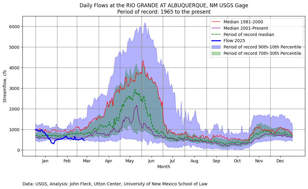
Early March is usually when I emerge from my wintry water nerd slumber and begin tracking the rise in my beloved hometown river, Albuquerque’s Rio Grande.
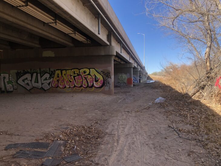
Yesterday morning the core family unit packed sandwiches and went down to the Rio Bravo Bridge, on Albuquerque’s south side. It’s a favorite spot because of the graffiti – the engineers built a lot of canvas for the artists to work with.
Bridge, with art. Photo credit: John Fleck/Inkstain.net
The county crews had recently painted over the graffiti on the bridge abutments, which always means a fun new canvas and a bunch of new art.
The river’s low – at around the 10th percentile on the dry side at the Central Avenue gage, the nearest measurement point upstream of here. I dashed off Tuesday’s post in a hurry because news, but what’s about to happen deserves more attention.
One of the deep/fierce discussion underway I’m having with some smart colleagues is the question of how much our community values a flowing river. One of the reasons we’re arguing, umm, I mean discussing, is that evidence about public attitudes is thin.
We’re about to have a Rio Grande through Albuquerque substantially drier than we’ve seen since the early 1980s. Before that time, summer drying was common because of community water management choices: larger supplies were diverted into irrigation ditches, leaving the Rio Grande to go dry. The river essentially dried through Albuquerque in eight out of ten years during the 1970s. That began shifting in the 1980s because of wetter climate, but more importantly because of water management choices that reflected a shift in community values.
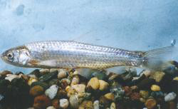
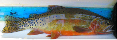
Rio Grande Silvery Minnow via Wikipedia
Beginning in the 1990s, the federal Endangered Species Act became the water policy driver, keeping water in the river’s main channel to keep the Rio Grande silvery minnow alive. “This little fish, that human efforts keep alive,” my Utton Center colleague Rin Tara has written, “is a powerhouse for dictating river flows in the Middle Rio Grande.”
For those who care about the Rio Grande (you wouldn’t have read this far if that didn’t include you), the whole paper is worth a read. It is the first time anyone has pulled together in a single narrative the history of the role of the silvery minnow in the last three decades of water management on New Mexico’s Middle Rio Grande. Rin’s legal scholarship also sheds new light on the way the Endangered Species act functions in practice in a situation like ours – an effort to keep a species alive in a river far removed from the ecosystem in which the species evolved. This disconnect is at the heart of the challenge posted by the ESA in the third decade of the 21st century. As I said, terrific new paper.
Given the current context – a river at risk of drying in 2025 – the challenge to community values around the Rio Grande is something I’ll be watching closely. Here’s Rin (“2028 BiOp” is a new minnow management plan now in development – read the whole paper, Rin explains):
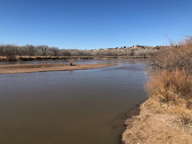
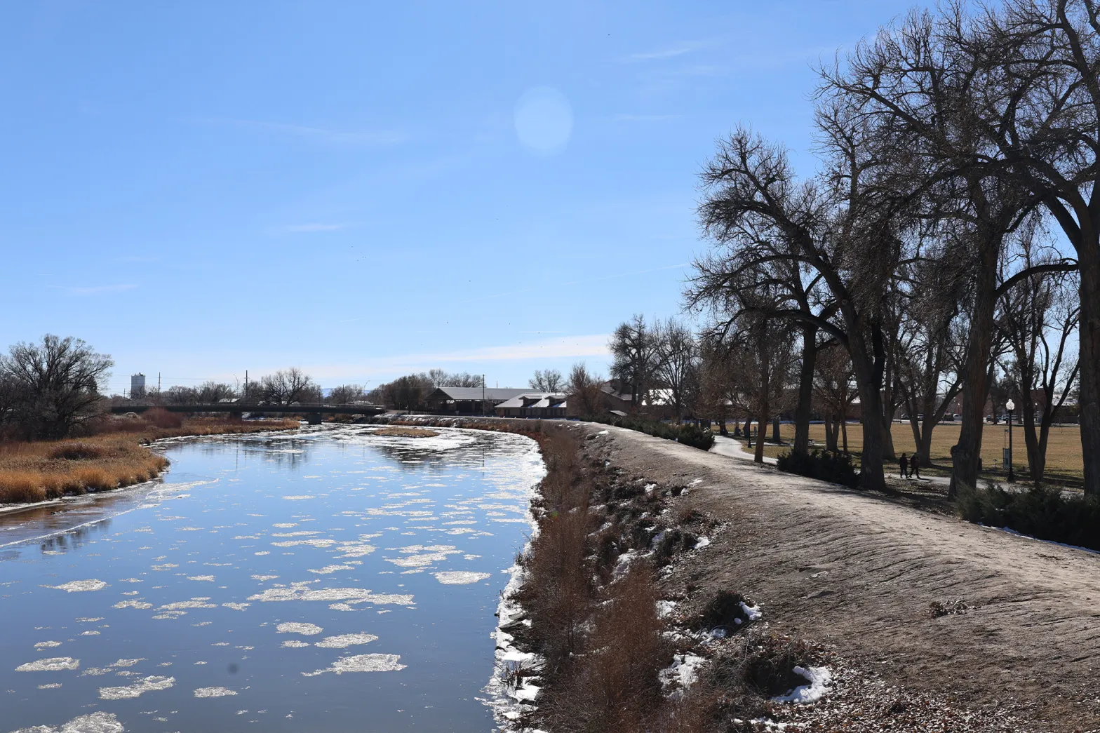
Rio Grande, March 12, 2025. Photo credit: John Fleck/InkStain.net
Big Dog
I rode back out to the river for this morning’s bike ride.(I am trying to ride and picnic more and work less, with mixed results.) The ride took me through downtown and across what used to be swampland to the Rio Grande. What we think of today as “the river,” the narrow channel snaking through the valley between levees, is a tiny fraction of what the Rio Grande used to be before we decided to build a city here. Even as I acknowledge the loss of the expansive wetlands that used to spread across the valley floor, I also love my city. Both of those things can be true, as is often the case with the most interesting moral tensions.
I stopped at one of my favorite river views to snap a picture for a friend I’d been texting with who loves the Rio Grande, but has moved to a city on a different (also beloved!) river.
It’s just above Central Avenue/Route 66. There’s a bike trail bridge over the Middle Rio Grande Conservancy District’s Central Avenue Wasteway, and when there’s water you feel like you’re out in the river. The wasteway delivers water from the irrigation system back to the main river channel, and when I was riding by this morning it was flowing at ~40 cubic feet per second. It’s a popular fishing spot, for both humans and cormorants, though I saw neither this morning taking advantage of the flows.
The journalist in me can’t resist small talk in a place like that. A woman was walking by with a big, beefy, happy dog. I asked if it was OK to pet, and did, though she had to restrain the friendly animal from jumping up on me with his wet, muddy paws. They’d walked down from their neighborhood just up the valley, so the pooch could play in the river. One of the weird things about low flow is that it actually makes the river more accessible for picnics and dog play. As it drops, you’ll see people out on the sandbars.
Until, of course, there’s no water left for frolicking. I assume there were silvery minnows out there in the channel. They cannot know what is coming, nor, frankly, can we.
Rio Grande and Pecos River basins. Map credit: By Kmusser – Own work, Elevation data from SRTM, drainage basin from GTOPO [1], U.S. stream from the National Atlas [2], all other features from Vector Map., CC BY-SA 3.0, https://commons.wikimedia.org/w/index.php?curid=11218868
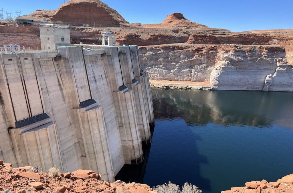
A high desert thunderstorm lights up the sky behind Glen Canyon Dam — Photo USBR
Click the link to read the article on the KNAU website (Melissa Sevigny). Here’s an excerpt:
February 24, 2025
This week’s scheduled meeting of a group focused on the management of Glen Canyon Dam was canceled by the Trump administration. It’s one of many scientific conferences and federal meetings that have been canceled or indefinitely postponed. The U.S. Bureau of Reclamation says the meeting will be rescheduled to ensure new Department of the Interior and Reclamation leadership are “fully briefed” on the Glen Canyon Dam Adaptive Management Work Group. The group advises the Secretary of the Interior on how best to manage Glen Canyon Dam in keeping with the 1992 Grand Canyon Protection Act. Matt Rice of American Rivers says that involves balancing the needs of water and hydropower users with cultural, environmental, and recreational values.
“And this group is the forum to balance and make management decisions based on all those values, to protect those values. So massively important.”
[…]
The canceled meeting comes amid a funding freeze that has stalled Colorado River conservation projects and amid layoffs at the U.S. Geological Survey, National Park Service and other federal agencies.
Scientists also declared several other extinctions, including the first documented plant extinction in New Hampshire
Extinction Countdown
In 2009 teams of volunteers fanned out across 35 countries in Europe, Africa, and Asia looking for something that, in all likelihood, no longer existed.
The object of their quest: a 14-inch-long shorebird with long legs, a curved beak, and a mix of white and gray feathers.
Last officially seen in 1995, the slender-billed curlew (Numenius tenuirostris) had once been plentiful enough to hunt — perhaps most notably for museum specimens. That pressure, combined with habitat destruction, reportedly pushed the birds into decline.
In November 2024, after years of searches, scientists declared that the species was gone for good — the first documented extinction of a bird species from mainland Europe, North Africa and West Asia.
“It is a tragedy on a par with the dodo and the great auk, and we should hang our heads in shame,” wrote Mary Colwell of the conservation group Curlew Action. “Our disregard for wildlife speaks volumes for who and what we are. The slender-billed [curlew] may not have had an economic value, it contributed nothing to the bottom line of anyone’s financial spreadsheet, no one relied on these birds for their jobs or wellbeing, there was no conceivable reason to drive them to extinction. But it seems that is exactly what we have done.”
The biggest tragedy about this bird’s loss: We didn’t act soon enough to save it.
“Conservation attention came too late for the slender-billed curlew,” researchers wrote in the paper announcing its probable extinction. “The potential decline of the species was highlighted [in 1912] and stated more explicitly [in 1943]. These warnings were not acted on however, and the species was not recognized as being of conservation concern until 1988. After this, a [1991] review of the species and an action plan [in 1996] followed. Our analysis indicates the species was on the verge of extinction or extinct when the action plan was published.”
They continued, warning that this extinction is a call to action to prevent future species losses:
“Such extinctions are an indicator of the failure of international cooperation on biodiversity conservation as surely as climbing carbon levels currently measure our failure adequately to address climate change. With more advanced technologies than were available even 20 years ago — including optical and photographic equipment, bird-tracking and remote-sensing methods, and an evidence base on methods for protection, management and restoration — there is even less excuse for further failures.”
But the slender-billed curlew won’t be the last species we lose, and it wasn’t the only species scientists declared extinct (or regionally extinct) in 2024. Here are some of their stories.
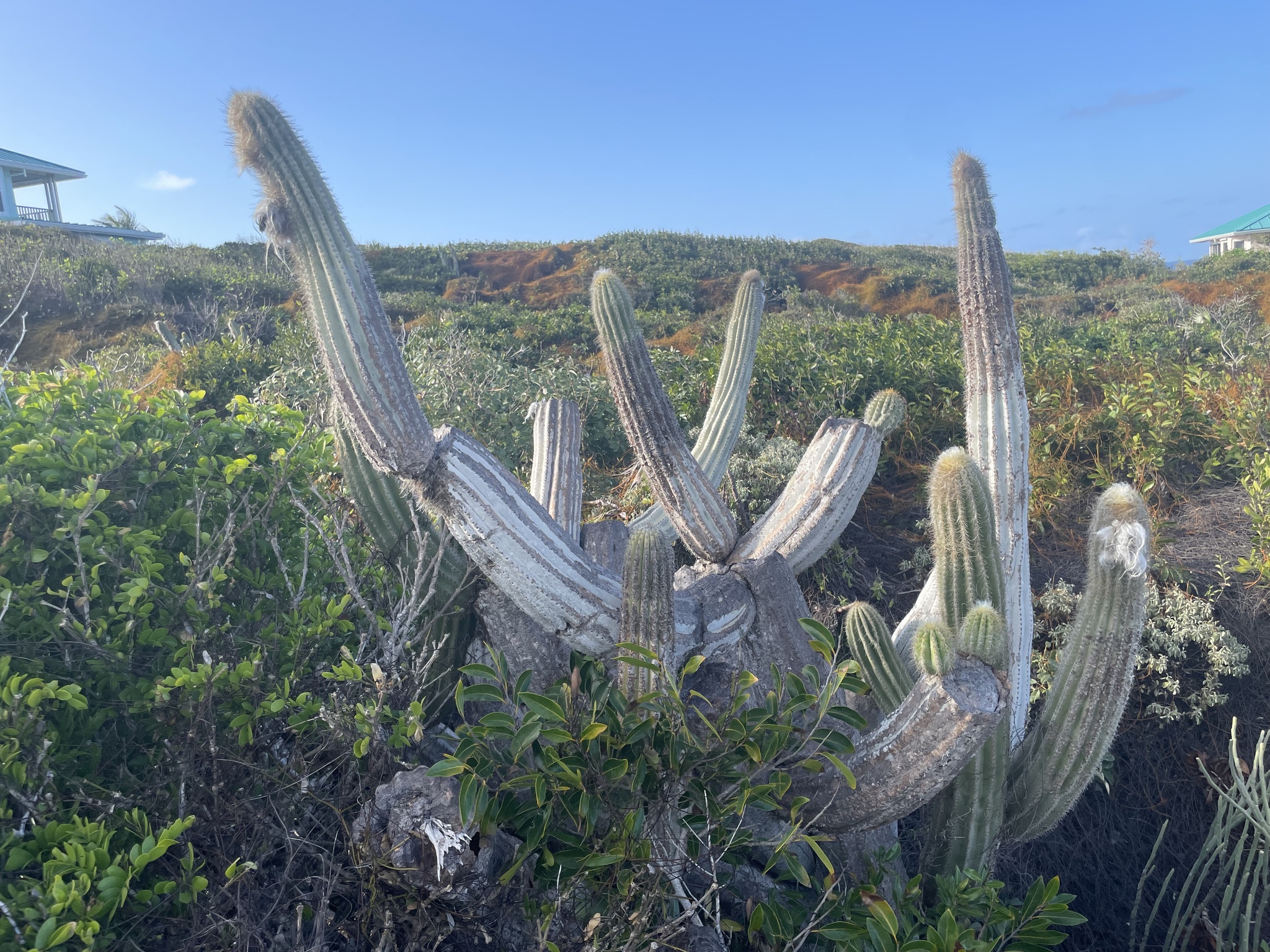
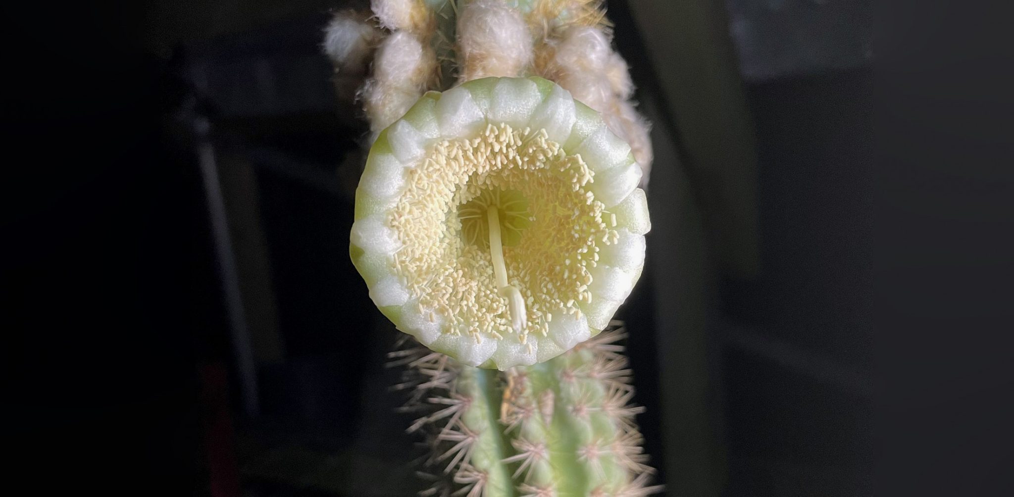
Key Largo tree cactus (Pilosocereus millspaughii) — This coastal plant still grows on a few scattered islands, but not on the island that gave it its name. Encroaching seas have wiped it out in the past couple of years, making it “the first local extinction of a species caused by sea-level rise” in the United States. That’s shocking for a population that was considered “thriving” as recently as 2021.
“Unfortunately, the Key Largo tree cactus may be a bellwether for how other low-lying coastal plants will respond to climate change,” Jennifer Possley, director of regional conservation at Fairchild Tropical Botanic Garden, said in a statement announcing the extinction.
Key Largo cactus, photo courtesy Florida Museum of Natural History
Expect more in future. But we can also use this as an opportunity: Scientists saw it coming and collected enough cactus flowers and fruits to keep the species growing in a greenhouse. Maybe one day they’ll be able to return to Key Largo. Until then the island has a hole in its ecosystem.
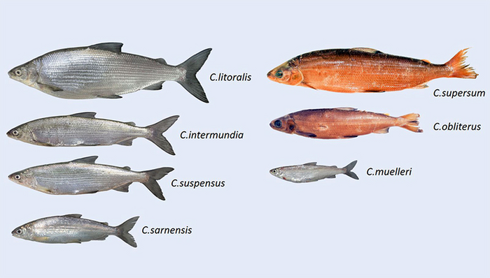
Obliterated whitefish (Coregonus obliterus), Ören whitefish (Coregonus trybomi) and Zug whitefish (Coregonus zugensis) — These Swiss fish were among seven species redescribed and taxonomically reassigned by scientists in 2023. The IUCN assessed them as extinct in 2024, reflecting a greater scientific consensus.
The obliterated whitefish (a name that just kills me) was last seen in Lake Zug in 1939 and, according to a press release, “would have been completely forgotten if specimens had not been found by Eawag scientists Oliver Selz and Ole Seehausen in the historical Steinmann-Eawag Collection.” It and other species died out from eutrophication — lack of oxygen in lake water caused by algal blooms, themselves caused by phosphates from domestic wastewater and fertilizer runoff from agriculture. (The Ören declined due to introduced predators like Eurasian pikeperch and acid rain.)
Lest we get completely depressed, the press release presents a lovely counterpoint, noting that “the only whitefish species still found in Lake Zug today, spawning near the shore, is the ‘Balchen.’ Testifying to its survival is its new scientific name — Coregonus supersum (‘I have survived’).”
The seven Coregonus species. Courtesy: Eawag
Java stingaree (Urolophus javanicus): This small Indonesian stingray was only observed once, at a fish market in 1862. The IUCN declared it extinct in December 2023 — calling it the first marine fish extinction caused by human activity — although the media didn’t notice until after January (which is why it’s on this year’s list).
“Intensive, generally unregulated fishing was likely the major threat resulting in the depletion of the Java stingaree population, with coastal fisheries catches already declining in the 1870s,” the extinction assessment reads. “Catches on the northern coast of Java in 1940 were down to almost half the annual catch landed in the 1860s. Additionally, the northern coast of Java, particularly Jakarta Bay, is heavily industrialized, and extensive habitat loss and degradation may also have impacted this species.”
Round Island hurricane palm (Dictyosperma album var. conjugatum) — As reported by Mongabay, the last wild tree of its kind “snapped during a windstorm.” The tree had stood on Mauritius “for decades as the only survivor of its kind.”
Bogardilla (Squalius palaciosi) — Last seen in 1999, this Spanish fish disappeared after dams and weirs limited its habitat and a half-dozen introduced species either ate it, outcompeted it for resources, or brought new pathogens to the area. It serves as a reminder that extinction is often the result of multiple factors chipping away at a species’ survival — a death of a thousand indignities.
Seven plants in Bangladesh: The Asian nation released its updated Plant Red List in November and announced that seven native plant species were no longer found within its borders. Most appear to be regional extinctions and still grow in other countries or in private collections, with the sad exception of the last plant on this list.
Fita champa (Magnolia griffithii)
Ironweed tree (Memecylon ovatum)
Jiringa (Archidendron jiringa)
Kathphal (Myrica nagi)
Syzygium venustum
Drypetes venusta
Thurma jam (Syzygium thumri)
Four Egyptian plants: A paper published last January assessed many native plants of Egypt and declared four species and one subspecies extinct:
Bellevalia salah-eidii — a perennial bulb that grew in sandy areas but hasn’t been since 1966.
Muscari salah-eidii — a perennial bulb last seen in the field in 1967.
Vicia sinaica — an annual or perennial herb once restricted to North Sinai and last collected in 1955.
Limonium sinuatum romanum — a perennial herb last collected in the field in 1949. The main species is known as wavyleaf sea lavender.
The paper doesn’t speculate on what causes these species to disappear but notes a long list of threats to Egyptian plants, including climate change, extreme weather, droughts, pollution, habitat alteration, roads and railways, agriculture, and biological resource use.
Ethiopian wolf (Canis simensis citernii) with Helichrysum citrispinum, Sanetti Plateau, Ethiopia. By Charles J. Sharp – Own work, from Sharp Photography, sharpphotography.co.uk, CC BY-SA 4.0, https://commons.wikimedia.org/w/index.php?curid=66000154
Ethiopian wolves (Canis simensis) — A paper published this July reports several regional extinctions for this embattled predator, now down to a population of about 450 animals. “We describe three population extinctions and three local extinctions within fragmented populations, and present evidence of factors accelerating the extinction process, such as disease (rabies and canine distemper virus), persecution, road kills and poisoning.” The situation isn’t likely to improve: “Hard borders imposed by expanding subsistence agriculture lock Ethiopian wolves into further isolation, with few opportunities for dispersal and recolonization,” they write. Shockingly, this species is still assessed as “endangered,” when its plight has obviously reached critical levels.
Sangihe dwarf kingfisher (Ceyx sangirensis) — A bird we didn’t know to keep looking for before it disappeared. A paper published this past March details decades of taxonomic confusion — enhanced by poor documentation of the first scientific specimen in the 1870s — that kept the animal from being recognized as its own species. Once native to Sangihe Island in the Philippines, it apparently no longer exists there.
Malagodon honahona — A paper published this past April described this newly recognized fish species from Madagascar … and also announced its possible extinction. The researchers — Emily M. Carr, Rene P. Martin, and John S. Sparks from the American Museum of Natural History — recount how they first encountered this species in a small, isolated swamp in 1994, where introduced mosquitofish (Gambusiaholbrooki) were competing with the native fish for resources.
But that wasn’t the only pressure, as they wrote: “The region upstream of their only known habitat lies outside the Réserve Spéciale de Manombo protected area and is afforded no protection. As a result, the watershed has experienced rapid deforestation in recent decades such that the fragile type locality has suffered severe degradation. It is likely M. honahona became extinct in the late 1990s, not long after it was first discovered.” In that fate it joins a similar species, M. madagascariensis, which Sparks and other researchers declared extinct in 2018 as part of an IUCN assessment of Madagascar’s freshwater fish.
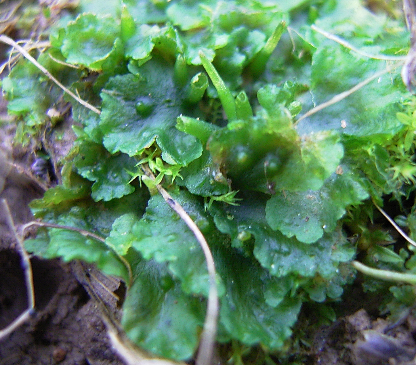
Smooth hornwort (Phaeoceros laevis) — This wide-ranging plant isn’t extinct, but a 2024 assessment of liverwort and hornwort species in Serbia calls it “possibly extinct” within that country, making it a noteworthy regional extinction.
Digitaria laeviglumis — This species of smooth crabgrass once grew in New Hampshire but was last seen in 1931 and had since almost been forgotten. A paper published this July declared it extinct. Some of the last samples of the crabgrass have sat in the University of New Hampshire’s Albion R. Hodgdon Herbarium for generations; recent DNA analysis helped to identify it as a unique species, revealing it as the first documented plant extinct in the Granite State.
“Documenting the extinction of Digitaria laeviglumis has significant implications for biodiversity conservation,” herbarium collections manager Erin Sigel said in a press release. “It highlights the vulnerability of endemic species, particularly those with very limited geographic ranges, and understanding the factors that led to the extinction of this grass can help inform conservation strategies for other at-risk species. This case underscores the vital role herbaria play in preserving specimens and providing essential data for scientific research.”
Hieracium tolstoii — This Italian plant presented scientists with some challenges. The Hieracium genus (better known as hawkweed) has more than 10,000 documented species, many of which remain under debate due to variations in their appearance and frequent hybridization, as well as a mutation process called polyploidization that can cause dramatic shifts in chromosomes. But a paper published this past September examined the records and confirms H. tolstoii (which once grew on “ancient brick walls” but hasn’t been seen since 1938) as a unique species — one that went extinct at some point in the 20th century. (Previous research had also declared it extinct but maintained some doubt it was a unique species.)
Fucus virsoides — This “glacial relict” algae species isn’t extinct, but it’s rapidly disappearing and deserves a shoutout. A paper published this past August warned that we could be heading toward “the first documented extinction of a marine macroalga in the Mediterranean Sea.” The researchers wrote that “F. virsoides could be considered functionally extinct in Istria (Croatia), critically threatened with extinction in Italy and Montenegro and locally extinct in Slovenia.” They hypothesize its decline has been caused by “a variety of anthropogenic stressors (e.g. habitat destruction, pollution, overgrazing) exacerbated by climate change,” all of which increased the Adriatic Sea’s surface temperature and salinity.
Taiwanese swallowtail butterfly (Papilio machaonsylvina) — Rumors of this butterfly’s extinction have fluttered around for years. It was last seen in 1999, before the Jiji earthquake struck Taiwan, killing more than 2,400 people, destroying the homes of 100,000 more, and causing $300 billion in damage. According to a paper published this past November, the earthquake also caused “multiple landslides” that “permanently altered” the butterfly’s habitat. Research published in 2018 and 2023 suggested the earthquake caused the butterfly’s extinction. This new research examines its morphological characteristics and DNA to confirm that it was a unique subspecies and notes that it “was well on its evolutionary track to become its own distinct lineage as a separate species.”
The paper also notes the butterfly’s importance to Taiwanese culture — “its image is imprinted on the personal ID cards of Taiwanese citizens,” the researchers write. They also suggest we keep looking for it: “Even though the butterfly has not been seen or collected since 1999, one can always hope that it still persists in the remote mountain regions in the Taiwan highlands.”
White-chested white-eye (Zosterops albogularis) — The Australian government has listed this 5-inch bird as extinct since 2000, but scientists kept looking for it for several years. The IUCN finally reassessed it as probably extinct in 2024. Native to Norfolk Island, the bird suffered most of their declines due to introduced black rats, which predated on their eggs. They were last officially observed in 1979, although possible sightings persisted into this century.
Multiple Polynesian tree snails — The IUCN listed several snail species as extinct this past year (although the scientific assessments were all done several years earlier). They include:
Partula langfordi — Last seen in 1992, wiped out by deforestation and the predatory invasive rosy wolfsnail.
Partula magistri — A “large, conspicuous” species observed alive just one time. The sole specimen was found in 1992 amid empty “freshly killed” shells left behind by wolfsnail predation.
Partula dentifera — Last seen in 1972, although it persisted until at least 1991, when only empty shells were found. The rosy wolfsnail again gets the blame.
Partula diminuta — Last seen on Tahiti in 1980, three years after the rosy wolfsnail arrived on the island. You can guess what happened next.
Pohnpei ground partula snail (Partula guamensis) — Another “large, conspicuous species” last recorded in 1936. This one has deforestation and a host of introduced species to blame: the New Guinea flatworm, three rat species, and possibly the rosy wolfsnail.
邛海白魚 or Qionghai white fish (Anabarilius qionghaiensis) — A freshwater fish frequently caught and eaten by the people living around China’s Qionghai Lake for decades (if not centuries), this species was last observed around 1970. Development, pollution from pesticides and fertilizers, overfishing, introduced species, and destruction of aquatic vegetation all conspired to do this fish in.
Limnophila limnophiloides — Scientists only documented this aquatic plant once, in 1918, in India’s Bhushi lake. Extensive surveys have failed to find it, so the IUCN this year declared it extinct. We don’t know exactly why or how it disappeared, but the assessment notes that the “area is converted into high intensity tourism area and the habitat is completely altered to a small reservoir which is used for bathing, swimming and other recreational purposes by more than a lakh (100,000) of people every year.”
Vachellia polypyrigenes and V. zapatensis — These Cuban plants were last seen in 1951 and 1940, respectively. The IUCN declared them extinct in 2024, blaming urbanization and petrochemical activity for the first species, and “the expansion of human activity” for the second.
Starnberg whitefish (Coregonus renke)and Chiem whitefish (Coregonus hoferi) — Native to the lakes in southern Germany for which they were named, these fish were last seen in the late 1800s and 1940s-1980s, respectively. They were assessed as extinct by the IUCN in 2024.
Orkney charr (Salvelinus inframundus) — This Scottish cold-water fish hasn’t been seen since the 1950s. Scientists suspect dams and other engineering projects build during the 19th century “disturbed tributary streams into which this species migrated to spawn.” The IUCN listed this species as “data deficient” for years but moved them into the “extinct” category in 2024. Nonetheless, some sources say the fish or another species that looks like it has recently been observed in Loch Meallt, so…fins crossed?
This list isn’t comprehensive, in several notable ways — because it can’t be.
First, these extinctions are not reported in real time. The last days of the last members of a species are rarely observed by human eyes. They occur in the cracks beyond our perception, out of sight, the disappearance of a shadow or a sunbeam, here and then gone.
Second, even when scientists suspect a species has died out, they don’t give up hope. They keep looking — often for decades. And on a not-uncommon basis, theyfindthem.
There’s an incentive to keep searching: Giving up too early ensures that a species won’t get the protection it deserves. Species have gone extinct simply because they were declared extinct too soon, protections were removed, and threats worsened as a result.
These endless quests aren’t easy: Tiny frogs who hide in deep jungles or plants that only flower a few nights a year don’t make themselves easily known.
It’s also hard to prove a negative: If you lay eyes on something, you know if exists. If you don’t see it, that’s not proof that it’s gone.
It’s also been a hard few years for science. Fewer researchers got into the field during the pandemic, and people still have a lot of catching up to do. Budgets have also gotten tighter or more unpredictable. We’ll see (or not see) the effects of the Trump administration’s slash-and-burn of federal research funding in the months and years ahead.
Finally, we must remember that most of the species we lose are “invisible extinctions” — species that have never been observed, documented, named, or studied by modern science. One study last year estimated that humans have caused 1,500 bird extinctions, half of which were of species we’d never documented. Another study estimated that Australia loses 1-3 invertebrate species every week. If a species doesn’t have a name and goes extinct, did it ever really exist?
Of course, it did — which is why stories of these extinct species remain so important. They’re a reminder to celebrate the diversity of life around us — and to protect it while we still can.
It’s time for an agreement in the Colorado River Basin, Colorado water and climate experts say.
Colorado River officials are at odds over how to store and release water in the basin’s reservoirs when the current rules lapse in 2026. Publicly, state negotiators stick close to their original, competing proposals, released early in 2024. Colorado experts watching the process understand the difficulty — it’s painful to talk about cutting water use — but time is of the essence.
Jennifer Pitt, the National Audubon Society’s Colorado River program director, paddles a kayak through a restoration site. (Source: Jesus Salazar, Raise the River)
“I have no idea what’s going to get them to agreement,” said Jennifer Pitt, the Colorado River program director for the National Audubon Society. “To me, the biggest pressure seems like time is running out.”
But there seems to be a lack of trust between the state negotiators, said Jennifer Gimbel, senior water policy scholar at the Colorado Water Center at Colorado State University.
“Not only is there this lack of trust, but there almost seems to be this effort to promote your own proposals by denigrating other proposals,” Gimbel said. “That frustrated me to no end. It’s like they have these political rallies.” [ed. emphasis mine]
If states are going to propose a united plan, then they need to do it by the end of 2025, preferably sooner, experts said.
“We continue to stand firmly behind the Upper Division States’ Alternative, which performs best according to Reclamation’s own modeling and directly meets the purpose and need of this federal action,” Colorado’s negotiating team said in a prepared statement Tuesday.
The basin is also about to see new leadership at the federal level. Colorado water experts are waiting to know who President Donald Trump will appoint to key positions, like the commissioner of Reclamation and the assistant secretary for water and science.
“They’re in a really tough spot. I would understand that,” said John Berggren with the environmental group Western Resource Advocates. “I hope they’re continuing to negotiate and have productive conversations, and I hope they’re open to some more creative options.”
Planning for the extremes
So what options are they considering? In the absence of a seven-state agreement on how to manage the basin’s water supply, the Bureau of Reclamation outlined five possible plans in November:
No action: Included as a formality and shows the risk of doing nothing
Federal authorities: Includes maximum Lower Basin cuts of 3.5 million acre-feet in extremely dry years
Federal authorities hybrid: Includes maximum cuts of 3.5 million acre-feet in the Lower Basin and conserving up to 200,000 acre-feet in the Upper Basin
Cooperative conservation: Includes maximum cuts of 4 million acre-feet in the Lower Basin and conserving up to 200,000 acre-feet in the Upper Basin
Basin hybrid: Includes maximum cuts of 2.1 million acre-feet in the Lower Basin and conserving up to 100,000 acre-feet in the Upper Basin
Colorado experts want to make sure the federal planning process is broad enough to include the worst possible conditions.
Udall/Overpeck 4-panel Figure Colorado River temperature/precipitation/natural flows with trend. Lake Mead and Lake Powell storage. Updated through Water Year 2024. Credit: Brad Udall
The Colorado River Basin’s flows are about 20% lower now than in the 20th century, said Brad Udall, senior water and climate research scientist at the Colorado Water Center at Colorado State University. That’s a drop from about 15.2 million acre-feet per year to about 12.4 million acre-feet, he said.
That’s not enough for the 15 million acre-feet allotted to the seven U.S. states, much less the additional water owed to Mexico and tribal nations.
Udall wants to make sure officials are planning for scenarios in which the river’s flow drops by an additional 10%, or down to 11 million acre-feet.
“The question is … who takes the pain? Is it all Lower Basin? Is Upper Basin sharing that?” he said.
One new detail for the Colorado experts who reviewed the report was the duration of the next management plan: Reclamation wants it to last for at least 20 years after 2026. It is unlikely to be a short-term, interim plan to give negotiators more time to reach a unified agreement.
The revised proposal submitted by the Upper Basin states — Colorado, New Mexico, Utah and Wyoming — also highlighted conserving up to 200,000 acre-feet of water (depending on river conditions), which seemed to move the states closer to alignment with Reclamation, experts said…
The Upper Basin’s revised proposal, and the federal options, include different “pools” in Lake Powell on the Utah-Arizona border, which would function like savings accounts and could store water conserved by Upper Basin states. Colorado water experts are keeping a close eye on how these accounts might work.
“Putting water in Powell is a good thing, but nobody in the Upper Basin wants to send water to protect Powell that ultimately just runs downstream,” said Steve Wolff, general manager of the Southwestern Water Conservation District based in Durango.
The experts wanted to know more about how conservation pools would function; how federal authorities in the basin might expand; which reservoirs will be included in the plan; what the impacts to the Grand Canyon would be under the different plans; and ultimately, what plan will stabilize the system.
They’ll have to wait to find out: The bureau is expected to release a deeper analysis of how each alternative could impact water management in different conditions later this year.
The Bureau of Reclamation’s final selection will likely mix and match elements of the different alternatives, said Carly Jerla, senior water resource program manager with the Bureau of Reclamation in a December presentation in Las Vegas.
“It’s a shame we don’t have a combined Upper Basin and Lower Basin plan right now,” Udall said. “Once Reclamation does its modeling, we’ll learn a lot. But we need a combined plan.”
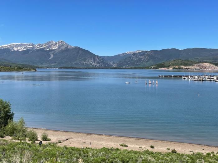
Dillon Reservoir is Denver Water’s largest reservoir. It sends water to the Front Range via the 23-mile-long Roberts Tunnel under the Continental Divide. Photo credit: Denver Water.
On Friday, in the last hours of the Biden administration, the U.S. Bureau of Reclamation announced it would spend $388.3 million for environmental projects in Colorado and three other Colorado River Basin states.
Now that funding is in limbo.
The money was set to come from a Biden-era law, the Inflation Reduction Act. On Monday, President Donald Trump ordered federal agencies to halt spending money under the act. Lawmakers were still trying to understand whether the freeze applied to the entire Inflation Reduction Act or portions of it as of Wednesday afternoon.
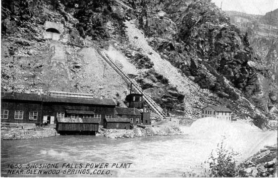
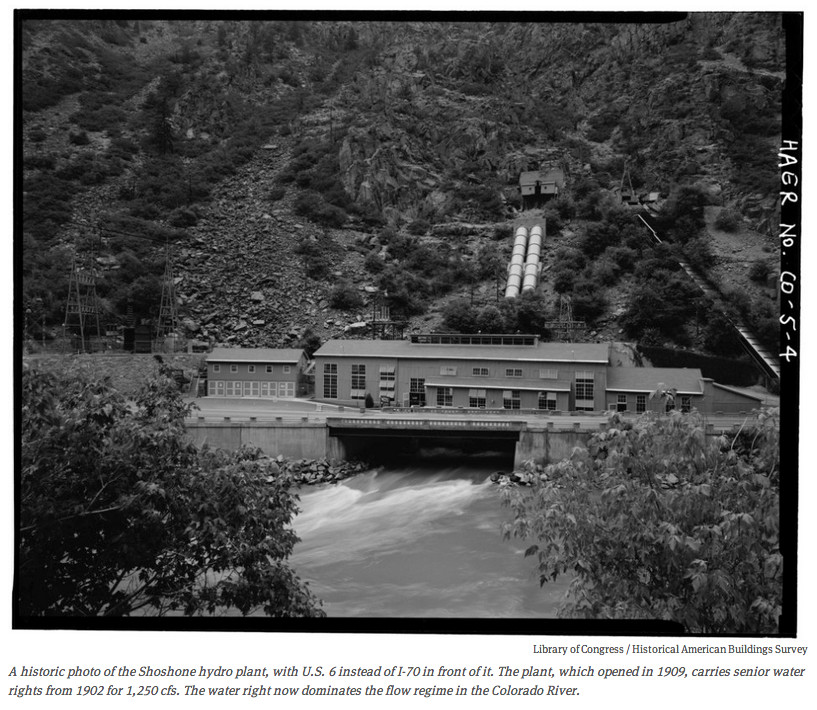
Shoshone Falls hydroelectric generation station via USGenWeb
The new executive order focused on energy spending but also raised questions about funding for environmental projects in the Colorado River Basin, including $40 million for western Colorado’s effort to buy powerful water rights tied to Shoshone Power Plant on the Colorado River and 16 other projects in Colorado.
Past regulations have been burdensome and impeded the development of the country’s energy resources, according to the executive order.
“It is thus in the national interest to unleash America’s affordable and reliable energy and natural resources,” the order said. “This will restore American prosperity — including for those men and women who have been forgotten by our economy in recent years.”
Where spending is stalled, federal agencies will have 90 days to review their funding processes to make sure they align with the Trump administration’s policies.
The proposed projects focus on improving habitats, ecological stability and resilience against drought in the Colorado River Basin, where prolonged drought and overuse have cast uncertainty over the future water supply for 40 million people. Reclamation also awarded $100 million for Colorado River environmental projects in Arizona, California and Nevada.
Coloradans were promised up to about $135 million from the Inflation Reduction Act as part of the Upper Basin Environmental Drought Mitigation Program. It’s one of many buckets that have distributed money from the act to Colorado.
This map shows the 15-mile reach of the Colorado River near Grand Junction, home to four species of endangered fish. Map credit: CWCB
With the funding, people around the state hope to upgrade infrastructure to help protect 15 miles of key habitat near Grand Junction for endangered species on the Colorado River. They want to improve aquatic habitats along rivers in Grand County, where low flows threaten fish and aquatic life, and restore ancient, water- and carbon-storing fens.
“It wasn’t surprising, but we still need to wait to see how it gets interpreted, and what it’s going to apply to or not apply to,” said Steve Wolff, general manager of the Southwestern Water Conservation District. The district joined with local partners to apply for funding for 17 projects in southwestern Colorado and was awarded $25.6 million.
“We would all be very disappointed if any of this money was removed,” Wolff said. “These funds are really bipartisan and are meant to get put on the ground and do good work.”
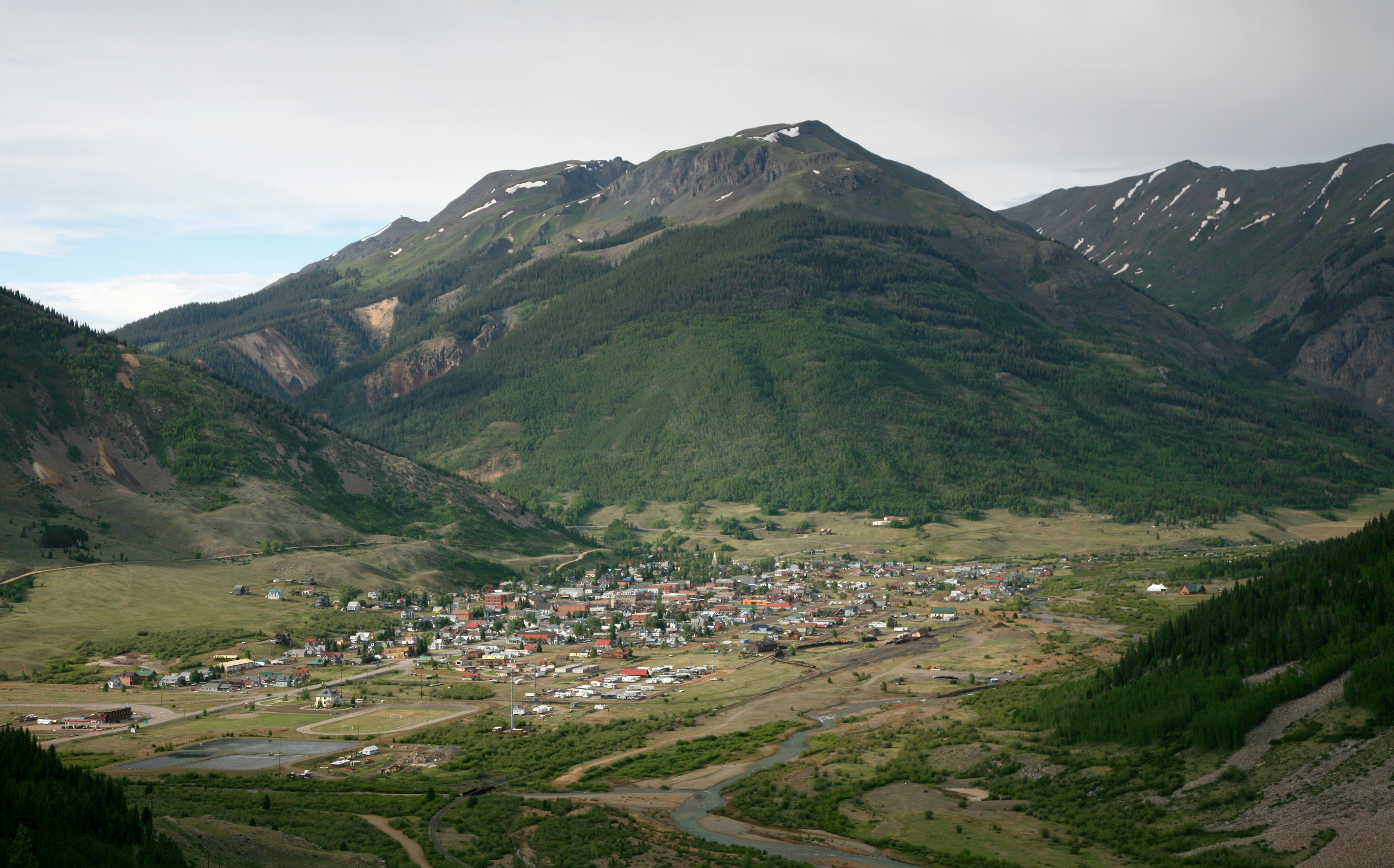
One of those projects aims to restore ancient fens along Highway 550, known as the Million Dollar Highway, between Silverton and Ouray in southwestern Colorado.
These fens, between 6,000 and 14,000 years old, naturally store carbon and slow runoff from the mountains, helping to maintain flows into the summer when water runs low and demand outpaces supply. Drought, a history of mining, and human impacts in the area have degraded the fen ecosystems over time, said Jake Kurzweil, a hydrologist with Mountain Studies Institute in southwestern Colorado.
The project managers want to hire locally to help the rural economy. And the work would help restore river ecosystems where they begin — at their headwaters — if the funding actually comes through.
“Until there’s a contract in place, we won’t be including it in our budgets,” Kurzweil said. “We’re optimistically hopeful, but not counting our chickens before they hatch.”
Southern Ute Indian Tribe’s Pine River Environment Drought Mitigation Project: Up to $16.7 million: The funding would improve the health of the Pine River watershed, fish passage, deteriorating infrastructure, and water quality while addressing drought impacts.
Shoshone Hydroelectric Plant back in the days before I-70 via Aspen Journalism
Shoshone Water Rights Preservation Project: Up to $40 million: The funding would go toward the $99 million purchase of the Shoshone Power Plant’s water rights by the Colorado River Water Conservation District. The district says it will protect future water supplies for ecosystems, farms, ranches, communities and recreational businesses.
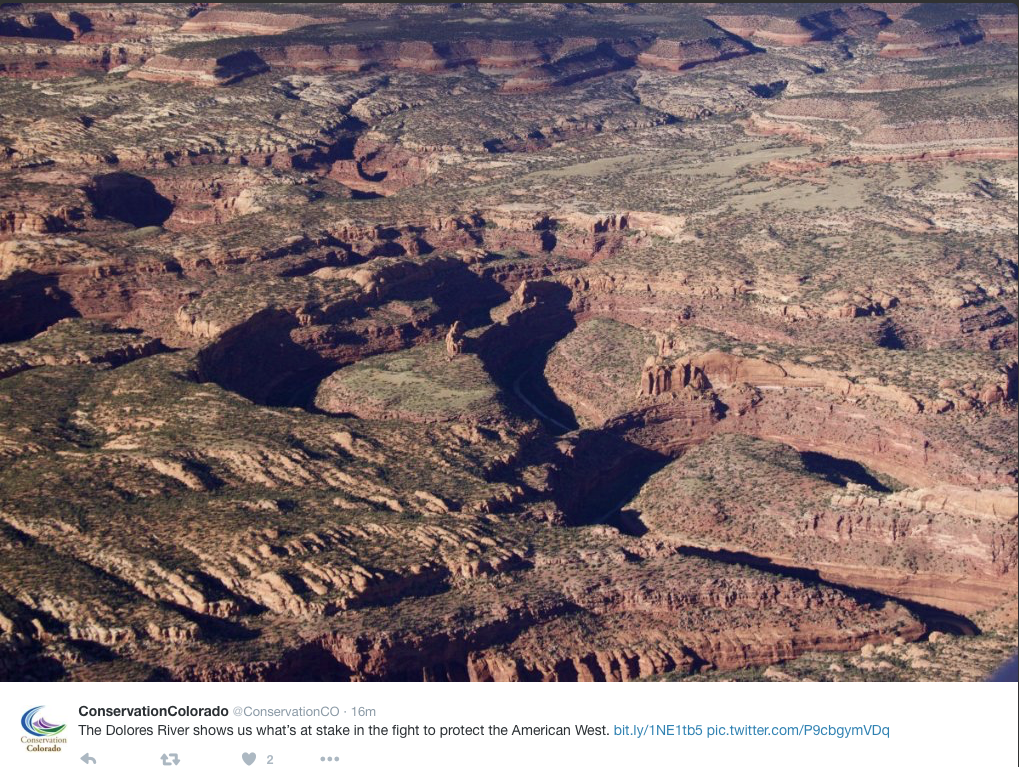
The Dolores River shows us what’s at stake in the fight to protect the American West — Conservation Colorado
Addressing Drought Mitigation in Southwestern Colorado: Up to $25.6 million: The funding would support 17 projects in the Dolores and San Juan river basins in southwestern Colorado. The projects aim to restore ecosystems and enhance biodiversity and water resources while supporting local communities and endangered species.
Tomichi Creek, a tributary of the Gunnison River, runs through the Peterson Ranch property. The Colorado Water Conservation Board holds an instream flow water right for 18 cfs on the creek in this stretch.
CREDIT: HEATHER SACKETT/ASPEN JOURNALISM
Grand Mesa and Upper Gunnison Watershed Resiliency and Aquatic Connectivity Project: Up to $24.3 million: The funding would restore watersheds to combat drought impacts to water quality and habitat in western Colorado.
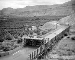
Orchard Mesa circa 1911
Orchard Mesa Irrigation District Conveyance Upgrades for 15-Mile Reach Flow Enhancement: Up to $10.5 million: The funding would convert open canals into pressurized pipelines, improving water delivery efficiency and reducing environmental stressors. This upgrade aims to support endangered fish species by enhancing streamflow in a critical stretch of the Colorado River.
A man fishes along Blue River. The federal government Dec. 19, 2023, announced a $1.8 million grant for a habitat restoration on a section of the Blue River. Blue River Watershed Group/Courtesy photo
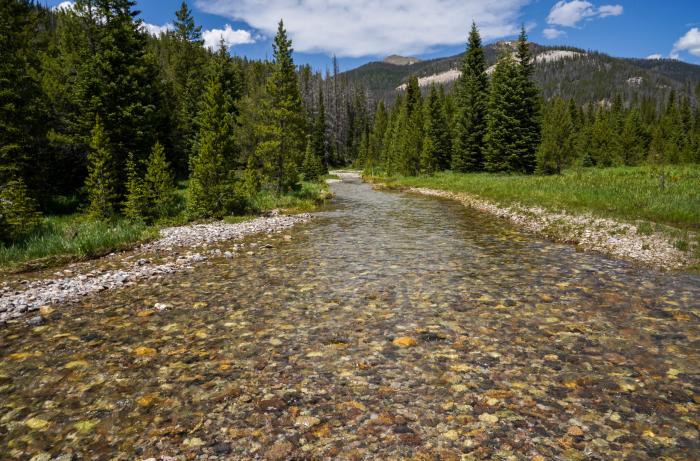
Enhancing Aquatic Habitat in Colorado River Headwaters: Up to $7 million: The funding would restore stream habitats along the Fraser, Blue and Colorado rivers in Grand County through channel shaping and bank stabilization.
Coyote Gulch on the Yampa River Core Trail August 24, 2022.
Yampa River/Walton Creek Confluence Restoration Project: Up to $5 million: The funding would restore river and floodplain habitat around Steamboat Springs.
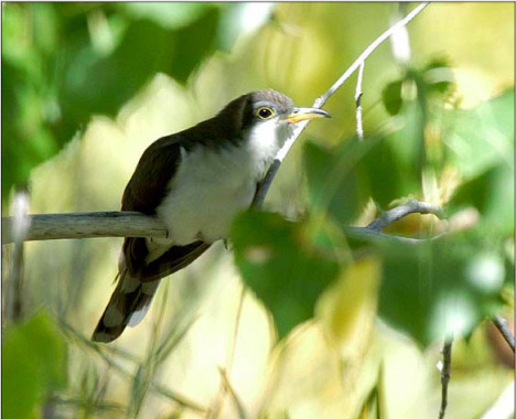
Yellow-billed cuckoos have nearly been extirpated from the western U.S. Photo courtesy Rocky Mountain Bird Observatory.
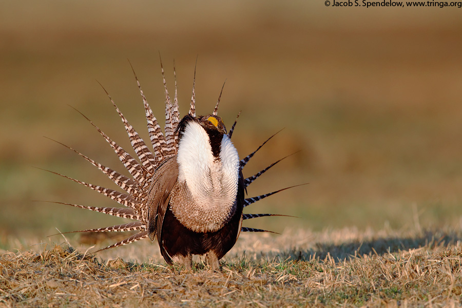
Drought Resiliency on Western Colorado Conserved Lands: Up to $4.6 million: The funding would help improve wetlands, floodplains, erosion control structures and habitat for at-risk species like the yellow-billed cuckoo and Gunnison sage-grouse.
The Colorado River, which feeds into Lake Powell, begins its 1,450-mile journey in Rocky Mountain National Park near Grand Lake, Colorado. Denver Water gets half of its water from tributaries that feed into the Colorado River. Some of these tributaries include the Fraser River in Grand County and the Blue River in Summit County. Photo credit: Denver Water
Upper Colorado Basin Aquatic Organism Passage Program: Up to $4.2 million: The funding would restore stream habitat in Grand County to improve biodiversity, habitats, fish passage and drought resilience.
Palisade peach orchard
Conversion of Wastewater Lagoons into Wetlands: Up to $3 million: The funding would turn outdated sewer lagoons into wetlands to improve biodiversity and habitat for migratory waterfowl and endangered fish species in Palisade.
Fruita Reservoir Dam Removal: Up to $2.8 million: The funding would remove a dam on Piñon Mesa to restore wetlands, habitat and biodiversity.
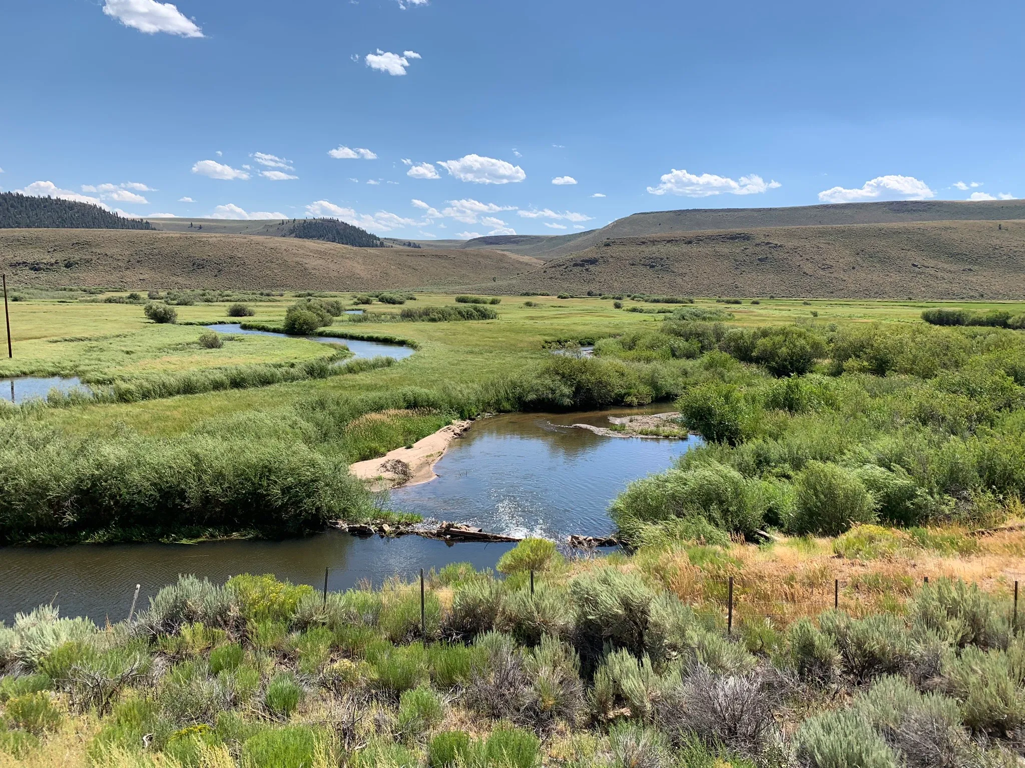
Beaver dam analog. Photo: Juliet Grable
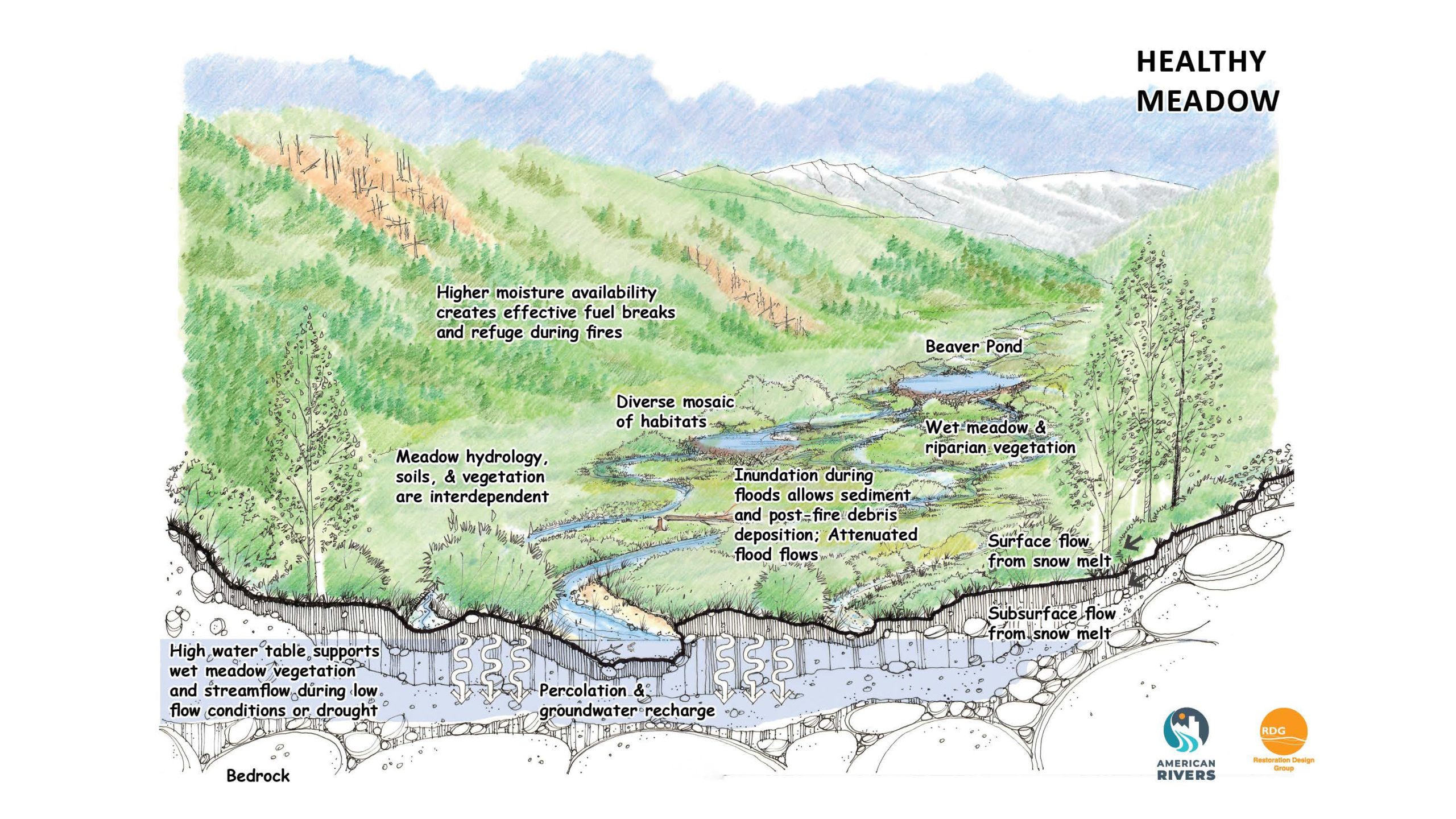
Monitoring and Quantifying the Effectiveness of Beaver Dam Analogs on Drought Influenced Streams in the Upper Colorado River Basin: Up to $1.9 million: The funding would restore degraded headwater meadows by implementing structures that mimic the natural functions of beaver dams.
Uncompahgre River Valley looking south
Uncompahgre Tailwater Rehabilitation Project: Up to $1.8 million: The funding would stabilize stream banks, restore aging infrastructure and improve the river habitat to help with ecological health and recreational opportunities.
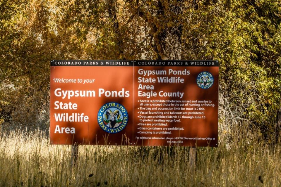
Photo credit: Town of Gypsum
Eagle River Habitat Improvement, Gypsum Ponds State Wildlife Area: Up to $1.5 million: The funding would improve fish habitat and water quality along the Eagle River in Eagle County.
Bicycling the Colorado National Monument, Grand Valley in the distance via Colorado.com
Orchard Mesa and Grand Valley Metering Efficiency Project: Up to $1.5 million: The funding would improve water management in the Grand Valley through the installation of advanced metering technology and real-time remote monitoring systems.
Biologists say federal target numbers are too low to ensure recovery of the Gunnison sage-grouse, which is listed as threatened under the Endangered Species Act. The bird’s largest population is in the Gunnison basin. Photo credit: Colorado Parks and Wildlife.
Habitat Restoration in the Gunnison Basin: Up to $750,000: The funding would use low-tech restoration structures to restore habitat for the endangered Gunnison sage-grouse in the Gunnison River Basin.
Toxic-algae blooms appeared in Steamboat Lake summer of 2020. The lake shut down for two weeks after harmful levels of a toxin produced by the blue-green algae were found in the water. As climate change continues, toxic blooms and summer shutdowns of lakes are predicted to become more common. Photo credit: Julie Arington/Aspen Journalism
Cyanobacteria Monitoring and Treatment for Drought-driven Blooms in a High Elevation, Upper Colorado Reservoir to save Ecosystem Function: Up to $518,000: The funding would use real-time water quality monitoring tools and targeted treatments to combat algal blooms and restore aquatic health at Williams Fork Reservoir.
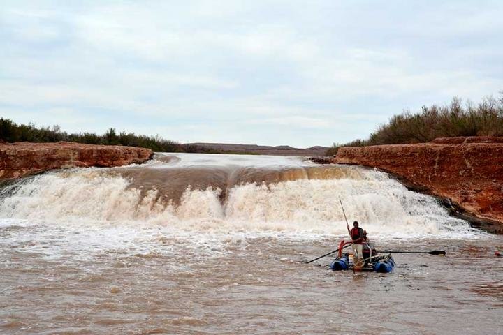
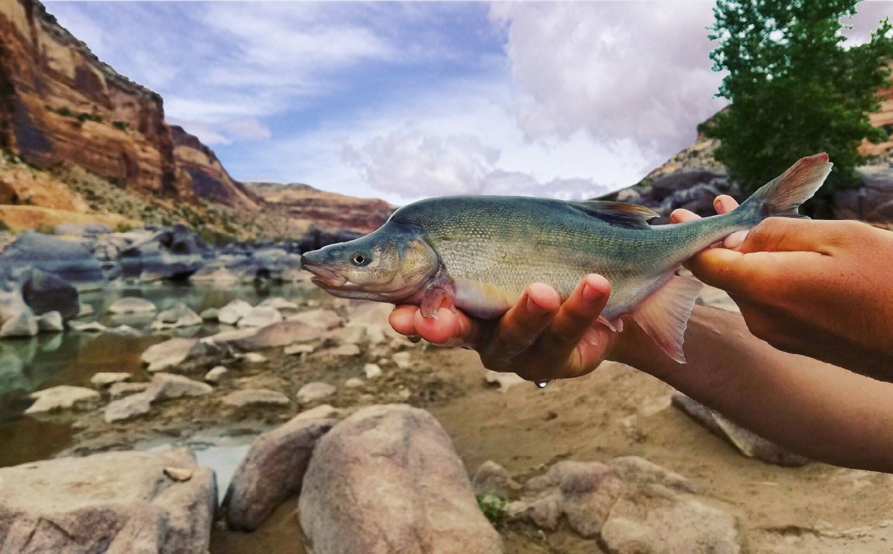
Since the late 1980’s, this waterfall formed from interactions among Lake Powell reservoir levels and sedimentation that redirected the San Juan River over a 20-foot high sandstone ledge [Dominy Formation]. Until recently, little was known about its effect on two endangered fishes. Between 2015-2017, more than 1,000 razorback sucker and dozens of Colorado pikeminnow were detected downstream of the waterfall. Credit: Bureau of Reclamation
From email from Reclamation (Western Colorado Area Office):
Releases are made for the authorized purposes of the Navajo Unit, and to attempt to maintain a target base flow through the endangered fish critical habitat reach of the San Juan River (Farmington to Lake Powell). The San Juan River Basin Recovery Implementation Program recommends a target base flow of between 500 cfs and 1,000 cfs through the critical habitat area. The target base flow is calculated as the weekly average of gaged flows throughout the critical habitat area from Farmington to Lake Powell.
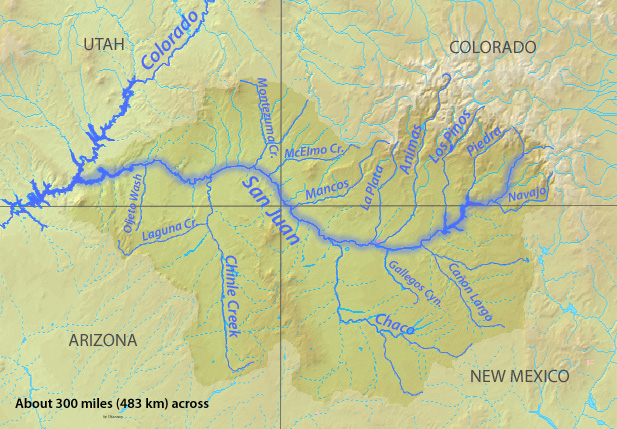
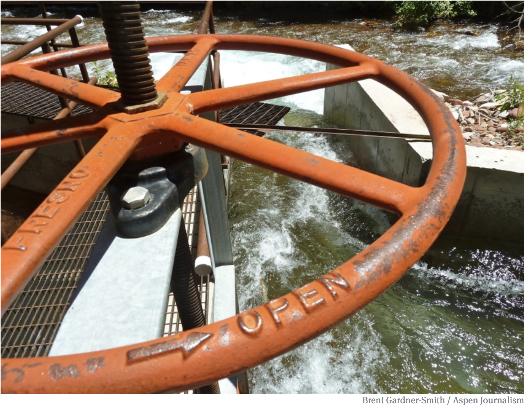
A news release from the SWCD said the funding will support 17 projects aimed at supporting aquatic ecosystems during periods of drought across the Dolores and San Juan River Basins in Southwest Colorado. General Manager of SWCD, Steve Wolff, said the projects will address three broad categories: the removal of invasive plants, erosion control and habitat connectivity…One example Wolff provided was the rebuilding of headgates – structures at the tops of stream diversions that regulate water flow – to allow fish to move upstream and downstream during periods of drought. The projects were selected on their feasibility, readiness and level of local engagement, and had the support of 37 different federal, state, tribal and local entities representing regional and local stakeholders.
In 2023, the SWCD board of directors organized a partnership of over 30 regional groups in preparation for the B2E grant application after recognizing the need for rural stakeholders in Southwest Colorado to compete more effectively for federal funding. Southwest Colorado has always needed a lot of funding; it has numerous small conservation districts, irrigation districts and conservation groups that individually lack the capacity to prepare applications for large federal grants, Wolff said. The final grant contract isn’t expected to be executed until late 2025 or early 2026. All funding must be spent by Sept. 30, 2031.
WASHINGTON — The Bureau of Reclamation today announced initial selections under the Upper Colorado River Basin Environmental Program for a $388.3 million investment from President Biden’s Investing in America agenda to improve wildlife and aquatic habitats, ecological stability and resilience against drought. The funding supports 42 projects in Colorado, New Mexico, Utah, Wyoming, as well as Tribal initiatives that will provide environmental benefits or the restoration of ecosystem and natural habitats. To view a full list of projects, visit Reclamation’s website. Individualized criteria for some projects are included in the descriptions at the link.
Additionally, Reclamation announced approximately $100 Million funding opportunity for the companion program in the Lower Basin, which seeks to fund projects that provide environmental benefits in Arizona, Nevada, and California.
“These historic environmental investments will restore and improve natural resources supporting the long-term sustainability of the Colorado River Basin, which includes nine National Parks across the seven states and is an essential habitat for more than a dozen endangered species,” Commissioner Camille Calimlim Touton said. “As we continue to develop the drought resiliency of the basin through investments in water conservation and efficiency projects, we can’t forget that a sustainable basin can only exist if there is a healthy environment.”
This is the first round of projects funded from the Upper Basin Environmental Drought Mitigation Program through the Inflation Reduction Act. More announcements are expected in the coming months, including projects from the most recent Upper Basin environmental announcement, which closed Jan. 10, 2025. Reclamation will begin negotiations with successful applicants to ensure funding conditions are met before funding is obligated. Funding for the Shoshone Water Rights Preservation Project will not be obligated until the Colorado water court enters a final decree; in addition, the agreement will contain provisions requiring Reclamation’s written consent for any water right changes. The conditions precedent set by the State of Colorado for their funding of the Shoshone Water Rights Preservation Project must also be met prior to the obligation of federal funds. Funding for the Pine River Environment Drought Mitigation Project is subject to negotiation concerning operation, maintenance and replacement costs and other appropriate considerations.
Reclamation’s new funding opportunity for proposed ecosystem restoration or improvements projects in the Lower Colorado River Basin is also funded by the Inflation Reduction Act, and will consider projects that provide environmental benefits, or ecosystem and habitat restoration projects that address issues directly caused by drought in the Lower Colorado Basin Region under Phase 3 of the Lower Colorado River Basin System Conservation and Efficiency Program. Reclamation expects to announce projects by spring 2025 and award approximately $100 million for planning, design, construction, and/or implementation of projects. Project and applicant eligibility information is available on the Bureau of Reclamation website.
The Biden-Harris administration has led a comprehensive effort to make Western communities more resilient to climate change and address the ongoing megadrought across the region by harnessing the full resources of President Biden’s historic Investing in America agenda. As climate change has accelerated over the past two decades, the Colorado River Basin experienced the driest period in over one thousand years. Together, the Inflation Reduction Act and Bipartisan Infrastructure Law provide the largest investment in climate resilience in our nation’s history, including $15.4 billion for Western water across federal agencies to enhance the West’s resilience to drought and deliver unprecedented resources to protect the Colorado River System for all whose lives and livelihoods depend on it. This includes $5.35 billion for over 577 projects in the Colorado River Basin states.
Projects in Colorado
Shoshone Water Rights Preservation Project: Up to approximately $40m
Funding is provided to permanently protect the Shoshone Water Rights in the Upper Colorado River Basin to ensure a reliable water supply for ecosystem, agricultural, municipal, and recreational uses. Key components include maintaining the historical flow regime, eliminating risks of abandonment due to plant decommissioning, and facilitating instream flow use by the Colorado Water Conservation Board. Funds will not be obligated or expended until a final Colorado water court decree is entered confirming water rights and the agreement will contain provisions requiring written consent of Reclamation on any water right changes. The conditions precedent set by the State of Colorado for their funding of the Shoshone Water Rights Preservation Project must also be met prior to the obligation of federal funds.
Addressing Drought Mitigation in Southwest Colorado: Up to approximately $25.6m
Funding is provided for restoring ecosystems and improving river and connection of waterways in southwestern Colorado. It involves a collaborative effort to enhance biodiversity and water resources while supporting local communities and endangered species.
Grand Mesa and Upper Gunnison Watershed Resiliency and Aquatic Connectivity Project: Up to approximately $24.3m
Funding is provided to implement watershed restoration actions to combat drought effects in western Colorado. Through a variety of strategies, it enhances water quality, habitat resilience, and connectivity for aquatic species.
Orchard Mesa Irrigation District Conveyance Upgrades for 15-Mile Reach Flow Enhancement: Up to approximately $10.5m
Funding is provided to convert open canals into pressurized pipelines, improving water delivery efficiency and reducing environmental stressors. This upgrade supports the recovery of endangered fish species by enhancing streamflow in the critical 15-mile reach of the Colorado River.
Enhancing Aquatic Habitat in Colorado River Headwaters: Up to approximately $7m
Funding is provided to restore stream habitats along the Fraser, Blue and Colorado rivers in Grand County, enhancing aquatic ecosystems through channel shaping and bank stabilization through collaboration with key conservation partners.
Yampa River/Walton Creek Confluence Restoration Project: Up to approximately $5m
Funding is provided to restore river and wetland ecosystems in Steamboat Springs through restoration of river and floodplain habitat and the rehabilitation of riparian and wetland area thereby enhancing ecological health and promoting biodiversity. It addresses drought impacts by improving water quality, habitat complexity, and community resilience.
Drought Resiliency on Western Colorado Conserved Lands: Up to approximately $4.6m
Funding is provided to implement various ecological restoration strategies, including the restoration of wetlands, reconnection of floodplains, the installation of erosion control structures to reduce sediment transport and enhance water quality, while promoting habitat restoration for at-risk species like the yellow-billed cuckoo and Gunnison sage-grouse.
Upper Colorado Basin Aquatic Organism Passage Program: Up to approximately $4.2m
Funding is provided to restore stream habitat in Grand County, promoting biodiversity and resilience against drought conditions while enhancing habitat connectivity and improving fish passage for native species, particularly Colorado River cutthroat trout.
Conversion of Wastewater Lagoons into Wetlands: Up to approximately $3m
Funding is provided to transform outdated sewer lagoons into wetlands, enhancing biodiversity and providing habitat for migratory waterfowl and endangered fish species in the town of [Palisade]. Once completed, the wetlands will improve water quality and increase native plant diversity, recharging groundwater and supporting up to 75% of commercially harvested fish.
Fruita Reservoir Dam Removal: Up to approximately $2.8m
Funding is provided to remove a dam on Pinon Mesa, restoring wetlands and enhancing biodiversity and wildlife habitat while ensuring ecological resilience through water pooling, pipeline removal and comprehensive habitat restoration efforts.
Monitoring and Quantifying the Effectiveness of Beaver Dam Analogs on Drought Influenced Streams in the Upper Colorado River Basin: Up to approximately $1.9m
Funding is provided to restore degraded headwater meadows by implementing structures that mimic the natural functions of beaver dams. These interventions enhance ecosystem resilience, improve water retention, and support native species.
Uncompahgre Tailwater Rehabilitation Project: Up to $1.8m
Funding is provided to address habitat degradation, enhancing ecological health and recreational opportunities through rehabilitation of river habitat, restoration aging structures, and implementation of bank stabilization techniques.
Eagle River Habitat Improvement, Gypsum Ponds State Wildlife Area: Up to approximately $1.5m
Funding is provided to enhance Eagle River in Eagle County, improving fish habitat and increasing resilience to low flows and drought while supporting local ecosystems and enhancing water quality.
Orchard Mesa and Grand Valley Metering Efficiency Project: Up to approximately $1.5m
Funding is provided to enhance water management in the Grand Valley through the installation of advanced metering technology and SCADA systems. This project addresses drought conditions by improving water use efficiency and supporting local aquatic ecosystems.
Habitat Restoration in the Gunnison Basin: Up to approximately $750k
Funding is provided to restore stream habitats in the Gunnison Basin, implementing low-tech restoration structures to enhance ecosystem resilience and support habitat for the endangered Gunnison Sage-Grouse.
Cyanobacteria Monitoring and Treatment for Drought-driven Blooms in a High Elevation, Upper Colorado Reservoir to save Ecosystem Function: Up to approximately $518k
Funding is provided to restore aquatic health at Williams Fork reservoir by deploying real-time water quality monitoring tools and implementing targeted hydrogen peroxide treatments to combat algal blooms. It enhances water quality management to protect ecosystems and support community recreational activities.
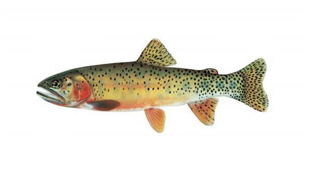
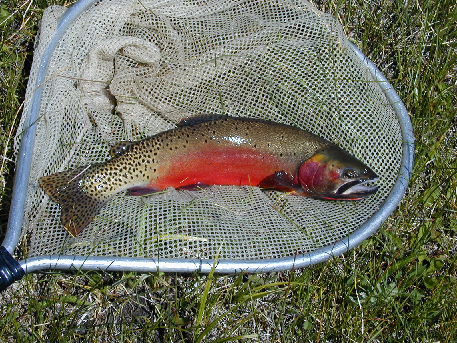
It’s a native species endangered (in the colloquial sense, not the legal sense) by both anthropogenic habitat changes (warm temperatures, less water, dams and stuff) and non-native immigrant species.
USFWS identified non-native hybridization and competition as the most significant threat, and concluded that collective action by a collaborative effort including federal, state, and tribal governments, along with NGOs, has successfully stabilized the fish’s population since discussion about possible listing first began a quarter century ago.
“The 119 populations are distributed across a wide geographic area, providing sufficient redundancy to reduce the likelihood of large-scale extirpation due to a single catastrophic event. Furthermore, the Rio Grande cutthroat trout Conservation Team has a demonstrated track record of responding to negative events to protect and even expand populations in the aftermath of large-scale changes to streams. Populations cover the breadth of the historical range, ensuring retention of adaptive capacity (i.e., representation) to promote short-term adaption to environmental change. The SSA report describes the uncertainties associated with potential threats and the subspecies’ response to these potential threats, but the best available information indicates the risk of extinction is low. Therefore, we conclude that the Rio Grande cutthroat trout is not in danger of extinction throughout all of its range and does not meet the definition of an endangered species.”
ESA questions
I’ve not followed the Rio Grande cutthroat trout saga closely. My primary interest is in its value in highlighting broader issues around the ESA that my Utton Center colleagues and I have been discussing of late.
Collective action
Collective action by a broad coalition of stakeholders before ESA listing seems to have been key in protecting what’s left of the species and avoiding listing.
Question: Is this driven by a societal environmental value (We love this fish and the ecosystems on which it depends, and want to protect them!) or a desire to avoid the messiness of ESA listing and the resulting land and water management craziness that would result therefrom?
In the new book, we note a clear distinction between these two types of cases in the history of Albuquerque’s relationship with the Rio Grande: environmental actions growing out of collective community values, and environmental actions driven by statutory (in this case ESA) mandates.
Charisma
Charismatic?
We know that charismatic species get more societal love. (Woe is our diminutive Rio Grande silvery minnow.) The Rio Grande cutthroat trout is charismatically beloved. Does this help explain the energetic collective action we’ve seen?
Loper Bright for the “foreseeable future”
Reading the USFW federal register notice in light of the Supreme Court’s Loper Bright decision, is interesting. IANAL, but my shorthand for the decision is that the courts no longer must defer to an implementing agency’s interpretation of ambiguous statutory provisions. Here’s USFWS in the cutthroat trout decision:
Maybe language like that was always included in USFW Federal register notices? I expect a lot more post-Loper Bright debates about what Congress intended.
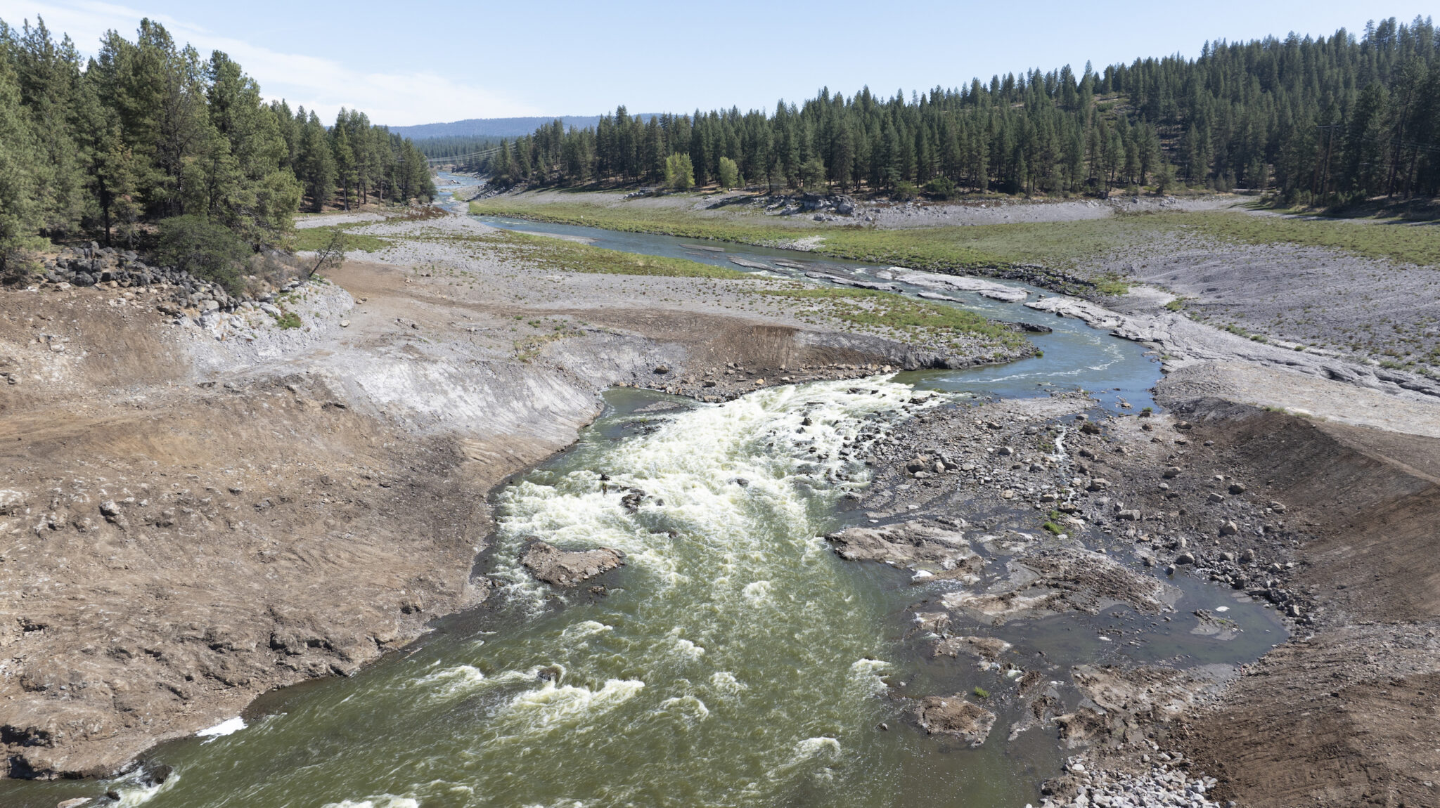
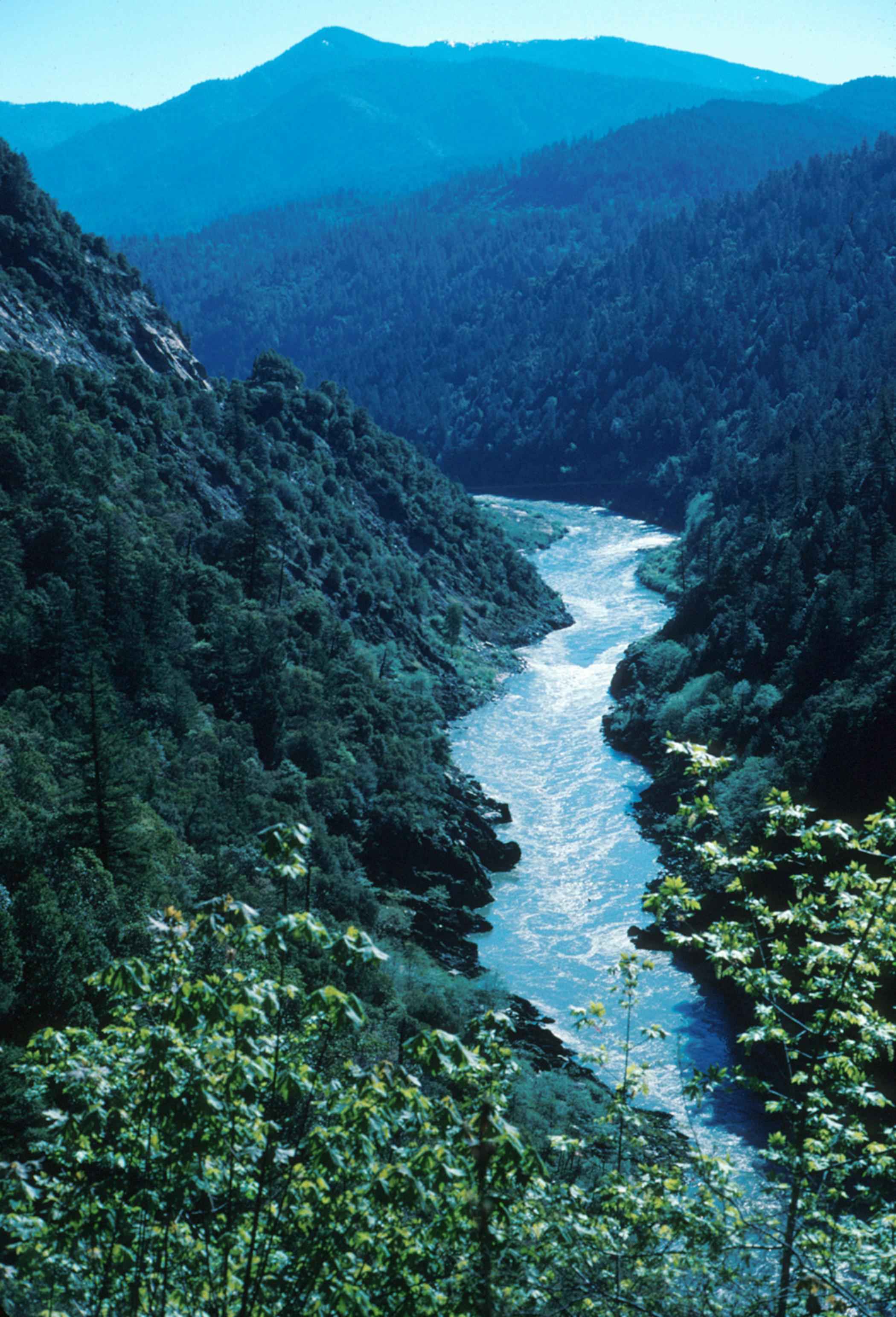
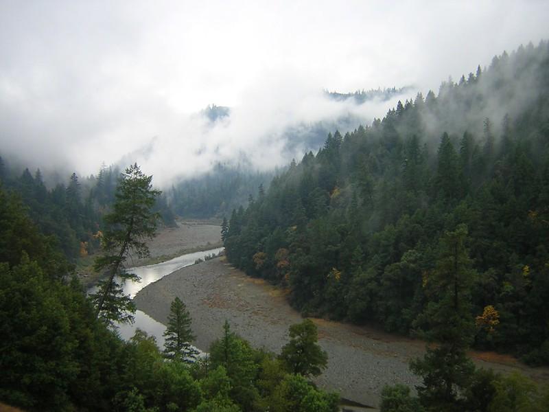
As I stood on a bridge and looked upstream along the Klamath River, I felt confused. For over 15 years, I had stood in the same stop and gazed on the earthen face of Iron Gate Dam. But on this day, I saw…space. Framing the edges of that space, I saw canyon walls, river bed, floodplains and terraces, and miles of vista.
I lost my dad last year, so I understand having the experience of noticing the absence of someone who had been monumental in my life – both physically and metaphorically. I understand the confusion that results from seeing a space where he used to be and being keenly aware of his absence. I noticed the absence of Iron Gate Dam in the same way – the loss of something that had been monumental in my life and in the lives of thousands of others. But unlike the absence of my dad, seeing the absence of Iron Gate Dam stirred feelings of wonder, joy, hope, and gratitude.
Undammed: The KLamath River Story
The history of water in the West has been shaped by conflict, greed, and scarcity, but in a remote pocket of Southern Oregon and Northern California, a different Western water story is taking shape. The largest dam removal in history is on the verge of completion on the Klamath River. This moment is the result of a historic decades-long Tribally-led campaign to free the Klamath River and restore salmon and steelhead populations, which are core to Native traditions and foodways. This is undoubtedly a huge triumph.
The first episode of this in-depth podcast dives into the past, present, and future of the world’s largest dam removal project and features Dr. Ann Willis, American Rivers’ California Regional Director.
The Upper Colorado and San Juan River Basins Endangered Fish Recovery Programs Reauthorization Act was included in the fiscal year 2025 National Defense Authorization Act. The fish legislation extends programs that protect four threatened and endangered native fish species in the Upper Colorado and San Juan river basins. The defense bill now heads to the president’s desk. The Senate version of the fish bill was sponsored by U.S. Sens. John Hickenlooper and Michael Bennet, both D-Colo., and Sen. Mitt Romney, R-Utah, among others. U.S. Rep. Lauren Boebert, R-Colo., carried a House version of the fish bill. A negotiated version of her bill and the Senate bill ended up being included in the defense bill. The Senate passed the defense bill Monday after passage by the House, despite controversy over a provision banning some gender-affirming care for transgender children of service members, according to a Reuters story.
The fish programs provide for studying, monitoring and stocking the four fish species, managing habitat and river flows, and combating invasive species through 2031. That provides certainty for Upper Basin water use and fulfills the federal government’s trust responsibility to tribes, according to a news release from Hickenlooper’s office…The fish bill language authorizes up to $92 million for the Bureau of Reclamation to contribute annual cost-shared funding for program implementation. It also adds up to $50 million to the authorization ceiling for capital projects, which will fund infrastructure improvements to benefit the fish.
An area chapter of Trout Unlimited recently partnered with a landowner to restore a portion of the West Fork of the Dolores River their property borders…Besides the West Fork’s beauty, it’s the largest tributary of the Lower Dolores. It’s also home to all four kinds of trout, including the only one native to Colorado, the cutthroat…
Over time, modern practices and a change of land use along the riverbanks – such as ranching, grazing, or simply cutting out big fields – has resulted in less and less “large woody debris” falling into the river, Rose said. That debris is not only a source of food, it also can be something of an anchor to slow down the water flow, and to offer fish and other critters a refuge.
In effect, the restoration project was in the name of something Rose called “structural complexity.”
“That’s the most important term you’ll pick up in this whole project,” Rose said. “If you don’t have complexity and have homogeneity, you don’t have the richness you need to accommodate all of the aquatic co-evolutions.”
To create this structural complexity – and put simply – the project involved strategically arranging big boulders in different ways and places along the stretch of river.
A salmon on the Klamath River is captured just downstream from Wards Canyon, California, to have a radio-tag device attached to its fin on its way upstream. This device will transmit location data to scientists in the Upper Basin, demonstrating information about the salmon’s return to its historic reaches in the freed river. Paul Robert Wolf Wilson/High Country News
Click the link to read the article on The High Country News website (Kylie Mohr):
December 25, 2024
Climate change and encroaching development continue to threaten biodiversity. At the same time, Westerners saw dozens of success stories in 2024. Two national monuments were expanded in California, while conservation gained equal footing with mining and drilling under the Bureau of Land Management’s Public Lands Rule. Alaska saw half of the National Petroleum Reserve-Alaska protected from new oil and gas leases, and the previous approval for the Ambler Road project in the Brooks Range was rescinded. Elsewhere in the region, fish returned to their former habitats and swam off the Endangered Species List, while wolf and gray whale populations continued to grow.
Fall-run Chinook Salmon, Oct. 16, 2024, photo by Mark Hereford, ODFW.
Salmon return to once-dammed reaches of the Klamath River
For over a century, dams blocked salmon from returning to their spawning grounds near the headwaters of the Klamath River. But the removal of four of the river’s six dams was completed this year, and in October, biologists saw several hundred chinook salmon above the dam sites. While scientists had expected salmon to return eventually, the appearance of so many fish so soon surprised and delighted the tribes who had ardently campaigned to remove the dams.
Fences come down
Every year, migrating elk, deer, pronghorn and moose are slowed, injured, and even killed by the West’s thousands of miles of barbed-wire fencing. Groups like the National Wildlife Federation (NWF) are working hard to remove barbed wire or replace it with more permeable barriers. According to the Mountain Journal, since 2021, the NWF and its partners have removed 40 miles of fencing from the High Divide region along the Montana-Idaho border. Sublette County, Wyoming, another leader in the wildlife-friendly fencing movement, has worked with state and federal partners to remove or improve more than 700 miles of fencing since 2017.
Gray whale populations rebound
Between December 2023 and mid-February 2024, researchers from the National Oceanic and Atmospheric Administration estimated that 19,260 gray whales migrated along the Pacific Coast — a 33% increase from the previous season. “The numbers are trending up,” NOAA spokesman Michael Milstein told the Oregon Capital Chronicle. “The indications are consistent that the whales have gone from a decline to a recovery.”
The fence line separating sagebrush and historic pastureland marks the north end of of the state of Wyoming’s school trust parcel in Grand Teton National Park, a tract known as the Kelly Parcel. (Mike Koshmrl/WyoFile)
Wyoming parcel approved for sale to Grand Teton National Park
Last year, it looked like an iconic parcel of state trust land outside Jackson, Wyoming, might be sold to a developer, prompting outrage from locals and conservationists. Known as the Kelly parcel, the land offers panoramic views of the Tetons and provides important habitat for migrating pronghorn and other wildlife species. But by law, state trust land must generate revenue for public schools. In November, Wyoming’s top-five state elected officials approved the sale of the parcel to the adjacent Grand Teton National Park for $100 million. The state will likely use the proceeds to purchase oil and gas-rich land in the Powder River Basin.
Wolves part of the pack discovered last summer in Tulare County called the Yowlumni Pack. The pack was found in the Sequoia National Forest near the Tule River Tribe of California’s reservation and ancestral lands.California Department of Fish and Wildlife
Wolf populations boom
An estimated 70 wolves are now living in California, an increase of 26 animals from last year. Two new wolf packs formed in Northern California this year, too. Meanwhile, Colorado saw the formation of its first pack since wolves were reintroduced last year.
Washington river gets legal rights — and other ballot wins
In Everett, Washington, voters approved a ballot initiative that grants the Snohomish River watershed the rights to exist, regenerate and flourish. City residents, agencies and organizations can now sue on behalf of the watershed, and any recovered damages will be used to restore the ecosystem. Also in Washington, voters upheld the 2021 Climate Commitment Act by voting no on Initiative 2117. The act caps and reduces carbon emissions for the state’s largest carbon emitters and raises money for conservation, climate and wildfire resilience statewide. In California, voters passed a $10 billion climate bond that will fund climate resilience projects, protect clean drinking water and help prevent wildfires.
Bear River Massacre site restored
One of the deadliest massacres of Native people in U.S. history happened near what’s now Preston, Idaho, in January 1863. Over 150 years later, the Northwestern Band of the Shoshone Nation is reclaiming the site of the massacre, a place their people once lived, celebrated and danced. Along the Bear River, the tribe is replacing thirsty invasive vegetation with native plants and restoring degraded agricultural fields to wetlands. Eventually, they hope to return an estimated 13,000 acre-feet of water to the parched Great Salt Lake annually. “For thousands of years, this wasn’t a massacre site,” Brad Parry, the tribe’s vice chairman, told High Country News. “We want to make this a place to come to again.”
Volunteers plant native vegetation along the banks of Battle Creek at the Bear River Massacre site in Preston, Idaho. Russel Albert Daniels/High Country News
Apache trout removed from Endangered Species List
In September, after 50 years on the federal endangered species list, Arizona’s state fish — the Apache trout — was declared recovered and removed from the list. The first American sportfish to achieve delisting, it owes its recovery to the White Mountain Apache Tribe as well as to federal and state agencies and nonprofits. In a statement, Interior Secretary Deb Haaland paid tribute to “the transformational power that collaborative conservation efforts — grounded in Indigenous Knowledge — can have on fish and wildlife.”
Extra wetland habitat created for birds
California’s Central Valley is vital to migrating birds, but its wetlands have been almost destroyed by agricultural and urban development. BirdReturns, a program that started in 2014, pays the valley’s rice farmers to create “pop-up” wetland habitat by flooding fields earlier in the fall and leaving them flooded later in the spring. Since its inception, BirdReturns has created 120,000 acres of temporary bird habitat.
Tribally led projects win big
TheAmerica The Beautiful Challenge funds voluntary conservation and restoration projects around the country, consolidating funding from federal agencies and the private sector. Numerous projects led by tribes in the West received money from the program this year, including the Summit Lake Paiute Tribe, which received $2.5 million for fish passage and riparian restoration projects in Nevada; the Pueblo of Jemez, which received $2.1 million for stream and wetland restoration in New Mexico; the Native Village of Tazlina, which received $2 million to incorporate Indigenous knowledge of migratory birds into state and regional meetings and management in Alaska; the Hoopa Valley Tribe, which received $4.5 million to remove invasive barred owls across Northern California; and the Eastern Shoshone Tribe, which received $3 million to expand the Yellowstone Bison Conservation Transfer Program.
Welcome to the Landline, a monthly newsletter from High Country News about land, water, wildlife, climate and conservation in the Western United States.Sign up to get it in your inbox. Screenshot from the High Country News website.
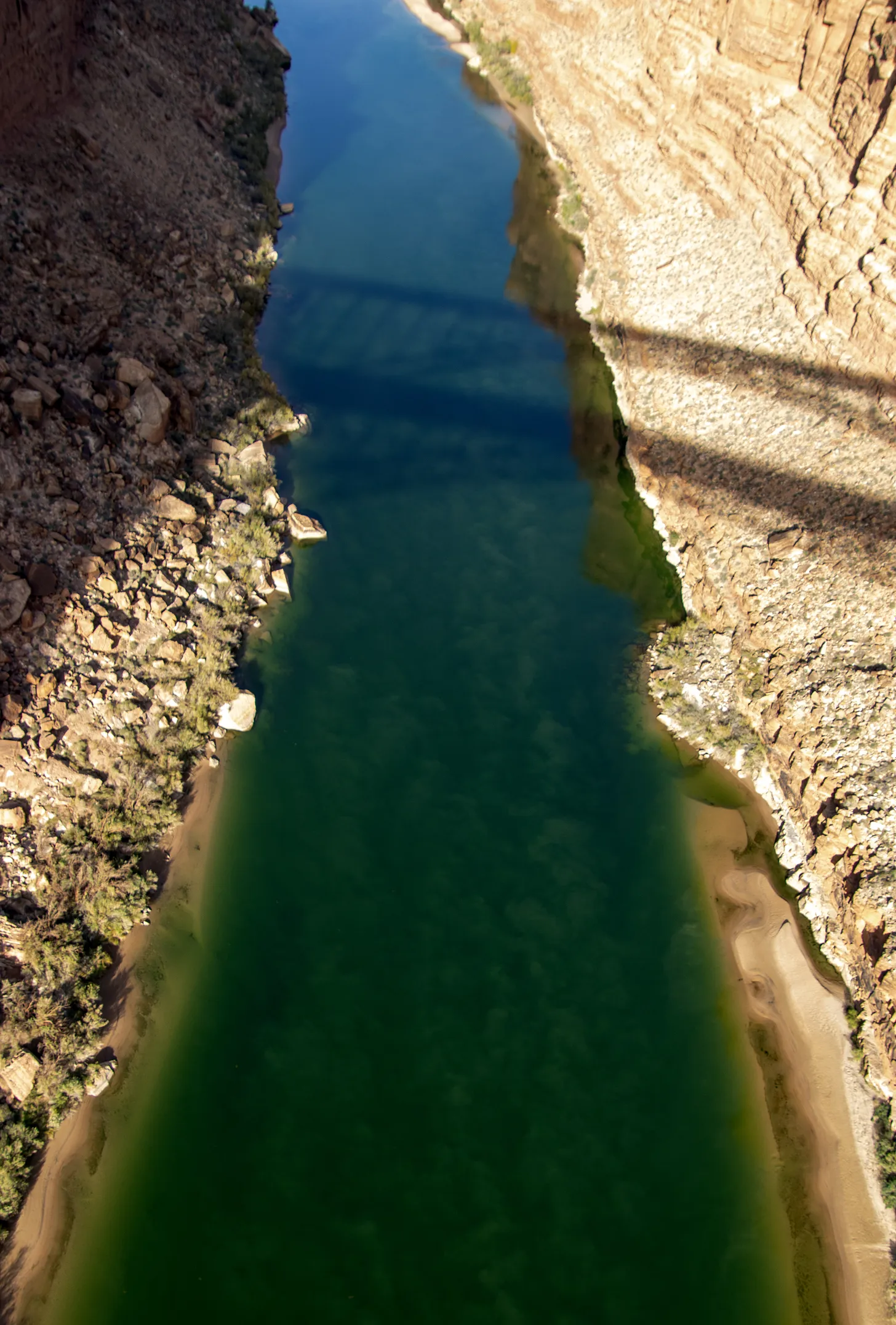
In mid-November, 10 days after 77 million of our fellow Americans chose Donald J. Trump to be their next president, I found myself at the old Navajo Bridge, which spans Marble Canyon and the Colorado River downstream from Lees Ferry in northern Arizona. I got out of my car, stretched and ambled toward the pedestrian bridge, which mirrors the newer one for automobiles.
As I reached the bridge, I noticed some onlookers looking intently downstream with binoculars. I followed their gaze to see a trio of giant, bald-headed, feathered creatures perched on the steel beams of the automobile bridge, looking a bit like the flying monkeys in the old Wizard of Oz film. They were California condors, maybe 10 in all, apparently waiting for an afternoon carrion snack to float by on the slow-moving emerald waters far below.
I wandered back and forth on the bridge for the next hour or so, stopping frequently to snap another photo, meditate vertiginously on the river and limestone cliffs or to gaze again in awe at the magnificent, uncanny creatures. Politics and the election results became irrelevant, at least for a moment, and it was with a newfound sense of serenity that I finally got back into the car and headed north.
Condors 6Y and 2A (I’m sure they have their own, more interesting names, but …) at the Navajo Bridge. According to condorspotter.com, 6Y is a male born in March 2019 at the Oregon Zoo. And 2A is a female hatched at the World Center for Birds of Prey in May 2021. Jonathan P. Thompson photo.
My mental calm was quickly shattered, however, as news trickled out about Trump’s Cabinet picks and plans. It is becoming increasingly clear that we are entering a perilous political era in which the federal government’s role is fundamentally altered. This includes a multi-pronged assault on our public lands and the rules, regulations, laws and agencies designed to protect them. Those condors on the Colorado River could be among the many victims.
Judging from the record of Trump’s first term, his campaign platform, his Cabinet picks so far and Project 2025, the right wing’s “presidential playbook,” it’s clear that he will once again attempt to dismantle the administrative state — and he’ll likely be better at it this time. The destruction will include gutting federal agencies, replacing experienced staffers with Trump loyalists and eviscerating protections for human health and the environment. The goal is to shrink the government, slash spending on safety nets and social programs to fund more tax cuts for the wealthy, and (of course) remove regulatory barriers standing in the way of ever-growing corporate profits. With the likes of Elon Musk buying his way into the administration, it promises to be a government of the billionaires, by the billionaires, and for the billionaires.
Trump actually summed up this ethos better than I ever could in a social media post, when he vowed to give anyone who invested at least $1 billion “in the United States of America … fully expedited approvals and permits, including, but in no way limited to, all Environmental approvals. GET READY TO ROCK!!!” He seemed to be responding to global mining corporation Rio Tinto, which is behind the proposed Resolution Copper Mine at Oak Flat in Arizona, urging the new administration to weaken environmental laws and expedite permitting for big mines.
During his first term, Trump made his hostility toward public lands clear as he reduced national monuments and rolled back regulations on fossil fuel extraction. This time, he promises a repeat performance, backed by a GOP-dominated Congress, a conservative-leaning Supreme Court and an army of professional ideologues who have been eagerly preparing for this moment for the last four years.
We can expect him to try to shrink or entirely rescind national monuments — particularly Bears Ears, Grand Staircase-Escalante and the Baaj Nwaavjo I’tah Kukveni-Ancestral Footprints of the Grand Canyon — potentially reopening hundreds of thousands of acres of uranium-rich lands to new mining claims during a time when the domestic uranium industry is experiencing a revival.
He will likely reward petroleum companies for donating generously to his campaign by implementing his “drill baby drill” policies. He’ll open up more public land to oil and gas leasing, including in the Alaskan Arctic, and rescind drilling bans on Thompson Divide in western Colorado and around Chaco Culture National Historical Park in New Mexico. He’ll roll back new EPA rules aimed at reducing greenhouse gas and mercury pollution from coal power plants.
If Trump’s hunger for “energy dominance” and corporate freedom don’t come for your public lands, the “Cult of Efficiency” probably will. Musk donated $277 million to Trump’s campaign. In return, he has been chosen to co-chair the so-called Department of Government Efficiency, or DOGE, where he has vowed to slash some $2 trillion in allegedly “wasteful” spending.
What this will actually mean remains unclear. But Trump’s suggestion that he may try to privatize the U.S. Postal Service because it’s not “profitable” and must be “subsidized” gives a good indication of what Musk’s quasi-department will be targeting. The USPS is designed to provide a public good, not a profit, and its priorities are fulfilling that mission, not maximizing efficiency. After all, how could delivering a letter to some remote rural backwater for some 50 cents ever be efficient?
And if the USPS is a problem, then what about public lands and the agencies that manage them? Sure, they provide ecological benefits, stewardship of and free access to millions of acres of stunning landscapes, wildlife habitat and so much more. And yet, they are “subsidized” to the tune of tens of billions of dollars each year, making them ripe for Musk’s chopping block. Utah, with the support of other conservative states, has offered to make Musk’s job easier with a lawsuit seeking to seize control of the “unappropriated” federal land in its midst. Because those states can’t afford to manage those lands at a loss, they would almost certainly sell them off to private interests.
And what about those condors? For years, industry and conservative politicians have tried to weaken the Endangered Species Act because it stood in the way of development and profits. Project 2025 calls for an escalation of these efforts, which now have more support in Congress — and from the efficiency cult.
The federal government has spent at least $35 million so far on the California condor program. It’s an effort that has so far paid off by helping to bring the species back from the brink of extinction; the wild population is up to almost 600 from an 1980s low of just 22 birds. Public goods such as species restoration simply don’t fit into narrow Musk’s profit-focused vision. And the condor remains fragile, threatened by lead poisoning, power lines, wind turbines and avian influenza, and it is not yet self-sustaining.
In the weeks since the election, I’ve seen a number of pundits, politicians and even advocates calling on land, water and air defenders to take a more conciliatory approach, to forge alliances with oil and gas companies, to abandon calls to “keep it in the ground,” to work with Republicans to speed up permitting reform in order to expedite renewable energy development, even if it does mean more fossil fuel development as well. Yet if ever there was a time not to give in, this is it. America’s public lands are under unprecedented attack from nearly every front. Now we need to be even more vigilant and fierce in our defense of it. [ed. emphasis mine]
Out on that bridge, something compelled me to hang my body a little too far over the rail so I could gaze straight through the empty space toward the river. My vertigo was overcome by the thrill of seeing, just below me on a steel girder, a juvenile condor, its pink beak jutting from a thatch of dark brown feathers. That, I thought, is certainly worth fighting for.
Condors perched on steel girders some 450 feet above the Colorado River. Jonathan P. Thompson photo.
The threatened Humpback Chub is one of four fish species that programs in Colorado and other Western states have been working to recover for nearly three decades. U.S. Fish and Wildlife Service/ Courtesy Photo
For nearly three decades, Colorado and other Western states have been working to recover several species of endangered fish in the Colorado and San Juan river basins. Congress last week approved a bill that will renew the program’s federal funding for seven more years. The bill was included in the 2025 National Defense Authorization Act, which is heading to President Joe Biden’s desk. Sens. John Hickenlooper, D-Colo., and Mitt Romney, R-Utah, sponsored the fish recovery program’s reauthorization act. Rep. Lauren Boebert, R-Colo., sponsored the bill in the House.
“Local communities, Tribes, water users, and Congress — we’re all in to protect our native fish and rivers,” Hickenlooper stated in a news release. “These programs are tried and true. Our extension will help continue them to save our fish and make our rivers healthier.”
Federal authorization for the two fish recovery programs — the Upper Colorado River Endangered Fish Recovery in Colorado, Utah and Wyoming as well as the San Juan Recovery Implementation Program in Colorado and New Mexico — expired this September. The reauthorization act, however, will extend the programs through 2031, authorizing the U.S. Bureau of Reclamation to contribute up to $92 million in the next seven years. The bill also adds up to $50 million for capital projects that support infrastructure improvements to recover the threatened and endangered species…The annual operating costs for the programs were historically funded by Colorado River Storage Project hydropower revenues, which have diminished over time due to drought, declining reservoir storage, increased costs and more, according to a September Colorado Water Conservation board memo. This has required the federal and state appropriations and contributions to increase to cover costs, it adds. The fish recovery programs also rely on in-kind contributions and funding from other partners. Both programs have sought to recover populations of four species — the humpback chub, razorback sucker, Colorado pikeminnow and bonytail fish — in these basins. When the Upper Colorado and San Juan programs were established in 1988 and 1992, all four species faced extinction, but they have seen some success.
Students from Palisade High School kissed good-bye to hatchery-raised juvenile razorback suckers before releasing them into the Colorado River May 2023. The fish are listed as endangered under the Endangered Species Act, but populations have recovered enough that U.S. Fish and Wildlife Service has proposed to downlist them to threatened. CREDIT: HEATHER SACKETT/ASPEN JOURNALISM
Endangered fish recovery programs in Colorado and three other Western states were given renewed access to federal funds thanks to a bill passed Wednesday by Congress.
Lawmakers gave the go-ahead to the U.S. Bureau of Reclamation to spend tax dollars on the programs with just days left in a lame-duck session, which adjourns Friday. The news was welcomed in Colorado, where the programs help protect four threatened and endangered species in the Colorado River and San Juan River basins.
“Local communities, Tribes, water users, and Congress — we’re all in to protect our native fish and rivers,” U.S. Sen. John Hickenlooper, a Colorado Democrat who sponsored the Senate bill, said in a news release. “These programs are tried and true. Our extension will help continue them to save our fish and make our rivers healthier.”
Lawmakers voted to reauthorize the federal funding for seven years for two programs: the Upper Colorado River Endangered Fish Recovery Program — which operates in Colorado, Utah and Wyoming — and the San Juan River Basin Recovery Implementation Program — which spans Colorado and New Mexico. The total funding amount is yet to be determined. The federal government allocated about $16.6 million, total, for the two programs between October 2023 and September 2024.
The recovery program bill was included in the annual National Defense Authorization Act, which sets national security policy and recommended spending levels for the Department of Defense. The act still awaited President Joe Biden’s signature as of Wednesday.
Rep. Lauren Boebert, a Republican who currently represents the 3rd Congressional District in western Colorado, sponsored the bill in the House of Representatives to reauthorize funding for the programs.
Through the programs, a wide network of federal, local and state agencies work together to try to stabilize and rebuild the populations of certain endangered species, including the razorback suckers, Colorado pikeminnow and bonytail. A fourth species, the humpback chub, has recovered enough that it was downgraded to threatened from endangered.
The fish species have lost vital habitat along the Colorado River and its tributaries, in part because of human uses, like developing former wetland areas, damming rivers, or diverting the flow of water to farms and cities. Dry years, lower flows and higher temperatures have led to warmer water, offering prime habitat for nonnative predator fish, which eat and compete with the threatened and endangered species.
Farmers, reservoir operators, city water managers, and conservationists across Colorado coordinate their water management plans to try to improve conditions for the species.
These plans also help ensure that Colorado River water continues to flow through western Colorado — instead of being used elsewhere — supporting agriculture and communities along the way.
Even students are involved in the effort. Every year, Palisade High School students help the Upper Colorado River program raise razorback suckers until they are old and large enough to be released into the river upstream from Grand Junction. The school released its thousandth sucker in May.
Students from Palisade High School transfer baby razorback suckers from a tank into the Colorado River. The students raised the endangered fish in a hatchery as part of the Upper Colorado River Endangered Fish Recovery Program. CREDIT: HEATHER SACKETT/ASPEN JOURNALISM
Pat Steele, a science teacher at the high school who helped found the program, said it is awesome to see lawmakers from both parties work together.
“That’s exactly what our lawmakers should be doing,” he said. “Working together and showing that example of bipartisanship, and showing our young people that this is how you get things done.”
For program managers, the move offers greater clarity going forward.
There was never a question that the programs would fold, but Reclamation is a major source of funding, said Michelle Garrison, a water resources specialist for the Colorado Water Conservation Board, one of the top water agencies in Colorado, and a representative of Colorado water users in the recovery efforts.
Without the legislation, the flow of funding could have been disrupted, potentially requiring cutbacks or making it harder to hire seasonal staff and order equipment, she said.
“Knowing it’s good to go really helps the planning process,” she said. It allows the network of partners to identify and prioritize what they need to focus on in coming years. “When you’re comfortable that you’re doing the best you can for the species, that gives you more certainty that you’re going to make sufficient progress.”
Ron Rogers biologist with Bio-West Inc., holds a large razorback sucker captured in Lake Mead near the Colorado River inflow area
A Colorado pikeminnow taken from the Colorado River near Grand Junction, and in the arms of Danielle Tremblay, a Colorado Parks and Wildlife employee. Pikeminnows have been tracked swimming upstream for great distances to spawn in the 15-mile stretch of river between Palisade and Grand Junction. An apex predator in the Colorado, pikeminnows used to be found up to six feet long and weighing 100 pounds. Photo credit: Lori Martin, Colorado Parks and Wildlife via Aspen JournalismWild bonytail chub
he Rio Grande cutthroat trout, icon of Southern Colorado and New Mexico, after years of fighting for survival with the help of countless human hours, will not find itself on the endangered species list. The U.S. Fish and Wildlife Service recently announced the trout is not in danger of extinction or likely to become so in the foreseeable future, after two and half decades of review and conservation work.
After completing a final review, the Service concluded that the Rio Grande Cutthroat trout’s current status in the mostly remote water ways of Colorado and New Mexico doesn’t meet the definition of a threatened or endangered species, and won’t be listed under the Endangered Species Act.
“CPW staff have worked tirelessly for decades to ensure Rio Grande cutthroat trout continue to persist,” said Matt Nicholl, Colorado Parks and Wildlife’s assistant director of aquatic wildlife. “The responsibility of successfully managing this species deeply aligns with our mission, and we are thankful for the continued support and collaboration with all of the partners who have made this announcement possible.”
Photo credit: Colorado Parks & Wildlife
Over the course of the past three decades, biologists from Colorado have added 94 populations of pure Rio Grande cutthroats to 239 miles of stream, through chemical reclamations and habitat and connectivity enhancements related to these species.
The Rio Grande cutthroat trout is one of 14 subspecies of cutthroat trout. It lives in mostly remote, mountainous streams in New Mexico and southern Colorado. The fish is a colorful red, orange and yellow, peppered with dark spots.
Cutthroat trout historic range via Western Trout
Rio Grande cutthroat trout can be found in high-elevation streams and lakes of the Rio Grande, Canadian and Pecos River drainages in Colorado and New Mexico, making it the southern-most cutthroat trout. Currently, the fish only occupies 12 percent of its historic habitat in about 800 miles of streams. Biologists estimate that 127 conservation populations now exist in the two states, and 57 of those populations are considered to be secure.
“The Rio Grande cutthroat trout has been New Mexico’s state fish since 1955,” said Amy Lueders, the Service’s southwest regional director. “This fish is extremely important for recreational angling in New Mexico and Colorado and management efforts have focused on population restoration, habitat improvement and research. We are thankful to the Rio Grande Cutthroat Trout Conservation Team because their continued work, along with efforts by other partners, will support the health of both the subspecies and its habitat into the future.”
To complete its life cycle, the cutthroat trout needs a network of slow and fast streams with clear, cold, and highly oxygenated water and highly biodiverse streambeds.
Since 2003, Colorado Parks and Wildlife and multiple partners, including federal agencies, states, tribes, municipalities, non-government organizations and private landowners, have worked to conserve the species and implement long-term management actions to ensure its persistence and survival.
A series of collaborative frameworks of this group was updated in 2013 and again in 2023 with a conservation agreement and conservation strategy that aimed for long-term conservation.
“This decision is in response to all of our hard work between all of our partners,” said CPW aquatic biologist Estevan Vigil. “The whole Rio Grande Cutthroat Conservation Team, this is a win for all of us and shows we’re working hard to conserve the species without making that federal protection necessary and that we are making gains for the species. The decision to not list the Rio Grande cutthroat doesn’t mean we can stop. It just means we are on the right track.”
The past, present and future threats to the Rio Grande cutthroat trout have been monitored and evaluated closely. The primary factor impacting the survival of the subspecies is the presence of nonnative species of trout, including rainbow trout, brook trout and brown trout. The conservation populations of Rio Grande cutthroat trout, or populations with less than 10 percent genetic introgression from nonnative trout, occupy approximately 12 percent of the species’ historical range. Additional threats include habitat loss, reduced habitat connectivity and whirling disease.
Those other fish will outcompete, prey upon and hybridize with Rio Grande cutthroats. As a result, pure populations of Rio Grande cutthroat trout are restricted primarily to headwater streams to avoid an overbearing mix of disease and genetics.
View the U.S. Fish and Wildlife Service’s findings here.
Credit: Colorado Parks & Wildlife
The trout has had a specialized team focusing on its survival throughout the restoration effort. The Rio Grande Cutthroat Trout Conservation Team is made up of state agencies in New Mexico and Colorado, as well as federal agencies, tribes, and non-government organizations.
In the past 10 years, the conservation team has conducted 13 population restorations by removing nonnative trout and reintroducing Rio Grande cutthroat trout.
The Rio Grande Cutthroat Trout Conservation Team meets in January each year to coordinate rangewide goals and objectives. Vigil said the team serves to provide checks and balances to each other to make sure holistic goals are met.
“Following that meeting, we all go back to the areas we manage and divide and conquer all summer to meet the goals set of conserving this species,” Vigil said. “Through this shared commitment to collaborate and take actions, the future for this native species is bright throughout the Rio Grande Basin.”
The conservation team has conducted 13 reclamation projects to restore the fish to its native streams in the past decade, and additional projects in Colorado will soon lead to further conservation populations.
Recognizing declines, CPW began conservation efforts for this species in the early 1980s. Work included genetic testing, invasive species removal, habitat protection and enhancement, and broodstock development.
In Colorado, Rio Grande cutthroats are spawned in the wild by CPW biologists and eggs are raised at the Monte Vista Hatchery. Since 2020, CPW has stocked 24 waters with Rio Grande cutthroats raised at the hatchery.
A new conservation population of Rio Grande cutthroat trout was designated in 2023 when a survey revealed multiple age classes of the species following a successful 2015 restoration project on the Roaring Fork drainage upstream of Goose Creek in the Weminuche Wilderness.
Recent reclamation projects also have been conducted on the North Fork and South Fork of Trinchera Creek, Sand Creek, and Rito Hondo Reservoir, but those populations won’t count as conservation populations until future surveys reveal multiple age classes of Rio Grande cutthroats.
“We are continuing to reclaim waters for native cutthroat trout by removing non-native fish and restocking with natives,” Vigil said. “We have a lot of projects and some in the process of being rebuilt. We know we are making good progress on the conservation of the species, and this is confirmation we are doing our jobs correctly and making progress.”
Over the past two years, species experts from CPW have served on the Technical Advisory Team to support USFWS in developing a Species Status Assessment. This included thorough input on early drafts of the assessment and enhancing scientific accuracy and defensibility of this document to support the final decision.
“CPW biologists played a significant role in the writing of this strategy, which details specific conservation actions and collaborative approaches that will reduce and/or eliminate threats to the long-term viability of the species,” said CPW senior aquatic biologist Jim White. “Following this announcement from the USFWS, we look forward to continued partnership with the conservation team as we continue to advance conservation goals for these unique species.”
Rio Grande cutthroat trout via Colorado Parks and Wildlife
Kevin Terry, a project coordinator for Colorado Trout Unlimited, holds up a Rio Grande cutthroat trout at Upper Sand Creek Lake.Workers administer the plant-based chemical compound rotenone at Upper Sand Creek Lake in the Sangre de Cristo range. The chemical kills all fish in the waterway so that Rio Grande cutthroat trout, a native species, had be restored to the habitat. (Provided by Colorado Fish and Wildlife)The Rio Grande cutthroat trout has dwindled in its native habitat. A multi-agency effort to restore it still can inspire anger and concern. (Provided by Colorado Fish and Wildlife)A Rio Grande cutthroat trout is pictured in 2014. Photo courtesy of U.S. Fish & Wildlife ServicePhoto credit: Colorado Parks & Wildlife
One of the hopeful notes coming out of the recent Colorado River discussions is the way the operation of Glen Canyon Dam in a more flexible way, to accommodate a broader range of values, is back on the table. The USBR alternatives released ahead of this week’s Colorado River Water Users Association, while requiring some tea leaf divination because of their brevity, seem to leave the door open for this discussion.
Jack Schmidt and I have a new white paper offering some assistance, based on our understanding of the legal and regulatory structure around Grand Canyon National Park and Glen Canyon National Recreation Area. The idea behind what we’re arguing isn’t to wag a regulatory finger and say, “The law requires us to do X.” Rather, we’re saying, “The law enables us to do X,” where for “X” we argue for the consideration of a wider range of social, cultural, and environmental values as we make decisions about how to divide the water up between Lake Mead and Lake Powell.
To consider how climate change could cause some extinctions, imagine a tiny mountain bird that eats the berries of a particular mountain tree. That tree can only grow at a specific elevation around the mountain, where it’s evolved over millennia to thrive in that microclimate. As global temperatures rise, both the tree and the bird will be forced to rise too, tracking their microclimate as it moves uphill. But they can only go so far.
“Eventually, they reach the peak, and then there’s nowhere else to go,” says Mark Urban, a biologist at the University of Connecticut.
Scientists call this mountain phenomenon the “escalator to extinction” and it’s just one way climate change is already squeezing plants and animals from their habitats. Researchers have conducted hundreds of studies projecting how different species might respond to different levels of climate change, finding varied results. In an analysis published Thursday in the journal Science, Urban sought to bring all those studies together…If countries meet the shared goal of limiting warming to 1.5 degrees Celsius, 1.8% of species will be at risk of extinction by the end of the century, Urban reports. But if global warming gets out of hand, warming four or five degrees Celsius, as many as 30% of species could be at risk…He points to confounding complexities in how species might respond to such climate extremes that scientists don’t yet know. More critters may simply not be able to cope, or ecosystems that lose species after species may collapse altogether. Additionally, many rare species are understudied, or not even discovered, and might be especially vulnerable in ways that don’t show up in this analysis…Different species face some different risks. Amphibians, including frogs and salamanders, are more vulnerable, Urban found, perhaps because their habitats are more sensitive to environmental changes. Species that live on islands, mountains and in freshwater could face more challenges, too. Targeted conservation efforts could help slow losses, Urban says, but they’re ultimately no substitute for reducing emissions.
Click the link to read the article on the InkStain website (John Fleck):
November 15, 2024
I put up a slide for my University of New Mexico water resources graduate students during class yesterday afternoon with two pictures – the emerging canyons at the upper end of Lake Powell, and a smallmouth bass.
When Lake Powell gets low, we get a) the remarkable emergence of Cataract Canyon, and b) warm water invasive smallmouth bass sneaking through Glen Canyon Dam’s outlets, headed downstream to dine on the endangered humpback chub. My University of New Mexico colleagues and collaborators Benjamin Jones and Bob Berrens famously dubbed these “green-vs-green” tradeoffs:
Managing for one – keeping Lake Powell high to keep smallmouth bass out of the Grand Canyon – inevitably conflicts with the other – keeping Lake Powell low to protect the emerging environmental values of Cataract Canyon.
In a new white paper out today, my colleagues Jack Schmidt, Eric Kuhn, and I argue for the creation of a process to better incorporate and manage the multiplicity of values along the Cataract Canyon/Lake Powell/Glen Canyon/Grand Canyon/Lake Mead stretch of the Colorado River as we develop new post-2026 river operating guidelines. We recognize that keeping water flowing to taps and headgates across the Colorado River Basin is the primary motivation behind the new operating guidelines being developed by the Bureau of Reclamation. We argue that, as the community is writing those rules, we have an opportunity to incorporate a broader set of community values.
In particular, we argue that more creative water accounting methods would allow water to be either held upstream in Lake Powell for later delivery, or send downstream early to Lake Mead, in order to better take into account what Benjamin and Bob called the “multiple dimensions of societal value.”
The white paper elaborates on our formal proposal submitted in March to Reclamation as part of the agency’s Post-2026 decision process.
Audubon’s Jennifer Pitt testifies before Congress on Colorado River habitats. Photo: Caitlin Wall/Audubon
Click the link to read the release on the Audubon website (Jennifer Pitt):
November 20, 2024
The following is the oral testimony of Jennifer Pitt, Audubon’s Colorado River Program Director before a House Natural Resources Subcommittee on Water, Wildlife and Fisheries:
Chair Bentz, Ranking Member Huffman, and members of the Subcommittee, thank you for holding this hearing on proposed legislation addressing water management in the western United States. My name is Jennifer Pitt and I serve as the Colorado River Program Director for the National Audubon Society, with over 25 years of experience working on water issues in the Colorado River Basin. National Audubon Society is a leading national nonprofit organization representing more than 1.4 million members and supporters. Since 1905, we have been dedicated to the conservation of birds and the places they need, today and tomorrow, throughout the Americas using science, advocacy, education, and on-the-ground conservation. Audubon advocates for solutions in the Colorado River Basin that ensure adequate water supply for people and the environment.
Audubon supports H.R. 9515, the Lower Colorado River Multi-Species Conservation Program Amendment Act of 2024. The Program constructs habitats along the Colorado River below Hoover Dam, and that habitat is essential not only for the 27 species the program targets, but also for many of the 400 species of birds that rely on the Lower Colorado River, including Yellow-billed Cuckoos, Sandhill Cranes, and Yuma Ridgway’s Rails. Today, because the Program spending does not keep pace with the collection of funds from non-federal partners, about $70 million is held in non-interest-bearing accounts. If these funds were held in an interest-bearing account, the Program would have about $2 million in additional funds per year, and be more able to maintain program implementation in the face of increasing costs.
Audubon appreciates the inclusion of H.R. 9969 in this hearing. This bill directs Reclamation and the Western Area Power Administration, in consultation with the Glen Canyon Dam Adaptive Management Work Group, to enter into a memorandum of understanding to explore and address potential impacts of management and experimental actions to help control invasive fish passage in the face of drought and declining water levels. Rapidly changing conditions on the Colorado River warrant the experimental approach of adaptive management, with the Work Group bringing together varied interests to a consensus on how to protect downstream resources and strike a balance on river operations. Results of this collaboration include improved sediment flows that help maintain sandy beaches used by plants and animals that dwell in the floodplain, as well as by people traveling the canyon by boat.
The context for these bills is the current crisis on the Colorado River. Climate change continues to ravage the Colorado River Basin, which is now in its 25th year of drought. The forecast for this winter is for above-normal temperatures and below-normal snowpack, which could impact Colorado River water supply. With a 2026 deadline looming for the expiration of existing federal guidelines for operation of federal Colorado River infrastructure – with implications for water supply reliability for people and the river itself – human nature is creating unacceptable risks. Colorado River water managers are preparing for conflict to protect their share of an increasingly scarce water supply, rather than focusing on holistic solutions.
Earlier this year, Audubon joined with conservation partners in submitting to Reclamation our Cooperative Conservation Alternative for consideration in the post-2026 NEPA process for developing Colorado River Operating Guidelines. Cooperative Conservation is designed to improve water supply reliability, reduce the risk of catastrophic shortages to farmers and cities, create new flexible tools that can protect infrastructure, incentivize water conservation, help Tribes realize greater benefits from their water rights, and improve river health. We urge Reclamation and all Colorado River Basin parties to consider our approach as they proceed through the NEPA process.
From a bird’s eye view, the whole system matters. That needs to hold true for water users who must figure out how to share the Colorado River. The old adage applies: united we stand, divided we fall. The Colorado River community – in particular Upper Basin and Lower Basin interests – must stop thinking parochially and start thinking about how we survive drier times together.
I would like to thank Congress for funding water conservation programs, such as WaterSMART and the Cooperative Watershed Management Program, and the crucial funding in the Bipartisan Infrastructure Law and the Inflation Reduction Act, both of which include funding to improve the resilience of the Colorado River Basin. With this funding, and states working together, we have avoided a crisis, but we are still just one bad winter away from catastrophic shortages. To be effective, this funding needs to get out of federal coffers and into the hands of water users and water managers, to incentivize water conservation and efficiency, to improve the health of the forests and headwater streams that are the river’s source, and to stabilize the river itself – the natural infrastructure that supplies water to more than 40 million people. Congress will need to help in the future with additional funding to support continued resilience investments in the Colorado River Basin as warming continues.
Thank you very much for the opportunity to testify and I would be happy to answer your questions.
Alamosa is continuing to piece together its Rio Grande recreation puzzle. With support from the city of Alamosa to pull back the levee to make way for a beach, the Alamosa Riverfront Project is taking a different shape. Support from the city will aid in helping bring the project to completion.
During a city council meeting earlier in November, councilors recognized that the project aids in the city’s “Activating the Rio Grande Corridor,” a top priority for the Parks and Recreation Department.
As the river’s oxbow loops lazily trickle ever southward to the Gulf of Mexico, deciphering how to ensure people can access the river, how the river can maintain its natural biodiversity, and how to prevent thousands from losing their homes in a “100-year” flood make it a daunting and sharp puzzle.
Proposed changes to levee location and riverfront access Credit: JUB Engineering
The Alamosa Riverfront Project is looking to expand recreation access and improve river restoration from the State Avenue Bridge, upstream of Alamosa’s Cole Park, to the West Side Ditch, downstream of Cole Park. It’s a multi-million dollar project that, so far, has received overwhelming support from the community, according to project planners and members of the community who showed up at a series of summer community meetings.
You may be able to take the town from the river, but the river will continue to flow through town.
The project is looking to connect people back to the Rio Grande, not through adrenaline-pumping white water, but instead by leveraging its natural geographic limitations.
Brian Puccerella, San Luis Valley Great Outdoor’s outdoor recreation manager, has been involved in this project since about 2016. That’s when the conversation about expanding access to paddlers, maybe adding a play wave, and just expanding recreation generally started making the rounds.
The conversation was about “what was possible in our stretch of river in town,” Puccerella said. “We didn’t know the answer to that.”
An engineering study was funded in 2017 to look at what was possible.
“The conclusion,” he laughed, “was not much. It’s pretty flat and we don’t have a lot of flow. That doesn’t mean there isn’t going to be recreational improvement.”
The study equates Alamosa’s stretch of low-flowing river, less than one mile per foot downhill through town, to a “skinny lake.”
Puccerella explained that Alamosa’s portion of the river doesn’t have the flows or drops to ever get whitewater, even in a good year. A lot of the water that flows from the mountains into the river is diverted to different systems throughout the San Luis Valley. By the time the river reaches Alamosa, its flows are quite slow.
What we do have, he said, is flatwater.
That’s not a negative, though. “It creates opportunity for family-friendly recreation.”
Construction is still a ways out. Alamosans can expect construction to begin sometime around fall 2026. A lot of money still needs to be raised, and a lot can happen between now and then. What planners won’t have to worry about is the Army Corps of Engineers’ levee recertification.
Credit: The Alamosa Riverfront Project
BEACHFRONT PROPERTY
When construction is finished, the western levee, the side of the river adjacent to Cole Park, will be pulled back and a highly accessible riverfront beach will be added. Right now there’s a fairly steep, unfriendly drop to the water. In the future, there will be easy access for everyone.
The Rio Grande Headwaters Restoration Project is heading up the funding and providing the support to engineers throughout the project’s timeframe. During the summer, the group held two community feedback meetings to both inform and learn. From those meetings, project planners were able to adjust the plans.
Final plans will be revealed to the public in early 2025. These preliminary renderings can give us a hint, however.
“We’re doing this because this is what the community wanted,” said Cassandra McCuen, program manager for the Rio Grande Headwaters Restoration Project. She called the project “amazing and transformative.”
McCuen and Puccerella joined Outdoor Citizen podcast host Marty Jones to talk more about the project and provide updates. You can listen to that episode here, or wherever you get your podcasts.
From those community meetings, project planners were able to incorporate community feedback. Two of the most important pieces of feedback for engineers and designers: ensuring as much of the project is ADA accessible as possible, and making sure the river and beachfront are safe.
Access from Cole Park will be a priority, as it will serve as a kind of hub. The project calls for a few more boat ramps, adding to the two Alamosa currently has. These boat ramps won’t be for motorboats, but personal watercraft such as paddle boards, tubes, kayaks, and canoes.
Increasing recreational potential increases recreational safety. Currently, Puccerella and McCuen said, floating south of Cole Park isn’t advised. The West Side Ditch Diversion and the railroad bridge are a bit of a snag of willows, rusty metal, and splintered wood.
Rio Grande at location of Alamosa Riverfront Project. Photo credit: Owen Woods
INSIDE THE LEVEE
“Inside the levee it’s more complicated,” McCuen said.
When it comes to changing the levee or potentially changing how water flows through town, you answer to the Army Corps of Engineers.
The Corps is responsible for ensuring that levees don’t fail during a proverbial “hundred-year flood.” Alamosa has a history of regular and devastating flooding. The levee system protects Alamosa proper and East Alamosa. Without a certified levee system, property owners are required to pay for flood insurance.
The recertification process is still many years out. The riverfront project is just a few years out. McCuen said the city has been an amazing partner in supporting the project.
With that in mind, project planners were able to meet with the Army Corps of Engineers and provide them with a full rundown of the project, plus the support of the city of Alamosa, and their proposal to pull the levee back.
McCuen said it was a real point of concern, because the project planners were unsure of how the Corps would react to the project’s proposal of pulling the levee back and the inner-levee restoration work.
McCuen said they were finally able to meet with the Army Corps in August. During that meeting, the Corps told the project planners they would be willing to work with them, “as long as you do not impact the flows through Alamosa negatively.”
Pulling the levee back to make way for a beach won’t impact flows in a noticeable way.
“Our project has worked seamlessly with the work that’s gone into levee recertification,” she said.
Fish species thought to be present at Cole Park, based on CPW fish surveys. Credit: The Alamosa Riverfront Project
FISH PASSAGE
People are not only getting an upgrade, but so are the wildlife. This project is unique and special to Alamosa through both its recreation and restoration efforts. McCuen said the attempt is to improve the natural condition of the Rio Grande through town alongside increasing its recreational value. From the planning phase onward, restoration has been at the forefront of the project.
In-town restoration work can be complicated due to the levee recertification, but also due to the geographical limitations Puccerella mentioned. The river is extremely confined, McCuen explained.
Part of that confinement is because the Rio Grande is a very developed river. For example, diverting the Rio Grande’s flow before it reaches Alamosa creates that low flow prime for paddling and floating, but it also makes the water warm.
Warm water is bad for the Rio Grande’s fish. “Super-duper low flows make the area hot,” McCuen said. So one of the major aspects of the restoration portion is creating a safe, cool fish passage.
“We want fish to be able to flow upstream and downstream.”
The fish passage would simply be deeper channels that fish would use as aquatic highways. Also needed are fish refuges, or backwater habitats that exist along the river to serve as places where native fish can take refuge from non-native carp and pike.
Restoring the Rio Grande will take time and effort, but connecting the people back to the river is a start.
“We really wanted to create a project that spoke to the culture of Alamosa, spoke to the community, is something the community wanted, and I think we’re gonna get there because people took time out of their day to be involved in all this,” McCuen said.
On Wednesday morning I woke up in Holbrook and, before leaving, did a little tour around the high desert crossroads town, awed by the weirdness of it all. I don’t mean that in a bad way. Holbrook, with its Bucket of Blood Street, grinning plastic dinosaurs, and mid-century kitsch, is truly unique, the product of the interstate, railroad, and Route 66 running through the nearest community to Petrified Forest National Park.
I headed west, doing my best to avoid driving on I-40. This led me to no fewer than three dead ends, forcing me to backtrack. But it also took me down some cool, if defunct, segments of Route 66, and almost got me creamed by a big rig hauling coal ash from the Cholla power plant, which looms over the sere landscape. After touring Joseph City and Winslow, I veered away from the Little Colorado River and headed southward across the Navajo Nation, up to Hopi, past the wintering corn fields at Moenkopi, and through Tuba City before continuing south on Hwy. 89.
The historic Navajo Bridge, now for pedestrians only, was built in 1929 and replaced by the larger bridge in the 1990s. Jonathan P. Thompson photo.
Whenever I’m in this part of Arizona, I try to get to Navajo Bridge (which is actually a pair of bridges), which spans Marble Canyon and the Colorado River downstream from Lees Ferry. One of the bridges was built in 1929, and is now for pedestrians, the other in 1993. They resemble the bridge that crosses the Colorado just below Glen Canyon Dam. I like to go out on the dam-bridge, too, but I also find it a bit frightening: the dam exudes an aura of, for lack of a better term, ominous violence. The Navajo Bridge, by contrast, is a place of serenity. You can stand out on it and, unimpeded by chain link fences, look straight down on the deep, murky green, slow-moving waters of the Colorado and do a bit of vertiginous meditation.
The Colorado River from the Navajo Bridge. Jonathan P. Thompson photo.
The light was crisp, almost harsh, on this visit, and the parking lot almost empty. I got out of the Silver Bullet, stretched, and ambled toward the bridge, noticing as I did a trio looking intently downriver through binoculars. It appeared as if they were studying the engineering of the automobile bridge, and I wondered if maybe it were cracking and getting ready to fail catastrophically. I readied my camera, just in case, and followed their gaze. That’s when I saw them: a trio of giant birds perched on the steel beams of the bridge, some 470 feet above the river, doing a bit of meditating of their own (or perhaps waiting for carrion to float by).
Condors perched on steel girders some 450 feet above the Colorado River. Jonathan P. Thompson photo.
The magnificent creatures, their pink bald heads jutting out from brown-feathered bodies, are California condors, some perhaps the descendants of six birds released in the area in 1996, others that were introduced in later years. They are huge — sporting up to ten-foot wingspans — but live a fragile existence. After being driven nearly to extinction, federal wildlife officials began rearing California condors in captivity and reintroducing them throughout the West. Now there are more than 500 California condors in the wild, but humans continue to imperil them.
Condors 6Y and 2A (I’m sure they have their own, more interesting names, but …) at the Navajo Bridge. According to condorspotter.com, 6Y is a male born in March 2019 at the Oregon Zoo. And 2A is a female hatched at the World Center for Birds of Prey in May 2021. Jonathan P. Thompson photo.
Perhaps the greatest threat is lead poisoning, which comes from ingesting carrion contaminated by lead ammunition. Lead ammunition is designed to shatter and fragment when it hits an animal, increasing its lethality. These fragments end up in the animal’s flesh and the guts, which hunters often discard in the field to be eaten by scavengers. This fall a condor in Zion died from lead poisoning, and wildlife officials say nearly every condor they test has some level of lead in its bloodstream.
Federal and state-level efforts to ban the use of lead ammunition for hunting have run into strong resistance from gun rights advocates, who claim (erroneously) that the initiatives are aimed at stopping all hunting. So some states, including Arizona and Utah, have implemented voluntary programs that incentivize hunters to use non-lead ammunition and dispose of gut piles in a scavenger-safe way. In 2019, California prohibited the use of lead ammo for hunting, but did not ban the sale of the ammunition.
A young condor on the pedestrian bridge. Jonathan P. Thompson photo.
I spent a good part of the afternoon mesmerized by the birds, hoping they would spot something dead and rotting and delicious so I could witness one in flight. It didn’t happen, but I consider myself fortunate nonetheless: As I was preparing to leave I looked straight down from my place on the bridge for one last glimpse at the mighty Colorado, all emerald green down below, and there, only about ten feet below me, sat a young condor, pink beak protruding from a fuzz of black feathers.
The twin turbines of Xcel Energy’s Shoshone hydroelectric power plant in Glenwood Canyon can generate 15 megawatts. The plant was down for about a year and a half, according to the Colorado Division of Water Resources. Credit: Heather Sackett/Aspen Journalism
The Shoshone Hydropower Plant in Glenwood Canyon was not operating for nearly all of 2023 and more than half of 2024, adding urgency to a campaign seeking to secure the plant’s water rights for the Western Slope.
According to records from the Colorado Division of Water Resources, the Shoshone Hydropower Plant was not operating from Feb. 28, 2023 until Aug. 8, 2024. According to Michelle Aguayo, a spokesperson from Xcel Energy, the company that owns the plant, there was a rockfall which forced an outage as well as maintenance which impacted operations during that time period.
The Grizzly Creek Fire burning along the Colorado River on August 14, 2020. By White River National ForestU.S. Forest Service – Public Domain
In 2024 the plant has been down for 221 days; in 2023 for 307 days; in 2022 for 91 days and in 2021 for 143 days. Water Resources Division 5 Engineer James Heath said he began tracking Shoshone outages in 2021 when they began to happen more frequently, starting with the post-Grizzly Creek fire mudslides in Glenwood Canyon.
“It was all these extended outages and just being able to have some sort of record of what was going on,” Heath said. “I kept getting questions from the parties on how many days we were operating ShOP and what the priorities were on those different days.”
The recent extended outages of the plant increase the urgency of the effort by the Colorado River Water Conservation District to acquire Shoshone’s water rights, which are some of the oldest and most powerful non-consumptive rights on the main stem of the Colorado River. If the plant were to shut down permanently, it would threaten the Western Slope’s water supply. The water rights could be at risk of being abandoned or acquired by a Front Range entity.
At a tour of the Shoshone plant in October, hosted by the Water for Colorado Coalition, River District Director of Strategic Partnerships Amy Moyer explained why the Shoshone water rights are important for improving water security and climate resilience on the Western Slope.
“As we’re sitting here in the iconic Glenwood Canyon. … It is a beautiful place, but we have an active highway, a railroad, a hydro power plant, all nestled in this tiny canyon that has experienced its fair share of natural hazards and risks over the years,” Moyer said. “When we’re looking at the level of risk, that is why we are looking for permanent protections for these water rights, and why we have a willing partner in Xcel Energy realizing that they had an incredible asset that was meaningful to Colorado’s Western Slope and the Colorado River itself.”
Water runs down a spillway at the Shoshone hydro plant in Glenwood Canyon. Rockfalls, fires and mudslides in recent years have caused frequent shutdowns of plant operations. Credit: Heather Sackett/Aspen Journalism
According to the terms of ShOP, when it is on during the summer, the plant can call 1,250 cfs. In the wintertime, that number falls to 900 cfs. The agreement is in place for 40 years (with 32 remaining), a relatively short period in water planning, after which it could be renegotiated. And ShOP doesn’t have the stronger, more permanent backing of a water court decree.
“ShOP came about as a band aid to kind of maintain the river flow and the river regime when the plant was out,” said Brendon Langenhuizen, River District director of technical advocacy. “ShOP wasn’t meant to be for year after year after year of the plant being down.”
The Shoshone hydro plant in Glenwood Canyon. The River District has made a deal with Xcel Energy to buy the water rights associated with the plant to keep water flowing on the Western Slope. Credit: Heather Sackett/Aspen Journalism
The River District’s campaign to acquire the Shoshone water rights has been gaining momentum over the last year, with about $55 million in committed funding so far from entities across the Western Slope, the River District and the state of Colorado. The River District plans to apply for $40 million in funding from the U.S. Bureau Reclamation’s B2E funding. This money from the Inflation Reduction Act is earmarked for environmental drought mitigation.
The River District’s plan is to add an instream flow use to the water rights in addition to their current use for hydropower. That requires working with the Colorado Water Conservation Board, which is the only entity in the state allowed to hold instream flow rights which preserve the environment, as well as getting a new water court decree to allow the change in use.
That way, when the Shoshone plant is offline, the instream flow right would be activated to continue pulling water downstream, making ShOP obsolete and solidifying a critical water right for the Western Slope.
Xcel would lease the water right for hydropower from the River District for as long as the plant is in operation.
“New plot using the nClimGrid data, which is a better source than PRISM for long-term trends. Of course, the combined reservoir contents increase from last year, but the increase is less than 2011 and looks puny compared to the ‘hole’ in the reservoirs. The blue Loess lines subtly change. Last year those lines ended pointing downwards. This year they end flat-ish. 2023 temps were still above the 20th century average, although close. Another interesting aspect is that the 20C Mean and 21C Mean lines on the individual plots really don’t change much. Finally, the 2023 Natural Flows are almost exactly equal to 2019. (17.678 maf vs 17.672 maf). For all the hoopla about how this was record-setting year, the fact is that this year was significantly less than 2011 (20.159 maf) and no different than 2019” — Brad Udall
“Colorado’s Western Slope is truly at an epicenter of increased temperatures and decreased streamflows that are exacerbating temperature issues, creating water quality issues,” Moyer said. “So it’s imperative that we look for these legacy level, permanent solutions to build resiliency in our basin.”
From warbler research to transmission line placement, Audubon staff worked on planning with birds and people in mind.
This year wind and solar generation in the U.S. surpassed coal for the first time, and solar is expected to supply most of the growth in electricity generation through 2025. The Inflation Reduction Act (IRA) continues to be a major catalyst for this momentum by providing substantial incentives that include tax credits for renewable energy and transmission projects. At the state and local level, clean energy goals and mandates, new jobs, and economic and community benefits are driving the growth of renewables.
Transitioning to clean energy is crucial for protecting hundreds of North American bird species from climate change, but infrastructure must be sited and operated with birds and people in mind. Audubon staff and chapters across the U.S. are working with planners, developers, and federal and state agencies to achieve this goal. Over the last 12 months, Audubon has been involved in the planning, permitting, siting, or operation of over 36 gigawatts of onshore and offshore wind and solar projects, as well as almost 45 gigawatts of transmission capacity. This conservation work includes providing recommendations on siting, permitting, monitoring, and research, grounded in Audubon’s extensive science and policy advocacy for birds and their habitats.
Here are some of this year’s efforts across the network:
Transmission Lines in Minnesota
In May, Minnesota made a significant move by passing legislation to allow transmission lines alongside highways, thanks to the efforts of Audubon Upper Mississippi River and their work with the NextGen Highways coalition. Audubon’s Birds and Transmission report shows that placing transmission lines on existing rights-of-way minimizes the overall transmission footprint, leaving more habitat intact and reducing the chance of collisions. This approach advances the clean energy transition while ensuring that Minnesota’s birds and communities benefit from responsibly sited transmission.
Getting Build Ready for Clean Energy in Washington
Audubon Washington is working with local chapters Lower Columbia Basin Audubon Society, Vancouver Audubon Society, and others to accelerate the state’s transition to clean energy on several fronts. The Audubon Washington team is championing a new Build Ready Clean Energy Program and advocating for the creation of a Clean Energy Development Authority to help meet the state’s clean electricity mandates. By joining forces with the NextGen Transmission coalition and actively participating in the Western Clean Energy Advocates (WCEA), Audubon is making its voice heard on key energy and transmission issues. They’ve also weighed in on the state’s environmental impact assessments for major transmission projects, utility-scale solar, and onshore wind. Audubon has also conducted in-depth spatial analyses, pinpointing areas in Eastern Washington as candidate sites for low-conflict solar development.
Monument Planning in California
While Audubon California co-leads the effort to designate the Chuckwalla National Monument in California’s desert, Audubon has joined solar industry leaders and conservationists to secure monument status for this unique landscape while ensuring the designation would not impede solar development in designated areas outside the monument and existing and planned transmission development through the monument. By balancing conservation with clean energy needs, this collaborative effort aims to protect the Chuckwalla’s important habitat and natural beauty while paving the way for responsible development.
A Prothonotary Warbler is fitted with a tracker. Photo: Erik Johnson/Audubon Delta
Warbler Research in Louisiana, Kansas, Arkansas, and Ohio
In May and June, Audubon Delta and partners fitted over 50 Prothonotary Warblers with tiny trackers across Louisiana, Kansas, Arkansas, and Ohio. The multi-sensor geolocators will collect data on the flight behavior of these songbirds as they migrate across the Gulf of Mexico. The information gathered from returning birds will offer new insights into their use of airspace and their responses to inclement weather. This research will aid in assessing collision risks for offshore wind projects in the region and support improved planning and siting efforts.
Reasonably foreseeable development scenario solar area relative to total area of lands available for application. Credit: Bureau of Land Management
Solar Development in Western States
The Bureau of Land Management (BLM) finalized in a plan for how utility-scale PV solar will be sited and permitted on 30 million acres of public lands across 11 states. In April, Audubon filed detailed comments on the Draft EIS that recommended improvements to BLM’s Solar PEIS, with a focus on avoiding and minimizing impacts to birds by prioritizing project development on degraded lands and close to transmission lines. Audubon also filed similar joint comments in a letter to BLM leadership in collaboration with four conservation organizations and five solar development companies. More than 2,900 Audubon supporters sent comments to the BLM in support of this approach. The Final EIS, released in August, improves on the initial draft, but further improvements are needed in plan implementation to streamline permitting for rapid deployment of solar energy on low conflict lands.
In February, the U.S. Fish and Wildlife Service (FWS) made their incidental take permitting program under the Bald and Golden Eagle Protection Act more efficient in ways that support the buildout of wind energy while benefitting Bald and Golden Eagle conservation. As part of the permit program, clean energy developers will commit to conservation measures and monitoring at their wind project and transmission sites, and the FWS will set the maximum number of eagles and eagle nests that might be harmed by wind energy and transmission without prosecution under the federal law. Audubon advocated for these improvements alongside conservation and industry partners to help advance wind energy development while protecting eagles.
The Offshore Wind panel during Climate Week NYC 2024. Photo: Darien Fiorino/Audubon
Offshore Wind Development
During Climate Week NYC, Audubon hosted a panel on the future of offshore wind in the United States. As of September, the U.S. has approved ten lease areas for offshore wind projects, representing more than 15 gigawatts of energy. That’s enough to power 5.25 million homes, and equivalent to half of the capacity needed to achieve the national goal of permitting 30 gigawatts of offshore wind by 2030. Audubon has been engaged on each project every step of the way, filing science-based comments that point to key areas that should be avoided for birds and sharing recommendations for research and operation. This is a collaborative effort with conservation partners as well as Audubon’s coasts and seabird experts and state coastal offices in the Atlantic, Gulf of Mexico, and Pacific. In the Atlantic, Audubon has a seat on the Regional Wildlife Science Collaborative for Offshore Wind (RWSC), which released a new research plan in January and announced funding commitments from federal agencies and developers to implement the plan.
The Crossing Trails Wind Farm between Kit Carson and Seibert, about 150 miles east of Denver, has an installed capacity of 104 megawatts, which goes to Tri-State Generation and Transmission. Photo/Allen Best
Full parking lots, like those at the base of Smuggler Mountain on a recent fall morning, can contribute to a sense of crowding on the trail, according to researchers with Utah State University who are conducting recreational surveys for the Roaring Fork Outdoor Coalition. The coalition is working to develop plans that strike a balance between recreation and conservation at a regional level. Credit: Elizabeth Stewart-Severy/Aspen Journalism
There’s a certain whiplash that accompanies conversations about trails, crowding and conservation in the Roaring Fork Valley.
Sure, the parking lots are full, but does that mean that trails are crowded? Maybe your answer depends on how recently you tried to hike or bike somewhere else, east of the Continental Divide or farther west, or how long ago your core memories of that particular trail were imprinted.
More broadly, are we making the right recreational choices at the right time of year to protect wildlife and the landscapes that draw so many people to the Roaring Fork Valley?
The 3-year-old Roaring Fork Outdoor Coalition, headed up by Pitkin County Open Space and Trails, is looking for expert and community involvement to help answer those questions and establish a plan for natural resource conservation and recreation in the Roaring Fork Valley.
The coalition, which includes representatives from six local governments, two federal land management agencies and Colorado Parks and Wildlife, has entered the third and final phase of a five-year process with a $125,000 grant from the state. Representatives from Pitkin and Eagle counties, the cities of Aspen and Glenwood Springs, and the towns of Basalt and Snowmass Village are working with the state wildlife agency, the Bureau of Land Management and the U.S. Forest Service to identify regional priorities and possible projects, and map out a guide for future decisions involving recreation and conservation.
The coalition will also include a community advisory group and is asking for participation from experts and stakeholders, including conservation-focused organizations such as Wilderness Workshop and American Rivers, local fire and ambulance districts, recreation heavy-hitters such as Aspen Skiing Co., outfitters and guides, and more.
Some of these groups have given feedback on the first two phases of the project, which included listening sessions, gathering data and building a framework for the coalition’s work. In the final phase, land managers aim to create a plan that helps anticipate current and future trends while exploring the best strategies to harmonize recreation and conservation.
Although there are many documents that guide recreation and conservation decisions around the valley, “We haven’t worked at the valleywide scale before,” said Carly O’Connell, senior planner and landscape architect for Pitkin County Open Space and Trails. Even when trails cross several jurisdictions, such as the Rio Grande Trail, recreation and conservation management “happens ad hoc, as needed, and there’s not a ton of coordination.”
O’Connell said the regional effort is not meant to replace any existing plans.
“We want this to be a strategic and higher level vision for the planning of recreation and conservation in the valley,” she said.
Colorado Gov. Jared Polis signed an executive order in 2020 that called for the creation of regional planning groups such as the Roaring Fork Outdoor Coalition and for funding to support those efforts.
“The state is looking for actions and priority projects to fund that have widespread support,” O’Connell said, so part of the coalition’s goal is to identify those projects in this area.
Winter is a critical time for elk and deer, since food is scarce and the animals are more sensitive to disturbance from recreation. Research from the Colorado Natural Heritage Program identified the best habitat quality for elk and deer in the winter; the data will help inform conservation and recreation decisions as the Roaring Fork Outdoor Coalition works on a regional plan. Credit: Courtesy CNHP and Watershed Biodiversity Initiative
Watershed biodiversity report informs conservation values and needs
Recreation and conservation are both at the heart of Roaring Fork Valley community values, and are simultaneously in tension and deeply reliant on each other.
“The region’s growing popularity threatens to overwhelm the very attributes that make it special,” the Roaring Fork Outdoor Coalition’s March 2024 vision framework notes. “The surrounding White River National Forest is the most heavily used National Forest with more than 18 million annual visitors. Land managers in various agencies and organizations are at capacity responding to growing recreational pressure at portals within their respective jurisdictions.”
It is less clear if the lands and trails themselves are at or near capacity. Two recent studies have worked to unpack the realities involving both recreation and conservation in the area, and the coalition will work to bring the studies together to inform future planning.
Beginning in 2018, the Watershed Biodiversity Initiative set out to identify and map the biodiversity and habitat quality for both wide-ranging, large animals such as deer and elk and rare species in the Roaring Fork Valley. The local nonprofit hired scientists with Colorado State University’s Colorado Natural Heritage Program (CNHP) to produce the Roaring Fork Watershed Biodiversity and Connectivity Study, which includes detailed mapping and ranking of habitat by conservation and restoration value.
“What we saw is that the overall conservation health or conservation index for the Roaring Fork Valley is really quite healthy. It really has a lot of conservation value,” said Renee Rondeau, conservation planner and ecologist at CNHP and a lead scientist on the report. Rondeau will serve as a biodiversity expert for the Roaring Fork Outdoor Coalition.
There are areas that are heavily impacted by development, particularly along Highway 82 and Highway 133.
“Those highways have a huge impact on large wildlife, especially deer and elk,” Rondeau said. “As density goes up, it impacts biodiversity. As our footprint increases, it impacts biodiversity.”
Researchers at the Colorado Natural Heritage Program studied the habitat quality and conservation values across the Roaring Fork watershed to identify the areas that are most critical for conservation and those with potential for restoration to protect local biodiversity. Red and orange areas on the map show spots – many along highways 82 and 133 – where restoration work could improve habitat connectivity for elk and deer. Credit: Courtesy CNHP and Watershed Biodiversity
As both Colorado’s population and the popularity of recreation grow, Rondeau expects to see human impact on biodiversity and habitat increase as well. A main concern is conserving low-elevation lands where deer and elk spend winters, a critical time for the animals’ health.
“How can we make sure that people have a place to live and thrive and enjoy life, but also protect all those things that people came here for?” Rondeau said. “Biodiversity is at the forefront.”
Certainly, recreation is not the only stressor for biodiversity and wildlife, and the impact that recreation has is both species- and timing-specific. For example, recreation during summer months in many popular areas does not impact elk and deer, but recreation can be highly disruptive in the spring months during calving season or in the winter when the animals are trying to conserve energy.
The biodiversity and connectivity report gives a general overview of the conservation values across the watershed, and its advanced mapping tools also can provide highly specific details about when and why some areas are critical to protect.
“I’m going to help [the Roaring Fork Outdoor Coalition] make sure that people know how to unpack this and use it wisely,” Rondeau said.
Rondeau anticipates helping the coalition identify a series of questions that will guide decision-making and plans for conservation and recreation, something like a dichotomous key for planning. And she will be an advocate for conservation as a top priority, because once land is used for other purposes, it’s very difficult to go back.
“Restoration is super, super expensive,” Rondeau said. “Conserving the land, if it’s in good shape, is the cheapest thing you could possibly do.”
Rondeau also sees the value in recreation, alongside measures to protect the best remaining lands for biodiversity and habitat.
“Recreation is super important for lots of reasons, from economics to our well-being, our joy, our children. We can’t say no to recreation,” Rondeau said. “Most conservation biologists understand that there are some compromises that we have to make, even for the benefit of some animals. The more people who get out and observe them, the more likely they are to want to protect them.”
Responses from surveys at trailheads show that trail users, including hikers and mountain bikers, do not feel that local trails are too crowded. The Roaring Fork Outdoor Coalition will use data from the surveys and a biodiversity report to generate a regional plan for recreation and conservation. Credit: Elizabeth Stewart-Severy/Aspen Journalism
Trailhead surveys show limited concerns about crowding, even at recreational hotspots
A series of surveys paid for by the coalition and begun in 2022 and are ongoing look closely at the motivations and experiences of people recreating in the Roaring Fork Valley. The coalition will use the survey responses alongside the biodiversity report and mapping data, working to bring the reports together for the first time. O’Connell said such an inquiry will help answer key questions for the coalition.
“Are these portals for recreation in the right spot? Are we managing for the right experiences in the right places?” she asked. “Are there places that are seeing high levels of use that maybe shouldn’t be? And are there places in the valley that could accommodate higher levels of use where we could be prioritizing recreation?”
Recreation experts from Utah State University conducted a series of surveys at 14 trailheads in the Roaring Fork Valley that they labeled as primitive, semiprimitive, concentrated, or urban-proximate and developed. At each location, the researchers looked to understand the visitors’ demographics, motivations and perceptions of crowding, as well as the use patterns of each spot.
Christopher Monz, who is with Utah State’s Recreation Ecology Lab, headed up the research and will serve as a recreation expert for the Roaring Fork Outdoor Coalition. He said the information is meant to provide a baseline from the perspective of visitors to local trails, but it is not meant to dictate what management should be.
Instead, it reveals what drives people to visit certain trails and what their experiences are like once there.
The report reveals some commonalities in why people visit certain areas, including a desire for exercise and fitness at trails such as the Ute Trail in Aspen and Arbaney Kittle near Basalt, and more focus on nature and tranquility at more remote trailheads such as Capitol Creek and Snowmass Creek.
“Visitors come to those locations with very different motivations,” Monz said. “We need to know that to be able to provide a fulfilling experience.”
With more people than ever recreating in Colorado, crowding has been a concern.
Monz’s team asked visitors to rate statements such as “trailhead parking is adequate” and “other people affected my recreation experience” on a scale of 1-5. Monz notes that visitor demographics – their age, where they live, how long they’ve been recreating in a particular location – all affect perceptions of crowding. Most of the 1,212 surveys indicated that people do not feel that local trails are very crowded.
“In a very broad brush, we’re not seeing strong signals from this group that crowding is at some sort of critical level,” Monz said.
Asked to rate if other people affect their recreational experiences, survey respondents had a mean score that fell near 2 on the scale – “somewhat disagree” – across primitive, semiprimitive and concentrated sites. At urban-proximate trails such as the Ute Trail and Smuggler, the mean was closer to 2.5 – between “somewhat disagree” and “neither agree nor disagree.”
Asked if parking is adequate, the same respondents had a mean score between 3.4 and 4.2 – between “neither agree nor disagree” and “somewhat agree.”
“If you can obtain a parking spot at your desired destination with relative ease, there’s a perception that it’s not very crowded,” Monz said. “If you can’t, then there’s this sense that it is highly crowded, regardless of the experience you have when you get out on the trail.”
Survey respondents reported using different trails, visiting trails during less busy times of the day or year and avoiding places with difficult parking; Monz and his team call such adjustments “coping behavior” that shows adjustment to growing crowds.
Surveys given at trailheads such as this are inherently limited — not only because people don’t want to spend much time filling out a survey, but also because they do not reach the very people who feel most impacted by crowds. Those who opt out of hiking the Ute because it’s too crowded will not be filling out a survey at the base of the trail.
“Everybody wants to turn the clock back 30 years or 40 years, but that’s not the reality. What we can do is try to manage the current conditions with the best information possible,” Monz said. “We have some responsibility to the contemporary visitor.”
The Utah State team also collected vehicle traffic data from 50 trailheads, including more remote locations, around the Roaring Fork Valley this year, and O’Connell said she expects an analysis of that data early next year.
O’Connell said the coalition is also planning to conduct both a statistically valid and an online opt-in survey about recreational use that will target more households in the Roaring Fork Valley.
Aspen Journalism is supported by a grant from Pitkin County’s Healthy Community Fund. Aspen Journalism is solely responsible for its editorial content.
The outflow at the bottom of Navajo Dam in New Mexico. Photo: Brent Gardner-Smith/Aspen Journalism
From email from Reclamation’s Western Colorado Area Office:
With forecast sufficient flows in the critical habitat reach, the Bureau of Reclamation has scheduled a decrease in the release from Navajo Dam from 550 cubic feet per second (cfs) to 450 cfs for Tuesday, October 22nd, at 7:00 AM. Reclamation is still currently utilizing the 4×4 for the release point due to a maintenance project. This project will continue throughout October and November.
Releases are made for the authorized purposes of the Navajo Unit, and to attempt to maintain a target base flow through the endangered fish critical habitat reach of the San Juan River (Farmington to Lake Powell). The San Juan River Basin Recovery Implementation Program recommends a target base flow of between 500 cfs and 1,000 cfs through the critical habitat area. The target base flow is calculated as the weekly average of gaged flows throughout the critical habitat area from Farmington to Lake Powell.
Click the link to read the article on the High Country News website (Natalia Mesa):
October 11, 2024
Every July, the western sandpiper, a dun-colored, long-beaked bird, leaves the shores of Alaska and migrates south. It may fly as far as the coast of Peru, where it spends several months before making the return trip. Western sandpipers travel along the Pacific Flyway, a strip of land that stretches along the Western coast of the Americas, from the Arctic down to Patagonia. The wetlands of California’s Central Valley offer sandpipers and thousands of other species a crucial place to rest and feed along the way. In September, at the peak of the southward migration season, tens of millions of birds stop there.
But intensive farming and development have destroyed 95% of the Central Valley’s wetlands, and as the wetlands have disappeared, the number of migrating birds has plummeted. Shorebirds like the western sandpiper, which dwell in seashores and estuaries, are particularly imperiled, declining by more than 33% since 1970.
In 2014, in the middle of a particularly punishing drought in California, a network of conservation organizations called the Migratory Bird Conservation Partnership tried a new strategy to help migrating birds: paying rice farmers to create “pop-up” habitat. The program, which is called BirdReturns and was initially funded by The Nature Conservancy, has since created tens of thousands of acres of temporary wetlands each year.
Map showing the global routes of migratory birds. Credit: John Lodewijk van Genderen via Reseachgate.net
Rice farmers in the Central Valley flood their fields when the growing season ends, generally around November, and keep them flooded until February to help the leftover vegetation decompose. They plant their crop after the fields dry out in late spring. The program pays rice farmers in the birds’ flight path to flood their fields a bit earlier in the fall and leave them flooded later in the spring. This creates habitat when the migratory birds need it the most, as they fly southward in the late summer and early fall and pass through again on their way north in the spring.
Daniel Karp, a researcher at UC Davis who studies conservation in working landscapes and is not involved in BirdReturns, sees the program as a rare conservation win. Most of the time, small farms that grow many different crops, plant hedgerows and pollinator-friendly flowers are the best way to conserve biodiversity in human-dominated landscapes. But although rice farmers grow only one crop, their large fields are an exception. While it’s far from a complete solution, “it’s this weird rare circumstance where you have a large industrial-scale intensive agricultural system that can simultaneously support wildlife,” Karp said.
BirdReturns started with just 10,000 acres in the Sacramento Valley. In 2021, it expanded to the San Joaquin Valley Delta. The program now has a network of regional partners who lead their own reverse auction programs, such as the similar Bid4Birds, piloted by the California Ricelands Waterbird Foundation.
Map of the Sacramento River drainage basin. The historically connected Goose Lake drainage basin is shown in orange. Made using USGS National Map and NASA SRTM data. By Shannon1 – Own work, CC BY-SA 4.0, https://commons.wikimedia.org/w/index.php?curid=79326436
Over the last nine years, BirdReturns has created 120,000 acres of bird habitat. Though it’s a far cry from the 4 million acres of wetlands present before colonial settlement, studies have shown that shorebird density is 2 to 3.5 times greater in pop-up wetlands than in other rice fields. And BirdReturns is fine-tuning its approach based on data, feedback from farmers, and ongoing research: A study published in early September analyzing nearly 9,000 field observations over five years gave scientists more information about the factors that create good shorebird habitat. For example, more shorebirds tend to visit fields where the water is shallow, especially if they’re flooded consistently, for months at a time as well as year after year.
BirdReturns also has the flexibility to adapt as conditions change from year to year. During droughts, for example, the program prioritizes places that birds have visited in the past. In wetter years, it might scale back. “The findings of your results are applied right away to on-the-ground actions,” said Greg Golet, senior scientist for The Nature Conservancy, who is involved in the program.
Challenges remain, though. The migration and agriculture cycles are not fully synchronized, making it difficult for rice farmers to flood their land early enough to create habitat for shorebirds, especially the long-distance migrants that might appear as early as July. BirdReturns has recently tackled other strategies, partnering with tomato farmers, who grow crops a bit earlier in the year and thus can flood their fields earlier.
And there’s still the question of how this practice can continue sustainably, especially as climate change-fueled drought makes water increasingly scarce, Karp said. In drought years, it’s costly to pay farmers to keep their lands flooded, if they have any water to spare at all. There’s no simple solution or easy answers, but for now, BirdReturns and similar programs are coming up with “creative solutions,” Karp said. “We thought we could rely on protected areas to conserve habitat globally, and we now know that’s not enough, and we need to complement that with a suite of different conservation strategies,” said Natalia Ocampo-Peñuela, a conservation ecologist at University of California, Santa Cruz, who is not involved with BirdReturns. While market-based solutions shouldn’t be the only answer, she said, they are “a piece of the puzzle.”
Click the link to read the article on the AZCentral.com website (Debra Utacia Krol). Here’s an excerpt:
October 12, 2024
The vinyl decals, featuring salmon crying to get beyond the first of the dams, were wrinkled, the banner itself battle-scarred in places. But the message was still clear: “Un-dam the Klamath now!”
That message became fact at the end of September, when the final hunks of concrete were trucked away from the last of the four dams that had impeded fish migration for nearly a century. The world’s largest dam removal project to date was complete, and about 500 people came to a meadow about 10 miles south of the Klamath on Oct. 5 to celebrate and to look forward to the next phase of restoring an entire basin the size of West Virginia…The Klamath River Basin suffered a near-death experience after being subjected to more than 100 years of mismanagement and injustices against tribal communities. Governments and private industry built dams on ancestral Shasta Nation lands, replumbed the Upper Klamath Basin for agriculture and channelized a key tributary, resulting in massive amounts of phosphorus flowing into the Upper Klamath Lake and eventually, the lower river…
Immediately, he said, the tribe lost 25% of its food supply. In 1984, the tribe was forced to stop fishing altogether when their other two major fish species, the c’waam and koptu, plummeted in numbers, victim to toxic waters in Upper Klamath Lake and the depleted water supplies as farmers asked for more water to be diverted for crops where the Lower Klamath Lake once stood…The two sucker fish, a cultural touchstone for the Klamaths, were listed as endangered in 1988 and have yet to recover. The tribe is the only one in the basin that holds treaty rights, and has made several “water calls” to keep enough water in Upper Klamath Lake to support the dwindling c’waam and koptu stocks. But that hasn’t proved to be very successful, and [William] Ray said that he is “upset, concerned, angry and frustrated at the prospect of extinction.”
While many are familiar with the fish and wildlife that define our landscapes there are other lesser-known critters that play a role in creating and maintaining a healthy ecosystem. This little guy isn’t flashy with brilliant plumage, a thrilling call, or a remarkable migration story. It is very difficult to see by the naked eye, doesn’t have a dramatic migration story, and isn’t tasty to eat. But you can always know where to find it … in clean clear healthy waters.
So what is this new river friend of ours?
Cymbella cistula photomicrograph. Via: American Rivers
Cymbella cistula shown here is one of the many members of the genera and among the many thousands of varieties of diatoms, or what are commonly called algae. Diatoms are microscopic cells with an outer body shaped in a dramatic and diverse array of wondrous forms. These individual diatoms can exist as individuals or group together in visible colonies (such colonies can be mistaken for a vascular plant, e.g., a plant that has circuitry like blood vessels for transporting water and nutrients through their stems … as a simpler form of life, diatoms have none of this circuitry).
Diatoms generate oxygen through photosynthesis – the process where sunlight and carbon dioxide are converted to oxygen, energy, and water. They are often referred to as planktonic (from the Greek for “wandering”) because despite some having the ability to swim about, they spend their time moving with the currents. The companion group of critters to the plant-like diatoms, or phytoplankton, are the zooplankton, the first consumer in the ocean that eats phytoplankton, also small or early life stage animals that swim or float about.
These two types of planktonic organisms are critical to freshwater and marine food webs and make up a tremendous amount of the living biomass, or organic matter, in our rivers and streams.
Algae? Phytoplankton? You may be envisioning a lake or stream covered in green, making recreation discouraging or even hazardous with certain types of algae blooming in the heat of summer. Too many nutrients from treated wastewater and lawn or farm chemicals allow many species of diatoms to excessively thrive. Impoundments behind dams are often subject to algae blooms due to the decreased flow of water and higher water temperatures. And while abundant amounts of algae generate oxygen from their photosynthesis, inevitably an excessive amount of algae biomass will crash and decay. And decay then consumes all that oxygen. What was a naturally clear and clean waterbody turns a murky green with little oxygen. And some species of diatoms generate toxins that are harmful to humans and animals, making an impoundment or lake not just unappealing to swim, but hazardous to your health. But what about our new friend Cymbella cistula? Not all diatoms are alike! And many species are quite sensitive to an abundance of nutrients and do not thrive in enriched and warmer waters. Cymbella diatoms are one of the diatoms that can really only flourish in low nutrient (“oligotropic”) conditions, waterbodies that run clear and clean. Here is where this tiny organism has an out-sized role in our work to protect and restore our waters.
To chart a course away from polluted and degraded rivers, streams, lakes, and wetlands we need to set a destination. One destination is a waterbody that has little or no impact from humans, or what scientists and regulators call a baseline condition. Because different types of waterbodies – wetlands, estuaries, lakes, streams, and rivers – all have different chemical, biological, and physical characteristics no two types of baseline conditions are exactly the same. Pristine rivers and streams in the northeast are generally those that run clear and cold and flow through forests and areas of little human disturbance. While you may know a pristine stream when you see it, in order to make decisions about how to restore an unloved reach of river, scientists and regulators need precise and measurable indicators of what a pristine baseline condition means.
Macro Invertebrates via Little Pend Oreille Wildlife Refuge Water Quality Research
For many years those indicators were chemical measures of water cleanliness – dissolved oxygen, suspended solids, or temperature. But these indicators only describe a condition at a point in time when the measurement was taken and don’t integrate conditions over longer periods. And they can miss other problems that may be present. So these chemical measures alone are not the best for ensuring we make it to our destination of healthy water. To get the get fullest and most robust picture of the health of a river or stream we need to listen to the critters!
To make a better roadmap (rivermap?) to our destination scientists have for years been exploring what types of fish, insects, and diatoms live in the different types of waterbodies. This work over the last 30 years has created biological definitions of a waterbody’s health to complement the more simplistic chemical measures. One of those biological definitions is based on the description of the types and amounts of diatoms present different environmental conditions. In many parts of the country including here in New England scientists have now collected enough diatom data across enough waterbody types and conditions to create statistical models that show us what diatoms should be living in what types of water conditions. These data and models allow environmental professionals to design clean-up plans or demonstrate how a high-quality water body can remain in good health. In our work to ensure our rivers can be as clean and healthy as possible we rely on the most robust tools, regulations, and policies that help guide science-based decision making. Biological indicators of river health are one of those important tools. The Cymbella diatoms whose presence in these models provides a scientifically robust measure of what constitutes high-quality water are ones we need to listen and pay attention to. So the next time you are paddling down or wandering along that clear and cold stream give a nod to that other “wanderer” helping guide us on our journey to clean and healthy water for all!
Aquatic Biologist Jon Ewert stocks Trojan Male brook trout into Bobtail Creek during a historic stocking event in the headwaters of the Colorado River basin. Photo credit: Colorado Parks & Wildlife
On Tuesday, Sept. 17, in an effort to restore native cutthroat populations in the headwaters of the Williams Fork River, Colorado Parks and Wildlife stocked 480 Trojan male or YY brook trout into Bobtail and Steelman creeks.
“This is a pretty historic moment for Colorado and native cutthroat trout restoration across the state,” said CPW Aquatic Biologist Jon Ewert. “This is a combination of both the hard work and dedication of CPW biologists current and retired.”
“This is yet another example of the groundbreaking work done by CPW biologists and researchers to preserve native species,” said George Schisler, CPW Aquatics Research Section Chief. “While Bobtail and Steelman creeks are the first to be stocked with YY brook trout, they will not be the last. This is just the first of many for Colorado.”
In 2010, an alarming number of non-native brook trout were discovered after completing a fish survey in the headwaters of the Williams Fork River. While it is unknown when brook trout invaded these creeks, it was evident the thriving brook trout had nearly decimated the native cutthroat population over time.
Cutthroat trout found within these two creeks are some of the highest-valued native cutthroat populations in the headwaters of the Colorado River basin. Considered a species of special concern in Colorado, this subspecies of trout is genetically pure and naturally reproducing.
“In 2011 we found 123 cutthroat trout combined in both creeks. Today, after 13 years of hard work by dedicated biologists we are seeing a little more than 1,400 cutthroats in these creeks,” said Ewert.
Trojan male brook trout are often called YY because they have two Y chromosomes, unlike wild males with an X and Y chromosome. These trout are stocked into wild brook trout populations and reproduce with the wild fish, producing only male offspring. Without a reproducing population (male and female fish), the brook trout will eventually die out, allowing for native cutthroat trout to be restored.
Colorado Parks and Wildlife will continue to stock both streams with YY brook trout over the next several years to sustain the number of Trojan males in the population, eliminating the production of female brook trout in the creeks.
To learn more about Trojan male brook trout and cutthroat trout restoration project in the Upper Williams Fork drainage, read our latest Colorado Outdoors Online Magazine article.
The Colorado River flows through the Shoshone diversion structure on Jan. 29, 2024. Northern Water, which supplies cities and farms on the Front Range, is asking for more data about how much water will stay on the Western Slope after the Colorado River District purchases rights to the water that flows through Shoshone. Photo credit: Alex Hager/KUNC
Click the link to read the article on the KUNC website (Alex Hager):
September 11, 2024
This story is part of ongoing coverage of the Colorado River, produced by KUNC and supported by the Walton Family Foundation. KUNC is solely responsible for its editorial coverage.
A Front Range water distributor is pushing back on a planned transfer of rights to water from the Colorado River. It has led to a disagreement between two major water agencies — a minor flare-up of longstanding tensions between Eastern Colorado and Western Colorado, which have anxiously monitored each others’ water usage for decades.
Northern Water, which serves cities and farms from Fort Collins to Broomfield, is asking for more data about the future of the Shoshone water right. Meanwhile, the Colorado River District, a powerful taxpayer-funded agency founded to keep water flowing to the cities and farms of Western Colorado, says Northern Water may be attempting to stymie its purchase of the water rights.
In early 2024, The Colorado River District announced it would spend nearly $100 million to buy rights to the water that flows through the Shoshone power plant, near Glenwood Springs. Shoshone’s water right is one of the oldest and biggest in the state, giving it preemptive power over many other rights in Colorado.
Shoshone Falls hydroelectric generation station via USGenWeb
Even in dry times, when water shortages hit other parts of the state, the Shoshone power plant can send water through its turbines. And when that water exits the turbines and re-enters the Colorado River, it keeps flowing for a variety of users downstream.
Since that announcement, the river district has rallied more than $15 million from Western Colorado cities and counties that could stand to benefit from the water right changing hands. Those governments are dishing out taxpayer money in hopes of helping make sure that water stays flowing to their region, even if demand for water goes up in other parts of the state.
The river district plans to leave Shoshone’s water flowing through the Colorado River. It’s an effort to help settle Western Colorado’s long-held anxieties over competition with the water needs of the Front Range, where fast-growing cities and suburbs around Denver need more water to keep pace with development.
The water right is classified as “non-consumptive,” meaning every drop that enters the power plant is returned to the river. The river district wants to ensure the water that flows into the hydroelectric plant also flows downstream to farmers, fish and homes. The agency plans to buy rights to Shoshone’s water and lease it back to the power company, Xcel Energy, as long as Xcel wants to keep producing hydropower.
Almost all of the $98.5 million for the river district’s purchase of Shoshone’s water will come from public funds. In addition to money from its own coffers and Western Colorado governments, the river district also plans to apply for federal funding to pay for its purchase of Shoshone’s water. It is planning to seek $40 million from the Inflation Reduction Act.
Despite decades-long tensions between water users on the Western Slope and the Front Range, leaders on the East side of the mountains have stayed mostly quiet about the Shoshone transfer.
Bicycling the Colorado National Monument, Grand Valley in the distance via Colorado.com
Northern Water’s recent statements about Shoshone perhaps mark the most notable public pushback to the pending deal. The agency supplies water to Front Range cities such as Loveland and Greeley, as well as farms along the South Platte River all the way to the Nebraska border.
The agency outlined its concerns in a letter to elected representatives, including Colorado Senators Michael Bennet and John Hickenlooper and congresspeople Joe Neguse, Lauren Boebert, Yadira Caraveo and Greg Lopez.
In short, Northern said it supports the concept of the transfer, but wants an independent study of how much water the Colorado River District plans to send down the river each year.
“We want to make sure that we’re all going into this with the same data to make sure that everyone’s interests are being addressed,” said Jeff Stahla, Northern Water spokesman.
Northern posits that the Western Slope could pull more water than the amount that has been historically used by Shoshone – enough to increase strain on upstream reservoirs that also supply the Front Range.
The River District calls that claim a “gross mischaracterization” of its plans.
“Their points ignore the stated intent of the effort and are counter to the stated values,” said Matthew Aboussie, a spokesman for the River District, “And they 100% know that.”
The River District published its own letter about the matter. The agency’s director said Northern Water’s efforts “were received as intentional obstacles intended to threaten the viability of the Shoshone Permanency Project,” and said Northern’s calls for more data collection could require a time-intensive study of the project and tie it up in litigation for up to a decade.
“We are not looking to change the historic flows,” Aboussie said. “So the intention is to protect the status quo.”
The River District is currently compiling data about the history and future of the Shoshone water right and plans to present it in Colorado’s water court, which is part of the state’s normal process to approve the transfer or sale of water rights.
Screenshot from the Highland Ditch Company website.
Here’s the release from the St. Vrain and Left Hand Water Conservancy District (Sean Cronin):
September 9, 2024
LONGMONT, COLO – This fall, the St. Vrain and Left Hand Water Conservancy District (“District”) and the Highland Ditch Company are collaborating on a unique pilot project to save fish in St. Vrain Creek. As ditch diversions are closed off for the fall, fish often become trapped in standing pools behind the headgates, which eventually dry up. The pilot project will rescue these fish and return them to the adjacent creek, protecting local fish populations and aligning with the community’s values of environmental stewardship.
Healthy fisheries are essential not only for the ecological health of local streams but also for supporting the recreational fishing economy—well worth the half days’ work it will take to move the fish back into the creek.
“The District and Highland are piloting this salvage effort, in the hopes that the results may be scaled up across the District, and potentially in other parts of Colorado,” said the District’s Watershed Program Manager Jenny McCarty.
Highland Ditch Company, which has been diverting water for over a century, sees this initiative as an example of the symbiotic relationship that can exist between local agriculture and environmental health.
The channel’s water “is used to irrigate 35,000 agriculture acres in this valley. Those farms are part of the fabric of this community… residents eat food from [these] farms,” said Wade Gonzales, Highland’s Ditch and Reservoir Superintendent. “We are all connected, and this pilot project will show how we can work together toward common goals.”
“Our constituents across the St. Vrain and Left Hand Valley have time and again supported approaches that balance water needs for thriving agriculture and a healthy environment”, said Sean Cronin, the District’s Executive Director. “We’re honored to be a trusted partner to Highland in leading this effort.”
Media are invited to the fish salvage effort in late September, 2024. Date to be determined. Please email jenny.mccarty@svlh.gov if you are interested in attending.
About the St. Vrain and Left Hand Water Conservancy District
The St. Vrain and Left Hand Water Conservancy District, created in 1971, is a local government, non -profit agency that serves Longmont and the surrounding land area. The District is dedicated to safeguarding water resources for all and promotes/partners on local water protection and management strategies that align with the five pillars of its Water Plan. Learn more at http://www.svlh.gov.
About the Highland Ditch Company
The Highland Ditch Company, based in Longmont, CO, was established in 1871 and irrigates about 35,000 acres of land along St. Vrain Creek, the most of any within District boundaries. The Highland Ditch Company pursues its mission to manage and deliver water for its shareholders by embracing innovative opportunities. Learn more at http://www.highlandditch.com.
Fog on the lower Klamath River near Arcata, California. Photo by Steve Gough/ U.S. Fish and Wildlife Service
Click the link to read the article on the AZCentral.com website (Debra Utacia Krol). Here’s an excerpt:
August 30, 2024
“I witnessed the 2002 fish kill on the Klamath River,” said Thompson, who’s now 28 and a member of the Yurok Tribe. “It was devastating seeing thousands of dead bodies the same size as me in the river.”
That horrific event spurred Thompson and many other Yurok, Karuk, Hupa and Klamath Tribes people to lead a two-decade campaign to save the Klamath River from death. Their solution: Remove four dams that impeded the free flow of the river and had bred deadly algae that led to the 2002 fish die-off. On Tuesday, the final impediment was removed and the Klamath was again a free-flowing river. The coffer dams, which had diverted water from the last two outdated hydroelectric dams undergoing demolition, were breached, allowing the river to reclaim its ancient course and reopen up to 400 miles of salmon spawning and nursery habitats. River and salmon protectors cheered and cried tears of joy as the coffer dams at Iron Gate and Copco I were broken open and the waters flowed down the river’s ancient channel. It’s the beginning of the end of a more than 20-year battle to remove the dams and restore the river during the nation’s largest-ever dam removal project…
The Klamath River has been hammered by more than 100 years of mismanagement and injustices against tribal communities. Some of those included building dams on ancestral Shasta Nation lands, replumbing the Upper Klamath Basin for agriculture and channelizing a key tributary resulting in massive amounts of phosphorus flowing into the Upper Klamath Lake and eventually, the lower river. Salmon and other fish populations, deprived of hundreds of miles of quiet pools to lay their eggs and for the juvenile fish to survive and thrive, shrank by about 95%, which led to the federal government enacting protections for some salmon populations. And as the salmon’s numbers diminished, so did the spirit of the Native peoples who have called the Klamath home for uncounted centuries. Salmon is at the heart of the Yurok, Hupa, Karuk, Shasta, Klamath, Modoc and Yahooskin Paiute peoples. They measured their lives by the seasons of spring and fall salmon runs. Combined with other nourishing foods like acorn, berries and, along the coast, seaweed, the Klamath’s human inhabitants were only as healthy as the river that flowed through their homelands…
The Federal Energy Regulatory Commission issued the final approval for the removal of the lower four Klamath River dams in November 2023, and removal started shortly afterward. Two other dams upriver from the four that were removed, the Link River Dam and the Keno Dam, have fish ladders installed…The removal of the final coffer dams means that salmon and other migratory fish now have an unimpeded aquatic highway to Upper Klamath Lake, the Sprague and the Williamson Rivers.
The National Fish and Wildlife Foundation (NFWF) today announced more than $1.5 million in grants to restore, protect and enhance aquatic and riparian species of conservation concern and their habitats in the headwaters of the Colorado River and Rio Grande watersheds. The grants will leverage over $1.8 million in matching contributions for a total conservation impact of more than $3.3 million.
The grants were awarded through the Southwest Rivers Headwaters Fund, a partnership between NFWF and the U.S. Department of Agriculture’s Natural Resource Conservation Service, U.S. Forest Service, U.S. Fish and Wildlife Service, Walton Family Foundation and the Trinchera Blanca Foundation, an affiliate of The Moore Charitable Foundation, founded by Louis Bacon.
“Communities in the Southwest have grappled with challenges to the long-term sustainability of their rivers,” said Jeff Trandahl, executive director and CEO of NFWF. “These grants demonstrate how investments in stream and meadow restoration in our headwaters can increase the climate resiliency of these critical water resources while supporting the Southwest’s many unique fish and wildlife species.”
The projects supported by the six grants announced today will address a key strategy for species and habitat restoration in headwaters streams of the Colorado River and Rio Grande: restoring and enhancing riparian and instream habitat.
“Consistent with the intent of the Inflation Reduction Act, the selected restoration projects within the forests, streams and riparian areas of the National Forests in Arizona, New Mexico and southern Colorado are a significant step to maintain and improve riparian and aquatic ecosystems into the future in the face of changing climates,” said Steve Hattenbach, Deputy Regional Forester, USDA Forest Service Southwestern Region. “Streams and riparian areas are key to ensuring sufficient water to maintain the ecological integrity of watersheds that support life in the beautiful Southwest.”
NFWF’s Southwest Rivers Program was launched in 2018 to fund projects that improve stream corridors, riparian systems and associated habitats from headwaters to mainstem rivers in the Southwest. Through the Southwest Rivers Headwaters Fund, the program funds projects that produce measurable outcomes for species of conservation concern in the wetlands and riparian corridors of the headwaters regions of major southwestern rivers. In 2022, the Fund expanded from the Rio Grande watershed to include to include priority headwaters watersheds of the Colorado River Basin in Arizona, New Mexico and Utah.
A complete list of the 2024 grants made through the Southwest Rivers Headwaters Fund is available here.
The humpback chub is one of four endangered fish species on the Colorado River. Photo credit: Utah Division of Wildlife Resources.
Click the link to read the article on the AZCentral.com website (Brandon Loomis). Here’s an excerpt:
August 25, 2024
A shot of cold water from Glen Canyon Dam appears to have stalled a smallmouth bass invasion of the Grand Canyon and protected rare Colorado River fish there, federal officials say. In early July, two years after first finding the predatory bass spawning below the dam and in threatened humpback chub territory, the U.S. Bureau of Reclamation began releasing cold water from deep in Lake Powell in an effort to chill the river past the temperature at which bass are known to reproduce. So far this summer, numerous netting, snorkeling and electrofishing trips on the river have turned up no newly hatched bass, biologists reported to an advisory committee meeting on Grand Canyon’s South Rim on Thursday.
“That’s huge,” said Kelly Burke, executive director at Wild Arizona and its Grand Canyon Wildlands Council, which had pushed for flow alterations from the dam to disrupt the bass invasion.
Cooler water was a must for preventing possible biological disaster this summer in particular, she said. “It couldn’t be better timed. We’re having an extraordinarily hot summer.”
The initial success also means the National Park Service will not dump a fish-killing chemical into spawning grounds a few miles downstream of the dam this year as it did last summer. Last year’s effort drew a rebuke from some tribal officials associated with Grand Canyon, who prefer nonlethal controls. Federal officials considered the bass invasion an emergency requiring quick action to prevent a population explosion that could devastate humpback chubs, 90% or more of which live in the Canyon. Cooling the river below 60 degrees Fahrenheit has at least stalled that explosion.
Researcher Seth Arens prepares to count plants in Glen Canyon on July 16, 2024. His study shows that many plants in areas once submerged by Lake Powell are the kind of native species that lived in the area before the reservoir. Alex Hager/KUNC
Click the link to read the article on the KUNC website (Alex Hager):
August 20, 2024
This story is part of ongoing coverage of the Colorado River, produced by KUNC and supported by the Walton Family Foundation. KUNC is solely responsible for its editorial coverage.
Seth Arens has all the adventurous swagger of Indiana Jones. His long hair is tied up in a bun, tucked neatly under a wide brimmed hat. His skin bears the leathery tan of someone who has spent the whole summer under the desert sun.
But as Arens pushed his way through a taller-than-your-head thicket of unforgivingly dense grasses, he explained why he doesn’t carry a machete, betraying his differences from the whip-cracking tomb raider.
“I guess, as an ecologist, I can’t quite bring myself to just hack down vegetation,” Arens said.
Arens is a scientist with Western Water Assessment and the Cooperative Institute for Research in Environmental Sciences, both environmental research groups headquartered at the University of Colorado Boulder.
He has spent weeks traversing the smooth, twisting red rock narrows of Glen Canyon in search of his own kind of treasure: never-before-collected data about plants.
Glen Canyon is perhaps best known for the reservoir that fills it. Lake Powell, the nation’s second-largest reservoir, has kept much of the canyon underwater since the 1960s and 70s. The 21st Century has changed that. Climate change and steady demand have brought its water levels to record lows, putting once-submerged reaches of the canyon above water for the first time in decades.
Katie Woodward, Seth Arens and Eric Balken stand in a stream-fed pool in Glen Canyon on July 16, 2024. This area was once completely submerged by Lake Powell, but now thrives with native plants. Alex Hager/KUNC
What happens next is still up in the air. Some environmental advocates want to see the reservoir drained so plants, animals, and geologic features can come back. Boaters and other recreators want to maintain the status quo – keep storing water in Lake Powell and sustain a tourism site that brings in millions of visitors each year.
In the snaking side canyons that were once under Lake Powell, Arens is methodically counting plants at different sites over the course of multiple years. He is creating a record of which species are taking root, and what might be lost if the reservoir were to rise again.
“Nature has given us a second chance to reevaluate how we’re going to manage this place,” Arens said.
While the study is still underway, Arens said native species dominate the landscape alongside the area’s creeks. The same kinds of plants that lived in Glen Canyon before Lake Powell have taken root again — even after their habitats were drowned — filled in with towering piles of sediment deposits, and then shown the light of day once more.
“It turns out nature is doing a pretty good job by itself,” Arens said, “Of coming back and establishing thriving ecosystems.”
‘Old assumptions’ and new policies
The data produced by this study is going public during a pivotal time for the Colorado River and its major reservoirs.
Decisions made over the next two years will shape who gets how much water from the shrinking river, which supplies roughly 40 million people. Cities and farms from Wyoming to Mexico are all trying to make sure they get their fair shares, and environmental advocates are trying to make sure the region’s plants and animals aren’t an afterthought.
A killdeer stands in a spring-fed stream in Glen Canyon on July 17, 2024. The native plants alongside the canyon’s streams are host to a variety of birds and other animals such as beavers, toads, lizards and insects. Alex Hager/KUNC
The current guidelines for managing the river expire in 2026. Right now, policymakers are working on a set of replacements. Eric Balken, director of the nonprofit Glen Canyon Institute, wants those new rules to factor in the wellbeing of plants around Lake Powell.
“If the old assumption was that we can store water in Glen Canyon because there’s nothing there, that assumption is wrong,” he said. “There is a lot here. There is a serious ecological consequence to putting water in this reservoir, and we cannot ignore that anymore.”
Balken’s group, which advocates for draining Lake Powell and storing its water elsewhere, provided some funding for the plant study being conducted by Seth Arens. Glen Canyon Institute is hoping it will provide data that proves the value of the canyon’s plant ecosystems to policymakers.
That’s extra important, Balken said, because federal water managers aren’t doing enough for Glen Canyon’s plants right now.
The Bureau of Reclamation, the federal agency that manages the West’s reservoirs, outlined its current strategy for river management in an October 2023 document called the “Draft Supplemental Environmental Impact Statement.” Balken called that document’s assessment of Glen Canyon plants “demonstrably false.”
In short, Reclamation describes an environment dominated by invasive plants that only stand to cause problems.
“When I read that,” Balken said, sitting near a patch of native willow plants feet from Lake Powell’s edge. “I just thought, ‘Had these people even been to Glen Canyon?’” This place is a vibrant, burgeoning ecosystem.”
Reclamation’s report mentions some native species that form “unique ecosystems within the desert,” but appears to conclude that rising reservoir levels – which are partially the result of the agency’s own management decisions – would ultimately be good for plant life around Lake Powell.
Seth Arens pilots a boat across Lake Powell between research sites on July 17, 2024. Some environmental advocates want to see the reservoir drained and its water stored elsewhere, while proponents of Lake Powell hail its value as a recreation area. Alex Hager/KUNC
It highlights the presence of invasive plant species and says “any additional acreage of exposed shoreline around Lake Powell has the potential to be invaded by invasive plant species such as tamarisk and Russian thistle.”
Balken and Arens argue the opposite, pointing to early survey findings that include widespread native plant life in areas that have been exposed by declining reservoir levels.
Reclamation declined to be interviewed for this story, but a spokeswoman for the agency wrote in an email to KUNC, “Reclamation’s consideration of impacts to vegetation are primarily for resources downstream of Glen Canyon Dam that are affected by dam releases.”
The spokeswoman wrote that “most of the releases, even on the annual time scale, have negligible effects on lake levels and vegetation,” and pointed to inflows, such as annual snowmelt, as having a bigger impact on water levels in the reservoir than Reclamation’s releases of water from Glen Canyon Dam.
Balken suspects that Reclamation lacks data about Glen Canyon’s plants and hopes that the ongoing study will fill in those gaps and help shape management plans going forward.
The National Parks Service, which manages recreation on Lake Powell and gathers some data about the surrounding environment, was not able to provide comment for this story in time for publication.
‘A chance for survival’ around Lake Powell
While Arens’ study hasn’t produced any hard data yet, he is taking a mental tally of plants every time he trudges through the lush, winding creekbeds that channel spring-fed streams into Lake Powell.
These riverside ecosystems were shaped by their years spent underneath the reservoir, and little signs of that reality are everywhere.
Seth Arens looks at plants growing from crevices in a rock wall in Glen Canyon on July 16, 2024. These “hanging gardens” thrive in shady canyon bends where water seeps from the wall. Alex Hager/KUNC
Standing in the baking desert sun, Arens poked at a digital map on his phone screen while trying to find his next research site, and the map showed that he was standing underwater. Much of the canyon is lined with banks of sediment, sometimes more than a dozen feet tall, that were left behind by the still waters of Lake Powell. Those banks now provide heaps of soil for the roots of native plants.
Now that some of those areas have been left to grow for more than two decades, in some cases, they abound with life.
In one canyon, frogs and toads hop along the clear trickle just downstream of a beaver pond while birds flit in and out of tall, shady cottonwoods. In another, ferns sprout from crevices where water seeps onto a damp rock wall.
It’s a veritable oasis in the desert – the kind of cool, spring-fed Eden that populated the heat-induced daydreams of thirsty cowboys traversing the expanses of the Old West.
Katie Woodward, Arens’ research assistant, is finding inspiration in these canyons, too.
“It’s very obvious that nature can take care of its own and turn a highly disturbed landscape, a landscape that was disturbed because of the follies of man, and change that into something that is diverse and productive,” she said. “I would have never believed how possible that was until I came down here.”
The researchers hope their findings about that recovering landscape end up in front of policymakers, whose decisions could shape the future of Glen Canyon’s native ecosystems.
Katie Woodward takes notes on plant species in Glen Canyon on June 16, 2024. She and researcher Seth Arens trek through remote desert canyons to tally the plants within, and have found mostly native vegetation in the canyon’s riparian ecosystems. Alex Hager/KUNC
“As Glen Canyon resurfaces, there’s an incredible moment for species that are feeling the pressures of both human-induced and naturally driven change on water resources in riparian areas in the west, to have a chance for survival in a future that feels really unknown and kind of scary.”
Some of those unknowns might get settled soon, as the next rules for Colorado River management are likely to include new plans for storing water in Lake Powell. State water negotiators have projected optimism that policy meetings will result in a new agreement for water management before the 2026 deadline.
The Great Salt Lake released 4.1 million tons of carbon dioxide and other greenhouse gases in 2020, researchers found — more evidence that dried-out lakes are a significant source of emissions.
In a new study in the journal One Earth, the researchers [Melissa Cobo and Soren Brothers] calculated that 4.1 million tons of carbon dioxide and other greenhouse gases were released from the drying bed of the Great Salt Lake in 2020, the year Cobo and others collected the samples. This would amount to about a 7 percent increase in Utah’s human-caused emissions, the authors found. While other researchers have documented carbon emissions from dried-out lakes — including the Aral Sea in Central Asia — Brothers said that his study tried to calculate what part of the emissions from this major saline lake could be attributed to humans, as the Great Salt Lake has been drawn down for human use, a decline worsened by climate change and the West’s megadrought of the past two decades.
“This is the first time we’re saying, ‘This is something that’s on us,’” said Brothers, now a climate change curator with the Royal Ontario Museum…Lakes around the world normally store carbon. Plant and animal remains settle on the bottom over thousands of years as sediment, much of it in low-oxygen layers that degrade slowly. When lakes dry out, oxygen can penetrate deep into the sediment, waking up microorganisms that start to feast on the organic matter, releasing carbon dioxide, Marcé said…
Utah’s Great Salt Lake — the largest saline lake in the Western Hemisphere — has been a buffet for microorganisms in recent years. Lake levels fell to record lows two years ago. It rebounded some after the past two wet winters, but vast stretches of dry lake bed remain, and levels still lie below what state officials consider a healthy range. There are many dangers posed by its diminished state, including toxic dust, loss of habitat for birds, and impact on brine shrimp and other industries.
Sunset from the western shore of Antelope Island State Park, Great Salt Lake, Utah, United States.. Sunset viewed from White Rock Bay, on the western shore of Antelope Island. Carrington Island is visible in the distance. By Ccmdav – Own work, Public Domain, https://commons.wikimedia.org/w/index.php?curid=2032320
A view of the popular Pumphouse campground, boat put-in and the upper Colorado River. Photo credit: Brent Gardner-Smith/Aspen Journalism
Click the link to read the article on the Summit Daily website (Ryan Spencer). Here’s an excerpt:
August 14, 2024
Grand, Eagle, Garfield and Mesa counties as well as local governments and water entities in Colorado have also pledged funds towards the $99 million purchase of the Shoshone water rights
The Summit County Commissioners have committed $1 million to support the Colorado River District’s effort to purchase and permanently protect the water rights associated with the Shoshone Hydroelectric Power Plant. For decades, the Colorado River District has been in talks with Xcel Energy to buy the rights to water used for Xcel’s Shoshone Generating Station, a hydroelectric plant in Glenwood Canyon. Last winter, the river district reached a historic deal to purchase the water rights from the utility company for $99 million. To date, more than half of that money has been raised. The vote Tuesday, Aug. 13, by the Summit County Commissioners moves the water district a step closer to closing on water rights important to communities up and down the Colorado River.
Rafters lift their paddles in the air as they make their way through a series of rapids on the Blue River as the Gore Range rises above the scene. Performance Tours Rafting/Courtesy photo
The flows guaranteed by the Shoshone rights provide critical water supplies that drive the recreation economies including rafting, kayaking and fishing in Summit, Grand and Mesa counties, according to the river district. Colorado River District general manager Andy Mueller called the commitment from Summit County, “a powerful statement of solidarity and foresight.”
This map shows the 15-mile reach of the Colorado River near Grand Junction, home to four species of endangered fish. Map credit: CWCB
The river district says the flows also are critical to the habitat of four fish listed on the federal Endangered Species Act as well as water security and quality for Western Slope agriculture and drinking water supplies. Since the river district struck a deal to purchase the water rights from Xcel in December, more than 20 Western Slope water entities and local governments have contributed $15.25 million in local funding. That includes the $1 million from Summit County, $1 million pledged by Grand County, $1 million from Mesa County, $2 million from Eagle County and $3 million from Garfield County. The state government has contributed an additional $20 million, and the Colorado River District’s Community Funding program has also contributed $20 million, bringing the total funds secured to date to $55.25 million, according to the river district. The river district says it is now turning its sights to a federal funding opportunity to secure additional funds toward the $99 million required to purchase the water rights
Proposed bypass channel for the Colorado River with Windy Gap Reservoir being taken offline, part of the agreements around Northern Water’s Windy Gap Firming project.
The finishing touches are just around the corner for the historic and broadly supported Colorado River Connectivity Channel (CRCC). After having been talked about for decades, the CRCC, which has aquatically reconnected two segments of the Colorado River around Windy Gap Reservoir for the time since the reservoir was built in the 1980s, is heading into its third and final construction season, with work expected to wrap up this fall. In this new 5-minute video, Northern Water and Colorado Parks and Wildlife officials discuss the ramping back up of construction, goals for the final construction season, and how fish have been successfully using the new channel since water first started flowing though it back in October.
A non-native smallmouth bass on the Green River, caught with a native bluehead sucker in its mouth. The biggest threat to native endangered fish are non-native predators, especially the smallmouth bass. Credit: USFWS.
Credit: USFWS
‘We’re reengineering the river in even crazier ways’
In an effort to prevent smallmouth bass — an invasive, voracious predator that feasts on native fish, including the threatened humpback chub — from establishing populations below Glen Canyon Dam, the U.S. Bureau of Reclamation in early July began releasing colder water from Lake Powell via the river outlet works (which are 100 feet lower in a cooler part of the water column) in addition to the hydropower penstocks. Known as the “Cool Mix Alternative,” Reclamation chose this option with the goal of keeping water temperatures below the dam under 15.5 degrees Celsius (60 degrees Fahrenheit), which is too cold for smallmouth bass to thrive.
But a report by a group of scientists at the Center for Colorado River Studies at Utah State University says that factors other than temperature should be taken into consideration when trying to manage the nonnative species. The Western Area Power Administration, which sells the hydropower generated by Glen Canyon Dam, funded the participation of two of the four scientists who authored the report.
The report says the nearest population center of humpback chub is 76 river miles downstream in Grand Canyon water that is too turbid for smallmouth bass to proliferate.
“We think the uncertainty in predictions about smallmouth bass establishment near the downstream humpback chub population centers and their impact on chub populations if smallmouth bass do become established is not adequately recognized,” the report reads.
The report urges water managers to not develop reservoir operation plans that are too prescriptive given the uncertainty about hydrology in the coming years.
“We think the various management actions being considered to control smallmouth bass recruitment are unlikely to be effective given the modest history of success of similar actions in the last two decades in the Colorado River ecosystem,” the report reads. “We recognize that our report differs from the dominant paradigm related to smallmouth bass in the Colorado River basin and that even suggesting this alternative paradigm will likely create disagreements among scientists and … stakeholders.”
This infographic shows how as Lake Powell water levels decline, warm water containing smallmouth bass gets closer to intakes delivering water through the Glen Canyon Dam to the Grand Canyon downstream. Credit: U.S. Geological Survey
Jack Schmidt, a Colorado River expert, professor and lead author on the report, said that it’s ironic that in order to preserve one of the last remaining native components of the river’s natural ecosystem (humpback chub), water managers are looking to increasingly unnatural actions on the already highly engineered river. Messing with nature only begets more messing.
“We’re making the river more unnatural, and we’re reengineering the river in even crazier ways to try to protect the remaining elements of the native ecosystem,” Schmidt said. “And although the intentions of that are incredibly well-meant, over the long run, that may not be possible. … At what point does making the river more unnatural just not make sense anymore?”
What is another way to ensure that releases out of Lake Powell’s hydropower penstocks are cold enough to prevent the establishment of smallmouth bass? Keep the reservoir more full. But with the effects of steady demand, drought and climate change, that’s easier said than done.
The back of Glen Canyon Dam circa 1964, not long after the reservoir had begun filling up. Here the water level is above dead pool, meaning water can be released via the river outlets, but it is below minimum power pool, so water cannot yet enter the penstocks to generate electricity. Bureau of Reclamation photo. Annotations: Jonathan P. Thompson
An aerial view of Assignation Ridge in the Thompson Divide area of Colorado. Project 2025 calls to restore mining claims and oil and gas leases in the Thompson Divide withdrawal area. (Courtesy of EcoFlight)
Written by former members of the Trump administration and other conservative leaders, Mandate for Leadership exhorts its readers to “go to work on Day One to deconstruct the Administrative state.” Among many other measures, it calls for radical reductions in the federal workforce and in federal environmental protections, and for advancing a “Trump-era Energy Dominance Agenda.”
The full text of Mandate for Leadership is below, preceded by an agency-by-agency overview of the proposals that could have the greatest impact on Western land, water and wildlife — as well as on Westerners themselves.
DEPARTMENT OF THE INTERIOR (p. 517)
The Project 2025 recommendations for the Department of the Interior were primarily authored by attorney William Perry Pendley, a vociferous opponent of protections for public lands and wildlife. As acting director of the Bureau of Land Management during the Trump administration, he transformed the agency into what one high-level employee described as a “a ghost ship,” in which “suspicion,” “fear” and “low morale” abounded.
Energy Policy
Pendley notes that the energy section was written “in its entirety” by Kathleen Sgamma of the Western Energy Alliance, an oil and gas industry group; Dan Kish of the Institute for Energy Research, a think tank long skeptical of human-caused climate change; and Katie Tubb of The Heritage Foundation. They recommend reviving the “Trump-era Energy Dominance Agenda” by:
reinstating a dozen industry-friendly orders issued by the Trump administration’s secretaries of the Interior (p. 522);
expanding oil and gas lease sales onshore and offshore (p. 522);
and weakening the National Environmental Policy Act, which requires environmental reviews of federally funded projects, by restoring Trump-era changes that set time limits for reviews, allowed agencies to skip some reviews altogether and eliminated any consideration of a project’s climate impacts (p. 533).
Land Conservation
The project aims to undo large landscape protections by:
The Cascade-Siskiyou National Monument was expanded via proclamation from President Obama in 2017, making the new monument approximately 112,000 acres. Bob Wick/Bureau of Land Management
Wildlife
Pendley expresses particular hostility toward the U.S. Fish and Wildlife Service, whose work he described as “the product of ‘species cartels’ afflicted with group-think, confirmation bias, and a common desire to preserve the prestige, power, and appropriations of the agency that pays or employs them.” He recommends:
delisting the grizzly bear in the Greater Yellowstone and Northern Continental Divide Ecosystems (p. 534);
ending the reintroduction of “experimental populations” outside a species’ historic range (p. 534);
abolishing the Biological Resources Division of the U.S. Geological Survey — which will be difficult to do, as it no longer exists as such and is now part of the National Park Service(p. 534);
The free-market advocate behind Project 2025’s section on the USDA has long railed against the subsidies and food stamp programs administered by the agency. As a fellow at The Heritage Foundation, Daren Bakst penned a lengthy report, Farms and Free Enterprise, that objects to many aspects of the farm bill, which funds annual food assistance and rural development programs. His vision, documented in the report, is present throughout Project 2025’s proposed agency overhaul.
Agency Organization
Project 2025 seeks to limit regulation in favor of market forces by:
reducing annual agency spending, including subsidy rates for crop insurance and additional programs that support farmers for lost crops (p. 296);
eliminating the Conservation Reserve Program, which pays farmers to enrich and protect parts of their land from agricultural production (p. 304);
removing climate change and equity from the agency’s mission (p. 290, 293);
and working with Congress to undo the federal labeling law, which requires consumer products to disclose where they were made and what they contain, as well as encouraging voluntary labeling (p. 307).
Forestry
The project will reduce forests on public lands by:
and rescinding the Biden administration’s Roadless Rule for the Tongass National Forest, which preserves 9.37 million acres of the world’s largest temperate rainforest and puts a cap on logging in the region (p. 531).
Logging within the Cougar Park timber sale in Kaibab National Forest in 2018. The timber project was part of an initiative intended to treat more than 2.4 million acres of ponderosa pine forest across northern Arizona. Dyan Bone/U.S. Forest Service
ENVIRONMENTAL PROTECTION AGENCY (p. 417)
Prior to serving as the EPA’s chief of staff during the Trump administration, Mandy Gunasekara was famous for handing Republican Sen. James Inhofe a snowball to disprove the existence of human-caused climate change. At the EPA, she played a key role in the United States’ withdrawal from the Paris Agreement and in the dismantling of the Obama-era Clean Power Plan. Gunasekara’s vision for the EPA is characterized by staff layoffs, office closures and the embrace of public comment over peer-reviewed science.
Agency Organization
The plan will diminish the agency’s scope of work by:
reducing full-time staff and cutting “low-value” programs (p. 422);
eliminating all research that is not explicitly authorized by Congress (p. 436);
restructuring scientific advisory boards and engaging the public in ongoing scrutiny of the agency’s science — potentially opening the door to a wave of pushback against the international consensus on climate change (p. 422, 436-438);
eliminating the use of catastrophic climate change scenarios in drafting regulation (p. 436);
relocating a restructured American Indian Office to the West (p. 440);
partially shifting personnel from headquarters to regional offices (p. 430);
and striking the regulations, including a program to reduce methane and VOC emissions, that enable the EPA to work with external groups to help enforce laws (p. 424).
Natural Resources
The project would jeopardize clean air and water by:
limiting California’s effort to reduce air pollution from vehicles by ensuring that its standards and those of other states avoid any reference to greenhouse gas emissions or climate change (p.426);
supporting the reform of the Endangered Species Act to ensure a full cost-benefit analysis during pesticide approval (p. 434-435);
repealing some regulations imposed by the Biden administration to limit hydrofluorocarbons, a particularly potent greenhouse gas (p. 425);
and undoing the expansion of the Good Neighbor Program, which requires states to reduce their nitrogen oxide emissions, beyond power plants to include industrial facilities like iron and steel mills (p. 424).
A selection of Colorado butterfly and bee species in the University of Colorado Museum of Natural History Entomology Collection. A collaborative study found that pollinators provide billions of dollars’ worth of services to Colorado, and they are at risk. Credit: Adrian Carper/CU Museum of Natural History
Pollinators are responsible for everything from the food we eat to the clothes we wear, and Colorado would not be so colorful without their contributions to the state’s landscape. But studies have shown that even in protected areas of Colorado, insects have declined by more than 60% over the past few decades.
A pollinator study led by Colorado State University Extension has found that native pollinators are worth billions of dollars to Colorado, and they need protection. The study has resulted in a state law that dedicates public funding to studying and conserving invertebrates and rare plants.
Legislators wasted no time in applying recommendations from the study, which was released in January. The law addresses the No. 1 priority outlined by the study: Protect imperiled native pollinating insects.
Deryn Davidson, principal investigator of the study and CSU Extension sustainable landscape state specialist, said the study and now the law recognize the importance of pollinators and called them significant steps toward invertebrate protection.
“The quick action on this bill is really fantastic because if we do nothing, the decline in not just pollinators but all invertebrates is going to be serious, and we’ll all be affected far more than people realize,” Davidson said.
Squash bees, like this Peponapis pruinosa, are among the most effective squash and melon pollinators. More than a third of the world’s crops depend on pollinators. Credit: Adrian Carper
Before the law, signed by Gov. Jared Polis on May 17, invertebrates were not included among wildlife managed by the state. The law authorizes Colorado Parks and Wildlife to make land management decisions based on pollinator conservation and establishes pollinator-related staff positions.
“The ability to specifically study pollinators and the plants that depend on them is crucial to our understanding of factors impacting native pollinators and how we can best support them,” said Adrian Carper, an entomologist with the University of Colorado Museum of Natural History and co-lead author of the study with Davidson and Steve Armstead of the Xerces Society for Invertebrate Conservation. Carper led the study’s science team, and Armstead led its land management team, while Davidson managed the project overall.
The combined team of experts spent a year synthesizing pollinator data and best management practices for large-scale pollinator conservation to present to the governor’s office at the end of 2023. The 306-page study, commissioned by the Colorado General Assembly in 2022, is the most detailed account of statewide pollinator health ever undertaken.
“This bill begins to implement the recommendations of Colorado’s Native Pollinator Study by enabling our state wildlife professionals to study and conserve all native species, including invertebrates and rare plants that serve as the foundation of healthy, functional ecosystems,” said Sen. Janice Marchman, who co-sponsored the bill in the Colorado Senate.
An orange-tipped cactus borer pollinates a curly cup gumweed; both species are native to Colorado. A collaborative study led by Colorado State University Extension is the most detailed account of statewide pollinator health ever undertaken. Credit: Adrian Carper
Protecting pollinators
The study found that pollinators are worth billions of dollars to Colorado agriculture alone. They are also essential for the plants, wildflowers and wildlife that make the Colorado outdoors so desirable for recreation – a significant economic driver for the state in addition to a quality-of-life enhancer for residents.
“Native pollinators are crucial to our crops, economy, natural areas, and overall health and wellbeing,” Carper said. “Without the pollination services they provide, our landscapes would be much less productive, diverse and sustainable.”
“They’re not just creepy-crawly annoyances,” Davidson added. “Pollinators are the unsung heroes.”
Without protection, however, the outlook for Colorado’s native pollinators is dire. Research in a protected high-altitude meadow near Crested Butte over the past 35 years found that there are about 61.5% fewer insects, due mainly to warmer temperatures and less precipitation.
Habitat loss, climate change, pesticides, inadequate land-management practices and competition from non-native species are the primary causes of pollinator decline.
Colorado has 24 species of bumblebees, and nearly one-fifth are under review for federal protection under the Endangered Species Act. Three Colorado butterflies already are listed as endangered.
“This bill takes a big step forward in making sure we’re managing and protecting the state’s wildlife holistically,” said Marchman, who represents Larimer and Boulder counties in the Senate.
Davidson said that there are simple things people can do in their own yards to help support pollinators, adding that pollinator habitat can boost the curb appeal of your home, too. For more information on how to create pollinator habitat in your own yard, view the video below.
For decades, courts have deferred to federal agencies when interpreting vague statutes. What constitutes the “take” or killing of an animal? What does it mean to maintain a wildlife population’s viability? What does “multiple use” mean when it comes to managing Forest Service or Bureau of Land Management lands?
But a recent ruling by the U.S. Supreme Court, Loper Bright Enterprises v. Raimondo, has shifted the authority to make these decisions from the executive branch to the federal judiciary. The 6-3 decision, split along ideological lines and written by Chief Justice John Roberts, did away with what’s known as the Chevron precedent, which instructed courts to defer to agency expertise regarding ambiguous laws, as long as those readings were reasonable.
The Chevron doctrine was one of the most-cited administrative law cases ever. In striking it down, the Supreme Court made an untold number of statutes vulnerable to legal challenges, while curtailing the ability of federal regulators to interpret and enforce existing laws.
“I think the bottom line is it will undoubtedly be disruptive,” said Martin Nie, a professor of natural resource policy at the University of Montana.
High Country News has compiled a list of some of the issues and topics in our core coverage areas that are likely to be impacted by Chevron’s repeal.
Lands, water and wildlife
Multi-use mandates: Several of the agencies that oversee land, water and natural resources are governed by multiple use mandates. Enacted in the 1960s and 1970s, these instruct agencies like the Bureau of Land Management and the Forest Service to promote a variety of outcomes, including recreation, sustained yield of natural resources and conservation.
“The statutes governing the Forest Service and the BLM are famously vague and discretionary,” Nie said.
This is especially true of the Federal Land Policy Management Act, which has directed public land regulation since 1976. The law has been flexible enough to accommodate both the Trump administration’s energy dominance agenda and the Biden administration’s recent conservation rule. The latter involved a new interpretation of FLPMA, elevating conservation to the same level of importance as energy extraction. Without the deference standard, Biden’s new rule will likely face legal challenges.
Josh Osher, public policy director at the Western Watersheds Project, thinks it’s now going to be difficult to impossible for the Fish and Wildlife Service to delist the Greater Yellowstone population of grizzly bears. Amaury Laporte/CC via Flickr
Unexpected upsides: For the nonprofit organizations that watchdog the federal government’s wildlife and natural resource agencies, the ruling may actually offer some benefits.
“The agency deference that has been part of the Chevron decision has worked against us in many cases,” said Josh Osher, public policy director at the Western Watersheds Project.
The nonprofit regularly challenges agency rulemaking and any other decisions that its staff believe do not follow the law. With Chevron’s agency deference gone, Osher thinks it’s now going to be difficult to impossible for the Fish and Wildlife Service to delist the Greater Yellowstone or Northern Continental Divide population of grizzly bears.
Nie believes that environmental laws, like the Endangered Species Act, that are relatively prescriptive as written and may potentially be less impacted by Chevron’s absence. The same legal specificity may help uphold decisions pertaining to national wildlife refuges — given that the U.S. Fish and Wildlife Service has a mandate to protect biological integrity, diversity and environmental health — and the Wilderness Act, which specifically prohibits “trammeling” protected areas.
This optimism is not universal, of course – especially given the uncertainty inherent in undoing 40 years of legal precedent.
“It reduces the effectiveness of our federal agencies that have the expertise on staff because it is up to the judges to interpret technical and scientific aspects of implementing the law, rather than the professional scientists within agencies,” wrote Rebecca Turner, chief policy and partnerships officer at American Forests, in an email to HCN.
The Albuquerque Indian Health Center, in New Mexico, run by the Indian Health Service. C Hanchey/CC via Flickr
Tribal law
Bureau of Indian Affairs: Legal experts say that the repeal of the Chevron precedent will have broad implications for Indian Country.
James Meggesto, an Onondaga citizen who leads the Native American law team at Holland & Knight, said that, on the one hand, the Supreme Court’s decision levels the playing field for tribes that wish to challenge federal regulations that “negatively impact Indian Country.”
“Not every decision of, say, the Bureau of Indian Affairs or the Indian Health Service when they were interpreting statutes necessarily benefited tribal interests,” he said.
But this cuts both ways. Meggesto mentioned two recent Biden administration rules that could now be vulnerable to lawsuits: a move to ease the process of transferring land into trusts to be held for the benefit of a tribe and a revision of regulations governing gaming compacts.
”This (ruling) is going to encourage anti-tribal interests to potentially challenge those in court,” he said. “And so tribes are going to be in a position of wanting to assist the government in defending those positive regulations.”
Meggesto said the recent ruling doesn’t affect the key tenets of Indian law, as expressed in the Canons of Construction of 1832. Those principles, he said, are “that treaties are to be construed as the Indians would have understood them, and federal laws, if they’re ambiguous, should be construed in a manner most favorable to the tribal interest.”
The Bonneville Shoreline Trail winds along the hills above Salt Lake City. Michlaovic/Wikimedia Commons
Climate and clean air
Tailpipe emissions: One of President Biden’s signature climate policies — an Environmental Protection Agency rule that uses the Clean Air Act to limit tailpipe emissions from cars sold in the U.S. — was under threat before Chevron’s repeal. The attorneys general of more than two dozen states, including Idaho, Montana, Utah and Alaska, sued the EPA in April, shortly after it released a final rule that aims to dramatically reduce nationwide carbon emissions by pushing automakers to sell greater proportions of hybrid and electric vehicles.
Existing laws are not explicit regarding whether regulators can take action against mobile sources of greenhouse gases — such as cars — as opposed to stationary sources like an industrial plant, according to Reuters.
The U.S. Court of Appeals for the District of Columbia Circuit will decide whether the rule will stand, without the leeway for agency interpretation that Chevron allowed.
Power plant emissions: Released in April, the EPA’s new carbon rule is ripe for legal challenges in a post-Chevron landscape. The regulation relies on the Clean Air Act, Clean Water Act and Resource Conservation and Recovery Act to limit pollution from power plants, including coal and natural gas plants, effectively pushing them to retire or install carbon capture technology to cut 90% of their greenhouse gas emissions by 2032 — a move hailed by climate advocates. Many states, however, argue that the drastic limits are unreasonable and vastly exceed the EPA’s authority under written law.
The Crossing Trails Wind Farm between Kit Carson and Seibert, about 150 miles east of Denver, has an installed capacity of 104 megawatts, which goes to Tri-State Generation and Transmission. Photo/Allen Best
Clean energy
IRA tax credits: In 2022, Congress passed the Inflation Reduction Act, a sweeping piece of legislation that included numerous tax incentives to spur the clean energy transition.
While the law itself remains intact, in a future without Chevron, legal experts are concerned that agencies will struggle to implement it. Some lawmakers disagreed, for instance, on whether sourcing electric vehicle components from certain foreign countries should be allowed; others have protested a Treasury Department rule that blocks nuclear plants from receiving funding for clean hydrogen projects.
Without the Chevron precedent, legal challenges to agency rules meant to implement the IRA could significantly stall the nation’s progress toward rapid decarbonization.
Wind turbines and utility lines in central Idaho, amid smoke from wildfires in 2021. Simon Foot/CC via Flickr
Transmission lines: To bring more decentralized solar and wind farms onto the power grid, developers need more transmission lines. The long wait times to get them approved have become a bottleneck, endangering the nation’s climate goals.
That’s why, in May, the Federal Energy Regulatory Commission released Order 1920, a regulation that forces transmission operators to be more proactive in their planning process, with the aim of easing connections to the grid. It’s already received partisan pushback from Republican states and state utility commissions, who say that the rule is too prescriptive and limits their legal role in the planning process.
FERC’s sole Republican Commissioner, Mark Christie, is already arguing that Chevron’s repeal will likely nullify Order 1920.
“The most important legal lifeline that Order No.1920 needed was pulled away today,” Christie wrote on the day of Chevron’s repeal, “and the final rule’s chances of surviving court challenges just shrank to slim to none.”
Labor Day Parade on Silverton’s Greene Street, once a strong Union town photo via The Denver Public Library.
Labor
The Fair Labor Standards Act, passed in 1938, mandated a national minimum wage, ended child labor and established overtime pay rules. But the law is at times ambiguous regarding which workers benefit from these standards. Historically, the U.S. Department of Labor issues rules clarifying issues like safety regulations, unemployment standards and union-organizing protections.
Without Chevron, decades of these interpretations are now subject to legal scrutiny. A blog post by Littler Mendelson P.C., a well-known law firm that often represents employers in union and labor litigation, predicts that federal labor regulators will issue fewer and more narrow regulations.
A Texas judge has already ruled to block the Department of Labor’s new overtime rule from going into effect. Devon Ombres, an attorney for the Center for American Progress, a progressive think tank, said that “labor law is so dependent on Chevron deference that virtually any type of progressive regulation that protects workers is going to be challenged under this new paradigm.”
In June, the Supreme Court of the United States issued a decision inLoper Bright v. Raimondo on the deference courts must give to federal agencies interpreting and implementing through regulations the laws they administer—a doctrine informally known as “Chevron deference.” This decision will impact how critically-important environmental laws that Audubon cares about – such as the Endangered Species Act, National Environmental Policy Act, Clean Water Act, and Clean Air Act – will be implemented moving forward.
What is Chevron deference?
Chevron deference was a result of a unanimous 1984 Supreme Court decision in the case of Chevron v. Natural Resources Defense Council. Under Chevron, when an agency adopts regulations implementing a statute, if an agency’s interpretation of a statute was challenged in court, the court must answer two questions before the challenge can prevail. First, it must assess whether the United States Congress has spoken directly to the question at issue. If Congress had, the agency’s action must align with the law. However, if Congress had not provided clear guidance on a question, the statute is ambiguous, and the court must assess whether the agency’s action is based on a reasonable interpretation of the law. If the agency had remained within the bounds of what can be reasonably construed to be Congress’s intent in passing the underlying law, the court must defer to the federal agency.
What did the Supreme Court decide?
Under Loper, the Supreme Court held that under the Administrative Procedures Act, courts may not defer to a federal agency’s interpretation of the law when the statute is ambiguous. The decision held that a court reviewing agency actions must “decide all relevant questions of law.” Under Loper, judges may be required to determine technical aspects of science or other detailed aspects related to how agencies should implement or enforce laws. Although the agencies’ interpretation will be given “the most respectful consideration,” the agencies’ interpretation cannot replace the courts’ judgment.
What are the possible impacts to conservation policies important to Audubon?
In practice, Chevron deference allowed Congress to write laws to protect the environment while allowing Executive Branch agencies to implement the intent of the law using their technical expertise in complicated environmental matters. Under the Chevron doctrine, Congress could choose when to utilize the expertise of agency staff and when to weigh in explicitly. For 40 years, the Chevron deference was foundational to the courts’ upholding regulations protecting the environment. With the deference, it provided enhanced certainty to agencies implementing broad laws passed by Congress.
The implications of the decision are likely to present challenges to conservation efforts supported by agency regulations and cause increased litigation and forum shopping. By removing the deference, we may be unable to take full advantage of the scientific expertise and practical experience of federal agencies. The likely increase in litigation also will slow the successful implementation of laws designed to address climate and biodiversity challenges that protect birds and communities.
To minimize these impacts, Congress should consider providing additional guidance on implementation when passing laws, avoid ambiguity, and enshrine aspects of agency authority where necessary to ensure effective policy implementation.
On the other hand, environmentalists may find “wins” when challenging regulations that are incompatible with our goals, such as anti-environmental regulations. In this instance, Congress’s passing detailed laws could ensure that sound environmental policies are advanced regardless of any administration’s position on these issues.
What are the next steps?
Policies informed by science and expertise are urgently needed to ensure that birds and people are protected. North America has lost 3 billion birds in the past 50 years, and Audubon’s science shows that two-thirds of North American bird species are at risk of extinction from climate change.
Audubon will closely monitor how the Supreme Court’s decision affects important environmental laws in the United States. Our commitment to advancing policy to protect bird habitats and address climate change remains unchanged. We will continue to work in partnership with federal, state, local, and tribal governments to ensure a future where birds and people thrive.
CPW’s Daniel Cammack, left, works alongside staff from the Denver Zoo Conservation Alliance to stock boreal toad tadpoles on June 20, 2024. Photo courtesy of Denver Zoo Conservation Alliance.
On June 20, 2024, teams from DZCA and CPW trekked wetlands near Creede to introduce more than 2,200 boreal toad tadpoles that officials hope could eventually host an established population of rare amphibians. This was the second successful breeding and release, including the reintroduction of more than 600 tadpoles in the Gunnison National Forest in 2022.
“This successful breeding and release effort was the result of a tremendous amount of hard work and planning by our Animal Care and Field Conservation teams and our partners at Colorado Parks and Wildlife,” said Brian Aucone, chief conservation officer at Denver Zoo Conservation Alliance. “We’re committed to continuing this effort with CPW for many years to come and doing our part to make sure this important species remains part of Colorado’s ecosystem for future generations.”
Once common in montane habitats between 7,000-12,000 feet in the Southern Rocky Mountains, the boreal toad has experienced dramatic population declines over the past two decades. The decline appears to be related to habitat loss and primarily infection by the chytrid fungus, which can infect most of the world’s 7,000 amphibian species and is linked to major population declines and extinctions globally. Officials estimate there may be as few as 800 wild adult toads left in Colorado.
“It was a very special day to join our partners from Denver Zoo to release boreal toad tadpoles that the Zoo produced at their facility,” said Daniel Cammack, Southwest Region Native Aquatic Species Biologist with CPW. “Consistent propagation of boreal toads in captivity has been the major missing link in our conservation efforts. In the past, we relied solely on collecting fertilized eggs from wild populations to grow into tadpoles at the hatchery and stock at translocation sites. Thanks to the Zoo’s expertise and hard work, we are able to increase our capacity and get more toads out at more locations. This is a critical partnership that we hope will translate to an increase in populations of this unique amphibian across our state.”
Denver Zoo Conservation Alliance has been conserving endangered and critically endangered amphibian species for more than 18 years. In 2018, DZCA became the first zoo in the Northern Hemisphere to successfully breed critically endangered Lake Titicaca frogs, and has since provided more than 250 healthy frogs to zoos and aquariums in the U.S. and Europe. In 2021, the organization successfully bred critically endangered Panamanian golden frogs as part of the Association of Zoos and Aquarium’s Species Survival Plan. In 2022, DZCA and CPW released the first brood – more than 600 tadpoles – from the joint initiative to support boreal toads in a remote wetland in Gunnison National Forest.
CPW has devoted significant resources for more than 30 years toward boreal toad research and continues to explore ways to recover the species. Specifically, CPW researchers focus on developing methodologies for reintroducing toads in historically occupied habitats, detecting chytrid fungus in the wild, marking and identifying individual toads and improving breeding success at the Native Aquatic Species Restoration Facility, which plays a critical role in the state’s efforts to restore populations of boreal toads.
Officials from DZCA and CPW estimate that it will take many years to bring the species back to a level where it is secure in the Southern Rocky Mountains and expect the collaboration to be a multi-year program. Additionally, as part of the wild release program, DZCA launched a community science project where volunteers monitor the species’ high-country habitat to help officials understand the health of current wild populations and determine suitable locations for future reintroduction of toads bred at DZCA’s campus in Denver. For more information, visit DenverZoo.org.
Boreal Toad Release June 20, 2024. Photo credit: Colorado Parks & Wildlife
Sunrise at Ruedi Reservoir October 20, 2015. Photo via USBR.
From email from Reclamation (Anna Perea):
July 24, 2024
The Bureau of Reclamation has scheduled the annual public meeting to discuss the Ruedi Reservoir Water Operations for the 2024 water year. The meeting will be held on Wednesday August 7, 2024, from 6:00 p.m. – 8:00 p.m. at the following location:
Roaring Fork Conservancy River Center 22800 Two Rivers Road Basalt, CO 81621
Topics will include:
Reservoir operations update (Reclamation)
Colorado River 15-Mile Reach endangered fish update (U.S. Fish and Wildlife)
Fryingpan River projects (Roaring Fork Conservancy)
Updates on Ruedi water leases (Colorado Water Conservation Board)
Overview of East Slope Fryingpan-Arkansas Project (Reclamation)
Public question and answer session
For more information, please contact Tim Miller, Hydrologist, Eastern Colorado Area Office, by phone or e-mail: (970) 461-5494, or tmiller@usbr.gov.
Media inquiries or general questions about Reclamation should be directed to Anna Perea, Public Affairs Specialist, at 970-290-1185 or aperea@usbr.gov. If you are deaf, hard of hearing or have a speech disability, please dial 7-1-1 to access telecommunications relay services.
One year ago, the Supreme Court issued its sweeping decision in the case Sackett v. EPA, which invalidated federal Clean Water Act protections for most streams and wetlands in the United States. Since then, the fight for clean water protections has been at the state level. This report outlines the state of clean water protections one year out from the Sackett decision and why federal protections for our critical waters is vital in the face of worsening climate change and other threats.
In the year since the Supreme Court ruling, two states passed or introduced legislation to create new permitting programs to fill the gap in federal protections and eight states passed or introduced stronger laws and policies to strengthen state protections. Two states passed legislation weakening state-level protections, while efforts to weaken state protections failed in four other states.
The Importance of Wetlands and Streams
Wetlands and streams are the livers and heart of our ecosystems. These critical waters prevent flooding, filter pollution, store carbon, and provide critical habitat for wildlife. According to the Environmental Protection Agency (EPA), ”Wetlands are among the most productive ecosystems in the world, comparable to rain forests and coral reefs.”
Similarly, streams that flow only part of the year play a critical role in maintaining the quality and supply of our drinking water and aid water conservation.
Our lakes and rivers depend on these critical waters, which in turn depend on the Clean Water Act (CWA or the Act) for protections to keep them healthy for fishing and swimming, agriculture and other business uses, and as a source for drinking water. In many cultures, particularly Indigenous cultures, water has a deep religious and spiritual element, and water is seen as life — waters are considered sacred places to cherish and protect. To limit their protection under the CWA could degrade the quality of water in waterways that people and wildlife depend on.
Healthy mountain meadows and wetlands are characteristic of healthy headwater systems and provide a variety of ecosystem services, or benefits that humans, wildlife, rivers and surrounding ecosystems rely on. The complex of wetlands and connected floodplains found in intact headwater systems can slow runoff and attenuate flood flows, creating better downstream conditions, trapping sediment to improve downstream water quality, and allowing groundwater recharge. These systems can also serve as a fire break and refuge during wildfire, can sequester carbon in the floodplain, and provide essential habitat for wildlife. Graphic by Restoration Design Group, courtesy of American Rivers
Oregon silverspot butterfly (Argynnis zerene hippolyta). Photo credit: Oregon Department of Fish & Wildlife
Click the link to read the release on the USFWS website (Marylin Kitchell):
The U.S. Fish and Wildlife Service today announced $48.4 million in grants to 19 states and Guam to support land acquisition and conservation planning projects on over 23,000 acres of habitat for 80 listed and at-risk species through the Cooperative Endangered Species Conservation Fund (CESCF). The grants will be matched by more than $27.75 million in partner funds.
“Thanks to the Endangered Species Act, this critical funding will help in conserving our nation’s most imperiled wildlife and vital habitat while fostering partnerships between federal, state and local governments, private landowners and communities,” said Service Director Martha Williams. “These grants support the Biden-Harris administration’s America the Beautiful initiative goal to conserve, connect and restore 30 percent of the Nation’s lands and waters by protecting biodiversity, slowing extinction rates and facilitating collaborative restoration efforts.”
Authorized by Section 6 of the Endangered Species Act and partly funded through the Land and Water Conservation Fund, CESCF grants contribute millions annually to support the implementation of state and territorial programs that conserve and recover federally listed and at-risk species on non-federal lands. This approach to conservation, done in cooperation with states, territories, willing landowners and local partners, furthers species conservation and facilitates compatible economic development.
CESCF land acquisition funding to states is awarded through two nationally competitive grant programs: the Recovery Land Acquisition Grant Program, which provides funds for the acquisition of habitat in support of Service-approved recovery plans, and the Habitat Conservation Plan Land Acquisition Grant Program, which provides funds to acquire habitat for listed and at-risk species to complement conservation strategies of approved HCPs. This year’s awards, totaling more than $41.4 million, will fund the acquisition and permanent protection for 21 projects over 23,000 acres of habitat across 16 states for the benefit of 40 listed and at-risk species, including the Indiana bat, wood stork, gopher tortoise, Oregon silverspot butterfly and speckled pocketbook mussel.
The Service also approved more than $6.9 million in grant awards to five states and Guam under the Conservation Planning Assistance Grant Program. Funding awarded through this program may be used to support the development, renewal or amendment of voluntary landowner agreements, i.e., HCPs and conservation benefit agreements. Eligible activities include document preparation, public outreach, baseline species surveys, habitat assessments, inventories and environmental compliance. This year’s awards will support nine conservation planning efforts covering 51 listed, candidate and at-risk species, such as the western snowy plover, Mariana fruit bat, San Joaquin kit fox and Everglade snail kite.
For a full list of awards and to learn more about the CESCF grant programs, please visit the Service’s program page.
The ESA provides a critical safety net for North America’s native fish, wildlife and plants. The Service is working to actively engage conservation partners and the public in the search for improved and innovative ways to conserve and recover imperiled species. Learn more online about our endangered species efforts.
Snowy plover (Charadrius nivosus) at Bon Secour National Wildlife Refuge. By U.S. Fish and Wildlife Service Southeast Region – Snowy Plover (Charadrius nivosus)Uploaded by AlbertHerring, Public Domain, https://commons.wikimedia.org/w/index.php?curid=29813304