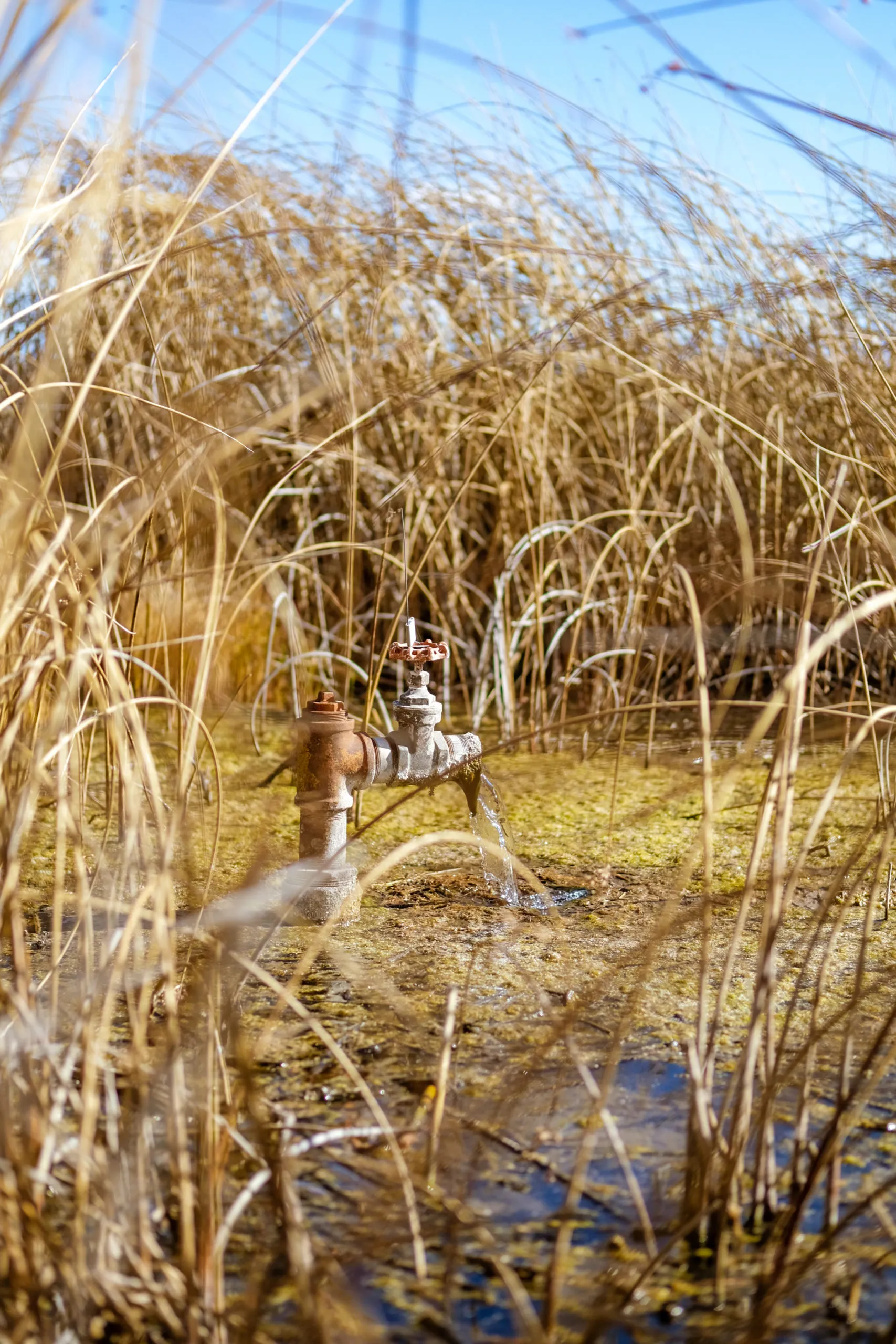
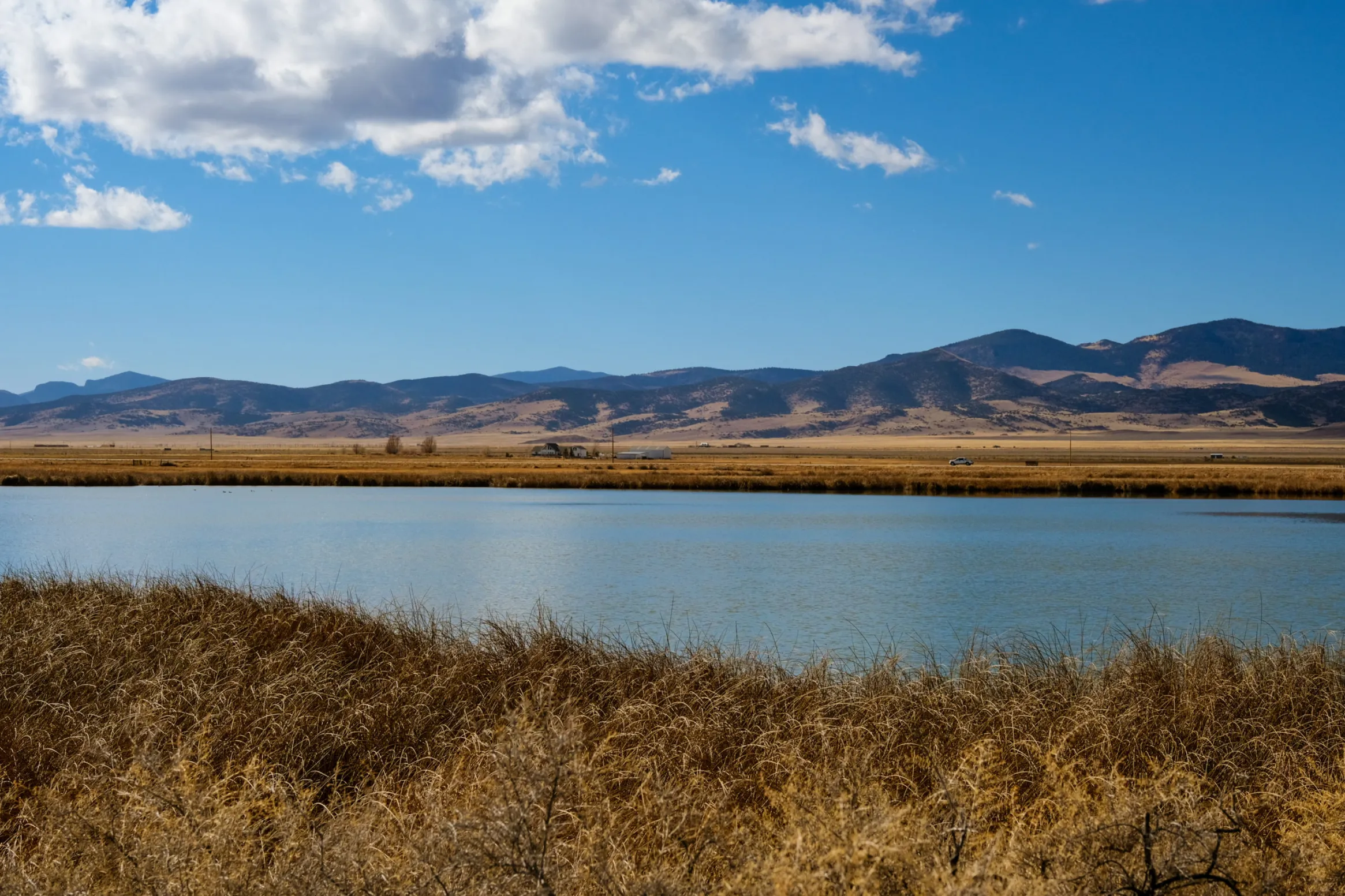
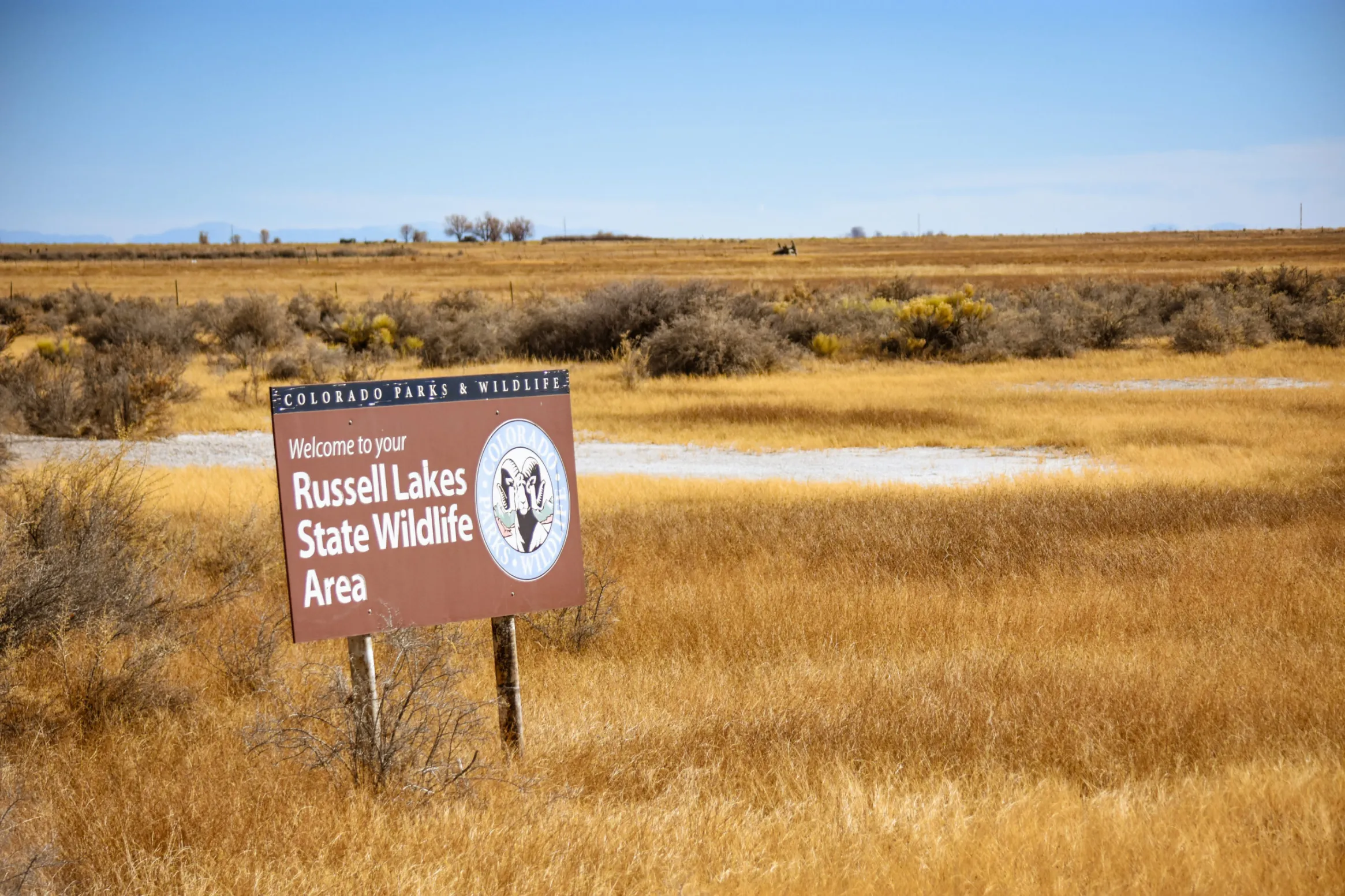
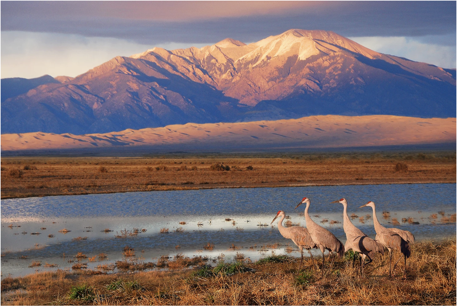
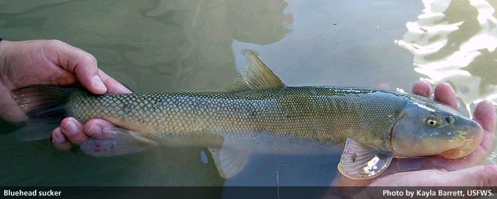
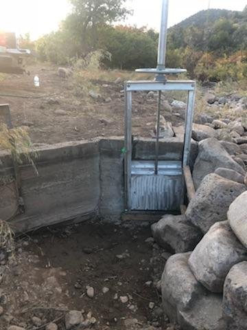
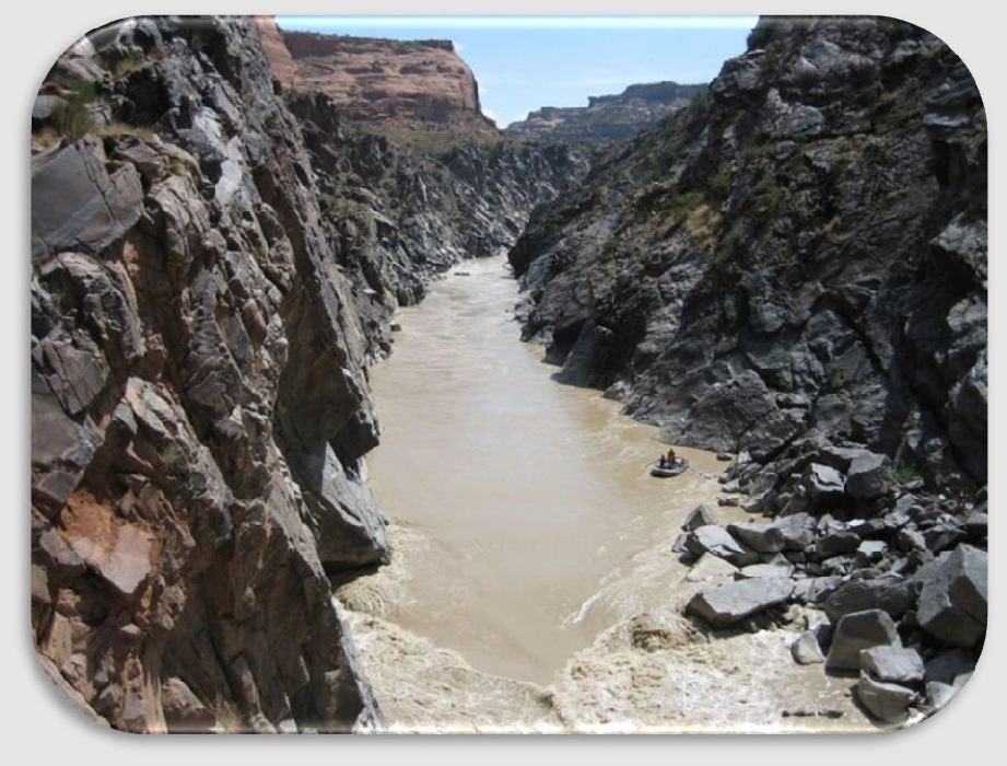
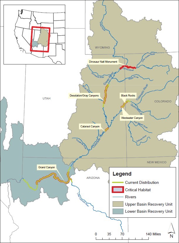
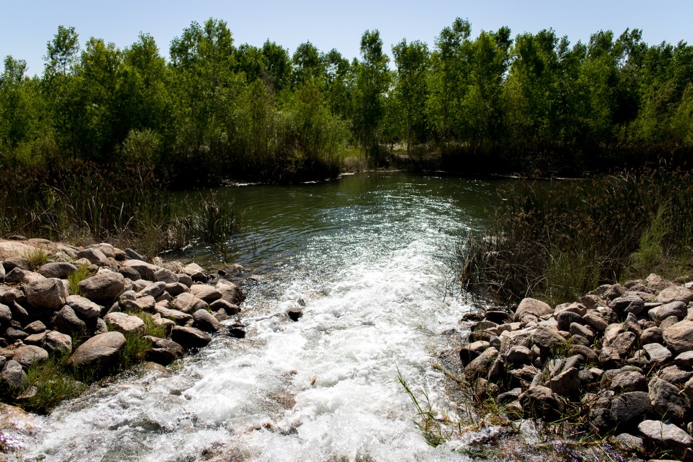
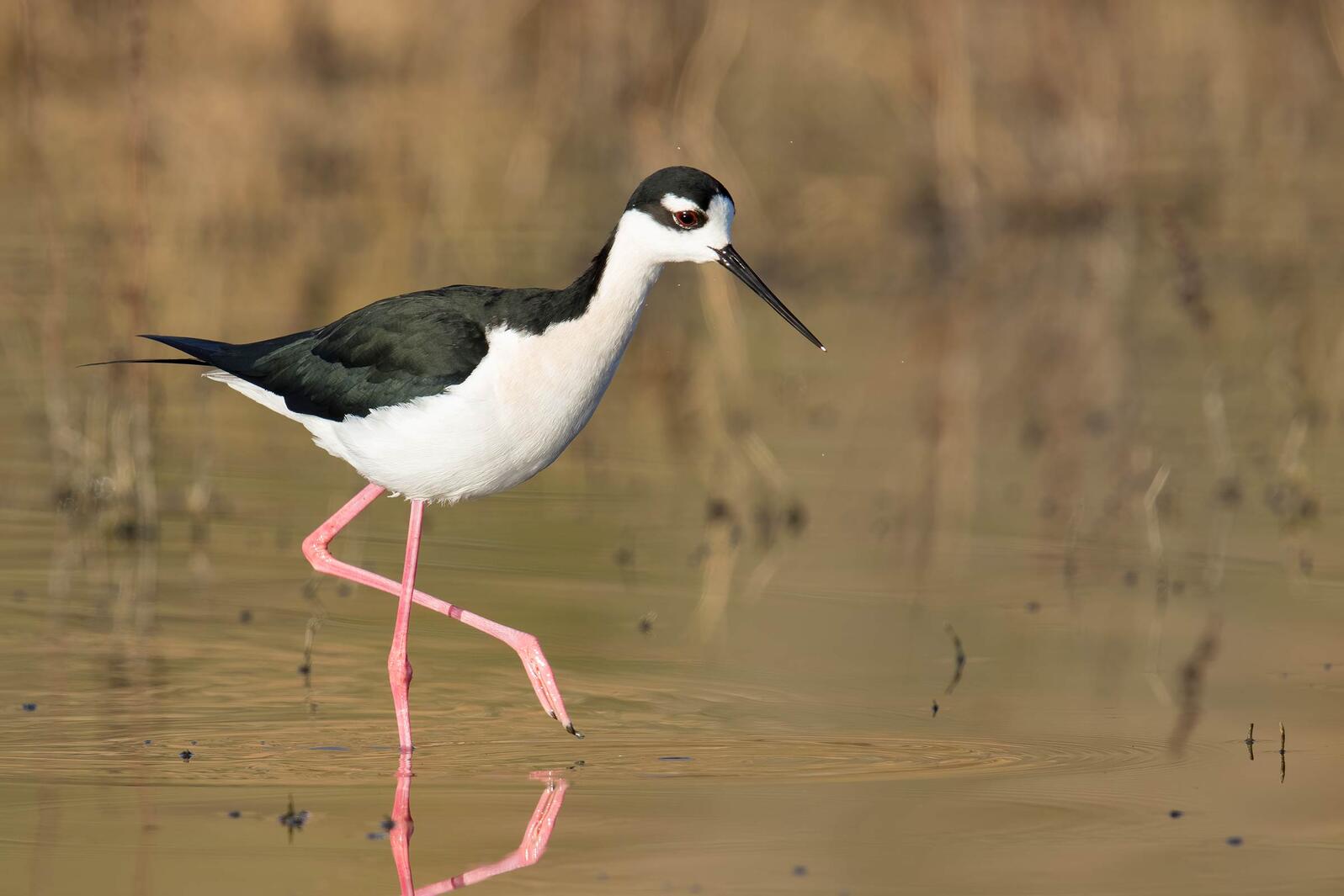
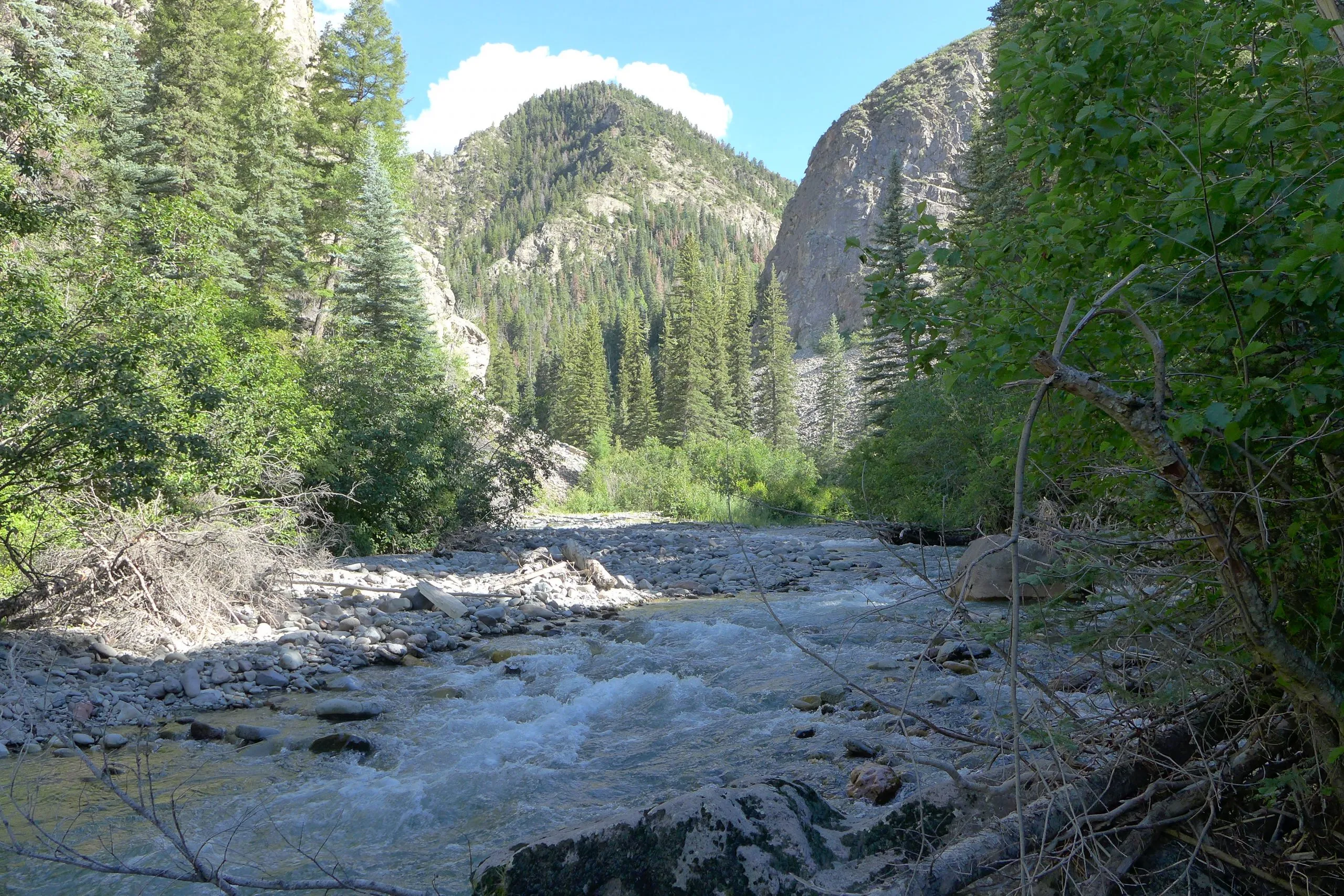
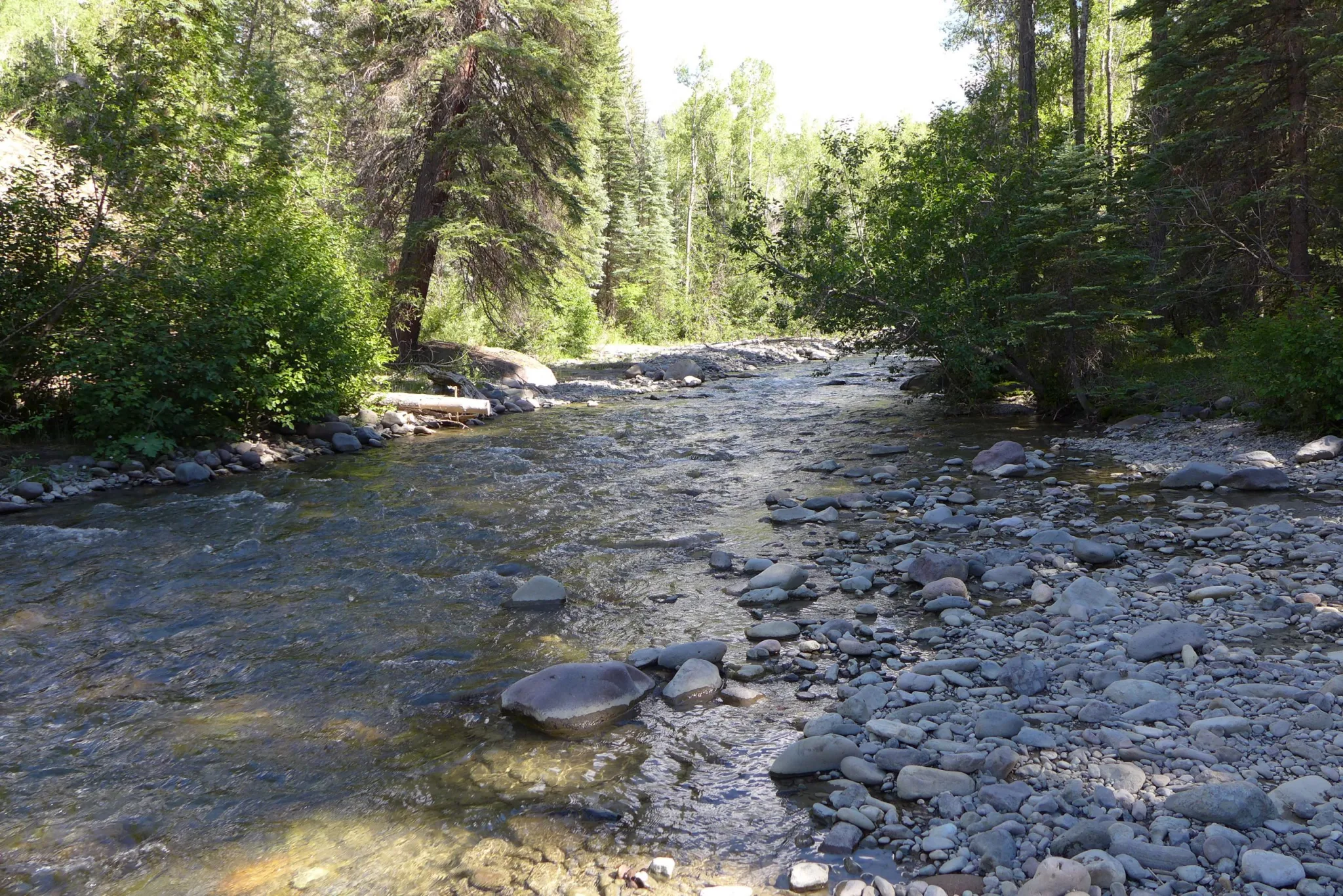
Side channels were excavated by the Bureau of Reclamation along the Rio Grande where it passes through the Rhodes’ property to provide habitat for the endangered silvery minnow. (Dustin Armstrong/U.S. Bureau Of Reclamation)
Click the link to read the article on the Associated Press website (Susan Montoya Bryan). Here’s an excerpt:
Triple digit temperatures and a fickle monsoon season have combined with decades of persistent drought to put one of North America’s longest rivers in its most precarious situation yet. Islands of sand and gravel and patches of cracked mud are taking over where the Rio Grande once flowed. It’s a scene not unlike other hot, dry spots around the western U.S. where rivers and reservoirs have been shrinking due to climate change and continued demand.
Local and federal water managers on Thursday warned that more stretches of the beleaguered Rio Grande will be drying up in the coming days in the Albuquerque area, leaving endangered silvery minnows stranded in whatever puddles remain.
The threat of having the river dry this far north has been present the last few summers due to ongoing drought, officials with the Bureau of Reclamation and one of the largest irrigation districts on the river said. But, this could be the year that residents in New Mexico’s most populated region get to witness the effects of climate change on a grander scale. It’s not uncommon to have parts of the Rio Grande go dry in its more southern reaches, but not in Albuquerque. Like a monument, the river courses through the city, flanked by a forest of cottonwood and willow trees. It’s one of the few ribbons of green to cut through the arid state, providing water for crops and communities.
“This is almost the sole source of water in the central part of New Mexico and we’re not trying to save it just for the fish,” said Andy Dean, a federal biologist. “It’s our job as the Fish and Wildlife Service to prevent the extinction of this animal, but this water is also for everybody in the valley. We’re trying to save it for everybody and if the fish is that piece that helps us do that, then that’s what we have to use.”
The Bureau of Reclamation will be releasing what little supplemental water it has left in upstream reservoirs along the Rio Grande. Over the last 20 years, the agency has leased about 700,000 acre-feet — or 228 billion gallons — of water to supplement flows through the middle Rio Grande for endangered and threatened species.
Hi, y’all, help bear witness to the Rio Grande right now. Wherever you are in NM, snap a few pictures, tell me where you are, & what you see. Avenida Cesar Chavez Bridge, Abq. Seeing swallows, chats, snowy egret. (+ irrigation canal) #nmwater#riograndenmpic.twitter.com/GTlqNz0Jpp
District calls on Front Range diverters to assist in prevention of further fish kills, economic impairment.
Low flows and high water temperatures are creating critical conditions on the Upper Colorado for the second consecutive year, triggering fishing closures amidst reports of struggling and dying fish. Anticipating these conditions, the Colorado River District chose to release water from an already-reduced Wolford Mountain Reservoir last weekend. This voluntary release generated approximately 200 acre-feet of water to protect the health of the river – and by extension, local economies and downstream water users. District staff, however, says further action is needed.
“Our constituents are seeing fish floating by belly-up and struggling to survive current hot temperatures,” said Brendon Langenhuizen, the River District’s Director of Technical Advocacy. “We’ve also received reports of dead fish along the riverbanks. Since the beginning of July, these new-normal conditions are having major impacts on the Upper Colorado River ecosystem. Colorado Parks & Wildlife’s fishing closures are symptomatic of a larger issue that needs the attention of all water users. Our District has and will continue to do our part with voluntary releases when water is available from our limited resources at Wolford Mountain Reservoir.”
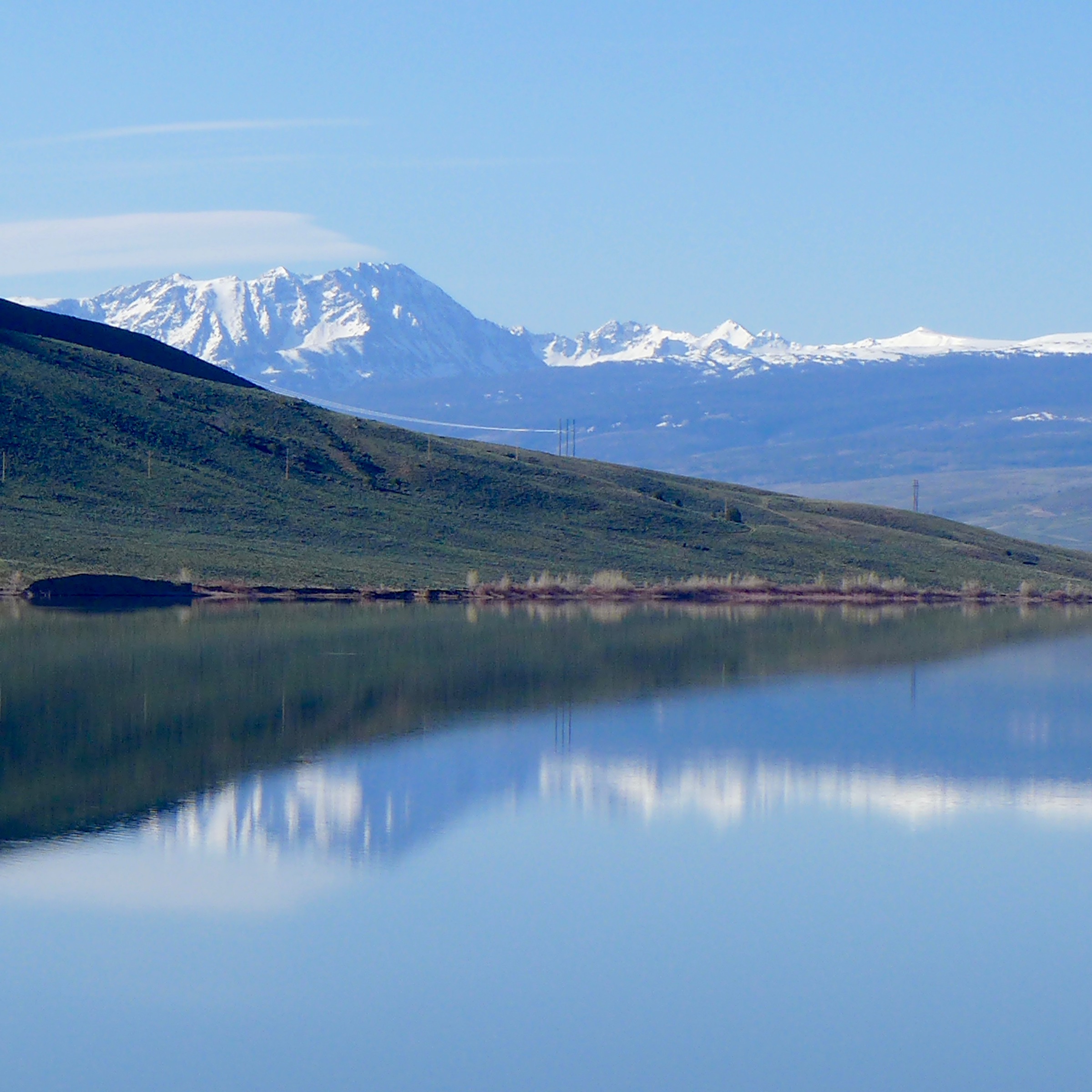
Wolford Mountain Reserovir, and the Gore Range. Photo: Brent Gardner-Smith/Aspen Journalism
Recent monsoonal rains are bringing some relief, but soil moisture issues and hot, dry conditions forecasted for early next week have prompted a need for direct action. In response, the River District began releasing an additional 50 cubic feet-per-second (cfs) Friday morning, July 15, and will continue through Sunday, July 17, providing another 300 acre-feet of water for the river by Monday morning. Limited West Slope water supplies will inhibit the River District’s ability to fully address temperature and flow issues, however.
“We can’t fix this situation alone,” Langenhuizen stated. “Our constituents are asking for help to address the river’s unhealthy conditions causing fish kills. They’re wondering why large Front Range providers are not reducing their transmountain diversions to join the River District in aiding Colorado’s namesake river and the livelihoods it supports.”
The River District urges these water providers to act in partnership with West Slope water users to protect the health of the Upper Colorado River.
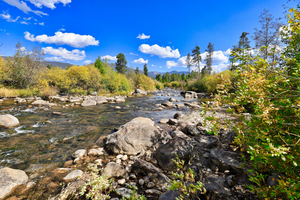
Colorado River just after crossing under highway 34. Photo credit: Colorado River District
My family has been raising cattle in the Southwest for almost 50 years, and last year we experienced a first – producers in our valley did not receive any supplemental irrigation water from the reservoir. Agricultural producers in the river valleys and winding canyons of the Southwest are feeling the impacts of climate change. Temperatures are rising, snowpack is decreasing, runoff is occurring earlier in the year, and it’s becoming drier. As climate change continues to impact the Southwest, understanding how these environmental changes impact us will help farmers and ranchers like myself adjust our land management practices to remain resilient to drought and climate change.
Ecosystems Adapt & So Can We!
Areas that receive low amounts of rainfall are especially susceptible to changes in the environment. The plants and animals that live in dry areas are specialized to this unique landscape, and as the world around them changes, they must adapt or face extinction. Fortunately, healthy ecosystems respond to change, and so can we. The key to responding is diversity. Biodiversity is what gives species the genetic advantage they need to adapt to changing environments. The environment is changing, and just as genetic diversity allows for change, farmers and ranchers can proactively use innovative, versatile strategies to respond and help their enterprises survive.
Healthy Livestock Make Happy, Profitable Ranchers
Ensuring livestock remain healthy is the top priority for those who raise animals. Managed grazing that supports healthy soils and robust forage is a must. Lack of water affects the nutritional content and digestibility of forage. This leads to animals – and ranchers – becoming stressed. Adjusting stocking rates and pasture rotation are a few strategies recommended by the USDA Southwest Climate Hub that can help support the health of your pastures, which in turn supports the health of your animals.
Increased temperatures aren’t just uncomfortable; livestock consume more water when it is hot, making stock water especially important when water is scarce. Warmer temperatures also directly impact the health of our livestock, which in turn reduces profits. Providing access to pastures with trees or shade structures where livestock can get out of the sun is just as important as providing access to water.
It’s No Surprise That Plants Need Water
Photo courtesy of Sensa Wolcott
When water is limited, our fields produce less hay, forage and produce, making it challenging to grow what we need to be successful. Changing temperature will affect which crops thrive in particular areas. The Colorado State University Extension office provides many helpful strategies for how we can tackle these challenges. Prepare to make adjustments to the specific plants that you cultivate. Try planting crop varieties that require less water to thrive and research how specific crops use water. Rotate crops in a way that better promotes growth and productivity during drought and incorporate strategies that slow down water and increase infiltration, such as installing contour swales in fields.
Changes in temperature and precipitation patterns will impact the harvest timing of hay and produce and increase the likelihood of weeds popping up. Be prepared for changes in when you typically harvest and focus on increasing biodiversity by planting a mixture of different types of plants in a hayfield or pasture. Variety provides resilience as well as defense against invasive species, which are less likely to move into healthy, drought-resilient pastures and hayfields.
Healthy Watersheds Support Us All
Wetland. Photo courtesy of Sensa Wolcott
Water is critical to life in Colorado because it supports the biodiversity and health of the entire watershed, including the animals and plants so important to farmers and ranchers. Improving irrigation efficiency and upgrading diversion structures can help us adapt to rising temperatures that cause snow to melt and runoff earlier in the year. Early runoff means there is less water later in the season, when animals, plants, and irrigators all need water. Practicing irrigation strategies that encourage keeping rivers wet and implementing practices that increase groundwater storage support healthy waterways and support the needs of farmers and ranchers.
Riparian area management techniques like those mentioned in this article from Agri-Food Canada can benefit producers and the ecosystem. Try fencing livestock out of parts of the riparian corridor to support healthy riparian ecosystems. Livestock can cause erosion and water quality concerns – but well-planned access points that provide livestock with access to crucial drinking water can support both a healthy herd and a thriving waterway.
Farmers and ranchers want to see water in the river – the longer the better – which also supports the health and well-being of the aquatic ecosystem. Protecting our riparian areas is imperative; when our riparian corridors are healthy and thriving, so are we.
We Have a Choice
The future of agriculture is tied tightly to the future of our waters. Healthy ecosystems that have a variety of plants and animals are vital. Choosing innovative management strategies enables us to be good stewards of the natural world while also improving our farms and ranches so that we all can remain resilient in the face of drought and a changing climate.
Sensa Wolcottt.
Sensa Wolcott works as the Watershed Coordinator for the Mancos Conservation District. She is pursuing her Masters in Biology through Miami University’s Project Dragonfly, where her work focuses on community-based conservation and connecting people with the land through dialogue and collaboration. Sensa and her family live on their family owned and operated cattle ranch and enjoys hiking, camping, mountain biking, and photography.
Mancos and the Mesa Verde area from the La Plata Mountains.
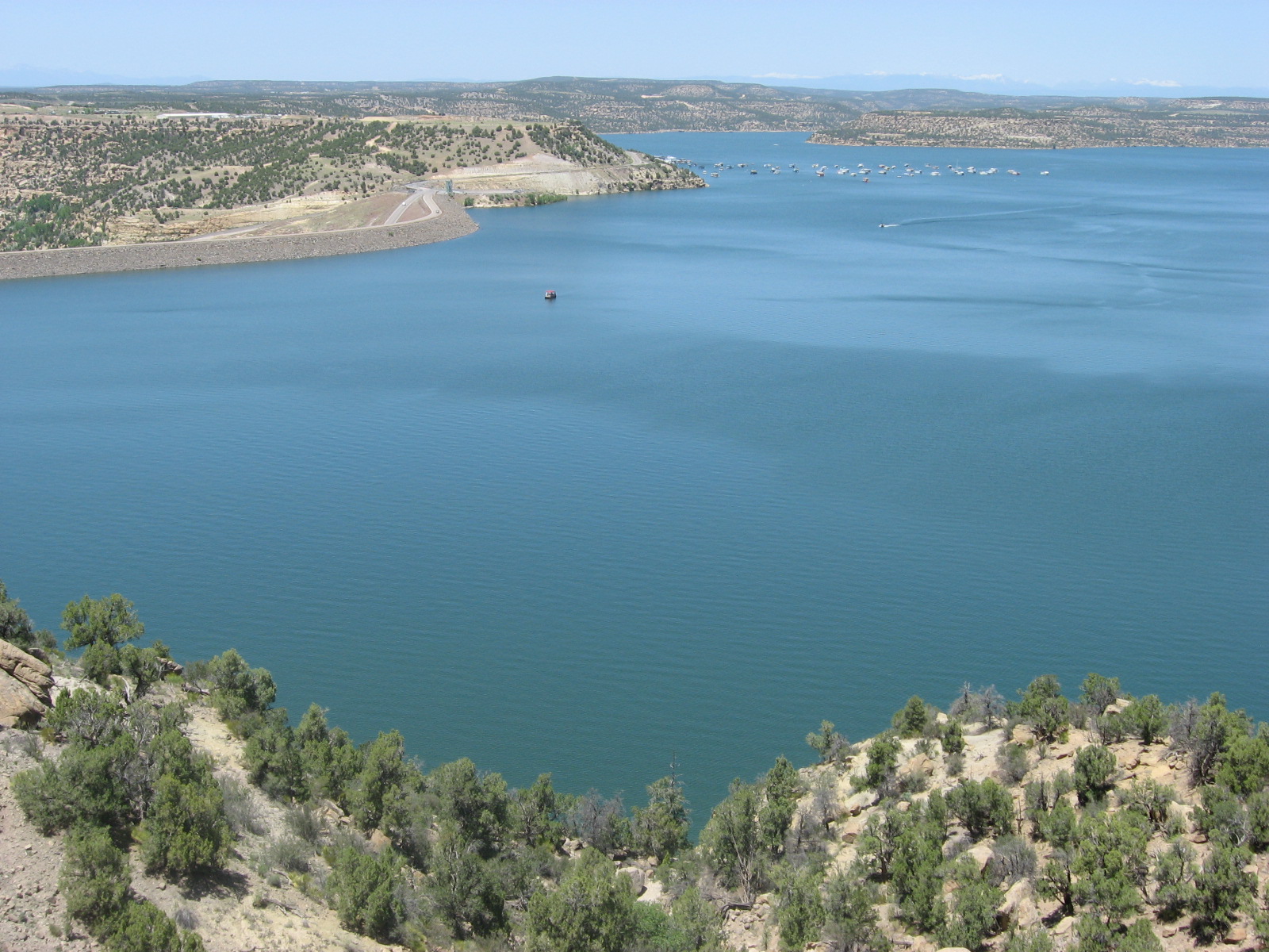
Navajo Reservoir, New Mexico, back in the day.. View looking north toward marina. The Navajo Dam can be seen on the left of the image. By Timthefinn at English Wikipedia – Transferred from en.wikipedia to Commons., Public Domain, https://commons.wikimedia.org/w/index.php?curid=4040102
From email from Reclamation (Susan Novak Behery):
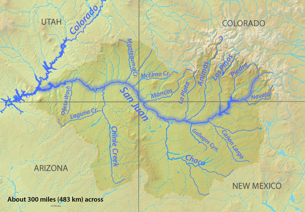
In response to low flows in the critical habitat reach and increased irrigation, the Bureau of Reclamation has scheduled an increase in the release from Navajo Dam from 500 cubic feet per second (cfs) to 700 cfs for today, Wednesday, July 13th at 12:00 PM, and additional increase from 700 cfs to 800 cfs at 2:00 PM.
Releases are made for the authorized purposes of the Navajo Unit, and to attempt to maintain a target base flow through the endangered fish critical habitat reach of the San Juan River (Farmington to Lake Powell). The San Juan River Basin Recovery Implementation Program recommends a target base flow of between 500 cfs and 1,000 cfs through the critical habitat area. The target base flow is calculated as the weekly average of gaged flows throughout the critical habitat area from Farmington to Lake Powell.
The Colorado River from Navajo Bridge below Lee’s Ferry and Glen Canyon Dam. The proposed Marble Canyon Dam would have been just downstream from here. Jonathan P. Thompson photo.
Click the link to read the article on the Associated Press website (Brittany Petersen). Here’s an excerpt:
For National Park Service fisheries biologist Jeff Arnold, it was a moment he’d been dreading. Bare-legged in sandals, he was pulling in a net in a shallow backwater of the lower Colorado River last week, when he spotted three young fish that didn’t belong there. “Give me a call when you get this!” he messaged a colleague, snapping photos.
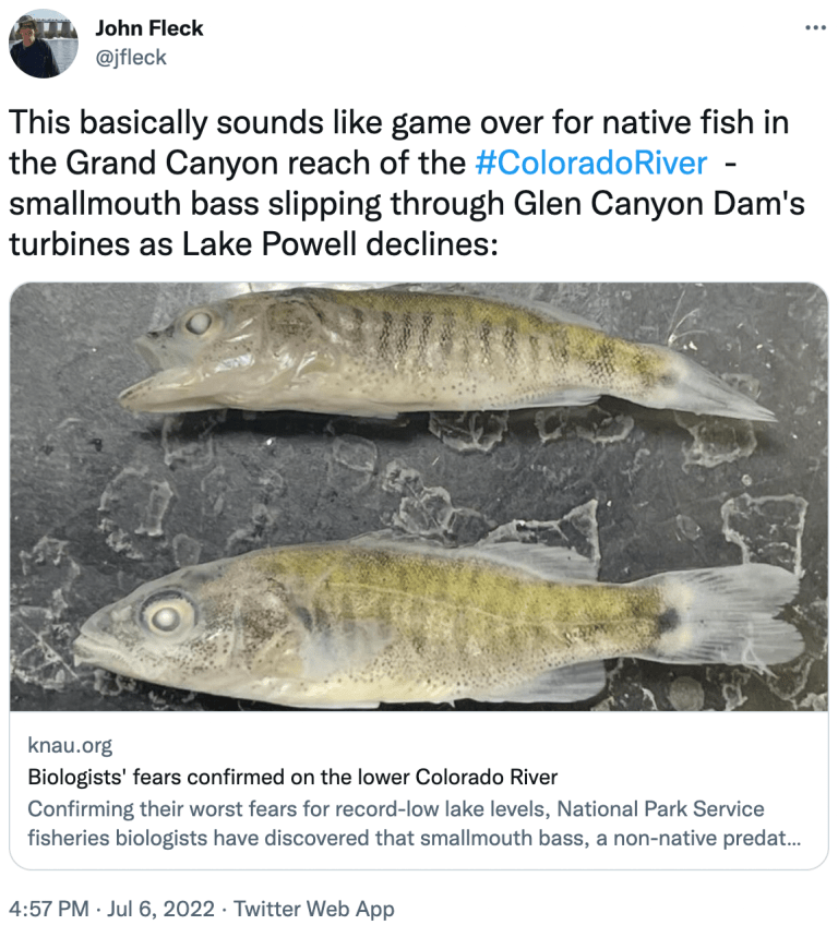
Minutes later, the park service confirmed their worst fear: smallmouth bass had in fact been found and were likely reproducing in the Colorado River below Glen Canyon Dam.
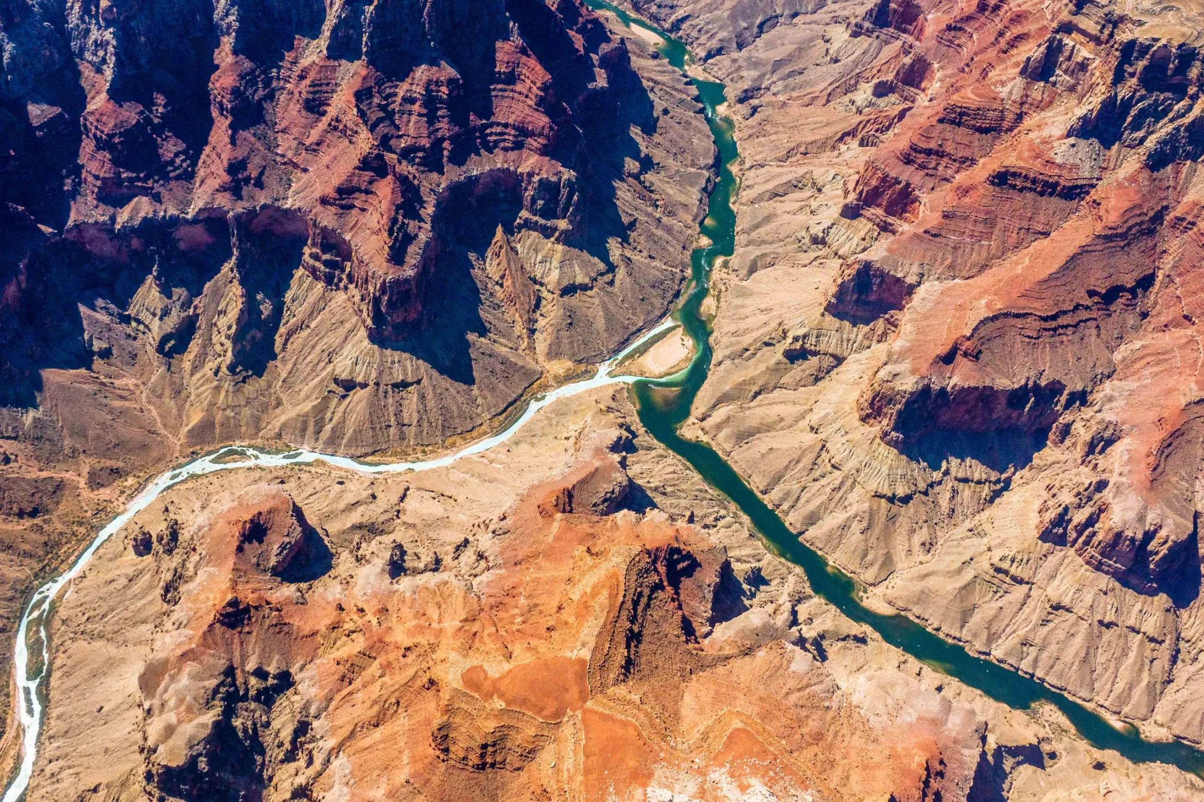
The confluence of the Colorado and Little Colorado rivers in the Grand Canyon, shown here in a September 2020 aerial photo from Ecoflight, represents an area where the humpback chub has rebounded in the last decade. That progress is now threatened by declining water levels in Lake Powell, which could lead to non-native smallmouth bass becoming established in the canyon. CREDIT: JANE PARGITER/ECOFLIGHT
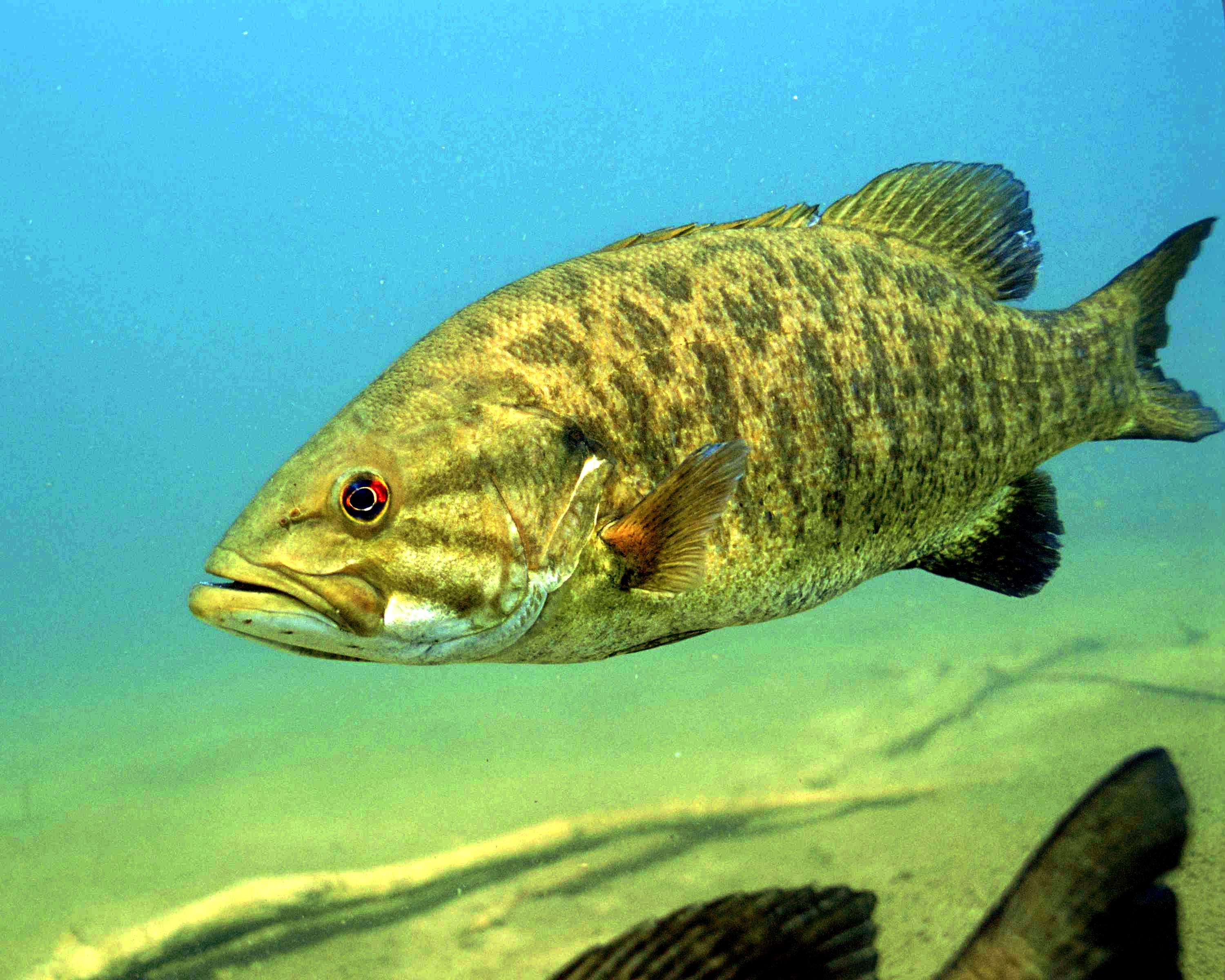
They may be a beloved sport fish, but smallmouth bass feast on humpback chub, an ancient, threatened fish that’s native to the river, and that biologists like Arnold have been working hard to recover. The predators wreaked havoc in the upper river, but were held at bay in Lake Powell where Glen Canyon Dam has served as a barrier for years — until now. The reservoir’s recent sharp decline is enabling these introduced fish to get past the dam and closer to where the biggest groups of chub remain, farther downstream in the Grand Canyon.
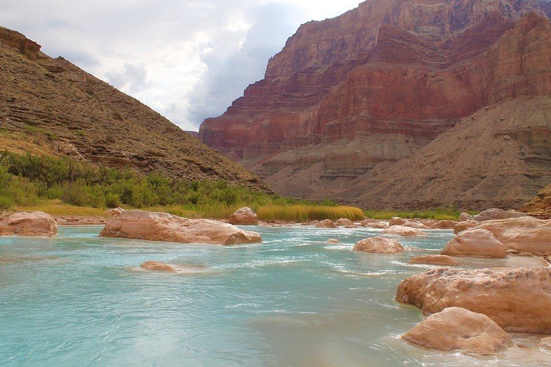
The Little Colorado River is best known for its milky blue waters that flow into the mainstem Colorado River in the Grand Canyon. These waters carry so much life-giving significance. For millennia, they have provided physical and spiritual sustenance for Indigenous peoples and supported plants, wildlife, communities, and more.
Grand Falls Little Colorado River, Spring of 2010.
But the Little Colorado River is not always blue. Sometimes it runs as thick and brown as chocolate milk. With a little knowledge of the river’s annual peaks and lows and an eye on the weather gauge, you can predict whether it will be brown or that remarkable turquoise blue.
So why and when is the Little Colorado River so blue?
Confluence of the Little Colorado River and the Colorado River. Climate change is affecting western streams by diminishing snowpack and accelerating evaporation. The Colorado River’s flows and reservoirs are being impacted by climate change, and environmental groups are concerned about the status of the native fish in the river. Photo credit: DMY at Hebrew Wikipedia [Public domain]
The source of its milky blue waters
The Little Colorado River gets its blue color from dissolved calcium carbonate in the water. This mineral is found in chalk, antacids, eggshells, dark green vegetables, rocks, and more. In the Little Colorado River, calcium carbonate forms a type of limestone called travertine that creates white, pillowy deposits along the riverbed. Most of the turquoise-blue water in the Little Colorado River comes from springs 10 to 13 miles upstream of the confluence. Thanks to these groundwater-fed springs, the last 13 miles of the Little Colorado River flow year-round at an average rate of 220 cubic feet per second (cfs) until joining the mighty Colorado River, which has an average flow between 8,000 and 25,000 cfs!
The Little Colorado River’s year-round flows are important for the region’s largest population of humpback chub. The warm, cloudy waters make excellent habitat for this threatened fish species.
Little Colorado River. Photo credit: Sinjin Eberle via American Rivers
Other colors of the Little Colorado River
When the Little Colorado River begins its journey from its headwaters in the White Mountains, its waters are not yet blue. The clear mountain stream flows north into the desert lands below, picking up sediment, minerals, and debris along the way. But less than 20 miles from its source, the Little Colorado River dries up. And for the next 300 miles, the river relies on precipitation to send water downstream. Modern-day water use is a major culprit of this dry stretch of the Little Colorado River. Year-round flows return near Blue Spring, 13 miles upstream of the confluence.
During two high runoff periods each year — in the spring from snowmelt and in the late summer from monsoon rains — the Little Colorado River runs red. During these periods, from February to April and July to September, the Little Colorado River may spike to 18,000 cfs. At this runoff level, the water can be so thick and muddy that placing your hand just an inch below the surface of the water makes it invisible to the naked eye.
The cultural significance of the Little Colorado River’s blue waters
The Little Colorado River’s blue waters have been of deep cultural significance to Native peoples since time immemorial. At least 10 tribes have traditional connections to what Zuni people refer to as “the umbilical cord” of the world. For Hopi people, the Little Colorado River is the home of their emergence story, and its waters, springs, and salt remain important to this day. Adjacent Diné (Navajo) communities, whose land may be affected by proposed dam development, are considering a sacred site designation for the area to prevent development threats like the former Escalade tram proposal.
But to truly understand the importance of the Little Colorado River, I suggest you go directly to the source. Visit the Lifeways of the Little Colorado River collection to hear 11 Native voices share their personal and cultural ties to this life-sustaining river.
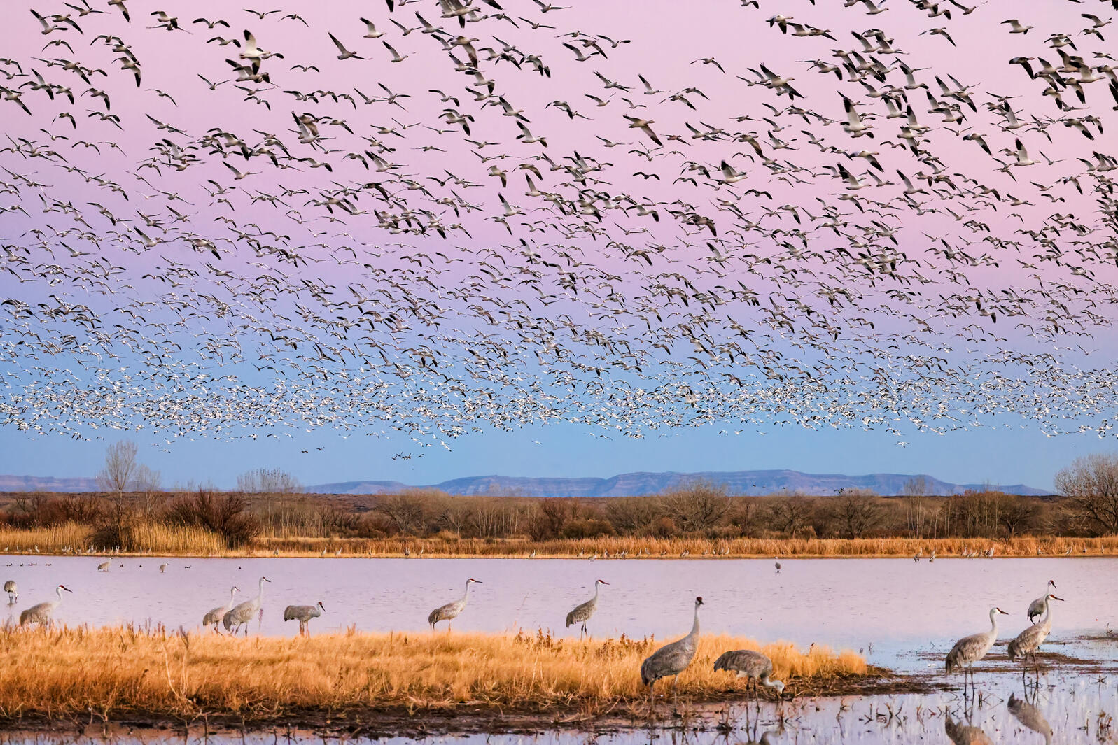
Sandhill Cranes and Snow Geese. Photo: Marti Phillips/Audubon Photography Awards
Click the link to read the article on the Audubon website (Karyn Stockdale):
News headlines in mid-June captured what Audubon’s Western Water team knows well: the Colorado River Basin and Great Salt Lake are in trouble—both facing historically unprecedented risks. Both may be headed towards ecological disasters, years in the making, the result of a pernicious combination of climate change aridifying the region and water management that does not adequately prioritize the environment. In the Colorado River Basin and at Great Salt Lake, warming temperatures and declining river flows threaten people and nature. And, we know there’s significant quality wildlife and bird habitat still worthy of attention and investments.
Birds tell us that water-dependent habitats across the arid West are essential oases and they are in decline. The water issues created by a century of law and infrastructure development are magnified by today’s climate crisis. For over 100 years, we’ve operated under a legal framework in the West where water has been “developed” without consideration for the Indigenous communities that have been on the land since time immemorial, and at the expense of the environment, sometimes draining the last drops of water that supported habitats. Across the West, water stress is evident—and people and birds will feel its effects. Audubon is working on some solutions (make sure you keep up with our ongoing posts), but for now, let me paint a picture of how dire the situation is.
News headlines in mid-June captured what Audubon’s Western Water team knows well: the Colorado River Basin and Great Salt Lake are in trouble—both facing historically unprecedented risks. Both may be headed towards ecological disasters, years in the making, the result of a pernicious combination of climate change aridifying the region and water management that does not adequately prioritize the environment. In the Colorado River Basin and at Great Salt Lake, warming temperatures and declining river flows threaten people and nature. And, we know there’s significant quality wildlife and bird habitat still worthy of attention and investments.
Birds tell us that water-dependent habitats across the arid West are essential oases and they are in decline. The water issues created by a century of law and infrastructure development are magnified by today’s climate crisis. For over 100 years, we’ve operated under a legal framework in the West where water has been “developed” without consideration for the Indigenous communities that have been on the land since time immemorial, and at the expense of the environment, sometimes draining the last drops of water that supported habitats. Across the West, water stress is evident—and people and birds will feel its effects. Audubon is working on some solutions (make sure you keep up with our ongoing posts), but for now, let me paint a picture of how dire the situation is.
With Great Salt Lake reaching its lowest ever recorded water levels, ongoing drought and increasing development pressures diverting the water flowing down rivers to the lake, a drying Great Salt Lake threatens the health of Salt Lake City residents, the future of key Utah industries, and the survival of millions of migratory shorebirds, waterfowl, and other wildlife. We are currently in uncharted territory as we test thresholds of water levels and this could have cascading effects that would ripple throughout the ecosystem. Although Auduboners tend to focus on the birds and ecology (where else in the West does one find FIVE globally Important Bird Areas at one location?), Great Salt Lake generates enormous impact for Utah and the region with $1.56 billion annually in economic contributions through mineral, aquaculture, and ski industries, and other recreation activities. The potential economic cost of the drying Great Salt Lake could reach $25.4 billion to $32.6 billion over 20 years, according to a 2019 report from the Great Salt Lake Advisory Council. Much like the Salton Sea in California – another giant salt lake—which is already experiencing severe air quality issues from the exposed dry lakebed, the public health and quality of life for communities around Great Salt Lake are at risk from increased dust from larger areas of exposed lakebed. Increased dust on snow also has the potential to compound the timing of snowmelt and thus water availability.
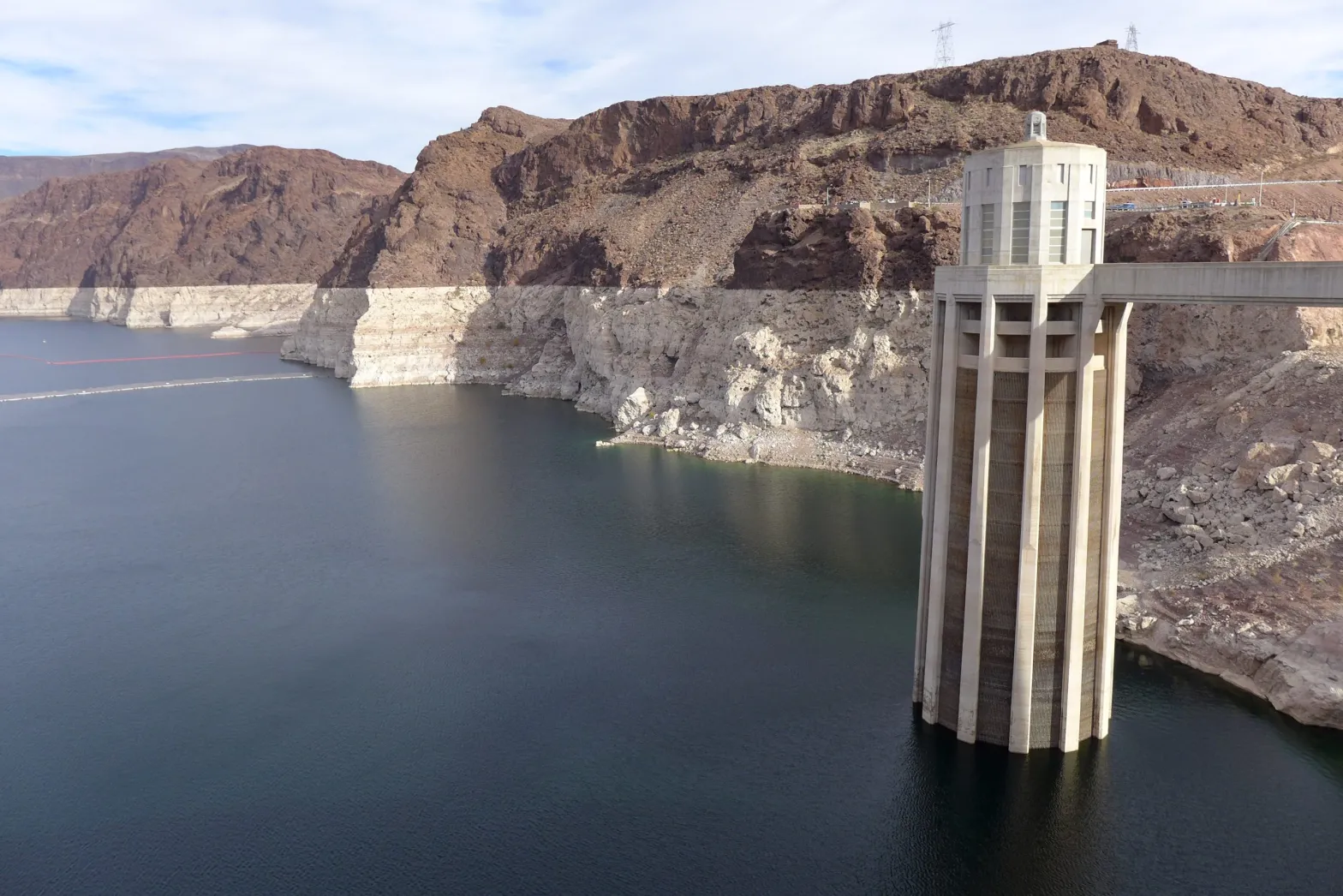
This photo from December 2021 shows one of the intake towers at Hoover Dam. Federal officials said basin states must conserve 2 to 4 million acre-feet to protect reservoir levels in 2023. CREDIT: HEATHER SACKETT/ASPEN JOURNALISM
Glen Canyon Dam creates water storage on the Colorado River in Lake Powell, which is just 27% full in June 2022. Bureau data on the reservoir’s water-storage volume showed a loss of 443,000 acre-feet. Credit: U.S. Bureau of Reclamation
Even more stunning is the realization that the Colorado River’s major reservoirs—water supply for some 40 million people—are on life support. The federal U.S. Bureau of Reclamation in March took the unprecedented step of claiming a human health and safety emergency to justify reducing the water it releases from one of those reservoirs. At a U.S. Senate hearing in mid-June, Reclamation Commissioner Touton stated that net Colorado River water uses must be reduced in the next year by 2-4 million acre-feet, a staggering volume that amounts to about 30 percent of average consumptive use.
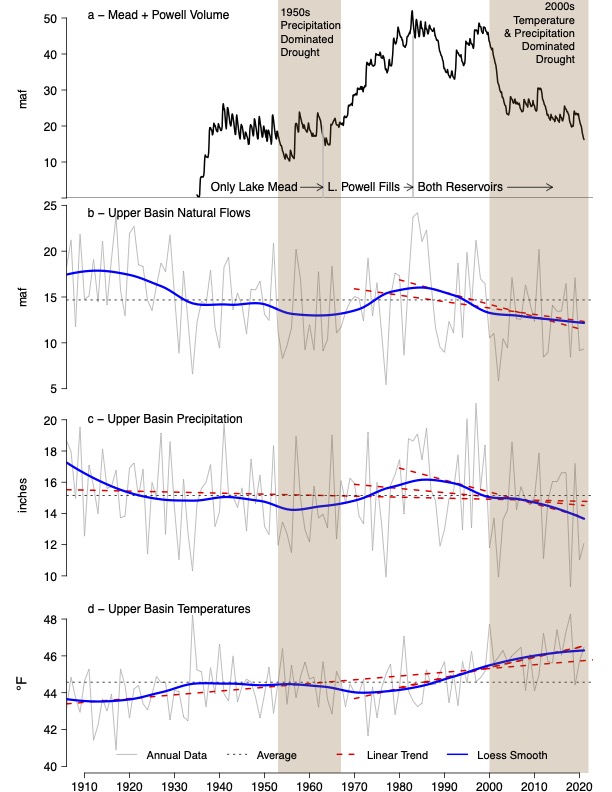
Brad Udall: Here’s the latest version of my 4-Panel plot thru Water Year (Oct-Sep) of 2021 of the Colorado River big reservoirs, natural flows, precipitation, and temperature. Data (PRISM) goes back or 1906 (or 1935 for reservoirs.) This updates previous work with @GreatLakesPeck.
Our water supplies across the dry West are in severe crisis because of historic over-development, compounded today by climate change. Warming temperatures are creating “hot droughts” that deplete flows in rivers, the flows that people and nature depend on. Today there is no longer enough water to supply all of the demands. Colorado River flows in the first two decades of the 21st century are 20 percent lower than flows in the last century. In years when we see “average” snowpack levels in the mountains, river flows are low: last year in the Colorado River’s headwater mountains, a 91 percent snowpack yielded only a 55 percent flow. That discrepancy demonstrates an impact of climate change between the mountain tops and the valley bottoms. Snowmelt isn’t reaching the rivers in the same way; warmer temperatures drive evaporation, turning the soils into thirsty sponges.
At the recent Colorado River-focused Getches-Wilkinson Center’s Colorado Law Conference aptly named “Hard Conversations About Really Complicated Issues,” Reclamation’s Jim Prairie shared the numbers behind the problem. The volume of water flowing into the Colorado River’s largest reservoirs—Lakes Powell and Mead—has declined, while uses have not. Over the past 20 years, this imbalance has resulted in a 40 million acre-foot decline in Colorado River reservoir storage – a volume that exceeds by a factor of three the Colorado River’s annual average flow. With so little water remaining in the reservoirs, the risks – including infrastructure failure, inability to deliver water to major population centers, and even the risk of no water flowing in the Grand Canyon – are untenable. Moreover, while Reclamation’s call for additional water conservation in the coming year should prevent things from getting worse in 2023, it is not projected to address recovery of the reservoirs, and is not expected to solve the problem beyond 2023 unless those enormous volumes of water can be conserved year after year.
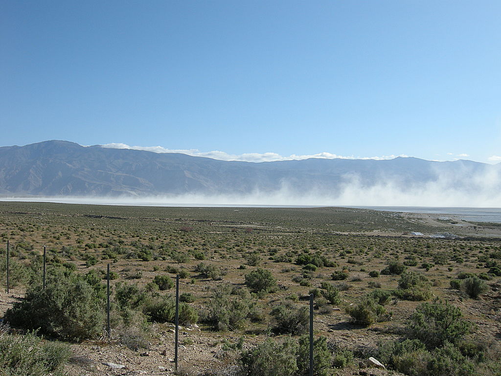
Blowing Alkali Dust at Owens Lake, California. Photo credit: Eeekster (Richard Ellis) via Wikimedia
Stakes are high, and mitigation will be costly. We learned that lesson at Owens Lake in California, where the costs to remediate the lake’s historic drying after Los Angeles diverted 100 percent of its water continue to grow. In order to address extreme dust pollution and loss of migratory bird habitat, the Los Angeles Department of Water and Power invested hundreds of millions of dollars to “rebuild” the ecosystem with pumping and piping of water, infrastructure and many dust control methods – resulting in annual maintenance costs estimated at $17 million. And the costs of restoring a small portion of flows and habitat in the once-vast Colorado River Delta underscore how much more expensive it is to try and fix rivers and lakes once they have been decimated.
This should be a wake-up call to everyone. This water crisis isn’t just impacting those of us who live in the West; it affects people who live in the East too. Not only did the Colorado River form beloved places like the Grand Canyon, it supports an enormous part of our American economy, and has outsized importance to wildlife and birds, with around 70 percent of all species in the region depending on the riparian corridor at some point in their life-cycle. On top of that, Great Salt Lake is essential to the world’s populations of Wilson’s Phalaropes, Eared Grebe, and American Avocet.
So what are some key takeaways that keep me up at night?
1) Today’s hydrologic cycle is vastly different than 50 years ago. Climate change is water change and climate continues to influence the hydrology in the West. And we have dry soils compounding the problem.
2) Solutions exist, but we need them to scale up. Quickly. Public funding—including the massive investments of last year’s Bipartisan Infrastructure Law—will help immensely. We must move swiftly to implement multi-benefit projects that protect our water resources. Ideas to improve the resilience of the West to declining water supplies abound. But will we respond fast enough? And don’t get me started about needed global climate change solutions to reduce carbon emissions…
3) In addition to scaling up solutions, representatives of Tribal and conservation interests need to be included in negotiations to define solutions. To leave out these voices would continue the systematic exclusion of Tribes and nature. Declining water supplies have amplified the problems created through inequitable access to water.
4) The immediacy of the situation. Although the environmental catastrophe looms large and needs immediate steps to reverse the trends—especially because nature impacts people—the risk of a catastrophic collapse of major Colorado River infrastructure is here. Soon. Federal leaders want the Colorado River Basin States to define plans in less than 60 days, noting that if the states cannot come to agreement on how to reduce water uses, the federal government will take unilateral action. Watch for Reclamation’s mid-August water forecast and announcements.
The buzz is around shared sacrifice. Politically, all sectors need to shoulder some of the burden of reducing water use. In all likelihood, despite having senior water rights, agricultural producers who rely on irrigation with Colorado River water will be required to take compensated cuts in their water use. As was pointed out at the Colorado River conference, we cannot conserve the 2-4 million acre-feet of water needed by evacuating the cities that rely on Colorado River water. Water conservation in the agricultural sector has implications for rural economies and the environment. It’s a terrible situation, and important that we are doing what we can to support rural economies and to increase investments in freshwater-dependent ecosystems.
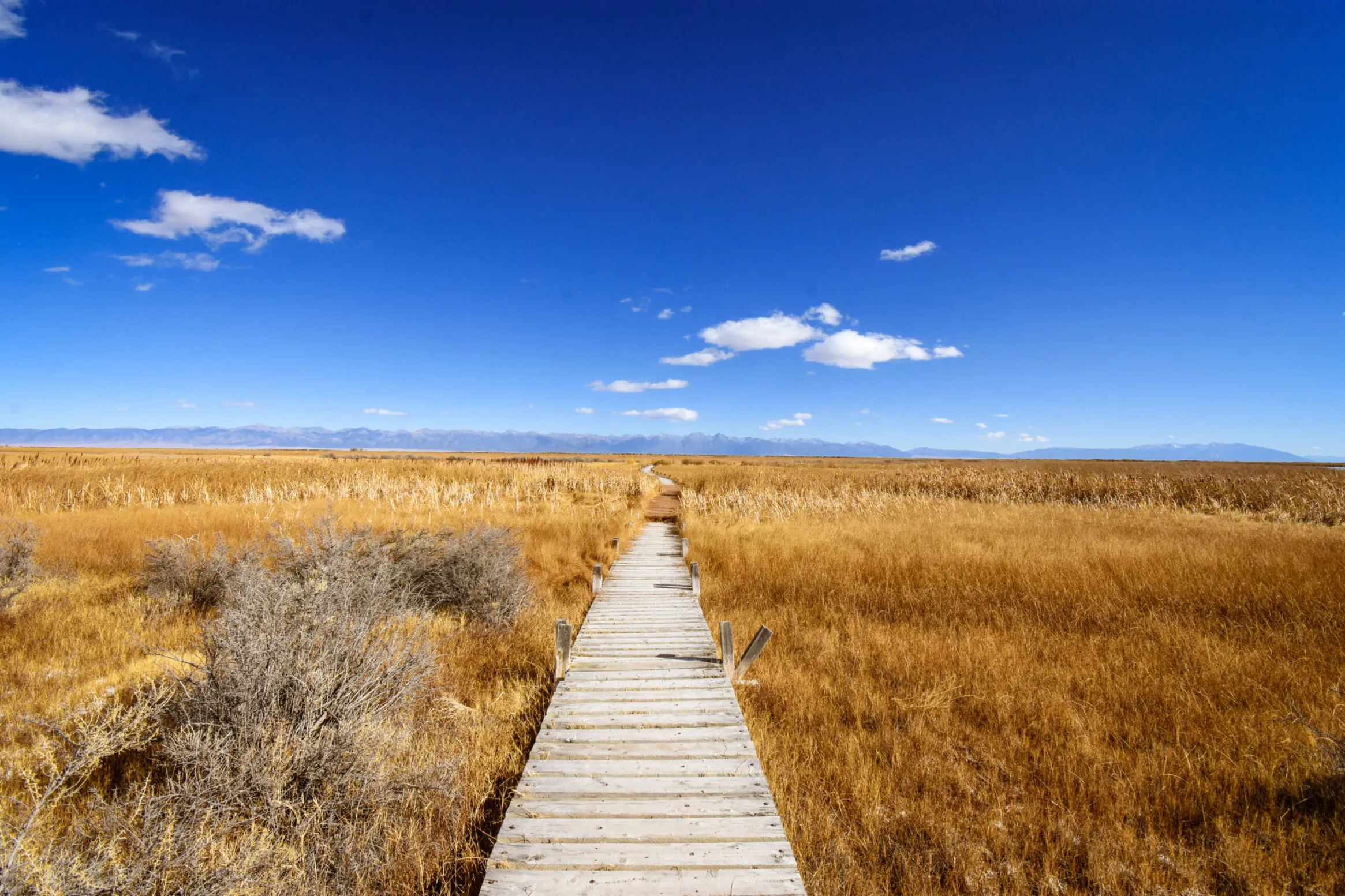
San Luis Valley wetlands. Photo credit: Ryan Michelle Scavo via The Alamosa Citizen
Water management systems in the West are breaking. As decision-makers revise the rules that shape water management systems, we need to urge them to incorporate today’s 21st century values, including equitable treatment of vulnerable communities that lack access to water, and emphasis on supporting water needs in the natural world around us. With even less water, the hard conversations on water conservation efforts should include both using less water while also ensuring water supply to all households in the Colorado River region, as well as minimum water flows to protect hydrologic connections and quality habitats as crucial steps to preserving our future in this landscape. We can’t let the water crisis allow bad projects to get approvals—they would create both short-term and long-term issues for the landscape. We’ve already lost too many wetlands and riparian habitats across the West—and birds are suffering in response. And birds tell us, we have to act on climate change and reduce carbon emissions. Because as bad as this seems, it can still get worse.
We are at a fundamental inflection point for the Colorado River and for Great Salt Lake. While this is a dire update, we need to stay focused to protect our future in the West. These immense water challenges underscore how essential Audubon’s work is to save and allocate water to these critical habitats and ecosystems. There is more to come this summer, and hopefully, we can find some breathing room to create the medium and long-term plans we need to protect water in the West.
In response to continued forecast precipitation and sufficient flows in the critical habitat reach, the Bureau of Reclamation has scheduled a decrease in the release from Navajo Dam from 500 cubic feet per second (cfs) to 400 cfs for Wednesday, June 29th, at 4:00 AM.
Releases are made for the authorized purposes of the Navajo Unit, and to attempt to maintain a target base flow through the endangered fish critical habitat reach of the San Juan River (Farmington to Lake Powell). The San Juan River Basin Recovery Implementation Program recommends a target base flow of between 500 cfs and 1,000 cfs through the critical habitat area. The target base flow is calculated as the weekly average of gaged flows throughout the critical habitat area from Farmington to Lake Powell.
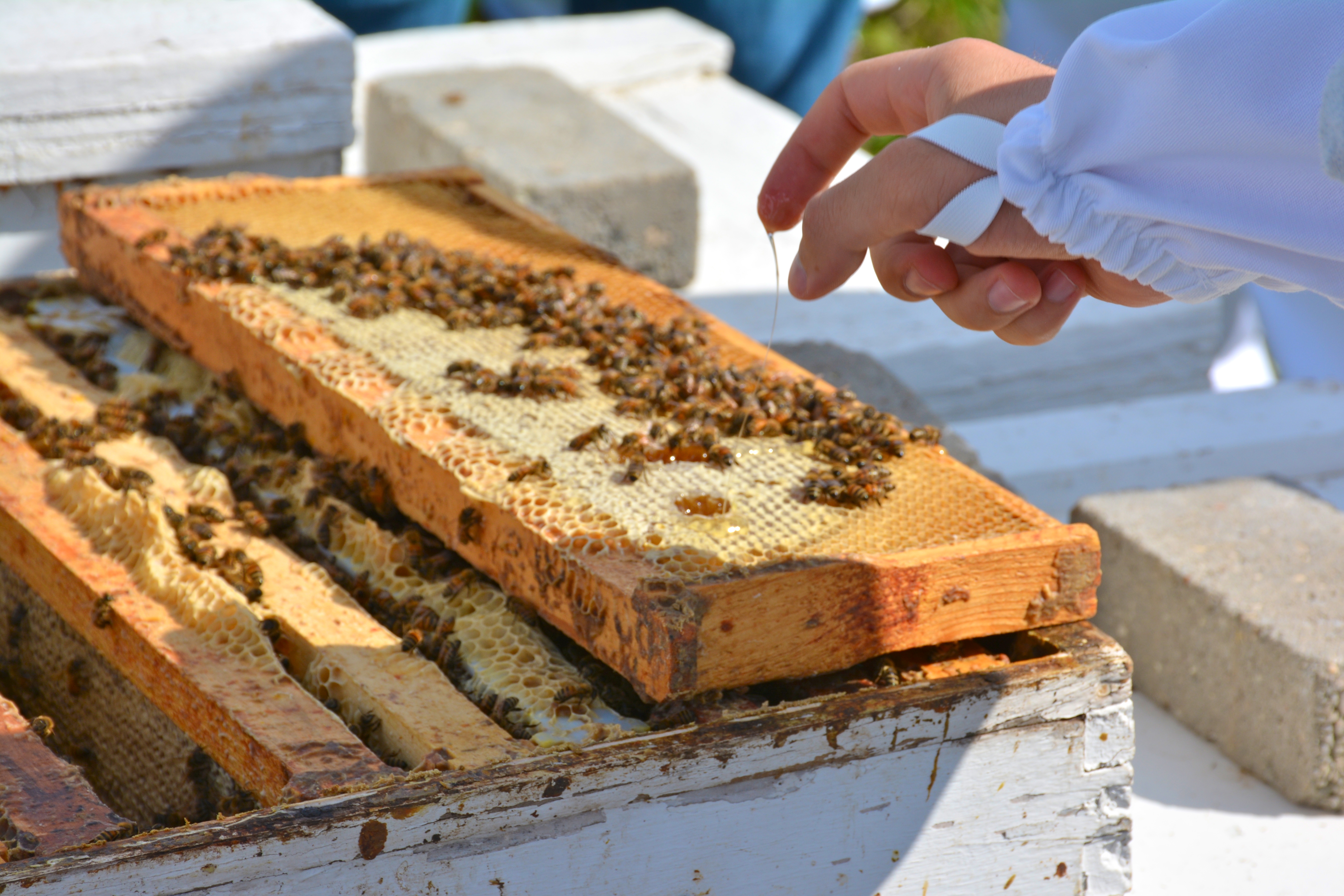
Honeybees are important pollinators, an ecosystem service that is not always adequately accounted for in traditional markets. Image credit: Marisa Lubeck, USGS.Click for a larger view.Click for a larger view.
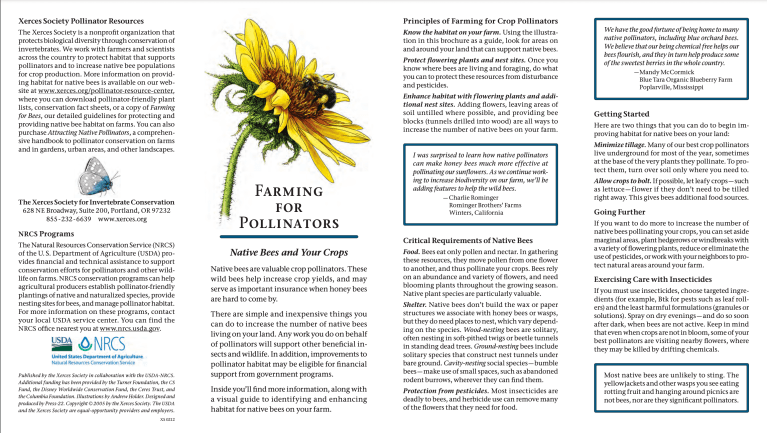
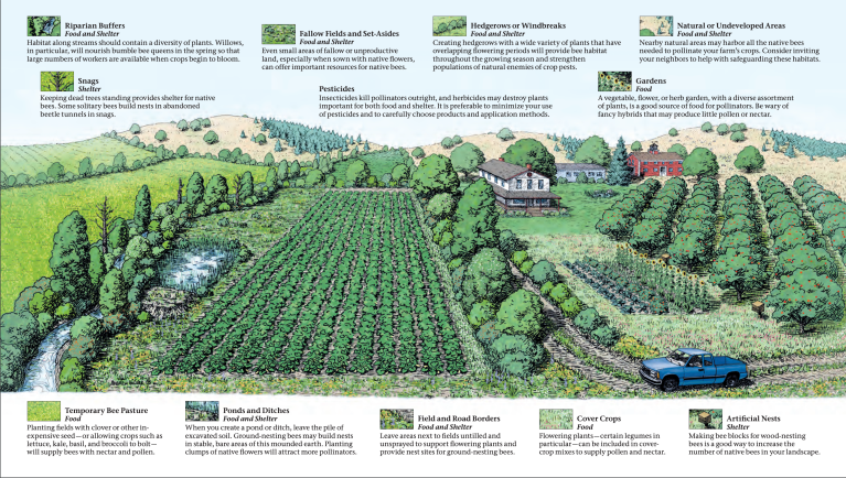
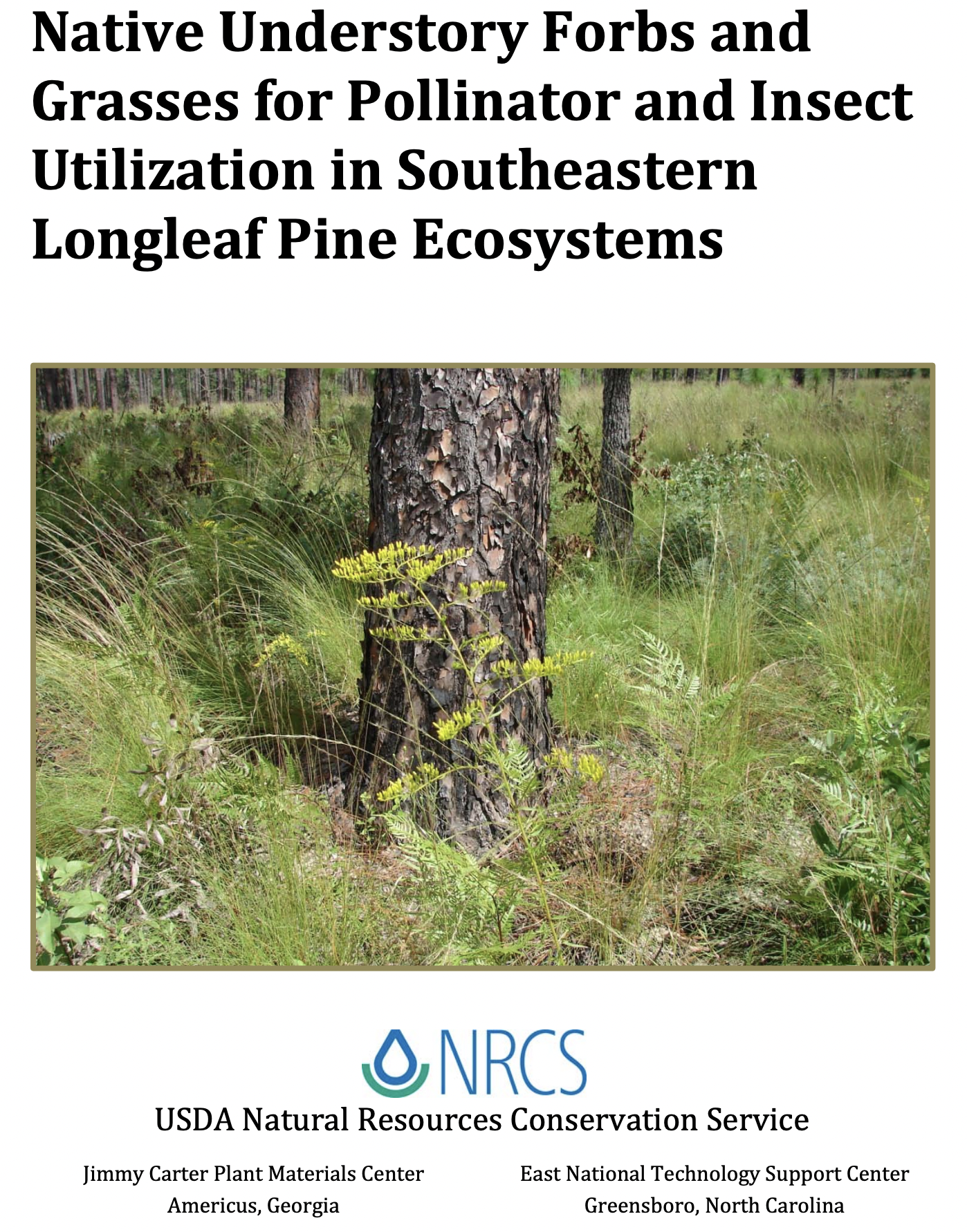
Click on the link to access “Native Understory Forbs and Grasses for Pollinator and Insect Utilization in Southeastern Longleaf Pine Ecosystems on the Natural Resources Conservation Service website.
For decades, so much water has been diverted to supply farms and cities that the Colorado River has seldom met the sea and much of its delta in Mexico has been reduced to a dry riverbed, with only small remnants of its once-vast wetlands surviving. Over the last eight weeks, water has been flowing in parts of the delta once again, restoring a stretch of river in Mexico where previously there had been miles of desert sand. The water is being released from an irrigation canal to aid the delta’s parched environment as part of an agreement between the Mexican and U.S. governments and with support from environmental groups. Those who are involved in the effort say that even as severe drought and the warming climate sap the Colorado River, the initiative shows how small amounts of water can be used to benefit struggling ecosystems…
This site, a habitat restoration area called El Chausse, is located in the southern portion of the delta, downstream from long stretches of dry riverbed, and was chosen as a place where limited water releases would boost the ecosystem by nourishing vegetation and expanding habitat for wildlife. It’s one of a few sites in Mexico where conservationists have been restoring wetlands and forests along the path where the river once flowed. Six years ago, workers removed invasive tamarisk trees at the site and planted a forest of native cottonwoods, willows and mesquites. Those trees have grown rapidly and now drape the wetland in shade, attracting a variety of birds, such as yellow warblers, blue-gray gnatcatchers and vermilion flycatchers…
This is the second straight year of water releases in Mexico. When the water flowed through part of the delta last year, plants released seeds that settled along the banks. [Eduardo] Blancas and his colleagues have seen vegetation flourish along the river channel. They’ve spotted about 120 species of birds in the area.
Denver Botanic Gardens was live-Tweeting from the summit yesterday. Here’s their Twitter feed. (They did not use the hash tag #shed22.)
Here’s the link to the #shed22 Twitter stream. I am always blown away at the insight and awareness displayed by others around me at theses events.
Denver Botanic Gardens is a great venue for the summit. If you need to get up and walk around to clear your mind you can take in the sights of the gardens.
Navajo Reservoir, New Mexico, back in the day.. View looking north toward marina. The Navajo Dam can be seen on the left of the image. By Timthefinn at English Wikipedia – Transferred from en.wikipedia to Commons., Public Domain, https://commons.wikimedia.org/w/index.php?curid=4040102
According to the Lake Navajo Water Database, the lake was at 56.4 feet below full pool, an eleva- tion of 6,028.6 feet, on June 12 and at 55.78 percent by volume of full pool on that same date. Before this year, the lowest level that had been observed in Navajo Lake on June 12 in the last 10 years was in 2013, when the lake was at 6,029.17 feet of elevation. Last year, the water level on June 12 was 6,041.47 feet of elevation. The Navajo LakeWater Database also notes that the San Juan and Piedra rivers, which feed Navajo Lake, are at 11.92 percent of their combined aver- age and that inflows for water year 2022, which began on Oct. 1, 2021, and ends on Sept. 30, 2022, are at 89.6 percent of those for water year 2021.
In an interview with The SUN, Colorado Parks and Wildlife Manager for Navajo State Park Brian Sandy explained the impact the low water levels have had on the park. He commented that the low water levels have had a “really negative impact” on the park’s marina and the services it can provide, with the on-the-water fuel pump dock and the pump-out station for houseboats both inactive. He noted that no slips are available at the dock, with the few that remain usable reserved for patrol and rental boats. He added that the water level in the mooring cove is sufficiently low to render most of the mooring balls unusable. Sandy stated that the low water level has had a particularly severe impact on houseboats, many of which depend on the mooring cove and the pump-out station…
Sandy commented that water levels in the reservoir are likely to continue to drop over the season with water commitments for the Navajo Indian Irrigation Project and municipal water for communities including Farmington, N.M., contributing to the decrease in lake levels, along with the drought and high winds.
Sandy added that releases of water from the reservoir also occur for the purposes of improving endangered fish species habitat downstream by raising water levels in rivers.
Click the link to read the article on the Circle of Blue website (Brett Walton). Here’s an excerpt:
The American West has been plumbed into a series of “mega-watersheds.”
Because basins are connected by pipelines and canals, drought in one region affects distant watersheds.
A big Southern California water agency plans to draw more water from the Colorado River this year because of inadequate moisture in the Sierra Nevada.
On a map that might grace the walls of a high school classroom, the watersheds of the American West are distinct geographical features, hemmed in by foreboding plateaus and towering mountain ridges. Look closer and those natural boundaries are less rigid. A sprawling network of pipelines and canals pierce mountains and cross deserts, linking many of the mighty rivers and smaller streams of the West. These “mega-watersheds” have redrawn the map, helping cities and farms to grow large and productive, but also becoming political flashpoints with steep environmental costs…
Upstream on the Colorado River, there are more links. Tributary streams in Colorado are diverted through the San Juan-Chama Project into New Mexico, where the water enters the Rio Grande system and supplies Albuquerque and Santa Fe. The Central Utah Project pulls Colorado River water into the orbit of the fast-growing Wasatch Front, which is not in the basin.
Colorado transmountain diversions via the State Engineer’s office
In the headwaters state of Colorado, 11 major interbasin transfers unite rivers on both sides of the Rockies. The Moffat and Adams tunnels cut through the Continental Divide, a feat of engineering that brings Colorado River water into the South Platte River basin, where it is gulped by Denver and other Front Range cities.
The Moffat Tunnel, heading east. Photo: Brent Gardner-Smith/Aspen Journalism
Entrance to the Colorado-Big Thompson project. Photo: Brent Gardner-Smith/Aspen Journalism
For all the water supply flexibility they provide, these diversions are not risk-free. They have depleted water for native fish. Many of them — from the Owens River in California to the West Slope of Colorado — contend with legacies of acrimony and mistrust, feelings that arose decades ago due to the political imbalance between rural areas where water was extracted and urban areas that benefitted.
The confluence of the Colorado and Little Colorado rivers in the Grand Canyon, shown here in a September 2020 aerial photo from Ecoflight, represents an area where the humpback chub has rebounded in the last decade. That progress is now threatened by declining water levels in Lake Powell, which could lead to non-native smallmouth bass becoming established in the canyon. CREDIT: JANE PARGITER/ECOFLIGHT
As climate change continues to shrink the nation’s second-largest reservoir, water managers are scrambling to prevent the release of an invasive fish into the Grand Canyon.
Smallmouth bass, a voracious predator and popular game fish, have been introduced into reservoirs throughout the Colorado River basin, including Lake Powell. The looming problem now is that as lake levels drop to historically low levels, the invasive fish are likely to escape beyond Glen Canyon Dam, threatening endangered fish in the canyon, whose populations have rebounded in recent years.
Smallmouth bass are a warm-water-loving species, hanging out in the top part of the water column, which is warmed by the sun. Until recently, the intakes for turbines at Glen Canyon Dam had been lower in the water column, where colder temperatures kept the fish away. But as the lake level falls, the warmer water band containing the smallmouth bass is sinking closer to the intakes, making it more likely that they will pass through the dam to the river below.
Warmer water below the dam also means a more ideal environment for the bass, which thrive in temperatures above 61 degrees Fahrenheit (16 degrees Celsius).
“With the levels we are expecting to get to this coming year, water temperatures are going to be warmer than they’ve been in 52 years in the Grand Canyon,” said Charles Yackulic, a research statistician with the U.S. Geological Survey’s Grand Canyon Monitoring and Research Center.
The research center has been modeling the likelihood that smallmouth bass will become established below the dam under different scenarios and providing that information to decision-makers and water managers.
Jack Schmidt, a Colorado River researcher at Utah State University and former director of the research center, co-wrote — along with Yackulic and others — a March 2021 paper that sounded the alarm that future warming is likely to disproportionately benefit nonnative fish species to the detriment of native species. The problem from which all others stem, including the changing fish communities, and the reason Powell is so low in the first place is the climate-change-driven supply-demand imbalance, Schmidt said.
Annual CO2 emissions from fossil fuels, by world region
“If we are going to continue to load the atmosphere with carbon such that the atmosphere warms and the runoff in the Colorado River keeps getting lower and if we are going to keep consuming water, … then you can only play this game of staving off the inevitable for so long before it’s game over,” he said.
Aerial image of entrenched meanders of the San Juan River within Goosenecks State Park. Located in San Juan County, southeastern Utah (U.S.). Credits Constructed from county topographic map DRG mosaic for San Juan County from USDA/NRCS – National Cartography & Geospatial Center using Global Mapper 12.0 and Adobe Illustrator. Latitude 33° 31′ 49.52″ N., Longitude 111° 37′ 48.02″ W. USDA/FSA, Public domain, via Wikimedia Commons
From email from Reclamation (Susan Novak Behery):
In response to decreasing flows in the critical habitat reach, and a declining flow forecast, the Bureau of Reclamation has scheduled an increase in the release from Navajo Dam from 300 cubic feet per second (cfs) to 500 cfs for Monday, June 13th, at 4:00 AM.
Releases are made for the authorized purposes of the Navajo Unit, and to attempt to maintain a target base flow through the endangered fish critical habitat reach of the San Juan River (Farmington to Lake Powell). This release change is calculated as the minimum required to maintain the target baseflow.
The San Juan River Basin Recovery Implementation Program recommends a target base flow of between 500 cfs and 1,000 cfs through the critical habitat area. The target base flow is calculated as the weekly average of gaged flows throughout the critical habitat area from Farmington to Lake Powell.
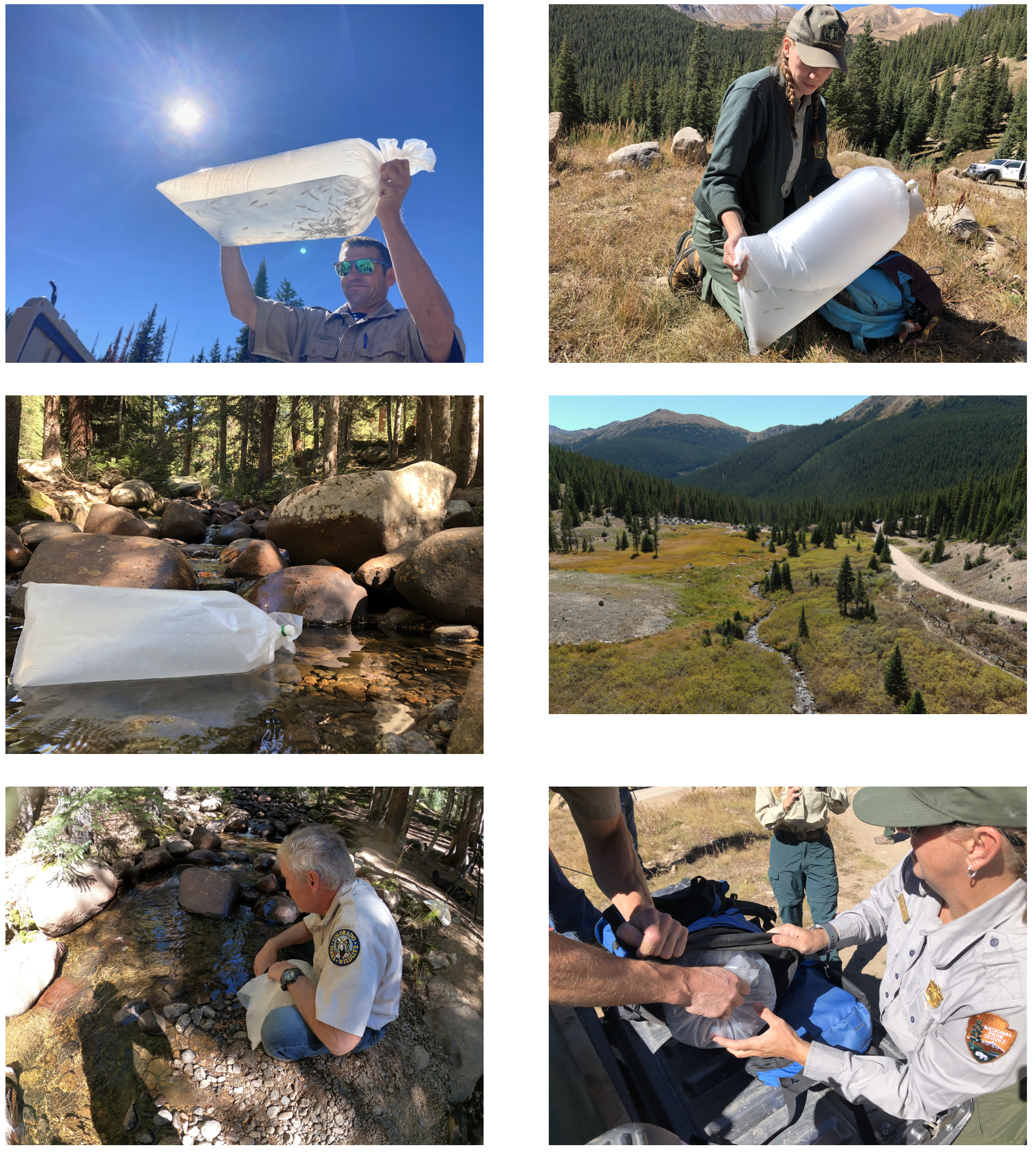
Students in Palisade High School’s fish hatchery program released the fish at Riverbend Park on Wednesday, the culmination of a full school year of taking care of the fish until they were ready to live in the river.
Some students, as well as Palisade teacher and fish hatchery coordinator Patrick Steele, even planted farewell kisses on some of the Razorback Suckers before releasing them into their permanent home…
At the beginning of the school year, U.S. Fish and Wildlife Service Fish Culturist Mike Gross, also the information and education coordinator with Upper Colorado River Endangered Fish Recovery Program, brings the razorback suckers to the school, where students care for the fish under Steele’s guidance…
Because razorback suckers are on the Endangered Species List, by law, the Colorado River District and the Upper Colorado River District have to allow a certain amount of water to flow through the river in order to create enough space for these fish to live in a new habitat safely.
“That helps water flow downriver, keeping it out of reservoirs and things like that, being able to then keep our canals full to irrigate and so forth,” Steele said. “It really is a great partnership between our U.S. Fish and Wildlife Service and the fish recovery program they run, our irrigation district, our cultural groups and farmers. It’s pretty neat that all those entities need to get together to keep these endangered species rolling and fish flowing through our river.”
A series of hot, dry years in the Upper Colorado River Basin has led to increasing concern about the security of water supplies at region-wide and local scales for the following purposes and sectors:
• Maintaining compact compliance and preventing Lake Powell’s water level from dropping too low to generate power.
• Maintaining agricultural production and the vitality of rural communities.
• Maintaining municipal and industrial water security.
• Maintaining river ecosystems.
Without a strategic, collaborative approach to addressing these issues, there is a risk that individual entities will act independently to secure their water supplies against climate and legal uncertainties. This could lead to more permanent transfers from agriculture, with detrimental impacts on rural communities and unpredictable impacts on river ecosystems.
Over the past several years, there have been numerous explorations into new approaches to meeting community and environmental needs in the Upper Basin, including deliberate, temporary, and compensated reductions in water use in order to help balance supply and demand in the Colorado River system, share water supplies between agriculture and cities, and aid troubled streams.
This report distills insights from these explorations that can help illuminate how such deliberate, temporary reductions in water use could play a role in:
• Enhancing long-term water security for farms, municipalities, industries and rivers in the Upper Basin (upstream objectives).
• Compact compliance and protection of power generation capacity in Lake Powell (downstream objectives).
In this report, the term “strategic conservation” will be used to describe these deliberate reductions in water use to meet specific goals.
The insights covered in this report focus on the following topics:
• Water user interest
• Agronomic impacts of reducing water use
• Monitoring and verification of saved water
• Shepherding and conveyance of conserved water
• Pricing considerations
• Environmental considerations
• Additional considerations
For each topic, key insights and remaining uncertainties are highlighted and illustrative research, experiences and resources are described. Links to documentation are provided wherever possible.
Upper Colorado River Endangered Fish Recovery Program
Click the link to read the release on the Reclamation website (Robert Manning):
The Bureau of Reclamation today submitted its initial spend plan for fiscal year 2022 funding allocations authorized in the Bipartisan Infrastructure Law to the U.S. Congress. This spend plan represents a blueprint for how Reclamation will invest in communities to address drought across the West as well as greater water infrastructure throughout the country. Reclamation will be provided $1.66 billion annually to support a range of infrastructure improvements for fiscal years 2022 through 2026.
“The Bipartisan Infrastructure Law is the largest investment in the resilience of physical and natural systems in American history,” said Assistant Secretary for Water and Science Tanya Trujillo. “Reclamation’s funding allocation for 2022 is focused on developing lasting solutions to help communities tackle the climate crisis while advancing environmental justice.”
“The Bureau of Reclamation serves as the water and power infrastructure backbone for the American West. The law represents a once-in-a-generation opportunity to improve our infrastructure while promoting job creation,” said Reclamation Commissioner Camille Calimlim Touton. “The funding identified in this spend plan is the first-step in implementing the Bipartisan Infrastructure Law and will bolster climate resilience and protect communities through a robust investment in infrastructure.”
The FY 2022 spend plan allocations include:
$420 million for rural water projects that benefit various Tribal and non-Tribal underserved communities by increasing access to potable water.
$245 million for WaterSMART Title XVI that supports the planning, design, and construction of water recycling and reuse projects.
$210 million for construction of water storage, groundwater storage and conveyance project infrastructure.
$160 million for WaterSMART Grants to support Reclamation efforts to work cooperatively with states, Tribes, and local entities to implement infrastructure investments to increase water supply.
$100 million for aging infrastructure for major repairs and rehabilitation of facilities.
$100 million for safety of dams to implement safety modifications of critical infrastructure.
$50 million for the implementation of Colorado River Basin drought contingency plans to support the goal of reducing the risk of Lake Mead and Lake Powell reaching critically low water levels.
$18 million for WaterSMART’s Cooperative Watershed Management Program for watershed planning and restoration projects for watershed groups.
$15 million for Research and Development’s Desalination and Water Purification Program for construction efforts to address ocean or brackish water desalination.
$8.5 million for Colorado River Basin Endangered Species Recovery and Conservation Programs.
Detailed information on the programs and funding provided in the Bipartisan Infrastructure Law, the FY 2022 BIL Spend Plan and materials from recent stakeholder listening sessions are available at http://www.usbr.gov/bil.
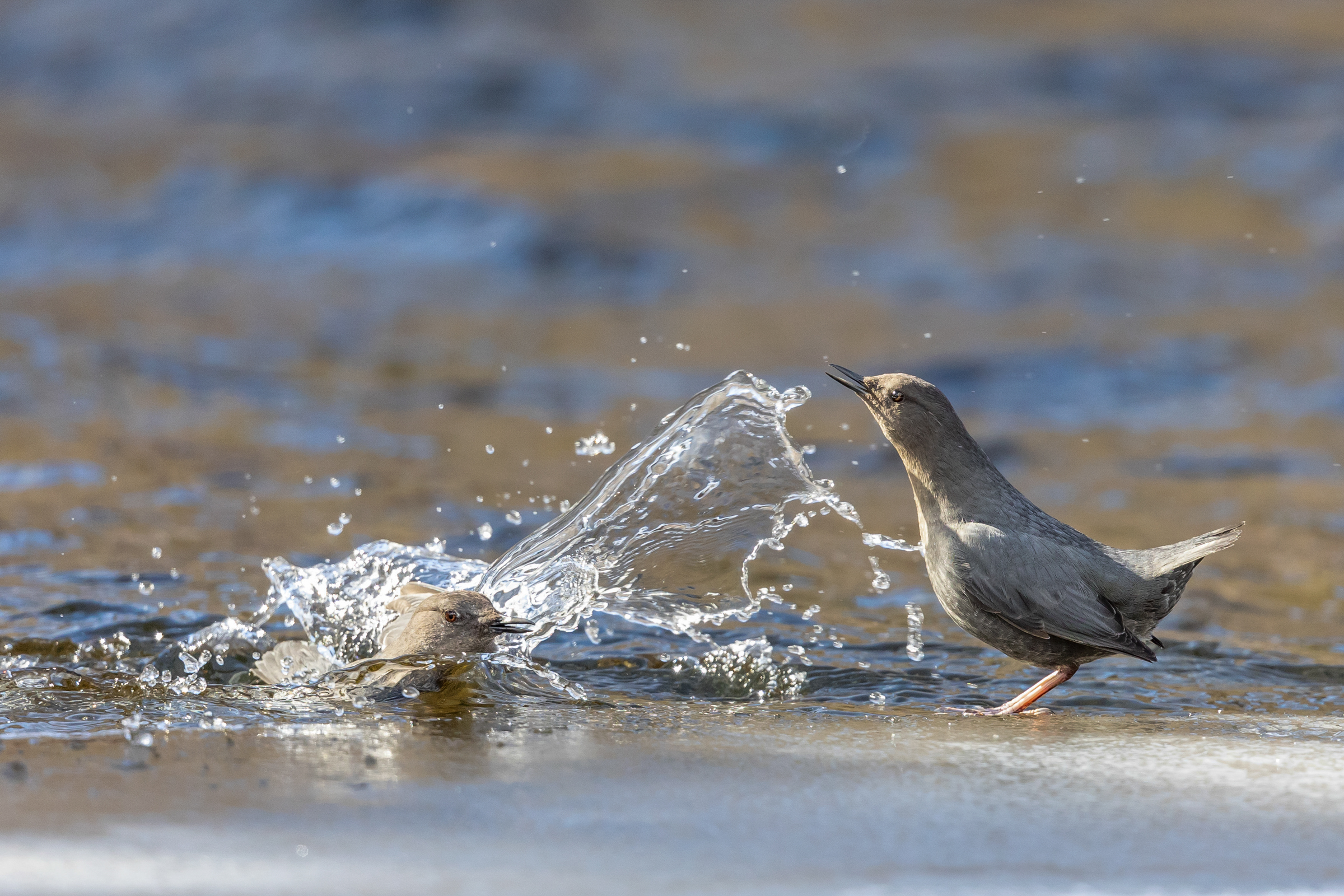
American Dipper, Lolo National Forest, Montana. Photo: Troy Gruetzmacher/Audubon Photography Awards
Click the link to read the article on the Audubon website (Caitlin Wall):
In March, Congress passed and President Biden signed a federal spending bill that will fund the government through September 30, 2022. Overall, the funding is a win for conservation and provides helpful increases for programs that address climate change, build community resilience, and protect birds and wildlife. Compared with four years of drastic funding cuts implemented from 2016-2020, this bill sets the stage for a positive trend in federal funding for the environment.
One bright spot is the (at least) $1.25 million included for Saline Lakes science, a key Audubon priority. In addition to this startup funding, Audubon is hopeful that Congress works to pass the bipartisan Saline Lake Ecosystems in the Great Basin States Program Act and additional appropriations for this critical assessment and monitoring program.
For the Colorado River, the spending bill is a bit of a mixed bag. The Cooperative Watershed Management Program received only $5 million, which is a slight increase over the $4.25 million it received last year, but far below our request of $20 million. However, this program received a huge boost in the Infrastructure Investment and Jobs Act (IIJA)—$200 million over five years. And the relatively new Aquatic Ecosystem Restoration Program received only $100,000 in Fiscal Year (FY)22, but will benefit from $250 million over five years in IIJA funding. These programs fund multi-benefit projects that support rivers, wetlands, communities, and water users and we are hopeful they continue to receive additional funding in future years. Audubon urges Congress to continue boosting annual funding for programs like these. Coupled with the historic amounts of funding in the IIJA, the river is receiving an influx of funding over the next few years to address the ongoing drought and water challenges.
Yuma desalting plant. Photo credit: USBR
We were also pleased to see that funding for the operation of the Yuma Desalting Plant was prohibited by the omnibus bill. Audubon remains opposed to the operation of the Yuma Desalting Plant, and encourages Congress to continue prohibiting appropriations for this purpose, as it would decimate irreplaceable bird habitat in the Colorado River Delta, particularly in the Ciénega de Santa Clara. And, the Lower Colorado River Basin received $25 million to implement the Drought Contingency Plans (DCP); this critical funding is in addition to $250 million in the IIJA, pointing to ongoing interest in ensuring these plans are implemented effectively.
For the Department of Agriculture, several important conservation programs were fully funded (meaning they received no cuts)—these include the Regional Conservation Partnership Program (RCPP) and the Environmental Quality Incentives Program (EQIP). RCPP promotes innovative regional approaches to improve the health of working landscapes and rivers with partner-driven, multi-benefit projects. EQIP promotes the voluntary application of land use practices to maintain or improve the condition of natural resources, including grassland health, water quality, and wildlife habitat. Both of these helps support overall watershed health and build the resilience of these ecosystems.
The Salton Sea is a major nesting, wintering and stopover site for about 400 bird species (Source: California Department of Water Resources)
Finally, the FY22 spending bill included Congressionally Directed Spending projects (previously known as earmarks) for the first time in many years. Audubon supported numerous project requests, and was pleased to see $2.546 million for a Salton Sea Research Project, secured by Representative Vargas. And, Representative Stanton secured $1.841 million for the Tres Rios project in Arizona, which Audubon also supported.
Audubon looks forward to the implementation of this funding for on-the-ground conservation activities, habitat restoration projects, and community resilience efforts. Federal dollars are critical to addressing climate change and the ongoing Western drought and aridification. Protecting watersheds protects people and birds, particularly in the West.
Looking ahead, President Biden released his FY23 budget on March 28, which initiated the appropriations process for the rest of this fiscal year. While the budget is only a statement of priorities and Congress will decide the actual spending amounts, Audubon was pleased to see investments for clean energy research, a civilian conservation corps, and equity initiatives to help historically marginalized communities.
The budget appropriates $1.4 billion for the Bureau of Reclamation, which oversees the West’s major waterways. This funding would include $2.254 million for the Cooperative Watershed Management Program and $500,000 for the Aquatic Ecosystem Restoration Program. Audubon urges Congress to fully fund these programs at $20 million and $15 million, respectively. Audubon also supports a full $5 million for the Saline Lakes science program at USGS, to build upon the initial investment made last year. We will be working with our partners to support other conservation programs and projects for FY23, and help continue this positive trend in funding.
Audubon urges the Administration and Congress to continue increasing funding amounts for programs that restore habitat, build community resilience, combat climate change and its devastating effects, and protect the places that people and birds need.
Swim class on the San Juan River. Photo: Brent Gardner-Smith/Aspen Journalism
From email from Reclamationk (Susan Novak Behery):
In response to increasing flows in the critical habitat reach, the Bureau of Reclamation has scheduled a decrease in the release from Navajo Dam from 350 cubic feet per second (cfs) to 300 cfs for Tuesday, April 5th, at 4:00 AM.
Releases are made for the authorized purposes of the Navajo Unit, and to attempt to maintain a target base flow through the endangered fish critical habitat reach of the San Juan River (Farmington to Lake Powell). This release change is calculated as the minimum required to maintain the target baseflow.
The San Juan River Basin Recovery Implementation Program recommends a target base flow of between 500 cfs and 1,000 cfs through the critical habitat area. The target base flow is calculated as the weekly average of gaged flows throughout the critical habitat area from Farmington to Lake Powell.
Click the link to read the article on the Moab Sun News website (Science Moab). Here’s an excerpt:
In the desert, few issues are as crucial as water. As a historic megadrought continues in the West, water usage is at the top of mind for many scientists. Hydrologists can help us understand how and when to enact new water policies. In this week’s column, Science Moab highlights important messages from conversations with hydrologists, speaking with Eric Kuhn, Jack Schmidt, Brian Richter, and Arne Hultquist.
Science Moab: Are we bound by water usage policies enacted years ago? If nature can’t sustain those, what then?
Eric Kuhn: One hundred years ago, we had some flexibility because the river was not very well-used. Today, not a drop of the Colorado River reaches the Gulf of California, so we don’t have that luxury. The way I look at it is: we legally allocated water based on an assumption that this river system had about 20 million acre-feet. Today, we think it’s more like 13, and it might be less in the future with climate change. Predictions and models show that increasing temperatures are going to reduce flows to the Colorado River. The drama is not how much water we’re going to have in the future — we know it’s going to be less. The drama is how we’re going to decide who gets less water, and when…
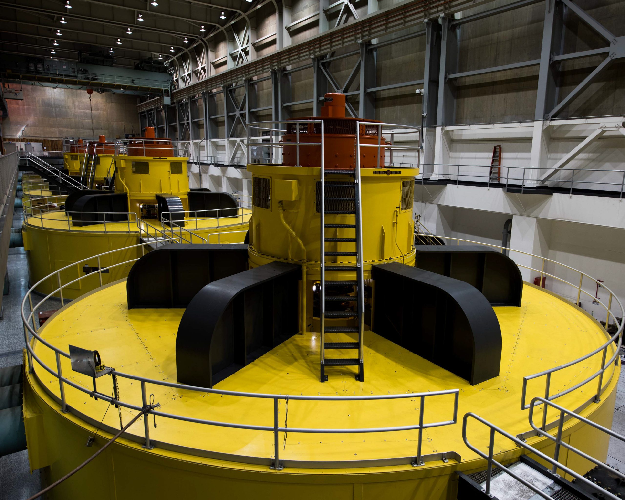
These turbines at Lake Powell’s Glen Canyon Dam are at risk of becoming inoperable should levels at Powell fall below what’s known as minimum power pool due to declining flows in the Colorado River. Photo courtesy U.S. Bureau of Reclamation.
Science Moab: At the start of 2021, Lake Powell was at 41% of its capacity. Why should we be so concerned that Lake Powell levels continue to fall to all-time lows?
Brian Richter: Lake Powell serves three really important benefits. One is that it generates hydropower from the Glen Canyon Dam, which provides electricity throughout the southwestern United States. Two, Lake Powell is important for tourism, which is impacted by falling water levels. But by far the biggest concern is that if Lake Powell drops by another 85 feet — and for reference, the lake level dropped by more than 30 feet in 2020 — then the lake will drop below the hydropower outlets, so all the electricity production out of Glen Canyon Dam will stop. But even worse is that it will become physically impossible to move enough water into the Lower Basin states to provide for their water needs.
Colorado transmountain diversions via the State Engineer’s office
Click the link to read the article on TheDenverChannel.com website (Via the Associated press: Grant Schulte). Here’s an excerpt:
State lawmakers gave initial approval to a bill that would allow Nebraska’s Department of Natural Resources to lay the groundwork for the estimated $500 million canal…The measure advanced, 36-3, through the first of three required votes in the Legislature despite skepticism from some lawmakers about whether the canal is necessary.
A canal to bring in water from Colorado and a large lake between Omaha and Lincoln both inched one step closer to reality Friday, but both proposals remain awash in questions.
Gov. Pete Ricketts has backed the water-related initiatives. Lawmakers on the Legislature’s Natural Resources Committee voted to advance bills laying the groundwork for each of them on Friday, and the Appropriations Committee approved a fraction of the $500 million the governor requested to fund the canal project.
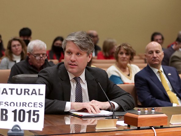
Legislative Bill 1015 would give the Department of Natural Resources the authority to build and maintain a canal and reservoir system to divert water from the South Platte River in Colorado for use in Nebraska. Under a compact that’s nearly a century old, the canal would allow the state to claim up to 500 cubic feet per second of water for irrigation between Oct. 15 and April 1.
The South Platte River Basin is shaded in yellow. Source: Tom Cech, One World One Water Center, Metropolitan State University of Denver.
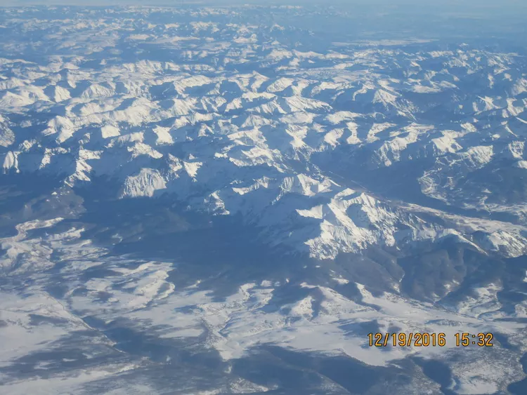
San Juan Mountains December 19, 2016. Photo credit: Allen Best
From email from Reclamation (Susan Novak Behery):
In response to decreasing flows in the critical habitat reach, the Bureau of Reclamation has scheduled an increase in the release from Navajo Dam from 350 cubic feet per second (cfs) to 400 cfs for tomorrow, Saturday, February 26th, at 4:00 AM.
Releases are made for the authorized purposes of the Navajo Unit, and to attempt to maintain a target base flow through the endangered fish critical habitat reach of the San Juan River (Farmington to Lake Powell). This release change is calculated as the minimum required to maintain the target baseflow.
The San Juan River Basin Recovery Implementation Program recommends a target base flow of between 500 cfs and 1,000 cfs through the critical habitat area. The target base flow is calculated as the weekly average of gaged flows throughout the critical habitat area from Farmington to Lake Powell.
This scheduled release change is subject to changes in river flows and weather conditions. If you have any questions, please contact Susan Behery (sbehery@usbr.gov or 970-385-6560), or visit Reclamation’s Navajo Dam website at https://www.usbr.gov/uc/water/crsp/cs/nvd.html
These turbines at Lake Powell’s Glen Canyon Dam are at risk of becoming inoperable should levels at Powell fall below what’s known as minimum power pool due to declining flows in the Colorado River. Photo courtesy U.S. Bureau of Reclamation.
The argument against major hydropower projects — ravaged ecosystems and large-scale displacement of people — is well known. But dam critics now say that climate change, bringing dried-up reservoirs and increased methane releases, should spell the end of big hydropower.
As the hydroelectric dam industry tries to reposition itself as a climate change solution, more and more evidence shows that climate change actually undermines the case for hydro dams.
Gone are the days when hydropower was considered the predominant engine of the world economy, leading a tenfold increase in global energy production over the twentieth century. Now its advocates portray it as a complement to wind and solar energy, a necessary source of steady output to balance wind and solar’s intermittent generation — and therefore a key component in the battle to limit climate change.
Hydroelectric Dam
One reason for the industry’s shift in strategy is that newly installed global capacity in hydropower lags far behind new wind and solar capacity, and declined each year from 2013 to 2019, with only a slight uptick in 2020. Another reason is that if hydropower is accepted as a tool for combating climate change, hydro developers would have a better chance of qualifying for financial support from governments and international institutions — all possessing funds they need for their pricey projects. With the ongoing United Nations conference on climate change in Glasgow in mind, Eddie Rich, chief executive officer of the International Hydropower Association (IHA), said recently that because of hydropower’s purported climate change-fighting attributes, his group seeks “appropriate support in the form of tax relief or concessional loans to ensure projects are bankable, as well as streamlining the approval process.”
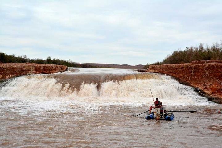
Since the late 1980’s, this waterfall formed from interactions among Lake Powell reservoir levels and sedimentation that redirected the San Juan River over a 20-foot high sandstone ledge. Until recently, little was known about its effect on two endangered fishes. Between 2015-2017, more than 1,000 razorback sucker and dozens of Colorado pikeminnow were detected downstream of the waterfall. Credit: Bureau of Reclamation
But the IHA faces an uphill battle in overcoming dams’ well-established liabilities — including ravaging the ecosystems of at least two-thirds of the world’s major rivers and upending the lives of hundreds of millions of people living both upstream and downstream from dams. Climate change further weakens the case for hydroelectric dams by intensifying droughts that increasingly hamper electricity production and by boosting evaporation from reservoirs as temperatures rise. In the pre-climate change era, plentiful methane emissions from some reservoirs might have been considered inconsequential, but now they are a major source of concern.
The just-completed 2021 World Hydropower Congress — whose theme was “Renewables Working Together” — ended with the announcement of the “San José Declaration on Sustainable Hydropower,” a document that affirms the industry’s commitment to best practices, including careful consultation with communities threatened by dam construction, responsible management of biodiversity impacts, and a long-overdue ban on projects in UNESCO World Heritage Sites. The document has been endorsed by at least 40 governments and such luminaries as Tony Blair, former British prime minister, and Malcolm Turnbull, former Australian prime minister.
But there is ample evidence that the IHA’s efforts amount chiefly to greenwashing, portraying the industry as socially and environmentally sensitive while carrying out business as usual. For all its gaudy rhetoric, the San José Declaration contains vague and untested enforcement mechanisms, and it remains unlikely that IHA member companies would be disciplined for violating its provisions.
The 510-MW Teesta-V hydropower station, in Sikkim in northern India, has been rated as an example of international good practice in hydropower sustainability, according to an independent report. Photo credit: Hydropower Review
A case in point is the Teesta-V hydroelectric dam in the Indian Himalayan state of Sikkim, constructed on a Brahmaputra River tributary and completed in 2008. In September the IHA awarded the project its “Blue Planet” Prize for “excellence in sustainable hydropower development,” noting that Teesta-V “met or exceeded international good practice” across 20 performance standards — ranging from cultural heritage to erosion to sedimentation — embraced by the IHA. Yet according to International Rivers, a nonprofit that advocates for people imperiled by dams, there was minimal consultation with local and Indigenous residents during the dam’s planning and construction, and blasting and tunneling caused landslides, sinkholes, drying up of residents’ water sources, and cracked walls and foundations in local houses that sometimes led to collapses, leaving some residents homeless. Last year, what India Today called a “massive” landslide beginning at the dam’s abutment left large boulders on top of the dam, damaging it and cutting off electricity generation for nine hours. It’s far from reassuring that the IHA chose Teesta-V as the best of dozens of projects evaluated for the prize.
This photo from December 2021 shows one of the intake towers at Hoover Dam. California, Nevada and Arizona recently penned a deal to keep 500,000 acre-feet of water in Lake Mead to boost the declining reservoir levels. CREDIT: HEATHER SACKETT/ASPEN JOURNALISM
The hydro industry portrays itself as the perfect antidote for wind and solar’s intermittency, but climate change has underlined the industry’s own reliability problem, which plays out in years instead of hours. In recent years, drought intensified by climate change has caused reservoirs on all five continents to drop below levels needed to maintain hydroelectric production, and the problem is bound to worsen as climate change deepens. Because of the U.S. West’s current megadrought, California’s huge State Water Project is generating electricity at just 35 percent of its 10-year average. At Oroville, California, site of the United States’ tallest dam, the power plant stopped working on August 5 and has not operated since. Hydropower capacity at Hoover Dam, which holds back the U.S.’s largest reservoir, Lake Mead, has dropped by 25 percent, and Glen Canyon Dam, site of the nation’s second-largest reservoir, Lake Powell, may be unable to generate any electricity as soon as next year, according to the U.S. Bureau of Reclamation. Because of the drought, the U.S. Energy Information Administration estimated in September that national hydropower production would drop by 14 percent from 2020 to 2021.
The international picture is no better. Beginning in 2013, Southern Africa has experienced frequent droughts that caused the world’s largest manmade reservoir, at the Kariba Dam on the Zambia-Zimbabwe border, to fall to 11 percent of capacity by 2019, frequently hampering electricity generation. This was a serious blow to the two countries’ economies, and millions of people experienced blackouts for extended periods. In South America, the worst drought in a century has caused huge drops in hydropower output, causing electricity shortages, price increases, and economic crises in Brazil, Chile, and Paraguay. Dams customarily deliver two-thirds of Brazil’s energy output, but reservoir levels have dropped to 24 percent of capacity. Jair Bolsonaro, Brazil’s Trumpian president, is far from a conservationist, but in March he called on Brazilians to “turn off a light at home” a few days before the government increased electricity prices by 7 percent.
Climate change has made dams unreliable in another way — the hydrological record, already limited by the low number of years it covers, has lost what predictive power it possessed. This has introduced vast uncertainty into flow assumptions that engineers took as their starting point in dam design. Now “thousand-year floods” may happen every decade or more, and permanent rivers may dwindle to trickles. Since climate change will produce more and bigger floods, new reservoirs must be expanded to accommodate them — adding to dams’ costs and environmental destruction. But most of the time, that additional capacity will go unused, increasing the dams’ inefficiency.
All this casts further doubt on another IHA claim, of hydro dams’ “affordability.” A study appearing this month in Global Environmental Change that assessed 351 proposed Amazon basin hydroelectric dam projects found that, because of climate-change-augmented drought, periods when the dams are incapable of producing electricity would increase, and periods when the plants operate at full capacity would decrease. As a result, many projects would have to more than double their planned electricity rates in order to break even — as the study put it, “rendering much of future Amazon hydropower less competitive than increasingly lower cost renewable sources such as wind and solar.”
Even disregarding climate change, the case for investing in dams has grown weaker in the last decade. A landmark 2014 Oxford University study in Energy Policy that evaluated 245 large dams found that they weren’t cost-effective and that their actual costs were nearly double their budgeted costs. Rich, the IHA chief executive, argued in an interview that the study was misleading because it omitted the bountiful indirect benefits of hydropower, in the form of economic stimulus. But the study also didn’t consider the indirect harm inflicted by dams — fish extinctions, ecosystem destruction, shattered Indigenous societies, the forced resettlement of at least 100 million people displaced by reservoirs, and life-changing disruptions to the lives of another half-billion downstream dwellers. The study asked one question — are dams profitable? — and answered it with a “no.” The indirect costs and benefits are much harder to calculate, but it’s difficult to imagine that their transient benefits would surpass their permanent environmental devastation.
Lake Kariba, the world’s largest reservoir, in 2018. Kariba Dam on the Zambia-Zimbabwe border. Photo credit: NASA
Lake Kariba, the world’s largest reservoir in 2019, after drought lowered water levels, stunting hydropower output at the Kariba Dam on the Zambia-Zimbabwe border. Photo credit: NASA
A follow-up Oxford University study published last month identifies a consistent bias in cost-benefit analyses of public investments that leads to overestimates of project benefits and underestimates of costs — and of the eight investment types studied (including railroads, bridges, roads, etc.), dams’ cost overruns were by far the highest. In part, this is because large dams take so long to build — more than eight years on average, not counting a few years of studying, planning, and acquiring permits — which makes the likelihood of unanticipated setbacks and cost increases, so-called “black swans,” much higher. Dams’ long gestation periods diminish their usefulness in fighting climate change, since the accelerating nature of the climate crisis means that infrastructure operating in the next few years is far more valuable than infrastructure completed a decade from now.
Even the hydro industry’s claim that dams generate “clean” energy is only partially true, for a significant fraction of reservoirs emit copious amounts of methane, a particularly potent greenhouse gas that this August’s Intergovernmental Panel on Climate Change report singled out as requiring “strong, rapid, and sustained” emission reductions to ward off more catastrophic warming. A 2019 study of 509 existing and proposed Amazon basin dams found that over a 20-year period, emissions from 25 percent of proposed lowland dams would emit more greenhouse gases than fossil fuel power plants. In the interview, Rich countered that other studies show that, over dams’ entire lifecycle, their emissions would be no greater than “green” technologies such as wind and solar. But even if true, this assertion overlooks the fact that most methane emissions from reservoirs occur in the first decade after commissioning, at the very time when reductions in methane emissions are considered most urgent.
Climate change is, first of all, a story about water. Since climate change has upended the planet’s hydrology, countering it requires a capacity to deal with massive uncertainty. Technologies that can do that must be nimble, flexible, modular (not one-of-a-kind), quickly and cheaply built, easily moved and replaced — like recently developed mini-hydro units a fourth the size of a railroad car that can be sited along the sides of rivers and canals and generate up to a megawatt of electricity in concert with natural river functions and with negligible damage to fish and environment.
Glen Canyon Dam releases. Photo via Twitter and Reclamation
By contrast, big hydroelectric dams menace ecosystems even beyond their own watersheds, and require upfront expenditures into the billions of dollars that don’t generate electricity or revenue for years. Their monumentality was once considered a public relations asset, yielding images of massive walls and tumbling water that world leaders loved to brandish in seeming validation of their own grandeur. Now all that cement means that the dams are stolid, inflexible, hard to repair, impossible to relocate, and extremely costly to remove — the opposite of what the new era requires.
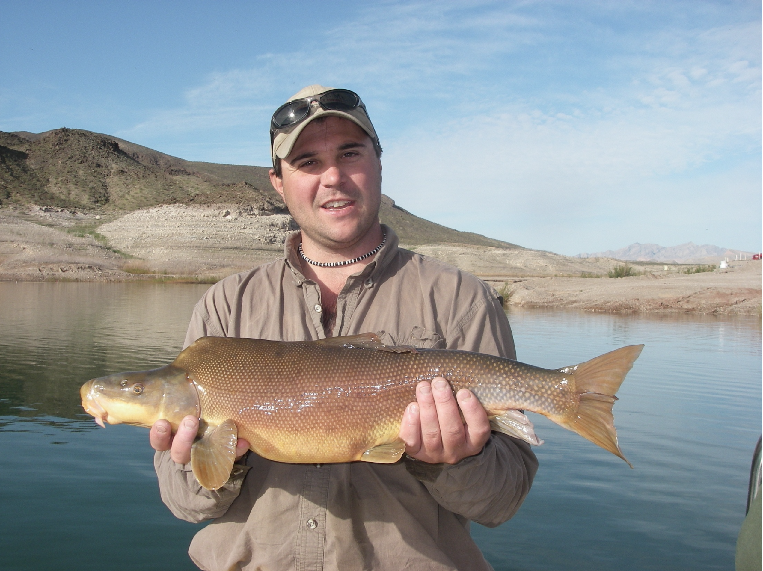
Ron Rogers biologist with Bio-West Inc., holds a large razorback sucker captured in Lake Mead near the Colorado River inflow area
Click the link to read the article on The Durango Herald (Aedan Hannon). Here’s an excerpt:
Hickenlooper, D-Colo., and Sen. Mitt Romney, R-Utah, introduced the Upper Colorado and San Juan River Basins Recovery Act in the Senate on Thursday to bolster the Upper Colorado River Endangered Fish Recovery and San Juan River Basin Recovery Implementation programs. The legislation would extend the two programs by one year and give communities more time to develop long-term management plans for the fish species they protect…
Humpback chub
A Colorado pikeminnow taken from the Colorado River near Grand Junction, and in the arms of Danielle Tremblay, a Colorado Parks and Wildlife employee. Pikeminnows have been tracked swimming upstream for great distances to spawn in the 15-mile stretch of river between Palisade and Grand Junction. An apex predator in the Colorado, pikeminnows used to be found up to six feet long and weighing 100 pounds. Photo credit: Lori Martin, Colorado Parks and Wildlife via Aspen Journalism
Wild bonytail chub
Ron Rogers biologist with Bio-West Inc., holds a large razorback sucker captured in Lake Mead near the Colorado River inflow area
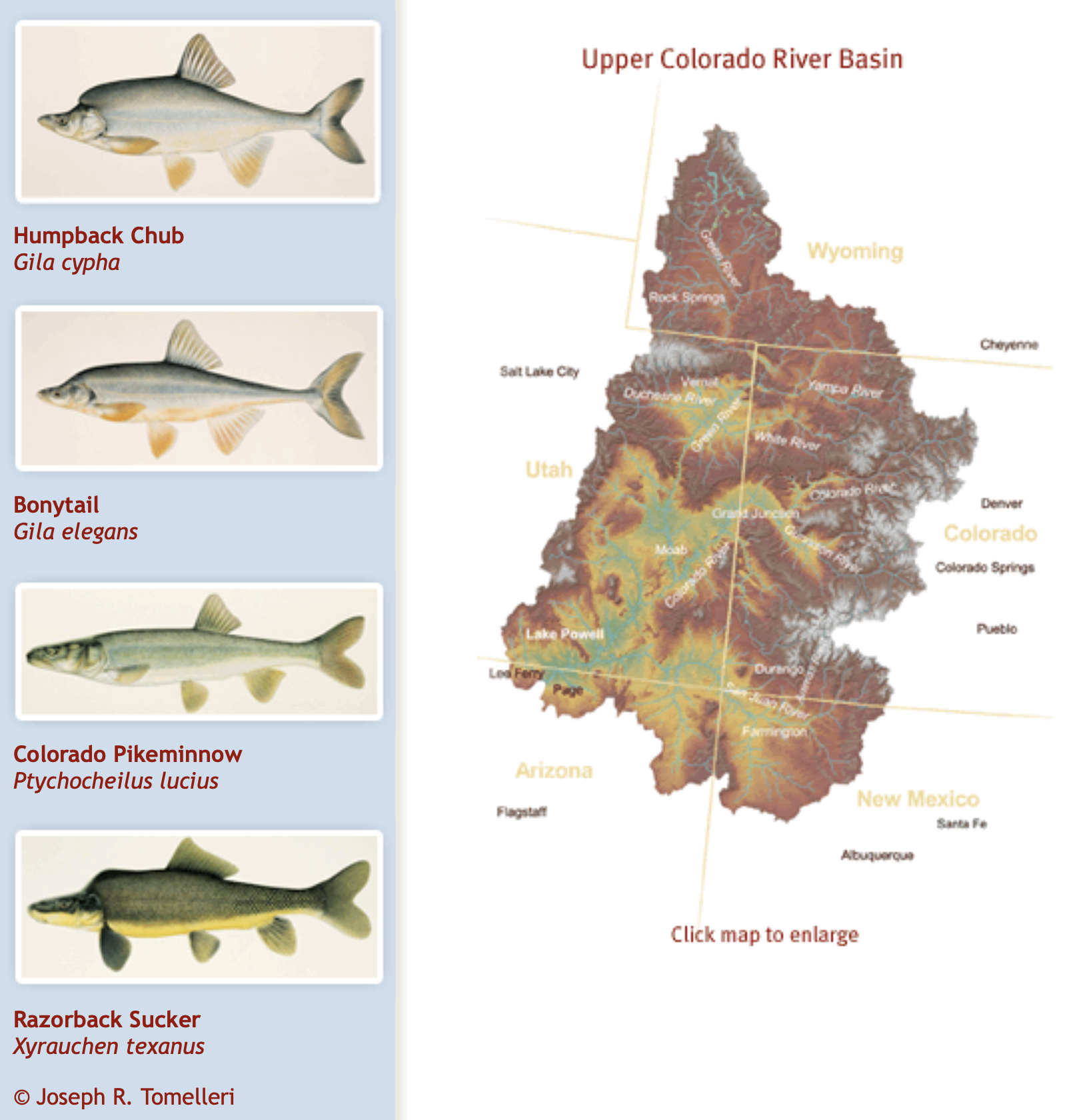
The Upper Colorado River Endangered Fish Recovery and San Juan River Basin Recovery Implementation programs aim to recover and protect four threatened and endangered fish species: humpback chub, bonytail, Colorado pikeminnow and razorback sucker…
The Upper Colorado River Endangered Fish Recovery and San Juan River Basin Recovery Implementation programs were established in the late 1980s and early 1990s with cooperative agreements between public land agencies, states, tribes and other stakeholders…
The decadeslong conservation efforts have largely been successful with the U.S. Fish and Wildlife Service recommending the downlisting of the razorback sucker and humpback chub from endangered to threatened in 2018.
But the added threat of climate change could affect these fish populations, with the razorback sucker, Colorado pikeminnow and bonytail still reliant on active management from the agencies and their partners.
The Platte River is formed in western Nebraska east of the city of North Platte, Nebraska by the confluence of the North Platte and the South Platte Rivers, which both arise from snowmelt in the eastern Rockies east of the Continental Divide. Map via Wikimedia.
A canal would divert South Platte River flows from Colorado to Nebraska under a bill heard Feb. 9 by the Natural Resources Committee.
LB1015, introduced by Speaker Mike Hilgers of Lincoln at the request of Gov. Pete Ricketts, would authorize the state Department of Natural Resources to develop, construct, manage and operate the canal and its associated storage facilities, called the Perkins County Canal Project, under the terms of the South Platte River Compact.
The bill also would authorize the department to use eminent domain to acquire land and resolve any legal disputes that arise as a result of the project.
The 1923 compact between Nebraska and Colorado apportions flows of the South Platte River between the states.
Nebraska Senator Mike Hilgers at Natural Resources Committee hearing February 9, 2022. Photo credit: Unicameral Update
Hilgers said the agreement entitles Nebraska to 120 cubic feet of water per second from the river during the summer. It also allows Nebraska to divert 500 cubic feet of water per second during the non-irrigation season if the state builds a canal, he said.
If Nebraska does not act to preserve its rights under the compact, Hilgers said, development along Colorado’s Front Range could “capture” those winter flows.
“This will certainly jeopardize our existing water uses and force us to seek more expensive and less certain water supplies,” he said.
Ricketts testified in support of LB1015, saying reduced South Platte River flows would affect irrigated agriculture, hydroelectric generation, endangered species protection and drinking water supplies for communities along the Platte River, including Lincoln and Omaha.
Compared to the economic cost of losing that water, he said, the $500 million canal and reservoir system would be a “bargain.”
Tom Riley, director of the state Department of Natural Resources, also testified in support. If Colorado follows through on proposed water management projects, he said, 90 percent of the South Platte River flows that Nebraska receives would be lost.
Building the canal would secure Nebraska’s right to the South Platte River’s winter flows “in perpetuity,” Riley said. If the Legislature authorizes the canal, he said, construction could begin as early as 2025, and it could be in use within a decade.
“In my 35 years as a water resources engineer practicing in the field, I have never seen a more important water project for Nebraska,” Riley said.
Testifying in opposition to the bill was Al Davis of the Nebraska chapter of the Sierra Club. He said further changes to the Platte River’s flow would affect the many species of birds, fish and mammals that rely on the river.
Davis questioned whether the project is viable and said it could be delayed by lawsuits. He said the proposed funding could be put to better use by retiring irrigated acres in overappropriated river basins and giving grants to farmers to help them reduce the amount of water they use.
“There are far too many unanswered questions to tie up $500 million for decades when that money could be used for an immediate benefit of Nebraskans,” Davis said.
Katie Torpy gave neutral testimony on behalf of the Nature Conservancy. She said colleagues in Colorado told her its list of proposed water management projects is a “brain dump” and that Colorado does not intend to pursue them all.
Torpy questioned whether Nebraska has exhausted all avenues to secure its rights under the compact. She said understanding how the proposed canal and reservoir system would affect the Platte River’s natural flow is “paramount” before moving forward.
The committee took no immediate action on LB1015.
Nebraska Rivers Shown on the Map: Beaver Creek, Big Blue River, Calamus River, Dismal River, Elkhorn River, Frenchman Creek, Little Blue River, Lodgepole Creek, Logan Creek, Loup River, Medicine Creek, Middle Loup River, Missouri River, Niobrara River, North Fork Big Nemaha River, North Loup River, North Platte River, Platte River, Republican River, Shell Creek, South Loup River, South Platte River, White River and Wood River. Nebraska Lakes Shown on the Map: Harlan County Lake, Hugh Butler Lake, Lake McConaughy, Lewis and Clark Lake and Merritt Reservoir. Map credit: Geology.com
Leaders from Nebraska’s irrigation and natural resources districts cast the plan as a crucial step to preserve as much of the state’s water supply as possible.
Republican Gov. Pete Ricketts identified it as a top priority, arguing that not moving forward would eventually cost Nebraska billions as farms, cities and other water users struggle with shortages.
Colorado officials say they don’t fully understand Nebraska’s concerns, noting that they’ve always complied with the compact.
People work on the Perkins County Canal in the 1890s. The project eventually was abandoned due to financial troubles. But remnants are still visible near Julesburg. Perkins County Historical Society
That was the refrain being sung before the Nebraska Legislature’s Natural Resources Committee Wednesday as state officials tried to persuade the senators to approve building the Perkins County Canal…
Proponents all told the committee that the Perkins Canal must be built as soon as possible, or Nebraska will never be able to claim the water it has a right to. Riley told the committee the canal is “central to water security in Nebraska. I’ve never seen a more important project. To fail to build this project now would be catastrophic.”
The now-or-never urgency of the canal is predicated on the assumption that Colorado water storage projects will soak up all but the absolute minimum flow required by the compact. Colorado officials estimate that even in a dry year, 10,000 acre feet of water escapes into Nebraska, beyond that which is required by the compact. Between 1996 and 2015, Colorado delivered to Nebraska nearly 8 million acre feet of river water, for an average of more than 400,000 acre feet per year.
Nebraska officials were quick to point out Wednesday that that’s water Nebraska counts on for irrigation, recreation and even municipal use. Ricketts told the committee that Colorado’s plans for water development and storage threaten to choke off that water supply.
“They’ve listed 283 projects, at a cost of $90 billion, and that includes projects already approved and underway,” Ricketts said. “That would eliminate 90 percent of the (winter time) stream flow coming into Nebraska. It would devastate our economy.”
Riley said he’s talked personally with Coloradans who vow they’ll “not let one drop beyond the Compact (rights) come into Nebraska.”
Asked if the canal project would increase Nebraska’s water supply, Riley said it won’t, but it will protect the water Nebraska gets now. And, because there’s no minimum specified for the non-irrigation season — essentially October to April — it would be possible for Colorado to dry up the South Platte River.
Kent Miller, manager of the Twin Platte Natural Resources District in North Platte, told the committee that’s the intent of Colorado’s water community…
Committee members grilled the witnesses on the absolute necessity of the canal and were clearly concerned about the $500 million price tag attached to it. When Riley testified that Nebraska needed to prove to Colorado that they were going to build the canal, he was asked whether perhaps $200 million would be convincing enough, at least to begin with. Riley said the funds need to be secured immediately because costs will escalate as time goes on.
Only one person spoke in opposition to the bill. Al Davis, legislative director for the Nebraska Sierra Club, said the project would interfere with the timing and flow of the river, and would have a negative impact on habitat. He suggested that, instead, the $500 million be spent on things like child care and infrastructure.
Platte River Recovery Implementation Program target species (L to R), Piping plover, Least tern, Whooping crane, Pallid sturgeon
Melissa Mosier, vice chair of the Land Advisory Committee for the Platte River Recovery Implementation Program, testified in a neutral position on the bill, but expressed concern that the canal project could disrupt the work done by the PRRIP board, of which Tom Riley is a member…
Katie Torpy, climate and energy policy lead for Nature Conservancy of Nebraska, also testifying in a neutral position, told the committee that her Colorado contacts led her to believe that Colorado has no intention of pursuing all of the 283 projects to which the bill proponents kept referring.
Governor Clarence J. Morley signing Colorado River compact and South Platte River compact bills, Delph Carpenter standing center. Unidentified photographer. Date 1925. Print from Denver Post. From the CSU Water Archives
NEBRASKA’S LAST BEST CHANCE TO SAVE THE SOUTH PLATTE RIVER
The Platte River, including the South Platte River tributary, runs about 400 miles through the heart of Nebraska from its western border with Colorado to the Missouri River. In Nebraska, the basin supports a population of well over one million people, including Lincoln and portions of Omaha. The river provides water for more than a million acres of irrigated agriculture, produces up to 140 megawatts of hydropower, provides cooling water for Gerald Gentleman Station – Nebraska’s largest power plant, sustains multiple threatened and endangered species, and generates countless recreational opportunities. It is arguably Nebraska’s most precious natural resource. Now, it faces an imminent threat.
Colorado’s South Platte River basin population is expected to
increase from 3.8 to as much as 6.5 million by 2050 (more than three times the population of our state today). Seventy thousand people move to the Front Range region every year. To support this explosive growth, Colorado’s legislature commissioned a study in 2016 to identify every drop of water “in excess of that required” to be delivered to Nebraska under the 1923 South Platte River Compact. Today, Colorado has nearly 300 projects in various phases of completion, planning, and assessment, all with the singular aim of preventing this “excess” water from reaching the state line.
Every drop of South Platte water that fails to reach Nebraska’s state line will need to be made up from storage in Lake McConaughy on the North Platte River. This means lake levels will be lower, carbon-free hydropower production will decrease, and storage supplies needed to mitigate drought within the Platte River Basin will be less reliable.
This growing threat led the editorial boards of the Lincoln Journal Star and Omaha World Herald, in the summer of 2019, to call upon State officials to protect Nebraska’s South Platte rights, echoing what we in the basin already knew – Colorado was coming for our water. But what could be done? To address that question, the Nebraska Legislature appropriated $350,000 in 2020 to study Colorado’s upstream development and its potential impact on Nebraska. The proposed Perkins County Canal Project is, in part, the culmination of that and other efforts by basin stakeholders to ensure Nebraska gets what it’s owed on the South Platte.
Most in the basin understand the 1923 Compact provides for a flow of 120 cubic feet per second (cfs) during the irrigation season. Many people have just recently learned the Compact also allows Nebraska to divert 500 cfs in the non-irrigation season. This right can only be enforced in priority, however, if Nebraska constructs a diversion near Ovid, Colorado to transport the water to Nebraska, as authorized by the Compact. For over 100 years building this diversion has been deferred, and as a result, Colorado has been taking the water Nebraska is not demanding. The proposed canal will allow Nebraska to fully exercise its Compact rights for the first time since the Compact was signed.
Beneficiaries of this multi-purpose project will include water users across the entire Platte River Basin. This includes those reliant on the Platte River to irrigate crops and those who rely on hydropower to light their homes and businesses. It also includes small and large municipalities that draw water from the Platte River but need more reliable water supplies to attract new industries and promote Nebraska’s future growth and development.
Some have claimed that even if constructed, such a project would yield too little water to justify itself. This is contrary to the available hydrologic data. Colorado itself has stated that over 300,000 acre-feet of “excess” flow enters Nebraska annually – water the new canal would help to protect for Nebraska. Critically, if the project is not built, Colorado can simply cut off this supply. To safeguard against this, Nebraska’s proposed project would capture the bulk of this water, deliver it to a series of reservoirs for temporary storage, and return it to the river.
Some say the project is too complicated and fraught with legal challenges. However, Nebraska’s entitlement to this water is cast in law by the two state legislatures and by Congress. Rarely is a legal right so clear and compelling. Moreover, for a century, we have been able to work cooperatively with Colorado in administering the Compact during the irrigation season. There is every reason to believe our State officials will continue to do so. Ultimately, if litigation became necessary, what alternative do we have? If Colorado develops as projected, it will reduce flow in the South Platte by 90%, forcing Nebraska to search out more expensive and less certain alternative supplies. We can’t simply abandon our water rights.
Some fear such a project could harm key species by reducing flows to the river. The opposite is true. If Nebraska fails to assert its rights on the South Platte, less water will cross the State line. By protecting our non-irrigation season rights, Nebraska will ensure South Platte flows are maintained in the key stretches of the river that support these species and their habitats. Indeed, the project would aid in species recovery by offering water managers greater flexibility to deliver water at times and locations needed to maximize wildlife benefits. This makes it easier for Nebraska users to remain in compliance with their obligations under the Endangered Species Act and the Platte River Recovery and Implementation Program.
South Platte River Storage Study Area. Illustration shows water availability, in blue circles, compared with demand at various places along the South Platte River. The yellow area is the study area. (Illustration by Stantec).
Finally, some argue the price tag is too high. Certainly a $500 million investment must be carefully assessed and evaluated. But, to put that figure in context, our neighbors are planning to spend approximately twenty times that amount ($10 billion) to access the same water we would divert through the project. One of the projects Colorado has identified as most critical would cost $800 million alone, piping tens of thousands of acre-feet of South Platte water every year about 150 miles uphill to the Parker area near Denver. Colorado understands the value of what’s at stake; we can’t afford to be pennywise and pound foolish while our water is diverted away from the river and from future generations of Nebraskans. The time to act is now. The South Divide Canal is our last best chance to protect and preserve the South Platte River in Nebraska.
Western Irrigation District
Twin Platte Natural Resources District
South Platte Natural Resources District
Central Platte Natural Resources District
Nebraska Public Power District
Central Nebraska Public Power and Irrigation District
In 1889, the stretch of the South Platte River in Perkins County, Nebraska was a threadbare nothing.
In an old newspaper clipping from the Grant-Tribune Sentinel, the county’s elected surveyor Mark Burke described what he saw once he arrived in Grant, Nebraska in the 1880s.
“After the ‘June Rise,’ the water disappeared entirely and the river channel became a waste of dry river sands without islands or vegetation,” Burke wrote.
He was the original mind behind the South Divide Canal, now known as the Perkins County Canal…
In the 1923 South Platte River Compact, Nebraska is guaranteed water during the irrigation season. Burke wanted to bank on water coming in during the off-season too…
Capability and feasibility are a few of the bigger questions from some water experts, such as Joel Schkneekloth, a water specialist at Colorado State University.
“It was something I had never heard of. A few people here have in Colorado. They know of it. They hear it once in awhile get popped back up,” Schneekloth said…
Burrowing through sandy southwestern Nebraska soil, the canal may need to be lined, which makes for a costly water project.
“Through talking and discussing with other people… they were going to have to cross a fairly sandy stretch to get out of the South Platte River. Sand and water would make for very low conveyance,” Schneekloth said.
Electric power generation from the Missouri River’s six upstream dams fell below average in 2021, forcing the federal agency that sells the power to buy electricity on the open market to fulfill contracts — a cost that may ultimately be passed on to ratepayers in a half-dozen states.
The U.S. Army Corps of Engineers manages dams and reservoirs along the 2,341-mile river. Mike Swenson, a Corps engineer in Omaha, Nebraska, said Thursday that energy production from the dams in the Dakotas, Montana and Nebraska was below average because water was kept in reservoirs to make up for drought conditions.
Energy production totaled 8.6 billion kilowatts of electricity in 2021, down from 10.1 billion kilowatts in 2020. A billion kilowatt-hours of power is enough to supply about 86,000 homes for a year.
The dams have generated an average of about 9.4 billion kilowatt-hours of electricity since 1967, including a high of 14.6 billion kilowatts in 1997. During the driest years this century, power plant output dwindled below 5 billion kilowatt-hours in 2007 and 2008, the Corps said.
The agency bought $18 million of electricity on the open market in fiscal 2021 that ended Sept. 30, data show.
The cost to individual ratepayers likely would be minimal, Meiman said.
Purchasing power to fulfill contracts is not unusual. The Western Area Power Administration has spent $1.5 billion since 2000 to fulfill contracts due to shallow river levels caused by drought, Meiman said.
Oahe Dam near Pierre, South Dakota, which holds Lake Oahe, and Garrison Dam, which creates Lake Sakakawea in North Dakota, are typically the biggest power producers in the Missouri River system.
Swenson said Oahe Dam generated 2.4 billion kilowatt-hours last year, down from the long-term average of 2.7 kilowatt-hours. Garrison Dam generated 2 billion kilowatt-hours of electricity last year, down from long-term average of 2.3 billion kilowatt-hours, he said.
The Corps is charged with finding a balance between upstream states, which want water held in reservoirs to support fish reproduction and recreation, and downstream states, which want more water released from the dams, mainly to support barge traffic…
The water storage level of the six upstream reservoirs is about 48 million acre-feet at present, or about 15% below the ideal level, Swenson said.
Threatened and endangered native fish of the Colorado River need access to the most basic of resources for recovery — adequate natural streamflow, according to new research. (Photo courtesy Nate Cathcart)
Rivers need water — a fact that may seem ridiculously obvious, but in times of increasing water development, drought and climate change, the quantity of natural streamflow that remains in river channels is coming into question, especially in the Colorado River basin. Newly published research from Utah State University poses a tough question in these days of falling reservoir levels and high-stakes urban development: whether the continued development of rivers for water supply can be balanced with fish conservation.
Historically, the Colorado River basin has been highly dynamic with a wide range of streamflow, river temperatures and large sediment loads. Native fish evolved through periods of wet and dry cycles. But water-supply development has depleted the flow of many rivers in the Upper and Lower Colorado River basins, and today’s river habitats are increasingly decoupled from the natural cycle of spring snowmelt, monsoon-season floods and intervening low flows in favor of development and for stocking nonnative sports fish.
The health and recovery of native fish species now depends largely on the public’s willingness to protect rivers that retain some semblance of a natural flow regime as freshwater conservation areas, say authors Casey Pennock, Phaedra Budy, Wally Macfarlane and Jack Schmidt of the Watershed Sciences Department in the S. J. and Jessie E. Quinney College of Natural Resources and colleagues.
“Most people who study or manage fishes know that complex habitat required by native fish is created and maintained by adequate river flows, or a natural flow regime,” said Budy. “Nonetheless, society continues to manage our desert rivers as if we think that fish don’t need water. If we continue down this path, we will watch native fishes, some of which are found nowhere else on Earth, blink off the planet.”
Graphic via Holly McClelland/High Country News.
Dams have changed the natural flow in many rivers in the Colorado River basin, but a more pressing problem is the depletion of flow such that little water remains in the channel. At a regional scale, water in the Colorado River basin is completely consumed and no water reaches the Gulf of California in most years. Even in the Upper Colorado River basin, some streams, such as the Duchesne, Price and San Rafael Rivers are nearly completely depleted of natural flow. If there is not enough flow in the river, other conservation efforts for native fish don’t really matter, say the authors.
Endangered fish recovery programs are designed not to interfere with existing or proposed future water development. The task of recovering endangered native fish populations may be an impossible goal wherever natural streamflow is declining due to a warming climate and wherever consumptive water uses are increasing, according to the authors. Despite decadeslong efforts by state, federal, tribal and private organizations, some native fish can’t maintain self-sustaining populations in the Colorado River basin today, and some species would be extinct without federal stocking programs.
“Managing for the minimum amount of water necessary to sustain native fish during dry spells is a common approach, but there are not many places where this strategy is sufficient to recover and protect native fish. We think conservation of natural flows is critical for long-term conservation of fish,” Pennock said. “In some rivers there have been attempts to recreate the benefits of natural flow with managed releases from large dams to reduce the negative downstream impacts of water development. These kinds of actions can have some localized benefit, but they are not likely to help native fish long-term or large-scale.”
Schmidt, who also directs Utah State’s Center for Colorado River Studies, stressed the importance of action.
“This study reminds us that increasing consumptive water use in an era of declining natural streamflow inevitably jeopardizes one of the Colorado River’s most distinctive attributes — its endemic native fishery,” Schmidt said. “If we care about protecting natural river ecosystems, then we as a society are going to have to care about leaving significant amounts of water in our rivers.”
Here’s the release from Colorado Parks & Wildlife (Jason Clay):
Colorado Parks and Wildlife is seeking applications for wetland and riparian restoration, enhancement and creation projects to support its Wetlands Program Strategic Plan.
Swim class on the San Juan River. Photo: Brent Gardner-Smith/Aspen Journalism
CPW will award up to approximately $1.25 million in funds from Great Outdoors Colorado (GOCO) and Colorado Waterfowl Stamps to projects in Colorado that support the Wetlands Program Strategic Plan’s two main goals:
Improve the distribution and abundance of ducks, and opportunities for public waterfowl hunting. Applications supporting this goal should seek to improve fall/winter habitat on property open for public hunting (or refuge areas within properties open for public hunting) or improve breeding habitat in important production areas (including North Park and the San Luis Valley in Colorado, and other areas contributing ducks to the fall flight in Colorado).
Cinnamon Teal by NPS Patrick Myers.
Improve the status of declining or at-risk species. Applications supporting this goal should seek to clearly address habitat needs of these species. See species list on the Wetlands Priority Species page.
The application deadline is Wednesday, Jan. 26. The Wetlands Funding Request for Applications (RFA) is available on our website, which can be accessed by clicking here.
American beaver, he was happily sitting back and munching on something. and munching, and munching. By Steve from washington, dc, usa – American Beaver, CC BY-SA 2.0, https://commons.wikimedia.org/w/index.php?curid=3963858
A new Tier 1 priority species this year is beavers. Beavers are a keystone species and ecosystem engineer that create and maintain healthy wetland and riparian habitats. Many mountain ponds, willow thickets and meadows are the works of beavers over time. These habitats aid in controlling floods, providing refugia during wildfires, improving water quality and preventing soil erosion.
Tier 1 species are the highest priority for project funding.
The Colorado Wetlands for Wildlife Program is a voluntary, collaborative and incentive-based program to restore, enhance and create wetlands and riparian areas in Colorado. Funds are allocated annually to the program and projects are recommended for funding by a CPW committee with final approval by the Director.
“Wetlands are so important,” said CPW Wetlands Program Coordinator Brian Sullivan. “They comprise less than two percent of Colorado’s landscape, but provide benefits to over 75 percent of the species in the state, including waterfowl and several declining species. Since the beginning of major settlement activities, Colorado has lost half of its wetlands.”
Since its inception in 1997, the Colorado Wetlands Program and its partners has preserved, restored, enhanced or created more than 220,000 acres of wetlands and adjacent habitat and more than 200 miles of streams. The partnership is responsible for more than $40 million in total funding devoted to wetland and riparian preservation in Colorado.
Fly fishers on the San Juan River below the Navajo Dam.U.S. Bureau of Reclamation
From email from Reclamation (Susan Novak Behery):
In response to decreasing flows in the critical habitat reach, the Bureau of Reclamation has scheduled an increase in the release from Navajo Dam from 300 cubic feet per second (cfs) to 350 cfs for Tuesday, January 4th, at 4:00 AM.
Releases are made for the authorized purposes of the Navajo Unit, and to attempt to maintain a target base flow through the endangered fish critical habitat reach of the San Juan River (Farmington to Lake Powell). This release change is calculated as the minimum required to maintain the target baseflow.
The San Juan River Basin Recovery Implementation Program recommends a target base flow of between 500 cfs and 1,000 cfs through the critical habitat area. The target base flow is calculated as the weekly average of gaged flows throughout the critical habitat area from Farmington to Lake Powell. Note that due to low storage and forecast inflows in WY 2022, the minimum release of 250 cfs, as documented in the Navajo Record of Decision (2006), may be implemented this winter or spring as long as that release can satisfy the target baseflow.
ANGLING is a time-honored tradition that spans family generations and fills a spiritual or even religious void in many people’s lives. Above it all, though, it is an almost daily connection with nature. These days, changes in the environment around us are becoming more apparent and even alarming.
This story started out as a pursuit to gain an understanding of climate change through the gaze of the Valley angler. Most of the questions were broad and allowed the angler to speak freely, but as more interviews were conducted, there became a series of throughlines, common subjects, and themes that became present: water levels, the Hoot Owl, an increase in recreational angling, and the Rio Grande cutthroat trout.
“The water is never gonna be what it used to be,” said Larry Zaragoza. He is an avid angler and fisher, who’s observed a stark decline in water levels and fish health over the past two years.
In his 53 years of fishing the Valley’s waters, Zaragoza said that he cannot compare these last two years to any other. He said the average 14-16 inch trout he catches are not as healthy looking, “not as meaty,” and slender-looking. As a catch-and-release fisherman, he said that there’s hardly even anything to catch and release.
What do he and his fellow anglers discuss when they meet or get together? “Water level is the first thing we talk about.”
Photo credit: Ryan Michelle Scavo
Deacon Aspinwall, the City of Alamosa’s planning and development specialist, is an avid angler himself.
Aspinwall has a science background and prefaced his answers by stating that in the 10 years he’s fished in the Valley’s waters it’s hard to draw long-term conclusions. However, he did say that within the last 10 years we have seen climate shifts, with runoff occurring much earlier than it did 20 years ago. He’s observed, through the angler’s perspective, a two-phase runoff, with the initial snow melt surge dubbed the “meltoff,” which is occurring earlier in the season from drier and warmer days.
His climate concerns as an angler are the lower snowpacks and earlier runoffs. In 10 years of fishing here he has noticed some changes in the fisheries – such as more “snot moss” turning up, and in higher elevations. And some fisheries that 10 years ago were fishable have now dried up.
He said that trout populations in Cat Creek and East Pass Creek that existed 20 years ago no longer exist today. “What will the next 20 years look like?” he pondered, especially, at what high mountain lakes and streams will look like in two decades.
Aspinwall said that it’s often difficult to discuss climate in a meaningful way that resonates with people. He added that a changing climate is natural, but the amount of carbon dioxide in our atmosphere isn’t.
On top of this, Aspinwall said that a real concern of his is the increase in angling pressure on fisheries. In the last year alone, he noticed that the Valley’s waters have seen an increase in angling and fishing.
“Some fisheries can’t handle more than one angler a day,” he said, pointing out that we all have a responsibility to fish and angle sustainably, for the next generation, and that all anglers and fishers should ask themselves, “Are we doing this sustainably, are we doing this responsibly?”
Conversations with the Hoot Owl
He said anglers need to be mindful of the “Hoot Owl.” This is the time to stop fishing. Catch-and-release fishing in warming waters after 2 p.m. can cause harm to the fish.
Trout Unlimited has worked closely with CPW to suggest that fishers and anglers voluntarily stop fishing between noon and 2 p.m.
Aspinwall and Kevin Terry, Trout Unlimited’s Rio Grande Basin program director, both brought up the point that it is a common misconception that the coolest part of the day to fish during is as the sun goes down. For catch-and-release fishing on warmer days in warmer waters, this presents a problem, as the warmest water temperatures, in fact, often don’t break until 9 or 10 at night.
So, the solution to this is to fish earlier in the day.
Terry said that if the water temperatures are high, and cause for concern, then fishing in the evening and at night is a problem, but if the temperatures are fine, then fishing in the afternoon is also fine. He said that it is the anglers’ responsibility to take a temperature reading of the stream to be certain it’s okay to fish there.
This goes against traditional thinking, but anglers have to evolve. This becomes more difficult for traveling anglers who spend time and money and travel to fish in the Valley’s waters. Though it is voluntary to adhere to the Hoot Owl, most catch-and-release anglers respect it.
Terry works for the National Trout Unlimited, and is a board member of the SLV Trout Unlimited chapter.
It’s worth noting that during the interview, Terry stressed that anglers and farmers are having similar water issues. There is a larger picture of the San Luis Valley’s water and how it affects everyone who lives here – and it brings attention to recent attempts to export water to the Front Range and the chronic unease that is felt around the Valley’s water.
The Rio Grande cutthroat is the only trout native to the San Luis Valley. Evidence suggests it was a native fish to Lake Alamosa 700,000 years ago. Photo credit: Ryan Michelle Scavo
Terry talked more on the Rio Grande cutthroat trout and its dwindling historic range. Native RGCT now only live in about 10 percent of that range, with about 10 “aboriginal” populations that have “never been messed with.” Those populations have never been reintroduced, moved, or hybridized.
A consistent population of RGCT requires isolation, with “fish barriers” such as waterfalls, culverts, or man-made structures. These allow the fish to maintain genetic isolation and avoid other risks. However, isolated streams can become vulnerable. Wildfires can send ash and soot down a high mountain stream and wipe out populations, or low-flow streams (less than 1 CFS) during one drought season can be “blinked out.”
For fishery biologists, Terry said that the conservation of RGCT is an “extremely high priority.”
He noted that these fish are not at historic sampling sizes, and that 2-3 populations have “blinked out” in the past 8 years.
The solution is to reintroduce these fish to more streams and bigger streams to make them less localized, isolated, and less at-risk. It is slow work.
Mark Seaton, president of the SLV Trout Unlimited chapter, said that the organization is anything but a fishing club. It’s a conservation organization that works closely with local groups to focus on habitat.
Seaton has noticed that shoulder seasons (spring and fall) have become longer and that winter temperatures are not as cold.
He stressed that rising temperatures are not good for trout.
The fly fishing community is aware of climate change he said, and that the last couple of years have been tough to fish.
The “number of boats on the river (Rio Grande) have increased dramatically,” he said.
For Seaton, the most concerning issues are low snowpack and the lack of water in streams and creeks. He said climate change is “a pretty big deal” in Trout Unlimited.
Trout Unlimited is a conservation-based organization with 400 unique chapters. There are 300,000 members from Maine to Alaska. Within TU’s ranks, there are state councils that organize the chapters. Through these state councils, state-wide efforts can be identified and tackled. Trout Unlimited can also provide state agencies with support through its members, providing much needed eyes, ears, and flies on the ground to provide empirical data.
Cutthroat trout historic range via Western Trout
Disease, algal blooms and the Rio Grande cuttthroat trout
Though the Valley has many species of fish, including kokanee salmon, largemouth and smallmouth bass, carp, northern pike, and bluegill, the trout is the most abundant and diverse species found in our waters. The Valley is home to rainbow, brown, brook and native Rio Grande cutthroat trout. The Rio Grande cutthroat is the only trout native to the San Luis Valley. Evidence suggests it was a native fish to Lake Alamosa 700,000 years ago.
Being the only native fish species to our land, it has been near extinction more than once. According to the book The Geology, Ecology, and Human History of the San Luis Valley, “mining, logging, over-harvesting, and extensive stocking of non-native fish drastically reduced their populations.” The biggest threats are “non-native fish, over-grazing, and the myriad issues associated with a warming climate: low snowpack and early melting, rising summer stream temperatures, high-severity wildfires, and low stream flows.”
The biggest issue facing fish populations is rising water temperatures. Trout are a cold water fish, requiring water temperatures between 37-66 degrees Fahrenheit for their life cycle from spawning, incubation, and growth. Water temperatures that exceed 70 degrees contain less dissolved oxygen. Trout, at these temperatures, have a difficult time getting oxygen and are more prone to disease such as Whirling disease.
Whirling disease is a parasitic infection that occurs in salmonid fish species – in Colorado, rainbow and cutthroat trout are the most at risk. Estevan Vigil, CPW’s Valley aquatic biologist, says it is the biggest disease to combat in the Valley.
Rising water temperatures can also lead to algal blooms. Algal blooms are a rapid growth of algae that bloom to the surface. Most blooms occur through a high nitrate content in the water which can occur through nutrient pollution from surrounding farms, industrial buildings, or cities. However, with high mountain lakes, blooms occur with warmer water or rural nutrient runoff, which allows more harmful bacteria to thrive in the algae causing it then to take in more light and grow.
Most blooms create foul odors and mucky surfaces, but some are toxic. Humans and animals exposed to toxic algae can show symptoms ranging from lung irritation to neurological damage.
Climate change will cause lakes and streams to warm over time and become more stagnant, which encourages more bacteria growth in algae.
Angling in a fish-less world
The act of angling is a method in mindfulness and a grounding meditation that has proven to de-stress. In England there are some therapists that have prescribed fly fishing to their patients. Project Healing Waters helps veterans with disabilities recover through time spent on the water. Casting for Recovery is an organization that helps women with breast cancer enhance their lives through fly fishing.
The lessons learned about angling in an unsteady climate are clear. The future remains the only unclear, murky aspect of angling. Some data from hundreds of years ago can be fun to look at, but averages can’t fully paint the picture of what’s happening now and a year from now, let alone 20 years from now.
Angling and fishing will continue for a long time in the Valley. There will still be safe havens on our streams and in our reservoirs for anglers and fish alike, but there needs to be constant attention to sustainability and responsibility. Meat fishing must be done within state regulations and angling must be done with temperature and conservation in mind.
Snowpacks will become more unpredictable. With meltoffs occuring in off seasons, the downstream effects are yet to be determined.
Climate change will cause lakes and streams to warm over time and become more stagnant, which encourages more bacteria growth in algae.
During a work session held by the Archuleta County Board of County Commissioners (BoCC) on Dec. 7, the board heard from Al Pfister with the Upper San Juan Watershed Enhancement Program (WEP) in regard to a matching fund request for the south Yamaguchi Park project.
The WEP is requesting $10,000 in matching funds. The funds would come from the county’s Conserva- tion Trust Fund (CTF), which can only be used for outdoor recreation purposes.
The total cost of the project is estimated at just over $664,000, with more than $500,000 coming from the grant.
The WEP needs a 25 percent cash match, or just over $166,000 to be awarded the grant.
Pfister explained the WEP is a stakeholder group that was formed to develop a stream management plan for the upper San Juan River basin…
He explained the WEP is working under the Colorado Water Plan and the Southwest Basin Roundtable Implementation Plan (SWBIP), “which sets the framework for how water issues are going to be addressed throughout the state.”
He mentioned that, currently, the SWBIP is being revised and should be coming out for public comment in January 2022.
As part of that plan, the WEP is applying for a matching grant from the Colorado Water Conservation Board (CWCB), Pfister noted…
He explained that the project objectives are to enhance the recreational experience for both anglers and river enthusiasts, improve pub- lic access to recreational features, improve fish habitat quality and pro- mote sediment movement through this section of the San Juan River.
“Everybody in the county is going to see some benefit from it, even if they don’t get in the river,” Commissioner Alvin Schaaf said.
During a work session held by the BoCC on Dec. 14, County Attorney/ Interim Administrator Todd Weaver indicated that the county does have sufficient funds in its CTF to commit $10,000 to the WEP out of the 2021 budget.
He noted the BoCC will likely vote on the matter at its next regular meeting scheduled for 1:30 p.m. on Dec. 21at 398 Lewis St., in the commissioners’ room.
Camille Stevens-Rumann, a forestry researcher at Colorado State University, graduate assistant Zoe Schapira, and field technician Zane Dickson-Hunt gather data in 2019 at the 2018 Spring Creek Fire burn scar, near La Veta, Colo. Here, aspen and scrub oak have sprouted but all pine trees and cones were destroyed in the fire. Photo by Mike Sweeney
The megafire era gripping the West isn’t just a threat to human development. Fires now burn so intensely that they literally reshape forests, shift tree species, and turn calm waterways into devastating mudflows.
A 2017 University of Colorado study analyzing 15 burn scars left from fires in Colorado and New Mexico found that as many as 80% of the plots did not contain new seedlings. In a 2020 follow-up study project under different climate change scenarios, the most severe scenario, where climate change continues unabated through 2050, showed as many as 95% of ponderosa pine and Douglas fir forests would not recover after a fire. In a “moderate” scenario where emissions decline after 2040, more than 80% of the forest would be replaced by scrubby grassland.
That, said study author Kyle Rodman, could have serious implications for waterways, due to the lack of established trees to stabilize soil and reduce the risk of flooding.
“Just because there aren’t trees doesn’t mean there’s no vegetation. Grasses and shrubs can hold back the soil, but it won’t be the same,” says Rodman, now a postdoctoral research assistant at the University of Wisconsin.
Nearly two decades later, the site of the 138,000-acre Hayman Fire, which burned in an area southwest of Denver in 2002, is still marred with patches of bare ground. That fire, according to a U.S. Forest Service (USFS) study, was so severe in areas that it consumed the canopy foliage as well as the seed bank for the forest’s ponderosa pines and Douglas firs, limiting regeneration. Overall, the study predicted “gradual return to preferred conditions” in the Hayman Fire area, though some of the worst-hit patches may see permanent vegetation changes.
In lower elevations, some of the heartier species, like the ponderosa pine and Douglas fir, are having trouble regrowing because of the increased heat and months-long drought. A 2018 study found that even seedlings of those species that were given supplemental water in burned areas had lower survival rates than expected because of the harsh natural conditions.
“When you’re planting a garden, those first few days are so critical. The plants need water to establish their roots and get healthy,” Rodman says. “Trees work a much longer timescale. Those first few years should be cool and wet and we just don’t have those conditions too often.”
“When you’re planting a garden, those first few days are so critical. The plants need water to establish their roots and get healthy,” Rodman says. “Trees work a much longer timescale. Those first few years should be cool and wet and we just don’t have those conditions too often.”
Some tree species, like the high-elevation lodgepole pine, generally rely on fire because the heat helps them open and release seeds. But recent fires are burning so intensely that even lodgepole cones are consumed.
A 2020 study in BioScience found that burned forests are showing “major vegetation shifts” and recovering more slowly than expected. In some cases, heartier species might give way to drier shrub-dominated vegetation that can burn more easily. The study found that, generally, those post-fire “forested areas will have climate and fire regimes more suited to drier forest types and non-forest vegetation.”
That means that hearty forests used to adapting to natural changes are now facing conditions “outside the realm of the disturbances that some forests can handle,” says lead author Jonathan Coop, a professor of environment and sustainability at Western Colorado University.
“We have this paradigm that fire is a natural part of the forest and that forests will always recover,” Coop adds. “These days, we shouldn’t count on that.”
That vegetation shift is especially worrisome for waterways. Normally, forest floors soak in rain and snowmelt, releasing it to waterways slowly throughout the spring and summer. Burn-scarred watersheds, however, have faster runoff and a lower water yield because of the loss of natural material and because of hydrocarbons from smoke permeating the soil. A USFS analysis found that more than 50% of wildfire-scarred land area in Colorado showed increased erosion potential, mudslide threats, and sediment in streams for at least 3-5 years after a fire.
Those effects can last even longer depending on natural conditions, says USFS research engineer Pete Robichaud. The wild seasonal swings from climate change are challenging forests by dumping more precipitation on less stable ground.
“The drought cycle is bigger and the wet cycle is more intense,” Robichaud says. “The perfect storm is a high-severity fire followed by a high-intensity rainfall event.”
Pinon and juniper forests that burned in the early 2000s show little sign of regeneration. Pony Fire, Happy Camp, Siskiyou County, California. Photo credit AWeekOrAWeekend.com.
The harsh natural conditions, as well as widespread damage from bark beetles, has complicated typical recovery efforts. Some scientists say the rapid changes in forest conditions and fire characteristics make it hard to know what the best recovery strategy is. In some forests, for example, aspen trees that regenerate from low-ground structures rather than relying on seeds to sprout may dominate. Especially in low-elevation areas, shrubbier species like the Gambel oak may regrow faster in forests once driven by conifers.
While replanting is a natural step in recovery (USFS hosts six national nurseries that act as seed banks, although it has restrictions on where certain species can be planted), there are even concerns that the natural conditions should prompt a re-examination of how best to revitalize forests. Ultimately, Coop says, we should expect that forests may not look the same as they did in a pre-megafire era.
“I think this points to the need for all stakeholders and the public to start to think outside the box as far as how we evaluate the forests and ecosystems we depend on,” says Coop. “We might have to think about what ecosystems we are saving and under what circumstances we’ll have to let things go and let some changes unfold.”
Jason Plautz is a journalist based in Denver specializing in environmental policy. His writing has appeared in High Country News, Reveal, HuffPost, National Journal, and Undark, among other outlets.
Monarch butterfly on milkweed in Mrs. Gulch’s landscape July 17, 2021.
FromNational Public Radio (Michael Levitt and Christopher Intagliata):
Every year, monarch butterflies from all over the western U.S. migrate to coastal California, to escape the harsh winter weather. In the 1980s and ’90s, more than a million made the trip each year.
Those numbers have plummeted by more than 99% in recent years.
“The last few years we’ve had less than 30,000 butterflies,” biologist Emma Pelton said. “Last year, we actually dropped below 2,000 butterflies. So really an order of magnitude change in a short time period.”
Pelton works with the Xerces Society for Invertebrate Conservation and says pesticides and habitat loss play a role in that decline.
But this year, the numbers are starting to pick up. Biologists and volunteers across California have already counted more than 100,000 monarchs.
Richard Rachman is the coordinator for the Xerces Society’s annual Thanksgiving monarch count in Los Angeles County, and has been buoyed by the numbers.
THROUGH their research on the San Luis Valley wetlands and bird migration patterns, Cary Aloiaand Jenny Nehring can tell you ducks that are divers are arriving on average 1.24 days earlier in the Valley, and ducks that are dabblers 1.7 days earlier.
WHAT DOES IT MEAN?
“Means that every year the peak migration is occurring 1.5 days earlier,” said Aloia. “If we look at historic records, peak migration was end of March-ish and now we’re looking at getting close to the beginning of March. What’s significant to that is that the irrigation season starts April 1. That means that farmers aren’t putting water out on their properties, they aren’t flood irrigating when the peak number of birds are there.
“What that also means is because peak numbers are March, the beginning of March, the birds start coming in the end of January now and February, and so we’ve got this period of time where we’re really limited because of an irrigation system.”
It’s complicated, but then it isn’t. Simply, climate change – where we experience extreme weather events hot and cold, and experience an overall warming to the seasons – is having a damaging effect on the natural wildlife of the Valley, the natural lands of the Valley, and how we all use it.
Photo: Ryan Michelle Scavo
The complication enters with solutions put forth to address the changing climate and how far the Valley is willing to go to address it. Spending time with Aloia and Nehring helps in understanding the circumstances and conditions.
The Alamosa Citizen visited recently over a Zoom call with Aloia and Nehring to talk about their research and ongoing work to address the Valley’s changing environment. Aloia and Nehring are biologists who work together as Wetland Dynamics and consult with companies and governmental agencies to preserve and conserve wetlands, riparian areas, and ecosystems like the San Luis Valley.
Their study, “San Luis Valley Wetland and Wildlife Conservation Assessment” published in 2019 and updated in 2020, is in the category of must reading if you care an iota about the San Luis Valley and how it’s faring in the first decades of the 21st century as climate change makes its presence more acutely felt.
“I would say we’ve got the climate change aspect, but we’ve also got sort of this urban push into wildlife habitat and the change in not only conversion of different types of wetlands, but the complete loss of wetlands,” said Aloia. “As the assessment pointed out, we have about a third of the wetlands that we had historically, and we continue to keep pushing that envelope, converting wetlands, and part of that conversion is, of course, the drought that we’re going through. We’ve lost a lot of wetlands because the water doesn’t get where it was historically.
Now we’re getting into climate change, human migration patterns as people seek out lesser-known and less-crowded spaces, land development, and intersecting it with the natural habitats that are being impacted by it all.
Here’s how Nehring follows up her partner Aloia’s comment when she said, “‘We have an exponential number of people coming here.”’
“I was reading a book on migration this last year,” Nehring said, “and they were talking about how if you watch a warbler foraging through just trees on the bank of a river, and it’s a bird that’s migrating. Neotropical songbirds migrate at night and they land in the morning, and they’ll feed and rest through the day, and then they’ll take off and fly another stretch that night. Or maybe they’ll stay two days. And it’s very weather dependent, and they follow rivers. Rivers are huge landmarks for migrating birds, and so if you watch a warbler foraging during migration, about once every three seconds, it’ll glean a little bug off a leaf and it’s eating.
Photo credit: Ryan Michelle ScavoPhoto credit: Ryan Michelle Scavo
“And if an area is cleared of that vegetation, and maybe the bird has to fly a bigger distance between clumps, and maybe their foraging goes from once every three seconds to once every four seconds, seemingly minuscule, but that means it’s a 25 percent increase in its energy expenditure to just eat.
“So if you think of the development Cari has referenced, people have moved to the Valley and there are a lot of rural areas across Colorado and the U.S. that have seen this shift because of COVID. If you just drive from South Fork to Creede, or anywhere along our river ways, you can see where a new house is, and you can see that people clear vegetation to the water because it gives them a better view, better access or whatever. But if you imagine, if you add all that cleared vegetation up, you’re having a huge impact in foraging areas for neotropical migrants and other wildlife.”
“And the same goes for grassland species,” Aloia adds, bringing more context and perspective to the conversation. “Nationally, continentally, we’ve seen a huge decline in grassland species. They took it really hard with that September snow that we had a year ago, and if you drive down the (county road) 8 South between Monte Vista and Alamosa, if you drive that road, the amount of clearing that has gone on just with greasewood, rabbit brush, sort of the more upland species that you don’t usually equate with wetlands, and having those sort of temporarily flooded areas that we identified in the assessment as being something that we’ve lost significantly, those areas are being cleared, and what we have is exposed ground now and weeds, and all kinds of things.
Photo credit: Ryan Michelle Scavo
“If you drive that in the spring and the fall, or if you’ve ever walked through a greasewood area, the amount of birds that are utilizing those types of areas is astounding. And we’re losing that habitat. As we know, at least 82 percent of all wildlife species use riparian areas or wetlands in some capacity during their life history. So even though we may look at those as really upland species, there is a lot of crossover between different habitat ecosystem types. So then we can’t just focus on a specific riparian or wetland area, we have to look at the system as a whole and see how we’ve really fragmented everything.
This year Nehring and Aloia noticed what they characterized as a “huge change in the bird migration for water fowls coming to the San Luis Valley.”
“We saw a three week shift in when the geese were breeding and bringing off their broods,” said Aloia. “We didn’t see the water fowl coming into the Valley as early as they usually do in the fall. It’s much later, and honestly I don’t even know that we’ve really seen it yet.
Sandhill Cranes West of Dunes by NPS/Patrick Myers
“We obviously have the cranes coming through and they sort of straggle in, in the fall. But in terms of water fowl they know that our water resources this year were low, they have a sense for that, and can just pass us by. Because they have wings, they are able to shift and go where resources are and I think we’re going to see that more and more.”
Nehring referenced a widely publicized study first reported in the journal Science that documented the loss of 3 billion birds, or one in every four birds, since 1970. “I’m thinking now, 3 billion birds in 30 years, that’s really dramatic but I think we’re entering into a new time period where we’ll have equally dramatic losses in a shorter period of time,” she said.
“And I think it’ll not only be birds,” said Aloia, “but it’s going to be other bigger wildlife species that may garner more attention because they’re more identifiable, more people know about them. We as biologists have definitely seen how the birds have changed in their movements and numbers, but I think that it’s definitely going to become more apparent to a bigger part of the population.”
Imagine life as a small fish. Your world is confined to swimming in creeks, rivers and streams searching out food, seeking shelter from predators, finding resting spots and, of course, fulfilling the biological urge to reproduce. For the female, finding just the right spot to lay one’s eggs is instinctual, and mosttravel great distances in search of suitable habitat.
Now image swimming along and encountering a structure the size of the Glen Canyon Dam – relatively speaking. There’s no going further – it’s pretty much the end of the road. This is the dilemma of a small fish as it confronts a water diversion structure.
Today one small fish, a native Bluehead Sucker, has cause for celebration. A completed project on East Divide Creek, a tributary to Divide Creek that flows into the Colorado River south of Silt, has opened up more than five miles of its historic habitat unreachable to the fish before now. Five miles is a considerable distance in which the fish population can expand, increasing resiliency for the species and reducing the risk of local extinction.
The project involved the reconfiguration of a diversion structure to make it easier for fish to swim upand over it. The King Heatherly diversion structure, located on public lands managed by the Bureau of Land Management’s (BLM) Colorado River Valley Office, but owned and operated by the Spring Creek Ranch, is critical for providing water to raise local crops and livestock. The structure needs to operate effectively and efficiently, but if designed properly, can continue to do so while accommodating fish passage. Scott Schreiber, an engineer with Wright Water Engineers (WWE), knows just how to do that.
Scott and his team of engineers and biologists developed a design with a rock ramp gradual enough for fish to swim up. The ramp has a rough bottom, mimicking a natural stream, complete with small boulders for fish to rest behind on their way upstream. The ramp also acts to stabilize the diversion structure and includes improvements to make annual maintenance easier for Spring Creek Ranch.
“The opportunity to connect these habitats provides great pride for WWE and myself as we look for ways to reconnect our sensitive watersheds for future generations. Using creative solutions and advanced hydraulic modeling, my team was able to understand velocity distributions across theproposed rock ramp to verify they were within the Bluehead Sucker’s burst and prolonged speedranges,” Scott said.
Brian Barackman, owner/operator of Diggin’ It River Works, was the local contractor selected to construct the project. His crew utilized heavy equipment outfitted with state-of-the-art electronics and GPS systems that allowed for precision placement of rock, pipe, fabrics, and vegetation. The resulting structures appear natural looking and should blend into the surrounding environment as they revegetate with native willows and grasses.
Bluehead Sucker, along with Flannelmouth Sucker, and Roundtail Chub are imperiled Colorado River basin native fish species. Collectively called “the three species,” their conservation is a cooperative effort across their range which includes New Mexico, Nevada, Wyoming, Utah, and Arizona. The three species currently only occupy a fraction of their historic range in large part due to habitat fragmentation by dams and water diversion structures. Other threats to the species include climate change, altered water quality, introduction of predatory and competitive species, and for the two sucker species, hybridization with non-native sucker species. All three fish species are found throughout the Middle Colorado Watershed and are part of an Integrated Water Management Plan that seeks to restore habitat for these species through projects like the King Heatherly Fish Passage project.
Fisheries biologist from the BLM and Colorado Parks and Wildlife (CPW) will be closely monitoring the success of the project by surveying for fish both below and above the structure, to determine if upstream movement is occurring. Documented successes from the project will be used to inform the design of subsequent projects like this in the watershed and across these species range, of which dozens have been identified.
“King Heatherly is the first project in Colorado focused on fish passage specifically for bluehead suckers. We hope this project lays a foundation to provide a blueprint for future fish passage structures for native fish in western Colorado and illustrates the feasibility of modifying structures to include fish passage,” says Jenn Logan, CPW Native Aquatic Species Biologist.
Also key to the success of projects like King Heatherly is the cooperation of a number of partners from private landowners to federal land management agencies, state resource agencies, and watershed organizations. As Tom Fresques, BLM Fish Biologist, noted “The Bluehead Sucker is a such a cool fish and the BLM is excited to have such a diverse collaborative partnership working to improve and expand habitat for this native species on public lands managed by the BLM.”
Paula Stepp, Executive Director for the Middle Colorado Watershed Council added, “Working collaboratively with local farmers and ranchers allows MCWC, BLM and CPW to enhance the water management capabilities of irrigation systems while providing native species the infrastructure to increase their long-term survival.”
Project funding came from a series of grants from the Desert Fish Habitat Partnership, BLM, CPW, and U.S. Fish and Wildlife Service. Project management was handled by the Middle Colorado Watershed Council. Please contact MCWC for more information or interest in a tour.
Improving the King Heatherly diversion dam for the health of native species
King Heatherly diversion structure. Photo credit: Middle Colorado Watershed Council
THE TARGET
Located south of Silt, CO on lands managed by the Bureau of Land Management, the King Heatherly Diversion Dam is a structure that has operational issues and needs to be improved. The project objectives are to:
Improve habitat connectivity for resident fish by improving upstream passage of the structure during the spring flow regime
Reduce maintenance needs and costs associated with the structure
Demonstrate the viability of projects of this type in the Middle Colorado watershed (Glenwood Springs to DeBeque)
Secondary objectives include:
Enhance hydraulics of the diversion structure, thereby improving width to depth ratios, as well as minimizing plunge pools and undermining of the structure;
Reduce or eliminate entrainment of fish into the ditch during the spring diversion period.
The bluehead sucker is primary native species that will benefit from this structural improvement project. The bluehead sucker has an impressive jump for a sucker, which still isn’t that impressive. They are listed as a ‘sensitive’ species by the Bureau of Land Management for Colorado. This dam is located on East Divide Creek, and would connect three miles of habitat along that creek.
THE PLAN
In 2018, the Middle Colorado Watershed Council contracted Wright Water Engineers to make modifications and to improve the structure. The BLM is sponsoring the improvement, as the structure is on public land. Picture updates will be coming soon to document this project.
The location of the King Heatherly Diversion Improvement project. Graphic credit: Middle Colorado Watershed Council
Lake Powell is shown here, in its reach between where the Escalante and San Juan rivers enter the reservoir, in an October 2018 aerial photo from the nonprofit environmental group EcoFlight. Colorado water managers are considering the implications of a program known as demand management that would pay irrigators on a temporary and voluntary basis to take less water from streams in order to boost water levels in Lake Powell, as an insurance policy against compact curtailment. CREDIT: ECOFLIGHT
From email from Reclamation (Susan Novak Behery):
In response to decreasing irrigation and increasing flows in the critical habitat reach, the Bureau of Reclamation has scheduled a decrease in the release from Navajo Dam from 400 cubic feet per second (cfs) to 350 cfs for Tuesday, October 26th, at 4:00 AM.
Releases are made for the authorized purposes of the Navajo Unit, and to attempt to maintain a target base flow through the endangered fish critical habitat reach of the San Juan River (Farmington to Lake Powell). This release change is calculated as the minimum required to maintain the target baseflow.
The San Juan River Basin Recovery Implementation Program recommends a target base flow of between 500 cfs and 1,000 cfs through the critical habitat area. The target base flow is calculated as the weekly average of gaged flows throughout the critical habitat area from Farmington to Lake Powell. Be advised, due to low storage and forecast levels in WY 2022, the minimum release of 250 cfs, as documented in the Navajo Record of Decision (2006), may be implemented this winter as long as that release can satisfy the target baseflow.
FromThe Grand Junction Daily Sentinel (Dennis Webb):
A rapids-loving, odd-looking native fish found locally in the Colorado River is now officially considered to be at a reduced risk of extinction.
The U.S. Fish and Wildlife Service on Friday said it has reclassified the humpback chub from endangered to threatened under the Endangered Species Act, thanks to significant progress made by conservation and recovery efforts of federal agencies, states, tribal entities and private partners.
“It’s a major milestone that we feel very proud of,” Kevin McAbee, acting director of the Upper Colorado River Endangered Fish Recovery Program, told The Daily Sentinel. “We believe that it demonstrates the collaborative conservation efforts that we’ve been undertaking with our partners over the last three-decades-plus are working. It’s really something that we’ve been working towards for many years and we’re just very excited about it.”
[…]
Feeding on insects, crustaceans and plants, the humpback chub can live 20 to 40 years, grow up to 19 inches long and produce up to 2,500 eggs per year. A warm-water species, it is uniquely adapted to live in the turbulent whitewater found in rivers’ rocky canyon areas, according to the Fish and Wildlife Service. Its namesake, fleshy lump behind its head evolved to make it harder to be eaten by predators, and large, curved fins let it stay in place in swift currents.
These traits have helped it survive in the Black Rocks area of the river in western Mesa County and in Westwater Canyon just across the Utah border, where the Fish and Wildlife Service says the most recent estimates indicate there are populations of 430 and 3,300 adults, respectively. The Westwater Canyon population has been growing and the Black Rocks numbers are stable, but a large number of juveniles may boost the Black Rocks population in the future.
Other stable populations exist at the Desolation/Gray canyons area on the Green River in Utah and Cataract Canyon on the Colorado River in Utah. The Grand Canyon is home to the largest number of fish, including an estimated 12,000 in a core area in the Little Colorado River and the Colorado River around their confluence…
Globally, the fish exists only in that handful of core population areas. Another population in Dinosaur National Monument appears to have died out. McAbee said the Westwater and Black Rocks populations combined are the largest population upstream of Lake Powell, making them the home of the largest combined population in the world of humpback chub outside of the Grand Canyon, and an important core population just downstream of Grand Junction…
Two multi-stakeholder efforts, the Upper Colorado River program and Glen Canyon Dam Adaptive Management Program, have worked to try to help recover the species. In the Upper Colorado River, these efforts have included protecting river flows; managing and removing predatory, nonnative fish; and installing and operating fish passage structures where dams otherwise can impede fish travel.
Water-release measures involving upstream reservoirs have helped manage river flows to benefit the fish despite drought conditions that largely have prevailed over the last two decades. The Fish and Wildlife Service concluded that current river flows and temperatures are largely adequate despite climate change, so it doesn’t put the fish at immediate risk of extinction, which would mean it’s endangered. But the agency found that uncertainty about the possible severity of future water-supply declines poses a threat to the fish in the future, so it is likely to become endangered in the foreseeable future — the criteria for determining that it is threatened…
Another uncertainty surrounds the future of conservation efforts in the Upper Colorado River Basin because the recovery program there currently is scheduled to expire in 2023…
“However, commitment to continue the decades-long partnership is strong, as demonstrated by ongoing efforts to extend the partnership beyond 2023,” the Fish and Wildlife Service says in its final rule on the fish’s downlisting…
A further challenge for the program that the Fish and Wildlife Service is monitoring is the status of its funding.
Federal hydropower revenue that has helped support the program is threatened because falling reservoir levels are jeopardizing hydropower generation.
Here’s the release from the U.S. Fish & Wildlife Service (Joe Szuszwalak):
Action follows years of stakeholder collaboration to save this unique Colorado River Basin fish
Thanks to the hard work of state, regional, Tribal and federal agencies, as well as private partners, significant progress has been made conserving and recovering the humpback chub. Following a review of the best available science, the U.S. Fish and Wildlife Service is announcing that it has reclassified the humpback chub from endangered to threatened under the Endangered Species Act (ESA). Today’s announcement follows the publication of the proposed rule in January 2020 and subsequent public comment period.
“Today’s action is the result of the collaborative conservation that is needed to ensure the recovery of listed species,” said Matt Hogan, Acting Regional Director for the Service. “Reclassifying this distinctive fish from endangered to threatened is the result of many years of cooperative work by conservation partners in the Upper Colorado River Endangered Fish Recovery Program and the Glen Canyon Dam Adaptive Management Program. We thank everyone involved for their efforts as we look toward addressing the remaining challenges in the Colorado River Basin.”
The humpback chub was first documented in the Lower Colorado River Basin in the Grand Canyon in the 1940s and the upper Colorado River Basin in the 1970s. It was placed on the list of endangered species in 1967 due to impacts from the alteration of river habitats by large mainstem dams. This fish is uniquely adapted to live in the swift and turbulent whitewater found in the river’s canyon-bound areas. The fleshy hump behind its head, which gives the fish its name, evolved to make it harder to be eaten by predators, and its large, curved fins allow the humpback chub to maintain its position in the swiftly moving current.
Westwater Canyon, UT – typical swiftwater habitat of the humpback chub.Credit: Brian Hines, Utah Division of Wildlife Resources
The Upper Basin Recovery Program’s conservation and management actions have resulted in improved habitat and river flow conditions for the humpback chub over the past 15 years. These efforts have increased the Westwater Canyon population to more than 3,000 adults and stabilized populations in Black Rocks, Desolation & Gray, and Cataract canyons. All populations in the Upper Basin have stabilized or increased, even as Lake Powell elevations have declined. Flow conditions have also improved during this period, as partners have refined flow management.
Water releases along the river continue to support this and other endangered species in the basin. In the Lower Basin population, there are now more than 12,000 individuals in the Little
Colorado River and the Colorado River at their confluence and increasing densities in the Grand Canyon’s western end due to the receding Lake Mead exposing river habitat. Additionally, successful efforts to reintroduce humpback chub into Havasu Creek and upstream portions of the Little Colorado River have expanded their range.
Ongoing multi-stakeholder partnerships are managing flows to improve habitat conditions for listed and sensitive riparian species in the Colorado River Basin, even as storage in the lakes decline. Drought conditions in 2021 highlight the continued importance of multi-stakeholder partnership programs in managing river conditions for these species and human needs. The final rule to reclassify the humpback chub from endangered to threatened does not relinquish ongoing monitoring or conservation actions; ESA protection to the species continues under this status.
Humpback chub conservation partners include the states of Utah, Colorado, Arizona, and New Mexico, as well as Tribal agencies, water users, power customers, recreational interests, and environmental organizations. Federal partners include the Bureau of Reclamation, National Park Service, and the Western Area Power Administration. These partners have all played a critical role in reaching conservation milestones for the species.
Humpback chub occupied range and critical habitat. Credit: Julie Stahli/USFWS
In response to public comments, the final rule includes updated monitoring data demonstrating populations are more resilient than previously described. It also includes updated information on the potential effects of climate change on water availability in the Colorado River Basin.
Ongoing threats to the humpback chub that Recovery Program partners are addressing include threats from non-native species such as smallmouth bass in the upper basin, uncertainties related to river flow, and the outcomes of a new cooperative agreement among partners in the Upper Basin Recovery Program.
As part of the final rule reclassifying the species from endangered to threatened, the Service has also finalized a 4(d) rule that reduces the regulatory requirements for state fish and wildlife agencies and other non-federal stakeholders when working to protect and recover the humpback chub. Examples of this work include creating refuge populations, expanding the range of the species, removing non-native fish species and creating catch-and-release fishing opportunities.
NPS and USFWS use a seine net to trap humpback chubs in the Little Colorado River. Photo credit Mike Pillow via the Arizona Daily Sun.
Humpback chub are one of four federally endangered fish species that rely on habitat in the 15-Mile Reach of the Colorado River. Humpback chub photo credit US Fish and Wildlife Service.
Humpback chub
FromThe Grand Junction Daily Sentinel (Dennis Webb):
A rapids-loving, odd-looking native fish found locally in the Colorado River is now officially considered to be at a reduced risk of extinction.
The U.S. Fish and Wildlife Service on Friday said it has reclassified the humpback chub from endangered to threatened under the Endangered Species Act, thanks to significant progress made by conservation and recovery efforts of federal agencies, states, tribal entities and private partners.
“It’s a major milestone that we feel very proud of,” Kevin McAbee, acting director of the Upper Colorado River Endangered Fish Recovery Program, told The Daily Sentinel. “We believe that it demonstrates the collaborative conservation efforts that we’ve been undertaking with our partners over the last three-decades-plus are working. It’s really something that we’ve been working towards for many years and we’re just very excited about it.”
According to the agency, the fish was first documented in the Grand Canyon in the 1940s and the upper Colorado River Basin in the 1970s, and placed on the list of endangered species in 1967 due to impacts from changes in river habitats caused by large dams.
Feeding on insects, crustaceans and plants, the humpback chub can live 20 to 40 years, grow up to 19 inches long and produce up to 2,500 eggs per year. A warm-water species, it is uniquely adapted to live in the turbulent whitewater found in rivers’ rocky canyon areas, according to the Fish and Wildlife Service. Its namesake, fleshy lump behind its head evolved to make it harder to be eaten by predators, and large, curved fins let it stay in place in swift currents.
These traits have helped it survive in the Black Rocks area of the river in western Mesa County and in Westwater Canyon just across the Utah border, where the Fish and Wildlife Service says the most recent estimates indicate there are populations of 430 and 3,300 adults, respectively. The Westwater Canyon population has been growing and the Black Rocks numbers are stable, but a large number of juveniles may boost the Black Rocks population in the future.
Other stable populations exist at the Desolation/Gray canyons area on the Green River in Utah and Cataract Canyon on the Colorado River in Utah. The Grand Canyon is home to the largest number of fish, including an estimated 12,000 in a core area in the Little Colorado River and the Colorado River around their confluence.
Globally, the fish exists only in that handful of core population areas. Another population in Dinosaur National Monument appears to have died out. McAbee said the Westwater and Black Rocks populations combined are the largest population upstream of Lake Powell, making them the home of the largest combined population in the world of humpback chub outside of the Grand Canyon, and an important core population just downstream of Grand Junction…
Two multi-stakeholder efforts, the Upper Colorado River program and Glen Canyon Dam Adaptive Management Program, have worked to try to help recover the species. In the Upper Colorado River, these efforts have included protecting river flows; managing and removing predatory, nonnative fish; and installing and operating fish passage structures where dams otherwise can impede fish travel.
Water-release measures involving upstream reservoirs have helped manage river flows to benefit the fish despite drought conditions that largely have prevailed over the last two decades. The Fish and Wildlife Service concluded that current river flows and temperatures are largely adequate despite climate change, so it doesn’t put the fish at immediate risk of extinction, which would mean it’s endangered. But the agency found that uncertainty about the possible severity of future water-supply declines poses a threat to the fish in the future, so it is likely to become endangered in the foreseeable future — the criteria for determining that it is threatened…
Some conservationists oppose downlisting of the humpback chub and razorback sucker, based on concerns ranging from the adequacy of current population numbers to declining water volumes in rivers and impacts from nonnative fish. The states of Colorado, Utah and Arizona all support the downlisting of the humpback chub, along with a separate finalized Fish and Wildlife Service rule that will reduce regulatory requirements for state fish and wildlife agencies and other non-federal stakeholders when working to protect and recover the humpback chub.
That rule allows for some exemptions from a prohibition protecting the fish from “incidental take,” such as death or harm, occurring during activities such as creating refuge populations, moving fish to new waters, removing non-native fish species, and creating catch-and-release fishing opportunities outside of core population areas to boost public awareness about the humpback chub.
The news on climate this summer has been grim. Not only did an Intergovernmental Panel on Climate Change report paint a depressing future, the dire consequences of unchecked emissions are already wreaking havoc across the globe. Those effects include powerful storms across the eastern half of the United States, and brutal heat that seared the West, killing more than 200 people. It did a number on birds, too.
The temperatures, which exceeded 110°F in places where it rarely gets above 85°F, drove young birds to fling themselves from their nests in a desperate attempt to escape the heat. In Seattle, most of the chicks in a Caspian Tern colony leapt from their rooftop nesting site; Seattle Audubon and Audubon Washington worked with rehabbers to save as many birds as they could, but many chicks died of their injuries. In Portland, more than 100 young raptors—mostly Cooper’s Hawks—did the same, and Portland Audubon Society helped rescue those birds, too.
Compounding the effects of the increasing temperatures, a long-term megadrought now affects the western half of the United States. Water levels are at historic lows, threatening communities, public health, and birds as well as critical ecosystems. In August the Bureau of Reclamation declared reductions in water deliveries to Arizona, Nevada, and the Republic of Mexico. This crisis is urgent for people—their businesses, their families—as well as for birds, a fact that they are telling us loud and clear.
But birds also tell us when we do something right.
The first water from the 2021 “pulse flow” is delivered at the Chausse restoration site in the Colorado River Delta. Photo Credit: Jesús Salazar/Raise the River via the Walton Family Foundation
The Colorado River is flowing again in its delta. Thanks to the Colorado River binational agreement with Mexico, Minute 323, more than 11 billion gallons of water will be delivered to the area this year for restored habitat. As the latest issue of Audubon magazine reports, with a relatively small amount of water committed to the delta—less than 1 percent of its former annual flow—more than 42,000 acres of riparian forest and wetlands can be protected and restored. In fact, targeted flows through the delta in 2014 led to a 20 percent increase in bird abundance and a 42 percent increase in bird diversity.
Our current water and climate crises are decades in the making, but there is still time to take action and reduce the damage. Good planning is critical to maintaining reliable water supplies for people and nature alike. Focusing on policy changes, research, and on-the-ground actions, we can unify the needs of birds with the water needs of cities and agriculture by helping communities adapt to climate change, reducing pressure on water supplies, and investing in natural climate solutions that absorb carbon pollution. By working together with Indigenous communities, governments, water agencies, and landowners, we can collectively protect birds and create an equitable and sustainable future for us all.
This piece originally ran in the Fall 2021 issue. To receive our print magazine, become a member by making a donation today.
As Great Salt Lake experiences alarmingly low water levels this year—dropping by nearly a foot below its previous historic low, the Utah Division of Water Rights this past week approved applications to deliver water to Farmington Bay of Great Salt Lake via the Jordan River. An innovative partnership is laying the groundwork to voluntarily share water for the lake to meet crucial needs for people, birds, and other wildlife.
The Utah Division of Wildlife Resources, Rio Tinto Kennecott, Central Utah Water Conservancy District, National Audubon Society, The Nature Conservancy, and Utah Reclamation Mitigation and Conservation Commission collaborated to achieve this important step in addressing Great Salt Lake’s declining water levels. Through two donations of water rights, up to approximately 21,000 acre-feet of water annually could be delivered to Farmington Bay over the next ten years, subject to seasonal water availability and priority of water rights.
Ensuring water flows to Great Salt Lake and its wetlands over the long term is the single most important strategy to prevent further drying of the lake. The state’s 2019 Concurrent Resolution to Address Declining Water Levels of the Great Salt Lake (HCR010) clearly “recognized the critical importance of ensuring adequate water flows to Great Salt Lake and its wetlands, to maintain a healthy and sustainable lake system.”
Keeping water flowing to Great Salt Lake’s wetlands and open water habitats is vital to maintaining important natural areas of international and hemispheric importance for birds, while also benefiting people. Recreational opportunities—including birding, hunting, and boating—as well as the minerals and brine shrimp industries that rely on the lake represent nearly $1.32 billion annually in economic activity. In addition to the economic, ecological, and cultural importance of a healthy lake, adequate water levels also protect public health from lakebed dust exposure, and contribute to Utah’s lake effect snow.
“The Utah Division of Wildlife Resources is dedicated to conserving, enhancing and actively managing Utah’s protected wildlife populations, which include shorebirds, waterfowl and other waterbirds,” said Justin Shirley, Director of the Utah Division of Wildlife Resources. “We appreciate this donation that represents a significant milestone for the Division and its ability to manage water needs for wildlife in unimpounded areas of Great Salt Lake and support critical wetland habitat around its shores.”
Rather than leaving the Jordan River at the historical diversion points some 30 to 40 miles upstream, the water will flow down river into Great Salt Lake, where the Jordan River flows into Farmington Bay.
“The Great Salt Lake sits on Rio Tinto Kennecott’s doorstep. It’s always been essential to our operations and our employees who care about the lake,” said Gaby Poirier, managing director of Rio Tinto Kennecott, which is donating up to 18,387 acre-feet of water annually. “This is a significant win for the health of the Great Salt Lake and a first in water rights history that we’re able to contribute to the lake as a beneficial water use. We’re excited to be part of this collaborative partnership that allows us to share water resources that benefit wildlife, habitats, delicate ecosystems and the whole Salt Lake Valley.”
Great Salt Lake water levels vary seasonally and from year to year, but overall have been on a steady long-term decline the last 150 years due to water diversions, drought, and a changing climate. Low water flows have particularly affected Farmington Bay, which includes the second-largest wetlands area on Great Salt Lake, covering approximately 121,500 acres. Currently, much of the lakebed in Farmington Bay is dry and exposed.
The aim is to deliver water for beneficial use into Great Salt Lake through voluntary water transactions while not interfering with other water rights, largely held by duck clubs along the south shores of the lake. Importantly, partners worked to find ways to use existing laws and policies to achieve the transactions.
“We are pleased to join in this partnership and use some of our water rights to benefit Great Salt Lake and Farmington Bay and its wildlife, while building relationships with organizations that understand the complexities of sustaining both environmental and community water needs,” said Gene Shawcroft, General Manager of Central Utah Water Conservancy District (District), which donated 2,927 acre feet of water annually. “The District has made instream flow commitments in many areas of the District, including environmental flows in the Sixth Water, Diamond Fork, and tributaries of the Duchesne River. This collaboration also helps the District realize its efforts to support environmental needs in ways that can have long-lasting effects on policy and provide avenues for future District projects that benefit nature.”
Farmington Bay, one of five Globally Important Birds Areas at Great Salt Lake, is a key resource for migratory birds. The Bay provides habitat for a large number of the world’s bird populations, including American Avocet, Black-necked Stilt, Cinnamon Teal, Ruddy Duck, White-faced Ibis and Wilson’s Phalarope.
“The health of Farmington Bay is essential to the health and productivity of the adjacent wetlands, including Audubon’s Gillmor Sanctuary, and we are grateful for this collaboration and the generous contributions of our partners,” said Marcelle Shoop, director of the National Audubon Society’s Saline Lakes program. “We also believe this project lays the foundation for future water transactions that can benefit wetlands and open water habitats of the lake. Audubon will continue to look for creative ways to ensure flows to Great Salt Lake and its wetlands.”
In 2019, Audubon and The Nature Conservancy approached Wildlife Resources, Kennecott and the District to explore opportunities for using Jordan River water rights to benefit Great Salt Lake’s Farmington Bay and correspondingly, the Lower Jordan River.
“The Nature Conservancy in Utah (TNC) has spent years working to protect the health of the Great Salt Lake ecosystem, which provides invaluable benefits to Nature and the people who live and work along the Wasatch front,” said Dave Livermore, Utah State Director for TNC. “Our Great Salt Lake Shorelands Preserve, located at the edge of Farmington Bay, will also benefit from maintained flows into the Bay, and we greatly appreciate all the contributions of these partners in helping this project come to fruition.”
The Utah Reclamation Mitigation and Conservation Commission (Mitigation Commission), which is responsible for projects to offset the impacts to fish, wildlife and related recreation resources caused by federal water reclamation projects in Utah, also joined the collaboration.
“The Commission has implemented important wetlands mitigation and conservation projects on the Jordan River and Great Salt Lake and we are fortunate to have longstanding relationships with all these partners in our efforts,” said Mitigation Commission Executive Director Mark Holden. “We greatly appreciate water right donations from Kennecott and the District, as well as Wildlife Resources’ pivotal management role using the water to benefit wildlife and the public. Likewise, the leadership of Audubon and TNC in their outreach and deliberative approach to water management lays an important pathway for similar efforts to preserve Great Salt Lake’s future.”
In response to increasing flows in the critical habitat reach, the Bureau of Reclamation has scheduled a decrease in the release from Navajo Dam from 700 cubic feet per second (cfs) to 500 cfs today, October 4th, at 12:00 PM. During this change, the Auxilary 4×4 release will be closed and all flow will be through the power plant.
Releases are made for the authorized purposes of the Navajo Unit, and to attempt to maintain a target base flow through the endangered fish critical habitat reach of the San Juan River (Farmington to Lake Powell).
The San Juan River Basin Recovery Implementation Program recommends a target base flow of between 500 cfs and 1,000 cfs through the critical habitat area. The target base flow is calculated as the weekly average of gaged flows throughout the critical habitat area from Farmington to Lake Powell.
Members from Colorado Parks and Wildlife, Trout Unlimited, US Fish and Wildlife Service, the USDA Forest Service, Rocky Mountain National Park and the Greenback Cutthroat Trout Recovery Team meet up by Jones Pass before stocking 6,000 greenback cutthroat trout into the West Fork of Clear Creek September 22, 2021. Photo credit: Colorado Parks & Wildlife
Here’s the release from Colorado Parks & Wildlife (Reid Armstrong and Jason Clay):
The USDA Forest Service, Colorado Parks and Wildlife, Trout Unlimited, and a host of volunteers stocked 6,000 greenback cutthroat trout fry into Upper West Fork Clear Creek near Jones Pass on Wednesday, Sept. 22.
This is the third location in the Clear Creek drainage where the Greenback Cutthroat Trout Recovery Team has stocked greenbacks into, joining Dry Gulch and Herman Gulch.
“Greenback cutthroat trout reintroductions such as the West Fork Clear Creek are really only able to occur due to the coordination and efforts of each cooperating agency and non-profit partners such as Colorado Parks and Wildlife, Trout Unlimited, US Fish and Wildlife Service, the USDA Forest Service and the Greenback Cutthroat Trout Recovery Team to name a few,” said Valerie Thompson, South Zone Fisheries Biologist for the Forest Service. “Each partner contributes in unique ways that enable the success of major conservation projects such as this one on West Fork Clear Creek, where over fourteen years of stream health data was collected, an old mine site was remediated, and stream banks were restored to allow for habitat that is suitable to sensitive aquatic life and now a new home to the Colorado State Fish, the Greenback Cutthroat Trout.”
The fact that this tributary was fishless to begin with made it a good candidate for the greenbacks, among other factors.
“We’ve done temperature monitoring and the temperatures are conducive to support natural reproduction,” said Paul Winkle, Aquatic Biologist for CPW. “It is a goal to get another population of fish on the landscape, so this is definitely an important thing for the recovery of greenbacks.”
This stretch of stream was fishless due to downstream barriers, such as a quarter-mile-long culvert underneath the Henderson Mine Site, among other natural barriers. That saved some heavy lifting, not requiring a reclamation of the stream to remove other non-native species of fish. Removal of all other species is necessary to ensure the successful reestablishment of greenbacks, which are native to the South Platte River basin.
“We knew that there were no fish in that section of Clear Creek and what a great thing to be able to put fish in without having to do a reclamation,” Winkle said. “The more streams of greenbacks we stock along the Front Range drastically improves the conservation status of the species.”
Today, the greenbacks are listed by the U.S. Fish and Wildlife Service as a threatened species. Greenbacks have previously been stocked into Herman Gulch, Dry Gulch, the East Fork of Roaring Creek and Zimmerman Lake. Those all reside within the South Platte River drainage. The sixth body of water in Colorado where the official state fish currently resides is in Bear Creek outside of Colorado Springs.
These rare fish, twice believed to be extinct, are descendants of the last wild population of native greenback cutthroat trout. Researchers from CU Boulder in partnership with CPW discovered in 2012 that the cutthroat in Bear Creek were the last remaining population of greenback cutthroat trout.
CPW’s Mount Shavano Hatchery in Salida is responsible for rearing and delivering all greenbacks that get stocked. They hatch fertilized eggs in its Isolation Unit. Extra milt collected from male greenbacks in Bear Creek goes to the U.S. Fish and Wildlife Service’s Leadville National Fish Hatchery to fertilize eggs from the greenbacks in its brood stock.
The eggs are then taken to Salida to be hatched and eventually stocked onto the landscape at various sizes. Sometimes those fish are of fingerling lengths (one to two inches), sometimes they are fry. Fry is a recently hatched fish that has reached the stage where its yolk-sac has almost disappeared and its swim bladder is operational to the point where the fish can actively feed for itself.
“Trout Unlimited and our West Denver Chapter have a long history of supporting the Forest Service and Colorado Parks and Wildlife in stewardship of the Clear Creek drainage,” said David Nickum, executive director of Trout Unlimited. “We are so pleased to see those efforts coming to fruition with our volunteers working side by side with our partners to finally return greenbacks to their home waters in the West Fork headwaters.”
Stocking Greenback cutthroat trout September 22, 2021. Photos credit: Colorado Parks & Wildlife
ooking west across the 445 acre-foot Windy Gap Reservoir, which straddles the Colorado River (Summer 2011). Photo By: Jeff Dahlstrom, NCWCD via Water Education Colorado
Thanks to a major infusion of COVID-related state stimulus cash earlier this year, nearly $13M in grants was awarded by the Colorado Water Conservation Board on Sept. 16 to projects designed to improve irrigation systems, aid the environment, improve water storage, and reconnect a critical channel on the Colorado River in Grand County.
The Colorado Water Conservation Board (CWCB) has historically dispensed $7.5 million annually in grants to assist projects that align with the goals of the 2015 Colorado Water Plan.
Thanks to the state stimulus funding, state legislators delivered $15 million in cash to the grant program, more than double last year’s amount. The funds must be awarded by July 2023.
In addition to supporting the water plan, the grants are designed to benefit multiple segments of the state’s economy, according to Anna Mauss, the CWCB’s chief financial officer.
“That can be hard to define,” she says, “but we are looking at solutions that benefit all sectors.”
Environment and recreation projects represented the largest slice of the pie at $6.6 million. The second largest slice, at $4.2 million, went to water storage and supply projects. Four agriculture projects together got $1.5 million.
The largest recipient of grants funds, at $3.8 million, is the Windy Gap Dam bypass, a project that will reconnect a critical channel on the Colorado River in Grand County. It has federal, state and county funding and cash from conservation organizations and landowners, all working under the umbrella of the Northern Water Conservancy District, which oversees Windy Gap for its owner, the U.S. Bureau of Reclamation.
Proposed bypass channel for the Colorado River with Windy Gap Reservoir being taken offline, part of the agreements around Northern Water’s Windy Gap Firming project.
The dam was constructed in the 1980s just below the confluence of the Fraser with the Colorado River west of Granby. Aquatic life has since diminished. The new channel is to reconnect the Colorado downstream from the dam with its upstream habitat.
According to the application, the project will expand the river’s gold medal trout fishery and make this segment more resilient in the face of increased water diversions, wildfires and climate change.
Center pivot sprinklers in the Arikaree River basin to irrigate corn. Each sprinkler is supplied by deep wells drilled into the High Plains (Ogallala) aquifer.
The Colorado Department of Agriculture got nearly $300,000 for a soil health project that will focus on the Republican River watershed for three years. Program directors expect 10 farmers to participate, incorporating water-saving actions into their land-use planning in a way that will conserve 47,000 acre-feet annually. In this way, according to the grant application, the project will also help sustain the Ogallala Aquifer.
Barr Lake State Park photo via Colorado Parks and Wildlife.
Two other projects getting funding are on the Front Range. At Barr Lake, located along Interstate 76 northeast of Denver, the Farmers Reservoir and Irrigation Co. plans to enlarge the storage capacity. A new study of regional extreme precipitation by the Colorado Dam Safety found that raising the spillway culvert would safely accommodate 1,500 acre-feet of additional storage. This, however, will inundate structures in the surrounding state park. The $279,000 granted the company will provide partial funding to mitigate the higher water levels on the park facilities.
Cutthroat trout historic range via Western Trout
Trout Unlimited was awarded $300,000 for efforts to restore populations of the greenback cutthroat trout, Colorado’s state fish, at the headwaters of the Cache la Poudre River. The species is native to the Eastern Slope, but the Poudre is augmented by diversions from the headwaters of the Colorado River in Rocky Mountain National Park. Most prominent of those diversions is the Grand River Ditch. The $300,000 granted to Trout Unlimited will go to creating a fish barrier in the Grand Ditch where it flows across the Continental Divide and into a tributary of the Poudre River.
David Nickum, executive director of Colorado Trout Unlimited, said that the project will take about 10 years. The greenback is currently federally listed as threatened by the Environmental Protection Agency, but Trout Unlimited hopes that a recovery stronghold on the Poudre can result in delisting. The full project will provide connected habitat for the trout species to more than 38 miles of stream and more than 110 acres of lakes and reservoirs.
Long-time Colorado journalist Allen Best publishes Big Pivots, an e-magazine that covers energy and other transitions in Colorado. He can be reached at allen@bigpivots.com and allen.best@comcast.net.
The U.S. Bureau of Reclamation (Reclamation) shared alarming news this year about the unprecedented conditions on the Colorado River. The agency, which oversees federal water management across 17 western states, publishes some pretty wonky information, even for those of us who regularly interface with this agency and rely on its analyses.
However, in June, Reclamation shared its new, five-year projections for the Colorado River Basin. It shares these projections a few times every year to assist drought management within the Basin. This time, the news was big: the water situation on the Colorado River is worse than folks anticipated when adopting the shared shortage agreements called the Colorado River Drought Contingency Plans (DCPs) adopted in 2019.
To jump to the conclusion: Reclamation’s projections signal that we urgently need to do more than the DCPs envisioned because of the increasingly hot and dry conditions in the basin. Reclamation has continued to revise its projections throughout this shockingly dry spring, resulting in really dire projections for water storage and distribution. In other words, less water for people, and less water in streams that benefit birds, fish, and a robust recreational economy.
We’ve arrived at the time when the limits of the Colorado River are being reached.
What does this mean for birds? Birds rely on the riparian habitats of the Colorado River and its tributaries, and aquatic birds have come to rely on the big reservoirs on the river, too. Surveys of aquatic birds at Lake Powell have documented dabbling ducks, diving species, shorebirds, and more. American Coot and Western Grebe are common. Gadwall, Common Goldeneye, Redhead, and Green-winged Teal have also been observed. The habitats created by Lake Powell have existed for less than 60 years and can change with the lake level, which can affect birds.
Colorado River Basin Plumbing. Credit: Lester Doré/Mary Moran via Dustin Mulvaney and Twitter
You may recall that the main reservoirs on the highly-plumbed Colorado River—Lake Powell and Lake Mead—sometimes “equalize” in water accounting flows. Lake Powell is the receiving reservoir from the Upper Basin states (Wyoming, Colorado, Utah, and New Mexico) meaning that it stores water that runs downstream from these states. Lake Mead is the distributing reservoir for the Lower Basin states (Arizona, Nevada, and California) and Mexico meaning that water deliveries to each of these places comes from available water in this lake (and legal water rights, of course). The amount of water in Lake Mead—the largest reservoir in the country—determines how much water a state has available for its Colorado River water users.
Reclamation projects that Lake Mead water levels are, for the first time ever, so low that they will require cuts in water Lower Basin water deliveries, operating in a Tier 1 shortage. And the agency says there is a greater than 99 percent chance of this shortage continuing into 2022 and a high risk (greater than 80 percent probability) that Lake Mead will remain under shortage operations for at least the next five years, perhaps with even more aggressive cuts.
Severe drought conditions are also triggering an emergency response with the release of water from reservoirs further upstream to address declining water levels at Lake Powell and protect the ability of the Glen Canyon Dam to generate hydropower. Representatives from Reclamation and the Upper Basin states just announced they will release water from Flaming Gorge and other reservoirs.
If we have another bad water year, elevations at Lake Mead could even be lower than before Lake Powell was created. It’s getting to the bottom for both of these reservoirs.
Why does this matter? These unprecedented and exceptional drought conditions are a signal to all of us to take steps to ensure the river flows long into the future and address water security for people and wildlife. Climate change is here and the entire Colorado River Basin is in crisis.
We have a very limited window to begin implementing innovative tools that are at our disposal in order to adapt to and mitigate climate change. In addition to reductions in carbon emissions and other large-scale solutions for our planet, Audubon continues to focus on federal and state investments in climate resilient strategies that will help stabilize water supplies and better assist economic sectors and ecosystems adapt to changing conditions. Future water projections by Reclamation – and future agreements on the Colorado River – need to account for climate extremes.
The effects of prolonged drought and climate change affect everyone in the basin. Our ways of life are at stake—millions of acres of farmland and ranches, urban and rural communities, recreation on rivers and lakes, our economies, as well as incredible bird life. Our work is more urgent and more difficult.
Confluence of the Little Colorado River and the Colorado River. Climate change is affecting western streams by diminishing snowpack and accelerating evaporation. The Colorado River’s flows and reservoirs are being impacted by climate change, and environmental groups are concerned about the status of the native fish in the river. Photo credit: DMY at Hebrew Wikipedia [Public domain]FromKUER (Lexi Peery):
The razorback sucker fish could be downlisted from an endangered species to threatened in the next year or so, according to the U.S. Fish and Wildlife Service. This week, environmental groups sent the agency a letter in opposition to the move.
The letter argues the razorback sucker is still in trouble, despite recoveries it’s made in the last 30 years, which is when it was first listed as federally endangered. The fish is native to the Colorado River, which is facing historic shortages due to the west’s megadrought…
The USFWS proposed a change in the fish’s status because they said its situation has improved and threats to it have been reduced. Though, they said it will need to be continually managed.
The letter from environmentalists was submitted as a public comment on the reclassification process. A spokesperson for the USFWS said they received around 35 comments.
Jen Pelz, Wild Rivers program director at the conservation group WildEarth Guardians, said it’s “irresponsible” to downlist the species now.
“Until the ecosystem that they live in can support self-sustaining populations, we believe that those species should maintain their endangered status, which is the highest protection under the law,” she said.
The humpback chub, another Colorado River native fish, could also be downlisted. The USFWS proposed a reclassification last year.
Horseshoe Bend, Arizona. Photo credit: Getches-Wilkinson Center
Click here for all the inside skinny and to register:
In any given year of late, demands for water in the Colorado River Basin exceed supply. Chronic drought, record heat, and rampant wildfires are already affecting the Basin’s overall health and resilience, and the historically low levels in Lakes Mead and Powell have caused an unprecedented call on the river. These historic challenges come at a time when several key components of the “Law of the River” are sunsetting in 2026. Key players are already revisiting the 2007 Interim Guidelines, Minute 323, and the 2019 Drought Contingency Plan. Relatedly, endangered fish recovery programs relevant to the region expire in 2023. Meanwhile, 48% of Tribal households in the U.S. do not have access to reliable water sources, clean drinking water, or basic sanitation. These harsh realities hasten the need to advance sustainable water management, improve watershed resilience, and ensure clean water access through collaborative decision-making. We look forward to bringing together diverse expertise and perspectives from across the region to draw the roadmap to an equitable future in the Colorado River Basin.
Part 1: Universal Access to Clean Water on Tribal Lands (Thursday morning)
Part 2: Ecosystem Health of the Colorado River Basin (Thursday afternoon)
Part 3: CRB Hydrology & Management Guideline Renegotiations (*Friday)
Opening Reception
Wednesday, September 29
5:30-7:30 p.m.
Wolf Law Building, Schaden Commons
We look forward to reconnecting with friends and colleagues, as well as
celebrating the 25-year career of Dr. Doug Kenney who retired at the end of 2020.
41st Annual Colorado Law Conference on Natural Resources
Thursday, September 30 and Friday, October 1
9:00 a.m.-5:00 p.m.
Wolf Law Building, Wittemyer Courtroom
Ouray County Water Users Association wants to build a 260-foot dam at this location on Cow Creek that would hold about 25,000 acre-feet of water. One goal would be to lessen daily flow fluctuations, especially during spring runoff. CREDIT: HEATHER SACKETT/ASPEN JOURNALISM
Water users in Ouray County are hoping to satisfy water shortages with what they say is a multi-beneficial reservoir and pipeline project. But the Ram’s Horn reservoir, Cow Creek pipeline and exchange are facing opposition from the state of Colorado and others.
The complicated, three-pronged project proposes to take water from Cow Creek and pipe it into Ridgway Reservoir, take water from local streams via ditches and store it in the reservoir, and build a new dam and reservoir on Cow Creek. This stored water would eventually be sent downstream to be used by the Uncompahgre Valley Water Users Association (UVWUA).
Ridgway Dam via the USBR
The project applicants — Ouray County, Tri-County Water Conservancy District, Ouray County Water Users Association and the Colorado River Water Conservation District — say they need 20 cubic feet per second of water from Cow Creek. Cow Creek is a tributary of the Uncompahgre River with headwaters in the Cimarron mountains. Cow Creek’s confluence with the Uncompahgre River is below Ridgway Reservoir, which is why an upstream pipeline would be needed to capture the water and bring it into the reservoir.
The applicants are also seeking to build Ram’s Horn Reservoir on the upper reaches of Cow Creek, which would hold about 25,000 acre-feet of water behind a 260-foot-tall and 720-foot-long dam. Ram’s Horn would help regulate what are known as diurnal flows during spring runoff — streamflows are higher during the day as the snow melts with warming temperatures, and lower at night as snow re-freezes. UVWUA says they can’t adjust their headgates to capture the high point of this daily fluctuation in flows, leaving the water to run downstream unused. The project would capture these diurnal peaks.
Ouray County Water Users Association wants to build Ram’s Horn Reservoir on the upper reach of Cow Creek, shown here. Colorado Parks and Wildlife opposes the project, in part, because of its potential impact to fish. CREDIT: HEATHER SACKETT/ASPEN JOURNALISM
Goal to prevent a call
The goal of the project is to prevent the UVWUA — one of the big senior water rights holders in the Gunnison River basin — from placing a call on the river.
When the UVWUA, which owns the Montrose & Delta Canal and has a 1890 water right, is not able to get its full amount of water, it places a call on the river. This means upstream junior water rights holders, like Ouray County Water Users, have to stop using water so that UVWUA can get its full amount. According to a state database, the M&D Canal has placed a call three times this summer, most recently from July 12 to 22. In 2020, the call was on for nearly all of July and August. Under Colorado water law, the oldest water rights have first use of the river.
By releasing the water stored in either Ridgway or Ram’s Horn reservoirs to satisfy a UVWUA call, Ouray County Water Users Association would then be able to continue using its own water.
The Glenwood Springs-based River District, which advocates to keep water on the Western Slope, is a co-applicant of the project.
“This (project) is consistent with the River District’s goals and objectives with supporting our constituents and making sure they have a reliable water supply,” said Jason Turner, River District senior counsel.
Ridgway Reservoir, on the Uncompahgre River in Ouray County, is popular with boaters. A proposed pipeline project that would bring water from Cow Creek into the reservoir is being met with opposition for environmental reasons. CREDIT: HEATHER SACKETT/ASPEN JOURNALISM
Potential impacts to fish, instream flows
But some state agencies, environmental groups and others have concerns about the project. Colorado Parks and Wildlife and Colorado Water Conservation Board have both filed statements of opposition to the application, which was originally filed in December 2019, amended in January and is making its way through water court. CPW claims that its water rights in the basin, which it holds for the benefit of state wildlife areas, fisheries and state parks, could be injured by the project. CPW owns nearly a mile of access to Cow Creek on the Billy Creek State Wildlife Area.
Between August 2019 and January 2020, CPW recorded water temperatures of Cow Creek and found they exceeded a state standard for trout. A report from CPW aquatic biologist Eric Gardunio says that the proposed project would likely cause an even bigger increase in water temperatures, resulting in fish mortality.
“The flow and temperature analysis for Cow Creek indicates that the water rights application has the likelihood to damage or eliminate the native bluehead sucker population as well as the rest of the fishery in the downstream end of Cow Creek through the degradation of water quantity and quality,” the report reads.
While less water in Cow Creek could result in temperatures that are too high for trout, water released from the proposed Ram’s Horn reservoir could be too cold for bluehead suckers.
“There’s going to be some changes to temperature and what our temperature data has outlined is that the species are at their extreme ends,” Gardunio said. “It’s nearly too cold for bluehead sucker and it’s nearly too warm for trout, so changes in temperature are going to have an impact to one or the other of the fishery.”
The Colorado Water Conservation Board opposes the project because they said it could injure the state’s instream flow water rights. Instream flow rights are held exclusively by the CWCB to preserve the natural environment to a reasonable degree. Ram’s Horn reservoir would inundate a section of Cow Creek where the CWCB currently holds an instream flow right.
“The application does not present sufficient information to fully evaluate the extent to which the CWCB’s instream flow water right may be injured,” the statement of opposition reads.
Environmental group Western Resource Advocates also opposes the project. Ram’s Horn Reservoir, with conditional water rights owned by Tri-County Water Conservancy District, is one of five reservoirs planned as part of the U.S. Bureau of Reclamation’s Dallas Creek Project, which dates to the 1950s. Ridgway Reservoir is the only one of the five that has been built.
This map shows the potential location of Ram’s Horn Reservoir, as well as other reservoirs originally conceived as part of the U.S. Bureau of Reclamation’s Dallas Creek Project. Only Ridgway Reservoir has been built. CREDIT: MAP COURTESY WRIGHT WATER ENGINEERS
Complex exchange
The third piece of the proposed project is what’s known as an exchange, where water would be conveyed via existing ditches connecting tributaries above Ridgway Reservoir. The exchange water would be stored there and released when senior downstream water users need it, which would benefit upstream water users. In addition to Cow Creek, the applicants are proposing to take water from Pleasant Valley Creek, the East and West Forks of Dallas Creek, Dallas Creek and the Uncompahgre River to use in the exchange.
Colorado Division of Water Resources Division 4 Engineer Bob Hurford laid out the issues his office has with this exchange in his summary of consultation. He recommended denial on the exchange portion of the application until the applicants list the specific ditches participating in the exchange and their locations, and agree that they are responsible for enlarging the ditches so they can handle the increased capacity of water.
“I have to have actual ditch names, the owners of the ditches have to be willing to participate and it has all got to be tracked to a tenth of a cfs,” Hurford said. “It’s not a loosey-goosey thing. It has to be dialed in and defined precisely.”
Another criticism of the project is that it won’t provide water directly to water users in Dallas Creek, which according to a report by Wright Water Engineers, is the most water-short region of the Upper Uncompahgre basin. Even if Dallas Creek water users participate in the exchange, in dry years still there may not be enough water in local creeks for them to use.
“This project has been sold as the savior of agriculture in Ouray County but this project will not provide wet water that would not otherwise be available to anybody that is an ag producer,” said Ouray County water rights holder and project opponent Cary Denison. “I don’t know one irrigator who is saying we need to build Ram’s Horn Reservoir.”
The project application is making its way through water court and applicants say they are continuing to negotiate with opposers. A status report is due in October. Attorney for the Ouray County Water Users Association and River District board representative Marti Whitmore said they want to make sure it’s a multi-purpose project that benefits everyone.
“Fish flows and recreation uses are important, so we are just trying to work out terms and conditions that are a win-win for everyone,” she said.
Aspen Journalism covers water and rivers in collaboration with The Aspen Times and other Swift Communications newspapers. This story ran in the Aug. 30 edition of The Aspen Times.
Here’s the release from Colorado Parks & Wildlife (John Livingston):
Colorado Parks and Wildlife successfully stocked a small number of pure Rio Grande Cutthroat Trout into Upper and Lower Sand Creek Lakes via helicopter on Aug. 24.
The fish used to stock the lakes came from the nearby Medano Creek drainage, which is located in the Great Sand Dunes National Preserve in the San Luis Valley. That drainage was previously restored with Rio Grande cutthroat trout in the 1980s.
By pulling trout from Medano Creek, CPW aims to accelerate the restoration project in the Sand Creek drainage by stocking a small number of adult trout capable of producing a spawn as early as 2022.
After capturing Rio Grande cutthroat trout from Medano Creek, CPW coordinated with the Colorado Division of Fire Prevention and Control to stock Upper and Lower Sand Creek Lakes from a helicopter, using the same bucket a firefighting helicopter would use to dump water onto a fire.
CPW will stock another 500 fingerling Rio Grande cutthroat trout spawned at the Monte Vista Hatchery later this year. That stocking will be completed via airplane.
“This is a challenging project, but it will provide ideal and protected habitat for these fish,” said CPW Senior Aquatic Biologist John Alves. “We are on our way to rebuilding a conservation population of the Rio Grande cutthroat trout.”
Last year, CPW treated the Upper Sand Creek drainage to successfully remove non-native fish.
CPW, the New Mexico Department of Game and Fish, the National Park Service, U.S. Forest Service, Bureau of Land Management and Native American tribes have been working to re-establish Rio Grande cutthroats across their native range for more than 20 years. Currently, Rio Grande cutthroat can only be found in about 12% of its historic habitat. Mining, water development, intensive land-use, stocking of non-native fish and over-fishing have caused the trout’s populations to decline significantly during the last 150 years.
The Rio Grande cutthroat is one of three native trout indigenous to Colorado. The Colorado River cutthroat is found on Colorado’s Western Slope, and the Greenback cutthroat is found in the South Platte drainage. CPW is also working on a variety of projects to restore those populations.