The Salton Sea spreads across a remote valley in California’s lower Colorado Desert, 40 miles (65 kilometers) from the Mexican border. For birds migrating along the Pacific coast, it’s an avian Grand Central Station. In midwinter tens of thousands of snow geese, ducks, pelicans, gulls and other species forage on and around the lake. Hundreds of other species nest there year-round or use it as a rest stop during spring and fall migration.
At the dawn of the 20th century, this massive oasis didn’t even exist. It was created in 1905 when Colorado River floodwaters breached an irrigation canal under construction in Southern California and flowed into a basin that had flooded in the past. In earlier years, the sea covered roughly 40 square miles more than its current size of 343 square miles (890 square kilometers).
Now, however, this resource is in trouble. Wasteful irrigation practices that maintained the sea have been reduced, and excess water is now being transferred to thirsty coastal cities instead. The sea’s volume has declined to roughly 4.6 million acre-feet, losing nearly 3 million acre-feet since the mid-2000s. (An acre-foot is about 326,000 gallons – the amount of water required to cover an acre of land to a depth of one foot).
In November 2022, the federal government pledged US$250 million for environmental restoration and dust suppression at the Salton Sea. It’s a historic contribution, but experts agree that other critical steps are needed.
We just completed more than a year of service to the California Salton Sea Management Program’s Independent Review Panel, which was charged with evaluating proposals to import water to the sea. In our view, the panel’s recommendations represent the best path forward. They also reflect the complexity of managing water in the increasingly dry U.S. Southwest, where other water bodies, such as Utah’s Great Salt Lake, share the same general challenges of net water loss.
An ecosystem on the brink
There’s no question that the Salton Sea desperately needs a fix. Rising salinity threatens worms, crustaceans and other organisms that make up the base of the sea’s food web and has killed off many of its fish species. Without intervention, the sea’s entire ecosystem could collapse.
Without government intervention, the sea would reach a lower equilibrium size by 2045 that matches smaller inflows with evaporation losses. Even greater areas of playa would be exposed, potentially generating even more airborne dust. https://www.youtube.com/embed/KOcB0A3K_bw?wmode=transparent&start=13 Land managers and local residents explain how the Salton Sea’s decline is affecting people and wildlife.
These schemes called for building immense desalination plants along the Sea of Cortez, up to 10 times bigger than California’s Claude “Bud” Lewis plant in Carlsbad – the largest such facility in the United States.
The proposals could not overcome three significant problems. First, they were projected to cost many tens of billions of dollars and take more than 20 years to complete. Second, they threatened to inflict nasty environmental consequences on the Sea of Cortez, dumping huge quantities of brine into sensitive and protected marine ecosystems and turning pristine beaches into industrial zones. Third, Mexico would derive little benefit from building a huge desalination plant in a remote area, other than some jobs from building and running the plant. https://cdn.knightlab.com/libs/juxtapose/latest/embed/index.html?uid=1c70a2bc-9035-11ed-b5bd-6595d9b17862 These satellite photos show how the Salton Sea shrank between 1984 and 2015, exposing dry playa around its edges (move slider to compare years).
Focus on salinity, not size
Ultimately, the panel concluded that expanding the Salton Sea to its former size was less important than controlling its salinity. The panel made four recommendations that center on building a desalination plant at the Salton Sea to the treat water that’s already there.
This plant would remove 200 million gallons of high-salinity water daily from the Salton Sea and produce 100 million gallons per day of desalinated water, which would be returned to the Salton Sea. In short order, this exchange would begin to significantly lower its overall salinity.
A desalination plant using reverse osmosis generates a brine stream equal to approximately half the volume of the treated seawater. Accordingly, the panel called for California to negotiate a voluntary paid transfer program in which the state would pay farmers to transfer enough water to the Salton Sea to replace the volume of brine removed at the desalination plant. The net effect would keep the sea from becoming even smaller and hasten the process of lowering salinity.
The desalination plant would generate an immense quantity of salt, which would require careful disposal. The panel recommended drying out the brine in evaporation ponds and transferring dried salts from the ponds to landfills or industrial uses.
Finally, the panel called for California to step up support for an aggressive program to stabilize the exposed playa. Techniques could include planting vegetation on the playa and plowing long rows of furrows to reduce dust mobilization during wind storms. The estimated total cost for this plan is $63 billion, compared with $95 billion-$148 billion for various proposals to desalinate and import water from the Sea of Cortez.
Since 2020, the state has conducted pilot projects to reduce dust blowing off the playa, with promising early results. The federal government’s $250 million pledge will enable this work to move more quickly.
Stabilizing the playa is essential to address significant public health concerns associated with windborne dust, although more must be done regionally to fully address air quality problems.
Looking forward, not backward
This approach will not satisfy critics who want to restore the Salton Sea to its maximum volume. These advocates recall the mid-20th century when the sea was a tourism draw and would like to reconnect the few small towns that once bordered the sea, which are now separated by extensive playa. Expanding the sea to its original size also would address concerns about playa-sourced air pollution.
In our view, however, the panel’s recommendations offer a genuine opportunity to solve the main problems: blowing dust and increasing salinity. This solution is more likely to actually be implemented than an enormous binational desalination project. It would happen more quickly, at about half the cost of the binational importation options.
We believe that the sooner California officials accept the reality of a smaller Salton Sea, the sooner the state can move ahead, focusing on air quality improvement and ecological restoration.
Click the link to read the article on the Audubon website (Abby Burk):
Water is our most precious natural resource and life-sustaining force for Coloradans, birds, and other wildlife. On January 9, Colorado lawmakers headed to the Capitol to start the 120-day legislative session. As a centerpiece of the session, water will connect and unite lawmakers and constituents with ripple effects for years to come.
At a critical time for water, leadership from all three legislative chambers have commented on the importance of Colorado’s water to the sustainability and vitality of our state. “(Water) is the conversation, it will be the centerpiece of our agenda this year, if for no other reason than that Colorado has to be seen as a leader in this space,” said Speaker of the House Julie McCluskie. “The conversation around water is going to be a big one,” said Senate President Steve Fenberg.
On January 17, 2023, Governor Jared Polis, in the State of the State address, remarked: “Water is life in Colorado and the west, it’s as simple as that. But we’re at a crossroads. Increased demand, chronic and extreme drought, conflicts with other states, and devastating climate events are threatening this critical life source— and we’ve all seen the impacts. Wildfires have destroyed hundreds of thousands of acres and devastated entire communities. Farmers and ranchers across the state fear that Colorado won’t have the water resources to sustain the next generation of agricultural jobs… When Colorado is 150, I want our state to have the water resources necessary for our farms, communities, and industries to thrive, and the tools in place to protect our state’s waterways and defend our rights.”
Clearly, water is a legislative priority. Big water ideas are in the wind, but proponents need to share concepts broadly. Our decisions about water influence all areas of life for people and nature. We’re doing a better job of including and valuing a diversity of input in water decisions, but we need to do more. A diversity of water stakeholders must support legislative proposals that support multiple beneficial uses.
Audubon Rockies is busy working with lawmakers, agencies, and partners to prioritize healthy, functioning, and resilient watersheds and river systems for people and birds—the natural systems that we all depend upon. There are already seven bills on our water watch list, plus several draft bills. Here are three water priority areas for Audubon in the 2023 Colorado legislative session. Please make sure you’re signed up to hear about opportunities to engage with them.
Funds provided by grants and landowners near Kremmling, Colorado, have facilitated improvements such as this back stabilization project. (Source: Paul Bruchez)
Stream Health
Colorado’s ability to thrive depends upon the health and function of our natural stream systems. Healthy, functioning stream systems provide critical habitat to most of Colorado’s wildlife; improve wildfire resilience, drought mitigation, flood safety, water quality, forest health, riparian and aquatic habitat; and provide many other ecological benefits that are beneficial to all Coloradans.
Stream restoration practices have been successfully implemented across Colorado for more than 30 years by federal, state, and local agencies, conservation organizations, water providers, and private landowners. The projects are usually designed to address the environmental, public safety, infrastructure, and economic impacts of degraded river corridor conditions. However, recently there has been increased uncertainty about stream restoration practices in regards to water rights issues. Project proponents need a clear path to initiating and completing a stream restoration project.
Colorado Department of Natural Resources (DNR) is on track to introduce proposed 2023 legislation to provide clarity and certainty on where stream restoration projects may take place based on the historical footprint (the presence of a stream and its riparian corridor’s location before disturbance occurred) without being subject to water rights administration. Without a legislative solution, Colorado could miss out on the critical benefits of healthy functioning river corridors and the significant funding currently available for watershed restoration work through the federal Infrastructure Investment and Jobs Act and Inflation Reduction Act.
This stream restoration legislation is a top priority for Audubon. We have partnered with DNR to host a water legislator webinar series on this bill.
Join me on February 2, 8-8:45 AM for a bill orientation webinar with DNR leadership, bill sponsors, and leading experts. Register here.
Climate stripes through 2022. Credit: Ed Hawkins
Climate Resiliency
Despite near-term optimism from a snowy December and January, climate change and unprecedented drought conditions in recent years are threatening Colorado’s ability to satisfy water users, environmental needs, and potentially interstate obligations. We need more flexible ways to manage and deliver water to support the Colorado we love. The Colorado River Basin has been in an extended drought going on 24 years. There are real consequences for people, birds, and every other living thing that depends on rivers in this region. Colorado needs tools and resources to proactively respond to drought conditions and maximize the benefits to the state, its water users, and river systems from once-in-a-generation competitive federal funds that have recently been made available to address the Colorado River Basin drought. Audubon will be watching this session for legislation to support that will provide new innovative solutions to the water threats we face.
Water Funding & Projects
Governor Polis’ proposed budget request includes a historic $25.2 million to advance the state’s Water Plan implementation and expansion of staff and funding to capture competitive federal funds. These much-needed proposals should be well-received by lawmakers, given that water security, drought, and fire are on everyone’s mind for this legislative session. We must ensure that these funds are invested wisely in water projects and water resources management strategies. The strategies must be equitable and fair for vulnerable communities and improve the health of Colorado’s watersheds for people and nature. Funding and water projects that support our river ecosystems are intrinsically related to our public health, economy, and the Coloradan ways of life.
Water users are urgently trying to keep Lake Powell on the Utah-Arizona border from dropping to a point where Glen Canyon Dam can no longer generate electricity. (Source: Bureau of Reclamation)
Another deadline to establish new cutbacks in water use in the seven-state Colorado River Basin is quickly approaching on January 31, 2023, as states continue their talks, as ordered by the U.S. Bureau of Reclamation.
In addition to the cutbacks, several other key decisions also lie ahead in the coming weeks, including how a $125 million, broad-based water conservation pilot program would operate, whether a permanent water conservation program known as demand management could work among the Upper Basin states, and how the third-year of an emergency drought plan, known as the Drought Response Operations Agreement, will function this spring and summer.
All are tied to reducing short-term and long-term demands on the drought-strapped river as part of a five-point plan put forward by the Upper Basin states last summer. In releasing that plan, the Upper Basin recognized its effectiveness would hinge on additional actions to reduce use in the Lower Basin.
The U.S. Bureau of Reclamation late last year had given the seven basin states until Jan. 31 to come up with a new agreement on water reductions, after an August deadline had passed.
Becky Mitchell, director of the Colorado Water Conservation Board who also represents Colorado on the Upper Colorado River Commission, said talks were continuing but that more work and specific plans from California, Arizona and Nevada would be necessary to reach an agreement and take action.
“The basin states, the federal government, and the tribes have been working collaboratively and tirelessly to find potential points of consensus on short-term actions to protect lakes Powell and Mead,” Mitchell said Monday at a meeting of the Colorado Water Conservation Board in Aurora.
“I continue to believe strongly that the Lower Basin states must take action to reduce their demands out of Lake Mead.
“We are moving forward on our commitments, but it is important to recognize that those commitments and that work alone mean nothing if the Lower Basin use continues as it has been,” she said. She also stressed the importance of considering what must occur in the Lower Basin before Colorado moves forward with widespread participation in the System Conservation Pilot Program.
Map credit: AGU
The basin is divided into two regions. The Upper Basin includes Colorado, New Mexico, Utah and Wyoming, while the Lower Basin covers Arizona, California and Nevada.
Last summer U.S. Bureau of Reclamation Commissioner Camille Touton ordered the states to figure out how to reduce water use by 2 million to 4 million acre-feet by August, but no agreements have been reached. Now the states, along with tribal leaders and the feds are aiming to agree to cuts by Jan. 31. If no consensus is reached next week, it leaves the possibility that the federal government will decide how to make the cuts in the coming weeks.
As lakes Powell and Mead have dwindled, all seven states have had to get by with less water and federal forecasts indicate that is likely to be the case for several more years.
West snowpack basin-filled map January 27, 2023 via the NRCS.
Since December, the water forecast has improved slightly thanks to heavy mountain snows in Utah and Colorado, according to Michelle Garrison, a water resources specialist at the Colorado Water Conservation Board.
“Snowpack and runoff in all of western Colorado and Utah is quite a bit above average … but from here on, it could get really dry just like it did last year. So folks need to be prepared to plan for a continued wet or a sudden drop to really dry or anything in between as they’re looking forward,” Garrison told the board.
Now 23 years into a megadrought widely believed to be the worst in 1,800 years, the highly developed river system is on the brink of collapse, with lakes Powell and Mead falling dangerously close to dead pool, a water level so low that, if it is reached, Powell won’t be able to produce hydropower and Mead won’t be able to serve the millions of people in the Lower Basin who rely on the river.
Colorado River headwaters tributary in Rocky Mountain National Park photo via Greg Hobbs.
The river begins in Colorado’s Never Summer Mountains, high in Rocky Mountain National Park. It gathers water from major tributaries in Colorado, such as the Yampa and Gunnison rivers, and throughout the Upper Basin, accumulating some 90% of the streamflow that it will provide throughout the seven-state river system thanks to the runoff from the Upper Basin’s deep mountain snows.
But since 2002, those mountain snowpacks have been shrinking, crushed by warming temperatures and fewer snow days.
Beginning in July of 2021, the U.S. Department of the Interior ordered, for the first time, emergency releases from Utah’s Flaming Gorge, Colorado’s Blue Mesa and New Mexico’s Navajo reservoirs. But that has done little to restore levels, although the releases are credited with providing some protection to the power supply.
While Lower Basin states have been forced to begin cutting back water use under a special set of operating guidelines and drought plans approved respectively in 2007 and 2019, negotiations in recent months have failed to achieve the federally ordered cutbacks. Upper Basin states are considering new programs and actions to further cut Upper Basin water use, but are hoping for additional Lower Basin commitments before taking additional water use reductions of their own.
West Drought Monitor map January 24, 2023.
At the same time, the drought has continued, and this winter could be dry once again, particularly in the Lower Basin. In response, last week, the federal government announced it would expedite negotiations on a new set of operating guidelines designed to protect lakes Powell and Mead to help restore the river.
Under the terms of the Colorado River Compact of 1922, the river’s supplies are divided equally between the Upper and Lower basins. But because the Upper Basin states have smaller and fewer reservoirs than the Lower Basin, users here have had to cut back their water use as the drought has continued. At the same time, Lower Basin users have been able to rely on stored supplies in Powell and Mead, at least until now.
Looking ahead, Jessica Brody, who represents the Metro Basin on the CWCB Board of Directors, said she would like to see more time taken before critical Upper Basin decisions are made, including participation in the $125 million System Conservation Pilot Program, which is accepting applications through Feb. 1.
“I’m a little bit concerned about the Feb. 1 deadline when we don’t yet know whether the Lower Basin will be able to come to the table in terms of reducing the demands in the Lower Basin,” Brody said.
Jerd Smith is editor of Fresh Water News. She can be reached at 720-398-6474, via email at jerd@wateredco.org or @jerd_smith.
Probably the most feasible option for bringing water from the Mississippi River basin would be to transfer water from Lake Sakakawea, a huge lake on the Missouri River in North Dakota, to the middle Rio Grande. The distance from Lake Sakakawea to the middle Rio Grande is approximately 1,000 miles. More importantly, it’s located at an elevation of 1,800 feet above sea level which greatly reduces pumping requirements.
A recent study done by the New Mexico Bureau of Geology and Mineral Resources suggests that water supply in the middle Rio Grande will decrease by about 30% over the next 50 years. That deficiency is approximately 300,000 acre-feet per year…Transferring 300,000 acre-feet of water from the Missouri River during six months of high flow each year, requires a flow of 830 cubic feet per second, similar to today’s flow in the Rio Grande at Albuquerque. This is far too much water for a pipe – it requires a canal 25 feet wide and eight feet deep. To pump this water, 650,000 horsepower or 500 megawatts of power will be needed. This is roughly half the power generated by a single unit at a nuclear power plant…
Transporting water from North Dakota to New Mexico would involve a canal that passes through or near seven states; North Dakota, Montana, South Dakota, Wyoming, Colorado, Kansas, and Oklahoma. Bringing water from Louisiana to the Colorado River will require passing through or near Louisiana, Texas, Oklahoma, New Mexico, Arizona, and Utah. Each of these states face serious water shortages. It is inconceivable to imagine that each of them won’t demand a proportionate share of water passing over or near their lands.
We must recognize that multistate interbasin transfers quickly become impractical when factoring in the water demands for all participants. The volumes of water in the Missouri River, Atchafalaya River and other North American rivers are large, but they are nowhere near sufficient to meet the demands of the arid West. We simply need to learn to live with what we’ve got, accept the fact that future shortages are inevitable, and then manage this most precious resource wisely and equitably.
Bruce Thomson, Ph.D., P.E., is a research professor in the Department of Civil, Construction and Environmental Engineering and in the Water Resources Program at the University of New Mexico.
Today [January 23, 2023], Colorado U.S. Senators Michael Bennet and John Hickenlooper urged the Bureau of Reclamation (BOR) to consider allocating additional funding from the recent omnibus funding bill for Fiscal Year 2023 (FY23) or the Bipartisan Infrastructure Law (BIL) for the Arkansas Valley Conduit (AVC).
The AVC is a planned 130-mile water-delivery system from the Pueblo Reservoir to communities in Bent, Crowley, Kiowa, Otero, Prowers, and Pueblo counties. The Conduit is the final phase of the Fryingpan-Arkansas Project, which Congress authorized in 1962.
“[T]he Conduit has been one of Colorado’s top priorities for nearly six decades,” wrote the senators. “Continuing to invest in this project will allow the project’s stakeholders to plan for more effective construction and delivery of clean drinking water throughout Southeast Colorado.”
In the letter, the senators highlight the $60 million allocated for the construction of the AVC from the BIL last fall, and ask BOR to allocate additional funds, which could be immediately applied to help advance different components of the AVC.
“For years, this project languished due to insufficient funding and a prohibitive cost-share agreement,” continued the senators. “Congressional appropriations over the past decade coupled with BOR’s recent $60 million award will finally enable the construction of this long-promised project. More investment, from the FY23 omnibus or future BIL awards, would accelerate the construction timeline and improve planning efficiency.”
Bennet and Hickenlooper have consistently advocated for increased funding for the AVC. The FY23 omnibus spending bill, which was signed into law in December, included $10.1 million for the Conduit after Bennet and Hickenlooper urged the Senate Appropriations Committee to continue to fund the project last May. In October, the senators visited Pueblo to celebrate the announcement of $60 million in BIL funds for the Conduit. The senators and U.S. Representative Ken Buck (R-Colo.) urged the OMB and BOR in July to allocate these funds. In March, Bennet and Hickenlooper secured $12 million for the Conduit from the FY22 omnibus bill. Prior to FY22, Bennet helped secure more than $70 million for the AVC. Bennet and Hickenlooper will continue working in Washington to ensure Colorado has the resources needed to complete this vital project for the region.
In 2009, Congress passed legislation Bennet worked on with former U.S. Senator Mark Udall (D-Colo.) to authorize a federal cost share for the construction of the Arkansas Valley Conduit. In 2013, Bennet and his colleagues sent a letter to the BOR to quickly approve the Conduit’s Environmental Impact Study (EIS) in order to expedite the project’s pre-construction process. In 2014, following Bennet and Udall’s efforts to urge the BOR to quickly approve the Conduit’s EIS, the Record of Decision was signed in February. Bennet joined the groundbreaking for the project in October 2020.
The text of the letter is available HERE and below.
A herd of elk feast on a sprinkler-irrigated meadow in the Starwood subdivision. The area is irrigated with water from Hunter Creek via Red Mountain Ditch.
CREDIT: HEATHER SACKETT/ASPEN JOURNALISM
A Western Slope water conservation district has released a draft of the rules it plans to use to guide a program paying water users to cut back.
The Glenwood Springs-based Colorado River Water Conservation District Board of Directors discussed the policy at its quarterly meeting this week. In December, the Upper Colorado River Commission unveiled details of a rebooted water conservation program, which originally ran from 2015 to 2018 and paid water users to use less Colorado River water.
Along with state officials, it will be up to the River District to approve or deny applications for the restarted program within its 15-county boundary, with the aim of preventing speculation and permanent damage to the Western Slope’s agricultural communities.
“While we didn’t come up with the idea of system conservation and certainly didn’t ever endorse the idea that $125 million should be made available for this particular system conservation program, we recognize that we need to act to protect our communities and our water supply here,” said Andy Mueller, general manager of the River District.
According to the River District’s criteria, an applicant must prove saving water will not injure other water users. In a given year, no more than 30% of the land owned by a single person or entity can be dried up and no more than 30% of the irrigated land in any sub-basin can be dried up.
The policy says that Front Range water providers — which in total take about 500,000 acre-feet of Colorado River water each year across the Continental Divide to growing cities and for agriculture — must also contribute their fair share of water. The River District will only approve contracts so long as there are no new transmountain diversion projects or expansion of an existing TMD project — at all.
“We are not going to ask our water users to cut back when what that means is essentially making room for new transbasin diversions,” Mueller said.
The policy also recommends that if the farm operator is not the owner of the land, that 40% of the federal payments go to the operator.
“Should all the funds go to landowners and not the farm operators, we may see families leave the area or be forced to switch professions,” Mueller said. “That’s a real potential negative of a program like this.”
The restarted System Conservation Pilot Program — which the River District is referring to as just the System Conservation Program, dropping the “pilot” since it’s no longer new — will pay water users a starting price of $150 per acre-foot of saved water. It will be funded with $125 million of federal funding from the Inflation Reduction Act. The deadline to submit applications is Feb. 1 and the UCRC expects to award contracts in March to begin conserving water during the 2023 irrigation season.
The goal of the SCP is to reduce Colorado River water use in the upper basin states (Colorado, Wyoming, Utah and New Mexico) to lessen the impacts of long-term drought and depleted reservoirs. The program is one arm of the UCRC’s 5-Point Plan, released in July, which is aimed at protecting critical elevations at the nation’s two largest reservoirs, Lake Powell and Lake Mead.
Fueled by a two-decade drought and climate change, the reservoirs have fallen to historically low levels, threatening the ability to make hydro-electric power at the dams. Upper basin water managers have called on the lower basin (California, Arizona and Nevada) to bear the brunt of the cuts needed to sustain the system, given that the lower basin regularly uses its full annual appropriation of Colorado River water, while the upper basin uses far less overall.
River District board members will provide feedback on the policy and could approve a final draft at a meeting in two weeks.
The original SCPP saved about 47,000 acre-feet of water at a cost of about $8.6 million over four years. UCRC officials have repeatedly said they cannot put a number on how much water they expect to be conserved in the new iteration of the program.
The UCRC held a webinar on Wednesday [January 15, 2022] to provide additional information to applicants and walk through the review process and timeline. According to UCRC Executive Director Chuck Cullom, the webinar had more than 120 participants.
Cullom said the UCRC, which has just three employees, will be looking to contractors and state leaders to get the program up and running.
“In order to engage in something as regionally diverse as system conservation requires a team,” he said. “So we are engaging with a consultant who will provide technical and administrative support work as well as the leadership and work from each of the four states.”
Aspen Journalism covers water and rivers in collaboration with The Aspen Times.
Map of the Colorado River drainage basin, created using USGS data. By Shannon1 Creative Commons Attribution-Share Alike 4.0
Waterfalls along Yule Creek. CREDIT: COURTESY PHOTO BY JOHN ARMSTRONG
Click the link to read the guest column on the Aspen Times website (Stacy Standley). Here’s an excerpt:
Now is the time to take a giant step into the future with revolutionary ideas that transcend the parochial local interests of the Roaring Fork River Valley by recognizing that climate/weather change, along with population growth, has erased the boundaries of the Colorado River Basin…Aspen is now the pivotal headwaters of the Colorado River Basin, which has become a small, compacted irrigation canal instead of a great river system and has shrunk many hundreds of miles into but a few feet…
1. There should be 100% metering and billing of every drop of water: 7% of the Aspen distribution is unmetered and/or unbilled and unmetered, and this should be eliminated.
2. You can not distribute or control what you do not measure: Metering and billing should be by constant recorded, instantaneous, wifi-linked electronic services on all distribution points and reported to every customer and the Water Department on a instantaneous daily basis, with auto shutoffs for an aberration of usage by 1% or more.
3. All wastewater and storm water must be a fully-integrated part of the treated water-supply system by municipal recycling and/or irrigation and municipal water usage.
4. Downstream water flows that exceed minimum stream flow must be acquired and piped back into the upstream Aspen intake.
5. Aspen and Pitkin County must negotiate with Twin Lakes Canal and Reservoir Co. and the Fry-Ark project to create water savings for their service area and water that can be allowed to stay in the Roaring Fork River Valley.
6. Salvation Ditch, Red Mountain Ditch, and all other local irrigation systems should become a part of the Aspen water conservation and re-use ethic.
7. 100% of all leaks and water waste must be ended immediately.
8. Every tree, plant, and natural out-of-house improvement must be identified and the water usage calculated by Lysimeter and/or other instantaneous soil moisture storage measurement system and then a local research and development lab created to test, grow, and install water conserving plants and systems for out-of-house water management and control.
9. All local streets should be coated with bright reflective surfaces to maintain a cooler urban-heat island and, thus, improve out-of-house water usage.
10. Aspen should create its own bottled (no plastic) water supply for individual use from a high-quality spring and distribute at least 2 gallons per person per day inside of the city service area for drinking water usage at cost to increase the Aspen water supply.
11. Aspen should divert into vertically oriented pipeline coils (24 to 48 inch) in all area streams to capture water runoff that exceeds minimum stream flows and keep the vertical-coiled pipelines at or above the city base elevation for instantaneous “pipeline coil reservoir storage.”
12. Every new or remodeled home and business must have installed an on-site water-storage tank for at least three months of driest in-house water usage.
13. Aspen should participate individually and/or with other Colorado River Basin water users in regional ocean, salt flats, and poor quality oil field wastewater/produced water (i.e., Rangely Field and Utah Basin) purification desalination and urban wastewater recycling for earning water-use credits.
14. Aspen should negotiate with Colorado River Basin Native American tribes to create constructive water savings and water-credit system for the benefit of reservation and also Aspen water usage.
15. Aspen should negotiate to replace Colorado River Basin hydroelectric-power generation with renewable energy to earn water storage credits for regional reservoir.
Lees Ferry streamgage and cableway on the Colorado River, Arizona. The point where the upper and lower Colorado River basins divide the river. (Public domain.)
Click the link to read the article on The Denver Post website (Nick Caltrain). Here’s an excerpt:
Colorado’s attorney general is seeking to reinforce his office’s water-focused legal team so it could be prepared for upcoming fights over the Colorado River. Attorney General Phil Weiser, who was just re-elected to a second term, said his office needs to be prepared for litigation or negotiation with other stakeholders to defend Colorado’s water rights. He’s not asking for an overhaul of the office — his ask to the Joint Budget Committee is for two new positions, and water and natural resources make up an overall small percentage of his office’s total budget — but he noted that “the challenges with water are heating up.”
“The era of the lower basin states taking as much water as they wanted — up to 10 million acre-feet when they’re only entitled 7.5 — is over,” Weiser said recently…
Ideas on bolstering the water supply — or at least not drinking too deep from it — vary. Weiser said his focus is on protecting the state’s share. Lawmakers have said water will be a “centerpiece” of this legislative session. House Speaker Julie McCluskie, a Democrat from Dillon, has also singled out lower basin states for overusing their allotment. Weiser noted the strain on the reservoirs and the pressure that puts on water users up and down the river. Navigating the legal rapids will require negotiation or litigation, he said.
“We’ve got to be prepared for either way,” Weiser told reporters after his investiture ceremony Thursday. “We are not going to be afraid to litigate and protect our rights, and as we can find collaborative solutions, we’ll work hard to do that.”
[…]
If lawmakers approve the request this spring for more water specialists, it would bring the department’s total staff working on interstate water issues to 11, including eight attorneys, according to budget documents. The internal team has already won legal victories against other states and the federal government, as well as saved the state money on outside experts, according to the proposal.
Colorado Springs with the Front Range in background. Photo credit Wikipedia.
Click the link to read the article on the KOAA website (Bill Folsom), Here’s an excerpt:
The ongoing drought in the west motivated a request from Colorado Springs Utilities for an update to city ordinances on annexing new developments into the city. With five in favor and four against, City Council approved the change saying for any development annexations to be considered, the city’s water supply has to be at 130% of what is needed for existing residents. Mayor John Suthers supported the change saying tough decisions are being forced by the current water crisis along the Colorado River Basin.
“Our citizens are asking a simple question, ‘Can you ensure we’ll have enough water?’ This ordinance acts in the public interest and answers that question loud and clear,” said Suthers…
Many developers from the community spoke against the change saying it will make large developments outside the city almost impossible.
Suthers Tweeted, “If we do nothing to maintain a buffer between our water supply and our water usage, and the city suffers a major curtailment of our Colorado River water, further drought will put us in an untenable situation, and we will be responsible for a failure of public policy.”
Colorado Springs Utilities (CSU) recommended the 130% number following an in-depth review of the organization’s capacity and ability to provide water to the city’s citizens. Utilities maintain that the city’s 30% margin buffer allows CSU to consistently provide water year in and year out.
The All-American Canal conveys water from the Colorado River to the Imperial Valley in Southern California. The Imperial Irrigation District is the largest user of Colorado River water. CREDIT: HEATHER SACKETT/ASPEN JOURNALISM
Imperial Irrigation District Vice President and Division 2 Director JB Hamby will serve as Chairman of the Colorado River Board of California following his unanimous election during Wednesday’s meeting held in Ontario, California.
Imperial Irrigation District Vice President and Division 2 Director JB Hamby will serve as Chairman of the Colorado River Board of California following his unanimous election during Wednesday’s meeting held in Ontario, California.
Hamby has served on the Colorado River Board since April of 2021 and is IID’s fourth member to serve as its chairman. IID’s Executive Superintendent, President, and Division 1 Director Evan T. Hewes served as the board’s first chairman from 1938 to 1947, followed by the district’s Executive Officer Munson J. Dowd from 1962 to 1965, and last by Division 3 Director Lloyd Allen from 2002 to 2006.
As chairman, Hamby serves ex-officio as the Colorado River Commissioner for the State of California. The commissioner is responsible for conferring with representatives of the seven Colorado River basin states and United States on the use of Colorado River water and safeguarding the rights and interests of the state, its agencies, and citizens, pursuant to the federal Boulder Canyon Project Act and the California Water Code.
“This is a historic time of reckoning on the Colorado River where growing demand over the decades exceeds a shrinking supply due to chronic drought and aridification,” Hamby said. “Protecting California’s stake on the Colorado River is vital to our future in Southern California. I look forward to working closely with the board’s member agencies — both agricultural and urban — to develop solutions that respect the Law of the River for the benefit of all Californians.”
The Colorado River Board is composed of representatives of the Coachella Valley Water District, Imperial Irrigation District, Los Angeles Department of Water and Power, the Metropolitan Water District of Southern California, Palo Verde Irrigation District, San Diego County Water Authority, and the state directors of Water Resources and Fish and Wildlife.
California’s Colorado River contractors have proposed to conserve up to an additional 400,000 acre-feet of water in Lake Mead each year, beginning in 2023 through 2026. The water, which would otherwise be consumed by California’s communities and farms, would leave up to 1.6 million acre-feet of water behind Hoover Dam at Lake Mead as part of a seven state and federal effort to stabilize the rapidly declining Colorado River system.
California has the largest entitlement to Colorado River water of the seven basin states which serves drinking water to over 19 million people in Southern California and irrigates over 600,000 acres of highly productive agricultural lands that produce fruits, vegetables, and other crops that are a core part of the national and global food supply.
Inlet/Outlet Tunnel (left), Bald Mountain Interconnect (center) and Main Dam (right). Credit: Northern Water
From the Chimney Hollow “E-Newsletter” from Northern Water:
Chimney Hollow Reservoir construction crews made significant progress in 2022. Work started in August 2021 and is scheduled to continue until August 2025. Here are some highlights from this year’s work.
Main Dam Foundation Prep: In November 2022, crews completed the main dam rock excavation, which marked a huge milestone in reservoir construction after 15 months of work on this component.
Hydraulic Asphalt Core: Chimney Hollow construction crews began the asphalt placement in October 2022. For the next two years, the asphalt will be placed in 9-inch increments per lift until the dam reaches a height of about 350 feet. Rockfill and filter/drain construction occur concurrently to complete the embankment construction at any given elevation.
Bald Mountain Interconnect: One of the most time-sensitive aspects of the Chimney Hollow Reservoir Project was the Bald Mountain Interconnect. A shutdown of the Colorado-Big Thompson (C-BT) Project occurred from mid-September through mid-December as crews cut into existing infrastructure to tie in a 126-inch diameter section of steel pipe with a 72-inch diameter steel offtake (known as a wye) to add the ability to deliver water into Chimney Hollow Reservoir from the C-BT Project.
Larimer County and Saddle Dam Access Roads: On Nov. 15, the Larimer County and saddle dam access roads were completed. When the reservoir opens to the public, the Larimer County access road will be the entry road to Chimney Hollow’s future public recreation and open space facilities. The saddle dam road is not a public road and extends to the saddle dam for Northern Water maintenance access.
Downstream Tunnel and Valve Chamber: The downstream tunnel portal and excavation of the 26-foot diameter downstream portion of the tunnel, which runs 667 feet to the center of the main dam was completed in October 2022. A 30-foot diameter valve chamber was also excavated to provide room for mechanical equipment installation and maintenance. A 72-inch diameter steel conduit will be placed inside the tunnel to bring water in and out of Chimney Hollow Reservoir.
Northern Water’s Joe Donnelly and Jeff Drager explain in this video how the new 90,000 acre-foot Chimney Hollow Reservoir, located southwest of Loveland, will be filled with water once construction is completed in 2025.
When we think about the Colorado River water shortage, it’s natural to blame it on the burgeoning population in desert cities like Phoenix and Las Vegas and Los Angeles. Too many people are sucking up too much water to keep their lawns green and their swimming pools full. And as more people move to these cities, their overall water consumption increases proportionally, putting more and more strain on the Colorado River system.
This pattern held true for eight decades after the 1922 signing of the Colorado River Compact: The number of people relying on the river’s waters shot up from less than 1 million to nearly 40 million, and overall water consumption climbed consistently as well, peaking at just under 20 billion cubic meters in 2000.
Suffice it to say, the population has increased a bit in the last century and some. Though it has also decreased in some places: Morenci, Arizona, is now down to 1,500 people; Jerome, Arizona’s population is less than 500; Silverton, Colo., has also shrunk considerably to around 600 year rounders. Source: USGS, 1916.
But then, according to a new study in the Journal of Water Resources Planning and Management by Brian Richter, the pattern was broken. Even as the population of the region continued to shoot up, consumption of Colorado River water actually dropped and then plateaued. That is to say, water use and population growth were decoupled.
Although the finding is counterintuitive, it won’t come as a surprise to those who have been paying close attention to the Colorado River. The crisis that has manifested over the past 20 years is rooted not in a constantly growing population, but in an already overtaxed river diminished by the most severe drought to hit the region in the last 1,800 years.
From Decoupling Urban Water Use from Population Growth in the Colorado River Basin, by Brian D. Richter. Journal of Water Resources Planning and Management, Feb. 2023.
Richter’s study not only confirms that, but it also shows how, when faced with hard limits, we can reduce consumption and work toward more sustainable systems without compromising quality of life.
Richter evaluated water use by 28 municipal utilities that collectively serve about 23 million people. More than half of them had reduced per capita water use enough to decrease total water deliveries by 18%, even as their populations grew by 24%. Albuquerque, Fort Collins, Phoenix, Los Angeles, and San Diego followed the trend. Perhaps the most impressive was the least expected: The Las Vegas metro area added nearly 1 million residents between 2000 and 2020, yet total water deliveries dropped by more than 40 million cubic meters, or 10%, during that same time. In other words, the land of conspicuous overconsumption cut per capita water consumption in half.
While larger cities have been able to cut consumption while growing, mid-sized communities have guzzled and grown at the same time. Figures from Richter.
So does this mean that Las Vegans are suffering from perpetual dehydration? Have the golf courses turned to sand? Have the Bellagio fountains gone dry? Nope, (at least not yet). I’d bet most Las Vegans don’t even notice the difference in their own collective water use, though they might have sensed the gradual disappearance of ornamental turf around the city. Same goes for the other cities with big savings.
That’s because they are realizing these consumption cuts not by rationing water, but by implementing system-wide efficiencies and incentives. New ornamental turf is banned in many of these places, for example, but folks are paid to remove the existing stuff. Same goes for switching to more efficient appliances. Most Las Vegas golf courses are irrigated with treated wastewater and a high-tech, vigilant leak detection and repair program saves hundreds of millions of gallons of water per year. The oil and gas industry ought to hire the Las Vegas leak police to deal with their methane problem.
One of the reasons Las Vegas and other cities were able to make such big gains is because there was so much waste in the system to begin with. Many of the low-hanging fruit have been plucked, but some still remain: Las Vegas’ top residential water users — ultra-wealthy mansion owners — still use tens of thousands of gallons of water per day; water pricing structures are not adequately progressive; and Nevada’s accounting system for Colorado River use disincentivizes indoor water conservation. 1.
Source: Decoupling Urban Water Use from Population Growth in the Colorado River Basin.
1.3 million gallons: Daily water use by the Venetian Casino Resort in Las Vegas, the metro’s largest commercial user.
35,646 gallons: Daily water use by Trophy Hills Residence, LLC, the Las Vegas mansion owned by the late Sheldon Adelson.
25,682 gallons: Daily water use by Via Tivoli LLC, the 75,000 square foot Henderson, Nevada, mansion owned by EBay founder Pierre Omidyar.
112 gallons: Average total daily per capita water use in Las Vegas (includes residential, commercial, industrial).
30 million gallons: Daily water loss to evaporation at Lake Powell in July.
So even Las Vegas still has ample room for cuts. Meanwhile, some cities remain ridiculously wasteful — we’re looking at you, Farmington and St. George and Scottsdale. The good news is that if these smaller cities follow the larger metros’ lead, they could realize significant cuts. The bad news is that it still won’t be nearly enough to save the Colorado River system on which so many of us depend.
And even if population and water consumption have been partially decoupled, they aren’t completely divorced. Las Vegas and Phoenix and L.A. eventually will hit a limit of per capita cuts, at which point a growing population will again cause overall consumption to increase. Thing is, there is no extra water in the system to sustain it, and the old practice of cities “buying and drying” farms and transferring the water rights to new housing development is untenable. Any agricultural water saved through efficiency or fallowing or crop-changes must go back to the river, not to new subdivisions.
For the last century, the Southwestern Growth Machine — fueled by greed, cheap and dirty power, and the mirage of abundant water — has churned away relentlessly. Now it’s time to shut it down and to practice not only water consumption-control, but also growth control — decoupling or not.
Colorado River “Beginnings”. Photo: Brent Gardner-Smith/Aspen Journalism
BKW Farms is a model for what sustainable water consumption and conservation can look like in the heart of Arizona’s Sonoran Desert | Photo: Sinjin Eberle
Brian Wong has a lot on his shoulders. A third-generation farmer, Wong grows crops — including nearly extinct heritage grains like white Sonora wheat — on 4,500 acres in the heart of the parched Sonoran Desert, about 25 minutes northwest of Tucson, Arizona. Bakeries, restaurants, breweries, and flour mills as far away as Minnesota and Florida rely on his grain to sustain their own businesses.
Wong’s BKW Farms is among the 80 percent of the state’s agricultural producers that rely on the Colorado River to irrigate their crops. And with the Colorado at precariously low levels, his family business faces its largest challenge in nearly 85 years. “We have a great understanding of and place great importance on water,” Wong says. “Water is something you need in almost every aspect of agriculture. Everything we grow is irrigated. We need to have a water source to put on the crops so we can continue growing food.”
The Central Arizona Aqueduct delivers water from the Colorado River. Photo credit: U.S. Bureau of Reclamation
All of the water irrigating Wong’s farm arrives via the Central Arizona Project (CAP), a 336-mile canal system that shuttles Colorado River water to customers throughout the state. Altogether, the Colorado irrigates 5 million acres of farm and ranch land across seven Southwestern states and Mexico. It supplies 40 million people with drinking water and supports a $1.4 trillion economy.
But climate change, extreme drought, and explosive population growth are taking an enormous toll on the river. The Colorado and its two largest reservoirs, Lake Powell and Lake Mead, dwindled to calamitously low levels in 2022, forcing the U.S. Department of the Interior to declare, for the first time in history, a Tier 1 Water Shortage. The declaration triggered deep cuts in the volume of Colorado River water delivered to Arizona, Nevada, California, and Mexico. Arizona agriculture took the biggest hit because CAP is on par to get 30 percent less water from the shrinking river. Even deeper restrictions will go into effect in 2023, with cities and Tribes shouldering more of the brunt.
Alongside farmers like Wong, American Rivers is urgently working together with partners at utilities, municipalities, and conservation groups to fix the massive imbalance between demand and a shrinking Colorado River.
Colorado River, AZ | Photo by Fred Phillips
From working with ranchers to restore habitat in the river’s headwaters, to encouraging municipalities to use less and eliminate unnecessary uses of valuable Colorado River water, to working on new guidelines for long-term management of the river, American Rivers is involved in decisions that span 1,700 miles of the Colorado River, from its headwaters in Colorado to its delta in Mexico.
“The hard truth is, there just isn’t enough water to go around for everyone,” Wong says.
We have to learn to live with a smaller Colorado River. Wong says the way forward is by partnering with advocates like American Rivers, who work with policymakers and stakeholders to elevate stories and shape water-management strategies into the future.
The bottom line is that “I” doesn’t work. We all rely on rivers, and water, and their continued existence. Our future demands that we invest boldly and immediately in strategies that will work — and that will build for all of us the kind of future we want for our children.
Part of the memorial to Wayne Aspinall in Palisade. Aspinall, a Democrat, is a legend in the water sector, and is the namesake of the annual award given by the Colorado Water Congress. Photo: Brent Gardner-Smith/Aspen Journalism
From email from Reclamation (Erik Knight):
The next coordination meeting for the operation of the Aspinall Unit is scheduled for Thursday, January 19th, 2023 at 1:00 pm
As of now, the meeting is planned to be held in person as well as virtually.
The meeting is planned to be held at the Western Colorado Area Office in Grand Junction, CO. Even if the in-person meeting needs to be cancelled, the meeting will still be held via webinar.
Information for connecting to the meeting virtually will be emailed out prior to the meeting, along with the agenda and handouts.
A coiled distillation membrane system for desalinating hypersaline brine. Rolling the system into a coil demonstrated the possibility of adopting a common space-saving, water-filtration format. (Photo by Kuichang Zuo/Rice University)
Click the link to read the article on The Denver Post website (Conrad Swanson). Here’s an excerpt:
The gist: The Pacific Ocean has more than enough water to supplement whatever the Colorado River has lost. But, as it is, ocean water is not safe to drink, nor can it be used on crops. Running ocean water through a desalination plant can filter out its dangerously high salt content, bacteria and other impurities to make it safe for use…
The recently opened PUR Water facility in Oceanside turns blackwater into potable water, or toilet to tap as it was once called, by pumping it into the ground then filtering it through a warehouse full of white filtration tubes. The colored pipes represent the different types of water at different stages. his facility in Oceanside, California turns recycled water into potable water by running it through filtration tubes. TED WOOD
This proposed pipeline divert water from the Atchafalaya River in Louisiana through Louisiana, Texas, New Mexico, Arizona and up to the Glen Canyon Dam. Credit: Don Siefkes
The gist: By spraying a chemical compound — typically silver iodide — into certain types of clouds, seeders can agitate super-chilled water particles inside, causing them to freeze and fall to the ground as snow…
The downtown Denver skyline from Arvada. Photo credit: Allen Best/Big Pivots
The gist: The more people, industries and businesses that call the American West their home, the more water those communities will need. Cities and states can encourage current residents to use less water, especially with aspects like water-dependent lawns. And they can require new homes and businesses to ensure they have a water supply before building…
The gist: State and federal officials could use huge chunks of now-available money to “buy and dry” farmland, farmers could periodically let their fields lay fallow or they can switch to less water-consumptive crops. Likely, the basin needs a combination of all of these combined with efficiency improvements throughout the industry to save water from the irrigating process…
Wildlife biologist Bill Vetter and Western Rivers Regional Program Manager with Audubon Rockies Abby Burk walk along an irrigation ditch in Grand County. An avian monitoring program aims to learn more about how birds use irrigated agriculture.
CREDIT: HEATHER SACKETT/ASPEN JOURNALISM
The gist: By legally cementing the water rights for the tribes depending on the Colorado River, state and federal governments could begin to lease, buy or otherwise compensate the tribes for their water. In addition, this would give the tribes better access to their own water, which they need to drink, farm and develop their communities.
Updated Colorado River 4-Panel plot thru Water Year 2022 showing reservoirs, flows, temperatures and precipitation. All trends are in the wrong direction. Since original 2017 plot, conditions have deteriorated significantly. Brad Udall via Twitter: https://twitter.com/bradudall/status/1593316262041436160
The cuts that are needed are on an unprecedented scale, and officials will be fighting an uphill battle against a deep, multi-year drought to get them done. State officials tried drastic measures to cut their usage this year, but the river’s continued decline was an alarming reality check…Experts told CNN that even with a good winter and spring runoff season, water managers still need to plan for the worst-case scenario.
“You can’t live with no water in the reservoirs hoping for good years; you need to refill the system,” Eric Kuhn, former manager of the Colorado River Water Conservation District, told CNN. “People realize that you can’t live on the brink of disaster.”
[…]
Anxiety is growing in the West as reservoir levels plummet. Negotiations between the states on voluntary water cuts have been tense and closely watched, particularly between the Lower Basin states of California, Arizona and Nevada. Those talks have stalled amid disagreement on how much water each state should sacrifice and how much money farmers, tribal nations and cities should be paid to reduce their water consumption. State negotiators are themselves waiting for the feds to decide how it will dole out $4 billion in drought relief money, which the Biden administration fronted from the Inflation Reduction Act to essentially pay people to not use water.
“I would not say it has put anything on hold,” Buschatzke told CNN.
Colorado River “Beginnings”. Photo: Brent Gardner-Smith/Aspen Journalism
“One of the big problems with bringing water from somewhere else is a false sense of security. When we live long distances from our water, we may not understand the limits of that supply or ecosystem- so conservation is less likely” — Abby Burk
Reprinted with permisssion from Don Siefkes:
Mike Wade, “Imperial Valley can’t sustain another water cut,” Dec. 14, is absolutely right. However, if we can’t get new water to the Colorado River, and even though conservation is important, no amount of conservation is going to fix this problem.
Here’s one solution to avoid the looming disaster. The National Infrastructure Bank (NIB) set out in House Resolution 3339 would provide $5 trillion in low-cost loans for a broad range of public infrastructure projects – including massive water systems – without the need for increasing taxes or any deficit budget spending. This bill is modeled on the successful Reconstruction Finance Corporation (RFC) started by President Herbert Hoover and used by President Franklin D. Roosevelt to build Hoover Dam and bring water and electricity to the Southwest.
Credit: Dan Swenson
The NIB is prepared to invest up to $400 billion to bring new water to the Colorado River and the Southwest. One possibility would be to divert water from the Atchafalaya River in Louisiana through Louisiana, Texas, New Mexico, Arizona and up to the Glen Canyon Dam.
In this proposal, no water would be taken from the main channel of the Mississippi. As of Dec. 19, 1.43 million gals/sec of Atchafalaya River water was simply going into the Gulf of Mexico without producing electricity or supporting commercial shipping. Taking just 100,000 gals/sec (7%) of this water would fill Lakes Powell and Mead to 50% capacity in one year and 9 months. The project would save on construction costs by using an existing facility – the Old River Control Complex just south of Vidalia, Louisiana, where the Army Corps of Engineers diverts 30% of the downflow of the Mississippi to prevent flooding in New Orleans.
This undertaking would build a 1,400 mile series of pipelines, open channels, tunnels and pumping stations (similar to the California, Los Angeles, Colorado River Aqueducts and the Central Arizona Project). It could be built in a year, along interstate highway rights-of-way, using huge earth-moving machines like those employed in Holland for their canal systems.
There is historical precedent for building systems like this project with deliberate, urgent, speed. In less than a year between 1942 and 1943, the RFC financed and built two pipelines of similar length, 1,200 and 1,400 miles, to carry crude oil from Texas oil fields to the East Coast. These pipelines rescued the entire East Coast industrial oil refining system and won World War II for the Allies.
This proposed pipeline divert water from the Atchafalaya River in Louisiana through Louisiana, Texas, New Mexico, Arizona and up to the Glen Canyon Dam. Credit: Don Siefkes
Such a water aqueduct system might cost on the order of $14 billion-23 billion, a small amount for a $5 trillion bank and also small compared to cutting off water supplies to farmers in the Southwest who produce $39 billion worth of our annual food supply. Without new water in the Colorado, food prices will skyrocket more than they already have, and we will all needlessly suffer. It is also unthinkable to allow water levels in Lakes Mead and Powell to fall to the point where the dams can no longer generate electricity or provide drinking water.
We don’t think anything about pumping crude oil and gasoline through 190,000 miles of U.S. pipelines from areas that have oil and gasoline to areas that don’t. We certainly can do the same with water.
Alphecca Muttardy is a Macroeconomist with the Coalition for a National Infrastructure Bank (NIBCoalition.com), and 25 year veteran of the International Monetary Fund. Don Siefkes is an MIT-trained chemical engineer who represents the Coalition for the NIB in the San Francisco Bay Area. Their emails are, respectively, amuttardy@gmail.com and donsiefkes@aol.com.
Water users are urgently trying to keep Lake Powell on the Utah-Arizona border from dropping to a point where Glen Canyon Dam can no longer generate electricity. (Source: Bureau of Reclamation)
Nevada water managers have submitted a plan for cutting diversions by 500,000 acre-feet in a last-ditch effort to shore up flows on the Colorado River before low water levels cause critical problems at Glen Canyon and Hoover dams. But the Silver State’s plan targets cuts in Utah and the river’s other Upper Basin states, not in Nevada, whose leaders contend it already is doing what it can to reduce reliance on the depleted river system that provides water to 40 million in the West.
“It is well past time to prohibit the inefficient delivery, application, or use of water within all sectors and by all users; there simply is no water in the Colorado River System left to waste and each industrial, municipal, and agricultural user should be held to the highest industry standards in handling, using, and disposing of water,” states a Dec. 20 letter the Colorado River Commission of Nevada sent to the Interior Department. “It is critical that Reclamation pursue all options that will help reduce consumptive uses in the Basin and provide water supply reliability.”
[,,,]
One option Nevada offers is for Utah, Colorado, New Mexico and Wyoming to accept substantial cuts in the amount of river they tap to ensure enough water reaches Lake Powell to keep Glen Canyon Dam’s hydropower turbines spinning and Lake Powell functioning as a reservoir…The proposal comes in the form of Nevada’s official comments to the supplemental environmental impact statement the Bureau of Reclamation is preparing for proposed changes to the operations of the drought-depleted reservoirs. One of three Lower Basin states, Nevada called on the Upper Basin states to reduce their withdrawals by a combined 500,000 acre-feet if Lake Powell’s level is projected to drop below 3,550 feet above sea level at the start of the coming calendar year…Today, the lake’s level is already far below than that, at 3,525.7 feet, just 35 feet above the point at which Glen Canyon Dam’s turbines would be damaged if water passes through the penstocks.
Lake Powell key elevations. Credit: Reclamation
“The reason [The Upper Colorado River Commision’s] five-point plan doesn’t have any specific numbers is because we don’t know what’s ahead of us. We don’t know whether the runoff is going to be 7 million acre-feet or 20 million acre-feet,” Shawcroft said. “The real challenge is the hydrology. But we know for a fact that that we’re not going to be able to continue operating the river like we always have. The majority of the water gets used in the lower basin states, but does that mean that Upper [Basin] states are off the hook? I don’t think they are.”
Colorado Water Conservation Board Executive Director and commissioner to the Upper Colorado River Commission Becky Mitchell, center, speaks on a panel with representatives of each of the seven basin states at the annual Colorado River Water Users Association conference in Las Vegas Thursday. The UCRC released additional details of a water conservation program at the CRWUA2022 Conference. CREDIT: HEATHER SACKETT/ASPEN JOURNALISM
Click the link to read the article on the KJZZ websits (Ron Dungan). Here’s an excerpt:
Colorado River Basin states recently gathered in Las Vegas for their annual water users convention. The states are trying to figure out how to get by with less water. The conference focused on a variety of topics, such as new technology, conservation and funding that will guide water users into the next century. But federal water managers say that new conservation measures need to be put in place or they will impose cuts.
Fountains shoot water from the Colorado River into the air outside of Caesar’s Palace in Las Vegas Friday. The resort hosts the annual Colorado River Water Users Association conference. CREDIT: HEATHER SACKETT/ASPEN JOURNALISM
Click the link to read the latest edition of The Runoff newsletter from the Aspen Journalism website:
Cities versus agriculture
Some water managers at CRWUA acknowledged a truth that is widely known but rarely stated so candidly: As the Colorado River crisis deepens, water to cities will not be cut off in favor of continuing to grow hay in the desert, no matter what the law of the river — which grants the most powerful water rights to the mostly agricultural users who got here first — says.
“If the literal enforcement of the law is that 27 million Americans don’t have water, those laws will not be enforced,” said John Entsminger, general manager of the Southern Nevada Water Authority.
The wisdom of building mega-cities in arid regions aside, the fact is that Denver, Phoenix, Las Vegas and L.A. exist now and rely on the Colorado River. And denying people water at their taps would be a public health catastrophe and moral failure.
“People migrate toward opportunity and you can’t stop it only at great moral cost,” said Kathryn Sorenson, a professor at Arizona State University and former director of Phoenix Water Services. “The cities have an obligation to provide water to the people who arrived.”
“We pray for the rains to come, for the snow to fall, for moisture in the earth. Not just for the Hopi, but for everybody. For every living thing that’s out there.” – Dennis Hopper, Hopi Elder
The Green and Colorado river systems form the backbone of the American West. Once spanning a 1,450-mile journey from the Rocky Mountains to the Gulf of California, today, none of the sediment-rich water reaches the Pacific Ocean. Instead, its water lies stymied in reservoirs and siphoned off to feed and nurture 40 million people from Salt Lake to Los Angeles.
One hundred and fifty years after John Wesley Powell’s historic descent of the Green and Colorado rivers, an unlikely crew of scientists, artists, educators, and river lovers repeated his journey on a trip that was simultaneously a celebration of modern river life and a critical look at how we interpret the Colorado River’s history and use its waters.
As the demand we place on the water of the Colorado continues to exceed its supply, we are forced to face uncomfortable truths about decisions made in our past. And we are reminded that the way we think about water—and all those dependent upon it—needs to shift if we want things to change for our future.
“Water is a life force for all of us. It has a spiritual and physical being to it that deserves respect. It’s not something that you take for granted.” – Lyle Balenquah, Hopi archaeologist
Map of the Colorado River drainage basin, created using USGS data. By Shannon1 Creative Commons Attribution-Share Alike 4.0
Known for its breathtaking scenery, the Dominguez-Escalante National Conservation Area is a fine example of the spectacular canyon country of Colorado’s Uncompahgre Plateau. Red-rock canyons and sandstone bluffs hold geological and paleontological resources spanning 600 million years, as well as many cultural and historic sites. The Ute Tribes today consider these pinyon-juniper–covered lands an important connection to their ancestral past. The Escalante, Cottonwood, Little Dominguez and Big Dominguez Creeks cascade through sandstone canyon walls that drain the eastern Uncompahgre Plateau. Unaweep Canyon on the northern boundary of the NCA contains globally significant geological resources. Nearly 30 miles (48 km) of the Gunnison River flow through the Dominguez-Escalante NCA, supporting fish, wildlife and recreational resources. The Old Spanish National Historic Trail, a 19th Century land trade route, also passes through it. A variety of wildlife call the area home, including desert bighorn sheep, mule deer, golden eagle, turkey, elk, mountain lion, black bear, and the collared lizard. There are 115 miles (185 km) of streams and rivers in the NCA, and there is habitat suitable for 52 protected species of animals and plants. By Bob Wick; Bureau of Land Management – Dominguez-Escalante NCA, Public Domain, https://commons.wikimedia.org/w/index.php?curid=42092807
by Abrahm Lustgarten
ProPublica is a Pulitzer Prize-winning investigative newsroom. Sign up for The Big Story newsletter to receive stories like this one in your inbox.
On a crisp day this fall I drove southeast from Grand Junction, Colorado, into the Uncompahgre Valley, a rich basin of row crops and hayfields. A snow line hung like a bowl cut around the upper cliffs of the Grand Mesa, while in the valley some farmers were taking their last deliveries of water, sowing winter wheat and onions. I turned south at the farm town of Delta onto Route 348, a shoulder-less two-lane road lined with irrigation ditches and dent corn still hanging crisp on their browned stalks. The road crossed the Uncompahgre River, and it was thin, nearly dry.
The Uncompahgre Valley, stretching 34 miles from Delta through the town of Montrose, is, and always has been, an arid place. Most of the water comes from the Gunnison River, a major tributary of the Colorado, which courses out of the peaks of the Elk Range through the cavernous and sun-starved depths of the Black Canyon, one rocky and inaccessible valley to the east. In 1903, the federal government backed a plan hatched by Uncompahgre farmers to breach the ridge with an enormous tunnel and then in the 1960s to build one of Colorado’s largest reservoirs above the Black Canyon called Blue Mesa. Now that tunnel feeds a neural system of water: 782 miles worth of successively smaller canals and then dirt ditches, laterals and drains that turn 83,000 Western Colorado acres into farmland. Today, the farm association in this valley is one of the largest single users of Colorado River water outside of California.
I came to this place because the Colorado River system is in a state of collapse. It is a collapse hastened by climate change but also a crisis of management. In 1922, the seven states in the river basin signed a compact splitting the Colorado equally between its upper and lower halves; later, they promised additional water to Mexico, too. Near the middle, they put Lake Powell, a reserve for the northern states, and Lake Mead, a storage node for the south. Over time, as an overheating environment has collided with overuse, the lower half — primarily Arizona and California — has taken its water as if everything were normal, straining both the logic and the legal interpretations of the compact. They have also drawn extra releases from Lake Powell, effectively borrowing straight out of whatever meager reserves the Upper Basin has managed to save there.
This much has become a matter of great, vitriolic dispute. What is undeniable is that the river flows as a much-diminished version of its historical might. When the original compact gave each half the rights to 7.5 million acre-feet of water, the river is estimated to have flowed with as much as 18 million acre-feet each year. Over the 20th century, it averaged closer to 15. Over the past two decades, the flow has dropped to a little more than 12. In recent years, it has trickled at times with as little as 8.5. All the while the Lower Basin deliveries have remained roughly the same. And those reservoirs? They are fast becoming obsolete. Now the states must finally face the consequential question of which regions will make their sacrifice first. There are few places that reveal how difficult it will be to arrive at an answer than the Western Slope of Colorado.
In Montrose, I found the manager of the Uncompahgre Valley Water Users Association, Steve Pope, in his office atop the squeaky stairs of the same Foursquare that the group had built at the turn of the last century. Pope, bald, with a trimmed white beard, sat amid stacks of plat maps and paper diagrams of the canals, surrounded by LCD screens with spreadsheets marking volumes of water and their destinations. On the wall, a historic map showed the farms, wedged between the Uncompahgre River and where it joins the Gunnison in Delta, before descending to their confluence with the Colorado in Grand Junction. “I’m sorry for the mess,” he said, plowing loose papers aside.
Colorado Rivers. Credit: Geology.com
What Pope wanted to impress upon me most despite the enormousness of the infrastructure all around the valley was that in the Upper Basin of the Colorado River system, there are no mammoth dams that can simply be opened to meter out a steady release of water. Here, only natural precipitation and temperature dictate how much is available. Conservation isn’t a management decision, he said. It was forced upon them by the hydrological conditions of the moment. The average amount of water flowing in the system has dropped by nearly 20%. The snowpack melts and evaporates faster than it used to, and the rainfall is unpredictable. In fact, the Colorado River District, an influential water conservancy for the western part of the state, had described its negotiating position with the Lower Basin states by claiming Colorado has already conserved about 28% of its water by making do with the recent conditions brought by drought.
You get what you get, Pope tells me, and for 15 of the past 20 years, unlike the farmers in California and Arizona, the people in this valley have gotten less than what they are due. “We don’t have that luxury of just making a phone call and having water show up,” he said, not veiling his contempt for the Lower Basin states’ reliance on lakes Mead and Powell. “We’ve not been insulated from this climate change by having a big reservoir above our heads.”
He didn’t have to point further back than the previous winter. In 2021, the rain and snow fell heavily across the Rocky Mountains and the plateau of the Grand Mesa, almost as if it were normal times. Precipitation was 80% of average — not bad in the midst of an epochal drought. But little made it into the Colorado River. Instead, soils parched by the lack of rain and rising temperatures soaked up every ounce of moisture. By the time water reached the rivers around Montrose and then the gauges above Lake Powell, the flow was less than 30% of normal. The Upper Basin states used just 3.5 million acre-feet last year, less than half their legal right under the 1922 compact. The Lower Basin states took nearly their full amount, 7 million acre-feet.
Colorado River Basin Plumbing. Credit: Lester Doré/Mary Moran via Dustin Mulvaney and Twitter
All of this matters now not just because the river, an unwieldy network of human-controlled plumbing, is approaching a threshold where it could become inoperable, but because much of the recent legal basis for the system is about to dissolve. In 2026, the Interim Guidelines the states rely on, a Drought Contingency Plan and agreements with Mexico will all expire. At the very least, this will require new agreements. It also demands a new way of thinking that matches the reality of the heating climate and the scale of human need. But before that can happen, the states will need to restore something that has become even more scarce than the water: trust.
The northern states see California and Arizona reveling in profligate use, made possible by the anachronistic rules of the compact that effectively promise them water when others have none. It’s enabled by the mechanistic controls at the Hoover Dam, which releases the same steady flow no matter how little snow falls across the Rocky Mountains. California flood-irrigates alfalfa crops destined for cattle markets in the Middle East, while Arizona takes water it does not need and pumps it underground to build up its own reserves. In 2018, an Arizona water agency admitted it was gaming the timing of its orders to avoid rations from the river (though it characterized the moves as smart use of the rules). In 2021, in a sign of the growing wariness, at least one Colorado water official alleged California was repeating the scheme. California water officials say this is a misunderstanding. Yet to this day, because California holds the most senior legal rights on the river, the state has avoided having a single gallon of reductions imposed on it.
Updated Colorado River 4-Panel plot thru Water Year 2022 showing reservoirs, flows, temperatures and precipitation. All trends are in the wrong direction. Since original 2017 plot, conditions have deteriorated significantly. Brad Udall via Twitter: https://twitter.com/bradudall/status/1593316262041436160
By this spring, Lake Powell shrank to 24% of its capacity, its lowest levels since the reservoir filled in the 1960s. Cathedral-like sandstone canyons were resurrected, and sunlight reached the silt-clogged floors for the first time in generations. The Glen Canyon Dam itself towered more than 150 feet above the waterline. The water was just a few dozen feet above the last intake pipe that feeds the hydropower generators. If it dropped much lower, the system would no longer be able to produce the power it distributes across six states. After that, it would approach the point where no water at all could flow into the Grand Canyon and further downstream. All the savings that the Upper Basin states had banked there were as good as gone.
In Western Colorado, meanwhile, people have been suffering. South of the Uncompahgre Valley, the Ute Mountain Ute tribe subsists off agriculture, but over the past 12 months it has seen its water deliveries cut by 90%; the tribe laid off half of its farmworkers. McPhee Reservoir, near the town of Cortez, has teetered on failure, and other communities in Southwestern Colorado that also depend on it have been rationed to 10% of their normal water.
Across the Upper Basin, the small reservoirs that provide the region’s only buffer against bad years are also emptying out. Flaming Gorge, on the Wyoming-Utah border, is the largest, and it is 68% full. The second largest, Navajo Reservoir in New Mexico, is at 50% of its capacity. Blue Mesa Reservoir, on the Gunnison, is just 34% full. Each represents savings accounts that have been slowly pilfered to supplement Lake Powell as it declines, preserving the federal government’s ability to generate power there and obscuring the scope of the losses. Last summer, facing the latest emergency at the Glen Canyon Dam, the Department of Interior ordered huge releases from Flaming Gorge, Blue Mesa and other Upper Basin reservoirs. At Blue Mesa, the water levels dropped 8 feet in a matter of days, and boaters there were given a little more than a week to get their equipment off the water. Soon after, the reservoir’s marinas, which are vital to that part of Colorado’s summer economy, closed. They did not reopen in 2022.
South Canal. Photo credit: Delta-Montrose Electric Association via The Mountain Town News
As the Blue Mesa Reservoir was being emptied last fall, Steve Pope kept the Gunnison Tunnel open at its full capacity, diverting as much water as he possibly could. He says this was legal, well within his water rights and normal practice, and the state’s chief engineer agrees. Pope’s water is accounted for out of another reservoir higher in the system. But in the twin takings, it’s hard not to see the bare-knuckled competition between urgent needs. Over the past few years, as water has become scarcer and conservation more important, Uncompahgre Valley water diversions from the Gunnison River have remained steady and at times even increased. The growing season has gotten longer and the alternative sources, including the Uncompahgre River, less reliable. And Pope leans more than ever on the Gunnison to maintain his 3,500 shareholders’ supply. “Oh, we are taking it,” he told me, “and there’s still just not enough.”
On June 14, Camille Touton, the commissioner of the U.S. Bureau of Reclamation, the Department of Interior division that runs Western water infrastructure, testified before the Senate Committee on Energy and Natural Resources and delivered a stunning ultimatum: Western states had 60 days to figure out how to conserve as much as 4 million acre-feet of “additional” water from the Colorado River or the federal government would, acting unilaterally, do it for them. The West’s system of water rights, which guarantees the greatest amount of water to the settlers who arrived in the West and claimed it first, has been a sacrosanct pillar of law and states’ rights both — and so her statement came as a shock.
Would the department impose restrictions “without regard to river priority?” Mark Kelly,, the Democratic senator from Arizona, asked her.
“Yes,” Touton responded.
For Colorado, this was tantamount to a declaration of war. “The feds have no ability to restrict our state decree and privately owned ditches,” the general manager of the Colorado River District, Andy Mueller, told me. “They can’t go after that.” Mueller watches over much of the state.Pope faces different stakes. His system depends on the tunnel, a federal project, and his water rights are technically leased from the Bureau of Reclamation, too. Touton’s threat raised the possibility that she could shut the Uncompahgre Valley’s water off. Even if it was legal, the demands seemed fundamentally unfair to Pope. “The first steps need to come in the Lower Basin,” he insisted.
Each state retreated to its corners, where they remain. The 60-day deadline came and went, with no commitments toward any specific reductions in water use and no consequences. The Bureau of Reclamation has since set a new deadline: Jan. 31. Touton, who has publicly said little since her testimony to Congress, declined to be interviewed for this story. In October, California finally offered a plan to surrender roughly 9% of the water it used, albeit with expensive conditions. Some Colorado officials dismissed the gesture as a non-starter. Ever since, Colorado has become more defiant, enacting policies that seem aimed at defending the water the state already has — perhaps even its right to use more.
For one, Colorado has long had to contend with the inefficiencies that come with a “use it or lose it” culture. State water law threatens to confiscate water rights that don’t get utilized, so landowners have long maximized the water they put on their fields just to prove up their long-term standing in the system. This same reflexive instinct is now evident among policymakers and water managers across the state, as they seek to establish the baseline for where negotiated cuts might begin. Would cuts be imposed by the federal government based on Pope’s full allocation of water or on the lesser amount with which he’s been forced to make do? Would the proportion be adjusted down in a year with no snow? “We don’t have a starting point,” he told me. And so the higher the use now, the more affordable the conservation later.
Colorado and other Upper Basin states have also long hid behind the complexity of accurately accounting for their water among infinite tributaries and interconnected soils. [ed. emphasis mine] The state’s ranchers like to say their water is recycled five times over, because water poured over fields in one place invariably seeps underground down to the next. In the Uncompahgre Valley, it can take months for the land at its tail to dry out after ditches that flood the head of the valley are turned off. The measure of what’s been consumed and what has transpired from plants or been absorbed by soils is frustratingly elusive. That, too, leaves the final number open to argument and interpretation.
All the while, the Upper Basin states are all attempting to store more water within their boundaries. Colorado has at least 10 new dams and reservoirs either being built or planned. Across the Upper Basin, an additional 15 projects are being considered, including Utah’s audacious $2.4 billion plan to run a new pipeline from Lake Powell, which would allow it to transport something closer to its full legal right to Colorado River water to its growing southern cities. Some of these projects are aimed at securing existing water and making its timing more predictable. But they are also part of the Upper Colorado River Commission’s vision to expand the Upper Basin states’ Colorado River usage to 5.4 million acre-feet a year by 2060.
It is fair to say few people in the state are trying hard to send more of their water downstream. In our conversation, Mueller would not offer any specific conservation savings Colorado might make. The state’s chief engineer and director of its Division of Water Resources, Kevin Rein, who oversees water rights, made a similar sentiment clear to the Colorado River District board last July. “There’s nothing telling me that I should encourage people to conserve,” Rein said. “It’s a public resource. It’s a property right. It’s part of our economy.”
In November, Democratic Gov. Jared Polis proposed the creation of a new state task force that would help him capture every drop of water it can before it crosses the state line. It would direct money and staff to make Colorado’s water governance more sophisticated, defensive and influential.
I called Polis’ chief water confidante, Rebecca Mitchell, who is also the director of the Colorado Water Conservation Board and the state’s representative on the Upper Colorado River Commission. If the mood was set by the idea that California was taking too much from the river, Mitchell thought that it had shifted now to a more personal grievance — they are taking from us.
On a day in late May [2022] when wildfire smoke obscured the throat of an ancient volcano called Shiprock in the distance, I visited the Ute Mountain Ute farming and ranching operation in the southwestern corner of Colorado. Photo credit: Allen Best/Big Pivots
Last month, Mitchell flew to California for a tour of its large irrigation districts. She stood beside a wide canal brimming with more water than ever flows through the Uncompahgre River, and the executive of the farming company beside her explained that he uses whatever he wants because he holds the highest priority rights to the water. She thought about the Ute Mountain Ute communities and the ranchers of Cortez: “It was like: ‘Wouldn’t we love to be able to count on something? Wouldn’t we love to be feel so entitled that no matter what, we get what we get?’” she told me.
What if Touton followed through, curtailing Colorado’s water? I asked. Mitchell’s voice steadied, and then she essentially leveled a threat. “We would be very responsive. I’m not saying that in a positive way,” she said. “I think everybody that’s about to go through pain wants others to feel pain also.”
Here’s the terrible truth: There is no such thing as a return to normal on the Colorado River, or to anything that resembles the volumes of water its users are accustomed to taking from it. With each degree Celsius of warming to come, modelers estimate that the river’s flow will decrease further, by an additional 9%. At current rates of global warming, the basin is likely to sustain at least an additional 18% drop in its water supplies over the next several decades, if not far more. Pain, as Mitchell puts it, is inevitable.
The thing about 4 million acre-feet of cuts is that it’s merely the amount already gone, an adjustment that should have been made 20 years ago. Colorado’s argument makes sense on paper and perhaps through the lens of fairness. But the motivation behind the decades of delay was to protect against the very argument that is unfolding now — that the reductions should be split equally, and that they may one day be imposed against the Upper Basin’s will. It was to preserve the northern states’ inalienable birthright to growth, the promise made to them 100 years ago. At some point, though, circumstances change, and a century-old promise, unfulfilled, might no longer be worth much at all. Meanwhile, the politics of holding out are colliding with climate change in a terrifying crash, because while the parties fight, the supply continues to dwindle.
Average combined storage assuming drought conditions continue
Average end-of-year combined Lake Powell and Lake Mead storage is shown, assuming hydrologic conditions of the Millennium Drought continue. Results show combined reservoir contents using a range of Upper Basin consumptive use limits (colored ribbons) along with a range of Lower Basin maximum consumptive use reductions (line styles) triggered when the combined storage falls below 15 million acre-feet (MAF). The status quo lines use the 2016 Upper Colorado River Commission (UCRC) projections and existing elevation-based shortage triggers. All water use and shortage values are annual volumes (MAF/year).
Recently, Brad Udall, a leading and longtime analyst of the Colorado River and now a senior water and climate scientist at Colorado State University, teamed with colleagues to game out what they thought it would take to bring the river and the twin reservoirs of Mead and Powell into balance. Their findings, published in July in the journal Science, show that stability could be within reach but will require sacrifice.
If the Upper Basin states limited their claim to 4 million acre-feet, or 53% of their due under the original compact, and the Lower Basin states and Mexico increased their maximum emergency cuts by an additional 45%, the two big reservoirs will stay at roughly their current levels for the next several decades. If the basins could commit to massive reductions below even 2021 levels for the Upper Basin and to more than doubling the most ambitious conservation goals for the south, the reservoirs could once again begin to grow, providing the emergency buffer and the promise of economic stability for 40 million Americans that was originally intended. Still, by 2060, they would only be approximately 45% full.
Any of the scenarios involve cuts that would slice to the bone. Plus, there’s still the enormous challenge of how to incorporate Native tribes, which also hold huge water rights but continue to be largely left out of negotiations. What to do next? Israel provides one compelling example. After decades of fighting over the meager trickles of the Jordan River and the oversubscription of a pipeline from the Sea of Galilee, Israel went back to the drawing board on its irrigated crops. It made drip irrigation standard, built desalination plants to supply water for its industry and cities, and reused that water again and again; today, 86% of the country’s municipal wastewater is recycled, and Israel and its farmers have an adequate supply. That would cost a lot across the scale and reach of a region like the Western United States. But to save the infrastructure and culture that produces 80% of this country’s winter vegetables and is a hub of the nation’s food system for 333 million people? It might be worth it.
A different course was charted by Australia, which recoiled against a devastating millennium drought that ended 13 years ago. It jettisoned its coveted system of water rights, breaking free of history and prior appropriation similar to the system of first-come-first-served the American West relies on. That left it with a large pool of free water and political room to invent a new method of allocating it that better matched the needs in a modern, more populous and more urban Australia and better matched the reality of the environment.
In America, too, prior appropriation, as legally and culturally revered as it is, may have become more cumbersome and obstructive than it needs to be. Western water rights, according to Newsha Ajami, a leading expert at Lawrence Berkeley National Laboratory and the former director of the urban water policy program at Stanford University, were set up by people measuring with sticks and buckets, long before anyone had ever even considered climate change. Today, they largely serve powerful legacy interests and, because they must be used to be maintained, tend to dissuade conservation. “It’s kind of very archaic,” she said. “The water rights system would be the first thing I would just dismantle or revisit in a very different way.”
This is probably not going to happen, Ajami said. “It could be seen as political suicide.” But that doesn’t make it the wrong solution. In fact, what’s best for the Colorado, for the Western United States, for the whole country might be a combination of what Israel and Australia mapped out. Deploy the full extent of the technology that is available to eliminate waste and maximize efficiency. Prioritize which crops and uses are “beneficial” in a way that attaches the true value of the resource to the societal benefit produced from using it. Grow California and Arizona’s crops in the wintertime but not in the summer heat. And rewrite the system of water allocation as equitably as possible so that it ensures the modern population of the West has the resources it needs while the nation’s growers produce what they can.
What would that look like in Colorado? It might turn the system upside down. Lawsuits could fly. The biggest, wealthiest ranches with the oldest water rights stand to lose a lot. The Lower and Upper Basin states, though, could all divide the water in the river proportionately, each taking a percentage of what flowed. The users would, if not benefit, at least equally and predictably share the misery. Pope’s irrigation district and the smallholder farmers who depend on it would likely get something closer to what they need and, combined with new irrigation equipment subsidized by the government, could produce what they want. It wouldn’t be pretty. But something there would survive.
The alternative is worse. The water goes away or gets bought up or both. The land of Western Colorado dries up, and the economies around it shrivel. Montrose, with little left to offer, boards up its windows, consolidates its schools as people move away, and the few who remain have less. Until one day, there is nothing left at all.
‘Colorado River “Beginnings”. Photo: Brent Gardner-Smith/Aspen Journalism
Interior celebrates the 200th anniversary of diplomatic relations between 🇲🇽 and 🇺🇸 at @CRWUA_water to honor the crucial role of the U.S. International Boundary Waters Commission and Comisión Internacional de Límites y Aguas entre México y Estados Unidos – Sección Mexicana in ensuring the equitable and sustainable use of the Colorado River for the benefit of us all. Photo credit: Tanya Trujillo’s Twitter Feed
Click the link to read the article on the KUNC website (Alex Hager). Here’s an excerpt:
The most powerful policymakers in the arid Southwest spent three days in Las Vegas, reviewing the grim state of a river that supplies 40 million people from Wyoming to Mexico. Federal and state authorities emphasized the need for collaboration to avert catastrophe, but have been reticent to make sacrifices during negotiations over plans that would reduce demand for water. This year marked the 76th meeting of the Colorado River Water Users Association and the event’s first ever sold-out attendance. Journalists, scientists, farmers and city officials packed the conference center at Caesar’s Palace to watch water managers hash out the river’s future in the public eye.
“There’s no substitute for being face-to-face,” said John Entsminger, general manager of the Southern Nevada Water Authority, which supplies Las Vegas. “It’s a lot easier to talk a little smack, call some people some names, when you’re not looking them in the eye.” […]
The current guidelines for the river are set to expire in 2026, and states are largely focused on coming up with new ones before that deadline. A century-old agreement governs how water is allocated across the arid Southwest, Meanwhile, some experts suggest that agreement, the Colorado River Compact, should be replaced to meet the modern demands of a region with sprawling fields of crops and booming urban populations.
“I think there is some heavy optimism that hopefully everyone will come to something that we can all agree on,” said Becky Mitchell, director of the Colorado Water Conservation Board, the state’s top water policy agency. “But it is going to take real cuts to everyone.”
Updated Colorado River 4-Panel plot thru Water Year 2022 showing reservoirs, flows, temperatures and precipitation. All trends are in the wrong direction. Since original 2017 plot, conditions have deteriorated significantly. Brad Udall via Twitter: https://twitter.com/bradudall/status/1593316262041436160
Municipalities of Los Angeles, San Diego, Phoenix, Tucson, Las Vegas, Denver, Salt Lake City, Albuquerque, and Tijuana rely heavily on the river for their water supplies. About 70% of the water is used to irrigate nearly 5.7 million acres (2.3 million hectares) of agriculture. The basin is home to 30 recognized Native American Tribes that hold senior legal rights to divert substantially more water than they currently use. Between 2000 and 2021, the average annual energy generation from the two major dams was 7.6 terawatt-hours (TWh)/year, enough to serve 2.5 million people. The river’s landscapes and ecosystems provide critical habitat for federally protected species and support an extensive recreation-based economy. Today, the entire flow is diverted along its 1400-mile course. In its lower reaches, only 10% of the natural flow reaches Mexico; rarely does the river flow to the Gulf of California…
Current reservoir storage levels could, however, be stabilized if consumptive uses decrease under different scenarios (see fig. S1). If the Upper Basin commits to limit water uses to 4.5 MAF/year (60% of their 7.5 MAF/year allocation, approximately 0.8 MAF/year higher than recent use), then the Lower Basin and Mexico must commit to more than doubling their current maximum reductions in existing use to 3.0 MAF/year (see the figure and fig. S1). In this scenario, the Lower Basin and Mexico receive 66.7% of their allocation, nearly matching the Upper Basin percentage. If the Upper Basin limits their depletions to 4.0 MAF/year (53.3% of their allocation, 0.3 MAF/year higher than recent use), then the Lower Basin and Mexico would need to decrease uses by approximately 2.0 MAF/year to stabilize the reservoirs (see the figure and fig. S1), assuring 77.8% of their allocation. This is close to recently proposed maximum Lower Basin and Mexico commitments to reduce existing use, which would not be invoked until Lake Mead declines further by 3 MAF. Delaying these reductions until then would result in greater loss of storage and stabilization occurring at lower levels than shown in the figure…
Our results show that although current policies are inadequate to stabilize the Colorado River if the Millennium Drought continues, various consumptive use strategies can stabilize the system. However, these measures must be applied swiftly. Although these concessions by both basins may seem unthinkable at present, they will be necessary if recent conditions persist.
Average combined storage assuming drought conditions continue
Average end-of-year combined Lake Powell and Lake Mead storage is shown, assuming hydrologic conditions of the Millennium Drought continue. Results show combined reservoir contents using a range of Upper Basin consumptive use limits (colored ribbons) along with a range of Lower Basin maximum consumptive use reductions (line styles) triggered when the combined storage falls below 15 million acre-feet (MAF). The status quo lines use the 2016 Upper Colorado River Commission (UCRC) projections and existing elevation-based shortage triggers. All water use and shortage values are annual volumes (MAF/year).
Hoover Dam’s intake towers protrude from the surface of Lake Mead near Las Vegas, where water levels have dropped to record lows amid a 22-year drought. (Source: Bureau of Reclamation)
Water authorities in the Western U.S. don’t have a crystal ball, but rapidly receding reservoirs uncovering sunken boats and other debris lost in their depths decades ago give a clear view of the hard choices ahead.
If western states do not agree on a plan to safeguard the Colorado River — the source of the region’s vitality — there won’t be enough water for anyone.
Water managers, researchers, agricultural producers and others from across the drought-stricken river basin met in Las Vegas last week for the Colorado River Water Users Association annual convention to face hard truths about the state of the river and historically-low levels of its biggest reservoirs.
Two decades of drought and poor planning have caused the river’s biggest reservoirs — Lakes Mead and Powell — to drop to their lowest collective volume since they were filled. [ed. emphasis mine]
“Time is not on our side. Hydrology is not on our side. That’s the frightening reality,” said Rebecca Mitchell, director of the Colorado Water Conservation Board. The hydrology “is going to force us to do something because we will have no other choices. Every day that passes this problem gets harder and harder to solve.”
Water storage in Lakes Mead and Powell is at a fraction of what it was two decades ago, and could drop below what’s needed to generate power as soon as next year, said water experts.
To put it in perspective, this winter both reservoirs were about a quarter full. In December 1999, Lake Powell was at 88% capacity, and Lake Mead was at 96% capacity, according to analysts.
Lower basin states faced their first-ever federally declared water shortage, which directs how much states can draw from the Colorado River in 2021. Deeper cuts were subsequently declared this year.
Water experts say more water cuts for lower basin states – including Nevada – are likely in 2024 due to even lower water levels.
Even further restricting water allocation “doesn’t mean the lakes won’t go lower than that,” said Ted Cooke, the general manager for the Central Arizona Project.
If nothing is done, there is a real possibility water levels in both reservoirs will drop so low in the next two years that water will no longer flow downstream to the 40 million people in the West who rely on the Colorado River.
Colorado Water Conservation Board Executive Director and commissioner to the Upper Colorado River Commission Becky Mitchell, center, speaks on a panel with representatives of each of the seven basin states at the annual Colorado River Water Users Association conference in Las Vegas Thursday. The UCRC released additional details of a water conservation program this week.
CREDIT: HEATHER SACKETT/ASPEN JOURNALISM
Faulty numbers and an over-allocated river
At the center of discussions last week was one of the most important legal documents governing how the river’s waters are shared: the 1922 Colorado River Compact, which allocated 7.5 million acre-feet for each basin, based on a faulty model that assumed the river system could supply 15 million acre-feet annually.
Today, officials acknowledge only 12.4 million acre-feet flows from the river each year, meaning western states will have to agree on massive cuts to their water supply for the sake of the river — a politically perilous decision.
Despite clear evidence of diminishing water supplies over the past century, not much has changed in terms of how states allocate and use water.
But those in charge are starting to understand that western states are getting to a tipping point that will force them to adjust their attitudes and change their consumption habits.
In June, Bureau of Reclamation Commissioner Camille Touton issued an ultimatum to states: Develop a plan to save 2 million to 4 million acre-feet of water by next year — roughly one-fifth of the water currently allocated to states—or the federal government will step in.
During a panel discussion at last week’s convention in Las Vegas, representatives for the seven western states who rely on the Colorado River said reaching a compromise will be their collective priority for the next six months.
They agree that the longer it takes to stabilize the river and conserve the water needed to keep the river functional, the more likely reservoir levels will continue to plummet, leaving states with fewer and fewer options.
Water managers also agree that about 75% of future water cuts will need to come from lower basin states — including Nevada — to reach reductions large enough to protect critical elevations in the reservoirs.
Lower basin states — Nevada, Arizona, and California — use nearly all their 7.5 million acre-feet Colorado River allocation compared to the 4.5 million acres-feet used by the upper basin states, said water managers.
“Yes, the lower basin will have to take the lion’s share of the reductions,” said John Entsminger, the general manager of the Southern Nevada Water Authority. “I’m a big believer in the law, I’m a big believer in food security, but I’m an even bigger believer in math.”
Nevada uses only a small share of the river’s water and has made great strides in conservation, but Arizona and California are still far from a deal. Both states will need to make painful reductions and incur massive expenses to stabilize their water use, say water experts.
Just last week, all of Southern California was declared to be in a drought emergency by the Metropolitan Water District, the main water supplier for Los Angeles county.
Lower basin states argue that upper basin states — Colorado, Wyoming, Utah, and New Mexico — also need to make a firm commitment to lower their water use.
Officials for the U.S. Bureau of Reclamation warned that aridification, the long-term shift to a drier climate, means even less snow runoff is making it to the river each year.
“It’s really hard to come up with solutions” based on who has priority water rights, said Tom Buschatzke, director of the Arizona Department of Water Resources. If cities in lower-basin states “wipe out every drop of their water, it’s still not going to stabilize the system,” said Buschatzke.
The upper basin has committed to looking into the feasibility of cutting back their water use — a move critics say amounts to “planning to make a plan.”
Upper basin states have not released an estimate of how much water they are able or willing to cut. However, the Upper Colorado River Commission says they are slowly taking steps to create a management plan with potential water cuts.
“We live within the means of the river every day,” said Becky Mitchell, the director of the Colorado Water Conservation Board. “What we like to do is under-promise and over-deliver, and make sure if there is a number out there it is a number that can actually be achieved.”
Reservoirs in upper basin states are currently providing what amounts to 19% of their annual water usage to Lake Powell, based on a 2019 drought response agreement.
“Those releases have had significant impacts, huge impacts on the local communities,” Mitchell said. “What you’re asking for is a big ask. We are willing to look at this, but we also need to look at the impacts at the same time.”
Water managers representing the four upper basin states released details of a temporary conservation plan last week.
One critical component of the plan is the reauthorization of the System Conservation Pilot Program, a program that paid water users to reduce their use, with the goal of implementing it by the summer.
It’s unclear how much water the pilot program will successfully conserve as a voluntary and temporary solution. The original program saved about 47,000 acre-feet of water at a cost of about $8.6 million over the four years.
“The System Conservation Pilot Program is called a pilot program for a reason,” said Gene Shawcroft, general manager of the Central Utah Water Conservancy District. “We believe we will learn a lot from that. We believe that it can easily be transitioned into a management plan.”
‘This is going to be painful’
Brandon Gebhart, the top water official in Wyoming, said previous conservation programs that depend on voluntary cuts were not as effective as water managers had hoped, but a recent shift in mentality among water users could make the difference.
Another change that could make the difference is the nearly $4 billion set aside for the Colorado River that would allow the Bureau of Reclamation to pay users to voluntarily forgo water use.
“There are positives. The funding that is coming in provides opportunity. It provides the ability to change,” said Mitchell, the director of the Colorado Water Conservation Board.
Still, water managers say the federal government will need to invest even more money into the river.
“If you look at the federal investment in Florida, after one hurricane they got an order of magnitude more federal assistance than the entire Colorado basin is getting in the face of this crisis,” said Entsminger, the Southern Nevada Water Authority general manager.
Western states will need all the assistance they can get to find ways to run their economies with less water, and time is running out.
A recent survey by the American Farm Bureau Federation found that more than 650 farmers in 15 Western states saw a 74% reduction in harvests, and 42% switched crops due to the drought.
It took Western states five years to agree on a short-term five year plan to address the region-wide drought that is set to expire in 2026, said Entsminger.
“We don’t have five months to come up with an operation plan for 2023,” Entsminger said. “It’s time to set aside the talking points and get real.”
Climate change has shrunk the river’s flows roughly 20% in the past two decades, and scientists predict they will shrink nearly 10% more with each additional degree of temperature rise.
“We have to move quickly and we’re committed to that,” said Mitchell. “We need to accept the situation we’re in and we need to reduce demands. All of us, every sector, every state, every water user. There isn’t any other way.”
“We have to accept that we can not cling to our entitlements or allocations. If they are not there none of it matters,” Mitchell continued. “Folks in the room have to be willing to let us make hard decisions, because this is going to be painful.”
Nevada Current is part of States Newsroom, a network of news bureaus supported by grants and a coalition of donors as a 501c(3) public charity. Nevada Current maintains editorial independence. Contact Editor Hugh Jackson for questions: info@nevadacurrent.com. Follow Nevada Current on Facebook and Twitter.
Updated Colorado River 4-Panel plot thru Water Year 2022 showing reservoirs, flows, temperatures and precipitation. All trends are in the wrong direction. Since original 2017 plot, conditions have deteriorated significantly. Brad Udall via Twitter: https://twitter.com/bradudall/status/1593316262041436160
Fryingpan-Arkansas Project water from the headwaters of the Colorado River flows into Turquoise Lake in the Arkansas Basin via the Boustead Tunnel (photo by Klambpatten, U.S. Bureau of Reclamation https://commons.wikimedia.org/wiki/File:Turquoise_Reservoir.JPG).
As part of a new water conservation program, the Upper Colorado River Commission “is seeking proposals immediately for the voluntary, compensated, and temporary water conservation projects for 2023.”
Colorado, New Mexico, Utah and Wyoming are Commission members, and the U.S. Bureau of Reclamation is a partner in the new conservation program, according to a statement issued Wednesday, Dec. 14, at the Colorado River Water Users Association meeting in Las Vegas, Nevada.
To be considered for funding, proposals for conservation projects will need to be submitted by Feb. 1, 2023. Details are available here.*
The Commission touts the new program as “a key component of the Upper Division States’ 5-Point Plan to address the impacts of the ongoing drought and depleted (water) storage in the Upper Colorado River Basin.”
The new conservation program is relevant here in the Arkansas River Basin because about 130,000 acre-feet of water per year, up to 23 percent of Arkansas River flows, are imported from the Colorado Basin according to Colorado Division of Water Resources data.
The Bureau of Reclamation operates the Fryingpan-Arkansas Project, which imports an average of 57,000 acre-feet of water per year. Colorado Springs, Pueblo and Pueblo West combine to import the other 73,000 acre-feet. Fry-Ark Project water supports local agriculture, cities, towns and industry.
Fry-Ark water and infrastructure also underpin the Voluntary Flow Management Program, which supports the multimillion-dollar recreation economies of Upper Ark communities as well as the Arkansas River’s Gold Medal fishery.
Colorado Water Conservation Board Director Becky Mitchell expressed support for the new program in a statement Wednesday. She emphasized, “The most impactful thing that can be done to manage the Colorado River System is to reduce uses in dry years.”
Mitchell noted that Colorado’s “strict administration of water rights based on hydrology” effectively achieves drought-year water-use reductions. “In 2021, administration impacted water use on over 203,000 acres within the Colorado River Basin in Colorado.”
Mitchell cited preliminary data from the Upper Colorado River Commission showing that the four Upper Basin states used 25% less water in 2021 than in 2020” in response to limited water availability.
“We must continue to live within the means of what the river provides year to year,” Mitchell said, “and we ask others to do the same. This is the only way the system will continue as we know it into the future.”
In requesting that others “live within the means of what the river provides,” Mitchell implicates the three Lower Colorado River Basin states – California, Arizona and Nevada.
The 1922 Colorado River Compact divided Colorado River water between the four Upper Basin states and the three Lower Basin states. The Compact requires the Upper Basin states, where most of the precipitation falls, to deliver a 10-year rolling average of 7.5 million acre-feet (maf) of water to Lees Ferry, Arizona, just south of the Utah state line. Of that water, California is entitled to 4.4 maf, Arizona, 2.8 maf, and Nevada, 0.3 maf.
The Compact also established a benchmark of 16.5 million acre-feet (maf) of water per year for Colorado River flows. However, data from NOAA show that average flows from 2000 to 2021 have dropped to 12.3 maf per year.
To date, the Upper Basin states have consistently met the 7.5-maf Compact requirement. At a meeting of Colorado’s Interbasin Compact Committee earlier this year, Mitchell shared statistics showing that Upper Basin states have significantly reduced water usage while Lower Basin states have not.
Colorado River Consumptive use graphic credit: Heart of the Rockies Radio
As the numbers reveal, Lower Basin states’ water usage – more than 2 maf per year beyond the 7.5 maf delivered by the Upper Basin – has trended higher, even as the 10-year rolling average dropped to 11.78 maf for 2012-21.
Specifically, 2019 saw Colorado River flows of 17.75 maf, a rare yearly surplus of 3.8 maf. In 2020, flows dropped to 9.6 maf, 4.5 maf less than the water used that year.
In 2021, flows dropped further, to 7.1 maf. Even with Upper Basin states reducing their water use by more than a million acre-feet in 2021, total water use in the Basin exceeded Colorado River flows by 6.4 maf, dropping water levels in lakes Mead and Powell to record low levels.
* The Upper Colorado River Commission’s Dec. 14 statement notes that full implementation of the water conservation program “is contingent on the passage of pending legislation in Congress” and finalization of an funding agreement between the Commission and the Bureau of Reclamation.
Utah, Colorado, Wyoming and New Mexico revived a program this week aimed at keeping water in the dwindling Colorado River by paying users who take conservation measures. Starting in April 2023, the System Conservation Pilot Program will pay users $150 per acre-foot of water they conserve. The plan is an attempt to keep more high elevation snowmelt flowing to lakes Mead and Powell, the largest reservoirs in the country, which are at historically low levels. The lion’s share of Colorado River water allocated for human consumption goes toward agriculture, and farmers and other users with a claim to the river will soon be able to submit a project proposal, then receive payment for what they conserve. The payments will come from a $125 million chunk of the Inflation Reduction Act, stemming from a $4 billion provision to fight drought in the Colorado River Basin. Participants could be paid more than the $150 per acre-foot rate if they submit a more detailed proposal…
The upper basin’s five-point plan to combat drought
Representatives from Utah, Colorado, New Mexico and Wyoming, which constitute the upper Colorado River Basin, unveiled the program at the annual Colorado River Water User’s Association conference hosted in Las Vegas. The System Conservation Pilot Program is the first step in a five-point plan that the upper basin rolled out this summer in response to the U.S. Bureau of Reclamation’s drastic announcement demanding states conserve at least 2 million acre-feet of water. The upper basin’s plan also includes a drought response plan that would potentially release water from upstream holdings to keep the Glen Canyon Dam operational; consider an “Upper Basin Demand Management program as interstate and intrastate investigations are completed”; use funds from the bipartisan infrastructure law to “accelerate enhanced measurement, monitoring, and reporting infrastructure to improve water management tools”; and “continue strict water management and administration within the available annual water supply.”
Enough gallivanting around the Mississippi Basin and its rivers; back to the troubled and troublesome Colorado River, currently experiencing its worst dry spell since around 800 CE. The Colorado Rivers, I should maybe say, since for all practical (human) purposes the river is now managed in a quasi-de jure way as two river basins under the Colorado River Compact and subsequent ‘Law of the River’ actions: an Upper Colorado River and a Lower Colorado River.
Previously here, I’ve been exploring the Colorado River Compact at its centennial, in what is certainly the worst year in its century. Here are some things I came up with in that exploration, that I don’t think are getting enough attention in our efforts to search our own souls and the soul of the river in the desert as we try to figure out where we are going from here:
1. The Colorado River Compact is not the ‘foundation of the Law of the River.’ The foundation of the Law of the River is the appropriation doctrine: the body of law that bases the right to use the water of the river and its basin (groundwater too, now) primarily on the seniority of use. First come, first served, for any economically beneficial use for as long as the use continues. Appropriations law is basically a powerful growth engine.
The Colorado River Compact, and all the subsequent laws, treaties, acts of Congress, and other consensual agreements involving the river thus become efforts to deal with the consequences of applying a powerful growth engine to an erratic and relatively modest river – and they fall short to the extent that they too cautiously circle around (or just ignore) the problem of a body of law encouraging unlimited demand on a limited resource.
2. The Compact could not do what its creators set out to do, so they settled for an expedient resolution to facilitate development of the River. The Compact was created because Euro-Americans wanted to control a rambunctious river whose erratic flows made it hard to use for civilized pursuits. But the growth logic of the foundational Law of the River (the appropriation doctrine) made six of the seven Colorado River states fear the pace of development of the seventh state, California, if the river were controlled; California could conceivably lay claim to most of the river’s water before the other states really got settled.
The six states thus wanted an ‘overlay’ to the unconstrained law of appropriation that would assure each state of enough water to meet their own future needs at their own pace. Unfortunately, they did not have – could not have had in the 1920s – enough solid information of what their reasonable future needs were. So they settled for an expedient resolution; they divided the river into two basins, above and below the uninhabited canyon region; each basin was given a little less than half the estimated flow of the river to develop, with the upper river basin committed to deliver a fixed amount of water to the lower river basin (75 million acre-feet over any ten-year period).
Eugene Clyde LaRue measuring the flow in Nankoweap Creek, 1923. Photo credit: USGS
3. Mistakes were made. Much has been made of the fact that the Compact commissioners selected an estimated flow of 15 million acre-feet of water to divide between the two basins, well above what has been proven to be a more realistic estimate of an average annual river flow of 13 million acre-feet by E.C. LaRue and some other Geological Survey scientists. It was, however, well below the optimistic 16.8 million acre-feet estimate by the Bureau of Reclamation.
It was also an ebulliently optimistic time in America – the advent of the Anthropocene, when we thought we were on the verge of freedom from the stodgy limitations of nature. The commissioners acknowledged that they did not have enough information to accurately divide the waters of the river seven ways, and were content to leave that task ‘to the hands of those men who may come after us, possessed of a far greater fund of information.’ We now know that they should have listened to the USGS scientists, but it is easier and kind of superior to tsk-tsk as ex post facto Monday morning quarterbacks, than it is to acknowledge and understand – maybe even regret the loss of – the spirit of the times when the mistake was made.
The Compact commissioners have also been faulted for ‘leaving the Indians out of the Compact.’ That is not entirely accurate; what they said was that ‘Nothing in this compact shall be construed as affecting the obligations of the United States of America to Indian tribes.’ But what was the obligation of the United States to the Indian tribes?
On the one hand, in 1908 the U.S. Supreme Court had decided, in a case involving an Indian reservation in Montana, that when the federal government reserved public lands for any specific purpose, such as an Indian reservation, that it also implicitly reserved enough water to carry out that purpose. In the case of an Indian reservation, this meant enough water to teach the Indians to be farmers rather than hunter-foragers – meaning irrigation water, in the West.
But on the other hand, when the Compact was created in the early 1920s, the federal government was aggressively pursuing the ‘soft genocide’ of forced assimilation. Between 1900 and 1925, the number of Indian youth essentially kidnapped into ‘Indian Boarding Schools’ swelled from around 20,000 to more than 65,000. The official policy was ‘kill the Indian to save the man.’ The Compact commissioners were all white professionals receiving mixed messages from the government, and might be expected to think, even hope (river gods forgive them), that any Indian water claims might fade away if government policy succeeded – which it didn’t, no thanks to federal Indian policies before or since. And a reserved water obligation for the reservations remains an untransacted and pending commitment.
So yes, the Compact kicked some cans down the road, that it’s now time to pick up and deal with. But no one seems to be saying anything about a much larger and more consequential Compact mistake…
4. Dividing a desert river basin into two river basins is not a good idea. It worked – sort of (Arizona didn’t accept it) – as a temporary fix to break the logjam of not knowing enough to make an equitable seven-way division of the waters. What made the two-basin Compact work at all, sort of, was the fact that, until the construction of Glen Canyon Dam, the river itself, flowing unconstrained past Lees Ferry, kept the water supply (nearly all from the Upper River Basin) united with the growing water demand (mostly in the Lower River Basin).
But once the big dam near Lees Ferry was in place, the supply-demand distribution became a management problem that gradually succumbed to bad power politics. The Bueau gave the Lower River Basin its Compact allocation and more, regardless of growing water supply problems upriver, and the Upper River Basin developed a large supply of justifiable but unproductive resentment. The Compact, which confused ‘equitable’ with ‘equal’ in its division between two basins, is broken by the dam that turns it into two rivers, one supplying the other in ways both unequal and inequitable. It’s not the ‘structural deficit’ per se, but the refusal to address it, that breaks the Compact.
So – what can we do?How do we muddle forward from where we are now? No one is asking me, but of course I have some thoughts….
First and foremost, we should reunite the two river basins into one squabbling river basin (with transbasin extensions). Drop the expedient Compact solution of two river basins – a mistake perpetrated by subsequent ‘Law of the River’ measures, and finally fatal when the Colorado River Storage Project Act enabled building a wall – literally – between the two river basins.
This reunion would have to start with a consensual seven-state agreement – a new compact, if you will, to execute the task deemed impossible in 1922: a seven-state division of the river’s use. After a century of development, this has been achieved, de facto, and equitably enough. The lower river basin states get the consumptive use of almost twice as much water as the upper river basin, but they spread it over far more people and quite a bit more (and more productive) ag land.
This will not be easy, of course – but nothing ever is in the Colorado River region. California and Arizona have gotten so used to using ‘undeveloped upper river basin water’ that they’ve forgotten that that ‘surplus’ hasn’t existed for decades. They think the ‘structural deficit’ is an act of God about which nothing can be done, rather than just the consequence of their growing on borrowed water, a loan now being called in. But the hardest part for the lower river basin will come when the firm numbers for present use apportionments by state all have to be converted into percentages of the diminishing whole river – which the upper river basin states have already been doing, living closer to the vagaries of a desert river. The upper river states will no longer have to fear a call from the lower basin states, so long as they stay within their apportioned percentage of what’s there.
The real reunion of the basins into one river might begin when those in the lower river basin acknowledge that the water supply for the river’s desert lands comes mostly from snowfall in mountains in the river’s headwaters. This suggests that the downriver users of a desert river should accept some responsibility for the maintenance and improvement of the river’s mountain headwaters, their water supply. And those in the upper river basin would need to acknowledge the need for that help, especially if it is financial.
‘Maintenance and improvement’ of the water supply? Can we ‘improve’ the water yield from a river’s headwaters? An undigested fact about the mountain headwaters of the Colorado River Basin is the scientists’ consensual estimate that somewhere around 90 percent of the precipitation that falls over the river basin does not make it into the river. It either returns fairly quickly to the heavens as water vapor, or soaks into the ground to be transpired by trees, grasses and other plants back into the atmosphere. Scientists estimate that as much as a third of the precipitation that falls is lost through sublimation in the high headwaters: snow and ice being vaporized by sun and wind without even turning into water first.
Some quantity close to another third of the precipitation is transpired through the forests that form a broad band around the headwaters reaches of the river. Contrary to Forest Service founder Gifford Pinchot, the forests are not ‘father’ to the rivers that work their way through the forests; the forests are just some of the first major ecosystems that depend on the river’s water for their life. We love and need the forests, and they do provide shade and shelter for the snow that makes it through the trees to the ground – but they also drink a lot of water (more as the ambient temperatures increase), and not always for their own betterment; the density and age of forests we have protected from cleansing fires result in the consumption of a lot of water by big old forest trees not really getting enough to be healthy.
Those forests are almost entirely managed by the U. S. Forest Service, management that must include the long-term health and well-being of the forest itself rather than just short-term commodity production. But are there ways to manage a healthy forest that maximizes the Forest Service’s 1897 organic act charge ‘to secure favorable conditions of water flows,’ as well as (or instead of) the charge ‘to furnish a continuous supply of timber’?We don’t really know, because the Forest Service has not paid as much attention to optimal water management as it has to optimal timber management. We do know, however – for one example – that timber managers favor denser stands to produce tall trees with less branchiness, but that density increases the amount of snow intercepted by trees, which increases snow loss through sublimation.
To even learn how to maximize water yield from the headwaters’ rocks, ice and forests will require experimentation, trying things out, and it will require creative scientists and lots of boots on the ground that the perpetually under-funded Forest Service cannot afford. If, however, all forty million users of the Colorado River’s water thought of themselves as part of the whole river’s watershed, top to bottom, they might be willing to pony up a pittance for the health and vitality of the headwaters that produces their water. This is already happening to a modest extent; some of the big dogs in the Lower River Basin – the Metropolitan Water District, the Southern Nevada Water Authority, the Central Arizona Project – are contributing funding to a cloud-seeding project in the river’s headwaters, to increase snowfall from selected storms. That is a beginning.
And the next steps? Well, at some point, we have to descend into the cellar foundation of the Law of the River, and figure out how to adapt the frontier instincts of the appropriations doctrine to a civilization of 40 million. As Tom Buschatzke, Arizona’s Director of Water Resources said, just last week at the meeting of the Colorado River Water Users convention: ‘The single biggest roadblock to solving the problem of stabilizing the river is the priority system.’
There will be more on this imagined reuniting of the two rivers and their basins. Stay tuned.
Updated Colorado River 4-Panel plot thru Water Year 2022 showing reservoirs, flows, temperatures and precipitation. All trends are in the wrong direction. Since original 2017 plot, conditions have deteriorated significantly. Brad Udall via Twitter: https://twitter.com/bradudall/status/1593316262041436160
Click the link to read the post on The Buzz website (Floyd Ciruli):
The NISP project in the North Front Range has just received its critical permit from the U.S. Army Corps of Engineers in compliance with the National Environmental Policy Act. The project, which will cost $2 billion and take years to complete, will provide water to a host of cities and agricultural water districts in Larimer, Weld, Morgan, and Boulder counties.
The review by Colorado and federal environmental agencies took 20 years and added millions in additional cost to the project in scientific study and mitigation, including sending more water down the Poudre River through Fort Collins to maintain flows above what currently exist. It also adds major recreational opportunities and flatwater fishing.
Ciruli Associates provided public relations and public opinion research to the project managers to assist in the regulatory compliance.
After years of opposition and delay, some adversaries now threaten lawsuits, their success after these long environmental reviews has been limited. Most recently, they filed lawsuits to stop the Windy Gap project on the western slope and Gross Reservoir in Boulder County and failed in both.
Fortunately, the region’s water leadership maintained a steady and determined commitment to achieving the project’s approval.
The Chimney Hollow Reservoir Project hosted a groundbreaking event on Aug. 6, 2021. Photo credit: Northern Water
Southern Nevada’s water boss is calling on other Colorado River basin states to “do the math and face reality” as they work toward finding a way to stabilize the dwindling river that supplies water to 40 million people in the Southwest. Speaking during a panel at the annual Colorado River Water Users Association in Las Vegas on Thursday, Southern Nevada Water Authority General Manager John Entsminger said California and Arizona are going to have to shoulder the brunt of the unprecedented cuts the federal government says are needed next year in order to keep the Lake Mead and Lake Powell from crashing to points that would put hydropower and water delivery operations at risk — a possibility that is far closer than previously thought….
Since 2000, California and Arizona have accounted for nearly 70 percent of the overall water consumed annually along the Colorado River, with the majority of that water going toward agriculture irrigation.
“I’m a big believer in the law, I’m a big believer in food security. But I’m an even bigger believer in math,” Entsminger said. “When you’re cutting 4 million acre feet out of 12, and three-quarters of the use are downstream of Hoover Dam, that’s where the cuts are going to come.”
Without any plan from the states in place, the federal government has started to move forward with a plan to augment prior drought contingency plans, and one of the options it is exploring is unilaterally mandating cuts to states’ water uses in order to protect critical water elevations at the Colorado River’s two major reservoirs. Forecasting from the Bureau of Reclamation that assumes continued dry conditions across the basin show that Lake Powell could fall far enough to jeopardize hydropower production by as early as next summer, while Lake Mead could hit that same point by spring of 2025. A recent analysis by the Southern Nevada Water Authority showed that roughly 1.5 million acre feet is lost along the Colorado River system each year to evaporation and in transit as water flows downstream, losses that at this point are mostly unaccounted for in the allocation of water rights among among the seven states and Mexico that pull from the river.
Tom Buschatzke, director of the Arizona Department of Water Resources, said that water lost to evaporation and other system losses do need to be accounted for moving forward, but said the “single biggest” roadblock to stabilizing the river is the priority system itself, where the oldest water rights are first in line.
Hoover Dam’s intake towers protrude from the surface of Lake Mead near Las Vegas, where water levels have dropped to record lows amid a 22-year drought. (Source: Bureau of Reclamation)
Bureau of Reclamation Commissioner Camille Touton in June tasked the seven Colorado River basin states to develop a plan to cut water use from the river by as much as 4 million acre-feet starting next year, or about 30 percent of the river’s recent annual flows, in order to prevent that future. One deadline came and went in August with no deal in place. States have continued to work toward finding some form of consensus in recent months, but nothing concrete has emerged…
In an interview Friday, Touton admitted that it is “very much an expedited timeline,” but said she has full confidence that something will be developed between the seven states over the next five to six weeks.
“It is what the river and the communities need and demand for this moment,” she said…
In October, the bureau kicked off the process of modifying the current drought guidelines for the Colorado, and will look at any proposals submitted by the states while also working to develop a plan that would allow the federal government to take unilateral action and mandate cuts if need be. Another deadline of sorts comes Tuesday, the last day for states to submit proposals for how to modify those drought guidelines, but states would have until the end of January to continue working toward coming to an agreement.
This map shows the Colorado River Basin and surrounding areas that use Colorado River Water, with four regions delineated, based on the degree to which flow is regulated and the channel physically manipulated. The dividing line for the upper and lower basin is Lee Ferry near Glen Canyon Dam.
CREDIT: CENTER FOR COLORADO RIVER STUDIES
Bath tub ring seen at Lake Mead Marina on Wednesday , Aug. 17, 2022. (Jeff Scheid/Nevada Independent)
First off here’s the link to the Colorado River Water Users Association Twitter Fest.
Click the link to read the article on Nevada’s only statewide nonprofit newsroom The Nevada Independent (Daniel Rothberg):
“Everything all at once, yesterday.” That’s how a federal water manager described dealing with the Colorado River at a conference of water users in Las Vegas this week. The river faces a crisis fueled by overuse and amplified by climate change — and as Wayne Pullan, the upper Colorado River regional director for the U.S. Bureau of Reclamation stated, officials are taking an all-hands approach.
“We joke within the region that we’re going to change our slogan” to the Latin phrase for “everything all at once, yesterday,” Pullan said during a meeting Wednesday.
The conference comes on the precipice of action as federal water managers with the bureau continue to push Colorado River users to cut back and put forward a set of consensus-based policies to start stabilizing the river’s quickly declining storage reservoirs in a matter of months.
At stake is water used by about 40 million Americans in seven Western states, from Wyoming to California, 30 Native American tribes and Mexico. Lake Mead, the country’s largest reservoir, is 28 percent full. Lake Powell, upstream, is 24 percent full. The low reservoirs give states that tap into the river little room to negotiate, and there are few options left other than significant cuts.
Earlier this year, the federal government, which operates infrastructure across the watershed, called on the seven states to cut massive amounts of water to stabilize Lake Mead and Lake Powell. In addition, the federal government is seeking comments from the states, tribal nations and the public about new operational policies for managing the reservoirs in the coming years.
Those comments are due Dec. 20. But the states will have another month — until the end of January — to negotiate a consensus-based solution that federal officials said they will weigh before taking unilateral action. In the absence of a consensus set of policies, David Palumbo, the bureau’s deputy commissioner, said the agency is also preparing a federal alternative.
He emphasized the effects of climate change reducing the amount of water running off into the river from snowpack, urging water users to think of new tools to address long-term aridification.
“We can’t rely on what we’ve done in the past to be adequate for the future,” he said.
In an interview, John Entsminger, the general manager of the Southern Nevada Water Authority and the state’s negotiator, said Colorado River states, which have had side meetings this week, are “still fairly far away from coming to consensus, but we’re closer than we were on Monday.”
The Las Vegas metro area, which gets about 90 percent of its water from the Colorado River, has prepared for low-water levels at Lake Mead for decades, implementing aggressive urban conservation measures, recycling and an intake to get water from the bottom of Lake Mead.
When asked if Nevada could be facing further cutbacks, Entsminger said past efforts should be considered but he added that the state is “certainly willing to be part of the solution.” What such a solution looks like, even if a framework for cuts is agreed upon, remains an open question.
The monumental task of what comes next: Governance of the Colorado River is diffuse, with power and water distributed differently among states, Native American tribes, irrigation districts and cities. For nearly two decades, the states have worked to cut back on their water use. Over that time, in a series of incremental deals, water users agreed to cut about 1.3 million acre-feet (one acre-foot of water is about enough water to fill a football field to a depth of one foot).
Now the states need to cut about two to four million acre-feet — and they are being asked to do so in a matter of months, not decades. Much of those cuts will fall on water users downstream of Lake Mead. Of the states drawing on Lake Mead, Arizona and California account for the bulk of that use. The two states are wrestling with how to divide cuts among each other and among water users in each state, given a century of legal agreements about how to share shortages.
Still, they are starting to make some progress toward cuts. The three states that draw on Lake Mead submitted 32 proposals to receive federal compensation for conserving water, according to Rebecca Mitchell, the director of the Colorado Water Conservation Board. But it’s likely that more painful cuts are going to be made, and some users will have to make hard choices. And states above Lake Mead, including Colorado, are also looking at compensated conservation.
“We have to accept the situation that we are in and we need to reduce demands,” she said. “All of us — every sector, every state, every water user… We have to accept that we cannot cling to our entitlements or allocations. If they are not there, none of that matters. It does not matter.”
People fish on the Colorado River as seen from Willow Beach in Arizona on Thursday, July 7, 2022. (Daniel Clark/The Nevada Independent)
Hydrology is dictating the agenda: For years, a motivator for the states to cut water use was the threat and uncertainty of federal intervention. That is still on the table. But in many ways, the physical hydrology of Lake Mead and Lake Powell are also dictating the timeline for action. With another winter of low runoff — the amount of water moving from snowpack into the river — both reservoirs soon risk falling to trigger elevations that would threaten water and power supplies.
In other words, if the reservoirs continue to drop, the cuts will be physical realities.
Updated Colorado River 4-Panel plot thru Water Year 2022 showing reservoirs, flows, temperatures and precipitation. All trends are in the wrong direction. Since original 2017 plot, conditions have deteriorated significantly. Brad Udall via Twitter: https://twitter.com/bradudall/status/1593316262041436160
“Hydrology will dictate more than policy,” said Chuck Cullom, director of the Upper Colorado River Commission, urging water users to take real action that results in lowering demands.
“And the alternative to inaction is brutal and entirely obvious,” he added.
But after years of discussing the issue, the time to act is running out.
“It took us five years to negotiate a five-year [drought plan],” Entsminger said during a panel Thursday. “And we don’t have five months to come up with an operation plan for 2023 and 2024. So it’s past time. I can look at all six microphones up here and dozens of people across this room, and I can give your well-worn talking points. It’s time to set it aside and get real.”
This is a climate change story: Even without climate change, the Colorado River would likely be facing a shortage. It has long been known that the Colorado River is overallocated — there are more rights to water on paper than there is actual water in the river, at least in many years.
But climate change has undoubtedly amplified the problem.
At a meeting on Wednesday, Anne Castle, the U.S. Commissioner at the Upper Colorado River Commission, said the “real enemy” is not another state or economic sector. It is climate change. [ed. emphasis mine]
Over the last two decades, far less water has entered the river, further worsening the imbalance between water supply and demand. Even in years with near average precipitation, the Colorado River has seen below average runoff, attributed in part to dry conditions and poor soil moisture.
Like with so many issues related to climate change, addressing the problem is forcing officials to grapple with injustices and inequalities embedded in the systems governing the Colorado River. The founding documents for the river’s governance largely ignore the rights of Native American tribes and the ecosystems that sustain wildlife and plants throughout the Colorado River Basin.
In looking at the climate-caused crisis on the Colorado River and a world with less water to go around, water officials are beginning to grapple with some of these longstanding injustices.
Native American tribes hold the rights to roughly 20 percent of the Colorado River, but they have been excluded from past decisions about water use. That has started to change. On Thursday, top federal water officials held meetings with tribal leaders from across the Colorado River.
“We all have our own individual issues when it comes to water,” said Timothy Williams, chairman of the Fort Mojave Indian Tribe, whose reservation extends to Arizona, Nevada and California.
“I think it’s coming to a head. At some point, there’s decisions that are going to be made,” he said on Thursday. “We just want to make sure that we’re part of the decision-making process.”
Colorado River “Beginnings”. Photo: Brent Gardner-Smith/Aspen Journalism
The downstream face of Glen Canyon Dam, which forms Lake Powell, America’s second-largest water reservoir. Water is released from the reservoir through a hydropower generation system at the base of the dam. The Glen Canyon Dam sits above Lake Powell and the Colorado River in Page, Ariz. Federal officials have projected that, as soon as July, water levels in the lake could fall to the point where the hydroelectric plant inside the dam could no longer produce power. Photo by Brian Richter
Many state water officials fear they are already running out of time.
Ted Cooke, general manager of the Central Arizona Project, which delivers Colorado River water to central Arizona, said that “there’s a real possibility of an effective dead pool” within the next two years. That means water levels could fall so far that the Glen Canyon and Hoover dams — which created the reservoirs at Lake Powell and Lake Mead — would become an obstacle to delivering water to cities and farms in Arizona, California and Mexico.
“We may not be able to get water past either of the two dams in the major reservoirs for certain parts of the year,” Cooke said. “This is on our doorstep.”
The looming crisis has energized this annual gathering of water bureaucrats, the occasional cowboy hat visible among the standing-room-only crowd inside Caesars Palace. It’s the first time the conference has sold out, organizers said, and the specter of mass shortages looms as state water managers, tribes and the federal government meet to hash out how to cut usage on an unprecedented scale…
The states of the Upper Colorado River Basin — Colorado, New Mexico, Utah and Wyoming — say it is difficult to specify how much they can cut because they are less dependent on allocations from reservoirs and more on variable flows of the river. The lower basin states — California, Arizona and Nevada — also consume far more water.
“In the Upper Basin, we can say we’ll take 80 percent, and Mother Nature gives us 30,” said Gene Shawcroft, chair of the Colorado River Authority of Utah. “Those are some of the challenges we’re wrestling with.”
Upper Colorado River basins. (The border of Wyoming and Colorado is mislabeled.) (U.S. BOR)
Water users are urgently trying to keep Lake Powell on the Utah-Arizona border from dropping to a point where Glen Canyon Dam can no longer generate electricity. (Source: Bureau of Reclamation)
First off here’s the link to the Colorado River Water Users Association 2022 Conference Twitter Fest.
Speaking at a conference in Las Vegas, federal officials told water managers from the seven states that rely on the river that they will weigh immediate options next year to protect water levels in depleted reservoirs, and that the region must be prepared for the river to permanently yield less water because of climate change.
“The hotter, drier conditions that we face today are not temporary. Climate change is here today and has made it likely that we will continue to see conditions like this, if not worse, in the future,” said Reclamation Commissioner Camille Calimlim Touton.
“The basin is seeing its worst drought in 1,200 years, and there is no relief in sight. And perhaps this is what it will be in the future,” Touton said.
Lake Mead and Lake Powell, the nation’s two largest reservoirs, are now nearly three-fourths empty, and water levels are set to continue dropping. The latest government estimates show there is a risk that Lake Mead could reach “dead pool” levels in 2025, at which point the river would no longer flow past Hoover Dam, cutting off water for California, Arizona and Mexico. That grim scenario has given urgency to the search for solutions, as officials from states, water agencies, tribes and the federal government consider options for water cutbacks on a scale never seen before.
Updated Colorado River 4-Panel plot thru Water Year 2022 showing reservoirs, flows, temperatures and precipitation. All trends are in the wrong direction. Since original 2017 plot, conditions have deteriorated significantly. Brad Udall via Twitter: https://twitter.com/bradudall/status/1593316262041436160
The annual meeting of the Colorado Water Users Association is a bit like the shadow puppets of Java – projections onto a public stage of things hinted at but largely unseen behind.
On display in public this year, in the formal CRWUA panels, was a frank discussion of the river’s problems that I found unprecedented.
Behind, in the realm of the puppeteers, was even more frank talk about the shape of a deal that would be needed to halt the reservoirs’ declines. It’s still a longshot, with a narrow path to success and a very tight deadline – whatever “consensus plan” the seven Colorado River Basin states come up with has to be delivered to the Department of Interior by the end of January.
But going into CRWUA, I could see no path. Now one is dimly visible.
MANAGING BASED ON INFLOW, RATHER THAN RESERVOIR LEVELS
A Kuhnian paradigm shift? Photo credit: John Fleck/InkStain
At the heart of the art of the possible here is shift in the discussion of a management framework, from the well-worn path of management by reservoir levels (if Powell “x” and Mead “y”, do “z”) to a system based on inflows. If less water flows in, you have to take less water out.
Phrased that way, it sounds so obvious, but it’s a major shift from the way the system was built and has been managed for a century. The reservoirs were built to store surplus when it’s wet to be used when it’s dry. I try not to use the phrase “paradigm shift” loosely, and it’s not entirely clear that it applies here. But the change that we’re seeing bears a lot of the hallmarks of the historian and philosopher of science Thomas Kuhn’s original formulation of the concept – the accumulation of enough anomalies that you can no longer stick to the old way of thinking.
I point here, by way of metaphor, to the accumulating shipwrecks emerging from the shores of Lake Mead.
What the hydrologists call the “mass balance problem” makes this inevitable. In the long run, you can’t take more water out of a reservoir than flows in. But the realization earlier this year that Reclamation’s engineers are uncomfortable using Glen Canyon Dam’s lower elevation outlet works has place the mass balance barrier squarely within the range of the next few years’ planning. If you believe them (and, importantly, the Department of Interior seems to), then there’s no way around shifting pretty quickly to a management regime in which the water you release from Lake Powell has to match up each year with the amount that flows in.
SO WHAT CHANGES IN RIVER MANAGEMENT WHEN YOU SHIFT TO AN INFLOW-OUTFLOW REGIME?
As soon as you adopt a policy that says that releases from Lake Powell are essentially limited to what flows into the reservoir – which is the practical equivalent of “protecting elevation 3,490” or whatever line the river management community chooses above that to offer a safety buffer – 3,525 used to be the number people talked about, but we blew right through that last March – you trip two significant management triggers:
you face the very real prospect of Colorado River flows past Lee Ferry dropping below the 10-year standard set by the compact, triggering either a compromise or a very ugly legal fight
you face the very real prospect of deep cuts for water users in the Lower Basin, because you pretty quickly turn Lake Mead into an inflow-outflow system too – and/or very ugly legal fights
I could have written all of that before CRWUA began. In fact, I did.
But going into CRWUA I believed the only way to tackle those problems was with a federal intervention. Now there seems a hope of a collaborative solution – of which I’m a big fan.
RELAXING THE LEE FERRY CONSTRAINT
There were encouraging signs this week that compromise might be possible on the first point, that the Lower Basin might agree to look the other way at a Lee Ferry shortfall, if the Upper Basin states are willing to get past their “it’s a Lower Basin overuse problem” mantra of recent years and kick in some reductions of their own. My read on the situation is that it won’t take a lot of water – folks in the Lower Basin get the fact that it’s primarily their problem. But I’m not in the negotiating room. This will almost certainly be harder than my usual naively optimistic expectation, right?
September 21, 1923, 9:00 a.m. — Colorado River at Lees Ferry. From right bank on line with Klohr’s house and gage house. Old “Dugway” or inclined gage shows to left of gage house. Gage height 11.05′, discharge 27,000 cfs. Lens 16, time =1/25, camera supported. Photo by G.C. Stevens of the USGS.
Source: 1921-1937 Surface Water Records File, Colorado R. @ Lees Ferry, Laguna Niguel Federal Records Center, Accession No. 57-78-0006, Box 2 of 2 , Location No. MB053635.
CUTTING LOWER BASIN USE
Regardless of how the Lee Ferry thing plays out, the hydrologic reality is that there will have to be deep Lower Basin cuts – far deeper than anything contemplated to date. The fact that extreme scenarios are being discussed among the states, rather than having state officials step aside and make the federal government impose them (or, in reality, as newly named Upper Colorado River Commission member Anne Castle reminded us, having climate change impose them) was encouraging to see in the shadows of the CRWUA puppets visible to us outsiders.
That’s incredibly important to the Lee Ferry point, because if the Lower Basin can get together and take on the herculean task of coming up with a formula to agree to the necessary cuts rather than having them be imposed, the Upper Basin is more likely to be willing to contribute without their longstanding worry that anything they kick in will just be sucked up and used in the Lower Basin.
In other words, legitimate action by the Lower Basin states makes Upper Basin action more possible.
My twinkly collaboration fanboy smile should not mislead you into thinking this will be painless – there will be a lot less water for cities and agriculture, and it would be a legal and moral failing if Tribal sovereigns are not brought into this discussion. All of those things make this really hard.
WHAT HAPPENS NEXT
All of this – an implicit relaxation of the Lee Ferry constraint, voluntary deep cuts in the Lower Basin, and an Upper Basin commitment to contribute some water – seemed to me beyond reach before we gathered at CRWUA. But behind the scenes there was serious, good faith attention to all of them, without the people making the proposals getting laughed out of the room. As Southern Nevada’s John Entsminger told the Nevada Independent’s Daniel Rothberg, the basin states are “still fairly far away from coming to consensus, but we’re closer than we were on Monday.”
Responses to Interior’s request for comments on its crisis-management-in-real-time planning effort are due Tuesday. It will be interesting to see if any of the Basin States offer up a formal first pass at a plan. And Reclamation has asked the states to provide a consensus scheme by the end of January.
Heading into CRWUA, I believed no such consensus was possible. I’ve updated my priors.
Southern California water agencies have agreed on a deal to cut back on the amount of water they use for the Colorado River, some of which is used to grow crops in the Imperial Valley. Ted Wood/The Water Desk
Alex Jack says he’s not charged enough for the water he uses at his Imperial Valley farm. Because the Colorado River water shared by him and his neighboring farmers who make up the vast agricultural economy in the middle of the desert is so cheap, he says, farmers have little incentive to conserve.
Jack, though, spends a lot of money to save water through a huge system of irrigation hoses that push water to the root of his Little Gem lettuce plants, drop by drop. The cost to run his 3,200-acre ranch is astronomical for the area, reaching upwards of $1 million a week during the busy season to power and pay for what functions like his own water district, circulating used water back to the top of his fields and storing excess in a private reservoir.
“Everything I do is to be a better farmer,” Jack, 64, said. “If I happen to conserve water in the process, that’s great. But they’re subsidizing the people that aren’t conserving water … It’s like politicians giving away free ice cream to everybody, then everyone is happy.”
The “they” Jack refers to is the Imperial Irrigation District, a public water and power utility that manages miles of canals delivering Colorado River water to farmers and residents of the valley.
Colorado River water was virtually free in the early 20th Century when pioneers dug the valley’s first canals that would later transform this desert landscape into a $2 billion agricultural industry. Imperial Valley farmers now pay about $20 an acre foot to transport Colorado River water to their fields, a price unchanged since 2011. An acre foot is enough water to fill an acre of land, one foot deep or how much an average California home uses both indoors and outdoors.
Farmers next door in San Diego County pay between $799 and $1,109 per acre foot. Even the Coachella Valley Water District, just north of Imperial Valley, charges farmers about $37 per acre foot, nearly twice what the Imperial Irrigation District charges its farmers.
Because water is so cheap, Imperial Irrigation District doesn’t make enough selling it to cover expenses on water revenues alone. Instead of charging farmers the full cost of water transportation to the valley, the district reinforces its budget by selling conserved water to San Diego, among a few other regions, at higher prices.
In the late 1990s, San Diego decided to diversify its water sources after a drought caused cutbacks from its only supplier, the Los Angeles Metropolitan Water District. San Diego made a deal to pay for water conservation on Imperial Valley farms in exchange for some of their Colorado River water. In the water policy world, that deal is known as the QSA or “quantification settlement agreement,” and it’s one of the largest transfers of water from agriculture to an urban area in U.S. history.
As a custom farm management company, we seek to provide the best farm services to you. We have many in-house services that belong to Bloom to Box Crop Care, Inc. (BTB) and we are always evolving and to keep up with the latest farm integrations to be the most efficient, productive, and cost-effective for our clients.
But IID doesn’t spend most of that money on conservation. It uses a large portion of those San Diego dollars to pay for employees that manage water deliveries and maintain canals and operate on good financial footing.
“Without the QSA, the growers would either have a very small water department and not the best service or they would have a rate increase by now,” said Tina Shields, water department manager at the Imperial Irrigation District.
Shields thinks increasing the water rate is a good idea but it puts the board elected to run the Imperial Irrigation District in a tough spot. The board is set to gain two new directors this year.
A member of that board, JB Hamby, who was elected in 2020 said he’s been floating the rate increase idea with farmers recently. The 26-year-old director acknowledged the issue has been mired by controversy in the past as farmers and the board worked through disagreements over water conservation largely sparked by the San Diego deal.
“We’re in a new era with a new set of (board members) and realities we’re experiencing,” Hamby said. “Let’s take a fresh look at what we’re doing and set rates according to what it actually takes to deliver the water here.”
Director JB Hamby represents Division 2 on the IID Board of
Directors, which includes southeast El Centro, Heber, Holtville, and
Seeley. He also serves on the Colorado River Board of California as
the representative for IID and as the Chairman of the Coachella Valley
Energy Commission. Photo credit: Imperial Irrigation District
The valley can’t ask San Diego for any more money. The price of the QSA is locked in until 2045.
Jack’s argument is simple: If farmers paid the true cost of water delivery, that could generate millions for farm conservation, and could free up more drought-stretched Colorado River water for others in the basin.
The true cost of water delivery varies depending on who you ask. Most agree, including director Hamby, the price hovers around $40 an acre foot – double what farmers pay now.
Jack is first to say his opinion is probably an unpopular one. But another key farming leader in the valley agrees.
Mark McBroom, 63, farms citrus and Medjool date groves on the valley’s northwestern corner flanked by sandy, arid federal land. He chairs the Agricultural Water Advisory Committee, a group of over a dozen water users appointed by elected Imperial Irrigation District board members. McBroom said he’s been pushing a higher water price for years.
“You have a lot of farmers on the fence because they don’t use the (conservation) program that much,” McBroom said. “And they enjoy the $20 price for farming their hay and their grass and things like this. They’re not a big proponent of this.”
One of those on-the-fence farmers is Trevor Tagg, 36, of West-Gro Farms, which grows dehydrated onions and forage crops, like alfalfa and Bermuda grass and sunflower.
“Everything is incredibly expensive right now in these forage commodities that I live and die by,” Tagg said. “Right now, the market for those crops is very high. But if they fall apart, and if we stick ourselves with more than double our water rate, we might solve the Lake Mead problem but you won’t see shit for forage commodities. I’m fearful of that.”
Hoover Dam’s intake towers protrude from the surface of Lake Mead near Las Vegas, where water levels have dropped to record lows amid a 22-year drought. (Source: Bureau of Reclamation)
Shrinking Colorado River Resources Squeeze Farms, Cities
Lake Mead is the Colorado River’s largest reservoir located behind Hoover Dam just outside of Las Vegas. The water level there signals the health of the rest of the river, which powers a massive agricultural industry and provides drinking water for millions of people living in seven states and two countries.
The West is experiencing such severe climate change-driven drought, the water level at Lake Mead dropped lower than ever before this year. To refill the reservoir, the federal government is coaxing states to reduce water demand by fallowing farms and flipping lawns into desert landscape. If states can’t agree, and water levels keep dropping, the federal government can set mandatory cuts following “the law of the river.”
That law is really a set of agreements and contracts made over a hundred years ago when expansionists first settled the West. They dictate a pecking order as to who loses river water depending on availability at Lake Mead. Imperial Irrigation District is virtually last in line to be cut by force.
Arizona, Nevada and Mexico are first in line and already face mandatory water cuts next year. California, under those century-old agreements, is in the clear for now. But political pressure from states that aren’t is mounting, so some of California’s biggest water users – including Imperial Irrigation District – tentatively agreed to voluntarily conserve 400,000-acre feet in 2023. California’s full share is 4.4 million-acre feet. Imperial Valley has a right to 3.1 million of that..
While that 400,000-acre feet savings seems a drop in the bucket, farmers in Imperial Valley, whose legal rights to water remain ironclad, will have to come up with over half of that. It ruffled feathers.
On Nov. 17, the Imperial County Farm Bureau sent a letter to the U.S. Bureau of Reclamation, the federal body that determines what happens along the Colorado River, restating their commitment to conserve an additional 250,000-acre feet. The bureau scolded the feds for failing to push other Colorado River basin states into a deeper state of mandatory drought conservation. That harsher scenario would force a canal serving Arizona cities like Phoenix to take an even larger hit and require other areas of California to take a cut for the first time.
Conserving more water in Imperial Valley “will however come at a great expense to our farmers, the IID and disadvantaged community whose main source of income comes from agriculture,” the letter reads.
The Bureau of Reclamation, in hopes of securing voluntary commitments to use less water, offered in August to pay farmers up to $400 per acre foot of water conserved. That’s not enough, the bureau wrote, to meaningfully impact the water levels at Lake Mead.
It is, however, more than Imperial Irrigation District pays them from San Diego dollars. Payments to add equipment like sprinklers, drip irrigation and other accouterments that help efficiently water crops average about $217 per acre foot of water saved. That reimbursement rate has dropped from $285 per acre foot in 2013 when the farm conservation program really kicked off.
Ranchers like Larry Cox, whose family farmed Imperial Valley since the 1950s, has long held Imperial Irrigation District’s payments weren’t enough to cover ever-skyrocketing labor and diesel costs. Cox said valley farmers mistrust their utility. He supports raising the price of water to reflect the cost of delivery but wants certainty that extra money would be spent on the land itself.
“Imperial Irrigation District needs to be held accountable for doing a good job of delivering that water,” Cox said.
Farmers Fear Fed’s Biggest Stick
A looming threat lingers over Imperial Valley that, if the drought worsens and states relying on the Colorado River can’t agree to save lots of water, the federal government might force farmers to fallow their ground, in other words, stop planting and, therefore, irrigating. That threat has a name: the 417 proceeding.
Farmers met the deal to give San Diego a portion of Imperial Valley’s water back in 2003 with fierce resistance at the start. So much so that the federal government leaned on the 417 proceeding, which served as a notice the government could cut how much water Imperial Valley farmers ordered that year from the Colorado River, if the valley didn’t come to terms with San Diego.
The 417 dictates water use should be both “reasonable and beneficial,” a broad definition in Western water law. It’s a box to check for all Colorado River water users each year, but during times of scarcity – like right now – water users are waiting to see whether the federal government might decide certain uses are unreasonable, like watering lawns or flooding crops with water, the traditional irrigation method in Imperial Valley.
“As water has become tighter and tighter the meaning of 417 is pretty clear,” Jack, the farmer, said. “You can’t just go out there and waste water. Using pump backs or drip irrigation puts you in that category of reasonable and beneficial, and therefore, no one should be able to take away your water.”
In other words, he views voluntary conservation as preemptive protection against the heavy hand of the federal government.
During a June meeting, fears of a 417 process resurfaced. Imperial Valley farmer Ronnie Leimgruber criticized the Imperial Irrigation District for poor management of the farming conservation program backed by San Diego dollars. Over the last two years, Leimgruber said, he spent $2.5 million on water conservation projects on his land but the utility still hasn’t reimbursed him.
“The only way we can improve our chances on a 417 is with water conservation projects on farms,” Leimgruber said. “The only way we can do that is if the district improves the way we do on-farm conservation. We need a way to insulate ourselves from the 417.”
Hamby said the utility’s had limited staff resources to focus on changes to the program made by previous leadership. He hopes the new board could use years’ worth of data from the program to make payments more predictable.
In the meantime, water agencies across the West are waiting to hear what the federal government might say about their water orders for 2024.
“It’s important we understand we’re being scrutinized and doing our part protecting our resources and maximizing beneficial use,” Hamby, the water district board director said.
The situation on the Colorado River continues to get worse. For months, there has been abundant news about falling lake levels (Lake Powell is below 25% full, and Lake Mead is hovering below 30% full) and while some areas of the west had a terrific monsoon, other areas were left high and dry. Now consider a forecasted La Nina winter (could be the third in a row,) which generally features a warmer and dryer season and reduced snowpack throughout the West, including the Rockies; the confluence of a grim water year is staring at us in the face.
The back of Glen Canyon Dam circa 1964, not long after the reservoir had begun filling up. Here the water level is above dead pool, meaning water can be released via the river outlets, but it is below minimum power pool, so water cannot yet enter the penstocks to generate electricity. Bureau of Reclamation photo.
Without being overly melodramatic, the reality is that unless some serious decisions are made, and fast, we could be facing the difficult reality of very little to no water being able to pass through Glen Canyon Dam, in essence creating a Grand Canyon without the guarantee of a flowing Colorado River. For anyone who has been on the river, whether on a raft trip or hiking to Phantom Ranch or trout fishing at Lee’s Ferry, this is a frightening vision. But what would someone who simply peers over the edge of the Canyon at the South Rim, enjoying the expanse and color and light of the distant rocks and buttes – does it matter to them that the small, silver ribbon in the distance is actually dry, rather than wet? Does it matter to people that the very thing that helped create, and certainly supports the web of life, culture, and connection of one of the grandest landscapes in the world, could be reduced to a mere trickle if we don’t take action – and soon? Are we ok with that scenario?
Could a rig like this even make it through the Canyon at severely reduced flows? | Photo by Sinjin Eberle
Let’s review what all this means in a practical sense. You may know that the Bureau of Reclamation, the Federal government agency that oversees/manages many of these big reservoirs and the Colorado River system overall, publishes a set of forecasts periodically to try to “project” what lake levels might be – usually up to two years into the future. These are called “24-month studies” and they take scores of different scenarios into account to forecast where the lake levels might be given varying amounts of runoff, soil moisture, snowpack, different temperature possibilities, and how much water is being used in different places across the entire basin. This all feeds into planning how much water needs to be stored, or how much can be released and when, for Lake Powell, Grand Canyon, and Lake Mead, among other federal facilities within the system. These predictions impact millions of people across the Southwest, and across the country when we start to consider that the vast majority of vegetables grown for our winter food supply rely on Colorado River water.
On average, about 8 million acre-feet of water (just one acre-foot is a football field of water, one foot deep, or just over 326,000 gallons) flows from Lake Powell to Grand Canyon in a normal year. But what happens if that number is drastically reduced, or water can’t safely flow through the dam at all? What happens then? Already this year, nearly a million-acre feet has both been sent downstream (from storage in Wyoming’s Flaming Gorge Reservoir) and held back in Lake Powell to slow the fall of the lake. Right now, there is only about 7 million acre-feet flowing into the Canyon in 2022. But levels are still declining, and we are getting closer to the point where Glen Canyon Dam cannot generate electricity, and potentially even worse, where water really can’t safely flow through the dam at all. What if those flows ultimately consisted of about 10% of what flows today – and all from seepage and springs dotting the length of the canyon itself?
Now back to the most recent 24-month study, where Reclamation projects through what they call the “minimum, most, and maximum probable” hydrology projections. For the first time in the history of these projections, the minimum probable projection indicates that Lake Powell could decline to a level where no electricity can be generated (below elevation 3,490ft) by as early as December of 2023. But that says nothing about the efficiency of that power, since the lower the lake gets, the weaker the power generation capability is.
What would this view look like if the Colorado River became Colorado Creek? | Nankoweep Straight on the Grand Canyon | Photo by Sinjin Eberle
Below that, water would need to be released through tubes that have never been tested for sustained use. Limited space exists where water can still flow through the dam, supplying water to Grand Canyon and Lake Mead, but not generating any power. Overall, this space is only 120 feet, then the lake would be at “dead pool” (at elevation 3,370 ft.) which is in essence exactly how it sounds – a pool of water not flowing through the dam at all.)
So how much more water needs to be held back in order to keep Lake Powell on life support? John Fleck, Eric Kuhn, and Jack Schmidt contemplate that very question as they set forth the rationale for doing keeping Lake Powell functional in an article they authored last week. We know that the Federal government has emphatically said that they will protect “critical infrastructure” which means Glen Canyon Dam and both the hydropower and water supply systems that depend upon it. We also know that there are many rules that dictate how this whole system is managed. The Colorado River community is comprised of 7 states, as well as the Republic of Mexico and the Department of Interior, along with stakeholders that include municipalities, irrigators, hydropower customers, recreationalists, and environmentalists. Each hold varying interests in different parts of the Basin, but all must find a way to participate as a whole within the Basin that sustains us all. Critical to considering the Basin going forward also requires recognition of the 30 Federally recognized Tribal nations which have long been left out of the decision-making process around the river. Their rights and role as it relates to the river can no longer be overlooked. Their opportunities to participate are gaining and they should be even more deeply included in decisions going forward. In short, nobody can go it alone, and everyone needs water security and predictability to plan for the future.
Fleck, Kuhn, and Schmidt argue that now might be the time for Reclamation to impose a restricted flow through the dam of only 5.5MAF – ~ 30% less than “normal” flows and still another 13% less water than is flowing into Grand Canyon today. And last week, the Bureau of Reclamation proposed “Moving forward with administrative actions needed to authorize a reduction of Glen Canyon Dam releases below seven million acre-feet per year, if needed, to protect critical infrastructure at Glen Canyon Dam.” This proposal would attempt to keep at least some water flowing through the hydropower turbines (and further lower the levels at Lake Mead) but would keep electricity flowing in both. But what impact would this have on the Grand Canyon ecosystem, including the four species of native fish, the coldwater fishery above Lee’s Ferry, and the amazing diversity of plant, animal, and bird life throughout the Canyon? What would happen to the vibrant and sought-after rafting industry, which between both private and commercial trips, ferry’s more than 26,000 people per year through one of the most amazing, humbling, and majestic landscapes on earth? And maybe most importantly, where does this leave the cultural and spiritual considerations that water flowing through the Canyon has for the various Tribal communities that consider the Colorado River and Grand Canyon sacred places – essential to their way of life?
Grand Canyon cliffs at sunrise | Photo by Sinjin Eberle
Can everyone come together with a solution to at least hold the river and the two reservoirs it feeds to a level that would at least triage the situation? If not, what then? While hypothetical, we need to recognize that a nearly dry or severely depleted Grand Canyon in a few short years is more plausible than ever. For anyone who has ever done a river trip leaving at Lee’s Ferry, you know that the Paria River comes in just a mile or so below the put-in, but that is a highly unpredictable river – often either pretty small or nearly dry much of the year, or a raging torrent during the monsoon season. The next “reliable” water coming into the Canyon is at the Little Colorado River, 75 miles from the dam – and 75 miles is a long way when there is so much riding on the health and sustainability of this ecosystem. Some water from seepage around the dam does occur, but with lowering lake levels, does that seepage get reduced as well? So many unknowns are staring us all in the face.
Confluence of the Little Colorado River and the Colorado River. Climate change is affecting western streams by diminishing snowpack and accelerating evaporation. The Colorado River’s flows and reservoirs are being impacted by climate change, and environmental groups are concerned about the status of the native fish in the river. Photo credit: DMY at Hebrew Wikipedia [Public domain]
The upshot is that this is a scary time in the Colorado River system, with many options to consider – rules and laws, and treaties to follow (or change) and lots of people depending on getting it right. And increasingly important in all this, is that getting it right means getting it right together – the possibility of litigation or other legal action would define the worst-case scenario, as any opportunity for compromise and collaboration and finding solutions together instantly stops the minute the first lawsuit is filed.
Updated Colorado River 4-Panel plot thru Water Year 2022 showing reservoirs, flows, temperatures and precipitation. All trends are in the wrong direction. Since original 2017 plot, conditions have deteriorated significantly. Brad Udall via Twitter: https://twitter.com/bradudall/status/1593316262041436160
The 22-year drought and its associated aridification of soils and plants, the exposure of more than 40 million people to water shortage, the whole country being impacted by the potential of reduced food production, and in the middle of all this, one of the seven wonders of the world and the ecosystem, and people, who are deeply connected to this place. Where do we go from here?
Click the link to read the post on the InkStain website (John Fleck):
The Park Service has cut a raggedy new dirt road (“4×4 recommended”) north of Hemenway Harbor along Lake Mead’s receding shoreline so you can still get in to go fishing and do the beach thing.
Mead was at elevation 1,043 and change as I rode it on my bike yesterday afternoon, with lunch and time on my hands to ponder the stakes. You could see the uppermost Las Vegas water pipe, exposed to the winter air, and the stranded intake from the World War II-era Basic Magnesium factory.
I passed three Lake Mead shipwrecks, the media icons of the great collapse, ruin porn of the Colorado River. I was happy, I guess, to finally bag the pictures for myself. I guess?
It was my annual pre-Colorado River Water Users Association Lake Mead visit – a bike ride along the reservoir, a trip to Hoover Dam, some quiet time in Boulder City before heading into the madhouse of Las Vegas and CRWUA and a Colorado River in crisis.
MANAGING IN CRISIS MODE
The challenge right now is a very practical one. We’ve no longer time the sort of vague generalizations I got when I turned to ChatGPT for help – “Implementing stricter water usage regulations and reducing water waste can help bring the supply and demand of the Colorado River into balance.” Great. Thanks. How we gonna do that?
The Colorado River brain trust has to write new rules, and it has to write them now, in a very specific way, with little time or room for error.
I have long had a dodge when reporters or my students or whoever asked me what I think we should do: It doesn’t matter what I think we should do, I would tell them. What matters, I would say, is what emerges from the seven states and the federal government, and increasingly the Tribes and others who who now, rightly, find themselves at the negotiating table(s).
Unfortunately, what has emerged from that process is shipwrecks emerging from Lake Mead.
So I’ve dropped the shield and begun thinking about how I would rewrite the rules, if anyone asked me. Come to think of it, the Federal Government has asked me, along with all the rest of you, via this Federal Register notice. You’ve got a week left before your assignment is due.
Basically, we need to do two things.
First, we need to rewrite the rules governing releases from Glen Canyon Dam to protect Lake Powell from reaching critically low levels that, by forcing the use of the dam’s lower outlet works, might threaten the structural integrity of the dam. We do this by setting a maximum release from Powell based on the current year inflow.
Second, we need rules to cut far more deeply into Lower Basin water use, like right now – far deeper than the rules we’ve got now. They’re just not sufficient. We have to include evaporation and system losses as part of each Lower Basin state’s allocation.
This is where the current rules lay out how much water is to be released each year from Glen Canyon Dam. Note the quaintly anachronistic “Lake Powell Active Storage” column on the right, with “dead pool” – zero active storage – at elevation 3,370.
If Reclamation decides it doesn’t trust the dam’s outlet works, which sit down there, then suddenly “active storage” doesn’t start until elevation 3,490, the level of the power plant intakes.
For now at least, 3,490 is the new dead pool.
That would mean that at elevation 3,525, rather than having 5.93 million acre feet of “active storage” – the amount of water above “dead pool” – we’ve really got less than 2 million acre feet of really actually usable, releasable water in Powell. The whole notion of “balancing” active storage in Mead and Powell, so central to the ’07 Guidelines, now has to look completely different.
When you get close to dead pool, you’ve got a “run of the river” system, which means that the only water that leaves a reservoir is the amount that comes in. Given that we’re apparently redefining that for Powell on the fly, the new versions of 6C and 6D somehow have to restrict releases from Powell to not much more than comes in. Basically starting now, and for the foreseeable future, until we can begin to refill Powell or drill some new tubes at the bottom that we trust.
A simple approach to the new rule here might be rewrite the release rules when you’re in the “Mid-Elevation Release Tier” (below 3,575) and the “Lower Elevation Release Tier” (below 3,525) to cap releases to inflow minus evaporation. That would set a sort ratchet that would prevent a further decline in Lake Powell below its current dangerously low levels.
You could start the year by capping Powell releases at the 24-month study’s “minimum probable” unregulated Powell inflow level, with the option of raising the release an April review based on the “most probable” unregulated inflow. Minus evaporation. You’d have to subtract evaporation from that.
Other than that, the 6C and 6D rules could stay the same.
SAVING LAKE MEAD
As the modeling presented by Reclamation in its webinars two weeks ago shows, if you operate Powell the way I describe under low flow scenarios, you can crash Mead in a hurry. We need rules that are ready for that.
the Lower Basin “structural deficit”, reified. Photo credit: John Fleck
Taking evaporation and system losses off the top before we begin handing out water is a start. The “structural deficit” is real, it’s a result of not taking evaporation and system losses into account, and it’s written in shipwrecks emerging from the depths of Lake Mead.
Right now evaporation and system losses are in the ballpark of 1 million acre feet per year, but to be on the safe side, let’s set them at the 1.2 million acre foot per year level in the classic Reclamation “structural deficit” Powerpoint slide.
So the cuts in section 2D of the Interim Guidelines would have to be rewritten, with Arizona, Nevada, and California taking a proportional share of system losses right off the top.
You can do this some really complicated ways, based on the distance downstream of each user’s intake – so Imperial and Yuma would take a bigger system losses hit, and Las Vegas (pulling straight out of Lake Mead) would only suffer evaporative loss.
That seems like a recipe for scientized litigation, so my proposal is simple: Everyone shares this equally (sorry, Nevada friends).
That would leave us with a base allocation that looks something like this:
The cuts in the big ’07 Guidelines/DCP allocation tables would then be deducted from these numbers. So under this scenario, if we drop into the Mead elevation 1,040-1,045 tier, the total allocations would be:
Notably, this gets us to the 2 million acre of cuts Reclamation Commissioner Camille Touton said we need in her testimony to Congress last summer.
UPPER BASIN
This obviously doesn’t touch the Upper Basin. The process Interior is using for this round of crisis management – a straight up revision to the ’07 Guidelines – doesn’t seem to offer a clear path to force the Upper Basin to come up with contributions of their own. For now, I’m OK with that. Since the ’07 Guidelines were signed, the Upper Basin has delivered more than 10 million acre feet of water above the required 8.25 million acre foot annual requirement. Despite that, the Lake Mead shipwrecks are emerging from the shallows. The key here is clearly to get Lower Basin overuse under control.
But I don’t think in the longer term the Upper Basin is off the hook. Reclamation’s modeling clearly shows a risk of the Upper Basin slipping below its 82.5×10 obligation if we have a few more bad years. We need a plan to deal with that. And it’s also a matter of fairness, in my view. We all have to contribute.
My scheme for Upper Basin contributions involves the next wet year – figuring out how to forego some of the Upper Basin storage we’ve got and get that water into Lake Powell instead. Suggestions for how to write that rule are welcomed – bonus if anyone can figure out how to fit that into the rewrite of the ’07 Guidelines currently underway.
COLLABORATION
I still believe in the power of the collaborative governance framework we’ve developed in the Colorado River Basin. As Assistant Secretary of Interior Tanya Trujillo told me when I was moderating her appearance at last summer’s Getches-Wilkinson Center conference, we’d be in a lot worse shape without it.
For what it’s worth, ChatGPT agrees: “Collaboration and cooperation among states and water users is crucial in finding solutions to the supply-demand imbalance on the Colorado River.”
Colorado River “Beginnings”. Photo: Brent Gardner-Smith/Aspen Journalism
Hoover Dam’s intake towers protrude from the surface of Lake Mead near Las Vegas, where water levels have dropped to record lows amid a 22-year drought. (Source: Bureau of Reclamation)
Chorus of experts warn climate change has rendered old assumptions outdated about what the Colorado River can provide, leaving painful water cuts as the only way forward
When the Colorado River Compact was signed 100 years ago, the negotiators for seven Western states bet that the river they were dividing would have ample water to meet everyone’s needs – even those not seated around the table.
A century later, it’s clear the water they bet on is not there. More than two decades of drought, lake evaporation and overuse of water have nearly drained the river’s two anchor reservoirs, Lake Powell on the Arizona-Utah border and Lake Mead near Las Vegas. Climate change is rendering the basin drier, shrinking spring runoff that’s vital for river flows, farms, tribes and cities across the basin – and essential for refilling reservoirs.
The states that endorsed the Colorado River Compact in 1922 – and the tribes and nation of Mexico that were excluded from the table – are now straining to find, and perhaps more importantly accept, solutions on a river that may offer just half of the water that the Compact assumed would be available. And not only are solutions not coming easily, the relationships essential for compromise are getting more frayed.
With the Compact’s shortcomings and the effects of climate change and aridification becoming as clear as the bathtub ring around Lake Mead, previous assumptions of how much water the river can provide and the rules governing how it gets divvyed up must be revised to reflect the West’s new hydrology. One thing is certain among experts and Colorado River veterans: Water cuts are in the short-term and long-term forecast for major cities such as Los Angeles, Las Vegas and Phoenix, as well as farmers from Colorado’s West Slope to growers in California’s Imperial Valley near the Mexican border.
“You don’t have any other arrow in your quiver right now except to reduce use,” Pat Mulroy, former general manager of the Southern Nevada Water Authority, told a gathering of Colorado River water interests this fall. “There are no other arrows.”
Updated Colorado River 4-Panel plot thru Water Year 2022 showing reservoirs, flows, temperatures and precipitation. All trends are in the wrong direction. Since original 2017 plot, conditions have deteriorated significantly. Brad Udall via Twitter: https://twitter.com/bradudall/status/1593316262041436160
The River’s Changing Math
Predicting the amount of water the Colorado River can provide in a given year has always been a challenge. The river’s flow is famously erratic, dictated by the size of the often-fickle Rocky Mountain snowpack and other variables such as soil moisture and changes in temperature.
Flows in the White River (pictured above) and other Upper Basin tributaries have declined dramatically over the last 20 years, a trend experts warn will worsen as the West becomes hotter and drier. (Source: The Water Desk)
The old expectations of the Compact signers is giving way to a new reality on the river. Over the last century, the river’s flows in the Upper Basin have dropped by 20 percent. Scientists have pinned warming temperatures as the main cause of the disappearing flows and predict the trend will worsen as the Upper Basin, source of most of the river’s water, becomes even hotter and drier.
Water users have been able to counter previous dry spells by relying on the river’s main reservoirs. But after more than two decades of drought, both Lake Mead and Lake Powell are only about one-quarter full. The reservoirs’ rapid declines have forced the Bureau of Reclamation to order unprecedented water cuts to Arizona and Nevada. Mexico is taking similar cuts under binational agreements. And Reclamation has warned more severe actions are needed to prevent the collapse of the Colorado River system.
The Compact signatories, relying on data from a small but abnormally wet time period, estimated the river’s annual average natural flow in the Upper Basin to be about 18 million acre-feet. The figure, they asserted, was enough to cover 7.5 million acre-feet of water in perpetuity for the Upper Basin states of Colorado, New Mexico, Utah and Wyoming, and 7.5 million acre-feet for the Lower Basin states of Arizona, Nevada and California. They also agreed that any water committed to Mexico would be supplied equally by the two Basins. Native American tribes, who now legally hold substantial rights to the river’s water, were barely mentioned.
Brad Udall, Colorado State University climate researcher, said it’s becoming harder and harder for the river to meet the promises outlined in the Compact and the accompanying set of agreements, laws and court cases referred to as the Law of the River. He warned dozens of water managers and policy experts at a recent Water Education Foundation Symposium that climate change caused by greenhouse gas emissions is rapidly and permanently shifting precipitation trends in the Basin.
“It’s not a drought, it’s not temporary, it’s aridification,” said Udall. “Additional 1 degree Celsius or more warming by 2050, Lee Ferry flows in 9 million acre-feet are possible. Every important trend line [is] heading in the wrong direction, notably our reservoirs, but all the science trends as well.” [ed. emphasis mine]
Data from recent decades shows it’s becoming uncommon for the river to meet the benchmark used to craft the Compact. Estimated annual flows at Lee Ferry, a key dividing point between the Colorado River’s Upper and Lower Basins, have surpassed 18 million acre-feet just four times since 1991, while the river’s average flow since 2000 has been 12.3 million acre-feet.
“If we’re taking out more than comes in, it is really simple math that the reservoirs are going to continue to decline,” said Rebecca Mitchell, director of the Colorado Water Conservation Board, the state’s water management agency.
The federal government may reduce releases from Glen Canyon Dam (pictured above) in 2023 by an unprecedented 2-3 million acre-feet, a move that would trigger severe cuts in the Lower Basin. (Source: Bureau of Reclamation)
Mitchell was among nearly 200 state and regional water managers, farmers, tribal leaders and other water interests from the seven Basin states, along with key federal and Mexican officials, who attended the Foundation’s biennial Colorado River Symposium in late September to mark the Compact’s 100th anniversary and to discuss the risks and challenges ahead for the iconic Southwestern river.
Discussions were sometimes sobering and sometimes tense, underscoring the growing risks to a river depended upon for drinking water by 40 million people and for irrigation of more than 4 million farmland acres across the Basin. An undercurrent of the discussions was whether Basin interests can avoid taking their differences to court – a prime motivation behind creating the 1922 Compact. Despite the occasional sharply worded airing of differences between Upper and Lower Basin interests, there was broad acknowledgement that action is needed to keep the river system functioning.
Reclamation Commissioner Camille Calimlim Touton was among those urging water interests throughout the Basin to continue working collaboratively toward solutions and she provided a broad outline of actions that federal officials are preparing to take in 2023 – including reducing water releases from Lake Powell and Lake Mead – to keep the river from crashing.
“The actions we choose to take over the next two years,” Touton told participants, “will define the fate of the Colorado River for the next century.”
Living Within New Means
Though the Colorado River’s annual yield has shrunk in the 21st century, demand for its diminishing supply hasn’t, creating a glaring math problem for Basin water managers. In a system where every drop of water is already allocated, the specter of an 11 million acre-foot river — or worse — is forcing users to prepare for a drier future.
The Colorado River Compact divided the basin into an upper and lower half, with each having the right to develop and use 7.5 million acre-feet of river water annually. (Source: U.S. Geological Survey via The Water Education Foundation)
One agency that has been actively finding ways to stretch its river supply is Southern Nevada Water Authority, which serves more than 2 million people in the Las Vegas area. The agency has updated its modeling and long-range planning to reflect the river’s changing hydrology.
John Entsminger, the authority’s general manager, said computer models are sending a direct warning that the Lower Basin will end up with only a slice of the 7.5 million acre-feet per year outlined in the Compact. After accounting for evaporation and system losses, he said, it’s probable the Lower Basin and Mexico will have much less water to split.
“It is incumbent upon the Lower Basin to come up with a plan to live within its 7 million acre-feet release from Lake Powell probably forever going forward and hope it’s not less than that,” said Entsminger.
Like Nevada, Arizona is already feeling the pinch from the latest round of federal water cuts. So far, the two states and Mexico have shouldered most of the pain.
In 2022, Arizona is using approximately 2 million of its 2.8 million acre-feet Colorado River allocation, according to state officials The state’s agricultural industry is taking the hardest hit, including one rural county that fallowed more than 50 percent of its farmland for lack of irrigation water.
“We’re already seeing huge pain, and with an 11 million acre-feet [river] that pain’s just going to continue to grow,” said Tom Buschatzke, Arizona Department of Water Resources director.
Lees Ferry, located 15 miles downstream of Glen Canyon Dam is the dividing line between the upper and lower Colorado River basins. Photo/Allen Best
The widening gap between supply and demand is also having an impact above Lee Ferry, where inflows into Lake Powell continue to fall below historical average. Water from Powell is critical for helping the Upper Basin meet its commitment under the 1922 Compact to deliver water to the Lower Basin.
Representatives from the Upper Basin states say they have collectively cut their annual consumptive river use from 4.5 million acre-feet to approximately 3.5 million acre-feet over the last three years. Over the same period, they argue, the Lower Basin has done little to reduce its own consumptive use. Similar to Arizona, Upper Basin farmers also have been on the receiving end of water cuts.
The Ute Mountain Ute Tribe has fallowed the majority of its farmland in southwestern Colorado while in Wyoming, more than 100,000 acres of farmland were cut off from surface water for most of August because of low stream flows in the Upper Basin.
“That equates to about 100,000 acre-feet of [diverted Colorado River water] a month…that’s a third of our average irrigated use,” said Brandon Gebhart, Wyoming State Engineer.
The Upper Basin states have proposed a five-point plan built around paying farmers to reduce water consumption. Though it doesn’t require mandatory cuts for water users, proponents say the success of the plan hinges on whether the Lower Basin agrees to leave more water in Lake Mead.
“I think we need to recognize that the uses are far outweighing what Mother Nature is providing and that is primarily not in the Upper Basin,” said Mitchell with the Colorado Water Conservation Board.
California In the Spotlight
California’s use of the river has been a sore point among others in the Colorado River Basin. California, the largest user of Colorado River water, has been spared from water cuts so far due to its senior priority rights and has been using its full 4.4 million acre-feet entitlement in 2022. Groups in both the Upper and Lower Basins say the state must significantly reduce its use to prevent the river system’s collapse.
The Salton Sea (pictured above ) straddles the Imperial and Coachella valleys and has long been a sticking point in Colorado River deals. But the federal government recently committed up to $250 million for restoration efforts at the sea. (Source: Water Education Foundation)
California water agencies and state officials have pushed back on criticism that they aren’t doing enough to help buoy the shrinking reservoirs.
Peter Nelson, chairman of the Colorado River Board of California, argued California delayed the current crisis by enacting voluntary deals that pay farmers not to plant their fields, transfer water to urban users or make their systems more water efficient.
“In the Lower Basin, since the last seven years or so, we’ve stored 1.5 million acre-feet of water in Lake Mead as Intentionally Created Surplus water,” said Nelson, who farms in the Coachella Valley. “That has enabled the lake levels at Lake Mead to stay high enough to stay out of shortages and benefit other states in the Basin.”
Though the state is using its full share amid another bitterly dry year on the Colorado River, California water managers say they are not dismissing the fact that the river is overprescribed and that future cuts are needed. But they warn that the state’s farmers shouldn’t be made the scapegoat for all the Basin’s water problems.
For example, cutting off water to farmers in the Imperial Valley may help solve one crisis but simultaneously cause another, said Henry Martinez, general manager of the Imperial Irrigation District. Agriculture overwhelmingly drives Imperial County’s economy, he said, so fallowing would lead to major job losses in a region already prone to high poverty and unemployment rates.
“You can devastate the whole industry by making the wrong cutbacks at the wrong time. There has to be consideration also as to how to prop up or maintain the economy of the region, otherwise you go from a very poor area to devastating even furthermore the economy,” said Martinez.
In response to Reclamation’s call this summer for river users to voluntarily conserve 2 million to 4 million acre-feet of water in 2023 to protect Lake Mead and Lake Powell, Imperial Irrigation District and other California agencies on Oct. 5 proposed a plan that would save 400,000 acre-feet — 9 percent of California’s river allocation — each year between 2023 and 2026.
Earlier this month, the Department of the Interior approved the deal, committing $250 million from the Inflation Reduction Act to kickstart the conservation plan and support Salton Sea restoration efforts. As a result of water conservation efforts and a long-term transfer of farm water from the Imperial Valley to urban San Diego, the sea has been shrinking, exposing more lakeshore to winds that blow hazardous, lung-choking dust into the region.
California’s offer has received mixed reviews throughout the Basin: Some have applauded the proposal and called it an encouraging first step from the river’s biggest user, but others have cast it as an underwhelming opening gambit.
Wade Crowfoot, California Natural Resources Agency Secretary, said the Basin must continue negotiating and taking advantage of federal aid earmarked for Western drought relief to spur water conservation.
“As challenging and as tense as this is, I think that there’s a real opportunity and that failure is not an option,” said Crowfoot. “Everybody understands we have to figure this out and we have some resources at our disposal.”
“We can’t be caught flat-footed.”
In June, Reclamation Commissioner Touton told a U.S. Senate panel that unless an emergency conservation deal was reached by river users in 60 days, the federal government would have to take unilateral action to prevent the system’s demise.
Bruce Babbitt, former Interior secretary and Arizona governor. (Source: Water Education Foundation)
But the deadline passed without a deal and there was no immediate federal response, causing water users to wonder whether repercussions were coming. With little progress on a watershed-wide conservation plan, some Colorado River veterans contend the federal government should take a direct role in facilitating negotiations.
“I think Reclamation is going to have to get some key players in the room, probably including Mexico, and really get down to the brass tacks of leveraging and what needs to be done,” said Tom Davis, general manager of the Yuma County Water Users’ Association. “We need to save this patient’s life in the next 24-36 months.”
Touton’s demand that the Basin states cut 2 million to 4 million acre-feet caught them off guard, said Bruce Babbitt, former Interior secretary and Arizona governor. Since the announcement, Babbitt said, the states have essentially been “stumbling around” in the absence of a well-defined negotiation framework.
Babbitt likened the current situation to the one 100 years ago, when the states’ negotiations on how to split the Colorado River had also stalled before President Warren Harding tapped Herbert Hoover to guide the talks. Babbitt told the September symposium there are important lessons to be taken from the structured discussions at Bishop’s Lodge, just outside of Santa Fe, N.M., that ultimately led to the formulation of the 1922 Compact.
“What finally emerged out of that in terms of process at Bishop’s Lodge is something that I think we need to reflect on because we’re going to have to put together a workable framework,” Babbitt added.
Federal officials contend there isn’t a leadership void.
David Palumbo, Reclamation’s deputy commissioner of operations, said Reclamation is preparing a suite of actions — including reducing releases from Lake Powell in 2023 — to prevent a scenario where water can’t flow out of the system’s main dams.
“If we need to release less than 7 million acre-feet [from Glen Canyon Dam] … if that hydrology is not there, we’re going to have to do something to avoid the crash and we’re going to be prepared to do that,” said Palumbo. “We can’t be caught flat-footed.”
Water users are urgently trying to keep Lake Powell on the Utah-Arizona border from dropping to a point where Glen Canyon Dam can no longer generate electricity. (Source: Bureau of Reclamation)
With talks between the states and tribes at a standstill, Interior Secretary Deb Haaland on Oct. 28 announced the federal government is considering deviating from operating rules established in 2007 and 2019 to handle water shortages on the river.
During recent public briefings, federal officials have indicated that Lake Powell releases may be slashed by 2 to 3 million acre-feet annually to keep the reservoir from reaching a point where it could no longer generate electricity or deliver water downstream.
Meanwhile, Reclamation is now offering Lower Basin water users up to $400 per acre-foot of conserved water over the next three years, part of the $4 billion in drought relief funding secured through the Inflation Reduction Act. In addition, at least $500 million will be reserved for water conservation and efficiency projects in the Upper Basin.
Some Colorado River veterans, including Colby Pellegrino, deputy general manager of resources for the Southern Nevada Water Authority, are urging Reclamation to focus the federal drought relief on actions that will not just temporarily halt Lake Mead’s decline, but permanently change water use habits.
“We should be using that money to fundamentally change the way we do everything in this Basin to use the least amount of water possible,” she said.
Considering the scope of the damaging economic, social and ecosystem impacts that would flood the Basin if Lake Mead or Lake Powell were to reach dead pool, others argue Congress should get more involved. One idea, outlined in a policy paper presented at the Symposium by the Foundation’s 2022 Colorado River Water Leaders class, is a biennial program that would provide federal funding for programs that would reduce system demand and encourage more frequent discussions between the states, tribes and other water users in the Basin.
Congress has enacted similar regional programs in recent decades, including in the Florida Everglades, the Chesapeake Bay and the Great Lakes. A stable source of federal funding can create permanent, multi-benefit solutions, said Brenda Burman, former Reclamation commissioner who will take over as general manager of the Central Arizona Project in 2023.
“Whether it’s biennial or yearly, I think we need to be looking at a Colorado River Basin program,” she said.
Tribes Gain a Say
Unlike previous deals, the federal government and states say they are committed to figuring out how to share Colorado River water while acknowledging the sovereignty and water needs of Native American tribes.
Lorelei Cloud, member of the Southern Ute Indian Tribe’s tribal council. (Source: Water Education Foundation)
Many Basin tribes, which hold legal rights to about a quarter of the river’s water, are hoping to upgrade their infrastructure and fully develop their water rights. As the tribes assert their water rights, the amount of water available to states with junior rights like Arizona or Nevada may shrink. After fighting legal battles to secure their rights to the river — 12 Basin tribes still have unresolved water rights claims — tribes aren’t eager to halt the progress they’ve made in bringing water to their communities and farms.
Lorelei Cloud, a member of the Southern Ute Indian Tribe’s tribal council, said the tribe’s unused river water simply flows by its Colorado reservation to be used by others downstream. She reiterated that unused tribal water, which gets treated as “surplus water”, is a vanishing luxury the rest of the Basin won’t soon be able to bank on.
“Tribes don’t get compensated and have never been compensated for our unused tribal water, especially the water that’s sitting in Lake Powell and Lake Mead,” said Cloud.
Decrepit water infrastructure among other issues prevents the Southern Ute from being able to use its full river allocation as it is, so Cloud added that the tribe is unlikely to cut back its water use even if the river continues to shrink.
“When tribes start to develop their water, what are you all going to do?” Cloud asked the Symposium crowd. “Because that water is ours. We’re in Colorado, so we’re going to get our water first.”
While the tribes have been historically excluded from and considered an afterthought in Colorado River negotiations, there are signs that the balance of decision-making power is shifting. Congress is providing billions of dollars in funding in the Bipartisan Infrastructure Law and the Inflation Reduction Act to help tribes across the country improve their drinking water and water delivery systems.
At the September Symposium, both federal and state officials echoed the need for tribes to be included at the bargaining table.
“Tribes across the Basin will also continue to play a vital role,” said Interior Secretary Haaland, the first Native American to serve as a cabinet secretary. “Indian tribes have water rights, and not only are they deeply affected by the drought, but they have been and will be invaluable partners in finding solutions.”
Other Challenges
Before considering any major changes to the river’s guiding principles, water managers will have to ensure that the country of Mexico is included in the process.
Mexico, already dealing with water shortages in several of its northern cities, is taking cuts to its river supply in 2022 and 2023 under binational agreements. Tensions over sharing the Colorado River have traditionally waxed and waned but the neighboring countries have been able to reach a series of water management agreements in recent decades.
Members of the International Boundary and Water Commission (IBWC), which oversees boundary and water issues between the U.S. and Mexico, said they are confident the two countries can continue communicating and building on previous partnerships.
“I feel that we’re going to go very far and be able to identify what we need to solve the issues along the U.S.-Mexico border,” said Maria-Elena Giner, the U.S. commissioner to the IBWC.
Thus far, talks regarding the river’s future have focused on limiting impacts to cities, farms and tribes. But reserving enough water to ensure the Basin’s fish and wildlife survive the drought is another thorny task water managers are wrangling with.
Environmental groups and other nongovernment organizations argue they are key river partners that can bring myriad resources and ideas to the brainstorming process.
“When the system is not sustainable, it’s not resilient and the environment loses. It’s the one that gets sacrificed first,” said Taylor Hawes, The Nature Conservancy’s Colorado River program director. “Finding solutions that do not sacrifice the environment, that do not look at the environment as a sacrificial lamb, need to be part of our collective path forward.”
Meanwhile, new rules that would require Lower Basin users to account for water lost in large reservoirs to evaporation or leaky water delivery infrastructure are in the works. Currently, Upper Basin states are charged for evaporation losses but the Lower Basin is not.
Federal officials estimate as much as 10 percent of the river’s flow evaporates annually, including more than 1 million acre-feet from the Lower Basin. The federal government has announced it may change the evaporation accounting practices by the end of 2024, meaning the Lower Basin could take a significant cut to its share.
“In these serious times, we need to take the overdue step of assessing how to account for those losses throughout the Basin. This is another tough reality that we must work together to address,” Haaland said.
As water managers attempt to navigate the river’s mounting crises, they can turn to a variety of recent success stories for inspiration.
Pat Mulroy, a senior fellow at the University of Nevada, Las Vegas’ Boyd School of Law and the former longtime general manager of the Southern Nevada Water Authority, is an advocate for extensively rethinking how the Colorado River is managed. (Image: University of Nevada, Las Vegas’ Boyd School of Law)
Cities such as Phoenix, Los Angeles and Las Vegas have shown the ability to decouple water demand from population growth. Restoration efforts at the long-neglected Salton Sea are producing positive results. An innovative water sharing deal is providing economic benefits to the Jicarilla Apache Nation as well as water security for New Mexico and increased river flows for endangered species of fish.
These beneficial programs and decisions — in a refreshing twist from a river history dominated by men — are being crafted with the input of women in high-ranking positions, creating hope on a river in dire straits.
Instead of court battles that could lead to a federal judge taking over management of the Colorado River, water users need to negotiate with open minds as they chart a path for the lifeline that means so much to so many, said Mulroy, former head of the Southern Nevada Water Authority. To cut through the paralysis that has bogged down negotiations, everyone will have to show the courage to deviate from old agreements and assumptions and prepare for cuts.
“We’re talking about a body of law and a structure we’ve lived with predicated on 17 to 18 million acre-feet,” Mulroy said, “and a reality that has 9 to 11 million acre-feet in the river – the two don’t mesh.”
Click the link to read the article on the InkStain website (John Fleck):
The Bureau of Reclamation folks haven’t posted the slides yet from last week’s Supplemental Environmental Impact Statement briefings. In the meantime, some of us in the Colorado River nerd world have been passing around our screenshotted copies like some sort of precious mimeographed ’60s ‘zine.
It was a remarkable affair.
Buried in the tables and graphs was a sobering message: If we are to take climate change seriously, we need to be prepared for the possibility of:
driving Lake Mead to “dead pool” in order to protect the structural integrity of Glen Canyon Dam
driving Lake Powell below the critical power pool threshold, where Reclamation is forced to use Glen Canyon Dam’s dicey outlet works, in order to protect Lake Mead from reaching dead pool
releases from Lake Mead of as low as 3.8 million acre feet in a single near future year – a ~5 million acre foot reduction from current levels
Lake Powell releases dropping below the 10 year-by-75 million acre foot benchmark set by the Colorado River Compact. Not merely the 10×82.5 maf number that includes the Upper Basin’s share of the U.S. Mexican treaty obligation. Below 10x75maf.
To be clear, Reclamation is not projecting those numbers. Rather, this is the no-holds-barred reality check being offered by Reclamation’s technical team of a plausible scenario for which we need to be prepared.
Given the context in which these numbers are being offered – new operating rules under a revised version of the 2007 Interim Guidelines – it seems clear where this is headed.
REFILLING
First and foremost, if we have a wet year this year, we need to hold water back now. I can imagine, for example, a new rule that constrains releases from Glen Canyon Dam indexed to inflows – perhaps “don’t release any more water from Glen this year than last year’s unregulated inflow”. If my hypothetical rule takes evaporation into account, that would mean something around a 6maf Powell release in 2023.
Just hypothetically.
One of the flaws we can now clearly see in the ’07 guidelines is that they were keyed to reservoir elevations rather than the actual flow of the river, in a way that allowed us to drain Mead and Powell. We have a chance for a tweak to save us from the worst of that over the next few years. [ed. emphasis mine]
LOWER BASIN USE
Cutting Powell’s releases, as we must do, quickly crashes Lake Mead, pushing it well down into the ’07 guidelines shortage tiers. But the model runs presented by reclamation show those current shortage tiers won’t be enough.
So a new set of rules, to get us through the next few years, has to offer up much deeper Lower Basin cuts than the current rules in the ’07 guidelines and Drought Contingency Plan. It also seems clear, after staring at Reclamation’s slides from last week’s briefing, that we need the cuts to kick in sooner, at higher Mead levels, if we are to be prepared for the possibilities contemplated in the briefing. I’m intrigued by a “double DCP” notion that’s been kicking around the basin community, because it’s based on ratios for shortages among the Lower Basin states that have already been negotiated.
My back-of-the-envelope look at those numbers suggests to me that Double DCP at higher Mead elevations might be going a little harsh on Arizona and easy on California. Dunno. Thinking about equities, “present perfected rights”, Tribal water, environmental flows, and my friends in the Lower Basin gives me a headache.
But I’ve got plenty of aspirin and 16 days until Interior’s deadline for comments, so perhaps I’ll make it.
Subsidized water cultivated the West, but this required becoming increasingly profligate with the region’s scarcest resource
The West uses too much water. For such a simple problem, the obvious solution — use less — lies frustratingly out of reach.
That inability to change may seem hard to understand, but the root of the problem becomes clearer if we consider the role of the West in the historical development of the United States:
The purpose of our system of “free water” — heavily subsidized water for irrigation — was to provide opportunities to settlers.
The frontier has served an important function in the Euro-American imagination since before there was a United States. For historians of the American West like me, the significance of the frontier has been at the center of our field for more than a century. Thomas Jefferson made the most notable case for westward expansion, prescribing it to relieve the social and political pressures that were building up as eastern populations grew and fought over limited resources. By the mid-1800s policymakers believed his ideal of yeoman homesteaders and their patchwork of farms was the Manifest Destiny of the United States’ exceptional democracy.
But that ideal never made it all the way across the continent. It ran into a problem right around the 100th meridian, west of which there wasn’t enough rainfall for agriculture.
Agriculture would require irrigation. A lot of it.
Hayfield message to President Obama 2011 via Protect the Flows
To solve this problem, the United States formed the Reclamation Service (the precursor to the Bureau of Reclamation) just over a decade after the frontier closed in 1890. While the federal government wasn’t quite powerful or rich enough, at the time, to construct many major irrigation projects, the Service provided a signal of the nation’s commitment to investing in the West as a site for settlement. It was too important a project to leave to private irrigation companies and too much work for individual homesteaders. As historian Donald Pisani put it in his book Water and American Government, “Federal reclamation was the last stage of Manifest Destiny.”
With the New Deal, the Bureau of Reclamation came into its own: Hoover Dam, completed in 1935 as the world’s largest dam, served as a symbol for the country’s ability to conquer nature.
Progressives championed desert reclamation at the turn of the century, but the federal government’s willingness to build infrastructure and give water away on extravagantly lenient terms was just as appealing for conservatives after World War II. Even Barry Goldwater, while courting the libertarians of the nascent New Right, advocated for the federally funded Central Arizona Project in his home state so that farmers could grow cotton in the Sonoran Desert.
That’s the defining contradiction of life in the West: “Government,” in Western parlance, was and is the stuff of restrictions, even when it’s the government that underwrites ever-popular sprawl.
While some made fortunes off this deluge of government spending, the enrichment of a few landowners was not the policy objective. Rather, the purpose of all the free water was to retain the West as a “safety valve,” a place of refuge for those who wanted to avoid the taxes and regulations of the East. But to accommodate growth without limits as the population boomed, the region would need to heighten the contradictions and become increasingly profligate with its scarcest resource.
Agriculture was once the means for permanent settlement of the arid West, and it continues to drive water consumption today. Around 80% of Colorado River water goes toward agriculture. About half of that is directed toward alfalfa hay that feeds cattle, an extremely inefficient way to provide calories for humans.
AZ must reduce water usage by 21% — and smaller cuts are needed in NV and Mexico — to avoid a “catastrophic collapse” of the Colorado River, the U.S. govt says.
The area is facing its worst drought in 1,200 years — now ongoing for 23 years — largely due to the climate crisis. pic.twitter.com/2n8gUy1eKV
Agricultural water rights are some of the oldest in the West, and water law here revolves around seniority. Yet even if there were a ready legal pathway to divert water away from alfalfa fields, the fact remains that the apparatus for western water delivery was simply not built with a regulatory lever. The underlying imperative to grow without limits would inevitably lead back to a state of crisis.
Consider St. George, Utah. The fastest growing metropolitan area in the country consumes almost no agricultural water, yet its lawns and golf courses quickly suck up its scarce water supply. The city, a popular destination for retirees, is expected to double in population by 2050. Officials now find themselves struggling to find sources of water for the surge in residents. What is quickly becoming a crisis for humans is also creating additional pressure on other species such as the endangered woundfin and Virgin River chub.
Pine Valley Mountains with St. George, Utah in the foreground. By Óðinn – Own work This image was created with Hugin., CC BY-SA 2.5 ca
The system’s deference to ideology over pragmatism is clear when it comes to the Basin’s 30 Native American Tribes. Collectively, they control about 20% of the water rights in the Colorado River system, yet many of those rights consist of “paper water.” They’re unrealized due to a lack of infrastructure. Building the necessary water projects for the Tribes would not only cost money but also push the system past the point of collapse. The very viability of the free water system depends on a de facto denial of the water rights of Indigenous nations, just as broken treaties facilitated the “free land” policy of the 19th century.
Free water was destined to run out eventually. Facing this problem in the West will be difficult, considering that politics and culture have worked in tandem for so long to keep “government” out of government-subsidized water. It’s unclear whether the system can be retrofitted with an off switch and whether the necessary governments can work together to do so before the Colorado River system crashes.
So how do we move forward? Ending the current subsidies seems the most commonsense solution — as well as the most unlikely to gain political traction.
Another possible solution: commodities trading. The classic solution for an imbalance of supply and demand is to introduce markets. Yet applying this approach to western water faces logistical challenges and can do little about longstanding problems of equity.
Still, the problem is big enough that all interventions may be necessary. Perhaps these first two ideas can be implemented. And perhaps we can think bigger.
One way forward is for the government to recognize the inherent worth of natural waterways, rejecting the premise that all fresh water must be consumed. Giving legal rights to ecosystems is the goal of the rights of nature movement, which has had some success across the world and even in the U.S. West. The organization Save the Colorado helped the communities of Ridgway, Nederland, and Grand Lake in Colorado pass resolutions recognizing the intrinsic rights of their watersheds. I’m part of an organization, Save Our Great Salt Lake, that’s exploring a similar strategy.
Wherever the future leads, the aridification of the American West will have consequences not just for those living here, but for the entire country.
It’s conceivable that westerners will adapt more readily to a drier climate than the rest of the nation will adapt to the loss of a region that functions as a safety valve. At any rate, we’re approaching the end of an era in which water was taken for granted. Just as human beings physically depend on water, our policies and conversations need to align with the water cycle.
Two of the biggest current topics in water resources management drew nearly 400 people to the Embassy Suites on Nov. 15.
The Northern Water Fall Symposium offered in-depth panel discussions exploring the ongoing challenges facing users of Colorado River water and the challenges of developing housing with appropriate water-conserving landscaping.
With an overall theme of the event highlighting the physical and sociological adaptations that may be required of Northern Colorado residents into the future, the Symposium brought together water users from across many municipalities, agricultural interests and industries to hear from top experts in their respective fields.
In addition to the in-depth discussions, the Symposium offered the opportunity to meet the new director of the Colorado Water Center – John Tracy, hear about the regional outlook from the state’s climatologist, forest health initiatives and local water projects.
Planning for the Spring Water Users Meeting has already begun, and more information will be released soon.
Glen Canyon Dam, seen here in May 2022, was a major electrical generation but has produced less as volumes in Lake Powell have declined. Photo credit: Allen Best/Big Pivots
As The Gazette’s report reminded us, our state’s defining river today is in greater peril than it has been at any time in history amid the West’s explosive growth and a 23-year drought that has limited the river’s flows year after year…conservation efforts alone seem like half-measures that inevitably lead to diminishing returns. As we asked here recently, what if we started putting more water into the Colorado River Basin instead of ratcheting down ever further how much is taken out of it? Increase supply, in other words, instead of futilely trying to curb demand. Some are taking up that challenge.
Arizona’s state government is laying plans with Mexico for a jointly developed desalination plant that would turn seawater into fresh water along the Arizona-Mexico border, where the Colorado River empties into the Sea of Cortez. That has the potential to lower water use downstream and leave more up river in Upper Basin states. There’s also great potential in new technology enabling water reuse, which is not so much a form of conservation as it is turning old water into new. Israel recycles and reuses nearly 90% of its water and Spain over 30%, a water expert recently wrote in a Gazette commentary.
Birds gather at the Salton Sea and important stop on the Pacific Flyway. Photo credit: The Revelator
Click the link to read the release on the DOI website:
The Department of the Interior today announced a historic agreement funded by the Inflation Reduction Act that will mitigate impacts from the worsening drought crisis impacting the Salton Sea in Southern California.
Established by Deputy Secretary Tommy Beaudreau and leaders from the California Natural Resources Agency, Imperial Irrigation District (IID) and Coachella Valley Water District (CVWD), the agreement will accelerate implementation of dust suppression and aquatic restoration efforts at the Salton Sea in Southern California. The agreement, which is set for consideration by the IID board of directors at its meeting tomorrow, will expedite implementation of the state’s 10-year plan and enable urgent water conservation needed to protect Colorado River reservoir storage volumes amid persistent climate change-driven drought conditions.
“The Biden-Harris administration is committed to bringing every resource to bear to help manage the drought crisis and provide a sustainable water system for families, businesses and our vast and fragile ecosystems. This landmark agreement represents a key step in our collective efforts to address the challenges the Colorado River Basin is facing due to worsening drought and climate change impacts,” said Deputy Secretary Beaudreau. “Historic investments from the Inflation Reduction Act will help to support the Imperial and Coachella Valley and the environment around the Salton Sea, as well as support California’s efforts to voluntarily save 400,000 acre-feet a year to protect critical elevations at Lake Mead.”
The Salton Sea, California’s largest lake, is receding due to the drought crisis gripping the West and resulting necessary conservation actions in the Imperial Valley that have reduced inflows to the Sea. Exposed lakebed is contributing to harmful dust emissions to the surrounding environment and reducing important environmental habitat for wildlife.
Under the agreement, the Interior Department’s Bureau of Reclamation will provide $22 million in new funding through the Inflation Reduction Act in fiscal year 2023 to implement projects at the Sea, support staffing at the Torres Martinez Desert Cahuilla Indian Tribe, and conduct scientific research and management that contributes to project implementation.
Subject to the implementation of voluntary conservation actions proposed by IID and CVWD, Reclamation will also provide an additional $228 million over the next four years to expedite existing projects and bolster staffing capacity at the water agencies to help deliver new projects. This is in support of California’s commitment to voluntarily conserve 400,000 acre-feet annually, starting in 2023. This $250 million investment from the Inflation Reduction Act will complement the $583 million in state funding committed to date.
“This agreement is a huge step forward,” said California Natural Resources Secretary Wade Crowfoot. “It builds our momentum delivering projects at the Sea to protect communities and the environment and ensures that California’s leadership conserving Colorado River water supplies doesn’t come at the expense of local residents.”
Under the agreement, the California Natural Resources Agency commits to accelerating project delivery through permit streamlining and use of its full contracting authority. It also commits to continue pursuing additional funding for projects to build on state funding already committed to Salton Sea Management Program implementation.
The Interior Department, IID and CVWD have agreed to establish programmatic land access agreements to enable state agencies to implement projects. In addition, the two water agencies will provide available future water supplies for new projects. This will enable California water agencies to commit to voluntarily reduce their water usage each year beginning in 2023 through 2026 to protect critical elevations in Lake Mead.
The Colorado River provides water to two countries, seven western states, 30 Tribal Nations and 40 million residents. It is currently experiencing the longest and worst drought on record, driven by hotter temperatures under climate change. Efforts continue in California and across the Colorado River Basin to find ways to stabilize water storage volumes in Lakes Powell and Mead. Reclamation and water agencies are working closely to take extraordinary actions to protect the Colorado River System.
Southern California water agencies have agreed on a deal to cut back on the amount of water they use for the Colorado River, some of which is used to grow crops in the Imperial Valley. Ted Wood/The Water Desk
Click the link to read “Drying California lake to get $250M in US drought funding” on the Associated Press website (Kathleen Ronayne). Here’s an excerpt:
The future of the Salton Sea, and who is financially responsible for it, has been a key issue in discussions over how to prevent a crisis in the Colorado River. The lake was formed in 1905 when the river overflowed, creating a resort destination that slowly morphed into an environmental disaster as water levels receded, exposing residents to harmful dust and reducing wildlife habitat. The lake is largely fed by runoff from farms in California’s Imperial Valley, who use Colorado River water to grow many of the nation’s winter vegetables as well as feed crops like alfalfa. As the farmers reduce their water use, less flows into the lake. California said it would only reduce its reliance on the over-tapped river if the federal government put up money to mitigate the effects of less water flowing into the sea. The deal announced Monday needs approval from the Imperial Irrigation District, the largest user of Colorado River water. The water entity’s board will take it up on Tuesday. Both the district’s general manager and board member JB Hamby applauded the deal Monday.
“The collaboration happening at the Salton Sea between water agencies and state, federal, and tribal governments is a blueprint for effective cooperation that the Colorado River Basin sorely needs,” Hamby said in a statement.
The $250 million will come out of the recently passed Inflation Reduction Act, which set aside $4 billion to stave off the worst effects of drought across the U.S. West. Most of the money is contingent on the Imperial Irrigation District and Coachella Valley Water District making good on their commitments to reduce their own use of river water. Both submitted proposals to cut back their usage for payment as part of a new federal program.
The Salton Sea is a major nesting, wintering and stopover site for about 400 bird species (Source: California Department of Water Resources)
Click the link to read “U.S. government pledges $250 million to help ailing Salton Sea” on The Los Angeles Times website (Ian James). Here’s an excerpt:
This year, federal officials demanded large-scale water cutbacks throughout the Southwest to try to prevent the Colorado River’s reservoirs from dropping to dangerously-low levels. Four major California water districts have proposed to reduce water use by up to 400,000 acre-feet per year for the next four years, about 9% of the state’s total water allotment.
The Imperial Irrigation District has pledged to take on the largest share of California’s reductions, up to 250,000 acre-feet of water per year.
“From the outset, IID made it clear that taking action to protect the Colorado River system would have significant impacts on the Salton Sea, and that IID’s participation was conditioned on real efforts and dollars to protect public health and wildlife around the sea,” Hamby said.
He said the federal government’s new commitment “makes it much easier and simpler for us to make large contributions toward the Colorado River system.”
The infusion of federal money is the central feature of an agreement among the federal government, the Imperial Irrigation District, the California Natural Resources Agency and the Coachella Valley Water District. The Interior Department announced the plan on Monday, and the Imperial Irrigation District’s board narrowly endorsed the agreement in a 3-2 vote at a meeting Tuesday. The debate was contentious, with some farmers, community advocates and local officials saying they didn’t think the agreement was a good deal for the Imperial Valley, or that the community should have more time to weigh in.
Luis Olmedo, executive director of the nonprofit group Comite Civico del Valle, said his organization opposed what he called a “hastily announced, half-baked deal.” He said in a statement, which a colleague read at the meeting in El Centro, that the board was deciding with little public scrutiny.
A portion of Lake Mead as seen from an airplane on Sunday, Aug. 14, 2022. (Daniel Clark/The Nevada Independent)
Click the link to read the article on Nevada’s only statewide nonprofit newsroom The Nevada Independent website (Daniel Rothberg):
As Colorado River water users prepare to meet in Las Vegas next month, the reality they face is one of growing uncertainty with few simple options left on the negotiating table. The math is well understood: There are more demands for the river than there is water coming into its reservoirs.
But cutting back at the scale necessary — and on a voluntary basis — has proven painstakingly difficult this year as top officials from across the Colorado River watershed have failed to reach a settlement. If the cuts are inevitable based on physical realities, questions remain about what form they will take. Will they be voluntary? Mandatory? Both? And how would they be enforced?
The federal government is pursuing a two-pronged strategy: On the one hand, it is seeking to fund voluntary conservation programs, paying irrigators to forgo water. But federal officials are also analyzing mandatory cutbacks if a negotiated deal cannot be reached among water users.
How the two strategies will work together — and in light of a century of contracts, agreements and guidelines that govern the river — remains a lingering question as water managers prepare for a conference in Las Vegas next month. The conference, hosted by the Colorado River Water Users Association, or CRWUA, brings together water officials, policymakers and interest groups from across the basin, which includes seven U.S. states, 30 Native American tribes and Mexico.
The conference will cap a dizzying year of crisis on a river beset with long-term challenges and inequities weaved into its foundational rules. In June, as negotiators were looking at reworking the operating rules on the Colorado River (set to expire in 2026), the federal government called on water users to agree on substantial short-term cuts that would stave off disastrous declines in Lake Mead and Lake Powell, the river’s largest reservoirs. Yet with such deep cuts needed, negotiators failed to develop a binding agreement after an August 15 deadline came and went.
“The level of uncertainty is increasing,” Tom Buschatzke, who directs the Arizona Department of Water Resources, said. “I haven’t seen anything that’s got the pendulum to stop swinging in the increasing direction and maybe at least stop — and maybe start going the other way.”
Since 1922, the Colorado River Compact has guided development in the watershed. On top of that foundational document are a century of treaties, federal laws and agreements dictating how the river and shortages are apportioned. But those deals have not shielded those reliant on the river, which serves 40 million people in the Southwest, from low reservoirs and mounting risk.
Together, the many reservoirs that store water for Arizona, California, Nevada and Mexico, are 33 percent full. Lake Mead, held back by the Hoover Dam and the reservoir from which the Las Vegas Valley draws 90 percent of its drinking water, is 28 percent full. Upstream at another large reservoir, Lake Powell, low water has exposed submerged landscapes. It is 25 percent full.
Modeling by federal water experts forecast both Lake Mead and Lake Powell continuing to drop below critical levels. Without changes in water use, Lake Mead, over the next two years, could drop below the threshold triggering deeper water shortages. And Lake Powell could drop below its minimum power pool, the point at which water is so low the dam cannot generate electricity.
In June, U.S. Bureau of Reclamation Commissioner Camille Calimlim Touton called on all water users and all sectors on the Colorado River to come together with a plan that would cut a huge amount of water — about 2 million to 4 million acre-feet — as a measure to stabilize the two reservoirs (an acre-foot is enough water to roughly fill a football field to a depth of one foot).
That put most of the onus on the Lower Colorado River Basin, the states downstream of Lake Powell (Arizona, California and Nevada), where most of the water is consumed in cities, farms, businesses and lost to evaporation. Of the seven states that rely on the Colorado River, Nevada has the smallest apportionment, with entitlements to only 1.8 percent of all the water that’s been allocated. Still, Las Vegas is also heavily dependent on the river as a long-term water supply.
John Entsminger, the general manager of the Southern Nevada Water Authority, said in a recent interview that Nevada faces less physical risk than water users downstream of Lake Mead. The agency recently completed construction of a low-level intake and pumping station that allows it to draw water out of Lake Mead, even in the most extreme water-shortage scenarios. Still, the interstate negotiations are highly consequential for shaping what future cuts might look like.
“So our risk really has to be evaluated in terms of how big of a reduction we could face and what are our plans for dealing with that,” he said. “I think we have the ability to adapt to anything that might come our way… We’re not going to start publicly negotiating against ourselves about how low we think our reduction might be, but we do internal modeling and look at additional steps we can take in conservation, and I think we’re at a pretty good place to take care of ourselves.”
With no agreement in place to cut close to 2 million acre-feet, the federal government has been stepping in. Earlier this year, the federal government injected an infusion of cash — $4 billion — into managing the river, a portion of which was set aside for conservation. In October, federal water managers began soliciting proposals to pay irrigators $330 to $400 for each acre-foot of water they conserved (federal officials said they would also accept different pricing proposals).
The proposals for voluntary and compensated conservation closed last week. California said it would commit to cutting 400,000 acre-feet of water (it is entitled to 4.4 million acre-feet), a mix of water from irrigation districts and through the primary municipal provider for Southern California.
“This isn’t the grand solution or all that California is going to do as we look to right sizing water usage,” said Wade Crowfoot, California’s natural resources secretary. “But our take was we’re on borrowed time so let’s step up and do as much as we can do collectively, voluntarily.”
In Arizona, the Gila River Indian Community announced that it would commit to forgo 125,000 acre-feet of water, according to The Arizona Republic. Native American tribes hold some of the oldest and most valuable rights to the Colorado River, but were excluded from the compact, one of the many fundamental injustices embedded into the framework of the river’s operating rules. At the same time some Native American tribes are stepping up to help conserve water, many are still fighting for their water rights, and face systemic barriers in putting the water to use.
California uses the majority of the water in the Lower Basin, followed by Arizona (it is entitled to 2.8 million acre-feet). But a federal law gave California a priority to water relative to the Central Arizona Project, a 336-mile canal running from the river through the Phoenix and Tucson areas. In theory, that means that in times of severe shortage California can use all its water before the canal gets any. Arizona says that’s not an equitable solution, and the law is not as clear-cut.
As a result of the differing priorities to water, Arizona has already made significant cuts to its water use in past years, including through the Drought Contingency Plan, while California has not. Buschatzke said he wanted to see the state commit to further cuts, closer to the 525,000 acre-feet in additional cuts that Arizona said it had put on the negotiating table this summer.
“I think California’s number should be closer to whatever Arizona has to do,” he said.
How the commitments to conserve water translates into actualwater savings is another issue that water managers are grappling with. It’s one thing to make a commitment. It’s another thing to get individual irrigators to cut back as farmers place water orders and prepare for the growing season. Many point to the 500+ Plan as an example. It was a voluntary program, signed by the states at the Las Vegas conference last year, and pledged to save 500,000 acre-feet of water.
“The 500 Plus plan existed in 2022,” said Colby Pellegrino, Southern Nevada Water Authority’s deputy general manager. “We just didn’t have enough interest in voluntarily participating.”
Crowfoot said he is “confident” that California water users can meet the conservation goal, but he recognizes “that there’s work to do to actually turn that commitment into wet water.”
Voluntary programs are not the only action that water users might expect to see within the next year. There remains a second approach on the table that could result in reductions for states across the basin. Last month, federal water managers initiated a formal process to conduct an environmental analysis that could result in mandatory water use reductions in the Lower Basin.
The federal government is evaluating a number of options, including holding back water in Lake Powell, redefining existing cuts and accounting for the significant amount of water that is lost to evaporation and leaky infrastructure. According to an analysis from the Southern Nevada Water Authority, accounting for evaporation and other losses could save about 1.5 million acre-feet.
Accounting for conservation could meet challenges. Some users said their legal priority to water should be factored into any discussion about evaporation. Otherwise, as JB Hamby, a board member for the Imperial Irrigation District (with the river’s largest single allocation) argues, “it’s an attempt to redistribute shortages from junior users to senior primarily agricultural users.” (In Western water law, those with newer “junior” rights are typically cut first in times of drought).
Hamby said the district was submitting a proposal to cut its use by about 250,000 acre-feet for a negotiated price, but he suggested uniform accounting for evaporation loss was a non-starter.
“The shortage,” Hamby said, “was not created by those who were there first, and there was still water gushing into the Sea of Cortez.” Instead, he said it should fall on more recent water uses.
But Buschatzke said his opinion is that everyone relies on infrastructure where evaporation is occurring, regardless of their priority. As such, all users have a responsibility in accounting for it in their water budgets. Still, he conceded that not all Arizona water users share this opinion.
“If you are using Colorado River water…, you own a piece of that evaporation loss,” he said.
Entsminger echoed this, saying that priority should not have anything to do with it. While there has been little overall progress on a negotiated approach, Entsminger pointed to one sign that parties, with varying interests, can still work collaboratively in the Colorado River Basin.
Last week, 30 municipal water providers from across the watershed signed a memorandum of understanding that pledged to increase water conservation and remove non-functional turf. For the larger cuts, Entsminger said that a consensus-based deal is still his preferred outcome.
“I still think it should be the path forward because your entire universe of options is contained within negotiation, litigation or legislation, and I’m not a fan of litigation or legislation,” he said.
Colorado River Allocations: Credit: The Congressional Research Service
Project 7 Water Authority scored another grant to help it add critical infrastructure. The Colorado River District’s Accelerator Grant program awarded Project 7 $46,600, to be used in developing a competitive federal funding application.
Project 7 provides drinking water for about 60,000 people in the Uncompahgre River Valley and is in the process of developing a backup treatment facility to deliver treated water from Ridgway Reservoir. Currently, Montrose, Delta and Ouray counties’ drinking water comes from a single treatment plant, using water from Blue Mesa Reservoir that is delivered via the Gunnison Tunnel.
The Colorado River District funding will help pay for a feasibility study and a grant application to the U.S. Bureau of Reclamation for funding to treat hard water with high levels of minerals in Ridgway Reservoir. This study and application will include the results of a pilot project that tested out different means of softening and filtration so that when the backup plant is built, the water it treats will be of the same quality as the current treatment plant. Once the study is accepted by BuRec, Project 7’s Regional Water Supply & Resiliency Program is eligible to apply for federal funding through the bureau’s Title XVI Water Reclamation and Reuse grant opportunity. Earlier this year, Project 7 secured $612,059 from BuRec’s Desalination and Water Purification Research Program, which paid for the pilot project (with a funding match from Project 7).
The push for a second treatment facility is on, because the current, single source puts the region’s drinking water supply at greater risks from wildfire, drought and infrastructure failure. Having a second treatment plant will provide another source of drinking water (from Ridgway Reservoir) and provide a backup option in the event of infrastructure failure at the current plant.
Click the link to read the article on the KUNC website (Luke Runyon). Here’s an excerpt:
On a chilly fall day, Eric Kuhn walked along a gravel path above the Colorado River in Glenwood Springs, Colorado. The former head of the Colorado River District, a water agency based on the state’s Western Slope, paused where one of its tributaries, the Roaring Fork, spilled into the river, creating a two-tone stream at the confluence, of beige and dark brown.
“About a third of the water that originates in the Colorado River can be accounted for right at this spot,” Kuhn said. The river is fed by melting snow which gathers each winter on the high mountain peaks of the southern Rocky Mountains. “When I think of rivers, I think of, where’s the water coming from and where’s it going?” Kuhn said. “And what’s happened to this river over the last 100 years?”
In 2021 Kuhn co-authored “Science Be Dammed” with his colleague John Fleck, a water policy professor at the University of New Mexico. The book is a detailed examination of how the river’s foundational agreement — the Colorado River Compact — came together a century ago.
The legal document turns 100 years old this November. The agreement among seven western states to manage the river’s waters was groundbreaking for its time. But the anniversary of its signing, on Nov. 24 1922, comes as the river is facing arguably its most-pressing crisis. Water supplies are shrinking due to climate change-induced warming. Demands for water have yet to shrink to match the drier conditions. The river’s largest reservoirs are declining to record lows, and forecast to drop further. And that fact is prompting those grappling with the shrinking river to ask: What benefit is the Colorado River Compact still giving the region’s water users?
[…]
The river’s gap between supply and demand was baked in from the start, said Kathy Jacobs, a water policy professor at the University of Arizona. Since the Colorado River Compact was signed, a complex legal scaffolding of agreements, court decrees and laws has been built on top of it. But it remains the foundation of the river’s management…Heather Tanana, a University of Utah law professor and citizen of the Navajo Nation, said the compact also represents how Indigenous people and their interests have been excluded from river management over time.
Native land loss 1776 to 1930. Credit: Alvin Chang/Ranjani Chakraborty
Click the link to read the article on the AZCentral.com website (Brandon Loomis). Click through and read the whole article since it captures the current state of the basin from stem to stern. Here’s an excerpt:
From mountain ranches in Wyoming to vegetable fields in Yuma, water users look for ways to keep the Colorado River flowing.
Over time the government built massive dams near Las Vegas and Page to store the water for those big downstream users: a Yuma lettuce field, an Imperial Valley melon patch, the Phoenix suburbs, all stretching toward a desert horizon far from the river’s channel. But more than two decades into a punishing drought that climate scientists say will likely intensify with more warming, the system can no longer supply everything that some 40 million people in a warming and drying region desire from it, or that grocers nationwide sell from its verdant fields. Since 2000, water demand and evaporation have exceeded the river’s flow, on average, by roughly 15%. The federal and state governments that share the water are now urgently seeking conservation to save the river. Their negotiations could produce either a new system of sharing the pain of cutbacks or an impasse that ends in lawsuits as states and water users try to hang onto water promised them in a different time…
Interstate negotiations have proceeded haltingly this year in an emergency effort to conserve billions of gallons needed to keep America’s biggest dammed reservoirs — lakes Mead and Powell — from emptying. The U.S. Interior Department has also begun a process for determining how to operate the dams and preserve the river beginning in four years, when current rules expire…
The devastating combination of a warming climate and sustained overuse has long bent the Colorado River, but now stands ready to break it. If neither the demand nor the weather relents, it’s possible the river could finally stop flowing past Hoover Dam by the end of President Joe Biden’s term. Farms with senior water rights on paper would not be able to claim their due from a dry riverbed. Phoenix, while backstopped with other in-state sources such as the Salt River, would have to stop pouring Colorado River water into its aquifer for future demands, and start pumping what is already there. Small ranch towns like Pinedale and even major farm service centers like Yuma would lose jobs and population as they are forced to reduce production…
Having never used all the water that they were promised in the 1922 Colorado River Compact, the Upper Basin states now find there’s no more to go around. The only way Wyoming, Colorado, Utah and New Mexico could grow into their full allocation in the current climate would be to force Arizona, Nevada, California and Mexico to give back more of the water they’re already using. Bruce Babbitt is among those who expect the U.S. will have to change the rules if drought continues to suppress river flows and reservoir levels over the next couple of years. The former Arizona governor and U.S. Interior secretary said the river will soon decline to the point where it’s impossible for the Upper Basin to meets its fixed yearly commitments to the Lower Basin without “progressively shutting down current Upper Basin uses. That is an ethical and political impossibility.
Updated Colorado River 4-Panel plot thru Water Year 2022 showing reservoirs, flows, temperatures and precipitation. All trends are in the wrong direction. Since original 2017 plot, conditions have deteriorated significantly. Brad Udall via Twitter: https://twitter.com/bradudall/status/1593316262041436160
Click the link to read the article on the InkStain website (Eric Kuhn and John Fleck):
On Nov. 16, 1922, the representatives of the seven Colorado River Basin states and federal lead negotiator Herbert Hoover settled what is, from today’s perspective, the most important element, of the Colorado River Compact.
Holed up a century ago at Bishop’s Lodge outside Santa Fe, New Mexico, they had come to agreement on dividing the river into “upper” and “lower” basins, with some water for each, a feature taken for granted in river management in the 21st century but new to their thinking a century ago. But they were at a stalemate on how much water the upper states would be obligated to send to the lower states.
Before adjourning the previous day’s meeting, Hoover had put a compromise proposal on the table – the Upper Basin would deliver 75 million acre-feet every consecutive ten years with a four million acre-feet minimum annual delivery. This was ten million more than the Upper basin’s 65 million acre-feet offer and seven million less than the 82 million acre-feet that the Lower Basin said they would accept.
During the 18th meeting the commissioners from both basins accepted Hoover’s offer and went far beyond that, agreeing to a set of broad principles that could be included in the compact.
THE FANTASY OF A SURPLUS
They also made one major change of direction. Through the end of the 17th meeting, the Commission had been focused on dividing the entire river. Carpenter had first suggested a 50/50 split at the Yuma gage (near the border with Mexico). In the most recent meetings, their focus had turned to dividing the river at Lee’s Ferry. But late Wednesday night, in executive session, or via discussions Hoover had with the individual caucuses, the commission decided to divide the river three ways – a piece for the Lower Basin, a piece for the Upper Basin, and a third surplus pool that would be apportioned at a future date.
Hoover put it this way – “In our discussions yesterday we got away from the point of view of a fifty-fifty division of the water. We set up an entirely new hypothesis. That we make, in effect, a preliminary division pending the revision of this compact. The seven and a half million acre-feet of flow rights are credited to the South, and seven and a half will be credited to the North, and at some future day a revision of the remaining water will be made or determined.”
The technical basis for a three-way split was as follows: The estimated water supply available from the river below Yuma was believed more than 20 million acre-feet annually. Arthur Powell Davis estimated that existing and future consumptive uses in the Upper Basin would total 6.5 million acre-feet annually. In the Lower Basin his estimate was 7.45 million acre-feet, 5.1 on the mainstem and 2.35 on the tributaries.
Allocating 7.5 million for each basin would cover their needs and leave a surplus of 5-6 million acre-feet to be doled out in the future. The language the Commission discussed showed that their intent was not to divide water, but rather to limit appropriations within each basin – “during the term of this compact appropriations may be made in either division with equality of right as between them up to a total of 7,500,000 acre-feet per annum for each division.”
Grand River Ditch July 2016. Photo credit Greg Hobbs.
EXPANDING “THE BASIN”
The Commission discussed ten basic principles including defining the Colorado River Basin as the hydrologic drainage basin plus places within a basin states, but outside the drainage area where water could be legally used. This made it clear that under a compact transbasin (transmountain) projects would be legal. This was crucial to negotiators for Utah, Colorado, and California. The Commission also agreed on the priority of uses. Domestic (broad definition) and agricultural uses would be superior to power generation and all superior to navigation purposes. It also agreed that the burden of a future treaty obligation would be equally shared between each basin.
The commissioners couldn’t agree on detailed language for all the principles, but still the 18th meeting ended on a euphoric note. They all agreed that it was time to for Chairman Hoover to appoint a drafting committee. Hoover appointed Carpenter, Steven B. Davis, Arizona Legal Advisor Richard Sloan, California Legal Advisor R.T. McKisick, and Reclamation Service Chief Counsel Attomar Hamele. Carpenter asked that Hoover be an ex-officio member of the committee and Hoover accepted.
The drafting committee met on the afternoon of November 16th and most of the day on both November 17th and 18th.
Herbert Hoover presides over the signing of the Colorado River Compact in November 1922. Members of the Colorado River Commission stood together at the signing of the Colorado River Compact on November 24, 1922. The signing took place at the Palace of the Governors in Santa Fe, New Mexico, with Secretary of Commerce Herbert Hoover presiding (seated). (Courtesy U.S. Department of Interior, Bureau of Reclamation)
In early November, the U.S. Supreme Court agreed to hear a case brought by the Navajo Nation that could have far-reaching impacts on tribal water rights in the Colorado River Basin. In its suit, the Navajo Nation argues that the Department of Interior has a responsibility, grounded in treaty law, to protect future access to water from the Colorado River. Several states and water districts have filed petitions opposing the tribe, stating that the river is “already fully allocated.”
The case highlights a growing tension in the region: As water levels fall and states face cuts amid a two-decade-long megadrought, tribes are working to ensure their water rights are fully recognized and accessible.
On average, 15 million acre-feet of water used to flow through the Colorado River every year. For scale, one acre-foot of water could supply one to three households annually. A century ago, states reached an agreement to divide that water among themselves. But in recent decades, the river has supplied closer to 12 million acre-feet. Scientists say water managers in the basin need to plan for closer to 9 million acre-feet per year, a 40 percent decrease in a water source that supports 40 million people, due to climate change and aridification.
No states have made plans to accommodate this drop. Meanwhile, tribal nations are legally entitled to between 3.2 and 3.8 million acre-feet of ground and surface water from the Colorado River system.
There are 30 federally recognized tribes in the river’s basin, and 12 of them, including Navajo Nation, still have at least some “unresolved” rights, meaning the extent of their rightful claims to water have yet to be agreed upon.
Grist / Jessie Blaeser / Amelia Bates
Ultimately, Indigenous nations in the Colorado River Basin could be serious power brokers in crucial water negotiations to come — but they face historical, legal and practical obstacles. The Navajo Nation, for example, has rights to almost 700,000 acre-feet of water annually across New Mexico and Utah, along with unresolved claims in Arizona. But, because of a lack of infrastructure, up to 40 percent of Navajo households don’t have running water. For the Navajo Nation and other tribes with allocations in the basin, building and improving infrastructure means providing citizens with access to a fundamental human right: water.
But tribal water use is taken out of state allocations, meaning the more water tribes use, the less states have. It also means that states have less incentive to work with tribal leaders or recognize pending water rights claims. This conflict is not new. It has been built into a century of policies that have excluded and divested from Indigenous nations. Read Next
Tribes often hold senior water rights, meaning their allocations are the last to be cut in a shortage, and states in the basin are beginning to reckon with this fact. A fundamental shift in how the river is governed — to a system that acknowledges tribes’ sovereignty and gives them greater say — will be key to sustainably and equitably distributing water in the years to come.
Tribes “need to be included in every one of those conversations and considered just like a state or the federal government,” Southern Ute Tribal Council Member Lorelei Cloud said at the annual Colorado River District Seminar in September. “You cannot discount us.”
Grist / Jessie Blaeser / Amelia Bates
One barrier to equitable distribution is a glaring information gap: There is no definitive source of data on water usage among tribes in the Colorado River Basin. Historically, federal surveys have ignored tribal water use, and though tribal-led studies have begun to fill these gaps, the lack of data makes planning for a future river with shrinking flows impossible.
“If you know how much water everyone has or is allocated, then you can come up with a comprehensive solution — not just management of the river but responses to climate change,” Heather Tanana (Diné), a professor of law at the University of Utah, said in an interview.
In Arizona, for example, nearly 70 percent of the state’s water allocation belongs to tribes, and nearly all the tribal nations with unresolved water rights in the basin have at least some territory in the state. According to a joint study by tribal nations and the federal government, 10 tribes in the basin, which hold the bulk of the recognized tribal water rights, are diverting just over half of what they’re entitled to — most of which is used for agriculture. It’s unclear what water availability would look like if these tribes had basic infrastructure to get water to their citizens, or if all tribes with unresolved rights settled their cases.
Grist / Jessie Blaeser / Amelia Bates
“My experience of negotiating water rights settlements in Arizona is that the state of Arizona very much approaches them as a zero-sum game,” said Jay Weiner, water counsel for the Quechan Indian Tribe and the Tonto Apache Tribe, which has been in settlement negotiations since at least 2014. That combative approach, he said, has persisted regardless of governor or political party. “It is something that seems to be deeply embedded in the fabric of Arizona and how it approaches Indian water rights settlements.”
In February, the federal government announced $1.7 billion for tribes to use for water settlements. That means more tribal citizens and communities could have access to water. It also means that states will have to work with tribes to plan for the future and adapt to climate change. Read Next
In some places, tribes and communities have already been moving in that direction, working together to find place-based solutions that use the resources and infrastructure at hand. The Pascua Yaqui Tribe and the city of Tucson, Arizona, have an intergovernmental agreement for Tucson to store and deliver potable water for the tribe, which doesn’t have the infrastructure to do so on its own. Such partnerships will only become more essential as drought and aridification continue to stress the region.
“If folks work together and partner together, the opportunity to solve the problem, I think, is enhanced,” said Robyn Interpreter, an attorney who represents the Pascua Yaqui Tribe and the Yavapai-Apache Nation in their water rights claims.
Grist / Amelia Bates / Jessie Blaeser / Joseph Lee / Anna Smith
The federal Navajo-Gallup Water Supply Project, which is building $123 million in infrastructure, is another promising example. The goal of the project is to construct water plants and a system of pipes and pumps that will deliver water to the Navajo Nation, the Jicarilla Apache Nation, and the city of Gallup, New Mexico. Crystal Tulley-Cordova, a principal hydrologist for the water management branch of the Navajo Nation Department of Water Resources, said in an interview there is a new willingness to collaborate, owing to both the severity of the situation and non-tribal water users’ realization that they must work with tribes. “Now there’s a greater desire to be able to work together. So I’m encouraged by that,” she said.
Meanwhile, tribal nations are also making progress in securing their access to water. In May, the Navajo Utah Water Rights Settlement Act was finalized, granting the Navajo Nation 81,500 acre-feet of water in Utah and authorized $220 million in federal funds for water infrastructure projects. “Our families celebrate this moment in history after decades of fighting for the Navajo Utah Water Rights Settlement,” Navajo Nation Council Delegate Charlaine Tso said in a statement at the time. “It is clear drought conditions are affecting water levels across the country. Many of our elders haul drinking water from miles away while we work to get proper water infrastructure projects completed. This settlement allows us to begin connecting our water lines to the most rural areas.”
However, tribes still have no direct means of governance over the river, and, as seen in the Navajo water rights case headed to the Supreme Court, states continue to fight tribal communities seeking access to water.
Last fall, more than 20 tribes signed a letter to Interior Secretary Deb Haaland in which they pressed for direct, sustained involvement in re-negotiating the guidelines that manage the river, which are set to expire in 2026. In Albuquerque, New Mexico, last March, Haaland and Bureau of Reclamation leadership met with tribal leaders and “committed to transparency and inclusivity for the Tribes when work begins on the post-2026 operational rules,” according to a spokesperson for the Department of the Interior.
“It’s the job of political imagination to see what’s possible,” Andrew Curley (Diné), an assistant professor of geography at University of Arizona, said in an interview. “That’s something that we collectively, not just Native nations but led by Native nations, can start to articulate. What is a different vision of the river than what has been put into law and these congressional acts and Supreme Court decisions over the years?”

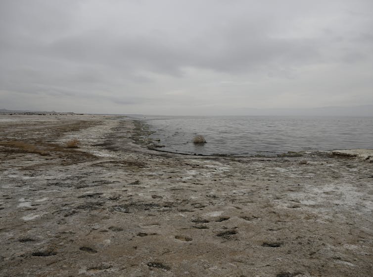
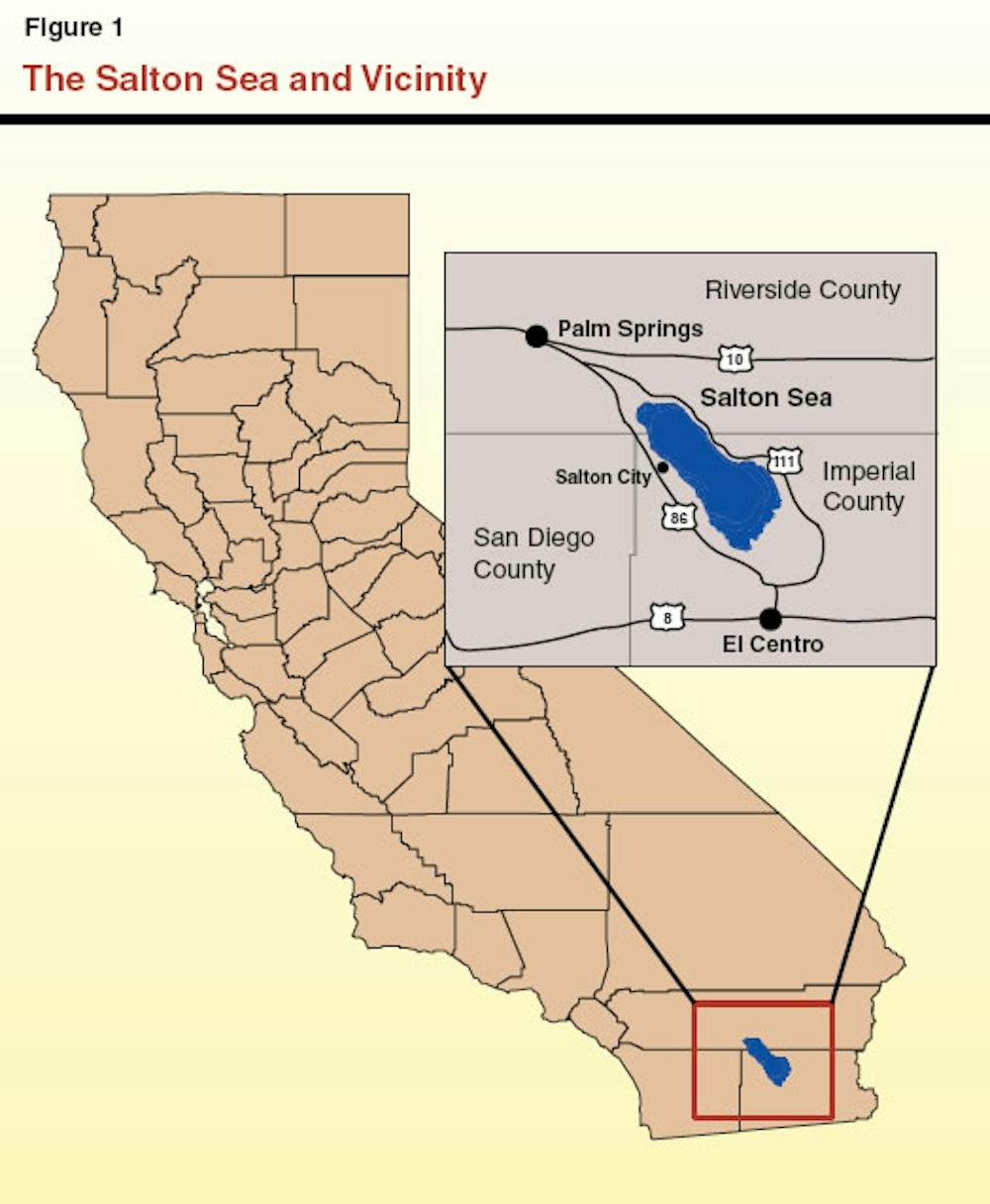
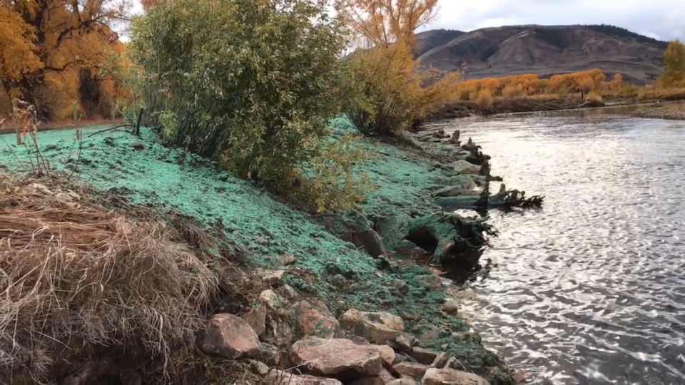


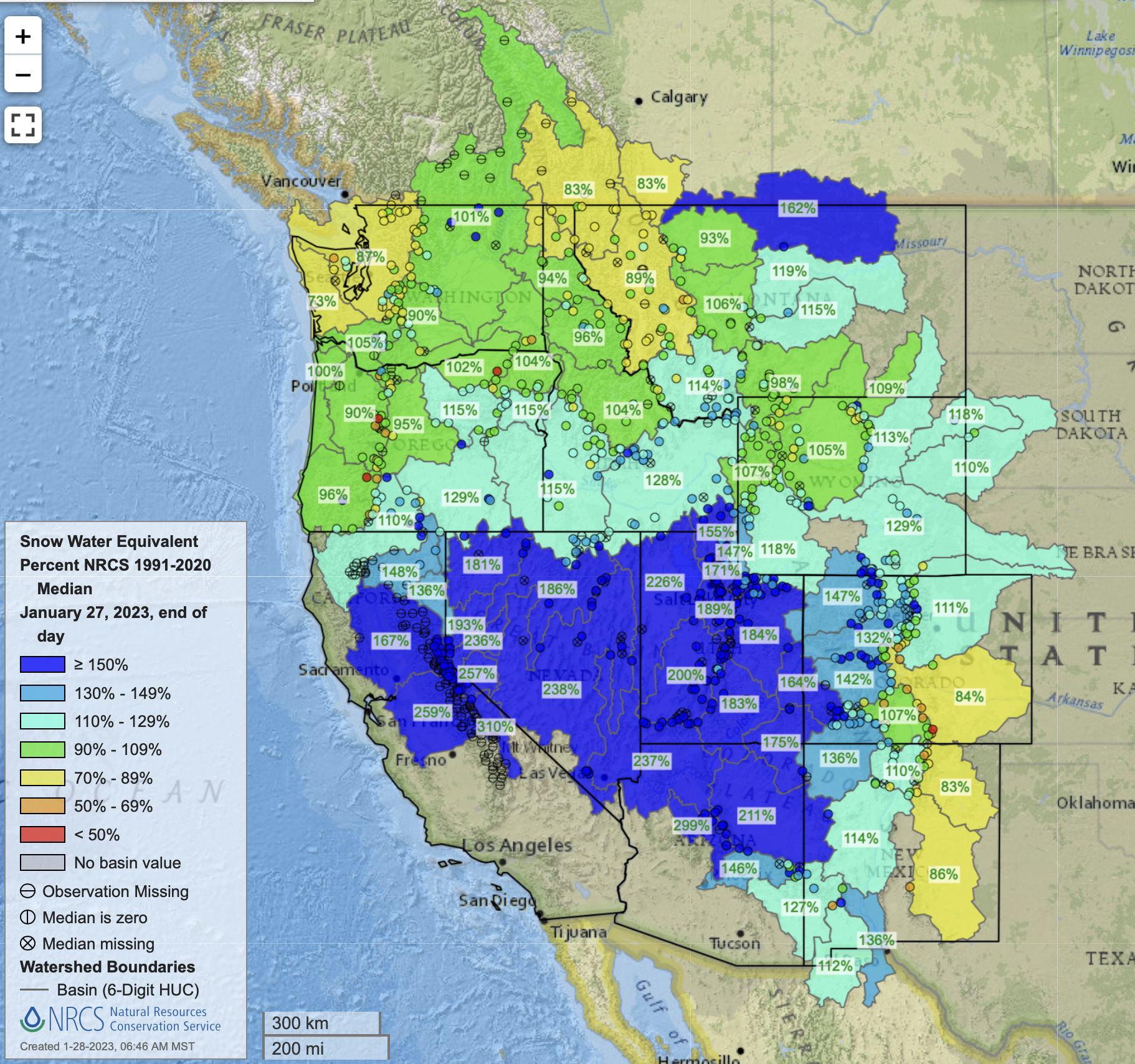

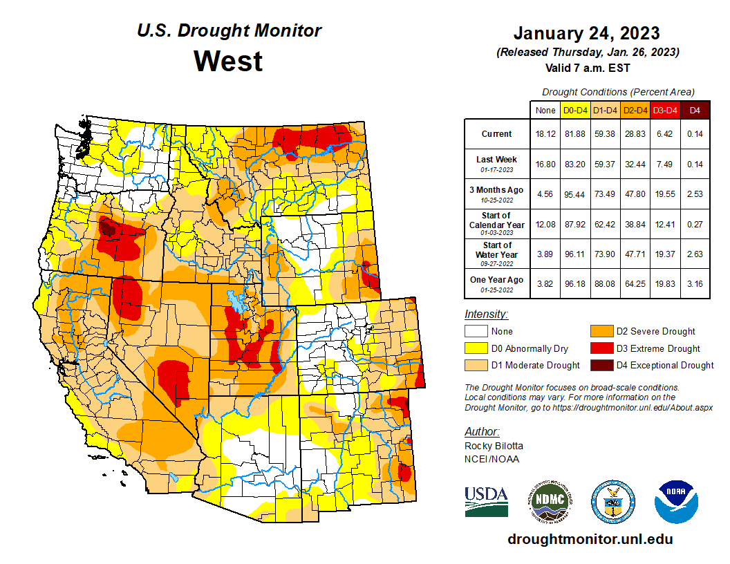


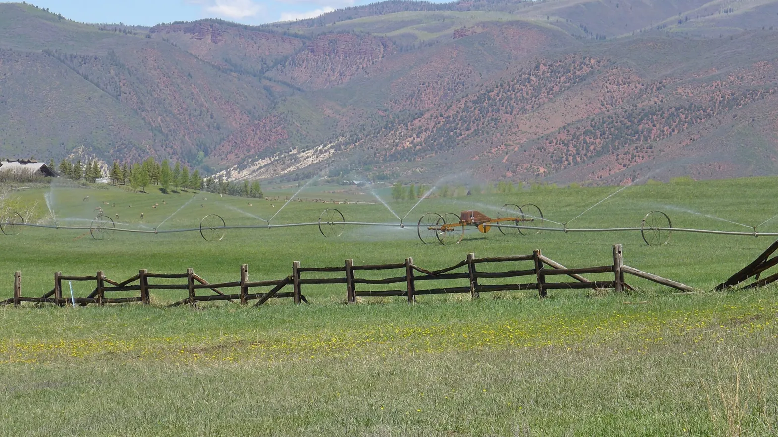


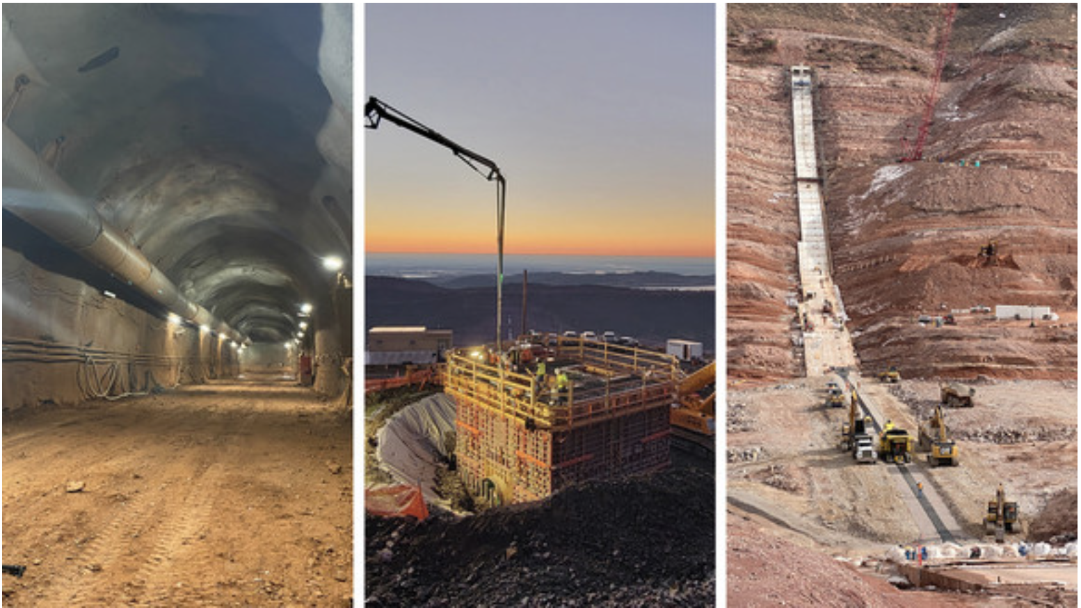


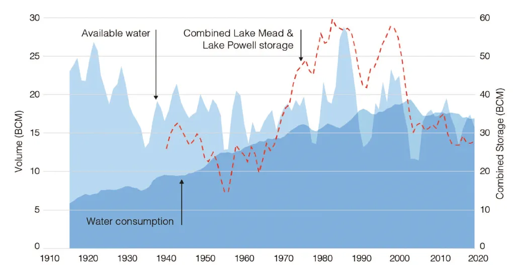

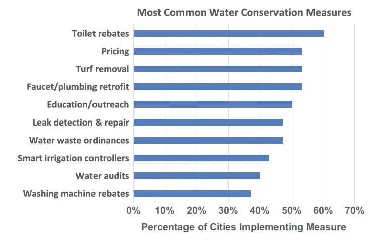


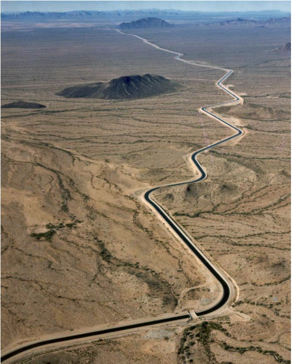

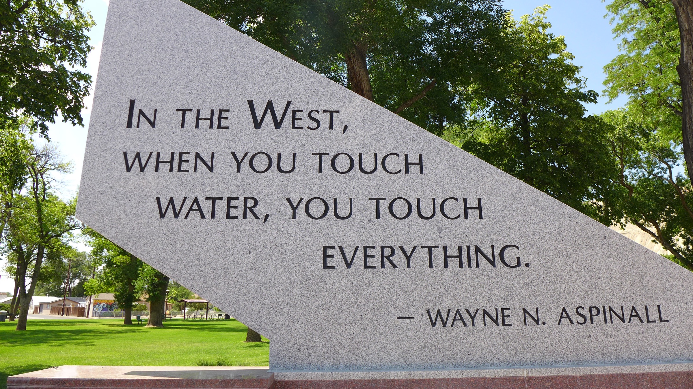
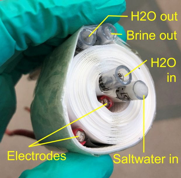

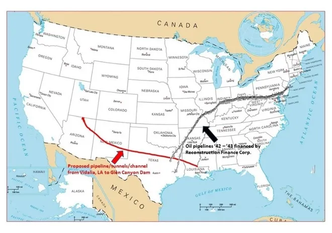


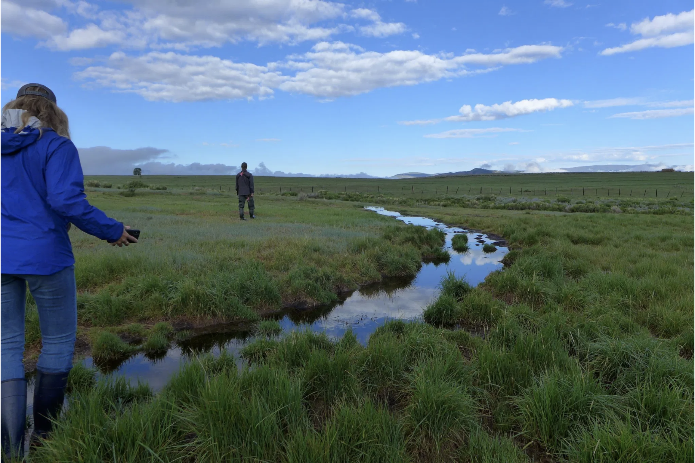


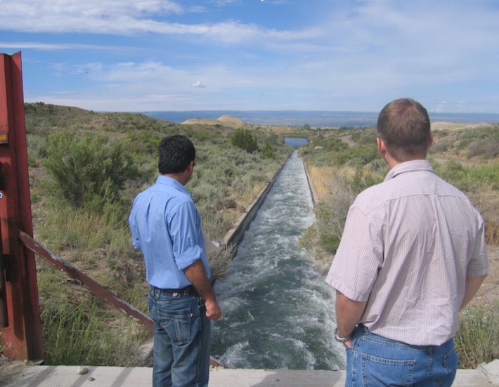

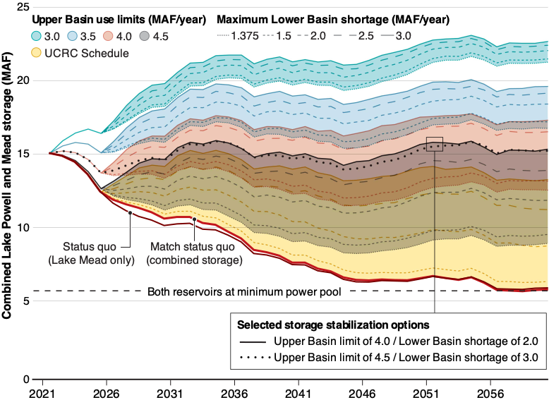
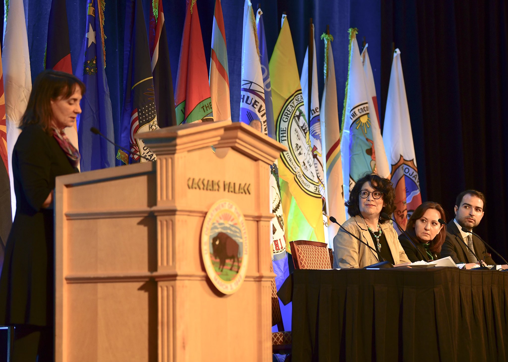

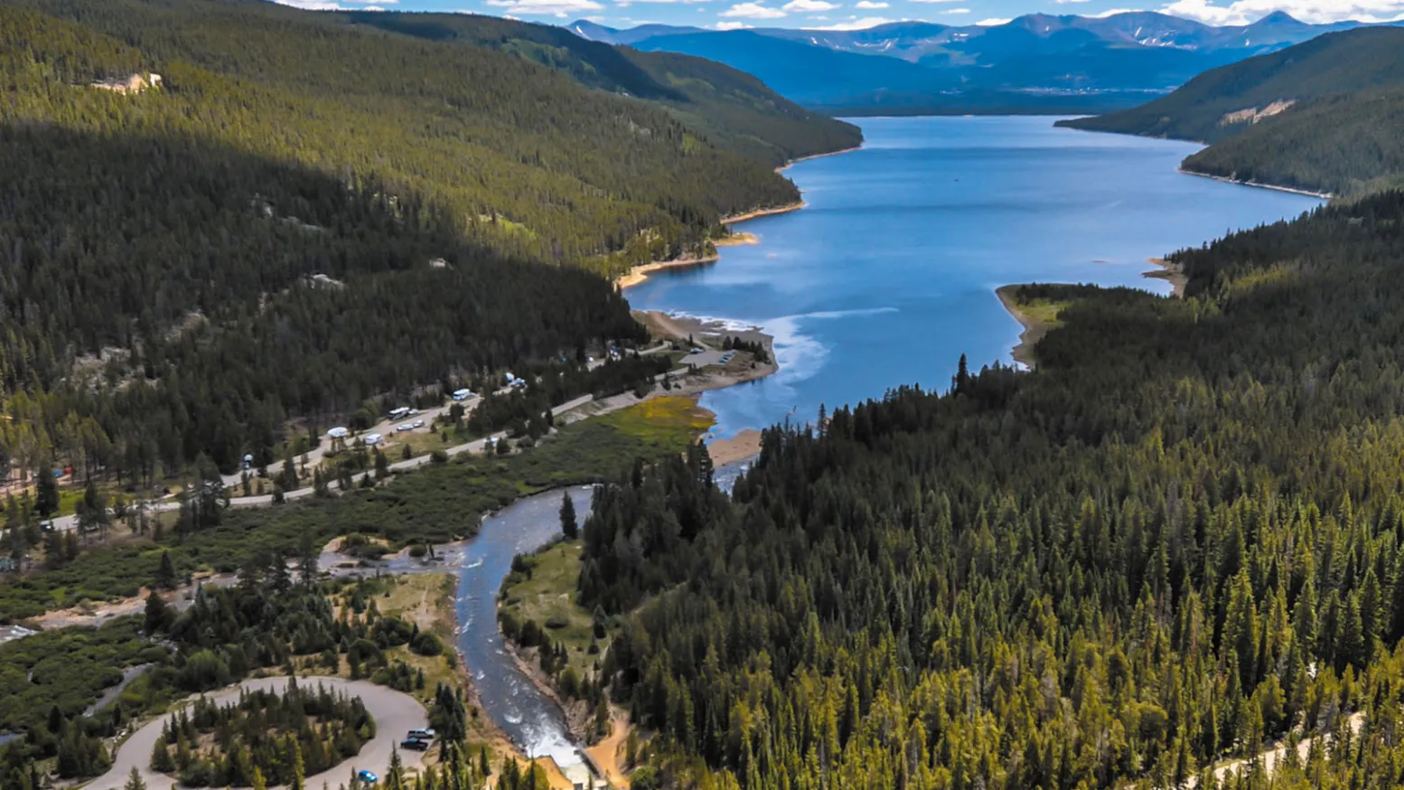
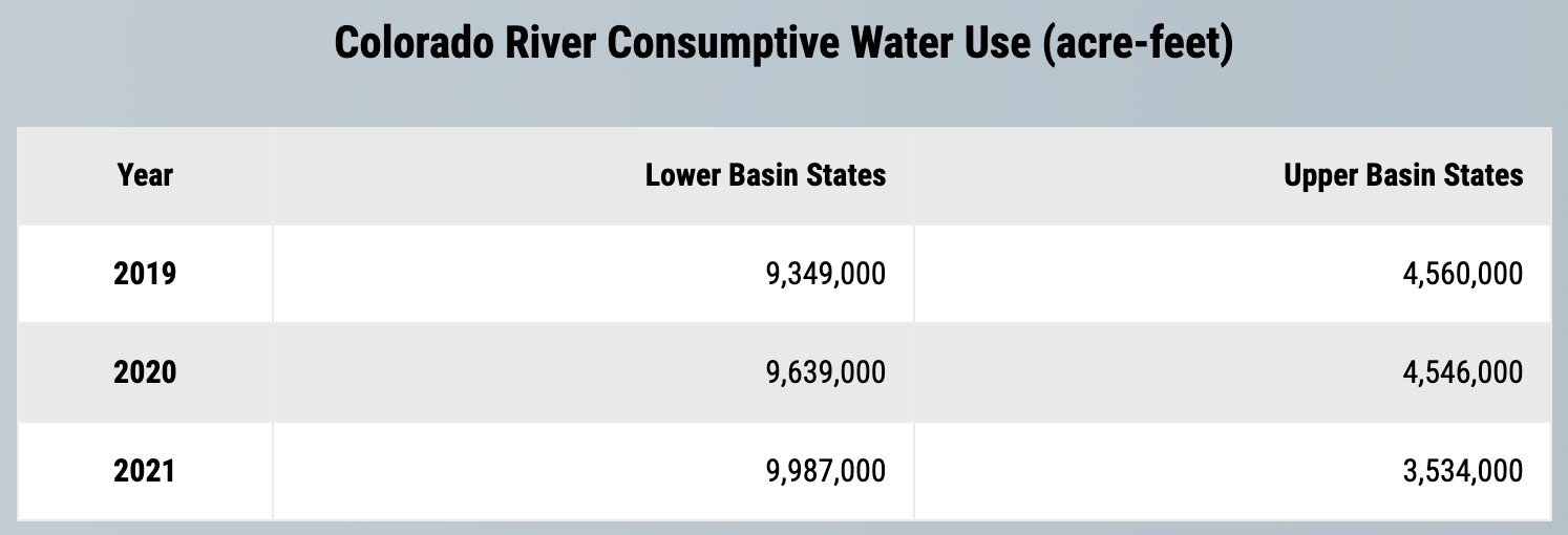


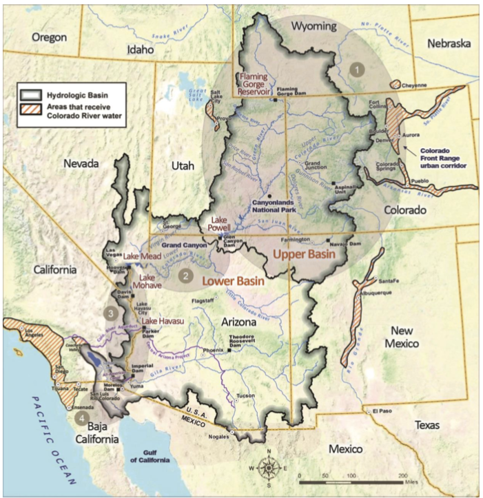


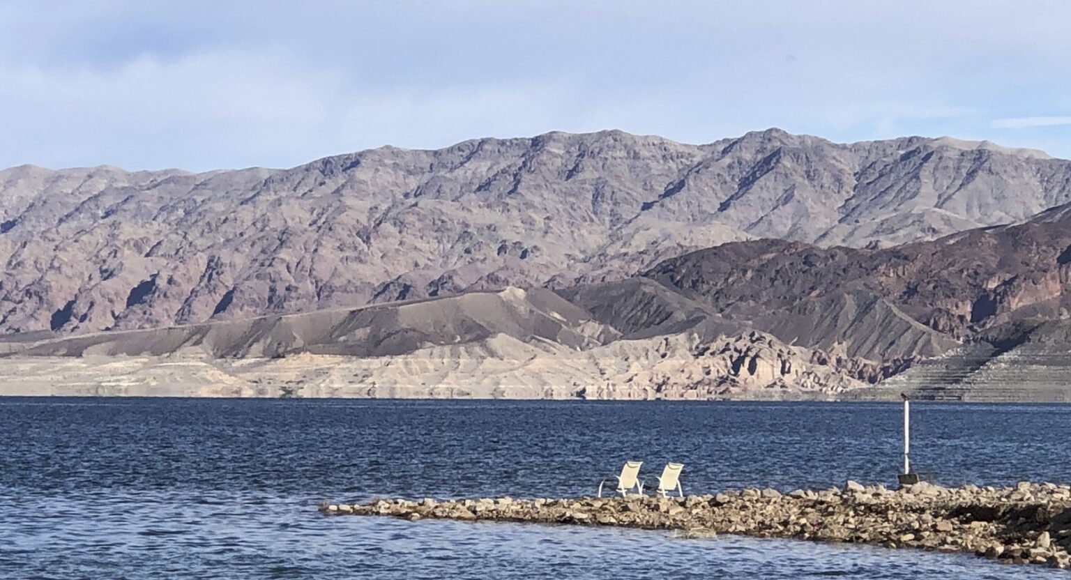
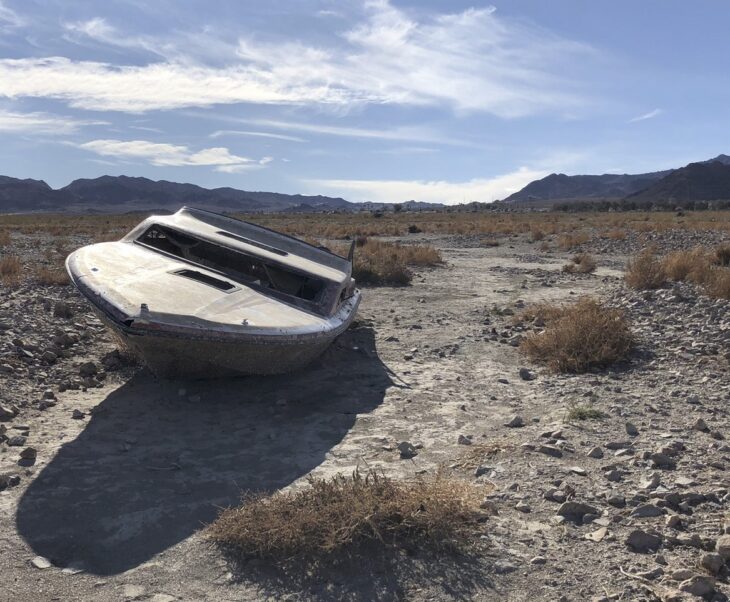


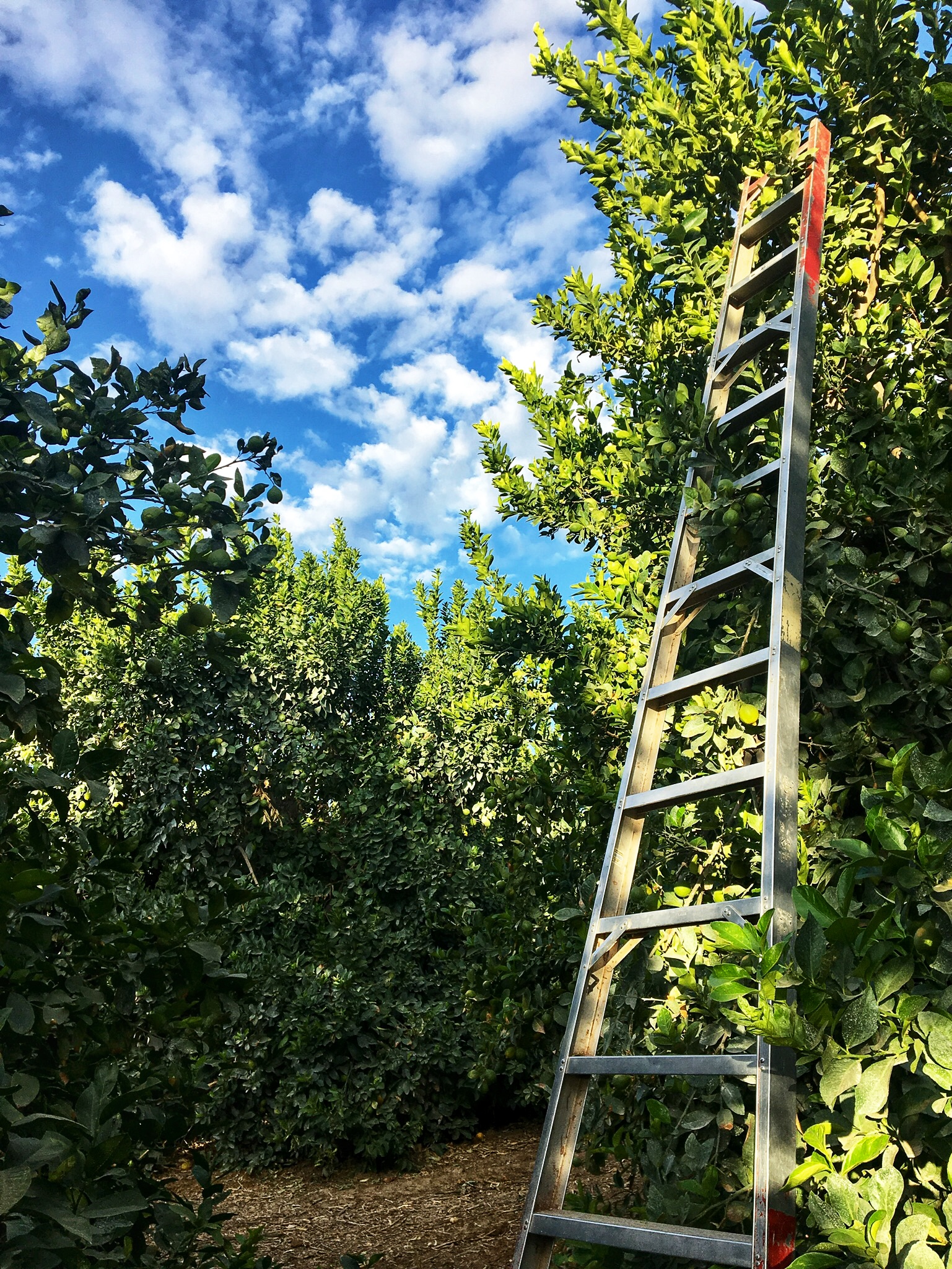

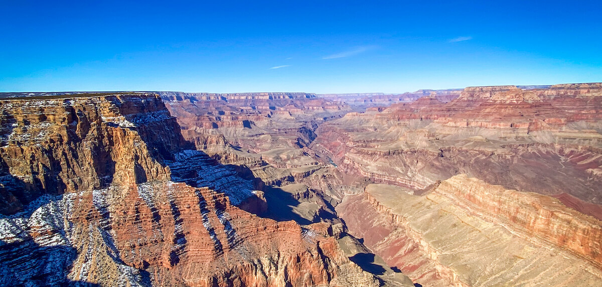


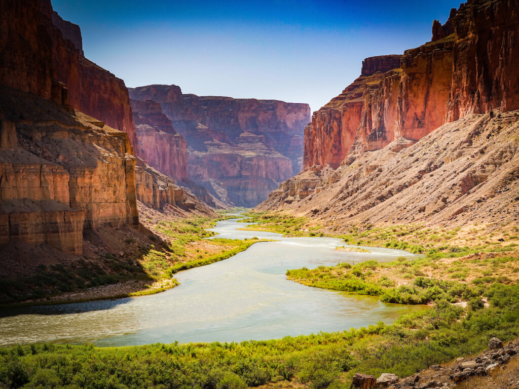


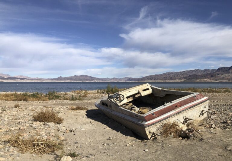


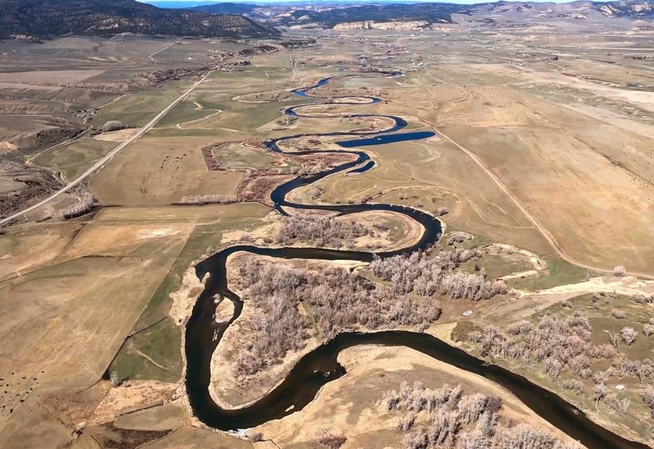
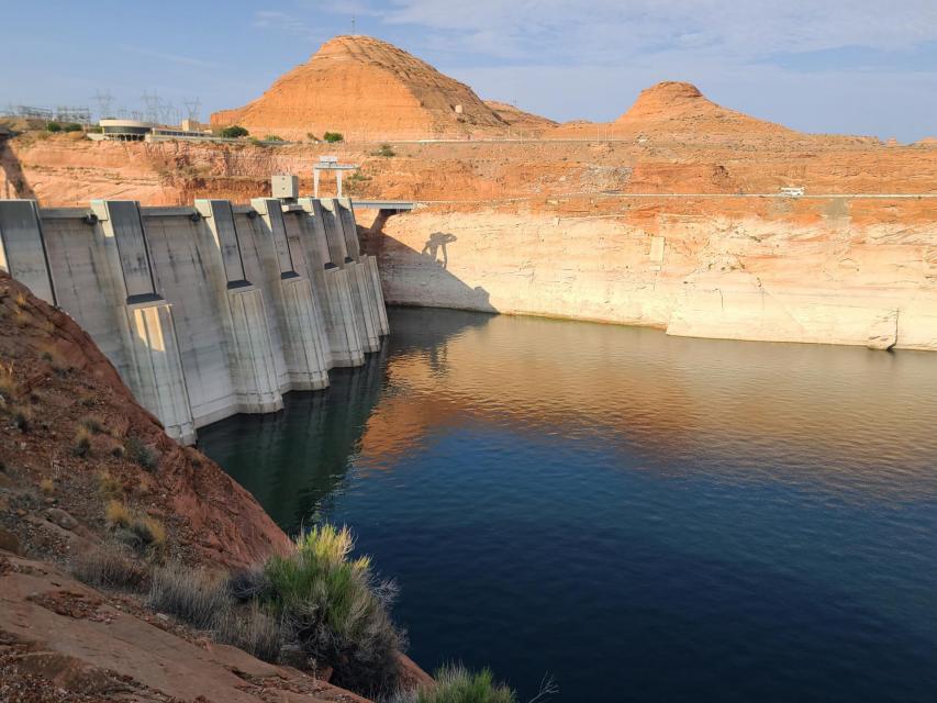

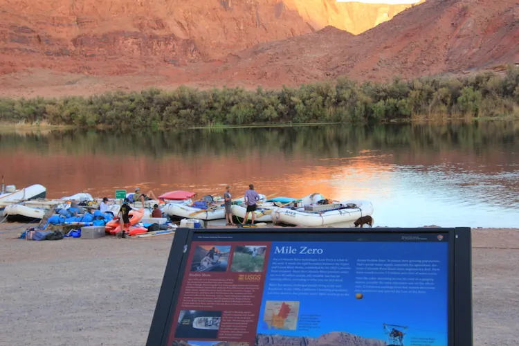


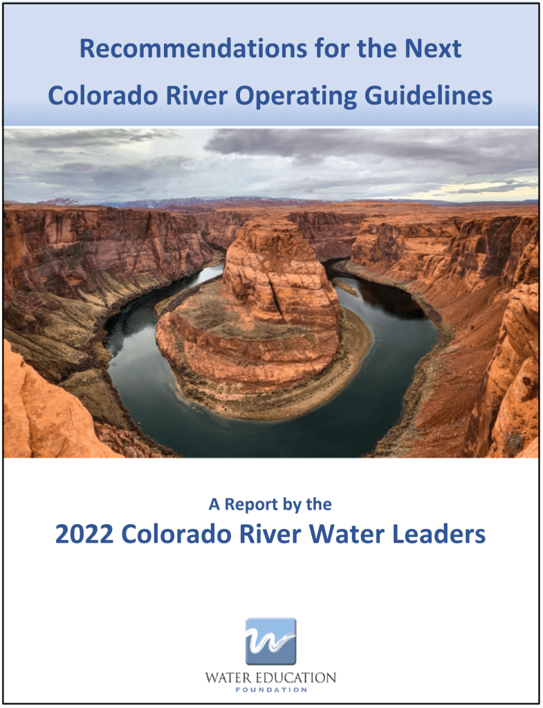


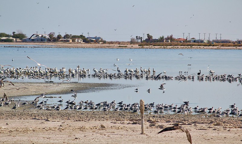
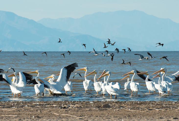
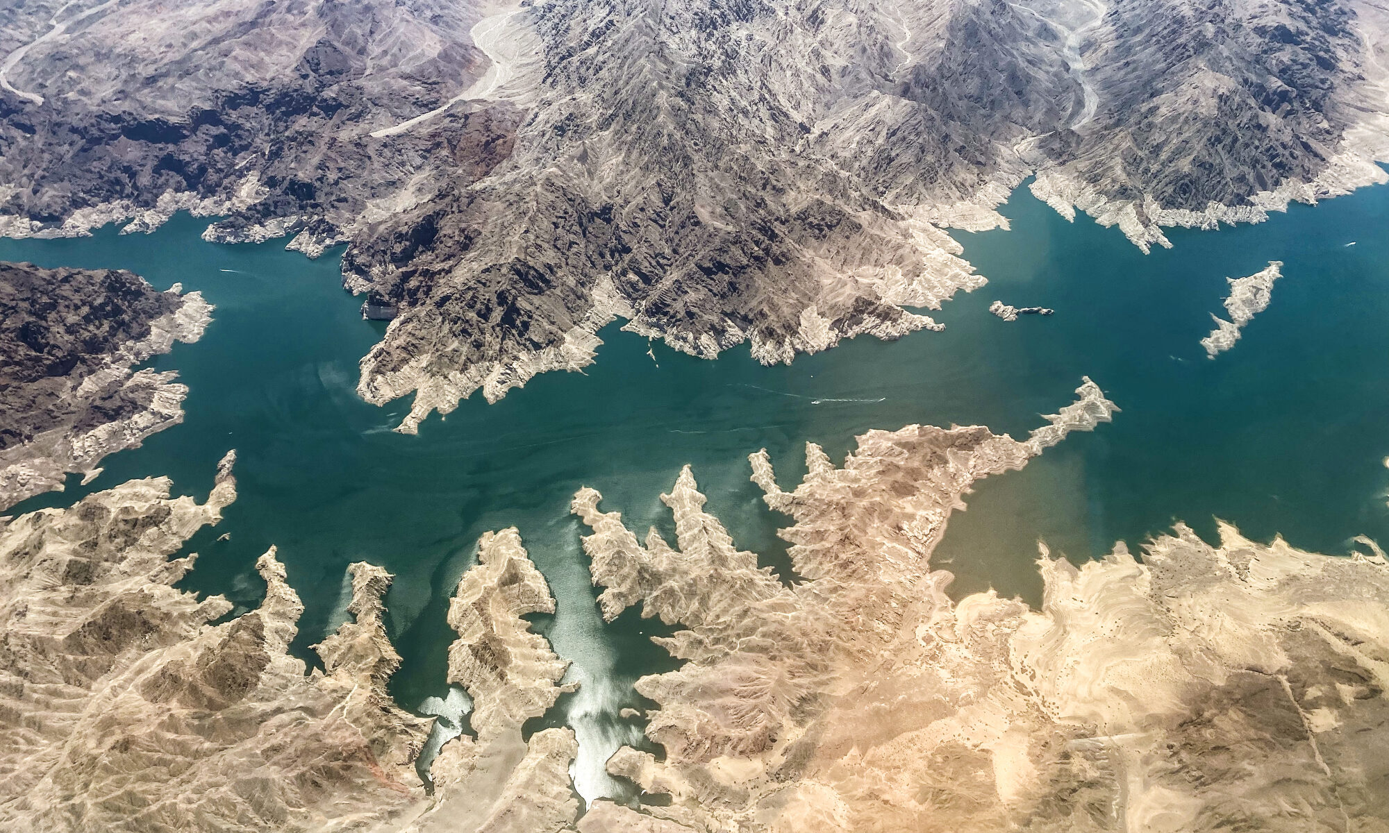
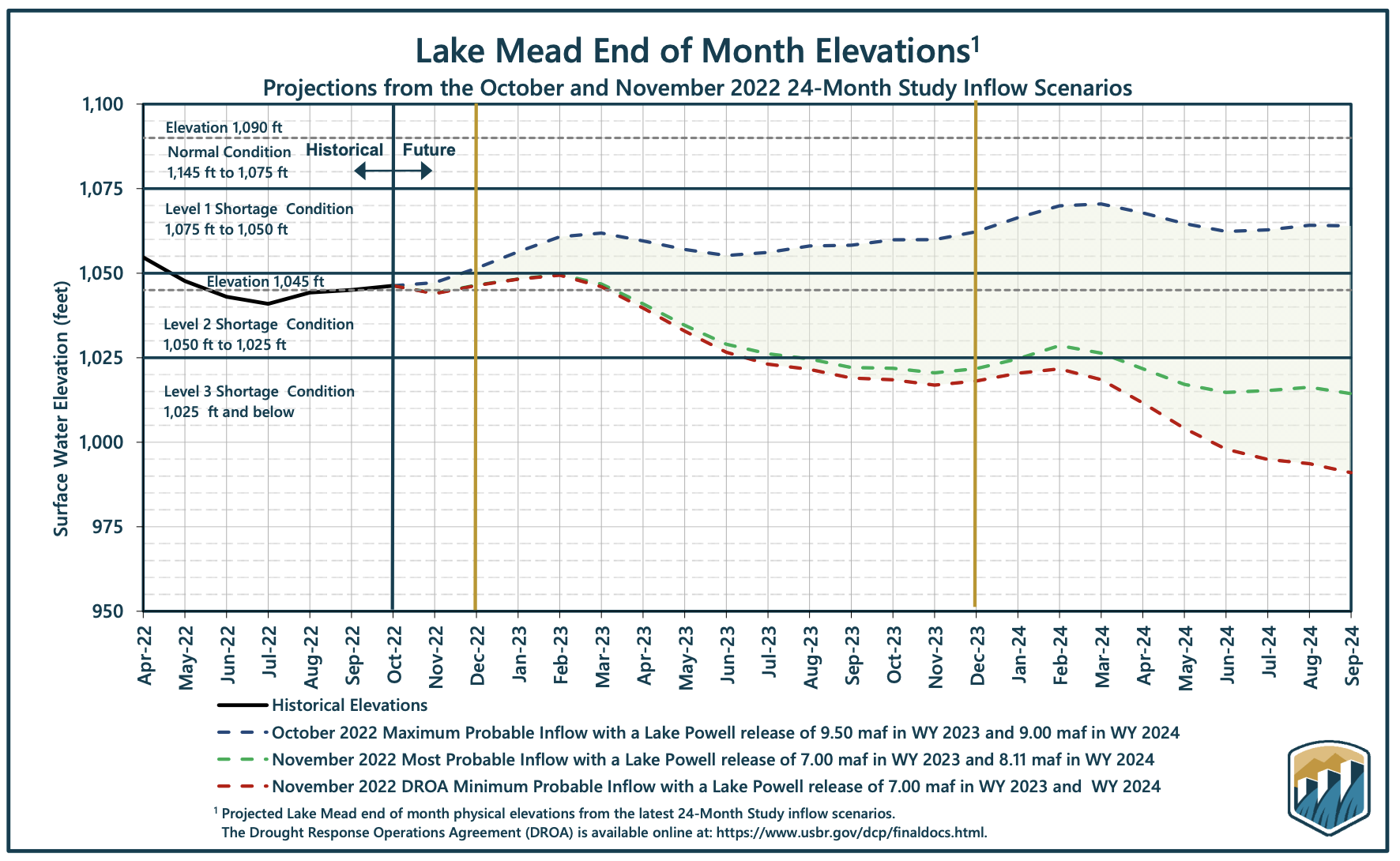


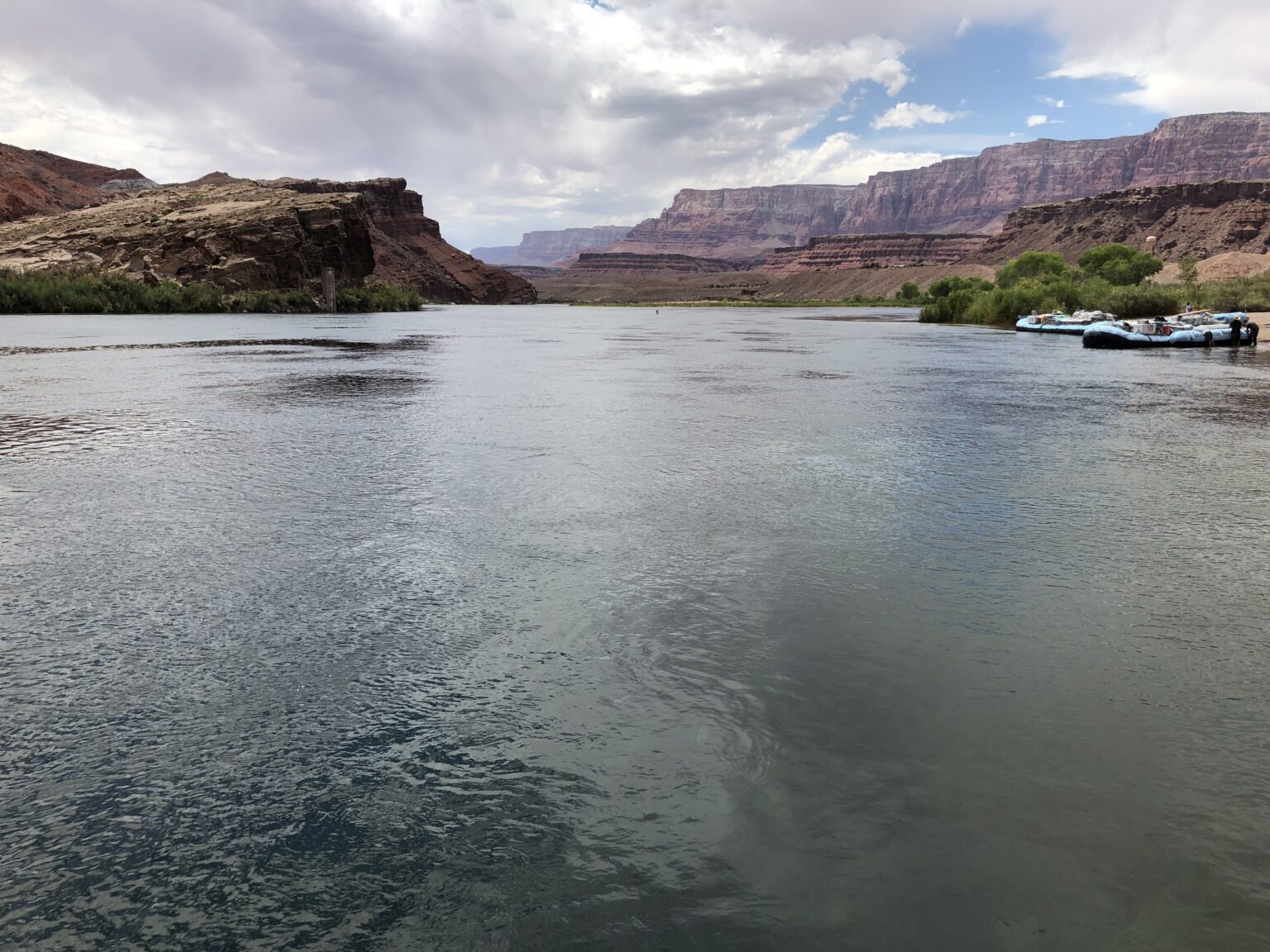

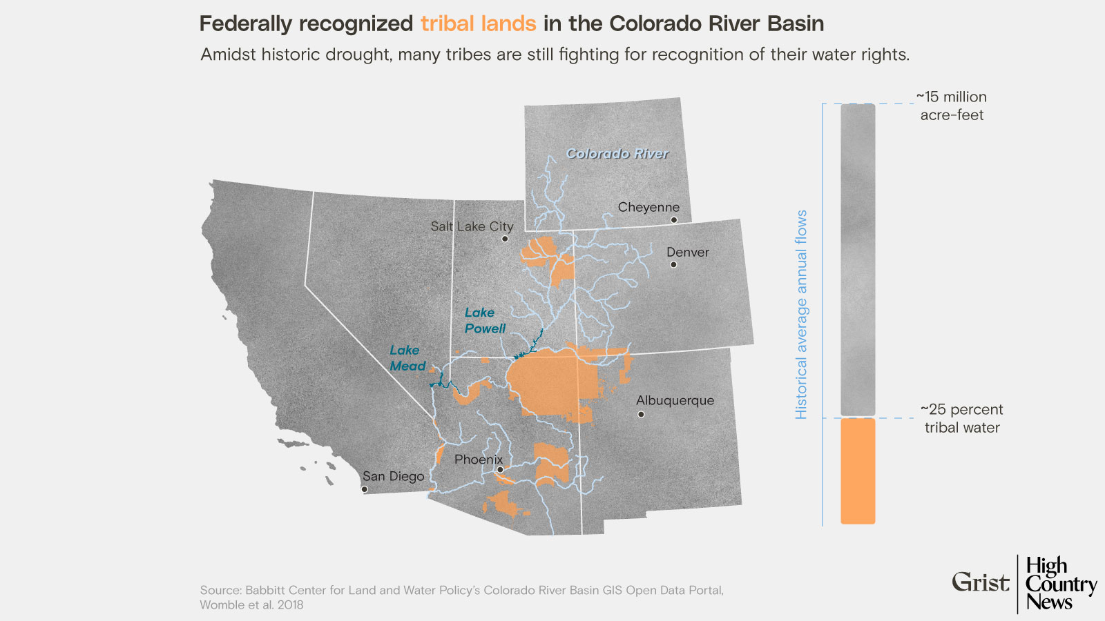
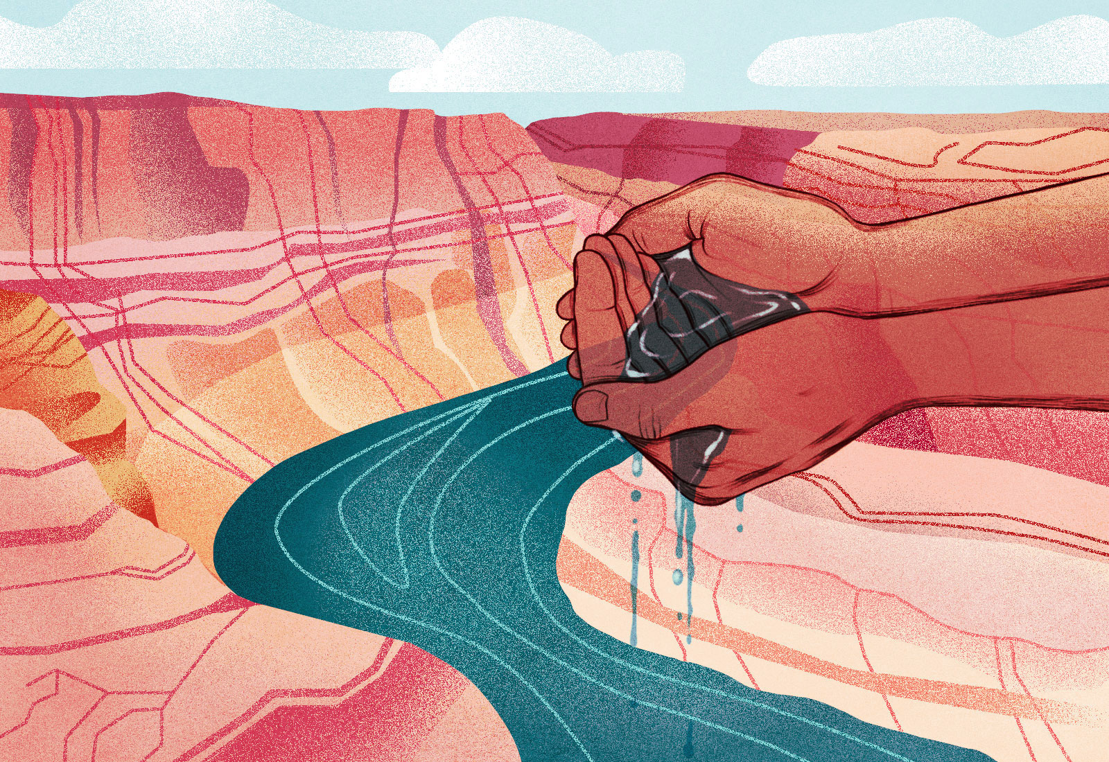
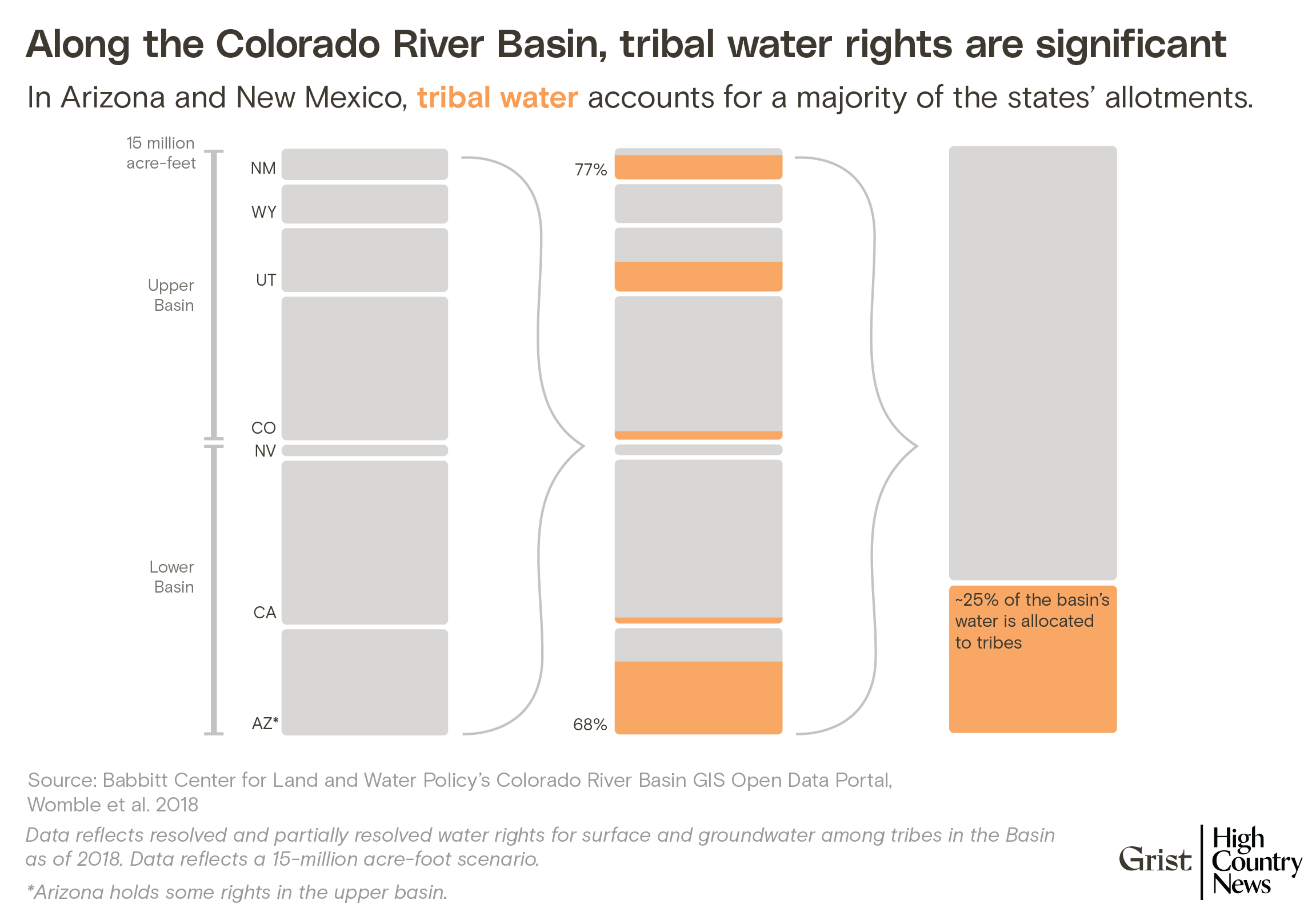
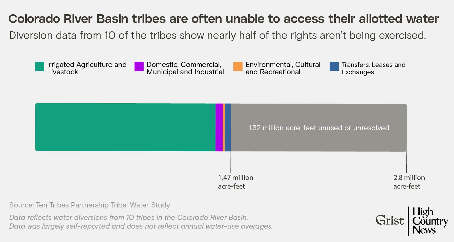
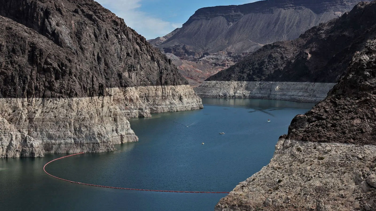
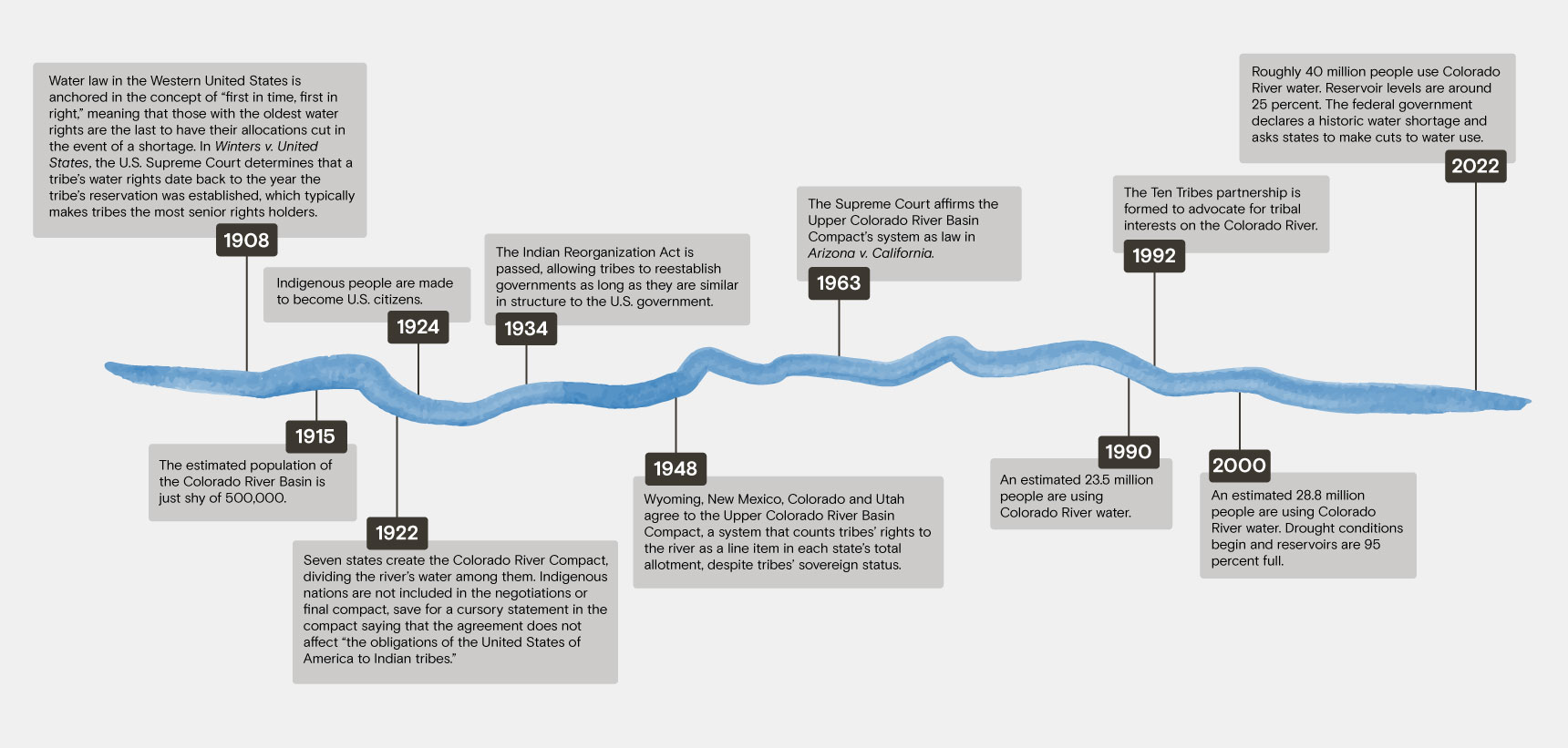