
From The Durango Herald (Dale Rodebaugh):
A ceremonial load of dirt was dumped Thursday to mark the end of construction of the Long Hollow Dam.
The brief topping-out observation was attended by members of the Ute Mountain Ute Tribe, which helped fund construction, and Brice Lee from La Plata Water Conservancy District, which sponsored the project.
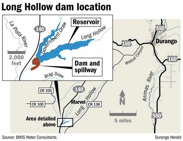
The reservoir behind the dam will store 5,300 acre-feet of water from Long Hollow Creek and Government Draw to support area irrigators and help Colorado meet its obligation to share La Plata River water with New Mexico…
The dam is 151 feet high with a span of 800 feet. A central clay core is supported upstream and downstream by tons of sand, rocks and dirt.
Aaron Chubbuck, Weeminuche project manager, said the dump trucks used during construction covered the equivalent of 10 trips around the world at the equator (about 250,000 miles).
Finishing touches remain. Sensors will be placed on the face of the dam to record possible movement or leakage, and electrical and hydraulic lines will be installed to operate the intake gate and valves on the downstream side.
The “borrow areas” from where construction materials were taken will have to be revegetated.
More La Plata River watershed coverage here.