
Click here to read the discussion:
ENSO Alert System Status: La Niña Watch
Synopsis: A transition from ENSO neutral to La Niña is favored in the next couple of months, with a 70-80% chance of La Niña during the Northern Hemisphere winter 2021-22.
In the last month, ENSO-neutral continued with near-to-below average sea surface temperatures (SSTs) persisting in the central and eastern equatorial Pacific. In the last week, all of the Niña index values ranged from -0.2oC to -0.3oC. Negative subsurface temperature anomalies (averaged from 180-100oW) remained steady in August, reflecting below-average temperatures that extended from the surface to ~250m depth in the eastern Pacific Ocean. Low-level wind anomalies were easterly over the western Pacific Ocean, while upper-level wind anomalies were westerly over the western and east-centralPacific. Tropical convection was suppressed near and west of the Date Line and enhanced over Indonesia. Given these conditions, the ocean-atmosphere system reflected ENSO-neutral, but is edging toward La Niña.
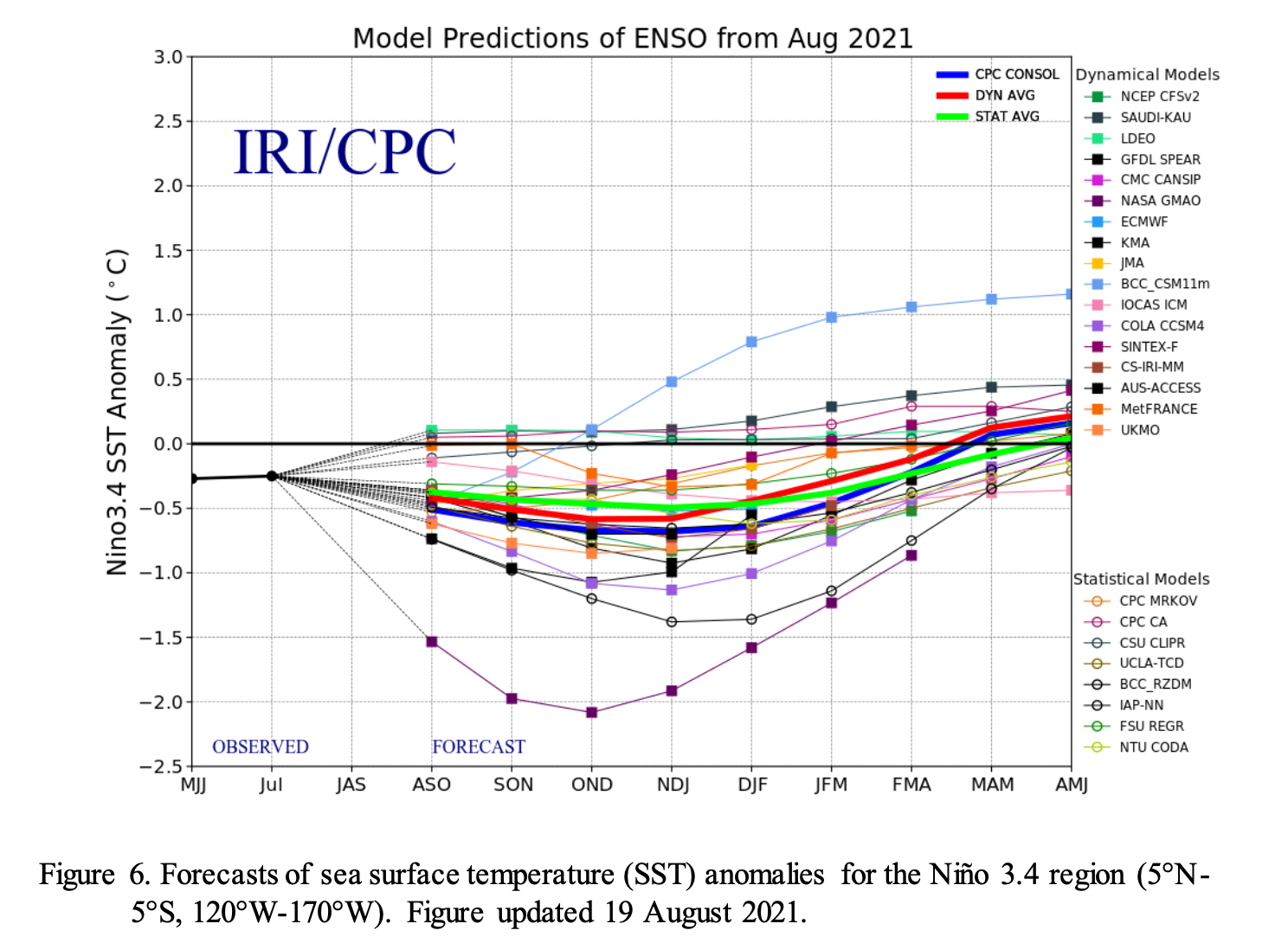
The IRI/CPC plume average of forecasts for the Niño-3.4 SST region from the last month favored borderline or weak La Niña during the fall and winter 2021-22. The forecaster consensus this month, however, favors the latest predictions from the NCEP CFSv2 and the North American Multi-Model Ensemble, which suggest higher chances for the emergence of La Niña. At this time, forecasters anticipate La Niña to be of weak strength (seasonal average Niño-3.4 index values between -0.5oC to – 0.9oC). In summary, a transition from ENSO-neutral to La Niña is favored in the next couple of months, with a 70-80% chance of La Niña during the Northern Hemisphere winter 2021-22 (click CPC/IRI consensus forecast for the chances in each 3-month period).