Kokanee Salmon are another species we sometimes encounter in the fall on the Dream Stream (South Platte River in South Park). Photo credit: Colorado Trout Hunters
This stretch of the South Platte and its world-class fishing have been damaged by floods, but borrowed root wads and other material could repair and protect it for years to come
Situated at 8,700-feet elevation in one of the largest plateau basins in North America, cradled by hills with snow-dusted peaks in the distance, this stretch of the South Platte owes its reputation to a combination of circumstances that create ideal habitat for fish — largely brown and rainbow trout but also species like kokanee salmon. They not only breed in sustainable numbers but also live long and grow to eye-popping sizes.
The stretch of river meanders through easily accessible flatlands between two reservoirs, Spinney Mountain to the northwest and Eleven Mile to the southeast, for three miles as the crow flies, though anglers walk its winding path for closer to five miles. But multiple floods over the past several years have chipped away at the banks and vegetation that provided safe harbor and attractive spawning grounds for the fish, threatening the optimal conditions.
Last month, Colorado Parks and Wildlife workers launched a project to restore the banks of this picturesque and prolific fishery in South Park, about 45 minutes west of Colorado Springs. And in a unique twist, the project was linked with another several miles away, focused on improving habitat for elk and mule deer.
Matt Kondratieff, aquatic researcher and stream restoration manager, already had done significant restoration on the Dream Stream back in 2013, but the project took a major hit months after its 2015 completion when a major flood ripped through the river and undid much of the work…
This wasn’t just any stretch of river. The Dream Stream ranks in the highest tier of Colorado fisheries, called Gold Medal waters. Those areas can produce 60 pounds of trout per acre, including a dozen that measure 14 inches or larger. Of the state’s roughly 9,000 miles of trout streams, only 322 miles meet those criteria — and this section of the South Platte exceeds the standards significantly.
“When we look at the Dream Stream numbers, the number of pounds per acre, we are 4.25 times the Gold Medal standards for biomass,” says Tyler Swarr, a CPW aquatic biologist whose territory includes the waterway. “And we’re almost five times the Gold Medal standard for the number of quality trout. So it’s a very robust fishery — really phenomenal, especially the brown trout population.”
The portion of the river that connects Spinney and Eleven Mile reservoirs now lies within what since 2010 has been known as the Charlie Meyers State Wildlife Area, named for the longtime Denver Post outdoors writer whose combination of eloquence and policy-minded conservation advocacy defined Colorado’s landscape. A memorial near the parking area celebrates Meyers, who died at 72 of complications from lung cancer…
Reality behind the dream
It may fly-fish like a dream, but there are plenty of reasons — both biological and hydrological — for this waterway’s abundance.
Start with Eleven Mile Reservoir, built in 1970. Lake species like brown and rainbow trout do well in the deep (more than 100 feet) and cool habitat, where they remain largely safe from predators and reside for most of the year — until it’s time to spawn. Then, they head upriver into the South Platte, where undercut banks provide further refuge while they pursue their journey to deposit their eggs in the river’s riffle habitat.
Riffles are generally shallower, faster parts of a stream where protruding rocks churn and oxygenate the water — which in turn aids water-dwelling insects, which become a current-driven buffet for fish. The gravel beneath provides the ideal repository for trout eggs.
Spinney Mountain Reservoir formally opened in 1982, providing a bookend to a remarkable ecosystem. The standing water of Spinney, plus gravity, creates groundwater movement that eventually rises into the Dream Stream from below — and the gentle upwelling provides prime conditions for trout eggs.
Too much sediment in a stream can smother them, but the rising water essentially cleans the gravel where the eggs lie and tumbles them in oxygen to enhance their development. Hatcheries replicate that natural water movement.
But as flooding washed away the river banks, once-prime spawning areas began accumulating fine sediment that hindered egg development. Left unrepaired, the stream would continually widen and become shallower. Water temperature would rise — a detriment to cold-water species like trout — and crucial hiding spots would disappear, exposing fish to predators from above…
Since water is released into the South Platte from the depths of Spinney, not the surface, the temperature remains hospitably cool, even in the heat of summer…
While Spinney also provides water to Aurora, the city has been accommodating in scheduling releases so that they don’t impact fish health or spawning — especially for the large population of browns in the area, notes John Davenport, chapter president for Denver Trout Unlimited.
“The way it has been managed and improved,” he says, “and with Aurora such a good partner to keep water flowing and take into consideration fish health, those fish grow large. If you’re not from Colorado, the Dream Stream will look nothing like your preconceptions. This is a meandering stream through flat, dry, sagebrush desert. It’s more like you’re on the plains than into the mountains. But as soon as visiting fishermen hook into big fish, they forget all about that.”
[…]
An unusual repair project
When Matt Kondratieff started formulating a plan for restoring the Dream Stream, he huddled with the project’s primary architects: CPW engineers, aquatic researchers and biologists Swarr and Spohn — people with decades of experience in the watershed.
He also consulted with several outfitters and anglers — including Landon Mayer — to fine tune the plans…
The project’s primary goal was to repair damage resulting from record high runoff in 2015, and two years later from a storm cell over the drainage that produced flash flooding. The use of toewood — a technique that employs submerged wood to reinforce the stream bank — would be augmented by other materials like cobble (basically rocks ranging from baseball- to basketball-size), large gravel and sod transferred from upland areas.
The area has a history of periodic flooding, often from localized storms that drench the region. One particularly freak storm just a few years ago dumped 3 inches of rain in less than an hour. Then rain turned to heavy hail and triggered a wall of water estimated at 10 feet high on the river.
What made the Dream Stream project unusual is that it fed off another CPW land management effort several miles away to enhance habitat for elk and mule deer. As the proliferation of mature conifer trees began to crowd out stands of aspen, a favored food source, crews worked in the James Mark Jones State Wildlife Area to thin the conifer.
“Bottom line,” Kondratieff says, “we needed large trees with root wads. So they figured out where there was overcrowding, took those trees and trucked them down. We used the root wad with the stem to weave into the banks, leaving root wads toward the channel, which creates complex habitat trout love.”
In all, workers moved nearly 60 15-foot tall trees, root wads still in place, four that measured 35 feet, plus 102 logs and more than 200 cubic yards of slash. Those elements were woven into the banks, while 15 tons of rock and boulders were strategically placed to enhance riffles…
By repairing the Dream Stream’s banks, CPW also aims to maintain a narrower channel that will effectively transport the fine sediment that can threaten egg-laying areas farther down the river to the next reservoir…
CPW research has determined that adding in-stream wood more than doubles trout abundance, as the root wads in particular provide cover for the fish to avoid predators, Swarr explains. Aside from anglers, the fish also must be wary of predatory birds that patrol the area, including eagles, herons, pelicans and osprey.
The project was funded largely by insurance money from the 2015 flood — about $60,000 — along with about $40,000 from CPW’s capital construction fund. Swarr estimates that to pay a private contractor for the work would have cost about $1.2 million compared to a little over $100,000 that it cost CPW to keep the work in-house, source materials on its own and combine it with the work on the department’s high-country project…
The heavy equipment required for the bank repair work is gone, but tracks remain as lingering evidence of the short-term disruption of the Dream Stream. Although plant life requires time to take hold and flourish — it could be a decade before it matures — the fish adapt quickly to the changes. Often it takes only days or weeks for them to adjust to the river’s new design, to discover new safe havens and food-rich riffles.
Spinney Mountain Reservoir
Managed flows along the South Platte River in Eleven Mile Canyon have helped rainbow trout eggs and young fish survive during spring runoff.
WHILE Colorado remains largely an observer in the ongoing federal court case over the Rio Grande Compact, the issues that could increase its involvement have become clearer since Texas filed its initial complaint eight years ago.
Texas originally made no claims against Colorado as its arguments focused on New Mexico’s delivery obligations and the use of groundwater below Elephant Butte Reservoir. Colorado was named a party to the initial complaint simply because it is a signatory to the 1938 compact. But the state’s role in the proceedings could change, depending on whether the case impacts Colorado’s ability to manage Platoro Reservoir, the Upper Rio Grande Basin’s largest post-compact reservoir, and the debits the state is allowed to accrue under the compact. Likewise, court decisions might change how federal water compacts are interpreted, which could also spur greater involvement by Colorado.
In August, Special Master Michael J. Melloy ordered Texas to file a supplemental complaint with the U.S. Supreme Court because it raised issues distinct from the original complaint and had the potential to greatly expand the scope of the lawsuit. That supplemental complaint claimed, among other issues, that New Mexico violated the compact by not keeping a pool of water equal to the delivery debits it is allowed to accrue in reservoir storage.
While Colorado was not named directly in the complaint, Colorado sees that claim as an attack on how the state manages its reservoirs and the 100,000 acre-feet of debits it is allowed to accrue against its downstream delivery obligation. “It is a bigger concern because it directly affects us,” Division Engineer Craig Cotten said earlier this month.
Water users in Colorado’s section of the Rio Grande have also informed Attorney General Phil Weiser that they would seek amicus status to join the case should Texas prevail with its claim. “If Texas were to prevail on its claimed interpretation of Arts. VI-VIII, Platoro Reservoir would be rendered effectively useless to the Conejos District because it would be the only reservoir where Colorado could store debit water,” stated the memorandum signed by the Rio Grande Water Conservation District, the Conejos Water Conservancy District and the Rio Grande Water Users Association.
Platoro Reservoir has a storage capacity of only 53,571 acre-feet, which would put Colorado in the position of losing roughly half of its allowable debits under the compact. Those debits, as the memorandum noted, were intended to recognize that variations in stream flow would impact Colorado’s ability to strictly adhere to the delivery obligations laid out by the compact.
Colorado is also leery of the proceedings giving the Rio Grande Project, which is made up mainly of Elephant Butte and Caballo reservoirs in New Mexico, an authority not called for by the compact. Both the United States, which operates the reservoirs under the Bureau of Reclamation, and New Mexico have argued that the project and its contracts with downstream irrigation districts are silently incorporated into the compact. “They’re really trying to add a lot to the compact,” Cotten said. A brief by Colorado has asked the special master to rule as a matter of law that the Rio Grande Project is not incorporated into the compact and does not impose obligations to the states under the compact. The issue of obligations under those contracts should be addressed outside the compact, Colorado argued.
Virtual testimony in the case began last week, with in-person testimony coming later in Cedar Rapids, Iowa. Both Cotten and Deputy State Engineer Mike Sullivan are expected to testify as fact witnesses, although they may not take the stand until a second phase of the trial in spring.
“It’s a fluid situation,” Cotten said.
Rio Grande and Pecos River basins. Map credit: By Kmusser – Own work, Elevation data from SRTM, drainage basin from GTOPO [1], U.S. stream from the National Atlas [2], all other features from Vector Map., CC BY-SA 3.0, https://commons.wikimedia.org/w/index.php?curid=11218868
The 96-degree heat has barely broken early on a September evening near Fruita, Colo. As the sun prepares to set, the ailing Colorado River moves thick and quiet next to Interstate 70, crawling across the Utah state line as it prepares to deliver billions of gallons of water to Lake Powell, 320 miles south.
This summer the river has been badly depleted—again—by a drought year whose spring runoff was so meager it left water managers here in Western Colorado stunned. As a result Lake Powell is just one-third full and its hydropower plants could cease operating as soon as July of 2022, according to the U.S. Bureau of Reclamation.
“We’re looking at a very serious situation from Denver all the way to California and the Sea of Cortez,” said Ken Neubecker, an environmental consultant who has been working on the river’s issues for some 30 years. “I’ve never seen it in a worse state.”
The Colorado River Basin is made up of seven states. Colorado, Wyoming, Utah and New Mexico comprise the upper basin and are responsible for keeping Lake Powell full.
Arizona, California and Nevada comprise the lower basin and rely on Powell’s larger, downstream sister reservoir, Lake Mead, just outside Las Vegas, to store water for delivery to Las Vegas, Phoenix, Los Angeles and more than 1 million acres of farmland.
These are two of the largest reservoirs in the United States. Few believed Mead, built in the 1930s, and Powell, built in the 1960s when the American West had just begun a 50-year growth spurt, would face a future where they were in seeming freefall. The two reservoirs were last full in 2000. Two years ago they dropped to 50% of capacity. Now they are operating at just over one-third their original 51 million-acre-foot combined capacity.
First-ever drought accord
Two years ago, this unprecedented megadrought prompted all seven states to agree, for the first time, to a dual drought contingency plan—one for the upper basin and one for the lower. In the lower basin, a specific set of water cutbacks, all tied to reservoir levels in Mead, were put in place. As levels falls, water cutbacks rise.
Those cutbacks began this year in Arizona.
But in the upper basin, though the states agreed to their own drought contingency plan, they still haven’t agreed on the biggest, most controversial of the plan’s elements: setting aside up to 500,000 acre-feet of water in a special, protected drought pool in Lake Powell. Under the terms of the agreement, the water would not have to be released to lower basin states under existing rules for balancing the contents of Powell and Mead, but would remain in Powell, helping to keep hydropower operations going and protecting the upper basin from losing access to river water if they fail to meet their obligations to Arizona, Nevada and California.
Rancher Bryan Bernal irrigates a field that depends on Colorado River water near Loma, Colo. Credit: William Woody
The pool was considered a political breakthrough when it was approved, something to which the lower basin states had never previously agreed.
“It was a complete reversal by the lower basin,” said Melinda Kassen, a retired water attorney who formerly monitored Colorado River issues for the Theodore Roosevelt Conservation Partnership.
But the idea was controversial among some powerful upper basin agricultural interests. Ranchers, who use some 80% of the river’s water, feared they would lose too much control of their own water supplies.
Seeking volunteers
As proposed, the drought pool would be filled voluntarily, largely by farmers and ranchers, who would be paid to temporarily dry up their hay meadows and corn fields, allowing the saved water to flow down to Powell.
Two years ago, when the drought contingency plan was approved, the four upper basin states thought they would have several years to create the new pool if they chose to.
But Powell’s plunging water levels have dramatically shortened timelines. With a price tag likely in the hundreds of millions of dollars, confusion over whether saved farm water can be safely conveyed to Powell without being picked up by other users, and concerns over whether there is enough time to get it done, major water players are questioning whether the pool is a good idea.
“It was probably a good idea at the time and it’s still worth studying,” said Jim Lochhead, CEO of Denver Water, the largest water utility in Colorado. “But it can’t be implemented in the short term. We don’t have the tools, we don’t have the money to pay for it, and we don’t have the water.”
Neubecker has similar concerns. “I fear it’s going to be Band-Aid on an endlessly bleeding problem…we need to do more.”
Since 2019 the State of Colorado has spent $800,000 holding public meetings and analyzing the legal, economic and water supply issues that would come with such a major change in Colorado River management.
Still no decisions have been made.
A call to act
Becky Mitchell is director of the Colorado Water Conservation Board, which is overseeing the analysis.
Aware of frustration with the state’s progress on studying the drought pool’s feasibility, formally known as its demand management investigation, Mitchell said the work done to date will help the state better manage the river in a drier future with or without the drought pool.
“We’re still ahead of the game in terms of what we’ve done with the study. The other states are looking at feasibility investigations but ours has been incredibly robust,” Mitchell said. “If we’re going to do it we have to do it right and factor all these things in. Otherwise we’re going to be moving backward.”
One example of a step forward is that new tools to measure water saved from fallowing agricultural land are now being developed.
A large-scale experiment in a swath of high-altitude hayfields near Kremmling has demonstrated that ranchers can successfully dry their fields and deliver Colorado River water to the stream in a measurable way, and the data is considered strong enough that it could be used to quantify water contributions to the drought pool.
Ranchers Joe Bernal, left, and his son Bryan inspect a feed corn field that depends on Colorado River water near Loma, Colo. Credit: William Woody
But other regulatory and physical barriers remain.
Under Colorado’s water regulations, rivers are only regulated where they cross state boundaries when water is scarce and the state would otherwise be unable to meet the terms of agreements with downstream states. But this is not yet the case on the Colorado River and its tributaries, so rules for determining who would get what in the event of cutbacks haven’t been developed.
In addition, because there has never been a so-called “call” on the Colorado River, the state has yet to require that all those who have diversion structures pulling from the Colorado River system measure their water use.
The situation is changing fast, though, with the 20-year drought and the storage crisis at Powell and Mead increasing pressure on state regulators to take action.
Now the state is taking steps to better monitor the river and its tributaries, moving to require that all diversion structures have measuring devices so it has the data it needs to enforce its legal obligations to the lower basin. If, for instance, some water users had to be cut off to meet the terms of the 1922 Colorado River Compact, the state could manage those cutbacks based on the water right decrees users hold that specify amount and priority date of use.
Such data would also be needed to administer a mass-fallowing program to help fill the Lake Powell drought pool.
Kevin Rein, Colorado’s State Engineer and top water regulator, said what’s known as the mainstem of the Colorado River is fairly well monitored but major tributaries, such as the Yampa and Gunnison, are not.
“A lot of tributaries don’t have the devices,” Rein said, adding that the state doesn’t know the extent of the problem. “But in important areas a lot of commissioners know there is a significant lack of measurement devices and that makes water administration difficult.”
Joe Bernal is a West Slope rancher whose family has been farming near Fruita since 1920. He has water rights that date back to 1898 and, like others in this rich agricultural region, he and his family have abundant water.
Bernal was an early supporter of the drought pool. He and his family participated in an experimental fallowing program in 2016, where they were paid to dry up their fields. He’s confident the problems can be solved.
But he’s also worried that the 500,000 acre-foot pool may not hold enough water to stabilize the river system and that it may not be done fast enough.
“We want to be sure the solution does some good, but the clock is ticking,” he said. “We don’t want to change the culture of this valley or our ability to produce food. But I think things need to move faster. We are taking too long implementing these solutions.”
Checking the averages
As Powell and Mead continue to drop—they were roughly half full just two years ago— Mitchell and Rein are quick to point out that Colorado remains in compliance with the 1922 Compact, which requires the upper basin to ensure 7.5 million acre-feet of water reaches the lower basin at Lee Ferry, Ariz., based on a 10-year rolling average. Right now the average is at roughly 9.2 million acre-feet, although it too is declining as the upper basin’s supplies continue to erode due to drought and climate change.
The Colorado River flows past fruit orchards near Palisade, Colo. Credit: William Woody
Climate scientist and researcher Brad Udall has estimated that the upper basin may not be able to deliver the base 7.5 million acre-feet in a year as soon as 2025. But the upper basin would remain in compliance with the 1922 Compact even then because the rolling average remains healthy.
Still, if the reservoirs continue to plummet as quickly as they have in the past two years, when they dropped from 50% to 30% full, the upper basin could face a compact crisis faster than anyone ever anticipated.
Major water users in the state, such as Denver Water, Northern Water and Pueblo Water, have water rights that post-date, or are junior to, the 1922 water compact, meaning their water supplies are at risk of being slashed to help meet lower basin demands.
The big dry out
Many river advocates hope the drought pool is approved because they believe it is an opportunity to test how the river and its reservoirs will work as the region continues to dry out.
“What we knew in 2018 [when the drought pool was conceived] is that we have more to do,” said Kassen. The drought pool, she said, “was a big win and offers a way of testing what the upper basin can do. It’s squandered if they don’t use it.”
Neubecker and others say it’s becoming increasingly clear that the river’s management needs to be re-aligned with the reality of this new era of climate change and multi-year drought cycles.
And that means that water users in the lower basin and upper basin will need to learn to live with how much water the river can produce, rather than how much a century-old water decree says they’re legally entitled too.
“We’re facing a 21st Century situation that was totally unforeseen by anyone,” Neubecker said, “and we no longer have the luxury of time.”
Jerd Smith is editor of Fresh Water News. She can be reached at 720-398-6474, via email at jerd@wateredco.org or @jerd_smith.
Wet meadows and riparian areas in sagebrush country only account for about 2% of the landscape. Trouble for these systems started when white settlers moved West. Instead of taking their wagons through the sagebrush where it was rocky and rough, they followed the edges of the meadows.
Seward said the wagon wheels created trenches that were reinforced by livestock trailing between water sources, and eventually off-road vehicles using the same paths. These trenches caused water to pool.
“When water gets captured in those trails it speeds up and becomes more erosive and it starts to downcut,” he said. “It starts actually washing away the topsoil and working its way until it finally hits the bedrock.”
Wet meadow in Rocky Mountain National Park. Photo credit: The Environmental Protection Agency
Sawyer said these impacts are being sped up by climate change.
“We are trying to prevent these systems from disappearing entirely from our landscape,” he said.
Wet meadows provide critical habitat for deer, elk, migratory birds, pollinators, livestock and the federally threatened Gunnison sage grouse.
Colorado Parks and Wildlife estimates there about 3,500 Gunnison sage grouse left, with a majority of the population living in the Gunnison Basin. In 2015, there were around 5,000.
The species suffers habitat loss due to human-driven growth and development. The birds need large swaths of healthy sagebrush habitat to thrive. Climate change also threatens what’s left of the species habitat. Wet meadows provide sage grouse with important brood-rearing habitat to raise chicks.
The Wet Meadows Restoration Resilience Building Project is a local effort to restore habitat for the threatened Gunnison sage grouse. It’s a collaboration by government agencies, nonprofits, private landowners and the public.
Wet meadows also act as natural sponges, holding water in the soil and slowly releasing it over time. Seward said the restoration work helps build resiliency into the ecosystem. That will only get more important as climate projections indicate the area will get warmer and drier.
“Everyone knows that water in the West is life,” he said. “All life needs water, so by holding more water here in the Gunnison Basin longer and putting it to good beneficial use for wildlife, for our agricultural industries, like ranching as well — really everyone benefits from this kind of work.”
Project organizers said the restoration is working in the Gunnison Basin. Overall, they’ve seen wetland vegetation double in treated areas since the program started in 2012.
This is just one of dozens of watershed restoration projects in Colorado and states across the West. Wet meadow restoration projects to benefit the Gunnison sage grouse are also happening in San Miguel, Montrose, Mesa and Delta counties.
Tyler Swarr, aquatic biologist for CPW, holds up a brown trout from Antero Reservoir on Wednesday, Oct. 6 when officials conducted the brown trout spawn there in South Park (photo by Jason Clay/CPW)
Here’s the release from Colorado Parks & Wildlife (Jason Clay):
Each fall, brown trout spawn in the mountain creeks and rivers across Colorado. It is also when aquatic biologists, hatchery staff, wildlife officers and volunteers for Colorado Parks and Wildlife come together to conduct its annual brown trout spawning operation at North Delaney Butte Lake and Antero Reservoir.
A quota is set to collect the number of eggs necessary to meet the needs for hatchery production, which CPW uses to augment natural reproduction across Colorado’s creeks, rivers and reservoirs.
This year, that quota was 1.1 million brown trout eggs. It took just three working days at those two brood stock bodies of water to meet the quota of fertilized eggs that get sent to CPW’s Mt. Shavano Hatchery in Salida and its Poudre Rearing Hatchery in Larimer County.
The hatcheries will rear the fish to a fingerling size, around three inches, before being stocked out across Colorado in 2022. Those brown trout fingerlings will get stocked back into both Antero Reservoir and North Delaney Butte Lake to ensure a strong brood stock population, but also across many other reservoirs and rivers.
“Some of them will come back and be stocked into Antero and some will go to North Delaney as well, so we can come back in three or four years and still will have fish,” said Tyler Swarr, aquatic biologist leading the brown trout spawning operation at Antero Reservoir. “The rest of them will get stocked out across the state.”
CPW stocks more than 700,000 brown trout annually to provide exceptional fishing opportunities.
Crews at Antero Reservoir were able to collect and fertilize 227,026 brown trout eggs from 117 females during its lone spawning day on Wednesday, Oct. 6.
At North Delaney Butte Lake in North Park, CPW’s team needed just three days (Oct. 5-7) to gather 888,574 eggs to surpass the quota of 1.1 million fertilized brown trout eggs for the year.
“2021 was another good brown trout spawn year at North Delaney,” said Kyle Battige, aquatic biologist leading the brown trout spawning operation there. “We saw many year classes present, handled over 1,500 brown trout in three days and I’m happy overall with the current condition of the brood lake”
Brown trout spawn in the wild occurs over the months of October and November. It is temperature dependent.
“River fish spawn a little bit later since it is colder,” Swarr said. “Since reservoirs absorb a lot more solar radiation, they are warmer, so they’ll actually spawn earlier here than they will in rivers.”
In the reservoirs, the silt from the wave action can cover the eggs and prevent them from getting the fresh oxygen they need to grow and hatch. In a river setting, brown trout will lay eggs in the gravel on the river bottom. Those eggs typically get laid in places of upwelling where there is a crest of a riffle and you have a plunge that causes the water to travel through the gravel, slowly turning the eggs and delivering oxygen to them.
“Our spawning operation helps to sustain some of our brown trout fisheries in the state and provides a little bit more fishing diversity for anglers,” Swarr said.
Brown trout are a hard-fighting fish and have beautiful coloration that matches the autumn season. Brown trout are golden brown with vibrant black, red and orange spots.
“The cool thing about them in the state of Colorado is they are resistant to whirling disease since they evolved with that in Europe,” Swarr said. “So, they’ve become kind of the bread and butter of our wild trout fisheries, at least in our northeast region, because really most of the brown trout in the state of Colorado are naturally reproducing wild populations and we don’t have to stock them to the numbers we do with rainbows. Rainbow trout are still impacted heavily by whirling disease.”
Communities that rely on the Colorado River are facing a water crisis. Lake Mead, the river’s largest reservoir, has fallen to levels not seen since it was created by the construction of the Hoover Dam roughly a century ago. Arizona and Nevada are facing their first-ever mandated water cuts, while water is being released from other reservoirs to keep the Colorado River’s hydropower plants running.
If even the mighty Colorado and its reservoirs are not immune to the heat and drought worsened by climate change, where will the West get its water?
What many people don’t realize is how old – and how vulnerable – much of that water is.
Most water stored underground has been there for decades, and much of it has sat for hundreds, thousands or even millions of years. Older groundwater tends to reside deep underground, where it is less easily affected by surface conditions such as drought and pollution.
As shallower wells dry out under the pressure of urban development, population growth and climate change, old groundwater is becoming increasingly important.
Drinking ancient groundwater
If you bit into a piece of bread that was 1,000 years old, you’d probably notice.
Water that has been underground for a thousand years can taste different, too. It leaches natural chemicals from the surrounding rock, changing its mineral content. Some natural contaminants linked to groundwater age – like mood-boosting lithium – can have positive effects. Other contaminants, like iron and manganese, can be troublesome.
Older groundwater is also sometimes too salty to drink without expensive treatment. This problem can be worse near the coasts: Overpumping creates space that can draw seawater into aquifers and contaminate drinking supplies.
Flow timescales of groundwater through different layers. USGS
Ancient groundwater can take thousands of years to replenish naturally. And, as California saw during its 2011-2017 drought, natural underground storage spaces compress as they empty, so they can’t refill to their previous capacity. This compaction in turn causes the land above to crack, buckle and sink.
Yet people today are drilling deeper wells in the West as droughts deplete surface water and farms rely more heavily on groundwater.
What does it mean for water to be ‘old’?
Let’s imagine a rainstorm over central California 15,000 years ago. As the storm rolls over what’s now San Francisco, most of the rain falls into the Pacific Ocean, where it will eventually evaporate back into the atmosphere. However, some rain also falls into rivers and lakes and over dry land. As that rain seeps through layers of soil, it enters slowly trickling “flowpaths” of underground water.
Some of these paths lead deeper and deeper, where water collects in crevices within the bedrock hundreds of meters underground. The water gathered in these underground reserves is in a sense cut off from the active water cycle – at least on timescales relevant to human life.
In California’s arid Central Valley, much of the accessible ancient water has been pumped out of the earth, mostly for agriculture. Where the natural replenishment timescale would be on the order of millennia, agricultural seepage has partially refilled some aquifers with newer – too often polluted – water. In fact, places like Fresno now actively refill aquifers with clean water (such as treated wastewater or stormwater) in a process known as “managed aquifer recharge.”
Average turnover times for groundwater in the U.S. Alan Seltzer, based on data from Befus et al 2017, CC BY-ND
In 2014, midway through their worst drought in modern memory, California became the last western state to pass a law requiring local groundwater sustainability plans. Groundwater may be resilient to heat waves and climate change, but if you use it all, you’re in trouble.
One response to water demand? Drill deeper. Yet that answer isn’t sustainable.
First, it’s expensive: Large agricultural companies and lithium mining firms tend to be the sort of investors who can afford to drill deep enough, while small rural communities can’t.
Second, once you pump ancient groundwater, aquifers need time to refill. Flowpaths may be disrupted, choking off a natural water supply to springs, wetlands and rivers. Meanwhile, the change in pressure underground can destabilize the earth, causing land to sink and even leading to earthquakes.
Pumping accelerates groundwater flow to a well, delivering dissolved chemicals. USGS
Third is contamination: While deep, mineral-rich ancient groundwater is often cleaner and safer to drink than younger, shallower groundwater, overpumping can change that. As water-strapped regions rely more heavily on deep groundwater, overpumping lowers the water table and draws down polluted modern water that can mix with the older water. This mixing causes the water quality to deteriorate, leading to demand for ever-deeper wells.
Reading climate history in ancient groundwater
There are other reasons to care about ancient groundwater. Like actual fossils, extremely old “fossil groundwater” can teach us about the past.
Envision our prehistoric rainstorm again: 15,000 years ago, the climate was quite different from today. Chemicals that dissolved in ancient groundwater are detectable today, opening windows into a past world. Certain dissolved chemicals act as clocks, telling scientists the groundwater’s age. For example, we know how fast dissolved carbon-14 and krypton-18 decay, so we can measure them to calculate when the water last interacted with air.
Younger groundwater that disappeared underground after the 1950s has a unique, man-made chemical signature: high levels of tritium from atomic bomb testing.
The various components and properties of an unconfined aquifer. USGS
Other dissolved chemicals behave like tiny thermometers. Noble gases like argon and xenon, for instance, dissolve more in cold water than in warm water, along a precisely known temperature curve. Once groundwater is isolated from air, dissolved noble gases don’t do much. As a result, they preserve information about environmental conditions at the time the water first seeped into the subsurface.
The concentrations of noble gases in fossil groundwater have provided some of our most reliable estimates of temperature on land during the last ice age. Such findings provide insight into modern climates, including how sensitive Earth’s average temperature is to carbon dioxide in the atmosphere. These methods support a recent study that found 3.4 degrees Celsius of warming with each doubling of carbon dioxide.
Groundwater’s past and future
People in some regions, like New England, have been drinking ancient groundwater for years with little danger of exhausting usable supplies. Regular rainfall and varied water sources – including surface water in lakes, rivers and snowpack – provide alternatives to groundwater and also refill aquifers with new water. If aquifers can keep up with the demand, the water can be used sustainably.
Out West, though, over a century of unmanaged and exorbitant water use means that some of the places most dependent on groundwater – arid regions vulnerable to drought – have squandered the ancient water resources that once existed underground.
How water use and recharge fit into the hydrological cycle. State of California
A famous precedent for this problem is in the Great Plains. There, the ancient water of the Ogallala Aquifer supplies drinking water and irrigation for millions of people and farms from South Dakota to Texas. If people were to pump this aquifer dry, it would take thousands of years to refill naturally. It is a vital buffer against drought, yet irrigation and water-intensive farming are lowering its water levels at unsustainable rates.
As the planet warms, ancient groundwater is becoming increasingly important – whether flowing from your kitchen tap, irrigating food crops, or offering warnings about Earth’s past that can help us prepare for an uncertain future.
The importance of protecting water, the communities that rely on it and the ecosystems that supply it, is embedded in Denver Water’s mission.
And the utility’s efforts toward sustainability were recognized in early October by the Association of Metropolitan Water Agencies, a group representing the largest publicly owned drinking water suppliers in the United States.
At the association’s annual meeting, held in Denver this year, Denver Water received the group’s 2021 AMWA Sustainable Water Utility Management Award. It was the second time Denver Water’s efforts were recognized. The utility also won the award in 2018.
Denver Water was among four utilities recognized by their peer utilities for innovative and successful efforts in economic, social and environmental endeavors.
Denver Water was honored with the 2021 AMWA Sustainable Water Utility Management Award by the Association of Metropolitan Water Agencies for its multiple efforts around an ethic of sustainability. It’s the second time Denver Water has won this national award. Photo credit: Denver Water.
“AMWA’s 2021 award winners are innovative water systems helmed by visionary executives and committed workforces who create sustainable utilities. In addition to delivering affordable and high-quality water and top-notch customer service, the systems provide exceptional environmental protection and resource management,” said AMWA President Angela Licata, who also is the deputy commissioner for sustainability in the New York City Department of Environmental Protection.
Solar power panels being installed during the construction of Denver Water’s new Administration Building, part of the utility’s sustainability efforts. Photo credit: Denver Water.
“We are always making improvements to how we operate because working in a sustainable manner ensures we will continue to deliver clean, safe water to the 1.5 million people who rely on us every day,” said Kate Taft, Denver Water’s manager of sustainability.
“We are honored that our efforts were recognized by AMWA, as so many of our peers across the nation share our focus on sustainability.”
AMWA recognized Denver Water for its efforts to improve operations and protect its surrounding ecosystem and communities. Among that work, AMWA noted that Denver Water has set formal goals to reduce carbon emissions, maintain a net-energy neutral operations, expand the use of renewable energy in its day-to-day work, and improve green infrastructure.
The group also highlighted Denver Water’s work through the Lead Reduction Program to protect customers from the risk of lead from customer-owned pipes and plumbing getting into their drinking water. The program, launched in 2020, will replace the estimated 64,000 to 84,000 customer-owned lead service lines over the course of 15 years.
Denver Water CEO/Manager Jim Lochhead accepts the 2021 AMWA Sustainable Water Utility Management Award from AMWA President Angela Licata and AMWA Vice President John Entsminger, at the group’s annual meeting in early October in Denver. Photo credit: Denver Water.
The group also focused on another aspect of Denver Water’s award-winning efforts, its From Forests to Faucets partnership with other government agencies to support work that reduces the risk of damage in the watershed from wildfires, including the planting of more than 1 million new trees.
Along with Denver Water, the group honored three other utilities for their management efforts:
Knoxville Utilities Board also was named for its sustainable management efforts.
Oklahoma City Water Utilities Trust received the 2021 AMWA Platinum Award for Utility Excellent.
Cobb County-Marietta Water Authority received the 2021 Gold Award for Exceptional Utility Performance.
Denver Water’s sustainability efforts include:
LEED certification for the buildings involved in the overhaul of Denver Water’s Operations Campus, a 34.6-acre complex on West 12th Avenue near downtown that has been the site of different Denver Water operations since 1881.
Creating a sustainability guide that outlined goals for Denver Water from 2018 through 2020, and updating that guide to set down new goals to guide the organization from 2021 through 2025.
Starting a waste diversion program that, since its beginning in 2018, has diverted nearly 94,000 pounds of waste from the landfill by composting. That’s nearly 47 tons.
Supporting efforts, such as Resource Central’s Garden In A Box program, that have helped Denver-area customers plant more than 100,000 square feet of low-water gardens — instead of turf — to save water and create beauty around their homes.
The San Juan Mountains and parts of Larimer County also had their hottest September on record, the data shows. Statewide, it was the third-warmest September in Colorado’s history, tying with September 1998…
It was also a drier month than usual for the Front Range and much of southern Colorado, according to state climatologists. After a wet spring and summer — the result of timely monsoon rains — moderate to severe drought conditions have started to return to eastern parts of the state. A swath of northwest Colorado remains under exceptional drought.
State officials anticipate fall will be warmer and drier than normal, stressing vegetation and soil that is already parched across the state, according to a report from the Colorado Department of Natural Resources.
San Luis Valley residents are currently fighting about how much water is available to them, McCracken said. Farmers growing potatoes, barley and alfalfa are pumping much of that water from wells, he said, all while the area’s snowpack is melting earlier than normal and evaporating before it can recharge local water sources.
Brad Udall: Here’s the latest version of my 4-Panel plot thru Water Year (Oct-Sep) of 2019 of the #coriver big reservoirs, natural flows, precipitation, and temperature. Data goes back or 1906 (or 1935 for reservoirs.) This updates previous work with @GreatLakesPeck
The Colorado River Basin encompasses seven U.S. states and supplies water to 40 million people. Over the past two decades, the basin has experienced record-setting heat and some of the driest years ever recorded, which have combined to sap the river of water at unprecedented rates. The largest reservoirs on the river have dropped to alarmingly low levels in recent months, forcing Western water managers to rethink how they operate in the face of scarcity.
Last month, federal officials sounded the alarm by declaring the first-ever water shortage in the basin. The U.S. Bureau of Reclamation cited “historic drought,” climate change, and low levels of runoff from the Rocky Mountains as reasons for the continued decline of Lake Mead…
Lake Mead low elevation. Photo credit: Department of Interior via ensia
With every foot that Lake Mead falls, the basin comes closer to triggering substantial cutbacks for certain water users along the river. The first round of reductions, which will take effect next year, will primarily impact farmers in central Arizona. But if lake levels continue to decline, future cutbacks could impact the 30 Native American tribes with lands in the basin…
Many Indian reservations are located in or near contentious river basins where demand for water outstrips supply. Map courtesy of the Bureau of Reclamation.
Indigenous nations have recognized rights to more than one-fifth of the basin’s annual supply — more than a trillion gallons, or nearly enough to cover an area the size of Connecticut in a foot of water. That allocation is likely to increase in the future, because 12 of the tribes in the Colorado River Basin are still engaged in the decades-long process of resolving their water rights claims, according to the Water & Tribes Initiative, a coalition of tribal representatives, water rights attorneys and academics.
Tribal water rights differ from state-based rights in several ways. Unlike a state or irrigation district, a tribe’s right to water dates back at least as early as the creation of its reservation. Despite having federally reserved water rights, tribal claims were largely ignored until the 1960s, when the U.S. Supreme Court adopted standards allowing tribes to have their rights quantified, a form of legal recognition that identifies the amount of water to which users hold rights.
But even for tribes that have resolved their rights, some face significant barriers to fully using their water, including a lack of necessary infrastructure, funding challenges, and limited legal options to put their water to use outside their reservations through leases or other arrangements.
If a tribe does not (or cannot) use all the water it is entitled to, it doesn’t go unused; thirsty cities and agricultural fields downstream from reservations siphon off the surplus, but with no compensation for the tribe…
Tribes with substantial diversion rights may remain unscathed by the initial reductions, with some even in the position to contribute water back into the system. But other tribes are less fortunate; in addition to unrecognized water rights, deteriorating infrastructure, and water insecurity issues, some tribes could face cutbacks to their water supply as early as 2023.
Whether a tribe is flush with mainstream flows or struggling to access clean drinking water, every tribe in the basin must navigate the complicated legal landscape that governs water rights on the Colorado.
Much of the water that flows through the Colorado River starts as snowpack in the southern Rockies. The snowmelt produced in spring then flows into tributaries in states like Utah, Wyoming, and Colorado. These states are part of the Upper Colorado River Basin: The lands fed by waters of the Colorado River system were divided into an upper basin and a lower basin during the negotiations for the 1922 Colorado River Compact. The so-called “law of the river” is an amalgamation of interstate compacts, statutes, regulations, court decisions, an international treaty, and the seminal 1964 U.S. Supreme Court decree in Arizona v. California, which enabled several tribes to quantify their rights.
In Utah, one of those tributaries — the Green River — flows through the lands of the Ute Indian Tribe, which had a portion of its water rights quantified in the 1920s but is still litigating unresolved claims. Because the Ute tribe has not fully resolved nor developed those rights, much of the tribe’s water goes unused and flows toward Lake Powell, the second-largest reservoir on the Colorado River.
Lake Powell Pipeline map via the Washington County Water Conservancy District, October 25, 2020.
Despite the declining water levels at the lake, the state of Utah is forging ahead with a proposed $2 billion pipeline that would pump water from Lake Powell to largely non-Native communities near St. George — 140 miles away, in southwestern Utah. Critics blasted the proposal, citing the state’s failure to recognize the tribe’s water entitlements, its refusal to conduct meaningful tribal consultation and, more generally, its antiquated approach to water development in the Western U.S.
The Ute Indian Tribe has a pending lawsuit challenging the project, arguing that the pipeline would obstruct the tribe’s efforts to fully develop its water rights. (The Ute Indian Tribe declined a request to be interviewed for this article, citing the ongoing litigation.)
[…]
Battling for water rights is more than just a struggle for adequate water resources; it’s a fight for better health.
Tribes with unresolved water rights must undertake a convoluted settlement process to have their share of the river quantified. And while every tribe is legally entitled to enough water to satisfy their on-reservation needs, having unquantified rights poses additional challenges for those tribes, according to Bidtah Becker, an associate attorney with the Navajo Tribal Utility Authority.
The Navajo Nation has extensive water rights in both the upper and lower basins, but the tribe’s claims in the state of Arizona remain unquantified. Proposed settlements negotiated by the tribe a decade ago never materialized. In the coming years, court proceedings are scheduled to resolve the water rights of the Navajo, as well as the neighboring Hopi Tribe.
Becker said tribes without recognized water rights often face challenges in securing funding for water infrastructure projects, especially in areas where substantial water pipelines and other facilities would be required. The lack of adequate water infrastructure has long plagued the Navajo Nation, where residents are 67 times more likely than other Americans to live without access to running water…
Installing pipe along the Navajo-Gallup Water Supply Project. Photo credit: USBR
As tribes with unresolved rights fight to settle their claims, the basin-wide shortage is forcing all stakeholders on the river to find ways to conserve water. That scarcity is likely to make striking a deal even more challenging than it has been in the past…
[Pam] Adams is one of the chief liaisons between the tribes and Reclamation, an agency under the Department of the Interior. Acknowledging the persistent challenges faced by tribes seeking settlements in the past, Adams said resolving all outstanding tribal claims is a priority among the department’s leaders, including Interior Secretary Deb Haaland, who is a member of the Laguna Pueblo. Clarifying the rights of each tribe also gives greater certainty to other stakeholders in the basin, Adams said, adding, “It’s best for everyone to get them settled and this administration is certainly very supportive of that.”
The Bureau of Reclamation is currently building a 300-mile-long pipeline that will supply water from the San Juan River to portions of the Navajo Nation and Jicarilla Apache Nation. Becker said projects like the Navajo-Gallup Water Supply Project are significant steps, but that more needs to be done to address the lack of water security in Native American communities…
Screen shot from episode of “Tom Talks” April 2020.
Members of the Gila River Indian Community, or GRIC, irrigate thousands of acres south of Phoenix. With a population of more than 13,000 living on the reservation, the tribe traces its roots to ancient cultures that built expansive networks of irrigation canals to support large villages along the waterway. These days, the farmlands are fed by a new stream. The Central Arizona Project, or CAP, completed in the 1990s, is a 330-mile-long canal that conveys Colorado River water from Lake Havasu, on the California border, to central and southern Arizona…
Because the CAP has some of the lowest-priority rights on the river, the canal is subject to the first round of reductions next year. The basin-wide Drought Contingency Plan established a three-tiered system for imposing reductions in the lower basin based on the level of Lake Mead. Under a Tier 1 shortage (which is triggered when the elevation of Lake Mead falls below 1,075 feet), CAP water supplies will be cut by 30 percent — reductions that will primarily impact farmers in places like Pinal County.
The five tribes that draw from the CAP have some of the highest-priority rights on the canal, which largely buffers them from the initial round of cutbacks. If Lake Mead were to fall below 1,025 feet in elevation, the lower basin would enter a Tier 3 shortage, at which point Arizona’s diversion rights would be reduced by roughly 45 percent compared to the canal’s current supply…
Even if continued declines were to trigger a Tier 3 shortage — the direst scenario envisioned in the 2019 Drought Contingency Plan — water deliveries to the Gila River Indian Community would be largely the same, according to Jason Hauter, a tribal member who represents the GRIC as an attorney…
But a Tier 3 shortage is far from the worst-case scenario, because declining streamflows could push the level of Lake Mead below the 1,025-foot mark — a situation left unaddressed by the Drought Contingency Plan. While the chances of Lake Mead reaching critically low levels seemed remote when planning efforts began, projections released by Reclamation last month indicate there is a 66 percent chance the reservoir falls below 1,025 feet by 2025.
Falling below that level would trigger additional cutbacks, which would likely include curtailing tribal water deliveries from the CAP. And, because tribes on the CAP are allowed to lease their water rights directly to municipalities, future reductions to tribal water could also impact the water-supply holdings of cities and towns throughout central Arizona.
If Lake Mead were to fall below 900 feet, it would elicit the disaster scenario known as “dead pool,” in which water would no longer flow through Hoover Dam, cutting off the lower basin and shutting down a hydroelectric plant that provides electricity for millions of people in the Southwest.
Stephen Roe Lewis, governor of the Gila River Indian Community, said via email that the tribe is committed to working with other stakeholders in the basin to avoid that fate.
But, as hydrological conditions in the basin continue to worsen, deeper cuts seem inevitable…
Wheat fields along the Colorado River at the Colorado River Indian Tribes Reservation. Wheat, alfalfa and melons are among the most important crops here. By Maunus at English Wikipedia, CC BY-SA 3.0, https://commons.wikimedia.org/w/index.php?curid=47854613
For thousands of years before the first concrete dams were built on the Colorado, the Mojave people — or AhaMacav, which means “people of the river” — maintained large settlements on either side of the surging stream. In 1865, the U.S. government lumped members of the Mojave and Chemehuevi tribes together to form the Colorado River Indian Tribes, or CRIT, which later came to include Navajo and Hopi families.
The CRIT’s water rights were quantified as part of Arizona v. California, the series of U.S. Supreme Court cases beginning in the 1930s that dealt with water disputes between the two states. Along with confirming the rights of the five mainstream tribes in the lower basin, the case also established the standard of determining tribal entitlements based on a tribe’s “practicably irrigable acreage.”
The tribe’s history of agriculture, including an 80,000-acre irrigation project built by the Bureau of Indian Affairs, enabled the CRIT to secure annual diversion rights of more than 700,000 acre-feet, the largest entitlement of any tribe in the basin. Although the CRIT uses a large portion of its water for farming and agriculture, much of its entitlements in both Arizona and California go unused — a fortunate fact for farmers in central Arizona.
The tribe has employed a number of creative approaches to generate revenue using its reserved water rights, including discontinuing certain existing water uses on tribal land, and using the water that is conserved to prop up levels in Lake Mead.
The tribe has agreed to fallow a portion of its historically irrigated farmland over the next three years, conserving a total of 150,000 acre-feet of water that will be left in Lake Mead. For its help in minimizing cutbacks for lower-priority users — such as agriculture served by the CAP — the tribe is receiving $38 million, mostly from the state of Arizona.
Margaret Vick, an attorney for the CRIT, said that although the tribe is well-positioned to contribute conservation water, its ability to benefit from other types of off-reservation uses are limited. Unlike tribes with water settlements, she said, the CRIT’s decreed water rights generally prohibit the tribe from directly leasing its water to off-reservation users. The tribe proposed federal legislation last year that would allow it to market some of its Arizona allocation, but the bill hasn’t been introduced in Congress, Vick said.
From the 2018 Tribal Water Study, this graphic shows the location of the 29 federally-recognized tribes in the Colorado River Basin. Map credit: USBR
Although the CRIT’s water rights are quantified and it has enough water to contribute to Mead, the tribe has historically suffered from a lack of funding for necessary infrastructure — something that is often negotiated as part of a water settlement, Vick said. According to the Tribal Water Study, parts of the federal irrigation project were built in the late 1800s, and suffer from “design limitations and simple aging problems,” such as unlined canals and deteriorating gates.
Weiner, the attorney for the Quechan tribe, said that while each tribe is in a different situation, they generally agree on the need for more flexibility in the legal framework that governs the river…
Despite the challenges facing tribes in the basin, tribal leaders and water managers see opportunities for solutions that would help alleviate some of the water-supply pressures on non-Native stakeholders while enabling the tribes to benefit from their water. And, regardless of the water management decisions that are made going forward, the tribes want a seat at the table.
Tribal leaders often lament the lack of tribal consultation that occurs when federal or state governments make decisions that impact tribal resources. Secretary Haaland has emphasized the importance of tribal engagement during her time leading the Interior Department, but the level of tribal involvement in the basin’s next round of drought planning remains to be seen.
Noting the importance of cooperation between basin stakeholders, Becker, the attorney for the Navajo Tribal Utility Authority, said the ongoing shortage should also serve as a reminder that water is not simply a commodity, but a vital substance on which our survival depends.
Our rivers are the lifeblood of the American West, and we all know that river and water management are both fundamentally important and infinitely complex, governed through a dizzying network of boards and contracts, local entities and statewide groups, individual expertise, and communal understanding.
Known as the “Mother of Rivers,” Colorado’s water impacts everyone and everything. It’s important that Coloradans from across the state have their voices heard as decisions about our critical waterways are made.
Photo Credit: Russ Schnitzer
It’s especially important to engage right now. The Basin Implementation Plans (BIPs) — locally driven documents identifying goals and actions in each of Colorado’s nine river basins — are undergoing updates and will help inform the update of the state’s Water Plan, due to be final in late 2022. The public comment period for BIPs begins next week and represents a critically important opportunity to learn more, engage in local conversations, and help shape the content of these plans which inform how water is managed at a local level. Before the comment period begins, Water for Colorado has prepared this blog to help you and your community understand the world of river basins and roundtables, and how you can speak up to protect healthy rivers for all who depend on them.
Basins: In order to facilitate conversations around managing our water, Colorado developed nine unique Basins that encompass multiple rivers, natural or artificial boundaries, and watersheds. Each basin has its own governing body called a “basin roundtable” composed of local volunteers who plan and make decisions about how to manage precious water resources.
So why are there nine basins and basin roundtables? The concerns of the Arkansas Basin — from the San Luis Valley to the Eastern Plains, where agriculture reigns supreme — are different from the concerns of the Metro South Platte — where rapid growth and a booming population are key challenges — which are different from the concerns of the Colorado — where the conversations around America’s hardest working river are both intensely local and surprisingly broad. As such, having governing bodies familiar with the unique concerns and opportunities in each basin helps ensure that the management within each basin is driven by locals. This process allows for decisions to be discussed and decided by locals who deeply engage with the rivers that support our environment, economies, and Colorado way of life.
You can check out a map below to determine your river basin; and engage with the graphics at the bottom of this post to learn more about how each basin’s economy is impacted by the recreation in the area.
The eight major river basins, plus the Denver metro area, are shown on this map from the South Platte River Basin Roundtable. Each basin has its own roundtable, made up of volunteers, to address local water issues. Credit: Colorado Water Conservation Board
Basin Roundtable: The basin roundtables were developed by the Colorado Water Conservation Board in 2005 to “facilitate discussions on water management issues and encourage locally driven collaborative solutions” (CWCB Basin Roundtables). These roundtables are composed of local volunteer members who represent a variety of interests including basin agriculture, environment,and recreation. Each basin has its own bank account and funds local projects. Monthly meetings are open to the public, and are where funding and other strategic decisions are made. This means you, and others who care about water conservation can participate and help influence the decision making process. Better yet, you can join these meetings virtually from the comfort of your home.
Basin Implementation Plan: Basin Implementation Plans (BIPs) are developed by basin roundtables to help frame regional issues as part of the overall creation of Colorado’s statewide water plan. While the Colorado Water Plan seeks to address statewide water concerns, BIPs are more focused on local needs, plans, projects, and goals. The BIPs are developed by basin roundtable members with support from the community and ultimately help inform the statewide water plan as well as direct spending priorities for the Roundtables.
Yampa River. Photo Credit: Sinjin Eberle
Colorado Water Plan: In 2015, then-governor John Hickenlooper ordered the creation of a plan to help coordinate and manage Colorado water. That moment was the impetus for our nine partner organizations to come together to form the Water for Colorado Coalition. The Water Plan was written and developed by the Colorado Water Conservation Board with support from stakeholders, interest groups, and the general public, who submitted 30,000 comments (which Water for Colorado played a major role in gathering) to inform the plan. The core values of the plan are designed to support a productive economy, create efficient water infrastructure, and protect the state’s diverse ecosystems. Colorado’s Water Plan remains a living piece of guidance that undergoes regular updates, the next of which is coming up in June 2022 — and is therefore already underway.
The first step toward responsibly managing water is working to ensure the public helps shape these plans. Members of the public need to speak up ensuring environmental concerns are addressed in the BIP updates. There’s no one better suited to inform local planning than people like you, who live, work, and recreate in the basins and understand the critical role that water and healthy rivers play in our economy, environment, and everyday lives. In the coming weeks, Water for Colorado will share opportunities for you to engage in the update process for the Basin Implementation Plans during the public comment phase that runs from October 13 through November 15. This is a critical opportunity for you to make your voice heard! Until then, we hope that you share this blog with members of your community to help all Coloradans understand the role they can play in supporting Colorado’s rivers and water!
A view of Reflection Canyon in Lake Powell, Glen Canyon National Recreation Area, in 2013. Sedimentary rock forms the landscape surrounding Lake Powell, on the Colorado River at the Utah-Arizona border. (Gary Ladd/National Park Service/Public domain)
WASHINGTON — Experts in government, agriculture, water management and the environment stressed during a U.S. Senate hearing on Wednesday the danger that droughts fueled by climate change pose in the West, including the Colorado River Basin.
During a hearing before an Energy and Natural Resources Committee panel, witnesses said long-term solutions and an investment in water infrastructure are needed to combat the effects of climate change.
“Water has always been a limited resource in the West,” Sen. Mark Kelly, an Arizona Democrat who chaired the hearing of the Water and Power Subcommittee, said. “We have this old saying in Arizona that ‘whiskey is for drinking, water is for fighting.’”
GET THE MORNING HEADLINES DELIVERED TO YOUR INBOX
He said that the issue is a priority for him because Arizona is on the front lines of a major drought, which can increase the risk of wildfires in the West.
Tanya Trujillo, the assistant secretary for water and science at the Department of the Interior, said that “water supply is below average.”
She said the federal government should continue to make investments in water infrastructure, and new technology such as water recycling and desalination systems that remove salt from salt water.
Kelly asked her how the Interior Department will use the $8.4 billion provided for the West in an infrastructure bill passed by the Senate.
Trujillo said that by replacing aging water infrastructure, water will be prevented from escaping, and that the bill also invests in technology that can capture water.
“We will experience unavoidable reductions in farm water supplies and hydropower generation, ecosystem degradation, and urban areas will need to conserve water,” she said, adding that Interior and its state and local partners “have planned for this by being proactive and fully using the tools we have.”
We will experience unavoidable reductions in farm water supplies and hydropower generation, ecosystem degradation, and urban areas will need to conserve water.
– Tanya Tujillo, assistantr secretary for water and science at the Department of the Interior
Tom Buschatzke, the director of the Arizona Department of Water Resources, said that Arizona has been under a state of drought emergency since 1999.
“The past two decades of ongoing drought in the western United States, and in particular the Colorado River Basin, is challenging the seven Colorado River Basin states of Arizona, California, Colorado, Nevada, New Mexico, Utah, and Wyoming, as well as the Republic of Mexico, to meet the needs of the 40 million people and millions of acres of farmland that rely on the river,” he said in his opening statement.
More than 40% of country in drought
Several senators raised their concerns about water availability for farmers, such as Kelly and John Hoeven, a North Dakota Republican.
Kelly asked what can be done immediately to help those farmers and ranchers.
Buschatzke said the state of Arizona has currently made $40 million available for farmers to maintain their infrastructure to help move and use their water supply.
Kelly had requested a Senate hearing on the drought conditions along the Colorado River after water level projections for Lake Mead and Lake Powell were released by the U.S. Bureau of Reclamation.
Lake Mead, a reservoir of the Hoover Dam, hit its lowest levels since 1930.
In a letter to Water and Power Subcommittee Chairman Ron Wyden, an Oregon Democrat, and the top Republican, Cindy Hyde-Smith of Mississippi, Kelly expressed his concern that the “U.S. Bureau of Reclamation issued its first-ever drought shortage declaration for the Colorado River.”
“More than 40 million Americans rely on Colorado River water to support our cities, tribes, and farms,” he wrote. “As of today, total Colorado River system storage is 40% of capacity, down from 49% at this time last year.”
Jennifer Pitt, the Colorado River Program Director at the National Audubon Society, said that 30 tribes also rely on the river.
“Climate change has come barging through the front doors of the Colorado basin,” Pitt said.
An August report by the Intergovernmental Panel on Climate Change found that for every 0.9 degree Fahrenheit the atmosphere warms, some regions will experience an increase in droughts, which can harm agriculture production and the ecosystem.
Droughts, exacerbated by climate change, will likely be more common by 2050, according to Yale Climate Connections, which is an initiative of the Yale Center for Environmental Communication.
As of late September, the National Integrated Drought Information System — part of the National Oceanic and Atmospheric Administration — has determined that more than 40% of the U.S., and nearly 48% of the lower states, are in drought.
NIDIS flagged the Illinois-Wisconsin border as a new area of concern and the area where the border meets Lake Michigan as being in extreme drought.
However, NOAA’s Climate Prediction Center is predicting that “more than half the country, including parts of the West, are favored to have a warmer-than-average October, but for the first time in months, there’s no brown on the map out West, and even a little green. That means the odds of (a) much wetter than average month are as good as or better than the odds of a much drier than average month.”
Colorado Newsline is part of States Newsroom, a network of news bureaus supported by grants and a coalition of donors as a 501c(3) public charity. Colorado Newsline maintains editorial independence. Contact Editor Quentin Young for questions: info@coloradonewsline.com. Follow Colorado Newsline on Facebook and Twitter.
OCTOBER 1 is a date virtually every farmer in the San Luis Valley’s ag-rich Subdistrict 1 has circled on their calendar. It’s when farm managers across Special Improvement District No. 1 of the Rio Grande Water Conservation District will go to their center pivot sprinkler and read their flow meter, and then record that number with the subdistrict’s program manager, Marisa Fricke.
The reading will tell the farm operator how many acre-feet of water they’ve used this irrigation season, and the total of all the meter readings that Fricke records will determine the next steps in the urgent efforts to replenish the shallowest aquifer in the Valley, the unconfined aquifer of Subdistrict 1.
“It’s the ‘hold your breath’ couple of months,” said Fricke, as she navigates her SUV through the subdistrict on a recent fall morning and gives lessons on the state of the Rio Grande. “Everything is riding on it.”
The number she’s looking for is 240,000-acre-feet of water or less. Remember that figure.
The last days of the potato harvest. Photo credit: The Alamaosa Citizen
The Valley’s Most Lucrative Corridor
Subdistrict 1 came into being in 2006 to “take action to help restore a balance between available water supplies and current levels of water use.” Remember, the unconfined aquifer had lost an estimated 1 million acre-feet of water to the changing climate from 2002 to 2004, and now efforts to replenish it have become vital to the Valley’s way of life, its $340 million annual ag economy, its growing tourist economy, and the quality of life, particularly in Alamosa, Saguache and Rio Grande counties where the boundaries of Subdistrict 1 largely lie.
Rio Grande River Basin via the Colorado Geologic Survey
It’s the biggest land subdivision in the San Luis Valley, with 3,000 water wells. When you think about Subdistrict 1, think of Coors and barley. Think about the Valley as the fifth-largest producer of potatoes in America. Think about lucrative ag contracts with Walmart and Safeway. Collectively the cash crops in the subdistrict are valued at approximately $400 million, said Fricke. Think about the farming communities of Center and Sargent and Mosca. Think about the Gator Farm, and the hot springs at the Sand Dunes Swimming Pool in Hooper. All of these attributes of the Valley reside in the Rio Grande Water Conservation District’s Subdistrict 1, and collectively they show what a devastating blow it would be to the Valley if the state of Colorado were to ever shut down wells in the subdistrict.
The state hinted at such a drastic step as recently as 2018 and 2019, when State Engineer Kevin Rein sounded the alarms about the importance of reducing groundwater withdrawals during a drought season and concerns about bringing the aquifer to sustainable levels by 2031. That’s what’s been agreed upon and what a state court-approved water plan calls for.
Subdistrict 1 program manager Marisa Fricke looks at a water meter. Photo credit: The Alamosa Citizen
ENTER Marisa Fricke. After she receives the October flow meter readings from approximately 310 farms in Subdistrict 1, she will analyze the figures and draft a report to the State Engineer and Colorado Water Resources Division on the status of the unconfined aquifer. Her report will tell the state the total amount of groundwater pumped out and the amount of surface water diverted and re-charged through ponds and irrigation ditches.
She’ll get around 1,800 meter readings in October, and she’ll then calculate how much groundwater was pumped, minus the amount of surface water that was diverted in. The net balance will reveal the amount of water that was truly over pumped from the aquifer.
She will also convey that it’s been yet another dry year in 2021 for the San Luis Valley, compounding an even drier 2020. Without consistent snowpack and summer monsoon seasons, the surest way the unconfined aquifer gets restored is through voluntary conservation efforts put in place by the Rio Grande Water Conservation District. Those efforts include:
A Conservation Reserve Enhancement Program (CREP) that pays producers to not use their well for 15 years.
Paying farmers not to plant a field.
Purchasing acres of farmland and retiring the water wells on that land.
Creating water credits so farmers who return more water to the aquifer than they took out can sell credits to other farmers who need more water for their fields.
All of these items will show up in Fricke’s report. “We are trying everything,” she said.
The odd thing is the unconfined aquifer, because of its unique hydrology and recharge decree, adds little injury to the Rio Grande Basin itself. The change in climate, though, means the aquifer struggles to restore itself naturally and farmers then must shoulder more of the burden.
“In my lifetime, I’ve seen the climate changes,” said Fricke, an Alamosa High and Adams State graduate. She was raised in Alamosa county, knows farming, understands the agricultural life of the San Luis Valley, and worries about what’s to come.
“Everyone is very concerned,” she said.
Nine years left to 2031
The subdistrict basically has nine years left to recover 864,000 acre-feet of water, maybe. If Rein determines that it has become evident that the goal to return the unconfined aquifer to a sustainable level by 2031 can’t be met, then the state could take action sooner.
Now you understand the importance of October 1. In 2020, 247,000 acre-feet of water was pulled out of the aquifer. While this year hasn’t been as dry, 2021 certainly has not been a good year for precipitation in the San Luis Valley, and the forecast for October, November and December shows a probability of more of the same – dry and little moisture, which likely translates into an earlier spring runoff in 2022 if snow arrives late in the winter.
This is how the changing climate affects the situation, and why the conservation efforts in Subdistrict 1 are critical to the Valley’s ag and farming industry. The Rio Grande Water Conservation District has purchased another 11 wells this year in an effort to retire groundwater and will offer the same program again in 2022.
Fricke will litter her report to the state with these types of facts to show all the work being done to preserve the aquifer. She describes the next few months as “the worst stress ever.” But then she smiles and flexes her determination to prove to the state that the water plan is working.
Asked what would be a good figure for 2021, she paused, gave it some thought, and said 240,000 acre-feet or less would signal some relief.
Asked when she’ll know, she turned and said, “December we’ll know the numbers.”
Colorado’s second largest electrical utility has committed to 80% reduction in carbon emissions by 2030 as compared to 2005. But can it cut even deeper, faster?
Filings with the Colorado Public Utilities Commission in late September offer a peek into the thinking of both that utility, Tri-State Generation & Transmission, and various other groups at the table.
“It is not reasonable to construct and integrate the sheer quantity of modeled new resources under this scenario,” says Tri-State in a filing submitted on Sept. 28. “The extent of the resources called for in eastern Colorado and Wyoming before 2028 are not physically possible on Tri-State’s transmission system.”
Tri-State was responding to a scenario called Roadmap, which calls for early retirement of 800 megawatts of coal generation—including the final unit at the Craig Generation Station in Colorado by 2028, ahead of Tri-State’s current plans of New Year’s Eve 2029.
That same Roadmap scenario would also have Tri-State curtail its use of a coal-fired power plant in Arizona called Springerville, cutting off production from the plant altogether in 2028 and also idling its share of Wyoming’s Laramie River Station coal plant for three to five months at a time.
Tri-State supplies electricity to 18 of Colorado’s 22 electrical cooperatives as well as 24 others in New Mexico, Wyoming, and Nebraska. Unlike Colorado’s two investor-owned electrical utilities, Xcel Energy and Black Hills, it had not been required to submit electric resource plans to the state regulatory body until a 2019 state law said it must.
In practice, Tri-State operated much like the private companies even if it is a non-profit cooperative, a creation of its member cooperatives. Individual cooperatives as well as municipal utilities still are not required to submit such plans.
In general, Tri-State wants to go slower in shifting off its coal plants. To go quicker means adding more natural-gas fired generation more rapidly, and the time for permitting such plants remains an unknown.
Several times, Tri-State says it wants to give time for other technologies to become more competitive. In other words, don’t rush the solutions. At least in its rebuttal document filed on Sept. 28, it does not describe those other technologies. It is known to be interested in both hydrogen storage and advanced nuclear technology—as, for that matter, most other utilities also are.
The filing also contains information about how it intends to assist the Craig community as it exits coal. The filings also emphasize the importance of a regional transportation organization, or RTO, in decarbonizing electricity while ensuring reliability and lower costs.
In this inaugural voyage under the 2019 law, Tri-State submitted its electric resource plan in December 2020. Tri-State promises 80% reduction in carbon dioxide emissions by 2030 as compared to 2005 (and 70% renewables). Xcel, the state’s largest utility, says it can achieve an 85% reduction (and 80% renewables).
Tri-State sees its path forward including more than 2,000 megawatts of new renewables, both wind and solar, as well as energy storage, by 2030.
Tri-State Generation and Transmission has a power-purchase agreement for 104 megawatts of generating capacity from the Crossing Trails Wind Farm, a wind farm between Seibert and Kit Carson, in eastern Colorado, on Oct. 3. Photo/Allen Best
Stakeholders have alternative ideas about how Tri-State should move forward, most calling for a more rapid retreat from coal. Their proposed scenarios have been modeled by Tri-State with aid of its new modeling software developed for utility planning.
Those stakeholders—who didn’t necessarily agree with each other in all cases—consist of the Colorado Energy Office, Colorado Independent Energy Association; the staff of the PUC; the Conservation Coalition (including Sierra Club and Natural Resource Defense Council); the International Brotherhood of Electrical Workers Local 111; Interwest Energy Alliance; Southwest Energy Efficiency Project; Western Resource Advocates; and Wyoming Rural Electric Cooperatives.
One of the disagreements involves the schedule for closing the units at Craig. Tri-State plans to close the first unit by the end of 2025, the second unit in September 2028, and then the third unit on New Year’s Eve 2029. It proposes to operate the coal units at lower levels during the latter part of the decade as it brings on renewables.
Three of the six alternative scenarios would have the final unit at Craig closed by the end of 2025.
Disagreements are also found in the sequence for closing the Arizona coal plant, Springerville. Tri-State has a contract through 2036 to lease 100% of the power generated by a 420-megawatt unit at the coal plant. Tri-State says it would be costly to escape that commitment quickly, although the details are blacked out in the public version of the filing.
Another point of contention is Laramie River Station in Wyoming. Tri-State is a partial owner as a result of its ownership in the Missouri River Power Project but has not had discussions with its partners. “Therefore, the costs are assumed to be immitigable in the modeling,” Tri-State says, using a word that means unable to be made less severe or serious.
A separate statement posted by Tri-State on its website notes that Tri-State is actually lowering rates, with a 2% reduction in March to be followed by another 2% in 2022.
Eric Frankowski, executive director of the Western Clean Energy Campaign, a group premised in a more rapid retreat from fossil fuels by utilities, found the latest filing by Tri-State to be lacking critical information. “Where is the explanation for why they want to operate Craig (unit 3) until 2029 while the modeling shows it would be better for customers to operate until only 2025. I don’t see that explanation in there.”
Also absent is any exploration of what it would take to close the coal plants in Arizona and Wyoming.
“With the exception of some new gas being delayed, (Tri-State’s revised preferred alternative) doesn’t do a whole lot to move the needle on retiring coal early and getting customers away from one of its most expensive generating sources.”
The other stakeholders have until November to respond to Tri-State’s latest filing. This is the way of the long, drawn-out process for creating the electrical grid of the future.
From The Upper San Juan Enhancement Partnership (Mandy Eskelson) via The Pagosa Springs Sun:
This summer, the Upper San Juan Watershed Enhancement Partnership (WEP) started Phase 3, the last phase of a planning process to develop a local water plan, with potential project opportunities that support river health and our community’s ability to rely on rivers for multiple uses, now and in the future.
The WEP originally planned to host a public workshop in September to share updates and next steps of this planning process, but our group needed to delay this event due to scheduling challenges, as well as developments on new multipurpose pilot projects along the San Juan River that WEP and our partners have been exploring.
The WEP hopes exploring project ideas now could address immediate needs revealed through our Phase 2 watershed assessments and stakeholder interests for ecological and recreational improvements on the San Juan River. We hope these will just be the start of many project ideas community members can consider when we all get together again to develop a list of on-the-ground opportunities to support the agricultural, environmental, municipal and recreational water use needs in the San Juan, Blanco and Navajo watersheds.
We plan to share more about these concept-level projects at our upcoming workshop in October for the community to consider and weigh in on. Projects within the Yamaguchi South area have been publicly shared and reviewed through several town council meetings and http://MyPagosa.org. We hope to share other developing project components very soon, but first, the WEP is connecting with individual landowners adjacent to the project areas to gather their feedback and approval before we open it up to the broader community for input.
The WEP will announce a new workshop date in the next few weeks and details on how anyone from the public can attend this event. The goal of the workshop will be to share areas that our Phase 2 assessment results identified as highly valuable or areas of concerns for river health and/or our community’s ability to use the rivers we rely on.
The WEP is also working on drafting an initial list of goals and objectives to help in identifying specific actions or projects to address these broader watershed goals. We need your feedback to refine and add to this initial list, so we hope you all will attend the WEP’s future workshop to share locations, actions and projects you would like prioritized for this water plan.
If community members cannot attend the workshop, the WEP will offer other options for you to share your feedback and participate. We are currently finalizing a survey that can be done via your computer, phone app or printed options to submit your answers. We also intend to host other public events for stakeholders to help with this planning process.
The WEP will announce the workshop date and share details on how you can get involved and share your ideas in the next few weeks.
If you would like to learn more about the WEP and the planning process, visit http://www.mountainstudies.org/sanjuan/smp and contact Mandy Eskelson (mandy@mountainstudies.org) or Al Pfister (westernwildscapes@gmail.com).
At its regular meeting held on Thursday, Sept. 23, the Pagosa Springs Town Council unani- mously approved two resolutions which approved $150,000 in matching funds needed for grants for river improvement projects in the San Juan River along Yamaguchi South Park and a portion of the river northeast of town.
Planning Director James Dickhoff presented the resolutions to the council, beginning with Resolution 2021-13, supporting submitting grant applications to the Colorado Water Conservation Board for recreational and ecological enhancement of the San Juan River adjacent to Yamaguchi South Park.
With this resolution, the council approved $96,000 of matching funds needed for the grant.
Town Manager Andrea Phillips explained in an email to The SUN that the council approved those funds to be taken out of the reserves for the 2021 budget.
“However, due to the timing of the grant application and notification, it may need to be included in next year’s budget instead. This would require additional council action in the future,” Philips wrote.
Dickhoff noted during the meeting that the total budget for the project along Yamaguchi South Park is $664,720 and the grant application is for $498,540.
Dickhoff explained that the Upper San Juan Watershed Enhancement Partnership ( WEP) has been working on identifying projects that are eligible for grant funding from the Colorado Water Conservation Board.
He noted that the town will administer the grant, if awarded, with help from the WEP…
The initial proposal presented by Dickhoff was structured in a fashion that contemplates the project over three years.
However, the council determined that it would have a stronger application for the funds if the entire amount of matching funds from the town is committed up-front…
Dickhoff explained that a total of $166,180 in matching funds is need- ed for the grant to be awarded.
Along with the $96,000 committed from the council, the WEP will also be requesting funds from other local entities.
He explained that WEP is planning on requesting $22,500 from the tourism board, $30,000 from Archuleta County, $10,000 from the Southwest Water Conservation District, $3,000 from Trout Unlimited, $750 from Friends of the Upper San Juan, $750 from Weminuche Audubon, $1,500 from the Nature Conservancy and $2,500 from Great Outdoors Fund…
The second resolution presented by Dickhoff during the meeting was Resolution 2021-14, supporting grant applications to the Colorado Water Conservation Board for recreational and ecological enhance- ments of the San Juan River upstream of town.
Dickhoff explained that the WEP is also assisting the town with this grant application as well, and that Trout Unlimited would be the entity to administer the grant “on behalf of the community.”
With the resolution, the council unanimously approved $56,000 in matching funds to be taken from the town’s 2022 budget and is contingent upon Trout Unlimited being approved for the grant.
Dickhoff explained that this grant is for river cleanup projects along the section of the San Juan River stretching from Bob’s LP to the Running Iron Ranch…
Dickhoff indicated that the WEP will also be presenting this opportunity to the other entities for requests for matching funds.
He explained that the WEP is planning on requesting $86,859 from the RESTORE Colorado Grant; $300,000 from the Bureau of Reclamation Watersmart Program; $22,500 from the tourism board; $30,000 from Archuleta County; $10,000 from the Southwest Water Conservation District; $3,000 from Trout Unlimited; $750 from Friends of the Upper San Juan; $750 from the Weminuche Audubon; $1,500 from the Nature Conservancy at $1,500 and $2,500 from the Great Outdoors Fund.
Agenda documentation on the topic also indicates funding being requested from the San Juan Water Conservancy District.
The perpetual pump problems that have perplexed the Pagosa Springs Sanitation General Improvement District (PSSGID) continue to persist, with two additional pump failures occurring, leaving the district with no operational backup pump on site.
Should the pumps go down, there is potential for a sewage spill, with the district looking to reduce the possibility of any sewage going into the river.
The district’s sanitation system includes “three lift stations, and the pumping stations that transport
the town’s wastewater to Pagosa Area Water and Sanitation District (PAWSD) for treatment. There are approximately 835 customers using … the collection system,” according to an agenda brief from Tuesday’s PSSGID meeting.
“In 2016, the GID and the Pagosa Area Water and Sanitation District (PAWSD) entered into an Intergovernmental Agreement (IGA) to pump the town’s sewage to the PAWSD Vista Treatment Plant,” explains the brief.
The board discussed the challenge of securing a backup pump in the event of another pump failure at Tuesday’s meeting.
“There continue to be unsustainable failures with the pumps,” a June board agenda brief reads.
The root of the issue is the ability for the district to pump poop uphill from town to the PAWSD ponds west of town.
“Since the last update to the board, we have experienced two more pump failures,” said Public Works Director Martin Schmidt as part of his update on the pump replacement process and the state of the district’s pump stations. “Staff was able to make the adjustments, and move the pumps around to keep the sewage pumping. We are currently out of spare shufflable pumps.”
“The pumps failed due to a seal failure and due to an electrical failure,” reads an agenda brief for the meeting. “Both were stemming from issues that we are addressing with the replacement pumps.”
Schmidt noted that an American Technical team from Farmington came up Tuesday to look at rebuilding a pump…
Schmidt explained they could get the pump to work with bearings and seal replacements. He also noted that it was an older type of pump that has tended to last longer and had the potential to become a spare for the future redesign.
The downside, according to Schmidt, is that rebuilt pump would not be at 100 percent of capacity. It would take about a month to rebuild the pump at a cost between $10,000 and $13,000. The district has spent approximately $2,000 on investi- gating the potential of the pump rebuild…
The rebuild project
The district is in the process of a re-engineering of the pump system. “A $400,000 grant from the Colorado Department of Public Health Environment has been awarded for replacement of the eight pumps at Pump Stations 1 and 2,” reads an
agenda brief.
“The cost of the pump replacement project is $800,000 with a $400,000 grant helping to pay for that project,” Martin explained of the rebuild project.
“Staff is continuing to work with Pentair-Fairbanks on getting the pump engineering complete and all of the orders submitted. Pentair has assured staff that every element of the construction of the pumps is being expedited and and that the last of the submittals for construction are imminent. Once the submittals are complete, a meeting with all involved parties will be conducted to coordi- nate the planning and replacement of the pumps. This meeting will be critical for the smooth transition to the new pumping system because of the complexity of making the change while we are still receiving sewage at the pump station,” reads the agenda brief. “Staff is cautiously optimistic about getting the pumps changed out before the I&I season in the spring, but at this time there is no set schedule.”
In response to a question from board president DonVolger, Schmidt clarified that the district will be getting eight pumps from Pentair-Fairbanks.
“We’re hoping that when we take care of the re-engineering and installation of eight new pumps that our system will be pretty much intact, maybe like it should have been engineered in the first place,” said Volger, with Schmidt confirming.
Schmidt reminded the board that former employee Gene Tautges wrote a grant and the district built a 250,000-gallon overflow tank.
“Right now, in a 24-hour period, we are anywhere between about 215,000 and 260,000 gallons,” Schmidt said regarding current sewage flows. “That usually holds
A powerful sprinkler capable of pumping more than 2,500 gallons of water per minute irrigates a farm field in the San Luis Valley June 6, 2019. Credit: Jerd Smith via Water Education Colorado
THE Colorado Water Conservation Board handed out roughly $2.8 million last week to five projects in the San Luis Valley, including a first-of-its kind conservation easement program aimed at protecting the region’s groundwater.
San Luis Valley Groundwater
Colorado Open Lands garnered $1.4 million for a voluntary conservation easement program, which would reduce groundwater pumping while allowing for continued agricultural use. The management plans accompanying the easements would draw on the experience of the Natural Resources Conservation Service. The total cost of the project is $8.2 million, the majority of which will come from the NRCS.
The Rio Grande Headwaters Restoration Project will use part of a recently awarded state grant to replace the Billings Ditch’s diversion structure and head gate, which are currently prone to debris and sediment buildup. Top photo: Daniel Boyes, program manager for restoration project, and Rick Davie and Steve Vandiver, both of whom sit on restoration project’s board, at the Ehrowitz Ditch, which will have the gravel push-up dam shown here replaced with a more efficient structure. It’s one of five irrigation ditches that will get improved diversions. Photos courtesy Rio Grande Headwaters Restoration Project. Photo credit: The Alamosa Citizen
CWCB granted $818,030 to the Rio Grande Headwaters Restoration Project for work on the Anaconda, Independent No. 2, Knoblauch, Ehrowitz, and Billings ditches. The project would improve diversions for the respective ditches, all of which are in Rio Grande County, while also including fish and boat passage. Work crews would also restore 3,960 linear feet of stream bank and enhance aquatic habitat through willow planting, channel and stream bank shaping, and the installation of rock clusters.
Farmer Erin Nissen with some of her cattle. Under Subdistrict 1’s fallowed field program, she is still able to utilize the land for grazing. Photo credit: Luna Anna Archey/High Country News
The board awarded $163,406 to the Rio Grande Water Conservation District to develop an in-basin water marketing strategy to secure the roughly 16,000 acre-feet needed by the Subdistricts to offset stream depletions. The program’s managers are eyeing tools such as temporary water leases or rotational fallowing toward that end. The Rio Grande Basin Cooperative Project, as the effort is known, also received $212,105 from the U.S Bureau of Reclamation, and roughly $163,000 from three other funders toward the $425,511 project cost.
Fig. 2. Mexican Land Grants in Colorado and New Mexico. The Baumann map depicted here mislabels these Mexican land grants as “Spanish”. Source: Paul R. Baumann 2001. SUNY-Oneonta.
The Sangre de Cristo Acequia Association received $24,500 to hold seminars around irrigation, soil health and cropping in 2022. Funds would also go toward developing a stakeholder group to implement projects and the association’s hosting of the Congreso de Acequias.
San Luis People’s Ditch spanning the long lot system
Colorado Master Irrigator, a nonprofit educational group, received $414,875 to expand trainings on water and energy conservation and other efficiency practices across the state. Part of those funds will focus on expanding offerings into the San Luis Valley through a partnership with the Colorado Ag Water Alliance and Subdistrict No. 1.
All of the funding for the Valley projects came from the Colorado Water Plan Grant Program. State lawmakers and Governor Jared Polis gave the grant program a boost in spring with $15 million from the state’s General Fund.
Rio Grande River Basin via the Colorado Geologic Survey
President Barack Obama’s establishment of the Bears Ears National Monument in Proclamation 9558 of December 28, 2016, represented the culmination of more than a century of efforts to protect the ancestral homeland of Tribal Nations that all refer to the area by the same name — Hoon’Naqvut (Hopi), Shash Jaa’ (Navajo), Kwiyagatu Nukavachi (Ute), and Ansh An Lashokdiwe (Zuni): Bears Ears. Preserving the sacred landscape and unique cultural resources in the Bears Ears region was an impetus for passage of the Antiquities Act in 1906. As early as 1904, advocates for protection of cultural landscapes described for the Congress the tragedy of the destruction of objects of historic and scientific interest across the American Southwest and identified the Bears Ears region as one of seven areas in need of immediate protection. Nevertheless, for more than 100 years, indigenous people, historians, conservationists, scientists, archaeologists, and other groups advocated unsuccessfully for protection of the Bears Ears landscape. It was not until the Hopi Tribe, Navajo Nation, Ute Indian Tribe of the Uintah and Ouray Reservation, Ute Mountain Ute Tribe, and Pueblo of Zuni united in a common vision to protect these sacred lands and requested permanent protection from President Obama that Bears Ears National Monument became a reality. Few national monuments more clearly meet the Antiquities Act’s criteria for protection than the Bears Ears Buttes and surrounding areas. This proclamation confirms, restores, and supplements the boundaries and protections provided by Proclamation 9558, including the continued reservation of land added to the monument by Proclamation 9681 of December 4, 2017.
As Proclamation 9558 recognizes, the greater Bears Ears landscape, characterized by deep sandstone canyons, broad desert mesas, towering monoliths, forested mountaintops dotted with lush meadows, and the striking Bears Ears Buttes, has supported indigenous people of the Southwest from time immemorial and continues to be sacred land to the Hopi Tribe, Navajo Nation, Ute Indian Tribe of the Uintah and Ouray Reservation, Ute Mountain Ute Tribe, and Pueblo of Zuni. Approximately two dozen other Tribal Nations and Pueblos have cultural ties to the area as well.
Describing as much as 13,000 years of human occupation of the Bears Ears landscape, Proclamation 9558 contextualizes the compelling need to protect one of the most extraordinary cultural landscapes in the United States. The proclamation describes the landscape’s unique density of significant cultural, historical, and archaeological artifacts spanning thousands of years, including remains of single family homes, ancient cliff dwellings, large villages, granaries, kivas, towers, ceremonial sites, prehistoric steps cut into cliff faces, and a prehistoric road system that connected the people of Bears Ears to each other and possibly beyond. Proclamation 9558 also describes the cultural significance and importance of the area, exemplified by the petroglyphs, pictographs, and recent rock writings left by the indigenous people that have inhabited the area since time immemorial.
In addition to cultural and historic sites, Proclamation 9558 describes the Bears Ears landscape’s unique geology, biology, ecology, paleontology, and topography. The proclamation identifies geologic formations rich with fossils that provide a rare and relatively complete picture of the paleoenvironment, striking landscapes, unique landforms, and rare and important plant and animal species. While not objects of historic and scientific interest designated for protection, the proclamation also describes other resources in the area, historic grazing, and world class outdoor recreation opportunities — including rock climbing, hunting, hiking, backpacking, canyoneering, whitewater rafting, mountain biking, and horseback riding — that support a booming travel and tourism sector that is a source of economic opportunity for local communities.
To protect this singular and sacred landscape, President Obama reserved approximately 1.35 million acres through Proclamation 9558 as the smallest area compatible with protection of the objects identified within the boundaries of the monument. He also established the Bears Ears Commission to ensure that management of the monument would be guided by, and benefit from, expertise of Tribal Nations and traditional and historical knowledge of the area.
On December 4, 2017, President Donald Trump issued Proclamation 9681 to reduce the lands within the monument by more than 1.1 million acres. In doing so, Proclamation 9681 removes protection from objects of historic and scientific interest across the Bears Ears landscape, including some objects that Proclamation 9558 specifically identifies by name for protection. Multiple parties challenged Proclamation 9681 in Federal court, asserting that it exceeds the President’s authority under the Antiquities Act.
Restoring the Bears Ears National Monument honors the special relationship between the Federal Government and Tribal Nations, correcting the exclusion of lands and resources profoundly sacred to Tribal Nations, and ensuring the long-term protection of, and respect for, this remarkable and revered region. Given the unique nature and cultural significance of the objects identified across the Bears Ears landscape, the threat of damage and destruction to those objects, their spiritual, cultural, and historical significance to Tribal Nations, and the insufficiency of the protections afforded in the absence of Antiquities Act protections, the reservation described below is the smallest area compatible with the proper care and management of the objects of historic and scientific interest named in this proclamation and Proclamation 9558.
Proposed Bears Ears National Monument July 2016 via Elizabeth Shogren.
he Bears Ears landscape — bordered by the Colorado River to the west, the San Juan River and the Navajo Nation to the south, low bluffs and high mesas to the east and north, and Canyonlands National Park to the northwest, and brimming with towering sandstone spires, serpentine canyons, awe-inspiring natural bridges and arches, as well as the famous twin Bears Ears Buttes standing sentinel over the sacred region — is not just a series of isolated objects, but is, itself, an object of historic and scientific interest requiring protection under the Antiquities Act. Bears Ears is sacred land of spiritual significance, a historic homeland, and a place of belonging for indigenous people from the Southwest. Bears Ears is a living, breathing landscape, that — owing to the area’s arid environment and overall remoteness, as well as the building techniques that its inhabitants employed — retains remarkable and spiritually significant evidence of indigenous use and habitation since time immemorial, including from the Paleoindian Period, through the time of the Basketmakers and Ancestral Pueblos, to the more recent Navajo and Ute period, and continuing to this day. There are innumerable objects of historic or scientific interest within this extraordinary landscape. Some of the objects are also sacred to Tribal Nations, are sensitive, rare, or vulnerable to vandalism and theft, or are dangerous to visit and, therefore, revealing their specific names and locations could pose a danger to the objects or the public. The variety, density, and prevalence of these objects, such as prehistoric roads, structures, shrines, ceremonial sites, graves, pots, baskets, tools, petroglyphs, pictographs, and items of clothing, all contribute to the uniqueness of this region and underscore its sacred nature and living spiritual significance to indigenous people.
Many of the Tribal Nations that trace their ancestral origin to this area and continue their spiritual practices on these lands today view Bears Ears as a part of the personal identity of their members and as a cultural living space — a landscape where their traditions began, where their ancestors engaged in and handed down cultural practices, and where they developed and refined complex protocols for caring for the land. The Bears Ears region is also a tangible location that is integral to indigenous ceremonial practices, cultural traditions, and the sustainment of the daily lives of indigenous peoples. Since time immemorial, the lands of the Bears Ears region have fostered indigenous identity and spirituality. Indigenous people lived, hunted, gathered, prayed, and built homes in the Bears Ears region. As a result, each geographic subregion and the mountains, canyons, mesa tops, ridges, rivers, and streams therein that make up the Bears Ears landscape hold cultural significance. These individual locales come together as objects of historic and scientific interest — many of which have spiritual significance to indigenous people and are located across this living landscape ‑- to tell stories, facilitate the practice of traditions, and serve as a mnemonic device that elders use to teach younger generations where they came from, who they are, and how to live. Resources found throughout the Bears Ears region, including wildlife and plants that are native to the region, continue to serve integral roles in the development and practice of indigenous ceremonial and cultural lifeways. From family gatherings, dances, and ceremonies held on these sacred lands, to gathering roots, berries, firewood, piñon nuts, weaving materials, and medicines across the region, Bears Ears remains an essential landscape that members of Tribal Nations regularly visit to heal, practice their spirituality, pray, rejuvenate, and connect with their history.
From Hole in The Rock looking South East across the Colorado River in Glen Canyon at Mile 84.4. By Ken Bertossi – Grand Canyon National Park Museum Collection GRCA 117031, Public Domain, https://commons.wikimedia.org/w/index.php?curid=86669734
The Bears Ears region is also important to, and shows recent evidence of, non-Native migrants to the area. From the smoothed-over surfaces of the Hole-in-the-Rock Trail to the historic cattle-ranching cabins, and the convoluted series of passages and hideouts used by men like Butch Cassidy, the Sundance Kid, and other members of the Wild Bunch on the Outlaw Trail, including Hideout Canyon, the Bears Ears landscape conveys the story of westward expansion of European Americans and the settlement of Latter-day Saint communities in southern Utah. Hispanic sheep herders from New Mexico also migrated into this area during the late 1800s, and many of their descendants continue to live in local communities.
Despite millennia of human habitation, the Bears Ears landscape remains one of the most ecologically intact and least‑roaded regions in the contiguous United States. As a result, the area continues to provide habitat to a variety of threatened, endangered, sensitive, endemic, or otherwise rare species of wildlife, fish, and plants. The area also contains a diverse array of species that benefit from the preservation of the landscape’s intact ecosystems.
The Bears Ears landscape also tells the stories of epochs past. The area’s exposed geologic formations provide a continuous record of vertebrate life in North America as well as a rich history of invertebrate fossils. The Chinle Formation, and the Wingate, Kayenta, and Navajo Formations above it, demonstrate how the Triassic Period transitioned into the Jurassic Period and provide critical insight into both how dinosaurs dominated terrestrial ecosystems and how our mammalian ancestors evolved. The discovery of several taxa, including a prosauropod that gets its name from a Navajo word tied to the region where it was found, the archosauromorph Crosbysaurus harrisae, and a unique phytosaur, have occurred exclusively within Bears Ears or have significantly extended an extinct species’ known range. While paleontologists have only recently begun to systematically survey and study much of the fossil record in this region, experts are confident that scientifically important paleontological resources remain to be discovered, and future exploration will greatly expand our understanding of prehistoric life on the Colorado Plateau.
The road to Bears Ears via the Salt Lake Tribune.
The landscape itself is composed of several areas, each of which is unique and an object of scientific and historic interest requiring protection under the Antiquities Act. Near the center is the Bears Ears Buttes and Headwaters, the location of the iconic twin buttes, which soar over the surrounding landscape and maintain watch over the ancestral home of numerous Tribal Nations. Containing dense fir and aspen forests that provide firewood to heat homes as well as powerful medicines and habitat for wild game species, Tribal Nations view the high elevation oasis as the key to life in the Bears Ears region. The Bears Ears Buttes also hold historical significance to the Navajo people, as the landscape and natural cliff dwellings served as hiding places to escape the United States military during the forced Long Walk, where more than 11,000 Navajo were marched up to 450 miles on foot to internment camps in Fort Sumner, New Mexico. Many Navajo hid in the remote canyons to avoid the forced removal from their traditional homelands in the Southwest by the United States from 1864 to 1868.
Indian Creek, Utah. Photo credit: Andrew Burr
In the northern part of the Bears Ears landscape lies Indian Creek, the home of a world-renowned canyon characterized by sheer red cliffs and spires of exposed and eroded layers of Navajo, Kayenta, Wingate, and Cedar Mesa Sandstone, including the iconic North and South Six-Shooter Peaks. The canyon includes famous vertical cracks striating its sandstone walls and the area provides important habitat for a multitude of plant and animal species. Indian Creek’s palisades provide eyries for peregrine falcons and potential nesting sites for bald and golden eagles, and the Lockhart Basin area and Donnelly Canyon contain Mexican spotted owl habitat. The Indian Creek area further provides critical winter grounds for big-game species such as mule deer, elk, and bighorn sheep and potential habitat for endangered fish and threatened plant species. The prominent Bridger Jack and Lavender Mesas are home to largely unaltered relict plant communities composed of pinyon-juniper woodlands interspersed with small sagebrush islands. It is also in Indian Creek that one can find Newspaper Rock, a massive petroglyph panel displaying a notable concentration of rock writings from persons of the Basketmaker and Ancestral Pueblo periods, the Ute and Navajo people who still live in the Four Corners area and beyond, and early settlers of European descent. Indian Creek also contains possible evidence of trade with cultures extending into Mesoamerica, including a thousand-year-old ornamental sash found in the area made from azure and scarlet macaw feathers as well as a petroglyph featuring a macaw-like bird figure. Shay Canyon is a side canyon that houses extensive, well-preserved petroglyph panels from multiple prehistoric periods. The panels contain a unique rock writing style that is believed to be both Freemont and Ancestral Pueblo in origin. Harts Point is an escarpment that provides spectacular views of the Indian Creek Canyon. These mesa tops also contain evidence of historic connections of indigenous people to the region. Additionally, Indian Creek provides fossilized trackways of early tetrapods and fossilized traces of marine and aquatic creatures such as clams, crayfish, fish, and aquatic reptiles dating to the Triassic Period.
Southwest of Indian Creek and geographically nestled between the Needles District of Canyonlands National Park, the Dark Canyon Wilderness area, and the Glen Canyon National Recreation Area, lie Beef Basin and Fable Valley, areas characterized by well-preserved Ancestral Pueblo surface sites ‑- including freestanding Pueblo masonry structures and towers — as well as petroglyphs and pictographs. The areas are unique in their high concentration of large, mesa-top Pueblo structures. Sites in this region may also provide evidence of some of the furthest north migration of Pueblo in the Mesa Verde region.
The Abajo Mountains near Monticello. By The original uploader was SyzygyMan at English Wikipedia. – Transferred from en.wikipedia to Commons by Davemeistermoab., Public Domain, https://commons.wikimedia.org/w/index.php?curid=4538727
Just south of Indian Creek, the westernmost edge of the Abajo Mountains forms the eastern boundary of the Bears Ears landscape. An island laccolith series of peaks and domes known also as the Blue Mountains due to the appearance of their heavily forested slopes contrasted against the red desert that surrounds them, the Abajo Mountains are rich in wildlife and home to several rare and sensitive plant species. As a result of the breadth of species, the Abajo Mountains have long been a traditional hunting ground for the indigenous people that have lived in the area and are held sacred by a number of Tribal Nations, including the Navajo Nation, Pueblo of Zuni, and Ute Indian Tribes. These peaks represent the highest elevations in the Bears Ears landscape and provide unbroken views of the entire region.
South of Beef Basin and Indian Creek, the landscape contains a number of sandstone canyons that drain the northern edge of the Abajo Mountains and Elk Ridge, including the Tuerto, Trough, Ruin, and North Cottonwood Canyons, at the bottom of which runs a perennial creek. Ancestral Pueblo sites within this area have special significance to the Pueblos of New Mexico, who identify these sites as part of their ancestral footprints that extend their traditional territory north of the Abajo Mountains. The area, which is composed of both Cedar Mesa Sandstone and Chinle Formation deposits, has a very high potential for Permian and Triassic fossils.
Gambel oak photo courtesy of Wikimedia.
The South Cottonwood Canyon region, characterized by prominent sandstone escarpments surrounded by forests of pinyon, juniper, and Gambel oak, interspersed with stands of ponderosa pine and mixed conifers, is situated west of the Abajo Mountains and south of the prominent sandstone towers known as the Chippean Rocks. The isolated area contains intact cultural landscapes of early Ancestral Pueblo communities. Some sites are organized as a larger central village surrounded by smaller family-sized dwellings, while others are large and inaccessible granaries. This region is home to a diversity of wildlife, including Townsend’s big-eared bats, beavers, and ringtail cats, as well as the Cliff Dwellers Pasture Research Natural Area, an ungrazed box canyon with a unique vegetative community and an imposing sandstone arch and natural bridge. The area also contains excellent big game habitat and is considered prime mule deer, elk, and black bear hunting grounds.
Further west, South Cottonwood Canyon is home to a unique density of Pueblo I to early Pueblo II village sites that are considered important to both archaeologists and Tribal Nations. One site, a collapsed two-story block masonry structure that appears to be an early version of a great house, was built during a time when the development of this kind of community structure was only beginning in Chaco Canyon. More recently, the South Cottonwood Canyon area proved critical to the survival of the White Mesa Ute during Anglo settlement of southern Utah. Paleontologically, there is high potential fossil yield on both the west side of the area, which contains portions of the Triassic Period Chinle and Moenkopi Formations, and the east side, which is composed of Jurassic Period Glen Canyon Group Kayenta Formation. The area also provides critical habitat for Mexican spotted owls, peregrine falcons, golden eagles, and spotted bats.
The Dark Canyon, Dry Mesa complex, located between Beef Basin and White Canyon, is wild and remote. In Dark Canyon — a canyon system that includes Peavine, Woodenshoe, and other minor tributaries — rock walls, which tower 3,000 feet above the canyon floor, provide a sense of solitude and isolation from the surrounding mesa tops. The canyon system, one of the only entirely intact and protected canyons from its headwaters on the Colorado Plateau to its confluence with the Colorado River, includes numerous hanging gardens, springs, and riparian areas and provides habitat for a wide range of wildlife, including known populations of Mexican spotted owl. Dry Mesa is relatively flat with stands of ponderosa pine, oak, and pinyon and juniper that provide foraging habitat for golden eagles and peregrine falcons. Many Tribal Nations have strong connections to sites in the area from three specific time periods: ancient hunter-gatherers during the Archaic period, Ancestral Pueblos during the Pueblo III period, and finally, Navajo, Ute, and Paiute families just before and during European migration into the Four Corners area. Visitors to the Dark Canyon Wilderness area will find the Doll House, a fully-intact and well-preserved single-room granary. Located at the bottom of Horse Pasture Canyon and Dark Canyon, visitors will also find Scorup Cabin, a line cabin originally built in Rig Canyon and later moved to its current location, that cowboys used as a summer camp while running cattle in the area. The area also contains exposures of Permian Period Cutler Group deposits that have a high potential to contain both vertebrate and invertebrate fossils.
Utah’s White Canyon. Photo credit: SUWA
Utah’s White Canyon makes a gorgeous, serpentine cut through Cedar Mesa, near Glen Canyon National Recreation Area. But it remains unprotected. It lies at the heart of the proposed Glen Canyon Wilderness, where the vast expanse of Paleozoic-era sandstone known as Nokai Dome eases its way to the upper reaches of Lake Powell in the Glen Canyon National Recreation Area. This region also includes the soaring Wingate Cliffs of the Red Rock Plateau, Mancos Mesa, Moqui Canyon with its meandering stream, Red Canyon, and the serpentine side canyons of White Canyon. This is one of the most remote regions of the state, but it lacks protection and is threatened by increasing ORV use.
It is all part of the San Juan-Canyonlands region of Southeastern Utah, one of the most iconic landscapes recommended for protection in America’s Red Rock Wilderness Act, boasting dramatic geologic features wrought by elemental forces, as well as internationally significant cultural sites of the Ancestral Puebloans and the Mormon Pioneers. Adorned with buttes and arches, vast stretches of slickrock deposited over 250 million years ago, ancient pinyon-juniper forests and an artist’s pallet of red-hued sandstone, the San Juan-Canyonlands region has inspired explorers since the days of John Wesley Powell, and its wonders represent some of the greatest unprotected wilderness in the country.[/caption]
The White Canyon region, west of Dark Canyon, is a remote area featuring an extensive complex of steep and narrow canyons cut through light-colored Cedar Mesa Sandstone. Once used by outlaws to evade authorities, the area’s slot canyons, including the Black Hole, Fry Canyon, and Cheesebox Canyon, now draw adventurers in search of multi-day, technical canyoneering opportunities. The entire White Canyon area has a rich paleontological history. Research in the area is ongoing, but recent discoveries of track sites in the Triassic Moenkopi Formation and an assemblage of invertebrate burrows suggest that a diverse fauna once thrived here. Mollusks, phytosaurs, and possible theropod and ornithischian fossils have also been found in White Canyon.
Elk Ridge, Utah. Photo credit: Tim Peterson via the Bears Ears Inter-Tribal Coalition
Located between the Abajo Mountains and the Colorado River, the high plateau of Elk Ridge provides stunning views of the surrounding canyons and the Bears Ears Buttes to the south. Visitors passing through the Notch, a naturally occurring narrow pass between north and south Elk Ridge, are treated to spectacular vistas of Dark Canyon to the west and Notch Canyon to the east. The area’s higher elevations, which contain pockets of ancient Engelmann spruce, rare stands of old-growth ponderosa pine, aspen, and subalpine fir, and a genetically distinct population of Kachina daisy, provide welcome respite from the higher temperatures found in the region’s lower elevations, especially during the summer. There is evidence that indigenous people have hunted and gathered plants on Elk Ridge for at least 8,000 years, a practice that continues today and is considered sacred by the Navajo Nation. Elk Ridge also has a long history of livestock grazing by Navajo and Ute families and later Anglo settlers. While the mesa top is primarily dry, water naturally occurs at the area’s seeps and springs, as well as the ephemeral Duck Lake, a seasonal wetland located on top of Elk Ridge that results from snowmelt. The upper reaches of the ridge also contain Upper Triassic formations with a high potential to contain fossils.
Texas Canyon, Utah, looking southeast towards Arch Canyon and Comb Wash. G. Thomas at English Wikipedia, Public domain, via Wikimedia Commons
To the east of Elk Ridge lies a major system of canyons on National Forest System lands, including Hammond Canyon, Upper Arch Canyon, Texas Canyon, and Notch Canyon. This deeply incised canyon system is composed of stunning red sandstone walls, white pinnacles, lush green foliage, and several small waterfalls. Uniquely, the area also contains large sandstone towers and hoodoos in a forested setting. The Hammond Canyon area, which is central to the history of the White Mesa Utes, contains numerous Ancestral Pueblo sites, including cliff dwellings. Hammond Canyon also contains an Ancestral Pueblo village with structures and pottery from multiple Ancestral Pueblo periods. High fossil potential exists in both the Upper Triassic and Lower Jurassic Glen Canyon Sandstone of Hammond Canyon’s lower half as well as the Permian Period Cedar Mesa Sandstone found in its upper half.
Ange Arch. This arch is located in Arch Canyon off Utah Rt. 95, the Bi-Centennial Highway. The opening has a height of 110 ft. and a span of 40 feet. Photo by Dr. Allen Crockett
Just south of Elk Ridge, Arch Canyon is a 12-mile long box canyon containing numerous arches, including Cathedral Arch, Angel Arch, and Keystone Arch. The area is teeming with fossilized remains, including numerous specimens from the Permian and Upper Permian eras. Cliff dwellings and hanging gardens are located throughout the canyon. Arch Canyon Great House, which spans the Pueblo II and III periods and contains pictographs and petroglyphs ranging from the Archaic to the historic periods, is located at the canyon’s mouth. A perennial stream that provides potential habitat for sensitive fish species and for the threatened Navajo sedge is located in the canyon’s bottom.
Mule Canyon. Photo credit: Utah.com
Mule Canyon, a 500-foot deep, 5-mile long chasm, is situated northeast of the Fish Creek area and southeast of the Bears Ears Buttes. Throughout the canyon, cliff dwellings and other archaeological sites are sheltered by rock walls composed of alternating layers of red and white sandstone. Among those are the stunning House on Fire, which has different masonry styles that indicate several episodes of construction and use. The area’s rich archaeological history is also evidenced on the nearby tablelands, where the Mule Canyon Village site allows visitors to view the exposed masonry walls of ancient living quarters and a partially restored kiva. Recent research suggests that Ancestral Pueblos in this area may have cultivated a variety of plants that are uncommon across the wider landscape and persist to this day, such as the Four Corners potato, goosefoot, wolfberry, and sumac. Although similar cultivation may have been occurring near Ancestral Pueblo sites across the Bears Ears landscape, it appears to have been particularly prevalent in and around the Mule, South Cottonwood, Dry, Arch, and Owl Canyons.
Tilted at almost 20 degrees and running along a north-south axis from the foothills of the Abajo Mountains, past the San Juan River, and onto the Navajo Nation, the serrated cliffs of the Comb Ridge monocline are visible from space and have both spiritual and practical significance to many Tribal Nations. It is in this area that one can find a series of alcoves in Whiskers Draw that have sheltered evidence of human habitation for thousands of years, including the site where Richard Wetherill first identified what we know today as the Basketmaker people, as well as Milk Ranch Point, where early Ancestral Pueblo farmers found refuge when the climate turned hotter and dryer at lower elevations. Comb Ridge, flanked on the west by Comb Wash and on the east by Butler Wash, holds additional evidence of centuries of human habitation, including cliff dwellings, such as the well-known Butler Wash Village and Monarch Cave, kivas, ceremonial sites, and rock writings, like the Procession Panel, Wolfman Panel, and Lower Butler Wash Panel, a wall-sized mural depicting San Juan Anthropomorph figures dating to the Basketmaker period that is considered important for understanding the daily life and rituals of the Basketmaker people. Chacoan roads as well as the handholds and steps carved into cliff faces found in this area formed part of the region’s migration system and are integral to the story of the Bears Ears landscape. The Comb Ridge area also contains a rich paleontological history, including an Upper Triassic microvertebrate site with greater taxonomic diversity than any other published site of the same nature in Utah, and the earliest recorded instance of a giant arthropod trackway in Utah. Paleontologists have also found phytosaur and dinosaur fossils from the Triassic Period and have identified new species of plant-eating crocodile-like reptiles and rich bonebeds of lumbering sauropods in the area.
Jackson Stairway. Photo credit: NPS.com
South Cottonwood Wash is an extensive drainage just east of Comb Ridge that extends from the Abajo Mountains to the San Juan River near Bluff, Utah. The drainage contains at least three great houses as well as a number of alcove sites, and it has a high density of petroglyphs and pictographs, including a cave with more than 200 handprints in a variety of colors. There is also evidence of a Chacoan road that connected multiple great houses and kiva sites. These prehistoric transportation systems in the Bears Ears region are critical to understanding the trading patterns, economy, and social organization of ancient Pueblo communities and the other major cultural centers with whom they interacted, such as Chaco Canyon.
Late afternoon light flows across the desert in Valley of the Gods, near Bluff, Utah. By John Fowler from Placitas, NM, USA – Valley of the GodsUploaded by PDTillman, CC BY 2.0, https://commons.wikimedia.org/w/index.php?curid=19730031
At the far southern end of the Bears Ears landscape lies Valley of the Gods, a broad expanse of sandstone monoliths, pinnacles, and other geological features of historic and scientific interest. Towering spires of red sandstone that rise from the valley floor are held sacred by the Navajo people, who view the formations as ancient warriors frozen in stone and places of power in which spirits reside. The austere valley, which is noteworthy in both its geology and ecology, provides habitat for Eucosma navajoensis, an endemic moth that lives nowhere else. The Mars-like landscape also contains evidence of our own planet’s distant past, including early tetrapod trackways, Paleozoic freshwater sharks, ray-finned fishes, lobe-finned fishes, giant primitive amphibians, and multiple unique taxa of mammal-like reptiles. Paleontologists have also uncovered notable plant macrofossils including ancestral conifers, giant horsetail-like plants, ferns the size of trees, and lycopsids (similar to modern clubmoss).
Swim class on the San Juan River. Photo: Brent Gardner-Smith/Aspen Journalism
The San Juan River forms the southern boundary of the Bears Ears landscape. One of the four sacred rivers that Tribal Nations believe were established by the gods to act as defensive guardians over their ancestral lands, the river is closely tied to traditional stories of creation, danger, protection, and healing. The Lime Ridge Clovis site demonstrates that the history of human occupation within the river corridor dates back at least 13,000 years. The Sand Island Petroglyph Panel presents petroglyphs primarily from the Basketmaker through the Pueblo III periods as well as more modern Navajo and Ute carvings. There are also a number of Ancestral Pueblo structures that are accessible by river, such as River House. Nearby San Juan Hill was the last major obstacle for the Hole-in-the-Rock expedition and presents visible evidence of the weary expedition’s effort to cross Comb Ridge, including parts of a road, wagon ruts, and an inscription at the top of the ridge. The river corridor also contains a number of unique geologic formations, such as the well-known balancing rock at Mexican Hat, and provides important habitat for the threatened yellow-billed cuckoo and the endangered southwestern willow flycatcher. The river itself is home to two endangered fish species: Colorado pikeminnow, the largest minnow in North America, which is believed to have evolved more than 3 million years ago, and the razorback sucker, the only member of its genus.
Cedar Mesa. Photo credit: Utah.com
Cedar Mesa is located in the heart of the Bears Ears landscape, west of Comb Ridge and north of the San Juan River. Ranging from approximately 4,000 to 6,500 feet in elevation, the approximately 400-square mile plateau is of deep significance to Tribal Nations. Characterized by pinyon-juniper forests on the mesa tops and canyons along its periphery, the entirety of Cedar Mesa is an object of scientific and historic interest, providing a broader context for the individual resources found there. It is the density of world-class cultural resources found throughout the remote, sloping plateau and its numerous canyons that make Cedar Mesa truly unique. For example, an open-twined yucca fiber sandal believed to be more than 7,000 years old was discovered in a dry shelter located in a narrow slickrock canyon in Cedar Mesa. Moon House is an example of iconic Pueblo-decorated architecture and was likely the last occupied site on Cedar Mesa. On the top of the plateau, Chacoan roads connect several Ancestral Pueblo great houses that show architectural influence from the Chaco Canyon region as well as ceramics that demonstrate both historic and modern Pueblo connections. And in the heart of Cedar Mesa, a multi-room, multi-story great house contains kivas with distinctive Chacoan features that are much larger than kivas found elsewhere on Cedar Mesa. Today, Cedar Mesa is home to bighorn sheep, but fossil evidence in the area’s sandstone has revealed large, mammal-like reptiles that burrowed into the sand to survive the blistering heat of the end of the Permian Period, when the region was dominated by a seaside desert. Later, during the Upper Triassic Period, seasonal monsoons flooded an ancient river system that fed a vast desert here. Salvation Knoll, a point from which lost Latter-day Saint pioneers were able to obtain their bearings on Christmas Day in 1879, is also located in the area.
Cedar Mesa is striated with deep chasms housing remarkably intact Ancestral Pueblo sites. John’s Canyon and Slickhorn Canyon, which empty into the San Juan River in the Glen Canyon National Recreation Area to the south, contain numerous petroglyphs, pictographs, and Ancestral Pueblo structures built into elongated alcoves on buff-colored cliffs. Similarly, the canyons on the east side of Cedar Mesa hold a significant density of archaeological sites providing a glimpse into the region’s past, including rock writings and Ancestral Pueblo dwellings. The Citadel cliff dwelling is just one example of the striking Ancestral Pueblo sites located in Road Canyon, while other sites include painted handprints and evidence of daily life left by Ancestral Pueblos. Located to the north of Road Canyon, the Fish Canyon area contains a number of Pueblo structures. The Fish Canyon area also contains one of the few perennial streams in the area and an important potential habitat for the Mexican spotted owl. Finally, the rust-colored, 145‑foot span of Nevills Arch awaits those who make the challenging trek down Owl Canyon. Opening to a height of 80 feet and named after Norman Nevills, the first boatman to take paying customers on the Colorado River through the Grand Canyon, the arch creates a striking window to the sky on the upper reaches of the canyon walls.
Upper Grand Gulch. Photo credit: ClimbUtah.com
Grand Gulch, a mostly dry canyon that meanders for nearly 50 miles on the western edge of Cedar Mesa and is replete with thousands of cliff dwellings and rock writing sites, likely contains the highest concentration of Ancestral Pueblo sites on the Colorado Plateau. Initially occupied in the Basketmaker II and III periods, Grand Gulch’s initial inhabitants left pictographs and constructed shallow pithouses and camps on the mesa top and dry shelters for storage. One pictograph dating from this time period depicting two large, anthropomorphic figures is of special religious significance to Tribal Nations. Grand Gulch also contains a multitude of Pueblo II to III sites and was one of the first prehistoric national historic districts designated on the National Register of Historic Places. The area contains the Turkey Pen site, which is believed to provide some of the earliest evidence of turkey domestication in North America, a pristine kiva in a remote canyon bend, and countless other unique Pueblo structures, such as Junction Village, a large Pueblo habitation site; Split Level Village, a multi-level Pueblo habitation; and Bannister House, a habitation consisting of two relatively intact structures and a spring at the base of the cliff face. Grand Gulch also contains unique artifacts, such as a tattoo needle, a site containing a multichromatic pictograph of a mask, important historic archaeological inscriptions from the Wetherill expedition, and a multitude of other rock writings.
Kane Gulch is a tributary canyon of Grand Gulch incised through Cedar Mesa Sandstone and clogged with house-sized boulders. The canyon houses an aspen grove — an uncommon occurrence at such elevations in the desert — and contains a number of archaeological sites that are perched on canyon walls high above cottonwood trees that provide welcomed shade to the riparian areas in the canyon bottom. Nearby, Bullet Canyon, which intersects with the upper reaches of Grand Gulch, also holds numerous structures, petroglyphs, pictographs, and other artifacts, such as the well-preserved Perfect Kiva — a partly restored kiva, accompanied by several rooms and other smaller structures.
The Red Cliffs area. Photo credit: G. Scott Hansen
To the west of Cedar Mesa, the Clay Hills, Red House Cliffs, and Mike’s Canyon form the southwest corner of the Bears Ears landscape. This remote and rarely visited area remains largely unstudied by scientists. Tool- and arrowhead-making sites, dwellings, and granaries in the lower reaches of the canyons indicate that they sustained Archaic, Basketmaker, and Ancestral Pueblo cultures. The area’s unforgiving topography, composed of expansive stretches of slickrock periodically interrupted by deep canyons, challenged Latter-day Saint settlers that traveled along the Hole-in-the-Rock Trail and left wheel ruts and other traces of pioneer life. The harsh ecosystem still supports a herd of desert bighorn sheep throughout the year, and in the canyon bottoms, including Mike’s Canyon, intrepid beavers can be found in small areas of riparian habitat. The Clay Hills area contains the first discovery of vertebrate fossils from the Bears Ears region, which was also the first occurrence of a phytosaur identified in Utah.
White Canyon is a canyon in San Juan County, Utah notable for Ancestral Puebloan cliff dwellings and slot canyons. It is spanned by Sipapu Bridge, one of the largest natural bridges in the world. The canyon begins in the foothills of the Abajo Mountains and passes through Natural Bridges National Monument before emptying into Lake Powell or, if lake levels are low, the Dirty Devil River. Utah State Route 95 parallels the inner gorge of the canyon for much of its length. One particularly deep and narrow section of White Canyon is known as the Black Hole. The walls in this permanently flooded 500-foot (150 m) long section are only a few feet (about 1 m) apart in some places. Canyoneers sometimes wear wetsuits to guard against hypothermia while traversing this section. The danger of flash flooding is very high due to the canyon’s large drainage basin. A 16-year-old girl drowned in a flash flood while hiking in the Black Hole area in September 1996. Ken Lund from Reno, Nevada, USA, CC BY-SA 2.0 , via Wikimedia Commons
Standing alone west of Cedar Mesa and adjacent to the Glen Canyon National Recreation Area, Mancos Mesa is likely the largest isolated slickrock mesa in southern Utah. Covering approximately 180 square miles, Mancos Mesa’s roughly triangular shape is bounded by towering cliffs, some reaching more than 1,000 feet high. The entire area is dominated by Navajo Sandstone and is incised with canyons, including Moqui Canyon, a 20-mile canyon with sheer walls rising over 600 feet. The mesa, an ecological island in the sky, contains a relict plant community that supports Native perennial grasses, shrubs, and some cacti. Mancos Mesa also contains archaeological remains dating back 2,000 years and spanning across the Basketmaker II and III and Pueblo I, II, and III periods.
Protection of the Bears Ears area will preserve its spiritual, cultural, prehistoric, and historic legacy and maintain its diverse array of natural and scientific resources, ensuring that the prehistoric, historic, and scientific values of this area remain for the benefit of all Americans. For more than 100 years, and sometimes predating the enactment of the Antiquities Act, Presidents, Members of Congress, Secretaries of the Interior, Tribal Nations, State and local governments, scientists, and local conservationists have understood and championed the need to protect the Bears Ears area. The area contains numerous objects of historic and scientific interest and also includes other resources that contribute to the social and economic well-being of the area’s modern communities as a result of world-class outdoor recreation opportunities, including unparalleled rock climbing available at places like the canyons in Indian Creek; the paradise for hikers, birders, and horseback riders provided in areas like the canyons east of Elk Ridge; and other destinations for hunting, backpacking, canyoneering, whitewater rafting, and mountain biking, that are important to the increasing travel- and tourism-based economy in the region.
WHEREAS, section 320301 of title 54, United States Code (known as the “Antiquities Act”), authorizes the President, in his discretion, to declare by public proclamation historic landmarks, historic and prehistoric structures, and other objects of historic or scientific interest that are situated upon the lands owned or controlled by the Federal Government to be national monuments, and to reserve as a part thereof parcels of land, the limits of which shall be confined to the smallest area compatible with the proper care and management of the objects to be protected; and
WHEREAS, Proclamation 9558 of December 28, 2016, designated the Bears Ears National Monument in the State of Utah and reserved approximately 1.35 million acres of Federal lands as the smallest area compatible with the proper care and management of the objects of historic and scientific interest declared part of the monument; and
WHEREAS, Proclamation 9681 of December 4, 2017, modified the management direction of the Bears Ears National Monument and modified the boundaries to add approximately 11,200 new acres of Federal lands, and the objects of historic and scientific interest contained therein, and to exclude more than 1.1 million acres of Federal lands from the reservation, including lands containing objects of historic and scientific interest identified as needing protection in Proclamation 9558, such as Valley of the Gods, Hideout Canyon, portions of the San Juan River and Abajo Mountains, genetically distinct populations of Kachina daisy, and the Eucosma navajoensis moth; and
WHEREAS, December 4, 2017, was the first time that a President asserted that the Antiquities Act included the authority to reduce the boundaries of a national monument or remove objects from protection under the Antiquities Act since passage of the Federal Land Policy and Management Act of 1976, as amended (43 U.S.C. 1701 et seq.); and
WHEREAS, the entire Bears Ears landscape is profoundly sacred to sovereign Tribal Nations and indigenous people of the southwest region of the United States; and
WHEREAS, I find that the unique nature of the Bears Ears landscape, and the collection of objects and resources therein, make the entire landscape within the boundaries reserved by this proclamation an object of historic and scientific interest in need of protection under 54 U.S.C. 320301; and
WHEREAS, I find that all the historic and scientific resources identified above and in Proclamation 9558 are objects of historic or scientific interest in need of protection under 54 U.S.C. 320301; and
WHEREAS, I find that there are threats to the objects identified in this proclamation; and
WHEREAS, I find, in the absence of a reservation under the Antiquities Act, the objects identified in this proclamation and in Proclamation 9558 are not adequately protected by otherwise applicable law or administrative designations because neither provide Federal agencies with the specific mandate to ensure proper care and management of the objects, nor do they withdraw the lands from the operation of the public land, mining, and mineral leasing laws; thus a national monument reservation is necessary to protect the objects of historic and scientific interest in the Bears Ears region for current and future generations; and
WHEREAS, I find that the boundaries of the monument reserved by this proclamation represent the smallest area compatible with the protection of the objects of scientific or historic interest as required by the Antiquities Act; and
WHEREAS, it is in the public interest to ensure the preservation, restoration, and protection of the objects of scientific and historic interest on the Bears Ears region, including the entire monument landscape, reserved within the boundaries of the Bears Ears National Monument, as established by this proclamation;
NOW, THEREFORE, I, JOSEPH R. BIDEN JR., President of the United States of America, by the authority vested in me by section 320301 of title 54, United States Code, hereby proclaim the objects identified above and in Proclamation 9558 that are situated upon lands and interests in lands owned or controlled by the Federal Government to be the Bears Ears National Monument (monument) and, for the purpose of protecting those objects, reserve as part thereof all lands and interests in lands not currently reserved as part of a monument reservation and that are owned or controlled by the Federal Government within the boundaries described on the accompanying map, which is attached to and forms a part of this proclamation. These reserved Federal lands and interests in lands consist of those lands reserved as part of the Bears Ears National Monument as of December 3, 2017, and the approximately 11,200 acres added by Proclamation 9681, encompassing approximately 1.36 million acres. As a result of the distribution of the objects across the Bears Ears landscape, and additionally and independently, because the landscape itself is an object in need of protection, the boundaries described on the accompanying map are confined to the smallest area compatible with the proper care and management of the objects of historic or scientific interest identified above and in Proclamation 9558.
All Federal lands and interests in lands within the boundaries of the monument are hereby appropriated and withdrawn from all forms of entry, location, selection, sale, or other disposition under the public land laws or laws applicable to the United States Forest Service (USFS), from location, entry, and patent under the mining laws, and from disposition under all laws relating to mineral and geothermal leasing, other than by exchange that furthers the protective purposes of the monument.
This proclamation is subject to valid existing rights. If the Federal Government subsequently acquires any lands or interests in lands not currently owned or controlled by the Federal Government within the boundaries described on the accompanying map, such lands and interests in lands shall be reserved as a part of the monument, and objects identified above that are situated upon those lands and interests in lands shall be part of the monument, upon acquisition of ownership or control by the Federal Government.
The Secretary of Agriculture and the Secretary of the Interior (Secretaries) shall manage the monument through the USFS and the Bureau of Land Management (BLM), respectively, in accordance with the terms, conditions, and management direction provided by this proclamation and, unless otherwise specifically provided herein, those provided by Proclamation 9558, the latter of which are incorporated herein by reference. The USFS shall manage that portion of the monument within the boundaries of the National Forest System (NFS), and the BLM shall manage the remainder of the monument. The lands administered by the USFS shall be managed as part of the Manti-La Sal National Forest. The lands administered by the BLM shall be managed as a unit of the National Landscape Conservation System. To the extent any provision of Proclamation 9681 is inconsistent with this proclamation or Proclamation 9558, the terms of this proclamation and Proclamation 9558 shall govern. To further the orderly management of monument lands, the monument will be jointly managed as a single unit consisting of the entire 1.36 million-acre monument.
For purposes of protecting and restoring the objects identified above and in Proclamation 9558, the Secretaries shall jointly prepare and maintain a new management plan for the entire monument and shall promulgate such regulations for its management as they deem appropriate. The Secretaries, through the USFS and BLM, shall consult with other Federal land management agencies or agency components in the local area, including the National Park Service, in developing the management plan. In promulgating any management rules and regulations governing the NFS lands within the monument and developing the management plan, the Secretary of Agriculture, through the USFS, shall consult with the Secretary of the Interior, through the BLM. The Secretaries shall provide for maximum public involvement in the development of that plan, including consultation with federally recognized Tribes and State and local governments. In the development and implementation of the management plan, the Secretaries shall maximize opportunities, pursuant to applicable legal authorities, for shared resources, operational efficiency, and cooperation.
In recognition of the importance of knowledge of Tribal Nations about these lands and objects and participation in the care and management of the objects identified above, and to ensure that management decisions affecting the monument reflect expertise and traditional and historical knowledge of Tribal Nations, a Bears Ears Commission (Commission) is reestablished in accordance with the terms, conditions, and obligations set forth in Proclamation 9558 to provide guidance and recommendations on the development and implementation of management plans and on management of the entire monument.
To further the protective purposes of the monument, the Secretary of the Interior shall explore entering into a memorandum of understanding with the State of Utah that would set forth terms, pursuant to applicable laws and regulations, for an exchange of land owned by the State of Utah and administered by the Utah School and Institutional Trust Lands Administration within the boundary of the monument for land of approximately equal value managed by the BLM outside the boundary of the monument. Consolidation of lands within the monument boundary through exchange in this manner provides for the orderly management of public lands and is in the public interest.
The Secretaries shall manage livestock grazing as authorized under existing permits or leases, and subject to appropriate terms and conditions in accordance with existing laws and regulations, consistent with the care and management of the objects identified above and in Proclamation 9558. Should grazing permits or leases be voluntarily relinquished by existing holders, the Secretaries shall retire from livestock grazing the lands covered by such permits or leases pursuant to the processes of applicable law. Forage shall not be reallocated for livestock grazing purposes unless the Secretaries specifically find that such reallocation will advance the purposes of this proclamation and Proclamation 9558.
Nothing in this proclamation shall be deemed to revoke any existing withdrawal, reservation, or appropriation; however, the monument shall be the dominant reservation.
Warning is hereby given to all unauthorized persons not to appropriate, injure, destroy, or remove any feature of the monument and not to locate or settle upon any of the lands thereof.
If any provision of this proclamation, including its application to a particular parcel of land, is held to be invalid, the remainder of this proclamation and its application to other parcels of land shall not be affected thereby.
IN WITNESS WHEREOF, I have hereunto set my hand this eighth day of October, in the year of our Lord two thousand twenty-one, and of the Independence of the United States of America the two hundred and forty-sixth.
Groundwater provides an important source of irrigation for farmers in southern New Mexico, but Texas alleges that New Mexico’s use of groundwater below Elephant Butte reservoir has reduced surface water in the Rio Grande that is available for farmers downstream.
Texas filed a lawsuit in 2013 before the U.S. Supreme Court alleging that New Mexico has violated the Rio Grande Compact. This week, special master Judge Michael Melloy heard witness testimony and opening arguments during the first week of a virtual trial. Melloy is tasked with compiling a report for the U.S. Supreme Court. The virtual section of the trial will be followed by an in-person section in the spring in Cedar Rapids, Iowa in March.
The United States has intervened in the case, arguing that New Mexico has failed to administer the groundwater use and that failure threatens not only the compact but also the 1906 treaty agreement with Mexico. This treaty requires the United States to provide Mexico with up to 60,000 acre-feet of water annually. The amount of water that Mexico receives can be reduced due to drought conditions and, when this occurs, the reductions must be proportional to reductions to water allocations for the two irrigation districts that use Rio Grande project water.
While Texas says groundwater pumping has hurt deliveries of Rio Grande project water to El Paso County Water Improvement District Number 1 (EP1), New Mexico claims a 2008 operating agreement that shifted some of the surface water to Texas has led farmers to rely more on groundwater.
New Mexico argues that the operating agreement led to farmers receiving less Rio Grande project water, however it allowed farmers to use groundwater. The two water districts agreed to this operating agreement as a way to address drought conditions, but neither Texas nor New Mexico were parties to the agreement.
Elephant Butte Irrigation District Vice President Robert Sloan said that the operating agreement is one of the factors that has made him more dependent on groundwater at his farm located south of Las Cruces. Sloan was on the EBID Board of Directors in 2008 and voted in favor of the operating agreement.
The Rio Grande project water is stored in two reservoirs in New Mexico—Elephant Butte and Caballo. Each year, based on the amount of water in storage, the allocations are made to the two irrigation districts. About 57 percent of the project water is allocated to EBID and 43 percent is allocated to EP1.
Groundwater pumping is not unique to New Mexico. There are also wells in Texas that impact the Rio Grande.
History of groundwater pumping
The Rio Grande project dates back to the 1930s. In the 1940s, a drought hit the region. EBID Treasurer and Manager Gary Esslinger told the court that this prompted farmers to drill groundwater wells. And, until 1980 when the state engineer closed the basin, Esslinger said property owners did not have to seek approval to drill a well. After the state engineer closed the basin, property owners had to get permission from the Office of the State Engineer prior to drilling a well.
Esslinger said in the 1940s farmers approached EBID about using groundwater to augment the surface water supplies. The U.S. Geological Survey was brought on board to study the impacts that this could have. While the study found there could be impacts to return flows and the amount of water in the drains–which take project water that seeps into the groundwater and return it to the river–the study did not address the impacts that these wells could have on deliveries of surface water to downstream users.
Now, as New Mexico is once again in a period of drought, groundwater provides a vital resource to farmers.
New Mexico farmers rely on groundwater
Sloan has about a dozen irrigation wells on his property. These wells were first drilled in the 1950s, however about six of them have had to be replaced since then. Sloan said when they replaced the wells they did drill deeper.
Prior to 2011, Sloan said farmers were able to pump as much as they needed. But then a court adjudication process resulted in a cap. This cap means that farmers can use four and a half acre feet of combined surface and groundwater. He explained that means that if he receives two acre feet of surface water then he can pump two and a half acre feet of groundwater. The wells have been metered since a 2006 order from the Office of the State Engineer. The OSE tracks the amount of water used and, if too much groundwater is pumped, the farmers receive a notice of over-diversion, Sloan said.
Sloan said farmers prefer the surface water because it is better quality as groundwater tends to have higher levels of salt, which can be detrimental to crops.
In the early 2000s, following 23 years of good water supplies, New Mexico entered into a drought that continues today. And, while farmers are hopeful that the drought will end soon, climate change is anticipated to lead to less water available.
“We are looking at a warmer, drier, more arid future where we will have to deal with less water, in fact we will have to deal with a lot less water,” said J. Phillip King, a consultant for EBID who has also been involved in the Interstate Stream Commission’s water planning.
This year, Sloan was allotted four inches of surface water, which was not enough to irrigate any of his crops. While he bought additional water from his neighbors, Sloan said he did have to rely on his groundwater wells to grow crops.
Groundwater salinity impacts Texas farmers
Further downstream, Art Ivey is a Texas farmer and board member of EP1. Like Sloan, Ivey grows pecans and uses both surface and groundwater. His original farm has seven wells on it and acreage he recently bought has two wells. Unlikely New Mexico, Ivey said Texas does not require farmers to meter their groundwater use.
Ivey said farmers prefer surface water because the groundwater has high salinity. If he was to only use groundwater, Ivey said it would be like “putting poison on our ground” and within a few years the plants would die.
He provided details about how he manages salinity on his farm, including trying to rebuild soil. This has included removing some clay and bringing in sand. Spraying sulfuric acid on the soil can also leach out salt, he said. However, Ivey said he no longer uses sulfuric acid because it is very dangerous. Gypsum and elemental sulfur can also be used and Ivey said he applies these soil amendments annually.
Ivey said when using well water he has to provide the trees with more water because of the salt levels.
Ivey was on the board of directors during the 2008 negotiations. He said the operating agreement included the ability to carry over water, which he described as “vitally important.” That means if the district does not use all the water it is allocated for one year, it can store the unused water for future use.
Ivey said this can allow the district to provide early season irrigation water.
Not all of the farmers in his valley have wells and, Ivey said, cotton farmers rely on early season water. He said cotton farmers need water in March and, this year, surface water was not available until June.
“If they don’t have wells, they don’t plant. And so they’ve lost a year of trying to grow a crop,” Ivey said.
Rio Grande and Pecos River basins. Map credit: By Kmusser – Own work, Elevation data from SRTM, drainage basin from GTOPO [1], U.S. stream from the National Atlas [2], all other features from Vector Map., CC BY-SA 3.0, https://commons.wikimedia.org/w/index.php?curid=11218868
For September, the average contiguous U.S. temperature was 67.8°F, 3.0°F above the 20th-century average, the fifth-warmest September in the 127-year period of record. For the year-to-date, the contiguous U.S. temperature was 57.0°F, 1.9°F above the 20th-century average, ranking 10th warmest in the January-September record.
The September precipitation total for the contiguous U.S. was 2.33 inches, 0.16 inch below average, ranking in the middle one-third of the 127-year period of record. For the year-to-date, the national precipitation total was 23.58 inches, 0.38 inch above average, ranking in the middle one-third of the January-September record.
NCEI updated the 2021 billion-dollar weather and climate disaster dataset to include 10 additional events — five severe storm events, four tropical cyclone events and one wildfire event. This brings the year-to-date total to 18 weather and climate disaster events with losses exceeding $1 billion each across the U.S. and is four events shy of the 2020 record for the most disasters on record in a calendar year.
This monthly summary from NOAA National Centers for Environmental Information is part of the suite of climate services NOAA provides to government, business, academia, and the public to support informed decision-making.
September
September Gridded Temperature Percentiles MapSeptember Gridded Precipitation Percentiles Map
Temperature
September temperatures were above average from the West Coast to the Great Lakes and into New England. Colorado and Rhode Island ranked third warmest on record for the month while five additional states across the West and Northeast ranked in the top five for September.
Temperatures were near average across parts of the Northwest, Gulf Coast and Southeast.
Alaska had a statewide average temperature of 39.3°F, 1.3°F below the long-term average and ranking in the coolest one-third of the 97-year record. Temperatures were below average across much of the state with near-average temperatures dominating the North Slope and portions of the northern interior regions. Temperatures were above average across the Central Panhandle.
Precipitation
Precipitation was above average across portions of the Northwest, Southwest, northern and central Plains and from the central Gulf Coast to New England. A series of atmospheric river events during the second half of September contributed to the above-average precipitation received across the Northwest. Resulting primarily from precipitation received as a result of the remnants of Hurricane Ida, Pennsylvania had its seventh-wettest September while Massachusetts ranked eighth wettest. Precipitation was below average across much of the northern Rockies, Deep South and Midwest. Oklahoma had its ninth-driest September on record.
Alaska’s average of 4.36 inches of precipitation in September was 0.21 inch below average and ranked in the middle one-third of the 97-year record. Precipitation was above average across the North Slope and the South Panhandle regions and below average from Bristol Bay to the Northeast Gulf region.
According to the September 28 U.S. Drought Monitor report, approximately 47.8 percent of the contiguous U.S. was in drought, up about 1 percent from the end of August. Drought conditions expanded or intensified across portions of the Midwest and central Plains and rapidly developed across the southern Plains during the second half of September. Drought severity and/or coverage lessened across parts of the West, northern Plains and New England.
Extremes
The western U.S. continues to battle an active fire season in 2021.
By the end of September, almost six million acres were consumed across the U.S.
This is approximately 500,000 acres less than the year-to-date 10-year (2011-2020) average.
The KNP Complex wildfires erupted in Sequoia and Kings Canyon National Parks in California during September, threatening some of the oldest and largest sequoia trees in the world.
On September 21, the Wildfire Preparedness Level was reduced to PL4, indicating that officials expected fire activity and demand on resources to continue declining as the wildfire season begins to wane. By September 28, officials further reduced the Preparedness Level to PL3.
The Atlantic Basin hurricane season continued to be active with 20 named storms identified during the first nine months of 2021. In September alone, nine new named storms formed — Larry, Mindy, Nicholas, Odette, Peter, Rose, Sam, Teresa and Victor.
Remnants of Hurricane Ida combined with a frontal system and brought unprecedented rainfall to parts of the Northeast on September 1. Flash Flood Emergencies were declared for the first time on record across parts of New Jersey and New York. Flash flooding, strong tornadoes and many fatalities resulted.
Tropical Storm Mindy made landfall on St. Vincent Island, Florida, on September 8 and quickly moved across Georgia and into the Atlantic Ocean causing minimal damage.
Hurricane Nicholas made landfall near Sargent Beach, Texas, on September 14 and drifted slowly toward Louisiana over the next several days, bringing flooding rainfall to parts of the Gulf Coast already saturated from Hurricane Ida.
January-September Gridded Temperature Percentiles MapJanuary-September Gridded Precipitation Percentiles Map
Temperature
Year-to-date temperatures were above average across the West, the northern and central Plains, Great Lakes, Northeast, Mid-Atlantic and portions of the Southeast. Maine had its second-warmest January-September on record while California ranked third warmest. Temperatures were below average across parts of the Deep South.
Year-to-date temperatures averaged across Alaska were near normal. Above-average temperatures observed across the southwestern and northeastern portions of the state, while most of Alaska had near-average temperatures over the first nine months of 2021.
Precipitation
January-September precipitation was above average across portions of the Southwest and from the Gulf Coast to the Ohio Valley and into the Northeast. Mississippi had its third-wettest year-to-date period while Louisiana ranked fourth wettest on record. Precipitation was below average from the West Coast to the northern Plains. Montana had its third-driest year-to-date on record, while North Dakota was fifth driest.
For Alaska as a whole, January-September precipitation was above average. Precipitation was average to below average from the Aleutians to the Northeast Gulf and above average across much of the remaining portions of the state.
Billion-dollar weater and climate disasters
A map of the United States plotted with 18 weather and climate disasters each costing $1 billion or more that occurred between January and September 30, 2021.1980-2021 Billion Dollar Disaster Frequency Map
Through the end of September, 18 weather and climate disaster events have been identified with losses exceeding $1 billion each across the U.S. during 2021. These events include one drought/heat wave event, two flooding events, nine severe storm events, four tropical cyclone events, one wildfire event and one winter storm/cold wave event. This is four events shy of the 2020 annual record of 22 events.
The U.S. disaster costs for the first nine months of 2021 are $104.8 billion, already surpassing the disaster costs for all of 2020 ($100.2 billion, inflation-adjusted).
Through September, disasters in 2021 have also caused more than twice the number of fatalities than from all the events that occurred in 2020.
Hurricane Ida is the most costly disaster to-date in 2021 — exceeding $60 billion — and will be ranked among the top-five most costly hurricanes on record (since 1980) for the U.S. Ida’s total cost will likely increase further, which will be reflected in our end-of-year report.
Since records began in 1980, the U.S. has sustained 308 separate weather and climate disasters where overall damages/costs reached or exceeded $1 billion (based on the CPI adjustment to 2021) per event. The total cost of these 308 events exceeds $2.085 trillion. Disaster costs over the last five years (2017-2021) will exceed a record $700 billion, reflecting the increased exposure and vulnerability of the U.S. to extreme weather and climate events.
Wildland firefighters apply structure wrap to the base of a giant sequoia tree to protect it from the KNP Complex Wildfire, September 17, 2021. Photo credit: Inciweb.org
The United States saw an unprecedented 18 separate billion-dollar weather and climate disasters in the first nine months of the year, according to scientists with NOAA’s National Centers for Environmental Information
Not only was September 2021 quite warm, but it also brought with it devastating impacts from four of the 18 disasters: flooding from Hurricane Ida, landfall of Hurricane Nicholas, and ongoing drought and wildfires tormenting communities in the West.
Below follow highlights from NOAA’s September U.S. climate report:
Climate by the numbers
September 2021
The average September temperature across the contiguous U.S. was 67.8 degrees F — 3.0 degrees above the 20th-century average — making it the fifth-warmest September in the 127-year climate record.
Colorado and Rhode Island had a September that ranked third warmest on record, while California, Massachusetts, New Mexico, Utah and Wyoming logged a top-five warmest September.
The average precipitation last month was 2.33 inches (0.16 of an inch below average), which ranked in the middle third of the climate record.
Some extremes included Oklahoma, which had its ninth-driest September, as well as Pennsylvania and Massachusetts, which saw their seventh- and eighth-wettest Septembers on record respectively, due to the remnants of Hurricane Ida.
Year to date | January through September 2021
The year-to-date average temperature for the contiguous U.S. was 57.0 degrees F — 1.9 degrees above average — making it the 10th-warmest YTD on record. Maine had its second-warmest YTD, while California ranked third warmest on record.
Looking at the year so far, the average precipitation total was 23.58 inches (0.38 of an inch above average) and ranked in the middle third of the record.
Mississippi had its third-wettest YTD while Louisiana saw its fourth wettest. Meanwhile, Montana had its third-driest YTD on record, while North Dakota saw its fifth driest.
A map of the United States plotted with 18 weather and climate disasters each costing $1 billion or more that occurred between January and September 30, 2021.
Billion-dollar disasters to date
From January through the end of September, the U.S. has experienced 18 weather and climate disasters each incurring losses that exceeded $1 billion. These disasters included: nine severe storms, four tropical cyclones, two flooding events, one combined drought and heat wave, one wildfire, and one combined winter storm and cold wave.
The loss of human life from these disasters is staggering: 538 people died, which is more than twice the number of deaths from all billion-dollar disasters that occurred in 2020.
Total losses due to property and infrastructure damage is up to $104.8 billion so far — eclipsing $100.2 billion incurred last year (adjusted for 2021 inflation).
The first nine months of 2021 have tallied the largest number of disasters in a calendar year so far, with 2021 currently placing second behind 2020.
This is also a record seventh-consecutive year where the U.S. experienced 10 or more billion-dollar disasters.
A map of the United States plotted with significant climate events that occurred during September 2021. Please see article text below as well as the full climate report highlights at http://bit.ly/USClimate202109.
More notable takeaways from the report
Ida leads the year’s most expensive disasters: To date, Hurricane Ida is the costliest disaster this year — exceeding $60 billion. Ida already ranks among the top-five most costly hurricanes on record for the U.S. since 1980, and its total cost will likely increase as damage costs continue to accumulate.
Another active year for the tropics: The 2021 Atlantic Basin hurricane season has seen 20 named storms as of the end of September. In September alone, nine new named storms formed — Larry, Mindy, Nicholas, Odette, Peter, Rose, Sam, Teresa and Victor.
Columbus Day celebrations in the United States – meant to honor the legacy of the man credited with “discovering” the New World – are almost as old as the nation itself. The earliest known Columbus Day celebration took place on Oct. 12, 1792, on the 300th anniversary of his landing. But since the 1990s, a growing number of states have begun to replace Columbus Day with Indigenous Peoples Day – a holiday meant to honor the culture and history of the people living in the Americas both before and after Columbus’ arrival.
In the following Q&A, Susan C. Faircloth, an enrolled member of the Coharie Tribe of North Carolina and professor of education at Colorado State University, explains the history of Indigenous Peoples Day and what it means to American education.
More than a dozen states and the District of Columbia now recognize Indigenous Peoples Day. Those states include Alabama, Alaska, Hawaii, Idaho, Iowa, Louisiana, Maine, Michigan, Minnesota, New Mexico, North Carolina, Oklahoma, Oregon, South Dakota, Vermont, Virginia and Wisconsin.
How does Indigenous Peoples Day change things?
Indigenous Peoples Day offers an opportunity for educators to rethink how they teach what some have characterized as a “sanitized” story of the arrival of Columbus. This version omits or downplays the devastating impact of Columbus’ arrival on Indigenous peoples. Indigenous Peoples Day is an opportunity to reconcile tensions between these two perspectives.
Yes, the shift from Columbus Day to Indigenous Peoples Day has met resistance from communities across the country. In 2021, parents in Parsippany, New Jersey, protested the local school board’s decision to celebrate Indigenous Peoples Day in place of Columbus Day. Among other things, they cited lack of community input, failure to honor the legacy of Italian immigrants and the need for a “more balanced picture of Columbus.” In response, the school board removed the names of all holidays from its calendar. Now the holidays are just referred to as “days off.”
What resources do you recommend for Indigenous Peoples Day?
FromThe High Country News [October 7, 2021] and & the west (Felicity Barringer):
Elizabeth Reese, Stanford Law School’s first Native American professor, discusses the intentional marginalization of tribal legal structures.
Elizabeth Reese via Stanford University
This story is co-published with & the West, an independent publication at Stanford University.
Assistant Professor Elizabeth Reese, who is Nambé Pueblo, joined the Stanford Law School faculty as its first Native American member in June 2021. Her new article, published in the Stanford Law Review, analyzes the way United States legal institutions systematically ignores the legal structures created by tribal governments. She recently spoke with Felicity Barringer about why she chose to study these ellipses in legal history, what harm the practice has done and what mainstream legal systems have missed.
This conversation has been edited for length and clarity.
Felicity Barringer: Why does your work focus on the way the legal systems of the 574 federally recognized tribes have been ignored?
Elizabeth Reese: I’m from Nambé Pueblo, a small Indian reservation just north of Santa Fe, New Mexico. When I’m home, most of my conduct is governed by the Nambé Pueblo tribal government. Everything from where and how I dump my trash to my right to own a firearm or not is decided—not by the State of New Mexico or the United States federal government—but by my tribal government.
When I enrolled in law school I was told that there are only two types of law in the United States that come from the two kinds of governments we have in our federal system: federal law and state law. Imagine how bizarre this was for me! I’m a citizen of a nation that’s older than almost any other on the continent. I’ve navigated tribal law my entire life, voted regularly in elections, complained about when they changed the speed limit, etc. Then, I show up to law school and everyone acted like the entire legal regime I grew up with doesn’t exist. It was maddening!
Not only was the feeling of invisibility and erasure confusing and insulting, I felt like I was the only one who knew that what was being presented to us was an incomplete picture of the legal system in the United States. As educators we ought to tell the truth, to give our students the full picture of American law. We should find it problematic that we uncritically ignored 574 governments that collectively govern as much land as California.
FB: What price does the country pay for decades of marginalizing the way tribal laws and tribal systems of government have evolved?
ER: I think we all pay a huge price. That comes both from the damage of how we have marginalized tribes and from what we have missed out on by doing so.
A difficult truth I struggled with in my recent article The Other American Law: how — even whether — to raise that tribal law was not marginalized by accident. Part of the colonial project involved making pre-existing government regimes look less worthy than the those that sought to displace them. Tribal governments and their laws were dismissed and delegitimized by the United States and other colonial powers as a part of their work asserting their own superior claims to govern the same territory.
It’s an ugly truth. But it’s one that deeply colors how we see tribal governments and their laws. When most Americans imagine a pre-colonial “tribal government” we think small, familial and primitive. We imagine a “less evolved” version of Western societies that has nothing novel to offer us because our own ancestors have been there and done that already. What we did was equate differences with deficiencies and forget a fundamental truth that we’ve all been human for just as long, simply making different choices. A lot of knowledge was lost or destroyed as colonial powers steamrolled over what they dismissed or were willfully blind to.
And a lot of opportunities to learn from one another never happened as tribal legal ideas or solutions didn’t trickle to an open-minded ear within the United States as they perhaps could have. Tribes, in turn, became incredibly distrustful of outsiders, and justifiably so.
Contemporary tribal governments have certainly changed a great deal since pre-colonial times — so has the United States. So, it is particularly tragic that the United States and tribes often fail to see each other clearly when they’ve both grown and changed so much in a uniquely intertwined way. They share a history now, and have reacted to that history or begun to reflect each other in interesting ways.
FB: Can you explain the difference between tribal law and what legal scholars call “Indian law?”
ER: Yes! This is a key distinction. “Tribal law” is a kind of law that is passed by a tribal government and that applies on their land and to — in varying degrees — the persons on that land. Within the category of “tribal law” are many different tribes’ laws: Navajo Nation law, Cherokee Nation law, Sault Tribe of Chippewa Indians law, etc. Just as, within the category of “state law,” there is California law, Michigan law, etc.
By contrast, “Indian law” is an academic field that includes both “tribal law” and all other law that has to do with Indians, most importantly, the body of federal laws that determine how much power and what kinds of powers tribal governments have. We call that body of federal law, “Federal Indian law.”
Unfortunately, at most U.S. law schools, if they have a class on “Indian law” at all, they provide either just a “Federal Indian law” class or it called “Indian law” that is almost entirely devoted to Federal Indian law. Tribal law, the law actually made by Indians, is ignored in favor of a focus on U.S. federal court decisions and congressional statutes that are, at best, the result of staunch Indian advocacy from the wings or, at worst, the decisions justifying colonialism itself.
Part of my work is a call to pay more attention to what I think of as the real Indian law.
FB: How is the work of tribal legal systems treated in federal, state and local courts? Do any court decisions treat tribal laws with the kind of attention given to state and local laws? Do non-tribal courts address issues that tribal laws raise?
ER: Tribal law is treated quite terribly, if it’s given the time of day in state or federal courts. This is particularly disheartening when state and federal courts have such a developed system for when, how, and why to defer to one another.
There’s an entire law school class that deals in large part with state law making an appearance in federal courts in particularly tricky instances. When that happens, federal courts will often wait to let a state court weigh in or defer to their decisions on a question.
By contrast, vital questions of tribal law — such as what is essential to the political integrity, health or welfare of the tribe to function as a self-governing entity — are decided by federal courts on their own, without pausing to ask if they are the most qualified court.
State and federal courts ought to be asking when deference to tribal courts is necessary, but many often treat an issue of tribal law — say whether a tribal law regulating reservation hunting is an important or necessary part of their self-governing powers — as if it is a fact of a case that a private party proved or didn’t using evidence they can submit to the court. This is a question about what is important to tribe’s legal and political system — who they are and what is at the heart of their government. We would never think of a question like “is free speech important to the United States’ political structure” as something private parties would litigate over and resolve by submitting evidence, let alone as something a judge from outside the United States would be qualified to decide for the United States without its participation. Any answer that foreign judge gave would seem, well, ridiculous — because it would be. If anyone can answer that question, it’s the United States itself.
FB: Why does Congress have no Native members who represent their tribes, rather than jurisdictions in their home state? The 2020 census shows an unprecedented 10-year increase in the combined population of Native Americans and Native Alaskans: 9.7 million, up from 5.2 million a decade ago. Now these groups account for 2.9% of the national population. Could a Native voting bloc be developed across existing jurisdictional lines?
ER: Good question! Why aren’t there at least 574 Congressmen representing each of the Indian tribes just like there are at least three representing each of the 50 states? I think the answer lies in the same colonial ugliness we discussed above, but not entirely. Remember that tribal governments were powerful allies and enemies throughout the history of the burgeoning United States.
It wasn’t a foregone conclusion at all that these governments would be swept aside instead of reorganized into one of the states as many other government entities ultimately were. Some tribes even received promises regarding representation within the United States’ political system that are now being finally honored. The Cherokee Nation, for example, bargained for a delegate in Congress in several of their treaties. Just in 2019 Kim Teehee was selected to serve as their first delegate, and they are waiting on Congress to officially seat her. She will, however, not be a voting member.
But even if the United States seats the Cherokee delegate they promised, one of the most amazing things happening with Indian representation right now is how tribes have managed to structure themselves and their services around tribal citizenship status rather than geography. Tribal citizens now live across the country, not just on their reservations or even ancestral home bases. Unlike the other U.S. jurisdictions, most tribal citizens do not lose the right to politically participate or receive certain services because they relocated.
Tribes are very creative, unique political entities; they are transcending a lot of the current physical boundaries we currently use to delineate political rights and government powers.
FB: How have Indian nations included expatriates in their electorates? Your article discusses an Indian tribes solution to expatriate voting in comparison to the U.S. approach to a voting population that includes 3 million people who live abroad, either serving in the military or choosing to live in another country.
ER: This question follows nicely from my prior discussion. In troubleshooting how to encourage political participation from citizens that don’t live on the reservation anymore, one tribe, the Citizen Potawatomi Nation of Oklahoma, decided to restructure their legislature so that their representatives would be composed of districts based on where they lived now, not where they last lived within the tribe’s territory.
That meant districts for far flung parts of the world, but that created community for the Citizen Potawatomi of New England, the Plains, or the Deep South. And it worked! Tribal political participation went up! Interestingly, the population of millions of American expats also vote at a much lower rate than we’d expect. The United States could try what the Potawatomi did and give expats their own political district of some sort; one that represented the unique interests of the predominately military and highly educated expat population.
FB: The state of Oklahoma recently petitioned the Supreme Court to narrow its 2020 McGirt decision, which effectively declared much of eastern Oklahoma to be Indian territory subject to tribal laws. Why is this such a big issue for the state? Will the McGirt decision prompt the legal world to pay more attention to tribal law?
ER: There was a lot of fear and misunderstanding about the McGirt decision. The bottom line: very little, if anything, would likely change for non-Indian Oklahomans since tribal law does not apply to non-Indian owned land or non-Indian persons’ conduct, even within the boundaries of a reservation, except in very rare circumstances.
The idea, however, that even if tribes were in complete control that would be somehow an automatic disaster is something we ought to push back against. Tribal governments are governments just like any other. They can be effective, and they can be flawed. But tribal governments should not be feared because they are unknown.
This decision does bring the possibility of tribal rule out of the shadows and, hopefully, in a way that normalizes it to Oklahomans rather than sensationalizing it. As more and more Oklahomans who are also tribal citizens opt into tribal courts and other services I think the visibility and acceptance of the tribes will only increase.
When I gave a talk about tribal law last year, I included PowerPoint slides with photos of tribal police cars, tribal court judges, tribal legislative chambers, tribal building permits, tribal census documents, tribal tax offices, tribal water facilities, etc. A colleague remarked afterwards that even though I’d talked to him many times about tribal law, it was entirely different seeing those images. It made clear to him in an instant how very real tribal governments are and how — just as I had said many times — they are just governments. As more Oklahomans see tribes for themselves, I have no doubt they will have the same reaction.
FB: What steps should be taken to normalize the inclusion of tribal law and tribal governmental systems in the legal landscape of courts in the United States?
ER: A huge step we can all take is to be more aware of the language that we all use to describe not just tribal governments, but Native people generally. We are a racial and demographic group, sure, but that has little real meaning. My ancestors were Indigenous people in New Spain, in Mexico, and now we are Native Americans—but the whole time were the people of Nambe Pueblo people. Recognizing Native are people not a monolith, but citizens of hundreds of distinct political entities within the United States in how we discuss them would go a long way to normalizing their recognition more broadly as such.
There is a lot of unintentional erasure that happens because we often don’t use the right words to discuss Native people or their governments. A tip that I recommend is asking yourself if you substituted in more familiar group’s name in sentence, would it still make sense? If I want to use “Native American” or “American Indian,” I need to remember that I’m using a continent-wide term with as little real meaning for people’s identity or political groupings as other continent-wide terms like “Asian” or “European.”
Say you want to know about Native American religion and start off thinking you want to ask: “What is Native American religion?” If you instead swap in a more familiar group’s word and ask, “What is European religion?” the error is immediately apparent. There is no single European religion, just as there is no Native religion. So, you’d know to rephrase into something like “How many religions are there in Europe?” or “What is the most popular religion in Europe?”
Felicity Barringer is the editor and lead writer for & the West, an independent publication based at Stanford University’s Bill Lane Center for the American West. At The New York Times for three decades, she covered such beats as national environmental news and the United Nations, and worked as a correspondent in Moscow. Her career began at The Bergen Record; she also worked at The Washington Post for nine years.
As the 2021 Water Year comes to a close, Colorado experienced the 4th warmest summer on record in 127 years on record. The month of August concluded as the 14th warmest August statewide and the 23rd driest on record. The U.S. Drought Monitor from October 5 reflects the result of warmer than average temperatures and below average precipitation as 2% of Colorado persists in exceptional (D4) conditions; 11% in extreme drought (D3); 14% severe drought (D2); 27% moderate (D1); and 35% of the state in abnormally dry (D0) conditions.
The Standardized Precipitation Index (SPI) values over varying timescales (30 days to 24 months) reveal varying chapters in the 2020-2021 drought story. Despite the summer monsoon activity that brought wetter conditions to western Colorado, the 12-month SPI shows extreme drought conditions in northwest Colorado and a continued dry pattern across the western half of the state. The satellite-derived VegDri Index, partially based on SPI, similarly highlights severe drought stress for vegetation in southeast Colorado and moderate drought on the eastern plains and northwest Colorado. Overall, there are very dry soil conditions going into the winter months.
Statewide reservoir storage was 80% of average and 48% of total capacity as of September 1 (a reduction from 85% of average on August 1, 2021).
The NOAA Climate Prediction Center three month outlook leans toward warmer temperatures and drier than average conditions, particularly in southern Colorado. It is expected that La Nina conditions will emerge during the fall months and persist through winter and early spring, followed by ENSO-neutral conditions in late spring and early summer of 2022.
Water providers report reservoir storage is in decent shape and demand is average for this time of year although some reported water usage was the same as in July and August.
Millet harvesting has been a disappointment in most areas of the state. Winter wheat planting has started despite the dry conditions though some producers will wait until there is moisture to plant winter wheat. The Colorado Crop Progress from the USDA reports the top soil moisture is 40% of adequate and the sub-soil moisture is at 35% of adequate.
Wildlife officials reported fishing closures were lifted on the Colorado, Eagle and Roaring Fork rivers but closures remain on the mainstem of the Yampa, Elk and Tomichi Creeks and the Dolores River below McPhee Reservoir. Aquatic biologists have discovered a significant fish kill in Grizzly Creek after the rain event on the Glenwood Canyon burn scar resulted in a massive mudslide.
A new assessment from a NOAA-led task force has concluded that the unprecedented drought parching the U.S. Southwest since 2020 is not entirely natural. The team found that the record-low precipitation that kicked off the event could have been a fluke—just the rare bad luck of natural variability. But the drought would not have reached its current punishing intensity without the extremely high temperatures brought by human-caused global warming.
Cumulative precipitation (brown line) and average temperature (red line) for all 20-month, January–August periods since 1895. The current drought coincided with record-low precipitation and near-record high temperatures. NOAA Climate.gov, adapted from original by the NOAA Drought Task Force. Photo of low water levels in Lake Powell on August 13, 2017, by Flickr user Edwin van Buuringen, used under a Creative Commons license.
As part of their analysis, the team compared observations of precipitation and temperature across six southwestern states—Arizona, California, Colorado, Nevada, New Mexico, and Utah—for the 20-month period from January 2020 through August 2021. Many areas in the region experienced three successive “failed” wet seasons; the 2019-2020 winter wet season, the 2020 June-August North American monsoon, and the 2020-2021 winter wet season were all below average.
Although the 2021 summer monsoon was good—well above average in some places—it was not enough to counter the cumulative shortfalls of the preceding years. The cumulative precipitation for the 20-month period was the lowest on record, dating back to 1895. That left almost the entire western half of the contiguous United States in some level of drought at the end of August.
(top) Drought conditions across hte contiguous United States at the end of August 2021. Most of the West is in some level of drought. (bottom) Percent of the Southwest in different categories of drought since 2000. Map by Climate.gov, based on data from the U.S. Drought Monitor project. Graph adapted from original by the NOAA Drought Task Force.[/caption]
Meanwhile, the average temperatures over the same 20-month period were near-record high. High temperatures make the atmosphere thirsty for moisture, which it draws vigorously out of the region’s soil, rivers, lakes—even the snowpack. This atmospheric demand, called a vapor pressure deficit (“VPD” for short), reached record highs during the current drought. Based on an analysis of computer model experiments, the drought task force team concluded that without efforts to control human-caused global warming, we should consider the current extreme drought a preview of coming attractions for the region:
“By 2030 and with no climate mitigation, more than 1 in 10 years will have VPD values as high as 2020…and by 2030–2050, a decade with VPD as high as we have seen in the last decade (2011–2020) will be the norm… .”
Exactly how devastating these conditions will be in different parts of the Southwest will depend on regional and seasonal variability in future precipitation as well as the decisions people make about how to manage the region’s scarce water resources. But the current drought suggests that the costs will be steep and the impacts far-reaching. The NOAA Drought Task Force estimated that the 2020 economic cost of drought in the Southwest was between $515 million and $1.3 billion—not including the costs associated with fires.
As for when the current event will break, the task force warns that it’s unlikely to be this winter. Thanks in part to the expectation that La Niña will settle into the tropical Pacific by later this fall, odds are that winter precipitation across the Southwest will be below average once again. That means the drought will likely persist well into 2022, and perhaps longer, depending on how unfavorable the coming wet season is.
The work of this NOAA Drought Task Force was funded through a collaboration between the National Integrated Drought Information System (NIDIS) and the MAPP program of NOAA’s Climate Program Office.
Click on a thumbnail graphic to view a gallery of drought data from the US Drought Monitor.
US Drought Monitor map October 5, 2021.
High Plains Drought Monitor map October 5, 2021.
West Drought Monitor map October 5, 2021.
Colorado Drought Monitor map October 5, 2021.
Click here to go to the US Drought Monitor website. Here’s an excerpt:
This Week’s Drought Summary
Several storm systems impacted various regions of the country this week as the transition to autumn continues. Temperatures through the Midwest and northern Plains remained unseasonal with departures of 9-12 degrees above normal. As cooler air came into the West, temperatures were 3-6 degrees below normal in the region and into the Southwest. The Pacific Northwest had several rain events that brought needed moisture into the region. Areas of eastern Arizona, New Mexico and Colorado also had above-normal precipitation for the week. A slow-moving cold front brought with it a line of showers from the Dakotas into Texas. This slow-moving rain maker brought relief to many dry areas of the Plains. Dry conditions dominated the northern Rocky Mountains as well as the coastal regions of the East from the Mid-Atlantic into Florida…
Significant rains fell over portions of western and central Kansas, central and northeast Nebraska and into central South Dakota as well as southeast North Dakota. Temperatures were warm over almost the entire region with departures of 9-12 degrees above normal in North Dakota and northern areas of South Dakota, and generally 3-6 degrees above normal elsewhere. Those areas that have been in long-term drought will continue to see challenges to pasture and rangeland conditions as well as available forage. Hay stockpiles continue to decline and will be more expensive on the open market compared to past years. Improvements to the drought status were made in areas that received the most rain and the indicators showed improvements. In South Dakota, extreme and severe drought was improved in the south and north areas while moderate drought and abnormally dry conditions were improved in the east. Where it remained dry in the western portions of the state, extreme and severe drought were expanded this week. In Nebraska, the dryness over the Panhandle remained a concern and a new area of extreme drought was introduced this week that went into southeast Wyoming. Areas of improvement were confined to central and southwest Nebraska where moderate drought and abnormally dry conditions were improved in response to the recent rains. Areas of eastern Colorado had moderate drought conditions expand this week while severe drought expanded in far southeast Colorado and into southwest Kansas. Areas of northwest Kansas saw improvements of abnormally dry and moderate drought conditions this week…
Colorado Drought Monitor one week change map ending October 5, 2021.
As the 2020-21 water year ended, several places set records for driest years ever recorded. In northern California, Redding ended up with 14.24 inches, breaking the previous record low of 19.38 inches in 1990-91 and a normal of 33.52 inches. Red Bluff recorded 9.48 inches compared to the previous record of 10.98 inches in 1975-76 and a normal of 23.12 inches. The Sacramento Executive Airport recorded only 6.61 inches of precipitation for the water year, breaking the record from 1976-77 of 6.62 inches, with normal being 18.14 inches. Rains in the Pacific Northwest and into the Four Corners regions were the only areas with above-normal precipitation for the week. The conditions brought with them cooler than normal temperatures with departures mainly 3-6 degrees below normal, with some even cooler readings in those areas that had the most rain. Warmer than normal conditions dominated the northern Rocky Mountains and into northern Wyoming where temperatures were 3-6 degrees above normal. Some improvements to the extreme drought were made over portions of northwest Colorado into eastern Utah. Extreme drought was also improved over western New Mexico while moderate drought was improved in central New Mexico. Exceptional drought was improved over northeast Washington into northern Idaho while extreme drought was expanded over southern Montana into northern Wyoming with severe and extreme drought expanding over western Montana. Areas of southwest and southern Colorado had moderate and severe drought conditions expand…
Temperatures across the region were generally warmer than normal with departures of 4-6 degrees above normal common. In contrast to last week, much of the region did see some beneficial rains that put the brakes on the recent dryness. Some areas did miss out, with the Oklahoma and Texas panhandles, east and west Texas and western Arkansas being the driest. Much of the abnormally dry areas introduced last week in Texas were improved this week with even some areas of moderate drought being removed in the south and central portions of Texas. Eastern Texas had an expansion of abnormally dry and moderate drought conditions, and in the Oklahoma panhandle, severe drought was expanded and a new area of extreme drought was introduced that also went into portions of southeast Colorado. Severe drought was expanded slightly in north central Oklahoma where rains missed while other areas of central Oklahoma had improvements to the drought status this week. Most of northern Arkansas had precipitation that helped to improve the abnormally dry conditions, but the spottiness of the rains also means that some areas continue to dry out…
Looking Ahead
Over the next 5-7 days, it is anticipated that warmer than normal temperatures will continue to dominate the eastern United States from the Rocky Mountains to the Atlantic coast. Temperatures will be warmest over the Great Lakes region where high temperatures will be 12-15 degrees above normal. The West will have below-normal temperatures with departures of 3-6 degrees below normal throughout the region. The best chances for precipitation will be over the Southeast, with areas of northern Georgia and Alabama and eastern Tennessee projected to record the most rain. The coastal regions of the Pacific Northwest look to stay wet, and wet conditions are anticipated over Nevada, Utah, western Colorado, Wyoming, Idaho and southern Montana. Up to an inch of rain is also anticipated over the northern Plains and Midwest.
The 6-10 day outlooks show the high probability of warmer than normal temperatures over the eastern half of the United States, where the greatest chances of above-normal temperatures are over the Great Lakes region and into the Mid-Atlantic. Above-normal chances of below-normal temperatures are anticipated over the West, with the greatest probabilities over the Great Basin. The best chance of above-normal precipitation is through the Rocky Mountains and Plains states, with the highest probabilities over the northern Plains. The best chances for below-normal precipitation are over the southern deserts of New Mexico, New England, and northern Florida into southern Georgia.
US Drought Monitor one week change map ending October 5, 2021.
Just for grins here’s a gallery of US Drought Monitor maps from early October for the past few years.
The playground that flows through Chaffee County delivered the goods this summer, with fat waves and tourist dollars churning out what Bob Hamel calls a banner season on the Arkansas River.
“If it’s a good rafting year, that drives the economy,” says Hamel, Executive Director of Arkansas River Outfitters Association and who sits at the Arkansas Basin Water Roundtable. “Everybody I talked to was up.”
The number of visitors to the 143-mile Arkansas River Recreation Area was already up 18 percent in 2020. The river economy typically flows more than $70 million a year into local communities.
But Hamel, like so many in the water community, is acutely aware of potential shoe dropping in the Upper Colorado River Basin, which ultimately plays out on the Arkansas River.
None of the water in America’s West, or anywhere, for that matter, operates in a vacuum. When the U.S. Bureau of Reclamation made its historic shortage declaration on the Colorado River on Aug. 16, the famed waters through Browns Canyon National Monument, as well as the local economy and environment that ripple out from them, were arguably in a stranger position than the day before.
In the words of Federal Water Master John Thorson, “Water links us to our neighbor in a way more profound and complex than any other.”
Browns Canyon via BrownsCanyon.org
Upon the Aug. 16 announcement, Arizona farmers braced for 512,000 fewer acre-feet in the 2022 water year. The news was no surprise, really; they’d anticipated it for months.
For now, Nevada will lose 21,000 acre-feet. California, with the most senior water rights among the three states that comprise the Lower Colorado River Basin along with Mexico, has been spared for the time being.
The situation has players in the water industry girding for more news nobody wants to hear. Lake Mead, the major reservoir for the lower basin states, had hit a historic low of 1,067 feet, threatening the levels for hydropower for 1.3 million people. Without significant changes to two decades of drought driven by changing climate, more restrictions are likely on tap.
And with that, talk is intensifying in the upper basin, where the Bureau could declare a shortage as soon as 2022. Colorado, Wyoming, Utah and New Mexico comprise the upper basin states that rely on Colorado River water…
Just as Lake Mead’s ability to supply water and electricity in the lower basin has been threatened, the levels at Lake Powell and the threshold required for hydropower could trigger cutbacks for the upper states. Glen Canyon Dam generates 5 billion kilowatt hours of electricity annually.
Projection of Lake Powell end-of-December reservoir elevations. The colored region, or cloud, for the hydrology scenario represents the minimum, 10th percentile, 90th percentile, and maximum of the projected reservoir elevations. Solid lines represent historical elevations (black), and median projected elevations for the scenario (yellow). Dashed gray lines represent important elevations for operations, and the vertical line marks the adoption of the 2019 Drought Contingency Plans. Graphic credit: Bureau of Reclamation
For the record, things at Lake Powell aren’t great. While Lake Mead is sitting at about 35 percent capacity – a level not seen since it started to fill with the completion of Hoover Dam in 1936 – Lake Powell, which began forming in 1963 with the construction of Glen Canyon Dam, is a scant 30 percent of full pool.
The reservoir, which straddles Utah into Arizona, is down 50 feet from a year ago, evidenced by a stark white ring against the red desert rock, representing former water levels. Canyons that were once underwater are emerging, and houseboat rental companies cancelled reservations through August. Responding to the historic low water levels, the National Park Service issued a ban on launching the boats in mid-July.
Colorado River “Beginnings”. Photo: Brent Gardner-Smith/Aspen Journalism
The Hardest-working River in the West
The Colorado could easily be called the hardest-working river in the West, originating as a modest creek in Grand County and eventually draining a massive watershed that serves 40 million people before it ends, 1,450 miles later, at its battered delta in the Gulf of California.
A map of the Fry-Ark system. Aspen, and Hunter Creek, are shown in the lower left. Fryingpan-Arkansas Project western and upper eastern slope facilities.
The Upper Arkansas River Basin eventually echoes what’s happening on the Colorado. The Fry-Ark, the trans-basin diversion project originating on the Frying Pan River in Pitkin County, bears notable responsibility for the fun and stream ecology hereabouts, and in turn, the local economy between July 1 and Aug. 15. During that timeframe up to 10,000 acre-feet in supplemental flows are set free from the Twin Lakes and Turquoise Lake reservoirs…
Fry-Ark, short for Frying Pan-Arkansas, was authorized in 1962 and completed in 1981. President John F. Kennedy called what would be a $585 million endeavor a game changer, a model for the future owned by all Americans.
Not that the proposal rolled in unscathed for a few approval strokes of Kennedy’s pen. A change-up from the considerably larger and scuttled Gunnison-Arkansas proposal, Fry-Ark would not happen easily. Enduring nearly endless political stalling from its genesis – mostly from Western Slope residents who weren’t keen on seeing their water sent to the eastern side of the Continental Divide – it also caught the wrath of California and Arizona politicos, who argued that any water diverted from the Colorado River Basin was ultimately bad news for them.
During that time, Americans also became increasingly concerned about the environmental issues surrounding the big resource development projects springing up, and Fry-Ark met opposition from groups such as the Sierra Club, Isaac Walton League and the Wilderness Society. But severe drought in the West in the 1950s was close enough to the 1930s Dust Bowl era to gather steam in Congress for water development.
The blue expanse of Ruedi Reservoir as seen from the air. Students with the Carbondale-based Youth Water Leadership Program took to the air with EcoFlight to see how people have modified water in the Roaring Fork watershed. Photo credit: Heather Sackett/Aspen Journalism
In the end, after considerable pitchfork throwing, the Ruedi Dam and Reservoir were offered up to the Western Slope as a storage solution and compromise of sorts. Construction began in 1964. The project was the first step of the massive, gutsy Fry-Ark. Its network of storage, tunnels and canals would in time send a reliable supply of water to east slope farmers, industries and cities, plump the summer waves moving through Chaffee County and help support a Gold Medal fishery in the off seasons…
Editor’s note: In late July, Gates Family Foundation and the Colorado News Collaborative announced that Ark Valley Voice (AVV) Journalist Tara Flanagan was awarded a water fellowship, to participate in a statewide newsroom effort to strengthen water reporting at newsrooms across Colorado. This is the first in a series of stories about the importance of water in the west, specifically focused on the Arkansas River basin.
Colorado West Slope water officials turned up the volume on the call for action around water and climate change, calling it a “train wreck.”
Andy Mueller photo credit MountainLawFirm.com.
At the Colorado River District’s Annual Water Seminar Oct. 1, Andy Mueller, general manager of the Glenwood Springs-based district, described climate change as a train wreck that needs to be stopped.
“For a decade or more, we have seen the train wreck slowly moving this way. It has picked up speed pretty significantly in the last couple of years, and the question is how do we avert the train wreck,” Mueller said.
He pointed to changes already underway as a result of the warming climate, and those that will be necessary. Uses of the Yampa River as it flows through Steamboat Springs have been curtailed for eight of the last 14 years because of high temperatures and low flows, he said. There have been fish kills in the Colorado River and other impacts to outdoor recreation. Ski areas face a shorter operating season and those in lower elevations may not survive. Agriculture users may need to remove marginal land from irrigation and take stock of their least productive crops.
“I think at every level our folks who are paying attention to the science and the hydrology, there is an increasing sense of urgency in the Colorado River Basin, and it’s shared by folks on the ground today, from ranchers in the Yampa River Valley to farmers in the Uncompaghre Valley to major urban providers like Denver Water. We all recognize there is something very different going on than there was 10 years ago in the Colorado River.”
“Climate change is barreling through the doors of America,” said Michael Connor, the second-highest ranking official in the Interior Department during the Obama administration and now a Washington D.C.-based attorney.
Brad Udall, a senior scientist and scholar at Colorado State University, said he began working on climate change in 2003. “I mostly got a lot of dirty looks,” he said. That has changed. “I have decided that misery loves company.”
Senior water and climate research scientist at Colorado State University and one of the authors of the National Climate Assessment. Photo credit: Colorado State University Water Institute
Udall stressed the importance of inflows into Lake Powell from Colorado, New Mexico, Wyoming and Utah, the states that comprise the Upper Colorado River Basin. Those inflows have averaged 8.4 million-acre feet since 2000.
Each year 500,000 acre-feet is lost to evaporation, leaving 7.9 million-acre-feet for release from Lake Powell. That’s less water than is needed to comply with the requirements of the 1922 Colorado River Compact. Unless flows improve, said Udall, the Upper Basin states may have to forego use of some of their own Colorado River supplies to ensure Arizona, California and Nevada, the Lower Basin states, receive their legal share.
Brad Udall: Here’s the latest version of my 4-Panel plot thru Water Year (Oct-Sep) of 2019 of the #coriver big reservoirs, natural flows, precipitation, and temperature. Data goes back or 1906 (or 1935 for reservoirs.) This updates previous work with @GreatLakesPeck
How did we get to this point? Several researchers in the last five years have fingered rising temperatures as a crucial factor in creating what Udall and his collaborator, the University of Michigan’s Jonathan Overpeck, in a famous 2017 paper, called “hot drought.” They said temperatures alone explained at least a third of the lesser river flows.
Loss of snow may further exacerbate warming. A 2020 paper by P.C.D. Milly and K.A. Dunne in Science found a 9.3% loss in Colorado River flows with each one degree Centigrade in warming. A key finding, said Udall, was that as shiny, reflective snow recedes, the amount of absorbed radiation rises.
A decade ago, there was no clear signal whether a warming climate would affect precipitation on the Western Slope. A picture is starting to emerge, with Southwestern Colorado now at significant risk of precipitation — and runoff — declines, he said.
The San Juan River near Bluff, Utah, had 30% less water in 2000-2019 as compared to 1906-1999. The Colorado River at Glenwood Springs had a 6% decline.
Soil moisture also matters. If the soil remains dry from the previous year, it sops up more of the potential runoff. In 2020, the snowpack was 100% of average but the runoff was 50%. That soil-moisture deficit played into this year’s even worse runoff, 30% of average from a snowpack that was 90% of average.
Gigi Richard via Fort Lewis College
Dr. Gigi Richard, director of the Four Corners Water Center at Ft. Lewis College in Durango, was asked whether she detects more acceptance of climate change as impacting water.
“Yes,” she answered. “In Western Colorado, it’s really hard to deny that from day to day, year to year, that we are feeling the impacts of climate change.”
Many Indian reservations are located in or near contentious river basins where demand for water outstrips supply. Map courtesy of the Bureau of Reclamation.
Connor, the former Interior official, pointed out that tribes in the Colorado River Basin have reserved rights, making them superior to the terms of the Colorado River Compact. Because of the sheer volume of those rights, especially in Arizona, many see them as crucial in whatever new Colorado River operating agreements are negotiated going forward.
“You need to be able to provide the tribes value for their rights,” if tribes are asked to give up use of those water rights, Connor said.
Muller warned of the need for adaptation and offered a conciliatory approach, saying water interests would need to unite to find solutions.
The River District, he noted, sought and obtained a tax increase from voters in an election that was supported by both the Grand Junction Chamber of Commerce and the Environmental Defense Fund. “When,” he asked, “is the last time you saw those two groups on the same page?”
Long-time Colorado journalist Allen Best publishes Big Pivots, an e-magazine that covers energy and other transitions in Colorado. He can be reached at allen@bigpivots.com and allen.best@comcast.net.
The Dixie Fire destroys a home in the Plumas County town of Greenville, Aug. 4, 2021. Photo by Karl Mondon, Bay Area News Group
Here’s a guest column from Maria Nájera that’s running in The Colorado Sun:
Across Colorado and the West, the intensifying effects of climate change are evident, from record-breaking heat to prolonged drought, erratic weather patterns, intense wildfires, and toxic air pollution that blots the sunlight and catches in our throats. The Intergovernmental Panel on Climate Change, a group of global scientists convened by the United Nations, noted in its major new report released in September that some of the devastating impacts of climate change cannot be averted, due to our decades of fossil-fuel use.
But we still have a small window of time to act and take steps that will help reduce greenhouse gas emissions and avoid the worst impacts of climate crisis.
Colorado and the rest of the nation must shift away from fossil-fuel reliance and cut the harmful carbon emissions that are heating our planet. Colorado has taken important steps to address climate change, and federal support for clean energy and climate action will help Colorado achieve its science-based climate goals.
The Biden administration’s Build Back Better plan is a much needed, pivotal set of federal actions and includes significant provisions we need to address climate change.
Tesla Power Wall.
A crucial part of Build Back Better is the American Jobs Plan’s Clean Electricity Standard, which would put the United States on a path to achieving, by 2035, a clean and reliable electricity system, by which we mean one free of greenhouse-gas emissions, and preferably powered by renewable sources. A June survey by Data for Progress and Western Resource Advocates shows that a large majority of Colorado voters support the key climate and clean energy provisions in the American Jobs Plan, and 73% of those voters support the plan’s provisions to transition to a 100% clean electricity grid.
The Climate Action Plan to Reduce Pollution, a Colorado bill signed into law in 2019, sets science-based targets of reducing statewide greenhouse-gas pollution 26% by 2025, 50% by 2030, and 90% by 2050 from 2005 levels. Earlier this year, Colorado Gov. Jared Polis released his Colorado Greenhouse Gas Pollution Reduction Roadmap outlining a plan to reach those targets. And Colorado legislators this year passed measures to reduce greenhouse-gas pollution from most electricity production 80% by 2030 compared to 2005 levels, as well as cut energy waste and power homes and businesses with clean electricity.
But further emissions reduction work at Colorado’s regulatory agencies and in future legislative sessions is needed to get the state on track to reach its climate goals. Complementary federal action will help Colorado achieve its climate commitments.
The Build Back Better plan aims to invest in creating a resilient grid, lowering energy bills for middle class Americans, improving air quality, and creating good-paying jobs on the path to achieving carbon-free electricity by 2035. Importantly, the plan would provide tax credits to incentivize the building of high-capacity power transmission lines that would help make the grid stronger.
Communities that have disproportionately borne the effects of climate change would benefit from billions of federal dollars as part of a framework called Justice40 – a plan that prioritizes investing in communities impacted by environmental racism. Under the initiative, the federal government would ensure 40% of climate and clean energy investments are directed to communities that have historically been marginalized. This includes funding for programs to clean up hazardous brownfield and Superfund sites, replace lead pipes, and invest in zero-emission public transit. Workers and communities who have relied on fossil-fuel extraction and power generation would have a path forward to new economic opportunities through the plan’s job-creation provisions.
Wind turbines on the Cheyenne Ridge. Photo credit: Allen Best/The Mountain Town News
Colorado and the West need significant federal investment to accelerate our clean energy transition. While Colorado has passed some important legislation and regulations aimed at reducing greenhouse gas pollution, a substantial gap remains between our current emissions and our science-based climate goals.
Federal funding can support and accelerate state efforts, by providing necessary resources to supplement state and local budgets for activities like constructing clean energy projects, plugging abandoned oil and gas wells, or building electric vehicle charging infrastructure. Significant federal spending also can speed deployment of emerging technologies, which brings down costs for everyone through economies of scale.
We face the increasing and devastating effects of climate change every day, and the science is clear: We must act now to protect Colorado.
We urge our federal lawmakers to take the courageous action needed in these pivotal times. Passage of the Build Back Better plan’s provisions would provide a much needed tailwind to accelerate Colorado’s existing efforts and address the climate challenges ahead.
Maria Nájera, of Denver, is government affairs director for Western Resource Advocates.
The news on climate this summer has been grim. Not only did an Intergovernmental Panel on Climate Change report paint a depressing future, the dire consequences of unchecked emissions are already wreaking havoc across the globe. Those effects include powerful storms across the eastern half of the United States, and brutal heat that seared the West, killing more than 200 people. It did a number on birds, too.
The temperatures, which exceeded 110°F in places where it rarely gets above 85°F, drove young birds to fling themselves from their nests in a desperate attempt to escape the heat. In Seattle, most of the chicks in a Caspian Tern colony leapt from their rooftop nesting site; Seattle Audubon and Audubon Washington worked with rehabbers to save as many birds as they could, but many chicks died of their injuries. In Portland, more than 100 young raptors—mostly Cooper’s Hawks—did the same, and Portland Audubon Society helped rescue those birds, too.
Compounding the effects of the increasing temperatures, a long-term megadrought now affects the western half of the United States. Water levels are at historic lows, threatening communities, public health, and birds as well as critical ecosystems. In August the Bureau of Reclamation declared reductions in water deliveries to Arizona, Nevada, and the Republic of Mexico. This crisis is urgent for people—their businesses, their families—as well as for birds, a fact that they are telling us loud and clear.
But birds also tell us when we do something right.
The first water from the 2021 “pulse flow” is delivered at the Chausse restoration site in the Colorado River Delta. Photo Credit: Jesús Salazar/Raise the River via the Walton Family Foundation
The Colorado River is flowing again in its delta. Thanks to the Colorado River binational agreement with Mexico, Minute 323, more than 11 billion gallons of water will be delivered to the area this year for restored habitat. As the latest issue of Audubon magazine reports, with a relatively small amount of water committed to the delta—less than 1 percent of its former annual flow—more than 42,000 acres of riparian forest and wetlands can be protected and restored. In fact, targeted flows through the delta in 2014 led to a 20 percent increase in bird abundance and a 42 percent increase in bird diversity.
Our current water and climate crises are decades in the making, but there is still time to take action and reduce the damage. Good planning is critical to maintaining reliable water supplies for people and nature alike. Focusing on policy changes, research, and on-the-ground actions, we can unify the needs of birds with the water needs of cities and agriculture by helping communities adapt to climate change, reducing pressure on water supplies, and investing in natural climate solutions that absorb carbon pollution. By working together with Indigenous communities, governments, water agencies, and landowners, we can collectively protect birds and create an equitable and sustainable future for us all.
This piece originally ran in the Fall 2021 issue. To receive our print magazine, become a member by making a donation today.
Mild drought conditions hit Littleton and the rest of metro Denver in mid-September, and since then, the drought has worsened, according to the latest U.S. Drought Monitor…
Drought spread from western Colorado across Denver’s metro area, which was classified as ‘D0: Abnormally dry’ in mid-September. By the end of the month, our region worsened to ‘D1: Moderate Drought,’ according to the monitor, which is published by the National Oceanic and Atmospheric Administration.
Rainfall kept Littleton drought-free throughout the summer, but recent dry conditions have increased, weather officials said.
Colorado Drought Monitor map September 28, 2021.
Western Colorado has battled extreme drought for several months. Moffat, Routt, Rio Blanco and Montezuma counties remain under ‘extreme’ or ‘exceptional’ drought conditions, according to the National Oceanic and Atmospheric Administration.
Rio Grande and Pecos River basins. Map credit: By Kmusser – Own work, Elevation data from SRTM, drainage basin from GTOPO [1], U.S. stream from the National Atlas [2], all other features from Vector Map., CC BY-SA 3.0, https://commons.wikimedia.org/w/index.php?curid=11218868
Attorneys laid out their arguments Monday during the first day of a virtual trial in a lawsuit over Rio Grande water with Texas and the federal government alleging that New Mexico’s use of groundwater cut into Texas’ share of river water.
The appointed special master, Michael Melloy, a senior judge for the U.S. 8th District Court of Appeals, is hearing arguments in the 8-year-old case and will compile a report for the U.S. Supreme Court.
Melloy determined in late August that the long-awaited three-month trial would be split into two portions, one virtual and one in-person later in Cedar Rapids, Iowa. He cited a health emergency for one of the Texas attorneys and concerns about the increase of COVID-19 cases for splitting the trial.
Virtual testimony from a mix of members of federal agencies, farmers, irrigation managers, hydrologists and city officials from El Paso and Las Cruces will continue over several weeks.
In the 2014 complaint in the case, officially called No. 141 Original: Texas v. New Mexico and Colorado, Texas attorneys allege New Mexico’s groundwater pumping reduced Texas’ Rio Grande portion by tens of thousands of acre feet each year, and owes Texas damages. An acre-foot of water is equal to about 325,851 gallons.
Colorado is named as a defendant only because it is a signatory to the 82-year-old Rio Grande Compact…
The longstanding tug-of-war over the river’s water between the states and the federal government started a decade ago. In a 2011 federal lawsuit, New Mexico alleged the federal government shorted New Mexico its Rio Grande water, and gave too much to Texas. It escalated when Texas filed a new lawsuit against New Mexico in the U.S. Supreme Court three years later.
On Monday, attorney Stuart Somach, who represents Texas, opened with an apology for repeating arguments, saying he’s presented Texas’ case since 2012…
The basis for Texas’ case, Somach said, was that New Mexico’s groundwater pumping south of the Elephant Butte Reservoir depleted the Rio Grande and violated the Rio Grande Compact.
Historically, the Rio Grande was split 57% to New Mexico and 43% to Texas. Somach said that the increased groundwater use from the city of Las Cruces, New Mexico State University and agriculture in New Mexico reduces the total amount of river water available to Texas.
“We don’t quibble with the fact that we get 43% of something,” Somach said. “But what we’re entitled to is 43% of the conditions that existed in 1938, not the conditions that have been created by New Mexico groundwater pumping.”
Somach said over the next few weeks, Texas farmers, the irrigation district and officials from the city of El Paso will testify to the “injury caused directly by New Mexico’s actions.”
James DuBois, an attorney in the Department of Justice, told the court that New Mexico has known that groundwater pumping would impact the amount of water in the Rio Grande…
DuBois said New Mexico’s actions threatened the compact, and the 1906 treaty that guarantees Mexico’s portion of the Rio Grande, up to 60,000 acre-feet…
DuBois said the court would hear from federal officials at the U.S. Bureau of Reclamation, which oversees irrigation projects in the West, about a 2008 operating agreement between the federal government and irrigation districts that updated allocations.
He said to expect testimony from the International Boundary and Water Commission, a binational agency which enforces the water treaty with Mexico, in coming weeks.
The opening arguments for New Mexico were split between the outside counsel and New Mexico Attorney General Hector Balderas.
Balderas said the uncertain climate future and a shrinking river make this case pressing…
Balderas said the state maintains that New Mexico is not receiving its fair share of water. He referenced the federal civil case from 2011, when the then-Attorney General Gary King sued the federal government over the 2008 operating agreement with the irrigation districts. King alleged the agreement gave too much water to Texas and shorted New Mexico. That 2011 case remains unresolved, because when Texas filed the lawsuit in the Supreme Court in 2014, action halted in the lower courts.
“It’s not Texas that is being harmed in this case, it is New Mexico,” Balderas said…
Attorney Jeff Wechsler, representing New Mexico, said the 2008 operating agreement meant that New Mexico is shorted on surface water, making area farmers more reliant on groundwater pumping…
Wechsler said that additional water in Texas is sold by the El Paso irrigation district to Hudspeth County, which is allowed to use Rio Grande project waste water…
Wechsler went on to say that groundwater pumping in the Hueco Bolson by El Paso, a major source of water for the city, has impacted Rio Grande project waters.
Wechsler said that New Mexico farmers, relying on groundwater because of the federal government’s allocation changes since 2008, are paying more in maintenance and in soil changes, which he said amount to millions in damages.
Weschler asked the court to rule that “New Mexico receives 57% of project water” and allow the state to collect damages.
It was a strange water year in San Juan County, with months of deepening drought and three glorious months of rain. The overall result for the water year, which wrapped up on September 30, was remarkably close in some areas to the precipitation amounts for a normal water year.
For the water year, Monticello received 14.91 inches of precipitation. This is 99 percent of the multiyear average of 15.1 inches.
The year-end total represents a remarkable turnaround from the year-to-date totals in June, before the arrival of the annual monsoon season. On June 30, Monticello had just 66 percent of normal precipitation.
Since that time, Monticello has received 8.67 inches of rain, which is 172 percent of the normal three-month average of 5.03 inches.
In contrast, the monsoon season brought wet weather to other locations of San Juan County, but not in as dramatic a fashion. Bluff finished the water year with 4.53 inches of precipitation, which is just 58 percent of the historic average of 7.76 inches. Bluff received 2.04 inches of rain during the monsoon season.
Blanding received ten inches of rain for the water year, which is 75 percent of the historic average of 13.3 inches. Blanding received 5.46 inches of rain during the monsoon season.
For the water year, the Camp Jackson weather station in the Abajo Mountains received 25.4 inches of precipitation.
The months of wet weather have given a wonderful start to the dryland farmers who plant crops in the fall. The winter wheat crop appears to be green and healthy and gives hope to farmers who have struggled during the drought. Similarly, the landscape is greener than normal, offering hope to the ranchers who rely on grazing for their livestock.
While the monsoon season has alleviated the stress of the continued drought on dryland agriculture and ranching, the water storage situation remains a major concern.
The water level in Lake Powell, the massive reservoir on the Colorado River, has fallen to record levels…
Lake Powell currently holds less than 30 percent of its capacity, with a water level 155 feet below capacity. The water is 50 feet below the level one year ago.
Similarly, the level of local reservoirs – including Loyds Lake and Recapture Reservoir – is significantly below full capacity and below the levels of one year ago.
In the past summer, Loyds Lake has dropped ten feet and Recapture Reservoir has dropped seven feet.
Satellite photo of the Great Salt Lake from August 2018 after years of drought, reaching near-record lows. The difference in colors between the northern and southern portions of the lake is the result of a railroad causeway. The image was acquired by the MSI sensor on the Sentinel-2B satellite. By Copernicus Sentinel-2, ESA – https://scihub.copernicus.eu/dhus/#/home, CC BY-SA 3.0 igo, https://commons.wikimedia.org/w/index.php?curid=77990895
With the news this week regarding the approval by the Utah Division of Water Rights for applications to deliver water to Farmington Bay of Great Salt Lake via the Jordan River, Dave Merritt former Board President of the Colorado River Water Conservation District forwarded a link to a New York Times article concerning a very different problem in 1987, that is, the Great Salt Lake was too full. From article (Thomas J. Knudson):
About the Archive
This is a digitized version of an article from The Times’s print archive, before the start of online publication in 1996. To preserve these articles as they originally appeared, The Times does not alter, edit or update them.
Occasionally the digitization process introduces transcription errors or other problems; we are continuing to work to improve these archived versions.
Brigham Young – Latter Day Saint movement leader (1801-1877). By Charles William Carter – Harvard Art Museum/Fogg Museum, Historical Photographs and Special Visual Collections Department, Fine Arts Library, 119.1976.1501
In the 1870’s, the Mormon leader Brigham Young was so concerned about the threat to farmland from the rising level of the Great Salt Lake that he dreamed of pumping excess water out onto the desert, but the idea was never accomplished.
Today, more than a century later, Brigham Young’s dream was realized when Gov. Norman H. Bangerter of Utah helped start the first of three giant pumps that will pull water out of the Great Salt Lake, now at the highest level in recorded history. The water will be dumped onto the Bonneville salt flats to the west, creating a smaller version of the Great Salt Lake that will cover 500 square miles, roughly 22 times the size of Manhattan.
The project, completed under harsh, desert conditions at breakneak speed, seeks to control a lake whose slowly rising waters have flooded highways, railroads, homes and businesses, causing some fatalities and an estimated $200 million in damage over the last five years.
“This is a project we have long waited for,” Governor Bangerter said. “We think Utah will now be in control of its destiny.”
Project Being Questioned
The West Desert Pumping Station is a series of three pumps designed to reduce the water level of the Great Salt Lake, the level of which had been rising steadily through the 1980s, threatening the shoreline industries, Salt Lake City International Airport, railroads, and even I-80 with flooding. The pumping plan called for a system to pump water from the lake to the adjacent Newfoundland Basin, located to the west. The south end of Hogup Ridge, a few miles further down the causeway northwest of Lakeside, was selected as the pump site, and six and a half miles of canals were dug to and from the pumps. Completed rapidly in less than a year, at a cost of nearly $60 million in state funds, the pumps went on line in April 1987. At the same time, a drought began, causing the lake level to subside naturally. The pumps were mothballed in 1989. Photo credit: The Center for Land Use Interpretation Attribution-Noncommercial-Share Alike 3.0 Creative Commons License.
The $60 million West Desert Pumping Project is one of the most ambitious and conflict-ridden in Utah history. And now, just as the pumps are being turned on, the cycle of wet weather that caused the flooding is passing. Many wonder if the state is spending $60 million to solve a problem that nature would have repaired free of charge.
“If the West goes into a dry cycle and the lake starts to recede naturally, the state will look foolish,” said Tony Willardson, associate director of the Western States Water Council here. “It will look like they spent a lot of money they didn’t need to.”
But Utah officials said the rising water left them little choice but to act. ”Everybody says let Mother Nature take her course, but she has already created $200 million in damage,” said W. James Palmer, an engineer with the Utah Department of Natural Resources who is coordinator of the pumping project. ”That’s a little bit hard to swallow. You can’t just keep backing away and backing away.
”I don’t know anyone who can tell me what the weather is going to do. If precipitation remains high, this is the only way possible to exercise any control over the lake.”
Situated on the barren and almost unpopulated northwest shore of the lake about 100 miles from Salt Lake City, the pumping station is a monument to the Mormon spirit of enterprise.
Technological Marvel
Every bolt, bucket of concrete and load of steel had to be hauled across 30 miles of open desert, through an Air Force bombing range and then down a narrow service road for 10 miles to the site. A natural gas line 37 miles long was installed. A canal was carved, up to 60 feet deep, through four miles of rock, sand and soil.
The three 16-cylinder engines that power the pumps are 27 feet long, and 17 feet high and weigh 81 tons each. The pumps, with propellers 10 feet in diameter, will lift water 15 feet out of the lake, up vertical chambers at a rate of 1.3 million gallons a minute, and spill it out into the canal.
”A project of this magnitude usually takes 18 to 24 months to complete,” said Mr. Palmer. ”We did it in nine-and-a-half months, because we just got to get rid of the water. Each day the lake sets a new record level.”
In the first year the pumping is expected to reduce the level of the 2,400-square-mile lake by as much as 16 inches, a process that could be likened to trying to drain a swimming pool with a soda straw. Fed by several major rivers, and containing no outlet, the lake has risen more than 12 feet since 1982. Engineers are hoping to lower the lake from 4,212 to 4,208 feet above sea level, the point at which the most serious flooding is expected to subside.
That is about $15 million a foot, a seemingly expensive solution, but one that officials said was necessary to prevent further destruction to Interstate 80, the Southern Pacific and Union Pacific Railroads and various lakefront enterprises. The project is expected to take three to four years.
Fog and Traffic Problems
It is, by anyone’s measure, a gargantuan task. The broad, shallow lake being created will be about one-fifth the size of the Great Salt Lake itself, and it is expected to generate huge banks of fog that could create traffic problems along the east front of the Wasatch Range, 90 miles away, and delays at the Salt Lake City International Airport.
The new lake will even have a name – West Pond – but it will be no sportsman’s paradise; it will be no more than 2 1/2 feet deep and heavily laden with salt. “There’s virtually nothing out there, maybe a few lizards and one or two rabbits,” said Mr. Palmer. “It will probably be nice to look at, but that’s about all.”
The key to the whole operation is evaporation. “The principle is very simple,” Mr. Palmer. “Evaporation is directly related to surface area. By increasing the surface area, we are increasing the evaporation.”
After months of preparation, the mood here today was one of gritty determination. “We’re not exactly jumping up and down because we get to do this,” said Mr. Palmer. “This is a project we had to do.”
Brigham Young felt that same way more than a hundred years ago. But after years of looking for a way to lower the Great Salt Lake, he eventually watched the water level recede naturally with the onset of drier weather. “He’s probably up there looking down on us right now,” said Mr. Palmer, “and saying good luck, suckers.”
Crystal Dam, part of the Colorado River Storage Project, Aspinall Unit. Credit Reclamation.
From email from Reclamation (Erik Knight):
Releases from the Aspinall Unit will be decreased from 1315 cfs to 1050 cfs late on Wednesday, October 6th. Releases are being decreased to bring an end to the Drought Response Operations Agreement (DROA) emergency releases to Lake Powell.
Flows in the lower Gunnison River are currently above the baseflow target of 790 cfs. River flows are expected to stay at levels above the baseflow target for the foreseeable future.
Pursuant to the Aspinall Unit Operations Record of Decision (ROD), the baseflow target in the lower Gunnison River, as measured at the Whitewater gage, is 790 cfs for October and November.
Currently, Gunnison Tunnel diversions are 700 cfs and flows in the Gunnison River through the Black Canyon are 590 cfs. After this release change Gunnison Tunnel diversions will still be around 700 cfs and flows in the Gunnison River through the Black Canyon will be near 325 cfs. Current flow information is obtained from provisional data that may undergo revision subsequent to review.
A rancher digs a boot heel into the dry ground of the Little Bear Ranch near Steamboat Springs, Colo., during the Northwest Colorado Drought Tour on August 11, 2021. Credit: Dean Krakel, special to Fresh Water News.
Click here to access the report from Nature (Nathan J. Steiger, Jason E. Smerdon, Richard Seager, A. Park Williams & Arianna M. Varuolo-Clarke. Here’s the abstract:
Geological evidence from the last millennium indicates that multidecadal megadroughts may have occurred simultaneously in California and Patagonia at least once. However, it is unclear whether or not megadroughts were common in South America, whether or not simultaneous megadroughts in North and South America occurred repeatedly, and what would cause their simultaneous occurrence. Here we use a data-assimilation-based global hydroclimate reconstruction, which integrates palaeoclimate records with constraints from a climate model, to show that there were about a dozen megadroughts in the South American Southwest over the last millennium. Using dynamical variables from the hydroclimate reconstruction, we show that these megadroughts were driven by the El Niño/Southern Oscillation (ENSO). We also find that North American Southwest and South American Southwest megadroughts have occurred simultaneously more often than expected by chance. These coincident megadroughts were driven by an increased frequency of cold ENSO states relative to the last millennium-average frequency. Our results establish the substantial risk that exists for ENSO-driven, coupled megadroughts in two critical agricultural regions.
NOAA and Saildrone will launch five specially designed ocean drones to collect weather and ocean data from inside hurricanes in the 2021 season. (Saildrone Inc.)
Here’s the release from NOAA (Monica Allen and Susan Ryan):
NOAA and Saildrone are collecting scientific data from inside Hurricane Sam
Saildrone Inc. and the NOAA have released the first video footage gathered by an uncrewed surface vehicle (USV) from inside a major hurricane barreling across the Atlantic Ocean.
The Saildrone Explorer SD 1045 was directed into the midst of Hurricane Sam, a category 4 hurricane, which is currently on a path that fortunately will miss the U.S. east coast. SD1045 is battling 50 foot waves and winds of over 120 mph to collect critical scientific data and, in the process, is giving us a completely new view of one of earth’s most destructive forces.
Equipped with a specially designed “hurricane wing,” enabling it to operate in extreme wind conditions, SD 1045 is braving Hurricane Sam in the open ocean, collecting real-time observations for numerical hurricane prediction models, which are expected to yield new insights into how large and destructive tropical cyclones grow and intensify.
SD 1045 is one of a fleet of five ‘hurricane’ Saildrones that have been operating in the Atlantic Ocean during hurricane season, gathering data around the clock to help understand the physical processes of hurricanes. This knowledge is critical to improving storm forecasting and is expected to reduce loss of human life by allowing better preparedness in coastal communities.
“Saildrone is going where no research vessel has ever ventured, sailing right into the eye of the hurricane, gathering data that will transform our understanding of these powerful storms,” said Richard Jenkins, Saildrone founder and CEO. “After conquering the Arctic and Southern Ocean, hurricanes were the last frontier for Saildrone survivability. We are proud to have engineered a vehicle capable of operating in the most extreme weather conditions on earth.”
The Saildrones provide data directly to NOAA’s Pacific Marine Environmental Laboratory and Atlantic Oceanographic and Meteorological Laboratory, Saildrone’s partners in this mission.
“Using data collected by saildrones, we expect to improve forecast models that predict rapid intensification of hurricanes,” said Greg Foltz, a NOAA scientist. “Rapid intensification, when hurricane winds strengthen in a matter of hours, is a serious threat to coastal communities. New data from saildrones and other uncrewed systems that NOAA is using will help us better predict the forces that drive hurricanes and be able to warn communities earlier.”
Drought isn’t a new thing in the West, but right now, much of the region is gripped in a historic drought. An unusually dry year coupled with record-breaking heat waves has strained water resources in the West this year. In fact, water levels are so low that the Bureau of Reclamation declared a water shortage on the Colorado River basin for the first time ever in mid-August. There are a lot of ideas for how to relieve the drought and ease its impacts—some more feasible than others. But when you think about water in the West, you have to think about scarcity too.
“You’re really thinking about, well, why is it scarce? Is it too little supply? Or is it too much demand? And in the case of water, it’s both, right?” said Jason Shogren, an economist at the University of Wyoming (UW). “You have a drought, and that is going to restrict the supply of water. And you have an increase in demand because people are moving more and more to the Rocky Mountain region, moving more and more to the west coast.”
And as Shogren pointed out, a lot of people move to the West and expect to keep parts of their lifestyles from where they came from, like lawns of lush green grass. But those require a lot of water. And Shogren said we have to think about all the different demands.
“And since we have a lot of demand for water in Southern California, Phoenix, Las Vegas. We have a lot of demand for water in agriculture production, whether it’s crops, or whether it’s nuts, or whether it’s wine,” he said. “And on the supply side, the question is, ‘Who gets what water? And why?'”
He added property rights over water are different by state and deciding how water rights are allocated and how they can be used gets tricky fast…
And with climate change intensifying extreme weather like droughts and flooding, there’s one potential solution that would help solve both problems. Dr. Tom Minckley said it involves moving water.
Missouri River Reuse Project via The New York Times
“We could say, ‘Oh, well, the western states are in drought. So we could take water from, say, the Mississippi or the Missouri River, and when it floods, we could capture that floodwater, and then basically return it to the head of the watershed,'” he said.
Dr. Minckley is a Professor in the Department of Geology and Geophysics at the University of Wyoming. He studies water in the West and how it’s managed. He said piping water from a flooded place to a place in drought is an idea that’s becoming much more popular. State governments already transfer water between some states in the west…
But because of Wyoming’s high elevation, moving water here from almost anywhere else would mean fighting gravity. It would require a lot of energy because water is actually quite heavy. Not to mention the logistics of where a pipeline would even go and how much it would cost – water is valued by the acre-foot.
“On average, it’s about $2,000 per acre-foot. And some of the Colorado River water in the state of Colorado is running for $85,000 an acre-foot. So, like, there’s these crazy, really big numbers out there,” said Minckley. “And the question is if we start moving water from where it is to where we want it to be, how do we pay for it?”
The idea has been researched and despite its growing popularity, the Bureau of Reclamation found its implementation highly unlikely because of the cost and logistics.
Cloud-seeding graphic via Science Matters
Another idea that’s been floated is cloud seeding…
[Bart] Geerts said farming communities in the High Plains have financially supported seeding operations in thunderstorms for decades, but it can be really hard to prove that kind of seeding actually worked. But, he said it is a lot easier to demonstrate that it worked when they seed winter clouds. Which can be more useful in the High Plains anyway.
Because there’s natural variability between the years, you can’t pinpoint exactly how much more snowfall there was due to seeding and they work with averages. Geerts said a common belief is that cloud seeding keeps moisture from falling in other places where it’s needed.
“It’s really not understood. There is that possibility but in general, these wintertime clouds are not very efficient,” he said. “Essentially water vapor condenses, you extract it, make it into snow, and thereby you reduce the downstream amount of water vapor to some extent. But that amount is so, so small, so insignificant compared to the total water vapor content.”
But Geerts added on the flip side of that, some of the seeding materials may float downwind and increase snowfall on the next mountain range.
“So it can work either way. We don’t really have an answer,” he said.
It seems like a lot of ideas and conversations about this topic end with that – “we don’t really have an answer.” But as droughts intensify, driven by climate change, those conversations continue to happen. And some may lead to more viable solutions.
UV light being emitted by a krypton chloride excimer lamp, fueled by molecules moving between different states of energy. (Credit: Linden Research Group)
Here’s the release from CU Boulder Today (Kelsey Simpkins):
A specific wavelength of ultraviolet (UV) light is not only extremely effective at killing the virus which causes COVID-19, but is also safer for use in public spaces, finds new CU Boulder research.
The study, published this month in Applied and Environmental Microbiology, is the first to comprehensively analyze the effects of different wavelengths of UV light on SARS-CoV-2 and other respiratory viruses, including the only wavelength safer for living beings to be exposed to without protection.
The findings, which the authors refer to as a “game changer” for UV light use, could lead to new affordable, safe and highly effective systems for reducing viral spread in crowded public spaces like airports and concert venues.
“Of almost every pathogen we have ever studied, this virus is one of the easiest, by far, to kill with UV light,” said senior author Karl Linden, professor of environmental engineering. “It takes a very low dose. This indicates that UV technology could be a really good solution for protecting public spaces.”
Professor Karl Linden and postdoctoral researcher Ben Ma. (Credit: CU Boulder)
UV light is naturally emitted by the sun, and most forms are harmful to living beings—as well as microorganisms, like viruses. This light can get absorbed by the genome of an organism, tie knots in it and prevent it from reproducing. These harmful wavelengths from the sun, however, are filtered out by the ozone layer before they reach the surface of the earth.
Some common products, like fluorescent tube lamps, use human-engineered UV light, but a white phosphorous coating on the inside protects people from the UV rays.
“When we take that coating off, we can emit those wavelengths, and they can be harmful for our skin and our eyes—but they can also kill pathogens,” said Linden.
Hospitals already use UV light technology to disinfect surfaces in spaces when there are no people in them, utilizing robots which can shine UV light in operating and patient rooms between uses.
And many gadgets on the market today clean everything from cell phones to water bottles with UV light. But safety protocols are still being developed by the FDA and EPA. Linden cautions against using any personal or “germicidal” devices in which a person is exposed to UV light.
The new findings are unique, he said, because they hit the sweet spot between UV light that is relatively safe for humans and harmful for viruses, especially the one that causes COVID-19.
“This can be a game changer for the public use of UV light in indoor spaces,” said Linden.
Death by exposure
For the study, Linden and his team compared different UV wavelengths side-by-side using standardized methods developed across the UV light industry.
“We thought, let’s come together and make a definitive statement on what UV exposure is required to kill off SARS-CoV-2,” said Linden. “We wanted to make sure that if UV light is being used to control disease, you’re delivering the right dose that’s protective of human health and human skin, but also going to be killing off these pathogens.”
The opportunity to do this kind of work is rare, as there are extremely rigorous safety standards required to work with SARS-CoV-2. So Linden and Ben Ma, postdoctoral researcher in Linden’s research group, collaborated with virologist Charles Gerba at the University of Arizona, at a lab cleared to work with the virus and its variants.
The researchers found that while the virus was quite susceptible to UV light in general, a specific wavelength of Far ultraviolet-C, at 222 nanometers, was particularly effective. Created by what’s known as a krypton chloride excimer lamp, fueled by molecules moving between different states of energy, this wavelength is very high energy. Therefore, it’s able to inflict greater viral protein and nucleic acid damage to the virus compared to other UV-C devices, as well as be blocked by the very top layers of human skin and eyes—meaning that it has limited to no detrimental health effects at doses that are capable of killing off viruses.
“Not only is it safe, it’s also the most effective,” said Linden.
Different wavelength of UV light, measured here in nanometers, can penetrate skin down to different layers. The farther down into the skin these wavelengths go, the more harm they can cause. (Credit: “Far UV-C Radiation: Current State-of Knowledge,” published by the International UV Association in 2021)
The role of UV disinfection today
UV light in various forms has been used widely since the early 20th century to disinfect water, air and surfaces. As early as the 1940s, it was used to reduce the transmission of tuberculosis in hospitals and classrooms, by shining the light at the ceiling to disinfect air as it circulated throughout the room. Today, it’s used not only in hospitals, but in some public bathrooms and airplanes when there are no people in those spaces.
In a recent White Paper published by the International UV Association, “Far UV-C Radiation: Current State-of Knowledge,” which accompanies the new study, Linden and co-authors argue that this safer wavelength of Far UV-C light could serve as a key mitigation measure against the current and future pandemics, in addition to improved ventilation, mask wearing and vaccination.
Linden imagines systems that could either cycle on and off in indoor spaces to routinely clean the air and surfaces, or create an ongoing, invisible barrier between teachers and students, customers and service workers, and people in spaces where social distancing is not possible, to disinfect the air.
UV light disinfection can even rival the positive effects of improved indoor ventilation by providing the equivalent protection of increased air changes per hour within a room. It’s also much cheaper to install UV lights than to upgrade an entire HVAC system.
“There is an opportunity here to save money and energy while protecting public health in the same way. It’s really exciting,” said Linden.
Additional authors on this publication include: Ben Ma of CU Boulder; Patricia Gundy and Charles Gerba of the University of Arizona; and Mark Sobsey of the University of North Carolina, Chapel Hill.
While the glistening golds of fall have just started to drape the landscape of Southwest Colorado, weather updates on the coming months are here – and the Four Corners is slated for a milder winter, with periodic snow systems that come in waves.
Residents of Southwest Colorado might not have to prepare for winter storms until later in December and into January, according to AccuWeather’s 2021-2022 winter forecast, released Wednesday.
At that point, storms from the Northwest might carry precipitation to the Four Corners, delivering snow to ski resorts in Colorado, Utah, New Mexico and Arizona.
Snow will likely fall in spells, rather than consistently, AccuWeather Senior Meteorologist Paul Pastelok said Thursday…
La Niña is weaker this year, contributing to milder winter conditions. The long-term drought in the U.S. Southwest will likely only temporarily be eased by precipitation from winter storms – unless the wet season persists unusually long…
Pastelok said his team believes the ongoing drought will be weaker, although it will still remain a concern. He believes there is a chance the region will get normal snowfall to mitigate it. What ends up happening in the Northeast Pacific – and how that influences the storm track coming into the West Coast – will later help determine whether the winter season skews to more normal levels, he said…
Some October storms would impact higher elevations, particularly in northern Colorado, he said.
Less snowpack is predicted throughout the northern Rockies. After experiencing its snowiest winter in 37 years last year, Denver’s snowfall should return to more normal levels, the report said.
As Great Salt Lake experiences alarmingly low water levels this year—dropping by nearly a foot below its previous historic low, the Utah Division of Water Rights this past week approved applications to deliver water to Farmington Bay of Great Salt Lake via the Jordan River. An innovative partnership is laying the groundwork to voluntarily share water for the lake to meet crucial needs for people, birds, and other wildlife.
The Utah Division of Wildlife Resources, Rio Tinto Kennecott, Central Utah Water Conservancy District, National Audubon Society, The Nature Conservancy, and Utah Reclamation Mitigation and Conservation Commission collaborated to achieve this important step in addressing Great Salt Lake’s declining water levels. Through two donations of water rights, up to approximately 21,000 acre-feet of water annually could be delivered to Farmington Bay over the next ten years, subject to seasonal water availability and priority of water rights.
Ensuring water flows to Great Salt Lake and its wetlands over the long term is the single most important strategy to prevent further drying of the lake. The state’s 2019 Concurrent Resolution to Address Declining Water Levels of the Great Salt Lake (HCR010) clearly “recognized the critical importance of ensuring adequate water flows to Great Salt Lake and its wetlands, to maintain a healthy and sustainable lake system.”
Keeping water flowing to Great Salt Lake’s wetlands and open water habitats is vital to maintaining important natural areas of international and hemispheric importance for birds, while also benefiting people. Recreational opportunities—including birding, hunting, and boating—as well as the minerals and brine shrimp industries that rely on the lake represent nearly $1.32 billion annually in economic activity. In addition to the economic, ecological, and cultural importance of a healthy lake, adequate water levels also protect public health from lakebed dust exposure, and contribute to Utah’s lake effect snow.
“The Utah Division of Wildlife Resources is dedicated to conserving, enhancing and actively managing Utah’s protected wildlife populations, which include shorebirds, waterfowl and other waterbirds,” said Justin Shirley, Director of the Utah Division of Wildlife Resources. “We appreciate this donation that represents a significant milestone for the Division and its ability to manage water needs for wildlife in unimpounded areas of Great Salt Lake and support critical wetland habitat around its shores.”
Rather than leaving the Jordan River at the historical diversion points some 30 to 40 miles upstream, the water will flow down river into Great Salt Lake, where the Jordan River flows into Farmington Bay.
“The Great Salt Lake sits on Rio Tinto Kennecott’s doorstep. It’s always been essential to our operations and our employees who care about the lake,” said Gaby Poirier, managing director of Rio Tinto Kennecott, which is donating up to 18,387 acre-feet of water annually. “This is a significant win for the health of the Great Salt Lake and a first in water rights history that we’re able to contribute to the lake as a beneficial water use. We’re excited to be part of this collaborative partnership that allows us to share water resources that benefit wildlife, habitats, delicate ecosystems and the whole Salt Lake Valley.”
Great Salt Lake water levels vary seasonally and from year to year, but overall have been on a steady long-term decline the last 150 years due to water diversions, drought, and a changing climate. Low water flows have particularly affected Farmington Bay, which includes the second-largest wetlands area on Great Salt Lake, covering approximately 121,500 acres. Currently, much of the lakebed in Farmington Bay is dry and exposed.
The aim is to deliver water for beneficial use into Great Salt Lake through voluntary water transactions while not interfering with other water rights, largely held by duck clubs along the south shores of the lake. Importantly, partners worked to find ways to use existing laws and policies to achieve the transactions.
“We are pleased to join in this partnership and use some of our water rights to benefit Great Salt Lake and Farmington Bay and its wildlife, while building relationships with organizations that understand the complexities of sustaining both environmental and community water needs,” said Gene Shawcroft, General Manager of Central Utah Water Conservancy District (District), which donated 2,927 acre feet of water annually. “The District has made instream flow commitments in many areas of the District, including environmental flows in the Sixth Water, Diamond Fork, and tributaries of the Duchesne River. This collaboration also helps the District realize its efforts to support environmental needs in ways that can have long-lasting effects on policy and provide avenues for future District projects that benefit nature.”
Farmington Bay, one of five Globally Important Birds Areas at Great Salt Lake, is a key resource for migratory birds. The Bay provides habitat for a large number of the world’s bird populations, including American Avocet, Black-necked Stilt, Cinnamon Teal, Ruddy Duck, White-faced Ibis and Wilson’s Phalarope.
“The health of Farmington Bay is essential to the health and productivity of the adjacent wetlands, including Audubon’s Gillmor Sanctuary, and we are grateful for this collaboration and the generous contributions of our partners,” said Marcelle Shoop, director of the National Audubon Society’s Saline Lakes program. “We also believe this project lays the foundation for future water transactions that can benefit wetlands and open water habitats of the lake. Audubon will continue to look for creative ways to ensure flows to Great Salt Lake and its wetlands.”
In 2019, Audubon and The Nature Conservancy approached Wildlife Resources, Kennecott and the District to explore opportunities for using Jordan River water rights to benefit Great Salt Lake’s Farmington Bay and correspondingly, the Lower Jordan River.
“The Nature Conservancy in Utah (TNC) has spent years working to protect the health of the Great Salt Lake ecosystem, which provides invaluable benefits to Nature and the people who live and work along the Wasatch front,” said Dave Livermore, Utah State Director for TNC. “Our Great Salt Lake Shorelands Preserve, located at the edge of Farmington Bay, will also benefit from maintained flows into the Bay, and we greatly appreciate all the contributions of these partners in helping this project come to fruition.”
The Utah Reclamation Mitigation and Conservation Commission (Mitigation Commission), which is responsible for projects to offset the impacts to fish, wildlife and related recreation resources caused by federal water reclamation projects in Utah, also joined the collaboration.
“The Commission has implemented important wetlands mitigation and conservation projects on the Jordan River and Great Salt Lake and we are fortunate to have longstanding relationships with all these partners in our efforts,” said Mitigation Commission Executive Director Mark Holden. “We greatly appreciate water right donations from Kennecott and the District, as well as Wildlife Resources’ pivotal management role using the water to benefit wildlife and the public. Likewise, the leadership of Audubon and TNC in their outreach and deliberative approach to water management lays an important pathway for similar efforts to preserve Great Salt Lake’s future.”
According to the U.S. Geological Survey (USGS), the San Juan River was flowing at a rate of 41.6 cubic feet per second (cfs) in Pagosa Springs as of 10 a.m. Wednesday, Sept. 29.
This is up from last week’s instantaneous reading of 22.3 cfs.
Based on 85 years of water records at this site, the lowest re- corded flow rate for this date is 12 cfs, recorded in 1953.
The highest recorded rate for this date was in 2014 at 1,120 cfs. The average flow rate for this date is 153 cfs.
As of 10 a.m. Wednesday, Sept. 29, the Piedra River near Arboles was flowing at a rate of 43.2 cfs, which is up from last week’s instantaneous reading of 32.9 cfs.
Based on 58 years of water records at this site, the average flow rate for that date is 192 cfs.
The highest recorded rate for this date was 1,490 cfs in 2014. The lowest recorded rate was 13.3 cfs in 2018…
Colorado Drought Monitor map September 28, 2021.
Water report
The district remains in a Stage 1 drought per its drought management plan, according to the press release.
Ramsey notes that the primary driver of this drought stage is the San Juan River flow in conjunction with the U.S. Drought Monitor, which indicates our area is in a severe to moderate drought.
Ramsey notes that PAWSD is continuing to request voluntary odd/even watering days, “requesting that if your address is an odd number only irrigate on odd calendar days and vice-versa for even number addresses.”
There are no other mandatory water use restrictions in place, besides limiting irrigation to after 6 p.m. and before 9 a.m.
Drought report
The National Integrated Drought Information System (NIDIS) was last updated on Sept. 21.
The NIDIS website indicates 100 percent of Archuleta County is abnormally dry. This is up from the previous report of 95.27 percent.
The percentage of the county in a moderate drought remains at 67.47 percent, consistent with the previous report.
The NIDIS website also notes that 42.68 percent of the county is in a severe drought stage, which is consistent with the previous report.
Additionally, the NIDIS website notes that 9.12 percent of the county remains in an extreme drought, mostly in the southwestern portion of the county, consistent with the previous report.
The NIDIS website notes that under an extreme drought stage, large fires may develop and pasture conditions worsen.
The far bank of the Yampa near the Flour Mill will get additional vegetation and trees to help cool river temperatures as part of this restoration project that began last week. The city of Steamboat is exploring a water quality trading program that could lower river temperatures and help the city comply with the permit requirements of its wastewater treatment facility. CREDIT: HEATHER SACKETT/ASPEN JOURNALISM
The city of Steamboat Springs is exploring a way to help it stay in compliance with state regulations and also cool down chronically high temperatures in an impaired stretch of the Yampa River.
A program called water-quality trading could allow the city to meet the requirements of its wastewater-treatment facility’s discharge permit from the Colorado Department of Public Health and Environment by cooling other areas of the river by planting trees.
The Yampa River flows through downtown Steamboat, where several parks and the Core Trail have been built along its banks. The river, a vital and cherished amenity for the Steamboat community, is popular with tubers and anglers. According to a 2017 survey of citizens, 75% of respondents ranked the management and health of the Yampa as essential or very important.
But low flows and high temperatures, made worse in recent years by climate change, have impacted the public’s ability to use one of their favorite amenities. In July, the city closed the river to commercial use because of high temperatures — over 75 degrees. The city also recommended a voluntary closure for noncommercial users of the river.
The entire 57-mile segment of the Yampa from above the confluence with Oak Creek to above the confluence with Elkhead Creek often has temperatures that are too high during the summer months, and in 2016 the segment was designated as impaired for temperature under the Clean Water Act. For July, August, September and November, stream temperatures exceed state standards for a cold-water fishery.
Because the river is classified as impaired, city officials expect that when CDPHE issues a future discharge permit for the city’s wastewater-treatment plant, it will include more-stringent water temperature standards. The wastewater-treatment plant may not be able to meet these standards unless it cools the effluent before releasing it back into the river. The city’s current discharge permit expires at the end of the year.
According to CDPHE Marketing and Communications Specialist Eric Garcia, Steamboat’s next permit will likely not have temperature limits, but will have temperature monitoring requirements. The soonest the city would have temperature limits for the wastewater treatment plan is Jan. 1, 2027.
“These monitoring requirements are included so that we have a full understanding of the temperature issues in the Yampa River and at the plant before we set any temperature limits,” Garcia said in an email.
These fields just south of Carbondale are irrigated with water from the Crystal River. The Colorado River Water Conservation District recently released a stakeholder report on a potential state program known as demand management that would pay irrigators to leave water in the river to send downstream to Lake Powell. CREDIT: HEATHER SACKETT/ASPEN JOURNALISM
The Colorado River Water Conservation District staff plans to present its own framework for a water-savings plan — separate from one the state of Colorado is developing — at its October board meeting.
The Glenwood Springs-based River District undertook its own investigation of a plan — known as demand management — that would pay water users to consume less and send the saved water downstream to Lake Powell. The Colorado Water Conservation Board is currently investigating the feasibility of such a program for the state, but the River District convened its own workgroup, made up of Western Slope water users, to look into the issue. Many of the workgroup’s stakeholders represented agricultural interests.
River District staffers will come up with their own market structure and rules for demand management to present to the board, according to general manager Andy Mueller.
“What we are presenting is not something we are necessarily as staff endorsing, but we are going to present more specifics than what the CWCB or our stakeholder group has come up with so far,” Mueller said.
The framework will incorporate some of the findings and recommendations of the River District’s stakeholder group, which were released in an August report. Among these was the unanimous recommendation that the state not rely solely on a demand-management program as a solution to water shortages in the Colorado River basin.
“It was recognized that demand management can’t be the only way in which the state successfully handles the impacts of climate change on the Colorado River,” Mueller said. “It may be a component of that, but the state needs to be really looking at conservation in all water segments.”
At the heart of a demand-management program is paying Western Slope irrigators on a temporary and voluntary basis to use less water in an effort to avoid a Colorado River Compact call. Instead of being spread across hayfields, the water would be sent downstream to a special 500,000-acre-foot pool in Lake Powell, which was established as part of 2019’s Drought Contingency Plan.
A compact call could occur if the upper basin states (Colorado, Wyoming, Utah and New Mexico) can’t deliver the 7.5 million acre-feet of water per year to the lower basin states (Arizona, California and Nevada) as required by a nearly century-old binding agreement. Colorado water managers desperately want to avoid a compact-call scenario, which could result in mandatory water cutbacks.
The participation of Western Slope agriculture is key to creating a workable demand-management program, but the report highlights several reasons this may prove challenging. Stakeholders expressed a strong distrust of decision-making and programs driven by state government and fear that Western Slope agriculture will be sacrificed to meet the Front Range’s and lower basin’s urban interests.
“Many do not view the state as representing the best interest of agriculture on the Western Slope and instead are making decisions that are driven by east slope and municipal interests,” the report reads.
These fields of the Crystal River Ranch outside of Carbondale are irrigated with water from the Crystal River. The Colorado River Water Conservation District released a report that recommends the state of Colorado not rely solely on a demand management program to address water shortages. CREDIT: HEATHER SACKETT/ASPEN JOURNALISM
TMDs in conflict
Other findings of the report are consistent with what River District and agriculture representatives have been saying since the state began its demand-management discussions in 2019: A program must not lead to the permanent dry-up of Western Slope agriculture, and additional diversions to the Front Range are in direct conflict with asking Western Slope water users to save water.
“The committee finds it inconceivable that under a demand-management program, the West Slope could work to conserve 25,000-50,000 acre-feet per year only to see the east slope simultaneously increase water diversions to the Front Range,” the report reads. “This situation would be antithetical to the goals of a demand-management program and efforts to prevent a future compact violation.”
The report says that transmountain diversions — in which Front Range water providers take water from the headwaters of the Colorado River and bring it under the Continental Divide to growing cities — are a driving factor in a potential compact violation. Most water managers agree that water rights that date to before the 1922 compact would be exempt from mandatory cutbacks in the event of a call. Post-1922 water-rights use would fuel a compact violation.
According to numbers from a previous River District study, 57% of Colorado’s post-compact water use is on the Front Range. Therefore, the report says, the Front Range should contribute 57% of the water to a demand-management pool.
Colorado transmountain diversions via the State Engineer’s office
In response to increasing flows in the critical habitat reach, the Bureau of Reclamation has scheduled a decrease in the release from Navajo Dam from 700 cubic feet per second (cfs) to 500 cfs today, October 4th, at 12:00 PM. During this change, the Auxilary 4×4 release will be closed and all flow will be through the power plant.
Releases are made for the authorized purposes of the Navajo Unit, and to attempt to maintain a target base flow through the endangered fish critical habitat reach of the San Juan River (Farmington to Lake Powell).
The San Juan River Basin Recovery Implementation Program recommends a target base flow of between 500 cfs and 1,000 cfs through the critical habitat area. The target base flow is calculated as the weekly average of gaged flows throughout the critical habitat area from Farmington to Lake Powell.
The South Platte River Basin is shaded in yellow. Source: Tom Cech, One World One Water Center, Metropolitan State University of Denver.
Here’s the release from the two entities (Deirdre Mueller):
Parker Water & Sanitation District (PWSD) and the
project to use a new water right that the two entities own along the South Platte River near Sterling, Colo. The announcement kicks off a unique collaboration between a Colorado conservancy district and a municipal water provider.
Known as the Platte Valley Water Partnership, the project will make use of new and existing infrastructure to store and transport water for agricultural use in northeastern Colorado and municipal use along the Front Range. The project will increase the renewable water supply for PWSD’s existing and expanding customer base while preserving and supporting agricultural uses in the South Platte River Basin. This renewable water supply is predominately available during spring runoff and major storm events, and would otherwise leave Colorado.
LSPWCD General Manager Joe Frank said of the agreement, “It’s critical for our community to avoid the buy-and-dry issues that have become commonplace. By working together with Parker Water & Sanitation District on an agreement that meets both of our needs, we’ve found a solution that addresses both agricultural and municipal water shortages without further drying up irrigated agriculture.”
“We look forward to working together with Lower South Platte Water Conservancy District,” said PWSD District Manager Ron Redd. “We’ve been guided by the principles laid out in the Colorado Water Plan; by opening up a dialog we discovered we had many shared values and were able to create a regional solution that benefits us all.”
More information about the Platte Valley Water Partnership and the project agreement can be found at https://www.pwsd.org/PVWP.
According to Thursday’s announcement, the project will make use of new and existing infrastructure to store and transport water for agricultural use in northeastern Colorado and municipal use along the Front Range…
The partnership involves the phased development of the water right. The early phases would involve a pipeline from Prewitt Reservoir in Logan and Washington counties to Parker Reservoir, which supplies the City of Parker. Later developments would see a 4,000 acre-foot reservoir near Iliff on land owned by Parker, and a 72,000 acre-foot reservoir near Fremont Butte north of Akron. A pipeline, pump stations, and treatment facility will also be built as part of the project,
The LSPWCD and PWSD have been in talks with each other and with landowners for several years. Lower South Platte general manager Joe Frank publicly briefed his board of directors in December 2019 about progress on the project and negotiations have been ongoing since then.
The project will be used to capture excess water that would otherwise leave Colorado, primarily during spring runoff and storms. Colorado and Nebraska have an interstate compact that requires a certain amount of water to leave the state for downriver users, but in some cases millions of gallons of water in excess of that escape across the state line.
Frank said Thursday the Platte Valley Water Partnership is a win-win for urban and rural water users…
Forecasts show water supplies will not keep pace with demand by 2050 for agricultural (Ag) or municipal and industrial (M & I) needs if Colorado does not find new approaches. Source: 2019 Analysis and Technical Update to the Colorado Water Plan.
PWSD District Manager Ron Redd said the project is in line with Colorado’s Water Plan, a 2015 document that provides guidelines for providing an adequate water supply for the state’s growth through 2050.
Colorado and Southern depot back in the day via LovelandHistorical.org
FromThe Greeley Tribune (Ken Amundson and Paul Hughes):
The city of Loveland has withdrawn from a state economic-development award process that it hoped to tap to help build a whitewater amusement park and hotel.
The move came Sept. 24; an announcement was made [October 2, 2021].
It puts plans for the state-supported whitewater park in limbo, but the park is only mostly dead and could be resurrected in another form, a city spokesperson said. The withdrawal means the park won’t be built with tourism money from the state…
Kelly Jones, city economic development director, said the city would be talking with local developer Martin Lind, who was among the parties first involved with the regional tourism effort that could have built projects in Windsor, Loveland and Estes Park…
The park’s costs were estimated at $200 million with $12 million coming from state grants.
“We’re not able to show ‘substantial progress’” to this point on the project, said Bruno, assistant to the city manager. The state deadline for evidence of progress would have been Nov. 12…
Three developers had responded to a new request for proposals from the city, and Loveland said in September it wanted to finish reviewing their proposals by early this month.
The three were Stand Rock Partners in Madison, Wisconsin, which developed the Wisconsin Dells Wilderness Hotel and Golf Resort; Johnson Consulting Services in Minneapolis, with, its website said, $4 billion worth of project experience; and Lind’s Water Valley Co. in Windsor, which has built projects in Weld and Larimer counties.
A finalist had been selected, and City Council review of a proposal or a development agreement was scheduled for Oct. 19. But the city decided it couldn’t meet the state EDC’s definition of substantial progress and it withdrew.
FromThe Ag Journal (Candace Krebs) via The La Junta Tribune-Democrat:
As seasonal farmers markets move into the final stretch, the produce is abundant, even if water availability in some cases curtailed production early on.
A sustained period of warm, dry days have been good for the peppers, tomatoes, melons and pumpkins, one La Junta area farmer said…
Every summer for the past 38 years, there’s been a Hanagan on this street next to the park selling produce, Hanagan said, serving multiple generations. The Old Colorado City market in Colorado Springs is one of the oldest in the state.
Frank Schmidt, owner of Schmidt Apiaries and the long-time operator of the market, said the venue was thriving. Even so, over the years it has become harder to retain actual farmers to anchor the market, while artisans and crafters proliferate, he said.
Schmidt is grateful to have around five or six farms still bringing produce, but he’s lost a few long-time produce vendors in recent years. Lusk Farms, of Rocky Ford, switched from growing produce to full-time hay production. Lippis Farm, of Florence, quit largely in frustration over the time, effort and expense involved in maintaining organic certification…
Farming is getting tougher, and most farmers feel like agriculture, in general, is under attack from a combination of rising costs, cumbersome regulations and controversial voter petitions backed by special interest groups, [Chuck] Hanagan said…
That’s why the agriculture community was so alarmed by the proposed PAUSE Act, short for Protect Animals from Unnecessary Suffering, which would have banned routine animal husbandry practices and required animals to live out a certain amount of their lives before slaughter, among other provisions.
It was struck down on legal grounds before ever being placed on the ballot, but it would have prohibited preg-checking and artificial insemination, practices Hanagan said are fundamental to good agricultural management, by conflating them with deviant sex acts…
The Colorado Department of Labor and Employment is in the process of drafting the new bill, which is due for final adoption no later than Jan. 31. It is aimed at addressing overtime wages for farm workers and making sure they have access to key service providers and heat stress protections…
A Colorado Agricultural Labor Survey conducted by Colorado State University last year found that among 213 respondents, the median wage range was $13-$15 per hour, consistent with the most recent averages reported by the National Agricultural Statistics Service Farm Labor Survey…
Farms such as Hanagan’s that bring in Mexican farmworkers through the federal H2A program are already required to provide housing, utilities and transportation, he said.
“Farmers are very good with managing natural resources because they have to be,” he said. “People think of that as soil and water, but just as important — and maybe more important — is their labor. You have to take care of that or you’re not going to be successful.”
Hanagan said his family has worked with some of the same employees from south of the border for 30 or 40 years, which creates mutual trust and allows for a great deal of flexibility in how they do their jobs.


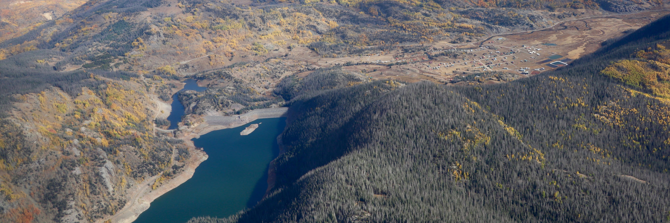

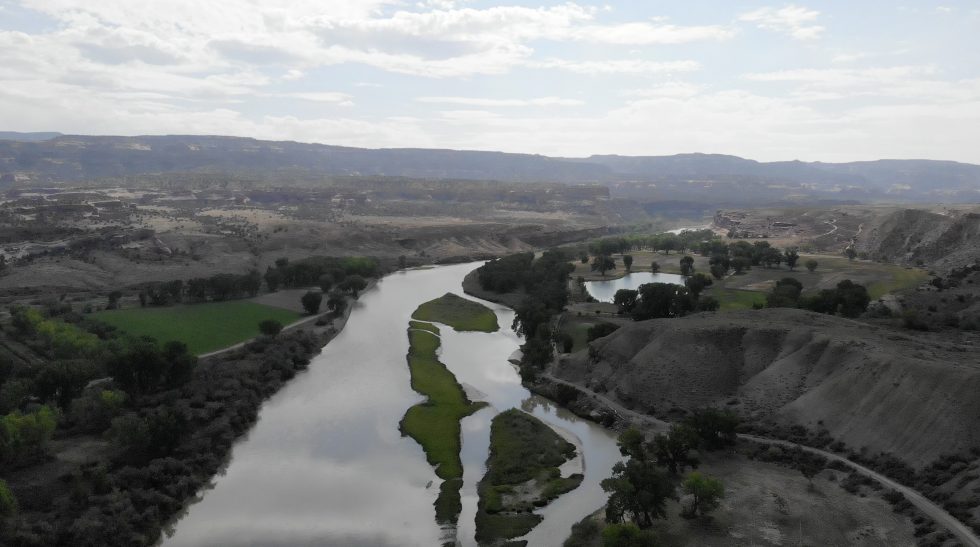


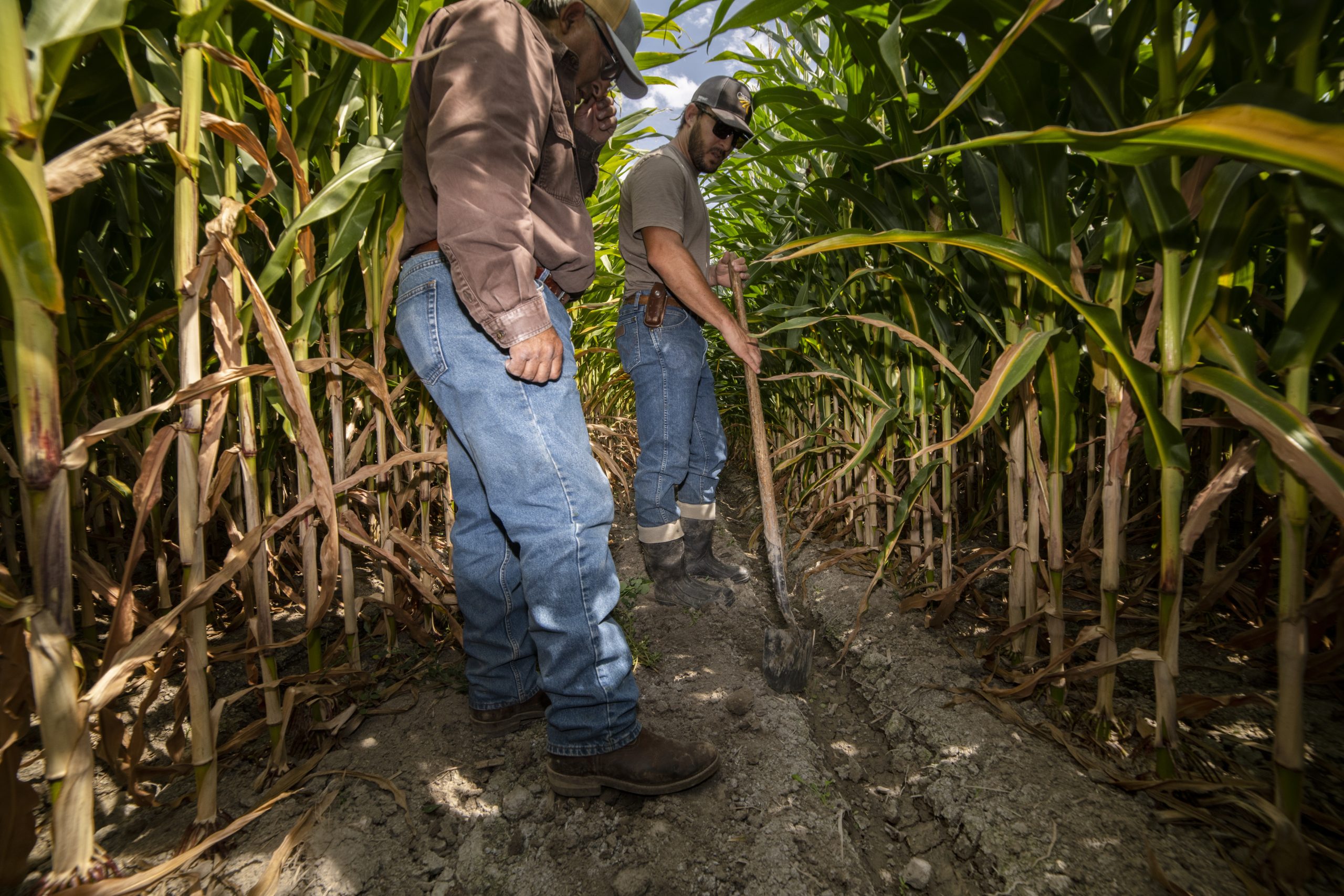
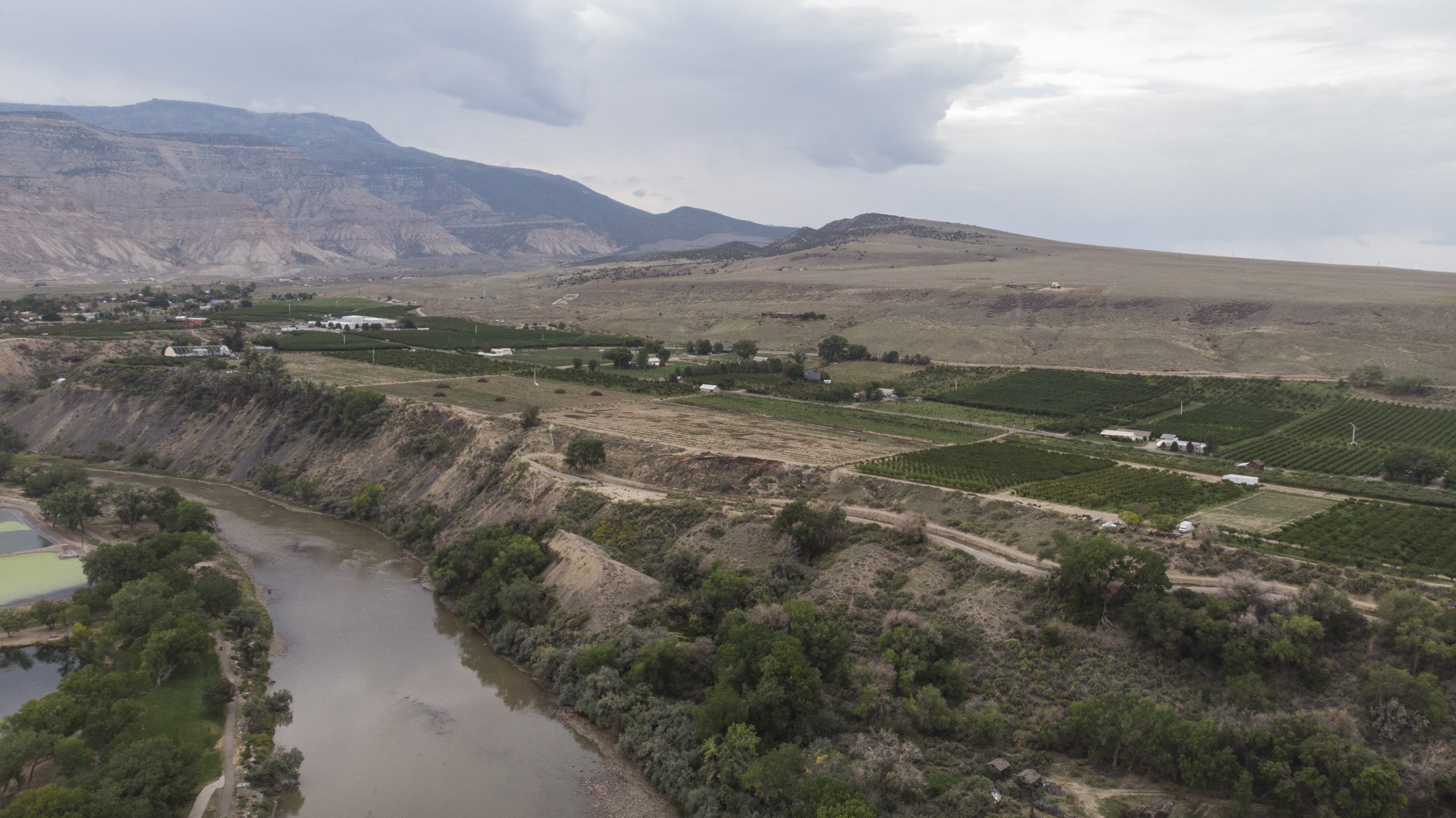
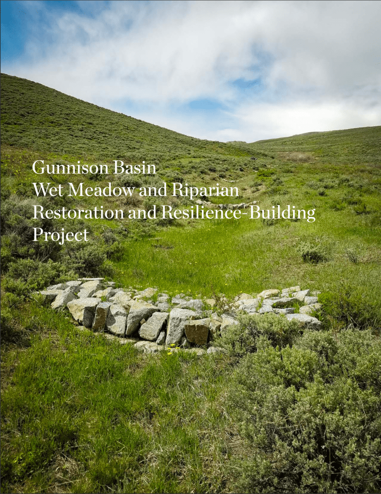
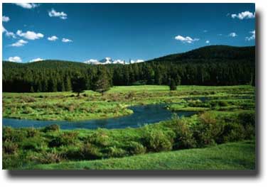
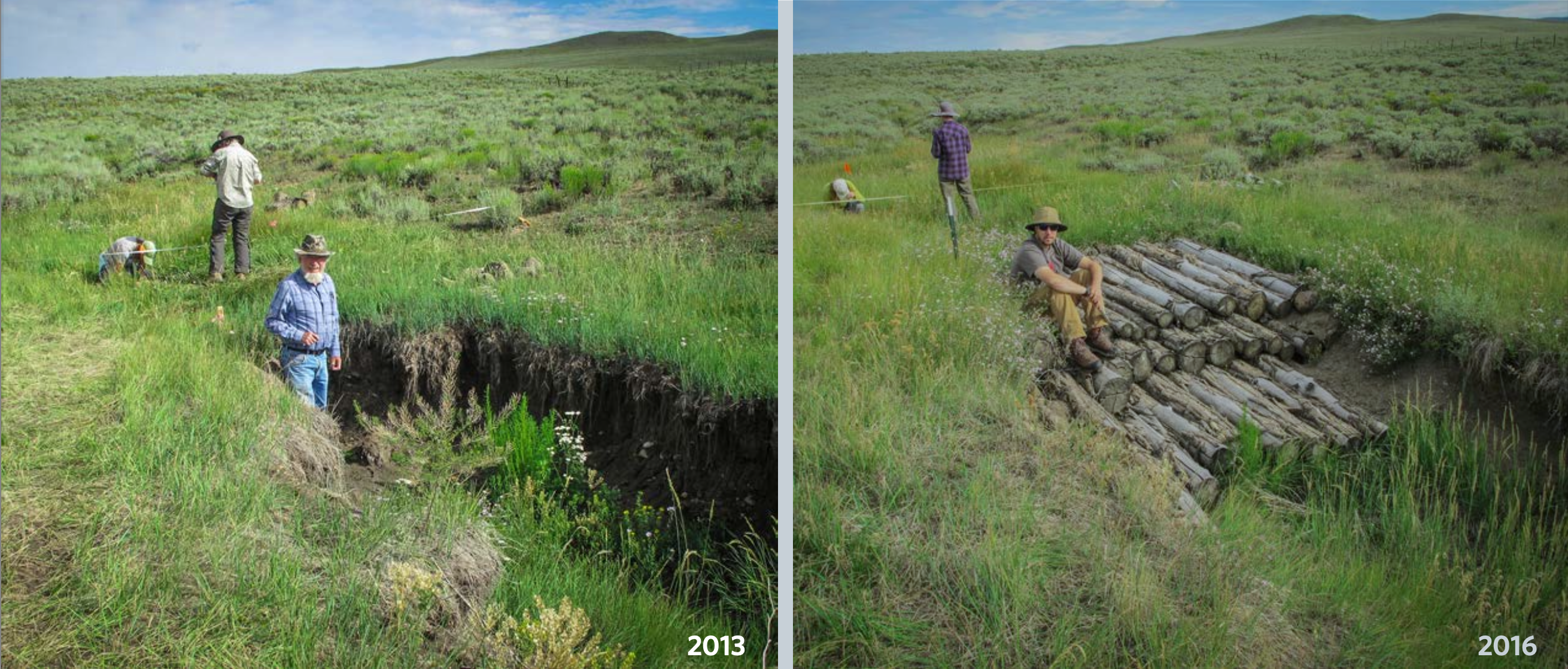
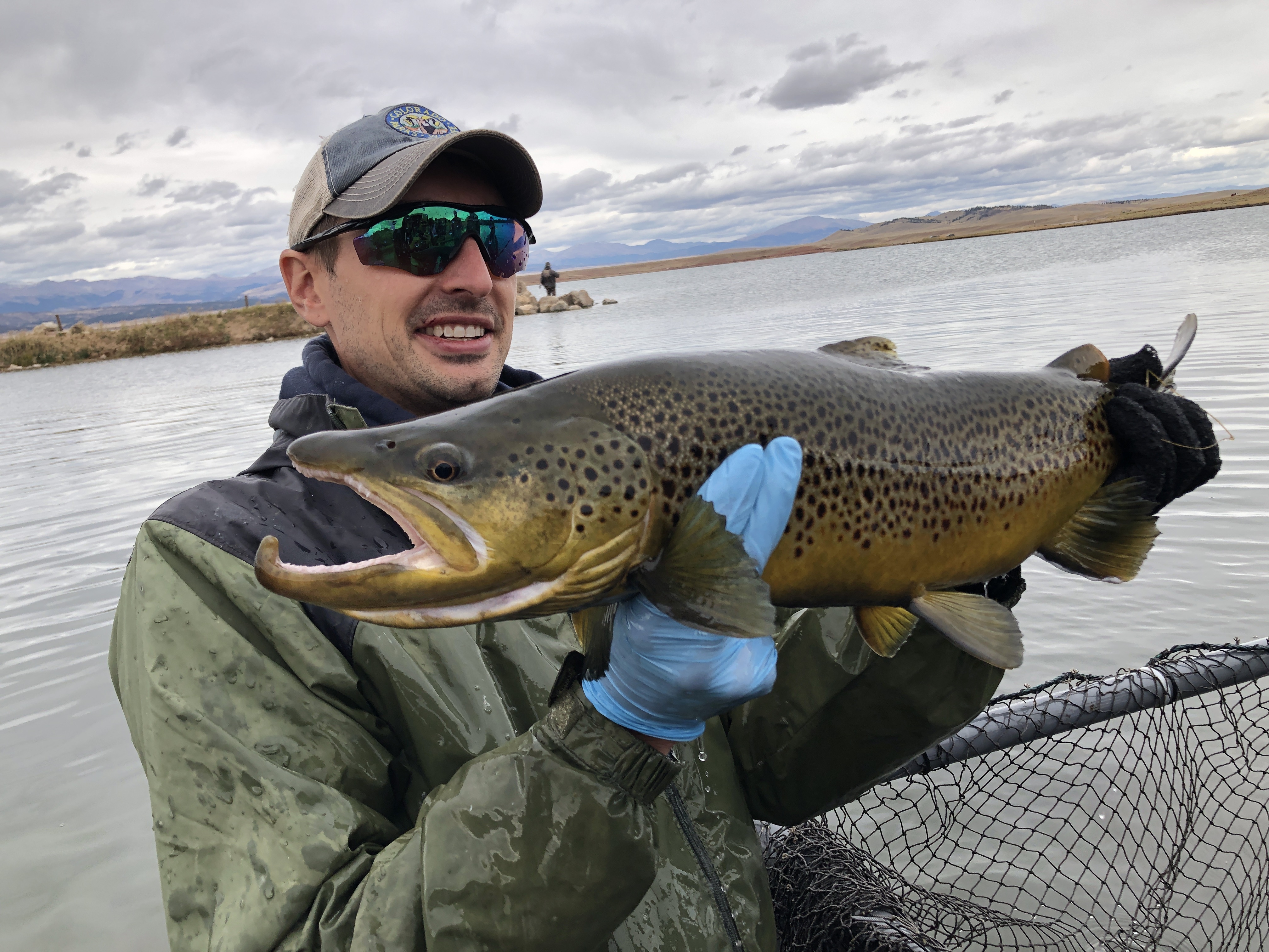


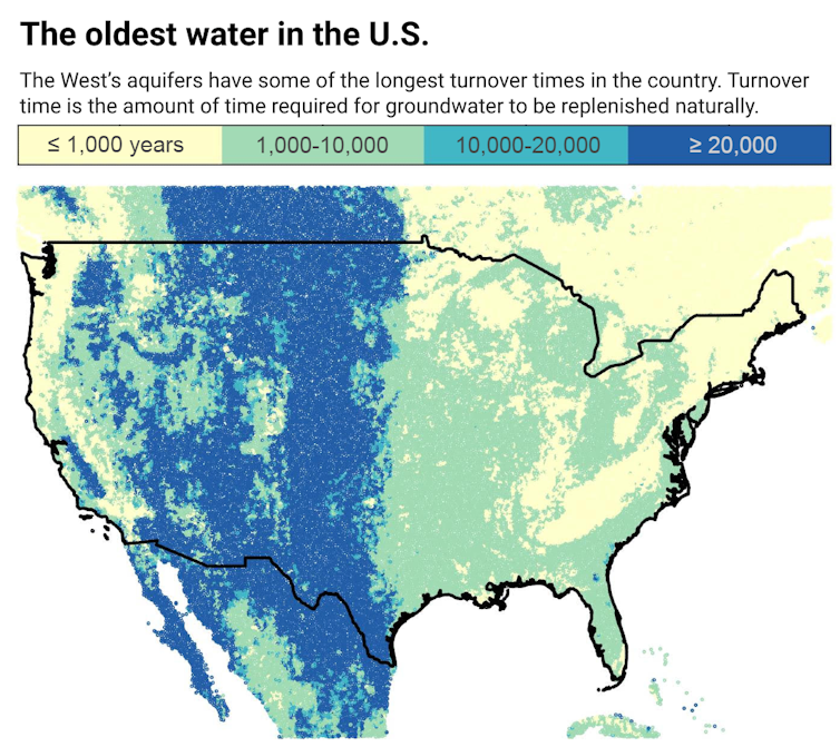
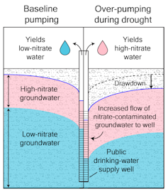
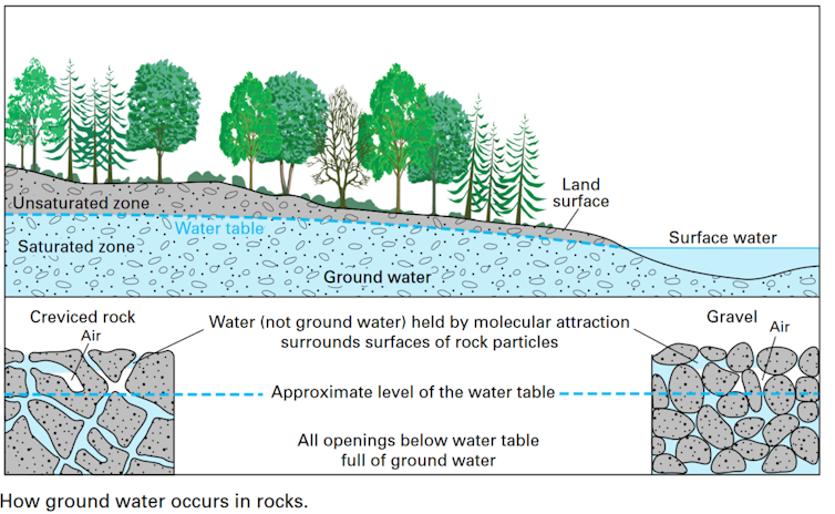
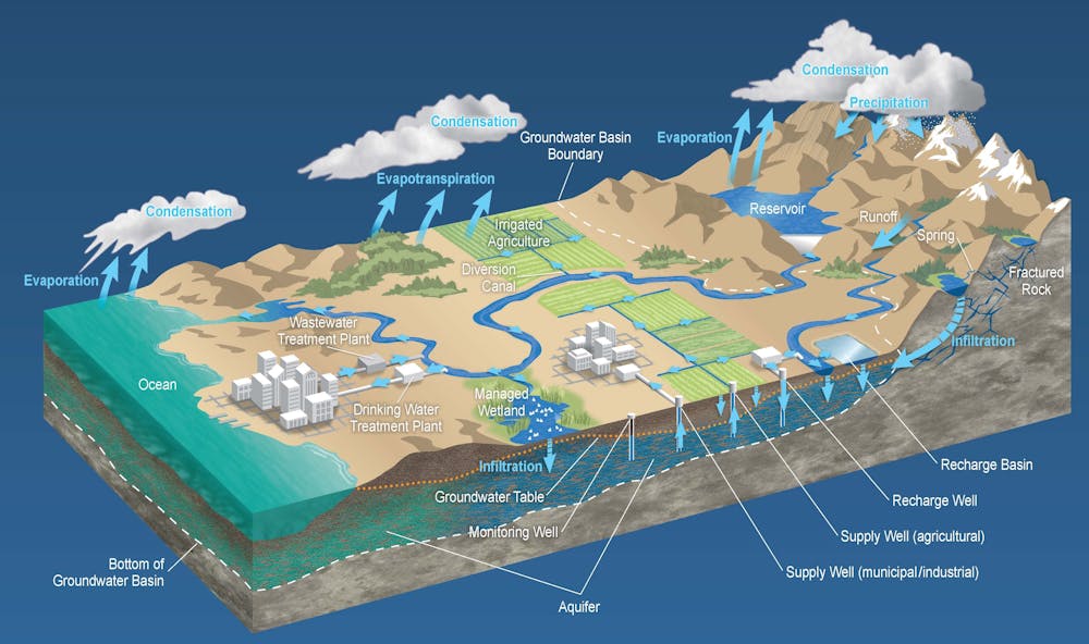
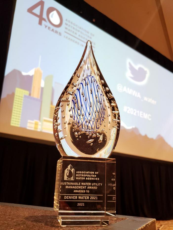

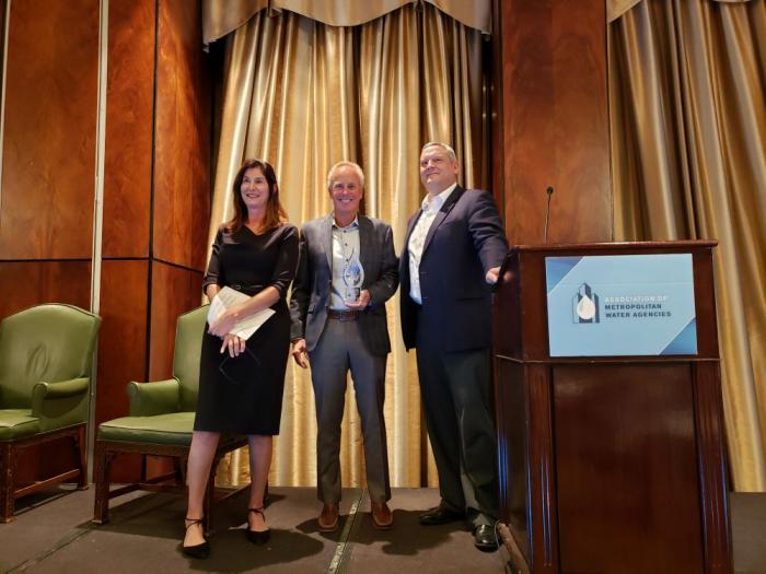
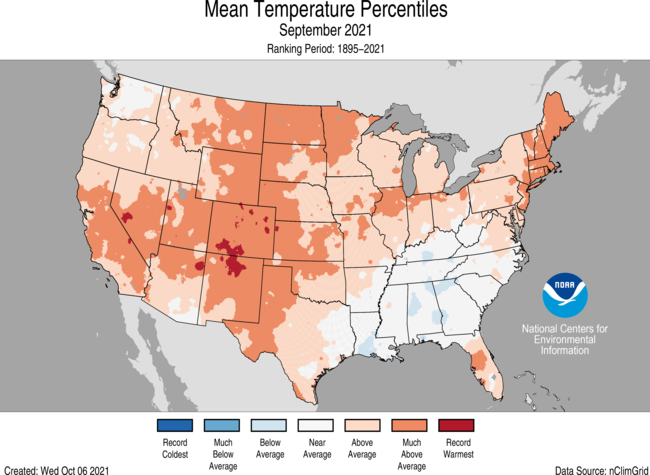


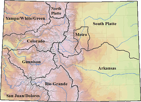
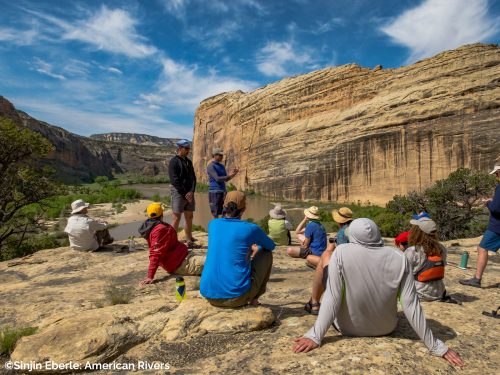
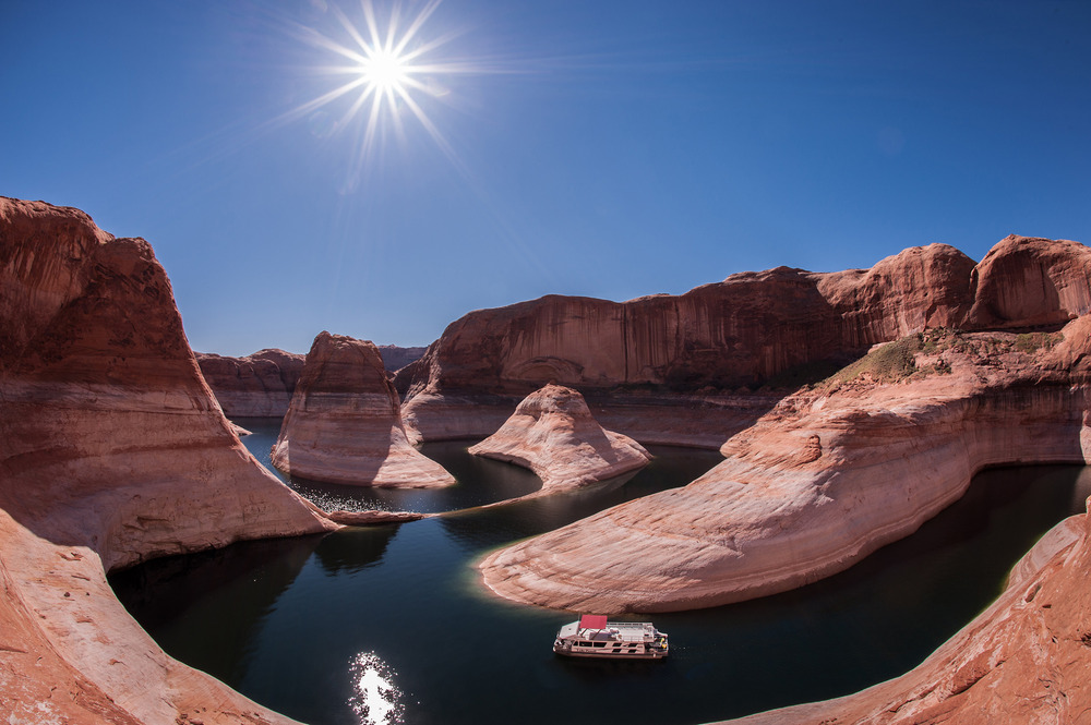
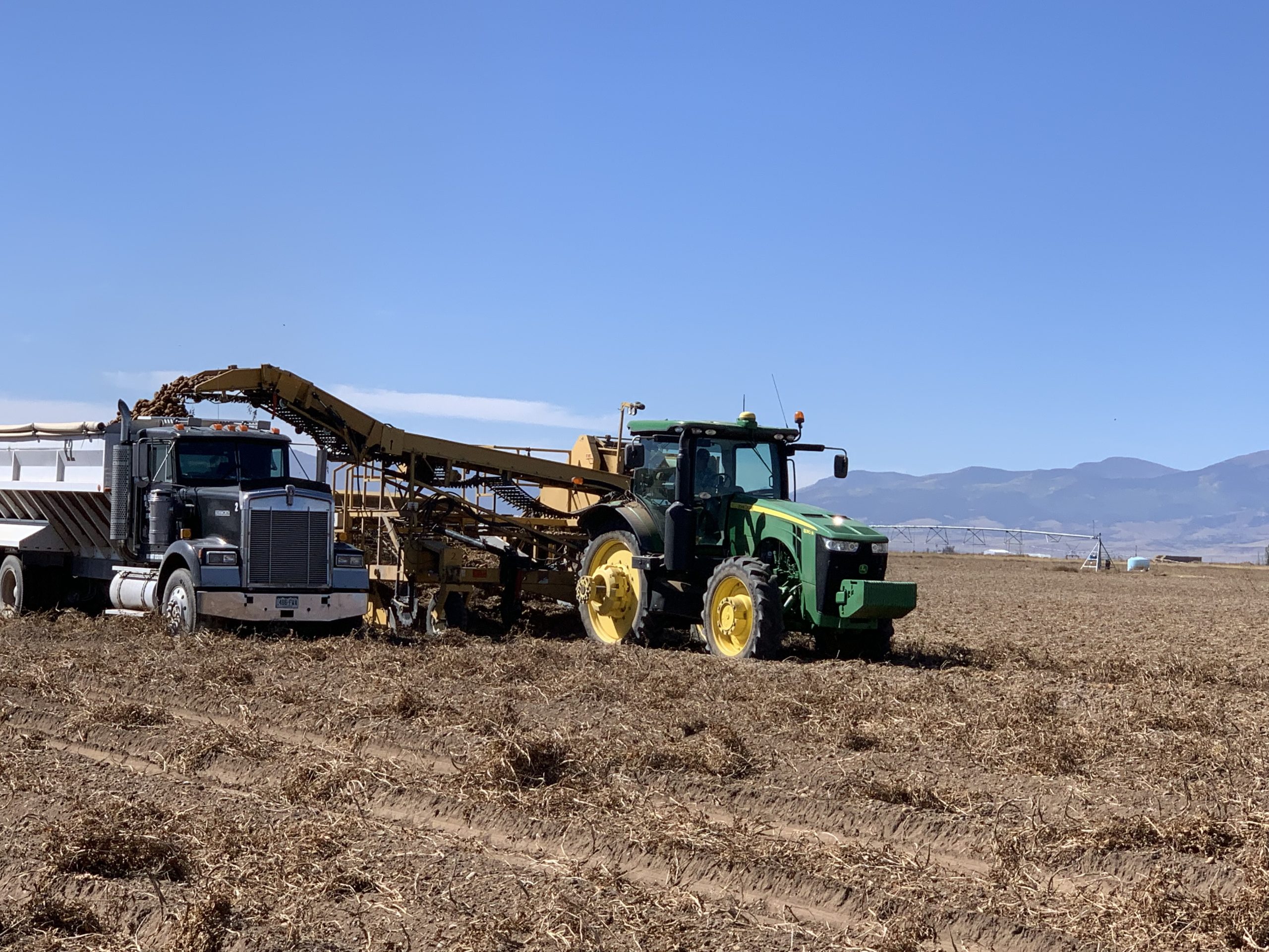

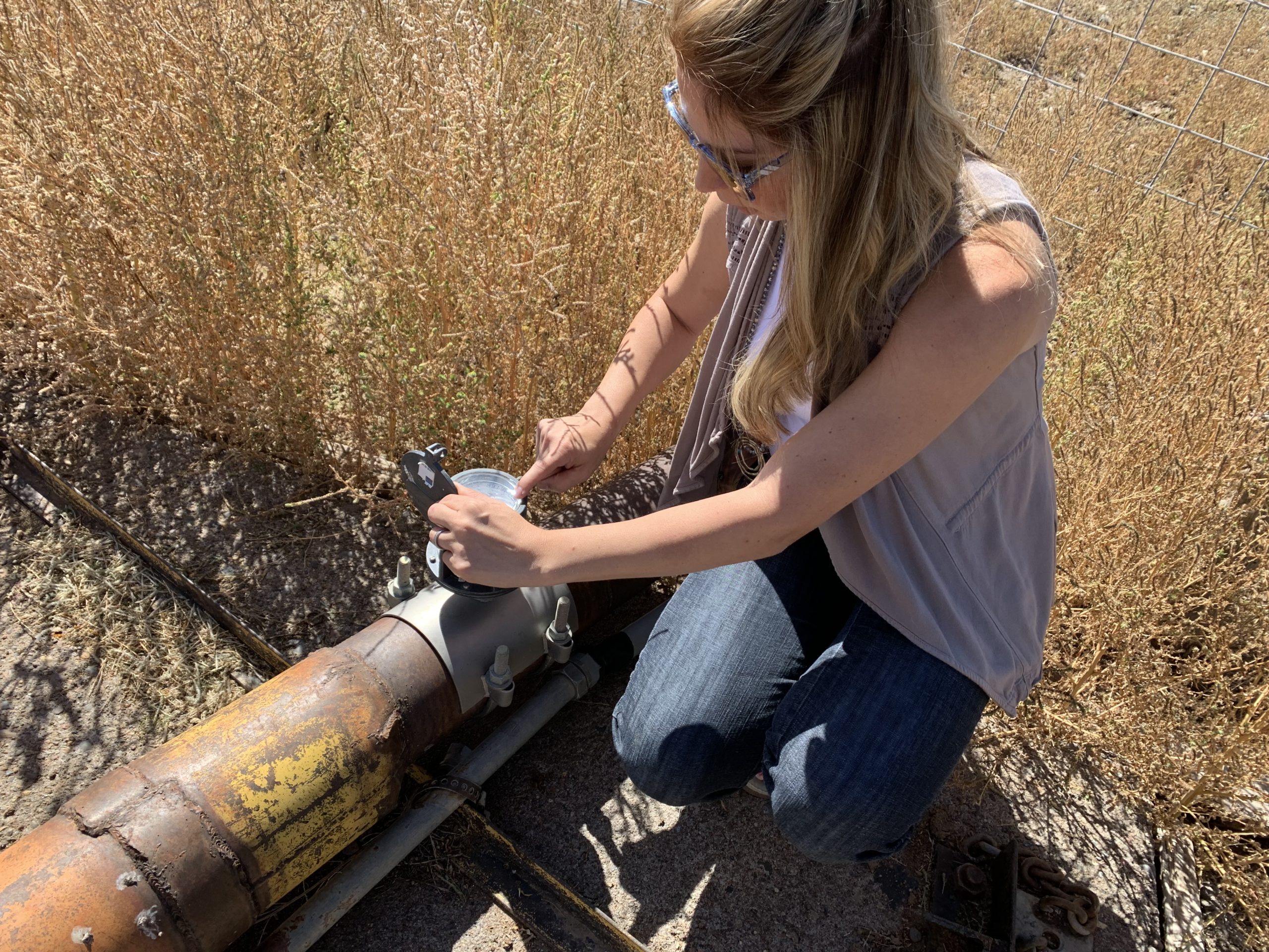


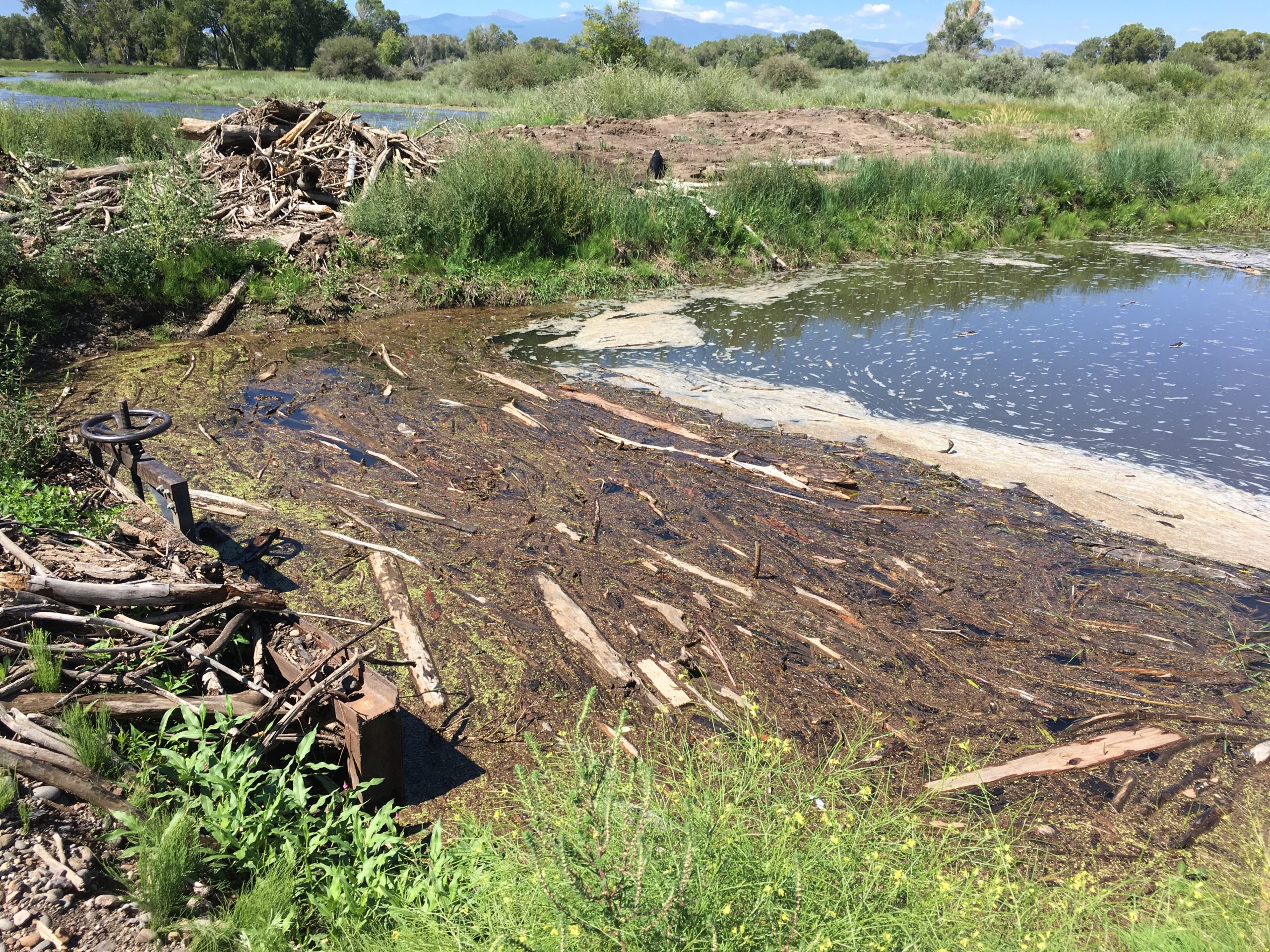


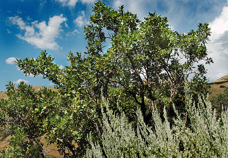

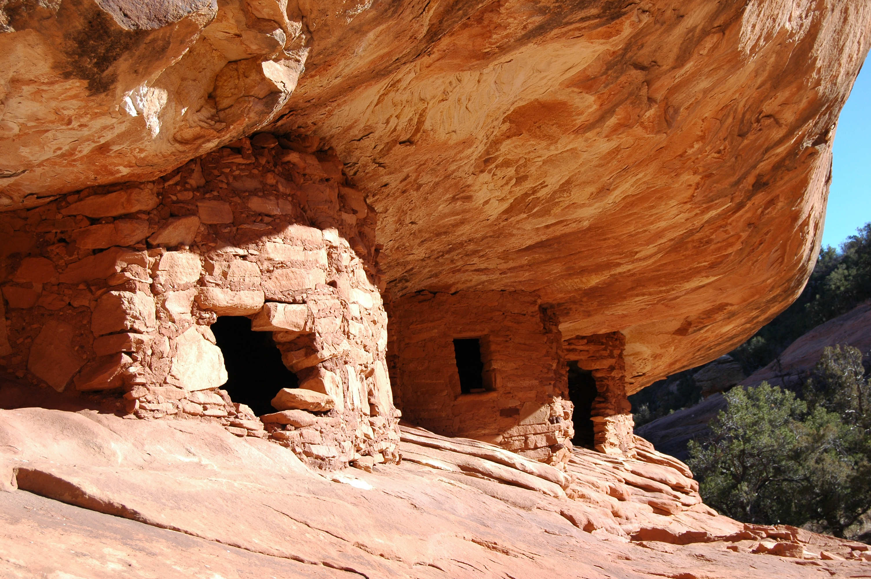

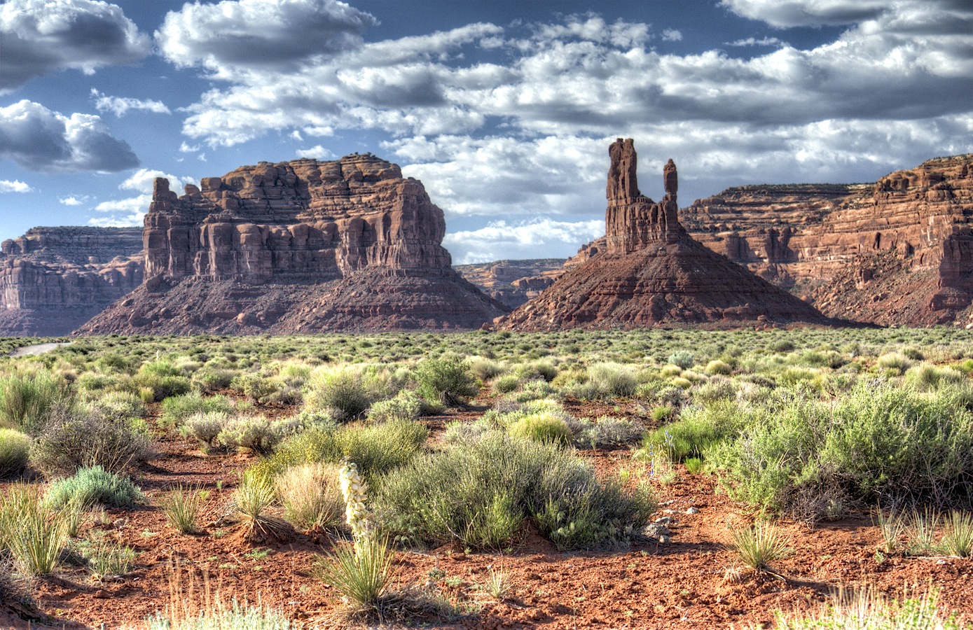

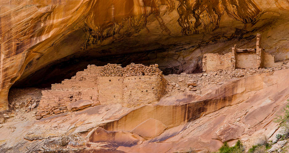
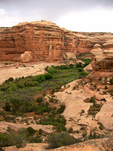
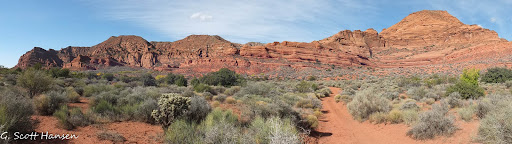
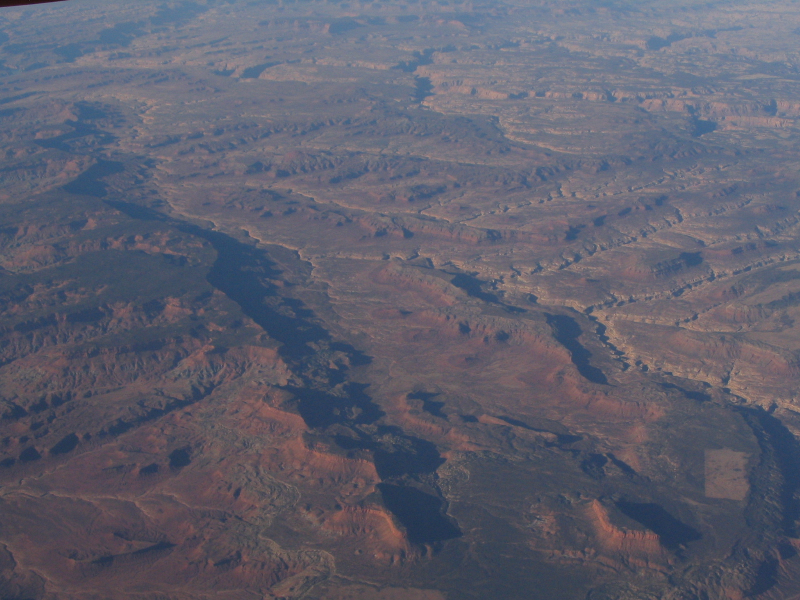
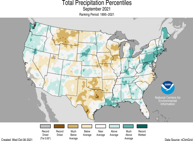
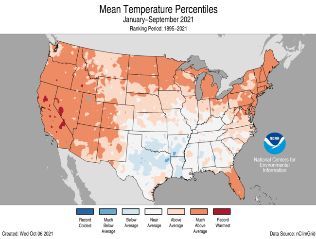
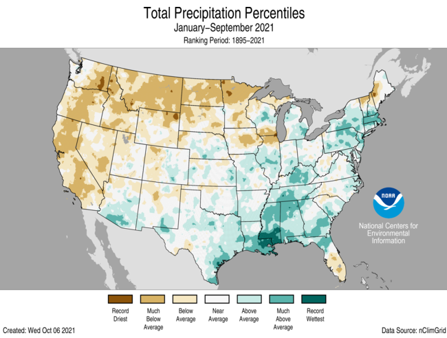
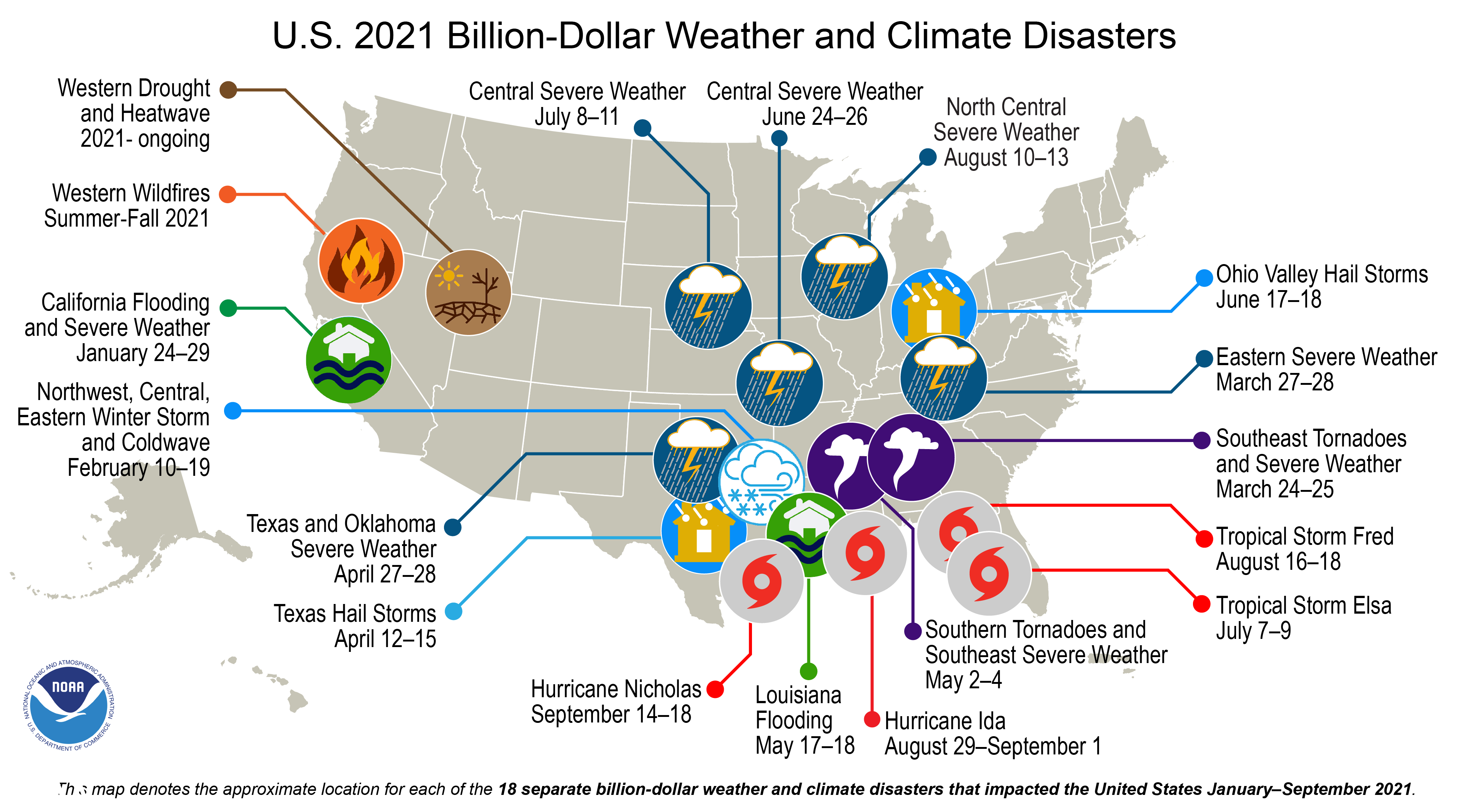
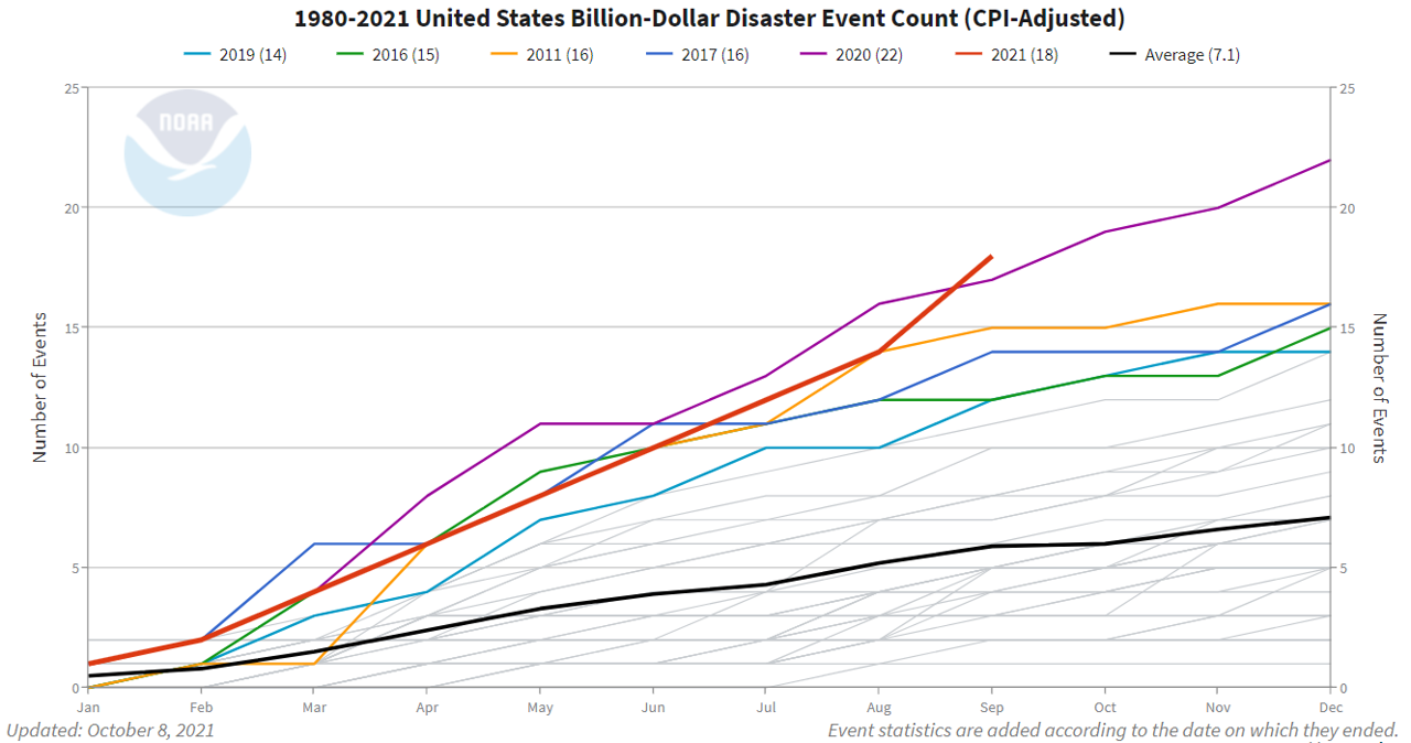
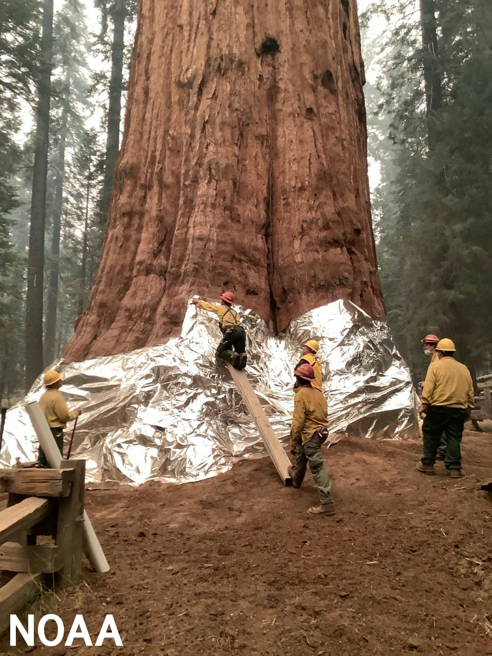
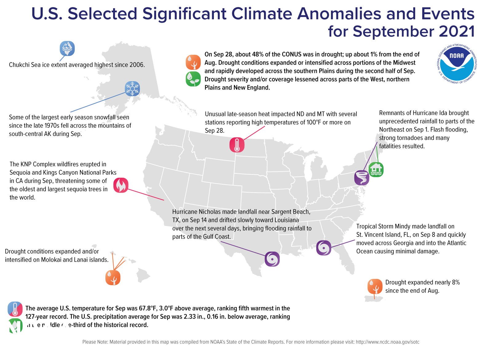


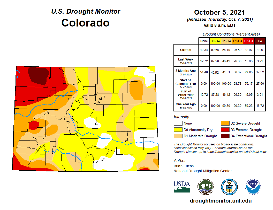
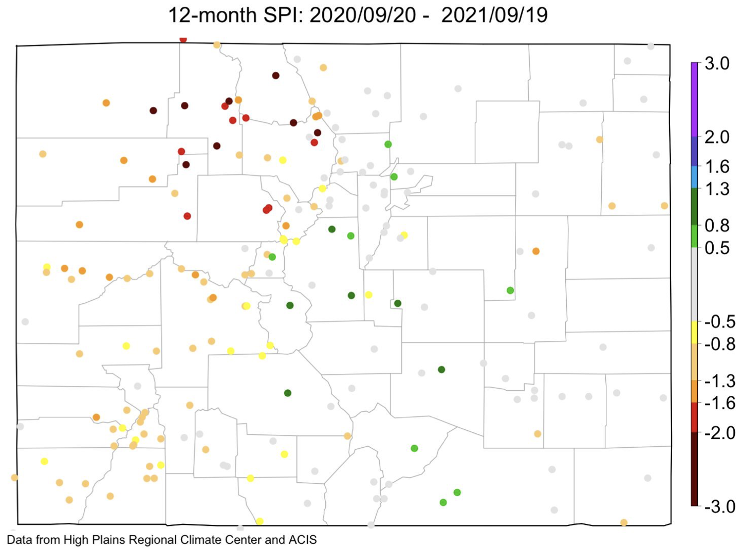
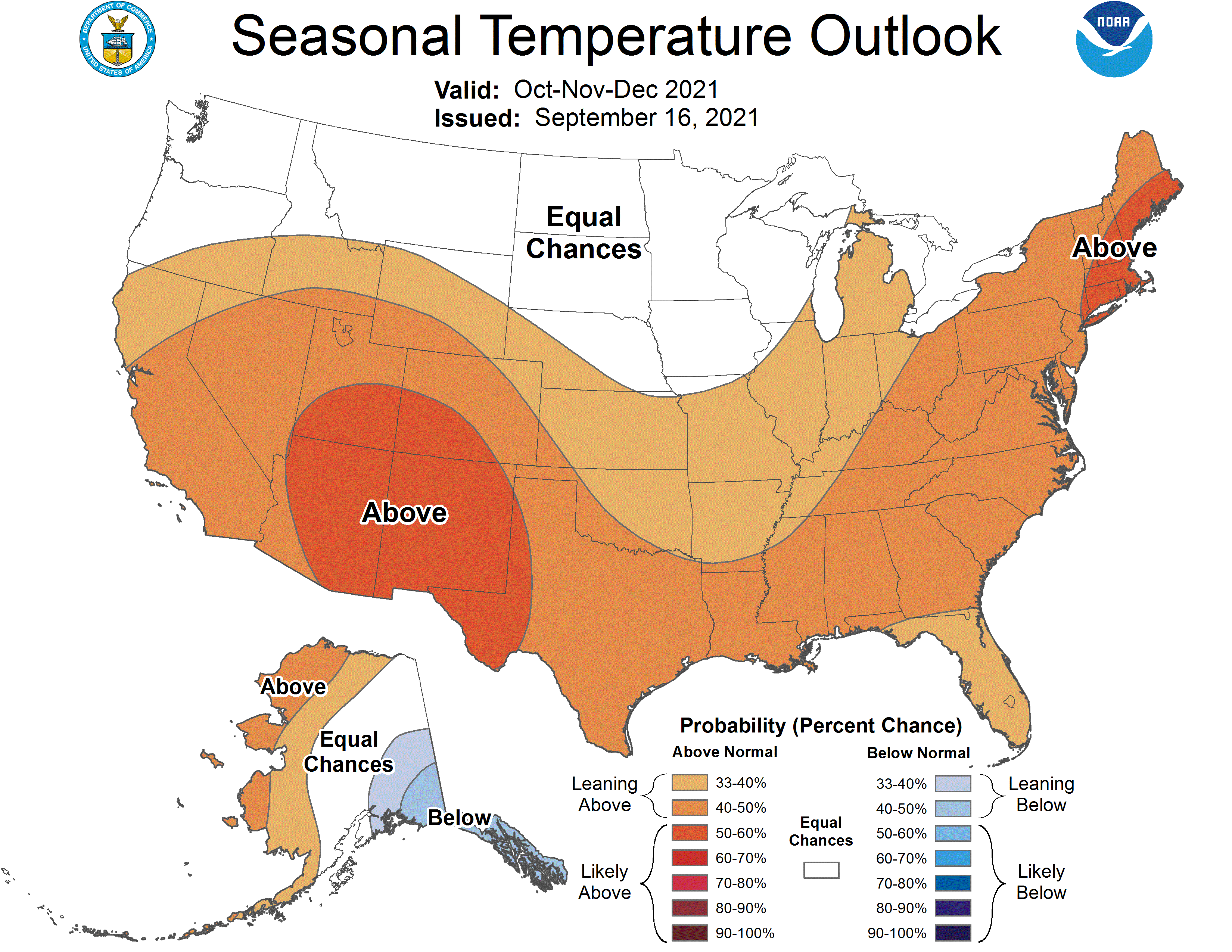

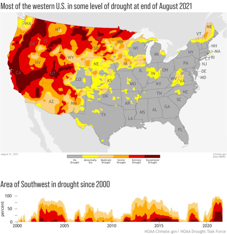


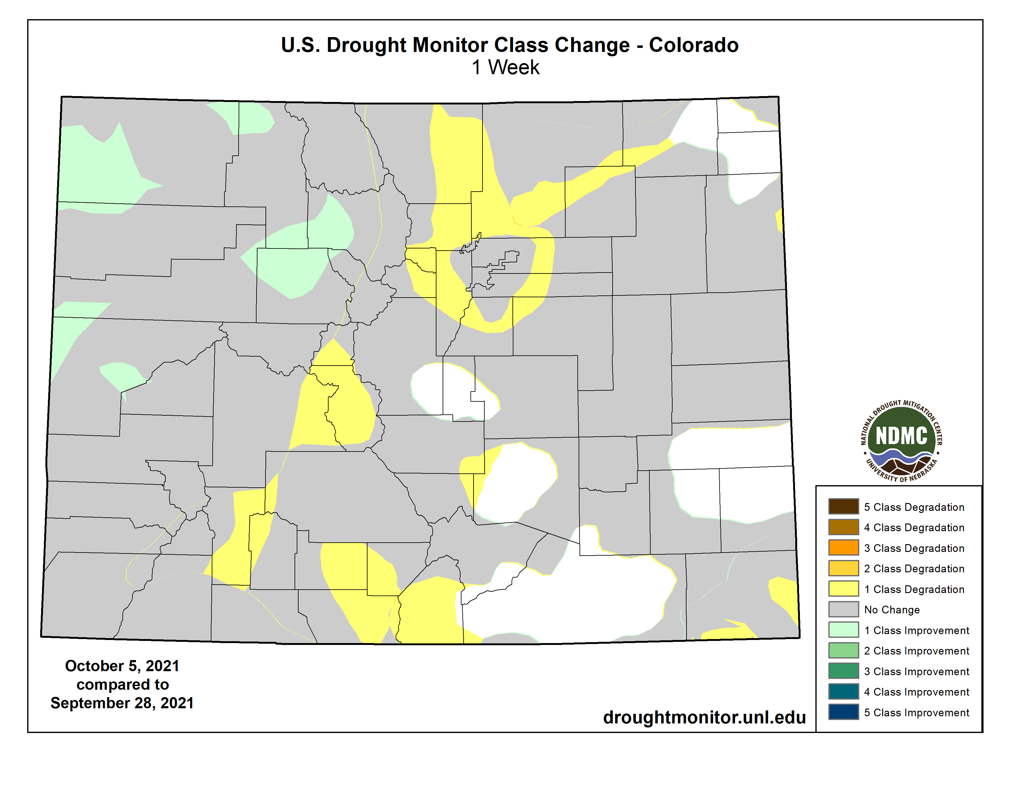

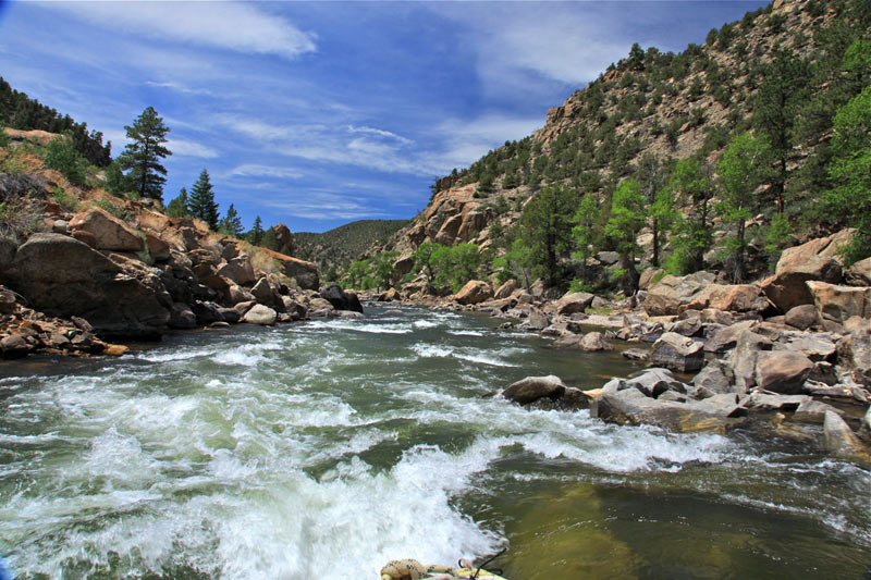
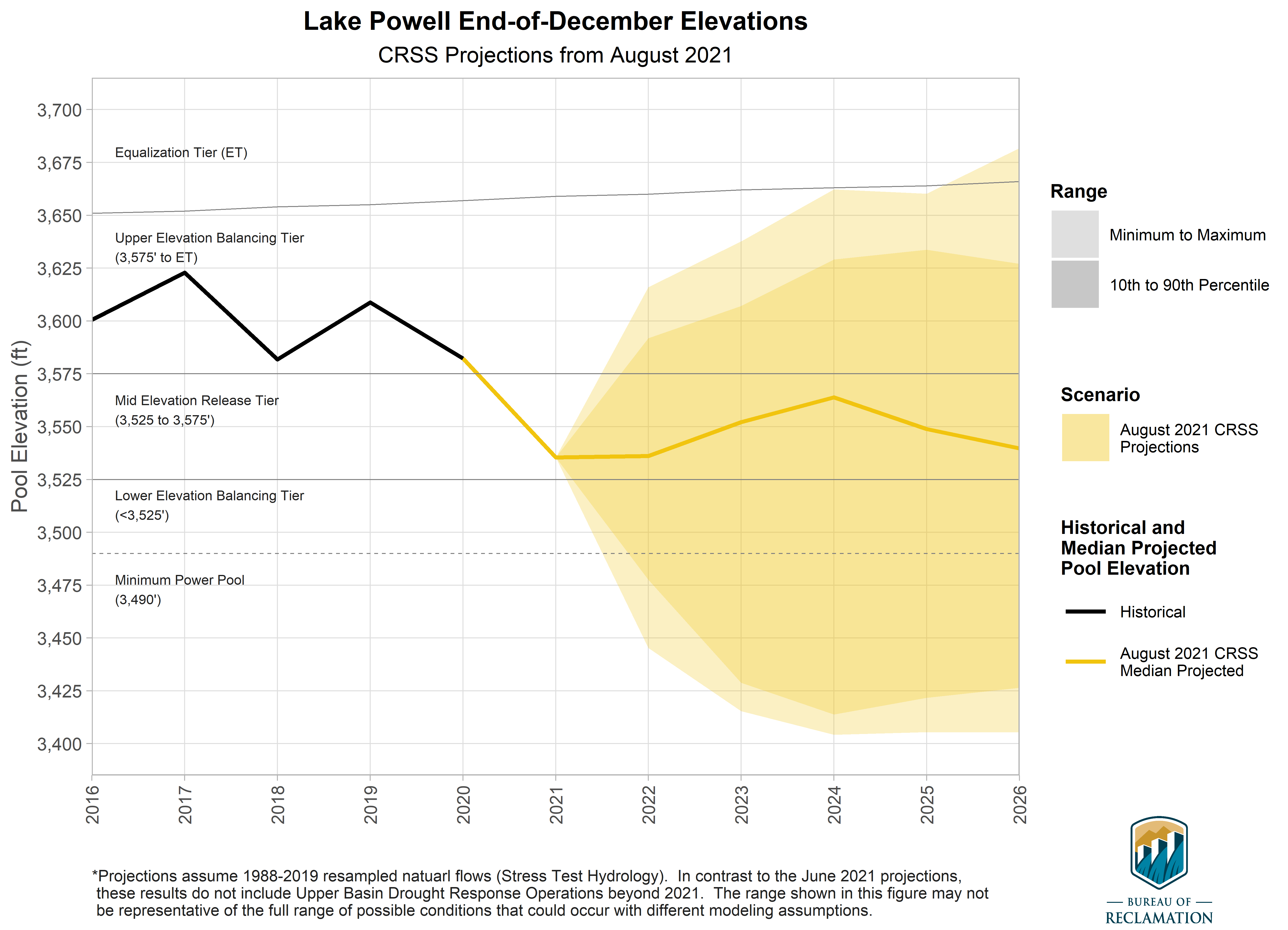


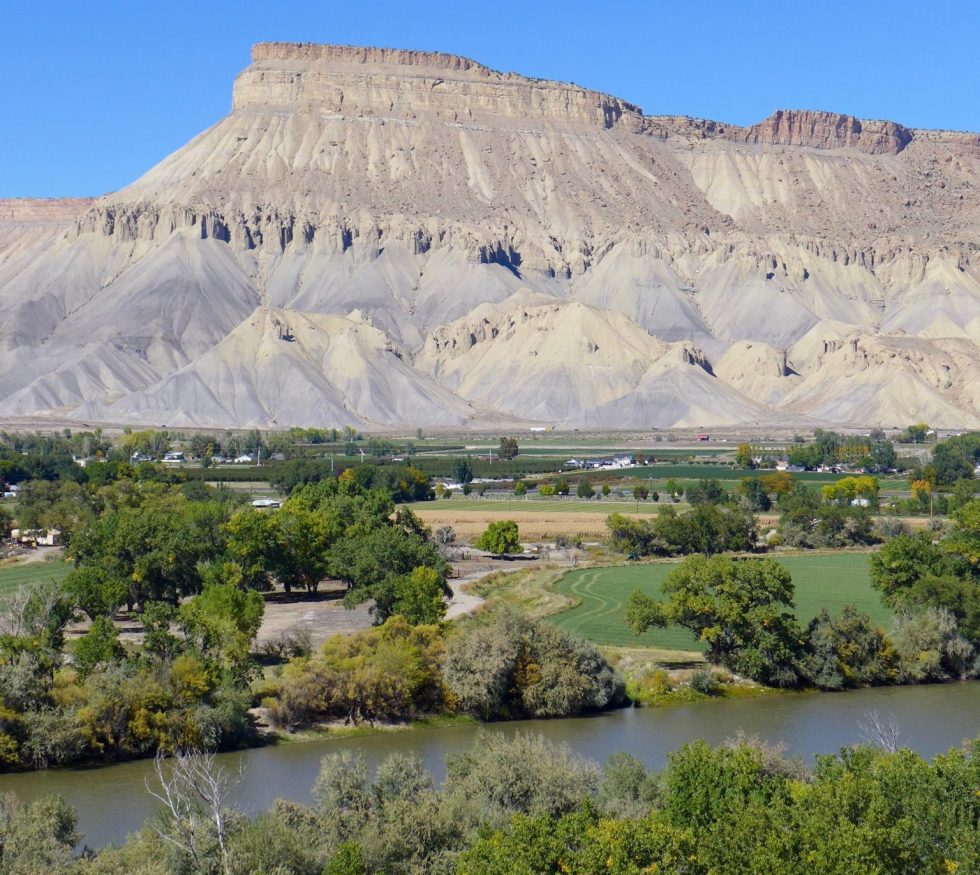


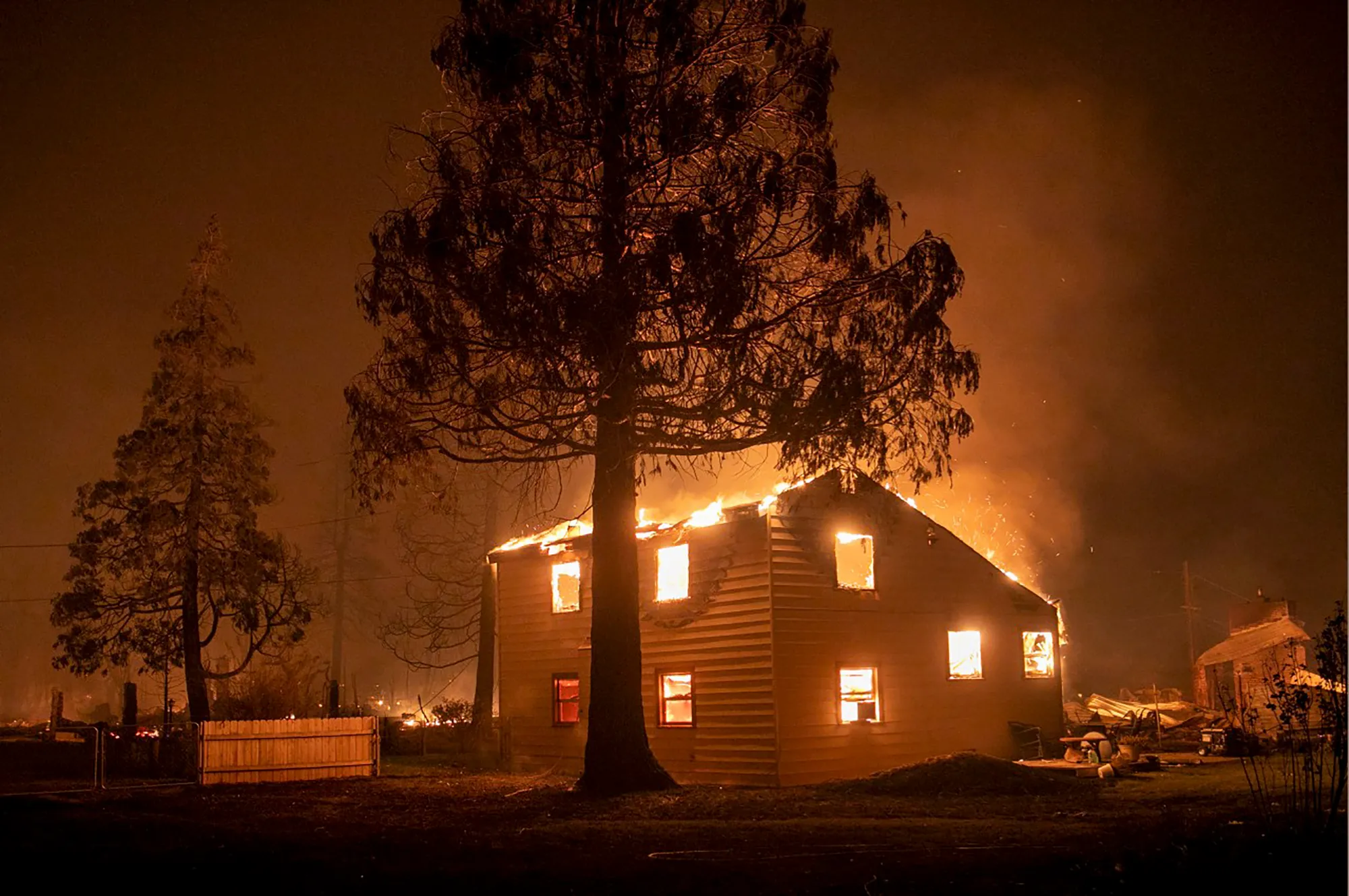

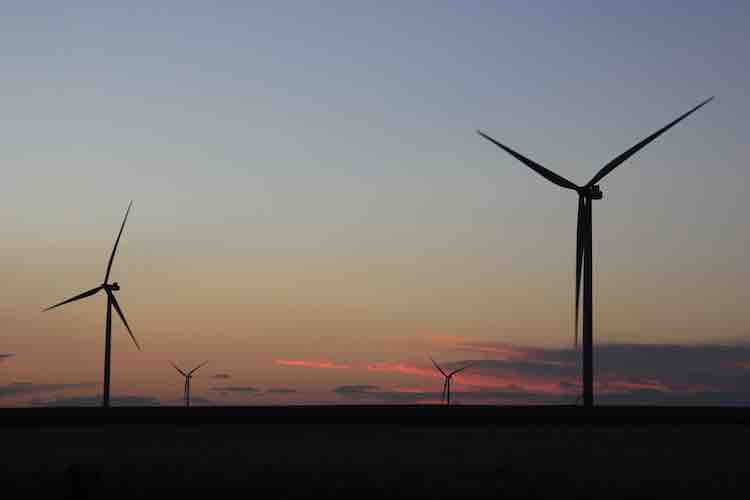

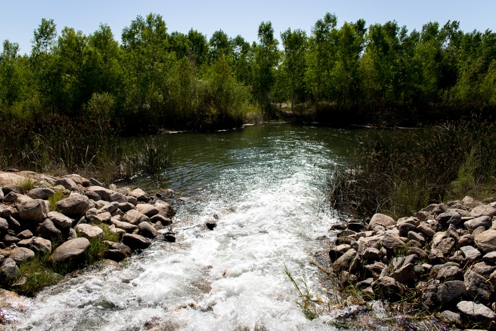


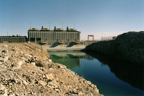
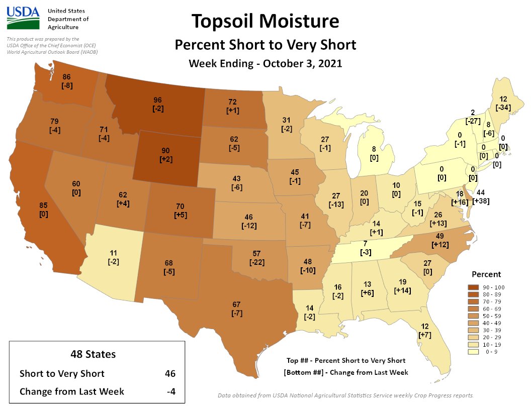
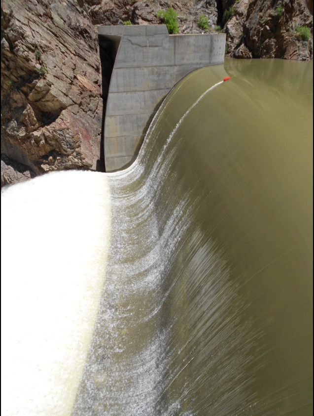
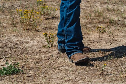


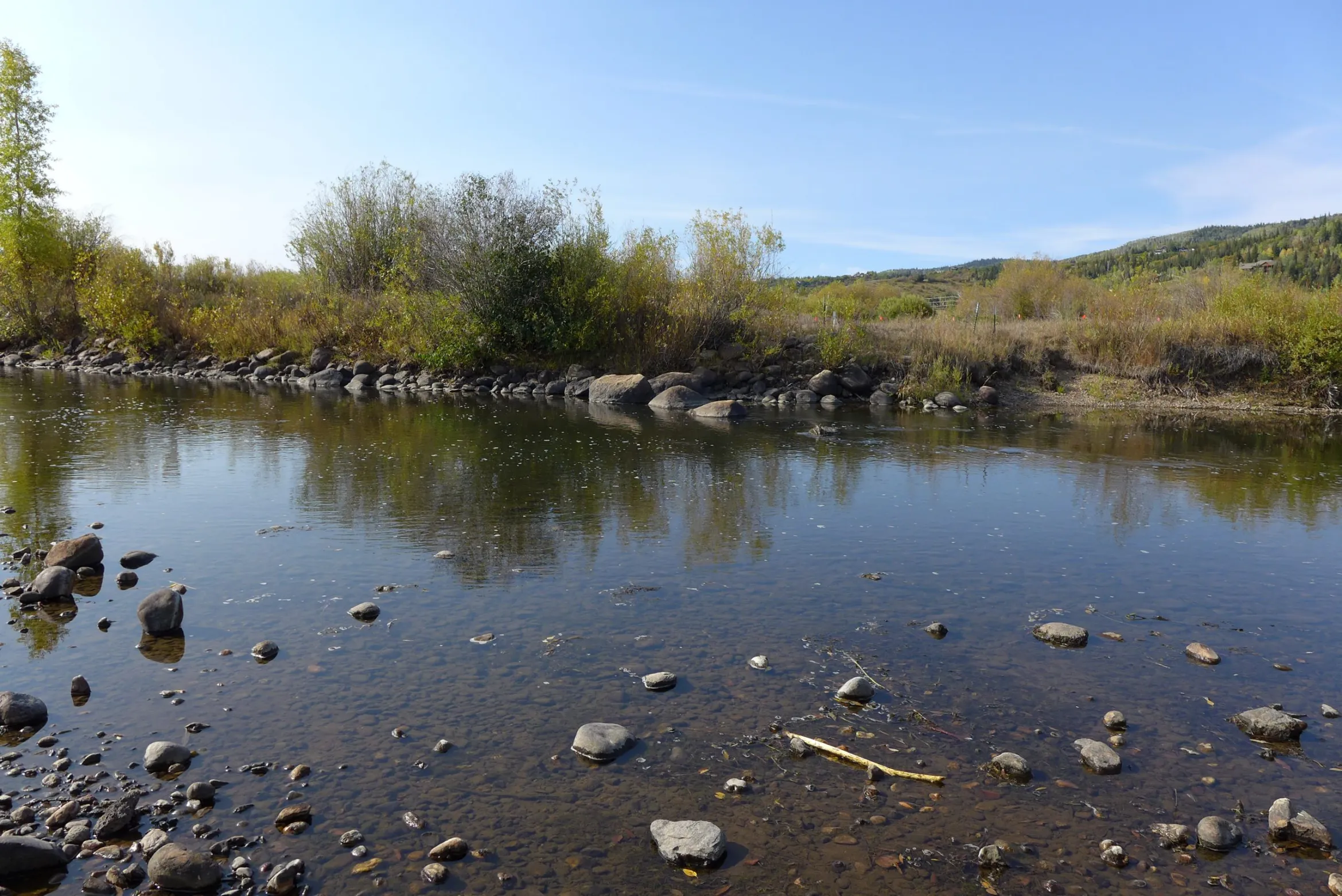
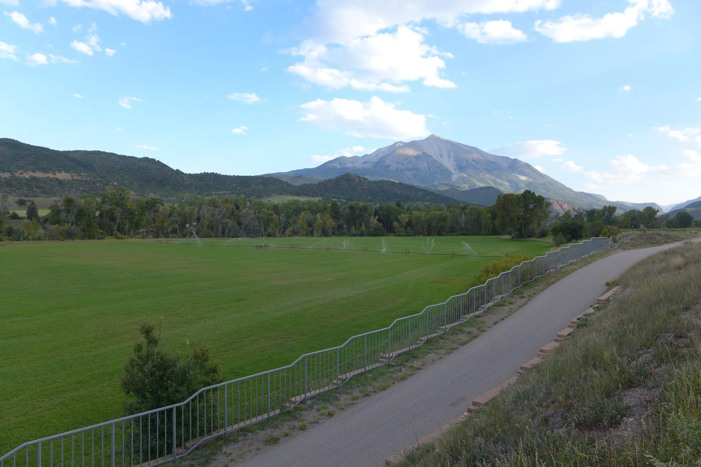


