Click on a thumbnail graphic to view a gallery of drought data from the US Drought Monitor website.


Click the link to go to the US Drought Monitor website. Here’s an excerpt:
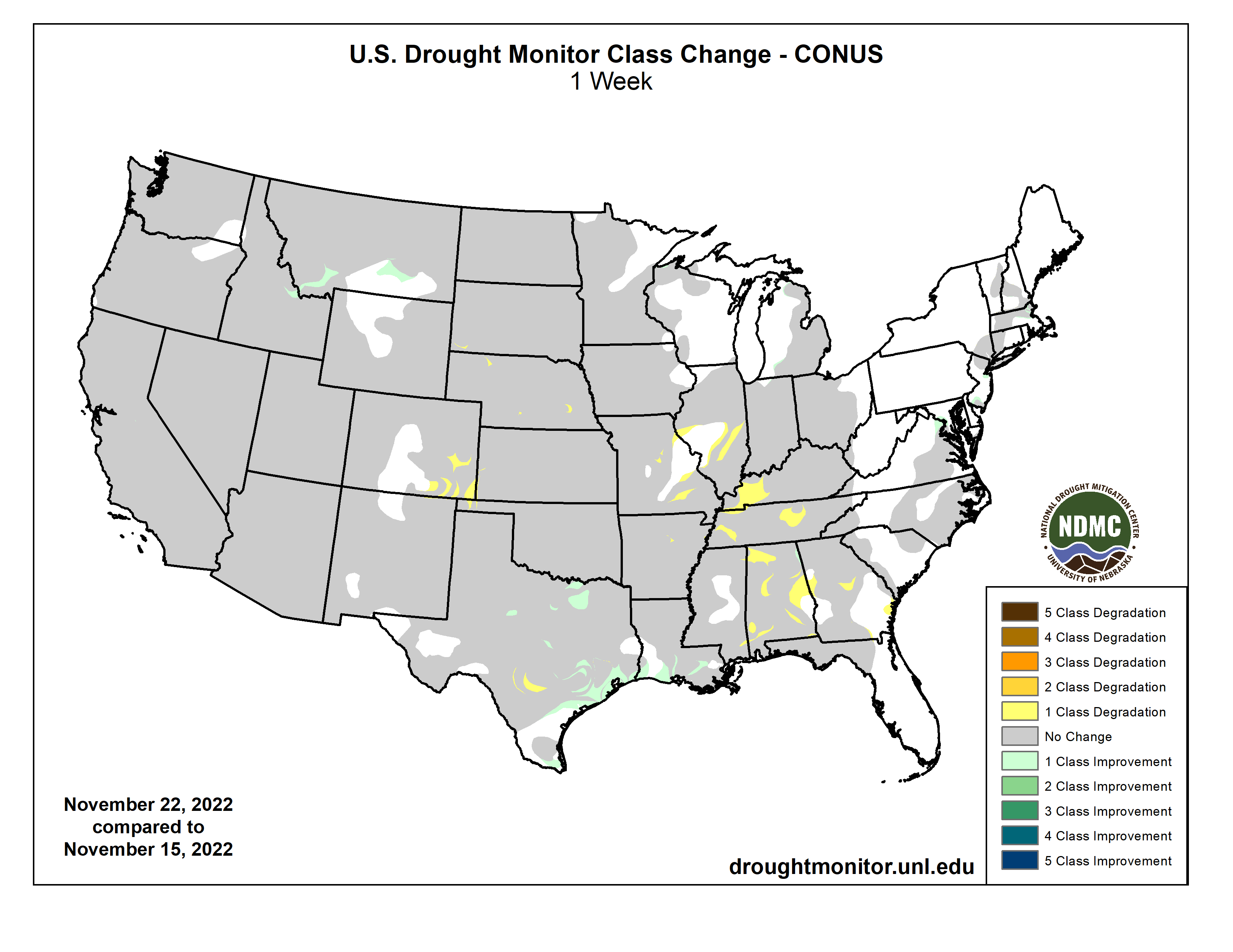
This Week’s Drought Summary
Cold, dry weather prevailed nearly nationwide, with a few exceptions. Notably, mid-November snow squalls developed downwind of the Great Lakes, resulting in localized totals of 2 to 6 feet or more. In addition, precipitation fell in parts of the South, East, and Midwest, primarily early in the drought-monitoring period, although most liquid-equivalent totals were under 2 inches. Snow broadly blanketed the Midwest and interior Northeast, especially on November 15-16, although amounts were mostly light to moderately heavy. Meanwhile, deep snow from a previous storm remained on the ground in much of Montana and North Dakota. As the period progressed, rain lingered in the western Gulf Coast region. Elsewhere, negligible precipitation fell across the western half of the country. On the Plains, the combination of cold weather and soil moisture shortages maintained significant stress on rangeland, pastures, and winter wheat. Weekly temperatures averaged at least 10°F below normal nationwide, except in the Desert Southwest and along the Atlantic and Pacific Coasts…
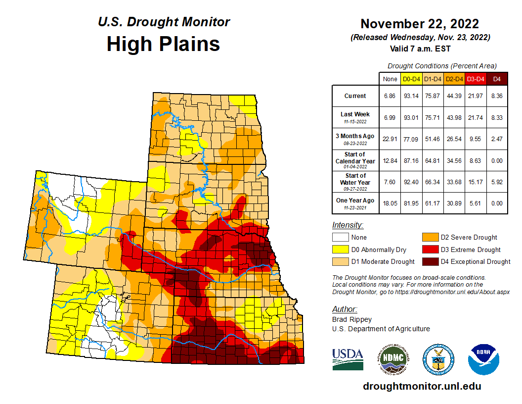
High Plains
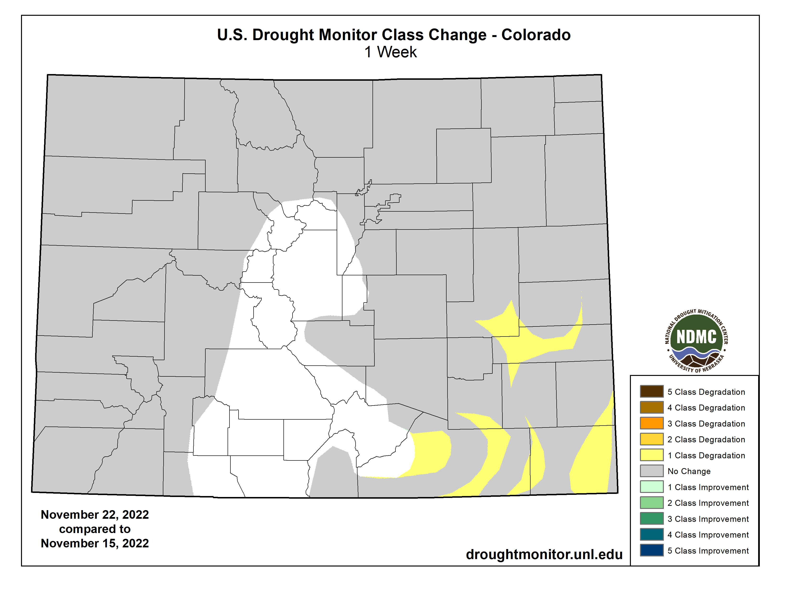
Following the previous week’s storm, snow and ice remained on the ground in parts of Montana and the Dakotas. In Bismarck, North Dakota, where the snow depth peaked at 17 inches on November 11, nine inches remained on the ground 10 days later. The freezing and frozen precipitation provided beneficial moisture for rangeland, pastures, and winter grains. Still, drought concerns persisted, especially in drier areas across the southern half of the region. On November 20, the U.S. Department of Agriculture noted topsoil moisture ranging from 63% very short to short in North Dakota to 87% in Nebraska. On the same date, at least 40% of the winter wheat was rated in very poor to poor condition in Colorado (52%), Kansas (40%), and Nebraska (40%). Although any changes in the drought depiction were relatively minor, worsening conditions were noted in a few areas. Drought stress on vegetation was aggravated by very cold weather, which led to several record lows. In Kansas, for example, record-setting lows for November 19 plunged to 8°F in Garden City and 11°F in Medicine Lodge…
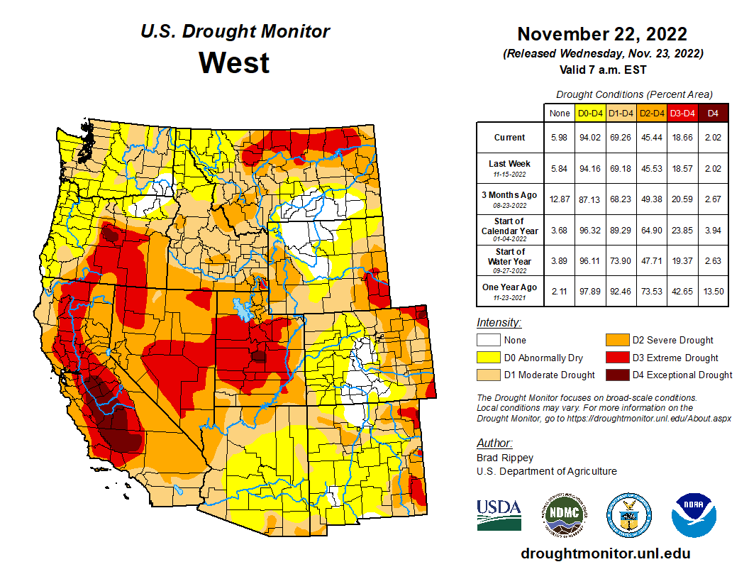
West
Like much of the rest of the country, the West experienced a full week of cold, dry weather, leading to minimal changes in the drought depiction. Fog, air stagnation, and low temperatures plagued the Northwest. Daily-record lows for November 17 included -16°F in Butte, Montana, and -3°F in Burns, Oregon. On November 18-19, Big Piney, Wyoming, collected consecutive daily-record lows of -15°F. Other Northwestern locations reporting a pair of daily-record lows on November 18-19 were Eugene, Oregon (21 and 18°F); Olympia, Washington (17 and 18°F); and Montana’s Bozeman Airport (-14 and -16°F). On the 18th, lows plunged to -22°F in Butte, Montana, and -21°F at Lake Yellowstone, Wyoming. Early-season snowpack remained mostly favorable west of the Continental Divide, but a return to stormy weather will soon be needed to sustain the promising start to the water year that began on October 1…
South
Significant rain fell in parts of the western Gulf Coast region, but most of the remainder of the South experienced cold, dry weather. According to the U.S. Department of Agriculture, Oklahoma and Texas were tied for the regional lead on November 20 with topsoil moisture rated 67% very short to short. On the same date, very poor to poor rating were observed in Texas for 58% of the rangeland and pastures; 52% of the oats; and 49% of the winter wheat. Similarly in Oklahoma, 41% of the winter wheat and 75% of the rangeland and pastures were rated very poor to poor. Amid the cold, dry regime, generally minor changes were introduced, except where heavy rain fell near the Gulf Coast…
Looking Ahead
Across much of the country, milder weather will replace previously cold conditions. By November 24, Thanksgiving Day, a storm system will begin to take shape across the south-central U.S. Late in the week, portions of the southern Plains should receive much-needed precipitation, including possible wet snow. Farther east, 5-day rainfall totals from the southeastern Plains to the southern Appalachians could total 2 to 4 inches or more. Late-week rain (locally 1 to 2 inches) may also spread into portions of the East and lower Midwest, including the Ohio Valley. Meanwhile, periodic precipitation will spread inland from the Pacific Northwest to the northern Rockies. Much of the remainder of the country, including an area stretching from California to the northwestern half of the Plains and the upper Midwest, will receive little or no precipitation during the next 5 days.
The NWS 6- to 10-day outlook for November 28 – December 2 calls for the likelihood of below-normal temperatures across the northern Plains and much of the West, while warmer-than-normal weather will prevail east of a line from the southern Rockies to Lake Michigan. Meanwhile, near- or below-normal precipitation in much of the southern and eastern U.S. should contrast with wetter-than-normal conditions from the Pacific Coast to the northern half of the Plains, Midwest, and mid-South.