
Click on a thumbnail graphic to view a gallery of drought data from the US Drought Monitor website.
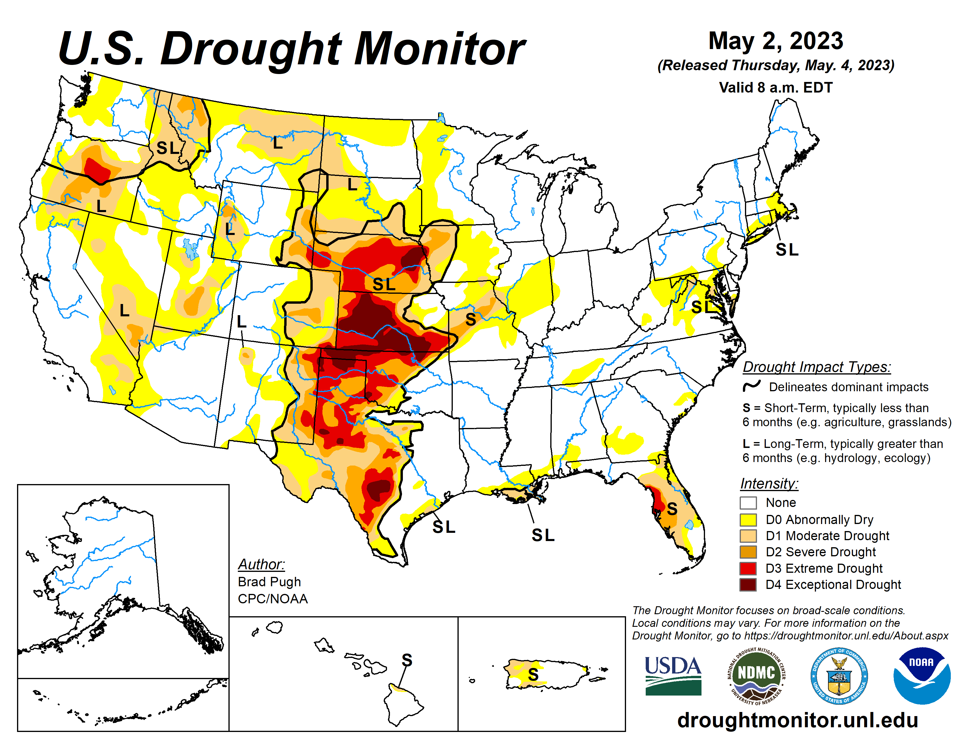


Click the link to go to the US Drought Monitor website. Here’s an excerpt:
This Week’s Drought Summary
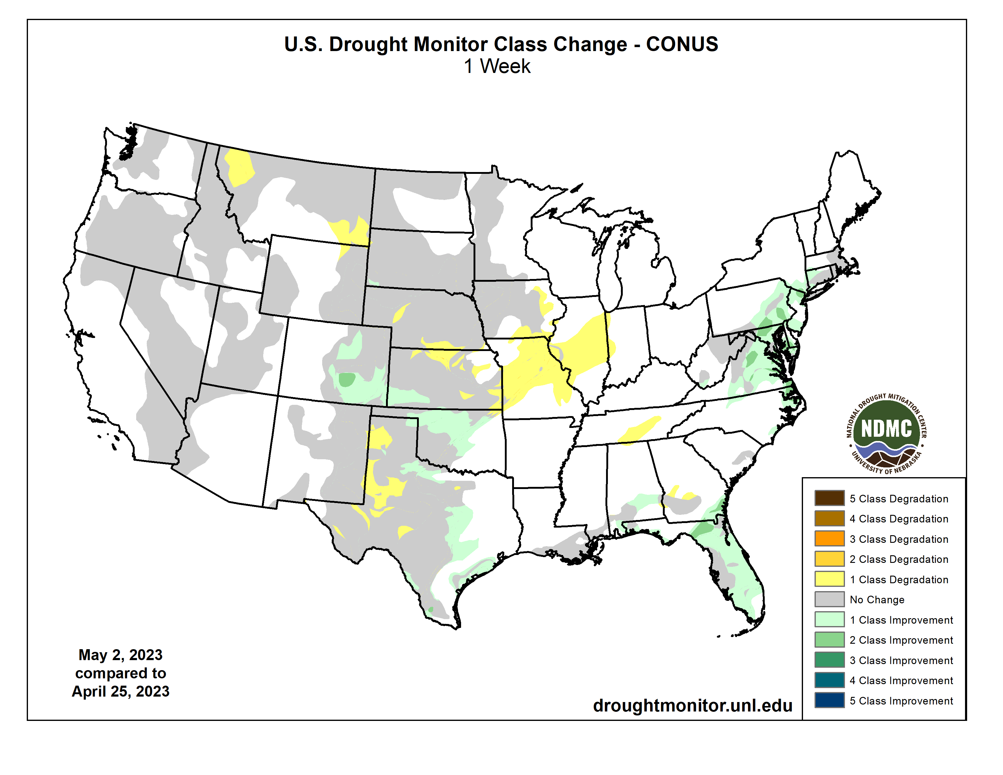
A pair of low pressure systems tracked from the Southeast northward along the East Coast, bringing a swath of widespread precipitation (2 to 4 inches, locally more) to much of the East Coast at the end of April. During the final week of April, the Southern Great Plains along with the Lower Mississippi Valley also received widespread precipitation with amounts exceeding 2 inches across southeastern Colorado, northern and eastern Oklahoma, and northeastern Texas. Late April was mostly dry across the Central to Northern Great Plains and Middle Mississippi Valley. Little to no precipitation was observed throughout the West where a significant warmup at the end of April resulted in rapid snowmelt, runoff, and flooding along streams and rivers. In contrast to these above-normal temperatures, cooler-than-normal temperatures occurred across the Great Plains, Corn Belt, and much of the East from April 25 to May 1…
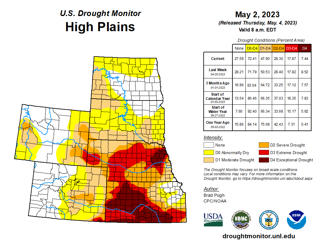
High Plains
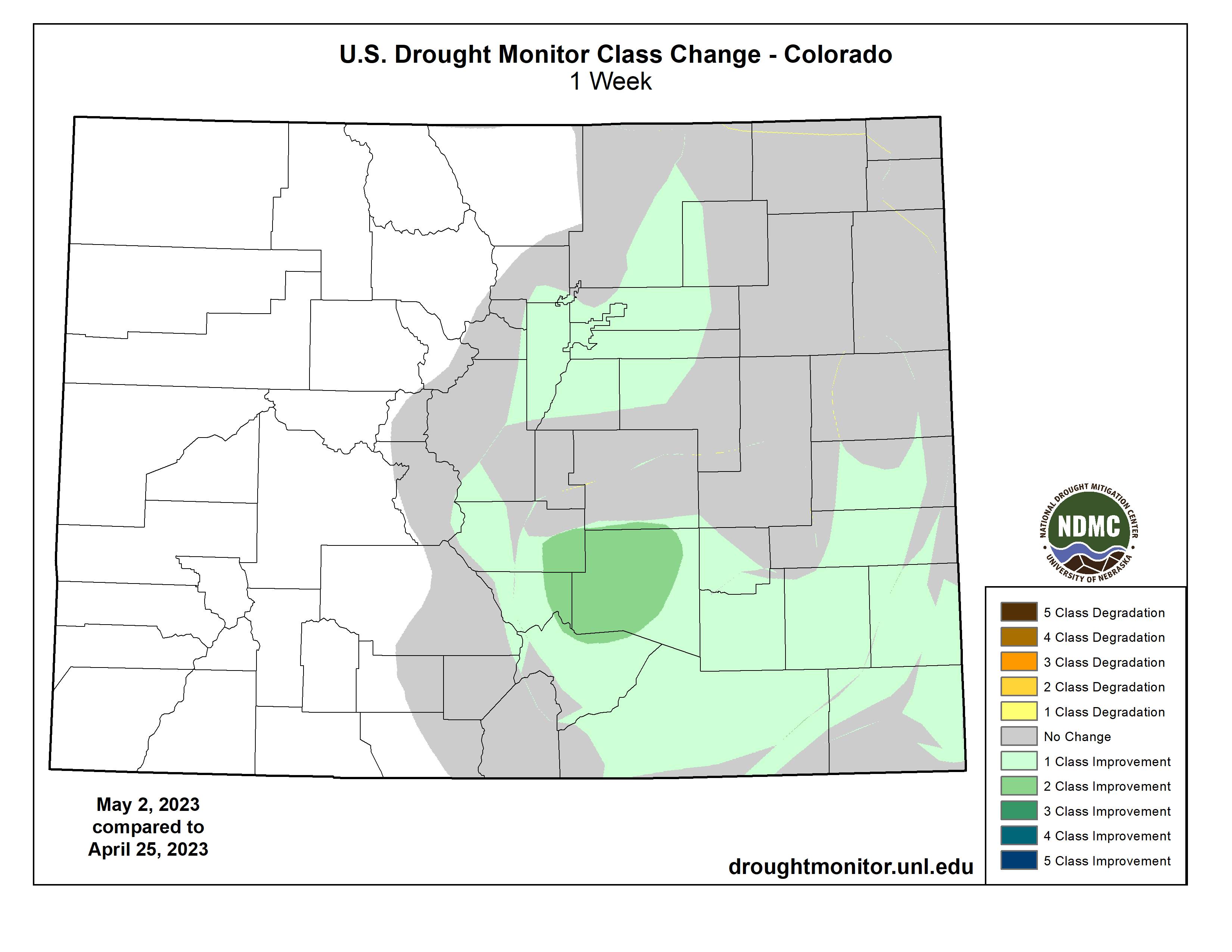
Rainfall of 1.5 to 2 inches, or more, during the past week along with SPI at various time scales and soil moisture supported a 1 to 2-category improvement to southeastern Colorado. For similar reasons, a 1-category improvement was made to southwestern Kansas. However, 12-month SPI still supports D3-D4 across much of western and central KS. Wichita has only received 0.72 inches of precipitation from March 1 to April 30, which made it the 2nd driest March and April on record and the driest since 1936. Based on the NDMC’s short and long-term objective blends and CPC’s leaky bucket soil moisture, D1-D3 expansion was warranted for northern Kansas and south-central Nebraska. D3 was increased westward across west-central Nebraska following a very dry April. North Platte tied the driest April on record. Degradations were also made to southeastern Kansas based on 60 to 120-day SPEI. Abnormal dryness (D0) coverage increased in northeastern Wyoming based on recent dryness and declining soil moisture. A small improvement was made to the southwest corner of South Dakota, based on a local report that was consistent with VegDri and objective drought blends…
West
30 to 60-day SPI along with soil moisture indicators support an expansion of abnormal dryness (D0) and moderate drought (D1) across southeastern Montana. 30 to 90-day SPIs, recent warmth, and soil moisture led to a 1-category degradation in northwestern Montana. Following major improvements during the past few months across California and the Great Basin, no changes were made this week after little or no precipitation. Drought of varying intensity is designated for parts of Oregon and northern Idaho where precipitation averaged below-normal for the Water Year to Date (October 1, 2022 to May 1, 2023)…`
South
Balancing longer term SPIs and recent widespread rainfall (1 to 3.5 inches), a 1-category improvement was made to parts of Oklahoma and Texas. Improvements were also made to parts of central Texas along with the Texas Gulf Coast after more than 1.5 inches of rainfall this past week. CPC’s leaky bucket soil moisture and 90 to 120-day SPI supported a slight expansion of moderate (D1) to severe (D2) drought in west-central Texas. Based on soil moisture considerations and impact reports (very dry pastures), extreme (D3) drought was increased in coverage across the Texas Panhandle. The addition of abnormal dryness (D0) in east-central Tennessee was based on increasing 30-day deficits, SPEI, soil moisture, and 28-day average streamflows…
Looking Ahead
During the next five days (May 4 – 8, 2023), moderate to heavy precipitation (0.5-1.5 inches, locally more) is forecast for the Pacific Northwest, Great Basin, Northern Rockies, and higher elevations of California. An active weather pattern is expected from the Great Plains east to the Mississippi Valley with varying 5-day precipitation amounts forecast. Following a very wet end to April along the East Coast, drier weather is forecast to be accompanied by a gradual warming trend across the East.
The Climate Prediction Center’s 6-10 day outlook (valid May 9-13) favors below-normal temperatures across the West, while above-normal temperatures are more likely throughout the central and eastern U.S. Elevated probabilities for above-normal precipitation are forecast for the Pacific Northwest, northern California, Great Plains, Mississippi Valley, and Southeast. Near normal precipitation amounts are favored for much of the Great Lakes and Northeast.
Just for grins here’s a gallery of US Drought Monitor maps for early May for the past few years.
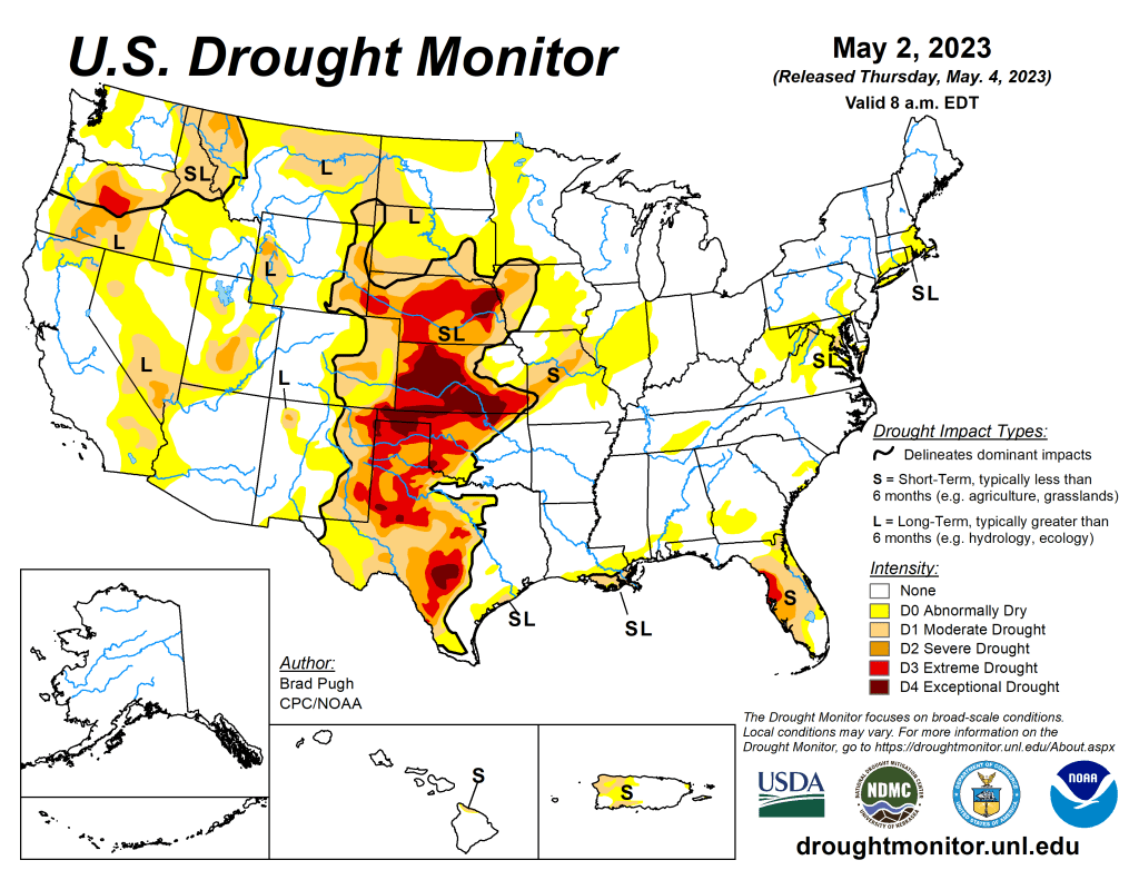
US Drought Monitor map May 2, 2023. 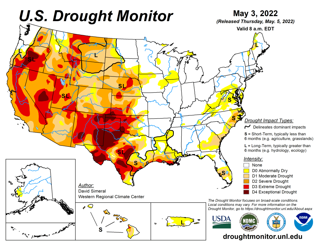
US Drought Monitor map May 3, 2022. 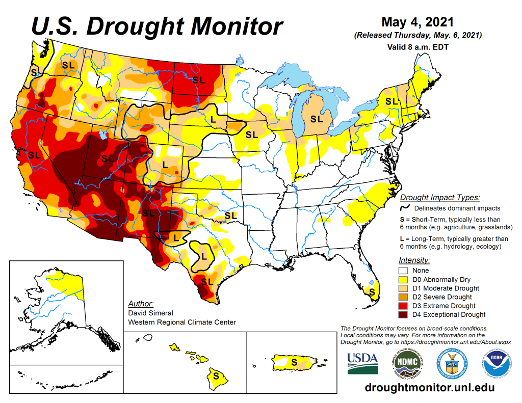
US Drought Monitor map May 4, 2021. 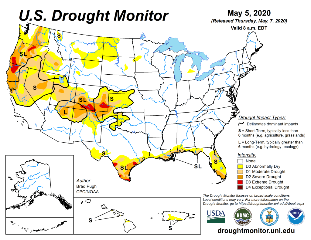
US Drought Monitor May 5, 2020. 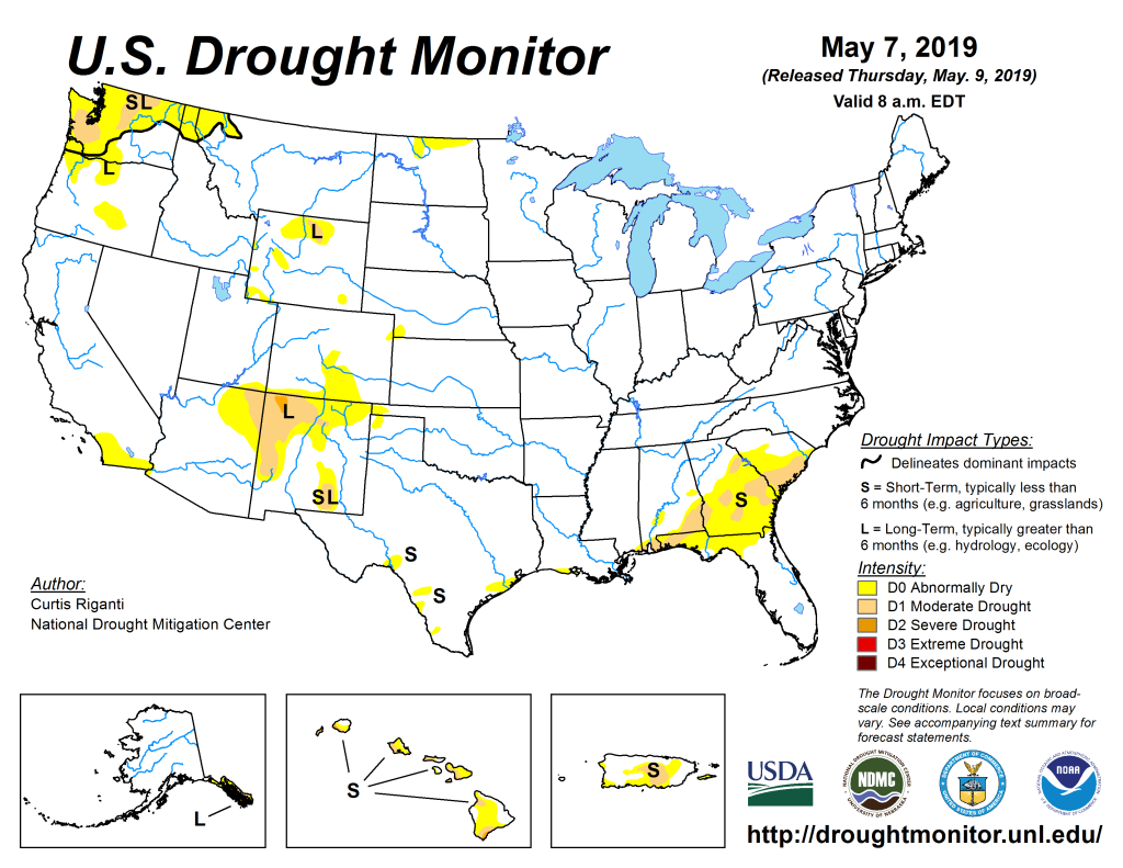
US Drought Monitor May 7, 2019. 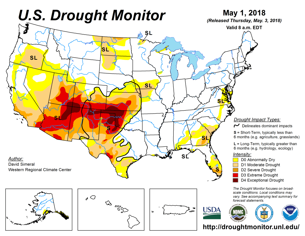
US Drought Monitor May 1, 2018. 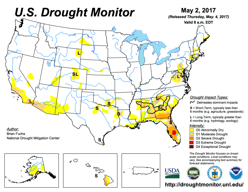
US Drought Monitor May 2, 2017. 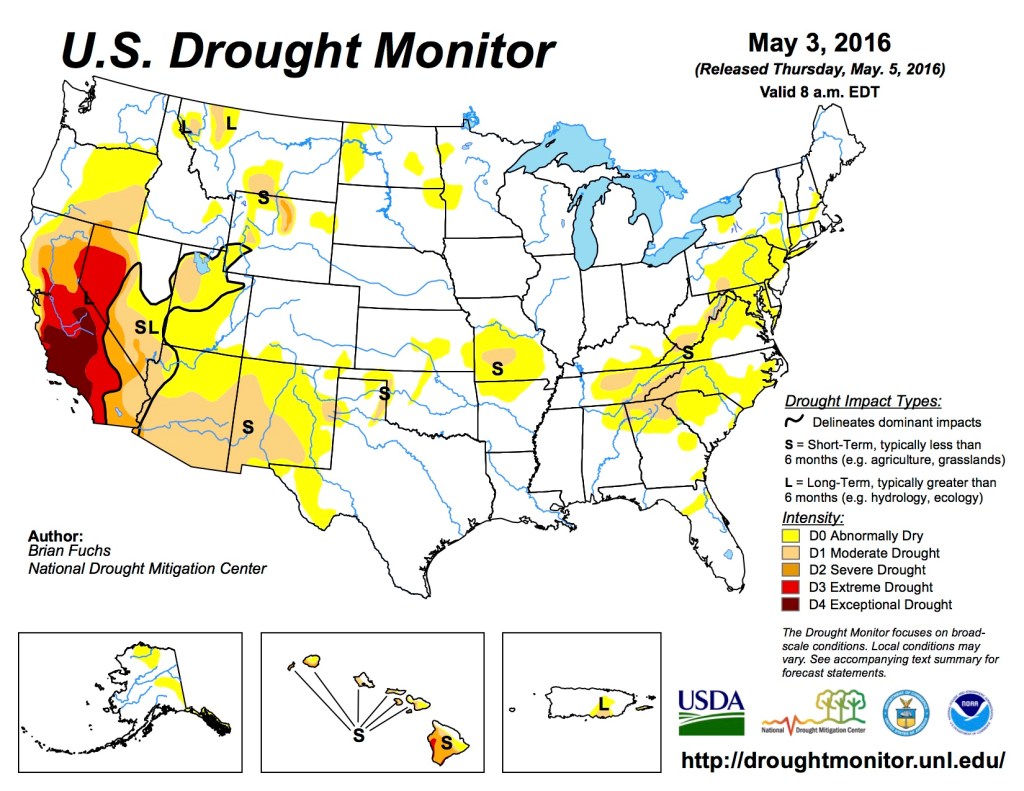
UD Drought Monitor May 3, 2016. 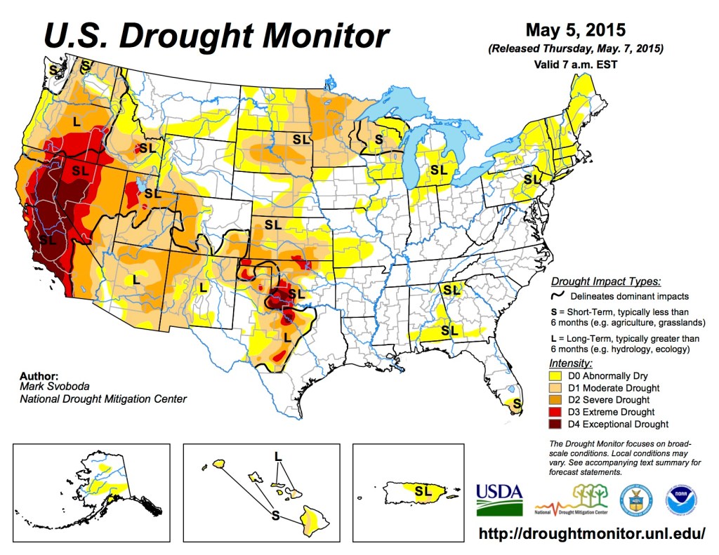
US Drought Monitor May 5, 2015 
US Drought Monitor May 6, 2014 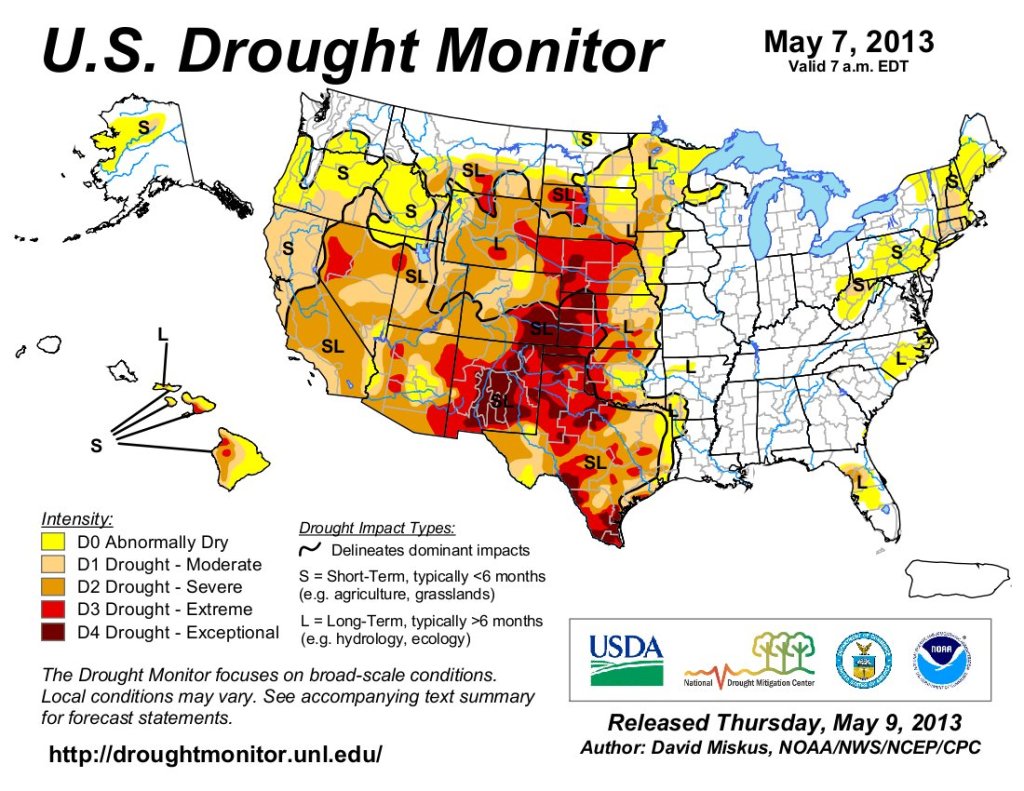
US Drought Monitor May 5, 2013 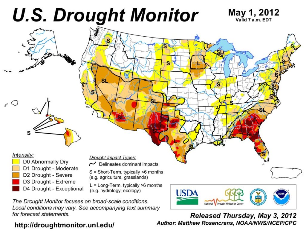
US Drought Monitor May 1, 2012 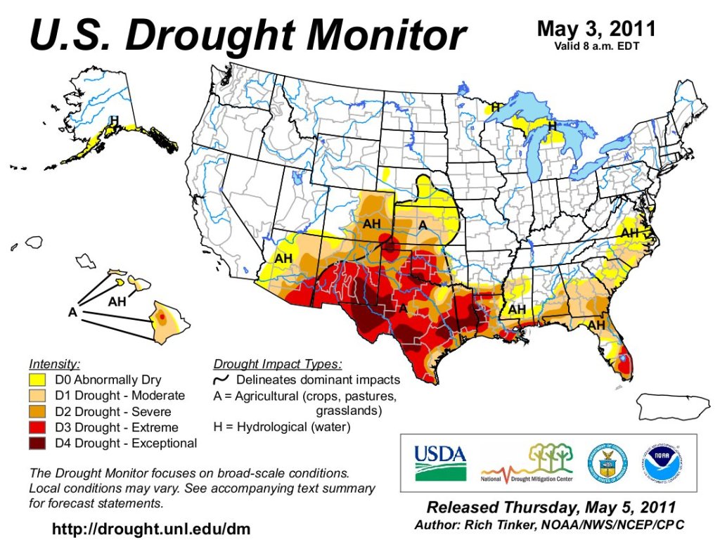
US Drought Monitor May 3, 2011.