

Click the link to read the article on the Sterling Journal-Advocate website (Jeff Rice). Here’s an excerpt:
According to a statement issued by Logan County Emergency Management Officer Jerry Casebolt Monday afternoon, the river level at the Atwood Gauge had peaked at 7.45 feet, nearly two feet below any level requiring action.
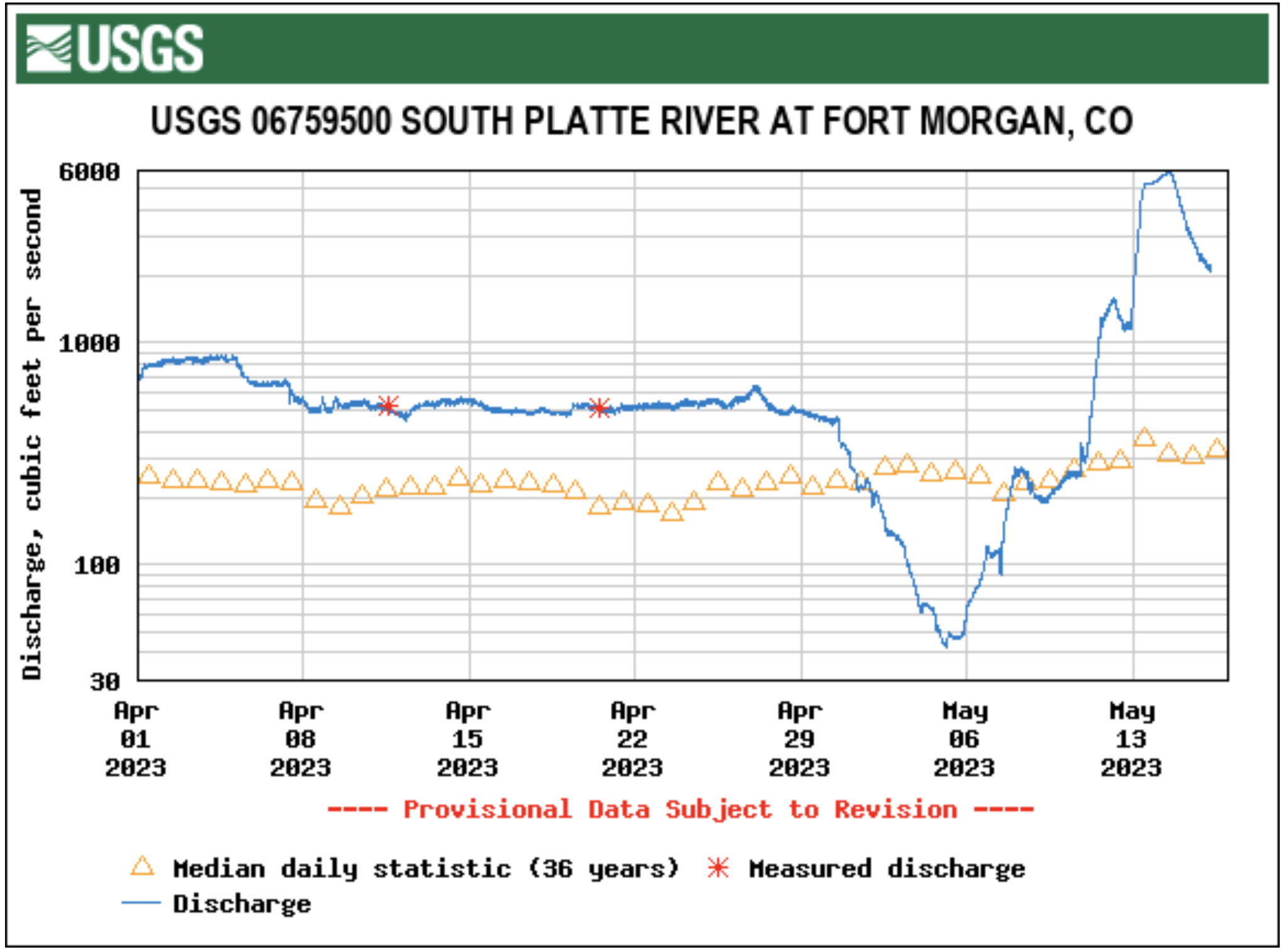
Casebolt said the high water had made it to the Crook bridge on County Road 55 early Monday, with river flow rising from 323 cubic feet per second on Sunday to 2,180 cfs on Monday. He said the Fort Morgan gauge was reporting 12.11 feet on Monday afternoon, down from 13.72 ft yesterday at this time. Meanwhile, the gauge at Kersey also had leveled off at 5.45 ft, which is down from its peak of 8.41 ft on Saturday morning. The high water was caused by nearly two days of continuous rain along the Front Range, The hardest rainfall seemed to occur in the central metro area, with Aurora recording 5.1 inches of rain between May 9 and May 12. In that same time period Denver reported 5 inches, Boulder 2.5 inches, Longmont 2.3 inches, Broomfield 3.5 inches, Loveland 2.4 inches, Fort Collins 2.25 inches and Greeley 4 inches.
While the runoff will subside over the next day or so, it will be followed by snowmelt as temperatures become warmer in the coming week. Daily highs along the Front Range should be in the upper 60s and upper 70s the rest of the week, with periods of possible thunderstorms at the end of the week.
