
Click on a thumbnail graphic to view a gallery of drought data from the US Drought Monitor website.


Click the link to go to the US Drought Monitor website. Here’s an excerpt:
This Week’s Drought Summary
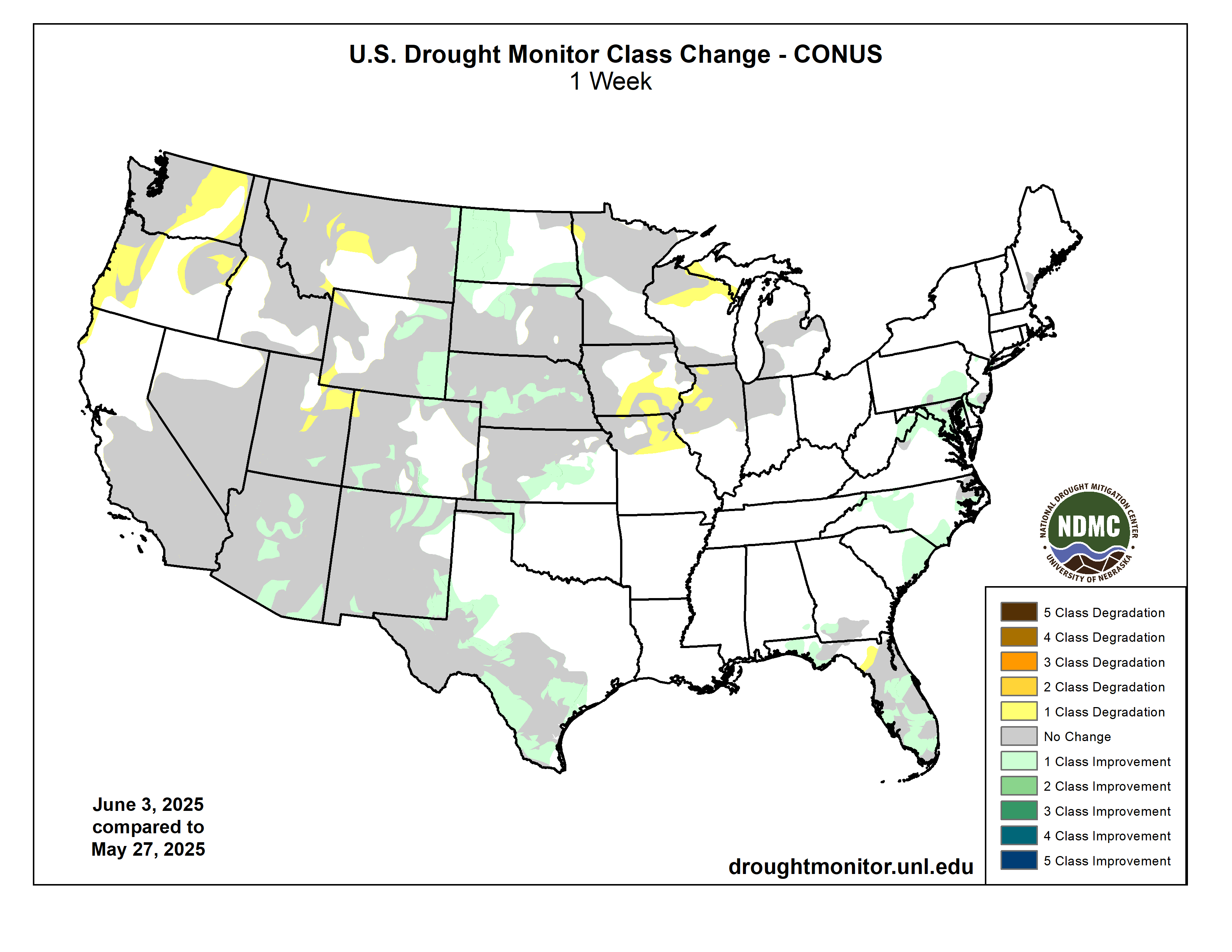
Drought coverage and intensity continued its overall decreasing trend this spring across the Great Plains. To the east across southern Iowa, northern Illinois, and northern Missouri, drought expanded with little to no precipitation from May 27 to June 2. The Desert Southwest had an unusual wet start to June as a low pressure system, interacting with enhanced moisture from Tropical Storm Alvin in the East Pacific, resulted in locally heavy rainfall and a 1-category improvement to parts of Arizona. A wetter-than-normal May brought an end to drought throughout much of the Northeast. The rainy season is well underway across Florida and heavy rainfall this past week led to improvements across the central to southern Florida Peninsula. 7-day temperatures (May 27-June 2) averaged below-normal across most of the eastern and central U.S., while above-normal temperatures prevailed for the West. Alaska and Puerto Rico are drought-free, while drought of varying intensity continues for parts of Hawaii…
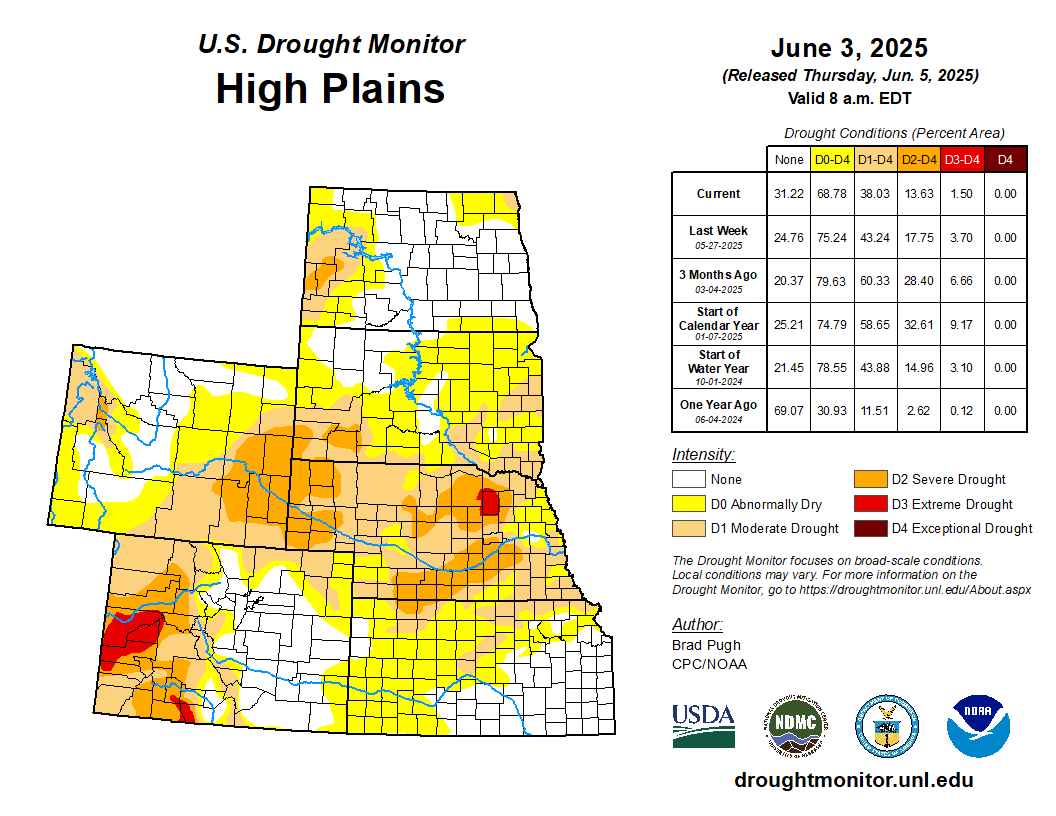
High Plains
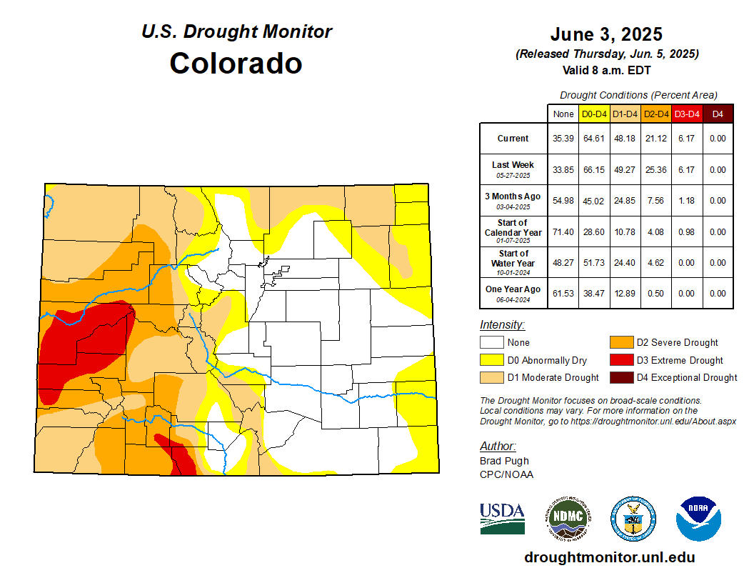
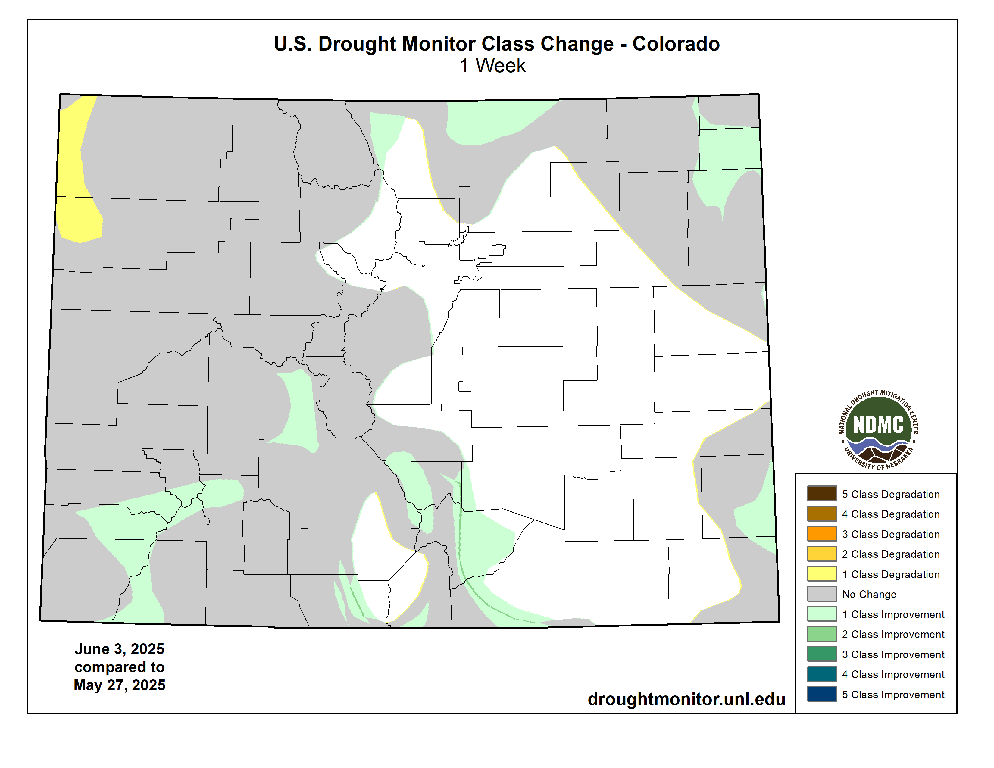
From May 20 to June 2, two-week precipitation amounts ranged from 2 to 4 inches, locally more, across much of Kansas, Nebraska, and northeastern Colorado. This precipitation accompanied by cooler-than-normal temperature during the latter half of May led to improving drought for the Central Great Plains. The southern half of Kansas is now drought-free. On June 2, precipitation (more than 0.5 inch) overspread southern Colorado where a 1-category improvement was made. Additional precipitation this past week along with consideration of SPIs dating back 6 to 12 months and the NDMC drought blends supported the removal of severe (D2) to extreme (D3) drought across southeastern Wyoming. Despite only light precipitation this past week, a 1-category improvement was made to much of the Dakotas to be more consistent with SPIs at various time scales, soil moisture, and the NDMC drought blends. For the Northern Great Plains, the drought impact was changed to long-term only given the recent wetness and the drought signal is strongest at 9 to 12 months…
West
The Desert Southwest had a rare wet start to June as a mid-level low pressure system interacted with enhanced moisture from former Tropical Storm Alvin in the East Pacific. Central Pima, northern Maricopa, and southern Yavapai counties of Arizona received 0.75” inches of precipitation with isolated amounts exceeding 2 inches, supporting a 1-category improvement. Although amounts were lower in southeastern Arizona, there was enough precipitation to warrant shifting the exceptional drought category (D4) to extreme drought (D3). A lack of springtime precipitation led to an expanding area of abnormal dryness (D0) and short-term drought (D1) across the Pacific Northwest. Based on worsening soil moisture and low 28-day average streamflows, a 1-category degradation was warranted for parts of central and southwestern Montana. A 1-category degradation was also made to parts of central and northeastern Utah. Elsewhere, across the West, little to no changes were made as California and Nevada enter their drier time of year.
South
For the second consecutive week, heavy rainfall (more than 1 inch) prompted a 1-category improvement to central and southern Texas. Despite this recent heavy rainfall, levels in the long-term monitoring wells of Bexar and Medina Counties remain near or at all-time lows. In addition, many of the 28-day average USGS streamflows across south-central Texas are below the 5th percentile, supporting the D3-D4 depiction. Since the SPIs dating back 6 months are mostly neutral to positive, the drought impact is designated as long-term only for central and southern Texas. Recent precipitation and the NDMC drought blends supported 1-category improvements to northern and eastern New Mexico. Additional rainfall this past week ended drought across Oklahoma and the Sooner State became drought-free for the first time since July 2019. The Lower Mississippi Valley and Tennessee Valley are also drought-free with 30 to 90-day precipitation averaging above normal…
Looking Ahead
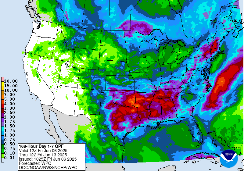
From June 5 to 7, a slow-moving cold front coupled with a low pressure system near the East Coast is forecast to bring scattered showers and thundershowers to the East with the heaviest precipitation for eastern North Carolina. Multiple rounds of thunderstorms with locally heavy precipitation are forecast from the Central and Southern Great Plains east to the Tennessee Valley through June 7. In the wake of a cold front, mostly dry weather will prevail for the Northern Great Plains and western Corn Belt. A warming trend is forecast across the Pacific Northwest and northern California with potential record highs on June 8 and 9.
The Climate Prediction Center’s 6-10 day outlook (valid June 10-14, 2025) favors above-normal precipitation for the Rocky Mountains, Great Plains, Lower Mississippi Valley, and Southeast. The outlook leans towards below-normal precipitation for the eastern Corn Belt. Below-normal precipitation is also favored for southern Alaska, while elevated above-normal precipitation probabilities are forecast across Hawaii. Above-normal temperatures are favored throughout much of the West, Northern Great Plains, Upper Mississippi Valley, and East Coast with increased chances for below-normal temperatures forecast for the Southern Great Plains and Middle Mississippi Valley. Cooler-than-normal temperatures are also more likely for much of Alaska.
Just for grins here’s a slideshow of US Drought Monitor maps for early June for the past few years.
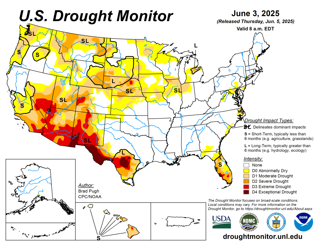
US Drought Monitor map June 3, 2025. 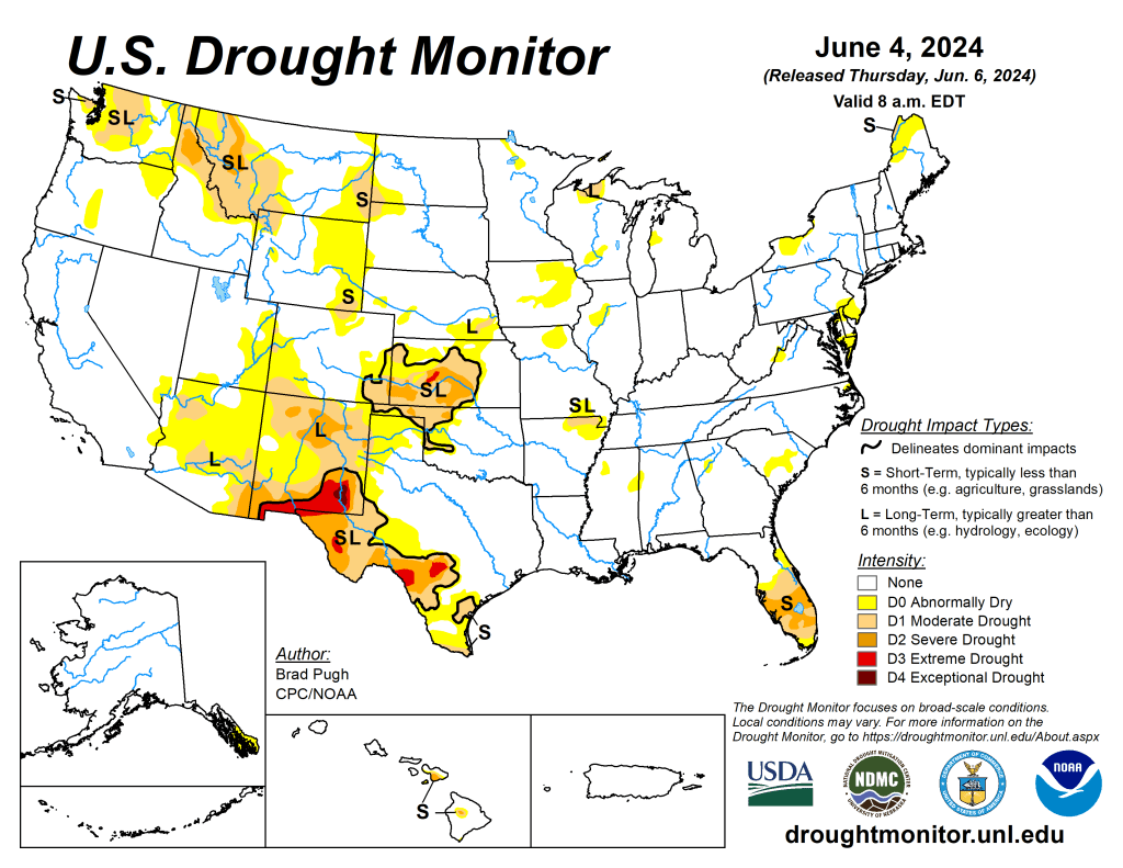
US Drought Monitor map June 4, 2024. 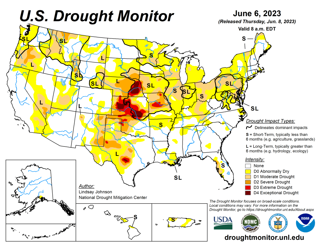
US Drought Monitor map June 6, 2023. 
US Drought Monitor map June 7, 2022. 
US Drought Monitor map June 1, 2021. 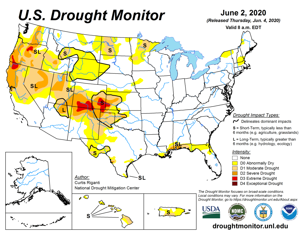
US Drought Monitor June 2, 2020. 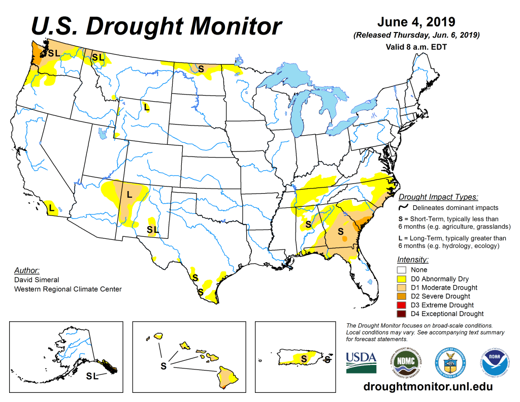
US Drought Monitor June 4, 2019. 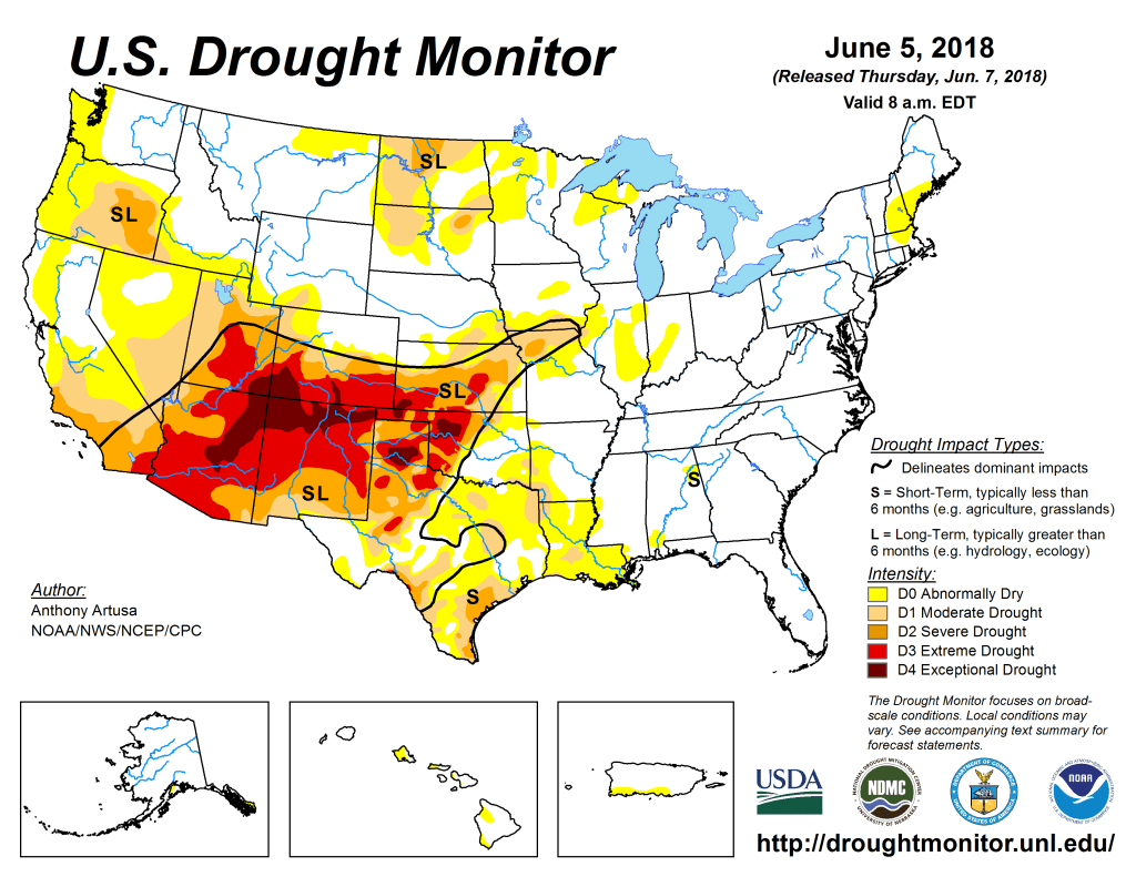
US Drought Monitor June 5, 2018. 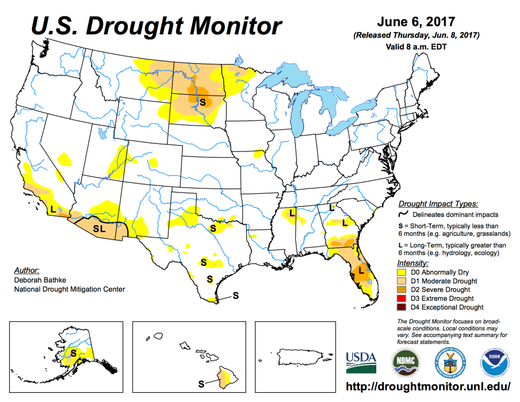
US Drought Monitor June 6, 2017. 
US Drought Monitor June 7, 2016. 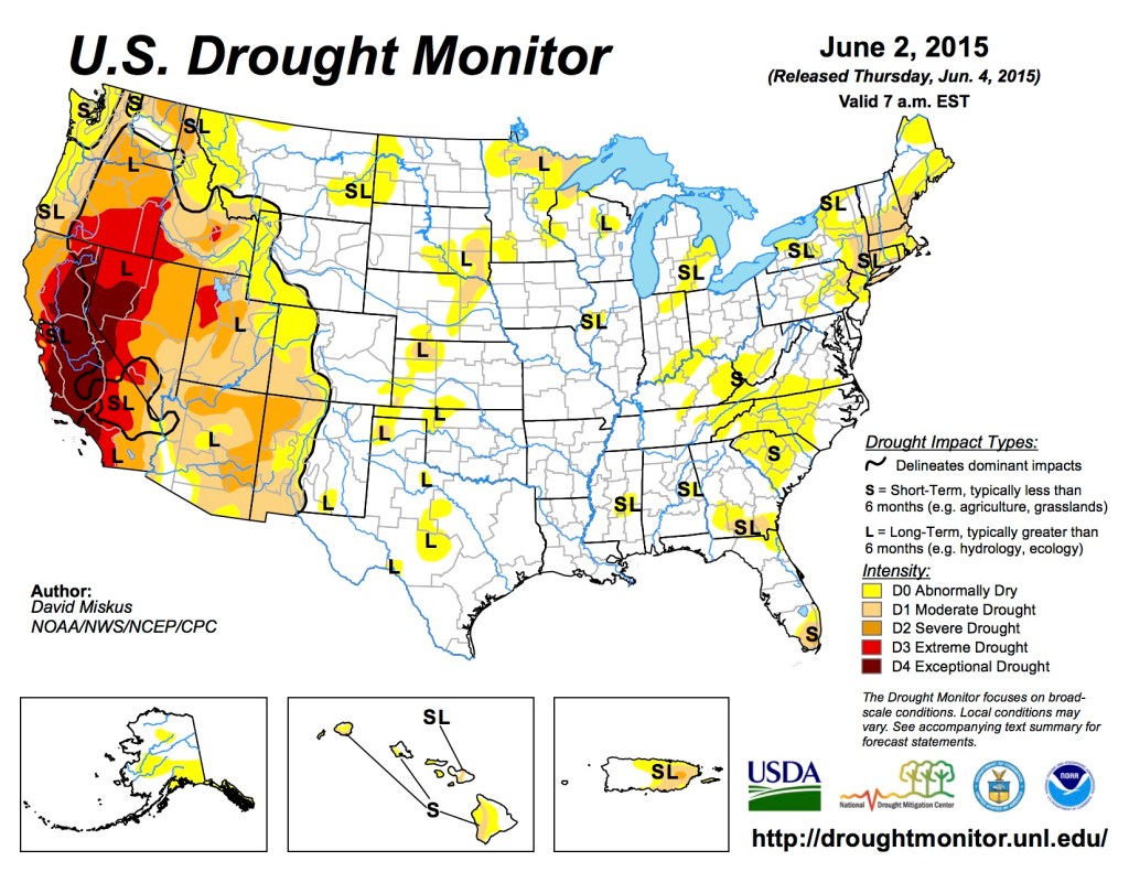
US Drought Monitor June 6, 2015. 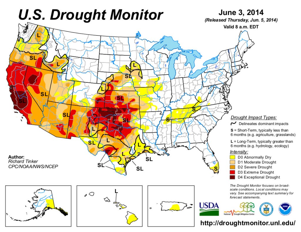
US Drought Monitor June 3, 2014 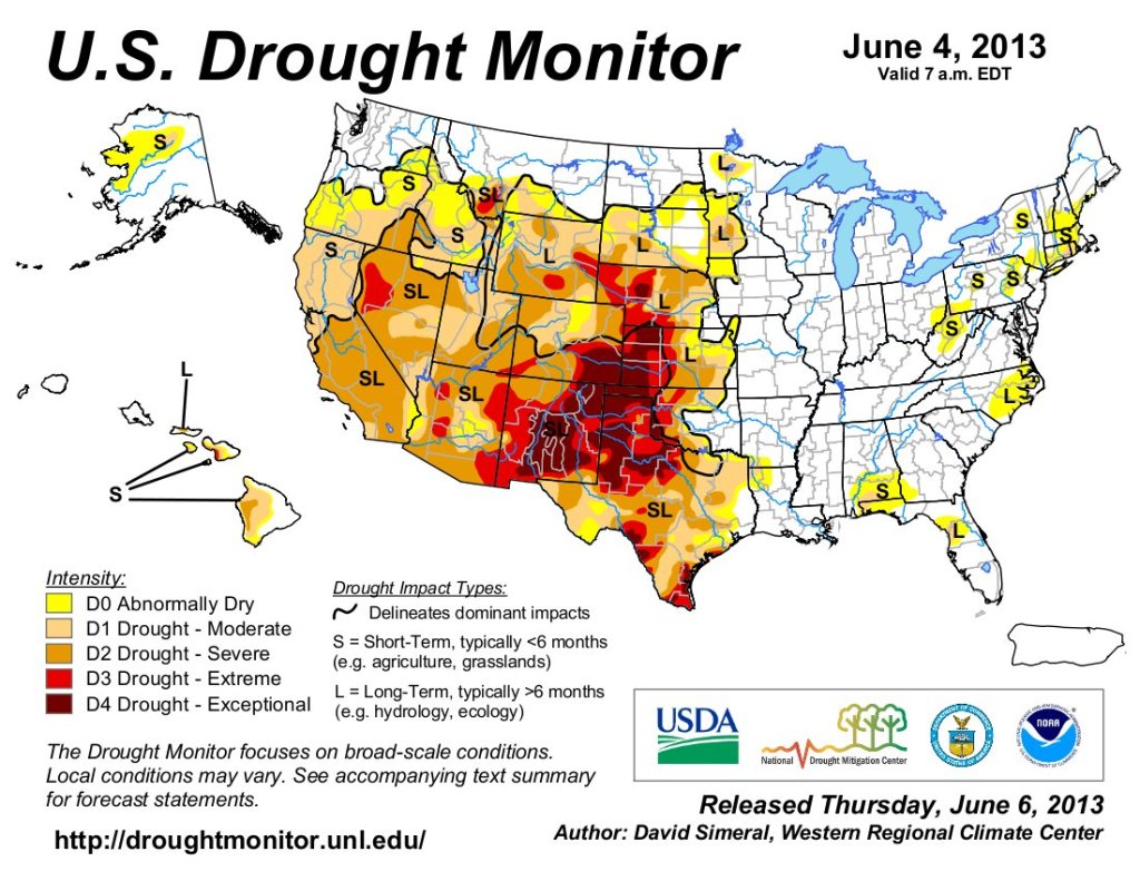
US Drought Monitor June 4, 2013. 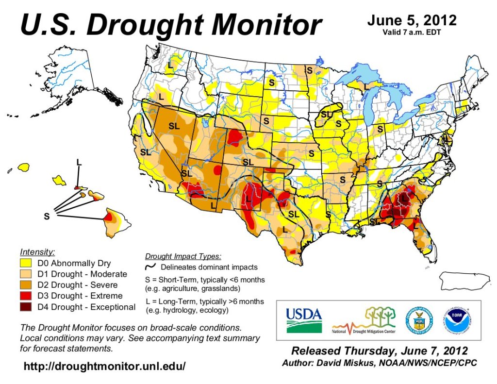
US Drought Monitor June 5, 2012. 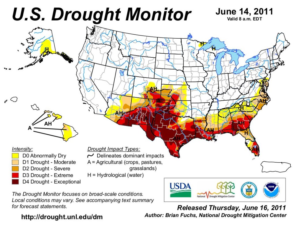
US Drought Monitor June 14, 2011. 
US Drought Monitor June 15, 2010.