This story was published in partnership with Public Domain.
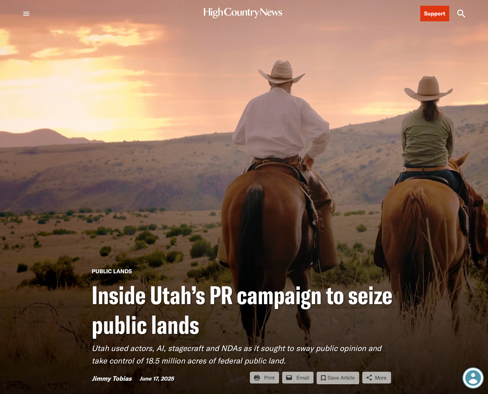
Last year, as Utah prepared to file a federal lawsuit aiming to take control of millions of acres of federal public land within its borders, state officials sought help swaying public opinion in their favor. So they turned to a group of public relations professionals at Penna Powers, a media and branding firm based in Salt Lake City.
Backed with a commitment of more than two million in tax-payer funds, the firm sprang into action. One of the early orders of business was studying the opposition. In June 2024, an assistant attorney general sent an email to numerous state government colleagues and Penna Powers staffers that contained a video from the Theodore Roosevelt Conservation Partnership (TRCP) in which the well-known hunter and media personality Randy Newberg described the dangers of transferring federal land to state control. “It doesn’t matter how many promises are made,” warned Newberg, “the financial realities would force states to sell off our public lands.”
Noting that organizations like TRCP are good at connecting with “traditionally conservative” audiences, the Utah official told his colleagues that “our PR efforts will largely depend on how well we can anticipate and effectively respond to these expected criticisms.”
“That definitely helps us know what we need to counter the opposition,” added Redge Johnson, director of Utah’s Public Lands Policy and Coordinating Office, or PLPCO, which has played a central role in organizing the state’s campaign to seize federal land.
Throughout 2024, Penna Powers put together an elaborate PR and media campaign to do just that — counter the opposition and build support for Utah’s efforts. They churned out videos, newspaper ads, social media spots and more. They hired actors, ran focus groups and helped prominent Utah politicians write talking points. In at least one instance, Penna Powers relied on AI to help create voice-overs in videos. In another instance, PLPCO staffers warned Penna Powers not to use too much scenic imagery in the campaign for fear it might undermine their efforts. They called the campaign “Stand for Our Land,” and those who worked on it were required to sign non-disclosure agreements. “The Office of the Attorney General is taking this NDA extremely seriously,” wrote one government official.
Hundreds of records reviewed by Public Domain shed light on the key players involved in this campaign and the strategies they used to persuade the public in their favor. Among other themes, their campaign relentlessly portrays the federal government as an absentee landlord that mismanages land and cuts off access to the public domain. Utah, on the other hand, is painted as a benevolent force working to ensure public land access. The campaign — like the lawsuit it was meant to support — seeks one principal outcome: federal land disposal. Utah has identified some 18.5 million acres of federal land within the state’s boundaries that are currently administered by the Bureau of Land Management on behalf of all Americans — and it wants those lands for itself.
Penna Powers, meanwhile, landed a big pay day. The contract between the PR firm and PLPCO runs until 2029 for a total cost of some $2.6 million.
In response to queries, PLPCO in a written statement said that,“Utah believes in protecting access to public lands for all users of all ages and abilities, and we are committed to actively managing these lands for generations to come. Utah is home to five national parks, several national monuments, and many other natural wonders. The state has always welcomed, and will continue to welcome visitors from around the world to visit and enjoy all that this great state has to offer.” Penna Powers did not respond to requests for comment.
Meanwhile, critics of the Utah PR effort called it a “propaganda” campaign meant to mislead Utahns and the general public.
“Penna Powers worked hand-in-hand with the state of Utah to craft a misleading message about the state’s land grab lawsuit,” said Kate Groetzinger, communications manager at the Center for Western Priorities, a conservation group. “They made it seem like forcibly taking ownership of public lands would help recreationists and ranchers, when the real goal of this lawsuit was to increase extraction and privatize national public lands in Utah. This campaign is the very definition of propaganda — misleading political messaging paid for by taxpayers.”
UTAH’S EFFORT TO take control of federal lands kicked off in earnest in 2012, when Utah’s then-Governor Gary Herbert signed into law the Utah Transfer of Public Lands Act, demanding state control of the majority of federal public land in Utah. “This is only the first step in a long process,” Herbert said at the time, “but it is a step we must take.” In 2018, Senator Mike Lee, a leading proponent of the land transfer movement, shared similar sentiments during a speech to the conservative Sutherland Institute in Salt Lake City. The campaign for land transfer, he said, “will take years, and the fight will be brutal.” Indeed, just last week, Lee put forward a proposal in the GOP’s massive reconciliation bill that would force the sell off of millions of acres of federal land in the Western U.S.
Utah’s actions to seize control of federal land have only grown more aggressive as the years have progressed. In August last year, it filed a lawsuit directly with the Supreme Court seeking to strip federal ownership over some 18.5 million acres of BLM land within Utah. It claims these lands are “unappropriated,” a novel argument meant to create a legal distinction between national parks, forests and monuments, and large swaths of BLM land across the West. If successful, Utah’s lawsuit would deprive the vast majority of Americans of their ownership stake in such BLM lands. Tribal nations, meanwhile, have been staunch opponents of Utah’s lawsuit, which the Ute Indian Tribe described as an “existential threat” to the tribe and its reservation lands.
In January this year, the Supreme Court declined to hear Utah’s case. It remains unclear whether Utah will refile its lawsuit in lower court, but its efforts to seize federal land are a generational project.
Regardless, Utah, faces a major public opinion hurdle. A large majority of Western voters are opposed to the idea of state control over federal public lands, according to Colorado College’s annual polling. Even in Utah, some 57% of voters oppose public land transfers. That is where Penna Powers comes in. The firm worked to reshape public opinion in the state’s favor, with a focus on building support among Utah residents as well as key decision makers at the national level.
“The Stand for Our Land public education campaign is informing Utahns about the management of public lands, and how federal agencies are restricting access to public lands and ignoring local concerns,” wrote PLPCO in a statement. “The Bureau of Land Management closed over 2,000 miles of Utah roads on public lands in the past two years.”
A centerpiece of Penna Powers’ effort has been glossy videos that portray federal land agencies as an exclusionary force bent on keeping people off the public domain. In one video, Penna Powers and PLPCO hired a voice actor to portray a “disabled camper” in a wheelchair on a camping trip with her family. “Because of my disability I need to reach campsites in a motorized vehicle,” the actor said. “If I lose road access, I lose the ability to do something I love with my family. That’s why I think Utah should be managing Utah land.” The actor who was selected to voice the video does not appear to use a wheelchair or mobility aid in social media posts and other records reviewed by Public Domain. PLPCO appears to have had many of those involved in its video shoots also sign NDAs. A talent agent for the actor in question did not provide comment at the time of publication.
Redge Johnson, the executive director of PLPCO, was particularly keen on the “disabled camper” storyline, among others. He asked about a video that combined the “disabled camper” story with one about an off-highway vehicles business. “I really want that video in the folder, it tells a great story,” he wrote to Penna Powers staffer Allyse Christensen, who worked on the Stand for Our Land campaign.
Others, like disability community advocate Syren Nagakyrie, said Utah’s use of a “disabled camper” storyline to promote its political agenda is “disingenuous.”
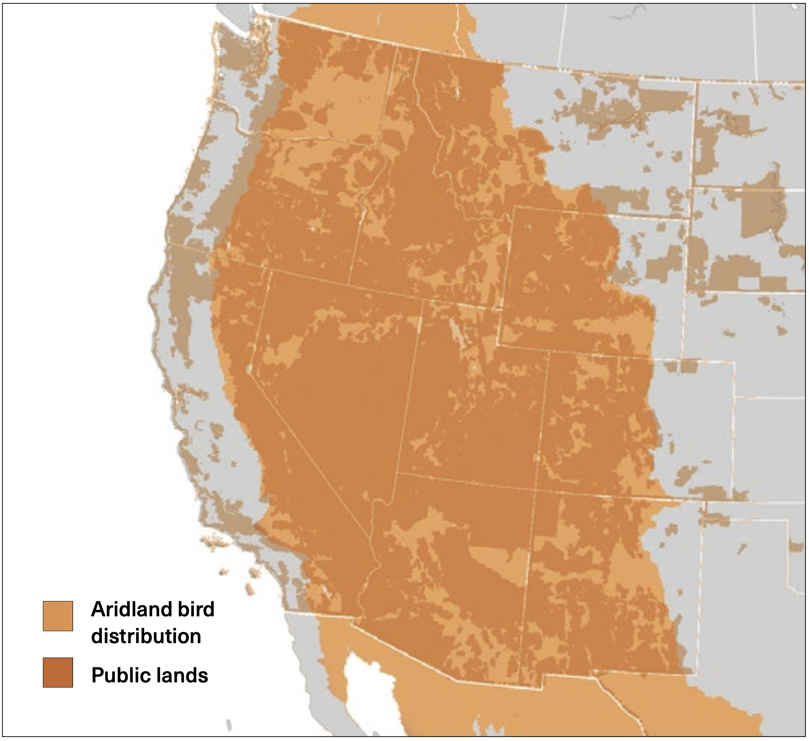
WESTERN PUBLIC LANDS ARE HABITAT FOR ARIDLAND BIRDS
This map shows the cumulative range for 30 aridland bird species in North America, with the vast majority of that range falling within the boundaries of federal and state public lands. Source: Aridland bird data from Bird Conservation Regions, Bird Studies Canada and NABCI. Public lands map from GISGeography.com.
The Wyoming Office of State Lands and Investments was ultimately given $75,000 for the study, and it picked Jackson-based Y2 Consultants to complete the analysis. When the 357-page study was completed the following fall, state land managers and lawmakers were warned that they lacked staff and resources to take over control of 25 million acres of Bureau of Land Management, U.S. Forest Service and Bureau of Reclamation property that fell within state boundaries.
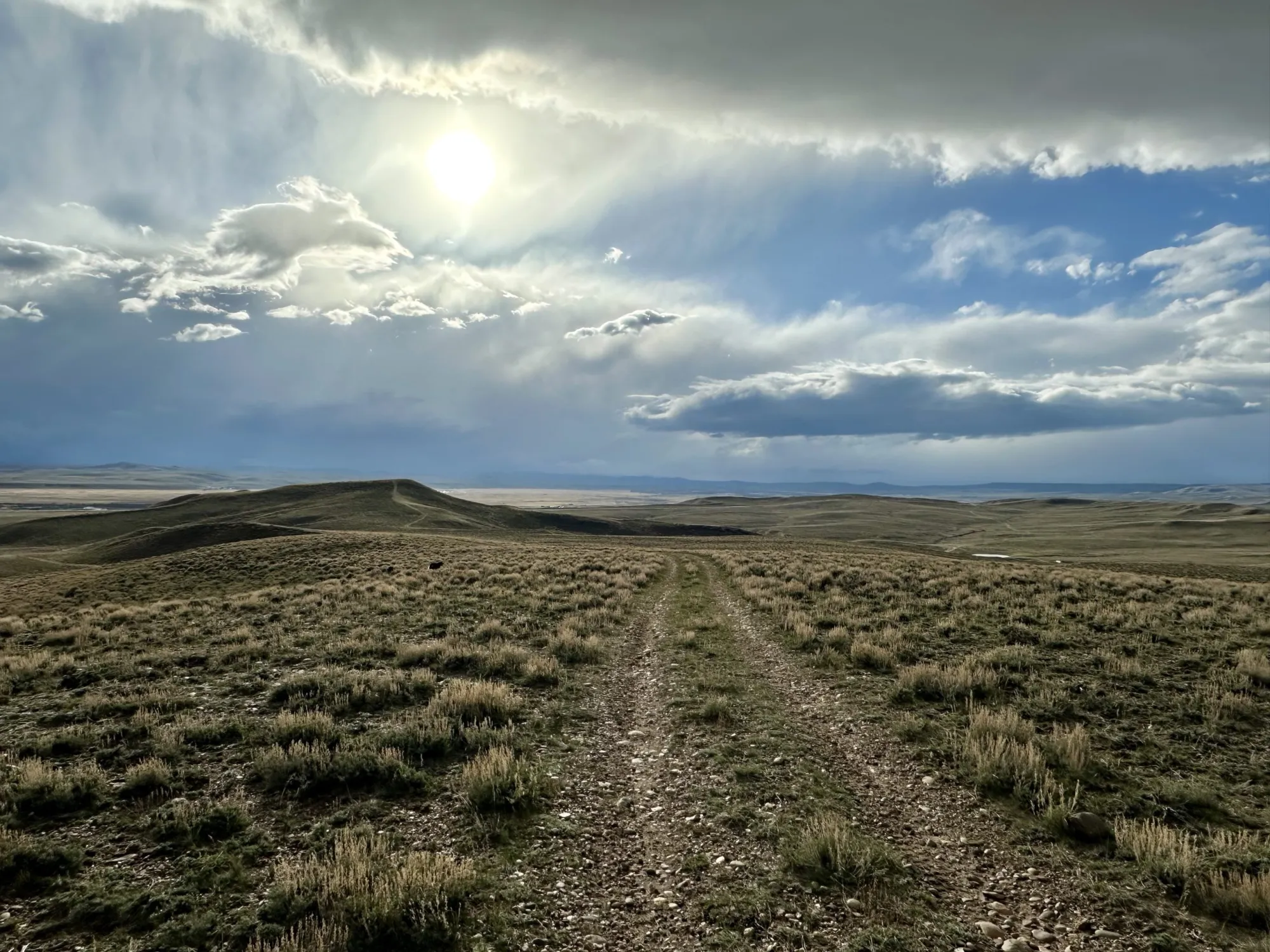
A two-track road cuts through Bureau of Land Management property west of Pinedale in April 2024. Such tracts of public land could be on the chopping block because of federal budget reconciliation text that seeks to sell between 2-3 million acres of the federal estate. (Mike Koshmrl/WyoFile)
“Ultimately, without significant changes to federal law, the greatest challenge would be that the state would be inheriting the same bureaucratic maze of overlapping, entwined, often conflicting federal mandates established in the labyrinth of laws and directives laid out by Congress,” the 2016 Y2 Consultants report stated. “The land management trials, conundrums, and conflicts encountered would largely be the same for the state that exist under present [federal] management.”
The first author listed on the report, a slot that typically denotes the lead, was Brenda Younkin, a natural resource specialist who co-founded Y2 Consultants with her husband, Zia Yasrobi.
On Wednesday, Politico’s E&E News publicized that Younkin had been appointed by the Trump administration and had started working in a senior advisor post at the Bureau of Land Management, where she’d report to its acting director, Jon Raby. Trump’s first pick to lead the BLM, Colorado oil and gas advocate Kathleen Sgamma, withdrew her bid after it was revealed that she’d written a memo expressing “disgust” for “President Trump’s role in spreading misinformation that incited” the Jan. 6, 2021 riot at the U.S. Capitol.
WyoFile was unable to reach Younkin for an interview Friday, but an auto-response from her Y2 Consultants email address confirmed a “leave of absence” because of a new gig with the U.S. Department of the Interior, the BLM’s government parent.
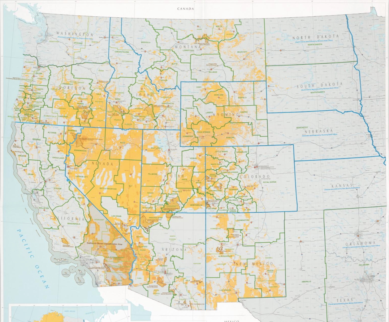
The Bureau of Land Management’s 245 million surface acres, depicted in yellow in this map, account for about 10% of the United States’ landmass. (Library of Congress)
According to her biography and past interviews, Younkin has worked in the public lands and ranching sphere her entire career.
In statements made to the Cowboy State Daily, U.S. Sens. Cynthia Lummis and John Barrasso both lauded Younkin’s appointment.
“The more Wyoming voices we can have in the room, the better off we will all be,” Barrasso told the outlet.
Younkin joins a handful of other Wyoming residents who’ve gone to work for the Trump administration’s Interior Department via political appointments, or who have been nominated for positions.
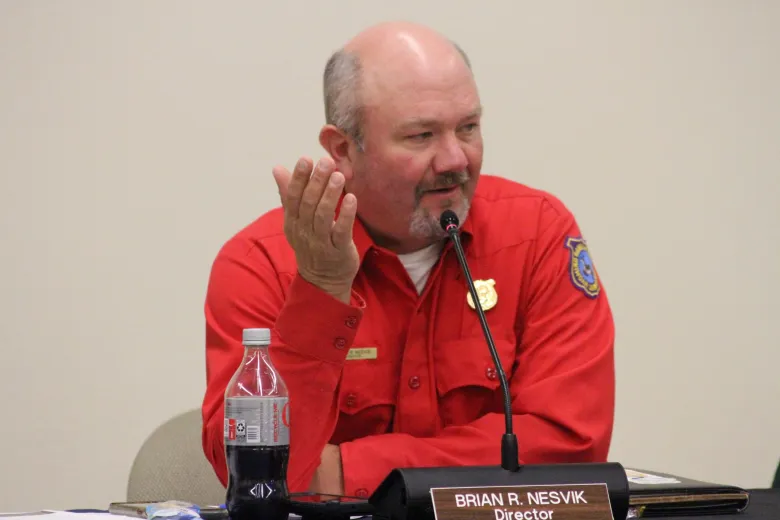
Wyoming Game and Fish Director Brian Nesvik speaks at a Game and Fish Commission meeting in Douglas in September 2024. (Mike Koshmrl/WyoFile)
Last, southwestern Wyoming big game hunting advocate Josh Coursey was appointed to a Fish and Wildlife Service post, pulling him away from the Muley Fanatic Foundation, which he co-founded. That group has since gone on record opposing a provision expected to be yoked into the so-called “One Big Beautiful Bill Act” that would mandate the sale of an estimated 2-3 million acres of federal land in 11 western states.
“Public lands need to stay in public hands and the Muley Fanatic Foundation opposes anything or anyone that threatens our lands that we hold dear for personal use,” President and CEO Joey Faigle told WyoFile in a written statement. “The public land sales being included in the reconciliation needs to stop now.”
If the public land sale mandates don’t stop, the amount of land that Younkin, the Jackson Hole consultant, will be tasked with overseeing at the Bureau of Land Management will shrink.
The disposal language in the Senate Committee on Energy and Natural Resources legislative text demands selling between 0.5% and 0.75% of the BLM and U.S. Forest Service’s 438 million surface acres within the next five years. Although just a fraction of the agencies’ overall holdings, it’d translate to doing away with public lands that collectively add up to an area no smaller than Yellowstone National Park.
War, tariffs and inflation are not the only things driving up the price of food. Widespread drought is also looming over what people around the world eat. In Brazil, parched coffee farms have affected latte prices everywhere. In the Midwestern United States, years of poor rainshave led ranchers to cull cattle herds and have raised beef prices to their highest levels ever. In China, one of the nation’s key wheat-producing regions, the Yellow River Basin, is withering under unusually hot, dry conditions. Germany had its driest spring since 1931, though rains in recent weeks have allayed concerns about its wheat and barley crops. Ukraine and Russia, rivals on the battlefield, are also facing the threat of drought for their wheat crops. Both countries are breadbaskets for millions of people far and wide. Morocco, for instance, now in its sixth year of drought, has relied increasingly on wheat imports from Russia. Droughts are part of the natural weather cycle but are exacerbated in many parts of the world by the burning of fossil fuels, which is warming the world and exacerbating extreme weather. Droughts can be particularly risky as the production of important foods becomes increasingly concentrated. For example, much of the world’s coffee comes from Brazil, cacao from Ivory Coast and Ghana in West Africa, and corn from Brazil, China and the American Midwest…Around the world, most people get their calories from three staple grains — rice, wheat and corn — which means that weather hazards to places where they are produced can have big repercussions for food security. Bad weather in one or two of those regions can destabilize the global supply…
Sandwiches, instant noodles, rotis. Wheat, in all its forms, has become one of the world’s most commonly eaten grains, second only to rice. That makes it one of the most closely watched crops in the era of extreme weather. Wheat is also often closely guarded. Take India, for instance. Prompted by an intense heat wave in 2022, the Indian government banned wheat exports in order to stockpile it at home…
Summer barbecue season is approaching just as the price of beef has topped records. Ground beef in the United States is close to $6 per pound, and steak is nearly twice that…A few factors are driving the price rise, including soaring insurance costs for farmers and the abiding demand for beef. But central to the rising cost of beef is a drought that has stretched across the Midwestern United States over the past several years. The conditions have dried up a lot of grazing land. Cattle herd numbers are at their lowest in 70 years.
The San Juan River near Navajo Dam, New Mexico, Aug. 23, 2015. Photo credit: Phil Slattery Wikimedia Commons
From email from Reclamation (Conor Felletter):
June 23, 2025
The Bureau of Reclamation has scheduled an increase in the release from Navajo Dam from 350 cubic feet per second (cfs) to 450 cfs for Tuesday, June 24th, at 4:00 AM.
Releases are made for the authorized purposes of the Navajo Unit, and to attempt to maintain a target base flow through the endangered fish critical habitat reach of the San Juan River (Farmington to Lake Powell). The San Juan River Basin Recovery Implementation Program recommends a target base flow of between 500 cfs and 1,000 cfs through the critical habitat area. The target base flow is calculated as the weekly average of gaged flows throughout the critical habitat area from Farmington to Lake Powell.
This scheduled release change is subject to changes in river flows and weather conditions. If you have any questions, please reply to this message, call 970-385-6500, or visit Reclamation’s Navajo Dam website at https://www.usbr.gov/uc/water/crsp/cs/nvd.html
Lake Mendocino, in Northern California’s wine country, was the proving ground for Forecast-Informed Reservoir Operations. (Source: California Department of Water Resources)
Western Water in-depth: For years, atmospheric rivers were a mystery. now, an innovative dam management approach is putting them to work
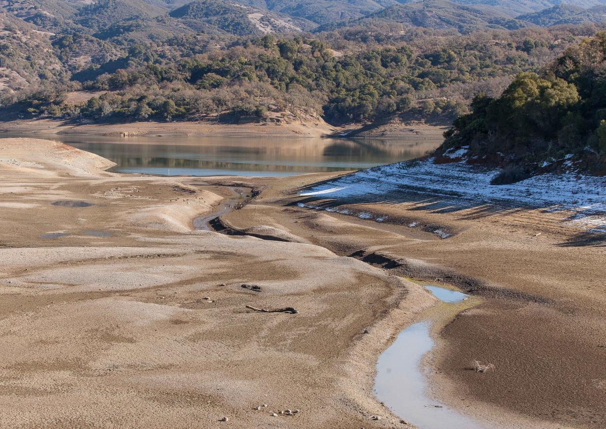
In December 2012, dam operators at Northern California’s Lake Mendocino watched as a series of intense winter storms bore down on them. The dam there is run by the U.S. Army Corps of Engineers’ San Francisco District, whose primary responsibility in the Russian River watershed is flood control. To make room in the reservoir for the expected deluge, the Army Corps released some 25,000 acre-feet of water downstream — enough to supply nearly 90,000 families for a year.
In doing so, the Army Corps averted the possibility of a catastrophic flood. But almost as soon as the water headed downstream, the pendulum swung in the other direction. The weather turned dry, and the months that followed proved to be the driest on record in California up to that point. A year later, the reservoir became a drought-cracked mudflat. The local water supplier, Sonoma County Water Agency, was forced to reduce releases by 60 percent during the dry summer, impacting urban and agricultural water users downstream.
State officials were frustrated. Members of a drought task force created by then-Gov. Jerry Brown traveled to Lake Mendocino, tucked into the coastal wine country near Ukiah, to hold a press conference. An exasperated John Laird, the state resources secretary at the time, asked some of the Army Corps’ top brass what they’d been thinking when they sent so much water downstream.
“I just blurted it out,” says Laird, now a state senator. “It was one of those emperor-has-no-clothes moments, because somehow nobody was speaking up about this.”
It made for an uncomfortable moment. But the incident catalyzed a wide-reaching effort to manage dams more nimbly in the face of wildly variable weather, and particularly to meet the challenge of atmospheric rivers — intense winter storms that pummel California and other parts of the West with huge amounts of rain.
In the wake of the controversy at Lake Mendocino, the quest to harness the power of atmospheric rivers birthed a new water-management approach: Forecast-Informed Reservoir Operations, or FIRO. The concept has been tested on three dams in California since 2019, with programs in development for several other dams across the West.
By pairing FIRO with accurate forecasts of where those storms will hit and how much rain they’ll bring, dam operators can work in real time to not only reduce the risk of dangerous floods, but also capitalize on atmospheric rivers’ potential as a source of additional water for protection from drought.
Now, the concept is poised to improve operations at 39 more dams across the arid Southwest and another 71 throughout the rest of the country. That will vastly increase FIRO’s potential and help dam operators stand ready for the wilder weather that the future will likely bring: storms intensified — and made more erratic — by climate change.
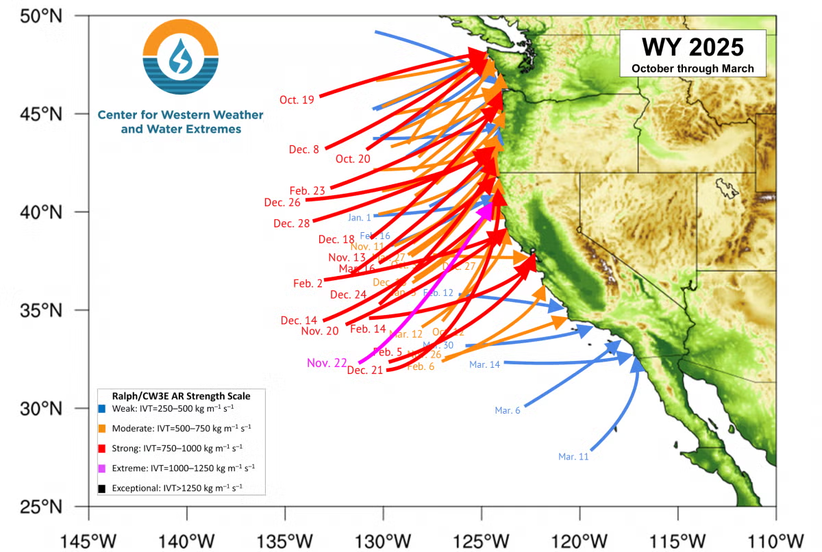
Some 50 atmospheric rivers hit the West Coast of the U.S. during the 2024-25 season. (Source: Center for Western Weather and Water Extremes)
Atmospheric Rivers Enter the Lexicon
For decades, the “Pineapple Express,” a type of storm that feeds off warm tropical moisture, figured prominently in local weather lore. By the early 1990s, researchers realized that it was just one kind of a broader category of unique storms that take shape far out in the Pacific. In a 1994 research paper, Yong Zhu, now at North Carolina State University, and MIT’s late Reginald Newell, christened them atmospheric rivers.
According to a 2019 study, atmospheric rivers caused $5.2 billion in damage in Sonoma County over the preceding two decades and were responsible for 99.8 percent of all insured flood losses there. A single 1995 storm — the most damaging event in 40 years of record keeping in the West — inundated the town of Guerneville on the Russian River and caused $50 million in insured losses countywide. The study determined that atmospheric rivers are the primary driver of flood damage in the West.
These powerful plumes of water vapor — which, on average, carry 25 times the flow of the Mississippi River — deliver 30 to 50 percent of total annual precipitation in California.
“Atmospheric rivers are the hurricanes for the West Coast,” says Cary Talbot, the FIRO National Lead with the Army Corps’ Engineer Research and Development Center.
But when they fail to arrive, that can also have a big impact, leaving the state parched and reeling. Their influence isn’t limited to just California, either: In 2021, researchers Mu Xiao, now at the Scripps Institution of Oceanography at UC San Diego, and Dennis Lettenmaier, now at University of California, Los Angeles found that almost one third of snowpack in the Upper Colorado River Basin comes from snowfall brought by atmospheric rivers.
The Army Corps’ primary responsibility is the high-stakes task of controlling floods, or as the agency puts it, “flood risk management.” As a result, the Army Corps tends to be extremely risk averse, and it literally runs its dams by the book: Each of its dams has an individually formulated water control manual with flood control curves, more commonly known as “rule curves,” that are practically chiseled in stone.
“When those things are written, they go through a really rigorous (vetting) process because it’s what we are going to be graded on in the courts,” says Talbot. “When somebody sues us for how we operated, they’re going to look at the water control manual and say: ‘Did the operators follow the rules?’ So, water managers don’t really want to stray too far from what it says.”
Rule curves typically force operators to keep reservoir levels low during wet seasons so they can catch and hold back the rainfall from anticipated storms and reduce the impacts of flooding downstream. But if those storms veer off their predicted course, or dissipate before they arrive, operators can’t get back the water they’ve already released — exactly what happened at Lake Mendocino in 2012.
The public outcry over that incident, which would be followed by the driest three-year period on record until then, helped nudge the Army Corps toward a more flexible approach.
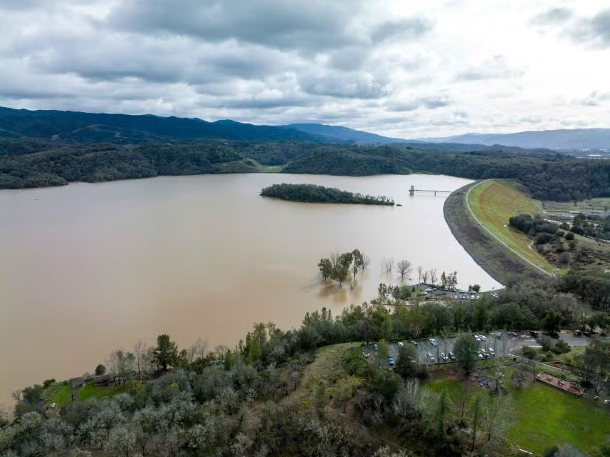
Flood-control releases in December 2012, followed by months of drought, sent reservoir levels in Lake Mendocino — shown here in December 2013 — plummeting. (Source: Sonoma Water)
“The disaster of a really bad drought in California focused congressional attention,” says Talbot. In 2015, Congress added a line in the Army Corps’ budget for a research-led Water Operations Technical Support program. “It wasn’t much money — it was really just $2 million to get it started — but the direction from Congress was to see if we can’t find a better balance between flood risk management and water supply, especially with respect to atmospheric rivers.”
The following year, the Army Corps modified its regulations to allow for the use of forecasts in operations planning. Actually incorporating that change into each dam’s water control manual, many of which are decades old, still required an administrative process that typically takes several years. But the announcement was a significant first step in the shift away from the hidebound rule curves that governed dam operations.
To make it all work, though, dam operators had to have weather forecasts that they could trust.
Decoding Atmospheric Rivers
As it happened, weather researchers were already on a quest to crack the mystery of how atmospheric rivers work. A key figure in the effort was Marty Ralph, who spent more than two decades as an atmospheric scientist at the National Oceanic and Atmospheric Administration (NOAA) beginning in 1992.
Marty Ralph, head of the Center for Western Weather and Water Extremes (CW3E), worked with colleagues to vastly improve the accuracy of atmospheric river forecasts. (Source: CW3E)
Ralph had begun studying cyclones off the U.S. West Coast in the mid-1990s. To get an up-close view of the storms in their spawning grounds far out at sea, he wheedled and cajoled the use of weather research aircraft from NOAA, NASA and the Air Force that sat idle following the busy summer hurricane season on the Gulf Coast. (At one point, Ralph experimented with — but ultimately gave up on — using a long-range surveillance drone called the Global Hawk, an $80-million-plus “hand-me-down,” as he puts it, from the Air Force to NASA.)
Ralph’s research focus gradually zeroed in on what would turn out to be atmospheric rivers. He didn’t read Zhu and Newell’s groundbreaking work on the phenomenon until 2003, but when he did, “the light bulb just went off, like, ‘Oh — that’s what we’re studying!’”
Ralph organized a series of annual “field campaigns” to learn more about atmospheric rivers and racked up more and more flight time. In 2013, he left NOAA to start the Center for Western Weather and Water Extremes, or CW3E, at the Scripps Institution of Oceanography at UC San Diego. There, working with other researchers, he continued to research atmospheric rivers’ origins and behavior. But along the way, he says, “it became clear to me that we should be trying this as an operational program to help with forecasting” so that dam operators could have a more accurate real-time picture of individual storms’ paths and intensity.
Lake Becomes Proving Ground
Meanwhile, Lake Mendocino was emerging as the first test case for FIRO. At the time, Jay Jasperse was the chief engineer and director of groundwater management for Sonoma Water, which gets much of its supply from the lake. Despite the Army Corps’ new openness to using forecasts for more flexible dam operations, he says, there initially was “a lot of skepticism from some parties, and there was a lot of concern that the Army Corps was going to be incurring a lot of liability, and that this is going to negatively impact their flood risk management operations.”
During the 2020 water year, FIRO allowed an extra 19 percent, or 11,175 acre-feet of water, to be captured in Lake Mendocino. (Source: Sonoma Water)
“There were some spirited debates, and I think it took us a few years just to learn about each other and about each other’s agencies and how we worked and what our needs were,” Jasperse says. “But we all stuck with it, because the overall idea just made too much sense.”
Before FIRO was tried at Lake Mendocino, it went through an exhaustive modeling process to determine how it would affect dam operations. Gradually, Jasperse says, “we started seeing this was pretty doable, and the Army Corps started to get more comfortable with it.”
After extensive modeling, FIRO was first tested at Lake Mendocino during the 2020 water year and immediately proved its worth: That year, FIRO allowed an additional 11,175 acre-feet of water to be captured and stored there. That helped show that dams originally built principally for flood control could also be used to increase water storage and reliability.
“There’s ways to do both under the right conditions, and Lake Mendocino is proof of that,” says Patrick Sing, the lead water manager for the Army Corps’ San Francisco District. “When all the weather forecasts say it’s going to be dry, we can hold onto a lot of water instead of releasing it. We’re not impairing our flood management mission, and we’re doing our part to be stewards of a resource that’s very valuable in the event that the next year is a drought.”
Still, Sing notes that FIRO isn’t a silver bullet.
“You do all this research and modeling, but at the end of the day, it comes down to the reservoir operator to make a decision, and their agency is going to be held responsible for that decision,” he says. “If they’re not comfortable enough with FIRO, it’s probably not going to move forward. And they shouldn’t be forced to do it. They should be comfortable and convinced that it is safe to do.”
At Lake Mendocino, Sing says, “there’s been enough research and development and testing that we’re comfortable doing this.”
Forecast-Informed Reservoir Operations are currently underway or being actively assessed at 21 dams on the West Coast. (Source: U.S. Army Corps of Engineers)
Expanding FIRO
In 2022, FIRO-based operations were extended to Lake Sonoma, the other reservoir that supplies Sonoma Water within the Russian River watershed. And this year, FIRO was put in place on a preliminary basis at another dam, Prado Dam on the Santa Ana River in Southern California. Since 2020, FIRO has contributed to an additional 95,000 acre-feet of storage in the three reservoirs — an amount equal to just over 75 percent of Lake Mendocino’s total volume.
“We’re getting better and better,” says Jasperse, who now works as a consultant for both Sonoma Water and CW3E. “Everybody’s getting more and more experience every year.”
FIRO won’t work at all dams, especially in areas where forecasts are less reliable. In the summertime in the Deep South, for example, “pop-up thunderstorms can happen any day, any time,” says the Army Corps’ Talbot, who is based in Mississippi. “We’ve got a lot of moisture coming up from the Gulf, so it’s much harder to predict that kind of impactful rain here than it is in the West.”
But experience has shown that where FIRO is viable, it can provide additional water at a cost far lower than traditional approaches for boosting water supply, like increasing the size of a dam.
“Those are lengthy, expensive and complicated processes. It’ll take, in some cases, a decade or more to realize those benefits,” says Talbot. “FIRO is something that we literally can do today. We didn’t have to change the dam at all. This is just taking existing infrastructure and making it work better.”
At Prado Dam in Southern California, the Orange County Water District is expanding the possibilities of FIRO by pairing it with a groundwater recharge program to ensure that water that’s released from the dam isn’t lost. There, releases can be diverted into recharge basins downstream, where the water then soaks into the local aquifer.
Adam Hutchinson, the district’s recharge planning manager, says the agency anticipates getting an average of an extra 6,000 acre-feet per year through its FIRO operations. That’s not a lot of water, but it makes a big difference. The water retailers in the district’s service area rely on groundwater for the majority of their water supply, but they still have to import about 15 percent from Northern California and the Colorado River, at a cost of more than $1,000 per acre foot.
“So for that 6,000 acre-feet that we hope to get,” he says, “that’s $6 million a year that we’re saving by putting this free water in the ground.”
“AR Recon” flights to improve the accuracy of atmospheric river forecasts, which have been carried out from California and Hawaii for years, are now also being launched from Guam and Japan. (Source: U.S. Air Force 403rd Wing)
More Dams on the Radar
While FIRO is currently in place at just three dams, it is on the brink of a dramatic expansion. Earlier this year, two more dams — both significantly larger than any at which FIRO is currently in place — were added to the roster of potential FIRO sites: The Yuba Water Agency’s New Bullards Bar on the Yuba River, and Lake Oroville, the 3.5-million-acre-foot flagship of the State Water Project on the Feather River. A group of federal and state agencies and CW3E completed a final viability assessment at the two dams. The California Department of Water Resources and Yuba Water are now contemplating what steps to take to put FIRO into practice at those facilities. (In 2019 a more limited program, often referred to as “FIRO Lite,” went into operation at the federal Bureau of Reclamation’s Folsom Dam, on the American River just upstream of Sacramento.)
FIRO-implementation efforts are also in progress for several other dams: Seven Oaks, upstream of Prado on the Santa Ana River; a system of 14 dams in Oregon’s Willamette Valley; and Howard Hanson Dam near Seattle.
And now, FIRO is about to get a much bigger boost. In May, the Army Corps completed an initial evaluation of the suitability of FIRO at each of the 593 flood-control dams under its authority nationwide. It found that implementing FIRO is promising at 110 of those, including 39 across the Southwest. Another 299 dams nationwide may have potential as candidates for FIRO, although they face some significant barriers to implementation.
The Army Corps is now moving forward on two more-detailed rounds of evaluation on the 110 top-tier dams. Then, beginning in 2027, it will move toward implementing FIRO at those with the most potential.
The biggest impediment to more widespread implementation of FIRO remains a lack of accurate forecasts in parts of the country that don’t experience atmospheric rivers.
“The most common reason it’s not going to work is forecast skill” — essentially, accuracy, says Talbot. “That’s the leading factor for eliminating dams in the screening process.”
In the West, the effort to improve forecasts only continues to advance. In December 2023, then-President Biden signed the Atmospheric River Reconnaissance, Observations and Warning Act, which had been introduced by California’s senior U.S. senator, Alex Padilla. The law called for what has become known as the AR Recon aerial surveillance program, led by Ralph and Vijay Tallapragada of the National Weather Service, to be expanded throughout the full winter season. The past two years, AR Recon carried out 107 reconnaissance flights across the Pacific, flying not only out of California and Hawaii, but Guam and Japan, as well.
“The farther West we go, the greater the lead time improvement we get” in forecasting, says Ralph. “We’ve been able to improve the forecast of extreme precipitation in California by about 12 percent just by adding the (AR Recon) data. That’s the equivalent of 10 years of the typical process of improving forecasts through research — so we’re buying a decade of advances just by adding these data.”
The Army Corps’ Talbot says those strides forward are welcome news for dam operators.
“If you take a water manager and you give them three extra days of lead time, they can do a lot with that. Water managers always tell me, ‘Look, you give me a weather crystal ball and I’ll manage water better,’” he says.
“As long as we keep the aircraft flying and people advancing on the science and the meteorological wizardry, these water managers are getting closer and closer to that crystal ball.”