Click the link to read the article on The Land Desk website (Jonathan P. Thompson):
July 15, 2025
I’m a little slow getting to this one, thanks mostly to being consumed by the whole public land sale brouhaha, but better late than never.
After years of bickering, wrangling, fighting, and digging in their heels, representatives of the seven Colorado River Basin states may have finally agreed on a “revolutionary” way to split up the river’s waters: They’re going to base it on how much water is actually in the river at any given time.
So, apparently, in this world, “revolutionary” is a synonym for the most common sense, obvious, and, really, necessary way to do things.
More specifically, the Upper Basin would release a percentage of the rolling three-year average of the“natural flow”* at Lee Ferry from Glen Canyon Dam, making it available to the Lower Basin. That’s opposed to the current model, where the Upper Basin is required to release at least 75 million acre-feet every ten years (or 7.5 MAF per year on average)**
Let’s pause for a moment and use an analogy to reflect on how short-sighted and dumb that original approach was. [ed. emphasis mine] Say someone has a potato farm and they die, leaving the farm to their two children, Upper and Lower, who must determine how to divide the farm and its yield between them. They look back at their parent’s ledgers, and determine that the farm has produced at least 15 tons of potatoes annually during the previous few years.
So they agree to divide it in half, with 7.5 tons going to each of them each year. But Upper will actually live on the farm, and has the keys to the lock on the gate, so they add into their Potato Farm Compact a clause that requires Upper to not prevent Lower from taking 75 tons of potatoes from the farm during every 10 year period.
This works out fine as long as the farm produces 15 tons per year. But what happens if you signed the Compact during an abnormally productive period, and the long-term average yield was far lower than 15 tons? Or what happens as the soil becomes less fertile and the irrigation water becomes more scarce and production drops far below 15 tons per year? Under the agreement, Upper still has to allow Lower to take 7.5 tons annually, leaving Upper with far less, maybe even nothing during a string of bad years.
Obviously, this is untenable. And, just as obviously, it would have made far more sense for Upper and Lower to simply divide each year’s harvest in half and each take 50% of whatever the total might be. Just as obviously, that would have been the smartest way to divide up the Colorado River in the first place.
Of course, a river is not a potato crop.To determine how much potatoes you have, you just put them on a scale. Determining the “natural flow” of the Colorado River is far more difficult, and requires inputting:
- data from 29 upstream streamflow gauges/gages;
- historic outflow and pool elevations from 12 main-stem and 12 off-stream reservoirs;
- upstream consumptive uses and losses.
While that doesn’t sound so complicated, gathering all of these inputs — reservoir evaporation, for example, or the exact amount consumed by agriculture — can require separate calculations and guesswork of their own.

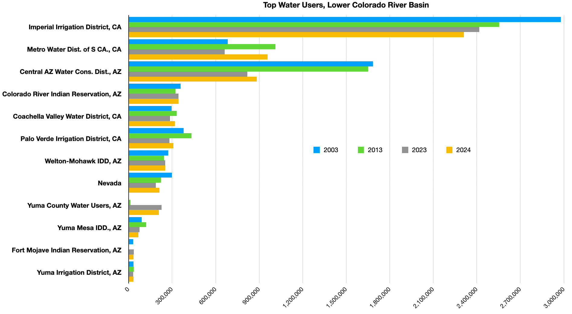
But the states wouldn’t be coming up with this from scratch. The Bureau of Reclamation already calculates the river’s natural flow at Lees Ferry along with Lake Powell’s unregulated inflow. As you can see from the graph below, the river has not consistently delivered 15 million acre-feet per year, forcing the Upper Basin to deplete their savings account (Lake Powell) in order to meet its Colorado River Compact obligations.
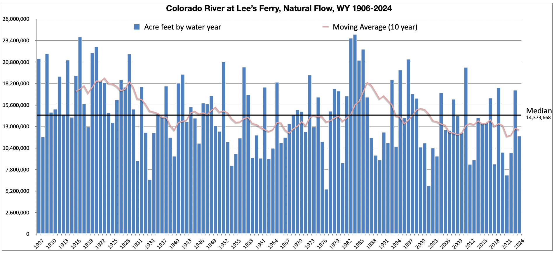
If the supply driven concept is implemented, it will base Glen Canyon Dam releases on a fixed percentage of the previous three-year moving average. For example, the average of water years 2022, 2023, and 2024 was 13 million acre-feet. If the Upper Basin and Lower Basin were to each take 50%, then the Glen Canyon release this year would be 6.5 million acre-feet (plus something for Mexico, presumably, although this isn’t clear. I highly doubt the Lower Basin will settle for just 50%, given that it has far more people, more agriculture, and is just thirstier, overall, but let’s go with that figure since it’s what’s in the Colorado River Compact, sort of.
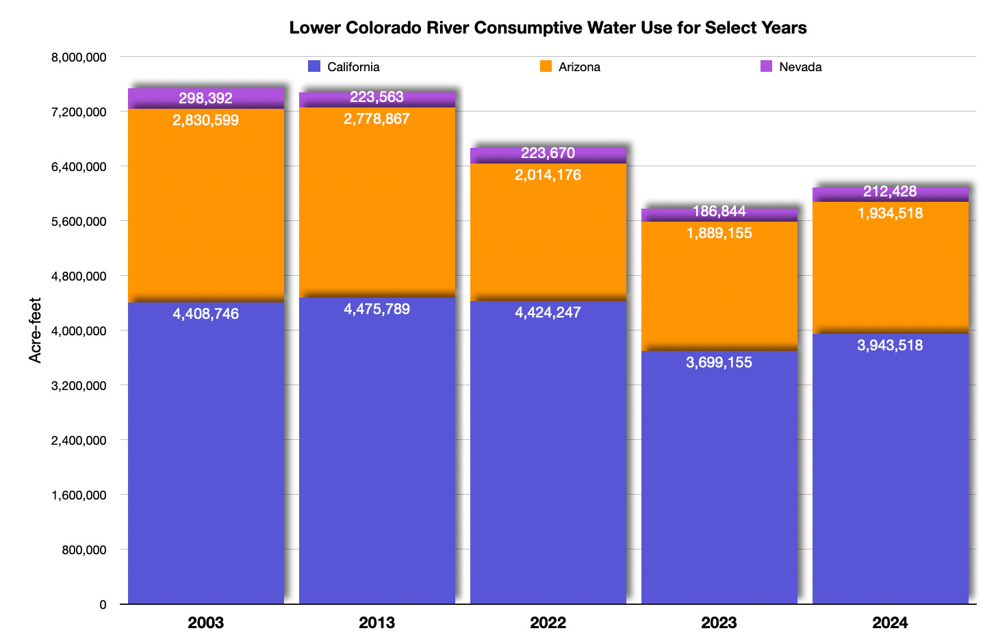
That would actually work: The Lower Basin states’ consumptive use last calendar year was about 5.8 million acre-feet, so they’d have enough to use, and a little on top for evaporation from reservoirs (which is not included in the Lower Basin’s accounting). It would leave the Upper Basin enough for consumption and some extra for reservoir storage.
But if you go with the previous three years (‘20,’21,’22), you end up with an average of just 9 million acre-feet, 50% of which would be a measly 4.5 million acre-feet, forcing downstream users — namely the Central Arizona Project, since their rights are junior to California’s — to take deep cuts. And it would leave the Upper Basin just enough to meet their needs, meaning they’d have to draw down Lake Powell or other reservoirs to fulfill their obligations.
Another tricky scenario would be if three decent water years were followed by an extremely dry year. Releases from Lake Powell could significantly exceed inflows, which might deplete the reservoir enough to bring it down to minimum power pool, which is no bueno.
While this may be the closest the states have come to reaching some sort of consensus on how to run the River beyond 2026, it seems as if there is still many sticky details to work out. How are they going to agree on a fixed percentage? What will the minimum release be? And how will that fly with the Upper Basin during years such as 2002, when the natural flow at Lees Ferry was a mere 5.8 million acre-feet? Time’s running out.
Now for some more data for your pondering pleasure:


This passage, from David Starr Jordan’s Fish Commission Bulletin 1889: Report of Explorations in Colorado and Utah During the Summer of 1889, remains relevant today:

Uggh. Fire season is getting ugly. The Dragon Bravo Fire blew up and burned the historic Grand Canyon Lodge on the North Rim. The Deer Creek Fire, burning near Old La Sal, Utah, just west of the Colorado state line, has grown to almost 12,000 acres and exhibited some erratic behavior (see video above). Just northeast of there, the Wright Draw and Turner Gulch fires have forced the closure of Hwy. 141 and numerous evacuations in the Unaweep Canyon area outside Gateway (the community of Gateway is not yet threatened). The South Rim Fire at the Black Canyon of the Gunnison is now at 4,000 acres. The Laguna Fire west of Abiquiu Reservoir in New Mexico has reached 15,200 acres. And the air in the West is basically full of smoke.
Here’s hoping for rain and lots of it, sans lightning, please.
📸 Parting Shot 🎞️
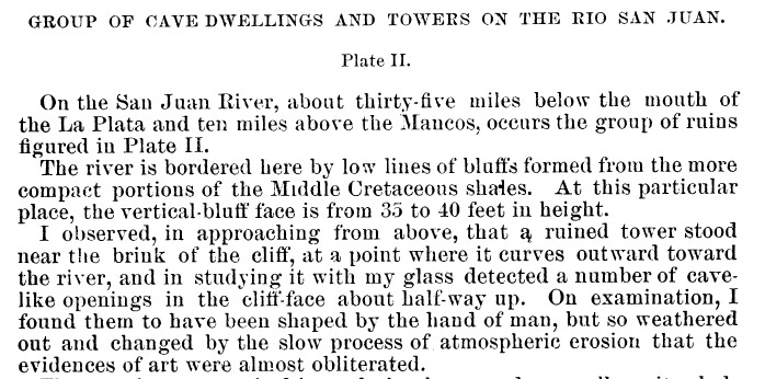
This one’s from “A notice of the ancient ruins of southwestern Colorado, examined during the summer of 1875,” by W.H. Holmes. The text is the beginning of the description of the sketch.