Climate change is warming the North Pacific Ocean, leading weather patterns that drive drought in the U.S. Southwest to persist decades longer than they have in the recent past.
The drought in the Southwestern U.S. is likely to last for the rest of the 21st century and potentially beyond as global warming shifts the distribution of heat in the Pacific Ocean, according to a study published last week led by researchers at the University of Texas at Austin.
Using sediment cores collected in the Rocky Mountains, paleoclimatology records and climate models, the researchers found warming driven by greenhouse gas emissions can alter patterns of atmospheric and marine heat in the North Pacific Ocean in a way resembling what’s known as the negative phase of the Pacific Decadal Oscillation (PDO), fluctuations in sea surface temperatures that result in decreased winter precipitation in the American Southwest. But in this case, the phenomenon can last far longer than the usual 30-year cycle of the PDO.
“If the sea surface temperature patterns in the North Pacific were just the result of processes related to stochastic [random] variability in the past decade or two, we would have just been extremely unlucky, like a really bad roll of the dice,” said Victoria Todd, the lead author of the study and a Ph.D student in geosciences at UT Austin. “But if, as we hypothesize, this is a forced change in the sea surface temperatures in the North Pacific, this will be sustained into the future, and we need to start looking at this as a shift, instead of just the result of bad luck.”
Currently, the Southwestern U.S. is experiencing a megadrought resulting in the aridification of the landscape, a decades-long drying of the region brought on by climate change and the overconsumption of the region’s water. That’s led to major rivers and their basins, such as the Colorado and Rio Grande rivers, seeing reduced flows and a decline of the water stored in underground aquifers, which is forcing states and communities to reckon with a sharply reduced water supply. Farmers have cut back on the amount of water they use. Cities are searching for new water supplies. And states, tribes and federal agencies are engaging in tense negotiations over how to manage declining resources like the Colorado River going forward.
“Planners need to consider that this drought, these reductions in winter precipitation, are likely to continue, and plan for that,” said Tim Shanahan, an associate professor at UT Austin’s Jackson School of Geosciences and co-author of the study.
The research began with decades-old sample cores taken from lakes in the Rocky Mountains. Using modern geochemical techniques, Todd was able analyze drought conditions during the mid-Holocene period 6,000 years ago, a period in Earth’s history when the Northern Pacific warmed and the Southwestern U.S. experienced hundreds of years of drought.
But the sample cores suggest the drought was much worse than previously thought by scientists. Through a series of climate models, the researchers found vegetation change in the tropics darkened the Earth’s surface so that it absorbed more of the sun’s heat. That led to a warming of the North Pacific that was similar to the PDO that drives drought in the Southwest, but in this case, the drying lasted for centuries. “As soon as we saw that, you know, we started thinking about what’s happening today,” Todd said.
For the past 30 years, the PDO has been in its negative phase, which leads to drought in the Southwest by reducing winter precipitation and the runoff from mountain snowpack that fills many of the region’s rivers and recharges groundwater aquifers.
Using an ensemble of historical and future climate models forecasting climate and precipitation patterns until 2100, they found the PDO-like negative phase continues through this century. But unlike the mid-Holocene period’s warming, which was brought on by vegetation change, today’s is driven by greenhouse gas emissions. Certain models revealed that the change in the ocean pattern was less about vegetation absorbing solar radiation, Todd said, and more about warming in general.
The study also revealed that current climate models are underestimating drought conditions, Todd and Shanahan said, and they hope to find better ways to approximate aridity going forward.
Drought that continued until the end of the century would have major implications for water resources in the Southwest and how they are managed. The region currently sustains some of the country’s biggest cities and most productive agricultural areas.
Brian Richter, president of the water research and education group Sustainable Waters and a water researcher not involved in the study, said the research further proves the drought in the Southwest is more intense than previously thought and is not going away any time soon.
“Doesn’t it suck that every time the science improves, the outlook for the climate and water looks worse?” he said.
In many ways, Richter said, what people are seeing on the ground is outpacing science. Five years ago, he said, farmers would say they’ve been through droughts before, and this one would soon pass. Now, he said, their tone has changed to “This is a different kind of a drought.”
Udall/Overpeck 4-panel Figure Colorado River temperature/precipitation/natural flows with trend. Lake Mead and Lake Powell storage. Updated through Water Year 2024. Credit: Brad Udall
It's been a bit since I've done a meteorological deep dive, but the devastating flash #flood in central Texas this July 4th/5th deserve a closer look. #TXwxYes remnants of #Barry were involved helping enhance moisture. A remnant MCV from Mexico on 3 July also played a role.Full evolution below ⤵️
Click the link to read the article on the Grist website (Tik Root):
July 21, 2025
The country watched in horror as torrential rain drenched Texas earlier this month, sweeping at least 135 people to their death. Kerr County alone lost 107, including more than two dozen children at Camp Mystic.
From afar, it would be easy, even tempting, to think that the floods like these could never happen to you. That the disaster is remote.
It’s not.
As details of the tragedy have come into focus, the list of contributing factors has grown. Sudden downpours, driven by climate change. The lack of a comprehensive warning system to notify people that the Guadalupe river was rising rapidly. Rampant building in areas known to flood, coupled with incomplete information about what places might be at risk. ’
These are the same elements that could trigger a Kerr County-type of catastrophe in every state in the country. It’s a reality that has played out numerous times already in recent years, with flooding in Vermont, Kentucky, North Carolina and elsewhere, leaving grief and billions of dollars in destruction in its wake.
“Kerr County is an extreme example of what’s happening everywhere,” said Robert Freudenberg, vice president of energy and environmental programs at the Regional Planning Association. “People are at risk because of it and there’s more that we need to be doing.”
The most obvious problem is we keep building in areas prone to flooding. The Federal Emergency Management Agency, or FEMA, produces readily available maps showing high-risk locales. Yet, according to the latest data from the nonprofit climate research firm First Street Foundation, 7.9 million homes and other structures stand in a FEMA Special Flood Hazard Area, which designates a location with 1 percent or greater chance of being inundated in any given year.
FEMA Flood Zone Top Ten
Rank
State
Percent of Properties
Number of Properties
1
Louisiana
22.83%
542,756
2
Florida
17.15%
1,581,552
3
Mississippi
12.41%
240,526
4
New Jersey
10.57%
364,098
5
West Virginia
9.29%
126,918
6
Arkansas
7.27%
146,226
7
Texas
6.49%
806,827
8
Iowa
6.32%
154,217
9
New Mexico
6.28%
94,265
10
Nebraska
6.18%
71,235
Source: First Street Foundation
In Louisiana, a nation-leading 23 percent of properties are located in a FEMA flood zone. In Florida, it’s about 17 percent. Arkansas, New Mexico and Nebraska are perhaps less expected members of the top ten, as is New Jersey, which, with New York City, saw torrential rain and flooding that killed two people earlier this month.
Texas ranks seventh in the country, with about 800,000 properties, or roughly 6.5 percent of the state’s total, sitting in a flood zone. Kerr County officials have limited authority to keep people from building in these areas, but even when governments have the ability to prevent risky building projects, they historically haven’t. Although one study found that some areas are finally beginning to curb floodplain development, people keep building in perilous places.
“There’s an innate draw to the water that we have, but we need to know where the limits are,” said Freudenberg. “In places that are really dangerous, we need to work towards getting people out of harm’s way.”
Kerr County sits in a region known as Flash Flood Alley and at least four cabins at Camp Mystic sat in an extremely hazardous “floodway” and numerous others stood in the path of a 100-year flood. When the Christian summer camp for girls underwent an expansion in 2019, the owners built even more cabins in the water’s path.
“It’s an unwillingness to think about what future — and the present — have in store for us,” said Rob Moore, the director of the Water & Climate Team at the Natural Resources Defense Council, or NRDC, about Americans’ tradition of floodplain development. ”It’s a reluctance to own up to the reality we live in.”
Many people don’t even know they are in harm’s way. According to NRDC, 14 states have no flood disclosure laws and, in eight, they deem the laws ‘inadequate.’ FEMA maps are also flawed. For one, they can be politically influenced, with homeowners and communities often lobbying to be excluded in order to avoid insurance mandates and potential building costs. And experts say the science underpinning the maps is lagging too.
“[FEMA] only maps main river channels and coastal storm surge areas,” explained Jeremy Porter, the head of climate implications research at First Street Foundation. The agency, he added, specifically doesn’t model heavy rainfall, isn’t great about indicating the risk of urban flooding, and is behind on accounting for climate change.
First Street Flood Zone Top Ten
Rank
State
Percent of Properties
Number of Properties
1
West Virginia
30.25%
413,499
2
Louisiana
26.33%
626,120
3
Florida
19.04%
1,755,363
4
New Jersey
17.32%
596,521
5
Mississippi
15.46%
299,566
6
Kentucky
15.30%
328,283
7
Texas
15.19%
1,888,282
8
Pennsylvania
14.93%
856,889
9
New York
14.27%
771,605
10
Delaware
12.95%
55,535
Source: First Street Foundation
First Street built a flood model that tries to fill in those gaps. It found that 17.7 million people are at risk of a 100-year flood, a number that’s more than double what FEMA’s hazard area covers.The state rankings also change, with mountainous areas susceptible to inland flash-flooding jumping up the list. West Virginia moves into first, with a staggering 30 percent of properties built in flood prone areas. Kentucky climbs from 19th to sixth.
Texas remains at seventh, but the portion of properties at risk goes to 15 percent. In Kerr County, FEMA’s maps showed 2,560 properties (6.5 percent) in a flood zone. First Street’s model nearly doubled that.
“There’s a ton of unknown risk across the country,” said Porter, who says better maps are among the most important goals that policy makers can and should work toward. First Street has partnered with the real estate website Redfin to include climate risk metrics in its listings.
Rob Moore says political will is essential to making that type of systemic change when it comes to not only flooding, but other climate risks, such as wildfires or coastal erosion. Strengthening building codes and restricting development in high-risk areas will require similar fortitude.
“Governments and states don’t want to tell developers to not put things in a wetland, not put things in a floodplain,” he said. “We should be telling people don’t put them in a flatland, don’t build in a way that your home is going to be more susceptible to wildfire.”
Until then, hundreds of communities across the country could — and likely will — be the next Kerr County.
Grist has a comprehensive guide to help you stay ready and informed before, during, and after a disaster.
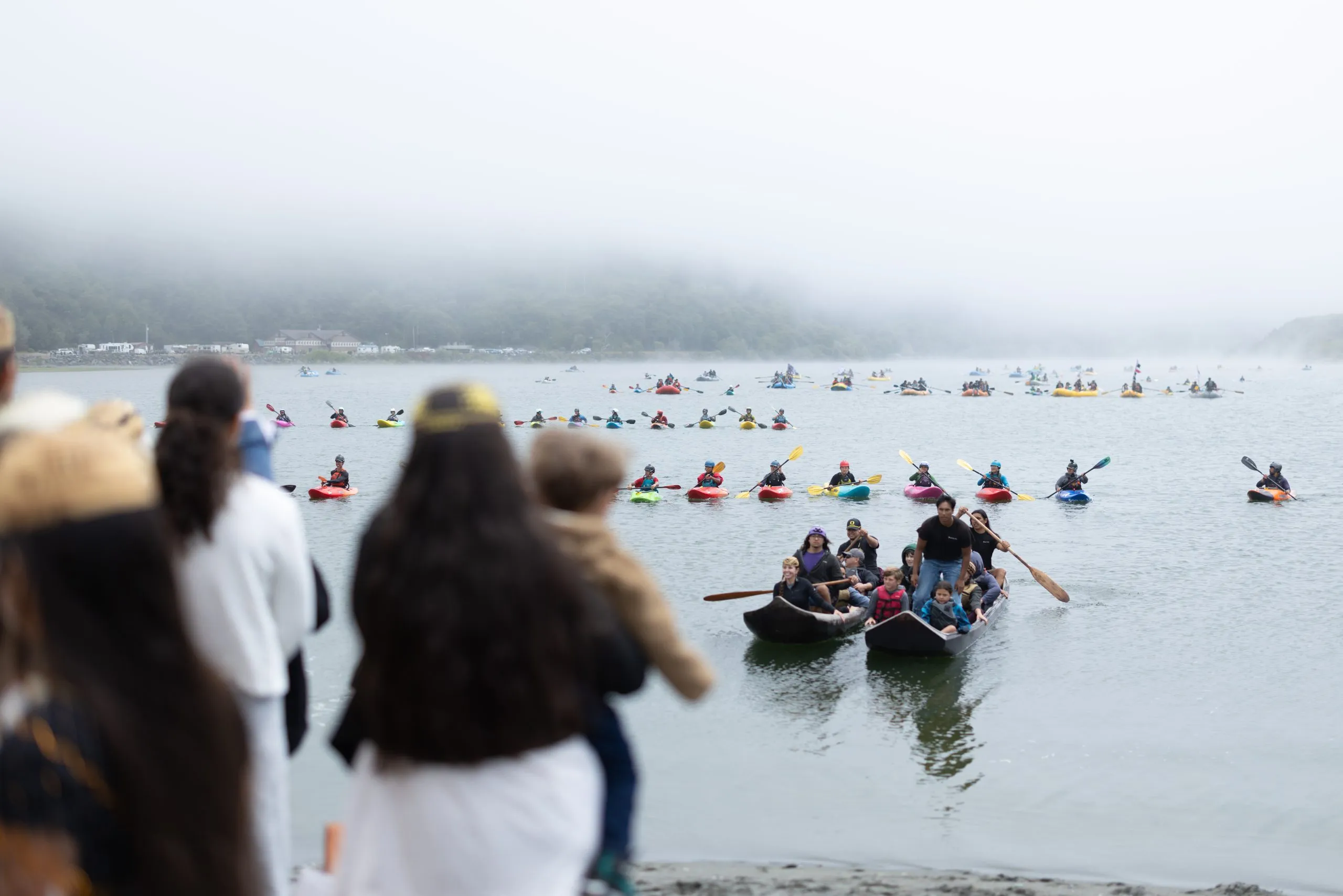
Indigenous youths with Ríos to Rivers’ Paddle Tribal Waters program head toward the shore where the Klamath River meets the Pacific Ocean in Northern California on July 11. The young kayakers were joined by a flotilla with dozens of tribe and community members on the final days of their monthlong, 310-mile journey. CREDIT: ERIK BOOMER / COURTESY OF RÍOS TO RIVERS
Click through to listen to an audio version of this story, produced for Aspen Public Radio.
In a thick forest along the remote northern California coast earlier this month, a group of mostly young Indigenous kayakers pushed off into the clear-emerald waters of the recently undammed Klamath River.
The 13- to 20-year-olds from more than six tribes in the Klamath Basin, along with several instructors, had been paddling for a month, covering over 300 miles.
In just a few hours, they would reach the Pacific Ocean, making the group among the first in over a century to descend the river from its headwaters in southern Oregon to its mouth in northern California. The expedition began in early June after the largest dam-removal project in history was completed last fall to restore salmon populations, improve water quality and support tribe-managed lands.
In the group was 15-year-old Hoopa Valley tribe member Carmen Ferris, who comes from a long line of fishing people along California’s Trinity River.
“The Trinity is the biggest tributary to the Klamath,” she said. “So I feel like I have a deep connection and ancestry with both of the waters.”
Carmen and about 40 other Indigenous kayakers had spent years training for the expedition with the help of Ríos to Rivers. Founded by Aspen resident Weston Boyles, 38, the nonprofit organization works with Indigenous youths around the world to protect rivers through advocacy, education and exchange programs.
Thirteen-year-old Scarlett Schroeder, left, and Coley Miller, 14, who belong to tribes on the Upper Klamath, stand with their paddles on the banks of the Klamath River. The Paddle Tribal Waters group of 13- to 20-year-olds from more than six tribes in the Klamath Basin, along with several instructors, were among the first in a century to paddle the free-flowing river after several major hydropower dams were removed last year. CREDIT: ERIK BOOMER / COURTESY OF RÍOS TO RIVERS
Historic paddle
In anticipation of the removal of four of the Klamath’s six dams, Boyles teamed up with local Indigenous youths and kayak instructors to launch the Paddle Tribal Waters program, with the goal of supporting young tribal members aiming to be the first to paddle the mostly free-flowing river since the first dam was built in 1918.
Although Carmen had heard about the dams growing up, it wasn’t until joining the program that she learned the full history of the decades-long effort by tribes and environmentalists, including her own Hoopa Valley people, to remove the dams from the Klamath and restore the salmon that local tribes once depended on.
“I was like, ‘Oh, my God, that is happening, and it’s nearby,’” she said. “I was in shock, and I learned about the history and what my ancestors and people before me have gone through for these dams to finally come out.”
Eighteen-year-old Ruby Rain Williams, of the Karuk tribe, and several other kayakers with Paddle Tribal Waters, navigate a section of whitewater on the Klamath River along the California-Oregon border. The group of local Indigenous youths trained for several years with the support of Aspen-based nonprofit Ríos to Rivers to be among the first in a century to paddle the recently undammed river. CREDIT: ERIK BOOMER / COURTESY OF RÍOS TO RIVERS
Carmen spent two years in the Paddle Tribal Waters program — taking tribe-led classes on river ecosystems, advocacy and cultural knowledge, as well as learning to whitewater kayak both in her own backyard and on exchange trips to Chile.
“I built a love for kayaking,” she said. “And then I was like, I’m definitely doing the descent, like I can’t stop kayaking now.”
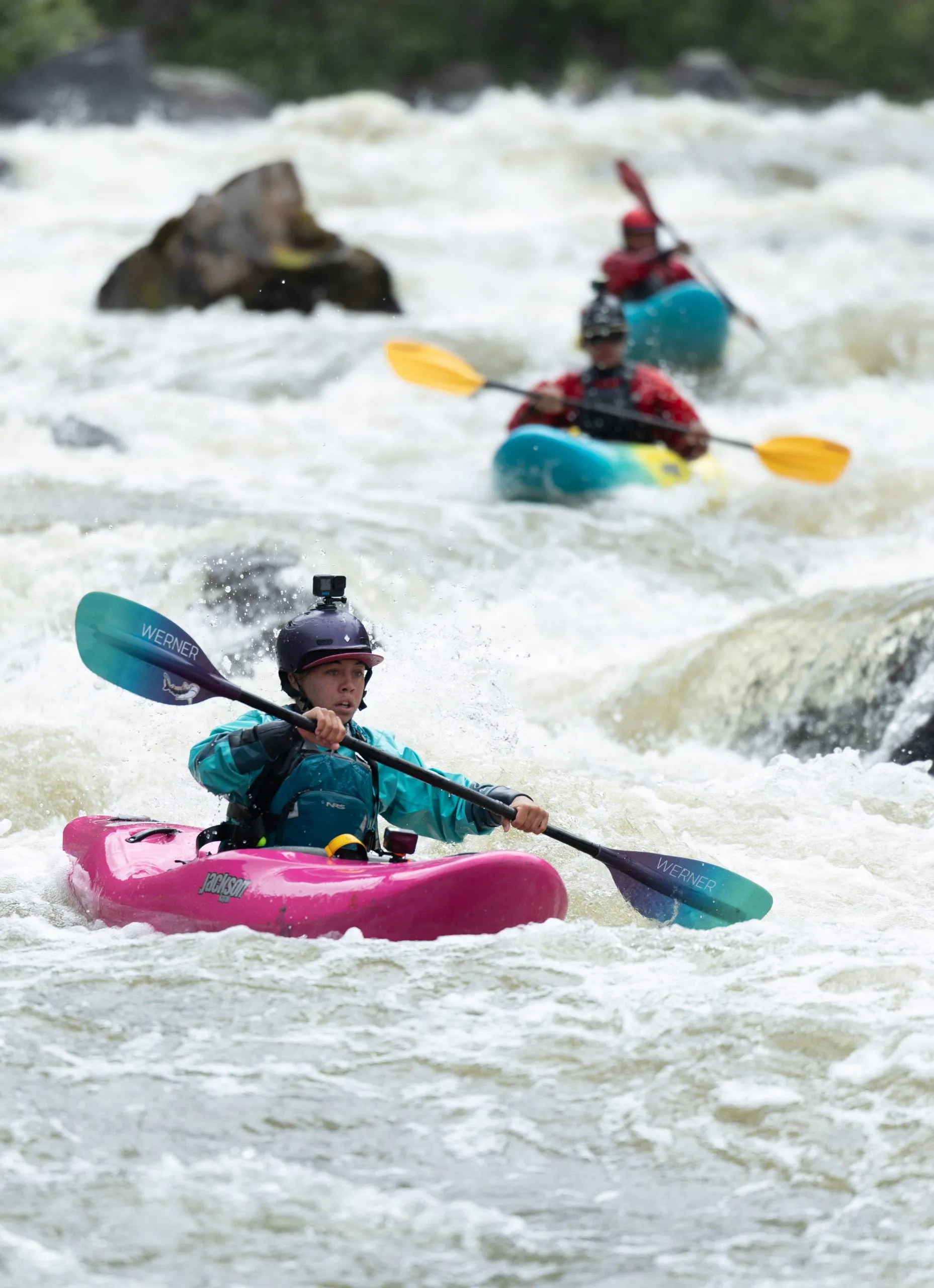
The journey from the river’s headwaters to the Pacific Ocean wasn’t easy, from camping in a remote, rugged wilderness to tackling a number of Class 4 rapids on the upper Klamath, including one called “Big Ikes.”
“I got battered into this hole for a little bit, and if I didn’t know how to roll, I’d probably swim that day, which wouldn’t have been fun, because there were a lot of rocks,” she said. “I ended up being OK, but everyone was like, ‘Carmen, what happened?’”
Ruby Rain Williams of the Karuk tribe, who turned 18 on the trip, said the paddle group faced other challenges beyond navigating technical and dangerous rapids.
“There were definitely some hard parts, like getting up every morning around 6:30, and also the flat-water days on the lake with the headwind were quite treacherous,” Ruby said.
They also learned some valuable river-trip lessons, including the importance of sun protection.
“I remember the first couple days, we’re all like, ‘Oh, we don’t need sunscreen. We never wear sunscreen,’” Ruby said. “You know, we’re swimming in the river all day and I put pink Zinc on my face just to look cool and I had polka dots burned all over my cheeks and my ears were burnt, and even my eyes because I didn’t wear sunglasses. It was just gnarly.”
A map of the Klamath River Basin shows the four hydroelectric dams that were removed last year: Iron Gate, Copco 1, Copco 2, and J.C. Boyle. The two remaining dams in the upper river basin (located west and northwest of J.C. Boyle Dam and depicted as gray dots) are mostly used for farming irrigation.
The recently undammed Klamath River runs through the site of the former Copco Lake reservoir, named for the Copco 1 dam, in Northern California. Restoration efforts have begun at the former reservoir site, but signs of the former reservoir still remain on the landscape. CREDIT: ELEANOR BENNETT / ASPEN JOURNALISM & ASPEN PUBLIC RADIO
The recently undammed Klamath River runs through the site of the former Copco Lake reservoir, named for the Copco 1 dam, in Northern California. Restoration efforts have begun at the former reservoir site, but signs of the former reservoir still remain on the landscape.
CREDIT: ELEANOR BENNETT / ASPEN JOURNALISM & ASPEN PUBLIC RADIO
Reshaped landscape
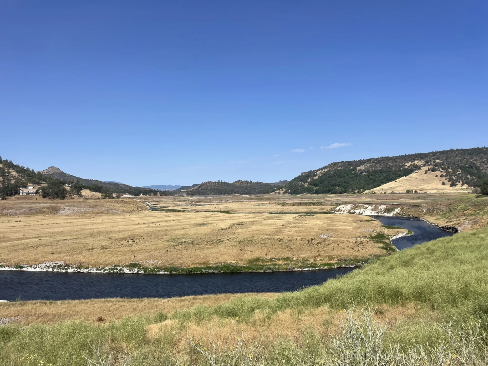
Along the river, the young kayakers saw how the dam- removal and restoration effort had started reshaping landscapes and communities as they paddled through former reservoirs and dam sites, including Northern California’s Kikacéki Canyon, where for decades the water had been diverted to a power station, leaving a dry stretch of riverbed.
The four recently removed hydropower dams, which were built between 1918 and the mid-1960s, were still producing relatively low amounts of electricity. According to PacifiCorp, which operated the dams and is owned by Warren Buffett’s company Berkshire Hathaway, the sites were producing less than 2% of the operator’s total power generation — enough to power about 70,000 homes when they were running at full capacity.
In addition to losing a relatively low amount of power generation, there were other concerns about removing the dams. These included potential impacts of drained reservoirs such as exposed sacred burial sites that had been previously submerged, increased fire risk, loss of tax revenues for nearby counties, and decreased property values for former lakeside homes.
Still, scientists and advocates for dam removal maintained that the dams and their reservoirs worsened water quality in the river and that removing them would reduce the likelihood of sediment buildup, toxic algae blooms and diseases that thrive in warmer, stagnant waters and are harmful to salmon. They also maintained that the dams blocked salmon from returning to their upstream habitat where fish lay eggs and babies grow before migrating to the ocean.
Eventually, local tribes and other dam-removal advocates came to an agreement with PacifiCorp and federal regulators, and in 2022, the four dams on the lower Klamath were approved for removal.
In order to alleviate some of the community concerns, the Klamath River Renewal Corporation (KRRC), which helped broker the dam-removal deal, and Resource Environmental Solutions (RES) are now overseeing restoration efforts. These include working with fire officials concerned about the loss of a wildfire-fighting resource once the reservoirs were drained to set up dry-hydrant systems that allow crews to pull water directly from the river.
They also worked with the Shasta Indian Nation to mitigate the risk of damage to newly exposed cultural sites. Last year, the state of California also transferred some of the land near one of the former reservoirs back to the group.
Other restoration projects include excavating sediment that had built up behind the dams and planting billions of native seeds along the riverbanks and former reservoir sites.
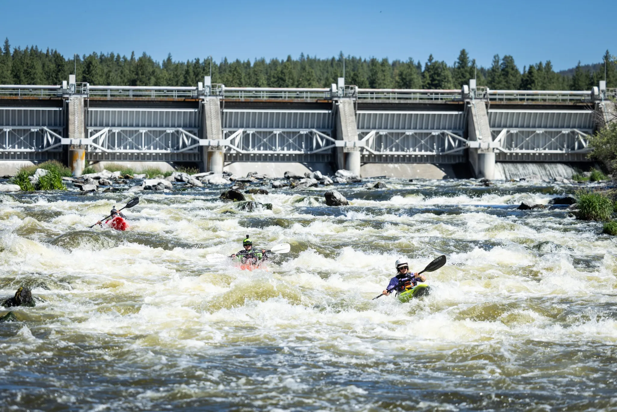
The two dams that remain in the upper section of the river in southern Oregon are primarily used to divert water for irrigation and farming. During their monthlong river trip, which began in Chiloquin, Oregon, the Paddle Tribal Waters group carried their kayaks on land and portaged around these remaining dams.
Tribal Paddle Waters youths kayak below the Keno dam, one of the two remaining dams on the upper Klamath. The expedition group carried their kayaks on land and portaged around both of the remaining dams. CREDIT: ERIK BOOMER / COURTESY OF RÍOS TO RIVERS
Salmon returning
Brook Thompson, a scientist and Yurok and Karuk tribe member, researches salmon life cycles and water quality, and joined the paddlers for the last few days on the river.
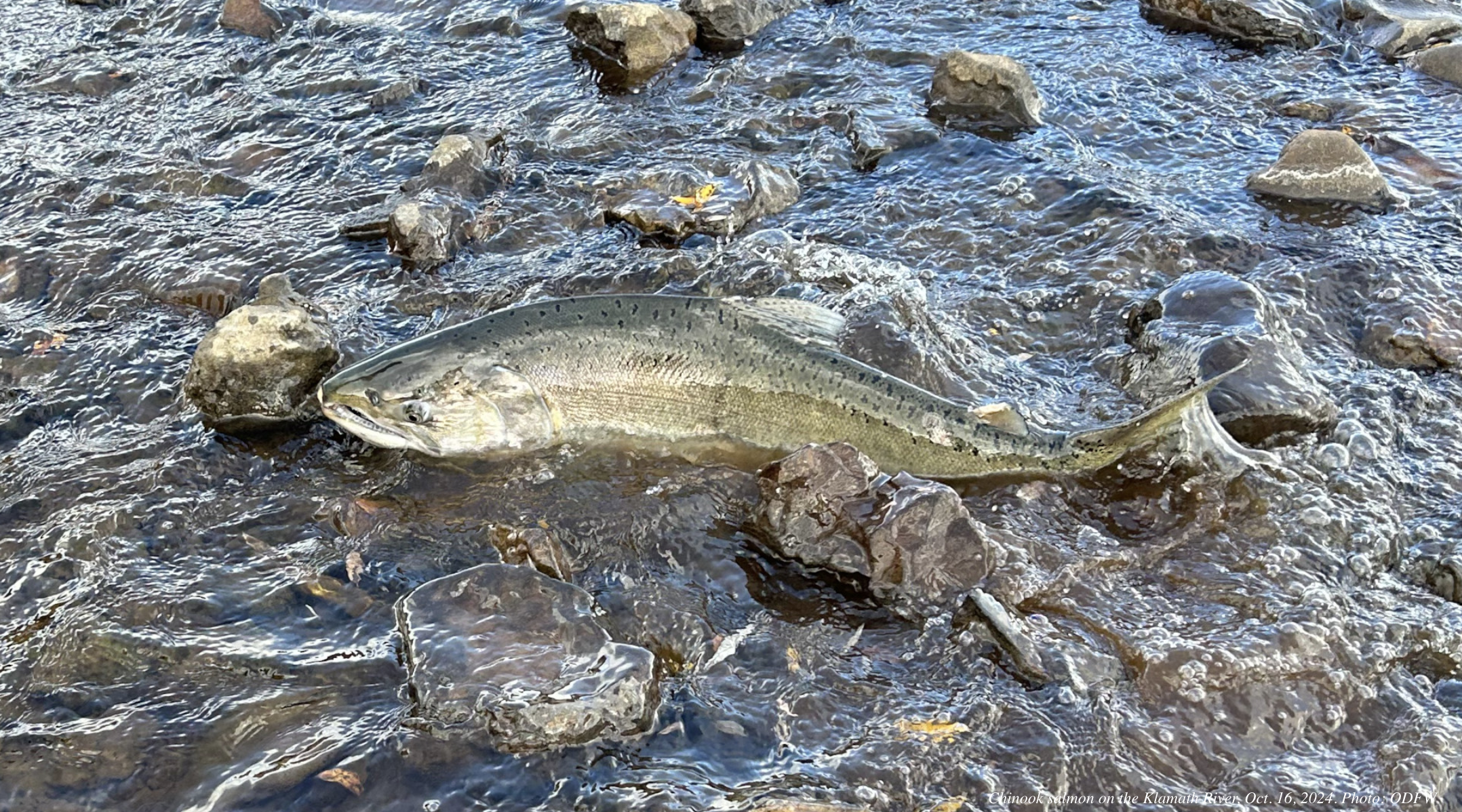
Despite an unexpected salmon die-off after the first of four dams came down last year, Thompson said hundreds of miles of fish habitat on the Klamath and its tributaries have now opened up and dwindling salmon populations are already returning to spawn in greater numbers.
Chinook salmon on the Klamath River, Oct. 16, 2024. Photo: Oregon Department of Fish & Wildlife
“We really did not know what was going to happen with the salmon and if they would return right away, or if it would take years,” Thompson said. “So the fact that they immediately started going past where the dam sites were is so exciting for me as a tribal member.”
Researchers have also found lower rates of disease-carrying parasites and toxic algae since the dams were removed last year, according to Thompson.
Thompson decided to study environmental engineering, water infrastructure and ecosystems after tens of thousands of dead salmon clogged the lower reaches of the river during a major drought in 2002, after a decision by the Bush administration that reversed environmental protections and allowed upper Klamath farmers to divert much of the remaining water.
“Witnessing thousands of fish die on the river firsthand as a 7-year-old really devastated me, personally, because these salmon are not just a food source for my family, they weren’t just our income — I paid for all my school clothes and supplies through selling fish as a kid — but they’re also a connection to family, they’re my connection to my ancestors and they’re really the lifeblood of the tribes here,” Thompson said.
Now that the dams are out, Thompson hopes reconnecting with the river, including through salmon fishing and recreation opportunities, can help address a rise in health concerns such as cardiovascular disease and diabetes, as well as mental health challenges faced by tribes in the region, including addiction and suicide.
“When you lose out on that culture, you’re having all these issues health-wise, and you’re having people die because of it,” Thompson said. “I know for me, if I’m not by the river, and I don’t get a chance to fish and pray and be thankful for this food that feeds my body, that connects me to my ancestors, then I don’t feel as well mentally either.”
Although the Klamath was once the third-largest salmon-producing river on the West Coast, young people such as Ruby, the Karuk tribe member, had only heard stories about those days.
“My grandma and my dad always told me how there used to be so many salmon in the river, you used to be able to walk across their backs and almost make it across,” Ruby said. “There was such an abundance of them that my grandpa would go spearfishing and be able to see them swimming through the river, because it was so clean and healthy.”
During a fall scouting trip before their monthlong journey, Ruby and another young kayaker were some of the first to witness the salmon migrate past one of the former dam sites in Kikacéki Canyon.
“We looked down, and then there’s these salmon just flying up the river, and you could see their heads at the top of the river’s edge,” Ruby said. “I’ve never seen that before. And to be able to say that I saw some of the first set of salmon make it up above where the dams used to be was incredible.”
Ma-Kaych McConnell, right, and several of his fellow Paddle Tribal Waters kayakers get ready to push off into the Klamath River on July 10, the day before reaching the Pacific Ocean. About 15 of the young paddlers finished the full, 310-mile descent of the river, and about 30 more met up with the group for the second half of the journey. CREDIT: ELEANOR BENNETT / ASPEN JOURNALISM & ASPEN PUBLIC RADIO
Carmen Ferris, in the red kayak, of the Hoopa Valley tribe, and Ruby Rain Williams, in the blue kayak, of the Karuk tribe, float on a peaceful stretch of the Klamath River the day before reaching the Pacific Ocean. The two young paddlers grew up hearing stories from their elders about a time when the undammed river was plentiful with salmon. CREDIT: ELEANOR BENNETT / ASPEN JOURNALISM & ASPEN PUBLIC RADIO
‘Only the beginning’
John Acuna, a Hoopa Valley tribe member and Ríos to Rivers kayak instructor, helped lead the group of young people on the Klamath just a few years after being introduced to the sport.
Despite nearing the end of a long expedition with only a day left on the river, Acuna sees the monthlong descent as the beginning of something bigger.
“This is the biggest dam removal in history, and kind of the question is ‘What do we do next?’” Acuna said. “The hope is that this sets a precedent for other dam-impacted rivers and dam-threatened rivers, and I think our work has kind of just begun.”
Ríos to Rivers board member and river guide Jaren Roberson, who grew up in Arizona, agrees — and he hopes the recent dam-removal can be a model for how his own Diné (Navajo) and Hopi tribes can have a greater say in how water is allocated in the Colorado River basin.
“Indigenous people should be figures in these resource management areas because they’re the ones who have been taking care of them and have been living in these places for generations and generations and generations,” Roberson said.
During the last few days of the trip, Boyles, Ríos to Rivers’ founder, invited Indigenous groups from Bolivia, Chile and New Zealand to join a flotilla with dozens of local tribe and community members, which accompanied the long-distance paddlers as they neared the end of their journey.
Afterward, the visitors were invited to share their experiences with dams in their own communities during a two-day symposium on the Yurok Reservation, near the California towns of Requa and Klamath, where the river meets the ocean.
“In other basins, the mistakes of building dams, of destroying habitat, destroying culture, can be avoided if we learn from the past,” Boyles said, addressing the symposium crowd July 12. “And that’s a goal and a vision of ours, is to make sure that folks in river basins that have yet to be impacted or could avoid having the big impacts of dams, can come here to the Klamath and other parts of the world and learn from all of your lived experiences.”
Paddle Tribal Waters youths run to touch the ocean at the mouth of the Klamath River after finishing their monthlong journey July 11. Some of the young paddlers have already started their own kayak clubs in their communities to help other Indigenous youth reclaim their rivers. CREDIT: ELEANOR BENNETT / ASPEN JOURNALISM & ASPEN PUBLIC RADIO
Young kayakers with Paddle Tribal Waters embrace a loved one on the beach July 11 after completing a 310-mile journey to the Pacific Ocean. Community members welcomed the paddlers home with a traditional prayer ceremony on the beach. CREDIT: ELEANOR BENNETT / ASPEN JOURNALISM & ASPEN PUBLIC RADIO
Reaching the ocean
On July 11, the final day of the monthlong paddle, dozens of community members lined the beach and cheered as the flotilla, with the young kayakers leading the way, emerged from the mist and paddled toward the Pacific Ocean.
Clarence Hostler, of the Hoopa Valley, Yurok and Karuk tribes, and two younger men brought traditional drums to welcome the paddlers.
He grew up swimming on the river as a kid in the 1950s, but he had to stop after he got a rash from the toxic algae.
Clarence Hostler, of the Hoopa Valley, Yurok and Karuk tribes, waits on the shore at the mouth of the Klamath River to greet the young Indigenous paddlers as they reach the ocean. Having grown up on the river in the 1950s, Hostler witnessed decades of violence, protests and legal battles over fishing and water rights before the dams were removed last fall. CREDIT: ELEANOR BENNETT / ASPEN JOURNALISM & ASPEN PUBLIC RADIO
“So I hadn’t been on the water on the Klamath since 1965, and just a couple of days ago, I joined the paddle group and it was a stretch of river that I’d never been on because I didn’t want to get that rash again,” Hostler said. “And then being with the group, it settled with me that this was a triumph of a spirit coming back to the river, that we get to live with the river again after so many of us had to stay away from the river because of the contamination.”
Seeing the young kayakers paddle the river, after experiencing decades of violence, protests and legal battles over fishing and water rights on the Klamath, brought him to tears.
“A lot of the early warriors had to do the difficult work, and there are some of us, older ones, who carry the knowledge of old ways,” Hostler said. “But now, some real work starts with these young people who are activists on the water because there’s more contaminated water yet that needs to be worked on.”
As Carmen and her fellow kayakers reached the ocean and splashed in the waves, she felt the weight of that history.
“We shouldn’t be having to do this — like, there shouldn’t have been dams in the first place — but we fought a lot for nearly a century, for decades and decades, and now dams are finally out,” Carmen said.
Even with feelings of sadness and frustration over what her people endured, Carmen is proud of what she and her peers accomplished.
“We’re making history,” she said. “This is something I never thought I’d ever do, but I’m doing it today.”
Now that the dams are out, Carmen and several of the other young kayakers who have already started their own kayak clubs, are looking forward to returning to their communities to help the next generation of young paddlers reclaim their rivers and their ancestry.
This story was produced by Aspen Journalism and Aspen Public Radio, in partnership with The Water Desk at the University of Colorado Boulder’s Center for Environmental Journalism.
This story was produced through a social justice reporting collaboration between Aspen Journalism and Aspen Public Radio.


