FromThe Associated Press (Brittany Peterson and Sam Metz):
hen Aurora buys one bucket of water, it’s really buying multiple buckets of water. Each drop of water will likely be used over and over again.
The growing city approaching 400,000 residents isn’t interested so much in acquiring single-use water anymore, said Greg Baker, spokesperson for Aurora Water. With its Prairie Waters potable reuse system, Aurora can recapture and reuse about 95% of the city’s water, so having multiple uses written into water rights agreements has become a top priority as water rights are likened to gold in the West — expensive and often hard to come by.
Aurora’s method — sterilizing wastewater from toilets, sinks and factories and then piping it back into homes and businesses as tap water — is catching on across the U.S.
In the Los Angeles area, plans to recycle wastewater for drinking are moving along with little fanfare just two decades after similar efforts in the city sparked such a backlash they had to be abandoned. The practice, which must meet federal drinking water standards, has been adopted in several places around the country, including nearby Orange County…
The shifting attitudes around a concept once dismissively dubbed “toilet to tap” come as dry regions scramble for ways to increase water supplies as their populations boom and climate change intensifies droughts. Other strategies gaining traction include collecting runoff from streams and roads after storms, and stripping seawater of salt and other minerals, a process that’s still relatively rare and expensive.
Though there are still only about two dozen communities in the U.S. using some form of recycled water for drinking, that number is projected to more than double in the next 15 years, according to WateReuse, a group that helps cities adopt such conservation practices.
In most places that do it, the sterilized water is usually mixed back into a lake, river or other natural source before being reused — a step that helps make the idea of drinking treated sewage go down easier for some.
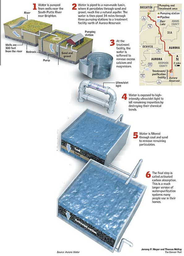
In Aurora, the process is thanks to the Prairie Waters system, which was opened in 2010. It starts south of Weld County along the Platte River, where Aurora holds water rights that can be used “to extinction,” meaning nearly endlessly.
“Essentially, this means that the water residents use for washing, laundry, showering, as well as some of the water from lawn watering, stays in the South Platte River Basin,” Aurora Water explains…
A few dozen wells on the basin pull water through hundreds of feet of sand and gravel to purify the water. Next, the water is pumped into basins of more sand and gravel where filtration continues. Finally, pipes take the water to three different pump stations, which lift the water 1,000 feet over a ridge and back to the Peter D. Binney Purification Facility, near Aurora Reservoir.
From there the water is treated and pumped back out to the city’s thousands of homes and businesses, where the cycle begins all over again…
Currently, the facility treats about 50 million gallons of water each day…
Funding for more wastewater recycling projects is on the way. The bipartisan infrastructure bill passed by Congress has $1 billion for water reuse projects in the West, including the $3.4 billion project in Southern California.
And tucked into the federal budget reconciliation package being debated is $125 million in grants for alternative water sources nationwide that could include reuse technologies.
Plans for expansion of the Aurora Prairie Waters project are ever-evolving and so there isn’t a build out budget attached, Baker said.
This fall Colorado has launched two new programs, one aimed at removing firefighting foam containing so-called “forever chemicals” from fire departments, military bases and other properties and an emergency grant program aimed at helping communities where the chemicals have appeared in drinking water.
The chemicals, known broadly as PFAS or poly- and per-fluoroalkyl substances, have long lifespans and have been linked to certain cancers. Contained in such common substances as Teflon and Scotchguard, they are also widely used to fight fires, particularly those involving jet fuel.
“We’re learning more every day about PFAS and its exposure in our environment,” said Erin Garcia, a spokeswoman with the Colorado Department of Public Health and Environment (CDPHE).
Widefield aquifer via the Colorado Water Institute.
The unregulated substances were once thought to be rare, but since at least 2015 have shown up at alarming levels in communities such as Fountain and Security, where groundwater was contaminated by runoff from the nearby Peterson Air Force Base. Those two communities were forced to shut down their water systems, find temporary substitute supplies, and build new treatment systems.
The chemicals have also been found in groundwater wells that serve Commerce City and in areas near the Suncor Refinery in Adams County and Buckley Air Force Base in Aurora, among other sites.
Two years ago, as more testing revealed more contaminated sites, the CDPHE vowed to boost its oversight. Since then the Colorado Legislature has provided the health department with more authority and money to combat the problem, including conducting surveys to identify contaminated sites and drinking water systems, and providing as much as $8 million to buy contaminated firefighting foam and store it, and to help communities whose water has been tainted by the compounds.
Sugarloaf Mountain fire station.
Dozens of fire departments, military facilities, water utilities, and commercial properties as diverse as hotels and apartment complexes, are now monitoring and testing for the substances.
As Colorado has ramped up its oversight, last month the EPA announced it would begin work on a regulation that will, for the first time, set a limit on PFAS compounds in drinking water. It is set to be available for public review next fall and would be finalized by the fall of 2023.
Ron Falco, CDPHE’s safe drinking water program manager, said he’s pleased the EPA is moving to regulate PFAS, but he said fast action is critical.
“We want the EPA to hit that timeline,” he said.
The South Adams County Water and Sanitation District, which serves Commerce City, is watching the state’s progress carefully. It discovered PFAS contamination in 2018 when it began testing voluntarily for the substances after the crises in Fountain and Security.
It already had in place a carbon filtering system and was able to strengthen it to reduce PFAS contamination in its system to 35 parts per trillion (ppt), half of the EPA’s voluntary 70 ppt guideline. It also had to shut down wells whose contamination levels were so high, 2400 ppt, that no amount of carbon filtering could remove the chemicals fast enough to keep the drinking water safe.
“The key here is that we can treat the current levels,” said Kipp Scott, manager of drinking systems at the South Adams County district, but better treatment will be needed once the federal regulation takes effect.
And that means the district will need to install a new system that uses an ion exchange technology to remove the chemicals. Its estimated cost is $70 million. Scott said the district hopes the state’s emergency grant fund and new federal infrastructure dollars will help cover the cost.
“I hope this moves in the right direction, and we can continue to provide safe water to our customers,” Scott said.
Jerd Smith is editor of Fresh Water News. She can be reached at 720-398-6474, via email at jerd@wateredco.org or @jerd_smith.
When Project 7 began drawing up plans for a water resiliency program in 2019, its leaders didn’t plan to invest in connecting a raw water line from the Ridgway Reservoir to a new treatment plant in Ridgway.
The new treatment plant and water line would be designed so additional capacity can be added in the future, allowing a maximum capacity of approximately 10 million gallons per day, more than a 30% increase in drinking water supply for the region.
The plan to construct the Regional Water Supply Program in conjunction with the Ridgway Water Treatment Plant is a decision driven by water supply security. The project will add a second water source to the region while serving all Project 7 members.
The valley hasn’t yet experienced water supply interruption, but Project 7 intends to stay ahead of a slew of risks that could potentially affect over 50,000 people and thousands of local businesses.
The new treatment plant would allow direct access to existing water rights in the Ridgway Reservoir while building a system resilient to wildfire, drought and transmission interruptions in the Gunnison Tunnel.
Project 7 Water Authority is a wholesale water treatment provider that supplies to the City of Montrose, City of Delta, Town of Olathe, Tri-County Water Conservancy District and the Menoken and Chipeta water districts, although each entity owns its own water rights.
Although geographically the second smallest entity in the cooperative by size, the City of Montrose uses roughly 50% of the water supply due to population density, with about 8,000 residents using water services from Project 7…
As it stands, the Gunnison River remains the only water supply source for the region, with one treatment facility to provide to the six entities within the cooperative.
The cooperative projected the overhead cost of the project to be between $50 – $70 million. The estimate includes the raw water line, but will become more specific as the design process progresses, said Miles Graham, spokesman for the resiliency program.
City of Montrose customers will see an increase in water rates on Jan. 1, 2022, due in part to Project 7’s elevated fees. Huggins noted that the impact of increasing wholesale rates for customers depends largely on the size and budget of the district…
Montrose residential water bills will increase by $4.86 per 3,000 gallons of water used per month and increase $1.35 per 1,000 gallons used per month, due in part to the water supplier raising its own fees by 15%.
At this stage in the planning process, it’s impossible to predict the cost for each entity without knowing the ultimate program cost or the amount of outside state and federal support, said Graham.
By using a uniform rate structure for all entities to provide local funding, the cost will be shared equally throughout the valley and supplemented by aggressively seeking grants and low-interest loans.
As the process moves forward, the team will be able to test and determine which treatment technology is best for the new plant and raw water line, as well as finding opportunities to make use of existing water distribution infrastructure near the new facility site.
The cost may be higher to build the raw water line, but overall, the cost to run and operate will be lower since the water quality leaving the reservoir will provide a stable water supply, Huggins noted. The water will also be easier to treat, with less influence from rain events washing mud and silt in the river that have to be removed, allowing for mitigated operation costs…
Water treatment plants often use electrical backup generators that run on diesel or natural gas, which is typically banned in the event of a wildfire, the engineer said. Because a gas-run generator on a tank of fuel presents a dangerous risk, utility companies usually shut off any natural gas in the area if a wildfire is present.
“So if you think about an emergency situation, having the ability to bring water down to this site and continue operations at the plant without having to pump it up from the river made a lot of sense. [It’s] a more sustainable solution than the other options for getting water to the site.”
Construction for the project is expected to begin in 2023. The new water line and treatment plan is slated to go online by 2025.
Fort Collins-Loveland Water District and South Fort Collins Sanitation District said they are working with law enforcement to investigate “ongoing acts of sabotage from unknown parties” that have reportedly caused serious harm to district and employee property.
The alleged acts of sabotage are tampering with critical pump stations, emptying of primary storage tanks and fire hydrants, and malicious vandalism of employee property, the districts said in a news release. The first instance was discovered in September 2019 and may have occurred prior to that time, and the issues have continued since then, according to district officials.
District leaders are asking anyone with information about the incidents to contact local law enforcement or email communications@fclwd.com. The districts want to hear about any suspicious activity at district hydrants, tanks and pump stations.
The quality of water and reclamation services delivered by the districts haven’t been compromised, leaders said, and district infrastructure is safe. The districts are working with legal counsel, outside advisers and law enforcement to investigate the activities, which district officials said are felony criminal offenses…
It’s not clear which law enforcement agencies are involved in the referenced investigation. The districts wouldn’t answer that question. Representatives of Larimer County Sheriff’s Office and Loveland Police Department said their agencies aren’t involved, and Fort Collins Police Service representatives said they assisted with an investigation in 2019 but haven’t been involved recently. The Coloradoan also reached out to the FBI but hadn’t received a response as of Friday afternoon…
District officials said they haven’t been able to share information publicly until now because of the sensitive nature of the investigation. They added they’ve invested in more advanced equipment to prevent situations like this one from happening again. A dedicated FAQ about the investigation is posted at http://fclwd.com/saysomething.
When Denver’s early settlers built the High Line Canal back in the 1880s, little did they know what the future would hold for the 71-mile man-made waterway that stretches from Waterton Canyon southwest of Littleton all the way to Aurora.
The High Line Canal was originally designed to deliver irrigation water to farmers on the dry plains of Denver. While Denver Water still owns and uses the canal to deliver irrigation water to customers, the canal corridor also has grown into a recreational asset and an ecological resource for the metro area.
On the recreational side, each year around 500,000 people walk, run and ride the canal’s 71-mile maintenance road that also serves as a popular trail. As an ecological resource, some sections of the canal structure itself are now being used for stormwater management.
The High Line Canal is an irrigation ditch built in the 1880s. Denver Water still uses the canal to deliver irrigation water to customers when conditions allow. Photo credit: Denver Water.
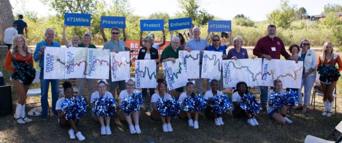
The evolution of the public’s use of the canal for recreation and stormwater management, along with its original role as a water delivery method, is one of the reasons why Denver Water and regional partners, including cities, counties, park and flood districts and stormwater management entities, have partnered with the High Line Canal Conservancy. The nonprofit organization’s mission is to preserve, protect and enhance the 71-mile canal in partnership with the public.
Denver Water plays an active role in the ongoing discussions about the canal’s future as it continues to serve its High Line customers. Because the canal has a junior water right and experiences high seepage and evaporation losses over large distances, Denver Water is looking for more reliable and efficient ways to deliver water to some of the High Line customers.
The High Line Canal in operation in May 2021. The canal is an inefficient means of delivering water long distances. It can get clogged with debris and loses 60% to 80% of its water to the ground due to seepage. Photo credit: Denver Water.
“As the canal’s role in the metro area evolves, Denver Water is committed to making sure it remains a beneficial asset to the community,” said Jeannine Shaw, government relations manager at Denver Water. “That’s why in 2020, the Denver Water Board of Commissioners approved a historic $10 million pledge to the High Line Canal Conservancy to invest in the long-term care and maintenance of the canal corridor.”
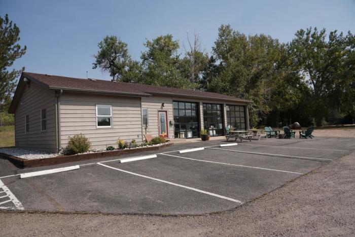
Included in the pledge is a piece of property and an office building located adjacent to the canal in Centennial for the Conservancy to use as its new headquarters.
The High Line Canal Conservancy’s new headquarters is located along the canal in Centennial. Denver Water provided the building to the nonprofit as part of a financial pledge in 2021. Photo credit: Denver Water.
As part of this evolution, the Conservancy, Denver Water and canal stakeholders are creating a new management structure called the Canal Collaborative to formally connect the regional partners as they guide the future of the canal.
Representatives from the Canal Collaborative pose with supporters for a picture to celebrate their work. Photo credit: High Line Canal Conservancy.
“The collaborative helps us do more together than any one entity can do alone,” said Suzanna Fry Jones, senior director of programs and partnerships for the High Line Canal Conservancy. “The collaborative management structure will ensure this treasured resource is preserved, protected and enhanced as a regional legacy for future generations.”
The formalized structure will benefit citizens and the environment along all 71 miles of the canal as it winds its way through Denver as well as Adams, Arapahoe and Douglas counties.
The Canal Collaborative includes the High Line Canal Conservancy, Denver Water, Arapahoe and Douglas counties, the cities of Aurora, Denver, Cherry Hills Village, Greenwood Village and Littleton, the Highlands Ranch Metro District, the Mile High Flood District, the Southeast Metro Stormwater Authority and South Suburban Parks and Recreation.
“The collaborative is important because we need to have a group that brings together all of the jurisdictions so we can hear from each one of those entities and their communities about what’s most important to them,” said Nancy Sharpe, Arapahoe County Commissioner for District 2, which includes Centennial, Greenwood Village, a portion of Aurora and unincorporated central Arapahoe County.
The Conservancy was formed in 2014 and has developed “The Plan for the High Line Canal,” which lays out guidance for repurposing the corridor along with over 100 recommendations for new projects.
Here’s a look at some of the developments along the canal in recent years.
Ecological resource
Under the new Stormwater Transformation and Enhancement Program, High Line Canal partners are looking at ways to allow and move stormwater through areas of the canal to improve water quality and manage local flooding in the South Platte River Basin. This is in addition to the canal’s existing irrigation delivery purposes.
Stormwater is any rain and snow that eventually flows off any impervious surface and into the canal.
Several structures have been built in or on the side of the canal to help manage the flow of stormwater through the channel.
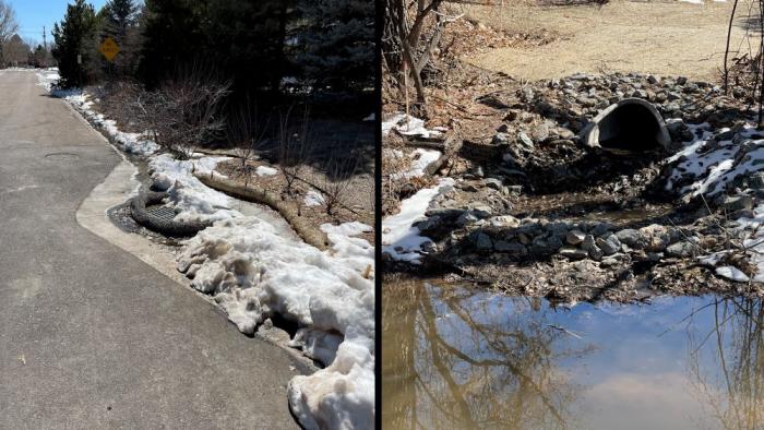
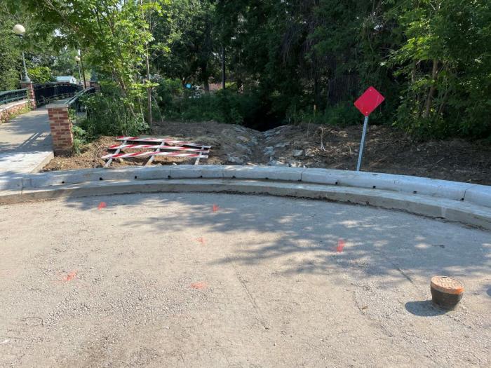
The new structures that are located on the side of the canal help improve drainage on city streets and collect debris and trash before water enters the canal.
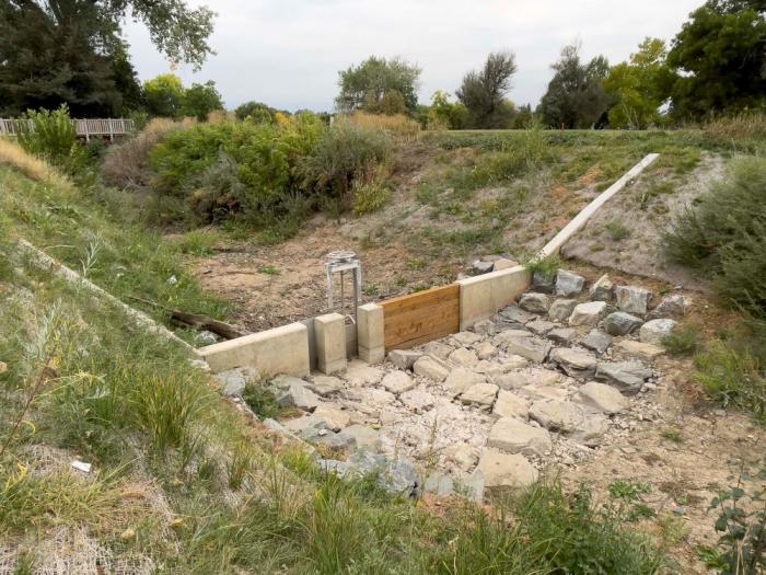
The structures being built inside the canal also help catch and stop debris and trash from flowing down the channel. They also temporarily slow down and detain water to filter out sediment.
These structures are designed to improve water quality before the water reaches receiving streams. Moving stormwater through the canal could provide an additional 100 days that the canal could be wet in some parts of the channel, which would benefit vegetation along the corridor while also enhancing the recreational user experience.
“Often times across the country, old utility and railroad corridors become degraded once their primary uses have been reduced, so we’re happy to see areas of the High Line Canal being maximized and transformed into green infrastructure,” Shaw said.
The City of Littleton built a stormwater management system on Windemere Street. Snow and rain drain through a grate on the street and into a pipe that flows into the High Line Canal. Photo credit: Denver Water.The City and County of Denver built four “drive-through forebays” at the end of several streets next to the High Line Canal across from Eisenhower Park. Before the structures were built, stormwater would flow uncontrolled and unfiltered into the canal. The forebays act as pre-treatment structures that will slow water down and allow sediment and trash to settle onto the street before entering the canal. Photo credit: Denver Water.The City and County of Denver built three concrete structures called water quality berms in the canal. This structure in the canal at Wellshire Golf Course will control the flow of water and catch trash and debris, making it easier to remove while providing cleaner water. Photo credit: Denver Water.A new water quality berm with a headgate in the High Line Canal at Eisenhower Park in Denver. The berm temporarily detains stormwater to promote filtration of sediment before water passes through to improve water quality in the canal’s receiving streams. Photo credit: High Line Canal Conservancy.When the High Line Canal is not in operation, gates are fully opened at stream crossings. This allows stormwater that’s been filtered in the canal to go into receiving streams such as Big Dry Creek at deKoevend Park in Centennial. Big Dry Creek eventually flows into the South Platte River. Photo credit: Denver Water.
Along with Littleton and Denver, stormwater projects are also being implemented in Centennial, Douglas County and Greenwood Village with additional projects in progress. Learn more about the Stormwater Transformation and Enhancement Program in this video.
Denver Water and its regional partners also are exploring other opportunities to allow the canal structure to be used. In areas where it has adequate stormwater capacity the canal could provide additional benefits to the neighboring communities and their surrounding environment to improve water quality in the South Platte River basin.
“As we navigate the evolving future for the lands the High Line Canal irrigates, Denver Water is excited to further the work with our regional partners to find additional utility for this cherished resource,” Shaw said.
The High Line Canal in September 2021, near the South Quebec Way trailhead in southeast Denver. The canal is dry most of the year when not in operation for irrigation deliveries. Moving stormwater through the channel improves water quality and could add an additional 100 days when the canal could be wet in some parts of the canal. Photo credit: Denver Water.
Tree canopy health
There are more than 23,000 mature trees along the High Line Canal, but many are at the end of their life span. The Conservancy is working with Denver Water and regional partners to remove dead trees and trim others to improve overall tree health and safety along the canal’s recreational trail.
To maintain the canal’s urban forest, the Conservancy’s Plan recommends planting 3,500 new trees by 2030. The species of trees being planted will be more drought tolerant than many of the old cottonwood trees currently along the canal.
In the fall of 2021, the Conservancy, along with the support of local volunteers and The Park People, planted 175 new, drought-tolerant trees. Photo credit: High Line Canal Conservancy.
Trail improvements
A major goal of the Conservancy and the Canal Collaborative is to make it easier, safer and more fun to walk or ride on the canal’s recreational trail. The Conservancy is working with local jurisdictions to add new pedestrian bridges, trailheads, underpasses, mile markers and wayfinding signs.
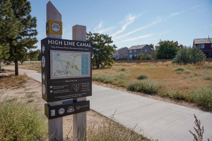
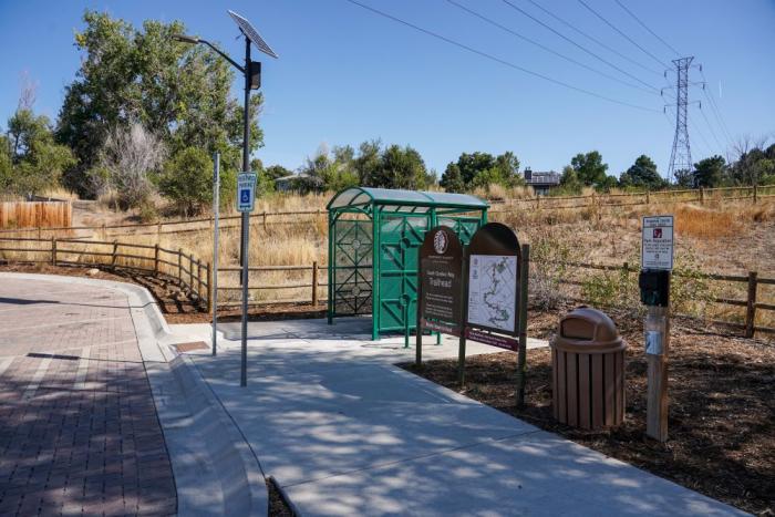
A biker rides through the new underpass that goes under South Colorado Boulevard and East Hampden Avenue next to Wellshire Golf Course in south Denver. The project provides a critical connection to allow safe passage under two busy streets, resulting in easier trail access and encouraging more users. The collaborative project was funded by the City and County of Denver, Cherry Hills Village and Arapahoe County along with funds from the federal government. Photo credit: Denver Water.A new sign along the High Line Canal trail in Aurora installed in 2021 provides a map to help trail users navigate the corridor. Photo credit: Denver Water.Arapahoe County Open Spaces opened a new trailhead on South Quebec Way in southeast Denver. The site includes parking, a bathroom, a trash can and a trail map. Adding new trailheads is major goal of the High Line Canal Conservancy to improve access and facilities for the public. Photo credit: Denver Water.
Canal Improvement Zones
Under The Plan, the Conservancy has worked with the community and jurisdictional partners to identify nine Canal Improvement Zones. These are locations where residents asked for trail enhancements to increase physical activity, foster community connections and create access points to nature.
Many of the sites are in diverse neighborhoods where the canal corridor has been historically under-utilized and lacked investment.
Enhancements may include pedestrian bridges, improved trail access, benches, signs, gathering spots and play areas.
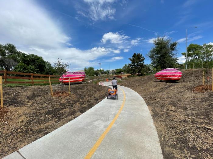
The first location to see new projects is the Laredo Highline neighborhood in Aurora, thanks to a $180,000 grant from the Colorado Health Foundation and an additional $180,000 from Arapahoe County.
A rendering of enhancements to the High Line Canal trail in Aurora’s Laredo Highline neighborhood. The enhancements include a new pedestrian bridge to improve trail access and new play and seating areas. Image credit: High Line Canal Conservancy.
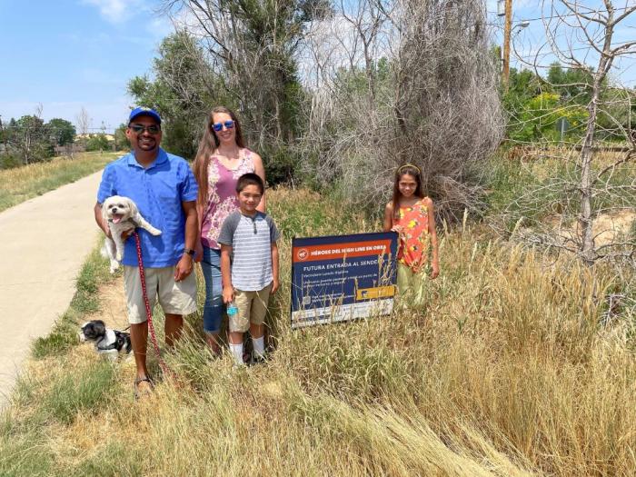
“I grew up in the Laredo Highline neighborhood and the canal has always helped bring the community together,” said Aurora resident Janak Garg. “We’re really looking forward to the new bridge and other improvements coming to the neighborhood.”
Janak Garg and his family stand at the spot where a new pedestrian bridge will be built across the canal in Aurora’s Laredo Highline neighborhood. Photo credit: Denver Water.
New mile markers
A very noticeable and welcome improvement to the trail is the addition of new mile markers. In the past, there were a variety of mile markers with different mileage from each jurisdiction, which made it confusing for hikers and bikers.
Now there are new Colorado red sandstone mile markers that line the trail from start to finish, paid for through donations by the Conservancy’s founding partners.
Most of the markers have a quote or message from the founding partners, like Al Galperin who lives near the South Quebec Way Trailhead, whose message reads: “Be the reason someone smiles today.”
“I hope it brings a little bit of extra joy to people on the trail,” Galperin said. “It’s nice to be able to help out and see all the new features coming to the canal.”
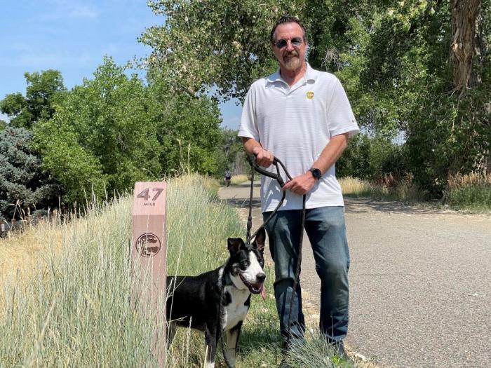
Al Galperin and his dog Brody stand next to one of the new mile markers along the High Line Canal trail. Galperin is one of the High Line Canal Conservancy’s Founding Partners who made a donation to help fund the mile marker project. Photo caption: Denver Water.
“It’s inspiring to see all these improvements and we’re excited for the future of the canal,” Shaw said. “The Conservancy and all of the partners are doing a great job leading the way and working with Denver Water and the community.”
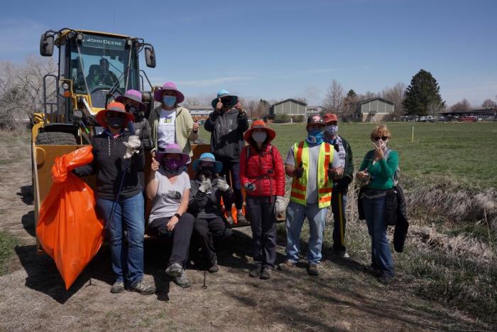
Denver Water crews participate with volunteers to help clean up the canal in Aurora in April 2021. Photo credit: Denver Water.
Visit highlinecanal.org to sign up for monthly emails for information on events throughout the year. The website also provides information about history of the canal, new projects and volunteer opportunities.
The Suncor refinery in Commerce City is pictured on Sand Creek near where it meets the South Platte River. Both streams have highly challenged water quality, though many conservationists argue they can get still better. Photo credit: Suncor
Following repeated pollution violations this year and calls to shut down the Suncor Energy oil refinery in Commerce City, Colorado health officials are seeking to renew the facility’s water quality permit, albeit with tighter restrictions.
The refinery has been allowed to operate on expired permits because the company applied to renew them before they lapsed. And now officials with the Colorado Department of Public Health and Environment are considering a new water quality permit for the facility, spokeswoman Erin Garcia said in a release.
The new permit would be more restrictive than the old one, Garcia said, and aims to better protect Sand Creek and downstream waters. The permit would also require more transparency surrounding the refinery’s operations and impose more pollution monitoring requirements and limits for toxic metals and chemicals.
Suncor would be required to conduct “frequent” site inspections ensure that drinking water moving through its property remains safe, bolster its maintenance operations and alert people by text message if or when a spill occurs…
But the draft permit isn’t finished yet, so state officials are soliciting public input. The department will host a virtual meeting Thursday between 6:30 p.m. and 8 a.m. to review current details of the draft permit. In addition the department will accept public feedback on the draft through Feb. 10, 2022. Additional details and public comment sections can be found online at http://cdphe.colorado.gov.
The facility has repeatedly violated pollution standards, even after state health officials boasted last year of fining the company up to $9 million for violations in 2017. Between March 27 and April 22 of this year, the refinery exceeded pollution limits 15 times, emitting too-high levels of hydrogen sulfide, carbon monoxide and sulfur dioxide…
State officials are also currently considering an air quality permit for the refinery, which would allow more of some types of pollution and crack down on others, The Denver Post reported in May. That proposed permit would raise permissible limits of volatile organic compounds that form ground-level ozone by 138 tons per year and allow 11 tons more particulate soot a year. It would, however, reduce sulfur dioxide and carbon monoxide…
In the bigger picture, however, Suncor has pledged to invest $300 million in the refinery before 2023 to make the facility “better, not bigger.” To that end, Adesanya told The Post in September that the company installed an automated shutdown system in part of the plant last year and will upgrade the rest of the facility with similar technology by the end of next year.
Colorado water quality regulators have issued a cease and desist order to the owner of two hard-rock mines located just outside the town of Nederland, alleging the mines have discharged potentially hazardous pollutants well in excess of permitted levels into nearby watersheds.
The Colorado Department of Public Health and Environment’s Water Quality Control Division issued a notice of violation on Nov. 5 to Grand Island Resources, LLC, which acquired the Cross and Caribou Mines in western Boulder County after the death of former owner and miner Tom Hendricks in 2020.
The violation notice came after a series of compliance advisories were sent to the company over the summer. The November notice alleges a failure to comply with current water quality standards, citing multiple excess effluent discharges of heavy metals during the months of December 2020 to August 2021, as well as a failure to comply with required reporting of additional water pollutants.
GET THE MORNING HEADLINES DELIVERED TO YOUR INBOX
Pollutants listed in the violation for exceeding the daily or monthly limits included lead, copper, zinc, silver and cadmium, with the self-monitored data showing several occasions where effluent discharges exceeded levels by up to three or four times the permitted amounts.
Grand Island Resources is currently permitted through the state to release treated wastewater via one outfall into Coon Track Creek within the specified effluent limits. The need to stay within these limits is underscored by the fact that the small creek serves as a tributary in the Boulder Creek watershed, ultimately joining another creek through the town of Nederland and flowing into the Barker Reservoir, one of several potable water sources for the city of Boulder.
In high concentrations, heavy metals are well documented to cause impacts to the environment and human health, including the ability to accumulate in the body over time and cause disease. Critically, the 2021 report of Boulder’s drinking water quality — which employs data from 2020 — reported no violations for lead or copper levels, and no public health advisories have been issued to date.
Direct water quality testing for the natural spring located off Caribou Road — a spring often utilized by locals and recreational visitors — was not immediately available, nor was the immediate source of the spring known.
Representatives of Grand Island Resources did not respond to requests for comment.
This is not the first time compliance advisories or notices of violations have been issued by CDPHE for the Cross and Caribou Mines. Publicly available documents show repeated enforcement actions regarding either excess effluent discharge or a failure to comply with reporting standards of treated wastewater dating back to the 1980s under previous ownership.
The current notice of violation for heavy metal water contaminants comes as Grand Island Resources is seeking revision of its current state permit, having filed for review with the Division of Reclamation, Mining and Safety, a branch of the state Department of Natural Resources, on Feb. 8. No determination has been made to date, with a pending response required from the mining company to proceed. At the same time, the notice of violation has been scheduled for a hearing before the Colorado Mined Land Reclamation Board on Dec. 15 to 16.
Grand Island Resources is also currently operating under a special use development agreement with the county of Boulder, according to Jesse Rounds, a senior planner with Boulder County Community Planning and Permitting. Rounds explained that this agreement is separate from the state mining permit and was acquired in the transfer of mine ownership.
According to Rounds, so long as the existing agreement is upheld, the agreement remains in place indefinitely. However, the county is now currently reviewing if the requested modifications to the state would continue to uphold the existing special use agreement, or if a full special use review may be necessary.
The Cross and Caribou Mines were once estimated to potentially be worth billions of dollars in gold, raising questions as to the long-term scale of mining to be conducted by the new company, and the subsequent implications for Boulder County.
“Mining has had an enormous impact on Nederland’s history,” Nederland Mayor Kris Larsen said in an interview. “It’s why our town exists in the first place, and I have no doubt that it will continue to be part of our future as the demand for domestically sourced minerals is only going to grow. But it can’t be done like it’s been done. It has to be done in a responsible way that protects our air, water, and common environment.”
SUPPORT NEWS YOU TRUST.
Colorado Newsline is part of States Newsroom, a network of news bureaus supported by grants and a coalition of donors as a 501c(3) public charity. Colorado Newsline maintains editorial independence. Contact Editor Quentin Young for questions: info@coloradonewsline.com. Follow Colorado Newsline on Facebook and Twitter.
The utility will pay millions to mitigate environmental concerns for Boulder County residents
The county received assurances Denver Water would pay to mitigate environmental damages expected from the work, but the deal still left Commissioner Matt Jones “heartsick.” He said commissioners fought for the best deal possible but he’s still concerned about the damage the project could do locally and for the millions of people who depend on the Colorado River…
Climate scientists and legal experts said they’re skeptical the parched Colorado River will provide enough water for Denver Water to fill an expanded Gross Reservoir. And even if the water’s there, the expansion and other projects like it will inevitably worsen water shortages on Colorado’s Western Slope and downstream, they said.
Utility officials, however, hailed the settlement and said that while they won’t be able to fill the reservoir every year — which they’ve known all along — years with above-average precipitation will provide more than enough water.
“We’re gonna fill the reservoir,” Denver Water Project Manager Jeff Martin said.
Climate change is trending in the wrong direction for such strong confidence, cautioned Mark Squillace, the Raphael J. Moses Professor of Natural Resource Law at the University of Colorado Law School.
“This just seems a bit insane to me that Denver Water is unwilling to acknowledge” that climate change is only likely to worsen water shortages on the Western Slope, Squillace said.
Martin said he still expects to break ground on the five-year, $464 million project by April…
Denver Water will pay $5 million to residents most impacted by the work and agreed to reduce noise and dust from the project using electric rather than diesel generators.
Denver Water’s drivers must complete bicycle awareness training, provide “truck free” days for cyclists and “leave Gross Dam Road in a better condition than before the project.”
Denver Water will pay $5.1 million to replace open space lands that would be flooded by the reservoir expansion and transfer 70 acres near Walker Ranch Open Space to Boulder County.
Denver Water will pay $1.5 million to reduce greenhouse gas emissions from the project and another $1 million to restore a stretch along South St. Vrain Creek.
Squillace said while those terms might benefit county residents, it’s still not enough and he was disappointed to hear commissioners agreed to settle.
“We were between a rock and a hard place,” Jones said. “We were pushed into this corner of knowing that and trying to figure out what we could get for Boulder County residents…
Martin said he and others at Denver Water expect to be able to fill the expanded reservoir in average and above-average years. South Boulder Creek, which is not part of the Colorado River system, also feeds into the reservoir and could supplement water in dry years on the Western Slope, he noted…
[David] Bahr suggested Denver Water could instead pipe in water from the Missouri River or other places in the Midwest that are expected to see more water in the coming years. While Martin said those types of ideas could be explored for the more distant future, Denver Water officials maintain that an expanded Gross Reservoir is the best course of action for now.
The project could still come to a halt, Squillace said. The more delays the work faces, the more climate data will be available, increasing political pressure for Denver Water to seek another way to secure its water supply.
“I’m still not so convinced that the project’s ever going to actually be built,” he said.
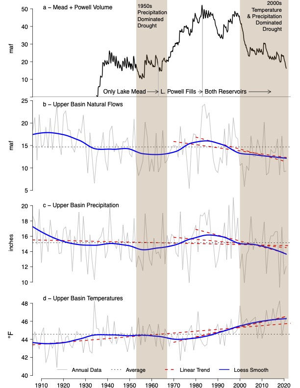
Brad Udall: Here’s the latest version of my 4-Panel plot thru Water Year (Oct-Sep) of 2021 of the Colorado River big reservoirs, natural flows, precipitation, and temperature. Data (PRISM) goes back or 1906 (or 1935 for reservoirs.) This updates previous work with @GreatLakesPeck.
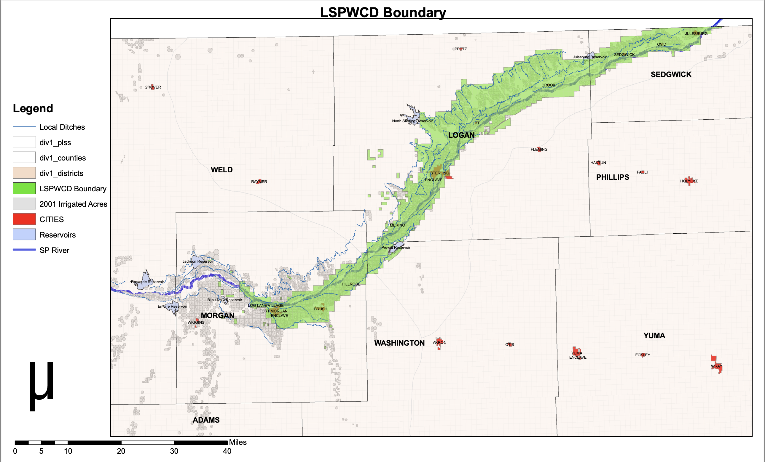
A Colorado taxpayer group has filed a class action lawsuit in the 13th Judicial District Court in Logan County to try to overturn a mill levy increase by the Lower South Platte Water Conservancy District.
The Public Trust Institute, a Colorado-based public interest law firm, and the National Taxpayers Union Foundation of Washington, D.C., filed the lawsuit Wednesday on behalf of an ad hoc group of taxpayers in Logan, Morgan, Sedgwick and Washington counties. Jim Aranci of Crook, Charles Miller, Jack Darnell and William Lauck of Morgan County and Curtis Werner of Merino are listed as plaintiffs in the lawsuit. Besides the water district, the defendants include the county clerks of the four counties, who collected the taxes and handed the funds over to the district.
At issue is the interpretation of a 1996 ballot question in which the LSPWCD “de-Bruced,” or excused itself, as the result of a public vote, from provisions of the TABOR amendment. In that ballot question, the district stated it would seek a public vote in order to raise taxes.
But other wording in that ballot question, and the district’s original mill levy allowance when it was formed in 1964, are at the crux of the conflict. When it was formed, the water conservancy district was allowed by state statute to levy up to 1 mill on property within the district, which includes parts or all of the four counties. The district’s board of directors had previously only asked for 0.5 mill because that was all that was needed.
At the end of 2019, however, the district’s board decided to raise the levy to the statutorily allowed 1 mill for 2020 to, among other things, help fund preparatory work on a project that eventually will help supply both the district and the City of Parker extra water from the lower reaches of the South Platte River. That mill levy was certified by county commissioners in the four counties at that time, and the district began collecting the tax revenues in 2020.
As the district board was planning its 2021 budget in December of 2020, however, a group of taxpayers objected, pointing to the 1996 ballot measure’s final sentence. It reads, “No local tax rate or property mill levy shall be increased at any time, nor shall any new tax be imposed without the prior approval of the voters of the LSPWCD.”
Jim Aranci, a former chairman of the district’s board, said Wednesday that the wording of that 1996 de-Brucing question was quite clear…
Joe Frank, general manager of the conservancy district, said Friday he’d heard rumors of a lawsuit being filed, but was not at liberty to discuss the issue further. He did, however, reaffirm the board’s position that the increase was thoroughly researched in 2019 before it was instituted for the 2020 budget year. He said the district’s legal counsel pointed to other wording in the de-Brucing ballot question: That the district could “utilize the full proceeds and revenues received from every source whatever, without limit.” And those “full proceeds and revenues” included the remaining half-mill originally allowed by statute but never used. In other words, the public vote would only be needed if the district wanted to exceed its original allowance of 1 mill.
Frank reiterated Friday that the board did not take the step lightly, and spent a lot of resources getting the right answers to its questions…
The water district has still been allowed to collect its 1 mill levy, since it was certified for the 2020 budget year. According to Colorado Revised Statute 39-1-111 (3) “If the board of county commissioners … fails to certify such levies to the assessor, it is the duty of the assessor, upon direction of the division of local government, to extend the levies of the previous year …”
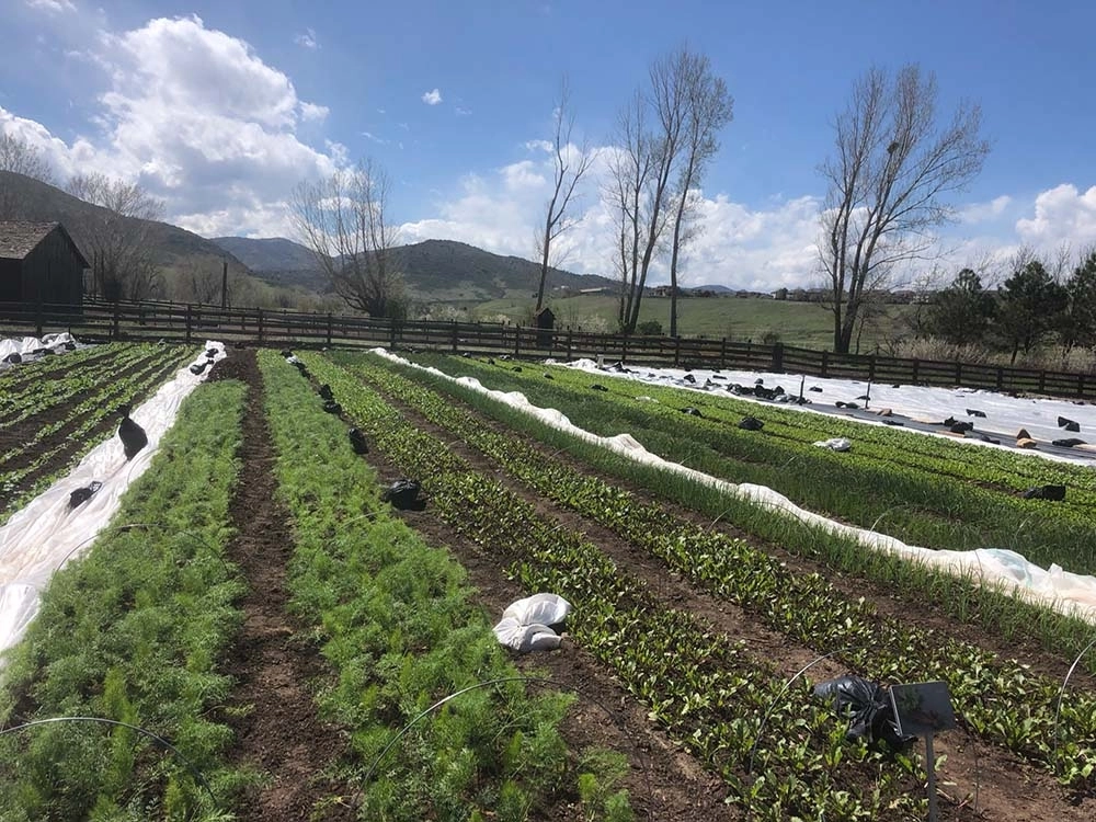
At Chatfield Farms, our CSA team is committed to investing in regenerative systems. Amidst mounting threats such as climate and environmental change that cause erratic farming conditions, we seek to learn about and practice regenerative principals so that we can continue to provide food to our communities.
In 2021 we were able to make great strides toward our regenerative goals. We developed an onsite composting program and practiced diligent cover cropping to protect and build our soils. We took steps to build high tunnels and windrows to protect crops from weather events and build resiliency into our operation. We are transitioning to reusable fabrics and irrigation options, rather than disposable. We continued to practice minimal tillage in many parts of the farm and have invested in equipment to expand those practices.
Through these efforts, our farm was able to provide tens of thousands of pounds of produce to many individuals and families in the greater Denver area.
This time of year, like many vegetable farmers in the region, we transition from the fast-paced hustle of the spring and summer to the reviewing, researching and planning nature of the colder months. As we re-visit the idea of regenerative agriculture this season, I find myself proud of all we have accomplished, and re-centering on a goal of mine.
This goal is to cultivate a more “kincentric” view of the world, to un- and re-learn the ways in which I understand my connection to the rest of the natural world. A kincentric view is one where we humans see ourselves as kin with the Earth and everything in it rather than as separate entities. This idea has indigenous roots and suggests a relationship of mutual respect among living things, stressing the importance of balancing give and take, input and extraction. For me, this seems as central to a regenerative practice as minimal tillage or cover cropping.
I believe it is our responsibility as farmers to observe changes in and interactions between the various facets of our ecosystem, and work to create a balance between our goal of food production and the needs of the organisms within the system.
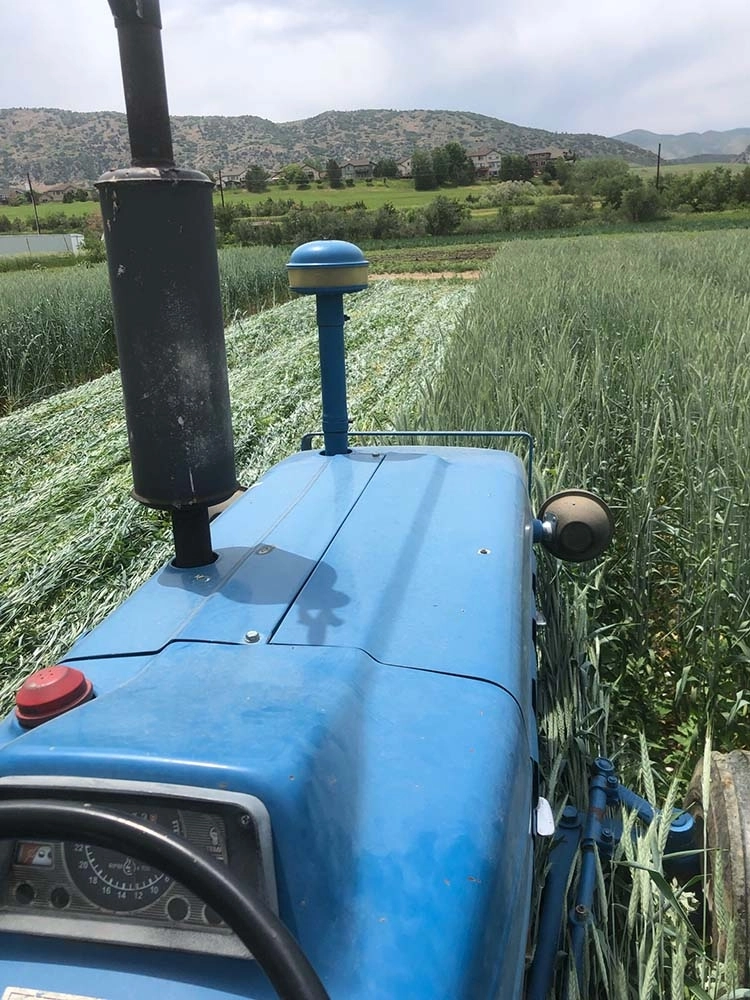
Tractor at Chatfield Farms. Photo credit: Denver Botanic Gardens
After nearly 20 years of preparations, the expansion of Gross Reservoir in Boulder County is moving ahead.
Last week, Denver Water took the final step necessary to proceed with the project after striking an agreement with Boulder County to take additional actions to offset impacts of the project.
The accord with Boulder County means Denver Water can proceed with the long-awaited project that will raise the dam, triple the reservoir capacity and mean far more water security for 1.5 million people in an era of more intense droughts, heavier rain events and earlier snowmelt – all driven by climate change.
“Today is an historic occasion for Denver Water,” CEO/Manager Jim Lochhead told Denver’s Board of Water Commissioners on Nov. 3, upon acceptance of the Boulder County agreement.
“We bring to a conclusion the federal, state and local review processes that will allow us to begin construction of the expansion of Gross Reservoir.”
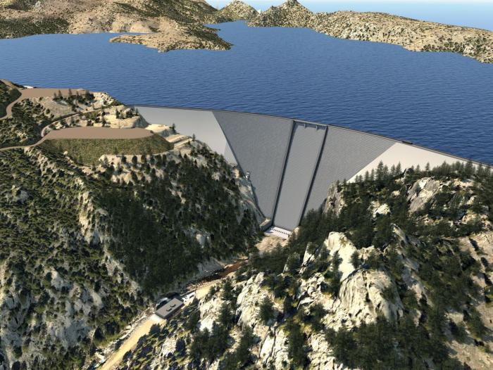
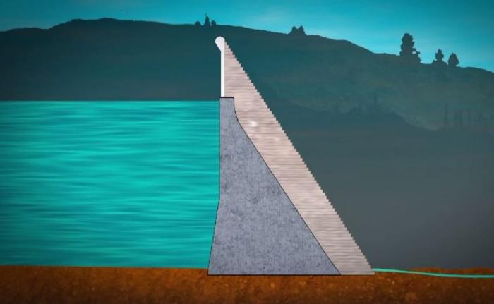
Expanding the reservoir requires raising the dam 131 feet by placing new concrete on the existing structure. Image credit: Denver Water.
Denver Water personnel will begin close coordination with Boulder County and others to prepare the area and local roadways for construction. Denver Water will continue to engage and communicate with project neighbors to ease impacts of the work.
“In the two decades Denver Water has spent preparing for the project, we have been driven by a singular value: the need to do this expansion the right way, by involving the community, by upholding the highest environmental standards and by protecting and managing the water and landscapes that define Colorado,” Lochhead said.
“Boulder County and its residents share these perspectives, and we look forward to continuing to work with them as the project moves ahead.”
Building the Gross Reservoir Dam in the 1950s. Photo credit: Denver Water.
Gross Dam was built in the 1950s and named after Dwight D. Gross, a former chief engineer at Denver Water. It was built to store water from the West Slope that travels through the Moffat Tunnel, as well as water from South Boulder Creek.
“The original engineers designed the dam so that it could be raised twice, if needed,” said Jeff Martin, Gross Reservoir project manager. “Based on our water supply projections and current system shortfalls, that need is here.”
Denver Water began the permitting process to raise the dam in 2003 and received approvals from the Colorado Department of Public Health and Environment in 2016 and the U.S. Army Corps of Engineers in 2017.
The plan cleared its final federal hurdle on July 16, 2020, when the Federal Energy Regulatory Commission gave its approval for the project and ordered Denver Water to proceed with design and construction.
The project has earned support from major environmental groups, business interests, water users on both sides of the Continental Divide and elected officials on both sides of the aisle, including the state’s last five governors.
Raising the dam will increase the reservoir’s storage capacity by 77,000 acre-feet of water and make Gross Reservoir the second-largest in Denver Water’s system. When complete, Gross Reservoir will be able to hold 119,000 acre-feet, second only to Dillon Reservoir in Summit County, which is capable of holding just north of 257,000 acre-feet.
The graphic shows the existing dam and water level and how high the new dam will rise above the current water level. Image credit: Denver Water.
Expanding Gross Reservoir is a major part of Denver Water’s long-term, multipronged approach to deliver safe, reliable water to more than 1.5 million people today and those who will call the Front Range home in the future. That approach includes increased water efficiency, recycling water and responsibly sourcing new storage.
The additional reservoir capacity will enable increased water capture in wet years to help avoid shortages during droughts. It will also help offset a current imbalance in Denver Water’s collection system that is a significant risk.
Denver Water has a water storage imbalance between its two collection systems with 90% of its reservoir storage located in the utility’s South System compared to 10% in its North System. This storage imbalance creates vulnerability if there is a drought, mechanical issue or emergency that affects the South System. The storage imbalance is one of the reasons Denver Water is expanding Gross Reservoir. Image credit: Denver Water.
“Right now, 90% of our water storage is on the south end of our water collection system, but just 10% of our storage is on the north end,” Martin said.
“By enlarging Gross Dam, we’ll be able to store more water in the north, which will improve our flexibility in the event there’s a problem on the south side that could come from any number of operational issues or threats, like wildfires.”
Once filled, the expansion at Gross will provide an additional 72,000 acre-feet of water storage, which is roughly the amount 288,000 residential households would use for one year.
In addition, 5,000 acre-feet of storage space in the expanded reservoir — known as the environmental pool — is reserved to support environmental needs as part of an agreement with the cities of Boulder and Lafayette. Water from the environmental pool will be used to provide beneficial stream flows along a 17-mile stretch of South Boulder Creek below the dam during dry periods to protect fish and aquatic insects.
Denver Water also has committed over $20 million to more than 60 environmental mitigation and enhancement projects on both sides of the Continental Divide as a result of the project. According to Colorado officials, those commitments will provide a net environmental benefit for the state’s water quality.
Denver Water will use its existing water rights to fill the reservoir when it is complete. Engineers expect it will take around five years to fill the newly expanded portion of the reservoir, depending on precipitation and water use from customers.
“In the end, this project won’t be judged by whether we raised the dam, but rather how we went about expanding the reservoir,” Lochhead said. “We will continue to seek community input and look forward to working with Boulder County as the project moves ahead.”
City Council calls for local control rules in big land projects could delay approval of Northern Water’s Northern Integrated Supply Project by a year.
Fort Collins has placed new barriers in front of Northern Water’s $1.1 billion plan to build a dam and pipeline network along the Cache la Poudre River, further slowing a decades-long project backed by 15 growing Front Range communities and water districts.
City government put a hold on the kind of pipeline and infrastructure work Northern Water needs for its Northern Integrated Supply Project, saying Fort Collins will pause for a year to write new regulations under state “1041” permitting laws that encourage local control of big land use projects. Fort Collins’ planning commission had rejected a NISP pipeline proposal through city open space last summer, but Northern Water’s board overrode the decision, as is allowed by state law.
Northern Water says it has already complied with local approval protocols, including receiving 1041 approval from surrounding Larimer County, and will study its options if Fort Collins tries to force NISP through a newly created layer of planning.
“We think that we’ve completed” the city’s Site Plan Advisory Review process, which was the standard before Fort Collins started talking about creating 1041 rules, Northern Water spokesman Jeff Stahla said. “We’re really going to take a close look at exactly what was passed by the city council.”
Placing a hold on new projects and asking staff to create a 1041 process for the first time was not meant to target Northern Water specifically, though it will likely delay their Fort Collins projects, city council member Kelly Ohlson acknowledged. A new group of city council members taking office after spring elections learned Fort Collins could use the state’s 1041 law to influence projects rather than just react to them, Ohlson said…
Mayor Jeni Arndt said the new tier of local regulations should not make a big difference in Northern Water’s decadeslong pursuit of final project approvals. Northern Water wants to build two big reservoirs northwest and east of Fort Collins, and connect them to the Poudre and the South Platte River through a series of pipelines and ditches.
Arndt said city leaders have narrowed down their interests in creating a 1041 review process to two areas for now: water projects and development that impacts natural areas.
“I don’t feel like that’s an evil volley against them,” Arndt said. “It’s not tit for tat. We have some legitimate concerns about our natural areas and parks.”
Conservation groups that have battled NISP and its complex water engineering for years are happy to see a new bump in the road for Northern Water, which says it expects to receive a final federal-level permit from the U.S. Army Corps of Engineers any month now. Opponents have filed suits and protested local government approvals since portions of NISP were first conceived in the 1980s. In July, they focused on the Fort Collins planning body’s decision whether to approve project pipelines buried in city park land and right of way…
A delay from Fort Collins to pursue more local control rules follows Northern Water’s success in September getting Larimer County approval for another key element of the project: moving U.S. 287 east over a ridge, north of Ted’s Place, to create the dam basin where Glade Reservoir will store Cache la Poudre water.
Northern Integrated Supply Project (NISP) map July 27, 2016 via Northern Water.
Overall, the northern supply project will build Glade and another new reservoir northeast of Greeley, Galeton, that will store South Platte River water. Some of the new supply will be delivered in the Cache la Poudre channel, while other transfers will be made by a series of pipelines and ditches.
Northern Water says the project will bring much-needed supply to 80,000 more residents in more than a dozen growing communities that have signed up for the water. The water agency says storing Cache la Poudre water in Glade during higher runoff allows them to supply a steady stream for wildlife and recreation through Fort Collins at times when the river otherwise runs nearly dry.
Opponents say NISP takes water from wildlife and scenic rivers, and encourages sprawling growth in communities that could do more to conserve water.
From protecting customers from the risk posed by old lead service lines to preparing to meet the challenges of the future, Denver Water takes a long-term view when planning for the future.
And the utility has been recognized nationally for its work, by peer utilities as well as by federal officials.
Denver Water in early October was recognized — for the second time — by the Association of Metropolitan Water Agencies, a group representing the largest publicly owned drinking water suppliers in the United States.
At the association’s annual meeting, held in Denver this year, Denver Water received the group’s 2021 AMWA Sustainable Water Utility Management Award for its work to curb carbon emissions, increase its use of renewable energy and protect the environment and its communities.
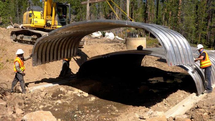
Denver Water crews install a new culvert over Cabin Creek in Grand County in partnership with the U.S. Forest Service and Grand County Learning By Doing. The new culvert will improve habitat for native cutthroat trout in the stream. Photo credit: Denver Water.
Denver Water’s groundbreaking Lead Reduction Program was recognized by the national utility association and also was highlighted by leaders at the Environmental Protection Agency earlier this year for the jobs it created and its unique approach to diverse communities.
Replacing all the old, customer-owned lead service lines in Denver Water’s service area at no direct cost to the customer will take 15 years to complete, and it’s just one of the major undertakings that make up the utility’s 10-year forecast for an estimated $2.6 billion investment into the system that supports about 25% of the state’s population, including Colorado’s capital city.
About 90% of the forecast investment over the next decade is dedicated to large projects and regular annual inspection and maintenance programs that protect customers, position Denver Water for the future and continue regular monitoring programs for infrastructure already in place. The remaining investment focuses on maintenance and improving the resiliency of the system.
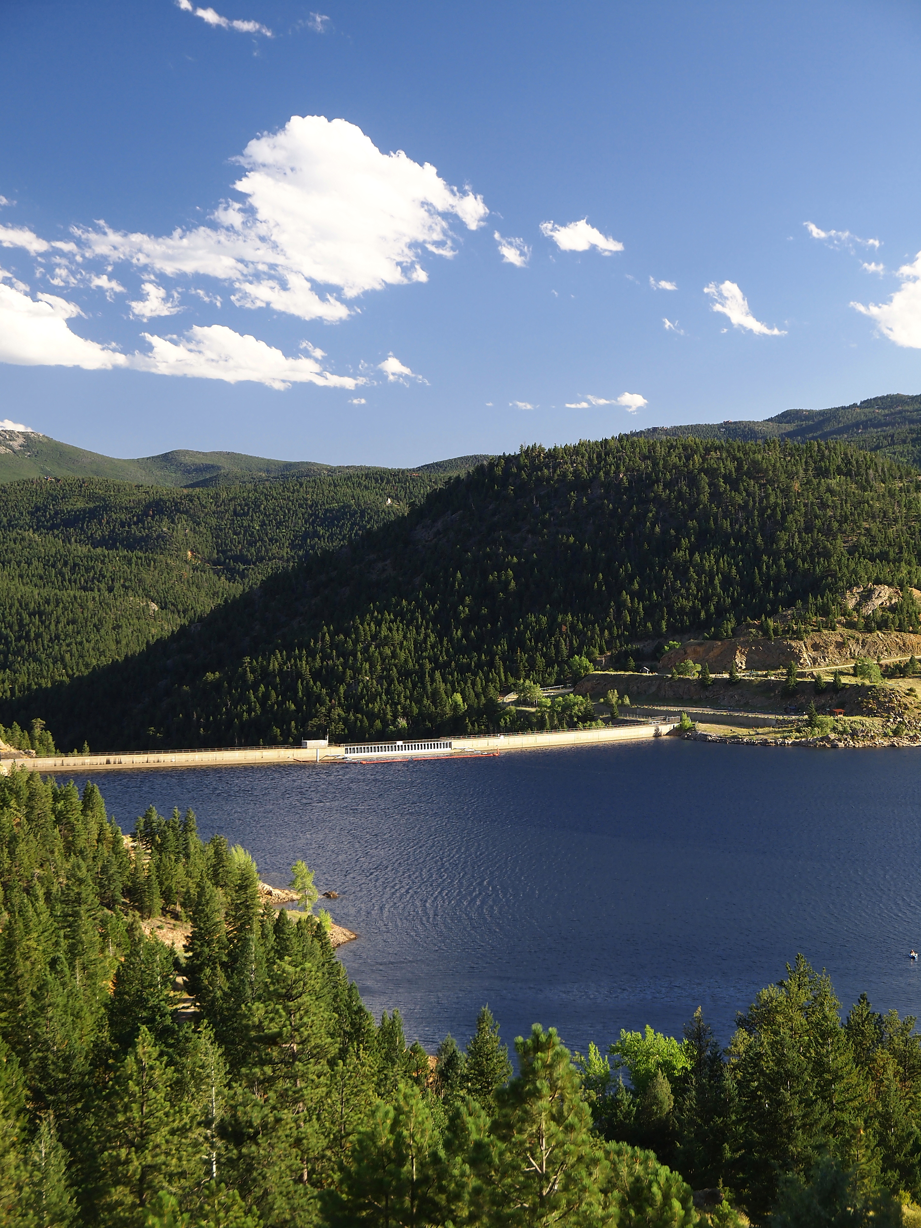
Gross Reservoir — The Gross Reservoir Expansion Project will raise the height of the existing dam by 131 feet, which will allow the capacity of the reservoir, pictured, to increase by 77,000 acre-feet. The additional water storage will help prevent future shortfalls during droughts and helps offset an imbalance in Denver Water’s collection system. With this project, Denver Water will provide water to current and future customers while providing environmental benefits to Colorado’s rivers and streams. Photo credit: Denver Water
Commissioners say they hate the project, but the odds of winning a lawsuit were poor. Denver Water upped the offer to help mitigate impacts of construction to $12.5 million.
The Boulder County Commissioners on Tuesday unanimously approved a settlement allowing Denver Water to expand the dam and pool at Gross Reservoir, despite vocal opposition from some residents, after a $10 million mitigation deal was sweetened by $2.5 million to soften construction impacts for neighbors.
Denver Water is likely to vote Wednesday to approve a total of $12.5 million in mitigation and open space donations for Boulder County, after last-minute talks raised the sum.
The commissioners said they were heartsick at the destruction the dam expansion will cause for neighbors and for revered county open lands. But, they added, county attorneys advised them that federal laws preempt their planning process because the existing dam includes a hydroelectric generator and is therefore controlled by federal laws.
The attorneys said Boulder County would lose a federal suit filed by Denver Water and that the agency would withdraw its mitigation offer if they delayed a vote.
Denver Water already has the federal approval it needs to raise the dam on South Boulder Creek by 131 feet, and inundate the surrounding forest for 77,000 more acre-feet of storage, nearly tripling capacity…
The commissioners wanted Denver Water to go through the county’s existing “1041” land use process, allowed under state law, before construction on the Gross Reservoir expansion begins. But in July, Denver Water sued, saying federal laws superseded Boulder County’s process and that its federal permit required the utility to begin construction by 2022. Boulder County was intentionally slowing down the project, Denver Water argued…
Denver Water Manager Jim Lochhead said in a statement after the vote, “I appreciate that this was a hard and emotional decision for the Boulder County Commissioners.
“We have tried for the last year to go through the County’s 1041 land use process, and only after delays were we forced to file litigation to prevent violation of the order by FERC for us to commence construction of the project. Denver Water continues to be committed to do everything in our power to mitigate local impacts of construction,” Lochhead said.
Construction would impact surrounding forests, trails, roads and neighbors, and also temporarily cut off access to popular open spaces in parts of the area. Commissioner Marta Loachamin said she toured areas around Gross Reservoir for the first time in June, and was struck by markings in the forest showing how many trees will have to be removed and how high the new water pool will rise in the canyon.
Conservation groups who have sued to stop the dam expansion can continue to negotiate with Denver Water for additional mitigation, deputy county attorney David Hughes told the commissioners. Denver Water has indicated they would continue to talk with the groups, he said…
The conservation groups are adamant Boulder County could have negotiated for more mitigation. Save the Colorado and PLAN-Boulder County said they had proposed $70 million in mitigation as a settlement, and that Boulder County stopped including them in talks last week.
Gross Dam enlargement concept graphic via Denver Water
The agreement with Denver Water now includes:
$5 million for the construction impacts on immediate neighbors of the reservoir.
$5.1 million to Boulder County open space funding to acquire new land or repair and maintain trails and facilities under extra strain from visitors who can’t use Gross Reservoir spaces.
$1.5 million to mitigate greenhouse gas emissions from construction.
$1 million for South St. Vrain Creek restoration.
A transfer of 70 acres of Denver Water land near Gross Reservoir to Boulder County to expand Walker Ranch Open Space.
Moving water from mountain reservoirs to household taps is never easy. For the next several months, Denver Water will be doing it with the equivalent of one hand tied behind its back.
A series of major maintenance and construction projects will require Denver Water to, essentially, shut down the entire north side of its collection, delivery and treatment system, and rely wholly on the southern end to supply 1.5 million people with water as the utility heads into the colder seasons.
The work has required a Colorado Ballet level of choreography to move water around the system months in advance in preparation for a rare set of circumstances.
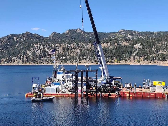
This summer, divers spent several weeks installing a new, massive grate at the bottom of Gross Dam. The grate protects the outlet works from potential damage from large debris. Photo credit: Black & Veatch
“Shifting all that water here and there, it’s a lot to keep straight, a lot to think about, a lot to juggle,” said Nathan Elder, manager of water supply for Denver Water. “And it all comes on top of watching the weather to see what it might — or might not — bring us as far as precipitation.”
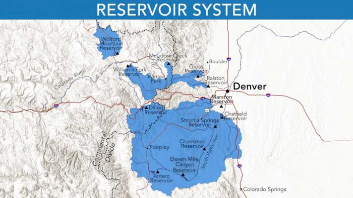
Rivers and creeks in Grand County are part of Denver Water’s North Collection System. Water flows through the Moffat Tunnel, under the Continental Divide, to Gross and Ralston reservoirs. Image credit: Denver Water.Denver Water’s entire collection system. Image credit: Denver Water.
Denver Water is conducting several projects that required the utility to turn off the spigot on its north side supply system late this summer. Those include:
Replacing a massive grate at the bottom of Gross Dam that prevents heavy debris from finding its way into the pipes and valves that calibrate water releases at the base of the dam. The project is so complex it requires specially trained diving crews working hundreds of feet under the reservoir surface.
Replacing concrete at the Moffat Canal near the east portal of the Moffat Tunnel. The freeze-thaw cycle at 9,200 feet has taken a toll and allowed for water to seep underneath concrete and create the potential for damaging erosion.
Repairing deteriorated concrete within the Moffat Tunnel caused by years of scour within the tunnel.
Replacing key structures at Ralston Reservoir along Highway 93 near Golden. The work to replace equipment that regulates the way water is carried through the dam will allow for safer operation of reservoir releases. Replacing that equipment requires draining the reservoir.
A project to connect the emerging Northwater Treatment Plant to Denver Water’s distribution system. This work, the overarching reason for shutting down north side flows, also requires taking the existing Moffat Treatment Plant offline for modifications related to the Northwater connections.
Ralston Reservoir, a key water supply bucket near Golden, has been drained to allow Denver Water to construct a new outlet works to release water from the base of the dam. Photo credit: Denver Water.
All that north side work means Denver Water will have to rely almost fully on supplies from its southern end that gather water from the South Platte River as well as from Dillon Reservoir in Summit County.
This north side shutdown is even more complicated than the maneuverings required in the summer of 2020, when Denver Water had to undertake big shifts in how it moved water through its system due to repair work that closed the Roberts Tunnel for two months, closing off access to water from Dillon Reservoir.
That orchestration was hard enough. Planning for the current shutdown began months ago when engineers decided to coordinate several projects to contain the treatment and delivery disruptions to a single fall and winter cycle.
“Doing it this way made the most sense,” explained Jennifer Gelmini, a senior engineer at Denver Water who is coordinating the projects. “We realized we were going to have a long outage for the work needed for the Northwater plant connections and Moffat modifications and looked at how we could take advantage of this big shutdown and what other projects could fit into that timeframe.”
Work started in August to replace concrete at the East Portal of the Moffat Tunnel near Rollinsville. Repairs were required on both the inside and outside of the portal area. Photo credit: Denver Water.
That plan made it critical to maintain as much water as possible in Dillon Reservoir to help with supplies in the late summer and fall, while also keeping levels high at Cheesman and Marston reservoirs so they can be relied on over the upcoming winter months.
Anglers and Sunday drivers may have noticed big flows in the North Fork of the South Platte River, too, in late summer, as the utility moved more water than usual from Dillon, through the Roberts Tunnel under the Continental Divide and into the North Fork. At times, late summer flows reached 450 cubic feet per second, compared to a more typical September flow of one-third that volume.
“We’ve been setting the stage on this for months,” Elder said. “Taking the north end out of the equation means we have to set up our southern end for all the heavy lifting for nearly an eight-month span. It’s a highly unusual and tricky undertaking.”
Ralston Reservoir near Golden must be drained completely to replace the outlet works at the base of the earthen dam. That reservoir holds nearly 11,000 acre-feet and will be out of commission until the beginning of runoff season in April 2022, creating a dramatic gap in Denver Water’s typical water delivery and treatment pattern.
Because the 84-year-old Moffat Treatment Plant also will be offline for that period, all the water treatment needs are pushed to the utility’s Marston and Foothills plants in the southwest side of the region.
Construction continues at the emerging Northwater Treatment Plant below Ralston Reservoir. Work this fall and winter will connect the facility to Denver Water’s distribution system. The plant is expected to be complete in 2024. Photo credit: Denver Water.
Further complicating such an extended dance: Denver Water this summer had to release large volumes of water from two West Slope reservoirs (Williams Fork and Wolford Mountain) to make up for a water debt it owed on the other side of the Continental Divide.
While those releases weren’t tied to the projects on the north end, it was another factor water managers had to keep in mind as they ensured Denver Water met all its many obligations, both to its customers and to agreements related to Colorado River flows.
“This year has been unusual,” Elder said. “No year is ever the same in water supply, but between a pretty dry winter, then a wet spring and early summer, followed by another dry stretch as we try to set the system up for these construction projects, there were a lot of details to sweat.”
The good news: Come spring, a lot of key projects will be wrapped up, and water managers will once again have more flexibility to manage water between its north and south systems.
Denver Water is planning to expand Gross Reservoir in Boulder County. The additional storage capacity will create more balance in the utility’s storage and give water planners more flexibility in their operational strategy. Photo credit: Denver Water.
Boulder County and Denver Water could be nearing a settlement to resolve a simmering dispute over plans to expand the Gross Reservoir.
Denver Water in July sued Boulder County in federal court, claiming commissioners were taking too long to consider the utility’s request to expand the reservoir.
“The proposed settlement would require Denver Water to pay more than $10 million to mitigate the impacts of the project in Boulder County,” Boulder officials said in a Friday news release. “In exchange, Boulder County would not dispute Denver Water’s claim that the project is exempt from review.”
Boulder County’s Board of Commissioners will meet Tuesday to discuss the proposed settlement, while Denver Water’s board will meet the following day. A federal judge had set oral arguments in the lawsuit for Nov. 4, but those would be canceled if the agency and county government approve the settlement…
The proposed expansion would raise the existing Gross Dam by 131 feet and widen it by 800 feet, increasing the reservoir’s capacity from nearly 42,000 acre-feet to nearly 120,000 acre-feet.
But Denver Water can’t just do it on its own — it needs a permit from Boulder County, which will receive none of the water security and all of the construction, traffic and ecosystem effects. Those who live near the reservoir complain that the five years of construction would bring pollution, lights and noise, while environmental advocates say tens of thousands of trees would have to be cut down to complete the project…
Some of the money ($2.5 million) would be allocated to assist Boulder County residents directly impacted by the project, while $5.1 million would go to open space funding to replace land consumed by the larger reservoir, Boulder officials said. Other funds would address greenhouse gas emissions from the project and restoration efforts of the South Saint Vrain Creek.
Denver Water would also agree under the proposed settlement to transfer 70 acres of land near Walker Ranch Open Space to Boulder County, which would be added to the recreational land…
In its lawsuit this summer, Denver Water alleged that Boulder County was overstepping its authority and jeopardizing the water project.
A federal judge dismissed a separate lawsuit in March from a coalition of environmental organizations, which sued the U.S. Army Corps of Engineers in 2018 to block the project.
Denver Water relies on a network of reservoirs to collect and store water. The large collection area provides flexibility for collecting water as some areas receive different amounts of precipitation throughout the year. Image credit: Denver Water.
The Denver Board of Water Commissioners agreed on Wednesday to raise water rates and fixed monthly charges, which will all go into effect Jan. 1, 2022.
For typical single-family residences using the same amount of water each year, this would shake out to an increase of 47 cents to $1.34 per month, or about $5.64 to $16.08 per year. However, these rates are also dependent on where in the Denver metro a customer lives, since rates are higher in the suburbs due to the rules of the Denver City Charter.
There are also multiple charging tiers at Denver Water, beginning with the lowest rates for water used for essential things like bathing and cooking, calculated by assessing water consumption during the winter. Other water usage, mainly for outdoor watering in the summer, is charged at higher tiers.
Denver Water is funding upgrades through these extra charges. These projects include expanding the Gross Reservoir near Boulder to increase storage capacity during wet years and boosting the entire system’s resilience as climate change leads to more unpredictable weather patterns. Other projects include the city’s efforts to replace old lead-containing pipes… as well as the city’s creation of new water quality laboratories and treatment centers.
For the first time since the historic Cameron Peak Fire charred a record breaking 208,000 acres in 2020, and since the rain on the burn scar caused fatal flooding in the Poudre Canyon in July of 2021, wildlife officers with Colorado Parks and Wildlife are seeing the detrimental impact the blaze had on the fish in the Cache la Poudre River. As feared, recent surveys of the river showed thousands of fish were killed as a result of the fire and its lasting impacts.
Cache la Poudre River. Photo credit: Allen Best
“The runoff events we saw this summer, post fire, have had a detrimental impact on the fishery,” said Kyle Battige, Aquatic Biologist with CPW…
CBS4’s Dillon Thomas was invited to join CPW staff as they conducted their first fish testing of the year along the Poudre River.
Battige and his team conducted Standardized Electrofishing Surveys along the Poudre River in mid-October, their first time surveying the region since the fatal flooding and Cameron Peak Fire…
The fatal landslide in July claimed the lives of four people near the Black Hollow Road area. CBS4 was invited to join CPW as they surveyed their two nearest stations, one upstream and one downstream from the slide.
Kelly Flats is a campground and recreation area just downstream from the landslide.
“Last year we caught approximately 200 fish,” Battige said of the roughly 40-yard stretch of the river they survey at Kelly Flats. “(This year) we caught zero trout.”
Not one single fish was found near Kelly Flats, just one year after hundreds were located there. Battige said he expected there to be fewer fish due to the impacts of the past year. However, he said he was shocked to not catch one single fish…
Though the results of the electrofishing were upsetting for the staff at Kelly Flats, greater signs of hope were unveiled a mile upstream from the landslide.
Within 30 seconds of entering the Poudre upstream from the slide and turning on their electrofishing system, multiple fish were being caught for counting…
At the survey station upstream more than 50 fish were caught during one pass. More were caught during a second pass. CPW staff were thrilled to see the fish were still in the region, even if not at the same population of previous years…
Battige said the Poudre River is typically not stocked with trout. The ecosystem has long thrived on its own even after natural disasters. The fish have historically repopulated and redistributed along the river without human intervention.
Battige said he was hopeful the fish would soon make their way toward the Kelly Flats area, repopulating that region…
The fish that are caught in the electrofishing process are weighed, measured, listed for species and then returned to the same waters.
Now, with stats in-hand, CPW will weigh their options for the future. Either let the river bounce back on its own, or try and shock the system by stocking the river with fish.
Natural resources experts who surveyed the fire’s impacts on the watershed, which [northern Colorado relies] on for drinking and irrigation water, believed the Cameron Peak Fire will have impacts on the Poudre River for at least 10 years.
A new federal system for projecting Colorado River water flows in the next two years confirms dire news about drought draining the West’s key reservoirs, and increases pressure on Colorado to conserve water immediately to avoid future demands from down-river states, conservation groups say.
The federal Bureau of Reclamation’s new system for projecting vital Colorado River flows in the next two years drops earlier, wetter years out of the historical reference, and gives more weight to two recent decades of drought. The regular October update this week shows water runoff into Lake Powell, the storage basin for four Upper Colorado Basin states, was only 32% of average for the 2021 water year, which runs from October to September.
The new projections for the next two years show that even with federal officials draining portions of Blue Mesa, Flaming Gorge and Navajo reservoirs to get more water to Lake Powell’s hydroelectric generating station, a moderate winter would leave the Colorado River in the same crisis a year from now. And a low-water scenario this coming winter season would drop Lake Powell well below the minimum level required to generate electricity by November 2022.
In addition to federal officials trying to protect hydroelectric generation at Lake Powell, and at Lake Mead as the downstream water bank for the Lower Basin states, water compacts govern how much Colorado River water needs to go downstream for use by agriculture and cities…
“We don’t have any more time to talk about it,” Matt Rice, co-chair of the Water for Colorado Coalition and Director of American Rivers’ Colorado River Basin Programs, said after reviewing the latest Bureau of Reclamation update.
Starting with the October update, the bureau begins the historical average calculations in 1991, instead of the 1981 cutoff used until now. The 1980s were much wetter in the Colorado River Basin, Rice said.
“These projections are worse than they have been in the past, but they’re also more realistic,” Rice said. Many conservation groups find that a positive step despite the bad news, Rice added, because it increases pressure on state water officials, local water conservancy districts, agriculture interests, cities and environmentalists to work faster on solutions.
At the same time, Rice said, the updated numbers should drive home the reality that there is 20% less water available now in the Colorado River than as recently as 2000. “There’s no more flexibility in the system, right? We’re looking over the edge of the cliff.”
Water conservation experts in Colorado have worked for years to avoid their worst-case scenario, which is a “call” or a sudden demand from federal managers to deliver more water for hydropower or to satisfy the compacts with the Lower Basin. Without advance planning, a call would force the state water engineer and local conservancy districts to cut irrigators’ water rights based only on the seniority of their water-use rights.
While state and local officials have been working with nonprofits on conservation plans, there are legal tangles that could require new legislation, and seemingly endless ethical questions about which parts of the state would suffer the most water loss, said Sonja Chavez, director of the Upper Gunnison River Water Conservancy District…
The boat ramp at the Lake Fork Marina closed for the season on Sept. 2 due to declining reservoir levels. The Bureau of Reclamation is making emergency releases out of Blue Mesa Reservoir to prop up levels in Lake Powell and preserve the ability to make hydropower. CREDIT: HEATHER SACKETT/ASPEN JOURNALISM
Blue Mesa Reservoir in her region has been nearly drained by drought and by federal officials taking extra from Western reservoirs to solidify Lake Powell’s power pool. Blue Mesa is projected to soon be down to 27% full, Chavez said. Blue Mesa was 33% full in mid-September, according to Bureau of Reclamation records.
State and private officials have cooperated to experiment with “demand-management” programs, where instead of buying agriculture land and its accompanying water rights outright, they buy the right to rent the water for a few years out of a decade. That rented water can be sent downstream in dry years, and in theory the restoration of water in other years should preserve the farm or ranch land while providing income for the farmer.
But renting or buying of water rights on the scale to meet compact demands would require hundreds of millions of dollars, with no current pot of money to pull from, water experts say. Colorado officials have mentioned the possibility of using money from the infrastructure stimulus plan currently under debate by Congress, but it’s uncertain whether the bill will pass, and how much water-related money will be in it if it does…
The largest amounts of water to be conserved are in agriculture, by far, but Front Range residents must be part of the statewide discussion about finding more water for the downstream Colorado River, Rice and Chavez said.
“You’re not going to get as much out of a city compared to what is the amount of irrigation water diverted for agriculture,” Chavez said. “But there’s also agriculture on the Front Range that benefits from our transmountain diversions,” some of which are created and controlled by urban water departments. “That has to be part of the picture.”
Front Range cities take water from the Roaring Fork River basin in a transmountain diversion through the Twin Lakes Tunnel. The city of Aspen is studying the potential for an Alternative Transfer Method, or ATM, to increase its water supplies, which could include approaching transmountain diverters about participating in a water-sharing agreement. Photo credit: Elizabeth Stewart-Severy/Aspen Journalism
After heavy public comment and debate, council voted 6-1 to change the scope of the city’s pending 1041 regulations and the moratorium they plan to put in place while staff is working on the regulations.
Both the one-year moratorium and the eventual regulations will now apply only to water and sewage treatment projects and highway/interchange projects that will be located in city parks or natural areas. The parks and natural areas component is the new part. Council narrowed the scope of the proposal in hopes of quelling concerns from developers and water providers while honoring the views of commenters who want the city to advocate for natural resource conservation.
The 1041 regulations provide an avenue for municipalities and counties to have more stringent oversight of certain types of “state interest” projects, a broad category that can include everything from water pipelines to mass transit to nuclear detonations. But the localities have to opt into the process, designate the state interest areas they want to regulate and draft their own regulations. The council majority that favors 1041 regulations sees them as an alternative to the city’s SPAR (Site Plan Advisory Review) process, which provides for nonbinding review of developments of state interest.
Now that council has designated areas of interest, a moratorium will take effect immediately and last until council adopts the 1041 regulations. It will prevent construction or development review of any water/sewer treatment or highway project that would be located wholly or partly in city parks or natural areas. The city is engineering an exemption process that may allow for some projects to bypass the moratorium, and 1041 review. Council will only exempt projects if they think adverse impacts can be avoided without a binding review process and the project meaningfully addresses an important community need that can’t be put off.
When council last discussed this topic in September, the 1041 regulations and moratorium were expected to apply to all water/sewer and highway projects in city limits. The initial scope inspired intense opposition from several developers and water districts in the region. A particular point of concern was the potential impacts of a moratorium on the NEWT III water pipeline project (short for North Weld County and East Larimer County Water Districts Water Transmission Pipeline Project). That pipeline will deliver water to many new housing developments in the region. The news of the moratorium led the North Weld County Water District board to issue a temporary moratorium on all tap sales and plant investment sales, and East Larimer County Water District leaders said they would likely do the same if a moratorium took effect.
Others who opposed or voiced concerns about the 1041 regulations and moratorium included Severance Mayor Matt Fries, the town of Timnath and the Fort Collins Area Chamber of Commerce.
Those who supported 1041 regulations and an immediate moratorium included representatives of Save the Poudre, Sierra Club and the Fort Collins Audubon Society…
Council ultimately supported the narrowed scope of regulations, paired with the immediate moratorium, 6-1. Council member Shirley Peel was the opposing vote, citing the potential for unintended repercussions to development and utility projects.
While city staff said the narrowed 1041 regulations are unlikely to affect the NEWT III pipeline, they will likely impact the Northern Integrated Supply Project. NISP is a project going through the permitting process that would take water from the Poudre and South Platte Rivers for storage in two new reservoirs. NISP organizer Northern Water plans to put some components of NISP in city natural areas, a plan the city rejected during SPAR review. But SPAR review, again, is only advisory, so Northern Water’s governing board overrode the decision. Still, the moratorium means that Northern Water would be barred from beginning work on the components in city natural areas. And the project would likely be subject to 1041 review if the regulations come to fruition as council is currently envisioning.
More to come on that. In the meantime, we can expect a one-year moratorium as staff works on the city’s new 1041 regulations. Council will have the last word on those regulations and is planning a six-month check in…
Climate progress report
Fort Collins exceeded its 2020 climate goals to reduce community and municipal greenhouse gas emissions by 20%, according to preliminary estimates presented to council Tuesday.
The 2020 goals are a step along the way to the city’s goal to reduce greenhouse gas emissions by 80% in 2030 and 100% in 2050. The goals apply to both municipal emissions and the community as a whole.
Fort Collins met its municipal benchmark for 2020 three years ahead of schedule, in 2017. As of 2020, it has reduced greenhouse gas emissions by 44% of 2005 levels.
The city met its 2020 community goal with a 24% reduction in emissions, up from a 7% reduction in 2019. The improvements came mostly from the Roundhouse Renewable Energy Project, a new wind farm that drove a 10% reduction in emissions; reduced vehicle travel, which drove a 3% decrease; and a 2% reduction in industrial emissions. Another 2% in reduced emissions were due to weather and other unspecified factors. City staff said the travel reductions were related to the stay-at-home order. It’s not yet clear what exactly drove the reduction in industrial emissions, and final numbers are expected in early 2022.
The community’s per-capita residential emissions were down 41% in 2020 compared to 2005 levels, staff said.
Staff expect Fort Collins to reach a 26% reduction in greenhouse gas emissions for 2021, based on current forecasts.
To reach the 2030 communitywide goal, the city will need to enact critical strategies — increased renewable electricity adoption, transit reductions and universal composting — plus all the other strategies identified as “next moves” in the latest update to Fort Collins’ Our Climate Future Plan.
Representatives of Fort Collins Sustainability Group, a local organization that advocates for climate action, said in a statement that they were “very pleased” to see that estimated emission reductions had topped the 2020 goal…
The group is advocating for bigger climate investments in the 2022 budget, such as doubling funding for Fort Collins Utilities’ Energy Services programs and transportation-related offers that would reduce emissions. Energy Services includes incentive programs for energy efficiency and electrification, energy code development and related initiatives. It’s a particularly important focus area for greenhouse gas emission reductions because emissions from electricity and natural gas make up most of the community’s emissions (about two-thirds in 2019).
After receiving feedback from the community and council, staff added a few more climate items to the proposed 2022 budget expected to bring 2022 greenhouse gas reductions from 2.7% to 2.9%. Staff said they weren’t recommending the more substantial boost to Energy Services funding suggested by Fort Collins Sustainability Group because that will require a larger conversation about changes to the program’s portfolio and responses to local workforce capacity and supply chain challenges.
Kokanee Salmon are another species we sometimes encounter in the fall on the Dream Stream (South Platte River in South Park). Photo credit: Colorado Trout Hunters
This stretch of the South Platte and its world-class fishing have been damaged by floods, but borrowed root wads and other material could repair and protect it for years to come
Situated at 8,700-feet elevation in one of the largest plateau basins in North America, cradled by hills with snow-dusted peaks in the distance, this stretch of the South Platte owes its reputation to a combination of circumstances that create ideal habitat for fish — largely brown and rainbow trout but also species like kokanee salmon. They not only breed in sustainable numbers but also live long and grow to eye-popping sizes.
The stretch of river meanders through easily accessible flatlands between two reservoirs, Spinney Mountain to the northwest and Eleven Mile to the southeast, for three miles as the crow flies, though anglers walk its winding path for closer to five miles. But multiple floods over the past several years have chipped away at the banks and vegetation that provided safe harbor and attractive spawning grounds for the fish, threatening the optimal conditions.
Last month, Colorado Parks and Wildlife workers launched a project to restore the banks of this picturesque and prolific fishery in South Park, about 45 minutes west of Colorado Springs. And in a unique twist, the project was linked with another several miles away, focused on improving habitat for elk and mule deer.
Matt Kondratieff, aquatic researcher and stream restoration manager, already had done significant restoration on the Dream Stream back in 2013, but the project took a major hit months after its 2015 completion when a major flood ripped through the river and undid much of the work…
This wasn’t just any stretch of river. The Dream Stream ranks in the highest tier of Colorado fisheries, called Gold Medal waters. Those areas can produce 60 pounds of trout per acre, including a dozen that measure 14 inches or larger. Of the state’s roughly 9,000 miles of trout streams, only 322 miles meet those criteria — and this section of the South Platte exceeds the standards significantly.
“When we look at the Dream Stream numbers, the number of pounds per acre, we are 4.25 times the Gold Medal standards for biomass,” says Tyler Swarr, a CPW aquatic biologist whose territory includes the waterway. “And we’re almost five times the Gold Medal standard for the number of quality trout. So it’s a very robust fishery — really phenomenal, especially the brown trout population.”
The portion of the river that connects Spinney and Eleven Mile reservoirs now lies within what since 2010 has been known as the Charlie Meyers State Wildlife Area, named for the longtime Denver Post outdoors writer whose combination of eloquence and policy-minded conservation advocacy defined Colorado’s landscape. A memorial near the parking area celebrates Meyers, who died at 72 of complications from lung cancer…
Reality behind the dream
It may fly-fish like a dream, but there are plenty of reasons — both biological and hydrological — for this waterway’s abundance.
Start with Eleven Mile Reservoir, built in 1970. Lake species like brown and rainbow trout do well in the deep (more than 100 feet) and cool habitat, where they remain largely safe from predators and reside for most of the year — until it’s time to spawn. Then, they head upriver into the South Platte, where undercut banks provide further refuge while they pursue their journey to deposit their eggs in the river’s riffle habitat.
Riffles are generally shallower, faster parts of a stream where protruding rocks churn and oxygenate the water — which in turn aids water-dwelling insects, which become a current-driven buffet for fish. The gravel beneath provides the ideal repository for trout eggs.
Spinney Mountain Reservoir formally opened in 1982, providing a bookend to a remarkable ecosystem. The standing water of Spinney, plus gravity, creates groundwater movement that eventually rises into the Dream Stream from below — and the gentle upwelling provides prime conditions for trout eggs.
Too much sediment in a stream can smother them, but the rising water essentially cleans the gravel where the eggs lie and tumbles them in oxygen to enhance their development. Hatcheries replicate that natural water movement.
But as flooding washed away the river banks, once-prime spawning areas began accumulating fine sediment that hindered egg development. Left unrepaired, the stream would continually widen and become shallower. Water temperature would rise — a detriment to cold-water species like trout — and crucial hiding spots would disappear, exposing fish to predators from above…
Since water is released into the South Platte from the depths of Spinney, not the surface, the temperature remains hospitably cool, even in the heat of summer…
While Spinney also provides water to Aurora, the city has been accommodating in scheduling releases so that they don’t impact fish health or spawning — especially for the large population of browns in the area, notes John Davenport, chapter president for Denver Trout Unlimited.
“The way it has been managed and improved,” he says, “and with Aurora such a good partner to keep water flowing and take into consideration fish health, those fish grow large. If you’re not from Colorado, the Dream Stream will look nothing like your preconceptions. This is a meandering stream through flat, dry, sagebrush desert. It’s more like you’re on the plains than into the mountains. But as soon as visiting fishermen hook into big fish, they forget all about that.”
[…]
An unusual repair project
When Matt Kondratieff started formulating a plan for restoring the Dream Stream, he huddled with the project’s primary architects: CPW engineers, aquatic researchers and biologists Swarr and Spohn — people with decades of experience in the watershed.
He also consulted with several outfitters and anglers — including Landon Mayer — to fine tune the plans…
The project’s primary goal was to repair damage resulting from record high runoff in 2015, and two years later from a storm cell over the drainage that produced flash flooding. The use of toewood — a technique that employs submerged wood to reinforce the stream bank — would be augmented by other materials like cobble (basically rocks ranging from baseball- to basketball-size), large gravel and sod transferred from upland areas.
The area has a history of periodic flooding, often from localized storms that drench the region. One particularly freak storm just a few years ago dumped 3 inches of rain in less than an hour. Then rain turned to heavy hail and triggered a wall of water estimated at 10 feet high on the river.
What made the Dream Stream project unusual is that it fed off another CPW land management effort several miles away to enhance habitat for elk and mule deer. As the proliferation of mature conifer trees began to crowd out stands of aspen, a favored food source, crews worked in the James Mark Jones State Wildlife Area to thin the conifer.
“Bottom line,” Kondratieff says, “we needed large trees with root wads. So they figured out where there was overcrowding, took those trees and trucked them down. We used the root wad with the stem to weave into the banks, leaving root wads toward the channel, which creates complex habitat trout love.”
In all, workers moved nearly 60 15-foot tall trees, root wads still in place, four that measured 35 feet, plus 102 logs and more than 200 cubic yards of slash. Those elements were woven into the banks, while 15 tons of rock and boulders were strategically placed to enhance riffles…
By repairing the Dream Stream’s banks, CPW also aims to maintain a narrower channel that will effectively transport the fine sediment that can threaten egg-laying areas farther down the river to the next reservoir…
CPW research has determined that adding in-stream wood more than doubles trout abundance, as the root wads in particular provide cover for the fish to avoid predators, Swarr explains. Aside from anglers, the fish also must be wary of predatory birds that patrol the area, including eagles, herons, pelicans and osprey.
The project was funded largely by insurance money from the 2015 flood — about $60,000 — along with about $40,000 from CPW’s capital construction fund. Swarr estimates that to pay a private contractor for the work would have cost about $1.2 million compared to a little over $100,000 that it cost CPW to keep the work in-house, source materials on its own and combine it with the work on the department’s high-country project…
The heavy equipment required for the bank repair work is gone, but tracks remain as lingering evidence of the short-term disruption of the Dream Stream. Although plant life requires time to take hold and flourish — it could be a decade before it matures — the fish adapt quickly to the changes. Often it takes only days or weeks for them to adjust to the river’s new design, to discover new safe havens and food-rich riffles.
Spinney Mountain Reservoir
Managed flows along the South Platte River in Eleven Mile Canyon have helped rainbow trout eggs and young fish survive during spring runoff.
Tyler Swarr, aquatic biologist for CPW, holds up a brown trout from Antero Reservoir on Wednesday, Oct. 6 when officials conducted the brown trout spawn there in South Park (photo by Jason Clay/CPW)
Here’s the release from Colorado Parks & Wildlife (Jason Clay):
Each fall, brown trout spawn in the mountain creeks and rivers across Colorado. It is also when aquatic biologists, hatchery staff, wildlife officers and volunteers for Colorado Parks and Wildlife come together to conduct its annual brown trout spawning operation at North Delaney Butte Lake and Antero Reservoir.
A quota is set to collect the number of eggs necessary to meet the needs for hatchery production, which CPW uses to augment natural reproduction across Colorado’s creeks, rivers and reservoirs.
This year, that quota was 1.1 million brown trout eggs. It took just three working days at those two brood stock bodies of water to meet the quota of fertilized eggs that get sent to CPW’s Mt. Shavano Hatchery in Salida and its Poudre Rearing Hatchery in Larimer County.
The hatcheries will rear the fish to a fingerling size, around three inches, before being stocked out across Colorado in 2022. Those brown trout fingerlings will get stocked back into both Antero Reservoir and North Delaney Butte Lake to ensure a strong brood stock population, but also across many other reservoirs and rivers.
“Some of them will come back and be stocked into Antero and some will go to North Delaney as well, so we can come back in three or four years and still will have fish,” said Tyler Swarr, aquatic biologist leading the brown trout spawning operation at Antero Reservoir. “The rest of them will get stocked out across the state.”
CPW stocks more than 700,000 brown trout annually to provide exceptional fishing opportunities.
Crews at Antero Reservoir were able to collect and fertilize 227,026 brown trout eggs from 117 females during its lone spawning day on Wednesday, Oct. 6.
At North Delaney Butte Lake in North Park, CPW’s team needed just three days (Oct. 5-7) to gather 888,574 eggs to surpass the quota of 1.1 million fertilized brown trout eggs for the year.
“2021 was another good brown trout spawn year at North Delaney,” said Kyle Battige, aquatic biologist leading the brown trout spawning operation there. “We saw many year classes present, handled over 1,500 brown trout in three days and I’m happy overall with the current condition of the brood lake”
Brown trout spawn in the wild occurs over the months of October and November. It is temperature dependent.
“River fish spawn a little bit later since it is colder,” Swarr said. “Since reservoirs absorb a lot more solar radiation, they are warmer, so they’ll actually spawn earlier here than they will in rivers.”
In the reservoirs, the silt from the wave action can cover the eggs and prevent them from getting the fresh oxygen they need to grow and hatch. In a river setting, brown trout will lay eggs in the gravel on the river bottom. Those eggs typically get laid in places of upwelling where there is a crest of a riffle and you have a plunge that causes the water to travel through the gravel, slowly turning the eggs and delivering oxygen to them.
“Our spawning operation helps to sustain some of our brown trout fisheries in the state and provides a little bit more fishing diversity for anglers,” Swarr said.
Brown trout are a hard-fighting fish and have beautiful coloration that matches the autumn season. Brown trout are golden brown with vibrant black, red and orange spots.
“The cool thing about them in the state of Colorado is they are resistant to whirling disease since they evolved with that in Europe,” Swarr said. “So, they’ve become kind of the bread and butter of our wild trout fisheries, at least in our northeast region, because really most of the brown trout in the state of Colorado are naturally reproducing wild populations and we don’t have to stock them to the numbers we do with rainbows. Rainbow trout are still impacted heavily by whirling disease.”
Mild drought conditions hit Littleton and the rest of metro Denver in mid-September, and since then, the drought has worsened, according to the latest U.S. Drought Monitor…
Drought spread from western Colorado across Denver’s metro area, which was classified as ‘D0: Abnormally dry’ in mid-September. By the end of the month, our region worsened to ‘D1: Moderate Drought,’ according to the monitor, which is published by the National Oceanic and Atmospheric Administration.
Rainfall kept Littleton drought-free throughout the summer, but recent dry conditions have increased, weather officials said.
Colorado Drought Monitor map September 28, 2021.
Western Colorado has battled extreme drought for several months. Moffat, Routt, Rio Blanco and Montezuma counties remain under ‘extreme’ or ‘exceptional’ drought conditions, according to the National Oceanic and Atmospheric Administration.
Drought isn’t a new thing in the West, but right now, much of the region is gripped in a historic drought. An unusually dry year coupled with record-breaking heat waves has strained water resources in the West this year. In fact, water levels are so low that the Bureau of Reclamation declared a water shortage on the Colorado River basin for the first time ever in mid-August. There are a lot of ideas for how to relieve the drought and ease its impacts—some more feasible than others. But when you think about water in the West, you have to think about scarcity too.
“You’re really thinking about, well, why is it scarce? Is it too little supply? Or is it too much demand? And in the case of water, it’s both, right?” said Jason Shogren, an economist at the University of Wyoming (UW). “You have a drought, and that is going to restrict the supply of water. And you have an increase in demand because people are moving more and more to the Rocky Mountain region, moving more and more to the west coast.”
And as Shogren pointed out, a lot of people move to the West and expect to keep parts of their lifestyles from where they came from, like lawns of lush green grass. But those require a lot of water. And Shogren said we have to think about all the different demands.
“And since we have a lot of demand for water in Southern California, Phoenix, Las Vegas. We have a lot of demand for water in agriculture production, whether it’s crops, or whether it’s nuts, or whether it’s wine,” he said. “And on the supply side, the question is, ‘Who gets what water? And why?'”
He added property rights over water are different by state and deciding how water rights are allocated and how they can be used gets tricky fast…
And with climate change intensifying extreme weather like droughts and flooding, there’s one potential solution that would help solve both problems. Dr. Tom Minckley said it involves moving water.
Missouri River Reuse Project via The New York Times
“We could say, ‘Oh, well, the western states are in drought. So we could take water from, say, the Mississippi or the Missouri River, and when it floods, we could capture that floodwater, and then basically return it to the head of the watershed,'” he said.
Dr. Minckley is a Professor in the Department of Geology and Geophysics at the University of Wyoming. He studies water in the West and how it’s managed. He said piping water from a flooded place to a place in drought is an idea that’s becoming much more popular. State governments already transfer water between some states in the west…
But because of Wyoming’s high elevation, moving water here from almost anywhere else would mean fighting gravity. It would require a lot of energy because water is actually quite heavy. Not to mention the logistics of where a pipeline would even go and how much it would cost – water is valued by the acre-foot.
“On average, it’s about $2,000 per acre-foot. And some of the Colorado River water in the state of Colorado is running for $85,000 an acre-foot. So, like, there’s these crazy, really big numbers out there,” said Minckley. “And the question is if we start moving water from where it is to where we want it to be, how do we pay for it?”
The idea has been researched and despite its growing popularity, the Bureau of Reclamation found its implementation highly unlikely because of the cost and logistics.
Cloud-seeding graphic via Science Matters
Another idea that’s been floated is cloud seeding…
[Bart] Geerts said farming communities in the High Plains have financially supported seeding operations in thunderstorms for decades, but it can be really hard to prove that kind of seeding actually worked. But, he said it is a lot easier to demonstrate that it worked when they seed winter clouds. Which can be more useful in the High Plains anyway.
Because there’s natural variability between the years, you can’t pinpoint exactly how much more snowfall there was due to seeding and they work with averages. Geerts said a common belief is that cloud seeding keeps moisture from falling in other places where it’s needed.
“It’s really not understood. There is that possibility but in general, these wintertime clouds are not very efficient,” he said. “Essentially water vapor condenses, you extract it, make it into snow, and thereby you reduce the downstream amount of water vapor to some extent. But that amount is so, so small, so insignificant compared to the total water vapor content.”
But Geerts added on the flip side of that, some of the seeding materials may float downwind and increase snowfall on the next mountain range.
“So it can work either way. We don’t really have an answer,” he said.
It seems like a lot of ideas and conversations about this topic end with that – “we don’t really have an answer.” But as droughts intensify, driven by climate change, those conversations continue to happen. And some may lead to more viable solutions.
The South Platte River Basin is shaded in yellow. Source: Tom Cech, One World One Water Center, Metropolitan State University of Denver.
Here’s the release from the two entities (Deirdre Mueller):
Parker Water & Sanitation District (PWSD) and the
project to use a new water right that the two entities own along the South Platte River near Sterling, Colo. The announcement kicks off a unique collaboration between a Colorado conservancy district and a municipal water provider.
Known as the Platte Valley Water Partnership, the project will make use of new and existing infrastructure to store and transport water for agricultural use in northeastern Colorado and municipal use along the Front Range. The project will increase the renewable water supply for PWSD’s existing and expanding customer base while preserving and supporting agricultural uses in the South Platte River Basin. This renewable water supply is predominately available during spring runoff and major storm events, and would otherwise leave Colorado.
LSPWCD General Manager Joe Frank said of the agreement, “It’s critical for our community to avoid the buy-and-dry issues that have become commonplace. By working together with Parker Water & Sanitation District on an agreement that meets both of our needs, we’ve found a solution that addresses both agricultural and municipal water shortages without further drying up irrigated agriculture.”
“We look forward to working together with Lower South Platte Water Conservancy District,” said PWSD District Manager Ron Redd. “We’ve been guided by the principles laid out in the Colorado Water Plan; by opening up a dialog we discovered we had many shared values and were able to create a regional solution that benefits us all.”
More information about the Platte Valley Water Partnership and the project agreement can be found at https://www.pwsd.org/PVWP.
According to Thursday’s announcement, the project will make use of new and existing infrastructure to store and transport water for agricultural use in northeastern Colorado and municipal use along the Front Range…
The partnership involves the phased development of the water right. The early phases would involve a pipeline from Prewitt Reservoir in Logan and Washington counties to Parker Reservoir, which supplies the City of Parker. Later developments would see a 4,000 acre-foot reservoir near Iliff on land owned by Parker, and a 72,000 acre-foot reservoir near Fremont Butte north of Akron. A pipeline, pump stations, and treatment facility will also be built as part of the project,
The LSPWCD and PWSD have been in talks with each other and with landowners for several years. Lower South Platte general manager Joe Frank publicly briefed his board of directors in December 2019 about progress on the project and negotiations have been ongoing since then.
The project will be used to capture excess water that would otherwise leave Colorado, primarily during spring runoff and storms. Colorado and Nebraska have an interstate compact that requires a certain amount of water to leave the state for downriver users, but in some cases millions of gallons of water in excess of that escape across the state line.
Frank said Thursday the Platte Valley Water Partnership is a win-win for urban and rural water users…
Forecasts show water supplies will not keep pace with demand by 2050 for agricultural (Ag) or municipal and industrial (M & I) needs if Colorado does not find new approaches. Source: 2019 Analysis and Technical Update to the Colorado Water Plan.
PWSD District Manager Ron Redd said the project is in line with Colorado’s Water Plan, a 2015 document that provides guidelines for providing an adequate water supply for the state’s growth through 2050.
Colorado and Southern depot back in the day via LovelandHistorical.org
FromThe Greeley Tribune (Ken Amundson and Paul Hughes):
The city of Loveland has withdrawn from a state economic-development award process that it hoped to tap to help build a whitewater amusement park and hotel.
The move came Sept. 24; an announcement was made [October 2, 2021].
It puts plans for the state-supported whitewater park in limbo, but the park is only mostly dead and could be resurrected in another form, a city spokesperson said. The withdrawal means the park won’t be built with tourism money from the state…
Kelly Jones, city economic development director, said the city would be talking with local developer Martin Lind, who was among the parties first involved with the regional tourism effort that could have built projects in Windsor, Loveland and Estes Park…
The park’s costs were estimated at $200 million with $12 million coming from state grants.
“We’re not able to show ‘substantial progress’” to this point on the project, said Bruno, assistant to the city manager. The state deadline for evidence of progress would have been Nov. 12…
Three developers had responded to a new request for proposals from the city, and Loveland said in September it wanted to finish reviewing their proposals by early this month.
The three were Stand Rock Partners in Madison, Wisconsin, which developed the Wisconsin Dells Wilderness Hotel and Golf Resort; Johnson Consulting Services in Minneapolis, with, its website said, $4 billion worth of project experience; and Lind’s Water Valley Co. in Windsor, which has built projects in Weld and Larimer counties.
A finalist had been selected, and City Council review of a proposal or a development agreement was scheduled for Oct. 19. But the city decided it couldn’t meet the state EDC’s definition of substantial progress and it withdrew.
Members from Colorado Parks and Wildlife, Trout Unlimited, US Fish and Wildlife Service, the USDA Forest Service, Rocky Mountain National Park and the Greenback Cutthroat Trout Recovery Team meet up by Jones Pass before stocking 6,000 greenback cutthroat trout into the West Fork of Clear Creek September 22, 2021. Photo credit: Colorado Parks & Wildlife
Here’s the release from Colorado Parks & Wildlife (Reid Armstrong and Jason Clay):
The USDA Forest Service, Colorado Parks and Wildlife, Trout Unlimited, and a host of volunteers stocked 6,000 greenback cutthroat trout fry into Upper West Fork Clear Creek near Jones Pass on Wednesday, Sept. 22.
This is the third location in the Clear Creek drainage where the Greenback Cutthroat Trout Recovery Team has stocked greenbacks into, joining Dry Gulch and Herman Gulch.
“Greenback cutthroat trout reintroductions such as the West Fork Clear Creek are really only able to occur due to the coordination and efforts of each cooperating agency and non-profit partners such as Colorado Parks and Wildlife, Trout Unlimited, US Fish and Wildlife Service, the USDA Forest Service and the Greenback Cutthroat Trout Recovery Team to name a few,” said Valerie Thompson, South Zone Fisheries Biologist for the Forest Service. “Each partner contributes in unique ways that enable the success of major conservation projects such as this one on West Fork Clear Creek, where over fourteen years of stream health data was collected, an old mine site was remediated, and stream banks were restored to allow for habitat that is suitable to sensitive aquatic life and now a new home to the Colorado State Fish, the Greenback Cutthroat Trout.”
The fact that this tributary was fishless to begin with made it a good candidate for the greenbacks, among other factors.
“We’ve done temperature monitoring and the temperatures are conducive to support natural reproduction,” said Paul Winkle, Aquatic Biologist for CPW. “It is a goal to get another population of fish on the landscape, so this is definitely an important thing for the recovery of greenbacks.”
This stretch of stream was fishless due to downstream barriers, such as a quarter-mile-long culvert underneath the Henderson Mine Site, among other natural barriers. That saved some heavy lifting, not requiring a reclamation of the stream to remove other non-native species of fish. Removal of all other species is necessary to ensure the successful reestablishment of greenbacks, which are native to the South Platte River basin.
“We knew that there were no fish in that section of Clear Creek and what a great thing to be able to put fish in without having to do a reclamation,” Winkle said. “The more streams of greenbacks we stock along the Front Range drastically improves the conservation status of the species.”
Today, the greenbacks are listed by the U.S. Fish and Wildlife Service as a threatened species. Greenbacks have previously been stocked into Herman Gulch, Dry Gulch, the East Fork of Roaring Creek and Zimmerman Lake. Those all reside within the South Platte River drainage. The sixth body of water in Colorado where the official state fish currently resides is in Bear Creek outside of Colorado Springs.
These rare fish, twice believed to be extinct, are descendants of the last wild population of native greenback cutthroat trout. Researchers from CU Boulder in partnership with CPW discovered in 2012 that the cutthroat in Bear Creek were the last remaining population of greenback cutthroat trout.
CPW’s Mount Shavano Hatchery in Salida is responsible for rearing and delivering all greenbacks that get stocked. They hatch fertilized eggs in its Isolation Unit. Extra milt collected from male greenbacks in Bear Creek goes to the U.S. Fish and Wildlife Service’s Leadville National Fish Hatchery to fertilize eggs from the greenbacks in its brood stock.
The eggs are then taken to Salida to be hatched and eventually stocked onto the landscape at various sizes. Sometimes those fish are of fingerling lengths (one to two inches), sometimes they are fry. Fry is a recently hatched fish that has reached the stage where its yolk-sac has almost disappeared and its swim bladder is operational to the point where the fish can actively feed for itself.
“Trout Unlimited and our West Denver Chapter have a long history of supporting the Forest Service and Colorado Parks and Wildlife in stewardship of the Clear Creek drainage,” said David Nickum, executive director of Trout Unlimited. “We are so pleased to see those efforts coming to fruition with our volunteers working side by side with our partners to finally return greenbacks to their home waters in the West Fork headwaters.”
Stocking Greenback cutthroat trout September 22, 2021. Photos credit: Colorado Parks & Wildlife
It’s been almost exactly a year since the Cameron Peak Fire tore through the foothills outside of Fort Collins, Colorado, on its way to becoming the largest fire in state history. Now, restoration efforts are underway. About 1 million people rely on water moving through this canyon, and one of the most effective ways to protect the area’s watershed uses these helicopters. Instead of scooping up water to drop on flames, pilots dip low and pick up bulging nets full of wood mulch to dump on the charred hillside.
Randy Gustafson, water resource administrator for the City of Greeley, looks on as a helicopter hovers near the ground, rumbling loudly over a pile of mulch bigger than a house. Then, it’s off as quickly as it came, zipping back and forth into the burn scar with heaving payloads in tow…
Even though Greeley is a two-hour drive away from this “aerial mulching” operation in Poudre Canyon, this is where the city’s water comes from. Snowmelt and rain make their way down from the foothills into the Cache la Poudre River before that water is piped over to the city. But Gustafson said a charred slope is slick like a frying pan. Water will run off of it, carrying dirt, ash and other debris into that water supply. So his team has to stabilize the hillside with mulch.
“I look at the Poudre as a living organism,” Gustafson said. “How do you keep it functional and operational and make it produce good, clean water for everybody down below?”
[…]
A burnt sign on Larimer County Road 103 near Chambers Lake. The fire started in the area near Cameron Peak, which it is named after. The fire burned over 200,000 acres during its three-month run. Photo courtesy of Kate Stahla via the University of Northern Colorado
Gustafson’s team is just one part of the city’s strategy to keep the water clean. Another effort is underway above Chambers Lake, less than a mile from where the fire began. Here, fire debris threatens to cause harmful algae blooms in the reservoir. So big bundles of spongy wood shavings, held together by biodegradable nets, are laid out on the hillside.
“They form a baffle,” Gustafson said. “They stop the debris, soil, ash, and keep it from coming down into the reservoir.”
On a visit to the site, Gustafson shows how the baffles are successfully holding back sludgy piles of gray dirt in one of the most severely burned parts of forest…
In the grand scheme of things, though, these efforts could be little more than a Band-Aid. The expensive and time-consuming mulching work can only cover a fraction of the burn’s sprawling footprint. And more are likely on the way…
“These megafires are unfortunately not going to be going anywhere anytime soon,” said Hally Strevey, director of the Coalition for the Poudre River watershed. “We’re trying not to lose hope. There are plenty of things we can still do, working together collaboratively.”
That includes her organization’s precautionary forest management in areas prone to burning. The fact it’s carried out by a watershed group just further emphasizes how deeply water and fire are connected. Even after a fire is put out, it takes a lot of work to keep the water clean.
But restoration projects like the one in Poudre Canyon are not cheap. Keeping just one helicopter in the air costs $87 per minute. Greeley’s deputy water director, Adam Jokerst, says the high costs are worth it for two reasons…
The money spent on recovery work is also a precautionary measure against purification costs that could be incurred if ash finds its way into the water supply…
Greeley’s water team says restoration work will carry into the next few years, but because of the size and severity of the burn, it may never truly be the same as it was before the fire.
Chambers Reservoir July 2016. Photo credit: Greg Hobbs
Deep in the Cameron Peak burn scar, nestled among charred hills, there’s an oasis of green — an idyllic patch of trickling streams that wind through a lush grass field. Apart from a few scorched branches on the periphery, it’s hard to tell that this particular spot was in the middle of Colorado’s largest-ever wildfire just a year ago.
This wetland was spared thanks to the work of beavers.
The mammals, quite famously, dam up streams to make ponds and a sprawling network of channels. Beavers are clumsy on land, but talented swimmers; so the web of pools and canals lets them find safety anywhere within the meadow.
On a recent visit to that patch of preserved land in Poudre Canyon, ecohydrologist Emily Fairfax emphasized the size of the beavers’ canal network.
“Oh my gosh, I can’t even count them,” she said. “It’s a lot. There’s at least 10 ponds up here that are large enough to see in satellite images. And then between all those ponds is just an absolute spiderweb of canals, many of which are too small for me to see until I’m here on the ground.”
The very infrastructure that gives beavers safety from predators also helps shield them from wildfire. Their work saturates the ground, creating an abnormally wet patch in the middle of an otherwise dry area. Dams allow the water to pool, and the channels spread it out over a wide swath of valley floor.
Fairfax researches how beavers re-shape the landscapes where they live. Across the West, she’s seen beaver-created wetlands survive wildfires.
“When you’re at this beaver complex,” she said, “it never stops being green. Everything else in the landscape – the hill slopes on either side, they both charred. They lost all their vegetation during this fire. But this spot, it did not. These plants were here last year and they’re still here today.”
Three water projects in the region will get $4.7 million from the Colorado Water Conservation Board. The board’s giving doubled this year due to COVID-related stimulus funds.
Northern Colorado Water Conservancy District in Berthoud is getting $3.8 million toward connecting the Windy Gap reservoir in Grand County to one at Chimney Hollow in Larimer County…
Restoring a river channel in the Upper Colorado Basin. Graphic credit: Northern Water
The grant goes for the [bypass] channel, which is still being designed.
“Colorado River Connectivity Channel is a major modification to Windy Gap Reservoir,” Stahla said. He said the channel’s funding is nearly complete. The grant “isn’t the final piece. We anticipate all the pieces coming together” by mid-2022…
Two other area projects got grants.
Bypass structure Grand River Ditch July 2016. Photo credit: Greg Hobbs
A “Poudre Headwaters Restoration — Grand Ditch Barrier” effort by Colorado Trout Unlimited in Denver got about $300,000 toward restoring 38 miles of stream and 110 acres of lake habitat.
The specific project involves the greenback cutthroat trout.
Efficient irrigation systems help save water and decrease leaching of salts. Photo credit: U.S. Climate Resilience Toolkit
A $1.2 million irrigation infrastructure effort got half its costs from this round of water board funds. The grantee is Colorado State University, through its Fort Collins campus, to use on work to boost water and energy efficiency and agricultural production.
The specific project is to build storage ponds, upgrade the existing equipment and add irrigation systems and other infrastructure for research on soil and crops and to launch a farm management competition to improve agricultural profitability.
These wetlands, located on a 150-acre parcel in the Homestake Creek valley that Homestake Partners bought in 2018, would be inundated if Whitney Reservoir is constructed. The Forest Service received more than 500 comments, the majority in opposition to, test drilling associated with the project and the reservoir project itself. Photo credit: Heather Sackett/Aspen Journalism
David O. Williams is a contributor to Writers on the Range. Photo credit: Writers on the Range
It was 1952 when the cities of Aurora and Colorado Springs first started gobbling up water rights in a remote, high mountain valley on the state’s Western Slope. The valley is called Homestake, and now, those same cities want even more of its pure water.
In western Colorado, where only about 20% of Colorado’s population lives, all water tries to flow toward the Pacific Ocean. On the east side, where most people live, water flows to the Atlantic. To bring the water from the west side to the east side of the Rockies requires lots of money and lots of pipelines.
But money isn’t much of a barrier when your population is exploding: Colorado Springs, with 478,961 residents, and Aurora, with 386,261, need more water. And they aim to get it even if it must cross under the Continental Divide and damage a fragile and ancient wetland called a “fen” in the process.
The new reservoir the two cities plan to build would be five miles downstream from their existing Homestake Reservoir, and called Whitney Reservoir after a creek that flows into Homestake Creek. There’s also a Whitney Park within the nearby Holy Cross Wilderness Area, which could lose some 500 acres if the new reservoir goes through.
The Holy Cross Wilderness Area near Vail, which could lose 500 acres under the new reservoir plan. (Photo Credit: John Fielder via Writers on the Range)
But protesters are already active, and conservation groups are threatening lawsuits. Meanwhile, the cities have already quietly begun test drilling at four possible dam sites on U.S. Forest Service land along Homestake Creek.
Obstacles, however, are popping up. The Forest Service says it won’t even consider a reservoir proposal that shrinks a wilderness area, and the cities would have to get that approval from both Congress and the White House.
The U.S. congressman for the district, rising Democratic star Joe Neguse, has also made it clear he doesn’t support shrinking a designated wilderness or damaging wetlands. Local leaders are also chiming in: “A Whitney Reservoir would irreparably change and harm our community,” said Minturn Mayor John Widerman and Red Cliff Mayor Duke Gerber, who co-wrote a letter to the Forest Service. Both represent small towns dependent on tourism and outdoor recreation.
State Sen. Kerry Donovan, a Democrat who grew up in the nearby ski town of Vail, also wrote the Forest Service to oppose the dam: “I cannot express how sternly the citizens of my district … oppose water diversion projects to Front Range communities.”
Another issue, and for some it’s the most critical, is the fate of valuable “fen” wetlands that would be destroyed by a dam and reservoir. “This is one of the finest wetlands we can find on our forest — it’s unbelievable,” White River National Forest Supervisor Scott Fitzwilliams told Aspen Journalism in 2019. “You can mitigate, but you can’t replace 10,000 years of work.”
etlands, which are havens of biodiversity, offer priceless ecological benefits. As wetlands are lost to development nationwide, critics of the dam project worry about its local impact. (Photo Credit: John Fielder via Writers on the Range)
Nor can you turn the clock back to 1952, when Colorado’s population was 1.36 million, compared to 5.7 million today, and the global land and ocean temperature was 1.52 degrees Fahrenheit cooler. Climate change, scientists say, will cause the Colorado River to lose up to 31% of its historical flow by 2052. That prediction was a factor in a recent, first-ever federal water shortage declaration.
“When Colorado Springs and Aurora got their water right, the [Holy Cross] wilderness wasn’t there and wetlands at that time were something we were just filling in,” said Jerry Mallett, president of the local conservation group Colorado Headwaters. “Since then (wetlands) have become an extremely valuable resource because of what they can do for groundwater recharge, addressing climate change — all kinds of things.”
Then there’s the issue of Kentucky bluegrass, Colorado’s landscaping groundcover of choice. Kentucky gets more than 50 inches of rain a year compared to the Front Range average of 17, so why pump western Colorado’s high-elevation water through the Rockies for lawns?
Colorado photographer and conservationist John Fielder, who says he’s been just about everywhere within the nearly 123,000-acre Holy Cross Wilderness Area, wants people to just look at his images of the fen wetlands along Homestake Creek, and then ask themselves these questions:
“Is anything more sublime and fertile and life-giving than a 10,000-or-more-year-old fen wetland? You can’t “mitigate” the loss of ancient wetlands by creating a manmade wet place somewhere else. No more water to the Front Range.”
David O. Williams is a contributor to Writers on the Range, writersontherange.org, a nonprofit dedicated to spurring lively conversation about the West. He is a freelance writer who lives near Vail, Colorado.
Drought has spread from western Colorado across much of Denver’s metro area, including Arvada, according to a monitor released Thursday by the National Oceanic and Atmospheric Administration.
The agency classified the following cities and regions as ‘abnormally dry’:
Eastern Jefferson County
Adams County
Denver County
Arapahoe County
Eastern Douglas County
Eastern Boulder County
Rainfall kept Arvada drought-free throughout the summer, but recent dry conditions have increased, weather officials said.
Western Colorado has battled extreme drought for several months. Moffat, Routt, Rio Blanco and Montezuma counties remain under ‘extreme’ or ‘exceptional’ drought conditions, according to the National Oceanic and Atmospheric Administration.
Flood damage Big Thompson Canyon September 2013 — photo via Northern Water
FromThe Fort Collins Coloradoan (Miles Blumhardt):
Eight years ago this week, Colorado experienced one of its worst natural disasters when a week of rain flooded 20 counties, caused nearly $4 billion in damages, killed nine people and destroyed more than 2,000 homes.
Not only was the devastation staggering, but it marked only the second time in Colorado weather history that such a flood happened in September.
The National Weather Service ranked the 2013 flood its top weather story of the 2010-19 decade…
On Sept. 10, it started raining and didn’t stop for virtually a week, dropping copious amounts of precipitation from the Colorado-Wyoming border to Colorado Springs…
Fort Carson near Colorado Springs set a state record of 11.85 inches of rain in a 24-hour period, according to the National Weather Service. Boulder received 9.08 inches in one day and 18.16 inches in the week, which equates to more than the area’s average precipitation for a year.
Fort Collins reported 5.3 inches, Buckhorn Mountain west of the city 9.87 inches and Estes Park 9.31 inches for the week. For Buckhorn Mountain, 7.62 inches of that rain fell Sept. 11-12…
At one point, [Fort Collins] was cut off with all roads leading in and out impassable, including Interstate 25 where it crosses the Poudre River and the Big Thompson River near Loveland.
The flood is one of the reasons the I-25 bridge over the Poudre River is being raised 8 feet as part of the North I-25 Express Lanes project.
The devastation was staggering:
The flood covered 4,500 square miles, or the size of more than 10 Rocky Mountain National Parks
The damage estimate reached nearly $4 billion
More than 19,000 people were evacuated
26,000 homes were damaged
200 businesses were destroyed and 750 were damaged
200 miles of road were damaged or destroyed, including U.S. Highway 34 in the Big Thompson Canyon
50 major bridges damaged
[…]
Storm pattern over Colorado September 2013 — Graphic/NWS via USA Today
Schumacher said a blocking ridge of high pressure parked over the Pacific Northwest and western Canada prevented other weather patterns from moving into the area.
A low pressure sat stationary in the Four Coroners area drawing up large amounts of tropical moisture and swinging that moisture out east then back west, creating an upslope condition against the foothills and mountains.
It rained early that week but then on the evening of Sept. 11 a weak disturbance coincided with the showers and thunderstorms, resulting in a slow and almost stationary area of heavy rain along the Front Range that lasted through much of Sept. 12.
The rain intensity lightened up, but rain continued through Sept. 16 with many areas of the Front Range receiving 6 to 18 inches of rain over the week.
Schumacher said another anomaly of the storm was at how high of elevation it rained. He said conventional wisdom is that intense rain rarely happens above 7,500 feet because in upslope conditions the moisture is pushing up the mountainsides, running out of moisture as it moves up in elevation.
However, the 2013 storm produced up to 10 inches of rain at 10,000 feet and higher…
Schumacher said the only other September rain that comes close to 2013 was in May of 1938.
South Fork of the Republican River
He said heavy rain flooded the Republican River in eastern Colorado then. In 1938 and even in 1997 when Fort Collins was flooded, rainfall measurements were taken by measuring rain found in buckets, old tires or anything that collected rain, Schumacher said.
Some measurements in 1938 recorded more than 20 inches of rain, but the measurement never became official because the rain was not recorded in a gauge…
For more information about the 2013 flood, read the Bulletin of American Meteorlogical Society [report].
At City Superintendent Mark Brown’s request, Holyoke City Council members held a work session immediately following their Sept. 7 meeting to discuss issues related to the city’s water.
He told the council that he, Lennie Fisbeck and Jeremy Thompson met with Element Engineering LLC on Friday, Sept. 3, to review ideas to address the issues…
Brown provided council members with spreadsheets showing nitrate level samples of the city’s different wells from 2002 through the third quarter of this year.
He said the increasing nitrate levels in the cemetery well are raising concerns. One of the possibilities of the increased levels is that an excessive nitrate plume could be headed in that direction.
He then discussed the possibility of getting the Stout well set up as a municipal well. This well, along with 318 acres located 2 1/2 miles south of Holyoke, was purchased by the city in 1996 from Clarence and Bernice Stout.
Brown said there are different options that can be used to bring the Stout well in, it’s just a matter of finding the one that suits the city best.
One of these options is to blend the Stout well with the cemetery well and come up with an acceptable nitrate limit.
This would involve connecting the two wells with underground pipes to let the water mix at a suitable distance before it ever gets to the city.
If the cemetery well gets to the point where it exceeds nitrate levels, allowing water from the Stout well to blend with water from the cemetery well would create an acceptable nitrate limit while still keeping both allocations…
Flushable wet wipes still causing problems
Brown then brought up the subject of the city’s wastewater, noting that flushable wet wipes continue to be an issue.
He outlined two possible scenarios to try to address the problem.
He said a grinder could be installed in the wet well of the existing lift station in Holyoke, grinding wipes up and pumping them to the lagoons. This would mean the lagoons would have to be dredged much more frequently since the debris would collect in the bottom of the lagoons.
The Blue River in Silverthorne on Nov. 28, 2020. The state has designated this section of the river a “gold medal” status based on the size and abundance of trout. Photo credit: John Herrick/Aspen Journalism
FromThe Summit Daily via The Sky-Hi News (Lindsey Toomer):
The Blue River Watershed Group has completed the first phase of its Blue River Integrated Water Management Plan with the help of partner Trout Unlimited. The organizations have been working on the project for a couple of years now to gather information on the health status of the river.
Richard Van Gytenbeek, Colorado River Basin outreach coordinator with Trout Unlimited, said the project is a way to bring all stakeholders relating to Blue River water use together. He said the watershed group taking the lead on this project will ensure it is a continuously evolving document…
Kendra Fuller, executive director of the Blue River Watershed Group, said the first phase of the project was meant to gather information about the current and future uses of the river, looking at what kinds of data has already been collected. She said the second phase — which is currently underway — will mostly be to fill in the gaps of information that couldn’t be found in the first phase. The final phase will be implementing actionable steps to maximize benefits for all Blue River users, as well as protect the water as a resource.
The biggest information gap found in the initial phase is that the watershed group hasn’t determined why there are declining fisheries between the town of Silverthorne and Green Mountain Reservoir. Fuller said the second phase aims to find answers by looking at a comprehensive picture of the health of the river.
Researchers will look at geomorphology — the study of the shape and flow of the river — macroinvertebrates, algae and water temperature to connect all the dots of the river’s ecosystem, Fuller said…
Van Gytenbeek said completing Phase 1 of the plan allowed them to get a good baseline of information to start determining what factors are causing what problems in the river…
Varying ecosystems
When splitting the Blue River into its three reaches, the key issues with each section are clear and unique to each portion of the watershed…
The first reach, which goes from around Hoosier Pass to the Dillon Dam, has seen some water quality issues due to a history of mining in the area. Fuller said while some restoration work has been done, there is still a lot more to do. She said fish surveys show that the fishery in this area isn’t great because of the mining and water-quality issues, and macroinvertebrate communities have been impacted, too.
While the biggest concern in the second reach from Silverthorne to Green Mountain Reservoir is the decline in fisheries, Fuller said this reach is heavily influenced by the Dillon Dam, including how and when water is released. She said this stretch of river used to be classified as a gold medal fishery, but the status was removed in 2016 because there were no longer enough fish to qualify. The loss of the gold medal status affects the river as a tourist attraction for fishing.
Fuller said the primary concern with the third reach of the Blue River, which goes from Green Mountain Reservoir until its confluence with the Colorado River, is high water temperatures. She said it has enough water to support the fish habitat but the temperatures have been exceeding the state’s temperature standards.
Further north, the river also has issues with streamflow changes based on how much water is being released from the Green Mountain Reservoir dam. Fuller said the amount of water released from the dam fluctuates greatly throughout the day and has an impact on the river’s ecosystem downstream, also creating safety issues for recreation if there are huge rises and falls in the water level…
Looking to the future
Another potential issue for Blue River streamflows is the fact that some Front Range water users have more water rights than they are using, Fuller said…
Fuller said it’s inevitable that local rivers will get lower due to a variety of factors like climate change and evolving Front Range water rights. Because of this, it’s essential to make sure our water is properly cared for as the Summit community continues to grow, she said.
FromColorado Public Radio (Michael Elizabeth Sakas):
Colorado’s Eastern Plains saw a lot of rain in the spring, which helped half of the state escape drought.
Summer was a different story. Many areas got much less rain than normal, and some spots around Washington and Yuma counties recorded their lowest amount of precipitation on record.
Courtesy of Russ Schumacher, from West Wide Drought Tracker
State climatologist Russ Schumacher said a weather station in Akron recorded its second-wettest spring, followed by the driest summer recorded there.
Joel Schneekloth, a regional water resource specialist with Colorado State University Extension, said if the extra spring moisture had been met with average summer rainfall, it would have been a “fantastic” year for many crops.
Schneekloth said the “saving grace” of this summer for the plains was the wet spring and closer-to-normal temperatures meant farmers used just a little more water than average. He said that made the biggest difference compared to historically dry summers in years like 2012 and 2002…
The wet spring meant most corn growers in Washington County will likely have a better year than they did in 2020, Schneekloth said. The county’s average corn crop yielded around 15 bushels per acre in 2020, but that average could increase to 35 this year.
What’s hurting the most this summer is proso millet, which was the third-largest crop for Washington County, according to 2017 data from the USDA.
“In our area for the most part, it’s a disaster,” Schneekloth said.
The millet is planted in early June, and the area’s last good rain was weeks before that. Schneekloth said the shallow roots failed in the dry soil. Those dry soils will have a long-term effect going into the fall because they will make planting wheat before the winter tough, Schneekloth said. He hopes some rain will fall before then…
Ron Meyer, an agronomist for Colorado State University Extension, said the extreme rain helped some crops on the Eastern Plains.
Meyer worried there wouldn’t be any wheat to harvest after a dry fall and winter in 2020 and into 2021. But the moisture got the wheat-growing again in March, which resulted in an above-average crop.
Once it stopped raining again in the summer, spring-planted crops like corn, sunflower and millet are now struggling.
Crop residue. Photo credit: Joel Schneekloth
Meyer said the dry summer shows why it’s important for farmers and ranchers to adapt to a warming climate. One way is through “banking” soil moisture by adopting practices that promote soil health and reduce tilling, as well as using drought-adapted varieties of crops to improve their chances of having a good harvest in extreme conditions.
With purified, reuse water flowing into Castle Rock homes this summer, the town was already celebrating the ability to supply high-quality drinking water to customers.
Accolades for the success at Castle Rock Water continued last week when the department received recognition for Outstanding Water Treatment Plant by the Rocky Mountain Section of the American Water Works Association.
The Rocky Mountain Section is the regional division of the American Water Works Association, the principal association for scientific and educational opportunities dedicated to managing and treating water. The Rocky Mountain Section represents water industry organizations in Colorado, New Mexico and Wyoming.
Castle Rock won in the large department category, which includes programs serving more than 50,000 people. The award was given specifically for the operations at the Plum Creek Water Purification Facility, which has developed the advanced treatment processes to accommodate purified reuse water…
The association also presented Castle Rock Water plant mechanic Casey Devol with the Water Treatment Maintenance Award for his design of new processes to clean pipelines. The annual award is given to a maintenance professional who demonstrates exceptional performance, dedication and teamwork. Devol was also recognized for his contribution to the Water to Wire efficiency study to reduce energy usage and pumping costs.
The local and national recognition for Castle Rock Water comes as efforts to invest in the town’s sustainable water future continues. Dating back to 2006, the town invested $208 million to build the reusable water facility.
Part of that investment included the construction of the $60 million Plum Creek Purification Facility. Reuse water will account for one-third of the community’s water supply and will be a big step in providing a sustainable water supply as the town grows and drought conditions are expected to continue.
In addition to the American Water Works Association awards, Castle Rock Water also received recognition for its efforts in environmental stewardship. This is the third consecutive year the water provider has received a Gold Level in the Environmental Leadership Program by the Colorado Department of Public Health and Environment. Reducing energy consumption, increasing water conservation efforts and instituting purified reuse water were among the primary considerations for the award.
The city of Greeley is set to bring in at least $60,000 more per year after revising a longstanding agreement on water with the town of Windsor.
An amendment to an existing agreement, approved by city council Tuesday, will make drought supply municipal water available to Windsor during dry times…
While Greeley still owns the rights, Windsor pays to [lease] those water rights to keep the city going if (and when) drought hits.
Greeley and Windsor have worked together on water for decades. The two entered into an intergovernmental agreement back in 1996 when Greeley agreed to treat and deliver potable water drawn from Windsor’s own sources.
In the event we do see times of shortage, Windsor will be able to access up to 350 acre-feet of water per year, enough water for about 700 to 1,050 homes…
The agreement approved by city council Tuesday goes into effect in 2022, starting at $60,000. Windsor is set to pay regardless of whether it is a drought year. The annual payment will then tick up by 3% per year.
Why does this matter?
Greeley hasn’t had to use drought restrictions for almost 20 years. But city officials haven’t forgotten how dire things got in 2002, a drought year that climate experts agree was one of the worst in 300 years.
According to the city, the shortage conditions that would need to kick in for Windsor to use the water happen about twice per decade – but climate change could mean those conditions would be met more often.
Toss a Frisbee too far at the disc golf course in west Denver and you’ll hit water burbling at the bottom of Lakewood Gulch.
Your errant Frisbee shouldn’t be underwater. Not this time of year. The other stream that runs into the confluence that makes up the disc golf park has a more historically accurate name: Dry Gulch.
A new study from Colorado State University researchers shows that about 80% of the water running through Denver’s inviting stream parks late in the summer flows there from lawns drenched in Denver tap water and leaks from the agency’s intricate system, not from snow runoff or foothills rain.
By history, geology and hydrology, these greenbelts should be bone dry. It’s only the return flow from all your lawn watering that makes a Denver stream anything other than a dry gulch for much of the year, according to the study. Watering to excess — meaning the grass doesn’t need all of it or the sprinklers are hitting concrete instead of green space — makes up most of that 80%. Leaking pipes and system flushes flowing down into stream beds make up the rest.
“It was surprisingly high,” said lead researcher Aditi Bhaskar, assistant professor at CSU’s Department of Civil and Environmental Engineering. Water engineers know tap water flows have an influence on urban streams, but Bhaskar had not expected them to make up effectively the entire creek.
Northern Water, the U.S. Forest Service, the U.S. Bureau of Reclamation, Grand County and additional regional health, water and recreation officials are closely monitoring a potentially harmful algal bloom that developed at Willow Creek Reservoir in July, a component of the Colorado-Big Thompson Project in Grand County.
In late July, monitoring teams found the presence of blue-green algae (cyanobacteria), which can sometimes produce toxins (cyanotoxins) that can be harmful to humans and animals. With this discovery, the U.S. Forest Service’s Arapaho National Forest placed restrictions on water contact recreation and posted signs informing the public of the issue.
Recent tests indicate the concentration of cyanotoxins in the two samples collected to be nearly negligible. However, because of evidence of algae in other parts of the reservoir where sampling has not occurred the reservoir remains under the existing restrictions for contact recreation.
Willow Creek Reservoir is part of the collections system for the Colorado-Big Thompson Project, which gathers water in the headwaters of the Colorado River for delivery to cities, farms and industries in northeast Colorado.
In the East Troublesome Fire of 2020, as much as 90 percent of the watershed that feeds into the reservoir sustained damage. This summer, the arrival of monsoonal moisture has increased the delivery of nutrients from the burn scar to the reservoir, and made these nutrients available to support increased growth of all kinds of algae. However, the vast majority of algae species are not harmful. Water recreation enthusiasts can learn more by viewing the Colorado Parks and Wildlife video and visiting the Colorado Department of Public Health and Environment links available from Grand County.
Water from Willow Creek Reservoir is pumped intermittently into Lake Granby to make room in Willow Creek Reservoir should future flooding occur. However, with a maximum capacity of 10,600 acre-feet, Willow Creek Reservoir is dwarfed by the 540,000 acre-foot Lake Granby, meaning the overall impact to the region’s water supply is negligible. In addition, water quality testing equipment installed in the aftermath of the East Troublesome Fire will be able to monitor key water quality metrics in the Colorado-Big Thompson Project. A monitoring program has been implemented to watch for algae blooms and potential toxins in the Three Lakes, as well as in Willow Creek Reservoir. Agencies will continue to review data and monitor the issue until the bloom disappears.
For information about water recreation opportunities on the Arapaho National Forest, visit http://www.fs.usda.gov/arp.
A joint press release among Northern Water, U.S. Forest Service, U.S. Bureau of Reclamation and Grand County.
The Colorado River at Kremmling in Grand County will enjoy a big bump in flows from August into October as Denver Water pays off a hefty water debt.
The Colorado River meanders through ranch land near Kremmling on Aug. 17, 2021. The river will see additional flows in late summer and fall as Denver Water sends additional water downstream. Photo credit: Denver Water.
The rising flows — an addition of more than 300 cubic feet per second (more on that later) sent from Wolford Mountain and Williams Fork reservoirs — serve as a good example of how Colorado’s intricate system of water rights can drive river flows higher when they might typically be lower as autumn settles in.
In this case, it works like this: A dry year created conditions that now require Denver Water to “pay back” water to the West Slope.
Why? Let’s stick with the easy version.
An agreement that emerged over 50 years of Byzantine legal fights allows Denver to move water from Dillon Reservoir in Summit County to the Front Range when it needs the water for its customers.
Dillon Reservoir stores water from the Blue River Basin in Summit County for Denver Water customers on the Front Range. Photo credit: Denver Water.
But — and this is a big “But” — if another big reservoir called Green Mountain (that’s the very long reservoir you drive past as you cruise Highway 9 between Silverthorne and Kremmling) — doesn’t fill up in the spring and summer, Denver Water has to make up the difference later in the year.
Green Mountain Reservoir is owned by the U.S. Bureau of Reclamation and located in Summit County north of Silverthorne along the Blue River. Photo credit: Denver Water.
Stay with us here. Take a look at the map that accompanies this story to help.
Dillon and Green Mountain Reservoirs are located along the Blue River, which is a tributary of the Colorado River. Water from Wolford Mountain and Williams Fork reservoirs eventually flows into the Colorado River via Muddy Creek and the Williams Fork River respectively. Image credit: Denver Water.
Years like this, when Denver Water has to refund water, are called “substitution” years. There have been big substitution years, when a lot of water is involved in the refund, in dry years such as 2002, 2004, 2012 and 2013.
This year is shaping up as a big one, too; one of the largest. In all, the utility expects to release about 37,600 acre-feet from Williams Fork and Wolford to make up what Green Mountain, a reservoir operated by federal Bureau of Reclamation, lacked this year.
That’s a lot of water — close to the capacity of Gross Reservoir, the big Denver Water reservoir in the foothills northwest of Denver. An acre-foot is roughly enough water to serve three or four households for a year.
Denver Water owns Williams Fork Reservoir (left) and stores water in Wolford Mountain Reservoir (right.) Denver Water uses the reservoirs to fulfill downstream water rights obligation. The water stored in these two reservoirs is not used for drinking water supplies in the Front Range. Photo credit: Denver Water and Colorado River Water Conservation District.
But wait, you say. Water from Williams Fork and Wolford won’t find its way to Green Mountain, since the Green Mountain Reservoir is on the Blue River and those two reservoirs send their water into the Colorado River, not the Blue.
(Also, water can’t flow upstream from the Colorado River into Green Mountain Reservoir. Take another look at the map in this story.)
That’s OK, as the point is to make up for flows in the Colorado River that would otherwise be augmented by releases from Green Mountain. In short, the releases keep the flows moving on the West Slope.
Now, back to those flows. Releases are expected to add an additional 400 cubic feet per second to the Colorado River in August, 320 cfs in September, and then decrease somewhat to an extra 200 cfs in the first two weeks of October.
The confluence of the Blue River (left) with the Colorado River (right), southwest of Kremmling. Muddy Creek, which carries water from Wolford Mountain Reservoir, flows into the Colorado River at this location as well. Photo credit: Denver Water.
How much water is that?
Quite a bit. If you think in terms of gallons (think of the gallon of milk at the grocery story), a cubic foot contains about 7.5 gallons. So 300 cubic feet per second means about 2,250 gallons of water per second added to the river flows. (Think about that many milk jugs floating by each second).
While it’s a lot of water to pay back — and it means Denver Water will need to draw down its supplies in Wolford and Williams Fork quite a bit — it could have been even more.
But a wet spring on the Front Range kept sprinklers off and demand low. Monsoons returned this year as well, boosting flows on both sides of the Continental Divide. All of that allowed Denver Water to reduce what it moved from Dillon Reservoir, through the Roberts Tunnel, to the Front Range.
Which, in turn, allowed a bit more water down the Blue River and into Green Mountain and reduced the “substitution” amount to be repaid.
The Blue River below Dillon Dam in Summit County on Aug. 16, 2021. Denver Water uses the dam to store and release water from the Blue River. Photo credit: Denver Water.
If you’ve stuck with us until now, we raise a toast to you, salute your interest in a puzzling topic, and hope that this boost in late season flows in the Colorado River brings a smile to all of us inspired by the beauty of a moving stream.
checking in from a twitter break…was looking at the rain that caused the awful flash flood in the Poudre Canyon on Tues. Nearly 2" in 2 hours at that elevation (9500+ ft) is really unusual, and happened in about the worst possible location with respect to the burn scar 1/ #cowxpic.twitter.com/lMIbeIJTNh
FromThe Fort Collins Coloradoan (Miles Blumhardt):
Two Larimer County floods in July caused $2 million in damages to roads and other infrastructure and prompted a report that concluded the risk to residents of Black Hollow from another flood is too great for them to stay overnight in their homes.
Lori Hodges, the county’s director of Emergency Management, said most of the damage to county roads and culverts has occurred in Buckhorn Canyon west of Fort Collins and the Retreat area just east of Glen Haven. About 6 miles of the newly rebuilt Buckhorn Road from the 2013 flood sustained damage.
Because of the ongoing risk of another flood in the Cameron Peak Fire burn scar, the county will take a wait-and-see approach to rebuilding the roads and replacing culverts, she said, which were damaged during July 20 and July 30 flash floods.
“We have a few more weeks to get through the monsoon season, and so we will have to figure out the best way to rebuild to better be able to withstand more flooding,” she said.
She said a Colorado Geologic Survey assessment of the Black Hollow neighborhood in the upper Poudre Canyon stated the danger from the instability of the area is so great that no one should spend the night.
The one item on the agenda was Ordinance 11-21 (passed unanimously) which amends chapter 13.24 of the Estes Park Municipal Code (MC) regarding agreements to provide raw water.
According to a memo to the board from Utilities Director Rueben Bergsten and Water Superintendent Chris Eshelman, the amendment is to assure the responsible management of water resources by requiring Town Board approval for raw water agreements lasting more than a year.
“The responsible management of our raw water resources, I think we would all agree, is becoming more and more important,” [Rueben] Bergsten said at the meeting….
The question for the state as a whole, and Estes Park itself, is how many entities to allow access to our water resources and for how much?
“We do anticipate, as time goes by, more and more and more property owners are going to be coming to the Town of Estes Park asking for what’s called replacement water,” Bergsten told the board. “We do this for a lot of people. It’s a matter of keeping the local economy healthy.”
A typical client seeking replacement water is someone using well water, or river water for irrigation and have water needs that still outweigh their supply.
“The Town owns 300 acre-feet of Windy Gap water rights. Windy Gap water can fulfill augmentation plan requirements for replacement water,” the memo said. “The Town has occasionally entered into long-term agreements with entities to supply replacement water.”
The most recent agreements made were: Preuss in July 2020, Idlewild in April 2019, and Cheley Camp in May 2012.”
Bergsten and Eshelman believe these raw water lease agreements are beneficial to the local economy and the surrounding communities; however, they tie up the town’s water rights.
“Town Staff foresee an increase in the number of replacement water requests as the State Water Commissioner increases their effort to audit augmentation plans,” the memo said. “Their audits included private wells.”
While requiring Town Board approval for raw water agreements lasting more than a year does have advantages such as reducing the administrative workload required to account for water use and augmentation, and supporting the responsible management of the town’s water, Bergsten and Eshelman are mildly concerned they may appear to be over reaching.
“Requiring properties to connect to our system might appear heavy-handed; however, their alternative requires them to pay an engineering firm to develop an augmentation plan, hire a lawyer to process the augmentation through water court, and secure replacement water from the Town,” the memo explains.
The Julesburg Town Board may be changing directions on its waste water project after listening to Brad Simons with MMI Water Engineers. Simons told the board that after reviewing the plans previously provided to him, he is agreeing more with former Trustee Todd Blochowitz that the town may be putting the cart before the horse. Blochowitz had made the remarks earlier in the year at a public meeting. Simons said after reviewing the proposed wastewater project that the design may still not meet the state’s required effluent discharge.
He suggested that the town pause briefly and research reversing their priorities and focus on the water project which may have a larger effect on correcting the problem at the wastewater facility. The water project would include upgrading of the reverse osmosis equipment that is 20 years old.
Northern Water’s board of directors unanimously overturned the city of Fort Collins’ denial of infrastructure associated with the Northern Integrated Supply Project, clearing the way Wednesday for construction of a pipeline and Poudre River diversion in city limits.
Fort Collins’ Planning and Zoning Commission rejected a SPAR (site plan advisory review) application for NISP infrastructure in a 3-2 vote on June 30. But state law allows governing boards to overrule denials of SPAR applications for public infrastructure with at least a two-thirds majority vote.
The Northern Water board’s decision means the water district, after getting the necessary city permits, should be able to build a river diversion on the Poudre at Homestead Natural Area and about 3.4 miles of pipeline in city limits. The diversion and pipeline are part of Northern Water’s plan to release between 18-25 cubic feet per second of the project’s Poudre River diversions through a 12-mile section of the river in Fort Collins before piping it to NISP participants.
NISP would take water from the Poudre and South Platte rivers to deliver an estimated 40,000 acre-feet of water annually to 15 small municipalities and water districts in Northern Colorado, including Fort Collins-Loveland Water District and Windsor. The water would be stored in two new reservoirs: Glade Reservoir, with a capacity of 170,000 acre-feet located northwest of Fort Collins at the mouth of the Poudre Canyon, and Galeton Reservoir, with a capacity of 45,600 acre-feet located northeast of Greeley.
On July 1, the Blue River below Dillon was flowing at 221 cubic feet per second. On Aug. 5, it jumped up to 455 cfs. Nathan Elder, manager of water supply for Denver Water, explained that in the first week of August, the Blue River’s flow reached the 450 mark and has slowly declined since. On Tuesday, Aug. 10, it was 340 cfs, which he said is slightly above normal for this time of year.
Denver Water manages Dillon Reservoir, which the Blue River flows into and out of.
“We’re trying to match outflow with inflow and send that water downstream to Green Mountain Reservoir,” Elder said…
The increase in water to Green Mountain Reservoir is welcome, as the reservoir was over 50,000 acre-feet below normal in late July, and a downstream call for irrigation rights was placed on the reservoir. As of Aug. 11, the reservoir, which is full at about 154,000 acre-feet of water, was holding 100,243 acre-feet of water.
Summit County saw its wettest July in 10 years, which is what has contributed to the increase in outflow, Elder said. He noted that not only has the rain on the Western Slope helped, but rain on the Front Range has lowered water demands on that side of the Continental Divide. That has reduced the need to send water through Roberts Tunnel, which has kept more water in Dillon Reservoir and made way for the release of more water down the Blue River and into Green Mountain Reservoir…
Dillon Reservoir started out the year lower than normal, and less water flowed in from the melting snowpack. In late June, Elder reported that the reservoir was full but only because much less water was released from the reservoir to the Blue River than in an average year. The lack of water flowing into the Blue River meant two things: Less water went to Green Mountain Reservoir, and commercial rafting couldn’t happen on the river this year…
Goose Pasture Tarn. Photo credit: City of Breckenridge
As for the Goose Pasture Tarn, which is currently lowered due to the rehabilitation of the dam, Elder said the tarn’s water that is being stored in Dillon Reservoir has a “very small impact.” For context, the tarn is 771 acre-feet, whereas Dillon Reservoir is over 257,000. Once it’s time for the tarn to be refilled, it will be given priority for water rights.
Denver Water relies on a network of reservoirs to collect and store water. The large collection area provides flexibility for collecting water as some areas receive different amounts of precipitation throughout the year. Image credit: Denver Water.
Colorado water commissioners declined to upgrade water quality rules for the urban stretch of river, though conservation groups say they are finally being heard.
Public officials, conservation groups and citizen speakers pleaded with the Colorado Water Quality Control Commission [August 9, 2021] to reverse a 2020 decision and strengthen protections for the South Platte River in north Denver and Adams County, but the commissioners declined.
Opponents of the commission’s decision last year thought they had one last chance in a “town hall” feedback format to urge the commissioners to revisit the controversial vote, which rejected a staff recommendation to upgrade the South Platte to higher water quality protections. They pointed to the recent weeks of high heat and air pollution in metro Denver, as well as a new climate change report showing irrefutable and irreversible damage to the environment, as more reasons to protect the river with tougher regulations…
“We cannot wait five more years to upgrade or revisit what’s happening to the communities in north Denver,” said Ean Tafoya, Colorado director of the nonprofit GreenLatinos.
The commissioners, who are appointed by Gov. Jared Polis to oversee the Water Quality Control Division of the Colorado Department of Public Health and Environment, said they would not reverse their 2020 decision now. The coalition favoring more protections said after the town hall they would consider trying to force the commission to reconsider through a petition process, by taking legal action…
The Platte River plods through downtown Denver, a small workhorse with a big load. Photo/Allen Best
But some commissioners appeared to leave the door open to further discussions and to seek more community input on future river decisions…
Those who want to elevate the South Platte’s urban stretches used the commission’s town hall comment period to attack the 2020 decision. The staff of the water quality division last year had recommended that the South Platte River through north Denver and Adams County, long plagued by industrial releases and wastewater effluent, be upgraded to the next higher level of stream protections.
Metropolitan Wastewater Reclamation District Hite plant outfall via South Platte Coalition for Urban River Evaluation
The higher level would have forced existing polluters in that section, like Metro Wastewater, Suncor or Molson Coors, to avoid further degrading water quality with any new activity unless they could prove it was essential to their continuing business. As it stands now, those existing polluters have “protected use” status that permits them to degrade the water, even though water quality in those central urban streams has improved in recent decades.
The Colorado division of Parks and Wildlife, the Environmental Protection Agency, the Adams County Commissioners and others had supported the staff request for a river protection upgrade. The water commissioners rejected the idea last year, and then again in June.
Adams County Commissioner Steve O’Dorisio said he wanted to be frank with the water commissioners that not enough opponents were prepared for the discussion ahead of the 2020 decision.
“Back in 2020 we did not know how this specific decision would affect our river and our communities,” O’Dorisio said.
Jeff Neuman-Lee, describing himself as a citizen speaker for the town hall forum, pointed to Colorado’s air fouled by wildfire smoke and heat-generated ozone in recent weeks.
“We’ve been just degrading our Earth over and over and over again, and we can’t tolerate any more,” he said. “It’s depressing to see that we’re allowing water quality to go unheeded; to create stretches of our rivers and say we don’t care about them, we’re just going to let them go.”
[…]
Sunrise along the Clear Creek Trail August 12, 2021.
Some of Monday’s speakers said they were concerned that leaving the South Platte’s water quality protection where it is now will weaken the current permit renewal process underway for the Suncor refinery, which borders Sand Creek as it empties into the South Platte. The state health department is reviewing and answering public comments on Suncor’s permit application, and conservationists and neighborhood groups want Suncor’s water and air pollution caps cut way back.
“This idea of grandfathered legacy pollution,” Tafoya said, “just because they always have, doesn’t mean they should continue to.”
Boaters at Cedar Springs Marina on Flaming Gorge Reservoir. The reservoir’s levels are expected to drop 2 feet a month under an emergency release of water designed to keep Lake Powell’s hydropower system operating. July 22, 2021 Credit: Jerd Smith
John Rauch and his family have operated the Cedar Springs Marina here since 1986. But three weeks ago, when the federal government suddenly ordered millions of gallons of water to be released from Flaming Gorge Reservoir down the Green River to Lake Powell, Rauch wasn’t prepared.
“It was a total gut punch,” he said on a recent hot, sunny morning. As visitors trekked down to rent his pontoon boats, and others slid their fishing craft into the reservoir, Rauch and his employees were already planning which boat docks and ramps would have to be relocated to keep them afloat. The reservoir is projected to drop as much as 2 feet a month through the fall as water is released.
Drought has plagued the Colorado River Basin for 20 years, but it hit crisis proportions this summer, pushing lakes Powell and Mead to historic lows and triggering, for the first time, emergency releases of water from Utah’s Flaming Gorge, Colorado’s Blue Mesa, and New Mexico’s Navajo reservoirs.
All told, 181,000 acre-feet of water are to be sent to Lake Powell by the end of December. Powell has dropped so low that its hydropower plants, which supply millions of homes with electricity and generate revenue for such things as a critical Colorado River endangered species program, may stop operating as early as next year if water levels continue to drop as they have been. The U.S. Bureau of Reclamation estimates there is a 3 percent chance of this occurring next year and a 29 percent chance of this occurring in 2022. But given the speed of the Powell’s decline, no one wants to risk a hydropower shutdown.
Savings accounts
Since their construction in the 1960s these reservoirs, known as Reclamation’s Colorado River Storage Project reservoirs, have acted as a giant savings account, helping ensure that if a crisis erupted on the river, the Upper Colorado River Basin states of Colorado, Wyoming, Utah and New Mexico would have enough water on hand to fulfill their legal obligation to deliver water to Nevada, Arizona and California, known as the Lower Basin states.
Credit: Chas Chamberlin
Colorado’s Blue Mesa Reservoir, part of the Aspinall Unit, is already low, at just 43 percent of capacity as of last month. Fed by the Gunnison River, a major tributary of the Colorado, the reservoir is tourism hot spot on Colorado’s West Slope.
Kathleen Curry, a former Colorado lawmaker, sits on the Colorado River District Board. She said she understands the need for the releases, but she said the changes in the shoreline at Blue Mesa aren’t going unnoticed.
“It’s taking residents and visitors by surprise, just because I don’t think anyone was expecting it,” she said.
The releases come under a special Upper Basin Drought Contingency Plan approved by Colorado, Wyoming, Utah and New Mexico in late 2018. A similar drought plan is in place for the Lower Basin, and they have been cutting back withdrawals from Lake Mead for the past two years.
Still the river system is drying out. And water leaders in Colorado are deeply worried that their carefully protected savings account is going to dry up too quickly to solve the Colorado River’s long-term problems.
Will it work?
“I understand and support the necessity of the Secretary [of the Interior] taking this action,” said Jim Lochhead, CEO of Denver Water. “The major concern I have is that Reclamation says the 181,000 acre-foot release will raise Lake Powell three feet. But I don’t know that they can even show that. I don’t know that they have accounted for transit losses and other losses.
“It’s important when these releases are made that they are accounted for, that we know where this water is going. If it doesn’t actually get down to [Lake Powell] to accomplish what it was designed to do, we should have kept it in that savings account,” Lochhead said.
Becki Bryant, a spokesperson for the U.S. Bureau of Reclamation’s Upper Colorado River region, said the agency is working to create a hydropower buffer in Lake Powell and believes the releases are adequate to accomplish that. But Reclamation is not yet doing the kind of precise tracking and accounting known as water “shepherding,” to ensure flows make it downstream, that Lochhead is requesting.
On Aug. 1, Lake Powell’s elevation stood at 3,553.8 feet above sea level. The action point, or so-called target elevation is 3,525. When that point came close in July, Reclamation moved quickly to order the emergency releases.
Powell’s hydropower plant stops generating power when it drops to 3,490 feet in elevation, according to Reclamation.
“Reclamation expects the additional release of water will be sufficient to protect Lake Powell’s target elevation through 2021. That target elevation provides a 35-vertical-foot buffer designed to minimize the risk of dropping below the minimum power pool elevation of 3,490 feet, and balances the need to protect the infrastructure at Powell’s Glen Canyon Dam.
“Shepherding water would be beneficial but is challenging on many levels for Colorado River Basin states,” said Bryant via email.
Bleak forecasts
Bryant said Reclamation will continue to consult with the Upper Basin states as it monitors reservoir levels and weather forecasts. Should conditions deteriorate further, the agency could examine whether to declare the releases futile and stop them, as it is allowed to do under the 2018 Drought Contingency Plan.
The water being released is so-called “system water,” meaning that it isn’t owned by a particular user.
Held by the federal government for the benefit of the Upper Basin states, the amounts of water specified in the release plan are jaw-dropping: 125,000 acre-feet from Flaming Gorge; 36,000 acre-feet from Blue Mesa; and 20,000 acre-feet from Navajo. An acre-foot of water is enough to cover one acre of land to a depth of 12 inches.
If that same amount of water were going to cities, it would be enough to serve more than 362,000 homes for one to two years. If going to farms, it could irrigate more than 113,000 acres, depending on the crop.
If the historic, 20-plus-year drought cycle doesn’t end soon, refilling those reservoirs is going to be difficult. And that has water managers worried.
“My level of concern is quite high,” said Becky Mitchell, director of the Colorado Water Conservation Board, the state’s lead water planning and policy agency. She also sits on the four-state Upper Colorado River Basin Commission, which advises Reclamation on river issues.
“And I can’t tell yet if [the releases] are going to do the trick,” she said. “But we have to respond to the levels in Powell.”
Cedar Springs Marina near Dutch John, Utah, on Flaming Gorge Reservoir in the early 1960s. In a first, emergency releases are being made under the 2018 Upper Colorado River Basin Drought Contingency Plan. Photo courtesy of the Rauch family.
Legal reckoning?
Under the 1922 Colorado River Compact, Colorado and the other Upper Basin states must deliver 7.5 million acre-feet (maf) [per year, 75 maf per 10 years] of water to the Lower Basin on a 10-year running average. Right now, the Upper Basin is delivering roughly 9.2 maf, Mitchell said, meaning that there is still time to help the system come back into balance before the Lower Basin states could legally call for more water than they currently receive.
Lake Powell is the Upper Basin’s largest storage pool on the system and is designed to be the four Upper Basin states’ major source of protection. Because of their legal obligations, Colorado water users are closely monitoring this year’s plunge in Powell, with the threat to hydropower production being seen as a dangerous antecedent to a compact call.
“That the system continues to deteriorate is concerning,” Lochhead said.
Roughly half of Denver Water’s supplies are derived from water rights it owns on the Colorado River system. While one portion of its portfolio dates back to 1921, and would therefore trump a 1922 compact call, several other rights were established later, meaning the utility might have to stop pulling from those water sources if Colorado were forced to cut back in order to meet compact obligations.
Other Front Range water providers, who also have Colorado River rights, are even more vulnerable, including the Pueblo-based Southeastern Colorado Water Conservancy District.
Southeastern’s rights date only to 1957.
Contingency v. reality
Lee Miller, Southeastern’s attorney, said the Colorado River crisis remains a long-term problem for his agency.
The rapid deterioration this year, however, is prompting everyone to rethink how much time they have to balance the massive river system as drought and a warming climate, as well as population growth, continue to sap its flows.
“Both the Upper and Lower Basin have now had to initiate elements of their drought contingency plans. When we passed it a couple of years ago everyone thought, “It’s good to have a contingency plan.’ But I don’t think anyone thought we would have to use the plans this quickly. It’s gone from being a contingency to being a reality, and that’s concerning.”
Back up at Flaming Gorge, John Rauch is watching the levels drop and making his own contingency plans.
“We are planning for the worst,” Rauch said. “For the foreseeable future, the outlook is dry. If it ends up that by the end of all of this that the reservoir becomes a river channel, we will be down there at water’s edge selling worms.”
Jerd Smith is editor of Fresh Water News. She can be reached at 720-398-6474, via email at jerd@wateredco.org or @jerd_smith.
These wetlands, located on a 150-acre parcel in the Homestake Creek valley that Homestake Partners bought in 2018, would be inundated if Whitney Reservoir is constructed. The Forest Service received more than 500 comments, the majority in opposition to, test drilling associated with the project and the reservoir project itself. Photo credit: Heather Sackett/Aspen Journalism
A group of Colorado residents demonstrated Saturday against the construction of a reservoir in the Homestake Valley, marching through the streets of Red Cliff and treating passing vehicles to a variety of colorful signs.
If you were headed south on Highway 24 on Saturday afternoon, you might have been able to read a clever statement like “Stop the whole dam thing,” and “They can’t ‘fen’ for themselves.”
Or you might have noticed a message or two that was more direct. Using an elongated trash picking tool to hoist her sign, Silverthorne resident Jan Goodwin wrote “CO Springs doesn’t need Red Cliff’s water.”
The group is opposed to building a new reservoir in the Homestake Valley 6 miles southeast of Red Cliff, which would be used by the people of Colorado Springs and Aurora, who hold water rights in the area, including the rights to the water in the existing Homestake Reservoir.
These wetlands in the Homestake Creek valley are near the site of the proposed Whitney Reservoir. The Forest Service is considering whether to issue a permit for drilling and a geotechnical study to test whether the site would support a dam. Photo credit: Heather Sackett/Aspen Journalism
But the nuances of the issue, including the sensitive wetlands known as “fens” and the study required for “the whole dam thing,” as referenced in the signs, was also discussed among the demonstrators. In order to construct a new dam and reservoir, the area will require some study, and the Forest Service has already approved that study, which will allow the cities to drill “10 bore samples up to 150-feet deep using a small, rubber-tracked drill rig as well as collect geophysical data using crews on foot,” according to the Forest Service, along with the construction of more than a half-mile of temporary roads to facilitate the work.
The effort could also impact up to 180 acres of wetlands on lower Homestake Creek, wetlands that include fens — groundwater-fed wetlands which began forming during the last ice age. A scientifically unproven idea to relocate the fens is being spearheaded and paid for by Aurora Water and the Board of Water Works of Pueblo…
A map prepared by Aurora Water that shows a potential 500-acre adjustment to the Holy Cross Wilderness boundary near the potential Whitney Reservoir on lower Homestake Creek. The map as current as of July 16, 2019.
[Charles] Fleming said he would like to see the people of Colorado Springs and Aurora make more of a good faith effort toward water conservation before seeking another reservoir in the Homestake Valley.
“I’d like to see them get rid of the green grass and focus more on xeriscaping first,” he said.
Parks said as a hotelier in Red Cliff, she sees the recreational appeal of the Homestake Valley as a wild space, not a space that would benefit from the creation of a National Recreation Area or reservoir.
One version of the reservoir envisions an encroachment into 500 acres of the Holy Cross Wilderness area of the White River National Forest, which would require an act of Congress.
Members of the Northern Water Municipal Subdistrict Board of Directors turn ground at the site of Chimney Hollow Reservoir on Friday, Aug. 6. From left are directors Don Magnuson, Sue Ellen Harrison, David Nettles, Todd Williams, Vice President Bill Emslie, President Dennis Yanchunas, Mike Applegate and Dale Trowbridge. Photo credit: Northern Water
Here’s the release from Northern Water (Jeff Stahla):
Northern Water’s Municipal Subdistrict celebrated the groundbreaking for Chimney Hollow Reservoir on Friday, culminating a 20-year permitting process to add resilience to the water supply for more than 500,000 northeastern Colorado residents.
The groundbreaking also triggers a host of environmental efforts that will occur in the headwaters of the Colorado River on the West Slope. Those include construction of the Colorado River Connectivity Channel to reconnect portions of the river located above and below Windy Gap Reservoir, wastewater treatment plant upgrades in the Fraser River Valley, environmental improvement projects through the Learning By Doing coalition, and other work providing water and storage that can be used for environmental purposes.
“Today marks a long-awaited milestone that required years of hard work and cooperation among many groups with diverse interests to achieve a project that has benefits for everyone in Colorado,” said Northern Water General Manager Brad Wind.
The addition of water storage is a key component of the Colorado Water Plan. Our population continues to grow as climate change brings higher temperatures and greater precipitation variability to the Colorado River headwaters. Construction of Chimney Hollow Reservoir gives the regional Windy Gap Firming Project participants a reliable water supply during dry years.
Since the Windy Gap Project was envisioned, water managers have recognized the need for additional storage specifically dedicated to storing Windy Gap water. Currently the Windy Gap Project depends on Lake Granby to store water when the project’s water rights are in priority. However, Lake Granby’s first priority is to store Colorado-Big Thompson Project water.
Chimney Hollow Reservoir is a key component for these Windy Gap Firming participants: Broomfield, Platte River Power Authority, Loveland, Greeley, Longmont, Erie, Little Thompson Water District, Superior, Louisville, Fort Lupton, Lafayette and Central Weld County Water District. Each of the reservoir project participants that provide residential water service has committed to reduce per capita water supply through water conservation.
Northern Water’s Municipal Subdistrict and Larimer County cooperated to purchase the Chimney Hollow property in 2004 from Hewlett-Packard. Chimney Hollow Reservoir will provide a much-needed outdoor recreational opportunity that can be enjoyed by everyone in Northern Colorado.
In recent weeks crews have been preparing the site for construction by bringing water and power to temporary administrative offices. In addition, the Western Area Power Administration relocated a high voltage power line from the footprint of the reservoir to a location up the hillside to the west.
Full dam construction activities are planned to begin Aug. 16. Barnard Construction Co. Inc. of Bozeman, Montana, is the general contractor for the four-year project. The cost of dam construction is estimated at $500 million, with the complete project including West Slope improvements at $650 million. The 12 project participants are paying its cost.
This graphic, provided by Northern Water, depicts Chimney Hollow Reservoir, located southwest of Loveland, after it is built.
When the dam is built, it will rise about 350 feet off the dry valley floor. The dam incorporates a technology common in Europe but less so in the United States. Its water-sealing core will consist of a ribbon of hydraulic asphalt instead of the clay that serves that purpose at the Carter Lake and Horsetooth Reservoir dams. Geologists discovered there wasn’t enough high-quality clay material within the footprint of Chimney Hollow Reservoir, and instead of bringing it in from elsewhere, the hydraulic asphalt core option was chosen. The dam’s rock-fill shoulders will use material mined from the reservoir footprint, which will reduce costs, pollution and increase storage capacity.
This new storage project allows us to supply clean water reliably, even in times of drought, to the people of northeastern Colorado from the existing Windy Gap Diversion. Starting construction on Chimney Hollow Reservoir is a major step to address water supply shortages for our growing population, much like our visionary predecessors did for us, while demonstrating that modern storage projects can also improve the environment.
More than 500,000 Coloradans across the Front Range can look forward to a more resilient water supply in the near future, after a groundbreaking Friday set in motion a $650 million project that will give water providers more reliable access to a vital resource that’s become increasingly scarce due to growing populations and climate change.
A crowd of about 200 gathered Friday morning for the groundbreaking of the Chimney Hollow Reservoir, a 90,000 acre-foot reservoir at least 20 years in the making. The reservoir will be located west of the Flatiron Reservoir in Larimer County.
A dozen municipalities, water providers and a power authority are participating in the Northern Water project, which boasts a price tag of $650 million, $500 million of which is for the dam construction. Other costs are going to environmental and water quality improvements in collaboration with affected communities. Adding in things like permitting costs, project manager Joe Donnelly said the total program costs were about $690 million.
Greeley is one of the participants, making up about 10% of the project. Other participants include Longmont, Fort Lupton, Central Weld County Water District, Broomfield and more. Greeley Water and Sewer director Sean Chambers said the city is putting about $57 million toward the construction…
The project had relied on Lake Granby to store water when the project’s water rights were in priority, but the lake’s first priority is to store Colorado-Big Thompson water. Over time, it became clear Front Range water providers would need a way to store Windy Gap water because the water wasn’t available when Front Range communities needed it the most…
Northern Water cooperated with Larimer County to purchase the Chimney Hollow property from Hewlett-Packard in 2004…
Drager and other speakers detailed numerous setbacks, including years of federal litigation after environmental groups filed a 2017 lawsuit. A judge in December dismissed the lawsuit, according to BizWest. The biggest setback, according to Drager, was needing to get a 1041 permit from Grand County. State officials also took issue when project officials hadn’t developed a mitigation plan with the state.
“We kind of argued a little bit, but we came to the conclusion that to really make this thing work, we would have to give something,” Drager said.
Restoring a river channel in the Upper Colorado Basin. Graphic credit: Northern Water
In a meeting with a Division of Wildlife official, they eventually settled on stream restoration for the Colorado River — one of many environmental considerations and concessions that helped pave the way for the partnerships that made the project possible…
Though some environmental work is being done at the site, most is at the headwaters of the Colorado River, according to Northern Water spokesman Jeff Stahla. The environmental mitigation and improvements will cost more than $90 million, including about $45 million to provide water for the river when it’s running low. Other improvements include helping the town of Fraser upgrade its wastewater treatment plant and stream restoration projects.
“These are things that wouldn’t have happened if this project doesn’t get built,” Stahla said. “By doing these things, it’s … mitigation and enhancement, because we’re not just mitigating for the effects of this project, but we’re enhancing what’s already there.”
The site will also serve as an outdoor recreational opportunity managed by Larimer County.
Map of the Colorado-Big Thompson Project via Northern Water