Glen Canyon Dam from the visitor center December 19, 2025.
Update: I found a more complete rendering of Seldom Seen’s Prayer in the Coyote Gulch archives. Scroll to the bottom.
I’m on the road back to Denver. I decided to take a southerly route east from St. George through southern Utah and Northern Arizona to travel through country I had not seen before. A short drive from Kanab on Friday put me at Glen Canyon Dam. Although I am not religious I wanted to stop there and recite Seldom Seen’s Prayer from Edward Abbey’s “Monkey Wrench Gang” which I first read while walking down the Escalante River. My sisters and brothers that walk the tribs off Glen Canyon understand.
“Dear old God, you know and I know what it was like here, before them bastards from Washington moved in and ruined it all. You remember the river, how fat and golden it was in June, when the big runoff come down from the Rockies?… Listen, are you listenin’ to me? There’s somethin’ you can do for me, God. How about a little old pre-cision-type earthquake right under this dam? Okay? Any time. Right now for instance would suit me fine.” -Seldom Seen Smith (H/T Fisher Brewing Company)
My rented Model Y at Glen Canyon Dam December 19, 2025.
What a joy it is to drive the Model Y with self-driving. Self-driving was particularly useful in Las Vegas with all the traffic and unfamiliar (to me) roads. The integration of the Navigation system and the Tesla Charging Network takes quite a load off cross-country road trips. For the leg between St. George and Pagosa Springs I charged at St. George, Page, Kayenta, and Durango.
Glen Canyon downstream of the dam December 19, 2025.
I found a more complete rendering of Seldom Seen’s prayer in the Coyote Gulch archives.
Seldom Seen’s prayer at about Glen Canyon Dam from The Monkey Wrench Gang — Edward Abbey
Happy #DecemberSolstice! 🌞Understanding seasons – a look at the hourly incoming solar radiation during the two solstices (23.5°N/S). I've added a red marker for ease of viewing. Dashed line shows the equatorThis graphic can be found at zacklabe.com/arctic-clima…
The idea began in California’s Sierra Nevada, a towering spine of rock and ice where rising temperatures and the decline of snowpack are transforming ecosystems, sometimes with catastrophic consequences for wildlife.
The prairie-doglike Belding’s ground squirrel (Urocitellus beldingi) had been struggling there as the mountain meadows it relies on dry out in years with less snowmelt and more unpredictable weather. At lower elevations, the foothill yellow-legged frog (Rana boylii) was also being hit hard by rising temperatures, because it needs cool, shaded streams to breed and survive.
A Belding’s ground squirrel in the Sierra Nevada. Toni Lyn Morelli
As we studied these and other species in the Sierra Nevada, we discovered a ray of hope: The effects of warming weren’t uniform.
We were able to locate meadows that are less vulnerable to climate change, where the squirrels would have a better chance of thriving. We also identified streams that would stay cool for the frogs even as the climate heats up. Some are shaded by tree canopy. Others are in valleys with cool air or near deep lakes or springs.
These special areas are what we call climate change refugia.
Identifying these pockets of resilient habitat – a field of research that was inspired by our work with natural resource managers in the Sierra Nevada – is now helping national parks and other public and private land managers to take action to protect these refugia from other threats, including fighting invasive species and pollution and connecting landscapes, giving threatened species their best chance for survival in a changing climate.
In New England, managers at national parks and other protected areas were worried about how species are being affected by changes in climate and habitat. For example, the grasshopper sparrow (Ammodramus savannarum), a little grassland songbird that nests in the open fields in the eastern U.S. and southern Canada, appears to be in trouble.
We have been actively mapping refugia in British Columbia, looking for shadier, wetter or more sheltered places that naturally resist the worst effects of climate change.
Forests and wetlands used by moose and other wildlife are becoming more vulnerable to climate change as temperatures rise. Alexej Sirén, Northeast Wildlife Monitoring Network
The mapping project will help to identify important habitat for wildlife such as moose and caribou. Knowing where these climate change refugia are allows land-use planners and Indigenous communities to protect the most promising habitats from development, resource extraction and other stressors.
On the sweeping vistas of East Africa, dozens of species interact in hot spots of global biodiversity. Unfortunately, rising temperatures, prolonged drought and shifting seasons are threatening their very existence.
In Tanzania, working with government agencies and conservation groups through past USAID funding, we mapped potential refugia for iconic savanna species including lions, giraffes and elephants. These areas include places that will hold water in drought and remain cooler during heat waves. The iconic Serengeti National Park, home to some of the world’s most famous wildlife, emerged as a key location for climate change refugia.
In East Africa, climate change refugia remain cooler and hold water during droughts. Protecting them can help protect the region’s iconic wildlife. Toni Lyn Morelli
Combining local knowledge with spatial analysis is helping prioritize areas where big cats, antelope, elephants and the other great beasts of the Serengeti ecosystem can continue to thrive – provided other, nonclimate threats such as habitat loss and overharvesting are kept at bay.
The Tanzanian government has already been working with U.S.-funded partners to identify corridors that can help connect biodiversity hot spots.
Hope for the future
By identifying and protecting the places where species can survive the longest, we can buy crucial decades for ecosystems while conservation efforts are underway and the world takes steps to slow climate change.
Across continents and climates, the message is the same: Amid our rapidly warming world, pockets of resilience remain for now. With careful science and strong partnerships, we can find climate change refugia, protect them and help the wild things continue to thrive.
Both scenarios were unusual – and they were largely directed by the polar jet stream.
What is a jet stream?
Jet streams are narrow bands of high-speed winds in the upper troposphere, around four to eight miles (seven to 13 kilometers) above the surface of the Earth, flowing west to east around the entire planet. They form where strong temperature contrasts exist.
Each hemisphere hosts two primary jet streams:
The polar and subtropical jet streams in positions similar to much of summer 2025. NOAA
The polar jet stream is typically found near 50 to 60 degrees latitude, across Canada in the Northern Hemisphere, where cold polar air meets warmer midlatitude air. It plays a major role in modulating weather systems in the midlatitudes, including the continental U.S. With winds up to 200 mph, it’s also the usual steering force that brings those bitter cold storms down from Canada.
The subtropical jet stream is typically closer to 30 degrees latitude, which in the Northern Hemisphere crosses Florida. It follows the boundary between tropical air masses and subtropical air masses. It’s generally the weaker and steadier of the two jet streams.
A cross section of atmospheric circulations shows where the jet streams exist between large cells of rising and falling air, movements largely driven by solar heating in the tropics. NOAA
Stronger (faster) jet streams can intensify storm systems, whereas weaker (slower) jet streams can stall storm systems, leading to prolonged rainfall and flooding.
2025’s intense summer of flooding
Most summers, the polar jet stream retreats northward into Canada and weakens considerably, leaving the continental U.S. with calmer weather. When rainstorms pop up, they’re typically caused by localized convection due to uneven heating of the land – picture afternoon pop-up thunderstorms.
During the summer of 2025, however, the polar jet stream shifted unusually far south and steered larger storm systems into the midlatitudes of the U.S. At the same time, the jet stream weakened, with two critical consequences.
First, instead of moving storms quickly eastward, the sluggish jet stream stalled storm systems in place, causing prolonged downpours and flash flooding.
Second, a weak jet stream tends to meander more dramatically. Its broad north-south swings in summer 2025 funneled humid air from the Gulf of Mexico deep into the interior, supplying storm systems with abundant moisture and intensifying rainfall.
Search-and-rescue crews look for survivors in Texas Hill Country after a devastating July 4, 2025, flash flood on the Guadalupe River swept through a girls’ camp, tearing walls off buildings. Ronaldo Schemidt/AFP via Getty Images
This moisture surge was amplified by unusually warm conditions over the Atlantic and Gulf regions. A warmer ocean evaporates more water, and warmer air holds a greater amount of moisture. As a result, extraordinary levels of atmospheric moisture were directed into storm systems, fueling stronger convection and heavier precipitation.
Finally, the wavy jet stream became locked in place by persistent high-pressure systems, anchoring storm tracks over the same regions. This led to repeated episodes of heavy rainfall and catastrophic flooding across much of the continental U.S. The same behavior can leave other regions facing days of unrelenting heat waves.
The jet stream buffered US in hurricane season
The jet stream also played a role in the 2025 hurricane season.
Given its west-to-east wind direction, the southward dip of the jet stream – along with a weak high pressure system over the Atlantic – helped steer all five hurricanes away from the U.S. mainland.
The 2025 Atlantic hurricane season’s storm tracks show how most of the storms steered clear of the U.S. mainland and veered off into the Atlantic. Sandy14156/Wikimedia Commons
Most of the year’s 13 tropical storms and hurricanes veered off into the Atlantic before even reaching the Caribbean.
A higher temperature contrast leads to stronger jet streams. As the planet warms, the Arctic is heating up at more than twice the global average rate, and that is reducing the equator-to-pole temperature difference. As that temperature gradient weakens, jet streams lose their strength and become more prone to stalling.
This increases the risk of persistent extreme rainfall events.
Weaker jet streams also meander more, producing larger waves and more erratic behavior. This increases the likelihood of unusual shifts, such as the southward swing of the jet stream in the summer of 2025.
A recent study found that amplified planetary waves in the jet streams, which can cause weather systems to stay in place for days or weeks, are occurring three times more frequently than in the 1950s.
What’s ahead?
As the global climate continues to warm, extreme weather events driven by erratic behavior of jet streams are expected to become more common. Combined with additional moisture that warmer oceans and air masses supply, these events will intensify, producing storms that are more frequent and more destructive to societies and ecosystems.
In the short term, the polar jet stream will be shaping the winter ahead. It is most powerful in winter, when it dips southward into the central and even southern U.S., driving frequent storm systems, blizzards and cold air outbreaks.
I’m heading to Las Vegas this morning for the 2025 Colorado River Water Users Association annual conference. Follow along on the CRWUA Twitter Feed.
I am using Turo for my EV rental this trip. I was able to snag a Tesla Model Y. The combination of the Model Y, the Tesla charging network, and the integration with the Tesla navigation system can’t be beat for these EV road trips.
Megan Sears and Wyatt Reis both research assistants in the Ecosystem Science and Sustainability Department in the Warner College of Natural Resources take snow hydro and depth probe samples at a research site near Chambers Lake in the Colorado mountains. January 10, 2022. Photo credit: Colorado State University
We’ve all heard the phrase, “Don’t eat the yellow snow.” But are there other things in snow that aren’t so obvious?
Colorado State University snow hydrologist Steven Fassnacht says absolutely.
Snow has more surface area than rain, so it can pull more contaminants out of the air, Fassnacht recently said on CSU’s The Audit podcast. That can be anything from forever chemicals to heavy metals and dust.
Professor Steven Fassnacht’s research focuses on studying water availability by looking at how snow and related environmental factors change over time and across different locations. Photo credit: Colorado State University
“The big ones that we see around here are nitrogen and sulfur-based,” he said. “They come out of the tailpipe, out of the smokestack, et cetera. So, if you’re downwind from a major industrial source of these, then the likelihood that you have these in the snowpack is a lot higher.”
While it’s less obvious than a billowing smokestack, microplastics are another contaminant that researchers are studying in snow.
“There are just so many little bits and pieces of plastic around,” Fassnacht said. “Think about going out in the snow. You’ve got plastic ski boots on and plastic skis and poles, and your jacket and all your equipment, that’s all plastic. Any breakdown of that – which will happen over time – is going to put microplastics onto the snowpack.”
But all of this doesn’t mean you should never catch another snowflake on your tongue, he said. Just be aware of where that snow is coming from.
Fassnacht recommends avoiding snow from nearby roadways or industrial areas. Likewise, if there’s been a recent forest fire or dust storm.
“There is a lot of physics and chemistry involved in what you get within the snowpack itself and where it comes from,” Fassnacht said. “So, do you want to eat the snow? Maybe. That’s not an answer that people want to hear. They want to hear “yes” or “no.” Most of the time you’re probably OK, but you want to really be aware of where you are eating this snow from.”
Listen to this and other episodes of CSU’s The Audit here or wherever you get your podcasts.
Audio transcript (Lightly edited for clarity)
INTRO: We’ve all heard the phrase, “Don’t eat the yellow snow.” But with all the atmospheric contaminants out there – including forever chemicals from manufacturing facilities, heavy metals from car emissions and microplastics from virtually everything – should we really be eating any snow?
To find out, we talked to Colorado State University snow hydrologist Steven Fassnacht. A professor with the Warner College of Natural Resources, Fassnacht’s research focuses on studying water availability by looking at how snow and related environmental factors change over time and across different locations.
We asked him about what contaminants are making their way into snow and how and where to find the cleanest snow if you decide to partake on an icy treat.
HOST: So, really should we be eating any snow, not just avoiding the yellow kind?
FASSNACHT:We really should be looking at the snow visually; that’s often the marker, so don’t eat the yellow snow. And for other obvious visual contaminants, things like dust and airborne pollutants and sand and things like that which are pretty obvious. Needles, you don’t want to eat pine needles. But in terms of what you can find in the snow that you should really be concerned about, those are ones that we cannot see. So, that is more of an understanding of where you are and what the sources of some of those contaminants could be.
The big ones that we see around here are nitrogen and sulfur-based. So, things that we call our NOx – our nitrates, nitrites – and our SOx – sulfates, sulfites, et cetera. We have our phosphorus-based equivalents as well, and these all come from emissions. They come out of the tailpipe, out of the smokestack, et cetera. So, if you’re downwind from a major industrial source of these, then the likelihood that you have these in the snowpack is a lot higher. There is a lot of physics and chemistry involved in what you get within the snowpack itself and where it comes from. So, do you want to eat the snow? Maybe. That’s not an answer that people want to hear. They want to hear “yes” or “no.” Most of the time you’re probably OK, but you want to really be aware of where you are eating this snow.
HOST: As you mentioned, a lot of contaminants are invisible to the naked eye, but things like dust can also be an issue. That’s something that actually impacts snow melt and runoff rates too, correct?
FASSNACHT: Dust on snow and other things that are dark on the snowpack really affect the melt rates. Here in Colorado, most of our snow melt is driven by the sun. We have 300-plus sunny days. We’re here in Colorado because we love the weather. We know that from the sunburns we get because the sun’s coming at us and is reflecting off the really shiny snow. But at the same time, then you add dust, ash and black carbon from industrial sources, and that lowers the reflectivity of the surface, how shiny it is. Technically, we call that albedo. Our snowpack here in Colorado, that melt is really driven by the albedo, by the reflectivity. When we have dust coming in, that can lower it and make the snow melt a lot faster. The sources of dust are typically from the Four Corners area, the Colorado Plateau. So, in Northern Colorado, you see it a little less than you will in the San Juans, for example.
HOST: So, is shinier snow better snow?
FASSNACHT: Not necessarily. Shinier snow is just newer snow. Does that mean that it’s better quality? Not necessarily. If you have dust on the snow, that’s going to be obvious. The snow, once it’s on the ground, is going to become less shiny because it’s just changing. Think of the snowflake that you cut out when you were in kindergarten, that piece of paper, that delicate nature of snow. Well, the snow doesn’t last like that for very long. It’s going to end up being rounded, it’s going to melt, so it may be less shiny, but it still could be of good quality. By that I mean you could still eat it without having a lot of contaminants in it.
HOST: We also talk a lot about microplastics and forever chemicals in our drinking water. I’m assuming those can also be found in snow.
FASSNACHT: Definitely. That is a relatively new area that people have been exploring. We see all this in our water. We see things like caffeine; we see things like pharmaceuticals. Those make a bit more sense to be in our water because of our water treatment plants. Whereas in the snow it’s a little bit different in terms of pharmaceuticals or things that go through the human body. But we can have microplastics; we can have other forever chemicals. It depends on how they get there. So, that is part of the process as well. We typically think of dust and fine particles in the clouds when those snowflakes are forming. That’s the core of a snowflake that’s coming down. But then as the snow falls, because think of the snow again, it’s your kindergarten cut out of the piece of paper and all those different angles and all those shiny bits. That means that snow has a lot of surfaces. If you compare that to rain, rain is a ball, and the snow has many more surfaces. When it falls through the atmosphere, it can then pick up a lot more particles that are in the air. So, if you have anything that’s airborne – I think about the Cameron Peak fire of 2020 and how yellow and brown the air was – if you had rain and even more effectively if you had snow that was falling, it would wash all of those things out of the air and that then would end up in our snowpack. How do the forever chemicals and microplastics get into snow? That is not exactly known. The microplastics, there are just so many little bits and pieces of plastic around. We have the huge issue of the garbage island, the plastic island floating around the Pacific. Well, that’s big chunks of plastic, but microplastics can be anything. Just think of all the plastic we have in our lives. It can break off from whatever, and then you get these little, tiny bits. They’re pretty light, and so they can easily end up in the air. Do you have a big cloud of microplastics? Probably not. But do you have those microplastics in the air? Sure. They come off of tires, they come off of car parts, they come off your Gore-Tex coat, et cetera. There’s lots of sources. Think about going out in the snow. You’ve got plastic ski boots on and plastic skis and poles, and your jacket and all your equipment. That’s all plastic. Any breakdown of that – which will happen over time – is going to put microplastics onto the snowpack. Where do we have microplastics? Well, probably lots of places. Where do they come from? It’s not quite as obvious as a big smokestack and something being blown downwind.
HOST: What about the effects that those kinds of contaminants can have on the body when ingested? I’m guessing you’d have to eat a lot of snow to have it have an impact, but what could that possibly mean?
FASSNACHT: Our snow in Colorado is still good quality. We don’t have huge industrial sources that are bringing in all of these contaminants. So, can we eat the snow? Probably. What does that mean? Usually not very much. Microplastics tend to just go through your body or they bioaccumulate. But it’s not like mercury in fish. These are things that are not as hazardous, at least as far as we know now. I am not a microchemist. I’m not a microbiologist. I don’t know how this actually will impact the body, but if you don’t have many, then it’s going to be a bit less of a hazard. It doesn’t mean you’re not going to have them. If you’re going to go out and eat snow all the time and have that as your water source, then you want to think about how you can filter some of these things out. Microfiltration is one of the better methods of taking out a lot of these constituents, but you need to know what’s in there before you can know what to take out.
HOST: I recently saw a video on social media of a woman from the Appalachian region, and she was making snow cream, which was a dessert made by mixing snow with milk, sugar and vanilla. She made a point that it needed to be fresh snowfall. But I’m wondering, one, is that a good idea, and, two, does having fresh snowfall really make that much of a difference? Her point was that it needed to be really fresh, like within the last hour or so.
FASSNACHT: That’s not going to make a difference. I’m now familiar with snow cream. I was out in the field last winter with some students, and one of the students brought a big bowl and brought some powdered sugar and some condensed milk. I don’t remember the vanilla part of it, but I’m sure you could add that. It was really tasty. Are you eating gallons and gallons? No, because think about the brain freeze, the ice cream headache you would have if you ate gallons and gallons of that, and how much sugar there would be in there. But getting back to the snow itself, to me it would be more of a texture issue. The texture of fresh snow, the characteristics, and the shape of that snow compared to older snow. And it’s just a bit more fun and it’s a bit more joyous and festive. This doesn’t have to be a holiday thing but being out in the woods and eating some of the snow, it just feels better to have this light fluffy powder. But from a contamination perspective, it’s not going to make that big a difference. The density of fresh snow is much less than that of older snow. We think of the really light fluffy powder, the stuff you can blow off your hand or blow off your windshield. It’s going to be a lot less dense and because of that you’re not necessarily having as much contaminant per unit mass, so to speak. But it’s more about texture, it’s a feeling. Chemical wise, it’s not really going to change anything.
HOST: So, is there a stratum where you want to eat the top layer of snow versus the middle layer of snow versus near the bottom? Do the contaminants sink?
FASSNACHT: The dissolved contaminants do get washed through the snow – our nitrogen, and phosphorus products, sulfur products. When the snow starts to melt, those get washed out first. So, if the snowpack is melting, those actually appear in the stream, and you see this big pulse of whatever’s in the snowpack. Any of the larger particles that don’t dissolve, our sand, our dust, et cetera, those stay within the snowpack, and what actually happens is the snowpack will melt down to them. We have a big dust storm in March that covers the landscape. Well, if we’re high enough up, we’ll get multiple snowstorms after that, and that’ll cover that dust layer. But then as the snow melts, it melts down to those physically visible layers. So, we get accumulation that way. Are you going to eat that snow? Not really. So yeah, later in the season, and maybe this goes back to the woman’s idea of eating fresh snow. It’s not going to have that accumulation where you’ve combined different layers of dust and whatnot.
HOST: Better or worse from an atmospheric contaminant perspective, catching a raindrop on your tongue or a snowflake?
FASSNACHT: It’s likely that the raindrop is going to be cleaner than the snow. But it just depends on what’s in the air. It depends on what was in the clouds when the raindrop versus the snowflake formed, and then what is below the clouds. So, if it’s a nice clean day and you don’t have a lot of chemicals in the air, then it doesn’t really matter because you’re not pulling out those chemicals when it’s raining or when it’s snowing. I can’t give you a solid answer. The conditions of what’s in the air are going to be a function of the temperature. Think of the front range and think of when do we have the haze, when do we have that brown cloud. There is some seasonality to it, so I’d be aware of that. I’d look around and think, what were the conditions when these clouds were forming? And what’s in the air?
HOST: You mentioned earlier the idea of kids cutting out the snowflake, and the raindrop is the ball, and the snowflake has a lot more surface area. Does that have an impact?
FASSNACHT: Yes. So, think of a ball. A ball is round and doesn’t have a lot of surface area to mass. A polar bear is a big round ball of fur with legs so that they minimize how much heat loss they have. And then if you think about the raindrop, that’s the same thing. Versus a snowflake which is a millipede, because it has all of these different arms. That’s a bad analogy, but I think you know where I’m going with this. It just has a lot more area per unit of mass, orders of magnitude, a hundredfold or maybe even a thousandfold, depending on how ornate the snow is. So, if there are things in the air, there’s just more surfaces to pick up whatever those chemicals are. But if you don’t have the chemicals in the air, if you’re in a clean atmosphere, then it’s not really a problem. The physics of what happens and then adding in the chemistry gets really complicated. You can have snow forming in the clouds, but then if it falls through a warm atmosphere, then it’s going to melt. It’s going to start as snow but end up as rain. Is that different than if that snow didn’t melt and you caught it with your tongue? Probably not. Again, depending on what it falls through. You can have the opposite too if you have rain forming in the clouds and then it freezes. If you have an inversion where the ground is colder than the air – it doesn’t happen that often – then it would freeze. But that’s the same as hail. Do you want to capture balls of hail on your tongue?
HOST: Ouch. I don’t think so.
FASSNACHT:I don’t think so either.
HOST: If you were going to eat snow, where would you go? Where would the safest, cleanest snow be?
FASSNACHT: I would go further away from the Front Range because the Front Range has a lot of people living here; we have a lot of industry. And if the wind is blowing up the hill, we often get upslope events where they’re coming from the east and blowing up the hill, then that’s going to be bringing those chemicals into the air and into our snowpack. Research from Niwot Ridge behind Boulder and research from Loch Vale in Rocky Mountain National Park has shown that there’s elevated nitrogen and sulfur constituents there. Not all year round, but part of the year. They’re downwind from these industrial sources, from the cars, from where all the tailpipes and the smokestacks are. So, I would shy away from areas like that. Can you eat a handful of snow? Yes. Do you want to subsist on snow coming out of the tailpipe of your car? No. If I were to go and pick a place, I’d go further away from industrial sources. I wouldn’t go right to the side of the road because you have tailpipes. I’d hike a hundred or two hundred feet in where you’re a little bit further away.
HOST: Knowing everything you know, do you ever eat snow?
FASSNACHT: I do eat snow. I take a lot of water with me when I’m out in the field, but I’ll eat a handful of snow. Yeah, I’ll eat fresh snow. For me it’s a texture thing. That density, the fresh snow is so light that you can take a handful, and you’re not getting a lot of water. Realistically, if you want a lot of water, you should stick your hand into the snow and get the older, rounder snow because you’ll have a lot more water for a handful than you would for fresh snow.
HOST: As a snow hydrologist, has your line of work changed how you see snow? Maybe while the rest of us are thinking about skiing or sledding or even shoveling, are you calculating snowpack properties and thinking about runoff rates? Does knowing so much about snow ruin the magic of it for you?
FASSNACHT: It’s a different magic. There’s science magic. There’s curiosity. There’s the questioning. During the pandemic, I told my spouse that I was going to shovel off the deck. She was looking for me a few hours later, and only half the deck – and the deck is 10 feet by 10 feet, like this is pretty small – but only half the deck was actually shoveled off because I was on my hands and knees measuring the snow properties because there were some really interesting melt features. I wanted to look at how the density and that amount of water changed because you had preferential melt, and there were certain areas in the shadows. So, yeah, I’m looking at snow from a science perspective, but there’s the curiosity, maybe not magic, but the curiosity. I spend a lot of time enjoying the snow, but from a different perspective than other people.
HOST: Well, now I think our listeners will probably be looking at it from a different perspective, too. Stephen, thank you so much for your time. I really appreciate it.
FASSNACHT:Yeah, you’re welcome. Thanks for chatting with me.
OUTRO: That was CSU snow hydrologist Steven Fassnacht speaking about the contaminants found in snow. I’m your host, Stacy Nick, and you’re listening to CSU’s The Audit.
Snowflake photos by Snowflakes Bentley (Wilson Bentley), c. 1902, By Wilson Bentley – Plate XIX of “Studies among the Snow Crystals … ” by Wilson Bentley, “The Snowflake Man.” From Annual Summary of the “Monthly Weather Review” for 1902., Public Domain, https://commons.wikimedia.org/w/index.php?curid=22130
Rare desert wetlands at the southern tip of the Sinai Peninsula could be wiped by global warming before the end of the century, a new report on climate change in the Arab region warns. Credit: Bob Berwyn/Inside Climate News
As global warming accelerates, about 480 million people in North Africa and the Arabian Peninsula face intensifying and in some places unsurvivable heat, as well as drought, famine and the risk of mass displacement, the World Meteorological Organization warned Thursday.
The 22 Arab region countries covered in the WMO’s new State of the Climate report produce about a quarter of the world’s oil, yet directly account for only 5 to 7 percent of global greenhouse gas emissions from their own territories. The climate paradox positions the region as both a linchpin of the global fossil-fuel economy and one of the most vulnerable geographic areas.
WMO Secretary-General Celeste Saulo said extreme heat is pushing communities in the region to their physical limits. Droughts show no sign of letting up in one of the world’s most water-stressed regions, but at the same time, parts of it have been devastated by record rains and flooding, she added.
“Human health, ecosystems and economies can’t cope with extended spells of more than 50 degrees Celsius. It is simply too hot to handle,” she said.
The region in the report stretches from the Atlantic coast of West Africa to the mountains of the Levant and the deserts of the Arabian Peninsula. It spans more than 5 million square miles, roughly the area of the continental United States west of the Mississippi River. Most people live near river valleys or in coastal cities dependent on fragile water supplies, making the entire region acutely sensitive to even small shifts in temperature and rainfall.
Egypt’s Nile Delta, one of the world’s lowest-lying and most densely populated coastal plains, is particularly vulnerable. The delta is sinking and regional sea levels are rising rapidly, putting about 40 million residents and more than half of the country’s agricultural output at risk.
The most recent Intergovernmental Panel on Climate Change report warns that large parts of the Nile Delta will face chronic flooding, salinized soils, and permanent inundation under nearly every future warming scenario. Some projections indicate that a third of the area’s farmland will be underwater by 2050. Because the delta is so low and flat, even modest sea-level rise will push saltwater far inland.
The new WMO report shows that the foundations of daily life across the Arab region, including farms, reservoirs and aquifers that feed and sustain millions, are being pushed to the brink by human-caused warming.
Across northwestern Africa’s sun-blasted rim, the Maghreb, six years of drought have slashed wheat yields, forcing countries such as Morocco, Algeria and Tunisia to import more grain, even as global prices rise.
In parts of Morocco, reservoirs have fallen to record low levels. The government has enacted water restrictions in major cities, including limits on household use, and curtailed irrigation for farmers. Water systems in Lebanon have already crumbled under alternating floods and droughts, and in Iraq and Syria, small farmers are abandoning their land as rivers shrink and seasonal rains become unreliable.
The WMO report ranked 2024 as the hottest year ever measured in the Arab world. Summer heatwaves spread and persisted across Syria, Iraq, Jordan and Egypt. Parts of Iraq recorded six to 12 days with highs above 50 degrees Celsius (122 degrees Fahrenheit), conditions that are life-threatening even for healthy adults. Across the region, the report noted an increase in the number of heat-wave days in recent decades while humidity has declined. The dangerous combination speeds soil drying and crop damage.
Northern African countries, including Egypt, are on the frontlines of the climate crisis, with temperatures soaring toward levels that aren’t survivable without shelter or air conditioning. Credit: Bob Berwyn/Inside Climate News
By contrast, other parts of the region—the United Arab Emirates, Oman and southern Saudi Arabia—were swamped by destructive record rains and flooding during 2024. The extremes will test the limits of adaptation, said Rola Dashti, executive secretary of the Economic and Social Commission for Western Asia, who often works with the WMO to analyze climate impacts.
Climate extremes in 2024 killed at least 300 people in the region. The impacts are hitting countries already struggling with internal conflicts, and where the damage is under-insured and under-reported. In Sudan alone, flooding damaged more than 40 percent of the country’s farmland.
But with 15 of the world’s most arid countries in the region, water scarcity is the top issue. Governments are investing in desalination, wastewater recycling and other measures to bolster water security,
but the adaptation gap between risks and readiness is still widening.
The worst is ahead, Dashti said in a WMO statement, with climate models showing a “potential rise in average temperatures of up to 5 degrees Celsius (9 degrees Fahrenheit) by the end of the century under high-emission scenarios.” The new report is important, she said, because it “empowers the region to prepare for tomorrow’s climate realities.”
The drought situation has improved markedly in the Southwest since the end of the last water year, especially in the Four Corners area. Source: National Drought Monitor.
We are now two months into the water year — and a couple of days into meteorological winter — and so far both are pretty weird. On the one hand, much of the West is covered by one of the scantest snowpacks for early December in decades. On the other, it’s also been one of the wettest beginnings to the water year in recent memory.
Graph of 2026 water year snowpack levels for the Animas River watershed (which this year reflects that for most of western Colorado and the Upper Colorado River Basin), along with every year since 2000 that has started as sparsely or more so than this year. Note that the 2008 snowpack in the Animas was just as meagre in early December as it is this year. Then the snows came with a vengeance, leading to one of the biggest winters on record as well as a very healthy spring runoff that lasted well into July.
While snow levels are paltry, the weather gods have delivered plenty of precipitation to the region. While that has helped ease drought conditions, it is no substitute for a healthy snowpack.
Adding to the uncanniness has been the wave of generous storms that have dumped up to a foot of snow on Colorado ski areas and snarled traffic, leading to at least two multi-car pileups on I-70 and shutting down other arteries — yet still failing to bring snowpack levels to anywhere near “normal.”
It’s a big ol’ mixed bag, in other words. The big October deluges eased the drought in much of the region, but the warm temperatures and snow drought don’t bode well for next spring’s runoff. Meagre early winter snowpacks can make and have made dramatic comebacks (e.g. water year 2008 in southwestern Colorado), and another storm is moving into the region as I write this, yet the National Weather Service’s is predicting an abnormally warm and dry winter for much of the Southwest.
🌵 Public Lands 🌲
The Grand County commissioners’ “Access and Capacity Enhancement Alternative” plan aimed at increasing visitation at Arches National Park was just the tip of an iceberg, it seems. Yesterday (Dec. 1), Commissioner Brian Martinez presented the plan to a group of state and federal officials at a closed State of Utah and National Park Service Workshop in Salt Lake City.
The meeting’s purpose, according to the official agenda, is:
This may sound fairly innocuous (and maybe it is). But given some of the players, it may also be the latest volley in Utah’s long-running effort to seize control of public lands. The meeting was run by the Interior Department’s associate deputy secretary, Karen Budd-Falen, and Redge Johnson, who leads Utah’s Public Lands Policy Coordinating Office.
Budd-Falen built her legal career on fighting federal agencies, including the Interior Department, and was part of the Sagebrush Rebellion and the Wise Use movements that endeavored to turn federal land over to states and counties and to weaken regulations on the extractive industries. Johnson, meanwhile, was a driving force behind the state’s effort to take control of 18.5 million acres of Bureau of Land Management land in the state.
An anti-BLM sticker (referring, presumably, to the federal land agency, not the Black Lives Matter movement) at another Phil Lyman rally against “federal overreach” and motorized travel closures in southeastern Utah back in 2014. Photo credit: Jonathan P. Thompson/The Land Desk
It’s not clear what is meant when they say the meeting is aimed at achieving Trump’s agenda. As far as national parks go, the administration has been rather chaotic: Freezing hiring, laying off thousands of staff (only to rehire some of them), slashing budgets, and allowing visitors to run roughshod over the parks during the government shutdown.
It sure looks like they are trying to cause the parks to fail, which would give them an excuse to further privatize their functions. Private for-profit corporations already run the lodges, campgrounds, and other services inside many parks. That’s why, during the shutdown, concessionaire-run campgrounds within parks continued to operate, while all of the government-run functions, such as entrance-fee-collection, were shuttered. In this way a false contrast was created between the functional privately-run operations and the dysfunctional public ones; visitors during that time would be excused for preferring the former.
The timing of this meeting, purportedly to receive input from gateway communities, is kind of odd. I have to wonder whether the Interior Department consulted local elected officials before raising entry fees for foreign visitors to $100 at Zion and Bryce Canyon National Parks in Utah, along with Grand Canyon, Acadia, Everglades, Glacier, Grand Teton, Rocky Mountain, Sequoia & Kings Canyon, Yellowstone, and Yosemite National Parks.
The Southwest’s tourism industry is highly reliant on international visitors. Visitation from abroad is already down, thanks mostly to the Trump administration’s “America First” creed and its general hostility to the rest of the world. Singling out foreign travelers for these higher fees — even if only at the most popular parks — is likely to dampen visitation from abroad even more, which will ripple through Western economies.
Grand County’s bid to cram even more visitors into Arches National Park won’t be too effective if would be visitors don’t even make it to the United States …
🗺️ Messing with Maps 🧭
This is just another old map that caught my attention, in part because it’s a reminder of how extensive the railroad network was, even in the rugged parts of Colorado, back in the late 1800s and early 1900s. This one shows the Denver & Rio Grande rail lines in 1893.
A warm fall in Albuquerque 2025. Credit: John Fleck/InkStain
Click the link to read the article on the InkStain website (John Fleck):
December 3, 2025
Inspired by this morning’s Downtown Albuquerque News Climate and Transport Index (come for the bus boardings and river flow data, stay for the Shawarma restaurant news), I give you data, one of those “Science confirms the obvious, but with graphs!” things.
The overnight lows were 2.5F higher than the recent average. I wonder if that sensibly improves your quality of life if you’re sleeping rough?
Kia Niro charging at a Flying J facility in Missouri December 1, 2025.
Getting to my daughter’s house was smooth sailing but the drive home was long and unsettling. It snowed Saturday in eastern Missouri so we hunkered down and worked on a jigsaw puzzle she purchased from the Endangered Wolf Center in Eureka.
I kept an eye on the NWS Kansas City Twitter feed noting that a storm was expected to hit KCMO around 9:00 AM on Monday. My thinking was to hit the road very early in the morning and drive into the storm there. On Monday the storm had already hit and was moving east towards me along Interstate 70.
East of Columbia I drove into the storm. It was not white out conditions but the snow was nice and wet and the roads became icy and snow packed, but well-traveled, and MODOT had the plows out. My daughter texted me that I-70 was closed between Columbia and Kansas City but I hoped that the wreckage would be cleared and the highway reopened before I got there.
As luck would have it the highway was opened back up but that stretch was littered with tractor trailer rigs and passenger cars in the median and off the side of the highway. About 40 miles from Kansas City the NWS office said that another wave of snow was moving into the metro area. It was getting dark so I checked into a hotel in Higginsville hoping that conditions would improve knowing that it is easier to drive in the snow during daylight.
The drive through Kansas City Tuesday morning was okay but slow-going with ice on the roadway in places and rush hour traffic filled with folks hurrying to their destinations. As I hoped, the highway dried out west of there and I was back up to the speed limit from there to Limon.
I had decided to drive all the way to Denver to avoid the storm there that was forecast to move in after midnight. The storm moved into the area early and I drove into it just east of Bennet which was a bummer.
The Kia Niro handled well in the crappy conditions. It is a nice EV but the one Avis rented me did not have battery conditioning for charging so I was at the mercy of battery temperature which made it slow to charge much of the time.
I had driven the route in my Leaf before which required a CHAdeMO connecter so I missed the proliferation of fast chargers along I-70. You can be assured that you will find sufficient places to fuel up your EV all along the route.
Next up, the CRWUA 2025 Conference in Las Vegas December 16-19, 2025.
Bosque del Apache National Wildlife Refuge in New Mexico transforms into a visual and auditory sensation with the arrival of sandhill cranes and geese for the winter.
Turkeys in Waterton Canyon. Photo credit: Denver Water
Happy Thanksgiving Day to you! Thanks for coming by Coyote Gulch.
I am so grateful for all the readers. When I’m up early in the morning looking for water news it is great to know that the blog is reaching so many folks.
Also, a huge thank you to family and friends that have helped keep me focused on the future, while not forgetting those 50 years of marriage, after Mrs. Gulch passed in 2023. I love you all.
Coyote Gulch at the Alamosa National Wildlife Refuge March 10, 2018 during the Monte Vista Crane Festival. Photo credit: Mrs. Gulch
I’m heading out to celebrate Thanksgiving with Hellchild and her husband. The Kia Niro is a rental from Avis. I had a bit of time to drive it around yesterday and I approve. DC Fast Charging with a CCCS1 adapter.
As generous and readily available as local land grants were, the Roaring Fork Valley was small potatoes compared with enormous public land grants that mark vast Western landscapes today and could foreshadow a similar trend if the political powers that be in Washington take on the directives and intentions of the current Trump administration.
“… a shady world of back-room deals, special interests and cronyism.”
— Erica Rosenberg, Western Lands Project
The future of federal public lands lies in the hands of the U.S. Congress as empowered by the American public. Whatever winds of influence and ideology blow through Washington also stir across vast acreages of American lands in the public domain of the commons.
In Aspen, Pitkin County and the greater Roaring Fork Valley, land giveaways have been many, although nothing near the scale of the decades preceding Aspen’s founding when, throughout the American West, land grants were excessive and often rife with fraud and scandal. By the time Aspen was settled in the 1880s, the outrages of earlier land grants had received pushback by a concerned public and were acted upon by congressional oversight that ended the most egregious giveaways.
Still, plenty of public land was doled out regionally to mining interests, homesteaders, railroads, schools, churches and others for what today seem like absurdly low valuations. An Aspen Journalism analysis conducted by Data Editor Laurine Lassalle of records available through the Bureau of Land Management (BLM), General Land Office and Pitkin County turned up 1,175 patents issued in Pitkin County between 1880 and 1900. Information below is based on a further review of 97 of those patents.
For example, Roaring Fork Valley rancher Fred Light (1856-1931) filed for 160 acres of public lands in 1883 and, in 1886, paid $200 when the patent was approved. Light bought the land under a federal provision that invited homesteaders to file for patent under the 1820 Sale Cash Entry Act. The price was $1.25 per acre, about $40 per acre in today’s dollars.
Light’s “Box L Ranch,” in the Capitol Creek Valley, grew by additional acquisitions, including Light’s purchase of his wife’s family’s nearby ranch. A tribute written about Light as a civic leader recounted the profitability and size of his holdings. “Owning and operating with skill and success one of the finest ranches in Pitkin County, which is of ample size, comprising nine hundred and forty acres, and sufficiently fertile and productive to yield abundantly of cereals and hay and liberally support large numbers of cattle and horses. Frederick Light, of near Snow Mass, is so situated that he may laugh adversity to scorn and feel secure of an expanding and substantial prosperity during the remainder of his days.”
Light’s former homestead has, of course, escalated in value since his ownership. Today, the average value per acre in the Capitol Creek Valley is $69,000 for agricultural properties and $171,500 for agricultural/residential, according to an analysis of Pitkin County Assessor’s Office records.
Under a different federal land grant program, mining claims were granted to anyone who could prove that a property was economically viable, a stipulation of the Mining Law of 1872. Under this law, which is still on the books and widely considered antiquated, miners paid $5 per acre for both surface and mineral rights. Filers would often accrue multiple claims, as did a number of local partnerships from the early 1880s in Aspen’s first acquired mineral patents.
In 1884, a partnership of 10 individuals — including Josiah Deane, Aspen’s first lawyer and later patriarch of the T-Lazy-7 Ranch on Maroon Creek — was issued a patent on 4.49 acres for a mineral lode called “Mountain Ranger,” located near Little Annie Basin on the backside of Aspen Mountain. They paid $22.45 on the location claim first filed in 1881, the year the city of Aspen was incorporated with Deane’s legal guidance.
In 1884, a six-way partnership filed for a patent on a 5.85-acre mineral patent claim named “Grand Prize,” for which they paid $29.25. The partnership included David R.C. Brown and Henry “Grandpap” Cowenhoven, two of Aspen’s founding fathers who had arrived here in the summer of 1880 by wagons over Taylor Pass — the first wagons to enter the Roaring Fork Valley.
Brown is recorded in another partnership filed in 1887 with three others for the “Monongahila,” a mineral lode of 8.31 acres for which they paid $41.55. Brown and Cowenhoven partnered again in 1889 with four others on a claim called “Idlewild” of 13.04 acres for which they paid $65.20. Brown and Cowenhoven (sometimes in the name of Cowenhoven’s wife, Margaret, and Brown’s wife, Catherine, the daughter of the Cowenhovens’) appear in numerous entries, attributing to sound investments that made them Aspen’s first self-made millionaires.
Another Aspen namesake, Henry Tourtelotte, also appears in a number of entries, establishing patents on claims named “Tanner,” “Buckhorn,” “Castle” and “Silver Bell.” Many of these claim names are familiar today as mountain peaks, ski runs and campgrounds. Another local mining scion, Horace Augustus Warner (HAW) Tabor, shows up in many records associated with Montezuma Basin and the Montezuma claim, a mine he owned that remains visible today at a nosebleed altitude high above Castle Creek. Tabor, known as “The Silver King of Leadville,” brought his entrepreneurial reputation to Aspen along with an opera singer named Baby Doe with whom he had a notorious love affair.
One photograph contained in the Loushin Family photo (2010.052.0001) of the Montezuma Gravity Mill up Montezuma Basin, circa 1940. 2011.052.0029 is next to this image in the photo album.
Prominent founding Aspenites David Hyman and Jerome B. Wheeler are also listed in numerous patent entries as among the earliest investors in Aspen mining claims such as “Mose,” “Little Maggie,” “Dolly Dot,” “Morning Star,” “Little Nell,” “Alaska,” “Siberia” and “Durant.” Hyman and Wheeler represented Eastern capital, which was essential to Aspen’s development and which enabled the nascent city to sustain ore production years before the city’s two railroads ran tracks to Aspen and gave it economic viability. Hyman was a prominent lawyer from Cincinnati and was Aspen’s first major mining investor. Wheeler, for whom the Hotel Jerome and the Wheeler Opera House are named, was married into the Macy family wealth, owners of New York City’s first department store.
The Smuggler Mining Co., whose name still marks the mountain and open space playground bounding Aspen to the east, shows patents that provided access and ownership to one of Aspen’s richest silver mines. It was from the Smuggler Mine in 1893 that the largest-ever nugget of almost-pure silver, weighing more than 1,800 pounds, was broken into three pieces so it could be extracted and paraded on a horse-drawn wagon through the thriving city at the verge of the Silver Crash of 1893 when silver was demonetized and the U.S. currency shifted to the gold standard, abruptly and dramatically curtailing Aspen’s thriving mining industry.
Today, historic patented mining claims hold far-different valuations, not for industrial mining potential, but as real estate valued as high-end properties in Aspen’s resort economy. For what the records show as “mines” in Aspen, the valuation goes from an historic low of $4.50 per acre to $500,000 per acre today.
The Denver & Rio Grande Western (D&RGW) and the Colorado Midland built their tracks to Aspen from Leadville, surmounting the Continental Divide on trestles, through tunnels and around winding switchbacks, the construction of which required monumental physical labor. Those rights-of-way remain public thoroughfares today as the Rio Grande Trail (D&RGW) and Highway 82 (Colorado Midland).
The railroads were granted swaths of public lands as an incentive to build tracks and open the West to resource development. Roaring Fork commerce served silver mining and agriculture for which two competing railroads laid tracks over and through the mountains. Unlike earlier railroad ventures in the U.S. that brought commerce and trade to the nation and received vast land grants, Aspen’s two local railroads were granted only their rights-of-way, which still added up to considerable acreage, albeit linear and confined to specific corridors.
Koch patent.
Cashing out the commons
As generous and readily available as local land grants were, the Roaring Fork Valley was small potatoes compared with enormous public land grants that mark vast Western landscapes today and could foreshadow a similar trend if the political powers that be in Washington take on the directives and intentions of the current Trump administration.
In a comprehensive 2009 report published by the Western Lands Project, “Carving Up the Commons: Congress & Our Public Lands,” its author, Janine Blaeloch, lays out the history of public land divestitures and describes the many ways public lands can become privatized, something the Trump administration has been applying as a means of capitalizing on extractive national assets. This is not the first time a Republican administration has attempted to commoditize the commons.
“Ronald Reagan’s Interior Secretary, James Watt, famously proposed during Reagan’s presidency (1981-1989) that public lands be sold to pay down the federal deficit,” Blaeloch wrote. “The Bush administration’s (2001-2009) budget for 2007 called for the sale of $800 million worth of U.S. Forest Service lands over five years and $182 million in public lands managed by the Bureau of Land Management (BLM) in the same time period.
“These periodic high-profile, sweeping, ideologically driven land disposal schemes gain the public’s attention because they are so over the top. What the public is largely not aware of is the fact that smaller scale disposal schemes are being enacted every day — often by the same politicians who declaim their love for the environment and public land.”
Legislative initiatives are receiving strong encouragement from the current Trump administration to parcel and sell off, trade or otherwise divest national public lands and put them into private hands, severing existing protections, means of preservation and ultimately public access. Although such current directives may lead to a new precedent of commoditization, they are part of a long and controversial history.
On April 23, historian and blog phenomenon Heather Cox Richardson wrote in her daily “Letters From an American” a warning that the Department of Agriculture (which administers the U.S. Forest Service) and the Bureau of Land Management (which is under the Department of the Interior) have been gearing up for a wholesale liquidation of the American commons.
“Today,” wrote Cox Richardson, “the White House under President Donald J. Trump celebrated Earth Day by announcing that the White House champions ‘opening more federal lands and waters for oil, gas and critical mineral extraction.’”
Cox Richardson pointed out that, in fact, public lands already benefit the nation by generating billions of dollars a year for the United States through tourism.
“Since the 1970s,” she wrote, “the right wing has come to see the public ownership of lands as an affront to the idea that individuals should be able to use the resources they believe God has put there for them to use.
“Developers have encouraged that ideology, for privatization of America’s Western lands has always meant that they ended up in the hands of a few wealthy individuals.”
The conservative political agenda outlined in Project 2025, she noted, calls for a giveaway to oil and gas and mining interests by “opening up more of our federal land to energy development, rolling back protections on federal lands, and selling off more land to private developers.”
Interior Secretary Doug Burgum made it clear in his January confirmation hearings, Cox Richardson wrote, “that he sees selling the public lands as a source of revenue, referring to them as ‘America’s balance sheet.’”
“We’ve got $36 trillion in debt,” Burgum said, as quoted by Cox Richardson, “but we never talk about the assets, and the assets are the land and minerals. The Interior Department has got close to 500 million acres of surface, 700 million acres of subsurface, and over 2 billion acres of offshore. That’s the balance sheet of America. I believe we ought to have a deep inventory of all the assets in America. We ought to understand … what [is] our assets: $100 trillion, $200 trillion? We could be in great shape as a country.”
Secretary Scott Turner (L) with Secretary Doug Burgham (R).
Bipartisan support for public lands
The Trump-era initiative to monetize public lands hit a roadblock, however, after bipartisan support for public lands overwhelmed the direction Burgum and the Trump administration had fomented both as an ongoing policy directive and as described in the GOP’s Big Beautiful Bill, which was voted in by Congress and signed into law by the president July 4.
A draft version of that bill had called for selling 0.5% to 0.75% of U.S. Forest Service and BLM lands in 11 Western states and for selling 0.25% to 0.5% of BLM lands within 5 miles of the border of a U.S. population center.
“A proposal to sell federal public lands,” Caitlyn Kim on Colorado Public Radio News reported June 29, “has officially been taken out of the Republicans’ spending and tax bill after facing strong pushback from hunters, fishermen, outdoor recreation users and, most importantly, Republicans in the U.S. Senate and House.”
U.S. Sen. Mike Lee (R-Utah), the chief elected Republican advocate for the sell-off, announced the removal of the public lands divestiture from the bill, blaming the decision on the budget reconciliation process and explaining that he could not get a safeguard to guarantee that the land would be sold only to American families.
CPR News reported that Lee “said he continues to believe the federal government ‘owns far too much land’ that he said is mismanaged and that ‘massive swaths of the West are being locked away from the people who live there.’ He indicated that he wasn’t giving up altogether, adding that he would work with President Donald Trump to ‘put underutilized federal land to work for American families.’”
However, according to the CPR report, “the decision [to delete public-land sales] also came after other Senate Republicans from the West said they opposed the idea and would offer an amendment to get it taken out of the bill. Five House Republicans also said they would vote against the GOP’s Big Beautiful Bill if it remained in.”
Colorado lawmakers celebrated the removal of public-land sales from the GOP bill as a defining endorsement for the value most Americans feel toward protecting the American commons. Rep. Joe Neguse (D-Colo.) wrote on social media: “The American people — and our public lands — have won!”
CPR News reported that Neguse and Rep. Jeff Hurd (R-Colo.) had issued a joint statement opposing public-land sales in an acknowledgment of unity for protecting a key American legacy that crosses the aisles of Congress. “Republican or Democrat — representing red, purple or blue districts — one sentiment continues to ring true: Public lands are not for sale.”
Sen. Michael Bennet (D-Colo.) wrote on social media: “This is a huge victory for Colorado and the West. Thank you to everyone who made their voice heard and fought back against this dangerous provision. America’s public lands belong to all of us.”
“Protecting public lands is the most nonpartisan issue in the country,” Chris Wood, president and CEO of Trout Unlimited, said in a statement quoted by CPR News. “This is certainly not the first attempt to privatize or transfer our public lands, and it won’t be the last. We must stay vigilant and defend the places we love to fish, hike, hunt and explore.”
Taking a stand on the land
Despite this most recent halt of public land sales, the threat is far from over, warns Blaeloch, whose 20-year advocacy mission before the Western Lands Project ceded its role to Wild Earth Guardians in 2016 was to “scrutinize public land trades, sales, giveaways and any project that would cede public land, and their impacts on habitat and wildlife, natural resources, land use and communities. The goal of Western Lands Project is to keep public lands public.”
“We are about to return to the Golden Age of land acquisitions for private benefit,” Blaeloch said in an Aspen Journalism interview in April. In her focused role as public lands defender, Blaeloch said, “We realized that the Forest Service and BLM conduct hundreds of land deals every year, mostly without public involvement. I like clarity and transparency, and I thought it was unfair that deals were being made without the public interest.”
Erica Rosenberg, a former president of Western Lands Project, concludes in the introduction to Blaeloch’s report: “Congressional processes threaten to trade away, sell or give away our public land heritage — piece by piece — through a shady world of back-room deals, special interests and cronyism.”
So, Blaeloch, digging into her background as a career environmental planner, has pushed back with the goal of making federal land management agencies accountable by tracking land deals, educating the public at the grassroots, and also by educating Congress on what has long been a veiled aspect of American land use on the federal level.
Railroad and timber land grants by 1878.
Free land for railroad and lumber industries
Blaeloch’s report for the Western Lands Project stated that the most opportune era in U.S. history for collusion in acquiring public lands dirt cheap or at no cost at all took place from the mid-1800s up to the early 1900s through manipulative deals benefitting large railroad interests and the fast-growing lumber industry.
“Between 1850 and 1870,” writes Blaeloch, “the federal government granted 131 million acres of public land to railroad corporations as incentive for westward expansion. These railroad land grants comprised one of the largest categories of public land disposal in U.S. history, after cash sale, homestead grants to individuals, and grants to the states for education and other purposes.”
For example, Blaeloch reports, “the Northern Pacific Railroad, which was to construct its line from St. Paul, Minnesota, to Tacoma, Washington, was granted 38.9 million acres, including 9.6 million acres in Washington state. Several other land grants were added to what would more than a century later become the Burlington Northern-Santa Fe Railroad, for an additional total of more than 47 million acres.”
These generous railroad land grants were typically given in alternating square miles extending out from the railroad lines and forming a “checkerboard” land-ownership pattern of public/private land that is still visible on many maps and to anyone who chances to gaze out the window of an airplane while flying over the clear-cut forests of the Pacific Northwest.
Land giveaways to railroads were originally intended to encourage Western settlement as the American frontier expanded. It was assumed that land along the railroad lines would become desirable, enabling the railroads and federal government to capitalize by selling their alternating public/private parcels to settlers who would benefit from nearby rail service.
“In fact,” writes Blaeloch, “the railroads kept much of their grant land, and the federal government designated many of its checkerboards as national forest. Nearly all of the railroad land ‘grants’ were in fact intended to be temporary transfers of public land that the railroads were supposed to sell in turn to ‘actual settlers’ to raise money for railroad construction.”
Some railroad companies kept their land grants even though they failed to build, and some transferred former public lands and the wealth they generated to cronies, including elected officials.
“By 1870,” writes Blaeloch, “the public had grown disgusted with the scandals and waste flowing from the railroad land grants, and this particular brand of public land giveaway ceased. By this time, too, the public was increasingly concerned about having reached the limits of free land and resources, and there was great controversy around the rapid liquidation of the country’s forests.”
By the end of the 19th century, the debate between forest preservation and utilitarian wise use was at full pitch. Preservation was strongly advocated by Sierra Club founder John Muir and his disciples. Utilitarian wise use was advocated by Gifford Pinchot, the country’s first Forest Service chief under President Theodore Roosevelt. Timber and mining industries actively lobbied for Pinchot’s view of the land as commodity, countering Muir’s view of the natural landscape as a necessary and valid public benefit.
Despoiling the garden
In his 1982 book, “Westward in Eden: The Public Lands and the Conservation Movement,” author William K. Wyant, a former Washington correspondent for the St. Louis Post-Dispatch, raises, as a popular conception, the idea of the land as ultimately exploitable: “The American has usually seen real estate as expendable,” he writes. “It is something of which there is assumed to be plenty more … somewhere else.”
When Ronald Reagan won the presidency in 1980, writes Wyant, the Republican mandate was to shrink government and its influences, and to cut regulations on industry. This afforded a propitious launch of the Sagebrush Rebellion, which advocated shifting federal lands in the West to the states. “The United States had at the outset an incomparable Garden of Eden to dress and keep, as the Old Testament phrases it,” wrote Wyant. “Its husbandry has been at sometimes profligate, greedy and short-sighted and at other times blessed with extraordinary vision.”
Wyant idealistically describes the continental United States as a vast and pristine wilderness, “a domain of incredible richness — virgin forests, great rivers, the prairies and high plains, the shining Rockies, the arid and sandy wastes and the golden Pacific shore. The early settlers found it majestic and unspoiled, and they plunged into it, defiant of restraints.”
But without restraints, the commons suffered immeasurable abuse and exploitation, as a statement from Pinchot made clear in the early 20th century: “Outside the tropics, American forests were the richest and most productive on Earth, and the best able to repay good management. But nobody had begun to manage any part of them with an eye to the future. On the contrary, the greatest, the swiftest, the most efficient and the most appalling wave of forest destruction in human history was then swelling to its climax in the United States; and the American people were glad of it.”
Rapacious companies such as logging giant Weyerhaeuser saw forested public lands not as cathedrals, as did Muir, but as wood lots. By 1974, cites Wyant, Weyerhaeuser owned outright more than 5.5 million acres, a holding bigger than the state of Massachusetts.
U.S. Sen. Gale McGee (1915-92) who served in Congress from 1959 to 1977 as one of the last Democrats to hail from Wyoming, in testimony in 1971, said, “Today, the once-great forests of our nation have been depleted to the point that would shame Paul
Bunyan. It is time to cease measuring the value of our public forests on the scale of board-feet of timber.”
Vast land giveaways were enabled by the 1862 Railroad Act, writes Wyant, when a number of private railroad companies were allocated $65 million in federal loans and handed a total 110 million acres of public domain. In 1864, an even more generous provision was made when the Northern Pacific Railroad, then building a 2,128-mile line from St. Paul to Tacoma received millions of acres of public lands, including about one-fourth of the state of North Dakota and 15% of Montana.
This largesse was coupled with political influence from railroad magnates who lobbied Congress for more land. Support for outrageous public behests also came from politicians who favored rail subsidies in exchange for locating lines in cities and towns that benefitted their constituents in blatant acts of patronage. Industry and business were in on the take at the expense of the commons.
“All in all,” writes Wyant, “Congress gave to the railroads an area nearly twice the size of Colorado and one-third as large as Alaska.” Another gift of the commons came to the railroads in the Forest Management Act of 1897, which allowed land-holders within newly designated and protected forest reserves to exchange, acre-for-acre, their holdings for lands that were outside the reserves.
Under this act, writes Wyant, rail barons were permitted to swap millions of acres of mountainous, desert, cutover or otherwise useless land for “in lieu” timber acreage of far greater value. The railroads then made deals with lumber companies by not only selling their holdings, but transporting for a profit the timber that was harvested from them. Loggers and railroads latched onto the mutual benefits of collusion in the exploitation of public lands, with no evident moral, ethical or ecological considerations.
After a hue and cry of protest from rising ranks of conservationists, the “in lieu” provision was repealed in 1905. However, eight years of rampant profiteering had already privatized huge chunks of the commons.
“In addition to the scars on the land,” writes Blaeloch, “the behavior pattern, too, was carried forward, and the companies established a paradigm that brought them enormous profits at the expense of the public interest, neatly disguised as ‘win-win’ deals. It is a pattern that shows itself time and again in land deals driven by politics, privilege and greed.”
A regional comparison is necessary to grasp the scale of land acquisitions by logging companies: The White River National Forest covers 2.3 million acres, one of the largest forests in the United States. The Emmerson family, which owns and operates Sierra Pacific Industries, a family legacy company since 1949 that logs usable lumber after forest fires and sells it to lumber retailers, owns 2.4 million acres in three Western states: California, Oregon and Washington. How did one family carve out of the American commons acreage greater than the largest national forest in Colorado? Timber.
Still, Wyant surmises, rising ranks of professional and educated conservationists have achieved national influence in the aftermath of public lands feeding frenzies. “An impressive machinery for the defense of the environment and public lands has been built,” he concludes. “Until it is more firmly in place and has the steady acceptance of the American people, we shall owe a heavy debt to the corporal’s guard of environmental lawyers and professional conservationists who man the ramparts while others sleep.”
Photo credit: Aspen Journalism
Congress, freewheeling land deals and FLPMA
The Congress shall have Power to dispose of and make all needful Rules and Regulations respecting the Territory or other Property belonging to the United States. — U.S. Constitution, Article IV, section 3, clause 2 (Property Clause)
As environmentalists and public land activists have become aware of the chipping away of public lands through land sales and exchanges, they realized that deals were being made through Congress with questionable legitimacy.
“Congress members,” writes Blaeloch, “were free to wheel, deal, carve up and give away public lands with no rules to hinder them.”
Although some deals were negotiated with bipartisan agreement, many were split down party lines. Geography has also played a role. Blaeloch reports that in the area of protecting public lands, “Republicans favor less of it than Democrats. As a party, Democrats have a far better record on public land protection, but the more consequential split is between Western and Eastern politicians, with easterners being more protective than westerners where public lands are in far greater supply.”
“However, it is by no means just ideology or geography that inspires congressional land deals,” writes Blaeloch. “Frequently, the bottom line is the direct, pragmatic opportunity to reward friends or curry political favor through the gift of public lands.”
In reaction to the gradual expansion of a national conservation ethic, Congress in 1976 passed the Federal Land Policy and Management Act (FLPMA), which gave broad authority to the BLM and Forest Service to implement land transactions by ideally providing a more rational, consistent and transparent process.
“It was not until 1976,” writes Blaeloch, “with the passage of FLPMA, that Congress officially closed the frontier, declaring that ‘it is the policy of the United States that the public lands be retained in federal ownership, unless as a result of the land use planning procedure provided for in this Act, it is determined that disposal of a particular parcel will serve the national interest.’ FLPMA established procedures, primarily for the BLM, to identify areas that should be retained for conservation purposes.”
According to an artificial intelligence search, FLPMA “mandates a multiple-use and sustained-yield approach, balancing resource extraction and commercial activities with conservation of natural and cultural resources. The act requires the BLM to periodically inventory public lands and their resources to develop management plans that balance various uses. FLPMA also requires the BLM to coordinate with state and local governments and provide for meaningful citizen involvement in land use planning such as land exchanges that allow the BLM to trade federal land for other land of potentially greater public value. FLPMA also mandates the protection of scientific, scenic, historic, ecological, and other resources, and the management of areas like wilderness study areas and Areas of Critical Environmental Concern (ACEC).”
Such managerial responsibilities provide oversight, explains Blaeloch, making land transfers more transparent and, as a result of increased public and administrative input, more complex. Many transfers are undertaken to eliminate private inholdings within the public domain, thereby consolidating larger areas of contiguous public land for more effective management. Other benefits include protecting watersheds or other sensitive lands and to serve other genuine public interest purposes.
Regarding the giving away or selling of public lands, writes Blaeloch, federal land agencies have been limited in their authority and they are not allowed to give it away. “By contrast, members of Congress may approve sales or giveaways of any size or nature, limited only by what they believe they can justify.” She warns, however, that congressional exchanges are often subject to little scrutiny or public involvement, with vague language in the FLPMA establishing a guideline that land disposals must “serve the national interest.” Defining “national interest” is key to the future of public lands.
Regarding land transfers, Blaeloch writes: “Perhaps their most basic flaw is that most are designed to serve narrow special interests, even where they purport to serve a greater good. It is now well established that land exchanges and sales implemented by the public land agencies — that is, through the administrative process — can be ill-conceived, badly executed and damaging to the public interest.”
One safeguard is the National Environmental Policy Act (NEPA), which provides strict guidelines by requiring environmental analysis and disclosure, as well as opportunities for citizen input. FLPMA dictates that land exchanges must serve the public interest and yield equal value to both or multiple sides in the transaction.
The following protections are required under NEPA and FLPMA against specious land exchanges:
Public notification to ensure that the affected communities are aware of the proposal and its scope.
Environmental analysis of the trade’s impacts, including the impact on public lands that would be traded away.
Analysis of a range of alternatives for the exchange including “no action,” different exchange configurations, outright purchase of private lands, and development restrictions on land traded to the private party.
Analysis of the ecological and other values on lands that would come into public ownership.
Formal opportunities for the public to respond to and ask for changes in the proposal, including public hearings and comment periods. In addition, the agency is required to respond to substantive comments and incorporate legitimate concerns into the proposal.
A “public interest determination” compiled by the agency that outlines the reasons/justification for the trade.
The right to appeal the decision if it is not in the public interest and/or the right to challenge the adequacy of the NEPA analysis.
Public disclosure of appraisal information once the agency’s “preferred alternative” is identified and before the land deeds are transferred.
Blaeloch cautions that the administrative route to land sales and exchanges provides a clearly delineated, predictable process. By contrast, she lists the reasons why the congressional route guarantees none of the safeguards provided in statutes and regulations:
A member of Congress can put any kind of land deal he or she desires into a piece of legislation, and none of the provisions listed above need to be included.
Public notification is not required; citizens learn about a legislated land trade by luck; by the grace of the proponent or congressional sponsor; in the news; or by searching the congressional website.
Environmental analysis is occasionally required but is often truncated and far more often omitted altogether.
Opportunities for public input are available through contacting members of Congress or submitting written or oral testimony for congressional hearings.
There is no right to appeal a land bill. Citizens cannot file an appeal against or sue Congress. In rare cases, it is possible to sue the agency over its implementation of a legislated exchange if it does not comply with the legislation that directed it.
There is no requirement for the disclosure of appraisal information. A “summary” of appraisal data may be made available; otherwise, complete appraisal information for a congressional land trade is probably available only after deeds have changed hands — assuming appraisals were conducted in the first place.
“Custom-written bills can provide the proponents with special provisions and guarantees they would not be able to secure through the agencies,” writes Blaeloch. “Proponents can manipulate the appraisal standards, bypass environmental analysis, set an absolute deadline for the transfer of deeds, and add custom provisions that are beneficial to the private parties. This emphasizes why it is a civic duty for American citizens to become involved in any decisions regarding public lands, whether management or transactions.”
Key events in the historic transfer of public lands to private hands (from “Carving Up the Commons,” published in 2009 by the Western Lands Project).
The Land Act of 1796 authorized public auctions of federal land.
The General Land Office was created in 1812 to administer the disposal of public lands.
By 1820, Congress had passed 24 acts granting to settler-squatters the right of preemption, allowing them to buy land without competitive bidding.
A series of railroad land grants between 1850 and 1870 allowed several dozen private railroads to acquire and sell public lands in order to raise capital to build the nation’s railroad and telegraph systems.
The 1862 Homestead Act authorized settlers to claim 160 acres of any land subject to preemption, and later to any unsurveyed land. The homestead was granted free for a nominal filing fee, but title was not transferred until the land had been settled and cultivated for three years.
The General Mining Law of 1872 allowed anyone to file a mineral claim on public lands and receive a patent to the land for $5 per acre or less. Under this law, more than 3 million acres of federal land have been patented. The law is still on the books.
The Desert Lands Act, Timber Culture Act, and Timber and Stone Act — all of which were advanced in the 1870s — made more land available to settlers and industries.
By the early 20th century, the federal government had granted or sold more than 1 billion acres, or 70% of the continental United States.
On the far edge of suburban Phoenix, a giant concrete arch spans the Central Arizona Project, dubbed a “Bridge to Nowhere” by developers and neighborhood activists alike. Nobody can use it; even pedestrians are barred by a chain-link fence sporting a huge “Road Closed” sign. To the bridge’s north, the desert sits as raw as ever.
The bridge was built in recent years to connect an existing subdivision to the planned North Star Ranch and its proposed 9,600 homes. North Star was to be the latest of many new master-planned communities in Buckeye, one of the fastest-growing cities in one of the nation’s fastest-growing metro areas.
But now, this development is on hold over concerns that there’s not enough groundwater to supply the community. And it’s not the only project: High Country News found that almost half a million homes, including thousands in North Star, are currently on pause, far more than developers or local elected officials have acknowledged publicly.
Developments like North Star have long represented the future of housing for local developers and prospective homebuyers. Phoenix has sprawled endlessly in every direction since World War II, a beacon of the Sun Belt. The city’s rampant growth has transformed former agricultural fields and open desert into homes and tested the bounds of the water supply in Maricopa County, which usually ranks as one of the nation’s fastest-growing counties. The proposed new developments would stretch past the White Tank Mountains, a low-slung collection of peaks that has long served as Phoenix’s unofficial western boundary, making them the most remote developments yet.
But then, in June 2023, state modeling studies concluded that Phoenix and the surrounding areas had “reached the anticipated limits of growth on groundwater supplies,” and the Arizona Department of Water Resources (ADWR) made the stunning decision to stop issuing new water supply certificates to developments served by groundwater in the city’s outer ring of suburbs. Nowhere on Phoenix’s edges did this moratorium hit harder than in Buckeye, where many of the halted projects were slated to be built.
The decision stemmed from a provision in the state’s pioneering 1980 Arizona Groundwater Management Act that required metro areas and developers to prove that new subdivisions have enough water to last 100 years.
A slew of sensational headlines followed. The New York Times said it likely signaled the “beginning of the end to the explosive development that has made the Phoenix area the fastest growing metropolitan region in the country,” a prediction echoed by other outlets. The number of homes halted due to unsustainable reliance on groundwater is a striking indication of how widespread the practice has become — and of the state’s determination to rein it in.
The moratorium’s impacts heightened a political crisis that had been building in Phoenix for years as the demand for cheap housing and the limits on its water supply collided. Not only did the moratorium come during the worst drought to hit the Southwest in at least 1,200 years, it also hit in the midst of a nationwide housing crisis that has impacted even the Phoenix area, once a bastion of affordability. Developers and their supporters argue that it has caused real economic harm to homebuyers, because they say growth has stopped where the housing is most affordable. But the moratorium could also encourage denser growth in the city — something urban planners say would be healthy for Phoenix and also preserve desert habitat, conserve water and bolster the sense of community.
In the two years since the moratorium began, the housing and water pressures on the area have only increased. Phoenix has become trapped between a demand for affordable homes that meet people’s expectations for a good middle-class life and what government officials say is the dwindling amount of water available to supply those homes. And decision-makers have splintered along partisan lines, seemingly intractably, divided over the best way forward. Republican legislators have pushed hard for bills that would ease or lift the moratorium, while Democratic Gov. Katie Hobbs, whose administration introduced it, and most Democratic legislators have continued to stand by it.
Phoenix is at an inflection point, Tom Buschatzke, Arizona’s water chief, said at a June 2023 press briefing announcing the new restrictions. The question remains: In which direction will Phoenix tip?
Locals call this bridge over the Central Arizona Project canal in Buckeye, Arizona, the “Bridge to Nowhere.” Caitlin O’Hara/High Country News
ONCE A QUIET FARMING COMMUNITY, Buckeye has rapidly mushroomed; town officials say about 125,000 people live here today, making it about 19 times larger than it was in 2000. That’s nothing, though, compared to the future growth already approved by the Buckeye City Council — enough new development to push the city’s population to more than 1 million.
State officials and local governments like Buckeye’s have routinely enabled this kind of growth through zoning and planning policies that treat sprawl as a way of life. Homes built within the urban core typically use less land, consume less water and require less infrastructure. Although they’re more expensive to build due to land costs, their urban location preserves desert habitat. But development on the edges has long been seen as the quickest, simplest way to meet people’s housing needs.
“In Phoenix, land development has always been as natural as breathing,” Andrew Ross observed in his 2011 book Bird on Fire, one of the few works that has ever taken a critical look at the region’s growth practices. “Any corner of the landscape is a parcel, begging for a contract; each building is a renovation opportunity, every open space a ‘vacant lot,’ awaiting its approver, and, with a little backing, it could be you.”
Efforts to rein in sprawl have run into economic — and political — walls. Growth-related industries such as construction and real estate account for a substantially larger share of the area’s economic base than they do in the U.S. as a whole — nearly 19% compared with 14.3% nationally. In 2000, the Sierra Club led a high-profile ballot initiative to compel Arizona cities to form growth management plans and impose urban growth boundaries on all cities with more than 2,500 people. A sizable majority of voters favored it initially, but the effort ultimately crashed at the polls, crushed by the real estate industry’s over $4 million opposition campaign.
Kathleen Ferris, a former state water director who is now a senior researcher studying water supply issues at Arizona State University, takes a particularly cynical view of the local attitude toward development — the “god of growth,” as she calls it.
An architect of the 1980 law that, years later, would halt North Star Ranch and the hundreds of thousands of other new suburban homes, she sees the restrictions as a protection against the worst of Arizona’s past excesses. “We are not going to have growth without water,” she said. “We will have water in hand before growth is allowed.”
Today, Ferris, at 76, is a key player in the ongoing struggle over the city’s water issues — one part water lawyer, one part researcher and one part crusader. She regularly talks with legislators and gives ADWR a piece of her mind about pending bills and regulations. As a water expert and a prominent voice speaking against groundwater-based development, her presence has become almost obligatory in discussions of Arizona’s water troubles.
Kathleen Ferris has spent her career working toward water security in Arizona as the state’s population doubled. Caitlin O’Hara/High Country News
In 1980, her presence loomed even larger: She was at the center of Arizona’s seemingly intractable groundwater wars. Back then, when lawmakers were drafting the bill that would ultimately spawn the current moratorium, the state’s groundwater levels were already nearing a crisis point: There were essentially no limits on groundwater pumping in any sector of the state’s economy, which was booming with the same intensity as it is today. Cities, farms and mines were at one point pulling at least 1.9 million more acre-feet a year out of the state’s aquifers than rainfall and snowmelt could replenish. In some areas, the aquifers were so depleted that they were collapsing, causing the land to sink and subside.
Around 200 miles of earth fissures caused by this subsidence have been mapped across Arizona. In both rural and suburban areas, earth fissures have undermined and closed roads, power lines, irrigation canals and sewer systems. In 2007, a horse fell into a 10-foot-deep, 15-foot-wide fissure in suburban Phoenix and died before it could be rescued.
Arizona already had a well-earned national reputation as a haven for land fraud. Legendary swindlers like Nathan Waxman, the self-proclaimed godfather of land fraud, were behind the sale of lots without any water supplies, roads or a clear understanding of who even owned the land. In the 1960s and 1970s, Waxman, working secretly with some of Arizona’s most prominent businessmen, “had scammed millions of dollars from Easterners who thought they were buying a retirement home rather than a chunk of barren desert,” reporters for the Arizona Project wrote.
“It just seemed horrible to me,” Ferris recently recalled. “Growth was really starting to happen big-time in Arizona. We were using way too much groundwater.”
In late 1979 and into 1980, then-Gov. Bruce Babbitt and more than a dozen lobbyists and legislators gathered in a downtown Phoenix law office for a closed-door meeting to hammer out details of what would become the state’s Groundwater Management Act. Ferris, one of the state’s preeminent groundwater authorities, and one of her staff members were the only women in the room.
Ferris was a few months shy of 31, but she was already regarded as an authority on groundwater. She had been intimately involved in day-to-day negotiations and politicking over the groundwater law. She spent countless mornings and evenings with Babbitt, the law’s prime architect, sifting through the bill’s fine points and hashing out the details.
As director of the Arizona Groundwater Management Study Commission, she spent nearly two years during the late 1970s traversing the state, seeking public comments on how to cobble together a new law regulating groundwater pumping. The committee’s recommendations would form the basis of the negotiations over the 1980 law.
Congress authorized construction of the $4 billion Central Arizona Project (CAP) in 1968, hoping to ease the groundwater deficit and deliver Colorado River water to Phoenix and Tucson. It was still under construction in the late 1970s, but a report commissioned by then-State Water Engineer Wes Steiner predicted that CAP would only bring in enough river water to fill two-thirds of central Arizona’s total overdraft — even if substantial farmland was retired.
Ferris agreed. She worked with Babbitt to orchestrate a quiet, successful effort to induce then-Interior Secretary Cecil Andrus to threaten to cut off federal funding for finishing CAP’s construction unless Arizona enacted a groundwater law.
But at one spring 1980 meeting, Bill Stephens, an attorney for the Arizona Municipal Water Users Association, made it clear that his group had strong objections to the assured water supply rule. And his association, which represented water utilities in Phoenix and its largest suburbs, had plenty of influence. Many of its members were already formalizing contracts to buy very expensive CAP water, and Stephens felt the rule was unfair.
“We were late in the negotiations, and I just remember Babbitt saying something like ‘I guess we’re going to have to put the issue aside. We’re not going to resolve this one,’” Ferris said.
“I just lost it,” Ferris recalled. “Tears were starting to flow down my face. I gathered up my books and my papers, and I walked out of the room. I was demoralized; I was so sad. I just had to get out of the room. I left while all those men were sitting around the table watching me.”
Within days, though, cooler heads prevailed. Ferris’ supporters among the negotiators convinced her to stay. If she walked out, it would permanently sink the bill. Some crafty negotiating got the cities back on board with the assured supply provision.
After the law was passed, Ferris became the first chief counsel of the Arizona Department of Water Resources, which the law created, then the director. These days, she sits on a water policy council that Gov. Katie Hobbs appointed shortly after taking office.
Kathleen Ferris holds a copy of the 1980 Arizona Groundwater Management Act at her office in Paradise Valley, Arizona.
Caitlin O’Hara/High Country News
WHEN NEWS BROKE OF THE STATE’S 2023 BAN on new groundwater-based subdivisions, sparking apocalyptic national coverage, local and state officials switched into defense mode.
“It seems in some ways like there’s criticism for us for doing planning and smart development,” Phoenix Mayor Kate Gallego told the Arizona Republic after the ADWR moratorium was announced. “It is a strength, not a weakness. We are planning ahead. We have a very simple principle: Water first, then development.”
While the moratorium is unlikely to stop the area’s runaway growth — 80,000 lots had already been approved — the initial response far downplayed the number of homes on hold, according to a High Country News review of state records.
Developers had filed for confirmation that they had enough water to move ahead on roughly 300,000 home lots when the state decision came down. Another 162,000 home lots on state-owned land from Phoenix west to Buckeye also remain undeveloped due to water shortfalls, ADWR records show. Arizona’s Constitution mandates that such lands be sold or leased to help fund public schools, meaning it’s usually developed with housing. But the application process for the assured water supply certificates started in the 2000s and never came through. The development plans were halted.
Among the biggest developments currently on hold are Teravalis and Belmont. Both have been in the works more than two decades. The aftereffects of the 2008 real estate crash delayed them, but they had recently been revived.
Teravalis, at 100,000 homes on nearly 37,000 acres, heralds itself as “the community of your future” and “the nation’s next premier master planned community.” Its website is packed with photos of sunset-drenched saguaros and chollas, and it promises to reduce water use by promoting native landscaping and to set aside 7,000 acres as natural open space, parks and trails. To its west runs Sun Valley Parkway, a seldom-traveled, 30-mile-long four-lane road, itself long known as the Road to Nowhere. Belmont would be only a little less grandiose, building 80,000 homes on 24,000 acres in unincorporated Maricopa County, along with data centers and autonomous vehicles, according to a 2017 press release.
In 2022, developers began construction on 8,000 homes in Teravalis that already had a guaranteed water source. Some are now listed for sale; model homes are already up and the first homes could be occupied by early 2026. But since none of the other planned homes were certified prior to the ruling, the rest of the project is on hold.
THE MORATORIUM CAME AS A COLLECTIVE SHOCK to the Phoenix-area homebuilding industry. But it shouldn’t have: For more than two decades, Arizona water officials had been sending out warnings, echoed by Ferris’ high-profile criticism. Time after time, they concluded that far less groundwater was available for proposed subdivisions than the developers claimed.
Belmont’s original developers, for example, wanted permission to use 39,000 acre-feet of groundwater per year. But back in 2003, ADWR determined that barely half that amount was physically available. Around the same time, Tartesso’s developer asserted that 26,000 acre-feet was available, while ADWR said it was actually only about 19,000 acre-feet. Similar discrepancies arose around proposed developments across the West Valley.
Then, in 2021 and 2022, ADWR told the developers of several subdivisions, including Festival Ranch and North Star Ranch, that it was finalizing a computer model for the West Valley area that showed the subdivisions’ groundwater demands likely exceeded known supplies.
But then-Gov. Doug Ducey’s Republican administration was said to have prevented the model’s public release. The day after Gov. Hobbs took office in January 2023, Ferris urged the new governor to release the study in an opinion piece for the Arizona Republic. Hobbs did so six days later. Alarm bells began to go off for developers and builders.
The moratorium that ADWR declared five months later “had pretty devastating impacts to housing,” homebuilder lobbyist Spencer Kamps told an ADWR advisory committee meeting a few weeks after its release. “We are the only land use that does meet the 100-year requirements,” since apartment, commercial and industrial development were not covered by the 1980 law.
Emilie Myth and her dog, Piper, at home in September. Caitlin O’Hara/High Country News
He estimated that developers and homebuilders were sitting on at least $2 billion worth of investments in infrastructure in the Buckeye area, including roads and sewer and water lines, along with the Bridge to Nowhere. His estimate rose to $4 billion as the moratorium continued. Kamps also said it contributed to rising housing costs as well, adding to the existing 45,000-unit housing shortage in the metro area.
The moratorium has also intensified the isolation of suburban areas where new development had been planned. Emilie Myth moved to Tartesso, a subdivision of Buckeye, well over three years ago. She had been living in Torrance, south of Los Angeles, but found herself stressed by the cost and concerned about the safety of her neighborhood. Late one night, for example, she found a woman sleeping in her garage and was barely able to wake her and get her to leave.
So she moved to Tartesso, where the mortgage for a four-bedroom house costs the same as the rent for her one-bedroom apartment back in California: about $1,600 a month.
The downside is being marooned on a service-less island. Tartesso, with its 3,400 homes housing 10,000 residents, is about 10 miles east of the nearest gas station and 20 miles west of the nearest place to buy groceries. A convenience store is expected to open a few miles away at the end of this year. The only food service available comes from the handful of food trucks that spend evenings in one of Tartesso’s many parks. Similarly, North Star Ranch would lie an hour’s drive north of downtown Buckeye. Just south at one of Festival Ranch’s subdivisions, there’s a lone restaurant attached to a golf course, and a single Subway outlet and convenience market at the development’s entrance. The nearest grocery store is a Safeway 20 miles east.
The Festival Ranch housing development in Buckeye, Arizona. Caitlin O’Hara/High Country News
Yet, in some ways, Myth enjoys the isolation. “I like the quiet,” she said. “The only things you hear are cars going by, people talking and dogs barking, whereas in cities it was traffic, 24-7.
“I never felt at peace.”
But it’s been an adjustment, too. She grew up in South Sacramento, where she could take the bus to the movies or walk to the convenience store to get a candy bar. “What do kids do around here? What do teenagers do around here?” she wondered. “I just feel like as a kid I could be more independent than a child is here.”
The very thing she struggles with now contributes to her new neighborhood’s low cost: Since World War II, homebuilders have hopped over the urban fringe and alfalfa and cotton fields to develop the vast swaths of cheap desert land beyond them. This made the housing more affordable; denser construction would have cost more per unit, as would including commercial services.
Buckeye, for example, is among the handful of areas in the Phoenix area where homeowners can find a new home for under $400,000, a study by longtime Phoenix economic consulting firm Elliott D. Pollack and Co. found. Between June 2019 and June 2025, the median home price in Maricopa County jumped 65% to nearly $474,000, according to one real estate company, putting home ownership out of reach for much of the working class. In a 12-month stretch, though, more than a quarter of the 2,700 homes that sold for less than $400,000 were in Buckeye. According to Pollack, “There are few suitable alternatives for affordable homes in the region if Buckeye cannot continue to develop homes.” Pollack’s study was commissioned by the Home Builders Association of Central Arizona.
Other reports, though, suggest that the moratorium may have had less of an impact than developers claim. There are dozens of homes listed in Tartesso, Festival Ranch and Buckeye in general for under $400,000. And a variety of other factors affect housing prices, according to a recent study from ASU’s Kyl Center for Water Policy: federal interest rates, inflation, supply chain interruptions, migration patterns, remote work, labor markets, inventory and local, state and federal government policies and regulations.
For example, the single-family, low-density zoning that covers most of the metro area can discourage lower-cost housing development and increases the cost of infrastructure such as roads and utilities. Macroeconomic influences account for much of the housing costs and availability, the study found. “In the absence of economic studies, it is difficult to say whether or how the (ADWR) moratorium might impact housing affordability.”
But it does mean that residents like Myth will likely continue to live in suburban isolation. “In a lot of ways, it sucks,” said Myth. “I understand why the governor wants to do that. We don’t want to turn off water for some people and have other people have it. But at the same time, when I moved here, I was told there is going to be more housing soon and eventually there will be a grocery store. That looks like it’s not going to happen for decades now.”
Some Tartesso homeowners told HCN they were leaving, or at least considering it, due to the long bus rides for schoolchildren and the onerous drives to get basic groceries. Not Myth, though. “I’ll probably stay here,” she said, since anywhere else, her mortgage bill could easily double.
Clouds catch the last light of the day behind a sign for the Tartesso development in Buckeye, Arizona. Caitlin O’Hara/High Country News
WITH TIME, THE FIGHT OVER THE MORATORIUM has hardened along familiar lines. Republican legislators have essentially accused ADWR of waging war against affordable housing, while ADWR and its backers say they’re standing firm on behalf of the state’s 45-year-old tradition of responsible groundwater management. A complicated history and a challenging present, distilled into a simple fight: affordability versus environment.
Duane Schooley Jr. bought two houses in Tartesso to rent out at first back in 2018 and 2019 because “we figured that Arizona was going to be a hot spot.” But Schooley, a local Republican party activist, is now openly disdainful of the state’s decision to stop allowing new homes to be built on groundwater supplies. He even doubts the state’s talk of a water shortage.
“When I moved here, it was all farmland, all of it,” Schooley recalled “Now, you have the Walmarts, the Boeings, the distribution centers. You displaced 1.3 million square feet of farmland for a concrete warehouse. Where did the water rights go? How much water were they using?” ADWR’s model found, however, that even those kinds of reductions in water use — moving away from farming, cutting back water use — hadn’t been enough.
Arizona officials are “playing with fire” and are “kind of short-sighted” by stopping so much development simply because of water, he added. “It seems kind of heavy-handed.”
Homebuilders began looking for a way around the moratorium just weeks after it was implemented. Industry representatives argued that developments that had been in process should be allowed to move forward, but state legislation on that got nowhere. After that and other efforts to overturn the moratorium failed, they pushed for a bill to allow new subdivisions to be built on retired farmland, since homes generally guzzle less water than cotton fields. The Legislature passed it in 2024, but Hobbs vetoed it after ADWR officials claimed it could actually lead to more water use in those areas. Developers have also challenged the accuracy of the forecasts made by ADWR’s groundwater model, saying its forecasts make faulty assumptions about where wells would be placed, overestimate future demands and underestimate supplies. Their consultant prepared an alternative model that projected groundwater supplies would more than suffice for 100 years. ADWR, however, pushed back on its findings.
For now, the department has focused instead on extending the responsibility to restrict groundwater use to some cities as well, by requiring them to cut groundwater use once renewable supplies arrive. While the rule’s backers say this provision is essential for reducing dependence on native groundwater, homebuilders and Republican legislative leaders have claimed it is an illegal “tax.” (ADWR has denied this, saying that it isn’t a tax.)
In early 2025, the Home Builders Association of Central Arizona joined two lawsuits against ADWR. One was filed on their behalf by the Goldwater Institute, a conservative think tank. This complaint challenged ADWR’s decision to stop issuing certificates for development, while the other, which was filed along with the Arizona Senate and House of Representatives, went after the requirement that cities importing renewable water cut groundwater use by 25%.
The Goldwater Institute lawsuit alleges that ADWR lacked the authority under state law to impose its moratorium in the first place, arguing that ADWR’s rules have become “insurmountable obstacles” to obtaining state certification of a 100-year supply.
In response, ADWR filed to have that lawsuit dismissed. “What is at stake in this lawsuit is the ability of the state to protect the Arizonans that are here today, by ensuring that their water supplies don’t run out or water levels fall to alarming depths of 1,000 feet due to new groundwater pumping,” Buschatzke, a defendant in the Goldwater lawsuit, wrote in an op-ed. “The Goldwater lawsuit would create a policy directive to rubber-stamp new developments if water was available beneath them, while forcing ADWR to ignore any potential impacts to neighboring homeowners or communities.”
The various factions have found one area of compromise, however: Legislation was passed this summer that could allow several hundred thousand new homes to be built on farmland. New subdivisions can only be built if they use as much as 1.5 acre-feet of groundwater per acre of developed land — enough water to serve three Phoenix-area homes for a year but far less than the farms themselves would have used.
But the new law won’t help the hundreds of thousands of planned homes in Buckeye and other suburbs in the desert. Instead, it focuses on developments that are less likely to move quickly.
Developers of master-planned communities want to build in lush desert mountain landscapes because they are selling atmosphere, said Sarah Porter, director of ASU’s Kyl Center. “They are designed from top to bottom, and everything is beautifully designed for a look, to work well together. It’s very hard to do that in an old farming town.”
A roofer works on a home in a housing development in Buckeye, Arizona, in September. Caitlin O’Hara/High Country News
WHATEVER THE OUTCOME of the various debates and lawsuits, Phoenix’s future growth ultimately depends on the public’s willingness to pay. “For enough money, people can dig a trench between Phoenix and the ocean to bring water. It might cost a trillion dollars, but it can be done,” said Brett Fleck, a water resources manager for the city of Peoria, northwest of Phoenix. “It’s not about running out. It’s about: Are you willing to pay for what it costs?”
Even relatively straightforward solutions are expensive and quickly run into problems. The city of Buckeye, for instance, agreed in early 2023 to pay $80 million to buy rights to 5,926 acre-feet of groundwater a year — enough to serve more than 17,000 homes annually — from a company that represents farms west of Phoenix. The town of Queen Creek spent $30 million for about 5,000 acre-feet from farms in the same area a year earlier.
In July, ADWR allowed the cities to take the water. But they still need the Central Arizona Project’s permission to put the water into the canal to bring it about 60 miles to the Phoenix area. That won’t be easy, since the water will require costly treatment: Much of it is contaminated with unsafe levels of naturally occurring arsenic and nitrates from crop fertilizers. If it’s put in the canal untreated, it would make water flowing to other houses and farms unusable.
And the CAP canal itself may very well be carrying less water soon. It has delivered renewable Colorado River water supplies to the state’s hot, dry interior since 1985, but with officials of the seven river basin states locked in tense negotiations over how to apportion the water supply from the oversubscribed river, the prospect of cuts looms large. Water officials of five Phoenix-area suburbs that get Colorado River water told HCN that they may have to scale back their future growth plans if the region sustains a significant cut to CAP deliveries.
Another proposal is to raise the Bartlett Dam on the Lower Verde River northeast of Phoenix so it can store an additional 323,000 acre-feet of water for metro-area cities in central Arizona. But one projection estimated it will cost about $1 billion, needs congressional authorization and wouldn’t go online until the late 2030s. The city of Phoenix is considering a facility that would treat upward of 80 million gallons of wastewater per day to make it drinkable — projected to cost $4 billion to build, and that’s a decade away.
Former Gov. Ducey proposed spending more than $1 billion for seawater desalinization plants on the Gulf of California and a pipeline to ship the treated seawater 200 miles north to the CAP canal. Ducey proposed this billion-dollar allocation toward the cost of such a project to the Arizona Legislature in 2022, but major state revenue shortfalls in 2024 led to a more than $400 million cut to the funding, leaving the prospect for water imports uncertain at best.
Myth would like to see some of these options considered more seriously. Why not, she asks, if the question is having enough water for people to drink and to bathe and to live?
“I would say that we are not being as imaginative about water as we could be,” she said. “If we could pipe oil from Canada to the Gulf of Mexico, why can’t we pipe water from the Great Lakes here, or bring water up from the Sea of Cortez and treat it up here?”
Tom Berry at home in the Festival Ranch housing development in Buckeye, Arizona in September. Caitlin O’Hara/High Country News
But for some residents the moratorium has offered unexpected benefits. They have come to love their subdivisions marooned in the desert and dread the revival of the growth machine. Tom Berry began thinking of moving to Arizona more than a decade ago but dismissed Phoenix’s rural suburbs as an option. “I thought, ‘Who in their right mind would ever live out there?’ It was so remote.” But after years living in a booming neighborhood of northern Peoria west of Phoenix, he grew concerned about all the development he could see coming. “It was really going to impact our lifestyle.” So he drove to Festival Ranch “on a whim,” and bought a new home there in September 2021. Like many Festival Ranch residents, he was delighted that the state had blocked North Star Ranch.
“(The city is) enamored with the high growth rate of Buckeye,” he said. “It is growth at any cost, and too bad if you already live here.”
Just across the Sun Valley Parkway from his neighborhood lies the huge White Tank Mountains Regional Park, he noted. The parkway drive passes through open desert where cattle that graze on neighboring state land occasionally break through fences and stroll onto the road. Authorities have posted signs between Festival Ranch and Surprise warning drivers to “Watch for cattle.”
“So one of my friends said, ‘How about we put signs on the fenceline facing the desert that says ‘Watch for cars?’” Berry said.
A few streets over, Billy Ryan, a 39-year-old paramedic and Phoenix-area native whose four-bedroom house lies a block away from the bridge, was also cautiously celebrating the halt on new homes.
“I don’t want any development up there. It’s more traffic, more people, more everything,” said Ryan. “The whole reason I moved out here was to get away from that.
“You go five miles down the road and you’re in open desert. You see snakes and bugs. There’s nothing to the north of us, to the east or to the west. We’re kind of like an island,” he added. “If you like being outside, in nature, it’s ideal.”
Still, he tempers his relief at the indefinite delay imposed on the North Star Ranch project with the intuitive awareness of someone born in the state that “you can’t stop progress.
“It will happen,” he said. “The developers always get their way. At the same time … if people want to develop here, they need to find a better way to get the water.
“I don’t know where they are going to get the water, it is a finite resource, to be sure. But at the end of the day, developers are the ones with cash. If not this election cycle, not now, four years later, five years later, 15 years later, it will get done.”
Development meets the desert in suburban Phoenix, Arizona. Caitlin O’Hara/High Country News
The San Juan Basin in northwestern New Mexico and southwestern Colorado is known for producing oodles of fossil fuels over the last century. But it is really so, so much more than that: An epicenter of cultures, lovely landscapes, and geological wonders. It is also a hotspot for fossils, some of which recently have yielded new information about the dinosaurs’ last days on earth.
While it’s generally accepted that non-avian dinosaurs were wiped out by an asteroid some 66 million years ago, researchers have long debated whether the big reptiles were doing well leading up to the cataclysmic event, or were already in decline and headed for extinction. A study published last month in Science, based on the fossil record of the San Juan Basin, finds that a diverse array of dinosaurs were actually flourishing at the end of the Cretaceous period. Had it not been for that asteroid, they might have stuck around for quite a bit longer.
And that’s not all for San Juan Basin dinosaur news! In September, a team of researchers announced they had identified a new species of duck-billed dinosaur in northwestern New Mexico. The Ahshiselsaurus, an herbivore, weighed up to nine tons and spanned up to 35 feet from bill to tail.
In a news release, the New Mexico Department of Cultural Affairs notes that the bones that led to the identification were unearthed in 1916 in what is now the Ah-shi-sle-pah Wilderness in San Juan County. “In 1935, the fossils were classified as belonging to another hadrosaurid called Kritosaurus navajovius. However, this new research identified distinctions between these fossils and all known hadrosaurids, including several key differences in the animal’s skull.”
Cottonwood trees in full autumn splendor in the Paradox Valley, Colorado. Jonathan P. Thompson photo.
🥵 Aridification Watch 🐫
This past weekend, my sister held the annual garlic-planting and apple cider-making ritual at her farm in the North Fork Valley in western Colorado. Folks from all around gather to help put thousands of garlic cloves into the ground. At the same time, a handful of us crank the handle and toss apples into the 125-year-old cider press that my ancestors brought to the Animas Valley from Pennsylvania in the early part of the century.
It was a lovely day, with an intensely blue, cloudless sky and high temperatures in the 60s. We felt lucky to have such conditions in early November, but they weren’t wildly abnormal. Though a few places in the region set daily high temperature records, at least as many also set daily low temperature records as the mercury dipped down to around 22° F, even in the lowlands, overnight.
More striking to me was when I stopped in Silverton on the trip back to Durango to take a bike ride on the new trails on Boulder Mountain. That mountain biking is even an option in Silverton in early November is a little odd. That the trails were bone dry at 10,600 feet in elevation is even odder. And that I was not just warm, but downright hot and sweaty in just short sleeves and shorts felt downright weird.
A cursory look at the data reveals that this has been one of the wettest — and least snowiest — starts to a water year on record, at least in southwestern Colorado. The huge, flood-spawning rains of October pushed the accumulated precipitation levels up into record high territory. But most of that liquid abundance fell as rain, not snow, even at high elevations. And the warm temperatures that followed has deteriorated what little snowpack existed. It’s striking to see only a thin layer of white painting its designs on north-facing slopes at 12,000 or 13,000 feet. And without a radical shift in weather (which is certainly possible), it’s hard to imagine ski areas opening by Thanksgiving.
Still, we’re only about one month into the 2026 Water Year, so it’s far too early to draw any conclusions from the data. Last year started out as one of the snowier seasons on record, before fading out into a pretty sparse snow year.
North-facing peaks in the San Juan Mountains, late October 2025. There’s snow, but a lot less than one would expect. Jonathan P. Thompson photo.
📖 Reading Room 🧐
Nick Bowlin and ProPublica just published an extensive investigation into oil and gas field “purges,” which is when injecting produced wastewater underground forces toxic water to spew out of old wells in mind-blowing volumes, killing vegetation and trees and contaminating the earth.| Bowlin’s investigation focuses on Oklahoma — where regulators are doing little to address it — but these purges occur anywhere that produced wastewater is injected into the ground as a way to dispose of it, which is to say every oil and gas field from Wyoming to New Mexico. Each barrel of oil pulled from the ground is accompanied by anywhere from three to 30 barrels of brackish wastewater that can be contaminated with an assorted soup of hazardous chemicals. This means that hundreds of billions of this stuff must be disposed of each year, usually by deep injection. As oil production continues, and as more and more wells are “orphaned” or abandoned without being plugged, the purge problem will only grow worse.
KUNC’s Alex Hagar has a nice, good-news piece on how beavers are returning to Glen Canyon and its tributary canyons as Lake Powell’s water levels recede. It’s yet more evidence that if — when — Lake Powell disappears, the canyons it and ecosystems it drowned will eventually recover, and may do so far more quickly than might be expected.
🔋Notes from the Energy Transition 🔌
Those of you who watch Denver television will certainly recognize longtime Denver 7 weather forecaster. He retired a little while back and has taken on a sort of second career advocating for a Super Grid — an integrated, nationwide, direct current, underground power grid designed to move power from where it’s generated to where it’s needed when it’s needed.
It’s a cool idea, but also a very, very ambitious one. Instead of rehashing all of the details, I’ll let you watch this video of his presentation, which gives a very informative overview of the whole energy situation.
Click the link to read the article on the KVNF website (List Young). Here’s an excerpt:
October 6, 2025
Black eyed peas could replace water thirsty crops on the Western Slope. That’s the hope of Srinivassa Pinnamaneni, Ph. D, at Colorado State University’s College of Agricultural Sciences in Fruita, Colorado. Pinnamaneni, said the project was initiated in his brain after seeing the decrease in pinto beans in the state. He said in the last three decades the crop has decreased from almost 300,000 acres to currently 25,000 acres in Colorado. He said most farmers have replaced pinto beans with corn, in part due, to more pests and diseases plaguing the bean crops.
“We want to introduce a new crop that saves water at the same time increases on farm returns and also take care of soil health. So the crop that came into my mind is black eyed peas. They have same duration, like 85 to 95 duration like pinto beans. And you farmers need not change any machinery for growing black eyed peas,” said Pinnamaneni.
Prior to the pilot program on the Western Slope, Pinnamaneni reached out to Trinidad Benham in Nebraska for a contract on the black eyed peas raised by Mike Ahlberg of Delta, Colorado.
“I went there to Gering, Nebraska to get the seeds and this spring I gave them to Mike Ahlberg, who planted them on Memorial Day and harvested on 13th of September.”
The researcher said Ahlberg’s pinto beans yielded around 30 hundred weight while the black eyed peas, they gave 25 hundred weight. He also noted that the current price of pinto beans nationally is $28 dollars to anywhere between $24 to $28 dollars per hundredweight. Trinidad Benham Corporation has made a contract with Ahlberg to buy the black eyed peas at $49 nine dollars per hundredweight.
“Luckily, they are trying to send the semi this week to ship these beautiful peas back to their processing plant at Sterling, Colorado,” Pinnamaneni said.
He said next year the Colorado Department of Agriculture will once again fund the project that could improve both soil health and save water.
Colorado River Basin in Colorado via the Colorado Geological Survey
The Colorado State Board of Land Commissioners (State Land Board) has approved the acquisition of the approximately 800-acre Lake Fork Ranch, located just west of Leadville in Lake County. The purchase represents a strategic reinvestment of trust land proceeds into a high-quality property with strong natural and agricultural values, diverse income potential, and long-term value-appreciation prospects. Through this acquisition, continued agricultural use and carefully planned recreation access will ensure that the ranch remains an active and productive part of the local economy.
“With this acquisition, we are protecting a special and amazing outdoor space in Lake County, expanding recreational opportunities, investing in Colorado students, and supporting economic success in our rural communities. Today’s announcement highlights our work to bolster local communities, protect Colorado’s natural resources and lands, and ensure long-term funding and preservation for the next generation and in Lake County,” said Governor Polis.
“I’m proud of the work the State Land Board is continuing to do to preserve agricultural use and to thoughtfully plan recreation activities,” said Dan Gibbs, Executive Director of the Colorado Department of Natural Resources.
“Lake Fork Ranch exemplifies how we’re building a more resilient and forward-looking land portfolio for Colorado’s public schools,” said Dr. Nicole Rosmarino, Director of the State Land Board. “It’s an investment in both the economic and ecological future of our trust lands—balancing water, recreation, and natural-capital assets that will generate returns for generations to come.”
A Strategic Investment
The acquisition aligns with the agency’s current strategic plan—to grow recurring, diversified revenue through entrepreneurial, non-extractive ventures.
Located three miles west of Leadville and framed by dramatic views of Mt. Elbert and Mt. Massive, Lake Fork Ranch includes irrigated meadows, creek bottomland, and forested uplands served by numerous water rights. The property is one of the last large, intact, non-eased ranches near Leadville and offers year-round access via state and county roads.
The purchase was funded through Non-Simultaneous Exchange (NSE) proceeds—funds generated from prior trust-land dispositions that must be reinvested into new properties within two years. If NSE proceeds are not invested in real property within this timeframe, the funds are transferred to the Permanent Fund—an inviolate fund invested in financial instruments.
Building a Modern Land-Use Portfolio
The State Land Board will implement a phased business plan for Lake Fork Ranch through 2028, designed to engage multiple lines of business and with the goal of achieving recurring annual yields of 2 percent or greater, with the potential for outsized one-time returns through ecosystem-services projects. “This acquisition reflects the significant collaboration and analysis by our dedicated team working group that looked closely at how Lake Fork Ranch could strengthen our portfolio as a long-term asset,” said Matt LaFontaine, Acquisition and Disposition Manager for the State Land Board. “Our staff will continue to meet and develop the business plan for this property. I’m particularly proud to add a property that not only fits our investment strategy, but will also generate future opportunities for the schoolchildren of Colorado—the ultimate beneficiaries of every decision we make.”
Potential future initiatives on the property include:
Mitigation Banking: Lake Fork Ranch has strong potential for ecosystem services projects and associated revenue. In particular, the west side of the property contains significant riparian area and wetland soils.
Soil Carbon Sequestration: Staff believes that implementing a soil management carbon protocol can provide a reasonable income stream.
Biodiversity Voluntary Market Project: The property has the potential to generate biodiversity credits and soil carbon credits, due in part to the property’s two fens and several areas of high priority wildlife habitat.
Agritourism-Ecotourism and Short-term Rentals: Agritourism/ecotourism is an increasingly desirable recreation opportunity. The existing residential structures can provide a nucleus, and select development of a few small cabins and a two-unit bathhouse would ideally position the property for this use.
Traditional Recreation: One of the property’s greatest natural resources is Lake Fork Creek. A rod-fee based fishing lease on the creek to outfitters would be easy to implement in the Board’s first year of ownership. In addition, Staff believes that a small campground could be ideally located on the north side of the property.
Water Development: Lake Fork Ranch benefits from numerous water rights. There are potential leasing opportunities for the rights including for the irrigation of the property to produce hay.
Cultural Resource Preservation: The property’s historic ranch structures, including improvements dating to the 19th century, add cultural depth to its natural and financial value. Their restoration could support heritage tourism, interpretive programming, or similar offerings, complementing recreation and agritourism uses. Staff will assess the feasibility of these efforts.
Initial capital improvements—estimated at $2 to $3 million—could address infrastructure needs and position the property for these new revenue streams. Staff will return to the Board in the future to request expenditure authorization once project scopes are finalized.
A Smart Investment in Colorado’s Future
Through thoughtful management, Lake Fork Ranch will serve as an example of how working lands can produce income for Colorado’s public schools while simultaneously advancing the State’s broader goals for recreation, biodiversity, and water conservation.
“From wetland restoration to fishing access, Lake Fork Ranch gives us a living laboratory for nature-based enterprise,” said Eliot Hoyt, Assistant Director for Sustainability and Working Lands. “It’s part of our commitment to generate dependable revenue while protecting the landscapes that define Colorado.”
Future investments in habitat restoration and wetland protection will not only enhance the property’s long-term value, but also position the State Land Board for participation in emerging conservation markets that reward landowners for measurable ecological outcomes. Meanwhile, continued agricultural use and carefully planned recreation access will ensure that the ranch remains an active and productive part of the local economy.
Arkansas River Basin — Graphic via the Colorado Geological Survey
Craig station. Photo credit: Allen Best/Big Pivots
The funding represents Trump’s latest attempt at coal revitalization, but updating the nation’s aging facilities would cost billions, experts say.
By Anika Jane Beamer
November 3, 2025
This article originally appeared on Inside Climate News, a nonprofit, non-partisan news organization that covers climate, energy and the environment. Sign up for their newsletter here.
The U.S. Department of Energy has announced up to $100 million in federal funding for projects modernizing the nation’s remaining coal plants, nearly half of which were slated to close by 2030.
The investment, a fraction of what would be needed for a comprehensive upgrade, is unlikely to make coal power more affordable, energy experts and anti-coal advocates say.
On Friday, U.S. Secretary of Energy Chris Wright issued the Notice of Funding Opportunity, calling for applications to design, implement, or test refurbishments and retrofit systems that allow coal plants to “operate more efficiently, reliably, and affordably.”
The announcement outlined three key areas for development projects: advanced wastewater management systems, systems that enable plants to switch between coal and natural gas, and advanced “co-firing” systems that allow simultaneous combustion of both fuel types.
The funding comes just a month after the department announced $625 million to “expand and reinvigorate” America’s coal industry.
That investment already included $350 million to recommission closed coal power plants or modernize plants and $100 million for the three development areas outlined in Friday’s announcement. The DOE did not respond to questions about why additional funds were announced just a month later.
Trump’s investments in coal are a drop in the bucket of what would realistically be needed to revamp the plants, said Michelle Solomon, a manager in the electricity program at Energy Innovation, a nonpartisan energy and climate policy research firm based in San Francisco.
“Those types of retrofits for a single plant can cost hundreds of millions of dollars,” said Solomon. “To do that for every plant in the coal fleet, you’re looking at billions of dollars. And you’d be putting those billions of dollars into clunkers. Literally burning that money.”
In April, following Trump’s “Beautiful Clean Coal” executive order, the Department of Energy rolled out a series of actions intended to reinvigorate American coal production. The department reinstated the National Coal Council as a federal advisory committee, offered long-term financing for coal infrastructure, designated coal as a critical material and mineral and ended a moratorium prohibiting new coal mining leases on federal land.
“You’d be putting those billions of dollars into clunkers. Literally burning that money.”— Michelle Solomon, Energy Innovation
Last week’s funding announcement advances Trump’s commitment to restore U.S. energy dominance, the official press release read.
“For years, the Biden and Obama administrations relentlessly targeted America’s coal industry and workers, resulting in the closure of reliable power plants and higher electricity costs,” U.S. Secretary of Energy Chris Wright said in the report. “Thankfully, President Trump has ended the war on American coal and is restoring common sense energy policies that put Americans first.”
Yet Trump’s attempt to save coal from the brink is unlikely to succeed.
In 2001, coal made up half of the electricity generated by utility-scale facilities in the United States. Today, it accounts for less than a fifth of generated power; the decline reflects the changing energy landscape.
The decline of coal energy is due to rising coal prices and the proven cost-effectiveness of alternative energy sources, including solar, wind and natural gas, said Solomon.
Analysis by Energy Innovation found that coal prices increased 28 percent between 2021 and 2024, while inflation rose only 16 percent in that time.
At 99 percent of U.S. coal plants—209 out of 210—it would be cheaper to replace energy with new wind and solar than to keep them operating, a 2023 Energy Innovation analysis found.
The Sierra Club has led the charge to close power plants in the U.S. through their decades-long “Beyond Coal” campaign. The new coal funding is “just the latest Trump administration action that harms people and the planet,” Sierra Club climate policy director Patrick Drupp wrote in a statement to Inside Climate News.
“Their pro fossil fuel agenda is intent on keeping deadly and expensive coal plants alive while Americans foot the bill and suffer the public health damage,” Drupp added.
Trump’s emergency orders to keep operating multiple coal plants slated for retirement have cost ratepayers tens of millions of dollars in the last year alone.
A 90-day emergency order requiring continued operation of Consumers Energy’s J.H. Campbell coal plant in Michigan has generated an additional $80 million in costs since May. The company has said that it will seek payment from ratepayers across the Midwest, in accordance with the cost-collection process set by the U.S. Department of Energy.
Trump has repeatedly argued that coal is critical to improving the reliability of the American energy grid amid surging power demand. But the reliability of coal plants may be overstated.
Between 2013 and 2024, forced-outage rates (excluding planned outages for maintenance) for coal exceeded those for other major sources of electricity, including gas, nuclear and hydroelectric power, according to a report by the North American Electric Reliability Corporation.
Most coal plants in the U.S. were built before 1990. Keeping those plants running as they age requires more and more money, leading utilities to schedule retirement dates for nearly half of all plants.
Solomon uses the analogy of car ownership to explain the decline of coal energy in the U.S. “If you have a car that has 250,000 miles on it, very little is going to bring that car back to new,” she said. “You can only do so much when the infrastructure is that old.”
Correction: This story was updated Nov. 4, 2025, to reflect that inflation rose 16%, not 6%, between 2021 and 2024, according to Energy Innovation’s analysis.
For decades, farmers have sought to conserve water in agriculture, with a focus on improving irrigation efficiency. That has included decreasing the practice of flood irrigation, in which water flows through trenches between rows of plants. Instead, many farmers are adopting more precise methods of delivering water to plants’ roots, such as sprinklers and drip systems.
In recent years, policymakers, researchers and consumers have come to look more closely at opportunities to conserve water throughout the entire process of growing, shipping, selling and eating food. Working with colleagues, we have identified several key ways to reduce water used in agriculture – some of which directly involve farmers, but two of which everyone can follow, to help reduce how much water is used to grow the food they eat.
The condition of the soil also matters. Many farmers have focused on short-term productivity, relying on fertilizers or frequent tillage to boost yields from one season to the next. But over time, those practices wear down the soil, making it less fertile and less able to hold water.
Adapting on-farm practices addresses only part of the water conservation effort. While crops are grown in fields, they move through a vast network of processors, distributors, supermarkets and households before being eaten, wasted or lost. At each link in this chain, consumers’ choices determine how much agricultural water is ultimately saved.
People’s dietary preferences, in particular, play a major role in agricultural water use. Producing meat requires significantly more water than growing plant-based foods.
While eliminating meat altogether is not everyone’s goal, even modest shifts in diet, whether reducing overall meat consumption or selecting proteins that use less water to produce, can ease the strain. Producing a pound of beef requires an estimated 1,800 gallons of water, compared with about 500 gallons for a pound of chicken.
Replacing all meat with the equivalent quantities of plant-based foods with comparable nutrition profiles could cut the average American’s food-related water use by nearly 30%. Even replacing a small amount of meat with plant-based foods or meats that require less water can make a difference.
While a single meal may seem inconsequential, if multiplied across millions of households these choices translate into meaningful water savings.
Perhaps the simplest and most powerful step people can take to save water used in agriculture is to cut back on food waste.
In the United States, 22% of total water use is tied to producing food that ultimately goes uneaten.
In developing countries, losses often result from limited storage and transportation, but in high-income nations like the United States, most waste happens at the retail and household level. In the U.S., households alone account for nearly 50% of all food discarded nationwide.
This creates a major opportunity for everyone to contribute to water conservation. Understanding the water embedded in different foods can make people more mindful about what ends up in the trash.
And on top of feeling good about helping the environment, there’s a financial reward: Wasting less food also means saving the money spent on food that would have gone to waste.
A new University of California San Diego study uncovers a hidden driver of global crop vulnerability: the origin of rainfall itself.
Published in Nature Sustainability, the research traces atmospheric moisture back to its source—whether it evaporated from the ocean or from land surfaces such as soil, lakes and forests. When the sun heats these surfaces, water turns into vapor, rises into the atmosphere, and later falls again as rain.
Ocean-sourced moisture travels long distances on global winds, often through large-scale weather systems such as atmospheric rivers, monsoons, and tropical storms. In contrast, land-sourced moisture—often called recycled rainfall—comes from water that evaporates nearby soils and vegetation, feeding local storms. The study finds that this balance between oceanic and terrestrial (land) sources strongly influences a region’s drought risk and crop productivity.
“Our work reframes drought risk—it’s not just about how much it rains, but where that rain comes from,” said Yan Jiang, the study’s lead author and postdoctoral scholar at UC San Diego with a joint appointment at the School of Global Policy and Strategy and Scripps Institution of Oceanography. “Understanding the origin of rainfall and whether it comes from oceanic or land sources, gives policymakers and farmers a new tool to predict and mitigate drought stress before it happens.”
Yan Jiang, lead author of the Nature Sustainability study and postdoctoral scholar at UC San Diego with a joint appointment at the School of Global Policy and Strategy and Scripps Institution of Oceanography.
A New Way to Forecast Drought Risk
Using nearly two decades of satellite data, Jiang and co-author Jennifer Burney of Stanford University measured how much of the world’s rainfall comes from land-based evaporation. They discovered that when more than about one-third of rainfall originates from land, croplands are significantly more vulnerable to drought, soil moisture loss and yield declines – likely because ocean-sourced systems tend to deliver heavier rainfall, while land-sourced systems tend to deliver less reliable showers, increasing the chance of water deficits during critical crop growth stages.
This insight provides a new way for farmers and policymakers to identify which regions are most at risk — and to plan accordingly.
“For farmers in areas that rely heavily on land-originating moisture — like parts of the Midwest or eastern Africa — local water availability becomes the deciding factor for crop success,” Jiang explained. “Changes in soil moisture or deforestation can have immediate, cascading impacts on yields.”
Two Global Hotspots: The U.S. Midwest and East Africa
The study highlights two striking hotspots of vulnerability: the U.S. Midwest and tropical East Africa.
In the Midwest, Jiang notes, droughts have become more frequent and intense in recent years — even in one of the world’s most productive and technologically advanced farming regions.
“Our findings suggest that the Midwest’s high reliance on land-sourced moisture, from surrounding soil and vegetation, could amplify droughts through what we call ‘rainfall feedback loops,’” Jiang said. “When the land dries out, it reduces evaporation, which in turn reduces future rainfall—creating a self-reinforcing drought cycle.”
Because this region is also a major supplier to global grain markets, disruptions there have ripple effects far beyond U.S. borders. Jiang suggests that Midwestern producers may need to pay closer attention to soil moisture management, irrigation efficiency and timing of planting to avoid compounding drought stress.
In contrast, East Africa faces a more precarious but still reversible situation. Rapid cropland expansion and loss of surrounding rainforests threaten to undermine the very moisture sources that sustain rainfall in the region.
“This creates a dangerous conflict,” Jiang said. “Farmers are clearing forests to grow more crops, but those forests help generate the rainfall that the crops depend on. If that moisture source disappears, local food security will be at greater risk.”
However, Jiang sees opportunity as well as risk:
“Eastern Africa is on the front line of change, but there is still time to act. Smarter land management — like conserving forests and restoring vegetation — can protect rainfall and sustain agricultural growth.”
Forests as Rainmakers
The research underscores that forests and natural ecosystems are crucial allies in farming. Forests release vast amounts of water vapor into the atmosphere through evaporation and transpiration (when plants produce moisture), effectively seeding the clouds that bring rain to nearby croplands.
“Upland forests are like natural rainmakers,” Jiang said. “Protecting these ecosystems isn’t just about biodiversity—it’s about sustaining agriculture.”
A Tool for Smarter Land and Water Management
Jiang’s research provides a new scientific framework connecting land management, rainfall patterns and crop planning — a relationship that could become central to future drought resilience strategies.
The study’s novel satellite-based mapping technique could help governments and farmers identify where to invest in irrigation infrastructure, soil water storage and forest conservation to maintain reliable rainfall.
Riparian ecologists David Cooper, left, and David Merritt take stock of the tree root crowns collected from the banks of the Crystal River the last week in October. They will take the trunks back to the lab in Fort Collins to study the tree rings, the first step in understanding how floods impact riparian vegetation. CREDIT: HEATHER SACKETT/ASPEN JOURNALISM
Over three sunny-but-cool October days, a team of scientists and volunteers dug up and hauled away the root crowns of trees along the Crystal River, a first step toward a potential strategy to protect flows on one of the last free-flowing rivers in Colorado.
David Cooper, a senior researcher on wetland and riparian ecology at Colorado State University, studies how spring floods affect riparian vegetation. His van was full of the tree samples that he would take back to the lab in Fort Collins to study their rings.
“We want to know the year the plant was established because once we know the year the plant was established, then we could relate that to the flow record that’s recorded by gauges,” Cooper said. “Then we can speak to the role of floods, which is important for the public to understand and for river managers to understand.”
The banks of the Crystal just upstream from Redstone are lined with narrowleaf cottonwood and blue spruce. Cottonwoods in particular need the rushing flows of spring runoff for their seeds to germinate and have evolved to disperse their seeds just after the high point of snowmelt each year. The seeds, carried along the wind by a bit of fluff, land in the bare, wet, mineral soil of streambanks where some of them take root.
Peter Brown with Rocky Mountain Tree Ring Research takes a core sample from a tree on the banks of the Crystal River. A type of instream flow water right that protects peak flows could help maintain spring floods, which are essential for growing new cottonwoods. CREDIT: HEATHER SACKETT/ASPEN JOURNALISM
Cooper’s work, which is estimated to cost $26,300, was commissioned by a subcommittee of the Crystal River Wild and Scenic and Other Alternatives Feasibility Steering Committee, which is looking at different tools that could be used to protect the river. The Crystal, which flows about 40 miles from its headwaters in the Maroon Bells-Snowmass Wilderness through the towns of Marble, Redstone and Carbondale before its confluence with the Roaring Fork, is one Colorado’s last undammed major rivers.
Environmental and recreation advocates and local municipalities, as well as many residents of the Crystal River Valley, have long sought to protect the river from future dams and diversions — infrastructure projects that have left many other Western Slope rivers depleted.
Those who want to protect the Crystal River have for the past few years been exploring the best ways to do that. Although proponents say a federal Wild and Scenic designation would do the best job of protecting the river, that has been met with resistance from some property owners, leading the steering committee to explore other options, in addition to pursuing Wild and Scenic.
Scientists dug up this root crown next to the Crystal River in order to study the tree rings and how they relate to flood years. The Crystal River Wild and Scenic Instream Flow Subcommittee is looking at how to protect spring peak flows in the river. CREDIT: HEATHER SACKETT/ASPEN JOURNALISM
Instream-flow subcommittee
After a year’s worth of meetings with a facilitator, the steering committee chose to pursue three potential ways forward: a “peaking” instream-flow water right; an intergovernmental agreement; and a federal Wild and Scenic designation. None of the methods would preclude the others; there could eventually be layers of protections for the Crystal.
The instream-flow subcommittee, which includes representatives from American Whitewater, and local governments and residents, is exploring how to keep water in the river by using the Colorado Water Conservation Board’s instream-flow program.
The CWCB is the only entity allowed to hold water rights that keep water in rivers and are designed to preserve the natural environment to a reasonable degree. A “peaking” instream-flow water right would keep in the stream all of the water not claimed by someone else during years with high spring runoff, thereby maintaining these periodic floods, which are essential for growing new cottonwoods.
The idea is that if these peak spring flows are already spoken for by the environment, they can’t be claimed by future reservoir projects, which also tend to capture water at the height of spring runoff and store it for use later in the year.
“If you want to be a little more objective about it, it’s an argument for or against floods and natural river processes,” said David Merritt, a riparian ecologist and former instream flow coordinator for the U.S. Forest Service who has worked on other instream-flow projects around the state. “The dam goes in, it’s going to interrupt that and you’ll end up with a different ecosystem.”
If there is less water available to develop, it could make a particular river less attractive for building a reservoir, said Laura Belanger, a senior policy adviser with Western Resource Advocates. The environmental nonprofit has worked on these types of peak instream-flow projects in the Gunnison River basin.
“Infrastructure is expensive, so you need to get a certain yield out of it,” Belanger said. “That could potentially make a project not be cost effective and not have sufficient yield to be pursued. … Around the state, so much water is already claimed, and so, for a lot of new reservoir projects, the peak is the only thing that’s available.”
So far, this tool for protecting the peak is little used, but there are three recent examples on streams that drain the Uncompahgre Plateau: Cottonwood Creek, Monitor Creek and Potter Creek. In 2024, these three creeks secured an instream-flow water right for their spring peak flows in years with high runoff. All three still allow for some amount of future water development.
“They don’t kick in every year; they’re definitely unique,” Belanger said. “It doesn’t kick in until you hit a certain high flow and then it protects the hydrograph all the way up and then back down to a certain value.”
Wetland and riparian ecologist David Cooper, left, and campaign director at Wilderness Workshop Michael Gorman look for the best place to cross the Crystal River. Scientists and volunteers collected tree root crowns from the riverbanks the last week of October, the first step in understanding how floods impact riparian vegetation. CREDIT: HEATHER SACKETT/ASPEN JOURNALISM
Subcommittee still looking at Wild and Scenic
The steering committee’s work, including the tree-ring study, is funded by Pitkin County Healthy Rivers, by the Mighty Arrow Family Foundation, and in-kind donations from Western Resource Advocates and American Whitewater. But the majority of the funding – $99,699 according to Hattie Johnson, southern Rockies restoration director with American Whitewater and member of the instream flow and Wild and Scenic subcommittees – is through the state’s Wild and Scenic Rivers Fund.
The CWCB generally advocates for using state mechanisms such as the instream-flow program to protect rivers because it would rather avoid a federal Wild and Scenic designation. With increasing competition for dwindling water supplies, the state has been reluctant to support Wild and Scenic designations, which could lock up water and prevent it from being developed in the future.
The U.S. Forest Service determined in the 1980s that portions of the Crystal River were eligible for designation under the Wild & Scenic River Act, which seeks to preserve, in a free-flowing condition, rivers with outstandingly remarkable scenic, recreational, geologic, fish and wildlife, historic, and cultural values. Wild and Scenic experts say the “teeth” of the designation comes from an outright prohibition on federal funding or licensing of any new Federal Energy Regulatory Commission-permitted dam. A designation would also require review of federally assisted water resource projects.
Any designation would take place upstream from the big agricultural diversions on the lower portion of the river near Carbondale.
The subcommittee that is still looking at a Wild and Scenic designation has hired a facilitator team from the Keystone Policy Center to help the group produce a report of its findings at a cost of about $45,000. And the instream-flow subcommittee has also hired Ecological Resource Consultants to do a sediment-impacts study, which is set to begin before winter and is estimated to cost about $30,000.
Wild and Scenic subcommittee chair Michael Gorman said members have taken a deep dive into policy and legislation, and have learned a lot from stakeholders along the river.
“We’ve got more work to do and we’re excited to have the skilled facilitators at Keystone to help us compile what we’ve learned about how Wild and Scenic legislation ties into our specific priorities on the Crystal River,” Gorman said in a prepared statement. “We look forward to having a report that we can share with our community and inform future discussions.”
Click the link to read the article on the Grist website (Tik Root):
October 27, 2025
The city of Clyde sits about two hours west of Fort Worth on the plains of north Texas. It gets its water from a lake by the same name a few miles away. Starting in 2022, scorching weather caused its levels to drop farther and farther. Within a year, officials had declared a water conservation emergency, and on August 1 of last year, they raised the warning level again. That meant residents rationing their spigot use even more tightly, especially lawn irrigation. The restrictions weren’t, however, the worst news that day: The city also missed two debt payments.
Municipal bond defaults of any kind are extraordinarily rare, let alone those linked to a changing climate. But with about 4,000 residents and an annual budget of under $10 million, Clyde has never had room to absorb surprises. So when poor financial planning collided with the prolonged dry spell, the city found itself stretched beyond its limits.
The drought meant that Clyde sold millions of gallons less water, even as it imported more of it from neighboring Abilene, at about $1,200 per day. Worse, as the ground dried, it cracked, destroying a sewer main and bursting another quarter-million dollar hole in the town budget. Within days of Clyde missing its payments, rating agency Standard & Poor’s slashed the city’s bond ratings, which limited its ability to borrow more money. Within weeks, officials had hiked taxes and water rates to help staunch the financial bleeding.
“There’s more to a drought than just the cost of water,” said Rodger Brown, who was mayor at the time and is now interim city manager. “It tanks your credibility.”
Each episode underscores how climate shocks once seen as exceptional are now straining local budgets. But drought may be the most insidious of these threats. Compared to other types of disasters, it often hits everyone in a community, affects large areas, and can last months, if not years. There are also fewer defenses and relatively limited government assistance. Experts worry that drought could ultimately prove an enormous risk to the $4 trillion municipal bond market that underwrites everything from roads and schools to the water running through millions of taps.
“I personally think this is a dark horse in the conversation right now,” said Evan Kodra, the head of climate research for the financial data company Intercontinental Exchange, or ICE. “It should be a bigger deal.”
This year alone has seen droughts in at least 43 states, from Vermont to California, affecting 125 million people. And ICE projects that more of the currently outstanding municipal debt will be located in areas prone to drought by 2040 than hurricanes, floods, and wildfires combined. The financial effects of prolonged water woes can mount in ways not seen in one-off events, said Jeremy Porter, the chief economist at First Street Foundation, a nonprofit climate research firm.
“Drought is one of those things, if there is an impact, there’s a step-function impact,” he said. “You just don’t have the capacity to cover the risk.”
Projected severe drought in 2055
Average weeks per year in severe drought conditions
Average weeks per year in severe drought conditions. Source: First Street Foundation Clayton Aldern / Grist
30-year change in drought risk
Increase in severe drought weeks from current conditions to 2055
Increase in severe drought weeks from current conditions to 2055. Source: First Street Foundation
Clayton Aldern / Grist
Droughts are particularly difficult for cities to guard against. While building codes and insurance discounts can encourage homeowners to raise their houses, use wind-resistant shingles, or clear brush to slow fires, the options for making sure people have enough water are far more limited without curbing development.
Also unlike with its headline-grabbing cousins, drought has a much weaker federal safety net when something does go wrong. The Department of Agriculture offers some aid to farmers, but there’s little funding for individuals or municipalities. The Federal Emergency Management Agency hasn’t issued a drought-related emergency or disaster declaration in the United States since 1993, despite states requesting aid. “There is no adapting to drought,” said Porter. “The federal government is probably not going to come in.”
As the planet warms, the dry conditions that sent Clyde into the financial abyss are only set to become more frequent and more intense. Intercontinental Exchange researchers found that even in a “best-case” climate scenario, drought, heat stress, and water stress will place billions of dollars of municipal bonds at risk by 2040. Under a worst-case situation, that number could reach hundreds of billions. While Clyde’s default was relatively tiny, municipal debt is the bedrock of everything from hedge funds to retirement accounts, making a string of such events potentially catastrophic for the economy.
But well before dramatic rolling defaults, the financial pressures of drought will likely alter daily life in many regions. That’s already the reality for one community in Arizona, where the rush for water has turned into a years-long financial and political standoff.
Rio Verde Foothills lies on the outskirts of Scottsdale. Residents there have been trucking water in from its larger neighbor ever since the unincorporated, “wildcat” development was founded in the early 2000s. The arrangement worked well until 2021, when a severe drought gripped the area, and Scottsdale decided it could no longer spare the dwindling resource. Cut-off residents of Rio Verde scrambled and eventually signed a $12 million contract with the state’s largest private water company, Epcor Utilities, to build a permanent supply line.
Three years later, though, the feud continues. Scottsdale agreed to keep providing water through the end of this year while Epcor Utilities built new infrastructure. But construction is months behind schedule and Scottsdale is sticking to its deadline — leaving the foothills once again facing a cutoff. (Epcor remains confident this won’t happen.)
Even when the new line is connected, Rio Verde Foothills residents could see their water bills double or triple. Hikes like that are going to be a far wider concern across the West than outright disconnection, says Sara Fletcher, an environmental engineer at Stanford University who works on water scarcity issues. “Water prices are going up, and up, and up,” she said. “They are going to go up much faster than inflation for the past decade.”
Credit: City of Clyde, Texas
The irony of drought is that as people conserve water to combat it, there is less money for the utility, whose costs remain relatively fixed. That results in “drought surcharges,” or other fees, for customers. [ed. emphasis mine] It’s a cycle that was on full display in Clyde.
By August 2023, the wave of aridity that hit West Texas had stretched for months, and officials in Clyde declared a stage 2 water emergency, which targets a 20 percent decrease in demand. By the following year they raised it to stage 3, or a 30 percent decline — one step below mandatory rationing. The measures worked, but at a cost. “Water sales are one of the main things that a city, almost any city, has,” said Brown. “That’s big for a city’s revenue generation.”
According to Clyde’s financial statements, it sold 7 million gallons less in 2023 than the year prior. It also had to import water from nearby Abilene at a premium of around $3 per thousand gallons. While Brown didn’t know exactly how much Clyde bought, he said it wasn’t as much as in some previous droughts but still significant. The bigger blow came when the parched ground split, shifted, and ruptured a major sewer line. The roughly $250,000 repair bill turned the cracks in the town’s finances into crevasses.
“You can’t have people out here without the services. So we had to fix it,” he said. These new liabilities and dwindling income came on top of millions of dollars in debt that Clyde had amassed over the years, despite having kept taxes or utility prices relatively flat. It created what Brown called a “perfect storm.”
On August 1, 2024, the city missed two bond payments — one for $354,325, another for $308,400 — and filed a claim on its bond insurance to cover them. By the end of the year Clyde had failed to meet a total of $1.4 million in liabilities. Standard & Poor’s slashed the ratings of the bonds with missed payments from A- to D, and the city’s creditworthiness to B, moves that will raise future borrowing costs for the city.
Outstanding debt
Current municipal bond debt by 2040 climate risk category, billions of dollars
While drought wasn’t the whole story, Brown called it a “significant reason” for Clyde’s woes. Whatever the cause, the fallout rippled quickly. The city council raised property taxes by 10 percent and tacked a $35 surcharge onto monthly utility bills. “We have people in this very room who have to decide already, do I buy medicine [or] do I buy groceries?” pleaded one person at a city council hearing. “This is reality in Clyde. You can’t raise their typical water bills any further.”
So far residents have absorbed the added costs, which has allowed the city to continue to operate. But the spiral from expensive, inaccessible, or nonexistent water could have been much worse. High bills can lead to compromises in daily life, whether that be letting parks wither or skipping showers. Over time, those inconveniences could make a town a less desirable place to live, which, in turn, might result in lower property values, a dwindling tax base, and, consequently, more financial troubles.
“If you don’t have water, if you don’t have a functioning city, there is a vicious cycle dynamic that could come into play,” said Kodra at Intercontinental Exchange. “Once your property tax base is decently lower than it was, then it’s harder to borrow money to dig out of that hole.”
Just for grins here’s a slideshow of early November US Drought Monitor maps for the past few years.
A beaver in the Lamar River. (Neal Herbert/National Park Service)
Click the link to read the article on the WyoFile website (Christine Peterson):
October 29, 2025
My rubber boots squelched as I grabbed another 5-gallon bucket full of mud from a Wyoming Game and Fish Department herpetology technician. We performed an awkward handoff before I dumped the mud on the ground in front of my sinking boots. The squelching continued as I used my boots to mash the fresh mud up against willow branches woven among 4-inch-wide posts rammed in a streambed.
Our little team, the herpetology technician, a Trout Unlimited project manager and another volunteer like me, were finishing up the first in a series of nearly a dozen fake beaver dams on a creek on the west side of the Snowy Range Mountains in southeast Wyoming. They’re technically called beaver dam analogues — since with their complex patterns of sticks and mud, they’re supposed to imitate real beaver dams. Although I’m not sure my noisy rubber boots really compare to the efficacy of the beaver tail.
The dams’ purpose, as the name implies, is to slow streamflow, lightly flooding banks and providing the water more time to seep into the ground.
If we’re lucky, a family of beavers will come along and make this analogue their home, even tearing out our handiwork to construct something they like better that’s more permanent and sturdier. Beavers are, after all, professional furry engineers, who perfected their craft over millennia.
A Wyoming Game and Fish Department herpetology technician pushes willow branches through posts in the South Fork of Lake Creek in the Snowy Range. The willow branches help create a beaver dam analogue, meant to slow water flow and replenish the water table. (Christine Peterson)
Our fake beaver dams aren’t meant to last forever. They’ll be maintained annually for about five years (unless real beavers take over earlier), but the result when established in the right place can be remarkable, restoring and rejuvenating wetlands, replenishing the water table, keeping water higher up in systems longer in the year, and providing habitat for everything from insects, frogs and toads to elk and moose, and yes, even beavers.
Stream restoration experts like Steve Gale, the Wyoming Game and Fish Department’s aquatic habitat biologist, can and do extoll the benefits of beavers and beaver dams. And while the rest of us standing in the stream bed see their utility, we also agreed with Gale when he said: “Who doesn’t want to play in the water with mud and sticks?”
Bigger than just beavers
Before European settlers streamed onto this continent, bringing an insatiable demand for beaver pelts, the rodents lived in streams, creeks and rivers almost everywhere. They dammed any flowing water they could find and had a hand in shaping large swaths of the nation.
While beavers can be a nuisance, falling ancient cottonwoods in parched areas and flooding creeks and irrigation ditches, they’re also one of the best examples of ecosystem engineers, Gale said, and their services have been missed. Without beavers and beaver dams, rivers run faster and cut down into the soil, they wash away sediment and move water faster from headwater states like Wyoming to other states downstream.
So now watershed managers are turning to contraptions like the ones a team of nearly 20, including Game and Fish employees and volunteers from all over the state, helped build in mid-September.
Two specialists with the Wyoming Game and Fish Department weave willow branches between posts in one of 11 beaver dam analogues built in mid-September. (Christine Peterson)
We stood on the banks of the South Fork of Lake Creek in the Pennock Wildlife Habitat Management Area and listened to Gale walk us through the process. In the last few decades, the South Fork of Lake Creek had cut deeper and deeper into the earth, ultimately sinking lower than the floodplain and as a result offering little water to surrounding vegetation. When runoff hit each spring, the water rushed down as plants sat parched on the banks.
“We lost riparian habitat and riparian width, which is important for calving areas,” he said. “We’re doing this work primarily for the deer, elk and moose.”
Beavers had been reintroduced here before, but even the industrious rodents had a hard time building dams and ponds deep enough to keep them alive and safe through winter.
We were here to help, hopefully. We would spend the bulk of the day pounding posts made from trees across the width of the creek over a quarter-mile-long stretch and then weaving bendy willow branches through the posts. After building a wall of willows, we would use buckets of mud and sod to fill in the cracks. With any luck, water would begin backing up almost immediately, eventually filling and slowly trickling over the tops.
Life or death
As beaver dam analogues become increasingly popular, biologists with state agencies and nonprofits are teaming up to place them in streams across the landscape.
Austin Quynn, the Trout Unlimited project manager helping direct our team, worked with groups of youth corps members over the last couple summers building, maintaining and repairing hundreds of analogues on a stream called Muddy Creek southwest of Rawlinsto help habitat for four native fish species: flannelmouth and bluehead suckers, roundtail chubs and Colorado River cutthroat. Last summer, beavers came from miles downstream and tore out dozens of analogues in one stretch. He sounded amused that his work was destroyed, because in its place, they’d built a massive dam that must have been what the beavers wanted and needed.
A finished beaver dam analogue stretches across a section of the South Fork of Lake Creek in the west side of the Snowy Range. Mud and woven willow branches help slow water, keeping the creek from becoming too incised and restoring wetlands. (Christine Peterson)
Some of the dams blew out from spring runoff, scouring the creek bed of sediment and leaving behind gravel that cutthroat trout could use for spawning.
Deep pools created by the analogues — and eventually beavers themselves — also offer fish refuge from the heat on mid-summer days.
On the east side of the Snowy Range, Wendy Estes-Zumpf, Game and Fish’s herpetological coordinator, and others built eight analogues in a creek which contains one of the last boreal toad populations in southeast Wyoming. It had been a stronghold for the creatures, but in the absence of beavers, the creek became incised, leaving little wetland habitat for toads to breed and survive.
A few seasons after Estes-Zumpf’s team erected the fake beaver dams, boreal toad populations have started to come back. She counted as few as four toads on past spring surveys and found almost 30 this spring including multiple age classes.
Beaver dam analogues aren’t a silver bullet for a drought-stricken West, Gale said, but for some species and some creeks, they could be the difference between life and death.
The snow season in Colorado’s high country is off to a slow start, but snowmaking at the ski resorts? That’s going gangbusters.
As October draws to a close, ski resorts are cranking out the snow due to a combination of the resorts’ annual race to opening day, this year’s unusually compressed window for the right meteorological conditions, and long-standing water supply agreements with Denver Water.
Snowmaking underway on the slopes at Breckenridge Ski Resort, one of six ski resorts in Denver Water’s watershed with agreements in place to use some of the utility’s water to make snow in the winter. Photo credit: Denver Water.
This year’s race to be the first ski resort to open ended over the weekend, when Keystone opened Saturday for three hours of afternoon skiing, followed by Arapahoe Basin, which opened for a full day of skiing on Sunday.
Denver Water collects water from across 4,000 square miles of mountain watershed, an area that’s also home to six major ski resorts: Arapahoe Basin, Breckenridge, Copper Mountain, Frisco Adventure Park, Keystone and Winter Park.
And stream gauges operated by Denver Water act as a proxy measure for snowmaking activity.
For example, the gauges monitoring streams affected by snowmaking at Winter Park and Keystone showed big overnight dips in recent days, as the resorts diverted water from the streams to their snowmaking equipment to get a head start on the ski season.
“The snow guns are blasting — and we can really see it reflected in those stream gauges,” said Nathan Elder, manager of water supply for Denver Water. “This appears to be one of the bigger starts to snow-making at the resorts as they gear up for opening day.”
The series of big drops in the amount of water flowing through the Moffat Tunnel last week indicates water being diverted to make snow at Winter Park Resort. Image credit: Colorado Water Conservation Board, Division of Water Resources.
It’s a reference to the impact of evaporative cooling in the dry Colorado air. In essence, the low humidity of the cold and dry air allows resorts to make snow even if the actual air temperature is above freezing.
“These ‘wet bulb’ conditions that are ideal for snowmaking have come later in the year than usual, so the resorts have had less time to make snow and are going strong now,” Elder said.
Water managers can see the activity in places like gauges on the Snake River, where overnight on Oct. 21, the stream that was flowing at 21 cubic feet of water per second plunged down to 6 cubic feet per second for several hours, then jumped back up to 32 cfs when the snowmaking at Keystone stopped the next day.
Importantly, the snowmaking machines couldn’t work their magic without the water the ski resorts are able to divert from high country streams. And the resorts can do that thanks to agreements with Denver Water that get the most use out of every drop of water.
Denver Water has very senior water rights in Grand and Summit counties, dating back to the 1920s and 1940s, before the ski resorts were open or made snow.
Agreements between Denver Water and the six ski resorts — Arapahoe Basin, Breckenridge, Cooper Mountain, Frisco Adventure Park, Keystone and Winter Park —allow the resorts to capture and use water for snowmaking, helping get the ski season off to an earlier start than they likely would be able to do otherwise.
The resorts use water that would otherwise get collected and stored in Denver Water reservoirs.
But it all evens out in the end. When the machine-made snow melts, it will flow downstream and wind up in the utility’s reservoirs on its way to customer taps next spring and summer.
Providing water for snowmaking is just one way Denver Water helps improve recreation in our collection system.
And those agreements are crucial this year, due to a late start to the snowfall season.
The average amount of snow measured at mountain tracking sites (called SNOTELs) as of Oct. 23 was 0 inches. There have only been seven other years, in the 46 years since SNOTELs began tracking data in 1979, when the average measurement was zero that late in October.
However, says Elder, do not despair.
A slow October roll-out does not automatically translate to a bad snow year overall.
“A slow start does not mean the peak snowpack in April will be low,” he said. “In some of those years the peak was well above average.”
And forecasts indicate that ‘wet-bulb’ temperatures are looking good for the remainder of this week, meaning more snowmaking will be underway.
So, if you haven’t already, get ready to break out those skis.
Denver Water relies on a network of reservoirs to collect and store water. The large collection area provides flexibility for collecting water as some areas receive different amounts of precipitation throughout the year. Image credit: Denver Water.
Drones have become integrated into everyday life over the past decade – in sectors as diverse as entertainment, health care and construction. They have also begun to transform the way people grow food.
In a new study published in the journal Science, we show that use of agricultural drones has spread extremely rapidly around the world. In ourresearch as social scientists studying agriculture and rural development, we set out to document where agricultural drones have taken off around the world, what they are doing, and why they have traveled so far so fast. We also explored what these changes mean for farmers, the environment, the public and governments.
From toys to farm tools
Just a few years ago, agricultural drones were expensive, small and difficult to use, limiting their appeal to farmers. In contrast, today’s models can be flown immediately after purchase and carry loads weighing up to 220 pounds (100 kg) – the weight of two sacks of fertilizer.
Their prices vary from country to country due to taxes, tariffs and shipping costs. In the U.S., a drone owner can expect to spend US$20,000 to $30,000 for the same equipment that a farmer in China could buy for less than $10,000. However, most farmers hire service providers, small businesses that supply drones and pilots for a fee, making them easy and relatively affordable to use. https://www.youtube.com/embed/1_XkHEUIi5Q?wmode=transparent&start=0 A promotional video for the DJI Agras T100 agricultural drone, which can carry a maximum load of 220 pounds (100 kg).
Agricultural drones are now akin to flying tractors – multifunctional machines that can perform numerous tasks using different hardware attachments. Common uses for drones on farms include spraying crops, spreading fertilizer, sowing seeds, transporting produce, dispensing fish feeds, painting greenhouses, monitoring livestock locations and well-being, mapping field topography and drainage, and measuring crop health. This versatility makes drones valuable for growing numerous crops, on farms of all sizes.
Technological leapfrogging
We estimated the number of agricultural drones operating in some of the world’s leading agricultural countries by scouring online news and trade publications in many different languages. This effort revealed where agricultural drones have already taken off around the world.
Historically, most agricultural technology – tractors, for example – has spread from high-income countries to middle- and then lower-income ones over the course of many decades. Drones partially reversed and dramatically accelerated this pattern, diffusing first from East Asia to Southeast Asia, then to Latin America, and finally to North America and Europe. Their use in higher-income regions is more limited but is accelerating rapidly in the U.S.
China leads the world in agricultural drone manufacturing and adoption. In 2016, a Chinese company introduced the first agriculture-specific quadcopter model. There are now more than 250,000 agricultural drones reported to be in use there. Other middle-income countries have also been enthusiastic adopters. For instance, drones were used on 30% of Thailand’s farmland in 2023, up from almost none in 2019, mainly by spraying pesticides and spreading fertilizers.
In the U.S., the number of agricultural drones registered with the Federal Aviation Administration leaped from about 1,000 in January 2024 to around 5,500 in mid-2025. Industry reports suggest those numbers substantially underreport U.S. drone use because some owners seek to avoid the complex registration process. Agricultural drones in the U.S. are used mainly for spraying crops such as corn and soy, especially in areas that are difficult to reach with tractors or crop-dusting aircraft.
Safer, but not risk-free
In countries such as China, Thailand and Vietnam, millions of smallholder farmers have upgraded from the dangerous and tiring job of applying agrochemicals by hand with backpack sprayers to using some of the most cutting-edge technology in the world, often using the same models that are popular in the U.S.
Drones save farmers time and money. They reduce the need for smallholders – people who farm less than 5 acres (2 hectares), which account for 85% of farms globally – to do dangerous and tiring manual spraying and spreading work on their own farms. They also remove the need to hire workers to do the same.
By eliminating some of the last remaining physically demanding work in farming, drones may also help make agriculture more attractive to rural youth, who are often disillusioned with the drudgery of traditional farming. In addition, drones create new skilled employment opportunities in rural areas for pilots, many of whom are young people.
On the downside, using drones could displace workers who currently earn a living from crop spraying. For instance, according to one estimate from China, drones can cover between 10 and 25 acres (4 to 10 hectares) of farmland per hour when spraying pesticides. That is equivalent to the effort of between 30 and 100 workers spraying manually. Governments may need to find ways to help displaced workers find new jobs.
In combination, these factors may increase the amount of food that can be produced on each acre of land, while reducing the amount of resources needed to do so. This outcome is a holy grail for agricultural scientists, who refer to it as “sustainable intensification.”
However, much of the evidence so far on yield gains from drone-assisted farming is anecdotal, or based on small studies or industry reports.
The drone revolution is reshaping farming faster than almost any technology before it. In just five years, millions of farmers around the world have embraced drones. Early signs point to big benefits: greater efficiency, safer working conditions and improved rural livelihoods. But the full picture isn’t clear yet.
Data construction at 49th & Race, Denver. Photo credit: Allen Best
Click the link to read the article on the Big Pivots website (Allen Best):
October 23, 2025
Data centers in Colorado have been almost exclusively located along the Front Range, more narrowly yet between Colorado Springs and Boulder County.
In other words, they have arrived at exactly those places within the state that have prosperous economies, jurisdictions even struggling with the challenges imposed by growth.
Might data centers make their way to rural areas of Colorado?
Leaders of several electrical cooperatives offer mixed responses. Some report getting interest already, others not.
Tri-State Generation and Transmission Association, Colorado’s second largest electrical provider, hopes to prime the pump. It has filed a proposal with the Federal Energy Regulatory Commission for a tariff that it believes will interest developers. It’s called HILT, which stands for high-impact load tariff. It is designed for demands of 45 megawatts or more.
Meanwhile, several state legislators continue to hone bills they expect to introduce into the next legislative session. In the last legislative session, one bill proposed incentives for data center development in some locations. Others thought that the state needed guardrails to ensure that other customers — as well as land and especially water resources — are not imperiled. (Look for a deeper story on that in coming days in Big Pivots).
“Absolutely,” said Duane Highley, the chief executive of Tri-State, in an interview with Big Pivots on Oct. 7 when asked about potential for data centers in places like Craig or Fort Morgan. “Our members have actually had quite a bit of interest across our entire footprint. So definitely not just the urban areas.”
The Westminster-based cooperative provides wholesale power to 40 electrical cooperatives and public power districts in Colorado and three adjoining states.
“Some of our high-elevation members get a lot of interest because of the cool air and less need for cooling a data center,” he said. This, he added, is particularly true in Wyoming, where Tri-State has 10 member cooperatives. It supplies electricity to 16 cooperatives in Colorado.
Tri-State does not deliver electricity to Craig and Hayden, although it does operate three coal-burning units at Craig. It plans a gas-fired power plant there after the coal units get retired. The first unit is scheduled to retire later this year and the final two before the end of 2028.
At 6,200 feet in elevation, Craig is consistently cooler than the Front Range. It is often below zero during winter nights, sometimes far below.
“I guess Craig would be an excellent spot,” said Highley. He cited the existence of a “really big substation” as well as transmission.
“So if anybody wants to start a conversation around Craig, we will have the tariff in place to allow that to happen. ”
Highley reported that Tri-State has had four gigawatts of requests on its system from data centers. Tri-State has a generating capacity of 2.5 gigawatts from Wyoming to Arizona. Not all that demand will materialize, Highley hastened to add. “A lot of them are just shopping, but I have to think that some part of that is real.”
A spot check by Big Pivots of electrical cooperatives in Colorado reveals little of substance — yet.
“We really haven’t had any inquiries about data centers in the Mountain Parks service territory to date,” said Virginia Harman, the chief executive of Granby-based Mountain Parks Electric. “That doesn’t mean they won’t happen.”
In Buena Vista, Jon Beyer, the general manager of Sangre de Cristo Electric, has the same report. “We are not getting any inquiries anywhere in the Arkansas Valley. Land prices are pretty expensive, and electrical infrastructure is probably not robust enough for stuff of that size. Finding employees is a challenge as well,” he said.
“Coops along the Front Range — Poudre Valley, United Power, Mountain View, maybe even San Isabel, I would guess they have all received inquiries, folks kicking the tires.”
In western Colorado, Delta-Montrose Association has at least heard a little bit of interest via upstream electrical providers but “nothing to take to the bank,” said Kent Blackwell, the chief administrative officer. “The fact that we have even heard any out there is shocking to me, this far removed from urban centers.”
Different sizes
Data centers do come in different sizes and flavors. Micro data centers generally are those in places of 5,000 square feet or less. Small comes in at 20,000 square feet. Hyper-scale data centers are classified as those with over 100,000 square feet and consuming 100 megawatts.
QTS, Colorado’s most high-profile data center, seems not to have divulged its square footage but has a 67-acre campus in Aurora, near the intersection of I-70 and E-470, and a demand of 177 megawatts. However, it still ramping up, with a 10-year expansion.
The QTS hypescale data center in Aurora occupies a campus of 67 acres and is still ramping up. Photo credit: Allen Best/Big Pivots
Many data centers are even larger. Meta (Facebook) has a data center in Oregon that covers 4.6 million square feet. A data center in Inner Mongolia covers 10.7 million square feet.
These definitions and other information, by the way, come in part from Google AI reports (which makes those of us who are actual providers of diminished relevance — or at least uncompensated.) They could be wrong — as AI often is. Of course, newspapers were never wrong, were they?
Tri-State’s Highley said he has talked with developers covered by non-disclosure agreements. “I can’t share who they are, but I’ll just say I’m inspired by them,” he said. “They have a lot of money, and they do have the ability to execute. I also believe they’re shopping multiple locations at once, and so it’s a little bit of competition.”
Will this new HILT tariff from Tri-State — assuming it is approved by FERC — become a model for others? Highley said he got a call from a White House office in late September. The individual had lots of questions about Tri-State’s FERC filing. The individual had read Tri-State’s FERC filing in detail.
“Why do you care so much? Why are you calling me?” Highley asked. ” And he said, ‘Because I think this tariff that you filed could set a precedent for the industry nation-wide.”
Highley said he has not noticed another large-load tariff approved at FERC, although he has seen two that were rejected. “I don’t think we have it perfect, but we think we’re moving down a good path. We had input from developers and from our own co-op members to design this.”
Stranded assets?
Will this interfere with Tri-State’s plans to decarbonize? It expects to be at 50% carbon free electricity by year’s end and 70% by 2030. No, said Highley. Tri-State can meet new demand with solar, wind and battery storage. It also plans another natural gas plant near Craig, pending approval by the Colorado Public Utilities Commission.
Tri-State and its members would also allow data center developers to produce part of their own generation. That tariff is called bring-your-own-resource, or BYOR. A developer might have better access to supply chains, Highley said. “Again, some of these hyper-scalers have such a big checkbook they can buy their way to the front of the line. ”
HIghley said the Tri-State’s tariff will ensure that it has the capacity to back up the data center developer while getting properly compensated, so no other members subsidize the project.
A September presentation by Matt Fitzgibbon, Tri-State’s vice president of planning and analytics, tells a slightly nuanced story. A slide deck reported “limited potential” for stranded assets resulting in financial risk to Tri-State and its members while enabling “economic development across our members’ systems at an unprecedented level and pace.”
This gets at the heart of one concern about data centers, as illustrated in the Xcel filing with the Colorado Public Utilities Commission last year. How much of the prospective demand from data centers is real? And if it is not real, who will be left holding the bag if a utility spends gobs of money building new generating capacity? How much risk will be put on ratepayers, in the case of Xcel, or in the case of cooperatives, members?
In Durango, Chris Hansen, the chief executive of La Plata Electric since November, foresees data centers arriving in more rural parts of Colorado.
“We have had significant discussions with three different data center operators who are interested in southwest Colorado,” he reported. “We are making sure that we are open for business and communicating our opportunities in the near term, in the next 24 months, and those requiring more lead time of three, four or five years.”
Data centers, he said, “are most focused on low cost of power and availability of water for cooling. Those are very high on their list.”
And Colorado’s sales tax policy will not make it a higher cost for developers when they are buying hundreds of millions of dollars for chips. “That is something that is relevant for them as they make their decisions.”
Hansen said he believes that data center demand can be met in ways that are highly beneficial to existing customers and the electrical system more broadly.
Some rural places could be limited by lack of sufficient fiber connectivity to more urban areas. Hansen acknowledges that but points out that data centers can have different needs. As for southwest Colorado, it is well connected.
Delta-Montrose’s Blackwell sees his cooperative being in a good position to interest data center developers. It has fiber connectivity to Denver, Salt Lake City and Albuquerque. “A Facebook, an Amazon — the big data centers will want direct fiber connectivity.”
A map published last week by the Wall Street Journal using Department of Energy information showed data centers across the United States. Texas has, well, Texas-sized dots and maybe bigger. Virginia, with its data center alley, is well represented. But you see almost no dots of any size in the Rocky Mountain states beyond the urban areas with the exception of Cheyenne.
Hansen said he believes electrical cooperatives are positioned to meet demand that investor-owned utilities in urban areas cannot.
“Larger investor-owned utilities around the country are not in great position to meet demand. That is the trend I am seeing. Rural co-ops can move fast, as they don’t have to necessarily go through PUCs. Those things help make rural areas more attractive.”
Lots of shopping, little commitment
In Southwest Colorado, the data developers have been looking to get started at 50 to 100 megawatts. If things go well, they might want to grow to data centers of a gigawatt or more.
Data centers come in different flavors, said Hansen. Some data centers do have flexibility in their need for electricity, while others must respond immediately to needs of their consumers.
“Tech companies in the AI race need power, and lots of it. They aren’t waiting around for the archaic U.S. power grid to catch up,” reports Jennifer Hlller.
Data centers long took power for granted, a consultant told the Journal. “But that’s no longer possible given the city-sized amounts of electricity needed to train AI models. One data center can devour as much electricity as 1,000 Walmart stores, and an AI search can use 10 times the amount of energy as a Google search,” Hiller said.
Hence, they have taken to building their own power generating sources, often gas plants.
The downside to that, as Hansen pointed out, is that the data center developers could still need the reliability of the broader grid. “It’s a balancing act,” he said.
While Hansen in Durango has just started getting inquiries from data center developers, Mark Gabriel, chief executive of Brighton-based United Power, has been fielding inquires for two or three years.
The electrical cooperative covers 900-plus square miles from the foothills of the Rockies to the oil and gas territory of the Wattenberg Field. But it also serves land near DIA as well as along the fast-developing I-76 and I-25 corridors.
As such, United has been getting lots of “tire kickers.” Now, says Gabriel, United actually expects something to come of the talk. Two operators with large load demands have committed to the $650,000 up-front fees, two more are in active negotiations, and several others are talking with United.
“We anticipate at least one to come to fruition,” said Gabriel.
Click the link to read the article on the Big Pivots website (Allen Best):
October 23, 2025
It’s another one of those good news, bad news stories.
First, the bad news. The federal government withdrew its tax credits of up to $7,500 for purchase or lease of a new EV (and $4,000 for a used EV). Congress made that decision in early July, as part of the One Big Beautiful Act. The deadline was Oct. 1.
The good news is that the deadline spurred Coloradans to set a new record for purchases of EVs. From July through September, 32.4% of new vehicle sales in Colorado were EVs or plug-in hybrids. Colorado led the nation, slight ahead of California.
Colorado now has surpassed 210,000 EV registrations. To put that into perspective, then-Gov. John Hickenlooper in 2018 declared a goal of 940,000 registered EVs in Colorado by 2030.
The state has a long way to go. But it does have momentum.
This chart from the Colorado Automobile Dealers Association shows how the sales of EVs and plug-in hybrids has grown during the last five years in Colorado. Sales of EVs dropped in the first six months of this year but leaped to a record in response to the imminent federal deadline.
In a statement issued by his office, Gov. Jared Polis heralded the sales. “Coloradans and the free market are saying loud and clear that affordable, clean and efficient electric vehicles are here to stay,” he said. Those electric cars, he said, save money while improving air quality.
First road charge for Coyote Gulch’s Leaf in Granby May 19, 2023. Note the Colorado Energy Office’s logo below the connectors on the unused charger.
We hear less about range anxiety. We still don’t have high-speed charging stations to match the “filling stations” created in the 20th century. However, the state as of early October, had 1,487 high-speed charging ports at 458 locations around Colorado. They can be found from Cortez to Holyoke, and from Dinosaur to Lamar.
And the number of EVs is, in some places, reaching a tipping point.
Travis Madsen, transportation manager for the Southwest Energy Efficiency Project, reports a trip to New Mexico recently along Interstate 25. At Pueblo, he stopped to recharge. For the first time ever anywhere in his experience, he had to wait. All the ports were busy.
Madsen also had good news. From July through September, a record 167 new fast-charging ports were installed in Colorado.
Will this momentum continue?
Madsen doesn’t expect sales to remain above 30% during the next few quarters. He does hope that public awareness has grown about the value of EVs regardless of federal tax credits. EVs still generally cost more, but they require less maintenance and can be fueled far more cheaply, especially at home. Department of Energy data show that current EVs are 2.6 to 4.8 times more efficient at traveling a mile compared to a gasoline internal combustion engine, according to the Natural Resources Defense Council.
To help maintain momentum, the state on Nov. 3 will raise Vehicle Exchange Colorado rebates from the existing $6,000 to $9,000 for new EV purchases and leases. For used EV purchases and leases, the prices will rise from $4,000 to $6,000. The program aims to enable income-qualified Coloradans to access EVs. Maybe that will include writers.
The power of Artificial Intelligence (AI) to improve the accuracy, accessibility and reach of weather forecasts and early warnings has been recognized by the World Meteorological Organization, which will seek to ensure that all countries can benefit from its life-saving potential.
Key messages
AI can accelerate Early Warnings for All
Forecasts and warnings save millions of lives and billions of dollars
AI will compliment – not replace – traditional forecasting tools
WMO science for action supports the global economy
Credit: WMO / Melissa Debray
An Extraordinary World Meteorological Congress issued a call to the public, private and academic sectors to collaborate on the development of AI and machine learning (ML) technologies to protect communities and economies from hazards like extreme heat and rainfall. It also paved the way for AI/ML to be anchored in WMO’s global observation, data processing and forecasting backbone.
The resolutions were part of a wider package of measures approved by the Extraordinary Congress to accelerate progress towards WMO’s top overriding priority – to ensure universal coverage of early warning systems through the achievement of Early Warnings for All by the end of 2027.
“Early warnings are not an abstraction. They give farmers the power to protect their crops and livestock. Enable families to evacuate safely. And protect entire communities from devastation,” UN Secretary-General António Guterres told the Extraordinary Congress on 22 October in a ceremony which was one of the highlights of WMO’s 75th anniversary activities.
“We know that disaster-related mortality is at least six times lower in countries with good early-warning systems in place. And just 24 hours’ notice before a hazardous event can reduce damage by up to 30 per cent. Early-warning systems work. And they’re finally getting the attention – and investment – they deserve,” said the UN Secretary-General.
Mr. Guterres launched Early Warnings for All in 2022 with the goal of ensuring universal coverage by the end of 2027.
“The visit of the United Nations Secretary-General, the participation of presidents and ministers and the global attention they attracted is a reminder that what we do matters. Now we must build on this momentum. This is the moment to turn visibility into impact. To translate recognition into investment. To make sure that our transformation continues — that WMO remains not only relevant, but more essential than ever,” she said.
Global forecasting backbone
Congress approved a new set of technical regulations concerning early warning services, providing a clear reference and ensuring that the authoritative and trusted role of National Meteorological and Hydrological Services in issuing reliable and accurate warnings are supported and enshrined in national legislation
It issued a “call to all stakeholders” to collaborate on the development of AI/ML environmental monitoring and prediction technologies, tools and applications, noting the “unprecedented pace of progress” and the “transformative potential” to achieve Early Warnings for All.
The resolution builds on decisions by the WMO Executive Council in June 2025. It reaffirms WMO’s mission to facilitate international cooperation and standardization, building on decades of trust and data collection. AI must complement, not replace, existing well-honed scientific forecasting methods and infrastructure.
It emphasizes open data, open-source tools, and FAIR principles to foster transparency and global participation. It calls for ethical frameworks which establish principles for cooperation, intellectual property, and responsible AI use.
Congress also approved a resolution to integrate AI into the global forecasting infrastructure.
Acknowledging the significant disparity in forecasting capabilities among WMO Members, Congress stressed the need to support National Meteorological and Hydrological Services (NMHSs) globally, especially those in low- and middle-income countries, LDCs, and SIDS, to access and utilize new AI technology.
Due to rapidly evolving AI/ML technologies, Congress agreed to develop a new WIPPS strategy incorporating AI. The WMO Integrated Processing and Prediction System (WIPPS) is a worldwide network of operational centres that makes scientific and technological advances accessible and exploitable by Members, providing products related to weather, climate, water, and the environment.
While AI offers transformative potential for operational forecasting and warnings, the resolution recognizes that considerable challenges remain in AI systems’ capability to support forecasts of local high-impact weather systems and hydrological processes. These challenges must be addressed, tested, and demonstrated for operational use.
To ensure all Members benefit, the resolution requested WMO bodies enhance capacity development on AI use under WIPPS for low- and middle-income countries, LDCs, and SIDS. Furthermore, WIPPS pilot projects are essential to explore and deliver new prediction products, demonstrating AI’s potential to enhance developing countries’ capabilities.
An ongoing pilot project between the meteorological services of Norway and Malawi, which demonstrate an AI weather prediction and the concept of Forecasts-in-a-Box, was presented to Congress. It has showed improvements in forecasts – and is being closely watched as a model for other countries with resource constraints.
In other action, Extraordinary Congress:
Advanced the goals of the Global Greenhouse Gas Watch by integrating key components into existing programmes, including the expanded World Weather Watch and the Global Atmosphere Watch Programmes.
Approved WMO’s first Youth Action Plan, marking a structured approach to integrating youth perspectives into its work and empowering the next generation of leaders. This is a landmark step in nurturing young meteorologists, hydrologists and climate and ocean scientists, marking a new era of shared inter-generational responsibility and expertise in weather, water, and climate action.
Streamlined procedures on elections and appointment of the WMO Secretary-General.
Endorsed the WMO Secretary-General’s restructuring of WMO, responding to evolving global challenges, the need for a more integrated Earth system services and increasing financial constraints.
Requested the WMO Executive Council to set up a task force to develop recommendations for modification to the strategic and operating plans for 2026/2027 as a result of the ongoing liquidity challenges of WMO.
Executive Council
WMO’s Executive Council met on 24 October immediately following Extraordinary Congress. It confirmed a total budget of 138.7 million for the biennium 2026/2027. It agreed to the terms of reference and composition of the new task force which will identify proposals for realignment of WMO’s Strategic and Operating Plans during the 2026–2027 biennium, given the ongoing financial uncertainty. Science for Action
The Extraordinary Congress was held as WMO celebrates its 75th anniversary, with the theme of Science for Action.
WMO’s work underpins resilient development, food, transport, energy, security, health, water management and disaster risk reduction.
It is essential to the global economy and society and can leverage potential to unlock even more benefits for the global good.
Credit: WMO / Fabian Rubiolo
Science for Action
The Extraordinary Congress was held as WMO celebrates its 75th anniversary, with the theme of Science for Action.
WMO’s work underpins resilient development, food, transport, energy, security, health, water management and disaster risk reduction.
It is essential to the global economy and society and can leverage potential to unlock even more benefits for the global good.
Click the link to read the article on the InkStain website (John Fleck):
October 11, 2025
Total flow to date on the Rio Grande at Otowi is the lowest since 1964.
Otowi is the place where the river leaves the upper valleys and enters the canyons that lie at the head of the valley of Albuquerque, what we in New Mexico call the “Middle Rio Grande.”
The graph shows total flow to date this year, with previous drier years called out in red. You can see that the “drought of the ’50s,” (which really extended well into the 1960s) was the big impact decadal-scale event here, not the ’30s, Dust Bowl.
If you squint, you also can see the subtle impact of the San Juan-Chama Project, which beginning in the 1970s began importing Colorado River water. I’m measuring total flow with this calculation, not what is formally called the “Otowi Index Flow,” the official measure of native water used for Rio Grande Compact accounting. This is the number that matters the most to me – it’s the total amount of water we have to work with here in the Middle Rio Grande, the actual flow of water into the valley each year. You can see a subtle impact of that SJC water, raising up the floor in dry years. At least I think I can see that.
A Note on Method
I am not a computer programmer, or software engineer, or whatever you call that thing. But I’ve been writing computer code since I was a teenager in Upland, California, writing Fortran on punch cards that we would send to the guy who ran the school district mainframe to run in the middle of the night. (Southern California’s Mediterranean climate meant we did not have to trudge miles to school barefoot in the snow, but we did write code on punch cards.)
I’ve done it because it’s fun (I did a stint as a free software volunteer on the GNOME project 20-plus years ago), as a toolkit for analyzing data in my haphazard career as a “data journalist,” and in early days of newspaper Internet work, when we rolled our own web site code in Perl. I am a terrible coder, but with some help (site:stackexchange.com “cryptic error message”) I know enough to make my way around the data I have questions about. I was the guy at the newspaper who “borrowed” Lotus 1-2-3 from a friend to analyze city budgets, and persuaded the IT folks to put “R” on my desktop computer against their better judgment. But it’s laborious stuff because of the gap between my subject matter expertise and my coding skills. As a result, there were things I didn’t bother with.
Luis Villa, a friend from my GNOME days who went on to become a lawyer and big think person about “open” and the commons, posed a question on his blog last month about the gateway language model coding tools provide into open data. The provocative header to the section of the post was “Accessibility & Democratization”:
“Vibecoding” is a technique by which you tell a language model in plain language what you want your code to do. It writes it. You run it. It chokes, you paste in the error message and say “Fix this.” After a couple of iterations, it works. This is both dangerous and liberating. For me, it opens up vast areas of open data for analysis that I never would have bothered with because of the agony of pasting error messages into a search engine trying to find someone on Stackexchange who had the same problem, running their code, getting a new error message, turtles all the way down. I know the questions and the analytical structures I need, but turning those ideas into code was a pain in the ass!
In the case of the graph above, I had some old code I had written that downloaded USGS streamflow data, converted cubic feet per second (a rate) to acre feet over a specified time period (a volume), compared flow to date this year to flow to the same date in previous years, and made a graph.
This year has been super dry. I was curious about previous years that had been this dry. Updating the code to color those with lower flow than this year’s red was conceptually trivial, but would have been tedious and time consuming. Also, the old code’s visualization was ugly. Vibecoding the changes took an order of magnitude less time than writing all of that code by hand. I’m pretty sure it took longer to make the locator map in Datawrapper (which is fast!) than it did to update the code.
This would be a terrible idea, as Simon Willison argues, if my goal was to become a better programmer, or a software engineer writing production code. This is the same reason using language models to do your writing for you – if your goal is to come to understanding – is a terrible idea. The act of writing is an act of coming to understanding. For me, the knowledge work here is staring at the graph, incorporating what it is telling me into my knowledge framework, and doing the work of writing this blog post. I need to know enough to look at the code and the data it spits out to be confident that it’s sane. But I don’t care about the finicky syntax of R’s “mutate” and “ifelse.”
Three years after the Hermit’s Peak/Calf Canyon wildfire burned over 500 square miles in New Mexico — cementing the blaze as the state’s largest-ever — residents are feeling the ripple effects of flood damage and water insecurity.
Flash flooding is common following large burns, and the risks can last for a decade or more. Charred soils are unable to effectively absorb water, and trees are no longer around to soak up or slow rains, which run over burn scars “like water off a parking lot,” Reuters reports.
Last year alone, 105 fires put 6 million acres — primarily in the American West — at risk of flooding impacts.
In Mora, New Mexico, more than two dozen floods have ravaged homes since the Hermit’s Peak/Calf Canyon blaze. More lives have been lost to water than fire. Meanwhile, mold after flooding has led to the abandonment or demolition of homes. Runoff of toxic heavy metals and other contaminants have left residents’ wells polluted and unusable.
Rio Grande and Pecos River basins. Map credit: By Kmusser – Own work, Elevation data from SRTM, drainage basin from GTOPO [1], U.S. stream from the National Atlas [2], all other features from Vector Map., CC BY-SA 3.0, https://commons.wikimedia.org/w/index.php?curid=11218868
This shows how buffaloes were pushed west by white immigrants—just like Native Americans. No coincidence the last years on it coincide with the end of the US Wars on the Indigenous. Also no coincidence both were nearly driven to extinction—they killed them to starve Native people pic.twitter.com/bclCTwbsUR
Populations of salmon re-establish spawning habitat in a tributary in Southern Oregon in October 2025. To get here, the salmon had to swim past Keno and Link River dams and through Upper Klamath Lake, which was made possible after four hydroelectric dams were removed downstream on the Klamath River last year. Photo credit: Paul Robert/Wolf Wilson
Click the link to read the article on the Oregon Public Radio (es Burns and Cassandra Profita):
October 17, 2025
Just a year after four dams were removed, fall Chinook have migrated nearly 300 miles into the Upper Klamath Basin in Southern Oregon.
For the first time in more than 100 years, Chinook salmon have been spotted at the confluence of the Sprague and Williamson rivers in Chiloquin, the government seat of the Klamath Tribes in Southern Oregon.
“A hundred and fifteen years that they haven’t been here, and they still have that GPS unit inside of them,” said the visibly giddy Klamath Tribal Chair William Ray, Jr. “It’s truly an awesome feat if you think about the gauntlet they had to go through.”
Ray said salmon traditionally comprised about a third of the diet of the Indigenous people in the Upper Klamath Basin. That food source vanished with the building of Copco 1 Dam in northern California in 1918.
Scientists have been tracking the migration of this year’s run of fall Chinook as they’ve passed all of the old dam sites on the river.
Last week they reached a huge milestone: A Chinook was photographed entering Upper Klamath Lake. But it was unclear how that fish and the others waiting to scale the fish ladder would fare in the lake, which has been plagued by water quality issues, including toxic cyanobacteria blooms.
“This past summer the water in the lake was so toxic that you could not drink it or swim in it,” said Ray.
Ray says the Klamath Tribes fisheries staff started tracing the tag on one of the Chinook as it passed through the Link River Dam fish ladder in Klamath Falls on Oct. 8. Just a couple days later, the fish was detected passing into the Williamson River, having swum approximately 15 miles through the lake.
A guide to salmon returning to the Upper Klamath Basin created by the Oregon Department of Fish and Wildlife in October 2025. Courtesy of Oregon Department of Fish and Wildlife
“The run so far this year has been incredibly exciting, and we’re expanding our monitoring program on an almost daily basis to keep adapting,” said Mark Hereford, ODFW Klamath fisheries reintroduction project leader. “It is incredible to be a part of this historic return and see where these salmon go and what they do.”
ODFW Public Information Officer Adam Baylor said tagged fish were also detected Tuesday in the spring-fed waters of Pelican Bay, on the opposite side of the lake.
A radio-tagged Chinook salmon swims amongst Kokanee and Redband Trout in a spring-fed pool alongside the Upper Klamath Lake in October 2025. Paul Robert Wolf Wilson
“We figure that right now, there are possibly more than 100 salmon that have made it — that are above the Link River Dam,” said Ray.
ODFW and the tribes are encouraging people not to touch or catch the salmon. The rivers in the Upper Klamath Basin are closed to all salmon fishing.
“What’s next is to allow them to live their lives without any kind of interference,” Ray said. “We’re praying. We’re praying as loud as we can pray that the spawners will do their natural work and just keep coming back every year so the population can grow into a fishable population for us.”
In the meantime, Ray said the Tribes have a responsibility to continue habitat restoration work in the region to make sure the new visitors to the Upper Klamath Basin have healthy places to go.
Exploring the data commons (I need to update the legend, the black lines are max and min)
Click the link to read the article on the InkStain website (John Fleck):
October 9, 2025
A bunch of odds and ends cluttering my brain, blog posts that are half written in my mind that are in the way:
Quoting Luis Villa on accessing the open data commons
Yes.
See graph above.
I always have had more questions (sometimes ill-posed, sometimes well-thought-through) than my coding abilities can execute. (See also domestic wells below.)
I pay for a subscription to Newspapers.com in order to have access to a large portion of my written work. I view what I have written over the course of my life – newspapers, books, blogs – as a mindful and intentional contribution to the information commons. But this aligns poorly with the formal economic and legal structures – “institutions” as we might define them for our water resources students, the rules that serve as the foundation for the more common-language definitions of “institutions” that might apply here, the organizations of publishing – newspapers and book publishers and Inkstain.
The newspaper paid me well (it wasn’t a lot of money, but I viewed it as a fair transaction) and owned what I produced. I pay now for the privilege of reading it. The books are more complicated. I choose to make Inkstain freely available.
Derrida and Adorno, two philosophers I have been poking at of late, are helping me think about the definitional challenges – not “the commons” in particular, but what we’re doing when we attach words/concepts to things, the cultural quicksand beneath our linguistic feet.
That Postcard
Point Sublime
“the nearest thing I have seen to being true”
Found this in a stack of old Dad stuff. It is my origin story, my father as a young artist in a moment of profound change. In laying the groundwork for his life, it laid the groundwork for mine.
Domestic Wells
OpenET-reported change in evapotranspiration, 2000-2004 compared to 2020-2024. Green is places water consumptive use from all sources has gone up. Brown is places it has gone down.
Density of domestic wells in greater Albuquerque. Dark green is >150 wells per square kilometer. Brown is no wells at all.
See Luis’s comment above about vibe coding and open data.
I am not sure what to do with this. I can’t unsee it.
I’m out on the epistemological thin ice here, but as a journalist I spent much of my life working in areas where that ice is thin, it’s where the interesting stuff happens.
Ostrom and the Colorado River
I’ve mostly been grabbing the handrail and trying not to fall off as my Wilburys friends, in what we see as a discourse vacuum, charge ahead with our critique of Colorado River governance:
In a 2011 paper, Elinor Ostrom laid out one of the final versions of her “design principles,” characteristics of successful institutional arrangements for collective action around natural resource systems. We spend a lot of time on this in the class I teach with Bob Berrens each fall for UNM graduate students. It was at the heart of my book Water is For Fighting Over, and it is at the heart of Ribbons of Green, the book Bob and I wrote that UNM Press will be publishing next year.
(Did I mention how much I love teaching?)
There are two design principles in particular that are at the heart of the current Colorado River challenges. Quoting from Ostrom 2011:
How are conflicts over harvesting and maintenance to be resolved?
How will the rules affecting the above be changed over time with changes in the performance of the resource system, the strategies of participants, and external opportunities and constraints?
There is an additional principle from Ostrom that shows up over and over in her work, that’s embedded in her explicit principles: a need for a shared understanding of the quantification of the resource.
I am thinking through how these ideas relate to the current Colorado River challenges. Those challenges suggest what I had thought was a functional system lacks these three things. I am thinking a lot about what I described in 2015 when I was writing Water is For Fighting Over, versus what I see happening in 2025. What has changed, or what did I miss?
In which I get my first ambulance ride
Burying the lead here (I always hated the artifice of the journalistic jargon-spelling “lede”), but I had occasion recently to spend a few days in the bubble of the medical-industrial complex. I’m fine, I think, but the identification of a “new” life-changing risk is in actuality the identification of a risk that has probably been there all along. It’s just that now I know about it.
Which means I can do some stuff to reduce that risk, including magical pharmacology (“If I crash,” I told my bike-riding buddy Sunday, “be sure to tell the EMT’s!”) and also saying more “nos” to the stresses of my life of public engagement. My contributions to the commons are not without personal cost, as well as the personal benefits I derive. (Sorry, J.)
It also means that I spend a lot of time thinking about this (new?) risk. This is subtext to all the rest of what I just wrote.
The Lee-Curtis proposal would bring OHV traffic into the wildness and quiet of Cathedral Valley in Capitol Reef National Park. Photo courtesy Stephen Trimble
In her “Last Words” interview that was broadcast after her death, Jane Goodall talked about her calm in the face of “the dark times we are living in now.” She devoted her life to battling for conservation but attributed this serenity to the time she spent in the forest with the chimps. All those weeks and months and years of quiet observation.
Such quiet is a rare gift. I haven’t been in Goodall’s Tanzanian rain forest, but recently shared Utah’s Capitol Reef National Park with a 25-year-old cousin visiting from urban America. Once in the canyons he kept pausing to say, “it’s so peaceful, so still.” He was astonished and renewed by that quiet.
This canyon country stillness is under attack. The assaults come in waves powered by motorized vehicles, engines revving.
First, the Trump administration proposes abandoning the 2023 Bureau of Land Management travel plan for Labyrinth Canyon. This 300,000-acre Utah wildland along the Green River just north of Canyonlands National Park is a gem—a fretwork of slickrock canyons along the river. Labyrinth preserves quiet for rafters, hikers, and bighorn sheep. No death-defying rapids here on this lazy, looping stretch easily paddled by families in canoes.
In a model compromise, the current Labyrinth plan maintains access to more than 800 miles of off-highway-vehicle (OHV) routes, closing only 317 miles to vehicles. In the surrounding Moab region, more than 4,000 miles of routes remain open. OHVs have plenty of room to roam.
But moderation is never enough for Utah politicians determined to motorize every inch of our public lands. They are pushing to reopen 141 miles of closed OHV routes at Labyrinth and hoping for even more. You can comment here before October 24.
In another backtrack on conservation in Utah, the administration has solicited bids for coal leasing on 48,000 acres of BLM land, much of it on and near the boundaries of national parks. The big views from Capitol Reef, Zion, and Bryce Canyon don’t stop at the park boundaries. Visitors, many from other countries, would be horrified by such industrialization of these world-class destinations. Rural Utah depends on these tourists to survive economically.
These are lands that even the conservative second Bush administration deemed unsuitable for mines. As Cory MacNulty, with the National Parks Conservation Association, said of the proposed leasing, “It’s absurd.”
Now the OHV battalions are threatening to overwhelm Capitol Reef National Park.
Utah Republican Senators Mike Lee and John Curtis introduced a bill on October 5 to open virtually every road in Capitol Reef to off-roaders. They claim that disabled Americans need this fundamental change to park policy, though even the park’s back roads are currently accessible by moderately high-clearance cars and trucks. There’s absolutely no need to permit noisy and destructive OHVs.
The senators’ second bill would potentially open other national parks to OHV use. Lee tried to pass nearly identical bills in 2021 and encountered a buzzsaw of resistance from national park advocates.
As retired Capitol Reef superintendent Sue Fritzke said, “OHVs would denigrate the very resources those sites have been set aside to protect, with increased dust and noise and impacts on wildlife, endangered species, and visitors.”
At each mile farther into remote corners of the park, off-highway vehicles become more problematic. Even though a majority of riders obey the rules, some will go off-road. They just will. Their vehicles are designed for this exact purpose. In Capitol Reef’s considerable backcountry—as in all underfunded national parks and monuments— staffing does not allow for constant patrolling to apprehend and ticket wrongdoers.
Capitol Reef is a place to slow down, not speed up. To revel in quiet, not reach for earplugs. To share the healing land with tenderness and restraint.
Lee disrespects national park values with these twin bills, and Curtis, who likes to tout his nature sensitivity on hikes with constituents, should know better. Their misguided proposals should be left to wither in committee and die. Those of us who love the restorative peace of national parks will just keep fighting such regressive bills.
Stephen Trimble: Photo credit: Writers on the Range
In her last interview, Jane Goodall asked us to never give up: “Without hope, we fall into apathy and do nothing. If people don’t have hope, we’re doomed. Let’s fight to the very end.”
We will.
Stephen Trimble is a contributor to Writers on the Range, writersontherange.org, an independent nonprofit dedicated to spurring lively conversation about the West. He is a writer and photographer in Utah.
The Gifford Homestead in Capitol Reef National Park. Jonathan P. Thompson photo.
Klamath salmon are spawning in the Williamson River 4 the 1st time since the early 1900s. This pivotal moment is a testament to decades of activism, rigorous scientific research & advocacy from Klamath Basin Indigenous communities & allies. Photos by Paul Wilson/Klamath Tribes pic.twitter.com/P1gYxhUXaD
Here’s the link to the obituary in The New York Times (Gavin Edwards). Here’s an excerpt:
October 16, 2025
Ace Frehley, the original lead guitarist of the hard-rock band Kiss, who often performed in white-and-silver face makeup as the group sold millions of records during his two tenures with it, from 1973 to 1982 and then from 1996 to 2002, died on Thursday in Morristown, N.J. He was 74…A consummate showman, like all the members of Kiss, Mr. Frehley was known for playing guitars rigged with pyrotechnic effects and for his distinctive stage persona: He was known as “the Spaceman” or “Space Ace” because of the silver stars on his face. He designed the band’s logo, with its lightning-bolt letters…
Many rock fans initially dismissed Kiss as gimmicky charlatans. Its members weren’t photographed without their stage makeup until 1983. But the band’s energetic and theatrical live shows built a following of teenagers, known as the Kiss Army. The band placed eight singles in the Top 40 during Mr. Frehley’s tenure, and he played on seven of them, including “Love Gun,” “Christine Sixteen” and “I Was Made for Loving You.”
[…]
During Mr. Frehley’s time with Kiss, the band released 11 albums, both studio and live, that went gold or platinum in the United States. (Kiss ultimately sold more than 100 million albums.) With the passage of time and the enduring popularity of its party anthem “Rock and Roll All Nite,” the band saw its critical reputation improve. Kiss was inducted into the Rock & Roll Hall of Fame in 2014. The guitarist Tom Morello of Rage Against the Machine inducted the band, making the case for Kiss’s influence on everyone from Metallica to Lady Gaga. Mr. Frehley, he said, “blazed unforgettable, timeless licks across their greatest records.” Mr. Frehley himself bragged in a 2024 interview with the website Antihero that “out of the four founding members of Kiss, I definitely have been the most successful solo artist.” That was true largely because of his single “New York Groove,” a Top 20 hit with a stomping beat that is now played at Citi Field after every Mets victory. “New York Groove” was the most successful single from a typically excessive Kiss stunt: In 1978, the four members all released solo albums simultaneously.
Scientists secure jute netting over mulch on a newly planted section of the Ophir Pass fen in Colorado’s San Juan Mountains. Anna Marija Helt/High Country News
The resinous scentof Engelmann spruce wafted over a shallow, mossy pool surrounded by lush sedges near the 11,800-foot summit of Ophir Pass, in southwestern Colorado’s rugged San Juan Mountains. This type of wetland, known as a fen, forms when perennial water saturates the ground, limiting plant decomposition and allowing organic matter to accumulate as peat.
Just downhill, however, on that hot, sunny July day, another part of the fen was visible: a degraded area, bare soil exposed on a steep slope.
Peatlands — fens and bogs — are key climate regulators. (Bogs are maintained by precipitation, but fens, which, in North America, occur in the Northeast, Midwest and Mountain West, depend on groundwater.) Their peat retains plant carbon that would otherwise decompose and be released as carbon dioxide. Despite covering only about 4% of Earth’s land area, peatlands store a third of the world’s soil carbon — twice the amount trapped in forest biomass. “Fens are old-growth wetlands,” said Delia Malone, a recently retired field ecologist with the Colorado Natural Heritage Program. Some of Colorado’s fens are over 10,000 years old.
In relatively dry southern Colorado, they also provide a secondary round of water storage. The first round is Colorado’s snowpack, which, as it melts, feeds groundwater that fens’ spongy peat captures and later releases to dwindling waterways and drying landscapes after the snow is gone.
But the steep and degraded bare patch at Ophir Pass no longer functions. Where sedges, mosses, bog birch and other wetland species should be thriving, white PVC groundwater testing wells dot the ground, and heavy straw tubes called wattles reduce water and sediment runoff into the creek below.
“This is the steepest peatland we’ve ever tried to restore, as far as I know,” said wetland ecologist Rod Chimner, a professor at Michigan Tech. In the Rockies, fens lie at high elevations, which complicates restoration. Approximately 2,000 fens have been mapped so far in the San Juans, and about 200 need work. Chimner’s Ph.D. advisor, David Cooper, began restoring the area’s fens decades ago, and together they’ve literally written the book on mountain peatland restoration. Now, Chimner and staff from Mountain Studies Institute (MSI) — a local nonprofit research and education center — are restoring an ecosystem born from the last ice age but damaged by bulldozing in the 1970s.
Dams, road-building and other human activities harm Colorado’s fens, which can take 1,000 years to build just 8 inches of peat soil. The Ophir Pass fen is a rare iron fen, fed by groundwater rendered acidic by iron pyrite. The resulting chemistry supports unique plant communities — and leaves iron and other minerals incorporated in the peat or deposited in hardened layers. This fen was likely damaged by bog iron mining, which has degraded several iron fens in the San Juans.
Wattles on a steep degraded section of the fen. Anna Maria Helt/High Country News
Lenka Doskocil examines roots in peat that could be centuries old. Anna Maria Helt/High Country News
A restored pool flanked by sedges. Anna Maria Helt/High Country News
CLOUDS STARTED TO BUILD as workers used hand saws to extract plugs of sedge and soil from a healthy, already restored part of the fen. Like Goldilocks’ bed, the plugs have to be just right: Too large or too many, and digging them up disturbs the soil surface; too small, and they won’t survive transplantation. “As long as it has at least one rhizome, it will plant and spread,” said Lenka Doskocil, a research associate with MSI’s Water Program and Chimner’s graduate student. She split a plug, revealing rhizomes embedded in the rusty-brown peat, then nestled it into a bucket of plugs. Sometimes, workers plant nursery plugs or greenhouse starts from seeds collected in the area.
Chimner and Doskocil hauled the first bucket of plugs up to the bare patch, began digging small, regularly spaced holes, then gently inserted one sedge plug per opening. A stiff breeze provided relief as several other people joined in. “Take your time and do it right,” Chimner said encouragingly as he stepped back to observe. Otherwise, the plugs wouldn’t take.
Doskocil spotted an older plug protruding from the soil. But it wasn’t from rushed planting: Frost heave, a freeze-thaw cycle that thrusts soil upwards, had kicked it out of the ground, she said, tucking it back in. Frost heave complicates planting and breaks rhizomes, preventing nearby plants from colonizing bare soil. But Chimner’s past research has yielded a solution: Team members insulated the surface around each newly transplanted sedge with Excelsior, a shredded aspen mulch tough enough to withstand several winters. “We’re giving them little down jackets,” Chimner said.
A rhythm of extract-portage-dig-plant-mulch ensued as the iron-painted ridge of Lookout Peak towered to the north. A passenger yelled “thank you” from a truck descending the pass. Doskocil broke open a handful of peat, revealing roots that were hundreds of years old, if not older.
Planting the steepest quarter acre here has been difficult, and a 2021 fire didn’t help. “We’re kind of starting all over again” in that section, Chimner explained. They’re experimenting with direct seeding, which is common in wetland restoration, but challenging at the high-elevation site. “I’ve seeded here three times,” said Haley Perez, a community science program assistant with MSI.
Conservation biologist Anthony Culpepper, associate director of MSI’s Forest Program, gestured uphill toward what used to be a bare “Mars slope.” He listed the challenges: timing, winds that blow seeds away, variable winter and monsoonal precipitation, a short growing season, a sunbaked slope and animals that eat the seeds. Still, over many seasons and with multiple collaborators — several federal agencies, San Juan National Forest, Purgatory Village Land, the National Forest Foundation, San Juan Citizens Alliance and others — they’ve made great progress. That former Mars slope is now covered with mat-forming, soil-stabilizing wetland plants, including rare species.
The fen is wetter from strategic placement of wattles and check dams, wooden slats that slow surface water flow so that it soaks into the ground instead of running straight downhill. In turn, more groundwater has enabled transplantation and spread of thousands of plants. Much of the fen is now green, with mosses and other vegetation colonizing on their own. “This is the first time I’ve seen arnica at the site,” said Culpepper, who also noted the lack of invasives, a promising sign.
MSI takes an adaptive approach to restoration: Research guides planning and execution, and outcomes are carefully monitored to guide future work. That’s important in a region and state where rising temperatures and declining snowpack are predicted to lower water tables, which could disrupt new peat formation and even promote peat decomposition, potentially shifting some fens from carbon storage to carbon release. “How do we get our systems to a spot where they’re resilient enough to withstand the challenges that are going to continue to come?” asked Doskocil. MSI and its collaborators are working on it — at Ophir Pass; at Burrows Fen, a new project north of Silverton; and elsewhere throughout the San Juans.
Fat raindrops landed as the group debated whether to secure the mulch with a layer of jute netting. A wind gust decided it; they added the netting and then, just as the sun returned, trooped uphill to their vehicles to head home. Someone asked Chimner if he was satisfied with the day. “When I can look down and see all green, I’ll be satisfied,” he replied.
Wild for Good is a call to action and, we hope, an inspiration for you to join us in work that future generations will thank us for. We highlight 10 landscapes that Wilderness Workshop is invested in for the long haul. They are places where we explore nature with our friends and families, float boats in the summer, and backcountry ski in the winter. They provide critical wildlife habitat and connectivity corridors, and safeguard ecosystems that are necessary for climate resilience. And they may be lost to us forever if we don’t rally for their protection.
There are many, many more lands in our region that must also be protected and conserved so that we have a vibrant wildlands network to sustain our human and natural communities – ranging from roadless areas to working lands. These 10 priority landscapes are anchors in that network, places we’ve identified as deserving of and needing durable protections to support the ecological vitality of the whole region. By creating and sustaining thriving ecosystems in our neck of the woods, we in turn sustain and contribute to healthier natural systems across the state of Colorado and the West.
Please join us in this important work. Together, our community can keep our treasured public lands and waters…Wild for Good.
Marshall Fire December 30, 2021. Photo credit: Boulder County
Click the link to read the article on the Big Pivots website (Allen Best):
September 24, 2025
Xcel Energy, Qwest Corporation, and Teleport Communications America have reached agreements in principle to settle all claims asserted by subrogation insurers, the public entity plaintiffs, and individual plaintiffs.
Xcel Energy, through its subsidiary, Public Service Company of Colorado, expects to pay $640 million related to these settlements. Of that, $350 million is to come from insurance coverage and none from its customers.
The agreements in principle remain subject to final documentation and individual plaintiffs opting in to the agreement negotiated and recommended by their counsel.
Xcel Energy does not admit any fault, wrongdoing, or negligence in connection with this resolution.
“Despite our conviction that PSCo equipment did not cause the Marshall Fire or plaintiffs’ damages, we have always been open to a resolution that properly accounts for the strong defenses we have to these claims. In resolving all liability from the claims, this settlement reinforces our longstanding commitment to supporting the communities we serve,” said Bob Frenzel, chairman, president and CEO of Xcel Energy, in a statement released by Xcel.
“We recognize that the fire and its aftermath have been difficult and painful for many, and we hope that our and the telecom defendants’ contributions in today’s settlement can bring some closure for the community.”
The Marshall Fire left smoldering ruins in a Louisville, Colorado, neighborhood, at the end of December 2021. Photo courtesy WXChasing. Used with permission.
Xcel has developed a comprehensive strategy to reduce wildfire risk and improve grid resilience. See more about that plan here. The 2025-27 Wildfire Mitigation Plan includes investments in system resilience, improved situational awareness of high-risk fire scenarios, enhanced operations and maintenance practices to mitigate fire risk and increased engagement with state and local agencies.
This plan, which is informed by inputs from local communities and governments, includes specific improvements for Boulder County, including undergrounding certain power lines and modernizing energy delivery infrastructure.
The Marshall Fire started December 30, 2021, from an ignition on the Twelve Tribes property in Boulder County, when embers from an earlier debris burn reignited. The fire, fueled by high winds, spread quickly to the towns of Louisville and Superior. A second ignition occurred nearby approximately 80 minutes later.
The plaintiffs filed lawsuits seeking billions of dollars in damages against Xcel Energy and the telecom defendants in connection with the second ignition. Xcel Energy disputes that its equipment was involved in the second ignition.
SALT LAKE CITY — Researchers at Utah State University just completed a joint study with the Utah Division of Water Rights to better understand surface water movement and measurement near Great Salt Lake.
The critical study comes as efforts are underway by the Great Salt Lake Watershed Enhancement Trust, Office of the Great Salt Lake Commissioner and other agencies to increase flows to benefit the lake’s diverse objectives including lake level, habitat and salinity.
By speaking with local water managers, USU researchers were able to gather key information about how surface water moves throughout the Great Salt Lake ecosystem, inclusive of Great Salt Lake’s peripheral wetlands and its water body, as well as document existing measurement infrastructure, which was previously unavailable in one location.
“This information was not included in the first report because we realized we needed extra time to understand the important nuances of the whole lake ecosystem connectivity,” said Eileen Lukens, a Utah Water Research Laboratory researcher on the project.
Measurement of the water flowing to the Great Salt Lake commonly relies on four gages upstream of Great Salt Lake’s peripheral wetland complexes with little measurement below those points prior to 2024, according to USU researcher Eryn Turney. This unique study involved a three-season field campaign in which the USU team visited sites at the last measurable points of inflow to Great Salt Lake.
“We realized that there was a gap in our understanding of how water moves not only to Great Salt Lake’s ecosystem as a whole, but also between distinctive portions of the ecosystem like the wetlands and water body,” Turney said. “We wanted to understand the interconnection of these areas and how increased measurement could facilitate future water delivery.”
With this in mind, USU researchers were able to identify locations where additional measurement infrastructure is needed to aid in lake-oriented objectives as well as develop diagrams to identify potential pathways for water delivery to areas of Great Salt Lake’s ecosystem.
“This study is an important step forward in understanding how water moves through the Great Salt Lake ecosystem,” said Division of Water Rights Deputy State Engineer Blake Bingham. “By identifying where additional measurement is needed, we can make better-informed decisions that support management objectives of the lake and water distribution across the basin. Collaboration like this between state agencies and our research partners strengthens our ability to administer and distribute water rights with greater confidence and transparency.”
Lukens added that their work is a part of a larger whole made up of many lake stakeholders with projects underway that contribute to tracking and managing water.
“The United States Geological Survey, Division of Water Rights and other agencies made huge efforts this past year while our study was underway to address some of the measurement gaps around the lake.” Lukens said. “Although there are still more gaps to address, we are a lot closer to understanding inflow to Great Salt Lake now.”
Sunset from the western shore of Antelope Island State Park, Great Salt Lake, Utah, United States.. Sunset viewed from White Rock Bay, on the western shore of Antelope Island. Carrington Island is visible in the distance. By Ccmdav – Own work, Public Domain, https://commons.wikimedia.org/w/index.php?curid=2032320
Members of the House Committee on Natural Resources convene a hearing on public land funding at Jenny Lake Plaza in Grand Teton National Park on Sept. 5, 2025. Representatives pictured are Troy Downing, Doug LaMalfa, Harriet Hageman, Chairman Bruce Westerman and Teresa Leger Fernandez. (Angus M. Thuermer Jr./WyoFile)
Click the link to read the article on the WyoFile.com website (Angus M. Thuermer Jr.):
September 15, 2025
Four initiatives among federal agencies and in Congress would harm the Western landscape owned by all Americans, conservationists contend.
As Congress conducted a high-profile hearing in Grand Teton National Park 10 days ago to support parks funding, President Donald Trump’s administration and supporters were busy elsewhere eliminating public land protections across the West.
The Grand Teton hearing conducted by the House Committee on Natural Resources on Sept. 5 heard widespread support for resolving a backlog of maintenance at national parks, along with calls to restore DOGE staffing cuts.
But the committee meeting at the spectacular Jenny Lake Plaza came amidst a flurry of attacks against rules protecting wildlife, its habitat and preservation funds, conservationists said.
Those attacks include Agriculture Secretary Brooke Rollins’ move to rescind the Forest Service roadless rule that protects 59 million roadless acres considered vital to wildlife. Also, Interior Secretary Doug Burgum issued an order restricting use of the Land and Water Conservation Fund, which was created in 1964 to buy and preserve recreation lands.
Meantime, the U.S. House on Sept. 3 put on the chopping block a Bureau of Land Management plan in Montana that restricted coal leasing. If agreed to by the Senate, the bill would open the door to “legal and regulatory chaos” across the West, the Center for Western Priorities warned.
And on Thursday, the BLM opened comment on the plan to roll back its Public Lands Rule that gave conservation an equal footing with industrial uses of property owned by all Americans.
All that happened in 15 days — about one week on either side of the congressional Teton hearing. But while witnesses were supporting parks in the open air of the Teton Mountains, Trump allies were undercutting conservation with less visible methods, one public lands advocate said.
The rule changes, secretarial orders and legislation are complex and sometimes opaque, said Amy Lindholm, an Appalachian Mountain Club director and spokesperson for the Land and Water Conservation Fund Coalition.
“It’s not easy to understand what’s going on here,” she said, using Burgum’s order curtailing the LWCF as an example. “It flies under the radar [but] could be as serious as selling off pieces of federal public land.”
The MAGA messages
The administration and its supporters characterized the changes as necessary to help reduce the federal deficit, rectify allegedly unlawful policies and increase energy production, among other things.
“I am so baffled and mortified that for four years our government intentionally tried to impose energy poverty on the American people, all to please the vocal but minority climate lobby,” U.S. Rep Harriet Hageman said on the House floor when voting Sept. 3 for Joint House Resolution 104.
That bill states that the BLM’s Montana management plan restricting coal leasing in the Powder River Basin “shall have no force or effect.”
Designated roadless areas, like these timber stands on the Shoshone National Forest near South Pass, would be eliminated under rescission of the 2001 Roadless Rule that’s been announced by U.S. Department of Agriculture Secretary Brooke Rollins. (Mike Koshmrl/WyoFile/EcoFlight)
Hageman’s vote was one of three in the 211-208 tally that helped Republicans use the Congressional Review Act to move the bill through the House.
On another front, Agriculture Secretary Rollins’ roadless-rule rollback will allow loggers “to access our abundant timer [sic] resources,” U.S. Sen. Cynthia Lummis wrote to a constituent on Sept. 2. The roadless rule “has done nothing to advance our national interest or strengthen our communities,” Lummis wrote.
The rollback “will give state and local leaders, not distant federal agencies, the authority to manage forests responsibly, improve forest health, and implement real wildfire prevention strategies,” Lummis’ letter reads. “I will push back on any policies that endangers [sic] Wyoming families, communities or businesses.”
In ordering revisions to the Land and Water Conservation Fund, Interior Secretary Burgum wrote that changes will ensure funds “are managed efficiently and aligned with the goals of the Trump administration.” The account was used to buy and protect the 640-acre Kelly Parcel in Grand Teton National Park. While touting the revisions, Burgum said the Trump administration has “prioritized access to Federal lands and outdoor recreation.”
At the BLM, meanwhile, conservation should not be on equal footing with mining, drilling and grazing, according to a notice seeking public comment on the expurgation of the Public Lands Rule. Also known as the Conservation and Landscape Health Rule, the measure is “unnecessary and violates existing statutory requirements,” the notice reads.
Conservation doesn’t rise to a “principal or major use” of BLM land, the Western Energy Alliance said in a statement supporting rollback of the Public Lands Rule. Those principal uses are “mineral exploration and production, livestock grazing, rights‐of‐way, fish and wildlife development, recreation, and timber,” the statement said.
Greens see an assault
Conservationists and others are challenging those MAGA positions. Using the Congressional Review Act to undo the BLM’s Montana plan for the Powder River Basin coal — a move Hageman voted for — risks unleashing “legal and regulatory chaos across the West,” the Center for Western Priorities said.
“If courts interpret this action broadly, every management plan written since 1996 could be challenged in court — potentially invalidating oil and gas leases, grazing permits, and threatening public access to trails and campgrounds,” the Center’s Deputy Director Aaron Weiss said in a statement.
Without BLM resource management plans, operations would revert to “outdated frameworks … written before today’s recreation economy took off,” he said. “Outfitters, guides and businesses that depend on reliable access for rafting, off-roading, and other outdoor activities could face years of uncertainty, permit delays, and costly litigation.”
Road densities are especially high in Wyoming outside of wilderness areas and wilderness study areas, marked in blue in this map. Roads depicted are from the U.S. Geological Survey National Transportation Dataset. (Wyoming Wilderness Association)
On the roadless front, Lummis’ contention that roads can help prevent wildfires contradicts a 2007 study that found “current road systems increase risk of human-caused fire.” Authored by the Pacific Biodiversity Institute, the 40-page paper found that “[a]reas that are very close to roads have many times more wildfire occurrences than areas distant from roads.”
Roadless areas are critical to outfitter Meredith Taylor, who has worked successfully in them for decades, she told WyoFile. Industrializing them could endanger her family, community and business, she suggested.
“Unnecessary road development would ruin the value of these public lands for people and wildlife who appreciate them as they are,” Taylor said. The Jackson Hole Wildlife Foundation and others urged the public to comment before Sept. 19.
Conservation should be equal
Conservationists also decried the pending revocation of the BLM’s Public Lands Rule/Conservation and Landscape Health Rule. “The administration is saying that public lands should be managed primarily for the good of powerful drilling, mining and development interests,” Alison Flint, senior legal director at The Wilderness Society, said in a statement.
“They’re saying that public lands’ role in providing Americans the freedom to enjoy the outdoors, and conserve beloved places … is a second-class consideration,” Flint said. The rule “has solid grounding in a nearly 50-year-old directive from Congress,” she said.
Defenders of Wildlife said the existing rule “requires science-based decision-making and consideration of conservation.” The rule is “foolishly being yanked away in service of the ‘Drill, baby, drill’ agenda,” Vera Smith, national forests and public lands director at Defenders, said in a statement.
Addressing changes to the Land and Water Conservation Fund, which receives $900 million a year from oil and gas leasing, LWCF Coalition spokesperson Lindholm warned of dangers in Burgum’s order.
“There’s a provision encouraging states to use their state grant dollars [from the federal fund] to buy surplus federal land,” she said. “We don’t want states to use the funds to buy back federal land that’s already been protected, to pay for continued access to places they already have access to,” she said.
Given Burgum’s advocacy for developing federal land for housing, the changes create “a dangerous potential pathway for the selloff of federal lands,” she said.
The agency already has a process for the sale of property that works, Lindholm said. Burgum’s order will reexamine that process “with the intent of increasing the discretion of the secretary.”
Without Burgum’s stated selloff advocacy, “it’s not something we would have necessarily red-flagged,” she said.
Soul of Wyoming
Healthy landscapes and wildlife are the soul of northwestern Wyoming, state Rep. Liz Storer, a Democrat from Jackson, said. Her district covers Grand Teton and parts of Yellowstone national parks, the National Elk Refuge, parts of the Bridger-Teton National Forest and BLM property.
Those lands and the wildlife on them “define who we are,” she said at a Keep Parks Public rally in Jackson on Sept. 4.
Others at the forum chimed in. “These threats to public lands are very much alive,” Lauren Bogard, senior director of advocacy at the Center for Western Priorities, said after outlining DOGE cuts and threats to conservation.EcoTour Adventures founder and wildlife guide Taylor Phillips told the Teton congressional panel that scientists are scared. “In the next five to 10 years, the wildlife as we see it now will not exist unless drastic measures are taken,” Phillips testified of his talks with scientists.
It took decades, stacks of legal paperwork and countless phone calls, but, in the spring of 2025, a California Chuckchansi Native American woman and her daughter walked onto a 5-acre parcel of land, shaded by oaks and pines, for the first time.
This land near the foothills of the Sierra National Forest is part of an unusual category of land that has been largely left alone for more than a century. The parcel, like roughly 400 other parcels across the state totaling 16,000 acres in area, is held in trust by the federal government for the benefit of specific Indigenous people – such as a family member of the woman visiting the land with her daughter.
Largely inaccessible for more than a century, and therefore so far of little actual benefit to those it is meant for, this land provides an opportunity for Indigenous people to not only have recognized land rights but also to care for their land in traditional ways that could help reduce the threat of intensifying wildfires as part of a changing climate.
In collaboration with families who have long been connected to this land, our research team at the University of California, Davis is working to clarify ownership records, document ecological conditions and share information to help allottees access and use their allotments.
California’s unique historical situation
As European nations colonized the area that became the United States, they entered into treaties with Native nations. These treaties established tribal reservations and secured some Indigenous rights to resources and land.
Just after California became a state in 1850, the federal government negotiated 18 treaties with 134 tribes, reserving about 7.5 million acres, roughly 7.5% of the state, for tribes’ exclusive use.
Then, in 1887, Congress passed the Dawes Act, which allowed Native people across the U.S. to be assigned or apply for land individually. Though it called the seized land – their former tribal homelands – the “public domain,” the Dawes Act presented a significant opportunity for the landless Native people in California to secure land rights that would be recognized by the government.
Allotments are in a wide range of ecosystems, though more are in blue oak woodlands than any other single type of habitat. Images created by James Thorne, Ryan Boynton, Allan Hollander and Dave Waetjan.
Many of these allotments were remote – ecologically rich, yet hard to access. They were carved out of ancestral territories but often lacked access to infrastructure like roads, water or electricity. In some cases, allotments were separated from traditional village sites, ceremonial areas or vital water resources, cutting them off from broader ecosystems and community networks.
Federal officials often drew rough or incorrect maps and even lost track of which parcels had been allotted and to whom, especially as original allottees passed away. As a result, many allotments were claimed and occupied by others, coming into private hands without the full knowledge or consent of the Native families they were held in trust for.
There were once 2,522 public domain allotments in California totaling 336,409 acres. In 2025, approximately 400 of these allotments remain, encompassing just over 16,000 acres. They are some of the only remaining, legally recognized tracts of land where California Native American families can maintain ties to place, which make them uniquely significant for cultural survival, sovereignty and ecological stewardship.
The allotments today
Because of their remoteness, many of these lands remained relatively undisturbed by human activity and are home to diverse habitats, native plants and traditional gathering places. And because they are held in trust for Native people, they present an opportunity to exercise Indigenous practices of land and resource management, which have sustained people and ecosystems through millennia of climate shifts.
We and our UC Davis research team partner with allottee families; legal advocates including California Indian Legal Services, a Native-led legal nonprofit; and California Public Domain Allottee Association, an allottee-led nonprofit that supports allottees to access and care for their lands. Together, we are studying various aspects of the remaining allotments, including seeking to understand how vulnerable they are to wildfire and drought, and identifying options for managing the land to reduce those vulnerabilities.
Allotments have a range of fire risk, though many are in very-high-risk areas. Images created by James Thorne, Ryan Boynton, Allan Hollander and Dave Waetjan.
Many of these parcels are located in remote, less-developed foothills or steep terrain where they have remained relatively intact, retaining more native species and diverse habitats than surrounding lands. Many of these parcels have elements like oak woodlands, meadows, brooks and rivers that create cooler, wetter areas that help plants and animals endure wildfires or periods of extreme heat or drought.
Allotment lands also offer the potential for the return of stewardship methods that – before European colonization – sustained and improved these lands for generations. For example, Indigenous communities have long used fire to tend plants, reduce overgrowth, restore water tables and generally keep ecosystems healthy.
Guided by Indigenous knowledge and rooted in the specific cultures and ecologies of place, this practice, often called cultural burning, reduces dry materials that could fuel future wildfires, making landscapes more fire-resilient and lowering both ecological and economic damage when wildfires occur. At the same time, it brings back plants for food, medicine, fiber and basketry for California Native communities.
Challenges on allotments
The Chuckchansi family who reached their land for the first time in the spring of 2025 would like to move onto the land. However, the parcel is surrounded by private property, and they need to seek permission from neighboring landowners to even walk onto their own parcel.
In addition, a small number of employees at the Bureau of Indian Affairs are responsible for allotments, and they must also deal with issues on larger reservations and other tribal lands.
Further, because the lands are held in federal trust, allottees’ ability to engage in traditional management practices like cultural burning often face more stringent federal permitting processes than state or private landowners – including restrictions under the Clean Air Act and the National Environmental Policy Act.
To our knowledge, no fire management plans have been approved by the Bureau of Indian Affairs on California Native American public domain allotments. Nonetheless, many families are interested in following traditional practices to manage their land. These efforts were a key topic at the most recent California Public Domain Allottees Conference, which included about 100 participants, including many allottee families.
People gather at the second annual California Public Domain Allottees Conference in May 2025. Nina Fontana, CC BY-NC-ND
One option could be to shift some of the regulatory authority from the Bureau of Indian Affairs to the allottees themselves. Shifting authority to Indigenous peoples has improved forest health elsewhere, as found in a collaborative study between University of California Extension foresters and Hoopa Tribal Forestry. That research found that when the Hoopa Tribe gained control of forestry on their reservation along the Klamath River basin in northern California, tribal leaders moved toward more restorative forestry practices. They decreased allowable logging amounts, created buffers around streams and protected species that were culturally important, while still reducing the buildup of downed or dead wood that can fuel wildfires.
At a time when California faces record-breaking wildfires and intensifying climate extremes, allotments offer rare pockets of intact habitat with the potential to be managed with cultural knowledge and ecological care. They show that adapting to change is not just about infrastructure or technology, but also about relationships – between people and place, culture and ecology, past and future.
The morning of 9/11 I was working at the computer. My son barged into the computer room and said, “Papa a plane hit the the World Trade Center building!”
I will always remember the people that died that day.
The best coverage of the event turned out to come from the bloggers. The talking heads on TV kept interviewing the same people and showing the same footage over and over. Meanwhile the bloggers reported what was going on from the point of view of those most affected by the losses of loved ones and what they observed on the street.
From my post on the first anniversary of the event:
The events of that day led me into the world of weblogging. I started reading Dave Winer’s Scripting News regularly. At the time he was pointing to people writing about the tragedy, in real time, in their own voices, and I was stunned by the effectiveness and quality of the reporting and opinion being published. Here’s the 9/11/2001… Scripting News. No one got much work done that day. A couple of TV’s were on in the building but people mostly sat around talking, working through the events, getting comfort from human conversation and interaction.
Every element that a wildfire needs in order to burn big, hot and fast converged in the northwestern corner of Colorado in early August.
Persistent daytime temperatures neared record highs. Winds gusted at 40 mph. Humidity levels hovered at about 2% — a percentage typically only seen in the Mojave Desert, said fire-behavior analyst Béla Harrington.
After six months of scant precipitation, the soil and vegetative fuels were bone dry, ready to explode with any extraneous spark.
The hot, thirsty air had sucked nearly every bit of remaining moisture out of the grasses, shrubs and trees.
With extremely low fuel moisture content levels in all types of vegetation, “The live fuels act like dead fuels,” Harrington said.
Between Aug. 6 and 9, the Lee and Elk fires near the town of Meeker scorched more than 100,000 acres.
By the time it was 95% contained on Aug. 31, the Lee Fire had become the state’s fourth largest fire in recorded history, with 138,844 acres burned.
“It’s the drought,” Harrington said from the Incident Command Center on Aug. 18 in Meeker, referring to why the Lee fire grew so big and so fast. At one point, the fire jumped across Highway 13 and came within less than 2 miles of the western edge of the town.
Had it not been for a change in wind direction that shifted the fire’s fury south toward Rifle — combined with the federal deployment of a massive amount of firefighting resources — the town may have faced a full evacuation.
On Aug. 11, the day before the larger region officially entered “exceptional drought” conditions, the Crosho fire started about 40 miles east of Meeker across the Flat Tops Wilderness, threatening the town of Yampa and ultimately burning more than 2,000 acres before it was declared fully contained Aug. 26.
Less than 30 miles to the south of the Crosho fire, lightning on Aug. 19 ignited the Derby fire on steep forested terrain, burning more than 5,700 acres near Dotsero.
Colorado’s only current area of D4 drought — the highest designation on the U.S. Drought Monitor’s 0-4 scale — encompasses the footprints of the four fires as well as nearly all of Garfield County, much of Rio Blanco County, and pieces of Moffatt, Routt, Eagle, Pitkin, Gunnison, Delta and Mesa counties.
The drought map of Colorado as of Aug. 28. Exceptional drought — the most extreme category — has fueled wildfires in the northwest region of the state.
Over much of the region, the soil is parched, the grass is yellow and wilted leaves are already changing colors.
From Meeker, Harrington pointed to red, orange and yellow serviceberry bushes on the hillside. “That doesn’t usually happen until October,” he said.
The monsoon season, which typically brings precipitation to the region starting in mid-July, didn’t show up until the end of August, said Colorado State climatologist Russ Schumacher. Before the season’s arrival this year, there were hot days, little cloud cover and very low humidity.
Mary Flynn, a fire prevention officer with the White River National Forest, said early color changes usually signal tree stress. Trees and shrubs in the region are going into winter dormancy early because of the drought, she said.
“With prolonged drought, trees are forced to conserve energy and resources. Lack of water will halt chlorophyll production and trigger leaf shedding to conserve water,” she said. “When a forest becomes severely impacted by drought, the small diameter plants, branches and grasses catch fire easily. Once the small diameter fuels are burning, fire spreads quickly to larger dry branches and plants. Once a fire is established, the resulting heat causes fire to spread even more quickly.”
In John Vaillant’s book “Fire Weather, he writes, “The drier the fuel and the hotter the air, the more explosive the fires, the more intensely they burn, the harder they are to extinguish and the more likely they are to produce their own weather in the form of wind and pyrocumulus clouds, which can generate fire whirls, tornadoes and more lightning, resulting in yet more fires that will perpetuate themselves for as long as fuel and weather conditions allow.”
On Aug. 9, the Lee fire created its own weather system, reaching above 30,000 feet with a pyrocumulus cloud.
The Lee fire’s smoke cloud was so big, it shaded the nearby Elk fire, Harrington said, cooling the smaller fire and giving firefighters an advantage. Burning along the White River just east of the Lee fire, the Elk fire was fully contained Aug. 16 at 14,518 acres.
A D4 drought is expected about once in 50 years, said Schumacher. “It’s reserved for the most extreme drought conditions,” he said.
But parts of Colorado have entered into exceptional drought at least five times since 2000.
“Based on tree-ring analysis, it has been determined that the American West is currently in the most severe drought of the past 1,200 years,” Vaillant writes in “Fire Weather.”
“Climate change is expected to continue to exacerbate impacts to forested ecosystems by increasing the frequency, size and severity of wildfires across the western United States,” according to a 2023 study by Tzeidle Wasserman and Stephanie Mueller and published in Fire Ecology.
And the trends are by no means isolated to the American West.
Canada set records in 2023 for its worst fire season and is currently experiencing its second-worst fire season in recorded history.
The European Union is experiencing its worst wildfire season on record.
National Interagency Fire Center public information officer Eric Coulter describes the fast moving progression of the Lee Fire in early August. CREDIT: KARI DEQUINE/ASPEN JOURNALISM
Good fire versus bad fire
Decades of excluding fire from the landscape inadvertently led to a mass buildup of fuel, said Angie Davlyn, executive director of the Roaring Fork Valley Wildfire Collaborative. Today, land managers are “doing great things to bring fire back in safe ways,” she said. However, Davlyn described this season’s drought conditions, when combined with the amount of “flammable stuff ready to ignite,” as “scary.”
Fire needs to be an essential part of the ecosystem, said Harrington. Some species of vegetation actually require heat in order to regenerate. Fire clears debris to make way for healthy new growth. “But you want low-intensity fire,” he said.
Schumacher said: “In the big picture, what we probably need is more fire on the landscape than less. But what we don’t want is really fast-growing, really intense fires. For one, they tend to be really hard to fight and raise the chance of approaching towns like Meeker or Rifle.”
Ecosystem recovery can also look different with higher-intensity fires, he said.
“When fires burn so hot and so intensely, they are not as healthy to the vegetation cycle regrowth,” he said. “When vegetation is scorched so completely, it takes a lot longer to come back,” and that creates conditions for invasive species such as fire-prone cheatgrass to infiltrate. “A really hot, intense, fast-moving fire can alter the ecosystem. That’s the difference.”
Fire severity — which is the extent of damage to vegetation and soil — is determined after a fire and plays a key role in recovery.
Drought can play a significant role in how fires affect ecosystems, according to a 2024 NASA analysis of 1,500 fires from 2014 to 2020 across the West. The research showed that “forests, grasslands and scrublands all struggle to recover from droughts that occur close in time with high-severity fires, which are becoming more common in the West,” writes Emily DeMarco, who is with NASA’s Earth Sciences Division. “That can lead to potentially lasting changes not only in the plant communities but also in local and regional water dynamics.”
Schumacher noted the increased fire risk after wetter years, when vegetation flourishes and grows dense.
“If it is dry, dry, dry all the time, the fuel never builds up, so you don’t have a lot of stuff to burn,” he said. “The amplification of extremes is a pretty common theme in what we can expect with a warmer climate.”
He also noted how wildfire burn scars increase the risk of flash flooding and mudslides, with vegetation killed and the topsoil layer turned hydrophobic, meaning it can’t absorb water. Schumacher pointed to the postfire mudslides that closed Interstate 70 in Glenwood Canyon the year after 2020’s Grizzly Creek fire, and deadly floods near Fort Collins two years after the Cameron Peak fire in 2020.
On July 8 in Ruidoso, New Mexico, destructive and deadly flash floods swept through the town that had been devastated by two wildfires in 2024.
The late-August rains prompted flash-flood warnings near the Lee fire with mudslides reported in Rio Blanco County. Although some area roads were impacted, no damage or injuries were reported.
Harrington said he had hope for renewed fertile pastures and healthy forage for deer and elk in at least some of the Lee fire’s footprint.
The Lee Fire smolders along Highway 13 south of Meeker on Aug. 18. The highway reopened on Aug. 16. CREDIT: KARI DEQUINE/ASPEN JOURNALISM
Bigger fires, longer seasons
A sign in Moffat County commemorates the 1988 “I Do” fire, which burned 15,000 acres and became, at that point, the state’s largest recorded fire.
The brutal fire season of 2002 brought many larger fires, including the Hayman fire, which became the largest ever in Colorado, at 137,760 acres. Then, in a single drought-fueled fire season in 2020, the Hayman was pushed to fourth place by the Cameron Peak fire (208,913 acres), the East Troublesome fire (193,812 acres) and the Pine Gulch fire (139,007 acres).
“Fire has always been a part of the landscape in the Western U.S.,” Schumacher said. “But these really big destructive fires are a relatively new phenomenon in western Colorado.”
Firefighter helicopter pilot and Basalt resident Steve Cohen said that in his 25-year career, he has seen firsthand fires steadily increasing in size. It wasn’t that long ago, he said, that “we’d never heard of a 100,000-acre fire.”
Cohen worked on the Lee, Elk and Crosho fires. Flying a six-seater A-Star helicopter, his duties include scoping out reports of smoke and transporting firefighters into and out of precarious terrain. Once he drops the crews, he takes the helicopter door off and sets up his neoprene bucket hanging at the end of a 100- to 150-foot cable, designed to scoop water from nearby ponds and lakes before dumping it on a fire.
Cohen also noted that many helicopter pilots are now required to work year-round contracts for what used to be a summer job. Thankfully grandfathered into his seasonal role, Cohen works as a ski patroller on Aspen Mountain in the winter.
A large aircraft drops retardant onto the edge of the Crosho Fire on Aug. 13 as it nears homes along County Road 8 near Dunkley Pass. CREDIT: KARI DEQUINE/ASPEN JOURNALISM
Firefighters save the day
While towns, surrounding neighborhoods and ranches were largely spared the wrath of the four northwestern Colorado fires, the Lee fire destroyed 30 structures, as well as an unknown number of cattle that could not be evacuated in time. According to the incident response team, seven of the structures were homes or cabins and 23 were “outbuildings.” Oil-and-gas infrastructure is still being evaluated for damage.
Eight structures were lost to the Elk fire, no structure was lost to the Crosho fire and one structure has been destroyed in the Derby fire, which was 6% contained as of Aug. 31.
The containment efforts by fire crews benefited significantly from the proximity of the fires to one another. When the Crosho and Derby fires ignited, abundant resources were already staged nearby, said Caleb Ashby, a Bureau of Land Management public affairs specialist with the National Interagency Fire Center (NIFC).
Crews worked on the Lee fire round the clock — bringing in a large amount of federal resources also protecting critical oil-and-gas infrastructure located near the fire’s northwestern boundary, said Eric Coulter, a NIFC public information officer.
At the Lee fire’s peak, there were nearly 1,300 inhabitants of the Incident Command Center staged at the Rio Blanco Fairgrounds in Meeker.
They utilized the most drones on any fire to date, Coulter said, including aircraft equipped with small “ping pong” balls filled with a chemical powder and then injected with glycol upon release, giving crews an aerial and overnight option to fight fire with fire in order to destroy fuel in the path of the fire and slow and control the burn.
At the Crosho fire, the federal response was immediate, and the air show was impressive. Not long after smoke was first reported, four red and yellow “Super Scooper” planes skimmed the surface of nearby Stagecoach Reservoir, filling their massive bellies before emptying them onto the fire.
Additional aircraft dropped countless loads of bright-pink retardant on the fire’s edges, while several different types of helicopters dumped water. Another plane flew high overhead, coordinating the whole show with military precision.
On Aug. 14, Colorado Gov. Jared Polis declared a disaster emergency and authorized the National Guard to help with the fire response, primarily utilized on the larger Lee and Elk Fires.
Rain fell on the Lee and Crosho fires on Aug. 15, helping turn the corner.
In communities near the four fires, handmade signs hung on fences and buildings expressing gratitude to the firefighters. Without the fast and massive local and federal responses — and lucky weather breaks — outcomes could have undoubtedly been worse.
Handmade signs of thanks cover the fence around the Rio Blanco County Fairgrounds — the temporary staging ground for the Lee and Elk fires’ incident command center. CREDIT: KARI DEQUINE/ASPEN JOURNALISM
Limited resources
The United States is currently at a Preparedness Level 4 (PL4), indicating that “national resources are heavily committed,” according to the NIFC.
A PL5 — the highest level — indicates “national resources are heavily committed, and additional measures are taken to support geographic areas. Active geographic areas must take emergency measures to sustain incident operations.”
At a PL5, it is possible that fire-response teams can’t get the resources that they request, Ashby said, although, ideally, resources are available but need to be moved around more strategically with a focus on protecting “values.”
“It is extremely impressive how fast we can move resources across the country to the folks who need them,” he said.
Still, “If we are at a PL5, resources are stretched extremely thin,” Ashby said. “Everyone is competing for the same resources.”
The values prioritized for protection include life, property, critical infrastructure and natural resources, Ashby said. With the critical fire weather conditions on display through most of August, the focus is on the initial attack.
“If we can keep a fire small before it grows into a large fire, that saves a lot of resources,” he said.
Collectively, the four fires surrounding the Flat Tops have cost the federal government about $65 million to fight, according to the most recent Incident Management Situation Reports.
The Lee fire alone has a price tag of $29.1 million as of Aug. 31. And that has not even been the state’s most expensive fire. The Turner Gulch fire, in Mesa County, has an estimated cost of $39.8 million to the federal government as of Aug. 28.
Ashby noted that these costs are just estimates at this time. Full costs include suppression repair, rehabilitation and local reimbursements, and they are not fully borne out until long after a fire has been extinguished.
On Aug. 6 and 7 the Lee Fire jumped across Highway 13, encroaching over the “Hogback” less than two miles from the edge of the town of Meeker. CREDIT: KARI DEQUINE/ASPEN JOURNALISM
The forecast
As fortuitous days of rain — heavy at times — fell on all four fires during the final week of August, it appeared that Mother Nature decided that the extremely drought-stricken corner of Colorado had had enough fire, for now.
The double-edged sword of precipitation also brought lightning and numerous new fire starts in the region, all of which were quickly contained.
Schumacher said he sees drought and fire comparisons to 2020, although he noted that the state’s second-biggest fire on record — East Troublesome — was ignited Oct. 14 of that year.
“2020 was exceptional in how long fire conditions persisted,” he said. “It remains to be seen if we have fires continue into the fall.”
At this time, the forecast is tilted toward a warmer-than-average fall, Schumacher said.
“The key question now is: Are we going to get relief here later in August and September, and see the end of fire season at that point? Or will we go back to a warm and dry fall and see things happening later in the season like 2020?”
Globally, 2025 is on track to become the second or third hottest year on record, behind 2024 and 2023.
Although there is only so much that humans can do in the face of bigger, hotter and faster fires, approximately 85% of wildfires nationwide are human-caused, according to the NIFC.
Davlyn said about half of Colorado’s annual average of 2,500 wildfires are caused by lightning.
Human-caused fires take resources away from lightning-caused fires, said Ashby. And although the late-August rains tempered the four fires and brought a collective sigh of relief from surrounding communities, “It’s not going to end this drought,” Davlyn said. “It’s not going to rehabilitate trees that have been in critical condition for months. It doesn’t work that instantaneously.”
Flynn echoed the need for continued vigilance. “This week’s moisture is providing much-needed relief on dry, stressed fuels in western Colorado,” she said. “But it may not be enough to significantly reduce fire danger moving into the fall.”

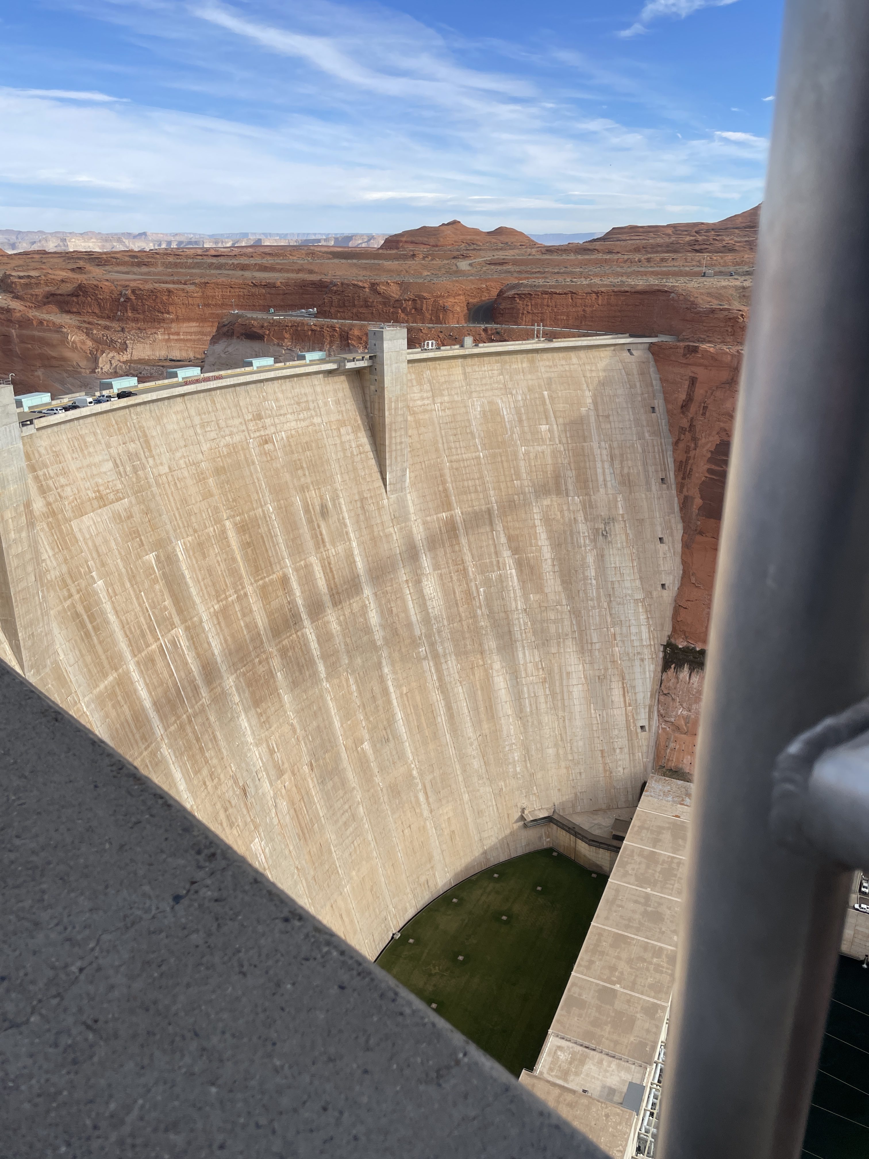


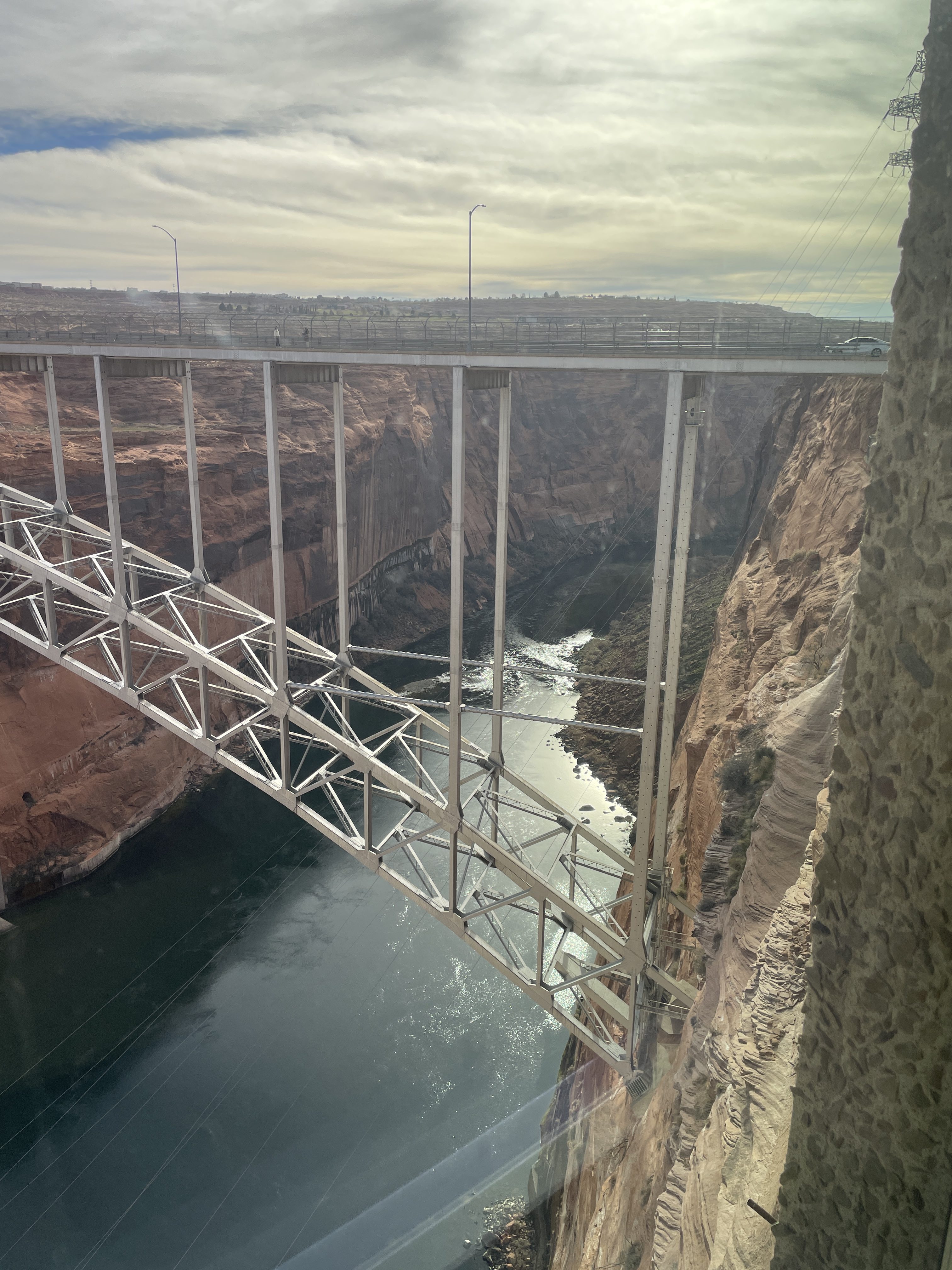
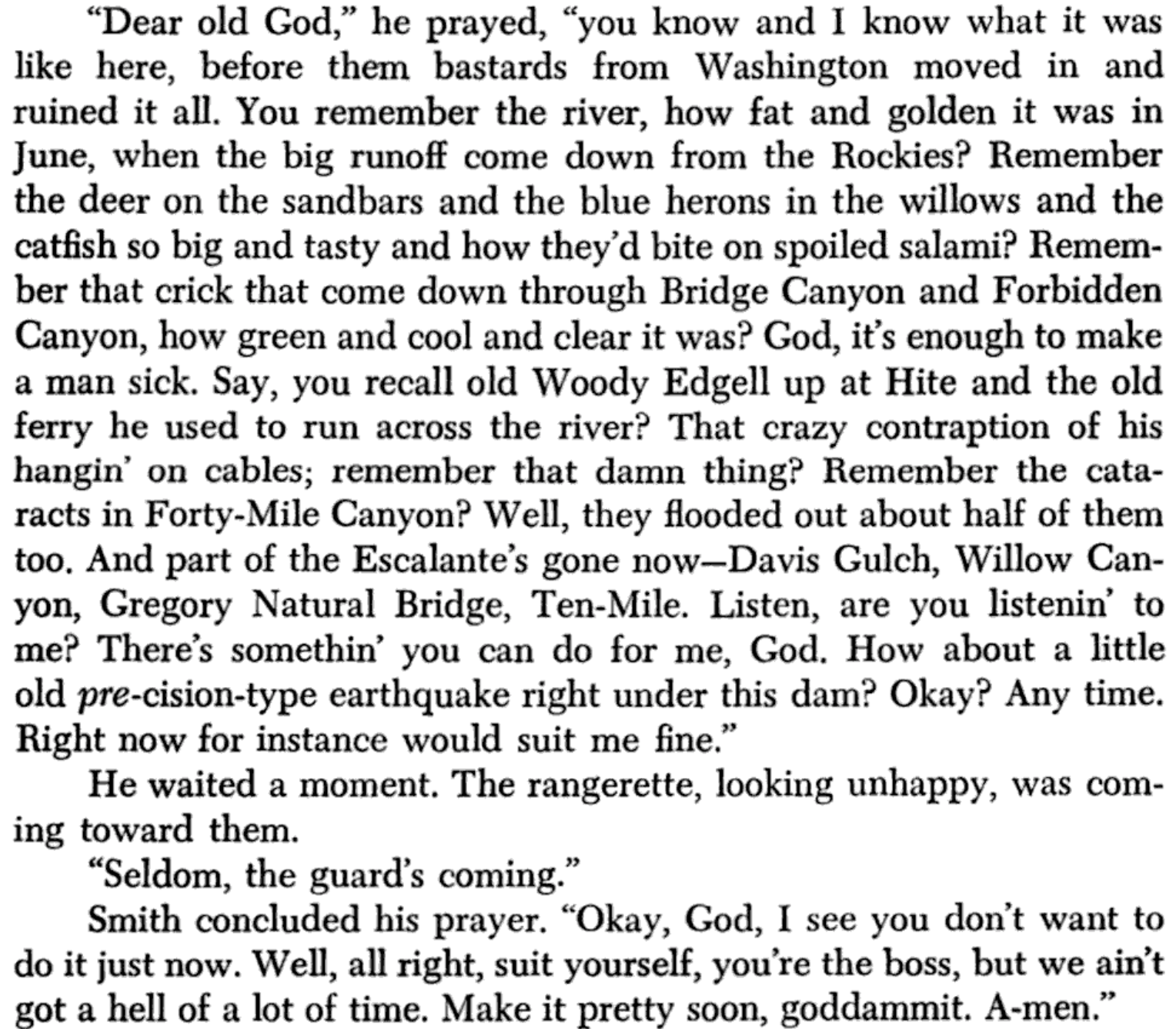


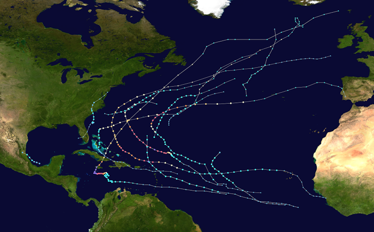


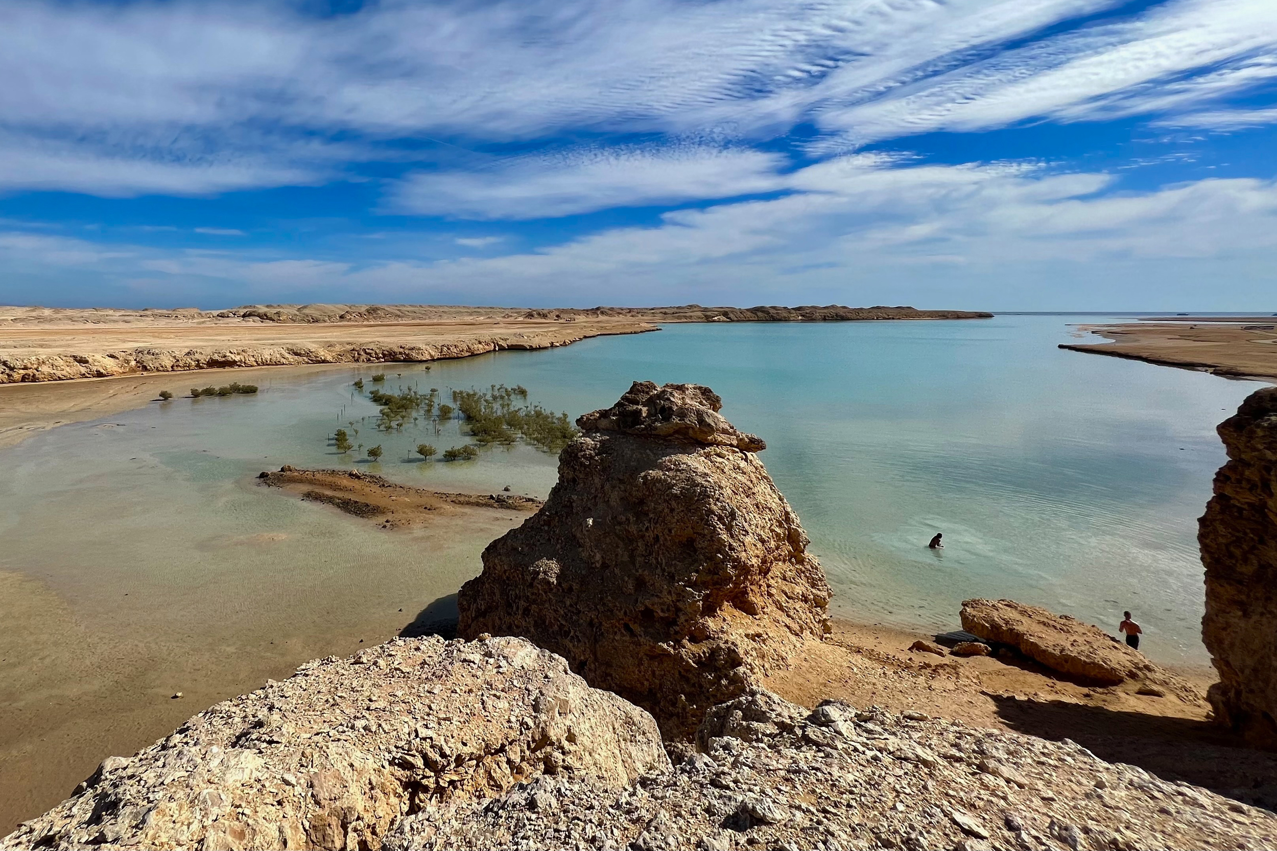

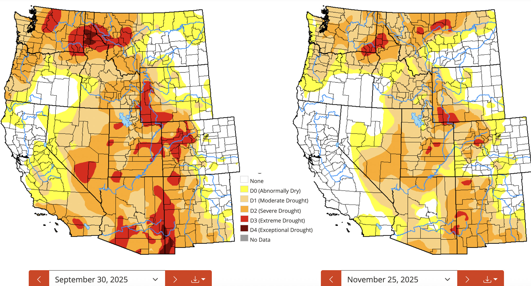

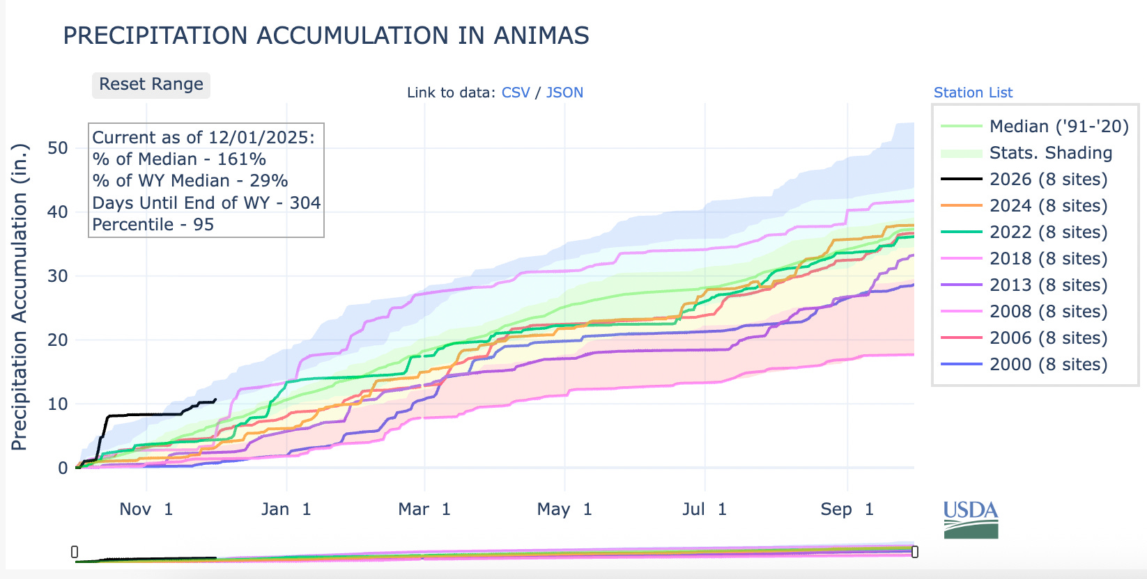
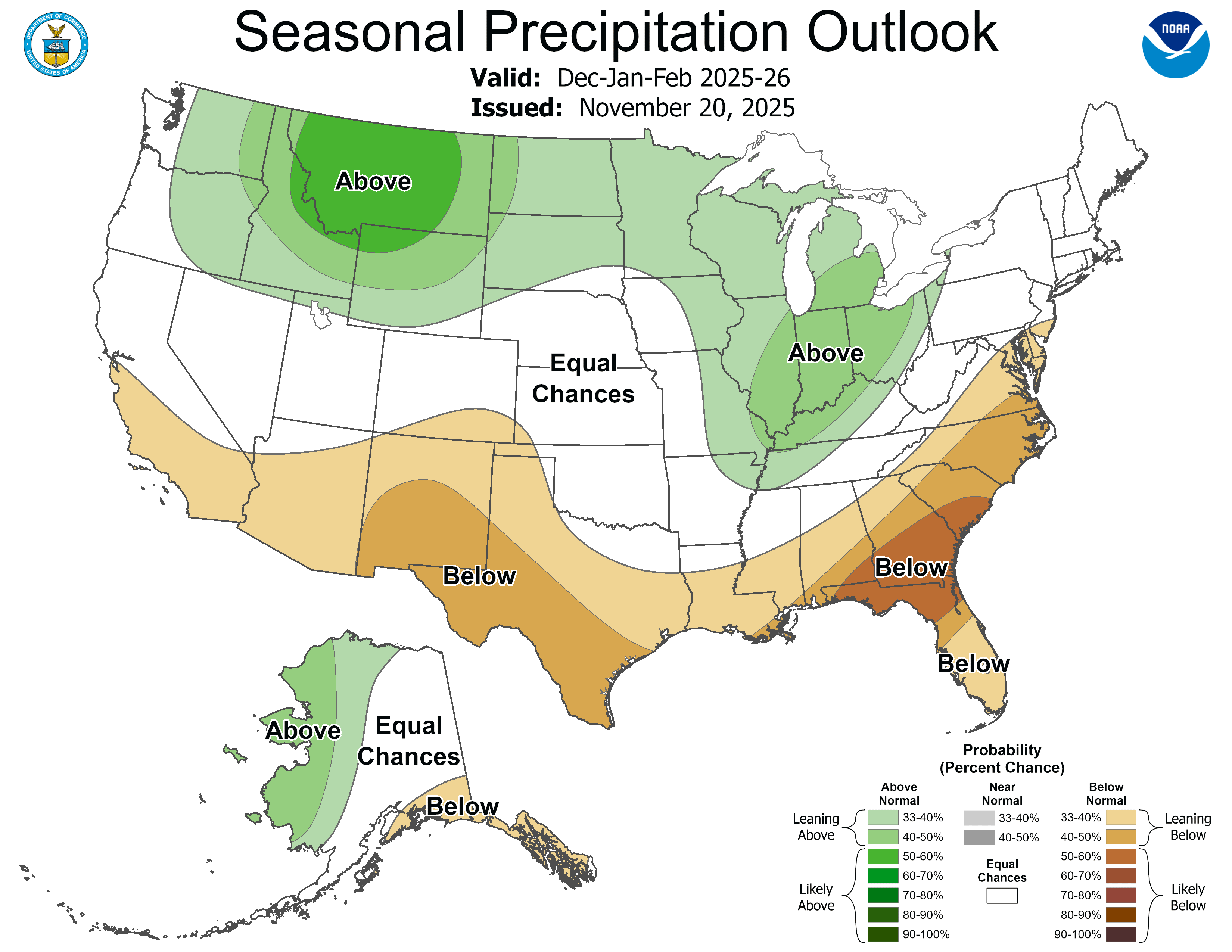
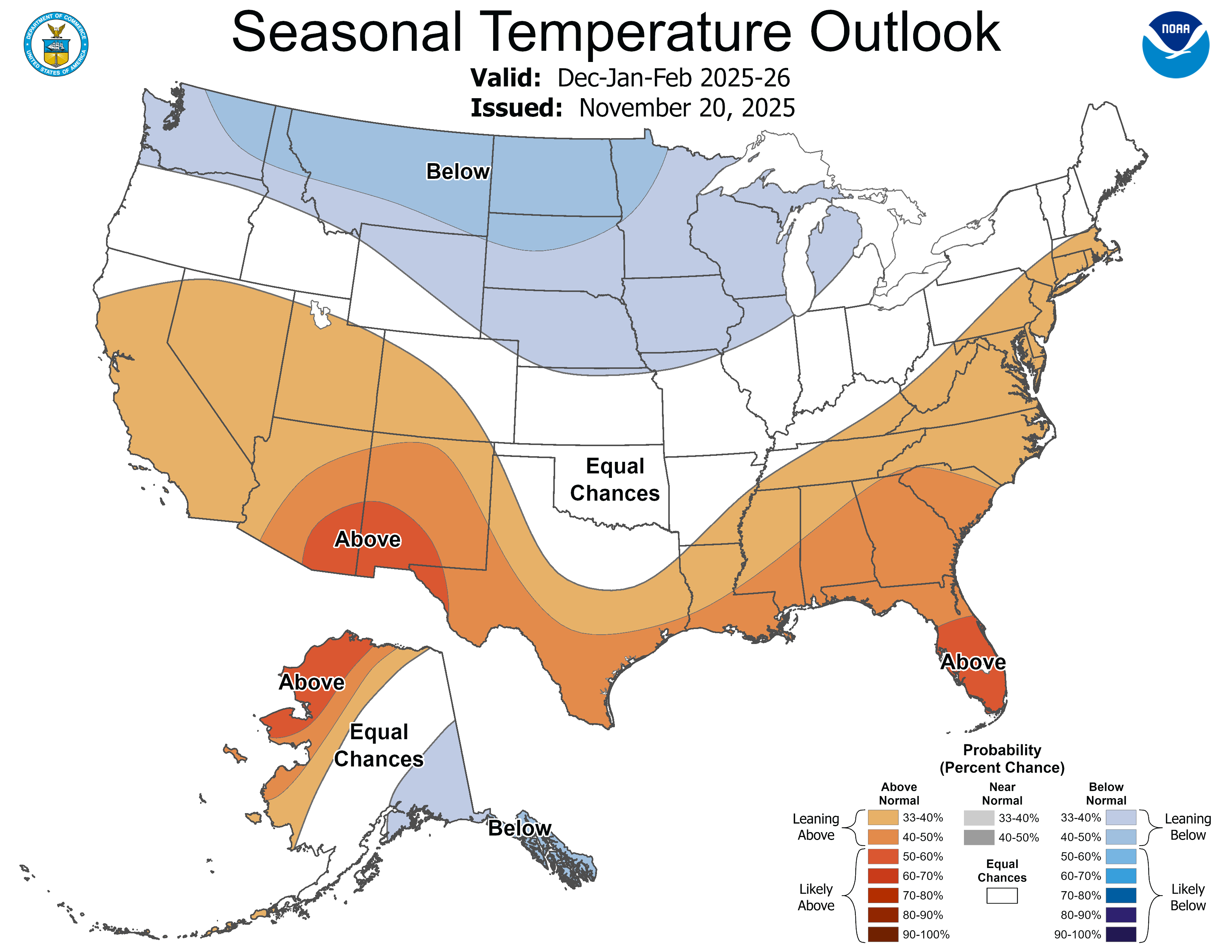


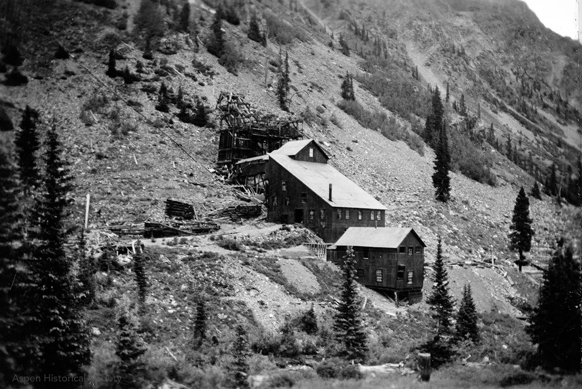
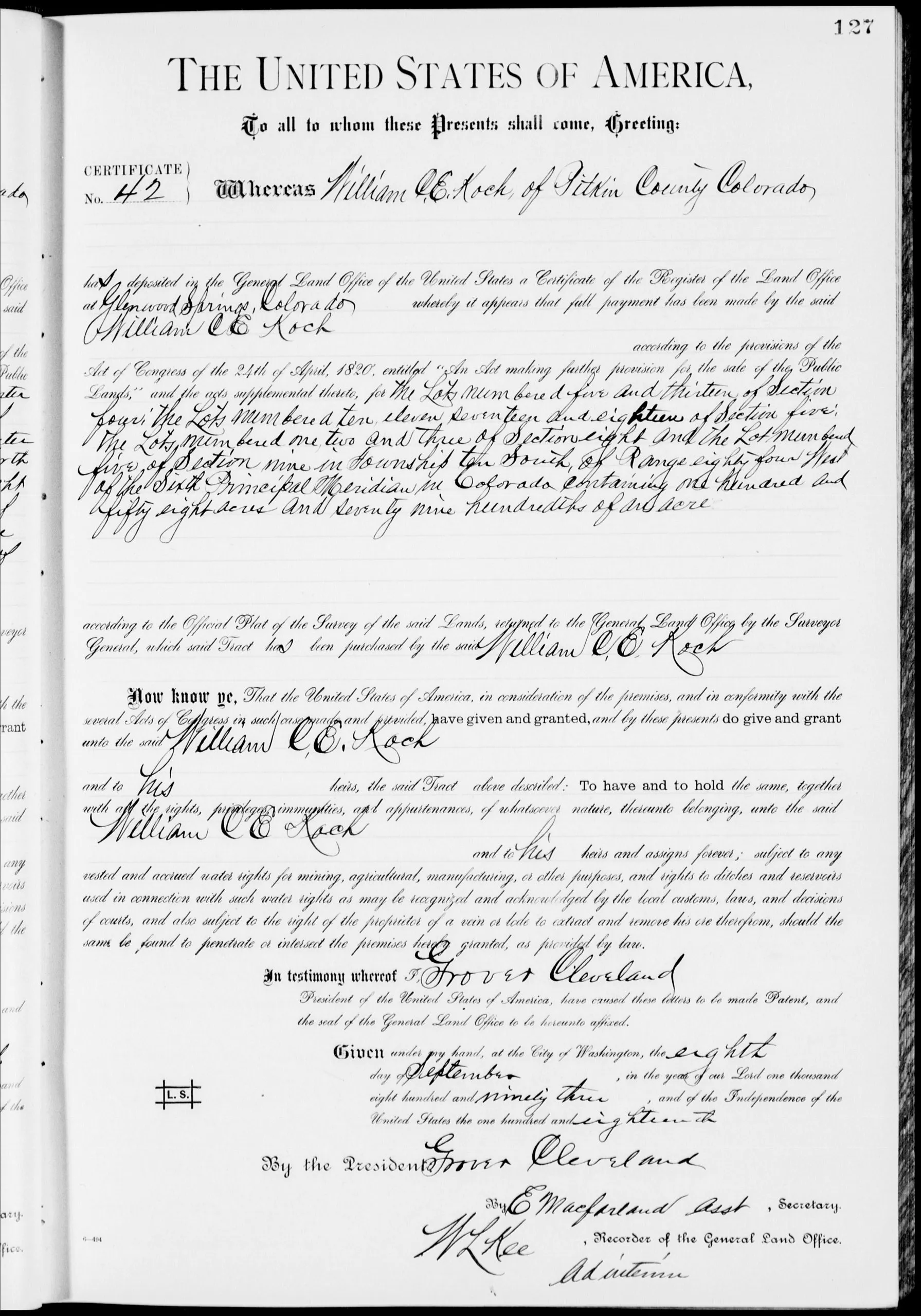
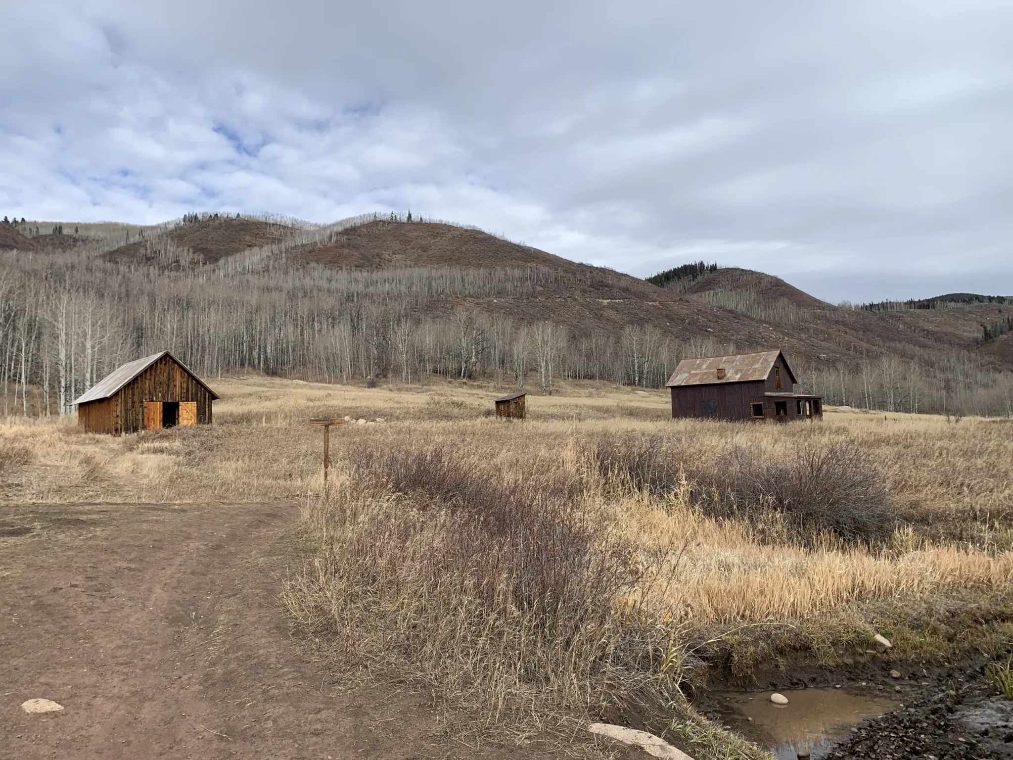


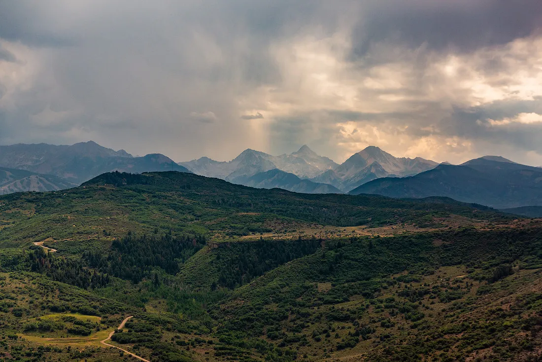
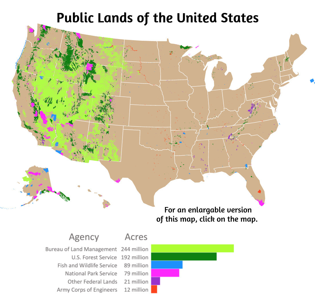

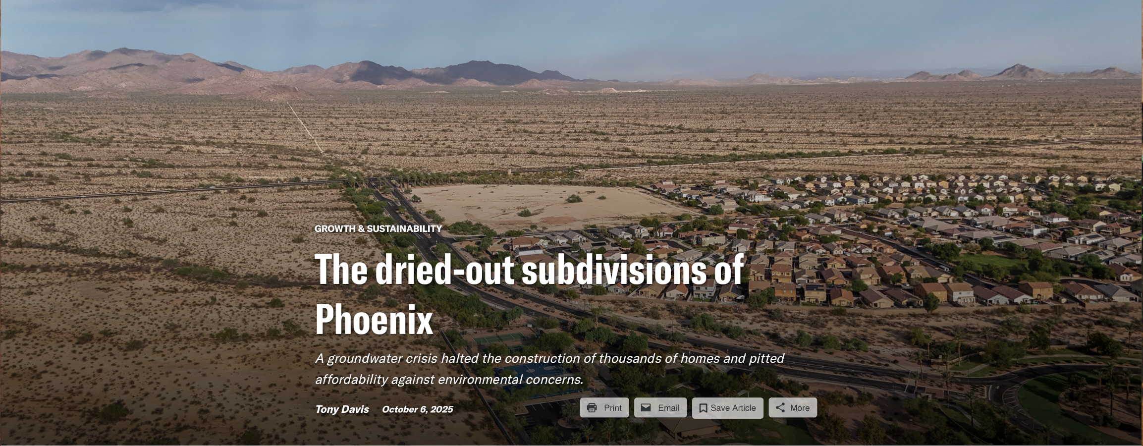


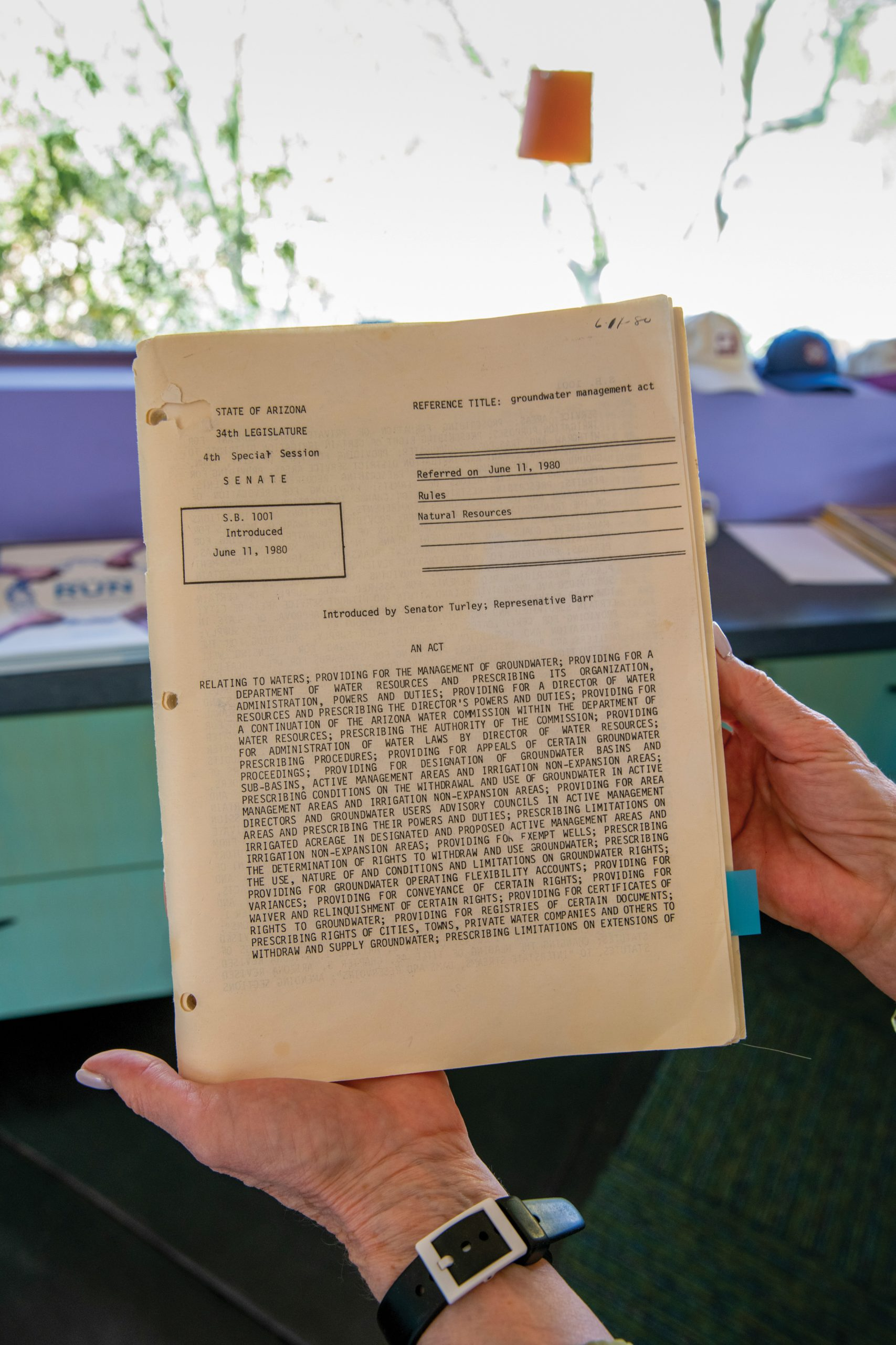


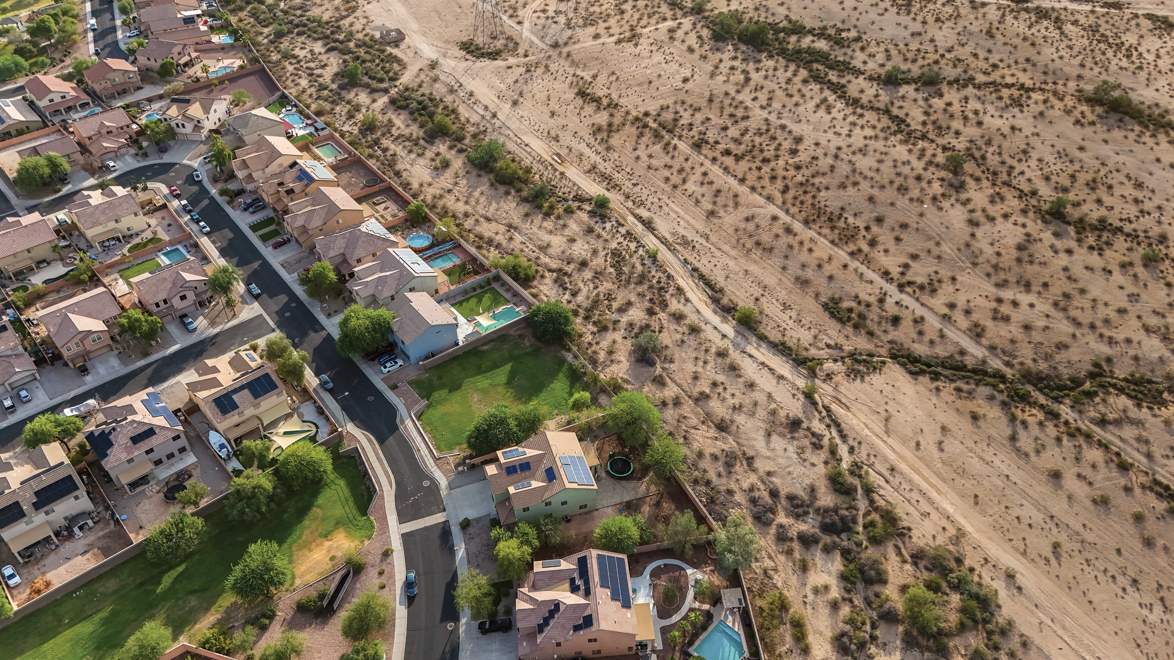


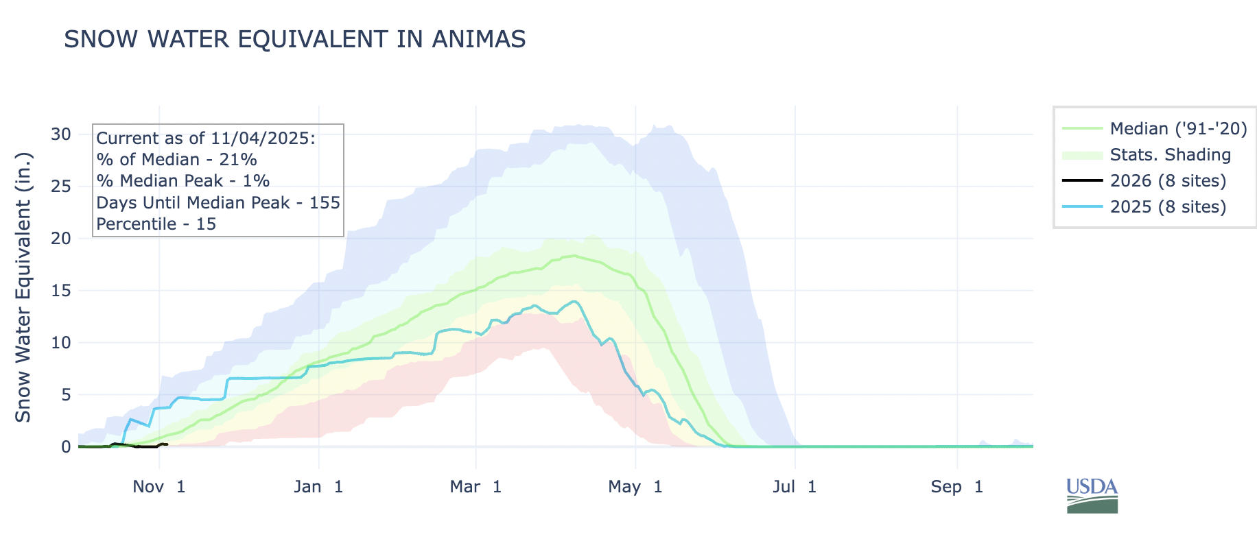
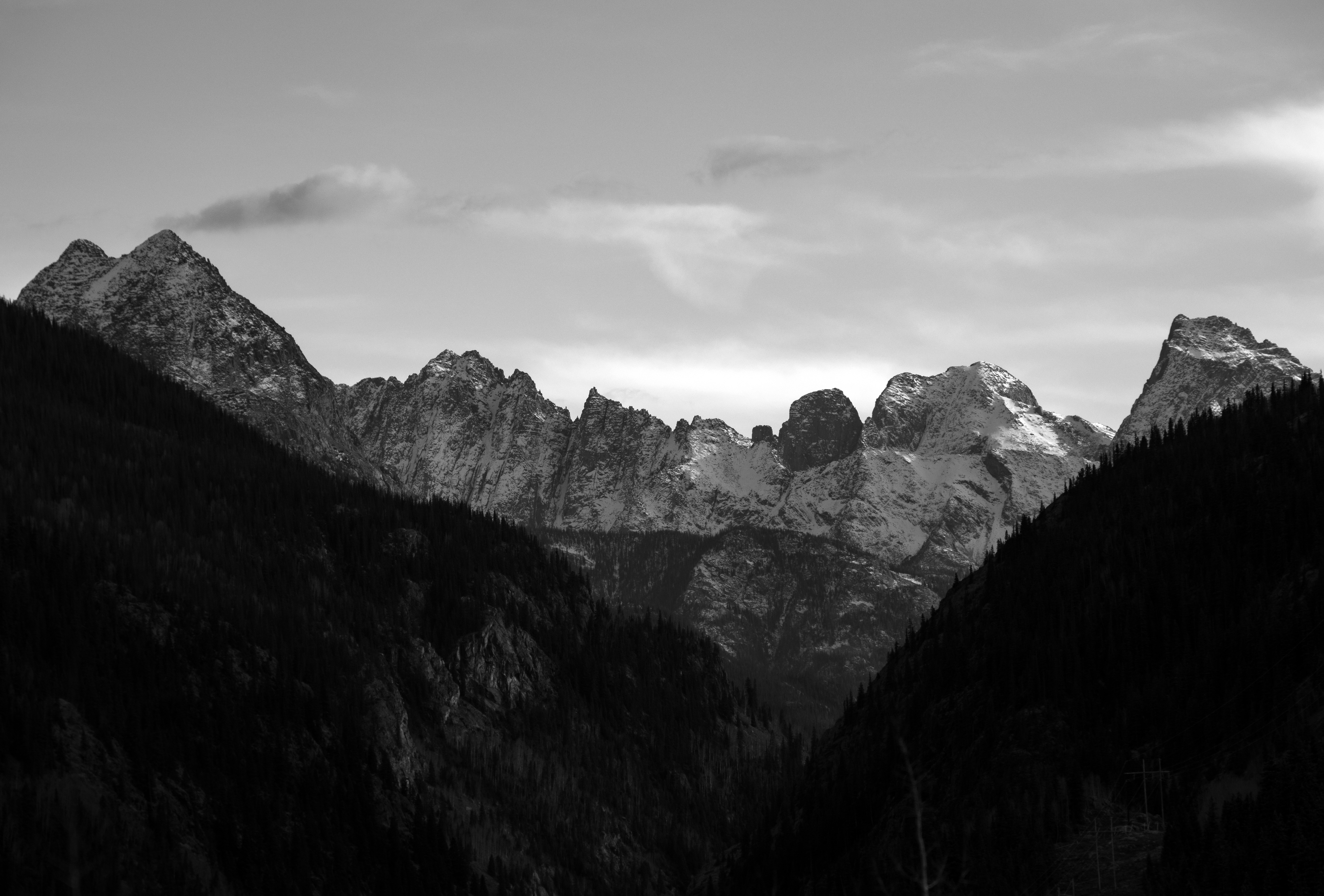


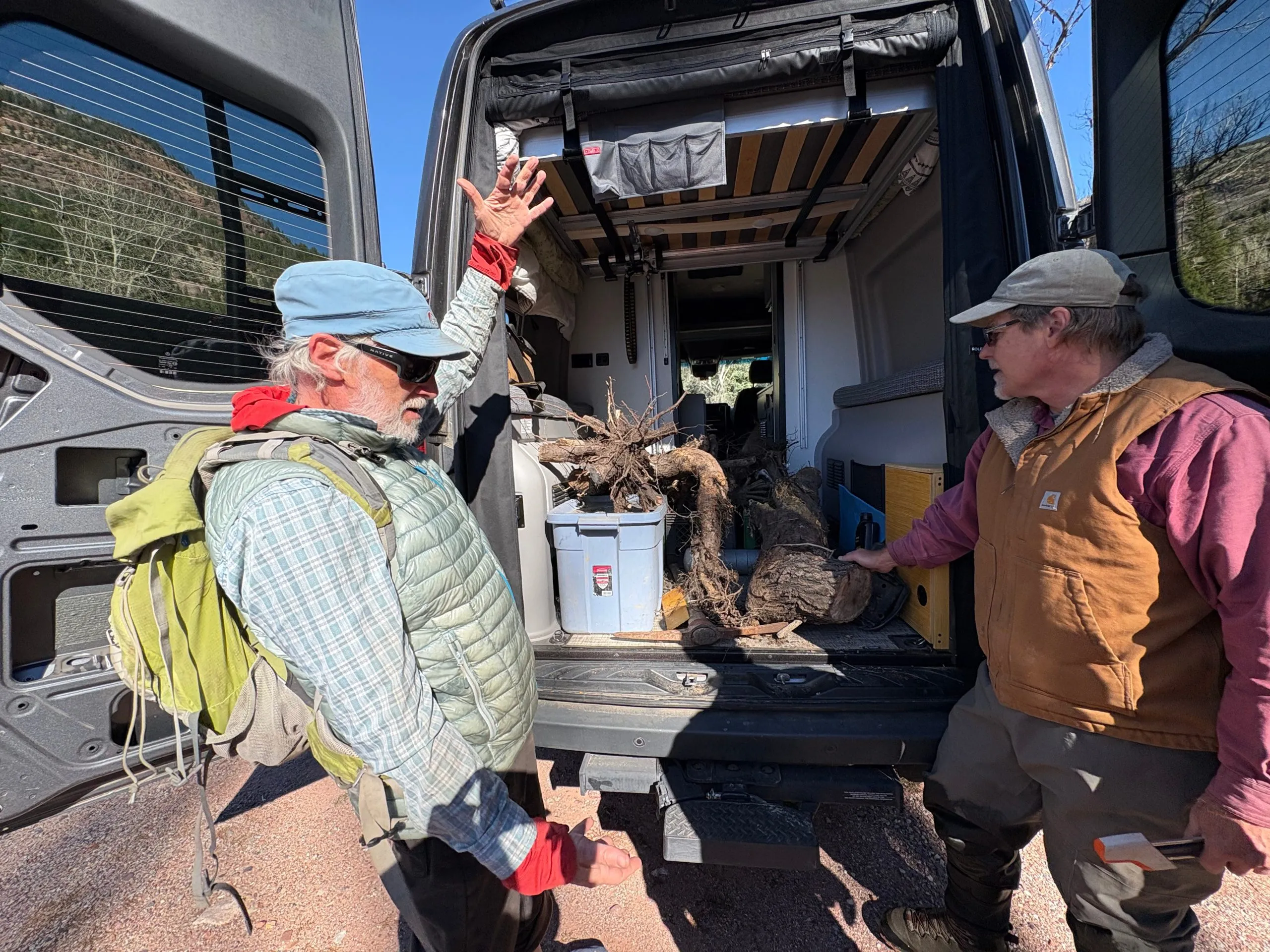


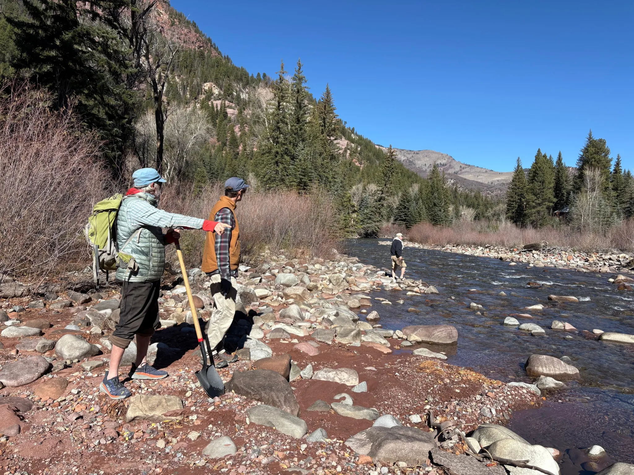

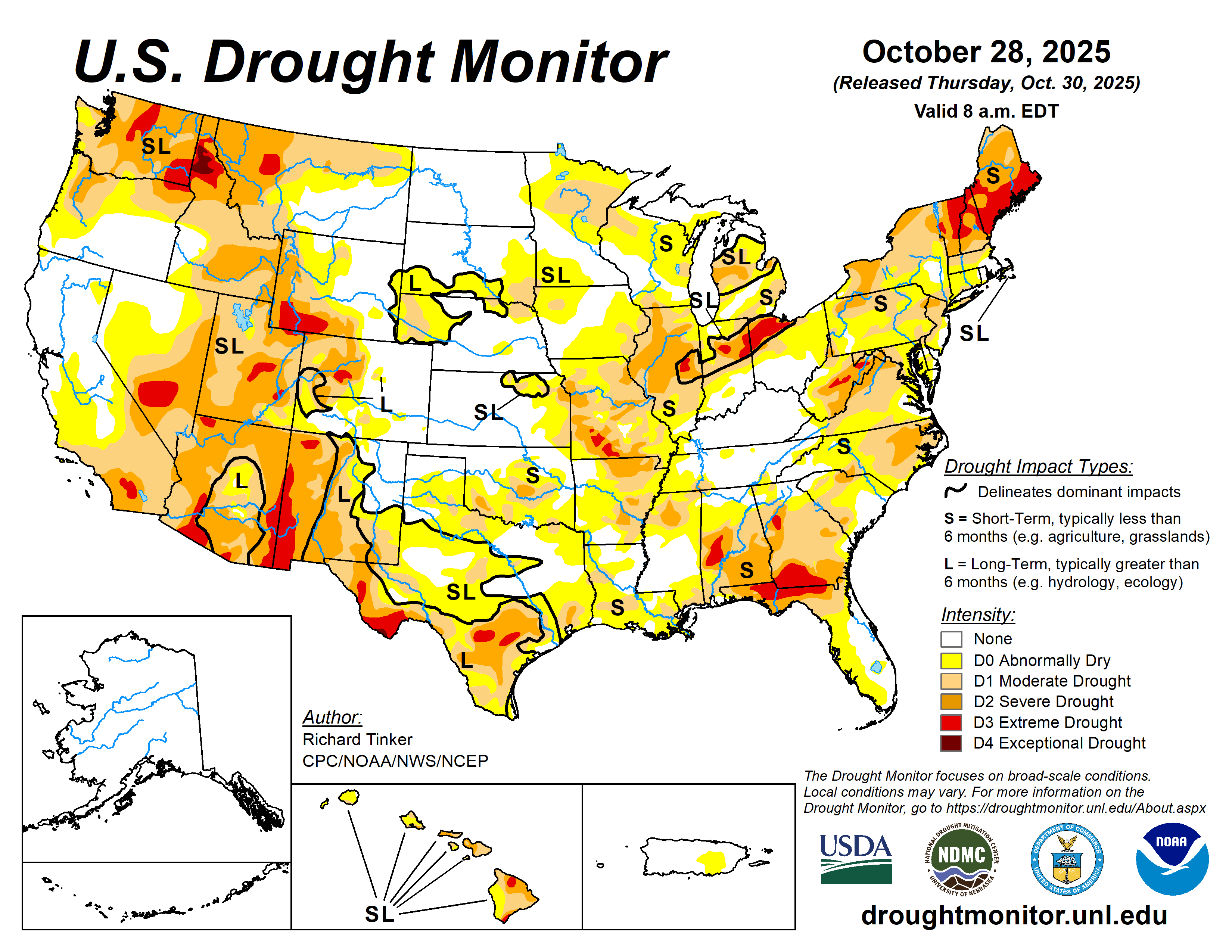


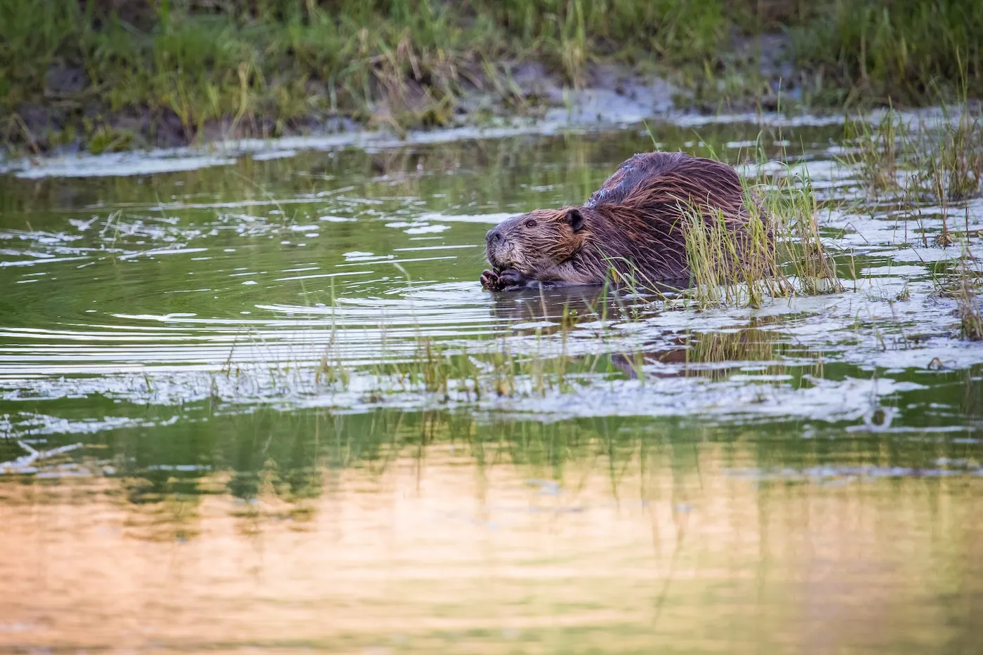
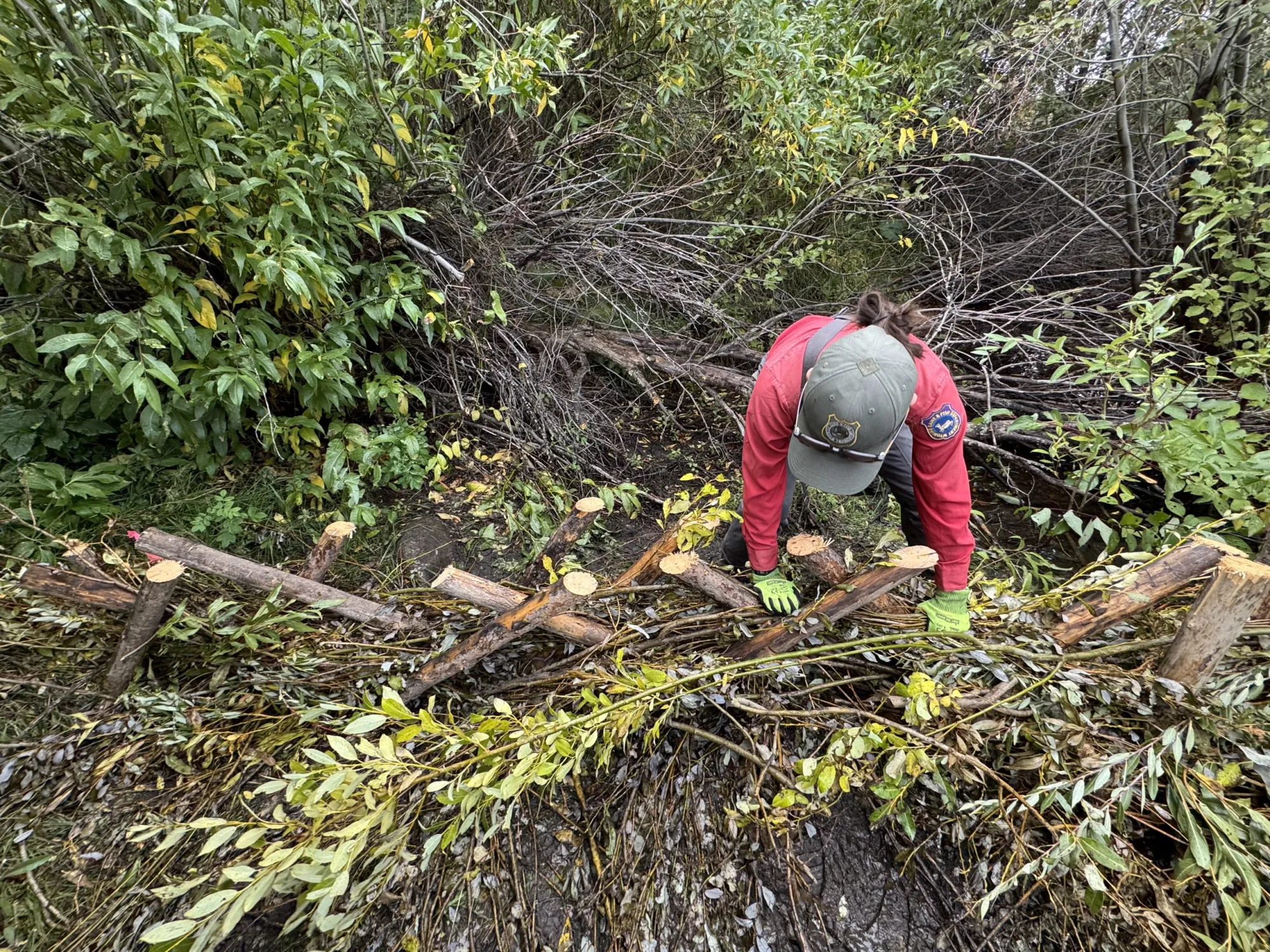
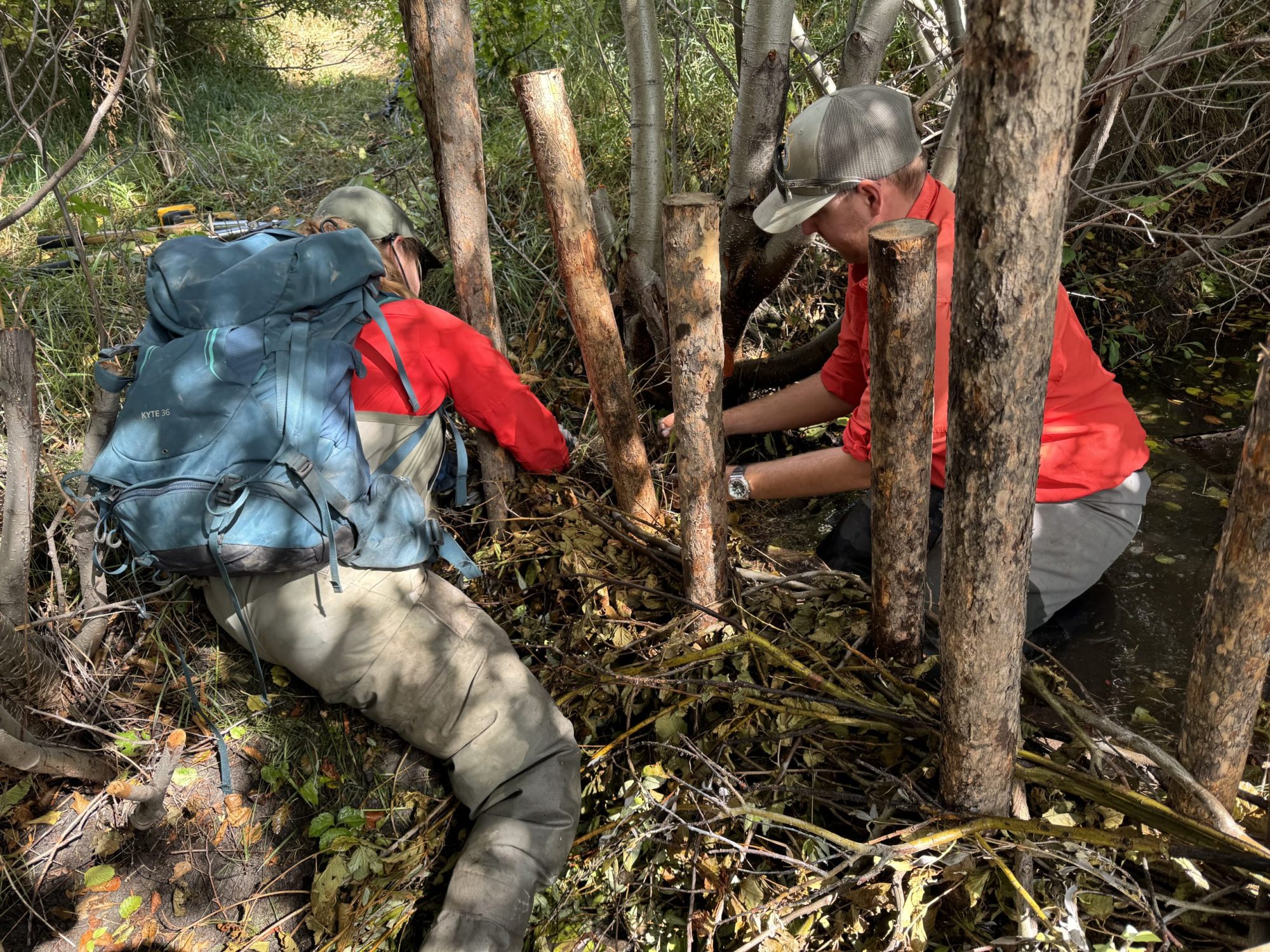


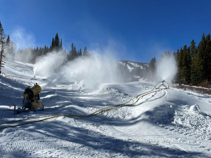

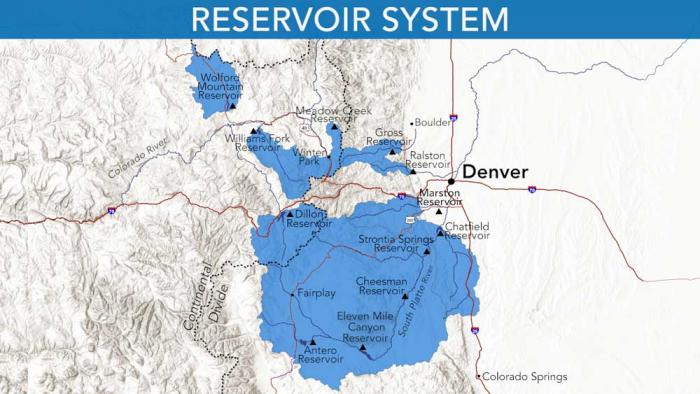
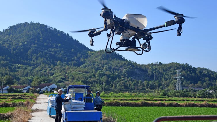


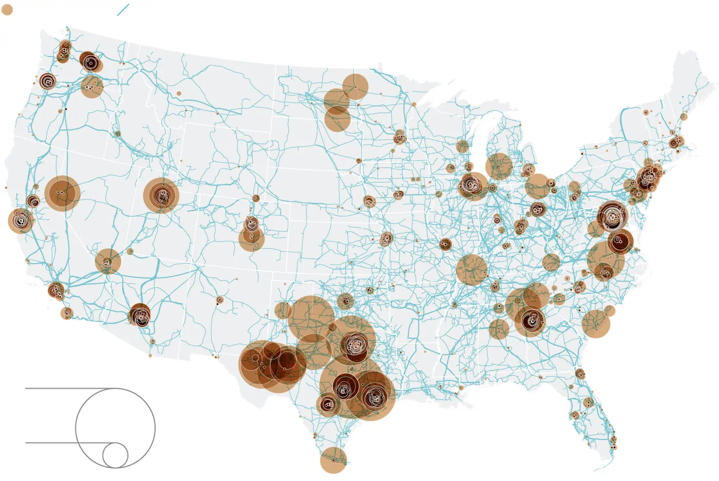


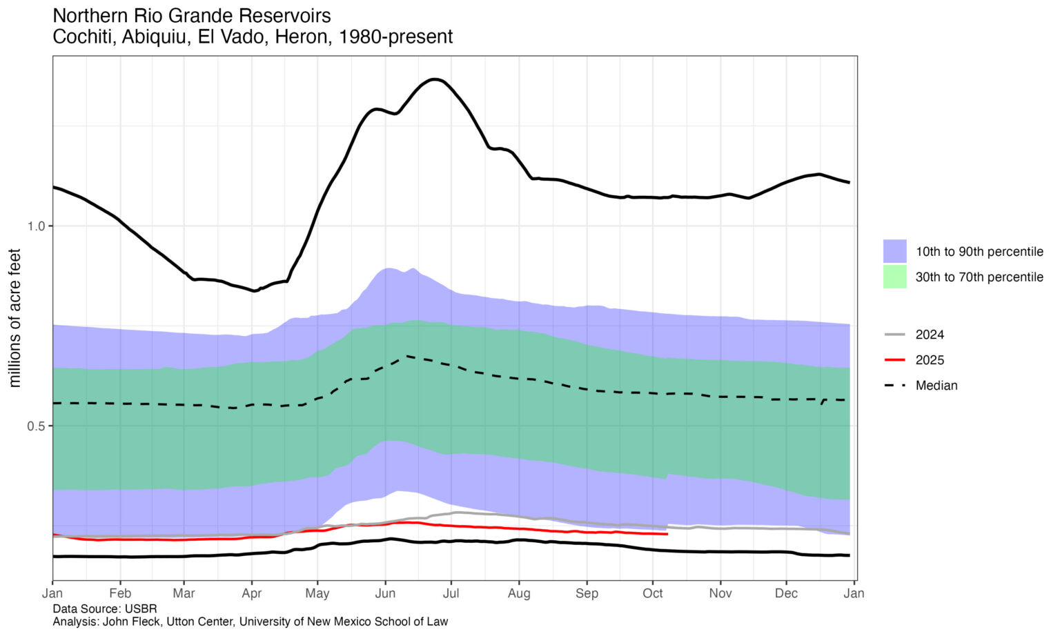

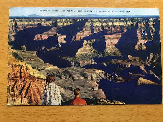


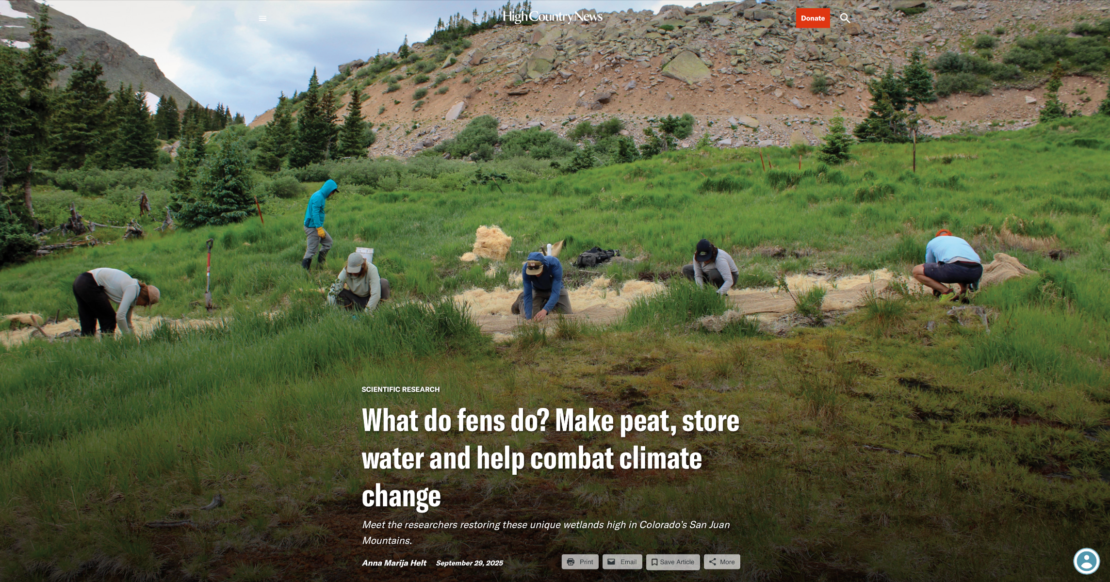
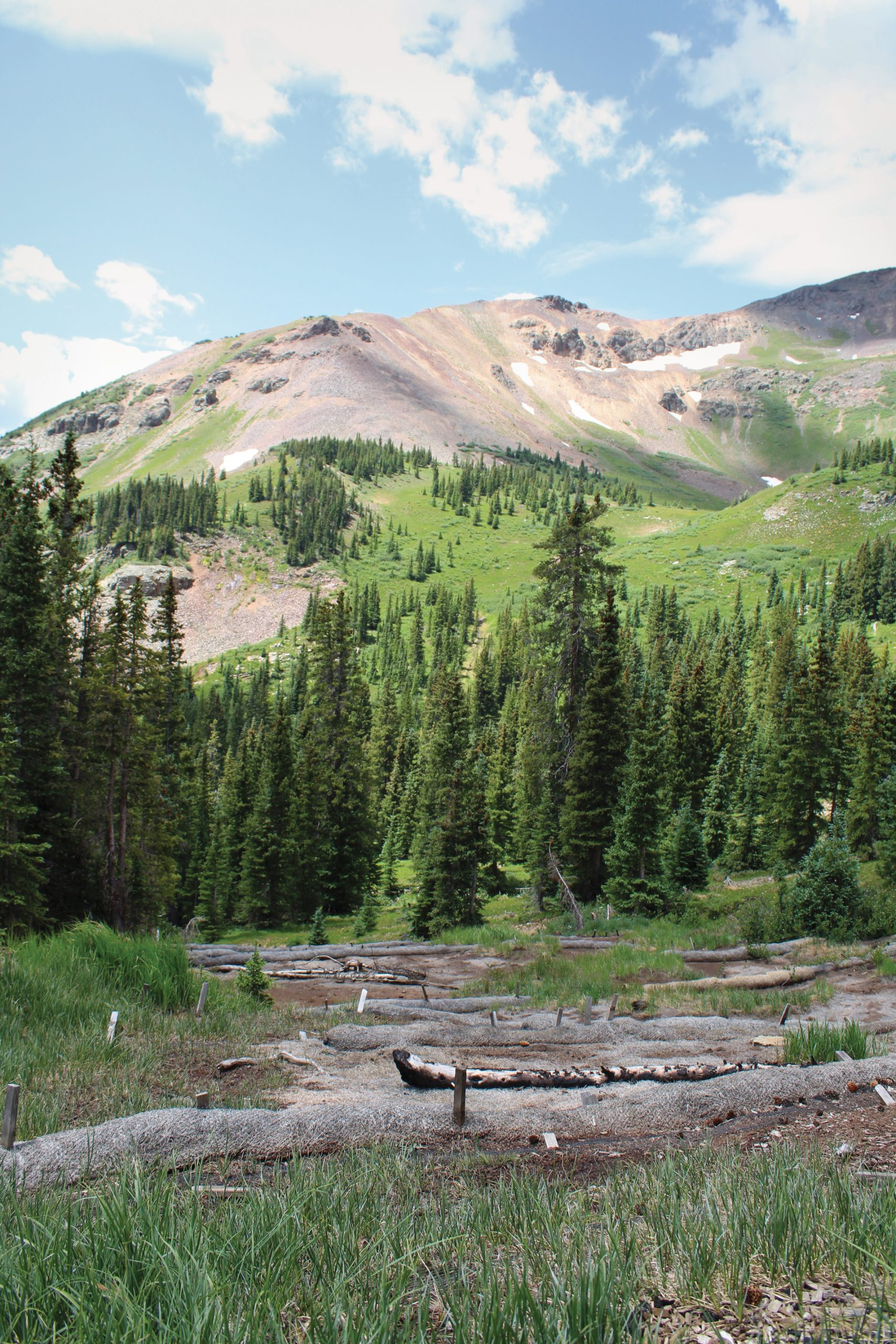


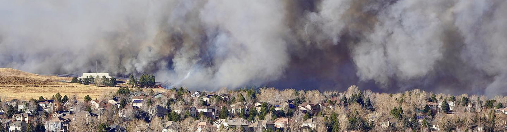
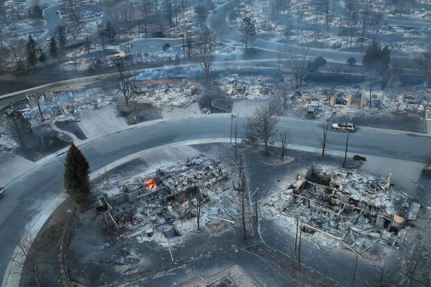
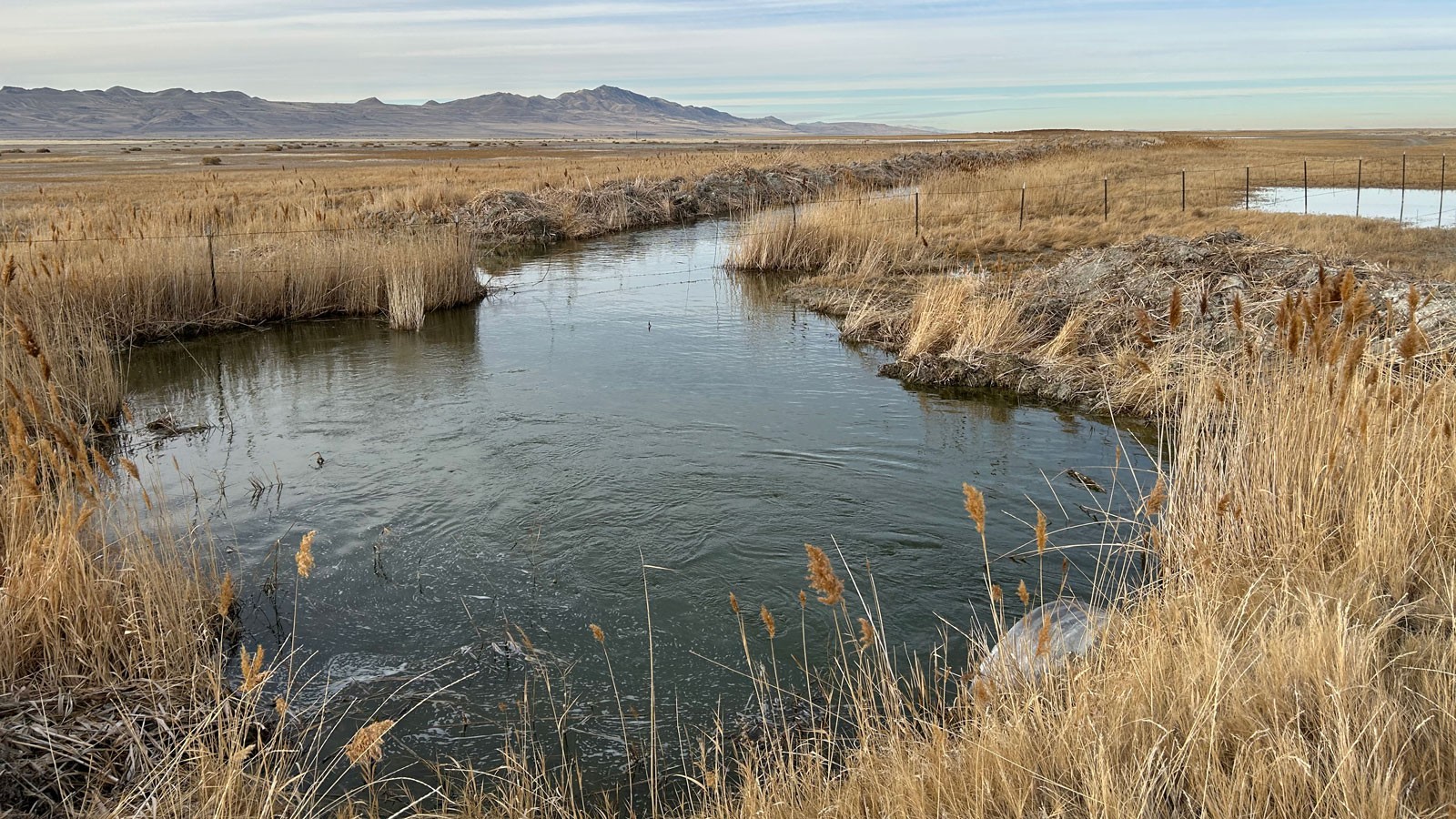

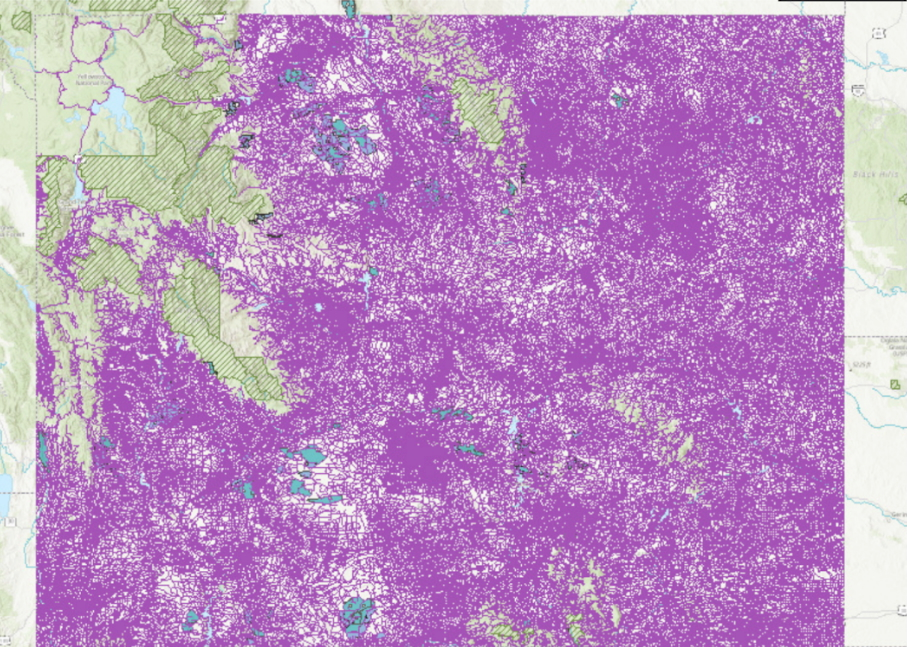


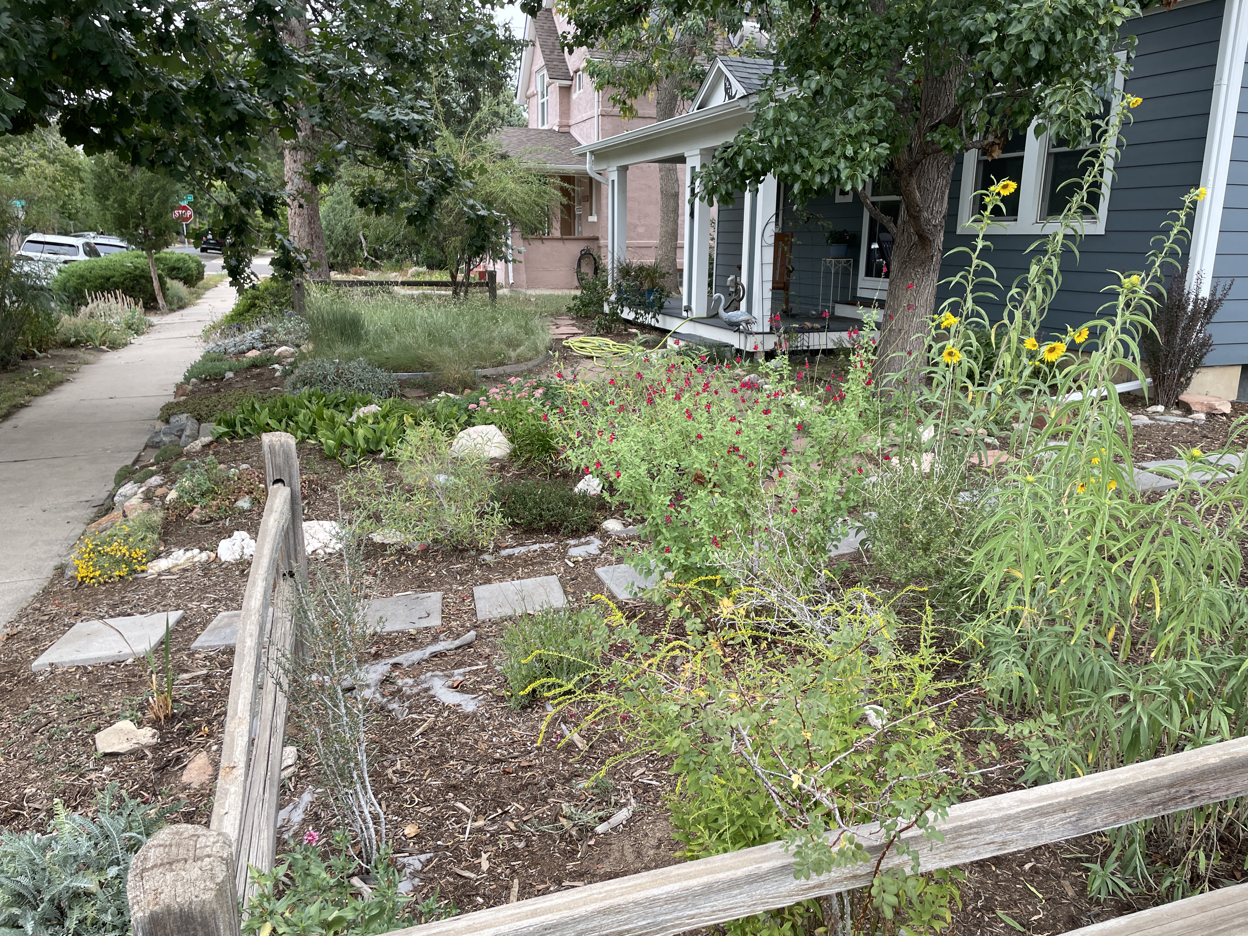

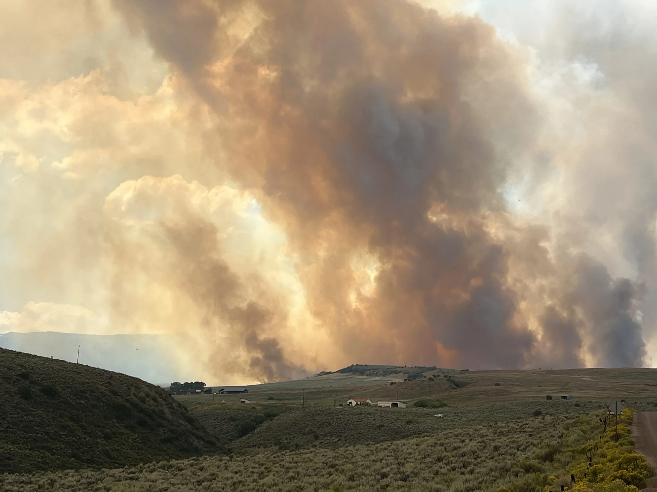
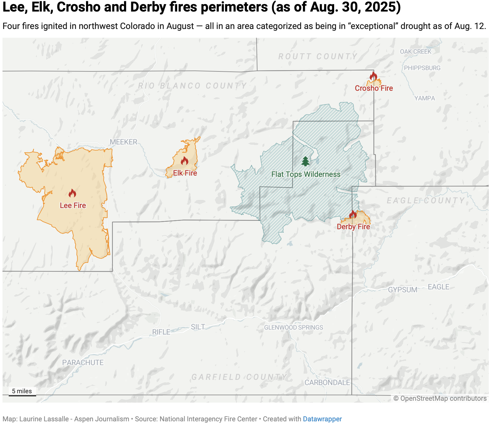
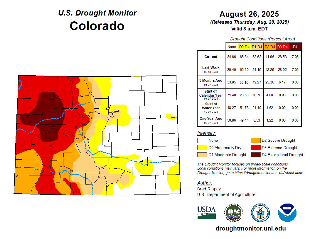

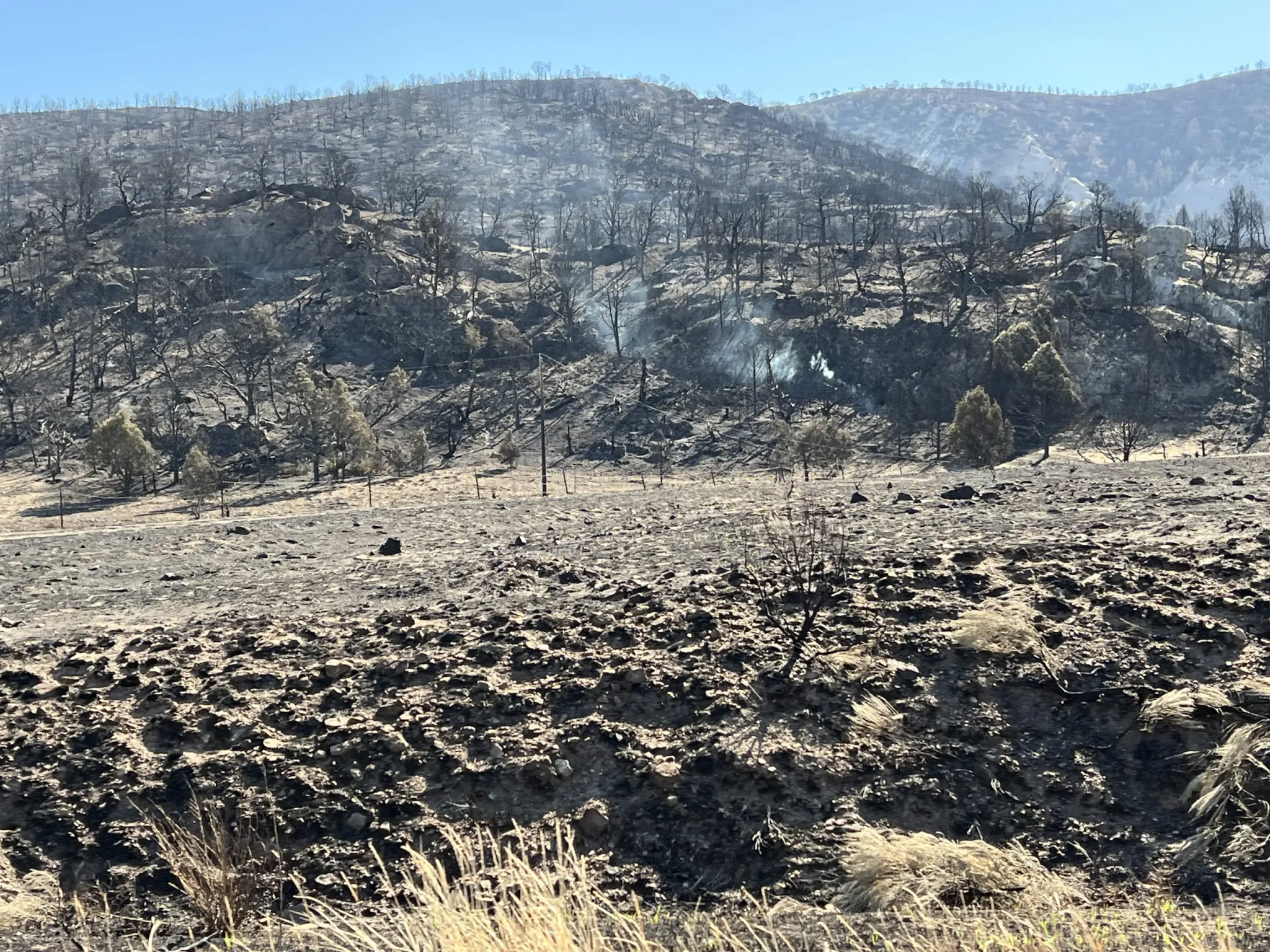
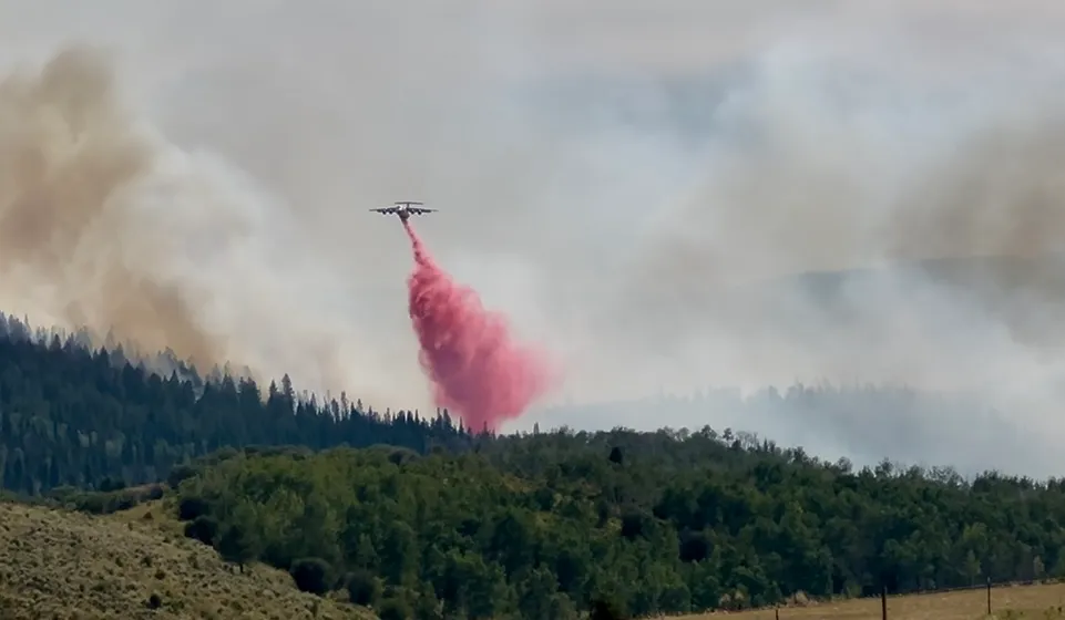
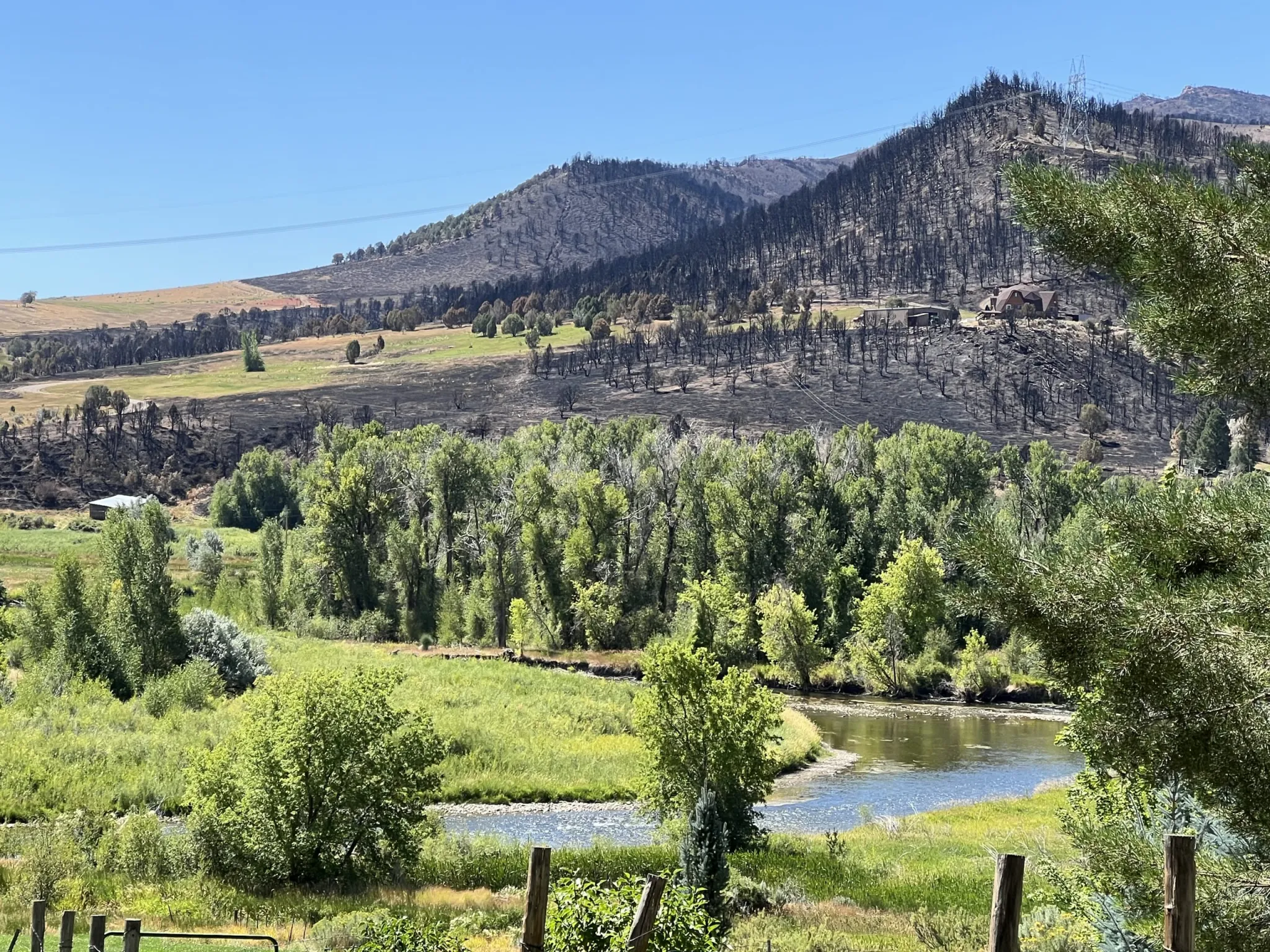
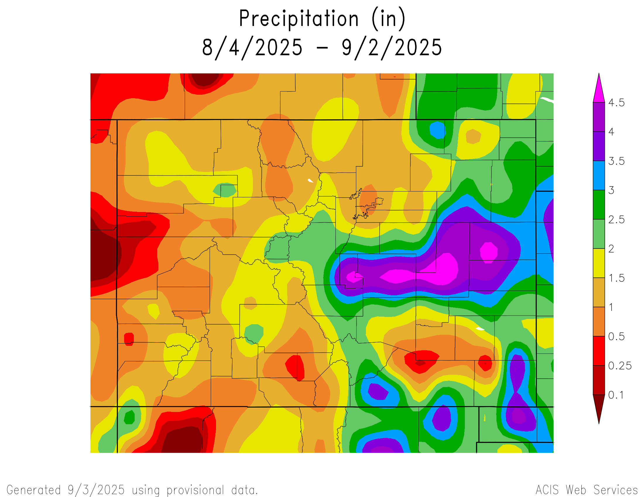