Oak Flat, Arizona features groves of Emory oak trees, canyons, and springs. This is sacred land for the San Carlos Apache tribe. Resolution Copper (Rio Tinto subsidiary) lobbied politicians to deliver this National Forest land to the company with the intent to build a destructive copper mine. By SinaguaWiki – Own work, CC BY-SA 4.0, https://commons.wikimedia.org/w/index.php?curid=98967960
Click the link to read the article on the AZCentral website (Debra Utacia Krol). Here’s an excerpt:
August 20, 2025
Key Points
Hours after the 9th U.S. Circuit Court of Appeals blocked a land swap for a copper mine at Oak Flat, President Donald Trump called the mine’s critics “Anti-American.”
Tribal leaders reacted quickly, reminding the president that they are the first Americans and are trying to protect their sacred lands.
Trump reportedly met with mining executives at the White House and, in his Truth Social post, argued that the United States needed to protect its copper reserves.
Arizona tribal leaders struck back after President Donald Trump called opponents of a planned copper mine at Oak Flat “anti-American,” suggesting they were allied with other copper-producing countries like China. Trump posted comments on Truth Social on Aug. 19, hours after the 9th U.S. Circuit Court of Appeals temporarily halted a land exchange that would allow Resolution Copper to build the mine on a site east of Phoenix held sacred by the Apache people and other Indigenous communities. “Those that fought (the mine) are Anti-American, and representing other Copper competitive Countries,” Trump wrote, while claiming that the 9th Circuit Court is “a Radical Left Court.” He did not include any evidence to support his claims…Currently, 10 of the judges on the 9th Circuit’s panel are Trump appointees; another three are Republican-appointed justices, while the remaining 16 judges in the circuit court are Democratic appointees, according to the legal news outlet Daily Journal. The president also said the U.S. needs copper now…
In a Facebook post on Aug. 20, San Carlos Apache Tribe Chairman Terry Rambler hit back: “As first Americans, the San Carlos Apache Tribe agrees on the importance of protecting America’s interests,” he said, but “the President’s comments mirror misinformation that has been repeated by foreign mining interests that want to extract American copper.” Rambler also pointed out that a Chinese company, Chinalco, is the largest shareholder of Rio Tinto and BHP, the two British-Australian firms that jointly own Resolution Copper. “Of course their interest is in mining this copper and shipping it to China.” With just three smelters in the U.S., and one of those currently non-functional, mines have been shipping crushed ore to China for processing for years.
The San Carlos Apache Tribe and a coalition of environmental groups have fought for years against the Resolution Copper mine, which would become one of the country’s largest at the cost of a site revered by the tribe.
Just hours before the deal was set to go through, a federal appeals court temporarily blocked a land transfer in Arizona on Monday that would ultimately lead to the destruction of a site sacred to Western Apache people.
The 9th U.S. Circuit Court of Appeals’ temporary restraining order is the latest in a long-running saga in which the U.S. Forest Service has planned to transfer the land to a mining company, Resolution Copper, while the San Carlos Apache Tribe and a coalition of environmental groups have fought to protect the sacred site of Oak Flat, or Chí’chil Biłdagoteel in Apache.
The company has worked for two decades to gain access to the 2,200 acres of land in Tonto National Forest that contains both the sacred site and one of the world’s largest untapped copper deposits. The restraining order halts the land transfer until the court can rule on two consolidated cases, which have argued in lower courts that approval of the land transfer and mine violates the National Environmental Policy Act and failed to adequately consult with the tribe.
“The Apache people will never stop fighting for Chí’chil Biłdagoteel,” said San Carlos Apache Tribe Chairman Terry Rambler in a statement. “We thank the court for stopping this horrific land exchange and allowing us to argue the merits of our pending lawsuit in court.”
A spokesperson for Resolution Copper said in a written statement that the order is “merely a temporary pause so that the court of appeals can consider plaintiffs’ eleventh hour motions,” and that the company is “confident the court will ultimately affirm the district court’s well-reasoned orders explaining in detail why the congressionally directed land exchange satisfies all applicable legal requirements.”
U.S. District Judge Dominic W. Lanza on Friday denied the tribe and environmental groups’ challenges, which had cleared the way for the land transfer to go through. In his order, he acknowledged the mine would destroy the sacred area and use a massive amount of the region’s scarce groundwater. But he noted that the transfer was signed into law in 2014 by President Barack Obama—mandated by Congress in a rider attached to a defense bill—and that the Supreme Court declined to hear another case challenging the mine.
A spokesperson from the U.S. Department of Agriculture, which oversees the Forest Service, declined to comment on the latest court order, but said the bill authorizing the land transfer aligns with the Trump administration’s efforts “to strengthen domestic mineral and energy production, advancing the nation’s economic and strategic goals.”
In April, the Trump administration signaled it would approve the project. A years-long religious freedom case brought by Apache Stronghold, an Apache religious group, was denied by the Supreme Court in May. Then, the U.S. Forest Service postedthe final environmental impact statement and draft record of decision for the Resolution Copper project, setting the stage for Oak Flat to be transferred to the mining company by Aug. 19.
Since then, the proposed mine has become one of the most high-profile environmental battles in the U.S. The 9th Circuit’s order requires the tribe and environmental groups to file their opening brief by Sept. 9, with answering briefs from the Forest Service and Resolution Copper due by Sept. 29.
“We’re thankful that the court has paused this ill-conceived land exchange that would destroy Oak Flat and all that makes it special, including the old Emory oak trees, endangered hedgehog cactus, and its significant cultural and recreational values,” said Sandy Bahr, director of the Sierra Club’s Grand Canyon Chapter, in a statement. The Sierra Club is one of the plaintiffs. “There is still a lot to do to save this special place, but we remain committed to doing everything we can to ensure Oak Flat is here for future generations.”
Trail building by the Civilian Conservation Corps on Notch Mountain, then a popular destination for its view of the Mount of the Holy Cross and the throngs of religious pilgrims who were drawn to the site in the early days of the Holy Cross National Forest, now part of the White River National Forest. CREDIT: U.S. FOREST SERVICE
Editor’s note: This story is the third of a three-part series examining the notion of public lands, both in the United States and in our region. Part one looked at the earliest expressions of the commons in territories that would become the United States. Parts two and three look at the history and legacy of what is now the White River National Forest.
The hunger for land was an insatiable draw to legions of the dispossessed who were on the march across America eager for land ownership. The Utes were simply in the way of an advance that could not or would not be stopped. The tragic story of these first inhabitants of the White River National Forest (WRNF) played out to a violent end amid a rush for land and resources in the Colorado Rockies that had 5,000 people per day pouring into the state by the 1870s.
Native inhabitants had been hunting and gathering here for more than 10,000 years. The Utes — the “People of the Shining Mountains,” according to the title of a book by Charles Marsh — ruled a vast and rugged empire of about 225,000 square miles that stretched from the Central Rockies west into Utah and Nevada, south into New Mexico and east onto the Great Plains where they hunted buffalo on horseback. The Utes were among the first Native Americans to acquire the horse from Spanish stock that, it was assumed, had been lost. Horses were key to Ute identity, and equestrian skills were a mark of manhood that provided rapid mobility and warrior status.
White River Ute warrior Gray Eagle and his young bride Honey Dew of the Mountains, on horseback on the western slope of the Wasatch Range in Utah, then roaming their vast territory west of the White River before the White River Agency was established. Circa 1871-1875. CREDIT: DENVER PUBLIC LIBRARY
Broken treaties and war
The advance of Europeans into Ute lands set up a tension that grew with every treaty violation and every trespass. As their domain was carved away, the U.S. government naively assumed the Utes could be transitioned from nomadic hunter-gatherers and cordoned off as sedentary farmers. Indian agents were hired to effect this transition, which, in the long run, proved futile and disastrous. There was no reasonable answer to “the Ute problem,” which was the terminology used by Frederick Pitkin, Colorado’s second governor from 1879-82, to refer to the cultural impasse.
The ensuing drama escalated at the White River Agency near today’s Meeker in 1879 when Indian agent Nathan Meeker, a naive and misguided minister, attempted to force the Utes’ compliance to “white man’s ways” by denying them their horses, rationing allotments and plowing over their racetrack to plant crops. Meeker and others believed that the Utes were in need of redemption for their spiritual welfare. The Utes, who found spiritual depth in the natural world around them, believed otherwise and clung to their sacred traditions.
The conflict boiled over in the late summer of 1879 when Meeker had a violent altercation with a Ute sub chief. The frightened Meeker sent for the U.S. Army, which advanced from Wyoming and was met by a strong Ute force. When the detachment of 190 troops crossed into Ute territory on Sept. 29, shots rang out, kicking off a grueling six-day battle of attrition that saw 17 U.S. soldiers killed and wounded 44, while the Utes saw 24 killed, in what became known as the Battle of Milk Creek. As the battle raged 17 miles away, Utes also attacked the White River Agency, killing Meeker, 10 men under his employ, and kidnapped women and children, including Meeker’s wife and daughter.
All captives were later released from a Ute camp on Grand Mesa. But the violent outbreak provided ample pretext for the whites to pursue a campaign of ethnic cleansing. In 1881, Pitkin issued an edict stating that the Utes would either be removed to reservations in Utah and southern Colorado or exterminated. Many were marched out of their homelands near the Uncompahgre River at gunpoint, while remaining bands roamed northwest Colorado until an 1887 military campaign known as the Colorow War.
With that Pitkin proclamation, 12 million acres of western Colorado opened for settlement. The White River Timberland Reserve was later created on these former Ute lands, placing them under federal administration. The Utes were compensated about $22 per capita in a settlement for all that they were forced to surrender. However, draws from those payments were taken from Ute hands to fund pensions paid to families of soldiers and agency staff killed during the violence surrounding the Meeker incidents. So ended the empire of the Utes.
Milk Creek Battlefield Park, 18 miles northeast of Meeker, Colorado. Battle of Milk Creek, Sept. 29 through Oct.5, 1879, between the Utes and the U.S. troops, which triggered the Meeker incident. The battle persisted with the Utes surrounding the wagon-circled troops until military reinforcements arrived. Most sources tally 17 whites killed and 44 wounded, along with 24 Utes killed and unknown numbers wounded, while 127 horses and 183 mules of the U.S. troopers died. By Jeffrey Beall – Own work, CC BY-SA 3.0, https://commons.wikimedia.org/w/index.php?curid=70937831
Exploitation, waste and destruction
“One of the most pressing problems facing Colorado in the 1880s and 1890s,” wrote Justine Irwin, author of the 1990 manuscript “White River National Forest: A Centennial History,” “was the prevalent exploitation of its natural resources by westward moving pioneers … [who] accepted the waste and destruction that followed as a small price to pay for their dream of prosperity.”
The prevailing attitude of the day regarded “wilderness” as a wasteland ripe for the biblical mandate in the Book of Genesis: “Increase, multiply, replenish the earth and subdue it.” These newcomers to western Colorado, wrote Irwin, viewed the land with “utilitarian spectacles,” through which “trees became lumber, prairies became farms, and canyons became the sites of hydroelectric dams.”
A dramatic example of the settlers’ creed was the extermination of the native elk herd as meat hunters ignored sustainable yields and fecklessly shot and killed all the native elk in the region, selling their harvest to railroad builders and mine workers. So-called “market hunting” flourished only as long as the herds lasted, and the 6,000 to 8,000 elk estimated to have been in the WRNF region in 1879 were soon extirpated. Hunters took only the hindquarters of the animals, leaving the rest as waste. The selling price for meat was 7 cents a pound for deer, 9 cents for elk, 10 cents for bighorn sheep and bear, and 50 cents for grouse.
Meanwhile, the General Land Office, a real estate branch of the Department of Interior, was busy selling off the commons at $1.25 per acre. The Homestead Act gave land away to qualifying settlers in 160-acre allotments for each adult member of a family. Large families could acquire considerable acreage of public lands. The Timber Culture Act of 1873, the General Mining Act of 1872 and the Railroad Act of 1862 gave away huge swaths of the public domain, all to encourage monetizing the commons and capitalizing on the riches of the continental empire of the United States.
“Ranchers, loggers and others invaded railroad lands taking what they wished and giving no thought to the long-range future of the region,” wrote Irwin, who describes a ruthless lawlessness that discouraged any interference in this land-based free-for-all. But there was change in the air as lawmakers recognized that there were limits to the nation’s natural resources. The giveaways continued, but national parks and designated forests were proposed and gradually established to preserve legacy Western landscapes for future generations in a first glimmer of conservation. The philosophy behind this growing movement was shared by Henry David Thoreau, George Catlin, John James Audubon, John Muir and an influential cadre of preservationists who began to win over advocates in Washington, D.C. The conservation ethic is summed up by author Rod Nash in his “Wilderness and the American Mind” (1967), in which he wrote, “Doesn’t the present owe the future a chance to know the past?”
Environmental concerns for preserving intact ecosystems to protect valuable and irreplaceable watersheds played a utilitarian role in conservation efforts on Western lands. Forestry management entered the lexicon of policymakers when, in 1875, Section 6 of the Colorado Constitution called for “Preservation of Forests: The General Assembly shall enact laws in order to prevent the destruction of, and to keep in good preservation, the forests upon the lands of the state.”
Citizen involvement through civic forestry associations amplified the call to protect national assets and save something for the future. In 1889, a timber reserve was called for on the Western Slope of Colorado to safeguard against wildfires, overgrazing and irresponsible timber harvests — all of which were decimating irreplaceable landscapes. A similar approach to nature aesthetics was winning hearts and minds for preserving the inspiring vistas that were beginning to sensitize America to the natural treasures of which it had taken possession.
In 1891, a groundswell of support led President Benjamin Harrison to enact the General Revision Act, a sweeping mandate to protect Western lands that led Harrison to issue a proclamation establishing the White River Plateau Timber Land Reserve, the first binding federal protection for a large expanse of central and northwest Colorado and the second of its scale and scope in the United States, after a forest reserve designated near Yellowstone National Park. Supporters called it a great victory, but detractors — of which there were many — impugned the initiative as a “taking” of what they considered the entitlement of free land.
The account of a boasting pioneer quoted in “White River National Forest: A Centennial History” and who had unconscionably plundered the public domain is a grim tale of misuse without supervision and reasonable limits of what was perceived as an infinite cornucopia: “In the summer of ’89, I killed about 700 deer and pulled the hides off, just for the hides. That fall, I got 43 bear near Lost Park. I shipped the hides to Chicago and they netted me clear $1.50 apiece. Everybody killed game for the hides and made money that way. I’ll tell you a fact: In ’89 I could ride up anywhere and there would be 40 to 50 bucks lying in one bunch. You could ride up to within a few feet of them. I killed 23 bucks in one day and jerked the hides off.”
Such carnage became repugnant to many and shameful to a growing number of nature lovers who advocated protective legislation such as the Forest Management Act of 1897 that granted the secretary of the interior power to regulate “occupancy and use” of federal lands. Implementation was another thing as new and often-inexperienced forest rangers came up against hardened libertarians who were armed and militant — namely, loggers and ranchers. Threats against rangers, who lacked policing power, were said to “make your eyes swell shut and your nose bleed,” according to “A Centennial History.”
“A ranger must be able to take care of himself and his horses under very trying conditions; build trails and cabins; ride all day and all night; pack, shoot and fight without losing his head. All this requires a very rigorous constitution,” read one early Forest Service job posting. A group of White River National Forest rangers are shown here at a 1921 meeting. CREDIT: U.S. FOREST SERVICE
Forest rangers bring law to the wilderness
According to Irwin’s manuscript, “the forest ranger had to become not only a conservationist, a lands manager, a grazing expert, a timber expert, a watershed manager, a wildlife protector and jack-of-all-trades, he also had to become an expert in public relations with a keen understanding of community and national politics.” Few could match up to these requirements without rigorous training and a deep commitment to the role.
In 1898, Charles W. Ramer of Fort Collins was appointed the first supervisor of the White River Plateau Timber Land Reserve, headquartered in Meeker. Jack Dunn, Harry Gibler and Solon Ackley were the first rangers hired to patrol the reserve, which was divided into nine districts. The rangers were assigned to observe that loggers and ranchers kept to their assigned boundaries, to ensure that game regulations were followed and to put out brush fires.
These early rangers faced tremendous personal risks from unruly forest users, as described in an account by ranger William Kreutzer, who faced repeated threats from his efforts to enforce regulations. One night in the early 1900s, wrote Irwin, “as he was returning to his camp from a day patrolling, three men sprang suddenly from the aspen thickets and attacked him. Almost instantly he was struck on the head with something that rendered him unconscious. When he recovered, many hours later, he was lying beside the road, his head ached, his nose was bruised.”
Early forest rangers faced personal risks from unruly forest users. One account by ranger William Kreutzer, shown here, described facing beatings and attempted shootings from his efforts to enforce regulations.
Another incident from Irwin’s manuscript revealed that Kreutzer boldly confiscated tools from a group of timber cutters felling trees inside the protected reserve. “One day he was riding a trail and a bullet whizzed by close to his head. He rolled from his saddle and sought shelter behind a large tree. Four more bullets struck near him. The boom that followed each shot told him they had come from a large rifle fired from a spot some distance away. He had only his six-shooter, but ascertaining as best he could the spot whence the shots came, he elevated the barrel of his gun and fired every cartridge. The shots of his assailant ceased. He decided that someone had just tried to scare him a bit.”
Trophy hunters flocked to hunt in the White River Reserve, the most prestigious of whom was President Theodore Roosevelt whose special train passed through Glenwood Springs in 1901. The Roosevelt party hunted the Danforth Hills near Meeker, killing 14 mountain lions. Although Roosevelt championed conservation of wild lands, he withdrew substantial acreage from the reserve on the advice of his chief forester, Gifford Pinchot, in order to appease complaints from forest users of “locking up the land.”
Meanwhile, posted notices advertised the following: “Men Wanted!! A ranger must be able to take care of himself and his horses under very trying conditions; build trails and cabins; ride all day and all night; pack, shoot and fight without losing his head. All this requires a very rigorous constitution. It means the hardest kind of physical work from beginning to end. It is not a job for those seeking health or light outdoor work. Invalids need not apply.”
Requirements were incredibly demanding, but men equal to the challenge answered the call and were hired only after completing a grueling exam that included saddling a horse, riding a required distance, packing a horse or mule with tools and camping gear, pacing the pack animal over a designated trail, taking bearings with survey tools and more. The annual salary for the few who were able to pass the test was $900 to $1,500, but starting at a lower figure.
The staunchest objectors to enforcement were cattlemen whose livelihood required substantial range. Among them was Roaring Fork Valley rancher Fred Light, who protested the charging of range fees for grazing his stock. Light’s story traces a reluctant yet gradual progression from vehement protests to acceptance of the principles of forest management.
Trophy hunters around the turn of the 20th century flocked to the newly created White River Reserve, the most prestigious of whom was President Theodore Roosevelt whose special train passed through Glenwood Springs in 1901. The Roosevelt party hunted the Danforth Hills near Meeker, killing 14 mountain lions. CREDIT: U.S. FOREST SERVICE
Light of the Roaring Fork
Fred Light (1856-1931) came to the Roaring Fork Valley in 1880. He prospected before locating a homestead on East Sopris Creek where he cut and sold hay in Aspen to feed the many teams required for mining and camp life. Eventually, Light proved up on his land, expanded his operation, and raised cattle and horses. In 1885, he was elected to the Colorado legislature and served two terms. He was a prominent, well-respected rancher who had political savvy — and clout.
“We want no forest reserves,” Light announced to cheers and applause at a meeting of the Stockmen’s Association in 1907. “If we must have reserves, we want no grazing tax; if we must have reserves and the tax, the cattlemen claim the privilege of saying who will be placed in charge of the reserves.”
Light gained notoriety when, that same year, he allowed his cattle to drift into the newly formed White River Forest Reserve where grazing was prohibited. Light, like many early ranchers, was resistant to government control over a resource that he and many ranchers took possession of as an entitlement by simply being there first and assuming a right of ownership.
Light was cited, which started a grazing-trespass case with the U.S. Department of Forestry and which eventually reached the Supreme Court. Light lost his case, but he had made a bold statement of rugged individualism that animated the spirit and the myth upon which much of the American West was settled. The decision against him, however, verified the government’s legitimacy in charging grazing fees and regulating uses on reserve land. Light accepted the decision and thereafter paid the appropriate fees. He also agreed to the rules and regulations, and he even came to endorse them as he witnessed how competing forest users were beginning to negatively impact the land.
Light’s story is compelling, but there was a far more sensational and dire event in his colorful life in the Roaring Fork Valley that describes a sad, personal anecdote. The Aspen-Democrat Times reported a dramatic event: An electrical storm, proclaimed “the worst in the history of this locality,” killed one person and wounded others in the Capitol Creek area.
According to the July 14, 1909, news story, “Early last evening an electrical storm set in which surpassed in severity any before experienced in this locality and brought disaster to the household of Hon. Fred Light of Capitol Creek, one of the most prominent and highly respected families of Pitkin County.” That evening, a bolt of lightning struck a potato cultivator outside the home, jumped to the gable on the home’s roof and ran down to the basement, where Light’s five children were packing meat. Light’s son Ray, 18, was killed with four others rendered unconscious.
Light’s conversion to the ways of the forest was a sign of progress, but, unfortunately, it did nothing to ameliorate an even more vitriolic conflict. A range war erupted in the early 1900s that pitted cattlemen and sheepherders against one another in a blood feud that resulted in thousands of sheep being slaughtered and a number of men being beaten and killed. The Western tradition of “first in time, first in right” gave cattlemen the wherewithal to declare the range existed for cattle only. Sheepherders were not forbidden by law or permit, but they took their lives in their hands if they violated the cattlemen’s self-imposed privilege.
Chapman Dam in the Fryingpan River basin, shown here in 1940, was a Great Depression-era Civilian Conservation Corps project. CREDIT: WWW.WATERARCHIVES.ORG
Range wars
While the Glenwood Post became amenable to regulations in the White River Reserve by acknowledging the advantages of range protection, increased pasturage and peaceable possession for cattlemen, the advent of sheepherders lit the fuse of a conflict that blew up repeatedly. Irwin describes the George Woolley Sheep Massacre in Routt County when, in 1911, several hundred sheep were “rimrocked” in a stampede that drove them off a cliff. In 1913, many sheep were killed by strychnine poisoning. Finally, a full-on range battle ensued in 1913 in the Battle of Yellowjacket Pass, between Craig and Meeker, when warring sheepherders and cattlemen fired upon one another, necessitating the calling out of the Colorado State Militia.
Changes in the cattle industry — such as growing domestic hay for winter feed and breeding more efficient strands of range cattle — increased weight gain and reduced the desperate need for vast grazing acreage. Forest rangers also played a part as peacemakers and mediators who headed off range feuds. They also took on rapidly expanding responsibilities to regulate timber cutting and supervise road-building, water diversions, irrigation, reforestation, erosion control, trail-building, sign-postage, wild game and fish management, and many other tasks. When elk were reintroduced to the forest in 1912 — Fryingpan Valley rancher Nelson Downey reportedly killed the last bull elk of the original herd in 1895 — rangers monitored the habitat and protected the imported elk from over-hunting.
As a more peaceful era settled on the reserve (renamed the White River Forest Reserve in 1902 by Roosevelt), a new use with rapidly growing popularity became evident as people came to the reserve, not to graze animals or cut timber, but to simply enjoy the sublime natural beauty that is in such profusion here. Enter recreation and a new identity for the public commons.
A U.S. Forest Service photo dated between 1910 and 1930 shows a man with a fishing pole near a tent at Snowmass Lake, with Snowmass Peak in the distance covered with snow. Recreation grew in popularity throughout the early 20th century, creating new priorities for the Forest Service. CREDIT: DENVER PUBLIC LIBRARY
For the love of nature
Pinchot, the chief forester, considered recreation to be only an “incidental use” until 1905, when hotels and sanitariums were introduced to the reserve for popular enjoyment and therapeutic healing. Gradually, roads and trails became part of the White River National Forest (Congress renamed it so in 1907) with the mandate to include all users. This brought commercial use into local cultural and economic equations and began a shift of management priorities.
An annual report on the forest in 1913 stated that natural resources would now be managed to reduce impacts from grazing and logging in order to “preserve the natural beauty of the location unmarred for the enjoyment of the public.” A potentially lucrative recreation economy spurred a tangential threat of privatizing public lands for commercial gain as stated in a letter to the U.S. Forest Service from the Denver Chamber of Commerce in 1913: “We deny that it is right or advisable for the federal government to retain title to and lease the public lands for any purpose whatsoever.”
The Forest Service was not alone in wariness of privatizing the commons for private development. In a major turnabout from only a decade before, Colorado stock growers shared the alarm: “We earnestly object to any action by Congress abolishing the national forests or transferring their control or administration from the national government, and we must respectfully urge our congressmen to oppose any measures materially changing the present method regulating grazing on the national forests.”
Even Light came to the forest’s defense as reflected in a report in the Glenwood Post in 1916: “Fred Light was even ready to kiss and forgive the forestry officials. … Mr. Light says he has learned to adapt himself to the forestry regulations and that the officials mean only good to the stockmen.”
Grazing and logging continued as fundamental to the forest economy, especially during World War I when resources were in great demand, and yet the clamor for private resorts and vacation cabins began exerting influence. Trappers Lake was a sought-after locale for a proposed lodge and several hundred cabins that threatened to commercialize a scenic focal point on this White River National Forest wilderness enclave. In 1919, Arthur Carhart, landscape architect for the U.S. Forest Service, made a survey of the area and later advocated for a new concept in public-lands management — wilderness — especially after a meeting with assistant forester Aldo Leopold, America’s first conservation biologist.
“How far shall the Forest Service carry or allow to be carried manmade improvement in scenic territories?” wrote Carhart. “The Forest Service is obliged to make the greatest return from the forests to the people of the nation that is possible.” Carhart acknowledged forest yields in economic terms, but then urged for a higher concept of land use. “There is a great wealth of recreational facilities and scenic values within the forests,” he opined. “There are portions of natural scenic beauty which are God-made and which of a right should be the property of all the people. There are a number of places with scenic values of such great worth that they are rightfully property of all people. They should be preserved for all time for the people of the nation and the world.”
With that statement, Carhart leaped beyond the utility of conversation via Pinchot into the notion of preservation along the aesthetic and spiritual lines of Muir and Leopold. Carhart concluded: “If Trappers Lake is in or anywhere near in the class of superlatives, it should not have any cabins or hotels intruding in the lake basin.” Trappers Lake was preserved, and Carhart’s memo became a strong endorsement of the Wilderness Act of 1964.
The mess tent at a Civilian Conservation Corps work project camp at Maroon Lake,1935. The CCC put the impoverished and the unemployed to work on federal lands to build roads, trails and facilities. CREDIT: ASPEN HISTORICAL SOCIETY
A Civilian Conservation Corps work project camp at Ashcroft, 1938. The workers at the camp were improving Castle Creek Road and building and repairing bridges. CREDIT: ASPEN HISTORICAL SOCIETY
The scenic WRNF and the CCC
There is a mountain in the distant West That, sun-defying, in its deep ravines Displays a cross of snow upon its side.
William Henry Jackson wrote that verse after photographing Mount of the Holy Cross (at 14,009 feet) during his wilderness sojourn in 1874 with the Ferdinand Hayden geologic survey team. Located in Eagle County, this dramatic peak became a religious icon in the 1920s when pilgrimages were made to nearby Notch Mountain for the spectacular view. Visitors came from around the world to see the sight, having either to hike there or to travel by horseback. President Herbert Hoover declared the peak a national monument in 1929. In 1950, that status was rescinded after the pilgrim era had tapered down to almost nothing.
Still, the religious influence of this remarkable mountain left an imprint in the American psyche that, for growing numbers, infused scenic lands with sacred status. A tide had turned when Western lands attained a divine countenance that glowed with ethereal majesty and touched the hearts, minds and imaginations of those who saw them. This love of the land became a national balm when, in 1929, the stock market crashed and America entered the Great Depression.
As many Americans suffered economic privation, the forests of the West became sanctuaries, places to escape the grit and grime of depressed cities and breathe fresh air. When Franklin D. Roosevelt was elected president in 1932, his socially progressive legislative agenda included the formation of a national service component called the Civilian Conservation Corps (CCC).
Federal dollars put the impoverished and the unemployed to work on federal lands to build roads, trails and facilities. CCC workers, each paid $30 per month, were mostly young men, from all walks and all corners of the nation, who spent weeks, months and sometimes years working in national forests, living in communal camps and recognizing the virtues of public lands.
During the 1930s, there were CCC camps in Woody Creek and at Norrie in the Upper Fryingpan. Gradually, forest access was opened to more users as land improvements mitigated erosion with the planting trees and shrubs, removing invasive or poisonous species, and making the forests prime recreation areas under the multiple-use mandate, which the Forest Service described as “inseparably interwoven into the social and economic future of forest communities.”
Maintaining the health of the range within the White River National Forest was a constant challenge made more practical by the Taylor Grazing Act of 1934, named for U.S. Rep. Edward Taylor, D-Colo., of Glenwood Springs. The act was designed specifically to prevent overgrazing and soil deterioration, and to provide for the orderly use and improvement of public lands, while also stabilizing the livestock industry dependent on the public range. Fundamentally, the act protected the health of the rangelands and the resources they provided.
Members of the 10th Mountain Division climb a slope during a winter training exercise where the troops skied from Leadville to Aspen. This image was likely captured near Mount Champion. After the war, many 10th Mountain veterans were among the legions of young skiers and mountaineers who established the Colorado ski industry that was soon to develop resorts on national forest land. CREDIT: 10TH MOUNTAIN DIVISION RESOURCE CENTER, DENVER PUBLIC LIBRARY
World War II and the 10th Mountain Division
America’s entering World War II with the Japanese attack on Pearl Harbor in 1941 raised demands for resources from the White River National Forest and reduced its workforce as all attention was focused on national defense. A different kind of attack, this one by the Engelmann spruce beetle, saw huge mortality rates throughout the forest, prompting foresters to implement the sustainable yield concept for renewable timber harvests, especially given the decimation from beetle-killed trees. This resulted in the passage, in 1944, of the Sustained Yield Forest Management Act, which found favor with the War Production Board and opened the forest to widespread logging. A deep cold snap in 1951 greatly reduced spruce beetle populations, restored forest health and obviated the need for insecticide applications that had been tested on Basalt Mountain.
The war brought a new user group to the forest when the 10th Mountain Division trained at Camp Hale, near Leadville. After the war, legions of young skiers and mountaineers were attracted to the state’s Rocky Mountains, where many established the Colorado ski industry that was soon to develop resorts on national forest land. Aspen became a focal point for Colorado’s identity with skiing, which brought Walter and Elizabeth Paepcke from Chicago to Aspen in 1945. Elizabeth Paepcke, who founded the Aspen Center for Environmental Studies (ACES), is described by Irwin as “an ardent conservationist trained by family friend, Gifford Pinchot,” and later by early wilderness advocate Enos Mills.
A Civilian Conservation Corps work project on Castle Creek Road,1937. Workers camped on public lands near Ashcroft improved Castle Creek Road and built and repaired bridges. CREDIT: ASPEN HISTORICAL SOCIETY
NEPA boosts environmental oversight
As recreation created mounting pressures for land development, the Forest Service recognized the need for greater environmental oversight, leading Congress in 1969 to pass the National Environmental Policy Act (NEPA). This groundbreaking legislation focused initially on the impacts of ski-area design and later became an overarching management tool for all public land uses.
Meanwhile, the White River National Forest became “the ski-area forest” as thousands of acres of public lands were permitted for ski runs and resort infrastructure. The town of Vail was incorporated in 1966, where by the end of the 1967-68 ski season, 1 million lift tickets were sold and revenues reached nearly $3 million. General forest visitation had also grown to 171,000 in 1947 from 96,000 in 1946. “For every two who pitched camp in our forests in 1948,” wrote a forester in 1950, “three or more did in 1949.” The recreation boom had begun.
By the mid-1950s, public demand for designated campgrounds created an ever-growing budget for facilities that could accommodate nature-seeking Americans. The role of the forests became focused on serving visitors in unprecedented numbers. The 1960 Multiple Use-Sustained Yield Act ushered in a new thrust for outdoor recreation as “multiple use” became the law of the land. Along with the explosion in tourism came ambitious water diversions as natural watersheds were impounded to fill dams and regulate flows for human benefit under the Bureau of Reclamation. Transmountain diversions and dams proliferated in the WRNF throughout the upper Fryingpan, Roaring Fork and Lincoln Gulch basins.
William Henry Jackson, who is credited with the image here, first photographed the cross of snow on the northeast face of the Mount of the Holy Cross in 1873, and the peak became one of the Rocky Mountains’ best known features. It was declared a national monument in 1929, but saw that status rescinded in 1950 as the number of religious pilgrims declined. The 14,009-foot peak has been protected by the Holy Cross WIlderness since 1980. CREDIT: DENVER PUBLIC LIBRARY
The wilderness idea
As human impacts threatened over-development of forest lands, a chorus of wilderness advocates called for a balance by establishing primitive and wilderness areas based on Carhart’s memo urging the preservation of Trappers Lake. The Wilderness Act of 1964 made possible the formation of the Maroon Bells-Snowmass Wilderness Area and many other mountain redoubts with roadless designations and pristine environments. Today, containing eight wilderness areas, the WRNF has 751,900 acres of statutory wilderness, the highest protected landscapes in the country, and 640,000 roadless acres.
The wilderness philosophy calls for preserving the nation’s legacy landscapes, where man is only a visitor. Although a mere 2% of the 48 contiguous states is protected with wilderness designation, these irreplaceable landscapes are sought after more and more frequently. They are fast becoming overcrowded, with many wilderness areas requiring permits merely to set foot in them. A deeper concept of nature has redefined recreation with access to quiet, peaceful settings where visitors may experience a spiritual balm and even a moral grounding for humanity. Lakota Sioux Luther Standing Bear said as much when he wrote at the turn of the 20th century: “The old Lakota was wise. He knew that a man’s heart away from nature becomes hard; he knew that lack of respect for growing, living things soon lead to a lack of respect for humans too.”
By the turn of the 21st century, the WRNF strained to manage for multiple uses of limited resources as competing users seek a balance among development, land conservation, wilderness preservation and environmental oversight. Management pressures are only growing, but under the current Trump administration’s Department of Government Efficiency (DOGE), many forest rangers and administrators have been dismissed, staffing is nearing a critical shortage, and the long-range management goals that have underpinned the health and resilience of the White River National Forest are under grave risks that are likely to impact the quality of our public lands.
A national forest mission statement describes what’s at stake: “The White River National Forest provides quality recreation experiences for visitors from around the world. Through strong environmental leadership we maintain a variety of ecosystems, producing benefits of local and national importance. Our success is due to active partnership with individuals, organizations and communities. Our strength is a diverse and highly skilled workforce.”
A current map of the White River National Forest, in green, which is Colorado’s largest, containing eight wilderness areas shaded dark green on this map.
The WRNF by the Numbers:
Total Acres of Land: 2.3 million
Wilderness Acres: 751,900
Roadless Acres: 640,000
Miles of System Trails: 2,500
Miles of System Road: 1,900
Miles of Streams: 4,000
Ski Resorts/Acres: 12 Resorts, 45,500 acres
Number of Campgrounds/ Picnic Areas: 85
Visitors per year: 9.2 million
This story, and Aspen Journalism’s ongoing coverage of challenges facing local public lands, is supported by a grant from the Fund for Investigative Journalism.
An undated historic photo shows the U.S. Forest Service ranger near the Mount of the Holy Cross. Before the turn of the 20th century, public lands lacked formal protection. “Nowhere has the strength and vitality of America been better reflected in the last 100 years than in the evolution of the National Forest System,” a forest official wrote in 1990. CREDIT: U.S. FOREST SERVICE
Editor’s note: This story is part two of a three-part series examining the notion of public lands, both in the United States and in our region. Part one looks at the earliest expressions of the commons in territories that would become the United States. Parts two and three look at the history and legacy of what is now the White River National Forest.
The evolution of the White River National Forest (WRNF) in just over a century mirrors the settlement of the American West — from an unregulated, free-for-all wilderness to strategically managed industrial tourism and sustainable, extractive industries. As the WRNF formed, it refined its management purview over user groups as they expanded from traditional timber and ranching to the ski areas, recreation sites and wilderness terrain that define the forest today.
Beginning with its original designation as a forest reserve in 1891, forest management was besieged by militant factions that argued against any management at all. This was an era when user groups included homestead farmers, fiercely independent ranchers and opportunistic loggers. Shrill denunciations and blatant noncompliance often occurred with these original land claimants who argued that public lands should be designated for those who came first and that its uses should be for what was best for them alone. Only as the forest adapted to changing times and needs did the multiuse mandate create opportunities and protections for all.
A prime example was Fred Light, a traditional rancher in the Roaring Fork Valley from the 1880s who at first resented the overlay of federal control over lands where he and other ranchers had grazed their cattle with no oversight and no fees. Light later came to appreciate the forest as it protected his interests from other users who threatened to overrun grazing lands, usurp water from the range or, in other ways, impinge on grazing entitlements. Light’s shift in temperament and his eventual willingness to follow forest regulations reflected a growing, if reluctant, acceptance that management principles are essential for all forest users to ensure equal access to the public commons.
Light’s transformation spread to other users as complexities arose around the need for sustainability. As a result, the forest mission grew into the broader interpretation of what is the best and highest use for all. This egalitarian approach required a deep and pragmatic exploration of values and resources that led to accommodating conflicting interests.
In the early days of the WRNF, however, forestry officials were immersed in countless disputes and occasional violent conflicts. Rangers were harassed, beaten and fired upon as they performed their duties according to the evolving directives of forest administrators. Juggling over the ensuing decades the utilitarian and esoteric aspects of this remarkably diverse topography of mountains, valleys, meadows, forests and rock-and-ice alpine splendor has required scientifically based and diplomatically advanced regulations to avoid the impacts of overgrazing, timber clear-cutting, mining, overcrowded recreation and other issues yet to surface.
Through it all, the WRNF remains public land — 2.3 million acres (3,593.75 square miles) of the most visited national forest in the United States, stewarded by rangers trained with the necessary skills of backwoodsmen, diplomats, defenders, peacemakers, resource managers and ecologists.
The story of the WRNF is therefore a weave of time and place, and of a people for whom the forest is both an economic lifeblood and a battleground for conservation and preservation. For many, the forest is a place of sacred, cherished, iconic and legacy landscapes in which any and all visitors may experience and celebrate the power and splendor of pristine nature.
The White River Plateau Timber Land Reserve, the second federal forest reserve to be created, came into existence in 1891 and has evolved into the White River National Forest we know today as the most visited national forest in the country. Its management purview reflects two centuries of tension between exploitation and preservation for the greater good. CREDIT: U.S. FOREST SERVICE
Snowmass Mountain is shown in a historic U.S. Forest Service photo. The architecture of the White River National Forest was determined by vast and nearly incomprehensible geologic forces that shaped the mountain landscapes we see today. CREDIT: U.S. FOREST SERVICE
Public lands with no protection
In a foreword to Justine Irwin’s unpublished manuscript “White River National Forest: A Centennial History,” Thomas Hoots, the WRNF supervisor in 1990, led off with a crucial observation: “Before the turn of the century, the public lands were without a protector.” The national commons was being plundered and exploited by whoever got there first. Such was the opportunism that was rampant during the fever of westward expansion marked by Manifest Destiny and a willful disregard to impose limits on human agency.
This land hunger was described the following way by Gifford Pinchot, chief of the U.S. Forest Service from 1898 to 1910 and one of America’s original wise use conservationists: “There is no hunger like land hunger, and no object for which men are more ready to use unfair and desperate means than the acquisition of land.”
Pinchot led a growing advocacy for conservation of national resources against great odds as they lobbied for protection of federal lands from the unbridled influences of capitalistic greed.
Richard A. Ballinger, secretary of the interior from 1909-11, clearly defined a prevailing view: “You chaps who are in favor of this conservation program are all wrong. In my opinion, the proper course to take with regard to [the public domain] is to divide it up among the big corporations and the people who know how to make money out of it.”
Thanks to those with clearer vision for a public lands legacy for America, the world and for future generations, Ballinger’s idea did not come to fruition. And yet such has been the message from the transactional Trump administration as the monetization of public lands offers yet again the potential for financial gain.
Thirty-five years ago, Hoots described a different ethic: “The nation’s leadership recognized this dilemma and so began the long climb towards public land and resource management as we know it today. Nowhere has the strength and vitality of America been better reflected in the last 100 years than in the evolution of the National Forest System.”
Gifford Pinchot portrait via the Forest History Society
The WRNF is an integral part of that system. It is also a stellar example of a forest that has withstood numerous threats and, despite many compromises toward achieving the multiple-use mandate, has retained the conservation principles that has made it one of the most successful stories of land management in the United States. “The strength of our nation,” concluded Hoots on the centennial of the WRNF, “demands nothing less of the stewards of these public resources.”
Federal forest management dates to 1876 when Congress created the office of special agent in the U.S. Department of Agriculture to assess the quality and conditions of forests in the United States. In 1881, the department expanded the office into the Division of Forestry. A decade later, Congress passed the Forest Reserve Act of 1891, authorizing the president to designate public lands in the West into what were then called “forest reserves.”
Enter what would become the White River National Forest, the preliminary boundaries of which were drawn on federal maps under the direction of administrators in Washington, D.C. These long-distance planners for a realm of national treasures gazed over mountainous regions whose value they could only speculate, but which they reasoned were valuable in ways other than extractive, fast-buck profits measured only in capital gains for the few.
Responsibility for these reserves fell under the Department of the Interior until 1905 when President Theodore Roosevelt transferred their care to the Department of Agriculture’s new division: the U.S. Forest Service. Pinchot led this agency as its first chief, charged with caring for the newly renamed public commons.
The WRNF was created as the White River Plateau Timber Land Reserve on Oct. 16, 1891, by President Benjamin Harrison. This reserve was the second oldest in the newly conceived forest system, after a reserve established east of Yellowstone National Park, which two decades earlier became the country’s first national park. The WRNF would become the largest forest in Colorado when, in 1945, it absorbed the Holy Cross National Forest, created as a reserve in 1905. This newly defined national forest was a priority because it was being exploited with unsustainable resource extraction. It soon earned a place of immeasurable importance in the mosaic of public lands designated across the rugged western United States.
A geologic map of Colorado, produced by the survey team led by Ferdinand Hayden in 1873-74, helped draw prospectors to the mountains. CREDIT: DENVER PUBLIC LIBRARY
Nature laid the foundation
The architecture of the WRNF was determined by vast and nearly incomprehensible geologic forces that shaped the mountain landscapes we see today. Precambrian granite is the bedrock that was heaved up, twisted, broken, eroded and later covered with beds of sandstone and, later still, covered with an inland seaway that stretched from Mexico to Canada.
That seaway propagated plant and marine life-forms that speak to a far-different climate and ecology than today and that would eventually, under enormous pressure, form into huge coal deposits. This Cretaceous Seaway then gave rise to new landscapes as several major uplifts shed the accumulated water into major river systems and began building the mountain peaks rising from the bedrock floor. The uplifting, some from magma upwelling, brought metals and minerals to the surface where they were dissolved in super-heated groundwater and conveyed in solution into bedrock faults and fissures where they precipitated out at concentration. This formed the veins that gold and silver miners would later extract through labyrinthine tunnels and shafts.
Glaciation sculpted the finishing touches on the landscape by paring mountains into ragged escarpments and precipitous arêtes, and gouging deep U-shaped valleys where glacial runoff cut deeper still in the V-shaped drainages that we see today. Nature’s work is never complete, and so the mountains and valleys continue to be formed by erosion and an almost immeasurable continued uplifting from energies emanating from Earth’s depths.
Then biology stepped in and established an overlay of life, the flora and fauna that we see today inhabiting the niches where they are genetically suited to proliferate and thrive. These are the desert scrublands, grassy meadows, mixed forests and lichen-covered alpine terrain comprising a half-dozen life zones and multiple ecosystems that give the WRNF the diversity that characterizes a healthy and vibrant ecology.
The forest is home to one of the largest mule deer herds and one of the largest elk herds in the nation, as well as bighorn sheep, mountain goats, black bears, mountain lions, snowshoe hare, marmot, porcupine, badger, marten, ground squirrels and chipmunks, hundreds of bird types, and thousands of plant species in a veritable Garden of Eden of biodiversity.
But the human stories are what capture our imaginations, as noted in Irwin’s WRNF Centennial History; the people of the forest have differed greatly in their relationship to it: “Some have loved her, some have abused her, some have hated her, but all have made her what she is today.”
A map shows the route of the 1776 Dominguez-Escalante expedition, led by two Spanish priests trying to find a way from Santa Fe to California. They reached Utah Lake before turning back, becoming the first Europeans to explore a vast portion of what would later become Colorado and Utah. CREDIT: WIKIMEDIA COMMONS
The first Europeans
The first Europeans to visit the region of the WRNF and enter the traditional homelands of the native Utes were Spanish Franciscan friars Fray Silvestre Velez de Escalante and Fray Francisco Atanasio Dominguez. The two explorers and their party left Santa Fe on an ambitious exploratory mission to find an overland route to the Roman Catholic mission in Monterey, in what later became California. They ventured into the Western wilderness in July 1776, the same year the American colonies declared independence from British rule.
After traversing what is now northern New Mexico and southwest Colorado, the party traveled north, eventually passing through the Paonia area and Muddy Creek. They met the Colorado River near Divide and Mamm creeks along the Grand Hogback, a diagonal sawtooth range near Silt and New Castle. With Ute guides, they crossed the White and Green rivers, making it as far as what is now known as Utah Lake along the Wasatch Front, where they encountered a thriving indigenous community. With winter approaching, the party turned back toward Santa Fe and faced starvation as they struggled to cross the Colorado River at a location now flooded by Lake Powell, but all made it back alive.
The Louisiana Purchase of 1803 opened the door to more exploration, this from the east where a few adventuresome parties reached Colorado’s Front Range. The towering Rockies were considered too severe an obstacle to pass through, except for freelancing traders and trappers who knew no bounds and no limits in their pursuit of trade and beaver pelts.
A French trapper, Antoine Robidoux, was perhaps the first Anglo to trap in the White River in 1825, harvesting beaver pelts from Trappers Lake on the north side of the Flat Tops. The Yampa Valley, to the north, became widely visited by mountain men such as Jim Bridger, Kit Carson and Jedediah Smith.
John Fremont, an Army officer and explorer, took part in an 1845 journey that crossed Tennessee Pass from the Arkansas River basin and then followed the White River into Utah. Credit: Wikimedia Commons
The seizing of Texas from Mexico in 1836 by Sam Houston stretched the promising Western U.S. boundaries, inviting more visitation as manifest destiny became a divine entitlement for Western settlement and provided a God-given mandate to force out native peoples and exploit the land and its many resources.
In 1845, John Fremont, guided by Carson, crossed Tennessee Pass from the Arkansas Valley and along the White River to Utah. With the announcement that gold had been discovered in California, streams of fortune-seekers flowed west through Colorado, many of whom recognized the grazing potential of verdant mountain valleys well-watered by rolling streams and rivers. After striking out on California gold, some returned to what would, in 1876, become Colorado to farm and raise cattle. The discovery of gold along Cherry Creek, near today’s Denver, made Colorado a hot new prospect in 1859, popularizing this mostly unmapped territory.
The next year, 1860, Capt. Richard Sopris, for whom Mount Sopris is named, prospected the Roaring Fork Valley with a party of 14. In journals, it was mentioned that they stopped to take in the soothing waters of Yampa Hot Springs at today’s Glenwood Springs. The Homestead Act was passed by Congress in 1862, encouraging more western migration and providing a relief valve for growing national tensions during the Civil War.
Official U.S. survey teams were sent west to report on resources and tribal relations. Foremost among them was John Wesley Powell, a Civil War veteran who had lost his right arm in the Battle of Shiloh, but it didn’t impede him from exploring the Green, Yampa, White and Colorado rivers. By the early 1870s, cattlemen began grazing their herds in Brown’s Park and the Meeker area in what would become northern Colorado.
As permanent settlements became established, some officials in the federal government became aware that Western lands had no protective management. They garnered congressional funding for a particularly seasoned survey team under the leadership of Ferdinand Vandeveer Hayden, who would later win acclaim for surveying Yellowstone. Hayden’s 1873-74 visits to the Gunnison Country, the Roaring Fork Valley and the White River produced maps that would later draw hordes of mining prospectors into Ute lands in the late 1870s.
The Hayden Survey produced detailed drawings of multiple mountainscapes across Colorado, including these depictions of Pikes Peak, the Sawatch Range and Elk Range. CREDIT: DENVER PUBLIC LIBRARY
Hayden and his “Rover Boys,” including renowned photographer and artist William Henry Jackson and geographer Henry Gannett, for whom the highest peak in Wyoming is named, summited, triangulated, mapped and named most of the major peaks that we know and climb today. The scientific acumen that this team provided was monumental in their understanding of geology, flora and fauna. Hayden correctly referred to the Elk Mountains as an example of an “eruptive range” and a “geologic jumble” for the upheavals he recognized. Described as “tall, slender, with soft brown hair and blue eyes,” Hayden, a consummate geologist, was given a nickname by the Utes that translated to “crazy man who runs around picking up rocks.”
A letter from Rover Boy J.T. Gardner to his daughter in New York state characterized what must have been a crowning moment in history to witness a pure wilderness: “We are in full tide of successful career camping almost every night at 11,000 or 12,000 feet and climbing peaks 14,000 feet and over, their tops overlooking crested ridges and grand rock-walled amphitheaters where old glaciers were born, I cannot tell you how I am enjoying this wonderful region. … What a sweet sight. … The terrible grandeur around me here where life is represented by the grim bears crawling along the edges of perpetual snow fields or the mountain sheep scaling the shattered crags.”
In a later letter, Gardner described the party’s discovery of Mount of the Holy Cross where a horizontal ridge and vertical couloir form a snow-filled cross. “We are undoubtedly the first who have ever reached this peak. I do not feel in the least over-fatigued and am very well and strong.” Enduring an early-winter storm, Gardner wrote: “On this climb I wore four heavy shirts and a thick buckskin coat. The snow blew so that I had to wear spectacles to protect the eyes.”
Hayden spent 20 days nursing a sick member of the party at the base of Mount Sopris while his party explored the Crystal River Valley, with Jackson photographing it all. Unfortunately for history, Jackson’s load-bearing mule stumbled and fell into the Crystal River, breaking the glass plate negatives. All photographic documentation from that portion of the survey was lost.
Nonetheless, Hayden’s Atlas of Colorado was published by the U.S. Department of the Interior in 1877, featuring six finely drawn resource maps identifying forests, pastures, croplands, and regions of coal, gold and silver. These geologic maps became a spur for treasure-seekers eager to flood into Ute lands. And there lay the age-old conflict between European trespass on the Western Slope of Colorado still controlled by the Utes under treaties, later broken, that were doomed at keeping the peace.
This story, and Aspen Journalism’s ongoing coverage of challenges facing local public lands, is supported by a grant from the Fund for Investigative Journalism.
This 1774 map shows the North American continent when it was still an unknown and unexplored wilderness inhabited by Native Americans. The vast interior would be acquired by the United States through the 1803 Louisiana Purchase and numerous land grabs that pushed against what then seemed like a limitless cornucopia. CREDIT: LIBRARY OF CONGRESS
“The house of America is founded upon our land,and if we keep that whole, then the storm can rage,but the house will stand forever.”— President Lyndon B. Johnson
Editor’s note: This story is part one of a three-part series examining the notion of public lands, both in the United States and in our region. Part one looks at the earliest expressions of the commons in territories that would become the United States. Parts two and three, which will run Sunday and Monday, look at the history and legacy of what is now the White River National Forest.
In April, U.S. Sen. John Hickenlooper, D-Colo., held a public gathering in Eagle to discuss the future of public lands under the Trump Administration. Will Roush, director of Carbondale-based Wilderness Workshop, stated a chief concern: Not only should public lands be protected — they must be maintained.
“Part of this work to make sure that we protect our public lands is just to keep our public land,” Roush said, as quoted in The Aspen Times on April 16. “If we can have a conversation about protecting public lands, then we’re not having a conversation about selling public lands.”
Roush’s reference was to the proposed sale of public lands that had been floated by Republican lawmakers as part of the budget reconciliation process. Hickenlooper said that any such large sales of public land would happen “over my dead body.” Since then, the sale of public lands advanced by Sen. Mike Lee, R-Utah, was removed from the Republicans’ “Big Beautiful Bill” due to pushback from bipartisan public lands advocates.
“Some things just shouldn’t be for sale,” Hickenlooper said, “and selling our public lands, which is one of the greatest assets we have as a country, is unthinkable. Selling broad tracks of BLM land or national forest, that’s unconscionable. So, yeah, I’ll do everything humanly possible to block that. And I’ve talked to enough Republican senators that I can’t imagine that’s ever going to happen — famous last words.”
A backpacker on the Four Pass Loop pauses before the snow-covered Maroon Bells in late autumn. “We need wilderness preserved — as much of it as is still left, and as many kinds — because it was the challenge against which our character as a people was formed,” Wallace Stegner wrote in a 1960 essay. CREDIT: PAUL ANDERSEN PHOTO
Exploiting veterans for cheap land
The idea of selling off lands held in public trust throughout the United States is grounds for national reflection on the significance of these very lands. Collectively referred to as the commons, these public lands are defined, according to an artificial intelligence search, as “the cultural and natural resources accessible to all members of a society, including natural materials such as air, water and a habitable Earth.”
Historically, the privatization of land across the continental United States has been, in large part, a protracted scandal of greed, corruption, exploitation and opportunism. The foundation of what President Lyndon B. Johnson called the “house of America” is established upon countless examples of feckless manipulation, starting in the aftermath of the Revolutionary War that opened the doors to America’s nascent continental empire.
Unable to pay Revolutionary War soldiers with cash in the fight against British domination, the necessarily frugal Continental Congress of this fledgling nation issued scrip, a cash substitute that could be redeemed with land grants on the expanding Western frontier. This complied with Thomas Jefferson’s vision of a landed citizenry — so-called philosopher farmers — who would furnish America with an independent, homespun, land-based community of engaged citizens able to guide the nation toward an enlightened future by “possessing a chosen country with room enough for our descendants to the thousandth and thousandth generation.”
But the plan went awry when cash-strapped veterans of the War of Independence traded their hard-earned scrip for pennies on the dollar to unscrupulous speculators who then cashed in the ill-gotten scrip to acquire millions of acres of Western land. These acts of greedy acquisition squandered the Jeffersonian promise of opening the country to those who had heroically served, often at great sacrifice. Land exploitation was condoned by those who would capitalize on the plight of veterans and the speculation of rising property values as the frontier moved west.
To retiring Gen. George Washington, this represented an irreparable moral failure to make good on a “debt of honor,” which he warned of in his Letter to the Governors at the successful culmination of the Revolutionary War in 1783: “In what part of the continent shall we find any man or body of men who would not blush to stand up and propose measures purposely calculated to rob the soldier of his stipend? And were it possible that such a flagrant instance of injustice could ever happen, would it not excite the general indignation and tend to bring down upon the authors of such measures the aggravated vengeance of Heaven?”
It may be hard to imagine a time in American history when land was so egregiously exploited — or that frontier land could be owned before it was even accurately measured. In “The Measuring of America,” Andro Linklater described the evolution of the earliest measuring instruments necessary for assessing land values: “Measuring out the wilderness made it possible for someone to buy and own it. This was a revolutionary concept. For centuries, the land had been lived in by the Delaware and passed through by the Miami and occupied by the Iroquois, but no one had ever owned it. No one had ever even thought of owning it. The idea of one person owning land did not yet exist on the west bank of the Ohio.”
Puritan colonist John Winthrop of the Massachusetts Bay Company reported in the 1600s, “As for the natives of New England, they enclose no land.” His reference to the enclosure echoed back to England in the 1100s when the public commons had been enclosed by the ruling aristocracy, banishing the people from their native landscapes. In America, where religious freedom had been a primary inspiration for colonial settlement in the new land, the acquisition of property soon predominated as a means for prosperity and personal gain.
Whereas Spanish and French New World settlements were owned strictly by the kings, the British colonies allowed individual ownership, which became a compelling reason for a dramatic swell in migration across the Atlantic. The resultant land hunger made a stark contrast to Native American concepts of the land as sacred common ground.
“What is this you call property?” asked a Massasoit chief in the 1620s of Plymouth colonists whom he had befriended. “It cannot be the earth, for the land is our mother, nourishing all her children, beasts, birds, fish and all men. The woods, the streams, everything on it belongs to everybody and is for the use of all of us. How can one man say it belongs only to him?”
A print published in 1866 by Currier & Ives in New York shows a native and three trappers seated around campfire, and three horses standing by a lake. Early white settlers, many driven across an ocean by a hunger to amass property, met with natives who in the words of one 17th century settler “enclose no land.” CREDIT: LIBRARY OF CONGRESS
Commoditizing the land
As land ownership evolved, the word “property” had to be redefined to include land. That is why the Virginia Constitution of 1776 — which was a prelude to the U.S. Constitution — stated “life, liberty and property” to be fundamental rights. The right to “the pursuit of happiness” came in a later iteration. It was land that defined a legitimate human pursuit.
Jefferson, America’s third president, assumed, according to Linklater, “the possession of land was the Newtonian principle that made democracy work. It guaranteed the independence of the individual and gave each one an interest in building a law-abiding community. All that was needed was education to teach them how best to use their freedom.”
James Madison, co-author of the Federalist Papers and the fourth president of the United States, differed with Jefferson’s land ethic. Madison regarded land ownership as restrictive and limiting to the need for a “commons” — the joint ownership and stewardship of the land. “Whenever there are uncultivated lands and unemployed poor,” wrote Madison, “it is clear that the laws of property violate natural right.” In an echo of the Native American view, Madison concluded, “The earth is given as a common stock for man to labor and live on.”
As the land became a transactional commodity, it was no longer valued solely for its production potential, but was valued for the raw land itself and what it might bring in speculative appreciation. “More than in any other economy of the time,” wrote Linklater, “American land was the prime producer of wealth … mostly from the increase in its value.”
Once a means of measuring the land was accomplished with a chain-link device called Gunter’s Chain, named for its inventor, land could be more accurately quantified, with metes and bounds better determined. This facilitated ownership assurances that could be defended by law. Gunter’s Chain preceded, by more than a century, the more widely used theodolite, a precise optical type of transit.
In the hands of savvy capitalists, measuring the land became a fever utilized by land corporations such as the Ohio Company, which used devalued currency that it had acquired to effect the most advantageous land purchases. “In the 1780s,” wrote Linklater, “most [state currencies] could be bought on the street for twenty cents on the dollar. When the states began to put their own public lands on sale, the holders of such notes could use them to pay for land at the currency’s full value.”
Speculation rewarded those who held the land as it escalated in price commensurate with demand from, as Linklater describes, “land-hungry, timber-yearning, field-dreaming squatters in Kentucky and Virginia” who sought land-owning opportunities. These opportunists saw the frontier as something more tangible than a romantic vision. “The adventure of taming the frontier was certainly there,” wrote Linklater, “but what drew people from eastern states and from around the world was the desire of this soil magically transformed from wilderness to property by the act of measurement and mapping. … The ease with which it made land available to anyone who went west in search of it had an almost incalculable influence on the development of the American psyche and the American economy.”
Gunter’s Chain was an early surveying tool of the late 1700s that became the first universally accepted measure for demarking western lands for acquisition and sale. Prior land measurements were vague, uncertain, non-conforming and readily challenged. CREDIT: LIBRARY OF CONGRESS
he wilderness made it possible for someone to buy and own it.
CREDIT: WIKIMEDIA COMMONS
In his seminal 1782 essay, “What Is an American?,” French immigrant farmer Jean de Crevecoeur issued a paean to the land and what it meant to America then. “I wish I could be acquainted with the feelings and thoughts which must agitate the heart and present themselves to the mind of an enlightened Englishman when he first lands on this continent. He must greatly rejoice that he lived at a time to see this fair country discovered and settled. He must necessarily feel a share of national pride when he views the chain of settlements which embellishes these extended shores.”
Equality and independence, wrote Crevecoeur, were the values the land gave to its new legal owners. “We are a people of cultivators, scattered over an immense territory, communicating with each other by means of good roads and navigable rivers, united by the silken bands of mild government, all respecting the laws without dreading their power, because they are equitable. … We are all animated with the spirit of an industry which is unfettered and unrestrained because each person works for himself.”
The American landscape became an asylum for the landless poor of Europe who had no opportunity to own land where they were born because of feudal controls that held the land for the aristocracy. “Can a wretch who wanders about, who works and starves, whose life is a continual scene of sore affliction or pinching penury — can that man call any other kingdom his country?” asked Crevecoeur. “A country that had no bread for him, whose fields procured him no harvest, who met with nothing but the frowns of the rich, the severity of the laws, with jails and punishments, who owned not a single foot of the extensive surface of this planet?”
Is it any wonder that land hunger was pervasive and drove hard men and women onto the rapidly expanding frontier of a continent that felt ripe for the plucking? America’s first president was exuberant in his depiction of just this manner of thought when he wrote his Letter to the Governors in 1783, as the Revolutionary War came to an end.
“The citizens of America,” Washington wrote, “placed in a most enviable condition, as the sole lords and proprietors of a vast tract of continent, comprehending all the various soils and climates of the world and abounding with all the necessaries and conveniences of life, are now, by the late satisfactory pacification, acknowledged to be possessed of absolute freedom and independency, are to be considered as the actors on a most conspicuous theatre which seems to be peculiarly designated by Providence for the display of human greatness and felicity.”
Manifest Destiny was a phrase coined by John O’Sullivan that stated: “The right of our manifest destiny to overspread and to possess the whole of the continent which Providence has given us for the development of the great experiment of liberty and federated self-government entrusted to us.” The associated image, “American Progress,” was painted by in 1872 by John Gast, a Prussian-born painter, printer, and lithographer who lived and worked during the 1870s in Brooklyn. CREDIT: LIBRARY OF CONGRESS
Manifest Destiny
Such effulgent prose prompted John O’Sullivan to declare, a century later, “Manifest Destiny” as the divine right of America to possess an entire continent as its just reward without moral scrutiny or remorse, but simply as a preordained right through the grace of God and the happenstance of history.
“Our Manifest Destiny is to overspread and to possess the whole of the continent which Providence has given us for the development of the great experiment of liberty and federated self-government entrusted to us,” O’Sullivan, a noted editor and diplomat, wrote in an 1845 essay about annexing vast areas of Western U.S. lands, including Texas.
This utilitarian affirmation of a right to possess paved the way to exploit all that the land could provide in a sometimes misbegotten destiny that would include the Dust Bowl of the 1930s. Manifest Destiny became a national entitlement of unlimited scope that remains an imperialistic rationale today.
Although individual and corporate land acquisitions of the 1700s ceded control of millions of acres from the public trust to private holdings, they were small potatoes compared with national acquisitions such as the Louisiana Purchase in 1803 as governments entered into the land market with astronomical acreages that amalgamated landscapes as mere abstractions.
“The sale of an empire,” wrote Linklater of Jefferson’s enormous real estate deal with the French, “was not an issue; it was simply a land deal.” The now-seemingly paltry sum of $15 million was deemed high at the time and raised eyebrows for profligacy. Yet, the French holdings of the purchase were acquired for 5 cents per acre — one of the most astounding real estate deals in history.
Captains Meriwether Lewis and William Clark led the famous Corps of Discovery on a survey of the Louisiana Purchase from 1804 to 1806, crossing the continental wilderness from St. Louis to the Pacific Ocean and revealing the enormity of President Thomas Jefferson’s astounding land deal with French potentate Napoleon Bonaparte. Credit: Library of Congress
In Steven Ambrose’s “Undaunted Courage” account of Meriwether Lewis and William Clark’s Corps of Discovery, the extent of the newly acquired Western lands and a constant sense of the unknown in their vast scale affected every member of the team and its captains. After reaching the Pacific coast at the mouth of the Columbia River, Lewis and Clark called for a vote that would decide a conundrum as to where the Corps would winter over. That vote was the first time in an official U.S. government capacity that a woman, a Native American and a Black African cast ballots with equal weight to their white counterparts. Sacajawea filled two roles, as both a woman and a Native American; and Clark’s slave, York, was the Black man. The captains granted them a say because their shared travails during the 18 months it took to reach the coast across the wilderness of the Louisiana Purchase had bonded them as equals.
And yet, what of the natives who had no vote and no say at other crossroads? They became collateral damage in the rapaciously acquisitive westward march across their former homelands. “Almost every Indian war from Fallen Timbers in 1794 to the final massacre at Wounded Knee in 1890 had its origin in the hunger for land,” wrote Linklater. Defeated, coerced and compromised, the natives often had no choice but to sign land-granting treaties that exploited their plight under rule by opportunistic whites. “The United States was making an offer that could not be refused,” wrote Linklater.
The treatment of the Cherokee was among the most brutal when settlement pressures divided their nation and later expelled its Eastern half, even though the tribe had settled to legitimately tend the land with white man’s ways, as had been stipulated. Removed by force to Oklahoma in the winter of 1838 by edict of President Andrew Jackson, the Trail of Tears claimed the lives of 4,000 of the dispossessed 16,000 from disease, starvation and bitter cold on this notorious death march.
His calloused treatment of the Cherokees in shameless pursuit of land reflected a deeper set of character flaws regarding Jackson’s presidency (1829-37), flaws that appear to crop up now and again in America’s top political figures, as a newspaper editorial of the day made clear:
“The language of Jackson has been that of a heartless despot, solely occupied with the preservation of his own authority. Ambition is his crime, and it will be his punishment too: intrigue is his native element, and intrigue will confound his tricks, and will deprive him of his power; he governs by means of corruption, and his immoral practices will redound to his shame and confusion. His conduct in the political arena has been that of a shameless and lawless gamester. He succeeded at the time, but the hour of retribution approaches, and he will be obliged to disgorge his winnings, to throw aside his false dice, and to end his days in some retirement, where he may curse his madness at his leisure; for repentance is a virtue with which his heart is likely to remain forever unacquainted.”
This treaty-breaking policy became a pattern that repeated itself again and again as Linklater describes: “Incursion by small groups of settlers, growing tension, Indian violence, American retaliation and the intervention of the U.S. Army.”
Such would be the fate of the Northern Utes in 1881, when this same progression fomented what was known as the Meeker Massacre and the expulsion of the Utes to two reservations after Colorado Gov. Frederick Pitkin’s decree that “The Utes must go!” Pitkin proclaimed that the “Ute problem” would be resolved either by moving them to reservations or eliminating them by extermination. Thus, 12 million acres of land, including Aspen and the Roaring Fork Valley, were opened to white settlement.
A late 19th century photo attributed to William Henry Jackson shows a view of the Yampah Hot Springs bathhouse buildings and hot springs pool in Glenwood Springs, Colorado, as well as a pedestrian bridge across the Colorado River, commercial buildings and residences. Jackson’s photography from the Rocky Mountain frontier introduced millions of Americans to the region. CREDIT: DENVER PUBLIC LIBRARY
Love of the land
As egregious as this historical progression sounds, all of us in western Colorado now call Ute lands our home. And so it has gone for generations of Americans whose acquisition of these once Native American lands has been a blessing overlaying a curse to those who were ruthlessly dispossessed. Many an author has described with rapture a sense of discovery, enchantment and enrichment from contact with these fought-over lands from which whole peoples were vanquished.
“When I strike the open plains, something happens,” wrote author Willa Cather (1873-1947), whose writings exude a deep appreciation for the Western landscapes of America. “I’m home. I breathe differently. That love of great spaces, of rolling open country like the sea, it’s the grand passion of my life.”
In 1850, long before Cather found her identity with the land, an Oregon Trail pioneer from Indiana, Margaret Frink, wrote a florid description of a junction of Midwestern wagon routes upon crossing Cottonwood Creek in Nebraska. Her praises as a witness to history are quoted in Rinker Buck’s “The Oregon Trail”:
“In the afternoon we came to the junction of the emigrant road from St. Joseph with our road. … Both roads were thickly crowded with emigrants. It was a grand spectacle to view the vast migration slowly winding its way westward over the broad plain. The country was so level we could see the long trains of white-topped wagons for many miles. It seemed to me that I had never seen so many human beings in all my life.”
Buck, who traveled the 2,150-mile Oregon Trail in four months by mule-drawn wagon in 2011, also quoted journalist George Law Curry, who crossed the trail in 1846 and was among 400,000 who had done so in the 15 years before the Civil War. Curry’s reflection was published in a St. Louis newspaper:
“Life on the plains far surpasses my expectation; there is a freedom and a nobleness about it that tend to bring forth the full manhood. A man upon the horizon-bound prairie feels his own strength and estimates his own weaknesses. He is alive to everything around him. For him there is a joy in the ‘lone elm’ grandeur on the mounds, beauty in the grassy and flower-besprinkled couch on which he rests, and a glory forever round him that stretches his spirit to its fullest tension.”
There were other reasons for the migration that made the West attractive, such as the growth of industrializing cities and the impending conflict over the spread of slavery, both repellant to those sensitive, bucolic souls seeking a peaceful little spread far from the madding crowd. The 1862 Homestead Act was the inducement where 160 acres could be claimed, worked and owned outright after living on it and improving it for five years. A small filing fee was required, as well as enough savings to get through until the land proved up.
“The idea behind the Homestead Act,” wrote Ian Frazer in “Great Plains,” “was that a nation of small, independent farmers would make the best foundation for democracy. It was an idea as old as the United States where politicians from the North wanted to fill the West with farmers to stop the spread of slavery.”
There was a political motive for offering free land, and an economic motive for those who sought it. Yet, the gift of land was not always fruitful for those who acquired it because of what all real estate brokers know about location, location, location. Bottomland near railroads was hard to get, so most homesteads were located on less-than-optimal plots. The homestead promise often failed to match up to the reality on the ground on what was a minimal portion of land, which rarely was enough to subsist on in pursuit of the evasive and intangible American dream.
Frazer wrote that the invention of barbed wire was necessary for any farm settlements to be possible and that the rates of success were marginalized by climate and aridity. Promotions by the U.S. Geological Survey and the serving railroads attempted to whitewash this harsh reality with “the meteorological theory that ‘rain follows the plow’ … that cultivation of the soil, human activity, steam from railroad engines — all the developments that accompany settlement — produced increased rainfall.” A so-called “rainline” was declared as an enticement by the Santa Fe Railroad to advance frontier settlements by 18 miles per year across the naturally arid West.
Cultivation was also thought to enhance dryland agriculture, but it proved yet another frontier fallacy as the sod was broken by the steel plow, resulting in destructive erosion. “Many thousands of homesteaders ended up owning farms on the Great Plains,” wrote Frazer. “But an even larger number went broke, lost their crops to grasshoppers, saw their fields dry up and blow away, went into debt, went crazy with loneliness, sold out, left, and never came back.”
Still, a deep-seated affection and affinity existed for the land as a romantic sense of place that was captured in verse by Katherine Lee Bates when she wrote “America the Beautiful” in 1895, five years after the closing of the American frontier. Her inspiration was a vision of Colorado’s Pikes Peak, for which the song was originally named:
O beautiful for spacious skies, For amber waves of grain, For purple mountain majesties Above the fruited plain! America! America! God shed his grace on thee And crown thy good with brotherhood From sea to shining sea!
Settlers in the Roaring Fork Valley, specifically Missouri Heights, raised similar paeans to the blessings of the land they acquired in the late 1800s and early 1900s as described by settler David Kapp in Anita McCune Witt’s “They Came From Missouri: The History of Missouri Heights, Colorado”:
I’ve got a hundred-sixty acres in the valley I’ve got a hundred-sixty acres of the best Got an old stove there That’ll cook three square And a bunk where I can lay me down to rest. I’ve got a hundred-sixty acres full of sunshine I’ve got a hundred-sixty million stars above Got an old paint hoss I’m the guy who’s boss On a hundred-sixty acres that I love.
Witt wrote: “They came by ship, by foot, by horse, and mule and oxen, by covered wagon and railroad box car, from all over the world, ultimately to settle on the high mesa above the Roaring Fork Valley.”
A mountain and pasture vista in eastern Oregon, near Unity, Oregon and the route of the Oregon Trail, illustrates the magnetic pull of the western frontier which enticed early emigrants. CREDIT: PAUL ANDERSEN PHOTO
The land forged the America character
The frontier experience was best described by Frederick Jackson Turner in his famous 1893 essay, “The Significance of the Frontier in American History.” In that vaunted text, Turner credits the varied landscapes of the American frontier with deeply influencing the American character.
“The existence of an area of free land, its continuous recession, and the advance of American settlement westward explain American development,” wrote Turner. “Behind institutions, behind constitutional forms and modifications lie the vital forces that call these organs into life and shape them to meet changing conditions. … The changes involved in crossing a continent, in winning a wilderness, and in developing at each area of this progress out of the primitive economic and political conditions of the frontier into the complexity of city life.”
Turner’s thesis underscores the critical importance of the land — the commons — as a formative influence to national characteristics of individualism, risk-taking, innovation and the constant refreshing of democratic institutions on the ever-advancing frontier as manifest in new communities far beyond the reach of established institutions. Against that demanding, sometimes fatal, character-building crucible, the American spirit was forged.
“American social development has been continually beginning over again on the frontier,” wrote Turner. “This perennial rebirth, this fluidity of American life, this expansion westward with its new opportunities, its continuous touch with the simplicity of primitive society, furnish the forces dominating the American character. The true point of view in the history of this nation is not the Atlantic Coast, it is the Great West.”
Turner described a de facto evolution across the landscape: First came the pioneer, who provisioned himself from the land with the rudiments of shelter, food and clothing, but never ownership. As the pioneers moved to new ground, they were replaced by emigrants who sought a longer tenure with land ownership, farming and establishing more permanence with their dwellings through the social institutions that platted towns and birthed cities. Finally came the developers, mercantile agents and entrepreneurs who converted the land to commercial purposes and ushered in urbanity.
The frontier landscapes also played a role in social diversity, as Turner posited: “In the crucible of the frontier the immigrants were Americanized, liberated and fused into a mixed race.” The frontier also influenced politics: “The legislation which most developed the powers of the national government, and played the largest part in its activity, was conditioned on the frontier.” The frontier also set a tone for a particular American personality: “The American intellect owes its striking characteristics to the frontier,” wrote Turner, “that coarseness and strength combined with acuteness and inquisitiveness, that practical, inventive turn of mind, quick to find expedients, that masterful grasp of material things, lacking in the artistic but powerful to effect great ends, that restless, nervous energy, that dominant individualism, working for good or for evil, and withal that buoyancy and exuberance which comes with freedom — these are the traits of the frontier.”
Wallace Stegner. Ed Marston/HCN file photo
Author Wallace Stegner recognized that the frontier had mostly been a wilderness bereft of human influence, which attributed the frontier with the power to “shape our history as a people.” Wilderness, the most protected landscape of U.S. public lands, was changed by those who pushed against it while they, too, were changed by coming in contact with it.
“While we were demonstrating ourselves the most efficient and ruthless environment-busters in history,” wrote Stegner, “and slashing and burning and cutting our way through a wilderness continent, the wilderness was working on us. It remains in us as surely as Indian names remain on the land.” Americans, he added, were “in subdued ways, subdued by what we conquered,” making us a nation of “civilized man who has renewed himself in the wild.”
Our wild lands — the untamed commons — continue to provide “spiritual refreshment,” wrote Stegner, “where the fun houses, the bulldozers, and the pavement of our civilization are shut out.” Stegner quoted author Sherwood Anderson, who suggested that men working in the outdoors “got a sense of bigness outside themselves that has now in some way been lost. Mystery whispered in the grass, played in the branches of trees overhead, was caught up and blown across the American line in clouds of dust at evening on the prairies.” Available here was a “deep, semi-religious influence” where men lost their “shrillness” and “learned the trick of quiet.”
Within his inspiring essay on wilderness, written in 1960 as a letter of comment to a federal lands manager, Stegner offered a manifesto for the conservation of a landscape that exists thanks to enlightened visionaries who recognized its lasting value for future generations, a landscape that can never be re-created:
“Something will have gone out of us as a people if we ever let the remaining wilderness be destroyed; if we permit the last virgin forests to be turned into comic books and plastic cigarette cases; if we drive the few remaining members of the wild species into zoos or to extinction; if we pollute the last clear air and dirty the last clean streams and push our paved roads through the last of the silence, so that never again will Americans be free in their own country from the noise, the exhausts, the stinks of human and automotive waste. And so that never again can we have the chance to see ourselves single, separate, vertical and individual in the world, part of the environment of trees and rocks and soil, brother to the other animals, part of the natural world and competent to belong in it.
“Without any remaining wilderness we are committed wholly, without chance for even momentary reflection and rest, to a headlong drive into our technological termite-life, the Brave New World of a completely man-controlled environment. We need wilderness preserved — as much of it as is still left, and as many kinds — because it was the challenge against which our character as a people was formed. The reminder and the reassurance that it is still there is good for our spiritual health even if we never once in 10 years set foot in it. It is good for us when we are young, because of the incomparable sanity it can bring briefly, as vacation and rest, into our insane lives. It is important to us when we are old simply because it is there — important, that is, simply as an idea.”
Roderick Nash, pictured here in the early 1980s in Crested Butte, is a wilderness historian and author of two seminal books on public lands: Wilderness and the American Mind; and The Rights of Nature. As a soundbite for conservation, Nash coined this rhetorical question: “Doesn’t the present owe the future a chance to know the past?” CREDIT: PAUL ANDERSEN PHOTO
Wilderness historian Roderick Nash detailed the evolution of wilderness ideology in his 1965 book “Wilderness and the American Mind,” quoting Aldo Leopold, America’s first conservation biologist: “Recreational development is a job not of building roads into lovely country,” Leopold observed in 1938, “but of building receptivity into the still unlovely human mind,” which lacked, in Leopold’s view, the wherewithal to “embrace, love, respect and admire the land.”
As a soundbite for conservation, Nash coined this rhetorical question: “Doesn’t the present owe the future a chance to know the past?”
Still, the utilitarian counterpoint has played a strong hand in land management and was made clear when vast acreages in Alaska were earmarked for wilderness during some of the most passionate conservation years in American history in the 1970s as the nation awoke to emergent wilderness values. “I believe,” said Robert Dilger of the Washington State Construction Trades Council, “that it is unwise to lock up for the future 146 million acres of land that has hardly been surveyed, let alone thoroughly analyzed for its resources.”
Dilger’s views echoed the “Wise Use” mindset that swept through many Western states in the 1980s and ‘90s, an idea that originated with Gifford Pinchot (1865-1946), the first chief of the U.S. Forest Service under President Theodore Roosevelt. “Pinchot’s devotion to the forest,” states a Facebook site honoring Pinchot, “went far beyond beauty and spiritual admiration. He saw protecting the national parks as a ‘social good’ and recognized that national forests had value not only because of their beauty but also because of the resources they provided to citizens.”
The outcome of innumerable debates, contentions and often-conflicting policies over public lands has resulted in a cumulative de facto division of enormous reaches of the commons across the continent. In a little over a century, the parceling of the great American landscape represents an intractable set of manipulations to control and own the commons by those who have often sought none other than personal gain.
Linklater wrote: “Since 1785 the landmass of the United States has grown to 2.3 billion acres, and of that total, 1.8 billion acres spread across 32 states have been at one time in the public domain. More than 1 billion acres have been transferred to individual ownership. In economic terms alone, it has represented the greatest orderly transfer of public resources to the private sector in history.”
Given the current trends in Washington, D.C., the proposed dispersal of public lands to which Hickenlooper speaks may surge again in historic proportions in acts that may make a strange mockery of a traditional and well-known Woody Guthrie song that has a crucial meaning to most Americans.
“This Land is Your Land”
This land is your land, this land is my land From California to the New York Island From the Redwood forest to the Gulf Stream waters This land was made for you and me.
As I went walking that ribbon of highway I saw above me that endless skyway I saw below me that golden valley This land was made for you and me.
I roamed and I rambled and I followed my footsteps To the sparkling sands of her diamond deserts While all around me a voice was sounding This land was made for you and me.
When the sun came shining, and I was strolling And the wheat fields waving and the dust clouds rolling A voice was chanting as the fog was lifting, This land was made for you and me.
This land is your land, this land is my land From California to the New York Island From the Redwood Forest to the Gulf Stream waters This land was made for you and me.
***
This story, and Aspen Journalism’s ongoing coverage of challenges facing local public lands, is supported by a grant from the Fund for Investigative Journalism.
Created by Imgur user Fejetlenfej , a geographer and GIS analyst with a ‘lifelong passion for beautiful maps.’ It highlights the massive expanse of river basins across the country – in particular, those which feed the Mississippi River, in pink.
High winds and extreme drought conditions in northwest Colorado have fueled the rapid growth of two wildfires this week near Meeker in Rio Blanco County, where firefighting crews say they’re prioritizing structure protection with “limited resources” on hand.
The Lee Fire, west of Meeker, nearly doubled in size Tuesday and has now burned 22,497 acres, predominantly on Bureau of Land Management land south of Colorado Highway 13. About 20 miles to the east, the Elk Fire is estimated at 8,304 acres in size. Both fires are believed to have been started by lightning strikes on Aug. 2.
Jeramy Dietz, operations section chief with the Rocky Mountain Incident Management Team responding to both fires, said in a video update Wednesday that crews are developing plans “based on our highest values at risk, with our limited resources that we have on hand.”
With the latest growth, the estimated area burned in Colorado by 11 major wildfires in 2025 now stands at 64,196 acres, according to federal data. That doesn’t include smaller fires suppressed by state and local first responders, but it already makes for the state’s worst fire year since 2020, when multiple historic blazes burned a record-setting 625,357 acres, according to National Interagency Fire Center data.
Other large Colorado fires this summer include the Turner Gulch Fire, which has burned over 24,000 acres east of Gateway, near the Colorado-Utah border, and is currently 49% contained; and the 4,232-acre South Rim Fire, which has forced the closure of parts of Black Canyon of the Gunnison National Park and is estimated at 52% containment.
Drought conditions classified as “severe” or “extreme” currently extend across the majority of Colorado’s western half, according to the U.S. Drought Monitor. A critical fire weather advisory for western Colorado and several neighboring states has been issued by the Rocky Mountain Area Coordination Center, a Denver-based branch of the NIFC, and will remain in place through at least mid-August.
“After a dry winter with minimal snowpack fuel moistures are well below normal, and much of the region is under severe to extreme drought,” the agency warns. “Extreme fire behavior marked by rapid spread, torching, and resistance to control is being driven by critically dry … fuels, and drought-stressed brush and trees. As heat intensifies and fuel moistures decline further, fire potential will remain elevated across the area.”
Colorado public health officials have issued health advisories for wildfire smoke in 17 counties across the state, including the Denver area and the northern Front Range. People “with heart disease, respiratory illnesses, the very young, and older adults” are advised to limit outdoor activities.
Due to climate change, much of Colorado has grown hotter and drier in recent decades, increasing wildfire risk. The three largest wildfires in Colorado history all occurred in 2020, and the state’s 20 biggest fires on record have all occurred in the past 20 years. Rising levels of greenhouse gases, mostly the result of fossil-fuel combustion, have caused much of the Western Slope to warm by an average of more than 4 degrees Fahrenheit above pre-industrial levels, and the region’s current “megadrought” is its worst dry spell in at least 1,200 years.
Click the link to read the release on the University of Colorado website (Daniel Katz, Ellie Browne, and Stephanie Maltarich):
June 9, 2025
Once in a while, scientific research resembles detective work. Researchers head into the field with a hypothesis and high hopes of finding specific results, but sometimes, there’s a twist in the story that requires a deeper dive into the data.
That was the case for CU Boulder researchers who led a field campaign in an agricultural region of Oklahoma. Using a high-tech instrument to measure how aerosol particles form and grow in the atmosphere, they stumbled upon something unexpected: the first-ever airborne measurements of Medium Chain Chlorinated Paraffins (MCCPs), a kind of toxic organic pollutant, in the Western Hemisphere. Their results published today inACS Environmental Au.
“It’s very exciting as a scientist to find something unexpected like this that we weren’t looking for,” said Daniel Katz, CU Boulder chemistry PhD student and lead author of the study. “We’re starting to learn more about this toxic, organic pollutant that we know is out there, and which we need to understand better.”
MCCPs are currently under consideration for regulation by the Stockholm Convention, a global treaty to protect human health from long-standing and widespread chemicals. While the toxic pollutants have been measured in Antarctica and Asia, researchers haven’t been sure how to document them in the Western Hemisphere’s atmosphere until now.
MCCPs are used in fluids for metal working and in the construction of PVC and textiles. They are often found in wastewater and as a result, can end up in biosolid fertilizer, also called sewage sludge, which is created when liquid is removed from wastewater in a treatment plant. In Oklahoma, researchers suspect the MCCPs they identified came from biosolid fertilizer in the fields near where they set up their instrument.
“When sewage sludges are spread across the fields, those toxic compounds could be released into the air,” Katz said. “We can’t show directly that that’s happening, but we think it’s a reasonable way that they could be winding up in the air. Sewage sludge fertilizers have been shown to release similar compounds.”
MCCPs little cousins, Short Chain Chlorinated Paraffins (SCCPs), are currently regulated by the Stockholm Convention, and since 2009, by the EPA here in the United States. Regulation came after studies found the toxic pollutants, which travel far and last a long time in the atmosphere, were harmful to human health. But researchers hypothesize that the regulation of SCCPs may have increased MCCPs in the environment.
“We always have these unintended consequences of regulation, where you regulate something, and then there’s still a need for the products that those were in,” said Ellie Browne, CU Boulder chemistry professor, CIRES Fellow, and co-author of the study. “So they get replaced by something.”
Using a nitrate chemical ionization mass spectrometer, which allows scientists to identify chemical compounds in the air, the team measured air at the agricultural site 24 hours a day for one month. As Katz cataloged the data, he documented the different isotopic patterns in the compounds. The compounds measured by the team had distinct patterns, and he noticed new patterns that he immediately identified as different from the known chemical compounds. With some additional research, he identified them as chlorinated paraffins found in MCCPs.
Katz says the makeup of MCCPs are similar to PFAS, long-lasting toxic chemicals that break down slowly over time. Known as “forever chemicals,” their presence in soils recently led the Oklahoma Senate to ban biosolid fertilizer.
Now that researchers know how to measure MCCPs, the next step might be to measure the pollutants at different times throughout the year to understand how levels change each season. Many unknowns surrounding MCCPs remain, and there’s much more to learn about their environmental impacts.
“We identified them, but we still don’t know exactly what they do when they are in the atmosphere, and they need to be investigated further,” Katz said. “I think it’s important that we continue to have governmental agencies that are capable of evaluating the science and regulating these chemicals as necessary for public health and safety.”
The United States’ national parks have an inherent contradiction. The federal law that created the National Park Service says the agency – and the parks – must “conserve the scenery and the natural and historic objects and the wildlife … unimpaired for the enjoyment of future generations.”
That means both protecting fragile wild places and making sure people can visit them. Much of the public focus on the parks is about recreation and enjoyment, but the parks are extremely important places for research and conservation efforts.
These places contain a wide range of sensitive and striking environments: volcanoes, glaciers, sand dunes, marshlands, ocean ecosystems, forests and deserts. And these areas face a broad variety of conservation challenges, including the effects of climate change, the perils of popularity driving crowds to some places, and the Trump administration’s reductions to park service staff and funding.
Gray wolves, long native to the Yellowstone area, were reintroduced to the national park in the mid-1990s and have helped the entire ecosystem flourish since. National Park Service via AP
Returning wolves to Yellowstone
One of the best known outcomes of conservation research in park service history is still playing out in the nation’s first national park, Yellowstone.
Gray wolves once roamed the forests and mountains, but government-sanctioned eradication efforts to protect livestock in the late 1800s and early 1900s hunted them to near extinction in the lower 48 states by the mid-20th century. In 1974, the federal government declared that gray wolves needed the protections of the Endangered Species Act.
The return of wolves has not only drawn visitors hoping to see these beautiful and powerful predators, but their return has also triggered what scholars call a “trophic cascade,” in which the wolves decrease elk numbers, which in turn has allowed willow and aspen trees to survive to maturity and restore dense groves of vegetation across the park.
Increased vegetation in turn led to beaver population increases as well as ecosystem changes brought by their water management and engineering skills. Songbirds also came back, now that they could find shade and shelter in trees near water and food sources.
Black bear protection in the Great Smoky Mountains
Great Smoky Mountains National Park is the most biologically diverse park in the country, with over 19,000 species documented and another 80,000 to 100,000 species believed to be present. However, the forests of the Appalachian Mountains were nearly completely clear-cut in the late 1800s and early 20th century, during the early era of the logging industry in the region.
Because their habitat was destroyed, and because they were hunted, black bears were nearly eradicated. By 1934, when Great Smoky Mountains National Park was designated, there were only an estimated 100 bears left in the region. Under the park’s protection, the population rebounded to an estimated 1,900 bears in and around the park in 2025.
Much like the gray wolves in Yellowstone, bears are essential to the health of this ecosystem by preying on other animals, scavenging carcasses and dispersing seeds.
When Everglades National Park was created in 1947, it was the first time a U.S. national park had been established to protect a natural resource for more than just its scenic value.
With their help, the parks – and the landscapes, resources and beauty they protect– can be preserved for the benefit of nature and humans, in the parks and far beyond their boundaries.
Click the link to read the article on the Big Pivots website (Allen Best):
August 5, 2025
Colorado governors of the past and possibly the future gathered in Lamar to pay their respects. His last wishes were that the wheat harvest go on.
When it became clear that John Stulp had little time left to live, he specified that the memorial service would come later, after the wheat had been harvested but before the next planting.
That service was held on Saturday, August 2, at the First Baptist Church in Lamar, in southeastern Colorado, not quite a month after his death. Several hundred people attended, many of us from out of town.
Fittingly, the family had positioned a few large vases fill with bundles of wheat next to the photos of Stulp. One photo was Yuma High School, and another was from a meeting with then-President Jimmy Carter. He got around in his life, but in his heart, he remained a farmer.
Tributes to his life were lavished at the church in Lamar, and from my experiences with him during the last 13 years or so, they were deserved. Responding to my first impressions on Facebook, one individual said this: “A great man.” Said another: “These sorts of people make civilization work.”
Former Colorado Gov. Bill Ritter was at the remembrance in Lamar, as was an individual who may possibly become Colorado’s next governor, Phil Weiser. Neither spoke, and as for Weiser, I saw no evidence he was campaigning. It appeared to me he was simply there to pay his respects after likely arising early in [Denver] to get to Lamar by mid-morning.
This was in addition to former U.S. senator, Ken Salazar, who was in the audience along with Kate Greenberg, the current Colorado commissioner of agriculture, and two of her predecessors, Don Brown and John Salazar. I also recognized various people from the Colorado Water Conservation Board, including at least two former directors of the Colorado Water Conservation Board, Becky Mitchell and James Eklund.
John Hickenlooper, still another former Colorado governor, was not there but had delivered a eulogy from the floor of the Senate shortly after John’s death on July 7. “John was a good man, a great man by any measure,” Hickenlooper had said.
What came out again and again was his love of place, his devotion to family and community, his generous heart. And while he was also a notably good listener, it was also said that John was a very good storyteller.
I knew Stulp a bit. In about 2012, I went to Beaver Creek for a water forum, and he was a speaker. I struck up a conversation with him, and he invited me to visit him on his farm south of Lamar the following weekend. Then I didn’t fully realize the irony of his position as the state’s “water czar” for Hickenlooper: his farm south of Lamar was entirely dryland.
When I visited him at that farm, we talked at length before he showed me around his home country. We stayed in touch after that, usually it being a matter of me seeking his perspective about water, energy, and other matters.
John leaned into the future. He saw the tiny details and the big pictures. Several times I consulted him to understand the role of eastern Colorado in our state’s energy transition. He had been a Prowers County commissioner from 1992 to 2003, and during the latter time he voted for approval of Colorado Green. The wind farm south of Lamar was, when it began operations in 2004, the largest in the country.
John Stulp purchased an electric pickup truck in 2022 and was happy to show it to visitors. Photo credit: Allen Best/Big Pivots
Of late, I was particularly interested in his experience as an early adopter. In his electric pickup he made the rounds between Lamar, a home in Lakewood that I believe he and his wife, Jane, had acquired during his 12 years in his position in Colorado state government, and Yuma, where he had begun life during an intense snowstorm in 1948 and where he still had farming property. Trips often also included Fort Collins, where two of his children lived.
Earlier this year, I was curious whether the growing network of fast-charging stations in eastern Colorado was meeting his traveling needs. By then, he was on oxygen, eight liters a minute, and when in the pickup he needed to draw on the battery. That gave him less margin for error, he said, and no, Colorado’s fast-charging infrastructure on the eastern plains fell short. He had been forced to return to an internal-combustion engine for trips to the Front Range.
As recently as late June, I had written to him after noticing a letter from him filed in a Colorado Public Utilities docket. It was, I wrote to him truthfully, the most compelling of all the comments I had seen filed in that case.
The main reflection I had after hearing the remarks in Lamar was a reinforcement of my previous opinion. For whatever reason, John put it together early in life. Many of us struggle to figure out our paths. He did not. He must have been a bright boy. By age 4, he was accompanying his aunt to a one-room schoolhouse. He grew up farming, growing corn, and raising cattle and hogs. He went to Colorado State University and became a veterinarian.
After stints as a veterinarian in Windsor and then Las Cruces, N.M., he and his wife, Jane, moved to the Lamar area, where she had grown up on a farm. They had five children, and he assumed new roles in agriculture organizations, his community, and state and national organizations. He was on the board of directors for the State Land Board, for the Colorado Wildlife Commission, and the board of governors of Colorado State University.
In the 1990s, then Colorado Gov. Roy Romer twice asked him to be the state ag commissioner, but he declined, citing the need to be with his family. Bill Ritter made the same request when he was elected in 2006, and this time he excitedly said yes. He served a four-year term.
Governor Hickenlooper, John Salazar and John Stulp at the 2012 Drought Conference
When John Hickenlooper was elected governor in 2010, he asked Stulp to be part of his team but in a different capacity. In his eulogy on the floor of the Senate, Hickenlooper explained what he was up to. Colorado had experienced particularly severe drought in 2011 and even more in 2012.
“I was convinced that we needed a blueprint, a plan of some sort, to address the projected growth and its future water supply, to make sure that we had the supply that could match our needs. I recruited John to serve as my top water policy advisor. We made it a cabinet-level position. He came to all our cabinet meetings. He was our water czar.”
Wheat harvest was a time of hard work but also joy at the Stulp farm south of Lamar. Photo credit: Allen Best/Bigg Pivots
Stulp’s background in agriculture — which uses 85% to 90% of water in Colorado — was key to his choice.
“John understood the agriculture community in Colorado better than almost anyone,” explained Hickenlooper. “Maybe that’s why, when I first approached him with the idea of a statewide water plan, he wasn’t immediately convinced. Actually, he was far from it. He was, I would say, more than skeptical.”
Hickenlooper explained that he understood how difficult it would be to get buy-in. “He didn’t think it was a smart idea for me politically as a new governor to take on an issue that had the potential to be so divisive,” explained Hickenlooper. “But he understood that we couldn’t let our rivers and farms be at risk of running dry. We needed him. Colorado needed him. And he set aside his reservations, rolled up his sleeves and went to work.”
Stulp’s work in achieving consensus was part of the state water plan completed in 2015 (and since updated twice). What has been the result of that plan? Has it actually been a success? That’s a much longer story.
In his eulogy, Hickenlooper also added a personal touch.
“I’m not sure there are gradations of ‘goodness,’ but I have traveled long distances with John Stulp, and I’ve stayed at his home in Prowers County where he and his remarkable wife, Jane, would cook up a barbecue and get me together with some of their neighbors.” “He even loaned my son, Teddy, a .410 shotgun so he could learn how to shoot,” said Hickenlooper.
“If I did believe in gradations of ‘goodness,’ John and Jane Stulp would be at the very top.”
Delivering a testament later, once again in response to my Facebook post, was Jackie Brown, who spent 39 yeas in public health, including 22 years in Prowers County. Stulp had recruited her to the position from nearby Baca County.
“John was the best example of a good man and a great leader,” she wrote. “He was honest, smart, caring, fair and had integrity. His family, community and his employees were his priority. Plus, he had a great sense of humor.”
The service was held in a church, and it turns out that Stulp was deeply religious. During covid, after his work in Colorado state government, he was confined to his home. He had, he told me, been admonished by one of his sons for venturing out to Walmart. Later, he lost a brother in Yuma to covid.
In this time of isolation, John agreed to take over the Baptist minister’s daily phone tree that sought to connect people during times of isolation. The pastor, Darren Stroh, said that Stulp had sent more than 200 messages. One of them contained these thoughts:
“If you were judged — choose understanding.
If you were rejected — choose acceptance.
If you were shamed — choose compassion.
Be the person you needed when you were hurting, not the person who hurt you.
Vow to be better than what broke you -— to heal instead of becoming bitter.
Act from your heart — not your pain.”
At the church on Saturday, his son Jensen told us about the father he knew, the father who relished wheat harvest, where he loved to offer rides in a combine to his grandchildren and others. Harvest on July 4th always produces extra energy amid questions of will it rain and will there be time to watch fireworks.
On this year’s July 4th, days before he died, the Stulp family gathered around John. With his strength ebbing, he delivered “one of the most meaningful and powerful speeches we’ve ever heard,” said John Stulp III. “It was a charge to the grandkids. First thing he said, finish harvest. Keep cutting the wheat. That was said multiple times.”
Then he continued about how he wanted them to comport themselves. Be flexible. The world is better when you are generous. We produce food, and the world is hungry. Care for others. Make sure they know you love them. Jesus wasn’t petty; neither should you be. Live in this moment and live it to the fullest, but plan for the future.
And with those words to his grandchildren remembered we were invited to the fellowship hall and a long table of tasty home-cooked food and an equally long table of desserts. In the middle of each table was a centerpiece consisting of a mementoes of John’s life and a small bundle of wheat.
Amidst the roar of rapids and the serenity of the Grand Canyon, “About Damn Time” by filmmaker Dana Romanoff, chronicles the journey of trailblazing boatwomen who, guided by legacy and determination, challenge a male-dominated world, protect sacred rivers, and pass the oars to the next generation. Dories—delicate, hand-crafted wooden boats—are known as the ballerinas of the river. They first danced on the Colorado River in the 1970s, introduced by environmentalist Martin Litton to immerse people in the Grand Canyon’s majesty and rally support against damming and destruction. Today, as the fight over Colorado River rights intensifies, river guides carry on this legacy, advocating for the protection of the Grand Canyon, the Colorado River, and its sacred places. Powerful, poetic, and action-packed, About Damn Time takes viewers on an exhilarating journey through churning rapids and serene starry nights. Along the way, it delves into the rich history and inspiring presence of boatwomen who are reshaping the river-running world for generations to come. A Stept Studios, Vault Rentals & Lockt Film presented by OARS Directed & Produced by Dana Romanoff Supported by American Rivers You might also like: A Guide to Fighting for Wild Rivers: • A Guide to Fighting for Wild Rivers | Pres… Martin’s Boat – A Film by Pete McBride: • Martin’s Boat – A Film By Pete McBride Dory Land: • Dory Land | Presented by OARS OARS has been providing whitewater rafting, hiking & multi-sport vacations since 1969 and we learned from decades of experience how to create magical nature-based experiences for you, your family, your friends or your business—the beauty of a pristine wilderness setting, combined with real-life adventure and thrills, captivating companionship and the chance to get away from it all. Find out more at our website: https://www.oars.com
Chuck Mangione, whose limpid fluegelhorn ruled the upper reaches of Billboard’s adult contemporary charts in the 1970s and ’80s with a culture-permeating lilt that helped create the genre known as “smooth jazz,” died on Tuesday at his home in Rochester, N.Y. He was 84. His death was confirmed by his family in a statement, which did not specify a cause. Mr. Mangione was a true pop star with an instantly recognizable signature silhouette: bewhiskered, his long hair crowned by a turned-down felt fedora. He was nominated 14 times for Grammy Awards and won twice: in 1976 for best instrumental composition, “Bellavia,” and in 1979 for best pop instrumental performance, for the title track from his score to the film “The Children of Sanchez.” Mangione hits could be grandiose, like “Land of Make Believe,” or lightly funky, like the aptly named “Feels So Good,” a Top 10 hit in 1978. Always melodic, his cotton-candy hooks could bore into listeners’ senses with a mood-elevating rush…
Mr. Mangione’s smooth jazz borrowed extensively from fusion — the infusion of electronic instruments into the jazz mainstream that Miles Davis had spearheaded in the late 1960s — dosing it with gossamer Flamenco-ish guitar and a disco backbeat, the perfect sonic pillow for his lyrical fluegelhorn. The result was a pop-jazz hybrid with enormous commercial appeal…“Feels So Good,” released in October 1977 as the title track off what quickly became a double-platinum album, made Mr. Mangione a superstar and cemented his style. It was infused with jazzlike licks but light on true jazz improvisation. Still, it brought the notion of jazz to a vast music-buying public that, for at least a decade, had been focused almost exclusively on rock ’n’ roll and its offshoots.
Mrs. Gulch’s landscape July 24, 2025. My son’s vegetable garden is shown in the right side background including the heirloom beans on the Cattle Fence Panel serving as a trellis.
Ozzy Osbourne, who achieved enormous success as a pioneer of two wildly popular entertainment genres, heavy metal music and reality television, died on Tuesday. He was 76. His family announced the death in a statement, which did not say where he died or specify a cause. He had been treated in recent years for a variant of Parkinson’s disease that he identified as Parkinsonism or Parkin 2, a condition exacerbated by his chronic drug abuse. Although Mr. Osbourne repeatedly announced his retirement over the years — he called a series of live dates in 1992 the “No More Tours” tour and a 2018 series “No More Tours II” — he gave his final concert this month, at a festival in his hometown, Birmingham, England, in his honor. Seated on a black throne, visibly moved by the enthusiasm of the crowd, he closed out his career by reuniting the original lineup of his heavy metal group Black Sabbath…As the lead singer of Black Sabbath, Mr. Osbourne was one of the inventors of heavy metal. As a solo artist, he became a remarkably durable star, with 13 platinum albums and the nickname “Prince of Darkness.” But he achieved even wider fame for his rock ’n’ roll excess, including an onstage incident in which he bit the head off a bat…
“All the stuff onstage, the craziness, it’s all just a role that I play, my work,” Mr. Osbourne insisted in an interview with The New York Times in 1992. “I am not the Antichrist. I am a family man.”
[…]
Born John Michael Osbourne in Birmingham on Dec. 3, 1948, he was the fourth of six children of John Thomas Osbourne, a toolmaker who worked the night shift at a power plant, and Lillian (Levy) Osbourne, who worked the day shift at an auto-parts factory. The Osbournes were crammed into a small working-class home; when Ozzy was young, it had no indoor plumbing. An indifferent student with undiagnosed dyslexia and attention deficit disorder, Ozzy dropped out of school at age 15 and had a series of short-lived jobs, including 18 months at a local slaughterhouse. After he was fired from that job (for fighting), he had a brief career as a burglar; when he was arrested, his father declined to pay the fine, and Ozzy spent three months in prison, which led him to abandon his criminal ambitions.
IN JULY 2020, Squeaks left Santa Ana Pueblo. Fitted with a GPS tracking collar by the pueblo’s Department of Natural Resources, the subadult male mountain lion made an extraordinary 558-mile journey to Mesa Verde National Park in southwestern Colorado. Squeaks crossed the rugged mesa and canyon country of northwestern New Mexico, skirted towns, swam Navajo Lake—twice—and struggled to navigate a maze of highways. Eventually, in late September, Squeaks made his way under US 550 near Cuba and continued north. The epic journey highlights a critical issue facing wildlife in New Mexico. Highways effectively work as deadly walls, impeding wildlife movement and decimating animal populations. In New Mexico, more than 1,200 wildlife-automobile collisions are reported across the state each year, although the number is considered a serious undercount. While firm wildlife-impact numbers are hard to come by, the New Mexico Department of Transportation (NMDOT) reported an average of 671 deer and 3,041 elk involved in crashes each year from 2002 to 2018…
Deer have been seen using the underpass on trail cameras. Photograph courtesy of NMDOT.
To address this, New Mexico is implementing a Wildlife Corridors Action Plan to guide NMDOT and the Department of Game & Fish to protect areas vital for wildlife movement and create fresh infrastructure that helps animals safely cross heavily trafficked highways…Over the past decade, the state has built 10 wildlife crossings, including one in Tijeras Canyon east of Albuquerque and at Ratón Pass near the Colorado border. Legislators also allocated an additional $50 million for construction of new passages in early 2025. The Wildlife Corridors Action Plan pinpointed 30 collision hot spots across the state with 11 in need of urgent action, including stretches near Silver City, Ruidoso, Glorieta Pass, and in the Sacramento Mountains. Santa Ana Pueblo is working with the state to construct wildlife passages along 19 miles of I-25 and nearly eight miles of US 550…
A bear using the underpass. Photograph courtesy of NMDOT.
The current top priority is a $45 million project on US 550, north of Cuba, to construct underpasses and overpasses with eight-foot-high fencing meant to both keep wildlife from highways and funnel them into the passages. That’s because different species have different needs when it comes to wildlife passages. Elk and pronghorn do not like underpasses, preferring a vegetated bridge over the highway. Deer, bear, mountain lions, coyotes, and bobcat are more comfortable with underpasses, provided they are at least 25 feet wide, 12 to 14 feet high, with a length less than 100 feet.
Earlier this week I was gazing with some amount of wonder at the Watch Duty fire map. Wildfires were cropping up in nearly every corner of the West, from the slopes of Navajo Mountain to the forests southwest of Window Rock; from the Gila Wilderness to two large blazes in southwestern Utah; from the Madre Fire north of Santa Barbara to the Gothic Fire in Nevada.
Oddly, however, Colorado seemed to be dodging fire season, despite ongoing drought conditions. That all changed a couple of days later, as blazes were sparked — mostly by lightning, it seems — along both rims of the Black Canyon of the Gunnison, on the Uncompahgre Plateau, and outside Buena Vista. Meanwhile, the Deer Creek Fire raced through 4,000 acres of forest and brush on the slopes of the La Sal Mountains just over the Utah border in just a matter of hours.
This isn’t surprising. Even in a not-so-dry year one would expect to see smoke in the air in July, especially when hotter than normal temperatures (Arches National Park recorded 106° F on July 10) combine with afternoon thunderstorms that bring a lot of lightning but not much rainfall.
But it does seem a little bit odd to be worrying about wildfires when, not far away, people and houses are literally being carried away by floodwaters. First came the horrible and heartbreaking tragedy in Texas’ Hill Country. Then, just a day or two later, more than three inches of rain fell over a couple of hours on the South Fork wildfire burn scar in southern New Mexico, sending mud-and-debris filled flash floods careening through the community of Ruidoso, killing three and damaging hundreds of houses and infrastructure.
Ruidoso can’t seem to catch a break from climate change-exacerbated disasters. In April 2022, the McBride Fire ripped through the area, killing two people and destroying more than 200 homes. Then, last June, the South Fork and Salt Firestogether burned nearly 25,000 acres and some 1,400 structures. Shortly thereafter heavy rains on the burn scar led to major flash flooding in the town.
This time there was even more rain in a shorter period of time, sending a massive wall of water down the Rio Ruidoso. In less than an hour, the river’s flow jumped from about 7 cubic feet of water per second, to 5,200 cfs (with the gage height leaping from 1.45 feet to 18.42 feet). That’s the highest flow by far since records began in 1958, and 700 cfs higher than last year’s post-fire flood. It turned the creek into a destruction machine.
Since record keeping began in 1954, the Rio Ruidoso did not even get close to 3,000 cfs until 2008. Since then it has exceeded that level four times, setting new records in both 2024 and 2025, which is likely because of increased runoff from the South Fork fire burn scar. Source: USGS.
But folks of a certain political bent think something else entirely is to blame: Deep-state “weather weapons” and cloudseeding. And they are serious enough about it that they are vandalizing weather radars and threatening to kill folks who work in the weather modification field. This WIREDarticle gives a good overview of the conspiracy theories at work.
It’s obviously a crock of cuckoo, for so many reasons. Deep state? Weather weapon? Targeting both red Texas and deep blue New Mexico? Yeah, no. Let’s say you do buy into all of that, then you might want to consider the questionable efficacy of said weather weapon.
Cloud-seeding graphic via Science Matters
Western water managers and ski areas have been trying to wring more snow from storms via cloudseeding for decades. Maybe, just maybe they’ve been able to increase precipitation from select storms by a as much as 10%, although that’s difficult to ascertain. And yet, they have not been able to end the megadrought that has seized the Southwest for two-and-a-half decades, they have not been able to concoct enough storms to fill Lakes Powell and Mead, and they have not delivered endless powder days to Rocky Mountain ski resorts.
Anyway, this is just an excuse to link to this old video on Project Skywater, which was the Bureau of Reclamation’s 1970s effort to use cloudseeding to increase snowpack in the Colorado River Basin to meet growing demands for water. It was a big, well-funded project. It didn’t yield much in the way of results. Nevertheless, it was the impetus for the San Juan Avalanche Project, which brought a herd of snow experts to Silverton to do a comprehensive study of avalanches and the potential impacts all of that new cloudseeding-yielded snow would bring.
Sorry for the poor production quality of the video, but it’s almost as old as I am, so what do you expect? Besides, it’s got a cool soundtrack.
🤯 Crazytown Chronicle 🤡
It’s funny, back in 1971, the Interior Department (via its Bureau of Rec) was putting out informative videos about attempted weather modification. Now they are spewing MAGA-cult propaganda that shouts Kim Jong Un. Oh how our public lands overseer has fallen! It refers to Trump as the “most iconic” president ever. Whatever the frack that means. Oh, also, expect an “iconic” fireworks show over Mt. Rushmore next year.
📈 Data Dump 📊
After pondering population growth and development in Kanab, Utah, in the last dispatch, I figured I’d take a look at where in the West folks are moving to in the post-COVID era. The answer: Arizona. Specifically Pinal County, which had the highest net in-migration rate1 from 2023 to 2024, and Maricopa County, which had the largest number of net in-migrants. San Juan County, Colorado, is also in the top 20 for migration rates, but that wasn’t exactly due to a massive population influx to the mountain town. It had a net in-migration of just 20 people, which is a lot in a county of 800 people.
Keep in mind this is not the population growth rate, which includes births and deaths, but just the migration rates (though the two closely correspond).
Many of these counties are the usual suspects, but there are some surprises. San Miguel (Telluride), Eagle (Vail), Hinsdale (Lake City), and Dolores (Rico) counties, all in Colorado, have some of the highest rates of out-migration in the West. These same counties had relatively high net in-migration between 2021 and 2023. The cause of the exodus is not clear, though it might have to do with high housing prices, which plague all of these places.
Pinal County’s appeal is probably related to it becoming an electric vehicle, battery, and other high-tech manufacturing hub in recent years, boosted by Biden-era incentives. Congress and Trump killed many of those incentives with their recent budget reconciliation bill, possibly jeopardizing at least some of the new firms and jobs. It will be interesting to see if the 2024 migration trends can continue. Neighboring Maricopa County continues to draw tens of thousands of new residents and air-conditioning-dependents each year, never mind that the mercury hit 118° F a couple of days ago.
L to R: Joe’s son and my children at the top of the Crack in the Wall trail to Coyote Gulch with Stevens Arch in the Background. Photo credit: Joe Ruffert
Joe Ruffert (Zach’s father) helping Coyote Gulch out of the mud along the Escalante River sometime in the early 1980s. We were on our way to meet Mrs. Gulch at Coyote Gulch. Photo credit: Mike Orr
Brian Wilson, who as the leader and chief songwriter of the Beach Boys became rock’s poet laureate of surf-and-sun innocence, but also an embodiment of damaged genius through his struggles with mental illness and drugs, has died. He was 82…On mid-1960s hits like “Surfin’ U.S.A.,”“California Girls” and “Fun, Fun, Fun,” the Beach Boys created a musical counterpart to the myth of Southern California as paradise — a soundtrack of cheerful harmonies and a boogie beat to accompany a lifestyle of youthful leisure. Cars, sex and rolling waves were the only cares. That vision, manifested in Mr. Wilson’s crystalline vocal arrangements, helped make the Beach Boys the defining American band of the era. During its clean-cut heyday of 1962 to 1966, the group landed 13 singles in the Billboard Top 10. Three of them went to No. 1: “I Get Around,”“Help Me, Rhonda” and “Good Vibrations.”…At the same time, the round-faced, soft-spoken Mr. Wilson — who didn’t surf — became one of pop’s most gifted and idiosyncratic studio auteurs, crafting complex and innovative productions that awed his peers.
“That ear,” Bob Dylan once remarked. “I mean, Jesus, he’s got to will that to the Smithsonian.”
Mr. Wilson’s masterpiece was the 1966 album “Pet Sounds,” a wistful song cycle that he directed in elaborate recording sessions, blending the sound of a rock band with classical instrumentation and oddities like the Electro-Theremin, whose otherworldly whistle Mr. Wilson would use again on “Good Vibrations.” “Pet Sounds” was a commercial disappointment upon its release, but the technical sophistication and melancholic depth of tracks like “God Only Knows” and “I Just Wasn’t Made for These Times”eventually led critics and fellow musicians to honor it as an epochal achievement. In both 2003 and 2020, Rolling Stone ranked “Pet Sounds” No. 2 on its list of the greatest albums of all time. (No. 1 was the Beatles’ “Sgt. Pepper’s Lonely Hearts Club Band” in 2003, Marvin Gaye’s “What’s Going On” in 2020.)
We travelled from Amsterdam to Paris via the train. What a great way to travel. The train was fast, smooth, and much quieter than an airplane. I have taken the train in the U.S. and Europe is way ahead.
From The New York Times (Ed Mackey): “Paris Saint-Germain thrashed Inter Milan 5-0 in Munich to win the Champions League for the first time. Former Inter player Achraf Hakimi opened the scoring for PSG, but it was the 19-year-old French forward Desire Doue who stole the show. He doubled PSG’s lead with a deflected effort before scoring a wonderful second goal after the half-time break. Khvicha Kvaratskhelia added a fourth and the 19-year-old substitute Senny Mayulu smashed home another to complete the rout.
Tomorrow it’s back to Barcelona and the flight (ugh!) back to Denver where Mrs. Gulch’s landscape is waiting.
Photos via my son May 31,2025. He said that the flowers are loving the rain in Denver.
“The Milkmaid” (Dutch: Het Melkmeisje) by Johannes Vermeer, created around 1657–1658. It is one of Vermeer’s most iconic works, depicting a domestic kitchen maid pouring milk in a quiet, intimate moment. The painting is renowned for its exquisite use of light, texture, and detail, capturing the serenity and dignity of everyday life.The Milkmaid (1658–1661). By Johannes Vermeer – Google Arts & Culture — AHrw. Z3. Av6. Zhjg 9. AHrw. Z3. Av6. Zhjg, Public Domain, https://commons.wikimedia.org/w/index.php?curid=13408941
We visited the Rijks Museum yesterday to take in the works of Dutch Golden Age painting, particularly Vermeer and Rembrandt, painters that I’ve heard about. At the Salvador Dali Museum the other day Vermeer was named as an influence. What a treat to be able to view so many beautiful and inspiring works of art in one location.
“The Syndics of the Drapers’ Guild” (Dutch: De Staalmeesters) by Rembrandt van Rijn, completed in 1662. It is housed in the Rijksmuseum in Amsterdam and is one of Rembrandt’s most celebrated group portraits. The painting depicts five drapers and their servant as they assess the quality of cloth, giving a glimpse into the civic and commercial life of 17th-century Amsterdam.
We rented electric bicycles for the journey from out hotel to the museum. Of course I had read about bicycle-friendly Amsterdam but seeing the sheer number of folks on bicycles was fantastic. Moms with children on their bicycles and riding beside them, a seemingly endless stream of bicycles up and down the bikes lanes that lined nearly every thoroughfare, along with a good number of electric bicycles of all types.
Rented electric bicycles near our hotel May 29, 2025.
We’re in Amsterdam. Day 6 was a travel day from Linz to Amsterdam via Vienna in the Danube Valley. Low hills and farms dominated the view. We enjoyed a wonderful dinner at the restaurant Ali Ocakbaşı in Amsterdam.
View from the Armada Hotel, Amsterdam, May 30, 2025.
The deck after the last cable car ride up to the “Top of Innsbruck” May 28, 2025.
Wednesday morning in Innsbruck we had the good fortune to go the the “Top of Innsbruck“. I’ve lived my entire life within sight of the Rocky Mountains and climbed many of them so today was a real treat. You take three separate cable cars to get to the last bit of a walk to the summit. Mountains show up in every direction from the top with the City of Innsbruck down below.
The City of Innsbruck from the “Top of Innsbruck” May 28, 2025.
Atlas cedar University of Bern Botanical Garden May 27, 2025.
We’re in Innsbruck, Tyrol, Austria tonight after a beautiful drive over the Jura Mountains from Saint Claude. We stopped for souvenirs and had a nice conversation with a couple who had just re-opened the store. Hellchild scored a bottle of wine that the owner said required an educated taste and that he didn’t like when he first tried it at 18. His wife said, “Then he married a country girl!” Later we ate lunch in Bern (Quiche Lorraine) and stretched our legs with a walk around the University of Bern Botanical Garden and a little “botanizing”.
Northern Alps from the highway between Bern and Innsbruck May 27, 2025.
Heading east towards Zurich we got our first glimpse of the northern Alps.
City walls with defending towers at Avignon. This is a view of the walls between the Porte de L’Oulle and the Porte du Rhône. The Petit Palais is just visible in the distance above the wall. By Henk Monster, CC BY 3.0, https://commons.wikimedia.org/w/index.php?curid=57881754
We’re in Saint-Claude, Bourgonne-Franche-comté, France after the drive from Avignon.
We drove around Avignon this morning checking out the walls of the Palais des Papes (Palace of the Popes). From Wikipedia: “The walls of Avignon (French: Les Remparts d’Avignon) are a series of defensive stone walls that surround the city of Avignon in the south of France. They were built in the 14th century during the Avignon papacy and have been continually rebuilt and repaired throughout their subsequent history…From the 1350s during the Hundred Years’ War the town became vulnerable to pillage by marauding bands of mercenaries and in 1357 under Innocent VI, the fifth Avignon pope, work began on the construction of a new set of city walls to enclose the expanded town. The walls took nearly 20 years to complete. The walls stretch for 4.3 km (2.7 mi) and enclose an area of 150 ha (370 acres). There were originally twelve gates controlling access to the city but this number was reduced to seven when the fortifications were modified between 1481 and 1487 during the French Wars of Religion. There are now 15 vehicular entrances and 11 pedestrian entrances…The town had always been subject to flooding by the Rhône. In November 1840 the river reached a height of 8.32 metres (27.3 ft), the highest that has ever been recorded. It caused severe flooding in the town with most streets under water. In some areas the water reached the first floor level of the houses. The flooding lasted for over three weeks and deposited large quantities of mud in the streets.Following this event the town decided to make better use of the town walls as a flood barrier and to install sluice gates on all the canals and drains. Each of the city gates was modified to facilitate the construction of a temporary cofferdam to prevent the river water entering the town. A pair of vertical slots were cut into the limestone blocks on either side of the opening. The slots were separated by a distance of between 0.5 m to 1 m and were designed to accommodate wooden planks which could be placed across the gate entrance. The gap between the sets of planks was filled with a mixture of earth and straw to create a dam.
From Wikipedia: “The Palais des Papes (English: Palace of the Popes; lo Palais dei Papas in Occitan) in Avignon, Southern France, is one of the largest and most important medievalGothic buildings in Europe. Once a fortress and palace, the papal residence was a seat of Western Christianity during the 14th century. Six papal conclaves were held in the Palais, leading to the elections of Benedict XII in 1334, Clement VI in 1342, Innocent VI in 1352, Urban V in 1362, Gregory XI in 1370 and Benedict XIII in 1394. The older area of Avignon is inside the walls and our hotel was located there.
Rows of trained Sycamores in Vienne May 26, 2025.
Coyote Gulch and Hellchild with the Rhone River in the background May 26, 2025 in Vienne.
The drive to Saint-Claude is up the Rhone Valley most of the way. Farms are everywhere, mountains in the distance most of the time. We stopped for lunch Vienne. From Wikipedia: “Vienne (French: [vjɛn]; Arpitan: Vièna) is a town in southeastern France, located 35 kilometres (22 mi) south of Lyon, at the confluence of the Gère and the Rhône. It is the fourth-largest commune in the Isèredepartment, of which it is a subprefecture alongside La Tour-du-Pin. Vienne was a major centre of the Roman Empire under the Latin name Vienna. Vienne was the capital of the Allobroges, a Gallic people, before its conquest by the Romans. Transformed into a Roman colony in 47 BC under Julius Caesar, it became a major urban centre, ideally located along the Rhône, then a major axis of communication. Emperor Augustus banished Herod the Great‘s son, the ethnarchHerod Archelaus to Vienne in 6 AD.
The view downriver (Bienne) from our hotel in Saint-Claude May 26, 2025.
From Wikipedia: “Saint-Claude (French pronunciation: [sɛ̃ klod]) is a commune and a sous-préfecture of the Juradepartment in the Bourgogne-Franche-Comtéregion in eastern France. It lies on the river Bienne…The town was originally named Saint-Oyand after Saint Eugendus. However, when St. Claudius had, in 690, resigned his Diocese of Besançon and died in 696 as twelfth abbot, the number of pilgrims who visited his grave was so great that, since the 13th century, the name “Saint-Claude” came more and more into use and has today superseded the other. It was the world capital of wooden smoking pipes crafted by hand from the mid 19th century to the mid 20th century. During WWII the town came under German occupation, yet still remained a haven for Jews escaping to Switzerland due to its proximity to it (about 8 km away, as the crow flies). As a punishment to the locals for consistently assisting and harbouring the fleeing Jews, the Nazis executed all of the town’s males of service age in the town centre.”
The view upriver (Bienne) from our hotel in
Saint-Claude May 26, 2025.
Crossed the Rhone River and now we’re in Avignon, Vaucluse, France for the night in a cool hotel in the old part of the city. It looked like we were driving into a castle on the way here. I’ll know better tomorrow when it is light out. The hotel is very old school, including steep winding steps up two floors to the rooms ,with no parking, so the vehicle in on the street a couple of blocks away.
La Sagrada Família Cathedral, Barcelona.
We spent some time this morning and into the afternoon in Barcelona checking out La Sagrada Família Cathedral, purchasing some souvenirs (I got an FC Barcelona hat), and dining on paella. As we approached Figueres Hellchild noticed a sign for the Salvador Dali Museum. While not on the official Coyote Gulch travel plan she insisted on stopping and a few hours later we were back on the road. What a fine experience.
“It’s so imspirational and hopeful knowing that someone can create so much beauty” — Hellchild
Winterized tents house researchers atop the Greenland Ice Sheet at the East Greenland Ice-Core Project. A black geodesic dome and a red mechanic’s garage can be seen in the distance. Photo courtesy of Tyler Jones.
A new study from Chloe Brashear, Tyler Jones and others suggests abrupt warming events were preceded by periods of unusually stable temperatures during the last ice age. The researchers point toward shifting sea ice as a potential driver of the phenomenon.
On July 21, 2019, Chloe Brashear carried another disc of ice through the underground ice cave at the East Greenland Ice-Core project. The cave lay a few meters below the surface of the sprawling Greenland ice sheet, more than 200 miles inland from the coast. Brashear loaded the disc onto a hot aluminum plate and then stepped into the sampling room, where the melt water was pumped through an array of equipment that would filter it, vaporize it and produce a readout of its chemical contents.
Despite the sub-freezing temperatures in the cave, space heaters and an array of whirring instruments kept the sampling room hot. Brashear cast off her parka and got to work.
In most ways, it was a typical day of late-summer field work, but this day was also special. Brashear and her colleagues were analyzing samples extracted from deep within the ice sheet—more than 2,000 meters below the surface. The scientists estimated that the ice was more than 40,000 years old. Later that night, they would celebrate over drinks and grub.
Chloe Brashear poses in the drill trench at the East Greenland Ice-Core Project. Photo courtesy of Chloe Brashear.
New Insights
Five years later, Brashear—now a PhD candidate at Utrecht University in the Netherlands—has teamed up with her former mentor, INSTAAR fellow Tyler Jones, and others to publish new insights from their 2019 expedition. Their new study takes a fresh look at some of the most dramatic climate upheavals in Earth’s history: abrupt warming events that punctuated the last ice age, between 11,000 and 50,000 years ago.
The data revealed something unexpected. On average, the colder periods between warming events displayed variable temperatures—it might be very cold one decade and much warmer the next. But, during the few hundred years before an abrupt warming event, this volatility flattened out. Each rapid warm-up was preceded by centuries of unusually stable temperatures.
“Variability would start to decrease first at decadal and multi-year scales,” Jones said. “Then, a few hundred years later, on average, there would be an abrupt warming event.”
It was as if the climate system was holding its breath before suddenly exhaling in a burst of warmth. But why?
The new paper proposes that shifting sea ice conditions in the North Atlantic may be the missing puzzle piece. If their hypothesis is correct, it could reshape our understanding of Earth’s climate system—especially in times of abrupt change.
Ice age heat
If the phrase “abrupt warming event” makes you think of modern climate change, you’re not wrong. But, the events that Brashear and Jones focused on in their latest paper, known as Dansgaard–Oeschger events, were actually much more intense. Researchers estimate that, in the most extreme version of their projections, temperatures in Greenland may have risen by as much as 29 degrees Fahrenheit in less than a decade.
“As an analogy, imagine you live in Northern Maine when you start college, and by the time you finish college it feels like you’re living in Southern Arizona,” Jones said.
Freshly-drilled ice cores are stored in the ice cave, where they await processing and analysis. Photo courtesy of Tyler Jones.
That changed when Jones and his colleagues, including INSTAAR faculty Bruce Vaughn, Valerie Morris and James White, developed a new methodology for analyzing ice cores: continuous flow analysis. Instead of chopping an ice core into chunks and analyzing each separately, continuous flow analysis melts the core tip to tail, extracting a near-unbroken record of past temperatures. This allows scientists to study changes in climate on a millimeter-by-millimeter scale. In the case of this project, continuous flow analysis allowed Brashear to interpret temperature data for distinct intervals of 7 to 15 years of ancient history.
“If you continuously sample the ice core, you capture all this detail that you are losing with discrete sampling,” she said.
This technique provided the new paper’s biggest insight: the stable temperatures that preceded each of the Dansgaard–Oeschger events. It also provided Brashear with a powerful dataset to compare to sea ice models.
The comparison once again produced an intriguing result. The changes in temperature variability were highly correlated with modeled changes in sea ice variability. In the new paper, Brashear provides a hypothesis: the leading edge of North Atlantic sea ice may have become more stable, which would have decreased its influence on short-term temperature fluctuations in Greenland.
If true, the finding could influence scientists seeking to refine models of Earth’s climate and gain insights into the modern era.
“This result doesn’t directly apply to the modern changes we’re seeing, because they are unprecedented,” Jones said. “But, our hope is that we can shed light on the mechanisms that gave rise to this lead-lag relationship in variability and temperature, and then pass those results on to the modeling community.”
The next chapter
The researchers are cautious to not overstate their results. After all, the sea ice hypothesis is just one of several possible explanations. More evidence is needed.
Some of that evidence may come soon. Jones’ lab has secured funding to reanalyze an ice core extracted in the late 1980s and early 1990s from a site 200 miles south of the East Greenland Ice-Core Project. Using continuous flow analysis, they hope to confirm the patterns Brashear identified and gain further insight into these ancient climate shifts.
“We’re hoping we can replicate the result and push further into modeling,” he said.
The final chapter of Brashear’s research at INSTAAR is now over, but the experience of working in the remote scientific encampment atop the Greenland ice sheet remains vivid. She looks back with fondness on long days in the underground lab, neverending Arctic sun and nights spent celebrating new discoveries with international collaborators.
“It’s awesome to be able to look at a dataset and then have these memories associated with it,” she said. “It helps you stay motivated… I’m still pursuing a career in science, so you could say it had a positive impact.”
A line of national flags waves in the arctic wind. 15 Institutes from 14 different countries participate in research at the East Greenland Ice-Core project. Photo courtesy of Tyler Jones.
This year marks the 25th anniversary of the establishment of Canyons of the Ancients National Monument. Encompassing 178,000 acres of public land west of Cortez, the Monument was created on June 9, 2000 by President Bill Clinton using the authority of the Antiquities Act. Canyons of the Ancients was the brainchild of Interior Secretary Bruce Babbitt, who had great familiarity with the area owing to his Arizona roots. Canyons of the Ancients is widely renowned for what is often called the highest known density of archaeological sites in the United States, including more than 6,000 recorded sites and a total number of sites estimated as high as 30,000. As such, Canyons of the Ancients offers an unparalleled opportunity to observe, study and experience how cultures lived and adapted over time in the American Southwest.
As explorers and settlers colonized the western United States, the evidence of these ancestral cultures sparked enormous interest and curiosity. The famous western photographer, William Henry Jackson, recorded dramatic photographic images of prehistoric dwellings in the McElmo Valley in 1874. The General Land Office (the original precursor to the Bureau of Land Management) set aside Goodman Point in 1889 and made it off limits to homesteading for the protection of significant cultural resources. Eventually, in 1985, the BLM proposed protection for the larger landscape that today comprises Canyons of the Ancients, labeling it as an Area of Critical Environmental Concern. At the time, the BLM described the cultural resources as “individually and collectively unique and nationally important, representing a successful and challenging adaptation to marginal environments that lasted for 800 years.” A century’s worth of recognition and interest in preserving this cultural landscape set the stage for the presidential proclamation that established Canyons of the Ancients as a National Monument in 2000.
The shiny new cold-weather air source heat pump installed during summer 2023 at Coyote Gulch Manor.
Click the link to read the article on the Big Pivots website (Allen Best):
May 12, 2025
A Boulder County couple — we’ll call them Fred and Wilma — decided to live their values and reduce the carbon footprint of their house. This is what they did.
This was originally published in the Boulder Weekly on April 16.
Fred and Wilma (not their real names) take climate change very seriously. For the last several years, they have been members of Citizens’ Climate Lobby, an organization that advocates for a tax on greenhouse gas emissions.
Yet like most of us, they were burning natural gas to heat the space and water in their 2,800-square-foot house near Niwot. Last year, they decided to live their values. They set out to go nearly all electric.
You, too, can be like Fred and Wilma. Here’s how.
Step 1: Assess
Energy audits provide great value in guiding investment choices. They can be had for $190 after rebates.
Even more valuable are blow-door tests. Most effective in cold weather, they provide visual images of heat escaping a house. Many Boulder residents can expect to pay $60 to $150 for a conventional blow-door test. In other jurisdictions, these advanced tests typically run $200 to $450.
EnergySmart
For Boulder County residents, EnergySmart is an excellent place to start on this journey. It’s a partnership of Boulder County, Boulder and Longmont with Xcel Energy and Platte River Power Authority.
Advisors can address everything from building insulation to solar panels to the needs of electric vehicles.
Efficiency Works (Longmont Power)
An Efficiency Works assessment will cost Longmont residents $60. While funds last, assessments are free of charge for rental properties in 2025.
Xcel Energy
The state’s largest utility provider currently offers two options for audits:
Home Energy Squad Plus Visit. The current cost is $100 (limited-time discounted rate; the cost without the discount is $150)
Stuart Cummings, a former pilot, and others created Go Electric Colorado with a goal of sharing their knowledge with homeowners who wanted to figure out ways to reduce the greenhouse gas emissions associated with their homes. Here Stuart Cummings explains heat pumps to an audience in East December. Photo/Allen Best
Go Electric Colorado coalesced in 2023 after Stuart Cummings, Julia Moravcsik and Nick Stevens met and realized how many people were interested in electric cars but remained fearful about ranges and reliability. They suspected the same was true about suppressing emissions in buildings.
Abundant information about home electrification can be found on the internet. But, as Moravcsik points out, “people kind of don’t know what they don’t know.”
“Even in Boulder, where people know a lot about this kind of stuff, most people knew nothing or next to nothing about home electrification,” she says.
Go Electric Colorado’s volunteer counselors have now provided nearly 400 consultations, about half in Boulder County, with others ranging from the eastern plains to the desert valleys of the Western Slope.
Step 2: Getting started
Insulation: Fred, who recently retired after several decades as a home remodeler, knew insulation was the most important thing in reducing energy use, no matter the fuel source. He and Wilma hired Net Zero Insulation to boost the attic insulation to R-60, the gold standard. (The R-value is the capacity of an insulating material to resist heat flow. The higher the R-value, the greater the insulating power.)
It cost $3,200, and the impact was immediate. The house stayed warmer in winter, cooler in summer — and lowered their utility bills.
Windows and doors: Many older houses have single-pane windows, which have an R-value of 1. Replacing them with double-pane windows can cost $10,000 to $20,000 depending upon the house size and number of windows. Some newer homes have triple-pane windows. Windows produced by Alpen High Performance at its Louisville factory can get up to R-11. They are also far more pricey.
The federal Energy Star program allows you to claim 30% of product cost up to a maximum of $600.
In the basement of their 1967 home, Fred installed six small double-paned windows at a cost of $2,000. Upgrading a single-paned patio door cost $3,200.
Go Electric Colorado’s Paul Bousquet counsels caution before upgrading from double to triple-pane windows. He instead advises having an energy auditor use an infrared camera to find imperfections in seals around windows.
Heat pumps: Heat pumps can replace gas-burning furnaces. Using electricity, they milk the heat from outdoor air then feed it into the building’s interior. During summer, the reverse process can replace air conditioners and swamp coolers. Heat pumps can also use the same process to produce hot water in lieu of natural gas.
Metro Denver-Boulder has several companies that specialize in heat pump installation. Xcel Energy has a list of contractors registered with the company. So does Energy Smart. Go Electric Colorado endorses a handful of contractors; Bousquet advises getting at least three bids.
Fred and Wilma used Elephant Energy for the air-source heat pump to warm and cool their house and heat their 50-gallon water heater. The $22,000 cost (after rebates) included an electrical upgrade. The Flintstone house stayed comfortable in January even when the temperature dipped to 9 below. Fred strongly advises finding a company that knows all the rebates.
(For example, Superior has a host of rebates for projects that serve up to four residential units, everything from insulation to electric induction cookstoves).
Kitchen stoves: Going electric also means replacing the kitchen gas-burning stove with an electric model. Plus, studies have shown that gas fumes while cooking the tamales can be unhealthy to cooks and others.
Boulder County offers an induction cook-top lending program for people who are curious about switching to an electric range: rebuildingbetter.org/induction-resources.
While roof-top solar is abundant in this Jefferson County housing development along Highway 93 between Golden and Arvada, Go Electric Colorado counselors say it should not be the first, second or even third investment for homeowners wanting to shrink the carbon footprint of their buildings. Photo/Allen Best
Solar: Going all-electric in your house may not get you 100% clean of fossil fuels. You might achieve that by investing in solar and battery storage, a path that Go Electric Colorado can also help with.
Locally, Boulder-based Namaste Solar — an employee-owned co-op — offers free quotes. Federal tax incentives can cover up to 30% of the cost of solar panels and battery storage.
Fred and Wilma, however, decided against going with rooftop solar. Solar farms can generate electricity at scale, and roof-top solar is a long-term investment.
That has also been the advice of Go Electric Colorado. Nice, they say, but it’s not the first, second or even third priority.
Getting electricity from the utilities will include some fossil fuel. But that should diminish to near zero during the next 15 to 25 years.
Fred says that upgrading their house was a reflection of their resolve to be a part, if a small one, of the climate solution. “You can tell how much people care by what they do,” he says.
During the 1910s, a large gray wolf — christened Ol’ Big Foot by his human admirers and adversaries — roamed from one end of what is now Bears Ears National Monument to the other, from the sinuous White Canyon to Clay Hills, from the ponderosa-studded glades of Elk Ridge to the gorge-etched Slickhorn Country to the Colorado River where it tumbles through Cataract Canyon.
Big Foot was one of the last remnants of the pre-settler colonial era, a vestige of a time when the landscape — and the people who lived with it — existed in a more harmonious and balanced way. I’ve been thinking alot about this wolf, and its counterparts in other parts of the region in the years prior to the species’ extirpation, amid the news that Mexican gray wolves are making their way north from southern New Mexico and Arizona, and gray wolves reintroduced in northern Colorado are moving southward. Though it ended tragically, Big Foot’s story gives me an inkling of hope during hopeless times.
By the time Big Foot had established dominion over a big chunk of southeastern Utah, the Hole-in-the-Rock settlers had been in the region for a few decades, hunting the deer, elk, and bighorn sheep nearly to extinction, while livestock operators such as J.A. Scorup, the “Mormon Cowboy,” were also covering the vast swaths of un-roaded public domain with thousands of head of cattle and sheep. In other words, they were robbing the wolves, cougars, coyotes, foxes, bears, and lynx of their natural prey, and replacing it with another fatter and slower food source, with a predictable outcome.
Ol’ Big Foot was rumored to be the most efficient livestock culler around, and was constantly trailed by a pack of coyotes looking to scavenge his many kills. The big canine allegedly took down 150 calves in one fell swoop — although that figure is almost certainly exaggerated to provide further justification for slaughtering predators. Not that the invaders needed an excuse: Killing wildlife, especially charismatic megafauna, was part and parcel of the white settler colonial project, even in areas where livestock predation wasn’t an issue. The goal was not just to settle on the land, but to “settle,” or tame, the land itself; to rob the wilderness of its wildness.
Ranchers and their cowboy hands were no match for the predators so, as is often the case, the fiercely independent Western individualists pleaded for government aid. Federal and county agencies paid cash for evidence of predator kills. La Plata County, Colorado’s “scalp records” from the late 1800s record payouts for some 300 hawk heads (at 25 cents apiece), 200 bear pelts, two-dozen mountain lion hides, and a handful of wolf skins. The mercenary killing spree took a heartrending toll, but it wasn’t enough for the ranchers. So in 1915 the federal government tasked the U.S. Biological Survey with the extermination of every predator in the West, by whatever means necessary, including rifles, traps, and poisons. The resulting systematic slaughter was popularly dubbed “Uncle Sam’s War on Varmints,” thusly described in a 1927 wire service story:
As twisted as it may be, the sentiment in the last phrase — that killing wild predators was actually preserving wildlife and saving other animals from extinction — was a commonly held belief. And the bizarre notion persists among many of those who oppose bringing the wolf back, saying they would compete with human hunters for wild game.
Clippings from Colorado newspapers from the 1890s through the 1920s. Source: Colorado Historic Newspapers.
The death toll from the “war,” or attempted speciecide, is stunning. In 1924, for example, the government hunters reported killing 2,000 animals in Colorado, alone, including more than 1,700 coyotes, 153 bobcats, 50 lynx, 8 wolves, 6 mountain lions, 4 bears, and 2 wild dogs. The toll for wolves, cougars, and bears is relatively low because by that point, those species’ populations had plummeted. In 1919 the Biological Survey predicted the West would be wolf-free within five years, and estimated only 100 remained in Utah.
As the wolf populations declined hunters and newspaper reporters started focusing on individual animals, ascribing them with personalities and even christening them. The descriptions often read like those of human outlaws: a mix of fear, condemnation, and veneration.
“Lobo, a great gray wolf who was the king of the pack at Currumpaw, a vast cattle range in New Mexico, was a thinker as well as a ruler,” Ernest Thompson Seton told a newspaper reporter in 1905, after he had killed the wolf by using his dead mate as a decoy. Avintaquint, of the Vernal, Utah, area, was the “crafty leader of one of the wiliest brand of pillagers of the cattle range that ever roamed the west.” Two Toes feasted on lambs in the Laramie River region; another Big Foot led a pack in the Unaweep area of western Colorado; Big Lefty was known to be one of the largest and most cunning wolves in the Crested Butte area, even though he had lost a leg to a trap; and Big Tooth Ben loped about Valencia County, New Mexico.
More clippings from the 1910s and 1920s. Hopefully the third one doesn’t give Interior Secretary Doug Burgum any ideas.
Old Three-Toes was known not just for preying on livestock, but also for seducing domesticated ranch dogs, which she was forced to settle for since most of the males of her species had been slaughtered. She lived in southern Pueblo County in Colorado and, according to news accounts, would sidle up to a ranch house in the dark, “making her coming known by a peculiar howl. And when she left, the family dog often went with her. Several ranch dogs have paid the death penalty to trapper or hunter when found fraternizing with this vicious destroyer of ranch property.”
In 1923, government hunters trapped some of Three Toes’ pups and lured the matriarch in for the kill. It was an especially deadly time for the other famous wolves, all of whom were captured and killed, to much fanfare, via cruel methods in the early and mid-twenties. Many were poisoned, one dragged a trap for miles before being shot, and at least one was captured alive and used as a decoy to lure others into traps or shooting range.
The Salt Lake Telegram ran a piece on Old Easyfoot, “thecelebrated wolf of eastern Kane county,” noting that the huge animal “battled six dogs into submission on Oct. 6, 1928, and gave up the fight only when he had been drilled through and through by the high powered rifles of the biological survey hunters.” Easyfoot’s stuffed carcass was later installed in the state capitol building.
Dr. A.K. Fisher, the Biological Survey’s Director, predicted in 1926 that “within a year Colorado would be a sportsman’s paradise because of the elimination of the wolf and the mountain lion.” He said only six wolves remained in the entire state: one north of Eagle; one north of Fruita; two near Mancos; and two that ranged into Colorado from New Mexico. “Coyotes are our greatest trouble at this time,” Fisher added. “But the elimination of the wolf has given us more funds to concentrate on coyote work and progress is being made against them.”
You might think that folks with the Biological Survey would know that killing all of the predators would lead to their prey, i.e. rodents, running rampant. Duh!
Fisher was a bit premature in his forecast — Colorado’s last wolf was killed in 1940, and they never got close to wiping out the coyote. Nor did he mention that even as the predator-killing campaign garnered success, the agency found itself putting more and more resources into exterminating prairie dogs, rats, squirrels, and rabbits. Go figure! But his assessment was correct: The wolf of the Western U.S. (outside of Alaska) was doomed, aside from a few specimens that traveled over the border from Canada or Mexico.
The war was not without its critics. In 1931, the American Society of Mammalogists called the biological survey “the most destructive organized agency which ever threatened the native fauna of the United States.” Not that it seemed to sway the agency from its mission, and by then it was too late for the wolf anyway.
In 1929, Arthur H. Carhart and Stanley P. Young wrote Last Stand of the Pack, a non-fiction account of the lives and deaths of the “last nine renegade wolves.” A passage from the Carhart’s introduction illustrates the sometimes contorted, sometimes conflicted, often bizarre attitudes towards wolves — which he refers to as cruel “wilderness killers.”
***
I grew up in southwestern Colorado in the 1970s and ‘80s. Our family vacations were camping trips — it’s what we could afford — and I started backpacking with friends up Junction Creek when I was 12. I don’t remember ever seeing a bear, a mountain lion, or even a bobcat. We knew they were out there, sure, but even black bears were rare enough that we didn’t think about securing our food in camp. My friends and I often prowled around under the light of a full moon without a single worry that we might make a tasty mountain lion meal.
Not only were the grizzlies and wolves long gone by then, but I don’t think I would have believed that at one time they were so plentiful in the San Juan Mountains that members of the 1874 Hayden Survey came to see them as unavoidable pests, encountering grizzlies nearly everywhere they ventured, even on 13,000-foot peaks. I lived right next to, and often ventured into the Weminuche Wilderness, a vast and rugged and untrammeled region, and yet wildness of the kind that flourished in pre-settler-colonial times remained a myth to me, something that may have existed but that was ungraspable, even to my active and sometimes zany imagination.
The idea that wolves or grizzlies would ever return to the region? Inconceivable.
After all, the march of “civilization” and “progress” is linear, the human population and the resources it consumes and the space it occupies and the impacts it has is a runaway train barreling toward inevitable collapse. The climate will continue to heat up, the skies will grow smoggier, the forests will burn, the mighty saguaro will topple, wilderness and solitude will become increasingly commodified, even the coyote’s nocturnal yips will become a thing of the past. Or so it seems, especially in times like these, when greed’s toll becomes more and more apparent, when a huge bloc of the U.S. citizenry puts more value on the price at the pump than they do on the survival of the planet, when the people allow fear to override compassion and leaders cherish wealth and power over humanity and justice.
And yet. In my hometown of Durango, black bears roam freely and plentifully, purloining apples and pears and garbage. Herds of deer graze front lawns up in Tupperware Heights. Mountain lion sightings on the Test Tracks trails on the edge of town are frequent. Up in Silverton, moose-sightings are common, bighorn sheep lick the salt off the roads on Red Mountain Pass, and a lucky few catch a glimpse of Canada lynx. The wildlife, so rare in my youth, has returned, bringing a bit of wildness with it.
Nearly a century after Canis lupus was extirpated from the Southwest, there is a spark of hope, an inkling of possibility that the wolf will return to the Bears Ears country. In March, a Mexican gray wolf named Ella by local school children, was spotted north of Interstate 40 near Mount Taylor. It was killed by still undisclosed means, but it was an indication that the reintroduced wolf population in the southern part of the state is looking to broaden its horizons. And just last week, Colorado Parks & Wildlife published a map showing where radio-collared gray wolves, reintroduced in the northern part of the state, had roamed. One traveled some 1,200 miles, making it as far south as the Uncompahgre River watershed.
The wolves are inching ever closer to the San Juan Mountains. Source: Colorado Parks & Wildlife.
Some might argue that there is no longer a place in Colorado or southern Utah for the solitary wolf. There are too many people, too much development, far too many highways, too many public lands ranchers who refuse to learn non-lethal ways to deter predators, and too many right-wing politicians who despise the wolf and all it symbolizes. Maybe they’re right. Government hunters with Wildlife Services continue the work of their Biological Survey predecessors: Last year, they killed 58,000 coyotes and 317 wolves nationwide, adding to the toll taken by private hunters (hunting wolves is legal in the Northern Rockies, where the population has somewhat recovered), cars, and other causes.
Still, for every human that yearns for the wolf’s demise, there are ten filled with awe and wonder for what the species, and its return, represents. As old Big Foot’s story illustrates, the wolf is resilient. In the spring of 1920, a trap set by bounty hunter Roy Musselman out on Cedar Mesa a few miles east of Grand Gulch finally ensnared Big Foot, doing “what a dozen or more trappers are trying to do,” according to an account by A.R. Lyman following Big Foot’s death.
Lyman wrote that the twelve-year old, eight-foot long wolf had been tormenting ranchers for a decade at least, and had killed thousands of dollars worth of cattle. Big Foot foiled countless hunters and cowboys over the years, driving his bounty up to $1,000, and even Musselman had been on its trail for four years, catching seven other wolves during that time, including Big Foot’s mate. He had a distinctive howl that could be distinguished five miles away, Lyman wrote, “and he has led many an interesting race with white men and Indians, always making safe his escape by his speed and his knowledge of the country.”
His country is one of the few places in the U.S. that hasn’t changed all that much in the last 100 years. Another Big Foot would find plenty of landscape for roaming and many a nook and cranny for hiding out in. And now there are more deer and elk to eat (along with some slow-moving elk, if you know what I mean). I’ll leave you with Lyman’s words from April 1920:
Gray wolves are currently protected under the Endangered Species Act. Photo credit: Tracy Brooks, U.S. Fish and Wildlife Service via Aspen Journalism
Clarence King; Camp near Salt Lake City, Utah. The exploration of the Survey of the Fortieth Parallel. Photo by Timothy H. O’Sullivan, October 1868. By Timothy H. O’Sullivan – Davis, Keith F., Timothy H. O'Sullivan, Jane Lee Aspinwall, François Brunet, John P. Herron, Mark Klett, and Julián Zugazagoitia. Timothy H. O'Sullivan: The King Survey Photographs. Yale University Press Mass. Published:2011., Public Domain, https://commons.wikimedia.org/w/index.php?curid=56679730
For several years I served on the board of a rural school district, and every year, when our draft budget was presented at our monthly public meeting, the audience would fill with people concerned about higher taxes. Seniors on fixed incomes spoke about the precarity of their budgets, while people of significantly greater means railed against “irresponsible” spending. As a board, we were trying to keep class sizes small enough for good learning outcomes and to avoid having to cut art and music and Spanish classes. I typically let the more senior board members handle the tough questions, but one year, as a young mom, I felt compelled to speak on behalf of the intergenerational social contract: the idea that when we were in school, we benefited from the investment of the generations before us, and it is therefore our moral obligation as adults today to invest in schools for the generations coming after us.
The intergenerational social contract is an old idea, far older than the U.S. government, Social Security and Medicare. It is not about entitlement. It’s about intergenerational caretaking — the recognition that there are no isolated moments of history, that we are obliged to pass on a world of hope and possibility to future generations. Indigenous communities have always understood this, which is why traditional ecological knowledge is increasingly being looked to for ways of managing the land for long-term health and sustainability. It’s a line of thinking that respects, and assumes a responsibility to, future inhabitants of Earth.
The intergenerational social contract also applies to public lands. Land-management agencies in the U.S., including the Bureau of Land Management, Department of the Interior and the Forest Service, have a legal responsibility to manage lands and resources with the future in mind. The words “to the benefit of present and future generations” are all over the charters and laws governing these agencies. Current proposals to sell off public land are not only a blatant violation of the social contract, but a violation of the very idea of public land. Transferring a public good into private hands is a crime against future generations.
The reckless actions of the Department of Government Efficiency (DOGE), as charted by Jonathan Thompson in this issue, are another blatant assault on the public good, slashing budgets for public land and firing its caretakers. Cutting funds for cancer and climate research is an assault on present and future generations, as is defanging the Endangered Species Act and the National Environmental Policy Act. This activity should be considered un-American: enriching the wealthiest while stealing from the everyday Americans of today, tomorrow and as long as our republic shall stand.
In the past an inland sea covered the area of the North Fork of the Gunnison River. Screenshot from The Creation of the Night Owl Forest
A heartwarming story about a love of place and mimicking natural processes to create new life on a small uplands farm outside Paonia, Colorado. Using agroforestry, hugelkultur, and careful observation this short film shows how one woman’s inspiration becomes the Night Owl Food Forest. Thanks to LOR Foundation for making this film possible.
Oak Flat, Arizona features groves of Emory oak trees, canyons, and springs. This is sacred land for the San Carlos Apache tribe. Resolution Copper (Rio Tinto subsidiary) lobbied politicians to deliver this National Forest land to the company with the intent to build a destructive copper mine. By SinaguaWiki – Own work, CC BY-SA 4.0, https://commons.wikimedia.org/w/index.php?curid=98967960
Click the link to read the article on the AZCentral.com website (Debra Utacia Krol). Here’s an excerpt:
April 18, 2025
Key Points
The Trump administration put Resolution Copper’s proposed mine at Oak Flat on a priority list with nine other mining projects, declaring they were vital to the nation’s security.
A day earlier, the administration announced it would re-issue an environmental impact statement required to finish a land swap that would allow the mine’s construction.
Tribes and environmentalists say Trump has clearly decided not to wait for court rulings on the project, putting the sacred site in greater jeopardy.
The Trump administration has now put the Oak Flat copper mine on the fast track for permit approval, a day after moving to push ahead with a land swap. A federal agency that oversees and supports permits for public lands projects added Resolution Copper‘s proposed mine east of Phoenix to a new priority list on April 18, along with nine other mining projects. It is part of the administration’s push to increase domestic production of critical minerals through an executive order issued March 20. The list was posted in the wake of an announcement by the U.S. government on April 17 that it would reissue the final environmental impact statement, clearing the way to transfer ownership of Oak Flat, a site considered sacred to Apache and other Native peoples, to Resolution Copper no earlier than June 17…
A petition attempting to stop the land swap is awaiting action at the U.S. Supreme Court. It was filed by grassroots group Apache Stronghold as part of ongoing litigation to stop the mine from turning Oak Flat into a huge crater through its mining process. The Becket Fund for Religious Liberty, which is representing Apache Stronghold, filed a letter April 18 with the Supreme Court calling for the high court to move quickly to accept Apache Stronghold’s case…The latest order put Oak Flat and nine other mining projects — including the McDermitt and Silver Peak lithium mines in Nevada; the Stibnite open-pit gold mine in Idaho; and the Lisbon Valley copper mine in Utah — on a faster schedule.
The fate of Arizona’s proposed Resolution Copper mine rested with the federal courts, but the administration announced Thursday it would move to approve the project before their rulings.
The Trump administration on Wednesday signaled it intends to approve a land transfer that will allow a foreign company to mine a sacred Indigenous site in Arizona, where local tribes and environmentalists have fought the project for decades and before federal courts rule on lawsuits over the project.
Western Apache have gathered at Oak Flat, or Chi’chil Biłdagoteel in Apache, since time immemorial for sacred ceremonies that cannot be held anywhere else, as tribal beliefs are inextricably tied to the land. The tribe believes the landscape located outside present-day Superior, Arizona, is a direct corridor to the Creator, where Gaan—called spirit dancers in English, and akin to angels—reside. The site allows the Western Apache to connect to their religion, history, culture and environment, tribal members told Inside Climate News.
But beneath the ground at the site of Oak Flat lies one of the world’s largest untapped copper deposits. Resolution Copper, a subsidiary of two of the biggest mining companies in the world, Rio Tinto and BHP, has worked for decades to gain access to the location to utilize what’s called “block cave mining.”
The method, used to access low-grade ore, requires undermining the surface of the land so it collapses under its own weight to reveal the copper. At some point, the proposed mine would create an open pit 1.8 miles wide and 1,000 feet deep, big enough to fit the Eiffel Tower and nearly as large as the local town, according to environmental review documents for the project.
Three lawsuits against the project are still working their way through the courts. Apache Stronghold v. United States, decided by a federal appeals court in favor of the mine, was appealed by plaintiffs more than a year ago to the Supreme Court, which has not yet decided whether to take it up. That case argues the destruction of Oak Flat violates the Apache’s religious freedom, and is a threat to other religions.
The other two cases are awaiting the Supreme Court decision before they advance through the federal court system.
Environmentalists, local opponents and members of the San Carlos Apache Tribe lambasted the administration’s decision to move forward without a ruling from the court.
“The U.S. government is rushing to give away our spiritual home before the courts can even rule—just like it’s rushed to erase Native people for generations,” Wendsler Nosie Sr. of Apache Stronghold, the religious group leading the fight against the mine, and former chairman of the San Carlos Apache Tribe, said in a statement. “This is the same violent pattern we have seen for centuries. We urge the Supreme Court to protect our spiritual lifeblood and give our sacred site the same protection given to the holiest churches, mosques, and synagogues throughout this country.”
The Trump administration did not respond to a request for comment.
Thursday’s decision to move forward with the Resolution Copper mine is the latest in the Trump administration’s efforts to boost the U.S. domestic mining industry as part of its “energy dominance” agenda.
Already this year, President Donald Trump has signed an executive order to streamline the permitting of mines across the country and make mineral extraction the top use of public lands that hold needed minerals. All mining projects for copper, uranium, potash, gold and any critical mineral, element, compound or material identified by the chair of the new National Energy Dominance Council are included under the order. One public comment period regarding an exploration plan for a lithium mine was already drastically reduced, but a fierce pushback from the public prompted an extension.
Mine Will Bring “Devastation and Pollution,” Opponents Say
The news about the mine came in legal filings for the three court cases and on the U.S. Forest Service’s website for the project, which states that it intends to publish the final environmental impact statement and a draft decision for the land transfer and mine within 60 days.
The filing said that if the Supreme Court declines to hear the religious freedom case, federal authorities will move forward with approval of the project. If the court hears the case and rules against the federal approval, the government will reevaluate how to proceed, it says.
“The feds are barreling ahead to give Oak Flat to Resolution Copper, even as the Supreme Court considers whether to hear the case,” Luke Goodrich, vice president and senior counsel at the Becket Fund for Religious Liberty, which is representing Apache Stronghold in its case, said in a statement. “This makes the stakes crystal clear: if the Court doesn’t act now, Oak Flat could be transferred and destroyed before justice can be served.”
Minerals like copper are critical to everything from transmission lines to batteries for electric vehicles. And mines for such minerals can bring coveted jobs to rural regions. But they often destroy local lands and waters.
The federal government’s initial environmental impact statement for Resolution Copper’s mine concludes that the project will destroy sacred oak groves, sacred springs and burial sites, resulting in what “would be an indescribable hardship to those peoples.” It would also use as much water each year as the city of Tempe, home to Arizona State University and 185,000 people. It would pull water from the same tapped-out aquifer the Phoenix metro area relies on, where Arizona has prohibited any more extraction except for exempted uses like mines.
The proposed mine would also leave behind a 500-foot-tall pile of mine tailings filled with 1.5 billion tons of toxic waste that would have to be constantly maintained to prevent the contamination from spreading.
Though Superior town leaders have backed the mine, not every local is supportive of it. Henry Muñoz, a lifelong miner who worked at the town’s previous copper mine until it shut down and is now the chairman of the Concerned Citizens and Retired Miners Coalition, said the administration’s decision is premature but that “money talks in Washington.”
Henry Muñoz, a former miner and resident of Superior, Arizona, overlooks a portion of Oak Flat—part of Tonto National Forest and a sacred site for the San Carlos Apache. Credit: Wyatt Myskow/Inside Climate News
One of the National Mining Association’s top priorities has been moving the stalled project forward.
“Rio Tinto and BHP, they have billions and billions of dollars,” Muñoz said. “They couldn’t care less about the environment, about the health and safety of people. Money is the motivator.”
In a statement, Vicky Peacey, general manager at Resolution Copper, said the company was “encouraged to hear” the Forest Service was proceeding with the project.
“This world-class mining project has the potential to become one of the largest copper mines in America, adding up to $1 billion a year to Arizona’s economy and creating thousands of local jobs in a region of rural Arizona where mining has played an important role for more than a century,” she said. “A decade of feedback from local communities and Native American Tribes has shaped this project every step of the way, and we remain committed to maintaining an open dialogue to ensure the Resolution Copper project moves forward responsibly and sustainably as we transition into the next phase of the permitting process.”
All of the project’s impacts, Muñoz said, are out in the open, available for the public to read in the hundreds of pages of permitting documents. He likened Resolution Copper’s public messaging of the project to the Devil telling someone not to read the Bible, as it would change how they felt about him. In this case, he said, the public would realize the project is not in the best interest of Americans.
“They’re talking a 40-year mine life,” Muñoz said, questioning what will happen to Superior after that time. “We’re going to be like all the other former mining towns. We’re going to have that big old toxic toilet on the hill. We’re going to have that big waste dump, and then we’re going to end up wasting 250 billion gallons of water that was meant for the American taxpayer, for the benefit of two foreign mining companies. There’s nothing good for us in this project that I can see. Nothing but temporary jobs. But at the end, devastation and pollution.”
A Decades-Long Fight
Since the 1950s, Oak Flat has been under the jurisdiction of the U.S. Forest Service and listed in the National Register of Historic Places. Legislators for years pushed to have the land made available for mining via a land transfer, where a company typically offers up environmentally important land it owns in exchange for lands better suited for extraction but unavailable for development.
Each attempt failed until 2014, when the late Arizona Sen. John McCain and former Arizona Sen. Jeff Flake attached a last-minute rider to that year’s defense bill that required Oak Flat to be transferred to Resolution Copper. The transfer launched one of the country’s most controversial and high-profile environmental fights, with the San Carlos Apache and environmentalists fighting to stop the transfer and save the sacred land.
The land Resolution Copper would exchange for Oak Flat includes an old-growth mesquite forest located in southern Arizona’s San Pedro Valley, near the town of Mammoth. Although that 3,000-acre site is treasured by birders, critics of the transfer say the site is not enough to compensate for the loss of Oak Flat, which is also habitat for multiple species listed under the Endangered Species Act.
Outside the town of Mammoth, Arizona, is the site of a mesquite forest owned by the mining company Resolution Copper. The forest is the centerpiece of the company’s land exchange with the federal government to acquire land outside the town of Superior for a controversial mine that would destroy a sacred site for the Western Apache. Credit: Wyatt Myskow/Inside Climate News
Outside the town of Mammoth, Arizona, is the site of a mesquite forest owned by the mining company Resolution Copper. The forest is the centerpiece of the company’s land exchange with the federal government to acquire land outside the town of Superior for a controversial mine that would destroy a sacred site for the Western Apache. Credit: Wyatt Myskow/Inside Climate News
The two other lawsuits over the mine that will go through the court system after the Apache Stronghold case reaches its final resolution include one from the San Carlos Apache tribe itself that argues, under a treaty between the tribe and the U.S. government, the land still belongs to the Apache tribe.
The other lawsuit, filed by the Arizona Mining Reform Coalition, the Center for Biological Diversity, Earthworks, the Grand Canyon chapter of the Sierra Club and the Inter Tribal Association of Arizona, alleged the Forest Service failed to analyze and mitigate the proposed mine’s potential damage to the environment and failed to comply with multiple laws and regulations.
“Once we destroy this,” Muñoz asked of Oak Flat, “what do we have left?”
Oak Flat, Arizona features groves of Emory oak trees, canyons, and springs. This is sacred land for the San Carlos Apache tribe. Resolution Copper (Rio Tinto subsidiary) lobbied politicians to deliver this National Forest land to the company with the intent to build a destructive copper mine. By SinaguaWiki – Own work, CC BY-SA 4.0, https://commons.wikimedia.org/w/index.php?curid=98967960
Oak Flat, Arizona features groves of Emory oak trees, canyons, and springs. This is sacred land for the San Carlos Apache tribe. Resolution Copper (Rio Tinto subsidiary) lobbied politicians to deliver this National Forest land to the company with the intent to build a destructive copper mine. By SinaguaWiki – Own work, CC BY-SA 4.0, https://commons.wikimedia.org/w/index.php?curid=98967960
Click the link to read the article on the AZCentral.com website (Debra Utacia Krol). Here’s an excerpt:
April 17, 2025
Key Points
In a new court filing, the Trump administration says it will reissue an environmental impact statement that would allow the government to swap land with Resolution Copper at Oak Flat.
The land swap was put on hold during the Biden administration and the case has been working its way through the courts. The Supreme Court is still deliberating whether to hear the case.
Opponents say the court filing demonstrates that Trump doesn’t care about the land or the people who hold it sacred and only wants to hand Resolution Copper what it wants.
The Trump administration plans to reissue the final environmental impact statement for a long-delayed land swap that would hand over Oak Flat, a site considered sacred to Apache peoples and other Native peoples, to a copper mining company no earlier than June 17, according to a filing with the U.S. District Court of Arizona. The government issued the notice on April 17 even as the U.S. Supreme Court continues to deliberate over accepting a 4-year-old court case filed by grassroots group Apache Stronghold to prevent the 2,200-acre site from being obliterated by a copper mine. It’s the latest twist in a more than 20-year-old struggle over the fate of Oak Flat, between the Native communities who hold the site sacred and Resolution Copper, which wants access to one of the country’s remaining large copper deposits. For the leaders of the opposition, the court filing confirmed their worst fears.
“The U.S. government is rushing to give away our spiritual home before the courts can even rule — just like it’s rushed to erase Native people for generations,” said Apache Stronghold leader Wendsler Nosie. “This is the same violent pattern we have seen for centuries. We urge the Supreme Court to protect our spiritual lifeblood and give our sacred site the same protection given to the holiest churches, mosques, and synagogues throughout this country.”
[…]
Oak Flat, or Chi’chil Biłdagoteel, “the place where the Emory oak grows,” is at the heart of a dispute over what should happen to the land. In December 2014, Congress authorized the U.S. Forest Service to trade the 2,200-acre site, currently a campground about 60 miles east of Phoenix, for parcels of environmentally sensitive private land owned by Resolution Copper, a subsidiary of British-Australian mining companies Rio Tinto and BHP…To obtain the copper ore, Resolution would use a method known as block cave mining, in which tunnels are drilled beneath the ore body, and then collapsed, leaving the ore to be moved to a crushing facility. Eventually, the ground would subside, leaving behind a crater about 1,000 feet deep and nearly 2 miles across where Oak Flat and its religious and environmental significance stand.
In this detailed computer animation, we take a look into the future of Oak Flat, meticulously illustrating the development of subsidence as a result of the block cave mining process over an extensive period of 40 to 50 years. Crafted with transparency and precision, this video is grounded in the findings of multiple technical studies, aiming to provide as realistic a projection as possible of the landscape changes that Oak Flat will undergo. Block cave mining, a method known for its efficiency and low cost, has significant impacts on the terrain above the extraction zone. Through state-of-the-art animation, viewers will gain an understanding of how and why these changes occur, presenting a clear picture of the subsidence process from start to finish. Join us as we explore the intricacies of block cave mining and its effects on Oak Flat, guided by the latest in animation technology and scientific research. Whether you’re a student, a professional in the field, or simply interested in the future of our landscapes, this video is an invaluable resource for grasping the challenges and considerations of modern mining practices. By offering a visual journey through time, we aim to foster a comprehensive understanding of the complexities involved in mining operations and their environmental impacts. Learn more at http://www.resolutioncopper.com
The city of Denver along with Jefferson County, The Mile High Flood District and the city of Wheat Ridge presented options for potential upgrades to the Clear Creek Trail during an open house in early April at Centennial Elementary School.
A section of the trail near Inspiration Point may get an upgrade for people that bike and walk. Currently, trail-users headed west must cross over West 52nd Avenue and then travel down about 1,100 feet of Gray Street, a residential street, before reaching the trail again.
The new plans unveiled at the open house offered five different options for new routes to avoid going down Gray Street, and all of them included under passes or bridges so trail users won’t have to cross West 52nd Avenue at grade anymore.
All of the options presented include new bridges or underpasses and involve several different routes that meander between Marshall Street and West 53rd Avenue. All of the proposed routes are west of the residences on Gray Street and south of Interstate 76. A study of the trail is expected to be completed in the fall.
At the meeting, residents were given the option to rank the five options and pick their favorites and least favorites. To learn more and give input on the potential routes, people can visit https://bit.ly/ClearCreekTrail. A current survey is open until April 18. [ed. emphasis mine]


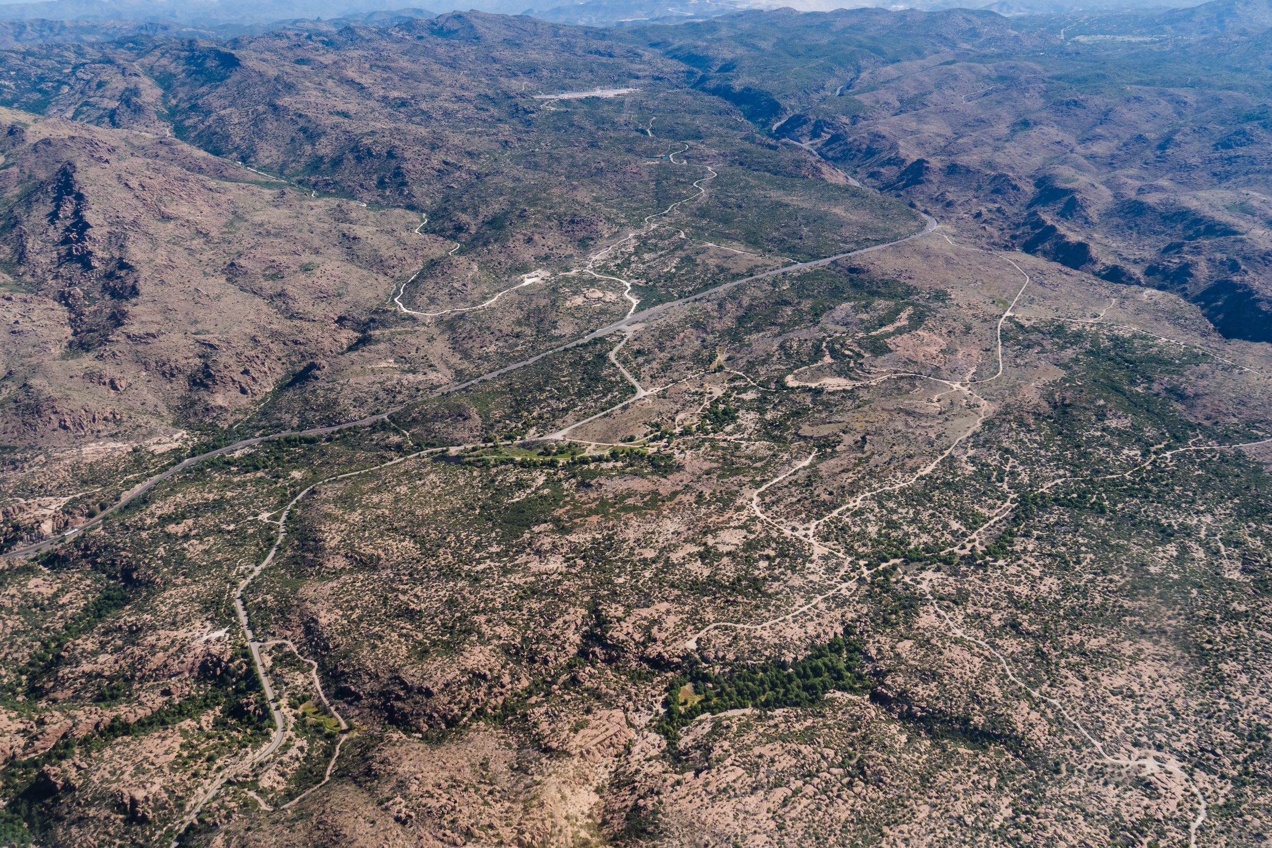
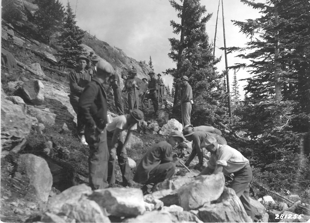
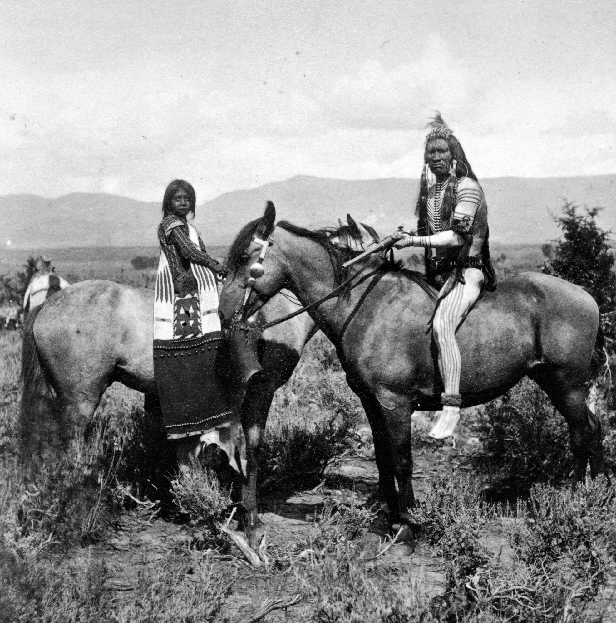
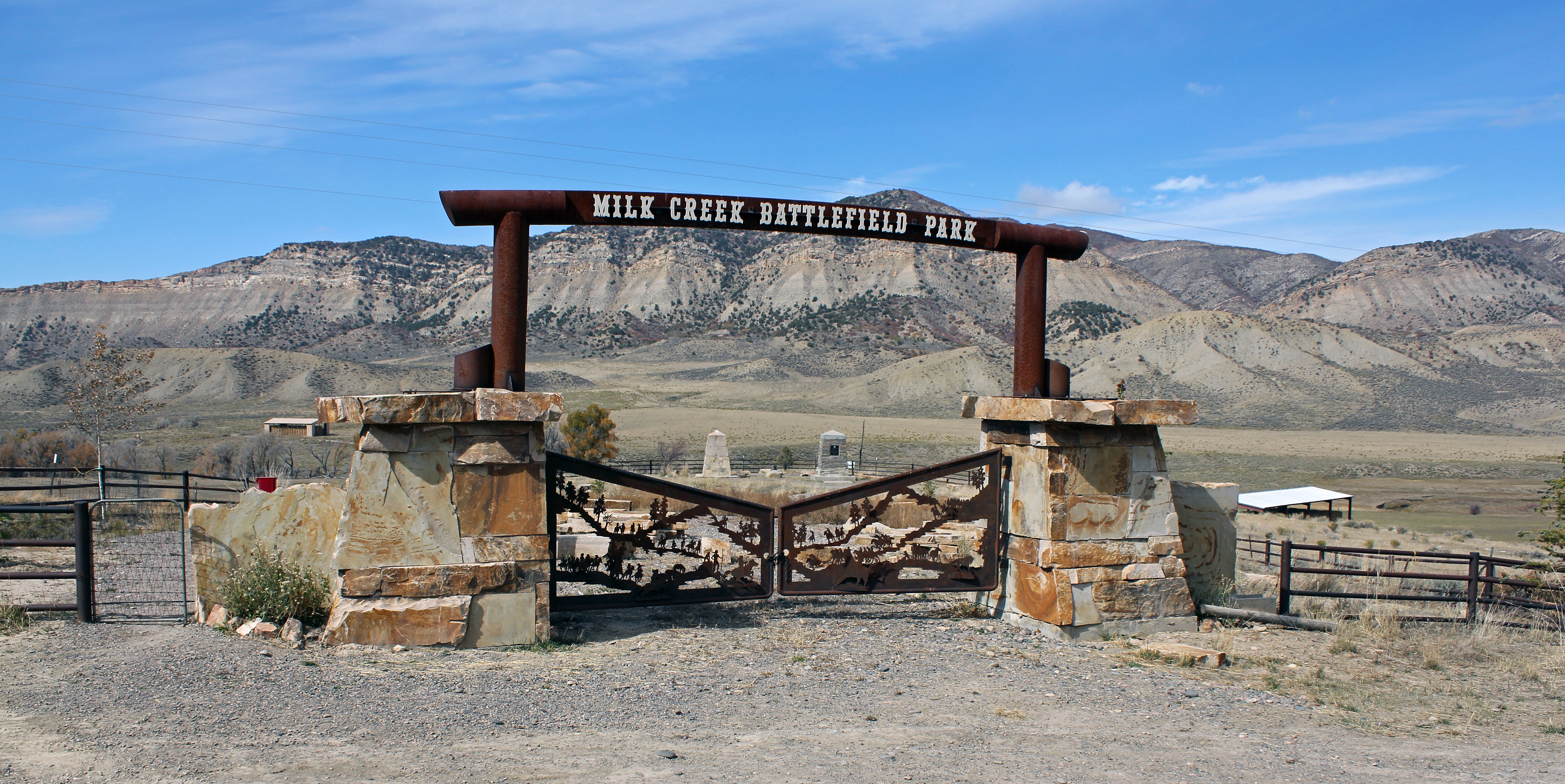


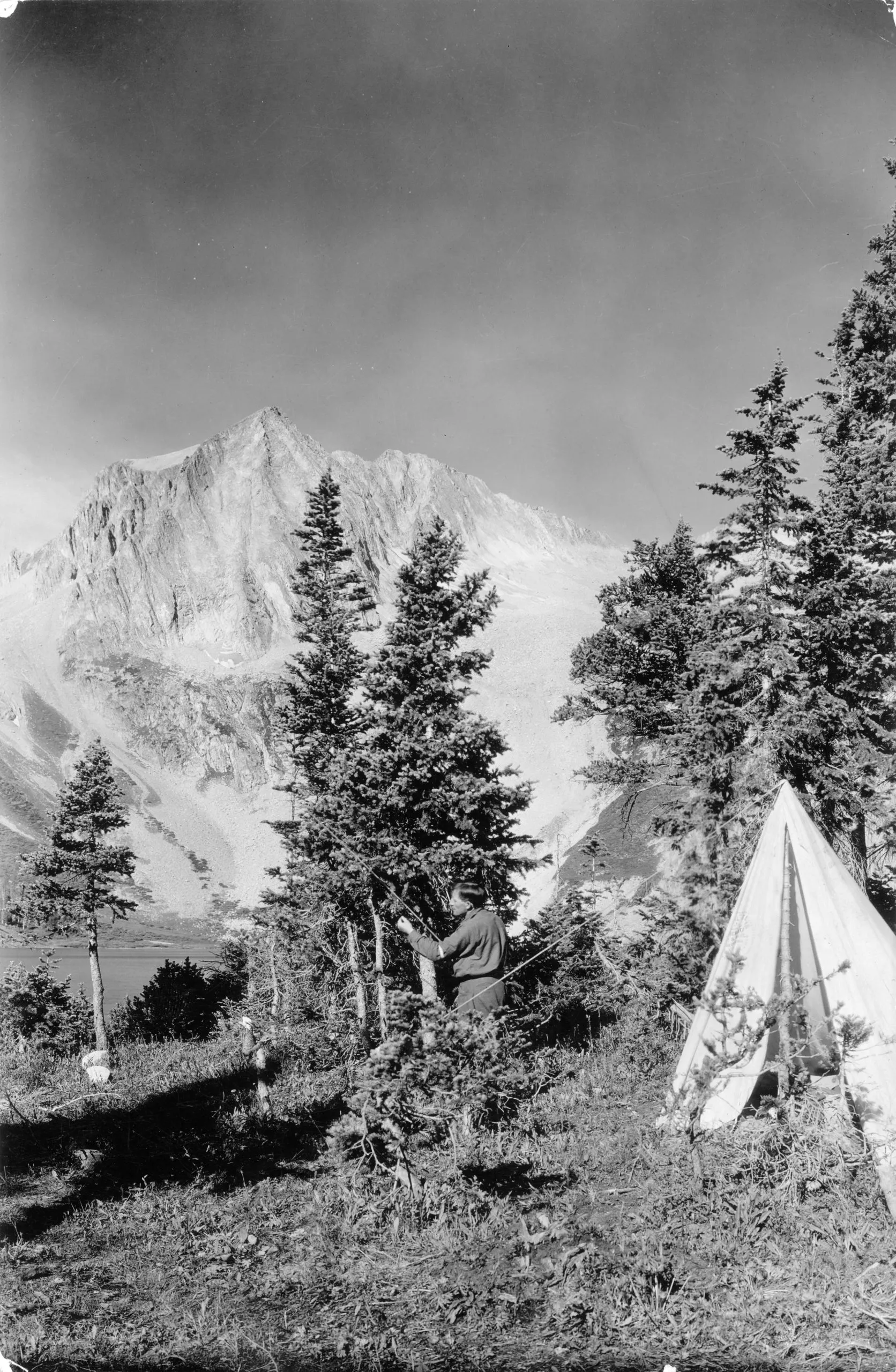
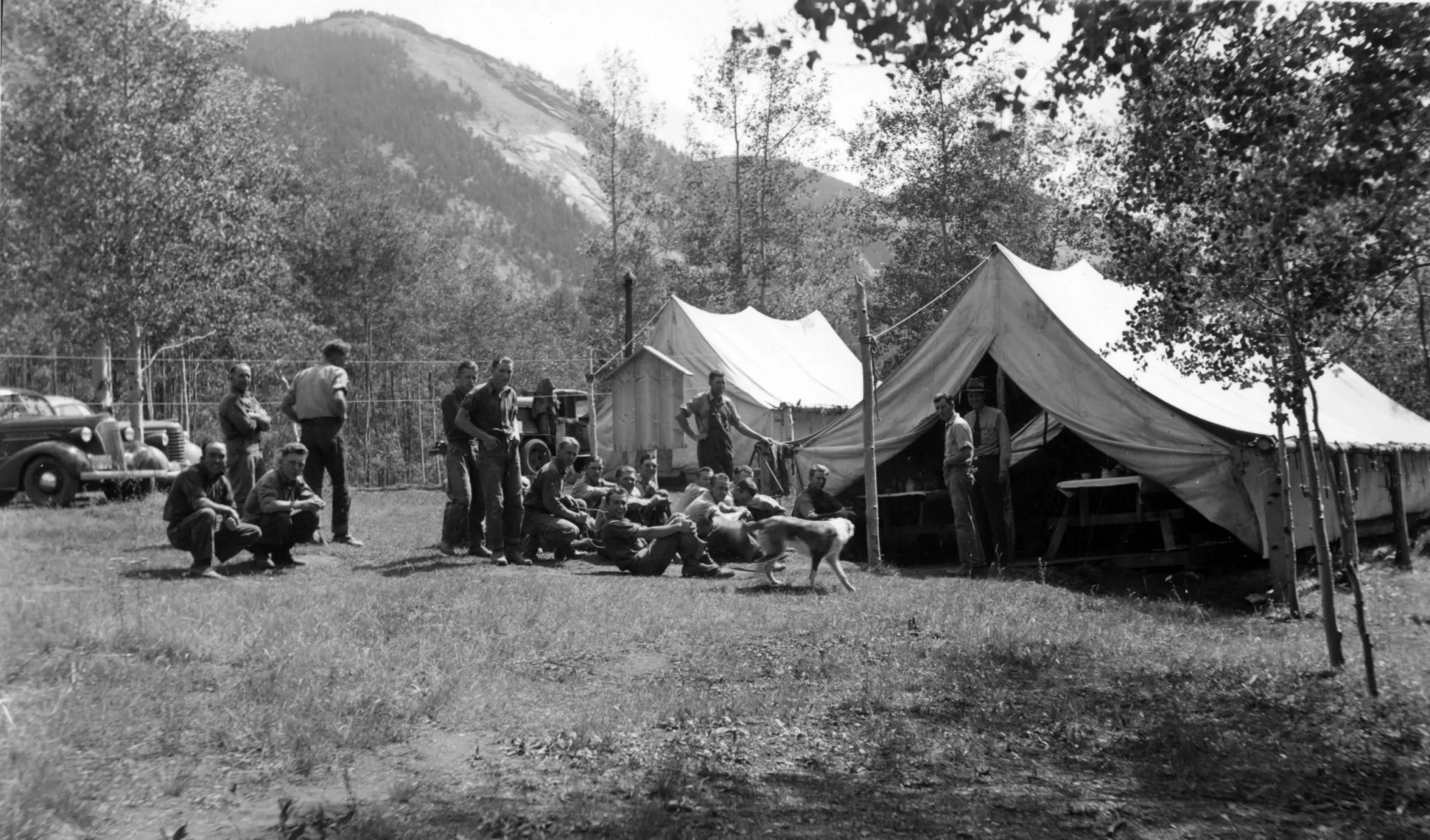
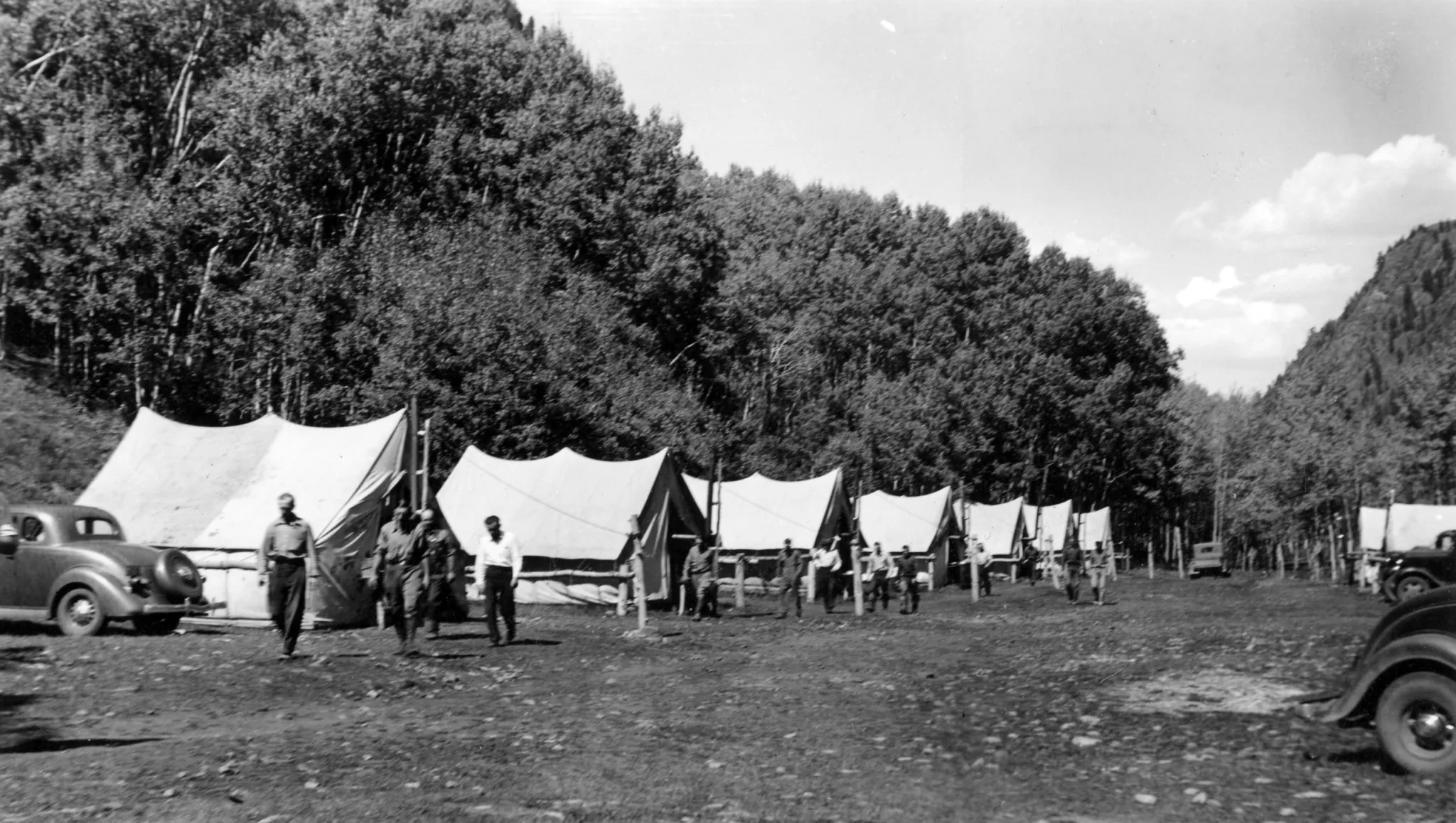


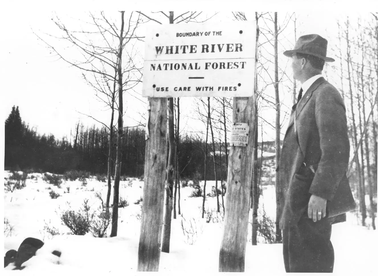
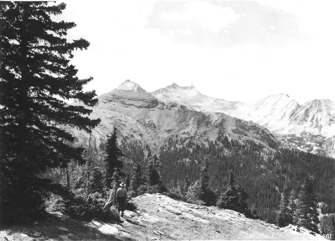

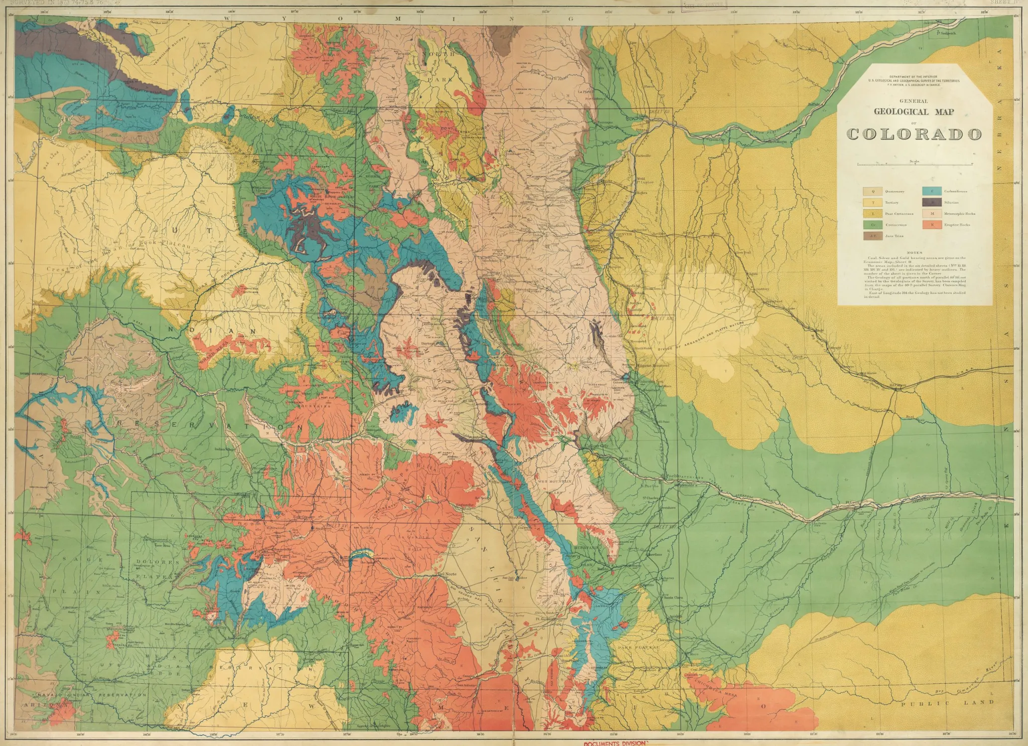

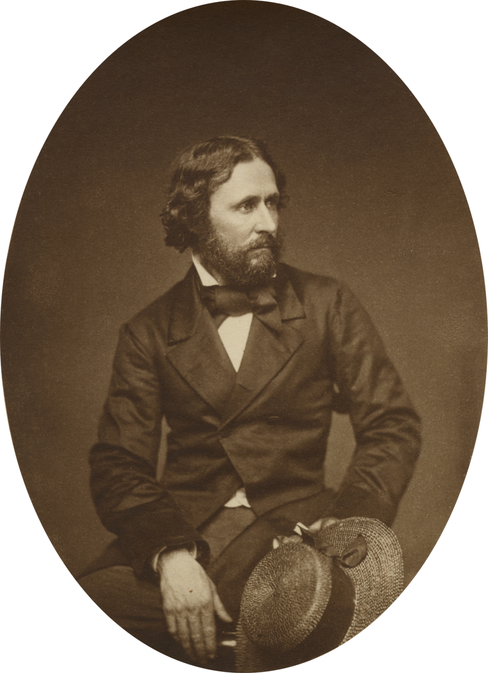
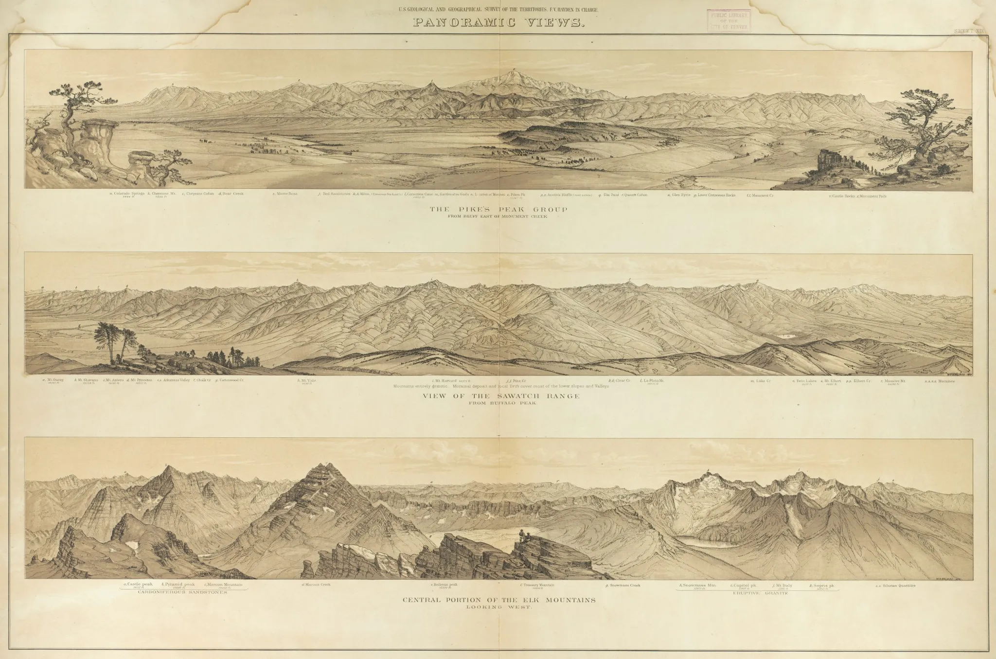

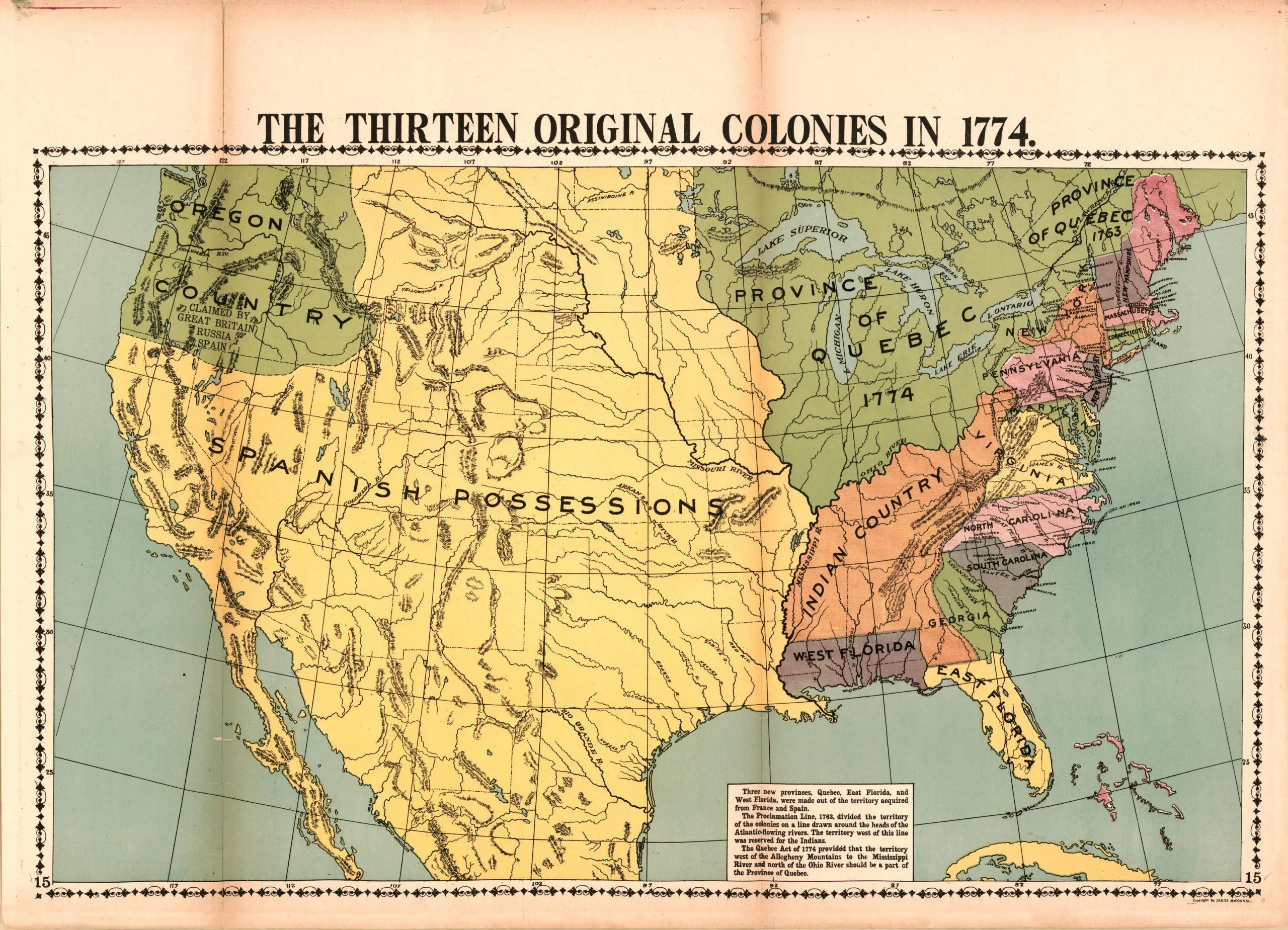

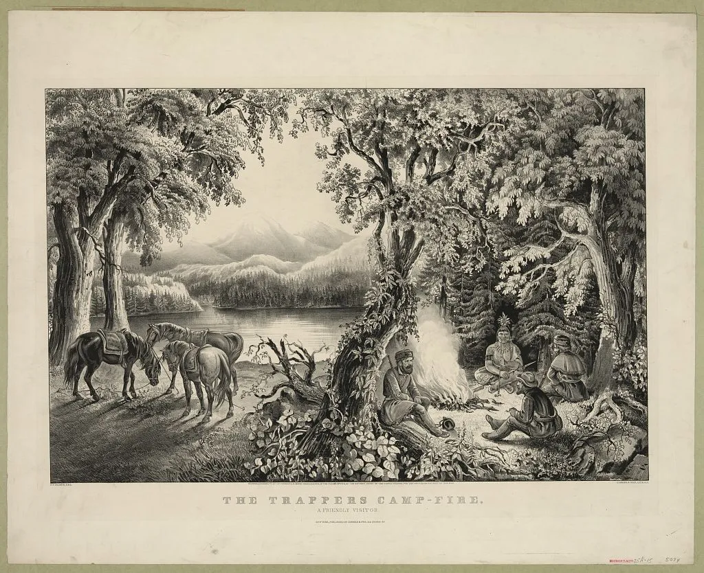

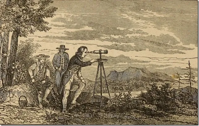
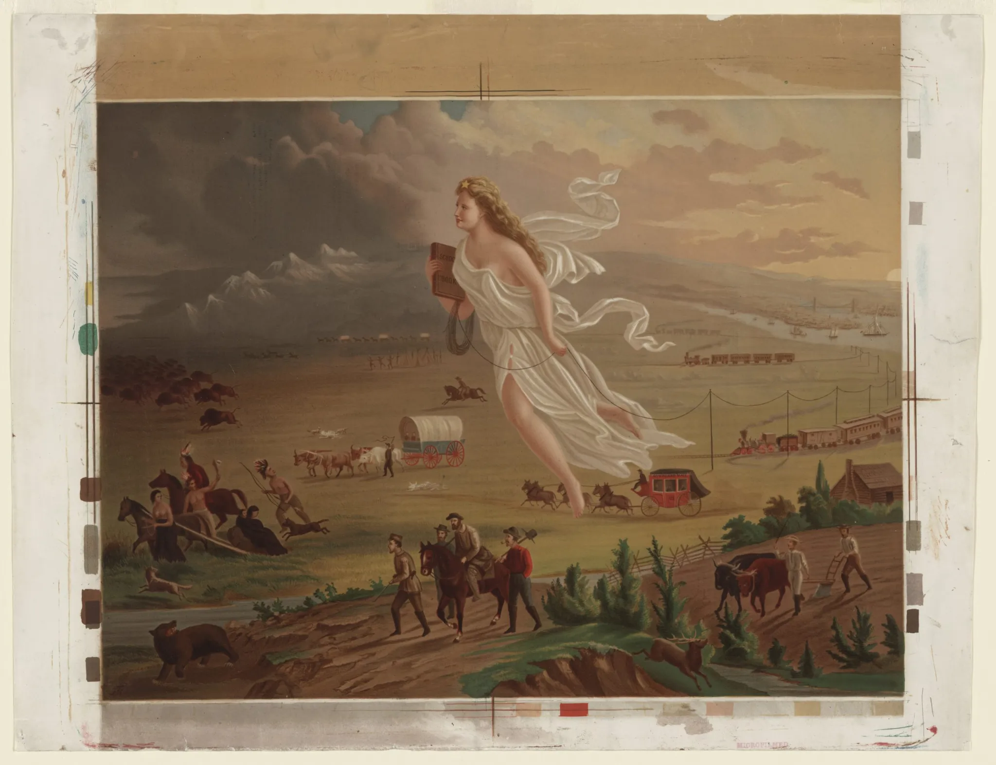

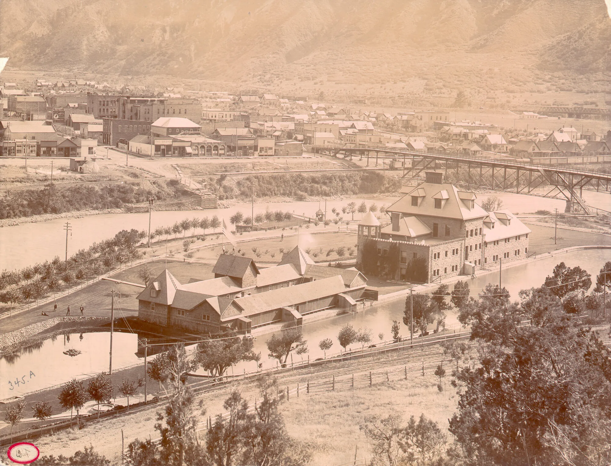


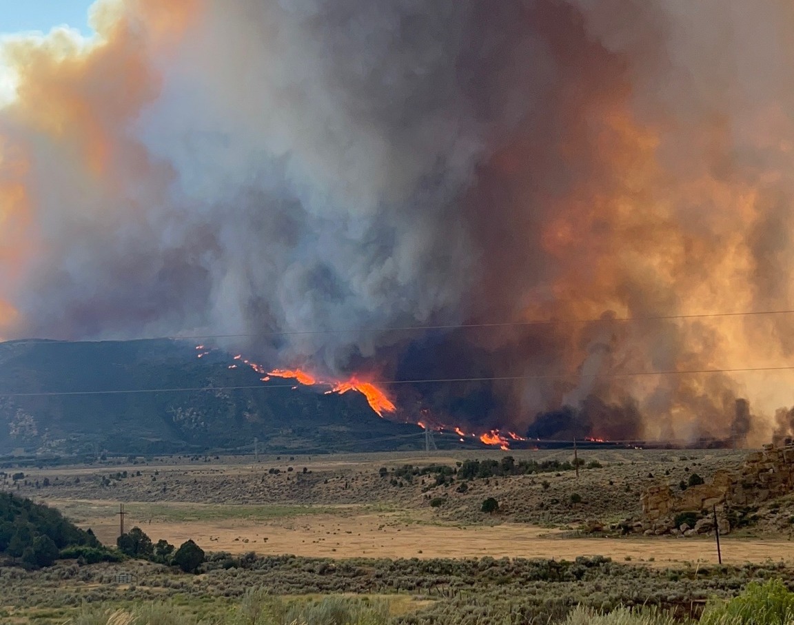

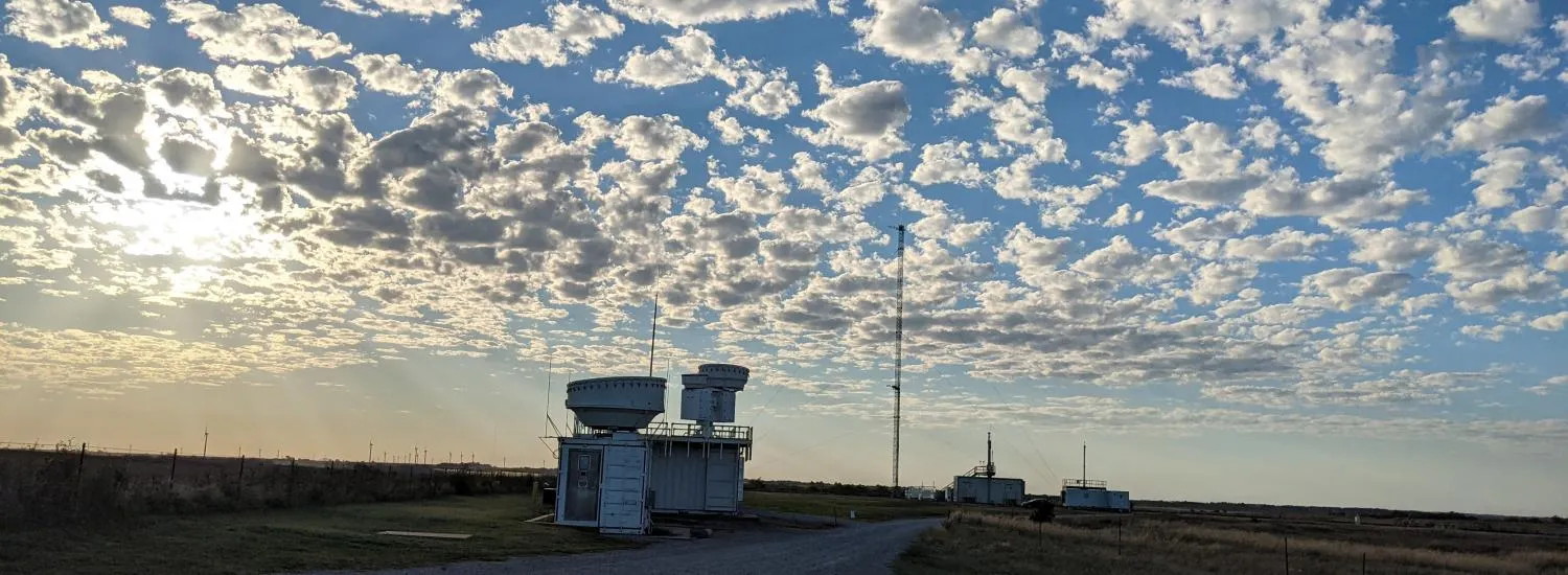
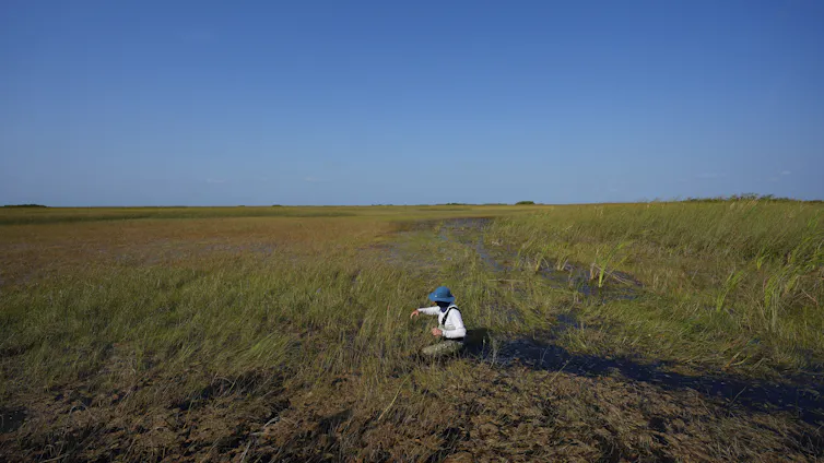
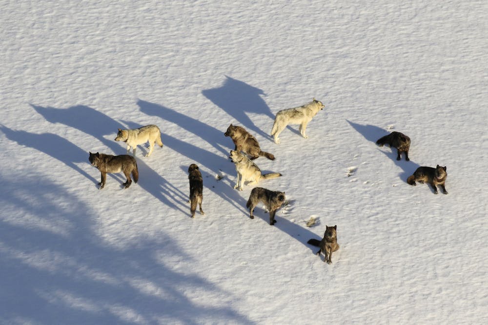


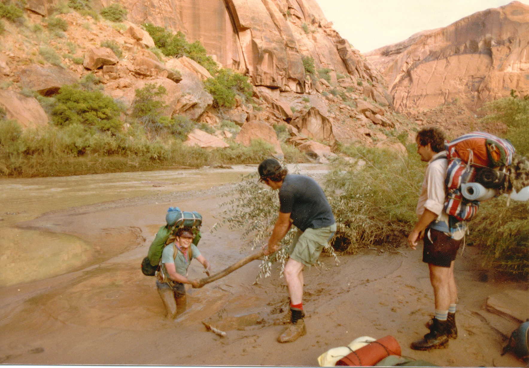

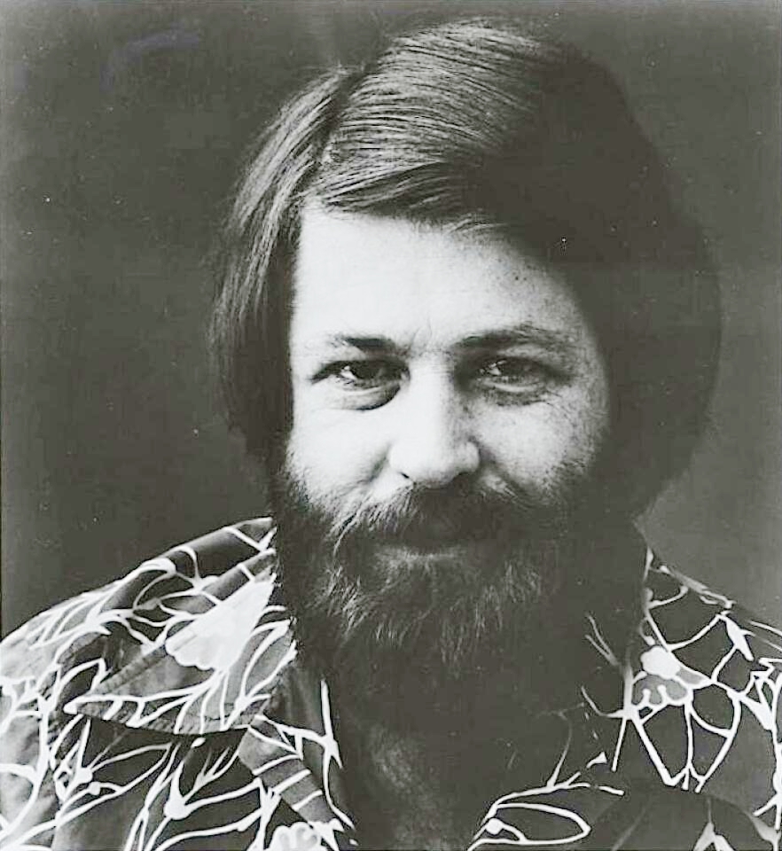


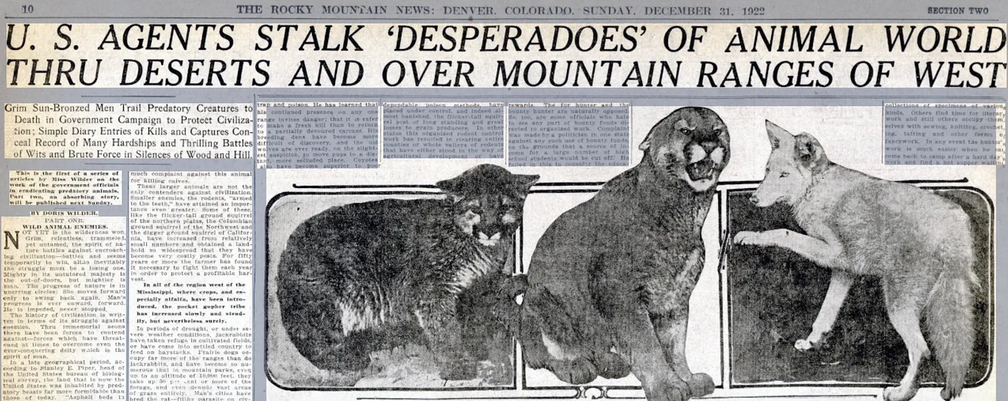


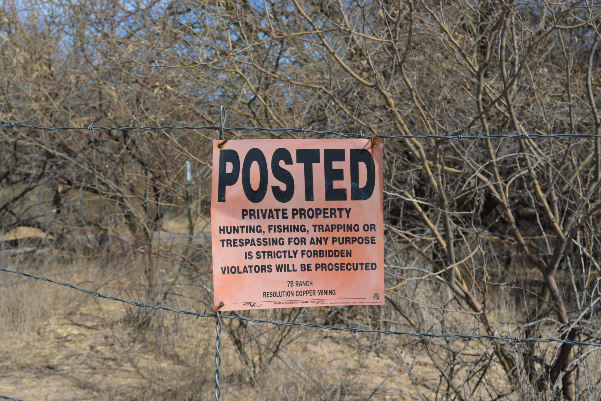
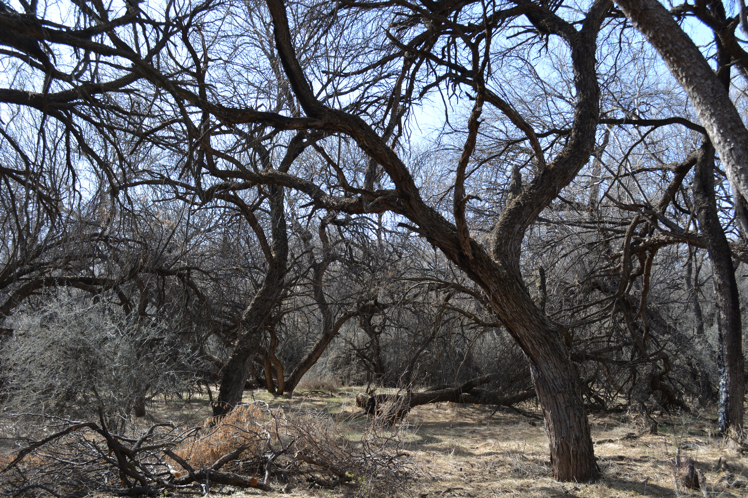