2010 Colorado elections: Ken Buck says that climate change is the ‘greatest hoax that has been perpetrated’

A picture named pika2

From the Fort Collins Coloradoan (Robert Moore):

“Sen. Inhofe was the first person to stand up and say this global warming is the greatest hoax that has been perpetrated. The evidence just keeps supporting his view, and more and more people’s view, of what’s going on,” Buck said.

Bennet spokesman Kincaid criticized Buck’s global warming stance.

“The simple fact that Ken Buck doesn’t believe in proven science is troubling and calls into question his understanding of more complex issues. It helps explain why he would oppose developing the new energy economy that would create jobs right here in Colorado.”

More 2010 Colorado elections coverage here. More climate change coverage here.

Secretary of Interior Salazar announces the ‘Colorado River Basin Geographic Focus Study’

A picture named coloradoriverbasin.jpg

Here’s the release from the Department of Interior. Here’s an excerpt:

“The Colorado River Basin is ground zero for assessing the effects of climate change on our rivers and taking creative management actions to head off the related dangers posed to our water supplies, hydroelectric power generation and ecosystems,” the Secretary said. “We are with you for the long haul to protect our region and its water.”

The Southwest Climate Center is the fourth of eight planned regional Climate Science Centers—or CSCs–to be established by the Department. With the University of Arizona in Tucson as home base, the center will be led by a consortium of that school and others — University of California, Davis; University of California, Los Angeles; Desert Research Institute, Reno; University of Colorado, Boulder; and the Scripps Institution of Oceanography at the University of California, San Diego.

More coverage from Amy Joi O’Donoghue writing for the Deseret News. From the article:

Called the Colorado River Basin Geographic Focus Study, the inventory will be conducted by scientific experts within the U.S. Geological Survey.

The study will be conducted over a three-year period and also is intended to provide a platform on how much water is needed to support ecosystems amid significant competition over water resources.

Salazar said the study is part of an ongoing effort outlined in the WaterSMART Secretarial Order signed in February of this year, adding that the last comprehensive assessment of water availability in the country was in 1978.

The USGS WaterSMART initiative will produce a water census for the nation, a new and ongoing appraisal for water availability that links both water quality and quantity. It will track changes in flow, use, and storage of water, as well as develop models and predictive tools to guide decisions.

A relatively new area of science evaluates how much water needs to be left in the streams to support important ecological values. This initiative includes a significant research and assessment effort to help wildlife managers characterize the flow needs for aquatic species and their habitat.

The USGS WaterSMART Colorado River Basin Geographic Focus Study will complement the River Basin Supply and Demand grant awarded for the Colorado Basin by the Bureau of Reclamation in 2010. It is one of three such studies on major river basins across the nation planned to begin this year.

More Colorado River Basin coverage here.

Climate change: Drought may threaten much of globe within decades

A picture named 20002009precipitation.jpg

Here’s the release from the National Center for Atmospheric Research. Here’s an excerpt:

Using an ensemble of 22 computer climate models and a comprehensive index of drought conditions, as well as analyses of previously published studies, the paper finds most of the Western Hemisphere, along with large parts of Eurasia, Africa, and Australia, may be at threat of extreme drought this century. In contrast, higher-latitude regions from Alaska to Scandinavia are likely to become more moist.

More Climate Change coverage here and here.

Aurora: Water treatment system background

A picture named watertreatment.jpg

From the Aurora Sentinel (Sara Castellanos):

The city’s water supply is derived primarily from snowmelt runoff in the Colorado, Arkansas and South Platte river basins. The water is then stored in 12 reservoirs and lakes including Aurora, Homestake, Twin Lakes and Rampart. It’s transported to the city from as far as 180 miles away through pipes, tunnels and pumps. There are nine staff members at the Wemlinger Treatment Plant who have more than 200 years of combined experience in the water quality field, with extensive knowledge in the world of chemistry. “It’s awesome to be associated with so many people who care so much about making really great water,” [Sherry Scaggiari, quality control supervisor] said. “We don’t say, ‘OK, what’s the level we have to meet?’ We say, ‘We are going to do better than that, and we are going to lead the industry.’”[…]

The contaminants in the city’s water are far below the allowable level mandated by state and federal laws. For example, the maximum contaminant level of total coliform bacteria, which is naturally present in the environment, is no more than 5 percent per month. The highest monthly percentage found in Aurora’s water was 0.52 percent, according to the 2010 Water Quality report. Only one sample was found positive for total coliform bacteria out of 2,268 samples. Hard work has paid off for the employees at the Wemlinger Treatment Plant. In 2009, the plant was awarded the “Excellence in Water Treatment” status after undergoing three levels of review by the American Water Works Associations’ Partnership for Safe Drinking Water program. Wemlinger is one of six treatment plants in the country to receive the award.

More water treatment coverage here.

Colorado State University Named Host Institution of Department of the Interior’s North Central Climate Science Center

A picture named meltwaterlake.jpg

Here’s the release from Colorado State University (Kimberly Sorensen):

Colorado State University is a hub of climate change research and is now home to one of eight U.S. Department of the Interior Climate Science Centers, announced today by Secretary of the Interior Ken Salazar. The CSU-led consortium of nine universities and other affiliated national laboratories was selected to host a regional Climate Science Center. The center is designed to put science to work to help federal, state, local, private and non-profit natural resource managers understand current and future impacts of climate change on critical natural, cultural, wildlife and agricultural resources.

The new North Central Climate Science Center will eventually host as many as eight federal scientists and several post-doctoral fellows who will provide regional land, water, fish and wildlife, and cultural heritage resource managers with the scientific tools and information to strategically adapt to and mitigate the impacts of climate change. The center is expected to be up and running in early 2011.

The CSU-led North Central consortium includes the University of Colorado, Colorado School of Mines, University of Nebraska-Lincoln, University of Wyoming, Montana State University, University of Montana, Kansas State University and Iowa State University. In addition, other federal partners in the consortium include the U.S. Department of Agriculture, Centers for Disease Control and Prevention, National Oceanographic and Atmospheric Administration, National Center for Atmospheric Research and others.

“The members of the consortium headed by Colorado State University can provide us with great expertise in the major climate-related challenges facing the North Central region – including diminishing water supplies, the spread of invasive species, outbreaks of pests and diseases, changing fire regimes, decreased crop and livestock production, and loss of habitat for critical fish and wildlife species,” said Salazar. “Selected through an open competition, these universities represent the full array of landscapes in the Rocky Mountains, Intermountain West and Great Plains.”

Regional Climate Issues

Federal scientists will collaboratively work with university researchers and address pressing regional climate issues such as the effects of pine bark beetle outbreaks on water, forest conditions and grizzly bears in Yellowstone National Park, and study the potential for dust from overgrazed areas to accelerate climate-driven snowpack melting.

Other work of the U.S. Department of the Interior North Central Climate Science Center will include:

Downscaling of global climate change models linking physical factors with biological, physical and ecological responses.

Forecasting of the effects of climate change on fish and wildlife populations, habitat and ecosystem services dynamics – including research as well as tool and data development and distribution.

Researching climate adaptation related to vulnerability assessments, adaptive management development, coping strategies and risk analysis development.
Developing innovative decision-support tools for adaptation and mitigation.

Colorado State University as Host

Colorado State University’s historic strength in environmental research and education on climate issues affecting land, water and energy supplies not only advances scientific understanding, it also cultivates the next generation of students and scientific workforce, making CSU an ideal host of a Climate Science Center.

“Colorado State University faculty have long been leaders in advancing environmental and climate research, and we’re honored and proud to be named home to the new North Central Climate Science Center, “ said CSU President Tony Frank. “This is a testament to the extraordinary achievements of our faculty and their colleagues across the region, and it will provide them a stronger platform to engage with other scientists on critical and pressing climate studies.”

Dennis Ojima, professor in CSU’s Department of Forest, Rangelands and Watershed Stewardship and senior research scientist at the Natural Resource Ecology Laboratory in CSU’s Warner College of Natural Resources, will lead the consortium.

“CSU has world-class expertise in climate, and we are leaders in engaging the public and policy makers in rendering our science and discoveries into practical solutions. Those strengths will be critical as the North Central Climate Science Center engages the research community and then ultimately translates that science to the decision-making community,” Ojima said.
State of Colorado Leader in Climate Science

In addition to premiere research universities, the state of Colorado is home to one of the most respected climate science communities in the world with many prominent institutions specializing in climate science including the National Center for Atmospheric Research, National Oceanographic and Atmospheric Administration’s Earth Science Research Laboratory, National Renewable Energy Laboratory, Western Water Assessment Regional Integrated Science and Assessments program, Agriculture Research Service, National Ecological Observation Network among many others. The North Central consortium will tap these and other institutions as they address regional climate science.

“Congratulations to Colorado State University for being selected to lead such a prestigious consortium of research institutions and to serve as host for the North Central Climate Science Center,” said Gov. Bill Ritter. “Over the past few years, Colorado has become a recognized leader in addressing climate change. We have enacted numerous policies to reduce greenhouse gas emissions and implemented strategies to adapt to and mitigate those impacts. This new regional center will advance this work and continue to keep Colorado on the leading edge of one of the most important challenges facing the world today.”

Other Climate Science Centers

The regional Climate Science Centers are a key element of the Interior Department’s first-ever coordinated strategy to address current and future impacts of climate change on America’s land, water, ocean, fish, wildlife and cultural resources. Climate Science Centers are intended to be a seamless network to access the best science available to help resource managers and decision-makers.

On Wednesday, the Interior Department announced the University of Arizona as home of the Southwest Climate Science Center. The Southeast Climate Science Center is led by North Carolina State University, the University of Washington hosts the Northwest Climate Science Center, and an Alaska Climate Science Center is led by the University of Alaska. The department will soon announce the host institutions for the Northeast, South Central and Pacific Islands Climate Science Centers.

Salazar initiated the coordinated climate change network in September 2009 that not only created the regional Climate Science Centers, but also a network of Landscape Conservation Cooperatives that engage federal agencies, local and state partners, and the public in crafting practical, landscape-level strategies for managing climate change impacts on natural resources.

More climate change coverage here.

2010 Colorado elections: Proposition 101, Amendment 60, Amendment 61 and Amendment 62

A picture named bearcreekevergreen.jpg

From the Broomfiled Enterprise (Dylan Otto Krider):

There aren`t many issues that can unite unions, business groups, school boards, charter schools, the Broomfield Chamber of Commerce and the Colorado beef industry, but amendments 60, 61 and Proposition 101 have done just that, bringing together the seemingly disparate groups in a stance against the ballot measures. They are among the groups that have joined a concerted effort to defeat the measures, which opponents say will cause massive layoffs and prevent future building at a time when schools budgets are shrinking…

Among those who have sent declarations of opposition to the measures to the Enterprise are Alliance for Sustainable Colorado, the Charter Institute, the State Board of Education, the Colorado Cattlemen`s Association and 36 Commuting Solutions. Broomfield City Council and the Broomfield Chamber of Commerce also are in opposition to the measures…

Steve Bobrick, former chairman of the Broomfield Economic Development Corp. board of directors, said the organization has come out against the measures, because building things such as water reservoirs are what lure facilities such as the new Conoco-Phillips training facility, slated to open in 2012 or 2013 at the former Storage Technology campus in Louisville. “You need government to do things most people will not do — take care of fire, police, water,” Bobrick said. Those core services could be in jeopardy if taxes are raised on government enterprises, a move Bobrick called “unprecedented.” Enterprises are cooperative efforts between government and private enterprise, such as universities…

In an investigation of a complaint for campaign finance violations, a Denver judge fingered anti-tax crusader Douglas Bruce, a former El Paso County commissioner and state representative, as being behind the effort to collect the more than 400,000 signatures needed to get the initiatives on the ballot. Despite the fact Bruce avoided dozens of attempts to compel him to testify in a deposition, the judge saw enough evidence to conclude Bruce coached petition collectors. Secretary of State records show eight professional signature collectors lived in a Colorado Springs rental house owned by Bruce while they collected 26,000 signatures. The Colorado Springs Gazette reported Bruce was found to have communicated with the petitioners using the e-mail address info@cotaxreform.com. Menten said she only became the spokesperson in March or April, and can`t comment on anything that happened before. She characterized the group as “grassroots” and said the language had been crafted by a number of different people.

Meanwhile, Ed Quillen takes a look at some of this year’s ballot amendments in his column in today’s Denver Post. From the article:

Which brings us to the ballot issues this year, which are making me a big fan of the quaint system of having a republic, where we elect people to make laws after hearings and thoughtful deliberation, rather than all this direct democracy.

We can start with Amendment 62, the “personhood amendment,” which would grant full legal rights to fertilized eggs. It’s almost identical to Amendment 48, which was soundly defeated two years ago. Apparently the zygote zealots plan to circulate petitions every two years until we get sick of voting it down and they manage to slip it through. You can have a small, frugal government, or you can have one that monitors every woman of child- bearing age to be sure she’s protecting the legal rights of any fertilized egg she may be carrying. But you can’t have both.

Then, we get to this year’s “Evil Three”: Amendments 60 and 61, along with Proposition 101. They’re assaults on self-government.

For instance, local residents can currently vote to “de-Bruce” their local governments, allowing them to keep tax revenue that would otherwise have to be refunded. It’s hard to see what’s wrong with that — people making decisions about taxes — but Amendment 60 would pretty well put an end to it.

Amendment 61 limits government borrowing. If I’m buying a house, I can decide whether a mortgage of 10, 20 or 30 years would work best. But if I’m a voter, then Amendment 61 says I’m too stupid to make such decisions.

Proposition 101 would roll back auto-license taxes that the legislature increased by calling them “fees” and avoiding a public vote. The honest course would have been to fund highway maintenance by seeking a fuel-tax increase in a referendum. But roads and bridges don’t fix themselves, and the state had to do something.

More 2010 Colorado elections coverage here.

Arkansas Valley: All parties settle out of new surface water irrigation rules case

A picture named irrigation.jpg

From The Pueblo Chieftain (Chris Woodka):

All parties have stipulated in the case, but the final decree has not been sent to Division 2 Water Court Judge Dennis Maes, according to Mardell DiDomenico, an employee of the court…

The rules have been discussed for nearly three years as a way to prevent consumptive use from expanding as a result of more efficient farm practices such as canal lining or sprinklers fed from ponds. State Engineer Dick Wolfe organized a committee to develop the rules in 2008 after numerous objections surfaced to the initial form. Wolfe argued that the rules are needed in order to prevent Kansas from beginning new litigation over the 1949 Arkansas River Compact. Colorado and Kansas last year settled a 24-year lawsuit over the compact.

The rules include provisions for general compliance, individual engineering reports or group plans to meet guidelines for new systems that have been developed by the state engineer. They apply only to agricultural surface water, as wells already are covered by 1996 rules.

More Arkansas Valley consumptive use rules coverage here.

Lower Arkansas Valley Water Conservancy District board meeting update

A picture named flatheadchub.jpg

From The Pueblo Chieftain (Chris Woodka):

“One of the exciting things we are finding is that we can fallow land and not be penalized,” Jim Valliant, coordinator of the study, told the Lower Arkansas Valley Water Conservancy District on Wednesday. “Now we are looking at the economics: What does the farmer have to have to make it worthwhile to fallow the land.” Valliant explained that fertilization is typically best done in the fall for two reasons:

– Fertilizer is generally cheaper at that time of year.

– It allows the fertilizer to blend with the soil. “If you get a little moisture in the fall, it mellows the land for planting,” Valliant said.

A study began in 2007 at the Arkansas Valley Ag Research Center, operated by Colorado State University, to look at what is needed to bring land back into production after it has been fallow for one to three years. Four plots were cultivated, with corn planted each year on one, three years on a second, two years on a third and one year on the fourth. The harvests from the fourth year were just completed, so the final results aren’t known. However, the nitrogen levels for all four years show the soil retained sufficient levels of nutrients to produce a crop without fertilization up to three years after first being fallowed. Fertilization was considered sufficient if at least 200 bushels of corn per acre were harvested. In each of the first three years, each plot yielded more than 200 bushels, except the initial year when just one of the four was planted and harvested. In other words, the plots that had been fallowed still produced adequately in the first or second year after replanting. That reduces the input cost to farmers during the fallow years, although there are still labor and fuel costs to maintain fallowed land.

Valliant said the next step is to analyze the relative cost of taking land out of production to determine how much farmers should reasonably charge for water when land is taken The Lower Ark district initiated and funded the study — about $50,000 over four years — as part of its efforts to establish the Super Ditch. At the time, there were few reports on the cost of bringing land back into production, or the financial risk farmers take by breaking cropping cycles.

More coverage from Chris Woodka writing for the The Pueblo Chieftain:

A survey by the U.S. Geological Survey and other partners began sampling fish in Fountain Creek in April and collected 20,000 fish at 10 sites, Pat Edelmann, head of the USGS office in Pueblo, told the Lower Arkansas Valley Water Conservancy District Wednesday. In the 10 areas, reaches of just 150-500 feet were studied, raising the possibility of many more fish in the creek, Edelmann said.

Of special interest is the flathead chub, a plains fish that is abundant in many places, but listed as a species of special concern in Colorado, and threatened or imperiled in several other states. In Colorado, the fish is found primarily in the Arkansas River basin below Florence and in the Rio Grande basin. “Some people say it is a trash fish, but our data collectors had a discussion with the blue herons and they think the chub are an excellent source of food,” Edelmann quipped…

The study is important to Colorado Springs Utilities, which is considering a fish ladder that would allow the chub to swim upstream. The project is part of the Army Corps of Engineers Fountain Creek Watershed Study and Pueblo County requirements for the Southern Delivery System. An earlier study found the flathead chub are poor jumpers, but persistent in finding their way around obstacles like rocks. Surprisingly, 15 of the tagged fish were found upstream of the Clear Springs Ranch site, presumably during the brief time once a week when a gate is opened to flush sediment. Some fish moved as much as 18 miles upstream.

More Fountain Creek coverage here and here.

Rio Grande Water Conservation Board meeting recap

A picture named riograndebasin.jpg

From the Valley Courier (Ruth Heide):

The first water management sub-district board of managers had approved its approximately $1 million budget pending approval from the sponsoring water district, which unanimously approved it on Tuesday. Counties within the first sub-district, lying in the closed basin of the San Luis Valley, will begin collecting fees from sub-district irrigators in 2011…

…the water board approved a mill levy of 2.35, less a temporary reduction of .27 for total mills of 2.08. The water district covers most of the San Luis Valley…

[RGWCD Bookkeeper Amber Pacheco] added that the professional services category includes legal and engineering expenses, and the district anticipates an increase in engineering fees to keep the sub-district process moving forward, not just for the first sub-district but also for the other Valley sub-districts that are forming…

[RGWCD Manager Steve Vandiver] estimated the district would probably have seven sub-districts. The formation of these sub-districts requires attorney and engineering fees that the sponsoring district hopes to recoup once the sub-districts are operational…

RGWCD Board Member Lewis Entz, long time state legislator whose legislation enabled the sub-district process, said the reason he created the legislation was so the San Luis Valley could solve its own problems “rather than let the state engineer do it. We are trying to do it here … We want to solve our own problems.”

[Alamosa resident Leon Moyer] suggested that the district post its proposed budget on the web site in the future, since the budgets he was able to pick up prior to the meeting were not the ones ultimately presented to the board. He said the public needs to have the opportunity to adequately review the proposed budget prior to the budget hearing.

More Rio Grand River basin coverage here.

CWCB: Arkansas Basin decision support system update

A picture named arkansasriverbasin.jpg

From The Pueblo Chieftain (Chris Woodka):

A committee advising state consultants on how to set up the study met Monday. Concerns about whether an existing state model used in other basins or a model more commonly used in several ongoing water studies were expressed. The group also clarified that the state model would be used primarily for planning, while the data in the model could be applied to water management…

Officials from the Colorado Water Conservation Board, which is developing the model with the Division of Water Resources, assured the group that the state would not ignore data that is already being collected in other studies. “We’re not telling anybody they have to abandon what they’ve developed,” said Ray Alvarado of the CWCB staff. “We’re not intending to do this in a vacuum. We need this tool, and it’s been used successfully in other basins.” The state has developed decision support systems for the Colorado River and Rio Grande. It is finalizing the support system for the South Platte…

In some ways, the Arkansas River basin study is the most complicated to develop because of exchanges, groundwater interaction and water rights issues. It was delayed because of ongoing litigation with Kansas over the Arkansas River Compact. Alternatives for the Arkansas River basin decision support system would range from $4.5 million to $17.3 million, depending on the level of detail desired, according to a draft report. The final report is expected to be presented to the CWCB in January…

“After we completed a needs assessment last year, our roundtable said the DSS was the most important thing we could do,” said Gary Barber, chairman of the Arkansas Basin Roundtable. “There is a great deal of expectation for what the DSS will do.”

More Arkansas River basin coverage here.

Lake Mead: ‘A record-setting moment’

A picture named drylakemead.jpg

Bump and update: From Time (Bryan Walsh):

What’s causing Lake Mead to dry up—and what does it mean for the Southwest? The one undeniable cause is simple growth—Las Vegas has grown from 25,000 people in 1950 to some 2 million today. That means more lawns, more laundry, more swimming pools, more car washes—in general, more straws sucking the water out of Lake Mead. And of course Las Vegas isn’t the only area in the Southwest to experience booming growth over the past few decades. From Denver to Phoenix to Los Angeles, the once lightly populated West has exploded, even as farmers in the region draw more water from the system to irrigate the desert.

But the Southwest has also been caught in a devastating drought that has now gone on for more than 10 years, one that has reduced the region’s water supplies even as growth has further stressed them. Drought is a natural phenomenon—especially in the desert, go figure—and there have been varying levels of rainfall in the region just in the 75 years since Lake Mead was first filled. But the scary thing is that the territory might be more vulnerable to drought than it seemed during the 20th century—a time period that may have been unusually wet on a historical scale. A 2007 panel organized by the National Research Council found evidence that mega-droughts had occurred in the Southwest more frequently than had been thought, and that “drought episodes are a recurrent and integral feature of the region’s climate.” The Colorado River Compact—which divides up water supplies for seven U.S. states and parts of Mexico—was drawn up in 1922, based on river flow data going back to the 1890s, a time of unusual wetness. We may have built the Southwest with a false sense of water security.

Then there’s climate change, an X factor for future water supplies. It’s difficult to gauge what impact, if any, global warming may have had on the current drought and on dropping water levels. As always, it’s virtually impossible to filter out climate change as a cause for a natural disaster amid all the noise and static of other factors. But as the recent report from the government U.S. Global Change Research Program shows, the Southwest is already rapidly warming, reducing the spring mountain snowpack that helps feed the rivers of the region. We’re likely to see increasing temperatures in the future, with more frequent drought and increasingly scarce water supplies. Climate change won’t be the only cause behind the drying of the West, but could make a bad situation much, much worse.

From The New York Times (Felicity Barringer):

“It is a record-setting moment,” said Colleen Dwyer, a spokeswoman for the Bureau of Reclamation. She added that slightly more water than usual had been released through Hoover Dam over the weekend because the power marketing agency that sends dam-generated electricity around the Southwest had requested some additional flow.

Lake Mead’s levels are still eight feet above the level at which a shortage is officially declared and limited rationing could go into effect for users in Nevada and Arizona, and well above the levels when the Hoover Dam’s hydroelectric output might be seriously jeopardized.

But Barry Nelson, a senior policy analyst for the Natural Resources Defense Council, said: “This strikes me as such an amazing moment. It’s three-quarters of a century since they filled it. And at the three-quarter-century mark, the world has changed.”

More coverage from the Arizona Republic (Shaun McKinnon):

Not since it was first filling in 1937 has Lake Mead held so little water. The reservoir’s level fell to the historic low shortly before noon on Sunday, eclipsing a previous record from the drought-stricken 1950s. The lake is now just 8 feet above the level that would trigger the first drought restrictions, which would reduce water supplies for Arizona and Nevada. That gap could close by next year – the reservoir fell 10 feet from October 2009 to 2010 – but there are measures in place that would likely delay rationing for one or two years or even longer if a wet winter increased runoff into the river. Most homes and businesses in Arizona likely would not feel the direct effects of the restrictions, which would divert water first from farmers.

But conservation groups say the reservoir’s low levels underscore the risk to the Colorado River. “Everyone needs to know when we turn on the tap, it drains water out of the river and it has ecological consequences,” said Gary Wockner, campaign coordinator for Save the Colorado, a non-profit education group based in Fort Collins, Colo. “We need to try to keep some water in the river and keep it alive.”[…]

The three lower-river states, along with Colorado, New Mexico, Utah and Wyoming on the upper river, approved a drought plan in 2007 that uses Lake Mead water levels to trigger incremental rationing, part of an attempt to avoid widespread shortages. The first trigger is at 1,075 feet above sea level. The reservoir reached elevation 1,083.18 feet around midday Sunday and was at 1,083 feet by Monday afternoon. The previous low level was 1,083.19 feet, set in 1956…Under the 2007 plan, the first trigger would reduce water deliveries to Arizona by a little more than 11 percent, or 320,000 acre-feet, and to Nevada by about 4 percent, or 13,000 acre-feet. Additional reductions would occur if the lake continued to drop.

More coverage from the Las Vegas Review-Journal (Henry Brean):

Since drought took hold on the Colorado and its tributaries in 1999, the surface of Lake Mead has plunged almost 130 feet and caused fits for the National Park Service and its marina operators who must extend roads, utilities and other services to reach the shrinking shoreline.

The lake’s decline poses major problems for the Southern Nevada Water Authority, which draws 90 percent of the Las Vegas Valley’s drinking water from intake pipes that will start to shut down should the lake fall another 33 feet. “I’m worried,” authority General Manager Pat Mulroy said. “We’re trying everything we can to keep as much water in Mead as we can.” The prognosis looks bleak. Mulroy said federal climate forecasters are predicting abnormally dry conditions during the next two winters in the mountains that feed the Colorado…

The previous low-water mark for Mead came 54 years ago, on April 26, 1956, when the drought-stricken lake bottomed out at 1,083.19 feet above sea level. According to the Bureau of Reclamation, the lake hit elevation 1,083.18 between 11 a.m. and noon Sunday and continued to fall. By Monday afternoon, it sank below elevation 1,083 as water was released through Hoover Dam to meet orders downstream from cities and farms in California and Arizona. Projections by the U.S. Bureau of Reclamation call for Lake Mead to reach a low point of 1,082.1 on Nov. 2. Then it is expected to rise by about 8 feet through the end of February before starting back down again. Water forecasters expect the lake to hit another record low by May and shrink below elevation 1,077 by September…

Even at its lowest level since it was first filled, Lake Mead remains the largest man-made reservoir in the United States. The falling water level has caused some problems with access, but it has also unveiled new coves and pristine beaches that used to be underwater, Roundtree said.

More coverage from the Voice of San Diego Environment (Rob Davis):

Millions of people — San Diegans included — rely on the reservoir’s water. So what does its drop mean here? In the short term, nothing. It doesn’t have any impact on San Diego’s supply even though we relied on the river for 61 percent of our water in 2009. But it does send a bad signal that the river supplying the Southwest’s lifeblood is continuing to face pressure — a pressure that scientists say is growing as the climate warms. If the lake continues dropping, it will first cause problems for cities in Arizona and Nevada before San Diego. Those states hold lower-priority rights to Colorado River water than California does.

More Colorado River basin coverage here.

La Niña primer

A picture named elninolanina.jpg

From the High Country News weblog The Range (Ed Quillen):

For the West, this means it will be wet in the north and dry in the south…

Colorado is in the middle between north and south in the West, so fluctuations on the jet stream will determine how much of the state gets buried in December and January…

In some years, there’s talk of “La Nada” — the nothing, or at least nothing out of the ordinary. El Niños and La Niñas tend to run in three- to seven-year cycles, and if you want to sound technical, you can call it ENSO for “El Niño/La Niña Southern Oscillation.”

La Niña was a hot topic last week when members of the CWCB, water providers and others huddled up at Denver Water to answer the question, “Drought in 2011?”. Below are my notes from the meeting:

Water Year 2010 review

Nolan Doesken kicked things off with a look back at the past year.

A year ago October was wet and snowy but in November everything dried out. Northern Colorado was dry until the spring when the precipitation pattern shifted north. Wind speeds were low over the winter leading to a decline in wind energy production in northeastern Colorado. There was a wet spring and early summer in northeastern Colorado. Also in April there was a series on large dust events in the San Juans. The runoff was fast a furious with sudden warming at the end of May. Colorado experienced a strong but confined monsoon mid-July to around August 15.

He said that yesterday’s precipitation was the, “first widespread event in 2 months.”

Overall, “Most of the state ended up near average for precipitation,” he said, and added that, “This is the first time in history that we have had 3 near average years in a row.”

According to Doesken, the summer was the 15th warmest on record, statewide.

Short-term forecast

Triste Huse from the National Weather Service presented the short-term weather outlook. She said we can expect a good storm around Tuesday of next week. She showed a slide of comparing the historical precipitation for the 45 day period between August 1 and October 7. 2010 was the third lowest on record. Her 60 day comparison, ending October 7, had 2010 in first place for dryness. She added that September 2010 was the 7th warmest on record.

Long-term forecast

Klaus Wolter started off his presentation by saying that, “La Nina is on a steam roller.” The Multivariate ENSO Index is at it’s lowest level in 94 years, he said, adding that, “This is quite remarkable,” and, “The system can’t really get any colder.” (ENSO = El Nino Southern Oscillation). He told the group, “If you’re making a bet on the first snowfall,” bet on next Tuesday. His research shows that, “We’ve never really had a dry winter with La Nina.”

He told the water providers that if this La Nina turns out to be a two year event, “You better hope that the first year is not too bad because the second year will get you.” He said, “The odds are better than 50-50 that this will be a large La Nina with a normal, at best October.” He believes that we’ll have a few months above average moisture for winter, “but the runoff season next year will be on the dry side.”

“We are not on a 2002 path at this point,” he said, predicting a near normal winter and a dry spring. If La Nina continues it could be the start of a dry 2012.

Water provider updates

Bob Steger from Denver Water asked each of the water providers present to update the group on current operations and any plans for dealing with the possibility of the D1 drought continuing or worsening. Most providers are in good shape regarding storage. Aurora and Colorado Springs are planning work on Homestake Reservoir in 2012 so they will be drawing it down it prior to the work starting. Denver Water does not plan any extra releases for the next few months – they’re just going to match demand.

The National Science Foundation funds Michigan State University effort to develop a management plan for the Ogallala (High Plains) aquifer

A picture named microhydroelectricplant.jpg

Here’s the release from Michigan State University (Layne Cameron):

Researchers at Michigan State University are helping shape the future of the High Plains’ water supply.

The Ogallala Aquifer is a vast underground system that spans from South Dakota to Texas with smaller portions in Colorado, New Mexico and Wyoming. It is one of the world’s largest aquifer systems, storing nearly as much water as Lake Erie and Lake Huron combined. Yet this seemingly limitless water supply, a key component supporting the Great Plains’ bountiful agriculture production, is shrinking.

The National Science Foundation has awarded MSU $1.2 million to help shape a course to better manage this important natural resource. The multidisciplinary team of researchers, led by hydrogeologist David Hyndman, will use the four-year grant to develop a sustainability plan based on economic, sociological and geographic issues affecting the aquifer.

“For more than 80 years, the Ogallala Aquifer has been used for irrigation, and the withdrawals far exceed its ability to replenish itself,” said Hyndman, who worked with the Kansas Geological Survey on this project. “We are on an unsustainable course and must make difficult changes if we are to keep using some of the best agricultural land in the country.”

Researchers will review decades of scientific data. They also will study the interactions between the region’s landscape, atmosphere and socioeconomic systems and link this data with climate, hydrology, vegetation and economic models.

The end result will produce predictions and impact assessments covering a range of potential solutions. Community and government leaders will be able to implement the team’s forecasts to adjust land management policies and to make strides toward sustainable water-use practices.

“Navigating a patchwork of state laws, regulations and economics means any change will require complex solutions,” Hyndman said. “And since scientific solutions don’t exist in a vacuum, our plan will also address social and economic variables.”

The MSU research team comprises Jinhua Zhao, associate professor of agricultural economics; Stephen Gasteyer, assistant professor of sociology; Nathan Moore, assistant professor of geography; Shiyuan Zhong, associate professor of geography; Warren Wood, John Hannah Visiting Professor of Integrative Studies; and Anthony Kendall, geological sciences research associate.

The grant is funded through the NSF’s Water Sustainability and Climate program.

More Ogallala aquifer coverage here and here.

Energy policy — hydroelectric: Aspen hydroelectric plant application filed with FERC

A picture named microhydroelectricplant.jpg

From the Aspen Daily News (Curtis Wackerle):

The city on Friday submitted its draft application for a conduit exemption to the Federal Energy Regulatory Commission (FERC). A conduit exemption would waive the formal FERC licensing process, which would likely include an environmental assessment or environmental impact statement.

The 521-page document explains why city officials believe the project qualifies for the conduit exemption.

It contains a report from Miller Ecological Consultants, which states that a minimum stream flow of 13.3 cubic feet per second (cfs) would be sufficient to maintain a healthy Castle Creek. It also contains intergovernmental agreements regarding stream monitoring and in-stream flows with the Colorado Division of Wildlife (DOW) and the Colorado Water Conservation Board (CWCB). It also includes about a dozen letters that have been filed in opposition to the conduit exemption…

Conduit exemptions are granted for small hydroelectric projects — defined as 15 megawatts or less — that use infrastructure that is not primarily intended for the generation of hydroelectricity. City officials claim that standard is met by a drainline currently under construction from Thomas Reservoir to Castle Creek near the site of the proposed hydro plant. City officials say the 4,000-foot-long drainline, approved in April at a cost of $2.3 million, is a necessary safety feature for Thomas Reservoir, which lacks adequate discharge capacity if there was ever an emergency. But the drainline also would be a “penstock” to feed water from the reservoir into a hydroelectric turbine in the proposed building underneath the Castle Creek Bridge…

A conduit exemption also requires that water used to generate electricity be discharged back into a conduit, into a point of municipal consumption or into a natural body of water if the same amount of water is re-diverted further downstream for municipal purposes. The application, prepared by Boulder law firm Dietze and Davis, states that discharging the water from the hydro plant into Castle Creek sustains an “in-stream flow” water right held by the CWCB. The in-stream flow constitutes a “point of municipal consumption,” according to the application. To come to that conclusion, the application argues that the CWCB is a municipality as defined by FERC. Further, the application cites case law which found that municipal consumption does not necessarily mean physically removing water from a river or stream…

By returning the water to the stream to meet a minimum stream flow requirement, the city and the water conservation board fulfill a municipal purpose, according to the application. The document, while arguing that it meets the discharge requirement, simultaneously asks for a waiver from that provision. “It’s just a belt and suspenders approach,” Kumli said. “We’re being careful to use FERC law in a manner that is fair [and consistent] with the way FERC approves hydroelectric projects.”[…]

Meanwhile, the Aspen City Council is considering whether to grant local land use approval for the hydro plant. Public hearings on the project began this summer, but have been tabled while a group of citizens and Pitkin County’s Healthy Rivers and Streams Board undertakes further study of the project. A group of citizens also is attempting to convene mediation meetings between project opponents — some of whom are considering lawsuits if the hydro plant is approved — and the city.

More hydroelectric coverage here and here.

Pueblo: The Pueblo Board of Water Works is considering a five percent rate hike

A picture named waterfromtap.jpg

From The Pueblo Chieftain (Chris Woodka):

Water board employees anticipate the 5 percent increase in 2011 largely to cover increased utility costs, which are expected to rise 22 percent to $2.57 million. Other large areas of expenditures include $1.26 million for outside services, up 8 percent; $1.3 million for repairs and maintenance, level; $1.24 million for supplies, level; $1.6 million for new main extension projects; and $870,000 to continue converting meters to an automated reading system. A rehabilitation of the outside and inside of the Hellbeck water tank will cost $400,000. Without using water development money, a rate increase of 8 percent is estimated…

Metered water sales are the largest source of revenue for the water board, and are expected to be about $19.5 million — 3.5 percent below budget — for 2010. Customers continue to use less water as part of a continuing conservation trend. In 2011, $20.5 million in metered sales is projected. The board also is anticipating more than $7.5 million in contract water sales in 2011, including $4.9 million to Xcel’s Comanche plants, $1.58 million from a pair of contracts with Aurora, $812,000 from raw water sales and $360,000 from the Black Hills contract. The budget workshop is scheduled at noon Nov. 9 and the hearing at 2 p.m. Nov. 16 at the Board of Water Works, 319 W. Fourth St.

More Pueblo Board of water works coverage here.

Lake Mead: ‘A record-setting moment’

A picture named drylakemead.jpg

From The New York Times (Felicity Barringer):

“It is a record-setting moment,” said Colleen Dwyer, a spokeswoman for the Bureau of Reclamation. She added that slightly more water than usual had been released through Hoover Dam over the weekend because the power marketing agency that sends dam-generated electricity around the Southwest had requested some additional flow.

Lake Mead’s levels are still eight feet above the level at which a shortage is officially declared and limited rationing could go into effect for users in Nevada and Arizona, and well above the levels when the Hoover Dam’s hydroelectric output might be seriously jeopardized.

But Barry Nelson, a senior policy analyst for the Natural Resources Defense Council, said: “This strikes me as such an amazing moment. It’s three-quarters of a century since they filled it. And at the three-quarter-century mark, the world has changed.”

More coverage from the Arizona Republic (Shaun McKinnon):

Not since it was first filling in 1937 has Lake Mead held so little water. The reservoir’s level fell to the historic low shortly before noon on Sunday, eclipsing a previous record from the drought-stricken 1950s. The lake is now just 8 feet above the level that would trigger the first drought restrictions, which would reduce water supplies for Arizona and Nevada. That gap could close by next year – the reservoir fell 10 feet from October 2009 to 2010 – but there are measures in place that would likely delay rationing for one or two years or even longer if a wet winter increased runoff into the river. Most homes and businesses in Arizona likely would not feel the direct effects of the restrictions, which would divert water first from farmers.

But conservation groups say the reservoir’s low levels underscore the risk to the Colorado River. “Everyone needs to know when we turn on the tap, it drains water out of the river and it has ecological consequences,” said Gary Wockner, campaign coordinator for Save the Colorado, a non-profit education group based in Fort Collins, Colo. “We need to try to keep some water in the river and keep it alive.”[…]

The three lower-river states, along with Colorado, New Mexico, Utah and Wyoming on the upper river, approved a drought plan in 2007 that uses Lake Mead water levels to trigger incremental rationing, part of an attempt to avoid widespread shortages. The first trigger is at 1,075 feet above sea level. The reservoir reached elevation 1,083.18 feet around midday Sunday and was at 1,083 feet by Monday afternoon. The previous low level was 1,083.19 feet, set in 1956…Under the 2007 plan, the first trigger would reduce water deliveries to Arizona by a little more than 11 percent, or 320,000 acre-feet, and to Nevada by about 4 percent, or 13,000 acre-feet. Additional reductions would occur if the lake continued to drop.

More coverage from the Las Vegas Review-Journal (Henry Brean):

Since drought took hold on the Colorado and its tributaries in 1999, the surface of Lake Mead has plunged almost 130 feet and caused fits for the National Park Service and its marina operators who must extend roads, utilities and other services to reach the shrinking shoreline.

The lake’s decline poses major problems for the Southern Nevada Water Authority, which draws 90 percent of the Las Vegas Valley’s drinking water from intake pipes that will start to shut down should the lake fall another 33 feet. “I’m worried,” authority General Manager Pat Mulroy said. “We’re trying everything we can to keep as much water in Mead as we can.” The prognosis looks bleak. Mulroy said federal climate forecasters are predicting abnormally dry conditions during the next two winters in the mountains that feed the Colorado…

The previous low-water mark for Mead came 54 years ago, on April 26, 1956, when the drought-stricken lake bottomed out at 1,083.19 feet above sea level. According to the Bureau of Reclamation, the lake hit elevation 1,083.18 between 11 a.m. and noon Sunday and continued to fall. By Monday afternoon, it sank below elevation 1,083 as water was released through Hoover Dam to meet orders downstream from cities and farms in California and Arizona. Projections by the U.S. Bureau of Reclamation call for Lake Mead to reach a low point of 1,082.1 on Nov. 2. Then it is expected to rise by about 8 feet through the end of February before starting back down again. Water forecasters expect the lake to hit another record low by May and shrink below elevation 1,077 by September…

Even at its lowest level since it was first filled, Lake Mead remains the largest man-made reservoir in the United States. The falling water level has caused some problems with access, but it has also unveiled new coves and pristine beaches that used to be underwater, Roundtree said.

More coverage from the Voice of San Diego Environment (Rob Davis):

Millions of people — San Diegans included — rely on the reservoir’s water. So what does its drop mean here? In the short term, nothing. It doesn’t have any impact on San Diego’s supply even though we relied on the river for 61 percent of our water in 2009. But it does send a bad signal that the river supplying the Southwest’s lifeblood is continuing to face pressure — a pressure that scientists say is growing as the climate warms. If the lake continues dropping, it will first cause problems for cities in Arizona and Nevada before San Diego. Those states hold lower-priority rights to Colorado River water than California does.

More Colorado River basin coverage here.

CWCB: Next board meeting November 15-17 in Berthoud

A picture named telluridevalleyfloororg.jpg

From email from the Colorado Water Conservation Board (Brent Newman):

Notice is hereby given that the Colorado Water Conservation Board (CWCB) will host a joint meeting with the Front Range Water Council on Monday, November 15, 2010, commencing at 10:00 a.m. This meeting will be held at Northern Colorado Water Conservancy District Office, 220 Water Avenue, Berthoud, Colorado 80513.

Notice is hereby given that a CWCB Public Rulemaking Hearing for proposed floodplain regulations will be held on Monday, November 15, 2010, beginning at 1:00 p.m. This Hearing will also take place at Northern Colorado Water Conservancy District Office, 220 Water Avenue, Berthoud, Colorado 80513.

Notice is hereby given that a meeting of the CWCB will be held on Tuesday, November 16, 2010, commencing at 8:00 a.m. and continuing through Wednesday, November 17, 2010. This meeting will be held at Northern Colorado Water Conservancy District Office, 220 Water Avenue, Berthoud, Colorado 80513.

More CWCB coverage here.

Windy Gap Firming Project update

A picture named chimneyhollowreservoir.jpg

From the Loveland Reporter-Herald (Pamela Dickman):

“This [the Colorado River] is not a healthy river,” [the director of the Colorado Division of Wildlife] Tom Remington said at a meeting in Loveland last week. “The question is how do we fix the river?”[…]

Northern Water, the water conservancy district that wants to build the reservoir [Chimney Hollow — part of the Windy Gap Firming Project], is required to work with the Colorado Division of Wildlife to mitigate any additional impacts to wildlife and the river. To accomplish this, the Division of Wildlife plans to bring planners together with biologists, government officials, conservation groups and others with a stake in the river. Maybe together, they can go one step beyond maintaining the river as it is to fixing problems from past water projects, Remington said.

The Division of Wildlife cannot prevent the district from taking the water, but it can try to mitigate the impact on wildlife, said wildlife commissioner Bob Streeter of Fort Collins. “We’re looking at this as an opportunity to fix a problem,” added Remington. “It leads to a better river down the road instead of just maintaining the current condition, which is all Northern Water is required to do.”

More coverage from the Summit County Citizen’s Voice. From the article:

…the [Wildlife] Commissioners were briefed on the potential impacts of the Windy Gap Firming Project on aquatic resources and heard input from landowners and fishing advocates about their concerns.

The Windy Gap Firming Project would allow the Northern Colorado Water Conservancy District to capture more of the water rights its owns on the West Slope for storage in a new reservoir west of Carter Lake in Loveland to provide additional reliability to its system.

The project has been undergoing review under the National Environmental Policy Act since 2003. West of the Divide, impacts could include a decrease of water level in Lake Granby, a reduction in trout habitat in the Colorado River due to lower stream flows and increases in water temperature. There would also likely be a reduction in river flows preferred by rafters and kayakers, with a potential impact on anglers who fish from personal floatation equipment. Fisheries east of the Continental Divide would benefit from potential development of a new flat-water fishery in the proposed Chimney Hollow Reservoir.

Later this fall, the Northern Colorado Water Conservancy District will present a plan to mitigate impacts from the project to the Wildlife Commission, which will need to approve or deny the plan within 60 days unless Northern consents to an extension.

The wildlife commission will take more public input on the Windy Gap project at an Oct. 21 meeting in Granby. “This is obviously a very, very important issue and our commissioners are anxious to learn more about how the impacts of this project can be mitigated,” Glenn said.

More Windy Gap coverage here and here.

Upper Arkansas Water Conservancy board meeting recap

A picture named upperarkansasvalley.jpg

From The Mountain Mail (Joe Stone):

The act would designate 850,000 additional wilderness acres in Colorado at 34 sites, including six in the Upper Arkansas River Basin and three along streams of “particular importance to the Upper Arkansas region,” district manager Terry Scanga said.

He identified the three tributaries as Beaver, Badger and Grape creeks and presented a letter from attorney John Hill describing negative impacts of the wilderness designation on water rights in those areas. All are downstream from developed areas. Hill wrote that wilderness designation would require the Secretary of Interior to claim all unappropriated water in these areas for in-stream flow, which “would preclude any future appropriations upstream of the wilderness area.”

In the case of Grape Creek, Hill wrote, “The proposed wilderness area … would significantly impact the operating regimen of DeWeese Reservoir.”[…]

Tim Canterbury, district board member and immediate past president of the Colorado Cattlemen’s Association, said he recently spent four days in Washington on behalf of cattlemen urging DeGette to “go back and rewrite the implementation” that directly affects cattle grazers, water districts and other water users. “She said, ‘Absolutely not,'” Canterbury reported. “We (the association) are not opposed to wilderness, but to the effects on cattle grazing … . Since she’s not willing to talk about it, we have to oppose this.” Canterbury added, “The agencies have no choice on implementation, and that’s the problem because it eliminates all activity.”

More Upper Arkansas Water Conservancy District coverage here.

2010 Colorado elections: Battle for the U.S. Senate seat

A picture named orchardmesa1911

From The Colorado Statesman:

Q: Would you support expanded use of nuclear energy?
Buck: “Yes.”
Bennet: “Yes.”

Q: Are you in favor of the Northern Integrated Supply Project (a water project on the northern Front Range)?
Bennet: “I don’t believe that’s a decision for me to make.”
Buck: “Yes. … That’s a decision for me to make, so, yes.” (Bennet interjected, “That’s going to come as news to the people of the region.”)

Q: About “fracking,” Congresswoman DeGette has a bill to require the industry to disclose the chemicals it uses to extract natural gas. Are you in favor of that legislation?
Buck: “No.”
Bennet: “I believe there should be public disclosure of fracking fluids.” (Pressed by Buck, who said, “That wasn’t an answer. Are you in favor of the bill?” Bennet responded, “I haven’t endorsed that bill, but I believe there should be public disclosure of fracking fluids.”)

More 2010 Colorado elections coverage here.

Interbasin Compact Committee: Meeting the water supply gap

A picture named ibccroundtable.jpg

From The Pueblo Chieftain (Chris Woodka):

“This is a four-legged stool,” said Alex Davis, chairwoman of the IBCC, at the group’s meeting last week. “These are all processes to meet the gap.” The “legs” are:

– Identified projects and processes already under way.
– New supplies of water, most likely new diversions from the Western Slope.
– Municipal water conservation.
– Drying up, or alternatively sharing, agricultural water supplies.

In any case, the state municipal water demand is expected to increase to nearly 2 million acre-feet from current demand of about 1.2 million acre-feet by 2050, when the state’s population is expected to double to 10 million people…

Not all of the identified projects — things like the Southern Delivery System or Arkansas Valley Conduit — are expected to be successful. And, they may not come at the right time or place to meet future needs. “We’re making the assumption that the identified projects and processes will be available to those who need them. It’s an oversimplification,” said Eric Kuhn, general manager of the Colorado River Conservation District. “Not all those who need water have access” to the identified projects and processes, he said. “The timing and how water can be available needs to be answered.”

Drying up agriculture is seen as the default option because that is what has happened in the past. Municipal water suppliers thirsty for new supplies have found willing sellers of agricultural water and have not fully developed all of the water they’ve purchased. The 2004 Statewide Water Supply Initiative developed by the Colorado Water Conservation Board, found that thousands of more acres would be dried up even if most current water projects were successful.

No one is sure how conservation would be applied toward new supplies of water or simply as a hedge against drought…

A proposal by the IBCC to create water banking, compensatory storage on the West Slope and a risk-management plan for needs on both sides of the Continental Divide was batted around last week. The Front Range has the greatest needs, and currently brings over nearly half of its surface water supply from the Colorado River basin. In Kuhn’s words, it is a way to “share the pain.” Water banking would try to guard water rights claimed since the 1922 Colorado River Compact against a call by downstream states by storing water to release in the driest years. “The water would be stored in wet years to protect diversions in dry years,” Davis said…

“This is the discussion we’ve needed to have since we formed,” said Peter Nichols, a water attorney appointed by the governor to the IBCC. “How do we as a state develop more water out the Colorado River basin?”

“This is a different way of doing things that would protect more interests and make for less of a battle in water court,” said Melinda Kassen, Trout Unlimited’s Western Water Project legal director. “At the end of the day, this might be too much of a give, and people are free to take their risk and go their own way.”

Jeris Danielson, a former state engineer who represents the Arkansas Basin Roundtable on the IBCC, suggested municipal interests need to back off their hard-line positions. “We’re just starting a conversation that never took place for 130 years,” Danielson said. “The issues are just beginning to develop.”[…]

Davis asked the group to strongly consider moving the storage proposal ahead, allowing those with objections to help shape it into a more acceptable form. “Without a new supply, ag is the first thing we throw under the bus, and conservation becomes harder if there’s no light at the end of the tunnel,” Davis said. “The fears and concerns of the West Slope and environmental groups would be the first to halt a new supply project. We have to find conditions that make it palatable to everyone.”

More IBCC — basin roundtables coverage here.

2010 Colorado elections: The Pueblo Chieftain editorial staff endorses Cory Gardner over Betsy Markey and John Salazar over Scott Tipton

A picture named republicanriversouthfork.jpg

From The Pueblo Chieftain:

As Republican whip of the Colorado House, Rep. Gardner consistently has voted for smaller and more responsible government. Before being elected, he was then-U.S. Sen. Wayne Allard’s natural resources aide and even helped to draft legislation for funding the Arkansas Valley Conduit to supply good drinking water to the Lower Arkansas Valley.

Rep. Gardner is committed to represent rural water interests, the ranchers against Pinon Canyon Military Maneuver site expansion and conservative tax and budget policies. In fact, he has been described as a responsible conservative Republican in the mold of former U.S. Sen. and 4th District Rep. Hank Brown.

From The Pueblo Chieftain:

On protecting the Arkansas Valley’s precious water supply, he’s been steadfast against further water raids by Aurora or any other entity. As a farmer himself who knows how it is to be at the end of an irrigation ditch, he will continue to defend Arkansas Valley farmers who want to maintain their way of life, of being suppliers of vital foodstuff for the rest of us.

More 2010 Colorado elections here.

Summitville superfund site update

A picture named summitvillemine.jpg

From The Pueblo Chieftain (Matt Hildner):

The water treatment plant, funded by $17 million in federal stimulus spending, has been eyed by federal and state environmental officials as a key component in limiting contamination from the site. It joins a new micro-hydro power plant and a dam spillway as projects crews worked on this summer. “There’s quite a lot going on this year,” said Austin Buckingham, project manager for the Colorado Department of Public Health and Environment…

Austin Buckingham said the new plant, which will draw water from the impoundment dam at the bottom of the site, will use lime to raise the pH balance of the contaminated water. The rise in pH forces the metals to precipitate. Those metals include copper, cadmium, manganese, zinc, lead, nickel, aluminum, and iron. With a capacity of 1,600 gallons per minute and the ability to run at night, thanks to automation, the plant is expected to have an easier time dealing with spring runoff from the site, which sits near tree line 18 miles southwest of Del Norte…

Other projects moving forward this year include the installation of a 56 kilowatt hydro power plant, which is expected to cut an estimated $15,000 per year off the site’s power bill. Turbines for the plant are expected to arrive in two weeks, she said. The turbines will be powered by water coming from the treatment plant on its way to Wrightman Fork, a tributary of the Alamosa River.

More Summitville Mine coverage here and here.

Arkansas Basin Roundtable meeting recap

A picture named lysimeter.jpg

From The Pueblo Chieftain (Chris Woodka):

While there are numerous stream gauges on the Arkansas River and large tributaries like Fountain Creek and the Purgatoire River, there is little specific information about what happens along smaller feeders, said Tim Gates, a Colorado State University-Fort Collins researcher. “The focus of this work is to fill the gaps left by the absence of data in the Upper Arkansas Basin,” Gates told the Arkansas Basin Roundtable last week.

Gates and other CSU researchers have spent 10 years studying broad irrigation districts in the Lamar and La Junta areas to try to understand how irrigation affects water tables and salinity. Using a $600,000 grant obtained through the roundtable, the CSU team looked at 17 wells in the Upper Arkansas, along with about 200 wells it already was monitoring in the Lower Arkansas farming regions in order to track water movement year-around…

The team also looked at surface flows in the area, in an attempt to reconcile how much water flows back to the river, how much soaks into the ground and how long it takes the groundwater to return to the river. “We’re trying to get a basic understanding of how much water is being contributed on the tributaries, many of which may not be gauged,” Gates said. “We also did seepage tests on ditches in the upper basin to determine just how much is making its way back to the river.”

The study also is tracking the loading of solids, salt and contaminants like selenium or uranium, Gates said. One preliminary finding, for instance, was a hot spot for uranium near Brown’s Creek south of Buena Vista . Levels were below clean water thresholds, Gates said.

More IBCC — basin roundtables coverage here.

Bureau of Reclamation: Title XVI Water Recycling and Reuse Funding Criteria Available

A picture named waterreuse.jpg

From email from Reclamation (Peter Soeth):

The Bureau of Reclamation has published the funding criteria for the Title XVI – Water Recycling and Reuse Program. The funding criteria will be used for two new fiscal year 2011 Title XVI Funding Opportunity Announcements.

Earlier this year, Reclamation made draft criteria available for public comment. The final funding criteria and a compilation of the public comments received are available online at www.usbr.gov/WaterSMART.

This fall, two funding opportunities will be posted at http://www.grants.gov. One opportunity will be open for construction of Title XVI projects. Another funding opportunity will provide cost-shared assistance for the development of feasibility studies under the program.

Title XVI of P.L. 102-575 provides authority for Reclamation’s water recycling and reuse program. The Title XVI program is focused on identifying and investigating opportunities to reclaim and reuse wastewaters and naturally impaired ground and surface water in the 17 Western States and Hawaii. Title XVI projects have the potential to stretch water supplies using both time-tested methodologies and piloting new concepts.

WaterSMART is a program of the U.S. Department of the Interior that focuses on improving water conservation and helping water-resource managers make sound decisions about water use. It identifies strategies to ensure that this and future generations will have sufficient supplies of clean water for drinking, economic activities, recreation, and ecosystem health. The Program also identifies adaptive measures to address climate change and its impact on future water demands.

More reuse coverage here.

Wiggins: Council moves water project along

A picture named waterfromtap.jpg

From The Fort Morgan Times (Dan Barker):

Council members approved a resolution certifying that the current project to bring water from a new source into town is an appropriate use of taxpayer dollars, as well as an emergency ordinance establishing the Town of Wiggins Water Enterprise. This is part of the effort to complete a set of conditions created by the USDA for receiving a loan and a grant to pay for the project. Since the money for the project comes from American Recovery and Reinvestment Act stimulus funding, governments that receive such funding must certify that their projects are appropriate ways to spend the money, said Wiggins Town Attorney Sam Light. That was one of the conditions for the loan and grant. In order to create bonds to sell to pay off the loan, an attorney who specializes in that kind of work said it is best to officially name the Wiggins water system an “enterprise,” although that is already the way it has been run, Light said. As an enterprise, the water system is exempt from Taxpayers Bill of Rights (TABOR) requirements to have voters approve any increases in costs, he said. Basically, this amounts to renaming the water fund to the water revenue fund, Light said.

The town is also working on the other conditions for the loan and grant, Rogers said. The town has gathered documentation of some of the right of way easements required for running a pipeline from a well northwest of Wiggins into the town, but is still working on it, Holbrook said. A title company is working on certifying that those easements do not have any liens or other encumbrances on them, Rogers said. The town’s auditor has said that he is sending a letter to document the town’s financial condition, but that has not come in yet, he said.

The USDA will be coming to Wiggins to present an official check on Monday, Rogers said.

More Wiggins coverage here and here.

Aurora: Prairie Waters dedication recap

A picture named prairiewaterstreatment.jpg

From the Aurora Sentinel:

Hundreds of people attended the Prairie Waters Project opening celebration last week at the Peter Binney Water Purification Facility near the Aurora Reservoir…

It is expected to increase Aurora’s water supply by 20 percent and deliver up to 10,000 acre-feet of water per year…

“Water projects in the arid west don’t just happen,” said Mark Pifher, director of the city’s water department, at the celebration. “They require the natural resource itself — the water, many permit approvals, technological means to capture that water, to treat it and distribute it, and perhaps most importantly … projects of this nature need the political will to bring them forward from design to fruition. This project possessed all of those attributes.”

More Prairie Waters coverage here.

La Niña: Big snows in December and January?

A picture named plowingsnowsanjuans.jpg

From the Summit County Citizens Voice (Bob Berwyn):

Joe Ramey, a climatologist with the National Weather Service in Grand Junction, went out on a limb last weekend to forecast a snowy winter, beginning in December and lasting at least through January, and possibly into February. The early part of the ski season might stay dry and warm a little longer than most eager skiers and snowboarders would like, but odds are the dumps should arrive for the heart of the season, he said. “The weather flip-flop in 2010 gives us a high level of confidence … but don’t bet the ranch,” Ramey said, speaking last week at the annual Colorado Snow and Avalanche Workshop in Leadville.

He based his forecast on the dramatic shift away from El Niño to La Niña, with much cooler than average sea surface temperatures in the eastern equatorial Pacific. Based on those temperature readings, this year’s La Niña is shaping up to be one of the strongest in several decades, but that alone doesn’t guarantee a big winter.

2010 Colorado elections: The Denver Post editorial board endorses Michael Bennet over Ken Buck

A picture named gunnisonriver.jpg

From The Denver Post:

Bennet has the potential to lead a bipartisan coalition of centrist U.S. senators who can finally begin tackling the nation’s burdensome debt, the unsustainable entitlement system, and the confusing, unfair tax code while also helping to guide us out of two wars and a deep recession.

More 2010 Colorado elections coverage here.

Forecasting water supply in a La Niña year

A picture named elninolanina.jpg

From the Vail Daily (Lauren Glendenning):

The La Nina weather pattern this coming winter means one thing for sure — there will be unusually cold ocean temperatures in the eastern Pacific Ocean near the Equator. The conditions tend to bring wetter than normal conditions across the Pacific Northwest and dryer and warmer than normal conditions across much of the southern tier of the United States. Colorado sits right in the middle, meaning things here could go either way. The last La Nina winter was 2007-08 and brought tons of snow to the valley. Powder days became the norm, but you never would have known it based on some early winter weather predictions that year, though…

[Klaus Wolter, a Boulder-based climatologist with the National Oceanic and Atmospheric Administration] said this coming winter is a “big La Nina year,” but that doesn’t necessarily mean previous La Nina patterns in the area mean anything about what’s to come. “2007-08 was a La Nina that was very beneficial for us, and unfortunately that doesn’t mean it will happen again,” Wolter said…

The National Oceanic and Atmospheric Administration’s long-range weather prediction for Western Colorado for the upcoming December, January and February months shows a 7.5 percent probability for record high amounts of snowfall, a 30.4 percent chance for above normal snowfall, a 36.1 percent chance for near normal snowfall, a 33.4 percent chance for below normal snowfall and an 8.7 percent chance for record lows of snowfall. Greene said looking at data like that and interpreting it “kind of depends on if you’re a glass half-full or glass half-empty person.”

Sanchez Reservoir: The Colorado Division of Wildlife plans to eradicate rusty crayfish in the reservoir

From The Pueblo Chieftain (Matt Hildner):

Tom Remington, the division’s director, signed the order this week in an effort to keep the rusty crayfish from being moved into other waters. “Rusty crayfish are a tenacious invasive species that have the potential to impact streams and lakes,” Greg Gerlich, the agency’s aquatic section manager, said in a news release. The crustacean has large claws and out-competes native species for food and habitat. They’re also capable of clearing large areas of aquatic plants, reducing habitat for invertebrates and shelter for small fish.

More rusty crayfish coverage here.

Interbasin Compact Committee: How much of the future municipal water gap can be met with conservation?

A picture named ibccroundtable.jpg

From The Pueblo Chieftain (Chris Woodka):

The IBCC is looking at how much of the state’s municipal water gap could be met by conservation and how the state should be involved in achieving conservation as part of a plan it hopes to complete in December. A subcommittee of the IBCC recommended stepping up state efforts to promote water conservation. Last year’s HB1051 required domestic water providers who supply more than 2,000 acre-feet — more than 100 are in that category — to report on water conservation…

Recommendations also included reducing water use by state agencies and adopting statewide efficiency standards that are tougher than federal rules for appliances in building codes in the short term.
In the long-term, the subcommittee wanted to look at more storage of conserved water and to see if more efficient agricultural irrigation could be a source of supply for municipal water.

Some IBCC members thought more mandatory conservation measures should be required, while others said that was too big a step that undermined local control and could put low-income homeowners at a disadvantage. “A lot of smaller communities would welcome the help because they see what happens when the cities buy and dry agriculture,” said Jay Winner, general manager of the Lower Arkansas Valley Water Conservancy District. “This is the lowest hanging fruit. Either we adopt this or stop meeting.”[…]

Several members of the IBCC disputed the idea that a reduction of water use on agricultural systems could be used to improve municipal supplies. Any savings would be passed on to the next junior water right, said Eric Wilkinson, executive director of the Northern Colorado Water Conservancy District. Wilkinson also pointed out that passive savings, the expected natural consequence of higher rate structures, updated appliances through market forces or public consciousness, would reduce demand, as staff of the Colorado Water Conservation Board projects. “It’s reduced demand that increases your supply. It just never shows up,” he said…

A savings of about 150,000 acre-feet annually is projected by the year 2050 through passive measures.
More active measures — the mandated building codes or landscape requirements — could save another 500,000 acre-feet annually by 2050. However, the water saved could either serve as security against drought or a future supply. “Since 2002, the Front Range has added 800,000 people and no water,” said Rod Kuharich, executive director of the South Metro Water Authority. “Conservation has gone to provide supply.”

More conservation coverage here. More IBCC — basin roundtables coverage here.

2010 Colorado elections: Pueblo County and City of Pueblo officials are freaking over the prospect of Proposition 101, Amendment 60 and Amendment 61 passing

A picture named ridgwayreservoir.jpg

From The Pueblo Chieftain (Peter Roper):

Pueblo County and city government officials are facing a tough budget year in 2011, but they don’t even want to imagine the difficulties if state voters approve the tax-cutting ballot measures known as Amendments 60, 61 and Proposition 101…

But when council asked Finance Director Sam Azad what would be the impact of the three ballot measures, he was blunt: Taken together, the city would lose $10 million in revenue in 2011 and up to 15 to 20 percent of its revenue over the next three years…

Calvin Hamler, Pueblo County’s finance director, said county revenues would shrink by $7.7 million next year if the ballot measures pass. “We’d see a loss of $6.4 million in property taxes alone in the first year,” Hamler said last week…

Proposition 101 would be more expensive, by Azad’s computations. The city would lose $6.7 million in revenue from a list of tax cuts or eliminated fees. The biggest item on the list would be the loss of $3.2 million in lost sales tax on telecommunications, auto sales and rentals.

Looking at the county’s budget for 2011, Hamler said Amendment 60 would cost $6.4 million in property tax revenue and $1.3 million more if Proposition 101 passes as well. While Pueblo city government depends on sales tax revenue, county government leans heavily on property tax receipts.

Hamler is forecasting property tax revenue of $41 million in 2011, but the passage of Amendment 60 would cut that down to $34.6 million.

More coverage from the Vail Daily (Chris Romer):

These issues have broad, bipartisan opposition across both sides of the aisle.

Our State Senator, Al White (R), said, “You know what the contingency for 60, 61 and 101 is? There isn’t one. Move to Wyoming. My position is hell no. No way.”

Add to that State Senator Greg Brophy (R), who said, “It’s like losing your job and getting sick at the same time. I’m for limited government, but not no government.”

Colorado Attorney General John Suthers (R) called these tax-cutting measures “pure anarchy.”

Weld County Commissioner Sean Conway (R) said “these measures make matters much worse in Colorado. They eliminate jobs, keep employers from moving to Colorado and putting people to work and push Colorado deeper in recession.”

The Denver Post, in an editorial against these issues, summed it up with the understanding that 60, 61 and 101 “might be tempting for some voters. But they would be devastating for Colorado.”

The Aurora Sentinel says, “Proposition 101 isn’t just a bad bill, it’s an insidious leap toward catastrophe disguised as economic aid for taxpayers.”

More 2010 Colorado elections coverage here.

Climate change and human water use alter rivers, eliminate top predators

A picture named bigfishlittlefish.jpg

Here’s the release from the U.S. Geological Survey (Theodore Kennedy):

Climate change and growing human demands for water are leaving an indelible mark on rivers and streams, shortening food chains and eliminating some top predators like large-bodied fish, according to a new study led by Arizona State University and co-authored by a U.S. Geological Survey scientist.

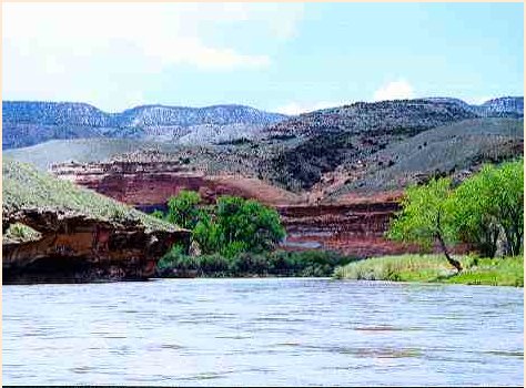
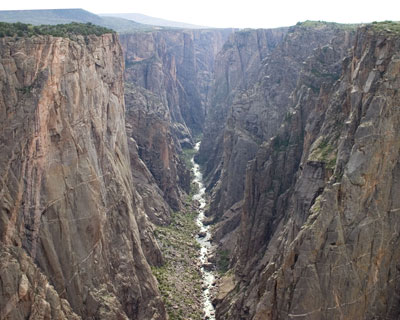
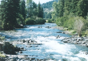
The team studied the food webs of 36 rivers and streams in the United States, ranging in size from the Mississippi and Colorado Rivers to their small tributaries. The study found changes in river hydrology, both drying and flooding, reduce the populations of some species in the middle or top of the food chain, and increase the likelihood of top-predator fish species being eliminated from aquatic ecosystems.

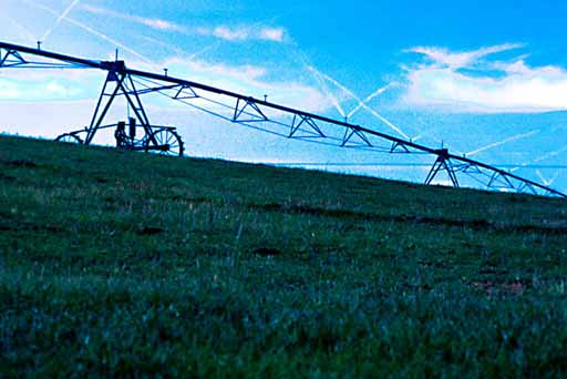
“The question becomes can you have fish and tomatoes on the same table?” said John Sabo, an Arizona State University associate professor and the study’s lead author. “Our results suggest that drying a river to provide water for agriculture and other uses may reduce the production of river-caught fish, a particularly important source of protein in the developing world.”

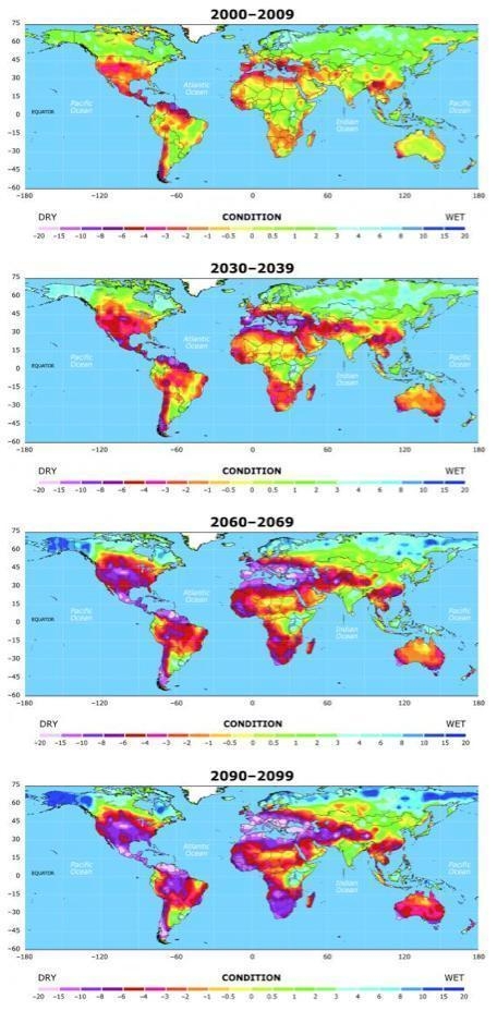
Worldwide, rivers are drying with increasing frequency because of human appropriation of water. Models indicate climate change will further exacerbate river drying and lead to more variable river flows, including flooding, in the future.

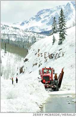
“This information has important implications for the management of U.S. rivers,” said USGS co-author Theodore Kennedy. “For instance, it may be possible to use controlled disturbances, such as experimental high-flow releases from Glen Canyon Dam in Arizona, to manipulate the system to benefit native fish.”

Results of the study, The role of discharge variation in scaling of drainage area and food chain length in rivers, were released October 15, 2010, in Science Express and will appear in Science in November. The research team includes John Sabo, Arizona State University, Tempe; Jacques Finlay, University of Minnesota, St. Paul; Theodore Kennedy, U.S. Geological Survey, Southwest Biological Science Center, Flagstaff, Ariz.; and David Post, Yale University, New Haven, Conn.

Here’s the release from the National Science Foundation (Cheryl Dybas/Skip Derra):

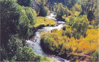
Rivers and streams supply the lifeblood to ecosystems across the globe, providing water for drinking and irrigation for humans as well as a wide array of life forms from single-celled organisms up to the fish humans eat.

But humans and nature itself are making it tough on rivers to continue in their central role to support fish species, according to new research by a team of scientists including John Sabo, a biologist at Arizona State University.

Globally, rivers and streams are being drained due to human use and climate change. These and other human impacts alter the natural variability of river flows.

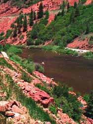
Some affected rivers have dried and no longer run, while others have seen increases in the variability of flows due to storm floods.

The result is that humans and nature are conspiring to shorten food chains, particularly by eliminating top predators like many large-bodied fish.

“Floods and droughts shorten the food chain, but they do it in different ways,” said Sabo.

Sabo is the lead author of a paper reporting results of a study of 36 rivers in this week’s issue of the journal Science.

“The length of food chains is a crucial determinate of the functioning of ecosystems,” says Alan Tessier, program director in the National Science Foundation (NSF)’s Division of Environmental Biology, which funded the research.

“Ecologists have long sought to explain why food chain length varies among different ecosystems. This study provides a quantitative answer to that question for stream ecosystems, and provides critical evidence for the importance of flow variation.”

High flows “take out the middle men in the food web, making fish [the top predator] feed lower in the food chain,” said Sabo. “Droughts completely knock out the top predator.”

“The result is a simpler food web, but the effects we see for low flows are more catastrophic for fish–and are long-lasting.”

Sabo and co-authors–Jacques Finlay, University of Minnesota, St. Paul; Theodore Kennedy, U.S. Geological Survey, Southwest Biological Science Center, Flagstaff, Ariz.; and David Post, Yale University, New Haven, Conn.–suggest that the fate of large-bodied fishes should be more carefully factored into the management of water use, especially as growing human populations and climate change affect water availability.

The researchers studied rivers and streams in the U.S. ranging in size from the Mississippi and Colorado Rivers, down to small tributaries.

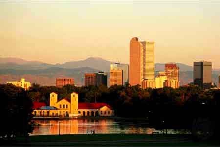
The rivers provide water to large cities like New York City, Minneapolis, Phoenix, Las Vegas and Los Angeles.

The study employed naturally occurring stable isotopes of the element nitrogen to measure how top-predators were faring in the food chain.

Nitrogen provides an indicator as it bioaccumulates, increasing by 3.4 parts per million with each link in the food chain.

“Floods simplify the food web by taking out some of the intermediate players so the big fish begin to eat lower on the chain,” Sabo said.

“With droughts, it’s completely different: droughts eliminate the top predator altogether because many fish can’t tolerate the low oxygen and high temperatures that result when a stream starts drying out.”

He added that climate change will play a growing role in coming years.

“Climate is giving us a new set of operating terms to work with,” Sabo said. “We will experience overall drying and greater weather variability, both of which will shorten river food chains.

There will be drying in some regions, particularly along the equator, and increased flow in some rivers, primarily at higher latitudes, scientists believe.

“We will see more variability because there will be change in the seasonality of storms,” said Sabo. “Ocean currents are changing, and the way the ocean blows storms our way is going to be different.”

The human effect on rivers and streams, and the food chain they support, is closely tied to land-use change, such as water diversion and regulation of flows due to dams.

Sabo outlined a classic scenario that humans face during drought years.

As drought takes hold, the need for water for irrigation and agriculture increases and leads to a draw-down of natural river flows.

The effects downstream can be devastating.

“We would not have guessed that the infrequent drought that results would have a big effect on a stream, but our results show that it does,” Sabo said.

“Some streams affected by drying five to ten years ago are still missing large-bodied fishes, compared with same-sized streams that never dried.

“Food webs can recover sooner after a flood, in roughly a year, but it takes far longer to recover in the case of drying or drought.”

The study hints that competing users of a river’s water–for agricultural production and recreational uses like fishing–need to work out amenable uses of rivers and streams that not only look to the immediate future, but also project long-term effects.

“The question becomes: can you have fish and tomatoes on the same table?” Sabo asked.

“They compete for the same resources, and society depends on both: agriculture for grain, fruits, vegetables, and fish for protein, particularly in the developing world.

“Humans may need to make hard decisions about how to allocate water so that we grow the right food, but still leave enough in rivers to sustain fish populations.”

More climate change coverage here.

Dust on snow

A picture named dustonsnowsanjuans.jpg

Here’s Part 3 of Mike Horn’s series running in The Crested Butte News. Click through and read the whole thing. Here’s an excerpt:

There’s a delicate balancing act here of ranching, recreation, water storage and stream health. And when there isn’t enough water to go accommodate everyone’s ideal stream flows, challenging—and often contentious—decisions need to be made. Fortunately things haven’t reached a desperate level in the Gunnison Basin—yet. But if drought conditions and climate change continues, and dust on snow continues to negatively affect water yields and reschedule runoff, conflicts are sure to arise amidst the many stakeholders, near and far, looking for their fill.
After a dry September in the Gunnison Basin, and the continuation of what the experts call a nine- to ten- year drought, stream flows are currently running well below normal. Some of that deficit can certainly also be attributed to dust on snow, and the resulting reduction in overall runoff, paired with snowmelt occurring up to three weeks earlier in the spring.

For ranchers, low flows this time of year make it more difficult to irrigate fields, and raise potential conflicts between recreation and ranching. Significant water is released during the summer from storage facilities like the Taylor Reservoir to accommodate recreation, be it for the boating or fly fishing industry. However, that is not the time of year ranchers need higher stream flows; they need adequate flows in the fall to irrigate their fields as they prepare next season’s hay crop, and bolster feed for cattle that will graze on-site through the winter.

More Gunnison River basin coverage here.

Colorado River District’s fourth quarter meeting October 19

A picture named coloradoriverbasincgs.jpg

Here’s the link to the agenda.

More Colorado River basin coverage here.

NIDIS Weekly Climate, Water and Drought Assessment Summary of the Upper Colorado River Basin

A picture named usdroughtmonitor10122010

Here are this week’s notes from the Colorado Climate Center.

Denver Water rates going up?

A picture named cityparksunrise.jpg

Here’s a release from Denver Water (Lori Peck):

Denver Water staff presented to the Board of Water Commissioners a preliminary proposal to adjust water rates for 2011 at its meeting today. The adjustment would provide further funding for the utility’s capital projects, which include upgrades to aging infrastructure over the next decade.

“We need to invest in our water system so we can continue to provide reliable service and clean water to our community,” said Angela Bricmont, director of finance. “Next year’s projects include more forest health related work like dredging Strontia Springs Reservoir, as well as replacing the 105-year old valves at Cheesman Dam, finishing major upgrades at Williams Fork Reservoir and Dam, and stepping up our pipe rehabilitation and replacement program.”

The effects of the proposed changes on customer bills would vary depending upon the amount of water the customer uses and whether the customer lives in Denver or is served by a suburban distributor under contract with Denver Water; the more customers use, the more they will pay. Under the current rate proposal, average Denver residential customers would see their bills increase by about $41 a year — an average of $3.40 per month. Typical suburban residential customers served by Denver Water would see an increase of $32 per year — an average of $2.66 per month. For example, the average annual cost for water for an inside-city customer in 2010 was $330, and would be $371 in 2011. Similarly, the average annual cost for an outside-city customer in 2010 was $555, and would be $587 in 2011. Adjustments also have been proposed for commercial, industrial and government customers.

“The future is going to be very challenging for every western water system,” said Tom Gougeon, Denver Board of Water Commissioners vice president. “We all face similar issues, including the need to invest in infrastructure, new supplies, watershed protection, recycled water and conservation. And, we live in an era where climate change will likely shrink supplies and increase demand. Even with a focus on cost control, productivity and efficiency, the cost of providing water is going to go up. Our job is to ensure that our customers are getting good value for the increasing investment they will need to make.”

If the proposed adjustments are approved, they would take effect March 2011. Rates for Denver Water customers living inside the city would remain among the lowest in the metro area, while rates for Denver Water residential customers in the suburbs would still fall at or below the median among area water providers.

Denver Water owns and maintains more than 3,000 miles of distribution pipe — enough to stretch from Los Angeles to New York — as well as 12 raw water reservoirs, 22 pump stations and four treatment plants. Ongoing rehabilitation and replacement of infrastructure is needed throughout the water distribution system, much of which dates back to post-World War II installation or earlier.

Denver Water plans to expand its system capacity over the next decade to meet the future needs of its customers by expanding the utility’s recycled water system, enlarging Gross Reservoir by 18,000 acre-feet, finishing the development of gravel pits that store reusable water, and exploring ways to work with other water providers to bring more supplies to its system.

Denver Water is funded through rates and new tap fees, not taxes. Its rates are designed to recover the costs of providing reliable, high-quality water service and to encourage efficiency by charging higher prices for increased water use. A significant portion of Denver Water’s annual costs do not vary with the amount of water sold and include maintenance of the system’s distribution pipes, reservoirs, pump stations and treatment plants. Denver Water also examines and adjusts its capital plan as necessary each year.

The Board is expected to vote on the proposed changes on Wednesday, Nov. 17, after considering public comment. Public comment will be taken at the Nov. 10 and Nov. 17 Board meetings at 9 a.m. The meetings are open to the public and will be held at Denver Water, 1600 W. 12th Ave. Public comment also will be taken at Denver Water’s Citizen’s Advisory Committee meeting, Thursday, Oct. 21, 6:15 p.m., at Denver Water. Comments also may be sent to the Board via e-mail.

See details of the 2011 rates proposal. Members of the public who have questions about the proposed rate adjustment may call 303-628-6320.

More Denver Water coverage here.

Aurora: Prairie Waters dedication today

A picture named prairiewaterstreatment.jpg

From the Denver Business Journal (Cathy Proctor):

The project (website here) boosts Aurora’s water supply by 20 percent — about 3.3 billion gallons of water a year. It came in ahead of schedule and $101 million under the original $754 million budget, said Greg Baker, spokesman for the Aurora Water Department. “We’re ahead of schedule and well under budget,” Baker said. “How often does a city get to say that?”

Water equivalent to what Aurora gets from the Western Slope, uses and sends into the South Platte River is pumped out of the river near Brighton, then filtered through a series of gravel and sand beds into a pipeline. The 34-mile pipeline sends the water to a new treatment plant. From there it goes on to city residents and businesses — who use it before its returned to the river. It’s a continuous loop of use and re-use. “It’s one of the most sustainable new water supplies in the Southwest,” said Scott Ingvoldstad, a spokesman for CH2M Hill. “It combines natural purification with a state-of-the-art new treatment facility that uses the latest technology to ensure that Aurora will have a sustainable and high-quality water supply for many decades. “It uses water rights that Aurora already owns and recaptures them in the South Platte River so that they didn’t have to build a new dam on the Western Slope. It’s making the most efficient use of the water rights that they already own,” Ingvoldstad said.

More Prairie Waters coverage here and here.

Pueblo County files appeal of judge’s ruling forcing the county out of Fountain Creek lawsuit

A picture named fountaincreekwatershed.jpg

From The Pueblo Chieftain (Robert Boczkiewicz):

[Pueblo District Attorney Bill Thiebaut] filed a notice Wednesday in U.S. District Court that he is appealing a judge’s 2007 decision that kicked out his 2005 lawsuit against Colorado Springs.
“Our office is confident the district court orders will be overturned by the Tenth Circuit Court of Appeals and that our claims will be reinstated,” Thiebaut said…

[Senior Judge Walker Miller] concluded in a 2007 decision in favor of the city that district attorneys do not have the legal authority to use the Clean Water Act to sue, as Thiebaut had done, on behalf of county citizens.
Thiebaut, in addition to appealing Miller’s decision to throw out his lawsuit, stated in Wednesday’s court filing that he also is challenging other decisions the judge made. One of those decisions granted the request of city-owned Colorado Springs Utilities to be removed as a defendant. Another decision granted Colorado Springs’ request to recover from Pueblo County about $7,475 in costs — not attorneys’ fees — the city purportedly incurred in fighting Thiebaut’s lawsuit. Appeals to the federal appeals court in Denver, where Thiebaut’s challenges are headed, typically take 18 to 24 months to be decided by the appellate judges.

More Fountain Creek coverage here. More on the lawsuit here.

Arkansas River Basin: Walsenburg water rights meeting recap

A picture named arkansasriverbasin.jpg

From The Trinidad Times (Steve Black):

James G. Felt, a Colorado Springs-based water rights lawyer, was the featured speaker at the meeting, along with Steve Witte, State Engineer for Colorado. Felt, who also teaches at the University of Colorado’s Continuing Education Division in Advanced Real Estate Law and Water Law, commented on the increasing awareness of the scope of the water rights problem. He said one of the reasons he and Witte had come to the meeting was to clear the air, describing the history of the water rights issue in the mountain West, and offering solutions to water users who find it difficult to understand complex, and sometimes confusing, water rights laws.

Felt spoke about the recent controversy in Crowley County, where the city of Colorado Springs bought up a canal long used by area farmers and ranchers. The water from the canal was then diverted to supply the exploding population of Colorado Springs, resulting in economic and environmental devastation for Crowley County. Without water for irrigation, the county’s agricultural land dried up, the land lost most of its value, the tax base collapsed, jobs were lost and essential government services could no longer be maintained. Felt spoke about County 1041 regulations, the state legislature’s reaction to what had happened in Crowley County, and other places in the state. “The purpose of the county 1041 regs is to mitigate the damage caused by drying up land,” Felt said. “If you dry up agricultural land it affects the tax base. The 1041 regs are designed to create a formula for balancing competing interests. By these laws, if you dry up farmland and that causes a loss in the tax base, then that loss has to be countered by a gain somewhere else.”[…]

Ponds are a popular option for many area citizens and communities, as much for beautification as for agricultural purposes. Water held in ponds is subject to evaporation, thus lessening its utility as a resource. Felt emphasized that the ponds are subject to regulations and that those having them or wanting to build them need to know what the rules are regarding ponds. He also discussed the issue of head stabilization ponds, where a rancher can hold water in a pond for a maximum of 72 hours before releasing it downstream. Augmentation, a process where, when water is depleted from a resource it must be replaced from another resource, was also discussed at length by Felt. He has worked on augmentation issues for 35 years, and said that laws vary on the subject, depending on whether the resource used is a tributary or non-tributary source.

More Arkansas River basin coverage here.

2010 Colorado elections: Proposition 101, Amendment 60 and Amendment 61

A picture named blackcanyoninnercanyonnps.jpg

From The Aspen Times (Janet Urquhart):

“It’s dangerous to use the citizen initiative process to write fiscal policy into the constitution,” said [Reeves Brown, executive director of Club 20], appearing Thursday in Aspen to give his presentation on the three initiatives to anyone who cared to listen. The audience included county Commissioner Rachel Richards, the county’s representative on the Club 20 board of directors, two newspaper reporters and commissioner candidate Jack Johnson. Brown has been traveling the state to present pie charts, graphs and fiscal projections associated with each of the ballot measures. Next week will take him to Grand Junction, Glenwood Springs, Pagosa Springs and Durango, he said.

Club 20, a nonpartisan and generally conservative voice for the Western Slope, represents a diverse constituency spread over 22 counties, but the 22-member board of directors voted unanimously last spring to oppose 60, 61 and 101, or the “Bad Three” as opponents call the measures. “When Club 20 speaks and speaks unanimously, that carries some weight,” Brown said…

The potential effects of the measures are complex and difficult to summarize, he said, and a voter who reads only part of the ballot language for the three measures isn’t likely to realize their ramifications. “Collectively, they will put Colorado in a constitutionally mandated recession,” he said.

More 2010 Colorado elections coverage here.

Interbasin Compact Committee meeting recap

A picture named ibccroundtable.jpg

From The Pueblo Chieftain (Chris Woodka):

State agencies often throw obstacles to moving water projects because of conflicting missions, legal restrictions and narrow interpretations of their purpose, a subcommittee of the Interbasin Compact Committee reported Thursday. “The state needs to be involved in asking the people of the state to support a water project,” said Travis Smith, chairman of the subcommittee. Smith is a rancher and represents the Rio Grande basin on the Colorado Water Conservation Board as well. “There has to be a willingness of state agencies to solve problems rather than create problems.” A task force of state agencies that would establish a process to gain approval for water projects was suggested. It would give proponents of projects a clearer idea of what is needed to obtain permits, Smith said.

The IBCC discussed whether the governor, Legislature or agency directors need to act, and when action would be appropriate. Other concerns included how to interact with federal agencies, overcoming legal restrictions of water court and how the turnover in state government could affect water projects that might take a generation to develop…

“We have to start doing things in a new way, because our tools today are different than 40 years ago,” said Eric Kuhn, manager of the Colorado River Conservation District. “We have to find new approaches to move creative ideas through water court, or else we’re fighting yesterday’s battles.” Kuhn said the district reached substantial agreement with Denver, Colorado Springs and other Front Range water suppliers eight years ago, but the process has stalled in water court…

The IBCC gave the proposal its nod as part of a report on how to deal with projected shortfalls of municipal water supply. The final report is expected to be completed in December.

More IBCC — basin roundtables coverage here.

2010 Colorado elections: Salazar/Tipton debate recap

A picture named lakeforkgunnisonriver.jpg

From The Pueblo Chieftain (Peter Roper):

Tipton has campaigned against earmarks, the special projects that Salazar and other lawmakers put in budget bills for their districts. Salazar was happy to hold up the $5 million he secured this year for the initial funding of the Arkansas Valley Conduit, the pipeline that is intended to take water from Lake Pueblo to communities down the valley.

He said Tipton apparently preferred to “stand idly by” while federal dollars were sent to other states. “Stand idly by?” Tipton answered, saying Salazar had voted for spending bills that helped drive the deficit to $13 trillion. That was greeted by Salazar supporters with shouts of “Bush! Bush!” — a reference to President George W. Bush’s administration. Pressing on, Tipton said he would support the conduit too, “But we also need to look out for our wallets.”

More coverage from Joe Hanel writing for The Durango Herald. From the article:

The Chieftain of Pueblo sponsored the debate. The newspaper has long advocated for the protection of the area’s water, and the first two questions centered on water issues. “The Salazars have never walked away from a water fight,” Salazar said, noting that he fought the 2003 water bonds known as Referendum A.

Tipton also said he would fight for water, but he would oppose earmarks in Congress, even for popular local projects like an Arkansas Valley water system.

“I think you as American citizens deserve to be dealt with squarely. Let’s have a straight-up vote,” Tipton said.

Salazar said he was proud that he secured an earmark for the Arkansas Valley project, and he will not stop seeking earmarks for his district.

“(Tipton) would rather sit idly by and allow California and New York to fight for that funding. I went to Washington to fight for the 3rd Congressional District, and I will fight to the death,” Salazar said.

Tipton replied that the federal debt is already too large to allow more spending without also making cuts.

More 2010 Colorado elections coverage here.

Aspinall Unit update

A picture named aspinallunitdescription.jpg

From email from Reclamation (Dan Crabtree):

Reclamation will be reducing releases from Crystal Reservoir during the coming weeks in response to the dry fall conditions and to provide low river elevations for the Brown Trout spawn. The target base flow for the Black Canyon will be 400 cfs this winter due to the current dry conditions. On Saturday October 16th at 4:00 p.m., releases from Crystal dam will be reduced by 100 cfs resulting in a flow in the Black Canyon and Gunnison Gorge of about 500 cfs. During the coming weeks, as the Uncompahgre Valley Water Users reduce diversions through the Gunnison Tunnel, there will probably be some minor flow fluctuations in the river. Flows in the Gunnison Gorge and Black Canyon will settle in the 400 cfs range sometime during the last two weeks of October.

More Aspinall Unit coverage here.

Fryingpan-Arkansas Project update

A picture named fryingpan.jpg

From email from Reclamation (Kara Lamb):

It is the time of year where we start making adjustments to Ruedi Dam for our fall and winter release schedule. As a result, we will curtail releases from Ruedi to the Fryingpan tomorrow, October 15, by about 35 cfs. This will put around 75 cfs in the ‘Pan at the Ruedi Dam gage.

Inflow to the reservoir has been dropping over the course of this week. It is currently around 45 cfs. The reservoir water elevation is at 7738 feet.

More Fryingpan-Arkansas Project coverage here.

Energy policy — oil shale: Three research projects are moving on to an NEPA review

A picture named shelloilshaleprocess3

Update: Here’s a release about the oil shale NEPA review from Governor Ritter’s office (Evan Dreyer):

GOV. RITTER STATEMENT ON BLM STEPS TOWARD OIL SHALE RD&D LEASING

Gov. Bill Ritter issued the following statement today regarding the U.S. Bureau of Land Management’s steps toward additional oil shale research activities:

“BLM Director Bob Abbey’s announcement that it will continue to analyze three oil shale research proposals follows Interior Secretary Salazar’s important reforms in Research, Development & Demonstration leasing. The RD&D program that this Administration is implementing has elements that I have long supported, including constraints on the size of leases and substantial due diligence and reporting requirements.

“Colorado has always supported a robust RD&D process to research and evaluate the technologies that could be used to develop oil shale and to better understand the environmental impacts.

“The potential for oil shale development in Colorado, and the economic opportunity that it represents, is huge. But the prospect of commercial-scale activities raises significant questions about how oil shale can be successfully integrated into our state’s economy and how we can protect the state’s environment, water, wildlife and communities.

“The RD&D program is wisely designed to answer fundamental questions about the feasibility of the technologies, their likely impacts on the environment and communities of Western Colorado, and their use of our scarce and valuable water supplies. As I have always maintained, these questions must be answered before oil shale research can transition to commercial development.

“I’m therefore pleased that Director Abbey is taking such a thoughtful approach.”

Here’s the release from the Bureau of Land Management (Matt Spangler/Vince Vogt):

The Bureau of Land Management today announced that it has taken a key step to advance research on an important potential source of domestic energy.

The BLM’s Washington, D.C., Office has completed its review of three nominations for oil shale Research, Development, and Demonstration (RD&D) leases in Colorado and Utah. These second-round leases would allow the proponents to test the feasibility of various oil shale recovery technologies on public lands in the two states. The nominations will now be forwarded to the agency’s Colorado and Utah State Offices for the next phase in the review process.

BLM Director Bob Abbey said, “To determine whether oil shale will be a viable energy source on a commercial scale, we need to support critical research to answer fundamental questions about the feasibility of the technologies, their impacts on the environment and local communities, and their use of water. This second round of leases will help us answer those critical questions so that we can chart a safe, orderly, and responsible path for our energy future.”

Abbey added, “The BLM is committed to careful consultation with all affected stakeholders in the oil shale process, including states, counties and tribes. The analysis that our states will now conduct will help us chart a wise path for western shale oil resources.”

In November 2009, the BLM published a notice in the Federal Register calling for nominations for a potential second round of oil shale RD&D leases, following the awarding of six leases in an initial round in 2007.

The BLM solicited nominations of parcels, not to exceed 160 acres, for the conduct of oil shale research, development, and demonstration under a 10-year lease term. Applicants could also identify up to an additional 480 acres to be reserved for a potential commercial lease, for a total of 640 acres. The lease size available for commercial development was reduced from the 5,120 acres in the first round of leasing because the substantial reserves represented by 640 acres are more than adequate for a major oil shale production operation. The second- round leases would contain substantial diligence requirements, including specific timeframes for submitting plans of development, obtaining state and local permits, developing infrastructure, and submitting quarterly reports.

The BLM received three nominations in early 2010: two in Colorado, from ExxonMobil Exploration, Co., and Natural Soda Holdings, Inc.; and one in Utah, from AuraSource, Inc.

Earlier this year, the BLM formed an Interdisciplinary Review Team (IDRT) with representatives of the Governors of Colorado, Utah, and Wyoming; the Department of Energy; and the Colorado School of Mines. The team recommended that all three nominations be advanced.

The Colorado and Utah offices will now conduct National Environmental Policy Act (NEPA) reviews of the nominations. The analyses may take from four to 18 months to complete, depending upon the complexity of the resource issues to be analyzed.

Oil shale is a fine-grained sedimentary rock containing organic matter from which shale oil may be produced. The organic matter, derived mainly from aquatic organisms, is called kerogen.

According to the United States Geological Survey, the U.S. holds more than half of the world’s oil shale resources. More than 70 percent of the U.S. supply lies on Federal lands in Colorado, Utah, and Wyoming.

From the Deseret News (Amy Joi O’Donoghue):

Colorado and Utah offices of the BLM will now complete a federally mandated environmental review. That could take up to 14 months. One lease is held by AuraSource in Utah, while the other two are in Colorado with Exxon?Mobil Exploration Co., and Natural Soda Holdings Inc.

AuraSource Chief Financial Officer Eric Stoppenhagen said the two-year-old company uses a low-temperature catalytic process to recover oil from oil shale, relying on less than one barrel of water per barrel of shale oil that is produced. Water consumption is driven more by mining and road dust control, as well as reclamation efforts. In China, AuraSource’s plant in Qinzhou has the processing capacity of 1 million tons of oil shale.

BLM’s director Bob Abbey said the projects will serve as a good blueprint to answer fundamental questions about the technology of oil shale extraction. “To determine whether oil shale will be a viable energy source on a commercial scale, we need to support critical research to answer fundamental questions about the feasibility of the technologies, their impacts on the environment and local communities, and their use of water,” Abbey said. “This second round of leases will help us answer those critical questions so that we can chart a safe, orderly and responsible path for our energy future.”[…]

Environmental groups, however, blasted the announcement. “Oil shale is nothing more than a dirty, expensive pipe dream,” said Bobby McEnaney, lands advocate for the Natural Resources Defense Council. “This administration is making smart decisions by investing in clean energy that will create jobs and reduce our dependence on oil. Oil shale undermines that effort,” McEnaney said.

More coverage from the Colorado Independent (David O. Williams):

BLM director Bob Abbey today announced the federal agency has reviewed nominations for three potential lease-holders — ExxonMobil and Natural Soda in Colorado and AuraSource in Utah – and will now forward them on to state regulatory agencies for the next phase of consideration. “The potential for oil shale development in Colorado, and the economic opportunity that it represents, is huge,” [Governor Ritter] said in a release. “But the prospect of commercial-scale activities raises significant questions about how oil shale can be successfully integrated into our state’s economy and how we can protect the state’s environment, water, wildlife and communities.”

“People have been trying to figure out how to suck the hydrocarbons out of these rocks for over a century,” former oil shale worker Craig Thompson said in a release. Thompson is now a professor of engineering at Western Wyoming Community College and on the board of the National Wildlife Federation. “No one has found an economic solution. When Exxon pulled the plug on their $5 billion gamble and laid off 2,200 workers, the West learned a bitter lesson. The last thing we need is another pipe dream and another economic ‘bust.’”

More coverage from the Denver Business Journal (Cathy Proctor):

The leases — the second round of federal oil shale leases offered in recent years — underwent review at federal agency’s headquarters in Washington and now will undergo additional review by BLM personnel in Colorado and Utah, the agency said. The department-level review team included representatives of the governors of Colorado, Utah and Wyoming, the U.S. Department of Energy and the Colorado School of Mines. The team recommended that all three nominations be moved to state-level reviews. The BLM’s Colorado and Utah offices will now conduct National Environmental Policy Act (NEPA) reviews of the proposals, a process that could take four to 18 months to complete, according to the BLM.

More oil shale coverage here.

Animas-La Plata Project: Planner to host a series of public meetings to help chart the course of recreation at Lake Nighthorse

A picture named lakenighthorserisingwaters052010

From The Durango Herald (Dale Rodebaugh):

“People are afraid they’re going to get run over,” [Planner Joy Lujan] said. “They fear they aren’t going to be heard.” She wants to dispel these fears by engaging the public in a series of open meetings starting early next month and ending early next year.

Meetings will include:

•One or two open houses with self-explanatory information stations and project participants to answer questions.

•Forums at which members of the public can express opinions. Keypad polling will determine support for different positions.

•Structured workshops to reach tentative agreements on issues such as boating. Motorized versus nonmotorized craft is one contentious topic.

•Design workshops that bring preferred recreation options into the plan.

•A session to review the overall recreation blueprint before it is adopted…

The Animas-La Plata Water Conservancy District took on the job of providing recreation at the lake 18 months ago after Colorado State Parks said it was broke. They caught a break when the National Park Service offered free for two years the services of Lujan to lead the public-participation aspect of a recreation plan. DHM Design of Durango is the consultant on technical and financial matters.

More Animas River watershed coverage here and here.

2010 Colorado elections: The Pueblo Chieftain editorial board endorses John Hickenlooper over Dan Maes and Tom Tancredo

A picture named huerfanoriver1

From The Pueblo Chieftain:

As mayor, and as a former private entrepreneur, he has been able to shrink the size of Denver’s government. He promises to do likewise as governor…

During a Chieftain-sponsored forum in Pueblo this week, Mr. Hickenlooper stated that “we should make sure every drop of water in the Arkansas (River) stays there. We import so much of our oil, just think about if we start importing our food. We have to make sure that resource is protected.”

More 2010 Colorado elections coverage here.

Blue Mesa Reservoir storage pool to protect against a Colorado River Compact call?

A picture named coloradoriverbasin.jpg

The Arkansas and Gunnison Basin roundtables are hoping to push along a storage pool of 200,000 acre-feet of water to protect transmountain diversions junior to the Colorado River Compact. Here’s a report from Chris Woodka writing for The Pueblo Chieftain. From the article:

The roundtable is developing the plan in conjunction with the Gunnison Basin Roundtable. It would release water from storage in Blue Mesa to prevent curtailment of diversions if downstream states in the Colorado River Compact issue a call on the river…

The plan of the Arkansas and Gunnison roundtables would be to store up to 200,000 acre-feet of water to release during dry times in order to allow transmountain diversions to continue. “Our motivation is that almost all of our transmountain rights are junior to the conditional rights of energy companies on the Western Slope,” said Gary Barber, chairman of the roundtable. “For the Gunnison folks, it would shift management to within the state of Colorado.”

The process of getting the Bureau of Reclamation to agree to a storage contract that would renew annually is complicated and the roundtables want to send a team to Washington to explore the possibility, rather than a letter which was proposed at the last meeting…

The group voted to send [Jim Broderick, vice chairman of the Arkansas Basin Roundtable], who has worked with top Reclamation officials through his position as executive director of the Southeastern Colorado Water Conservancy District, to Washington. Under the joint proposal, the Gunnison roundtable would send a representative, and top state water officials would also attend. “We want to see if the water in Blue Mesa could be put to use for the whole state,” Broderick said…

The plan would not allow water from the Gunnison River to be pumped over the Continental Divide, which is still fiercely opposed by water interests in the Gunnison basin, said Jeris Danielson, a water consultant and former state engineer. The storage account proposed in the agreement would provide protection for absolute water rights — water that has been put to a beneficial use rather than simply claimed — prior to Sept. 10, 2010, explained Alan Hamel, executive director of the Pueblo Board of Water Works. It would allow for protection of existing water rights or against depletions in the Arkansas, South Platte and Colorado basins, but would not preclude development of future transmountain projects, he said. “The idea would be to develop a pool of water to be used against a call from the downstream states,” Hamel said. “Other entitlements within the state could still be developed.”

Colorado’s Front Range imports nearly 500,000 acre-feet (160 billion gallons) annually from the Western Slope. The Arkansas Valley imports about 130,000 acre-feet (42 billion gallons) annually, through the Twin Lakes, Boustead, Homestake and Carlton tunnels, as well as several ditches.

More IBCC — basin roundtables coverage here.