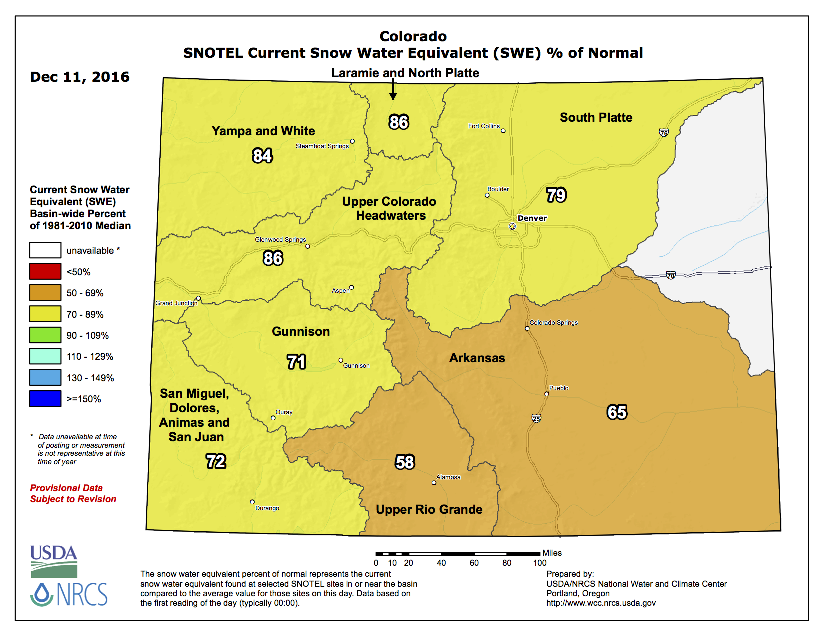
#Snowpack news: Upper #ColoradoRiver, Laramie and North Platte basins = 86% of normal (best in state) Here’s the West-wide basin-filled map from the NRCS: Westwide SNOTEL basin-filled map December 11, 2016 via the NRCS. And here’s the statewide basin-filled map from the NRCS: Statewide snowpack December 11, 2016 via the NRCS. Share this: Share on Bluesky (Opens in new window) Bluesky Share on LinkedIn (Opens in new window) LinkedIn Share on Facebook (Opens in new window) Facebook Email a link to a friend (Opens in new window) Email Print (Opens in new window) Print Share on X (Opens in new window) X Like this:Like Loading…