Here is the Westwide basin-filled SNOTEL map for December 17, 2016 from the NRCS.

Click on a thumbnail graphic to view a gallery of snowpack data from the NRCS.

Colorado statewide SNOTEL basin-filled map December 17, 2016 via the NRCS.

Arkansas River Basin High/Low graph December 17, 2016 via the NRCS.

Upper Colorado River Basin High/Low graph December 17, 2016 via the NRCS.

Gunnison River Basin High/Low graph December 17, 2016 via the NRCS.

Laramie and North Platte Basin High/Low graph December 17, 2016 via the NRCS.

Upper Rio Grande River Basin High/Low graph December 17, 2016 via the NRCS.

San Miguel, Dolores, Animas and San Juan Basin High/Low graph December 17, 2016 via the NRCS.

South Platte River Basin High/Low graph December 17, 2016 via the NRCS.

Yampa and White Basin High/Low graph December 17, 2016 via the NRCS.
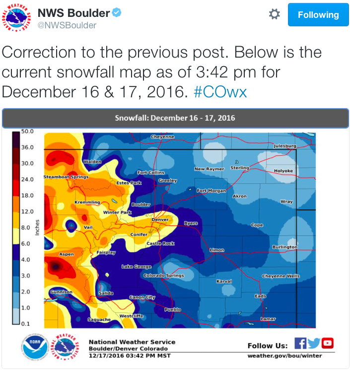
And here’s the snowfall map for the Northern and Central mountains and the eastern plains of Colorado thru December 27, 2016 via NWS Boulder.