Click on a thumbnail graphic to view a gallery of drought data from the US Drought Monitor.
US Drought Monitor map June 29, 2021.
West Drought Monitor map June 29, 2021.
High Plains Drought Monitor map June 29, 2021.
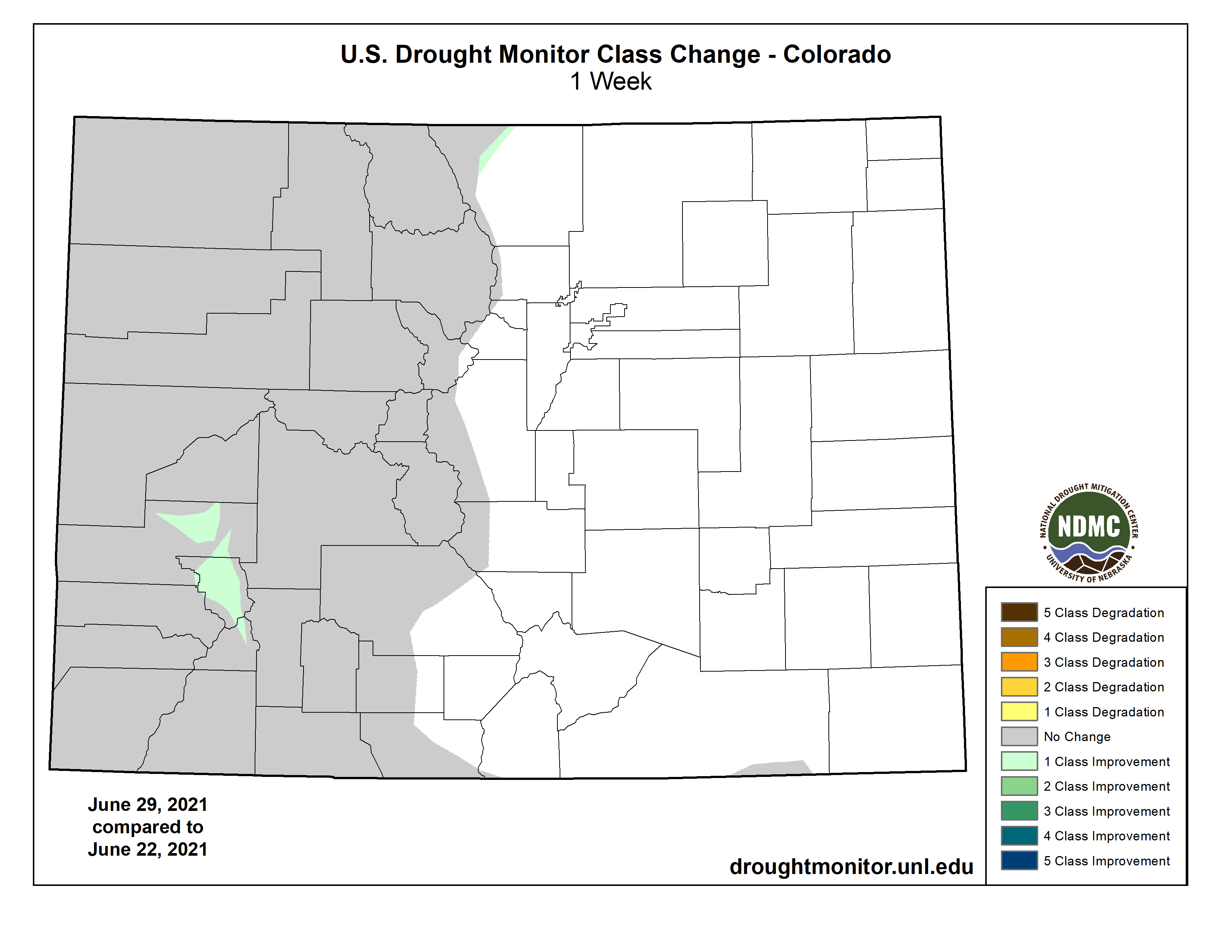
Colorado Drought Monitor map June 29, 2021.
Click here to go to the US Drought Monitor website. Here’s an excerpt:
This Week’s Drought Summary
This week’s U.S. Drought Monitor saw changes to over 30 states this week. Record-breaking heat in the Northwest, Great Basin, and Northeast led to expansions of drought conditions. Meanwhile, multiple rounds of heavy rain across the Central U.S. led to large-scale improvements, and intense rainfall along the Gulf Coast led to the reduction or removal of lingering pockets of abnormal dryness…
The same stalled frontal boundary that affected the Lower Midwest this week also brought widespread rain to the region with the largest totals (2 to 8-plus inches) falling over eastern Kansas and eastern Nebraska. One-category improvements were made in southeast Kansas, eastern and north central Nebraska, and parts of North Dakota as short-term rainfall deficits decreased and streamflow and soil moisture improved. In Colorado, improvements were made to small areas of exceptional (D4) and extreme (D3) drought as recent rainfall has helped chip away at shorter term deficits. Hydrological and ecological drought, which generally occur on longer time scales, remain a concern. In areas which missed out on the heaviest rain, drought continues to impact the region with cattle producers feeling the brunt of the impacts. The USDA reports that 90% of South Dakota and 66% of North Dakota’s topsoil moisture is short to very short, leading to forage shortages. Producers from Wyoming eastward across the Dakotas are having to make tough decisions as to what to do with cattle, with many selling entire herds. In response to the worsening conditions, extreme drought (D3) expanded in South Dakota and parts of Wyoming where supported by increasing rainfall deficits, declining soil moisture and streamflow, and vegetation stress…
Colorado Drought Monitor one week change map ending June 29, 2021.
Unprecedented heat in the Northwest, combined with another week of dry weather, led to worsening drought conditions across the region. This week, high temperatures ranged from 20 to 30 degrees above normal, breaking multiple records. The excess heat greatly increased evaporative demand, further drying out soils and vegetation, and worsening conditions. Many areas in the Northwest saw one-category degradations, including expansions of severe (D2) and extreme (D3) drought. Conditions in the Southwest remained unchanged, except for the expansion of D3 in central Arizona. Much of the West is classified as severe drought or worse. Notable impacts include increased wildlife encounters in California, Nevada, and Utah, as drought has driven snakes and/or bears in search of food and water into urban areas in those states. In Montana, fishing restrictions have been put in place on many rivers due to low flows and warm waters. Drought-stricken ranchers are selling cattle due to poor forage conditions and a lack of feed. On top of this, grasshoppers have been denuding trees and competing with cattle for food. So far, at least eight national forests in the West now have fire restrictions…
A band of substantial rain (6 to 10-plus inches) fell from West Texas to northeast Oklahoma, leading to large areas of one-category improvements as well as some smaller areas of two-category improvements as short-term rainfall deficits, soil moisture, and streamflow improved. Drought and abnormal dryness remain in areas where indicators still show dryness at longer timescales. A re-evaluation next week will help determine the full effect of the rainfall…
Looking Ahead
The National Weather Service Weather Prediction Center forecast for the next five days (July 1 -4) shows that the prolonged heat wave is expected to continue across the interior sections of the Northwest and Northern Rockies and move into the Northern High Plains. In the East, a cold front is forecast to bring relief from the hot, muggy weather in the Northeast, Mid-Atlantic, and Southeast. As the front moves through the region, these areas can expect moderate to heavy rainfall and an increased chance of severe weather.
Moving into next week, the Climate Prediction Center six-to-10 day outlook (valid July 6-10) favors above normal temperatures across the West, Northern and Central Plains, Midwest, and Northeast. Below normal temperatures are most likely across the South, Southeast, and Alaska. Below normal precipitation is expected to continue across much of the west and Northern Plains, while above normal precipitation is favored across most of the rest of the Lower 48 and Alaska.
US Drought Monitor one week change map ending June 29, 2021.
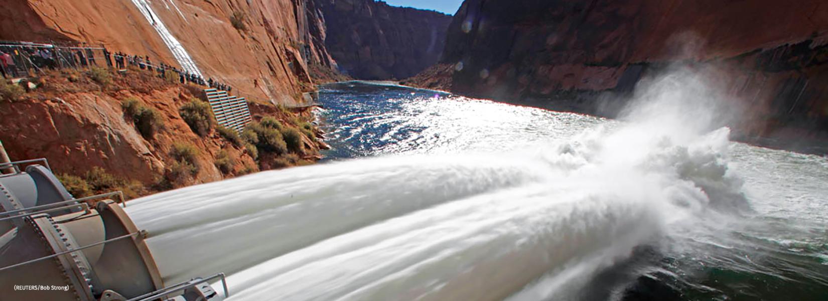
On a spring morning in 1996, then–Interior Secretary Bruce Babbitt stood at Glen Canyon Dam, a concrete bulwark in Arizona that holds back the Colorado River to form Lake Powell. During a live broadcast on the Today show, a popular national TV program, Babbitt opened valves to unleash an unprecedented experimental flood into the Grand Canyon just downstream. As onlookers applauded, water gushed from gaping outlet pipes. Babbitt called the experiment, which was testing one way of restoring Grand Canyon ecosystems damaged by the dam, the start of “a new era” in environmental management.
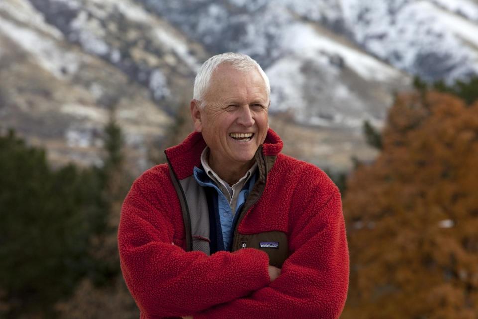
Jack Schmidt was underwhelmed by the scene. He had spent years helping design the controversial experiment—which cost electric utilities nearly $3 million in lost revenue—and fighting to launch it. But compared with the natural deluges that raged down the canyon before the dam was completed in 1963, he remarked to a Los Angeles Times reporter, “This is a pretty wimpy flood.”
That verdict was typical of Schmidt, a river scientist at Utah State University who thinks big and speaks candidly. During his long research career, he has played a major role in revealing how the Colorado River functions, and how forces—natural and human—are reshaping and often damaging it. Despite his bluntness, Schmidt is a go-to expert for stakeholders and policymakers. He has taken them on river trips to explain key research findings, drawing graphs in the sand. And with other researchers, Schmidt has catalyzed far-reaching changes in how government agencies manage the Colorado River system, a critical source of water shared by seven states and Mexico.
“Jack looms very large in both the science and the policy of the Colorado River,” says Gordon Grant, a hydrologist and geomorphologist with the U.S. Forest Service in Oregon. “He’s not afraid to push back on the water managers and he’s not afraid to push back on the environmental groups,” says Tom Buschatzke, director of the Arizona Department of Water Resources. “He’s willing to use science to try to find practical solutions.”
As a warming climate reduces the river’s flow, Schmidt, 70, is making what could be his most important push to shape the fate of his beloved waterway. He and his colleagues are working to inject a dose of scientific reality into public debate over water resources that, the team says, is too often clouded by wishful or outdated thinking. The biggest delusion: that there will be enough water in a drier future to satisfy all the demands from cities, farmers, power producers, and others, while still protecting sensitive ecosystems and endangered species. The hard truth, according to long-term scenarios produced by Schmidt and his colleagues, is that some users will have to consume less water, and that policymakers will face agonizing choices sure to produce winners and losers.
Those are messages that many players aren’t eager to hear, especially states planning to drain more water from the river to fuel growth. But Schmidt says he and his colleagues simply want everyone to understand the potentially divisive trade-offs. “We ask provocative and uncomfortable questions,” he says.
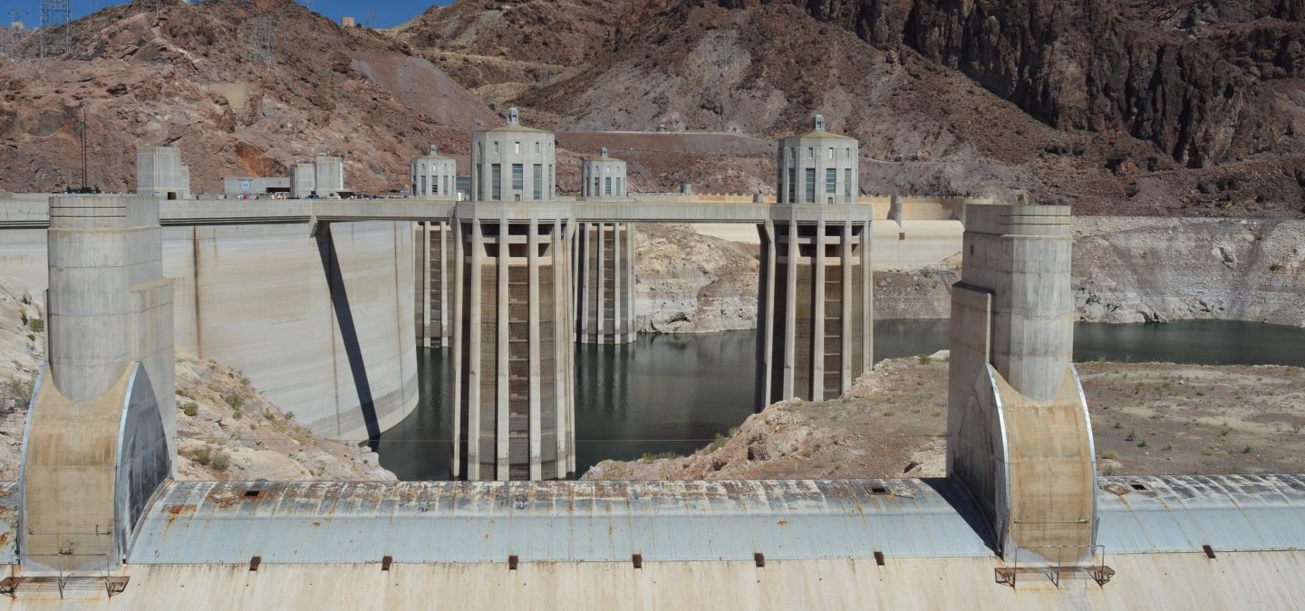
Lake Mead behind Hoover Dam. Lake Mead last month fell to its lowest level since the Hoover Dam was built in 1936. The shoreline has dropped 45 meters since the reservoir was last full in 2000. Photo by Ken Neubecker via American Rivers
The moment is ripe, as a record-breaking drought provides a taste of what more climate change could bring. Last month, Lake Mead, a second massive reservoir downstream from Lake Powell, dropped to its lowest level ever. At the same time, government officials are beginning a 5-year process of renegotiating several key agreements over use and management of the river’s water. They have sought Schmidt’s views. “We had Jack and his team present to our leadership because of the high regard we hold for their research,” says Katrina Grantz, assistant regional director of the Upper Colorado Basin for the federal Bureau of Reclamation, which operates many major dams.
Some see Schmidt’s tell-it-as-it-is approach as critical to developing realistic policies. “Jack is never afraid to speak the truth, according to what the research is saying,” says Mike Fiebig of American Rivers, an environmental group that Schmidt advises. And, he adds, Schmidt will speak “to whoever is listening.”
FOR A CONTINENTAL-SCALE river, the Colorado is not very big, but it has an outsize importance. Rising in the Rocky Mountains, its muddy water has always been crucial to the development of the arid West. In 1936, the Hoover Dam created what is still North America’s largest reservoir, Lake Mead. The dam’s 17 turbines generate electricity that lights Los Angeles, Las Vegas, and other cities, and also powers pumps that lift river water over mountains and into southern California. Engineers built hundreds of kilometers of canals to carry the water to cities and farmers. In Colorado, they constructed numerous tunnels, including one below the continental divide, to deliver water to Denver. Today, more than 40 million people in seven states and many Native American tribes rely on the Colorado River.
The water has long been worth fighting over. In 1922, in a bid to prevent conflicts, states in the watershed divided the rights to nearly 20 cubic kilometers of water, which they assumed was only part of the river’s annual flow. The compact gave half of the water to the lower basin, where cities and farms, especially in California and Arizona, have long used about twice as much water as consumers in the upper basin. The other half was promised to the upper basin, so that states including Colorado and Utah could develop in the future. A follow-on agreement in 1944 gave water to Mexico, where the river’s last drops barely trickle into the sea.
Lawyers and politicians spent decades disputing the terms of the original compact, parts of which remain contested. Meanwhile, it became ever clearer that the compact rested on flawed assumptions, because it was struck when the region was abnormally wet. After the 1930s, the Colorado River carried considerably less water on average for the next 4 decades (see chart, below). The past 2 decades have seen another decline, as the region endures its worst dry spell in 1250 years; flows have been about 19% less than the entire 20th century average. Climate models suggest an additional 30% decline by 2050, as precipitation continues to decrease and the atmosphere warms. The heat dries the soil and causes plants to transpire more, reducing the runoff efficiency—the fraction of precipitation that reaches the river.
The impacts are impossible to miss. From the air, bathtub rings of white stone encircle Lake Mead, which has been less than 40% full since 2015, as well as Lake Powell, which has been below 50% capacity since 2013. Boat ramps have been extended to help keep a large recreational industry afloat. Farmers in multiple states are expecting cutbacks in water deliveries next year. Nevada is launching new conservation measures, including a ban on using Colorado River water to irrigate lawns after 2026.
In some states, the shrinking river has only intensified claims on its flow. “It’s our water,” Utah State Senator Don Ipson (R) proclaimed in March. He was urging his colleagues to support a bill, now awaiting the governor’s signature, that creates a new commission to advocate for the state’s right to develop future water supplies.
Such assertive political jockeying highlights the challenge facing negotiators. They must grapple with key agreements that expire in just 5 years, as well as an inexorably changing climate. “All of that,” says water policy expert Brad Udall of Colorado State University, Fort Collins, “has combined into this slow-moving trainwreck.”
SCHMIDT GREW UP far from the Colorado in suburban New Jersey. He first glimpsed southwestern landscapes in undergraduate geology classes at Bucknell University in Pennsylvania. An encounter with famed river scientist Luna Leopold during his master’s work at the University of California, Berkeley, inspired his passion for natural resource issues. He went on to a Ph.D. at Johns Hopkins University, studying water policy and how rivers reshape landscapes with one of the field’s top experts, Gordon “Reds” Wolman.
Soon he was immersed in a conflict over the Colorado River that had begun in the 1970s, not long after Glen Canyon Dam was completed. The barrier nearly doubled the storage capacity for water, but it dramatically changed river conditions in the Grand Canyon. It cut off supplies of sediment that had created vast sandbars, for example, and released clear, cold water that allowed introduced species, such as trout, to displace native fish adapted to warm, muddy flows. Sudden releases of water to meet electrical demand, an operation called hydropeaking, disturbed wildlife, plants, and thousands of rafters who were floating the canyon each year.
Annual U.S. precipitation changes by percentage from the 1981–2010 U.S. Climate Normals to the newest data in the 1991–2020 Normals, released by NOAA, May 2021. Decreases indicate a drier Southwest, and increases indicate wetter sections of the Northern Plains, Great Lakes region, and Southeast. Courtesy of CISESS.
Environmental groups sued, demanding that the Bureau of Reclamation do more to protect the ecosystem. In response, in 1982 the federal government launched what became a $12 million research program to probe dam impacts. Schmidt was funded to study the Grand Canyon’s sandbars, which river guides complained were shrinking, depriving them of camping spots.
Schmidt’s research helped explain the losses, revealing how swirling water digs up sediment in certain places and drops it elsewhere. The work “really has been foundational for all the thinking about sandbar dynamics since,” says Grant, who was a student alongside Schmidt at Johns Hopkins.
During a chilly rafting trip studying erosion, Schmidt and others discussed what could be done to prevent the losses. By the light of a campfire, they drafted a “beach bill” in his field book, sketching out the kind of federal legislation that could safeguard the canyon’s beaches.
A few years later, Bill Bradley, a Democratic senator from New Jersey, visited Middlebury College, where Schmidt was a faculty member. He and three students handed the senator a report they had written on sandbar erosion. Bradley took it with him when, the next month, he visited the canyon to see the problems for himself.
Bradley and other lawmakers were crafting their own bill, which became the Grand Canyon Protection Act of 1992. It helped set the stage for the experimental floods that began in 1996. The idea, developed by a small group of researchers including Schmidt, was that artificial floods could carry sand downstream. Although Glen Canyon Dam blocks most of the sand that used to wash down the main river channel, tributaries below the dam still supply some. The floods would drop the sediment onto sandbars. Dam operators weren’t eager to cede control to the scientists, though. “Jack had to duke it out,” Grant says.
The experimental floods have proved only modestly successful, in large part because the tributaries don’t deliver enough sediment to make a huge difference. Rich Ingebretsen, co-founder of the Glen Canyon Institute, an environmental group, says the real significance of the first experiment was that dam operators now consider environmental impacts—and not just the needs of electric utilities, farmers, or recreational boaters—in deciding when and how much water to release. “It ushered in a new world,” Ingebretsen says. “Environmentalists were now working with water managers for the first time in the history of the country.”
POLICYMAKERS HAVE BEEN slower to grapple, at least publicly, with a question that extends far beyond the river’s ecosystems and recreational opportunities: the limits of its ability to supply all the water the West wants, now and in the future.
Schmidt remained focused on river dynamics and developing strategies to lessen the impact of dams on ecosystems, first at Utah State and then, starting in 2011, as chief of the U.S. Geological Survey’s Grand Canyon Monitoring and Research Center (GCMRC), which helps guide restoration and management efforts. Martin Doyle, who studies river science and policy at Duke University, says he was skeptical that Schmidt would thrive as a government official, in part based on his frank approach to peer-reviewing papers. “He always signed his reviews and it was always just brutal, because he wasn’t tolerant of sloppy thinking.” But Schmidt had remarkable success boosting his staff ’s morale and conditions for research, Doyle says. “He started to turn the GCMRC from a monitoring center to a science center.”
The new abnormal
For the first third of the 20th century, the Colorado River supplied plentiful water on average, despite large annual fluctuations (top). Then water supply fell to a relatively constant level while use by cities and farms ramped up. Over the past 3 decades, climate change affected supply as rising air temperatures (bottom) increased water loss from soil and plants. Lower runoff efficiency means less rain and melted snow end up reaching the streams that feed the Colorado River.
One research goal was to figure out exactly when an experimental flood would most benefit ecosystems. “Jack had a huge influence,” says Anne Castle, a fellow at the University of Colorado, Boulder, who oversaw water and science policy at the Department of the Interior from 2009 to 2014. “He cares about getting it right, that the river is managed in a way that reflects the best science available.”
The experience at GCMRC also got Schmidt thinking about how regional water supply decisions, often made decades ago, could thwart efforts to improve river management. For example, when his team participated in writing a new plan for operating the Glen Canyon Dam to make sandbars more stable and protect endangered fish such as the humpback chub, it could not consider any changes that were inconsistent with existing water supply agreements. That was frustrating, Schmidt recalls: “Nobody really asked the question: What’s the way to manage the [whole] system that’s the best for Grand Canyon?”
AFTER SCHMIDT LEFT GCMRC to return to Utah State in 2014, he wanted to explore those possibilities—unhindered by political and institutional constraints. He set up an interdisciplinary research center, and 2 years ago pulled together an all-star team of water experts for the effort, called the Future of the Colorado River Project. Among the collaborators: Udall, a veteran of western water policy; Eric Kuhn, retired general manager of the Colorado River Water Conservation District, a planning agency, who provides a practical perspective; and Kevin Wheeler of the University of Oxford, a master of complex hydrological models.
The group has so far released six white papers. Some address technical matters, such as how to improve the models used to develop management policy for reservoirs. Others have scrutinized hot-button proposals, such as prioritizing water storage in Lake Mead and keeping less in Lake Powell. This proposal, called Fill Mead First, could be a first step toward dismantling Glen Canyon Dam and restoring the canyon behind it. (Schmidt’s team concluded the approach wouldn’t save much water and would likely greatly perturb the downstream ecosystem.)
The latest installment, released in February, evaluated for the first time how rising temperatures and declining runoff might jeopardize the regional water supply. The white paper also looked at how demand might change in coming decades. Using the same computer model that the Bureau of Reclamation and state water agencies use, known as the Colorado River Simulation System, the team examined numerous scenarios, including how meager runoff could reduce water storage in Lake Powell and Lake Mead to critical levels. At one threshold dam turbines couldn’t generate electricity. If levels fall even lower, the reservoirs can no longer release water to alleviate downstream shortages, leaving users at nature’s mercy.
Glen Canyon Dam high flow release photo.
The modeling, done by Wheeler, showed reservoirs might dip into the danger zone, perhaps within 2 to 3 decades, assuming the present drought persists. To maintain a degree of water security, the study found that upper basin users would have to cap consumption at a long-term average, and lower basin states might have to cut their use by as much as 40% by the 2050s. “Colorado River outlook darkens dramatically in new study,” ran a headline in the Arizona Daily Star.
That is a “really bold and difficult upshot,” Fiebig of American Rivers says. And although it’s not news to veteran water experts, says Elizabeth Koebele, an environmental social scientist at the University of Nevada, Reno, “bringing that [message] into the broader policy conversation is pretty provocative now.” The results mean the upper basin can’t develop all of its water rights, Schmidt says. Making that scenario “completely transparent forces everybody to deal with it.”
Not surprisingly, some groups argue the study is overly pessimistic. Amy Haas, executive director of the Upper Colorado River Commission, notes the white paper uses “obsolete” water demand forecasts from 2007. The more recent forecast predicts less of an increase, she says. (Schmidt says those numbers don’t change the overall picture.) Average demand for water has not risen in recent decades in the upper basin, Schmidt notes, and it will likely stay flat and shift. More water may become available to citiesas coal-fired power plants close and agricultural practices shift. Other change may be in store if Native American tribes decide to assert their water rights and develop or market them outside of their reservations.
Buschatzke of the Arizona Department of Water Resources says the group’s sobering scenarios are helpful for informing decision-making. “We understand what they’re doing is pushing the envelope, rightly so for academia.” But he says the department must create a water supply plan that is acceptable to diverse parties. Some lower basin groups are likely to oppose any plan that calls for cuts, he says, whereas conservation-minded advocates might push for even larger cuts.
Upper basin states, meanwhile, remain staunchly opposed to any notion of giving up future development. In Utah, which had the nation’s fastest growing population over the past decade, despite having the second driest climate, officials want to build a 225-kilometer pipeline to tap more water from Lake Powell. They shrug off concerns about how that could affect downstream supplies. Critics of Utah’s new water advocacy agency worry it will simply deny the reality of climate change as it attempts to protect the state’s water rights. “The Utah State Legislature is still mired in an era of unreality,” says Daniel McCool, a political scientist at the University of Utah. The state’s recent moves amount to “a declaration of water war, frankly.”
THE NEW ROUND OF NEGOTIATIONS over the Colorado compact will reveal just how far the parties are willing to go in acknowledging the worst case scenarios. “It’s all coming to a head,” Koebele says. “The extreme drought … is really highlighting that we do need to think more creatively.” Some of the big ideas floated by Schmidt’s group include new water accounting methods that span the entire basin, which would allow more flexible dam operations, and expand voluntary water banking and market exchanges of water rights.
Even as Schmidt works to highlight the risks of business as usual, he knows he may have to accept another difficult truth: that, in the end, people might once again decide to sacrifice the Colorado River ecosystems in order to get the water they want for cities, farms, and power.
Currently, environmental management programs—including some he helped design—mitigate some of the most severe impacts of existing dams and other infrastructure. But that won’t suffice as climate change and new water demands take hold. “We can’t solely rely on tweaking small aspects of reservoir operations to protect river ecosystems,” he says. “We also have to consider how much water rivers need to remain healthy.”
Schmidt would like that need to be a larger part of the upcoming negotiations. His own priority is to preserve the flows of rivers in the upper basin, which are wilder than the lower basin’s highly engineered reaches. When pressed, he confesses to an “aesthetic and philosophical wish” for a return to vanishing and long-gone landscapes of the Colorado. He recognizes that it may be impossible.
Still, Schmidt wants officials debating the future of the Colorado to know the region’s vast and growing human presence is not the only thing at stake. Next month, he will lead scientists, water managers, tribal leaders, and other river stakeholders on a raft trip down the Green River, the longest headwaters tributary of the Colorado. During the 5-day trip, organized by his center at Utah State and American Rivers, Schmidt will use sandbars as classrooms, sharing what he and other researchers have learned about the fish, plants, sand, and dams. The goal, he says, is that “when people are sitting in those conference rooms making decisions about water supply, they have in the back of their mind what these rivers are all about.”
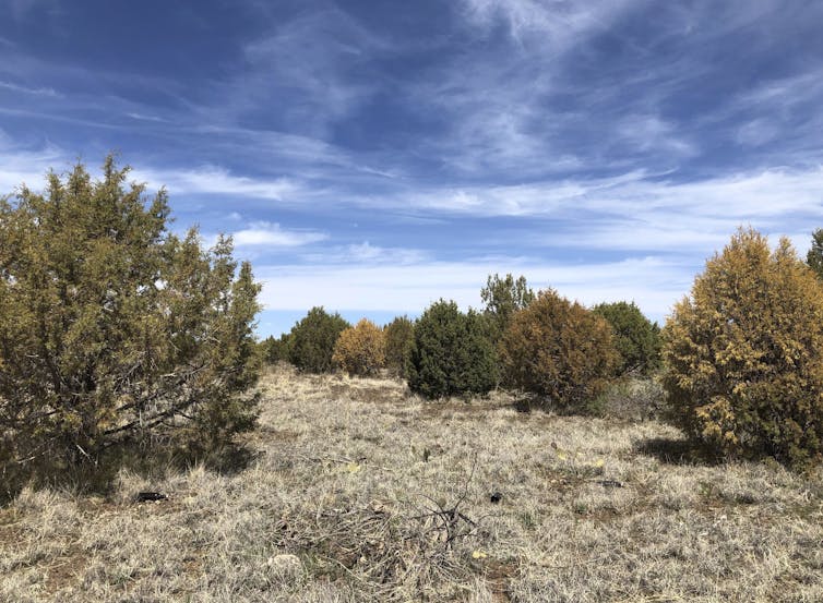
Like humans, trees need water to survive on hot, dry days, and they can survive for only short times under extreme heat and dry conditions.
During prolonged droughts and extreme heat waves like the Western U.S. is experiencing, even native trees that are accustomed to the local climate can start to die.
Central and northern Arizona have been witnessing this in recent months. A long-running drought and resulting water stress have contributed to the die-off of as many as 30% of the junipers there, according to the U.S. Forest Service. In California, over 129 million trees died as a consequence of a severe drought in the last decade, leaving highly flammable dry wood that can fuel future wildfires.
Trees survive by moving water from their roots to their leaves, a process known as vascular water transport.
Water moves through small cylindrical conduits, called tracheids or vessels, that are all connected. Drought disrupts the water transport by reducing the amount of water available for the tree. As moisture in the air and soil decline, air bubbles can form in the vascular system of plants, creating embolisms that block the water’s flow.
The less water that is available for trees during dry and hot periods, the higher the chances of embolisms forming in those water conduits. If a tree can’t get water to its leaves, it can’t survive.
A dyed cross section of a ponderosa pine sapling shows the water transport tissue and conduits. Raquel Partelli Feltrin
Drought stress also weakens trees, leaving them susceptible to bark beetle infestations. During the 2012-2015 drought in the Sierra Nevada, nearly 90% of the ponderosa pines died, primarily due to infestations of western pine beetles.
Fire damage + drought also weakens trees
Although fire is beneficial for fire-prone forests to control their density and maintain their health, our research shows that trees under drought stress are more likely to die from fires. During droughts, trees have less water for insulation and cooling against fires. They may also reduce their production of carbohydrates – tree food – during droughts, which leaves them weaker, making it harder for them to recover from fire damage.
Trees that suffer trunk damage in a fire are also less likely to survive in the following years if drought follows. When trees have fire scars, their vascular conduits tend to be less functional for water transport around those scars. Traumatic damage to the vascular tissue can also decrease their resistance to embolisms.
So, burned trees are more likely to die from drought; and trees in drought are more likely to die from fire.
What does this mean for future forests?
Trees in Western forests have been dying at an alarming rate over the past two decades due to droughts, high temperatures, pests and fires. As continuing greenhouse gas emissions warm the planet and drive moisture loss, increasing the frequency, duration and intensity of droughts, research shows the U.S. and much of the world will likely witness more widespread tree deaths.
The impact that changing drought and fire regimes will have on forests farther in the future is still somewhat unclear, but several observations may offer some insight.
There is evidence of a transition from forests to shrublands or grasslands in parts of the Western U.S. Frequent burning in the same area can reinforce this transition. When drought or fire alone kills some of the trees, the forests often regenerate, but how long it will take for forests to recover to a pre-fire or pre-drought condition after a large-scale die-off or severe fire is unknown.
In the past decade, the Western U.S. has witnessed its most severe droughts in over 1,000 years, including in the Southwest and California. A recent study found subalpine forests in the central Rockies are more fire-prone now than they have been in at least 2,000 years.
If there is no change in greenhouse gas emissions, temperatures will continue to increase, and severe drought stress and fire danger days will rise as a result.