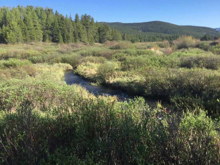
The investigative drilling proposed along Homestake Creek in Eagle County, Colorado could dewater and destroy valuable wetlands. Photo by Marjorie Westermann.
Here’s the release from Wild Earth Guardians (Jen Pelz):
To safeguard irreplaceable wetlands and imperiled species in the headwaters of the Colorado River, a coalition of conservation groups today warned the U.S. Forest Service and U.S. Fish and Wildlife Service that they will file a lawsuit in federal court if the agencies do not complete a comprehensive analysis of the effects of the planned and permitted geotechnical investigation on the greenback cutthroat trout and Canada lynx.
The Forest Service issued a special use permit for the Whitney Creek Geotechnical project on March 22, 2021. The feasibility assessment is the first step by the Cities of Colorado Springs and Aurora to build another large dam and reservoir in the Homestake Valley in the White River National Forest for diversion out of the Colorado River Basin to the Front Range.
“Nature’s bank account is severely overdrawn due to climate change and unsustainable use,” said Jen Pelz, the Wild Rivers Program Director at WildEarth Guardians. “The solution is not to build a bigger bank, but to conserve water, protect land and wildlife, and start living within the river’s means.”
The letter sent by WildEarth Guardians, Colorado Headwaters, Holy Cross Wilderness Defense Fund, Save the Colorado, the Colorado Chapter of the Sierra Club, and Wilderness Workshop details how the agencies failed to consider the effects of the investigative drilling, as well as the forthcoming dam and reservoir project, on listed species in violation of the Endangered Species Act. Listed species identified that exist in or downstream of the project include the threatened Canada lynx, Greenback cutthroat trout, and Ute Ladies’-tresses orchid, and the endangered bonytail chub, Colorado pikeminnow, humpback chub, and razorback sucker.
“After reviewing the record it’s clear that the U.S. Forest Service and the U.S. Fish & Wildlife Service failed to comply with the Endangered Species Act. The real impacts to listed species, including lynx and cutthroat trout, haven’t been adequately considered or disclosed,” said Peter Hart, Staff Attorney at Wilderness Workshop. “Today’s letter puts the agencies on notice of the violations we’ve identified; they now have 60 days to respond. If the issues we’ve raised remain unresolved, we could pursue a legal challenge in federal court.”
In addition to the harm to imperiled species detailed in the notice letter, the investigative drilling proposed along Homestake Creek in Eagle County, Colorado could drain and destroy valuable wetlands. Further, the exploration will lay the foundation for a destructive reservoir that would inundate hundreds of acres in the Holy Cross Wilderness Area while stealing more water from the Colorado River to the thirsty front range for use by the Cities of Colorado Springs and Aurora.
The groups urge the Forest Service and the Fish and Wildlife Service to conduct a comprehensive analysis of the effects of the geotechnical investigation and related activities on threatened and endangered species as required by the Endangered Species Act before any investigatory drilling or other activities are undertaken in the Homestake Valley. If the agencies fail to do so, the groups will file a lawsuit in federal court after the 60-day notice period is complete.
“Colorado has not seen a transmountain diversion in 45 years. With climate change and the Colorado River losing 1% of flows each year, the Aurora and Colorado Springs’ Homestake project will never be built,” said Jerry Mallett, President of Colorado Headwaters…
“It is unfortunate that the U.S. Forest Service has chosen to facilitate the construction of a dam near a wilderness area in order to transfer yet more water from the West Slope to cities in the Front Range. The proposed dam and reservoir would drown wetlands and riparian habitat, which are naturally rare in the arid west comprising just 2 percent of the landscape,” explained Ramesh Bhatt, Chair, Conservation Committee of the Colorado Sierra Club. “Despite their rarity, wetland ecosystems are needed by greater than 80 percent of our native wildlife during some phase of their life cycle. Building this dam would be another devastating blow to Colorado’s biodiversity, which is already in crisis. This action by the Forest Service is not only contrary to its mandate to protect natural areas but is also illegal because the Service chose to cut corners to make its decision.”
“The proposed Whitney Creek project starting with destructive drilling of the irreplaceable Homestake Creek wetlands is an environmental atrocity and must be abandoned. The permit for drilling must be revoked. It is premised on several fallacies: that it will not damage the wetlands, that it will determine that there is no geologic reason not to build the proposed Whitney Creek Reservoir, and that the reservoir will be built. None of these things are true,” said Warren M. Hern, Chairman, of Holy Cross Wilderness Defense Fund. “The permit assumes that Congress will approve a loss of 500 acres from the Holy Cross Wilderness, which we will oppose, which the public will oppose, and which will not be approved by the Congress. Aside from irrevocable destruction of the Homestake Creek wetlands at and downstream from the proposed reservoir, the proposed reservoir is placed over a major geological fault, the Rio Grande Rift, which is a tectonic divergent plate boundary. Placing a reservoir at this site is pure madness and terminal stupidity. It would endanger the lives of those living downstream. We will oppose it by every legal means available.”
Homestake Creek flows from Homestake Reservoir near Red Cliff. A pilot reservoir release to test how to get water to the state line in the event of a Colorado River Compact Call proved hard to track for state engineers. CREDIT: BETHANY BLITZ/ASPEN JOURNALISM
This map shows the location of test holes Homestake Partners plans to drill as part of its geotechnical investigation into the feasibility of a dam site in the Homestake Creek valley. The Forest Service has received more than 500 comments, most of them in opposition to, the drilling and the overall reservoir project. Credit: USFS via Aspen Journalism
These wetlands in the Homestake Creek valley are near the site of the proposed Whitney Reservoir. The Forest Service is considering whether to issue a permit for drilling and a geotechnical study to test whether the site would support a dam. Photo credit: Heather Sackett/Aspen Journalism
These wetlands, located on a 150-acre parcel in the Homestake Creek valley that Homestake Partners bought in 2018, would be inundated if Whitney Reservoir is constructed. The Forest Service received more than 500 comments, the majority in opposition to, test drilling associated with the project and the reservoir project itself. Photo credit: Heather Sackett/Aspen Journalism
A map from Colorado Springs Utilities that shows how tunnels could bring water to Whitney Reservoir from Fall and Peterson creeks, and from the Eagle River. The map also shows the route of a pipeline to pump water from Whitney Reservoir to Homestake Reservoir.
A wetland area along Homestake Creek in an area that would be flooded by a potential Whitney Reservoir. The cities of Aurora and Colorado Springs are looking to develop additional water in Eagle County and divert it to the Front Range. Photo credit: Brent Gardner-Smith/Aspen Journalism
A map prepared by Aurora Water that shows a potential 500-acre adjustment to the Holy Cross Wilderness boundary near the potential Whitney Reservoir on lower Homestake Creek. The map as current as of July 16, 2019.
A view, from the Alternative A dam site, of the Homestake Creek valley. The triangle shape in the distance is the dam that forms Homestake Reservoir. Photo credit: Brent Gardner-Smith/Aspen Journalism
One of four potential dam sites on lower Homestake Creek, about four miles above U.S. 24, between Minturn and Leadville. From this location, the dam that forms Homestake Reservoir higher up the creek can be seen. Photo credit: Brent Gardner-Smith/Aspen Journalism
Homestake Creek, flowing toward the Eagle River, near the Alternative A dam site being studied by Aurora Water and Colorado Springs Utilities, about three miles up Homestake Road from U.S. 24. The photo was taken on July 13, 2019. Photo credit: Brent Gardner-Smith/Aspen Journalism
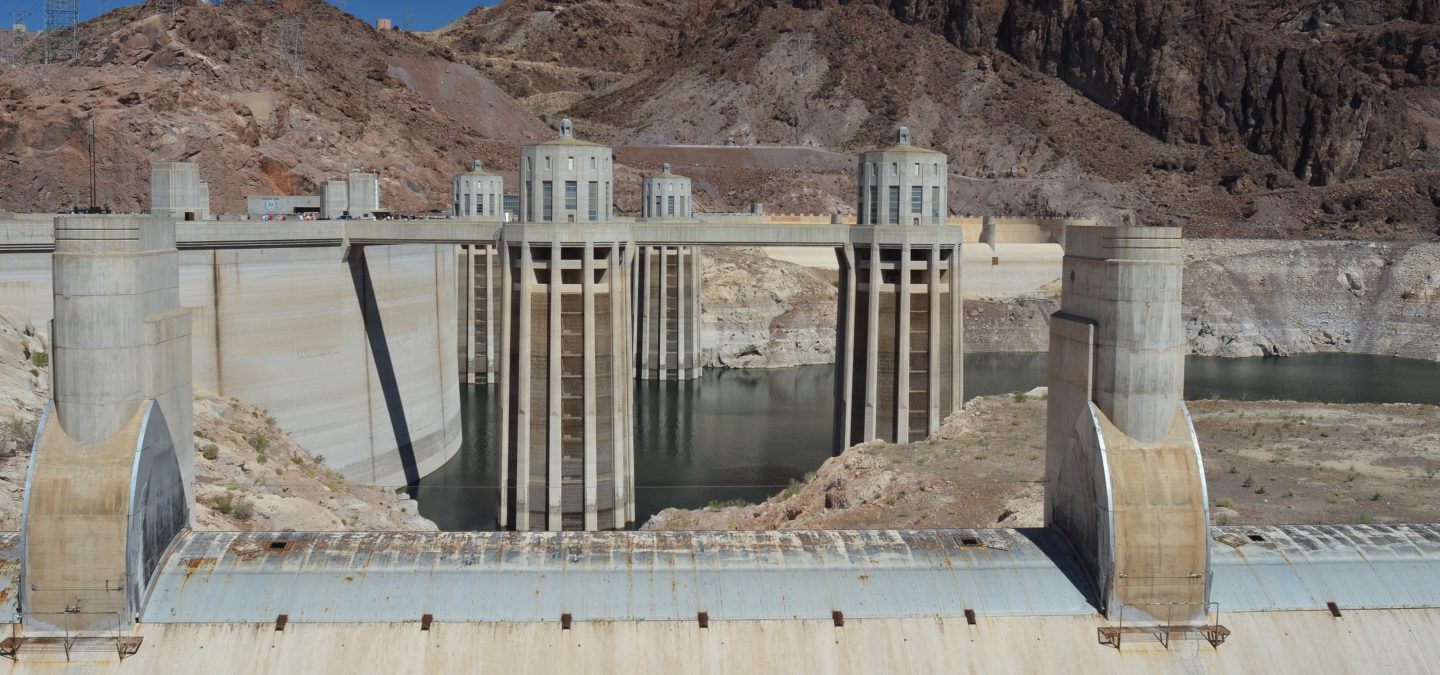
Lake Mead behind Hoover Dam. Lake Mead last month fell to its lowest level since the Hoover Dam was built in 1936. The shoreline has dropped 45 meters since the reservoir was last full in 2000. Photo by Ken Neubecker via American Rivers
Another dry year has left the waterway that supplies 40 million people in the Southwest parched. A prolonged 21-year warming and drying trend is pushing the nation’s two largest reservoirs to record lows. For the first time this summer, the federal government will declare a shortage.
Climate change is exacerbating the current drought. Warming temperatures are upending how the water cycle functions in the Southwest. The 1,450-mile long river acts as a drinking water supply, a hydroelectric power generator, and an irrigator of crop fields across seven Western states and two in Mexico. Scientists say the only way forward is to rein in demands on the river’s water to match its decline.
#LakePowell is seen in a November 2019 aerial photo from the nonprofit EcoFlight. Keeping enough water in the reservoir to support downstream users in Arizona, Nevada and California is complicated by climate change, as well as projections that the upper basin states of Colorado, Utah, Wyoming and New Mexico will use as much as 40% more water than current demand. A recent white paper from a lineup of river experts calls those use projections into question. CREDIT: ECOFLIGHT via Aspen Journalism
With the river’s infrastructure able to cushion against some of the immediate effects, what manifests is a slow-moving crisis. Water managers, farmers and city leaders clearly see the coming challenges, but haven’t yet been forced to drastically change their uses, always hoping for another wet year to stave off the inevitable.
But with its two biggest buckets — Lakes Powell and Mead — at or below 35% of capacity, and projected to decline even further, a reckoning over the West’s water use appears closer on the horizon.
Extremely dry conditions like the region is experiencing in 2021 make clear that the Colorado River is currently unable to meet all the demands communities in the Western U.S. have placed on it, and it’s up to its biggest users to decide who has to rely on it less.
Denver used to average about five days of 95-degree heat prior to the 1970s; now it’s more than 20 days
At its core, climate change is simply a change in the usual weather that a location experiences over time — the 80218 zip code in Denver, the state of Colorado, the contiguous United States or the entire planet. Thanks to modern technologies and weather tracking systems, scientists are able to visualize the changes in our weather and climate on every scale.
There are numerous reasons for that climate change (NASA’s Climate Change page is a great resource), spanning from the Earth’s distance from the sun to humans burning coal, oil and gas, the gases from which “cause the air to heat up.”
A large chunk of the United States has seen a warming trend in annual temperature (comparing the climate normals from this decade to decades past), most notably in the Western U.S., areas around the Great Lakes, the Northeast and Florida — so, almost everywhere…
Summer warming
The U.S. meteorological summer season, which runs from June 1-Aug. 31, has warmed by at least 2.0 degrees since 1970, according to Climate Central, an independent organization that surveys and conducts scientific research on climate change.
In Denver and Colorado Springs, the summer season has warmed by 2.6 degrees since 1970 — higher than the national average. Grand Junction’s average summer temperature is up by 1 degree, smaller but still notable.
Higher average temperatures increase the number of extreme heat days. Denver used to average about five days of 95-degree heat prior to the 1970s; now it’s more than 20 days. Colorado Springs used to experience 11 days of 90-degree heat in 1970, now the city feels 30 days of intense heat per season. Grand Junction saw an average of four days of 100-degree heat in 1970 and now that number has increased to nine days.
On average, Grand Junction experiences higher temperatures throughout the year because it’s a dry, arid desert climate, so temperature and precipitation extremes are more difficult to reach.
But as we’ve seen as of late, temperatures have had no trouble reaching dangerous levels several times this year already (don’t forget the record-shattering heat wave we experienced before the peak summer heat even set in)…
Summer nights are typically where Colorado cities balance out the daily temperature average due to the fact that they cool off efficiently in normally dry air. But data is showing that even our nighttime temperatures are rising.
In Denver, the average nighttime temperature has risen by 1.8 degrees since 1970; it’s 1.7 degrees warmer in Colorado Springs and 0.3 degrees warmer at night in Grand Junction on average.
RECLAMATION RELEASES ADDITIONAL 5-YEAR PROJECTIONS TO SUPPORT DROUGHT RESPONSE PLANNING EFFORTS IN THE COLORADO RIVER BASIN
As one element of the ongoing implementation of the 2019 Drought Contingency Plans for the Colorado River Basin, the Bureau of Reclamation today released additional 5-year projections on the Colorado River System based on June 2021 conditions.
Five-year projections are typically modeled in January, April and August of each year. The additional June projections will inform the ongoing drought operations planning efforts at key Reclamation reservoirs in the Upper Colorado River Basin. These efforts are ongoing among Reclamation and the Colorado River Basin states under the Upper Basin Drought Response Operations Agreement.
“The June 5-year projections for the Colorado River System reaffirm this is a serious situation,” said Wayne Pullan, Upper Colorado Basin Regional Director. “We are actively engaged with the Colorado River Basin states and other partners to respond to changing conditions to avoid critical elevations at Lake Powell.”
Projections for anticipated runoff in the Upper Colorado Basin have declined over the course of the spring. Using information based on recent hydrology (since 1988 and known as the Stress Test Hydrology), Reclamation notes several key findings for Lake Powell in the June 5-year projections:
A 79% chance that Lake Powell will fall below its target water-surface elevation of 3,525 feet sometime next year.
Lake Powell’s target water-surface elevation of 3,525 feet provides a 35 vertical-foot buffer designed to minimize the risk of dropping below the minimum power pool elevation of 3,490 feet, and balances the need to protect the infrastructure at Glen Canyon Dam and to meet current operational obligations to the Lower Colorado River Division states of Arizona, California, and Nevada.
Beyond 2022, Lake Powell’s chances of falling to critical levels also increased.
There is a 5% chance that Lake Powell will fall below minimum power pool elevation of 3,490 feet in 2023 and 17% in 2024.
In the Lower Basin, the updated projections for Lake Mead continue to affirm the high likelihood of a first-ever shortage condition in the Lower Basin in calendar year 2022. Consistent with the 2007 Interim Guidelines, if Lake Mead’s end-of-calendar-year elevation is projected to be at or below 1,075 feet, Lake Mead would operate in a shortage condition in the upcoming year. The prescribed shortage reductions for Arizona and Nevada would also be coupled with water savings contributions under the Lower Basin Drought Contingency Plan. Mexico would reduce their allotment and make water savings contributions under Minute 323 to the 1944 U.S. Mexico Water Treaty. Consistent with the 2007 Interim Guidelines, the 2019 DCP and Minute 323, operational decisions for 2022 will be made by Reclamation in August 2021.
Reclamation is also concerned with the longer-term projections, which show a higher likelihood of Lake Mead declining to the critical elevations of 1,025 and 1,000 feet by 2025. Based on the June update, the chance of this occurring by 2025 is 58% and 21%, respectively.
Reclamation provides projections using two future hydrology scenarios: The Stress Test Hydrology based on the last 32 years, and the Full Hydrology based on the last 114 years. The Stress Test Hydrology provides more plausible near-term outlooks because it embeds the recent warming trend and current drought period. It is about 11% lower on average compared to the Full Hydrology…
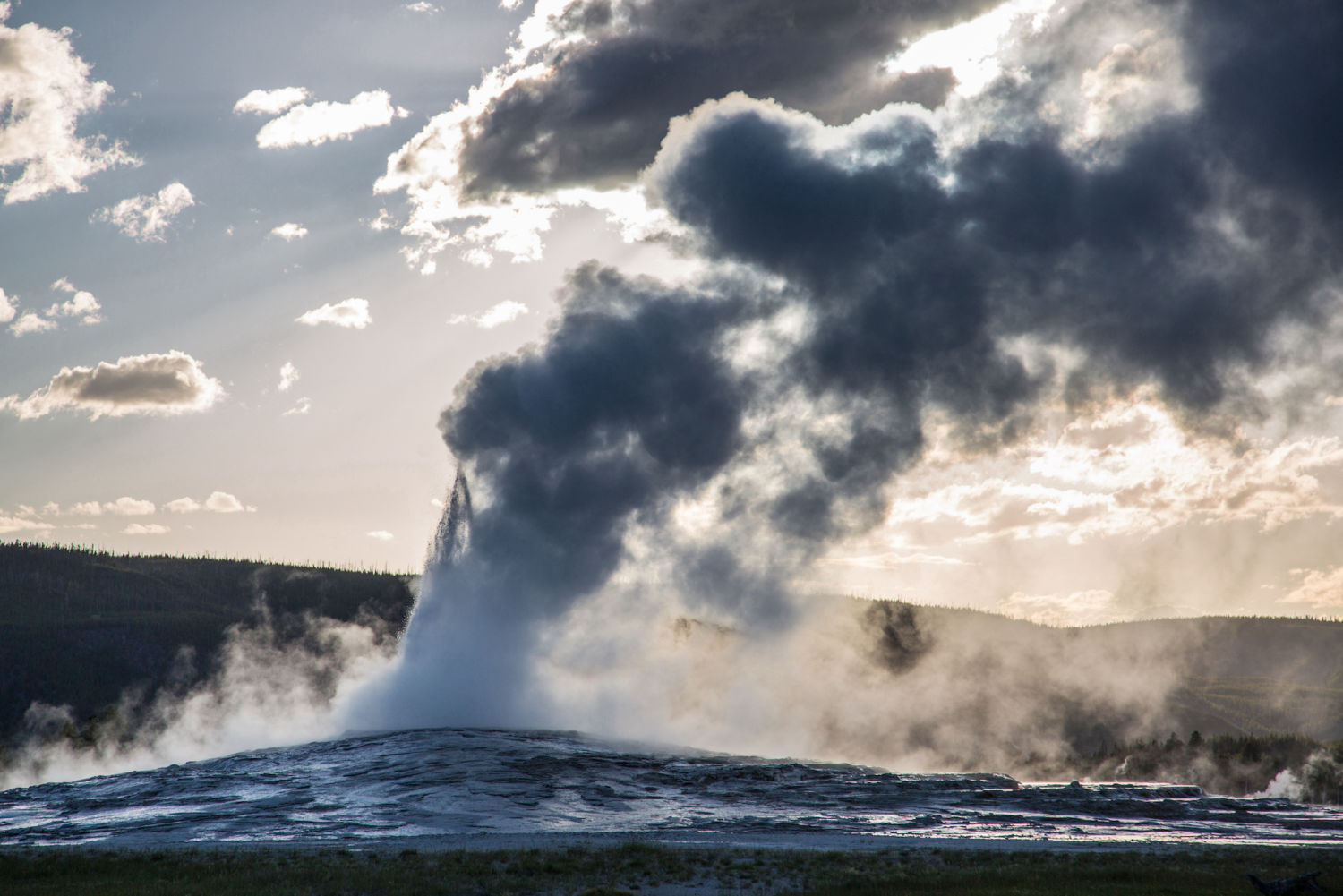
A new report details global warming’s impact on Yellowstone Park, changes that have begun to fundamentally alter its famed ecosystem and threaten everything from its forests to Old Faithful geyser. Such troubling shifts are occurring in national parks across the U.S. West.
In 1872, when Yellowstone was designated as the first national park in the United States, Congress decreed that it be “reserved and withdrawn from settlement, occupancy, and sale and … set apart as a public park or pleasuring ground for the benefit and enjoyment of the people.” Yet today, Yellowstone — which stretches 3,472 square miles across Montana, Wyoming and Idaho — is facing a threat that no national park designation can protect against: rising temperatures.
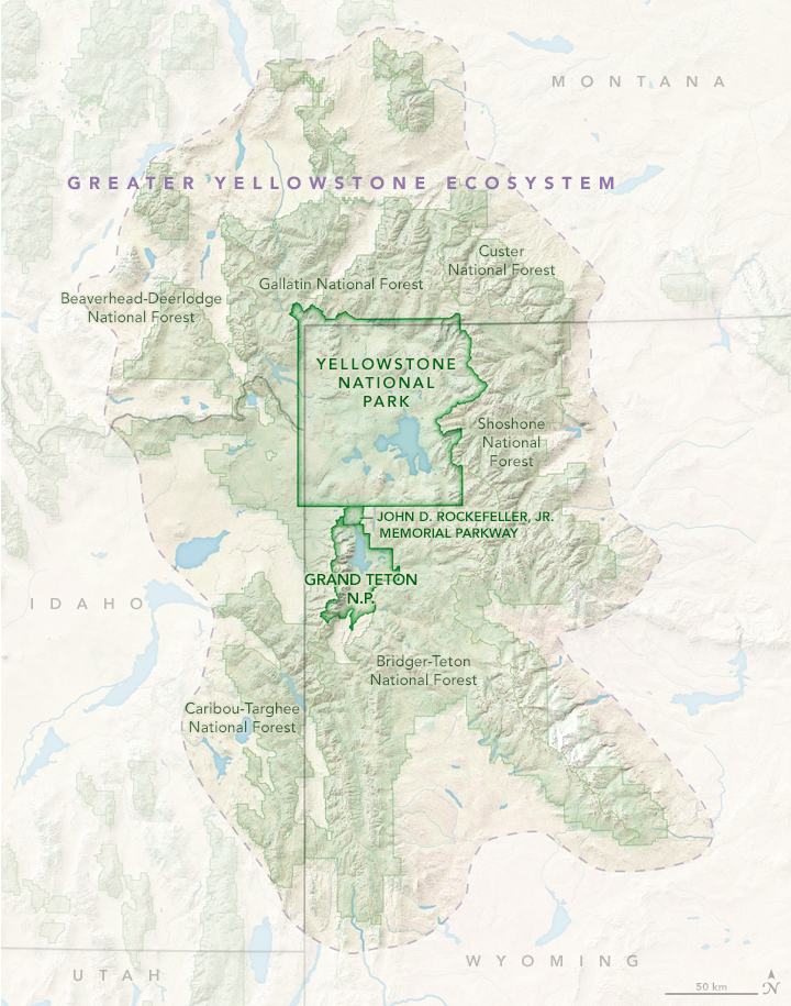
Since 1950, the iconic park has experienced a host of changes caused by human-driven global warming, including decreased snowpack, shorter winters and longer summers, and a growing risk of wildfires. These changes, as well as projected changes as the planet continues to warm this century, are laid out in a just-released climate assessment that was years in the making. The report examines the impacts of climate change not only in the park, but also in the Greater Yellowstone Ecosystem — an area 10 times the size of the park itself.
The climate assessment says that temperatures in the park are now as high or higher as during any period in the last 20,000 years and are very likely the warmest in the past 800,000 years. Since 1950, Yellowstone has experienced an average temperature increase of 2.3 degrees Fahrenheit, with the most pronounced warming taking place at elevations above 5,000 feet.
The Greater Yellowstone Ecosystem. NASA EARTH OBSERVATORY MAP BY JOSHUA STEVENS, USING DATA FROM THE NATIONAL PARK SERVICE AND THE U.S. FISH AND WILDLIFE SERVICE via Yale 360
Today, the report says, Yellowstone’s spring thaw starts several weeks sooner, and peak annual stream runoff is eight days earlier than in 1950. The region’s agricultural growing season is nearly two weeks longer than it was 70 years ago. Since 1950, snowfall has declined in the Greater Yellowstone Area in January and March by 53 percent and 43 percent respectively, and snowfall in September has virtually disappeared, dropping by 96 percent. Annual snowfall has declined by nearly two feet since 1950.
Because of steady warming, precipitation that once fell as snow now increasingly comes as rain. Annual precipitation could increase by 9 to 15 percent by the end of the century, the assessment says. But with snowpack decreasing and temperatures and evaporation increasing, future conditions are expected to be drier, stressing vegetation and increasing the risk of wildfires. Extreme weather is already more common, and blazes like Yellowstone’s massive 1988 fires — which burned 800,000 acres — are a growing seasonal worry.
The assessment’s future projections are even bleaker. If heat-trapping emissions are not reduced, towns and cities in the Greater Yellowstone Area — including Bozeman, Montana and Jackson, Pinedale, and Cody, Wyoming — could experience 40 to 60 more days per year when temperatures exceed 90 degrees F. And under current greenhouse gas emissions scenarios, temperatures in the Greater Yellowstone Area could increase by 5 to 10 degrees F by 2100, causing upheaval in the ecosystem, including shifts in forest composition.
At the heart of the issues facing the Greater Yellowstone Area is water, and the report warns that communities around the park — including ranchers, farmers, businesses and homeowners — must devise plans to deal with the growing prospect of drought, declining snowpack and seasonal shifts in water availability.
“Climate is going to challenge our economies and the health of all people who live here,” said Cathy Whitlock, a Montana State University paleoclimatologist and co-author of the report. She hopes “to engage residents and political leaders about local consequences and develop lists of habitats most at-risk and the specific indicators of human health that need to be studied,” like the connection between the increase in wildfires and respiratory illness. Sounding the alarm isn’t new, but the authors of the Yellowstone report hope their approach, and the body of evidence presented, will convince those skeptical about climate change to accept that it’s real and intensifying.
The report describes a scenario that is now all too common across the American West and in the region’s renowned national parks, from Grand Canyon in Arizona, to Zion in Utah, to Olympic in Washington state. Record warming and extreme drought mean there is not enough fall and winter moisture, leading to steadily declining mountain snowpack. Many iconic venues may soon lose the very features they were named for. Most striking is Glacier National Park in Montana, where, since the late 19th century, the number of the park’s glaciers has declined from 150 to 26. The remaining glaciers are expected to disappear this century.
In Joshua Tree National Park in California’s Mojave Desert, extreme heat — coupled with a prolonged drought — has wreaked havoc on the eponymous species. Because of drought and wildfire, the park is poised to lose 80 percent of its renowned Joshua trees by 2070.
Swaths of Rocky Mountain National Park in Colorado have suffered massive die-offs of white pine and spruce as warming-related bark-beetle infestations have killed an estimated 834 million trees across the state. And in Yosemite National Park in California, the rate of warming has doubled since 1950 to 3.4 degrees F per century. Yosemite is experiencing 88 more frost-free days than it did in 1907. The park’s snowpack is dwindling. Its remnant glaciers are fast disappearing. And wildfires are becoming more common. In 2018, the park was closed for several weeks because of dense smoke from a fire on its border. The National Park Service says that temperatures could soar by 6.7 to 10.3 degrees F from 2000 to 2100, with profound impacts on the Yosemite ecosystem.
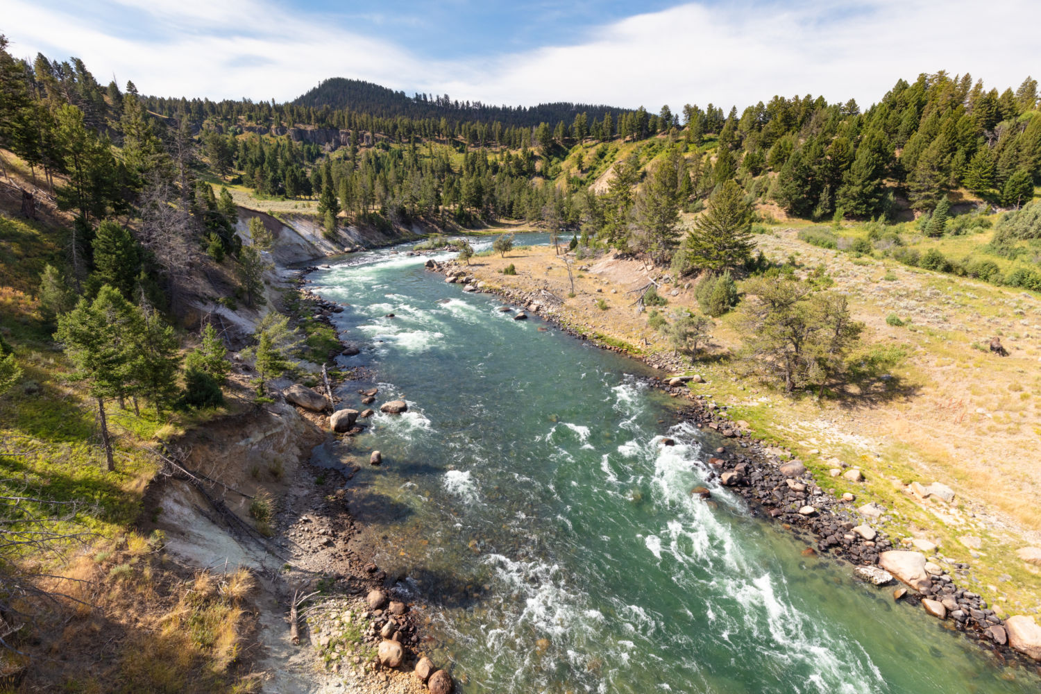
Yellowstone River. Snowpack in the Yellowstone area is melting earlier, leading to a decline in summer streamflows. JACOB W. FRANK / NATIONAL PARK SERVICE via Yale 360
The Yellowstone assessment paints a detailed portrait of the past, present and future impacts of climate-related changes.
“This is one of the first ecosystem-scale climate assessments of its kind,” said co-author Charles Drimal, water program coordinator for the Greater Yellowstone Coalition. “It sets a benchmark for how the climate has changed since the 1950s and what we are likely to experience 40 to 60 years from now in terms of temperature, precipitation, stream flow, growing season and snowpack.” Researchers from the U.S. Geological Survey, Montana State University and the University of Wyoming were the lead scientists on the report.
The report’s study of snowpack and its link to water offer the biggest takeaways for Westerners who might question how or why they’re impacted. Rocky Mountain snowmelt provides between 60 to 80 percent of streamflow in the West, and hotter temperatures mean reduced snowfall and less water for cities as far afield as Los Angeles. For the millions of people living in cities across the West, many of whom are reliant on runoff from the snowpack in the Rocky Mountains, these trends jeopardize already insufficient supplies. The dangers are starkly evident this summer, as years of drought and soaring temperatures have left the West facing a perilous wildfire season and water shortages, from Colorado to California.
“All that snow becomes water that goes into the three major watersheds of the West — some of it goes as far as L.A. — and that comes together in the southern edge of Yellowstone National Park,” said Bryan Shuman, a report co-author and geologist at the University of Wyoming. “Looking at projections going forward, that snowpack disappears.”
Wyoming rivers map via Geology.com
The Yellowstone, Snake and Green rivers all have headwaters in the Greater Yellowstone Area, feeding major tributaries for the Missouri, Columbia and Colorado rivers that are vital for agriculture, recreation, energy production and homes. Regional agriculture — potatoes, hay, alfalfa — and cattle ranching depend on late-season irrigation, and less snow and more rain equals less water in hot summer months.
Then there are the rapidly growing tourism and hospitality industries that rely on Yellowstone’s world-class rivers and ski areas for angling and black diamond runs. Fishing is now regularly restricted because of high water temperatures that stress fish.
“Even mineral and energy resource extraction need to be part of this discussion,” said Whitlock, referring to Wyoming’s oil and gas industry, heavily reliant on large amounts of water. Industry may be the slowest to evolve, but it’s among the most at-risk, she said.
Many locals do quietly acknowledge the reality of what’s happening, she said, but community buy-in remains tough in this culture war hotspot, where many farmers and ranchers have long opposed government land intervention.
The land in the Greater Yellowstone Area, comprising 34,000 square miles, is among the last, largely intact temperate ecosystems in the United States and includes two national parks (Grand Teton in Wyoming is the other), five national forests, and half a dozen tribal nations. It’s also home to 10,000 hydrothermal features, including 500 geysers. Recent research has shown that in periods of extreme heat and drought, geysers such as Yellowstone’s renowned Old Faithful have shut down entirely.
The current conditions do have some historical precedent. In the last 10,000 years, Yellowstone has experienced periods of dryness equal to or greater than present, said Whitlock.
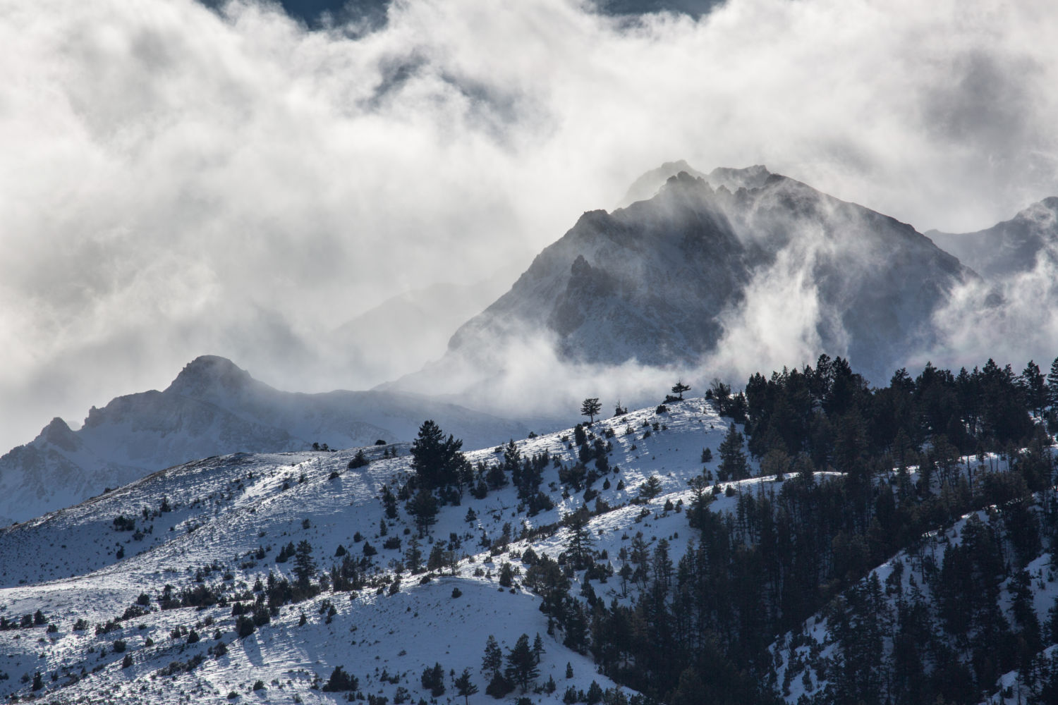
Electric Peak in Yellowstone National Park. Snowfall in the Yellowstone region has declined as a result of climate change. NEAL HERBERT / NATIONAL PARK SERVICE via Yale 360
“That’s a lens to look at the past,” said Shuman, who once trekked the 3,000-mile Continental Divide Trail to get a sense of the land. “If you add just a few degrees, you fundamentally alter things. When you walk across these high mountains, you can see they used to be covered in glaciers. It’s like walking in the ruins of Ancient Rome. That Ice Age world was only 5- to 7-degrees F colder than the pre-industrial era.”
“The water in those mountains is the water supply of the West and it’s drying up,” said Shuman.
In Yellowstone, the threat to human health and livelihoods may be the strongest incentive to take steps to soften the blows from climate change.
“Water is the thing everyone is most concerned about, and in general, people are receptive,” said Shuman. “Our economic future depends on adjusting.”
Just how the residents of the Greater Yellowstone Area will adapt is an open question, but researchers say that acknowledging the myriad problems that are now daily realities for many, from ranchers to anglers, is the first step toward a productive dialogue.
As the West experiences a growth surge, Cam Sholly, Yellowstone National Park’s superintendent, writes in the report that “the strength of local and regional economies” hangs in the balance if no steps are taken to rein in global warming.
Said Whitlock of Montana State, “When you think about the temperature curve that looks like a hockey stick, my parents pretty much lived on the flat part of the curve, I’m on the base, and my grandkids are going to be on the steep part. Our trajectory depends on what we do about greenhouse gases now. By 2040, 2050, we can flatten the curve. But the business-as-usual trajectory, 10 to 11 degrees of warming in Yellowstone and much of the West — what we do in the next decade is critical.”
The Greater Yellowstone Area includes both Yellowstone and Grand Teton national parks, as well as surrounding national forests and federal land. National Park Service
Grand Prismatic Spring Yellowstone National Park. Photo credit: Pixabay via NOAA
In Yellowstone National Park. Photo credit: Pixabay via NOAA
Yellowstone Falls photo credit Abby Howe via the Department of Interior.