Lake Powell is seen in a November 2019 aerial photo from the nonprofit EcoFlight. Keeping enough water in the reservoir to support downstream users in Arizona, Nevada and California is complicated by climate change, as well as projections that the upper basin states of Colorado, Utah, Wyoming and New Mexico will use as much as 40% more water than current demand. A recent white paper from a lineup of river experts calls those use projections into question. CREDIT: ECOFLIGHT via Aspen Journalism
Polis signs latest $20 million infusion for Colorado Water Plan as hotter, drier climate grips Southwest
Colorado Gov. Jared Polis has signed off on increased funding for water development projects that state officials regard as critical to meet growing demands. But the state’s plans to secure more water from rivers here are colliding with the hotter, drier climate that’s hammering the Southwest, where Colorado River reservoirs are at record-low levels.
Federal authorities warn hydropower electricity for millions of people (and their air conditioners) could be jeopardized if water levels in Lake Powell and Lake Mead — now both about 34% full — fall much lower. That’s partly why water officials from seven states met in Denver this week to size up perils before their next round of negotiations over how states deal with diminishing water.
Colorado, New Mexico, Utah and Wyoming (the Upper Basin states along the Colorado River) are facing pressure from Lower Basin states (Arizona, Nevada, California) to use less water — even though the 1922 Colorado River Compact legally entitles them to use more — to try to save the downriver reservoirs.
“There’s a reality that we do have a shrinking water supply and we’re all going to have to figure out new ways to reduce our use. We try to stay out of any state’s business, but we also realize there’s not enough water for the Upper Basin to use its full allotted water under the compact,” said Bill Hasencamp, the Colorado River resources manager for the Metropolitan Water District of Southern California, which serves 19 million people in the Los Angeles area and San Diego…
Colorado leaders over the past six years have awarded more than $500 million in grants and loans for 323 projects in carrying out the state’s water plan — which calls for $100 million a year through 2050. Polis last week signed the latest monetary infusion into law: HB21-1260 for $20 million more to the Colorado Water Conservation Board to go toward increased water storage capacity and supply. The bill provides $15 million for loans and grants and $5 million for the regional “roundtable” panels that have planned 500 local water development projects.
Polis also signed off on SB21-189 to spend $1.2 million more in construction funds for the implementation of the overall $20 billion water plan, which was launched in 2015 to ensure enough for a productive economy — from cities to farms to the recreation industry — while preserving healthy rivers through efficient water use and carefully designed water projects. Two in progress would siphon significantly more water out of the Colorado River basin — an expanded reservoir for Denver and enlarged Moffat system that diverts west-flowing water to the northern Front Range…
“We are already actively talking about and experiencing cuts, which have been particularly painful in this very dry year,” [Rebecca Mitchell] said, referring to the state’s allocation system that forces junior water-rights holders to use less in dry times. “These are historically low conditions and we need basin-wide solutions that we work on together.”
State officials in Colorado, Utah and Wyoming contend they’re entitled under the 1922 compact to use as much as 2 million acre-feet more water. But those shares are based on century-old calculations for how much water the river can provide — 15 million acre-feet a year — rather than the 12.3 million acre-feet average total flow since 2000.
Contingency plans for enduring severe droughts are expected to force mandatory cutbacks next year in Arizona, Nevada and Mexico.
Monument Creek, taken looking south from the northern section of Monument Valley Park via Loraxis
FromThe Tri-Lakes Tribune (Benn Farrel) via The Colorado Springs Gazette:
With limited water resources, the Town of Monument looks to encourage water conservation among residents while the area is experiencing high temperatures in its semi-arid climate and increased water demand.
As the town invests $22 million in improvements to the infrastructure of its water system, an increase in water production and additional storage is in the near future. However, to maintain healthy landscapes around the community, the town is encouraging responsible water practices, implementing water restrictions and has offered tips to efficient water use…
Properties within the service of Triview Metropolitan District are also under restrictions from May 1 through Sept. 30 every year…
Properties which use the Woodmoor Water and Sanitation District are restricted from June 1 to Sept. 30…
Photo from the Colorado Independent.
On May 31, the Town of Monument released an informational video, “Conserving water using rain barrels,” on its YouTube channel, informing residents of their rights to conserve rainwater with rain barrels and how to do it. A few years ago, the State of Colorado legislature passed House Bill 16-1005 which allows single-family residences to collect rainwater in two barrels maximum, each up to 110 gallons, to be used solely for outdoor use and not consumption or indoor use. It also mandates the top of the barrels must be sealed to prevent pests from getting in.
The bill was geared toward helping homeowners offset the use of their irrigation systems for their landscaping.
Residents of the Town of Monument, who use of the town’s water system, are offered a $50 rebate if receipts for the rain barrel purchases are provided and their account with the Monument Water Department is current. The rebate is given in the form of a credit toward the account.
Tips for installing the rain barrels are available on the Town of Monument’s YouTube channel, or by visiting the town’s website, tomgov.org, clicking on the “Community” tab and visiting the Garden & Landscaping page.
Denver Basin Aquifer System graphic credit USGS.
The Triview Metropolitan District is presently making a transition from making use of the non-renewable groundwater from the Denver Basin to renewable surface water. Last year, the district acquired 568-acre feet of water rights and purchased another 1,000-acre feet of water storage in April. Triview acquired nearly 850 acres of land to be used for the development of two large reservoirs which are near completion.
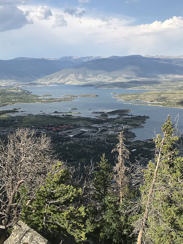
View atop Mount Royal overlooking the town of Frisco, CO and Lake Dillon. Photo credit: Ndebel Creative Commons Attribution-Share Alike 4.0
Here’s a guest column from Melissa Sherburne that’s running in The Colorado Sun:
We all have a choice to either engage in efforts to help combat the loss of biodiversity and climate change, or watch from the sidelines.
Because we love our public lands and want to protect them for future generations, the Frisco Town Council recently unanimously passed a resolution that states that we stand with President Biden, U.S. agencies, members of Congress, state and local officials, and others in support of science-based, locally-led conservation efforts that help the country achieve the goal of protecting 30% of our country’s lands and waters by 2030, commonly referred to as 30×30.
These efforts are a part of the administration’s America the Beautiful vision for how the United States can work collaboratively to conserve and restore the lands, waters, and wildlife that support and sustain our country and create jobs and strengthen the economy.
Melissa Sherburne. Photo credit: Town of Frisco
Last month, the world’s leading biodiversity and climate experts released an important peer-reviewed report that emphasizes the importance of looking at the loss of biodiversity and climate crises as one problem rather than tackling each individually. The report authors warn that if we don’t take this approach and instead try to solve these problems in isolation, we do so at our peril.
I am very encouraged that the 30×30 goal contained in the America the Beautiful vision does just what scientists are recommending by acknowledging that we have to address the loss of nature and climate change together. If we can restore whole ecosystems, then they will, in turn, cheaply and quickly absorb the carbon emissions that are the root cause of climate change and are wreaking havoc on the planet.
30×30 can ensure that we preserve a healthy network of biodiversity and protect our natural areas while not only helping to offset climate change, but also protect and restore more public lands that are foundational to our way of life, health, and economies in mountain communities like Frisco.
Local governments know how important it is to set attainable and forward-looking goals. Achievable targets can make small differences in the near term, and more significant impacts over the long term.
Making decisions about finite resources like lands and waters and climate change can be overwhelming, but they are so important because they have lasting impacts. We have to ensure that we are stewards for future generations.
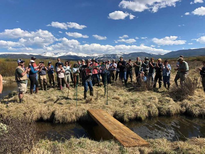
I am proud that the Town of Frisco is committed to conserving our lands and waters. In 2020, we worked with Colorado Open Lands to place a permanent conservation easement on 10.88 acres in the Meadow Creek wetlands and also restored 0.41 acres of wetlands. This effort grew out of the need to restore and preserve a new wetlands area because we lost wetlands during the Frisco Bay Marina’s 2019 “Big Dig” project.
Because of this conservation easement, the land is protected from development allowing community members and visitors the opportunity to enjoy these lands for recreation and rejuvenation well into the future.
Because Frisco is surrounded by public land, we must continue to work in partnership with community partners, the U.S. Forest Service, Summit County, and Denver Water to protect natural resources and wildlife habitat, encourage human-powered recreation, and mitigate wildfire risk.
I would like our town to engage in more regional conservation efforts like Summit Safe Passages, which works to create safer roads for wildlife and people by building wildlife crossing structures across roads to reduce wildlife related collisions, ensure healthy wildlife populations and save taxpayers money.
We all have a choice to either engage in efforts to help combat the loss of biodiversity and climate change, or watch from the sidelines. I am grateful that President Biden has chosen the former by setting forth an inclusive and locally-led America the Beautiful conservation vision that includes the 30×30 goal — a way for us to collaborate and achieve results for natural resource protection at a national scale.
We and future generations will benefit if local, state, tribal governments, and local communities like Frisco can collaborate more frequently to achieve science-based voluntary landscape scale conservation.
Melissa Sherburne is a council member for the Town of Frisco, a board member for High Country Conservation Center, and a planning and public lands consultant with a master’s degree in Environmental Management degree from Duke University and a bachelor’s in Environmental Studies from the University of Colorado Boulder.
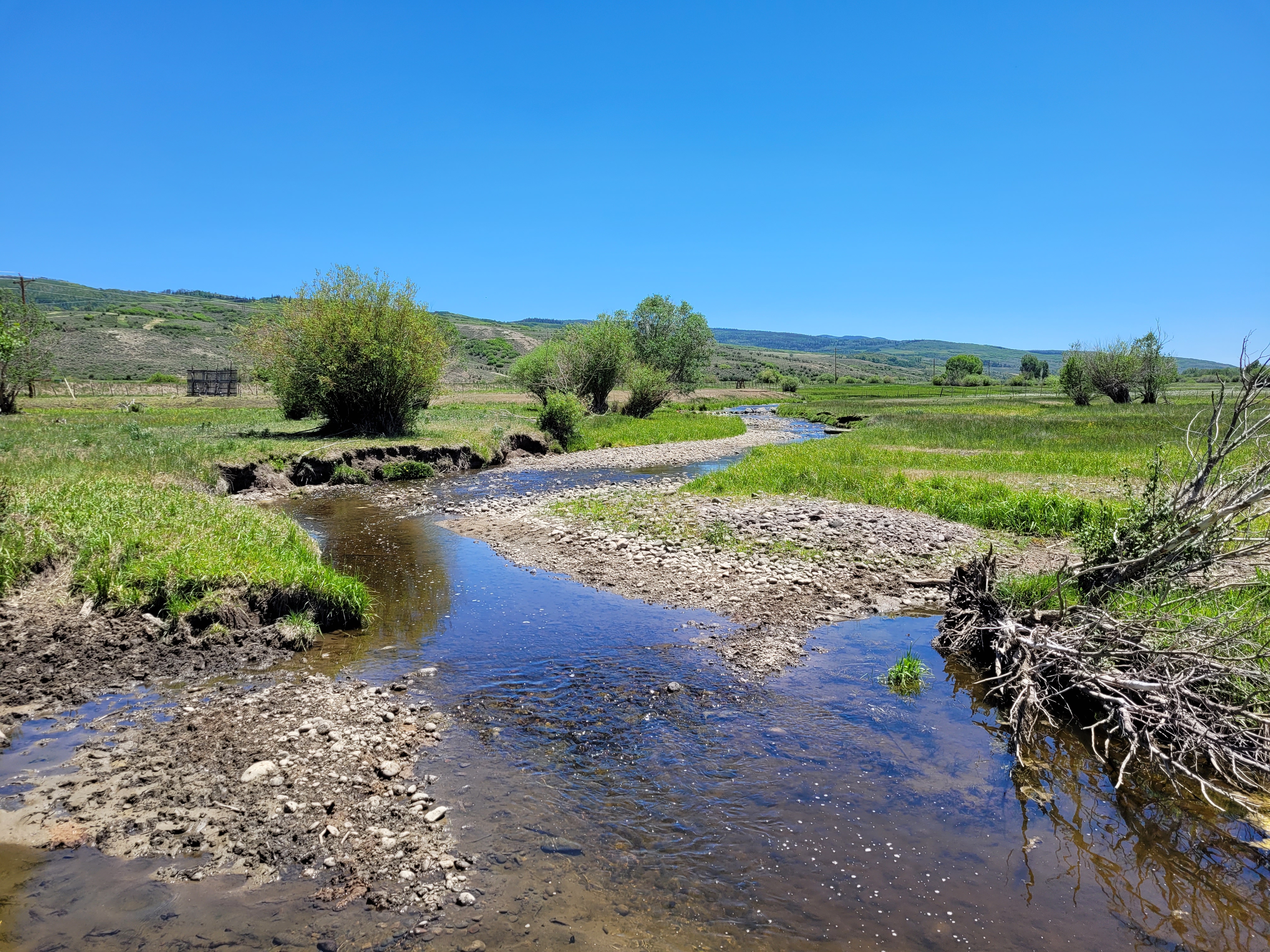
Cross Mountain Ranch, a sprawling cattle, guest and hunting operation near Maybell and the Yampa’s confluence with the Little Snake River, needed water to flood meadows for sheep and other livestock.
But there was nothing left to divert into the ranch’s ditch at Lily Park. A state official’s snapshot from the time shows no Yampa there at all — just a gravel bar with a stagnant puddle at the base.
The ranch may be far down river, but it’s high in priority. Under Colorado water law, that means the ranch long ago secured water rights that are vastly senior to many other users on the river. So if the ranch needs it, the state water engineer has to put a “call” on the Yampa and tell junior holders upriver to stop using, letting their water flow on toward Cross Mountain and the Utah border.
Yampa division engineer Erin Light did just that for the first time ever in 2018. She has an 80-page list of descending water rights holders on the Yampa. The ranch is on page one.
The easiest way to find enough water to meet the ranch’s rights was to call Craig Generating Station, a massive coal-fired electricity plant holding a variety of river rights and reservoir shares in the Yampa basin. The power station, managed by Tri-State Generation and owned by a variety of Western utilities, has been cooperative on water issues, Light said, and quickly sent more water downstream.
Then it happened again in 2020. Drought. A nearly dry river by the time the Yampa neared Dinosaur National Monument. And an official state call.
Yampa River at Stagecoach Res Inlet 10 CFS 5-24-21 May 2021. Photo credit: Scott Hummer
This year, the Yampa is looking severely troubled again. It’s no longer a fluke, but a trend. And so Light has asked her boss, state engineer Kevin Rein, to approve her 15-page memorandum and request declaring the Yampa officially “over appropriated.”
Too many users have divided up the river’s dwindling water too many ways, and future ditch diggers and well drillers need to be warned. Dozens of new water rights applications hit the water court for Yampa claims every year, she added…
Yampa not alone under drought pressure
The Yampa isn’t the first Colorado river to suffer the indignity of an official declaration of over appropriation. In fact, most of the major rivers were divided too many ways decades ago and therefore need to be managed down to the drop, from the South Platte on the Front Range, to the Arkansas and the Poudre.
But the fact it’s happening to the Yampa, long running relatively wild and free through the thinly-populated open range of northwest Colorado, is a clear danger sign, according to state officials and conservation groups. Drought in the short term and climate change in the long term are overlaid by relentless economic growth throughout Colorado, turning debates over water use from a distant worry into a current event…
West Drought Monitor map June 29, 2021.
Light’s detailed memo justifying the over appropriation declaration for the Yampa noted that water volume delivered by the river has fallen in recent decades from a norm of 1.5 million acre-feet a year to 1.1 million acre-feet. At the U.S. Geological Survey’s Maybell gauge on the Yampa on Friday, the river flowed at about 340 cubic feet per second, less than 16% of the median figure for that day in 105 years of recordkeeping…
So what would state approval of the over appropriation designation mean in practical terms for northwestern Colorado counties? Developers seeking to drill a new well in the Yampa Basin will see new state scrutiny of their plans to make sure they are not drawing down river water already owned by a senior rights holder. If Light thinks there would be damage, she can require the developer to augment the loss with a different supply, such as stored reservoir water or a pond capturing water during higher runoff periods…
Anyone with an improperly permitted well will also face new reviews, and demands for augmentation. Because of the way Colorado’s rivers and water tables behave, state engineers consider wells to be drawing down river water just as if they were taking it from the river’s surface.
People could still apply for new surface rights from the Yampa, but they will be warned, Light said, that their supply is likely to run out by August or September when senior rights holders put in their call to protect what they need.
Sunset from the western shore of Antelope Island State Park, Great Salt Lake, Utah, United States.. Sunset viewed from White Rock Bay, on the western shore of Antelope Island. Carrington Island is visible in the distance. By Ccmdav – Own work, Public Domain, https://commons.wikimedia.org/w/index.php?curid=2032320
FromThe Associated Press (Lindsay Whitehurst). Click through and read the whole article and for the photographs. Here’s an excerpt:
For years, though, the largest natural lake west of the Mississippi River has been shrinking. And a drought gripping the American West could make this year the worst yet.
The receding water is already affecting the nesting spot of pelicans that are among the millions of birds dependent on the lake. Sailboats have been hoisted out of the water to keep them from getting stuck in the mud. More dry lakebed getting exposed could send arsenic-laced dust into the air that millions breathe…
The lake’s levels are expected to hit a 170-year low this year. It comes as the drought has the U.S. West bracing for a brutal wildfire season and coping with already low reservoirs. Utah Gov. Spencer Cox, a Republican, has begged people to cut back on lawn watering and “pray for rain.”
For the Great Salt Lake, though, it is only the latest challenge. People for years have been diverting water from rivers that flow into the lake to water crops and supply homes. Because the lake is shallow — about 35 feet (11 meters) at its deepest point — less water quickly translates to receding shorelines…
The waves have been replaced by dry, gravelly lakebed that’s grown to 750 square miles (1,942 square kilometers). Winds can whip up dust from the dry lakebed that is laced with naturally occurring arsenic, said Kevin Perry, a University of Utah atmospheric scientist.
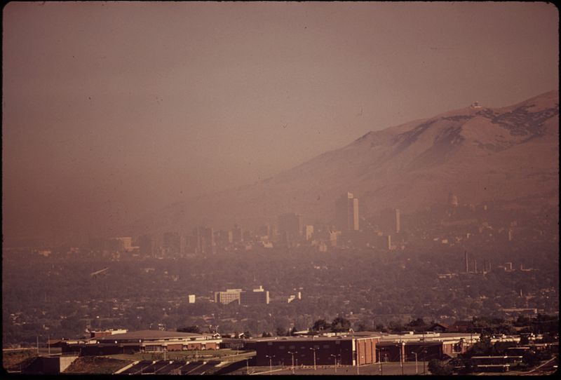
Smog blankets Salt Lake City. Photo credit Wikimedia Commons.
It blows through a region that already has some of the dirtiest wintertime air in the country because of seasonal geographic conditions that trap pollution between the mountains…
Luckily, much of the bed of Utah’s giant lake has a crust that makes it tougher for dust to blow. Perry is researching how long the protective crust will last and how dangerous the soil’s arsenic might be to people…
Most years, the Great Salt Lake gains up to 2 feet (half a meter) from spring runoff. This year, it was just 6 inches (15 centimeters), Perry said.
“We’ve never had an April lake level that was as low as it was this year,” he said.
More exposed lakebed also means more people have ventured onto the crust, including off-road vehicles that damage it, Great Salt Lake coordinator Laura Vernon said…
Brine shrimp support a $57 million fish food industry in Utah but in the coming years, less water could make the salinity too great for even those tiny creatures to survive.
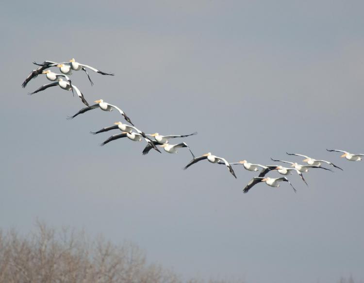
American White Pelicans flying in formation. Photo credit Missouri Department of Conservation.
“We’re really coming to a critical time for the Great Salt Lake,” said Jaimi Butler, coordinator for Great Salt Lake Institute at Westminster College in Salt Lake City. She studies the American white pelican, one of the largest birds in North America.
They flock to Gunnison Island, a remote outpost in the lake where up to 20% of the bird’s population nests, with male and female birds cooperating to have one watch the eggs at all times.
“Mom goes fishing and dad stays at the nest,” Butler said.
But the falling lake levels have exposed a land bridge to the island, allowing foxes and coyotes to come across and hunt for rodents and other food. The activity frightens the shy birds accustomed to a quiet place to raise their young, so they flee the nests, leaving the eggs and baby birds to be eaten by gulls.
Denver Water cuts back on some of its West Slope supplies to help struggling streams.
The Colorado River is hurting.
The struggles of the river’s largest reservoirs, Lake Mead and Lake Powell, have been well documented over the last decade as drought has ravished the West.
The story, however, starts more than 500 miles upstream in Grand County, Colorado.
The county is filled with streams that make up the beginning of the mighty Colorado’s journey in the mountains north of Grand Lake. Around 60% of the water in Grand County is diverted from these streams and used for agricultural and municipal water supply, mostly on the Front Range.
That includes the Denver metro area, which receives about 20% of its water from Grand County, where Denver Water has water rights dating back to the 1920s. Most of the water is captured in rivers and streams around Winter Park when mountain snow melts in the spring.
Rivers and creeks in Grand County are part of Denver Water’s North Collection System. Water flows through the Moffat Tunnel, under the Continental Divide, to Gross and Ralston reservoirs. Image credit: Denver Water.
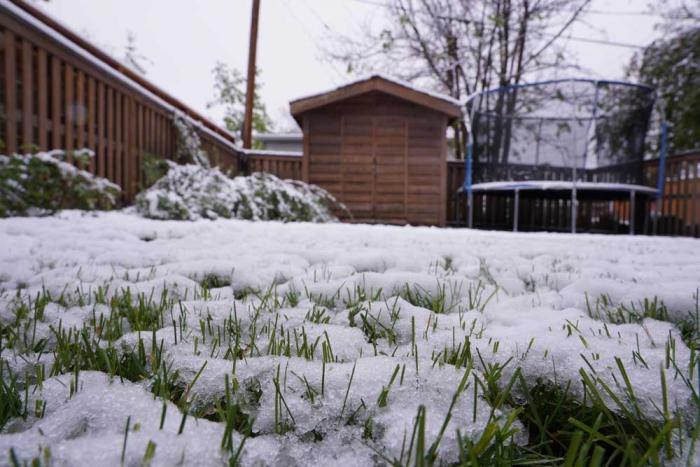
But, after a lackluster runoff season on the West Slope combined with dry soils from the past year, the hot, dry conditions in early June meant the high-country rivers and streams needed help.
Denver Water responded by voluntarily reducing diversions from several Grand County creeks and coordinating with the Colorado River District, Grand County, Northern Water and other Learning By Doing partners to adjust operations, where possible, to help boost water levels in some of the more troubled areas.
“While our primary responsibility is to make sure we’re supplying water to 1.5 million people in the metro area, we’re always looking for opportunities to help improve conditions on the rivers, to help the aquatic environment, recreation and communities they flow through,” said Nathan Elder, Denver Water’s manager of water supply.
By reducing diversions, Denver Water foregoes collecting a portion of water it is legally entitled to collect for its water supply in exchange for improving streams and tributaries along the Colorado River.
The Fraser River flows below a Denver Water diversion structure in Grand County in June 2021. Denver Water voluntarily released around 11,000 acre-feet of water from streams in the county from June 6 through early July in 2021 to improve aquatic habitat downstream. Photo credit: Denver Water.
It started with a plea for help
On June 5, the Colorado River District asked Denver Water for help after reporting extremely low water levels and critically high water temperatures on the Colorado River. The river district reported conditions were creating unhealthy habitat for fish and aquatic insects.
“When the email came in Saturday morning, we were in a position to quickly respond and reduce the amount of water we were pulling from several Grand County creeks,” Elder said.
Denver Water has continued making operational adjustments since that email.
The utility estimates that by early July it will have voluntarily foregone collecting around 11,000 acre-feet of water from Grand County to help keep more water in the Colorado and Fraser rivers. That’s roughly enough water to supply over 44,000 residences for one year.
“It has been helpful to hear directly from stakeholders in Grand County, including Trout Unlimited and ranchers along the river, on where we may be able to truly help the river, the community and the environment with our operational adjustments,” Elder said.
“With help from the West Slope, we’ve been able to target specific areas and send some beneficial water downstream.”
This includes adjusting water releases from Williams Fork Dam twice a day in a way that also benefits the Colorado River.
For example, when releasing water from the dam, Elder and his team try to time the flows, so the water reaches the river in Kremmling — an area prone to higher river temperatures — during hotter times of the day.
The higher water level helps to cool down the water, which is better for the aquatic environment.
Warm temperatures and low water levels create unhealthy conditions for fish in Colorado streams. Denver Water worked with the Colorado River District to send cooler water downstream in June to help lower temperatures on the Colorado River near Kremmling. Photo credit: Denver Water.
Position to help
The wet spring conditions along the Front Range boosted water supplies in Denver Water’s South Platte River collection system, which drastically reduced customers’ demand for water across the metro area — where Denver Water serves a quarter of the state’s population.
In fact, from January to May, Denver Water’s customer water use hit a 50-year low across the metro area, despite nearly 600,000 more people in its service area since 1970. That includes years in which the metro area was on mandatory drought restrictions.
“Some of the low use may be due to COVID-19 impacts on business and obviously a wet, cool spring helped,” said Greg Fisher, demand manager for Denver Water.
“It’s a great sign that our customers really understand efficient water use and let Mother Nature do the watering for them when possible.”
This wet spring on the Front Range also helped provide additional flexibility on how Denver Water collected and distributed water across its collection system during the spring snow runoff.
“We were able to turn off the Roberts Tunnel in April, which helped bring water levels up in Dillon Reservoir for boating,” Elder said.
“The conditions also enabled us to send more water down the Blue River below Dillon Dam to help improve fish habitat around Silverthorne instead of sending the water to the Front Range.”
Denver Water uses the Roberts Tunnel to bring water from Dillon — the utility’s largest reservoir — under the Continental Divide to the Front Range.
But flexibility like this is not always possible, especially with the myriad threats Denver’s water system is facing.
“Between the rising temperatures, changes to the timing of spring runoff, extreme fire behavior and half a million more people expected in the metro area by 2040, our ability for flexible operations is decreasing in a time when we need it the most,” said Elder.
“We must take an ‘all-in’ approach that includes conservation, water reuse and development of new water supplies so we can continue to maximize the benefits of a large system.”
Wet conditions in the metro area during the spring of 2021 reduced demand for water for irrigation. The lower demand gave Denver Water more flexibility to fill its reservoirs and provide additional water for environmental benefits on the West Slope. Photo credit: Denver Water.
More flexibility
According to Elder, hot, dry weather conditions highlight the benefits of having a large water collection system, as it provides the water planning team more flexibility in its operational playbook.
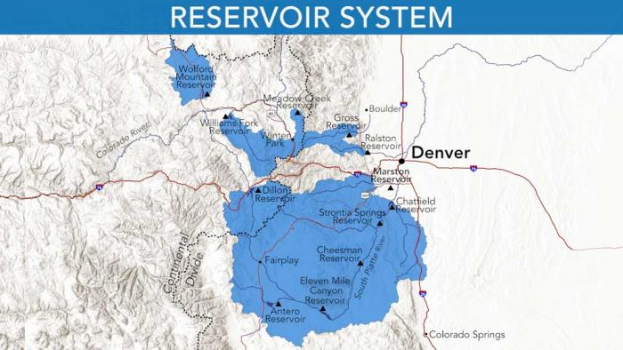
Denver Water relies on a network of reservoirs to collect and store water. The large collection area provides flexibility for collecting water as some areas receive different amounts of precipitation throughout the year. Image credit: Denver Water.
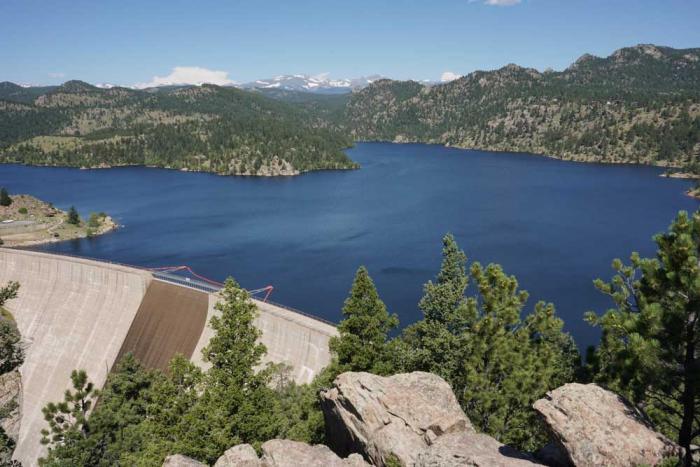
The vision for the Gross Reservoir Expansion Project, which is in its final steps of permitting, is an example of how additional water storage can really help streams in times of drought.
“As part of the Gross Reservoir Expansion, some of the voluntary things we’re doing this year — like leaving more water in the Grand County rivers — will become required annual operations for us,” said Elder.
Denver Water is planning to expand Gross Reservoir in Boulder County. The additional storage capacity will create more balance in the utility’s storage and give water planners more flexibility in their operational strategy. Photo credit: Denver Water.
That’s because Denver Water is one of 18 partners who signed the Colorado River Cooperative Agreement in 2013, ushering in a new era of cooperation between the utility and West Slope stakeholders, all with the vested interest in protecting watersheds in the Colorado River Basin.
As part of that agreement, a process called “Learning by Doing” was created, which has helped the utility stay better connected on river conditions in Grand County. The partnership is a collection of East and West Slope water stakeholders who help identify and find solutions to water issues in Grand County.
“Denver Water has been part of Grand County for over 100 years, and we understand the impact our diversions have on the rivers and streams,” said Rachel Badger, environmental planning manager at Denver Water.
“Our goal is to manage our water resources as efficiently as possible and be good stewards of the water — and Learning By Doing helps us do that.”
That’s because Denver Water is one of 18 partners who signed the Colorado River Cooperative Agreement in 2013, ushering in a new era of cooperation between the utility and West Slope stakeholders, all with the vested interest in protecting watersheds in the Colorado River Basin. As part of that agreement, a process called “Learning by Doing” was created, which has helped the utility stay better connected on river conditions in Grand County. The partnership is a collection of East and West Slope water stakeholders who help identify and find solutions to water issues in Grand County. “Denver Water has been part of Grand County for over 100 years, and we understand the impact our diversions have on the rivers and streams,” said Rachel Badger, environmental planning manager at Denver Water. “Our goal is to manage our water resources as efficiently as possible and be good stewards of the water — and Learning By Doing helps us do that.”