From The Glenwood Springs Post-Independent (Ike Fredregill):
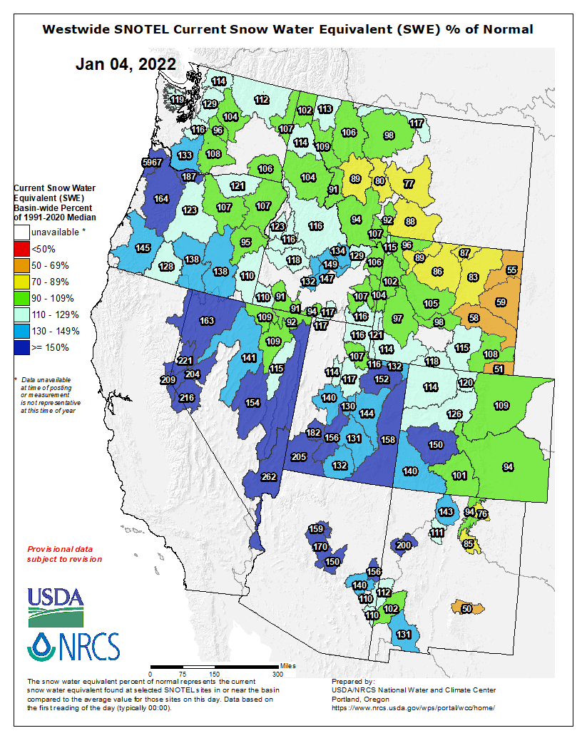
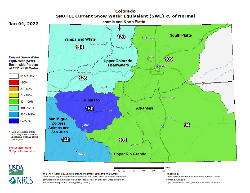
According to SNOTEL reports, most of western Colorado is experiencing above average snowpack with the upper Colorado River watershed, which includes Garfield County, clocking in at about 126% of typical snow water equivalent measurements, the U.S. Department of Agriculture reported…
Sunlight Mountain Resort…measures snow daily, and reported about 60 inches fell from Dec. 24 to Jan. 1.
From The Pueblo Chieftain (Lacey Latch):
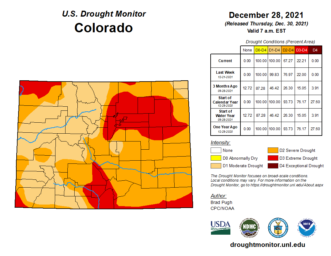
About three inches of snow fell in Pueblo starting the night of New Year’s Eve and continuing throughout the next day, according to the National Weather Service Pueblo. While any amount of moisture is good for the prolonged drought conditions across the state, this amount of snow will likely not be enough to make any significant difference in the conditions on the southeastern plains. “In regard to the widespread drought across Southern Colorado it’s probably going to not have that much of an impact,” said NWS meteorologist Stephen Rodriguez.
“We need to see persistent [snow] and even more (amounts of snow across) Southeast Colorado.” Freezing temperatures during and immediately following the snowfall were quickly overtaken by climbing temperatures; Pueblo reached a high of 47 degrees on Jan. 3 and the forecast predicts a high of 62 degrees later this week. While this snowfall was the most Pueblo’s seen this winter, three inches of melted snow roughly amounts to about 18 inches of rain, leaving minimal moisture behind. “In terms of the southeast plains, this past snow event probably had minimal impact in regard to the drought,” Rodriguez said. Looking ahead, Rodriguez said the southeast plains have little-to-no precipitation in the forecast through at least mid-January.
From Out There Colorado (Tamera Twitty):
Thanks to a widespread storm system that hit Colorado on New Year’s Eve, Colorado Springs has finally seen snow for the first time this season.
Measurable snow was recorded at the Colorado Springs Airport on Saturday night by the National Weather Service, absolutely smashing the city’s record for latest first snowfall of the snow season. The prior record was set on December 2nd in 2016, meaning that the December 31 ‘first snowfall’ this year pushed this date back 29 days…
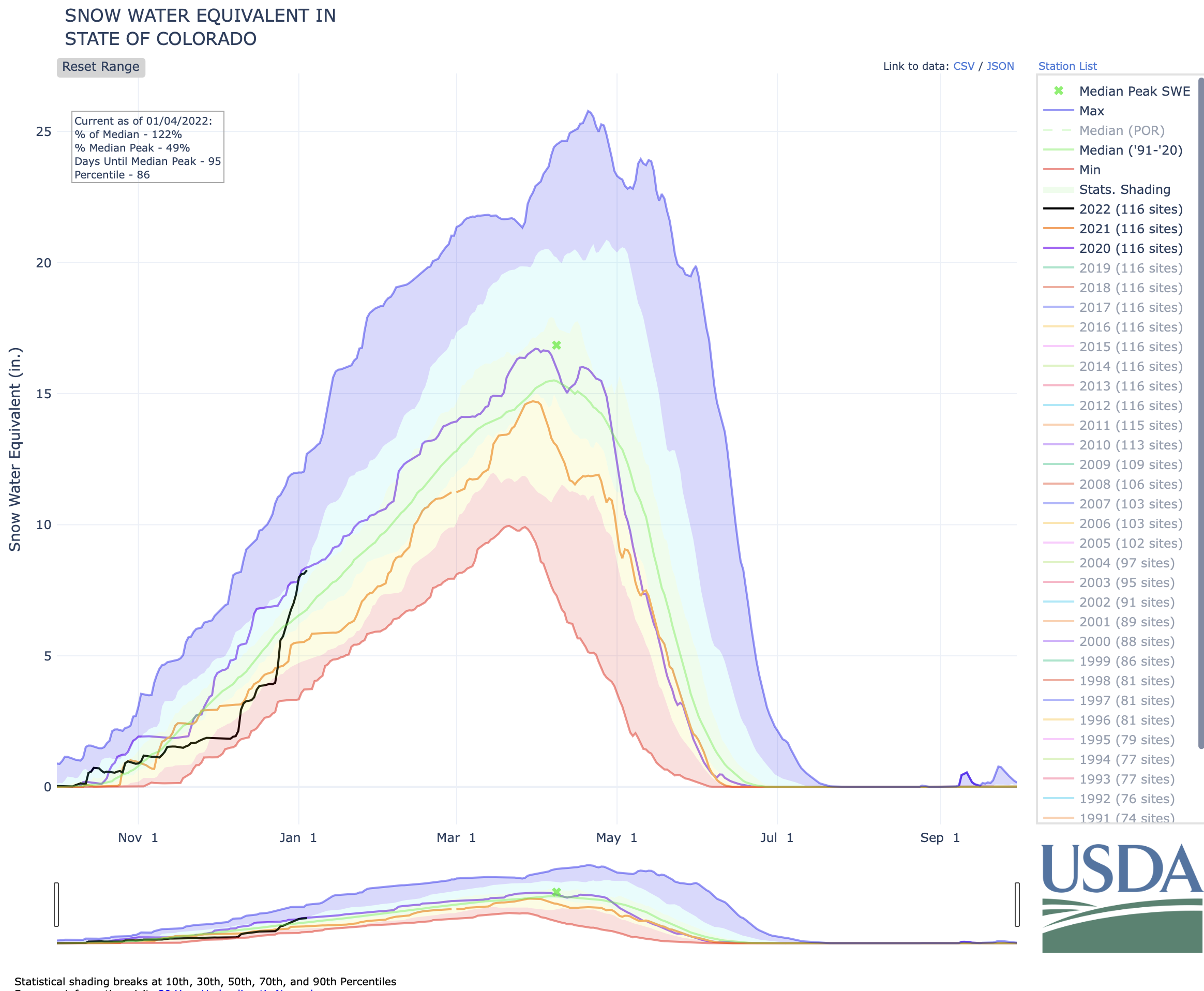
As illustrated on the chart below, the state experienced its fastest jump in snow pack so far this season over the last few days. The current snow water equivalent is 121% of the to-date median statewide, according to the USDA.