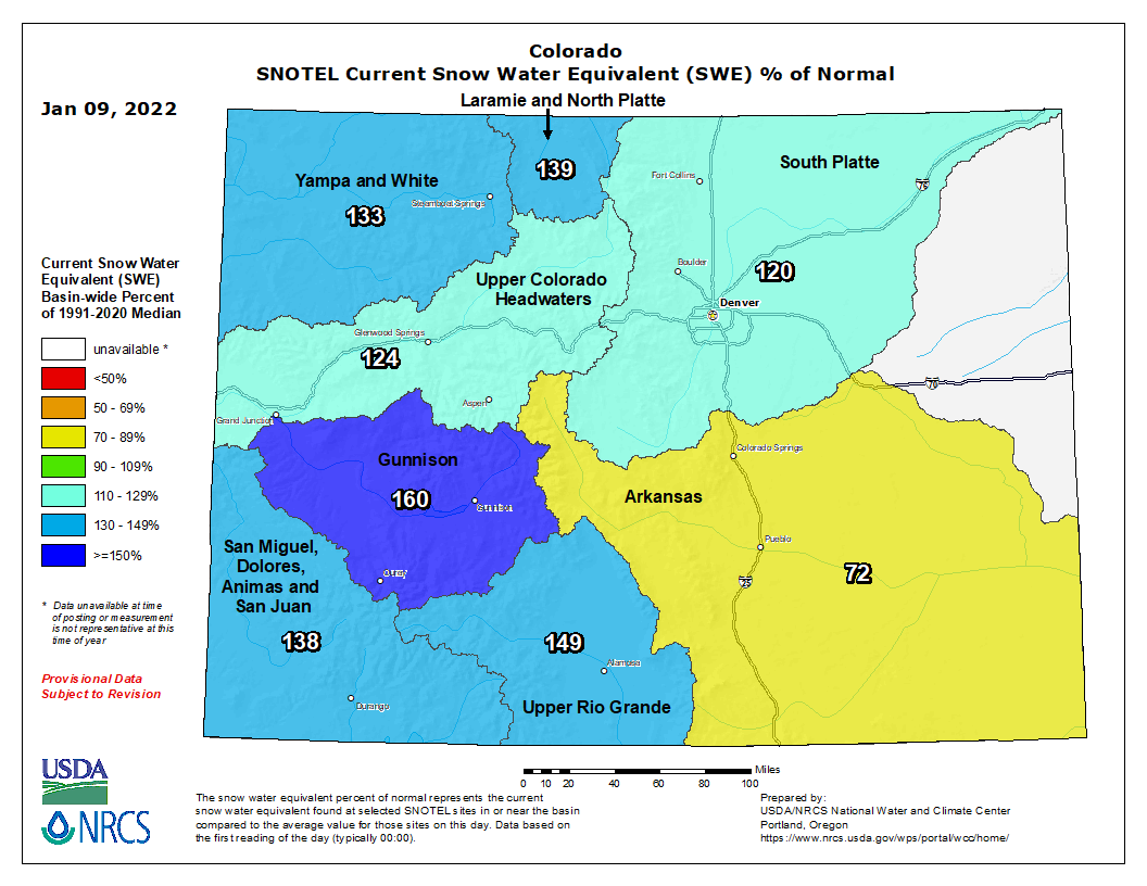
Less than a month ago, on Dec. 8, 2021, the snowpack level for the San Miguel, Dolores, Animas and San Juan river basins was at 31 percent of that date’s median, according to the U.S. Department of Agriculture (USDA) National Water and Climate Center’s snow pack report.
As of 11 a.m. on Jan. 5, the San Miguel, Dolores, Animas and San Juan river basins were at 136 per- cent of the Jan. 5 median.
According to the USDA, as of 11 a.m. on Wednesday, Jan. 5, the Wolf Creek summit, at 11,000 feet of elevation, had 22.6 inches in snow water equivalent.
That amount is 149 percent of that date’s median snow water equivalent…
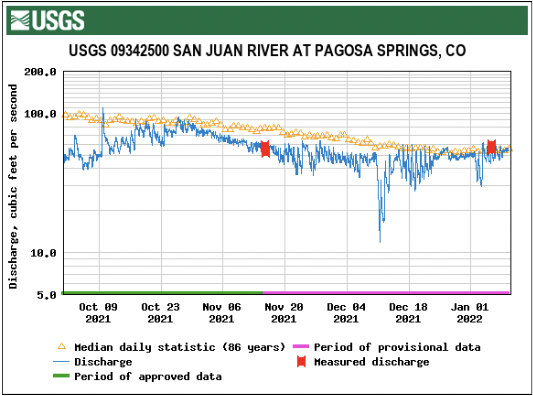
River report
According to the U.S. Geological Survey (USGS), the San Juan River was flowing at a rate of 53.7 cfs in Pagosa Springs as of noon on Wednesday, Jan. 5. Based on 86 years of water records at this site, the lowest recorded flow rate for this date is 26 cfs, recorded in 1990. The highest recorded rate for this date was in 1987 at 116 cfs. The average flow rate for this date is 59 cfs.
An instantaneous reading was unavailable for the Piedra River near Arboles.
Colorado Drought Monitor map January 4, 2022.
Drought report
The National Integrated Drought Information System (NIDIS) was last updated on Dec. 28, 2021. The NIDIS website indicates 100 percent of Archuleta County is abnormally dry and also in a moderate drought. The NIDIS website also notes that 47.66 percent of the county is in a severe drought stage. Additionally, the NIDIS website notes that 10.33 percent of the county remains in an extreme drought. No portion of the county is in exceptional drought.