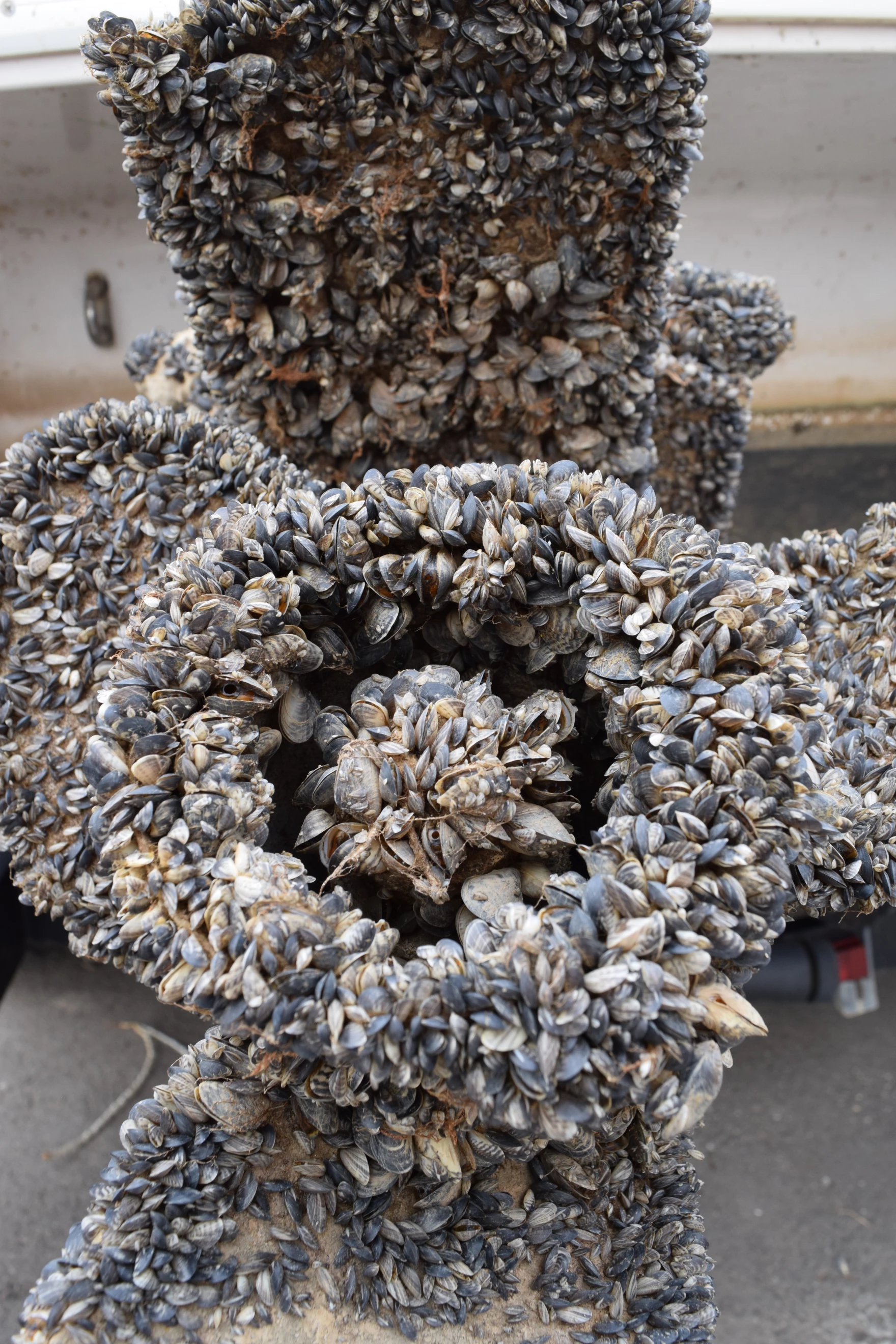
On Wednesday, May 1st, the Ruedi Reservoir boat ramp opened along with motorized watercraft inspection and decontamination for aquatic nuisance species such as the quagga and zebra mussels. On the second day of the season, two boats were found to be infested with mussels as opposed to only three boats for the entirety of the 2023 season. Most of the infected boats are coming from Lake Powell, which is ridden with quagga mussels. Due to the increasing threat they pose, Reudi Reservoir has a mandatory inspection and decontamination protocol in place for entry and departure in compliance with state regulations. The inspection station is operated by CPW from daylight to dark through October.
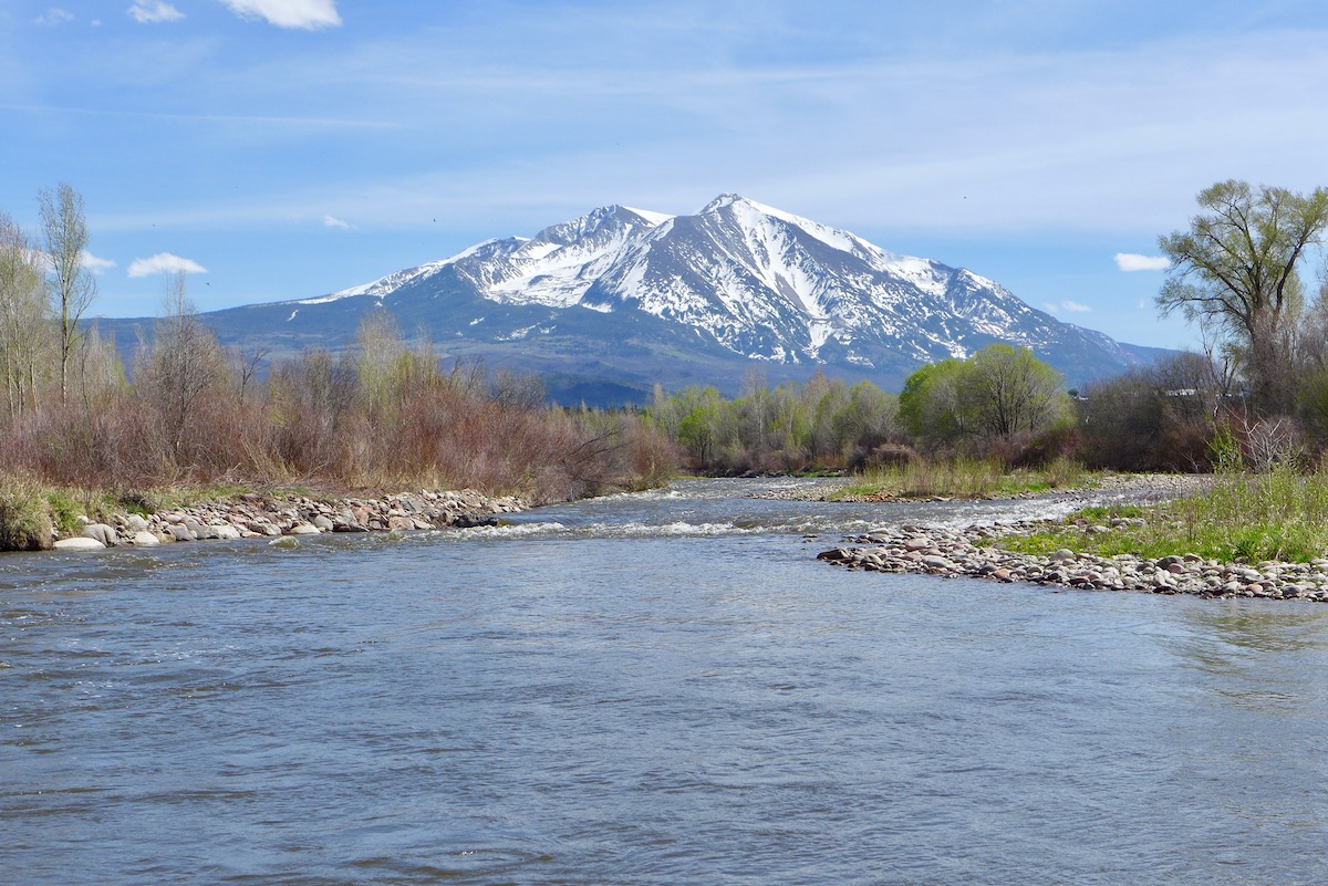
The Roaring Fork River just above Carbondale, and Mt. Sopris, on May 3, 2020. Photo credit: Brent Gardner-Smith/Aspen Journalism
Click the link to read the article on the Aspen Daily News website (Austin Corona). Here’s an excerpt:
May 21, 2024
Two groups of states submitted conflicting proposals in March describing how federal officials should manage reservoirs on the Colorado River after 2026. Former Colorado River Water Conservation District General Manager Eric Kuhn, along with two other water experts, have their own idea to pitch. Kuhn and his co-authors, University of New Mexico professor John Fleck and Utah State University professor Jack Schmidt want to add more flexibility to dam operations to address environmental and recreation concerns in the Grand Canyon below Glen Canyon Dam (the dam that forms Lake Powell). Kuhn presented what has been called the “academic proposal” during a Colorado Basin Roundtable meeting in Glenwood Springs on Monday. He said the document is not a “proposal” akin to the states’ proposals, describing it as more of an “approach” that can be incorporated with other proposals.
“What we’ve proposed is a one-speed bicycle with pedal-back brakes,” Kuhn said. “What all of the parties are likely to negotiate for an actual accounting system is more like a Mars rover.”
The two alternatives submitted by the states propose regulations that will layer on top of the 1922 Colorado River Compact to regulate how federal officials release water from major reservoirs after current regulations expire at the end of 2026. One proposal, submitted by the “Upper Basin” states (Colorado, Utah, New Mexico and Wyoming) would regulate releases from Lake Powell, while the “Lower Basin” states (California, Arizona and Nevada) proposal reaches farther to affect releases from Powell, Lake Mead and five other reservoirs spread across both basins…
Kuhn’s, Fleck’s and Schmidt’s solution, Kuhn said, is to allow the U.S. Secretary of the Interior to adjust Glen Canyon releases when necessary to address these diverse and changing issues. Every time managers adjust for environmental or other concerns, though, it will mean that Powell (which is in the Upper Basin) or Mead (in the Lower Basin) ends up with a different amount of water from what the guidelines officially dictate. To deal with this disparity, the authors propose setting up a special “account” of water in one reservoir that compensates for unexpected losses in the other. If managers choose to release more water from Powell than expected, it means the Upper Basin lets more water flow to the Lower Basin than is obligated. Therefore, that water would be held in an “account” in Lake Mead, and it would count against Powell’s future releases to the Lower Basin. The reverse would be true if managers release less water from Powell than expected — they would set up an account in Powell that would later add on top of future releases to Mead.
“New plot using the nClimGrid data, which is a better source than PRISM for long-term trends. Of course, the combined reservoir contents increase from last year, but the increase is less than 2011 and looks puny compared to the ‘hole’ in the reservoirs. The blue Loess lines subtly change. Last year those lines ended pointing downwards. This year they end flat-ish. 2023 temps were still above the 20th century average, although close. Another interesting aspect is that the 20C Mean and 21C Mean lines on the individual plots really don’t change much. Finally, the 2023 Natural Flows are almost exactly equal to 2019. (17.678 maf vs 17.672 maf). For all the hoopla about how this was record-setting year, the fact is that this year was significantly less than 2011 (20.159 maf) and no different than 2019” — Brad Udall
The size of Wyoming’s proposed and controversial West Fork Dam in the Medicine Bow National Forest in Carbon County is in flux as federal environmental analysts juggle economics and conservation in a review of the planned 264-foot high concrete structure, key analysts say.
As now planned, the structure would flood 130 acres and hold 10,000-acre-feet of water on a headwaters tributary of the Colorado River Basin where drought and climate change plague a river system that supports 40 million people. The dam’s reservoir would hold enough water to supply 20,000 households for a year but it would be used principally to benefit a few dozen irrigators, federal and state documents show.
Releases from the proposed reservoir would flow down Battle Creek to irrigators in the Little Snake River Valley in Wyoming and Colorado. But Wyoming’s plan has drawn public scrutiny and controversy over its purported benefits and impacts.
Studies and analysis reveal that some parts of the plan are uneconomical, officials with the U.S. Natural Resources Conservation Service said last week. That’s leading the agency to consider reducing the cost and scope of the project, cutting the amount of water to be impounded and also employing irrigation conservation measures, federal analysts said.
Even as reviewers flesh out various ways to supply irrigators with late-season water, along with some public benefits and habitat improvements, Wyoming’s design remains “one of the leading alternatives,” said Shawn Follum, an engineer with the federal conservation service.
As envisioned by the Savery-Little Snake Water Conservancy District, Colorado’s Pothook Water Conservancy and the Wyoming Water Development Office, the 700-foot-long dam near the confluence of Battle and Haggarty creeks would span a gorge and back up water for almost two miles.
Project backers estimated in 2017 that the entire project would cost $80 million, most of which the state of Wyoming would fund.
Some alternatives being considered in the environmental impact statement are “just not economically viable,” Follum said. “There’s no net benefit to the government.
“There’s a possibility of maybe changing the scope of that dam a little bit as we’re going through some of the economics to try to reduce some costs,” he said.
“We haven’t identified a modified West Fork [Dam] that’s practical yet,” Follum said. “But we are looking at [whether] we [can] reduce the need of the impounded water with some conservation measures, like lining a ditch to reduce seepage.”
Ongoing studies could propose a smaller project: “That’s what we’re hoping,” he said. But analysts haven’t resolved that size issue, Natural Resources Conservation Service public affairs specialist Alyssa Ludeke said.
“We just don’t have the final answer on that yet,” she said.
December deadline
A draft environmental impact statement likely won’t be completed and released for public comment until December, the two officials said in a telephone interview. The federal conservation service began reviewing the project in December 2022, coordinating with other federal and state agencies, including the Wyoming Water Development Office, the Medicine Bow National Forest and the Wyoming Office of State Lands and Investments.
The state lands office proposed exchanging Wyoming property located inside the Medicine Bow for federal property at the dam site, a swap officials said would expedite environmental reviews. Wyoming sought 1,762 acres of federal land in exchange for an equal value of state property — until last month.
That’s when Jenifer Scoggin, director of the land office, reduced Wyoming’s proposal by 272 acres, or about 16%.
Wyoming’s Office of State Lands and Investments proposed this 1,490-acre Forest Service parcel be traded to Wyoming to enable construction of the West Fork Dam. the parcel is 16% smaller than Wyoming’s original request. (OSLI via Medicine Bow National Forest)
The amendment to seek only 1,490 acres was “based on discussions with the U.S. Forest Service,” Scoggin wrote Jason Armbruster, Bush Creek/Hayden District ranger with the Medicine Bow. The change “addresses resource issues” identified by field studies, she wrote.
Some of the parcels the state sought required Wyoming to surmount “larger hurdles than we could jump,” said Jason Crowder, deputy director of the state lands office.
“We’ve been working for the past year or so trying to come up with a package of land that would move easily through the federal exchange system,” he said in an interview. “It just made sense to change the make-up of the parcels involved [to follow an] easier path.”
The Medicine Bow will use the updated Wyoming proposal as the basis for a “feasibility analysis,” forest spokesman Aaron Voos wrote in an email. That finding — whether the exchange is possible — is the first of two steps.
If the swap is feasible, the Medicine Bow would then determine whether it is in the public interest.
Alternatively, the environmental review might suggest that the state construct and operate a reservoir under a federal permit instead of acquiring the land underneath and surrounding the dam and reservoir. Wyoming has not favored that path.
The Natural Resources Conservation Service and U.S. Forest Service continue their independent reviews.
“I believe the land exchange will probably be slower than the EIS itself,” Follum said. “But that won’t impact [us at the conservation service] because we’re going forward with the kind of a dual assumption; it’ll either be a land exchange or permit.”
The conservation service identified six alternatives when it announced its environmental review, including a no-action alternative. Three other alternatives consider building the dam as proposed under a Forest Service permit or through a land exchange. A fifth option calls for locating a reservoir elsewhere and a sixth calls for water conservation and habitat-improvement projects.
West Fork Fire June 20, 2013 photo the Pike Hot Shots Wildfire Today
Click the link to read the article on the USGS website:
May 21, 2024
Wildfires are a natural process in many ecosystems, but they are increasing in size, severity and frequency in many areas across the United States.
After a wildfire, loss of canopy vegetation and changes to soil properties can occur, which leads to more water flowing over land during rainfall. This can lead to flooding, erosion, and the movement of sediment, ash, pollutants and debris to surface water.
The range of water quality impacts after a wildfire varies, from no noticeable change to large increases in the amount of sediment, nutrients, metals and other constituents. This can result in decreased water quality, loss of reservoir storage capacity, stream habitat degradation and increased treatment costs for drinking water providers.
The most severe water quality impacts are often delayed until high-intensity rainstorms occur, which can happen months to years after a wildfire. This can complicate efforts to collect post-wildfire water quality data, as funding opportunities for data collection have likely diminished by the time the most severe impacts have occurred.
To improve understanding of how wildfires affect water supplies, USGS scientists developeda strategy for selecting water sampling locations and methodologies for data collection, in order to improve the identification of regional insights into wildfire impacts on water quality.
“We don’t currently have enough data to estimate how wildfires affect water quality in different regions,” said Sheila Murphy, USGS research hydrologist and lead author of the study. “Monitoring water quality after wildfires in a strategic, consistent way would help us assess and predict the impact of wildfires on surface waters, which is critical to human and ecosystem health.”
USGS Gallinas Creek near Montezuma, NM (08380500) streamgaging and water-quality monitoring station in August 2022 (watershed burned by Calf Canyon/Hermit Peak Fires April-August 2022) (photo showing Johanna Blake, USGS; photo by Jeannie Barlow, USGS)
A USGS streamgage at Gallinas Creek near Montezuma, NM in August 2022. The watershed was burned by the 2022 Calf Canyon/Hermits Peak Fire.
With hundreds of wildfires occurring in watersheds across the country each year, it would be difficult to monitor every stream within or downstream of a burned area. Collecting post-wildfire water quality data from sites that are diverse in climate, land use, geology and vegetation can build a foundation for distinguishing regional differences in impacts to water.
One of the study’s key insights is a list of important parameters to measure after a wildfire. These parameters are critical to understanding how post-wildfire water quality impacts humans, wildlife and the environment.
The parameters are divided into two tiers in order to help balance the collection of essential data with fiscal and practical constraints. Parameters in the first tier, which includes water temperature and turbidity are considered the highest priority for assessing impacts of wildfire on water quality. Parameters in the second tier, such as alkalinity, lay the groundwork for next-generation modeling capabilities but can also substantially increase monitoring costs.
This USGS research can provide water providers, reservoir operators, land managers and emergency response agencies with actionable guidance to prepare for and mitigate against wildfire impacts to water supplies.
Learn more about how the USGS is working to assist the water resources community in planning for and adapting to impacts on water resources after wildfires here.
Shoshone Falls hydroelectric generation station via USGenWeb
Click the link to read the article on the Sky-Hi News website (Elliot Wenzler). Here’s an excerpt:
May 30, 2024
A major deal to secure flows along the Colorado River in perpetuity is gaining momentum after Gov. Jared Polis signed a bill appropriating $20 million to the water right acquisition Wednesday in Silverthorne.
“I’m not being hyperbolic when I say it’s a once in a lifetime opportunity,” said Zane Kessler with the river district. “This has been a priority for our predecessor’s predecessors on the Western Slope.”
[…]
With the $20 million from the state, another $20 million from the river district and about $11 million from several other entities across the Western Slope, the sale is halfway to being fully funded. The district hopes to receive the rest of the funding from the federal government by the 2027 deadline to secure enough money…The funding was part of the annual water projects bill, which lawmakers pass each year to dedicate funding to various projects throughout the state. This year, about $56 million total was set aside. That’s higher than in years past because of an increase in revenue gained from sports betting. The state will ask voters to let them grow that funding further in November.