Guest column: Bureau of Land Management Public Lands Rule brings balance to public lands management — #Colorado Newsline

A view from Handies Peak in Hinsdale County. The peak, which rises to 14,048 feet and is pictured in July 2011, is the highest point of land managed by the Bureau of Land Management outside of Alaska. (Bob Wick/BLM/Public Domain Mark 1.0)

Click the link to read the guest column on the Colorado Newsline website (Becky Edwards and Jen Clanahan):

May 15, 2024

As Mamas, we are constantly seeking balance, whether it is managing our responsibilities at work and home, finding time for our own interests, budgeting or, quite literally, when we are teaching our children to ride bikes or trek across a log over a stream. Balance keeps things in check and benefits all of us.

It is in the spirit of balance that the new Bureau of Land Management Public Lands Rule was penned. Previously, the management of these public lands has focused on other uses, while conservation has been left out of the equation. Drilling, grazing, ranching and recreation were taken into consideration, but not conservation and land preservation.

Until now.

Recently, the Department of the Interior announced a final rule to guide the BLM on managing resilient ecosystems that will weather a changing climate, protect existing landscapes that provide critical wildlife habitat, clean air and water, and take into consideration how communities are impacted by a changing world. These decisions will be made based on science, data and Indigenous knowledge.

While the Federal Land Policy and Management Act, the act that supplied the BLM with its modern mission, does require the BLM to protect public lands, the Public Lands Rule provides guidance and resources to achieve it.

It will give land managers tools to protect, restore and maintain our public lands and waters. In Colorado, the BLM manages more than 8.3 million acres of our public lands.

This rule could not have come at a more crucial time. Our public lands are feeling the strain of climate change and increased use. Recognizing that we are at a pivotal point in time where we must preserve, protect and properly manage our public lands, the new rule will bring balance to today’s activities, which will also determine the state in which we pass these treasured lands to future generations.

Our public lands are the backbone of our way of life in the Western states. They are where we teach our kids to fish, camp and hike. They are where we go ourselves to find solitude, recreate, and slow down from our busy lives.

Communities situated near these lands and waters are changing too. Some are experiencing the benefits of booming economies, while others scramble to maintain their way of life as once-sleepy towns get busier. About 4.3 million jobs are created across the U.S. through outdoor recreation, like wildlife watching, boating and hiking, on public lands. These activities contribute about $11.4 billion to the national economy, especially impacting gateway communities to these areas. Now, there will be new opportunities for people to engage in decision-making when it comes to issues that are close to home.

We are grateful that we are able to enjoy these varied and vast lands with our families. We believe it is our responsibility to care for them during our time here and maintain them for our kids, and theirs. This new rule will help ensure that these treasured lands remain healthy and ready to welcome future generations.

We would like to thank BLM Director Tracy Stone-Manning for her leadership on the rule and  Colorado’s Sens. Michael Bennet and John Hickenlooper for their support, and Montana Sen. Jon Tester.

Plan to use cyanide to extract gold from #Leadville mining waste has residents concerned: Proposal has prompted locals to submit hundreds of comments in opposition — The #Denver Post #ArkansasRiver

California Gulch back in the day

Click the link to read the article on The Denver Post website (Elise Schmelzer). Here’s an excerpt:

A company in Leadville wants to truck 1.2 million tons of the waste to a mill on the southwestern edge of the high mountain city, use cyanide to extract gold and silver from the rocks, and then return the hills to a more natural state. CJK Milling says its proposed operation would be “one of the largest, most innovative environmental cleanups of abandoned mine waste” in Leadville — and a model for other historic mining areas.

But the company’s proposal has prompted skepticism and alarm in Leadville, with some locals opposing the additional trucks the project would put on roads in the area. Others fear the use of toxic cyanide — up to 600 pounds a day — so close to town and the Arkansas River. They worry about the project’s potential impacts on soil, water and air quality.

The proposal has also raised a broader question: What is the future of mining in a town that once relied on it but has cultivated a new identity as a high-altitude hub for tourism and recreation?

[…]

Company leaders, however, say their project is not a mining operation — and instead is focused on removing the waste piles and returning the land they sit on to its natural state. The project could be an example of profitable, privately funded cleanup of mining waste, said Nick Michael of CJK Milling.

Airborne Technology Developed at the University of Southern #California Brings New Hope to Map Shallow Aquifers in Earth’s Most Arid Deserts

Click the link to read the release on the University of Southern California website:

Airborne sounding radars can perform comprehensive mapping within a few hours compared to existing in-situ methods that would take a few years

Photo credit: University of Southern California

May 16, 2024

Water shortages are expanding across the Earth. This is particularly acute in desert areas of the Middle East that are subject to both drought and extreme conditions such as flooding. As a result of these uncertainties, there is an increasing reliance on shallow aquifers to mitigate these shortages. However, the characteristics of these aquifers remain poorly understood due to the reliance on sporadic well logs for their management.

To address this challenge a team of researchers at the USC Viterbi School of Engineering Ming Hsieh Department of Electrical and Computer Engineering along with collaborators at Metric Systems Corporation, Caltech, Institute of Flight System Dynamics at the Technical University of Munich, the Department of Electrical Engineering at Qatar University, the Qatar Environment and Energy Research Institute at Hamad Bin Khalifa University, Bin Omran Trading & Telecommunications, the Earth and Life Institute at Catholic University of Louvain, the Department of Civil and Environmental Engineering at University of Hawai’i at Manoa, and The Aerospace Corporation, developed a new prototype for what the team is calling an  “Airborne Sounding Radar for Desert Subsurface Exploration of Aquifers,” nicknamed “Desert-SEA.” The new technique will map the top of the aquifer, called the “water table,” spanning areas as large as hundreds of kilometers using a radar mounted on a high-altitude aircraft. According to the researchers, Desert-SEA will measure, for the first time, the variabilities in the depth of the water table on a large scale, allowing water scientists to assess the sustainability of these aquifers without the limitations associated with in-situ mapping in harsh and inaccessible environments.

“Understanding how shallow groundwater moves horizontally and vertically is our primary objective as it helps us answer several questions about its origin and evolution in the vast and harsh deserts. These are questions that remain unanswered to this day,” says Heggy, a research scientist at USC who specializes in radar remote sensing of deserts and the lead author of the paper outlining the technology in IEEE-Geoscience Remote Sensing magazine.

How it works:
The technique uses low-frequency radar to probe the ground. The radar sends a series of pulsed waves into the ground, which are reflected when interacting with the water-saturated layer. From the reflected signal, and using an array of advanced antennas combined with computational techniques, the water table can be mapped with relatively high vertical and spatial resolution.

When imaged, a stable water table usually appears as flat reflector as the amounts of water withdrawn and the amount of water that enters the system (its “recharge”) are nearly equal. However, if there is any imbalance, this will be reflected in the resulting image showing an upward or downward deflection in shape of the water table.

A similar technique is widely used for probing ice in the Antarctic and planetary bodies; however, adapting it to sense shallow aquifers in the deserts required resolving several challenges in the radar design that took three years of hard work with industry partners in Carlsbad, CA, to resolve it.

“In particular, we had to resolve the blind zone near the surface. The highly radar-attenuating ground, unquantified sources of noise, and complex clutter can mask the detection of shallow aquifers. Our system’s probing and surveying capabilities surpass those of commercial ground penetrating radars, whether surface or drone-mounted. Our system transmits stronger signals, has more sensitive receivers, and operates faster by several orders of magnitude,” says Heggy.

Current shallow groundwater maps in several parts of arid deserts, such as the Sahara, rely on data from wells that are tens, hundreds, and sometimes even thousands of miles apart, which could lead to inaccurate estimates of their volume and dynamics. Heggy suggests that this would be like finding out data about groundwater in the entire United States solely by looking at data from a well in New Jersey. (The desert area of North Africa and the Arabian Peninsula is twice the size of the continental United States). Thus, well logs alone cannot give a proper assessment of their rapid evolution, cautions Heggy.

According to the researchers, Desert-SEA’s capability to transmit high-power signals and use advanced onboard processing can fill the gaps in the data presented by well logs’ geographical distribution.

With this new prototype, Heggy predicts that even with a small airplane flying at two hundred miles per hour, the team could  cover in an hour what researchers would normally cover in a year from well log data.

Co-author Bill Brown was the lead engineer on the project. Brown says, “The Desert Sea Radar represents a significant advancement in airborne sensing and environmental engineering. By integrating high-frequency radar with AI technologies, it can generate real-time, three-dimensional mappings of subterranean water sources. This capability is crucial for securing sustainable water management in arid regions.”

While this technology will be tested in the Middle East, it has wide application to other places that are subject to extended droughts, notably in central Asia and Australia, and even in US deserts.

This technology works best in very dry areas like sand and its particular importance goes beyond understanding the current water supply. It can also be deployed for repeated assessments to understand sustainability for agriculture and, consequently, for ensuring food security for inhabitants of these extreme environments.

“Having the ability to peer more than 100 feet deep through dry sand, across vast deserts and in record time, is going to allow us to answer fundamental questions about the ebb and flow of groundwater in these regions and how we can use it in a more sustainable way,” said Elizabeth Palmer, a Fulbright Fellow working on the project.

“I am always glad to participate in airborne research missions. However, because the Desert-SEA mission will have a humanitarian impact on relieving water stress, it gives me unique feelings of motivation and pride,” Akram Amin Abdellatif, a researcher at the Technical University of Munich (TUM) noted.”

The next step for the research team is to take this designed prototype and build a flight model to be implemented on helicopters and fixed-wing aircraft.

2024 #COleg: #Colorado lawmakers passed 10 new water measures this year. These are the biggest ones — Fresh Water News

Colorado state capitol building. Photo credit: Allen Best/The Mountain Town News

Click the link to read the article on the Water Education Colorado website (Larry Morandi and Jerd Smith):

May 16, 2024

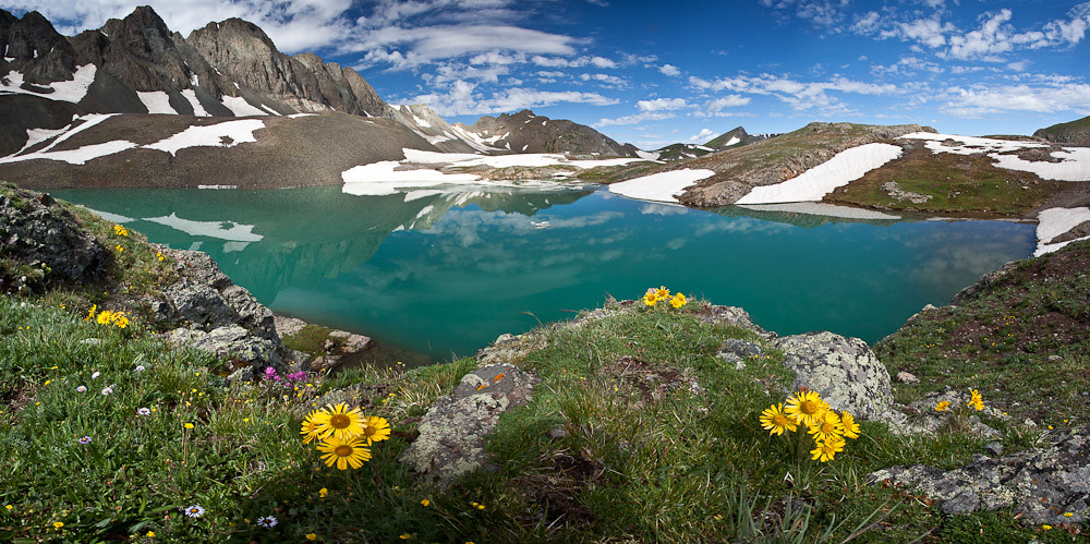
Colorado lawmakers gave the thumbs-up to 10 water measures this year that will bring millions of dollars in new funding to help protect streams, bring oversight to construction activities in wetlands and rivers, make commercial rainwater harvesting easier, and support efforts to restore the clarity of Grand Lake.

Money for water conservation, planning and projects was a big winner, with some $50 million approved, including $20 million to purchase the Shoshone water rights on the Colorado River.

Sen. Dylan Roberts, D-Frisco, chair of the Senate Agriculture and Natural Resources Committee, expressed gratitude for the legislature’s focus on water issues and for funding the Shoshone purchase. “This continues to show the state’s financial investment in our water future,” he said, “and we’ll now ask voters to retain even more money from sports betting to continue that funding commitment.”

Roberts was referring to a ballot initiative that will ask voters in November to allow the state to hold onto more of the tax revenue generated by sports betting.

Another major law created a new permitting program to protect wetlands and streams from construction, road building and development activities. Those federal regulations were wiped out last year by the U.S. Supreme Court in its Sackett v. EPA decision. Two competing measures were initially introduced, but lawmakers joined forces toward the end of the session to arrive at a bipartisan consensus.

In another action, lawmakers approved a narrow change to storm water storage rules that will allow an innovative commercial rain-water harvesting pilot program in Douglas County’s Sterling Ranch development to proceed.

“Dominion is excited to continue to advance the only regional rainwater harvesting project in the state, which now can be completed in a cost effective and timely manner with the unanimous support of the Colorado Legislature and the governor,” said Andrea Cole, general manager of Dominion Water and Sanitation, which is conducting the pilot program and which serves Sterling Ranch.

And lawmakers also approved two high-profile resolutions, one supporting efforts to restore clarity in the state’s Grand Lake, and a second resolution urging Congress to provide funding to help repair aging water systems serving tribal communities and others in southwestern Colorado. A third identifies projects eligible for funding through the Colorado Water and Power Development Authority. Resolutions, unlike laws, don’t usually come with money and have little legal weight.

Here’s a look at the most significant measures that passed.

House Bill 1435 — Colorado Water Conservation Board projects

This is an annual bill that provides grants and loans to projects requested by the Colorado Water Conservation Board. None of the money is from the state’s general fund; it includes interest earned from CWCB loans, severance taxes and sports betting revenue. The largest amounts this year are for two CWCB loans: up to $155.65 million for the Windy Gap Firming Project, and up to $101 million for the Northern Integrated Supply Project. The balance is for grants that include:

  • $23.3 million to help implement the state water plan (all of it from sports betting revenue, up from $10 million last year)
  • $20 million to support the purchase of Shoshone power plant water rights by the Colorado River Water Conservation District
  • $4 million for drought planning and mitigation projects
  • $2 million for the turf replacement program.

House Bill 1379 — Regulating dredge and fill activities in state waters

This bill grew out of the May 23, 2023 U.S. Supreme Court decision in Sackett v. U.S. Environmental Protection Agency, which narrowed the scope of waters protected under the federal Clean Water Act. It ruled that federal regulation of dredge and fill activities applies only to wetlands that have a “continuous surface connection” to rivers and other permanent bodies of water where it would be difficult to determine where the river stopped and the wetland began, eliminating federal protection to large areas of wetlands and seasonal streams in Colorado.

House Bill 1379 requires the Water Quality Control Commission in the Colorado Department of Public Health and Environment to develop rules by Dec. 31, 2025, to implement a state program that is at least as protective as the guidelines developed under Section 404 of the Clean Water Act. It covers discharges to “state waters,” which are defined as “any and all surface and subsurface waters that are contained in or flow in or through the state, including wetlands.” House Speaker Julie McCluskie, D-Dillon, said that by shifting from a “gap” program that covers only those waters left unprotected by Sackett to a “state waters” approach “we ensure clarity and certainty.”

The bill exempts certain activities and excludes some waters from coverage. Activities not requiring a permit include normal farming, ranching and forestry operations, along with maintenance of currently serviceable structures and construction or maintenance of irrigation ditches. Excluded waters include those in ditches and canals, wetlands adjacent to ditches or canals that are supported by water in the ditch or canal, and artificially irrigated areas that would revert to upland if irrigation ceased. Rep. Karen McCormick, D-Longmont, said that “codifying in statute the exemptions rather than leaving it to rulemaking” avoids some of the “unpredictability that existed at the federal level.”

Senate Bill 148 – Rain water harvesting, storage

Allows, with proper authorization, those operating an approved rain water harvesting pilot project to store water in a detention facility.

Senate Bill 197 — Water conservation

Senate Bill 197 contains provisions that were either recommendations or items discussed by the Colorado River Drought Task Force the General Assembly created last year. The bill allows the owner of a storage water right to loan water to the CWCB for stream sections where the CWCB does not hold an instream flow right. It permits the creation of agricultural water protection programs statewide instead of just in the South Platte, Republican and Arkansas river basins in eastern Colorado, and authorizes an irrigation water right holder to request a change in use to an agricultural protection water right that would allow the lease, loan or trade of up to 50% of the water.

The bill also allows electric utilities that plan to close coal-fired power plants in the Yampa River basin in northwestern Colorado from losing their water rights if they decrease or do not use the water for a specified period of time. Roberts said this would allow electric utilities “to temporarily toll their water rights and protect them from abandonment while those companies explore alternative energy development” to align with the state’s clean energy and greenhouse gas reduction goals.

The drought task force included a sub-task force to study tribal matters, which recommended a provision in the bill that requires the CWCB to reduce or waive any matching requirements for state water plan implementation grants awarded to the Ute Mountain Ute Tribe or the Southern Ute Indian Tribe.

House Bill  1436 — Sports betting revenue

Sports betting revenue has been used to help fund implementation of the Colorado Water Plan since passage of Proposition DD by the electorate in 2019, which legalized sports betting and taxed its proceeds. The amount of revenue that can be used to support the state water plan was capped at $29 million, a figure that is likely to be exceeded this year. Rather than refund the excess money to casinos and licensed sport betting operators that paid the tax, House Bill 1436 refers a ballot measure to the voters in November asking them to remove the cap and allow the state to keep all revenue and use it to fund water conservation and protection projects.

The bill’s fiscal note projects that sports betting revenue will exceed $29 million this fiscal year by $2.8 million, by $5.2 million in fiscal year 2025, and by $7.2 million in fiscal year 2026 (the actual revenue is distributed the year following its collection and spent the year after). Rep. Marc Catlin, R-Montrose, noted that sports betting revenue has exceeded expectations, and if the voters approve, “this seems to be the easiest way to fund these kinds of projects (because) you don’t have to go and ask for property tax revenue or for tax money out of the state general fund.”

Senate Bill 5 — Prohibiting certain landscaping practices to conserve water

Faced with climate change and increasing water demand, Senate Bill 5 is designed to reduce water used for landscaping in new development projects. It prohibits local governments from allowing the installation of nonfunctional turf — grass that is not used primarily for recreational purposes — in commercial, institutional, industrial or common interest community property, street rights-of-way, parking lots, medians or transportation corridors after Jan. 1, 2026. It does not apply to residential property or to turf that is part of a water quality treatment program, native grasses or artificial turf on athletic fields. The bill also prohibits the Department of Personnel from installing the same types of turf in any new state facility construction project after Jan. 1, 2025.

Roberts noted that irrigating nonfunctional turf “is responsible for what is believed to be up to 50% of municipal water use,” and pointed out that Senate Bill 5 builds on legislation passed two years ago that provides funding for a turf replacement program.

Senate Bill 37 — Green infrastructure to improve water quality

Senate Bill 37 calls for a study of how “green infrastructure” might replace traditional concrete and steel wastewater treatment plants in managing water quality. Green infrastructure, according to bill writers,  is “a strategically planned, managed, and interconnected network of green spaces, such as conserved natural areas and features, public and private conservation lands, and private working lands with conservation value.” It can improve water quality by reducing stormwater runoff as pollutants are absorbed into soils and filtered before entering waterways, and lessen the need for expensive wastewater treatment plants, also known as gray infrastructure.

The bill requires the University of Colorado and Colorado State University — in collaboration with CDPHE — to conduct a feasibility study of how green infrastructure can be used as an alternative to gray infrastructure in complying with water quality regulations, and the types of new funding mechanisms that might support it. The universities, with CDPHE’s approval, may conduct up to three pilot projects to test their findings. CDPHE and the universities must complete the study by April 1, 2026, and submit a report summarizing its findings and any recommendations to the General Assembly’s Water Resources and Agriculture Review Committee no later than Nov. 1, 2026.

Sen. Cleave Simpson, R-Alamosa, noted the cost-effectiveness of green infrastructure, especially in rural communities like those in his district where “to invest tens of millions of dollars in a new wastewater treatment plant to serve small numbers of people is just problematic.” He views Senate Bill 37 as offering “a different path forward where you can get the same outcomes but with more natural investments.”

More by Larry Morandi and Jerd Smith

Global temperature is now near its peak due to El Nino + aerosol decrease — @DrJamesEHansen #ActOnClimate #KeepItInTheGround

How far will it fall in the coming La Nina? If El Nino/La Nina average is ~1.5C, given Earth’s energy imbalance, we are now passing thru 1.5C, for practical purposes. See MayRpt – https://mailchi.mp/caa/comments-on-global-warming-acceleration-sulfur-emissions-observations

Ramping up to peak severe thunderstorm and tornado season in #Colorado — @ColoradoClimate Center

Click the link to read the blog post on the Colorado Climate Center website (Russ Schumacher):

May 16, 2024

The midwest and south have been very active with severe weather lately, but it’s been relatively quiet here in Colorado so far. But we’ve reached the middle of May, which is the time of year when the threat for severe thunderstorms and tornadoes in Colorado rises rapidly. In this blog post, we’ll walk through some of the interesting aspects of Colorado’s severe weather climatology, and what history shows about what we could expect in the coming months. (If you like to explore data on your own, you can jump right over to the set of severe weather maps and graphs on our website.)

Where does severe weather tend to happen in Colorado?

First, let’s look at where severe weather happens in Colorado. (Below is a static map, but do check out the interactive map on the website where you can zoom in, select specific hazard types, etc.) The first thing you likely notice from this map is that severe storms happen a lot more frequently in eastern Colorado than on the western slope. This probably isn’t a huge surprise. There are four ingredients required to get severe thunderstorms: moisture and instability in the atmosphere, a mechanism to lift the air, and vertical wind shear (the change in wind speed and/or direction as you go up in height). Those ingredients are in place a lot more often in eastern Colorado than to the west — especially the moisture and instability. It’s tough to get enough moisture for really intense thunderstorms up in the high country.

Map showing reports of tornado (red), severe hail (green), and severe thunderstorm wind gusts (blue) in Colorado from 1955-2022. Visit the interactive version at: https://climate.colostate.edu/severe_storms.html

Now, if you look even closer at the map of reports, you might notice some other interesting patterns. For example, in southeast Colorado, can you pick out Highway 50? Your eye might also be drawn to clusters along the Front Range urban corridor, or even other roads. There’s not any reason to believe that hail falls more frequently on highways than in open fields: instead, this demonstrates that the primary source of severe weather data is reports made by people, so there are more reports where people tend to be! (More of them in cities and on roadways, fewer in rural areas away from towns and major roads.)

When does severe weather tend to happen in Colorado?

Next, we can take a look at when during the year that severe weather reports tend to happen. The black lines in these graphs show a smoothed version of the average number of reports per day. For tornadoes, the frequency ramps up through May and reaches a peak in early June, with a slow decline through the summer and into the fall. The graph for severe hail looks similar, but shifted a little later: the peak is in mid-June. The graph for severe wind reports looks a little strange, though, with a big spike on a particular day. That spike comes from the unusual derecho that swept across the country on June 6, 2020. Just in Colorado, there were 137 reports of severe thunderstorm winds (58 mph or stronger) and 36 reports of winds exceeding 75 mph on that one day, far more than any other day in Colorado records.1 That single storm system was able to alter what the severe weather climatology looks like in Colorado!

Distribution of the average number of tornado, hail, and wind reports in Colorado across the year. Visit the interactive version at: https://climate.colostate.edu/svr_reports_dist.html

Another way to look at the data, which smooths out the effect of individual rare events, is “severe weather days”: the number of days that had one or more report of a particular hazard. The tornado and hail graphs look pretty similar to the ones above, but now the wind graph is better behaved. It shows that severe thunderstorm wind gusts are more frequent later in the summer, with a peak in early to mid-July. (An important note is that this only considers wind gusts produced by thunderstorms. Other types of intense wind tend to happen in the winter and spring.)

Distribution of the average number of days per year with tornado, hail, and wind reports in Colorado across the year. Visit the interactive version at: https://climate.colostate.edu/svr_days_dist.html

2023 was a very active year

We’re still awaiting the final compilation of data from NOAA for 2023, but we know that it was one of the most active years for Colorado severe weather in recent times. You might remember the Red Rocks hailstorm, the historic number of tornadoes in northeast Colorado on June 21, the unusual late-night hailstorm on June 28, or the Yuma County tornado on August 8 that was rated EF-3. Later in the evening of August 8, a new state record hailstone, 5.25 inches in diameter, was collected in Yuma County by a storm chaser.

Especially when it comes to hail, 2023 was a year for the record books, with the largest number of reports on record across every size category. (Keep in mind, though, that hailstorms have not been consistently recorded over time, and population has grown, so it’s tough to look at trends of hail reports over the long term. The 2023 data are also still awaiting final confirmation.)

How to get severe weather warnings; how to submit reports

If severe weather is in the forecast, it’s important to have more than one way to get warnings from the National Weather Service. Make sure that Wireless Emergency Alerts (WEA) are active on your phone. Get a NOAA Weather Radio, especially for times when you might be outside of cell service, like when camping. Follow your local broadcast meteorologists and your local National Weather Service office. Think about the safe place where you, your family, and your pets can go if a warning is issued.

If severe weather happens to occur in your area, you can also help by reporting what happened to the National Weather Service. They accept reports over social media, or if you’re especially dedicated you can get trained to be a Skywarn spotter, submit reports on your phone using mPING, or join the Community Collaborative Rain, Hail, and Snow (CoCoRaHS) network where you can submit detailed information about hail, heavy rain, and other hazardous weather. All of these reports are useful both for knowing what is happening while storms are ongoing, and for researchers to understand how to make better forecasts and warnings in the future.

In future posts, we’ll take a deeper dive into some of the most unusual and highest-impact storms that have occurred in Colorado in its history, and other interesting aspects of the severe weather climatology.

Further reading

For further reading, check out this paper by former CSU PhD student Sam Childs:
Childs, S. J., and R. S. Schumacher, 2019: An Updated Severe Hail and Tornado Climatology for Eastern Colorado. J. Appl. Meteor. Climatol.58, 2273–2293, https://doi.org/10.1175/JAMC-D-19-0098.1.

  1. The previous highest number of thunderstorm wind reports on a day was 30 severe reports (58+ mph), and 7 “significant” (75+mph) severe reports. ↩︎
Last night’s storm (July 30, 2021) was epic — Ranger Tiffany (@RangerTMcCauley) via her Twitter feed.

Feds to end coal leasing in #PowderRiver Basin, nation’s largest source of coal: The U.S. Bureau of Land Management’s decision to end future #coal leasing in the region is likely to be challenged — @WyoFile #ActOnClimate #KeepItInTheGround

Arch Resources’ Black Thunder mine in the Powder River Basin. (Alan Nash)

Click the link to read the article on the WyoFile website (Dustin Bleizeffer):

May 16, 2024

In a historic move, the U.S. Bureau of Land Management has proposed ending federal coal leasing in the Powder River Basin. The region, which extends from northeast Wyoming to southern Montana, is the nation’s largest coal supplier, and for 50 years a pillar of Wyoming’s economy.

The federal agency on Thursday issued its final supplemental environmental impact statement and proposed amendment to its Buffalo Field Office land use plan, selecting a “no future coal leasing alternative.” Mining companies can still develop their existing federal coal leases, which would allow for the region’s current rate of production to continue through 2041, according to the agency’s estimates.

The BLM was required by court order to rework its land use plan updates for the Buffalo, Wyoming and Miles City, Montana field offices after local conservation groups successfully argued it had not fully considered environmental, climate and human health impacts resulting from further coal leasing in the region. The agency’s action this week opens a 30-day “protest” period, and a final order is due later this year.

To submit a written protest, visit the BLM’s Filing a Plan Protest page for instructions. Protests must be submitted by June 17.

Though the Powder River Basin coal industry has been in decline since 2008, the BLM’s decision — even if it is defeated by legal challenges — sends a strong signal to the industry, as well as Wyoming and Montana leaders, that mining in the region will come to an end, said Shannon Anderson, attorney for the Sheridan-based landowner advocacy group Powder River Basin Resource Council.

“This recognizes the reality of where things are headed and provides us certainty,” Anderson told WyoFile. “It also provides the opportunity to responsibly close these mines to ensure reclamation gets done.”

Coal trucks prepare to dump their payload at Arch Resources’ Black Thunder coal mine in northeast Wyoming. (Dustin Bleizeffer/WyoFile)

Wyoming’s congressional delegates blasted the decision.

“This will kill jobs and could cost Wyoming hundreds of millions of dollars used to pay for public schools, roads, and other essential services in our communities,” Sen. John Barrasso, a Republican and vocal industry advocate, said in a statement. “Cutting off access to our strongest resources surrenders America’s greatest economic advantages — to continue producing affordable, abundant, and reliable American energy.”

Retired Powder River Basin coal miner Lynne Huskinson, also a member of the Powder River Basin Resource Council and Western Organization of Resource Councils that challenged the BLM, applauded the agency’s decision.

“As someone who lives near some of the largest coal mines in the nation, I’m thankful for the leadership from the BLM in finally addressing the long-standing negative impacts that federal coal leasing has had on the Powder River Basin,” Huskinson said in a statement. “For decades, mining has affected public health, our local land, air, and water, and the global climate. We look forward to BLM working with state and local partners to ensure a just economic transition for the Powder River Basin as we move toward a clean energy future.”

Wyoming coal production — primarily in the Powder River Basin — recently fell 20% with forecasts for lower-than-average demand for the rest of the year.

Despite declining demand, Wyoming Mining Association Executive Director Travis Deti believes cutting off coal leases will bring dire consequences. “In a time of deteriorating grid reliability and soaring electricity demand, make no mistake about it — the lights are going out,” Deti said in a prepared statement.

Gordon promises to sue

The BLM’s coal leasing decision is the latest in a series of federal rules aimed at drastically reducing greenhouse gas and other pollutants from fossil fuels, earning accolades from environmental groups and ire from states dependent on coal, oil and natural gas production.

The actions hit particularly hard in Wyoming where the BLM manages 18 million surface acres and about 43 million acres of subsurface minerals, including the vast majority of coal in the Powder River Basin.

  • The agency recently released a draft management plan for sage grouse habitat that could further restrict oil and gas development
  • The BLM in March announced its “final Methane Waste Rule” requiring oil and gas producers to curb greenhouse gas emissions from operations on federal and tribal lands — designations that describe 70% of Wyoming’s mineral acreage.
  • The agency is finalizing another rule to put conservation on par with the “multiple-use” doctrine guiding federal lands — another threat to Wyoming’s oil and gas industry, according to opponents.
  • The U.S. Environmental Protection Agency in April issued four “final” rules aimed at drastically cutting coal pollution, including a mandate that existing coal-fired power plants cut or capture 90% of their planet-warming carbon dioxide emissions by 2032 or convert to natural gas or close altogether.

The culmination of Biden administration actions, according to Gov. Mark Gordon, appears to be a deliberate attack on fossil fuel jobs and the economies of energy-producing states.

Gov. Mark Gordon spoke with Advance Casper members Feb. 13 2024 in Casper. (Dustin Bleizeffer/WyoFile)

“With this latest barrage in President Joe Biden’s ongoing attack on Wyoming’s coal country and all who depend upon it, he has demonstrated his lack of regard for the environment, for working people, and for reliable, dispatchable energy,” Gordon said in a statement. “This decision [to end coal leasing], compounded by the recent EPA rules, ensures President Biden’s legacy will be about blackouts and energy poverty for Wyoming’s citizens and beyond.”

Gordon promised to “fully utilize the opportunities available to kill or modify this Record of Decision before it is signed and final.”

Praise for federal environmental actions

Environmental groups say the bold federal actions to curb planet-warming greenhouse gas emissions are long overdue.

“The only way to address the climate crisis is to transition to a renewable energy economy, and America’s public lands are at the center of that transition,” Center for Western Priorities Deputy Director Aaron Weiss said in a statement. “We’re thankful to Interior Secretary Deb Haaland, BLM Director Tracy Stone-Manning, and all of the hard-working scientists and land managers who prepared these [Powder River Basin coal leasing] management plans.”

The main operations of the North Antelope Rochelle coal mine, as captured by satellite image. (Google Earth)

Conservation groups have also noted that the pollution reduction rules are accompanied by unprecedented spending via the Inflation Reduction and Infrastructure Investment and Jobs acts, injecting billions of dollars into communities throughout the nation, including funds that are specifically targeted to help energy communities transition away from fossil fuels.

Though many Wyoming communities are eager to take advantage of the federal dollars, they’ve struggled to muster the professional resources necessary to compete for them, while Gordon has rejected some of the federal programs.

Though coal has long powered the nation, markets are already adapting to cleaner forms of energy that will allow the nation to move beyond the greenhouse gas-emitting fuel, according to the Western Organization of Resource Councils’ Board Chair Paula Antoine.

“BLM’s announcement recognizes that coal’s era is ending,” Antoine said in a statement, “and it’s time to focus on supporting our communities through the transition away from coal, investing in workers, and moving to heal our lands, waters and climate as we enter a bright clean energy future.”

Coal

The West remains cattle country: Livestock has indelibly altered the region’s land, water and air — Jonathan P. Thompson (@HighCountryNews)

Click the link to read the article on the High Country News website (Jonathan P. Thompson):

May 1, 2024

In the mid-to-late 1800s, well-financed livestock operations drove tens of thousands of cattle onto the “public domain” — i.e., onto the lands stolen from Indigenous people in the Interior West, where the grass grew as high as a pony’s belly and appeared to be free for the taking. The livestock industry, along with mining, soon dominated the region’s colonial-settler culture, economy and politics. 

By the end of the century, however, the big cattle drives were becoming a thing of the past. In the ensuing decades, ranches gave way to energy fields and suburban sprawl, and the industry’s economic power faded. And yet, the West is still Cattle Country: The cowboy myth endures, fueling tourism. Ranching wields an outsized influence over state and federal politics. And the cattle themselves are still here, millions of them, squeezed into massive feedlots, scattered across public lands and pumping out milk in industrial-scale dairies. 

More of the region’s irrigation water and farmland goes to alfalfa and other livestock feed than to any other crop. Cows are walking, cud-chewing methane dispensers, creating massive “hotspots” of greenhouse gas above overcrowded feedlots. And they continue to roam the West’s public lands, decimating grasslands, facilitating the spread of noxious weeds, destroying cryptobiotic crusts, trampling riparian areas and fouling desert streams.

In 1965, Arizona researchers found that cattle grazing in the Sonoran Desert had caused a “shift in the regional vegetation of an order so striking that it might be better associated with the oscillations of Pleistocene time than with the ‘stable’ present.” The landscape has been so altered by livestock that we can barely imagine what it looked like before the herds arrived. Forget the Anthropocene; the West is still stuck in the Beefocene.

34
The GWP drops to about this amount once in the atmosphere over a 100-year interval, after methane slowly breaks down into carbon dioxide and water.

86
Global warming potential (GWP) of methane over a 20-year interval, meaning it is 86 times more potent than carbon dioxide in the near term.

A single cow-calf pair emits 233 pounds of methane annually.

31.3 million acres
Minimum amount of land in the Western U.S. dominated by cheatgrass, a noxious, fire-prone weed spread by grazing, as of 2000.

123.5 million
Tons of carbon lost to the atmosphere as of 2000 due to the conversion of native rangelands to cheatgrass in the Wyoming big sagebrush biome.

$1.35 
Grazing fee per AUM on BLM land in 2024 and the previous several years, meaning that’s how much it costs a rancher to keep one cow and calf on public land for a month, during which they’ll consume 600-to-1,000 pounds of forage. This is the minimum amount Congress allows the BLM to charge.

$8-$12
Administrative cost per AUM to manage livestock on public lands.

$5.498 million 
Amount that industry, including livestock lobbying groups, donated to Frank Mitloehner, a UC Davis animal science professor who downplays cattle’s contribution to climate change.

$36 
Social cost of greenhouse gas —the estimated cost of damage done to the climate — for one AUM on Western public lands.

$105.9 million 
Amount budgeted to the Interior Department for rangeland management in 2020, meaning taxpayers are subsidizing grazing operations to the tune of $90 million per year.

650,000-2 million
Gallons of water needed annually to irrigate an acre of alfalfa, depending on location and climate.

$2.5 billion 
Total amount of federal conservation, disaster, commodity and crop insurance subsidies paid to ranchers and farmers in the 11 Western states between 1995 and 2020. 

SOURCES: U.S. Department of Agriculture, Bureau of Land Management, Bureau of Reclamation, Environmental Working Group, Environmental Protection Agency; “Water Scarcity and Fish Imperilment Driven by Beef Production,” by Brian Richter, et al.; “The animal agriculture industry, US universities, and the obstruction of climate understanding and policy,” by Viveca Morris and Jennifer Jacquet; “Livestock Use on Public Lands in the Western USA Exacerbates Climate Change: Implications for Climate Change Mitigation and Adaptation,” by J. Boone Kauffman, et al.

Data visualization by Jennifer Di-Majo/High Country News