Messing w/ Maps: #ColoradoRiver Plumbing edition — Jonathan P. Thompson #COriver #aridification

The Central Arizona Project canal passes alfalfa fields and feedlots in La Paz County, Arizona. The fields are irrigated with pumped groundwater, not CAP water. Source: Google Earth.

Click the link to read the article on The Land Desk website (Jonathan P. Thompson):

August 16, 2024

šŸ—ŗļø Messing with Maps 🧭

Imagine that you’ve set off for a hike in the desert of western Arizona, hoping to get up high so you can get a view of the juxtaposition of alfalfa fields against the sere, rocky earth. But you somehow get disoriented, the sun reaches its apex and beats down on you, the temperature climbing into the triple digits. The ground temperature becomes so hot you can feel it through the soles of your Hoka running shoes. Your water bottle is empty. Feeling certain you are going to die you pick a direction and stagger in as straight a line as you can manage, rasping for help. And then, just when you’re about to curl up under a rock and surrender, you see, coming straight out of a hillside, a virtual river. It must be a mirage, you think, or a hallucination, you run toward it, climb the fence, and dive into the cool, deep water. 

This is not a fantasy scenario. There is, in fact, a place in the western Arizona desert where a lost traveler could stumble upon a giant canal emerging from the earth.

The Central Arizona Project’s Mark Wilmer pumping plant at Lake Havasu. The 14 plants on the CAP system push water across more than 300 miles with a vertical gain of 3,000 feet. Moving water requires enormous amounts of power, making the CAP the state’s largest single electricity user, with annual power bills totaling $60 million to $80 million. Source: Google Earth.
Central Arizona Project canal daylighting at the Buckskin Mountain Tunnel. Source: Google Earth
The outlet of the San Juan Chama Project runs into Willow Creek west of Los Ojos before running into Heron Lake. Source: Google Earth
The Rio Blanco intake for the San Juan-Chama Project, which takes water from three upper San Juan River tributaries and ships it across the Continental Divide to the Chama River watershed and, ultimately, the Rio Grande. Source: Google Earth

It’s just one of theĀ crazy plumbing projects along the Colorado RiverĀ and its tributaries. And they can look pretty weird when you stumble upon them in remote places. That’s what happened to me the other day — virtually. I was using Google Earth to chart the 1776 Escalante-Dominguez expedition’s path when, near Chama, I came across a large volume of water emanating from an arid meadow. After some thought I realized it was the outlet for the San Juan-Chama Project that diverts about 90,000 acre-feet of water annually from three tributaries of the San Juan River, sends it through the Continental Divide via a tunnel, and delivers it to Willow Creek and Heron Reservoir. From there it can be released into the Chama River, which runs into the Rio Grande, which is used by Albuquerque and Santa Fe to supplement groundwater and the shrinking Rio Grande.

The Big Thompson Project sucks water out of the Colorado River near its headwaters and siphons it through the mountains via the Alva Adams Tunnel. The water feeds reservoirs that feed Front Range cities and is used to generate hydropower. Adams tunnel inlet at Grand Lake. Source: Google Earth
The Big Thompson Project sucks water out of the Colorado River near its headwaters and siphons it through the mountains via the Alva Adams Tunnel. The water feeds reservoirs that feed Front Range cities and is used to generate hydropower. Penstocks and powerplant at Flatiron reservoir on the right. Source: Google Earth

These things aren’t only unsettling in a visual way, but in a conceptual way as well. One would expect cities and agricultural zones to rise up around where the water is and to grow according to how much water is locally available. Instead, cities rise up in places of limited water and grow as if there were no limits, importing water (and power and other resources) from far away.Ā 

The Julian Hinds pumping station, near Desert Center, California, lifts water from the Colorado River Aqueduct 441 feet as it makes its way toward Los Angeles. Source: Google Earth
The Southern Nevada Water Authority was forced to build a third water intake from Lake Mead that was able to draw water as the reservoir continued to shrink. The pumping plant is pictured. Source: Google Earth

The American West’s last quarter-century ranks as the driest in 1,200 years, research shows — The Los Angeles Times #ActOnClimate

NASA satellite images show water decline in Lake Mead from 2000, at left, to 2022. Credit: Colorado State University

Click the link to read the article on The Los Angeles Times website (Ian James). Here’s an excerpt:

July 30, 2024

Three years ago, climate researchers shocked drought-weary Californians when they revealed that the American West was experiencing its driest 22-year period in 1,200 years, and that this severeĀ megadroughtĀ was being intensified by global warming. Now, a UCLA climate scientist has reexamined the data and found that, even after two wet winters, the last 25 years are still likely the driest quarter-century since the year 800.

ā€The dryness still wins out over the wetness, big time,ā€ said UCLA professor Park Williams.

The latest climate data show that the years since 2000 in western North America — from Montana to California to northern Mexico — have been slightly drier on average than a similar megadrought in the late 1500s. Williams shared his findings with the Los Angeles Times, providing an update to his widely cited 2022Ā study, which he co-authored with scientists at Columbia University’s Lamont-Doherty Earth Observatory. The new findings reveal that even the unusually wet conditions that drenched the West since the start of 2023 pale in comparison to the long stretch of mostly dry years over the previous 23 years. And that dryness hasn’t been driven by natural cycles alone. Williams and his colleagues have estimated that a significant portion of the drought’s severity — roughly 40% — is attributable to warming driven by the burning of fossil fuels and rising levels of greenhouse gases. The warming that has occurred in the region, an increase of more than 2.5 degrees Fahrenheit since recordkeeping began more than a century ago, has intensified the dry conditions, making the latest megadrought significantly more severe than it would be without climate change.

But are we still in a megadrought? How will we know when the megadrought is finally over? Williams said those questions will take some time to answer, and the conclusions will only become clear in hindsight.

ā€œBased on the definition of megadrought that we’ve been using, which involves looking at the past 10 years to see if dry or wet conditions prevailed, we can only see the termination of a megadrought in hindsight,ā€ Williams said. ā€œIf the next few years are on average wet, that will mark the end of the megadrought. If they’re dry, the megadrought will continue.ā€

Atmospheric carbon dioxide concentrations (CO2) in parts per million (ppm) for the past 800,000 years. On the geologic time scale, the increase to today’s levels (orange dashed line) looks virtually instantaneous. Graph by NOAA Climate.gov based on data from Lüthi et al., 2008, via the NOAA NCEI Paleoclimatology Program.

Support broadens for water rights purchase with commitments from #Colorado Mesa University, Grand Valley Power — The #GrandJunction Daily Sentinel #ColoradoRiver #COriver #aridification

View of Shoshone Hydroelectric Plant construction in Glenwood Canyon (Garfield County) Colorado; shows the Colorado River, the dam, sheds, a footbridge, and the workmen’s camp. Creator: McClure, Louis Charles, 1867-1957. Credit: Denver Public Library Digital Collections

Click the link to read the article on The Grand Junction Daily Sentinel website (Dennis Webb). Here’s an excerpt:

August 17, 2024

Western Colorado financial support for purchasing major Colorado River water rights is broadening beyond local governments and water entities thanks to commitments made in recent days by the boards of Colorado Mesa University and Grand Valley Power. CMU’s board on Friday unanimously agreed to commit up to $500,000 toward the effort to purchase the water rights for the Shoshone hydroelectric power plant in Glenwood Canyon for $99 million, and Grand Valley Power’s board recently pledged $100,000…

ā€œWe’ve been of course following like everyone else the importance of the Shoshone right and this regional community effort to try and protect western Colorado,ā€ CMU President John Marshall said Friday in an interview. ā€œIt just seemed like the obvious thing for the regional comprehensive university here to be in that conversation.ā€

He said he’s pleased to see the CMU board take the initiative to contribute to the purchase. Thanks to state and CMU funds, the college this summer began a three-year project to upgrade its geothermal-geoexchange plant that it uses for heating and cooling on campus. Already the system saves CMU about $1.6 million a year, and the latest upgrade will result in an additional $260,000 a year in forgone energy costs, Marshall said. He said CMU’s intention is to contribute a total of up to $500,000 over two years resulting from those forgone energy costs to the water rights purchase. Marshall said he thinks every entity that is committing funds to the effort is doing it for the same reason, which is the long-term health of the river…

Grand Valley Power is a not-for-profit electric cooperative serving 19,000 meters in and around Mesa County. Reached for comment Friday afternoon on its $100,000 commitment, Grand Valley Power CEO Tom Walch said in a prepared statement, ā€œGrand Valley Power serves a rural consumer base, a large segment of which relies on agriculture. GVP’s contribution will come from unclaimed patronage capital and won’t affect the electric cooperative’s rates. What the contribution will affect is the rights of our members to feel secure about the future of sustainable water on the Western Slope. Our board recognizes the immense value these water rights hold for our region.ā€

Dramatic glacier recession over 100 years — Mountain Futures

Jul 24, 2024 How have glaciers changed in the last 100 year? Thanks to the Glacier RePhoto project and many forward-looking photographers, we have this powerful collection of repeat photos to share. Why does it matter: Mountain glaciers are critical to the western United States and other mountainous regions around the world. They provide key water resources, habitat for wildlife and fish, and areas to explore, recreate in, and be inspired by. But they are rapidly receding around the world due to climate change. Places and glaciers included in this video: Cascades, Sierra Nevada, Rocky Mountains, Three Sisters, Glacier National Park, Mount Rainier National Park, Mount Baker, Mount Hood, Mount Adams, Grinnell Glacier, Coe Glacier, Blackfoot Glacier, Emmons Glacier, Collier Glacier, Boulder Glacier, Thunderbird Glacier, and more. To learn more about the Glacier RePhoto project and browse their map of repeat images, visit: https://www.hassanbasagic.com/project…

About me: I’m Scott Hotaling–an Assistant Professor at Utah State University in the Department of Watershed Sciences. My lab studies high mountain ecosystems and the impact climate change and loss of snow and ice is having on them. I created this YouTube channel to share our research and information about climate change with the rest of the world. Learn more about my lab: https://qcnr.usu.edu/research/ccml/ Interested in studying aquatic ecosystems for an undergraduate or graduate degree? Check out my department at Utah State University: https://qcnr.usu.edu/wats/

The #GreatSaltLake isn’t just drying out. It’s warming the planet — The Washington Post #aridification

Figure 1. A bridge where the Bear River used to flow into Great Salt Lake. Photo: EcoFlight.

Click the link to read the article on The Washington Post website (Joshua Partlow). Here’s an excerpt:

July 25, 2024

The Great Salt Lake released 4.1 million tons of carbon dioxide and other greenhouse gases in 2020, researchers found — more evidence that dried-out lakes are a significant source of emissions.

In aĀ new studyĀ in the journal One Earth, the researchers [Melissa Cobo and Soren Brothers] calculated that 4.1 million tons of carbon dioxide and other greenhouse gases were released from the drying bed of theĀ Great Salt LakeĀ in 2020, the year Cobo and others collected the samples. This would amount to about a 7 percent increase in Utah’s human-causedĀ emissions,Ā the authors found. While other researchers have documented carbon emissions from dried-out lakes — including theĀ Aral SeaĀ in Central Asia — Brothers said that his study tried to calculate what part of the emissions from this major saline lake could be attributed to humans, as the Great Salt Lake has beenĀ drawn down for human use, a declineĀ worsened by climate changeĀ and theĀ West’s megadroughtĀ of the past two decades.

ā€œThis is the first time we’re saying, ā€˜This is something that’s on us,ā€™ā€ said Brothers, now a climate change curator with the Royal Ontario Museum…Lakes around the world normally store carbon. Plant and animal remains settle on theĀ bottom over thousands of years as sediment,Ā much of it in low-oxygen layers that degrade slowly. When lakes dry out, oxygen can penetrate deep into the sediment, waking up microorganisms that start to feast on the organic matter, releasing carbon dioxide, MarcĆ© said…

Utah’s Great Salt Lake — the largest saline lake in the Western Hemisphere — has been a buffet for microorganisms in recent years. Lake levels fell to record lows two years ago. It rebounded some after the past two wet winters, but vast stretches of dry lake bed remain, and levels still lie below what state officialsĀ consider a healthy range.Ā There are many dangers posed by its diminished state, including toxic dust, loss of habitat for birds, and impact on brine shrimp and other industries.

Sunset from the western shore of Antelope Island State Park, Great Salt Lake, Utah, United States.. Sunset viewed from White Rock Bay, on the western shore of Antelope Island. Carrington Island is visible in the distance. By Ccmdav – Own work, Public Domain, https://commons.wikimedia.org/w/index.php?curid=2032320

Six tribal water rights settlements for #NewMexico heard on Capitol Hill — Source NM

An aerial view of the Jemez Watershed on June 28, 2024. (Photo by Danielle Prokop / Source NM)

Click the link to read the article on the SourceNM.com website (Danielle Prokop):

July 29, 2024

If approved, the settlements would bring in more than $3.7 billion in federal funds and end decades of water rights litigation

The Navajo Nation president and leaders from Acoma, Ohkay Owingeh and Zuni Pueblos joined tribal leadership from across the nation on Capitol Hill, offering testimony about the benefits of $3.7 billion federal dollars in six proposed water rights settlements across New Mexico.

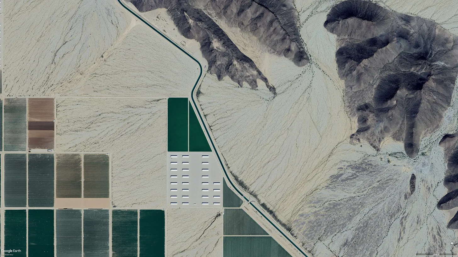
The deals would settle tribes and Pueblos’ water rights in four New Mexico rivers: the Rio San JosĆ©, the Rio Jemez, Rio Chama and the Zuni River. 

Another bill would also correct technical errors in two previously ratified water rights settlements: Taos Pueblo and the Aamodt settlement Pueblos of NambƩ, Pojoaque, Tesuque and San Ildefonso. Finally, a sixth bill would add time and money for the Navajo-Gallup water project to construct drinking water services.

New Mexico representatives presented a record six settlements for Pueblos and tribes at a subcommittee hearing Tuesday, the first step in getting needed Congressional approval to end decades of litigation. Companion proposals from the Senate were heard Friday in the Senate Indian Affairs Committee. Mescalero Apache Tribe President Thora Padilla was introduced to senators with support for the settlements. 

As climate change reshapes the Southwest into something hotter and drier, with more strain on its water resources, approaching water collaboratively means communities have a chance to stay, and tribes can exercise their sovereignty.

In front of House members on Tuesday, Ohkay Owingeh Gov. Larry Phillips Jr. said the settlement of the Ohkay Owingeh’s rights on the Rio Chama will offer a means of long-awaited restoration. 

ā€œThe U.S. bulldozed our river, it destroyed our rivers and bosque,ā€ he said. ā€œThis needs to be fixed, the settlement gives us the tools to do that.ā€

Rep. Teresa Leger FernƔndez (D-N.M.) said tribes and Pueblos gave up certain acreage that they are entitled to, and worked out drought-sharing agreements to benefit everybody in the region.

Leger FernƔndez sponsored five of the bills, and Rep. Gabe Vazquez (D-N.M.) sponsored a sixth that was heard on Tuesday.

Additionally, she said the funds will enable more infrastructure, bosque restoration and ensuring water rights protections for neighboring acequias. 

Acoma Pueblo Gov. Randall Vicente told the committee that making concessions in the settlement was crucial to preserving water for future generations.

ā€œIt is better to have adequate wet water, than paper rights without a water supply,ā€ he said.

Even if the Pueblo enforced having the oldest water right, Vicente said the Rio San José’s system is so damaged, it would take decades for water to reach Acoma.

The settlements can help redress the federal government’s injustices towards Ohkay Owingeh Pueblo, Phillips said. He pointed to the U.S. Army Corps of Engineers and U.S. Bureau of Reclamation’s channelizing of the Rio Chama and the building of Abiquiu Reservoir in the 1950s, which moved water away from the Pueblo. 

ā€œBoth of these actions resulted in depriving us of our bosque and waters necessary for a proper river,ā€ he said. ā€œWe entered into the settlement in order to protect, preserve our water resources and the bosque.ā€

The loss of water not only impacts the health of Pueblo communities, Phillips said, but it splits people from their lands and means the loss of sacred bodies of water and ceremonies to celebrate them.

Water offers a lifeline to traditional ways and offers prosperity, said Zuni Pueblo Gov. Arden Kucate.

Zuni Pueblo will work to build new drinking water treatment systems and restore waffle garden irrigation practices, a technique used for generations until the turn of the 19th century, when settlers diverted water and clearcut the Zuni River watersheds.

ā€œIt will usher in, what I sincerely believe, will be a new chapter for our tribe, allowing us to protect and sustainably develop our limited water resources, to restore traditional agriculture and facilitate much-needed economic development,ā€ Kucate said about the settlement.

Navajo Nation President Buu Nygren also spoke, celebrating water rights settlements with both New Mexico and Arizona.

Some of the settlement agreements are already two years old.The administration supports all of the New Mexico settlements, said Bryan Newland (Ojibwe), the assistant secretary for Indian Affairs at the U.S. Department of the Interior.

ā€œAny delay in bringing clean, drinkable water to communities is going to harm the people who live in those communities,ā€ Newland said. ā€œWe also know from our experience that these settlements only get more expensive, and implementation only gets more expensive the longer we wait.ā€ 

Tribal water rights are not entirely settled in New Mexico, mostĀ notably on the Rio Grande, where a federal assessment teamĀ started addressing water claims issues in 2022. Leger FernĆ”ndez said she hopes the six water rights settlements in other watersheds will provide a model for collaborative management of water rights on New Mexico’s largest river.

An aerial view of the Jemez Watershed on June 28, 2024. (Photo by Danielle Prokop / Source NM)

ā€œThese water rights settlements provide the framework for future water rights settlements, which include those involved in Rio Grande,ā€ Leger FernĆ”ndez said.

Leger FernĆ”ndez said the moment was still momentous, even if it’s only the first step.

ā€œThere’s never been this many settlements at one time,ā€ she said. ā€œThere has never been a hearing that was this big.ā€

What’s the process?

The House Committee on Natural Resources held a legislative hearing on 12 water rights settlements across the U.S. with a projected cost of $12 billion. 

The hearing consisted of testimony from federal agencies and heads of tribal governments. 

The settlements can now head into a process called mark-up and means they can be added to legislative packages moving forward. Both of New Mexico’s senators sponsored companionate bills.

It’s just the first step in the process, but Leger FernĆ”ndez said she’s looking to face the biggest hurdle of cost head-on. She and members of the Department of the interior testified that continuing to fight court battles will cost the federal government more money, and that waiting isn’t an option.

ā€œThe longer we wait, the more expensive it will be,ā€ she said.

New Mexico Lakes, Rivers and Water Resources via Geology.com.

Climate Change Indicators in the United States: Fifth Edition — Environmental Protection Agency

Click here to access the report on the EPA website:

The fifth edition of Climate Change Indicators in the United States documents how climate change is impacting the United States today, the significance of these changes, and their possible consequences for people, the environment, and society.

Using EPA’s climate change indicators and relevant scientific literature, the report groups indicators into eight themes that help to show interconnections, cause-and-effect relationships, and how physical changes in the atmosphere affect people and the environment. Indicators related to human health and societal impacts of climate change cut across chapter themes and are integrated throughout the report. Each theme includes information on why the changes matter, as well as examples and discussion of the unequal impacts of climate change. The report also provides examples of what people and communities can do to address climate change, and what actions are already underway.