Quiet beauty surrounds you So does the wind the whole year, too Your red rock canyons are a shelter From many storms that I’ve been through Canyons so deep You can see the stars at noon
It’s a paradise I’m thinking of Dreaming comes easy As I’m held within these walls And the river gently sings her lullaby
Sometimes the silence overwhelms me Perhaps it’s something in the air I wish that I could go more often For I find peace and comfort there Canyons so deep You can see the stars at noon
It’s a paradise I’m thinking of Dreaming comes easy As I’m held within these walls And the river gently sings her lullaby
Tiny flowers in the springtime Where cold water swirls around late frost This canyon serves as a reminder Of so much wilderness that’s lost Canyons so deep You can see the stars at noon
It’s a paradise I’m thinking of Dreaming comes easy As I’m held within these walls And the river gently sings her lullaby
Dreaming comes easy As I’m held within these walls And the river gently sings her lullaby
His rich baritone and gift for melodies made him one of the most popular artists of the 1970s with songs like “The Wreck of the Edmund Fitzgerald” and “If You Could Read My Mind.”
Gordon Lightfoot, the Canadian folk singer whose rich, plaintive baritone and gift for melodic songwriting made him one of the most popular recording artists of the 1970s, died on Monday night in Toronto. He was 84…
Mr. Lightfoot, a fast-rising star in Canada in the early 1960s, broke through to international success when his friends and fellow Canadians Ian and Sylvia Tyson recorded two of his songs, “Early Morning Rain” and “For Lovin’ Me.” When Peter, Paul and Mary came out with their own versions, and Marty Robbins reached the top of the country charts with Mr. Lightfoot’s “Ribbon of Darkness,” Mr. Lightfoot’s reputation soared. Overnight, he joined the ranks of songwriters like Bob Dylan, Phil Ochs and Tom Paxton, all of whom influenced his style…When folk music ebbed in popularity, overwhelmed by the British invasion, Mr. Lightfoot began writing ballads aimed at a broader audience. He scored one hit after another, beginning in 1970 with the heartfelt “If You Could Read My Mind,” inspired by the breakup of his first marriage. In quick succession he recorded the hits “Sundown,” “Carefree Highway,”“Rainy Day People” and “The Wreck of the Edmund Fitzgerald,” which he wrote after reading a Newsweek article about the sinking of an iron-ore carrier in Lake Superior in 1975, with the loss of all 29 crew members…
For Canadians, Mr. Lightfoot was a national hero, a homegrown star who stayed home even after achieving spectacular success in the United States and who catered to his Canadian fans with cross-country tours. His ballads on Canadian themes, like “Canadian Railroad Trilogy,” pulsated with a love for the nation’s rivers and forests, which he explored on ambitious canoe trips far into the hinterlands. His personal style, reticent and self-effacing — he avoided interviews and flinched when confronted with praise — also went down well. “Sometimes I wonder why I’m being called an icon, because I really don’t think of myself that way,” Mr. Lightfoot told The Globe and Mail in 2008. “I’m a professional musician, and I work with very professional people. It’s how we get through life.”
[…]
Gordon Meredith Lightfoot Jr. was born on Nov. 17, 1938, in Orillia, Ontario, where his father managed a dry-cleaning plant. As a boy, he sang in a church choir, performed on local radio shows and shined in singing competitions. “Man, I did the whole bit: oratorio work, Kiwanis contests, operettas, barbershop quartets,” he told Time magazine in 1968…Mr. Lightfoot, accompanying himself on an acoustic 12-string guitar, in a voice that often trembled with emotion, gave spare, direct accounts of his material. He sang of loneliness, troubled relationships, the itch to roam and the majesty of the Canadian landscape. He was, as the Canadian writer Jack Batten put it, “journalist, poet, historian, humorist, short-story teller and folksy recollector of bygone days.”
Old growth Ponderosa pine on public land that would be transferred to private ownership in proposed Valle Seco land trade, photo courtesy of Colorado Wild Public Lands
In 2017, the public lost 1,470 acres of wilderness-quality land at the base of Mount Sopris near Aspen, Colorado.
For decades, people had hiked and hunted on the Sopris land, yet the Bureau of Land Management (BLM) handed it over to Leslie Wexner, former CEO of Victoria’s Secret and other corporations, at his request. The so-called “equivalent terrain” he offered in return was no match for access to trails at the base of the 13,000-foot mountain.
This ill-considered trade reveals how land management agencies pander to wealthy interests, do not properly value public land, and restrict opportunities for public involvement. It’s an ongoing scandal in Colorado that receives little attention.
Since 2000, the BLM and the Forest Service have proposed over 150 land exchanges in Colorado. Last year alone, the agencies proposed to trade more than 4,500 acres of public lands, worth over $9 million, in three major Colorado land exchanges.
Land to be traded away includes precious riverfront, lands recommended for Wild and Scenic River designation, and hundreds of acres of prime hunting and recreation territory.
Open meadows and mixed forest are common among the parcels Denver Water is conveying to the U.S. Forest Service. Photo credit: Denver Water.
Public land exchanges can be a useful tool. Federal agencies use them to consolidate land holdings, improve public access, reduce management costs and protect watersheds.
By law, the trades must serve the public interest, and the land exchanged must be of equal value. The agencies are supposed to analyze, disclose and mitigate the impacts of relinquishing public lands in exchanges, and also solicit public input on whether a trade makes sense.
But here in Colorado — and elsewhere around the country — this management tool has been usurped by powerful players who aim to turn valuable public lands into private playgrounds.
Often, the deals proposed sound good in terms of acreage. In the Valle Seco Exchange, for example, the San Juan National Forest in southern Colorado would trade 380 acres for 880 acres of prime game-wintering habitat. But the trade mostly benefits the landowners pushing the exchange.
Public lands for trade in the Valle Seco Exchange include river access, corridors considered for Wild and Scenic River designation, wetlands, sensitive species habitat, and significant cultural sites.
Alarmingly, the Valle Seco exchange also includes more than 175 acres of a Colorado Roadless Area, a designation meant to block development of high-quality land. The exchange would allow a neighboring landowner to consolidate those 380 acres with his 3,000-plus acre ranch, opening the door to development.
The Valle Seco Exchange follows a long-standing pattern. “Exchange facilitators,” people familiar with the land-acquisition wish lists of agencies, help private landowners buy lands the agencies want. The landowners then threaten to manage and develop those lands in ways that undermine their integrity.
The Valle Seco proponents did this by closing formerly open gates and threatening to fence the 880 acres for a domestic elk farm and hunting lodge. This is blackmail on the range.
While catering to these private interests, the agencies suppress public scrutiny by refusing to share land appraisals and other documents with the public until afterthe public process has closed — or too late in the process to make it meaningful.
The proponents and their consultants have ready access to these documents, yet the public, which owns the land, does not. In Valle Seco, appraisals were completed in August 2020, but they weren’t released to the public until December 2021, just a few weeks before the scheduled decision date for the exchange. Advocates managed to pry the appraisals out of the agency only after submitting multiple Freedom of Information Act requests and taking legal action.
In another deal, the Blue Valley Exchange, the BLM also withheld drafts of the management agreements until just before releasing the final decision. This is hardly an open and fair public process.
The federal government presents what are, in effect, done deals. Development plans and appraisals are undisclosed and comment periods hindered. By prioritizing the proponents’ desires over public interests and process, the land management agencies abdicate their responsibilities.
Erica Rosenberg. Photo credit: Writers on the Range
The result is that too many land trades are nothing less than a betrayal of the public trust as the public loses access to its land as well as the land itself.
Erica Rosenberg is a contributor to Writers on the Range, writersontherange.org, an independent nonprofit that works to spur lively conversation about Western issues. She is on the board of Colorado Wild Public Lands, a nonprofit in the town of Basalt that monitors land exchanges around the state.
Around 10,000 years ago, the Neolithic revolution saw many human cultures end their nomadic lifestyles of hunting and gathering to settle and begin farming.
This onset of agriculture has seen humans reshape the Earth’s surface – cultivating crops to provide food for people and animals, grazing livestock on pastures and cutting wood to be used as construction material or fuel.
These interventions into natural ecosystems provide the foundation for modern society, but they also come with some unwanted side effects. One of the most dramatic is the tremendous amount of carbon dioxide (CO2) that is released through the way that humans use the land.
As the global community tries to get a grip of its CO2 emissions, understanding where they are coming from is key to stopping them – and to increasing the amount of atmospheric CO2 taken up by the land.
In this article, we show how we can track the ups and downs of CO2 emissions and removals from land-use change in six very different parts of the world – Brazil, China, the Democratic Republic of the Congo (DRC), Europe, Indonesia and the US.
Past, present and future of land-use emissions
Globally, the largest share of humanity’s CO2 emissions stems from burning fossil fuels, which made up about 87% of CO2 emissions over the past 20 years. Land-use emissions are responsible for the remaining 13%.
Historically, land use was even more important, with land-use emissions being larger than fossil emissions until the 1950s. Collectively, one-third of CO2 emissions since 1750 are due to land-use change.
Although the share of land-use emissions has gone down in recent decades, their importance might increase again in the future due to the potential reduction of fossil fuel emissions in line with global climate mitigation policies.
Likewise, reducing CO2 emissions from land use is a key factor for meeting climate targets – for example, the Glasgow Declaration on Forests, agreed at COP26, calls on countries “to halt and reverse forest loss and land degradation by 2030”.
These intended emission reductions can be complemented by taking up and storing additional carbon in biomass and soils – for instance, via forestation and forest management. Sustainable land use can, thus, itself become a key element for climate mitigation.
CO2 emissions to the atmosphere and carbon uptake by vegetation and soils are known as carbon fluxes. The balance between all of these fluxes determines whether the land is a net “source” of carbon or a net “sink”.
Drone photo of deforestation in the Bolivian Amazon for soybeans. Photo by Rhett A. Butler.
To reverse land use from being an overall global source of CO2 to being a sink, it is essential to understand the various drivers of these fluxes.
Furthermore, as mitigation policies are mainly implemented at the national level, estimating land-use CO2 fluxes for individual countries provides important insights into the effectiveness of mitigation efforts.
Estimating CO2 fluxes from land use
Global estimates of land-use CO2 fluxes are often based on computer models that provide a consistent method of quantifying fluxes for all countries.
Of particular importance are “bookkeeping” models. These track changes in the carbon contents of soil and vegetation that occur due to land-use changes (such as deforestation, where forest is converted to agricultural land) or land management (such as wood harvest, where forest remains forest) based on spatially explicit data.
The resulting CO2 fluxes between land and atmosphere are calculated as the changes in carbon contents of soil and vegetation.
Bookkeeping models account for various processes – ranging from the fast emission of CO2 due to fires, to the rather slow decomposition of long-lived wood products, to the gradual regrowth of forest. They are complemented by CO2 emissions from peat drainage and peat fires from existing estimates.
The Global Carbon Budget (GCB) – published each year by the Global Carbon Project – currently uses estimates from three bookkeeping models to provide land-use CO2 fluxes at global level.
These models have been improved in recent years and now include more detailed data for specific countries. As a result, the most recent GCB of 2022 extended its assessment to include land-use CO2 flux estimates at the country-level.
Land-use CO2 fluxes in individual countries
In the chart below, we take a closer look at six countries and regions with distinct land-use flux dynamics. The chart shows annual land-use CO2 fluxes for each region. Lines above the zero line indicate a net source of CO2, while lines below indicate a net sink. In all countries, land-use CO2 fluxes show substantial year-to-year variability.
Time series of net land-use CO2 fluxes for Brazil (blue), Indonesia (red), the DRC (yellow), China (dark blue), US (orange), and the EU27 of Europe (purple) over 1950-2020. Lines denote the average land-use CO2 flux estimates and shaded areas represent the uncertainty of these numbers (minimum-to-maximum range, as estimated by three bookkeeping models). Chart by Tom Pearson for Carbon Brief.
Brazil (blue), Indonesia (red), China (dark blue) and the DRC (yellow) have had the highest land-use CO2 emissions in the last 70 years – representing around 45% of all emissions from net-emitting countries.
Europe (purple) and the US (orange) have had the largest net CO2 removals – representing about 90% of all removals from countries with a net sink. China switched from net land-use emissions to net removals in the 2000s.
Drivers of land-use change
The models we use allow us to estimate the impact of specific drivers of CO2 fluxes for individual countries. The chart below illustrates the variations that this analysis reveals.
The bars for each region show average CO2 fluxes from deforestation (blue), forestation (dark blue), wood-harvest emissions (yellow) and removals due to regrowth (orange), peat fires and drainage (red) and other transitions (purple) for 1950-2020.
These other transitions include the transformation of shrubland to cropland or pasture or conversions between cropland and pasture. Bars above the zero line indicate sources of CO2, while bars below indicate sinks. The grey bars show the overall net fluxes from land use for each region.
Components of land-use CO2 fluxes in Brazil, Indonesia, China, the DRC, the US and Europe (EU27) averaged over 1950-2020. The individual components are deforestation (blue), forestation (dark blue), wood harvest (yellow for emissions and orange for removals), peat drainage & peat fires (red) and other transitions (purple). Net fluxes for each country are shown in grey.
In Brazil, land-use emissions were high, but relatively constant, between the 1960s and the 1980s. In the 1990s, emissions began to rise and reached a peak in the early 2000s, as deforestation rates accelerated. In the following years, deforestation and emissions decreased substantially under the presidency of Luiz Inácio Lula da Silva (Lula), but they have started to increase again in the most recent years due to less-stringent forest protection policies under former president Jair Bolsonaro.
While deforestation clearly dominates CO2 emissions in Brazil, substantial emissions also stem from wood harvest and from other transitions.
For Indonesia, emissions are characterised by a quick increase in the 1980s, which was predominantly due to deforestation for the expansion of palm oil plantations and cropland. This was followed by several large emissions peaks starting in the late 1990s, caused by widespread peat fires used – on top of drainage – to convert peatlands into agricultural land.
In 1997, remarkably high emissions were apparent resulting from the interaction of land-use changes and an extremely dry El Niño year. Strikingly, Indonesia has the largest CO2 uptake due to forestation of all countries displayed. However, regrowth after harvest only partly offsets wood harvest emissions, pointing to unsustainable forestry practices.
The DRC has had low emissions throughout the 20th century, but emissions increased substantially in the late 2000s and remain high to this day.
Emissions from deforestation dominate land-use fluxes in the DRC, but they are largely counterbalanced by removals due to forestation. Farmers in the DRC often apply shifting cultivation, an agricultural practice in which forests are burned down to obtain arable land (causing CO2 emissions), which is in turn abandoned after a few years, allowing forests to regrow and take up CO2 again. This results in high CO2 fluxes from both deforestation and forestation, respectively. Other fluxes are mostly negligible in the DRC.
China saw a sharp increase in emissions due to deforestation in the 1980s. However, large uncertainties exist regarding the timing and extent of the deforestation activities, which is reflected in the large uncertainties of China’s emissions in that period. Economic reforms starting in 1978 led to decreasing deforestation rates and to forest expansion, causing a decline in CO2 emissions from the 1980s onwards.
In the last 20 years, land-use fluxes in China have remained close to net-zero, as emissions due to deforestation and wood harvest have been largely offset by CO2 uptake from forestation and regrowth after wood harvest.
In the US, emissions decreased in the 1950s, and land use has been a relatively small net carbon sink from the 1960s onwards, albeit with substantial uncertainties. Wood harvest causes the highest emissions, although these are counterbalanced by subsequent regrowth.
Rainforest logging Sumatra, Indonesia. Credit: Sumatran Welfare Society
Collectively, Europe (specifically, the 27 countries that now make up the EU) had a constant carbon sink throughout the last 70 years, mainly due to forestation. Europe has a long history of deforestation, going back to Roman times and intensifying until it reached a peak at the onset of the industrial revolution. In the years that followed, forests in Europe started to regrow again, leading to large-scale CO2 removals. The balance of emissions and removals from wood harvest suggests that forestry in Europe is sustainable.
It is worth noting that the uncertainties around the land-use CO2 fluxes shown here are substantial for several countries – particularly in Brazil, China and the US. These large uncertainties are due to various reasons, but mostly stem from differences in land-use change data used by the different bookkeeping models and differences in process implementation – such as in the consideration of fire management in the US. There are also varying assumptions on how much carbon is stored in soils and different types of vegetation, and on how quickly vegetation and soils emit carbon (after deforestation) or take up carbon (after reforestation) following land-use changes.
Importance of national mitigation plans
Emissions from land-use change can be expected to decrease substantially in the coming years – as long as countries put the land-use commitments within their Paris Agreement climate pledges into action.
Detailed knowledge of the changes and drivers of land-use CO2 fluxes in individual countries provides a key element to monitor and assess the country-specific measures to cut emissions and increase removals.
Specifically, splitting up land-use fluxes into their components allows for a separate assessment of emissions and removals. Net CO2 sinks are only possible if CO2 removals from forestation exceed the sum of emissions from deforestation, peat emissions and other emission-causing land-use transitions.
A comprehensive and reliable quantification of land-use fluxes is also essential in light of the increasing importance of carbon dioxide removal (CDR) technologies, since the vast majority of CDR currently stems from conventional management of land, such as reforestation.
A ‘severe’ solar storm triggered the outburst of auroras. Even California, Arizona, Arkansas and Virginia reported sightings.
Skywatchers in Europe, Asia and North America were treated Sunday night to perhaps one of the most widespread displays of the northern lights since the autumn solar storms of 2003. Equally impressive shows of the aurora australis, or southern lights, were spotted in Australia and New Zealand.
The northern and southern lights, collectively known as the aurora, are most common in the high Arctic and Antarctic regions around the poles, but they can venture to the middle latitudes on rare occasions during potent geomagnetic storms. The storms are caused by magnetic energy and electrons that are hurled into space by the sun. The stronger the solar storm, the greater the effect — particularly if the resulting outburst is directed toward Earth. Forecasters at the Space Weather Prediction Center in Boulder, Colo., issued warnings for a Level 4 out of 5 “severe” geomagnetic storm, which happens on average only 60 times every 11 years. The episode may have been even more intense at times, sparking auroral displays as far south as California, Arizona, Arkansas and Virginia…
On Friday afternoon, NASA’s Solar Dynamics Observatory satellite recorded an explosion on the surface of the sun. The flare, rated an M2 on an ascending scale that climbs A, B, C, M to X, caused a radio burst on Earth eight minutes later. That clued NOAA forecasters into the fact that the energy was directed toward Earth…The flare was followed by a coronal mass ejection (CME) — a mass of solar plasma, charged particles and magnetism — that headed directly toward Earth at speeds of roughly 1.5 million miles per hour. That interplanetary shock wave collided with Earth’s magnetic field on Sunday afternoon Eastern time, which was after dark in Europe and in the early hours of Monday in China. Brilliant apparitions of the northern lights quickly appeared. The CME brought “severe” geomagnetic storming, stronger than what the Space Weather Prediction Center forecast when the CME left the sun Friday…
The colors of an aurora correspond to the type and altitude of the element that is excited in Earth’s atmosphere, Murtagh explained. Excited oxygen atoms glow red above 120 miles and glow green between 60 and 120 miles. Excited nitrogen atoms below 120 miles can glow pink or purple. Murtagh said a more intense aurora is typically higher, so lower latitudes will see more red.
“The bigger storms can light up the higher altitudes, which is largely going to [excite] the oxygen causing that red,” he said. “The further you are away, down south that is, you’re going to not see the green and yellow in the lower altitudes.”
The protest encampment was easily visible from Highway 40 going West from Needles, California — a cluster of olive-green Army tents that stood out from the low-lying creosote bushes and sagebrush that cover the expanse of Ward Valley. At its height, the camp held two kitchens (one vegetarian, one not), a security detail, bathroom facilities and a few hundred people — a coalition of five tribal nations, anti-nuclear activists, veterans, environmentalists and American Indian Movement supporters. They were there to resist a public-lands trade between the federal government and the state of California that would allow U.S. Ecology, a waste disposal company, to build a 1,000-acre, unlined nuclear waste dump that threatened both desert tortoises and groundwater. “It became like a little village, a working village,” recalled David Harper, a member of the Colorado River Indian Tribes who was a tribal spokesperson at the time.
The Bureau of Land Management had announced it would start evicting the protesters at midnight on Feb. 13, 1998. But that day, tribal elders decided that they would not leave. Federal officials and tribal spokespeople met to negotiate at a blockade on the highway overpass. The leaders of the standoff were committed to nonviolence, but the atmosphere felt tense and uncertain. At a press conference, elders in ribbon dresses and beadwork sat under the sun in folded chairs, backed by tall banners that read, in part, “Save the Colorado River.” “We can no longer stand by, as people, to allow this to continue to happen to us,” said then-Fort Mojave Tribal Chairperson Nora McDowell, her black curls framing her face and her voice quavering at times.
After 113 days, the BLM rescinded the eviction order. A year later, a federal court ruling finalized the victory: There would be no dump at Ward Valley. The protest served as a nexus of the decade’s political issues in Indian Country — a test of the Clinton administration’s commitment to tribal consultation and the Endangered Species Act, as well as of new federal laws and policies on environmental justice and sacred site protections. It was also a time of cultural upwelling — the camp provided space for elders to share stories, knowledge and ceremony with the thoroughly intergenerational community. Children and teens took part alongside everyone else. Doelena Van Fleet was one of those kids; her father, Victor, was a key organizer. The encampment period was a kind of “restoration,” she said. “Because of their actions, our voices can be heard now.”
Left, Doelena Van Fleet observes the crowd at the Ward Valley Spiritual Gathering. Right, Avi Kwa Ame is a sacred site and the center of creation for 10 Yuman-speaking tribes.
NĪa MacKnight/High Country News
ON A BRIGHT,chilly Saturday in February, a hundred or so people gathered at the same spot where the tents once stood in Ward Valley. The elders of that time have passed on, while others from the camp have since become elders themselves. The small children that ran around the camp are now on tribal councils. Nora McDowell, now in her 60s and project manager for the tribe’s Pipa Aha Macav Cultural Center, read a list of names in remembrance. Both Native and non-Native speakers shared memories: the sleet and hail, chasing after tents blowing away across the valley, reaffirming the power of collective action, and the importance of knowing — and standing up for — the place you come from. They celebrate every year, but this February was special; it marked 25 years since the encampment and ensuing victory, a mile marker of time.
Colleen Garcia, a Fort Mojave tribal council member who was at the encampment, stood at the microphone in front of the crowd. “We are Mojaves,” she said to shouts of confirmation. “Others will come and go. But we people here will be here forever.”
“Others will come and go. But we people here will be here forever.”
In Garcia’s comments, one can hear the echoes of the past — decades ago, the Fort Mojave Indian Tribe’s then-vice chairman, Llewellyn Barrackman, voiced the same sentiment to reporters. “For us, as Mojaves, we’re born and raised here and this is our roots,” he said. “U.S. Ecology people come here from elsewhere, and maybe 10 years from now they get transferred. But us, we’re going to be here until we die.” The BLM acreage of Ward Valley, like all public lands, is ancestral tribal land, in this case of the Mojave, Quechan, Cocopah, Colorado River Indian Tribes, Chemehuevi and others. And though Ward Valley was the focus of the nuclear waste dump conflict, it’s part of a broader region known as Avi Kwa Ame, which is just as important to the tribes in the region.
Community members and allies gather in February for the 25th anniversary of the Ward Valley standoff.
NĪa MacKnight/High Country News
The landscape at Avi Kwa Ame is a reminder that rocks, in fact, move. Tilted granite shelves jut from the earth’s surface, rock walls crumble to the valley floor below. Shapes of smooth rock sag and gape like melted candles, while bursts of green yucca dot the landscape. This is the origin place of 10 Yuman-speaking tribes, and considered sacred by more. In 1999, the same year that a court ruling protected Ward Valley from the nuclear waste dump, Avi Kwa Ame was placed on the National Register of Historic Places, a first step toward legal protection.
In March, at the White House Conservation in Action Summit, President Joe Biden signed a declaration that officially designated Avi Kwa Ame as a national monument, with the resulting protections covering more than 500,000 acres of BLM land just north of Ward Valley. The boundaries connect wilderness lands managed by the National Park Service and BLM — though, in truth, Avi Kwa Ame is boundless. The designation will do more than prohibit solar or wind development. It will also protect the core cultural traditions that were empowered in Ward Valley, with the declaration including a commitment to co-stewardship between the Interior Department and tribal nations. “Because we have the history of that work, it was really a strong argument for how this could be mutually beneficial, not just to solidify that work, but to honor and respect all of the blood, sweat and tears that have gone into protecting this landscape,” said Ashley Hemmers, Fort Mojave tribal administrator.
TODAY, TRIBAL NATIONSare working with a federal government that is more receptive to tribal knowledge and co-stewardship of public lands than it was in the past. In the 1990s, in response to concerns that tribes were not thoroughly consulted, then-Interior Deputy Secretary John Garamendi told Fort Mojave tribal member and Ward Valley spokesperson Steve Lopez that “the discussions really need to happen between the state and the Department of the Interior.”
But not far from Ward Valley, efforts to exploit ancestral tribal land continue: Corporations want to mine gold on Conglomerate Mesa in California; lithium in Thacker Pass, Nevada; and copper in Oak Flat, Arizona, despite sustained opposition from tribes and their allies, and an administration that has prioritized tribal sovereignty. Existing laws have so far failed to provide reliable protection for these lands. Even places with designated protection from development are threatened by increased visitation; lax oversight leads to problems like the vandalism of petroglyphs. Today, “there’s more knowledge about the responsibility that the federal government has for tribal consultation on projects on public lands,” said Daniel Patterson, an ecologist and former BLM employee who supported the tribes at the standoff. But consultation is inconsistent across the agency. “It seems like that’s being decided more in the courts instead of where it should be decided, which is with Native nations.”
The success of the 1998 encampment hinged on relationship building, and on non-Native allies’ recognition of the tribes’ cultural and political sovereignty. A similar spirit is evident around Avi Kwa Ame today, owing to the same tribes. Other national monuments, including Bears Ears, have faced opposition from locals and state and federal politicians. But the boundaries for Avi Kwa Ame have the support of nearby towns, their congressional representatives and all federally recognized tribes in Arizona and Nevada. “We really — as a tribe — learned through (Ward Valley) how to critically engage multiple stakeholders for the overall good of the landscape and environment,” said Hemmers.
Or, as David Harper put it, “In Ward Valley, the people’s culture rose.”
Anna V. Smith is an associate editor for High Country News. She has placed in the Native American Journalists Association’s Native Media Awards in the category of Best Coverage of Native America three times.Email High Country News at editor@hcn.org or submit a letter to the editor. See our letters to the editor policy.
I missed posting about the 20th Anniversary of Coyote Gulch last year. Click the link to see the original post where I changed the name of the blog: https://radio-weblogs.com/0101170/2002/03/29.html
I apologize for the look on the linked post. I was using Radio Userland software and the company ceased operation in 2009. The former owner was able to get Automattic to host the blogs but many of the files were lost.
My little boys are growing up. My older one starts kindergarten next month. My little one is charging out of toddlerhood, becoming more independent by the day. Life moves so fast, and the best way I know to slow things down and treasure the moments is to get out on a river.
My sons exploring outside together. Photo credit: Amy Souers Kober
So I took the boys to Oaks Bottom Wildlife Refuge. It’s in the heart of Portland, not far from our house.
A little piece of wildness on the Willamette River. An easy urban escape. It was cloudy, a welcome break from the record heat and drought we’ve had this summer. The alders and cottonwoods smelled so good as we walked the shady trails.
Walking down to the river, we talked, free of distractions. At home I feel as if I’m always trying to do five things at once and conversations are constantly interrupted. But here, it’s just us. No chores or emails, just walking and chatting. Just being, together. My five year old reaches out to hold my hand, and my heart melts. How much longer until he’s too old, too cool, for this?
As we walk, I’m thinking about a recent New York Times article, HOW WALKING IN NATURE CHANGES THE BRAIN. The story looks at how spending time in natural spaces reduces anxiety, worry and stress.
For me, rivers are medicine. I know when I need a break, when I need to get out for a float, swim, paddle, or streamside hike. If walking in nature changes our brains, then spending time on rivers must deliver an even bigger bang for the buck, right? I’m thinking of multi-day river trips. I’m thinking of finding peace and connection, of open hearts and strengthened spirits. Healing waters. I’m remembering floating on my back down the Salmon, nights in the Grand Canyon, early morning kayaking on the Potomac…
My boys, racing for the river’s steep bank, bring me back to earth. I snap out of my reverie and take their hands. Together, we carefully approach the eroded edge. A sailboat is anchored here, and kayaks paddle by. We wave, and they wave back.
My five year old asks if he can get a kayak for his birthday.
I think that’s his best birthday present request yet. And I’m game. Any excuse to get us out here more often. For fun, of course. But also to test our own mini science experiment that nature, that rivers, really are fundamental to our health, well-being, and relationships. That they are essential to our happiness, to who we are.
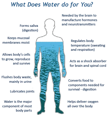
Without water, life on Earth could not exist as it does today. Understanding the history of water in the universe is critical to understanding how planets like Earth come to be.
Astronomers typically refer to the journey water takes from its formation as individual molecules in space to its resting place on the surfaces of planets as “the water trail.” The trail starts in the interstellar medium with hydrogen and oxygen gas and ends with oceans and ice caps on planets, with icy moons orbiting gas giants and icy comets and asteroids that orbit stars. The beginnings and ends of this trail are easy to see, but the middle has remained a mystery.
I am an astronomer who studies the formation of stars and planets using observations from radio and infrared telescopes. In a new paper, my colleagues and I describe the first measurements ever made of this previously hidden middle part of the water trail and what these findings mean for the water found on planets like Earth.
Star and planet formation is an intertwined process that starts with a cloud of molecules in space. Bill Saxton, NRAO/AUI/NSF, CC BY
Stars begin to form when parts of the collapsing cloud reach a certain density and heat up enough to start fusing hydrogen atoms together. Since only a small fraction of the gas initially collapses into the newborn protostar, the rest of the gas and dust forms a flattened disk of material circling around the spinning, newborn star. Astronomers call this a proto-planetary disk.
As icy dust particles collide with each other inside a proto-planetary disk, they begin to clump together. The process continues and eventually forms the familiar objects of space like asteroids, comets, rocky planets like Earth and gas giants like Jupiter or Saturn.
There are two potential pathways that water in our solar system could have taken. The first, called chemical inheritance, is when the water molecules originally formed in the interstellar medium are delivered to proto-planetary disks and all the bodies they create without going through any changes.
The second theory is called chemical reset. In this process, the heat from the formation of the proto-planetary disk and newborn star breaks apart water molecules, which then reform once the proto-planetary disk cools.
Normal hydrogen, or protium, does not contain a neutron in its nucleus, while deuterium contains one neutron, making it heavier. Dirk Hünniger/Wikimedia Commons, CC BY-SA
To test these theories, astronomers like me look at the ratio between normal water and a special kind of water called semi-heavy water. Water is normally made of two hydrogen atoms and one oxygen atom. Semi-heavy water is made of one oxygen atom, one hydrogen atom and one atom of deuterium – a heavier isotope of hydrogen with an extra neutron in its nucleus.
The ratio of semi-heavy to normal water is a guiding light on the water trail – measuring the ratio can tell astronomers a lot about the source of water. Chemical models and experiments have shown that about 1,000 times more semi-heavy water will be produced in the cold interstellar medium than in the conditions of a protoplanetary disk.
This difference means that by measuring the ratio of semi-heavy to normal water in a place, astronomers can tell whether that water went through the chemical inheritance or chemical reset pathway.
V883 Orionis is a young star system with a rare star at its center that makes measuring water in the proto-planetary cloud, shown in the cutaway, possible. ALMA (ESO/NAOJ/NRAO), B. Saxton (NRAO/AUI/NSF), CC BY
Measuring water during the formation of a planet
Comets have a ratio of semi-heavy to normal water almost perfectly in line with chemical inheritance, meaning the water hasn’t undergone a major chemical change since it was first created in space. Earth’s ratio sits somewhere in between the inheritance and reset ratio, making it unclear where the water came from.
To truly determine where the water on planets comes from, astronomers needed to find a goldilocks proto-planetary disk – one that is just the right temperature and size to allow observations of water. Doing so has proved to be incredibly difficult. It is possible to detect semi-heavy and normal water when water is a gas; unfortunately for astronomers, the vast majority of proto-plantary disks are very cold and contain mostly ice, and it is nearly impossible to measure water ratios from ice at interstellar distances.
A breakthrough came in 2016, when my colleagues and I were studying proto-planetary disks around a rare type of young star called FU Orionis stars. Most young stars consume matter from the proto-planetary disks around them. FU Orionis stars are unique because they consume matter about 100 times faster than typical young stars and, as a result, emit hundreds of times more energy. Due to this higher energy output, the proto-planetary disks around FU Orionis stars are heated to much higher temperatures, turning ice into water vapor out to large distances from the star.
Using the Atacama Large Millimeter/submillimeter Array, a powerful radio telescope in northern Chile, we discovered a large, warm proto-planetary disk around the Sunlike young star V883 Ori, about 1,300 light years from Earth in the constellation Orion.
V883 Ori emits 200 times more energy than the Sun, and my colleagues and I recognized that it was an ideal candidate to observe the semi-heavy to normal water ratio.
These results fill in the gap of the water trail forging a direct link between water in the interstellar medium, protostars, proto-planetary disks and planets like Earth through the process of inheritance, not chemical reset.
The new results show definitively that a substantial portion of the water on Earth most likely formed billions of years ago, before the Sun had even ignited. Confirming this missing piece of water’s path through the universe offers clues to origins of water on Earth. Scientists have previously suggested that most water on Earth came from comets impacting the planet. The fact that Earth has less semi-heavy water than comets and V883 Ori, but more than chemical reset theory would produce, means that water on Earth likely came from more than one source.
On March 3, 1923, President Warren G. Harding wielded the Antiquities Act to designate Hovenweep National Monument in southeastern Utah. The designation put a few hundred acres and a handful of Puebloan towers and other cultural sites under the auspices of the National Park Service, and was mainly aimed at protecting the sites from further looting and vandalism.
“Few of the mounds have escaped the hands of the destroyer,” T. Mitchell Pruden wrote of Hovenweep’s cultural sites in 1903. “Cattlemen, ranchmen, rural picnickers, and professional collectors have turned the ground well over and have taken out much pottery, breaking more, and strewing the ground with many crumbling bones.”
Jonathan P. Thompson photo.
The protections that come with a national monument arrived a little late and covered far too little ground and too few sites. Still, we can be thankful that some of the most prominent structures were kept from further destruction. But regardless of the national monument status, or which federal agency manages it, Hovenweep is a special place — one of my favorites. No one describes it better than the late scholar, potter, architect, and activist Rina Swentzell, Tewa, of Santa Clara Pueblo:
“I think that Hovenweep is the most symbolic of places in the Southwest…Hovenweep give me a feeling similar to what I feel when I’m participating in ceremonies which require a tacit recognition of realities other than the blatantly visual. During those times I know the nature and energy of the bear, of rock, of the clouds, of the water. I become aware of energies outside myself, outside the human context. At Hovenweep, I slide into a place and begin to know the flowing, warm sandstone under my feet, the cool preciousness of the water, the void of the canyon, and the all covering sky. I want to be a part of the place.” — Rina Swentzell, Tewa architect, potter and scholar, Santa Clara Pueblo.
A Pi Day pie from Reilly’s Bakery in Biddeford at Biddeford High School in Biddeford, ME on Friday, March 13, 2015. (Photo by Whitney Hayward/Portland Press Herald via Getty Images)
CELEBRATING cranes starts with understanding them. It’s a sight to see 200 or so people packed into a room to listen to stories about crane conservation. The most fascinating part of the 40th Monte Vista Crane Festival is the effort to educate the public.
On top of the numerous birding tours that were no doubt supported with years of experience, the Crane Fest hosted a series of talks on Saturday. “Habitat Selection and Movement Patterns of Sandhill Cranes;” “Elk on the SLV Refuge Complex: What’s Going on Out there?;” “The Secret Lives of Nesting Sandhill Cranes;” and George Archibald’s keynote talk, “Lessons Learned from 50 years of Crane Conservation.”
A good-sized crowd came out to the Ski Hi Complex on a chilly Saturday night to listen to Archibald speak and to view the premiere of filmmaker Christi Bodi-Skeie’s new film, “Where the Cranes Meet the Mountains.”
The film focused on Valley artist Amanda Charlton and the inspiration she draws from the cranes against the Valley sky. Bode-Skeie’s images of Sandhill cranes, the Valley sky, and Charlton’s art invoke nothing short of the true sense of home in the Valley.
Charlton called the cranes her fellow citizens. “We are not separate from nature,” she said in the film.
“It’s hard to encompass the beauty and the magic,” Bode-Skeie said after the premiere.
She reflected on being able to share Chartlon’s first time seeing the cranes and the collaboration of telling a story that “honored those that live locally and that there’s this beautiful thing in your backyard that we get used to taking so for granted. Also inviting other visitors down that this is something that really makes a place what it is,” she said. “To be able to do that in a place that I have fallen in love with is pretty special to share with you all.”
A Crane keynote
George Archibald, co-founder of the International Crane Foundation and the world’s leading crane advocate, reflected on portions of his 50-year career in crane conservation. He highlighted major successes and failures, lessons learned, and provided insight into how we can continue the work over the next 50 years.
Crane expert George Archibald gives a presentation on Saturday. Photo credit: Alamosa Citizen
He also just told some really cool stories and facts about cranes. Archibald’s passion for cranes is one thing, but his ability to share that passion with an audience is something else. His stories held everyone in captivated wonder.
In 1973, Archibald, along with fellow graduate student Ron Sauey, established the International Crane Foundation in Baraboo, Wisconsin.
Originally from New Glasgow, Nova Scotia, Canada, Archibald has spent his career traveling the globe working to restore populations of cranes. During the presentation he touched on crane conservation efforts in the United States, Japan, China, North and South Korea, Russia, India, Iran, and a plethora of other countries.
When asked how many countries he’d traveled to, he said he wasn’t sure, but that it was “over a dozen.”
His next trip is to Nepal to study the demoiselle cranes. They are the smallest of the cranes, but they can fly at 28,000 feet.
Archibald began his talk on experiments conducted in an effort to restore whooping crane populations. “Experiment 1” was started in 1975 to create a migratory flock of whooping cranes between Grays Lake National Wildlife Refuge in Idaho and the Bosque del Apache National Wildlife Refuge in New Mexico – coming straight through the San Luis Valley.
Researchers brought whooping crane eggs, removed sandhill crane eggs and took them back to Maryland for research, and left one whooping crane egg to substitute for it. A large number were hatched and raised by their “foster parents.” The young birds traveled to the Bosque in New Mexico with their foster parents, but when they saw other whooping cranes, “they ignored one another.”
These adopted cranes “had absolutely no interest in pairing with a whooping crane.”
During the experiment, which ran from 1975-1984, researchers were able to place 289 whooping crane eggs in that many sandhill crane nests. Out of those eggs, 84 were able to fledge, but there were no whooping crane pairings.
“The project stopped and eventually the birds died off,” he said. Archibald went on to say that “we’ve had many disappointments in the saga with the whooping cranes.”
Despite downturns and total redirects, the current estimated population of whooping cranes both in captivity and in the wild is about 836 worldwide.
Sandhill cranes stop and gather in a field near the Monte Vista National Wildlife Refuge during their yearly trek.
ARCHIBALD spoke on more experiments that have been conducted through the years, such as whooping cranes that are nesting in a Louisiana crawfish farm. Archibald says that the farmers and the cranes live happily with one another. As the farmers collect the cages near their nests, Archibald said the birds don’t mind.
What’s more, the Cheorwon Basin, which lies right in the middle of the Korean Demilitarized Zone, is prime wintering and feeding ground for white-naped and red-crowned cranes. After the Soviet Union was dismantled, the supply lines of fertilizer and other items to North Korea stopped. This led to “continued deterioration of the farmland in North Korea.”
These lands are ripe for the picking for these cranes. During the North Korean Famine, it is believed that cranes were likely hunted for food. Archibald said “we don’t know anything about it really.”
As a Canadian, Archibald has been able to travel to North Korea. He’s been working with Korean cranes since 1974. Archibald has advocated with his South Korean colleagues to make the Cheorwon Basin a protected wildlife area.
The global population of white-naped cranes is around 12,000, Archibald said. Of those, 9,000 of them winter in the Demilitarized Zone.
(An interesting fact about the Korean Demilitarized Zone (DMZ): The 38th Parallel, where the DMZ sits, also happens to fall right here in the San Luis Valley.)
Archibald’s job requires working with people on the ground in countries where these cranes reside. One of the crane species Archibald discussed was the Siberian crane. Since the invasion of Ukraine, Archibald said he isn’t able to work with his Russian colleagues.
Archibald talked about a single Siberian crane named Omid. Omid was part of a group that migrated to Iran from Siberia. Heavy hunting along this migration route led to the death of Omid’s pair more than 15 years ago. Omid is the only Siberian crane with the knowledge of the 5,000-kilometer migration path between Uvat, Siberia, and Fereydunkenar, Iran.
Just a few days ago, Archibald said, Omid was paired with a female who was born in captivity, in the hope that Omid will bond with this female and teach her the path.
“If they can pair and survive the migration and come back with a chick we’ll have three birds that know the migration route. And then we can release more birds with them. So keep those birds in your prayers,” Archibald said.
Sunday Morning Dinosaur Viewing
The Monte Vista National Wildlife Refuge bustled Sunday morning with the soft whispers of wonder, rapid-fire camera shutters, and the call of Sandhill cranes.
In a patch of farmland, the birds mingled with Canadian geese, ate, danced, flew around, sang their songs, and bathed in the March sun.
Photographers with tripods and photographers without captured the birds in all their moments, often commenting on the cooperative sun. Most just stood and watched with their bare eyes.
The people were quiet and the birds were loud. We were all there to listen and see. In the back of everyone’s mind was the hope we’d all hear that elusive “whoosh” that happens when a large crowd of sandhill cranes flies away at once. This did not happen for this group of cranes and crane-viewers. After the morning went on, the Canadian geese decided to put on the show instead.
Rachel Carson in 1940. By U.S. Fish and Wildlife Service – This image originates from the National Digital Library of the United States Fish and Wildlife Serviceat this pageThis tag does not indicate the copyright status of the attached work. A normal copyright tag is still required. See Commons:Licensing.See Category:Images from the United States Fish and Wildlife Service.http://training.fws.gov/history/carson/carson.html, Public Domain, https://commons.wikimedia.org/w/index.php?curid=277288
Click the link to read the article on the Audubon website (from March 31, 2016, Emily Silber). Here’s an excerpt:
When we hear the word “naturalist,” we often think of Charles Darwin and his theories, John Muir, the “Father of National Parks,” and of course, John James Audubon. But let’s not forget the women who rallied to preserve the natural realm. From creating the first avian field guide, to ending the feather trade, to dying in pursuit of birds, these seven femmes prove that the history of incredible women transcends any single month.
Ohio native Genevieve Estelle Jones was a self-taught scientific illustrator christened the “other Audubon.” After seeing some of Audubon’s paintings at an exhibition, Jones decided to draw the nests and eggs of the 130 bird species nesting in Ohio at the time. But before she could finish, she died from typhoid fever at age 32. Her family spent the next seven years completing the hand-colored plates, of which 90 copies were made. Only 26 still exist.
This two-woman dream team was responsible for taking down the 19th-century plume trade and establishing the National Audubon Society. Appalled by the number of birds being killed in the name of fashion, Hemenway, an impassioned amateur naturalist, and her cousin Hall, persuaded their socialite friends to boycott the trade and protect the wildlife behind it. Ultimately, they recruited 900 women to join the fight, and gave rise to an establishment that, a century later, has grown to 1 million members and supporters strong.
Florence Merriam Bailey, maker of the first known bird guide, in New Mexico, 1901. Photo: Vernon Bailey Collection/American Heritage Center/University of Wyoming
Florence Merriam Bailey
1863-1948
American nature writer and ornithologist Florence Merriam Bailey was a jane of all trades. Not only did she work with the National Audubon Society during its early years, she is also credited for writing the first known bird guide, Birds Through an Opera Glass, published in 1889. A true pioneer in the field, Merriam protested the mistreatment, killing, and trade of feathered animals. Her legacy still remains in the form of a subspecies of the California Mountain Chickadee, Parus gambeli baileyae, that was named in her honor.
Rachel Carson
1907-1964
Rachel Carson is most famous for her book Silent Spring, in which she bared the sins of the pesticide industry. In her later writings, the author and activist continued to examine the relationship between people and nature, questioning whether human beings are truly the dominant authority. Needless to say, she was an outspoken advocate for the environment and one of the greatest social revolutionaries of her time.
Frances Hamerstrom
Position title:1907-1998. Photo credit: University of Wisconsin — Madison
Frances Hamerstrom
1907-1998
This female ornithologist dedicated the majority of her life to just one kind of bird: The Greater Prairie-chicken. Frances Hamerstrom headed a research team that ultimately saved the eccentric species from extinction in Wisconsin. She helped identify the ideal habitat for prairie-chickens, and was also one of the first to put colored leg bands on wild birds—a technique that has helped reveal important information on bird behavior through the decades.
Phoebe Snetsinger. Photo credit: Ornithology: The Science of Birds
Phoebe Snetsinger
1931-1999
When faced with the grim diagnosis of melanoma, 50-year-old Phoebe Snetsinger turned her life upside down: She went from being a housewife to racing around the globe as a competitive birder. Despite being beaten and raped in Papua New Guinea, Snetsinger never gave up on her passion. In 1995, she broke a world record by being the first person to spot more than 8,000 species of birds. A short time later she died in a bus crash while birding in Madagascar. But she will always be celebrated for living life with absolute fearlessness.
These women are just a few of the heros who forged the path for the modern-day bird-conservation movement. Today’s ornithologists, birders, and activists certainly match their passion and dedication. In fact, in 2011, of the 47 million birdwatchers in the United States, more than half were women. Between women spearheading sustainable projects around the world, Audubon’s standout conservationists, and badass chicks who love to bird . . . our avians are in very good hands.
Colorado’s forests and regional water supplies are inextricably linked. Trees capture pollutants before they enter rivers, streams and reservoirs. Effectively managed forests have a lower risk of uncharacteristic wildfire that may scorch the earth and lead to mudslides and floods, damaging municipal water infrastructure, such as reservoirs and pipelines.
The Powderhorn Wilderness Area in the southern Rocky Mountains is home to part of the Gunnison River watershed. Photo: Bob Wick, BLM
Colorado is a headwaters state. Mountain snow provides water for four major rivers in the region: the Colorado, Arkansas, Rio Grande and South Platte. Colorado’s high-country watersheds provide water to Colorado and 18 other states; the need for effective forested watershed management cannot be overstated. The Colorado State Forest Service works with partners all over the state and region on projects to protect these vital resources.
Stressors on Colorado’s Watersheds
Forests have a critical impact on water quality. In addition to removing pollutants, forests keep sediment out of water supplies, regulate stream flows, reduce flood damage and store water. They also provide habitat for wildlife and increase biodiversity, which improves the resiliency of the entire forest.
Unfortunately, Colorado’s forests are vulnerable to increasing stressors:
Uncharacteristic wildfire can trigger cascading effects. Areas that burn completely tend to have slower regeneration of trees and other plants, resulting in changes in snowmelt timing and a higher potential for flooding and debris flows that harm water infrastructure.
Population increases in the wildland-urban interface (WUI) put more pressure on wildfire mitigation resources, heighten demand for water-intensive agricultural products and inflate the number of people recreating in Colorado’s forests.
Insects and diseases can cause a slow but steady change in forests, frequently making wildfire in areas dense with beetle-killed trees more intense and more difficult to suppress.
Climate change affects snowpack levels and the timing of precipitation. For example, the Colorado Water Center at Colorado State University describes how the timing of peak snow runoff historically occurred in June. Recently, runoff has occurred in pulses that disrupt water storage systems and some runoff may not be captured.
These stressors already affect watersheds across Colorado, threatening water quality and availability for millions of Americans. Future water security requires direct and immediate action.
How the Colorado State Forest Service Protects Watersheds
As a headwaters state, actions taken in Colorado affect water security in other states. The CSFS addresses forested watershed protection in many ways, and it’s important to remember that the success of this work depends on effective collaboration and constant work with contractors, landowners and partners, whether they’re federal, local, private or non-governmental.
Identify Priority Watersheds
The Colorado Water Plan is the framework developed to meet the state’s water needs, and it describes a shared stewardship ethic to protect the health of watersheds. As part of this shared stewardship, staff at the CSFS consults with partners and other entities to identify priority areas for watershed protection projects. The CSFS’ 2020 Colorado Forest Action Plan identifies key watersheds that affect agriculture, downstream communities, recreation and ecosystem function.
The CSFS is uniquely positioned to lead cross-boundary, watershed-level projects that have large impacts on communities and individuals. Some examples of the agency’s partnerships include the Forests to Faucets program and the Forest and Land Management Services Agreement with Denver Water, which has supported healthy forest practices in Boulder, Clear Creek, Douglas, Eagle, Grand, Jefferson, Park and Summit counties since the mid-1980s.
Manage Forests
CSFS staff regularly completes and oversees on-the-ground work in forests across Colorado. When insects or diseases have left swaths of standing dead trees, foresters take on fuels reduction to remove trees that increase the risk of uncharacteristic wildfire. This also happens in areas that have experienced decades of fire suppression and consequently have dense undergrowth that raises the risk of a high-intensity crown fire.
After disturbances such as wildfire, insect infestation or flooding, forests may require some management to improve the speed and quality of regeneration. These management techniques may include reseeding, planting seedlings, removing slash or spreading mulch to prevent landslides or flooding. All management activities require monitoring and adaptive management to ensure success over time.
High Priority Watershed: The Colorado River
The Colorado River originates from the high-elevation snowfields in Rocky Mountain National Park and supplies water to 40 million people downstream.
Decades of drought combined with higher demands on the water from growing populations have dramatically decreased the amount of water in the river, as well as the reservoirs it feeds. The Glen Canyon Dam, filled by the Colorado River, produces power for 5 million people in seven states. The dam holds back Colorado River water to create Lake Powell. KUNC reported that in 2022 the lake held less than 25 percent of its capacity.
Concerns about water availability are not hypothetical; shortages are already being felt and observed. As soon as June 2023, the Glen Canyon Dam may no longer produce electricity due to continuing low water levels in Lake Powell. The effects will not just be downstream. Front Range agriculture and municipal water consumption may be affected.
Assist Communities
The CSFS is a forestry and outreach agency, dedicated to educating and assisting communities and individuals across Colorado with forest management, especially how it relates to watershed protection. For example, each May the CSFS works with partners to promote Wildfire Awareness Month and provide information to homeowners about steps they can take to reduce the risk of wildfire to their homes and properties.
A volunteer helps thin an area of lodgepole regrowth in northern Colorado. Photo: CSFS
CSFS foresters in 17 field offices across Colorado provide direct assistance to landowners in their areas. They create forest management plans and advise on development of Community Wildfire Protection Plans (CWPPs). By working so closely with community groups, foresters can include watershed protection expertise when planning projects.
Support Timber Industry
Reduction and removal of hazardous, flammable materials is an important aspect of managing forests for watershed protection. Ideally, these materials can be used by the timber industry in some manner, whether it’s for firewood, building materials or furniture. Profitable Colorado wood products help offset the costs of forest management that protects our forested watersheds.
It’s impossible to separate watershed protection from other forest management goals and objectives. Activities that help reduce the risk of uncharacteristic wildfire often reduce the risk of damage to municipal water infrastructure. Reforestation goals also promote watershed health by growing trees that remove pollutants from waterways. Protecting the forested watersheds that are the source of water for millions of Colorado residents, as well as residents of other states, is an immense responsibility and a guiding priority of the work of the CSFS.
THE San Luis Valley premiere of “Where the Cranes Meet the Mountains,” a short documentary to commemorate the 40th Annual Monte Vista Crane Festival, is slated for Saturday, March 11 at the Ski Hi Events Complex.
Filmmaker Christie Bode-Skeie and Crane Festival volunteer Jenny Nehring joined The Valley Pod for a conversation on the making of the film and all events scheduled for the 2023 Crane Festival.
Listen to the full podcast episode with Christie Bode-Skei and Jenny Nehring: HERE
“We wanted to tell the story of how it feels to see the cranes at the Monte Vista Crane Festival and the impact of that to someone new to the Valley,” explained Nehring.
The film features South Fork artist Amanda Charlton Hurley, who is a new arrival to the Valley experiencing for the first time the sights and sounds of Sandhill Cranes. For Bode-Skeie, it was a perfect way to recreate her own initial experience with the Sandhill Cranes and bring that to life through the documentary.
“I really wanted to strike a deep emotional chord,” Bode-Skeie said, “and I think I had to put myself back in the place when I first saw the cranes in the Valley 10 years ago and what that experience was like and looking at it with fresh eyes. It’s so easy to take things for granted when it’s right in your own backyard.”
The documentary also gives a subtle nod to other attributes of the Valley for residents and tourists alike to appreciate and provides a sense of the small town vibe of Monte Vista and surrounding communities.
In addition to the “Where the Cranes Meet the Mountains” documentary, the 40th Monte Vista Crane Festival will feature a keynote address by George Archibald, co-founder of the International Crane Foundation. The International Crane Foundation is celebrating its 50th year and bringing Archibald in to speak was a natural fit for Monte Vista’s 40th Crane Festival, said Nehring.
Tickets to the documentary premiere and to Archibald’s keynote address are available at mvcranefest.org.
Outside Capitol Reef, photo courtesy of Michael Shoemaker
Click the link to read the article on the Writers on the Range website (Richard Knight):
High on a mesa where everyone can see it, a trophy house is going up in the northern Colorado valley where I live. Some of my neighbors hear that the house will be as big as 15,000 square feet. Others say it will take three years to complete. Whether that is valley gossip or truth, the house is now the center of everybody’s attention.
Richard Knight. Photo credit: Writers on the Range
Until this happened, my valley seemed to offer much of the best of what Colorado has to offer, including views of a snow-capped mountain range, and spread out below, irrigated hayfields with black cows on tan rangeland. But now, right in the center of the valley, will be one person acting out a lack of consideration for others.
Gigantic trophy houses seem to signal, “I built here to see, but also to be seen.” It’s a jarring reminder that we in the New West are remaking the Old West in our own image, a job that apparently requires a drastic redoing of topography. These big homes seem to follow a pattern of complicated rooflines, lots of windows that reflect the light and “ego gates” at the beginning of driveways.
Most of us in this valley delight in what we’ve been able to see from our front door: Uninterrupted ridgelines, cliffs, and the rounded slopes that converge to make foothills, which then rise into mountains. Nature made these views, and we’ve been fortunate to have them in our lives every day.
But more and more, houses that resemble castles are sprouting on ridgelines and hilltops, here and all over the mountains. And sometimes it’s ordinary houses or trailers that get built on ridgelines, interrupting the natural flow of the land.
Where only a few years ago our eyes might find comfort in tracing a ridge’s backbone — wondering how it got to be named White Pine Mountain when no white pines grow there — now we look at manmade structures that irritate the eyes.
People who have lived in my valley for decades share a different style. Appreciating what a winter wind can do to steal warmth from inside a house, they looked for sheltered areas to build. They saw it made sense to build low, tucking a home against the south side of a hill or cliff.
Most yard lights were few and hard to see, as were their homes. But the new Western lifestyle broadcasts yard lights at night for all to see, just as the homes are conspicuously visible during the day.
In this newfangled West that has “ranched the view,” people apparently need to stand out to enjoy an amenity lifestyle. Will these new folk ever take time to appreciate the human and natural histories of the place they live in now, to show respect for the land and its natural beauty? Will they learn to be considerate of neighbors and not take away from the views that define where we live?
It’s shameful to think that just as we first moved into the West to exploit its valuable resources, we now exploit the last resource our region has to offer — its heart-stopping beauty.
There is some good news, because in many parts of the West we are learning how to sustainably log, graze, divert water and develop energy. I hope it’s not too late for us to also realize the value of fitting into the land as residents, to keep intact our ridgelines, mesas, mountains and valley floors. Once a house caps a hilltop, however, that view is irretrievable, gone forever.
I hope we can learn how to value homes that blend with the land in shape, color and location. Maybe a new generation of home builders, architects, and developers will lead the way in paying due respect to our region’s natural beauty.
But I’m afraid that it’s too late for our valley. The great writer Wallace Stegner told us that the task of Westerners was to build a society to match the scenery. From what I see, we’re not doing the job.
Richard Knight is a contributor to Writers on the Range, writersontherange.org, an independent nonprofit that hopes to inspire lively conversation about the West. He works at the intersection of land use and land health in the American West.
Thirteenth annual Conservation in the West Poll reveals voters not willing to go backwards on conservation progress to address gas prices, cost of living, or water shortages
COLORADO SPRINGS—Colorado College’s 13th annual State of the Rockies Project Conservation in the West Poll released today [February 16, 2023] shows strong support for conservation policies among Westerners even as concerns around gas prices, cost of living, drought and water shortages remain high.
The poll, which surveyed the views of voters in eight Mountain West states (Arizona, Colorado, Idaho, Montana, Nevada, New Mexico, Utah, and Wyoming), found support in the 70 to 90 percent range for conservation goals like protecting wildlife habitats and migration routes, ensuring healthier forests, preventing light pollution that blocks out the stars, and safeguarding drinking water.
From Bears Ears National Monument. Photo credit: Jonathan Thompson
82 percent of Westerners support achieving a national goal of conserving 30 percent of land and inland waters in America, and 30 percent of ocean areas, by the year 2030. Support for that proposal is up 9 percent since 2020, while opposition to the goal dropped by 5 percent during that time. In order to further conservation progress, 84 percent of Westerners support presidents continuing to use their ability to designate existing public lands as national monuments to maintain public access and protect the land and wildlife for future generations.
Voters express higher levels of concern than in the past over several issues that impact Western lifestyles. Asked what they consider to be extremely or very serious problems for their state, 65 percent of Westerners point to inadequate water supplies, 67 percent say drought, 69 percent say the low level of water in rivers, 78 percent name the rising cost of living, and 60 percent say the price of gasoline.
Those spiking concerns, however, are not dampening enthusiasm for conservation action across the West. Support remains high for a range of policies aimed at protecting land, water, air, and wildlife, including:
Highway 160 wildlife crossing 15 miles west of Pagosa Springs. Photo credit: Allen Best
85 percent support constructing wildlife crossing structures across major highways that intersect with known migration routes.
The tallest dunes in North America are the centerpiece of a diverse landscape of grasslands, wetlands, forests, alpine lakes and tundra at Great Sand Dunes National Park in Colorado. Photo credit: The Department of Interior
84 percent support creating new national parks, national monuments, and national wildlife refuges and Tribal protected areas to protect historic sites or areas of outdoor recreation.
Community solar garden in Arvada. Photo credit: Allen Best/Big Pivots
67 percent support gradually transitioning to 100 percent of energy being produced from clean, renewable sources like solar and wind over the next ten to fifteen years.
Hey, World! I’m Tye, and I’ve been hiking for about 10 years. Come join me on this hiking journey throughout the state of New York. To learn more about me: https://youtu.be/GH2NqOEWJoc. Photo credit: Hiking While Black
76 percent support directing funding to ensure adequate access to parks and natural areas for lower- income people and communities of color that disproportionately lack them.
Western San Juans with McPhee Reservoir in the foreground from the Anasazi Center Dolores
85 percent support ensuring Native American Tribes have greater input into decisions made about areas on national public lands that contain sites sacred or culturally important to their Tribe.
“This year voters in the West have a lot on their minds, but they are not willing to trade one priority for another,” said Katrina Miller-Stevens, Director of the State of the Rockies Project and an associate professor at Colorado College. “High gas prices, increasing costs of living, and water shortage concerns are not enough to move Westerners to reconsider their consistent support for conservation policies or seek out short-sighted solutions that put land and water at risk. In fact, people in the West want to continue our progress to protect more outdoor spaces.”
Dories at rest on a glorious Grand Canyon eve. Photo by Brian Richter
Locally, a variety of proposed conservation efforts are even more popular with in-state voters than they were when surveyed last year. In Arizona, 62 percent of voters support legislation to make permanent the current ban on new uranium and other mining on public lands surrounding the Grand Canyon. 90 percent of Coloradans agree with protecting existing public lands surrounding the Dolores River Canyon to conserve important wildlife habitat, safeguard the area’s scenic beauty, and support outdoor recreation. 84 percent of Montanans support enacting the Blackfoot Clearwater Stewardship Act to ensure hunting and fishing access, protect stream flows into the Blackfoot River, and add eighty thousand acres of new protected public lands for recreation areas, along with timber harvest and habitat restoration. In New Mexico, 88 percent of voters want to designate existing public lands in the Caja del Rio plateau as a national conservation area to increase protections for grasslands and canyons along the Santa Fe river and other smaller rivers flowing into the Rio Grande. 83 percent of Nevadans want to designate existing public lands in southern Nevada as the Spirit Mountain National Monument to ensure outdoor recreation access and help preserve sacred Native American sites.
Voters call for bold action on water conservation in line with heightened concerns
The level of concern among Westerners around water issues remains high in this year’s poll even amidst a notable uptick in winter precipitation across the West.
Colorado River “Beginnings”. Photo: Brent Gardner-Smith/Aspen Journalism
The Colorado River is held in high regard by voters in the states that rely on it. 86 percent say the Colorado River is critical to their state’s economy and 81 percent view it as an attraction for tourism and recreation. At the same time, 81 percent of voters say the Colorado River is at risk and in need of urgent action.
Concerns about water availability in the West translate into support for a variety of water conservation efforts, including:
95 percent support investing in water infrastructure to reduce leaks and waste. 88 percent support increasing the use of recycled water for homes and businesses.
87 percent support requiring local governments to determine whether there is enough water available before approving new residential development projects.
80 percent support providing financial incentives to homeowners and businesses to replace lawns and grassy areas with water-saving landscaping.
62 percent support prohibiting grass lawns for new developments and homes.
Rancher Bryan Bernal irrigates a field that depends on Colorado River water near Loma, Colo. Credit: William Woody
54 percent support providing financial incentives to farmers to temporarily take land out of production during severe water shortages.
Despite concerns over higher gas prices and cost of living, voters want a cleaner and safer energy future on public lands
In the face of higher gas prices and increased costs of living, Westerners still support proposals to limit the volume and impacts of oil and gas drilling on public lands.
The Four Corners methane hotspot is yet another environmental climate and public health disaster served to our community by industry. But now that we’ve identified the sources we can begin to hold those responsible accountable for cleaning up after themselves. The BLM methane rule and EPA methane rule are more clearly essential than ever. Photo credit: San Juan Citizens Alliance (2018)
91 percent support requiring oil and gas companies to use updated equipment and technology to prevent leaks of methane gas and other pollution into the air. 91 percent of voters support requiring oil and gas companies, rather than federal and state governments, to pay for all of the clean-up and land restoration costs after drilling is finished. 72 percent of voters support only allowing oil and gas companies the right to drill in areas of public land where there is a high likelihood to actually produce oil and gas.
Asked what should be the highest priority for meeting America’s energy needs, 65 percent of Westerners say it should be reducing our need for more coal, oil and gas by expanding the use of clean, renewable energy. That is compared to 32 percent who favor drilling and digging for more oil and gas wherever we can find it.
Given a choice of public lands uses facing lawmakers, 68 percent of voters prefer ensuring we protect water sources, air quality, and wildlife habitat while providing opportunities to visit and recreate on national public lands. By contrast, only 26 percent of voters would rather ensure we produce more domestic energy by maximizing the amount of national public lands available for responsible oil and gas drilling and mining.
This is the thirteenth consecutive year Colorado College gauged the public’s sentiment on public lands and conservation issues. The 2023 Colorado College Conservation in the West Poll is a bipartisan survey conducted by Republican pollster Lori Weigel of New Bridge Strategy and Democratic pollster Dave Metz of Fairbank, Maslin, Maullin, Metz & Associates. The survey is funded by the William and Flora Hewlett Foundation.
The poll surveyed at least 400 registered voters in each of eight Western states (AZ, CO, ID, MT, NV, NM, UT, & WY) for a total 3,413-voter sample, which included an over-sample of Black and Native American voters. The survey was conducted between January 5-22, 2023 and the effective margin of error is +2.4% at the 95% confidence interval for the total sample; and at most +4.9% for each state. The full survey and individual state surveys are available on the State of the Rockies website.
Colorado College is a nationally prominent four-year liberal arts college that was founded in Colorado Springs in 1874. The College operates on the innovative Block Plan, in which its 2,200 undergraduate students study one course at a time in intensive three and a half-week segments. For the past eighteen years, the college has sponsored the State of the Rockies Project, which seeks to enhance public understanding of and action to address socio-environmental challenges in the Rocky Mountain West through collaborative student-faculty research, education, and stakeholder engagement.
About Fairbank, Maslin, Maullin, Metz & Associates
Fairbank, Maslin, Maullin, Metz & Associates (FM3)—a national Democratic opinion research firm with offices in Oakland, Los Angeles and Madison, Wisconsin—has specialized in public policy oriented opinion research since 1981. The firm has assisted hundreds of political campaigns at every level of the ballot—from President to City Council—with opinion research and strategic guidance. FM3 also provides research and strategic consulting to public agencies, businesses and public interest organizations nationwide.
About New Bridge Strategy
New Bridge Strategy is a Colorado-based, woman-owned and operated opinion research company specializing in public policy and campaign research. As a Republican polling firm that has led the research for hundreds of successful political and public affairs campaigns we have helped coalitions bridging the political spectrum in crafting winning ballot measure campaigns, public education campaigns, and legislative policy efforts. New Bridge Strategy helps clients bridge divides to create winning majorities.
About Hispanic Access Foundation
Hispanic Access Foundation connects Latinos and others with partners and opportunities to improve lives and create an equitable society.
Today is International Day of Women and Girls in Science! Reclamation is proud to recognize some of our female scientists today who are knocking down doors and creating new opportunities for women to advance in this field.#February11#WomenInSciencepic.twitter.com/pxle3r7eD8
Honeybees, which pollinate one-third of the crops Americans eat, face many threats, including infectious diseases. On Jan. 4, 2023, a Georgia biotechnology company called Dalan Animal Health announced that it had received a conditional license from the U.S. Department of Agriculture for a vaccine designed to protect honeybees against American foulbrood, a highly destructive infection.
To receive a conditional license, which usually lasts for one year and is subject to further evaluation by the USDA, veterinary biological products must be shown to be pure, safe and reasonably likely to be effective. Dr. Jennie Durant, an agriculture researcher at the University of California, Davis, who specializes in honeybee health, explains why this vaccine is potentially an important step in ongoing efforts to protect pollinators.
1. What threat does this vaccine address?
The new bee vaccine, Paenibacillus Larvae Bacterin, aims to protect honeybees from American foulbrood. This highly destructive bacterial disease gets its name from the foul scent honeybee larvae exude when infected.
An outbreak of American foulbrood is effectively a death sentence for a bee colony and can economically devastate a beekeeping operation. The spores from the bacteria, Paenibacillus larvae, are highly transmissible and can remain virulent for decades after infection. https://www.youtube.com/embed/VENKKufzMAE?wmode=transparent&start=0 How American foulbrood affects honeybee colonies.
Once an outbreak occurs, beekeepers typically have to destroy any bee colonies that they know were infected to avoid spreading the disease. They also have to destroy the hive boxes the colonies were stored in and any equipment that may have touched infected colonies.
Beekeepers have used antibiotics preventively for decades to keep foulbrood in check and treat infected colonies. Often they mix the antibiotics with powdered sugar and sprinkle it inside the colony box. As often happens when antibiotics are overused, scientists and beekeepers are seeing antibiotic resistance and negative impacts on hive health, such as disruption of the helpful microbes that live in bees’ guts.
2. How effectively does the vaccine prevent infection?
Studies are still analyzing its effectiveness. One published study demonstrated a 30% to 50% increase in resistance to American foulbrood in a vaccinated queen’s offspring.
While this might seem low, it’s important to put the results in context. Given how deadly and contagious American foulbrood is, researchers did not want to directly expose an outdoor hive to foulbrood with an unproven vaccine. Instead, they conducted lab studies where they exposed test hives to around 1,000 times the number of American foulbrood spores a colony would typically be exposed to in the field. Dalan, the manufacturer, has field trials planned for 2023.
3. How do you vaccinate honeybees?
It’s not done with tiny needles – beekeepers mix the vaccine into bee food. This approach exposes queen bees to inactive Paenibacillus larvae bacteria, which helps larvae hatched in the hive to resist infection.
This is not a mRNA vaccine, like the Pfizer and Moderna COVID vaccines. It’s a more traditional inactive vaccine like the one we use against polio. To understand how the vaccine works, it’s helpful to know what queen bees eat: a protein-rich substance called “royal jelly” that is secreted from glands on the heads of young worker bees.
When queen bees are shipped to a beekeeper, they are typically placed in a small cage with 50 to 200 worker bees that have been fed something called queen candy. This substance is often made with powdered sugar and corn syrup and has the consistency of sugar cookie dough or modeling clay. Worker bees consume the candy, produce royal jelly and feed it to the queen.
The vaccine’s delivery method uses this unique system. A beekeeper can mix the vaccine with the queen candy, which is then digested by worker bees. They produce royal jelly and feed it to the queen, who digests it and then transfers the vaccine to her ovaries. Once she is transferred to the hive and begins laying eggs, the larvae that hatch from those eggs have a heightened immunity to American foulbrood. https://www.youtube.com/embed/PcDF23HdlUY?wmode=transparent&start=0 The new vaccine takes advantage of the queen’s central role in the hive.
4. Who will use the vaccine?
According to representatives at Dalan, limited quantities of the vaccine should be available starting in spring 2023 to commercial beekeepers and bee producers, with the aim of supplying smaller-scale beekeepers and hobbyists in the future.
5. How long will a dose last?
Dalan is still researching the specifics. Its current understanding is that it will last as long as the queen bee can lay eggs. If she dies, is killed or is replaced, the beekeeper will have to purchase a new vaccinated queen.
6. Is this a big scientific advance?
Yes – it is the first vaccine for any insect in the U.S. and could help pave the way for new vaccines to treat other issues that have plagued the beekeeping industry for decades. Honeybees face many urgent threats, including Varroa mites, climate change and poor nutrition, which makes this vaccine an exciting new development.
Dalan is also working on a vaccine to protect bees against European foulbrood. This disease is less fatal than American foulbrood, but is still highly infectious. Beekeepers have been able to treat it with antibiotics but, as with American foulbrood, they are seeing signs of resistance.
The lot where they scraped my grandfather’s house. He built the old place in 1923.
Very cool that the house my grandfather built almost made it to 100. Post construction mods included digging out the crawl space for a convection coal furnace and plumbing for a wringer washer. Along with my brother I built a model train layout with a slot car course on the dirt banks around the north end of the basement.
I hope the builders leave the Catalpa (Gertie planted it, generations used the bean pods for cops and robbers battles) and the Blue spruce tree.
I actually stole the Blue spruce as a seedling from Rocky Mountain National Park, back when I was a Cub Scout. My mother worried all the way back to Denver about the rangers busting us, but she really wanted a Blue spruce in the yard. The seedling had 3 branches when I dug it up but it soon crowded out the front yard rose garden.
Gertie and Frank on their wedding day.
The old house after being gussied up by new owners. Photo credit: Zillow
Click the link to read the guest column on The Denver Post website (John Fielder). Here’s an excerpt:
For 40 years, I have worked as a nature photographer and publisher to promote the protection of ranches, open spaces, and wildlands in Colorado and beyond. Humanity will not survive without the preservation of biodiversity on Earth, and I have been honored to use my photography to influence people and legislation to protect our natural and rural environments. I am humbled that these photos have spurred the passage of the 1992 Great Outdoors Colorado Trust Fund Initiative (GOCO) and Congress’s Colorado Wilderness Act of 1993 among other land protection projects across this state that I love.
I have decided to donate my life’s work of photography to you, the people of Colorado. As our state’s historical preservation arm, History Colorado will be the repository of this collection of more than 5,000 photos distilled from 200,000 made since 1973. Their digitization and exhibition development is made possible by a grant from the Telluray Foundation.
Click the link to read the obituary on the Rolling Stone website (Jon Dolan). Here’s an excerpt:
Croz was inducted into the Rock and Roll Hall of Fame as a member of both the Byrds and Crosby, Stills, and Nash
Crosby was a founding member of the Byrds, playing guitar and contributing harmony vocals to many of their most enduring songs, including “Eight Miles High,” “So You Want to Be a Rock ‘n’ Roll Star” and “Turn! Turn! Turn!” Shortly after being forced out of the group due to personality conflicts with frontman Roger McGuinn, he formed the supergroup Crosby, Stills, and Nash with Buffalo Springfield’s Stephen Stills and Graham Nash of the Hollies. The trio – which became a quartet in 1969 when Neil Young joined their ranks – played a major role in the development of folk-rock, country-rock and the emergent “California sound” that dominated rock radio throughout the mid-Seventies. Croz wrote many of their most beloved tunes, including “Almost Cut My Hair,” “Long Time Gone” and “Deja Vu.”
[…]
“David was fearless in life and in music” — Graham Nash
[…]
In 1964, he joined a band called the Jet Set, consisting of Roger McGuinn and Gene Clark. They changed their name to the Beefeaters, and then the Byrds. Crosby’s gorgeous harmonizing, heard on hits like the Bob Dylan cover “Mr. Tambourine Man” and “Turn! Turn! Turn!,” was an essential component in the Byrds’ folk-rock sound…Crosby and Stephen Stills, who had recently disbanded Buffalo Springfield, began writing songs together in 1968. They were soon joined by Nash, who had just quit the Hollies, and the trio performed together for the first time at the L.A. home of Cass Elliot of the Mamas and the Papas. Their self-titled 1969 debut was a hit, producing the classic single “Suite: Judy Blues Eyes,” about Judy Collins…Adding Neil Young later that year, the quartet played their second gig at Woodstock, in front of nearly 500,000 people, announcing the arrival of one of rock’s first — and greatest — supergroups.
Highway 160 wildlife crossing 15 miles west of Pagosa Springs. Photo credit: Allen Best
Click the link to read the article on the Big Pivots website (Allen Best):
$5 million in projects an important step in reimagining Colorado’s highways to accommodate wildlife
Although never a big-game hunter, I have killed three deer in Colorado and likely gave a bull elk a terrific headache. That’s not to mention my carnage among rabbits and other smaller critters.
Cars were my weapon, not guns.
Driving at dusk or into the darkened night will inevitably produce close brushes with wildlife, large and small, on many roads and highways. Even daylight has its dangers.
Colorado is now redefining that risky, ragged edge between wildlife habitat and the high-speed travel that we take for granted. State legislators delivered a message last year when appropriating $5 million for wildlife connectivity involving highways in high-priority areas.
In late December, state agencies identified seven locations where that money will be spent. They range from Interstate 25 south of Colorado Springs to Highway 13 north of Craig near where it enters Wyoming. New fencing and radar technology will be installed. Highway 550 north of Ridgway will get an underpass.
The pot wasn’t deep enough to produce overpasses such as two that cross Highway 9 between Silverthorne and Kremmling or one between Pagosa Springs and Durango. But $750,000 as allocated to design work for crossings of I-25 near Raton Pass with a like amount for design of an I-70 crossing near Vail Pass.
In this and other ways, Colorado can better vie for a slice of the $350 million allocated by Congress in the 2021 Infrastructure Investment and Jobs Act for improved wildlife connectivity.
This is on top of the overpass of I-25 planned for the segment between Castle Rock and Monument to complement the four underpasses installed in the widening project of recent years.
We are pivoting in how we regard roads and wildlife habitat. We have long been driven to protect human lives and our property by reducing collisions. Our perspectives have broadened. Human safety still matters, but so do the lives of critters.
Before, says Tony Cady, a planning and environmental manager for the Colorado Department of Transportation, highway safety for people was the highest priority —and conservation for wildlife a distant second. “Now we’re seeing much more of a wedding or marriage of those tow values, safety and conservation.”
A 2016 study of western Colorado identified highest-priority road segments in red. A 2022 study showed even more road segments in eastern Colorado owing at least partly to higher traffic volumes. See study here.
Biologists in the 1990s began emphasizing highways as home wreckers. Expanding road networks, they said, was creating islands of wildlife habitat. Fragmented habitat leads to reduced gene pools and, at the extreme, to the threat of extinction of species in some areas, called extirpation.
I-70 became the marquee for this. Wildlife biologists began calling it the “Berlin Wall to Wildlife.” The aptness of that phrase was vividly illustrated in 1999 when a transplanted lynx released just months before tried to cross I-70 near Vail Pass. It was smacked dead.
With that graphic image in mind, wildlife biologists held an international competition in 2011 involving I-70. The goal, at least partially realized, was to discover less costly materials and designs.
Colorado’s pace has quickened since a 2014 study documenting the decline of Western Slope mule deer populations. Also helpful was creation of the Colorado Wildlife and Transportation Alliance, a consortium of the state’s transportation and wildlife agencies along with federal land agencies and non-profit wildlife groups.
In 2019 an incoming Gov. Polis issued an executive order to state agencies directing them to work together to solve road ecology problems.
Two wildlife overpasses along with underpasses and fencing north of Silverthorne completed in 2017 have been valuable examples. Studies showed a 90% reduction in collisions.
“An 80% to 90% reduction right off the bat is pretty typical for these structures,” says Cady
Beginning in 2016 for the western half of the state, data have been crunched to delineate the state’s 5% highest priority road segments. These data may give Colorado a leg up on access to federal funds.
The two studies found 48 high-priority segments in western Colorado and 90 in eastern Colorado, reports Michelle Cowardin, a wildlife biologist for Colorado Parks and Wildlife. The Craig and Meeker areas have lots of high priority roads, but so is much of I-76 between Fort Morgan to Julesburg.
Eastern Colorado had even more high-priority road segments than the Western Colorado. See more here.
Some jurisdictions are diving deeper. Eagle County has completed a study of wildlife connectivity, and Pitkin County has secured funding for a first-step study that will identify highest-priority locations in the Roaring Fork and Crystal River valleys.
These new studies attest to a shift in public attitudes and a shift within the state agencies. Cady says that highway engineers still think about human safety first, but there has also been a shift.
“I think the mindset has shifted in the last four or five years. We are not having to justify the inclusion of wildlife components in projects. It’s more understood that these are necessary components.”
To be clear, remediation in Colorado is mostly done as part of road projects. The work on Highway 160 between Pagosa and Durango, for example, came in at $11 million, of which only $3.5 million went to the overpass and also an underpass as well as other measures with wildlife in mind.
Projects also tend to have multiple funding sources. For example, the Southern Ute Tribe provided $1.5 million for that project near Pagosa. The project on Highway 9 in Middle Park included $4 million from a local rancher.
Rob Ament of Montana State University’s Western Transportation Institute says wildlife connectivity is becoming institutionalized in how we think about transportation corridors. Instead of motivated solely to minimize risk to humans, there’s growing appreciation of the needs of wildlife, too.
There’s solely motivation an extravagance, he says, crossings are becoming a cost of doing business.
This is happening internationally, too. “My world is just exploding,” he said while reciting crossings for elephants in Bangladesh, tigers in Thailand and work for other species in Argentina, Nepal, and Mongolia.
Coyote Gulch’s Leaf August 2017 about to be towed to Denver after collision with a deer.
Jeff Beck, one of the most skilled, admired and influential guitarists in rock history, died on Tuesday in a hospital near his home at Riverhall, a rural estate in southern England. He was 78…
In 1965, when he joined the Yardbirds to replace another guitar hero, Eric Clapton, the group was already one of the defining acts in Britain’s growing electric blues movement. But his stinging licks and darting leads on songs like “Shapes of Things” and “Over Under Sideways Down” added an expansive element to the music that helped signal the emerging psychedelic rock revolution…Three years later, when Mr. Beck formed his own band, later known as the Jeff Beck Group — along with Rod Stewart, a little-known singer at the time, and the equally obscure Ron Wood on bass — the weight of the music created an early template for heavy metal…he earned eight gold albums over more than six decades. He also amassed seven Grammys, six in the category of best rock instrumental performance and one for best pop collaboration with vocals. He was inducted into the Rock ’n’ Roll Hall of Fame twice, as part of the Yardbirds in 1992 and as a solo star in 2009…
He became attracted to electric guitar after hearing Les Paul’s work and was later drawn to the work of Cliff Gallup, lead guitarist for Gene Vincent’s band, and the British player Lonnie Mack. He became entranced not only by the sound of the guitar but also by its mechanics.
“At the age of 13, I built two or three of my own guitars,” Mr. Beck wrote in an essay for a book about his career published in 2016 titled “Beck 01: Hot Rods and Rock & Roll.” “It was fun just to look at it and hold it. I knew where I was headed.”
Click the link to read the post on The Buzz website (Floyd Ciruli):
Not only has Colorado shifted to the sapphire “Blue” side of the spectrum, but its counties are being rearranged politically.
The chart below which compares the 15 percent margin in the November election between Michael Bennet and Joe O’Dea in Colorado’s largest counties, shows El Paso and Douglas are becoming more like swing Republican counties providing only modest Republican margins. They are now similar to the formerly strong Democratic Pueblo County, which regularly offers only small Democratic margins.
Denver delivers the biggest statewide vote, even in a lower turnout (67% in 2022 vs 76% in 2018) off-year election ahead of liberal Boulder and the new Democratic strongholds of Arapahoe and Jefferson counties. Among larger counties Republicans still win Mesa on the Western Slope and Weld in the North Front Range.
Among the biggest factors shifting Colorado’s voting patterns were the rapid growth of voters during the last decade (about 1 million voters). They largely settled in the Denver metro area with some overflow in Larimer and Weld in the North Front Range and El Paso in the south. They also primarily registered as unaffiliated. In 2012, unaffiliated voters were 37% or 900,000 voters. In 2022, they were 46%, and 1,734,000 voters. Since 2016, they have been primarily voting for Democratic Party candidates.
The United States has more than 9.8 million square kilometers of land and water, both publicly and privately owned. Now, through a Department of the Interior (DOI) program, local governments and tribes in the United States will be working to conserve, protect and restore sections of both throughout the country.
With so much land at risk because of climate change and nature loss, the Biden administration aims to conserve at least 30% of American land and waters by 2030.
The America the Beautiful Challenge brings together many U.S. government agencies, led by the Department of the Interior, to advance an inclusive and collaborative land conservation mission.
The National Fish and Wildlife Foundation working with DOI will award $91 million in new grants — with $50.7 million matched by grantees, for a total amount of $141.7 million — to 55 nongovernmental organizations, tribes, U.S. territories and state governments across the United States. Applicants were encouraged to apply if their grant proposals included utilizing Indigenous Traditional Ecological Knowledge — a body of observations, oral and written knowledge, innovations, practices and beliefs developed by tribes and Indigenous peoples through interaction and experience with the environment, according to the White House.
“Nature is essential to the health, well-being and prosperity of every family and every community in America,” said Secretary of the Interior Deb Haaland. “This work will create jobs, strengthen our economy, address equitable access to the outdoors, and help tackle the climate crisis.”
The Fort Belknap Indian Community received nearly $5 million in funding to increase bison populations in collaboration with the Blackfeet, Chippewa-Cree of Rocky Boy and Fort Peck tribal communities across Montana (above). The project will restore 23,000 hectares of bison habitat. The tribes will continue to work together to share information about bison and land management.
Spirit Falls is generally shaded by the surrounding woods. However, in late spring and summer, sunlight reaches the base of the falls in the early afternoon hours and makes for a lovely photograph. Photo credit: Umpqua National Forest
NFWF awarded one of the largest grants — just over $6 million — to the Confederated Tribes and Bands of the Yakama Nation in Washington state. The Yakama Nation will use the funds for seven habitat restoration projects on 623 hectares to reconnect passageways between land and water on more than 2,400 hectares, and to strengthen the climate resilience of people, wildlife and habitats across the land.
In North Carolina, the Eastern Band of Cherokee Indians will use $309,000 to work with multiple government agencies to conserve or protect rare, culturally significant species within the greater Eastern Band of Cherokee Indians’ ancestral landscape. This includes improved data management and modeling tools to maximize conservation efforts on the ground.
With a $723,200 grant, the Stockbridge-Munsee Community plans to help bring Lenape tribal youth back to ancestral lands (Lënapehòkink) along the Delaware River watershed and in portions of New York state to cultivate tribal identity and provide career pathways for the youth. The collaboration between three Lenape tribes will help cultivate tribal identity and cultural resilience through a youth immersion program and 18 youth fellowship positions.
Native land loss 1776 to 1930. Credit: Alvin Chang/Ranjani Chakraborty
Atmospheric rivers have been in the news a lot over the past couple of months, from a late October atmospheric river that brought record-breaking rainfall across Northern California to a mid-November storm that led to catastrophic flooding in Washington. A new atmospheric river storm is hitting the Western U.S. now and more are likely on their way. But what exactly is an atmospheric river?
Atmospheric rivers aren’t a new phenomenon on the West Coast, but this type of storm has drawn greater attention in recent years as scientists have learned more about how they work.
Here are 6 things to know about atmospheric rivers as the West’s wet season continues:
1. Atmospheric rivers transport water vapor from the tropics towards the poles.
Sources/Usage: Public Domain. Visit Media to see details.
Animation showing AR plumes over the Pacific during January 2012.
The formation of an atmospheric river starts near the equator. The sun heats the earth most directly at the equator, and these warm temperatures cause water to evaporate and rise into the atmosphere.
Some of that water vapor is pulled away from the equator by atmospheric circulation, forming a narrow band that transports the water vapor to other regions like a conveyer belt. Atmospheric rivers flow in the lowest part of the atmosphere, only about half a mile to a mile above the ground. When they reach the coasts and flow inland over mountains, the atmospheric river is pushed upwards, causing much of that water vapor to condense and fall to the ground as rain or snow, creating an atmospheric river-driven storm.
2. Atmospheric rivers are the largest “rivers” of fresh water on Earth.
While atmospheric rivers are pretty different from rivers of liquid water down on the ground, they transport enough water to deserve their moniker as rivers. Studies of atmospheric rivers over the Pacific have found that they transport water vapor at a rate equal to 7–15 times the average daily discharge of the Mississippi River. They can be hundreds to thousands of miles long, and though they are narrow in the context of weather systems, “narrow” can mean up to 300 miles across!
Atmospheric rivers are always flowing somewhere on Earth, even though they don’t consistently stay in one place like rivers on the ground. At any given time, 90% of the water vapor moving toward the poles is concentrated in about 4-5 atmospheric rivers across the globe. Together, these narrow bands of flowing water vapor cover less than 10% of the circumference of the planet.
Atmospheric river storms can affect people around the country and the world. Scientists estimate that atmospheric rivers provide over half of the mean annual runoff on the east and west coasts of North America, France, northern Spain and Portugal, the United Kingdom, southeastern South America, southern Chile, Southeast Asia, and New Zealand.
Sources/Usage: Public Domain. Visit Media to see details. Atmospheric rivers occur all over the world in this global view from February, 2017.
3. There’s a rating system for atmospheric rivers like there is for hurricanes.
Like the scales for hurricanes and other hazards, the rating scale for atmospheric rivers is based both its physical characteristics (wind speed for hurricanes, quantity of water vapor for atmospheric rivers) and on the level of destruction it causes.
While other rating systems are focused solely on the hazards of the event, the atmospheric river system incorporates the idea that these events can be beneficial, hazardous, or both. On the low end of the scale, AR Cat 1 events rated as primarily beneficial and at the high end, AR Cat 5 events primarily hazardous.
Atmospheric River rating system.
Sources/Usage: Public Domain. Visit Media to see details.
A scale that categorizes atmospheric river events based on the maximum instantaneous integrated water vapor transport (IVT) associated with a period of atmospheric river conditions (i.e., IVT ≥ 250 kg m–1 s–1) and the duration of those conditions at a point.
Atmospheric river storms can be beneficial in places like drought-stricken California—up to 50% of California’s annual precipitation can come from atmospheric rivers, and atmospheric rivers can bring enough water to end a drought. USGS research has found that 33%–74% of droughts on the West Coast between 1950 and 2010 were broken by the arrival atmospheric river storms (the October atmospheric river eased but did not end California’s current drought, however). On the other hand, high-intensity atmospheric rivers can be as destructive as hurricanes and lead to widespread flooding, landslides, and debris flows.
The atmospheric rivers that hit Northern California on October 24, 2021 and the Northwest on November 15, 2021 have both been rated 5, AR Cat 5 (Exceptional): Primarily hazardous.
Sources/Usage: Public Domain.
Before a fire, forests act like a sponge and a water filter, meaning that rainwater can recharge drinking water supplies and only needs minimal treatment before use. After a fire, forests respond to rainfall as if the ground is covered in a layer of plastic wrap. Water cannot penetrate into the soil and huge amounts of surface runoff from rainstorms carry ash, sediment and other pollutants downstream into streams and reservoirs.
USGS scientists regularly conduct post-fire debris-flow hazard assessments for select fires in the Western U.S. not long after the fire burns. The hazard maps produced during these assessments help officials identify potentially dangerous conditions so they can take action to protect lives and property before and during extreme weather events. For example, USGS hazard maps of the 2020 Bond Fire informed response during subsequent atmospheric river storms in early 2021.
Atmospheric rivers can influence the impacts of future fires, too. In 2017, USGS scientists studying this topic found that atmospheric rivers could actually increase the area burned by fires in the year following an event, especially in the most arid parts of the interior Southwest. Though wet winters can lead to higher soil moisture in the short term and increase snowpack in the mountains, wet winters also mean a lot of vegetation growth at lower elevations. Much of that growth is invasive grasses that dry out quickly come summertime and become highly flammable fuels for fast-moving wildfires.
Sources/Usage: Public Domain.
Post-wildfire flooding and debris flow in a small canyon above the Las Lomas debris basin in Duarte, the winter after the the June 2016 Fish Fire in Los Angeles County, California.
5. An atmospheric river mega-storm could be California’s other “Big One.”
Visualization of the ARkStorm Scenario. Credit: USGS
If you live on the West coast, you’ve likely heard about “the big one” or even “the really big one,” phrases that refer to potential major earthquake events along the faults of California and the Pacific Northwest. But there’s another “big one” you may not have heard of: according to USGS natural hazards scientists, an atmospheric river-driven mega-storm that could cause catastrophic damage is plausible, if not inevitable, for California. Such a storm could cause extensive flooding across the state, raising environmental health concerns, causing thousands of landslides, disrupting critical infrastructure for days or weeks and causing 350 billion dollars in damages and 290 billion dollars in business interruption losses.
USGS scientists have developed ARkStorm, a hypothetical, scientifically realistic future winter storm scenario, to figure out all the details of what such an event would look like. ARkStorm (for Atmospheric River 1,000) was designed to be similar in intensity to the California winter storms of 1861 and 1862, the largest and longest California storms in the historic record and the cause of the Great Flood of 1862. This type of storm would produce precipitation at levels only experienced on average once every 500 to 1,000 years.
Artist’s drawing of flooded streets in Sacramento, California (view up K Street from the levee) during the flood of 1862.
6. Atmospheric rivers are expected to increase in intensity in California due to climate change.
Human-caused climate change is increasing the intensity of many extreme weather events, and atmospheric rivers are no exception, at least in California. Research by USGS scientists and partners has found that over the past 70 years, there is a pattern of increasing water vapor transport onto the West Coast associated with ocean surface warming. Atmospheric rivers aren’t predicted to become more frequent, but California’s precipitation will become more volatile, with more water concentrated into a smaller number of higher-intensity atmospheric river events.
High-intensity atmospheric river storms can cause a lot of damage, and there are likely to be more such storms in our future. But with the help of USGS science, we have the information and tools to prepare for even a “big one.” Unlike earthquakes or fires, scientists can predict the timing and strength of atmospheric rivers several days in advance, allowing people to stock up on emergency food and water, make preparations for shelter, and avoid high-risk areas.
Over the long term, the studies like the ARkStorm Scenario can help raise awareness of a future big storm and inform major logistical planning and infrastructure development, helping people prepare for major atmospheric river storms and limit their destruction.
Sources/Usage: Public Domain.
An atmospheric river hit the central California coast and stalled there between January 26 and 28, 2021 — with catastrophic consequences. Rainwater washed dead trees, ash, mud, and rock downslope from the nearby watershed, scorched by the Dolan Fire in Los Padres National Forest in the fall of 2020. Drain pipes that run below Highway 1 were rapidly clogged with the debris and were eventually overwhelmed. The roadway was no match for the overflowing culverts, resulting in a massive collapse of the rocky cliff.
Every year, trees grow two annual rings. In the spring, the usually wider and thinner-walled layer, called springwood, grows. In the summer, a thicker-walled layer, called summerwood, develops. Annual rings are typical in temperate forest trees.
Tree Physiology
A tree is a tall plant with woody tissue. Trees gather light for photosynthesis through their leaves; this process creates “food” for the tree.
Most of a tree trunk is dead tissue and serves only to support the weight of the tree crown. The outside layers of the tree trunk are the only living portion. The cambium produces new wood and new bark.
The band of tissue outside of the cambium is the phloem. Phloem transports new materials (the sugars created from photosynthesis) from the crown to the roots. Dead phloem tissue becomes the bark of a tree.
The band of tissue just inside of the cambium is the xylem, which transports water from the roots to the crown. Dead xylem tissue forms the heartwood, or the wood we use for many different purposes.
Every year, trees grow two annual rings. In the spring, usually a wider and thinner-walled layer called springwood forms. In the summer, a thicker-walled layer, called summerwood, develops. Annual rings are typical in temperate forest trees.
Parts of a Tree
Leaves – broadleaf or needles; primary location for photosynthesis and production of hormones and other chemicals.
Twigs and Branches – support structures for leaves, flowers and fruits.
Crown – the upper part of the tree composed of leaves, twigs, branches, flowers and fruit.
Flowers – the site of reproduction. Trees can be male, female or both. Conifers, however, do not have petals and typical flower structures.
Fruits and Seeds – all trees have seeds, most are inside of the fruit.
Trunk – generally a single “stem,” but can be multiple-stemmed. Main functions are materials transport and support.
Bark – main function is to protect the living tissue called cambium from damage.
Roots – two main functions: (1) collect nutrients and water and (2) anchor the tree.
Trees Grow:
At the twig tips (apical meristem)
At the root tips (root apical meristem)
At the cambium (old xylem cells become heartwood, old phloem cells become bark)
Why do Leaves Change Color in the Fall?
Chlorophyll production goes down as night length increases (fall and winter). The green colors are no longer reflected and other chemicals in the leaf become dominant, revealing red and yellow pigments. Weather during the period of declining chlorophyll production influences intensity of colors.
Warm fall weather generally reduces color quality.
Moist soils following a good growing season contribute to greater color intensity.
A few warm, sunny days and cool nights increase brilliance.
Drought usually results in poorer displays.
Leaves fall in autumn as part of a tree’s preparation for winter dormancy. Because it is too cold for water to remain in the plant tissues (freezing water would rupture cells in the tree), and because the water in the soil is frozen and cannot be absorbed, trees shut down major processes in the cold months. Deciduous trees drop their leaves; conifers have strategies to maintain their needles during the winter.
Concentric rings of various widths mark the annual growth of trees. Photo by Peter Brown, Rocky Mountain Tree-Ring Research. Photo credit: NOAA
This is an installment of the Landline, a fortnightly newsletter from High Country News about land, water, wildlife, climate and conservation in the Western United States. Sign up to get it in your inbox.
Is overpopulation the environmental elephant in the room?
Last month, the United Nations announced that the Earth’s population had reached 8 billion. The organization’s leaders don’t see all those humans as something to fear, but rather as, in the words of Secretary General António Guterres, “an occasion to celebrate diversity and advancements while considering humanity’s shared responsibility for the planet.”
But judging from the letters I get after almost every environment-related piece I write, I suspect that some readers would disagree.
“I am an avid ‘environmentalist,’” a reader recently wrote. “Simple, plain truth fact: Whether it is climate change, wildlife habitat, immigration, and yes, even gun violence. We will NEVER make much progress … until we make significant gains in stabilizing and ultimately reducing the cancer of human population growth.”
This note echoes hundreds of other responses I’ve received over the last couple decades. The basic idea is that all aspects of environmental degradation — along with traffic congestion and the housing crisis — are rooted in overpopulation. And, the argument goes, not mentioning this in environmental stories is irresponsible, verging on dishonest. “Population growth is the environmentalists’ ‘elephant in the room,’” another reader wrote. “We ignore the issue at our peril.”
We at Landline would like to use the 8-billion benchmark as an opportunity to stop ignoring population. But, fair warning: You might not like what we have to say.
No, I’m not going to tell you to stop worrying about population growth. Even as the U.N. celebrates the advances in medicine and nutrition that make it possible for billions of people to exist on Earth, it acknowledges the challenges presented by rapidly growing numbers in places like Nigeria. And no, I’m not going to deride every overpopulationist as a racist or eco-fascist or eugenicist. While it’s true that fear of overpopulation is often used to justify racism or eco-fascist views or xenophobia, there are plenty of folks who are genuinely concerned about the planet’s ability to sustain 8 billion people, no matter where or who or what color those people may be.
But I will suggest that you’re barking up the wrong tree.
Most folks would agree that the real worry here is not the sheer numbers, but their collective impact on the environment. We — the planet’s human inhabitants — are clearing land, leveling forests and mountains, mining and drilling minerals and burning fossil fuels in order to sustain ourselves and our lifestyles. That, in turn, is diminishing biodiversity, driving species to extinction and stretching the planet’s carrying capacity to a snapping point, thereby imperiling our own species’ survival. The problems are exacerbated as planet-warming greenhouse gas emissions soar, further diminishing freshwater stores and hurting food production.
And the environmental impacts, put simply, are the product of population multiplied by per capita consumption. It would stand to reason that with every added unit of humanity comes a corresponding and proportional increase in environmental impact. The thing is, per capita consumption varies widely across the globe and the demographic spectrum, vastly outweighing simple population numbers in our impact equation.
14 Percent by which total global energy consumption has increased over the last decade.
11 Percent by which total global population increased during that same period.
6 Percent by which total global carbon emissions from energy use increased over the decade.
That is to say, the affluent consume far more than everyone else and therefore have a much greater environmental impact, throwing the aforementioned equation into disarray. The richest 10% of the globe’s population are responsible for nearly half of all “lifestyle consumption emissions,” according to Oxfam, while the poorest half is responsible for just 10% of those emissions. Another way to look at this is that each person at the top of the global wealth ladder emits about 31.25 metric tons of carbon dioxide-equivalent each year, while each of the globe’s poorest 50% emits about 1.25 tons of CO2. That’s because folks in the so-called “developed” world burn through a heck of a lot more fossil fuels, food, water, minerals, Big Macs — you name it — than those in less-affluent, rapidly growing regions.
Increases in population still result in increases in overall environmental impact. But per capita consumption plays a far bigger role. It’s runaway consumption, not unhindered population growth, that is most responsible for the habitat loss, land-use changes and resource exploitation that most threaten biodiversity and cause the runaway greenhouse gas emissions that are altering the climate.
4.7 billion Metric tons of carbon dioxide emitted from energy use in the United States in 2021.
3.8 billion Metric tons of carbon dioxide emitted by Europe energy use in 2021.
1.3 billion Metric tons of carbon dioxide emitted by Africa from energy use in 2021.
This equation — combined with the disproportional influence of consumption over sheer population numbers — holds true even at a regional level.
Perhaps the most prominent example of a system in the West that has exceeded the carrying capacity is the Colorado River. The population has dramatically increased in the seven Colorado River Basin states over the last few decades. And, during that same time, demand for the river’s water has come to vastly exceed the supply.
At first glance, it would appear that a larger population has resulted in greater consumption, thereby draining the reservoirs. But the data doesn’t back this up. While Colorado River consumption climbed along with population for decades after the Colorado River Compact was signed a century ago, that demand leveled over the last couple of decades, even as the population exploded. Yes, consumptive use of the Colorado River’s waters held steady or even dropped as the population climbed, as counterintuitive as that may seem.
The Bellagio fountains in Vegas. The fountain is fed by a private well from a now-defunct golf course, not by the Colorado River. Credit: Brent Gardner-Smith/Aspen Journalism
750,000 Amount by which the Las Vegas metro area population increased between 2002 and 2021.
26 billion gallons Amount by which the Las Vegas metro area overall water use decreased during that same period.
500,000 acre-feet Estimated amount of Colorado River water used to irrigate alfalfa fields in a single California irrigation district per year, or nearly twice the Las Vegas area’s total annual consumption.
It’s not just the billionaires. Americans in general tend to favor relatively giant automobiles and lawns and houses — the average home size in Colorado Springs is almost 2,800 square feet. These, in turn, require more energy, wider roads, more water and lead to residential sprawl, which gobbles up farmland and open space and wildlife habitat. Bigger physical footprints almost always have bigger environmental footprints.
This isn’t the result of 8 billion people on the planet or cross-border immigration. It’s the natural outcome of the dominant culture, which values affluence, economic growth and corporate profit above all else. It’s societal greed and an emptiness that always yearns for more, in part because corporate marketing schemes have convinced us that the more we accumulate, the happier we are. But Americans don’t have the highest quality of life, they just lead the most profligate lives, throwing away enough food each year, for example, to feed an entire nation.
161 to 335 billion tons Estimated amount of food wasted in the U.S. supply chain each year, which amounts to as much as 1,032 pounds per person.
140 million Acres of land required to grow food that is wasted each year in the U.S.
5.9 trillion Gallons of water used to grow food that is wasted each year in the U.S.
Trying to control the population — whatever that might look like — isn’t going to solve those problems. Only a rejiggering of the system, a suppression of the collective capitalist appetite, a debunking of the belief that all growth is good and that more is more, will right the sinking ship we’re on. [ed. emphasis mine]
Meanwhile, policymakers and thinkers and environmentalists should focus more on reducing consumption and changing what is consumed, especially by the affluent. Because when it comes to the environment, that’s the real elephant weighing down the planet.
On the day of winter solstice, many Native American communities will hold religious ceremonies or community events.
The winter solstice is the day of the year when the Northern Hemisphere has the fewest hours of sunlight and the Southern Hemisphere has the most. For indigenous peoples, it has been a time to honor their ancient sun deity. They passed their knowledge down to successive generations through complex stories and ritual practices.
As a scholar of the environmental and Native American religion, I believe, there is much to learn from ancient religious practices.
Ancient architecture
For decades, scholarshave studied the astronomical observations that ancient indigenous people made and sought to understand their meaning.
One such place was at Cahokia, near the Mississippi River in what is now Illinois across from St. Louis.
In Cahokia, indigenous people built numerous temple pyramids or mounds, similar to the structures built by the Aztecs in Mexico, over a thousand years ago. Among their constructions, what most stands out is an intriguing structure made up of wooden posts arranged in a circle, known today as “Woodhenge.”
To understand the purpose of Woodhenge, scientists watched the sun rise from this structure on winter solstice. What they found was telling: The sun aligned with both Woodhenge and the top of a temple mound – a temple built on top of a pyramid with a flat top – in the distance. They also found that the sun aligns with a different temple mound on summer solstice.
Archaeological evidence suggests that the people of Cahokia venerated the sun as a deity. Scholars believe that ancient indigenous societies observed the solar system carefully and wove that knowledge into their architecture. https://www.youtube.com/embed/on6JybDqLRc?wmode=transparent&start=0 Clip from ‘Cahokia’s Celestial Calendar (Woodhenge)’ episode of PBS’ ‘Native America.’
Scientists have speculated that the Cahokia held rituals to honor the sun as a giver of life and for the new agricultural year.
Complex understandings
Zuni Pueblo is a contemporary example of indigenous people with an agricultural society in western New Mexico. They grow corn, beans, squash, sunflowers and more. Each year they hold annual harvest festivals and numerous religious ceremonies, including at the winter solstice.
At the time of the winter solstice they hold a multiday celebration, known as the Shalako festival. The days for the celebration are selected by the religious leaders. The Zuni are intensely private, and most events are not for public viewing.
But what is shared with the public is near the end of the ceremony, when six Zuni men dress up and embody the spirit of giant bird deities. These men carry the Zuni prayers for rain “to all the corners of the earth.” The Zuni deities are believed to provide “blessings” and “balance” for the coming seasons and agricultural year.
As religion scholar Tisa Wenger writes, “The Zuni believe their ceremonies are necessary not just for the well-being of the tribe but for “the entire world.”
Winter games
Not all indigenous peoples ritualized the winter solstice with a ceremony. But that doesn’t mean they didn’t find other ways to celebrate.
The Blackfeet tribe in Montana, where I am a member, historically kept a calendar of astronomical events. They marked the time of the winter solstice and the “return” of the sun or “Naatosi” on its annual journey. They also faced their tipis – or portable conical tents – east toward the rising sun.
They rarely held large religious gatherings in the winter. Instead the Blackfeet viewed the time of the winter solstice as a time for games and community dances. As a child, my grandmother enjoyed attending community dances at the time of the winter solstice. She remembered that each community held their own gatherings, with unique drumming, singing and dance styles.
Later, in my own research, I learned that the Blackfeet moved their dances and ceremonies during the early reservation years from times on their religious calendar to times acceptable to the U.S. government. The dances held at the time of the solstice were moved to Christmas Day or to New Year’s Eve.
Today, my family still spends the darkest days of winter playing card games and attending the local community dances, much like my grandmother did.
Although some winter solstice traditions have changed over time, they are still a reminder of indigenous peoples understanding of the intricate workings of the solar system. Or as the Zuni Pueblo’s rituals for all peoples of the earth demonstrate – of an ancient understanding of the interconnectedness of the world.
You saw it at Thanksgiving, and you’ll likely see it at your next holiday feast: piles of unwanted food – unfinished second helpings, underwhelming kitchen experiments and the like – all dressed up with no place to go, except the back of the refrigerator. With luck, hungry relatives will discover some of it before the inevitable green mold renders it inedible.
U.S. consumers waste a lot of food year-round – about one-third of all purchased food. That’s equivalent to 1,250 calories per person per day, or US$1,500 worth of groceries for a four-person household each year, an estimate that doesn’t include recent food price inflation. And when food goes bad, the land, labor, water, chemicals and energy that went into producing, processing, transporting, storing and preparing it are wasted too.
To avoid being wasted, food must avert a gauntlet of possible missteps as it moves from soil to stomach. Baruch College marketing expert Lauren Block and her colleagues call this pathway the squander sequence.
It’s an example of what economists call an O-ring technology, harking back to the rubber seals whose catastrophic failure caused the Space Shuttle Challenger disaster in 1986. As in that event, failure of even a small component in the multistage sequence of transforming raw materials into human nutrition leads to failure of the entire task.
MIT economist Michael Kremer has shown that when corporations of many types are confronted with such sequential tasks, they put their highest-skilled staff at the final stages of production. Otherwise the companies risk losing all the value they have added to their raw materials through the production sequence.
Who performs the final stages of production in today’s modern food system? That would be us: frenzied, multitasking, money- and time-constrained consumers. At the end of a typical day, we’re often juggling myriad demands as we try to produce a nutritious, delicious meal for our households.
Unfortunately, sprawling modern food systems are not managed like a single integrated firm that’s focused on maximizing profits. And consumers are not the highly skilled heavy hitters that Kremer envisioned to manage the final stage of the complex food system. It’s not surprising that failure – here, wasting food – often is the result.
Indeed, out of everyone employed across the fragmented U.S. food system, consumers may have the least professional training in handling and preparing food. Adding to the mayhem, firms may not always want to help consumers get the most out of food purchases. That could reduce their sales – and if food that’s been stored longer degrades and becomes less appetizing or safe, producers’ reputations could suffer. https://www.youtube.com/embed/PwTqA9q2L4Y?wmode=transparent&start=0 Reducing household food waste is a step that everyone can take to help slow climate change – but consumers may not know where to start.
Three paths to squash the squandering
What options exist for reducing food waste in the kitchen? Here are several approaches.
Build consumer skills.
This could start with students, perhaps through reinvesting in family and consumer science courses – the modern, expanded realm of old-school home economics classes. Or schools could insert food-related modules into existing classes. Biology students could learn why mold forms, and math students could calculate how to expand or reduce recipes.
Outside of school, there are expanding self-education opportunities available online or via clever gamified experiences like Hellman’s Fridge Night Mission, an app that challenges and coaches users to get one more meal a week out of their fridges, freezers and pantries. Yes, it may involve adding some mayo.
Enter the meal kit, which provides the exact quantity of ingredients needed. One recent study showed that compared to traditional home-cooked meals, wasted food declined by 38% for meals prepared from kits.
South Korea has begun implementing taxes on food wasted in homes by requiring people to dispose of it in special costly bags or, for apartment dwellers, through pay-as-you-go kiosks.
Kiosks for collecting food waste in Seoul, South Korea. Revi/Wikipedia, CC BY
A recent analysis suggests that a small tax of 6 cents per kilogram – which, translated for a typical U.S. household, would total about $12 yearly – yielded a nearly 20% reduction in waste among the affected households. The tax also spurred households to spend 5% more time, or about an hour more per week, preparing meals, but the changes that people made reduced their yearly grocery bills by about $170.
No silver bullets
Each of these paths is promising, but there is no single solution to this problem. Not all consumers will seek out or encounter opportunities to improve their food-handling skills. Meal kits introduce logistical issues of their own and could be too expensive for some households. And few U.S. cities may be willing or able to develop systems for tracking and taxing wasted food.
As the National Academies of Science, Engineering and Medicine concluded in a 2020 report, there’s a need for many solutions to address food waste’s large contribution to global climate change and worldwide nutritional shortfalls. Both the United Nations and the U.S. National Science Foundation are funding efforts to track and measure food waste. I expect that this work will help us understand waste patterns more clearly and find effective ways to squelch the squander sequence.
A study by MIT researchers confirms that the planet harbors a “stabilizing feedback” mechanism that acts over hundreds of thousands of years to pull the climate back from the brink, keeping global temperatures within a steady, habitable range. Credits: Image: Christine Daniloff, MIT; NASA
Click the link to read the release on the MIT News website (Jennifer Chu):
The Earth’s climate has undergone some big changes, from global volcanism to planet-cooling ice ages and dramatic shifts in solar radiation. And yet life, for the last 3.7 billion years, has kept on beating.
Now, a study by MIT researchers in Science Advances confirms that the planet harbors a “stabilizing feedback” mechanism that acts over hundreds of thousands of years to pull the climate back from the brink, keeping global temperatures within a steady, habitable range.
Just how does it accomplish this? A likely mechanism is “silicate weathering” — a geological process by which the slow and steady weathering of silicate rocks involves chemical reactions that ultimately draw carbon dioxide out of the atmosphere and into ocean sediments, trapping the gas in rocks.
Scientists have long suspected that silicate weathering plays a major role in regulating the Earth’s carbon cycle. The mechanism of silicate weathering could provide a geologically constant force in keeping carbon dioxide — and global temperatures — in check. But there’s never been direct evidence for the continual operation of such a feedback, until now.
The new findings are based on a study of paleoclimate data that record changes in average global temperatures over the last 66 million years. The MIT team applied a mathematical analysis to see whether the data revealed any patterns characteristic of stabilizing phenomena that reined in global temperatures on a geologic timescale.
They found that indeed there appears to be a consistent pattern in which the Earth’s temperature swings are dampened over timescales of hundreds of thousands of years. The duration of this effect is similar to the timescales over which silicate weathering is predicted to act.
The results are the first to use actual data to confirm the existence of a stabilizing feedback, the mechanism of which is likely silicate weathering. This stabilizing feedback would explain how the Earth has remained habitable through dramatic climate events in the geologic past.
“On the one hand, it’s good because we know that today’s global warming will eventually be canceled out through this stabilizing feedback,” says Constantin Arnscheidt, a graduate student in MIT’s Department of Earth, Atmospheric and Planetary Sciences (EAPS). “But on the other hand, it will take hundreds of thousands of years to happen, so not fast enough to solve our present-day issues.”
The study is co-authored by Arnscheidt and Daniel Rothman, professor of geophysics at MIT.
Stability in data
Scientists have previously seen hints of a climate-stabilizing effect in the Earth’s carbon cycle: Chemical analyses of ancient rocks have shown that the flux of carbon in and out of Earth’s surface environment has remained relatively balanced, even through dramatic swings in global temperature. Furthermore, models of silicate weathering predict that the process should have some stabilizing effect on the global climate. And finally, the fact of the Earth’s enduring habitability points to some inherent, geologic check on extreme temperature swings.
“You have a planet whose climate was subjected to so many dramatic external changes. Why did life survive all this time? One argument is that we need some sort of stabilizing mechanism to keep temperatures suitable for life,” Arnscheidt says. “But it’s never been demonstrated from data that such a mechanism has consistently controlled Earth’s climate.”
Arnscheidt and Rothman sought to confirm whether a stabilizing feedback has indeed been at work, by looking at data of global temperature fluctuations through geologic history. They worked with a range of global temperature records compiled by other scientists, from the chemical composition of ancient marine fossils and shells, as well as preserved Antarctic ice cores.
“This whole study is only possible because there have been great advances in improving the resolution of these deep-sea temperature records,” Arnscheidt notes. “Now we have data going back 66 million years, with data points at most thousands of years apart.”
Speeding to a stop
To the data, the team applied the mathematical theory of stochastic differential equations, which is commonly used to reveal patterns in widely fluctuating datasets.
“We realized this theory makes predictions for what you would expect Earth’s temperature history to look like if there had been feedbacks acting on certain timescales,” Arnscheidt explains.
Using this approach, the team analyzed the history of average global temperatures over the last 66 million years, considering the entire period over different timescales, such as tens of thousands of years versus hundreds of thousands, to see whether any patterns of stabilizing feedback emerged within each timescale.
“To some extent, it’s like your car is speeding down the street, and when you put on the brakes, you slide for a long time before you stop,” Rothman says. “There’s a timescale over which frictional resistance, or a stabilizing feedback, kicks in, when the system returns to a steady state.”
Without stabilizing feedbacks, fluctuations of global temperature should grow with timescale. But the team’s analysis revealed a regime in which fluctuations did not grow, implying that a stabilizing mechanism reigned in the climate before fluctuations grew too extreme. The timescale for this stabilizing effect — hundreds of thousands of years — coincides with what scientists predict for silicate weathering.
Interestingly, Arnscheidt and Rothman found that on longer timescales, the data did not reveal any stabilizing feedbacks. That is, there doesn’t appear to be any recurring pull-back of global temperatures on timescales longer than a million years. Over these longer timescales, then, what has kept global temperatures in check?
“There’s an idea that chance may have played a major role in determining why, after more than 3 billion years, life still exists,” Rothman offers.
In other words, as the Earth’s temperatures fluctuate over longer stretches, these fluctuations may just happen to be small enough in the geologic sense, to be within a range that a stabilizing feedback, such as silicate weathering, could periodically keep the climate in check, and more to the point, within a habitable zone.
“There are two camps: Some say random chance is a good enough explanation, and others say there must be a stabilizing feedback,” Arnscheidt says. “We’re able to show, directly from data, that the answer is probably somewhere in between. In other words, there was some stabilization, but pure luck likely also played a role in keeping Earth continuously habitable.”
This research was supported, in part, by a MathWorks fellowship and the National Science Foundation.
Did you know New York recently had a major “lake effect” snowstorm? The view from space helps us see how this kind of storm happens. Cold air passes above unfrozen lakes and picks up moisture, which falls as snow on the downwind side of the lake. pic.twitter.com/lY7xLSmUXH
As a singer, songwriter and keyboardist, she was a prolific force behind one of the most popular rock bands of the last 50 years...
Ms. McVie’s commercial potency, which hit a high point in the 1970s and ’80s, was on full display on Fleetwood Mac’s “Greatest Hits” anthology, released in 1988, which sold more than eight million copies: She either wrote or co-wrote half of its 16 tracks. Her tally doubled that of the next most prolific member of the band’s trio of singer-songwriters, Stevie Nicks. (The third, Lindsey Buckingham, scored three major Billboard chart-makers on that collection.) The most popular songs Ms. McVie wrote favored bouncing beats and lively melodies, numbers like “Say You Love Me” (which grazed Billboard’s Top 10), “You Make Loving Fun” (which just broke it), “Hold Me” (No. 4) and “Don’t Stop” (her top smash, which crested at No. 3). But she could also connect with elegant ballads, like “Over My Head” (No. 20) and “Little Lies” (which cracked the publication’s Top Five in 1987)…
All those songs had cleanly defined, easily sung melodies, with hints of soul and blues at the core. Her compositions had a simplicity that mirrored their construction. “I don’t struggle over my songs,” Ms. McVie (pronounced mc-VEE) told Rolling Stone in 1977. “I write them quickly.”
In just half an hour, she wrote one of the band’s most beloved songs, “Songbird,” a sensitive ballad that for years served as the band’s closing encore in concert. In 2019, the band’s leader, Mick Fleetwood, told New Musical Express that “Songbird” is the piece he wanted played at his funeral, “to send me off fluttering.” Ms. McVie’s lyrics often captured the more intoxicating aspects of romance. “I’m definitely not a pessimist,” she told Bob Brunning, the author of the 2004 book “The Fleetwood Mac Story: Rumours and Lies.” “I’m basically a love song writer.” At the same time, her words accounted for the yearning and disappointments that can lurk below an exciting surface. “I’m good at pathos,” she told Mojo magazine in 2017. “I write about romantic despair a lot, but with a positive spin.”
Climate change and political polarization are two of the twenty-first century’s critical socio-political issues. Here we investigate their intersection by studying the discussion around the United Nations Conference of the Parties on Climate Change (COP) using Twitter data from 2014 to 2021. First, we reveal a large increase in ideological polarization during COP26, following low polarization between COP20 and COP25. Second, we show that this increase is driven by growing right-wing activity, a fourfold increase since COP21 relative to pro-climate groups. Finally, we identify a broad range of ‘climate contrarian’ views during COP26, emphasizing the theme of political hypocrisy as a topic of cross-ideological appeal; contrarian views and accusations of hypocrisy have become key themes in the Twitter climate discussion since 2019. With future climate action reliant on negotiations at COP27 and beyond, our results highlight the importance of monitoring polarization and its impacts in the public climate discourse.
a, Total number of Twitter posts using the term ‘COP2x’ created each day. Inset: Google Trends (GT) popularity scores for ‘COP2x’, with country-specific scores showing the local enhancement of public engagement. b, The retweet distributions for COP21 and COP26. The total numbers of retweets are shown in the top right. Extended time periods and other COPs are shown in Supplementary Figs. 1 and 2. (Click for a larger view.)
Water serves a number of essential functions to keep us all going. Sources/Usage: Public Domain.
Click the link to read the article on the USGS website:
Think of what you need to survive, really just survive. Food? Water? Air? Facebook? Naturally, I’m going to concentrate on water here. Water is of major importance to all living things; in some organisms, up to 90% of their body weight comes from water. Up to 60% of the human adult body is water.
According to Mitchell and others (1945), the brain and heart are composed of 73% water, and the lungs are about 83% water. The skin contains 64% water, muscles and kidneys are 79%, and even the bones are watery: 31%.
Each day humans must consume a certain amount of water to survive. Of course, this varies according to age and gender, and also by where someone lives. Generally, an adult male needs about 3 liters (3.2 quarts) per day while an adult female needs about 2.2 liters (2.3 quarts) per day. All of the water a person needs does not have to come from drinking liquids, as some of this water is contained in the food we eat.
Water serves a number of essential functions to keep us all going
A vital nutrient to the life of every cell, acts first as a building material.
It regulates our internal body temperature by sweating and respiration
The carbohydrates and proteins that our bodies use as food are metabolized and transported by water in the bloodstream;
It assists in flushing waste mainly through urination
acts as a shock absorber for brain, spinal cord, and fetus
forms saliva
lubricates joints
According to Dr. Jeffrey Utz, Neuroscience, pediatrics, Allegheny University, different people have different percentages of their bodies made up of water. Babies have the most, being born at about 78%. By one year of age, that amount drops to about 65%. In adult men, about 60% of their bodies are water. However, fat tissue does not have as much water as lean tissue. In adult women, fat makes up more of the body than men, so they have about 55% of their bodies made of water. Thus:
Babies and kids have more water (as a percentage) than adults.
Women have less water than men (as a percentage).
People with more fatty tissue have less water than people with less fatty tissue (as a percentage).
There just wouldn’t be any you, me, or Fido the dog without the existence of an ample liquid water supply on Earth. The unique qualities and properties of water are what make it so important and basic to life. The cells in our bodies are full of water. The excellent ability of water to dissolve so many substances allows our cells to use valuable nutrients, minerals, and chemicals in biological processes.
Water’s “stickiness” (from surface tension) plays a part in our body’s ability to transport these materials all through ourselves. The carbohydrates and proteins that our bodies use as food are metabolized and transported by water in the bloodstream. No less important is the ability of water to transport waste material out of our bodies.


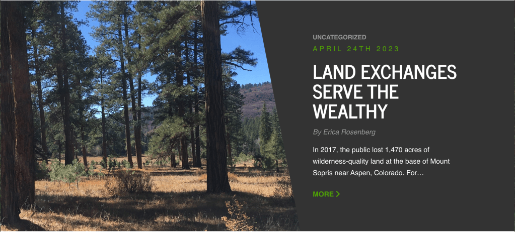
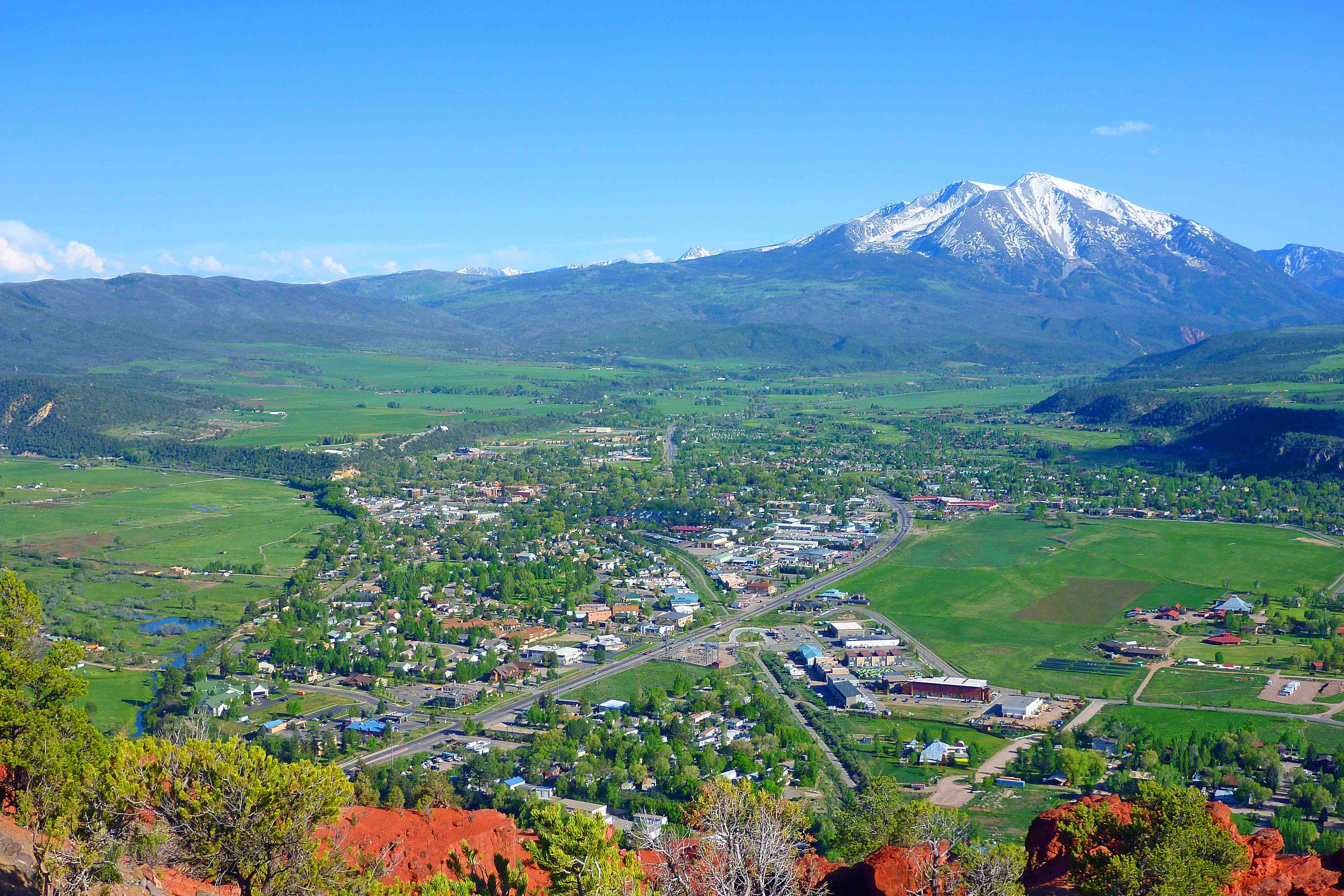
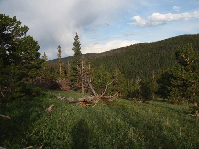
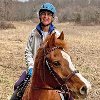
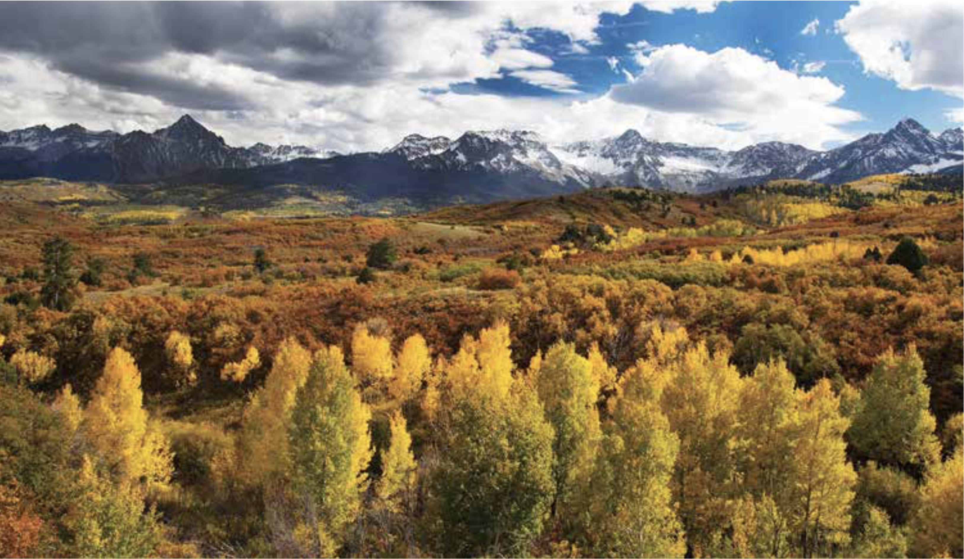
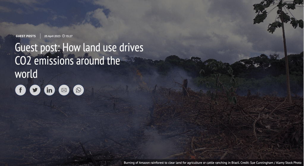
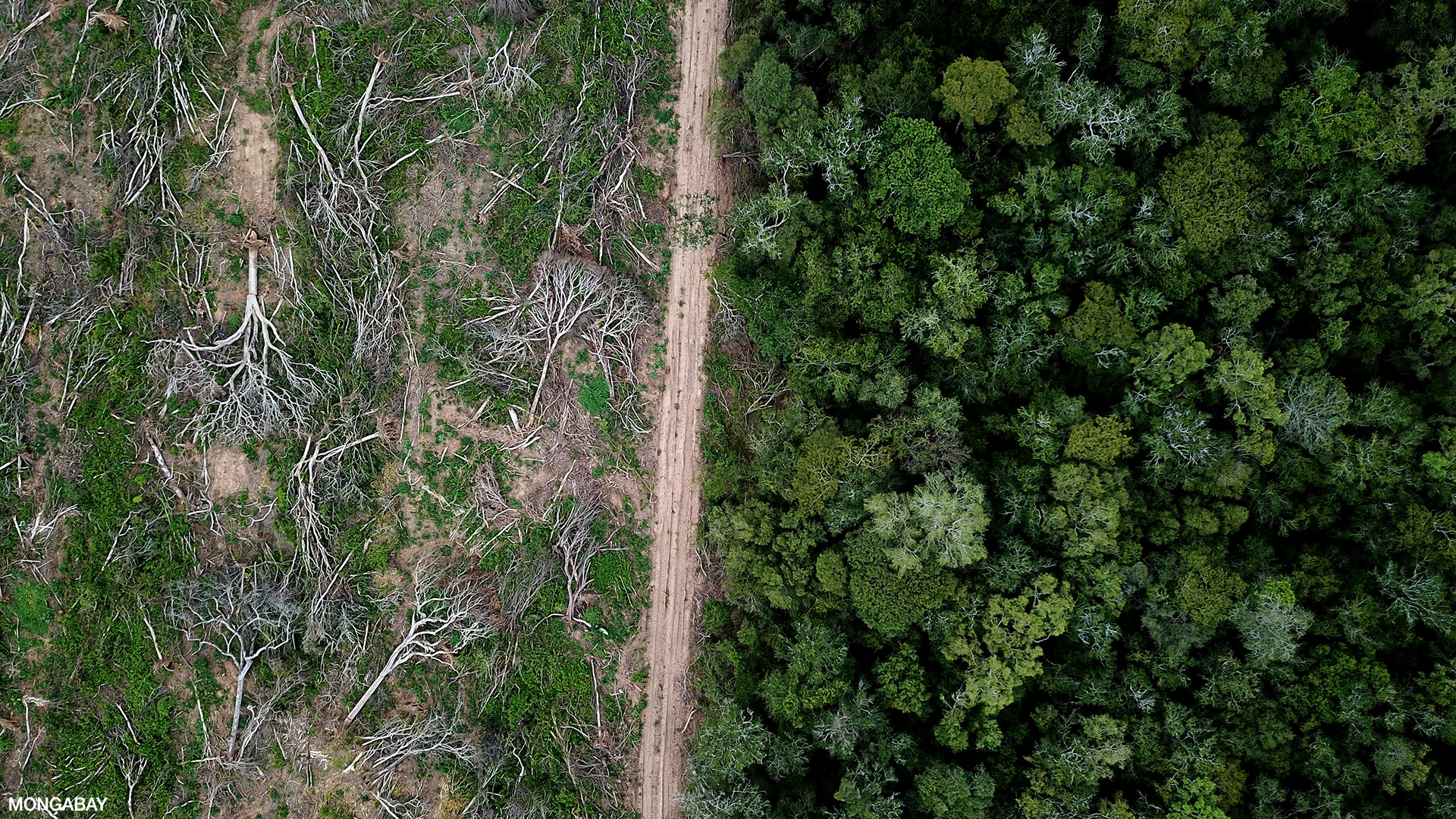
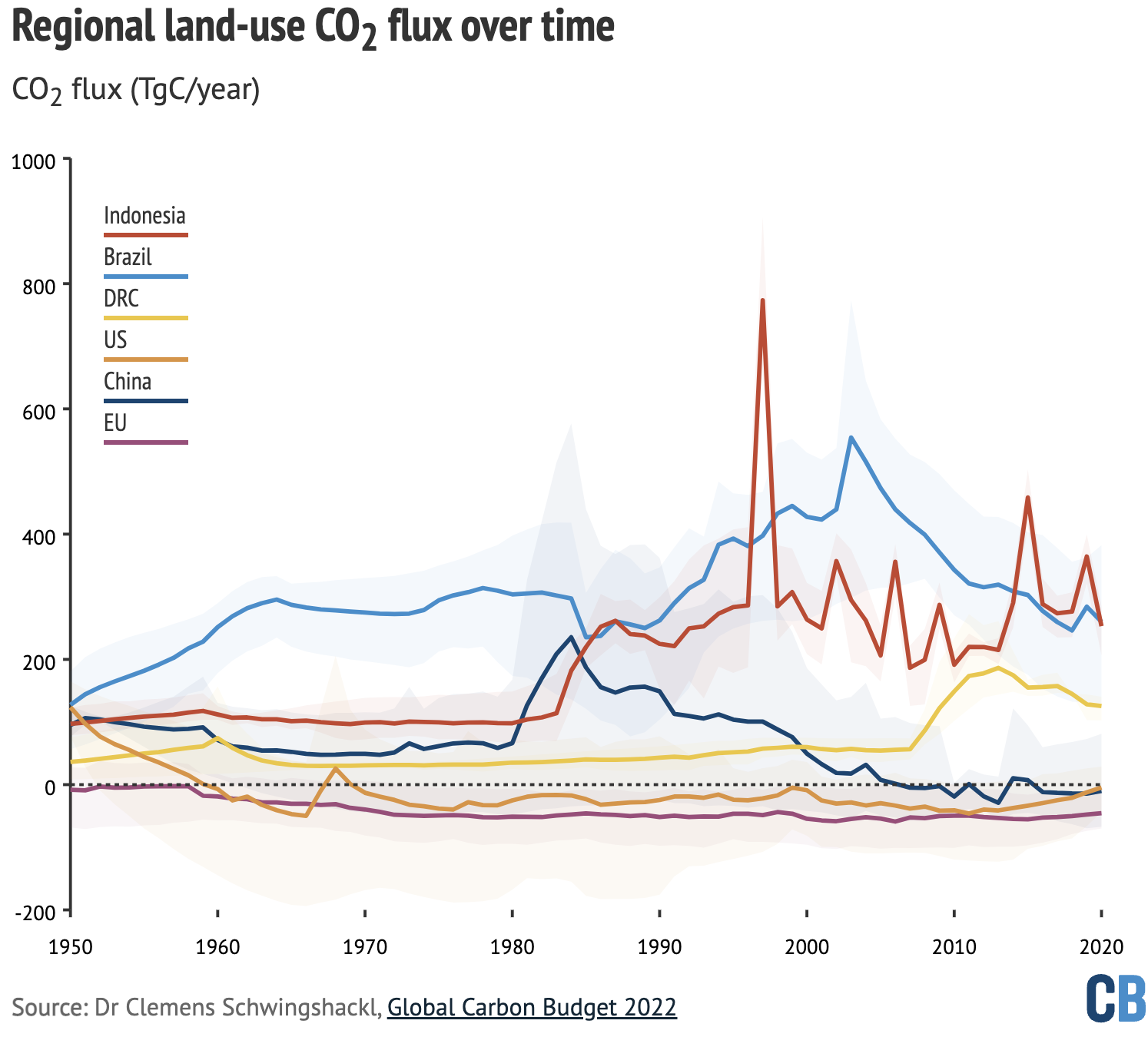

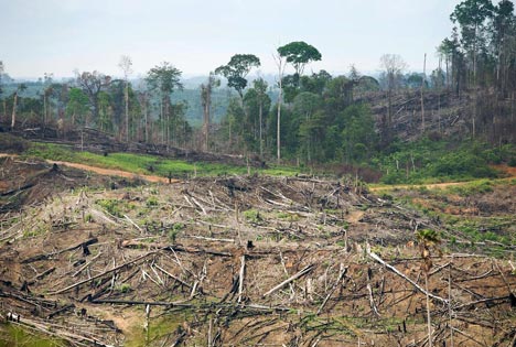

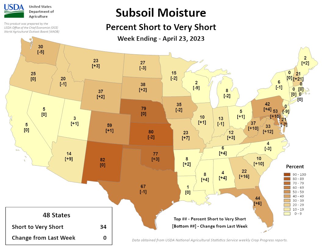
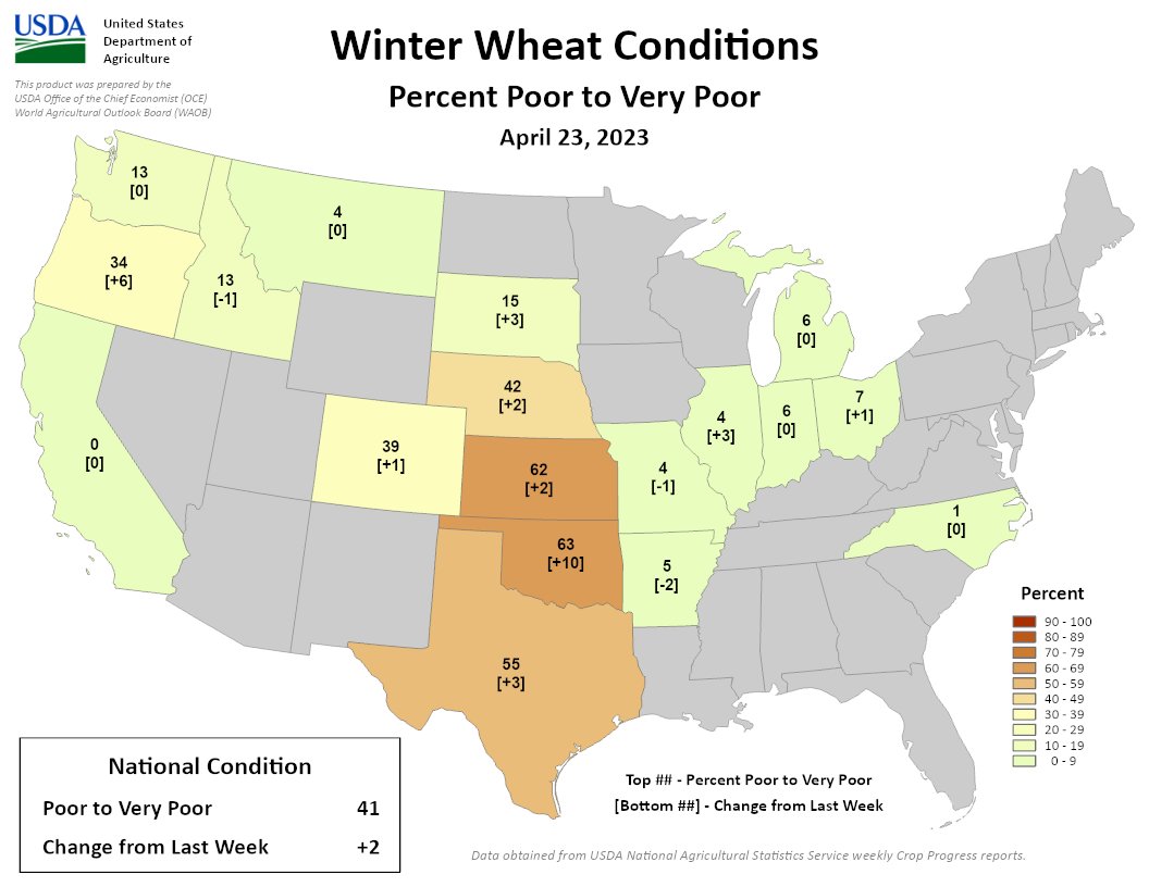

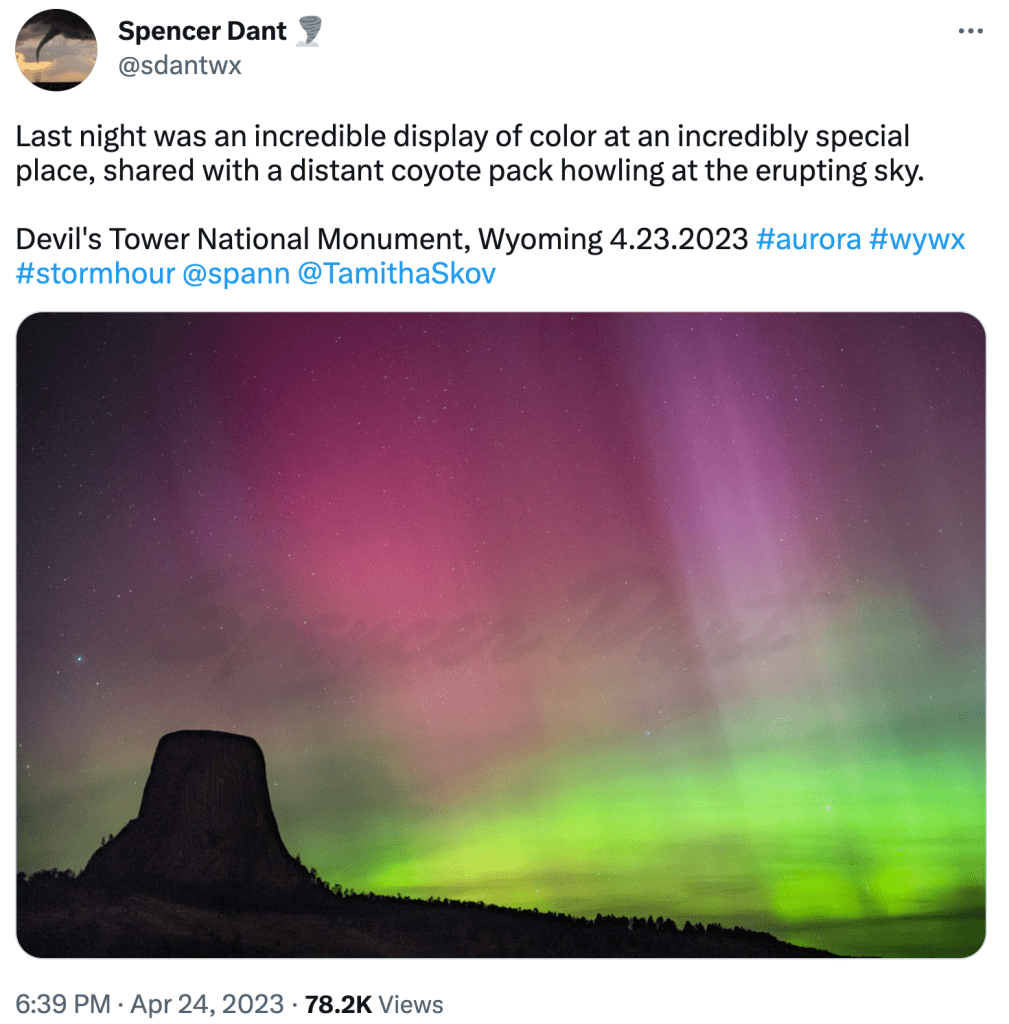

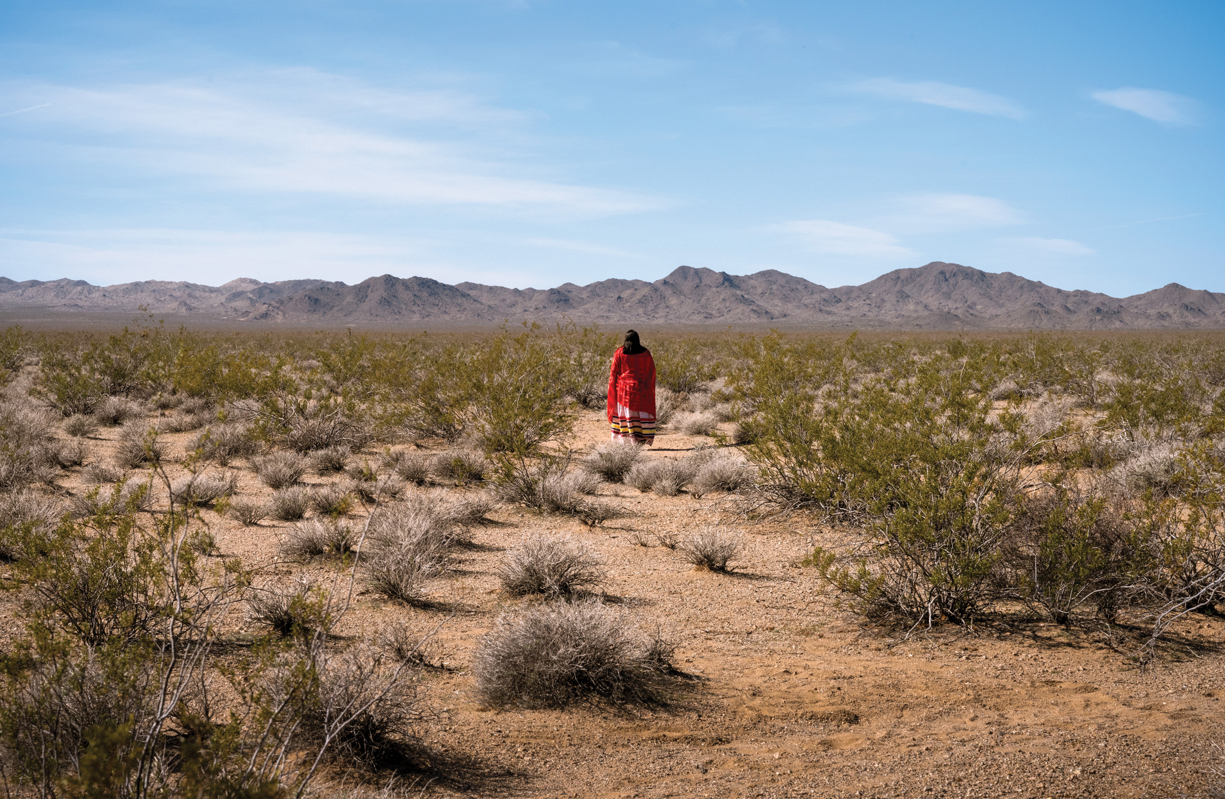
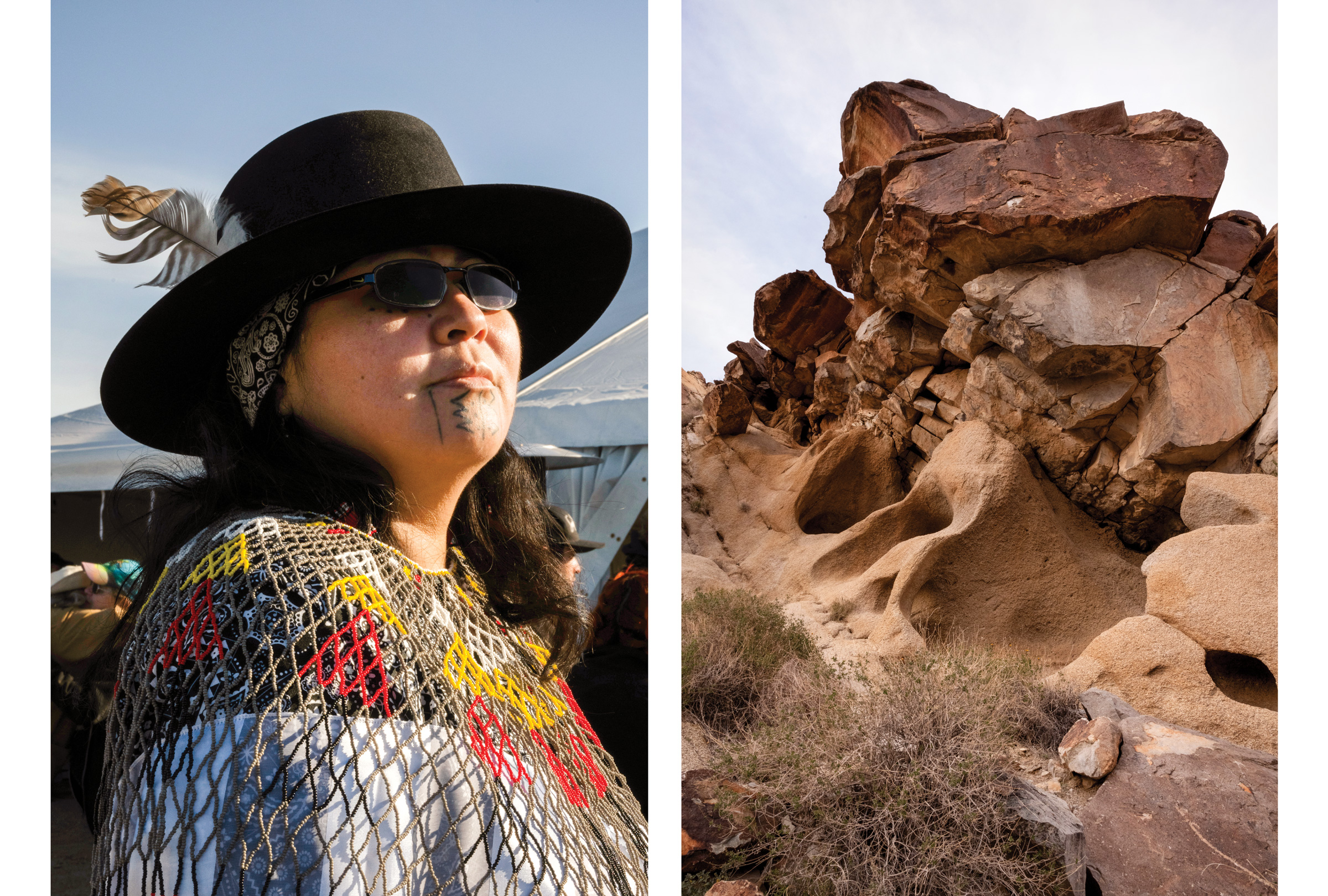
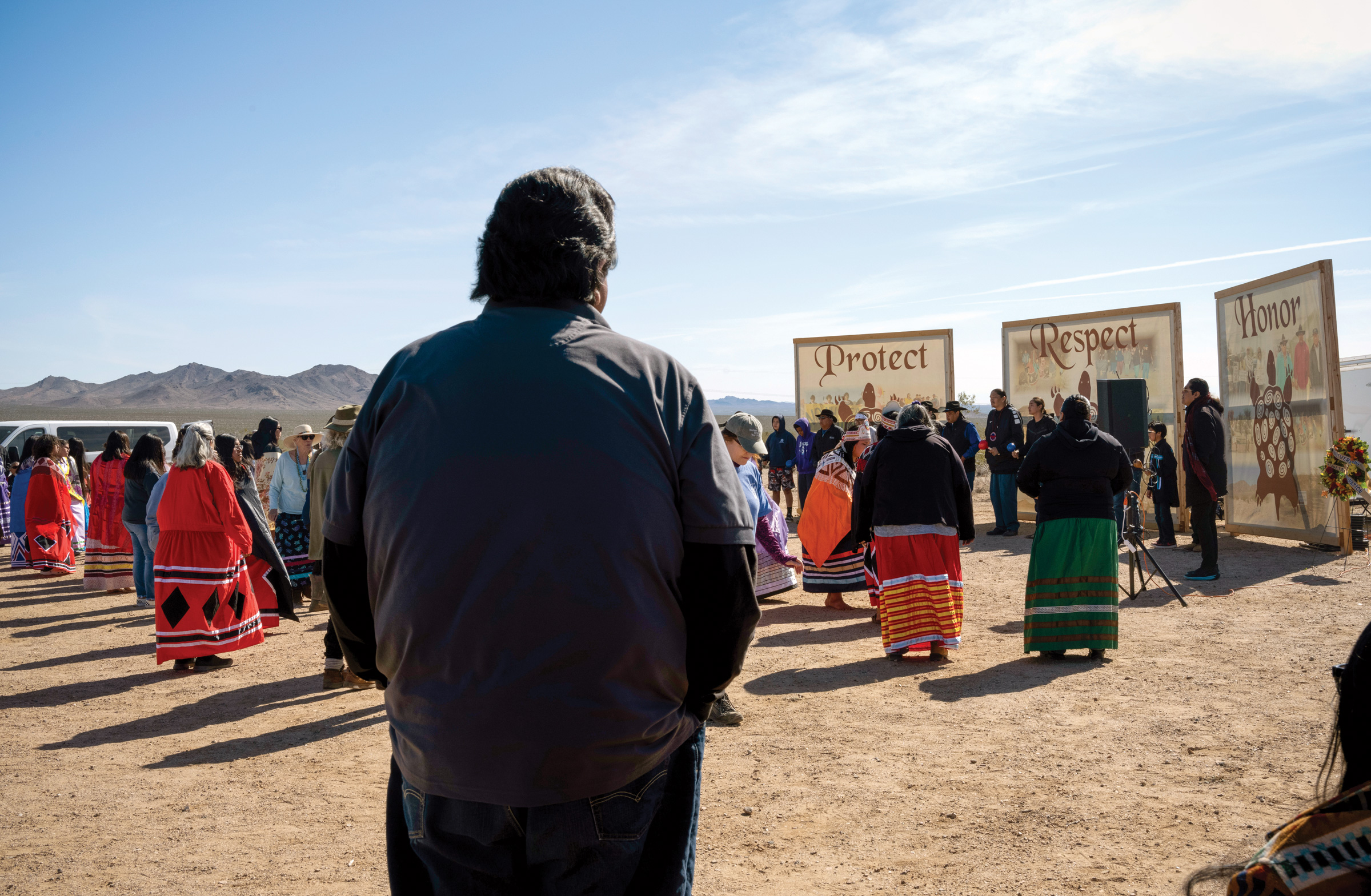


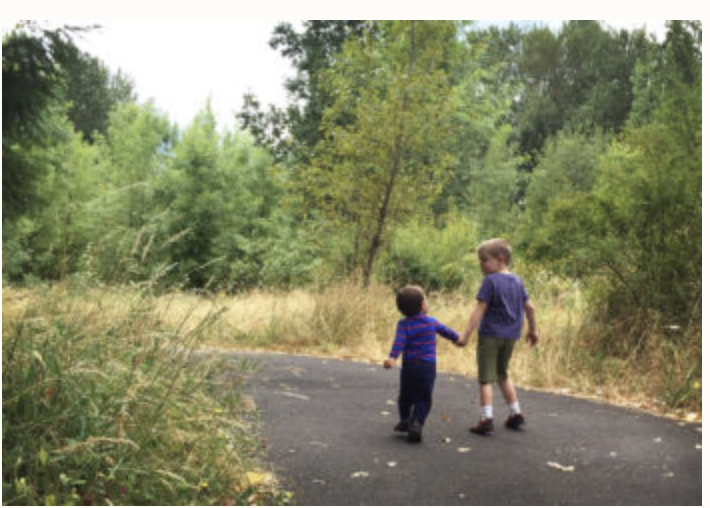


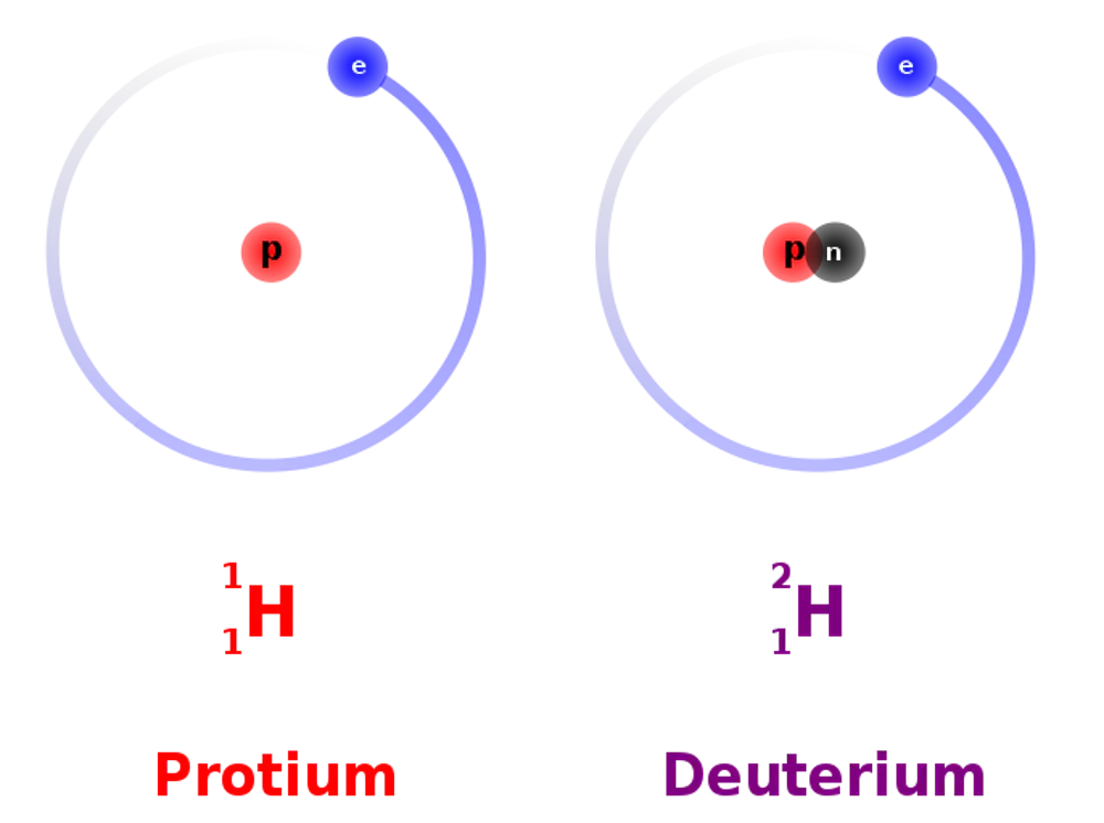


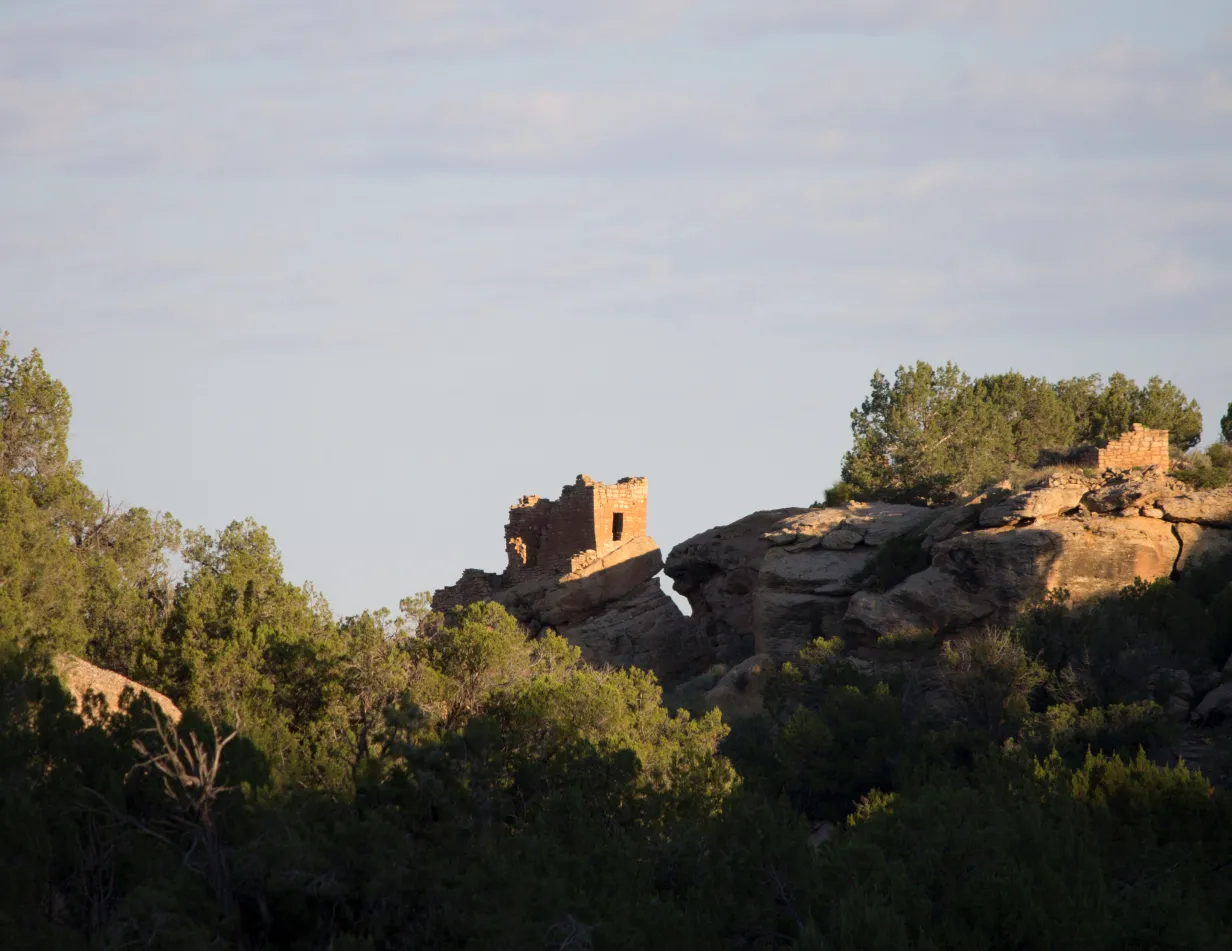
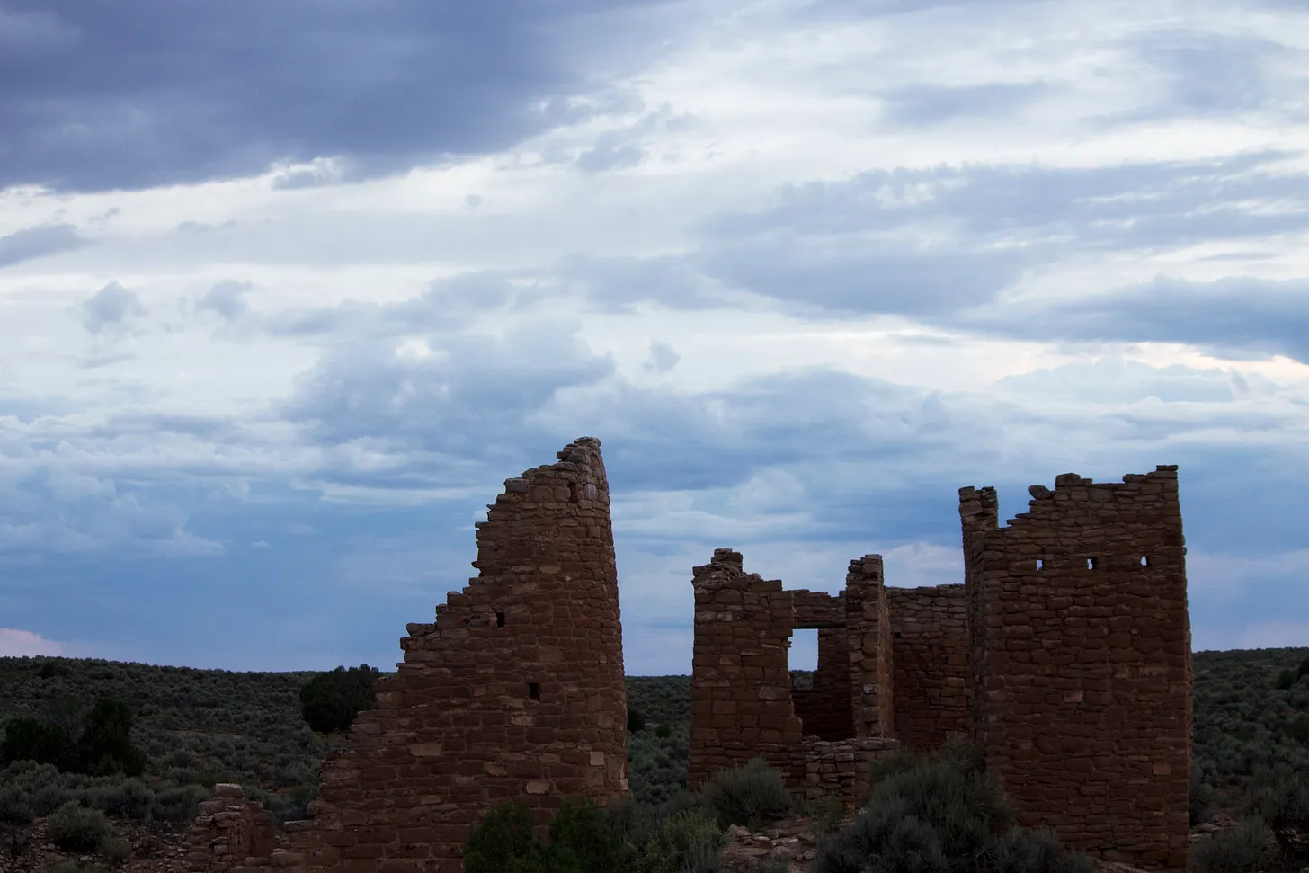
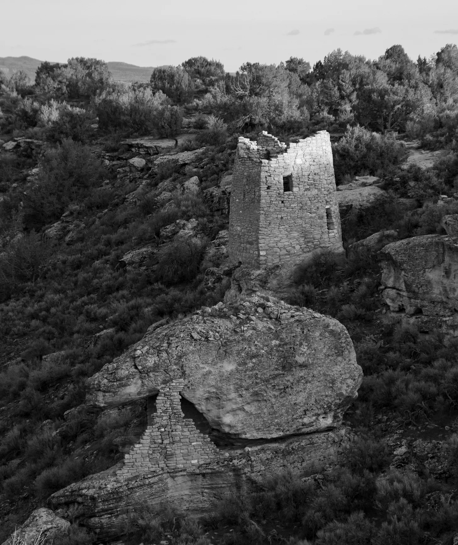
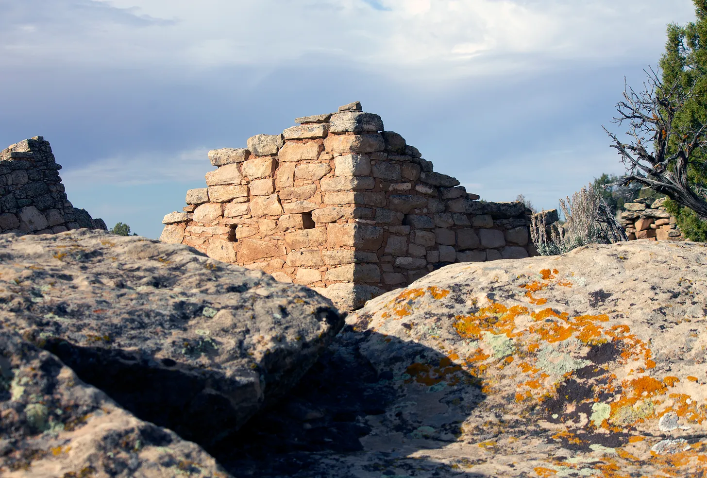
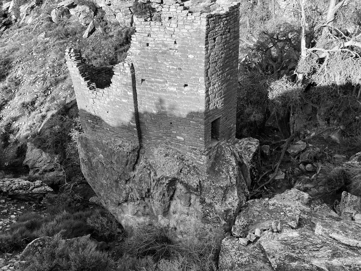
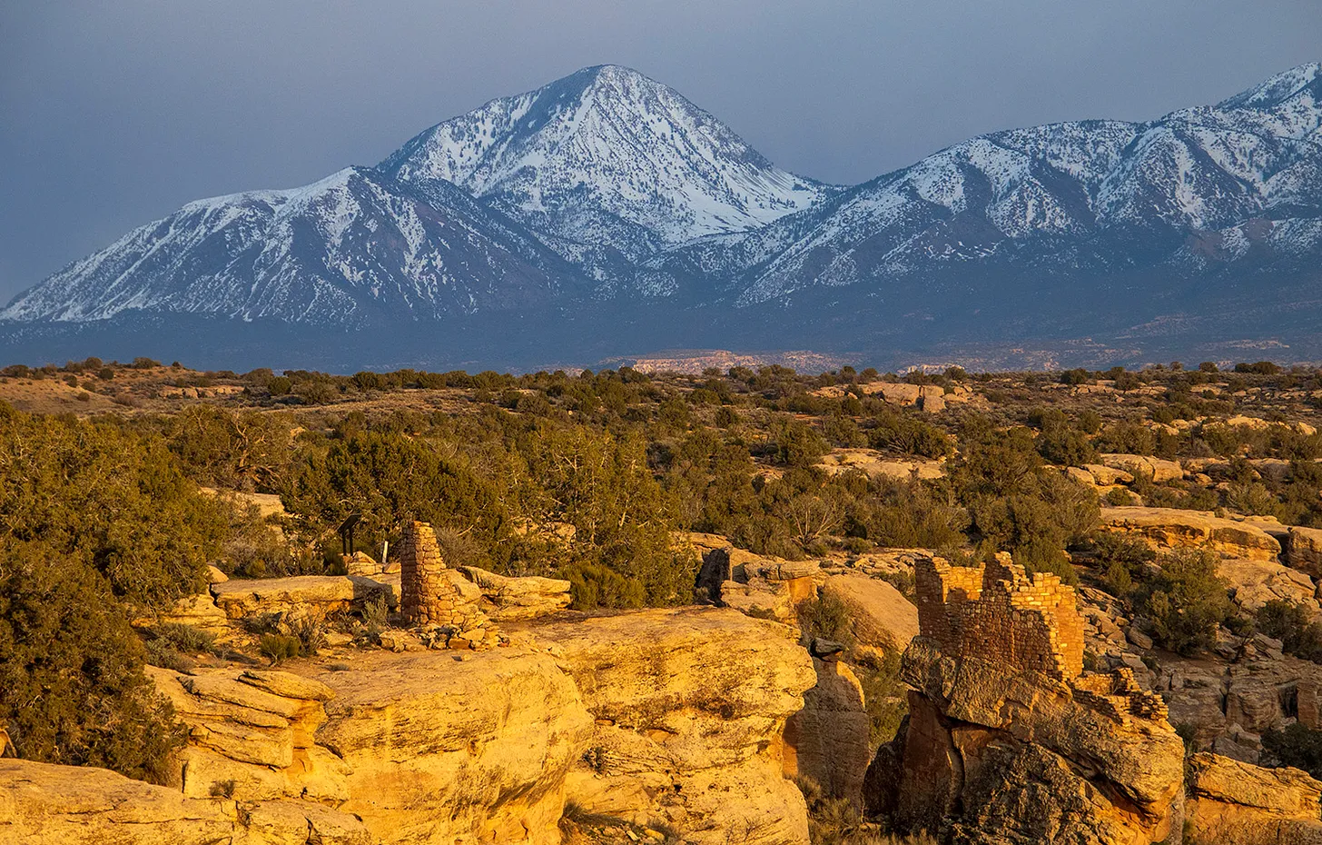
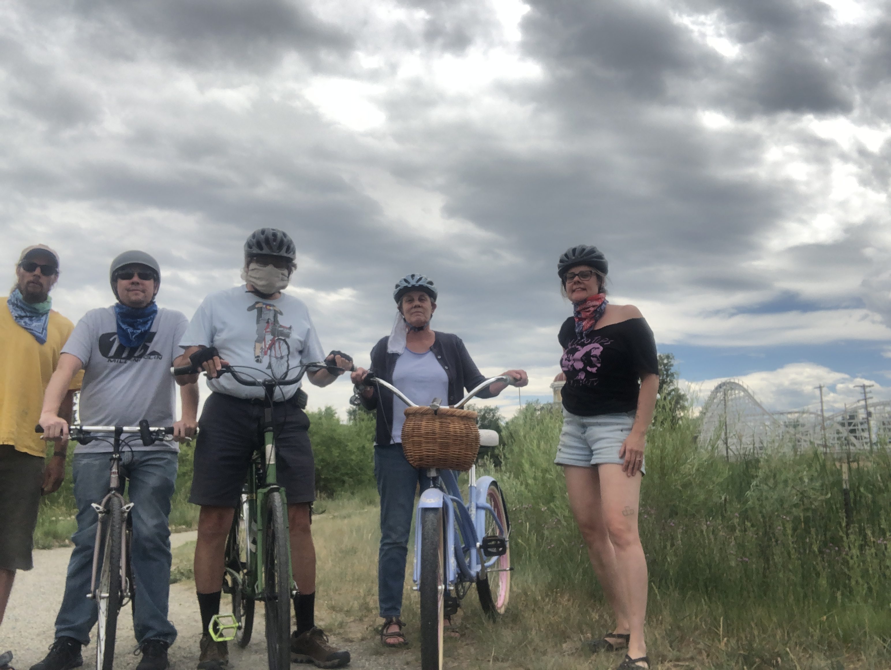

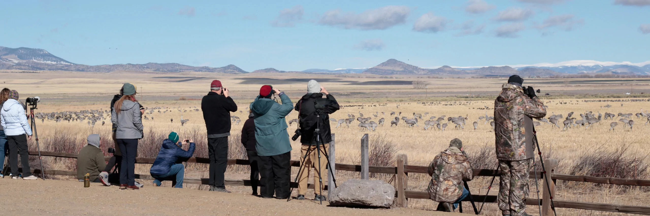
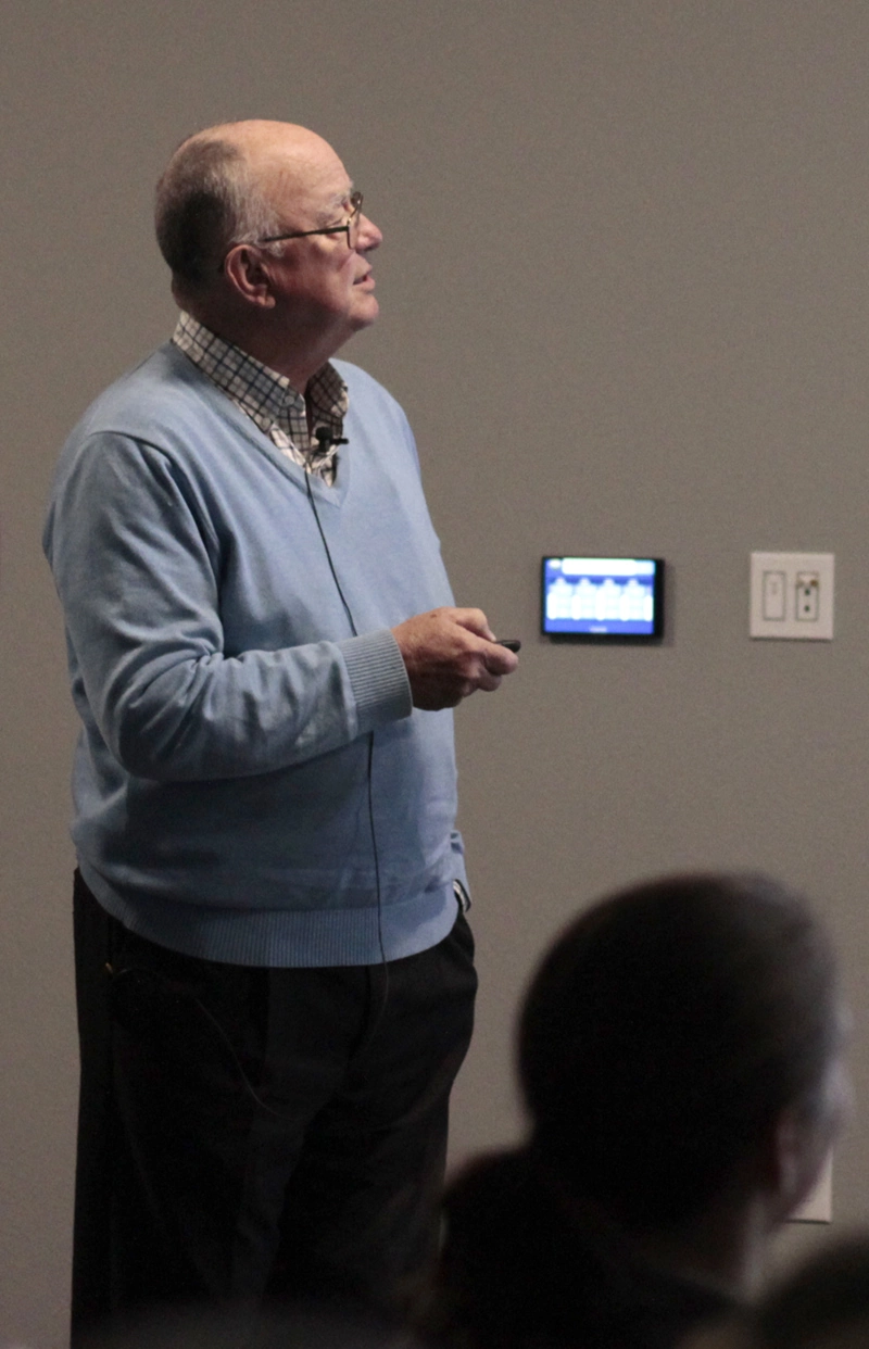
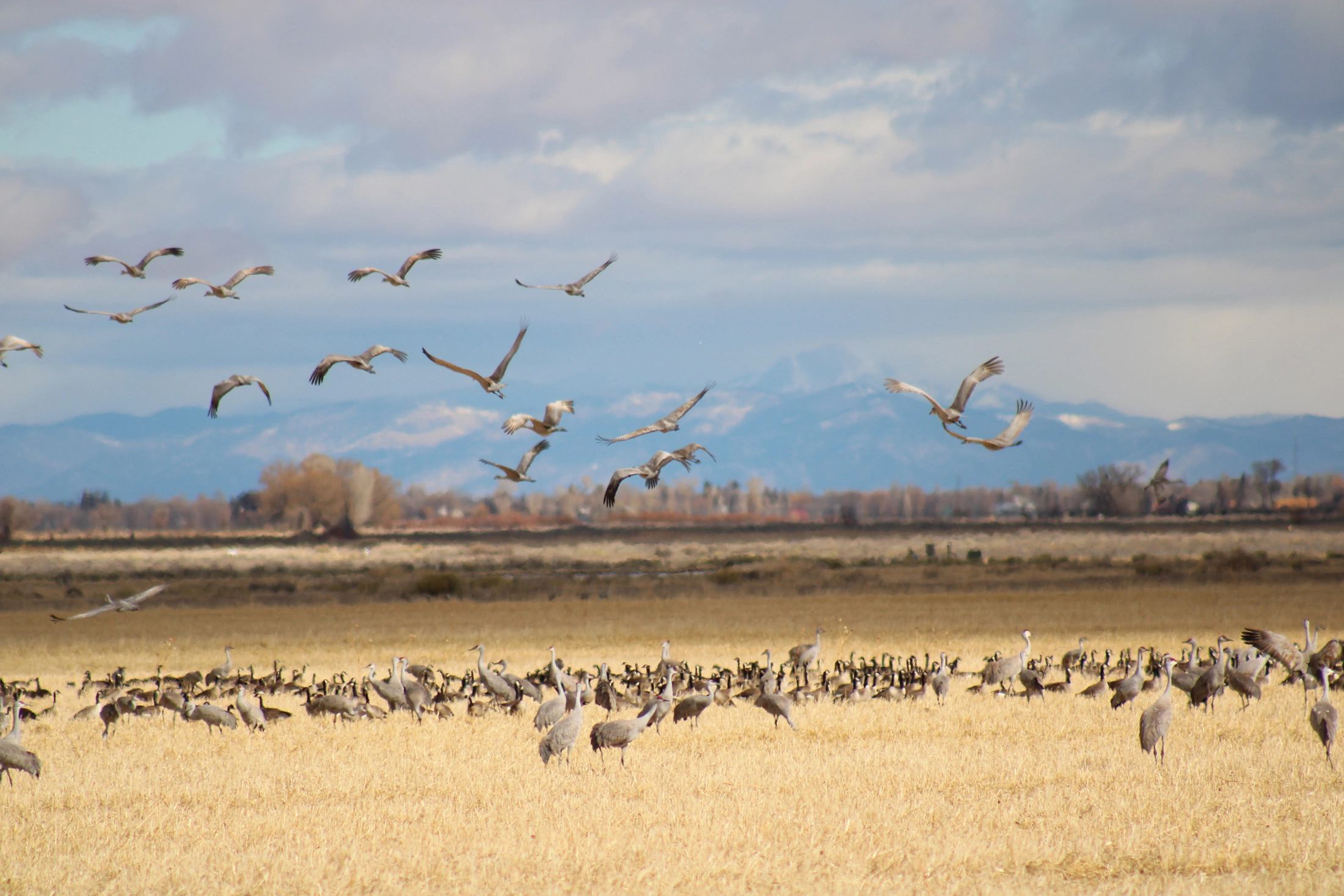


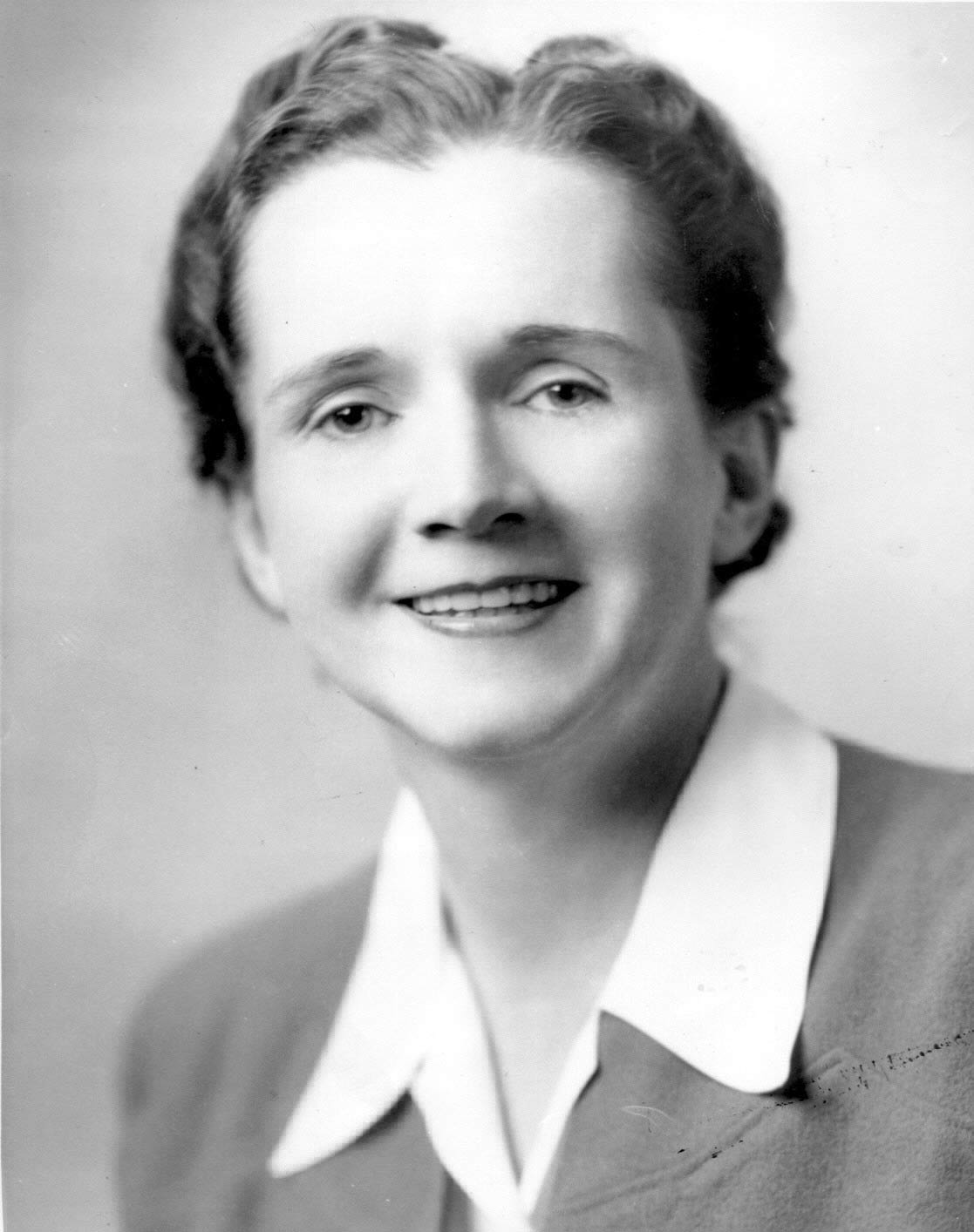


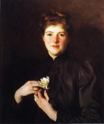
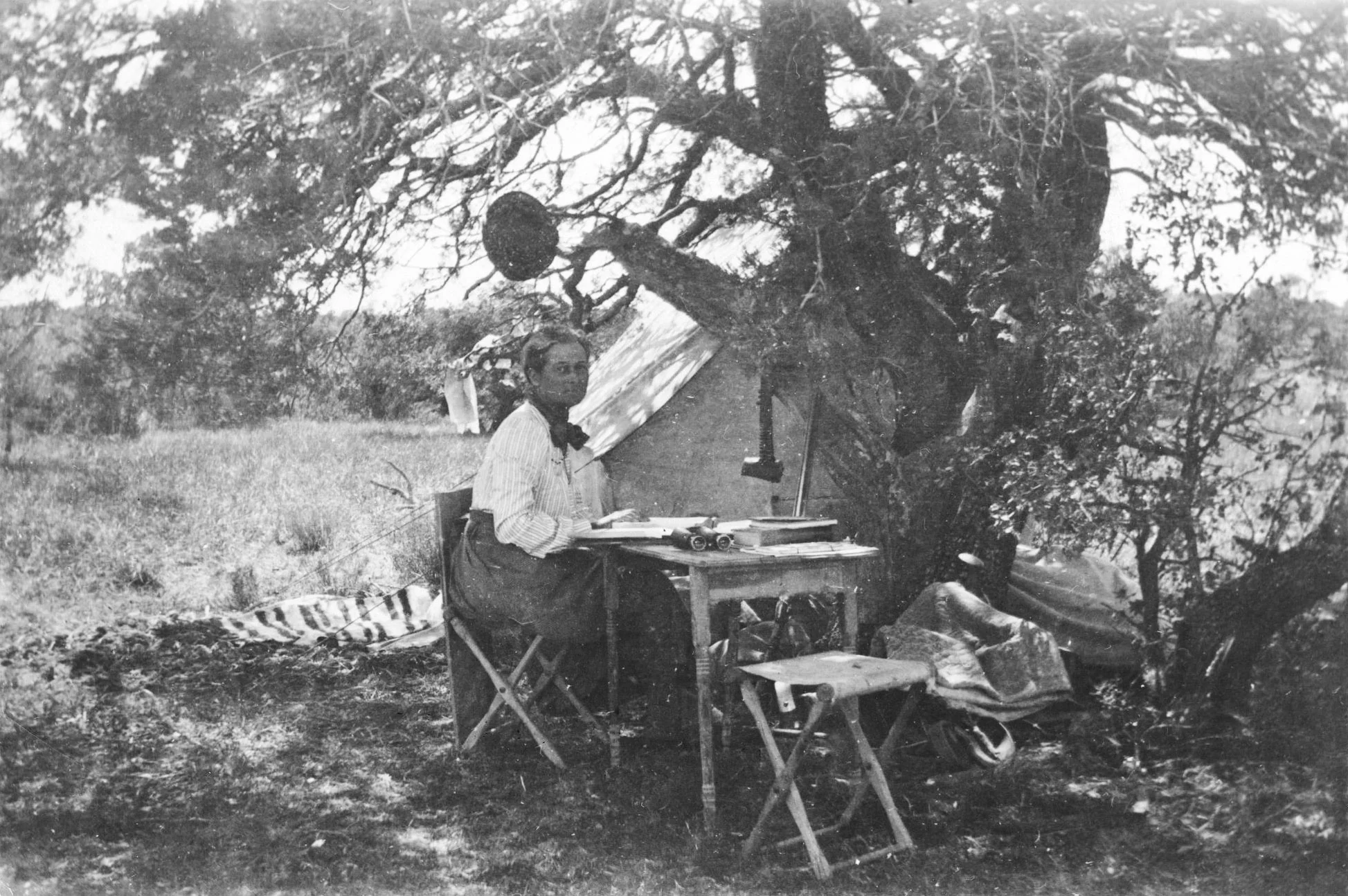


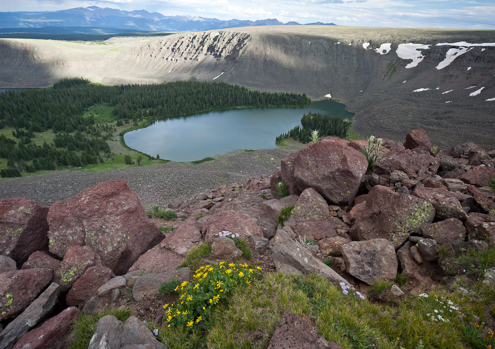

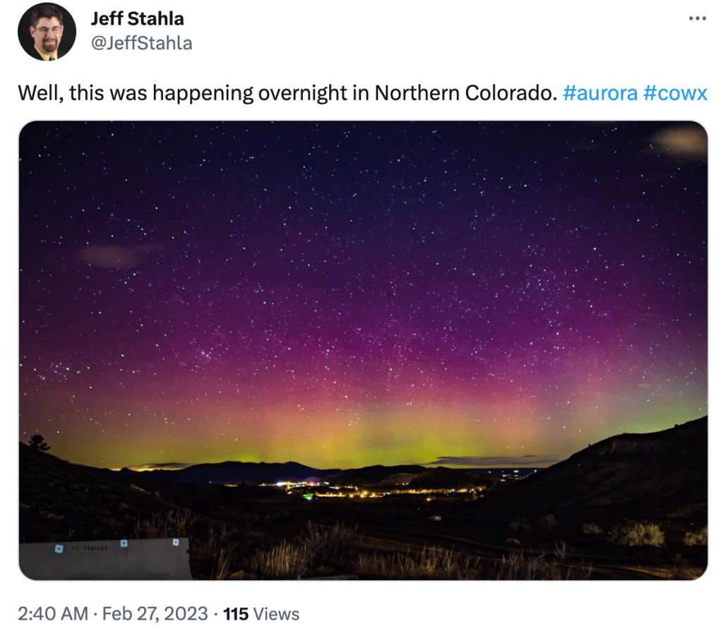


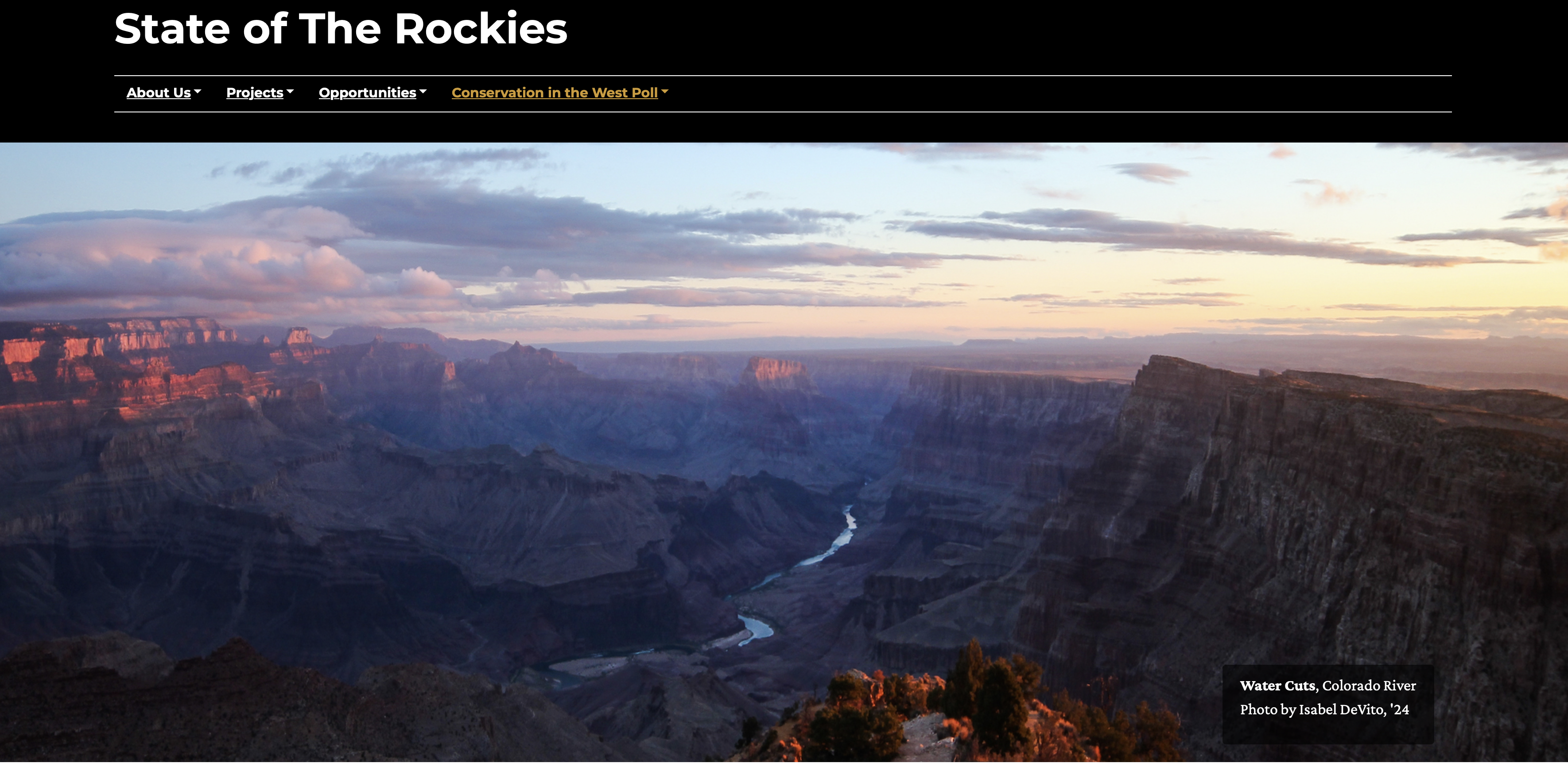
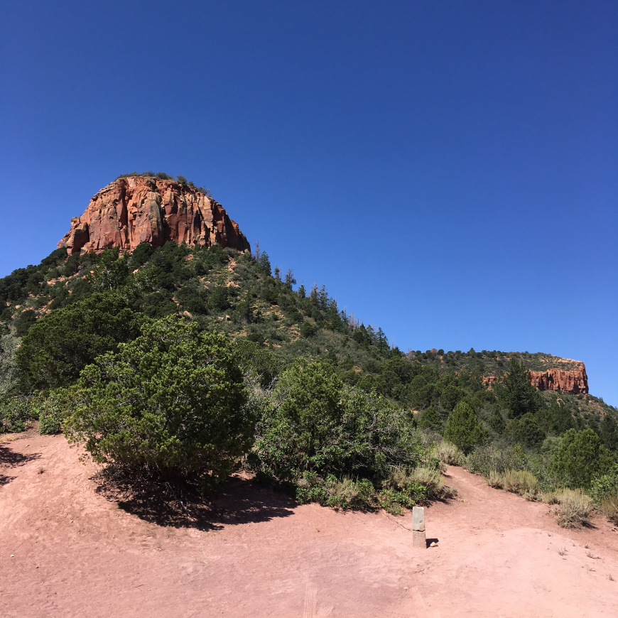


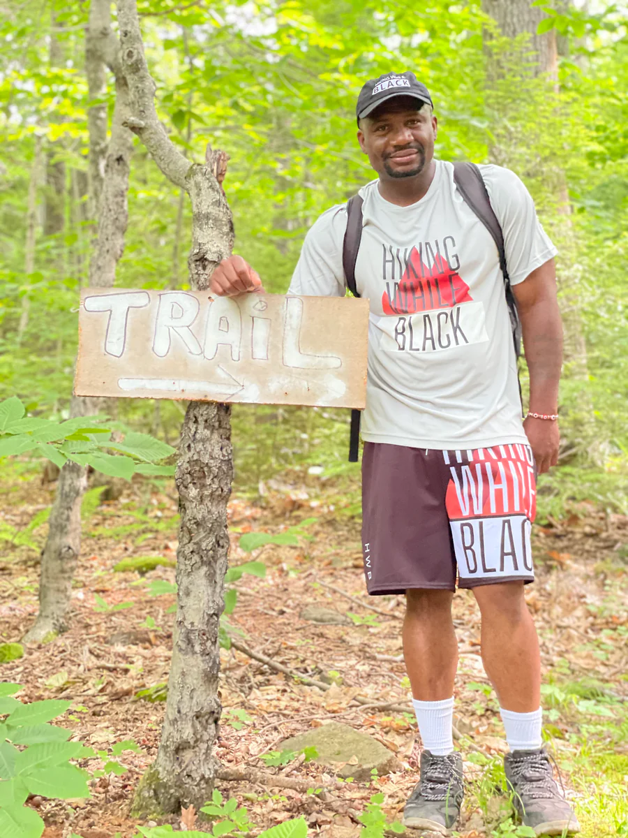

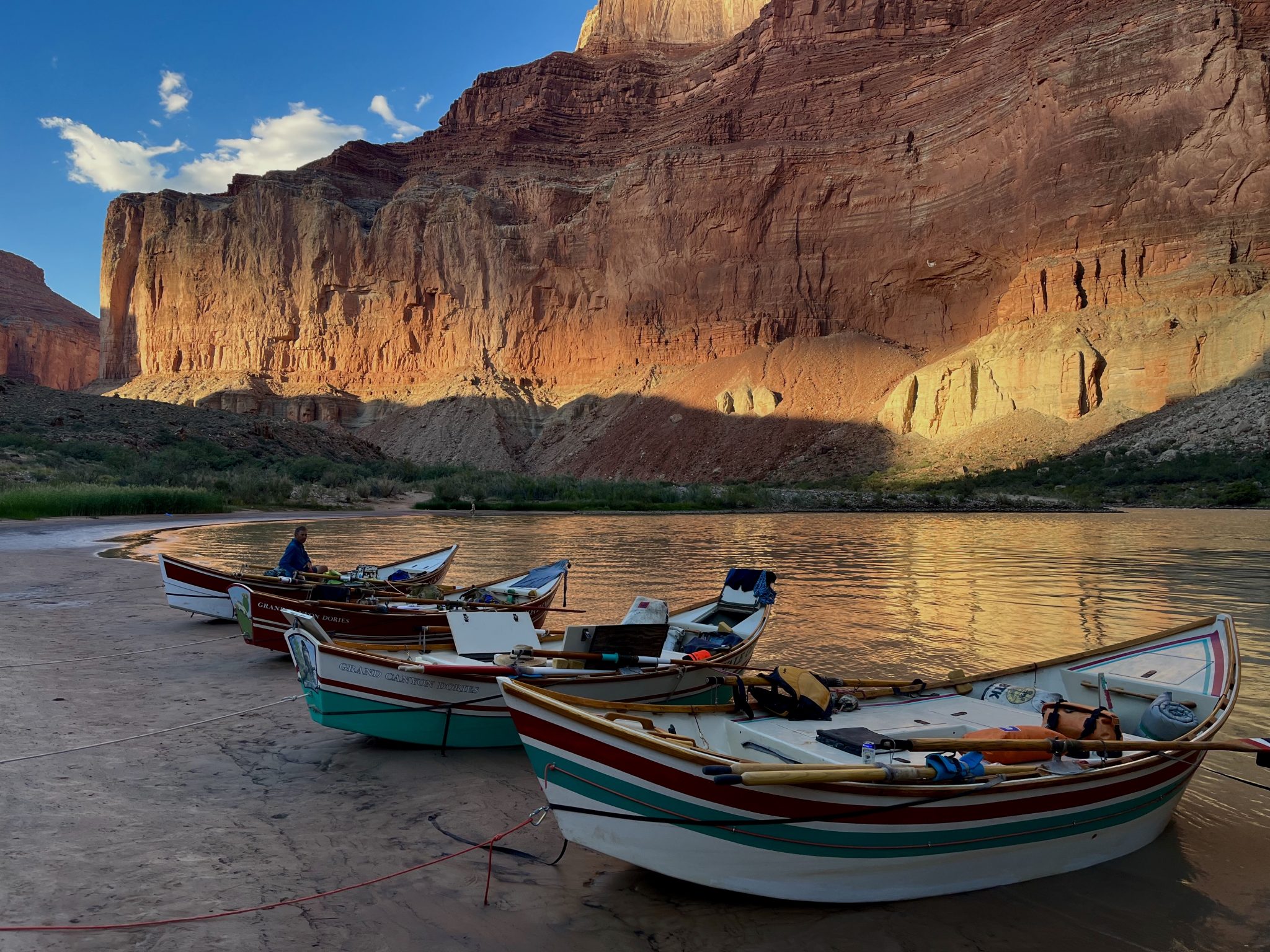


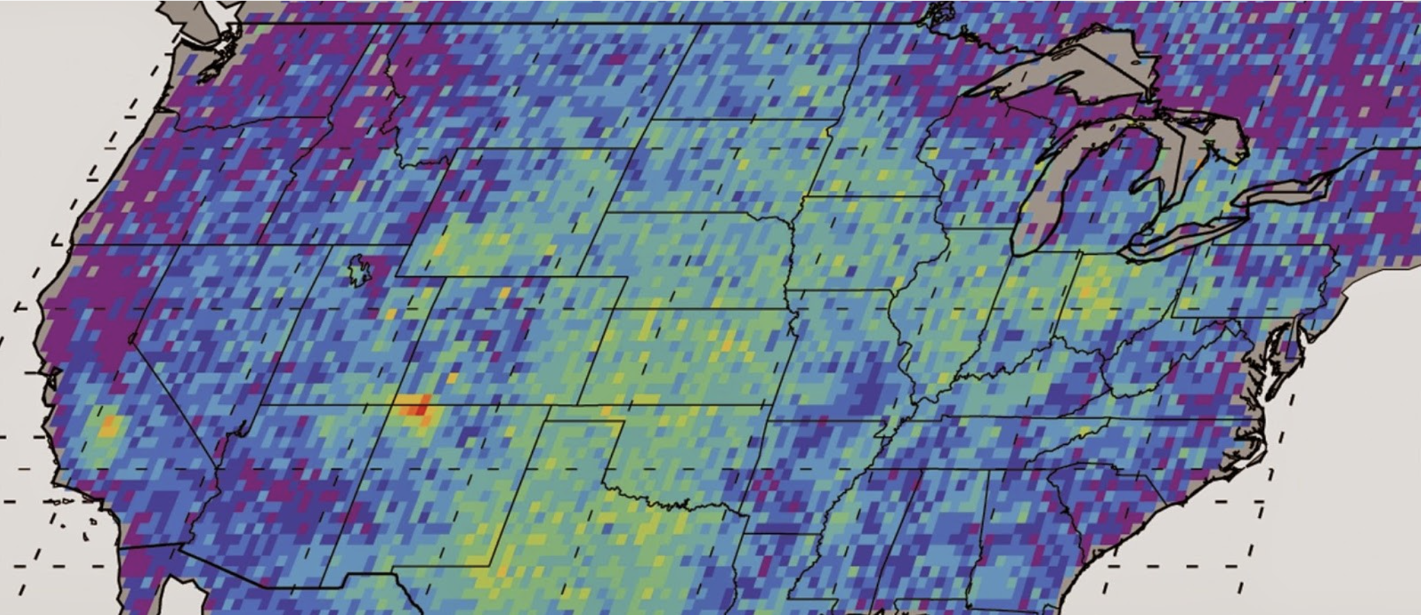
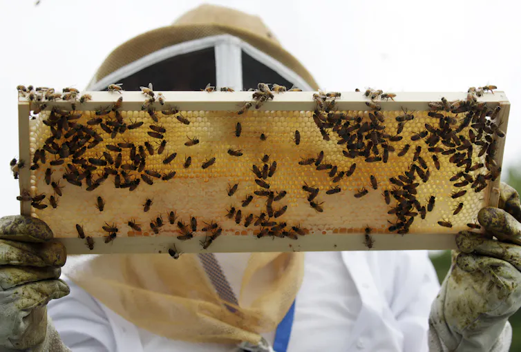


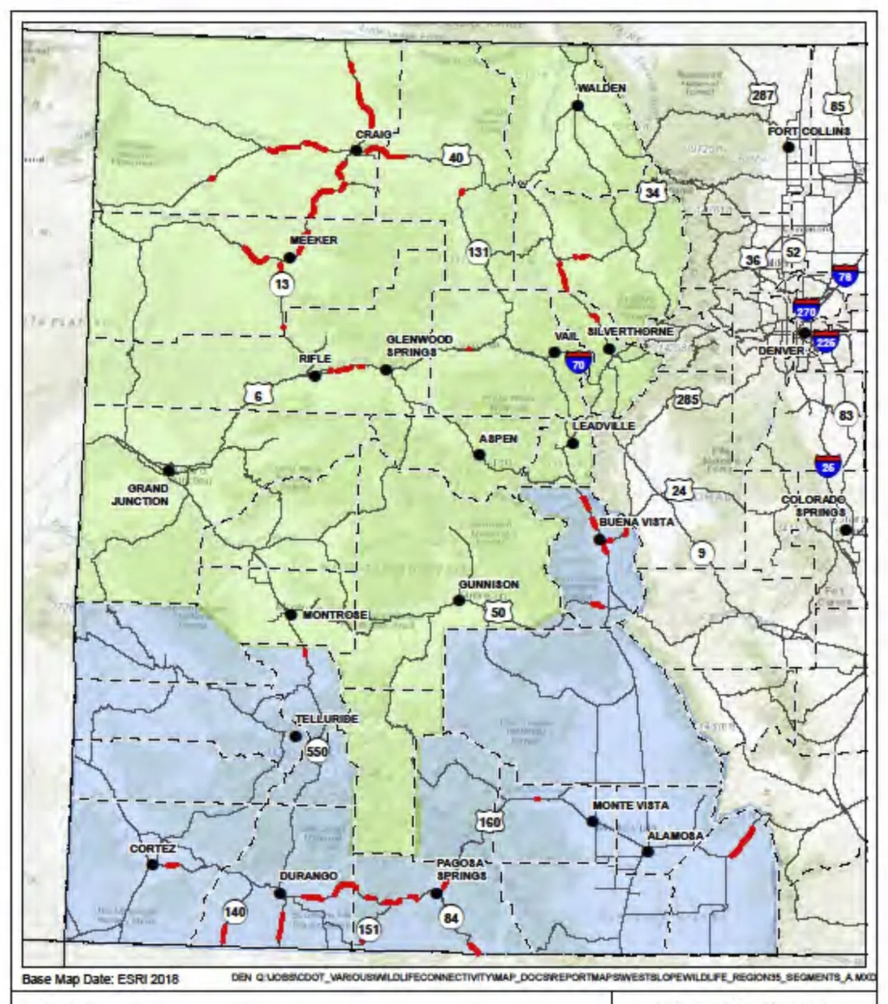
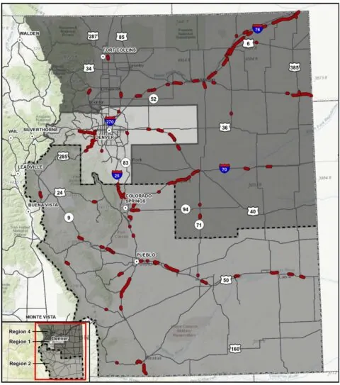


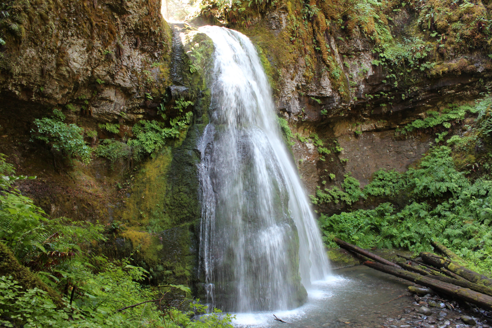


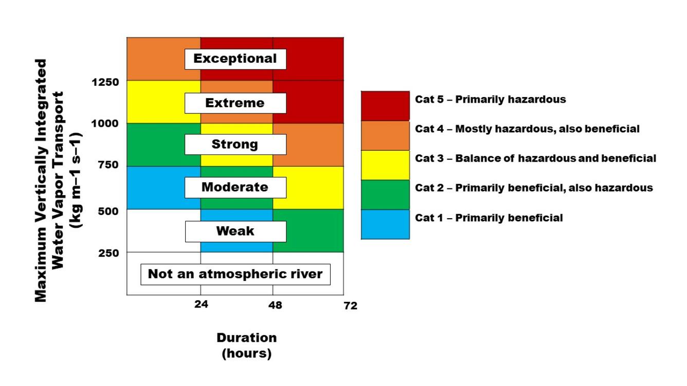
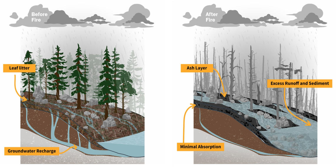


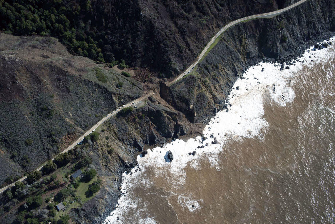
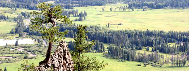


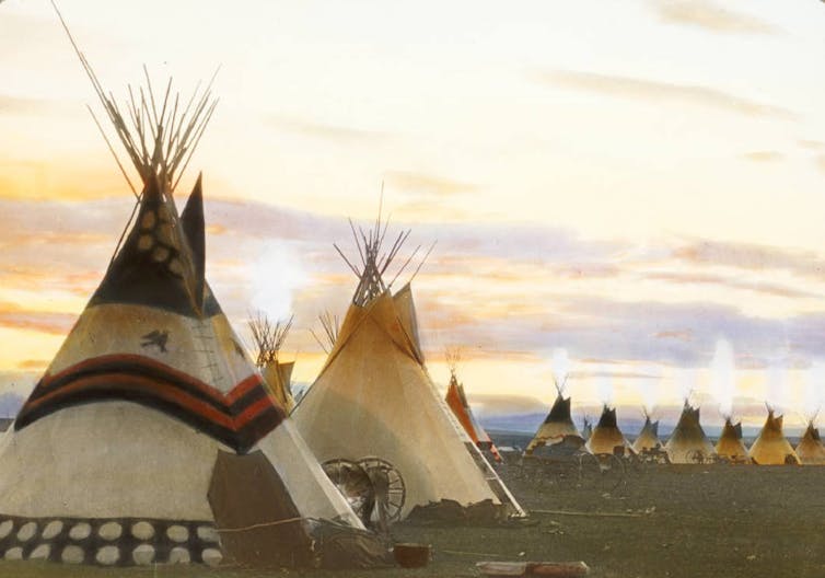
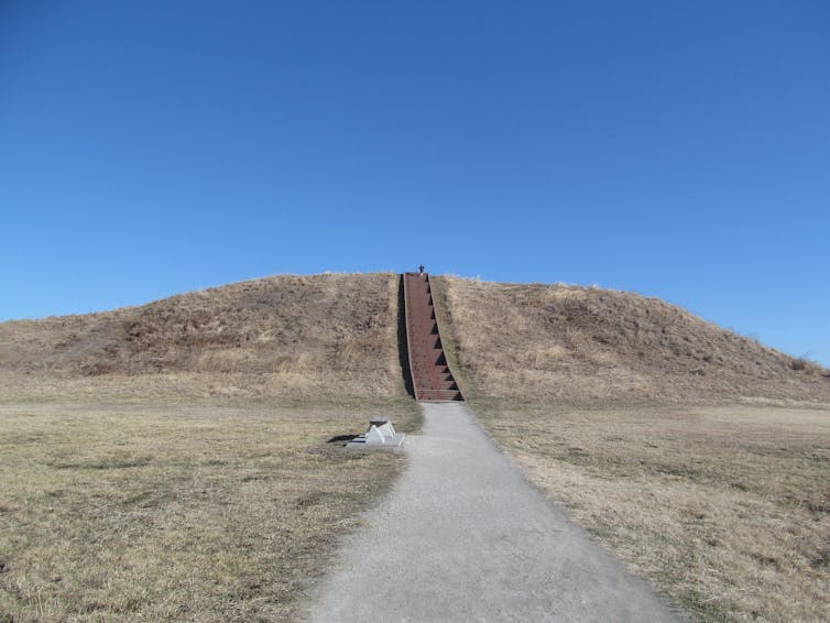


