It’s been a noticeably wet and snowy start to the year in Denver. In fact, it’s been the wettest start to a year since the early 1940s.
The Mile High City has seen close to 8 inches of precipitation this year already thanks to the big March blizzard bringing us the equivalent amount of moisture as a monsoon thunderstorm as well as multiple over-performing weather events after that.
Annually, Denver picks up just over 14 inches of precipitation, leaving us well ahead of schedule as we head into the hot, summer months…
Colorado Drought Monitor map May 4, 2021.
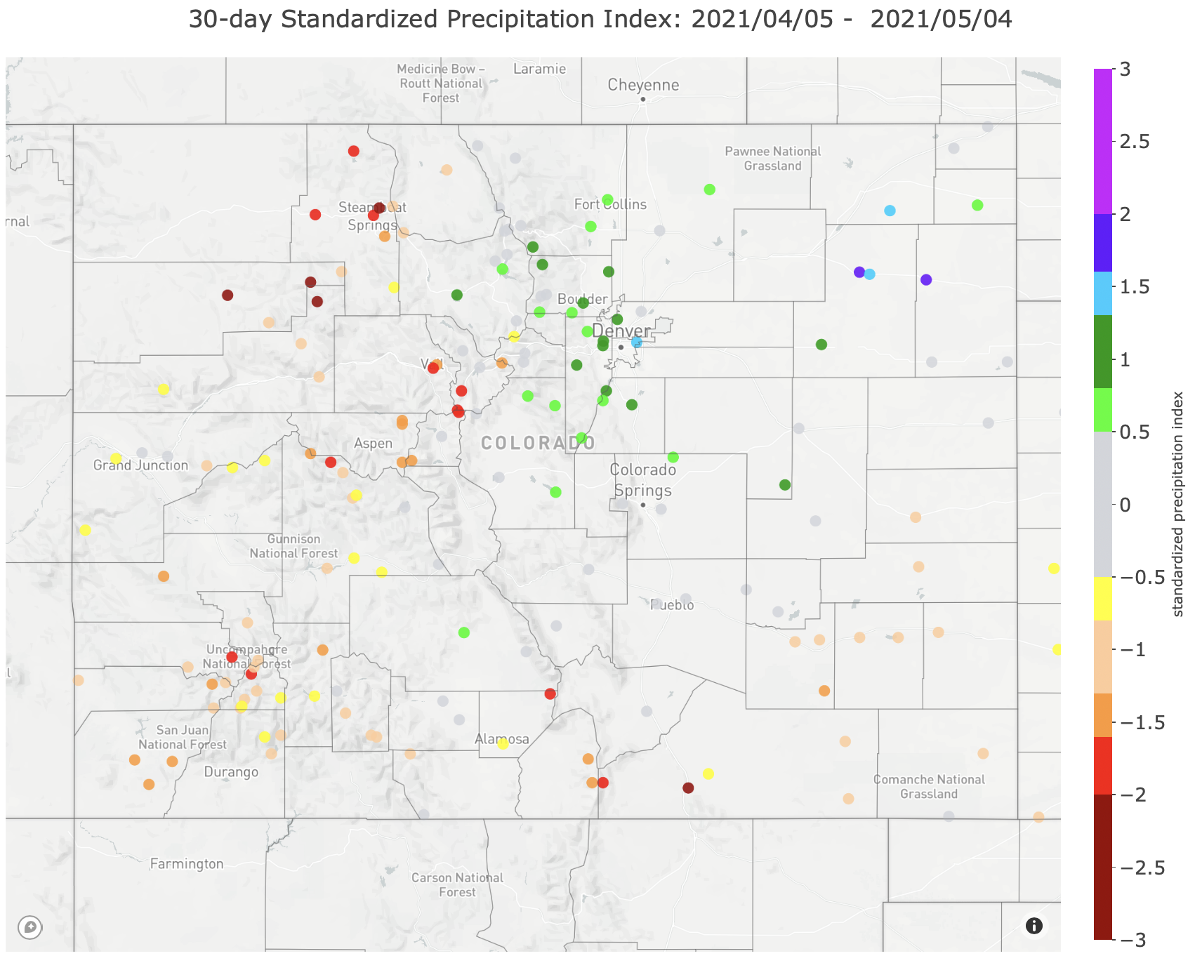
Most of the recent storms have been helping out the northern Front Range and the northern Front Range only. Areas near Grand Junction, Telluride, Durango, Pagosa Springs and Glenwood Springs are suffering from severe and exceptional drought and have been for quite some time.
Since May 2019, select areas across the Western Slope and southwest Colorado have seen the rainfall deficit grow to over 20 inches, but most areas have a deficit between 12 and 20 inches over the past two years. The drought that has been ongoing in this area of the state has been growing in size and intensity, leaving the upcoming summer a season with looming fire and water supply concerns.
30-Day Standardized Precipitation Index Map May 7, 2021 via the Colorado Climate Center.
The Standardized Precipitation-Evapotranspiration Index measures drought in an area based on the size and duration and until recently, the worst SPEI reading for the Western Slope came in 2002 with a value of -1.7. The current SPEI index is sitting at -2.1, the worst that has ever been seen since records started in the late 1800s and a very concerning number as we head into the hot, dry months.