Click on a thumbnail graphic to view a gallery of drought data from the US Drought Monitor.


Click here to go to the US Drought Monitor website. Here’s an excerpt:
This Week’s Drought Summary
Much of the western CONUS experienced below-normal average temperatures this week, with many areas across the Great Basin and Northern Rockies observing greater than 6°F negative departures. Above-normal precipitation in the West was limited to the high elevations of the Cascades, the Central Great Basin, Montana, and northern New Mexico. However, improvements were only warranted in western Montana and northern parts of New Mexico, where the heaviest precipitation fell. Elsewhere in the West, degradations were warranted due to declining snowpack, stream flows, and soil moisture. The Southern Plains and Gulf Coast also experienced negative 7-day average temperature departures. However, negative departures along the eastern Gulf Coast were driven by easterly to northeasterly flow early in the week whereas below-normal temperatures along the western Gulf Coast and Southern Plains were driven by above-normal precipitation (1 to 2 inches across the Southern Plains and well in excess of 3 inches through the Ark-La-Tex and along the western Gulf Coast). Heavy rains in the Southern Plains resulted in continued improvements across Texas this week, while high pressure across the Southeast exacerbated 30 to 60-day dryness in Virginia, the Carolinas, and Florida, leading to degradation of abnormally dry (D0) and moderate drought (D1) conditions. From the Central and Northern Plains eastward to the Atlantic Coast, most areas experienced temperatures 6°F to 9°F above-normal. Heavy rains fell across western portions of the High Plains Region, warranting minor improvements across the western Dakotas, while the larger improvements were observed from western Nebraska and Kansas westward to the Front Range. From the eastern High Plains Region to the Great Lakes, improvement and degradations were observed based on where the heaviest precipitation fell. In the Mid-Atlantic and Northeast, below-normal precipitation over the past couple of weeks and above-normal average temperatures this week resulted in D0 expansion from the Great Lakes to New England and into the Mid-Atlantic, with some D1 expansion in Upstate New York. Stream flows and soil moisture continue to rapidly decline across the Northeast, Mid-Atlantic, and portions of the Southeast…
In the High Plains Region, a swath of 1.5 to 3 inches (locally more) of rain fell from western North Dakota southward to eastern Colorado and northwestern Kansas. This resulted in reductions in D0 (abnormally dry) and D1 (moderate drought) coverage in western Nebraska and eastern Colorado, with additional 1-category improvements in the drought depiction across southeastern Colorado. In the Dakotas, where long-term moderate (D1) to exceptional (D4 – South Dakota) drought is entrenched, the heavy rainfall, although beneficial, was only enough for minor reductions in D1 (moderate drought) to D3 (extreme drought) coverage in the western areas. Reports indicate much of this week’s heavy rains was immediately absorbed by the severely dry soils, with no runoff into empty dugouts or ponds. However, in some locations, the rain fell so quickly that it did not allow time for infiltration into the topsoils, resulting in erosion of topsoils. Furthermore, high wind events have increased the potential for evaporative loss of this moisture from the topsoils. Currently, very little vegetative matter is available for grazing, despite some isolated areas of green-up from recent rainfall. In eastern North Dakota, some D3 reduction was warranted in areas receiving more than 1.5 inches of rainfall, diminishing long-term deficits. However, in South Dakota, where above-normal temperatures (9°F to 12°F positive anomalies) and below-normal precipitation (less than 50 percent of normal precipitation), expansion of D0 (abnormally dry), D1 (moderate drought), and D2 (severe drought) coverage were warranted as 30-day SPIs have fallen to D3 to D4 equivalence and 30-day deficits (1 to 3 inches) continue to accumulate…
Most basin snow water equivalent (SWE) percentiles across the Western Region are well below-normal for the period of record (near and below the 65th percentile), especially in the Four Corners region (below the 5th percentile in Arizona and New Mexico). Only parts of the Pacific Northwest and areas of central Montana experienced near and above-normal seasonal snowfall. However, above-normal temperatures over much of the West in recent weeks to months has resulted in rapid snowmelt and, due to dry topsoils, much of the melt water has not made it into the rivers, lakes, and reservoirs. In California, USGS 7-day average stream flows across the coastal ranges around and north of the Bay Area, and extending eastward into the Sacramento River Basin, are rapidly declining having dropped below the 2nd percentile at many locations in the coastal ranges, and below the 10th percentile eastward into the northern Central Valley. CPC soil moisture ranks below the 1st percentile (corroborated by NASA SPoRT 0-200 cm soil moisture percentiles), NASA GRACE indicates severely depleted groundwater, and vegetation indices (VegDRI and VHI) indicate severe vegetation stress. Reports of reduced pasture forage, livestock requiring supplemental feed and/or being sold off are increasing. Additionally, stock ponds are running dry and farmers have been forced to haul water in several locations. There are also reports of increased well drilling in the Sacramento River Valley and groundwater levels have fallen so low near the Sacramento and San Joaquin River deltas that there is an increased risk of salt water intrusion. Given the worsening conditions, D4 (exceptional drought) was expanded eastward into the Sacramento River Basin from the coastal ranges in and around the Bay Area. Farther east, D3 (extreme drought) was expanded into the Lake Tahoe area, as rapid snowmelt has nearly eliminated remaining snowpack, resulting in declining stream flows in that region, which have fallen to below the 10th percentile at several stations. In northeastern California, D2 (severe drought) was expanded into the lower Klamath Watershed, as USGS 7-day average stream flows have fallen below the 10th percentile and groundwater remains severely depleted (D3 to D4 equivalent, per NASA GRACE). Furthermore, the Yurok Tribe Fisheries Department reported diseased juvenile fish during an annual assessment and project a catastrophic fish kill along the Klamath River.
Elsewhere across the Western Region, targeted degradations to D2 (severe) and D3 (extreme) drought in eastern Washington and D1 (moderate) and D2 drought in northeastern Oregon were made. CPC soil moisture indicates widespread soil moisture conditions below the 5th percentile and groundwater is depleted for many areas. These degradations also correspond well with VegDRI, which indicates increased stress on vegetation. Despite the poor soil moisture conditions, 7-day average stream flows remain near and below-normal across many areas east of the Cascades due to the near to above-normal seasonal snowpack leading into the summer months. Conversely, in Montana, above-normal precipitation (7-day accumulations in excess of 2 inches liquid water equivalent) fell across the western half of the state, with locally more than 5 inches falling near Flathead National Forest (per AHPS). The heavy rainfall resulted in targeted improvements in areas experiencing abnormally dry (D0), moderate drought (D1), and severe drought (D2) conditions. However, long-term deficits remain (10 inch liquid water equivalent deficits in some of the higher elevations of western Montana)…
Heavy rainfall and flooding was the main concern for many locations in the Southern Region this week. Across eastern and southern Texas, the Ark-La-Tex, and southwestern Louisiana, many areas received in excess of 3 inches of rainfall this week, in addition to the heavy rainfall observed in recent weeks. Southeastern Texas and southwestern Louisiana were again some of the hardest hit areas, with several areas receiving 8 to 10 inches of rainfall, and more in some locations. The eastern half of Texas, although having become drought free this week, has switched to become excessively wet, with flooding ongoing in several areas. Farther west in Texas, further reductions in D0 (abnormally dry) and drought (D1-D4) coverage were warranted in areas receiving more than 2 inches of rainfall, and some green-up has been indicated across parts of western Texas in recent weeks. From northern Mississippi to central Tennessee, 30-day rainfall deficits are beginning to increase. D0 was introduced in south-central Tennessee, extending across into northwestern Alabama, as 30-day SPIs have fallen into the D0 to D1 range, despite near normal stream flows. This area also shows up well (D0 to D1 equivalent depictions) in the NASA SPoRT 0-100 cm soil moisture…
Looking Ahead
During the next 5 days (May 27 to 31), parts of the Pacific Northwest, much of the Great Plains and Corn Belt, and Mid-Atlantic are favored to remain wet. Some locations in the Central Plains could receive up to 2 to 4 inches of rainfall. Temperatures are forecast to remain below-normal for much of the period across the Central and Southern Plains, with temperatures starting out below-normal across the eastern CONUS before moderating to near-normal during the period. In the West, temperatures are expected to be much above-average, with forecast positive anomalies in excess of 20°F near the end of the 5-day period.
The CPC 6-10 day extended range outlook (valid June 1 to 5) favors enhanced odds for above-normal temperatures and below-normal precipitation across much of the West and Northern Tier to the Great Lakes, with above-normal temperature probabilities extending into the Northeast. Enhanced odds for below-normal temperatures and above-normal precipitation are favored across the Southern Plains and Lower Mississippi Valley, with odds tilting toward above-normal precipitation across the Southeast. In Alaska, above-normal temperatures are predicted across the Southwest Mainland and parts of the Alaska Peninsula, while enhanced odds for below-normal temperatures are predicted over the eastern half of the state. Above-normal precipitation is favored across much of Mainland Alaska, extending to the Panhandle.
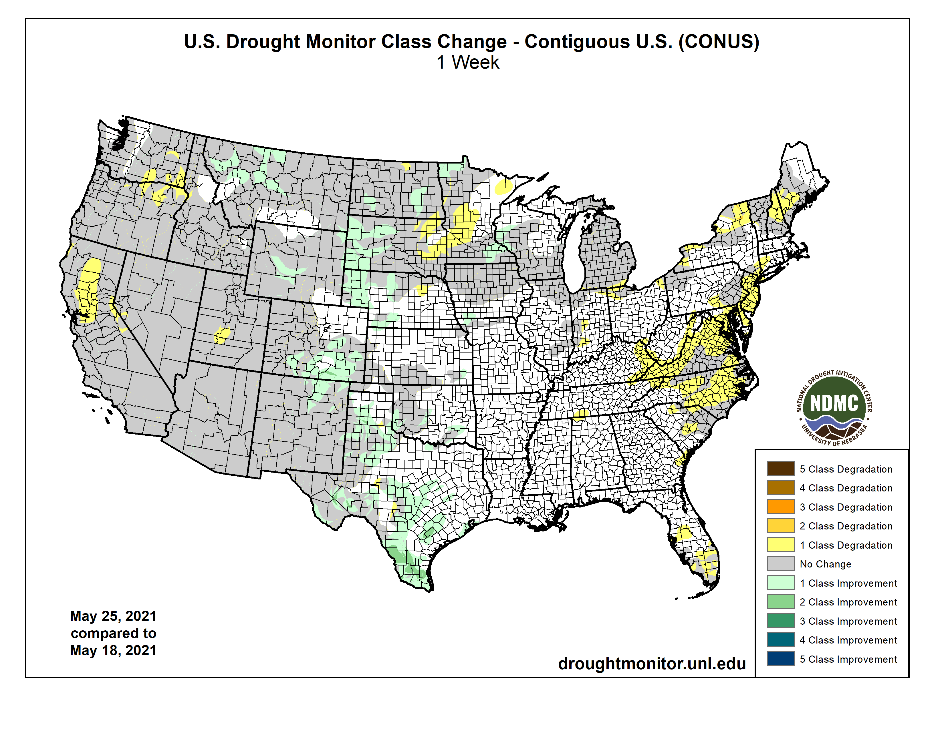
Here’s the US Drought Monitor one week change map ending May 25, 2021.