The health of our waters is the principal measure of how we live on the land — Luna Leopold
The river of lost flows: Is the #AnimasRiver drying up? A look back at the dwindling last century says yes — The #DurangoTelegraph #SanJuanRiver #ColoradoRiver #COriver #aridification
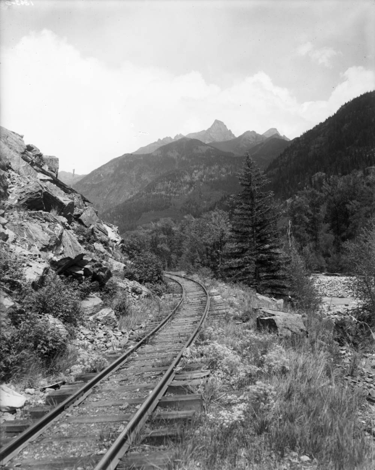
View of Denver and Rio Grande (Silverton Branch) Railroad tracks and the Animas River in San Juan County, Colorado; shows the Needle Mountains. Summer, 1911. Denver Public Library Special Collections
The American West is stricken by drought. That is not news. For the past 20 years, moisture levels have been abnormally low in the region. Shriveling crops, raging wild fires and diseased forests are just some of the fallout. Now scientists fear we may be on the verge of a megadrought – a long-lasting period of greatly reduced moisture. The last megadrought was in the 1500s and lasted some 50 years. Past megadroughts were naturally occurring. Their causes are complex and not completely understood. What scientists do understand is that the present drought has been worsened by anthropogenic (human caused) warming. That’s right, our old friend global warming has worsened our present drought by 30-50 percent. How bad could it get? The past 20 years contends with any 20-year period in the last 1,200 years for the severity of drought. That is some bad news.
The San Juan Basin drainage has been especially hard hit. The Animas River shows decreased flow not for the past 20 years, but for the past 30 years, since the early 1990s. In fact, discounting the abnormally wet 1980s, the Animas River has been steadily losing flow since the beginning of record keeping in the 1890s. The history of a single river graphed on a chart is notoriously hard to plumb for trends. Too many years buck the norm presenting a confusing welter of peaks and troughs. But dive deep enough and the evidence is there. The Animas River is not doing well.
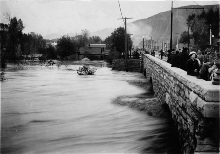
Durango flood of 1911 river scene. Photo credit Center of Southwest Studies, Fort Lewis College.
On Oct. 5, 1911, after days of heavy rain, the Animas River came roaring out of its banks. It peaked at 25,000 cubic feet per second (cfs) which was 11 feet deep measured at the station near the power plant. The water reached the top of the arches on the Main Avenue Bridge. The monster runoff of 1911 set the record –since records have been kept – for peak run off of the Animas. Jump ahead to 1927 – a freakish combination of late snow melt and an early monsoon rain June 27, 1927, lashed the river to its second-highest historical level: 20,000 cfs and 9.65 feet…
Peak flow is flashy. It makes stunning photographs. It puts people on the river and pictures in the paper. But it’s a flighty thing, much like spring itself. Peak flow does not water crops or nurture cities. That measurement is annual discharge – which is measured in thousand acre feet, or k/a/f…from 1913-25, the average annual discharge was 750 k/a/f, that’s three-quarters of a million acre feet per year.
Our second period of increased annual discharge is 1941-1950 when the average annual discharge was 665 k/a/f. In our third period, 1979-88, average annual discharge ticked upward to 700 k/a/f, a period that has not been matched for the last 80 years.
For comparison, from 2010-19 the average annual flow of the Animas dropped to 496 k/a/f, a staggering 34 percent decline from the average flow a century ago. If scientists are correct – and we are entering another megadrought, aided and abetted by global warming – the future of the Animas appears grim.
In the past Durango survived the loss of its smelter. A present controversy over the coal-fired train continues to tear at the town. What is Durango’s future with an Animas River reduced to the size and ferocity of an irrigation ditch? How does that impact Durango’s self-image? Where then will lie the soul of el Rio de las Animas Perdidas? Along a dry river bed?
One thought on “The river of lost flows: Is the #AnimasRiver drying up? A look back at the dwindling last century says yes — The #DurangoTelegraph #SanJuanRiver #ColoradoRiver #COriver #aridification”
Consider impact of Vallecito Dam 1941, and Lemmon Dam 1963.


Consider impact of Vallecito Dam 1941, and Lemmon Dam 1963.