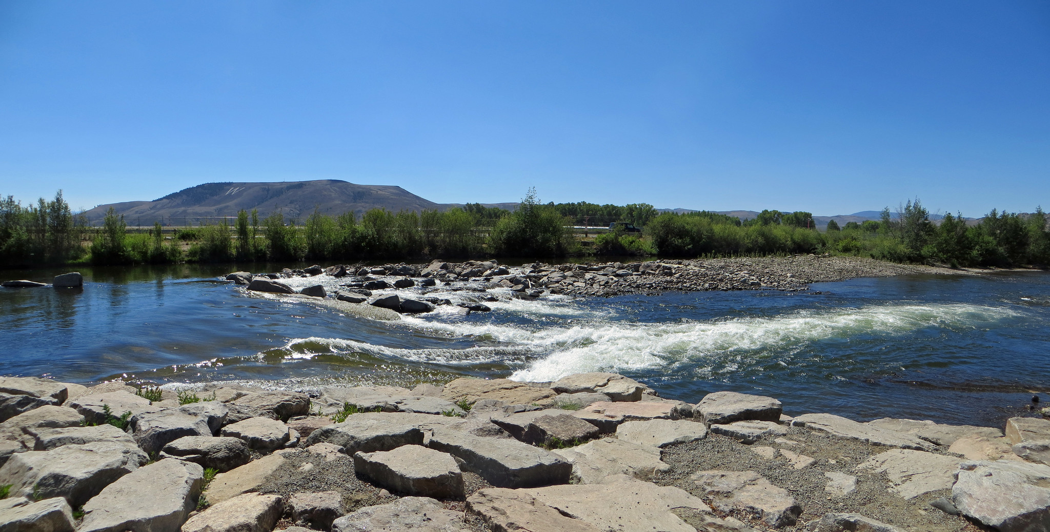
Gunnison Waves and other river users have asked local leaders to add a waveshaper to the whitewater park — a device that is prized by surfers for its ability to create a consistent wave when flows vary along the river.
Gunnison County, along with the Upper Gunnison River Water Conservancy District, are collecting feedback from local surfers and other river users on proposed improvements at the Gunnison Whitewater Park. Conceptual plans include moving and replacing the second wave or “Drop #2,” and adding an adjustable waveshaper. Although a waveshaper is widely supported by the river community, county staff are still exploring its feasibility due to staffing issues and added costs.
McLaughlin Whitewater, the design and engineering firm the county works with to assess conditions at the park, has been monitoring Drop #2 yearly since wave three was rebuilt in 2015 due to scouring underneath. According to project manager Ben Nielsen, although the current condition of Drop #2 does not pose a safety risk to surfers, it is worsening and following the same trajectory as wave three.
Jason Lakey, one of the original founders of Gunnison Waves, said the drop first shifted in 2019 after a big snow year. Users began to notice a decrease in the waves performance in 2020, where waves were harder to catch and stay in, he said.
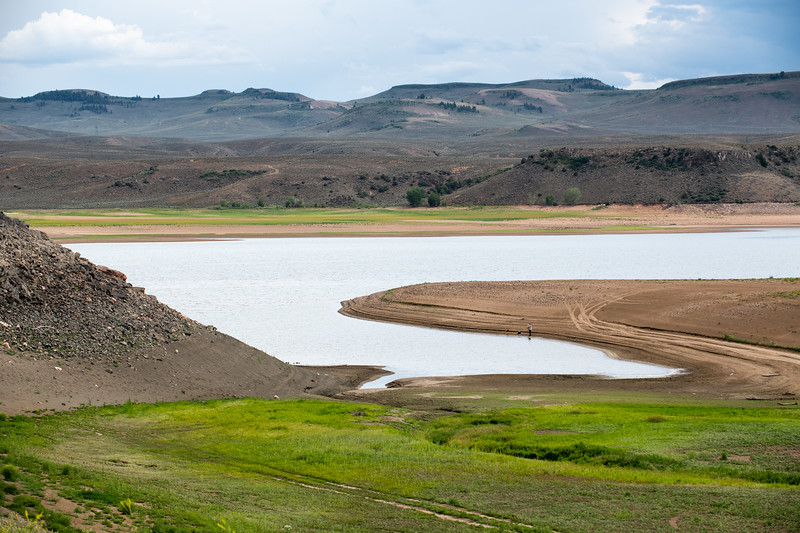
Blue Mesa Reservoir is the largest storage facility in Colorado in the Upper Colorado River system. Prolonged drought and downriver demand is shrinking the reservoir. Credit: Tom Wood, Water Desk
Click the link to read the article on the KUNC website (Luke Runyon and Alex Hager). Here’s an excerpt:
Colorado’s water shortages are not relegated to the distant future. Water supplies cannot meet current demands in many communities, and are only likely to worsen as climate change heats up and dries out the state’s cities and farms. That message is front and center in the Colorado Water Conservation Board’s first draft of a comprehensive update to the Colorado Water Plan, originally passed in 2015. Its initial creation was spurred by then-governor John Hickenlooper.
The plan anticipates a supply-demand gap of 240,000 to 740,000 acre-feet for cities and industries by 2050…For agricultural users, shortages are already a way of life. The plan projects that an existing shortfall of 2.6 million acre-feet for farmers and ranchers could increase to 3.5 million acre-feet by the middle of this century.
The plan is candid about the harsh effects of climate change, and the likelihood that Colorado’s water future will be shaped by warming and drying patterns. This includes acknowledgements of “aridification” – the idea that the West is not just experiencing the normal ebb and flow of drought, but instead becoming permanently drier. Climate scientists broadly agree that rising temperatures are driving a batch of changes that result in a shrinking water supply for much of the Southwest.
Today, the Colorado Water Conservation Board (CWCB) released the draft update of the Colorado Water Plan for a 90-day public comment period. The plan, originally developed in 2015 under the direction of Governor John Hickenlooper, is meant to address growing water scarcity in Colorado and ensure the state has a sustainable water future that meets the needs of a wide range of water uses by all Coloradans. In response to the release of the updated plan, Water for Colorado has issued the following statement.
“We appreciate all of the hard work by CWBC staff and board members and Department of Natural Resources to prepare a draft update to the Colorado Water Plan. We have already begun our thorough and detailed review and we look forward to providing comments. Our coalition was founded seven years ago to help influence the development of the 2015 Water Plan through providing technical review and driving civic engagement. We will submit comments and engage in a robust conversation with stakeholders on how we can best protect Colorado’s watersheds and rivers for all Coloradans and for future generations. We look to this Water Plan update to improve water security throughout the state by equitably addressing many of our watershed and water conservation needs.
This revision of the Colorado Water Plan will certainly play an important role in advancing our water goals throughout the state. But it alone will not be sufficient to meet the growing water challenges we face. This was further emphasized by recent statements by federal officials about the need for substantial water reductions by all states and in all water sectors to avoid critically low levels in the Colorado River basin’s largest reservoirs. Worsening hydrology and increased demands placed on dwindling water resources guarantee that additional, urgent actions will need to be taken to ensure a secure water future for Colorado. Governor Polis has called 2022 the “year of water” for Colorado, and we look forward to working with Governor Polis and his administration, other elected officials, Basin Roundtables, and communities on the critically important issues facing our state in 2022 and beyond. We must meet this pivotal moment in a way that positions Colorado as a leader in collaborative water management — our state’s future depends on it.”
The coalition has spokespeople available for comment now and in the coming 90 days, during which both partner organizations and the public have a vital opportunity to ensure that their voices are heard, that their interests are considered, and that Colorado’s water plan is truly that — a plan for the entire state.
Pathfinder Dam part of the North Platte Project (originally the Sweetwater Project) is an irrigation project in the U.S. states of Wyoming and Nebraska. The Interstate Canal is part of the project. By Josh Hallett – originally posted to Flickr as Pathfinder Dam – Wyoming, CC BY-SA 2.0, https://commons.wikimedia.org/w/index.php?curid=4171115
From email from Governor Gordon:
Governor Mark Gordon has mobilized the Wyoming National Guard and multiple state agencies to provide assistance to the residents of Lingle and Goshen County in response to flooding that is occurring as a result of a breach in the Interstate Canal north of Lingle.
“I want to thank our state agencies for their quick response to this concerning situation and I praise them for their hard work and dedication to help minimize the impact on our citizens and communities there. Thanks to the quick and competent response from our state agencies, including the Wyoming Office of Homeland Security and the State Engineer’s Office, we were able to rapidly respond to the situation.
At my request, Secretary of State Buchanan is on the ground to personally survey the scope of the damage and to ascertain what resources are needed to help the citizens of Goshen County. Secretary Buchanan has reported the local folks are working together to sandbag the canal. As I have said many times before, I am proud of our Wyoming people who do what they do best—helping neighbors.
My office has been in contact with Governor Ricketts of Nebraska, as the majority of the water in the canal flows to our neighbors in Nebraska. We will continue to communicate with Nebraska officials as we work to resolve the issue.” Gov. Gordon said.
After Goshen County Commissioners issued an emergency declaration, the Governor activated the Wyoming National Guard to place 1,000-pound sandbags in the breach. The Laramie County Fire Authority assisted the State by transporting the sandbags to the site of the canal breach.
Staff from the Wyoming Office of Homeland Security, the State Engineer’s Office and county officials immediately traveled to the site to assess the situation. The Wyoming Public Service Commission is working with utilities. Water was promptly diverted from the canal at the Whalen Diversion Dam and parts of Lingle were evacuated. Early estimates determined that water levels would begin receding around 2 p.m. this afternoon. However, water is expected to continue flowing for the next twelve hours, as the canal was full prior to diversion.
There comes a phase in almost any large-scale, controversial project on public or private land when the questions arise and the lawsuits begin. The proposed Uinta Basin Railway (UBR) is no different.
Everything about the venture is large-scale, from its nationwide scope to potential global impacts. Although the UBR, at 88 miles, is considered a “short line,” it would create a new link in the oil supply chain connecting the vast, fracked-oil fields in northeast Utah’s Uinta Basin to the national rail network, passing through Glenwood Canyon on its way to the refineries on the Gulf Coast. The UBR, approved by the Federal Surface Transportation Board (FSTB) in late 2021, would provide enough transportation capacity to increase oil production in the Uinta Basin from between 80,000 and 90,000 barrels per day (B/D) currently to 350,000 B/D — essentially quadrupling output.
The increase in CO2 from expanding Uinta Basin production would come at a time when scientists around the world are sounding an alarm. In 2022, the Intergovernmental Panel on Climate Change stated that global greenhouse gas emissions must peak by 2025, drop by half by 2030 with net-zero CO2 emissions by 2050 to avoid catastrophic and possibly irreversible climate changes.
Combined CO2 emissions from the estimated fracked-oil operations in the Uinta Basin as result of the UBR and end-product combustion range from about 20 to 55 megatons per year, which, at the high end, is equal to about 1% of the U.S. or 17.5% of the United Kingdom CO2 output in 2020.
The Uinta Basin is shown on this map, along with existing rail terminals in Carbon County, Utah, where limited amounts of the basin’s waxy crude is loaded into train cars. A proposal to create a direct rail link to the basin would provide shippers with enough transportation capacity to quadruple output.
Salt Lake City refineries at capacity
The type of oil found in the Uinta Basin is tricky to transport and difficult to refine. Called “waxy crude” because of its high paraffin content, it solidifies at about 100 degrees Fahrenheit. The Utah Department of Environmental Quality states that it must be “heated in the field and transported in insulated trucks.”
As explained by Adam Sayres, president of Axia Energy II, which operates in the Uinta Basin, Uinta crude is like Chapstick. He gave a detailed presentation to the Board of Trustees of Utah’s School & Institutional Trust Lands Administration (SITLA) in May 2018, stating that the crude is liquid underground at about 225 degrees, but once it hits the surface, it has to be kept in heated tanks at 180 degrees. Then, it’s loaded onto insulated trucks that head for Salt Lake City refineries, about 150 miles away.
According to Matt Sands, host of the Mineral Rights Podcast, in 2019, those refineries had a total production capacity for 189,000 B/D but only about 88,000 B/D for Uinta Basin waxy crude. Salt Lake City was declared a nonattainment area by the Environmental Protection Agency for air-quality standards twice in one decade — in 2009 for fine particulate matter and in 2015 for ozone — which proved problematic for those wanting to increase Uinta Basin waxy-crude production. “Production has had to mirror the refining capacity,” Sayres told the SITLA board.
Bryce Bird, director of the Utah Division of Air Quality, told Aspen Journalism that ozone levels have not improved and emissions from all refining operations are capped due to air-quality concerns. “Without getting permit changes or offsetting emissions, the refineries cannot increase production,” he said.
Wendy Park, an attorney for the Center for Biological Diversity, a conservation group opposed to the UBR, said Uinta Basin oil producers are locked into the Salt Lake City refinery market, which gives the refineries a distinct advantage. “The Salt Lake City refineries can ask for a discount because there isn’t much competition for this waxy crude oil, [since companies] can’t get it to other customers,” she said. “The increase in markets for Uinta Basin crude would allow oil producers to charge higher prices, which would spur increased drilling.”
The only way to increase production in the Uinta Basin is to refine the waxy crude somewhere else. Proponents of the UBR say the best way to do that is to link the Uinta Basin by rail to the national rail network, near Price, Utah, and take that crude to Gulf Coast refineries that can handle it.
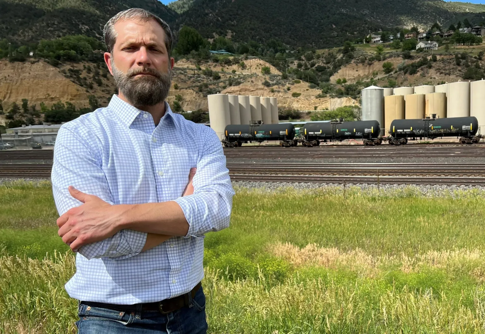
Glenwood Springs Mayor Jonathan Godes near the Union Pacific rail yard just west of downtown. Godes is opposed to oil trains from the Uinta Basin coming through Glenwood Springs.
Oil trains would go through Colorado
The UBR promises to add from three to 10 oil trains daily to the national railway running through Colorado. The trains would share the tracks with Amtrak and freight haulers, winding through Glenwood Canyon and up through the Moffat Tunnel before descending to Denver and then east and south. The waxy crude would be shipped in heated unit cars — approximately 110 cars per train with the capacity to carry about 642 barrels in each car.
Communities along the Colorado route, including the city of Glenwood Springs, have written to U.S. Sens. Michael Bennet and John HIckenlooper against the UBR, citing concerns about air quality, wildlife, water and public safety. Glenwood Springs Mayor Jonathan Godes told Aspen Journalism that an accident or spill in Glenwood Canyon would be disastrous all the way to the Sea of Cortez. “To say it’s a far-fetched possibility, I think, is to ignore reality,” he said. “If that waxy crude that’s heated in order to stay viscous spills into our watershed and into the Colorado River, it would be a massive cleanup where they would have to remove tons of soil and debris.”
Eagle County officials, who are party to a lawsuit challenging the FSTB’s December approval of the UBR, have also voiced concerns that the long-dormant Tennessee Pass rail line would be revived as an alternate route for the oil trains should the national rail network through Colorado — particularly the Moffat Tunnel — become crowded.
Texas-based Rio Grande Pacific Corp (RGPC), which plans to build and operate the UBR, also owns Colorado, Midland & Pacific Railway (CMP), which, in late 2020, attempted to lease a portion of the Tennessee Pass line from UP for possible commuter/passenger service and freight options, and applied for fast-track approval from the FSTB. RGPC made a point of stating that it “has no plan to operate oil trains over Tennessee Pass.” RGPC even went so far as to amend its plan a week before the FSTB made its decision, requesting restriction from hauling crude oil, coal and hazardous materials in the proposed lease.
But Eagle County Commissioner Matt Scherr is not convinced. “There is no way they can commit to that,” he told Aspen Journalism. “They are not allowed to officially make a promise that [they] will not do some sort of activity on a line that has a general practice of moving freight.”
The FSTB denied the application — and, by extension, RGPC’s proposed amendment — on March 25, 2021, for a variety of reasons, including public opposition and RGPC’s apparent rush to get it done. But the decision left the door open for CMP to reapply with a more comprehensive impact review and a full application process. “So, the proposal could come back,” said Park.