Lees Ferry streamgage and cableway downstream on the Colorado River, Arizona. (Public domain.)
September 21, 1923, 9:00 a.m. — Colorado River at Lees Ferry. From right bank on line with Klohr’s house and gage house. Old “Dugway” or inclined gage shows to left of gage house. Gage height 11.05′, discharge 27,000 cfs. Lens 16, time =1/25, camera supported. Photo by G.C. Stevens of the USGS. Source: 1921-1937 Surface Water Records File, Colorado R. @ Lees Ferry, Laguna Niguel Federal Records Center, Accession No. 57-78-0006, Box 2 of 2 , Location No. MB053635.
Click the link to read the article on the KUNC website (Luke Runyon). Here’s an excerpt:
State engineer Kevin Rein oversees the state’s water rights system. In a meeting with the Colorado River District board on Jul. 19, Rein assured members he would not be mandating conservation among their municipal, industrial and agricultural users. The district covers 15 counties in Western Colorado.
“There is nothing telling me to curtail water rights. There’s nothing telling me that I should encourage people to conserve,” Rein said…
Colorado officials have argued the blame for the river’s supply-demand imbalance rests with California, Arizona and Nevada. Some doubt the federal government’s authority to demand the states use less water. The 1922 Colorado River Compact, a document that inflated available water within the entire basin, apportioned 7.5 million acre-feet of water to the river’s Upper and Lower Basins, respectively. In recent decades Lower Basin uses have exceeded that amount, while Upper Basin uses have remained below the apportionment.
“We’re way under our allocation of 7.5 million acre-feet a year,” Rein said. “So what does that mean? ‘We need to conserve.’ To me, that means that we don’t change our administration at the state engineer’s office.”
Rein said he has mandated water use reductions in other Colorado watersheds under the compact administration legal process. But the Colorado River has avoided that fate so far, he said. Without a solid legal basis, Rein said his hands are tied.
“If you have a beneficial use for water and you have a right to water and the right is physically and legally available, then I would encourage people to use your water right. It’s a public resource. It’s a property right. It’s part of our economy. It’s part of your livelihood,” Rein said.
“Somebody might tell me I’m wrong someday, but right now, I don’t see a legal basis for asking people to curtail,” Rein said…
Colorado River District general manager Andy Mueller said he wanted to know how the federal government was planning to tighten how it accounts for water use in the Lower Basin, including evaporation from reservoirs, a longtime complaint of Upper Basin leaders.
“It is extremely frustrating to see system water utilized for the benefit of the three Lower Basin states and us taking a hit for it. And now we are for the first time, frankly, about to be injured by it,” Mueller said.
Upper Basin leaders have resisted calls for specific amounts of conservation on the Colorado River. In a plan released last week, the four Upper Basin states — Colorado, Wyoming, New Mexico and Utah — instead call for the reinstatement of a conservation program that paid farmers to forgo water supplies, first tested in 2014.
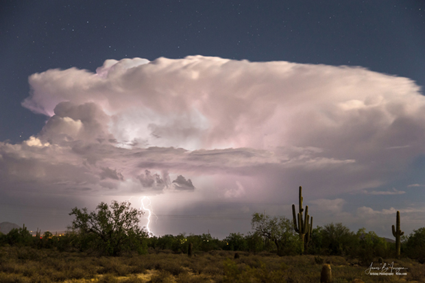
Arizona monsoon cloud with lightning striking the beautiful Sonoran desert in North Scottsdale. Photo by James Bo Insogna. Title: Arizona Monsoon Thunderstorm. Taken on August 15, 2016. Used under a Creative Commons license.
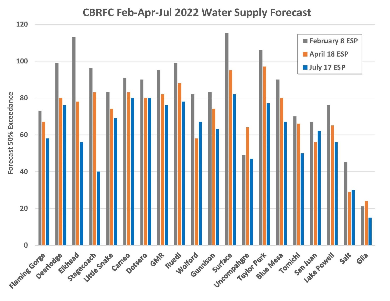
Don Meyer, Sr. Water Resource Specialist, and Dave “DK” Kanzer, Director of Science and Interstate Matters, gave a thorough hydrological report to the Board on July 20th. Their report focused on the current, productive monsoon cycle, storage in local reservoirs, and the low flows and high water temperatures observed in the Upper Colorado River headwaters.
Monsoons
“We’ve been enjoying some moisture from this monsoonal flume,” said Meyer. “It seems almost weekly.”
These frequent, often fast-moving bouts of moisture have improved soil moisture across the District and helped farmers and ranchers by also providing cloud cover which decreases evaporation and soil temperature.
“Is it helping with the overall drought conditions?” Kanzer asked. “Well, the answer is sort of. It’s not doing much for the Colorado River Basin system as a whole, but those afternoon rain showers have done wonders for our local water users.”
Reservoir Storage
Wet and cool conditions in April sustained the snowpack which also helped local reservoirs with water storage.
“The longer runoff is delayed, the more water ends up in the system,” Meyer said. “However, we are still below average.”
Water managers across the West Slope depend on higher flows during the spring runoff to fill reservoirs for release during hotter, drier months later in the summer. Healthy river ecosystems depend on high flows to flush sediment, however, so often larger amounts of water are passed during the natural runoff window to support fish health. Choosing how much and when to fill a reservoir of any size involves accounting for myriad variables. Accurate predictions and streamflow forecasts are an essential part of getting this balancing act right.
Meyer shared how Elkhead Reservoir, one of the two reservoirs managed by the River District, was a study in this complex process this summer. “Elkhead fill was a bit of a nail-biter this year.” Meyer said. “We were operating to reduce downstream erosion. To do this we try to store peak flows and release a lower, steadier amount of water, but we had some issue with the forecasts. In early May, we realized that we weren’t going to get those big, forecasted peaks, so we had to quickly reduce releases. Incorrect forecasts were really detrimental.”
No forecasts for streamflow or storage on the West Slope are above 80% for this summer.
“We often talk about the importance of accurate science and forecasts,” said Andy Mueller, General Manager of the River District. “Not having accurate data does have major impacts for the health of streamflow and the human communities.”
Director Kathleen Curry from Gunnison County shared the dire conditions facing Blue Mesa Reservoir which is barely half full after last year’s Drought Operations release to Lake Powell and this year’s unimpressive runoff.
“The whole system is really stressed.” Curry said. “Blue Mesa is filled with algae, and the river above that is warm and bright green. The fish from the 15-mile reach are so stressed, they are coming up the Gunnison to just below the Redlands Canal. It’s become very difficult for the system to meet all the needs.”
The 15-mile reach is a section of the Colorado River where streamflow in the summer is reduced by more than half due to agriculture and municipal diversions in Grand Valley.
High Water Temperatures
“This is a tale of two years,” said Meyer “In 2021, we had some really hot, unusual temperatures. Last year it was in June, and this year, they were just as bad, but came later in July.”
In mid-July, temperatures in the Colorado River between Kremmling and Catamount (two USGS gages which provide data on streamflow, water temperature, dissolved oxygen and particulate matter) indicated that the water temperature was well outside a healthy range for fish. In response to the spiking temperatures, Colorado Parks and Wildlife issued multiple voluntary fishing closures not only for stretches of the Upper Colorado River, but also for sections of the Eagle, Roaring Fork, Fraser, and Yampa Rivers to protect already-stressed, cold-water fish like trout.
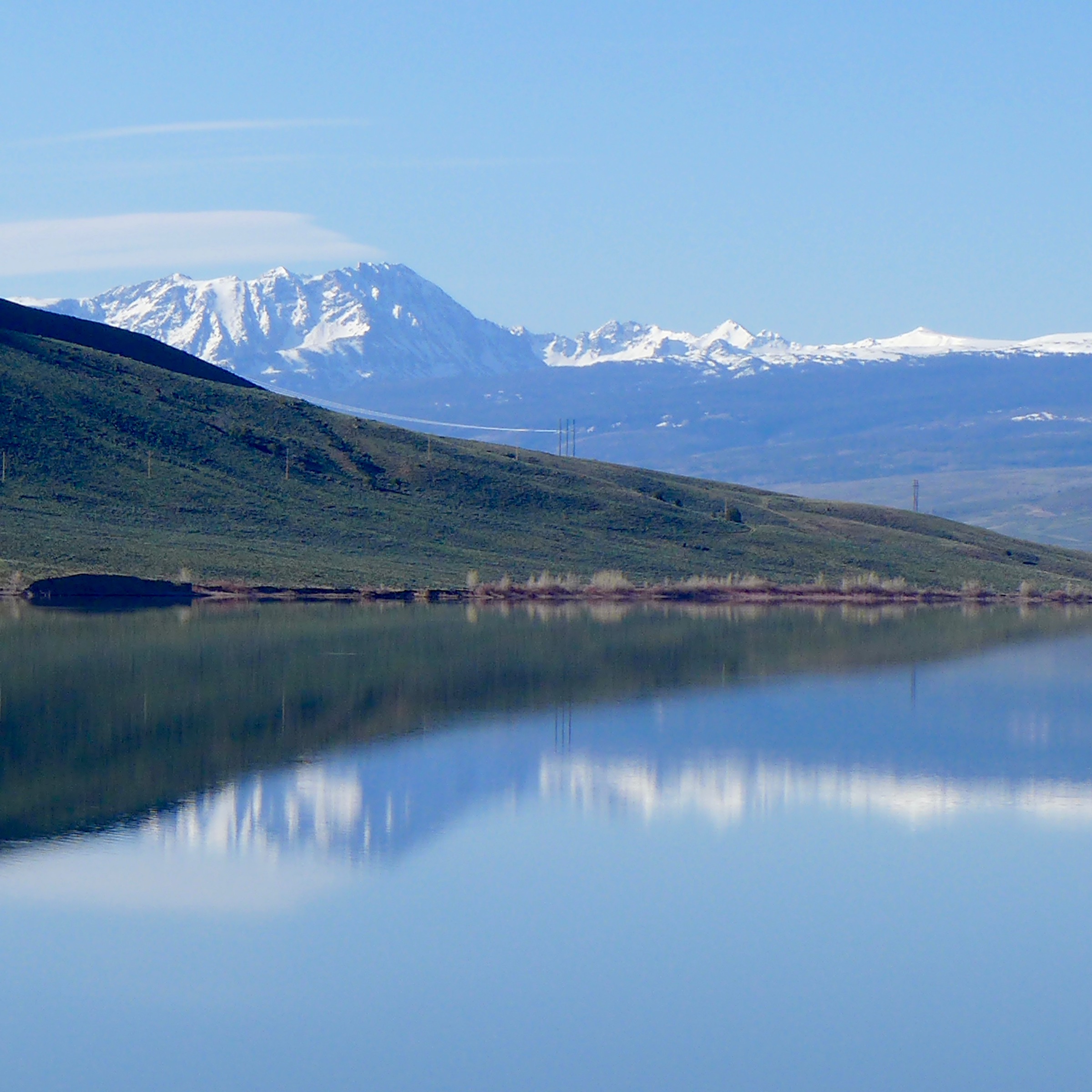
Wolford Mountain Reserovir, and the Gore Range. Photo: Brent Gardner-Smith/Aspen Journalism
Anticipating these conditions, the Colorado River District chose to release approximately 200 acre-feet of water from Wolford Mountain Reservoir. The low streamflow conditions are due in part to climate change and earlier, hotter summer temperatures, inaccurate streamflow forecasts, and trans-basin diverters who continue to fill their reservoirs regardless of the hydrological conditions on the Western Slope.
“The issue is not our ag producers,” said Andy Mueller, General Manager of the River District. “The issue is that Front Range diverters continue to take their water no matter what the snowpack looks like. Streamflow drops, raising the temperature of the river and damaging the fish health and the economy of the West Slope.”
Marc Catlin, Director from Montrose County shared his perspective as well. “There is no one at this table who is doing as well as they are. They divert 100% of their right now matter what, no matter what the snowpack.”
According to Brendan Langenhuizen, Director of Technical Advocacy, local anglers and residents of Grand County were deeply appreciative of the District’s efforts to lower water temperatures. “I’ve received several voicemails. One was from an angler in the Vail Valley. He talked about the real economic impacts due to high water temperatures. Once the fishing closures go into place, they can’t run their business.”
Gallinas River watershed. Map credit: Hermit’s Peak Watershed Alliance
Click the link to read the article on the KOAT website (Nick Catlin). Here’s an excerpt:
Las Vegas is relying solely on its reservoirs to supply water, but it currently contains less than 50 days of water. Las Vegas normally relies on the Gallinas River as its primary water source. However, the Hermits Peak/Calf Canyon fires damaged thousands of acres of the watershed for the river. The city said the fires have caused large amounts of ash and debris to enter the river, preventing Las Vegas from pulling from its primary water source.
Click the link to read the in-depth article on the Colorado Springs Gazette website (Mary Shinn). Click through for the whole article and to view the photo gallery. Here’s an excerpt:
The same uncertainty facing [Nancy] Caywood’s family farm in Pinal County is widespread across the Colorado River basin following a Bureau of Reclamation announcement the seven states reliant on the river, including Colorado, need to conserve an additional 2-million to 4 million acre-feet of water next year to preserve the integrity of the stricken system, including power production in Lake Powell and Lake Mead. Colorado Springs Utilities relies on the river for 70% of its water and so it’s possible the community could be asked to conserve more as the whole basin tries to balance the needs of farms, cities and industry. Utilities has not received any clear direction from the state or other agencies yet and is not expecting much change next year, Kalsoum Abbasi, Utilities’ planning supervisor for water conveyance, told the board in July…
On Colorado’s Western Slope, growers with more junior rights have faced drought-driven uncompensated cutbacks and shutoffs in recent years and officials with the Colorado Water Conservation Board say that’s why major cuts to meet the Bureau’s goals should come from the Lower Basin states, such as California. Upper Basin states Colorado, New Mexico, Utah and Wyoming cut 1 million acre-feet of water use between 2020 and 2021 because of the drought conditions. The board did not have an estimate of how much had been cut in Colorado alone.
“Our water users are already really, really cut back,” said Amy Ostdiek, chief of the interstate, federal and water information section for the conservation board. For example, the Ute Mountain Ute Tribe in Southwest Colorado fallowed more than 4,000 acres because of drought conditions…
However, Colorado and the other Upper Basin states could achieve greater water savings by paying growers to leave land unplanted, a step known as demand management. Colorado policy makers want to avoid policies that permanently remove water rights from farmland, a practice known as buy and dry. The Upper Basin states said in a recent letter to the Bureau of Reclamation they would “consider” implementing demand management to meet the bureau’s goals. The bureau’s call for millions of acre-feet in conservation followed the first-ever Tier 1 cutbacks on the river that hit the Central Arizona Project hard this summer, showing how water shortages can play out…
Aerial photo – Central Arizona Project. The Central Arizona Project is a massive infrastructural project that conveys water from the Colorado River to central and southern Arizona, and is central to many of the innovative partnerships and exchanges that the Gila River Indian Community has set up. Public Domain, https://commons.wikimedia.org/w/index.php?curid=326265
As part of the Central Arizona Project deal, Arizona “would suffer losses before California would have to give up one drop of water,” said University of Arizona Professor Jeff Silvertooth, who has researched the profitability and sustainability of Southwest agriculture. “They never envisioned the possibility of what we are experiencing today.”
Climate change has heightened the problem. While the basin has seen droughts with similar levels of low precipitation in the past, higher average temperatures further stress the environment, said Russ Schumacher, state climatologist…
…the Central Arizona Project’s regular supply was cut by 30%, or about 500,000 acre-feet this year. The project cut agricultural deliveries by 65%, while urban areas received their full water deliveries. The cuts left farmers who are reliant on the canal to fallow large portions of land in Pinal County, near Caywood’s farm…While Central Arizona Project users are among the most junior on the river, Yuma, Ariz., a powerhouse of leafy green vegetable production, and Mesa County in Colorado, famous for Palisade peaches, are among the most senior. Still, some of those users have made water conservation changes…
Colorado utilities support new approaches to conservation, because water saved by the Lower Basin can help preserve the levels in Lake Powell, said Todd Hartman, a spokesman for Denver Water. More study is needed to see how useful the N-Drip system would be in Colorado…Max Schmidt, with the Orchard Mesa Irrigation District, said he expects water will have to leave the Western Slope to meet cities’ needs. He noted that in the Grand Valley, development typically happens on less productive farmland that already has water rights. But on the Front Range development has relied heavily on water from other basins.
Orchard Mesa Irrigation District power plant near Palisade. Water from Colorado’s snowpack is distributed across the region through a complex network of dams, pipelines and irrigation canals. Photo credit: Orchard Mesa Irrigation District
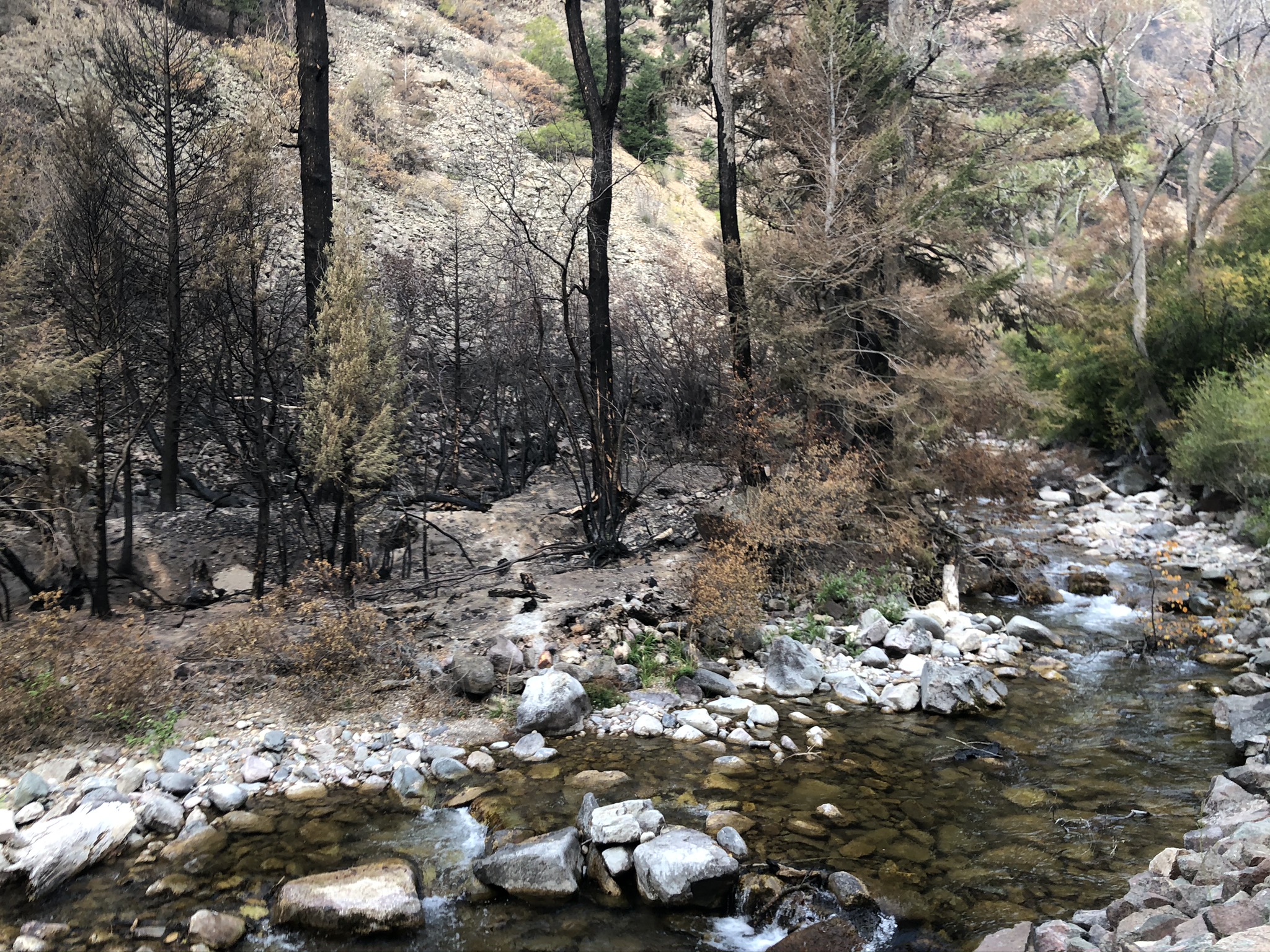
Turbidity in the Colorado River is dropping to levels previous to major wildfires and mudslides that roiled Glenwood Canyon in 2020 and 2021, Silt Public Works Director Trey Fonner said…Whenever loose rock and dirt unearthed from heavy rainstorms barrel into the Colorado River — the main source of drinking and agricultural use for Silt, Rifle and Parachute — sediment increases. The measurement is called turbidity…Turbidity levels rose after the Grizzly Creek wildfire consumed more than 32,631 acres within Glenwood Canyon in 2020 and after a rare, 500-year rain event in summer 2021 caused massive debris flows in the same area…
Middle Colorado Watershed Council Executive Director Paula Stepp said one of the ways to mitigate turbidity relies on new measurement devices installed up and down the Colorado River. With water quality monitoring stations established by the USGS in Garfield County, data collected from these sites are used to warn downstream users. Though Glenwood Springs’ primary water source isn’t the Colorado River, the city has water monitoring stations at Veltus Park on the Roaring Fork River and at the confluence of the Colorado and Roaring Fork Rivers near Two Rivers Park. Three other stations are located in South Canyon, Silt and Rulison…
Recently, Silt used $200,000 in American Rescue Plan Act funds to pursue an engineering study on how it can better its methods of pulling water from the Colorado River. That study concluded the city needed at least $30 million to not only combat turbidity levels but better serve its growing population. One way to pay for water and wastewater treatment improvements falls on the $1 trillion bipartisan infrastructure bill passed by Congress in November 2021.
Click the link to read the article on the Summit Daily website (Eliza Noe). Here’s an excerpt:
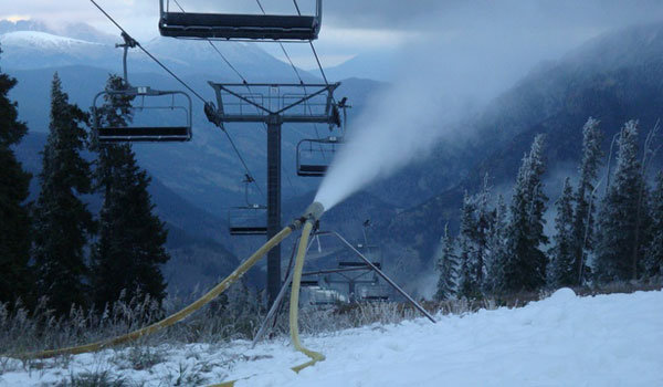
This week, Copper Mountain Resort kicked off its carbon sequestration study, and over the next 10 years, scientists and resort leaders are hoping that ski slopes can contribute to the fight against the effects of climate change. The resort hosted a conservation summit on Wednesday, where Copper officials discussed the goals of the project with other ski industry and environmental leaders. Jeff Grasser, efficiency manager for Copper Mountain, said efforts have already been made to increase biodiversity of the land, but this study would continue meeting sustainability goals. Carbon sequestration is the process in which carbon dioxide is removed from the atmosphere and held in solid or liquid form. In this case, it would be in the soil, where most of the world’s carbon is stored. Grasser said the resort has developed a scientific-based study to prove that their efforts actually help increase the amount of carbon dioxide being taken out of the air…
Grasser said currently, the goal is to offset one gram of carbon per square meter. That would be about 50 metric tons of carbon per year. Specifically, he said that he is looking forward to seeing if the study could offset the resort’s backup motors for lifts since those are run by fossil fuels and are tested regularly to make sure they are functioning. Though it would not happen overnight, Grasser said building more biodiversity could help reach that goal…
Jennie DeMarco, assistant professor at Southwestern University in Texas, is a scientist assisting on the project and said that, in her work, she focuses on nature-based solutions. By doing restoration projects, people can increase carbon storage and avoid greenhouse gas emissions. She said the key with nature-climate solutions is that they can be implemented in a lot of different ecosystems. They are cost effective, she claimed, compared to new carbon-capture technology.
Just like any major disturbance, ski slopes can disrupt or degrade soils, which makes them less likely to store carbon. One solution that this project will study is adding compost to certain areas to improve soil health and encourage more sequestration and plant growth.
This image was taken during the peak outflow from the Gold King Mine spill at 10:57 a.m. Aug. 5, 2015. The waste-rock dump can be seen eroding on the right. Federal investigators placed blame for the blowout squarely on engineering errors made by the Environmental Protection Agency’s-contracted company in a 132-page report released Thursday [October 22, 2015]
Click the link to read the article on the Durango Telegraph website (Jonathan Romeo). Here’s an excerpt:
With the recent news that the Environmental Protection Agency agreed to pay New Mexico and the Navajo Nation more than $63 million for damages related to the Gold King Mine spill, some Coloradoans are asking: What about us?
“I just always question, should we have been louder, because holy smokes, that’s a lot of money,” La Plata County Commissioner Matt Salka said. “And it is concerning when $60 million-plus goes to communities at the end of the river, yet (Durango and Silverton) were the most heavily impacted.”
[…]
The “Bonita Peak Mining District” superfund site. Map via the Environmental Protection Agency
After the plume passed by, the communities closest to the headwaters – Silverton and Durango – decided not to pursue litigation against the EPA. Instead, they chose to push for the cleanup of mines that pock the mountains around Silverton and have degraded water quality in the Animas River since the heydey of mining in the late 1800s, early 1900s. And indeed, in fall 2016, a collection of historic mines in the area, including the Gold King, received a Superfund designation with widespread local support…
Downstream communities in New Mexico and on the Navajo Nation, however, went a different route. New Mexico sued the EPA in May 2016, with the Navajo Nation following suit a few months later. The $63 million settlement, announced in June, is now under question by upriver elected officials.
“Those are funds I would have liked to see go to the actual source of the issue,” Salka said. “We should be addressing the Superfund site, making sure water quality is good and preventing another mine blowout.”
[…]
While the sheer sight of the spill alarmed even the most involved members of groups such as the Animas River Stakeholders Group (a now-defunct organization of volunteers dedicated to protecting the health of the river), the fact that a mine blew out near Silverton wasn’t a shock. It has happened many times over the years. Looking at the long view: roughly 5.4 million gallons of acid mine drainage leaches into the Animas each day, compared to 3 million in the one-time Gold King blowout. The spill, however, was the catalyst that finally secured a Superfund designation for the mines draining around Silverton. In the past, some community members objected that a Superfund declaration carried a stigma that would imperil the town’s tourism economy and destroy any possibility of reviving the local mining industry. But after the Gold King blowout drew national attention, there was no stopping the momentum, and the Bonita Peak Superfund site was established. It’s composed of 48 historic mining sites around Silverton that are the biggest culprits of metal loading…
Prior to mining, snowmelt and rain seep into natural cracks and fractures, eventually emerging as a freshwater spring (usually). Graphic credit: Jonathan Thompson
It should be noted New Mexico also reached an $11 million settlement with Sunnyside Gold, the last operating mining company in Silverton, and is still pursuing a lawsuit against the EPA’s contractor…
The orange plume flows through the Animas across the Colorado/New Mexico state line the afternoon of Aug. 7, 2015. (Photo by Melissa May, San Juan Soil and Conservation District)
On the Navajo Nation, a different case was made about the Gold King Mine spill. From a Native American cultural perspective, waters are sacred, and the disturbing sight of a bright orange San Juan River had a traumatic impact on tribal members (not to mention the history of environmental injustice on tribes throughout North America). According to media reports, some farmers on the Navajo Nation refused to use San Juan River water for years after the spill…
That’s not to say Silverton and Durango were shorted. Both governments received some reimbursement for dealing with the spill itself. The EPA built a $1 million water treatment plant that continues to operate at a cost to the EPA of $2.5 million a year. And, the agency has spent about $100 million to date on the Superfund site and expects to spend significantly more in the coming years…
Since the Gold King Mine spill happened, a lot of money has been exchanged (and not exchanged: the EPA, for instance, denied liability for $1.2 billion in private damages, such as rafting companies that took a hit during the river closure, lost wages for the tourism sector and alleged damage to crops and livestock). EPA’s Basile added a separate lawsuit settlement will have Sunnyside Gold pay $41 million to the federal government and $4 million to Colorado, all to be used on top of the federal government’s $45 million for the Bonita Peak site…At the end of the day, however, local officials say the best payout of all would be improved water quality in the Animas River watershed. Yet, Brookie said it does sting to see the dollar amount going to a New Mexico community that may not necessarily have a case for claiming they were impacted by the Gold King Mine spill.
Coyote Gulch’s rented Tesla charging in Green River, Utah.
Saturday was a long day as we drove from Denver to Mesquite, Nevada. The route was all on I-70 and I-15. The Tesla charging network makes traveling along the interstate network worry free. We charged in Glenwood Springs, Colorado and Green River, Richfield, and Beaver, Utah. At every stop other Tesla vehicles were charging. There was a line of vehicles waiting to charge in Glenwood Springs and the Richfield location with only four chargers was full.
Explorer John Wesley Powell and Paiute Chief Tau-Gu looking over the Virgin River in 1873. Photo credit: NPS
In Green River, Utah, while charging we spent time at the excellent “John Wesley Powell River History Museum” next door to Tesla’s supercharger facility. The museum is worth your time if you are passing through, interesting displays and of course many old photographs of the area and the Colorado and Green rivers, settler stories, etc.
In the late afternoon we drove into Monsoon storms in S. Utah culminating in a spectacular downpour as we drove through St. George, Utah into the Virgin River Canyon. I was thinking of the bad situation in Flagstaff, not all that far away as the crow flies.
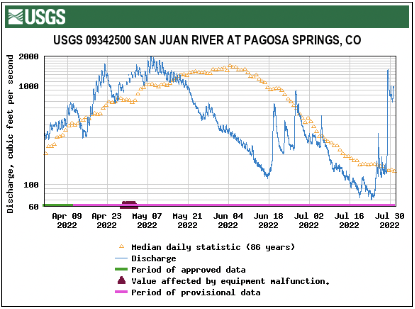
Stream flow for the San Juan River on July 27 at approximately 9 a.m. was 148 cubic feet per second (cfs), according to the U.S. Geological Service (USGS) National Water Dashboard. This is down from a nighttime peak of 191 cfs at 12:30 a.m. on July 27. These numbers are down from a recent peak flow of 328 cfs at 8:45 p.m. on July 25. However, flows are up from last week’s reading of 113 cfs that occurred at 9 a.m. on July 20.
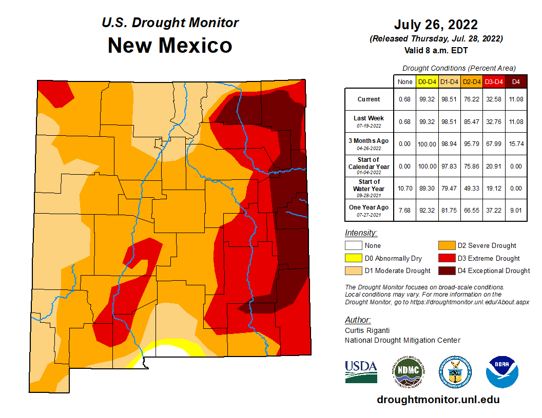
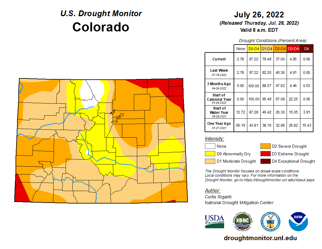
Colorado Drought Monitor map July 26, 2022.
The National Oceanic and Atmospheric Administration (NOAA) National Integrated Drought Information System (NIDIS) reports that 100 percent of the county is experiencing drought.
Although June 2022 was the second wettest June in 128 years, with 2.48 more inches of precipitation than normal, 2022 to date is the 33rd driest year in the last 128 years, with 2.84 fewer inches of precipitation than normal, according to the NIDIS. The NIDIS places the entire county in a moderate drought…The NIDIS also places 46 percent of the county, primarily the southern and western portions, in a severe drought.
Pagosa Springs Panorama. Photo credit: Gmhatfield via Wikimedia Commons
Click the link to read the article on the Pagosa Springs Sun website (Dorothy Elder). Here’s an excerpt:
The San Juan Water Conservancy District (SJWCD) Board of Directors saw the first draft of an Upper San Juan River Basin water supply and demand analysis at its July 25 meeting.
The analysis, conducted by Lakewood-based consultant Wilson Water Group (WWG), studied the supply and demand through 2050 in the Upper San Juan River Basin and was commissioned by the SJWCD. Presenting the results, Erin Wilson, principal at WWG, noted that the results are still a draft and that its findings could be revised or expanded depending on feedback from the board.
The goals of the analysis were to document “current and potential future demands for water from municipal, agricultural, and environmental and recreational users” in the region, as well as “identify options for meeting any potential shortages in water supply in the future,” Wilson stated. The “unprecedented growth” of the Town of Pagosa Springs and ongoing drought conditions of the San Juan region emphasize the importance of this study, Wilson explained…
These demands showed an average annual future shortage that ranges from around 4,100 acre-feet to 73,000 acre-feet in the analysis. Wilson clarified that the shortages incorporate the area’s current water storage capabilities. From these numbers, the analysis suggests potential Dry Gulch reservoir sizes that could meet the needs of the demand projections. The limiting factors in reservoir sizing are the legally and physically available water to fill the reservoir, the 50 cubic feet per second (cfs) filling constraint, and the demands driving reservoir releases, the analysis explains. The 50 cfs limit is based on the Dry Gulch Reservoir water right, and the Dry Gulch environmental flow stipulations have to be met when the reservoir is filling, Wilson explained.
“Note that because the annual high demand shortages are greater than water available for filling (limited by 50 cfs), the reservoir inflow cannot keep up with the reservoir releases; therefore, a reservoir cannot meet the high demand shortages regardless of size,” the report reads.
The recommendations for the reservoir size are 1,600 acre-feet to meet low demand and 10,000 acre- feet to meet mid-range demand. Wilson clarified these calculations are usable volume numbers, not the total volume of the reservoir. The report also offers alternatives to the construction of a reservoir that could potentially lessen shortages and meet demand projections. These include stream restoration, agricultural fallowing and improved forest health…Many of these potential solutions are experimental at this point, and the report suggests that SJWCD “continue to monitor on-going projects to see how the results could be applicable in the Upper San Juan basin.”
Overall, board members brought forward many suggestions to strengthen the report. This included a deeper analysis of wildfire resiliency, leaking issues with PAWSD and a more in-depth look at the need for a reservoir.
There was also a dispute over the 226 gallons per capita per day metric, which board member Joe Tedder thought sounded too high based on Colorado averages.
Wilson clarified the number is the region’s entire demand — commercial included — and not just household use.