Albuquerque, New Mexico — In late June, the mornings start out at 80 degrees but temperatures quickly soar past 100. Everywhere fields are brown and the high desert bakes in glaring sunlight. But there is one long, narrow corridor of green here: the Rio Grande.
Jason Casuga, CEO of the Middle Rio Grande Water Conservancy District, and Anne Marken, water operations manager, have been watching the river’s water gauges around the clock for days, knowing that entire stream segments below Albuquerque may go dry at any time. If rains come over the weekend, everyone will relax, at least for a while.
Side channels were excavated by the Bureau of Reclamation along the Rio Grande where it passes through the Rhodes’ property to provide habitat for the endangered silvery minnow. (Dustin Armstrong/U.S. Bureau Of Reclamation)
If that moisture doesn’t come, Casuga and Marken must move quickly to release to these dry stream segments whatever meager water they can squeeze from their drought-strapped system, giving the U.S. Bureau of Reclamation time to save as many endangered silvery minnow as they can from almost certain death.
“We only have so much time to start the drying operation,” Casuga said, referring to a practice where his district shifts water in its system so that Reclamation can rescue the fish before the stream goes completely dry and leaves them stranded to suffocate.
The Rio Grande Basin spans Colorado, New Mexico and Texas. Credit: Chas Chamberlin
“If we don’t do it, you might see 30 miles of the entire river go dry. It’s stressful. We’ve been doing this controlled hopscotching for weeks now.”
The Middle Rio Grande district, created in 1925, is responsible for delivering waters to farmers as well as helping the state meet its obligations to deliver water to Texas under the 1938 Rio Grande Compact. It coordinates management activity with Reclamation and the U.S. Army Corps of engineers on a river system that includes five major reservoirs and hundreds of miles of canals.
A crippled river
The district’s liquid juggling act is becoming increasingly common, and it is painful for everyone to watch, from the 19 tribes and six pueblos whose homes have lined its banks for thousands of years, to the 6 million people and 200,000 acres of irrigated lands that rely on the river across the three-state river basin.
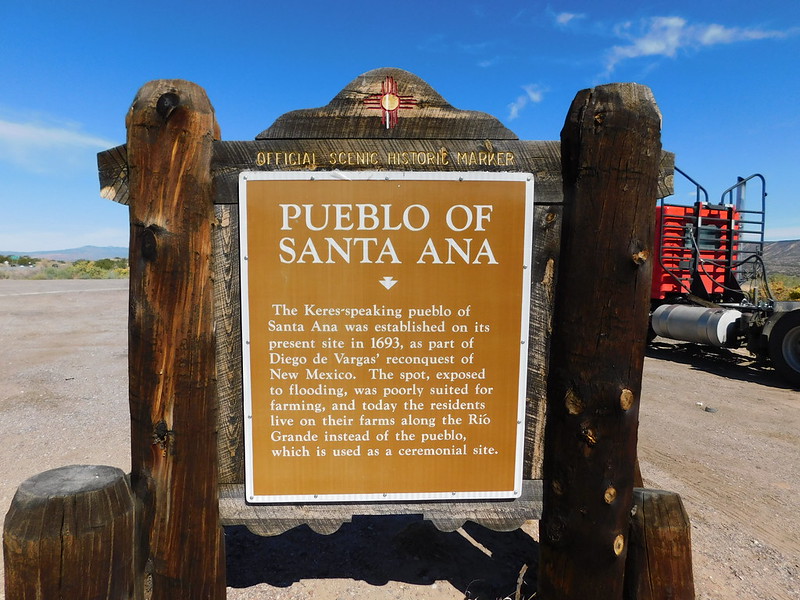
“The worry is heavy,” said Glenn Tenorio, a tribal member of the Santa Ana Pueblo north of Albuquerque, who also serves as the pueblo’s water resources manager.
The Pueblo of Santa Ana lies just north of Albuquerque on the Rio Grande. Credit: Creative Commons
Under the terms of the 1938 Rio Grande Compact, Colorado, New Mexico and Texas share the river’s flows before it reaches Mexico. They have watched drought cripple the river, with flows dropping by 35% over the last 20 years.
But unlike other Western states, in New Mexico water users share both supplies and shortages, and that’s a lesson other states might benefit from, experts say. In most Western states where the prior appropriation system, known as first-in-time, first-in-right exists, water users with younger, more junior water rights are routinely cut off in times of shortage, creating expensive, conflict-ridden water management scenarios.
Water scarcity grows
Still, in response to growing water scarcity, Texas sued New Mexico in 2013, alleging that groundwater pumping in the southern part of New Mexico was harming its own share of water in the river. After being heard briefly before a special master for the U.S. Supreme Court last year, the three states—Colorado is also named in the case—agreed to pause the lawsuit while they conduct mediation talks.
Want more background on the Rio Grande Compact?
Check out this fact sheet
Whether the talks will succeed isn’t clear yet. In addition to the groundwater dispute, New Mexico owes Texas roughly 125,000 acre-feet of surface water from the river and, under the terms of the compact, cannot store any water in its reservoirs until Texas is repaid.
But there is some hope emerging, as Colorado embarks on a $30 million land fallowing program to reduce its Rio Grande water use and as New Mexico seeks new federal rules that will allow it to store more water and re-operate its federal reservoirs.
Abiquiu Reservoir, in northern New Mexico, is one of several that are being drained by the mega drought. Credit: Mitch Tobin, Water Desk, March 2022
Page Pegram helps oversee Rio Grande river issues for New Mexico’s Office of the State Engineer. Unlike Colorado, New Mexico has never had the resources to quantify its various water users’ share of the river. Until now, the state has survived on healthy snowpacks and summer rains.
Though the drought has lasted more than 20 years, in the last five years, Pegram has seen the system deteriorate significantly.
“We’re seeing a fundamental change in water availability,” she said. “Suddenly, everything is different. Temperatures are higher, evaporation is higher, and soil moisture is lower. It’s new enough that we can’t pinpoint exactly what’s happening and we don’t have time to study the issue. It’s already happened.”
The headwaters of the Rio Grande River in Colorado. Photo: Brent Gardner-Smith/Aspen Journalism
In the beginning
The Rio Grande has its genesis in the lush high mountain tundra above Creede, Colo., flowing down through Monte Vista and Alamosa, making its way along Highway 287, crossing the Colorado state line as it flows toward Santa Fe and Albuquerque, then dropping down to the tiny town of Truth and Consequences before it hits the Texas state line. At that point it travels through El Paso and forms the border between Texas and Mexico until it hits the Gulf of Mexico.
It is in the headwaters region in Creede where the majority of its flows originate. And while the hay meadows outside Creede are lush, and the streams cold and full, water has become so scarce even here that if homeowners want to drill a water well, they have to buy water rights from elsewhere to ensure those farther downstream on the river have adequate supplies.
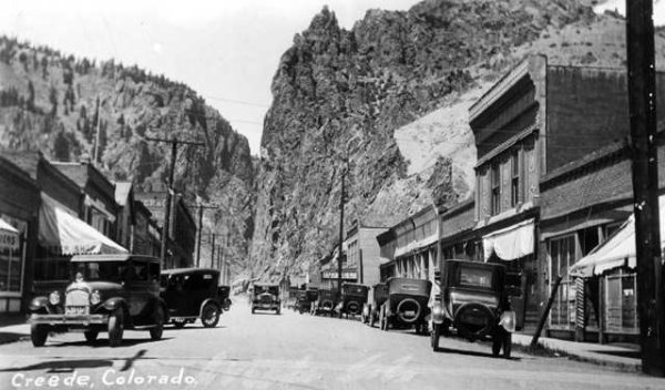
Creede circa 1920
Zeke Ward has lived in Creede for some 40 years, and has served on citizen advisory boards that oversee the river, water quality, and mine residue cleanup efforts.
He said the headwaters area has largely been protected from the most severe aspects of the mega-drought gripping the Rio Grande Basin and much of the American West because there are few people here and 80% of the land is owned by the U.S. Forest Service.
Still, he says, the river is vital to the region’s small tourist economy. “We don’t have a ski area,” he said. “So we have to make a living in 100 days, and that’s not easy.”
Follow the river below Creede and soon you enter the San Luis Valley, where irrigated agriculture dates back at least to the 1500s and where the combination of drought and overpumping have sapped an expansive, delicate series of aquifers. So much water has been lost that the state has issued warnings that it will begin shutting wells down if the aquifer, which is fed from the Rio Grande and its tributaries, is not restored within 10 years.
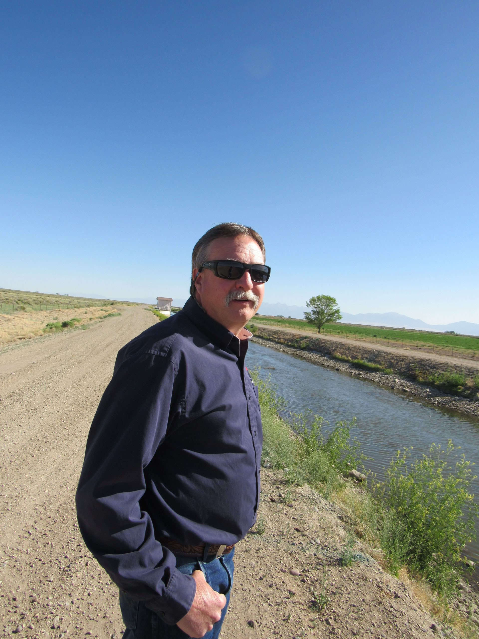
Craig Cotten is the top Colorado regulator on the Rio Grande and has overseen state and community efforts to make sure Colorado can deliver enough water to fulfill its legal obligations to New Mexico and Texas.
Craig Cotten, Colorado’s top regulator on the Rio Grande, stands on a ditch that delivers water to New Mexico to help meet Colorado’s obligations under the Rio Grande Compact of 1938. Credit: Jerd Smith, Fresh Water News
To do so, Cotten routinely cuts water supplies to growers, based on where they fall in the valley’s system of water rights. Right now, Colorado is meeting its compact obligations, but the cost to the valley is high and the cost of failure higher still.
“The farmers are struggling with reaching sustainability,” Cotten said. “If they don’t get there, wells will be shut down.”
But Cotten said he is cautiously optimistic that the Rio Grande can be brought back to health as the climate continues to dry out, in part because there are new tools to manage its lower flows more precisely, including sophisticated airborne measuring systems that show with greater accuracy how much snow has fallen in remote areas and how much water that snow contains.
Knowing more precisely how much water is in the system means the state can capture more when flows are higher, and see more accurately when streamflows will drop. Previously, snow-water estimates have varied widely, miscalculating by as much as 70% or more how much water is in a given mountain region.
In addition, this year Colorado lawmakers approved $30 million to begin a program that will pay San Luis Valley farmers to permanently fallow their lands, something that will relieve stress on the aquifer and the Rio Grande and which could stave off a mass well shutdown.
Plenty to learn
Cleave Simpson manages the Rio Grande Water Conservation District in Alamosa and is also a Colorado state senator.
He believes that the work on the upper Rio Grande holds important lessons for the three states sharing its water and others in the American West.
The people of the Rio Grande Basin have been living with whatever the river can produce for years now, and effectively sharing in any shortages. In addition, though the San Luis Valley aquifers are deteriorating, the farmers in the region have taxed themselves and used some $70 million from those tax revenues to fallow land, something that more and more experts agree will need to be done everywhere, including in the crisis-ridden Colorado River Basin.
“You don’t have very far to look to see your future on the Colorado River,” Simpson said. “Just look at the Rio Grande.”
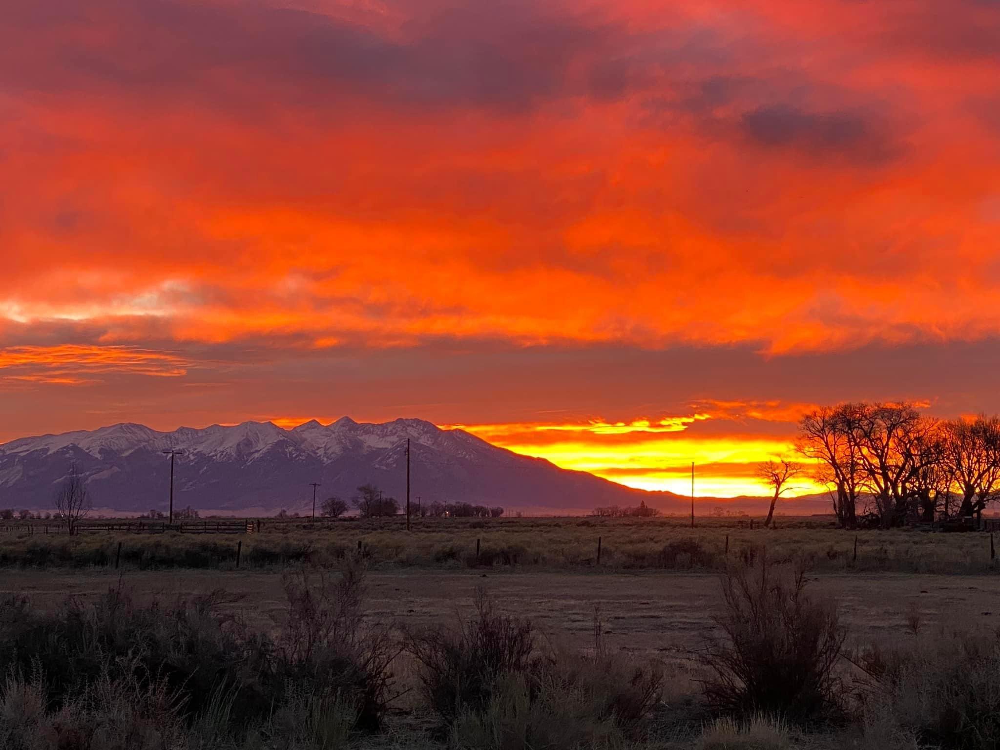
Sunrise March 16, 2022 San Luis Valley with Mount Blanca in the distance. Photo credit: Chris Lopez/Alamosa Citizen
Farmers in the San Luis Valley, including Simpson, are also testing new crops, such as quinoa and industrial hemp, which use less water than potatoes, a longstanding local mainstay.
“I don’t think I can keep doing what our family has been doing for four generations,” Simpson said. “I raise alfalfa because my dad and my grandpa did. But now I am raising 50 acres of industrial hemp for fiber … it certainly uses less water than my alfalfa crop.”
Daily prayers
The work in the San Luis Valley, including the new $30 million paid fallowing program, is a major step toward bringing the Rio Grande Basin back into balance.
And while “fallowing” is a term somewhat new to the water world, it is a management practice some of the oldest users of the river, its tribes, have practiced for millennia.
Tenorio’s family has lived in Santa Ana Pueblo for thousands of years. He said tribal members have learned to balance their needs with whatever the river provides. These days that’s not easy, but he said they focus on the future, to ensure their communities can grow and that their irrigated lands continue to produce the corn, melons, grains, beans and alfalfa that they’ve raised as long as anyone can remember.
“We only can do with what we’re given from Mother Nature,” Tenorio said.
Like other tribes in New Mexico, the Santa Ana Pueblo’s water rights have never been quantified, but because they are so old, they get their water first based on how much is available.
Looking ahead, Tenorio is hopeful that better coordinated use of New Mexico’s few reservoirs, as well as more efficient irrigation systems, will allow everyone to adapt to the drier environment.
“We pray every day for our farmers and everyone who lives on the river,” he said.
Wagon Wheel Gap on the Rio Grande, by Wheeler, D. N. (Dansford Noble), 1841-1909.jpg. Photo credit: Wikipedia
Unlocking manmade infrastructure
Casuga, of the Middle Rio Grande Conservancy District, describes himself as the CEO of bad news. But he said he has some hope that the river can be better managed.
If new rules to operate the federal reservoirs are eventually approved, he says New Mexico could easily meet its water obligations to Texas. An effort is now underway in Washington, D.C., to make that happen.
“This river is highly developed from a human standpoint,” Casuga said. “We as men impact the river so we have to unlock this manmade infrastructure to help it.”
Until then though, the day-to-day reality of operating the river remains complex. In June, when the temperatures were soaring, the rain did come, but it offered only a brief respite for the Rio Grande.
This week, as the searing heat returned, the river began drying out, forcing Casuga and Marken to launch their elaborate hopscotch game again.
Jerd Smith is editor of Fresh Water News. She can be reached at 720-398-6474, via email at jerd@wateredco.org or @jerd_smith.
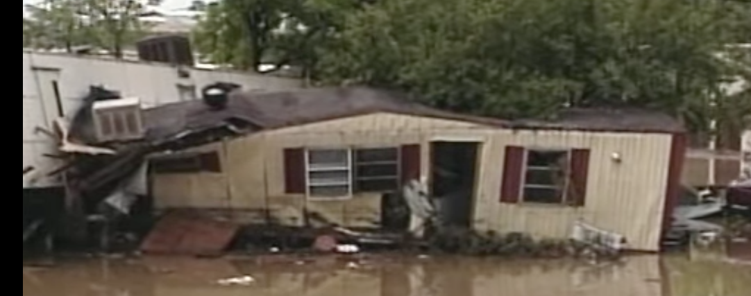
Coyote Gulch’s good friend had just sold his mobile home near Prospect Road and S. College Avenue in Fort Collins when the July 28, 1997 flood hit. The buyers were safe.
Witnesses could hear yells for help, see trailers wash off their foundations and smell the propane that streaked the debris-filled floodwaters…
As July 28, 1997 ended and a new day began, Fort Collins was faced with a new city — one full of twisted debris, totaled cars and forever-changed families.
Twenty years later, walk through the events of that night with this timeline of the Spring Creek Flood. See how heavy rain turned a creek into a deadly river. Watch as a festival-like atmosphere — with people kayaking in the streets — gave way to a somber city the next morning. And revisit the places that were washed away and rebuilt.
How it started — Heavy rainfall pounded parts of Fort Collins, with isolated storms wetting the city on July 27, 1997. The following day, it was about to get worse…
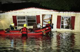
Photo shows rescuers at Coyote Gulch’s good friend’s mobile home near Prospect Road and S. College Avenue in Fort Collins when the July 28, 1997 flood hit. The buyers were safe.
Worries rise with water — What started as heavy rain and minor flooding took a turn as the night of July 28 wore on. With a sprinkling of students, staff and facilities workers on campus at CSU, many witnessed unprecedented damages.
The night turns deadly — “It was a night of terror at a trailer park,” televisions across Colorado boomed as footage from a 9News broadcast showed the hellish landscape along Spring Creek. Fires erupted, trailers washed off their foundations and residents clung to trees as two mobile home parks became targets for the devastation.
July 27, 1997 5 p.m. – After a mostly dry July, torrents of heavy rain begin northwest of Laporte. The storm expands southward into Horsetooth Reservoir.
6:30 p.m. – Heavy rain mostly stops. The air remains humid.
Midnight – Southeasterly winds behind a cold front push more moist air against the eastern foothills.
July 28, 1997
1 a.m. – Steady rain develops, at first limited to a narrow band along the foothills.
2 a.m. – Rainfall rates in excess of 1 inch per hour develop northwest of Laporte. Residents wake up to standing water.
8 a.m. – After early morning letup of overnight rains, a brief, soaking shower catches Fort Collins morning commuters. To the northwest, major flooding begins around Laporte.
Noon – Skies remain cloudy over the Fort Collins area Monday afternoon. Dewpoint temperatures hover in the low 60s.
6 p.m. – A first wave of heavy showers moves into Fort Collins. Rain increases with hourly accumulations of close to 1 inch in southwest Fort Collins.
7 p.m. – Rainfall rates approach 3 inches per hour, according to a rain gauge at the CSU Foothills Campus.
8 p.m. – Flooding of homes and streets in Fort Collins intensifies. The water is 2 feet deep at Elizabeth and Shields streets. Flow rate along Elizabeth is comparable to that of the Poudre River.
8:30 p.m. – Extremely heavy rain falls locally over a few square miles approximately at the corner of Drake Road and Overland Trail. Rainfall totals for a 90-minute period exceed 5 inches. The heaviest-hit area includes the Spring Creek watershed.
9:30 p.m. – The National Weather Service issues a flash flood warning for Larimer County.
10:30 p.m. – Floodwater bursts open the Lory Student Center’s west doors.
11 p.m. – The water level in a nearby mobile home park rises 5 feet in 3 minutes. Five people die. A train derails. A gas leak causes an explosion south of Prospect Road and east of the railroad tracks.
July 30, 1997
Summer classes are back in session on campus.
August 1997
Fall classes at CSU begin on time.
September 1997
A picnic is added to President Al Yates’ annual fall address to thank the campus and community for its resilience in the wake of the disaster. The tradition continues today.
These are perilous times in the troubled Colorado River basin, a make-or-break moment in which some of the nation’s fastest growing and most arid states begin to reckon with a drier future.
The next month will be especially intense.
Several weeks ago, in the face of another paltry runoff forecast, the Bureau of Reclamation issued an ultimatum to the basin’s seven states: to keep key reservoirs Mead and Powell from crashing, develop a plan by mid-August to conserve 2 million to 4 million acre-feet of water in the next year — or the Bureau would make the cuts as it sees fit.
Those are astounding figures. On the higher end, that amount of conservation is one-third of the Colorado’s recent annual flow. It’s also about as much water as California is allocated from the river.
The plan’s due date coincides with the publication of a highly anticipated and consequential Bureau of Reclamation report. The so-called 24-month study — tentatively scheduled for August 15 — determines how much water Mead and Powell will release in 2023. It also determines how much water Arizona, California, Nevada, and Mexico, which shares the basin, will be required to forgo next year.
Discussions about the Colorado River can resemble a doctor’s visit: filled with technical jargon, unfamiliar acronyms, and the anxiety that comes from incomplete understanding.
This glossary is an attempt to demystify the language. It outlines key terms and phrases and their context — so as the basin chatter heats up you can keep your DCP and DROA actions straight and know who’s taking ICS.
Map credit: AGU
Upper/Lower Basin
In terms of law and management, the Colorado River basin is split in two.
The upper basin states are Colorado, New Mexico, Utah, and Wyoming (plus a tiny sliver of Arizona that is essentially Navajo Nation land). The lower basin is Arizona, California, and Nevada. Separate agreements bring Mexico into the mix.
Las Vegas Lake Mead intake schematic, courtesy SNWA.
Dead Pool
All reservoirs have limits. Dead pool, an evocative term, is the ultimate limit. It’s the point at which water can no longer be released downstream because a reservoir falls below its lowest outlet pipe.
For Lake Mead, dead pool is elevation 895 feet. For Powell, 3,370 feet.
Today, the reservoirs are at 1,040 feet and 3,536 feet, both at about 27 percent of full capacity.
Even at dead pool some water might remain in the reservoir, but it can’t flow without extraordinary assistance. Las Vegas, in a proactive step, invested $1.3 billion in an intake pipe and low-elevation pumping station that allow the city to draw water from Mead when the reservoir is at dead pool.
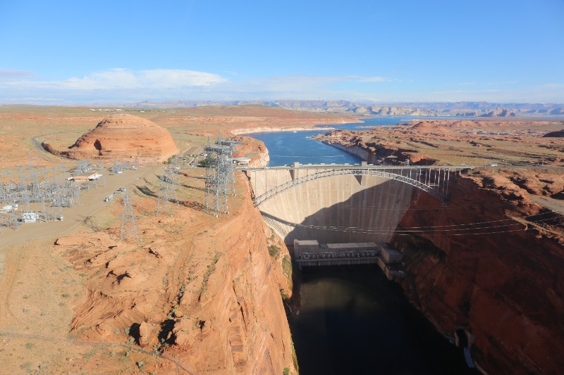
Lake Powell’s Glen Canyon Dam is used to produce hydropower that is delivered over a 17,000-mile transmission grid, reaching six states and 5 million people. Photo courtesy Western Area Power Administration.
Minimum Power Pool
A second limit for a reservoir, minimum power pool refers to the water level required to generate hydropower.
This is the level near the location of the penstocks. Penstocks are the pipes that move water from the reservoir to the power-generating turbines.
For Powell, minimum power pool is 3,490 feet. The Bureau of Reclamation is attempting to prevent Powell from dropping below this level.
For Mead, minimum power pool is 950 feet.
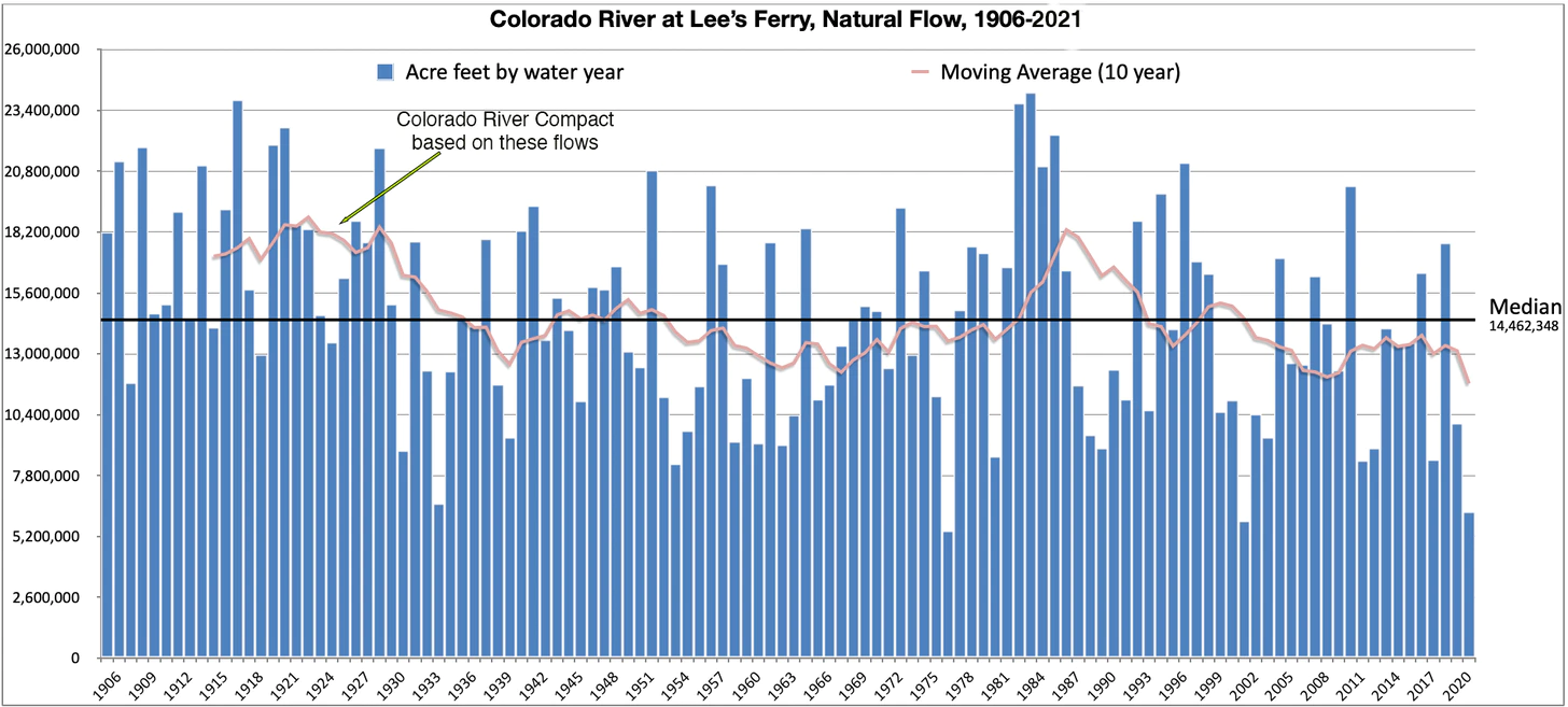
Natural Flow is an estimate of how much water would have naturally run past Lee’s Ferry if there were no dams or diversions upstream. It is calculated using the actual flow, historic flows, and upstream consumptive uses. Bureau of Reclamation modeling is complete to 2019; I extrapolated 2020 and 2021 based on Lake Powell inflows. The 1922 Colorado River Compact gave 7.5 million acre feet to the Upper Basin, 7.5 MAF to the Lower Basin, and (in the ‘40s) 1.5 MAF to Mexico, based on early 1900s observations. As the graph above shows, the average flows dropped below that level a decade later and stayed there aside from a brief respite in the 1980s. Source: USBR
Operational Neutrality
The Bureau of Reclamation took an unprecedented step in May, announcing that it would reduce releases from Powell to Mead this year by 480,000 acre-feet.
The move helped keep Powell above minimum power pool. But it came with a worrisome side effect for the lower basin states: less water sent downstream to Mead.
They have good reason to worry. Depriving Mead of that water meant a greater likelihood of a more severe shortage tier for the lower basin next year. Mead, in fact, has plummeted this year, falling 21 feet since April.
The states and the feds agreed to a work-around. To maintain “operational neutrality” the shortage tiers for next year would be calculated as if the 480,000 acre-feet had been released to Mead. In other words, on paper the water is in Mead…but in reality it sits upstream in Powell.
Every bit of water matters these days. Currently one foot of elevation change in Mead is equal to about 70,000 acre-feet. So the 480,000 acre-feet held back in Powell corresponds to roughly 6.8 feet in Mead.
How long will this shadow accounting be in place? Becki Bryant, a Reclamation spokesperson, told Circle of Blue that the agency is discussing that matter with the states. They hope to reach an agreement by the publication of the August 24-month study.
24-Month Study
The name explains its purpose. Published every month, this Bureau of Reclamation study projects reservoir elevations in the Colorado River basin for following 24 months.
The pivotal edition is the August study, which sets the operating conditions for the reservoirs for the next year. Here’s how it works:
Reclamation looks at the projected elevations of Mead and Powell at the beginning of the upcoming year. Their elevations determine how much water flows from Powell to Mead. There are complex charts that describe the scenarios and dictate the decision.
In turn, Mead’s elevation determines if the lower basin states are in a shortage tier, which requires water supply cuts from the river.
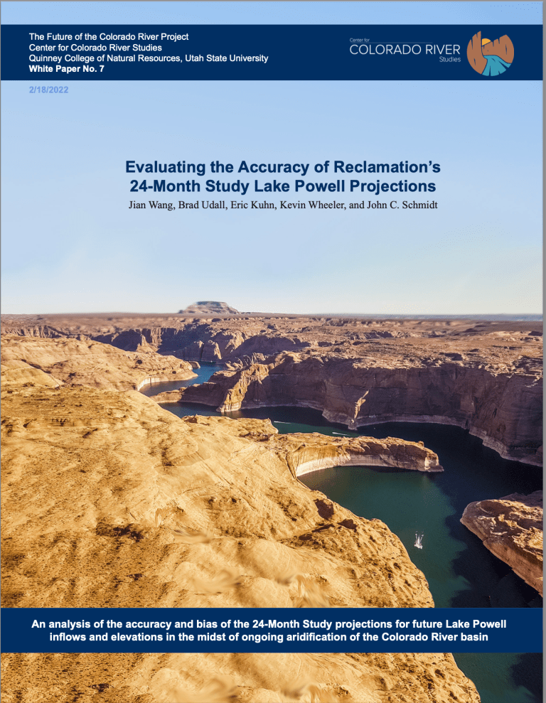
Images from the NASA Earth Observatory released in early July focused on the northern arm of Lake Mead and its decline from 2000 until now. As western states are being asked for solutions to keep Lake Mead and Lake Powell from hitting critical low points, there is more talk about what it would take to pump water from the Mississippi River to western states as well. (Image courtesy of NASA Earth Observatory)
Shortage Tiers
When Mead drops below certain elevations, the lower basin states and Mexico must reduce their withdrawals from the river.
The shortage tiers have evolved as the basin’s water supply imbalance has become more pronounced.
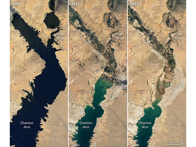
The initial tiers were set in 2007, in what are known as the interim guidelines. The tiers were updated in 2019 in the DCP. What’s that, you ask?
Colorado River drought contingency plans signing ceremony in May 2019. Photo: U.S. Bureau of Reclamation
DCP
Short for drought contingency plan, the DCP was approved by the basin states and the federal government in 2019.
The DCP updated the shortage tiers by increasing the amount of water cuts that lower basin states would take as Mead drops. For the first time, California agreed to take cuts, but not until Mead drops below 1,045.
In 2022, the lower basin is in a Tier 1 shortage. Arizona is taking most of the cuts.
What about the upper basin? Those states signed DROA…
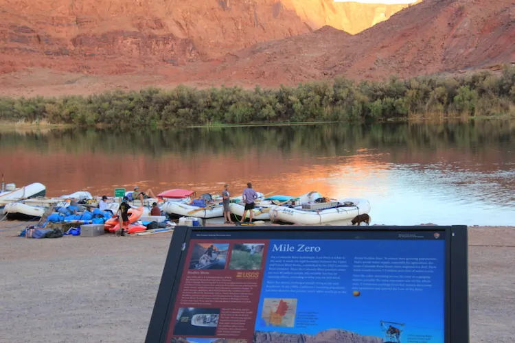
Lees Ferry, located 15 miles downstream of Glen Canyon Dam is the dividing line between the upper and lower Colorado River basins. Photo/Allen Best
DROA
Short for drought response operations agreement, this is the upper basin’s portion of the DCP. It outlines actions that the upper basin will take to preserve water levels in Powell.
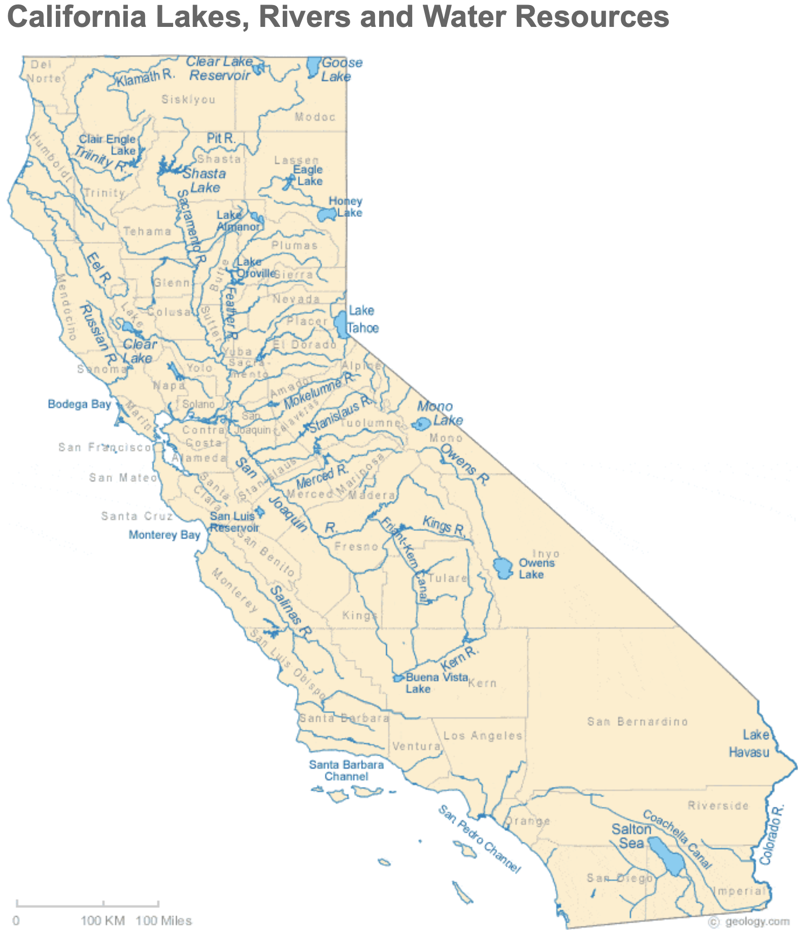
Arizona Rivers Map via Geology.com.
Shortage Tier 2A
One of two possible shortage tiers for 2023. This tier occurs when the August 24-month study projects that Mead will be between 1,050 feet and 1,045 feet on January 1 of the following year.
Mead is on the cusp right now. Alan Butler, a Reclamation hydraulic engineer, said on July 13 that Mead is projected to be at elevation 1,045.9 feet in January, after accounting for operational neutrality.
If a 2A tier is declared, Arizona continues to take the largest cut. It would forgo 592,000 acre-feet, about four-fifths of the total cuts shared by the lower basin and Mexico.
California Rivers via Geology.com
Shortage Tier 2B
This is the other possible outcome, which would take place if Mead is projected to be between 1,045 feet and 1,040 feet.
In this tier, California takes its first shortage cuts. Though Arizona, having to cut 640,000 acre-feet, would still feel the most pain, California would be required to cut 200,000 acre-feet.
These shortage tier numbers do not include Reclamation’s mandate for 2 million to 4 million acre-feet of additional savings, nor do they include the 500-plus plan.
Aerial photo – Central Arizona Project. The Central Arizona Project is a massive infrastructural project that conveys water from the Colorado River to central and southern Arizona, and is central to many of the innovative partnerships and exchanges that the Gila River Indian Community has set up. Public Domain, https://commons.wikimedia.org/w/index.php?curid=326265
500-Plus Plan
An agreement from lower basin states to conserve an additional 500,000 acre-feet in 2022 and 2023 beyond what was required in the Tier 1 shortage declaration for 2022. The states and federal government contributed $200 million combined, money that will pay water users to leave their allocations in Mead.
Brad Udall: Here’s the latest version of my 4-Panel plot thru Water Year (Oct-Sep) of 2021 of the Colorado River big reservoirs, natural flows, precipitation, and temperature. Data (PRISM) goes back or 1906 (or 1935 for reservoirs.) This updates previous work with @GreatLakesPeck.
Protection Volumes
When Reclamation ordered the basin states to plan for 2 million to 4 million acre-feet in additional conservation, Camille Touton, the agency’s leader, said it was to protect “critical levels” in Mead and Powell.
What are those critical levels? Reclamation analyzed two scenarios. But the conservation mandate was derived from the scenario that keeps more water in the reservoirs.
That scenario is Mead above 1,020 feet and Powell above 3,525 feet. The “protection volumes” are the 2 million to 4 million acre-feet needed to preserve the reservoirs above those thresholds.
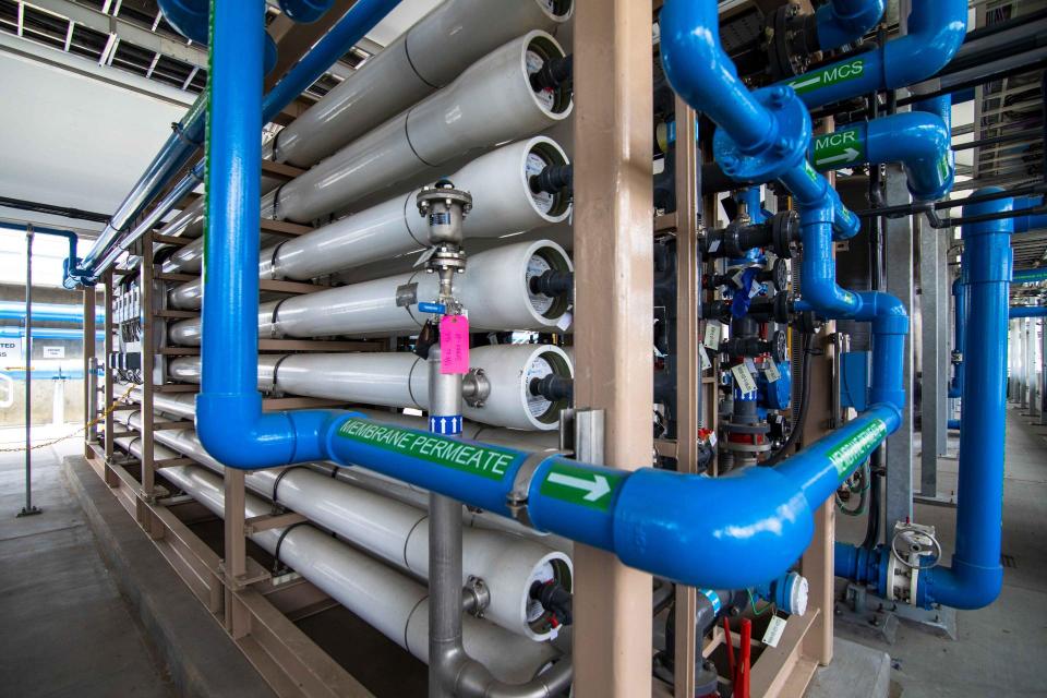
Filtration pipes at Metropolitan Water District of Southern California’s wastewater recycling demonstration plant. (Source: Metropolitan Water District of Southern California)
ICS
An acronym that stands for intentionally created surplus, which acts like a savings account in Mead.
Lower basin water users can accrue ICS when they undertake conservation projects that permanently reduce consumption. Combined, the lower basin states have just accumulated shy of 3 million acre-feet of ICS credits stored in Mead.
Some of that water will be drawn this year. Metropolitan Water District of Southern California, a large wholesale agency, anticipates taking 175,000 acre-feet of ICS, according to spokesperson Bob Muir. This is to offset reduced allocations from the State Water Project, a canal system that moves water from north to south in California.