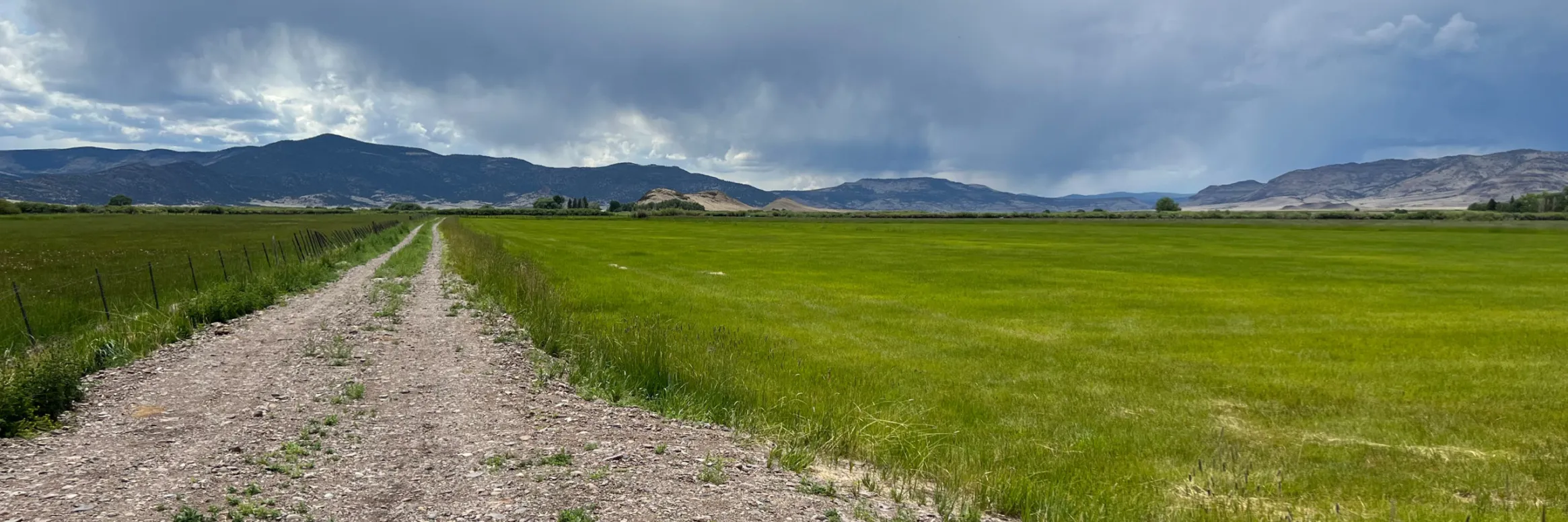
AS you come into Saguache, about a half-mile out and to the west, you’ll find the start of the Hazard ranch and owners of the number one water right on Saguache Creek.
The Hazards have been ranching in Saguache forever, back to the 1870s, as everyone in the town and the county will tell you, which is why it comes as somewhat of a shock to the ranching and farming community that the Hazard family has sold the ranch to the Rio Grande Water Conservation District.
The transaction very likely could save the rest of what’s remaining of ranching and farming in Subdistrict 5 of the Rio Grande Water Conservation District. Without the purchase of the Hazard ranch, neighboring farm and ranch operations were facing ongoing curtailment of wells from the state Division of Water Resources because the subdistrict was unable to offset the injury depletions to Saguache Creek.
Saguache Creek. Photo credit: The Alamosa Citizen
n this particular instance,” said George Whitten, vice president of Subdistrict No. 5 Board of Managers, “had we not been able to secure that water and we weren’t able to actually establish an annual replacement that satisfies the state, then there would have been about 8,000 acres of meadow land that would have been lost.”
So now you understand the importance of the acquisition and how the Hazard family, a symbol of historical and cultural pioneering in Saguache, came to save the day.
“What Perry (Hazard) told me is that as a family they decided the thing to do was sell it to the subdistrict and that way a lot of people around here could benefit from that water rather than selling it to a developer or something like that,” Whitten said.
The sale was for $2.8 million. But really it’s the symbolism and meaning of the sale by one of the Valley’s oldest ranching families, a generational family that saw the end of the line and gave life to the other farms and ranches still trying to make it.
Nightmarish well curtailment
It’s been a rollercoaster 15 months for Subdistrict 5, with irrigators losing critical production time the last two irrigation seasons – 2021 and 2022 – after the state first shut down 230 or so wells in the subdistrict on April 1, 2021.
The subdistrict, like the others in the Rio Grande Water Conservation District, is required to file an Annual Replacement Plan with the state Division of Water Resources that shows precisely how farm operators are returning water to the Upper Rio Grande Basin tied to the amount of well pumping that occurs.
The state rejected the 2021 Subdistrict 5 Annual Replacement Plan because it didn’t have a source of water to remedy its depletions on Saguache Creek. When that happened the farmers and ranchers in the subdistrict had their worst fears come true.
The state initially had wells shut down from April 1 to June 22, 2021, before a challenge by the Rio Grande Water Conservation District was successful and wells were turned on again. By that time, though, operators like North Star Farm, a hay provider for large dairy operations in California that runs 28 circles in Subdistrict 5, lost critical time in their growing season.
he subdistrict also still did not have a remedy to its depletions on Saguache Creek when the 2021 appeal went through and had to figure that out in time to file its 2022 Annual Replacement Plan.
The state has a period of May 1 to April 30 of the following year as the annual replacement plan year for Valley irrigators.
The transaction on the Hazard ranch wasn’t finalized until May, and so at the start of May the state curtailed water wells in Subdistrict 5 for the second year in a row until it reviewed and approved the 2022 Annual Replacement Plan and the sale of the ranch.
“We get credit for the water that that property is not going to consume for the rest of the year, and we use that water and leave it in the stream to remedy the injury caused by the wells,” said Chris Ivers, program manager for Subdistrict 5.
The subdistrict has been letting the ranch dry up the past 40 days or so since it’s owned the property, Ivers said.
“The location of this water right and this property, it helps us tremendously because that stretch of the stream historically has always been wet,” Ivers said. “So we can have this water in place for dry years, and then in wetter years the stream goes farther so we can have sources of remedy down lower on the stream that can come to play in those years.”
Saguache Creek
The expectation is that the sale of the Hazard ranch will go a long way toward keeping that stretch of the Upper Rio Grande Basin and the confined aquifer sustainable, and help other cattle ranchers and hay farmers stay in business.
The sale also means there will be fewer cattle being raised in the Valley. It’s what the Hazard family did and had done for decades, but now it’s given up its farm and the water rights and others will carry on.
“It’s an incredibly fortunate thing for us to be able to require that water right. You couldn’t pick a better one,” Whitten said.
“We will need this water going into the future. It’s part of the long term plan,” said Ivers.
The Colorado River from Navajo Bridge below Lee’s Ferry and Glen Canyon Dam. The proposed Marble Canyon Dam would have been just downstream from here. Jonathan P. Thompson photo.
Click the link to read the article on the Associated Press website (Brittany Petersen). Here’s an excerpt:
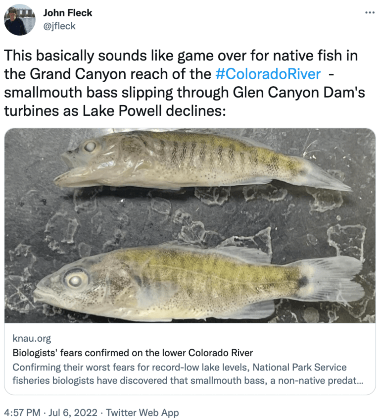
For National Park Service fisheries biologist Jeff Arnold, it was a moment he’d been dreading. Bare-legged in sandals, he was pulling in a net in a shallow backwater of the lower Colorado River last week, when he spotted three young fish that didn’t belong there. “Give me a call when you get this!” he messaged a colleague, snapping photos.
Minutes later, the park service confirmed their worst fear: smallmouth bass had in fact been found and were likely reproducing in the Colorado River below Glen Canyon Dam.
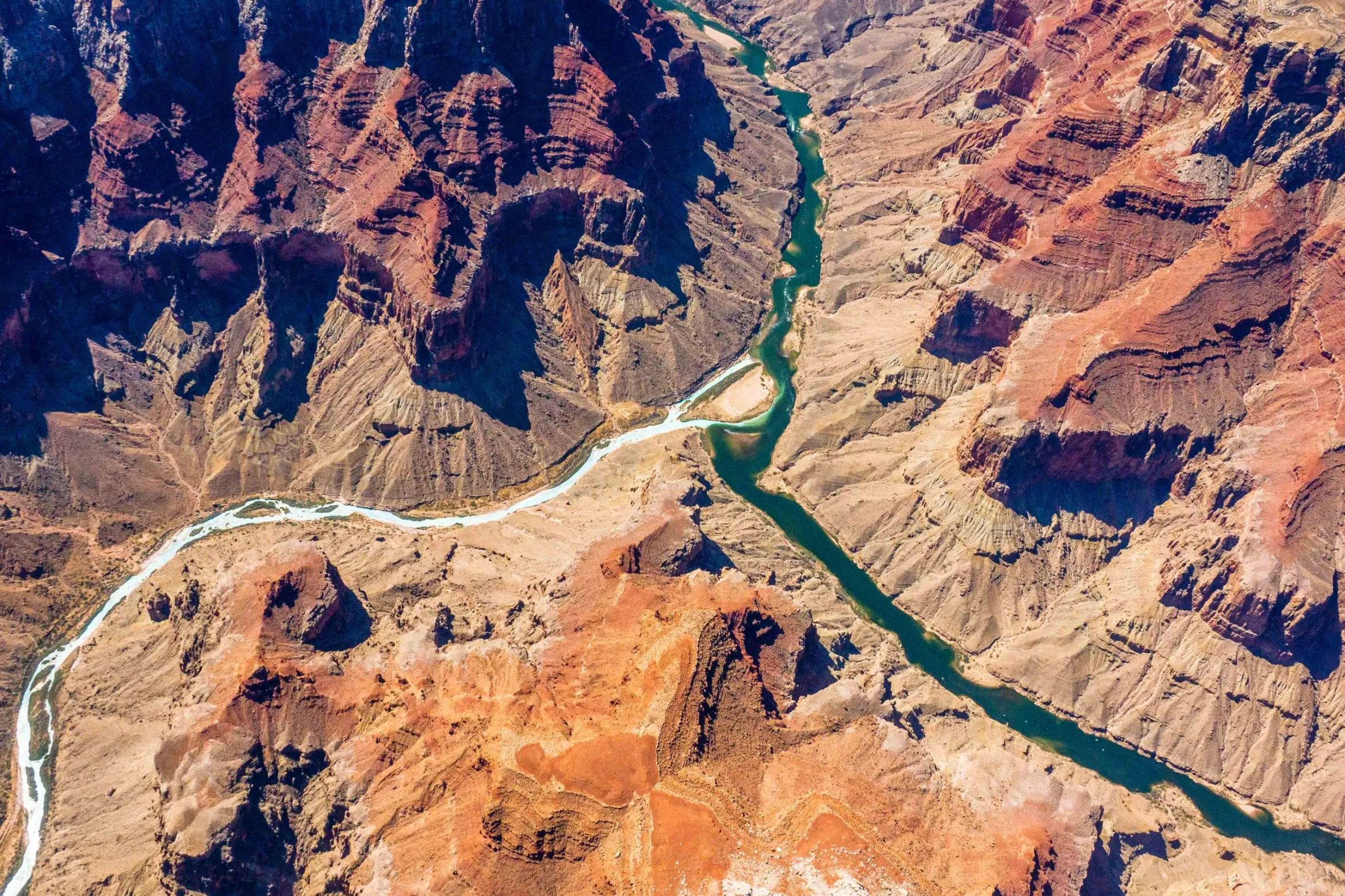
The confluence of the Colorado and Little Colorado rivers in the Grand Canyon, shown here in a September 2020 aerial photo from Ecoflight, represents an area where the humpback chub has rebounded in the last decade. That progress is now threatened by declining water levels in Lake Powell, which could lead to non-native smallmouth bass becoming established in the canyon. CREDIT: JANE PARGITER/ECOFLIGHT
They may be a beloved sport fish, but smallmouth bass feast on humpback chub, an ancient, threatened fish that’s native to the river, and that biologists like Arnold have been working hard to recover. The predators wreaked havoc in the upper river, but were held at bay in Lake Powell where Glen Canyon Dam has served as a barrier for years — until now. The reservoir’s recent sharp decline is enabling these introduced fish to get past the dam and closer to where the biggest groups of chub remain, farther downstream in the Grand Canyon.
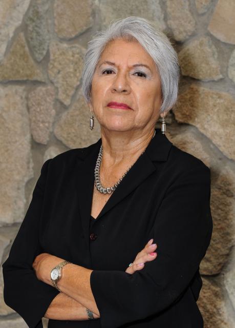
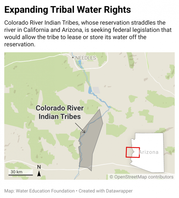
Western Water Q&A: CRIT chair Amelia Flores says allowing tribe to lease or store water off reservation could aid broader Colorado River drought response and fund irrigation repairs
Amelia Flores, chairwoman of the Colorado River Indian Tribes. (Source: CRIT)
As water interests in the Colorado River Basin prepare to negotiate a new set of operating guidelines for the drought-stressed river, Amelia Flores wants her Colorado River Indian Tribes (CRIT) to be involved in the discussion. And she wants CRIT seated at the negotiating table with something invaluable to offer on a river facing steep cuts in use: its surplus water.
Wheat fields along the Colorado River at the Colorado River Indian Tribes Reservation. Wheat, alfalfa and melons are among the most important crops here. By Maunus at English Wikipedia, CC BY-SA 3.0, https://commons.wikimedia.org/w/index.php?curid=47854613
CRIT, whose reservation lands in California and Arizona are bisected by the Colorado River, has some of the most senior water rights on the river. But a federal law enacted in the late 1700s, decades before any southwestern state was established, prevents most tribes from sending any of its water off its reservation. The restrictions mean CRIT, which holds the rights to nearly a quarter of the entire state of Arizona’s yearly allotment of river water, is missing out on financial gain and the chance to help its river partners.
Flores, as CRIT’s tribal chair and the first woman to hold that post, is leading her tribe’s effort to persuade Congress to allow the tribe to lease or store its water off reservation lands like tribes in Arizona and other Colorado River Basin states with congressionally approved deals already can. If Congress grants the request by CRIT, Flores said, the tribe would offer water to aid struggling Arizona farmers and cities as well as wildlife restoration sites throughout the Lower Basin. The bill is pending in a U.S. Senate committee.
CRIT is comprised of members from four distinct ethnic groups, the Mohave, Chemehuevi, Hopi and Navajo tribes, and has set its sights on having a voice in renegotiation of operating guidelines for the Colorado River, which must be renewed by 2026. Flores contends the tribe has proven itself as a valuable partner by recently leaving water in Lake Mead to alleviate shortages. She hopes CRIT will finally have a voice in determining the river’s future, unlike previous negotiations that were crafted without tribal input.
In an interview with Western Water, Flores explains CRIT’s cultural ties to the Colorado River, the proposed legislation and the need for tribes to play larger roles in the upcoming renegotiations.
WESTERN WATER: You refer to the tribes as Aha Makhav, or people of the river. Can you talk briefly about the tribe’s historical relationship with and its cultural ties to the Colorado River?
AMELIA FLORES: Our creator Mataviily created first the stars and the planets and then after he created the animals, he created the people. To go along with that, he created the river and laid aside the lands for us to live off of. This is in our clan songs. The clan songs followed the river from Avii Kwa’ame north of Laughlin, and the Newberry Mountain Range. That is our sacred mountain to the Mohave people. And not only to the Mohave, but to the other tribes along the river. I can’t leave out the mountains. The mountains are very sacred to the Mohave people and they all have names. As stewards of the land and of the river, our identity is in the land and the water. We are the river.
WW: In December of 2020, you were elected by a wide margin to become the first female chair of the Colorado River Indian Tribes. What inspired you to run for the position and, as you said after the election, break the glass ceiling?
FLORES: It goes back to me serving the tribal membership for 29 years as the library archivist. And during that time I was mentored by the Mohave elders, and these were male elders, about the history and the culture of our tribe. The knowledge they passed on was inspiring and I think that is part of me wanting to serve on the tribal council level. And so, it was just moving on to the next level (to become CRIT chair). Also, the passion that I have to serve and help my people is another part that inspired me to continue working for my people.
With the trust and the support of the people, I was elected. It was their support and their vote that broke the glass ceiling, not me. I can provide a woman’s voice to the decisions and to the government.
WW: Under your leadership CRIT is pursuing federal legislation that would allow it to lease or store some of its Colorado River water off the reservation. How would the bill benefit the tribe and how does it fit into broader efforts to share water across the entire Lower Colorado River Basin?
FLORES: The CRIT Resiliency Act didn’t happen overnight. Our past tribal councils had been looking at how we could get more benefit out of, and authority over, our water. Over at least the last 20 years other tribes in Arizona started getting their settlements. With their settlements, they’re able to lease their water that they use from the Colorado River.
Agriculture is the main economic venture on CRIT’s reservation, where a range of crops like alfalfa, cotton and sorghum thrive in the rich soil along the banks of the Colorado River. (Source: CRIT)
WW: Looking ahead, what sort of role might CRIT and other tribal groups play in the discussions about the next set of river operating guidelines, which must be finalized by the year 2026? What are some of CRIT’s main priorities heading into these renegotiations?
FLORES: I can only speak for CRIT, not for the other tribes. But we all should play equal roles to the states in these discussions. Each tribe is vital and for so long we’ve been left out of the discussions, we’ve been left out of when plans are developed. With the drought and given the conditions [on the river], we are now being invited to the table, which has been a wake-up call for the Bureau of Reclamation and the United States. We’re all sovereign, we all have our own water rights. But ultimately the United States has its obligations to protect our resources and that’s not only water but other resources, like land for the individual tribes.
I think we need to remain vigilant. We need to hold the Bureau of Indian Affairs and the federal government to their policies. And I believe through negotiation and being at the table, we have a better chance of holding them accountable. We don’t ever want to go back to 10 years, even five years ago when we weren’t consulted.
WW: What is your greatest concern with the Colorado River, especially given the drought?
FLORES: My concern is that there’s a risk the Colorado River could stop flowing if the megadrought continues. Although we would be the last to be cut, it would greatly impact our tribal government and our services to the people. It would impact our environment and the habitat preservation we have going on at the Ahakhav Preserve. I’m hanging on to hope that we have a change in our climate, but there’s a possibility that no water could be flowing along the banks of the river.
WW: CRIT in recent years has participated in the 2019 Drought Contingency Plan and done things like fallow farmland in order to help avoid shortages elsewhere in the Lower Colorado River Basin. Do you think the federal government and the other river users will recognize and credit CRIT’s cooperation and actions during the renegotiation process?
FLORES: Oh yes. With the 200,000 acre-feet of water that we’ve already left in Lake Mead, I don’t think they could overlook us anymore and what we have contributed. And we are now in a relationship with the Arizona Department of Water Resources and also CAP. So in developing those relationships over the years they see us as a vital part of saving the river.
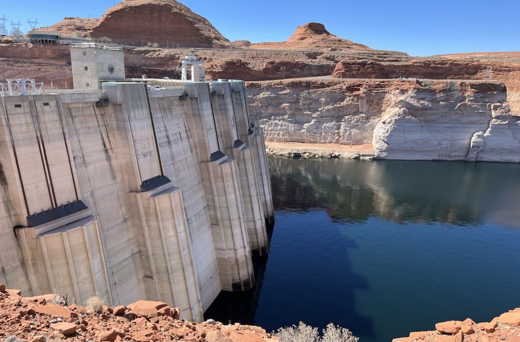
Glen Canyon Dam creates water storage on the Colorado River in Lake Powell, which is just 27% full in June 2022. Bureau data on the reservoir’s water-storage volume showed a loss of 443,000 acre-feet. Credit: U.S. Bureau of Reclamation
After inputting the new data on July 1, 2022 storage values at the current elevation dropped 6%
The Bureau of Reclamation last week revised its data on the amount of water stored in Lake Powell, with a new, lower tally taking into account a 4% drop in the reservoir’s total available capacity between 1986 and 2018 due to sedimentation.
Bureau data on the reservoir’s water-storage volume showed a loss of 443,000 acre-feet between June 30 and July 1 — a 6% drop in storage from 6.87 million acre-feet (which is 28.28% of live storage based on 1986 data) to 6.43 million (26.46% of full).
The cause was a recalculation of water stored based on a Bureau of Reclamation and U.S.Geological Survey study released in March — the first such analysis in more than 30 years — about Lake Powell’s loss of storage capacity due to the amount of sediment that the Colorado River and other tributaries deposit into the reservoir. The study was based on data about sediment in the lake collected in 2017 and 2018.
“After inputting the new data on July 1, 2022, storage values at the current elevation were updated, resulting in a decrease of 443,000 acre-feet,“ bureau officials wrote in an email.
The Bureau of Reclamation has performed two prior sediment surveys: pre-impoundment (before the construction of the dam — up to 1963) and in 1986.
Storage capacity figures prior to the release of the report in March had been based on 1986 data, Casey Root, a hydrologist for the U.S. Geological Survey’s Utah Water Science Center, said in an email.
The new data will be included in the upcoming July 24-Month Study, scheduled to be released in mid-July, which forecasts the reservoir’s volume and surface elevation, and in any subsequent operational projections.
Slackwater delta
“Like most reservoirs, Lake Powell loses storage capacity as a result of sedimentation from its source rivers,” said Root, who worked on the most recent USGS and Bureau of Reclamation study.
The paper explained that Lake Powell has continuously trapped sediment — including silt, sand and mud — from the Colorado and San Juan rivers since the Glen Canyon Dam impounded the rivers in 1963. The meeting of the free-flowing rivers carrying sediment with the slack water of the reservoir creates a delta, where the sediment falls to the lake’s bottom.
Root explained that the delta regions are located at the furthest extents of Lake Powell and that these areas typically contain the most sediment.
“Sediment isn’t deposited uniformly across the reservoir but rather far from the dam,” he said. “Over time, these deposits can laterally build toward the dam.”
Since it began filling in 1963, the reservoir has lost on average about 33,270 acre-feet in storage capacity each year, according to the study.
“Lake Powell is unique in that it is a long, narrow, steep-walled canyon, so the deltas have historically been about 150 miles away from Glen Canyon Dam,” Root said. “Simply being far away from the deltas can help buffer the dam and its operations against sedimentation.”
Due to this sedimentation, Lake Powell’s storage capacity at full pool decreased by 6.79% from 1963 to 2018, or a 1.83 million acre-foot loss.
Between 1986 and 2018, it dropped by 4%, which represents a loss of 1.05 million acre-feet in 32 years.
This animation shows the sedimentation process in Lake Powell.
Sedimentation and the limits on useful life
While sedimentation is shrinking Lake Powell’s storage capacity, the 2022 study shows that storage loss has remained stable since 1963.
From 1963 to 1986, Lake Powell had lost on average 33,390 acre-feet in storage capacity each year; from 1986 through 2018, 33,180 acre-feet per year was lost, according to the report.
“As a first-order approximation, the average annual storage loss in Lake Powell indicates the remaining volume at full pool will be filled in approximately 750 years. However, the reservoir fills laterally, from the deltas toward Glen Canyon Dam, and would likely cease to be useful sooner,” the study pointed out.
Several other variables — including sedimentation rates and climate sensitivity among others — need to be taken into consideration to better evaluate the remaining useful life of the reservoir.
Researchers are currently working on the July 24-Month Study, which should offer further insights on the reservoir’s future operations when it gets published later this month. Lake Powell dropped to its lowest level since filling prior to this spring’s runoff, which has been increasing reservoir levels since late April. At its lowest point, Lake Powell’s surface elevation at the Glen Canyon Dam dropped to 3,522.24 feet above sea level on April 22, just 32 feet above the minimum level required to generate hydropower. Water volume at the reservoir on that day was listed as being at 23.68% of full pool.