One of the City of Northglenn’s water diversions on Berthoud Pass that was vandalized the week of June 19. | City of Northglenn / Courtesy Photo Unknown-1
Click the link to read the article on the Sky-Hi News website (Tracy Ross). Here’s an excerpt:
The Grand County Sheriff’s Office reported last Friday that several water diversion gates on Berthoud Pass that deliver water to the city of Northglenn were intentionally damaged or destroyed, creating “monumental losses” for that city. Northglenn officials first contacted the sheriff’s office on June 22. They reported a theft of water and criminal mischief of the diversion gates on the Berthoud Pass Ditch in Current Creek Basin. Northglenn collects water from the ditch and diverts it into Clear Creek, said Andy Miller, president of the board of directors of the Upper Colorado River Watershed Group. On June 22, Northglenn staff reported “a sudden and significant decrease in water output routed for Northglenn” on the two days previous to their call. When Northglenn staff responded to the ditch, they found that several water diversion gates were intentionally damaged or destroyed…
Some are questioning whether the vandalism was sabotage by a water conservation group. Kirk Klancke, president of the Colorado River Headwaters chapter of Trout Unlimited, said a similar act happened at the same spot several years ago. In 2019, vandals caused an estimated $1 million worth of damage to the City of Northglenn’s collection system and disrupted both Northglenn and Golden water supplies…
Northglenn’s water right on Berthoud Pass is 600 acre feet of water per year, available between May 15 and October 15. Northglenn’s average annual water use is 6,000 acre feet, “so this is about one-tenth of our annual water supply,” said Moon. “It doesn’t seem like a lot, but on a good year, Berthoud Pass water is incredibly important to us. And now that we’re watching climate change change our weather patterns, and summer weather getting drier and drier, getting that water early in the season and being able to use it is one of the ways we can keep our residents from having water restrictions when we see our neighbors not the doing the same.”
Colorado transmountain diversions via the State Engineer’s office
The Yampa Valley has seen above average rainfall for the second straight month, with June seeing just shy of 3 inches of precipitation compared to the 1.6-inch average. While this year is trending better than the past handful, Van De Carr said talk of a closure [of the river] could swiftly surface…
The Yampa River below Stagecoach closed to fishing in early June because of low flows, which dropped to just 10 cfs flowing out on June 14. On Sunday afternoon, about 51 cfs was flowing into the reservoir and about 41 cfs out, according to data from the U.S Geological Survey…
Speaking before the Senate Committee on Energy and Natural Resources on June 14, Bureau of Reclamation Commissioner Camille Calimlim Touton warned that water users along the Colorado River must slash their usage by as much as one-fourth by the end of next year to “help preserve and protect power pool” at Glen Canyon and Hoover dams — both of which produce hydropower for millions across the region. Touton said Reclamation has seen similar patterns across every major basin in the West — hydrologic variability, hotter temperatures, dry soil — leading to earlier snowmelt and low runoff. Coupled with the lowest reservoir levels on record, “there is so much to this that is unprecedented,” she said.
“But unprecedented is now the reality,” Touton said…
“It is in our authority to act unilaterally to protect the system, and we will protect the system,” she said.
When looking to reduce usage by 4 million acre-feet, John McClow, general counsel for the Upper Gunnison River Water Conservancy District, said the answer is obvious. The Upper Basin states, situated at the headwaters of the Colorado River, have continued to take involuntary shortages each year, dependent on ebb and flow of rain and snowmelt.
“We haven’t got anything to give,” he said. “They’ve had perfect control of their supply ever since Hoover Dam was built. Their system is a lot easier to operate, you just turn on the tap … We don’t have those resources in the Upper Basin.”
[…]
UCRC Executive Director Chuck Cullom said he believes both the Upper and Lower basins need to contribute to a solution.
“I think the Upper Basin has taken significant efforts and suffered significant pain,” Cullom said. “There is more that can be done. Most of the work going forward should come from the area where there’s significant water use. And that’s, again, downstream.”
Cullom said although he is optimistic water users, tribes and the federal government can negotiate a plan within the 60-day window, emergency releases in 2021 and Touton’s call for more water reflects that the existing rules have been exhausted.
“Now that we’ve depleted the storage, the only choice is to adapt,” he said.
Some of the snowmelt flowing in the Blue River as it joins the Colorado River near Kremmling, Colo., will reach the Lower Basin states. Dec. 3, 2019. Credit: Mitch Tobin, the Water Desk
Click the link to read the article on the Summit Daily website (Eliza Noe). Here’s an excerpt:
The plan focuses on four “interconnected action areas,” including resiliency planning, thriving watersheds, robust agriculture and community. It describes 50 “partner actions,” or project ideas that could be supported by Water Plan grants, as well as 50 “agency actions,” to support local projects, conservation and wise-water development. Overall, however, basin roundtables and stakeholders identified more than 1,800 potential future projects statewide, and 321 are in the Colorado Basin with 36 being in Summit County. In total, over $20 billion would be spent on the projects by 2050. Russ Sands, senior program manager of water supply planning for the Colorado Water Conservation Board, said that projects in the database are designated as near-term, midterm or long-term when it comes to getting them done. They’re also not all infrastructure projects. Some may work toward water conservation and others may be educational projects or environmental…
According to the plan, the Colorado Basin — which includes Summit County and the Blue River — faces issues such as competing resources for agriculture, tourism, protection of endangered species and potential for Colorado River Compact administration. The basin encompasses about 6% of the state’s population, and between 2015 and 2050, population is expected to increase 48-88%. Flows are also projected to be variable over the next several decades. Decreased peak flows across the basin create risks for wetland plants and fish habitats. Instream flows and recreational in-channel diversions may not be met if summer flows decrease due to climate change. Each year, water providers in the South Platte and Arkansas Basins export approximately 480,000 acre-feet each year from the Colorado Basin for eastern slope agricultural, municipal and industrial uses. Across the basin, as much as 70% of the river’s water flows out of Colorado…
The pie chart shows how much water each sector uses in Colorado, as well as how much water originating here leaves the state. CREDIT: COURTESY COLORADO WATER PLAN
“(June 30) opens up the 90-day public comment period,” Rebecca Mitchell, director of the Colorado Water Conservation Board, said. “This updated new and improved Water Plan is designed to meet today’s water challenges and builds on the legacy that we have in Colorado of collaborative statewide water planning.
Raymond Langstaff, a rancher and president of the Bookcliff Conservation District, irrigates a parcel north of Rifle. The 2023 Water Plan update says agriculture could experience an even bigger water supply gap in the future. CREDIT: HEATHER SACKETT/ASPEN JOURNALISM
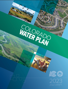
State officials are hoping dire climate predictions and water shortages will convince Coloradans to get involved in planning how to share a dwindling resource.
Colorado Water Conservation Board staff released the second iteration of the Colorado Water Plan on Thursday, which is now open for public comment. The first version of the plan was implemented in 2015.
Words from the late water expert and former Colorado Supreme Court Justice Greg Hobbs set the tone on page 1 of the document: The 21st century is no longer about developing a resource, it is now an era of limits and learning how to share a developed resource.
“I think we get to educate and engage and inspire and be an example and I think that’s the benefit,” said CWCB Executive Director Becky Mitchell. “I think when we are given the opportunity to lead, Coloradans do that.”
The updated plan lays out four interconnected areas for action: vibrant communities, robust agriculture, thriving watersheds and resilient planning. Although municipal and industry does not currently experience a gap, the plan predicts a 230,000 to 740,000 acre-foot shortfall for cities and industries by 2050. According to the plan, about 20% of agriculture diversion demand is currently not met statewide, and that gap could grow to a 3.5 million acre-foot shortfall by 2050 under the “hot growth” scenario that would see temperatures rise 4.2 degrees Fahrenheit.
Meeting these supply-demand gaps will require hundreds of water projects throughout Colorado’s eight river basins, and carries a price tag of $20 billion. These projects, many of which have benefits to more than one water-use sector, are laid out in each roundtable’s Basin Implementation Plan.
Boaters float the Yampa River. According to the updated state Water Plan, summer recreation flow needs may not be met in the future due to lower peak flows, fueled by climate change. CREDIT: HEATHER SACKETT/ASPEN JOURNALISM
Backdrop of climate change
The 239-page document is set against the backdrop of climate change, which plays a bigger role in this water plan than in the 2015 version. The first water plan did not include projections of future climate change in its analyses. Three of the five planning scenarios now include assumptions of hotter conditions in the years to come.
According to the plan, Colorado has had three of the top five driest years on record since 2000 and has experienced a 2 degree Fahrenheit increase in average temperature. The state may see an additional 2.5 to 5 degree warming by 2050. Most projections show a decline in spring snowpack and more frequent heat waves, drought and wildfire, all of which have implications for water.
Environmental and recreation water needs could see the worst impacts since those uses generally have the most junior water rights.
“Peak runoff may shift as much as one month earlier, which could lead to drier conditions in summer months and impact storage, irrigation and streamflow,” the plan reads. “Decreased peak flows across the basin create risks for riparian/wetland plants and fish habitat. Instream flows and recreational in-channel diversions may not be met if June-August flows decrease due to climate change.”
The pie chart shows how much water each sector uses in Colorado, as well as how much water originating here leaves the state. CREDIT: COURTESY COLORADO WATER PLAN
Old tensions and trends
The new plan addressed a tension from the first plan: Front Range water providers would like the ability to develop new transmountain diversions in the future, while Western Slope stakeholders say not to look to the Colorado River basin for more water for thirsty cities. Colorado’s Front Range currently takes about 500,000 acre-feet of water a year from the headwaters of the Colorado River basin across the Continental Divide.
The plan stopped short of a detailed analysis of transmountain diversions because of ongoing litigation and permitting processes, but promised that state staff would facilitate discussions about transmountain diversions before the next update to the plan.
“Our promise to West Slope folks was when we could get past those legal barriers, we would take an honest look at trying to have a better conversation,” said Russ Sands, senior program manager for the CWCB’s water supply planning section. “I think we owe it to our stakeholders to try and focus on analysis.”
The plan says Colorado will continue the slow but steady transformation of moving water from agriculture — by far the largest water user — to cities, with nearly 14,000 acres of irrigated land expected to be urbanized, one-third of that in the Grand Valley. Stakeholders estimate the loss of irrigated land to “buy-and-dry” to be even greater at 33,000 to 76,000 acres, which is three times higher than the 2015 Water Plan estimate.
But this could be eased by innovative and flexible agreements between water users that allow the temporary transfer of water from one use to another. Formerly known as Alternative Transfer Methods, state officials have rebranded them Collaborative Water Sharing Agreements, which allow water sharing, but prevent the permanent removal of water from the land.
The Crystal River wends its way downstream along the flanks of Mount Sopris to its confluence with the Roaring Fork River near Carbondale. State officials have released an update to the 2015 Water Plan, which includes hotter and drier future planning scenarios. CREDIT: HEATHER SACKETT/ASPEN JOURNALISM
Equity and engagement
State officials have also made an effort to be more inclusive this time around and in March 2021 convened a Water Equity Task Force to help shape a guiding set of principles around equity, diversity and inclusion to inform the water plan. Abby Burk, the western rivers regional program manager with Audubon Rockies, was an equity task force member.
“People are engaging and leaning into the space other than just the water right owners,” she said. “We are all supported by water every single day. How do we expand this decision-making to include more voices? How do we open our arms and encourage more people to come into this space?”
The 2015 Water Plan racked up more than 30,000 comments and state officials are hoping Coloradans become even more involved this time around. The plan lays out three levels of engagement citizens can take and encourages Coloradans to promote water conservation, join water-focused stakeholder groups and coordinate with local leaders to advance water policy.
And there is a small bright spot that shows the potential for change when citizens get engaged: The plan says that Coloradans have reduced their per-person water use from 172 to 164 gallons a day, a 5% reduction in demand since 2008, mainly due to conservation efforts.
Sands said the tough conditions can open people’s minds and make them more willing to come to the table to talk.
“I think we are actually going to see more collaboration than ever,” he said.
The update to the Colorado Water Plan is open for public comment until September 30 and CWCB staff will also hold four online listening sessions. The plan is scheduled to be finalized by the CWCB in January 2023.
Aspen Journalism covers water and rivers in collaboration with The Aspen Times.
Colorado River “Beginnings”. Photo: Brent Gardner-Smith/Aspen Journalism
Click the link to read the article on the Colorado Public Radio website (Michael Elizabeth Sakas). Here’s an excerpt:
The mid-August deadline is quickly approaching for the states — Colorado, Utah, Wyoming, New Mexico, California, Nevada and Arizona — to figure out how to cut water usage down by 2 to 4 million acre-feet. For context, the entire state of Arizona is allowed to use 2.8 million acre-feet of river water each year.
Becky Mitchell, the commissioner of the Colorado Water Conservation Board, represents Colorado at the planning table with other states in the basin. Right now, her work is focused on collaborating with the other states in the upper part of the river basin — Utah, Wyoming and New Mexico — to come up with a list of ways their states can cut down on how much water they use. In a conversation on CPR’s Colorado Matters, Mitchell said most of that responsibility should be on the states in the lower part of the river basin: Arizona, Nevada and California.
“They’re using more than mother nature provides,” Mitchell said.
Mitchell said the states in the upper part of the river basin had been forced to use less water because of ongoing drought worsened by climate change. The states in the lower basin use water stored in Lake Powell and Lake Mead, the two largest reservoirs in the U.S., which she said has allowed those states to increase their water usage in the last few years. Mitchell said water stored in Lake Powell and Lake Mead allows the lower basin states to use more water than the river can provide, which has significantly dropped after decades of ongoing drought and the impacts of climate change.
Crop residue November 4, 2021. Photo credit: Joel Schneekloth
Click the link to access the paper on the Nature Sustainability website (Chloe MacLaren, et al.). Here’s the abstract:
Ecological intensification (EI) could help return agriculture into a ‘safe operating space’ for humanity. Using a novel application of meta-analysis to data from 30 long-term experiments from Europe and Africa (comprising 25,565 yield records), we investigated how field-scale EI practices interact with each other, and with N fertilizer and tillage, in their effects on long-term crop yields. Here we confirmed that EI practices (specifically, increasing crop diversity and adding fertility crops and organic matter) have generally positive effects on the yield of staple crops. However, we show that EI practices have a largely substitutive interaction with N fertilizer, so that EI practices substantially increase yield at low N fertilizer doses but have minimal or no effect on yield at high N fertilizer doses. EI practices had comparable effects across different tillage intensities, and reducing tillage did not strongly affect yields.
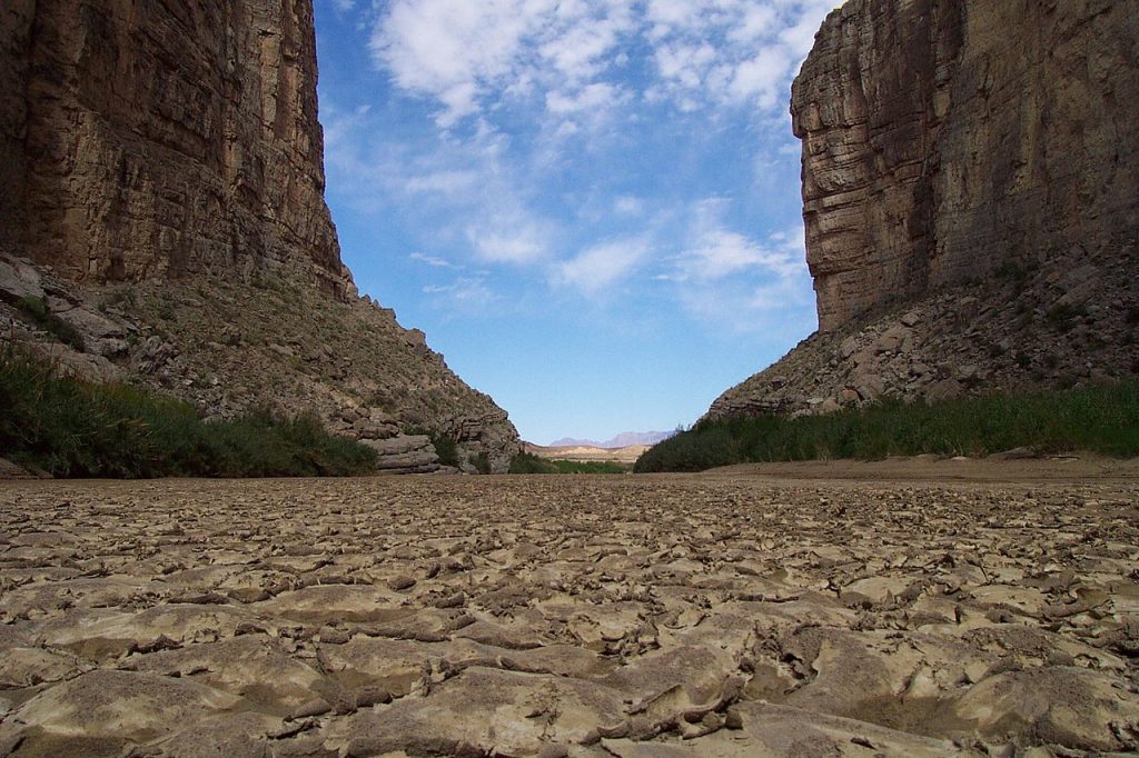
Some parts of the Rio Grande already experience a dry river most of the year. Photo by WildEarth Guardians.
Click the link to read the article on the Texas Observer website (Dylan Baddour). Here’s an excerpt:
Near Santa Elena Canyon, a river gage measured 0 cubic feet per second for the first time on record on April 28, and it stayed that way for most of the next month. It’s a grim warning sign for the lower reaches of the Rio Grande, which provide water to millions of acres of crops and to many people in Texas and Mexico. The river has dried up in other spots off and on for decades now, battered by drought and overuse, but never in these places. No one alive has seen the river as it looks today.
“The scope of this is significantly more widespread than I have ever seen,” said Raymond Skiles, a retired park ranger who spent 31 years at Big Bend National Park and grew up in the region.
Heavy rains fell in West Texas and North Mexico over the first weekend in June, sending a raging pulse of water down the canyons of Big Bend and wetting the riverbed again. It was sweet relief from the ongoing drought, but nothing near enough to bring the once-great river of Texas back to life.
What seems like the death throes of this river began slowly. Upstream, between El Paso and Presidio, the so-called “forgotten” stretch has run dry intermittently for the last 40 years. But water from the Rio Conchos, which meets the Rio Grande at Presidio, always brought the river back to life before.
Skiles said he only saw the river dry up once below the Conchos in Big Bend National Park. It was 2003 and it happened along a particularly remote area, accessible only via a 15-mile round-trip hike. The phenomenon lasted only several weeks and never affected more visited stretches of river upstream, so few visitors noticed.