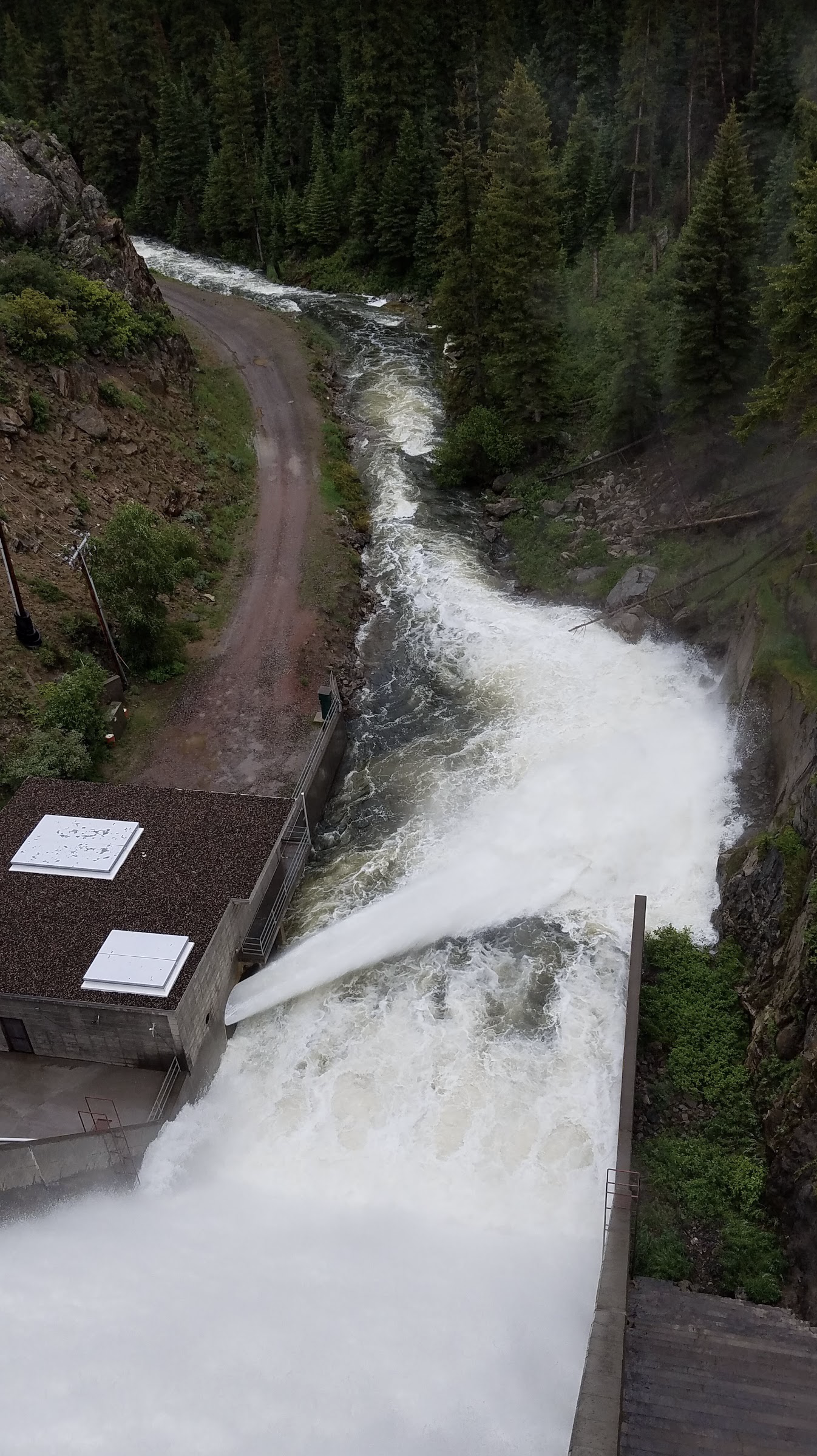
Near the end of July, flows into Stagecoach Reservoir from the Yampa River dropped below 40 cubic feet per second for a few days. That threshold is important because it helps, in part, determine how much water flows out of the reservoir and continues downstream to Steamboat Springs. If the flow coming in is more than 40 cfs, then at least 40 cfs is usually discharged at the bottom of Stagecoach Dam. If the inflow drops below 40 cfs, the outflow generally would as well, leaving less water for critical fish habitat below the dam and in the river in general.
The long-term deal is one of the first in the state and was made possible by a 2020 state law allowing such agreements. Before, groups like the Water Trust and Upper Yampa district needed to rehash out a contract each year…
But this year has been different. While the snowpack wasn’t impressive, spring precipitation slowed melting, and there was still snow in the basin until June 23, according to the Natural Resources Conservation service. Monsoon rains have further buoyed the river, with Steamboat measuring more than 10 inches of rain from May to July. While not necessarily a good roll, this year doesn’t seem like a bad one.
“I think it is on the low side of average,” said Emily Lowell, the district engineer for the Upper Yampa Water Conservancy District. “Runoff was pretty average, and I think monsoonal rains this summer have made it sustain that average.”
But even in a close-to-average year, releases from the reservoir are still needed, though not to the same extent. Since the first releases at the end of July, inflows and outflows have both stayed above 40 cfs and more of the trust’s water hasn’t been needed.
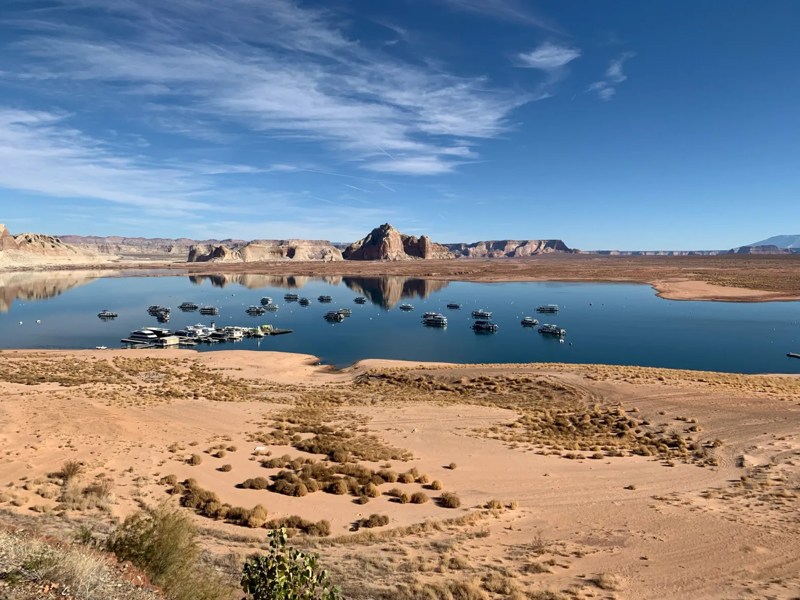
Houseboats on Lake Powell on Dec. 13, 2021, near Wahweap Marina, where the quarter-mile-long boat ramp is unusable due to low water levels. The Bureau of Reclamation Commissioner has said 2 to 4 million more acre-feet of conservation is needed to protect the system, leaving water managers wondering what authority the feds have over upper basin water projects. CREDIT: HEATHER SACKETT/ASPEN JOURNALISM
As the deadline approaches for the seven Colorado River basin states to come up with a plan to conserve water, some Colorado water managers are asking what authority the federal government has in the upper basin and which water projects could be at risk of federal action.
U.S. Bureau of Reclamation Commissioner Camille Touton sent water managers scrambling when she announced in June that they had a 60-day window to find another 2 to 4 million acre-feet of water to conserve or the federal government would step in to protect the system. With many reservoirs, transbasin diversion systems and irrigation projects in Colorado tied in one way or another to the Bureau of Reclamation, some are asking if the water in these buckets could be commandeered by the feds to make up the shortfall.
“I think that there’s probably a good argument that the Secretary (of the Interior) has some authority under those projects,” said Eric Kuhn, Colorado River author and former Colorado River Water Conservation District general manager. “The projects on the Western Slope and in the upper basin states that are owned by the federal government and are ultimately under the authority of the Secretary of the Interior, those are the projects at risk.”
Mcphee Reservoir
Paonia Reservoir. Photo credit: The College of New Jersey
Rifle Gap Reservoir via the Applegate Group
Taylor Park Reservoir
Ridgway Dam via the USBR
Ruedi Reservoir. Photo credit Greg Hobbs
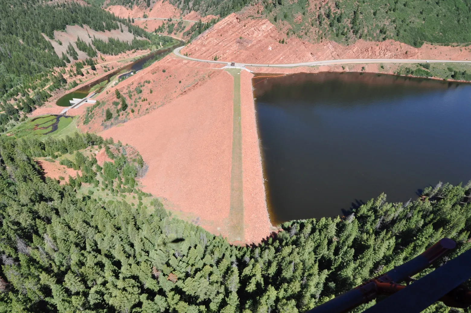
There are many dams and reservoirs across Colorado that are tied to the Bureau of Reclamation’s 20th century building frenzy to impound water and “reclaim” arid regions through irrigation. On the Western Slope, some of the well-known projects include the Fryingpan-Arkansas Project (Ruedi Reservoir), Dallas Creek Project (Ridgway Reservoir), the Dolores Project (McPhee Reservoir), Paonia Reservoir, the Grand Valley Project, the Silt Project (Rifle Gap Reservoir), the Uncompahgre Project (Taylor Park Reservoir) and more.
In general, the local entities like conservancy districts, irrigators and municipalities who use the water are responsible for repaying the Bureau for the cost of the project. But the infrastructure is owned by the Bureau of Reclamation. Some projects are operated by Reclamation and some are operated by a local entity. Many also have a hydropower component.
“I think each project operator is having to look at their contractual obligations with the Bureau and their attorneys are going back over those with a fine tooth comb to see if the arm of the Bureau can reach up through Lake Powell and into the upper basin states,” said Kathleen Curry, a rancher and Gunnison County representative on the Colorado River Water Conservation District. “All of the upper basin projects are going to need to look real hard at what authority the Bureau has.”
Last year Reclamation made emergency releases out of Blue Mesa, Flaming Gorge and Navajo reservoirs to prop up Lake Powell. In this instance their authority was not questioned since these reservoirs are, along with Lake Powell, the four initial reservoirs of the Colorado River Storage Project. They store what’s called “system water,” which is used specifically to help the upper basin meet its delivery obligations to the lower basin.
But water managers still don’t know exactly what, if anything, Reclamation is allowed to do with the water contained in other reservoirs with Reclamation ties.
The crest of the dam across the Fryingpan River that forms Ruedi Reservoir, which can hold 102,373 acre-feet of water. Some Western Slope water managers are asking what authority the Bureau of Reclamation has over water projects with Reclamation ties in the upper basin. CREDIT: PHOTO: COURTESY OF BUREAU OF RECLAMATION
No answers from officials
At the River District’s third quarterly board meeting in July, board members repeatedly tried to pin down answers from federal and state officials without much luck.
Montrose County representative and state Rep. Marc Catlin asked state engineer Kevin Rein where he stood on whether the Bureau of Reclamation could make reservoirs with Reclamation ties release water downstream to Lake Powell to meet the 2 to 4 million acre-feet conservation goal.
“If the Bureau of Reclamation comes into the state of Colorado and says it wants to move water… down to Lake Powell, what’s the state engineer going to do?” Catlin asked. “Are those water rights under state law or federal law?”
Rein did not know the answer.
“I’m not sure what authority — this is not one of those rhetorical ‘I’m not sure,’ I really am not sure — what authority the Bureau of Reclamation would have to induce a federal project with state water rights to release them to get to Powell,” Rein said.
Later in the meeting, Katrina Grantz, the Bureau of Reclamation’s Upper Colorado Basin Assistant Regional Director, gave a presentation and took questions from board members. Curry asked if changes could be proposed to the operation of projects within the 15 counties represented by the River District with federal ties to get closer to the 2 to 4 million acre-feet. Grantz side-stepped the question.
“At this point we are not looking at specific locations,” she said. “I would turn it around and say: Are there areas where you locally think there might be areas to conserve?”
River District General Counsel Peter Fleming said the authority of the feds in the upper basin is untested. This is partly because the upper basin has dozens of small Reclamation projects as well as thousands of individual water users on private ditch systems that are not affiliated with the federal government. Colorado has generally been left alone to administer this complex system of water rights under the state doctrine of prior appropriation, which means older water rights get first use of the river.
The lower basin, in contrast, has only about 20 diversions — and only six or so big ones — from the Colorado River. And each entity that uses water from Lake Mead has to have a contract with Reclamation, meaning the federal government is directly involved with water deliveries.
“The reason I think these issues are untested is historically the secretary’s role in the upper basin has been different than the secretary’s role in the lower basin,” Fleming said. “It’s much more hands-off. The difference in river administration is huge.”
Fleming said that the River District does not have advice for its water users on the situation, other than to reiterate the upper basin stance that the responsibility to come up with the 2 to 4 million acre-feet lies overwhelmingly with the lower basin.
“At the end of the day I think there will be a big effort to try to resolve things through agreement and I believe the secretary will exercise her authority to the greatest extent she can without triggering litigation,” Fleming said.
Water managers may not have to wait long to get some clarity. The deadline for the states to come up with a conservation plan before the feds take action to protect the system is fast approaching. The upper basin states, through the Upper Colorado River Commission, have put forward a 5 Point Plan, which lays out actions they say are designed to protect the reservoirs.
Amee Andreason, public affairs specialist with the Bureau of Reclamation, said officials may answer the question of federal authority in the upper basin at a media event on Aug. 16 that coincides with the release of the August 24-month study, which lays out reservoir operations for the following water year.
If the feds end up curtailing uses in the lower basin, it could set a precedent that would strengthen the argument that they can do the same in the upper basin, Kuhn said.
“That’s one I think is the elephant in the room,” he said. “The fact that the River District board was asking about authorities tells you people are thinking about it.”
This story ran in the Aug. 4 edition of the Sky-Hi News.
The seven Colorado River states – Arizona, California, Colorado, New Mexico, Nevada, Utah and Wyoming – face a daunting mid-August deadline. The federal government has asked them to come up with a plan to reduce their combined water usage from the Colorado River by up to 4 million acre-feet in 2023.
That is a massive reduction for a river system that currently produces about 12.4 million acre-feet. The Bureau of Reclamation, which manages the Colorado River, warned that it will “act unilaterally to protect the system” if the states cannot come up with an adequate plan on their own.
The seven states have worked cooperatively over the past two decades to identify solutions to a shrinking river. But their response now, much like the global response to climate change, seems far from adequate to the enormous challenge.
In a recent letter to BuRec, the Upper Colorado River Commission, speaking for the four Upper Basin states, proposed a plan that adopts a business-as-usual, “drought-reduction” approach. They argue that their options are limited because “previous drought response actions are depleting upstream storage by 661,000 feet.”
The Commission complains that water users “already suffer chronic shortages under current conditions resulting in uncompensated priority administration, which includes cuts to numerous present perfected rights in each of our states.”
This leads the Commission to conclude that any future reductions must come largely from Mexico and the Lower Basin states of Arizona, California and Nevada, because they use most of the water.
But the Lower Basin states have already taken a significant hit to their “present perfected rights,” and if BuRec makes good on its promise to act unilaterally, they will face another big reduction. The cooperative relationship among the Basin states will not endure if the Upper Basin refuses to share the burden by reducing its consumption.
The Gross Reservoir Expansion Project involves raising the height of the existing dam by 131 feet. The dam will be built out and will have “steps” made of roller-compacted concrete to reach the new height. Image credit: Denver Water
A good place to start might lie with two Colorado projects to divert water from the Colorado River basin to the Front Range. Both began construction this summer. The Gross Reservoir Expansion Project will triple the size of one of Denver Water’s major storage units. Denver Water’s original justification for this project – to serve Denver’s growing urban population – seems odd given that water demand in their service area over the past two decades has shrunk, even as its population rose by nearly 300,000.
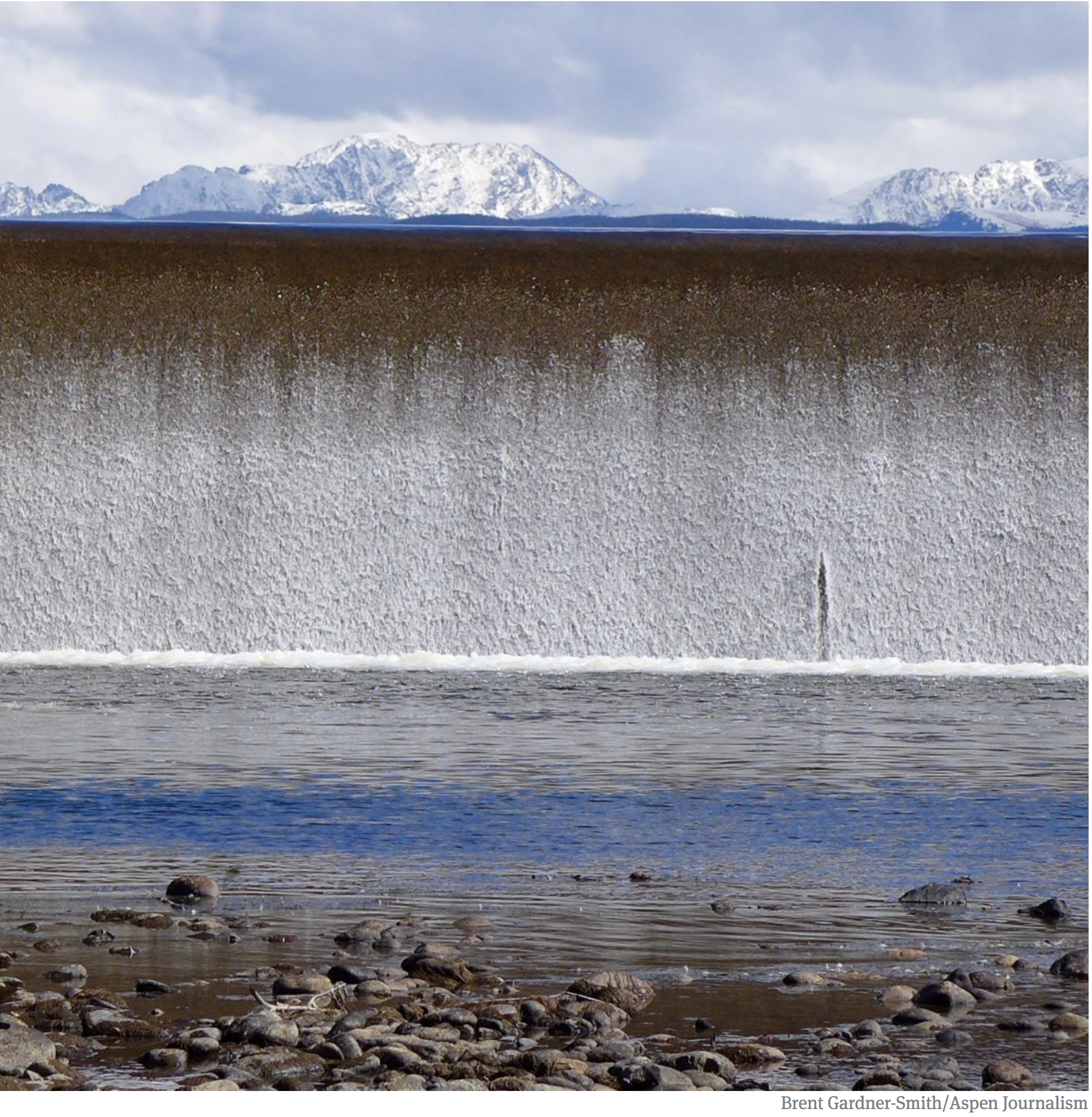
Outflow from the dam across the Colorado River that forms Windy Gap Reservoir. Taken during a field trip the reservoir in September, 2017.
Similar questions have been raised with the Northern Colorado Water Conservancy District’s Windy Gap Firming Project, which plans to store Colorado River water to support population growth in Front Range cities.
These two projects suggest that Colorado is prepared to exacerbate the current crisis when the opposite response is so desperately needed.
Abandoning these two projects would signal that Colorado is serious about giving the Colorado River a fighting chance at survival. It might also jump-start good-faith negotiations over how Mexico, the states, and tribes might work to achieve a long-term solution to this crisis.
The homestead laws of the 19th century attracted a resilient group of farmers to the West who cleverly designed water laws to secure their water rights against all future water users. “First in time, first in right” became the governing mantra of water allocation, because, except for Tribal Nations, the farmers were first.
That system worked well for many years. As communities grew, cities and water districts built reservoirs to store the spring runoff, ensuring that water was available throughout the irrigation season.
Climate change and mega-droughts have upended that system. Nowhere have the consequences been as dire as in the Colorado River Basin. America’s two largest reservoirs, Lake Powell and Lake Mead – key components of the Colorado River’s water storage system – have not filled for more than two decades. They now sit well below 30% of their capacity.
Hotter temperatures, less mountain snowpack, and dry soils that soak up runoff like a sponge have brought us to this seven-state crisis. All seven states must now share the pain of addressing this crisis.
The Upper Basin Commission’s anemic response to BuRec’s plea is not a serious plan. We can do better and we must.
Mark Squillace and Quinn Harper are contributors to Writers on the Range, writersontherange.org, an independent nonprofit dedicated to spurring lively conversation about the West. Mark Squillace is the Raphael J. Moses professor of natural resources law at the University of Colorado Law School. Quinn Harper is a graduate student pursuing a master’s degree in natural resource policy at the University of Colorado, Boulder.
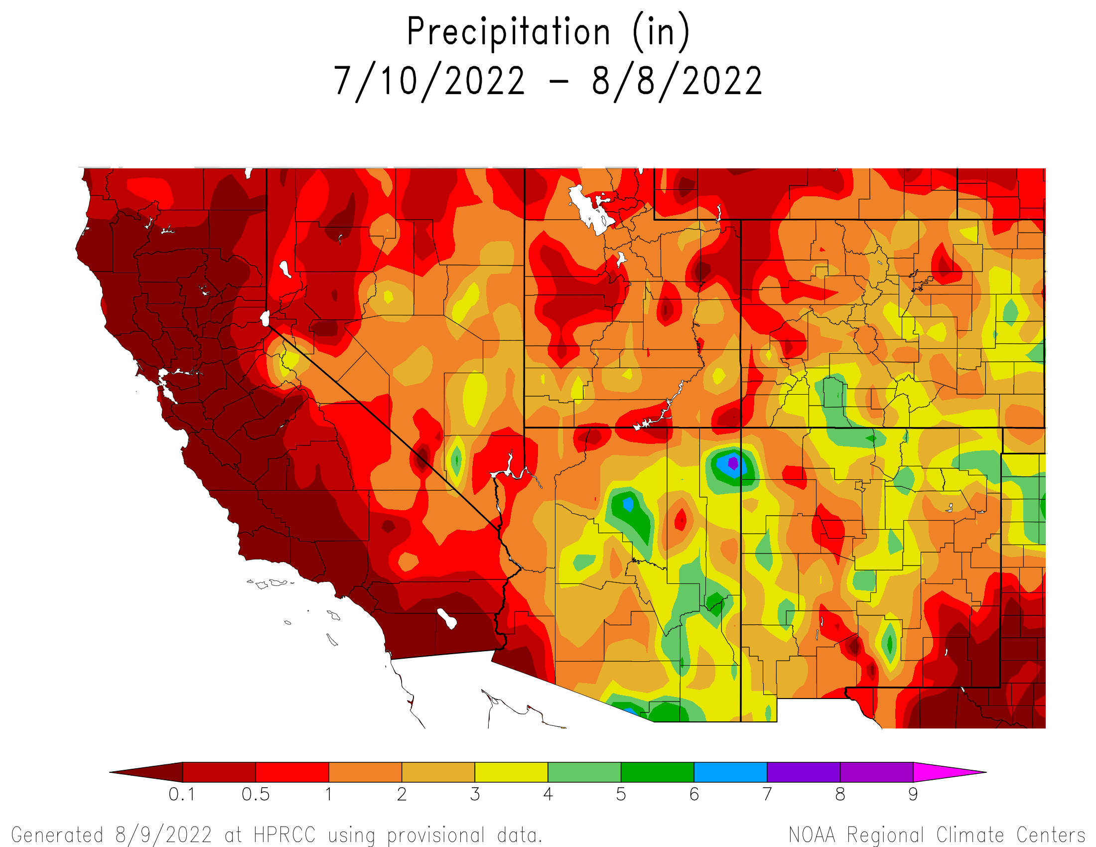
This week, according to the Community Collaborative Rain Hail and Snow Network (CoCoRaHS) website, Station CO-AU-33, located on Cactus Drive in Aspen Springs west of Pagosa Springs, experienced the third highest rain total in Colorado of 3.46 inches for the period between July 27 and Aug. 3. CoCoRaHS also indicates that, for the period between July 20 and Aug. 3, sites in Archuleta County received between 2.85 and 4.20 inches of rain. Higher precipitation totals were concentrated in and to the north and west of Pagosa Springs, with the highest total being reported near Hidden Valley Lake up Four- mile Road north of Pagosa Springs…
Rivers and drought
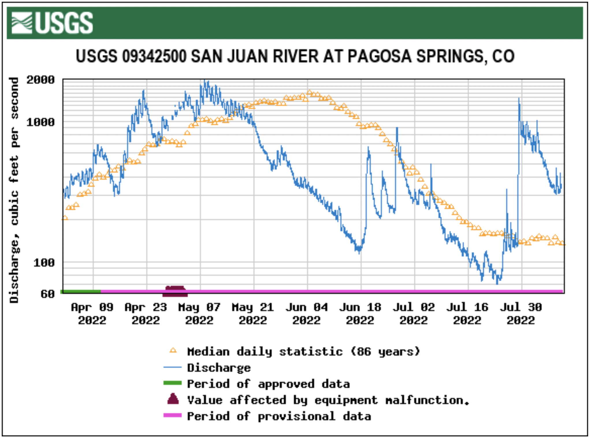
Stream flow for the San Juan River on Aug. 3 at approximately 12 p.m. was 611 cubic feet per second (cfs), according to the U.S. Geological Service (USGS) National Water Dashboard. This is down from a nighttime peak of 1,020 cfs at 8:30 a.m. on Aug. 2. These numbers are down from a recent peak flow of 1,470 cfs at 4:15 a.m. on July 29. However, flows are up from last week’s reading of 134 cfs at noon on July 27.
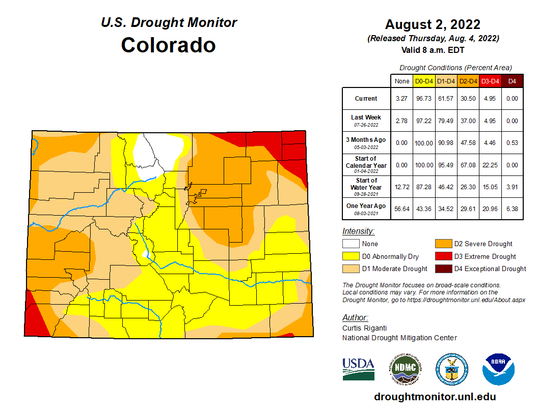
Colorado Drought map Monitor August 2, 2022.
The National Oceanic and Atmospheric Administration (NOAA) National Integrated Drought In- formation System (NIDIS) reports that 100 percent of the county is experiencing drought. The NIDIS places the entire county in a moderate drought…The NIDIS also places 46 percent of the county, primarily the southern and western portions, in a severe drought.
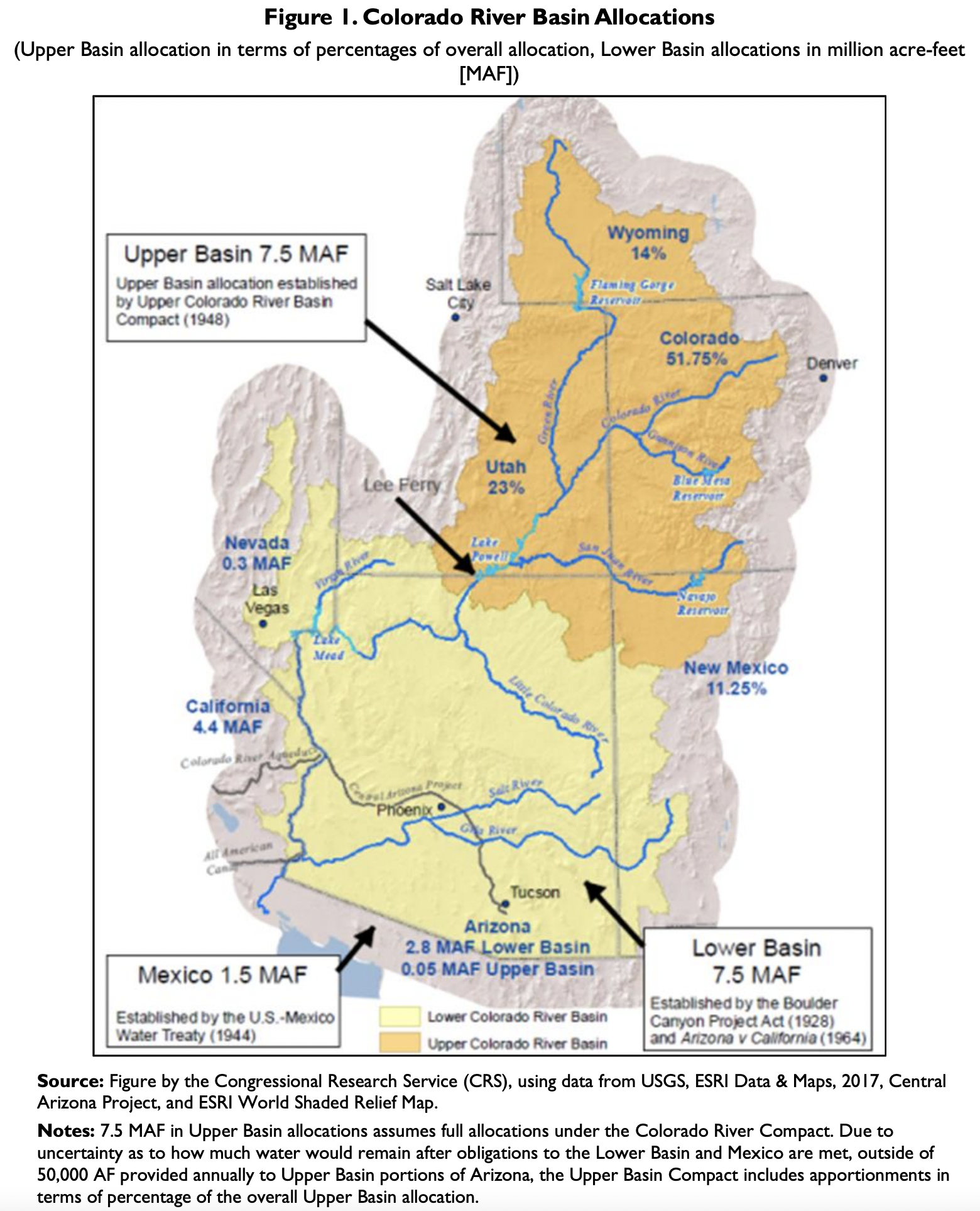
The Colorado River Basin (Figure 1) covers more than 246,000 square miles in seven U.S. states and Mexico. Basin waters are managed and governed by multiple laws, court decisions, and other documents known collectively as the Law of the River. The Colorado River Compact of 1922 established a framework to apportion water supplies between the river’s Upper and Lower Basins (divided at Lee Ferry,AZ). Each basin was allocated 7.5 million acre-feet (MAF) annually under the compact; an additional 1.5 MAF in annual flows was made available to Mexico under a 1944 treaty. Since the Upper Basin’s waters were developed after much of the Lower Basin, its apportionments are significantly less than the full amount allowed under the compact and are framed mostly in terms of percentages of available supplies. The Bureau of Reclamation (Reclamation) plays a prominent role in basin water management due to the many federally authorized projects in the basin.
Credit: The Congressional Research Service
The Colorado River Basin is in the midst of a long-term drought, during which consumptive use has regularly exceeded natural flows. When federal and state governments originally approved the 1922
compact, it was assumed based on the historical record that river flows would average 16.4 MAF per year.
Actual flows from 1906 to 2020 were approximately 13.9 MAF, with flows averaging approximately 12.5 MAF since the onset of the basin’s drought in 2000. These conditions are projected to continue.
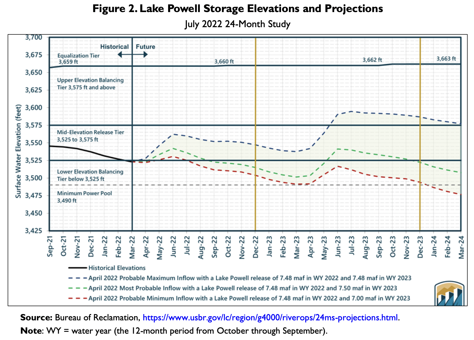
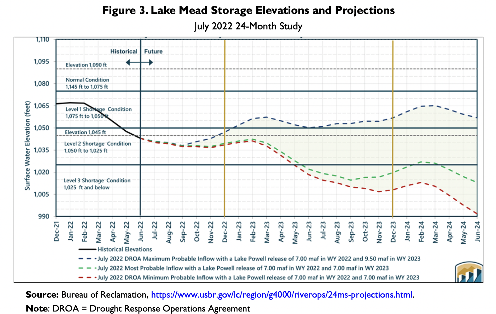
Observers track the status of two large federal reservoirs—Lake Powell in the Upper Basin, impounded by Glen Canyon Dam, and Lake Mead in the Lower Basin, impounded by Hoover Dam—as an indicator of basin storage conditions. Reclamation makes operational decisions for basin reservoirs in monthly 24-month studies. Recent 24-month studies projected additional reductions in water storage at both reservoirs (Figure 2, Figure 3).
Credit: USBRCredit: USBR
Mitigating Drought in the Colorado River Basin Previously, there have been multiple efforts to improve the basin’s water supply outlook, including the 2003 Quantitative Settlement Agreement, the 2007 Interim Shortage Guidelines, and the 2019 drought contingency plans (DCPs) for the Upper and Lower Colorado River Basins. (The latter were authorized by Congress in P.L. 116-14.) The DCPs required reduced Lower Basin deliveries based on Lake Mead storage levels, authorized additional water conservation efforts, and put in place the framework for a Drought Response Operations Agreement (DROA) to coordinate Upper Basin operations to prevent the loss of hydropower generation at Glen Canyon Dam.
Despite these efforts, storage levels at both reservoirs have continued to fall. In August 2021, Reclamation declared the first-ever Level One Shortage Condition for the Lower Basin, which formally triggered delivery curtailments for Arizona (512,000 AF) and Nevada (21,000 AF). Reclamation’s August 2021 24-month study also indicated for the first time the possibility of Lake Mead falling below 1,020 feet within two years, which resulted in agreement on a new set of actions in 2021, known as the 500+ Plan. This effort is expected to result in the conservation of an additional 500,000 AF in Lake Mead in 2022 and
2023 (i.e., 1 MAF total).
In March 2022, Lake Powell fell below 3,525 feet for the first time since the late 1960s. To alleviate the potential for lost hydropower generation at Glen Canyon Dam, the Department of the Interior initiated DROA operations, resulting in operational changes in July 2021 and January 2022. In May 2022, Reclamation invoked emergency authority to move approximately 500,000 AF of water from Flaming Gorge Reservoir to Lake Powell and held back 480,000 AF of Lower Basin releases pursuant to the 2007 guidelines.
At a June 14, 2022, congressional hearing, Reclamation announced that states needed to conserve an additional 2 MAF to 4 MAF in 2023 to protect storage volumes over the near term (2023-2026). This estimate was the result of a 2022 Reclamation analysis. Reclamation noted that if the target is not met with voluntary commitments by August 2022, the agency would act unilaterally. In a July 18, 2022, letter to Reclamation, Upper Basin representatives declined to contribute a specific volume of cutbacks to these
efforts, instead laying out a five-point plan as the basis for its water conservation efforts.
Congress is involved in basin management primarily through directives and authorizations for Reclamation projects and activities. In addition to the 2019 authorization of the DCPs, Congress has authorized “system conservation” efforts in the basin that expire in 2022. Congress also has appropriated regular and supplemental appropriations for Colorado River water conservation efforts in addition to regular operational funds. Legislation under consideration in the 117th Congress would enact other new authorities aimed at improving basin water management.
The 2007 Interim Shortage Guidelines and the 2019 DCPs are set to expire at the end of 2026. Extending or amending previous agreements is central to future basin water management. On June 20, 2022, Reclamation published a “pre-scoping” notice seeking input on how to foster participation in the National Environmental Policy Act (NEPA) process to develop post-2026 basin operations. A formal notice for NEPA scoping is expected in 2023.
Author Information Charles V. Stern
Specialist in Natural Resources Policy
Unfortunately, the situation on the Colorado River is not unique. Colorado’s mountains are the headwaters of four major river systems: the Colorado, the Platte, the Arkansas and the Rio Grande. Each river provides critical water supplies for the present and future needs of our state; each is being impacted by the effects of climate change; and under Interstate water compacts signed decades ago, Colorado must share each with its neighboring downstream states. Climate change, or what scientists are now referring to as aridification, has caused all of Colorado to be hotter and drier. The combined effects of climate change, interstate water compact obligations and intense competition for the available water among different communities and water use sectors within our state means that future Coloradans will have to learn to do more with less water. This will take bold action, compromise and a new era of innovation and cooperation among competing water interests within Colorado and among Colorado and its neighboring states.
Rio Grande through the eastern edge of Alamosa July 5, 2022. Photo credit: Chris Lopez/Alamosa Citizen
Already, the farmers in Colorado’s fertile Rio Grande Basin are struggling to maintain an aquifer by restricting pumping. They face an awful choice — reduce their collective uses of the aquifer to a sustainable level so that some farms can survive, or they all fail. At the same time, the surface water supply from the Rio Grande River, which must be shared with New Mexico and Texas, has diminished and most likely will continue to do so.
The Republican River’s South Fork near Hale, Colorado, with the region’s seemingly endless fields. Credit: Wikimedia Commons/Jeffrey Beall
The Republican River Basin, a small but agriculturally important river system that originates on the plains and flows east to its confluence with the Missouri River, is also stressed by overuse of the river supply. Productive farm fields are being fallowed so that Colorado can comply with the Republican River Compact. Fortunately for the Rio Grande and Republican river basins, the General Assembly set aside $60 million to buy out farms in order to leave water in the aquifers and river systems. That amount is a drop in the bucket for what will be needed to recover and sustain those systems.
Photo shows Tennessee Creek near the confluence of the East Fork Arkansas River in winter with snow on the Continental Divide of the Americas. The report evaluates current and emerging snow measurement technologies for the Western United States. Photo: Reclamation
The South Platte River runs near a farm in Henderson, Colorado, northeast of Denver. Henderson is the site of one of the possible reservoirs for the regional water project proposed by SPROWG. Photo credit: Lindsay Fendt/Aspen Journalism
The Arkansas River and South Platte River systems also have significant challenges. These basins are home to 85% of Colorado’s population and to most of its commercial agriculture. The farm economy in the Arkansas has already suffered when the Colorado State Engineer had to cut back the use of alluvial wells, which were depleting flows to the Arkansas River and causing Colorado to be out of compliance with the Arkansas River Compact. The South Platte River system, which relies on return flows to sustain the river past the state line, is seeing much higher demands. The current return flow regime is threatened by Nebraska reinvigorating the proposed Perkin’s Ditch, a century-old feature provided for in the 1923 South Platte Compact. Both these basins are being hammered by the combined impacts of Front Range cities rushing to buy and dry existing farms to provide water for future growth while their water supplies imported from the Colorado River Basin have become less reliable due to climate change caused drought and compact obligations.
Colorado’s future economy will depend on implementing innovative methods to sustain, deliver and treat water supplies while leaving enough water in our streams to maintain healthy and thriving aquatic ecosystems. Water delivery entities need to think broader to collaborate with others on ways to manage and share their supplies and their systems.
From the 2018 Tribal Water Study, this graphic shows the location of the 29 federally-recognized tribes in the Colorado River Basin. Map credit: USBR
Click the link to read the article on the InkStain website (John Fleck):
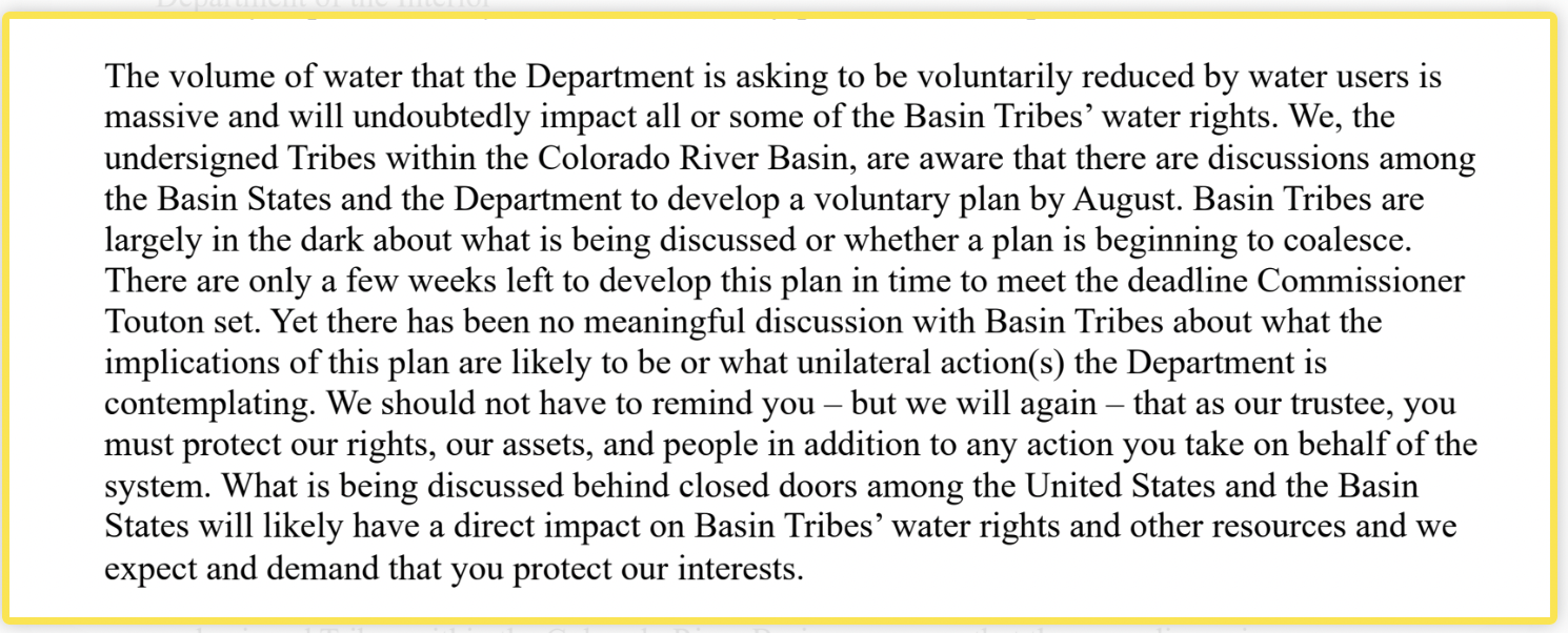
In a July 22 letter, the leaders of 14 Colorado River Basin Tribal governments complained to the U.S. Department of Interior about being left out – again – of the current negotiations around short terms Colorado River cutbacks:
Colorado River “Beginnings”. Photo: Brent Gardner-Smith/Aspen Journalism
Click the link to read the article on the Inkstain website (John Fleck):
Janet Wilson had a helpful story yesterday in the Desert Sun about California’s negotiations over its piece of the looming Colorado River cutbacks. Its bottom line is that California – the state with the largest Colorado River allocation – is talking about kicking in 500,000 acre feet of water. Or maybe it’s really just 400,000 acre feet of water – as the Metropolitan Water District of Southern California’s Bill Hasencamp told her, paraphrased, the negotiations are fluid and numbers could change.
4 million acre feet is obviously out of reach. It always was.
But if Wilson’s numbers about California’s contributions are right – and she’s a good reporter, we have every reason to believe they’re in the ballpark – 2 million acre feet of additional conservation is beyond the grasp of a voluntary deal as well.
Nevada’s share of the river is so tiny that its contribution is couch cushion change, a rounding error.
That leaves, in round numbers, 1.5 million acre feet of water to come out of Arizona just to get to Touton’s bottom line number for additional conservation. That would require completely drying up the Central Arizona Project canal. (CAP is taking 1.031maf this year, and averaged ~1.4maf over the previous fives years). I’m frequently surprised by Arizona, but it seems unlikely that they’ll agree to a voluntary deal that dries up the CAP canal. If that’s where we end up, Arizona’s best alternative to a negotiated agreement will be to just make the feds do it, make them take the heat. (Worth noting that FiveThirtyEight has Arizona Democrat Mark Kelly slightly favored to hold his seat. Water politics is high stakes politics.)
Combine that with the reality that Arizona’s Native American communities, major water rights holders, have complained that they’ve been cut out of this entire process, according to a July 22 letter just surfaced.
I can imagine creative accounting that might allow everyone to grin through their teeth and count water moved down to Lake Powell from Flaming Gorge and other Upper Basin reservoirs as part of the 2 million. That’s pretty clearly not what Touton called for in June. It’s not “additional conservation”. But it might create some space for a face-saving deal.
Whether that would be enough to protect us from dead pool is another question.
A REMINDER OF THE STAKES
The Bureau of Reclamation’s most recent “minimum probable” model runs show Lake Powell dropping below power pool – unable to generate electricity, and forced to move water through bypass tubes that Reclamation has made clear it does not trust – by October 2023.
Under that same scenario, Lake Mead drops to elevation 992 feet above sea level over the next 24 months.
(Trust me, having to type a Lake Mead elevation level without having to use a comma made me clench.)
At that point, a lack of water will make massive cuts a self-executing reality. We’ve drained our buffer. You can’t use water that doesn’t exist.
AT THE NATIONAL WESTERN CENTER, an unparalleled system is mining dirty water for clean energy. It’s the largest sewer-heat recovery project in North America.
You’re not alone if you read the word “sewer” and thought, “Wait, what?”
Yes, this green energy relies on raw sewage from thousands of homes and businesses in Denver – a great gush of wastewater expelled from dishwashers, washing machines, sinks, showers, tubs, and toilets. Sewage often is associated with its fecal content, but it contains something far more relevant to sustainable energy. That’s heat. Consider: An 8-minute shower typically uses a whopping 20 gallons of water at roughly 105 degrees Fahrenheit. With each load of laundry, a high-efficiency washing machine could gulp 13 gallons of water at up to 130 degrees. And, with each cycle, a dishwasher might use 4 gallons of water at 140 degrees. That’s a lot of water – and a lot of heat – down the drain.
In fact, the U.S. Department of Energy estimates that Americans send the equivalent of 350 billion kilowatt-hours of energy down our drains each year – enough to power about 32 million U.S. homes.
“It really is just wasted heat,” said Leslie Fangman, a civil engineer and vice president of corporate development for CenTrio. CenTrio is part of a consortium called EAS Energy Partners, which was selected by the National Western Center Authority and the city and county of Denver to finance, design, build, operate, and maintain the sewer-heat recovery system.
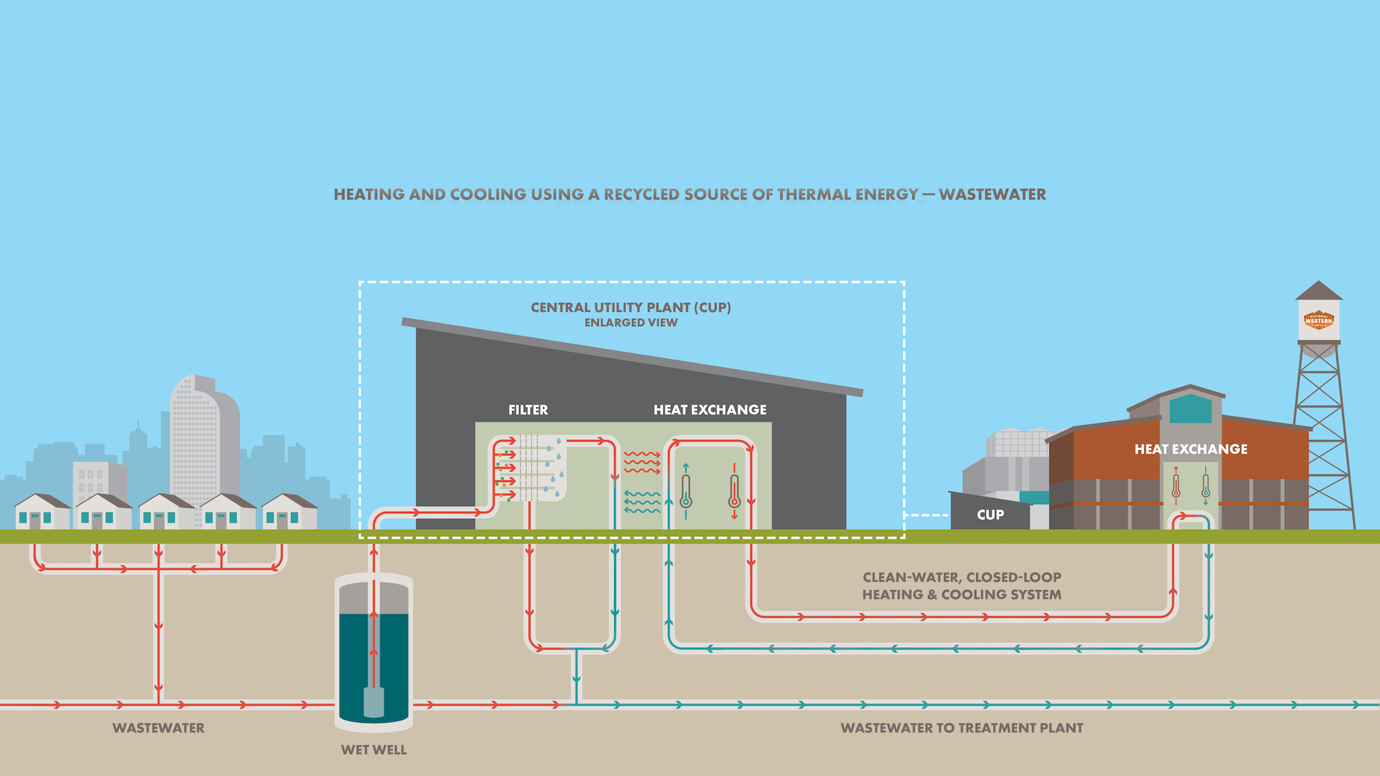
The sewer-heat recovery system extracts heat from wastewater in the wintertime and uses it to warm buildings. In the summertime, the system reverses and rejects heat to cool buildings. Illustration: National Western Center Authority
The project relies on technology that is more than a decade old but has not been widely adopted, largely because of infrastructure complexities and high upfront costs. Yet, the concept is straightforward: During wintertime, extract heat from sewage and recycle it to warm a network of buildings, called an energy district; during summertime, use the same system to reject heat and cool the buildings. In so doing, dramatically reduce use of natural gas and electricity, which power furnaces and air conditioners.
After several years of planning and construction, the sewer-heat recovery system is poised to become a highlight of sustainability at the National Western Center. The center comprises 250 acres near I-25 and I-70 in north Denver. It is a $1 billion redevelopment, transforming the historic grounds of the National Western Stock Show into a year-round site for entertainment, education, and innovation. CSU Spur is the center’s educational anchor, with three new buildings dedicated to public education, research, and community outreach around the critical topics of food, water, and animal and human health.
“When I first heard about this system, I remember thinking, ‘Holy cow, there’s a lot of thermal energy capacity that’s going downstream that we could capture,’” said Brad Buchanan, chief executive officer of the National Western Center Authority, which contracted with EAS Energy Partners to build the sewer-heat recovery system. “It really grabbed my attention because we decided to hold a very high bar for sustainability. It seemed to be the perfect fit if we were really going to walk the talk of reducing carbon emissions.”
eslie Fangman, vice president of corporate development for CenTrio, has led project development on behalf of a business consortium hired for the job. Denver, CO – April 21, 2022 Leslie Fangman, a civil engineer and vice president of corporate development for CenTrio Energy is arranged for a portrait at the Central Utility Plant (CUP) at the National Western Center in Denver, Colorado, U.S., on Thursday, April 21, 2022. Photographer: Matthew Staver 303-916-6155 http://www.matthewstaver.com mattstaver@hotmail.com
The heat recovery system took 18 months to design and build. It is projected to fill 90 percent of heating and cooling needs in seven buildings encompassing more than 1 million square feet. That makes the system the largest of its kind in North America. With buildout of the National Western Center’s initial phases, the heat recovery system is expected to save 2,600 metric tons of carbon dioxide per year – equivalent to eliminating 6.6 million vehicle miles from roadways. And it has capacity to expand even beyond the center’s first planned phases of construction.
The system began operating in April. For now, it serves the Vida and Terra buildings on the CSU Spur campus, as well as the nearby HW Hutchison Family Stockyards Event Center; they are the first new buildings at the National Western Center. Soon, the Hydro building will open at CSU Spur, becoming the fourth building in the energy district.
“It’s a great way to recover resources that we usually think about as waste,” said Jocelyn Hittle, who has led development of CSU Spur for the Colorado State University System. “I love the idea of Spur being able to help advance the state of the art by using nascent technology that is novel at this scale.”
The system diverts sewage from a 72-inch pipeline that runs along the western border of the National Western Center. The pipeline carries wastewater from tens of thousands of homes and businesses to the Robert W. Hite Treatment Facility, which is operated by Metro Water Recovery on the city’s northern edge. It is the largest wastewater treatment facility in the Rocky Mountain West.
The side stream of dirty water enters the Central Utility Plant at the National Western Center and runs through a grinding system to break down solids before wastewater goes through a heat exchanger and then flushes back to the sewer. During cold months, an industrial plate-and-frame heat exchanger draws warmth from the dirty water and transfers it to clean water that constantly circulates through the energy district in a closed loop. Clean water never touches dirty water as it runs through this “ambient loop.” When warm water arrives at each building, equipment again transfers heat – this time, from the ambient loop to a forced-air system, which then cycles warmth through building air. Back at the Central Utility Plant, dirty water returns to the sewer; it is enclosed in pipes, so the sewage does not emit odors.
During warm months, the process reverses: The system extracts heat from air in district buildings and transfers it to the ambient loop, then on to sewage – thereby rejecting heat from the energy district. Wastewater again runs to the Hite Treatment Facility, while cool, clean water runs into the energy district. At each building, cooler temperatures then are pulled from the ambient loop and cycled through building air.
In both cases, heat pumps are needed to extract and exchange thermal energy, and water is the medium sharing that energy. In this way, the sewer-heat recovery system may warm or cool buildings. If clean water in the ambient loop isn’t the desired temperature, boilers give it a boost in cold months, and cooling towers reduce it in hot months.
“You wouldn’t even be aware it exists, but the system really is revolutionary. It really represents a lot of the city’s goals toward resiliency, and it’s a great example of how we can do something creatively and innovatively,” said Mike Bouchard, program director for the Mayor’s Office of the National Western Center. The city and county of Denver owns National Western Center land and several center facilities; the office spearheaded the procurement process for the heat recovery system, coordinated efforts with center partners, and constructed the ambient loop.
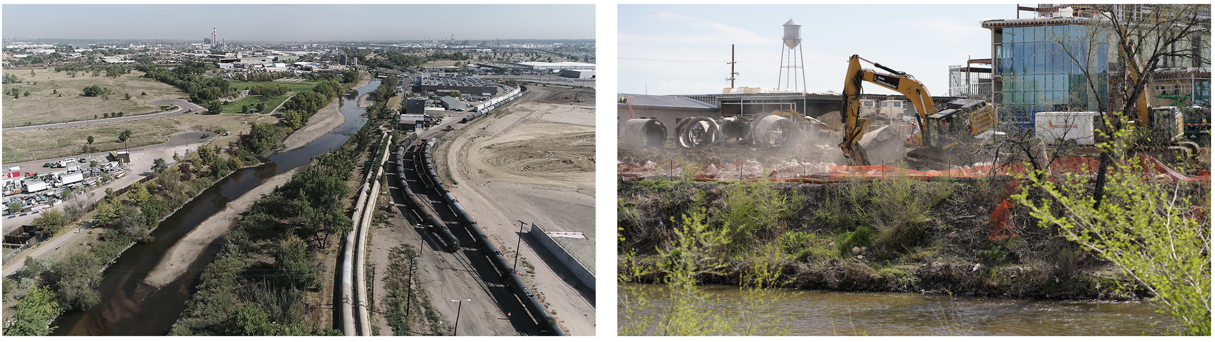
he Delgany Interceptor pipes run along the border of the National Western Center and convey sewage to a treatment plant. The pipes were above ground, shown at left (Photo: Metro Water Recovery). The pipes were replaced and buried, above right, providing a prime chance to build a new green energy system.
The system saves significant energy in part because sewage maintains a fairly constant temperature, typically ranging between 55 degrees and 75 degrees throughout the year. That means the source already is close to ideal building temperatures, said René Moffet, who managed system engineering and design for AECOM Technical Services Inc., another of the EAS Energy Partners. Saunders Construction of Denver built the system as part of the partnership.
“This system is something we can take a lot of pride in,” Moffet said. “It’s awesome – especially with a project that’s the first of this scope in North America. A lot of people are watching this to see how it will go.”
Top left: Wastewater enters the Central Utility Plant and runs through a heat exchanger, which extracts thermal energy and transfers it to clean water that flows to new buildings in the energy district. Bottom left: If water is not warm or cool enough, boilers or cooling towers adjust water temperature. Right: A closed pipeline of clean water, called an ambient loop, is the medium conveying thermal energy.
The sewer-heat recovery system cost $34 million, financed through a public-private partnership spanning 40 years. At the end of that period, total system costs are expected to be slightly above those of conventional systems, Buchanan, of the National Western Center Authority, said. However, those costs would decrease if the system were expanded to additional construction at the site or if partners were able to capitalize on potential carbon offsets, he said.
“I’m an evangelist for this system,” Buchanan said. “It will be a substantial difference maker with carbon reduction, and it’s pretty easy to get excited about that.”
Brad Buchanan, CEO of the National Western Center Authority, says he is an evangelist for the system. Denver, CO – April 25, 2022 Brad Buchanan, CEO of the National Western Center Authority is arranged for a portrait along the South Platte River near the Central Utility Plant (CUP) at the National Western Center in Denver, Colorado, U.S., on Monday, April 25, 2022. Photographer: Matthew Staver 303-916-6155 http://www.matthewstaver.com mattstaver@hotmail.com
The concept emerged in 2015 with Jim McQuarrie, former director of technology and innovation for Metro Water Recovery, Denver’s wastewater utility. The utility pursues sustainability and cost savings at the energy-water nexus. It also has a significant issue to manage: To meet state and federal regulations, effluent – or treated wastewater – must be a sufficiently low temperature, especially during cold months, before it can be discharged to the South Platte River. The guidelines are designed to avoid disrupting river ecology. Cooling effluent is a costly and energy-intensive undertaking, so Metro Water Recovery sought an environmentally sustainable way to do it – one that might have benefits well beyond regulatory compliance.
An opportunity arose during master planning for the National Western Center. Among stakeholder objectives was burial of the Delgany Interceptor sewer lines – two pipes, both 6 feet in diameter, that run along the South Platte River on the west side of the National Western Center. The pipes carry Denver sewage to the Hite Treatment Facility. For years, they were above ground – an eyesore that blocked access to the river. McQuarrie and other leaders thought site redevelopment offered a chance to replace and bury the interceptor lines, while fulfilling additional goals: It would be an ideal time to install a landmark renewable energy project, which would save carbon emissions and reduce wastewater temperatures to help meet effluent guidelines; meantime, pipeline burial would open the riverfront for new trails, open space, and National Western Center programming.
National Western Center. Photo credit: CSU
The new system cuts “thermal pollution” in effluent and contributes to Denver’s climate goals, making it a model for utilities and municipalities nationwide, said Blair Wisdom, who succeeded McQuarrie as director of technology and innovation at Metro Water Recovery. “It’s really a recycling concept that addresses single-use heat,” Wisdom said. “Denver and the state are recognizing that a lot of greenhouse gas emissions are from people heating and cooling their built environments, and that includes household water.”
The project, which involved dozens of National Western Center stakeholders, also demonstrates the power of collaboration, noted McQuarrie, who now leads water projects for Tetra Tech, a global engineering firm. “One of the most striking things about this whole project is the impact that can be created when people partner together and work toward a common goal,” McQuarrie said. “Something like this requires people to think big and challenge themselves about whether adhering to traditional past practices is truly the best thing for future generations.”
The utility plant is an unobtrusive building containing leading-edge technology. Denver, CO – April 21, 2022 A view of the Central Utility Plant (CUP) at the National Western Center in Denver, Colorado, U.S., on Thursday, April 21, 2022. Photographer: Matthew Staver 303-916-6155 http://www.matthewstaver.com mattstaver@hotmail.com
Early in the planning process, McQuarrie discussed the concept of a sewer-heat recovery system with Ken Carlson, a Colorado State University professor who served as McQuarrie’s adviser as he attained a master’s degree in civil and environmental engineering. Carlson is director of CSU’s Center for Energy Water Sustainability and is an expert on water recycling technologies. He agreed the heat recovery system might work well at the National Western Center; the two pitched the idea to the CSU System, which, in turn, took it to a larger leadership group. Carlson then asked six undergraduates to study the concept – a move that fit well with CSU Spur’s educational goals.
The students – calling themselves “the Sustainulators” – evaluated sewer-heat recovery systems as part of a senior design project, a capstone for CSU students in civil and environmental engineering. During 2015-2016, with the guidance of senior research manager Asma Hanif, the student team gathered reams of data; their meetings, site visits, and final report generated information and enthusiasm leading into formal planning for the heat recovery system. In fact, the CSU team recommended pipeline burial and system installation much like that later accomplished.
Natalie Thompson led the student team. In May 2016, she earned a bachelor’s degree in environmental engineering, with a minor in global environmental sustainability, and went on to attain a master’s degree at the University of Cincinnati. The CSU project heightened her interest in designing water and wastewater systems, Thompson said. Now, she’s doing that engineering work as part of international development projects throughout Uganda.
“Our project was such an exciting time to see how you can incorporate sustainability into design, while also making a space more beautiful,” Thompson wrote in an email sent from Kampala, Uganda. “This project opened my eyes to heat recovery, which makes so much sense when thinking about all the hot water we use in America. It made me see that we should not view wastewater as a waste, but as an opportunity. That really shifted my perspective as someone who has always been inspired by sustainability.”
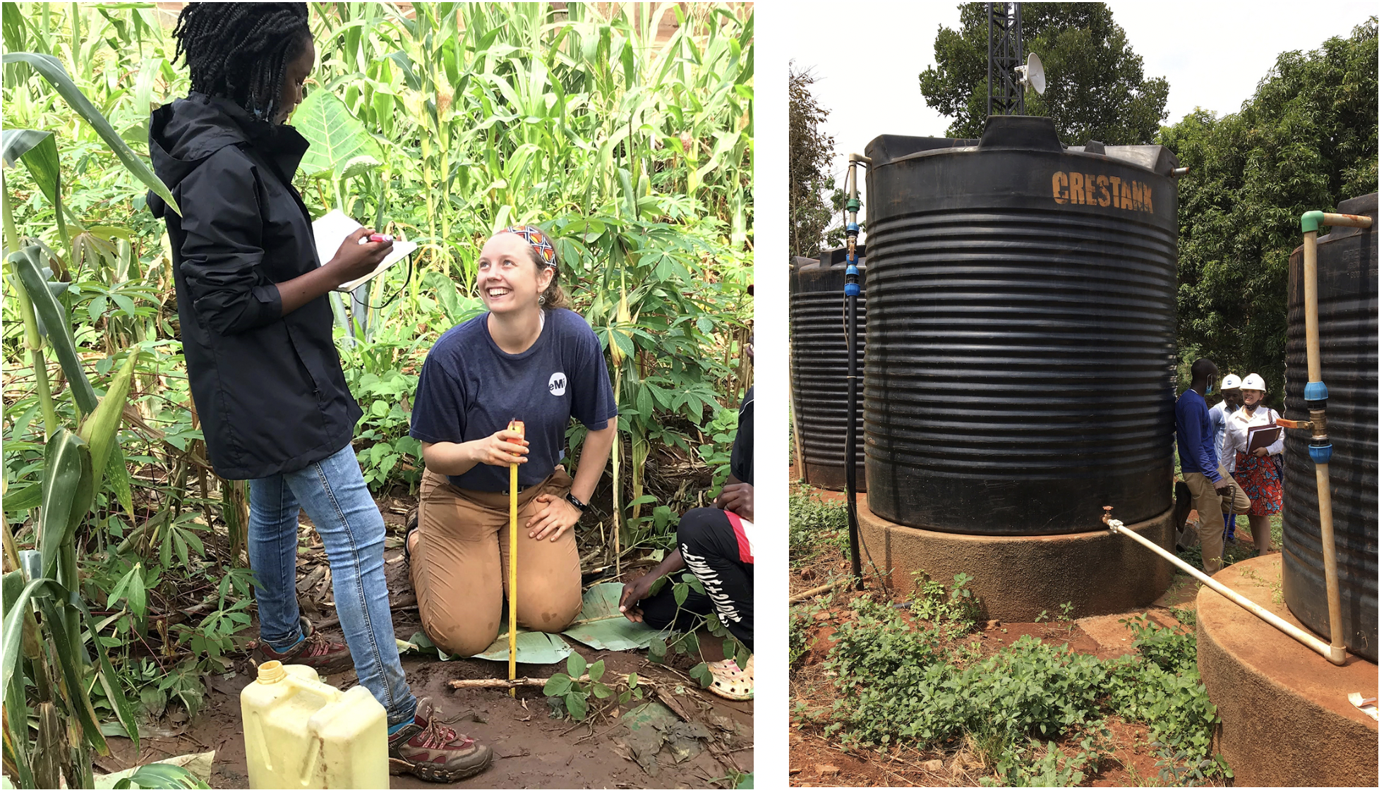
Natalie Thompson, kneeling, led a CSU student engineering team that studied the sewer-heat recovery system; she’s now working on international water projects
Viewing wastewater as an opportunity – and, specifically, as an important source of thermal energy, nutrients, and fresh water – is at the core of a principle called “One Water.” The theory holds that water has value in all its forms and may be managed through integrated systems and technologies that together improve water quality, access, and sustainability on an increasingly thirsty planet. The sewer-heat recovery system at the National Western Center exemplifies the One Water concept, and university students and researchers will continue to study the system and its benefits, Hittle said. In the forthcoming Hydro building at CSU Spur, researchers with CSU’s One Water Solutions Institute also will advance the One Water idea by testing new technologies for the treatment and use of wastewater, stormwater, and roof runoff.
The combination of big ideas and technical challenges inspired the engineering students who first evaluated the sewer-heat recovery system, Thompson said. “It really ignited my passion for working with communities, understanding needs, and then designing,” she wrote. “I love the idea that sustainability is not just a buzzword, but a lifetime of serving a community.”
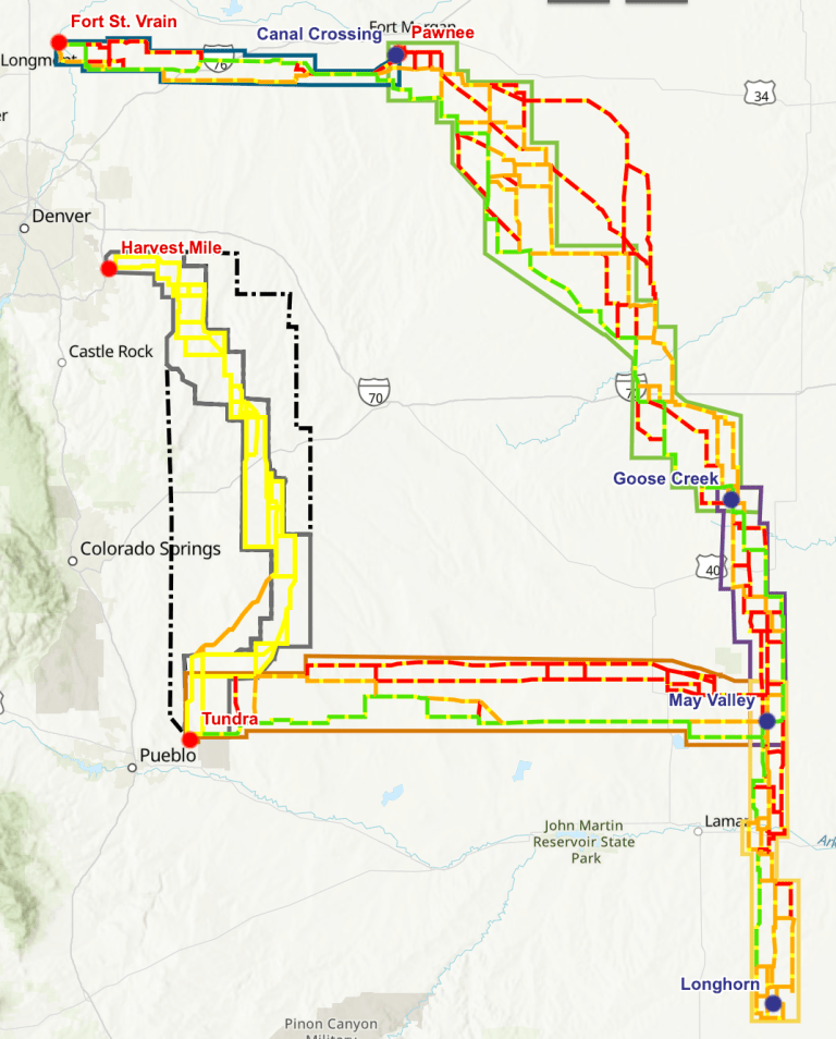
Most of the $9-$10 billion that Xcel Energy will spend in the next few years will be spent on Colorado’s eastern plains. Why is this such a big deal for Colorado?
Click the image to go to Xcel’s project page and the interactive map.
Colorado will soon embark on a change with few rivals in the last 100 years. Think of the dismantling of geography by construction of Interstate 70 through the tunnels, over Vail Pass, and through Glenwood Canyon. Think of Denver International Airport. Think of the arrival of electricity to farms and small towns in the 1930s and 1940s.
Within a decade, Xcel Energy, the state’s largest electrical utility, will retire all its coal plants, convert one to burn natural gas, and add massive amounts of wind on Colorado’s eastern plains and solar generation, some of it in the Western Slope’s Grand Valley, along with batteries nad perhaps other storage, as it pursues a mid-century goal of net-zero carbon. Combined with potentially 740 miles of new transmission lines looping around eastern Colorado, this investment in new generation could hit $9 billion to $10 billion. Xcel will likely get its final green light from state regulators in the next month, maybe two.
This has repercussions beyond Xcel Energy, which sells more than half the electricity in Colorado. It also delivers wholesale sales to some municipalities and cooperatives, including Holy Cross Energy, Yampa Valley Electric, and Grand Valley Power.
Is this money well spent? If you’re a climate hawk, as I am, convinced we must dramatically reduce our emissions of greenhouse gases, this represents a giant step forward. We must immediately reduce emissions from electrical generation and also displace fossil fuels in transportation and buildings.
True, China’s emissions keep growing. But Colorado can lead the United States by example, and the United States can lead the world.
Some people, even champions of this transition, disagree with the precise pathway. For example, if demand were shaved through energy efficiency and other programs, will less investment in new generating resources be needed, says Western Resource Advocates, an environmental group.
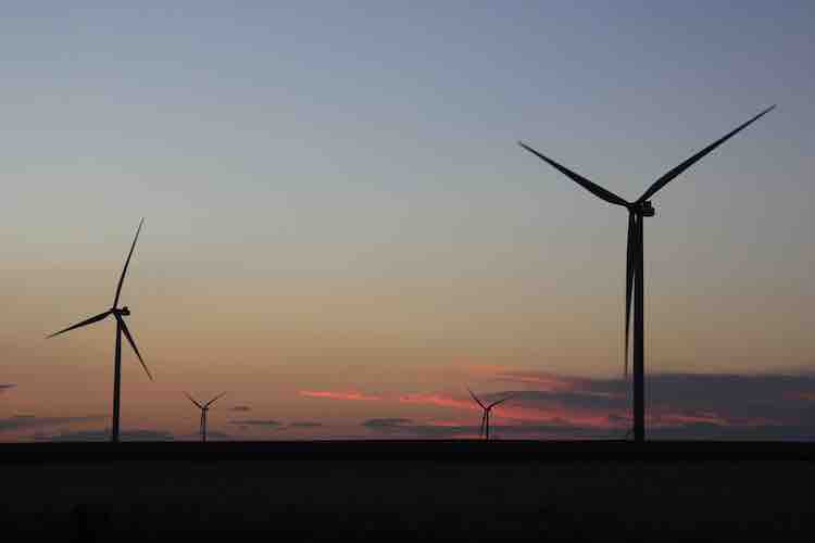
From Colorado eastern plains, already dotted with wind turbines, come other complaints about cluttered skylines. This is not universal. Other plainsmen (and women) welcome the property taxes local governments will realize and the lease payments to land owners.
Nuclear power represents another question. Colorado’s lone experiment with nuclear power, at the St. Vrain plant near Greeley, went seriously awry. But now come efforts with presumably smaller and hence lower-risk modular reactors, such as are being planned in Idaho and also Wyoming. Cost, more than safety, is the fulcrum for the debate. Nuclear has had exorbitant cost overruns. Will this new technology be better?
Comanche 3, a coal plant in Pueblo, has become the symbol for this energy transition. It was approved 18 years ago by Colorado regulators, a $1 billion investment (in today’s dollars). Utilities had been building ever-bigger coal-fired coal plants, abetted by natural gas plants to meet peak demands, for a half-century. Few were willing to give credence to the vision of renewable energy. I remember in about 2008, a geologist in Meeker who still hoped for the dream of milking hydrocarbons from the oil shale of northwestern Colorado. “We can’t run a civilization on windmills,” he fumed.
We still can’t. And as somebody pointed out to me, even wind turbines need oil and grease and so forth. But we can do far, far more than Xcel or most others thought just 18 years ago.
Cheyenne Ridge, located between Burlington and Cheyenne Wells, near the Kansas border, is one of many wind projects on Colorado’s eastern plains. Soon, new transmission will enable far more wind and solar projects. Photos/Allen Best Photo credit: Allen Best/The Mountain Town News
This has come in increments. Almost simultaneous with approval of Comanche 3 came Colorado’s first renewable energy mandate. Xcel fought it. Then it set out to comply. Costs of wind tumbled dramatically, and then so did solar. Something of the same thing is now happening with lithium-ion batteries.
It’s not yet possible on a large scale to affordably eliminate all emissions. But also note this. In 2005, when Xcel began building Comanche 3, about two-thirds of its electricity came from coal plants. Within a decade, it will be close to zero. We’re moving fast, because we can and because we must.
Will there be adverse consequences beyond altered prairie vistas on the Great Plains? Quite possibly. With I-70, what once was close to a full-day journey from Grand Junction to Denver was shortened to a long morning. But the highway has made mountain valleys a little less lovely and far more noisy.
This course correction in our energy foundation may also prove to have flaws that may require further altering. And in 18 years we may look back and wonder if we should have held off just a little longer for a technological breakthrough instead of making Colorado’s eastern plains look like Paul Bunyan’s playground for Erector Set creations.
What we cannot afford is to do nothing. Given what we know today, about the cost of energy and the cost of climate change, this massive investment soon to happen looks to be the wisest path forward.
This year marks the 100th anniversary of the Colorado River Compact, an innovative and influential legal agreement among seven U.S. states that governs water rights to the Colorado River. In recognition of this anniversary, the Colorado State University Libraries will be spotlighting a series of stories in SOURCE about the ripple effects of this 100-year-old document on diverse people, disciplines and industries in 2022.
One hundred and fifty two years ago, Colorado Agricultural College’s first buildings sat among sagebrush and prairie grasses. As the campus grew, its center became enshrined in a green meadow ringed by elms, a space now known as the iconic Oval.
Today, Colorado State University’s green spaces are woven into the tapestry of campus life – from the Intramural Fields to Monfort Quad, they serve as informal parks for students and faculty alike to revel in the beauty of the Front Range.
A western campus shaped by urban ideals
These spaces speak to the larger power of the designed landscape in American life. Popularized by the public park movement and Frederick Law Olmsted’s layout of suburban landscapes in the late 1800s, large, green public spaces provided serene outdoor recreation in cities after the Industrial Revolution.
“The democratic nature of large, open spaces on the East Coast was brought with people as they moved West,” said CSU landscape architecture professor Lori Catalano. “It was a way of creating central green spaces that were shared, but the plants and ideas migrated from a humid climate in the East to the semi-arid climate in the West.”
As a growing land-grant institution, CSU’s adoption of the green aesthetic instilled the idea of parks as public spaces accessible to all.
Though the Oval’s first elms were planted in 1881, it wasn’t until 1919 that it became the center of campus, soon after Fort Collins’ City Park was established. These spaces signified how far green spaces had spread from their wealthy urban roots and democratized access to parks in northern Colorado.
“As humans, plants, and animals moved west, they modified the landscape,” Catalano said. “Alfred Crosby’s concept of ecological imperialism helps explain how emigrants moved westward with a variety of diseases, plants, and animals co-creating an environment that reinforced the presence of open grassy fields with trees.”
After World War II, green spaces were adopted into front lawns by middle-class residents seeking a taste of luxury. CSU’s own green aesthetic bloomed as it grew. Spaces like the Monfort Quad, the Intramural Fields and the Lagoon complemented new architecture while creating new outdoor spaces for students between classes.
Green oases in the prairie
“Traditionally on campuses, buildings are grouped to create a series of outdoor rooms,” Catalano said. “Aesthetically, people and students expect large areas of green lawns with trees – they don’t expect it to look like prairie.”
In the American West, these green landscapes live on and signal the continuing legacy of centuries-old ecological imperialism, but they contrast with the region’s naturally dry, beige prairies. CSU’s green spaces remain a central part of its identity and help unify landscapes without sacrificing flexibility and durability – which is critical for a campus that has thousands of students traverse its grounds during the school year.
“College campuses are used a lot like parks and need a surface that is flexible and durable,” Catalano said. “Grass is very durable, as it can tolerate students walking over it, (playing) frisbee, picnicking, whereas our native grasses that require less water cannot tolerate that level of compaction.”
Lawns are also simpler to maintain compared to native plants – all that’s required is mowing, fertilizing, and watering. But throughout the American West, green lawns contrast with dry, semi-arid landscapes and may not survive a resource-scarce future.
“If campus reflected the natural landscape of Fort Collins, we’d see grasslands with Cottonwood trees and peach leaf willows along waterways,” Catalano said. “Visually, lawns hold a cultural power. They look good, they’re green … it’s what we know and what makes us comfortable.”
What will green spaces look like in the future?
With an unprecedented mega-drought in the Colorado River Basin, some states have challenged the ubiquity of green lawns.
In Las Vegas, authorities started paying people to remove their irrigated lawns in the 1980s, and the program has been largely successful in curbing residential water use. As of 2021, any “non-functional” lawns are banned in Las Vegas to conserve water, reflecting how Nevada’s lower allocation of Colorado River water is already stretched thin.
In Colorado, House Bill 22-1151, which was signed into law this past April, requires the Colorado Water Conservation Board to create a statewide program with $2 million in funding to incentivize replacing grass with “water-wise” landscaping.
But, according to Catalano, changing how people understand and perceive the landscape can prove daunting.
“It takes a lot of will and intention to make a commitment to changing the landscape,” she said. “We could incentivize it, but one challenge is, the price of water is relatively inexpensive – it takes someone who’s passionate and intentional about it to be enticed by incentives, because there’s not a huge financial gain. It’s a little like solar – we all want it, but how much are we willing to pay for it?”
Curbing water usage through changing landscape aesthetics will be necessary to ensure the long-term health of the Colorado River Basin.
In June, the U.S. government declared that the basin must cut its water usage by 2 to 4 million acre-feet or risk federal intervention. Meanwhile, CSU researchers found that most streams flowing through the Denver parks system only exist because of runoff sprinkler water. Reducing water consumption through limiting green lawns, then, could prove effective.
Though CSU’s campus design now seems set in stone, its history reflects a century of cultural changes that have cultivated tree-lined avenues, sprawling fields and verdant quads. A long cry from Old Main set atop rolling plains, the future of these unifying spaces will be influenced by the state of the Colorado River Basin and pending water shortages.
“Landscapes are often unseen, undervalued, and not understood. When people can’t see or don’t understand the processes and systems involved in creating and maintaining landscapes, it is difficult for them to value making a change,” she said. “When we begin to see and value alternative landscapes that require less water, reducing the dominance of lawns is possible.”
Click on a thumbnail graphic to view a gallery of drought data from the US Drought Monitor website.
US Drought Monitor map August 2, 2022.
High Plains Drought map Monitor August 2, 2022.
West Drought map Monitor August 2, 2022.
Colorado Drought map Monitor August 2, 2022.
Click the link to go to the US Drought Monitor website. Here’s an excerpt:
This Week’s Drought Summary
Weather and drought conditions varied widely in the contiguous U.S. this week. From the Desert Southwest and southern Colorado eastward into the Texas Panhandle, western Kansas, eastern Colorado, northern Oklahoma, and Arkansas, heavy rainfall fell in some areas, leading to localized improvements in ongoing drought. Drier conditions in the Northeast led to the expansion of moderate and severe drought in the New York City area and in parts of New England. Drier weather also led to expansion of drought conditions in parts of the central Great Plains and Upper Midwest. Similar conditions in Texas led to expansion of drought conditions there, while recent precipitation led to some improvements in southwest Texas. For more local details, please refer to the regional summaries below…
Moderate to heavy rains fell this week across portions of Colorado and western Kansas, related to an active North American Monsoon. Aside from other localized pockets of moderate to heavy rain, the High Plains region saw mostly dry weather this week. Temperatures from 2-4 degrees below normal were common across most of Kansas, southeast Colorado, central and eastern Nebraska, eastern South Dakota, and North Dakota this week. Near-normal temperatures mostly prevailed elsewhere, with parts of western Wyoming experiencing temperatures from 2-6 degrees above normal. The heavier rains in Colorado and western Kansas led to some improvements in ongoing drought, with localized removal of drought occurring, as precipitation deficits lessened. Conditions worsened in parts of southwestern, central, eastern, and northern Nebraska, and in adjacent southern South Dakota, where deficits in soil moisture and precipitation worsened. In Columbus, Nebraska, the Platte River ran dry, indicative of the moderate and severe drought conditions ongoing in and near the eastern Nebraska town. Two reservoirs in eastern Colorado are expected to run dry soon due to drought and water demand from irrigation…
In the West region, moderate to heavy rain fell across parts of Arizona, New Mexico, Utah, Nevada, and far southeast California. In locations where long-term rainfall deficits, soil moisture, and groundwater improved substantially, ongoing drought conditions improved locally. A south-to-north temperature gradient set up this week, with temperatures in Arizona and southern Nevada coming in 3-6 degrees below normal in spots, while a heat wave developed in the Pacific Northwest, pushing temperatures more than 9 degrees above normal in parts of northern California, Oregon, and Washington. In southeast and east-central Oregon, the evaporative stress from the heat locally worsened drought conditions. A myriad of drought impacts continued in the West this week, including wildfires in northern Utah and a central California reservoir dropping to its lowest level in 5 years…
The South region saw highly variable weather this week. This led to a wide range of changes to the ongoing drought areas across the region. Temperatures across most of Texas were above normal for the week, with many readings of 4-8 degrees above normal. Temperatures across the rest of the South were more moderate, generally within 4 degrees of normal on either side. Heavy rainfall occurred from the central and northern Texas Panhandle eastward through the northern half of Oklahoma, Arkansas, northern Mississippi, and portions of Tennessee. This led to improvements in the Texas Panhandle, northern Oklahoma, Arkansas, Tennessee, and Mississippi. Conditions also improved a bit in southwest Texas, where recent rainfall began to alleviate short- and long-term precipitation deficits. Meanwhile, short-term drying combined with above-normal temperatures to worsen drought conditions across some other parts of Texas and Oklahoma. Drought impacts across Texas ranged from crop failure to water supply problems, in one case from a well failure…
Looking Ahead
From Thursday, August 4 to the evening of Monday, August 8, the National Weather Service Weather Prediction Center is forecasting moderate to heavy precipitation in parts of Arizona, western and northern New Mexico, high elevation areas of Colorado, northwest Wyoming, and localized areas of east-central California, central Nevada, and western and northern Utah. Widespread precipitation is also forecast in parts of the Upper Midwest, Middle Mississippi River Valley, Ohio River Valley, and southern Appalachians. Some precipitation is also forecast in western parts of the Northeast region, and along the Louisiana Gulf Coast.
For August 9-13, the National Weather Service Climate Prediction Center’s precipitation forecast favors above-normal precipitation near and west of the Continental Divide, especially in eastern Nevada and most of Utah. Farther east, below-normal precipitation is favored in the Central Great Plains and Upper Midwest. A narrow swath from southern Texas northeast to southern New England is slightly favored for above-normal precipitation. In Alaska, above-normal precipitation is favored in the east, while below-normal precipitation is favored in the southwest part of the state. Below-normal temperatures are strongly favored in most of Alaska, especially in west-central areas. Below-normal temperatures are slightly favored in most of Arizona, southern Nevada, and southeast California. Above-normal temperatures are favored across most of the Great Plains, Pacific Coast, and Northwest, especially from western Nebraska to the Dakotas and eastern Montana. Above-normal temperatures are also favored for most areas along the East Coast.
US Drought Monitor one week change map ending August 2, 2022.
Just for grins here’s a gallery of US Drought Monitor maps for early August for the past few years.
Day 8’s drive was from Mesquite, Nevada to Fruita, Colorado. I always enjoy the Virgin River Canyon. The drive takes you up from St. George through central Utah, over the San Rafael Swell and then into Colorado.
We charged the night before in Mesquite during dinner, then again in Beaver, Utah, a short bump in Richfield, Utah, and then again in Green River. The Tesla seems to be designed for these high speed highways.
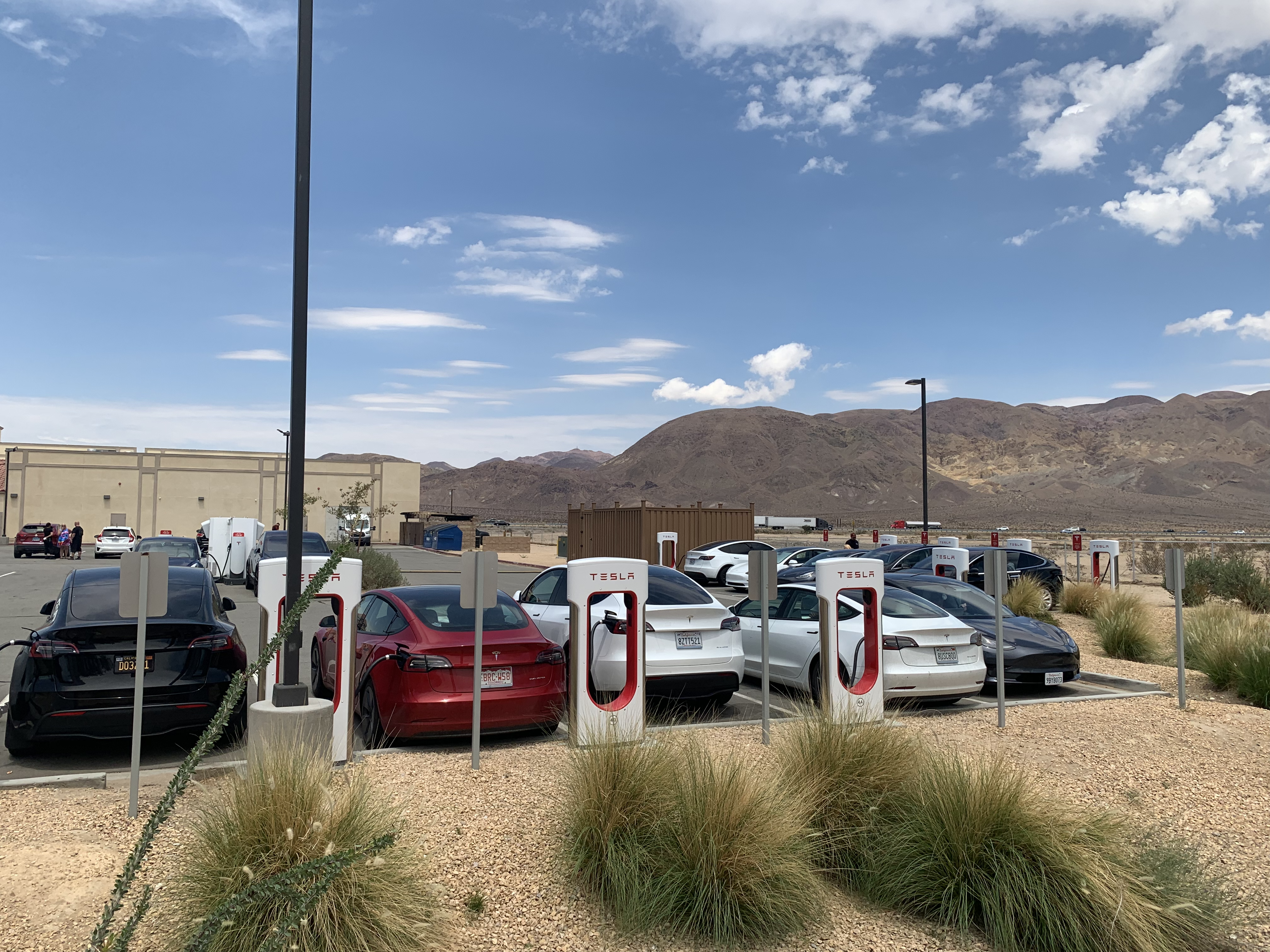
Coyote Gulch’s rented Tesla Model 3 charging in Yermo, California August 5, 2022.
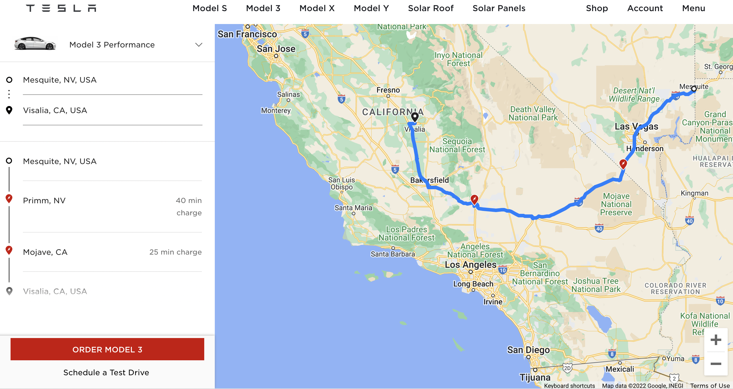
We started back home from Visalia, California on Friday with a stop in Las Vegas to drop off hellchild for her flight home.
We charged the Tesla at our hotel overnight and then once more in Yermo, California before a short charge in Las Vegas to get us to our destination, Mesquite, Nevada. The Model 3 is a fantastic highway ride. We shared every Tesla Supercharger location with others also charging and Teslas kept coming and going all the while when we were there. Tesla has done a great job building facilities for their customers.
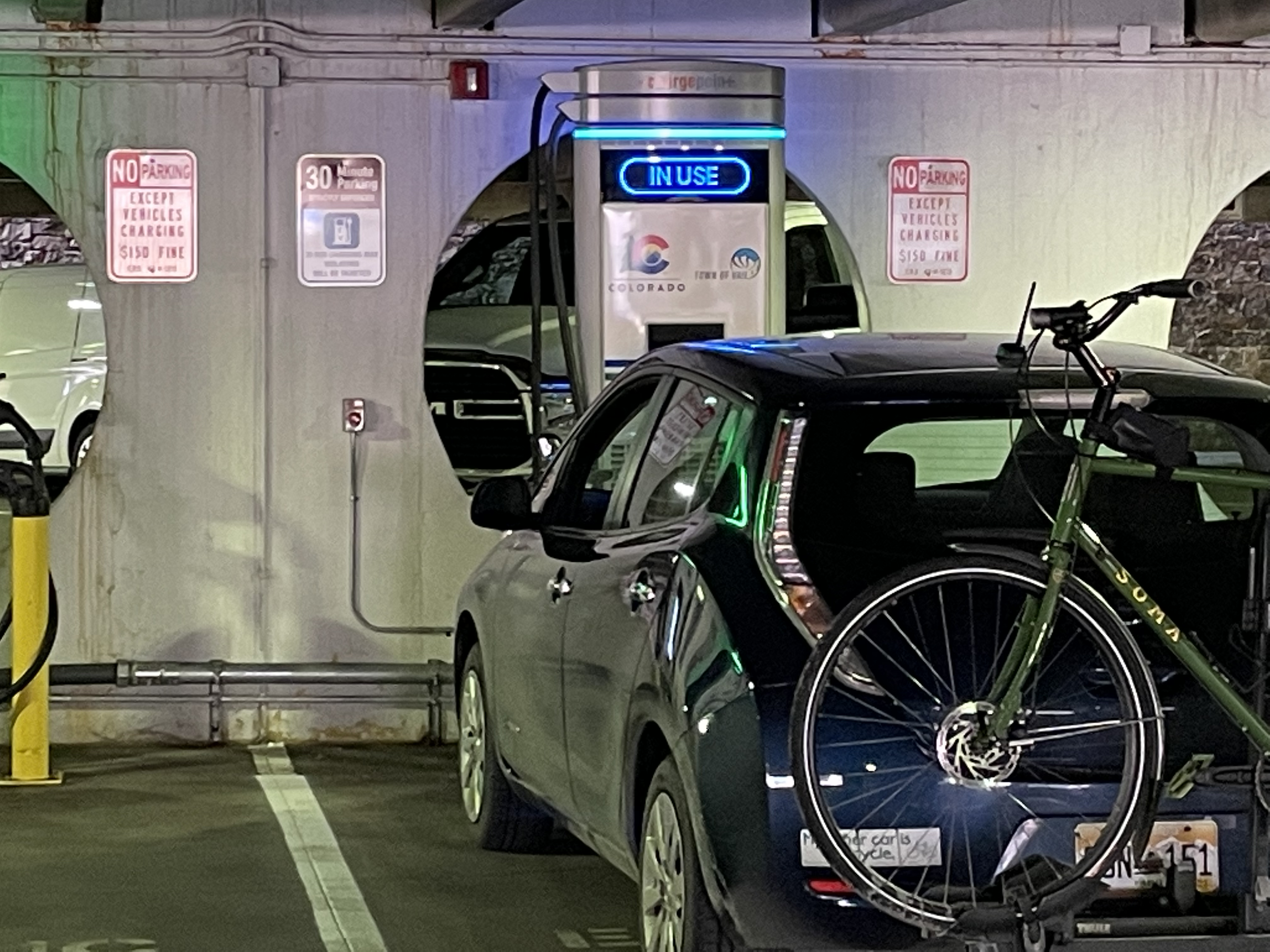
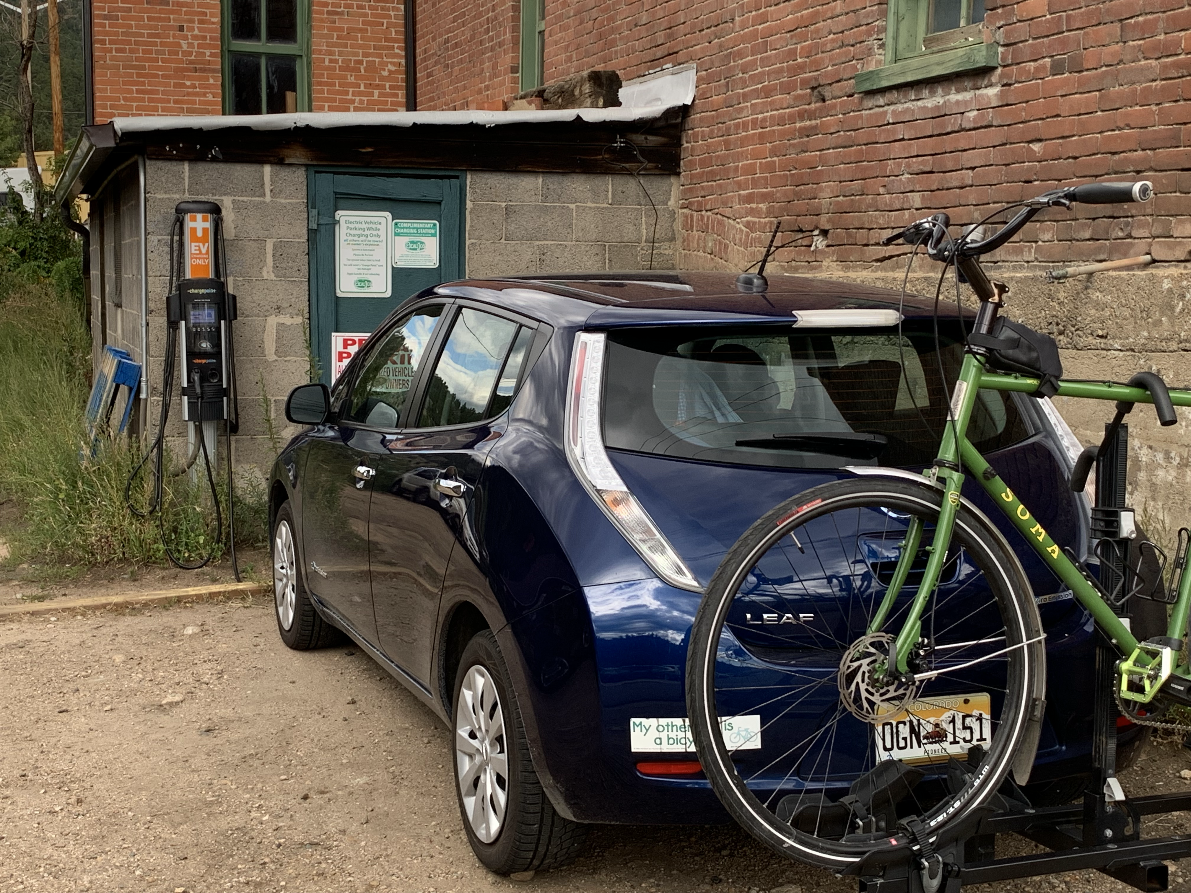
This was eye-opening for me as I had to wait for local government and retailers to build charging infrastructure along the highways after buying my Nissan Leaf in 2016. On my first foray to Steamboat Springs in 2017 I had to use Level 2 chargers in Idaho Springs, Winter Park, and Kremmling. Now there are DC Fast Chargers in Granby and Fraser and all along I-70 from Silverthorne to Grand Junction.
Leaf charging at the Lionshead parking facility in Vail September 30, 2021.
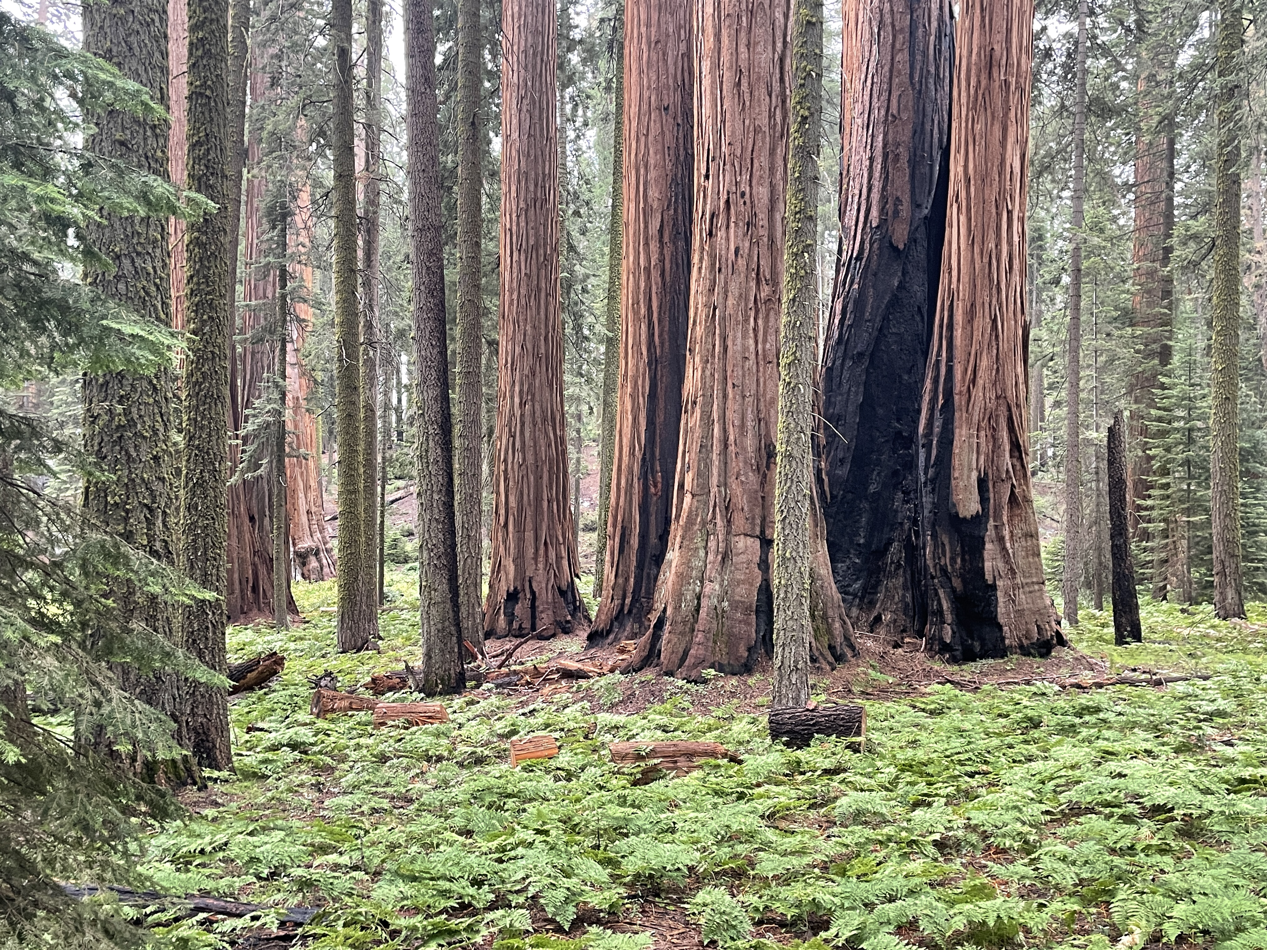
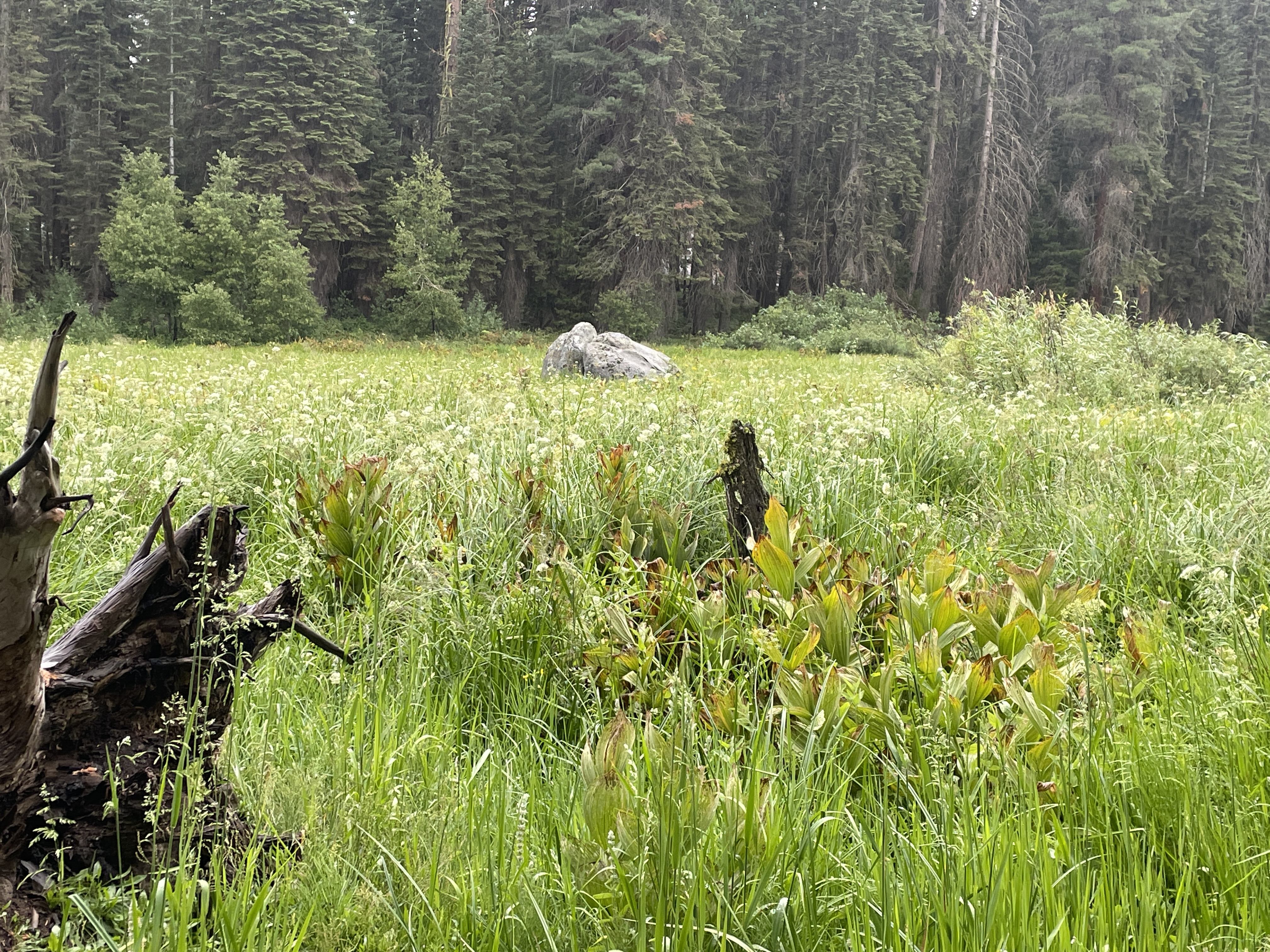
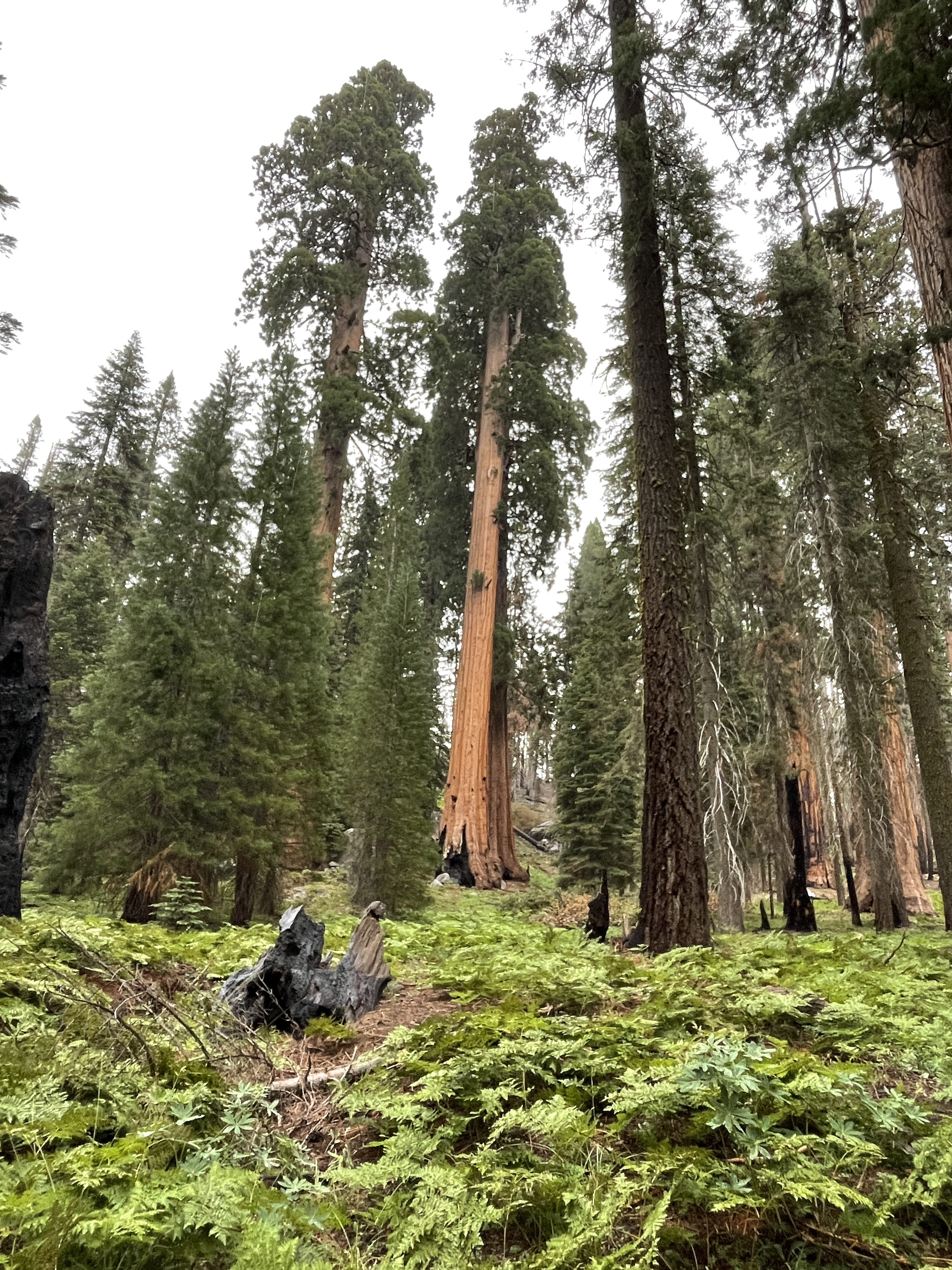
We drove to the Atwell Mill and Grove on Day 6 and then up to the Giant Tree Forest for a nice walk in the light rain. During the walk we saw the Crescent Meadow which, according to the NPS John Muir called in the “Gem of the Sierra.” There was evidence of last year’s fire all around but that didn’t detract from the beautiful landscape.
Crescent Meadow Sequoia National Park August 4, 2022.
The Tesla Model 3’s charge was sufficient for the entire drive and we ended up at our hotel with 35% charge. We picked up charge coming back on Mineral King Road (5%) and down from the Giant Tree forest (6%). The all-wheel drive Tesla performed well on the steep twisting road above the river on the way to the Atwell Grove and back.
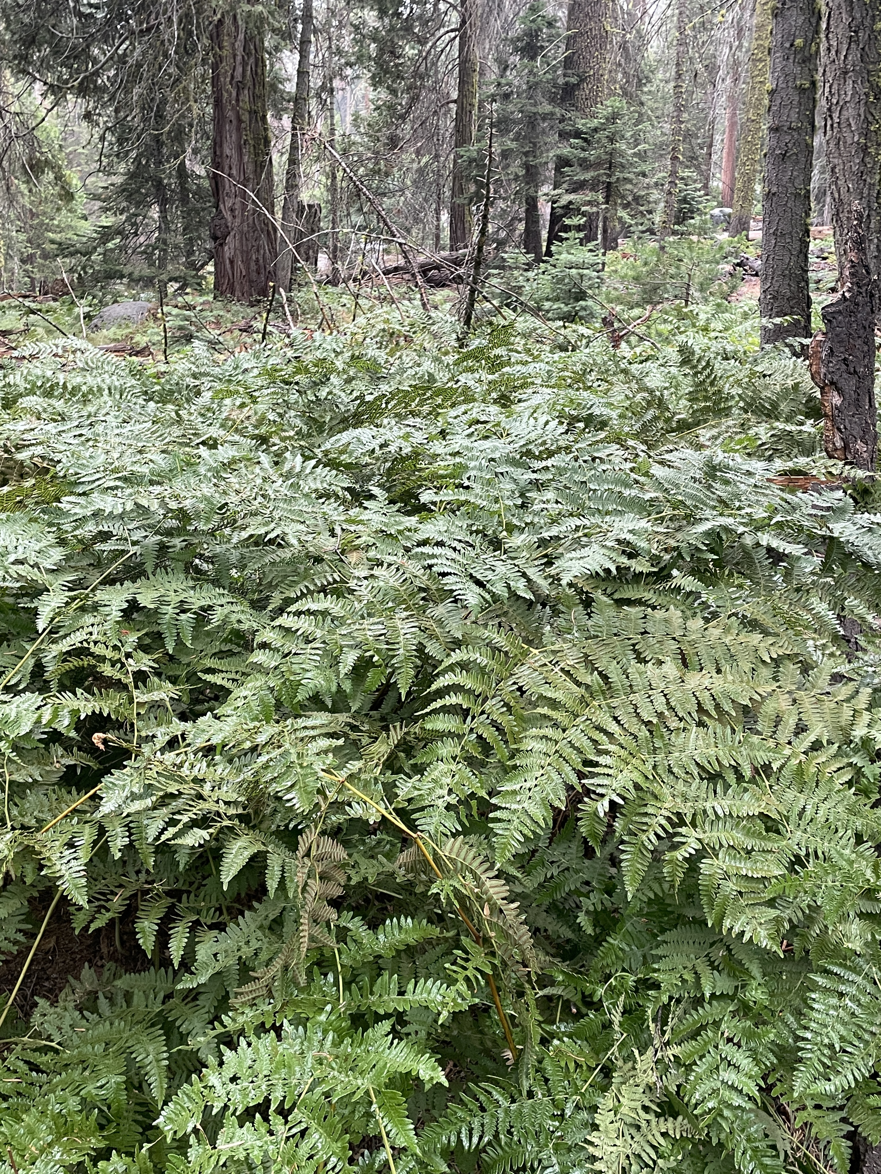
Some of the flora in the Giant Tree Forest August 4, 2022.
Sadly, Days 7,8, and 9 are travel days back to Denver, somewhere around 1,150 miles.
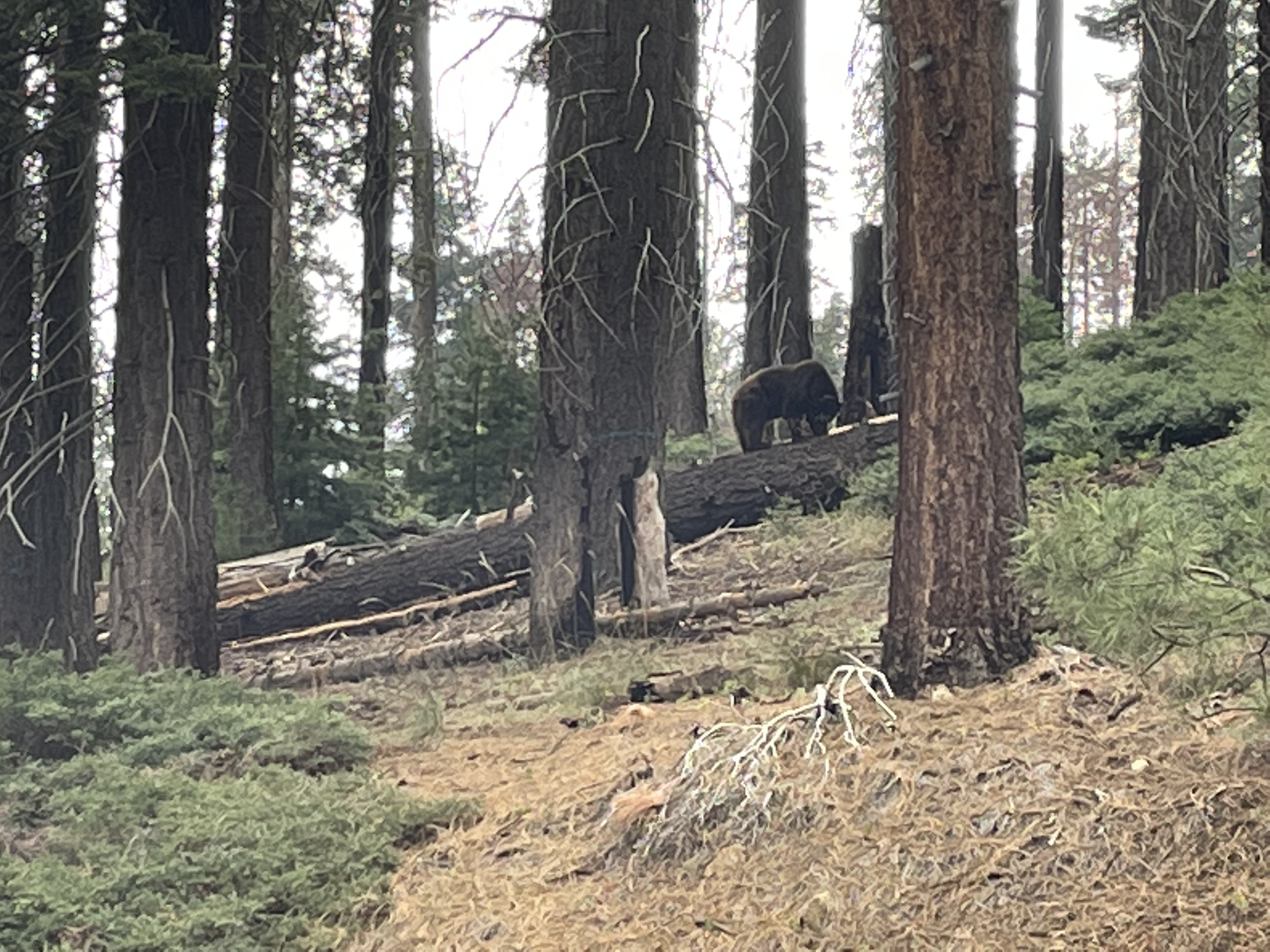
Bear searching for dinner August 3, 2022 Sequoia National Park.
We drove to the General Grant Tree in Kings Canyon National Park area first thing to get in a hike and to see the many large sequoias in the area. The trails lead to trees named after the states. We then took the Generals Highway over to Sequoia National Park. There were lots of opportunities for “botanizing”. I have been informed that botanizing is the term you use when incorporating plant and tree observations into your enjoyment while hiking.
The Tesla Model 3 had more than enough range for the day. We picked up 7% charge from the regenerative braking system traveling down to the valley to charge at Traver, California for the next day.The car was at 38% when we hooked up, after starting the day at 95%.
Just for grins here’s a gallery of photos from Hellchild, Mrs. Gulch and myself.
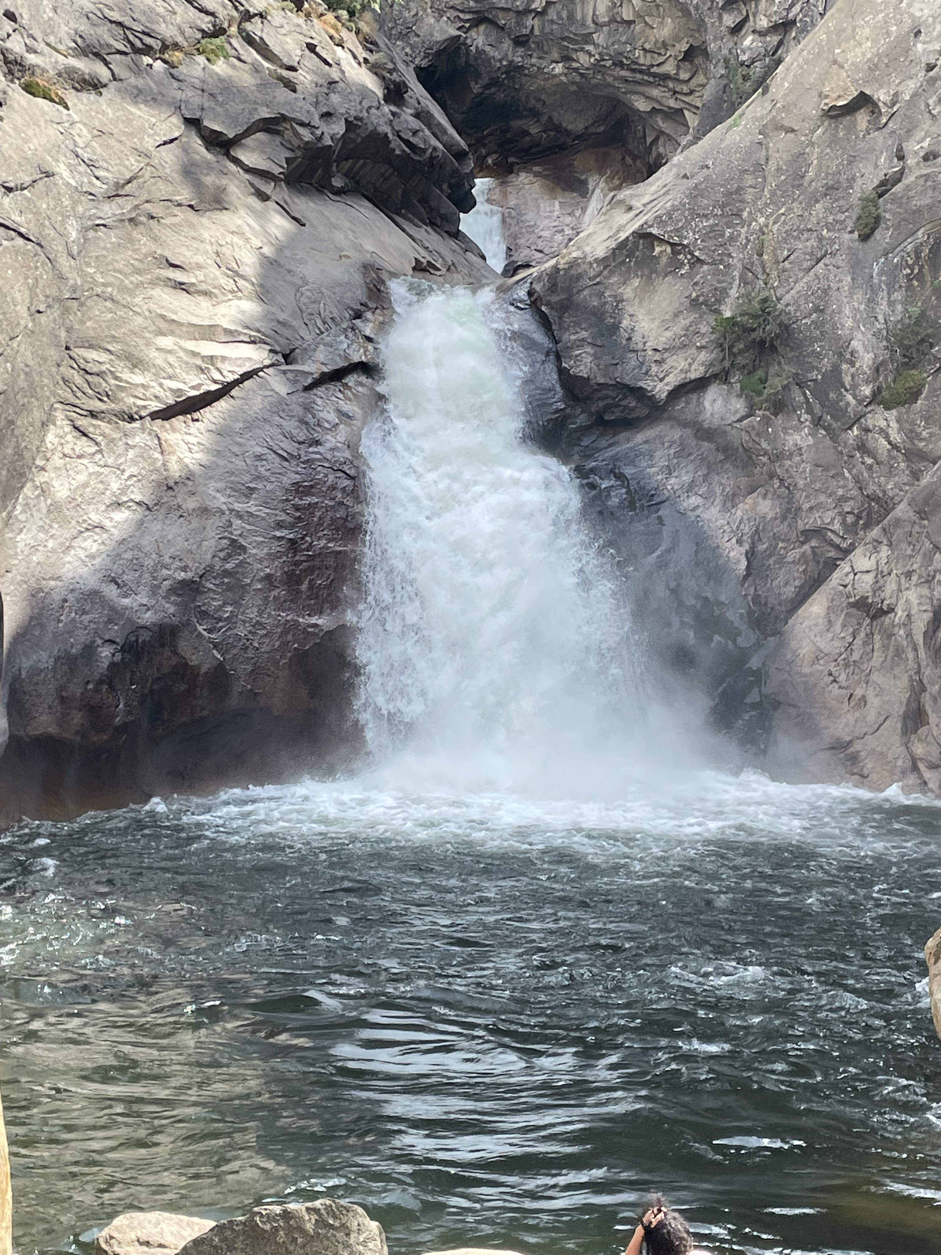
Rolling River Falls Kings Canyon National Park August 2, 2022.
We drove to the end of the road in Kings Canyon on Day 4. The canyon is impressive and it was great to see the turbid water in the South Fork of the Kings River indicating that the area had seen rain recently. In fact, when we were enjoying the Roaring River Falls thunder could be heard a short distance away. The canyon floor is forested with the now familiar varieties of trees that make up the canopy. There is also a variety of shrubs and flowers for the botanically suited like my traveling companions, the horticulturist and the geneticist.
A huge bonus for me were all the farms along the route that Tesla navigation chose for us. What a bounty of fruit and other crops. Folks that know me well know that I love farmers and farming, and of course the infrastructure to move water it where it is needed.
This was the first day that we really depended on the range of the Tesla Model 3. There are no charging facilities after you start the climb from the valley floor. There would be few locations where the trickle charger would be useful. We picked up 6% from the regenerative braking system from the Grant Tree lodge down to the valley floor. The Model 3 had good charge left when we stopped at the Supercharger in Traver to charge up for Day 5.
Charging the Tesla August 3, 2022 for the next day in Kings Canyon and Sequoia national parks.
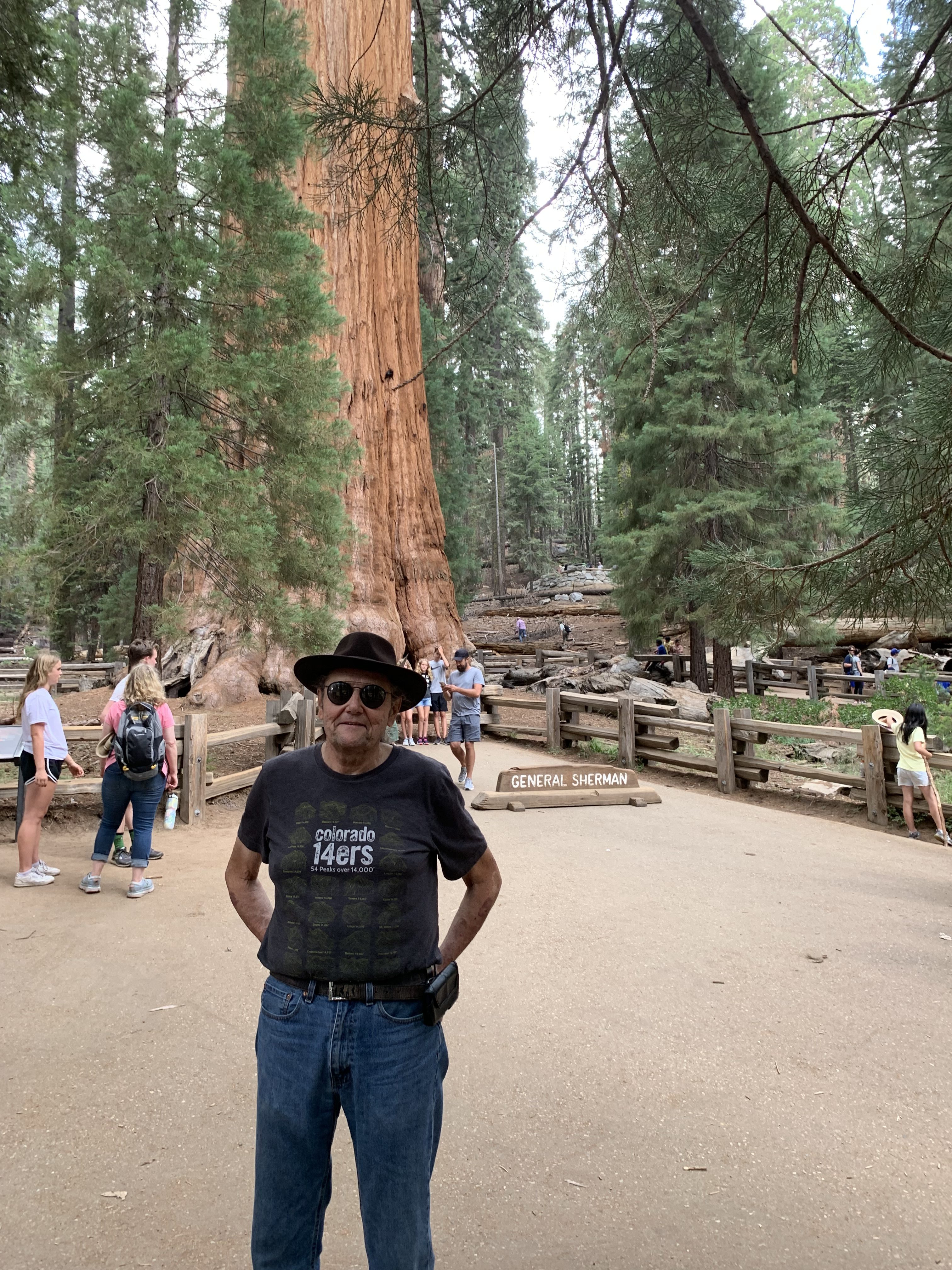
Coyote Gulch at the General Sherman tree Sequoia National Park August 1, 2022. Photo credit: Hellchild
We went up into Sequoia National Park on Day 3. The primary stop was to see the “General Sherman” tree which is largest tree in the world you are told by the NPS folks. It was quite an experience seeing the mixed forest of Sequoias, firs, etc.
We toured all day on one charge from our hotel — the Model 3 has good range. What a climb from the valley up to the area of the trees. On the trip down we picked up 7% charge from the regenerative breaking system. EV drivers love downhill just as bicyclist’s do. 🙂
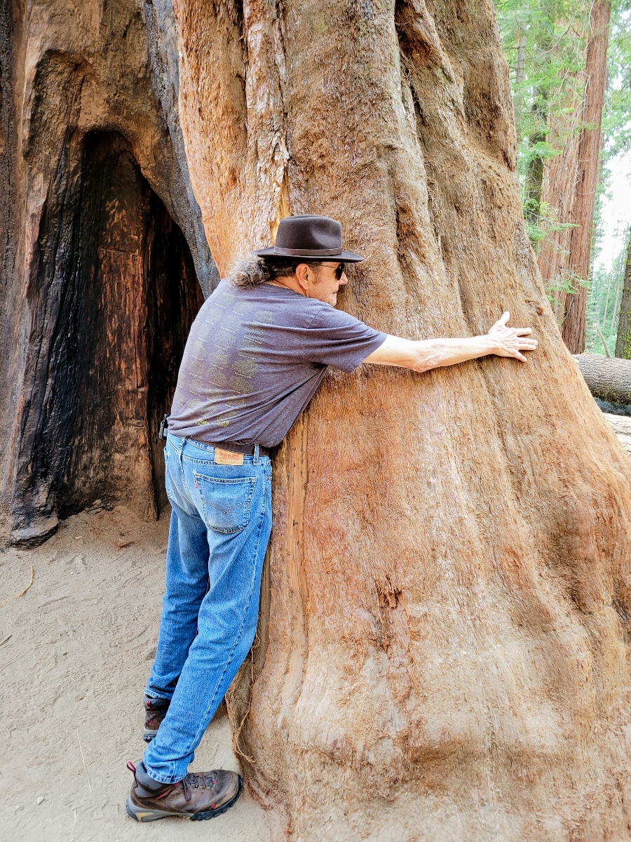
Coyote Gulch attempting to hug a Sequoia near the General Sherman tree August 1, 2022. Photo credit: Mrs. Gulch
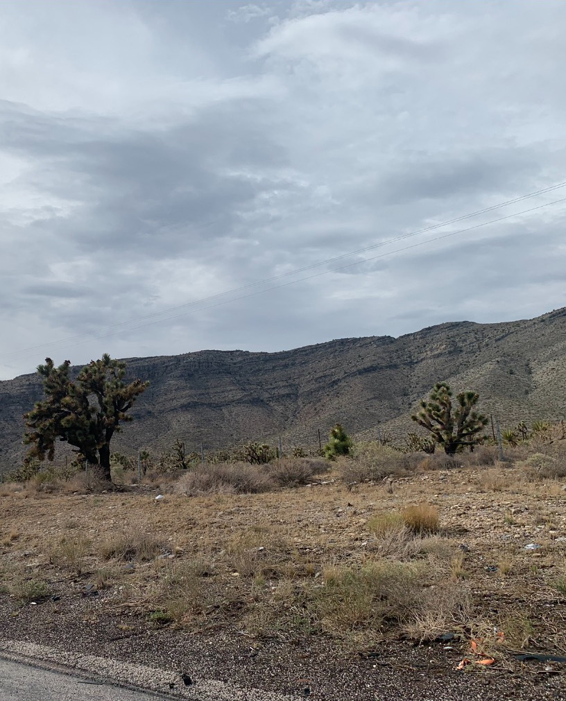
Joshua Trees in California July 31, 2022. Photo credit: Hellchild
Day 2 was another travel day. We had to go from Mesquite, Nevada to Visalia, California, near Sequoia and King’s Canyon national parks. We stopped in Las Vegas to pick up our daughter who had flown in to meet us.
Ugh, the drive from Las Vegas to Baker, California was slow due to traffic. One reason was that mud and debris had washed over the road from convective storms in some places so traffic was backed up while the highway was being cleared. The major reason, we learned from the server at dinner, was that traffic is horrible on Sunday afternoon in that stretch. The traffic was something that I had not allowed for.
It was cool to see so many Joshua trees (this was a novel experience for me). This part of California is very different from our usual haunts. The Tesla navigation system worked flawlessly, even routing us around an accident (there were three in the stretch) down county two-lane blacktop at one point. There was standing water on that road in a couple of places. The NWS warning, “Turn around don’t drown, unless you see someone else get through safely,” was on my mind. 🙂
Screenshot of the Tesla’s “Go Anywhere” apps.
Our hotel is a Tesla destination hotel so after picking up a bit of charge in Bakersfield we plugged in overnight at our base for exploring the sequoias. We utilized Tesla superchargers in, Mesquite, NV, Las Vegas, NV and Bakersfield, CA but could have gotten away with fewer stops according to the Tesla trip planner. I am very impressed with the ease of navigation and the quick charging at the superchargers.
It is so cool that I can rent a Tesla for long driving vacations and not use my Nissan Leaf with it’s more limited range.
Leaf charging at the Beau Jo’s charger in idaho Springs August 23, 2021.