Groups continue working on #CrystalRiver protections: Three subcommittees exploring various methods; questions multiply on Wild & Scenic designation — Heather Sackett (@AspenJournalism)

Beaver Lake and the Crystal River in Marble seen from the air. Three subcommittees are continuing to work on exploring protections for the river. Credit: EcoFlight

Click the link to read the article on the Aspen Journalism website (Heather Sackett):

October 29, 2024

Three subcommittees exploring ways to protect the Crystal River met in Marble on Monday to share their status and findings after six months of work.

The Crystal River Collaborative Steering Committee split into three subcommittees in March, each focused on evaluating a different method of river protection: a peaking instream flow; an intergovernmental agreement; and a federal Wild & Scenic designation.

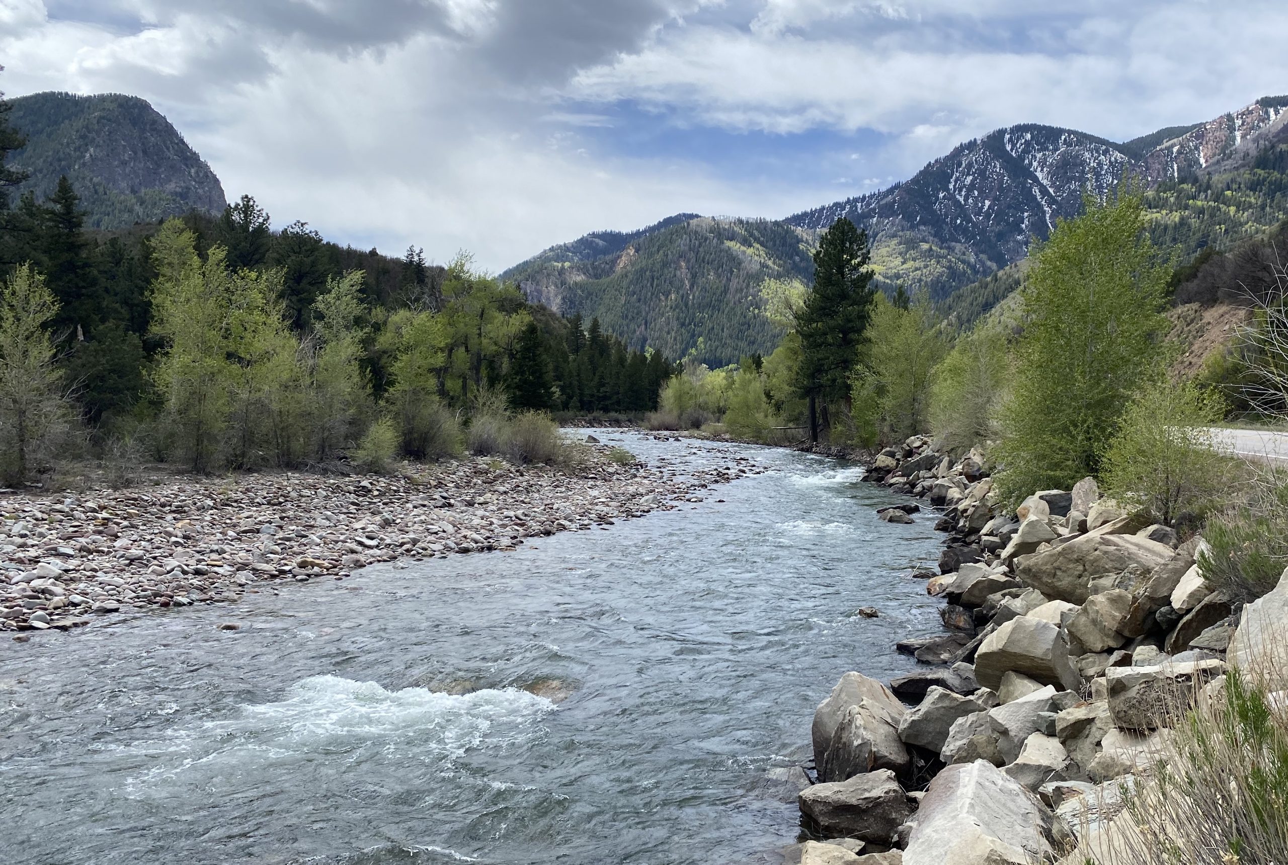
Some Crystal Valley residents, along with Pitkin County, have pushed for a Wild & Scenic designation for years as the best way to prevent future dams and diversions. Others, wary of any federal involvement, have balked at the idea, instead proposing different types of protections. But nearly everyone involved agrees that some type of protection is necessary to ensure that one of Colorado’s last free-flowing rivers stays that way.

A peaking instream-flow water right could protect about 25,000 acre-feet of river flows during peak runoff so that that water could not be claimed by a new transbasin diversion or dam project. Committee member Andrew Steininger said the group has hired environmental consultant Brad Johnson to study the issue and write a report on the feasibility of a peaking instream-flow water right on the Crystal. The water right is designed to protect special riparian ecosystems, including plants that need annual floodwaters to survive, and it’s not clear how it would be adapted to the Crystal.

“We are anxiously awaiting Brad’s work, and I think that will really help inform what an avenue might look like,” Steininger said.

Gunnison County Commissioner Liz Smith gave an update on the intergovernmental agreement committee, or IGA. An IGA would include representatives from Gunnison County, Pitkin County, Marble, Colorado River Water Conservation District and West Divide Water Conservancy District. The IGA would have two main goals: Signatories would agree to not support any new reservoir or impoundment of water on the main stem of the Crystal and would agree to oppose in water court any water rights application that would remove water from the Crystal River basin.

Steering committee members agreed that Smith will work on a draft IGA with the local governments, which will be reviewed by the steering committee before the governments sign it.

The view looking upstream on the Crystal River below Avalanche Creek. Pitkin County and others wants to designate this section of the Crystal as Wild & Scenic. CREDIT: CURTIS WACKERLE/ASPEN JOURNALISM

Wild & Scenic

Members of the subcommittee dedicated to exploring a Wild & Scenic designation said the process is a lot more complicated than they initially thought it would be. The group provided 13 pages of information with many links to additional resources. Every white paper that the group reads and every expert that they talk to generates new questions, said committee member Hattie Johnson.

“One takeaway from this process is that we don’t have a draft to share, we don’t have a formal recommendation,” said committee member Lea Linse. “There is a lot more to this act than a lot of us starting this process realized.”

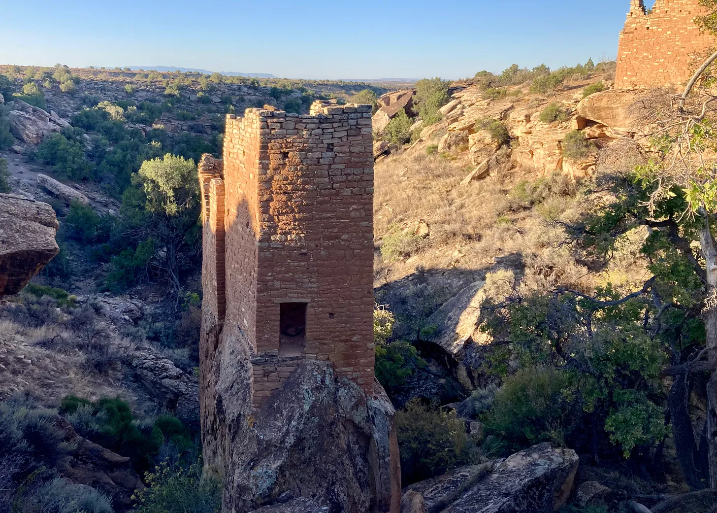
The U.S. Forest Service first determined in the 1980s that the Crystal River was eligible for designation under the Wild & Scenic Rivers Act, which seeks to preserve rivers with outstandingly remarkable scenic, recreational, geologic, fish and wildlife, historic and cultural values in a free-flowing condition. There are three categories under a designation: wild, which are sections that are inaccessible by trail, with shorelines that are primitive; scenic, with shorelines that are largely undeveloped, but are accessible by roads in some places; and recreational, which are readily accessible by road or railroad and have development along the shoreline.

The Crystal could include all three types of designation: wild in the upper reaches of the river’s wilderness headwaters, scenic in the middle stretches and recreational from the town of Marble to the Sweet Jessup canal headgate.

Each river with a Wild & Scenic designation has unique legislation written for it that can be customized to address local stakeholders’ values and concerns.

The teeth of the designation comes from an outright prohibition on federal funding or licensing of any new Federal Energy Regulatory Commission-permitted dam, on the mainstem of the river or its tributaries. A designation would also require review of federally assisted water resource projects.

According to section 7 of the Wild & Scenic Rivers Act, a project requires review when it meets both of the following criteria: it is proposed in the bed or banks of a designated river and it is proposed by a federal agency or it requires some type of federal assistance such as a permit, license, grant or loan. Projects on the bed or banks of a tributary of a designated river stretch also trigger a review when they are proposed by a federal agency or if they require some type of federal assistance such as a permit, license, grant or loan; and are likely to affect a designated river.

Subcommittee members said better understanding how that would play out in the Crystal River basin will require more work.

“The process where the broad and easy questions to answer have been covered, and now we are starting to get into tricky territory where additional facilitated conversations would be important to this group,” said committee member and Pitkin County Commissioner Kelly McNicholas-Kury. “Section 7 is always the sticking point. It’s always the area of the law where the negotiation and the learning and the clear understanding needs to be very intentional.”

Crystal River Valley resident and Wild & Scenic proponent Bill Argeros speaks at a steering committee meeting Monday at the Marble firehouse. Argeros said it’s time for the subcommittee to start drafting a proposal for legislation. Credit: HEATHER SACKETT/Aspen Journalism

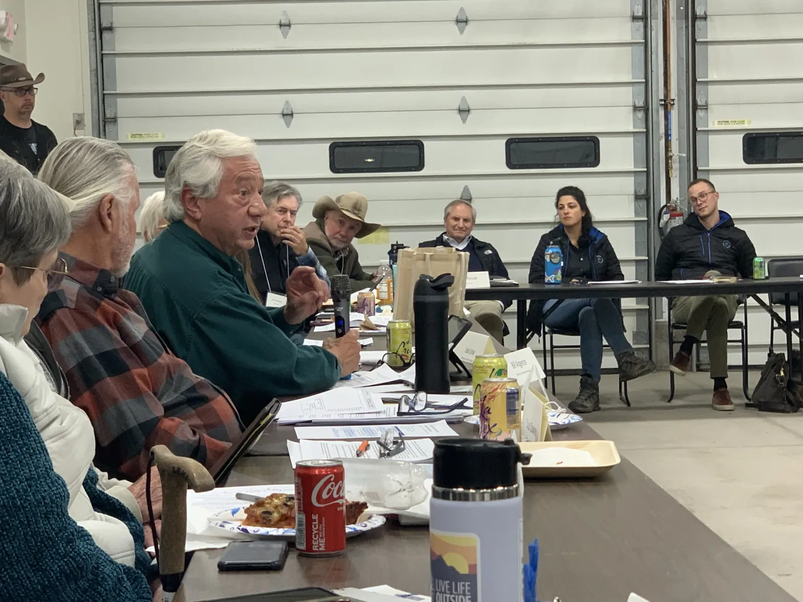
There was some disagreement among the group about how fast they should move forward with a draft proposal for Wild & Scenic legislation. Crystal Valley resident Bill Argeros, who favors Wild & Scenic, said the committee’s task was very clear. The group’s charter says they are charged with creating a draft Wild & Scenic legislative proposal and map that protects the community-held values on the Crystal River, while addressing local concerns.

“Draft a proposal — that’s what we need to do, and I think that’s what everybody here is waiting for,” he said. “We need to work on that really hard and as quickly as we can.”

But others cautioned that pushing too fast would be a mistake and that there’s still a lot to learn. Carbondale rancher Bill Fales is familiar with these sometimes-messy community processes; he helped advocate to protect public land from new oil and gas leases in the Thompson Divide. Earlier this year, the Biden administration announced the 20-year withdrawal of nearly 222,000 acres from oil and gas development. The effort eventually paid off, but it took decades of work by ranchers and environmentalists.

“Look at Thompson Divide,” Fales said. “Eight months is premature. Don’t expect to do something this consequential in one year.”

All three subcommittees will continue working, and another meeting of the larger steering committee is scheduled for April.

#BearsEars final management plan drops as lawsuit drags on — Jonathan P. Thompson (LandDesk.org)

The Bears Ears. Jonathan P. Thompson photo.

Click the link to read the article on The Land Desk website (Jonathan P. Thompson):

October 8, 2024

🌵 Public Lands 🌲

The BLM has released its final environmental review of the proposed Bears Ears National Monument management plan that will replace the existing, 2020 Trump-era plan. Like the draft plan, it places a strong emphasis on tribal co-management and incorporating traditional Indigenous knowledge into decision making, education, and interpretation. Tribal input will mostly come via the Bears Ears Commission, made up of representatives from each of the five tribal nations that initially proposed the national monument in 2015.

And, as with the draft plan, the preferred alternative is less restrictive than the preservation-focused one in most respects. Livestock grazing, for example, will continue on largely as it has in the past; firewood harvesting as well as gathering of ceremonial plants will be allowed; motorized travel will still be allowed on designated routes through much of the monument; and dispersed camping will continue, with some limits.  

The final plan drops even as the state of Utah and its co-plaintiffs press on with their lawsuit seeking to eviscerate or eliminate the national monument — and diminish the Antiquities Act as a whole. The plaintiffs assert that Congress intended the Antiquities Act to apply only to specific objects, not landscapes or the context in which those “objects” exist. The lawyers who devised this argument apparently have not seen the Grand Canyon, one of the first national monuments established under the Antiquities Act, which is clearly a landscape, not a discrete “object.” (I further refute their arguments here).

The landscape-scale designation allegedly imperils the plaintiffs — a rancher, a miner, an off-road lobbying group, and a Ute Mountain Ute tribal member — because the accompanying restrictions would “upend traditions and existing ways of life across the area” by making it impossible to continue ranching, mining, off-road riding, and harvesting ceremonial plants across all 1.36 million acres. 

In fact, the proposed management plan allows all of those activities to continue, thereby further weakening the plaintiffs’ already feeble argument. Even mining can occur on existing, active, valid claims, which I’ll get to in a moment. A judge tossed the lawsuit last August, and last week the plaintiffs gave it another try in a federal appeals court; a decision isn’t expected for months. 

So far, environmental groups have tentatively supported the plan. Meanwhile, the strongest opposition has come from the NSSF, or the Firearm Industry Trade Association, which balked at the decision to ban recreational shooting throughout the monument. More on that below.  

Here are some of the key provisions in the final plan that stood out (in no particular order):

  • The national monument will be divided into four zones: Front Country (21,407 acres along paved highways where visitor infrastructure would be concentrated); Passage (26,000 acres along other travel routes and throughways); Outback (542,361 acres that would “provide an unsupported backcountry experience” with dispersed camping), and Remote (775,000 acres for a “natural and undeveloped experience for non-motorized and non-mechanized recreation with an emphasis on protecting the most fragile and least-accessible areas…”) 
  • Dispersed camping would be allowed in much of the monument except around streams, developed recreation areas, and wherever else it’s necessary to protect the national monuments’ resources. Agencies and the Bears Ears Commission would work to determine which areas would allow dispersed camping and which would be limited to designated sites.  
  • Under the draft plan, no commercial filming would be allowed. In the final plan the agencies backed off on that and changed it to allow filming unless it “causes an appreciable disturbance to BENM resources or takes place in Tribal Nations’ sacred sites.” 
  • Pets would need to be leashed throughout the monument and would not be allowed in the Cedar Mesa Backpacking Sub-Area, Doll House, and potentially some other sites.
  • Climbing: Replacement of existing bolts/anchors/etc. would be allowed on existing routes as needed for safety and any new climbing or canyoneering routes that require fixed gear would need approval from agencies. 
  • Hunting would be allowed within the monument in accordance with state laws, but recreational shooting would be banned. This will protect the soundscape, make it safer for other visitors, and protect rock art panels and other cultural sites. As disturbing as it may be, many if not most petroglyph panels in the Bears Ears area have been marred by gunshots. This ban is aimed at providing a further level of protection. The NSSF, a firearm industry lobbying group, balked at the ban, claiming that it amounts to blocking access to federal land and is therefore illegal. This is simply false, obviously. Recreational shooters can access the monument; they just can’t shoot recreationally while they’re on it.
A petroglyph panel in Bears Ears National Monument irreparably damaged by recreational shooters. Jonathan P. Thompson photo.
  • While mechanical methods would be allowed for vegetation management, chaining would be banned.
  • Travel Management: Under the existing, Trump-era plan, about 436,000 acres of the national monument are closed to off-highway vehicles. The proposed plan would close 637,615 acres to OHVs. While it’s an increase, it still leaves about 727,000 acres open to OHV travel on thousands of miles of designated routes. That’s a heck of a lot of territory that remains open to the likes of the Blue Ribbon Coalition, one of the lawsuit plaintiffs. And while the draft plan would have banned all motorized travel in Arch Canyon, the final proposal backs off on that and would allow OHV travel along the sensitive canyon floor with a permit. The permit system has yet to be developed. 
  • Bicycles would be limited to routes where OHV use is allowed and to trails specifically designated for bikes.

Running cattle near Valley of the Gods in Bears Ears National Monument. Jonathan P. Thompson photo.
  • Livestock grazing will be prohibited on 162,217 acres, meaning that the remaining 1.2 million acres will be available to the likes of Zeb Dalton, a livestock operator, federal grazing allotment holder, and plaintiff in the state’s lawsuit seeking to revoke the monument. Dalton claims that if his efforts to rescind the monument designation were to fail, he’d be forced to go out of business due to the “tremendous regulatory burdens and compliance costs.” Yet Dalton provides no evidence that the monument’s establishment or restoration of the original boundaries has in any way increased these burdens, nor does the proposed management plan increase restrictions on grazing. And under the current regime, while there are nearly 60,000 permitted animal unit months, or AUMs, on the monument, only about 34,000 of those have been billed, meaning ranchers are only using about 58% of the available spaces for cattle — voluntarily, not because of any restrictions. The proposed plan would increase the number of available AUMs, potentially allowing even more cattle on the national monument.
    • There is one major change that could affect livestock operations: If a rancher were to voluntarily relinquish their federal grazing allotment within the national monument, that allotment would be retired permanently, meaning the BLM or USFS would not be able to lease it out to another operator. This may mean that grazing is phased out from the monument over the very long term. But it also opens the door for conservation groups to purchase grazing allotments from willing sellers so they can retire them. This can be very lucrative for the livestock operator who is looking to get out of the public lands grazing business. 
  • Another plaintiff in the lawsuit is Ute Mountain Ute tribal member Suzette Morris. According to the complaint, the national monument has restricted Morris’ ability to practice her traditions because she “depends on having ready access to these lands so that she can remove certain resources from them (e.g., cedar post, firewood, medicinal herbs).” Under the proposed management plan, Morris would continue to be able to harvest cedar posts, firewood, medicinal herbs, and other plants and trees for traditional or ceremonial purposes. Furthermore, the agencies would work with tribal nations to “provide for the monitoring, management, protection, and access to vegetation types import to Indigenous ceremonial or other traditional uses.”
A map showing some active mining claims within and adjacent to Bears Ears National Monument. The Kimmerle claims mentioned below are indicated by the A. A rundown on the other claims can be found here.

The national monument designation withdrew all 1.36 million acres from new mining claims and oil and gas leases. However, it does not block development of existing, active, valid mining claims and leases. The trick here is with the “valid” part. A mining claim can be active so long as the claimant keeps up on their yearly maintenance fees. The validity of a claim, on the other hand, depends on the discovery of a valuable mineral deposit there, which must be demonstrated. Active claims within the monument don’t go away, but they also can’t get an operation permit unless they are also valid claims. Kyle Kimmerle, yet another plaintiff in the lawsuit, claims that the estimated $100,000 cost of demonstrating validity is blocking him from mining his uranium claims in the White Canyon area — and earning $2 million to $3 million in profit. And thus, he has destroyed his own argument, for if he is so sure of that bonanza, then he should have no problem laying down $100,000 up front, since he would get a 2,000% to 3,000% return on his investment. Kimmerle holds hundreds of mining claims in southeastern Utah, most of them in uranium-rich areas such as the Lisbon Valley. And yet he chose one in a national monument to apply for an operating permit, shortly before joining up as a plaintiff in this lawsuit. Kinda makes you wonder about motives, doesn’t it?

I’ve barely scratched the surface of this document and the plan it lays out. I’d strongly encourage y’all to give it a gander yourself. It has interesting chapters on the tribal nations’ ties to the landscape, on the wildlife that lives there, and even on the economic effects of the plan. The planning process now enters its final phase and the agencies are expected to make a final decision and adopt the plan in coming months. Read it here.

Big win for Bears Ears, Grand Staircase-Escalante — Jonathan P. Thompson

·August 15, 2023

Big win for Bears Ears, Grand Staircase-Escalante

Sacred lands, public lands, tribal nations, and the Antiquities Act all scored a huge victory last week when a federal judge dismissed a lawsuit seeking to rescind President Biden’s 2021 restoration of Bears Ears and Grand Staircase-Escalante National Monuments.

Read full story


📸 Parting Shot 🎞️

Some very cool Puebloan architecture at Hovenweep National Monument. Jonathan P. Thompson photo.