The future of New Mexico’s beloved bosque: In a warmer, drier climate, restoration has its limits — @HighCountryNews #RioGrande

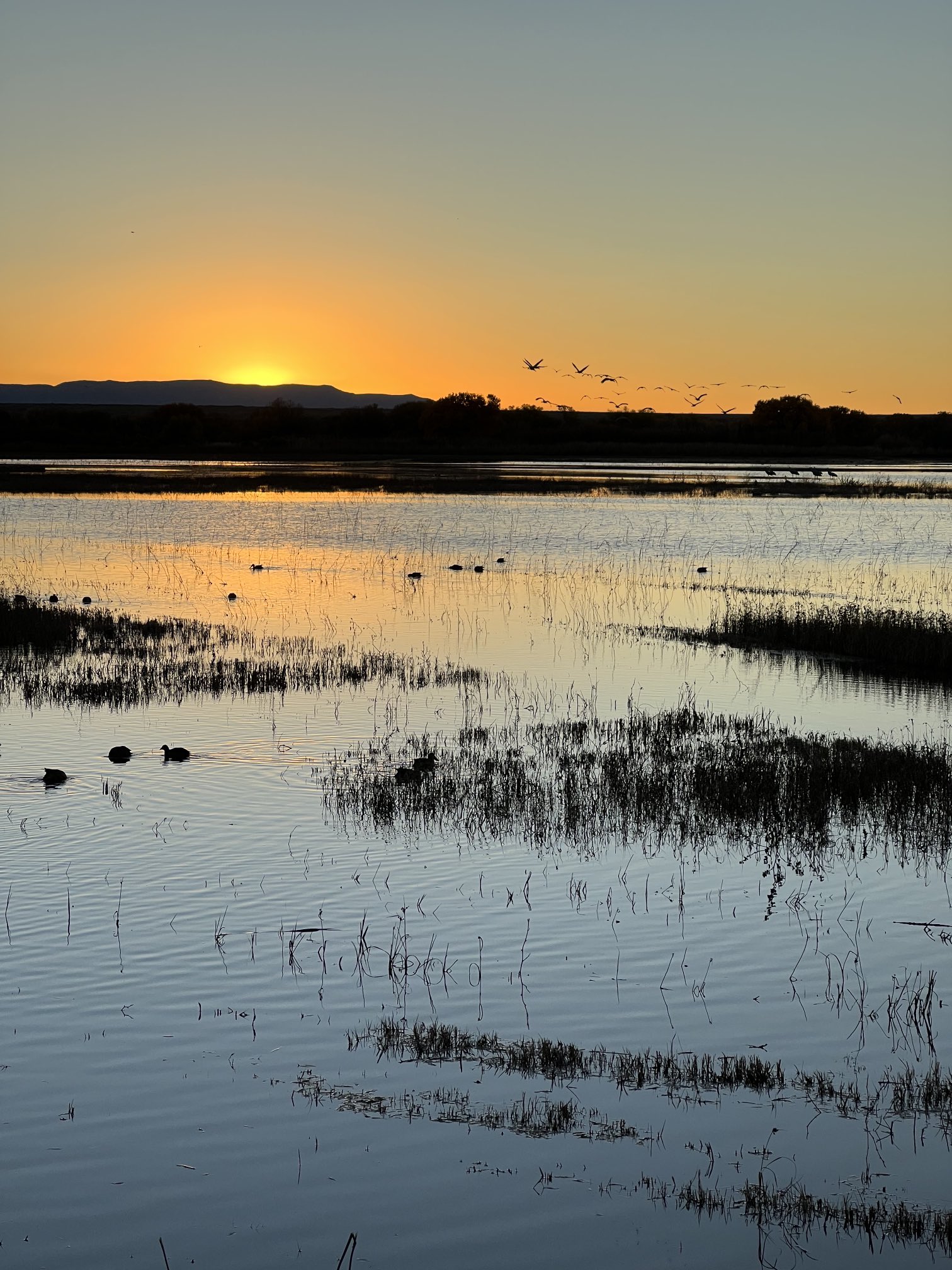
Birds and water at Bosque de Apache New Mexico November 9, 2022. Photo credit: Abby Burk

Click the link to read the article on the High Country News website (Anna Marija Helt):

November 1, 2024

Old rope swings hang from even older cottonwoods along the Middle Rio Grande in Albuquerque, New Mexico. The riverside forest, known as the bosque, has long been a shady oasis in the arid valley. “It’s where everyone would go,” said Shelby Bazan, who describes herself as a “born and raised Burqueña,” or native of Albuquerque. Her father grew up along the river in the ’70s, and both her parents remember summers when the river was alive with water and people. 

Myron Armijo, the governor of Santa Ana Pueblo, shares those memories. “The Rio Grande was our playground,” he said. “Once we got our chores done, then we would get out there and play, a lot of the time pretty much all day long.” Now, water diversions, development and climate change leave more sections of the river dry each year. “If you jump, you’re just going to hit the dirt,” said Bazan. Nobody has bothered to replace the old swings.  

Over the past two decades, restoration efforts large and small have removed introduced plants such as tamarisk and Russian olive, which can form impenetrable thickets, replacing them with native cottonwoods, willows and shrubs that support wildlife and are significant to the people with the deepest roots in the valley. “It means a lot to us, both traditionally, culturally,” Armijo said of the bosque.

But as the region warms — average temperatures since 2000 have been 1.8 to 2 degrees Fahrenheit higher than they were over the previous century — and the once-high water table drops, those who love the bosque have been forced to reconsider what can be realistically restored.

OVER MILLENNIA, the bosque’s mosaic of plant communities was maintained by a high water table, seasonal flooding and a meandering river channel. “You’d have grassy meadows, wetlands and understory shrubs over here; young cottonwoods over there; older cottonwoods over here,” said ecologist Kim Eichhorst, director of the community-science-based Bosque Ecosystem Monitoring Program (BEMP). 

By the 1990s, 150 years of water- and land-use decisions had destroyed or degraded much of this historic mosaic. “Channelization, levees to protect communities, impoundments to store water for irrigation purposes — that all changed the river,” said Glenn Harper, who’s worked for Santa Ana Pueblo for over 25 years and oversees its 142,000 acres of grassland, shrubland and woodland habitat

A cottonwood forest in Bosque del Apache National Wildlife Refuge. Credit: Matthew Schmader/Open Space Division

Cottonwoods that germinated in the 1930s and 1940s are now separated from the river and nearing the end of their lifespan. Without the seasonal floods that distributed seeds and nutrient-rich sediment, there are few young cottonwoods to replace them. At the same time, drier, hotter conditions have encouraged introduced plants, not only tamarisk and Russian olive but Siberian elm, Ravenna grass and many others. 

In response, many Middle Rio Grande communities — at Santa Ana and Sandia pueblos, in Albuquerque and elsewhere — began restoration efforts along the river to bring back the bosque. Though much of the initial work was spearheaded and funded by local communities, many of the projects now have government agency support. For example, Albuquerque’s industrialized South Valley is now home to Valle del Oro National Wildlife Refuge, thanks to a collaboration between the local community and the U.S. Fish and Wildlife Service. Though bosque restoration isn’t the refuge’s sole purpose, it is a part of its plans for the land. 

When Santa Ana Pueblo embarked on its ambitious bosque restoration plan, said Armijo, the tamarisk and Russian olive thickets under the mature cottonwoods were so dense that getting through them on horseback was impossible. After the pueblo’s Bosque Restoration Division cleared about 1,500 acres, the bosque began to resemble the open cottonwood forest that pueblo elders remembered from their youth. 

Since then, though, falling groundwater levels have stressed the aging cottonwoods, and many are dying or dead. “Climate change,” said Nathan Schroeder, Santa Ana Pueblo’s Restoration Division manager. “That’s where I feel like the deck keeps getting shuffled.” And because the roots of young trees can no longer reach the water table, the pueblo’s original plan for planting new cottonwoods among the old is no longer tenable.

AS CONVENTIONAL restoration approaches become less reliable, advocates are asking how to move forward. “What we really need is to recognize what the system can support,” said Eichhorst. Instead of trying to restore the bosque to what it was, she envisions a mix of dryland plants and smaller pockets of “wet-loving” plants, cottonwoods or otherwise, wherever water is sufficient.  

At the pueblo, the Restoration Division may plant some native drought-tolerant shrubs where it had planned to grow cottonwoods. Farther downstream in Albuquerque, said geographer and herbalist Dara Saville, some of these species are showing up on their own: “Now that the bosque is largely dry … you see the creeping in of plants from the mesa, from the foothills, from these higher, drier areas.” 

Saville, the founder of the nonprofit Yerba Mansa Project (YMP), doesn’t mind shrubs. “They’re key components of my concept of restoration, resiliency and ongoingness.” The bosque will continue, she said, but as it changes to adapt to new conditions, tenacious, shrubby plant species will likely become more common. And while shrubs can’t provide a shady refuge for people, they do offer food and shelter to wildlife, and some are sources of traditional foods and medicines. Along the Middle Rio Grande, project staff and volunteers have planted native species, such as yerba mansa, pale wolfberrygolden currant and willow baccharis, all of which have medicinal uses. 

Bazan, who works as a BEMP educator, said nonnative trees are another option: “If we don’t have the cottonwoods, would you rather have an exotic bosque that has Siberian elm that still provides shade — or would you rather have a native bosque, but of shrubs and dry grassland areas?” Though Siberian elms are classified as “noxious weeds” in New Mexico, their tolerance for a lower water table and their ability to provide habitat for local species such as porcupine have led restorationists to consider leaving them in place in some areas.
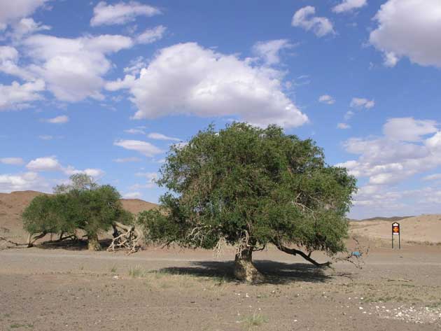
Siberian Elm In mongolia (Gobi desert), a tree Ulmus pumila (Fr). By Tiarescott – TerraNova, le désert de Gobi, CC BY-SA 3.0, https://commons.wikimedia.org/w/index.php?curid=6795911

While the restoration projects are ecologically and culturally important, there are many competing uses for the Rio Grande’s water, including irrigation and the demands of an expanding urban population. Although riverside vegetation also uses river water, a new bosque mosaic is expected to use less water than extensive thickets of nonnative trees and shrubs. 

In the pueblo, however, the focus remains on native plants and wildlife. To support young cottonwoods and willows, the restoration division, in partnership with federal agencies, used excavators to lower sections of the riverbank and bring back some limited flooding. The bosque planted in this new floodplain over the past 15-plus years is luring endangered southwestern willow flycatchers, threatened western yellow-billed cuckoos and, according to this year’s survey, yellow warblers, Harper said. 

No matter its makeup, restoring and maintaining a more resilient bosque ecosystem will require cooperation and long-term maintenance. “It never ends,” said Harper. Eichhorst is encouraged by the region’s shared love of the bosque. “It isn’t something that’s just an older generation, but it’s something that younger students are actively participating in,” she said. “It’s not hopeless.”   

This story is part of High Country News’ Conservation Beyond Boundaries project, which is supported by the BAND Foundation. hcn.org/cbb
‘This means we need to plan for a hotter and drier future’ — Allen Best (@BigPivots) #ActOnClimate

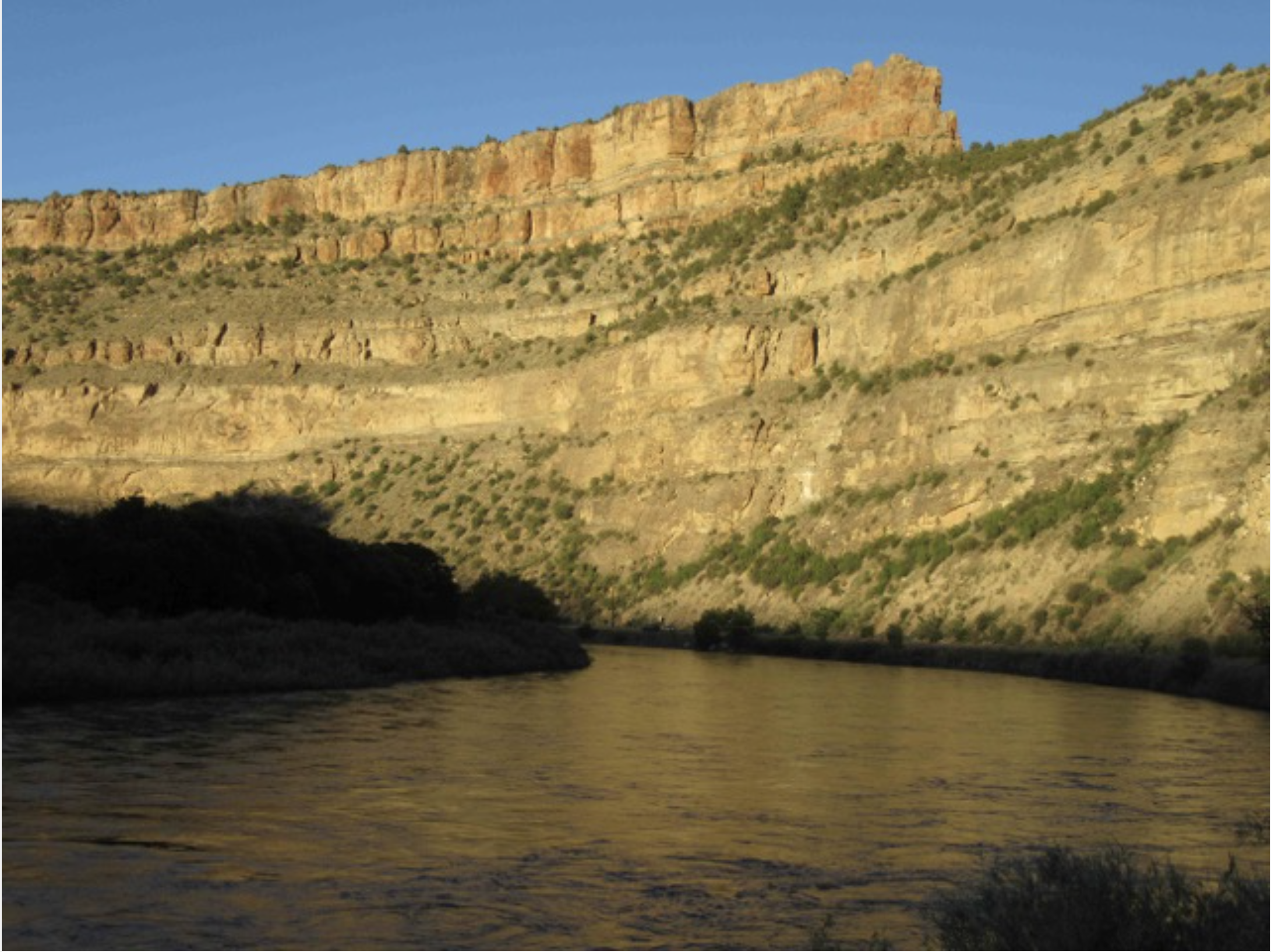
The Colorado River in De Beque Canyon, near Grand Junction, Colo. Photo/Allen Best

Click the link to read the article on the Big Pivots website (Allen Best):

November 14, 2024

New study says greenhouse gases, not natural drought, have been swinging a heavier bat in Western states since 2000

Yet another scientific study finds that rising heat has been playing an outsized role in the spreading and lengthening drought in the American West during the 21st century. The question remains how exactly we will act on this information.

The latest study was published in Science Advances under the title of “Anthropogenic warming has ushered in an era of temperature-dominated droughts in the western United States.”

“For generations, drought has been associated with drier than normal weather,”

said Veva Deheza, a study co-author and director of the National Oceanic and Atmospheric Administration’s National Integrated Drought Information System .

“This study further confirms we’ve entered a new paradigm where rising temperatures are leading to intense droughts with precipitation as a secondary factor.”

Previous studies had demonstrated the influence of precipitation and evaporative demand on drought. The researchers in this new study explicitly sought to disentangle the influences  of natural variability from human causes, i.e. warming produced by the addition of greenhouse gases to the atmosphere.

They concluded that around the year 2000 that human-caused warming became the dominant factor in the severity of drought in the 11 Western states and also expanded areas affected by drought conditions.

They attributed 61% of the severity of the drought from 2022 to 2022 to high temperatures and only 31% to reduced precipitation.

“This study has uncovered that rising temperatures and the resulting high evaporative demand have surpassed precipitation deficit as the dominant drought driver around the year 2000 in the (Western United Sates),” wrote Rong Fu, a UCLA climate researcher, a lead author of the study.

“This change cannot be explained by natural climate variability and is mainly caused by warming due to anthropogenic forcing. This drought regime shift has led to increased drought severity and coverage since the turn of the 21st century, marking the beginning of a new era where (western United States) droughts are increasingly driven by evaporative demand rather than precipitation deficits.”

This study builds upon the work of Brad Udall of Colorado State University and other studies. Udall and Jonathon Overpeck, then of the University of Arizona, completed a study in 2017 that found a third to a half of the nearly 50% in reduced flows in the Colorado River from 2004 to 2014 could be attributed to warming. Their study was called “The twenty-first century Colorado River hot drought and implications for the future.”

That study helped spread the use of the word “aridification” for what is occurring. Unlike drought, it is not necessarily something that will end.

Flows in the Colorado River have declined 20%, a process often called aridification. The river and its tributaries provide water from Albuquerque to Denver to Cheyenne, as well as to most of southern California, plus most places between.

Udall last week told the Los Angeles Times that this new study came to the same conclusion of his and other studies.

Grass front yards are rare in some subdivisions in Albuquerque, a city heavily dependent upon diversions of water from the San Juan River, a tributary to the Colorado River. Photo/Allen Best

“They found, just like all these other studies, that higher temperatures have been, and are going to be, a cause of more severe droughts as it warms in the 21st century,” he said. “That means that we need to plan for a hotter and drier future.”

“New plot using the nClimGrid data, which is a better source than PRISM for long-term trends. Of course, the combined reservoir contents increase from last year, but the increase is less than 2011 and looks puny compared to the ‘hole’ in the reservoirs. The blue Loess lines subtly change. Last year those lines ended pointing downwards. This year they end flat-ish. 2023 temps were still above the 20th century average, although close. Another interesting aspect is that the 20C Mean and 21C Mean lines on the individual plots really don’t change much. Finally, the 2023 Natural Flows are almost exactly equal to 2019. (17.678 maf vs 17.672 maf). For all the hoopla about how this was record-setting year, the fact is that this year was significantly less than 2011 (20.159 maf) and no different than 2019” — Brad Udall

Russ Schumacher, the Colorado climatologist, said temperatures can be expected to increase an average of between 1 and 4 degrees Fahrenheit unless emissions can be abated, creating a climate in Denver more akin to that now found in Albuquerque or El Paso and likely further reducing flows of the Colorado River that have averaged 12.5 million acre-feet this century to possibly 9.5 million acre-feet.

Colorado statewide annual temperature anomaly (F) with respect to the 1901-2000 average. Graphic credit: Becky Bolinger/Colorado Climate Center

The seven-basin states that share the river are already struggling to come to grips with this existing hotter and drier reality than the compact that was struck a century ago and assumed more than  17.5 million-acre feet.

This, in turn, will force shifts in what crops we grow on farms as well as the choices made in urban landscaping.

Ogallala Aquifer groundwater withdrawal rates (fresh water, all sources) by county in 2000. Source: National Atlas. By Kbh3rd – Own work, CC BY-SA 3.0, https://commons.wikimedia.org/w/index.php?curid=6079001

Others areas in the 11 Western states don’t rely upon the Colorado River but have parallel problems. For example, portions of eastern Colorado overlie the Ogallala Aquifer, a body of water deposited up to two million years ago that is being drawn down rapidly. Most of the water goes to creating feedstock for livestock.

In his comments to the LA Times, Udall also expressed dismay at the policies that many expect Donald Trump will institute as president, rolling back efforts to hurry the energy transition.

“We know how to solve this problem,” Udall said. “Much of this will now be sidelined to pursue an anti-science agenda that will further enrich the gigantic companies that created this problem in the future place.”

Another way of understanding the study findings is that the higher temperatures caused primarily by burning fossil fuels have made ordinary droughts into exceptional droughts.

release posted on the NOAA website explained that droughts-induced by natural fluctuations in rainfall still exist, but there’s more heat to suck moisture from bodies of water, plants, and soil.

“A warmer atmosphere can hold more water vapor before the air mass becomes saturated, and precipitation can form. This creates a cycle in which the warmer the planet gets, the more water can evaporate from the landscape and remain stored in the atmosphere longer before it returns to earth as rain or snow.”

Droughts can form even if precipitation patterns remain within a normal range as higher temperatures and evaporation remove water from soils. They can last longer, cover wider areas, and be even drier with every little bit that the planet warms.

To tease out the effects of higher temperatures on drought, the researchers have separated “natural” droughts due to changing weather patterns from droughts due to human caused climate change in the observational data over a 70-year period. Previous studies have used climate models to conclude that rising temperatures contribute to drought. But without observational data about real weather patterns, they could not pinpoint the role played by evaporative demand due to naturally varying weather patterns.

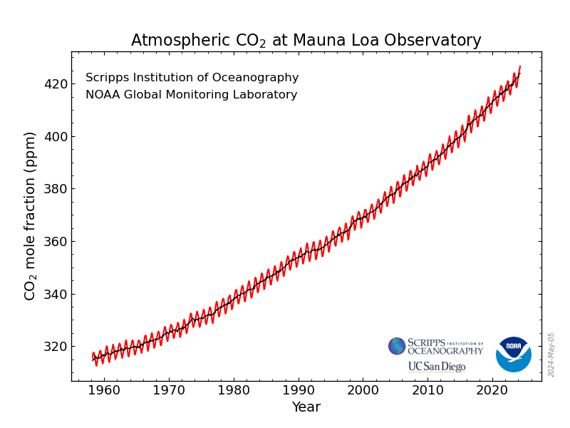
CO2 at Mauna Loa 1960 thru 2020.
This graph shows the full record of monthly mean carbon dioxide measured at Mauna Loa Observatory, Hawaii. The carbon dioxide data on Mauna Loa constitute the longest record of direct measurements of CO2 in the atmosphere. They were started by C. David Keeling of the Scripps Institution of Oceanography in March of 1958 at the NOAA Weather Station on Mauna Loa volcano. NOAA started its own CO2 measurements in May of 1974, and they have run in parallel with those made by Scripps since. (Image credit: NOAA Global Monitoring Laboratory)

Montrose County’s 6th Annual West Slope Water Summit — KJCT

Uncompahgre River Valley looking south

Click the link to read the article on the KJCT website (Ja’Ronn Alex). Here’s an excerpt:

November 14, 2024

Over 300 people attended Montrose County’s 6th Annual West Slope Water Summit…Water is a big part of the Western Slope’s identity. Montrose County held a water summit and invited everyone to drop by and hear speakers like Andy Mueller of the Colorado River District speak on the issues.

“We really want to make sure they understand where the situation is with the Colorado River, the things we have to do,” said Sue Hansen, Montrose County Commissioner of District 2.

Rest assured, our state representatives in Denver are looking to keep water on the Western Slope, on the Western Slope. “We are the biggest water rights holder, and we need to make sure that we can protect that as we go forward. Downstream is continuing to want more and more and more. There is no way any of us can continue to supply them with what they think they want,” commented Catlin.

Map of the Gunnison River drainage basin in Colorado, USA. Made using public domain USGS data. By Shannon1 – Own work, CC BY-SA 4.0, https://commons.wikimedia.org/w/index.php?curid=69257550

#Colorado to Receive $7 Million for Water Measurement Devices in the #ColoradoRiver Basin — Colorado Water Conservation Board #COriver #aridification

Above image shows a Parshall flume measurement structure, with additional telemetry to collect and transmit data, off the Bear River in South Routt County. Photo credit: CWCB

From email from the CWCB:

November 15, 2024

The Colorado Water Conservation Board and the Colorado Division of Water Resources are excited to announce $7 million in funding for Colorado water users within the Upper Colorado River Basin in need of a device to measure their water diversions. 

The Upper Colorado River Commission approved the $7 million for Colorado on October 28. The funding comes from the Commission’s federal Bipartisan Infrastructure Law (BIL) Spend Plan. In total, the BIL provides $8.3 billion to the Bureau of Reclamation for western water infrastructure.

The funding comes at a time when the Colorado Division of Water Resources is working on implementing new water measurement rules in the Colorado River, including Divisions 4, 5, 6 and 7. Rules for Division 6, which includes the Yampa, White, and Green River basins, were signed on January 16, 2024. DWR is currently in the rulemaking process for Division 7, which includes the San Juan and upper Dolores River Basins. Division 4 covers the Gunnison River basin, San Miguel River basin, lower Dolores River basin, and the Little Dolores River basin. Division 5 covers the mainstem of the Colorado River.

The new rules provide clarity on what an acceptable water measurement device is and where they are needed. While Colorado statute gives the State and Division Engineers authority to require water users to install measuring devices, it does not include specifics on what are considered acceptable measuring methods. 

“Accurate measurement of diversions is critical to protect Colorado’s entitlement to water, including under the Colorado River Compact, and to ensure we are maximizing the beneficial use of the public’s water resource,” said Jason Ullmann, State Engineer. “We appreciate this funding from the UCRC to help Colorado water users with the costs of installing a measurement device.”

The Colorado Water Conservation Board will manage the $7 million program and will hire an engineering consultant to assist with the administration. Details about program eligibility and applications will be announced in 2025.

“This new program is a testament to CWCB’s mission to conserve, develop, protect, and manage Colorado’s water resources for both present and future generations,”said Lauren Ris, CWCB Director. “Colorado is a longstanding leader in water measurement and administration, and we aim to extend these benefits to as many West Slope users as possible, ensuring sustainable water management for years to come.”

CWCB expects to roll out a competitive application process that will allow water users in the Upper Colorado River Basin who are in need of measurement devices, such as flumes and weirs, to apply for funding over the next several years.

Ralph Parshall squats next to the flume he designed at the Bellevue Hydrology Lab using water from the Cache la Poudre River. 1946. Photo Credit: Water Resource Archive, Colorado State University, via Legacy Water News.