Click the link to read the discussion on the Climate Prediction Center website:
ENSO Alert System Status: El Niño Advisory
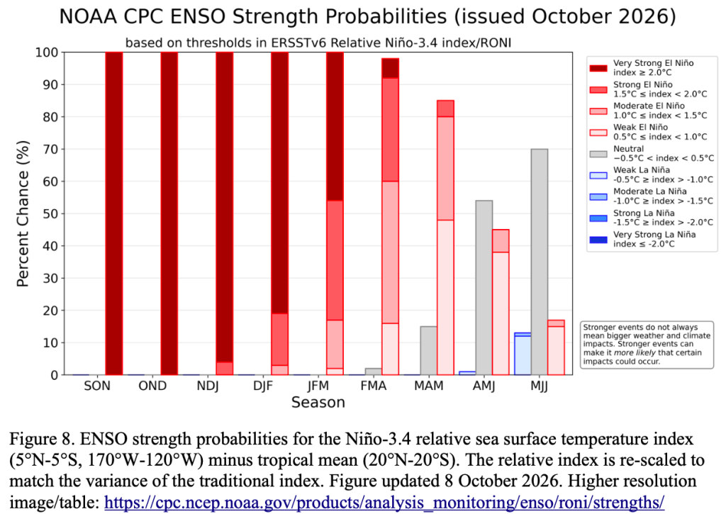
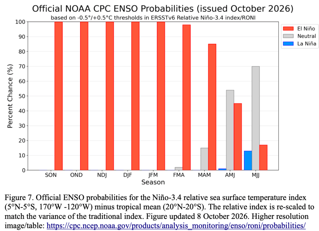
Synopsis: El Niño continues to strengthen, with a strong-to-very strong El Niño likely through January-March 2027 (remaining greater than an 83% chance).
El Niño strengthened further last month, with sea surface temperature anomalies exceeding +4.0°C in portions of the eastern equatorial Pacific. Most Niño indices increased in the past month, reaching +2.1°C in Niño-3.4, +3.0°C in Niño-3, and +3.9°C in Niño-1+2. The equatorial subsurface temperature index (average from 180°-100°W) was well above average, reflecting a deeper-than-average thermocline. Subsurface temperatures remained in excess of +10.0°C at depth in the eastern Pacific Ocean. Low-level westerly wind anomalies and upper-level easterly wind anomalies stretched from the western to the east-central equatorial Pacific. Enhanced convection and rainfall persisted from the central to the eastern Pacific, while anomalies remained suppressed over Indonesia.The traditional and equatorial Southern Oscillation indices were significantly negative. Collectively, the coupled ocean-atmosphere system reflected a strengthening El Niño.
The CPC Official ENSO outlook, which synthesizes multiple models from North America and abroad, indicates El Niño will continue to strengthen through the end of the year. Chances remain high for a historic event that would exceed the strength of previous El Niño events dating back to 1950 (+2.5°C or more for a 3-month RONI value): the chance is 54% for September-November, 83% for October-December, and 70% for November-January. With an event of this magnitude, the chances of experiencing impacts consistent with El Niño are larger, though not guaranteed (see CPC outlooks for probabilities of seasonal anomalies). In summary, El Niño continues to strengthen, with a strong-to-very strong El Niño likely through January-March 2027 (remaining greater than an 83% chance).