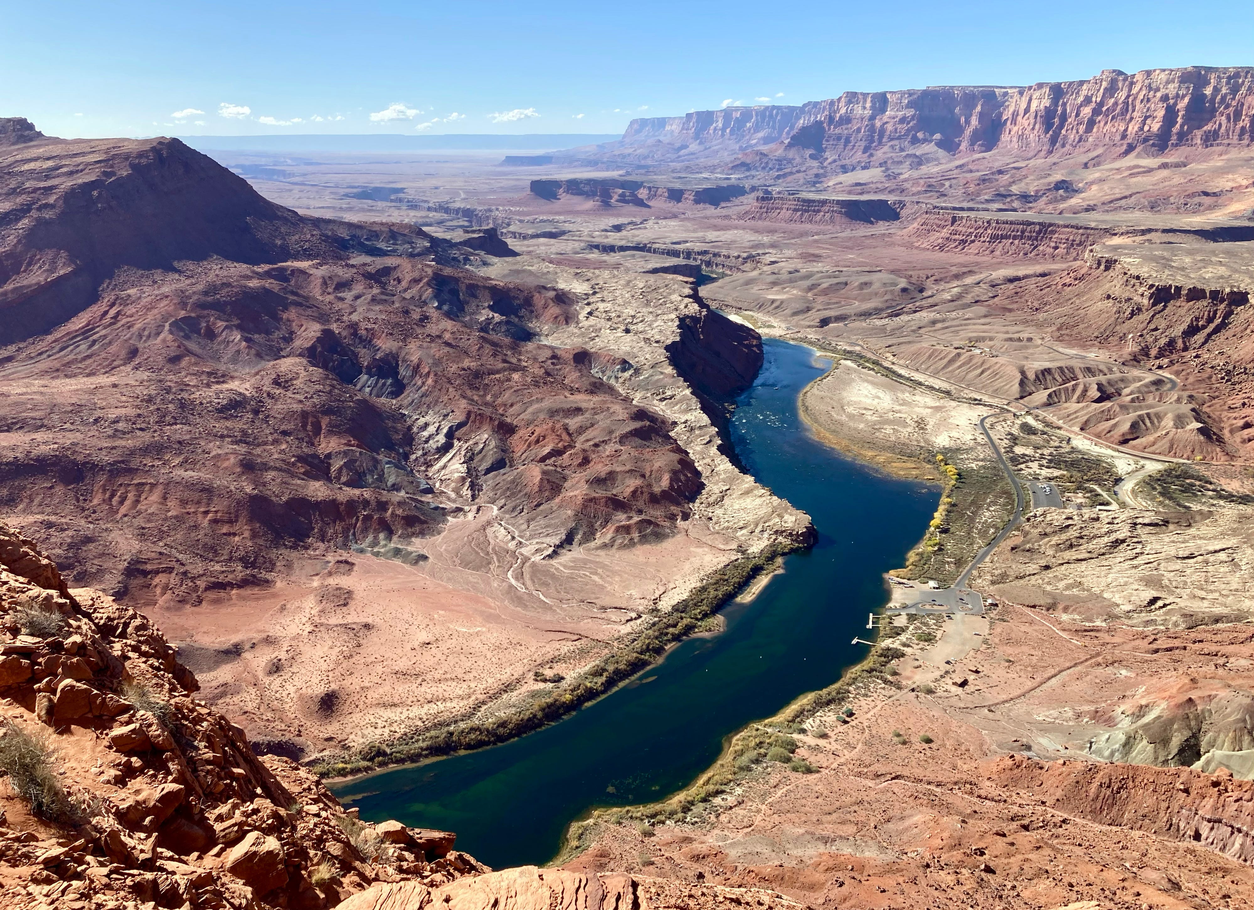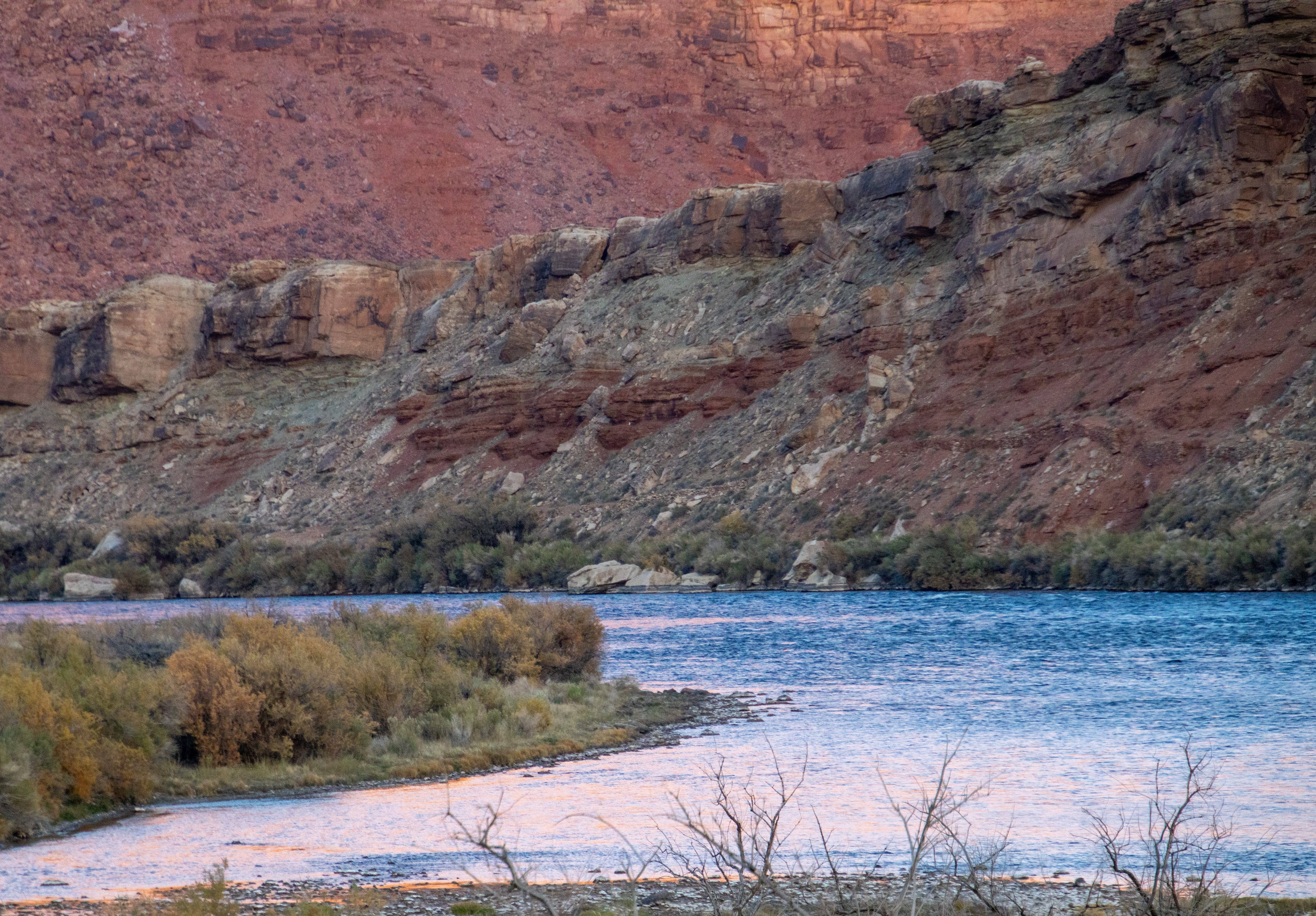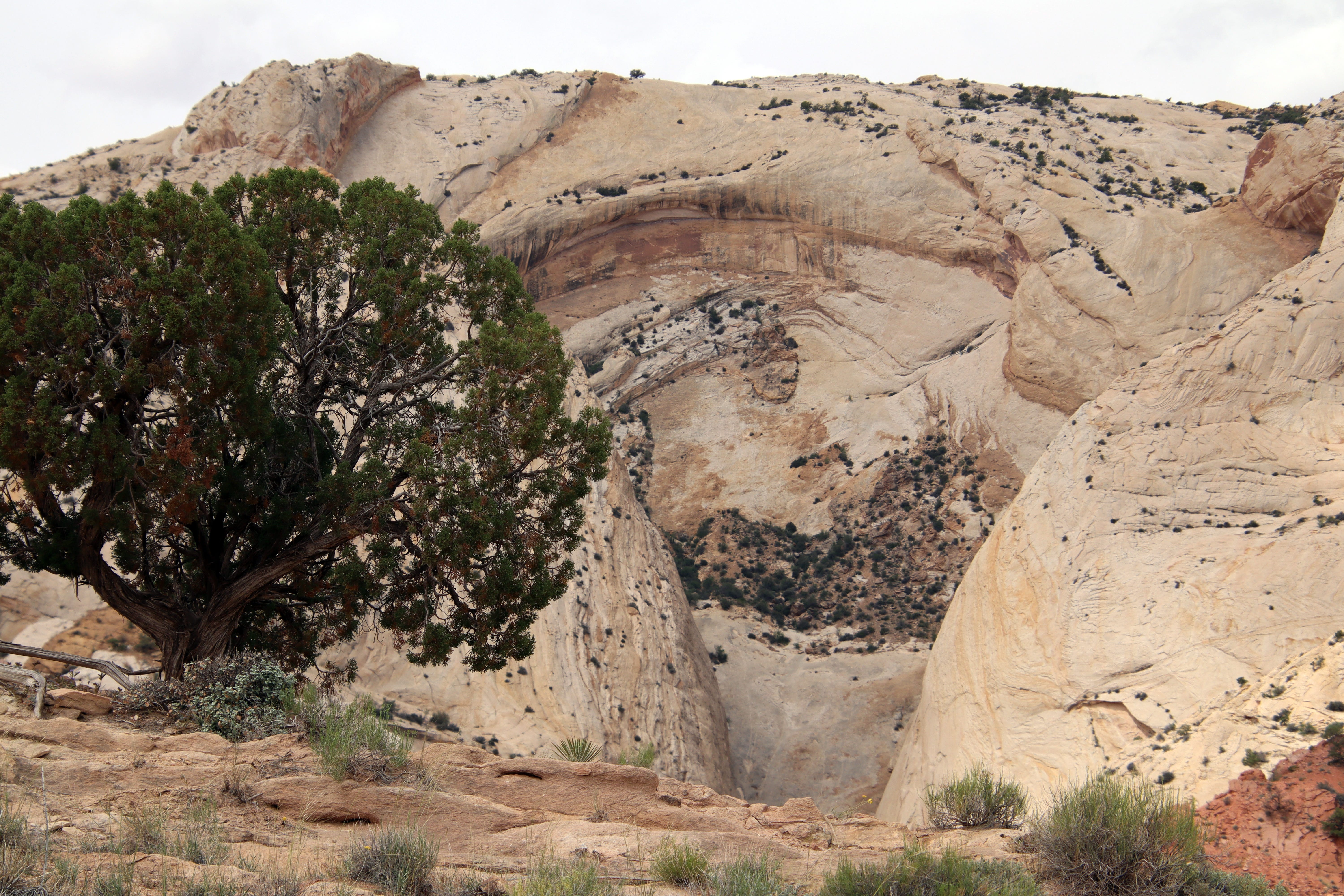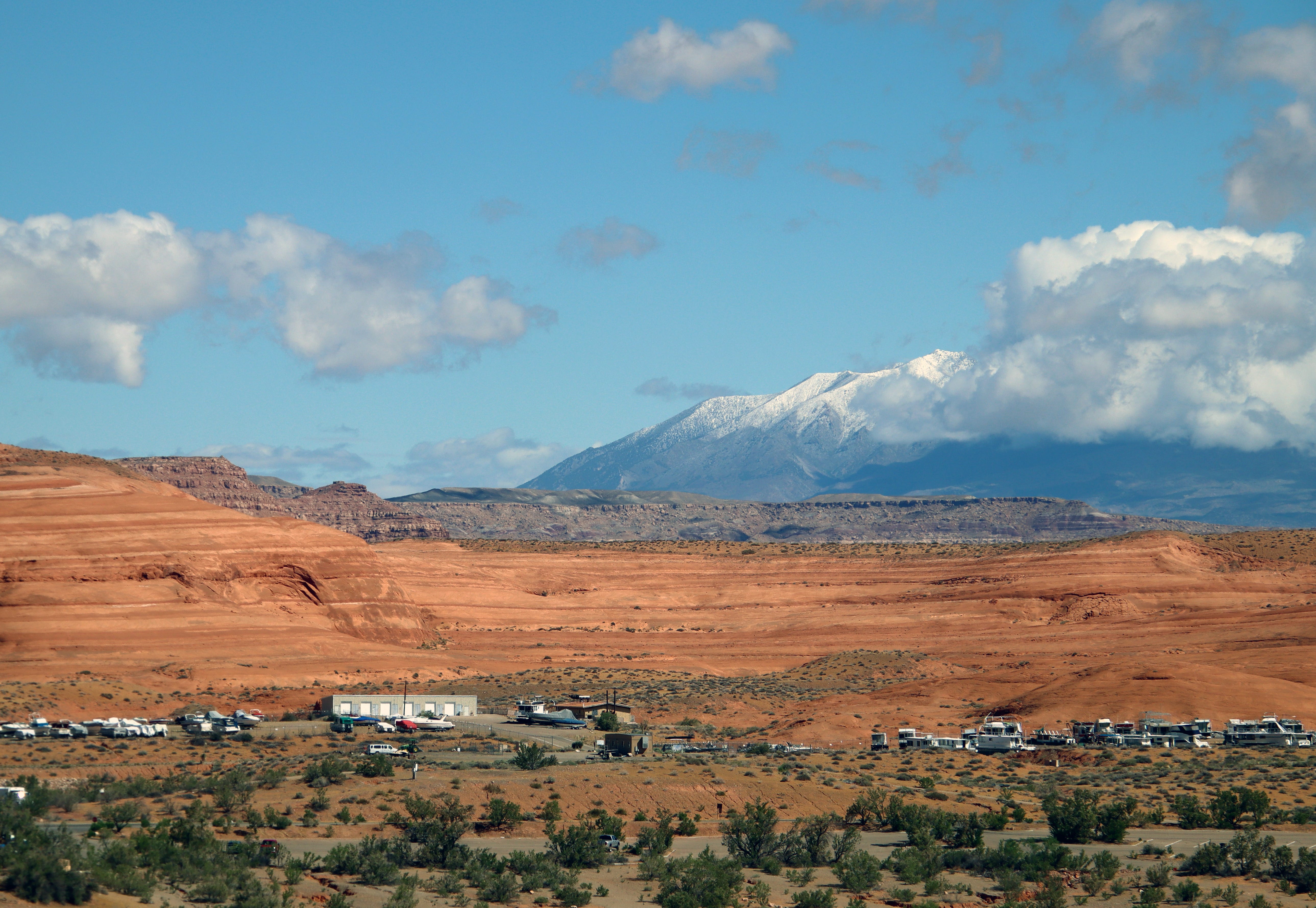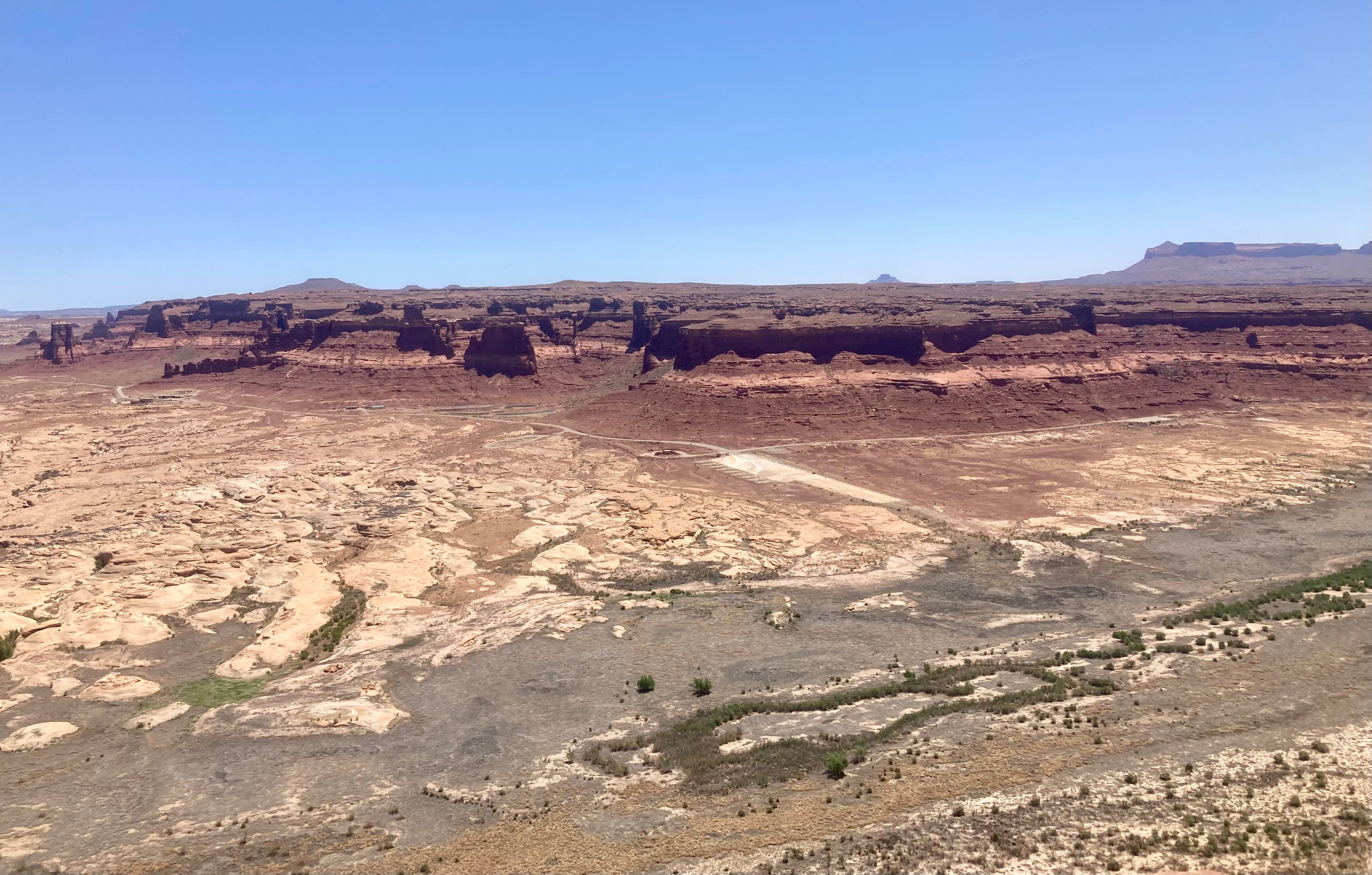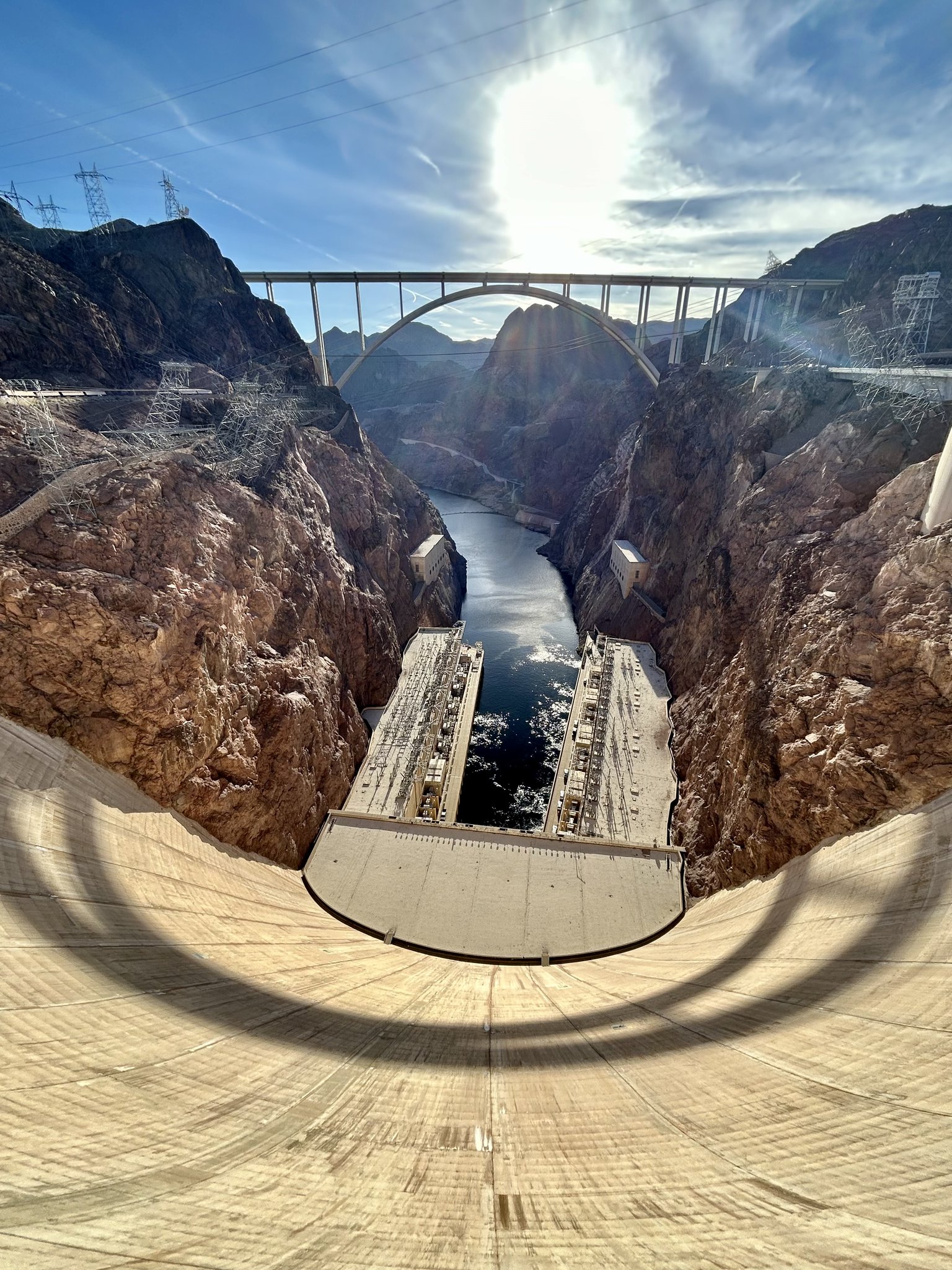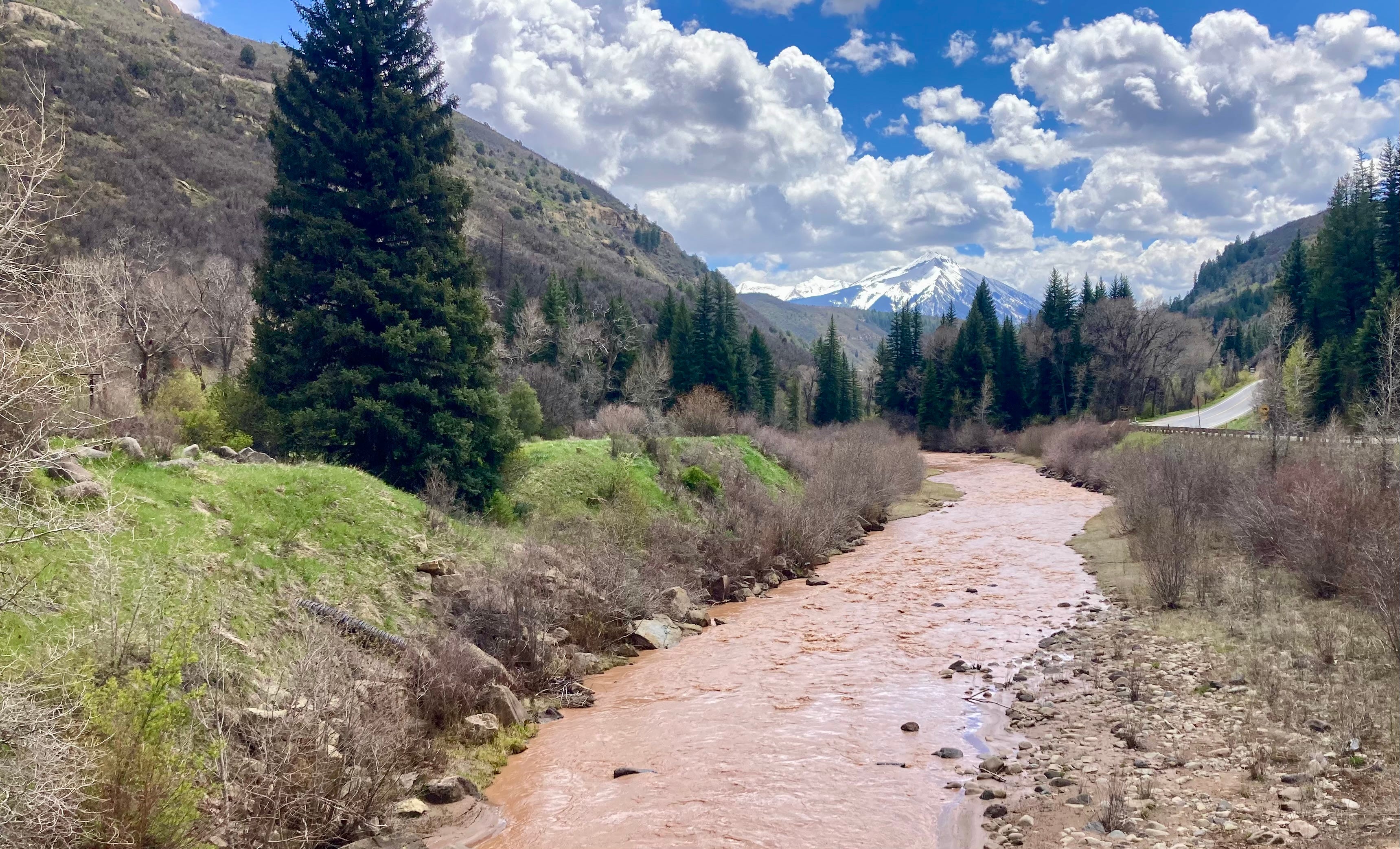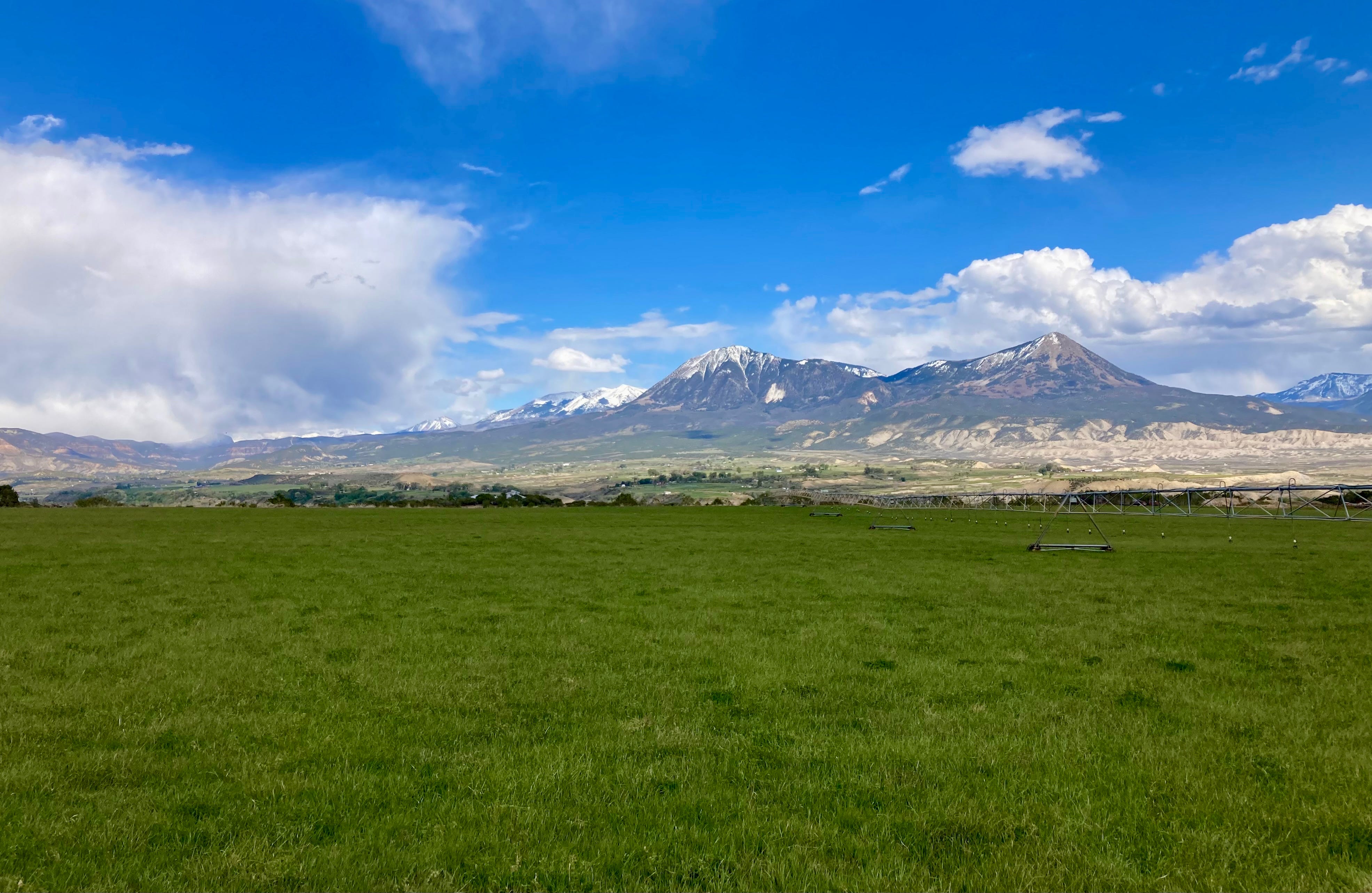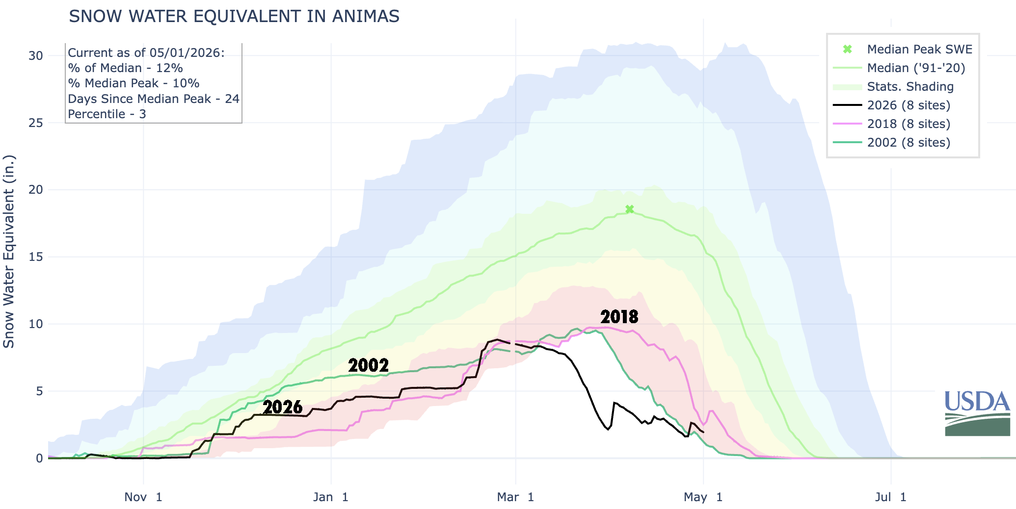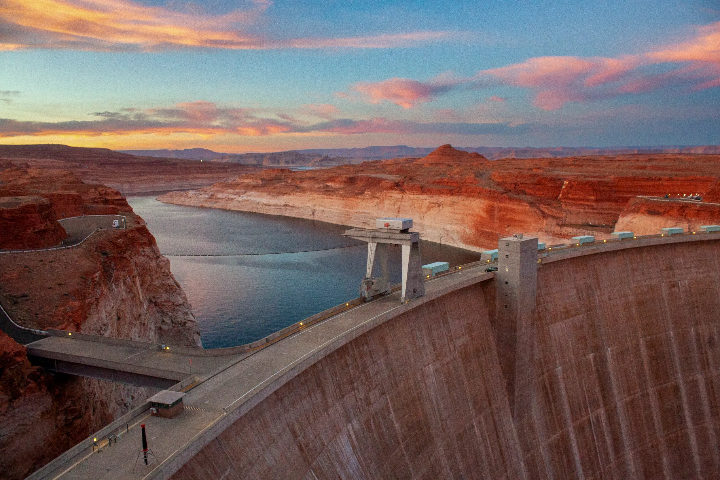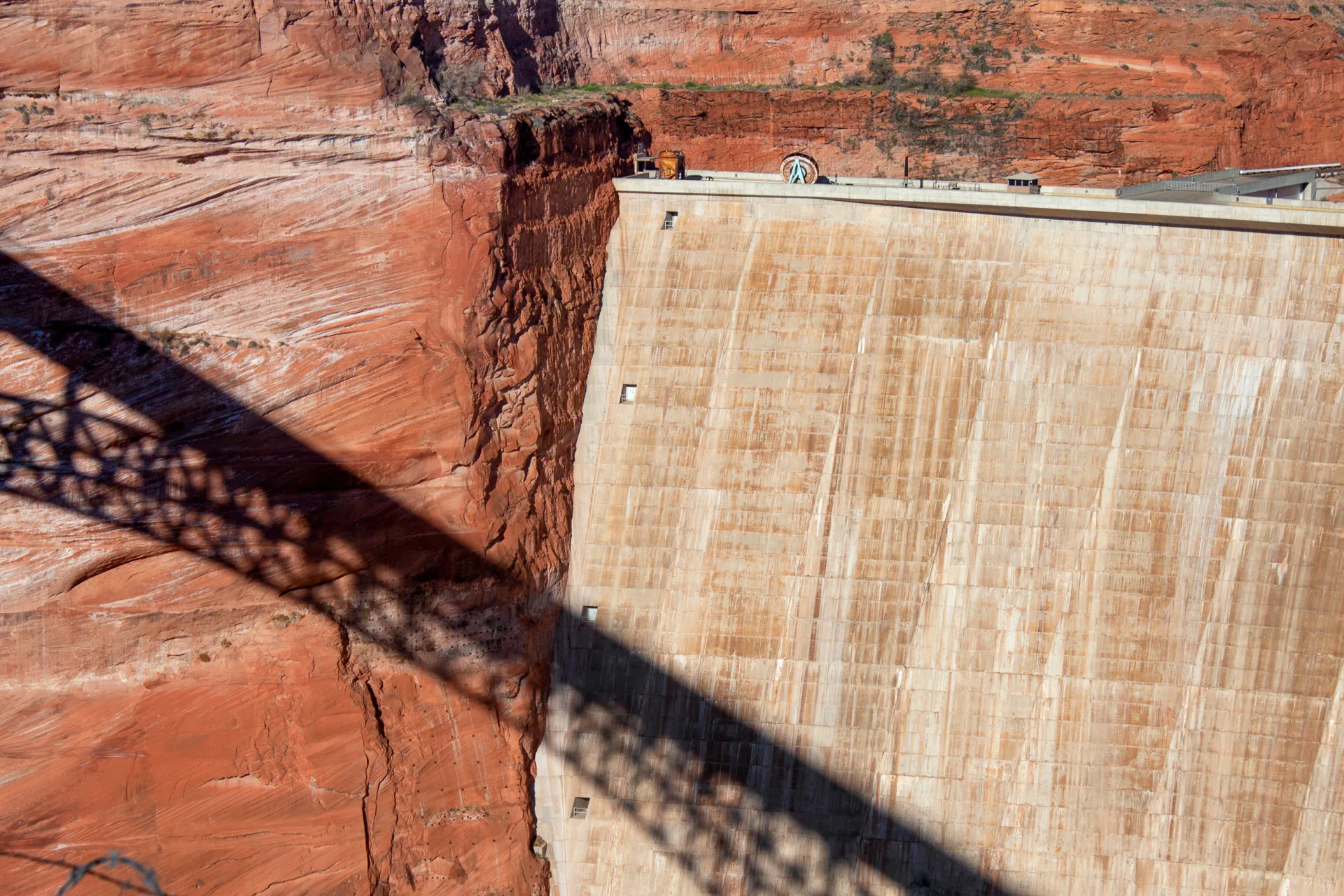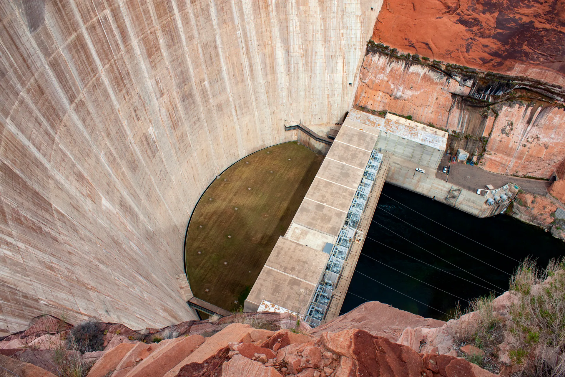
Drinking Song: Muddy water vs. the infrastructure, and seven people, that stand like a dam on the #ColoradoRiver; “Protecting what we love is a journey without end” — Morgan Sjogren (https://wildwords.substack.com) #COriver #aridification

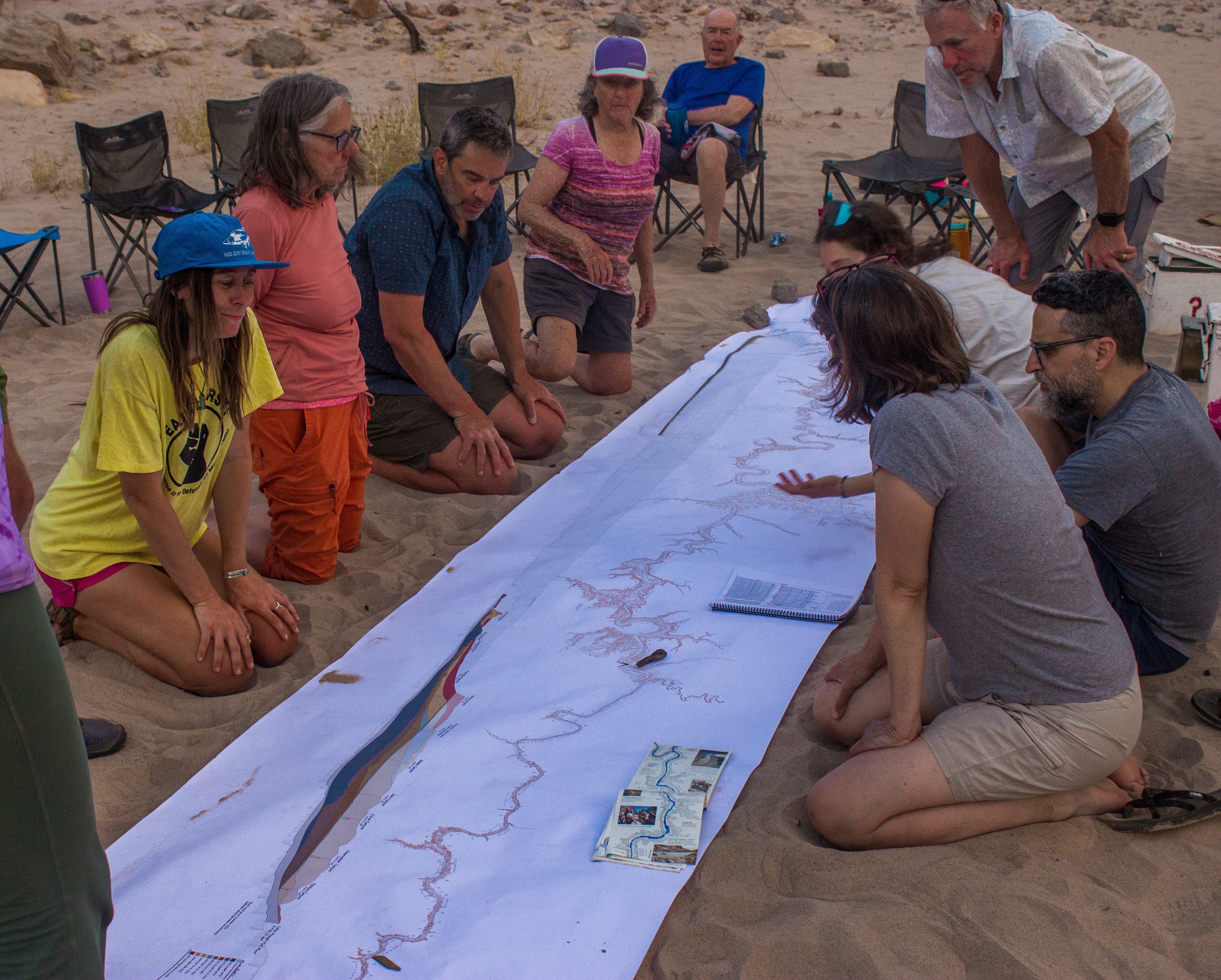
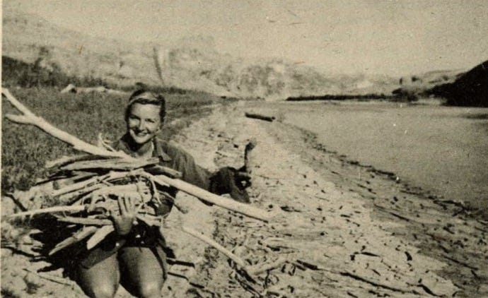
“Colorado River Negotiators” in Cataract Canyon. No clue how the gal in the Earth First! shirt slipped in there? Photo credit: Wild Words

Click the link to read the article on the Wild Words website (Morgan Sjogren):

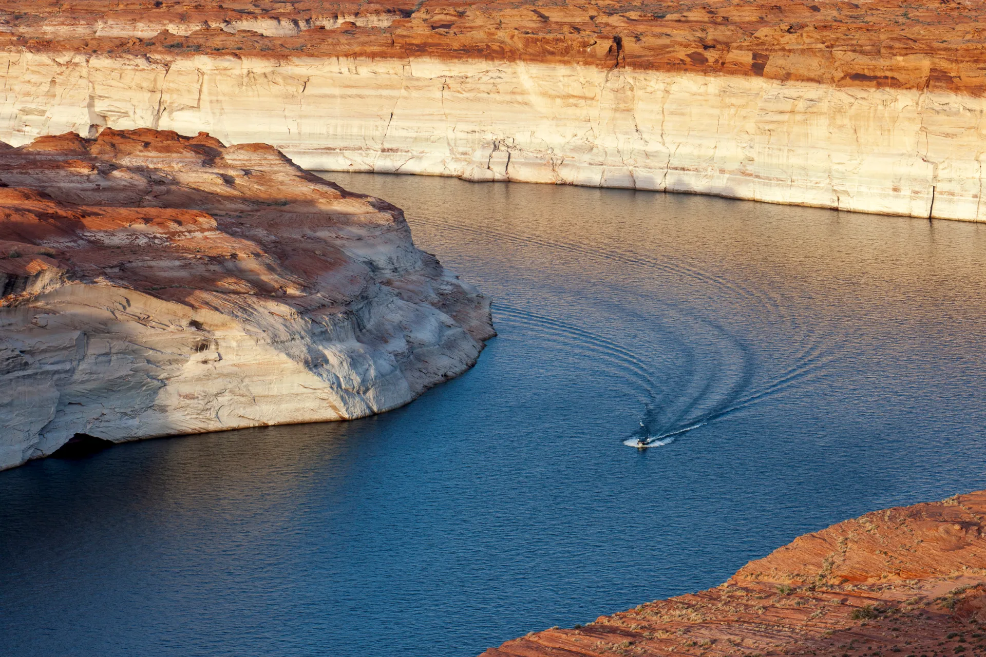
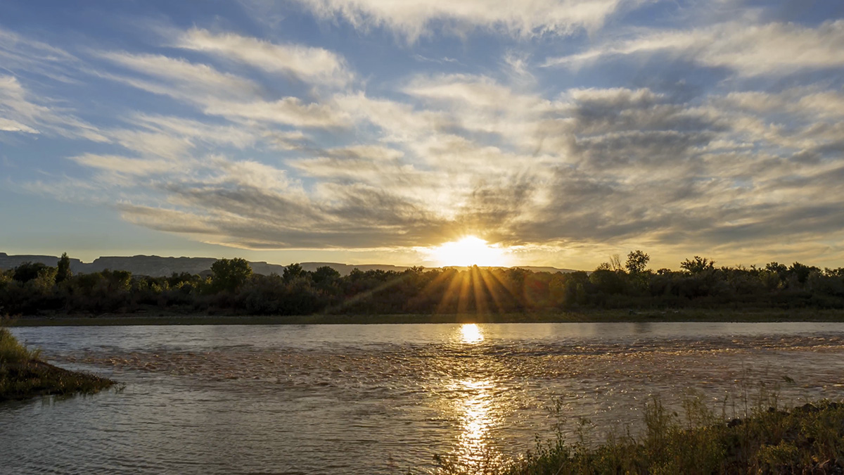
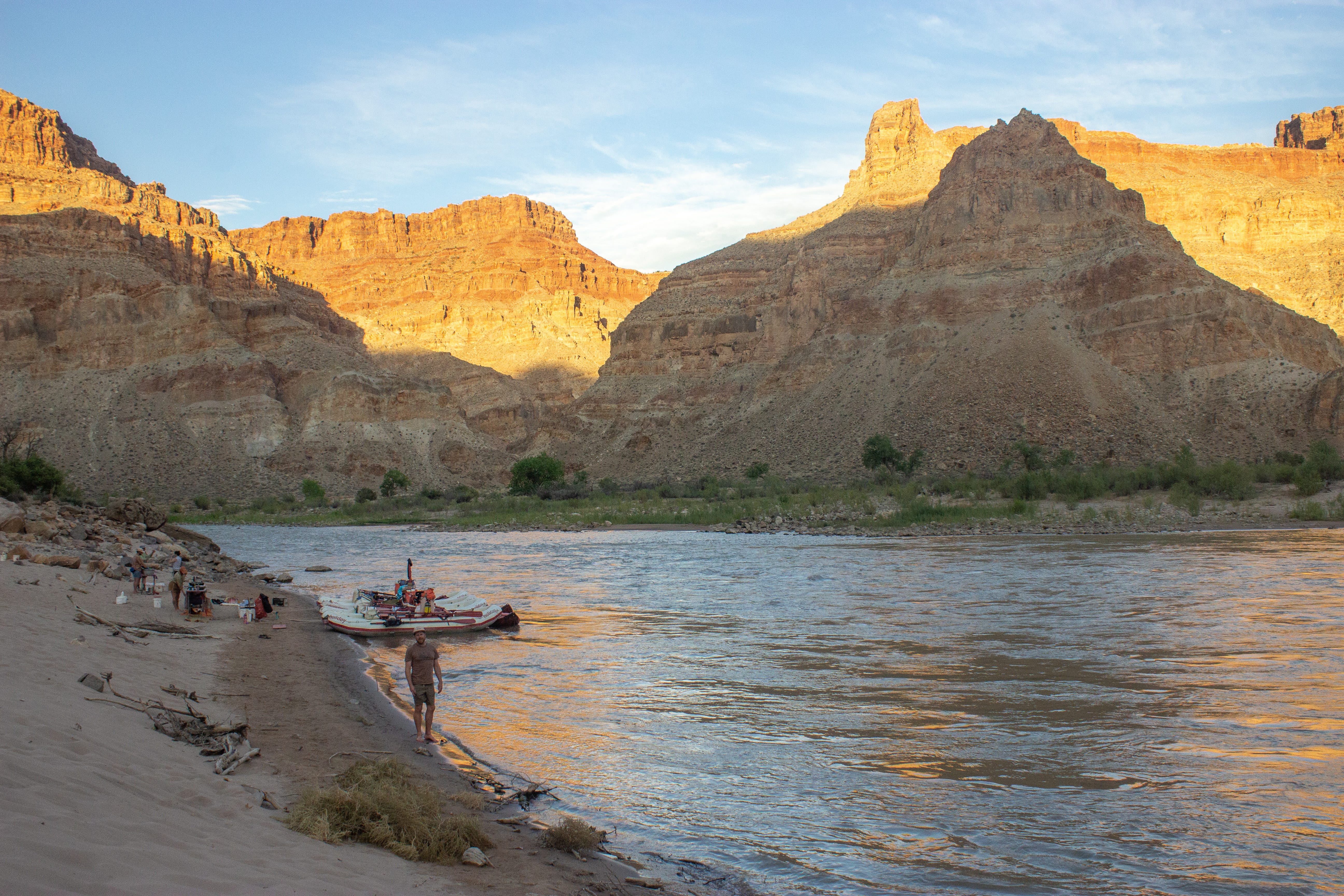
On Monday, June 15, a new cadre of representatives from seven Colorado River Basin states convened below Cataract Canyon for water negotiations. The open-air meeting was held in an eddy flanked by a thick layer of the Dominy Formation.1 Silt tumbled into the banks in low runoff conditions as the Upper Basin (Colorado, Utah, Wyoming, New Mexico) and Lower Basin (California, Arizona, Nevada) prepared statements about how to reduce over-consumption of the shrinking Colorado River.

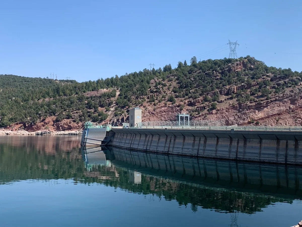
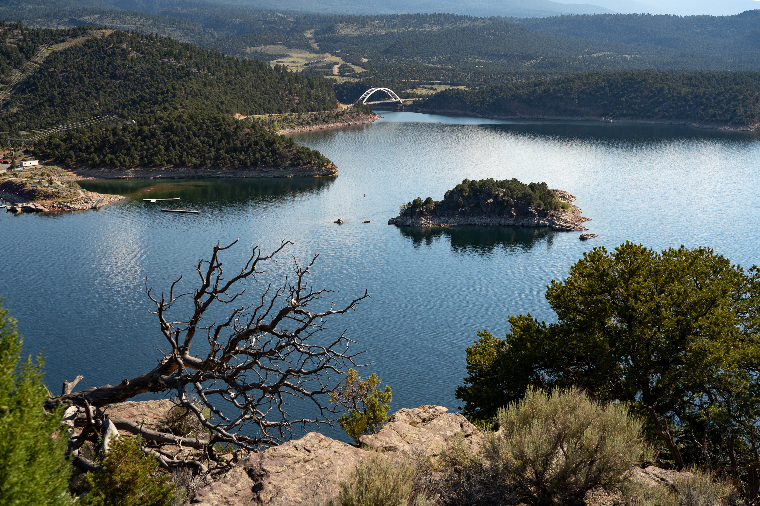
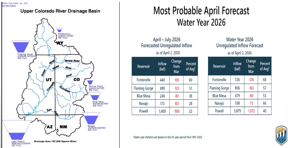
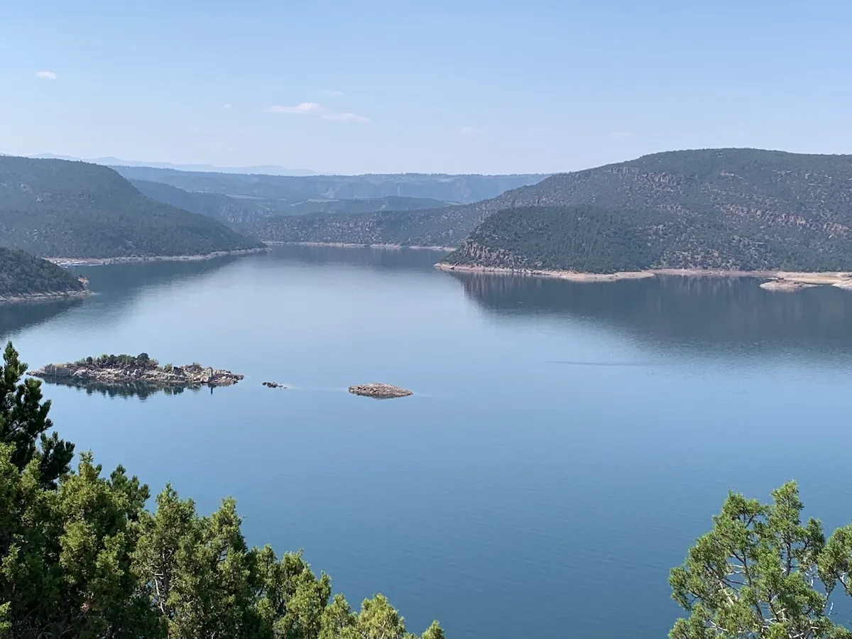
While this meeting was not public or real, it attempted to be more inclusive by allowing the river to attend. A few great blue herons and minnows also popped in. The Upper Basin kicked things off with the state rep from Colorado, who insisted they did not need to make any water cuts because Mother Nature makes those for headwater states. Utah led the group in prayer, offered to pay farmers to stop farming, and insisted that the public can be trusted to do the right thing and make voluntary water cuts. Wyoming ranted about the emergency water releases draining Flaming Gorge Reservoir, with impacts to the recreation economy. New Mexico was too stressed to speak since the Rio Grande is also running dry.

Lower Basin negotiators let a lawyer representing Nevada take the lead while boasting their effective long-term water-saving measures. California reminded everyone that it is the fourth-largest economy in the world, and that stronger municipal water conservation efforts are underway. Arizona presented the dire effects to the state when water to the (junior rights status) Central Arizona Project is cut. Still, all three states agreed to cut Colorado River water use.

The impromptu Colorado River standoff theater was not real. It was a beach game intended to explain water overallocation. That it still resulted in imaginary litigation speaks loudly to this moment in history. The ability to take this lunchtime activity a little too literally was also because the participants were members of Glen Canyon Institute and guides for Holiday River Expeditions. These shenanigans took place in the final hours of a five-day river trip in Cataract Canyon to support GCI’s ongoing efforts for the restoration of Glen Canyon.

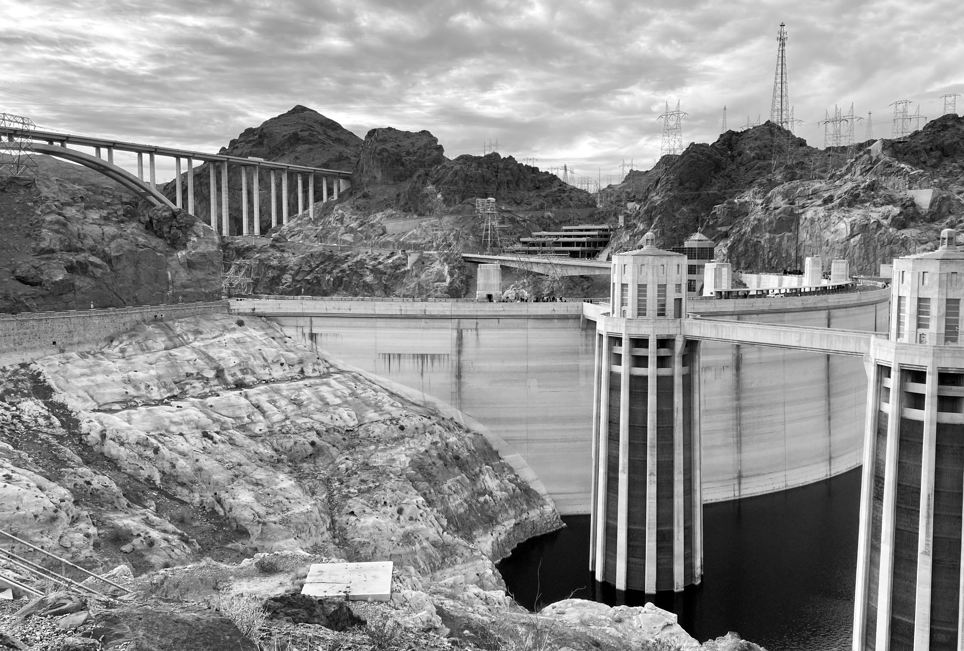
The group was certainly highly astute to Colorado River current events to throw down such an intricate dialogue on the spot. Instead of making a list of the very real solutions to distribute Colorado River water to forty million people, the group recognized what is literally standing in the way: seven state representatives who are just as responsible for the looming potential for a Colorado River crash as Glen Canyon Dam.

The basin-wide impasse is by far the most frustrating aspect of explaining the current problems and future management of the Colorado River. The potential solutions are abundant, even obvious. Everyone in the basin needs to use less water.

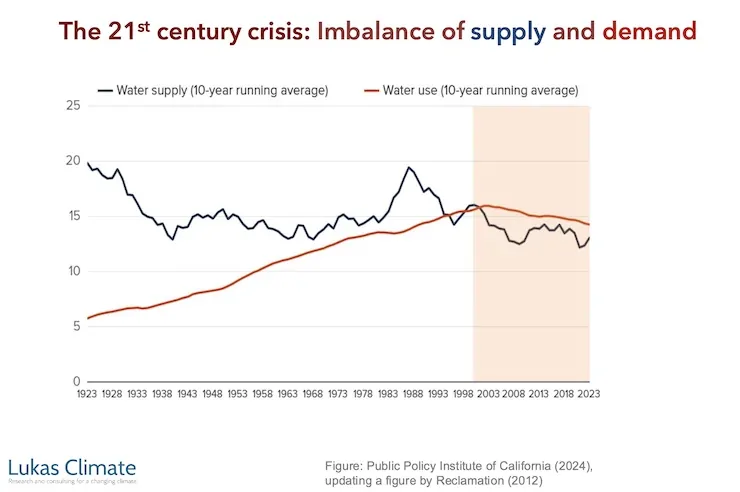
Other critical changes, like giving all thirty Colorado River-connected tribes a seat at the negotiating table and updating the 1922 Colorado River Compact to actually meet river flows where they are at in 2026 (an average of 12.5 million acre-feet down from 15 million acre-feet a century ago), are long overdue. Not to mention, ensuring the Colorado River’s right to flow, in line with the Colorado River Indian Tribe’s legal personhood status for the river under their Tribal law.
Beyond the dam, is the Colorado River’s most glaring problem, both concealed and amplified by the water crisis-–is this what democracy is supposed to look like? And what can a citizen of the Colorado River watershed actually do about it?

Despite this broken system, advocacy, especially in the long-term, can move the needle. Until recently, opposition to Glen Canyon Dam was viewed by some as a fringe environmental cult.

Yet Glen Canyon Institute has maintained a constant presence on the front lines of this issue. Since 1996, GCI “embarked upon a multi-year campaign to protect and restore Glen Canyon and reverse the decline of Grand Canyon’s fragile ecosystem.” The Fill Mead First plan takes a hard look at the long-term realities of keeping two major reservoirs, Powell and Mead, more than half empty. Then, in 2024, the Bureau of Reclamation made an announcement that opened minds (and some hearts) to consider that Glen Canyon Dam is a major part of the current problem.

Through persistent love and devotion of these advocacy efforts, awareness for the recovery of Glen Canyon continues to gain momentum. So does dealing with Glen Canyon Dam’s outdated infrastructure which is becoming more mainstream and realistic everyday. In a recent letter, the Lower Basin states urged the Bureau of Reclamation to make dam modifications.2

While it is electrifying to be on the pulse of a major change that stands to benefit Glen Canyon and the lower Colorado River, the current negotiation process is still a dystopian nightmare circus.3
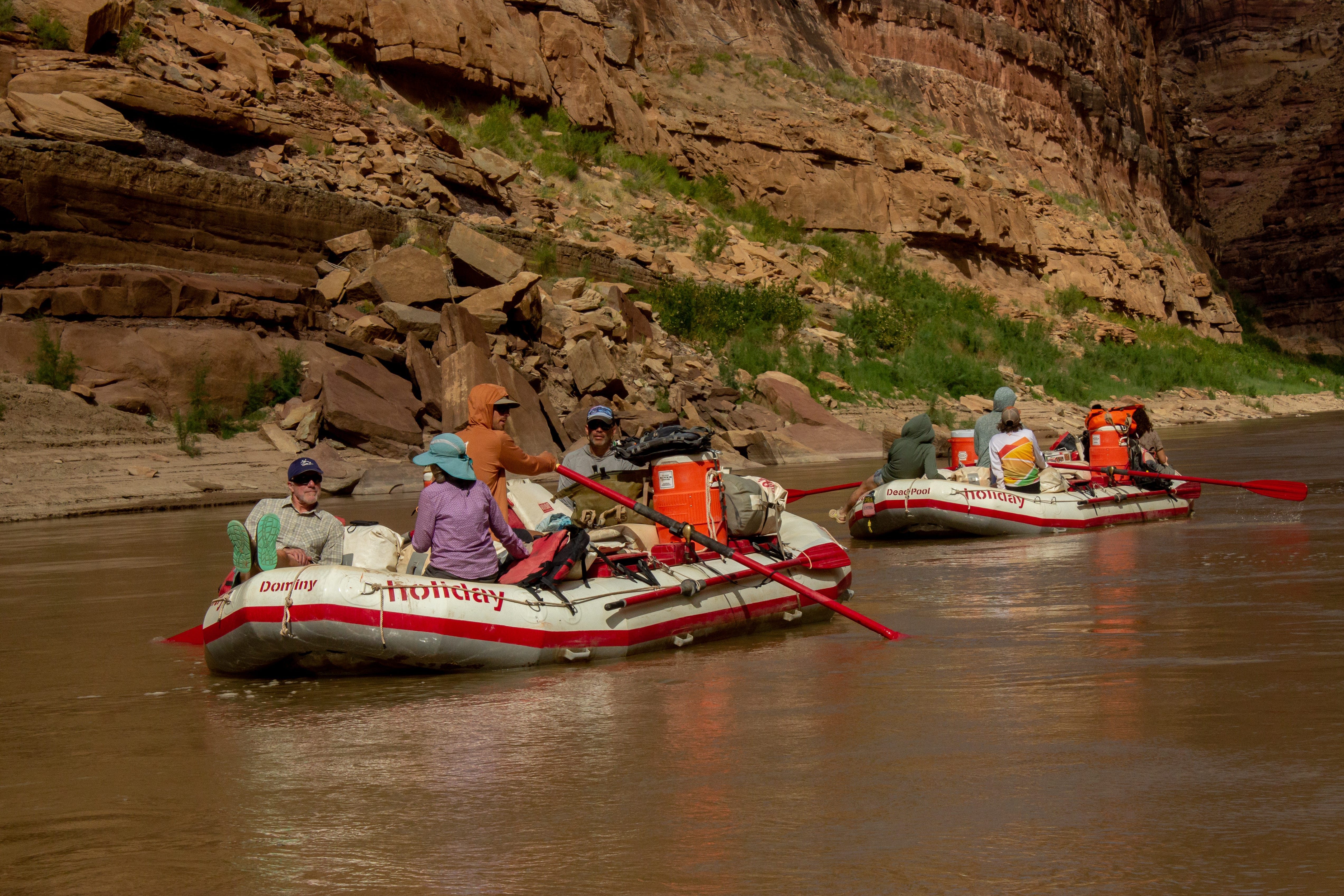
Holiday named a new raft Dominy to spur conversation among guests. Some of us felt superstitiously avoidant of this boat during the rapids. Photo credit: Wild Words
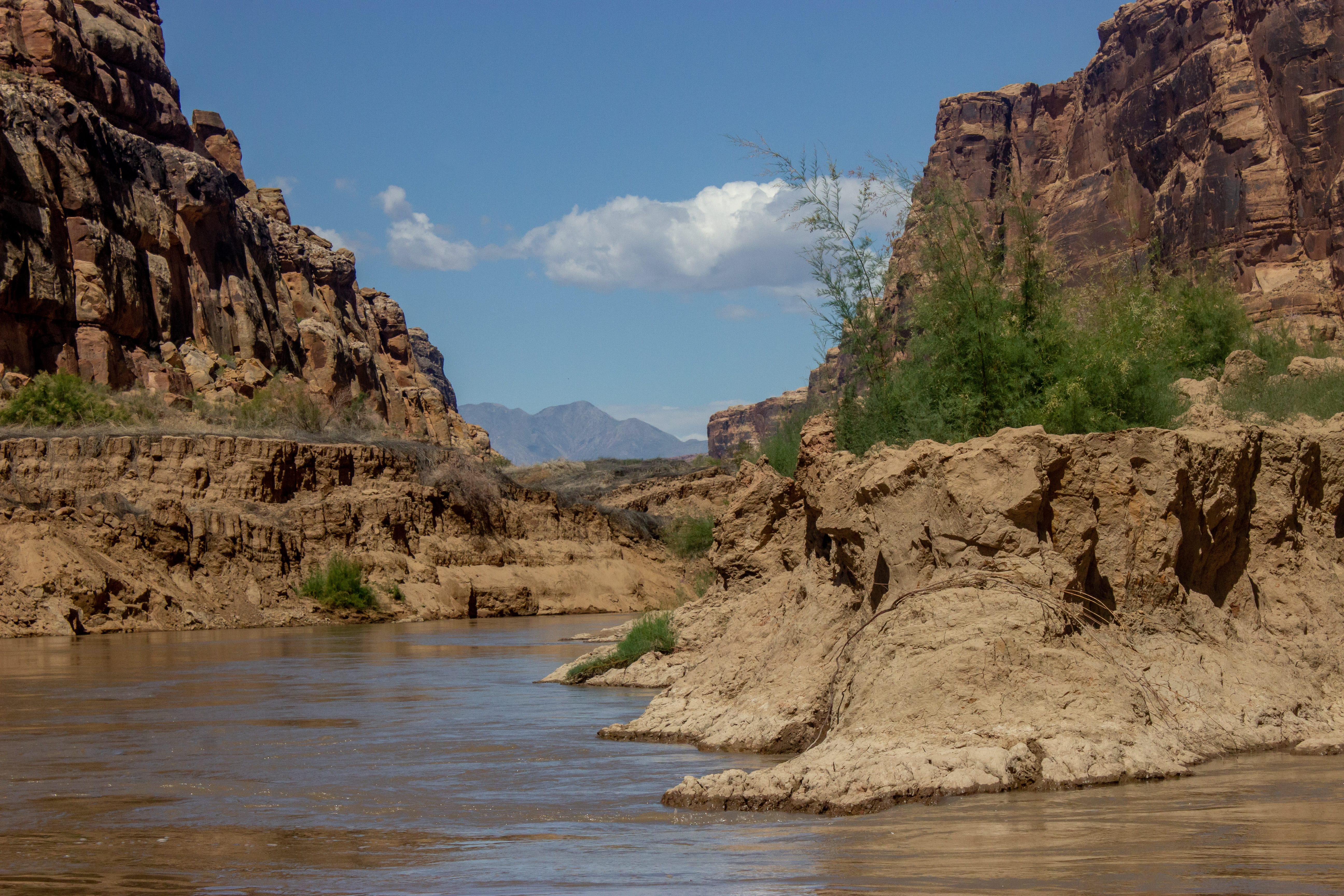
The “Dominy” formation. Photo credit: Wild Words

During the GCI member trip, new bets from the states and cards from the feds were again being waged. Colorado River states traveled to Washington, D.C., and testified in front of the Senate Energy & Natural Resources Committee. Meanwhile, without a consensus proposal between states, the feds are drafting up a plan to be released next month. The White House will need to sign off on the plan. Litigation by at least some of the states is expected. 

Utah reps are urging a withholding of federal spending on states that choose the courtroom. Utah Sen. Mike Lee stated, “Taxpayers should not be asked to subsidize litigation among states.”4 More promising, Lower Basin states announced a Memorandum of Understanding for the San Diego Water Authority to sell surplus desalination water to these states to offset Colorado River water use.

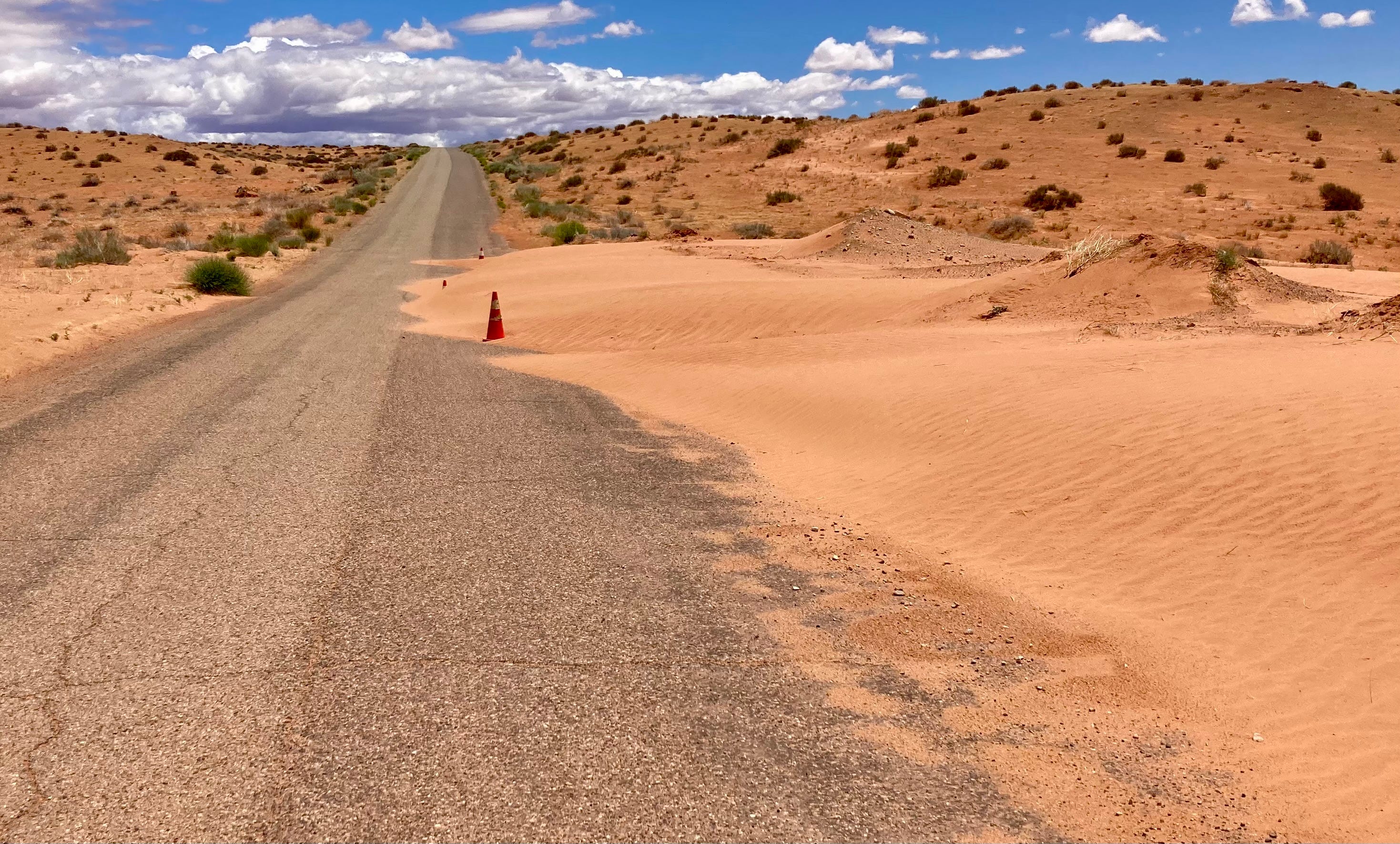
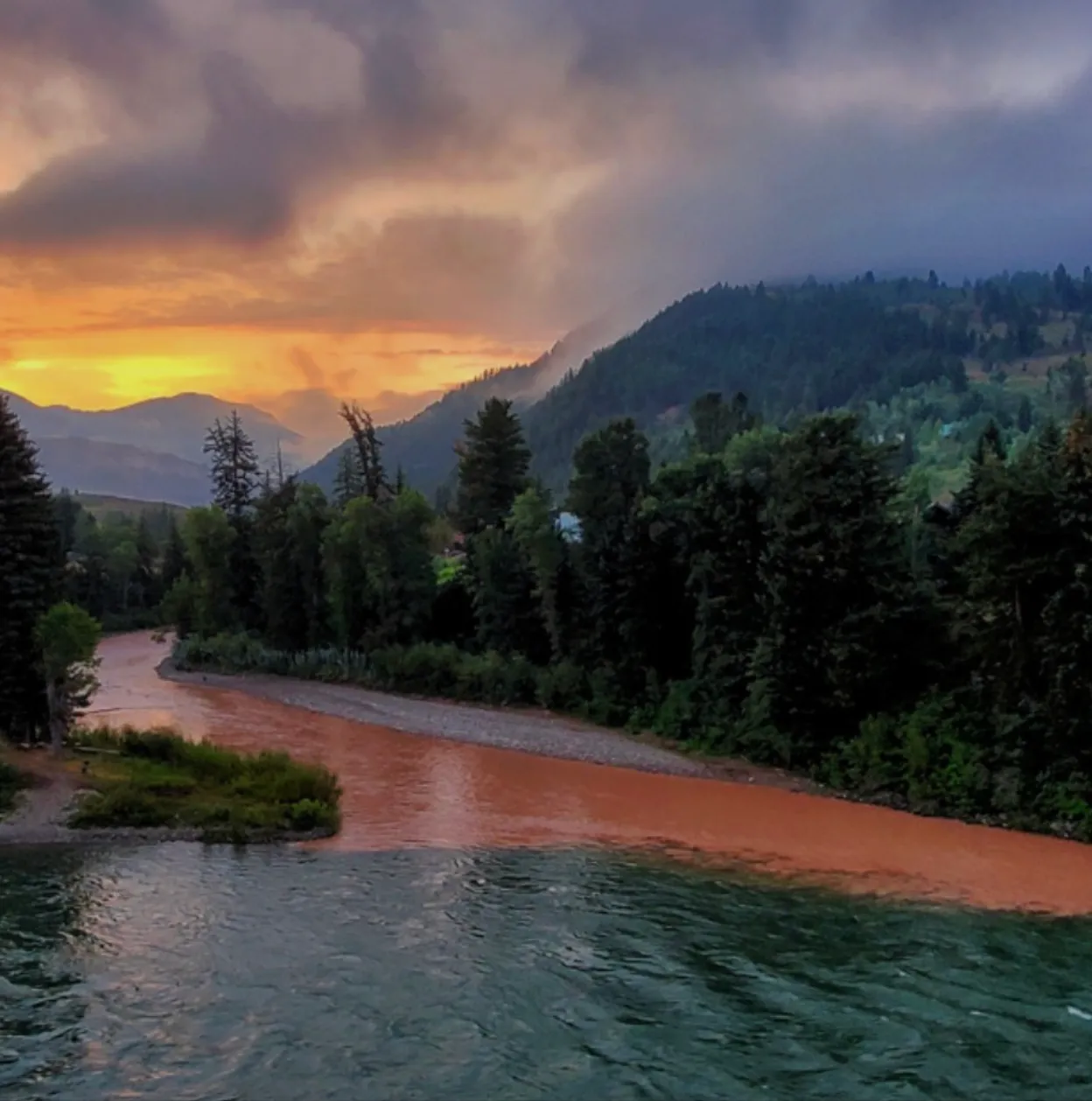
Did I mention mud? Our put-in situation at Mineral Bottom on the Green River was enhanced by recent emergency releases and fish management pulse flows from Flaming Gorge Dam. Holiday’s guides insist this put-in is more challenging than the old North Wash Boat Ramp, which is now repaired and fodder for a different story. Photo credit: Wild Words

For some folks, like myself, this shit show is so fascinating that we are keen to immerse ourselves in the muck. However, even if you care deeply for the Colorado River, this can be overwhelming, especially amid the persistant horrors of this era. Naturally, our instinct may be to turn away. This came up during a riverside policy talk on the trip led by GCI’s projects and development manager Anna Penner and me. With so much going on and the constant information overload online, it is important to trust your gut instinct and give yourself space away from the news. Just don’t pull your heart from the Colorado River itself.  [ed. emphasis mine]

The Colorado River carries hope. The side effects of drought, overallocation, and indecision is the steady return of a free flowing Colorado River and Glen Canyon emerging from a shrinking reservoir. I’ve written before that many of us were too late to experience Glen Canyon before the dam, but we are now right on time to witness its resurrection. Cataract Canyon is an ideal place to experience the changes in motion. From muddy sediment-rich river flows and returning rapids to strongholds of native plants like box elders and seep willows propagating in tributary canyons. 
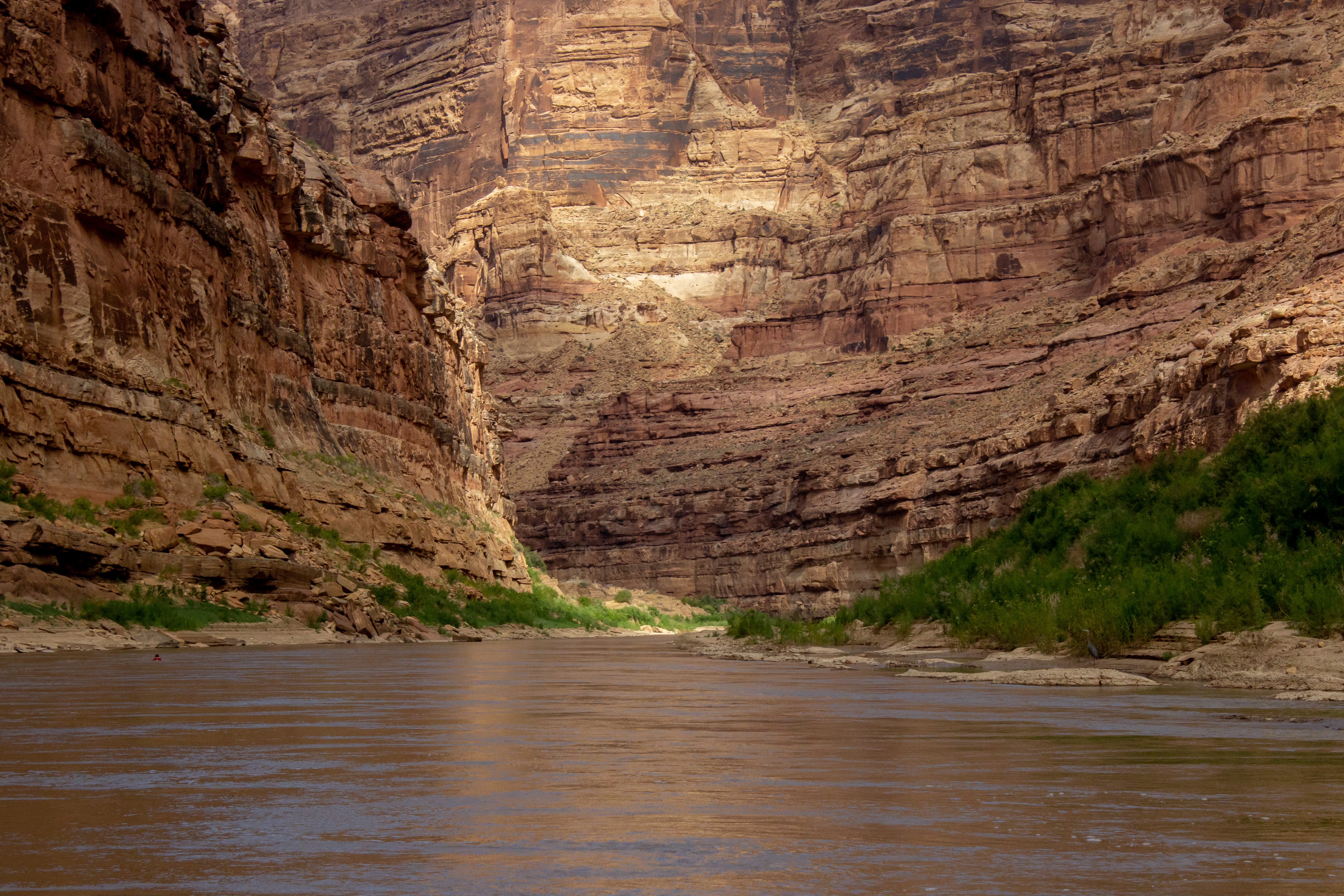
Photo credit: Wild Words

For one guest, Tom, these watershed moments for Glen Canyon are major bookends in his life. As a young lad, his family crossed the old Hite Ferry at Dandy Crossing in their station wagon during a road trip. They then drove up the rock-rutted and sandy North Wash, sans road, before it became Highway 95. He also boated on Lake Powell in 1965, before it filled completely, and vividly recalls seeing the fully exposed Hole-in-the-Rock site. Now age seventy seven, Tom and his lifelong friend Paul make time every year to return to the Colorado River with GCI. He has been a member for twenty-one years
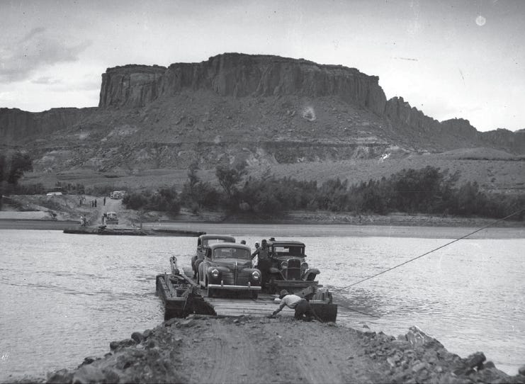
Photo of Dandy Crossing: Photo credit: Cindy Stafford
North Wash travel. Credit: Cindy Stafford

This was Aaron’s first Cataract River trip, and a deserved reward for living with my Colorado River obsession. His perpetual and ever-widening smile affirmed how important quality time with the river is, now and always. Post-trip, he told me his favorite part of the trip was “watching the swirling eddy lines at sunset, while sitting on the beach with the group.” 

Right now, we are all in an eddy. The decisions made, or not, in 2026 will ripple beyond our lifetime. But so will our unrelenting love for the river and the water that sustains life in the West. Impossible dreams, like the EarthFirst! symbolic crack in the dam, may come to life in yet unimagined ways, so long as we do not give up.
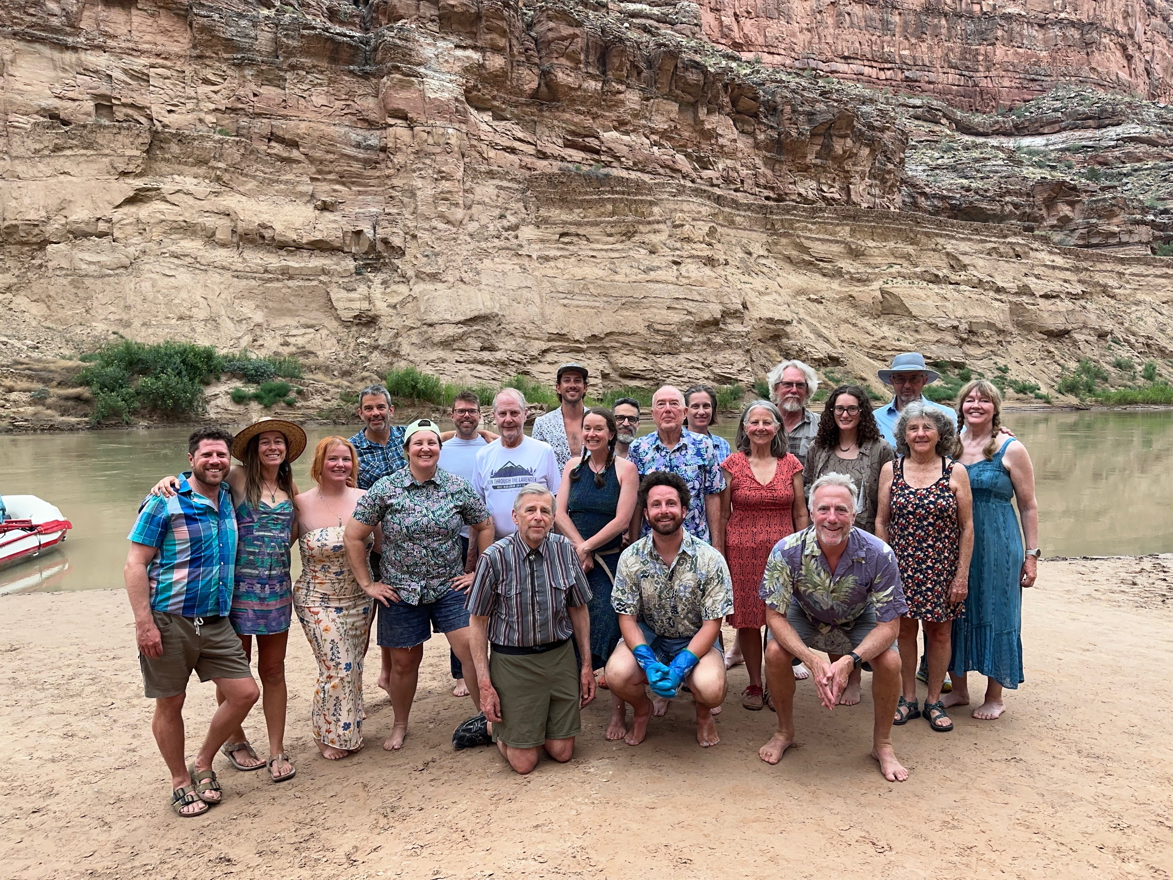
Glen Canyon Institute 2026 river trip group photo. Photo credit: Wild Words
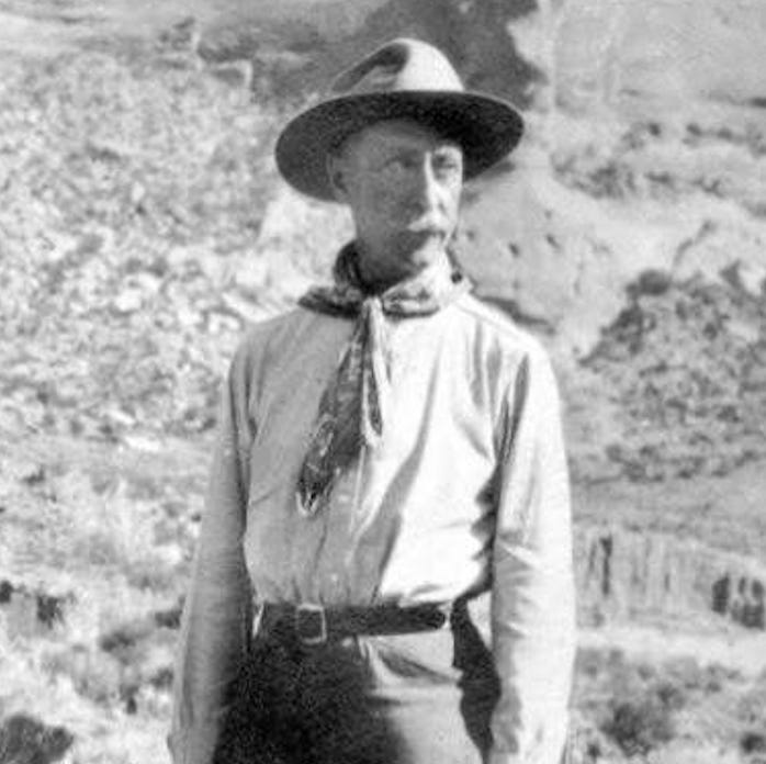
Charles L. Bernheimer. Credit: “Path of Light” — Morgan Sjogren

On our final night, the group pulled out our finer attire in an homage to explorer Charles L. Berheimer, the gentleman explorer, who in 1929 made a concerted effort to prevent Glen Canyon Dam. Now, as Glen Canyon claws its way back from the reservoir, it deserves our best effort and utmost respect. Beside the murmuring current, Lauren Wood, Holiday Expeditions’ trip director, played their guitar while we all sang Katie Lee’s “Drinking Song.”

Of The Drinking Song, Lee wrote:

In Lee’s ranting prologue to “Folk Songs of the Colorado River,” she wrote:
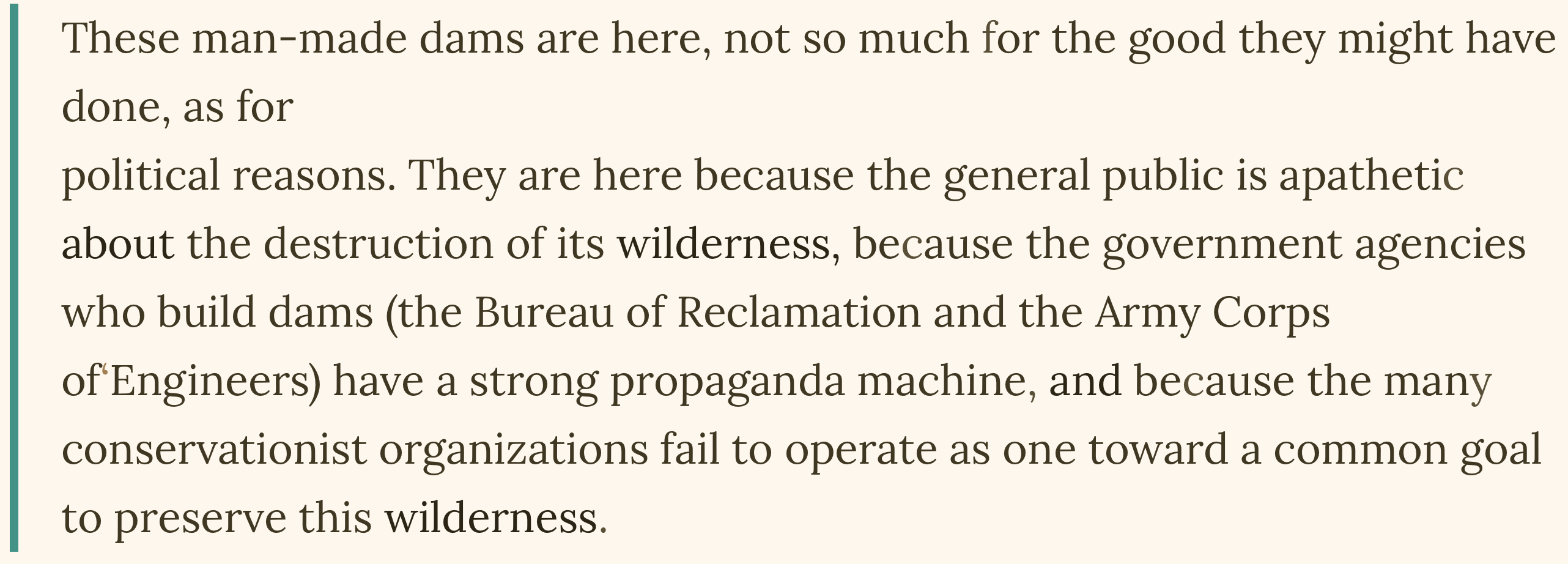
To this, I pause and take another swig of whiskey and muddy water. This spring, I had more than one interview with so-called major environmental groups that sounded more like public relations agents for Glen Canyon Dam and Lake Powell.

Lee continued:

Exhausting? Perhaps. But better tired than apathetic. With tin cups filled with muddy water, this moment asks us to stand with all who have defended the Colorado River in the past and will continue on into the future. Protecting what we love is a journey without end.
To support efforts to restore Glen Canyon and ensure continued water deliveries below Glen Canyon Dam, consider becoming a supporter of Glen Canyon Institute

Or pick up a Glen Canyon Backcountry Club hat! A portion of the proceeds will support GCI.

Desert guide John Wetherill, an OG Glen Canyon Defender.

This also spills the beans about a new venture Aaron and I are launching in September! More to share about that soon.

Wild Words is a reader-supported publication. To receive new posts and support my work, consider becoming a free or paid subscriber.


1 The reservoir sediment left behind as Lake Powell drops is not so affectionately named in reference to Floyd Dominy, the former Bureau of Reclamation Director responsible for the creation of Glen Canyon Dam. Some of us have thoughts about this. I am saving these for my next book, Riverside, to be published by Torrey House Press in 2027.)

2 GCI breaks down the Lower Basin letter here.

3 CC the millions of dollars being spent to extend boat ramps in Lake Powell, but that is for another story.

4 This week, Sen. Mike Lee’s scheme to use the Congressional Review Act to overturn Grand Staircase-Escalante National Monument’s management plan failed when the Senate missed a 60-day deadline to vote on it.

A bend in Glen Canyon of the Colorado River, Grand Canyon, c. 1898. By George Wharton James, 1858—1923 – http://digitallibrary.usc.edu/cdm/ref/collection/p15799coll65/id/17037, Public Domain, https://commons.wikimedia.org/w/index.php?curid=30894893

If AZ and other states sue over Colorado River, Utah senator warns they could lose $354M in aid

by Marcus Reichley, Cronkite News
June 10, 2026 Cronkite News offers an audio version of this story using an automated voice created by AI. Errors in pronunciation, pacing and intonation may occur. If you notice an error please contact cronkitenews@asu.edu.

WASHINGTON – The chair of the Senate Energy and Natural Resources Committee warned Arizona and two other states that rely on the Colorado River on Wednesday that they will lose access to hundreds of millions in conservation aid if they pursue litigation over water rights. 

Roughly $354 million is still available under a 2022 climate law. But the funds expire at the end of September.

“States that choose to sue their fellow basin states over Colorado River operations should not expect Congress to reward that decision with additional federal funding,” Sen. Mike Lee, a Republican from Utah – one of the four Upper Basin states, said at the outset of a hearing on the stalemate among the seven states that share the river. “Federal taxpayers should not be asked to subsidize litigation among the states.”

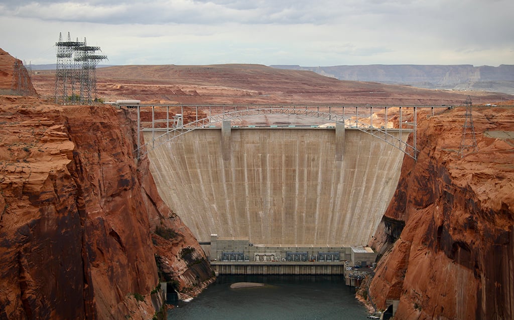
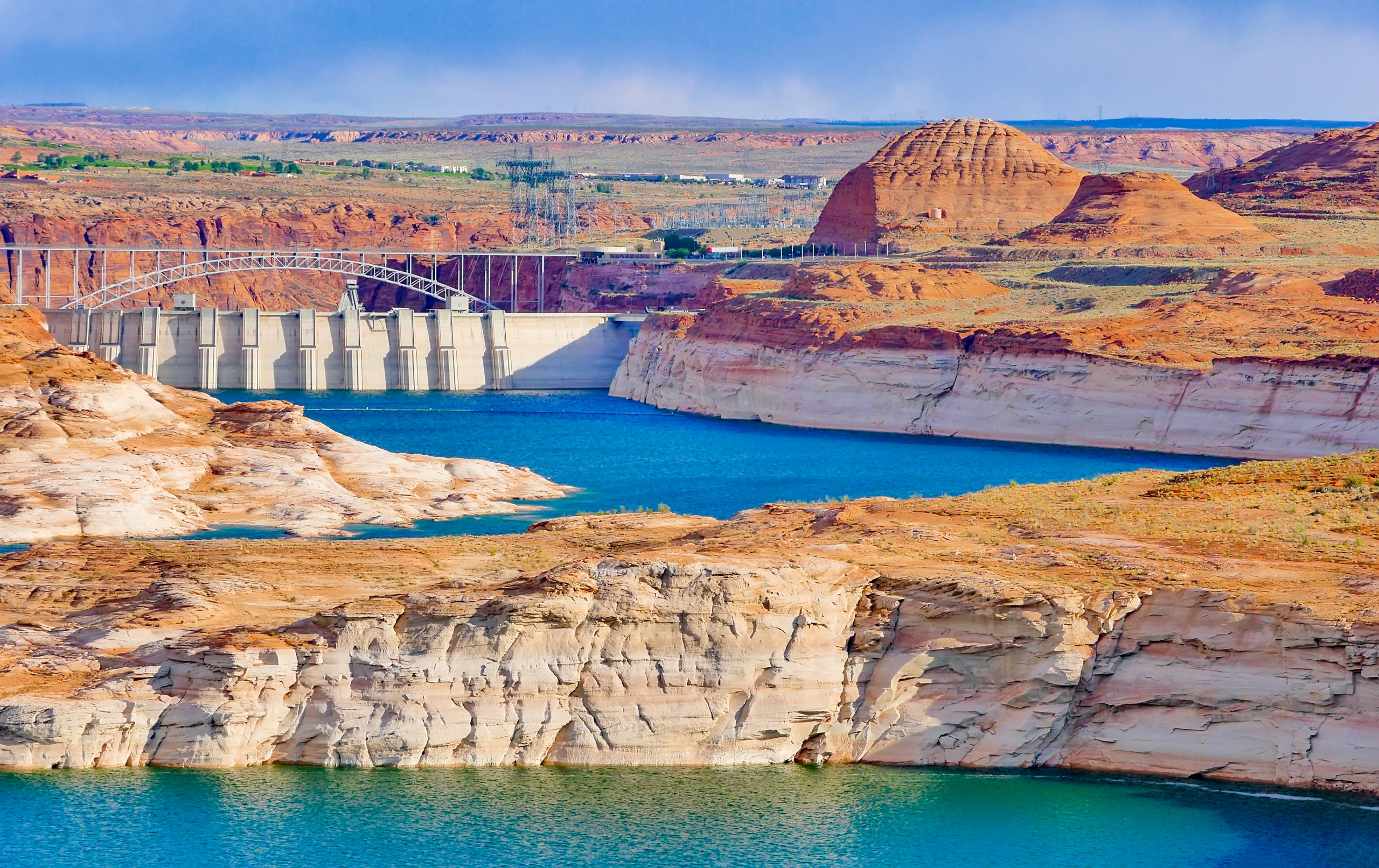
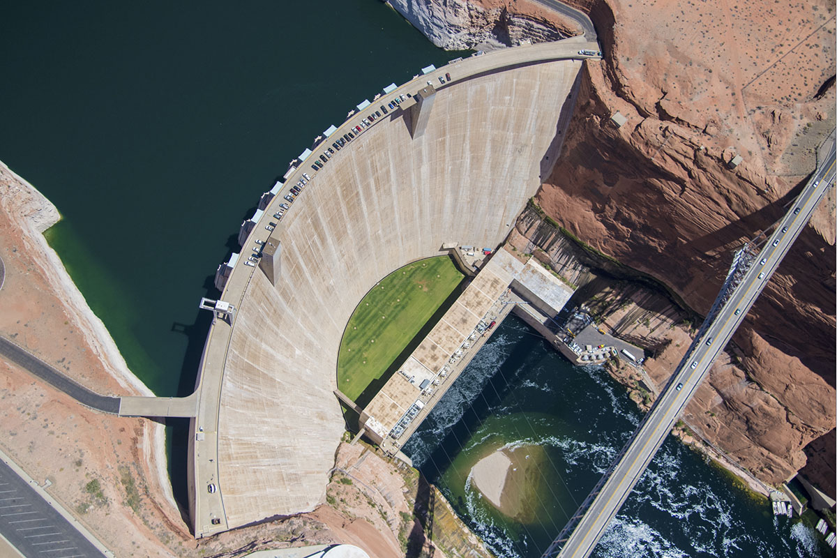
Glen Canyon Dam holds back Lake Powell on Nov. 2, 2022. States upstream and downstream of the dam have different ideas about how to manage the amount of water released from the reservoir, which has become a key sticking point in ongoing negotiations about the Colorado River’s future. (Photo by Alex Hager/KUNC)

Arizona, California and Nevada have been at odds with Colorado, Utah, New Mexico and Wyoming over how to divide the dwindling water supply when the most recent 19-year deal expires at the end of 2026.

The funds Lee threatened to block are a key element of the Lower Basin’s most recent proposal from May 1, which relies on the funding to incentivize voluntary water conservation as an alternative to mandatory cuts.

The $354 million comes from the Inflation Reduction Act signed in 2022 by President Joe Biden, which set aside $4 billion for drought mitigation and compensation for voluntary conservation. Funds that remain unused when the current fiscal year ends Sept. 30 will revert to the Treasury.

By then, the Bureau of Reclamation, part of the Department of the Interior, plans to finalize a federally imposed plan to allocate water to the seven states over the next decade. One alternative in the draft the bureau issued in January would impose cuts up to 77% for Arizona, with a 6% cut for Nevada. The other states could continue taking water at current rates.

The states missed a deadline last November to submit a consensus plan to federal regulators.

The White House tried to facilitate progress by convening Arizona Gov. Katie Hobbs and her counterparts in January. With the stalemate continuing, Lee used Wednesday’s hearing to add more pressure on the states to find a solution.

He chastised officials in the Lower Basin states for, among other things, taking out newspaper ads attacking Upper Basin states.

Negotiators appeared to be “preparing actively for litigation,” he said – and in fact, key officials in both camps have told Cronkite News in recent days they are preparing for that possibility.

Congress “will not be a bystander in this process,” Lee said, noting that under the Constitution, Congress holds approval authority over any long-term interstate compact. 

He also expressed sympathy with the Upper Basin’s stance, warning that any proposal asking those states to absorb greater operational burdens without regard to the river’s existing legal framework “will face a difficult path forward” in Congress.

The chairman framed the moment as a failure of collective will, cataloguing a string of missed deadlines. “The basin can no longer afford to wait,” he said.

After Lee delivered his rebuke, Arizona Sen. Ruben Gallego, a Democrat, pressed the Trump administration from the opposite direction. 

Gallego asked Andrea Travnicek, assistant secretary for water and science at the Department of the Interior, how the department plans to weigh Arizona’s economic stakes as it finalizes its decision.

“The Colorado River is a lifeline for Arizona,” Gallego said, noting the state is home to the most advanced semiconductor manufacturing hub in the Western Hemisphere and that the success of its industries are essential to the nation.

“The technological industries, the domestic food supply, and energy security are all top priorities for the United States, including the president’s agenda,” he said.

Travnicek said the department cannot accept either the May 1 proposal from the Lower Basin nor the latest Upper Basin proposal as they currently stand. 

“We have some concerns and areas where we think that there should be adjustments,” she said.

She confirmed that the Interior Department is coordinating with the Energy Department and U.S. Department of Agriculture, among other agencies. She said an interagency water subcabinet meeting will be held Thursday. 

The hearing laid bare the tension that has made a seven-state deal so elusive, with senators from both basins on hand.

Travnicek fielded pressure from both directions without committing to either.

The stakes are straightforward and very high. 

Decades of drought have pushed water levels to dangerously low levels even as demand and population grow. The river now provides barely half the amount of water each basin has been legally entitled to draw. 

“Delay carries its own consequences,” Lee said, “and the basin can no longer afford to wait.”

This article first appeared on Cronkite News and is republished here under a Creative Commons Attribution-NoDerivatives 4.0 International License.

MAGA (#Utah U.S. Senator Mike Lee) fails to derail Grand Staircase-Escalante National Monument plan; Trump looks to tweak WSA management, climbing rules; Plus, a guest commentary on #ColoradoRiver allocation — Jonathan P. Thompson(LandDesk.org) #COriver #aridification

A monarch butterfly in Grand Staircase-Escalante National Monument. Jonathan P. Thompson photo.

Click the link to read the article on The Land Desk website (Jonathan P. Thompson):

🌞 Good News! 😎

THE NEWS: Sen. Mike Lee, the ultra-MAGA Utah Republican, failed once again to diminish public lands protections when his bid to use the Congressional Review Act to revoke Grand Staircase-Escalante National Monument’s management plan expired before getting a vote. 

THE CONTEXT: This spring, Lee and Rep. Celeste Maloy, also a Utah Republican, introduced a joint resolution of disapproval in both houses of Congress aimed at repealing the 2024 management plan. That started the clock ticking on a 60-day time-limit for a simple majority vote to overturn the plan. The deadline passed on June 11 without any action, meaning that any effort to toss the plan now would be subject to the Senate filibuster, so would need 60 votes to pass — a highly unlikely prospect. 

Had the resolution passed, the national monument’s management would have reverted back to the weak and inadequate 2020 Trump I-era plan, which allowed more grazing, more damaging “vegetation management,” and more off-road vehicle use. Plus the 2020 plan only covered the 1 million acres left in the national monument after Trump removed about 900,000 acres from its boundaries, meaning almost half of the national monument would in a sort of management limbo. 

This would have sown chaos and confusion, yet it wouldn’t have diminished the national monument or the protections that were baked into the establishing proclamation. The monument boundaries would have remained intact, along with the prohibition on new oil and gas drilling, mining claims, and other energy development. 

Nevertheless, it clearly was intended as an attack on the national monument and the attendant protections, which have been a sore spot for Utah sagebrush rebel-leaning politicians since Bill Clinton established it under the Antiquities Act 30 years ago this September. What Maloy or Lee hoped to actually achieve with the attack is a little less clear, even if it had hit its target. 

Maloy likely was trying to brush up on her anti-federal-land-management credentials before what could be a bruising primary. Her challenger is notorious sagebrush rebel Phil Lyman, who led an illegal OHV-ride down the archaeologically rich Recapture Canyon in 2014 to protest what he called “federal overreach.” 

So far, Maloy is winning the fundraising race by a healthy margin. Utah Political Watchreports that the Defend our Values Super PAC run by former Rep. Chris Stewart, R-Utah, just donated $900,000 to Maloy’s campaign. The American Conservation Coalition PAC, which says it “helps elect leaders who champion American energy dominance, environmental conservation, and cutting-edge innovation,” has spent over $150,000 in support of Maloy, as well. Maloy isn’t exactly living up to the conservation part of that, but I’m not sure the PAC folks care too much about it, either. 

And then there’s Lee. Sometimes it feels as if he’s taking up the tasks Project 2025 guided the Trump administration to execute, but that the administration has backed off from because of how deeply unpopular they have turned out to be. It’s almost as if the administration is tasking Lee with feeding some red meat to the MAGA base, but also is setting him up to fail.


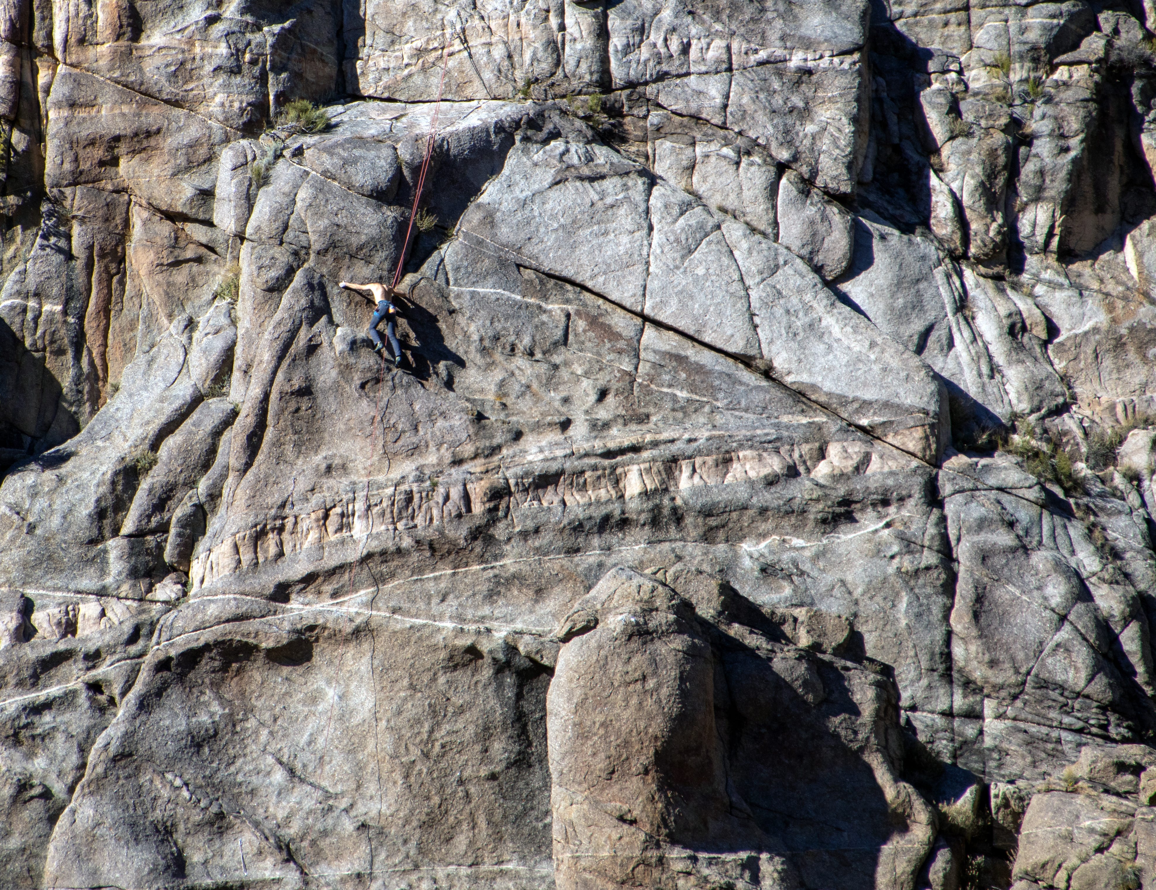
Rock climber in Unaweep Canyon, Colorado (not a wilderness area). Jonathan P. Thompson photo.

THE NEWSThe U.S. Interior Department is launching a “review” of rock climbing management and wilderness study area policies. On June 15 it opened the 60-day public comment period on its proposals to establish “a consistent approach to recreational rock climbing management across designated wilderness areas,” and to evaluate whether “existing wilderness study areas and lands with wilderness characteristic policies should be updated, clarified, or revised.” 

THE CONTEXT: Any time the Trump administration decides to “review” something, it pays to be wary, since more often than not the review leads to the evisceration of some sort of environmental protection. They tend to couch it in euphemisms, however, such as this bit from an Interior press release: “… Interior is focused on expanding outdoor recreation opportunities, removing unnecessary barriers to access, and use, and managing public lands in a way that benefits the American people.” 

Wilderness areas are designated by Congress and are governed by a set of specific rules that can’t be altered by the administration. However, the question of whether installing fixed climbing bolts and anchors is permitted or not is vague and has shifted over the years (what is clear is that power drills cannot be used to install them). The administration is looking to clear this up, and to allow fixed anchors in wilderness areas as long as they follow certain guidelines.

Wilderness study areas share many of the same qualities and protections as wilderness areas, but have not been designated as such by Congress. In 1976, Congress tasked the BLM with identifying potential wilderness areas within its domain and make recommendations regarding them. Those that were identified and fit certain criteria but not designated became wilderness study areas, or WSAs. There are currently 491 wilderness study areas covering over 11 million acres. Look at a map of areas that have large swaths of BLM land — particularly in Utah — and you’ll almost certainly find a few. 

The Federal Land Policy Management Act directed the BLM to manage the WSAs “in a manner so as not to impair the suitability of such areas for preservation as wilderness” and prevent “unnecessary or undue degradation.” In other words, you couldn’t build a permanent road through a WSA because that would preclude it from being designated as a wilderness area later.

This leaves room for agency interpretation. The current BLM policy, carried out in accordance with a 2012 manual, is to “continue resource uses on land designated as WSAs in a manner that maintains the area’s suitability for preservation as wilderness.” Under that policy, the agency almost certainly would not permit a road through a WSA, because that would preclude it from being designated as a wilderness area later. And, according to the memo, it most likely would not allow motorized or mountain bike use in a WSA.

The current administration is unlikely to get away with allowing permanent roads in WSAs. However, given its language about removing barriers to access, one can expect it to apply a broader and more permissive interpretation of the non-impairment standard to its policies. This might mean allowing motorized vehicle or mountain bike use within WSAs on existing trails, for example, or even some logging or small-scale mining, so long as the agency officials could convince themselves that it would be cleaned up later. 

Finally, the BLM also has a policy for managing lands with wilderness characteristics that are not WSAs or designated wilderness areas. The administration is reviewing this policy, as well. 

Interior announced all of these policies in one press release, but you need to comment on them individually. Here’s how:

  • For the fixed anchors and other climbing management changes in wilderness areas, go to the Federal Register page and follow the instructions, or go directly to the regulations.gov page and click on “Comment.” 
  • For changes to wilderness study area management, go to the Federal Register page, and read the instructions, or go directly to the regulations.gov page and click on “Comment.” 
  • For changes to lands with wilderness characteristics management, go to the Federal Register page, and follow the instructions, or go directly to the regulations.gov page and click on “Comment.”

Colorado River “Beginnings”. Photo: Brent Gardner-Smith/Aspen Journalism
🐟 Colorado River Chronicles 💧

Guest Commentary: A Fair Allocation for the Colorado River

by Levi Tenen

This summer is the last chance for seven Western states to allocate the Colorado River voluntarily before the federal government steps in1. Gridlock persists: Lower Basin states (California, Arizona, and Nevada) have offered to reduce their water usage the most, but they believe that Upper Basin States (Colorado, New Mexico, Wyoming, and Utah) ought to reduce their usage as well if the region dries up too much.2 The Upper Basin states reject this proposal, refusing to reduce the amount of water that was allotted to them under previous agreements.3 The federal government has proposed solutions of its own, all of which seem to favor the Upper Basin states.4

The debate raises fundamental questions: how should resources be allocated in times of scarcity, and do past agreements matter today? From my research in ethics, I think there is an answer, and one that has not been noticed by others. Justice demands that Upper Basin states give up some of their allotted, promised water, but Lower Basin states must greatly limit their water usage and—the new idea—Lower Basin states ought to pay for the extra water they receive.5

To see why, consider a thought experiment from philosopher Jeremy Waldron6: Imagine you and I own ranches in an arid region. We drill wells on our respective properties and enjoy plentiful water. Good times come to an end, however, when a drought sets in and my well runs dry. Unable to relocate, I am stuck in a dire circumstance. Due to the geography of the area, however, you continue to have a surplus of water. What, if anything, do you owe me? Without anyone else around to help me, are you obligated to share your water? The answer is yes, to an extent. It would be wrong, for instance, if you prevented me access to your well just to let the water go unused, leaving me to die. It would also be wrong if you kept me from your well so that you could build a nice new pool, or even so that you could increase your wealth by adding many more head of cattle, all while I perish nearby. Put simply, in times of scarcity and desperation, justice limits a person’s property rights. Justice will never require you to endanger yourself, but more modest sacrifices can become obligatory.

What most people miss, however, is that obligations often fall onto the recipients of aid. Return to the above case. First, even though water is scarce, other resources may not be. So, while you are obliged to give me water, if I have money, labor, or something else to give in return, I ought to do so. It would be unfair, after all, for me to hold onto large amounts of disposable wealth and take your water, leaving you altogether worse off and me only better off.

Secondly, even though I receive water from you, I cannot use it however I want. For, I do not have the right to an endless amount of your water. The water you owe me is only for the basic conditions of life, not for wasting away or for self-serving, economic growth. So, I mustn’t add more cattle to my ranch or build a pretty fountain in my courtyard. Indeed, if scarcity persists, I need to reduce my water consumption greatly, scaling back my ranch operations. To do otherwise would be to limit your future opportunity unjustly.

Carried over to the Colorado River, this much then seems clear: Upper Basin states ought to give some of their unused water to Lower Basin states, even though they all previously agreed to allocate that water to the Upper Basin. The scarce and desperate times limit the past agreements, particularly because the scarcity was unforeseen. And make no mistake: the Lower Basin states are facing dire times. Tens of millions of people in those states depend on the river for drinking water.7 Moreover, 70% of the water goes to food production, with the majority going towards crops in Lower Basin states.8 Running out of water is an existential threat to the cities and peoples in the Lower Basin, and it is a threat to food security the nation over.9

However, the Lower Basin states ought to purchase the water from Upper Basin states and they need to minimize their burden on those states, even if that means ceasing new housing developments and industrial projects. Perhaps if the Lower Basin states add these conditions to their offer, negotiations will move forward and the Upper Basin will accept their share of the burden: sending some of their allotted water downstream.

Levi Tenen is an Assistant Professor of Philosophy at Virginia Wesleyan University. He grew up in Arizona and conducts research at the intersection of Ethics, Political Philosophy, and Environmental Law.


1 https://www.congress.gov/crs-product/R45546 (if printed as Pdf– p. 34-35)

2 https://www.congress.gov/crs-product/R45546 PDF p.35

3 https://www.congress.gov/crs-product/R45546 PDF p. 35-36

4 https://www.congress.gov/crs-product/R45546 PDF p. 40 and 43.

5 Nowhere in this doc (https://www.congress.gov/crs-product/R45546) does it mention compensation from lower basin states. The only exception I can find is: https://cwseducation.ucdavis.edu/class/116/inefficient-over-appropriated-and-non-inclusive-can-water-trading-resolve-pitfalls

6 Waldron, Jeremy (1992) “Superseding Historic Injustice,” Ethics 103:1, pp. 4-28.

7 https://www.congress.gov/crs-product/R45546 PDF p.5

8 https://mcmsc.asu.edu/sites/g/files/litvpz576/files/2024-08/Water%20Project%20compressed_1.pdf

9 https://mcmsc.asu.edu/sites/g/files/litvpz576/files/2024-08/Water%20Project%20compressed_1.pdf

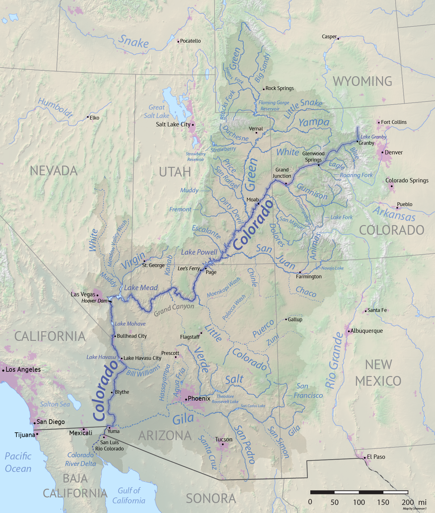
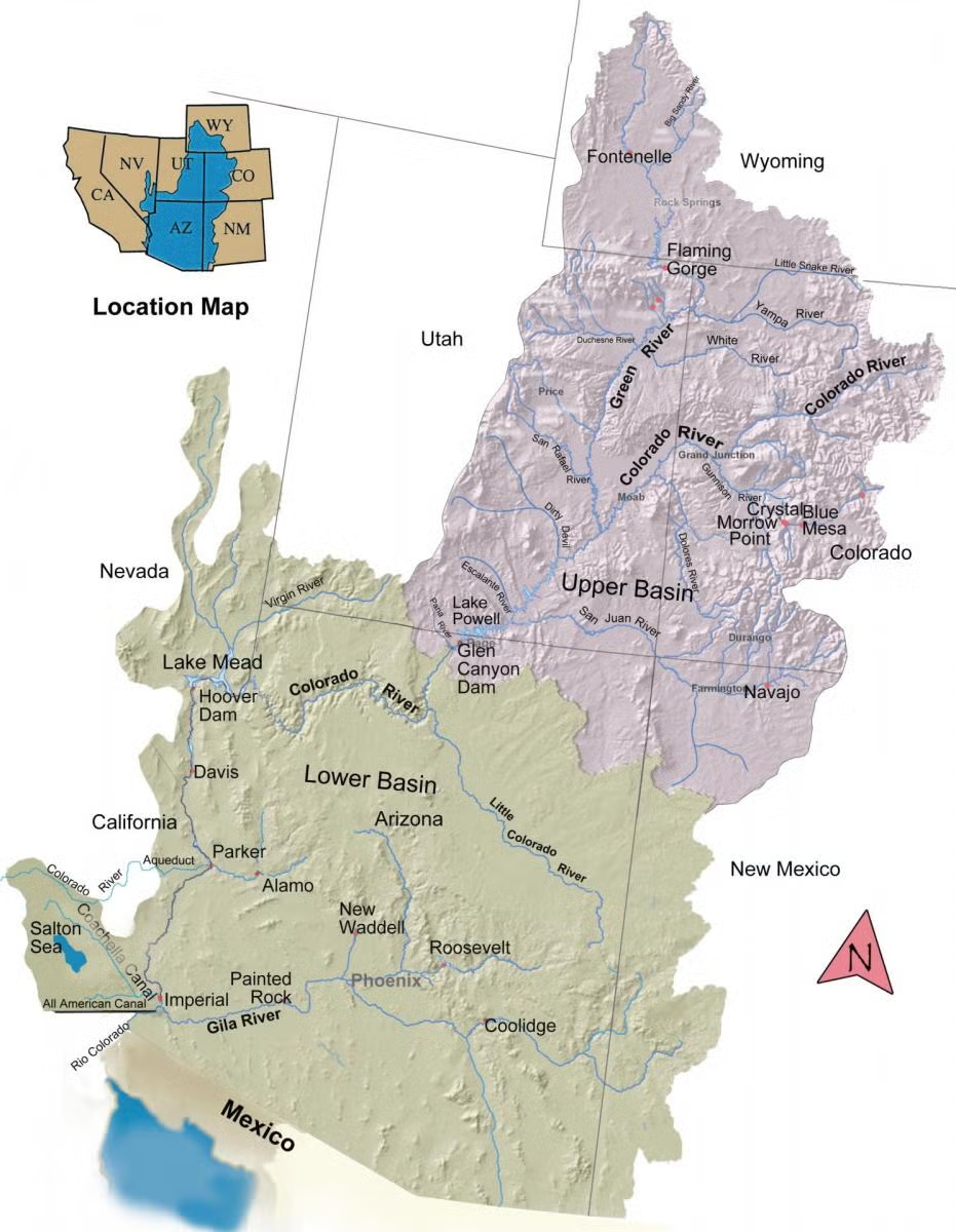
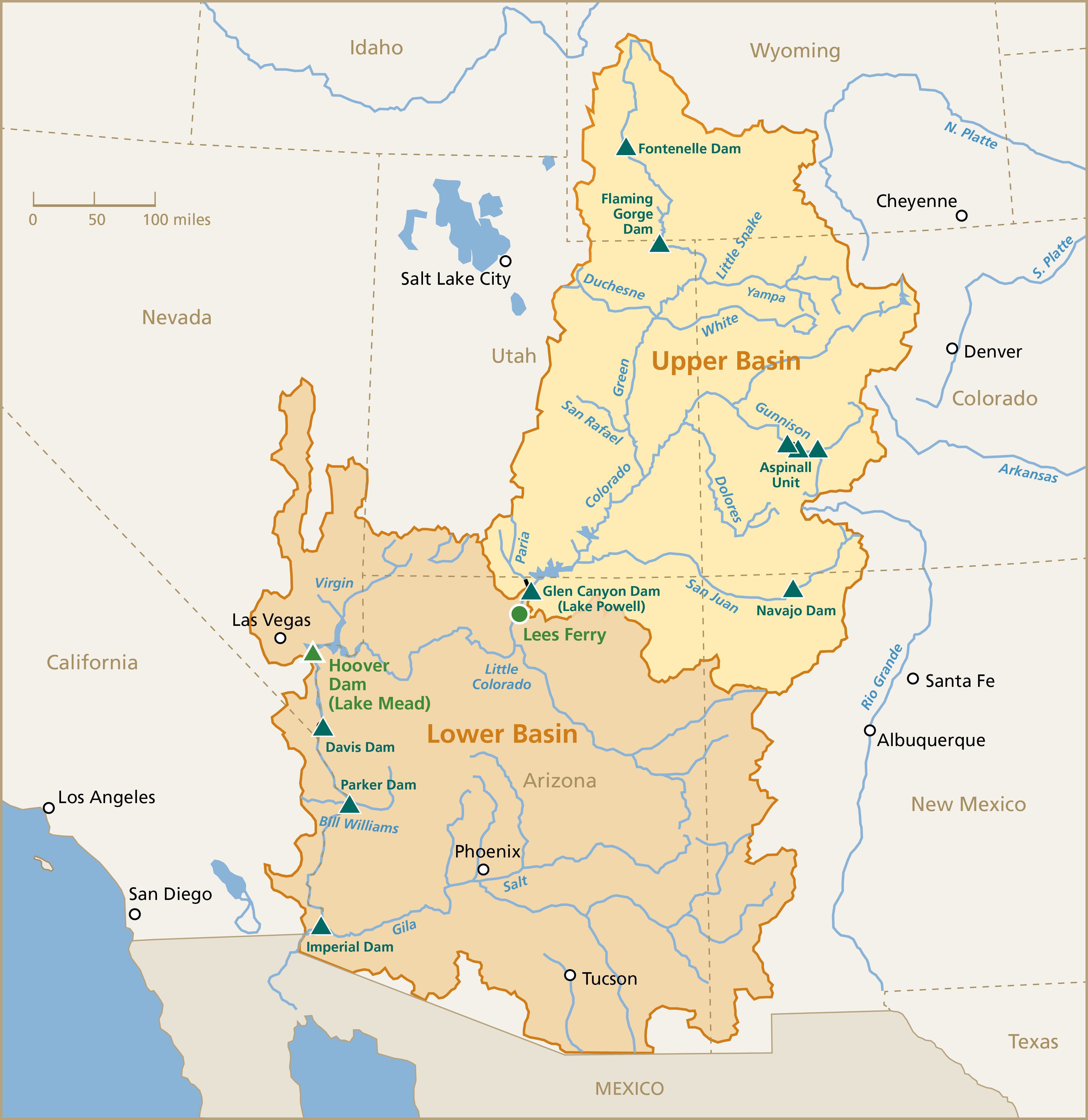
Map of the Colorado River drainage basin, created using USGS data. By Shannon1 Creative Commons Attribution-Share Alike 4.0

The #ColoradoRiver Water Supply Crisis in a Few Graphs: Part 1 — Jack Schmidt, Anne Castle, Eric Kuhn, Kathryn Sorensen, Katherine Tara (Getches-Wilkinson Center) #COriver #acidification

Click the link to read the article on the Getches-Wilkinson Center website (Jack Schmidt,1 Anne Castle,2 Eric Kuhn, 3 Kathryn Sorensen,4  Katherine Tara5

June 18, 2026

In the next few weeks, we will share a few graphs and charts that we find informative in understanding today’s water supply crisis on the Colorado River. This short paper concerns the present status of reservoir storage.

IN BRIEF

In 2026 and for only the third time in the 21st century, there was no accumulation, and no recovery, of total Basin live storage6 during the snowmelt season. Nor was there any accumulation or recovery of total live storage in Lake Powell and Lake Mead during the 2026 snowmelt season. Total Basin live storage (hereafter, total Basin storage) is all the water available in the Colorado River Basin’s reservoir “savings account” and stored in reservoirs within the watershed.7 On June 1, total Basin storage was 22.94 million acre feet (maf), only 1.62 maf above the previous minimum of March 20238 and less than 2 years supply at the current rate at which water is consumptively used or lost in the Basin. Total Basin storage will almost certainly drop to less than the previous record minimum by March 2027.

THE PRESENT CONDITION

On June 1, 2026, total Basin storage in 46 reservoirs in the Colorado River Basin was 22.94 maf, 9 39% of the content of those same reservoirs in late August 1999, the last time those reservoirs were relatively full.10 On June 1, Lake Mead held 33% of the Basin’s active storage, 32% was in 42 reservoirs upstream from Lake Powell, 25% in Lake Powell, and 10% in Lake Mohave and Lake Havasu. The combined live storage in Lake Mead and Lake Powell was 28% of the total live storage of those two reservoirs in late summer 1999.11

Why Total Basin Storage?

Most policy analysis of reservoir storage in the Colorado River Basin focuses on Lake Powell and Lake Mead or, alternatively, on all federally managed reservoirs in the Basin. These reservoirs are the focus of ongoing negotiations among the Basin states and will be impacted by impending management decisions by the federal government. On June 1, 89% of total Basin storage was held in 12 federally managed reservoirs.12 Slightly more than 60% of live storage upstream from Lake Powell was held in 8 federally managed reservoirs.

Total Basin storage is the total amount of water stored in reservoirs in the Colorado River watershed. In addition to the 12 federally managed reservoirs, Basin storage includes federal project reservoirs managed by other entities and non-federal reservoirs managed by municipal water providers and water conservation and conservancy districts. Some of the non-federal reservoirs act as forebays that facilitate trans-basin diversions to the Colorado Front Range or Utah’s Wasatch Front. Water stored in these non-federally managed reservoirs is not subject to current or proposed federal operating guidelines. In the Upper Basin, however, water stored in the non-federally managed reservoirs is one determinant of total Upper Basin consumptive use. Therefore, the status of storage in all the Basin’s reservoirs is an indicator of the overall condition of the Colorado River reservoir system and its ability to buffer continued declining inflow. Transfer of water from one reservoir to another, such as the on-going transfer from Flaming Gorge Reservoir to Lake Powell, does not affect total Basin storage. Although such management policy is critical to protecting dam infrastructure and maintaining realistically accessible storage in Lake Powell, 13 such policy merely shifts the location of the Basin’s deck chairs. What matters is whether the ship is sinking. [ed, emphasis mine]

Accumulation Period And Depletion Period

In terms of reservoir storage, we have previously distinguished two periods of the year – the period of reservoir rise (i.e., accumulation period) and the period of reservoir decline (i.e., depletion period).14 In terms of total Basin storage, the 2-3 month long accumulation period typically begins in mid-April, although it has begun as early as mid-March (Supplemental Table 1). The accumulation period typically ends in early July but has sometimes ended in early June and as late as early August. In rare cases, as discussed below, there has been no accumulation. The depletion period typically occurs from mid-summer until the following spring and lasts 9-10 months.

BASINWIDE STORAGE SHOWS CONTINUED DOWNWARD TREND DESPITE PERIODIC WET WINTERS

Basin Reservoirs in Spring 2023 Were at an Unprecedented Low.

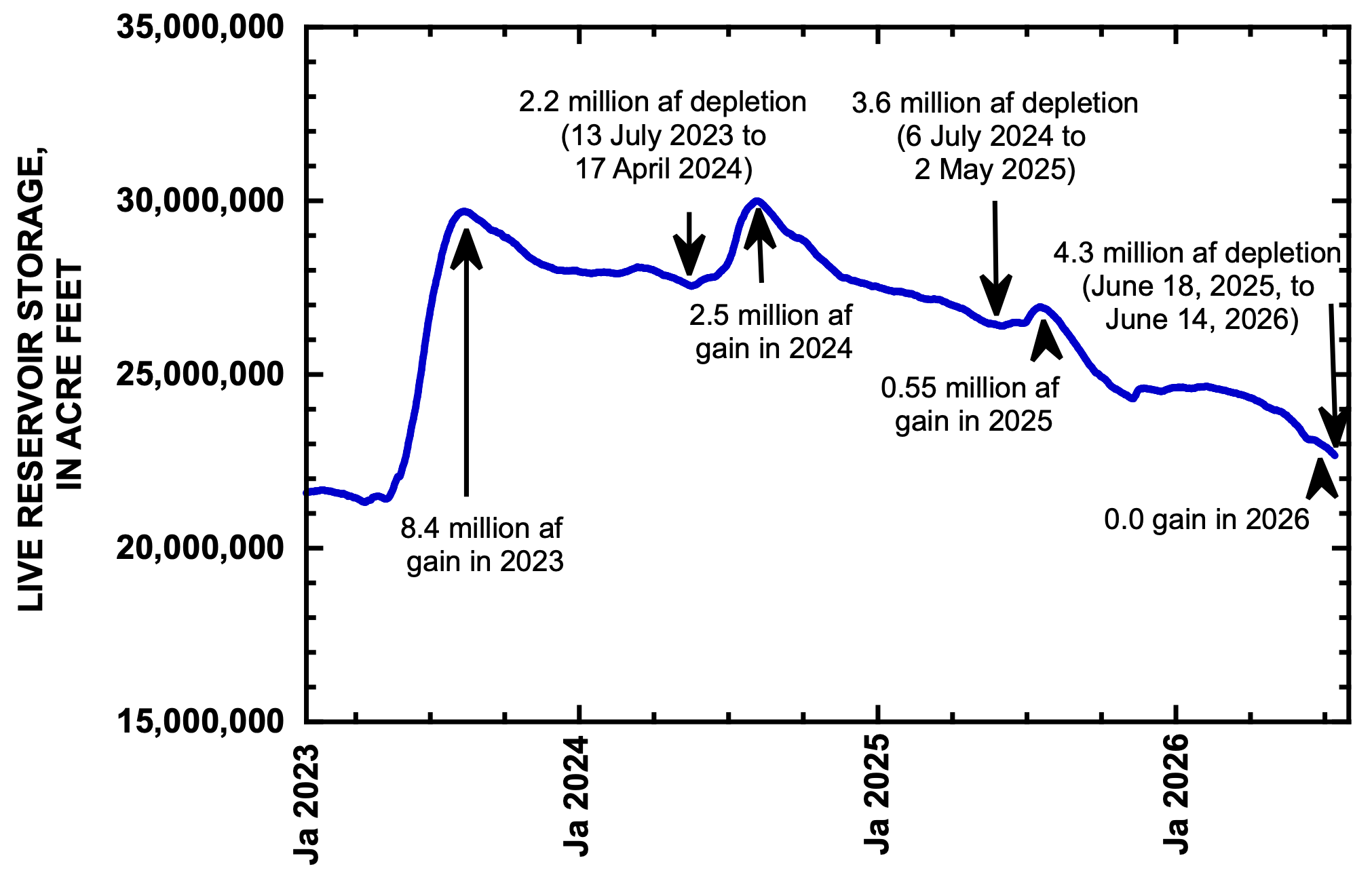
Figure 1 shows total live storage in 46 reservoirs during the past 3.5 years. The minimum amount of water in those reservoirs was on March 14, 2023, immediately before snowmelt began from the winter 2022/2023 snowpack. At that time, the Basin’s reservoirs only held 21.32 maf. Total Basin storage had not been that low since May 1965 when the newly constructed Colorado River Storage Project reservoirs were beginning to fill.15

Figure 1. Graph showing total storage in 46 reservoirs in the Colorado River Basin since January 1, 2023. The minimum amount during this period occurred in mid-March 2023, when total storage was less than at any time since late May 1965. The amount of increase or decrease in total Basin storage during the accumulation and depletion periods of each year are shown. Updated to June 14, 2026.

Snowmelt in 2023 was unusually large for the 21st century, and reservoir storage significantly recovered. The 8.38 maf increase in reservoir storage during the 2023 accumulation period was the second largest single-year increase of the 21st century and resulted from the second largest unregulated inflow to Lake Powell of the 21st century.16 The Basin’s reservoirs were subsequently drawn down by only 2.15 maf between July 13, 2023, and April 17, 2024, the smallest depletion period since at least 2010. Unregulated inflow to Lake Powell in Water Year (WY) 2024, primarily due to the 2024 snowmelt season, was typical of the 21st century,17 and the Basin’s reservoirs recovered 2.45 maf. Because Basin reservoir recovery exceeded the drawdown during the preceding 2023-2024 depletion period, Basin storage reached its highest recent peak at the beginning of the 2024-2025 depletion period.18

The gains of 2023 and 2024 were subsequently lost between summer 2024 and today, because depletion exceeded accumulation. In spring 2027, total Basin storage is likely to be less than it was in March 2023.

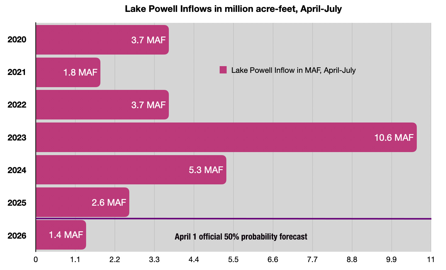
In early July 2024, the multi-year downward turn of reservoir storage began. The Basin’s reservoirs were depleted by 3.60 maf during the 2024-2025 depletion period, more than 1 maf greater than the preceding accumulation. Unregulated inflow to Lake Powell in WY2025 was the fourth driest of the 21st century19, and the Basin’s reservoirs only accumulated 0.55 maf, a small amount. Despite hard-fought, politically contentious, and economically expensive system conservation and assigned water efforts as well as a wet fall in the southern part of the Basin, the Basin’s reservoirs were depleted by 4.00 million af during the 2025-2026 depletion period.20 The most probable unregulated inflow to Lake Powell in WY2026 is forecast to be 3.40 maf, the second lowest inflow of the 21st century.21 There will be no accumulation this year.22

As of June 1, 2026, the Basin’s total storage was only 1.62 maf more than total storage at its record-breaking low in March 2023. It is likely that Basin storage in spring 2027, before the 2027 accumulation season begins, will be lower than at any time since 1965, because depletion during the 2016-2027 period will probably exceed 1.62 maf.23

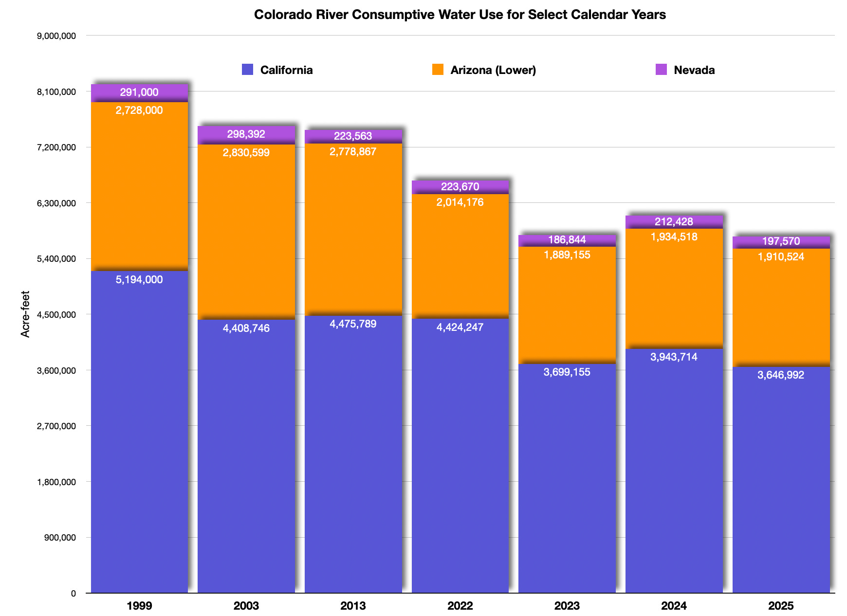
The depletion of reservoir storage that began in summer 2024 occurred despite a significant effort to reduce Lower Basin water use. Water use in California and Arizona in Calendar Year (CY) 2025 was the lowest and third lowest, respectively, since CY2010, and use in those two states in CY2024 was the fourth lowest since CY2010. Water use in Arizona in CY2026 is forecast to be the lowest since CY2010. Upper Basin use in CY2024 was typical for the period CY2010-CY2024; Upper Basin use data for CY2025 are not yet available.

Despite each spring’s snowmelt inflow, each part of the Basin’s reservoir system that stores water – Lake Mead, Lake Powell, and the reservoirs upstream from Lake Powell – has declined since their recent maximums in summer 2024.

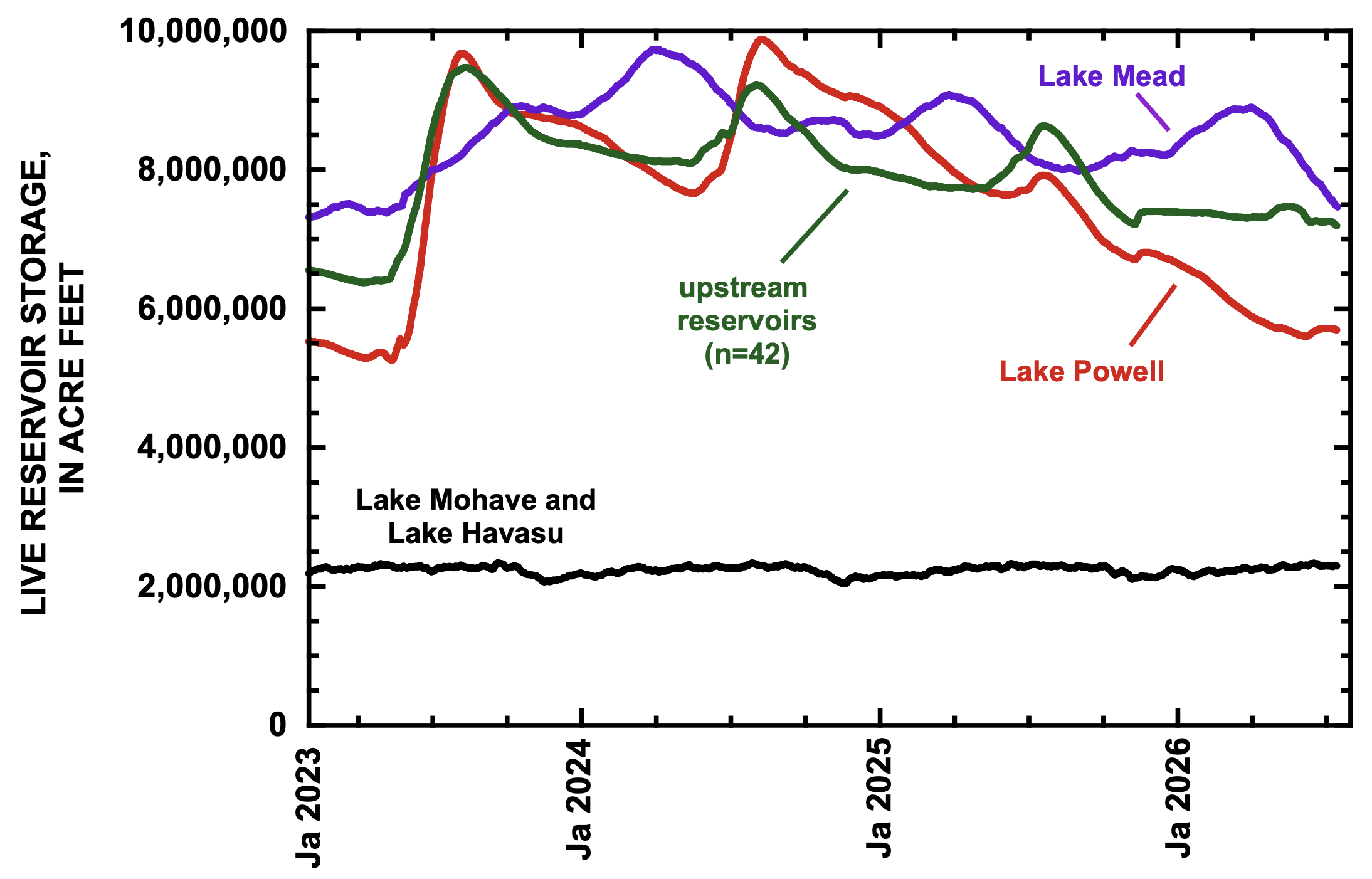
Lake Mead typically peaks between January and March and then declines until August (Fig. 2). This pattern contrasts from that of Lake Powell and of reservoirs further upstream. The winter peaks of Lake Mead in 2024, 2025, and 2026 have been progressively lower each year, and the summer minimums have also been lower each year. In 2026, Lake Mead peaked on February 28 and lost 1.23 maf between March 1 and June 1 and will probably continue to drop during the rest of summer. On June 1, 2026, Lake Mead stored only 0.34 maf more than its recent minimum of January 1, 2023.24

Figure 2. Graph showing live storage in Lake Mead, Lake Powell, in 42 reservoirs upstream from Lake Powell, and in Lake Mohave and Lake Havasu since January 1, 2023. Updated to June 14, 2026.

In the last two years, Lake Powell has dropped more than other reservoirs. Lake Powell lost more than 4 maf of stored water since early July 2024. In 2026, Lake Powell steadily declined from the beginning of the year until May 7 and stabilized following the onset of snowmelt runoff, increased releases from Flaming Gorge Reservoir, and reduction of releases at Glen Canyon Dam.25 On June 1, decline in Lake Powell resumed. The total live storage in Lake Mead and Lake Powell on June 1 was 13.38 maf, significantly less than the capacity of either individual reservoir.

Total storage in 42 reservoirs upstream from Lake Powell also declined during the past 3.5 years. Those reservoirs rise every spring and typically recover until sometime in June or July. Presently, many reservoirs in the headwaters of the upper Colorado River are still rising, 26 as are Fontenelle and Big Sandy in the upper Green River Basin. However, total reservoir storage in the Gunnison and Green River watersheds is already at its lowest of the year. Total reservoir storage in the San Juan River watershed has been declining since mid-April but is not yet at its lowest point for the year.

OVERALL TRENDS IN BASIN STORAGE DEMONSTRATE RATCHET EFFECT IN FULL FORCE

In the context of the entire 21st century, Basin storage significantly dropped during two multi-year dry periods, 2000-2004 and 2020-2022 (Fig. 3).27 In other years, the bounty of snowmelt was temporarily stored but completely consumed in subsequent years. The resulting pattern for the 21st century is jagged, but the overall trend in storage has been relentlessly downward, because Basin average uses and losses have consistently exceeded average inflows. We call this pattern the Ratchet Effect, because a rachet is a mechanical device that only allows movement in one direction, in this case towards ever declining Basin storage and deeper into crisis.28 Despite laudable efforts to maintain balance through system conservation and assigned water programs, the ship continues to sink.

Figure 3. Graph showing live storage in the Basin’s reservoirs since January 1, 1999. We call this pattern the Ratchet Effect of declining Colorado River Basin storage in the 21st century. Updated to June 14, 2026.

SUPPLEMENTAL TABLE

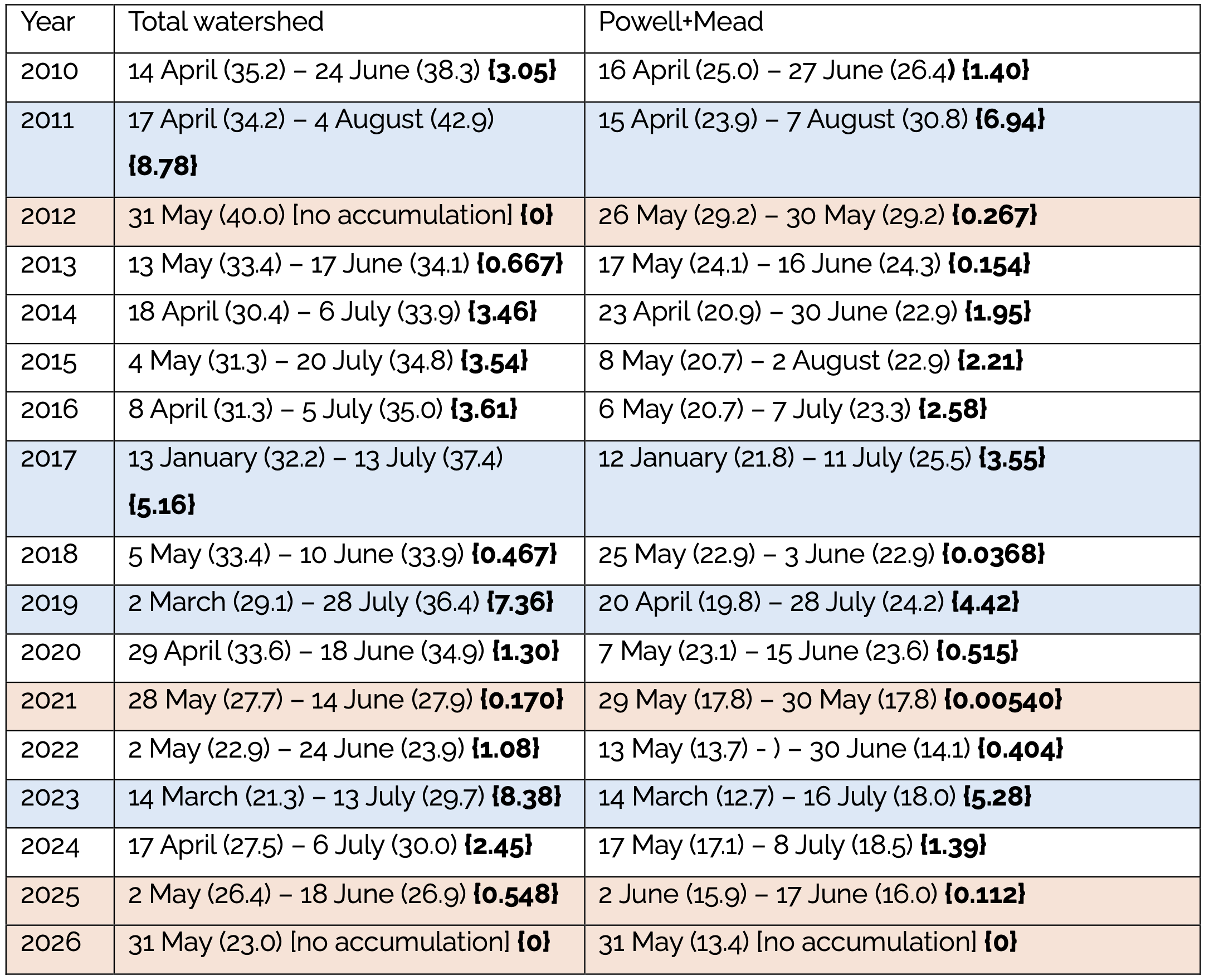
Supplemental Table 1. Beginning and end dates of the reservoir storage accumulation period for the entire watershed and for Lake Powell plus Lake Mead. The volume in storage for each date is indicated. The value at the beginning of the accumulation period is the minimum storage at the end of the preceding 9-10 month depletion period. Numbers in bold brackets are the accumulation, in millions of acre feet. Tan shading indicates years that were among the five driest of the 21st century. Blue shading were years that were among the five wettest of the 21st century.


1 Center for Colorado River Studies, Utah State University, former Chief, Grand Canyon Monitoring and Research Center.

2 Getches-Wilkinson Center, Univ. of Colorado Law School, former US Commissioner, Upper Colorado River Commission, former Assistant Secretary for Water and Science, US Dept. of the Interior.

3 Retired General Manager, Colorado River Water Conservation District.

4 Kyl Center for Water Policy, Arizona State University, former Director, Phoenix Water Services.

5 Staff Attorney, Utton Transboundary Resources Center, University of New Mexico.

6 Live storage is all water stored in reservoirs that can be vacated by gravity, no matter how difficult or slow would be the process of withdrawing that water. Active storage is all water stored above minimum power pool, and inactive storage is water stored between dead pool and minimum power pool. These definitions differ from those used in previous papers that we have written. In past papers, we used the term active storage to refer to what we now refer to as live storage. This change is made to be consistent with terminology of Bureau of Reclamation.

7 We do not consider reservoirs that store Colorado River water but are located beyond the watershed boundary, such as Horsetooth or Twin Lakes Reservoirs in Colorado.

8 As discussed below, the March 2023 minimum was the lowest total Basin storage since May 1965 when the reservoirs of the Colorado River Storage Project were beginning to fill.

9 the contents of these reservoirs are reported by the Bureau of Reclamation https://www.usbr.gov/uc/water/hydrodata/reservoir_data/site_map.html. These reservoirs include the largest in the Basin, as well as many small ones.

10 The total amount of water in the 46 reservoirs on August 24, 1999, was 59.52 maf. The only previous periods when total Basin storage exceeded that amount were for ~4.5 months between June 9 and October 24, 1983, and during parts of summer 1984, 1985, 1986, and 1998 The largest amount of live storage in these reservoirs was 63.61 maf on July 15, 1983.

11 Total live storage in Lake Mead and Lake Powell peaked at 47.70 maf on September 19, 1999, and was 13.38 maf on June 1, 2026.

12 The contents of these 12 reservoirs are reported in Reclamation’s 24-Month Study reports and include Taylor Park, Blue Mesa, Morrow Point, Crystal, Fontenelle, Flaming Gorge, Vallecito, and Navajo that are upstream from Lake Powell, as well as Lake Powell, Lake Mead, Lake Mohave, and Lake Havasu. The contents of the latter two reservoirs, as well as Morrow Point and Crystal, do not change much during the year.

13 A. Castle et al. 2026. UPDATE: Colorado River Basin storage continues slide toward system crash. https://qanr.usu.edu/coloradoriver/files/research/Wilburys-system-crash.pdf.

14 J. Schmidt and J. Fleck. 2025. Colorado River Basin reservoir storage; where do we stand? https://www.inkstain.net/2025/06/colorado-river-basin-reservoir-storage-where-do-we-stand/.

15 The 12 federal reservoirs had 18.93 maf of active storage on March 14, 2023, and were at their lowest since early May 1965.

16 The largest single-year accumulation of Basin storage was in 2011, when storage increased 8.78 million af. Unregulated inflow in WY2011 was 15.97 maf, and natural flow in WY2011 was the largest of the 21st century (WY2011 = 20.16 million af). Unregulated inflow to Lake Powell in WY2023 was 13.42 million af, and natural flow of the Colorado River in WY2023 was 17.41 million af, the third largest of the 21st century.

17 Unregulated inflow was 7.98 million af, 2% less than the average for the 21st century (2000-2026). Natural flow at Lees Ferry in WY2024 (11.88 million af) was 1.5% less than the 21st century average.

18 Total Basin storage was 29.99 million af on July 6, 2024, the largest peak since mid-January 2021.

19 WY2025 unregulated inflow was 4.69 million af. Natural flow at Lees Ferry was 8.50 million af, the fifth driest of the 21st century.

20 J. C. Schmidt et al. 2026. Lake Powell and Lake Mead are moving in opposite direction – what gives? https://qanr.usu.edu/coloradoriver/news/blog-2026-2-9. Here, we are arbitrarily ending the 2025-2026 depletion period on June 1, 2026, when the 2026-2027 depletion period begins.

21 June 24-Month Study.

22 The only other years in the 21st century when there was no accumulation of total Basin storage were 2002 and 2012.

23 The median drawdown of the Basin’s reservoirs since 2010 during each depletion period has been approximately 3.6 maf, and the smallest previous depletion was 2.15 maf. There have only been six years when Basin-wide reservoir depletion was less than 3.0 million af: 2023-2024 (2.15 million af), 2022-2023 (2.19 million af), 2014-2015 (2.61 million af), 2016-2017 (2.75 million af), 2019-2020 (2.82 million af), and 2011-2012 (2.93 million af).

24 Active storage in Lake Mead on January 1, 2023, was 7.32 million af.

25 Lake Powell only gained 0.12 million af between May 7 and May 31.

26 These reservoirs include Granby, Dillon, Ruedi, Green Mountain, Taylor Park, and Ridgway.

27 J. C. Schmidt et al. 2023. The Colorado River water crisis: its origin and the future. WIREs Water 10.1002/wat2.1672.

28 A. Castle et al. 2026. UPDATE: Colorado River Basin storage continues slide toward system crash. https://qanr.usu.edu/coloradoriver/files/research/Wilburys-system-crash.pdf.

‘It’s devastating’: Drawdown at #FlamingGorge hits local recreation economy; Emergency drought-induced draw to save downstream #LakePowell wreaks havoc on #Wyoming-#Utah’s lucrative Flaming Gorge — Dustin Bleizeffer and  Hannah Romero (WyoFile.org) #GreenRiver #ColoradoRiver #COriver #aridification

Anglers flock to Flaming Gorge Reservoir on Memorial Day weekend. Kokanee salmon and trophy-sized lake trout draw tens of thousands of visitors to the reservoir each year, supporting a recreational economy in southwestern Wyoming and northeastern Utah. (Hannah Romero/Green River Star)

Click the link to read the article on the WyoFile website (Dustin Bleizeffer and  Hannah Romero):

June 4, 2026

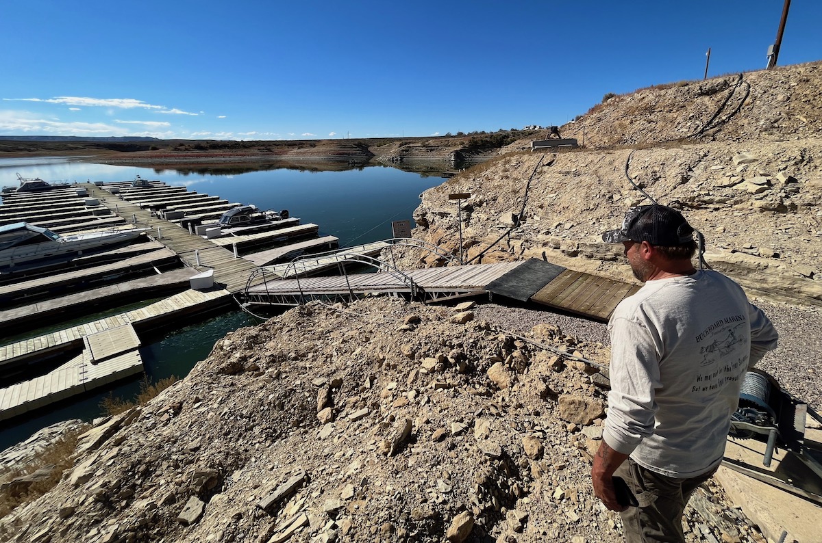
As campers with boats flocked to Buckboard Marina at the start of Memorial Day weekend, Tony Valdez was busy issuing refunds and repairing broken boat ramps. One older Green River man, who walked with two canes, left with his money refunded for the season after discovering he could not safely make it down to the boat slip. Due to dropping water levels at Flaming Gorge Reservoir, the ramp is now buckled, angling up and down like a pitched roof. 

“It’s devastating, not just to me, it’s all the marina owners,” said Valdez, who owns Buckboard Marina, south of Green River. “It’s a big loss, and this is a big loss to the community.” 

Along the cliffs and shoreline, darker and lighter lines of rock and sand trace the water’s elevations, showing where the water hits when the marina is full, where it hovered this spring and where it dropped after an initial “flush.” Valdez estimates the reservoir has dropped by 7 feet since April. 

But that’s not the worst of it. Valdez anticipates that by the end of this summer, the reservoir will be as low as it’s ever been. 

Why the drain?

For all its charm as a beloved recreation spot and its utility as a local economic driver, Flaming Gorge Reservoir owes its existence to a legal compact that essentially regards it as an insurance policy in times of drought.

Its primary purpose, according to federal officials and Colorado River Compact scholars, is to serve as a backup water bank to help maintain the Colorado River system. Specifically, Flaming Gorge and a handful of other reservoirs in the upper Colorado River Basin states of Wyoming, Colorado, Utah and New Mexico are key to ensuring a minimum flow of 7.5 million acre-feet of water, on a running 10-year average, at Lees Ferry just downstream of Lake Powell, a massive man-made reservoir straddling the Utah-Arizona border.

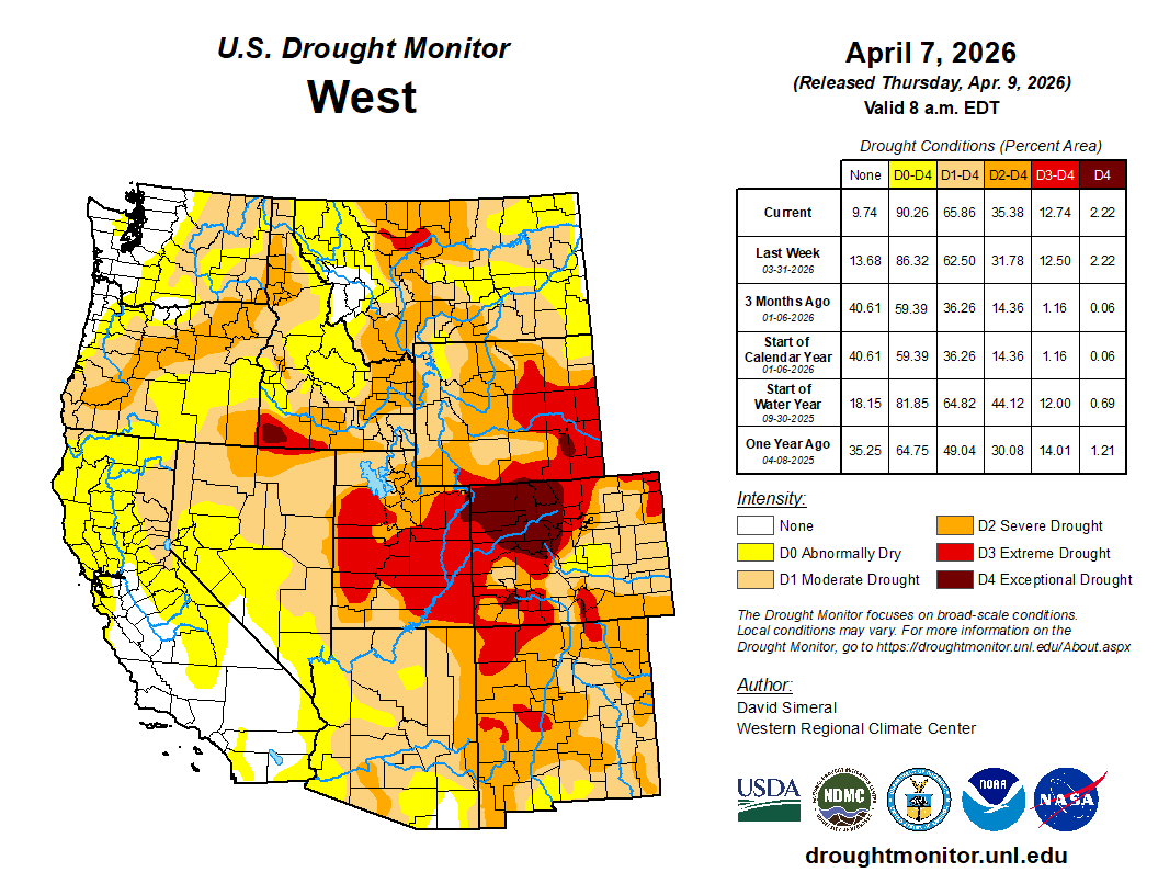
Today, after more than 20 years of drought intensified by human-caused climate change, the Colorado River is in crisis, putting at risk massive agricultural irrigation operations that consume about 80% of its water. This past winter saw historically low snowpack in the Upper Colorado River Basin — a primary source for the river’s flow. 

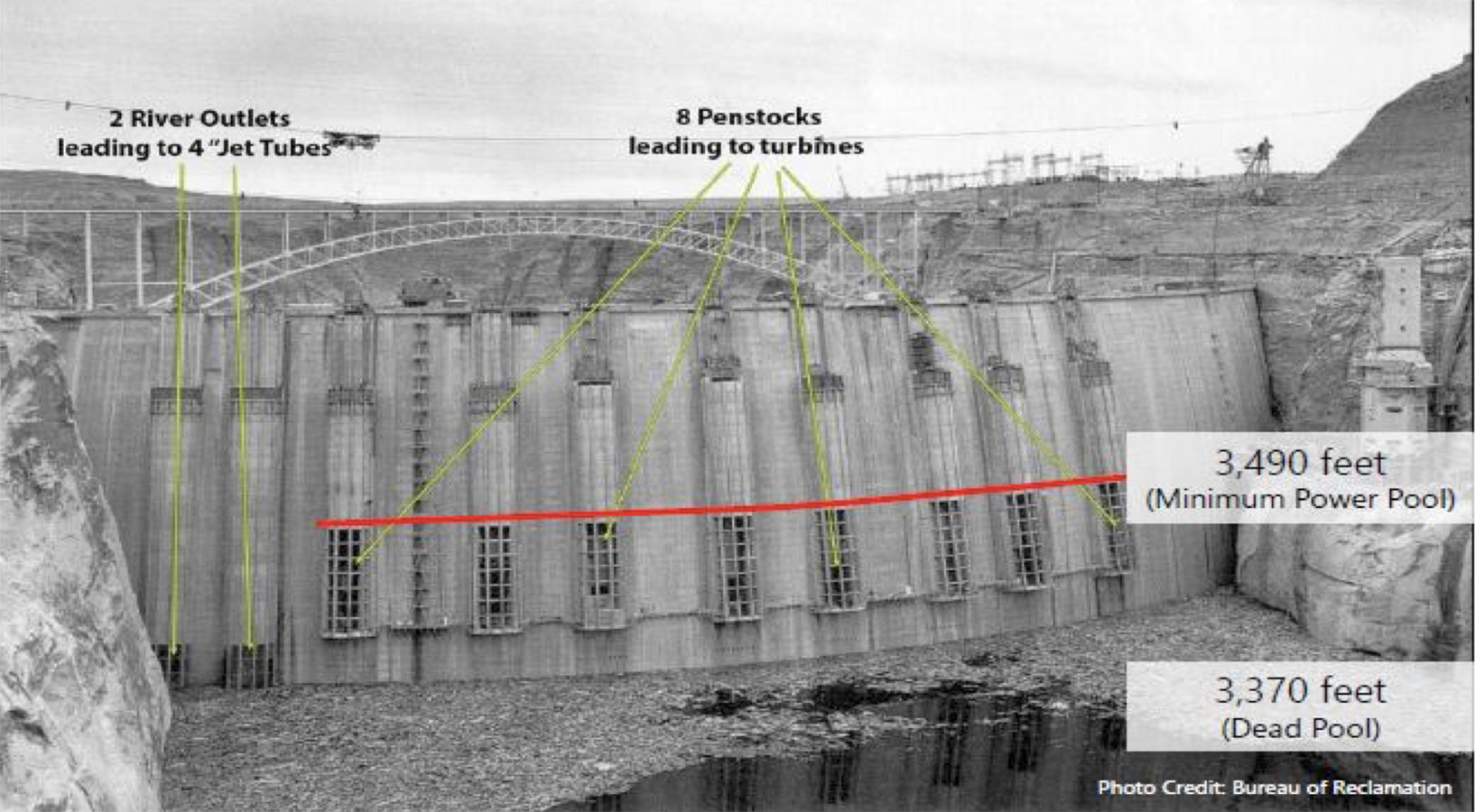
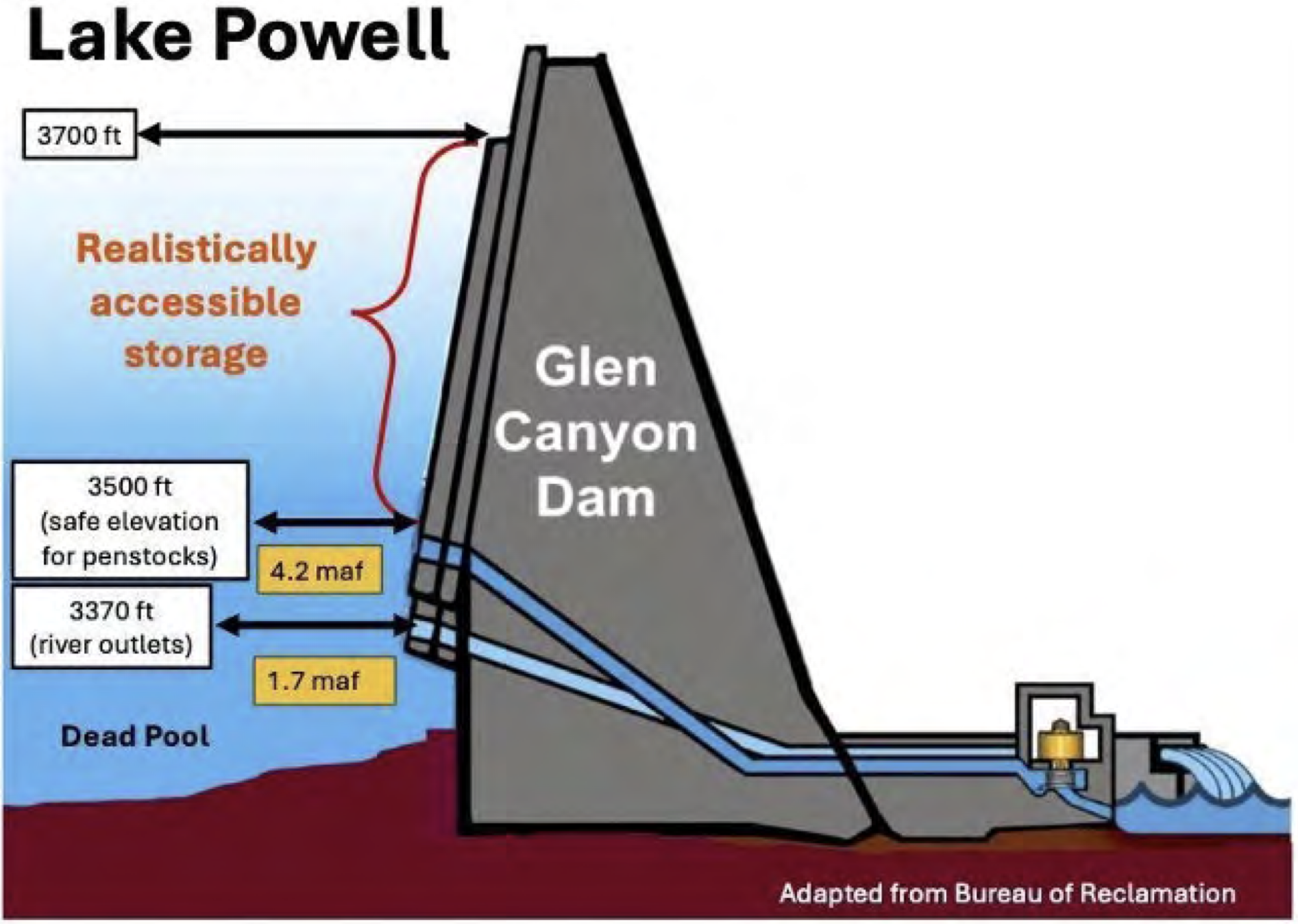
This annotated 1963 photo of the Glen Canyon Dam shows the minimum level of Lake Powell, below which would render the dam’s power generation components inoperable. (Bureau of Reclamation)

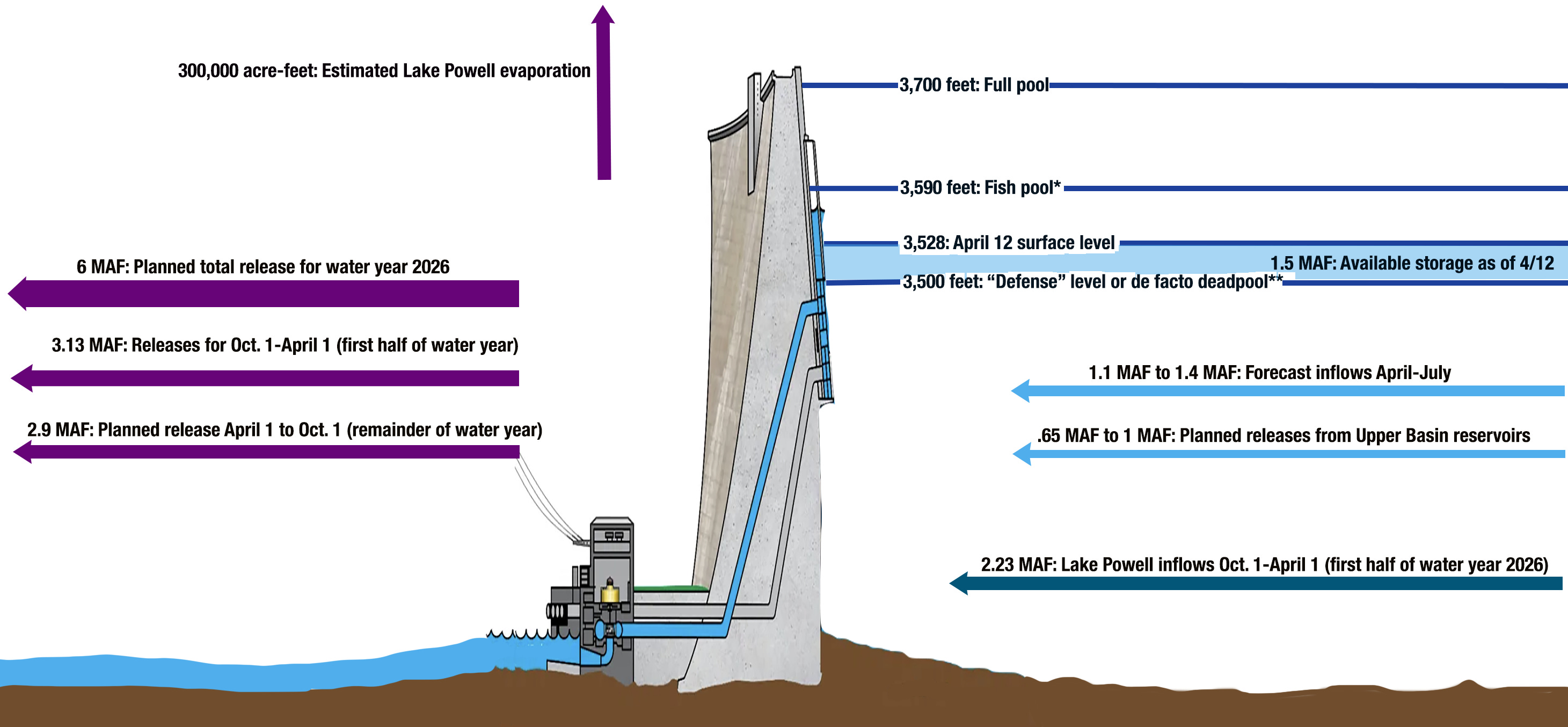
Combined with record heat in March, Lake Powell is at risk of dropping below Glen Canyon Dam’s “minimum power pool,” the point at which it can no longer produce hydroelectric power, according to water officials. If it falls even lower, the dam, which holds back Lake Powell, could be at risk of structural damage or unable to allow water to flow downstream.

The situation triggered a drought response operations agreement that calls for restricting releases from Lake Powell and an order to draw extra water from Flaming Gorge upstream. In total, water managers will release about 1 million additional acre-feet of water from Flaming Gorge in April 2026 through April 2027. 

“These actions are expected to lower [Flaming Gorge’s] elevation by roughly 35 feet over the next year to approximately 59% of capacity,” the bureau said in April.

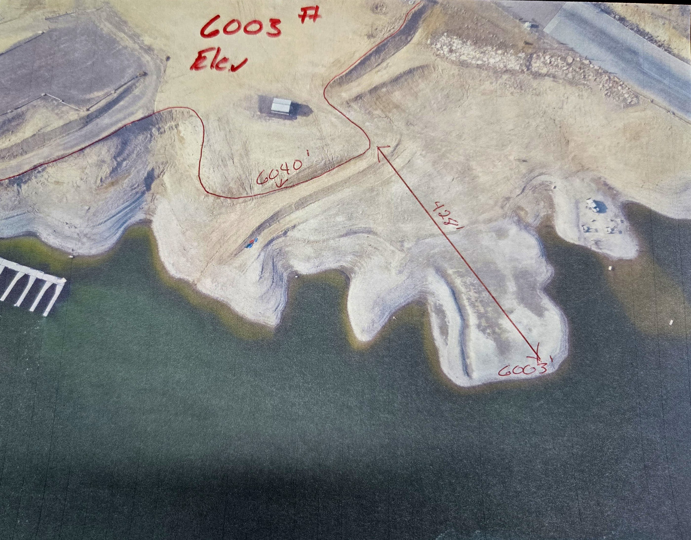
“The elevations are real critical,” Valdez said. At Buckboard Marina, high water has hovered between 6,030 and 6,040 feet above sea level over the past 50 years, he said. Dropping 35 feet could expose 400 feet of shoreline in some places, including marinas with boat ramps, he said. 

Dropping water levels in the Flaming Gorge Reservoir by 35 feet could expose over 400 feet of shoreline in some places, including marinas with boat ramps, according to Buckboard Marina owner Tony Valdez. (Hannah Romero/Green River Star)

If the water elevation continues to retreat, it could reach a point where boats can’t be brought in or out.

“By September, this thing is going to be down to 6,000 feet. That’s it,” Valdez said. “Next year, if it goes below that, there’s no more marina here.”

Setting a course 

Water managers set a course in April to “stabilize” Flaming Gorge’s outflow to about 1,100 cubic feet per second, representing the rate needed to achieve the 1 million acre-feet of extra water release, according to the bureau. On top of that, there are two previously planned “flushes” from the Gorge. The first, in early May, temporarily increased the outflow to about 8,600 cubic feet per second to enhance the proliferation of razorback sucker larvae, and a second 72-hour flush beginning June 8 will temporarily increase the outflow to about 4,600 cubic feet per second to discourage the proliferation of smallmouth bass.

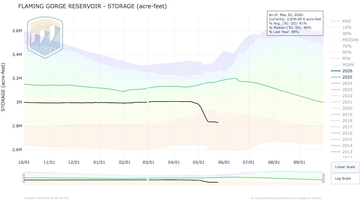
So far, Flaming Gorge has dropped from about 3 million acre-feet in April (or 82% capacity) to about 2.83 million acre-feet as of May 25. Meanwhile, water managers warn, “This release plan is subject to change depending on evolving river conditions and weather forecasts.”

Click to enlarge: This chart depicts water storage levels at Flaming Gorge Reservoir. (Bureau of Reclamation)

Those evolving conditions include forecasted versus actual flows from streams feeding the system. For example, those “unregulated” or natural flows are forecasted to be much lower than normal: 70,000 acre-feet of water into Flaming Gorge during May (28% of average), 175,000 acre-feet in June (45% of average) and 84,000 acre-feet (42%), according to the Bureau of Reclamation.

Water officials caution that water flowing from the Flaming Gorge Dam could change, and that those recreating on the Green River below should monitor release schedules at this website. The bureau also noted, “Water will be colder than usual and will run high and swift during periods of elevated releases.”

Water floats recreation economy

Buckboard Marina went through a similar drop in water a few years ago. The Bureau of Reclamation began pulling water from the Flaming Gorge in 2021, and by 2022, the marina’s water level was at an all-time low. While the reservoir recovered somewhat in 2023 thanks to a good year for moisture, Valdez said, the reservoir has continued to decline since then. 

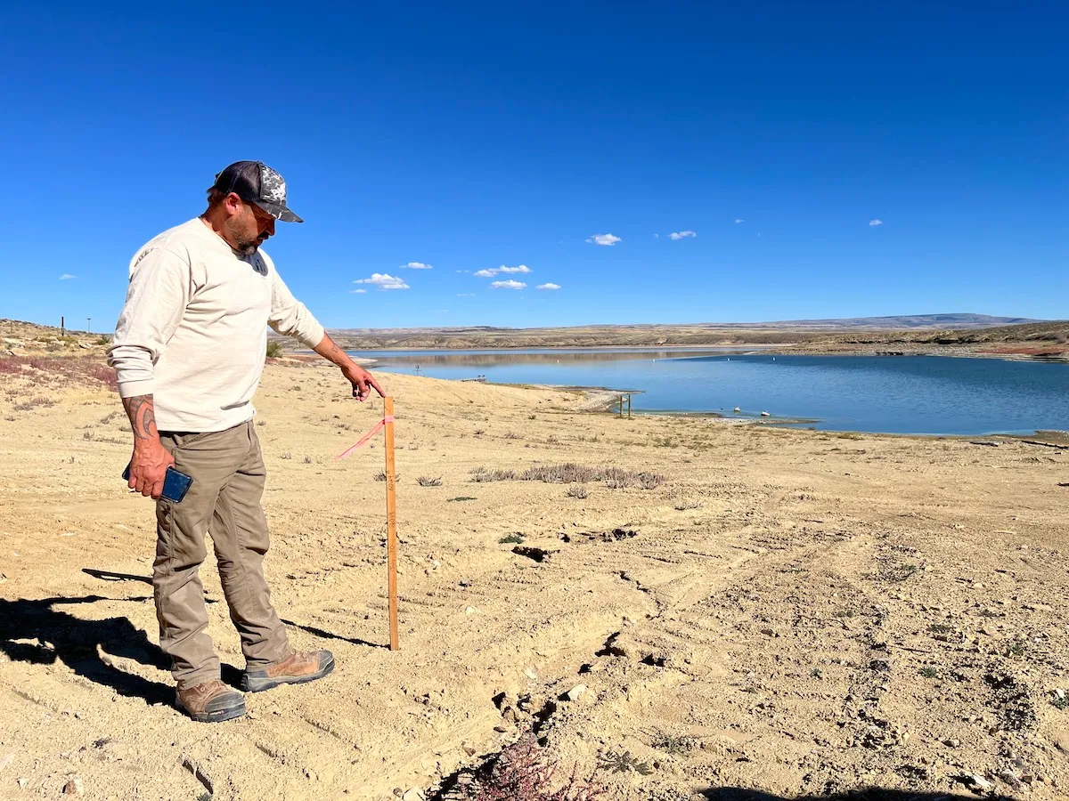
Buckboard Marina owner Tony Valdez stands next to a stake that indicates the extent of lowering water levels at Flaming Gorge Reservoir Sept. 26, 2022. (Dustin Bleizeffer/WyoFile)

Kokanee salmon and trophy-sized lake trout draw tens of thousands of visitors to Flaming Gorge each year, supporting a recreational economy in southwestern Wyoming and northeastern Utah. But as the lake is drawn down, water recedes from shallow shorelines and fish are forced into a smaller space, essentially shrinking the fishery toward the dam side of the reservoir. 

One of Valdez’s primary concerns is that water levels could drop below the ideal elevation for kokanee to spawn in the reservoir. 

“I think people don’t realize the economic value it brings,” he said. “It is a big deal when you lose your kokanees.”

Already, kokanee are struggling to thrive in the reservoir. 

Drinking water dries up

Valdez has already lost money this year just from people being concerned about water levels. He estimated that the marina lost roughly $30,000 in cancellations when discussions about releasing water began as early as February.

Other problems also start to arise as the water drops. The marina will lose access to drinking water at 6,010 feet, below their floating pump that supplies potable water. It’s only 7 feet away from the current level.

“That’s scary to me,” Valdez said.

The marina can truck in water from Rock Springs, but it costs about $1,200 to bring in 8,000 gallons, which lasts about two weeks. For Valdez, it feels “asinine” to lose water at a marina.

“Why would we run out of water on a lake?” 

Water levels also impact the location of the fuel dock and fuel lines extending to it. If the reservoir sinks too low, it could cost up to $100,000 to adapt, he said. 

Drawing down water levels quickly — as happened in early May — can damage marina structures. After the 2021-22 drawdown, Valdez said he spent about $130,000 in repairs. 

Buckboard Marina owner Tony Valdez shows a boat ramp that now angles up steeply before dropping down after the reservoir’s water levels dropped several feet. (Hannah Romero/Green River Star)

This time, he’d hoped to keep up. He and a group of 10 men worked to keep pace with the dropping water levels, repairing and modifying ramps. It wasn’t enough.

“The drop was dramatic enough to break all of our approaches, our bridges, our stuff, so it broke a lot of the welds, broke a lot of the structured steel, because it just vertically dropped too fast for the weight,” he said. 

When structures go from water to land that quickly, the weight is too much for them to hold up, Valdez said. 

“I’m re-rigging everything, and this is only a temporary fix ’til September, because that’s when the season ends.”

The marina should remain mostly functional until the summer season ends, he said. But with extra water releases set to continue through the winter, the lake could drop another 10 to 12 feet by the spring. 

“We’re getting into numbers that I don’t even want to talk about,” Valdez said. “I mean, there’s no marina.”

What’s next?

“The guy with the boots on the ground that watches this every day,” as Valdez describes himself, can see what water managers can’t, and he questions whether official numbers and estimates match reality.

“It’s hard to watch this when it’s out of your hands.”

Valdez is critical of the 1922 compact, doubting the legal rationale of sending Wyoming water to places like Arizona. He also wonders about the role of local industries — refineries, coal-fired power plants and trona mines — that use large amounts of water, and the idea of adding more industrial facilities that require even more water, like data centers. 

“We don’t have the water to give away,” Valdez said.

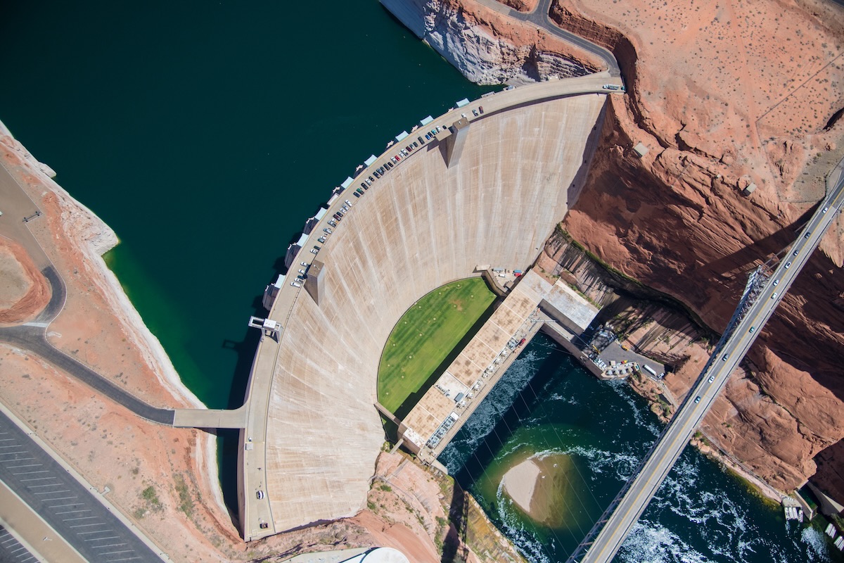
Aerial photo of the Glen Canyon Dam near Page, Arizona. Photo by Alexander Heilner/The Water Desk, with aerial support by LightHawk.

Bryan Seppie, general manager for the Joint Powers Water Board for Sweetwater County, Rock Springs and Green River, agrees. “The poor hydrology this past winter has affected most all water users in some form or another,” he said.

His board monitors the Colorado River system closely. Just upstream from Flaming Gorge, the Bureau of Reclamation reduced releases from Fontenelle Reservoir due to poor inflow projections. Although the water will still be enough for river users, the low summer flows will have a negative impact. 

“Low river flows typically result in higher water temperatures, which generally leads to higher levels of moss/algae and overall lower water quality,” Seppie said in an email.

What about recovery? 

Valdez wonders: What’s the plan to allow the reservoir to bounce back?

Wyoming State Engineer Brandon Gebhart and his staff have warned for months that although Flaming Gorge can serve as a backup to Lake Powell this year, it drains the Gorge’s ability to play a similar role next year, or the year after. It takes time for Mother Nature to replenish the bank.

“The big thing that nobody is talking about is the recovery,” Valdez said. “Where is the recovery of our water?”

This year’s drain on Flaming Gorge began at a low point. The reservoir hadn’t fully recovered after the last major pull. Rather than starting at a high point of 6,040 feet, the marina was at about 6,024 feet, he said. 

“There’s no recovery plan,” he said. “We can’t just let them keep taking. I mean, where’s this end?” 

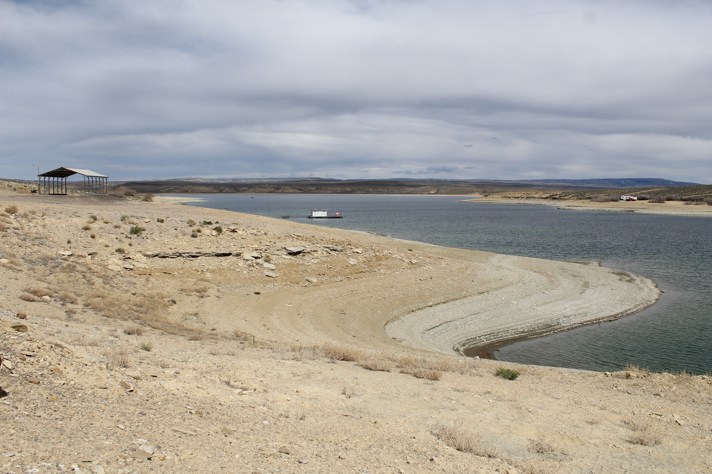
Rings line the shore of Flaming Gorge Reservoir, showing the drop in the water level at the popular recreation spot that spans the Wyoming-Utah border. (Hannah Romero/Green River Star)

If there is no grace period for the reservoir to replenish and officials want to take even more in the near future, starting from such a low elevation point, it will be “devastating,” Valdez said. 

“The water going down is not the end of the world, it’s the recovery in a timely manner that really matters,” he said. “I can’t preach recovery enough.” 

Watching people come to the marina and seeing how happy they are still motivates Valdez to keep going. Despite the drawdown, there’s nowhere else he’d rather be. 

“We’re not going to run away. We’re not going to give up,” he said. “We’re going to fight.”

ten tribes
Graphic via Holly McClelland/High Country News.

To Lees or not to Lee’s; Mike Lee goes after roadless rule; Trump steps up oil and gas leasing; Plus a dash of historical mass murder and its connection to today’s copyediting and political battles — Jonathan P. Thompson (LandDesk.org)

Looking down at Lees Ferry and Lee Ferry, but probably not Lee’s Ferry or Lees’ Ferry. Jonathan P. Thompson photo.

Click the link to read the article on The Land Desk website (Jonathan P. Thompson):

June 12, 2026

🐟 Colorado River Chronicles 💧

Recently, my colleagues at High Country News and I had a bit of a kerfuffle over whether the place on the Colorado River that divides the Upper Basin from the Lower Basin was called Lee Ferry, Lee’s Ferry, or Lees Ferry. Our esteemed copyeditor, Diane Sylvain, was beating herself up for letting a “Lee Ferry” sneak into an article I wrote, when the HCN style guide says it should be “Lees Ferry.”

I pointed out that it was fine, since “Lee Ferry” is an accepted spelling, as is “Lee’s Ferry.” This prompted a sharp rebuke: “Its name is Lees. … Dissenters can use apostrophes on their own time.”

Great. Now I’ve been labelled as a copyedit dissenter. That hurts. But it also sent me down a wormhole on this whole Lee Lees Lee’s Ferry thing, not in an effort to catch any copyeditors out, not as an act of dissent, but just because I’m curious about how we got to where “Lees Ferry” is the accepted spelling, in defiance of apostrophes and, perhaps, history. In the process I learned a lot about one of the coolest spots I know.

Photo credit: Jonathan P. Thompson/The Land Desk

Honestly, I wish we could use a different name altogether for this place of convergence in the far reaches of northern Arizona, something grander and more suited to the landscape, to the condors that ply the skies over the Marble Canyon, to the towering Vermillion Cliffs, and the way the light plays off the stone and dances across the ripply waters of the Colorado River, a dim echo of the geological turmoil that occurred here. Lees Ferry is where the Wingate sandstone of Glen Canyon gives way to the Kaibab limestone of Marble Canyon, where the deep gorge of the Paria River meets up with the Colorado, and — more arbitrarily — where the Upper Basin of the Colorado River meets the Lower Basin. 

The geologic transition influenced the topography, making this one of the few places in the region that people and their horses and wagons can reach the Colorado River safely without winches and ropes or parachutes. 

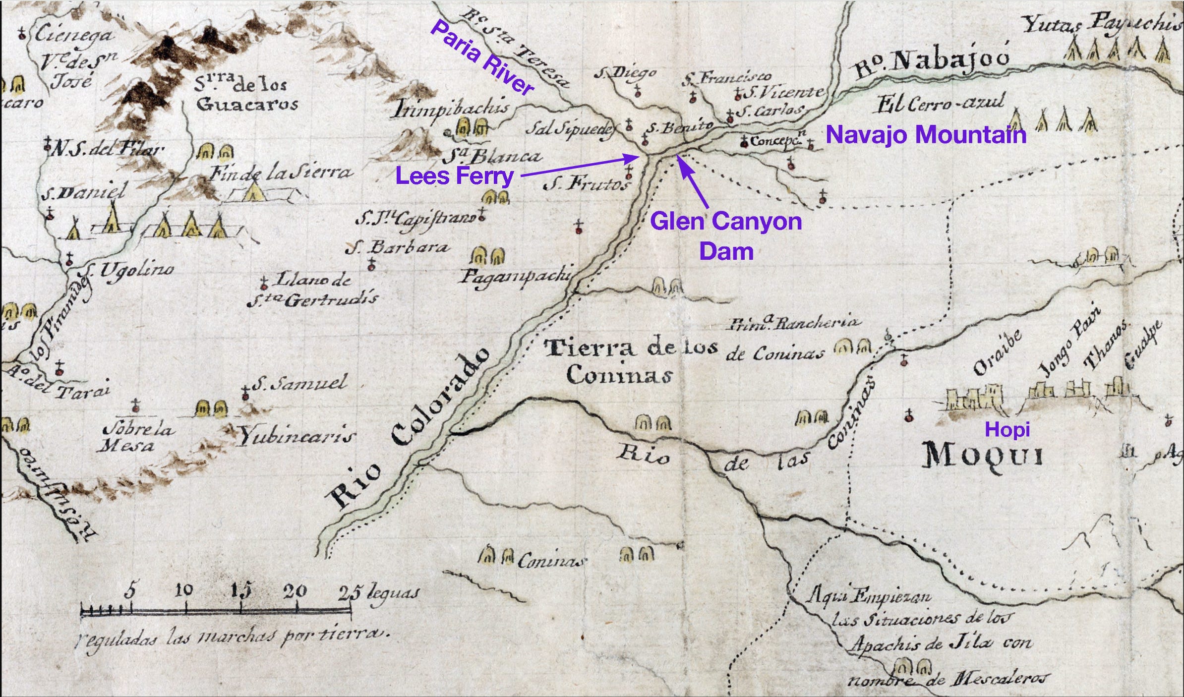
Hopi people probably forged the first footpaths to the river from the east, making their way down the giant limestone ramp. Much later, the Escalante-Dominguez expedition of 1776, searching for a return route to Santa Fe, stumbled upon this place, naming it San Benito de Salsipuedes1. “The entire terrain from San Fructo up to here is very troublesome,” the friars wrote, “and altogether impassible when it contains a little moisture from snow and rain.” They also said the land was “pleasingly jumbled,” which seems a perfect descriptor. Some of the Spaniard colonists tried to cross the river, but found that the water was too deep and the current too swift — although they managed to survive. They had to exit the canyon and continue upstream for miles before finding a way across.

A section of Don Bernardo Miera y Pacheco’s map from the Escalante-Dominguez expedition showing what is now known as Lees Ferry.

Paiute guide Naraguts led explorer Jacob Hamblin to the crossing in the 1860s, putting it, figuratively, on the Euro-American maps. And in 1871, a man named John Doyle Lee and his wife Emma settled near the mouth of the Paria and, with a boat abandoned by John Wesley Powell, established a ferry river crossing just upstream from the confluence of the Paria River, naming the place Lonely Dell.

Lee was the adopted son of Brigham Young and had been a Church of Latter Day Saints leader. However, the church excommunicated him after he helped lead the Mountain Meadows Massacre in southwestern Utah, which resulted in the killing of more than 100 non-Mormon white settlers. Whether he chose to go to the remote Lonely Dell to escape prosecution for mass-murder or was exiled there isn’t really clear. Either way, it didn’t work out: Federal marshals arrested him in 1874. In a jail-house interview with the Philadelphia Times the following year, Lee said he had 18 wives, 63 children, 100 grandchildren, and one great grandchild. He also refused to implicate Brigham Young for his role in the massacre. Lee was tried, convicted of first-degree murder, and executed by firing squad in 1877.

Emma Lee continued operations at the ferry until 1879 (meaning she ran it for longer than her husband). Then Warren Johnson and sons ran the enterprise on behalf of the LDS Church, followed by James Emmet and the Grand Canyon Cattle Co., followed again by Johnson and sons for Coconino County. The ferry was finally shut down in 1928 after an accident killed three people. The Navajo Bridge downstream was under construction at the time and would have displaced the ferry, so it would have been abandoned anyway.

John Lee’s notoriety and his conviction didn’t dissuade folks from using his name to refer to the ferry and the place — although it could be argued that it’s named after Emma, not John.

George F. Cram maps from 1879 and 1900 show “Lee’s Ferry” at the confluence of the Paria and the Colorado rivers, but an 1881 version of Cram’s map calls it “Lees Ferry.” Newspaper articles in 1899, 1905, and 1935 refer to the place as “Lee’s Ferry,” as does an 1884 Rand McNally map. It goes like this up until the 1930s, with mapmakers and others generally using both Lee’s and Lees, depending, perhaps, on the typesetter’s fondness for apostrophes. Another theory (albeit likely false): “Lees” is actually the plural form, not the possessive without the apostrophe, so as to give both Emma and John credit for starting and running the ferry. Whatever the case, by the 1940s “Lees Ferry” had edged out “Lee’s Ferry” as most cartographers’ preferred form.

It seems, then, that we have come to the end of this journey, and that “Lees Ferry” is the most acceptable spelling, whether or not it’s grammatically correct. But then along comes “Lee Ferry” to throw it all out of whack.

In 1916, Eric C. LaRue wrote a paper on “The Colorado River and its Utilization” for the U.S. Geological Survey, which is the arbiter of place names. In it, he refers to the place where the Paria River meets the Colorado River as “Lee Ferry.” Except then, five years later, the USGS installed a Colorado River streamflow gage just upstream of the Paria River confluence and called it “Lees Ferry.”

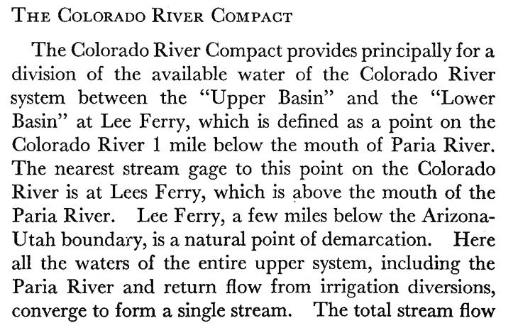
Does this settle it? Nope. Because in 1922, the Colorado River Compact was hammered out. This is the foundational document of the “Law of the River,” and it partitioned the Colorado River watershed into the Upper Basin and Lower Basin states and parceled out its waters to each. The dividing line between the two? Lee Ferry. No, the authors did not accidentally omit the “s” in “Lees.” In its definition-of-terms section, the Compact says: “The term ‘Lee Ferry’ means a point in the main stream of the Colorado River one mile below the mouth of the Paria River.” Yet, the ferry established by John and Emma Lee — along with the USGS streamflow gage — are located above the mouth of the Paria River (because sediment from the Paria can mess up measurements and, possibly, ferries).

A passage from he U.S. Bureau of Reclamation’s 1946 report, “The Colorado River: A Natural Menace Becomes a Natural Resource,” in which they use both “Lees Ferry” and “Lee Ferry” and explain the difference between the two. Source: USBR.

While these two points on the map are close enough together to be considered the same place, there is a significant distinction when it comes to accounting for the water in the Colorado River: By putting the dividing point (Lee Ferry) below the mouth of the Paria, it includes the Paria River in the Upper Basin, and includes those flows in the 75 million acre-feet every ten years the Upper Basin is obligated to allow to flow past Lee Ferry. To determine the flow at Lee Ferry, the USGS adds the measurement from the Lees Ferry streamflow gage to the one from the Paria River gage.

It’s about as clear as a sediment-choked Colorado River now, isn’t it? Here it is in a slightly more concise version:

  • Lees Ferry = Lee’s Ferry ≠ Lee Ferry
  • Lees Ferry is the most widely accepted term for the geographical location at and around the confluence of the Colorado River and Paria River in northern Arizona. It’s probably derived from “Lee’s Ferry,” as the USGS typically drops apostrophes from possessive place names for reasons unknown. Lees Ferry also refers to the USGS Colorado River streamflow gage located just upstream from the mouth of the Paria River.
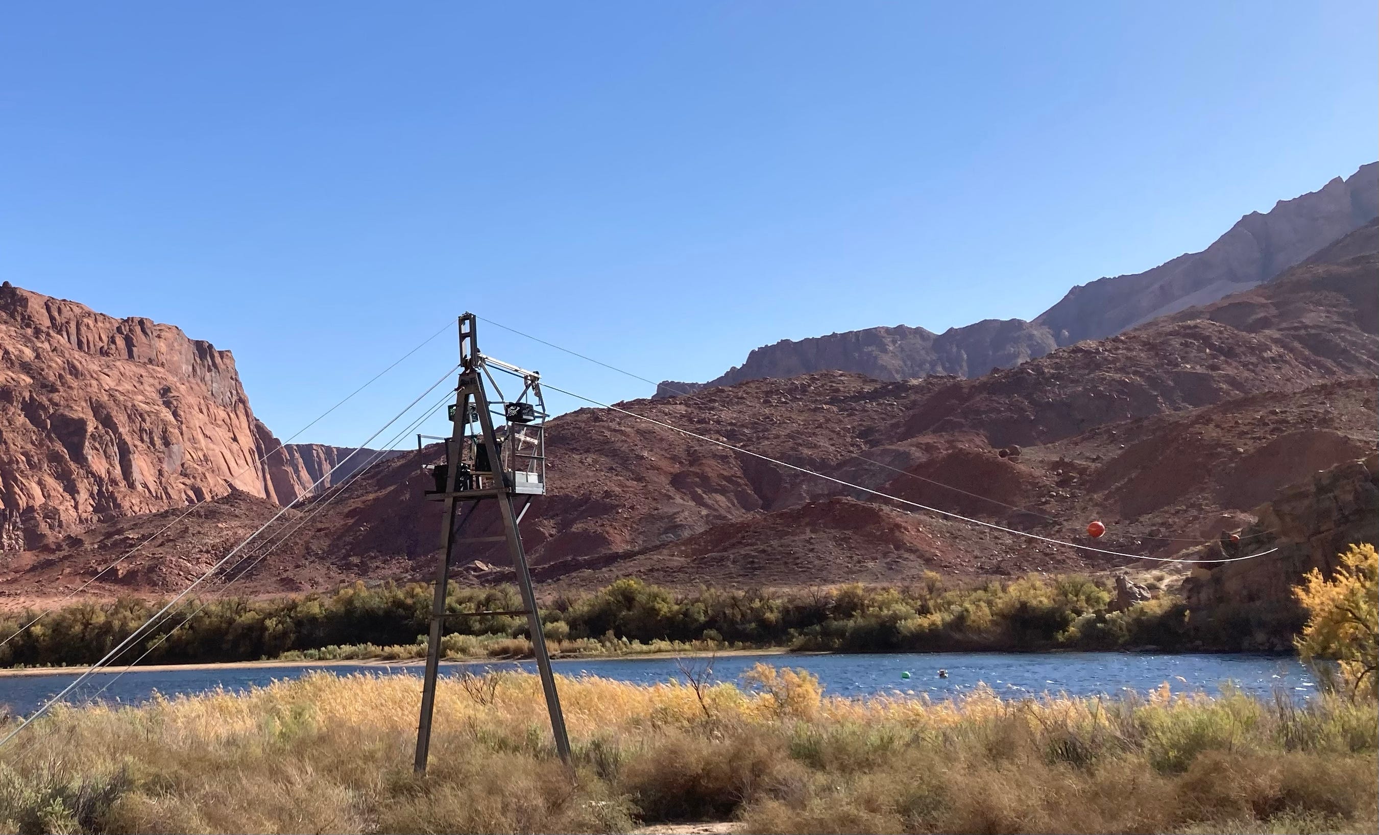
Zipline at the USGS Lees Ferry streamflow gage, not to be confused with Lee Ferry, which is the point that divides the Colorado River’s Upper Basin from the Lower Basin. Jonathan P. Thompson photo.
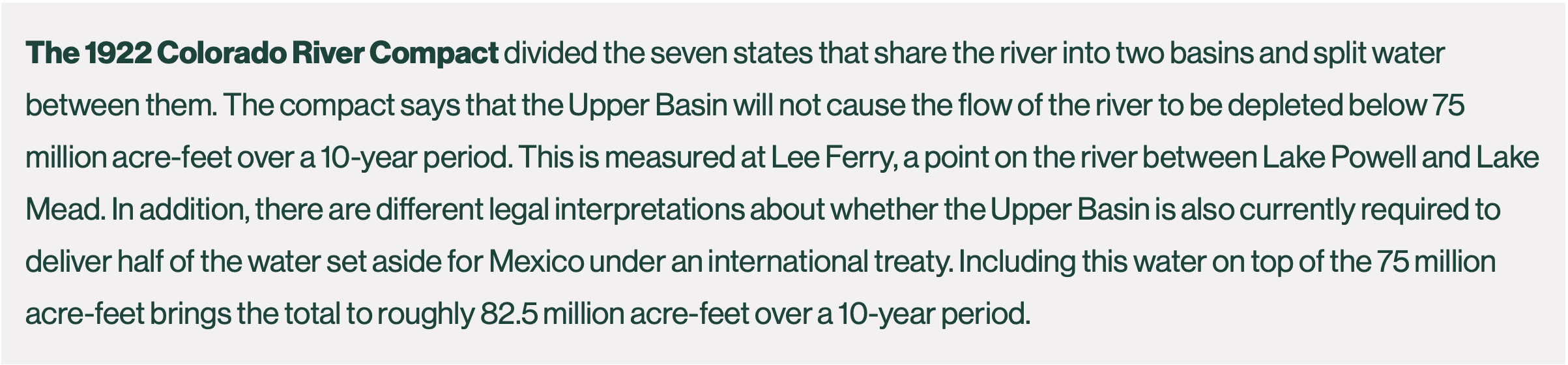
  • Lee Ferry is the correct term for the point one mile downstream from the mouth2 of the Paria River that divides the Colorado River’s Upper Basin from the Lower Basin. The Colorado River Compact mandates that the Upper Basin “will not cause the flow of the river at Lee Ferry to be depleted below an aggregate of 75,000,000 acre-feet for any period of ten consecutive years.”
  • The streamflow at Lee Ferry is determined by adding the measured flow at the Lees Ferry streamflow gage to that at the Paria River gage just upstream from the Paria River’s mouth.
  • So, if one is writing about the Upper Basin’s non-depletion obligation, they should use “Lee Ferry.” If they are writing about the historical settlement, the general place, or the streamflow gage, they should write “Lees Ferry.
🌵 Public Lands 🌲

THE NEWS: MAGA Sen. Mike Lee, of Utah, is back on his anti-public-lands crusade, this time with an underhanded attempt to repeal the wildly popular 2001 Roadless Area Conservation Rule, which protects some 45 million acres of U.S. Forest Service land from roadbuilding and logging3. And yes, Mike Lee is related to the aforementioned convicted mass murderer John D. Lee, though I’m sure that has nothing to do with this.

THE CONTEXT: Lee had a busy week. First, he went ballistic on social media after the Trump Defense Department removed the Church of Latter Day Saints from its list of Christian religious denominations (it’s still a recognized faith, but lost the “Christian” label). Apparently he was worried Mormons would be left out of Pete Hegseth’s white Christian Nationalist holy wars.

Then, ol’ Jell-O-Social Lee snuck a last-minute amendment into the bipartisan Wildfire Prevention Act that would not only kill the Roadless Rule, but also prevent a similar rule from being implemented later. The Senate’s energy and natural resources committee voted to advance the amended legislation along party lines. Next it will be subject to a full Senate vote.

Lee’s amendment “just blows up” the bipartisan support for the larger Wildfire Prevention Act, said a clearly dismayed Sen. Martin Heinrich, a New Mexico Democrat. The larger legislation, introduced by Sen. John Barrasso, R-Wyo., aims to increase forest thinning and other vegetation treatments as well as prescribed burns on Forest Service and BLM land. It would also guide the agencies to develop strategies for using “livestock grazing as a wildlife risk reduction tool.”

The jury is certainly still out on the efficacy of forest thinning as a wildfire hazard mitigation method. As for livestock grazing? Yeah, probably not, unless all vegetation is eaten down to bare dirt. And once all of the native grasses are gone, it opens the door to cheatgrass, which is especially flammable. Then there’s the question of whether wildfires are really a bad thing — but we’ll leave that debate for later.

Lee claims his motives are pure, and that the Roadless Rule is hampering access for fire prevention and fighting efforts. That’s not true. While the rule generally prohibits roadbuilding and timber harvesting in inventoried roadless areas, it makes exceptions for both if they are deemed necessary for wildfire hazard mitigation or to fight fires. In a public hearing, Sen. Alex Padilla, D-California, pointed out that 240,000 acres of inventoried roadless areas in his state alone had been treated for wildfire hazard mitigation treatment, proving Lee wrong. And the Trump administration, for better or worse, has lagged on forest thinning: A Center for Western Priorities analysis found the Forest Service treated 35% less acreage in 2025 than it did under Biden in 2024.

In fact, building more roads increases access to remote areas. Since most fires are started by humans, it follows that putting more humans into a forest makes it more likely that forest is going to be ignited by an errant spark, cigarette, campfire, or a hot catalytic converter in some tinder-dry grass. So if you really want to prevent wildfires, consider closing some of the thousands of miles of existing roads across public lands.

It’s not clear what Lee hopes to accomplish with these inane, and often futile moves, but what he has done is given strength and energy to the environmental movement. His bid last year to sell off public lands to real estate developers not only flopped, but enlarged the constituency opposing land transfers of any kind. His latest assault on public lands has riled up the hook and bullet crowd, who don’t want roads and timber operations sullying game habitat and streams. And his amendment may very well kill the wildfire bill’s chances at passing, disrupting the efforts of his right-wing colleagues.

Maybe Lee’s inherent extremism forces him to lash out at bipartisanship and pragmatism, in general. After all, he got into the Senate by unseating the late Sen. Bob Bennett, a conservative Republican who lost favor with the more extreme wing of his state’s party by attempting to broker a compromise on public lands in Utah.

It’s tempting to blame Lee’s zealotry on genetics, given that he is the great-great-grandson of John D. Lee, who was convicted and executed for his role in the Mountain Meadows Massacre of 1857, when a group of Mormon militia members killed about 120 gentile emigrants as their wagon train made its way from Arkansas to California. The attack came during a time of heightened tension and conflict between the LDS church and the federal government.

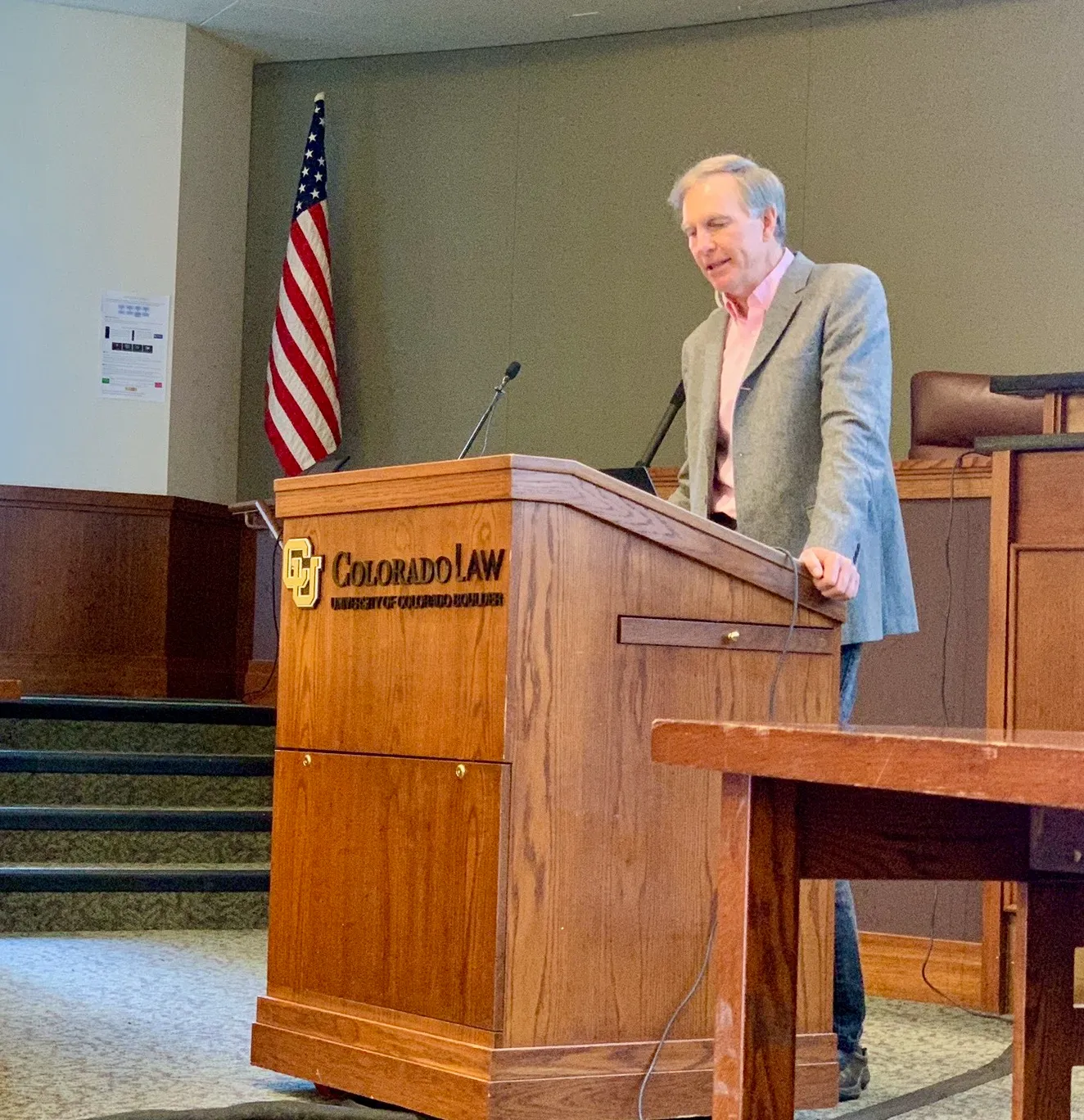
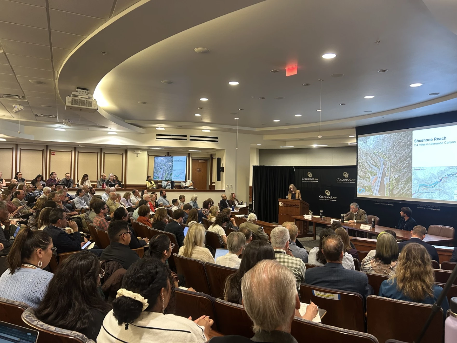
Water and climate scientist Brad Udall speaks at the annual Colorado Law Conference on Natural Resources at the University of Colorado Boulder June, 2014. Udall has been one of the loudest voices calling for audacious leadership on issues of climate and the Colorado River. Photo credit: Heather Sackett/Aspen Journalism

The problem with that theory is that John D. Lee’s direct descendants — who likely number in the thousands by now — also include Stewart and Morris Udall, influential Western Democratic politicians and public lands champions. Stewart served as Interior Secretary under John F. Kennedy and Lyndon B. Johnson, and Morris was an Arizona congressman for three decades. Stewart’s son Tom represented New Mexico in the House and Senate, and Mo’s son Mark, a Colorado Democrat, served in the Senate and House as well. 

Those Udalls were (and are) Democrats and environmentalists and, according to some takes, “staunch liberals.” But they were also old-school Western politicians who valued pragmatism over ideology and values over party, everything Mike Lee is not. Lee could learn a lot from his kin. 

🛢️ Hydrocarbon Hoedown 📈

I’ve written here often about how the Trump administration is handing out drilling permits to petroleum companies like Shriners throwing candy at a parade. Over the last six months, for example, the BLM has issued drilling permits at a rate of 500 per month; you’d have to go back to the George W. Bush administration to see the agency acting at a more rapid pace. But the administration is supplicating itself even more to the fossil fuel industries in a different realm: leasing as much public land to oil and gas companies as they possibly can.

Earlier this month, for example, the Bureau of Land Management auctioned 114,439 acres of public land in Wyoming to the oil and gas industry. Next week, the BLM will put a whopping 160,268 acres in Colorado on the auction block, which could open 174 parcels in Arapahoe, Garfield, Jackson, Mesa, Moffat, Rio Blanco, Routt, and Weld counties — including prime elk habitat — to drilling. And in December, the agency is looking to auction nearly 79,000 acres on the Arizona Strip, despite the fact that there are no known petroleum reserves there. 

The public comment period is long gone for those lands, but another planned December sale in Colorado is still subject to your input. This time the BLM is looking to sell 114 parcels on nearly 127,000 acres. The parcels are scattered around the state, with the biggest chunk east of Trinidad, including a block along the Purgatoire River. More than 2,000 acres in and around the HD Mountains in southwestern Colorado — including one big swath south of Chimney Rock — are also going on the block.

Parcels in Archuleta County, Colorado, the BLM plans to put on the oil and gas lease auction block in December (outlined in black). To comment on the proposal, click on this link.

1I’ve seen different translations for “Salsipuede,” including: “you can get out” and “get out if you can.” It seems that the latter is most accurate, given that a “San Benito” is a cassock worn by errant friars. They also called the place “distressful.” 

2This is not at a fixed point, as the mouth of the Paria River has migrated from north to south over the years, thanks to sedimentation and so forth. 

3The original rule covered nearly 60 million acres, however, as the rule was battered around the courts and political playing field in the years after its implementation, Colorado and Idaho petitioned to create state-specific rules for inventoried roadless areas in their states. That means that any rescission of the rule, whether it’s administratively by the Trump administration or via Lee’s amendment, would not affect Colorado or Idaho roadless areas.

Ecological Drought in the #ColoradoRiver Basin: Seeing the Full Picture; It’s not just about precipitation, it’s about how #drought moves through a system — Abby Burk (Audubon.org) #COriver #aridification

A rainstorm over southern Colorado. Photo: Abby Burk

Click the link to read the article on the Audubon website (Abby Burk):

May 7, 2026

Drought in Colorado isn’t abstract—it’s shaping decisions right now, from headwater streams to major reservoirs. And this year, the signals are hard to ignore. At the same time, conversations about water are tightening. There’s more concern and more sensitivity—especially around anything tied to water availability.

That’s exactly why it matters how we talk about ecological drought.

This isn’t a new issue. It’s a clearer, science-based way to describe what’s already happening—across rivers, landscapes, and communities.

A System Under Stress

The Colorado River Basin is entering this water year under extreme hydrologic pressure.

Snowpack across the Upper Basin has dropped to record or near-record lows. By early April, snow water equivalent in many areas fell to a fraction of normal, and snow cover reached the lowest levels observed in the satellite record. At the same time, this winter ranked among the warmest on record—reducing snow accumulation, accelerating melt, and increasing evaporative losses. These patterns are consistent with the impacts of climate change across the Colorado River Basin, where rising temperatures are diminishing snowpack reliability and reducing overall runoff efficiency.

June 1, 2026 seasonal water supply forecast summary.

Those conditions are now reflected in forecasts. Runoff across the Upper Basin watersheds is expected to be among the lowest on record, with sharply reduced inflows into Lake Powell. Meanwhile, Lake Powell and Lake Meadcontinue to sit near historic lows—leaving very little buffer in the system.  

Even where spring storms have brought some relief, the underlying deficitremains. Dry soils, warm temperatures, and reduced snowpack mean less water ultimately reaches rivers.

This is not just a dry year. It’s a system under compounding stress.

Why This Matters: Ecological Drought

Ecological drought helps explain what those conditions mean on the ground.

Scientifically, it’s defined as an episodic deficit in water availability that pushes ecosystems beyond their thresholds—impacting ecosystem services and triggering feedbacks in both natural and human systems.

That definition matters because it expands how we think about drought.

It’s not just about precipitation. It’s about how drought moves through a system:

  • From snowpack to soil moisture  
  • From soil moisture to vegetation and habitat  
  • From ecosystems to the services people depend on  

Modern droughts are also changing. They are becoming hotter, longer, and more widespread, with impacts amplified by both climate conditions and human water use.

And those impacts don’t stay contained.

Ecological drought is fundamentally about connected systems. When ecosystems cross critical thresholds—losing wetland function, shifting vegetation, or degrading habitat—those changes feed back into water supply, with wide-ranging implications to agriculture, wildfire risk, and community stability.

What it Looks Like Right Now

In Colorado, ecological drought is showing up as a shift in timing, duration, and connectivity.

Even with recent moisture:

  • Peak river flows are shorter and less effective  
  • River baseflows drop earlier  
  • Floodplains connect less often  
  • Wetlands and side channels dry sooner  

These aren’t always dramatic changes—but they compound, especially when they occur in back-to-back years, reducing recovery time.

That’s a critical shift. Drought is no longer just episodic. It’s increasingly persistent, with ecosystems spending less time in recovery and more time under stress.

Birds Are Early Indicators

For birds, these shifts are immediate.

Migratory species depend on wetlands that function like stepping stones across the landscape. When those wetlands shrink or disappear earlier, habitat becomes compressed.

Riparian birds like the Northern Yellow Warbler and Song Sparrow rely on dense, water-supported vegetation during breeding season. Earlier drying reduces both cover and food availability.

Wetland-dependent species such as the American AvocetWhite-faced Ibis, and Sandhill Crane are especially sensitive to shrinking shallow-water habitat.

American Avocet. Photo: Mick Thompson

And beneath all of this, food webs shift. Aquatic insects emerge differently under drier conditions, creating mismatches with nesting cycles.

Birds are often the first to show us what’s changing—but they’re not the only ones affected.

People Are In This System, Too

Ecological drought makes one thing clear: this is a single, connected system responding together. The same processes that shape habitat also shape outcomes for people. Soil moisture influences forage conditions for agriculture. Water timing and availability affect the reliability of community supplies. River flows support recreation and local economies, while connected floodplains help reduce risk and support recovery after disturbance.

This is what we mean by ecosystem services—the benefits people receive from functioning natural systems. When those systems are strained or begin to break down, those benefits decline as well.

What This Means for the Basin

The science is pointing to something bigger than a single dry year.

The Colorado River Basin is increasingly operating in a warmer, drier regime, where snowpack is less reliable and variability is higher. Recent conditions mirror some of the most consequential low-flow years in recent history—and they are becoming more frequent.

At the same time, current operating guidelines are set to expire, and the decisions made now will shape how the system responds to these conditions going forward.

What’s needed is a shift—from reactive, year-to-year crisis management to more durable and flexible operations; from short-term fixes to sustained investment in long-term resilience; and from fragmented efforts to stronger alignment across states, Tribes, and water users.

There is growing recognition that solutions must include conservation, efficiency, infrastructure, and watershed health—including restoration that improves how water is stored and functions across the landscape. Without that kind of alignment, risks will continue to compound—ecologically, economically, and socially.

A Clearer Lens for What’s Ahead

Ecological drought is not a new agenda. It’s a way to understand how drought actually works in today’s world—how water shortages move through ecosystems, how impacts cascade, and how those impacts ultimately reach people.

It connects snowpack to rivers, rivers to habitat, and habitat to communities. And it underscores something essential: when ecosystems are pushed beyond their limits, the consequences don’t stay ecological—they become systemic.

That’s why this matters now. Because the question in front of us isn’t just how we respond to this year’s drought. It’s whether we’re building a system that can function—ecologically and socially—under the conditions we know are coming (or are here).

That’s the conversation worth getting right. 

Map of the Colorado River drainage basin, created using USGS data. By Shannon1 – Own work, CC BY-SA 4.0, https://commons.wikimedia.org/w/index.php?curid=65868008

Broke and On Their Own: Small Water Systems Lose Ground as Federal Support Wavers; For systems serving rural and low-income communities, the finances were already precarious — Brett Walton (circleofblue.org)

Kevin Sonnichsen, water commissioner, right, and Alan Novacek, backup operator and sewer commissioner, left, gaze into the Creighton water treatment facility in this file photo from 2021. Built in 1993, the facility uses reverse osmosis to remove nitrate. Creighton was the first community in Nebraska to use reverse osmosis to remove nitrate in drinking water. Photo © J. Carl Ganter/Circle of Blue

Click the link to read the article on the Circle of Blue website (Brett Walton):

June 11, 2026

The country’s most severe drinking water problems, from high levels of contaminants and foul-smelling water to pipe breaks, low water pressure, and expensive rates, are generally found in the thousands of small systems that serve dozens of people up to a few thousand.

These systems are public health crises waiting to emerge, said Denise Schmidt, director of water at the Environmental Policy Innovation Center, a group that works with water utilities on infrastructure funding.

Though some are perpetually struggling, small water systems, especially those serving low-income communities, are encountering a fresh set of economic and political hurdles in their quest for safe drinking water.

In recent industry surveys, small utilities report that accessing financing to repair and upgrade their systems is becoming increasingly difficult. Their credit ratings are deteriorating, making borrowing more expensive. The rates they charge customers are not covering the cost of providing water service, thus digging a long-term financial hole. Extreme weather is burdening them with unexpected and daunting repairs to their reservoirs, treatment plants, and pipe networks. Federal water quality mandates for PFAS and lead pipe replacements, though both providing public health benefits, are an added cost.

Small systems, in effect, are walking a precarious path. They are trying to survive today while also staring at a gathering wave of necessary replacements to aging pipes and treatment plants.

The Trump administration and Republican allies in Congress, meanwhile, are casting more obstacles. The White House’s tariffs have increased the price of equipment and materials. And the House’s fiscal year 2027 budget would cut the main federal water infrastructure program by about a quarter.

“I don’t think people realize how big this wave is and how much it’s going to cost,” said Blake Anderson, president and founder of Mogollon Water Management, a company that operates and maintains 11 small water systems in northeast Arizona. “The utilities that were built in 1970 now are 56 years old. There was a lot of development that happened back then. And all of these waves are going to start crashing.”

Negative Outlook

Crashing sounds are gaining strength.

Last year, for the first time, S&P Global, a credit rating agency, lowered the financial outlook for small water and wastewater utilities from stable to negative. Large and medium utilities remained stable. 

The increased pessimism for small water utilities is due to stiffening financial headwinds, said Malcolm D’Silva, an associate director at S&P, which rates roughly 1,700 water and wastewater utilities. Ninety-one percent of the agency’s credit downgrades last year were for small systems, he said. Credit downgrades increase the cost of borrowing.

D’Silva narrated a story in two parts. One is the “expense squeeze.” Costs are rising across the board. First from the post-Covid inflation and supply chain shortages, and now from the Trump administration’s tariffs. Half of the utilities that responded to the American Water Works Association’s annual survey said that tariffs had “moderate or considerable” pressure on equipment and materials costs. At the same time, revenue is not keeping up. In the same survey, only 43 percent of utilities said they charged customers enough to fully cover service costs.

The second part is managerial. Small systems typically do not have the technical expertise, staff, or budget to analyze their infrastructure and apply for funding in the way that larger utilities do. Some might keep only paper records of their pipe networks. The smallest systems have volunteer board members or staff that might also oversee the fire department and run a business.

The positive news is that last year might have been the bottom for small systems, D’Silva said. S&P is seeing some improvement in the first half of 2026, with the rate of downgrades slowing. More utilities have instituted rate increases to fill budget holes, D’Silva said.

Federal Question Mark

Just as one hole is closing, however, another might be opening.

Every year the White House lobs a spending plan toward Capitol Hill and members of Congress decide whether those numbers are a good idea. For fiscal year 2027, the Trump administration proposed a roughly 90 percent cut to the two state revolving funds, the main federal sources of water infrastructure funding.

Congress usually sustains the state revolving funds, which have broad support. But this budget cycle could be different. 

A House spending bill cuts the revolving funds by about 24 percent combined. The House Appropriations Committee approved the bill on June 3.

The bill provides $1.2 billion for the Clean Water State Revolving Fund (27 percent cut) and $911 million for the Drinking Water State Revolving Fund (19 percent cut). The Senate has not yet introduced its version.

Jeff Dietlin, director of utilities for Cadillac, Michigan, stands inside a new pump house built as part of the city’s East 44 Road well field project. The city received a $9.8 million low-interest loan from the Drinking Water State Revolving Fund to finance the project. Photo © J. Carl Ganter / Circle of Blue

The Environmental Policy Innovation Center, or EPIC, tracks state revolving fund expenditures and project proposals in 15 states. At Circle of Blue’s request, EPIC analyzed small system and very small system requests for drinking water funding. By EPA’s definition, small systems serve fewer than 10,000 people and very small systems fewer than 3,300.

The data indicate high demand from these systems. Some 61 percent of projects seeking drinking water funding were small or very small. However, only about a third of these proposed projects advanced to the next step in the funding process. This “highlights significant unmet infrastructure needs,” EPIC analysts wrote.

Water infrastructure funding needs and the status of the revolving funds were a point of discussion during a House Energy and Commerce Committee hearing on May 20.

Jessica Kramer, the head of the EPA Office of Water, defended the administration’s proposed cuts. Her justification: the states have $14.8 billion in uncommitted state revolving funds, those sitting in coffers for more than a year without being allocated. That money should be distributed first, she argued.

“It doesn’t do any good to get the money to the states if the states aren’t actually getting it out to the communities that need it,” Kramer said.

Schmidt, the EPIC water director, had a different view. Two issues are being wrapped into one, she said. If state administrative capacity to review and approve applications is the problem, then focus on that. But don’t use it to rationalize disinvestment in an otherwise successful decades-long infrastructure program.

“Uncommitted does not mean unneeded,” Schmidt said. “Cutting moves us farther from the solution.”

The View from Arizona

The financial pressures that populate D’Silva’s and Schmidt’s spreadsheets are the on-the-ground reality for Blake Anderson.

Anderson is the president and founder of Mogollon Water Management, a company that operates and maintains 11 small water systems in the White Mountains of northeastern Arizona. Mogollon oversees the smallest of the small – systems ranging in size from 29 service connections to roughly 1,100.

These are not the sophisticated, professionally managed systems that you would see in Phoenix or Flagstaff.

“They’re volunteer board members and they’re aware that there’s some sort of money for water out there but they don’t know where it is, or if they do know, they aren’t sure how to go about applying and accessing it,” Anderson said, describing the challenges for small systems in securing grants and loans.

“Most of them have never done a capital improvement project over $50,000,” he added. “And so there is not institutional knowledge in how do you manage a federally funded program or a state funded program? How do you go about securing engineers or contractors? What are the proper procurement practices?”

One school of thought for solving the small systems problem is that there should be fewer of them. By connecting with larger systems or forming regional partnerships, small utilities could grow into medium-sized utilities with favorable economics: more customers to cover expensive infrastructure costs, better credit ratings, money to hire knowledgeable staff.

Research from Manny Teodoro at the University of Wisconsin indicates that the target size for utility consolidations should be about 20,000 service connections, or about 60,000 people. At that point the most serious water quality violations become far less common and operating costs become more reasonable. 

Where might funding for consolidations come from? States like California have dedicated programs, though even those are facing funding shortfalls. Another source is federal: the state revolving funds that House Republicans want to cut.

The water treatment process

Reclamation says new #ColoradoRiver plan will be short-term: Operating plan may be based on latest Lower Basin proposal — Heather Sackett (AspenJournalism.org) #COriver #aridification

Glen Canyon Dam forms Lake Powell on the Colorado River near Page, Ariz. Officials from the U.S. Bureau of Reclamation are holding back water and releasing water from an upstream reservoir to prop up levels in Lake Powell. CREDIT: HEATHER SACKETT/ASPEN JOURNALISM

Click the link to read the article on the Aspen Journalism website (Heather Sackett):

June 5, 2026

Federal officials announced on Thursday that they plan on using a shorter-term framework for future Colorado River management so they can be more responsive to changing conditions and reservoir levels.

Acting Commissioner of the U.S. Bureau of Reclamation Scott Cameron said at an annual conference on water policy that the agency will be using a 10-year framework, issuing new operational guidelines every two years. In the absence of a seven-state deal for sharing shortages and managing reservoirs, river management now falls to the federal government — an outcome nearly everyone had hoped to avoid.

“We would love to have a 20-year deal or a 30-year deal but, frankly, we haven’t even been able to get the seven states to agree on what a two-year deal would look like,” Cameron said. “Given the highly unusual hydrological situation in the basin … we think it makes sense to take a second look at decision making every couple of years.”

As part of the required process under the National Environmental Policy Act, Cameron said Reclamation will release a final Environmental Impact Statement with its “preferred alternative,” in mid-to-late summer. It will lay out a more detailed 10-year operations plan for the nation’s two largest reservoirs, Lake Powell and Lake Mead, and will include short-term operational guidelines for 2027 and 2028. He said the plan provides a stable, transparent and adaptable framework for river management.

Scott Cameron is the acting commissioner of the U.S. Bureau of Reclamation. He announced Thursday the federal agency is planning to release a river management plan in mid-to-late summer that includes a 10-year framework, with new operational guidelines every two years. CREDIT: U.S. BUREAU OF RECLAMATION

“We want to pay more attention to what’s actually happening in the river and what’s happening in terms of the elevation of the reservoirs,” Cameron said. “We want to manage conservatively during low inflow periods and hopefully be able to transition to recovery as conditions improve across the basin to keep the system stable and resilient.”

Cameron left the door open for a return to future management by the states and added that if they eventually come to an agreement, it could supplant the federal plan.

Cameron’s update came at the Colorado Law Conference on Natural Resources at the University of Colorado Boulder, hosted by the Getches-Wilkinson Center and the Water & Tribes Initiative. Water managers from around the basin gathered at the Wolf Law School in the midst of one of the worst droughts on record that threatens the water supply for about 40 million people in the American Southwest. Record hot temperatures and one of the worst snowpacks since measuring began resulted in streamflows that peaked much lower than normal and, in some reaches, a month early. Reclamation’s most recent projections put spring runoff into Lake Powell at just 800,000 acre-feet, which would be 13% percent of normal and the lowest on record.

On top of the abysmal hydrologic conditions, the basin is also in the midst of a management crisis. The Upper Basin states (Colorado, New Mexico, Utah and Wyoming) and Lower Basin states (California, Arizona and Nevada) after two years of negotiating have failed to reach a consensus on how they will share future cuts and have blown past deadlines to come up with a plan. The current guidelines, which have determined shortages and releases since 2007, expire at the end of the year. But for all intents and purposes, water managers need a new plan in place by the start of the new water year on Oct. 1.

Some of the problem still centers around the 1922 Colorado River Compact, which allocated half of the river’s flows (7.5 million acre-feet a year) to each basin. But this framework no longer applies under 21st century conditions, which has seen flows decline by 20% due to climate change. Despite indications a year ago that the states were moving to a supply-driven model based on each year’s snowpack and available water — rather than a fixed allocation of water — a new management framework the states can agree on has remained out of reach.

Colorado representative Becky Mitchell and Nevada representative John Entsminger speak at a conference on Colorado River policy in Boulder on Friday, June 5, 2026. The federal government is set to release a plan for future river management in mid-to-late summer. CREDIT: HEATHER SACKETT/ASPEN JOURNALISM

Beyond the band-aid

The feds’ operating plan for the first two years may be based on a proposal submitted by the Lower Basin states in early May, in which they propose to cut another 700,000 acre-feet of water per year through 2028, on top of the 1.5 million acre-feet they had already promised. California and Arizona will each take another 300,000 acre-feet of cuts and Nevada will take a cut of 100,000 acre-feet. The proposal does not include any mandatory conservation from the Upper Basin.

Federal officials responded in a May 28 letter with adjustments to make the proposal feasible, including the requirement that the Lower Basin states help pay for the 700,000 acre-feet of conservation. In the past, conservation programs have depended heavily on federal funding.

Becky Mitchell, who represents Colorado in the negotiations among the states, said during a Friday panel that the feds’ plan was a starting point but raises some concerns. Constantly renegotiating an operating plan every two years would be hard to fathom, she said.

“How do we fund and finance if we’re constantly renegotiating?” Mitchell said. “And how do we create the certainty that the 40 million people deserve?”

The feds have already stepped in this spring to prevent the worst consequences of the exceptionally dry winter and keep water levels at Lake Powell from falling below the threshold for making hydropower at Glen Canyon Dam. They are releasing up to 1 million acre-feet from Flaming Gorge Reservoir to prop up Powell and holding back Powell releases by about 1.5 million acre-feet. Cameron conceded, however, that these are temporary, stop-gap measures meant to address a critical situation.

“I think we succeeded in making everybody unhappy and everybody mad, which maybe means we’re doing the right thing in terms of Lake Powell,” Cameron said.

The Upper Basin states, including Colorado, are exploring ways to contribute water to a pool in Lake Powell as a means of maintaining higher water levels and an insurance policy against drastic cuts. But officials have not budged from their position that the Upper Basin is limited in what it can do and that cutting Lower Basin overuse is the primary solution to the Colorado River crisis.

Brad Udall, a water and climate scientist at Colorado State University whose presentation kicked off the conference, asked water managers not to waste this unique opportunity to redo 100 years of law and policy around how to manage a critical resource. And he directed a plea at the Upper Basin, saying that they, too, are part of the problem.  

“We need everybody with a shoulder to this wheel,” Udall said. “We understand that the Upper Basin is different. We understand that they don’t have (large upstream) reservoirs and that every year people suffer. But we need you to help. Please help us.”

Udall/Overpeck 4-panel Figure Colorado River temperature/precipitation/natural flows with trend. Lake Mead and Lake Powell storage. Updated through Water Year 2025. Note the tiny points on the annual data so that you can flyspeck the individual years. Credit: Brad Udall

#ColoradoRiver Basin – new report from my colleagues on the implications of running on empty — John Fleck (InkStain.net) #COriver #aridification

Map of the Colorado River drainage basin, created using USGS data. By Shannon1 Creative Commons Attribution-Share Alike 4.0

Click the link to read the article on the InkStain website (John Fleck):

June 1, 2026

I’ve been on a “Colorado River sabbatical” of late, but I took a peek last week at Reclamation’s latest 24-month study. Holy moly things have gotten bad since the last time I looked!

Those not on sabbatical already know all of this, but to keep Lake Powell above a surface elevation of 3,500 feet, Reclamation is:

  • increasing releases out of Flaming Gorge on the Wyoming-Utah border
  • dropping releases out of Lake Powell to 6 million acre feet this year

Even with those two “hail Mary” moves, Lake Mead is projected in the “most probable” scenario to drop to elevation 1,020 by summer 2027. Under the “minimum probable” forecast, Mead drops all the way to elevation 1,008 in 2027.

We are on the brink, as a group of my colleagues explains in a new analysis out this morning (Monday June 1, 2026), of a system crash:

That’s from the latest report from the team of Castle-Schmidt-Kuhn-Sorensen-Tara, the Traveling Wilburys of the Colorado River. I’ve been on “sabbatical”, so I didn’t work on this one with my friends. (The joke is that I’m busy catching up on old movies, which is at least partly true, did you know Billy Wilder made, like, 50 movies?)

Even a wet year, my friends conclude, would only provide a short reprieve from the need to significantly reduce consumptive use.

Building on a similar analysis done last September (I was a co-author on that one), the authors attempt to overcome one of the shortcomings of the traditional Colorado River accounting systems, which is to treat any water above “dead pool” as usable storage. This is not the case, with clear do-not-cross lines in the reservoirs that are maintained for technical reasons well above the bottom, defined by my colleagues as…

One of the reasons for my “sabbatical” is, frankly, an agonized frustration with the abject failure of Colorado River governance at the basin scale, and a desire to turn my attention to the local level, which is where the problem solving responsibility seems to rest right now. Each community needs to be having a serious conversation right now about the specifics of its Colorado River water supply, and how it intends to go about using less. Blaming other people for using too much isn’t particularly useful at this point, we seem to have chosen to hand that set of questions (the rule-based part of “who is entitled to how much”) over to the courts, and who knows what that process holds. We know the answer for everyone is “use less water”, and each community needs to be getting on with that conversation.

The full report is here.

President Trump’s border wall is ‘blowing up’ sacred sites in 4 US states — AZCentral.com

Video and photos of fish-shaped intaglio (geoglyph) damaged by border wall construction contractors at Cabeza Prieta National Wildlife Refuge. Footage taken from Mexico. Credit Russ McSpadden / Center for Biological Diversity

Click the link to read the article on the AZCentral website (Debra Utacia Krol). Here’s an excerpt:

June 7, 2026

Key Points

  • Border wall construction is damaging or threatening sacred Indigenous, cultural, and environmentally sensitive sites in four states along the U.S.-Mexico border.
  • The Department of Homeland Security has waived environmental and historic protection laws to expedite construction of a two-layered structure.
  • Sites affected include a 1,000-year-old O’odham geoglyph in Arizona and Kuuchamaa, a sacred mountain to Kumeyaay tribes in California.

The recent destruction of a 1,000-year-old sacred O’odham geoglyph in the Cabeza Prieta National Wildlife Refuge is only the latest example of damage and desecration to religious, cultural and environmentally sensitive sites caused by construction of the border wall along the U.S.-Mexico border. At least one Catholic shrine, two mountains held sacred by Kumeyaay bands in California and Catholics on the New Mexico-Texas state line, and wetlands prized as life-giving water sources for wildlife and humans have all suffered damage or are in the work zone. The Las Playas Intaglio holds great cultural and historical importance to O’odham and other Indigenous peoples in the Southwest. The intaglio, or geoglyph, was created by scraping the top darker layer of earth from the desert floor, resulting in a 200-foot-long rendition of a fish with its nose pointing south. Some tribes say it served as a directional marker along a trail that led to the Gulf of California and its marine resources, including salt deposits…

The Department of Homeland Security is filling in the gaps in the border wall not completed during President Donald Trump’s first term. The agency is also building a second wall parallel to the first in areas deemed to be at higher risk of smuggling and human trafficking. The Trump administration has moved to waive environmental and historic protection laws and regulations in its rush to build the walls. In April 2025, the Department of Homeland Security issued waivers to expedite construction in Arizona and New Mexico, based on a 2005 law that gave the agency the authority to waive laws to expedite barriers and roads at the U.S. border…The agency has also ignored directives such as sites being included in the National Register of Historic Places, the United States’ official list of historic and archaeological resources deemed worthy of protection…

Tecate Peak as seen from Potrero, CA. By UncleMunkle – Own work, CC BY-SA 3.0, https://commons.wikimedia.org/w/index.php?curid=51110281

Members of the 16 Kumeyaay tribal communities in Southern California and Baja California sounded alarms when the government began blasting chunks off Kuuchamaa, also known as Mount Cuchuma or Tecate Peak. The 3,885-foot-high mountain straddles the U.S.-Mexico border and is about 4 miles west of Tecate, Baja California. Kumeyaay people consider Kuuchamaa their most sacred mountain. According to the Kumeyaay Diegueño Land Conservancy, a nonprofit founded in 2005 to protect areas important to the Kumeyaay peoples, the peak is the namesake of a powerful Kuseyaay, or religious leader…Like other cultural and sacred places, the government has waived environmental laws and disregarded Kuuchamaa’s listing in the National Register of Historic Places. The 1992 listing, which Bergueno said was led by her elders, was the first-ever Native religious site to be listed…

Quitobaquito Springs was heavily damaged as the first border wall was built in 2020. At least two endangered species, the Sonoyta pupfish and Sonoyta mud turtles, are endemic to the springs and found nowhere else on the planet. Their survival was on the line as construction crews pumped water and damaged wetlands. The spring is also a lifeline for other wildlife in one of the hottest, driest parts of the Sonoran Desert. Biologists and environmentalists are already mapping strategies to rescue Sonoyta mud turtles from the pond should CBP damage it again. A small population of the Sonoyta pupfish was brought to a new desert stream habitat at Biosphere 2 in October 2025 to provide a backup to the critically endangered species.

Quitobaquito Pond. By NPS – National Park Service, Public Domain, https://commons.wikimedia.org/w/index.php?curid=91942483

It’s not all doom and gloom, and 4 other things we learned at CU Boulder, Getches-Wilkinson Center’s, #ColoradoRiver gathering — Scott Franz (KUNC.org) #COriver #aridification

A large crowd listens to a presentation at the University of Colorado Boulder law school about securing powerful new water rights on Colorado’s West Slope to benefit the health of the Colorado River. Scott Franz/KUNC

June 5, 2026

This story is part of ongoing coverage of the Colorado River, produced by KUNC in Colorado and supported by the Walton Family Foundation. KUNC is solely responsible for its editorial coverage.

Water negotiators, river enthusiasts, Native tribes and lots of lawyers convened at the University of Colorado Law School on Thursday to take stock of the future of the dwindling Colorado River.

Here are five things KUNC’s water and environment reporter learned on the first day of the gathering.

There’s a thirst for treating the river as more than something to be consumed, and monetized and stretched out

Dale Sinquah, a tribal council member for Arizona’s Hopi tribe, is among a growing number of people who view the Colorado as a living being that should have the same rights as a person.

“If you look at it at that level and you allow it to, then it starts changing the ways in which you think about it, and maybe your actions,” he said.

Late last year, the Colorado River Indian Tribes of Arizona and California voted to give their namesake waterway the same legal rights as a person, saying the ‘living being’ deserves more protection while it’s being threatened by overuse and drought.

Sinquah said he had mixed reviews of the discussions at the water conference halfway through the first day.

“I’m kind of wondering if we’re stuck in that mode where you know personal interest (is winning) instead of how do we fix this as a whole, as a group,” he said. “It works better when you work together as a group.”

There’s still no finalized federal plan for the river yet, and the White House could have the final say…

Scott Cameron, the acting commissioner of the Bureau of Reclamation overseeing the operations of Lake Powell and Lake Mead, said the Interior Department is expecting to publish a short term operating plan for the reservoirs by “mid-summer.”

He said the plan would have to be renegotiated every two years and could be replaced at any time with one that the seven states can agree on.

“The good news is that the White House is very interested in what’s going on with the Colorado, so we’ll probably have to brief the White House on the (Secretary of the Interior’s) decision before it’s final,” Cameron said.

U.S. Interior Secretary Doug Burgum, center, speaks during a gathering with governors from six states in the Colorado River basin on Friday, Jan. 30, 2026. Photo credit: Lowell Whitman/Department Of Interior

River negotiations are ongoing, but details are scarce…

First governors from all seven states in the river basin were summoned to Washington, DC, ahead of the Feb. 14 deal deadline they missed.

Then, after that didn’t work, came the Microsoft Teams meeting.

Scott Cameron, the acting commissioner of the Bureau of Reclamation, said Interior Secretary Doug Burgum recently talked with the seven governors again on the virtual meeting platform.

“The fact that he is trying to wrangle his gubernatorial colleagues twice, I think, indicates how seriously Secretary Burgum takes what’s happening in the Colorado River,” Cameron said.

However, no deal has yet to materialize as the states remain at an impasse, and some in the upper basin have called for a different mediator to intervene.

June 1, 2026 seasonal water supply forecast summary.

One thing is clear.

Forecasts for the river have gotten worse in recent months. And there was an acknowledgement that the status quo is not sustainable.

ten tribes
Graphic via Holly McClelland/High Country News.

Could the feds get more involved in the management of upper basin reservoirs like Flaming Gorge? The answer is murky…

The audience asked Cameron, the Bureau of Reclamation official, about his thinking on how Interior should manage four large reservoirs in the upper basin that are collectively known as the upper initial units (they include Flaming Gorge on the Wyoming-Utah border).

Flaming Gorge is currently being partially drained so water can be sent down to Lake Powell so it doesn’t get so low that it stops producing hydropower.

Cameron said the Interior Secretary could exert more control over the reservoirs in the future in the event of an “emergency.”

“And what an emergency is, I think, is probably in the eyes of the beholder,” he said. “Now, you put four or five lawyers in a room. You’ll probably get nine answers on how much discretion the secretary has or doesn’t have in the upper initial units.”

It’s not all doom and gloom…

Author Zak Podmore, known for his recent book Life After Deadpool: Lake Powell’s Last Days and the Rebirth of the Colorado River, wowed the audience with a photo slideshow of what’s happening in Glen Canyon as drought takes water levels lower and lower in Lake Powell.

Parts of the lake that have only recently been uncovered are full of old beer cans and other relics of boating escapades, including sunken boats.

But deeper down, Podmore shared photos of Native artifacts that have survived decades of being submerged.

New ecosystems are also taking shape. 

The Colorado River Basin spans seven U.S. states and part of Mexico. Lake Powell, upstream from the Grand Canyon, and Lake Mead, near Las Vegas, are the two principal reservoirs in the Colorado River water-supply system. (Bureau of Reclamation)

Behind-the-curtain politics of a #ColoradoRiver conference — Allen Best (BigPivots.com) #COriver #aridification

Doug Kenney at the Getches-Wilkinson Center 2026 Conference on the Colorado River June 5, 2026. Photo credit: Allen Best

Click the link to read the article on the Big Pivots website (Allen Best):

June 7, 2026

Doug Kenney, principal organizer of annual gathering in Boulder, talks about how the growing tensions among basin states pose challenges in setting the agenda

The Colorado River has always had a magnetic appeal to the public consciousness. John Wesley Powell and his crew were instant national heroes after they emerged from the Grand Canyon in 1869.

That interest continues to this day. Bathtub rings are an absorbing visual, an easy way to communicate declines in the two biggest reservoirs in the basin, Mead and Powell. The river is being hammered by a warming climate and archaic governance of the shared resource.

This provides much to chew on, and that discussion continued again on June 4-5 at the Colorado River Conference hosted by the Getches-Wilkinson Center at the University of Colorado Law School. Organizers reported 373 people were registered to attend in person and another 132 remotely, a record for both. This surpasses a record set last year.

Afterward, Big Pivots sat down with Doug Kenney, the principal organizer of the conference, to take stock of what had just transpired. He directs the Western Water Policy Program and chairs the Colorado River Research Group.

What year did this conference begin? What was the thinking that gave birth to it?

I believe 1983 was the first one. This was mostly a creation of Larry MacDonnell, (the first director of the Natural Resources Law Center, a position he held from 1983 to 1994).

Larry pursued a dual mandate of researching key issues but also of trying to involve the public and other constituencies. A conference was a natural thing to do. We are an educational institution.

I’ve done the last 30 or so of them, but Larry got it started,

It seems like two or three, maybe three years ago, the tribes became a major presence in attendance and on the agenda. How did this come about?

Mostly through our professional networks. We knew people who were associated with the (Colorado River Basin) Water and Tribes Initiative. They wanted to broaden their reach and their influence. At the same time, we’ve here always wanted to involve tribal interests in what we do, going back to the work of David Getches and Charles Wilkinson.

We decided we’d try co-hosting a conference. It’s a partnership, and like all partnerships, it grows over time. But it’s working pretty well, I think.

Am I wrong? Was I missing something? I didn’t notice much of tribal presence in the agenda or participation until just a few years ago.

We’d usually maybe have one tribal speaker sprinkled in the program somewhere, but it was pretty hit and miss, in part I think because you kind of need a critical mass of involvement from the tribal community for other tribes to feel like this is a place that they’d be taken seriously and that they’d be welcomed. It wasn’t a slow linear growth to where we’re at today. There was a pretty dramatic shift four or five years ago.

How new is the Water Tribal Initiative?

They’ve been around I think for about a decade. They’re co-managed by Matt McKinney, who wasn’t here, and Daryl Vigil.

Native America in the Colorado River Basin. Credit: USBR

It’s not a national thing, but the Colorado Basin has 30 different tribes. That’s a pretty big number of tribes to keep track of. It’s a network as much as it is anything, and every so often they try to get together. They consider this conference their big convening. They also get to get together at CRWUA (Colorado River Water Users Association, which holds an annual conference during December in Las Vegas).

They have also produced a few research reports. This week they talked about their report on tribal sovereignty.  And they have particular initiatives within the Water and Tribes Initiative, such as universal access to clean water. They are pushing, mostly through federal legislation, to provide assurances that all tribes have access to clean water.

Do they have a strong benefactor?

I don’t think so, but they have a very broad base of funders and supporters. A lot of water agencies, a lot of people, and a lot of organizations that know tribes have been treated poorly and that tribes have legitimate interests in the basin but (know) that many tribes just don’t have the resources to do this without some assistance.

As I’ve attended most years since 2002, I have noticed some ebbs and flows. There were some empty seats this afternoon, but the seats were mostly occupied through the first day and a half, and that’s somewhat different than, say, 10 years ago. What explains the ebb and flow?

I attribute that mostly to two things: one is this partnership with the Water and Tribes Initiative. The other thing is the fact that we’re talking about the Colorado River, which by every measure is in a crisis. It’s easier to get people’s attention when you’re talking about a crisis than when you’re talking about something that’s still not that serious. That’s part of it.

We used to be in another building. This is clearly a better facility for audience and speakers alike. That helps us attract a larger audience. We’ve had good foundation support, good funders. It takes a lot of money to do this, but we’ve had funders that see value in it. That has allowed us to make this a bigger event.

The conference is always the first week of June, so when do you begin rough-drafting the agenda?

Usually January. In some years it’s easier than others. This year was the most difficult. It was the easiest year in terms of attracting an audience. The hardest year in terms of putting the program together.

Everyone’s mad at each other, and everyone is — I can’t tell you all the back stories. Becky Mitchell said something today about how it’s hard to negotiate and prepare for litigation at the same time. She’s right. And I was thinking to myself, it’s hard to bring people together to talk at a conference while acknowledging the fact that they’re all mad at each other, and some of them are about to sue each other, and some can’t be in the same room with each other because they’re that angry, and some will be deeply offended if someone else is there.

It’s one of these years that there’s just so many delicate issues and angry folks — and angry for legitimate reasons; I’m not discounting that. But it’s been a really challenging year.

Your answer anticipates my next question, but I’ll ask it nonetheless. If memory serves me, a few years ago you had representatives of all seven basin states at the same table. This year you had two. I guess it’s fair to say that agenda setting has become more politically sensitive.

Every year for the last four or five years we’ve given all seven principals, all seven states, an opportunity to sit at the same table and have a discussion. In every passing year it becomes more difficult to do that.

Commissioner to the Upper Colorado River Commission Becky Mitchell, center, speaks on a panel with representatives of each of the seven basin states at the annual Colorado River Water Users Association conference in Las Vegas Thursday, December 15, 2022. CREDIT: HEATHER SACKETT/ASPEN JOURNALISM

You have seen this at CRWUA as well. Some years they had to divide into two sessions, upper and lower basin sessions. For awhile we were thinking of just having a lower basin session. The lower basin folks were happy to do that, but the upper basin folks weren’t as comfortable. We (also) thought about a different part of the session or a different location.

Ultimately we came to the conclusion that everyone could agree if it would be a conversation, not a posturing or confrontational thing. (Having) one upper basin person and one lower basin person, that was a format that could work. That’s what we did (with Becky Mitchell from Colorado and John Entsminger of Nevada). Anything more elaborate than that I don’t think was viable this year. It’s a really delicate time.

In terms of conferences devoted to the Colorado River do you have rivals for what you’re doing? Are there other places in Arizona or California, for example, that are kind of like must-go sessions?

There are two must-attend Colorado River conferences each year, and this is one of them. CRWUA (in Las Vegas) is the other one.

We specifically try to be different than CRWUA. We’re the opposite end of the calendar, roughly six months away. CRWUA is in many respects much more of a social event. We try to be more academic and about policy, with serious talk about serious issues. CRWUA, just like us, ebbs and flows from year to year in terms of what it looks like. But we try to be a little more hard-hitting and less of a, you know, take-the-family-and-have-a-vacation sort of event. I don’t mean to sound like I’m negative on CRWUA. I think we’re the perfect compliment.

Aside from that, there are some meetings such as CLE, Continuing Legal Education. It always has a Colorado River event. This year was quite good. Many other years, it’s not as strong. For practicing attorneys, that’s something that they want to go to every year, because they can get some credits there.

Still another one in New Mexico that’s held each year kind of commemorates the signing of the compact.

How do you measure success? I’m sure you constantly ask that question of yourself.

You understand the challenge of it all. We can measure success by the size of the crowd and that they mostly seemed to have a good time. In that sense, that’s success.

The other side of that is that we’ve been focused just on the Colorado River issues for the last five or six of these, and things have only gotten worse on the river. Obviously, we don’t think we’re to blame for that. But clearly, there’s no great success story that we can lay credit to either.

So I think we’re successful in that we promote conversation and the exchange of ideas, and we shine a light on new and innovative ideas, and we give a voice to people who sometimes don’t have a voice. This is where the tribes come into play again.

Some elements I think are successful, but in the very big scope of things, the issues that we’ve been addressing in our conference aren’t getting any better. It does force me to think about (and question) whether there is a better way for us to make a difference. I don’t know what that would be, but I do think about that a lot.

Map of the Colorado River drainage basin, created using USGS data. By Shannon1 Creative Commons Attribution-Share Alike 4.0

President Trump’s administration revokes OHV restrictions for public lands: Plus: #ColoradoRiver slides towards “system crash” — Jonathan P. Thompson (LandDesk.org)

Plus: Colorado River slides towards “system crash”

Click the link to read the article on The Land Desk website (Jonathan P. Thompson):

June 2, 2026

🌵 Public Lands 🌲

The Trump administration is attacking public lands again, this time in an apparent effort to open more special places to off-road vehicles. Late last Friday, Trump issued an executive order revoking a Nixon-era policy aimed at ensuring “that the use of off-road vehicles on public lands will be controlled and directed so as to protect the resources of those lands, to promote the safety of all users of those lands, and to minimize conflicts among the various uses of those lands.”

No, this does not mean unfettered swarms of ATVs will be kicking up dust on your favorite public lands next week. But it does bolster the off-road vehicle lobby’s effort to open up motorized access to federal lands, and takes away one of the long-term planning tools used by land management agencies to protect those places from off-road vehicle use and abuse. 

In the nearer-term, Trump’s order could end or diminish the ban on OHVs in national parks, allowing the vehicles to travel backroads in, say, Capitol Reef National Park. This might not sound so bad: If a three-ton SUV can drive there, why not let a smaller side-by-side or four-wheeler on the same road?

The answer lies in the nature of the newer OHVs, namely “side-by-sides” or razors, which more closely resemble souped-up dune buggies than conventional SUVs. While some people use OHVs as mere modes of transportation, the vehicles are more commonly treated and utilized like recreational playthings — very powerful, fast, and noisy toys that tend to travel in herds. They therefore bring their own type of impacts. 

Alpine Loop Backcountry Scenic Byway near Lake City, Ouray, Powderhorn, Ridgway, Silverton Credit: ColoradoDirectory.com

Anyone who has traveled on or hiked around the Alpine Loop in the San Juan Mountains of southwestern Colorado on a busy summer day has likely experienced these particular impacts first-hand. Those roads were first opened up to OHVs in the early 2000s. Since then Alpine Loop traffic numbers have exploded, with at least half of the motorized traffic made up of OHVs.

Law enforcement officers now spend a disproportionate amount of time and energy trying to keep the OHV drivers on designated routes and in compliance with traffic laws. OHV crashes, often resulting in serious injury, are not uncommon. And each summer several riders surrender to the temptation to illegally leave the road — these are off-road vehicles, after all — and rip across the tundra, causing irreversible damage. Unlike regular vehicles, OHVs tend to travel in herds, spewing exhaust and kicking up dust, their collective buzzing reaching far beyond the roads on which they travel. It has become almost impossible during the high season to completely escape the incessant din of OHVs on the Alpine Loop, even in wilderness study areas.

This same phenomenon could now be coming to a national park near you.

The administration claims it eliminated the policy because it was outdated, vague, and redundant, because Congress has since passed a host of other laws protecting public lands from OHVs and other uses. The order goes on to say:

This makes very little sense. Sure, the restrictions on OHVs could hamper energy or timber development if it required destructive off-road vehicle use, but you’re not going to haul a drill rig into the backcountry on a side-by-side. And the idea that a hiker might feel “banned” from a trail because they couldn’t ride get there on an OHV is just silly. 

The dubious statement reeks of the rhetoric of the crowd that claims that motorized vehicle restrictions are locking folks out of public lands, and therefore are discriminating against the type of people who drive these vehicles. But the discrimination claim simply does not fly. Mountain bikes are banned from wilderness areas, from a majority of trails in national parks, from some trails on BLM land, and are not allowed to ride off-trail on all federal land. This has nothing to do with the people who ride the bikes, or even the funny clothes they tend to wear, and everything to do with the vehicles’ potential impacts.

Trump probably did this at the behest of the Blue Ribbon Coalition and the likes of Sen. Mike Lee, who has pushed legislation that would open up national parks to OHVs. Maybe he’s trying to garner support from somewhere, given his terrible favorability ratings. Or perhaps he’s trying to appease the motorized crowd, which is probably a bit miffed that their drug of choice — gasoline — is so damned expensive thanks to Donny’s dumb war. Maybe he’s even trying to increase national park entry fee revenues so he can funnel it to his ballroom/drone-port or his White House UFC fight.


The arrogance of the off-road vehicle lobby — Jonathan P. Thompson


Near Hite with the Henry Mountains. Jonathan P. Thompson photo.
🐟 Colorado River Chronicles 💧

It pretty much goes without saying that if next winter is as bad as this past winter, in terms of mountain snowpack, then the collective users of the Colorado River and its infrastructure will be toast — at least figuratively (maybe literally, too?). Now, my favorite team of Colorado River wonks1 [Anne Castle,  Jack Schmidt, Eric Kuhn,  Kathryn Sorensen, Katherine Tara] have crunched the latest water numbers, and they’ve found that even a nearly “normal” winter won’t stop depletion of “reasonably accessible storage in Lake Powell and Lake Mead, leading to “devastating consequences.” 

Back in 1999, the Colorado River’s storage system, which consists of Lake Powell, Lake Mead, and several other smaller reservoirs in the Upper and Lower basins, was almost full, holding about 60 million acre-feet of active, or available, storage. This provided a robust savings account that could be tapped during the inevitable dry spells on the notoriously fluctuating river system.

The reserve, however, was not adequate for the megadrought — or long-term aridification — that started in 2000 and continues today. Instead of following the usual up-down cycle, the Colorado River’s flows began a downward trend that is on track to hit its lowest point so far this water year, while consumptive use stayed more or less steady. Demand exceeded supply more years than not, drawing the savings account down significantly. That has forced the Bureau of Reclamation to take extraordinary measures, such as reducing downstream releases and tapping upstream reservoirs, to keep Lake Powell’s surface level from dropping below 3,500 feet, or what I call de facto dead pool 2.

Thanks in part to extra releases from Flaming Gorge Reservoir in May, Lake Powell’s surface level climbed slightly to 3,528 feet last month. Given that spring runoff in the Upper Basin has peaked and most tributary flows are decreasing, we can expect that number to start dropping, perhaps precipitously, at least until the monsoon arrives. 

The wonks wanted an idea of how things might play out in the slightly longer-term, so they modeled two scenarios:

In the first scenario, they assume that the Colorado River’s natural flow, or the estimated amount of water in the river without human consumption or interference, will be similar to water year 2025, when the mountain snowpack was below average but not nearly as slim as this year. They also assume that consumptive uses will remain at the lowest levels in recent years.

Natural flow: 8.5 MAF at Lees Ferry + .70 MAF from Grand Canyon and Virgin River = 9.20 MAF
Consumptive use: 3.56 MAF Upper Basin (includes evaporation and other losses) + 8.23 MAF Lower Basin + Mexico (incl. evap and other losses) = 11.79 MAF
Deficit and resulting reservoir drawdown: 2.59 MAF
Realistically accessible storage (RAS) remaining in Mead, Powell, and Flaming Gorge: 3.63 MAF

For the second, they plug in snowpack/flow numbers similar to those from water year 2023, which was a huge winter. Consumptive use would be about the same as in 2023. 

Natural flow: 18.55 MAF
Consumptive use: 13.10 MAF
Surplus: 4.83 MAF
RAS: 11.05 MAF

Under the first scenario, the BoR will almost certainly have to go to a run-of-the-river situation on Glen Canyon Dam to defend 3,500 feet. That would mean releases would be approximately equal to inflows minus evaporation and seepage from the reservoir, and might drop to 3,000 to 4,000 cubic feet per-second or even lower. In the summer of 2002 inflows at times dropped below 1,000 cfs. This would turn the river through the Grand Canyon into a relative trickle, and cause a significant drawdown of Lake Mead. 

The second scenario would be far better, but is far from an enduring solution. At best it would buy a little time, perhaps enough for the feds to build bypass tunnels around Glen Canyon Dam to allow for sustained releases below 3,500 feet. If it were followed by another three or four 2023-like winters, then things would start to look pretty darned good. 

But if it were followed by just one more dry year it would bring everything back to today’s rather dire situation.

Since there’s no way to bolster supplies, the only way out of this mess is to continue to slash demand. The paper’s authors write:

Oof.


As long as we’re on the topic, the BoR recently released its Lower Basin accounting report for 2025, which tallies up consumptive uses in the basin. As you can see from the following graphs, which the Land Desk whipped up using the BoR data, the Lower Basin uses significantly less water now than it did in 1999, just before the current megadrought began. Upper Basin consumptive use figures for 2025 are not yet available. The following figures do not include reservoir evaporation, conveyance losses, or Mexico’s use.

All three Lower Basin states have substantially reduced Colorado River water consumption since 1999. However, more cuts will be needed if current climatic and streamflow trends continue. Data: USBR, Graphic: The Land Desk

🤖 Data Center Watch 👾

Has Enchant Energy finally found a raison d’être? The Farmington-based company was created in 2019 to try to save the San Juan coal-fired power plant from retirement by retrofitting it with carbon capture equipment. Enchant would then sell the carbon to oil producers in the Permian Basin, while also receiving generous federal tax credits. Basically they wanted to turn the power plant into a taxpayer subsidized carbon dioxide factory. It flopped for various reasons. Now the San Juan plant — and all of its pollution — are no more. We suspected Enchant Energy had met a similar fate.

But then I received a press release letting me know the not-so-up upstart is not dead, but has instead signed a letter of intent with Creekstone Energy to capture carbon from the tech firm’s proposed hyperscale Delta Gigasite data center in Delta, Utah. As is often the case, Creekstone touts all of the renewable energy it plans on building for its center, but the first phase will be powered by natural gas, which emits carbon dioxide.

Enchant hopes to capture the carbon from the gas plant and convert it into marketable fuel. The company has apparently given up on trying to give coal-burning a slightly more climate-friendly veneer (after all, Trump has declared coal to be “clean” and “beautiful”). Instead, it looks like they’re jumping on the data center bandwagon, along with wannabe nuclear reactor developers and the like. 

Who knows, maybe this is the thing that finally gives Enchant some meaning. But we’re not holding our breath. After spending gobs of money on lobbying, pulling in some hefty federal grants, then failing spectacularly with the San Juan generating bid, Enchant partnered with another firm and tried to buy the Intermountain coal plant in Delta to use it to power its own data center. That didn’t work, either.


Dolores Canyon solar project outside of Cahone, Colorado, with Airproduct’s apparently defunct helium plant on the right. Jonathan P. Thompson photo.

🔋Notes from the Energy Transition 🔌

Yes, the energy transition may have run into some stumbling blocks, i.e. the Trump administration’s hatred for anything that might compete with coal and oil and gas, but it’s still quietly underway. For example, out by the aforementioned, defunct San Juan coal plant, DESRI recently broke ground on two utility-scale solar installations: the 170-megawatt Foxtail Flats solar-plus-battery storage array; and the 100-MW Four Mile Mesa solar-plus-storage project. 

That’s some pretty serious generating capacity and adds to the existing San Juan solar facility nearby. Los Alamos County has signed on to purchase power from Foxtail Flats, and Meta will be drawing electricity Four Mile Mesa via PNM to power its data centers. 

Both of the new facilities are under development on Ute Mountain Ute tribal land. 

📸 Parting Shot 🎞️

In last week’s comments, ncoffey94 asked what kind of bike I ride. It’s a 2023 Niner RLT, with an aluminum frame, carbon fork, and SRAM Apex parts. It’s nothing fancy and isn’t super light. But I dig it for riding on the roads, dirt, and even singletrack. It’s got 40 mm tires, so isn’t so great in the sand, and with no suspension I don’t do big drops or super-cobbly stuff. But it sure is nice having just one bike for all uses.

Photo credit: Jonathan P. Thompson.

1 Anne Castle, Jack Schmidt, Eric Kuhn, Kathryn Sorensen, and Katherine Tara. 

2 Water can no longer be released through the penstocks and hydropower turbine below 3,500 feet, forcing dam operators to rely on the lower river outlets for all downstream water releases. Those outlets are not engineered for sustained, long-term use, however, and could be damaged. The feared scenario looks kind of like this: The penstocks are closed; the river outlets release water faster than reservoir inflows; the reservoir surface level drops down to, say, 3,450 feet; the river outlets get damaged so must be shut down altogether, trapping the remaining water behind the dam and halting all releases until the water climbs back up to 3,500 feet. This would effectively dry up the Grand Canyon and cause Lake Mead to start plummeting as well. Of course, no one wants this to happen, so BoR is doing all it can to defend 3,500 feet, making that level the effective dead pool, even though technically 3,370 feet (the river outlet elevation) is the actual dead pool.

Green River nuke’s back on the table; Hole-in-the-Rock road paved; Plus: Notes from the Road and a recipe — Jonathan P. Thompson (LandDesk.org)

Sprinkler and fields outside Green River, Utah. Jonathan P. Thompson photo.

Click the link to read the article on The Land Desk website (Jonathan P. Thompson):

May 29, 2026

Blue Castle Holdings is proposing to build a nuclear power plant in Green River, Utah. You have not gone through a time warp, nor is this a “this date in history” sorta thing, though it could be. The same company tried to build a reactor in Green River a couple of decades ago, during the last “nuclear renaissance,” but the project fizzled amid fierce opposition, uncertainty over water rights, and as the nuke boom busted before it ever really got going.

This week, Blue Castle announced that the concept had only been dormant, not dead, and that it was coming out of hibernation in a spiffed up form in hopes of serving rapidly growing data center-driven electricity demand. Instead of constructing two, 1,500 MW reactors, the company — in partnership with Fulcrum Point Holdings — looks to install small modular reactors. It has not specified what the nameplate capacity will be, but says the units can be air-cooled, meaning they wouldn’t use as much water as conventional reactors.

Blue Castle has a bit of a head start on the project, since they’ve already done most of the site characterization work (on private land about five miles west of Green River). But they’ll still have to jump through the nuclear reactor licensing hoops, which can be arduous. That said, it should be a lot easier with both the Trump administration and the Cox administration champing at the bit to get more nukes up and running. Meanwhile, opposition to the idea is not likely to be any less fervent now than it was 20 years ago, and they’ll still have to secure water in an increasingly aridified region.

The melon-farming town along the banks of the Green River has become a magnet for proposed and actual industrial projects lately. The prospective nuclear plant joins Anson Resources’ lithium extraction project, Western Uranium & Vanadium’s proposed uranium mill, a 400-megawatt solar-plus-storage installation, and various uranium, lithium, and potash extraction proposals in the surrounding areas.

Check the weather report before heading out on this road. Photo credit: NPS
🌵 Public Lands 🌲

Well, they’ve gone and done it now. Garfield County has paved the Hole-in-the-Rock Road, or at least the first 10 miles of it. To folks who are unfamiliar with the road situation in Utah, paving — chip-sealing, actually — a notoriously washboarded, suspension-blasting, teeth-rattling dead-end dirt road may not seem like such a big deal. But this little maintenance action could have real consequences for the public land it runs through, i.e. Grand Staircase-Escalante National Monument, and sets a dangerous legal precedent when it comes to roads on public lands. It is also a symbolic move for both the opponents and proponents of the asphalt-laying project.

The Hole-in-the-Rock (HITR) road roughly follows the first segment of the Hole-in-the-Rock trail, which is the route Church of Latter Day Saints colonists forged in 1879 to get from Escalante to what would become Bluff City on the banks of the San Juan River in the southeastern corner of Utah. When the early Mormon travelers reached the seemingly-impassable, 2,000-foot-deep Glen Canyon on the Colorado River, they blasted and built a passage for their wagons, horses, and cattle through a natural opening in the cliff and called it Hole in the Rock.

It may have been this experience, in part, that led the descendants of those folks to develop a kind of fetish for roads, especially ones that cross federal land. By building the path across an especially rugged chunk of country and even crossing the mighty Colorado, they were able to assert a certain amount of control over what they saw as a hostile and wild landscape. Now county commissioners in Utah fight for control over backcountry roads* as a sort of proxy for dominating the lands they pass through. Garfield County has long looked to take ownership of the HITR road so that they can improve and pave it and be sure the Bureau of Land Management never closes it.

Environmental groups, meanwhile, have pushed back against county control. While the feds almost never close roads, they are more likely than counties to do so if necessary to protect cultural or ecological resources**. Counties are more likely to improve the roads, which leads to more people and attendant impacts in the backcountry.

Today’s HITR road runs 62 miles, from just outside Escalante to Hole in the Rock, where the canyon below is now mostly inundated by Lake Powell. It snakes its way on a rough parallel path to the Escalante River and passes near the heads of many of its tributary canyons that are popular with backcountry adventurers.

As visitation to the national monument and its surroundings has increased, so has the HITRR’s traffic: Garfield County’s road crew says some 600 vehicles per day travel the washboard-plagued road, with as many as 1,500 each day on weekends. All those cars wreak havoc on the road, and the county says it has been spending $150,000 annually on maintenance, some of which it claims could be avoided if it were allowed to pave the road.

Last July, a federal court ruled in favor of Garfield County and granted it quiet title to the section of the HITR Road in the county (the lower section is in Kane County, which also won quiet title to that portion of the road). In February, the county began preparing the route for chip-sealing. It informed the BLM of the work, but did not apply for a permit, and the BLM did nothing to stop the work. That was two victories in a row for the local-control over the public’s land crowd.

The Southern Utah Wilderness Alliance sued both the BLM and the county, saying the work required federal approval, since it occurred on federal land. It also sought an emergency injunction on further work while the case is pending.

Earlier this month, a judge denied the injunction request, clearing the way for Garfield County to proceed. A few days later, the machines were out there laying asphalt, while county officials and their backers crowed triumphantly and public land lovers cried foul. The courts may eventually rule against the county, but the chip seal is there to stay.

“Paving will lead to more, faster, and louder traffic,” said SUWA attorneys in a written statement, “changing the remote, serene backcountry experience the monument was created to protect, and that draws visitors from around the world.”


Even pavement/chip-seal can’t stop the desert from taking back the Burr Trail. Jonathan P. Thompson photo.

The HITR Road battle is an echo of an almost identical fight over the Burr Trail, another backcountry road between Boulder, Utah, which lies within Grand Staircase-Escalante National Monument, and Ticaboo/Bullfrog on the shores of Lake Powell. The sections on BLM land on either side of the route have been paved and/or chip-sealed after years of conflict. But the National Park Service has blocked Garfield County from paving the middle segment, which passes through Capitol Reef National Park.

I drive the Burr Trail any chance I get, simply because I love the country it travels through and because the slower pace the road requires allows me to see more, and facilitates frequent stops to get out of the car and look around.

I’m sure that traffic has increased since the paving. Just based on my observations, however, I would say that the added number of vehicles is not necessarily increasing the number of folks going into the surrounding backcountry. What I’ve seen are more RVs and low-slung sedans heading down the road from Boulder, going beyond the end of the pavement, stopping at the top of the switchbacks through the Waterpocket Fold (where the road is steep, loose gravel, and washboarded), then turning around and heading back up to Boulder. The eastern paved section, towards Bullfrog, has very little traffic. (On my most recent trip I did see a few vehicles drive up the Burr Trail switchbacks, then come back down before heading north on the Notom Road back toward Capitol Reef, a phenomenon that was also evident at the Moqui Dugway road in San Juan County.)

Looking down at the unpaved part of Burr Trail from the switchbacks. Jonathan P. Thompson photo

So while paving HITRR is a sort of symbolic and even spiritual defeat for those public lands and the folks looking to protect them, I’m also not sure that it will necessarily lead to more impacts to the surrounding backcountry. Garfield County’s vehicle count numbers, if correct, indicate that the automobile-driving masses are already driving the road. How could you cram more than 1,500 vehicles a day onto that little section?

In any event, it’s certainly the end of an era, and driving the first ten miles of the HITRR will be a completely different experience than it was pre-blacktop. Whether the phenomenon will be limited to those ten miles (and the Burr Trail), or spread throughout the rutted byways of Utah may depend on the outcome of SUWA’s lawsuit.


The Donald Trump Burr Trail? Oy! — Jonathan P. Thompson


Campsite boulder. Utah. Jonathan P. Thompson photo.
🛻 Notes from the Road 🏕️

The hummingbirds have come back to southern Utah for the spring. Are they earlier than usual? Later? Maybe all that really matters is the penstemon are blooming, scarlet red.

***

One of my non-Land Desk gigs is compiling and summarizing Western energy news for a Canary Media newsletter every Monday, Wednesday, and Friday morning. This requires early morning internet, so when I’m out and about it means staying in a hotel on those nights or camping in a site where I know there is a strong and steady cell signal.

Stone, water, light. Utah. Jonathan P. Thompson photo.

But on Tuesdays and Thursdays and weekends, I’m free to wander as far off grid as I can get. This is not difficult in southern Utah, which may have the highest proportion of out-of-cell-signal-range lands in the continental U.S.

Liberated from the digital shackles, I meander impulsively, by car, by bike, on foot, in search of the perfect campsite, a cool pool of desert water, a viewpoint from which the landscape unfurls before me, the post-storm light playing among the red rock crevices and spires far below. The sense of time slips away and I quickly forget what day it is. The lack of destination or deadline allows me to wander down whatever road, canyon, or trail looks appetizing. More often than not, they are dead ends, which is just fine.

A tinaja, or pothole, after a good rain. Southeastern Utah. Jonathan P. Thompson photo.

Recently I set off on such an amble from Bullfrog Marina on Lake Powell. A storm had blown through the night before, leaving a few inches of wet snow on the steep slopes of the Henry Mountains and clearing the haze and smoke and dust from the air. Remnants of the storm lingered over the mountains and high mesas, defying the weather forecasts.

Following a bike ride up the paved part of the Burr Trail, I headed in el Burro Blanco onto the eastern slope of the Henries, and followed a back road that traversed the incline.

The soil was rocky enough to naturally gravel the road, or rather, to cobblestone it. While it wasn’t a smooth ride, it did keep the surface solid despite a couple of inches of moisture that fell the previous night and morning, at least for a while. Then, after topping a little rise, and as I descended a north-facing slope into a small drainage, the cobbles vanished, giving way to classic southern Utah clay. Goopy nasty stuff, that is, the kind of mud that steals your shoes, builds up on your tiles, and turns a motorized vehicle into a slip-sliding, uncontrollable, wheeled sled and that inspires signs warning “Impassible When Wet.”

Post-rain arroyo patterns. Jonathan P. Thompson photo.

Luckily, the fall line followed the line of travel, meaning I landed safely on a more solid patch of road at the trough of the drainage. I got out and surveyed the path ahead on foot, only to find that conditions worsened. I could either camp there and wait for the road to dry, or try to make it back up the hill I had just slid down in my rear-wheel drive pickup.

The former was the more intelligent choice, of course. But the campsite was far from ideal, and the clouds were still pretty thick, meaning it might rain or snow even more, and I don’t always make the smartest choices. Then I remembered: I had bought chains for the truck soon after inheriting it. I broke them out, chained up the rear wheels, did a thirty-point turnaround, and barreled back up the way I came, no problemo.

A couple of hours later, after venturing down another backroad, albeit one on more stable soil and at a considerably lower elevation, I landed in a delightful campsite. The rain had flushed away the gnats, settled the dust, sculpted the sand in the arroyos that flowed past the camp, summoned the wildflowers to bloom, and filled the tinajas and potholes to the brim with murky, cool water.

***

Photo credit: Jonathan P. Thompson/The Land Desk

I’ve included a lot of different types of content in the Land Desk, from Messing with Maps, to Data Dumps, to movie reviews, but I don’t believe I’ve ever included a recipe here. That all changes today. I would recommend that you not try this recipe at home; it’s refined nature can only be fully appreciated when prepared on a camp stove and eaten in the outdoors, preferably while watching the evening light slide slowly across the desert.

I grew up going camping, usually in the Utah desert, with my family. It’s just what we did on many a weekend and on just about every school break. We didn’t have enough money for “real” family vacations, and we wouldn’t have wanted to do the Disneyland thing, anyway. This means I also grew up eating my father’s distinctive camp cooking, almost always made over a campfire because we didn’t have a camp stove.

I remember liking the food back then, but looking back I do have to wonder whether it wasn’t a form of child abuse. Delicacies included Dinty Moore beef stew on top of a bed of those canned deep-fried chow mein noodles; corned beef hash from a can; Vienna sausages — my dad’s friend called them cows lips in order to get us to hand them over; generic grape, orange, or black-cherry soda-pop; and, my personal favorite, those Pillsbury biscuits in a can cooked in a skillet over the fire in a sizzling reservoir of Country Crock squeeze-bottle margarine.

I’ve spent years trying to heal the taste-bud trauma, partially by sprinkling my food with truffle oil whenever someone else is paying for it, and have come quite a ways in my recovery. But it all went to hell in a hand basket when I went camping with a friend, who originally hails from the Midwest, and let him assume dinner duties one night. To my horror and dismay, he prepared something called Chili-Mac, which consists of a can of Hormel canned beef chili dumped into a batch of Krafts instant macaroni and cheese. I guess I’m lucky he didn’t do his other specialty, which involves hot dogs and mac-and-cheese — entirely too reminiscent of those damned jelly-coated cows’ lips, er, Vienna sausages.

Anyway, I learned my lesson, and I vet all of his dinner choices beforehand, and bring backup food just in case he tries to pull a fast one. Meanwhile, I’ve developed a more regionally and taste-bud appropriate alternative to his Chili-Mac. I call it Mac-n-Chile. Here’s the recipe (serves one hungry person):

  • One box of Annie’s macaroni and cheese. I prefer the aged cheddar stuff, but any flavor will do.
  • One can of hot Hatch green chiles. Yes, you can bring fresh roasted chiles if you want, but that adds to the work and complexity and who wants all of that? The canned stuff is fine.
  • A liberal sprinkling of Cobblestone farm’s garlic powder. Oh, you want to buy the cheap grocery store stuff that has no flavor and is filled with anti-caking agents like silicon dioxide? Suit yourself! But if you want the best, you gotta go with Cobblestone Farms.
  • A touch of salt and olive oil or butter.

Follow the instructions on the box, but salt the pasta water (they don’t put enough salt in those cheese packets), and add some olive oil or butter when mixing in the dried cheese. Dump in the green chiles and a liberal sprinkling of garlic powder — more is better. Pour yourself a beverage of your choice, sit down on your camp chair, truck’s tailgate, or a slab of sandstone, and devour it.

Oh, and keep your eyes open for those hummingbirds. I hear they’re buzzing about the canyon country these days.

On misleading public lands coverage: Plus: Mining (Hype) Monitor — Jonathan P. Thompson (LandDesk.org)

Big Indian Rock in the Lisbon Valley, not far from the Velvet-Wood Mine and other prospective uranium prospects. Jonathan P. Thompson photo.

Click the link to read the article on The Land Desk website (Jonathan P. Thompson):

May 26, 2026

🌵 Public Lands 🌲

One good thing the Trump administration’s and the GOP’s attack on public lands has brought about is more attention to public lands and the sometimes arcane policies governing them. When I started the Land Desk back in 2021, it was one of the only Substack-like outlets focusing on public lands issues; now there are more than a dozen of them, put out by journalists, quasi-journalists, and advocacy groups — with a fair amount of overlap. Meanwhile, more conventional media outlets have also beefed up their public lands coverage since Trump took office.

I’m all for it — a well informed public makes for a stronger democracy — but it does have a major downside. There has been a noticeable increase in disinformation and misinformation and simply erroneous coverage of the issues and, especially, of the potential effects of the administration’s actions. The motives are surely mixed, ranging from honest misunderstandings to the writer trying to simplify complex issues for the average reader. Maybe they feel that the nuanced reality won’t rally the troops as effectively as hyperbolic alarmism. Maybe they know that outrage is more likely than mere concern to garner clicks, subscriptions, and donations.

While I understand the need to get people fired up about these issues and actions — most of which should indeed be stopped — I also worry that writing one’s congress member or commenting to the federal agencies based on erroneous information will be ineffective or even counterproductive. The truth in most of these cases is bad enough. Let’s just stick with it. Please?

Here are a few examples of what’s got my goat:

The claim: Revoking Grand Staircase-Escalante National Monument’s management plan will open up nearly 900,000 acres of the monument to oil and gas drilling, coal extraction, and uranium mining

The messier reality: MAGA Sen. Mike Lee’s and Rep. Celeste Maloy’s attempts to use the Congressional Review Act to revoke Grand Staircase-Escalante National Monument’s management plan is abhorrent, stupid, and is done out of spite rather than for any pragmatic reasons. If they succeed, the monument’s management will revert back to the far weaker 2020 plan that allowed more grazing, more damaging “vegetation management,” and more off-road vehicle use. Plus the 2020 plan only covered the 1 million acres left in the national monument after Trump removed about 900,000 acres from its boundaries, meaning there would be a sort of management limbo on those 900,000 acres. 

However, rescinding the plan will not eliminate or shrink the national monument or its basic protections, nor will it allow drilling or mining or other development anywhere within the 1.9 million acre national monument. The boundaries will remain the same, which means that the terms set in the 2021 proclamation restoring them also remain in effect1, and that includes no new oil and gas or coal leases or mining claims within the national monument. 

Furthermore, the claims about grazing have been exaggerated as well. The 2020 plan allowed grazing in all but 125,800 acres of the national monument, but did not allow it right along the Escalante River or in Lower Calf Canyon, and it would have allowed suspended allotments to be reissued (if a rancher wanted them). The 2024 plan put 314,700 acres off-limits to grazing — including bigger buffers around the Escalante River — and would have permanently retired suspended allotments.


Feds seek public input on Grand Staircase-Escalante management plan — Jonathan P. Thompson


The claim:Moving the U.S. Forest Service headquarters to Salt Lake City, “the beating heart of the anti-public-lands movement in America,” will lead to a mass selloff of public lands and is part of an “execution” of the agency.

The messy reality: Look, I know that Utah politicians are kooky and that they don’t like the idea of federal land management. I wrote a whole damned book about it. But that doesn’t mean that once you cross the border into Utah you become a raving sagebrush rebel. There are pros and cons to moving a federal agency to the West, but it’s not like Phil Lyman, Mike Lee, Celeste Maloy, Ken Ivory, and the ghost of Cal Black are going to have more influence over the agency’s HQ in SLC than they would in D.C. Nor is the relocation, alone, going to lead to public land sales. Utah happens to be home to strong public lands advocacy and environmental groups, including SUWA, Grow the Flow, Utah Rivers Council, HEAL Utah, Uranium Watch, Torrey House Press, and others. Salt Lake City is more progressive politically than many cities in blue states. Over the last three decades it has elected liberal mayors and other city leaders, including climate, human rights, and air quality activists. 

Instead of fear-mongering over Utah, maybe we should be focused on the severe budget cuts plaguing the Forest Service, the loss of thousands of staffers and their deep well of institutional knowledge, its growing inability to manage lands under its purview regardless of where it’s headquartered, along with policies aimed at increasing logging and grazing on the nation’s forests. That’s the real danger.


Chaco protections in the crosshairs; USFS HQ to SLC — Jonathan P. Thompson


The mislead: Almost every story or blog post or call to action regarding the administration’s move to rescind the oil and gas leasing moratorium in the area around Chaco Culture National Historical Park is accompanied by a photo of Pueblo Bonito, Casa Rinconada, or another site inside the park itself.

The messy reality: This is misleading because it gives the impression that those structures will now be open to drilling. That’s not the case. The park and the pueblos in it retain their protections no matter what happens with the moratorium. The leasing ban is for a ten mile radius outside the park boundaries, which is, indeed, a very significant cultural landscape, replete with Chacoan “roads,” outlier pueblos and great houses, shrines, and other sites — and absolutely should be protected from energy development. This is an innocent mistake: The sites in “downtown Chaco” are not only photogenic, but most outlets probably can’t find stock images of the sites that could be wrecked by drilling if the moratorium is lifted. Still, they could ask me …


Indigenous leaders call for oil and gas leasing reform — Jonatha P. Thompson


So yes, write to your congress member, protest, write letters to the editor, and send your two cents to your public lands agencies. But please, base your protests and suggestions and recommendations on facts, not on outrage-inciting hyperbole or speculation.


The Shootaring uranium mill near Ticaboo, Utah. Anfield says it plans to restart the facility. Built in 1980, the facility ran for only six months or so before shutting down. It has remained idle ever since. Jonathan P. Thompson photo.
⛏️ Mining Monitor ⛏️

If nuclear reactors could run on hype, alone, then we’d have plenty of power for all of those hyperscale data centers in the pipeline. The optimistic, gold-rushesque press releases about new uranium mining claims, acquisitions, and exploration just keep coming, giving the impression that there is a nuclear renaissance underway in the West. Maybe there is, sort of, but it hasn’t made it to the uranium mining space yet. 

The one substantial move forward was the Nuclear Regulatory Commission granting a construction license to Bill Gates-backed Terra Power, allowing it to begin building its Natrium advanced reactor in Kemmerer, Wyoming. It’s a big deal, but the company doesn’t expect to bring the plant online until 2030, at least, and will still need an operating license to do so. 

It will take more than one reactor to bring the western Colorado and eastern Utah uranium mining industry back to anywhere near its Cold War-era glory days, though that’s not stopping mining firms from courting investors. 

Some of the latest hype includes:

  • American Atomics’ website banner is an image of Monument Valley, where Diné miners worked Cold War-era uranium mines with virtually no safety measures or protective equipment, despite industry and government knowledge of the occupational hazards. Many of those workers eventually fell sick and died from exposure to radon and other substances in the mine. Now the company hopes to “reshape how nations fuel their power grids and defend their energy sovereignty” by building a “fully American-controlled nuclear fuel cycle, from exploration and extraction to enrichment and supply.” They hope to seed the effort with the 217-claim Big Indian project in the Lisbon Valley in cooperation with a company run by Mark Steen, the son of Charles Steen. American Atomics also has a block of mining claims in the Uravan uranium belt in western Colorado. 
  • After abandoning its proposal to use high-pressure slurry ablation, or HPSA, to extract uranium from the October waste rock pile near Gateway, Colorado, Disa applied to do the same on the smaller Mary Ann pile in Montrose County. On April 22, the NRC replied to Disa with a request for more information. Disa filed an amendment to its application on May 14. 
  • Anfield Energy submitted a permit to restart its long-idle JD-8 mine located on a mesa south of the Paradox Valley in western Colorado. This is part of an effort to restart its entire Monogram Mesa Complex, which consists of five inactive facilities. The company claims it plans on being permitted and starting production in mid-2026. If it hits its target, however, it doesn’t appear to have a place to mill the ore. While it says it plans to restart the Shootaring Mill near Ticaboo, Utah, the state hasn’t issued a permit for it to do so. However, Anfield did apparently drill monitoring wells at the Shootaring Mill and at its Slick Rock project near the western Colorado hamlet of the same name. 
  • Anfield, as you may remember, is the company behind the Velvet-Wood uranium mine in the Lisbon Valley. The same one the Trump administration dramatically fast-tracked permitting for to help solve the so-called “energy emergency.” Well, Anfield did do some work at the mine, but they still don’t have state air quality, ventilation shaft, or groundwater remediation permits, meaning actual production is a long ways off. That must be some emergency, eh?
The Velvet Wood-Mine as it appeared in May 2026. Without critical state permits, they won’t be solving the energy emergency anytime too soon. Jonathan P. Thompson photo.

1 It’s worth remembering that restored GSENM was managed by the Trump-era plan for the three years between when Biden restored the monument in 2021, and when the new management plan went into effect in 2024.

Climate change comes for a #LakePowell marina: Will Bullfrog survive the shrinking #ColoradoRiver? — Jonathan P. Thompson (LandDesk.org) #COriver #aridification

A mini-sandstorm partially obscures the Bullfrog Marina on Lake Powell. Dropping reservoir levels are forcing officials to move the marina to a deeper part of the lake. Jonathan P. Thompson photo.

Click the link to read the article on The Land Desk website (Jonathan P. Thompson):

May 22, 2026

Maybe sitting next to the wall of plate glass windows was not the smartest move, I thought, as a sienna-colored cloud of sand lifted up from the lakeside and made its way in my direction. I had just tucked into my $16 grilled chicken sandwich at the Anasazi Restaurant at Bullfrog Marina on Lake Powell when the wind kicked up, sandblasting the windows and causing a sizable milk crate to slide back and forth along the railings of the patio outside. It was an eerie scene. Had this been an apocalyptic cli-fi film set in a calamitously aridified West, this would have been the moment when a pterodactyl-like creature smashed through the window and plopped down all bloody and sandy in my plate of fries, an omen of the horrors to come.

It was not, however, a film. The dystopian scene was real as was the aridification, though it did not include any prehistoric creatures — only a handful of staff and other diners who, much to my dismay, seemed utterly unperturbed by the sandstorm and the havoc it was wreaking on a set of outdoor furniture. And, outside, a few ravens who seemed delighted to frolic in the gusts’ updrafts.

When we think of climate change’s effects, we might imagine communities inundated by rising seas, unhoused folks exposed to ever more severe heat waves, or entire towns wiped out by megafires. I was here at Bullfrog to see how a warmer and drier climate is affecting the communities, infrastructure, and economies that rose up around and depend upon Lake Powell-based recreation.

Bullfrog is the largest and most extensive marina on Lake Powell’s northern end. It has a 48-room hotel, the aforementioned restaurant, a gas station and convenience store, an RV park, and other lodging, along with its own school, which this year had four students in grades K-6. The population of some 50 to 100 consists mostly of employees of the National Park Service and Aramark, the private concessionaire that runs the reservoir’s marinas and other facilities. Nearby Ticaboo, which lies outside Glen Canyon National Recreation Area but also relies on Lake Powell recreation, has another 50 to 100 residents. The nearest incorporated town is Hanksville, some 67 miles to the north.

Bullfrog Creek along the southern end of the Burr Trail and Bullfrog Bay on Lake Powell in the distance. Jonathan P. Thompson photo.

Bullfrog lies at the end of the road on a bay at the mouth of Bullfrog Creek, where the water is shallower than on the main channel of the Colorado River, making the marina and its facilities more vulnerable to dropping water levels. While the main boat ramp is still being used, it will likely become unusable later this summer as the reservoir’s surface levels falls toward 3,500 feet. In coming weeks, the entire floating marina will be towed across the reservoir to deeper water adjacent to Halls Crossing Marina; Bullfrog’s fuel and boat rental docks have already been moved. The ferry between Bullfrog and Halls Crossing isn’t functional at low water levels, so is expected to be out of commission for the rest of this year, making for a 145-mile car trip between the facilities at Bullfrog and the boat ramps and marina at Halls Crossing.

I visited Bullfrog on a Sunday in mid-May. Because I needed to do some internet-related work early on Monday morning, I stayed in the hotel. I initially regretted not staying in the campground, since it was mostly empty and had a strong cell phone signal, but when the tent-shredding winds and skin blasting sands kicked up I was happy to be ensconced in more secure lodging, especially given the relatively reasonable price.

It was the high tourist season elsewhere in Canyon Country. The trailhead parking lots at Capitol Reef National Park were all full or overflowing that morning as I drove through, and Torrey had been busy during my stay there for a writing conference. As I slowly made my way down the Notom Road and Burr Trail, stopping frequently to gaze at the curves and crevices in the Waterpocket Fold and for a quick bike ride, I saw maybe a half-dozen other vehicles.

Waterpocket Fold. Jonathan P. Thompson photo.
Waterpocket Fold detail. Jonathan P. Thompson photo.

Bullfrog, meanwhile, was decidedly quiet. The hotel was nearly empty. Only a few sites in the RV park were occupied, and I later saw that most of the sites were out of order and closed. A couple of dozen cars, at the very most, were parked on the only operable boat ramp. The shelves on the little convenience store were sparsely stocked, and a box of Triscuits was going for $7.50 — though there was no cheese to accompany them — and gas was selling for $5.17. In May of 2000, the Bullfrog District received 33,000 visits, according to National Park Service statistics; in May 2025 only 10,886 visitors passed through the entrance gate. Current numbers aren’t yet available, but I imagine this year’s visitation will be far lower. And once the boat ramp ceases to function, I imagine the numbers will plummet further.

Boats, redrock, and snowy Henry Mountains at Bullfrog Marina. Jonathan P. Thompson photo.

The National Park Service is planning to build a new, deeper-water boat launch at Stanton Creek, a couple of miles from central Bullfrog, where the marina can be moved permanently. The project is expected to cost some $73 million, and won’t be completed this year. It’s a type of climate adaptation, I suppose, though one can’t help wonder how long the fix will last if the reservoir’s levels keep dropping.

Meanwhile, Bullfrog’s future is in doubt. A series of especially snowy winters in the high country might be enough to bring Bullfrog back from the edge of obsolescence. Maybe they won’t even need the Stanton Creek site. On the other hand, just one more below-average snowpack year could doom Lake Powell altogether. If Colorado River flows don’t increase substantially in the next year or two, the Bureau of Reclamation will have little choice but to build tunnels to bypass Glen Canyon Dam and effectively drain the reservoir in order to keep water running into the Grand Canyon and on to Lake Mead.

The question then would be whether Bullfrog could (or would even want to) adapt to a different sort of tourism.

The place might try to cater to hikers and small-watercraft users looking to check out newly revealed parts of Glen Canyon that have been inundated for the last several decades. And it could lure travelers exploring the greater region’s backcountry, though it’s not clear that type of visitor is going to be interested in the type of accommodations and services Bullfrog currently offers. Maybe it will just become a destination for disaster-tourist voyeurs looking to see the effects of climate change in real-time. Or, perhaps Bullfrog will become another Hite Marina, which the shrinking reservoir has left high and dry, its boat ramp separated from the lake by some six miles, the store and campground permanently shuttered and gated off.

Sightseers at Hite Overlook gazing down at the “Dominy Formation” of silt left behind by the receding waters of Lake Powell. Jonathan P. Thompson photo.
Hite Marina and boat ramp on what once was the northern end of Lake Powell. Jonathan P. Thompson photo.

The last time I visited Bullfrog was in the late 1980s. My dad, my brother, and I camped at Halls Crossing, then woke up and rode the ferry across the lake. From there we made an epic loop around and over the Henry Mountains along the then-unimproved Burr Trail and another gnarly road in our 1967 Pontiac Catalina. It took at least eight hours and involved some extensive road-building to keep the boat-like vehicle from bottoming out. Anyway, I remember Bullfrog as being a bustling resort with a sort of spring break party vibe, relative to the more bare-bones Halls Crossing. Of course, those were the glory days for Lake Powell, when the reservoir was full, and at the end of a bone-jarring drive across the desert one could stop at the Hite Marina for refreshments.

That night I listened to the sand batter the sliding glass door of my hotel room. The next morning, the reservoir’s placid waters reflected dawn’s first light, and the distant sandstone dunes seemed to glow from within. And to the north, a fresh coating of snow covered the craggy slopes of the Henry Mountains, promising a little bit of relief from these dry and trying times.

Henry Mountains. Jonathan P. Thompson photo.
📸 Parting Shots 🎞️
Early light, the Colorado River canyon, and the Henry Mountains from the White Canyon drainage. Jonathan P. Thompson photo.

Apache Plume and canyon in Utah. Jonathan P. Thompson photo.

The #ColoradoRiver and reckoning time for the Front Range — Allen Best (BigPivots.com) #COriver #aridification

Click the link to read the article on the Big Pivots website (Allen Best):

May 26, 2026

Dissonance exists between life-close-to-normal policies regarding urban water use and the growing crisis on the river

Casually surveying the urban landscapes in much of Colorado’s Front Range, you’d never know that the Colorado River — the source for roughly half the water of the cities — has deteriorated to its most pitiful shape of perhaps the last century.

Oh, yes, some utilities — notably Denver Water and Aurora Water, which together serve 1.9 million residents — have imposed rigorous stage-one drought watering restrictions. Outdoor irrigation is allowed twice per week and never during the heat of day. Other water utilities that tap Colorado River water, however, have asked only for voluntary cutbacks, if any at all.

Jeff Lukas via the Western Water Assessment.

Jeff Lukas, a water consultant with several decades invested in climate change work, says this seeming aloofness of some cities will not persist indefinitely. That is certainly true if the record heat and abnormal dryness of the past winter continues into 2027. They may have no choice.

“I think Front Range cities will be asked, whether nicely or not, to reduce their Colorado River diversions,” said Lukas in a May 11 webinar. “The mechanism for that is unclear, but I think it’s going to happen.”

Water rights of the Front Range cities — and many of those on the Western Slope, too — are junior to the Colorado River Compact. It was negotiated in 1922, making diversions more recent than that junior.

Problems in the basin were becoming apparent in the 1990s. The warming climate in this century has provoked changes. By all accounts, they have not been enough.

Lukas, as a dendrochronologist at the Institute of Alpine and Arctic Research in Boulder 20 years ago, was teasing out evidence from tree rings to understand the climates of the Colorado River Basin during the last 1,200 years.

Later, as a scientist with the Western Water Assessment, Lukas co-authored (with Liz Peyton) a 2020 report called Colorado River Basin Climate and Hydrology: State of the Science. That 500-page report integrated more than 800peer-reviewed studies to help water managers understand physical processes, climate risks, and forecasting tools across the basin.

In 2024, with the state climatologist, Russ Schumacher, and several others, Lukas turned out the 100-page volume called “Climate Change in Colorado.”

Based in Lafayette, Lukas now works as a consultant. At Lukas Climate Research and Consulting, he specializes in the overlapping areas of climate hazards, water resources, and ecosystems.

Lukas, in a presentation he titled “Running dry on the Colorado River: The roots of the crisis & its implications for the Front Range,” explained the big picture and Colorado’s Front Range part in it.

Defined by the Continental Divide, Colorado has an inverse relationship between its eastern and western slopes. About 90% of the state’s residents live to the east, nearly all at the foot of the Rocky Mountains, whereas 80% of the state’s precipitation originates on the west side, in the headwaters of the Colorado River and its tributaries.

Snow from the Gore Range and other “islands” of precipitation in Colorado provide 50% to 60% of the water in the Colorado River. Photo credit: Allen Best/Big Pivots

Colorado itself provides 50% to 60% of the water in the entire Colorado River, depending upon the year. This year has been a terrible year everywhere in the basin, Colorado included.

Lukas explained that “islands of moisture” provide nearly all the water in this 244,000-square-mile basin. The high mountains constitute these islands. Some places deliver more than others. Buffalo Pass, near Steamboat, famously has had prodigious volumes of snow. This snow, when melted, can produce 50 inches of water.

It takes 20 inches or more of precipitation in these mountain islands to produce meaningful runoff. Even then, it doesn’t all end up in the Colorado River. In Colorado and the three upper-basin states, he said, 16% of the rain and snow that falls becomes water in the Colorado River. In the hotter lower basin, the figure is 3%.

“The atmosphere takes back most of what it giveth, even in the wetter upper basin,” he said.

Evaporation and transpiration are the pickpockets of this water. Heat produces evaporation, and we’ve had plenty of that this year.

Temperatures during November through April were the warmest on record in Colorado for that span of months. March heat was exceptional. This produced runoff in the rivers that in most cases may surpass that of May or June, the traditional times for peak runoff. Peak runoff has been trending earlier by several weeks during the last few decades, but this was a leap of about two months.

Runoff for April through July — a time that normally accounts for 70% to 80% of annual streamflows — this year will likely deliver no better than 20% to 40%. In its May report, the Bureau of Reclamation said April flows into Lake Powell were 40% of the average during the last 30 years and it expects flows in May to sink to 9% of that average.

Can it get any worse? Count on it, said Lukas.

“We should expect not every year to look like 2026 from here on out, but more years in the future will look like 2026. And somewhere down the pipe, not as far in the future as we would like, there will be a year worse than 2026 for the Colorado River.”

Members of the Colorado River Commission, in Santa Fe in 1922, after signing the Colorado River Compact. From left, W. S. Norviel (Arizona), Delph E. Carpenter (Colorado), Herbert Hoover (Secretary of Commerce and Chairman of Commission), R. E. Caldwell (Utah), Clarence C. Stetson (Executive Secretary of Commission), Stephen B. Davis, Jr. (New Mexico), Frank C. Emerson (Wyoming), W. F. McClure (California), and James G. Scrugham (Nevada)
CREDIT: COLORADO STATE UNIVERSITY WATER RESOURCES ARCHIVE via Aspen Journalism

This is so very different from what was assumed by the delegates from the seven basin states who gathered in 1922 in Santa Fe to apportion the Colorado River.

The role of reservoirs

Taking the big, long-term view, Lukas pointed out that the overall story of the Colorado River is one of modifications needed to suit human uses. “It’s all about smoothing out the natural variability in the availability of water over space and over time.”

Reservoirs are the primary means by which humans have been able to “smooth out the natural variability.”

The Colorado River Basin has 60 million acre-feet of storage. That’s four times the annual flow. Five-sixths of the storage capacity is found in the desert in two vessels: lakes Mead and Powell. The headwaters have many reservoirs but they are relatively small. The total storage capacity is 2,000 times more than the volume of Dillon Reservoir.

Illustration from the report, “Antique Plumbing & Leadership Postponed” from the Utah Rivers Council,
Glen Canyon Institute and the Great Basin Water Network. Courtesy of Utah Rivers Council

Since 2000, stored water in those two big buckets, Mead and Powell, has declined from 49 million acre-feet to 16 million acre-feet as of May. Of that, 9 million lies at elevations below the lowest outlets. These are called dead pools.

Those delegates in 1922 who crafted the Colorado River Compact, the legal document that provided the basis for nearly all these dams and aqueducts subsequently built, assumed annual flows of 17 million to 18 million acre-feet. They were overly optimistic. The 20th century average was 15.2 million acre-feet.

Now comes the 21st century, and the average at Lee Ferry has dipped to 12.2 million acre-feet. This has implications for the Front Range cities but also farms. If Colorado must reduce its diversions to accord with the compact, those rights dated before 1922 will be exempt from reductions. The giant transmountain diversions have come more recently, as have many of the diversions for towns and cities on the Western Slope.

Accumulating evidence fingers human-caused climate change with large amounts of responsibility for declined flows. Lukas said his rule of thumb is that the role of greenhouse gases overall are responsible for two-thirds of lower flows.

Colorado statewide annual temperature anomaly (°F) with respect to the 1901-2000 average. Graphic credit: Colorado Climate Center

As for the mechanics of this shift, rising heat is one important “knob,” said Lukas. As the atmosphere warms, it reduces “runoff efficiency” even more, sending water into the atmosphere instead of into streams and then rivers. Accumulating evidence fingers human-caused climate change with responsibility for most and possibly all of increased temperatures.

Precipitation has declined about 5% since 2000, with a larger reduction in spring, an important time of year to get moisture. Here, the link to the warming climate is less clear. “It seems increasingly likely that climate change is changing the dynamics of storm tracks and the persistence of, say, high-pressure systems over the interior West,” said Lukas. “That is, at least in part, responsible for why we’ve had less precipitation since 2000.”

The Colorado River, though, had problems even before the warming climate began throwing sharp elbows in water volumes. The reservoirs of the Colorado River Basin were 92% full in 1999, a wet decade overall. Even then, however, the Colorado River had ceased to reach the Pacific Ocean. There were too many straws inserted.

Less than 12% of the river’s flow goes to urbanized and industrial uses. Lukas pointed out that cities have become more efficient in their use of water. The rule of thumb for Denver and other Western cities is that one acre-feet of water meets the needs of a three households on an annual basis. That compares with two households a few decades ago.

Mining of fossil fuels and minerals uses a small amount. Evaporation from reservoirs and rivers and other “system losses” accounts for about 15%.

That takes us to agriculture. It uses 75% of the river’s water in the Colorado River for irrigation on 5 million acres. Some of that land lies outside the basin itself. That includes the South Platte and Arkansas River valleys of eastern Colorado.

Over half of that water — about 9 million acre-feet — gets used to grow feed for livestock, mainly alfalfa and pasture grass.

Might cities want to cut deals with farmers to “share” the water? This discussion has been underway for at least 15 to 20 years. Some pilot projects in Colorado and elsewhere have been launched to see what this might look like. A strong proponent has been James Eklund, a water attorney in Denver. Others question how this is done and, for that matter, whether we want to do it. But certainly, water for urban uses has higher monetary value than growing hay to feed cattle.

Why the restraint of cities?

As for the Front Range cities, the big question is whether they are planning for a river that produces even less than it does now.

In 2024, Andy Mueller, the general manager of the Colorado River Water Conservation District, suggested the need to start planning for a river that may deliver less than 10 million acre-feet in coming decades. Some thought then that the state engineer, Jason Ullman, needed to start sorting through this matter of junior vs. senior rights. Jim Lochhead, a former water attorney on the Western Slope and later CEO of Denver Water, pushed back, saying it was premature given the huge amount of work that would be required. See: “Heading for the Colorado River Cliff,” Big Pivots, Oct. 20, 2024.

At the Zoom session on May 11, I asked Lukas about the modest watering restrictions by Front Range water providers. He had previously described mixed signals from the water utilities. If 2027 is dry again, expect more uniformity around drought restrictions. “But it’s pretty weird right now,” he said.

With the attention to the Colorado River in the news media, it seemed like a perfect opportunity for the water utilities to mount more aggressive campaigns. Any idea why they had not, I wondered.

The utilities, he said, are reluctant to deliver regulations that produce discomfort around outdoor water-use restrictions. They don’t want to do this unless absolutely necessary.

Part of this is because of experiences during the covid epidemic. A lesson to public servants during that time made them more reluctant to push the public to do things they don’t want to do. “You only want to exercise that authority, that public legal authority, sparingly and only when it’s clear that is what is really necessary.”

Revenue was another consideration. Water infrastructure is expensive, and the money to pay for it comes from charges for water use. By imposing limits, you reduce revenue and hence must charge more for water. The conundrum is that reducing use doesn’t necessarily mean you pay less. In some cases, less water may require more infrastructure. This is a hard message to convey.

“What you’re seeing is a dissonance between the circumstances and what’s happening, at least this year,” he said.

Or at least right now. We have had rainy weather in May. Some meteorologists think we may end up with healthy rainfall this summer. If instead the summer is like the winter, very hot and dry, I expect the utilities might pick up their game.

Jeff Lukas presented in a session called Zoom at Noon. You can see the hour-long presentation here. The passcode is %ACg9*XU

Trump administration releases critical federal money for major #ColoradoRiver water rights purchase: $40 million contribution toward Shoshone water rights deal had been frozen for more than a year — The #Denver Post #COriver #aridification

View of Shoshone Hydroelectric Plant construction in Glenwood Canyon (Garfield County) Colorado; shows the Colorado River, the dam, sheds, a footbridge, and the workmen’s camp. Creator: McClure, Louis Charles, 1867-1957. Credit: Denver Public Library Digital Collections

Click the link to read the article on The Denver Post website (Elise Schmelzer). Here’s an excerpt:

May 22, 2026

For more than a year, the U.S. Bureau of Reclamation has withheld $40 million awarded to the Colorado River District for the purchase of the water rights attached to Xcel Energy’s aging Shoshone Power Plant in Glenwood Canyon. The release of the federal funding brings the total amount secured for the purchase to $97 million — just shy of the $99 million needed for the project. For years, the river district — a taxpayer-funded agency based in Glenwood Springs that works to protect Western Slope water — has worked to purchase the rights from the utility. Its leaders want to ensure that, even in dry years, the billions of gallons of water the rights command continue to flow west through the canyon and to the communities, wildlife habitats and farms downstream. The district and other Western Slope entities feared the certainty of the flows would be threatened if another purchaser — like a Front Range utility — were able to snag the rights first. The purchase is a “once-in-a-generation” investment in securing Western Slope water supplies, said Andy Mueller, the general manager of the Colorado River District, in a news release Friday. The federal dollars will add to the $20 million contributed by the Colorado Water Conservation Board and the $37 million raised by the district from Western Slope governments, organizations and irrigators.

“This award is a major breakthrough in our coalition’s effort to permanently secure historic flows on the Colorado River,” he said…

The federal funding brings the Shoshone water rights deal — originally inked in 2023 — one step closer to completion. Xcel Energy still needs approval for the sale from Colorado’s public utility regulators, and the river district m

Advertisement for My Self + Romancing the River – Elephants in the River — George Sibley (SibleysRivers.com) #ColoradoRiver #COriver #aridification

The cover of a new book I’ve just published, Storm in My Head, a collection of poetry written over the 60 years I’ve been living in the headwaters of the Colorado River, since 1966 — George Sibley

Click the link to read the article on the Sibley’s Rivers website (George Sibley):

May 26, 2026

This is the cover of a new book I’ve just published, Storm in My Head, a collection of poetry written over the 60 years I’ve been living in the headwaters of the Colorado River, since 1966. My 60-year celebration. Those of you who prefer your literature in sprints and strolls over the marathon essays I impose on you might enjoy this book. I’m in the process of getting it distributed, and it may eventually be in a bookstore near you or on Amazon; but for the time being, if you are interested, an email to me, george@gard-sibley.org, will initiate a response on how to get a little money to me (10 bucks plus shipping) to get an inscribed copy wending its way to you.

End of advertisement – back to the river….

Romancing the River – Elephants in the River

The Colorado River situation is moving toward replacing the existing ‘Interim Guidelines’ for managing the river system with a new set of interim guidelines for managing the river system. This new set is devised mostly by the Bureau of Reclamation, which is growing a little desperate to avoid the embarrassment of having its river system cause the flow of the river to stop – ‘dead pool’ – behind one or another of its big dams, in a river management system built for a considerably larger Colorado River – now as mythic a river as the biblical four that flowed out of the Garden of Eden.

All this makes me think I’ll briefly abandon my historical update of Frederick Dellenbaugh’s Romance of the Colorado River, and try to sort through what has been happening recently in the present, most of which we’ve been reading or hearing about in the media.

Reports on the river’s flow after the Weirdest Winter Ever (at least in recorded time) have just gotten worse and worse; now the anticipated inflow to Powell Reservoir is 13 percent of the thirty-year average, from tributary runoffs that peaked as much as two months earlier than the usual early June. The Bureau of Reclamation’s 24-month projection indicates that, if last year’s releases from Powell were replicated this year, they might have to stop generating power by late summer to protect the power turbines – which in effect declares the remaining quarter of the reservoir’s potential storage ‘dead pool,’ since the only other way past Glen Canyon Dam is through four outflow tubes of questionable viability that the Bureau would like to use as little as possible.

The Bureau will address this with two emergency measures: first, by bringing a large quantity of stored water down the Green River from Flaming Gorge Reservoir, and second, by cutting releases from Powell Reservoir by close to two million acre-feet (maf) – which in turn will leave Mead Reservoir lower and diminish its power generation. This is an emergency plan that can nowise be considered long-range planning.

The Lower Basin states in turn have bumped up their willingness to take more shortages for the next couple years by roughly doubling shortages they have already agreed to accept – if the feds will pay them something for not using water that is not there. Their earlier cuts were basically just enough to finally start taking out of their individual allotments the system losses (mostly evaporation) they have been dismissing, with Bureau cooperation, as being met through ‘surplus flows’ that effectively disappeared when the Central Arizona Project came online in the 1990s.

The four Upper Basin states have responded by suggested that it might be time to bring in a facilitator or mediator to conduct the seven-state negotiations on future management planning. This launched an episode of fussing between the Lower and Upper Basins as to who first had that idea, with the other basin objecting to it. But no one seems to be totally opposed to the idea at this point, and it might happen. 

Udall/Overpeck 4-panel Figure Colorado River temperature/precipitation/natural flows with trend. Lake Mead and Lake Powell storage. Updated through Water Year 2025. Note the tiny points on the annual data so that you can flyspeck the individual years. Credit: Brad Udall

But basically it all seems to be in reaction to an ‘emergency’ water year, with no advance on more long-range planning – and there is no reason to believe that this year in just a one-shot emergency like the 1977 water year. It is just the most extreme year in an extreme period – the past quarter century – that is probably the shape of the future in the Colorado River region, and there are no more Flaming Gorge reservoirs to draw down for the next emergency year….

It’s probably important to remember a distinction: there is a river, the Colorado River, and we have overlaid on that river a management systemfor managing the river’s water for its human uses, a system whose parts either store water or distribute stored water to users. But we do not directly ‘manage’ the river itself, which runs according larger ‘operators’ – to global climate factors that we can inadvertently change but do not directly control, to what is happening to precipitation that falls in the river’s watersheds, and to how much what lives on the land (including us) interacts with the flow both on and below the land surface.

That last point – the water ‘on and below the land surface’ – strikes me as very important but largely ignored in the stalemated negotiations. You remember the metaphor of ‘the elephant in the room’: a big thing that everyone in the room is trying to ignore because to acknowledge it is to open a can of worms? (Sorry, mixing metaphors here.)

Well, we have ‘elephants in the river’ – or rather maybe in the ‘box’ containing the sacred Law of the River, through which we try to manage to the river. That’s the box that we’re all supposed to be ‘thinking outside of.’ Beginning to work ‘outside the box’ on anything will open a can of worms, but… are we going to have any choice, further down the road when it will be even harder if the elephants in the river continue to be ignored?

Trying to think in an integrated way of the water under the land as well as that on the land is one of our elephants in the river. We need to keep in mind the distribution of the freshwater all land-based life depends on (basically a solar-distilled three percent of the ocean’s water). In our times more than half of the freshwater on the planet is ‘banked’ in mountain glaciers and the ice sheets of the polar regions and Greenland – although this fraction is gradually diminishing under the changing climate. Of the remaining 35-40 percent, most of it is groundwater – water that soaks into the land, nurturing nearly all of the plant life that is the foundational food, fuel and housing supply for the animal kingdom (including us). This leaves only a small fraction of the water on the surface – lakes, wetlands, streams and rivers – and this is also a diminishing fraction, as the warming climate increases sublimation and evaporation from all waters exposed to the sun’s increasing power.

Typical water well

Yet that is also the fraction of freshwater over which nearly all the human squabbling is happening. For a long time, until the last century-plus, that was all the water that most of the animal kingdom could access, but now we have – and use, not wisely – pumps that make the groundwater accessible too.

We also know that most of that small fraction of surface water is pretty intimately connected to the groundwater. A river is not just a drain for water that failed to soak into the ground; as a river runs through its low-elevation course in a watershed, it constantly interacts with the groundwater, gaining water when the land is wet and the ground is full of water, and giving water to the land, as gravity permits, when the land is dry.

Healthy mountain meadows and wetlands are characteristic of healthy headwater systems and provide a variety of ecosystem services, or benefits that humans, wildlife, rivers and surrounding ecosystems rely on. The complex of wetlands and connected floodplains found in intact headwater systems can slow runoff and attenuate flood flows, creating better downstream conditions, trapping sediment to improve downstream water quality, and allowing groundwater recharge. These systems can also serve as a fire break and refuge during wildfire, can sequester carbon in the floodplain, and provide essential habitat for wildlife. Graphic by Restoration Design Group, courtesy of American Rivers

This knowledge ought to drive us toward thinking of groundwater and surface water as a single water source – not just our awareness that pumping the land dry will also diminish the river, but also our awareness that irrigating the chronically dry lands from the streams and rivers not only grows more plants and animal foods that the dry land could – but some of that irrigation water also sinks below the root zone to recharge the groundwater. The city of Gunnison, where I live, bought a ranch adjacent to the city because the city leaders knew enough about alluvial water to know that their groundwater supply (several relatively shallow wells) depended on keeping that ranch under irrigation from the river — water mostly cleaned by the ground it passes through.

But back to the Colorado River, the fraction of the water that does not soak into the land is a larger fraction than you would find in gentler lands primarily because most of the water falls on mountains in winter as snow, which melts in a relatively short time period as the weather warms, too fast for all of it to sink into land that is often too steep or too rocky for absorbing it anyway. But even in that ‘runoff period,’ scientists are learning that a lot of the water in the stream in the ‘spring flood’ season is groundwater flowing in from saturated lands.

Despite knowing all this, however, we persist in fighting over the fraction of freshwater that flows in the river’s watersheds through the year in the Colorado River region (natural basin plus out-of-basin extensions), and pay little in a basin-wide way to the use and abuse of groundwater. Only Colorado – to the best of my knowledge – has tried statewide to legally integrate the use of surface waters and groundwater: since 1969 all groundwater users had to acquire water rights, in the same priority system with surface water users. And – before there was easy access to computers and spreadsheets – all groundwater uses going back almost a century were also integrated into that priority system, a massive ‘can of worms’ to negotiate.

What’s been happening in Colorado for 35 years then is the beginning of the intelligent management of an integrated surface-and-groundwater supply – apparently far too intelligent for the Trumpish agri-industrialists of the two largest Colorado River water users, Southern California and Arizona. Arizona was forced to develop a groundwater management plan (1970) for the areas of Arizona that would be served by the federal Central Arizona Project, in order to get Congress to pass the project; but the rest of the state has been pumping groundwater at prodigious rates, with surface subsidence as evidence of collapsing emptied aquifers that are lost forever. Most of California’s groundwater overpumping is up in the Central Valley, not ‘served’ by the Colorado River, but as Colorado River flows inexorably diminish in a warming world, there will be growing temptations to pump in the Imperial and Coachella Valleys.

I have not found figures for the amount of unregulated groundwater ‘mining’ that goes on in the Colorado river region, but the number and volume of aquifers that have collapsed and been lost due to water-mining would probably go a long way toward filling Mead and Powell Reservoirs. And if you pause for a second and think about it, storing water underground is probably better than storing it in open reservoirs under a desert sun.

That is not the only elephant in the Colorado River – and most of them lead back, one way or another to the Colorado River Compact. The ‘temporary’ two-basin division that has clearly become toxic. Acknowledgement that the compact commission’s original goal of a seven-state division is not just possible now, but has been realized, to everyone’s discontent, making the two-basin division nothing but a battleground. Acceptance of the fact that the diminished river will continue to diminish so long as we continue to put greenhouse gases into the atmosphere faster than the planet can absorb them. Acknowledgment of the fact that as the planet warms, surface storage in big desert reservoirs is a bad idea that will get worse. Acceptance of the fact that the reconvening of a compact commission is overdue, to formalize the seven-state division and its appropriative consequences. And maybe the biggest worm-can of all: are some reasonable, even moral, limits on the appropriation doctrine possible?

We’ll look at some of these other elephants in future posts here – which I think is where the ‘romance of the Colorado River’ is today. I also think we will never have a workable resolution to our current river-system problems until we take on the elephants and bump our own consciousness of water in the arid regions up a notch from the naive ‘conquest of the desert.’

Map of the Colorado River drainage basin, created using USGS data. By Shannon1 Creative Commons Attribution-Share Alike 4.0

“I Am Not Optimistic”: Western Slope Leaders Gather as #ColoradoRiver Crisis Deepens — KVNF #COriver #aridification

Udall/Overpeck 4-panel Figure Colorado River temperature/precipitation/natural flows with trend. Lake Mead and Lake Powell storage. Updated through Water Year 2025. Note the tiny points on the annual data so that you can flyspeck the individual years. Credit: Brad Udall

Click the link to read the article on the KVNF website (Brody Wilson). Here’s an excerpt:

May 19, 2026

A special mid-year West Slope Water Summit brought together water managers and community leaders to address a dire water year. Projected inflows into Lake Powell are expected to be well below half of normal — and negotiations over the river’s future remain unresolved.

A special mid-year West Slope Water Summit convened this week in Montrose — called early because the situation couldn’t wait until November. Montrose County Commissioner Sue Hansen organized the gathering after attending the Colorado River District’s State of the River address. She told attendees it was time to step up the urgency.

“This year is the first year that I am not optimistic,” Hansen said. “This is unprecedented and perhaps sobering for all of us.”

[…]

“The Lower Basin has put out, maybe you guys have heard of this, bridge proposal a couple weeks ago that in my opinion is a joke,” she said.

Her frustration centers on the math. The proposal calls for reducing water use by 3 million acre-feet over two years. But Flinker says that’s nowhere near enough — the river needs cuts of at least that much every single year. At the heart of the standoff is a hard reality. There is currently much less water in the river than we have been using, and no one anticipates that changing any time soon.

As Flinker puts it, “Well, I can speak for myself and you probably have the same opinion. Who wants to reduce their water usage? Right? No one. And the Lower Basin has used over 10 million, close to 11 million, acre-feet out of this river every year, much above their allocation. They don’t want to use less – especially when it’s not a little less – it’s like half, right?”

Department of Interior releases $40 million award for the Shoshone Water Rights Preservation Project — Lindsay DeFrates (Colorado River District) #ColoradoRiver #COriver #aridification

This historical photo shows the penstocks of the Shoshone power plant above the Colorado River. Credit: Library of Congress photo

Click the link to read the release on the Colorado River District website (Lindsay DeFrates):

May 22, 2026

On Friday, May 22, 2026, Congressman Jeff Hurd announced the release of a $40 million award to the Colorado River District for the purchase and permanent protection of the Shoshone Water Rights. The final approval of $40 million award brings the total amount of funding secured to $97 million of the $99 million needed for the purchase. The process now moves into the contracting phase during which the River District will work with the Bureau of Reclamation to finalize the terms of the award.

Colorado River District General Manager Andy Mueller offered the following remarks regarding the broad, bi-partisan support of this project from our federal, state and local representatives:

“This award is a major breakthrough in our coalition’s effort to permanently secure historic flows on the Colorado River. This funding would not have been possible without the leadership of Representative Jeff Hurd. His unwavering advocacy within the Administration helped secure this once-in-a-generation investment in a project that is vital to the prosperity of rural communities, farmers and ranchers on the Western Slope.

Senator Michael Bennet demonstrated valuable foresight appropriating Inflation Reduction Act funding to address the growing water challenges facing the Colorado River Basin. His leadership helped deliver this historic investment in long-term water security and protect our state’s namesake river for generations to come.

As founders of the Colorado River Caucuses in both the Senate and House, Senator Hickenlooper and Representative Neguse fought for these dollars by developing and strengthening coalitions across divides – both geographical and political. By advocating for the Shoshone Water Rights Project in Colorado and Washington, they helped deliver a durable and permanent solution for the entire Colorado River system.

Shoshone Hydroelectric Plant back in the days before I-70 via Aspen Journalism

Flexible pool of water could be key to protect #LakePowell: Concept paper lays out how water could be moved to where its needed — Heather Sackett

Lake Powell is formed by Glen Canyon Dam. In a concept pitched by a conservation organization, a flexible pool of water could be moved between Upper Basin reservoirs to wherever it’s needed most. CREDIT: HEATHER SACKETT/ASPEN JOURNALISM

Click the link to read the article on the Aspen Journalism website (Heather Sackett):

May 12, 2026

An environmental organization is floating a concept that could help the Colorado River system during extremely dry years like this one and keep the nation’s two largest reservoirs above critical thresholds.

Boulder-based Western Resource Advocates has released a concept paper that explores the idea of a flexible pool of water that can be moved wherever it’s needed most among the basin’s biggest reservoirs.

Water users in the Lower Basin states — California, Arizona and Nevada — currently have about 3.2 million acre-feet stored in Lake Mead through voluntary conservation and efficiency measures. Water users bank water in this pool, known as the Intentionally Created Surplus, and can take this water back out again to use under certain circumstances.

The paper’s authors — John Berggren, a regional policy manager with Western Resource Advocates, and Kevin Wheeler, principal and engineer with Water Balance Consulting — used the ICS pool as an example to explore how the idea would work. They say that if the ICS pool could be moved from Lake Mead to Lake Powell, the U.S. Bureau of Reclamation could have a buffer to more easily protect Glen Canyon Dam infrastructure, minimize the need for large releases from upstream reservoirs and reduce the risk of litigation among the seven basin states that share the Colorado River. 

“If you took a million or two million acre-feet out of Mead in the form of a conservation pool and moved it to Powell, then you could protect Powell without having to do all the DROA and the 6e releases,” Berggren said. “This is a perfect year where we would like to have the flexibility to move this water wherever it’s needed most, in this case in Powell.”

Berggren is referring to the actions that the federal government is taking this year: releasing up to 1 million acre-feet from Flaming Gorge Reservoir to prop up Powell, as well as reducing releases down to just 6 million acre-feet from Powell instead of the originally expected 7.48 million acre-feet. Projections from Reclamation show the reservoir falling below 3,500 feet by this summer if these actions aren’t taken, jeopardizing the ability to make hydropower at Glen Canyon Dam.

This is a pivotal moment for the Colorado River Basin’s 40 million water users, with a historically bad snowpack and streamflows pushing reservoir levels to new lows and management into crisis mode. The seven states that share the river have not been able to reach an agreement for how reservoirs will be operated and shortages will be shared after the current framework expires this year. The feds are poised to step in with their own management rules, but the actions they are allowed to legally take may not go far enough to keep the system from crashing.

Graphic credit: Aspen Journalism

An invisible pool

Berggren’s paper lays out a surplus pool that would be flexible and “operationally neutral,” and would be separate from the rest of the stored water in both reservoirs. That means it wouldn’t count toward calculations of how much water is in Lake Powell or Lake Mead for the purpose of determining how water shortages would be shared. 

There isn’t a way to physically move water upstream, but according to WRA, water could be transferred between reservoirs through adjustments to dam releases and careful accounting. A pool could be “moved” from Mead to Powell by holding back water in Powell. It could be moved back to Mead by increasing releases from Powell.

The concept paper does not advocate for taking such actions this year, presenting them as a potential strategy to be used under a new river management framework that is being hashed out between the states that share the river and the federal government.

“There are a lot of concerns about operational neutrality, but we’re trying to show that it’s actually not that scary and can provide benefit with less risk than the current options,” Berggren said.

Reservoir levels in Mead currently determine how deep cuts to the Lower Basin states are; as Mead is drawn down, it triggers deeper cuts. Some water experts have said the ICS pool allows Lower Basin water users to game the system. By leaving their water in the ICS pool, it keeps reservoir levels artificially high and lets water users avoid taking deeper cuts. If the ICS pool had remained separate from the rest of Lake Mead, shortage triggers and mandatory conservation would have happened earlier. 

Making this pool “operationally neutral,” or invisible to reservoir operations, fixes this issue.

In a proposal submitted to the federal government May 1, the Lower Basin states expressed support for this concept, but they did not lay out a plan to implement it. 

“The goal is to achieve operational neutrality of ICS,” the submittal reads. “The Lower Division States will continue to determine when and how to convert ICS to operational neutrality at higher elevations in Lake Mead.” 

They also said the long-term goal is to create an operationally neutral common pool of new water savings to be strategically deployed at low elevations to help delay and offset additional reductions to the Lower Basin. 

Some experts say there are concerns and unanswered questions about these types of pools. The dividing line where water delivery is measured from the Upper Basin (Colorado, New Mexico, Utah and Wyoming) to the Lower Basin is Lee Ferry, just downstream of Lake Powell. Water measured at this location determines whether the Upper Basin remains in compliance with the 1922 Colorado River Compact. Moving water between reservoirs would have to deal with this issue.

“You would just have to agree on the rules of when is it considered a delivery at Lee Ferry and when isn’t it a delivery at Lee Ferry,” said Colorado River expert and author Eric Kuhn.

Another problem is that removing the ICS pool from reservoir accounting would leave a 3.2-million-acre-foot hole in Lake Mead that would need to be filled. 

“It’s hard to get there because there isn’t a way to make ICS operationally neutral unless you impose the shortages that would occur if the ICS weren’t there,” said Kathryn Sorensen, director of research and professor of practice at the Kyl Center for Water Policy at Arizona State University. “I don’t know how else you can do it. You have to pay the piper.”

The infamous bathtub ring around Lake Mead can be seen in this photo of the intakes at Hoover Dam in December 2021. A conservation organization says flexible pools could be used to “move” water from Lake Mead to Lake Powell, where water levels could be critically low this year.  CREDIT: HEATHER SACKETT/ASPEN JOURNALISM

Lower Basin proposal

Last week, the Lower Basin states submitted a proposal to Reclamation to operate the reservoirs through 2028 that includes more conservation. This short-term deal could provide a temporary fix while states continue to hammer out a long-term strategy to share the river. 

The Lower Basin states are proposing to cut another 700,000 acre-feet of water per year through 2028, on top of the 1.5 million acre-feet they had already promised. California and Arizona will each take another 300,000 acre-feet of cuts and Nevada will take a cut of 100,000 acre-feet. The proposal does not include any mandatory conservation from the Upper Basin. 

“It was a monumental undertaking in a very short time frame to come up with all of this,” said JB Hamby, California’s lead negotiator. “We need a bridge to the future, and we welcome and look forward to an opportunity for a full seven-state deal where all states are part of the solution.”

The Lower Basin proposal also says that this year’s release from Flaming Gorge to prop up Powell should be as close to the maximum amount of Reclamation’s range of 1 million acre-feet as possible. The proposal also calls for increasing releases from Lake Powell if hydrology and projected reservoir levels improve.

“The intent under improved hydrology is to share the benefits of improved hydrology between both basins,” the proposal reads. 

Colorado’s negotiator, Becky Mitchell, said in a prepared statement that the Lower Basin’s proposal for water-use reductions is a good first step but they still call for too much water to be released out of Lake Powell and other Upper Basin reservoirs.

“The Lower Division States’ proposal would also drain the Upstream Initial Units with limited opportunities for recovery,” Mitchell’s statement reads. “Lake Powell should properly be viewed as a savings account for the Lower Basin: The Lower Basin’s own resiliency depends upon it. The entire Basin should support sustainable, supply-driven operations at Lake Powell that rebuild storage.”

Upper Basin officials have proposed a mediator to help move the needle on talks about future management to try to get to a seven-state deal.

Berggren said that although the concept of a flexible, floating pool doesn’t solve the basic supply-and-demand problem on the Colorado River, it’s still an important tool for future management. 

“There are a bunch of other things needed, including Lower Basin users and Upper Basin users using less water overall,” Berggren said. “This is just one component. But it helps provide some benefit in dry years like this one.”

Congress is gunning for a national monument in #Utah — Scott Braden (writersontherange.org)

Click the link to read the article on the Writers on the Range website (Scott Braden):

May 18, 2026

In backcountry first aid, the rapid assessment of someone injured was for years summed up by the ABCs: check the patient’s airway, breathing and circulation. A new priority has since been added: stop life-threatening bleeding as quickly as possible.

That approach is relevant for those of us working to protect public lands as we confront the equivalent of a massive hemorrhage. It is Congress’ unconstrained use of the Congressional Review Act (CRA) to destroy management plans that were thoughtfully considered and years in the making.

With only simple majority votes required in each chamber of Congress, bypassing committee review and without the Senate’s 60-vote filibuster, management plans that involved extensive public participation are being thrown out.

The CRA has already been used to undo six resource management plans and one mining prohibition. What replaces these plans is unclear and has plunged public land managers, local communities and even industry into uncertainty that will linger for years.

Pose Lake. By R27182818 at the English-language Wikipedia, CC BY-SA 3.0, https://commons.wikimedia.org/w/index.php?curid=3069673

Last month, Congress used the CRA to remove protections against mining for roughly 225,000 acres at the headwaters of the Boundary Waters Canoe Area Wilderness. This was a major blow to the watershed of America’s most visited wilderness and a grim moment for conservationists. Now, the focus has shifted to Utah.

Senator Mike Lee and Rep. Celeste Maloy, both Utah Republicans, have introduced joint resolutions to undo the management plan for the 1.9-million-acre Grand Staircase-Escalante National Monument. When you think of Southern Utah, Grand Staircase-Escalante is at its heart; its vast landscape of canyons and mesas knits together Bryce Canyon and Capitol Reef national parks and the Glen Canyon National Recreation Area.

If this CRA resolution passes, it could devastate the monument, turning it into a place where out-of-control off-road vehicle use, landscape-level clearcutting, and other extractive activities would all be possible. 

The good news is that this fight is one that we, together, can win. When we do, it will set a precedent to protect all national monuments, national parks and beloved public lands that might be next in line.

In the House of Representatives, the ever-changing margins are razor thin—just ask Republican Speaker Mike Johnson, who struggles with vote counts daily. In the Senate, Mike Lee has proved notorious for wasting valuable time with legislation that has little chance of passing.

We know these elected officials have been hearing from their constituents who are unhappy about their previous votes using the CRA. In both chambers, a growing list of Republicans find they need to bolster their public lands and environmental credentialsbefore the mid-terms.

Lee and Maloy’s doomed efforts last year to sell off public lands proved highly unpopular nationwide and in Utah. Knowing that, members of Congress might want to think twice before tying themselves to the duo’s latest attempts to weaken protection for Grand Staircase-Escalante.

At the Southern Utah Wilderness Alliance, we’re no stranger to an uphill battle. Ever since SUWA was founded in 1983, we’ve sparred with Utah’s anti-public-lands politicians, who show a level of disdain for our national heritage that seems bizarre in its tenacity. A deep-rooted belief that a federal public lands system simply should not exist seems to drive these politicians—defying logic, economic data and poll after poll.

That’s why we are not shy about asking people outside of Utah to join us in speaking up for protecting public lands in Utah. Public lands belong to all Americans, and every day, we urge people across the country to tell their elected officials to speak up for public lands, Indigenous sacred sites and intact ecosystems in Utah—because our politicians won’t.

Scott Braden

This is the moment to urge members of Congress to vote “no” on the Grand Staircase-Escalante CRA resolution. A vote could be coming anytime in the next few weeks. Time is of the essence.  

To make the case, everyone who cares about the magnificent red-rock canyons of Grand Staircase-Escalante and Southern Utah needs to act now. The more our voices are raised and registered, the stronger our message urging Congress to listen to the people who want protection and stewardship, not short-term exploitation of our public land.

Scott Braden is a contributor to Writers on the Range, writersontherange.org, an independent nonprofit dedicated to spurring lively conversation about the West. He is the executive director of the Southern Utah Wilderness Alliance (SUWA).

The Antiquities Act of 1906 was signed into law by Theodore Roosevelt, for “… the protection of objects of historic and scientific interest” through the designation of national monuments by the President and Congress. National monuments are one of the types of specially-designated areas that make up the BLM’s National Conservation Lands. Some of the earliest national monuments included Devils Tower, the Grand Canyon, and Death Valley. They were initially protected by the War Department, then later by the National Park Service. More recently, the BLM and other Federal agencies have retained stewardship responsibilities for national monuments on public lands. In fact, the BLM manages more acres of national monuments in the continental U. S. than any other agency. This includes the largest land-based national monument, the Grand Staircase-Escalante National Monument in Utah featured here. National monuments under the BLM’s stewardship have yielded numerous scientific discoveries, ranging from fossils of previously unknown dinosaurs to new theories about prehistoric cultures. They provide places to view some of America’s darkest night skies, most unique wildlife, and treasured archaeological resources. In total, twenty BLM-managed national monuments, covering over five million acres, are found throughout the western U. S. and offer endless opportunities for discovery. Photos and description by Bob Wick, BLM.

Feds seek short-term fixes on #ColoradoRiver, leaving #Arizona in limbo — AZCentral.com #COriver #aridification

Udall/Overpeck 4-panel Figure Colorado River temperature/precipitation/natural flows with trend. Lake Mead and Lake Powell storage. Updated through Water Year 2025. Note the tiny points on the annual data so that you can flyspeck the individual years. Credit: Brad Udall

Click the link to read the article on the AZCentral website (Brandon Loomis). Here’s an excerpt:

May 14, 2026

Key Points

  • The U.S. Bureau of Reclamation is now seeking a 10-year water-sharing plan for the Colorado River states, adjusting cutbacks every two years.
  • A worst-case scenario being modeled could slash water shares for Arizona, California and Nevada by 40%.
  • The Lower Basin states have proposed their own conservation plan, which could cover the first two years of the new federal framework.

Unable to get Colorado River states to hash out a new 20-year deal to share in worsening water shortages, the U.S. Bureau of Reclamation has told them it’s now aiming for a 10-year plan with prescribed cutbacks to be reassessed every two years. Federal officials informed the seven states of their new preference late last week, and Arizona’s lead negotiator made it public on Wednesday, May 13, during a meeting of a committee representing the cities, tribes and other water users who meet to develop a unified state position.

The shift to what could effectively become five two-year plans carries both opportunities and risks for Arizona. On the one hand, state Water Resources Director Tom Buschatzke said, it means a proposal that the Lower Basin states — Arizona, California and Nevada — recently submitted to boost their conservation through 2028 could cover the first two-year term if federal officials agree. That would keep water moving through the Central Arizona Project Canal, an economic lifeline that is at risk under some other scenarios. On the other hand, a move to bite-size plans “has us in a room negotiating for the next 10 years,” Buschatzke said at a meeting of the Arizona Reconsultation Committee. “That’s not something that creates the certainty that we’ve heard some people desire.”

[…]

New rules are necessary because the shortage-sharing guidelines that covered the last 20 years expire this fall — and because the river keeps shrinking along with a paltry snowpack in the Rocky Mountains. A deepening shortage has increased the stakes, keeping a consensus deal out of reach…In pitching their new 10-year “framework,” federal officials also informed the states that they intend to at least model the potential effects of a 3 million acre-foot annual reduction to what the three Lower Basin states could pull from Lake Mead. That worst-case scenario would slash 40% from what the century-old Colorado River Compact promised those Lower Basin states, and it could dry up the CAP Canal. It’s nearly twice the reduction that those states offered in their recent proposal…A 10-year program with a broad menu of potential guidelines that update every two years allows flexibility to adapt to both the changing hydrology and the potential for a political breakthrough on a consensus deal, [Alex] Smith said.

Map of the Colorado River drainage basin, created using USGS data. By Shannon1 Creative Commons Attribution-Share Alike 4.0

In this special episode, SNWA General Manager John Entsminger joins City Cast Las Vegas Podcast host Jesse Merrick to discuss how the aging Law of the River is colliding with a modern #climate — Southern Nevada Water Authority #ColoradoRiver #COriver #aridification

President Trump axes Public Lands Rule: Plus — The Hoback Report, a guest dispatch from Bob Frodeman — Jonathan P. Thompson (LandDesk.org)

The Hoback River after a storm as it meets up with the Snake River. Bob Frodeman photo. (via The Land Desk)

Click the link to read the article on The Land Desk website (Jonathan P. Thompson):

May 12, 2026

The Hoback Report

by Bob Frodeman

The weather has been odd this year on the southern side of the Yellowstone Plateau. And summer is setting up to be a little scary – low water, fire danger, and masses of tourists.

Hoback, Wyoming, is an unincorporated area of a few hundred people 14 miles south of the Jackson Town Square. It’s the poorest part of the wealthiest county, Teton, in the United States. The residents here stand a little apart – you see bumper stickers plastered with the message ‘Hoback Nation’. Some four million cars pass through our roundabout each year, mostly tourists, but also people driving to work from more affordable locales like Alpine and Pinedale. It’s also where the Hoback River joins the Snake just before it enters the Snake River Canyon, the site of whitewater trips offered by local outfitters.

The Hoback River runs 66 miles, starting in the slopes of the Wyoming Range around Bondurant, Wyoming. It still runs free – no dams (yet). For a western river it’s medium sized: base flows sit at 200 cubic feet per-second across the winter, with peak flows reaching perhaps 4,300 cfs around the first of June. The last 11 miles of the Hoback, from its confluence with Granite Creek, are protected, part of the National Wild and Scenic Rivers System. My home looks up the Hoback: deer walk across the river in the winter and fishermen and kayakers come down all summer.

Waterwise, conditions were better here than across most of the West until the March warm-up. Teton County was even a bit above normal in snow water equivalent, or SWE, the typical measure of snowpack. But the snowfall was unevenly spread: lots of snow in the mountains, but dry in the valleys. For the first time since the 90s there wasn’t continuous snow cover in the valley across the winter, and we had a brown Christmas. The valleys saw five rain events this winter that melted what snow we did get at 6,000 feet. On the other hand, the warm, wet air meant more snow on the peaks. Jackson Hole Mountain Resort had the best snow in the West.

Up until the late March heatwave, the Hoback watershed was faring better than most of the West, snowpack-wise. But after that? Not so great. Source: NRCS.

The heatwave of March was something to behold. On March 21 the temperature hit 71 degrees, 32 degrees above normal, taking a big bite out of the snowpack. The rivers grew five times from their base flows two months ahead of schedule. Daffodils appeared five weeks early.

On the good side, the winter has been easy on the wildlife. The antelope have been particularly hard hit by the winter of 2022-2023. That year the fawn mortality was nearly 100%, the result of three feet of crusty snow. Whether the antelope, deer, and elk will have enough browse this summer is an open question. Fingers are crossed for a good monsoon.

But even with a good monsoon this summer’s water situation is looking dicey. The local reservoirs, Jackson and Palisades, caught the early runoff, but Wyoming has rights to only 4% of the water in the Snake – senior water rights belong to Idaho farmers. The Bureau of Reclamation recently announced that Jackson Lake may be drained dry this summer to provide water to farmers across the Snake River Plain. We’ll learn more about Bureau of Reclamation plans at its meeting in Jackson in mid-May.

At least the ospreys were on time. The pair that inhabit the nest above our home appeared on April 1. They’ve been busy carrying sticks to replenish their nest. They spend the summer fighting with bald eagles, when they aren’t dismantling fish in the crooked dead conifer that juts out over the river.

This might sound idyllic, but there’s a wealth of political controversy in Teton County. You’d expect nothing less from a place that combines funhogs and billionaires, second homeowners and 4th generation ranchers, a county with 23,000 inhabitants hosting 3.3 million visitors a year. Teton County is a blue dot in a very red state. It creates a weird dynamic: the conservative Freedom Caucus politicians in Cheyenne are often hostile to us while also being dependent on our tourist-generated income (there is no state income tax). There’s also a jarring juxtaposition of the local and the international: the Jackson Hole Economic Policy Symposium, sponsored by the Federal Reserve Bank of Kansas City, meets here each August, and the likes of JD Vance and Kristi Noem come to town for fundraisers. Real estate office windows are plastered with ads printed in both English and Russian. And the average price of a home here is more than six million dollars.

Bob Frodeman lives in Hoback, Wyoming. He is a co-editor of A Watershed Moment: The American West in the Age of Limits.

Wyoming rivers map via Geology.com

🌵 Public Lands 🌲

The Trump administration today [May 12, 2026] fully rescinded the Conservation and Landscape Health Rule, a.k.a. the Public Lands Rule. The Biden-era rule was finalized in 2024 and endeavored to put conservation on a par with other uses of federal lands, such as grazing, mining, and drilling, primarily by making leases available for conservation or restoration projects. Now, before it ever even had a chance to be tested, it is being killed to better align the Bureau of Land Management’s regulations with the Trump administration’s agenda, which effectively is to return the agency to the days of the Bureau of Livestock and Mining.

This is yet another volley in the administration’s wholesale assault on public land management and environmental protections designed to benefit the extractive industries, while also sticking it to some of Trump’s many adversaries.

It’s unfortunate, sure, but the reaction from some environmental groups seems totally overblown and aimed more at triggering anger than truly considering the limited effects this will likely have on the ground. While I understand the need to rally the troops, so to speak, I’m not sure hyperbole and constant outrage is all that productive.

I’ve read, for example, that the administration is “stripping conservation” from public lands, and that this is simply a prelude to “dispose of these landscapes entirely.” It sounds a lot like the reactions from the extreme right when the rule was being developed: It would “eradicate grazing” and its framers were akin to tree-spiking eco-terrorists, that it would “lock up more land,” and then South Dakota Gov. Kristi Noem called it “dangerous.”

None of this is accurate.

For the most part, the Public Lands Rule was a sort of reinforcement of the 1976 Federal Land Policy Management Act’s multiple-use mandate, which directed the BLM to manage public lands “on the basis of multiple use and sustained yield” and “in a manner that will protect the quality of scientific, scenic, historical, ecological, environmental, air and atmospheric, water resource, and archeological values.”

The rule applied land health standards and codified a framework for establishing areas of critical environmental concern. Perhaps most significantly, it created a conservation lease system, which allowed entities to lease land to conduct restoration projects or conservation activities. While conservation tends to be considered a “non-use,” this flipped that to make conservation a “use” — one that could even generate revenues for the federal government. Whether this put conservation on a level-playing field with drilling, mining, and other extraction is unclear.

What is clear is that the rule could not be used to boot cows, drill rigs, mines, or any other existing use off public land. Conservation leases would only be available on land that wasn’t already leased or claimed. And it had absolutely nothing to do with public land conveyances, exchanges, transfers, or sales.

Since the rule didn’t stop extractive uses, abuses, or land transfers, revoking it won’t spark an uptick in grazing, drilling, or mining, nor will it lead to wholesale land selloffs. 

What the Public Lands Rule did do was attempt to steer the agency — albeit gently — further away from its old identity as a sort of clearing house for extractive industries. It acknowledged the effects of climate change on public lands, and the landscape-health standards — if applied correctly — could have stopped the BLM from leasing out certain parcels for development. And, it seems to me, the conservation lease concept could have helped kickstart a land healing industry.

For example, a conservation group might have been able to lease out one of the vacated grazing allotments in Canyon of the Ancients National Monument, and conduct restoration work on that land, such as replanting native grasses or removing noxious invasive weeds. Or perhaps using federal funds from the Biden-era Infrastructure and Inflation Reduction Acts — which Trump and the GOP gutted — an entity could have taken over terminated leases in the mostly abandoned Horseshoe-Gallup oilfield, cleaned up the mess, and plugged and reclaimed the methane-oozing wells. 

Tragically, the initiative was nipped in the bud before anyone could see how it might play out on the ground. Hopefully when this administration is over some semblance of democracy and reason will return to Washington and maybe not only revive this rule, but make it even stronger.


Redux: The rise of the land-healing industry — Jonathan P. Thompson


📸 Parting Shots 🎞️

A friend and I went down to Farmington over the weekend to check out some of the newish mountain biking trails around there. We rode the Boneyard trail, which crosses through some interesting country and, as is almost always the case when on public lands in the San Juan Basin, it wound its way around pumpjacks and other gaspatch detritus. It’s sort of like a journey through the energy-economic transition, given that the trails are part of an effort to diversify the fossil fuel economy with outdoor recreation. 

The riding is good, though you might want to avoid the trails on a hot day, and sandy areas can bog down bikes with skinnier tires (I rode a gravel bike, which wasn’t a great idea). And, of course, afterwards we went to Blake’s Lotaburger for lunch. The following images are from the trail and downtown Farmington.

Near Farmington, New Mexico. Photo credit: Jonathan P. Thompson
Farmington, New Mexico. Photo credit: Jonathan P. Thompson

Thoughts on boomtown architecture — Jonathan P. Thompson


The #ColoradoRiver is in trouble. A new concept paper shows how a water savings account can help — John Berggren and Kevin Wheeler (Western Resource Advocates) #COriver #aridification

Marble Canyon. Photo credit: Western Resource Advocates

Click the link to read the release on the Western Resource Advocates website (John Berggren):

May 4, 2026

A new concept paper from experts at Western Resource Advocates and Water Balance Consulting shows that flexible water conservation pools can help get the Colorado River through dry years like this one.

  • The Colorado River’s two major reservoirs are approaching historic lows, threatening the infrastructure that delivers water and hydropower to communities across the West. The current tools to address the problem are limited.
  • The guidelines for managing the river expire this year. There are several management alternatives being considered that incorporate new flexible conservation pools. 
  • A new concept paper shows how these pools can protect the Colorado River Basin and minimize conflict in critically dry years.

Imagine that you’re about to overdraw your checking account. Would you transfer money from your savings to avoid overdraft fees? Cut back on your spending?

Water managers on the Colorado River are faced with a similar problem, and few people are happy with the options available.

The Colorado River Basin just experienced its warmest winter on record. Snow water equivalent, or the amount of water in snowpack, is on track to be one of the lowest on record. An unprecedented March heat wave quickly melted much of what little snow was available to feed the river. And the West is projected to continue getting hotter and drier in the coming years.

The Colorado River Basin isn’t dealing with a temporary water shortage, it’s bankrupt.

The river’s two major reservoirs — Lake Powell and Lake Mead — were constructed with a much bigger river in mind. Today, these reservoirs are approaching historic lows, threatening the infrastructure that delivers water and power to communities across the West. The Bureau of Reclamation forecasted that Lake Powell could drop below 3,500 feet, or the level needed to protect hydropower production, this summer if no actions were taken.

We are about to overdraw the account, resulting in significant consequences for the West.

Figure 2. Diagram showing schematic of Glen Canyon Dam elevations at which Lake Powell’s waters can be released downstream, and the volumes of water defined by these elevations. Active storage between 3370 and 3500 ft is not realistically accessible for continuous downstream release without risk to engineering infrastructure at the dam and powerplant. Hydroelectricity cannot be produced below 3490 ft, and 3500 ft has been established as a minimum safe level for intake through the penstocks.

Under current management guidelines, Reclamation only has two options to put more water in Lake Powell, and both come with drawbacks. The first is to release water from upstream reservoirs into Lake Powell. This is a stopgap measure — like drawing on your savings account to cover an unexpected expense. There are limits to how much water can be moved and how often. Upstream reservoirs must be allowed to refill after the water is transferred to Lake Powell.

The second option is to reduce Lake Powell releases. However, holding too much water in Lake Powell could trigger litigation from the Lower Basin states as soon as this fall, claiming that the Upper Basin is violating the Colorado River Compact.

Reclamation announced in late April that it will be using both options simultaneously keep water levels in Lake Powell from dropping below 3,500 feet. The agency plans to release between 660,000 and 1 million acre-feet of water from an upstream reservoir while reducing Lake Powell releases by 1.48 million acre-feet. While Reclamation is trying to protect the river with limited tools, the Basin states are not thrilled with the plan. The Upper Basin was quick to point out that increased releases from upstream reservoirs will have significant impacts on local economies and is not an action that can be taken year after year. Meanwhile, the Lower Basin says withholding additional water in Lake Powell could lead to the Upper Basin violating the Colorado River Compact.

The plan also might not work. It is expected to keep Lake Powell just above 3,500 feet — dangerously close to the hydropower intakes. This could potentially draw air into the intakes, damaging equipment and resulting in a complete loss of hydropower production.

The river’s current management guidelines are clearly no match for climate change. We are drawing down our savings in the hope of just barely making ends meet. It might not be enough, and it’s not something we can afford to do every year.

A NEW WAY FORWARD

The river is undergoing dramatic changes. What if we had a new management tool that allowed us to change with it?

WRA worked with Kevin Wheeler at Water Balance Consulting to find out.

We found that flexible water conservation pools can help maintain critical reservoir elevations and minimize the need to release large volumes of water from upstream reservoirs, while also not exasperating compact compliance issues.

We looked at the Intentionally Created Surplus (ICS) program — an existing water conservation program in the Lower Basin — to explore how this might work.

Currently, the ICS program allows water users in the Lower Basin to save water and store it in Lake Mead through actions like increasing irrigation efficiency or fallowing farmland. There is a little over 3 million acre-feet of ICS water currently being stored in Lake Mead.

This water has the potential to provide enormous benefit to Lake Powell as well, but there are institutional barriers to moving it. The water level in Lake Mead is currently used to determine how much water is released to the Lower Basin. Under the current guidelines, moving ICS water out of the reservoir would lower Lake Mead and impact Lower Basin shortages.

The key to solving this problem is creating a conservation pool that is “operationally neutral,” allowing saved water to be moved between reservoirs without impacting Lower Basin shortages or affecting compact compliance. This would allow ICS water to be stored in Lake Mead or Lake Powell — wherever it is needed to protect infrastructure and river health.

There is no infrastructure on the Colorado River to physically move water upstream; however, water can be transferred between reservoirs through adjustments to dam releases and careful accounting. For example, reservoir releases from Lake Powell could be physically reduced by 1 million acre-feet to “move” 1 million acre-feet of ICS water upstream from Lake Mead to Lake Powell. Releases from Lake Powell could later be increased by 1 million acre-feet to physically transfer the water downstream back to Lake Mead.

Because this water is operationally neutral, it would not be considered when calculating Lake Mead water levels and so moving it would not affect Lower Basin shortages. It also would not affect the 10-year Lee Ferry average. On paper, it would be as though there was no reduction in Lake Powell releases to “move” water upstream. This avoids exasperating compact compliance issues. This is in contrast to the operations Reclamation is undertaking this year, which will result in actual decreased Lake Powell releases, affect the 10-year Lee Ferry average, and bring compact implications as a result.

Our analysis shows that if a flexible conservation pool had been available this year, it could have significantly reduced the need to pull additional water from upstream reservoirs — helping to address concerns raised by the Upper Basin states. It also would have minimized compact compliance implications — helping to address issues raised by the Lower Basin.

The guidelines for managing the river expire this year, and there are several new management alternatives on the tablethat incorporate flexible conservation pools. Our analysis shows how these pools could work to protect the river and our communities in critically hot and dry years like this one.

Drawing down our savings isn’t going to work in the long term. We need sustainable solutions to ensure the infrastructure that delivers water and power to the West can function in dry years.

Download the concept paper.

Lake Powell and Glen Canyon Dam. Photo credit: Western Resource Advocates

Feds will front big bucks to conserve #ColoradoRiver water, says #Arizona water chief Tom Buschatzke — Tucson.com #COriver #aridification

From left, J.B. Hamby, chair of the Colorado River Board of California, Tom Buschatzke, Arizona Department of Water Resources; Becky Mitchell, Colorado representative to the Upper Colorado River Commission. Hamby and Buschatzke acknowledged during this panel at the Colorado River Water Users Association annual conference that the lower basin must own the structural deficit, something the upper basin has been pushing for for years. CREDIT: TOM YULSMAN/WATER DESK, UNIVERSITY OF COLORADO, BOULDER

Click the link to read the article on the Tucson.com website (Tony Davis). Here’s an excerpt:

May 5, 2026

The federal government has agreed to pump more than $450 million into programs to carry out additional Colorado River water conservation, Arizona Department of Water Resources chief Tom Buschatzke said Monday. The spending is necessary to make the new proposal from Arizona, Nevada and California work, Buschatzke and other water officials said Friday in releasing their offer to save 700,000 to 1 million acre-feet of river water through 2028. A million acre-feet is the equivalent of approximately 10 years’ worth of Colorado River deliveries to Tucson Water. The U.S. Interior Department proposed that the money be spent, and the U.S. Office of Management and Budget, which must sign off on all federal expenditures, approved it, Buschatze said at a news briefing Monday afternoon on the new plan from the three Lower Colorado River Basin states…J.B. Hamby, California’s Colorado River commissioner, said later Monday that what Buschatzke said is also his understanding of the federal government’s position. The federal funding offer would require the Lower Basin states to engage in a cost-sharing effort to contribute money to the water-saving scheme, Buschatzke said.

States seek a ‘marriage counselor’ in #ColoradoRiver brawl. Are they too late? — HavasuNews.com #COriver #aridification

The Hoover Dam is a powerhouse! With an impressive output of about 3 billion kilowatt-hours of electricity annually, it provides enough energy to light up about 1 million households in Nevada, Arizona, and California, ensuring the lights stay on un the Southwest. Photo credit: USBR

Click the link to read the article on The Havasu News website (Alan Halaly). Here’s an excerpt:

May 1, 2026

In a Thursday joint statement, the Upper Colorado River Basin states of Colorado, Utah, New Mexico and Wyoming called for “immediate mediation” in the yearslong deadlock with the Lower Colorado River Basin states of Nevada, California and Arizona. They offered no details about who could fill that role or which entity would pay for the costs.

“Time is short, but structured negotiations through mediation offer a new path for authentic discussions,” New Mexico’s Upper Colorado River Commissioner Estevan López said in a statement. “Even at this late stage, we should pursue every opportunity to reach a workable agreement.”

[…]

Asked about how a mediator could differ from the federal government’s intervention or the appointment of a so-called “water master” at the U.S. Supreme Court, Entsminger said states are unlikely to view a mediator’s decision-making as binding.

“It’s certainly not litigation; it’s not even arbitration,” Entsminger said. “It’s more of a marriage counselor.”

[…]

Colorado River Board of California Chairman JB Hamby said in a Tuesday statement that his state proposed a mediation process last year. California officials see the need for both long- and short-term solutions, and mediation could push the Upper Basin toward “verifiable water contributions,” Hamby added.

“Effective mediation requires common ground, and the system cannot wait,” Hamby said. “Current conditions require immediate, measurable water reductions from every state.”

Map of the Colorado River drainage basin, created using USGS data. By Shannon1 Creative Commons Attribution-Share Alike 4.0

MAYDAY! #Snowpack Report: And fact-checking #ColoradoRiver claims — Jonathan P. Thompson (LandDesk.org) #COriver #aridification

Muddy Creek living up to its name just before it runs into Paonia Reservoir, which was about 70% full on April 30. Jonathan P. Thompson photo.

Click the link to read the article on The Land Desk website (Jonathan P. Thompson):

May 1, 2026

⛈️ Wacky Weather Watch⚡️

If someone were to be dropped from another planet into the North Fork Valley in western Colorado today, they would be forgiven for assuming there is not a water crisis. A thick carpet of green covers the valley floor, the irrigation canals are filled to the brim, trees are leafing out, the river is running and Paonia Reservoir is almost full, and the mountains are still graced with snow.

I didn’t even come from outer space — I think — and I find the contrast between the news reports of water shortages and restrictions and the on-the-ground situation here to be quite jarring. Is it possible that April precipitation has averted the calamity?

A green hay field on a mesa in the North Fork Valley in western Colorado. Jonathan P. Thompson photo.

Yes, a series of storms, some quite abundant, have moved through the Upper Colorado River Basin, boosting snowpack and soothing the desiccated earth. It has certainly felt cooler and wetter than normal, but that was mostly an illusion brought on by the abnormally dry winter and the searing March heatwave. And it hasn’t been nearly enough to offset the warm winter and the lack of snow, as the graphs below indicate.

As for the full ditches, I guess you could attribute that to a “make hay while the water is available” sort of ethos. You might as well douse the fields and fill ponds while spring runoff is in full swing and the river still runs, knowing that it may not last beyond June. Meanwhile, Paonia Reservoir’s relatively healthy levels are the result of the Fire Mountain irrigation canal — which relies on reservoir water — being shut down for emergency repairs.

Meanwhile, there is a conspicuous absence here in this agricultural hotspot: There are no blossoms or fruit on apple, cherry, peach, or pear trees. The March heatwave sparked a spectacular orchard super-bloom. That was followed by a devastating freeze that killed all of the fruit, even in orchards where extreme preventative measures were taken, and even “burned” the leaves on some trees. Wacky weather indeed.

The North Fork of the Gunnison’s May 1 snowpack this year is tied for the lowest on record with 2012.
The Animas River watershed did get enough of a boost to bring snowpack levels back up above 2002’s for this date. Source: NRCS.
Even with the recent storms, the Upper Colorado River Basin snowpack remained at record-low levels as of May 1. The previous low year (from 40 years of SNOTEL records) was 2012, with 2002 and 2018 not far behind. Source: NRCS.
🐟 Colorado River Chronicles 💧

Phil Lyman, the former and hopeful Utah politician, recently posted this on Facebook:

Just to sum it up: He’s knocking a federal program that pays willing farmers to voluntarily cut off irrigation to their fields in order to conserve water in an effort to balance Colorado River demand with the shrinking supplies. And he’s blaming it all on California. 

Lyman’s general sentiment is not new, nor is it uncommon among water users in the Upper Basin states. In fact, it’s basically a cliché. Since I was a kid I’ve heard folks saying something along the lines of: If we don’t use the water, it’ll just run on down to California, where those L.A. folks will guzzle it up to fill their swimming pools and water their golf courses. It’s a rather simplistic view, and one that doesn’t account for the realities of water law or the way the Colorado River system works. In other words, it’s just plain wrong, and a candidate for Congress — as Lyman is — should know better.

Udall/Overpeck 4-panel Figure Colorado River temperature/precipitation/natural flows with trend. Lake Mead and Lake Powell storage. Updated through Water Year 2025. Note the tiny points on the annual data so that you can flyspeck the individual years. Credit: Brad Udall

The Colorado River and its users have a problem: Demand for the water exceeds supply, and the supply is continually shrinking. Since boosting supply is not a feasible option, demand — i.e. consumptive use — must be reduced significantly. While everyone must make cuts, agriculture is the river’s largest water user by far, meaning that sector is going to have to make the largest cuts, by volume. This isn’t about demonizing farmers or alfalfa, it’s not about whether Californians or Utahns are more deserving of the water. It’s simple math.

The farm fallowing program is one way to cut consumption quickly by paying willing farmers to voluntarily forego irrigating some or all of their fields on a year-by-year basis. It’s not ideal, but it is legal, voluntary, and can save junior water rights holders, including cities and towns throughout the watershed, from being forced to shut off their water intakes. And in no way is farm fallowing exclusive to Utah. It’s occurring all over the place.

Let’s do a little fact-check of Lyman’s other points:

  • Farm fallowing in Utah is being done to benefit California, which “demolished its water storage infrastructure.” No and no. The goal here is to leave a little more water in the river, to keep the whole system from collapsing. Any amount conserved in one place will potentially benefit all other river users, as well as the river itself. Foregoing irrigation on a Utah farm, for example, could help keep the taps on in St. George or some other Utah community that relies on the river. Dams have been removed in California, most significantly four structures on the Lower Klamath River. But those were primarily for hydropower production, not irrigation or water storage, and they are far removed from the Colorado River or any associated water storage.
  • “Paying farmers not to feed us to bail out California’s failures …” Actually, the feds and state and other programs mostly are paying farmers not to grow alfalfa or hay, which feed cattle, and it has nothing to do with California’s “failures.” Indeed, California grows a lot of alfalfa, too, but it also grows all kinds of vegetables — far more than in Utah.
  • If the water saved in Utah does make it to the Lower Basin and California, then the biggest beneficiary would be … farmers. Most of the water in the Lower Basin goes to the Imperial Irrigation District, where it is used for farming. Those farmers have also been part of the federal fallowing program, and have managed collectively to reduced their Colorado River water consumption by about nearly 1 million acre-feet since 2003.
  • Lyman calls for eliminating or restructuring federal farm fallowing programs. I’m curious if he’s talked to the farmers about this, especially the ones who may lose their water and be forced to fallow anyway. Isn’t it better to get paid not to grow something than to not get paid for it?
  • “… fight to end federal policies that separate water from the people who depend on it. Water rights are property rights.” We all depend on water; the California farmers depend on water just as much as Utah farmers do. Furthermore, the California farmers also own their land, they have some of the most senior water rights on the Colorado River, and according to the “Law of the River,” they could likely go to court to force many Utah farmers to stop irrigating altogether, without compensation. The farm fallowing program does not separate water from the farmers, it simply pays them to temporarily forego irrigation.
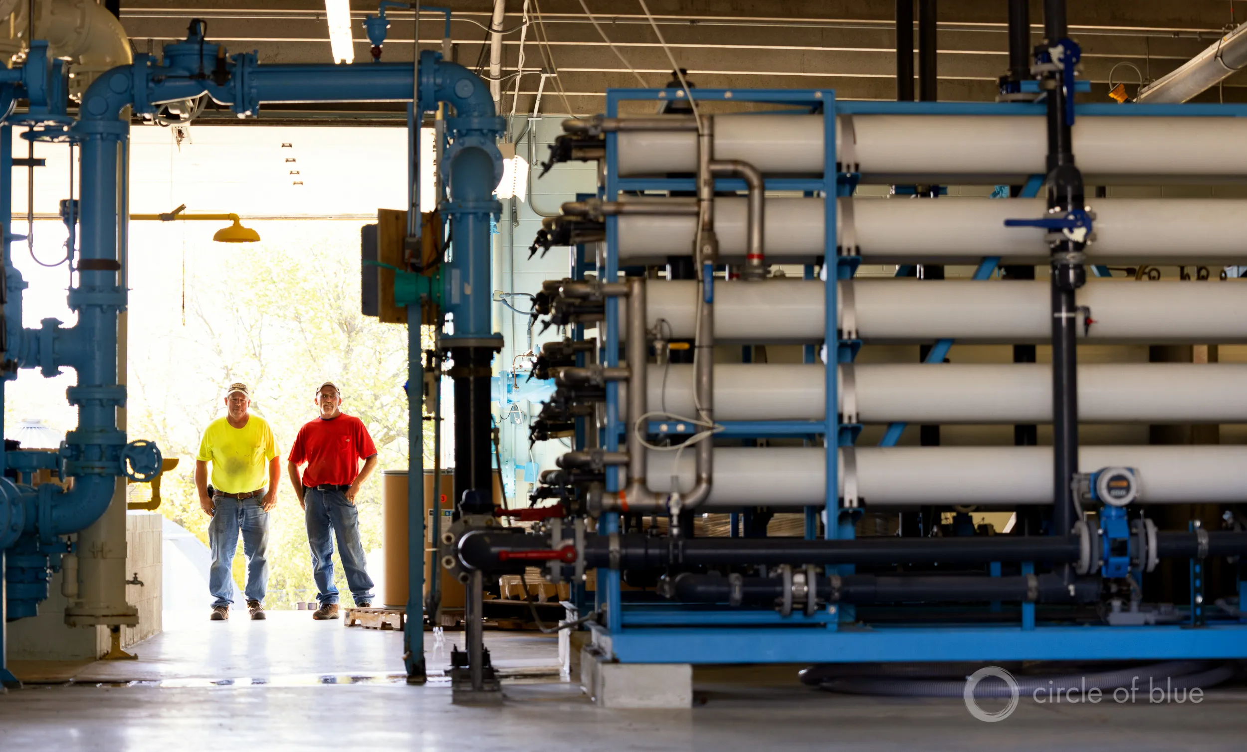
  • “… end the war on farm water.” Look, there is not enough water in the Colorado River for everyone. Everyone will have to take cuts, but irrigated agriculture is the biggest user by far, and therefore will have to make cuts in order to balance supply and demand. It’s simple math: All of Las Vegas and southern Nevada use less than one-tenth of the water that goes to the farms in the Imperial Irrigation District.
  • “… propose that the federal government build and operate desalination plants in California to free up Colorado River water for Utah …” Desalination will likely be a part of the West’s water future, especially for coastal urban areas. But building the plants, and processing and transporting these kinds of volumes of water, would be outrageously expensive and energy-intensive, which would be especially harmful to farmers, who rely on cheap water.

***

The Bureau of Reclamation recently decreased Glen Canyon Dam releases from about 8,200 cfs to a steady 7,000 cfs (without the usual nighttime reductions). This appears to be the lowest sustained releases since the dam was built, and if continued throughout the entire year would lead to only 5 million acre-feet of annual releases, which would make the Lower Basin states even more grumpy and litigation-happy than they already are.

But not to worry, the feds are still on course to release 6 MAF for the water year, because they released about 10,000 cfs during January and February. Still, it’s going to change the complexion of rafting in the Grand Canyon, for sure, and it is certainly pushing the boundaries of the Grand Canyon Protection Act.

📸 Parting Shot 🎞️

Snow falls on the Abajo Mountains in southeastern Utah as seen from near Dove Creek, Colorado. Jonathan P. Thompson photo.

Colorado River Board of #California: Lower Basin States Advance Plan to Deliver up to 3.2 Million AF Through 2028 to Protect #ColoradoRiver — Doug MacEachern, Bronson Mack, and Fernando Castro-Alvarez #COriver #aridification

Udall/Overpeck 4-panel Figure Colorado River temperature/precipitation/natural flows with trend. Lake Mead and Lake Powell storage. Updated through Water Year 2025. Note the tiny points on the annual data so that you can flyspeck the individual years. Credit: Brad Udall

Click the link to read the release on the Colorado River Board of California website:

May 1, 2026

The Lower Basin States of Arizona, California, and Nevada today advanced a plan to stabilize the Colorado River through 2028, responding to declining reservoir levels, record low inflows to Lake Powell, and increasing risk of reaching critical elevations at both Lake Powell and Lake Mead.

Earlier in the post-2026 process, the Lower Basin took a significant step by proposing 1.25 million acre-feet in annual reductions, with an additional 250,000 acre-feet from Mexico, totaling approximately 1.5 million acre-feet per year.

This proposal builds on that foundation with an expanded system conservation program across the Lower Basin with an estimated contribution of at least 700,000 acre-feet. In total, the plan identifies up to 3.2 million acre-feet of water savings to the system through 2028.

The proposal is an integrated package addressing Lake Powell releases, Upper Initial Unit operations, Lower Basin reductions, additional conservation, use of Intentionally Created Surplus, and system infrastructure improvements. Lower Basin contributions are contingent on these coordinated operations to ensure system stability as well as appropriate funding.

“With this proposal, the Lower Basin is putting forth real action to stabilize water supply along the Colorado River. We’re putting forward additional measurable water contributions for the system. Without that, the system will continue to decline,” said JB Hamby

“This proposal is about moving from ideas to implementation,” said John Entsminger. “It pairs real measurable water contributions with sensible dry-condition operations at Lake Powell and across the Upper Initial Units. Now is the time for every water user in the Basin to double down on water conservation as we face historically dry hydrology.”

“This proposal reflects the creativity and commitment of water users across the Lower Basin who continue to step forward with solutions that support the river,” said Tom Buschatzke. “We have shown that collaborative, voluntary efforts and reductions that are certain can produce meaningful water savings.”

The Lower Basin states recognize the Upper Basin’s call for mediation and are open to that process. However, current conditions require immediate, measurable water reductions from every state. The Lower Basin states stand ready to engage in a meaningful process for long-term solutions while encouraging the Upper Basin to step forward now with verifiable water contributions to help stabilize the system and support a near-term, seven-state bridge.

The Lower Basin states confirmed that the proposal preserves legal accountability under the Colorado River Compact, including Upper Basin delivery obligations, while maintaining a clear path toward a broader agreement among all seven Basin States.

The plan has been advanced to the federal government for consideration as part of the ongoing post-2026 planning process and is intended to provide a near-term bridge through 2028 while long-term operating guidelines are finalized.

Implementation of key elements of the proposal, including expanded system conservation, will require federal partnership. The proposal remains subject to approval by the Arizona Legislature and relevant California and Nevada water agency governing boards.

Press Contacts: 

Arizona: Doug MacEachern, dmaceachern@azwater.gov

Nevada: Bronson Mack, bronson.mack@snwa.com

California: Fernando Castro-Alvarez, fscastro@iid.com

Colorado River “Beginnings”. Photo: Brent Gardner-Smith/Aspen Journalism

The Central #Arizona Project supports historic three-state #ColoradoRiver deal #COriver #aridification

Colorado River. Photo credit: Central Arizona Project

May 1, 2026

The situation on the Colorado River is dire. Flows have reached historic lows and water saved in major storage reservoirs is approaching critical elevations. To date, solutions to the crisis have been elusive, with lengthy litigation looming as the seven states that share the river have been unable to agree on an appropriate remedy to the situation. That is why today’s announcement that the Lower Division States of Arizona, California and Nevada have come together to announce a bridge proposal that will support the entire Colorado River system through 2028 represents a welcome lifeline and cause for hope. This three-state proposal is a two-year, comprehensive package that will commit a minimum of 3.2 million acre-feet of Lower Division water savings in Lake Mead by 2028

The proposal is a bridge, a pathway to future operations that extend beyond the expiration of the existing river operating guidelines at the end of 2026. However, this massive sacrifice by the Lower Division States is only possible by implementing the entire proposal, which requires a series of critical actions by the federal government. The federal government must commit the remainder of Colorado River drought funding to offset impacts to Lower Division users, create a tribal pool to meet federal responsibilities to tribal communities, and use the reservoirs upstream of Lake Mead for their foundational purpose — meeting water delivery obligations to the Lower Division. Congress built those upstream dams for the purpose of releasing water and meeting minimum obligations to the Lower Division under the Colorado River Compact during an extended drought like the one we face today and now, the dams must be used as mandated by Congress.

Today’s announcement is the latest in a series of actions by the Lower Division States to preserve the stability of the Colorado River system. Lake Mead would be in the mud if not for Lower Division water users leaving water in the lake to protect the system, and every drop that has been left in Lake Mead is benefiting Lake Powell and the Upper Division by allowing for less water to be released downstream.

But Lower Division actions alone cannot protect the entire system from extraordinarily dry years. This year is an example where, despite the Lower Division’s ongoing reductions and contributions, Lake Powell needed additional emergency action.

While this new Lower Division bridge requires no action from the Upper Division states, it is well past time that the Upper Division States agree to be part of the solution by committing to verifiably conserve water and end their out-of-touch demand that the Upper Division be allowed to increase their total uses from a shrinking system.

The Central Arizona Project applauds the Lower Division States for developing the proposal and urges the federal government to speedily approve this emergency effort to bridge the river system through 2028.

#GlenCanyonDam Faces Its Existential Moment — Brett Walton (circleofblue.org) #ColoradoRiver #COriver #aridification

Glen Canyon Dam. Photo credit: Circle of Blue

Click the link to read the article on the Circle of Blue website (Brett Walton):

April 29, 2026

This story was produced by Circle of Blue, in partnership with The Water Desk at the University of Colorado Boulder’s Center for Environmental Journalism.

KEY POINTS

  • Glen Canyon Dam, completed in 1963, was not designed to be operated at extremely low water levels in Lake Powell.
  • The decline of Lake Powell is putting hydropower generation and downstream water deliveries at risk.
  • The Bureau of Reclamation, the federal water manager, is studying options for retrofitting Glen Canyon Dam.

In the span of U.S. history certain years are turning points, milestones in the nation’s story. 1776. 1865. 1929. 1968. Circumstance and consequence conspire to make it so.

For the Colorado River and those who rely on it, 2026 is on the verge of similar prominence. Circumstances in the basin today are that urgent.

Udall/Overpeck 4-panel Figure Colorado River temperature/precipitation/natural flows with trend. Lake Mead and Lake Powell storage. Updated through Water Year 2025. Note the tiny points on the annual data so that you can flyspeck the individual years. Credit: Brad Udall

A slow-developing water supply calamity, decades in the making, has boiled over, like a cold war turning hot. Extreme heat in March – triple-digit temperatures never witnessed that early in the year – obliterated a meager snowpack. The basin’s big reservoirs, the supposed buffers against short-term drought, were already uncomfortably low after a quarter-century of declining river flows. They will drop even lower. The amount of water flowing this summer into Lake Powell, the nation’s second-largest reservoir, will be one of the smallest ever measured, barely a trickle.

“This is unprecedented, but it’s not unpredicted,” said Eric Balken, executive director of the Glen Canyon Institute. “I like to say that this is the most predicted disaster of all time.”

Lake Powell is formed by Glen Canyon Dam, a striking 710-ft tall concrete arch braced against ruddy sandstone walls. It plugs the Colorado just after the river enters Arizona. Meant to ensure water deliveries to the lower basin states of Arizona, California, and Nevada, Glen Canyon Dam was finished in 1963 to complement the Colorado River’s audacious engineering that distributes water through mountains and uphill to the largest cities in the Southwest and to the region’s most productive farmland. When full, Lake Powell holds enough water to flood the entire state of Virginia to the depth of one foot.

Climate change and water demand that still exceeds supply have flipped the engineering script. Lake Powell is less than 25 percent full today. Glen Canyon Dam, instead of being a guarantor of water, is now the most significant water chokepoint in the basin. The hard-won asset has become a glaring liability.

The back of Glen Canyon Dam circa 1964, not long after the reservoir had begun filling up. Here the water level is above dead pool, meaning water can be released via the river outlets, but it is below minimum power pool, so water cannot yet enter the penstocks to generate electricity. Bureau of Reclamation photo. Annotations: Jonathan P. Thompson

The reversal of fortune is because of how Glen Canyon Dam was designed. The dam was never meant to be operated at the extremely low water levels that Lake Powell is rapidly approaching. Doing so for extended periods of time could damage the pipes that move water through the dam, according to the Bureau of Reclamation, the federal agency that manages the structure.

Reclamation is now studying its options for retrofitting Glen Canyon Dam to accommodate a lower Lake Powell. It expects to release those findings later this year or in early 2027. As any home remodeler knows, renovating an aging structure is neither quick nor cheap, especially when failure could have disastrous consequences.

In the short term, Reclamation is relying on operational band-aids for Glen Canyon Dam and Lake Powell. With the consent of the seven states in the basin – Arizona, California, Colorado, Nevada, New Mexico, Utah, and Wyoming – the agency took unprecedented action this month to prop up the reservoir. Releasing more water from upstream reservoirs and holding back more in Powell will delay Glen Canyon’s infrastructure reckoning. But that day will soon come, and Reclamation’s answer to the dam’s engineering problems will have far-reaching implications – not only for the reliability of the basin’s water supply, but also for its power customers, ecology, and recreation economy.

An Assessment Deferred

Dams are difficult to manage under any circumstance. Management is even more troublesome when operators must balance multiple, conflicting objectives. In Glen Canyon’s case those objectives are water supply, flood control, hydropower generation, and releasing water to protect the ecology downstream in the Grand Canyon – namely, beach-building and threatened native fish like the humpback chub. This is in addition to ensuring the safe operation of the dam itself.

As of late April 2026, Lake Powell was just 25 percent full and projected to drop to a record low in the next 12 months. Photo © Brett Walton/Circle of Blue

How to operate Glen Canyon Dam and Hoover Dam, its larger downstream sibling, is what the seven basin states and Reclamation are attempting to figure out right now. The current agreement covers operations through 2026. Reclamation published a draft environmental impact statement, or EIS, in January that would impose severe cuts on water users in the lower basin, particularly Arizona, in part to protect Glen Canyon Dam’s fragile infrastructure.

For that reason, water users in the lower basin and elsewhere support an engineering fix for Glen Canyon Dam. Many were incredulous that Reclamation did not include an assessment of dam modifications in its draft environmental analysis.

“This EIS could have been a great avenue to look at real changes at Glen Canyon Dam that could solve the water delivery problem and some of the ecological problems, too,” Balken said. 

Patrick Dent is the assistant general manager for water policy at the Central Arizona Project (CAP), which delivers Colorado River water to the densely populated center of the state. He said that CAP does not favor any particular fix – only one that provides dam managers with more flexibility.

“Our primary interest is that they could release water at a lower lake level,” Dent said.

The Gila River Indian Community, which receives Colorado River water through CAP, told Reclamation that the agency has a duty to safeguard the tribe’s water rights, which are at risk if the dam cannot release enough water. “The United States must take action to fix Glen Canyon Dam,” Gov. Stephen Roe Lewis wrote in a March 2026 letter.

The Colorado Water Conservation Board, which represents that state’s water interests, said it supports a reevaluation of Glen Canyon Dam, but “in a separate action” from the EIS.

Becki Bryant, a Reclamation spokesperson, said the agency will release an appraisal study assessing three dam modification alternatives at the end of this year or in early 2027. Any action beyond the study, she said, requires congressional authorization and funding.

Illustration from the report, “Antique Plumbing & Leadership Postponed” from the Utah Rivers Council,
Glen Canyon Institute and the Great Basin Water Network. Courtesy of Utah Rivers Council

‘Antiquated Plumbing’

The tool for managing the dam’s multiple objectives, which are a legislative requirement as well as a practical necessity, is the water held in Lake Powell, said David Wegner, a scientist who has worked on Glen Canyon policy for more than four decades. But even water has limits when the engineering is inadequate. “Sadly, these dams were not built for multiple objectives,” Wegner said. And Glen Canyon was certainly not built for extremely low water, he added.

Glen Canyon Dam, completed in 1963, was not designed to be operated at extremely low water levels that Lake Powell is now approaching. Photo © Brett Walton/Circle of Blue

The problem with Glen Canyon is what a coalition of environmental groups calls the dam’s “antiquated plumbing.” The groups – Glen Canyon Institute, Great Basin Water Network, and Utah Rivers Council – published a report in August 2022 that outlined these engineering deficiencies.

Water can exit Glen Canyon in only three ways. One is the spillways, a pressure-release valve for flooding, which are located at elevation 3,648 feet, near the top of the dam. They are irrelevant today. Lake Powell rests 122 feet below them.

The main exit point is through the eight penstocks, the 15-foot diameter tubes that move water through the turbines to generate hydroelectricity. The penstocks are incapacitated when Powell drops below 3,490 feet. (The lake today is 36 feet higher than that level.) If the lake falls below what is known as minimum power pool, hydropower generation also ceases.

If that happens, water must be released through four 8-foot diameter pipes called the river outlet works. Smaller than the penstocks, the river outlet works are located at elevation 3,370. Below that elevation water cannot be released from Powell, a status known ominously as “dead pool.” (Functionally, the river outlet works may be useless at elevation 3,394, Reclamation says.)

The environmental groups identified two limitations with the river outlet works. One is that they were not designed to be operated full-time. They are a role player, not the star. The other is that their smaller size means less water can pass through them. That’s a problem because the upper basin states of Colorado, New Mexico, Utah, and Wyoming are required to send a set amount of water downstream to the lower basin, according to the 1922 Colorado River Compact that divided the river.

The flow restrictions imposed by the river outlet works, if they had to be used full time, means that the upper basin could violate the compact, which could mean water cutbacks imposed by the lower basin.

“It’s just so counterintuitive that the tool that was designed to meet this delivery obligation” – the construction of Glen Canyon Dam – “is now going to be the roadblock that may prevent the delivery obligation from being met,” said Balken of the Glen Canyon Institute.

The engineering problems are not a new discovery. Wegner, who was with the Bureau of Reclamation at the time as its Grand Canyon environmental studies manager, helped lead a 1987 National Academies report on Glen Canyon. The report recommended that the Interior Department consider the “installation and operation of multiple outlet structures” at Glen Canyon, which would give dam managers more flexibility with water releases.

Glen Canyon Dam’s powerhouse sits at the base of the 710-foot-tall structure. Hydroelectric generation has dropped in tandem with the falling water levels in Lake Powell. Photo © Brett Walton/Circle of Blue

Glen Canyon’s structural problems were substantiated in 2023, when Reclamation used the river outlet works during an experimental “high-flow” release of water to flush sediment downstream and rebuild eroding Grand Canyon beaches.

The high-volume release caused pitting, or cavitation, within the river outlet works, a risk that was heightened due to the physics of water when Lake Powell is low. Reclamation coated the pipes with epoxy as a temporary fix to prevent more damage, a process that took several months. The agency has since used two small-scale physical models at its Technical Service Center in Denver to test dam operations at low water levels and the effect on infrastructure.

Reclamation acknowledged the limitations of the river outlet works in a technical memopublished in March 2024 by Richard Lafond, director of the agency’s Technical Service Center. The memo’s conclusions were endorsed by the top decision-makers in Reclamation’s Upper Colorado River Office.

“Long term operation of the river outlet works will result in accelerating regular operation and maintenance tasks,” LaFond wrote. Reclamation should “not rely on the river outlet works as the sole means for releasing water from Glen Canyon Dam.”

Wegner put it in starker terms. If the river outlet works had to be relied upon and the pipes began to erode again, then Reclamation could potentially lose control of water flows.

“Potentially that could fail,” Wegner said, meaning an inability to control water releases through the dam if the pipes are structurally compromised. “And if that fails, now you have a catastrophe on your hand and you have limited options to manage that catastrophe.” 

In other words, there would be no way to release water downstream into the Grand Canyon and into the lower basin.

Neither Quick Nor Easy

What fixes are possible? Reclamation received $2 million from Congress in the fiscal year 2022 budget for an appraisal study.

Reclamation outlined three engineering possibilities in a 2023 presentation, most of which centered on preserving hydropower generation as Lake Powell declines.

One possibility is a new, lower intake that uses the existing power generation turbines. An intake located deeper in the reservoir would allow Glen Canyon to pass water in what is currently dead pool. But it would entail “increased risk from penetration through the dam.”

The second would connect new power generation equipment to the river outlet works.

The third option is tunneling through the canyon wall and installing a new underground power station. This would also provide more flexibility for water releases.

Reclamation also included three operational or policy changes for power production, including investing in wind and solar to offset hydropower declines.

Other ideas that seemed kooky and fringe just a few years ago – draining Lake Powell and filling Lake Mead first; changing the basin’s water accounting system – are now being discussed throughout the basin with more seriousness and candor.

Beyond that presentation, Reclamation has not said much publicly about dam modification. The agency declined an interview request to discuss Glen Canyon Dam’s engineering problems.

Whatever direction Reclamation chooses – an option outlined above or something new – the process will not be quick or easy. Any change to Glen Canyon must go through an environmental analysis and public comment period. Congress will have to authorize actions and appropriate the funds. Construction alone will take years.

Wegner, who was the staff director for the House Natural Resources Water and Power Subcommittee from 2008 to 2014, knows the difficulty and sees a lack of leadership. “There’s nobody in Washington who has been willing to lead the charge trying to get Congress to provide authorized funding to do this sort of work.”

‘Reservoir Triage’

Because Reclamation is not confident it can operate the river outlet works for an extended run, the agency is focused on keeping Powell above elevation 3,500 feet.

Protecting 3,500 feet comes with all sorts of baggage. It preserves hydropower generation, which power customers appreciate. But in effect the redline at that elevation strands some 4.4 million acre-feet in Lake Powell. (Only 3.7 million acre-feet is technically accessible with the current plumbing.) Some have called this elevation a “de facto” dead pool. Thus, the agitation in the lower basin for a plumbing system within the dam that provides access to this water.

The mineral “bath tub ring” above Lake Powell shows where its water level has been. Photo © Brett Walton/Circle of Blue

Balken said that downstream water deliveries, not preserving hydropower, should be Reclamation’s biggest concern.

“When these decision makers are talking about Glen Canyon Dam from only a hydropower perspective, I think it’s missing the larger point, which is the dam is about to become the biggest roadblock of water deliveries that the basin has ever seen,” Balken said.

Flaming Gorge Reservoir, on the Green River, straddles the Wyoming-Utah border south of Rock Springs. The Flaming Gorge dam, on the Utah side, was completed in 1964 and is a critical component of the Colorado River water storage system. The Green River, the chief tributary to the Colorado River, originates in the Wind River Range, flows to Flaming Gorge Reservoir, then connects with the Colorado River in Canyonlands National Park in Utah.

To avoid the infrastructure risks of dropping below 3,500 feet, Reclamation has started to take extraordinary action. The agency has two emergency levers it is pulling. One is to hold more water back in Lake Powell. Reclamation cut water releases to the legal minimum this year, something it has never done. The other is releasing more water from Flaming Gorge, a reservoir upstream that is in better shape.

As Balken describes it, “This is reservoir triage.”

These emergency actions have serious side-effects. Upstream, Flaming Gorge is expected to lose 35 feet of elevation by next spring, once the extra water has been released. That will hurt the recreation economy of northeastern Utah and southwestern Wyoming – fewer boat ramps in the water, less fishing access.

These upstream releases have limited utility, Wegner said. “You can do that once or twice. But you got to then depend upon Mother Nature refilling those reservoirs upstream.”

Hoover Dam at low water. Jonathan P. Thompson photo.

Downstream, Lake Mead will drop quickly and it too will approach a level in which hydropower generation at Hoover Dam severely drops. Algal blooms in a warmer, shallower lake could be a problem. “They’re going to be robbing Mead to pay Powell,” Balken said.

Trying Not to Hit Bottom

The idea of dead pool – when Lake Powell can no longer release water – was almost inconceivable when the reservoir was designed and filled. The official device for measuring Lake Powell’s elevation ends at the top of the penstocks, at elevation 3,477.5 feet. According to Reclamation’s 2024 technical memo, “This is an indication that reservoir elevations below minimum power pool” – 3,490 feet – “were not anticipated.”

Cavitation at the Glen Canyon Dam, the cause of the emergency in 1983 via Flow Science.

Reclamation finished filling the reservoir in 1980. Three years later, after an intense El Niño winter, the dam’s upper limits were tested. Floodwaters in the summer of 1983 nearly broke the dam. Such volumes are almost inconceivable now.

In a typical year, Lake Powell would be rising in late April, flush with the deposits of snowmelt from headwater basins in the Rocky Mountains. Not this year. The snowpack peaked in many basins in late February or early March. What little snow there was has already melted. As of April 28, Lake Powell inflows are projected to be just 16 percent of average. Lake level forecasts from mid-April showed a long downward slope for the next 12 months. Those projections were what triggered the emergency release of water from Flaming Gorge and the reduction in Lake Powell releases.

Scientists have been warning about circumstances like this for years. In a defining period for the basin, all the predictions of water supply shocks in the Colorado River from the past two decades are coming to pass.

“We should have been prepared for this,” Balken said.

President Trump looks to Make America Graze Again: Plus: BLM peddles vacant grazing leases; Wacky weather watch — Jonathan P. Thompson (LandDesk.org)

Photo credit: Jonathan P. Thompson

Click the link to read the article on The Land Desk website (Jonathan P. Thompson):

April 24, 2026

🐮 Grazing Gazette 🥩

When Donald Trump was elected president for the second time, we all knew what was coming to the nation’s public lands: The administration would favor extractive uses by eviscerating environmental protections, rolling back regulations, and leasing out as much land as possible while handing out drilling permits like Shriners throwing candy at a parade.

Yet there was one realm where I figured the administration couldn’t bestow any more deregulatory gifts, namely public lands grazing. It’s not that I thought Trump would clamp down on the destructive practice, it’s just that I figured the status quo was about as permissive as it could get. Past administrations, be they Democratic or Republican, have generally shied away from updating or reforming public lands grazing policies out of fear of inflaming the West’s cowboy culture — even if it is based largely on myth.


The West’s Sacred Cow — Jonathan P. Thompson


But Trump, his Interior Secretary Doug Burgum, and Agriculture Secretary Brooke Rollins are intrepidly going where previous administrations did not dare: grazing reform. Well, sort of, though maybe not in the way public lands lovers might have hoped. In fact, they are doing their best to make grazing policy even more lax with a goal of getting more cattle out there to trample public lands, cryptobiotic soils, and cultural sites.

Last month, Burgum and Rollins announced an MOU between the two agencies designed to “boost the supply of American born, raised, and harvested beef” by cutting “bureaucratic red tape” and giving the livestock industry more control. The MOU has a goal of “maintaining grazing capacity wherever possible, including no net loss of Animal Unit Months within allotments,” even if those allotments are degraded or in poor health. In Burgum’s words, one goal is to “preserve America’s ranching heritage for generations to come.” Forgive me for getting anxious whenever I see “heritage” used in conjunction with public lands.

“Today’s signing sends a clear message: the Trump administration is putting America’s farmers and ranchers first,” said Secretary of Agriculture Brooke Rollins. Which brings up the question of what message the administration was sending in February when Trump signed an executive order to quadruple beef imports from Argentina in an effort to keep Big Macs affordable.

🗺️ Messing with Maps 🧭

To help it carry out its mission, the Bureau of Land Management has released an interactive map aimed at putting more cattle and sheep back on public lands. The “federal grazing lands potentially available” map shows allotments that have been vacated, often as a result of deals brokered by environmentalists, with the intent of peddling the tracts to livestock operators. While there’s no guarantee that the BLM would lease out all of the vacant tracts, the presence on the map of the ones vacated for environmental purposes is enough to set off alarm bells.

Grazing allotments listed as “potentially available” for leasing on the BLM’s new map. The five parcels closest to Silverton were retired in 2023 to protect bighorn sheep. Source: BLM

For example, the map includes 10 allotments in the high country around Silverton, Colorado, totaling about 70,000 acres. In 2023, the National Wildlife Federation paid the Etchart Sheep Ranch to vacate five of these allotments in an effort to give Rocky Mountain bighorn sheep more breathing room and protect them from diseases transmitted by domestic sheep. The deal was made with the hope that the leases would be retired permanently. Yet the inclusion on the map indicates they could see domestic sheep once again, emphasizing the need for legislation that would make such retirements perpetual.

Also on the map are the Flodine Park and Yellowjacket allotments in Canyon of the Ancients National Monument near the Colorado-Utah border. In 2005, a rancher gave up the allotments, north and south of McElmo Canyon, respectively, and sold 4,500 acres of adjacent private land to the BLM to add to the national monument. Both allotments and the private land contain a number of intermittent streams, shallow canyons, and numerous cultural sites. They had been grazed relentlessly for decades prior, and showed the wear and tear—much of the cryptobiotic soil had long before been trampled and destroyed and invasive cheat grass had infiltrated the grazed areas. An archaeological assessment conducted later found grazing had damaged dozens of sensitive and cultural sites in the areas.

The Yellowjacket and Flodine Park allotments in Canyons of the Ancients National Monument. They have been vacant since 2005, and a previous effort to lease them out again was halted. Now it looks like they may be back on the block. Source: BLM

In 2010, the BLM, which manages the monument, issued a new resource management plan, which allowed for continued grazing, but also opened the door to permanently retiring vacant grazing allotments if they fail to meet BLM rangeland health standards or when grazing is negatively impacting cultural sites. Five of the 28 allotments in the most heavily visited areas—including Sand Canyon—were cancelled, but not the Flodine Park and Yellow Jacket allotments, which were still in retirement at the time.

Instead, the local county commissioners and a group of ranchers pressured the BLM to reauthorize grazing on both allotments—to bring them out of retirement, if you will. The BLM acquiesced, but environmentalists and tribes with roots in the area fought back, forcing the agency to do a more thorough environmental analysis of the proposal. The opposition was enough to prompt the agency at least to delay issuing any leases, and the allotments remain in limbo.

Meanwhile, a team of scientists assessed the healing process on the Flodine Park and Yellow Jacket allotments, which by then had been cow-free for 11 years (though feral horses had grazed there). They compared biocrusts on those allotments to a fenced enclosure that hadn’t seen grazing for 53 years and a plot that was being actively grazed. What they found was both predictable and remarkable: The longer a plot went without cows, the healthier it was, as summed up by these graphs.

Source: Grazing, Rest, and Biological Soil Crust in Canyons of the Ancients National Monument Marc Coles-Ritchie, Lior Gross and Mary O’Brien, Grand Canyon Trust.

While the natural landscape can eventually heal itself, livestock’s damage to the cultural landscape is irreversible. BLM surveys identified 266 cultural sites on the two allotments, including 35 with “standing architecture.” At least 43% of those had been damaged by livestock.

Now what’s left may be in danger, too, at least if those allotments’ presence on the new map is any indication. And guess what? Packing these allotments isn’t going to make that steak any cheaper. Only about 1% of American beef is grazed on public lands. 

Check out the BLM Grazing availability map yourself: https://experience.arcgis.com/experience/0a208d6eac6144969213c68519a8cfdd


Mt. Blue Sky at 14,130 feet in elevation on April 22, 2026. Jonathan P. Thompson photo.

⛈️ Wacky Weather Watch ⚡️

If you were to get all of your information about the West’s climate from daily weather reports and road condition websites, you might think that April snow showers and deep freezes had ended the snow drought and would lead to big May streamflows. After all, it snowed enough in Colorado to turn roads to slip-and-slides and causing a 75-car pileup on I-70 near the Eisenhower Tunnel. The temperatures dropped low enough to wipe out most of the fruit blossoms the March heat wave tricked into blooming early. Only the farmers who used extraordinary measures — starting fires or smudge pots in the orchards, running wind machines, etc. — could save some of their summer harvest.

Sunset over the San Juans. Jonathan P. Thompson photo.

Sure, the snow that did fall in April helped, but only enough to elevate snowpack levels to, well, the lowest on record (only by a slightly smaller margin than before). And the freeze was deep, which helped extend the spring runoff in the few areas where there was any snow left. But even there, I suspect that peak runoff has already come and gone (though I’m not calling the Predict the Peak contest yet!). 

I flew over Colorado’s mountains the other day and was rather shocked at the dearth of snow, even on the highest peaks. Mt. Blue Sky, formerly Mt. Evans, had only a few patches of white left — at 14,130 feet in elevation. Everything below 10,000 feet appeared to be snowless. While the San Juan Mountains appeared to be in slightly better shape, it was still looking pretty dry. The Animas River watershed’s snowpack remains lower than it was on 2002 on this date.


The (new) water year of our discontent — Jonathan P. Thompson


Dismantling the U.S. Forest Service harms public lands and communities — Tracy Stone-Manning (WritersOnTheRange.org)

San Isabel National Forest, Nathrop, Colorado, Dave Marston photo

Click the link to read the article on the Writers on the Range website (Tracy Stone Manning):

April 22, 2026

When I led the Bureau of Land Management under President Biden, the hardest part of my job was reassembling the agency after the first Trump administration had scattered its headquarters from our nation’s capital. The move crippled the agency—as intended. 

That experience led me to understand that the current Trump administration’s unpopular plan to move the U.S. Forest Service headquarters will be every bit as destructive. It will hurt forests, wildlife and communities that rely upon our public lands and waters.

In 2020, almost 90% of the BLM employees ordered to move West chose not to, forcing them out the door. With those seasoned employees went years of wisdom and knowledge of how things are supposed to work, of how to deliver for the American people. 

Today’s Forest Service plan goes farther, aiming to close regional offices and shutter dozens of the agency’s research centers, as we face what some say will be a horrific wildfire season.  

The Forest Service and the BLM combined manage 20% of our country’s lands and waters. These public lands, the places we camp, hike, watch birds, hunt and simply wander in nature, are truly one of America’s best ideas. For Westerners, they are a deep part of our identity.

There is a reason Forest Service headquarters are based in Washington, DC. It’s where our nation’s leaders work. Believe me, I did not want to move to the capital from my home in Montana to run the BLM, but to be able to fight for Western people and places, I had to go to the seat of our nation’s power. 

I was often in the Interior Secretary’s offices. I frequently walked to work with the U.S. Fish and Wildlife Service director, talking through thorny problems such as how to protect wildlife while permitting transmission lines. Washington is where people manage relationships with Congress, where budgets get made.

The administration says all their changes are about bringing leadership closer to where the work happens. That’s a political talking point, and it’s false.

If DOGE’s dismantling of government agencies last year provides any lesson, then cruelty and disruption are the real point. These changes aim to create chaos, deliver the administration’s stated goal of traumatizing employees, and imperil the very existence of public lands — lands that belong to all Americans. We improve the management of our forests by giving foresters the resources they need and letting them make decisions based on sound science and collaboration, not by gutting their agency.  

Over the course of the last year, the Forest Service forced or coerced roughly a quarter of its approximately 30,000 employees to leave. In this latest round of engineered chaos, thousands of people will be reassigned and ordered to move. If BLM history is any guide, almost all will leave their positions rather than uproot their families. The agency could soon be left with roughly half its former ranks. 

Think of your job. Now, think of half of your colleagues gone. Would your organization be able to recover from the loss and demoralization to do its work? 

There are inevitable repercussions to this radical attack on our public land management agencies: Campgrounds will close. Trails won’t be maintained. High fuel loads near communities will go unaddressed. Wildfires will become even harder to fight. More sawmills will close. The health of our land, waters and wildlife will decline. With things going wrong on the ground, some will demand that these lands be transferred to states or sold to private industry.  

Tracy Stone-Manning. Photo via WritersOnTheRange.org

That’s exactly what the people in power today want. The choice of Utah for the Forest Service headquarters—home to Senator Mike Lee, who leads the charge on public land selloff, as well as to the state that is suing to try to take over millions of your public lands—reveals the administration’s true agenda.

The inevitable does not need to happen. There is one power to stop our public lands from being mismanaged to the point of selloff: It’s the outrage of the American people.

Americans overwhelmingly support public lands and want future generations to enjoy the freedoms found in them. Our public forests, rivers and deserts deserve to be treated better, and the federal land managers who work tirelessly deserve better. It’s up to us to demand it.  
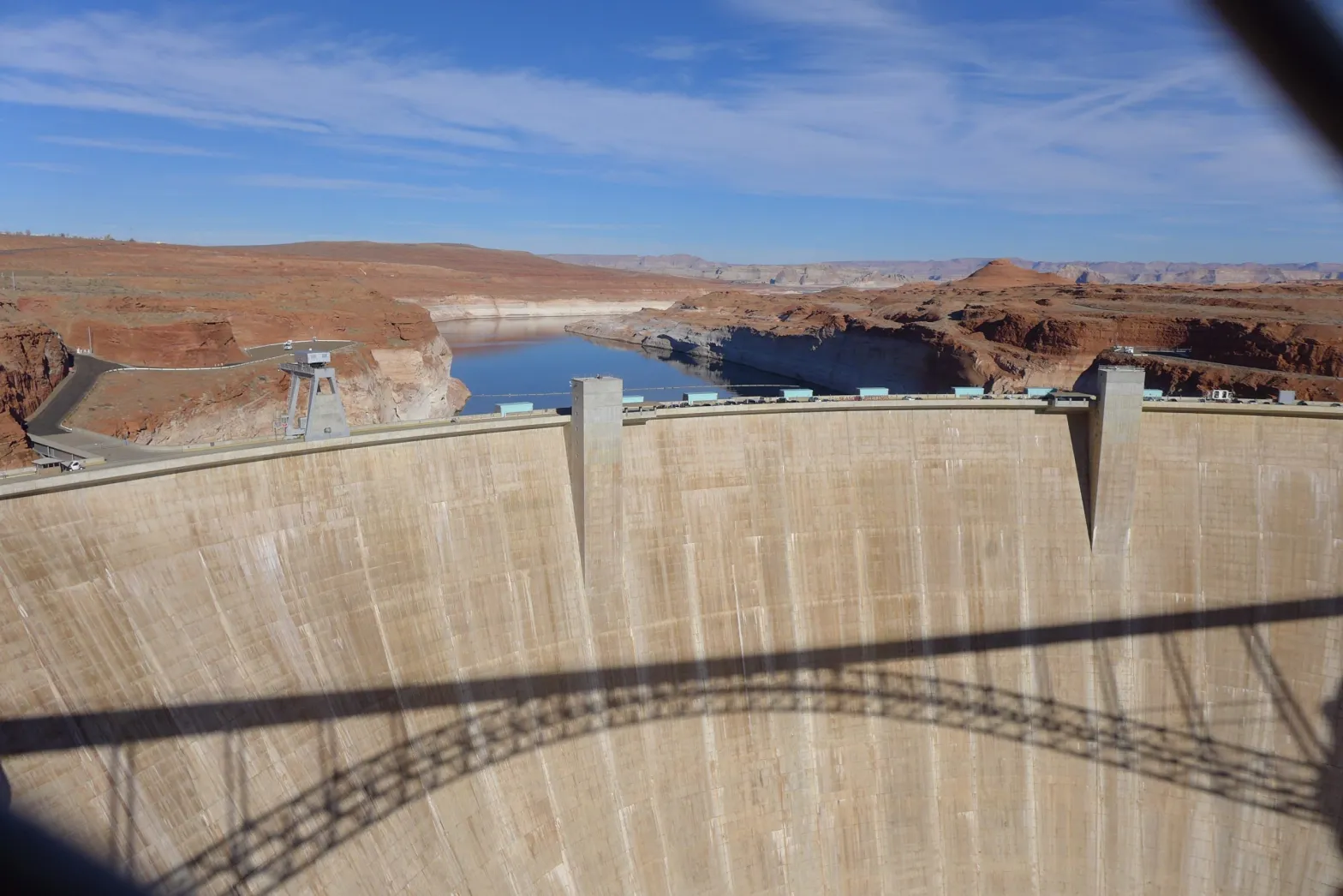
Tracy Stone-Manning is president of The Wilderness Society and a contributor to Writers on the Range, writersontherange.org, an independent nonprofit dedicated to spurring lively conversation about the West.

The Bureau of Reclamation is planning to increase releases in from #FlamingGorge Reservoir while cutting discharges from #LakePowell — Summit Daily #ColoradoRiver #COriver #aridification

Click the link to read the article on the Summit Daily website (Ali Longwell). Here’s an excerpt:

April 20, 2026

With a historic drought hitting the Colorado River basin, the U.S. Bureau of Reclamation is making preparations to slow releases from the river’s largest reservoir while increasing withdrawals from an Upper Basin reservoir. 

“Given the severity of the risks facing the Colorado River system, it is imperative that we take action quickly to protect a resource that supplies water to 40 million people and supports vital agricultural, hydropower production, tribal, wildlife and recreational uses across the region,” said Andrea Travnice, the Bureau of Reclamation’s assistant secretary of water and science in a Friday, April 17 news release…

As a result, the Bureau of Reclamation is anticipating that inflow to Lake Powell will be 29% of the historical average, which it reports is one of the lowest on record. If water levels fall below a certain elevation — below 3,490 feet or roughly 15% of its capacity — it can impact operations, regional power and water supplies as well as reduce hydroelectric power generation. The Bureau is projecting it could hit this minimum power pool level by August. As of April 19, Lake Powell and Lake Mead were 24% and 32% full, respectively. 

View below Flaming Gorge Dam from the Green River, eastern Utah. Photo credit: USGS

The driest year revisited: Five takeaways from 2002 for today’s #ColoradoRiver, experts weigh in on what we learned during the region’s worst #drought on record, and how those lessons might help us this year — Annie MacKeigan (WaterDesk.org) #COriver #aridification

The Colorado River carves through mud left behind from Lake Powell when the reservoir was at full pool, near Hite, Utah in October 2022. (Alexander Heilner/The Water Desk with aerial support from LightHawk)

Click the link to read the article on The Water Desk website (Annie MacKeigan):

April 23, 2026

The Colorado River basin has been here before. 

This year’s historic winter of low snow might feel novel. But recent years give some insight into just how dry the West’s most important river system can get. This season’s scant snowpack is melting rapidly, and turning up memories of other notably dry years. 

Prolonged drought conditions and warming temperatures since 2000 have produced severe single-year droughts in 2002, 2012, 2018 and 2020 in the river’s headwaters states of Colorado, Wyoming and Utah. As severe drought years continue to put the Southwest’s water infrastructure to the test, communities in the region are grappling with how best to understand and adapt to a changing climate. 

2002 stands as the worst drought on record for the Colorado River, measured as the flow into one of its biggest reservoirs, Lake Powell on the Utah-Arizona border. It’s possible 2026 could break that record. Back then the year acted as a wake-up call to the region’s water leaders, spurred important policy changes, and reshaped attitudes around conservation. 

We asked Colorado River experts Eric Kuhn, Jeff Lukas and Jim Lochhead to share five important takeaways from the 2002 drought, and what to know as we enter the warmer, drier months of 2026.  

1. Reservoirs have memory

Reservoirs act as batteries for water availability, charged by inputs such as snowmelt, streams, rivers and precipitation. 

“What you did two or three years ago can affect your water supply now,” said Eric Kuhn, former general manager for the Colorado River Water Conservation District. “So in a good year, if you are conserving, you are actually helping the system out for the next drought.” 

The 2002 drought prompted municipal utilities to rethink their reservoir usage. 

“Water managers and agencies have absorbed several lessons from 2002, including holding something back. They’re operating the reservoirs a little differently,” said Jeff Lukas, an independent climate and water researcher who has lived on Colorado’s Front Range for 40 years. 

By conserving reservoir water, municipal utilities can maintain water storage for less abundant water years of the future. But as dry conditions have dogged the entire Colorado River basin for more than a quarter-century, the system’s buffer is gone. 

“The biggest issue is that Lake Powell and Lake Mead were relatively full in 2002,” Kuhn said. Now, both Lake Powell and Lake Mead are at critically low levels, and the water scarcity is increasing the likelihood of multi-state litigation.

In 2002, drought was dealt with on a local level; water utilities were not thinking about drought in terms of the entire river system, but instead how to regulate municipal water use. This year’s dry conditions are pushing the whole region to the brink. 

2. Conservation can make a big difference, if it is mandatory

Individual contributions to water conservation, adhering to local outdoor watering restrictions for example, can make a difference. Prompted by the 2002 drought, a 2004 University of Colorado study aimed to measure the effectiveness of water restrictions put in place by water providers on the state’s populated Front Range. 

The study followed municipal water providers Thornton, Aurora, Westminster, Fort Collins, Boulder, Louisville, Lafayette and Denver Water, comparing 2002 usage to average water usage in 2000 and 2001. Researchers determined that water restrictions are most effective when mandatory. Mandatory restrictions in Lafayette reduced water usage by as much as 53%, according to the study. 

The same study found that under mandatory restrictions, savings of expected water use per capita was as successful as 56%, while voluntary restrictions only measured up to 12%. 

Outdoor watering represents a big slice of a city’s water budget, and 2002 showed utilities that in times of crisis people can rein in their use. 

“Everyone should realize that they can make a small contribution to the solution,” Kuhn said. “Even though their individual contribution might be miniscule, when you add up all their neighbors and other people, it’s not miniscule. It’s very, very big.” 

Watering a lawn once or twice a week, and not during peak hours, is a practical way to conserve water while keeping grass alive. 

3. This is not a one-off year

It’s easy to shrug off a dry year and hope for wet weather’s return. But the long-term trends are concerning. 

“This is really the 26th year of extreme drought,” said former Denver Water CEO Jim Lochhead. On a larger scale, the seven Colorado River basin states—Arizona, California, Colorado, Nevada, New Mexico, Utah and Wyoming—have been preparing for worsening drought conditions since the shock of 2002. But river policy hasn’t kept pace with the aridification, leaving the region’s largest reservoirs at near record lows. 

The Colorado River flows through canyons in northern Arizona in October 2020. (Ross Rice/The Water Desk & LightHawk)

“This has been a slow moving train that I think the states have known was coming, and they have frankly failed to do anything about it,” said Lochhead, who also represented the state of Colorado amid interstate Colorado River negotiations in the 1990s and early 2000s.

The Colorado Climate Center anticipates droughts to increase in severity and frequency, a trend that is only expected to continue in Colorado and across the Southwest as warming temperatures upend the water cycle. 

“We should be managing and thinking about water, using water, as though it were always a drought,” Lukas said. 

4. Communities have more practice dealing with drought, but still struggle  

Drought conditions in 2002 led some municipal water utilities to organize and create incentives for conservation, and transformed the urban landscape, swapping grass for more drought-tolerant plants. Those water restrictions allowed municipal water providers to curb water demand while steadily growing in size. However, there is still room for improvement in disproportionately affected communities.  

According to Lochhead, urban areas need to prioritize heat reduction in neighborhoods that have fewer trees in order to lessen the impacts of drought and warming temperatures. Using scarce water supplies to encourage tree-planting and increase shade should remain a priority. 

“I think we need to work with those communities to enhance some landscaping,” Lochhead said. “Whether it’s the homeless population, whether it’s just kids that are out, whatever it may be, those areas are where they’re pretty hard hit by heat.” 

Farmers and ranchers are used to riding the highs and lows of western weather. But extremely dry years like 2002, and now 2026, can push their operations to the limits. 

“This is going to be a really tough year,” Lukas said. “You’re going to have a lot of people selling off their herds and taking insurance out because of low crop yields.”

The majority of Colorado’s annual water supply is used for irrigation, so any proposed restrictions can be costly for the agricultural community. “There are going to be a lot of farms and ranches that just can’t operate because they don’t have any water,” Lochhead said. “There are going to be some significant economic consequences.” 

5. Stay aware, even if things seem bleak 

For Lukas, this year and its predecessors test our expectations about what nature can provide.

Even in periods of prolonged drought, there are wet years. “Judging from history, that tends to put everyone back on their heels, a little complacent,” Lukas said, but maintaining water storage relies on year-to-year vigilance, not complacency.  

Another primary concern during drought years is wildfire. With less moisture in the soil, dry vegetation acts as fuel for wildfire, which becomes harder to contain under hot and dry conditions. 

“I worry a lot less about municipal water supply than I do about wildfire,” Lukas said. Many of Colorado’s notably dry years have also recorded severe and destructive wildfires. 

It comes at no surprise that worsening drought falls in line with worsening wildfires. “Climate change is delivered to people through changes in the hydrologic cycle,” Kuhn said, so being aware of water usage now is just as, if not more important as it was in 2002.

This story was produced and distributed by The Water Desk at the University of Colorado Boulder’s Center for Environmental Journalism.

The Water Cycle. Credit: USGS

Emergency plans for the #ColoradoRiver buy time, not solutions — Caitlin Ochs (High Country News) #COriver #aridification

The Colorado River flows below Glen Canyon Dam in this image from 2021. Photo credit: Caitlin Ochs

Click the link to read the article on the High Country News website (Caitlin Ochs):

April 24, 2026

The federal government ordered Flaming Gorge water released and cuts to Lake Powell releases, to prevent collapse.

Last week, the federal government ordered emergency measures to prevent water levels at Lake Powell from falling so low that Glen Canyon Dam, which created the reservoir, could no longer generate power or deliver water downstream. Without this intervention, models showed that the reservoir could drop below safe operating levels in August, meaning that the river would not have a reliable way to flow past the dam. This would threaten water and power supplies for millions of people across the Southwest, as well as the flow of water through the Grand Canyon.

Westwide SNOTEL basin-filled map April 24, 2026.

Across the Colorado River Basin, an extremely low snowpack combined with a record-shattering March heat wave, have left water managers with few other options. The region’s reservoirs were already depleted from years of relying on wet winters to balance the growing demand with the ongoing drought.

Flaming Gorge Reservoir, on the Green River, straddles the Wyoming-Utah border south of Rock Springs. The Flaming Gorge dam, on the Utah side, was completed in 1964 and is a critical component of the Colorado River water storage system. The Green River, the chief tributary to the Colorado River, originates in the Wind River Range, flows to Flaming Gorge Reservoir, then connects with the Colorado River in Canyonlands National Park in Utah.

The Bureau of Reclamation ordered releases from Flaming Gorge Reservoir, which straddles the Utah-Wyoming border, to bolster Lake Powell’s water levels. At the same time, the amount of water delivered from Powell to downstream users will be significantly reduced.

“This is a short-term solution,” said Jenny Dumas, water attorney for the Jicarilla Apache Nation, which sits near the border of Colorado and New Mexico. “It’s going to take time to recover these reservoirs before we can do this again. So while we can exhaust our reserves to avoid system collapse this year, it means reserves won’t be there next year.”

This is not the first time water managers have turned to Flaming Gorge to stabilize the larger river system. In 2022, the federal government ordered the reservoir to release 550,000 acre-feet to stabilize the downstream river system, which disrupted recreation and rattled upstream communities. This time, Reclamation has authorized releases of up to 1 million acre-feet. Over the next year, a third of the reservoir’s storage is expected to be gradually released. By September, water levels are projected to drop about 12 feet.

Flaming Gorge Reservoir stores water from the Green River in Wyoming, and is shared by Wyoming and Utah. Ted Wood/The Water Desk

“This is an unprecedented release volume — more than double the last time,” said Amy Haas, executive director of the Colorado River Authority of Utah, who briefed communities bracing for the releases at Flaming Gorge Reservoir. “We really just don’t know the actual impacts of these releases to surrounding communities, and our water users are struggling. My goodness, we are on target to become one of the worst water years on record. The forecasts are stunning to all of us.

The amount of water projected to flow into the river from snowmelt is rapidly declining. Over the first two weeks of April, forecasts for Lake Powell fell by 500,000 acre-feet. The spring forecast is shifting so quickly, some experts believe the releases from Flaming Gorge may need to increase.

“I think it’s a target, and they’re going to have to revise it,” said veteran water manager and researcher Eric Kuhn, who co-authored a paper last September predicting this kind of shortage and calling for action. “It’s many river miles from Flaming Gorge to Lake Powell. What are the transit losses?”

“Also, when March looked like June, what are June and July going to look like?” he added. “I could easily see that 1 million becomes 1.5 million acre-feet by March of 2027.”

Kuhn sees the emergency actions as a sign of broader failure to address the underlying issues that led to the current situation. “The Department of Interior no longer acknowledges that the fundamental problem is climate change. We’re dealing with the symptoms of the disease. We’re not dealing with the underlying problem,” he said. “The law of the river was written for a river that no longer exists from a hydrologic standpoint.”

In a meeting Tuesday, Upper Basin state commissioners acknowledged the need for emergency action but warned that this was not a long-term solution. 

“I want to make darn sure people understand … the incredibly difficult, heartbreaking decisions that are having to be made with the lives of generations of cattle production, and farming communities in the Upper Basin states,” particularly in Utah, said Gene Shawcroft, Utah’s Colorado River commissioner.

Wyoming Commissioner Brandon Gebhardt reported that 13,000 acres of agricultural land in the South Piney drainage on the eastern slopes of the Wyoming Range had been cut off from water, adding that even some of the state’s oldest and most senior water rights — some dating to 1898 — will likely be impacted. 

“We expect three of the five Flaming Gorge boat ramps in Wyoming will be rendered unusable, and low reservoir levels will have long-lasting negative impacts on reservoir fisheries,” said Gebhardt. “We recognize what we are approving today will have significant negative impacts on our water resources, local economies and recreation.”

Map of the San Juan River, a tributary of the Colorado River, in Arizona, Colorado, New Mexico and Utah, USA. Made using USGS National Map data. By Shannon1 – Own work, CC BY-SA 4.0, https://commons.wikimedia.org/w/index.php?curid=47456307

Shortage is affecting more than agriculture and recreation. The Ute Mountain Ute Tribe, for example, reported its sacred springs going dry, affecting ceremonies, and the tribal farm will have to operate with just 14% of its normal water supply. Meanwhile, the Jicarilla Apache Nation said it received just 25% to 35% of its contracted water allocation, leaving tribal leaders uncertain about whether they can divert enough water from the Navajo River to meet the community’s domestic needs.

With no sign of long-term agreement on how to manage the river past September, legal tensions among the basin states remain high.

Arizona’s Department of Water Resources released a statement agreeing with plans to order upstream releases to stabilize Lake Powell but also warning that the revised downstream releases were “substantially less than required under the 1922 Colorado River Compact,” referencing the foundational legal document dividing the river. “Failure to comply,” the release stated, “is itself a serious development that Arizona will assess and respond to accordingly.”

Upper Basin state commissioners plan to hold a special meeting to revisit the issue and vote on whether to continue emergency actions past August after assessing water levels and determining whether or not the releases are working.

Regardless of the possible legal battles, the reduced water in the river, infrastructure limits and political gridlock have left basin communities feeling uncertain about their future water security. After the planned releases from Flaming Gorge, if next winter brings another dry year, it is unlikely that upstream reservoirs will have enough water to stabilize Lake Powell.

The basin needs more than emergency actions, Dumas said. “We really want to emphasize the need for serious and permanent changes in how we use and manage the river to adjust to current and future hydrology.”

This story was produced by High Country News, in partnership with The Water Deskat the University of Colorado Boulder’s Center for Environmental Journalism. 

#LakePowell will get a short-term boost amid #ColoradoRiver #drought — Alex Hager (KJZZ.org) #COriver #aridification

Glen Canyon Dam. Photo credit: Robert Marcos

Click the link to read the article on the KJZZ website (Alex Hager). Here’s an excerpt:

April 21, 2026

The nation’s second-largest reservoir will get a boost to keep water levels from dropping too low, but the fix won’t last long…The Bureau of Reclamation will take water from Flaming Gorge Reservoir in Utah and Wyoming and send it downstream to Lake Powell. The agency, which manages major dams and reservoirs across the Western U.S., will also ratchet back the amount of water released from Lake Powell. The efforts are mainly focused at keeping Glen Canyon Dam running smoothly. If water levels drop much further, Lake Powell’s surface will fall below the intakes that pull water into hydropower generators within the dam…Water levels had been forecast to drop below the hydropower intakes level as soon as this summer…

Illustration from the report, “Antique Plumbing & Leadership Postponed” from the Utah Rivers Council,
Glen Canyon Institute and the Great Basin Water Network. Courtesy of Utah Rivers Council

Reclamation’s plan will likely stave off catastrophe at Glen Canyon Dam, but it will do little to solve the problem that imperiled it in the first place. Climate change has left the river with less supply, and humans have not been able to adequately rein in demand.

“This action that’s being taken is a band-aid solution for a gaping wound,” said Eric Balken, executive director of the nonprofit Glen Canyon Institute. “It’s a short-term measure that does not get at the root of the problem, which is over consumption of water.”

Colorado River Basin via Rand JIE

#ColoradoRiver water release is a ‘Band-Aid on a gaping wound’ with negotiations stalled — KJZZ.org #COriver #aridification

The Grand Canyon survey party at Lees Ferry. Left to right: Leigh Lint, boatman; H.E. Blake, boatman; Frank Word, cook; C.H. Birdseye, expedition leader; R.C. Moore, geologist; R.W. Burchard, topographer; E.C. LaRue, hydraulic engineer; Lewis Freeman, boatman, and Emery Kolb, head boatman. Boatman Leigh Lint, “a beefy athlete who could tear the rowlocks off a boat…absolutely fearless,” later went to college and became an engineer for the USGS. The Grand Canyon survey party at Lees Ferry in 1923. (Public domain.)

Click the link to read the article on the KJZZ website (Lauren GilgerAlex Hager). Here’s an excerpt:

April 21, 2026

It’s been a record dry winter across the West — and it’s making an already bad situation on the Colorado River even worse. If water levels get any lower, Lake Powell and the dam that holds it back could be in dire straits. So now, the federal government is stepping in to prop up water levels. But, as KJZZ’s Alex Hager reports, it could be a Band-Aid solution to a much bigger problem. Hager joined The Show to explain.

LAUREN GILGER: Good to have you. So, what’s the situation on Lake Powell right now after this really dry winter? Kind of a worst-case scenario almost.

ALEX HAGER: Well, right now water levels there are forecast to drop to dangerously low levels as soon as this summer. And when I say dangerous, that means we would start to see some of the infrastructure in Glen Canyon Dam, which is up in Page, Arizona, start to fail. So water levels are on track right now to drop below the intakes for the hydropower turbines that sit inside the dam. That means it would become difficult or impossible to spin them and make electricity for 5 million people across seven states. If water drops a little bit further than that, it might not be able to pass through the dam at all. We are already looking at — you know, if it falls below that hydropower intake, it could only travel through this little-used set of backup pipes. We don’t know that it could carry enough water through. You start to have all of these problems. So we are seeing some actions to prevent that from happening now.

LAUREN GILGER: OK. So tell us about those actions. This is the federal government sort of taking control of at least this aspect of it. What are they going to do?
ALEX HAGER: That’s right. The federal government is stepping in. It is kicking into action something of an emergency backup plan. It’s been done before, but it is definitely a backup plan. And they’re going to shuffle some water around. There is another big reservoir up in Utah and Wyoming called Flaming Gorge, and they’re going to release extra water from Flaming Gorge, send it down the Colorado River to help fill up Lake Powell. At the same time, they’re going to start tightening the tap on Lake Powell, meaning that less water comes out of it. That water will — less of it will flow into the Grand Canyon downstream to Lake Mead and downstream to us.
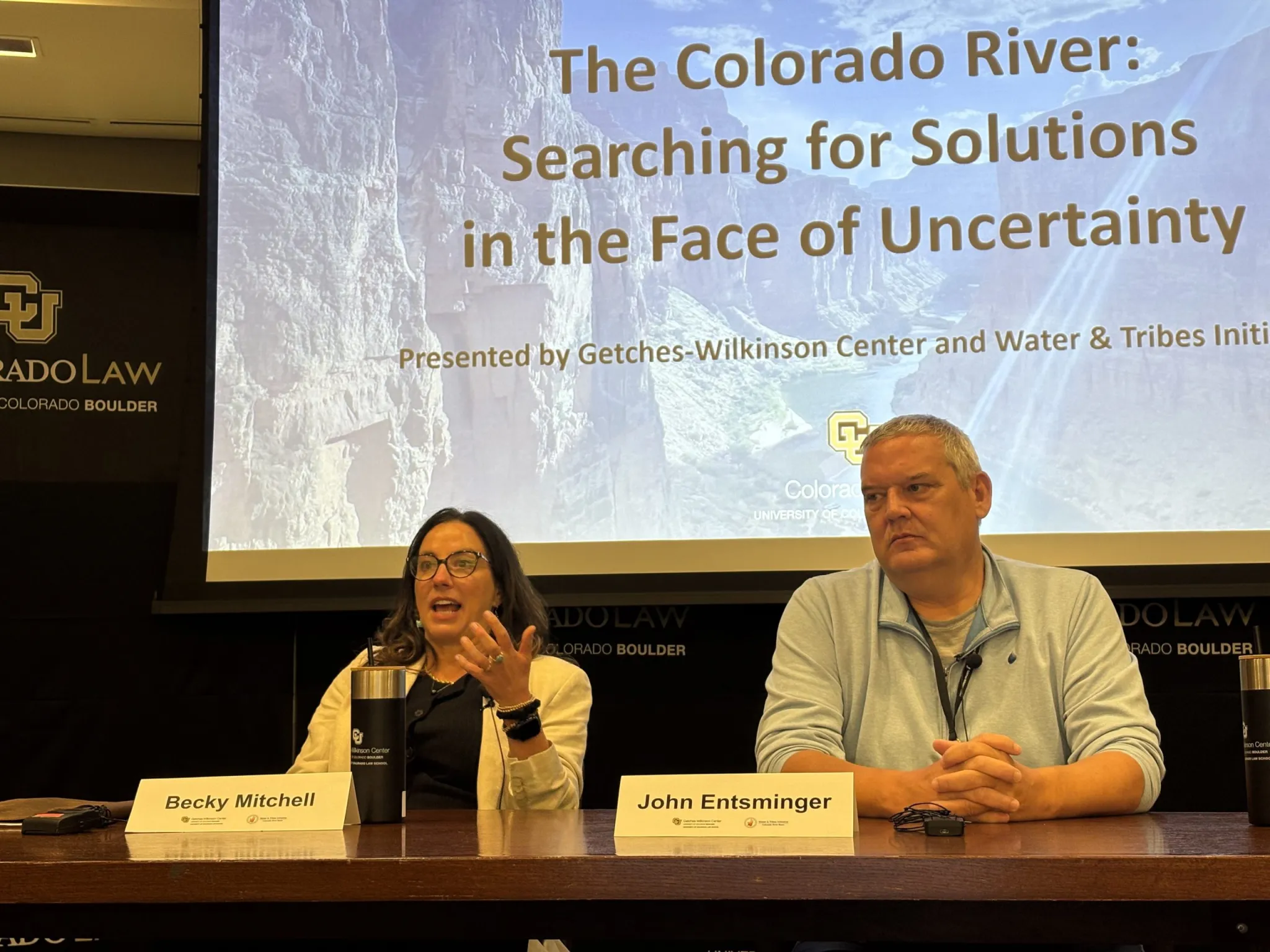

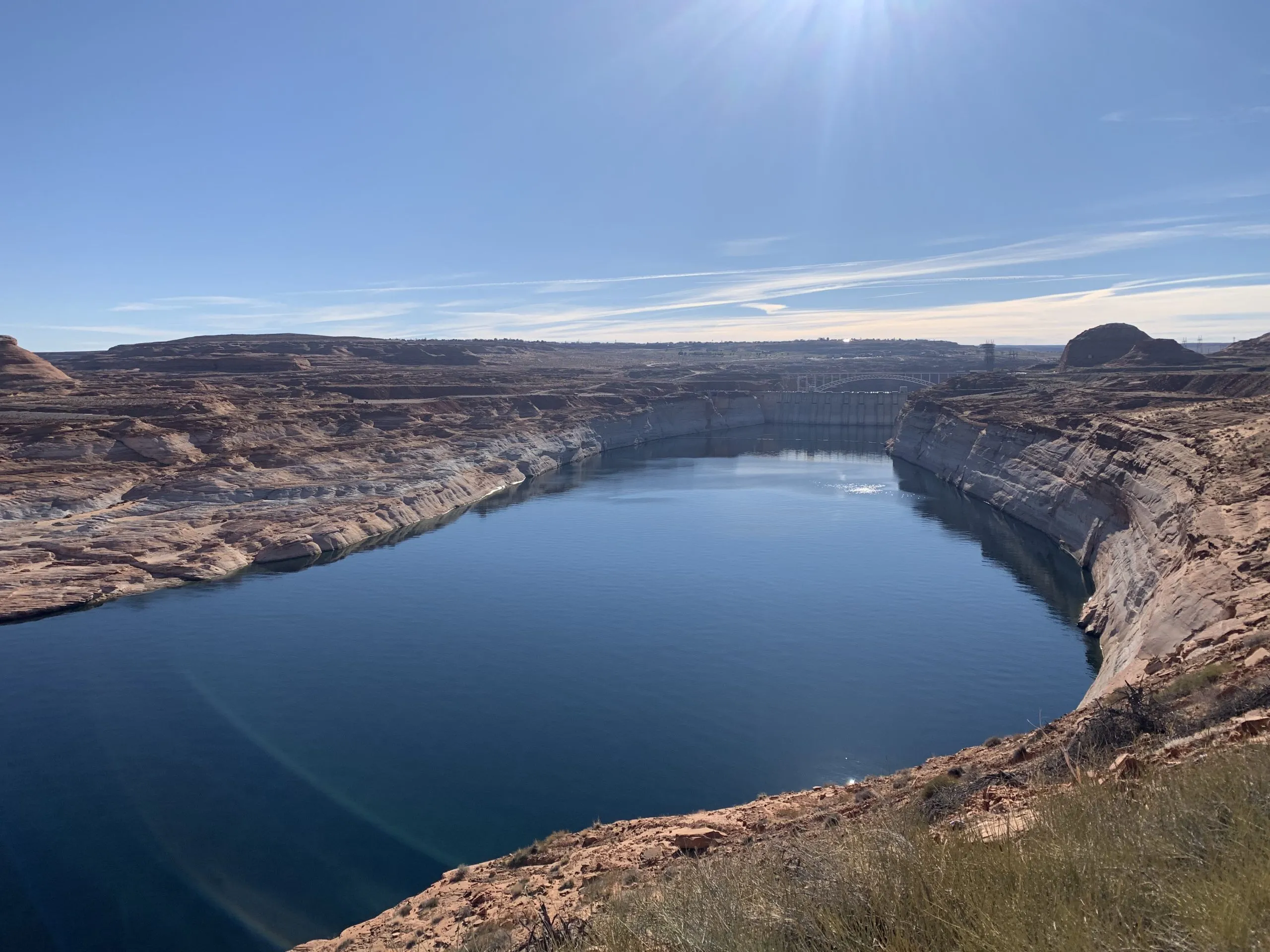
Map of the Colorado River drainage basin, created using USGS data. By Shannon1 Creative Commons Attribution-Share Alike 4.0

Romancing the River: The Era of Conquest 3 — George Sibley (SibleysRivers.com) #ColoradoRiver #COriver #aridification

The back of Glen Canyon Dam circa 1964, not long after the reservoir had begun filling up. Here the water level is above dead pool, meaning water can be released via the river outlets, but it is below minimum power pool, so water cannot yet enter the penstocks to generate electricity. Bureau of Reclamation photo. Annotations: Jonathan P. Thompson

Click the link to read the article on the Sibley’s Rivers website (George Sibley):

April 21, 2026

A bad year in the Colorado River Basin – barring a truly miraculous spring, probably the worst in recorded history. It is bad enough so the Bureau may have to stop creating power from the Glen Canyon powerplant by this coming fall. At that point, the only way to get water downriver from Glen Canyon Dam will be dribbling it through four outlet tubes that the Bureau is now wishing it had built differently (better) 65 years ago. And praying for enough precip to push the level back above the danger point for the turbines.

Meanwhile the negotiations between the seven basin states about the future distribution of the water remained at an impasse. One might think that a really bad year might generate some new thinking, but the two Basins are still debating Compact numbers like 7.5 million acre-feet for the Lower Basin with a river that might produce less than 5 maf this year, and maybe not much more than that more frequently in the future.

It should be obvious by now that any further negotiation between the states needs to have an independent facilitator guiding the discussion, pushing both factions to disassemble their own non-negotiables. A hard-ass facilitator speaking on behalf of river reality. [ed. emphasis mine]

It seems likely that we will go into the 2027 water year this fall with some new ‘interim plan’ for operating the river system for the water year that begins in October – probably some mix-and-match from the Bureau’s five alternatives proposed last year and ‘EISed’ while the seven states fiddled. The real purpose of the new interim plan will be to keep the infrastructure of the river system viable – dancing with the dead pool. This will probably impose serious delivery shortages on those below the Powell and Mead Reservoirs (meaning the Lower Basin), and also drop the Upper Basin’s rolling 10-year total closer to the 75 million acre-feet (maf) that will cause the ‘compact call’ threat to rear its ugly head.

Year-to-year might be the most honest approach now, anyway, getting a habit of feeling our way forward carefully, with our eyes wide open – woke, one might say.  The managerial ‘need for certainty’ in projections may not be part of the future we’ve imposed on ourselves.

But that’s a good place to let the present sit and settle, and go back to the unfolding saga of the ‘Era of Conquest’ in this update of Fred Dellenbaugh’s Romance of the Colorado River. You may remember that in the last post here, I related that the Bureau of Reclamation, feeling much loved for the Boulder Canyon Project that watered, fed and powered a massive regional development in Southern California, came out of World War II ready to do the same for the Compact’s Upper Basin, in response to a mandate in the Boulder Canyon Project Act that a plan be developed for the development of the rest of the river.

There was, however, already quite a lot of development going on in the Upper Basin – at least in the state of Colorado, beginning in the 1930s, simultaneous with the Boulder Canyon Project.

Udall/Overpeck 4-panel Figure Colorado River temperature/precipitation/natural flows with trend. Lake Mead and Lake Powell storage. Updated through Water Year 2025. Note the tiny points on the annual data so that you can flyspeck the individual years. Credit: Brad Udall

To establish context – the whole Colorado River Basin was experiencing its first serious modern-times drought, even as the Great Depression was settling over the whole nation. After the ‘pluvial’ of water abundance in the first three decades of the 20th century, which convinced the water mavens that the river would deliver a dependable-enough flow of nearly 18 maf, the basin experienced its first 5 maf flow in 1933; by the end of the 1930s, there was reason to doubt that the river would ever again average 18 maf.

But Colorado had a special problem to resolve about Colorado River water distribution: the transdivide situation. I will not bore you again with my opinion of the imperial arrogance in randomly laying down straight line state boundaries in a region of great geographic and geological diversity. But what this created in the irrelevant rectangle called Colorado was like a blanket laid over a fence – the fence being the Continental Divide. West of the Divide, precipitation that fell (mostly snow in the winter) all ran off toward the Pacific Ocean in the Colorado River tributaries. East of the Divide, it all ran off toward the Atlantic in the Platte, Arkansas and Rio Grande Rivers. Because the weather mostly rode in on the prevailing westerlies, considerably more precipitation fell on the West Slope than fell on the East Slope. But the vagaries of cultural and economic development put most of the population and economic growth on the East Slope – ‘80 percent-20 percent’ is the rough ratio frequently used to describe the imbalance between water and population in the blanket dropped over the fence.

The distribution of water on both sides of the ‘blanket’ was governed by the appropriation doctrine as stated in the Colorado Constitution: all the water in the state belongs to the people of the state, subject to appropriation for individual use, and the right to divert ‘shall never be denied’ – with seniority among users determining the right to use the water in times of shortage. And by the turn of the century, challenges in water court had established the right to divert water from one basin to another.

As the drought of the 1930s settled in, farmers on the East Slope began to experience serious pressures on the water supply. And consistent with the optimism and technological advances of the early 20th century, this was not regarded as a fact of life to be acknowledged and adapted to, but as a problem to be addressed – in this situation, by moving water from the West Slope. A major task – but Franklin Roosevelt’s ‘New Deal’ efforts to alleviate the Great Depression offered the possibility of some help, through new agencies like the Reconstruction Finance Corporation and the Public Works Administration.

So when the Colorado General Assembly gathered early in 1933, two water project bills were in the hopper: one to divert an unspecified quantity from the Upper Colorado River in the Grand Lake area to the South Platte River basin, and one to divert an unspecified quantity from the Gunnison River to the Arkansas River basin.

Inhabitants of the West Slope, however, knew nothing about this until they read about it in the newspapers. And they were even more surprised that summer when construction actually began on two transdivide projects: the Denver Water Board began constructing a system of small canals high in the Fraser River headwaters (Upper Colorado tributary) to bring water to the Moffat railroad tunnel pilot bore, which the Water Board had leased from the railroad – an unused but already dug ‘pipe’ to the northern Denver area. And the sugar-beet industry led by Great Western Sugar was doing the same collection system in the headwaters of the Roaring Fork River above Aspen for diversion into a small tunnel to the Arkansas River basin. Both of those enterprises were self-funded.

All of this precipitated a regional West Slope meeting in Grand Junction of ‘water people’ – county commissioners and attorneys who were also all ranchers or farmers – at which a ‘Western Colorado Protective Association’ (WCPA) was formed, and a letter was drafted to the state engineer expressing concern that the proposed and in-process projects threatened the future development of the West Slope, and requesting inclusion in all future discussion of them.

The situation as the West Slope people saw it was not a ‘water grab.’ The leadership in the WCPA knew that the East Slope irrigators and city-builders were exercising a constitutional right in appropriating ‘the people’s water’ on the West Slope. They also knew that most of the Colorado River water left the state’s West Slope in an unmanageable snowmelt flood anyway, and it might as well go through a tunnel to the Front Range as through Grand Junction and on to – well, soon, on to enviable storage behind the great dam being built far downstream rather than its historical destiny of flowing on into the salty sea unused.

Storage! That was the key to the West Slope’s chief water problem, which was water available throughout the growing season for finishing as well as starting crops. West Slope engineers had been drafting up a number of reservoir-and-irrigation projects to present to the Bureau of Reclamation, but dams are expensive, and all of the proposed reservoirs served mountain-valley populations too small to pass the Bureau’s cost-benefit analyses.

So the concept of ‘compensatory storage’ for water lost through transdivide diversions became the WCPA’s central focus. And despite their small population, the WCPA had two good cards to play. One was the fact that New Deal federal funding distributed to the states had to be for projects approved by the entire state; the transdivide diversions that needed federal assistance needed for the basin of origin to be as happy as the basin of destination.

A image shows a guest column by Rep. Edward Taylor that appeared from the Steamboat Pilot in 1921. Graphic credit: Northern Water

The other card was a congressional representative, Edward Taylor, whom they had returned to Congress for 12 terms by 1933, and who had over that quarter-century ascended to chairmanship of the subcommittee that controlled the Interior Department budget in the powerful House Appropriation Committee. Congressman Taylor launched the WCPA’s ‘defensive offensive’ by saying that any project seeking federal assistance for a transdivide diversion would have to provide, as part of their project, an acre-foot of compensatory storage for the West Slope for every acre-foot to be diverted.

That was a large and very expensive demand. Taylor exempted Denver and its Moffat project from the mandate – because, he said, we all want to see ‘our capital city’ grow unrestricted. More likely, he knew that Denver could fund its own project and would at best just ignore him; he was not their congressman, and the Denver Water Board at that point was coming under the domination by their attorney, Glenn Saunders, a city-builder who envisioned a water supply for a ‘thousand-year city,’ most of which he thought would have to come from the West Slope. He just wanted the hicks to stay out of his way. (Not an exaggeration at all.)

Taylor could, however, impose his acre-foot-for-every-acre-foot demand on those seeking federal Public Works Administration funds or Bureau of Reclamation assistance. And that set up what is really an interesting story of people working out difficult problems they’ve imposed on themselves in draping a blanket over a fence and calling it a state, then adopting a wide-open appropriations doctrine for the distribution of a limited resource statewide. It’s a story with many moving parts that we don’t really have time for here in depth; I will note, however, that the whole story is told in my Water Wranglers book, the story of the development of Colorado’s share of the Colorado River. (Out of print, but copies supposedly in all Colorado libraries.)

The principal players in the story were the Western Colorado Protective Association (WCPA), led by Frank Delaney, a lawyer-rancher, and D.W. Aupperle, a Grand Junction lawyer and fruit grower; the South Platte Water Users Association (SPWUA), led by Charles Hansen, a newspaper editor in farm country and a couple lawyer-farmers; and of course the Bureau which wanted to do a big transdivide diversion to the South Platte River. And what turned out to be the ‘wild card,’ Congressman Taylor.

A seemingly endless series of meetings began between the WCPA and the SPWUA with the Bureau in attendance. There was fundamental agreement that, first, the East Slope had legal right to appropriate West Slope water, and second, that the East Slope owed the West Slope some compensation for diverting part of the West Slope’s base for future development. The challenge was arriving at the amount of compensation. The SPWUA wanted to divert more than 300,000 acre-feet from the Colorado River, for what became the Colorado-Big Thompson Project, but they did not see how (even if they could get some New Deal PWA financing) they could afford to also create that much West Slope storage. But the WCPA felt bound to support their congressman – without whom they really had no card to keep them in the game. Frustration and ire grew on both sides – compounded by having to travel back and forth either on the slow trains or drive on roads that were really ‘country’ (a major West Slope chronic complaint).

Finally, in the spring of 1936, Frank Delaney of the WCPA suggested a compromise. If the Bureau and SPWUA wanted to rush into construction, it would have to be Taylor’s acre-foot-for-an-acre-foot mandate. But if they could delay their project until the Bureau did a thorough study of what the loss of 300,000 af of free-flowing water (most of it annually leaving the state unused anyway) would be to the West Slope, and how much storage would actually compensate the West Slope users for that loss of spring runoff, the West Slope would accept that number (and work on getting Cong. Taylor to accept it).

The ‘Delaney Resolution’ broke the stalemate. The Bureau men spent months poring over existing rights and land maps (long before computers and spreadsheets), and came up with a need for 152,000 acre-feet of compensatory storage: 52,000 af to make sure that the Shoshone power plant water right above Glenwood Springs could be met year round (which would also ensure enough late season water for the Grand Valley farms and orchards), and 100,000 af for future irrigation and domestic water development.

That cut Taylor’s demand in two – and the Bureau planned to add a powerplant to the dam that would significantly reduce what the SPWUA would have to pay back. During this period, Taylor – an old man – was actually too sick to participate, and the Delaney Resolution was adopted for the Colorado-Big Thompson Project. (Taylor would die in office in 1941 – still believing that an acre-foot-for-every-acre-foot was what should be adhered to.)

Graphic credit: RogerWendell.com

The compromise process was codified as ‘Senate Document 80,’ part of the Colorado-Big Thompson Project Act passed in 1937. Senate Doc. 80 became part of all subsequent transdivide project planning – except where Denver was concerned; it wasn’t until the veto of Denver Water’s Two Forks Project half a century later that Denver Water finally conceded to take West Slope needs into account in its transdivide projects.

That process of working through a significant challenge to mutual benefit stands, in at least my mind, as one of the highlights of the Era of Conquest in the Colorado River region – a period not without occasional efforts measuring up to the often naive but high-minded vision driving the developers’ ‘romancing of the river’ – to bring deserts into bloom, to reshape unfriendly environments to accommodate individuals and their families willing to work at it. It is too easy to condemn that from this side where we reap the harvest of all the mistakes involved that they didn’t know about until they had made them.
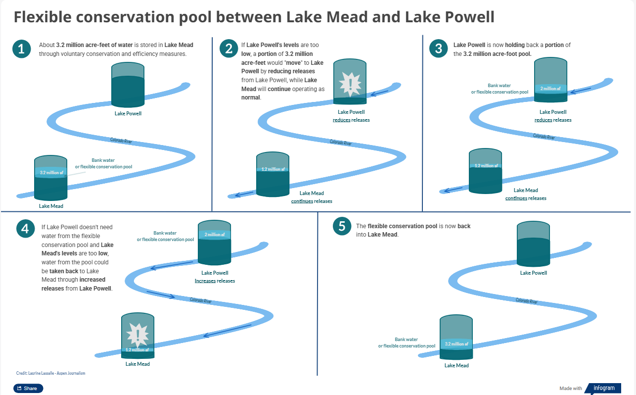
Next post, we’ll look at what happened to that carefully forged intrastate resolution when serious Colorado River planning came to the Compact’s Upper Basin. Meanwhile – pray for monsoons, or just a good rainy spell.

Colorado transmountain diversions via the University of Colorado

The state of #solar: Despite partisan rhetoric, the industry is still booming — Rebecca Egan McCarthy &  Kate Yoder (Grist.org)

May 6, 2023 – Volunteers with the National Renewable Energy Laboratory’s (NREL’s) ESCAPES (Education, Stewardship, and Community Action for Promoting Environmental Sustainability) program lend a hand to Jack’s Solar Garden in Longmont, Colo. Bethany Speer (left) goes back for more while Nancy Trejo distributes her wheelbarrow load to the agrivoltaic plots. (Photo by Bryan Bechtold / NREL)

Click the link to read the article on the Grist website (Rebecca Egan McCarthy &  Kate Yoder):

April 20, 2026

Solar power is cheap, fast, and in demand as data centers consume more and more electricity.

The future looked dire for renewable energy in the United States last spring. Republicans in Congress started gutting the Inflation Reduction Act, forcing its generous tax credits for wind and solar into an early retirement. The Interior Department then rolled out a series of byzantine regulations aimed at restricting clean energy on federal land. Some feared those regulations would curb wind and solar development on private land, too.
Although these restrictions do seem to have hindered the wind industry, there are some signs that its fortunes are changing. But a year later, solar continues to boom. MAGA influencers are promoting it, there’s hope for legislation that would speed up approvals for new projects, and the industry has continued to expand over the last year as energy requirements from data centers demand fast, cheap power. The Trump administration has even signed off on some big solar projects: In February, the administration announced that it would allow several solar projects that had been blocked by the new Interior regulations to move forward. 

“I feel like there has been so much written that’s like, ‘The Trump administration is delaying this stuff. It’s holding it all up in red tape. Nothing’s getting built,’” said Hannah Hess, director of the Rhodium Group’s Clean Investment Monitor team. “When we look at the data, that’s not true.” Combined, solar and battery storage (which banks excess energy for use when the sun’s not shining) accounted for 79 percent of power generation brought online in 2025 and are expected to continue to grow by 49 percent before the Inflation Reduction Act tax credits expire at the end of 2027. 

Support for solar among rank-and-file-conservatives has fallen in recent years, caught up in partisan culture wars, but it could gain more traction in the party if it’s paired with affordability concerns. Some 69 percent of Republicans say they are supportive of solar, provided it lowered electricity costs, according to a recent poll from the research organizations GoodPower and NORC at the University of Chicago. The Solar Energy Industries Association, the industry’s primary lobbying group, has emphasized that its industry aligns with President Donald Trump’s “energy dominance” agendaand lowers energy costs for families and businesses. “Conservative voters are drawing a clear distinction between rhetoric and practical solutions that lower costs,” read a blog post from the association in February.

Even prominent conservative figures seem to be softening toward solar. Katie Miller, a former Trump administration official and the wife of Stephen Miller, the White House’s deputy chief of staff for policy, has gone so far as to herald solar as the “energy of the future.” In February, she posted to X: “Giant fusion reactor up there in the sky — we must rapidly expand solar to compete with China.” That same month, Energy Secretary Chris Wright, who had been a vocal critic of solar power, started saying it could be beneficial. “Is there a commercial role for solar power that can add to the grid affordable, reliable energy?” he said. “Certainly there is.” 

Data center developers have begun looking to solar as a complement to oil and gas, rather than a competitor. The incoming demand “feels crazy,” said Jim DesJardins, executive director of the Renewable Energy Industries Association of New Mexico. “It’s scary, almost. Five years ago, we were talking about an increase in load from EVs and building electrification — we’re not talking about that anymore. It’s all data centers and how are you going to power them.” This year marked the first time, said DesJardins, that the New Mexico Oil and Gas Association reached out to sponsor the renewable energy association’s annual conference.

Solar is, by far, the cheapest and fastest way to bring energy online, especially as the shortage of gas turbines — internal combustion engines that convert fuel into a steady, reliable energy — in the U.S. creates yearslong delays to build new power plants that run on natural gas. [ed. emphasis mine] The technology is crucial for data centers that need to run 24 hours a day, seven days a week. “The backlog alone [for turbines] is five to nine years,” said Mike Hall, CEO of Anza Renewables, an energy intelligence and procurement platform based in California. “Then you’ve got to permit it. Then you’ve got to be near a gas pipeline for fuel, and then you’ve got the climate and the carbon issues.” A recent study from the analytics company Sightline Climate found that half of data center deals were expected to be delayed due to power constraints and local opposition, and developers are beginning to realize that waiting in line for a gas turbine could spell doom for their operation. 

There are still some obstacles ahead for solar power, however. “We’ve definitely seen examples from our developer customers where the Department of Interior rules are creating challenges for their projects on federal land, but we haven’t seen that it’s really slowed down development on private land,” said Hall. “The bottlenecks are typically still local permitting and interconnection with utilities — those are still major challenges, and we haven’t seen a lot of improvement in either area yet.”

Shortly before Congress adjourned for its winter recess in December, the House passed the Standardizing Permitting and Expediting Economic Development Act, also known as the SPEED ACT, a bipartisan bill that would streamline the permitting process for energy, infrastructure, and transportation projects by overhauling the National Environmental Policy Act, or NEPA. Signed by President Nixon in 1970, NEPA requires federal agencies to consider how proposed infrastructure projects or drilling permits would affect the environment before approving them. Permitting reform is the rare, bipartisan issue that has sparked real enthusiasm on both sides of the aisle. 

After a scuffle over the Trump administration’s decisions to shut down offshore wind projects, which judges ruled invalid, Democratic senators Martin Heinrich and Sheldon Whitehouse are coming back to the negotiating table to hammer out a deal. “Right now, we’re leaving electrons on the table thanks to Trump’s deliberate attacks on clean energy — forcing Americans to pay higher electricity bills,” Heinrich’s office told Grist. “To lower costs, this administration needs to stop stalling and slow walking clean energy projects and take the politics out of permitting reform.”

The war in Iran, which has caused oil prices to skyrocket, may serve to boost interest in solar power even more — especially as a way to combat rising electricity costs and promote energy independence. “Energy poverty has always been a problem in the U.S., and it’s gotten significantly worse in recent years,” said Brad Townsend, vice president of policy and outreach at the Center for Climate and Energy Solutions, an environmental policy nonprofit. He pointed to a study from the nonprofit RMI, formerly the Rocky Mountain Institute, that found 1 in 3 households were struggling to pay their utility bills. “I think folks in the administration are increasingly becoming aware of the fact that we can’t turn away renewable energy.” 

In terms of the geopolitical reasons to support solar, “no one has fought a war over the sun,” DesJardins told Grist. “Not yet, anyways.” 

Critics question feds’ plans for future of #ColoradoRiver: In years of severe #drought, ‘the system is failing’, #ClimateChange is sapping river flows as #LakePowell, #LakeMead water levels continue to fall — The #Denver Post #COriver #aridification

Udall/Overpeck 4-panel Figure Colorado River temperature/precipitation/natural flows with trend. Lake Mead and Lake Powell storage. Updated through Water Year 2025. Note the tiny points on the annual data so that you can flyspeck the individual years. Credit: Brad Udall

Click the link to read the article on The Denver Post website (Elise Schmelzer). Here’s an excerpt:

April 19. 2026

The multitude of water managers tasked with overseeing the drying Colorado River systemstand at a dire crossroads. As a years long stalemate in negotiations persists between the seven states that share the river, it’s become increasingly likely that the federal government will impose its own long-term plan, choosing from a range of proposals officials have outlined in recent months. But experts and water managers across the 250,000-square-mile Colorado River basin are raising the alarm about the five plans, questioning if any of them hold up under the new climate reality. They say the federal plans won’t keep the system from crashing in critically dry years — which are becoming more frequent — and could wreak chaos on the pivotal lifeline for 40 million people in the American Southwest.

“In every one of those alternatives, under what they call critically dry hydrology, the system is failing,” said Andy Mueller, the general manager of the Colorado River District, a taxpayer-funded agency based in Glenwood Springs that works to protect Western Slope water. “And critically dry hydrology is what we have continued to see consistently in the basin in the last 25 years and what we should expect going forward.”

[…]

In extremely dry years, the longer-term plans under consideration by Reclamation would allow the water levels of the system’s two main reservoirs to repeatedly fall below minimum power pool. Federal officials then would be forced to make recurring emergency cuts to the water supplies of the three states downstream of the reservoirs, creating uncertainty for millions of people and a massive agricultural industry…Letters from a number of Colorado entities — including the Northwest Colorado Council of Governmentsirrigation districts, the Western Slope’s Club 20 and county commissions from a vast swath of the state — urged federal officials to present at least one plan that would hold up in extremely dry years.

“Sound science dictates that Colorado River management must evolve to handle a permanently drier future,” Tina Bergonzini, the general manager of the Grand Valley Water Users Association, wrote in her comments to the bureau. “The current federal preference for predictability is an atmospheric impossibility given that studies indicate rising temperatures have already slashed river flows by a fifth.”

[…]

The conflict on the Colorado is likely one of the world’s first major water policy overhauls to grapple with the reality of climate change, said Brad Udall, a senior water and climate research scholar at Colorado State University’s Colorado Water Center. In the past, Colorado River managers made operational tweaks and short-term deals to address drought. This time, it’s different.

“We’re not looking at an incremental step here,” Udall said. “We’re looking at a complete redo of how we operate this resource that affects 40 million people.”

Map of the Colorado River drainage basin, created using USGS data. By Shannon1 Creative Commons Attribution-Share Alike 4.0

Reclamation Acts to Protect #ColoradoRiver System During Historic #Drought: The prolonged drought combined with the lowest winter #snowpack on record is requiring swift actions to protect this vital water system #COriver #aridification

The Colorado River flows through seven states and provides water to 40 million people. Photo credit: USBR

Click the link to read the release on the Bureau of Reclamation website:

April 17, 2026

Long-term drought has reduced Colorado River system storage to about 36 percent of capacity, and the combination of the lowest snowpack on record and record-breaking March heat has further intensified drought conditions across the Basin. These compounding factors are creating elevated risks to essential water and power infrastructure that supply water to more than 40 million people, underscoring the need for immediate action.

Lake Powell’s water year minimum probable inflow is forecasted at just 2.78 million acre-feet—29% of historical average and one of the lowest on record. Reclamation’s April “24 Month Study” projects Lake Powell may decline to below 3,490 feet—the minimum power pool level—by August 2026 without major intervention. If Glen Canyon Dam declines below 3,490 feet, water releases would be only through the river outlet works, which could cause operational issues, uncertainty for users, downstream impacts, instability in regional power and water supplies, and a reduction in power generation. 

Secretary of the Interior Doug Burgum met with Governors for the seven basin states, Arizona, California, Colorado, Nevada, New Mexico, Utah and Wyoming, and their designees again today to discuss the concerning hydrology and plans for operations. 

“I am grateful for the Governors and their teams working diligently to find a solution to the complex challenges created by these unprecedented drought conditions which require immediate action,” said Interior Secretary Doug Burgum. “Interior and Reclamation continue to coordinate with the basin states, tribes, Mexico and basin stakeholders as we make the decisions necessary to operate and protect the system.” 

To stabilize the system, Reclamation is moving quickly and initial plans include adding up to about 2.48 maf of water to Lake Powell by moving water from the upstream Flaming Gorge Reservoir and by reducing releases from Lake Powell.  [ed. emphasis mine]

Through the 2019 Drought Response Operating Agreements, Reclamation is intending to release 660,000 acre-feet to 1 maf from Flaming Gorge Reservoir from April 2026 through April 2027. In addition, Reclamation is intending to reduce the annual release volume from Lake Powell to Lake Mead by 1.48 maf—from 7.48 maf to 6.0 maf—through September 2026 by utilizing section 6E of the Record of Decision from the final 2024 Supplemental Environmental Impact Statement for near-term Colorado River Operations.  

Together, these actions are expected to increase Lake Powell’s elevation by approximately 54 ft to at least elevation 3500 feet by April 2027. Through the current, ongoing DROA process, the basin states, tribes and partners continue to provide feedback related to the proposed releases. A final decision will be coming next week. 

Flaming Gorge Reservoir now holds about 3.1 maf of water, which is 83% full. These actions are expected to lower the reservoir’s elevation by roughly 35 feet over the next year to approximately 59% of capacity. This will have no effect on contracted water rights at Flaming Gorge or Lake Powell. No additional releases from the other upstream initial units of the Colorado River Storage Project Act—Blue Mesa and Navajo reservoirs—are planned at this time, due to their low water levels and poor forecasted inflows.  [ed. emphasis mine]

“Given the severity of the risks facing the Colorado River system, it is imperative that we take action quickly to protect a resource that supplies water to 40 million people and supports vital agricultural, hydropower production, tribal, wildlife, and recreational uses across the region,” said Assistant Secretary – Water and Science Andrea Travnicek. “As we weigh current conditions and prepare for future operations by working with states, tribal nations and stakeholders, the Department of the Interior and Reclamation remain fully committed to taking the actions necessary to reduce impacts on water deliveries, safeguard critical infrastructure, and preserve as much operational flexibility as possible.”   

Basin-wide impacts 

Reclamation acknowledges that the proposed reduced releases from Lake Powell will accelerate the downstream decline of Lake Mead, with the potential for up to an additional 40% reduction to Hoover Dam’s hydropower generating capacity as early as this fall. Reclamation and its lower basin partners are collaborating to conserve water in Lake Mead and maintain its water levels, even as releases from Lake Powell are planned to decrease.  

The initial proposed drought response actions may also impact recreation across multiple sites. At upstream reservoirs, boating access may be reduced earlier in the season than normal. In the Grand Canyon, lower flow rates will affect rafting conditions, and fishing may be more challenging. At Lake Mead National Recreation Area, reduced water levels may further limit boating access. Reclamation is working with reservoir recreation management partners now and as the summer progresses.  

The 2026 operational challenges come at a time of transition as the existing agreements that guided the operations of the Colorado River for the last two decades are set to expire at the end of the year. As we approach the new water year on October 1, the seven basin states have not reached consensus on a new operating framework. With time running out, there is a need for extraordinary collaboration for 2027 and beyond. In the absence of a consensus and following the completion of the NEPA process, the Interior Department will be prepared to determine operations for Post 2026 later this summer to provide certainty and stability for the Colorado River Basin.  

To learn more about the Interior Department’s or Reclamation’s activities around the Colorado River, please visit the Colorado River Basin website

Colorado River “Beginnings”. Photo: Brent Gardner-Smith/Aspen Journalism

Feds’ $140 million promised to #ColoradoRiver drought mitigation projects remains stuck for ‘bureaucratic’ reasons — The Summit Daily #COriver #aridification

The Colorado River passing Grand Junction, Colorado. Photo by Robert Marcos.

Click the link to read the article on the Summit Daily website (Ali Longwell). Here’s an excerpt:

April 13, 2026

Despite pressure from Colorado’s congressional delegation, around $140 million in federal funding previously granted to Western Slope water projects has lingered in limbo for nearly 16 months. The funds, awarded to 17 Western Slope projects in the final days of President Joe Biden’s administration, were part of the Inflation Reduction Act’s drought mitigation grant opportunity for the Upper Colorado River Basin. This included $40 million granted to the Colorado River District to aid in its purchase of the Shoshone water rights, the oldest and largest non-consumptive right on the Colorado River tied to the hydropower plant in Glenwood Canyon.  Three days after the awards were announced, President Donald Trump took office, and his Day 1 order, “Unleashing American Energy,” called for all federal agencies to “immediately pause the disbursement of funds appropriated through the Inflation Reduction Act.” In June, the U.S. Bureau of Reclamation released funds for two of the projects in the Orchard Mesa Irrigation District in Palisade, but the rest remain frozen. 

“The funding has not yet been released, and that’s a real concern given current conditions across all of Colorado, but particularly western Colorado,” said Rep. Jeff Hurd, a Republican representing Colorado’s third district spanning the Western Slope, in an interview on Thursday, April 9. “I am continuing to press hard for clarity on timing and next steps because those projects were awarded for a reason and the need has not gone away.”

The Inflation Reduction Act set aside $4 billion toward drought mitigation, including funds for the Bureau of Reclamation’s Upper Colorado River Basin System Conservation and Efficiency program, also known as the Bucket 2E funding. In January, the Bureau under Biden’s administration allocated a total of $388.3 million to 42 projects on tribal land and in states in the Upper Basin. 

Shoshone Falls hydroelectric generation station via USGenWeb

This included $152 million for 17 projects in Colorado, including those for wildlife habitat, watershed and stream restoration, water infrastructure improvements and more. Only $12 million of this funding for two Orchard Mesa Irrigation District projects  — meant to improve water delivery to the 15-mile reach of the Colorado River, which extends from Grand Junction and the confluence of the Gunnison River and serves as critical habitat for several endangered fish species, as well as install new metering technology in the Grand Valley — has been released to the awardees.  The largest Colorado award was the $40 million promised to the River District, which represents 15 Western Slope counties. This funding represented a large chunk of the $98.5 million that the River District needs to purchase the Shoshone water rights from Excel Energy. Outside of the frozen federal dollars, the River District has raised $57.2 million from the state Legislature, its board and the various Western Slope municipalities and utilities it serves.  Matt Aboussie, Colorado River District’s communications director, said the district continues to work closely with the Bureau of Reclamation to secure this promised funding and remains committed to securing the rights. 

“Funding will not be the obstacle that stops this effort,” Aboussie said. “If needed, River District leadership is prepared with alternative funding options and continues to rely on all our communities to get this project across the finish line.”

Abysmal math on the #ColoradoRiver: Feds look to avoid de facto deadpool at #GlenCanyon Dam — Jonathan P. Thompson (LandDesk.org) #COriver #aridification

The Central Arizona Project canal, which carries Colorado River water to Phoenix and Tucson, as it runs past fields in the desert (that are irrigated with groundwater, not CAP water). The CAP is not likely to see new cuts this year beyond the levels already imposed. Source: Google Earth.

Click the link to read the article on The Land Desk website (Jonathan P. Thompson):

April 14, 2026

🐟 Colorado River Chronicles 💧

With each passing April day without major snowfall, we gain more clarity on the Colorado River situation and what things might look like this summer, which is, in a word, grim. Or, as Arizona’s top water officials put it: “The winter and spring snowpack and runoff projections in the upper basin are abysmal.”

The Colorado River Basin Forecast Center is putting a number to that term by predicting that the Colorado River system will deliver about 1.4 million acre-feet1 of water to Lake Powell from April 1 through July 31. That’s about 23% of the median for the spring runoff season, which is when flows are most abundant, and just over half of last year’s not so great figure of 2.6 MAF.

This year’s Upper Colorado Basin spring runoff is forecast to be about 1.4 million acre-feet. That isn’t as low as 2002, which was just below 1 million acre-feet, but if conditions don’t improve it could fall even lower than that. Source: Colorado River Basin Forecast Center.

Believe it or not, that figure — the official 50% forecast, made by an actual person — may be optimistic. Over the last two weeks, the Ensemble Streamflow Prediction model (which is a constantly updating automated forecast) has come up with an even more dire outlook, downgrading the forecast to 1.16 MAF during that same time period.

Abysmal, indeed.

We’re also getting a little more information as to how the feds plan to address the crisis, at least in the near-term. Most significantly, they tentatively plan to “defend” minimum power pool at Glen Canyon Dam, which is to say they will do what it takes to keep the surface level of Lake Powell at or above 3,500 feet in elevation to avoid relying on the lower river outlets, which are not engineered for sustained use. The weapons they will use for this defense include:

  • Reducing Lake Powell releases from the planned 7.48 million acre-feet to 6 million acre-feet.
  • Releasing up to 1 MAF from the “Upper Initial Units,” which includes Flaming Gorge, Blue Mesa, and Navajo Reservoirs. Hydrology may make this impossible, however, meaning that these releases could be as low as 650 MAF .65 MAF (or 650,000 acre-feet).
  • For now, Interior is not asking for larger cuts from the Lower Basin (beyond the 1.5 MAF cuts they’ve already taken), which presumably means the feds will not reduce Lake Mead releases through Hoover Dam.

But will it be enough to avoid dipping below what I call de facto deadpool at Lake Powell? We won’t really know until later this summer, but a fairly simple calculation can help predict that future. Keep in mind that I’m no hydrologist, I’m just working with the numbers that are available to see whether potential inputs (Lake Powell inflows) are at least equal to planned outputs (Glen Canyon Dam releases).

I put together this little diagram to help visualize things. I know the text is tough to read in the email version, and especially if you’re reading this on your phone. So I’d suggest clicking on the image (or the headline of this post) and viewing it in the web version.

Simplified diagram of Glen Canyon Dam with inputs (on the right) and outputs (on the left). *Fish pool is the surface level scientists have deemed necessary for minimizing the potential of non-native bass escaping through the dam and propagating downstream, where they can compete with endangered native fish. Infographic by Land Desk using data from Bureau of Reclamation and the Colorado River Basin Forecast Center.

Here are the figures for the equation. 

Inflows:

  • 1.5 MAF: Lake Powell Storage available above 3,500 feet.
  • 1.1 MAF to 1.4 MAF: Forecast Lake Powell inflows April-July
  • .65 MAF to 1 MAF: Planned releases from upper basin reservoirs.

TOTAL INFLOWS: 3.25 to 3.9 MAF

Outflows:

  • 2.9 MAF: April 1 – Oct. 1 releases to reach 6 MAF for the water year (3.13 MAF has already been released)
  • .3 MAF: Rough estimate of evaporation from Lake Powell for the remainder of the water year.

TOTAL OUTFLOWS: 3.2 MAF

That gives us a whopping .05 to .7 million acre-feet to spare. That is cutting it close, folks; a hot, dry summer could drive evaporation levels up, and/or bring inflows down, shaving off the sliver of breathing room this affords. But unless the outlook dims considerably, the BoR should be able to avoid a run-of-the-river situation this year, which is good news. And, since Arizona likely will not be required to take more cuts this year, the state will probably hold off on doing a compact call and dragging the Upper Basin to court. 

These measures, however, will have a variety of consequences, including:

  • The Upper Basin reservoirs (Flaming Gorge, Navajo, Blue Mesa) are also likely to see record low inflows this year. That, combined with up to 1 million acre-feet of additional releases to benefit Lake Powell, will draw them down considerably, affecting hydropower production, irrigation, and, especially, recreation. 
  • Non-native smallmouth bass are abundant in Lake Powell, but since they are warmer-water fish, they tend to stay near the surface of the reservoir, meaning under normal conditions they stay well above the penstocks, or the outlets in the dam that lead to the hydropower turbines. However, as the surface drops closer to the penstock openings, so do the fish, allowing them to get flushed through the dam into the Colorado River. And because the water released from the dam is warmer (since it’s nearer to the surface), that warms the river downstream, allowing the bass to thrive and compete with the endangered native fish downstream. This is likely to be exacerbated as the surface level nears 3,500 feet. 
  • This year’s 6 MAF release from Glen Canyon Dam will bring the ten-year aggregate flows at Lees Ferry down to about 79 million acre-feet. This potentially puts the Upper Basin in violation of Article III of the Colorado River Compact, which mandates that the Upper Basin “not cause the flow of the river at Lee Ferry to be depleted below an aggregate of 75 million acre-feet” for any 10-year period. A 1944 treaty added another 7.5 million acre-feet to this figure to cover half of Mexico’s allotment, making for a total of 82.5 MAF over ten years. Note: The interpretation of this provision is in dispute. 
  • The diminished reservoir levels, combined with the reduced releases, will lead to lower hydropower output from the dam. That will force tribes, communities, and utilities that buy the relatively cheap power to purchase it on the open market. And it will also cut into power-sale revenues, which help fund endangered fish recovery programs. 
  • Reduced dam releases will mean lower flows, on average, through the Grand Canyon, affecting riparian ecosystems and boating. 
  • Reduced dam releases equate to lower flows into Lake Mead. Since the BoR apparently does not plan to cut releases from Hoover Dam, that reservoir will likely see its levels drop considerably, diminishing hydropower output and affecting recreation. My rough calculation suggests Lake Mead’s surface level will drop from the current 1,060 feet to about 1,030 feet, which would be lower even than in 2022. The BoR has suggested it will “defend” a level of 1,000 feet. That would almost certainly lead to Lower Basin shortages.
It’s still a long ways out, but for now the NOAA is calling for above average precipitation in the Southwest later this summer.
A super El Niño appears to be forming, but the effects in the Upper Colorado River Basin are especially hard to predict because it sits right in between the “warmer, drier” and the “wetter, colder” zones, meaning it could go either way. Source: NOAA.

There is potentially good news on the horizon. Conditions are ripening up for a “super” El Niño to begin forming this summer. It’s difficult to predict how that will affect the Upper Colorado River Basin, but for now, forecasts are calling for a strong monsoon in the Southwest, beginning in July. That probably would not do much to bring up Lake Powell’s levels, but it would provide relief to the many farmers who are almost certain to lose irrigation relatively early this summer and may help keep late-summer megafires at bay. And, you never know, El Niño might just bring a monster winter just when we need it most.


A Colorado River glossary and primer — Jonathan P. Thompson


1 *The forecasts are for the “unregulated flow,” which means that it is an estimate of what the flow would be without upstream dams holding water back. This is not the same as “natural flow” which is a calculation of what the flow would be without upstream human consumptive use, dams, or diversions. In this case, actual inflow and unregulated inflow are almost the same.

Map of the Colorado River drainage basin, created using USGS data. By Shannon1 Creative Commons Attribution-Share Alike 4.0

‘It’s incredibly bad’: No end in sight to #ColoradoRiver water crisis. Emergency drawdown of #FlamingGorge is imminent, officials say. The water situation is crashing so rapidly that authorities can’t confidently track the extent of it — Dustin Bleizeffer (WyoFile.com) #COriver #aridification

A tourist visits the lower reaches of Flaming Gorge Reservoir in Utah in September 2021. (Dustin Bleizeffer/WyoFile)

Click the link to read the article on the Wyofile website (Dustin Bleizeffer):

April 10, 2026

The outlook for the Colorado River, and Lake Powell in particular, continues to worsen due to an historically warm winter and dismal snowpack.

Projections show that Lake Powell on the Utah-Arizona border could drop low enough this year that it stops producing hydroelectric power at the Glen Canyon Dam. If it drops even lower, the dam is in danger of structural failure.

Wyoming relies on some of that hydroelectric power, according to state officials. The state will also play a major, legally obligated role in trying to help prevent such a catastrophe. Primarily, the Bureau of Reclamation will release extra water from Flaming Gorge Reservoir — potentially 1 million acre feet, which is more than a quarter of its storage capacity of about 3.8 million acre-feet.

In addition to recreation and economic impacts at Flaming Gorge on the Wyoming-Utah border — boat ramps may be rendered inoperable — Wyoming officials worry about potential mandatory water use reductions in the southwest corner of the state, as well as potential legal entanglements over a seven-state negotiation that has so far failed to resolve how stakeholders will share the pain of a declining Colorado River.

Buckboard Marina owner Tony Valdez, seen here Sept. 26, 2022, says he’s made continual adjustments to boat docks to keep up with lowering water levels at Flaming Gorge Reservoir. (Dustin Bleizeffer/WyoFile)

Adding to frustrations and fears, the water crisis is so severe and crashing so rapidly that stakeholders can’t even track — with confidence — its extent.

“Even though these projections are painting an incredibly dire picture for us, we need to be mindful that runoff might even be worse than what’s being projected,” Wyoming Senior Assistant Attorney General Chris Brown said Friday, adding that dry soil throughout the region is a wildcard in water calculations. “It’s bad. It’s incredibly bad what we’re seeing in the Upper [Colorado River] Basin right now.”

Brown joined Wyoming State Engineer Brandon Gebhart Friday at a Wyoming Colorado River Advisory Committee meeting to provide an update on the crisis (click here to see a slidedeck presented at the meeting).

“The information we’re getting is evolving just about as quickly as the hydrology is declining, so we’re trying to react to what we’re seeing in almost real time,” Brown said. “We don’t know what’s actually going to happen.”

This graphic depicts the “probable” water year for the Colorado River Basin in 2026. (Bureau of Reclamation)

An extra release from Flaming Gorge, which will begin on or before May 1, is a certainty, according to Wyoming water officials. That’s because the reservoir was specifically built to serve as a sort of water bank to ensure legally obliged deliveries to downstream states Nevada, Arizona and California. Among four storage reservoirs in the upper basin, Flaming Gorge has the most — and the most legally unrestricted – water to send downstream to Lake Powell.

“It’s the low-hanging fruit,” Brown said. “It’s the biggest, by far, and it’s got the most available water.”

The reservoir also played a vital backup role for Lake Powell a few years ago. Colorado River authorities released an extra volume of about 465,000 acre-feet of water from Flaming Gorge in 2023.

But this year, even considering decreased releases from Lake Powell to help maintain Glen Canyon dam’s functionality, “anything we do as far as upstream [extra water] releases is not going to be enough,” Brown said.

Flaming Gorge Reservoir on the Utah side near the dam in September 2021. (Dustin Bleizeffer/WyoFile)

The Ship Needs a Captain: A call for leadership in the #ColoradoRiver Basin —  Page Buono and Sinjin Eberle (AmericanRivers.org) #COriver #aridification

Banks of Lake Powell, Arizona in March 2026 | Page Buono

Click the link to read the article on the American Rivers website (Page Buono and Sinjin Eberle):

March 18, 2026

The situation is clear: the precipitation outlook in the Colorado River Basin is dire, the river cannot sustain the demands placed on it, and this year we’re likely to face unprecedented management decisions with potentially catastrophic consequences.

Despite decades of warnings and years of negotiations, there remains no clear blueprint for how the West can live with less water. That future is no longer hypothetical—it is already here.

Lake Powell’s drastically low water levels are evident in the discoloration of ancient cliffs that were submerged for decades, often referred to as “the bathtub ring” in March 2026 | Page Buono

We often talk about the Colorado River and drought in ways that can feel removed, impersonal, abstract, and buried in jargon. But beneath the stories, there are real lives, livelihoods, ecosystems, and traditions that make the region what it is, and that are very much at stake. 

West Drought Monitor map April 7, 2026.

On March 3, for example, the US Drought Monitor released their latest report, revealing that “snow water equivalent” is less than 70% of normal across the Central Rockies, and less than 50% in the Four Corners. 

Snow water equivalent is essentially how the water in the snow translates to real, wet water – the kind rivers and people rely on. By some accounts, the prediction for this year’s total is now on par with – and potentially worse than – 2002, which previously held the record for one of the worst water years on the Colorado River. For those who live in the region, the catastrophic wildfires of 2002 are not abstract: the Hayman fire burned for over a month, killed six people, destroyed more than 600 homes, and amounted to estimates of $42 million worth in damages. That same year, Arizona experienced the Rodeo-Chediski fire, which burned nearly half a million acres.

But it isn’t just one fire in one year – throughout the Southwest and in California, regions are experiencing some of the largest, most catastrophic wildfires in history, and they’re occurring much more frequently.

Map of the Colorado River drainage basin, created using USGS data. By Shannon1 Creative Commons Attribution-Share Alike 4.0

Upper #ColoradoRiver Basin States’ Governors Release Statement on Proposed Draw Down of #FlamingGorge and Upper Basin Reservoirs

View below Flaming Gorge Dam from the Green River, eastern Utah. Photo credit: USGS

Click the link to read the release on Governor Polis’ website:

April 9, 2026

Today, Governors Jared Polis (D-Colo.), Mark Gordon (R-Wyo.), Michelle Lujan Grisham (D-N.M.) and Spencer Cox (R-Utah) released a statement on the proposed draw down of Flaming Gorge and other upper basin reservoirs: 

“This is an unprecedented year on the Colorado River, and likely will be one of the worst on record. A dry year like this reminds us of why it is critical that all who rely on this resource learn to live within its means and adapt our uses accordingly. 

The Upper Division States of Colorado, New Mexico, Utah, and Wyoming, are actively and strictly regulating water uses. Because of such diminished runoff, existing state laws in the Upper Division States require water users to face cuts to water rights dating back to the 1800s – these cuts are mandatory, uncompensated, and will have significant impacts on water users, including Upper Basin Tribes, and local economies. 

It is critical that any releases made by the federal government from Flaming Gorge and other upstream reservoirs are in compliance with existing agreements, particularly the 2019 Drought Response Operations Agreement between the Bureau of Reclamation and the Upper Division States and governing law and done for the purpose of protecting Lake Powell. We must have a clear understanding of how these proposed releases will effectively protect elevations at Lake Powell. Once the releases conclude, we expect that all water released from Flaming Gorge and other upstream reservoirs will be fully recovered. 

Further, any releases must be appropriately sized. Years like this one remind us that appropriate water storage helps us survive the dry years, and that we must be prepared not only for this year but future dry years, as well as average years. 

As we continue to comply with commitments to our water users and the Law of River, we recognize the impacts of water shortages and water releases from Upper Basin reservoirs on local communities – not only related to future water supply availability, but also how they affect jobs and local recreational and other economies. We recognize the need to live within the available supply and expect other communities to do so as well.”