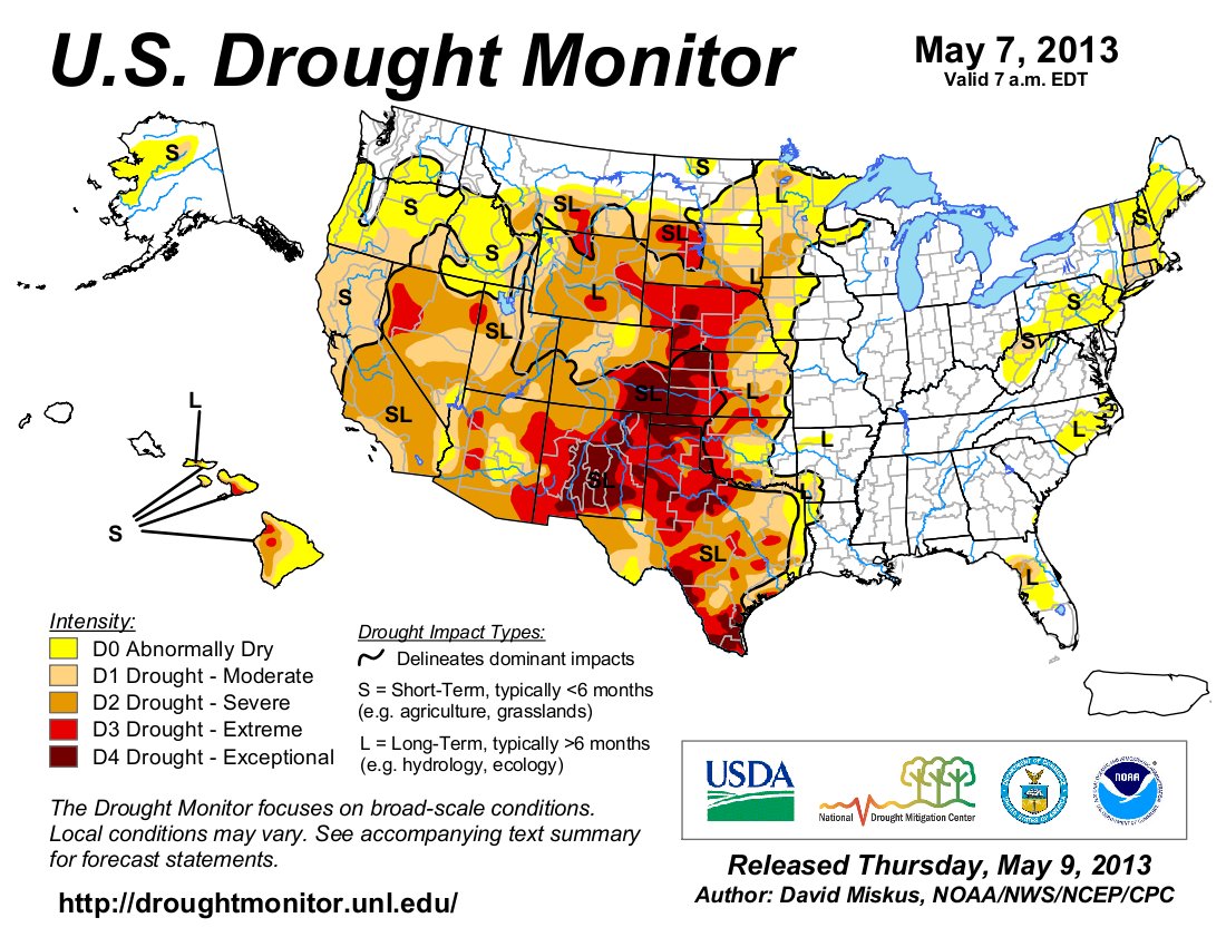
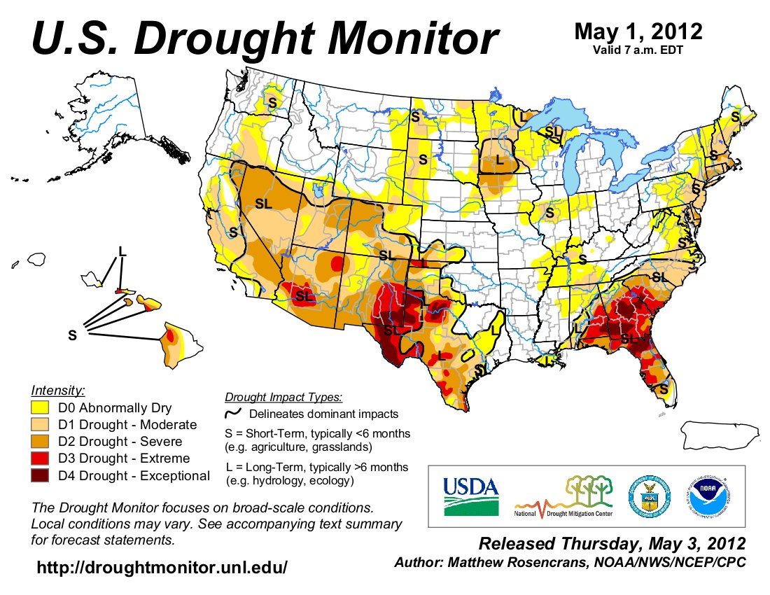
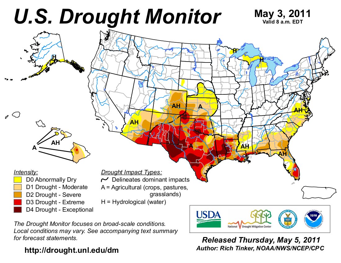
Click on a thumbnail graphic to view a gallery of drought data from the US Drought Monitor website.
Click the link to go to the US Drought Monitor website. Here’s an excerpt:
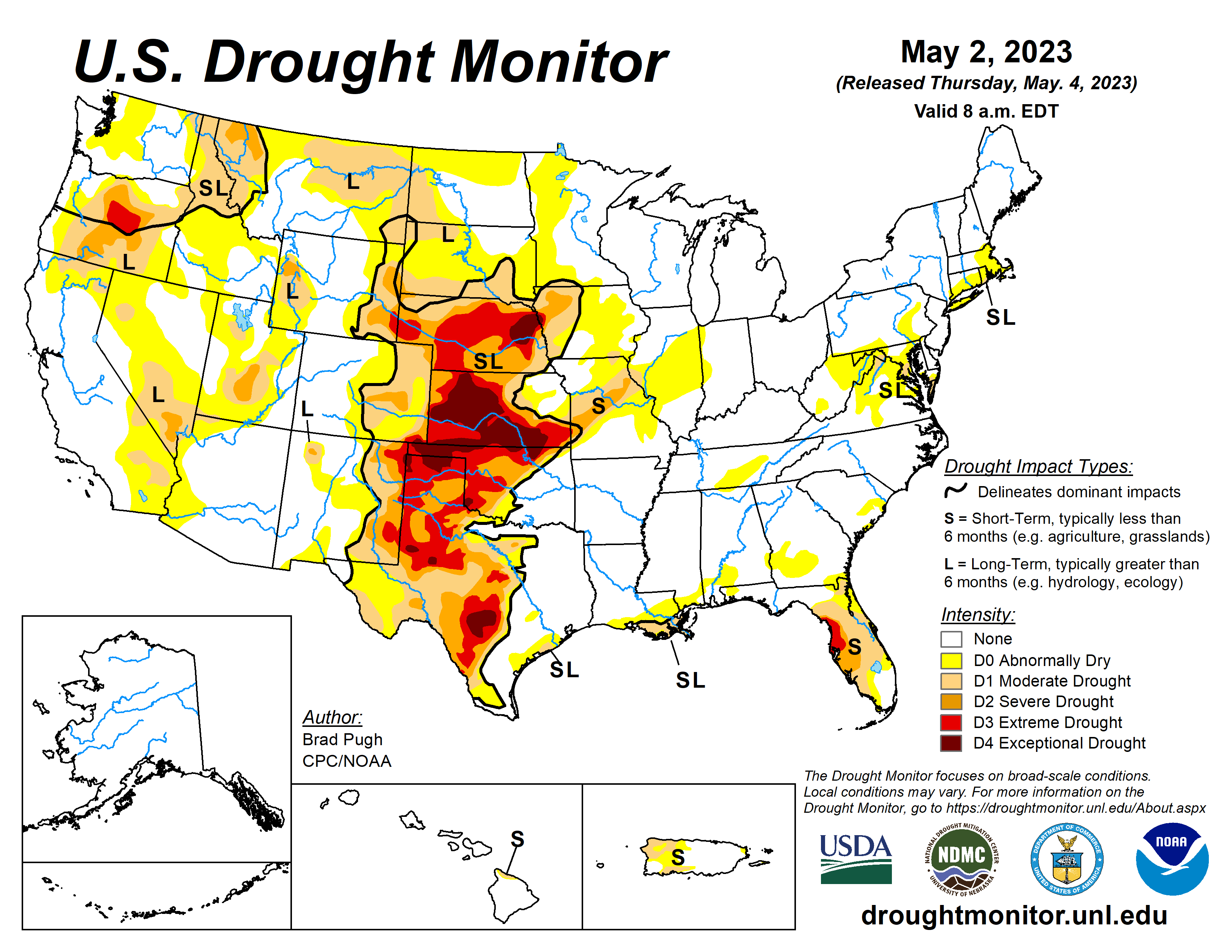
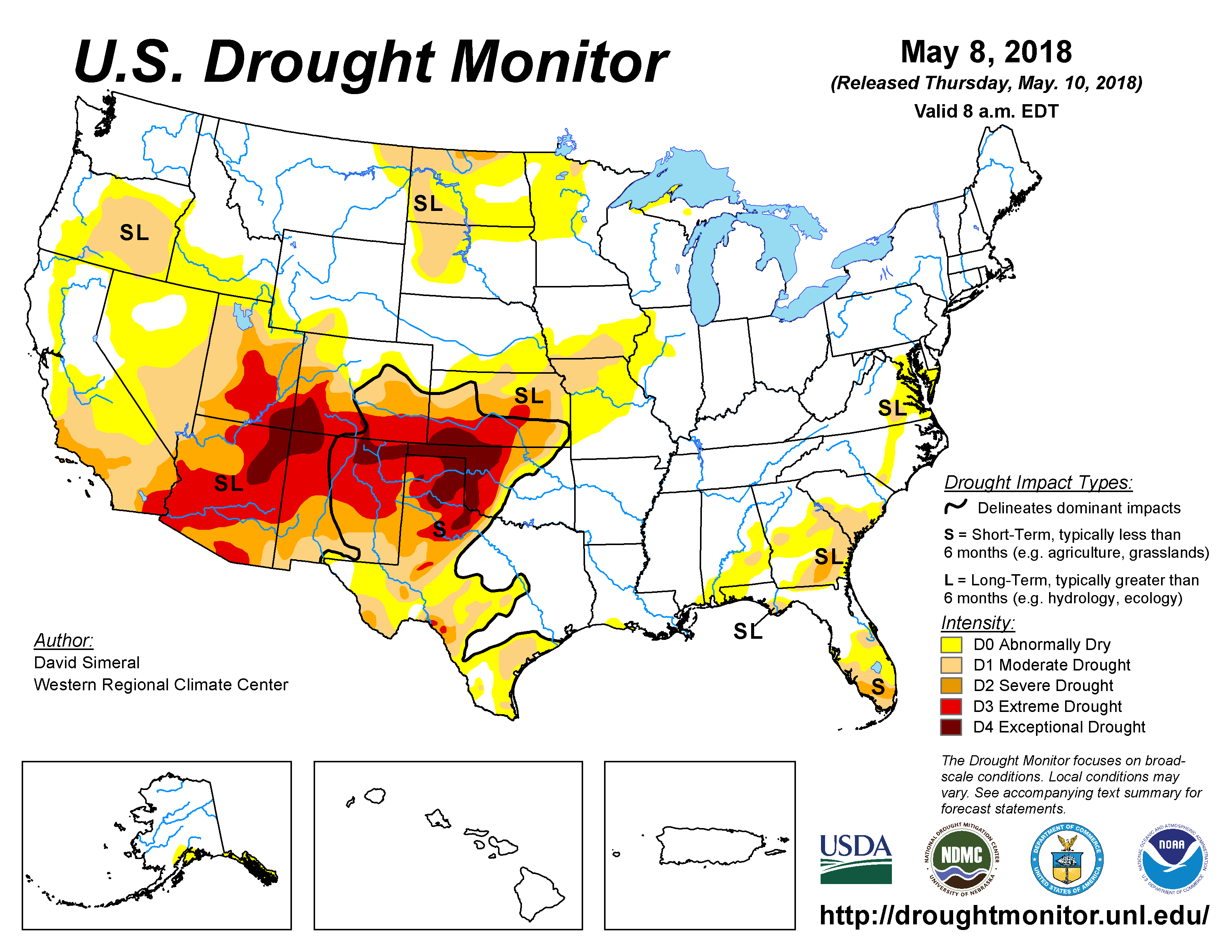
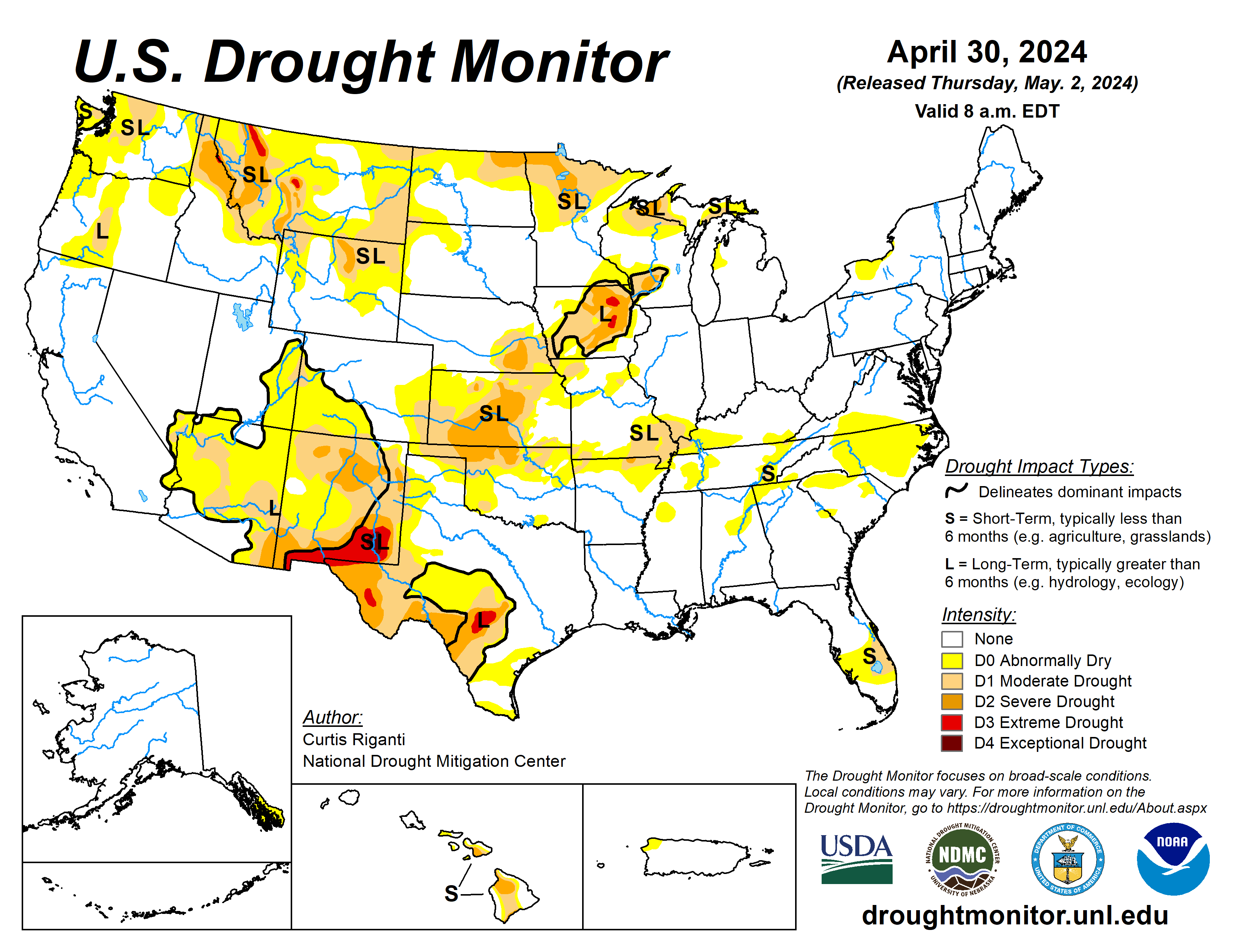
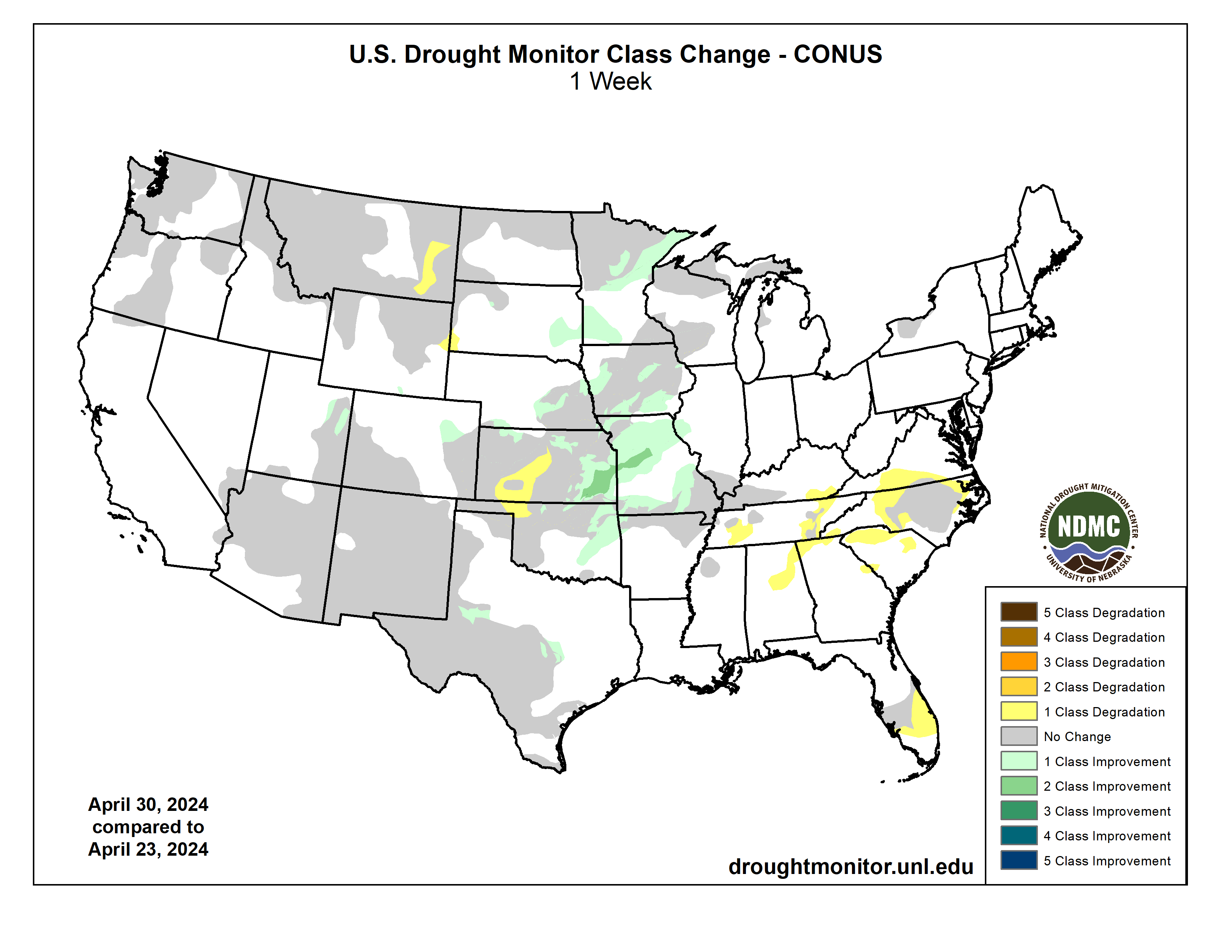
This Week’s Drought Summary
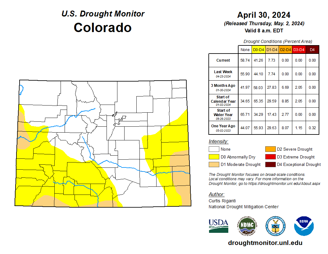
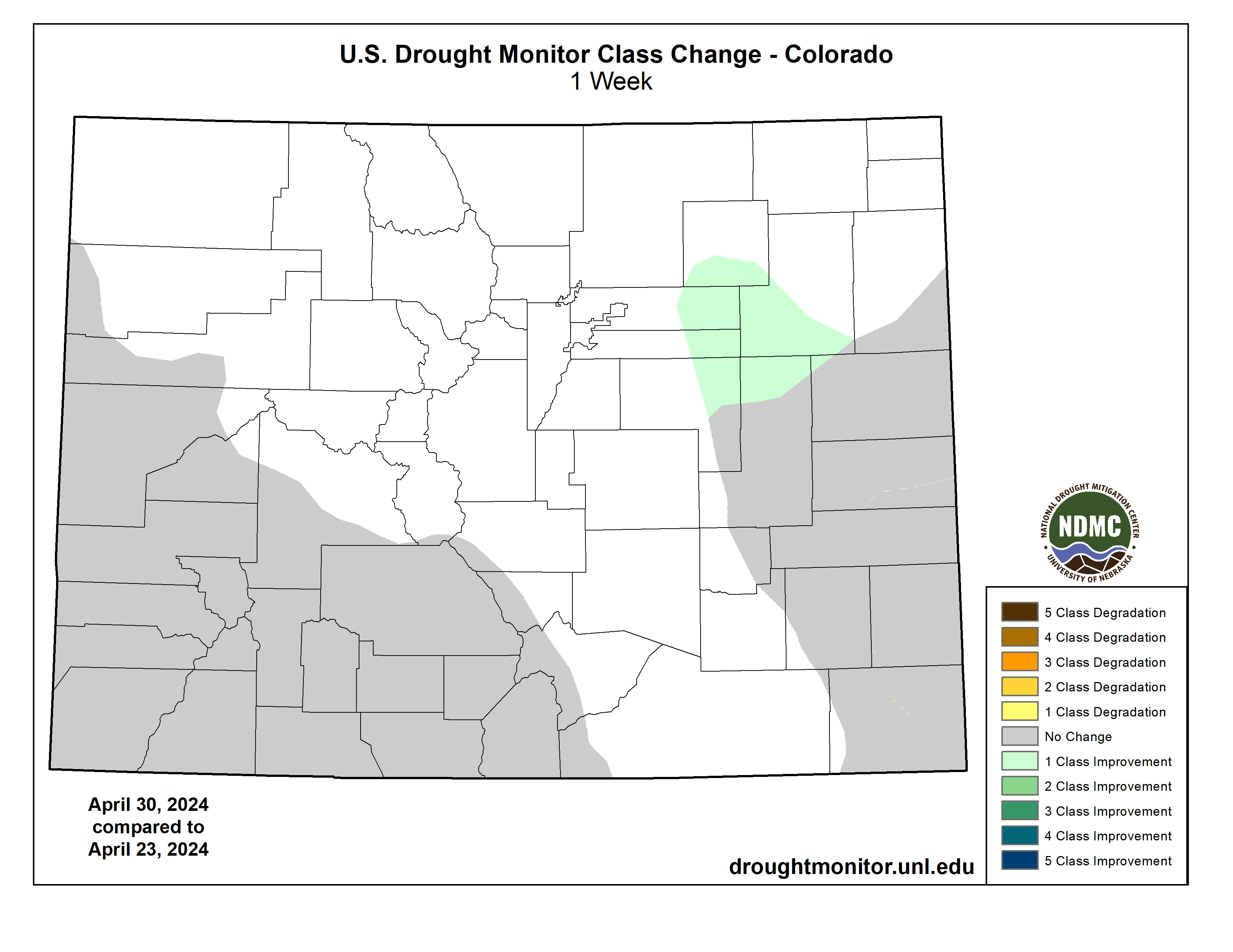
During the late week and weekend, a large severe weather outbreak brought large hail, damaging winds and numerous intense tornadoes to parts of the central and southern Great Plains and Midwest. The storm systems responsible for the severe weather outbreak also brought widespread moderate and heavy rain amounts to the central U.S., leading to widespread improvements in drought and abnormally dry conditions. To the southwest of the heavy rainfall, in northwest Oklahoma and southwest and central Kansas, severe drought expanded as flash drought continued to take hold during a very dry late winter and early-mid spring, leading to reports of very poor wheat conditions and dust storms. Recent dry weather over the last month, combined with a mostly dry week, led to the development of more areas of abnormal dryness and moderate drought over scattered parts of the Southeast, Tennessee and southeast Kentucky. Conditions mostly remained unchanged in the western U.S., though a few improvements occurred in Colorado and Utah after recent precipitation, while conditions worsened in parts of southeast Montana and the Black Hills region of South Dakota and adjacent northeast Wyoming amid recent dry weather. Heavy rains in the northeast part of Puerto Rico eased drought and abnormal dryness there as streamflows improved and crop stress lessened…
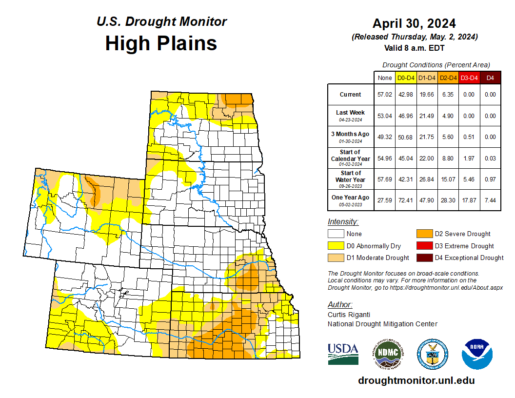
High Plains
Moderate to heavy precipitation fell across much of the High Plains region this week, excluding central and southwest Kansas and northeast Wyoming and southeast Colorado. Mostly warmer-than-normal temperatures occurred in Kansas, Colorado, Wyoming and the western Dakotas, while elsewhere, temperatures were mostly within a couple degrees of normal. While the storms responsible for the rain brought damaging hail and tornadoes in parts of the region, the rainfall helped to alleviate drought conditions in many areas. Eastern Kansas and Nebraska saw improvements in some areas, with parts of southeast Kansas seeing two-category improvements in the areas of heaviest rainfall. Meanwhile, in tandem with severe drought expansion in northwest Oklahoma, severe drought conditions expanded in central and southwest Kansas after another mostly dry week. Flash drought conditions in this region have led to dust storms and very poor wheat conditions…
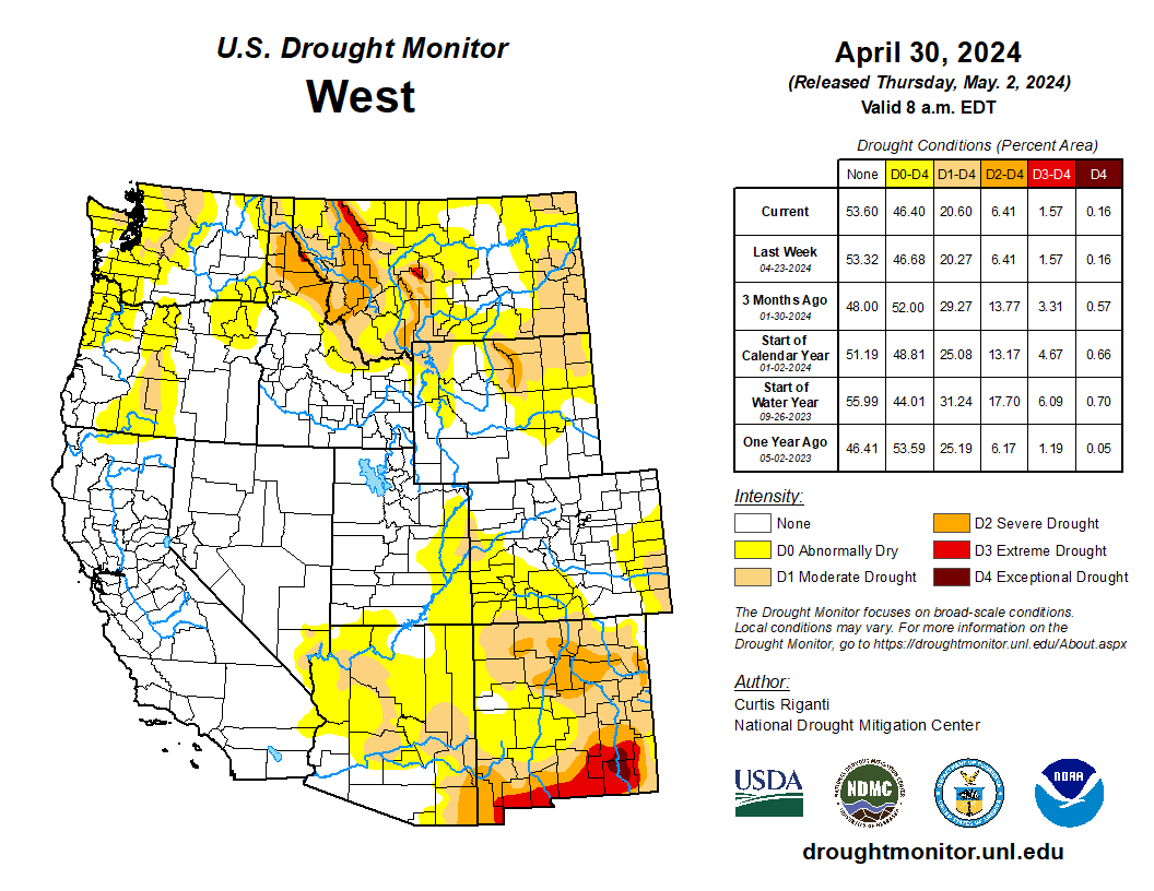
West
Weather conditions were variable across the West this week. Precipitation amounts from 0.5 to 2 inches (locally higher) fell in western parts of Washington and Oregon. Elsewhere, precipitation amounts varied from none to locally up to 2 inches, especially in some high-elevation areas. Temperatures were mostly near normal or a couple degrees below normal in Washington, Oregon, California, Arizona and western New Mexico, while near-normal or warmer-than-normal temperatures prevailed elsewhere. Drought conditions remained mostly unchanged across the region. In northeast Utah, abnormal dryness and moderate drought were reduced in coverage after recent wet weather and low evaporative demand. In southeast Montana, moderate drought grew in coverage as short-term precipitation deficits grew alongside decreasing streamflow and soil moisture…
South
Weather conditions varied widely across the South region this week, with heavy rain falling in parts of Oklahoma, Texas, Arkansas and Louisiana, while other areas were left mostly or completely dry. Temperatures were mostly warmer than normal across the region, especially in Oklahoma and Texas, where weekly readings came in 4-8 degrees above normal, with a few local readings even warmer than that. A few spots in central Texas and the Trans-Pecos region saw improvements to drought or abnormally dry conditions after recent rainfall. In eastern and parts of northern Oklahoma, recent heavy rainfall led to improving conditions. Meanwhile in Tennessee, short-term dryness continued, leading to the expansion of moderate drought and abnormal dryness in eastern Tennessee and the expansion of abnormal dryness in western parts of the state. Flash drought continued to worsen in parts of northwest Oklahoma and adjacent portions of the Texas and Oklahoma panhandles, where severe drought expanded amid quickly drying soils and growing short-term precipitation deficits…
Looking Ahead
Between the evening of Wednesday, May 1 (time of writing), and the evening of Monday, May 6, the National Weather Service Weather Prediction Center is forecasting moderate to heavy rain amounts from central Texas and northern Louisiana northward into the mid-Missouri and upper-Mississippi River valleys. In this region, rainfall amounts are forecast to range from a half inch to locally as high as 3 inches, especially in parts of Oklahoma, Texas and northern Louisiana. Similar precipitation amounts are also forecast in western Washington and Oregon, while some precipitation exceeding 1 inch is also forecast in parts of the northern Sierra Nevada. Mostly dry weather is forecast for eastern Colorado, New Mexico, Arizona, southwest Nevada, southern California and deep south Texas.
For May 7-11, the National Weather Service Climate Prediction Center’s forecast favors colder-than-normal weather across much of the western U.S., with the highest confidence for colder-than-normal weather centered over Idaho and northern Nevada. Warmer-than-normal weather is expected in much of the southeast half of the contiguous U.S., especially from Texas northeast to the mid-Atlantic. Above-normal precipitation is favored in the northern U.S., especially eastern Montana, while below-normal precipitation is favored in coastal California, southern New Mexico and southern and western Texas, southeast Louisiana and most of Florida.
During the May 7-11 period, colder-than-normal temperatures are favored in southwest, south-central and southeast Alaska, and across all of Hawaii. All of Alaska is favored to receive above-normal precipitation, with confidence highest outside of the far west and northwest. With the exception of the Big Island, the forecast slightly favors above-normal precipitation in Hawaii.
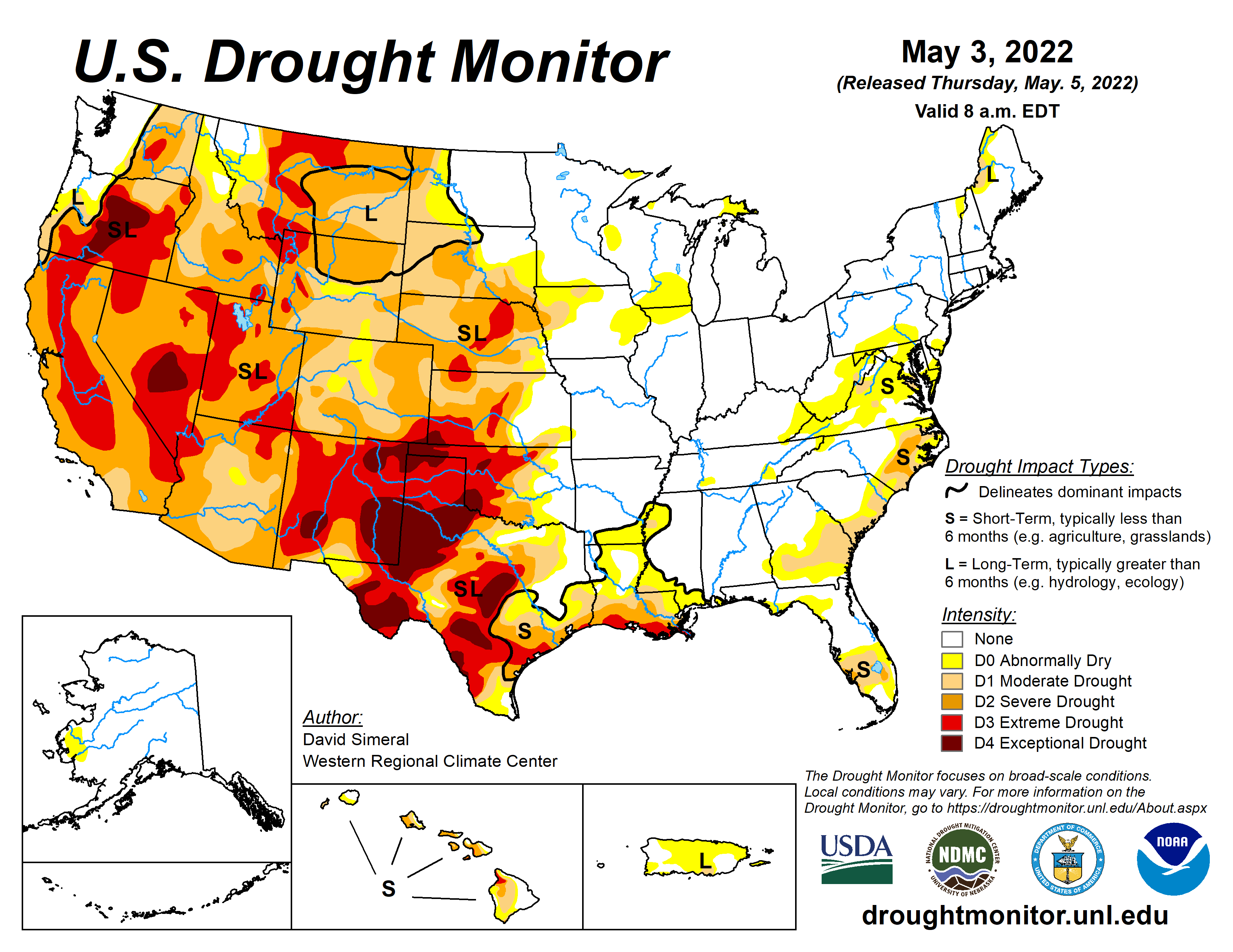
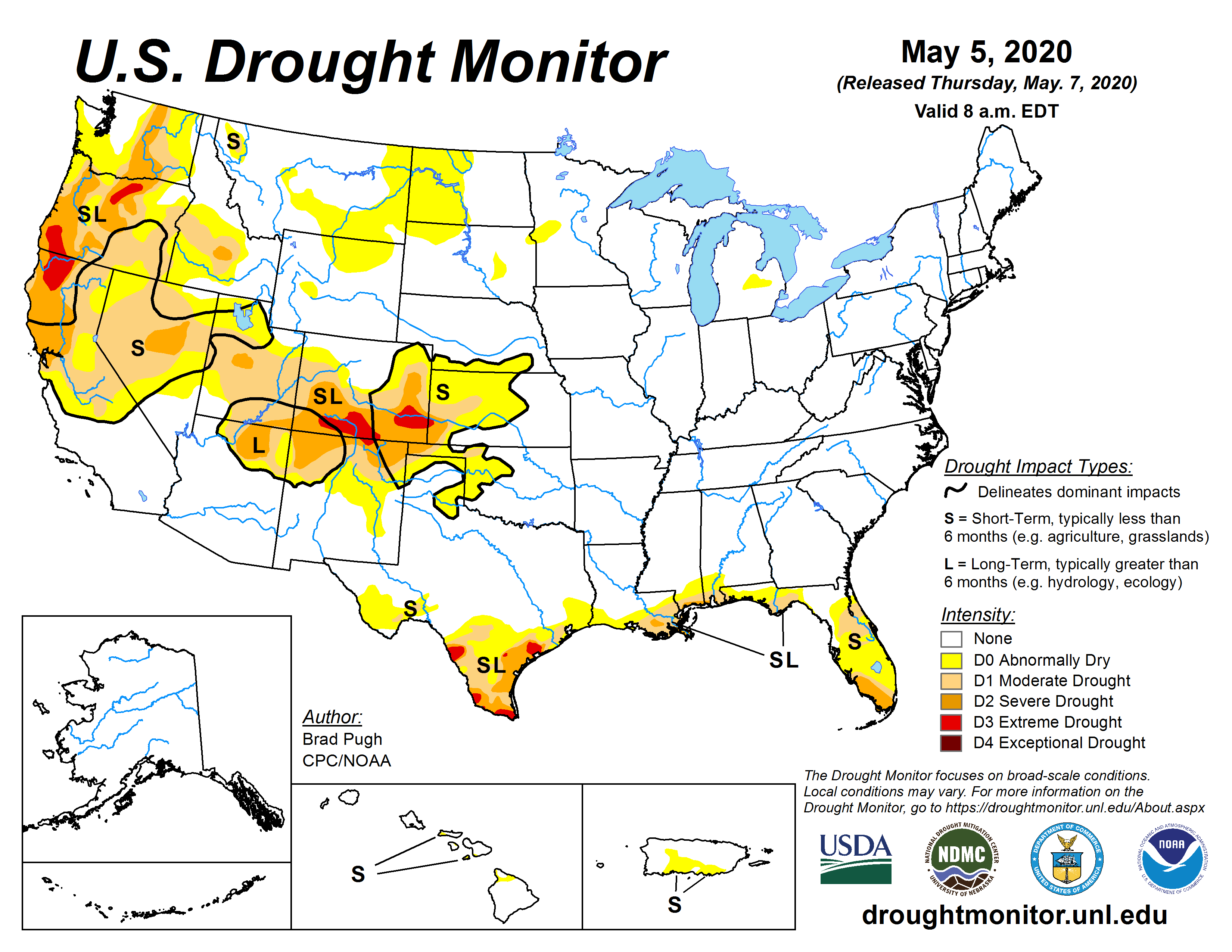
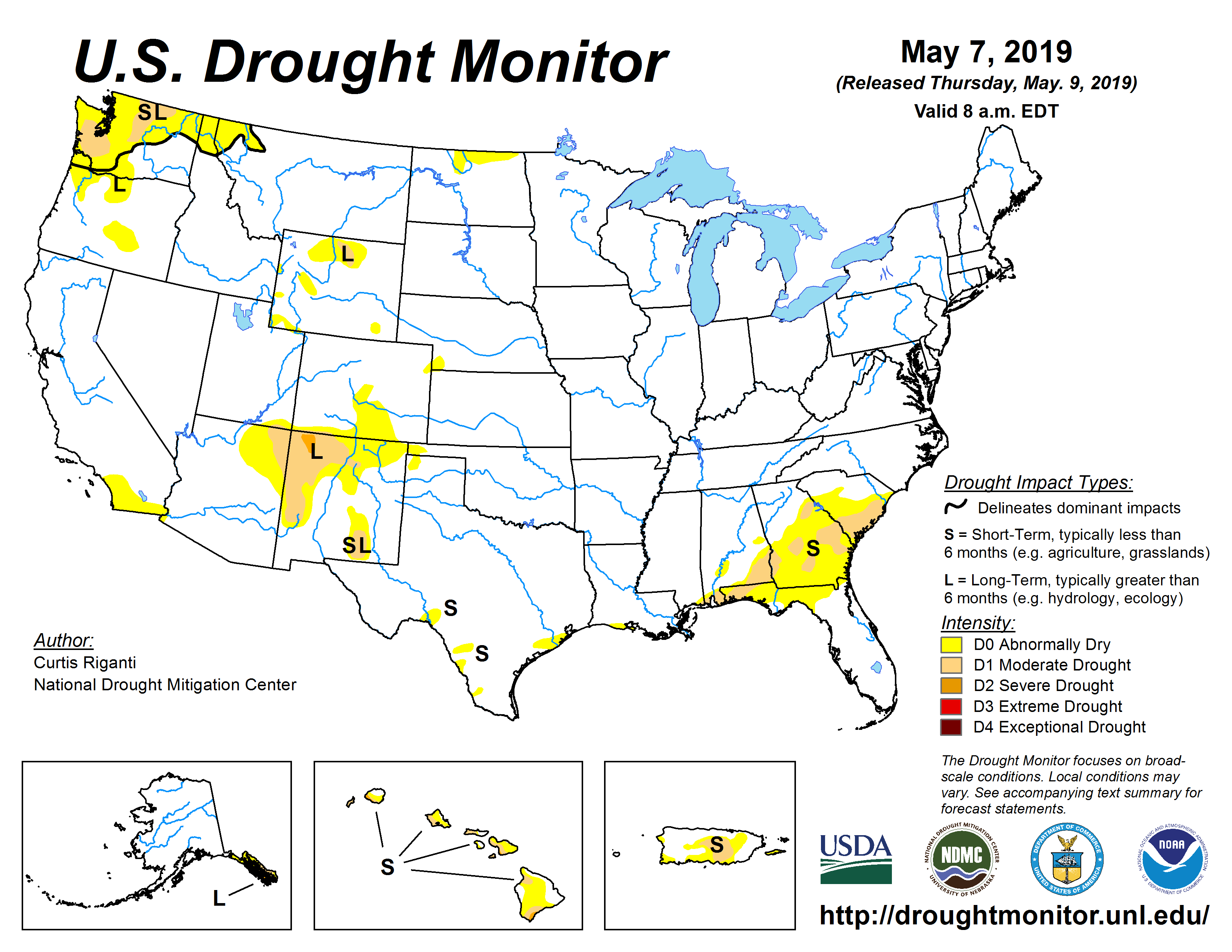
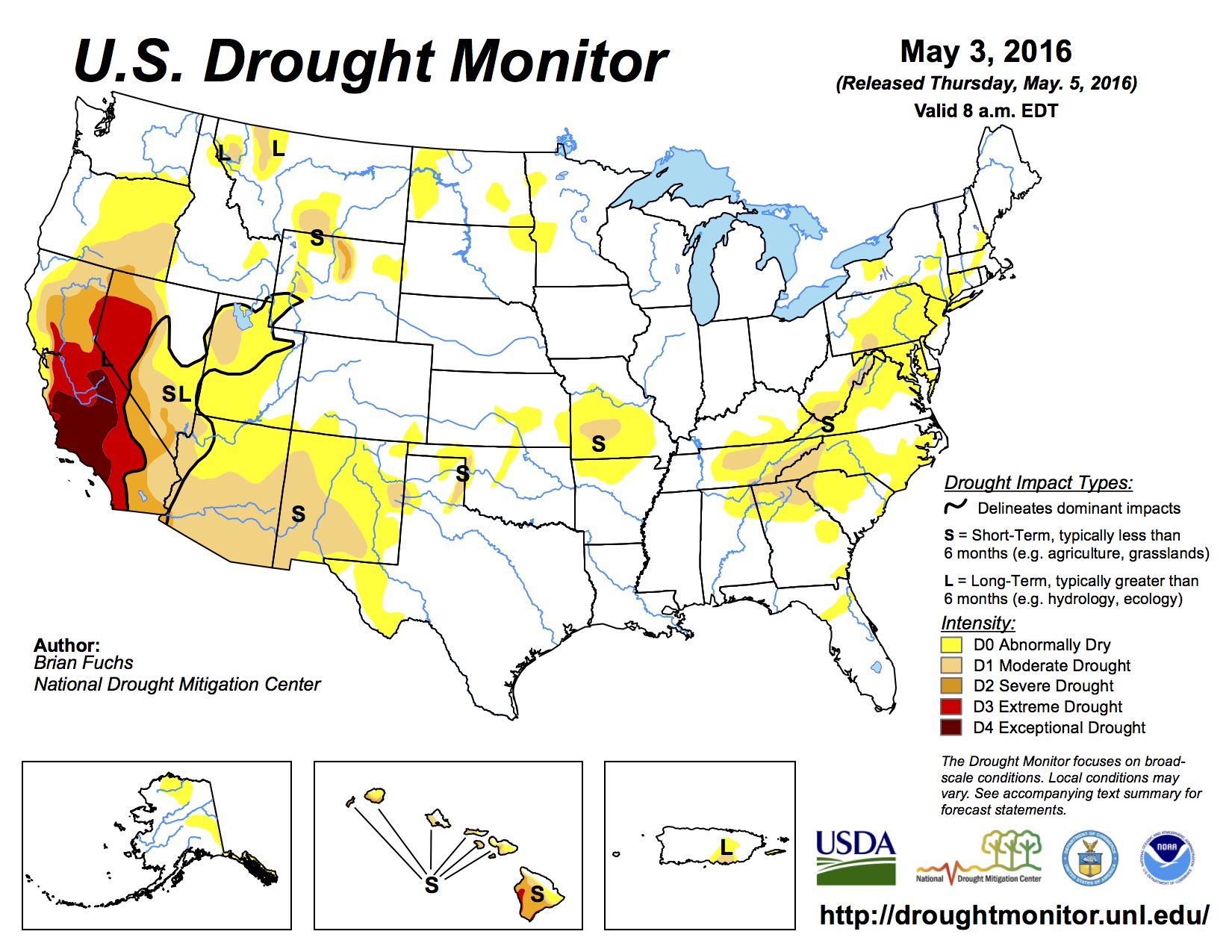
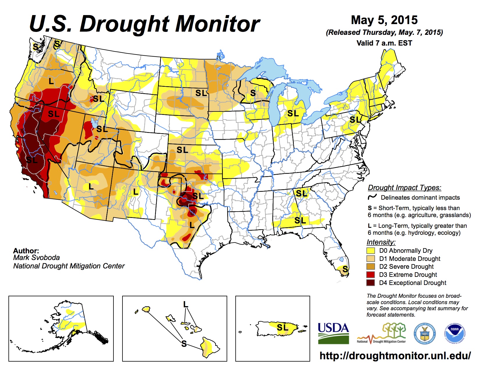
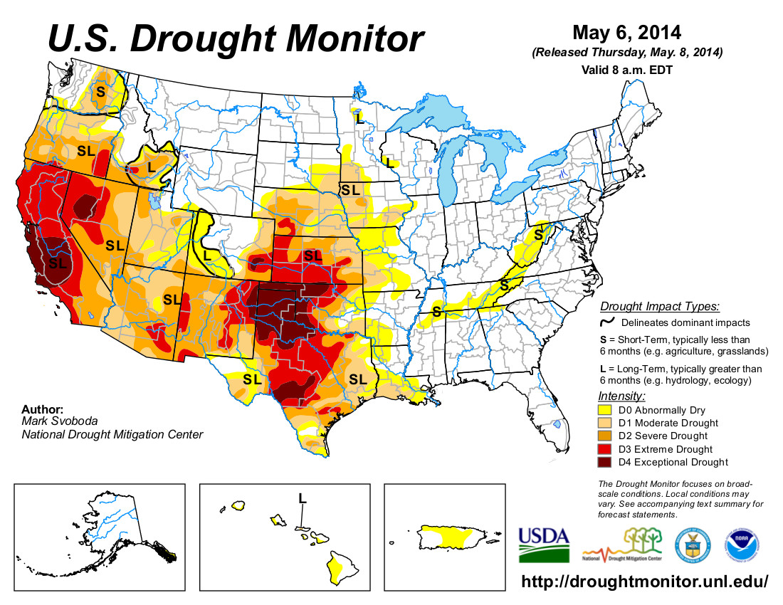
Just for grins here’s a gallery of US Drought Monitor early May maps for the last few years.