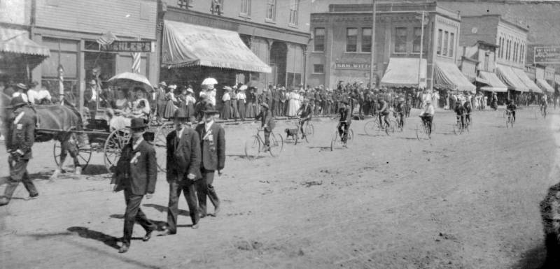
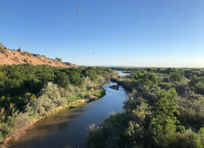
Happy #LaborDay 2024

Click the link to read the article on the Aspen Journalism website (Heather Sackett):
August 30, 2024
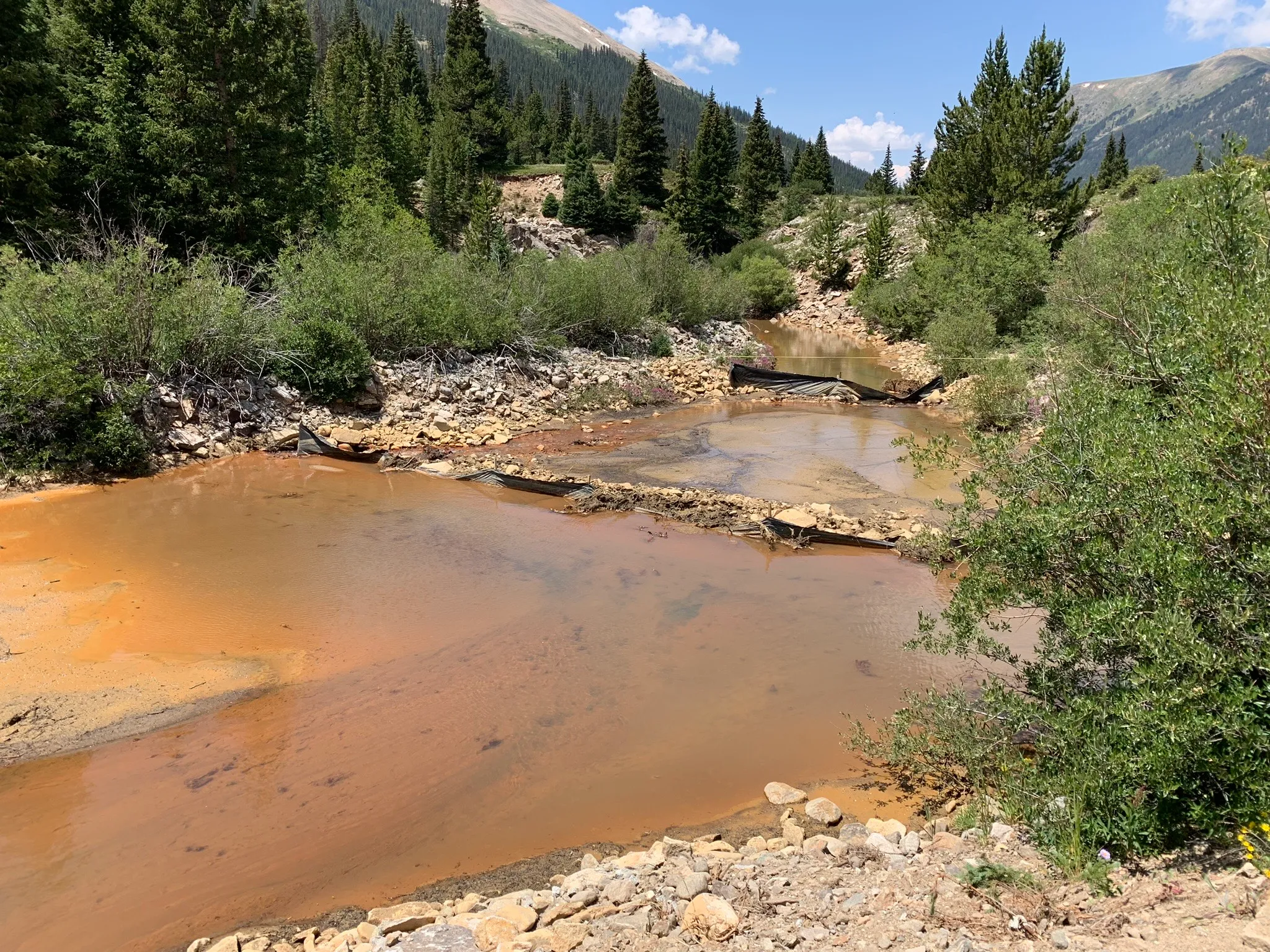
Pitkin County officials say that a July release from Grizzly Reservoir that turned Lincoln Creek and the Roaring Fork River orange had minimal biological effects on fish and other aquatic life.
Water quality testing results from the day of the sediment release, July 16, show high levels of iron and aluminum, but they do not show levels of copper high enough to be toxic to fish.
Members of the Lincoln Creek workgroup, which is comprised of officials from Pitkin County, Colorado Parks & Wildlife, Colorado Department of Public Health and Environment, Independence Pass Foundation and others, met remotely on Wednesday to debrief the July 16 incident. The water quality samples were collected by staff from the Roaring Fork Conservancy and the results are available on River Watch, a statewide volunteer water quality monitoring program operated by CPW.
The released sediment was in particulate form and less able to be readily taken up by aquatic life, according to a press release from Pitkin County. There were no fish kills reported to CPW and the event is not expected to have a significant long-term impact on aquatic ecosystems.
“Most of this indicates that although visually the impact of the event was, you know, scary to look at, it does seem that at least from a copper and biological perspective that there was less of a copper biological risk to fish,” said Megan McConville, CPW River Watch program manager. “The copper has a more toxic effect on aquatic life than the aluminum or the iron.”
Twin Lakes Reservoir & Canal Co., which operates Grizzly Reservoir, drained the reservoir this summer so it could make repairs to the dam and outlet works. On July 16, a pulse of sediment-laden water from the bottom of the reservoir was released down Lincoln Creek, turning it and the Roaring Fork River orange and alarming Aspen residents and visitors.
A July 1 news release from Pitkin County had warned of the potential for temporary discoloration of the river as the reservoir was drawn down, but the severity of the event shocked many people. The U.S. Army Corps of Engineers is investigating whether the sediment release needed a permit under the Clean Water Act.
Officials say the release is unlikely to pose any ongoing risk to people recreating in local waterways.
Local officials, residents and environmental groups have long been concerned about water quality on Lincoln Creek and the July 16 release came at a time of increased scrutiny. Officials have determined that a “mineralized tributary,” which feeds into Lincoln Creek above the reservoir near the ghost town of Ruby, is the source of the high concentrations of metals downstream. The contamination seems to have been increasing in recent years and may be exacerbated by climate change as temperatures rise.


High levels of aluminum, iron at testing sites
Water quality samples were taken by Roaring Fork Conservancy staff at six locations on Lincoln Creek and the Roaring Fork on three dates: June 4, June 25 and July 16. The locations were the Grizzly Reservoir inlet, below Grizzly Dam, the Lincoln Gulch Campground on the creek just above the confluence with the the Roaring Fork, the Grottos day-use area and Difficult Campground. Control samples were also taken from the Roaring Fork just above the Lincoln Creek confluence. An additional location, below the sediment traps on Lincoln Creek about 50 yards below Grizzly Dam, was tested only on July 16.
That data show sharply increasing concentrations of aluminum and iron on July 16, particularly just below the dam. On June 25, there were 258 micrograms (parts per billion) of aluminum in the water below Grizzly Dam, which is still exceeds the chronic water quality standard for aquatic life (on all but one date and location, the amount of aluminum exceeded either the CPW acute or chronic water quality standards for aquatic life). During the release on July 16, that jumped to 1.7 million micrograms. Testing at the second location below the dam, below the sediment traps placed by Twin Lakes, that number was down to 726,600.
“There was a pretty significant drop from what was coming directly out of the dam,” said Chad Rudow, water quality program manager with the Roaring Fork Conservancy. “It kind of shows the sediment traps were doing their job and helping to sequester some of that stuff.”

By the time the release had made it downstream to the confluence of the Roaring Fork, the total iron levels had decreased by 97%, and total aluminum decreased by 98%.
Because there were additional elements in the water, the aluminum was not as toxic to fish as it could have been, McConville said.
“The more carbon you have in the water, the less toxic it makes the aluminum,” she said. “Because we’ve got bottom lake sediments coming down, they were probably pretty high in carbon. … My guess is that a big slug of carbon came down along with the iron and aluminum and for aluminum in particular, it probably provided some protection for those aquatic organisms.”
The iron levels also exceeded state chronic water quality standards for aquatic life in eight of the 19 sites and days tested, but iron is a 30-day standard and the release was a roughly 36-hour event.
“If that event had gone on for 30 days or a longer duration, then that standard would have been applicable,” McConville said. “But because it was such a short-term event, that sort of clogging, smothering effect that we would expect from that precipitated iron just really didn’t have a chance to occur.”
The reason copper levels below the reservoir were so low is probably because the entirety of Lincoln Creek above the reservoir — the source of copper contamination — is being diverted to the Arkansas River basin through the Twin Lakes Tunnel.

Lincoln Creek and Grizzly Reservoir are part of a highly engineered system that takes about 40% of the water from the headwaters of the Roaring Fork to cities and farms on the east side of the Continental Divide. Water is sent from the reservoir through Twin Lakes Tunnel into Lake Creek, which is then collected in Twin Lakes Reservoir.
Four municipalities own 95% of the shares of water from the Twin Lakes system: Colorado Springs Utilities owns 55%; the Board of Water Works of Pueblo has 23%; Pueblo West Metropolitan District owns 12% and the city of Aurora has 5%.
Officials said at Wednesday’s meeting that this is just the initial attempt at understanding the water quality testing data around one reservoir release event and there is still a lot of data that needs to be analyzed from other testing agencies.
In addition to the Roaring Fork Conservancy, four other entities are conducting water quality sampling this summer: Pitkin County Environmental Health; the U.S. Forest Service; Colorado Parks and Wildlife; and the Institute of Arctic and Alpine Research at the University of Colorado Boulder. The workgroup has hired consultant LRE Water to review the data and an EPA report, make a site visit and comment on the sampling plans of the five different entities.
“The initial plan was to have all of the data come to us at one time, the beginning of next year, but there became this ask for the data around this event; there was a concern around toxicity,” said Kurt Dahl, Pitkin County environmental health director. “There’s still a lot of data that we have out there. … The context of the entire year is going to have to wait until our intended timeframe of early next year to talk about how this looks in comparison to the various other times we’re out there sampling.”

Click the link to read the article on the Department of Energy website (Shannon Brescher Shea):
August 28, 2024
From thirsty agricultural crops to whitewater rafters contemplating a low river, a lack of water is the most obvious in the summertime. Its impact is particularly clear when many people rely on the same source of water. What happens in the Colorado River’s East River Watershed affects 40 million people from seven U.S. states as well as Mexico. Around the world, similar mountainous areas provide the water that helps feed one to two billion people. In fact, scientists call these regions “the world’s water towers.”
But problems with these watersheds don’t start in the summer or even the spring. In fact, they begin in the winter, when snow isn’t building up in the Rocky Mountains and similar areas as it once did. The snow that falls – or doesn’t fall – in the mountains has huge effects on what’s available for the rest of the year. Future climate change may cause less and less snow to fall in these areas and reliably convert to water downstream.
Researchers supported by the Department of Energy’s (DOE) Office of Science are working to understand the role of snow drought, how to measure it in the future, and how to use such data to inform decision-making.
Droughts in the winter
In a regular drought – also called a meteorological drought – there’s a lack of precipitation. It often has immediate and obvious effects. In contrast, a snow drought’s effects are delayed. When snow falls in the winter, it builds up as snowpack. In the spring, much of this snowpack melts and moves through the watershed as runoff. It ends up in rivers that provide water to people far beyond the mountains.
But if there’s less snow than usual in a single winter, or if less snow fails to transition to water downstream, there’s less spring runoff. The lack of snow can change both the amount and the timing of the runoff. The situation gets even worse when there are multiple years of low snowfall, as the snowpack further decreases each year.
Snow drought can happen for three reasons. When temperatures are exceptionally warm, precipitation can fall as rain instead of snow. When overall precipitation is low, there’s less rain and snow. Lastly, when temperatures are warm and precipitation is low, areas end up with less precipitation and a smaller proportion of it as snow.
Providing water in a warmer future
While the mighty Colorado River often has huge amounts of water, that water comes from many small streams and rivers in the form of snowmelt. In fact, almost three-quarters of the Colorado River’s water comes from runoff from snowfall. Snow drought can take a tremendous toll.
Poor water management can leave communities struggling to have enough water throughout the year. Unfortunately, the unpredictability from snow drought can make it hard for water managers to know how much and when water will be available.
Future climate change is very likely to make this predicament worse. Higher elevations are already warming faster than lower ones. The hotter temperatures from climate change will result in less snowpack over time. Scientists are already seeing an increase in snow droughts across the world from the late 1980s to the present.
To understand how much and where these shifts in snow droughts will occur, Marianne Cowherd, a researcher at the University of California Berkeley (UC Berkeley), worked with researchers at DOE’s Pacific Northwest National Laboratory to run scenarios on a number of climate models. Climate models provide a computer simulation of past, present, and future climate and Earth systems. Because each model has its strengths and gaps, the team compared the results from nine different models.
They conducted two different scenarios. The medium emissions scenario assumed that greenhouse gas emissions will stay at the same level and start to decrease in 2050. The higher-emissions scenario assumes there will be no decrease in 2050 and that the emissions trends will continue.
The news wasn’t good. Both scenarios predicted snow drought increasing in most areas of the world. In particular, all snowy regions of the Northern hemisphere and the Andes were modeled to have less snow than they do now. Not surprisingly, the higher-emissions scenario was worse. In addition to snow droughts becoming more frequent, both scenarios predicted they will become more severe.
About two-thirds of the decrease would be from higher temperatures alone, with the rest a combination of higher temperatures and decreased precipitation. This is a major shift from the past, when snow droughts were mainly caused by low precipitation. This split from meteorological droughts will make it even more difficult for water managers to predict and accommodate snow droughts.
Measuring a changing world
On top of all of that, it’s likely that the tools water managers rely on are likely to become less accurate due to climate change.
Measuring snow drought is already harder than measuring regular drought. Scientists use a combination of climate models and real-time measurements taken in the field to understand what will happen in the future. While climate models can make big-picture estimates, most are not yet precise enough to provide year-to-year predictions. For example, several models represent mountaintop temperatures as cooler than they are in real life.
That leaves most of the short-term predictions up to field measurements. Fortunately, there’s already an extensive network of sites around the world. Unfortunately, these sites weren’t designed for a changing climate. Over time, they will become less accurate as the snow line shifts to higher elevations. In particular, these changes will have major effects on the Lower Colorado River Basin and Nevada.
Cowherd collaborated with scientists from DOE’s Lawrence Berkeley National Laboratory and the University of California Los Angeles (UCLA) to study and solve this challenge. They determined that we can still use present snow-measurement networks, albeit with a few changes. They also found that it will be important to have additional information about the relationship between temperature, snow, and geographic space. In addition, climate models that are flexible enough to handle new information will be important for understanding these year-to-year differences.
SAILing towards solutions
It’s clear that more information about snowfall in mountain terrain is essential to ensuring people in the American West can have access to the water they need. Thankfully, DOE is helping fill that gap.
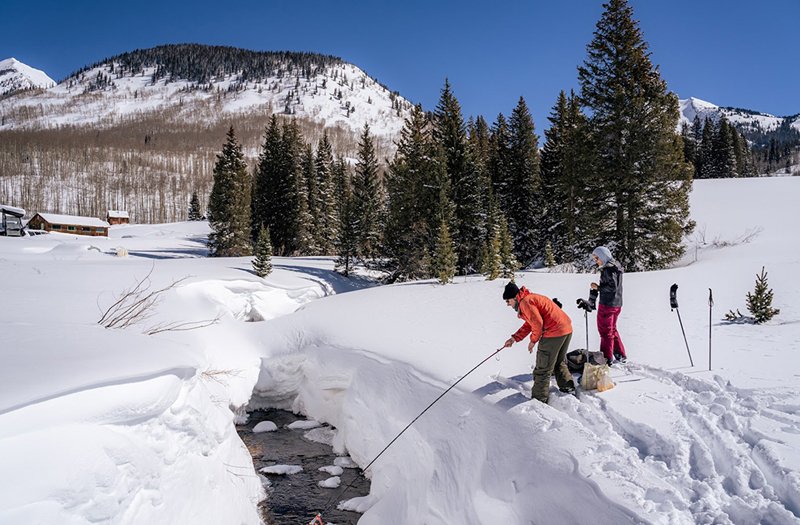
The Surface Atmosphere Integrated Field Laboratory (SAIL) campaign was a 21-month effort to collect a massive amount and variety of data about the conditions above, at, and under the surface of the East River Watershed in Colorado. Scientists used more than 50 instruments from the DOE Office of Science’s Atmospheric Radiation Measurement user facility, as well as guest and existing regional instruments to collect data on how and when water moves through this landscape.
Researchers from SAIL and nearby field campaigns that ran simultaneously observed atmospheric, surface, and subsurface changes from season to season. In the winter, they slogged through deep snow. In the summer, they looked out on forested mountains and green valleys.
SAIL finished collecting data in June 2023. However, the work of SAIL and its related campaigns is far from over. SAIL collected a far more comprehensive, detailed set of data than any previous mountain hydrology campaign had collected. Printing out all the data would generate 15 billion pages of documents.
Right now, researchers are analyzing the data and considering how to use them to make climate models more accurate and precise. They’re closely collaborating with scientists funded by DOE Office of Science’s Earth and Environmental Systems modeling program.
There are already useful results. Both the study on snowpack measurement sites and the one describing how models underestimate temperatures on mountaintops used data from SAIL.
Scientists will continue to dig into data from SAIL and related campaigns. This data will help us better understand the “world’s water towers” and how they will change over time. The resulting improvements to climate models will help water managers and others better predict snowpack in the years to come. From the data collected in the past to the present, our scientists are helping us face a future with a changing climate.
Click the link to read the article on the National Public Radio website (Bria Suggs). Here’s an excerpt:
August 16, 2024
Eighty years ago, the United States and Mexico worked out an arrangement to share water from the two major rivers that run through both countries: the Rio Grande and the Colorado. The treaty was created when water wasn’t as scarce as it is now. Water from Mexico flows to Texas’ half-billion-dollar citrus industry and dozens of cities near the border. On the Mexican side, some border states like Baja California and Chihuahua are heavily reliant on the water that comes from the American side of the Colorado River.
Now, those water-sharing systems are facing one of the biggest tests in their history. Mexico is some 265 billion gallons of water behind on its deliveries to the United States. Unpredictable weather patterns due to climate change, growing populations, aging infrastructure and significant water waste have left both countries strapped for water and have escalated tensions along the border. Maria-Elena Giner is the U.S. commissioner of the International Boundary and Water Commission, the binational agency that oversees the 1944 water treaty and settles disputes. Mexico is “at their lowest levels ever” in the treaty’s history, Giner said. The treaty operates in five-year cycles, and the current deadline for deliveries isn’t until October 2025.
But “the question is that they’re so far behind, it will be very difficult, if not statistically impossible, for them to make up that difference,” Giner said…
To address the water scarcity in Texas, officials last year proposed a solution: a treaty “minute,” or amendment, that would allow Mexico to pay water directly to South Texas instead of giving two-thirds to the Mexican state of Tamaulipas first, as currently specified in the treaty. But quenching the thirst in South Texas ahead of its own citizens was likely a nonstarter ahead of Mexico’s presidential election this year. Negotiations on the treaty changes were completed and both countries were set to sign last December, but Mexico has yet to receive official authorization to do so, said Giner, of the International Boundary and Water Commission.


Click the link to read the article on the Inside Climate News website (Jake Bolster)
August 16, 2024
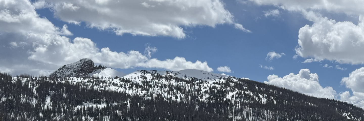
The Never Summer Mountains tower almost 13,000 feet above sea level on the west side of Rocky Mountain National Park, the regal headwaters of the Colorado River. Snowmelt and rainfall trickle southwest from the peaks through jumbles of scree and colorful deposits of silicic rock, formed some 27 to 29 million years ago, then plunge into Gore Canyon. There, the river gallops downstream, absorbing other tributaries from Arizona, New Mexico, Utah and Wyoming on its way to California. More than 40 million people from seven states and Mexico depend on water from the Colorado River Basin to drink, irrigate crops, generate electricity and recreate, a demand that is greater than the river system can bear.
Historically, variations in snowpack would correlate with the amount of available water in the river come summertime. But since 2000, less and less snowmelt has been making its way into the Colorado River, and water levels in the river have not tracked as closely with variations in precipitation. A new study from the University of Washington, published today in the journal Geophysical Research Letters, offers a clue as to why this may be: increased evaporation and decreased springtime rainfall is leading parched plants and trees to suck up much of the snow melt before it ever reaches the river.
“These headwater areas provide around 70 to 80 percent of the Colorado River’s water,” said Daniel Hogan, a PhD student at the University of Washington who worked on the study. “Snowy peaks and all those high mountain rivers are really the linchpin of the system. So if less water is coming from there, then you can expect less water in the entire river.”
Hogan and a team of scientists used precipitation and streamflow data from 26 upper Colorado River basins—a large sample of the eventual river’s supply, accounting for about a quarter of the Colorado River’s streamflow—to study why there was a growing disparity between snowpack and water levels.
They found that the upper Colorado River basin had experienced a 9 percent decrease in annual spring rainfall compared with precipitation levels prior to 2000. Over half of the 26 basins they surveyed had “significant annual precipitation decreases,” they wrote. Spring had the most severe dropoff in rain, with a 14 percent decline compared to pre-2000 data. “Lower and middle elevation headwater basins were particularly affected,” with 12 of 17 showing “significant decreases,” they wrote.
This drop-off in spring precipitation appears to be especially detrimental to water levels in the summer. Though the researchers did find evidence of decreased rainfall in other seasons, spring rains accounted for 56 percent of the water-level variance.
“Spring precipitation decreases alone fall short of explaining observed streamflow deficits,” the team concluded, but when combined with other forms of water loss, like evaporation and nearby vegetation soaking up the moisture, that explained 67 percent of the variance.
Among the tens of millions of people the Colorado River is overpromised to are farmers irrigating about 5 million acres of agricultural land. But theirs aren’t the only plants impacting Colorado River levels. In their study, the research team worked under the assumption that trees and vegetation in forests ringing the Rockies need springtime precipitation to grow; in its absence, snowmelt becomes the plants’ primary source of water—and they have first dibs.
“It’s a very sound study,” said Tanya Petach, a climate science fellow with the Aspen Global Institute, which helps connect academics with outside organizations that can make use of their work. Petach, who was not involved in the University of Washington study, is a hydrologist who got her Ph.D. in environmental engineering from the University of Colorado. “It helps fill out part of the missing puzzle piece” as to why high levels of winter snowpack haven’t translated to large stream flow numbers in some recent years, she said.
The group’s findings read “like two knockout punches,” said Hogan. “You have less precipitation, so that leads to less streamflow, just inherently. And then, you also have a consequence of the trees and plants that still need their water,” which leads to “uncertainty in how much water we think we have.” He hopes this study helps water modelers understand the importance of using spring precipitation in addition to winter snowpack to predict how much water will be available in the river.
This study “puts a lot of momentum” behind improving spring forecasts for Colorado River stream flows, Petach said.
Hogan could not say for sure whether climate change has played a role in the decreasing springtime precipitation levels across the upper Colorado River basin as no part of their study was designed to investigate that possible connection. But other studies have already suggested climate change is driving droughts in the Colorado River’s upper basin.
Decreasing water levels across the Colorado River “could very well be linked to climate change directly,” Hogan said. “And if that is the case, then we can expect these declines to continue.”