
Click the link to read the article on the Summit Daily website (Kit Geary). Here’s an excerpt:
January 5, 2025
Summit and Eagle counties are poised to get a consistent dusting of powder nearly everyday this week heading into next weekend, according to National Weather Service meteorologists. Meteorologist Zach Hiris said there will be a “fairly active pattern across the mountains” on Monday, Jan. 6, and Tuesday, Jan. 7, which is likely bring a few inches of snow to the slopes. He said “a bunch of weak systems” could follow from Wednesday through Saturday and these are slated to bring a couple more inches. Summit’s mountains are anticipated see anywhere from 3-6 inches and its valley areas could see 1-3 inches of snow by Wednesday morning, Hiris said. Wednesday, Thursday and Friday could bring an inch or two each, but it will be more sporadic than the snowfall delivered by Monday and Tuesday’s storms, he said.
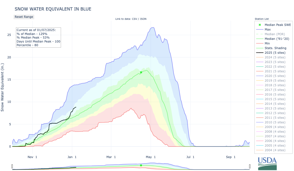
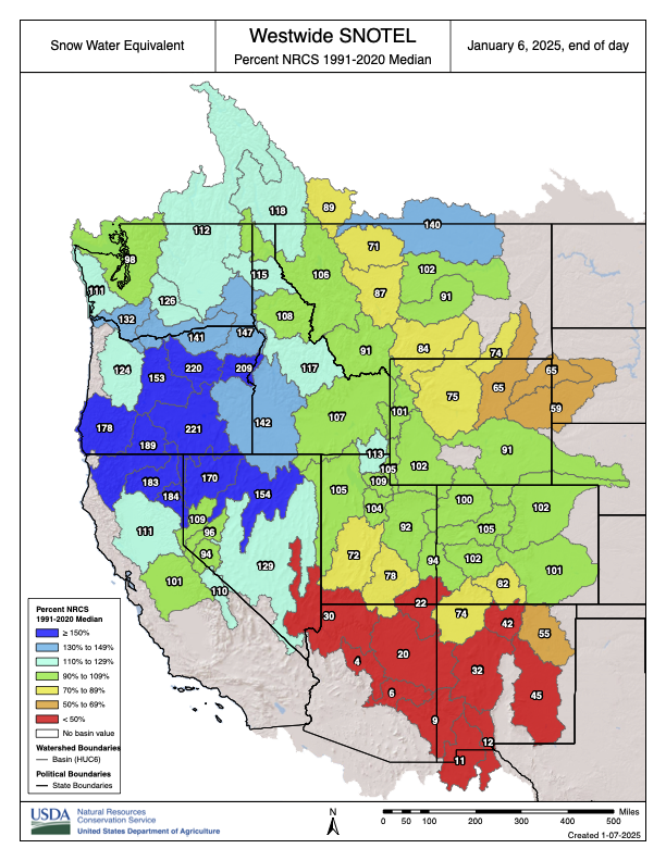
Hiris said the Blue River Basin is currently at 129% of its snowpack median.

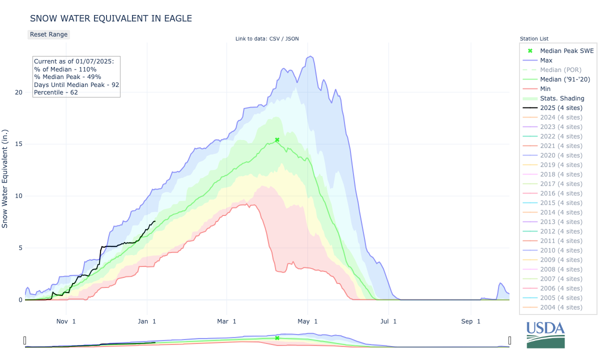

According to the United States Department of Agriculture, the Colorado Headwaters river basin is currently at 104% of its median snowpack, the Eagle area is at 113% of its median snowpack and the Roaring Fork area is at 109% of its median snowpack.