From Jonathan’s BlueSky feed this morning:
Click the link to read the article on The Land Desk website (Jonathan P. Thompson):
October 23, 2026
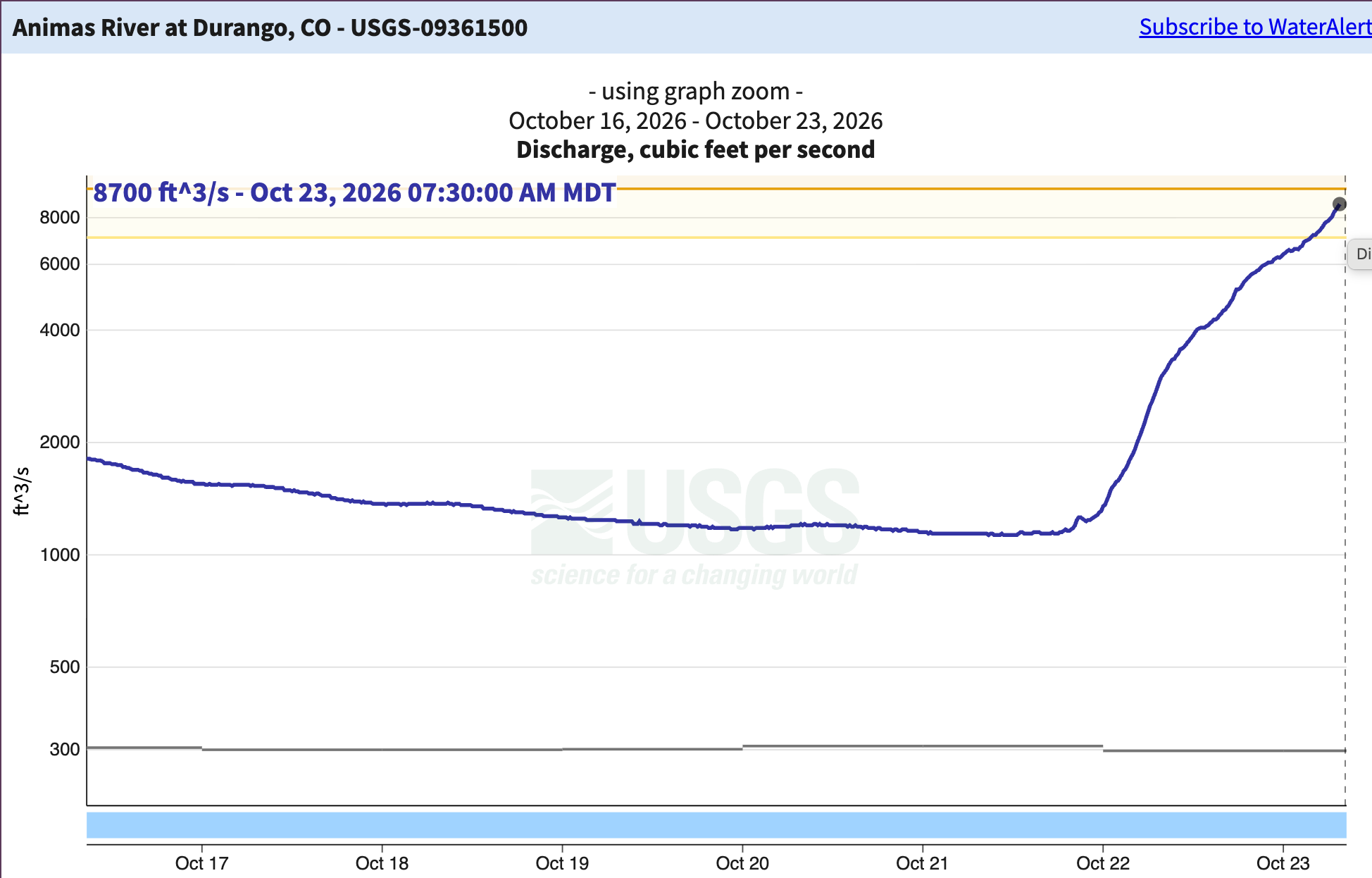
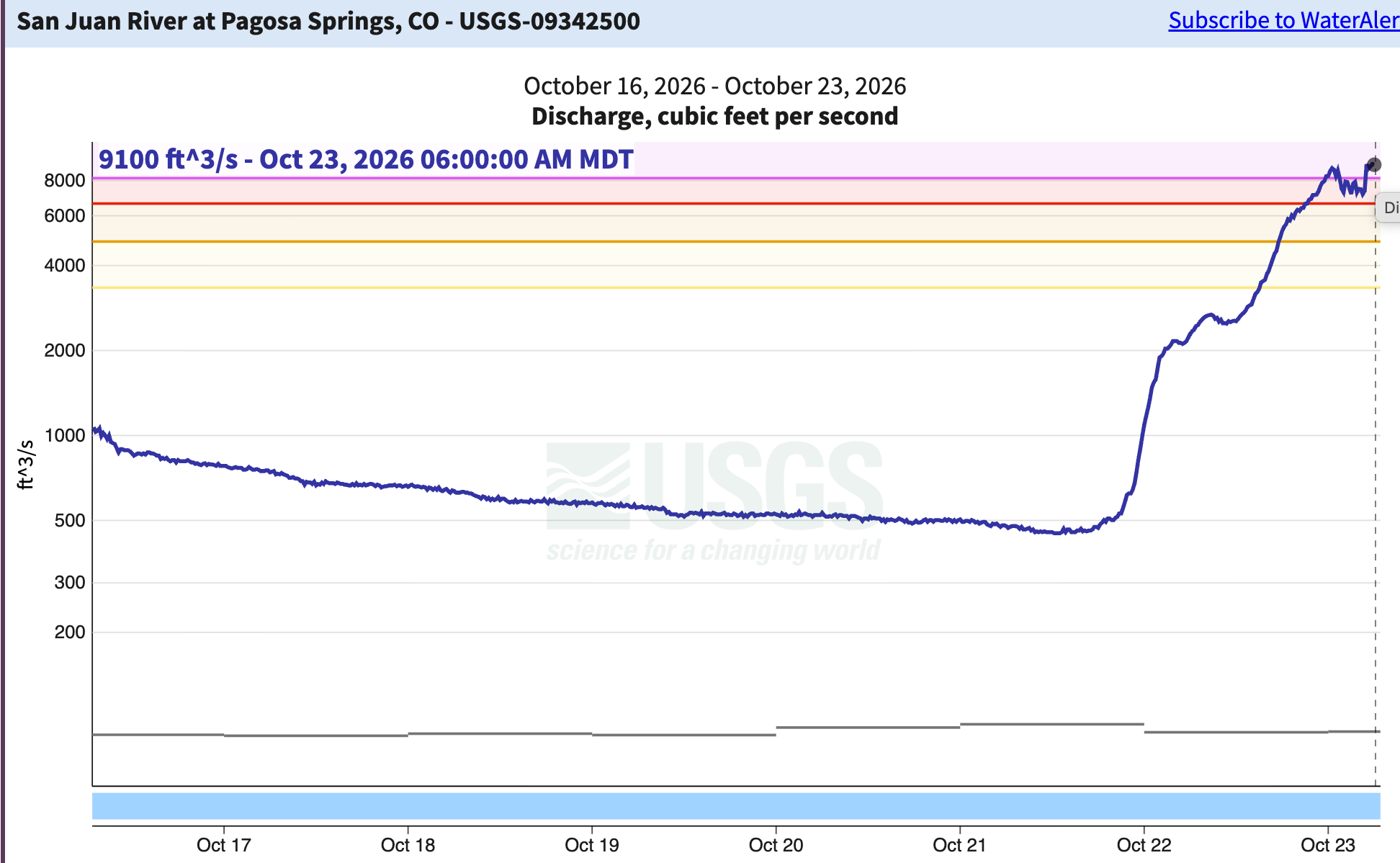
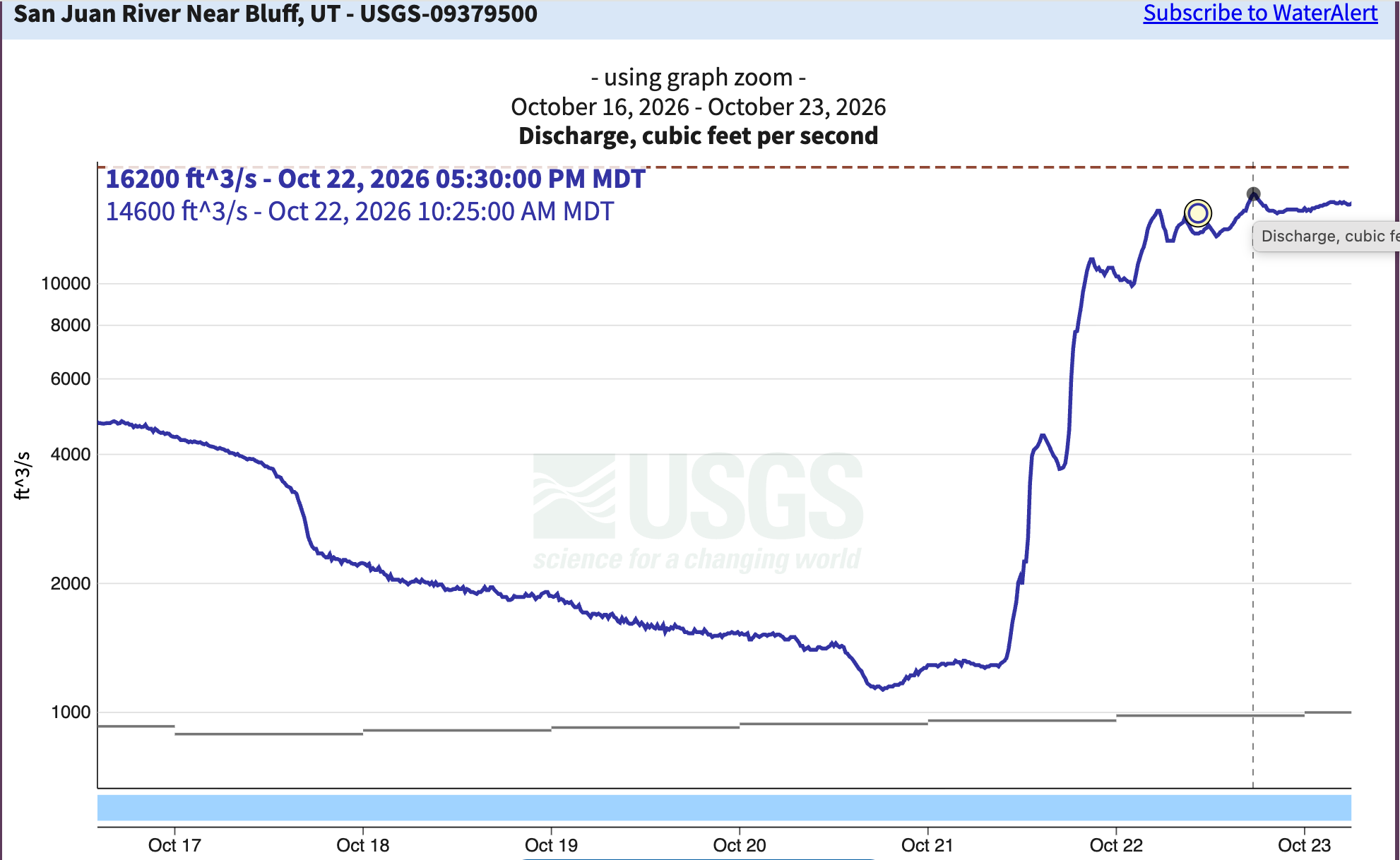
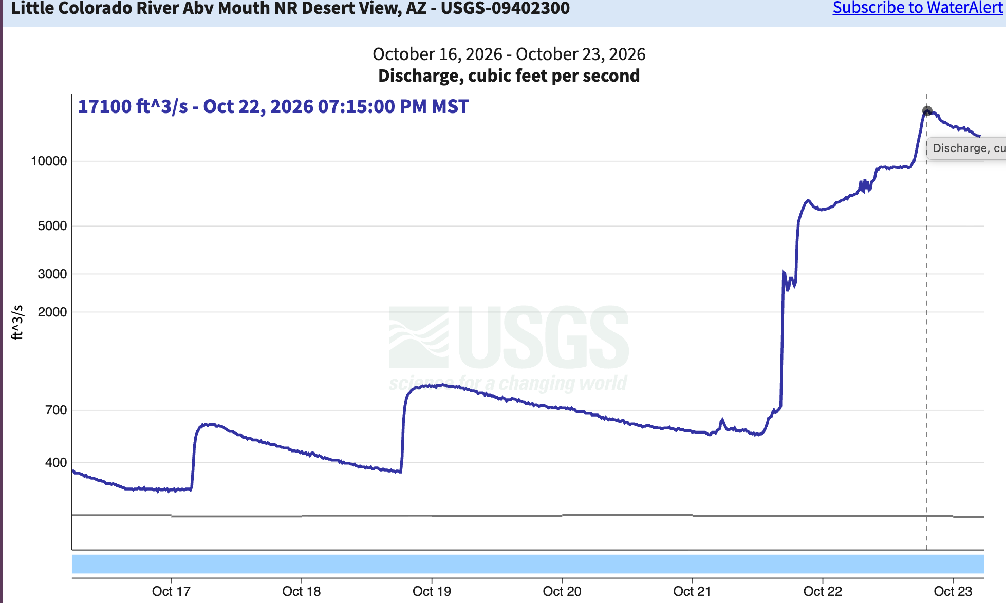
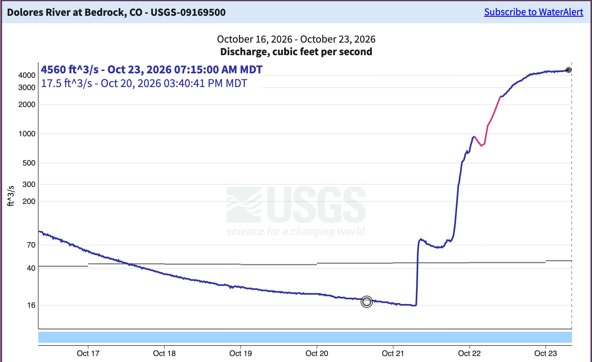
Yet another round of storms slammed the Southwest this week, wreaking havoc across the region and hitting the Four Corners Country hard. By Friday morning, the rain had let up in most places, but some rivers are continuing to rise toward flood levels. Here’s a quick rundown of some notable impacts, then on to the hydrographs:
- The Navajo Nation once again suffered major flash flooding that washed out roads or otherwise rendered them impassible. Perhaps the worst of it unfolded in Dennehetso, a low-lying community between Kayenta and Mexican Water, where the Navajo Department of Emergency Management and other agencies had to use a specialized vehicle to rescue 30 people from flooded homes.
- An emergency was declared in Hurricane, Utah, after a couple of inches of rain fell in the headwaters of Gould Wash, which then partially inundated the southwest Utah community.
- An evacuation order was issued for low lying areas along the San Juan River, as stream levels met and then exceeded last October’s high-water levels.
- The Colorado Department of Transportation closed a segment of Hwy 550 over Red Mountain Pass, CO 17 over Cumbres Pass, Hwy 160 over Wolf Creek Pass, CO 151 near Chimney Rock, and a section of Hwy 160 west of Pagosa Springs due to flooding, debris flows, and/or safety concerns. Those segments remained closed as of Friday morning at 8 a.m.

- And in Heber, Arizona, a possible tornado caused widespread damage.
RERUN: Four Corners floods: past, present, and … future? Is this the year for a 1911 repeat? — Jonathan P. Thompson
Now for a look at some streamflows.
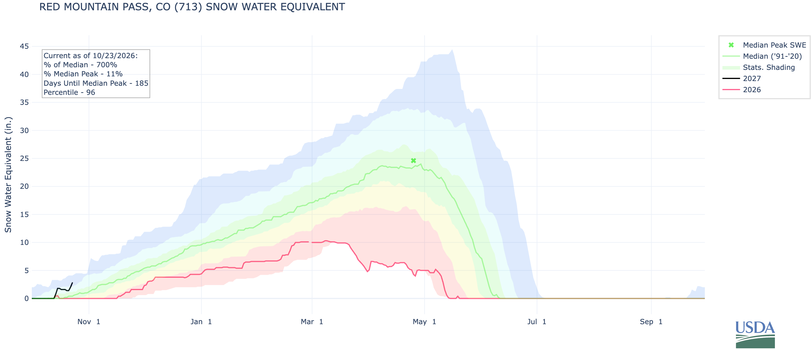
While it’s been a bit too warm for this wet stuff to take the form of snow in the lowlands and midlands, it has left a good coating of wet, white stuff on the peaks. The Center for Snow and Avalanche Studies monitor at its Senator Beck Study Plot near Red Mountain Pass is recording 12.8 inches of snow, with about five inches of snow water equivalent. That’s significantly higher than what the nearby SNOTEL station is currently recording (2.8 inches of SWE).