#Drought news July 10, 2025: Improving drought conditions were made to parts of #NewMexico, S.W. #Colorado, and #Arizona, 90-day precipitation, valid April 9-July 7, avg. more than 150 percent of normal for much of #Nebraska, E. Colorado, and E. #Wyoming.

Click on a thumbnail graphic to view a gallery of drought data from the US Drought Monitor website.

Click the link to go to the US Drought Monitor website. Here’s an excerpt:

This Week’s Drought Summary

Drought coverage and intensity continued its decline throughout the Great Plains since the spring with additional heavy rainfall during the first week of July. Despite the extremely heavy rainfall and flash flooding this past week, long-term drought dating back multiple years remains across south-central Texas. Improving drought conditions were made to parts of New Mexico, southwestern Colorado, and Arizona, while drought expanded and intensified across the Pacific Northwest and Northern Intermountain West. Much of the Corn Belt and Midwest remains drought-free, but a continued lack of adequate precipitation led to worsening drought for northern Illinois. Following another week of summertime thunderstorms with heavy rainfall, drought ended for most of the central to southwestern Florida Peninsula. Nearly all of the East, Ohio and Tennessee Valleys, and Lower Mississippi Valley are drought-free. 7-day temperatures (July 1-7), averaged 2 to 4 degrees F above normal across the Pacific Northwest, Northern Great Plains, Midwest, and New England. Cooler-than-normal temperatures were limited to the Southern Great Plains and portions of the Southwest. Parts of northwestern Alaska and the Yukon River Valley are designated with short-term drought, while drought of varying intensity continues for Hawaii. Although Puerto Rico currently remains drought-free, short-term precipitation deficits have increased…

High Plains

Another round of heavy rainfall (1 to 2 inches, locally more) supported a 1-category improvement to parts of the Northern and Central Great Plains. April through early July is a wet time of year and 90-day precipitation, valid April 9-July 7, averaged more than 150 percent of normal for much of the Dakotas, Nebraska, eastern Colorado, and eastern Wyoming. Conversely, moderate drought (D1) across northeastern North Dakota was expanded westward due to another dry week and above-normal temperatures. The D1 is supported by the 30 to 60-day SPIs along with soil moisture indicators. Eastern Kansas has missed out on the heavy rainfall recently and abnormal dryness (D0) was added to that part of the state. Although precipitation was not that heavy across southwestern Colorado, enough precipitation along with support from SPIs at multiple time scales and the NDMC drought blends warranted small 1-category improvements…

Colorado Drought Monitor one week change map ending July 8, 2025.

West

Based on rapidly declining soil moisture and low 28-day average streamflows, additional degradations were warranted this week for the Pacific Northwest with an expanding coverage of moderate (D1) to severe (D2) drought across Oregon and Washington. Farther to the east, extreme drought (D3) was expanded to include more of northern Idaho. Parts of Utah also had a few areas with degradations based on 28-day streamflow, soil moisture, and high evaporative demand recently. A drier end to the wet season, 60 to 90-day SPI, and low soil moisture supported an expansion of abnormal dryness (D0) across northern to central California. Following recent beneficial precipitation along with timely wetness back to the late spring, improvements were warranted for parts of north-central and eastern Montana. Drought intensity remained nearly steady for the Desert Southwest although locally heavier Monsoon showers led to a small reduction in extreme drought (D3) for eastern and southern Arizona…

South

A broad one to two-category improvement was made this past week to much of the ongoing long-term drought areas of Texas along with parts of New Mexico. The heaviest precipitation (5 to 10 inches, or more) occurred across the Edwards Plateau and south-central portions of Texas. According to CoCoRaHS gauge measurements from July 1-7, precipitation amounts ranged from 12 to 18 inches in eastern Burnet and western Williamson counties of Texas. Although 1 to 2-category improvements were made, a long-term drought dating back multiple years with low groundwater and reservoir levels continue. Therefore, an area of long-term drought (D1+) was maintained. The Edwards Aquifer Authorityโ€™s long-term observation wells at Medina and Uvalde counties remain in extreme (D3) to exceptional (D4) drought levels. Elsewhere, across the Southern Great Plains and Lower Mississippi Valley, no short-term or long-term drought is designated…

Looking Ahead

From July 10 to 14, a cold front is forecast to shift southeast across the central U.S. and provide the focus for thunderstorms. The most widespread, heavy precipitation (more than 1.5 inches) is forecast across the Upper Mississippi Valley and Western Corn Belt, but locally heavy precipitation is expected as far south and west as the Southern Great Plains and eastern New Mexico. Daily convection with locally heavy precipitation is forecast across the Mid-Atlantic and Southeast, especially east of the Appalachians. A lull in the Monsoon will be accompanied by above-normal temperatures across the Desert Southwest. Dry weather and increasing heat are likely for the interior Pacific Northwest.

The Climate Prediction Centerโ€™s 6-10 day outlook (valid July 15-19, 2025) favors above-normal precipitation across the eastern two-thirds of the contiguous U.S., most of Alaska, and the western Hawaiian Islands. The largest above-normal precipitation probabilities (more than 50 percent) are forecast for the Florida Panhandle, western Texas, and eastern New Mexico. Increased below-normal precipitation probabilities are limited to the Pacific Northwest. Above-normal temperatures are favored throughout the Pacific Northwest, Great Basin, eastern Texas, Lower Mississippi Valley, and the East. Increased chances for below-normal temperatures are forecast for the Great Plains. The outlook leans cooler (warmer)-than-normal for southern (northern) Alaska.

US Drought Monitor one week change map ending July 8, 2025.

Safeguarding the sagebrushโ€™s rich wet meadows, one #Wyoming gulch at a time: Simple erosion-control technique named after scientist Bill Zeedyk fortifies ecologically valuable riparian zones all around the western U.S — Mike Koshmrl (WyoFile.com)

Cooper Fieseler places stones intended to prevent erosion during a June 2025 Zeedyk structure-building outing on the White Acorn Ranch. (Mike Koshmrl/WyoFile)

Click the link to read the article on the WyoFile website (Mike Koshmrl):

Tom Christiansen drew a parallel to the human body as he described the purpose of the low-tech rock structures heโ€™s been building for years within the creases of western Wyomingโ€™s sagebrush sea. 

The malady? Erosion. The treatment: A carefully placed stone.  

โ€œEach of these is a stitch on what we donโ€™t want to become a sucking chest wound,โ€ Christiansen told a group of rock-moving volunteers on Saturday in late June. 

The group was assembled on the White Acorn Ranch, a picturesque cattle operation south of the Lander Cutoff Road thatโ€™s within the spectacular Golden Triangle โ€” a 367,000-acre region along the flanks of the Wind River Range that houses the best remaining sagebrush habitat on Earth.

In a June 2025 outing near South Pass, Tom Christiansen, Mark Kot and Lindsey Washkoviak distribute stones that will be positioned into Zeedyk structures intended to protect wet meadows. (Mike Koshmrl/WyoFile)

The high desertโ€™s sagebrush-steppe has enormous ecological value. Thatโ€™s evidenced by the struggling species that depend upon the embattled biome. But itโ€™s an arid environment, and certain nooks and crannies play an outsized role in nourishing the landscapeโ€™s native and domesticated inhabitants. High on that list are the grassy wet meadows that convey precious water, like arteries pump blood, through the contours of the sagebrush-covered hills.

โ€œThese areas are pretty small, but theyโ€™re very important,โ€ said Christiansen, a retired sage grouse coordinator for the Wyoming Game and Fish Department. โ€œThese are the grocery stores.โ€ 

Youngsters Cooper Fieseler and Camryn Christiansen-Fieock check out a mega-sized Zeedyk structure built to address an especially broad โ€œheadcutโ€ that was eroding into the green grass uphill. (Mike Koshmrl/WyoFile)

But those bottomlands can become barren of the biomass that feeds insects, sage grouse chicks and on down the food chain. Erosion, although a natural phenomenon, can be hastened by factors like overgrazing and extreme weather events made more likely by climate change. When erosion runs out of control into grassy gulches, they become incised gullies. Out goes the vegetation. 

Thatโ€™s where the simple rock structures come in. 

The same spot before the mega-sized Zeedyk structure went in. (Tom Christiansen)

โ€œPrevent that erosion, get more water into the soil, keep the water table up, keep the green vegetation โ€” thatโ€™s the intent of these structures,โ€ Christiansen said. 

Known as Zeedyk structures, after their inventor, Bill Zeedyk, the stone assemblies come in different shapes and sizes. At the White Acorn Ranch and numerous other corners of the West, there are โ€œone rock dams,โ€ โ€œzuni bowls,โ€ โ€œrock mulch rundownsโ€ and other hand-built structures intended to arrest vertical โ€œheadcutsโ€ in ephemeral streambeds.

By facilitating the flow of water and slowing it down, the structures can prevent erosion from spreading uphill. Although the ecological do-gooding tactic relies on simple concepts and materials โ€” essentially well-placed rocks โ€” building it out requires hard physical labor. 

Mark Kot listens to a discussion about Zeedyk structures in June 2025. (Mike Koshmrl/WyoFile)

A bevy of volunteers flocked to South Pass on June 21 to erect new Zeedyk structures and shore up old ones. 

Jared Oakleaf, Liz Lynch and Lindsey Washkoviak ventured up from Lander. Mark Kot, bad back and all, came from Rock Springs to move rock. Christiansen made the drive from Green River alongside his granddaughter, Camryn Christiansen-Fieock, of Big Piney. On a day off, Wyoming Game and Fish Department habitat biologist Troy Fieseler made the trek from Pinedale and with his son, Cooper. 

A group of volunteers building Zeedyk structures in June 2025 aims to preserve the grassy bottoms pictured in this photo on the White Acorn Ranch. (Mike Koshmrl/WyoFile)

The rocks were donated, too. Robert Taylor, an avid sage grouse hunter from Washington state, ponied up for the materials the volunteers carefully placed. 

Several of the bunch devoting their Saturday to moving rocks up on South Pass were seasoned. Fieseler even learned the ropes from the techniqueโ€™s namesake himself. 

โ€œThe very first time I did it, we had Bill Zeedyk come out,โ€ he said. โ€œHe taught us to read the landscape.โ€

Troy Fieseler motions while talking with fellow volunteers during a June 2025 Zeedyk structure-building outing on the White Acorn Ranch. (Mike Koshmrl/WyoFile)

That 2021 workshop, held at Seedskadee National Wildlife Refuge, imparted Fieseler with lessons he hasnโ€™t forgotten. Protecting uneroded wet meadows is a far more efficient use of time and resources than trying to restore those that have already washed out, he recalled.

Over the last decade, Zeedykโ€™s erosion-control tactics have gained traction in Wyoming and well beyond. The Natural Resources Conservation Serviceโ€™s Sage Grouse Initiative gave the concept its legs, Christiansen said. Now there are thousands of structures dispersed across hundreds of projects, he said.

โ€œEach of these, whatโ€™s its significance?โ€ Christiansen said. โ€œAn individual one, itโ€™s not so much, but when you start doing thousands of these across the West, there is significance.โ€

Zeedyk structures in action helping to control erosiion and retain moisture on a gulch in the White Acorn Ranch. (Tom Christiansen)

Enough time has passed since the techniqueโ€™s inception that restoration specialists know it works, thanks to long-term monitoring

The White Acorn Ranchโ€™s Zeedyk structures also have proven hardy and able to withstand the worst that the harsh Wyoming environment can throw their way. Christiansen and his fellow volunteers labored in a corner of the state that got walloped during the winter of 2022-โ€™23 by an unusually hefty snowpack. 

โ€œThis ensured the runoff from the heavy snow,โ€ Christiansen said. โ€œThey dealt with a lot of energy, and handled it. Very few rocks moved.โ€

Christiansen spoke of the rock structureโ€™s resilience on the front end of a day of labor. From a section of state land, he motioned down a draw. 

โ€œThereโ€™s over 20 structures between here and where that slope toes off,โ€ he said. 

Every one of them had been erected by Christiansen, the crews of Zeedyk structure-building volunteers and agency folks that have also chipped in.

Frances Brennan, Cooper Fieseler and Camryn Christiansen-Fieock pose after a couple hours of playing and moving rocks that went into Zeedyk structures on the White Acorn Ranch. (Mike Koshmrl/WyoFile)

R.I.P. John Stulp

John Salazar, Governor Hickenlooper, and John Stulp at the 2012 DNR Drought Conference

From email from the Colorado Water Congress (Christine Arbogast):

The Colorado water family has lost a giant and a gentleman. ย To be able to stand by Johnโ€™s side was an honor, as he exhibited such knowledge, integrity and humility in all he did.

Obituary from Peacock Funeral Home:

A memorial service is pending for longtime Lamar resident John R. Stulp, Jr.

John was born on December 27, 1948 at Yuma, CO to John and Nina (Dunafon) Stulp Sr. and passed away on July 7, 2025 at the age of 76 at the Prowers Medical Center in Lamar with his family by his side.

John is survived by his wife Jane Stulp of the family home in Lamar; children John (Lyndsey) Stulp, III of Fort Collins, CO; Janea (Sunit) Bhalla of Fort Collins, CO; Jason (Megan) Stulp of Fruit Heights, UT; Jeremy (Christi) Stulp of Granada, CO; and Jensen (Annessa) Stulp of Lamar, CO; grandchildren Jackson, Cooper, and Eli Stulp; Brady, Kaitlyn, and Tyson Bhalla; Ethan, Nathan, and Addison Stulp; Mark and Brynn Stulp; and Zeke, Trenton, and Anneston Stulp.

He is also survived by his sisters, Clydette (Charles) DeGroot of Cabris, France and Patty Stulp of Denver, CO; his aunt Leta Smith of Joes, CO; his brothers-in-law Bill Ragsdale of Santa Clarita, CA; John Ragsdale of Santa Clarita, CA; and David Ragsdale of Fort Collins, CO; his sisters-in-law Cindy Stulp of Yuma, CO; Renel Ragsdale of Santa Clarita, CA; Judy (Gary) Barham of Halfway, MO; and Jean Ragsdale of Bolivar, MO; as well as many cherished nieces, nephews, cousins, and a host of friends.

He is preceded in death by his parents, his brothers D.V. Stulp and Tim Stulp, his parents-in-law Howard and Mary Ragsdale, and his brother-in-law Bob Ragsdale.

More Coyote Gulch posts mentioning John Stulp.

Assessing the U.S. #Climate in June 2025 — NOAA

Click the link to read the report on the NOAA website:

Key Point:

A widespread late-June heatwave impacted much of the central and eastern U.S., and brought record-setting temperatures. More than 100 million people across 726 counties experienced record heat from June 22โ€“25.

Map of the U.S. selected significant climate anomalies and events in June 2025

Other Highlights:

Temperature

June 2025 U.S. Mean Temperature Departures from Average Map

The average temperature for the contiguous U.S. (CONUS) in June 2025 was 71.2ยฐF, 2.8ยฐF above the 20th-century average, and ranked seventh warmest in the 131-year record. Temperatures were above average across most of the Lower 48, with much-above-average warmth affecting large areas of the western third of the country, along with parts of the Florida Peninsula, Mid-Atlantic, Northeast and Great Lakes regions. Rhode Island saw its second-warmest June on record and its warmest for nighttime minimum temperatures, which were 5.8ยฐF above average.

Alaskaโ€™s average temperature for June was 50.8ยฐF, 1.6ยฐF above the long-term average and ranking in the warmest third of the 101-year record. While parts of the southeast Panhandle were slightly cooler than average, the North Slope was notably warm at more than 3 degrees above average.

The average temperature for the CONUS during the first half of 2025 (Januaryโ€“June) was 49.6ยฐF, 2.1ยฐF above the 20th-century average, ranking in the warmest third of the 131-year record. All states recorded temperatures above their long-term averages for the six-month period, with much-above-average warmth observed across parts of the West, Southwest and portions of the East Coast. Alaskaโ€™s year-to-date average temperature was 26.8ยฐF, 5.5ยฐF above its long-term average, tying as the fourth-warmest Januaryโ€“June in the 101-year record.

Precipitation

June 2025 U.S. Total Precipitation Percentiles

The average precipitation for the contiguous U.S. in June was 3.22 inches, 0.30 inch above the long-term average, ranking in the wettest third of the 131-year record. Much of the Southwest, the southern and central Plains, the middle and upper Mississippi Valley, parts of the Ohio Valley and Great Lakes region and areas of the Deep South recorded above-average rainfall. In contrast, drier-than-average conditions prevailed from the central West Coast through the Northwest and into the Rockies. The Northwest region experienced its third-driest June on recordโ€”and driest since 2003โ€”with Washington and Oregon each receiving less than half an inch of rain for the month. Parts of north-central California and south-central Washington recorded no measurable rainfall for the entire month.

For the Januaryโ€“June period, the CONUS averaged 15.70 inches of precipitation, 0.40 inch above the long-term average, ranking in the middle third of the 131-year record. Most of the western half of the country, along with a narrow band from the central Plains through the mid-Mississippi Valley and parts of the Southeast, were drier than average. Above-average precipitation was recorded from the southern Plains through the lower Mississippi and Ohio Valleys into the Northeast, as well as in parts of the northern Plains and upper Mississippi Valley.

Alaska received 2.32 inches of precipitation in June, which was near the long-term average. Conditions were drier than average across the eastern interior and North Slope but wetter than normal in the western and southwestern parts of the state. For the first half of the year, Alaska recorded 16.58 inches of precipitation, 2.96 inches above average, marking its fifth-wettest start to the year on record.

Drought

US Drought Monitor map July 1, 2025.

According to the July 1ย U.S. Drought Monitor report, about 32.4% of the contiguous U.S. was in drought, an increase of approximately 2.8% since the beginning of the month. Drought developed or intensified across much of the Northwest through the Rocky Mountains and in small areas of the Alaskan interior. Conversely, drought contracted or was reduced in intensity across parts of the Southwest and southern Texas, the central and northern Plains, the upper Mississippi Valley and parts of Florida.

Monthly Outlook

July temperatures are expected to be above normal across the entire contiguous U.S., with the highest likelihood of warmer-than-average conditions in the Mountain West, southern Texas and throughout much of the Great Lakes and the Northeast. For rainfall, parts of the Northwest and the southern and central Plains are expected to be drier than normal, while the interior East is favored to have a wetter-than-average July. Drought is likely to persist across much of the western U.S. in July, with some further development in the Northwest, while improvement is expected across southeastern Arizona, southern New Mexico and far West Texas, where above-average rainfall is favored.

Visit the Climate Prediction Centerโ€™s Official 30-Day Forecasts and U.S. Monthly Drought Outlook website for more details.

Significant wildland fire potential is above normal for July across the Northwest, Hawaii and Puerto Rico. For additional information on wildland fire potential, visit the National Interagency Fire Centerโ€™s One-Month Wildland Fire Outlook.

For more detailed climate information, check out our comprehensive June 2025 U.S. Climate Report scheduled for release on July 14, 2025. For additional information on the statistics provided here, visit the Climate at a Glance and National Maps webpages.

Job Opportunity: #Colorado Division of Water Resources – Assistant Division Engineer (PE II) (Division 5, #GlenwoodSprings)

Click the link to view the job posting on the State of Colorado Job Opportunities website.

As the #ColoradoRiver shrinks, desert towns grow: Kanab gets a bunch of new development, Imperial Irrigation District scoffs at farmland #solar — Jonathan P. Thompson (LandDesk.org) #COriver #aridification

A houseboat docks on the mudflats near Wahweap Marina during the summer of 2021, when reservoir levels dropped perilously low. Jonathan P. Thompson photo

Click the link to read the article on The Land Desk website (Jonathan P. Thompson):

July 8, 2025

๐Ÿฅต Aridification Watch ๐Ÿซ

If Lake Powell is like a big thermometer gauging the hydrologic health of the Upper Colorado River Basin, then itโ€™s running a high fever.

In one case, the fever analogy is a bit too literal: The National Park Service has detected high concentrations of cyanotoxins in the reservoir around the mouth of Antelope Canyon, and is warning folks to limit their exposure to the water. Warm water is one of the drivers of cyanotoxin growth.

The surface level peaked out on June 19 at 3,562 feet above sea level, with about 7.8 million acre-feet of storage (or about one-third of its capacity). That means the big, white โ€œbathtubโ€ ring on the sandstone cliffs has grown by about 27 feet in the past year, re-revealing some landforms and rendering some boat ramps unusable. Levels will continue to drop throughout the summer.

This is because more water is leaving the reservoir via downstream releases and evaporation than is flowing into it. Reservoir inflows during June were a mere 883,000 acre feet, or about 41% of the median inflows. Thatโ€™s far lower than the last two years and is only marginally higher than in 2002, 2018, and 2021, some of the worst years on record. And with the water year three-fourths of the way done, only 4.2 million acre-feet has flowed from the Colorado River and its upstream tributaries into the reservoir, setting the stage for a water year total of just about 5.5 million acre-feet โ€” or 2 million acre-feet less than the minimum release from Glen Canyon Dam.

The only good news is that temperatures at the reservoir mostly have been in the 80s or 90s for the past several weeks, which is about normal for this time of year. Oh, and another sorta-kinda silver lining: As the reservoir levels drop, the surface area decreases, reducing the rate of evaporation. Yay?

Inflow volumes at Lake Powell have been pretty skimpy this water year, with June of 2025 delivering just 41% of the median flows for that month. 1983 was the biggest water year on record since Glen Canyon Dam was completed in 1963, and 2002 was the lowest inflows.

Meanwhile, many of the Colorado Riverโ€™s users continue under the illusion that the Colorado River Compact and the Law of the River will trump nature and the reality of diminishing flows.

Take the Imperial Valley in southern California. The Imperial Irrigation District is the single largest water user on the river, consuming some 2.3 million acre-feet during the 2024 calendar year to grow various food crops and a lot of alfalfa. Thatโ€™s about seven times more Colorado River water than all of southern Nevadaโ€™s casinos, hotels, golf courses, and homes consume.

Bales of alfalfa in the Imperial Irrigation District of southern Calfornia, grown with Colorado River water. Photo by Brian Richter

But itโ€™s also about 200,000 acre-feet less than the irrigation district consumed in 2013. Thatโ€™s in part because some farmers are being paid to not irrigate or to irrigate less, often meaning they must fallow their fields, at least temporarily. And some of those farmers have chosen to lease their land โ€” about 13,000 acres โ€” to solar companies for utility-scale energy installations, allowing them to continue to make money off the land without further depleting the Colorado River.

Thanks to Dustin Mulvaney for tipping us off to this resolution on Bluesky.

That irks the Imperial Irrigation Districtโ€™s board, which recently passed a resolutionโ€œopposing the continued expansion of utility-scale solar projects on active or historically farmed agricultural landโ€ in the district. โ€œOur identity and economy in the Imperial Valley are rooted in agriculture,โ€ said IID Board Chairwoman Gina Dockstader, in a written statement. โ€œSolar energy has a role in our regionโ€™s future, but it cannot come at the cost of our farmland, food supply, or the families who depend on agriculture. This resolution is about protecting our way of life.โ€

The resolution doesnโ€™t carry any legal weight, but the IID has a lot of influence, and could easily push the county to ban or heavily restrict solar installations on farmland as dozens of other counties across the nation have done.


Meditations on solar, Joshua trees, and the movement to kill clean energy — Jonathan P. Thompson


Granted, taking land out of agriculture and irrigation has consequences. It can become a weed-choked, dust-spawning expanse. In the Imperial Valley, irrigation runoff feeds the Salton Sea. And, of course, you lose food production and farmworker jobs.

Nevertheless, the resolution seems somewhat short-sighted. It is based on the assumption that the IID will be able to flex its senior water rights in perpetuity, and never have to give up significant amounts of irrigation. It robs farmers of their private property rights, their ability to diversify their income sources, and an opportunity to conserve increasingly scarce water.

And, if the solar installations arenโ€™t built there, they are likely to end up on public land in desert tortoise and other wildlife habitat that could require the removal of hundreds or even thousands of Joshua trees. Worse, it might result in new natural gas or even coal plants to meet the burgeoning demand for power driven by the proliferation of energy- and water-intensive data centers.


A Dog Day Diatribe on AI, cryptocurrency, energy consumption, and capitalism — Jonathan P. Thompson


๐Ÿ  Random Real Estate Room ๐Ÿค‘

And on that note, thereโ€™s Kanab, in south central Utah. Iโ€™ve driven through Kanab many a time, but usually I just roll on through, finding more of interest in Ordervilleor Fredonia or even Colorado City and Hildale. I mean, Orderville does have โ€œHo-Made Pies,โ€ or so the sign declares, and was founded as a bastion of the United Order, the tenets of which were communalism, cooperation, and equal distribution of wealth.

Kanab, meanwhile, was notable to me only as the home of former Utah state representative Mike Noel, who was a Wise Use/Sagebrush Rebel leader of the early 2000s, and I wasnโ€™t going to stop in for a cup of coffee โ€” er, a soda โ€” with the guy. So I failed to notice that the little community was not only growing, but sprawling into the surrounding red-rock desert in the form of upscale resorts and housing communities and even a brand new town. A friend sent me this video, which enthusiastically offers details:

  • There is, for example,ย Catori Canyonย โ€œa premium housing development & luxury gated communityโ€ that โ€œredefines modern indoor-outdoor living.โ€ Prices start at $450,000 โ€” for a bare lot. It also predictably has a pickleball court, which is what I think they mean when they say it โ€œisnโ€™t just home โ€” itโ€™s a lifestyle.โ€ I call that real estate propaganda.
  • Andย Ventana Resort, which is on state trust lands and is described by the Utah Trust Lands Administration as an โ€œambitious project that includes townhomes, affordable housing, nightly rentals, single-family homes, and even a hotel.โ€ The Kane County Water Conservancy District, headed by the aforementioned Mike Noel, had hoped to build a golf course on the land, but pickleball โ€” yes, the development has courts โ€” and four swimming pools won out, apparently. The townhomes are expected to begin at $650,000, according to theย Southern Utah News.
  • The new town? It was originally just a huge subdivision called Willow Preserve Estates, which received county approval (after the county had denied its proposed public infrastructure district). But apparently the developers werenโ€™t content with the limits of the subdivision approval, so they petitioned the state toย incorporate their own municipalityย called Willow, which would allow them to approve their own PID with higher housing density. Kane County commissioners areย miffed. If the state approves the municipality, it will include 1,200 to 1,400 home sites along with commercial areas on a big parcel of land east of Kanab and just south of Hwy 89.

Thatโ€™s a lot of homes; Kanab has about 2,000 households, and that doesnโ€™t count Catori Canyon or Ventana Resorts, let alone Willow. And, if youโ€™re like me, youโ€™re wondering where these folks โ€” along with the other developments with their swimming pools and lawns โ€” are going to get their water.

It appears the answer is: wells. Kanab currently supplies its 5,000 residents with several groundwater wells and springs. Willow will likely get its water from Kane County Water Conservancy Districtโ€™s Johnson Canyon system, which is also fed primarily by groundwater. Which is to say, they arenโ€™t taking it directly out of the Colorado River system, but they are taking it indirectly from the system, since groundwater and surface water is all connected. Plus, aquifers all over the Colorado River Basin are being depleted by over-pumping. Pulling more out of them is not sustainable.

But thatโ€™s not all. Kanab is also about to be home to two new ultra-exclusive resorts in a similar vein as Amangiri, the posh place frequented by the Kardashians and located just outside the (past and possibly present) polygamist community of Big Water, Arizona. 

Canyon Country, my friends, is rapidly being gentrified. 

Kaia, by Outdoor Citizen, bills itself as a โ€œnew ultra-luxury RURAL EB-5 investment opportunity.โ€ That is, if youโ€™d like to migrate to America, just fork out a million or so bucks for one of the 40 planned residences in Johnson Canyon outside Kanab and, voila!, you have permanent U.S. residency. In Europe they call that a โ€œgolden passport.โ€ The projectโ€™s developer is FirstPathway Partners, whose sole purpose is to facilitate these EB-5 visas.

Kaia, by Outdoor Citizen, bills itself as a โ€œnew ultra-luxury RURAL EB-5 investment opportunity.โ€ That is, if youโ€™d like to migrate to America, just fork out a million or so bucks for one of the 40 planned residences in Johnson Canyon outside Kanab and, voila!, you have permanent U.S. residency. In Europe they call that a โ€œgolden passport.โ€ The projectโ€™s developer is FirstPathway Partners, whose sole purpose is to facilitate these EB-5 visas. 

Kaiaโ€™s website says the development โ€ฆ

Yeah, the BLM land might be protected for now. But a warning to the rich folks that might want to invest: Utah politicians are leading the charge to turn that lovely โ€œGreenbeltโ€ of public land over to housing developers. So instead of those fetching red rocks, you might one day have a view of a subdivision out your giant front window. And if Sen. Mike Lee and his ilk canโ€™t sell the public land straight out, the Trump administration might just fast-track a uranium or coal mine, AI-crunching data center, or oil and gas development in that greenbelt just a few hundred meters from your luxury home.


Late light on Glen Canyon rock formations. Jonathan P. Thompson photo.

Federal Water Tap, July 7, 2025: President Signs Budget Bill, Agencies Move to Streamline Environmental Reviews — Brett Walton (circleofblue.org)

Sensitive satellite-based instruments enable scientists to measure relative variations of Earthโ€™s gravitational field. Data gathered by NASAโ€™s Gravity Recovery and Climate Experiment (GRACE) is used in a new study to show that many continental regions are experiencing long-term aridification. Credit: NASA/JPL/University of Texas Center for Space Research

The Rundown

  • President Trumpโ€™sย budget billย targets a few water projects while eliminating some climate and environment programs.
  • Agencies move to constrainย environmental reviewsย under NEPA.
  • EPA says it will loosenย wastewater pollution rulesย for thermal power plants later this summer.
  • GAO reviewsย NASAโ€™s major projects, including the third generation of a water-tracking satellite.
  • EPA intends to take public comments on its idea to narrowย state and tribal reviewsย under Section 401 of the Clean Water Act.
  • White House orders higher fees for foreign tourists visitingย national parks.

And lastly, EPAโ€™s internal watchdog notes the risks of rising seas to federally owned Superfund sites.

โ€œIf contaminants from federal facility Superfund sites are released into the surrounding communities, the health, jobs, and environment of millions of U.S. residents may be threatened. Further, the federal funds expended to implement those remedies would have been wasted.โ€ โ€“ Report from the EPA Office of Inspector General that identifies 49 federally owned Superfund sites at risk of flooding from rising seas and increased storm surge.

By the Numbers

$658 Million: Expected baseline cost of the third generation of NASAโ€™s satellite mission that measures changes in the planetโ€™s water storage. The GRACE-C mission is scheduled for July 2029, according to a Government Accountability Office review of NASAโ€™s major projects. Operating for more than two decades, the GRACE satellites have been instrumental in tracking global groundwater depletion.

News Briefs

NEPA Overhaul
Cabinet and other agencies โ€“ including the Interior DepartmentU.S. Department of Agriculture, and Army Corps of Engineers โ€“ announced they will revise their rules for environmental reviews of major projects and prioritize shorter and quicker assessments of potential harms.

The agencies are shortening the administrative timeline for implementing a new rule, arguing that the standard notice-and-comment process would be an unnecessary delay and โ€œcontrary to the public interest.โ€

The Council on Environmental Quality, the White House arm that traditionally oversees NEPA, revoked its regulations in April in response to an executive order promoting domestic energy production. The agencies, now seeking faster, more efficient reviews, are establishing their own rules.

Besides the arrival of the new administration, recent legal rulings have also rearranged the playing field for environmental reviews.

In justifying its action, each agency cited the U.S. Supreme Courtโ€™s ruling in May in Seven County Infrastructure Coalition v. Eagle County, ColoradoThat ruling, in a case which centered on a railroad line in Utah for crude oil, allowed for narrowly focused environmental reviews that assess only a specific project and not the actions โ€“ like upstream oil drilling and downstream oil refining โ€“ it would enable.

Budget Bill
The budget reconciliation bill, which could add $3 trillion to the national debt over the next decade, barely mentioned water directly.

Among the few call outs: The bill delivers $1 billion for surface water storage and water conveyance in the western United States. The money is for projects that increase or restore capacity of Bureau of Reclamation water conveyance systems or increase their use. Increasing reservoir storage capacity โ€“ such as raising Shasta Dam, a Republican-driven idea thatโ€™s been on the table for years โ€“ is also acceptable. The money is available through September 30, 2034.

More broadly, climate and environment programs were chopped. Unobligated Inflation Reduction Act funds โ€“ those not yet committed to a recipient โ€“ were yanked back for programs on climate data, environmental justice block grants, reducing air pollution at schools, and more.

National Parks Fees
President Trump ordered the Interior Department to increase national park entry fees for foreign visitors. The additional revenue would be channeled to infrastructure improvements at the parks or to increase park access.

Still Storm Watching, For Now
NOAA said it would delay by one month the termination of certain storm-tracking satellite data, the Associated Press reports.

Studies and Reports

Superfund Sites at Risk from Rising Seas
The federal government owns 157 Superfund sites. Forty-nine of those sites are at risk of flooding from rising seas and increased storm surge.

The assessment comes from the EPAโ€™s internal watchdog, which published the report to draw attention to federal liabilities related to climate change and the nationโ€™s most toxic sites.

The at-risk Superfund sites are clustered at military sites around Chesapeake Bay, Puget Sound, and San Francisco Bay.

Arizona Groundwater Assessment
The U.S. Geological Survey published a report on water quality in the Coconino aquifer in northern Arizona, where it could be a water source for the Hopi Tribe and Navajo Nation.

On the Radar

Water Quality Permitting
The EPA is considering a rulemaking that would narrow the scope of Clean Water Act reviews undertaken by states and tribes.

These Section 401 reviews have been a target of the Trump administration. Energy companies complain that states have used their review authority to block fossil fuel infrastructure such as natural gas pipelines.

Before the rulemaking, the EPA is asking for public input. The agency opened a docket for written submissions, and it will hold two online events at a time to be announced.

File written comments at www.regulations.gov using docket number EPA-HQ-OW-2025-0272. The deadline is August 6.

Another Slogan Commission
Through an executive order, President Trump established the Presidentโ€™s Make America Beautiful Again Commission.

The commissionโ€™s objectives โ€“ โ€œpromote responsible stewardship of natural resources while driving economic growth; expand access to public lands and waters for recreation, hunting, and fishing; encourage responsible, voluntary conservation efforts; cut bureaucratic delays; and recover Americaโ€™s fish and wildlife populations through proactive, voluntary, on-the-ground collaborative conservation effortsโ€ โ€“ in some ways conflict with the administrationโ€™s desire to cut budgets and greenlight fossil fuel projects.

One of the commissionโ€™s charges is to recommend to the president โ€œsolutions to expand access to clean drinking water and restore aquatic ecosystems to improve water quality and availability.โ€ Stay tuned.

Power Plant Wastewater
Lee Zeldin, EPA administrator, said his agency later this summer will relax wastewater pollution rules for thermal power plants that burn fossil fuel and nuclear fuel.

The Biden administration placed stricter limits on these wastewater discharges last year. In a press release, Zeldin said compliance deadlines would be extended. The agency will also reconsider technological requirements for preventing polluted discharges.

Federal Water Tap is a weekly digest spotting trends in U.S. government water policy. To get more water news, follow Circle of Blue on Twitter and sign up for our newsletter.

The upset apple cart of the #ColoradoRiver — Allen Best (BigPivots.com) #COriver #aridification

Mapping the Grand Canyon. In this photo we have Claude Birdseye (right) – expedition leader and Chief Topographic Engineer of the USGS, and Roland Burchard (left) – expedition topographer. Photo credit: USGS

Click the link to read the article on the Big Pivots website (Allen Best):

June 30, 2025

Becky Mitchell and Doug Kenney had much to say at Crested Butte. Just as important may have been what they did not say.

The apple cart of the Colorado River has been upset for 25 years, and Doug Kenney and Becky Michell were on stage June 24 at the Crested Butte Public Policy Forum to talk about the bruised apples.

Thereโ€™s broad understanding that what worked in the past wonโ€™t work in the future. As to what will work โ€” ah, well, that has yet to be resolved. โ€œSo far, we havenโ€™t really been able to pull the demands down as quickly as supplies have been going down,โ€ said Mitchell.

Adding tension to the conversation is another so-so or worse spring runoff in the river. Despite a decent snow year in northern Colorado, yet another early, warm and mostly drier-than-usual spring has produced an anemic projected runoff of a little over 9 million acre-feet. Average runoff into Lake Powell has been 12 million in recent years. The compact governing the river between the three lower-basin states and the four upper basin states assumed at least 20.

Douglas Kenney. Photo credit: University of Colorado Boulder

Kenney directs the Western Water Policy Program at the University of Colorado Boulderโ€™s Getches-Wilkinson Center. The program puts on a conference each June that is considered one of several must-attend events for those drawn to the unceasing drama about Coloradoโ€™s namesake river.

The river and its tributaries provide water for farms almost to Kansas and Nebraska and, on the west side, to 23 million people crowded along the Pacific Ocean in southern California.

In Crested Butte, Kenney said that unlike other people in Colorado River discussions, whether they represent environmental or agriculture organizations, he enjoys a rare freedom. โ€œI tell people sometimes, I donโ€™t have a dog in the fight, and by that, I just mean I donโ€™t have to represent an interest.โ€

Then he added: โ€œThatโ€™s not entirely true.โ€ He went on to confess that when he sees the Colorado River โ€œsometimes it gives me goosebumps. And Iโ€™m not a goosebumps sort of guy.โ€

Coloradoโ€™s Becky Mitchell had a hearty laugh at the 2024 Getches-Wilkinson Centerโ€™s Colorado River conference. Photo/Getches-Wilkinson Center

Mitchell shared that she was a โ€œsolid B studentโ€ who had grown up in Hawaii before arriving in Colorado to pick up two degrees at the Colorado School of Mines. She worked primarily as a consulting engineer before becoming the director of the Colorado Water Conservation Board. In 2024, Gov. Jared Polis named her to a new position in Colorado government: the stateโ€™s negotiator on Colorado River issues.  Unlike others in such roles, sheโ€™s not a lawyer.

โ€œOften I think of everything as a math problem,โ€ she said. โ€œAnd a lot of what you see with the Colorado River is a math problem. Itโ€™s kind of simple math, almost like just addition and subtraction, not even algebra or multiplication.โ€

The two provided a high-level, yet sometimes detailed overview of the Colorado River during their hour on stage. However, students of the Colorado River, especially about the dramas, might have wanted another hour and the opportunity to ask additional questions.

For example, what do they make of the so-called โ€œnatural flow proposalโ€ that was first formally discussed at a public meeting earlier that day in Arizona. As reported by the Las Vegas Review-Journal, this would base the release of water from Lake Powell on a three-year average of the โ€œnatural flowsโ€ of the river.

In their comments at Crested Butte, Mitchell and Kenney both broadly identified the need for the river to be shared in ways aligned with what Mother Nature is delivering, not a century-old compact.

Later, at a different meeting, Mitchell had this to say: โ€œWhat we know today is that for any approach to work, it must be supply driven, perform well under both dry and varying hydrologies, and adapt to uncertain future conditions fundamental to this โ€˜divorce,โ€™ or how we call it in Colorado, the conscious uncoupling.โ€™โ€

Others might have asked Mitchell about the tensions behind the closed-door sessions โ€” and the things that Kenney mentioned she could not really talk about in a public forum.

Or about the amount of water used to grow hay, including alfalfa, and other fodder crops for livestock. A 2020 study published in Nature Sustainability found that 55% of the water in the Colorado River Basin altogether goes to crops to feed primarily cattle. In the upper basin, itโ€™s much higher.

Mitchell and Kenney did talk about Mead and Powell, the two big reservoirs in the basin, as all Colorado River conversations must.

โ€œThose are the two biggest reservoirs in the United States, and they happen to fall on a river thatโ€™s not even one of the top 20 biggest rivers in the U.S. in terms of volume,โ€ observed Kenney. The reservoirs were close to full 25 years ago. Now, theyโ€™re two thirds empty. โ€œOptimists would say one-third full,โ€ he said.

If you have more water going out than you have coming in, he explained, you have a mass balance problem. โ€œThatโ€™s happening 8 out of 10 years. More water leaves than is coming into the reservoirs under guidelines adopted in 2007. Those interim guidelines govern operations, including how much water is released from the reservoirs and when.

โ€œWhen we talk about Big River issues right now, the Big River issue is getting the system into balance and bringing back the sustainability of the system,โ€ Kenney explained.

Management of the reservoirs was premised on meeting demand. To be more precise, demands of the lower-basin states. Until relatively recently, the lower-basin states were taking an average 10 million acre-feet even if the river delivered only 5 to 10 million acre-feet for the entire basin. Having two big reservoirs upstream allowed them to ignore the winters of scant snow in the headwaters and the rising spring temperatures that spiked evaporation and transpiration.

The first big shock was in 2002, when the river delivered only 3.8 million acre-feet. That was bad, very bad. But the reservoirs still had a lot of water. And there had been bad snow years before. In 1934, for example, the river delivered only 3.9 million acre-feet. And in 1977, a cold but uncommonly snowless winter, it had delivered 4.8 million acre-feet.

By May 2022, Lake Powell had dropped to the lowest levels since the 1960s, when it began filling after construction of Glen Canyon Dam.ย Photo/Allen Best

A big snow year did not soon follow 2002, so the states, guided by the Bureau of Reclamation, came up with a sort-of short-term set of solutions called the 2007 Interim Guidelines. Those guidelines remain in effect but are to be replaced with new guidelines. Thatโ€™s a way of saying how the river is to be managed and, more precisely, who gets what and when. Theyโ€™re called the post-2026 guidelines.

As were the 2007 guidelines, these will be interim, because the hydrology of the Colorado River Basin is not static. It is changing, with some concern that the river, already slimmed down from its 20th century average, will continue to shrink. The Colorado River Compact that was devised in 1922 to apportion the riverโ€™s waters assumed somewhere around 20 million acre-feet. This century the average has been 12.5 million acre-feet.

โ€œThe math problem is becoming worse,โ€ said Kenney.

It will likely worsen. Some scientists have projected a further decline in decades ahead, conceivably to an average 10 million acre-feet or less.

How to shrink demands to correspond with the shrinking river?

Mitchell offered some thin optimism. Demands have ceased to rise. They have actually declined. The lower-basin states have reduced their take from the river to 7.5 million acre-feet.

Thatโ€™s what the compact apportioned. But again, the compact from 1922 was flawed. It assumed more water than the river has delivered. Because of the two big reservoirs in the deserts of Utah and Arizona, the lower-basin states have been able to get their 7.5 million acre-feet (and more, until relatively recently). Arizona and California take way more than half of the riverโ€™s harvest. And because the upper-basin states were not taking their full allocation, they could get away with it without causing harm.

The 21st century combined with the aridification caused by rising temperatures have forced the issue. Even so, the reckoning has come slowly. The lower basin states did not reduce demand to stay within the compact until forced to by a declared shortage in August 2021.

While the decision was not a surprise to veteran Colorado River watchers, it vaulted the Colorado River troubles high into the national consciousness. The story ran on the front page of the New York Times: โ€œIn a First, U.S. Declares Shortage on the Colorado River, Forcing Water Cuts.โ€ Arizona farms took the brunt of this declaration, but as the Times noted, wider reductions loomed as climate change continues to affect flows into the river.

The upper-basin states have been averaging 4.4 to 4.5 million acre-feet, far less than the 7.5 million acre-feet apportionment in the compact. How much they take depends upon how much it snows and rains.

โ€œWe have highs and lows because of hydrology. That can shift a lot. A really good example is from 2021 to 2022. Our use was 4.9 (million acre-feet), and then it went down to 3.9 the following year. That wasnโ€™t because weโ€™re amazing people.โ€

It was, Mitchell explained at Crested Butte, as she does in all of her talks, because the upper basin is limited by what Mother Nature actually delivers. The upper basin has no big dams upstream to serve as an aqua bank account. It has to moderate demand based on what kind of snow โ€” and rain โ€” year occurs.

Some 92% of all the water in the Colorado River originates in the upper basin states, including the Yampa River, seen here emerging from Cross Mountain Canyon in northwest Colorado. Photo/Allen Best

When thereโ€™s insufficient water, the state engineer in Colorado and his district engineers cut off water users, mostly ranchers irrigating grasses.

The compact struck among the four-upper basin states in 1948 used a more common-sense approach for how to allocate the 7.5 million acre-feet in the 1922 compact. It allocated the water among the four states based on proportions. Colorado gets a little more than half โ€” and uses most of it. Wyoming has never come close to developing its share. Regardless, the rule of percentages makes sense for an uncertain hydrology.

โ€œWe realized real quickly that Mother Nature reigned supreme,โ€ said Mitchell. I would be in big trouble if I said the lower basin should do the same. I think they should, but theyโ€™re not there yet.โ€

Mitchell used an analogy to describe the difficult transition for the lower basin. It is much harder to take candy from a baby after they have it,โ€ she said.

โ€œItโ€™s going to be hard for them, and my heart goes out to them. But we have an example up here of how it works. Seniors work with juniors,โ€ she explained, using the shorthand for senior and junior water uses under the prior appropriation system governing water use in Colorado and most Western states. Ag works with environment interests, utilities with agriculture, and so on. They cut deals in advance of water-short years.

โ€œWe have examples of how to make it work. You have a budget. You have to work within it. Thatโ€™s the deal. And sometimes that budget might fluctuate.โ€

โ€œWeโ€™ve not lost all of our junior water-right holders in Colorado because of one bad year or two bad years or three bad years, in a row, because we figure out how to make it work. And what we are saying to the lower basin is figure out where the deals are to be made.

And she drew upon her childhood for another dynamic.

โ€œWhat my mom always said is, you can have anything you want, but you canโ€™t have everything you want.โ€

Translated to the lower basins, that means โ€œyou canโ€™t have chip factories and the largest agriculture in the world and golf courses and pools and Scottsdale and whatever.  You can have the capability to have a strong economy, a sustainable system. You just canโ€™t have it all.โ€

The federal government, through the Bureau of Reclamation, an agency housed within the Department of Interior, built the dams. Reclamation manages the dams. As Mitchell said, they turn the spigots. The onus is on the states to create a solution, an agreement of how to share the shrinking river, but the federal government could step in, if forced to. Mitchell said the feds donโ€™t want to.

โ€œThey really want a consensus deal with the seven states,โ€ she said. Thatโ€™s a hard thing, because thereโ€™s no way to do this without change. The math is the math. The facts are the facts. Thereโ€™s not the 50 million acre-feet in these reservoirs that there were when these (2007) guidelines started. And so the consensus is harder.โ€

Mitchell said she wouldnโ€™t disparage those who created the now obviously flawed 2007 guidelines. Climatologists had suggested only a 3% probability of the runoff that has happened since then would come to pass.

โ€œWhat weโ€™re trying to create through this federal process is something that can handle all the hydrologies. How do we all suffer when the river is suffering? How do we all benefit when the river is flush? And what does benefit look like? Thatโ€™s different in the upper basin than in the lower basin.โ€

The federal government in this case has been nudging the states toward agreement.

โ€œTheyโ€™re trying to say, โ€˜You know, you might be able to open up different project funding if you guys can get to a deal.โ€™ We know we need a deal. Iโ€™m not going to promise you that weโ€™re going to get there, but it is a goal. And (the federal agencies) are part of that goal. They donโ€™t want to make the hard decisions of cutting people off. They are the water masters in the lower basin. They can turn the valves, and thatโ€™s their role.โ€

Added Kenney: โ€œTypically the states are happiest when the federal government is silent, (but) sometimes itโ€™s helpful to have a federal government that is throwing out some ultimatums and some deadlines and some threats.โ€

In the last six months, the federal involvement in the negotiations has grown, and it might grow yet. But a big part of the process โ€” as Mitchell had said โ€” is that the states need to be coming up with their wish list for Congress for consideration next spring.

โ€œSo there is a federal role,โ€ Kenney summarized. โ€œIt evolves based on how the states are doing. But the tradition is you want the feds to stay away until itโ€™s time for someone to write the check.โ€

MItchell had the last word. She again pointed to the meager runoff from this yearโ€™s upper-basin rivers, source of 92% of the riverโ€™s water. Runoff is projected at a little more than 5 million acre-feet into Powell, which is to release 7.48 million acre-feet to the lower basin.

Again, itโ€™s a match problem. And it could get worse.

โ€œIf next year looks anything like this year, or even as a 12 million acre-foot river, actions absolutely have to be taken., and those actions are going to be greater than anybody has put on the table voluntary.โ€

Udall/Overpeck 4-panel Figure Colorado River temperature/precipitation/natural flows with trend. Lake Mead and Lake Powell storage. Updated through Water Year 2024. Credit: Brad Udall

The devastating flash #flood in central #Texas this July 4-5, 2025 deserve a closer look — Philippe Papin

It's been a bit since I've done a meteorological deep dive, but the devastating flash #flood in central Texas this July 4th/5th deserve a closer look. #TXwxYes remnants of #Barry were involved helping enhance moisture. A remnant MCV from Mexico on 3 July also played a role.Full evolution below โคต๏ธ

Philippe Papin (@pppapin.bsky.social) 2025-07-05T22:00:33.079Z

Judge’s ruling keeps #Thornton water pipeline project moving forward — The #FortCollins Coloradan #PoudreRiver #SouthPlatteRiver

Thornton Water Project preferred pipeline alignment November 16, 2023 via ThorntonWaterProject.com

Click the link to read the article on the Fort Collins Coloradoan website (Rebecca Powell). Here’s an excerpt:

July 7, 2025

Key Points

  • A Larimer County judge ruled in favor of Larimer County commissioners, upholding their approval of a permit for Thornton’s 10-mile pipeline project.
  • Save The Poudre, an environmental group, sued the county, arguing the commissioners didn’t properly consider the ‘Poudre River option.’
  • Save The Poudre is considering an appeal, while Thornton says it continues to focus on providing water to its residents.

The city of Thornton is the true winner in a recent court ruling focused on the pipeline it’s planning to build in Larimer County to bring more water to its residents. The lawsuit was filed a year ago by Save The Poudre,ย an environmental advocacy group. Its target was theย Larimer County commissioners, who had approved a permit for construction of the pipeline.

On July 3, Larimer County District Court Judge Michelle Brinegar ruled that commissioners were justified in their decision to approve the application for 10 miles of pipeline through the county…In its lawsuit, Save The Poudre asked the judge to vacate the board’s decision to approve the pipeline. The nonprofit alleged that commissioners didn’t adequately follow the county’s standards for these kinds of applications. Specifically, Save The Poudre contends that commissioners should have required Thornton to present a plan for the so-called Poudre River option, which would have conveyed the water through the Poudre River downstream of Thornton’s current diversion point…But commissioners concluded that while they could encourage the Poudre River option, they couldn’t require it. Brinegar sided with commissioners, saying they can’t compel Thornton to present all possible alternatives, only those that are reasonable.

โ€˜We stand on the brink of system failureโ€™: Feds up pressure for states to reach deal on the future of the #ColoradoRiver — The Salt Lake Tribune #COriver #aridification

Click the link to read the article on The Salt Lake Tribune website (Leia Larsen). Here’s an excerpt:

June 26, 2025

The clock is ticking for seven states to figure out how theyโ€™ll share dwindling water in the Colorado River for the foreseeable future. In a meeting at the Utah State Capitol Thursday [June 26. 2025], the riverโ€™s four Upper Basin state commissioners further embraced the idea of a โ€œdivorceโ€ with their Lower Basin neighbors โ€” anย idea also floated at a meeting in eastern Utah last week, as reported by Fox 13.

โ€œToday we stand on the brink of system failure,โ€ said Becky Mitchell, the commissioner for Colorado. โ€œWe also stand on the precipice of a major decision point.โ€

…negotiations between the four Upper Basin states, which includes Utah, Colorado, Wyoming and New Mexico, have been in a standstill with the remaining three Lower Basin states for more than a year. The Interior Departmentโ€™s acting assistant secretary for water and science, Scott Cameron, has met with leadership in the seven states that use Colorado River water since April, working to broker a deal.

Udall/Overpeck 4-panel Figure Colorado River temperature/precipitation/natural flows with trend. Lake Mead and Lake Powell storage. Updated through Water Year 2024. Credit: Brad Udall

โ€œWe all have to live in the physical world as it is,โ€ he said, โ€œnot as we might hope it will be.โ€

On Thursday, Cameron presented water managers with a deadline. The Interior Department plans to release a draft environmental impact statement evaluating different alternatives for the riverโ€™s future in December, which will then open to public comment. The department will make its final decision on how to proceed by June of 2026.

โ€œThe goal is to essentially parachute in a seven-state deal as the preferred alternative,โ€ Cameron said.

For that to work, the states will need to reach an agreement by Nov. 11. By Feb. 14, theyโ€™ll need to hand over the details of their plan. Whatever the states decide on, Cameron reminded commissioners, will likely take an act of Congress and new policy adopted by most of the affected statesโ€™ legislatures…

The idea of framing the future relationship of the river users as a โ€œdivorceโ€ was first pitched by the Lower Basin states, Mitchell said. Under that proposal, the Upper Basin states would release water from Lake Powell based on the average natural flow measured at Leeโ€™s Ferry, a point just downstream of the reservoir and upstream of both Grand Canyon National Park and Lake Mead.

โ€œIf done correctly,โ€ Mitchell said, โ€œit should provide the opportunity for the Upper and Lower basins to manage themselves, with the only real point of agreement being the Powell release.โ€

Study from 2020 Shows #GlobalWarming Intensifying Extreme Rainstorms Over North America — Bob Berwyn (InsideClimateNews.org)

Last night’s storm (July 30, 2021) was epic — Ranger Tiffany (@RangerTMcCauley) via her Twitter feed.

Click the link to read the article on the Inside Climate News website (Bob Berwyn):

June 2, 2025

The current warming trajectory could bring 100-year rainstorms as often as every 2.5 years by 2100, driving calls for improved infrastructure and planning.

New research showing how global warming intensifies extreme rainfall at the regional level could help communities better prepare for storms that in the decades ahead threaten to swamp cities and farms. 

The likelihood of intense storms is rising rapidly in North America, and the study, published Monday in the Proceedings of the National Academy of Sciences, projects big increases in such deluges.

โ€œThe longer you have the warming, the stronger the signal gets, and the more you can separate it from random natural variability,โ€ said co-author Megan Kirchmeier-Young, a climate scientist with Environment Canada.

Previous research showed that global warming increases the frequency of extreme rainstorms across the Northern Hemisphere, and the new study was able to find that fingerprint for extreme rain in North America.

โ€œWeโ€™re finding that extreme precipitation has increased over North America, and weโ€™re finding thatโ€™s consistent with what the models are showing about the influence of human-caused warming,โ€ she said. โ€œWe have very high confidence of extreme precipitation in the future.โ€ 

At the current level of warming caused by greenhouse gasesโ€”about 1.8 degrees Fahrenheit above the pre-industrial averageโ€”extreme rainstorms that in the past happened once every 20 years will occur every five years, according to the study. If the current rate of warming continues, Earth will heat up 5.4 degrees by 2100. Then, 20, 50 and 100-year extreme rainstorms could happen every 1.5 to 2.5 years, the researchers concluded.

โ€œThe changes in the return periods really stood out,โ€ she said. โ€œThat is a key contributor to flash flooding events and it will mean that flash flooding is going to be an increasing concern as well.โ€

Better Science, Better Forecasts

The 2013 floods in Boulder, Colorado that killed nine people and caused more than $2 billion in property damage are a good example of how such climate studies can help improve flood forecasts, said Kevin Trenberth, a climate scientist with the National Center for Atmospheric Research in Boulder, Colorado.

โ€œThat was an exceptional event and the rain was like tropical rain. The radars greatly underestimated the magnitude as a result,โ€ said Trenberth who returned to his home in Boulder during the floods with a broken foot, only to have to climb on his roof to direct the gushing water away from his house.

From: The Great Colorado Flood of September 2013

A subsequent study found that the rain resulted from an unusual atmospheric brew over Colorado. Mountain thunderstorms mingled with a juicy atmospheric river from the tropics, dropping up to 17 inches of rain in a few days, nearly as much as Boulderโ€™s annual average total. Human-caused climate change โ€œincreased the magnitude of heavy northeast Colorado rainfall for the wet week in September 2013 by 30%,โ€ the study found.

A separate study concluded that global warming actually decreased the likelihood of the 2013 floods. The conflicting results hint at the complexities of climate research, but, since then, the influence of human-caused climate change on extreme weather has become more clear.

The risks will continue to increase as the atmosphere warms, said David R. Easterling, a climate extremes researcher and director of the U.S. National Climate Assessment. โ€œThe detection has been there for a while on a lot of extreme events,โ€ said Easterling, who was not involved in the new study. โ€œWeโ€™re going to see increases in extreme events, and we need to be prepared.โ€ 

Easterling said most current infrastructure, such as dams and bridges, was designed based on rainfall values from the mid- to late-20th century and was not built to withstand the more frequent extreme rains identified by the new research.

โ€œThere are going to be much more damaging floods that are going to wash out a lot of the infrastructure,โ€ he said. โ€œYouโ€™ll see more floods and bigger floods and major impacts to our civil engineering infrastructure.โ€

According to the Environmental Protection Agencyโ€™s website, data from the National Oceanic and Atmospheric Administration indicates that the percentage of total precipitation coming from intense single day events has increased significantly since about 1980, with nine of the top 10 years for extreme one-day precipitation events occurring since 1990. The EPAโ€™s precipitation indicator website also shows similar changes at the global scale.

Warmer Air, More Moisture and Shifting Storm Tracks

One way to visualize the planetโ€™s climate system is as a heat-driven pump that tries to balance the planetโ€™s energy by circulating it around the globe and cycling it from oceans, to land, to the atmosphere. Global warming puts more heat into the pump and that energy is manifested elsewhere in the system. For instance, for every 1.8 degrees Fahrenheit of warming, the atmosphere holds 7 percent more moisture that can fall as extreme rain, hail or snow. 

But global warming can increase rainfall by much more than 7 percent in individual events. In Hurricane Harvey, for example, the estimated boost in rainfall was about 30 percent, said Trenberth.

โ€œThe outcome depends on the kind of storm. If the rainfall is in or near the center of the storm, as for a hurricane, then the extra oomph from the latent heat release intensifies the storm and makes it bigger and longer lasting,โ€ he said. โ€œThis can also happen for an individual thunderstorm.โ€ He was not involved in the new study.

For storms outside the tropics, the most rain happens away from the center, which doesnโ€™t necessarily make the rain more intense, but can affect the way the storms move and develop, he added.

โ€œThis is the atmospheric river phenomenon and requires the weather situation to remain stuck for a bit, as a river of moisture from the subtropics, like the pineapple express, pours into a region,โ€ he said. A 2019 study showed that atmospheric rivers cause most of the flood damage in the Western United States already, and global warming is projected to intensify those events.

In addition to simply having more moisture in the atmosphere, global warming may also drive more extreme rainfall by shifting global weather patterns, said climate scientist Peter Pfleiderer, with Climate Analytics in Berlin. 

In a 2019 study published in the journal Nature Climate Change, Pfleiderer and other scientists looked at how global warming changes weather patterns in ways that make heat waves, droughts or rainstorms longer or more intense. With global temperature increases of 2.7 to 3.6 degrees Fahrenheit (the range to which the Paris climate agreement hopes to limit warming), periods of heavy rain would increase 26 percentโ€”the most of all the weather phenomena studiedโ€”the research found.

Friederike Otto, acting Director of the Environmental Change Institute at Oxford, said new research showing how global warming affects extreme rain regionally complements studies that identify the effect on individual events.

As a co-investigator with World Weather Attribution, Otto has been involved in a series of recent studies looking at how global warming affects droughtsheat waves and extreme rain. The strongest signal, as she expected, was with heat waves, but she expects rain events โ€œfar outside the observations so far.โ€

โ€œOne thing I only started to realize in the last year, is how important attribution is for making projections,โ€ she said. Climate attribution studies show how the warming of the planet makes some extremes more likely, and intensifies other weather events. Linking measurements of what actually happens with model predictions โ€œgives you more confidence that the changes are because of climate change,โ€ she said.

Escalating Impacts Require Adaptation and Resilience

Floods caused by extreme rain are among the costliest climate-related disasters. A NOAA compilation of billion-dollar disasters lists a long string of deadly catastrophes caused, at least in part, by extreme rain. These include the January 2020 floods in New York, Michigan and Wisconsin, where significant damage along the shoreline of Lake Michigan was compounded by extremely high water levels in the lake, as well as a lack of seasonal ice cover.

In 2019, extreme and persistent spring rainfall in the Midwest led to one of the costliest inland flooding events on record. Floodwaters inundated millions of acres of farms, along with numerous cities and towns and Offut Air Force Base in Nebraskaโ€”the third U.S. military base to be damaged by a billion-dollar disaster in a six-month period. In all, that wave of flooding caused $10.9 billion in damage, NOAA estimated.

Earlier this month, persistent heavy rains contributed to the failure of a dam in Michigan, and Easterling said heavy rains were also implicated in the 2017 Oroville Dam failure that cost $1.1 billion and forced the evacuation of 180,000 people. The flooding caused by record rainfall from Hurricane Harvey in 2017 was a big part of the $125 billion worth of damage caused by the storm.

Extreme rain can also have an impact on a smaller scale. In mountainous areas, heavy precipitation over even a small area can be disastrous. In the Rocky Mountains, such cloudbursts have caused toxic floods of acidic water from abandoned mines, and in the European Alps, scientists say extreme rains are unleashing larger and more destructive rockfalls and landslides.

โ€œWe are going to get more intense, extreme precipitation, this is one of the things we are sure about,โ€ said Hannah Cloke, a University of Reading natural hazards researcher and hydrologist specializing in flood forecasting. 

The United Kingdom has been hit repeatedly by extreme rain in recent years, including Storm Desmond in 2015, which was linked with global warming and caused at least $550 million in damage, flooding nearly 10,000 homes and businesses. Cloke said the recent flooding has apparently even shaped her daughterโ€™s world view. For a recent school assignment, the nine-year-old used plastic bottles to build a floating house reminiscent of the movie Waterworld.

โ€œMost of the design standards for storm infrastructure are not high enough for the predictions, or even what weโ€™re seeing right now,โ€ she said. โ€œWe have to get away from the idea that you can just carry on business as usual. We have to adjust our expectations of what could happen. We need to get people out of harmโ€™s way and be realistic about where we live.โ€

Cloke said the certainty of increased extreme rainfall means that communities have to adapt by creating or restoring natural areas that can soak up the rains in the uplands, and cities need to be redesigned with green roofs and other measures to prevent flood waters from piling up and destroying property. More and more, flood experts are thinking in terms of socio-hydrology, she said.

โ€œYou canโ€™t just look at the water, at the heavier rain, and how fast itโ€™s running down the rivers,โ€ she said. โ€œItโ€™s about how humans and water interact at all levels, and how politics controls where the water is. Itโ€™s about who is at risk of flooding and whether those people have any agency to reduce the risk.โ€ 

New research like the PNAS study that shows the regional fingerprint of global warming on extreme rainfall can help reduce the risk, she said, because it enables better short-term forecasts. 

โ€œWe have a lot of the right science in place but we still canโ€™t predict the exact locations and amounts,โ€ she said. โ€œWe donโ€™t quite understand the development of the water cycle and we often underestimate rainfall for those reasons. But we shouldnโ€™t be surprised that these rains are happening. Weโ€™re going to see entire cities at a standstill.โ€

It's been a bit since I've done a meteorological deep dive, but the devastating flash #flood in central Texas this July 4th/5th deserve a closer look. #TXwxYes remnants of #Barry were involved helping enhance moisture. A remnant MCV from Mexico on 3 July also played a role.Full evolution below โคต๏ธ

Philippe Papin (@pppapin.bsky.social) 2025-07-05T22:00:33.079Z

#Solar panels could help make farms more resilient to #ClimateChange, but they need cash to make it work — KUNC.org

The North Fork River valley. Photo credit: Colorado Farm & Food Alliance

Click the link to read the article on the KUNC website (Caroline Llanes). Here’s an excerpt:

July 1, 2025

At Thistle Whistle Farm in Hotchkiss, farmer Mark Waltermire grows a wide variety of crops on his 16 acres.

“A lot of greens, onions, shallots, cabbage, kohlrabi, carrots, beets, parsnips, burdock root, scorzonera and saltapie, and then heirloom tomatoesโ€ฆ” he lists when prompted.

Waltermire’s farm is in Colorado’s North Fork Valley, in the West Elk Range of the Rockies. The growing season is short, and the climate is semi-arid. As Waltermire notes, climate change is impacting how he operates…Waltermire is considering a solution [to the warmer atmosphere] that would create a dual use of his land. He wants to build five acres of solar panels on his land โ€” about a megawatt of power โ€” and continue growing his tomatoes, eggplants, potatoes, and leafy greens under them. The solar panels would provide shade, something that would benefit his many crops, as well as his goats, chickens, and ducks…It’s called agrivoltaics, combining agriculture with photovoltaic, or solar, panels…[Byron Kominek] explains that selling the energy from these solar panels can help farmers, even during bad years.

Row crops underneath solar panels. Photo credit: Colorado Farm & Food Alliance

A jarring pothole — Allen Best (BigPivots.com)

Josh Shipley. Credi: Allen Best/Big Pivots

Click the link to read the article on the Big Pivots website (Allen Best):

July 3, 2025

Josh Shipley rides a Harley and drives a Jeep. He says ending federal tax credits for solar may upend his business.

Josh Shipley rides a Harley in his spare time and likes to take his family on off-road Jeep trips and has hunted across North America.

On Wednesday morning, Shipley had to fight tears as he talked about the impact on his business, Alternative Power Enterprises, and the families of the employees of the earthquake-inducing bill now being debated in Congress.

โ€œRemoving these tax credits at the end of the year is going to be extremely detrimental,โ€ he said on a press call orchestrated by the staff of U.S. Sen. John Hickenlooper. โ€œWe actually donโ€™t believe weโ€™re going to be able to stay in business.โ€

The business is based in Ridgway, one of two smaller solar installation companies there. It has eight employees, and they have five spouses and seven children. They do work from Paonia to Silverton.

โ€œItโ€™s not just eight people that are going to be affected by this,โ€ he said. The business, he explained, has been around for 30 years, and in recent years it has been able to start helping low-income families to get solar.

โ€œI think in the last three years, 120 families in our area have benefited,โ€ he said. โ€œIf I canโ€™t survive, the other parts of this business are going away. I canโ€™t be there to help those individuals.โ€

Shipley said he bought the business in 2020 with the assumption that federal tax credits would be phased out, but not until 2032.

The bill, he said, is a tragedy for U.S. energy policy.

โ€œRepublicans are always talking about independence and being โ€” sorry, Iโ€™m getting a little emotional โ€” getting and being dominant in our industries. This is how we become energy dominant. Itโ€™s not just wind. Itโ€™s not just solar. Itโ€™s not just natural gas plants. Itโ€™s not just nuclear power plants.

โ€œIt takes every single one of these technologies for us to create that โ€” excuse me โ€” and to keep these families โ€” Iโ€™m sorry, excuse me โ€” but it will take all of these forms of energy to create that dominance,โ€ he said. This billโ€™s going to kill that. There are no ifโ€™s, andโ€™s, or butโ€™s about it. Small businesses will go out of business because of it.  There will not be the workforce that is going to be required to create that energy dominance later, when theyโ€™ve realized what theyโ€™ve done.โ€

Hickenlooper, who had arrived late the night before from Washington D.C., touched on several provisions of what he called the โ€œcruel, reckless billโ€ that the Senate had passed on Sunday morning.

โ€œThis was a vote that would strip 17 million Americans, including many, many children, of their health care, push more than 300 rural hospitals to close, gut investments in affordable clean energy,โ€ he said โ€œIt would expand our national debt at a level that we have never imagined before, and all this just to accommodate these lavish tax cuts for wealthy Americans, most of whom arenโ€™t asking for the tax cuts. It is a form of madness, fiscal madness, and I think itโ€™s cruel.โ€

U.S. Sen. John Hickenlooper called the bill passed by his fellow senators โ€œcruel.โ€ Credit: Allen Best/Big Pivots

Later, he explained that the bill would gut the Inflation Reduction Act of 2022. โ€œIt was a major step towards addressing climate change, and now itโ€™s been itโ€™s like running into a brick wall,โ€ he said.

โ€œWeโ€™re going to lose over a million jobs in this country. I mean, these are careers, hundreds of billions of dollars of lost GDP, lost wages. Weโ€™re going to see the cost of electricity go up. Weโ€™re going to kill new renewable energy that prevents blackouts just when weโ€™re in the process of trying to accommodate AI. We need more energy. Weโ€™ve got over 8,000 solar jobs just in Colorado.โ€

Speaking later, KC Becker described the bill as triggering an all-hands-on-deck moment for the solar industry in Colorado. In April, she became the executive director of the Colorado Solar and Storage Association.

โ€œPeople are nervous from the smallest companies to the largest companies. Itโ€™s been a whirlwind,โ€ she said. โ€œThe bill was expected to get better in the Senate. It actually got worse in the Senate because of the excise tax (on solar and wind production, now discarded).โ€

Right now, many solar providers are working hard, because they have inventories of panels. But the demand, if this bill gets passed as new constructed, will cause demand to drop off a cliff after Dec. 31.

The big question in Colorado โ€” and part of the national dialogue โ€” is whether any of Coloradoโ€™s representatives in Congress who are Republicans will buck the marching orders of President Donald Trump. Rep. Gabe Evans and Jeff Hurd, both freshman and both Republican, voted for the bill after saying nice things about renewable energy.

Fort Lupton-based Evans was barely elected last November from the Eighth District north of Denver, his first run at Congress. Grand Junction-based Hurd has a more comfortable position in the Third District, which covers much of the Western Slope plus much of southern Colorado.

Also speaking on the webcast press conference were the four Democrats who are members of Coloradoโ€™s delegation in the House of Representatives, Gov. Jared Polis, and various individuals from health care providers, most from more rural parts of Colorado.

The take-away message was that this bill will dramatically hurt poorer people who are unable to afford health care without governmental assistance. That, however, can also be true in urban areas.

U.S. Rep. Brittany Pettersen was momentarily reduced to fighting tears when she talked about the giant erosion of programs to help low-income people. โ€œWhen I think about my mom who works a low-wage job, without access to medical care,โ€ said Pettersen, who then choked up. For her, this was politics, but the bill was also deeply personal.

Getches-Wilkinson Center Well Represented at #CrestedButte Public Policy Forum — Douglas Kenney #ColoradoRiver #COriver #aridification

Mount Emmons

Click the link to read the release on the Getches-Wilkinson Center website (Douglas Kenney):

July 2, 2025

On the evening of June 24, the GWCโ€™s Doug Kenney joined Becky Mitchell, Coloradoโ€™s lead negotiator on Colorado River matters, at the Crested Butte Public Policy Forum for a conversation about current and future Colorado River issues.  Well over 100 people packed the Center for the Arts for the public event that in previous years has featured speakers as varied as Ted Turner, Sandra Day Oโ€™Connor, and the GWCโ€™s Senior Fellow Anne Castle.

The primary focus of discussion was how โ€œbig riverโ€ issuesโ€”that is, the changing rules determining how Colorado River supplies are shared amongst the seven statesโ€”impact the availability of water on Coloradoโ€™s West Slope.   This required a review of the three numbers in the basin that increasingly are out of step: the amount of water entering the system each year through snowmelt and rain; the amount of water consumed by water users throughout the basin; and the amount of consumptive use that has been promised to water users in the Colorado River Compact and other laws. This mismatch of supplies, demands and allocations is not a new problem, but is of particular urgency now as Lakes Powell and Mead are two-thirds empty, the EIS process for new determining new reservoir operations is well underway, and the current year runoff is shaping up as one of the worst in decades.

The conversation was led by Julie Nania, an icon in Crested Butte for her work with High Country Conservation Advocates in protecting Mt. Emmonsโ€”the so-called โ€œRed Ladyโ€โ€”from development into a molybdenum mine, as well as her service on the Board of Directors of the Upper Gunnison Water Conservancy District and as Executive Director and Faculty Chair of the Coldharbour Institute based at Western Colorado University.  Julie began her career at Colorado Law (class of 2011), which included a post-graduate fellowship with the GWC from 2013-2014 working on tribal water rights. Julie stands as a great example of the GWCโ€™s ongoing influence in protecting the resources and places that we all value.  

Udall/Overpeck 4-panel Figure Colorado River temperature/precipitation/natural flows with trend. Lake Mead and Lake Powell storage. Updated through Water Year 2024. Credit: Brad Udall

Data Dump: Abandoned oil and gas wells in #NewMexico: Also: Public lands continue to take a beating, despite one small victory — Jonathan P. Thompson (LandDesk.org)

A serious mess, also known as the NE Hogback #53 well and associated infrastructure. Chuza, the most recent owner of the site in the Horseshoe Gallup oil field in northwestern New Mexico, went bankrupt. That left New Mexico and federal taxpayers holding the cleanup bill. The site has been partially reclaimed, but only partially. Jonathan P. Thompson photo.

Click the link to read the article on The Land Desk website (Jonathan P. Thompson):

July 2, 2025

๐Ÿ›ข๏ธย Hydrocarbon Hoedownย ๐Ÿ“ˆย Data Dumpย ๐Ÿ“Š

A new report on New Mexicoโ€™s abandoned and orphaned oil and gas wells presents an alarming and expensive scenario for the state. It reveals that while the industry generates a lot of revenue for the state, cleaning up its mess is also poised to cost state and federal taxpayers hundreds of millions of dollars. No, this report was not put out by an environmental or progressive advocates, but by the stateโ€™s legislative finance committee.

New Mexico has been an oil and gas hotspot for more than a century, during which drillers have sunk at least 121,000 wells, mostly in the San Juan and Permian basins in the northwest and southeast portions of the state. Newly drilled wells typically kick out a large volume of oil and/or gas during the first months after drilling, generating a lot of cash for their operators and for state coffers, and helping to push production numbers for the state through the roof.

Decline curve generated by decline curve analysis software, utilized in petroleum economics to indicate the depletion of oil & gas in a petroleum reservoir. By Richard Banks – Sent to me personally, GFDL, https://commons.wikimedia.org/w/index.php?curid=33914059

But the wells are soon afflicted with whatโ€™s known as the decline curve, meaning that the longer they pump, the less they pump. You know, itโ€™s kind of like aging in people. Eventually, aging will render all oil and gas wells into low-producing stripper wells (Iโ€™m not sure how this analogy extends to the human realm, but hey โ€ฆ) that kick out less than 10 barrels of oil per day. Thousands of New Mexico wells are extreme strippers, producing one barrel or less daily. Yet they continue to spew methane, hydrogen sulfide, and volatile organic compounds at the same as or an even higher rate than their younger, more vital counterparts.


A trip through a sacrifice zone: The Horseshoe Gallup oilfield — Jonathan P. Thompson


This is problematic for a number of reasons. For one, the operators of stripper wells are likely to be smaller, less financially secure companies, and itโ€™s easier and cheaper for them to keep the wells in a nearly inactive state โ€” during which the wells continue to ooze pollutants into the air and groundwater โ€” than to decommission, plug, and reclaim them. It may make economic sense to abandon these wells, or for the companies to cease to exist and โ€œorphanโ€ the wells, leaving them to the state or federal taxpayers to clean up, since reclamation bonds are woefully inadequate. And, finally, these wells generate almost nothing in production taxes, meaning that they arenโ€™t contributing much to the stateโ€™s conservation fund, a portion of which is used to clean up abandoned and orphaned wells.


Saga of an Oil Well (The Horseshoe Gallup Field Sacrifice Zone Part II) — Jonathan P. Thompson


The near constant drone of drilling for over a century has resulted in a near-constant addition of low- to non-producing wells to New Mexicoโ€™s rosters. While responsible and financially solvent companies plug and reclaim their own wells, many smaller operators simply walk away.

New Mexicoโ€™s Oil Conservation Division is currently responsible for plugging close to 1,000 abandoned and orphaned wells, including 700 on state or private land, and for remediation and reclamation of an additional 500 well sites and 18 infrastructure sites (such as leaky tank batteries).

Detail of interactive map showing orphaned, inactive, and low-producing wells on state and private land in the San Juan Basin (this leaves out hundreds of additional such wells on federal lands).

At recent rates, plugging them will take close to a decade, not including remediation/reclamation. OCD is also responsible for remediation and reclamation of an additional 500 well sites and 18 infrastructure sties. In total, plugging, remediation, and reclamation of all currently orphaned wells and infrastructure on state and private land is estimated to cost a minimum of $208 million, and likely more. And thatโ€™s just for now.

The report goes on to say: โ€œโ€ฆ in addition to wells the state already has legal authority to plug, thousands of inactive and low-producing wells are at risk of being orphaned, potentially increasing the stateโ€™s liability by many orders of magnitude.โ€ There are about 1,400 inactive at high risk of being orphaned on state and private land, according to the OCD. And there are thousands more that are extremely low-producing wells โ€” putting out less than one barrel of oil equivalent per day โ€” for which the โ€œexpected cost of cleanup far exceeds predicted future revenues, increasing their risk of being orphaned.โ€

And the kicker: โ€œAltogether, the stateโ€™s current and near-future liability for well plugging and site remediation is estimated to be between $700 million and $1.6 billion.โ€

More data from the report:

  • 38,817 Number of stripper wells, meaning they produce less than 10 barrels of oil-equivalent daily, in New Mexico, making up about 64% of the stateโ€™s active wells. This number will continue to increase.
  • $100,000 Average cost to plug single oil and gas well.
  • 450% Percent the average state-contracted cost to plug an oil and gas well in New Mexico has increased since 2019.
  • $250,000 Maximum amount of financial assurance an operator in New Mexico must post to cover the costs of plugging and reclaiming its wells. This cap applies whether the operator has five wells or 500 wells, meaning it actually provides almost no financial assurance whatsoever.
  • $46.4 million Amount spent by the New Mexico Oil Conservation Division to plug and reclaim 360 wells and associated infrastructure between 2019 and 2024.
  • 9% Percent by which the cost of plugging a gas well exceeds that of an oil well. Most of the wells in the San Juan Basin are gas wells.
  • $208 million Estimated cost to New Mexico to plug, remediate, and reclaim all existing orphaned and abandoned wells and infrastructure on state and private land.
  • $5.6 million Amount in financial assurance associated with orphaned wells or their operators, meaning most of the costs will be shouldered by the taxpayers โ€” either via the state reclamation fund or federal grants.
  • $66.7 million April 2025 balance of New Mexicoโ€™s oil and gas reclamation fund (which is funded by a portion of conservation tax revenues).
  • $6 million Tax revenue New Mexicoโ€™s 3,024 wells producing less than 1BOE/day would generate with the West Texas Intermediate oil price at $70/barrel (itโ€™s currently lower than that). Plugging and reclaiming those same wells would cost an estimated $531 million to $885 million. โ€œThe vast majority of the wellsโ€”87%โ€”are owned by private companies whose financial health is difficult for regulators to assess.โ€
  • $1.6 millionย Amount New Mexico paid in 2024 to plug six of Ridgeway Arizonaโ€™s wells under a 2023 settlement agreement with the company. Under the agreement, the state pays to plug 299 of the companyโ€™s wells, and the company reimburses the state $2 for each barrel of oil it sells, with a minimum payment of $30k per month. But at current rates, the total cost to plug the remaining wells could be $60 million or more, meaning it would take the company as long as 170 years to pay it off.

๐ŸŒต Public Lands ๐ŸŒฒ

By now youโ€™ve probably heard that Sen. Mike Lee pulled his public land sell-off provision from the budget reconciliation bill that the Senate just passed following intense backlash. And perhaps youโ€™re planning on celebrating the salvation of Americaโ€™s public lands on July 4.

Thereโ€™s so much BS in Leeโ€™s statement. How, for example, does selling public land to developers keep it from being ruined for the next generation? It doesnโ€™t, it just locks up that land for every generation except those that can afford to buy a house in the new subdivision that would go there. Public land is not โ€œlocked away from the people who live there.โ€ But it would be locked away if it was privatized. And while there is no property tax on public lands, there are federal payments in lieu of taxes, or PILT, which a county can use to fund schools and search and rescue operations. Plus, public lands generate billions in revenue for gateway communities through public land usersโ€™ sales and lodgers taxes and local spending.

Well, I hate to be Mr. Buzzkill, but while this victory may be sweet, it does little to offset the bitterness brought by continuing attacks on public lands, along with democracy, morality, decency, and, well, America, itself, this Independence Day week.

The โ€œBig, Beautiful Billโ€ perpetuates and amplifies the massive transfer of wealth from low- and middle-income and working-class Americans to the richest 10%. It will slash Medicaid and other vital programs Americans have paid into and rely upon, while also dismantling tribal sovereignty. And yet, it will also drive up the deficit by trillions of dollars due to additional spending on the military industrial complex, which is reaching its tentacles further into immigration enforcement, wildlife blocking border walls, deportations, and $450-million-per-year concentration camps. With Trump threatening to revoke citizenship from U.S.-born citizens whom he considers threats (e.g. Zohran Mamdani and Elon Musk), those camps may end up housing his political opponents. I really hate to make this comparison, but that is some severe Nazi-esque nastiness.

The Senateโ€™s bill gives more handouts to the oil and gas and coal industries, while revoking tax credits for wind and solar power, which could kill those industries when they are needed most.

And yes, some of you may cheer a weaker renewable-energy industry, since it will mean fewer utility-scale installations blanketing the desert. I get that. But it will also hurt rooftop solar and larger installations on big box stores, over parking lots, or in fallow agricultural land, brownfields or other appropriate sites. A western Colorado farmerโ€™s plan to install solar panels to generate electricity and shade his crops, for example, is imperiled by the GOPโ€™s plans.

This at a time when strain on the power grid is exponentially increasing due to the outsized demand of more and more AI-powering, hyperscale data centers. That power will come from somewhere, and if itโ€™s not solar or wind or batteries, then itโ€™s likely to be from pollution-intensive coal and natural gas (mined and drilled from public lands), fish-killing hydropower, or new nuclear reactors (that will require uranium mined from public lands).

And keep in mind, oil and gas leasing and mining claims represent a sort of quasi-privatization of public lands. Sure, the government retains title to the land, but the corporations get access to the minerals within, can rip the land apart to get to them, and can cut off public access with the necessary permits. With its accelerated 14-day โ€œenergy emergencyโ€ permitting process, the Trump administration is making it a heck of a lot easier for corporations to mine, drill, and otherwise develop public lands, sans public input. The latest beneficiaries include:

  • NorthWestern Energy, which was given the Bureau of Land Management green light to build aย 74-mile natural gas pipelineย between Helena and Three Forks, Montana.
  • Ormat got the BLM go-ahead to move forward on three separate geothermal projects in Nevada:
    โ€ข Exploration work at theย Diamond Flat projectย near Fallon;
    โ€ข Upgrades at theย McGinness Hills projectย in Lander County;
    โ€ข Exploration drilling at theย Pinto Geothermal Projectย near Denio.

Iโ€™m not suggesting that these are horrible projects that shouldnโ€™t have been approved. Geothermal holds a lot of potential as a relatively clean, round-the-clock baseline power source, and these are merely upgrades and exploration, not full on developments. Still, geothermal development and even exploration have impacts and can affect groundwater aquifers, springs, and wetlands. Land agencies should have as much time as it takes to adequately analyze potential effects, and tribal nations should be consulted and have time to do their own analysis. And if itโ€™s happening on public lands, then the public deserves to know about it and have an opportunity to weigh in. None of that is possible under this 14-day permitting process.

So, yeah, happy Fourth of July, yโ€™all and welcome to the Divided States of Project 2025. And on that note, the Land Desk will be taking the rest of the week off.


๐Ÿ“ธ Parting Shot ๐ŸŽž๏ธ

Just getting into the olโ€™ July Fourth spirit with this picture of Raymond “Squeekโ€ Huntโ€™s signs near his mutton meat slaughterhouse and shop in Waterflow, New Mexico. I mean, it does have an American flag in it, after all.

The Colorado Water Conservation Board grants hearing over Shoshone Power Plant water rights deal — Shannon Mullane (Fresh Water News) #ColoradoRiver #COriver #aridification

Water runs down a spillway at the Shoshone hydro plant in Glenwood Canyon. Rockfalls, fires and mudslides in recent years have caused frequent shutdowns of plant operations. Credit: Heather Sackett/Aspen Journalism

Click the link to read the article on the Water Education Colorado website (Shannon Mullane):

July 3, 2025

{The Colorado Water Conservation Board] unanimously agreed Tuesday to hear out Front Range water operatorsโ€™ concerns about a Western Slope plan to purchase historic Colorado River water rights.

The Colorado River Water Conservation District, which represents 15 Western Slope counties, negotiated a $99 million deal to purchase water rights tied to the century-old Shoshone Power Plant, owned by a subsidiary of Xcel Energy.

The River District and the Front Range groups โ€” Aurora Water, Denver Water, Colorado Springs Utilities and Northern Water โ€” all want to maintain the historical flows past Shoshone to provide predictable water supplies long into the future. They mainly disagree about the amount of water involved. Front Range providers say, if the number is too high, it could hamper their ability to provide water to millions of people.

In June, the Front Range water managers asked the Colorado Water Conservation Board to hold a hearing to air concerns. That hearing will be held during the boardโ€™s meeting, Sept. 16-18.

โ€œWe look forward to the hearing, and we appreciate the effort and the time that you and the staff have put into this effort,โ€ Andy Mueller, the River Districtโ€™s general manager, said during the board meeting Tuesday. โ€œ[We] look forward to finishing this in September.โ€

The decision Tuesday also opened up a seven-day period, ending July 9, for others to ask to join the September hearing. The board will share updates with the public on its website.

The hearing is part of a larger [CWCB Instream and water court] process to decide whether Shoshone Power Plantโ€™s water rights can become an environmental water right, called an instream flow right. These rights aim to keep water in rivers to help aquatic ecosystems.

Photo: 1950 โ€œPublic Service Damโ€ (Shoshone Dam) in Colorado River near Glenwood Springs Colorado.

In this case, the environmental water right would focus on a 2.4-mile stretch between Shoshoneโ€™s intake dam, which takes water out of the Colorado River, and the end of its penstocks, which return all of Shoshoneโ€™s water to the river. The power plant is tucked into Glenwood Canyon along Interstate 70 a few miles east of Glenwood Springs.

At times, the power plant sucks nearly all of the Colorado Riverโ€™s flow โ€” depending on the amount of water in the river above the dam โ€” through its turbines before returning it to the river channel. When this happens, the 2.4-mile stretch immediately below the dam is reduced to a narrow channel of water.

The environmental flow right would allow water managers to keep more water in that stretch of the river to help fish and other aquatic species. If approved, it would be the largest, most influential instream flow right in the stateโ€™s portfolio. The Colorado water board has until Sept. 18 to make its decision.

The Colorado River District wants to purchase the water rights as part of a larger plan to permanently shore up water supplies for Western Slope communities, which have long worried that Shoshoneโ€™s flows could change if Xcel decided to shut down the power plant or sell the water rights.

The district has a purchase agreement with Xcel Energy to buy the rights and lease the water back to Xcel to generate electricity. One of the terms of the deal is getting the instream flow use approved by the state.

The Front Range water providers and water managers want to prevent any changes to Shoshoneโ€™s water rights from harming their water supplies.

Shoshoneโ€™s water rights are like the bottom blocks in a game of Jenga: change to the rights could cause ripple effects statewide, in part, because of their age, location and amount of water.

Shoshoneโ€™s oldest water right can impact up to 10,600 other upstream water rights because of the plantโ€™s geographic location, according to the Colorado Division of Water Resources. Those junior water users include Front Range water managers, like Denver Water and Northern Water, that send water to millions of people.

Colorado transmountain diversions via the State Engineer’s office

They are also tied to numerous, carefully negotiated agreements that dictate how water flows across both western and eastern Colorado.

The Front Range water operators want to resolve their concerns about the historical flows through Shoshone during the instream flow approval process this summer.

The Colorado River District says their questions can be resolved during the subsequent water court proceedings, where opposing parties will have another opportunity to voice their concerns and make sure their water supplies arenโ€™t negatively impacted.

โ€œWe are deeply concerned that the Front Range entities requesting this contested hearing are asking the CWCB to encroach on the jurisdiction of water court,โ€ the district said in a prepared statement Tuesday.

More by Shannon Mullane

Map credit: AGU

More Coyote Gulch Shoshone water right coverage here.

#Drought news July 3, 2025: Primarily dry weather occurred west of the Continental Divide of the Americas in #Colorado and #Wyoming where degradations occurred due to soil moisture and streamflow deficits amid growing precipitation deficits

Click on a thumbnail graphic to view a gallery of drought data from the US Drought Monitor website.

Click the link to go to the US Drought Monitor website. Here’s an excerpt:

This Week’s Drought Summary

Over the past week, scattered heavy rains fell over parts of the central Great Plains and Upper Midwest. Rain amounts were especially heavy in parts of Nebraska and Minnesota, where locally 8 or more inches of rain fell. These rains helped to alleviate drought and abnormal dryness in some areas. A few areas of the Dakotas, Minnesota, Indiana and Illinois that missed heavier rains saw localized degradations. Heavy monsoonal rain and thunderstorms also occurred in parts of west Texas and New Mexico, leading to some improvements to ongoing drought and abnormal dryness there. Meanwhile, most areas west of the Continental Divide remained dry or mostly dry. This continued dry weather led to further degradation in drought and abnormal dryness, especially in the Northwest, where severe and extreme drought developed or expanded in coverage. Conditions in the Southeast and central Gulf Coast were mostly quiet this week, though a few areas in east Tennessee and southern Louisiana saw localized abnormal dryness develop given short-term precipitation deficits and declining soil moisture. Heavier rains fell across parts of Florida, leading to some reduction in drought and abnormal dryness coverage in the Florida Peninsula. Well-above-normal temperatures occurred in the Ohio Valley, Mid-Atlantic and Lower Great Lakes regions, where temperatures ranging from 4-8 degrees above normal, and locally 10 degrees hotter than normal, were common. The Northwest was also warmer than normal this week, with most areas checking in with warm anomalies of 2-6 degrees. Southeast New Mexico and west Texas finished the week 2-8 degrees cooler than normal owing to rain and clouds from the North American Monsoon, which became much more active this week.

A mix of improvements and degradations occurred across Hawaii, where vegetation and streamflows responded to recent rainfall or lack thereof.

Scattered heavier showers fell across parts of Alaska, while some locations that missed out saw fire danger increase, leading to a mix of improvements and degradations.

Short-term rainfall deficits continued to build in north-central and south-central Puerto Rico, leading to localized increases in abnormal dryness coverage…

High Plains

Very heavy rain fell across parts of southwest and central Nebraska, which extended into portions of northern Kansas (north of Interstate 70) and portions of west-central and eastern South Dakota. Significant flash flooding occurred from rain amounts locally exceeding 8 inches in Grand Island, Nebraska, while very heavy rain, locally in excess of 5 inches, fell in parts of eastern South Dakota, where significant tornadoes also occurred on June 28. Heavier rain amounts fell in parts of south-central and northeast Colorado as well, though most of the heavier totals were in the 1-3 inch range. Primarily dry weather occurred west of the Continental Divide in Colorado and Wyoming. Temperatures across the region were mostly near normal to 2-4 degrees above normal, though parts of the eastern Dakotas were a few degrees cooler than normal. In areas that received heavy rain, soil moisture and precipitation deficits were alleviated and widespread improvements to ongoing drought or abnormal dryness occurred, including a two-category improvement in central Nebraska where some of the weekโ€™s heaviest rains fell. Meanwhile, degradations occurred in northwest Colorado and western Wyoming, where soil moisture and streamflow deficits mounted amid growing precipitation deficits…

Colorado Drought Monitor one week change map ending July 1, 2025.

West

Heavy monsoonal rains fell this week in parts of New Mexico, excluding the far northwest. Elsewhere, this weekโ€™s weather was almost entirely dry. Combined with warmer-than-normal temperatures (mostly by 2-6 degrees) in the Northwest states, this led to widespread degradation in drought and abnormal dryness for central and northern Utah, Idaho, parts of northern and much of western Montana, and Washington. Very low streamflows and large short-term precipitation deficits contributed to widespread expansion of severe and extreme drought in western Montana and adjacent Idaho. Short-term severe drought also occurred in parts of central and north-central Washington, where deficits in precipitation and streamflow continued to grow. In much of New Mexico, excluding the far west and northwest portions, near- or below-normal temperatures were common this week along with some heavier rainfall amounts exceeding 2 inches (locally exceeding 5 inches). The improved soil moisture and lessened precipitation deficits led to widespread improvements to ongoing drought and abnormal dryness in southeast, southwest and north-central New Mexico. Exceptional drought expanded slightly along part of the Arizona-New Mexico state line where deficits in groundwater and precipitation continued to mount…

South

Heavy monsoonal rains fell this week across portions of west Texas, with local amounts of 2-3 inches or more. Heavy rains of 2-3 inches or more also fell across parts of northeast Oklahoma, and southwest Tennessee. Elsewhere, rainfall amounts of at least 2 inches were less common, while southern Arkansas and northern Louisiana, northwest Oklahoma and portions of central Texas saw mostly dry weather this week. In west Texas, under the monsoonal rainfall, temperatures were 4-8 degrees cooler than normal in some areas. Elsewhere across the region, temperatures were mostly 2-4 degrees warmer than normal in Arkansas and northern Mississippi, while temperatures were mostly 2-6 degrees warmer than normal in Tennessee. Outside of Texas, the South region remained almost entirely free of drought or abnormal dryness. However, around a few localized areas of short-term precipitation and soil moisture deficits, a few small areas of abnormal dryness developed in southern Louisiana and eastern Tennessee. In west Texas, heavy rains from the North American Monsoon helped to partially alleviate short- and long-term precipitation deficits and improve soil moisture quantity…

Looking Ahead

The National Weather Service Weather Prediction Center is forecasting a few areas of rainfall exceeding 1 inch for the period through the evening of Monday, July 7. Localized 1-inch or greater totals are possible in locations in New Mexico, northwest Texas, central and eastern Oklahoma, northern Kansas and Nebraska into the Upper Midwest and northern Great Plains, western Montana, and the Florida Peninsula, perhaps extending to the Southeastโ€™s Atlantic coastline as a weather disturbance moves through. Heavy rain amounts exceeding 3 inches are forecast in portions of the Florida Peninsula, especially along much of its Gulf coast. Mostly dry weather is expected from the Intermountain West to the Pacific Ocean and across much of south Texas, Mississippi, Alabama, Georgia and the southern Mid-Atlantic.

For July 8-12, the National Weather Service Climate Prediction Center forecast strongly favors warmer-than-normal temperatures in the western Contiguous U.S., especially west of the Continental Divide. Warmer-than-normal temperatures are also favored in the eastern U.S., especially from Virginia southward to Florida. Near- or below-normal temperatures are favored for parts of the southern and central Great Plains and western portions of the Midwest. Below-normal precipitation is favored from northern Arizona across Utah, Nevada, southern Idaho, much of Oregon and southwest Washington. Above-normal precipitation is slightly favored in southern Arizona and southern and eastern New Mexico eastward across much of the Contiguous U.S.

In Alaska, above-normal precipitation is favored across much of the state, especially in the eastern half and excluding the far west reaches. Cooler-than-normal temperatures are favored across most of Alaska, especially central and eastern portions of Alaska.

In Hawaii, warmer-than-normal temperatures are favored from Molokai westward. Above-normal precipitation is favored throughout Hawaii.

US Drought Monitor one week change map ending July 1, 2025.

Riparian restoration on Rifle ranch marks 10 years: John Powers hopes #RifleCreek project can be living lab for improving habitat — Heather Sackett (AspenJournalism.org)

Rifle ranch owners John Powers, left, and plant ecologist Lisa Tasker talk about the Rifle Creek restoration project at a tour of the property on June 3. The project has replaced invasive species with native plants. CREDIT: HEATHER SACKETT/ASPEN JOURNALISM

Click the link to read the article on the Aspen Journalism website (Heather Sackett):

June 18, 2025

The banks of a previously degraded 1-mile stretch of Rifle Creek are now thick with willows and cottonwoods, and have signs that deer, elk and beavers are once again frequent visitors. 

This summer marks 10 years since an ambitious, multiphase riparian restoration project began on John Powersโ€™ ranch, located north of Rifle and off Colorado 325. Since 2016, the property has been a worksite of the Colorado Natural Heritage Program, which has cataloged species; replaced invasive Russian olive, thistles and weeds with native trees, flowers, shrubs and grasses; and trained the next generation of scientists and conservationists on how to restore the health of a stream. 

On June 3, Powers, who is a self-described lover of the outdoors, along with friend and associate Janna Six, as well as interns from CNHP, hosted a public-outreach day with conservation professionals who worked on the project, including representatives from local governments, agencies and nonprofit organizations, for a tour of the project. Powers called it a living lab for education and hopes it can serve as a demonstration project for other ranches in the area that want to control erosion. 

A decade ago, the banks of the creek were severely eroded โ€” bare of vegetation in places and steep. Part of the reason for these conditions is the upstream Rifle Gap Reservoir, which was completed in 1967. Sediment collects behind the dam, meaning the water released downstream is clean and erosive, cutting into the streambanks. The three-phase project sought to remedy that.

โ€œRifle Creek used to be shallow, allowing horse-drawn hay wagons to cross it,โ€ Powers said in a written response to questions from Aspen Journalism. โ€œAfter the Rifle Gap Reservoir was built, severe erosion occurred downstream, making creek banks vertical and 12-15 feet deep.โ€

Powers said the goals of the project are to improve the habitat for songbirds, pollinators and wildlife; increase carbon sequestration, including cultivating healthy soil and minimizing erosion; and maintain the economic benefits of a working ranch while enhancing the ecological condition of the riparian area.

Small cottonwoods and other native trees have fencing to protect them from wildlife and livestock until they get established. The riparian restoration project on the Powers Ranch near Rifle planted thousands of native trees, shrubs and grasses. CREDIT: HEATHER SACKETT/ASPEN JOURNALISM

The thousands of native plants were put in over a three-year intensive effort by volunteers and interns, led by plant ecologist Lisa Tasker. Some are protected by fencing from wildlife and livestock until they become established, and are watered with a drip irrigation system. 

โ€œMy hope is that I live long enough that I wonโ€™t be able to see one side of the creek from the other side of the creek,โ€ Powers told tour participants.

David Anderson, director and chief scientist at CNHP, said conditions on the ranch have changed dramatically for the better over the past decade due to the restoration work.

โ€œWeโ€™re seeing a lot more birds now that thereโ€™s some woody structure,โ€ he said. โ€œThereโ€™s just a whole different suite of wildlife that can utilize the riparian area there now.โ€

Anderson added that with the new vegetation providing shade to cool the stream, conditions for native fish will improve.

Sprinklers have replaced flood irrigation on part of the Powers Ranch property near Rifle. This summer marks the 10th year since the beginning of a creek restoration project on the ranch. CREDIT: HEATHER SACKETT/ASPEN JOURNALISM

Restoration tactics take time

Rivers and wetland habitats comprise a small amount of Coloradoโ€™s land area, but they are of outsize importance to wildlife. Improving the health of Rifle Creek is a focus of the Middle Colorado Watershed Council, a nonprofit organization that works to protect and improve watershed health. Between 2015 and 2019, the creek was the subject of a watershed assessment, which looked primarily at water quality. 

The council has also been implementing the goals of its Riparian Restoration Implementation Plan, which spans the entire Colorado River watershed from Glenwood Springs to DeBeque. But the stretch of Rifle Creek from below Rifle Gap Reservoir to its confluence with the Colorado River is a main concern. 

โ€œWe wonโ€™t be able to restore the whole thing right away,โ€ said Kate Collins, executive director of the council, referring to plans to conduct additional restoration work along Rifle Creek beyond the Powers ranch. โ€œBut what we want to do is identify certain projects that are either the most urgent or perhaps they are the most low-hanging fruit โ€” in other words, thereโ€™s the best opportunity for restoration.โ€ 

The health of many streams across the Western Slope is impacted by erosion, invasive species and agriculture. Collins said the tactics for fixing them are often low-tech, such as replacing invasives with native plants. 

โ€œSome of these techniques are being widely used, and this Rifle Creek project could be a model for others,โ€ she said, referring to the Powers ranch restoration project.

Rifle Creek in 2015 before the riparian restoration project. The banks of the creek were severely eroded. CREDIT: JOHN POWERS

Future plans for the ranch include another bio blitz in 2026 in which CNHP interns will document as many species of plants and animals on the ranch as possible over a 24-hour period and compare the results to their bio blitzes in 2016 and 2017. 

Powers and Anderson are also interested in potentially building what are called beaver dam analogs (BDAs), which are human-made structures that mimic beaver dams, helping to slow streamflow and keep water on the landscape. These temporary wood structures usually consist of posts driven into the streambed with willows and other soft materials weaved across the channel between the posts. Environmental groups and local governments are using BDAs to improve stream health and wildlife habitat.

โ€œWeโ€™re really interested in doing some of those,โ€ Anderson said. โ€œI hope that maybe next year or in another subsequent year that weโ€™ll work with the interns to build some of those structures right in Rifle Creek.โ€

For Powers, the Rifle Creek restoration on his ranch has been a passion project that keeps a riparian area thriving, as well as adapting to climate change and a future with less water. Collins sees the project as a step toward reconnecting the community to its local waterway.

โ€œ(Rifle Creek) is a vital part of what runs through that town and that community, and itโ€™ll be exciting to see what positive ecological changes those bring about to virtually everything else,โ€ Collins said…

This story ran in the June 23 edition of theย Grand Junction Daily Sentinel.

Rifle Gap Reservoir via the Applegate Group

Front Range concerns over purchase of Colorado River rights on Western Slope to get hearing: #ColoradoRiver District wants to buy Shoshone Power Plant rights to protect water flows — The #Denver Post #COriver #aridification

Shoshone Falls hydroelectric generation station via USGenWeb

Click the link to read the article on The Denver Post website. (Elise Schmelzer). Here’s an excerpt:

July 2, 2025

Four major Front Range water providers โ€” Denver Water, Aurora Water, Colorado Springs Utilities and Northern Water โ€” will presentย their concerns about the purchaseย of theย Shoshone Power Plantย water rights by the Colorado River District during a hearing in September before the Colorado Water Conservation Board. The board during a special meeting Tuesday decided to hold the hearing to hash out the urban utilitiesโ€™ concerns about how much water should be allocated to the right. The board must decide by September whether to approve the new use of the water right proposed by the district…The Colorado River District, a taxpayer-funded agency that works to protect Western Slope water,ย in 2023 announced a $99 million dealย to buy the water rights from Xcel Energy, which owns the power plant. The purchase โ€” a decades-long effort by the district โ€” will ensure that water will continue to flow west past the plant tucked into Glenwood Canyon and downstream to the towns, farms and others who rely on the Colorado River even if the century-old power plant were decommissioned.

Each of the Front Range utilities have said they do not oppose the purchase itself. They do, however, question the river districtโ€™s calculations of how much water has been used historically under the rights. Under Colorado water law, that number will determine how much water must flow through the plant in the future. The districtโ€™s calculations are too high, the four utilities argue, and would leave them with less water from the Colorado River for their own uses. The river district has repeatedly said it plans to maintain the status quo and will not use more water than has been used in the past. Disputes about the amount of water historically used under a water right should be settled in water court, the districtโ€™s general manager Andy Mueller said Tuesday in a statement.

โ€œWe are deeply concerned that the Front Range entities requesting this contested hearing are asking the CWCB to encroach on the jurisdiction of water court,โ€ Mueller said. โ€œโ€ฆ We believe maintaining public trust relies on following the right path and avoiding political intrusion.โ€

Colorado transmountain diversions via the State Engineer’s office

More Coyote Gulch coverage of the Shoshone plant.

Western public land sale axed from Senate budget bill: #Utah U.S. Senator Mike Lee withdraws a plan that could have auctioned more than a million acres — Angus M. Thuermer Jr. (WyoFile.com)

This map shows land owned by different federal government agencies. By National Atlas of the United States – http://nationalatlas.gov/printable/fedlands.html, “All Federal and Indian Lands”, Public Domain, https://commons.wikimedia.org/w/index.php?curid=32180954

Click the link to read the article on the WyoFile website (Angus M. Thuermer Jr.):

June 28, 2025

Utah Sen. Mike Lee withdrew his land-sale provision from the Senate reconciliation budget bill Saturday evening.

โ€œI was unable to secure clear, enforceable safeguards to guarantee that these lands would be sold only to American families โ€“ not to China, not to Blackrock, and not to any foreign interest,โ€ Lee posted on X. โ€œFor that reason, Iโ€™ve made the decision to withdraw the federal land sales provision from the bill.โ€

The Republican had sought to require the sale of Bureau of Land Management property โ€” owned by all Americans โ€” to help Western communities resolve affordable housing worries. Critics said existing laws allow such sales and that the measure violated a core western value โ€” public access to public land.

More than one million acres of public land were at stake. The provision required the government to auction the property rapidly and with curtailed public involvement.

Conservationists, hunters and anglers and outdoor recreation businesses erupted in virtual applause after Lee conceded. Opposition across the West stirred thousands to rally in support of continued ownership of and access to their publicly owned property.

โ€œPublic lands are the cornerstone of our conservation legacy,โ€ Chris Wood, president and CEO of Trout Unlimited said in a statement heralding the provisionโ€™s demise.

Others were less reserved.

โ€œTotal faceplant,โ€ wrote Land Tawney, co-chair of American Hunters & Anglers.

โ€œHe rewrote his scheme multiple times,โ€ Tawney said of Lee. โ€œAnd tonight? He yanked his own language from the bill,โ€ Tawney wrote in a statement.

President Trumpโ€™s First EPA Promised to Crack Down on Forever Chemicals. His Second EPA Is Pulling Back — Anna Clark (Propublica.org)

Lock and Dam No. 1 on the Cape Fear River in Bladen County, North Carolina. By Bud Davis, U.S. Army Corps of Engineers – U.S. Army Corps of Engineers Digital Visual LibraryImage pageImage description pageDigital Visual Library home page, Public Domain, https://commons.wikimedia.org/w/index.php?curid=2000782

Click the link to read the article on the Propublica website (Anna Clark):

July 2, 2025

EPA Administrator Lee Zeldin claims to prioritize combatting long-lasting chemicals called PFAS. Despite this, the agency has delayed enforcement of standards and terminated over $15 million in funding for โ€œforever chemicalsโ€ research.

ProPublica is a nonprofit newsroom that investigates abuses of power. Sign up to receiveย our biggest storiesย as soon as theyโ€™re published.

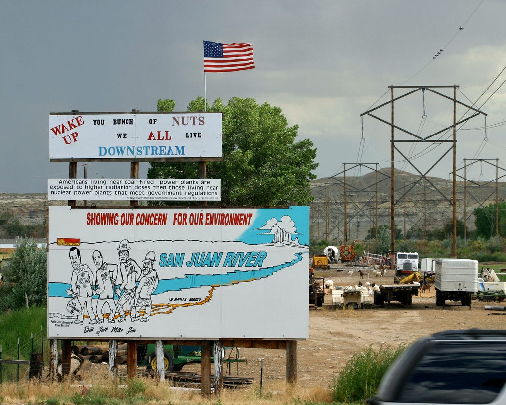
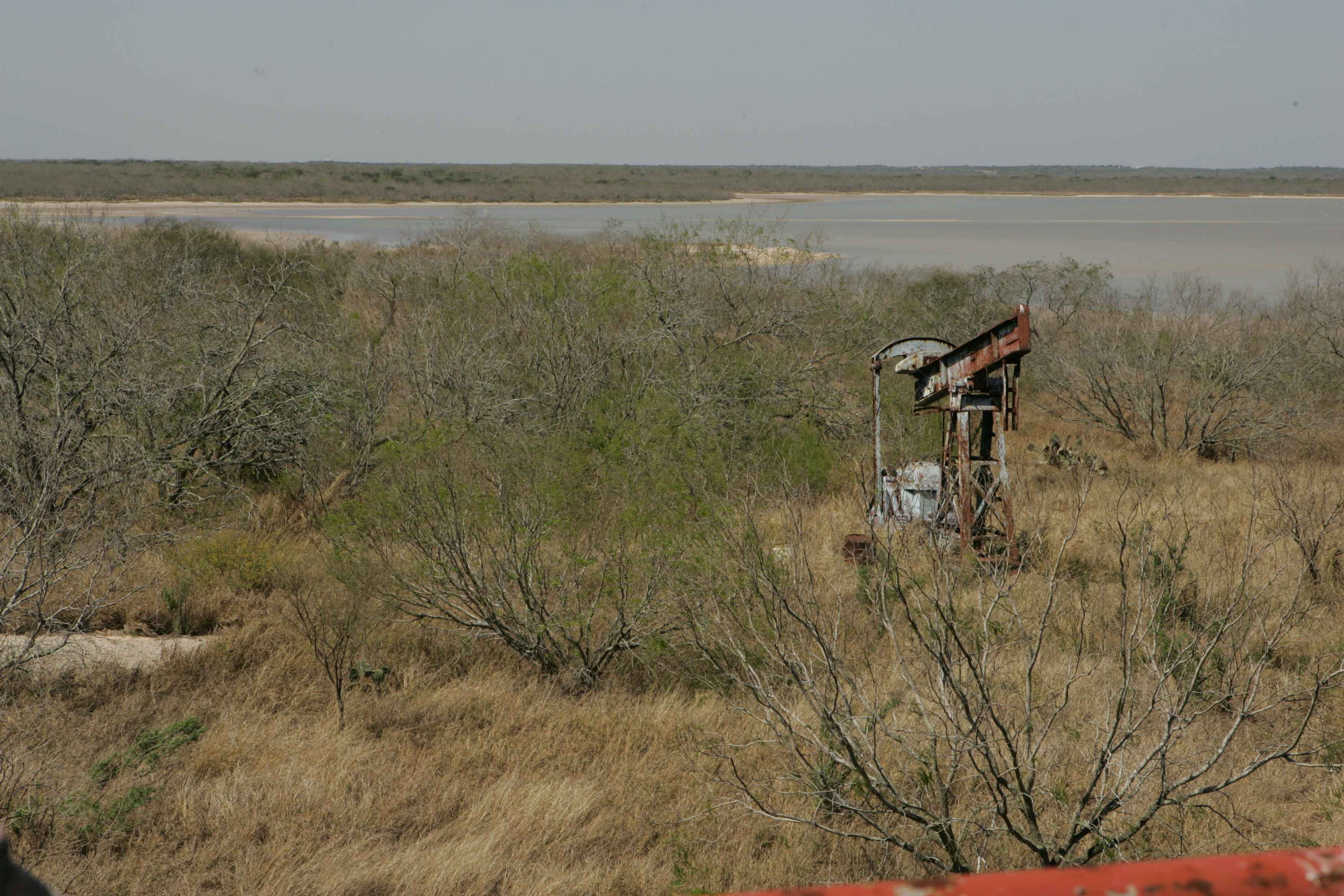
One summer day in 2017, a front-page story in the StarNews of Wilmington, North Carolina, shook up the lives of hundreds of thousands of people. The drinking water system, it said, was polluted with a contaminant commonly known as GenX, part of the family of โ€œforeverโ€ PFAS chemicals.

It came from a Chemours plant in Fayetteville, near the winding Cape Fear River. Few knew about the contaminated water until the article described the discoveries of scientists from the Environmental Protection Agency and a state university. Given that certain types of PFAS have been linked to cancer, there was widespread anxiety over its potential danger.

In the onslaught of legal action and activism that followed, the EPA during President Donald Trumpโ€™s first term took an assertive stance, vowing to combat the spread of PFAS nationwide.

In its big-picture PFAS action plan from 2019, the agency said it would attack this complex problem on multiple fronts. It would, for example, consider limiting the presence of two of the best-known compounds โ€” PFOA and PFOS โ€” in drinking water. And, it said, it would find out more about the potential harm of GenX, which was virtually unregulated.

By the time Trump was sworn in for his second term, many of the planโ€™s suggestions had been put in place. After his first administration said PFOA and PFOS in drinking water should be regulatedstandards were finalized under President Joe Biden. Four other types of PFAS, including GenX, were also tagged with limits.

But now, the second Trump administration is pulling back. The EPA said in May that it will delay enforcement on the drinking water limits for PFOA and PFOS until 2031, and it will rescind and reconsider the limits on the other four. Among those who challenged the standards in court is Chemours, which has argued that the EPA, under Biden, โ€œused flawed science and didnโ€™t follow proper rulemaking proceduresโ€ for GenX.

These EPA decisions under Trump are part of a slew of delays and course changes to PFAS policies that had been supported in his first term. Even though his earlier EPA pursued a measure that would help hold polluters accountable for cleaning up PFAS, the EPA of his second term has not yet committed to it. The agency also slowed down a process for finding out how industries have used the chemicals, a step prompted by a law signed by Trump in 2019.

At the same time, the EPA is hampering its ability to research pollutants โ€” the kind of research that made it possible for its own scientists to investigate GenX. As the Trump administration seeks severe reductions in the EPAโ€™s budget, the agency has terminated grants for PFAS studies and paralyzed its scientists with spending restrictions.

Pointing to earlier announcements on its approach to the chemicals, the EPA told ProPublica that itโ€™s โ€œcommitted to addressing PFAS in drinking water and ensuring that regulations issued under the Safe Drinking Water Act follow the law, follow the science, and can be implemented by water systems to strengthen public health protections.โ€

โ€œIf anything,โ€ the agency added, โ€œthe Trump administrationโ€™s historic PFAS plan in 2019 laid the groundwork for the first steps to comprehensively address this contamination across media and we will continue to do so this term.โ€

In public appearances, EPA Administrator Lee Zeldin has pushed back on the suggestion that his agency weakened the drinking water limits on GenX and similar compounds. Future regulations imposed by his agency, he said, could be more or less stringent.

โ€œWhat we want to do is follow the science, period,โ€ he has said.

That sentiment perplexes scientists and environmental advocates, who say there is already persuasive evidence on the dangers of these chemicals that linger in the environment. The EPA reviewed GenX, for example, during both the first Trump and Biden administrations. In both 2018 and 2021, the agency pointed to animal studies linking it to cancer, as well as problems with kidneys, immune systems and, especially, livers. (Chemours has argued that certain animal studies have limited relevance to humans.)

Scientists and advocates also said itโ€™s unclear what it means for the EPA to follow the science while diminishing its own ability to conduct research.

โ€œI donโ€™t understand why we would want to hamstring the agency that is designed to make sure we have clean air and clean water,โ€ said Jamie DeWitt, a toxicologist in Oregon who worked with other scientists on Cape Fear River research. โ€œI donโ€™t understand it.โ€

Delays, Confusion Over PFAS

Favored for their nonstick and liquid-resistant qualities, synthetic PFAS chemicals are widely used in products like raincoats, cookware and fast food wrappers. Manufacturers made the chemicals for decades without disclosing how certain types are toxic at extremely low levels, can accumulate in the body and will scarcely break down over time โ€” hence the nickname โ€œforever chemicals.โ€

The chemicals persist in soil and water too, making them complicated and costly to clean up, leading to a yearslong push to get such sites covered by the EPAโ€™s Superfund program, which is designed to handle toxic swaths of land. During the first Trump administration, the EPA said it was taking steps toward designating the two legacy compounds, PFOA and PFOS, as โ€œhazardous substancesโ€ under the Superfund program. Its liability provisions would help hold polluters responsible for the cost of cleaning up.

Moving forward with this designation process was a priority, according to the PFAS plan from Trumpโ€™s first term. Zeldinโ€™s EPA describes that plan as โ€œhistoric.โ€ And, when he represented a Long Island district with PFAS problems in Congress, Zeldin voted for a bill that would have directed the EPA to take this step.

The designation became official under Biden. But business groups, including the U.S. Chamber of Commerce, and organizations representing the construction, recycling and chemical industries, sued. Project 2025, The Heritage Foundationโ€™s playbook for the new administration, also questioned it.

Zeldin has said repeatedly that he wants to hold polluters accountable for PFAS, but his EPA requested three delays in the court case challenging the Superfund designation that helps make it possible.

The agency said in a recent motion it needed the latest pause because new leadership is still reviewing the issues and evaluating the designation in context of its โ€œcomprehensive strategy to address PFOA and PFOS.โ€

The EPA also delayed a rule requiring manufacturers and importers to report details about their PFAS use between 2011 and 2022. An annual bill that sets defense policy and spending, signed by Trump in his first term, had charged the EPA with developing such a process.

When Bidenโ€™s EPA finalized it, the agency said the rule would provide the largest-ever dataset of PFAS manufactured and used in the United States. It would help authorities understand their spread and determine what protections might be warranted.

Businesses were supposed to start reporting this month. But in a May 2 letter, a coalition of chemical companies petitioned the EPA to withdraw the deadline, reconsider the rule and issue a revised one with narrowed scope.

When the EPA delayed the rule less than two weeks later, it said it needed time to prepare for data collection and to consider changes to aspects of the rule.

In an email to ProPublica, the agency said it will address PFAS in many ways. Its approach, the agency said, is to give more time for compliance and to work with water systems to reduce PFAS exposure as quickly as feasible, โ€œrather than issue violations and collect fees that donโ€™t benefit public health.โ€

The court expects an update from the EPA in the Superfund designation case by Wednesday, and in the legal challenges to the drinking water standards by July 21. The EPA could continue defending the rules. It could ask the court for permission to reverse its position or to send the rules back to the agency for reconsideration. Or it could also ask for further pauses.

โ€œItโ€™s just a big unanswered question whether this administration and this EPA is going to be serious about enforcing anything,โ€ said Robert Sussman, a former EPA official from the administrations of Presidents Bill Clinton and Barack Obama. As a lawyer, he now represents environmental groups that filed an amicus brief in PFAS cases.

Back in North Carolina, problems caused by the chemicals continue to play out.

A consent order between the state and Chemours required the manufacturer to drastically reduce the release of GenX and other PFAS into the environment. (The chemicals commonly called GenX refer to HFPO-DA and its ammonium salt, which are involved in the GenX processing aid technology owned by Chemours.)

Chemours told ProPublica that it invested more than $400 million to remediate and reduce PFAS emissions. It also noted that there are hundreds of PFAS users in North Carolina, โ€œas evidenced by PFAS seen upstream and hundreds of miles awayโ€ from its Fayetteville plant โ€œthat cannot be traced back to the site.โ€

PFAS-riddled sea foam continues to wash up on the coastal beaches. Chemours and water utilities, meanwhile, are battling in court about who should cover the cost of upgrades to remove the chemicals from drinking water.

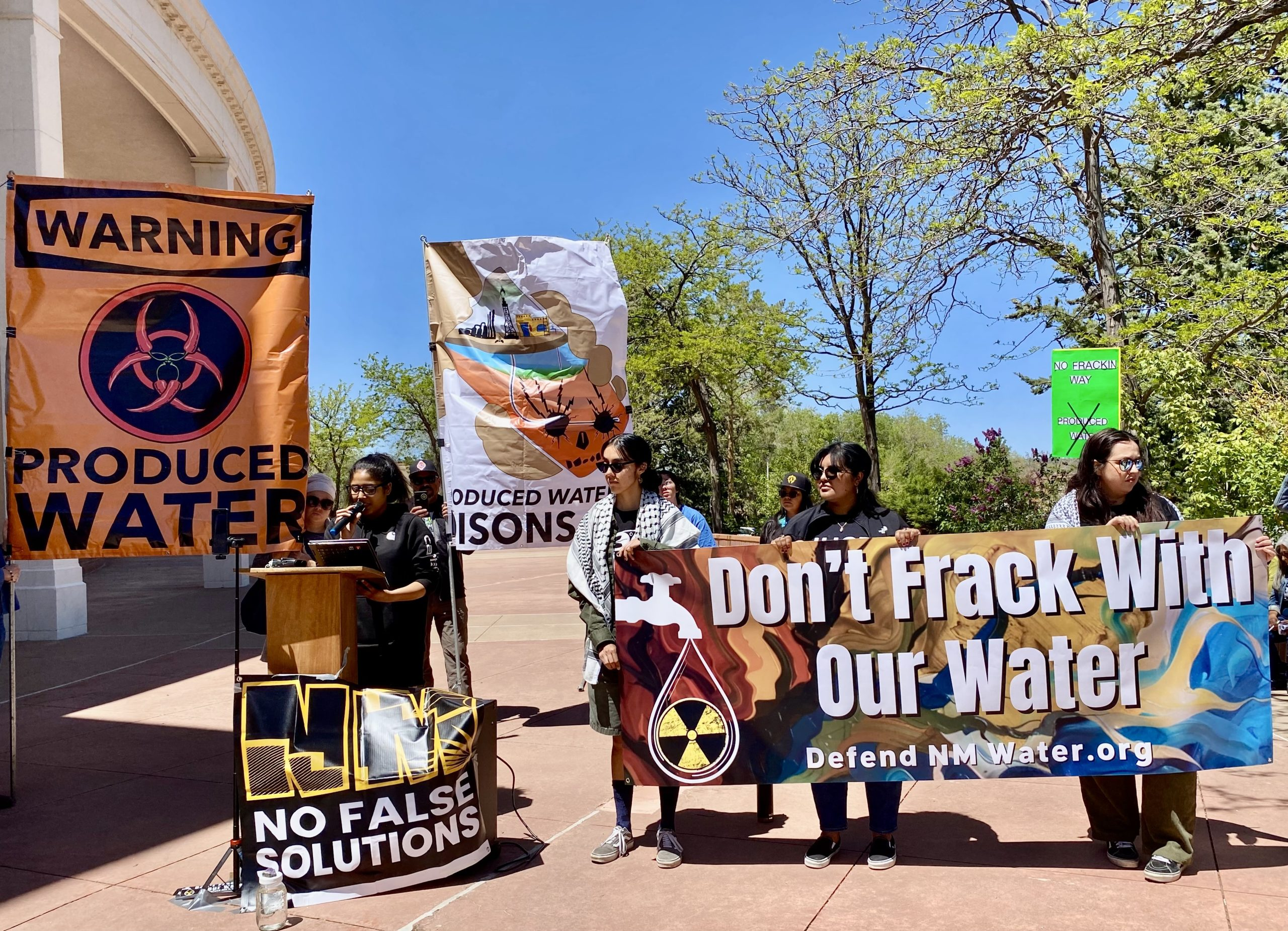
Community forums about PFAS draw triple-digit crowds, even when theyโ€™re held on a weeknight, said Emily Donovan, co-founder of the volunteer group Clean Cape Fear, which has intervened in federal litigation. In the fast-growing region, new residents are just learning about the chemicals, she said, and theyโ€™re angry.

โ€œI feel like weโ€™re walking backwards,โ€ Donovan said. Pulling back from the drinking water standards, in particular, is โ€œdisrespectful to this community.โ€

โ€œItโ€™s one thing to say youโ€™re going to focus on PFAS,โ€ she added. โ€œItโ€™s another thing to never let it cross the finish line and become any meaningful regulation.โ€

A letter dated April 29, 2025, notifying Michigan State University about the termination of a grant for research into PFAS, one day after the EPA said in a press release that it was committed to combating PFAS contamination by, in part, โ€œstrengthening the science.โ€ Credit: Obtained by ProPublica

Research Under Fire

The EPA of Trumpโ€™s first term didnโ€™t just call for more regulation of PFAS, it also stressed the importance of better understanding the forever chemicals through research and testing.

In a 2020 update to its PFAS action plan, the EPA highlighted its support for North Carolinaโ€™s investigation of GenX in the Cape Fear River. And it described its efforts to develop the science on PFAS issues affecting rural economies with โ€œfirst-of-its-kind funding for the agriculture sector.โ€

Zeldin, too, has boasted about advancing PFAS research in an April news release. โ€œThis is just a start of the work we will do on PFAS to ensure Americans have the cleanest air, land, and water,โ€ he said.

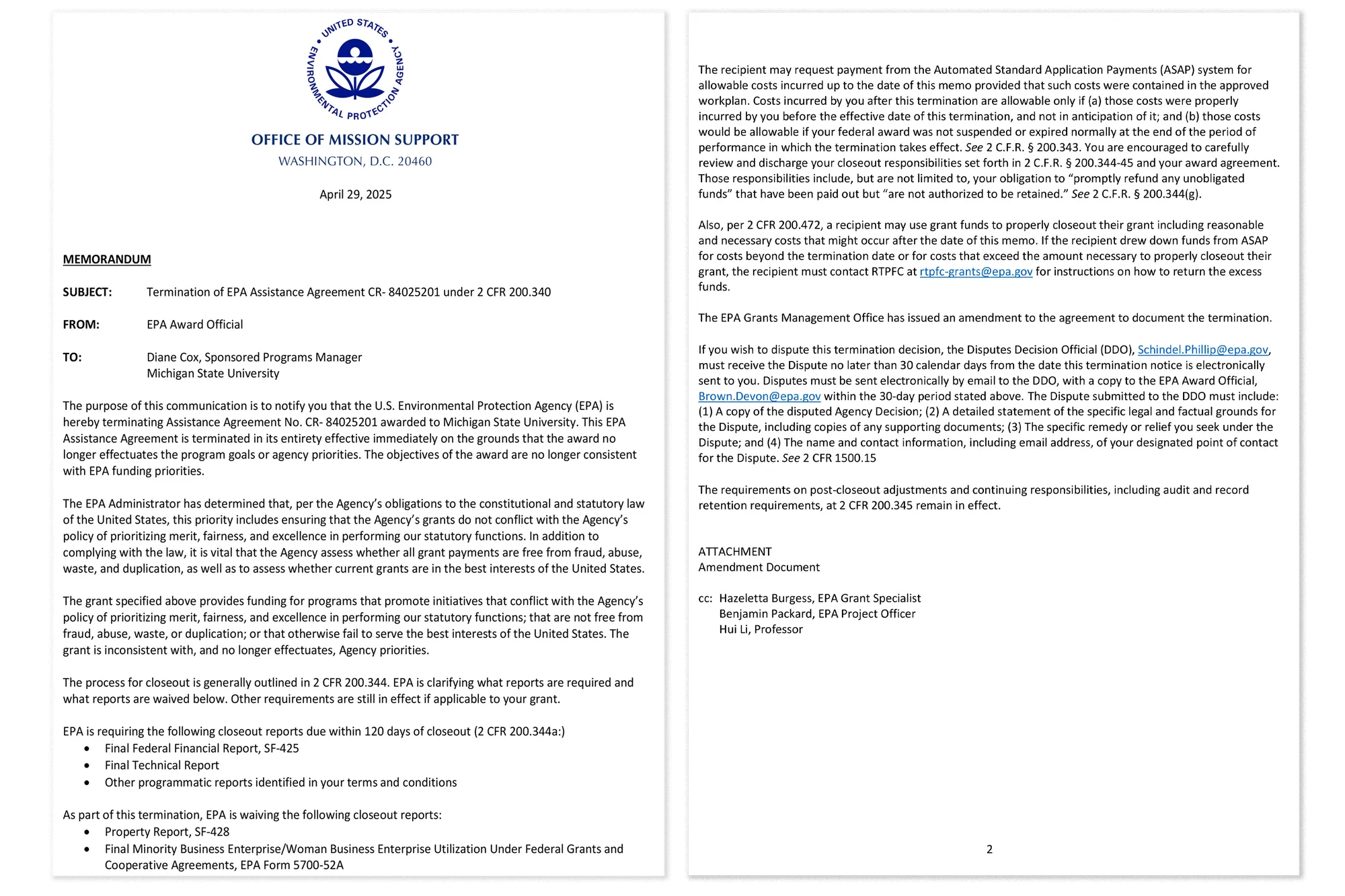
At about the same time, though, the agency terminated a host of congressionally appropriated grants for PFAS research, including over $15 million for projects focused on food and farmlands in places like Utah, Texas and Illinois.

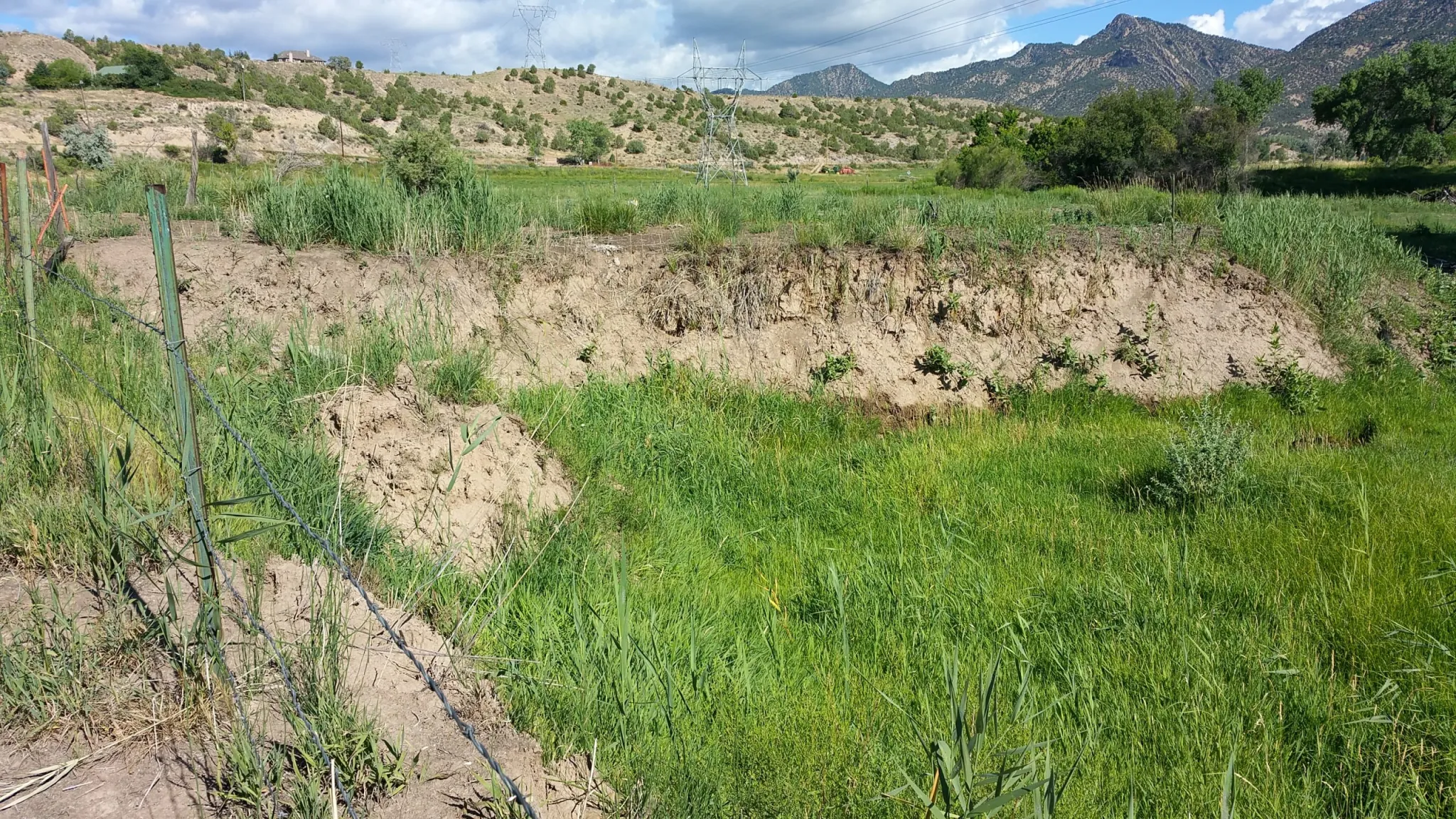
Scientists at Michigan State University, for example, were investigating how PFAS interacts with water, soil, crops, livestock and biosolids, which are used for fertilizer. They timed their latest study to this yearโ€™s growing season, hired staff and partnered with a farm. Then the EPA canceled two grants.

In virtually identical letters, the agency said that each grant โ€œno longer effectuates the program goals or agency priorities. The objectives of the award are no longer consistent with EPA funding priorities.โ€

The contrast between the agencyโ€™s words and actions raises questions about the process behind its decisions, said Cheryl Murphy, head of Michigan Stateโ€™s Center for PFAS Research and co-lead of one of the projects.

โ€œIf you halt it right now,โ€ she said, โ€œwhat weโ€™re doing is weโ€™re undermining our ability to translate the science that weโ€™re developing into some policy and guidance to help people minimize their exposure to PFAS.โ€

At least some of the researchers are appealing the terminations.

About a month after PFAS grants to research teams in Maine and Virginia were terminated for not being aligned with agency priorities, the agency reinstated them. The EPA told ProPublica that โ€œthere will be more updates on research-related grants in the future.โ€

Even if the Michigan State grants are reinstated, there could be lasting consequences, said Hui Li, the soil scientist who led both projects. โ€œWe will miss the season for this year,โ€ he said in an email, โ€œand could lose the livestock on the farm for the research.โ€

Federal researchers are also in limbo. Uncertainty, lost capacity and spending restrictions have stunted the work at an EPA lab in Duluth, Minnesota, that investigates PFAS and other potential hazards, according to several sources connected to it. As one source who works at the lab put it, โ€œWe donโ€™t know how much longer we will be operating as is.โ€

The EPA told ProPublica that itโ€™s โ€œcontinuing to invest in research and labs, including Duluth, to advance the mission of protecting human health and the environment.โ€

Meanwhile, the agency is asking Congress to eliminate more than half of its own budget. That includes massive staffing cuts, and it would slash nearly all the money for two major programs that help states fund water and wastewater infrastructure. One dates back to President Ronald Reaganโ€™s administration. The other was spotlighted in a paper by Trumpโ€™s first-term EPA, which said communities could use these funds to protect public health from PFAS. It trumpeted examples from places like Michigan and New Jersey.

The EPA lost 727 employees in voluntary separations between Jan. 1 and late June, according to numbers the agency provided to ProPublica. It said it received more than 2,600 applications for the second round of deferred resignations and voluntary early retirements.

โ€œThese are really technical, difficult jobs,โ€ said Melanie Benesh, vice president for government affairs at the nonprofit Environmental Working Group. โ€œAnd the EPA, by encouraging so many employees to leave, is also losing a lot of institutional knowledge and a lot of technical expertise.โ€

The shake-up also worries DeWitt, who was one of the scientists who helped investigate the Cape Fear River contamination and who has served on an EPA science advisory board. Her voice shook as she reflected on the EPAโ€™s workforce, โ€œsome of the finest scientists I know,โ€ and what their loss means for public well-being.

โ€œTaking away this talent from our federal sector,โ€ she said, will have โ€œprofound effects on the agencyโ€™s ability to protect people in the United States from hazardous chemicals in air, in water, in soil and potentially in food.โ€

Map showing the Cape Fear River drainage basin. By Kmusser – Self-made, based on USGS data., CC BY-SA 3.0, https://commons.wikimedia.org/w/index.php?curid=5506415

June 30, 2025 North American #Monsoon Drought Status Update: Wet Start for the Monsoon Over #Drought-Stricken Southwest — NOAA

Click the link to read the drought update on the NOAA website:

The North American Monsoon brings summer precipitation to parts of the Southwestern U.S. and Mexico. The monsoon season is June 15 to September 30, though the actual arrival of the monsoon can vary.

Key Points

  • Over the past year, drought developed and intensified in the Four Corners region and southern California and Nevada, with the most intense drought conditions in Arizona and New Mexico.
  • The 2025 North American Monsoon began last week in parts of New Mexico and West Texas, bringing helpful rains to drought-stricken areas but also dangerous flooding. Other states (Arizona, Colorado, California, Nevada, Utah) await their first monsoonal precipitation.
  • Monsoonal rainfall only provides a fraction of the West’s water supplies, with the majority coming from snowpack. However, it can meaningfully reduce local drought impacts by reducing demand for water stored in reservoirs, recharging soil moisture and groundwater, benefitting agricultural production by improving grassland health for livestock and filling stock ponds, and reducing wildfire risk.
  • Outlooks favor above-normal monsoonal precipitation for the Southwestern U.S. in July. This could improve drought conditions and provide short-term relief, but dry landscape conditions leading into the monsoon mean drought is likely to persist. NOAAโ€™sย Climate Prediction Centerย predicts drought improvement (but not removal) for the area near the Arizona-New Mexico border in July.
  • However, precipitation in the first half of July is not a predictor of precipitation during the rest of the Monsoon season. Tracking conditions and outlooks as summer progresses will be especially important.ย 

This update is based on data available as ofย Monday, June 30, 2025 at 8:00 a.m. MT. We acknowledge that conditions are evolving.

What Is the North American Monsoon? Why Does It Matter?

  • Theย North American Monsoonย brings summer precipitation to parts of the Southwestern U.S. and Mexico, typically beginning in mid- to late June and lasting through September. This pattern results in active thunderstorms acrossย Arizona,ย New Mexico,ย Colorado, and southern/eastern Utah. Monsoonal surges can also occur outside of these “core” areas, reaching Nevada, southeastern California, Far West Texas, and Wyoming.
  • The North American Monsoon is a seasonal wind shift that occurs between June 15โ€“September 30, depending on geographic location. The monsoonal flow allows moisture to move into the Southwestern U.S., which provides a needed ingredient for thunderstorm activity.
  • The development of a ridge of persistent high pressure near the Four Corners region in the Southwest often initiates monsoon activity by providing a more moist, southerly flow from the subtropics around North America. Learn more aboutย monsoon dynamics.
  • The monsoon can vary in intensity and location from year to year. A more active monsoon season can moderate hot conditions with more thunderstorm activity, increase soil moisture, and reduce land surface temperatures, and improve drought conditions.ย 

How Does the Monsoon Impact Drought in the Southwest? 

  • Rainfall associated with the monsoon is very important for the Southwest U.S. Parts ofย Arizona and New Mexico receive as much as 10-60% of their annual precipitation during the monsoon season (data for June-August).
    • The position of the high pressure system can shift throughout the season, which determines if Arizona or New Mexico will get more or less rain. This can sometimes result in rapid drought improvement or onset.
  • A weak or inactive monsoon season can worsen short- and long-term drought conditions. For example, the inactiveย 2023 Monsoon Seasonresulted in significant drought expansion for New Mexico and Arizona. Meanwhile, an average to above-average monsoon can potentially improve or remove drought conditions, such as theย 2022 North American Monsoon, which was the 9th wettest on record and significantly improved drought conditions in Arizona and New Mexico.
  • The monsoon has a lesser influence in Nevada and California, though areas of southern Nevada and southeastern California occasionally receive significant monsoonal precipitation. On average, 20-25% of southern Nevadaโ€™s precipitation falls during the summer.
  • Even in states where an outsized portion of annual water supply is derived from snowpack, monsoonal rainfall can still meaningfully reduce local impacts. For example, monsoonal precipitation can reduce demand for water stored in reservoirs, recharge groundwater, benefit agricultural production by improving grassland health for livestock and filling stock ponds, and reduce wildfire risk.

North American Monsoon Precipitation Is a Major Contributor to Southwestern Annual Rainfall

Percent of total annual precipitation occurring during June-August, based on 1981-2010 PRISM data. Figure from Western Regional Climate Center

What Is the Drought Status Going into the North American Monsoon?

  • As of June 24, every state in the Southwest (and California) is experiencing some level of drought (D1-D4), according to the U.S. Drought Monitor :
  • National Weather Service offices throughout the Southwest have issuedย drought information statementsย describing local drought conditions and impacts, including for:
  • In Arizona and New Mexico, drought conditions have expanded since summer 2024. Drought intensified and expanded northward and westward into southern Nevada and California due to a dry summer in 2024 followed by a dry fall and winter. Some areas (e.g., Arizona, southern California, and Nevada)ย saw slight improvement this spring, but drought persists.
  • Looking back 12 months to the start of the last monsoon (June 2024) until now (May 2025), Arizona experienced its 3rd driest and Nevada its 13th driest Juneโ€“May,ย ย going back 130 years. Some areas were worse at the county scale. Yuma and Maricopa counties in Arizona; Imperial County, California; and Clark County, Nevada experienced June-May periods in the top three driest on record.
  • Utah,ย New Mexico, and theย Navajo Nationย have already declared drought emergencies.ย 

Widespread Southwestern Drought at the Start of Monsoon Season (June 24, 2025)

U.S. Drought Monitor map of the Southwest U.S.. Valid June 24, 2025. The U.S. Drought Monitor depicts the location and intensity of drought across the country. The map uses 5 classifications: Abnormally Dry (D0), showing areas that may be going into or are coming out of drought, and four levels of drought (D1โ€“D4). Source: NOAA, USDA, NDMC. Map from Drought.gov.

Low Statewide Precipitation Over the Past Year

June 2024โ€“May 2025 precipitation for counties across the Western U.S. shown as a ranking compared to historical conditions from 1895 to the present. Brown hues indicate precipitation in the lowest third of historical conditions, gray indicates near-normal precipitation, and blue hues indicate precipitation in the top third of historical conditions. Source: NOAA National Centers for Environmental information, Climate at a Glance.

Will the North American Monsoon Be Active through September? What Does This Mean for Drought?

  • Seasonal forecasts of monsoon precipitation are largely based on continental or global-scale influences (e.g., sea surface temperature patterns), while actual rainfall totals for a given location are influenced by local-scale factors (e.g., local landscape, humidity, and temperatures), some of which can change quickly and over short distances. As a result, there is greater uncertainty in monsoonal precipitation forecasts for specific locations than when considering the Southwest region as a whole.
  • The Southwestern U.S. isย forecast to be wetter than normalย through at least mid- to late July. However, precipitation in the first half of July isย not a predictor of precipitation during the rest of the monsoon season.
  • For the 2025 Monsoon Season,ย NOAAโ€™s Climate Prediction Centerโ€™s seasonal outlooksย favor above-normal temperatures and equal chances of below-normal, normal, and above-normal precipitation across most of the Southwestern U.S.ย An โ€œequal chancesโ€ outlook does not necessarily mean normal, or average, rainfall can be expected. Rather, it implies that there is nothing in the climate system (including the El Nino-Southern Oscillation, which is currently neutral) that is pushing weather patterns toward one extreme or the other and any scenario is possible.
  • Droughtย is predicted to persist in much of the region over the next month and theย summer months, with potential drought improvements (but not removal) in the โ€œcoreโ€ monsoon region at the Arizona-New Mexico border.
  • Given these outlooks,ย wildfire risk is forecasted to beย near normalย for parts of the Southwest that normally have good summer precipitation from the monsoon.
  • For short-term forecasts, see theย Quantitative Precipitation Forecast (QPF)ย or your local National Weather Serviceย Weather Forecast Office.

Odds Favor Wet Start for the Monsoon through Mid- to Late July

Precipitation outlook for July 12โ€“15, 2025, showing the probability (percent chance) of above-normal (green hues) or below-normal (brown hues) precipitation across the U.S. White indicates equal chances of above- or below-normal precipitation. Source: NOAA’s Climate Prediction Center.

Monthly drought outlook showing where drought is predicted to develop (yellow), persist (brown), remain but improve (gray/beige), or be removed (green) in July 2025. Issued June 30, 2025. Source:ย NOAAโ€™s Climate Prediction Center.

Potential Impacts of North American Monsoon Precipitation for Drought

MonsoonImpactsBelow-Average PrecipitationNear-Average PrecipitationAbove-Average Precipitation
Impact on DroughtLong- and short-term drought in the region would worsen, potentially similar to what happened in summer 2023.Short-term drought improvement is possible.This could help improve long- and short-term drought in the Southwest, but the potential for hazardous flash flooding would increase.
Water StorageIncreased reservoir storage and groundwater depletion as municipal and agricultural demand increase during hot season.An average-to-above average monsoon can increase water storage and replenish stock ponds in parts of the region, but not by significant amounts.  Research has shown that summer precipitation is less efficient than winter precipitation at alleviating hydrologic drought. However, a more active monsoon reduces outdoor water demand, which has a positive impact on water supply.
Wildland FireElevated wildland fire potential to continue through summer.Fire potential to return to near normal for this time of year. Lightning can be a source for fire ignition.Fire potential to return to near normal for this time of year.

Potential drought impacts if the Southwest receives below-average, near-average, or above-average precipitation during the 2025 North American Monsoon Season.

Al Gore: Why #climate action is unstoppable โ€” and “climate realism” is a myth

Southern Utes to tap #LakeNighthorse water: Tribe holds rights to 38,108 acre-feet annually — The #Durango Herald #AnimasRiver

Lake Nighthorse and Durango March 2016 photo via Greg Hobbs.

Click the link to read the article on The Durango Herald website (Christian Burney). Here’s an excerpt:

June 10, 2025

The Southern Ute Indian Tribe plans to begin drawing water from Lake Nighthorse this summer, becoming the first entity to use the reservoir for non-testing purposes since the reservoirโ€™s completion in 2009. The Southern Ute Tribal Council approved the annual use of a portion of its Animas-La Plata Project water in Lake Nighthorse for โ€œfuture industrial uses,โ€ including energy development, in February 2024, according to the tribal newspaper,ย The Southern Ute Drum.

โ€œThis is a historic and exciting moment for the Southern Ute Indian Tribe โ€“ the Tribe is finally utilizing some of its ALP water rights that it has fought for over a long period,โ€ the Drum reported. โ€œThe Tribe plans to continue developing its water resources for the benefit of the Tribe and its members in the future.โ€

[…]

Lake Nighthorse stores 123,541 acre-feet of water. The tribe holds a 44,662 acre-foot annual allocation from the A-LP, with 38,108 acre-feet stored in Lake Nighthorse, according to a U.S. Bureau of Reclamation spokesperson. The tribeโ€™s claim represents about 35% of the water stored in the reservoir, according to theย Drum…The tribe currently uses 6,553 acre-feet annually from its Animas River allocation under the A-LP, according to the Bureau of Reclamation.

Can fracking #wastewater be reused?: #NewMexicoโ€™s legislators are eager to repurpose โ€œproduced water,โ€ but environmental organizations say that there is no safe way to do that — Shi En Kim (High Country News)

A DEQ worker collects samples from Alkali Creek below where produced water from the Moneta Divide Field is discharged. (Wyoming DEQ)

Click the link to read the article on the High County News website (Shi En Kim):

June 9, 2025

On Oct. 2, 2024, a geyser erupted in Toyah, a town in west Texas 50 miles from the New Mexico border. This was not a case of water miraculously appearing in the desert, a deliverance from the areaโ€™s long-standing drought. Rather, it was an environmental disaster: a blowout from an orphaned oil and gas well.

What gushed from the ground wasnโ€™t actually water, but rather a vile brine of heavy metals, radioactive substances, chemical additives and noxious organics โ€” the by-product of fracking. 

The Toyah incident is the latest of at least eight leaks over the preceding 12 months in the Permian Basin, a fracking hub across west Texas and southeastern New Mexico. It highlights the increasingly urgent challenge of what to do with frackingโ€™s wastewater โ€” what fossil fuel companies euphemistically call โ€œproduced water.โ€ But some New Mexico legislators have a solution in mind: For the last few years, theyโ€™ve proposed reusing the wastewater off the oil field for industrial purposes, such as data center cooling and hydrogen production.

Part of their argument is that New Mexico desperately needs water. More than 90% of its residents live in areas facing drought. In the next 50 years, the already-arid state will see its ground- and fresh water sources shrink by 25%.

Political pressure is mounting on New Mexicoโ€™s lawmakers to tap into fracking wastewater as a new resource. Environmental groups, however, strongly oppose the idea, arguing that there is still no way to make the wastewater safe for off-field use. Year after year, the New Mexico Legislature finds itself at a crossroads.

โ€œWe are, as a state, very beholden to oil and gas,โ€ said Carlos Matutes, the New Mexico director at the advocacy group GreenLatinos thatโ€™s part of the coalition opposing produced water reuse. Any bill that sanctions produced water, he said, โ€œis almost guaranteed to come back.โ€

PRODUCED WATER is an existential dilemma for the oil and gas industry. Fracking involves blasting underground rock with water to free up trapped oil and gas, but when that water returns to the surface, it is laden with contaminants it picks up from the earth. Every barrel of hydrocarbons reaped also generates up to 10 barrels of contaminated water. In 2021 alone, New Mexico was spewing 147 million gallons of toxic wastewater daily.

Drilling companies usually dispose of wastewater in dedicated injection wells. Water, however, does what water always does: It flows where it wishes, heedless of human-drawn boundaries. And it can travel for miles underground, then burst forth from improperly sealed oil wells, as it did with Toyah. (So far, no company has claimed ownership of the well, though its use dates back to 1961.) Even wastewater that stays underground finds ways to revolt โ€” by triggering earthquakes. As fracking operations have ramped up over the last decade, so too has the tally of tremors. In the past year alone, New Mexico experienced over 2,500 quakes, most of them concentrated in the southeastern corner of the state, where fracking is most flagrant. In comparison, only 45 tremors rumbled the state in 2017.

Currently, most of New Mexicoโ€™s produced water is either injected underground or transported across state lines for disposal elsewhere. By contrast, neighboring Texas permits repurposing treated wastewater for other uses or discharging it into the environment.

Produced water. Graphic credit: U.S. Department of Energy

In late 2023, New Mexico Gov. Michelle Lujan Grisham floated a strategic water supply proposal to follow in the footsteps of its neighbor. Initially, she proposed investing $500 million of state funds in treating produced water. But that measure dried up in legislative budget negotiations. In subsequent revisions, Lujan Grisham has watered down the funding allocation, from $250 million in 2024 to $75 millionin 2025. Each time, pushback from environmental groups helped flush produced water treatment from the proposals altogether.

Even if the plan had sailed through, though, it would not have recouped a significant amount of water, said Rachel Conn, the deputy director of the water conservation organization Amigos Bravos. Removing contaminants from fracking wastewater requires copious energy to boil off and squeeze fresh water from dissolved toxins. Her team estimates that it costs at least $2 to treat a barrel, twice as much as it costs to send it down an injection well. The total amount could easily top $1 billion a year. (In Texas, oil companies pay more, as much as $10 per barrel for treatment.) Given the high costs, Conn said that the amount of water the strategic water supply could afford to treat would meet no more than 1% of New Mexicoโ€™s water needs โ€” a literal drop in the bucket.

Additionally, environmental organizations like Amigos Bravos have raised concerns about the safety of fracking wastewater, whether itโ€™s treated or untreated. Radioactivity levels around several injection wells in Ohio and West Virginiaexceed the federal safety limit by several hundred-fold; and in one Pennsylvanian river, radium still persists among mussels even five years after the last discharge of produced water.

The complex cocktail of chemicals found in produced water makes it hard to characterize, said Bonnie McDevitt, a research physical scientist at the U.S. Geological Survey. Companies usually guard the chemical additives in their fracking fluid as a trade secret. Toxicity requirements cannot cover every contaminant present, essentially leaving some questionable compounds completely unregulated. That means that even if the treated wastewater technically meets drinking water standards, it may not necessarily be safe to drink. Environmental advocates are calling for testing limits on 600 compounds potentially found in fracking wastewater before it can be used off fracking fields.

But the fossil fuel industry insists that the treatment technology is ready; Ryan Hall, the director of technical operations at NGL Energy Partners, said, โ€œWe can treat to any spec.โ€ As one of the nationโ€™s largest handlers of the industryโ€™s wastewater, his company manages 2.5 million barrels from the Permian Basin, mainly by disposing of it in injection wells. NGL Energy has also explored wastewater treatment in some states, and Hall said it is eager to start in New Mexico once authorities give the legislative greenlight.

The New Mexico Produced Water Research Consortium, which is partially funded by oil and gas companies, is currently leading the effort to develop purportedly safe and affordable treatment methods. The instituteโ€™s recent projects include advancing various separation technologies and studying the health impacts of produced water on indicator species, like aquatic microbes and plants. โ€œIโ€™m with the environmental groups,โ€ said Pei Xu, the instituteโ€™s research director and an environmental engineer at New Mexico State University. โ€œWe also want this water to be very safe. I think we have made a lot of very good progress.โ€

THE BATTLE BETWEEN industry and environmental groups is heating up. In April, New Mexicoโ€™s Water Quality Control Commission announced that it would allow pilot treatment projects to discharge up to 84,000 gallons of wastewater into groundwater daily. Environmental groups filed court briefs and staged a protest outside the Capitol, and 27 state legislators wrote a letter to the commission urging it to reconsider. In a follow-up hearing on May 13, the commission rescinded its April decision and reinstituted the ban.

What environmental groups want, ideally, is to end fracking altogether. But thatโ€™s unlikely to happen anytime soon: New Mexico is economically dependent on oil and gas, ranking second in the nationโ€™s top fossil fuel-producing states. Industry has a solid grip on politics here โ€” roughly 60% of Lujan Grishamโ€™s 2017-2022 campaign contributions came from the stateโ€™s largest oil corporations.

At the very least, environmental groups say, taxpayer dollars shouldnโ€™t be used to solve a problem of the industryโ€™s own making. โ€œIt should be the industryโ€™s responsibility to clean up that produced water,โ€ Conn said. Her suggestion: Reuse the wastewater for future fracking. About 60% of wastewater is recycled on oil fields; Conn says bumping the rate to 90% could save 4 billion gallons of fresh water โ€” more than all the produced water that the strategic water supply proposal would treat.

Active Permian Basin pumpjack east of Andrews, Texas. By Zorin09 – Own work, CC BY 3.0, https://commons.wikimedia.org/w/index.php?curid=14607474

Meanwhile, drilling shows no signs of slowing down. Across the Permian playa, pumpjacks rise like giant birds pecking at the ground. Strewn alongside these steel flocks are miles-deep injection wells, each designated by a comparatively squat wellhead that often comes in the shape of a cross โ€” a headstone for an otherwise unmarked grave for the vast refuse that refuses to go quietly.

Environmental groups protest outside New Mexicoโ€™s Capitol after the state announced it would allow pilot treatment projects to discharge up to 84,000 gallons of wastewater into groundwater daily. Courtesy of New Energy Economy

Front Range water providers request state hearing to air concerns about Western Slope water rights deal — Shannon Mullane (Fresh Water News) #ColoradoRiver #COriver #aridification

Shoshone Hydroelectric Plant back in the days before I-70 via Aspen Journalism

Click the link to read the article on the Water Education website (Shannon Mullane):

July 26, 2025

Four major Front Range water agencies have requested a state hearing to fully air their objections to a Western Slope plan to purchase historic, coveted Colorado River water rights.

The Colorado River Water Conservation District, which represents 15 Western Slope counties, is leading the effort to purchase the $99 million water rights tied to the century-old Shoshone Power Plant, owned by a subsidiary of Xcel Energy. The district wants to buy the rights to protect historical water resources for Western Slope communities long into the future.

Aurora Water, Denver Water, Colorado Springs Utilities and Northern Waterย  also want to maintain the historical flows past Shoshone which provides stability for their water supplies. They just disagree over the numbers, namely how much water is included in the deal. If the number is too high, it could throw a wrench in their water systems.

The stateโ€™s water board, the Colorado Water Conservation Board, will decide duringย a special meeting Tuesdayย whether to grant the hearing requests.

โ€œIf, as the River District asserts, the status quo will be maintained, this acquisition can be a win-win for both the Front Range and the West Slope,โ€ wrote Marshall Brown, general manager of Aurora Water in a letter on June 9. โ€œHowever โ€ฆ we have significant concerns.โ€

The Colorado River District already has passed a few hurdles in its years long effort to purchase the powerful water rights for Shoshone, located just east of Glenwood Springs.

It has a purchase agreement with Xcel Energy. A diverse array of Western Slope cities, agricultural groups, the Colorado legislature and others have promised millions of dollars toward the asking price.

The federal government awarded $40 million, but that funding remains tied up in President Donald Trumpโ€™s policy to cut spending from big Biden-era funding packages.

Democratic and Republican Congressional representatives from Colorado have spoken in support of the purchase. U.S. Rep. Jeff Hurd, a Republican from Grand Junction, asked Secretary of the Interior Doug Burgum to release the funds in a committee meeting this month.

120 days to decide

The district is moving on with its next step: working with the state to use the water rights to help protect the environment. This is where the concerns over historical flows come in.

The River District wants Shoshoneโ€™s rights to be used to keep water in the Colorado River near the power plant in Glenwood Canyon to benefit aquatic ecosystems when the power plant isnโ€™t generating electricity.

The additional environmental use would secure the flow of water past the power plant, even if the plant goes out of commission โ€” maintaining the status quo flows permanently. That water could otherwise be used further upstream.

The Colorado Water Conservation Board, faces a September deadline to decide whether to approve this new environmental use, called an instream flow right.

If approved, the instream flow right would be one of the largest, most influential environmental water rights in state history in large part because of their seniority in the stateโ€™s water system.

The board launched its 120-day decision-making process May 21, triggering a 20-day window for people to submit notices that they planned to contest the proceedings and request a hearing.

Front Range outlines concerns

The four Front Range water managers were the only entities to submit notices within that 20-day window.

They want to recalculate how much water has been used at Shoshone in past decades before the matter goes to water court, where opposing parties will have another opportunity to voice their concerns and make sure their water supplies arenโ€™t negatively impacted.

Collectively, the four agencies help deliver water to over 3 million people along the Front Range cities and northeastern plains.

In its letter, Aurora Water said the river districtโ€™s estimate could overstate historic use by up to 300,000 acre-feet. One acre-foot roughly equals the annual water use of two to three households. The utility did not respond in time for publication.

Northern Water is concerned about its ability to fill Green Mountain Reservoir in Summit County, which depends in part on downstream water rights, like Shoshoneโ€™s. The reservoir delivers water to the Western Slope, including to a 15-mile stretch of the Colorado River that provides vital habitat for endangered and threatened fish.

Colorado Springs Utilitiesโ€™ letter said a too-high estimate could cut into the amount of water the provider can divert from the Blue River and the Homestake Water Project, which directs water from the Western Slope to the Eastern Slope.

Denver Water cited similar concerns, saying the proposal, as is, will change the โ€œstatus quoโ€ in ways that would harm the utilityโ€™s ability to provide water to over 1.5 million people during severe or prolonged drought.

Colorado Springs and Denver Water declined to comment further, referring to their written letters.

If the Colorado Water Conservation Board approves the hearing request, people will have until July 9 to ask to join the hearing process, said Rob Viehl, chief of the Stream and Lake Protection Section at the Colorado Water Conservation Board. The board will share updates with the public on its website and decide the date of the hearing during its meeting Tuesday.

More by Shannon Mullane

#Utah U.S. Senator Mike Lee pulls his public land sell-off bill after serious backlash — Jonathan P. Thompson (BlueSky)

Sen. Mike Lee pulls his public land sell-off bill after serious backlash. That's what happens when you try to hand Americans' land to developers.

Jonathan Thompson at the Land Desk (@landdesk.bsky.social) 2025-06-29T04:23:31.940Z

โ€˜Like taking Smokey Bear away from the Forest Serviceโ€™: President Trump’s Administration proposes consolidating wildland firefighting into single agency — Summit Daily News

The Grizzly Creek Fire burning along the Colorado River on August 14, 2020. By White River National ForestU.S. Forest Service – https://www.facebook.com/GrizzlyCreekFireCO/posts/128313015469678, Public Domain, https://commons.wikimedia.org/w/index.php?curid=93777078

Click the link to read the article on the Summit Daily News website (Ryan Spencer). Here’s an excerpt:

June 26, 2025

[Colorado U.S.] Senator John Hickenlooper is looking into the proposal to create a U.S. Wildland Fire Service and what it could mean for wildfire response and resources

President Donald Trumpโ€™s 2026 budget proposal outlines plans to create a new U.S. Wildland Fire Service by combining the wildfire assets currently distributed between the U.S. Forest Service, the U.S. Fish and Wildlife Service, the Bureau of Land Management and the National Park Service. The budget request states that the โ€œdispersed natureโ€ of the federal wildfire program โ€œcreates significant coordination and cost inefficiencies that result in sub-optimal performance.โ€ It would house the U.S. Wildland Fire Service in the Department of Interior. But in a letter to the Senate earlier this month, a nonprofit group representing thousands of U.S. Forest Service retirees, including seven previous chiefs of the agency, raised concern that consolidating federal firefighting operations would be โ€œa costly mistake.โ€

โ€œWildfire management is more than extinguishing fires,โ€ National Association of Forest Service Retirees Chair Steve Ellis wrote in the letter. โ€œThe critical linkage between fire suppression and forest management, including fuels reduction and prescribed fire, must be maintained. Severing forest management and forest managers from fire suppression will make firefighting less safe and put communities at greater risk.โ€

In addition to relocating firefighting operations, Trumpโ€™s budget request for the Forest Service asks Congress to zero out millions of dollars of funding, including for forestry research and grants that support state, tribal and private forestry efforts. It also proposes cuts of $392 million to the Forest Service management budget and $391 million to forest operations…Ellis, who worked for the federal government for 38 years in both the Forest Service and the Bureau of Land Management, said โ€œthe fire program is integrated into almost everything the Forest Service does.โ€ From forest thinning to prescribed burns, prevention and suppression, Ellis said strategies have to be integrated into the broader forest management goals. By removing firefighting operations from the Forest Service, the proposal could divorce firefighting from land management, he added…

When asked about the U.S. Wildland Fire Service proposal, White House Assistant Press Secretary Taylor Rogers pointed to the Los Angeles wildfires that killed 30 people, forced 200,000 to evacuate and burned 57,000 acres earlier this year…But Ellis questioned whether a consolidated federal firefighting agency like the U.S. Wildland Fire Service would have done anything to prevent or lessen the impacts of the Los Angeles fires. In his experience, Ellis said the fire program in the United States is โ€œpretty seamlessโ€ with different agencies not only working with each other but also collaborating with state and local partners to combat wildfires.

Romancing the River: The Empire Strikes the Public Lands, Part 3 — George Sibley (SibleysRivers.com)

Credit: Sibley’s Rivers

Click the link to read the article on the Sibley’s Rivers website (George Sibley):

June 24, 2025

There it is again โ€“ the invocation for most of the 20th century. But โ€“ wait: arenโ€™t we in the 21st century? Well, really โ€“ not yet in any way that matters. President Biden tried, through his big beautiful legislative acts (two of them), to nudge and cajole us into the early 21st century: beginning to commence to proceed to address the scientific reality of a climate that our created realities have been inadvertently changing for the worse, and the socioeconomic realities of an increasingly inequitable society that unbridled private capitalism has been advertently imposing on us all. But Bidenโ€™s acts no longer address our official realities.

The new official reality, which wants to take us back to the good old days of the mid-20th century, includes a full restitution of the fossil energies (including beautiful clean coal) that, a mere seven months ago, we were told we needed to stop using as soon as we possibly could for the sake of our continued existence on the planet. Trump may have missed a couple โ€˜first dayโ€™ promises โ€“ low grocery prices and peace in the Ukraine โ€“ but one first-day promise he did fulfill was issuing an executive order on January 20, 2025 for โ€˜Unleashing American Energy,โ€™ colloquially known as โ€˜Drill, baby, drill.โ€™

Therein, Trump explained that โ€˜in recent years, burdensome and ideologically motivated regulations have impeded the development of these (fossil) resources,โ€™ inflicting โ€˜high energy costs upon our citizens โ€ฆ driving up the cost of transportation, heating, utilities, farming, and manufacturing, while weakening our national security.โ€™ Trump proclaimed that this constituted a โ€˜National Energy Emergencyโ€™ caused by President Biden and other liberals obsessed by a โ€˜climate crisisโ€™ that is now, almost magically, no longer an official part of American reality.

Biden-era policies, according to this MAGA narrative, kept energy development off of the public lands by โ€˜locking the lands upโ€™ for conservation, preservation and recreation, making Bidenโ€™s administration responsible for our high gasoline and home-heating prices. And the Trump administration was going to reverse that by reopening the public lands for the O&G industry to drill new wells, increasing the supply of gas and oil to both bring down O&G costs and re-establish Americaโ€™s global energy dominance โ€“ a dominance in O&G production that we already in fact have.

Trumpโ€™s Interior Secretary Doug Burgum followed this up February 3, 2025 with a seven-page order revoking all of President Bidenโ€™s energy-related executive orders dating back to 2021, and replacing them with orders specific to โ€˜drill, baby, drill.โ€™

But there is a problem they are not acknowledging, however: is the O&G industry really going to get out there and โ€˜drill, baby, drillโ€™? The truth, as usual with Trump, lies elsewhereโ€ฆ.

Letโ€™s take a look at how the leasing process goes, on our Bureau of Land Management lands (with similar rules on the National Forests):

  • First, someone from the public โ€“ usually someone from the O&G industry โ€“ expresses interest in a piece of land for oil or gas production. The BLM then has to prepare a lease sale for that land. Biden rules put in force last year (now rescinded) restricted this to lands with some probability of actual O&G resources in the land.
  • Once requested lands are mapped into lease units (maximum lease 2,560 acres in the lower 48 states, 5,760 acres in Alaska), the BLM holds quarterly auctions to lease the mapped units. The 2024 rules (now rescinded) raised the minimum bid from $2/acre to $10/acre, and also declined to sell the leases when there was no competitive bidding.
    The leases are for 10 years (renewable in some cases), with rental at $3/acre for the first two years, $5/acre for the next six years, and $15/acre for any year thereafter โ€“ obvious incentive to get a lease into production.
  • Before leaseholders can do anything on the land, they need to put up a bond to cover the cost of closing-off and site reclamation when they abandon the well (after 4 years with no action). The minimum bond was increased in 2024 from $10,000 to $150,000, making forfeiture painful (now rescinded).
  • When leaseholders are ready to โ€˜developโ€™ a lease, they apply for a drilling permit. If their drilling plan is approved by the BLM (more than 95 percent are), they pay a permitting fee (minimum $10,000) and can then โ€˜drill, baby, drill.โ€™ Biden rules (now reduced again) charged a 16.67 percent royalty to the government on what they produce.
  • Oil wells can be operated as long as they are profitable, with lease extensions. When they are no longer producing enough to profitably cover lease rent plus operating expenses, the company owning the lease is responsible for closing down the well and restoring the land.

Did the โ€˜Biden-eraโ€™ government โ€˜shut downโ€™ this leasing and permitting process, โ€˜locking outโ€™ energy development, as the Trump administration and the O&G industry claim? Hardly; thatโ€™s just more Trumpty-Dumpty fake news. Anyone with a cultural memory that goes back further than 2025 will remember that environmental interests were constantly haranguing the Biden administration to stop the leasing on public lands, since it undermined the administrationโ€™s other efforts to address the climate crisis, which was then officially part of our reality, like it or not. It is also part of our reality, however, that our need for gasoline and natural gas has not diminished much, and Biden had to work for a balance no one liked. Anyone wanting to revisit the kind of pressure from both sides that Biden and his Interior Department encountered on such issues could look at this AP story about leases in Alaskaโ€™s far frozen north.

Thereโ€™s a more important fact (remember โ€˜factsโ€™?) to keep in mind about the leasing situation, however, and Trumpish complaints that the government is blocking our energy dominance on the planet: 25 million acres of public land are currently reserved in O&G leases, but at least a third of that, maybe more, is in leases that have not been developed. Let me say that again: the O&G industry already holds several thousand leases that it has not begun to bring into production.

Two questions rise: Why are they not developing these leases on which they are paying rent? And why are they agitating for even more leases?

The answer to the first question is the most obvious: they do not want to bring more wells into production because the price of a barrel of oil has been dropping below their industrial break-even price of around $65/barrel. Energy production is governed to some extent by a calculation called the ER:EI โ€“ โ€˜Energy Return on Energy Investment.โ€™ In the good old days of 30-cents-a-gallon gasoline, oil was โ€˜gushingโ€™ abundantly from wells. The ER:EI of oil then ranged from 20:1 upward, depending on how fast it flowed and how far it had to go to market โ€“ meaning 20 barrels were produced for every barrel-equivalent of energy invested.

The miracle of โ€˜frackingโ€™ opened up vast new regions from which oil could be squeezed, but fracked oil does not gush; instead it has to be freed from rock formations with complex and expensive drilling and pumping procedures. The ER:EI of fracked petroleum and natural gas is 5:1 or often lower. The O&G frackers need barrel prices above $65 to even begin making a profit.

Recent rumors of war in the Mideast have pushed the price up to the $70-75/barrel range, but that is a fluctuating situation that will not be reflected at the gas pump. And that may be countered by the OPEC+ nations (all the Arabian nation-states plus Russia and a handful of other non-Arabian states), who just upped the ante. They still have oil they can access at an ER:EI significantly above that of the United States frackers โ€“ and they recently voted to increase their production June 1 by an additional 411,000 barrels a day, which pretty well insures that the global prices of a barrel will not go up to where United States frackers will want to start developing the thousands of leases they are paying rent on. Unless, perhaps, Trump decides to put a tariff on OPEC oil and gas, with all the political chaos that would create โ€“ including driving up the price of gasoline and heating gas here.

So therein lies the truth about who is responsible for persisting higher gas prices: it wasnโ€™t the Biden administration shutting off opportunities; it was the O&G industries refusing to develop low-cost public-land opportunities they already owned โ€“ not wanting to produce oil and gas at a loss as a patriotic MAGA gesture. America has no more โ€˜cheapโ€™ oil with the massive profitability of a high ER:EI.

But at any rate, if we do actually have a โ€˜national energy emergency,โ€™ it is certainly not going to be resolved by putting a lot more public land up for leases to โ€˜unleashโ€™ Americaโ€™s fossil energy, with more than a third of the public land already leased but not developed due to low energy prices. A January lease offer โ€“ Bidenโ€™s last โ€“ in the Arctic National Wildlife Refuge had no bidders.

So why the big push for more public lands leasing?

Well, in Trumpland it may not be about lower prices for consumers at all, but about industrial control in the public lands. An O&G lease, so long as the rent is paid โ€“ pocket change for the industry โ€“ amounts to a priority use on public lands managed for multiple uses. So long as a lease remains undeveloped, it canโ€™t be fenced; it is open for grazing cattle, hikers, bikers and other โ€˜multiple-usersโ€™ to wander over. But the O&G company has the priority use on the land, and if it decides to develop the lease, the surface land needed for the drilling and pumping operations becomes single-use land, with a road leading into it โ€“ no longer really โ€˜publicโ€™ or โ€˜multiple useโ€™ for so long as the well operates.

As noted in the leasing and permitting process outlined above, the drilling company has to put up a bond assuring that it will properly shut down and plug the well and reclaim the area when the well runs out. The historic $10,000 bond was so low that companies found it cheaper to just forfeit the bond and leave it leaking methane into the atmosphere, polluting the underground water table, and surrounded by the refuse from the fracking operation. The Biden administration raised the bond for a permit to drill to $150,000, about twice the current average reclamation cost, and enough to make some miners/drillers to think twice about just abandoning the well. Now, of course, that Biden-era move toward good sense is being rescinded.

How many โ€˜orphaned wellsโ€™ are there (abandoned with little or no reclamation)? No one seems to know for sure. The EPA estimates there are as many as four million abandoned wells nationwide, most plugged to some degree with known owners and operators; but some 100-150 thousand of the abandoned wells are orphaned โ€“ no financially solvent owner-operator can be found, and many of those are not plugged, and are emitting methane into the atmosphere and oil and toxic fracking fluids into water tables. Those numbers are more guesstimates than estimates, and no one really knows how many of the orphaned wells are on public lands, but we taxpayers will end up paying to plug, clean up and maintain the orphans, as (chronically inadequate) budgets allow (2024 information).

There may be another rationale behind the O&G industriesโ€™ desire for more leasing and permitting, when they arenโ€™t developing a third of what they already have. There is a huge overlap between the 90 percent of BLM land that is open for O&G leasing at the request of the industry, and the BLM land that is suitable for the development of the massive solar, wind and geothermal renewable energy resources that will be needed when American reality again encompasses the climate crisis. Leasing processes have been worked out for renewable energy development โ€“ somewhat more rigorous than those for the O&G industry โ€“ and many of the suitable sites find an O&G lease right in the middle of them, with its undeveloped use priority. The developers of the renewables have to buy surface-use waivers from the O&G leaseholders โ€“ unless the O&G leaseholders donโ€™t want to give up the chance to develop their non-renewables.

Well โ€“ enough said on this. I hope this disabuses you of the Trumpty-Burgumty nonsense about a โ€˜national energy emergencyโ€™ that can be resolved through a wide-open assault on our public lands. Thatโ€™s the good news; the bad news is the fact that gasoline at the pump is probably never going to go down much, so long as a barrel of oil has to bring more than $70 to the fossil-fuel producer.

An intelligent and forward-looking society would be working to gently and fairly phase out the truculent O&G industries, and phase in the renewable energy resources with a lot of job creation โ€“ which the Biden administration, now seemingly maligned by everyone, was actually trying to do with the two big beautiful infrastructure acts that the Trumpty-Burgumties are trying to rescind as thoroughly as possible, for no discernible reasons other than their own โ€˜creative reality,โ€™ and of course, with Trump, vengeance on his enemies.

The Trumpty-Burgumty teams have come up with some other plans for the public lands, including selling off some of them โ€“ a lemon from which it might actually be possible to squeeze some lemonade, depending on how it shakes out. More about that in the future, when we see if it stays in the Big Piggy Billโ€ฆ.

Next post โ€“ back to the Colorado River where, believe it or not, things are pretty much still where they were a year ago โ€“ which is to say โ€˜a standstillโ€™ โ€“ at least in terms of a new management plan for the post-2026 era. Stay tuned.

Oil and gas infrastructure is seen on the Roan Plateau in far western Colorado. (Courtesy of EcoFlight)

#Drought news June 26, 2025: Short- and long-term precipitation deficits continued to grow in parts of N. #Colorado, which along with drops in soil moisture and streamflow led to localized worsening of drought or abnormal dryness

Click on a thumbnail graphic to view a gallery of drought data from the US Drought Monitor website.

Click the link to go to the US Drought Monitor website. Here’s an excerpt:

This Week’s Drought Summary

This week, widespread degradations occurred in the Northwest United States, where despite slightly cooler and wetter conditions this week, rapid drying continued to be a problem. In the central Great Plains and Midwest, scattered heavier rains led to improving drought or dryness conditions in some areas, especially in northern Missouri and Iowa, while some others who missed out on the heavier rains saw degrading conditions amid hotter-than-normal temperatures. In Florida, a mix of localized improvements and degradations occurred; scattered heavy rains improved the situation for some, while other areas that missed the heavy rain saw short- and long-term precipitation deficits grow amid worsening fire danger. After recent heavy rain, a small area west of Baltimore saw improvement to long-term moderate drought, while the most of the rest of the Northeast remained free of drought or abnormal dryness, with a small area of long-term moderate drought on Cape Cod continuing this week. A mix of improvements and degradations occurred in Texas following heavier rains last week in the south-central part of the state but drier weather in the Midland-Odessa area this week. Localized improvements occurred in areas of heavy rainfall on the eastern plains of New Mexico. Please note that any rain that fell from mid-Tuesday morning onward will be considered in next weekโ€™s map.

In Alaska, short-term abnormal dryness and moderate drought developed and expanded in parts of central Alaska, where short-term precipitation deficits built and fire danger increased.

In Hawaii, localized improvements and degradations occurred after an overall drier week with trade-wind showers on the windward sides of the islands.

In Puerto Rico, abnormal dryness developed along the northwest and south-central coasts where short-term precipitation deficits grew amid crop stress and decreasing groundwater levels…

High Plains

In Nebraska and Kansas, scattered heavy rains fell in parts of both states, especially in central and eastern areas, leading to localized improvements to ongoing drought and abnormal dryness. In some areas that missed heavier rains this week, temperatures ranging from 4-8 degrees hotter than normal led to degrading conditions, as streamflow and soil moisture levels dropped. Long-term drought over the last few years has continued to take a toll on trees in eastern Nebraska, as the bur oak, elm, hackberry, ash and red oak populations saw increased mortality or significant loss in canopy. Short- and long-term precipitation deficits continued to grow in parts of northern Colorado, which along with drops in soil moisture and streamflow led to localized worsening of drought or abnormal dryness. Meanwhile, heavier rains in the last couple of weeks in southeast Wyoming led to improving conditions there. The western half of Wyoming, in contrast, has continued to see rapid drying, leading to poor vegetation health and locally decreasing streamflow and soil moisture. Moderate and severe drought grew in coverage in parts of southwest Wyoming, while abnormal dryness grew in coverage northeast of Yellowstone National Park..

Colorado Drought Monitor one week change map ending June 24, 2025.

West

Predominantly cooler temperatures occurred in the West this week, with many areas west of Utah, Arizona and Wyoming seeing temperatures range from 2-8 degrees cooler than normal. Despite the cooler weather this week, the drying trend continued across much of the Northwest states, with abnormal dryness and moderate and severe drought significantly growing in coverage in northern portions of Utah and Nevada, northeast California, far western Montana, Idaho and southeast portions of Oregon and Washington. In these areas, short-term precipitation deficits are growing, streamflow is lower in spots, vegetation is struggling and soil moisture deficits are developing. Near the end of the week, scattered heavy rains fell in the eastern plains of New Mexico, leading to localized improvements in drought and abnormal dryness. The impact of these rains on the rest of the water cycle, as well as any further rain, will be further evaluated next week…

South

Temperatures across the South region this week ranged from near-normal to 2-6 degrees warmer than normal in most of the region. Heavy rains fell in parts of central and northern Oklahoma, Tennessee, northeast Arkansas, Mississippi, and the western Texas and Oklahoma Panhandles. Most of central and south-central Texas had drier weather this week. Despite the dry weather there, some improvements to the Drought Monitor occurred in south-central Texas as the impact of recent heavy rains continued to be evaluated. A small increase in abnormal dryness and moderate drought occurred in the Midland-Odessa area due to growing short-term precipitation deficits and decreasing soil moisture and streamflow. Outside of Texas, the rest of the South remained free of drought or abnormal dryness…

Looking Ahead

The National Weather Service Weather Prediction Center forecast through the evening of Monday, June 30, shows mostly dry weather in the West, especially for areas west of the Continental Divide. Drier weather is also expected in western North Dakota and Montana, most of Texas, Arkansas and western Louisiana, and in the eastern Carolinas. Rainfall in excess of 1 inch is forecast in parts of eastern Kansas and Nebraska, the eastern Dakotas, the Upper Midwest, the Northeast, the eastern half of the Gulf Coast and the Florida Peninsula.

For July 1-5, the National Weather Service Climate Prediction Center outlook favors above-normal precipitation across Alaska, Hawaii and most of the Contiguous United States. The highest confidence for above-normal precipitation during this period is centered on Arizona, New Mexico, southwest Texas, Utah and Colorado as monsoonal moisture streams into the region. Cooler-than-normal temperatures are favored in southeast Arizona, New Mexico, western Texas and southern Colorado, while near-normal temperatures are favored from the central Great Plains into the Great Lakes. Within the Contiguous United States, warmer-than-normal temperatures are favored elsewhere, with the highest confidence for this residing in the Northwest, western Gulf Coast, and Mid-Atlantic. Warmer-than-normal temperatures are favored across most of Hawaii. Warmer-than-normal temperatures are also favored from southwest to north-central Alaska (excluding the Aleutian Islands), while cooler-than-normal weather is favored in the extreme northwest reaches of Alaska and in the southeast portion of the state.

US Drought Monitor one week change map ending June 24, 2025.

The secret double life of americaโ€™s public lands: And why you should know about it if you drink waterโ€ฆ — ย John Zablocki (AmericanRiver.org)

Middle Fork Snoqualmie River, Washington | Monty Vanderbilt

Click the link to read the article on the American Rivers website (John Zablocki):

January 21, 2025

Public lands are the birthright of every American. One of the great privileges of living in this country is the ability to access hundreds of millions of acres to enjoy the great outdoors โ€” all for free.

People care about and use public lands for many reasons. From hunters and anglers to miners and ranchers, hikers and mountain bikersโ€”there is something for almost everyone on public lands. But what if you live in a city and never set foot on public lands?  Why care about them then?

Log Meadow, California | Maiya Greenwood

Not everyone hunts, fishes, mines, ranches, hikes, or bikes; but everyone, truly everyone, depends on clean water. The big secret about public lands is that they are arguably the countryโ€™s single biggest clean water provider. According to the US Forest Service, National Forests are the largest source of municipal water supply in the nation, serving over 60 million people in 3,400 communities across 33 states. Many of the countryโ€™s largest urban areas, including Los Angeles, Portland, Denver, and Atlanta receive a significant portion of their water supply from national forests.

Healthy forests and grasslands perform many of the functions of traditional water infrastructure. They store water, filter pollutants, and transport clean water to downstream communities. And they do it naturally โ€” essentially for free. When rivers are damaged from land uses on public lands, we all pay the price โ€” literally; we all pay more in taxes and utility bills to clean up the water.

What happens on the publicโ€™s land also happens to the publicโ€™s water. The importance of managing public lands for the benefit of public water is so fundamental, it has been a pillar of public lands management agenciesโ€™ missions since their inception over a century ago. For example, The Organic Act of 1897[1]ย that created the US Forest Service stated:

As Wyoming protests, public land sell-off โ€˜just getting startedโ€™: #Utah U.S. Senator Mike Lee trims plans, calling targeted BLM land โ€˜unused,โ€™ โ€˜mismanagedโ€™ and โ€˜only appropriate for housing.โ€™ — Angus M. Thuermer Jr. (WyoFile.com)

A two-track road cuts through Bureau of Land Management property west of Pinedale in April 2024. (Mike Koshmrl/WyoFile)

Click the link to read the article on the WyoFile website (Angus M. Thuermer Jr.):

June 25, 2025

In the face of a backlash, Utah Republican Sen. Mike Lee has revamped his public land sell-off measure to target only Bureau of Land Management holdings while also declaring, โ€œweโ€™re just getting started.โ€

A reconciliation budget proposal revised by Leeโ€™s Senate Energy and Natural Resources Committee targets BLM land within five miles of undefined โ€œpopulation centers.โ€ It puts checkerboard BLM holdings back on a priority list for his โ€œmandatory disposalโ€ measure and takes lands under permit for grazing off the auction block.

The revision would shift 15% of revenue to local governments and conservation. The bill would appropriate $5 million to carry out the mandatory sales, which are designed to be offered within 60 days of passage and regularly thereafter.

Lee has not said or mapped how much land must be sold, ostensibly for affordable housing.

โ€œWe havenโ€™t put out maps because there are a whole bunch of criteria established by the legislation, and those criteria are very difficult to reduce to a map,โ€ Lee told conservative radio host Charlie Kirk in a video posted on X.

But opposition to Leeโ€™s measure comes from โ€œall walks of life,โ€ said Land Tawney, former president and CEO of Backcountry Hunters and Anglers. That includes โ€œDemocrats, Independents, Republicans, hunters, anglers, bird watchers, kayakers, ranchers [and] loggers,โ€ he said Wednesday at a roundtable hosted by Democratic U.S. Sen. Martin Heinrich of New Mexico.

Heinrich excoriated Leeโ€™s measure.

โ€œEighty-five percent of the money from these sales would go to pay for tax cuts,โ€ Heinrich said. โ€œThat means that folks like Elon Musk, who already own[s] 4,400 acres of land in Texas [worth] some $3.4 billion, will make money off the public lands that should belong to the American people.

โ€œThatโ€™s horseshit,โ€ Heinrich said.

A spectrum of opposition

Leeโ€™s plan to include U.S. Forest Service land in the โ€œmandatory disposalโ€ provision flunked a parliamentarianโ€™s rules test that limits reconciliation budget measures to relevant budget matters. The revised provision must undergo the same scrutiny, Democrats say.

Heinrich poo-pooed the notion that Leeโ€™s measure would result in affordable housing. โ€œAn out-of-town billionaire can show up, buy a 100-acre parcel and throw a trophy home on it,โ€ he said.

Powell resident Mike Tracy criticized Leeโ€™s linking of public land and affordable housing.

โ€œIf you put those two concepts in the same sentence,โ€ he said of Leeโ€™s proposal, โ€œit makes them seem somehow related, maybe even somehow causal.

โ€œIt makes people not feel comfortable speaking out against it because who wants to be against affordable housing?โ€ he said at the roundtable. โ€œI donโ€™t think itโ€™s proper to say that theyโ€™re related.โ€

U.S. Sen. Catherine Cortez Masto, a Democrat from Nevada, had a message for Lee. โ€œDonโ€™t come into our states and dictate what should be done.

โ€œIt is clear theyโ€™re trying to sell this public land to pay for this reconciliation package, which gives tax cuts to billionaires,โ€ she said. โ€œThatโ€™s what this is about.โ€

โ€œRight now, we are pissed,โ€ said hunting advocate Tawney, who represented American Hunters and Anglers. โ€œThey want to defund, dismantle and then divest,โ€ he said of President Donald Trumpโ€™s administration.

Native American tribes are upset, too, said Hilary Tompkins, former solicitor for the Department of the Interior.

โ€œThe Southern Ute Indian tribe in southwestern Colorado is concerned because they have off-reservation hunting and fishing rights on an area that includes BLM lands,โ€ she said. โ€œThey have not heard from anyone who is advocating for this proposal about the impact on those off-reservation treaty rights.โ€

Wyoming Gov. Mark Gordon sees opportunities to resolve the stateโ€™s challenges with the checkerboard land ownership pattern along the Union Pacific Railroad line, said Jess Johnson, government affairs director with the Wyoming Wildlife Federation.

โ€œI want to figure out how we do this in a Wyoming way,โ€ she said of the checkerboard conundrum. โ€œThis budget reconciliation is not it.โ€

Not sensitive lands?

Wyomingโ€™s U.S. Sens. John Barrasso and Cynthia Lummis, Republicans who continue to support Trumpโ€™s agenda, did not respond Wednesday to requests for comment about the backlash. โ€œIt is clear that our congressional delegation isnโ€™t in it for Wyoming,โ€ the stateโ€™s Democratic Party chair, Lucas Fralick, said in a statement.

Lee, however, explained some of his thinking.

โ€œIโ€™m working closely with the Trump administration to ensure that any federal land sales serve the American people โ€” not foreign governments, not the Chinese Communist Party, and not massive corporations looking to pad their portfolios,โ€ he said in a post. โ€œThis land must go to American families. Period.โ€

In the radio interview, he said opposition was ginned up.

American Enterprise Instituteโ€™s proposed Freedom City sites on BLM land near Grand Junction, Colorado.

โ€œThe left is working overtime to dupe conservatives about my federal land sale bill,โ€ he said. โ€œThis is just basically surplus land thatโ€™s suitable for housing because itโ€™s right next to where people live.โ€

He characterized critics as having an agenda. โ€œWhat Iโ€™ve heard is that people on the left generally want people moving from rural areas into urban areas, more suburban areas and from single-family housing into multi-family housing, higher density housing units,โ€ he said. โ€œThey believe that thatโ€™s good for them, perhaps for Mother Earth, or whatever their reasons might be.

โ€œThese are not sensitive lands,โ€ Lee said of the targeted BLM parcels. โ€œThey are not lands that are out there, that are part of an environment thatโ€™s appropriate for hunting, for hiking, for fishing, etc.โ€

Wyomingโ€™s Johnson challenged that notion at the roundtable. She said she arrowed her first mule deer on public land near town.

โ€œI was on this amazing parcel of public land โ€” tiny,โ€ she said. โ€œItโ€™s little. Itโ€™s one to three miles from Lander. Itโ€™s BLM. Itโ€™s really nothing special to look at, except it is everything to me.โ€

This map shows land owned by different federal government agencies. By National Atlas of the United States – http://nationalatlas.gov/printable/fedlands.html, “All Federal and Indian Lands”, Public Domain, https://commons.wikimedia.org/w/index.php?curid=32180954

Tribal leaders rally support for Chaco Canyon, citing threats from President Trump’s energy policies — AZCentral.com

An image of the ruins of Chetro Ketl in Chaco Canyon (New Mexico, United States); shown is the complex’s great kiva. By National Park Service (United States) – Chaco Canyon National Historical Park: Photo Gallery, Public Domain, https://commons.wikimedia.org/w/index.php?curid=1536637

Click the link to read the article on the AZCentral website (Arlyssa D. Becenti). Here’s an excerpt:

June 25, 2025

Key Points

  • The National Congress of American Indians passed a resolution seeking new protections for Chaco Canyon in New Mexico.
  • The group says the Trump administration wants to rescind an administrative order that created a 10-mile buffer around Chaco Canyon, barring oil and gas drilling for 20 years.
  • The resolution has renewed a rift between other tribes and the Navajo Nation, which says the 10-mile buffer could cost local residents royalties from gas and mineral extraction.

The oldest and largest organization representing tribal governments is urging action to protect Chaco Canyon from oil and gas leasing, amid what its leaders say are growing threats from the Trump administration’s energy policies. The National Congress of American Indians passed a resolution urging action to restart efforts to protect Chaco Canyon and the public lands surrounding it, and to pass the Chaco Cultural Heritage Area Protection Act, which would create a permanent 10-mile buffer zone around the site restricting oil, gas and mineral extraction. Trump has ordered federal agencies to prioritize energy and mineral extraction on public lands. Supporters of the buffer say that a shift in policy risks damage to Chaco Canyon, but residents with land allotments in the region argue that the buffer could deprive them of an income. With the resolution, the NCAI joins other tribes, elected officials and environmental organizations opposing a proposal to revoke Public Land Order 7923, which withdraws approximately 336,404 acres of federal land from new oil and gas leasing within a 10-mile area around Chaco Canyon for 20 years…

On June 6, New Mexicoโ€™s senators and congressional delegation sent a letter to Interior Secretary Doug Burgum expressing support for the 10-mile buffer zone around Chaco Canyon. Sens. Martin Heinrich and Ben Ray Lujรกn, along with Reps. Melanie Stansbury, Teresa Leger Fernรกndez, and Gabe Vasquez, all Democrats, signed the letter, which voiced concern over the Interior Department’s move to begin revoking the public lands order…The letter said Interior has yet to adequately consult tribal nations on Chaco Canyon protections. A May 9 letter from the Bureau of Land Management, an Interior agency, announced a general tribal consultation for May 28, 2025, which gave less than 30 daysโ€™ notice and was short of the departmentโ€™s own consultation standards. The letter also claimed that many affected Pueblos were not directly notified, and that BLMโ€™s informal virtual presentation lacked the detail and structure needed for meaningful dialogue or informed tribal input According to the bureauโ€™s own estimates, the 10-mile withdrawal area protects approximately 4,730 documented archaeological sites while oil and gas operators forgo development of only a few dozen wells, stated the letter.

The Navajo Nation is embroiled in a lawsuit against Haaland and the Interior Department, filed in a New Mexico federal court three days before President Donald Trump took office. The suit argues that Interior’s plan to withdraw land from new oil and gas leasing violated the law and could cost land allottees millions of dollars in royalties.

The official National Park Service map for Chaco Culture National Historic Park. By United States National Park Service – http://www.nps.gov/chcu/index.htm, Public Domain, https://commons.wikimedia.org/w/index.php?curid=111458973

BREAKING: #Utah Senator Mike MAGA Lee changes public land sell off bill — Jonathan P. Thompson (LandDesk.org) #ColoradoRiver #COriver #aridification

Condors perched on steel girders some 450 feet above the Colorado River. Jonathan P. Thompson photo.

Click the link to read the article on The Land Desk website (Jonathan P. Thompson):

June 24, 2025

๐ŸŒต Public Lands ๐ŸŒฒ

Sen. Mike Lee, the Utah Republican and Trump sycophant, has slightly backed off on his proposal to sell-off public lands, but only slightly. 

Lee posted the following on X/Twitter at 5:42 a.m. today:

Big sigh of relief? Nope. Sure, itโ€™s great heโ€™s removing Forest Service land from the pool of land eligible for โ€œdisposal.โ€ This means the Hidden Valley/Falls Creek areanear Durango is out of danger, as are parcels near Flagstaff and Boise and Santa Fe that could have ended up on the auction block under the original provision. The 5-mile limit from population centers will also take some remote BLM parcels out of consideration โ€” parcels that wouldnโ€™t have been prioritized, anyway. 

The change reduces the size of the pool of available land, and presumably also reduces the amount of land that would be sold to between 1.25 million and 1.9 million acres. Thatโ€™s still a crap-ton of public lands that will be privatized, cluttered up with houses and roads and cul-de-sacs and power lines and so forth, and to which the public will lose access. If this goes forward, you can plan on houses popping up on some of your favorite hiking, trail-running, or biking areas. 

And it still includes places like:

  • Animas Mountain and upper Horse Gulch near Durango;ย 
  • swaths of BLM land near Naturita and Nucla, Colorado;ย 
  • BLM land, including wilderness study areas, near Moab (wilderness study areas and areas of critical environmental concern are not exempted from the sell off);
  • parcels that abut Zion National Parkโ€™s boundaries (within five miles of Springdale and Rockville);
  • the lower slopes of Jumbo Mountain near Paonia;ย 
  • parcels on Las Vegasโ€™s fringe, along with tracts around Mesquite and Moapa that the Freedom Cities folks have their eyes on;ย 
  • other Freedom City-proposed parcels near Fruita and Grand Junction;
  • the list goes on and on. (To get an idea just check out the Wilderness Society map, ignore the green areas, and look for โ€œpopulation centersโ€ around the brass-colored areas to see what might be eligible).

Freedom Cities are back! — Jonathan P. Thompson

Lee says he will protect ranchers, which may or may not mean his provision would again leave out land that is in active grazing allotments. He doesnโ€™t explain what the hell he means by โ€œFREEDOM ZONES,โ€ except to imply that he wouldnโ€™t let any foreigners buy the land(?). Lee once again doesnโ€™t mention a damned thing about affordable housing, meaning heโ€™s just fine with public lands being used for luxury developments or even multi-million dollar mansions. 

Oh, and then thereโ€™s that little aside about the Byrd Rule. Yeah, that might get in Leeโ€™s way. See, the Senate parliamentarian ruled that the public land sell off provision, along with several other sections relating to energy development on public lands, were subject to a 60-vote threshold. This means they would likely be dropped from the reconciliation bill altogether, since leaving it in could sink the entire โ€œBig Beautifulโ€ whatever. Still, the GOP has a thing about ignoring the parliamentarian and the usual rules, and Lee indicated he would push on with this concept in one form or another. So now is not the time to back down. 


The public lands sell-off provision has generated a huge amount of outrage and public push back, which is clearly working (after all, why else would Lee make those changes?). But itโ€™s not the only or even the worst thing the MAGA folks are inflicting on the American publicโ€™s lands. 

For example, yesterday Agriculture Secretary Brooke announced that the U.S. Forest Service plans to repeal the Clinton-era Roadless Rule, which blocks roadbuilding and other development on about 58 million acres of Forest Service land. If the rollback survives inevitable legal challenges, it will open up a lot of forest to logging.


Glen Canyon Dam, January 2022. Jonathan P. Thompson photo.
๐Ÿฅต Aridification Watch ๐Ÿซ

To be a Colorado River watcher is to ride a slow-motion emotional roller coaster. We reached extreme highs during the late 1980s and into the 1990s, fell into a two-decade depression beginning in 2002 โ€” with ebullient spikes in 2005, 2008, 2011, 2019 โ€” and then the bountiful winter of 2023 came along and was followed up by a not-so-sad 2024.

It was enough to convince us we were recovering, and we could quit therapy, cut back on the meds, and stop worrying (all figuratively, of course). During this period of relative abundance, all of the studies about climate heating diminishing snowpacks and threatening the Westโ€™s lifeline seemed a bit abstract: Scary, sure, but we still had years and years before it manifested itself.

Yeah, no. It turns out that 2023 was just another manic and anomalous episode that falsely lulled us into complacency. And now that it has past, weโ€™ve been sent spiraling back down into a deep aridification-sparked depression (somewhat figuratively speaking).

The snowpack-meagre 2025 winter delivered the first buzzkill to the Upper Colorado River Basin, followed by a warm and dry and dismal spring. Now, Lake Powellโ€™s surface level is flatlining just as it should be shooting upward, an indicator that the river is back to its new normal. That is to say it is once again shrinking, and the gap between how much water has been allocated to the riverโ€™s users and whatโ€™s actually in there continues to grow. Which is to say, weโ€™re still f&$#ed, and getting even more so with each passing year.

In fact, the U.S. Bureau of Reclamationโ€™s latest projection has Lake Powell possibly dropping below the minimum power pool, or the level at which hydropower production shuts down, as soon as the end of 2026. Mind you, thatโ€™s their worst case scenario, but these forecasts often lean towards optimism. Most notable is how dramatically the forecast has changed since April, a difference that is visible in the graph below.

Romancing the River: The Empire Strikes the Public Lands, Part 2 — George Sibley (SibleysRivers.com)

Click the link to read the article on the Sibley’s Rivers website (George Sibley):

June 10, 2025

Get used to it: Iโ€™m probably going to be using that quote at the head of every post here for the near future at least; nothing so perfectly summarizes the history not just of the past several months, but of the past century, beginning โ€“ so I would argue โ€“ in the 1920s with the first crash of over-financialized hog-trough capitalism,  resolved with the construction of Hoover Dam, and the birth of a growing government partnership with the private sector in financing and building what we came to accept as 20thcentury reality.

Since the 1990s and the creation of the internet and virtual reality, we have seen the process of imperial reality creation speed up โ€“ now to a literally unbelievable speed with leadership standing firmly athwart the line between the merely incredible and the absolutely ridiculous.

Science has been puffing and panting along behind the juggernaut of industrial civilization for that whole century, trying to point out theโ€™ real realitiesโ€™ we have to ultimately confront and learn to live with, real realities whose consequences for what we have been doing are measurable, documentable โ€“ and increasingly alarming. So alarming that the Trumpty-Mumpty masters of the universe are telling us we can ignore, deny them. No, not can, but will deny and ignore them, because in their new reality such things as โ€˜climate crisis,โ€™ โ€˜social inequity,โ€™ โ€˜resource depletionโ€™ (including potable water) either do not exist, or are deported, or are otherwise under control.

A Big Beautiful Joke: How many Republicans does it take to change a light bulb? Answer: None; Trump just says Iโ€™ve fixed it, and the Republicans sit in the dark and applaudโ€ฆ.

Okay โ€“ moving on. Iโ€™ll begin with a couple of corrections to the last post, about the Trumpish assault on the public lands, specifically the lands managed by the Bureau of Land Management (BLM). First, the correct name of the law mandating the BLM Resource Management Plans that the MAGAs donโ€™t like, is the Federal Land Policy and Management Act (FLPMA). And second, the Gunnison Sage Grouse is not a subspecies of Sage Grouse; it has been recognized as a distinct species. My apologies, and thanks to Arden Anderson, a retired BLM agent living in Gunnsion.

But now โ€“ well, Iโ€™m confused.

In my last post here, I got about halfway through some historical perspective on a bill proposed by my occasional congressional representative, Jeff Hurd, a lawyer from Grand Junction. (By โ€˜occasional representative,โ€™ I mean I occasionally feel represented by Congressman Hurd, a definite improvement over the Repugnican Lauren Boebert whom he replaced.) But โ€“ now heโ€™s got me almost as confused as Trump gets us all on tariffs.

Hurdโ€™s bill to the House is for a โ€˜Productive Public Lands Actโ€™ (โ€˜PPL Actโ€™). In Hurdโ€™s own words: โ€˜This bill would force the Bureau of Land Management to reissue nine Biden-era Resource Management Plans (RMPs) which locked up access to viable lands throughout Colorado and the West. A reissue of these RMPs will put us on a path to energy dominance allowing for a more secure and prosperous United States.โ€™ This is a direct legislative response supporting Trumpโ€™s trumped-up โ€˜national energy emergency,โ€™ announced his first day in office with an executive order titled โ€˜Unleashing American Energy.โ€™ One โ€˜First Dayโ€™ promise he did keep. We will look at more closely at the โ€˜national energy emergencyโ€™ in the next post (if it is still part of official reality).

Meanwhile,ย however, at about the time my post about Hurdโ€™s PPL Act was appearing in your inbox, Hurd announced that he was introducing in the House, as a bipartisan legislation proposal, the bill that Coloradoย Democratย Senator [Michael Bennet] had just introduced in the Senate, for a โ€˜Gunnison Outdoor Resources Protection Actโ€™ (โ€˜GORP Actโ€™).

The GORP Act, if passed, according to Senator [Bennet’s] website description, โ€˜will protect over 730,000 acres of public lands in Western Colorado, safeguarding the regionโ€™s local economy, world-class recreation, ranching heritage, wildlife habitat, and clean air and water.โ€™ Itโ€™s a true mulitple-use bill, in the spirit of the FLPMA, that includes:

  • Enlargement of existing wilderness areas into undeveloped land around their edges;
  • โ€˜Protection Areasโ€™ designated to protect the natural and undeveloped character of public lands;
  • โ€˜Recreation Management Areasโ€™ to provide for sustainable management of both motorized and unmotorized recreation;
  • โ€˜Special Management Areasโ€™ set aside for โ€˜broadly conserving, protecting, and enhancing the natural, scenic, scientific, cultural, watershed, recreation and wildlife resourcesโ€™;
  • A โ€˜Rocky Mountain Scientific Research and Education Areaโ€™ in the upper East River valley, above and below the Rocky Mountain Biological Lab in Gothic;
  • โ€˜Wildlife Conservation Areasโ€™ to conserve and restore wildlifeย andย wildlife habitat (including the Gunnison Sage Grouse);
  • Existing mineral claims or oil and gas leases can be developed, but there will be no further withdrawals for minerals or oil and gas on the public lands covered by GORP, and the oil and gas rights under some of the land can only be developed with no surface disturbance (by horizontal drilling or tunneling).

If the GORP bill were to pass, it would require new Resource Management Plans that would, in Repugnican terminology, be โ€˜locking upโ€™ a large quantity of public land for a diversity of uses valued in the local economy and culture โ€“ with no accommodation for the โ€˜national energy emergency.โ€™ The GORP bill includes practically everything the โ€˜Productive Public Landsโ€™ bill wants to undo in nine existing BLM Resource Management Plans.

It is not, in short, a bill anyone would expect from even a Republican, let alone a Repugnican โ€“ and certainly not from the congressman who put the โ€˜Productive Public Landsโ€™ bill before the House. Iโ€™ve submitted a question to Congressman Hurd asking for his rationale, in submitting one bill that essentially contradicts another bill he had submitted. Iโ€™ve received no answer yet, but will pass it along when I do.

The simplest explanation โ€“ maybe just simplistic, fitting the Trumpty-Mumpty era โ€“ is that Rep, Hurd knows that the โ€˜Productive Public Landsโ€™ bill will probably be passed by the Republican-majority House (the usual one or two vote โ€˜landslideโ€™), while the GORP Act has practically no chance of passing. But proposing it will make him some friends among the conservationists and environmentalists that continue to be a growing part of his district, grasping at any straw in these times. Or maybe, Iโ€™ve heard it suggested locally, his work session with the Gunnison County Commissioners, between his presentation of the two bill, was a low voltage version of the biblical bolt that struck Saul/Paul on the road to Damascus. The commissioners did make a well-informed and passionate defense of the grassroots input on and support for the amended Gunnison Sage Grouse RMP that Rep. Hurdโ€™s PPL Act would throw out.

And the amended Sage Grouse Resource Management Plan deserves a defense, in whatโ€™s left of our democratic system of governance. Rep. Hurd and other Repugnican supporters blame these RMPs on President Biden, but all President Biden did was what other presidents this century, excepting Trump, have done: they have stood back and let the 1970 National Environmental Policy Act, and the two 1976 Acts, the Federal Land Policy and Management Act and the National Forest Management Act, work as Congress intended, back in the way-too-short 1970s โ€˜enviro-populistโ€™ era.

That legislation happened before the Supreme Court turned our elections over to the plutocrats who only want to get richer. From the mid-1960s through the 1970s, the people elected a series of Congresses that actually performed the will of the people, who saw the forests dying from acid rain, rivers too polluted to even swim in let alone drink from, air sometimes unbreathable, and who wanted to protect and restore what was still salvagable on the planet after a century of pedal-to-the-metal, balls-to-the-wall industrial capitalism. That, in at least my mind, is one of the times when America was great. And needs to be great again in that way, even greater as the challenges escalate โ€“ but that wonโ€™t happen during the Trumpty-Mumpty hog-trough administration.

The GORP bill is a synthesis of portions of the plans evolving since the turn of the century to keep the Gunnison Sage Grouse viable as a species, and also of a โ€˜Gunnison Public Lands Initiativeโ€™ that has been evolving since 2014. The โ€˜GPLIโ€™ is a collaboration involving ranchers, motorized and non-motorized recreational users, whitewater and flatwater interests, and other stakeholders whose joint purpose is to strike a balance between conservation (in culture as well as nature), preservation, and tourism on the 2.5 million acres of public lands in Gunnison County โ€“ four-fifths of the County. Sage Grouse concerns spread the GORP bill into counties beyond Gunnison County where the bird is found in small populations.

The national public land agencies โ€“ mainly the BLM and Forest Service โ€“ accept the need for public participation in resource management planning, and respect the level of knowledge that most stakeholders bring to the table; but they also have top-down management priorities to work into the mix, and are a little reluctant about โ€˜citizen initiativesโ€™ with a more local economic and ecological focus. Senator Bennett used the Gunnison Public Lands Initiative as a foundation document for his GORP bill, but the U.S. Forest Service mostly ignored it in the recent Grand Mesa, Uncompahgre and Gunnison National Forest planning process for the next decade.

They prefer citizen response to alternatives established (with citizen participation) through the NEPA environmental analysis procedure; various alternative management action plans are outlined and analyzed according to the exhaustive (and often exhausting to read) environmental analysis that had been assembled. There is always a โ€˜no action, continue current managementโ€™ alternative; there is usually a โ€˜heavy industrialโ€™ alternative that the environmental and recreational users donโ€™t like, a โ€˜heavy recreation and preservationโ€™ alternative that the loggers and miners donโ€™t like, and gradations between leading to a โ€˜preferred alternativeโ€™ that tries to balance the various multiple uses in a way that everyone can live with.

So that is where we stand now: Senator [Bennet] and Representative Hurd are presenting the grassroots, multiple-use โ€˜Gunnison Outdoor Resource Planning Actโ€™ bill (GORP Act) in the two houses of Congress, with thirty West Slope participating organizations signed on, including eleven County Boards of Commissioners. And Representative Hurd is presenting in the House of Representatives the โ€˜Productive Public Lands Act bill (PPL Act). The GORP bill, if passed, would require Resource Management Plans of exactly the type that the PPL bill, if passed, would seek to rescind, in favor of a top-down, single-use bill to โ€˜Unleash American Energy.โ€™

Next time, we will take a deeper look at the unleashing of American energy on our public lands. (And after that, I promise, itโ€™s back to the river โ€“ the beautiful, the beautiful and also useful river.

Map of the Gunnison River drainage basin in Colorado, USA. Made using public domain USGS data. By Shannon1 – Own work, CC BY-SA 4.0, https://commons.wikimedia.org/w/index.php?curid=69257550

โ€˜A glimmer of hopeโ€™ emerges from long-stuck #ColoradoRiver negotiations — Alex Hager (KUNC.org) #COriver #aridification

The potential path forward.

Click the link to read the article on the KUNC website (Alex Hager):

June 23, 2025

This story is part of ongoing coverage of the Colorado River, produced by KUNC and supported by the Walton Family Foundation.

Thereโ€™s a break in the clouds that have hovered over Colorado River negotiations for more than a year. State water leaders appear to be coalescing behind a new proposal for sharing the river after talks were stuck in a deadlock for more than a year.

The river is used by nearly 40 million people across seven states and Mexico, but itโ€™s shrinking due to climate change. As a result, state leaders need to rein in demand. For months, they were mired in a standoff about how to interpret a century-old legal agreement. The new proposal is completely different.

Instead of those states leaning on old rules that donโ€™t account for climate change, theyโ€™re proposing a new system that divides the river based on how much water is in it today.

โ€œWe finally have an approach that at least allows a glimmer of hope that the laying down of arms is possible,โ€ said John Fleck, a writer and water policy researcher at the University of New Mexico.

The long, tense negotiations have mostly been stuck on one issue: How much water should the Upper Basin states โ€” Colorado, Utah, Wyoming, and New Mexico โ€” send downstream from their largest reservoir, Lake Powell? 

The new plan says the amount should be based on a three-year rolling average of the โ€œnatural flowsโ€ in the river โ€” basically, how much water would flow through it if human dams and diversion werenโ€™t in the way.

States would still have to negotiate the exact percentage of those โ€œnatural flowsโ€ that would go downstream to the Lower Basin states of California, Arizona and Nevada. Picking that number will likely be difficult, but the fact that states are willing to base it on current climate conditions represents a major philosophical shift in how the river is divided.

โ€œThis new approach gets beyond the obsessively arcane discussions about various interpretations of laws written 100 years ago, with people hoping that their lawyers’ arguments can mean they get more water,โ€ Fleck said. โ€œIt says, โ€˜Look, we all have to share this river. We have to do some math about how much water it really has.โ€™โ€

Nevada’s John Entsminger, Arizona’s Tom Buschatzke, and California’s JB Hamby sit on a panel of state water leaders at the Colorado River Water Users Association annual conference in Las Vegas on December 5, 2024. Arizona’s Tom Buschatzke (center) brought details of a Colorado River plan to the public, and said it “allows for a fair division of what Mother Nature provides to us. Alex Hager/KUNC

Details of the plan first emerged in a meeting of the Arizona Reconsultation Committee, where the stateโ€™s water leaders gather to discuss Arizonaโ€™s position in multistate talks. Tom Buschatzke, director of the Arizona Department of Water Resources, described the plan as โ€œinnovative.โ€

โ€œI was very pessimistic that we were on a path towards litigation,โ€ he said. โ€œIโ€™m more optimistic now that we can avoid that path if we can make this work.โ€

Buschatzke emphasized that the proposal is in its early stages. The concept is now heading to the Bureau of Reclamation, the federal water agency which manages dams and reservoirs in the West. Employees there will run models to figure out exactly how much water would flow between the two basins.

State and federal leaders are in a crunch to finalize new water sharing rules before a 2026 deadline, when the current rules expire.

โ€œIt is still just a concept,โ€ Buschatzke said. โ€œWe havenโ€™t agreed to anything at this point, but we agreed to test it.โ€

Colorado, which often speaks on behalf of all four Upper Basin states, appears cautiously supportive of the plan.

โ€œColorado remains committed to developing supply-driven, sustainable operations of Lake Powell and Lake Mead,โ€ Becky Mitchell, Coloradoโ€™s top water negotiator, wrote to KUNC in a statement. โ€œThe natural flow approach is one way to achieve this, if it is done right.โ€

Colorado and its allies initially dug in their heels on aย very specific interpretationย of the 1922 Colorado River compact, arguing that they shouldnโ€™t have to take new cutbacks to their water supplies since theyย feel the impactsย ofย climate change-fueled shortages more than their downstream neighbors.

โ€œThere is no doubt that Arizona views things differently than the Upper Division States, and a successful framework will set aside our differing views and focus instead on the health and sustainability of the Colorado River System for all who depend upon it,โ€ Mitchell wrote.

Map credit: AGU

Inside #Utahโ€™s PR campaign to seize public lands: Utah used actors, AI, stagecraft and NDAs as it sought to sway public opinion and take control of 18.5 million acres of federal public land — Jimmy Tobias (High Country News)

Part of a promotional video the campaign ran last year.ย Stand For Our Land Utah/YouTube screenshot

Click the link to read the article on the High Country News website (Jimmy Tobias):

June 17, 2025

This story was published in partnership with Public Domain.

Last year, as Utah prepared to file a federal lawsuit aiming to take control of millions of acres of federal public land within its borders, state officials sought help swaying public opinion in their favor. So they turned to a group of public relations professionals at Penna Powers, a media and branding firm based in Salt Lake City. 

Backed with a commitment of more than two million in tax-payer funds, the firm sprang into action. One of the early orders of business was studying the opposition. In June 2024, an assistant attorney general sent an email to numerous state government colleagues and Penna Powers staffers that contained a video from the Theodore Roosevelt Conservation Partnership (TRCP) in which the well-known hunter and media personality Randy Newberg described the dangers of transferring federal land to state control. โ€œIt doesnโ€™t matter how many promises are made,โ€ warned Newberg, โ€œthe financial realities would force states to sell off our public lands.โ€ 

Noting that organizations like TRCP are good at connecting with โ€œtraditionally conservativeโ€ audiences, the Utah official told his colleagues that โ€œour PR efforts will largely depend on how well we can anticipate and effectively respond to these expected criticisms.โ€ 

โ€œThat definitely helps us know what we need to counter the opposition,โ€ added Redge Johnson, director of Utahโ€™s Public Lands Policy and Coordinating Office, or PLPCO, which has played a central role in organizing the stateโ€™s campaign to seize federal land.  

Throughout 2024, Penna Powers put together an elaborate PR and media campaign to do just that โ€” counter the opposition and build support for Utahโ€™s efforts. They churned out videos, newspaper ads, social media spots and more. They hired actors, ran focus groups and helped prominent Utah politicians write talking points. In at least one instance, Penna Powers relied on AI to help create voice-overs in videos. In another instance, PLPCO staffers warned Penna Powers not to use too much scenic imagery in the campaign for fear it might undermine their efforts. They called the campaign โ€œStand for Our Land,โ€ and those who worked on it were required to sign non-disclosure agreements. โ€œThe Office of the Attorney General is taking this NDA extremely seriously,โ€ wrote one government official. 

Hundreds of records reviewed by Public Domain shed light on the key players involved in this campaign and the strategies they used to persuade the public in their favor. Among other themes, their campaign relentlessly portrays the federal government as an absentee landlord that mismanages land and cuts off access to the public domain. Utah, on the other hand, is painted as a benevolent force working to ensure public land access. The campaign โ€” like the lawsuit it was meant to support โ€” seeks one principal outcome: federal land disposal. Utah has identified some 18.5 million acres of federal land within the stateโ€™s boundaries that are currently administered by the Bureau of Land Management on behalf of all Americans โ€” and it wants those lands for itself.  

Penna Powers, meanwhile, landed a big pay day. The contract between the PR firm and PLPCO runs until 2029 for a total cost of some $2.6 million. 

In response to queries, PLPCO in a written statement said that,โ€œUtah believes in protecting access to public lands for all users of all ages and abilities, and we are committed to actively managing these lands for generations to come. Utah is home to five national parks, several national monuments, and many other natural wonders. The state has always welcomed, and will continue to welcome visitors from around the world to visit and enjoy all that this great state has to offer.โ€ Penna Powers did not respond to requests for comment. 

Meanwhile, critics of the Utah PR effort called it a โ€œpropagandaโ€ campaign meant to mislead Utahns and the general public. 

โ€œPenna Powers worked hand-in-hand with the state of Utah to craft a misleading message about the stateโ€™s land grab lawsuit,โ€ said Kate Groetzinger, communications manager at the Center for Western Priorities, a conservation group. โ€œThey made it seem like forcibly taking ownership of public lands would help recreationists and ranchers, when the real goal of this lawsuit was to increase extraction and privatize national public lands in Utah. This campaign is the very definition of propaganda โ€” misleading political messaging paid for by taxpayers.โ€

UTAHโ€™S EFFORT TO take control of federal lands kicked off in earnest in 2012, when Utahโ€™s then-Governor Gary Herbert signed into law the Utah Transfer of Public Lands Act, demanding state control of the majority of federal public land in Utah. โ€œThis is only the first step in a long process,โ€ Herbert said at the time, โ€œbut it is a step we must take.โ€ In 2018, Senator Mike Lee, a leading proponent of the land transfer movement, shared similar sentiments during a speech to the conservative Sutherland Institute in Salt Lake City. The campaign for land transfer, he said, โ€œwill take years, and the fight will be brutal.โ€ Indeed, just last week, Lee put forward a proposal in the GOPโ€™s massive reconciliation bill that would force the sell off of millions of acres of federal land in the Western U.S. 

Utahโ€™s actions to seize control of federal land have only grown more aggressive as the years have progressed. In August last year, it filed a lawsuit directly with the Supreme Court seeking to strip federal ownership over some 18.5 million acres of BLM land within Utah. It claims these lands are โ€œunappropriated,โ€ a novel argument meant to create a legal distinction between national parks, forests and monuments, and large swaths of BLM land across the West. If successful, Utahโ€™s lawsuit would deprive the vast majority of Americans of their ownership stake in such BLM lands. Tribal nations, meanwhile, have been staunch opponents of Utahโ€™s lawsuit, which the Ute Indian Tribe described as an โ€œexistential threatโ€ to the tribe and its reservation lands. 

In January this year, the Supreme Court declined to hear Utahโ€™s case. It remains unclear whether Utah will refile its lawsuit in lower court, but its efforts to seize federal land are a generational project. 

Regardless, Utah, faces a major public opinion hurdle. A large majority of Western voters are opposed to the idea of state control over federal public lands, according to Colorado Collegeโ€™s annual polling. Even in Utah, some 57% of voters oppose public land transfers. That is where Penna Powers comes in. The firm worked to reshape public opinion in the stateโ€™s favor, with a focus on building support among Utah residents as well as key decision makers at the national level. 

โ€œThe Stand for Our Land public education campaign is informing Utahns about the management of public lands, and how federal agencies are restricting access to public lands and ignoring local concerns,โ€ wrote PLPCO in a statement. โ€œThe Bureau of Land Management closed over 2,000 miles of Utah roads on public lands in the past two years.โ€

A centerpiece of Penna Powersโ€™ effort has been glossy videos that portray federal land agencies as an exclusionary force bent on keeping people off the public domain. In one video, Penna Powers and PLPCO hired a voice actor to portray a  โ€œdisabled camperโ€ in a wheelchair on a camping trip with her family. โ€œBecause of my disability I need to reach campsites in a motorized vehicle,โ€ the actor said. โ€œIf I lose road access, I lose the ability to do something I love with my family. Thatโ€™s why I think Utah should be managing Utah land.โ€ The actor who was selected to voice the video does not appear to use a wheelchair or mobility aid in social media posts and other records reviewed by Public Domain. PLPCO appears to have had many of those involved in its video shoots also sign NDAs. A talent agent for the actor in question did not provide comment at the time of publication. 

Redge Johnson, the executive director of PLPCO, was particularly keen on the โ€œdisabled camperโ€ storyline, among others. He asked about a video that combined the โ€œdisabled camperโ€ story with one about an off-highway vehicles  business. โ€œI really want that video in the folder, it tells a great story,โ€ he wrote to Penna Powers staffer Allyse Christensen, who worked on the Stand for Our Land campaign. 

Others, like disability community advocate Syren Nagakyrie, said Utahโ€™s use of a โ€œdisabled camperโ€ storyline to promote its political agenda is โ€œdisingenuous.โ€ 

WESTERN PUBLIC LANDS ARE HABITAT FOR ARIDLAND BIRDS This map shows the cumulative range for 30 aridland bird species in North America, with the vast majority of that range falling within the boundaries of federal and state public lands. Source: Aridland bird data from Bird Conservation Regions, Bird Studies Canada and NABCI. Public lands map from GISGeography.com.

Trump appointee, a Jackson Hole consultant, IDโ€™d pitfalls of #Wyoming managing its federal land: Tapped for Bureau of Land Management post, Brenda Younkin will report directly to agencyโ€™s acting director, Jon Raby — Mike Koshmrl (WyoFile.com)

Brenda Younkin was tapped for a Bureau of Land Management post in the Trump administration. (photo illustration by Tennessee Watson/WyoFile)

Click the link to read the article on the WyoFile website (Mike Koshmrl):

June 20, 2025

Not unlike the current moment, roughly a decade ago a political push to do away with large swaths of federal lands in the West was gaining steam. 

Utah Republican U.S. Rep. Jason Chaffetz ran a bill at the time that would have transferred 3.3 million acres of the federal estate to state ownership. The bill was later pulled, and the representative resigned his congressional seat after the proposal whipped hunters and anglers into a fury

The movement crossed state lines into Wyoming. During state lawmakersโ€™ 2015 general session in Cheyenne, a legislative committee drafted a bill that demanded the transfer of vast tracts of federal lands to Wyoming. Later, the measure was amended to require a study of Wyoming managing federal lands, not owning them.

The Wyoming Office of State Lands and Investments was ultimately given $75,000 for the study, and it picked Jackson-based Y2 Consultants to complete the analysis. When the 357-page study was completed the following fall, state land managers and lawmakers were warned that they lacked staff and resources to take over control of 25 million acres of Bureau of Land Management, U.S. Forest Service and Bureau of Reclamation property that fell within state boundaries.

A two-track road cuts through Bureau of Land Management property west of Pinedale in April 2024. Such tracts of public land could be on the chopping block because of federal budget reconciliation text that seeks to sell between 2-3 million acres of the federal estate. (Mike Koshmrl/WyoFile)

โ€œUltimately, without significant changes to federal law, the greatest challenge would be that the state would be inheriting the same bureaucratic maze of overlapping, entwined, often conflicting federal mandates established in the labyrinth of laws and directives laid out by Congress,โ€ the 2016 Y2 Consultants report stated. โ€œThe land management trials, conundrums, and conflicts encountered would largely be the same for the state that exist under present [federal] management.โ€

The first author listed on the report, a slot that typically denotes the lead, was Brenda Younkin, a natural resource specialist who co-founded Y2 Consultants with her husband, Zia Yasrobi. 

On Wednesday, Politicoโ€™s E&E News publicized that Younkin had been appointed by the Trump administration and had started working in a senior advisor post at the Bureau of Land Management, where sheโ€™d report to its acting director, Jon Raby. Trumpโ€™s first pick to lead the BLM, Colorado oil and gas advocate Kathleen Sgamma, withdrew her bid after it was revealed that sheโ€™d written a memo expressing โ€œdisgustโ€ for โ€œPresident Trumpโ€™s role in spreading misinformation that incitedโ€ the Jan. 6, 2021 riot at the U.S. Capitol. 

WyoFile was unable to reach Younkin for an interview Friday, but an auto-response from her Y2 Consultants email address confirmed a โ€œleave of absenceโ€ because of a new gig with the U.S. Department of the Interior, the BLMโ€™s government parent.

The Bureau of Land Managementโ€™s 245 million surface acres, depicted in yellow in this map, account for about 10% of the United Statesโ€™ landmass. (Library of Congress)

According to her biography and past interviews, Younkin has worked in the public lands and ranching sphere her entire career. 

In statements made to the Cowboy State Daily, U.S. Sens. Cynthia Lummis and John Barrasso both lauded Younkinโ€™s appointment. 

โ€œThe more Wyoming voices we can have in the room, the better off we will all be,โ€ Barrasso told the outlet. 

Younkin joins a handful of other Wyoming residents whoโ€™ve gone to work for the Trump administrationโ€™s Interior Department via political appointments, or who have been nominated for positions. 

Wyoming Game and Fish Director Brian Nesvik speaks at a Game and Fish Commission meeting in Douglas in September 2024. (Mike Koshmrl/WyoFile)

In early February, former Wyoming Game and Fish Department Directorย Brian Nesvik was nominated to directthe U.S. Fish and Wildlife Service, though four months later his appointment has still not cleared the Senateโ€™s confirmation process. Cyrus Western, a former Republican statehouse representative, wasย picked to helm the U.S. Environmental Protection Agencyโ€™sย Region 8 office, based in Denver. Cheyenne attorney Karen Budd-Falen was alsoย selected as the acting deputy secretaryย under Interior Secretary Doug Burgum.ย 

Last, southwestern Wyoming big game hunting advocate Josh Coursey was appointed to a Fish and Wildlife Service post, pulling him away from the Muley Fanatic Foundation, which he co-founded. That group has since gone on record opposing a provision expected to be yoked into the so-called โ€œOne Big Beautiful Bill Actโ€ that would mandate the sale of an estimated 2-3 million acres of federal land in 11 western states. 

โ€œPublic lands need to stay in public hands and the Muley Fanatic Foundation opposes anything or anyone that threatens our lands that we hold dear for personal use,โ€ President and CEO Joey Faigle told WyoFile in a written statement. โ€œThe public land sales being included in the reconciliation needs to stop now.โ€

If the public land sale mandates donโ€™t stop, the amount of land that Younkin, the Jackson Hole consultant, will be tasked with overseeing at the Bureau of Land Management will shrink. 

The disposal language in the Senate Committee on Energy and Natural Resources legislative text demands selling between 0.5% and 0.75% of the BLM and U.S. Forest Serviceโ€™s 438 million surface acres within the next five years. Although just a fraction of the agenciesโ€™ overall holdings, itโ€™d translate to doing away with public lands that collectively add up to an area no smaller than Yellowstone National Park.

War, Inflation and Now #Drought Are Hitting Global Food Supplies: Staples including wheat, beef and coffee are all being affected by the lack of rainfall. In some cases, prices are climbing to record highs — The New York Times

Egeria Creek [May 2017] flows into the Yampa River. Photo/Allen Best

Click the link to read the article on The New York Times website (Somini Sengupta). Here’s an excerpt:

June 21, 2025

War, tariffs and inflation are not the only things driving up the price of food. Widespread drought is also looming over what people around the world eat. In Brazil, parched coffee farms have affected latte prices everywhere. In the Midwestern United States,ย years of poor rainshave led ranchers to cull cattle herds and have raised beef prices toย their highest levels ever. In China, one of the nationโ€™sย key wheat-producing regions,ย the Yellow River Basin, is withering under unusually hot, dry conditions. Germany had itsย driest spring since 1931, though rains in recent weeks have allayed concerns about its wheat and barley crops. Ukraineย andย Russia, rivals on the battlefield, are also facing the threat of drought for their wheat crops. Both countries are breadbaskets for millions of people far and wide. Morocco, for instance, now in its sixth year of drought, has relied increasingly on wheat imports from Russia. Droughts are part of the natural weather cycle but are exacerbated in many parts of the world by the burning of fossil fuels, which is warming the world and exacerbating extreme weather. Droughts can be particularly risky as the production of important foods becomes increasingly concentrated. For example, much of the worldโ€™s coffee comes from Brazil, cacao from Ivory Coast and Ghana in West Africa, and corn from Brazil, China and the American Midwest…Around the world, most people get their calories from three staple grains โ€” rice, wheat and corn โ€” which means that weather hazards to places where they are produced can have big repercussions for food security. Bad weather in one or two of those regions can destabilize the global supply…

Sandwiches, instant noodles, rotis. Wheat, in all its forms, has become one of the worldโ€™s most commonly eaten grains, second only to rice. That makes it one of the most closely watched crops in the era of extreme weather. Wheat is also often closely guarded. Take India, for instance. Prompted by an intense heat wave in 2022, the Indian government banned wheat exports in order to stockpile it at home…

Summer barbecue season is approaching just as the price of beef has topped records. Ground beef in the United States is close to $6 per pound, and steak is nearly twice that…A few factors are driving the price rise, including soaring insurance costs for farmers and the abiding demand for beef. But central to the rising cost of beef is a drought that has stretched across the Midwestern United States over the past several years. The conditions have dried up a lot of grazing land. Cattle herd numbers are at their lowest in 70 years.

Navajo Dam operations update June 24, 2025

The San Juan River near Navajo Dam, New Mexico, Aug. 23, 2015. Photo credit: Phil Slattery Wikimedia Commons

From email from Reclamation (Conor Felletter):

June 23, 2025

The Bureau of Reclamation has scheduled an increase in the release from Navajo Dam from 350 cubic feet per second (cfs) to 450 cfs for Tuesday, June 24th, at 4:00 AM. 

Releases are made for the authorized purposes of the Navajo Unit, and to attempt to maintain a target base flow through the endangered fish critical habitat reach of the San Juan River (Farmington to Lake Powell).  The San Juan River Basin Recovery Implementation Program recommends a target base flow of between 500 cfs and 1,000 cfs through the critical habitat area.  The target base flow is calculated as the weekly average of gaged flows throughout the critical habitat area from Farmington to Lake Powell.  

This scheduled release change is subject to changes in river flows and weather conditions.  If you have any questions, please reply to this message, call 970-385-6500, or visit Reclamationโ€™s Navajo Dam website at https://www.usbr.gov/uc/water/crsp/cs/nvd.html

#Californiaโ€™s quest to turn a winter menace into a water supply bonus is gaining favor across the west — Matt Jenkins (Water Education Foundation)

Lake Mendocino, in Northern Californiaโ€™s wine country, was the proving ground for Forecast-Informed Reservoir Operations. (Source: California Department of Water Resources)

Click the link to read the article on the Water Education Foundation website (Matt Jenkins):

June 19, 2025

Western Water in-depth: For years, atmospheric rivers were a mystery. now, an innovative dam management approach is putting them to work

In December 2012, dam operators at Northern Californiaโ€™s Lake Mendocino watched as a series of intense winter storms bore down on them. The dam there is run by the U.S. Army Corps of Engineersโ€™ San Francisco District, whose primary responsibility in the Russian River watershed is flood control. To make room in the reservoir for the expected deluge, the Army Corps released some 25,000 acre-feet of water downstream โ€” enough to supply nearly 90,000 families for a year.

In doing so, the Army Corps averted the possibility of a catastrophic flood. But almost as soon as the water headed downstream, the pendulum swung in the other direction. The weather turned dry, and the months that followed proved to be the driest on record in California up to that point. A year later, the reservoir became a drought-cracked mudflat. The local water supplier, Sonoma County Water Agency, was forced to reduce releases by 60 percent during the dry summer, impacting urban and agricultural water users downstream.

State officials were frustrated. Members of a drought task force created by then-Gov. Jerry Brown traveled to Lake Mendocino, tucked into the coastal wine country near Ukiah, to hold a press conference. An exasperated John Laird, the state resources secretary at the time, asked some of the Army Corpsโ€™ top brass what theyโ€™d been thinking when they sent so much water downstream.

โ€œI just blurted it out,โ€ says Laird, now a state senator. โ€œIt was one of those emperor-has-no-clothes moments, because somehow nobody was speaking up about this.โ€

It made for an uncomfortable moment. But the incident catalyzed a wide-reaching effort to manage dams more nimbly in the face of wildly variable weather, and particularly to meet the challenge of atmospheric rivers โ€” intense winter storms that pummel California and other parts of the West with huge amounts of rain.

In the wake of the controversy at Lake Mendocino, the quest to harness the power of atmospheric rivers birthed a new water-management approach: Forecast-Informed Reservoir Operations, or FIRO. The concept has been tested on three dams in California since 2019, with programs in development for several other dams across the West.

By pairing FIRO with accurate forecasts of where those storms will hit and how much rain theyโ€™ll bring, dam operators can work in real time to not only reduce the risk of dangerous floods, but also capitalize on atmospheric riversโ€™ potential as a source of additional water for protection from drought.

Now, the concept is poised to improve operations at 39 more dams across the arid Southwest and another 71 throughout the rest of the country. That will vastly increase FIROโ€™s potential and help dam operators stand ready for the wilder weather that the future will likely bring: storms intensified โ€” and made more erratic โ€” by climate change.

Some 50 atmospheric rivers hit the West Coast of the U.S. during the 2024-25 season. (Source: Center for Western Weather and Water Extremes)

Atmospheric Rivers Enter the Lexicon

For decades, the โ€œPineapple Express,โ€ a type of storm that feeds off warm tropical moisture, figured prominently in local weather lore. By the early 1990s, researchers realized that it was just one kind of a broader category of unique storms that take shape far out in the Pacific. In a 1994 research paper, Yong Zhu, now at North Carolina State University, and MITโ€™s late Reginald Newell, christened them atmospheric rivers.

According to a 2019 study, atmospheric rivers caused $5.2 billion in damage in Sonoma County over the preceding two decades and were responsible for 99.8 percent of all insured flood losses there. A single 1995 storm โ€” the most damaging event in 40 years of record keeping in the West โ€” inundated the town of Guerneville on the Russian River and caused $50 million in insured losses countywide. The study determined that atmospheric rivers are the primary driver of flood damage in the West.

These powerful plumes of water vapor โ€” which, on average, carry 25 times the flow of the Mississippi River โ€” deliver 30 to 50 percent of total annual precipitation in California.

โ€œAtmospheric rivers are the hurricanes for the West Coast,โ€ says Cary Talbot, the FIRO National Lead with the Army Corpsโ€™ Engineer Research and Development Center.

But when they fail to arrive, that can also have a big impact, leaving the state parched and reeling. Their influence isnโ€™t limited to just California, either: In 2021, researchers Mu Xiao, now at the Scripps Institution of Oceanography at UC San Diego, and Dennis Lettenmaier, now at University of California, Los Angeles found that almost one third of snowpack in the Upper Colorado River Basin comes from snowfall brought by atmospheric rivers.

The Army Corpsโ€™ primary responsibility is the high-stakes task of controlling floods, or as the agency puts it, โ€œflood risk management.โ€ As a result, the Army Corps tends to be extremely risk averse, and it literally runs its dams by the book: Each of its dams has an individually formulated water control manual with flood control curves, more commonly known as โ€œrule curves,โ€ that are practically chiseled in stone.

โ€œWhen those things are written, they go through a really rigorous (vetting) process because itโ€™s what we are going to be graded on in the courts,โ€ says Talbot. โ€œWhen somebody sues us for how we operated, theyโ€™re going to look at the water control manual and say: โ€˜Did the operators follow the rules?โ€™ So, water managers donโ€™t really want to stray too far from what it says.โ€

Rule curves typically force operators to keep reservoir levels low during wet seasons so they can catch and hold back the rainfall from anticipated storms and reduce the impacts of flooding downstream. But if those storms veer off their predicted course, or dissipate before they arrive, operators canโ€™t get back the water theyโ€™ve already released โ€” exactly what happened at Lake Mendocino in 2012.

The public outcry over that incident, which would be followed by the driest three-year period on record until then, helped nudge the Army Corps toward a more flexible approach.

Flood-control releases in December 2012, followed by months of drought, sent reservoir levels in Lake Mendocino โ€” shown here in December 2013 โ€” plummeting. (Source: Sonoma Water)

โ€œThe disaster of a really bad drought in California focused congressional attention,โ€ says Talbot. In 2015, Congress added a line in the Army Corpsโ€™ budget for a research-led Water Operations Technical Support program. โ€œIt wasnโ€™t much money โ€” it was really just $2 million to get it started โ€” but the direction from Congress was to see if we canโ€™t find a better balance between flood risk management and water supply, especially with respect to atmospheric rivers.โ€

The following year, the Army Corps modified its regulations to allow for the use of forecasts in operations planning. Actually incorporating that change into each damโ€™s water control manual, many of which are decades old, still required an administrative process that typically takes several years. But the announcement was a significant first step in the shift away from the hidebound rule curves that governed dam operations.

To make it all work, though, dam operators had to have weather forecasts that they could trust.

Decoding Atmospheric Rivers

As it happened, weather researchers were already on a quest to crack the mystery of how atmospheric rivers work. A key figure in the effort was Marty Ralph, who spent more than two decades as an atmospheric scientist at the National Oceanic and Atmospheric Administration (NOAA) beginning in 1992.

Marty Ralph, head of the Center for Western Weather and Water Extremes (CW3E), worked with colleagues to vastly improve the accuracy of atmospheric river forecasts. (Source: CW3E)

Ralph had begun studying cyclones off the U.S. West Coast in the mid-1990s. To get an up-close view of the storms in their spawning grounds far out at sea, he wheedled and cajoled the use of weather research aircraft from NOAA, NASA and the Air Force that sat idle following the busy summer hurricane season on the Gulf Coast. (At one point, Ralph experimented with โ€” but ultimately gave up on โ€” using a long-range surveillance drone called the Global Hawk, an $80-million-plus โ€œhand-me-down,โ€ as he puts it, from the Air Force to NASA.)

Ralphโ€™s research focus gradually zeroed in on what would turn out to be atmospheric rivers. He didnโ€™t read Zhu and Newellโ€™s groundbreaking work on the phenomenon until 2003, but when he did, โ€œthe light bulb just went off, like, โ€˜Oh โ€” thatโ€™s what weโ€™re studying!โ€™โ€

Ralph organized a series of annual โ€œfield campaignsโ€ to learn more about atmospheric rivers and racked up more and more flight time. In 2013, he left NOAA to start the Center for Western Weather and Water Extremes, or CW3E, at the Scripps Institution of Oceanography at UC San Diego. There, working with other researchers, he continued to research atmospheric riversโ€™ origins and behavior. But along the way, he says, โ€œit became clear to me that we should be trying this as an operational program to help with forecastingโ€ so that dam operators could have a more accurate real-time picture of individual stormsโ€™ paths and intensity.

Lake Becomes Proving Ground

Meanwhile, Lake Mendocino was emerging as the first test case for FIRO. At the time, Jay Jasperse was the chief engineer and director of groundwater management for Sonoma Water, which gets much of its supply from the lake. Despite the Army Corpsโ€™ new openness to using forecasts for more flexible dam operations, he says, there initially was โ€œa lot of skepticism from some parties, and there was a lot of concern that the Army Corps was going to be incurring a lot of liability, and that this is going to negatively impact their flood risk management operations.โ€

During the 2020 water year, FIRO allowed an extra 19 percent, or 11,175 acre-feet of water, to be captured in Lake Mendocino. (Source: Sonoma Water)

โ€œThere were some spirited debates, and I think it took us a few years just to learn about each other and about each otherโ€™s agencies and how we worked and what our needs were,โ€ Jasperse says. โ€œBut we all stuck with it, because the overall idea just made too much sense.โ€

Before FIRO was tried at Lake Mendocino, it went through an exhaustive modeling process to determine how it would affect dam operations. Gradually, Jasperse says, โ€œwe started seeing this was pretty doable, and the Army Corps started to get more comfortable with it.โ€

After extensive modeling, FIRO was first tested at Lake Mendocino during the 2020 water year and immediately proved its worth: That year, FIRO allowed an additional 11,175 acre-feet of water to be captured and stored there. That helped show that dams originally built principally for flood control could also be used to increase water storage and reliability.

โ€œThereโ€™s ways to do both under the right conditions, and Lake Mendocino is proof of that,โ€ says Patrick Sing, the lead water manager for the Army Corpsโ€™ San Francisco District. โ€œWhen all the weather forecasts say itโ€™s going to be dry, we can hold onto a lot of water instead of releasing it. Weโ€™re not impairing our flood management mission, and weโ€™re doing our part to be stewards of a resource thatโ€™s very valuable in the event that the next year is a drought.โ€

Still, Sing notes that FIRO isnโ€™t a silver bullet.

โ€œYou do all this research and modeling, but at the end of the day, it comes down to the reservoir operator to make a decision, and their agency is going to be held responsible for that decision,โ€ he says. โ€œIf theyโ€™re not comfortable enough with FIRO, itโ€™s probably not going to move forward. And they shouldnโ€™t be forced to do it. They should be comfortable and convinced that it is safe to do.โ€

At Lake Mendocino, Sing says, โ€œthereโ€™s been enough research and development and testing that weโ€™re comfortable doing this.โ€

Forecast-Informed Reservoir Operations are currently underway or being actively assessed at 21 dams on the West Coast. (Source: U.S. Army Corps of Engineers)

Expanding FIRO

In 2022, FIRO-based operations were extended to Lake Sonoma, the other reservoir that supplies Sonoma Water within the Russian River watershed. And this year, FIRO was put in place on a preliminary basis at another dam, Prado Dam on the Santa Ana River in Southern California. Since 2020, FIRO has contributed to an additional 95,000 acre-feet of storage in the three reservoirs โ€” an amount equal to just over 75 percent of Lake Mendocinoโ€™s total volume.

โ€œWeโ€™re getting better and better,โ€ says Jasperse, who now works as a consultant for both Sonoma Water and CW3E. โ€œEverybodyโ€™s getting more and more experience every year.โ€

FIRO wonโ€™t work at all dams, especially in areas where forecasts are less reliable. In the summertime in the Deep South, for example, โ€œpop-up thunderstorms can happen any day, any time,โ€ says the Army Corpsโ€™ Talbot, who is based in Mississippi. โ€œWeโ€™ve got a lot of moisture coming up from the Gulf, so itโ€™s much harder to predict that kind of impactful rain here than it is in the West.โ€  

But experience has shown that where FIRO is viable, it can provide additional water at a cost far lower than traditional approaches for boosting water supply, like increasing the size of a dam.

โ€œThose are lengthy, expensive and complicated processes. Itโ€™ll take, in some cases, a decade or more to realize those benefits,โ€ says Talbot. โ€œFIRO is something that we literally can do today. We didnโ€™t have to change the dam at all. This is just taking existing infrastructure and making it work better.โ€

At Prado Dam in Southern California, the Orange County Water District is expanding the possibilities of FIRO by pairing it with a groundwater recharge program to ensure that water thatโ€™s released from the dam isnโ€™t lost. There, releases can be diverted into recharge basins downstream, where the water then soaks into the local aquifer.

Adam Hutchinson, the districtโ€™s recharge planning manager, says the agency anticipates getting an average of an extra 6,000 acre-feet per year through its FIRO operations. Thatโ€™s not a lot of water, but it makes a big difference. The water retailers in the districtโ€™s service area rely on groundwater for the majority of their water supply, but they still have to import about 15 percent from Northern California and the Colorado River, at a cost of more than $1,000 per acre foot.

โ€œSo for that 6,000 acre-feet that we hope to get,โ€ he says, โ€œthatโ€™s $6 million a year that weโ€™re saving by putting this free water in the ground.โ€

“AR Reconโ€ flights to improve the accuracy of atmospheric river forecasts, which have been carried out from California and Hawaii for years, are now also being launched from Guam and Japan. (Source: U.S. Air Force 403rd Wing)

More Dams on the Radar 

While FIRO is currently in place at just three dams, it is on the brink of a dramatic expansion. Earlier this year, two more dams โ€” both significantly larger than any at which FIRO is currently in place โ€” were added to the roster of potential FIRO sites: The Yuba Water Agencyโ€™s New Bullards Bar on the Yuba River, and Lake Oroville, the 3.5-million-acre-foot flagship of the State Water Project on the Feather River. A group of federal and state agencies and CW3E completed a final viability assessment at the two dams. The California Department of Water Resources and Yuba Water are now contemplating what steps to take to put FIRO into practice at those facilities. (In 2019 a more limited program, often referred to as โ€œFIRO Lite,โ€ went into operation at the federal Bureau of Reclamationโ€™s Folsom Dam, on the American River just upstream of Sacramento.)

FIRO-implementation efforts are also in progress for several other dams: Seven Oaks, upstream of Prado on the Santa Ana River; a system of 14 dams in Oregonโ€™s Willamette Valley; and Howard Hanson Dam near Seattle.

And now, FIRO is about to get a much bigger boost. In May, the Army Corps completed an initial evaluation of the suitability of FIRO at each of the 593 flood-control dams under its authority nationwide. It found that implementing FIRO is promising at 110 of those, including 39 across the Southwest. Another 299 dams nationwide may have potential as candidates for FIRO, although they face some significant barriers to implementation.

The Army Corps is now moving forward on two more-detailed rounds of evaluation on the 110 top-tier dams. Then, beginning in 2027, it will move toward implementing FIRO at those with the most potential.

The biggest impediment to more widespread implementation of FIRO remains a lack of accurate forecasts in parts of the country that donโ€™t experience atmospheric rivers.

โ€œThe most common reason itโ€™s not going to work is forecast skillโ€ โ€” essentially, accuracy, says Talbot. โ€œThatโ€™s the leading factor for eliminating dams in the screening process.โ€

In the West, the effort to improve forecasts only continues to advance. In December 2023, then-President Biden signed the Atmospheric River Reconnaissance, Observations and Warning Act, which had been introduced by Californiaโ€™s senior U.S. senator, Alex Padilla. The law called for what has become known as the AR Recon aerial surveillance program, led by Ralph and Vijay Tallapragada of the National Weather Service, to be expanded throughout the full winter season. The past two years, AR Recon carried out 107 reconnaissance flights across the Pacific, flying not only out of California and Hawaii, but Guam and Japan, as well.  

โ€œThe farther West we go, the greater the lead time improvement we getโ€ in forecasting, says Ralph. โ€œWeโ€™ve been able to improve the forecast of extreme precipitation in California by about 12 percent just by adding the (AR Recon) data. Thatโ€™s the equivalent of 10 years of the typical process of improving forecasts through research โ€” so weโ€™re buying a decade of advances just by adding these data.โ€

The Army Corpsโ€™ Talbot says those strides forward are welcome news for dam operators.

โ€œIf you take a water manager and you give them three extra days of lead time, they can do a lot with that. Water managers always tell me, โ€˜Look, you give me a weather crystal ball and Iโ€™ll manage water better,โ€™โ€ he says.

โ€œAs long as we keep the aircraft flying and people advancing on the science and the meteorological wizardry, these water managers are getting closer and closer to that crystal ball.โ€


Reach Writer Matt Jenkins at mjenkins@watereducation.org

Know someone who wants to stay connected to water in the West? Encourage them to sign up for Western Water and follow us on LinkedInX (formerly Twitter)Facebook and Instagram.

Aspinall Unit operations update June 23, 2025: 700 cfs in the Black Canyon

Crystal dam spilling May 2009

From email from Reclamation (Conor Felletter):

June 23, 2025

Today, Monday, June 23rd at noon MT, the releases from Crystal Dam will increase to 1,650 cfs. On Tuesday, June 24th at 9am MT, the scheduled releases from Crystal Dam will increase to 1,750 cfs. Releases are currently at 1,550 cfs. This release change is intended to meet the baseflow target in light of rapidly declining tributary flows. Reclamation will evaluate the need for further release increases in the coming days based on updated forecasts.

Gunnison River flows in the Black Canyon/Gunnison Gorge are currently ~500 cfs and are anticipated to increase to approximately 700 cfs. Gunnison Tunnel diversions remain at 1025 cfs.

Releases are made for the authorized purposes of the Aspinall Unit, and to attempt to maintain a target base flow through the endangered fish critical habitat reach of the Gunnison. Future release changes will be determined based on changes in tributary flows and weather

New #ColoradoRiver plan spreads the pain, shares water based on reality of shrinking flows — AZCentral.com #COriver #aridification

The potential path forward.

Click the link to read the article on the AZCentral website (Brandon Loomis). Here’s an excerpt:

June 18, 2025

Key Points

  • Arizona officials present details of a new proposal to share future shortages on the Colorado River.
  • The “supply-driven” solution would base allocations on the river’s actual flows, not on storage in the reservoirs.
  • Upper Basin states say the plan has problems, but Gov. Katie Hobbs insisted Arizona will defend its river allocation and demand other states take cuts.

Negotiators for the seven states arguing over diminished Colorado River water are discussing an option they hope will end their deadlock, one that Arizona officials say would focus less on who gets what and more on what the river can realistically provide. Theyโ€™re calling it the โ€œsupply-drivenโ€ solution, Arizona Water Resources Director Tom Buschatzke said, and it links the required water deliveries out ofย Glen Canyon Damย to what might naturally be flowing downstream at Lees Ferry if the dam werenโ€™t there. The Rocky Mountain states upstream from there would have to let that amount pass, and the Southwestern states would have to live within its limits. Itโ€™s intended as a fair way of adapting โ€” and shrinking โ€” the regionโ€™s use of a river whose flow was once thought to exceed 15 million acre-feet of water a year but, in the last 25 years, has averaged 12.4 million…

Jennifer Pitt and Brad Udall at the Getches-Wilkinson Center/Water and Tribes Initiative conference June 5, 2025. Photo credit: Allen Best/Big Pivots

A Colorado State University climate scientist recently projected that the regionโ€™s warming trajectoryย could drop the flow to 10 millionย by the end of this century โ€” a plunge of about a third of the water that the first state negotiators agreed to divvy up with the 1922 Colorado River Compact…

Udall/Overpeck 4-panel Figure Colorado River temperature/precipitation/natural flows with trend. Lake Mead and Lake Powell storage. Updated through Water Year 2024. Credit: Brad Udall

So far, agreement about whatโ€™s fairย has appeared distant.ย The Lower Basin states of Arizona, California and Nevada have the bulk of the regionโ€™s population and farm production, and have fully developed and then started to cut back on the half of the riverโ€™s flow that the compact awarded them. The Upper Basin states of Colorado, New Mexico, Utah and Wyoming have not fully developed their share of the water โ€” a share that no longer fully exists. They have balked at cutting their existing uses to meet the compactโ€™s requirement that they send at least half of the riverโ€™s flow of a century ago now that a changing climate has exposed the folly of the compactโ€™s numbers. The supply-driven model would generally mandate a flow past Lees Ferry to the Southwestern states equal to a rolling three-year average of the natural flow that the mountain snowmelt provides, Buschatzke said. There would be upper and lower bounds on that number, to account for needs such as protecting reservoir levels that are safe for Glen Canyon and Hoover dam operations. Those bounds are as yet unidentified.

Map of the Colorado River drainage basin, created using USGS data. By Shannon1 Creative Commons Attribution-Share Alike 4.0

Once a Showcase of American Optimism and Engineering, Hoover Dam Faces New Power Generation Declines: #LakeMead is shrinking, threatening a big drop in electricity from the #ColoradoRiver basinโ€™s biggest dam — Brett Walton (circleofblue.org) #COriver #aridification

Water level of Lake Mead behind the Hoover Dam July 2023. Photo credit: Reclamation

Click the link to read the article on the Circle of Blue website (Brett Walton):

June 23, 2025

The long-term drying of the American Southwest poses a gathering and measurable threat to hydropower generation in the Colorado River basin.

Should Lake Mead, the reservoir formed by Hoover Dam, continue to shrink, a substantial drop in the damโ€™s hydropower output is on the horizon.

The diminished state of the lake and the potential severe drop in electricity supply illustrate the consequences of a warming climate for the region. Built in the throes of the Great Depression, Hoover was the signature project of a country displaying its grit and engineering prowess to tame the Westโ€™s mightiest rivers to irrigate farmland and build cities. Today the dam is an aging asset buffeted by hydrological change and generating half the power that it did just a generation ago.

According to the Bureau of Reclamation, the federal agency that manages the basinโ€™s large dams, if Lake Mead falls another 20 feet, Hoover Damโ€™s capacity to generate electricity would be slashed by 70 percent from its current level.

If there is a reason not to be especially alarmed itโ€™s this: Hoover is just a small piece of the regionโ€™s electric power infrastructure. Federal dams along the Colorado River account for just over 4 percent of Arizonaโ€™s generating capacity, for instance.

Still, the cheap electricity is a lifeline for tribes and small rural electric providers. And the damโ€™s ability to be quickly turned on and off helps regulate the peaks and troughs of electricity demand. Curtailing this source of inexpensive electricity would raise the cost of power in the region while also challenging the integration of renewable energy into the electric grid.

A hydropower shortfall will be โ€œbad news for us,โ€ said Ed Gerak, executive director of the Irrigation and Electrical Districts Association of Arizona, which represents power providers that receive federal hydropower from Colorado River dams.

Lake Mead now sits at an elevation of 1,055 feet. The break point for hydropower is 1,035 feet. At that level, 12 older turbines at Hoover that are not designed for low reservoir levels would be shut down, Reclamation said. Five newer turbines installed a decade ago would continue to generate power.

The threat is real, especially as this yearโ€™s runoff forecast for the basin continues to worsen. Every month, Reclamation updates its projection of reservoir levels over the next two years. The June update shows a 10 percent chance that Lake Mead breaches 1,035 feet in spring 2027.

In a worst-case scenario, the breach would happen at the end of 2026, just when current operating rules for Lake Mead and Lake Powell expire. The modeling indicates a similar chance that Lake Powell drops low enough in 2027 that Glen Canyon Dam, another key hydropower asset in the basin, stops producing electricity.

The probability that Lake Mead drops that far is small and laden with uncertainties about weather and water use. But it is large enough that Hooverโ€™s power customers are signaling their concern.

Reclamation, for its part, acknowledges the problem at Hoover and is evaluating its options. The agency estimates that replacing the 12 turbines would cost $156 million.

โ€œReclamation is assessing the cost-benefit analysis of replacing some of the older style turbines and the timeline for installation,โ€ the agency wrote in a statement to Circle of Blue. โ€œOrdering new turbines is a lengthy process as they have to be designed, model tested, built and ultimately installed.โ€

The dozen older turbines are not designed to operate at low reservoir levels. Dams like Hoover, which was completed in 1936, function based on the principle of hydraulic head, which is the difference in elevation between the top of the reservoir and the intake pipes for the damโ€™s powerhouse. When the hydraulic head drops, so does the water pressure. That can trigger the formation of air bubbles in the water, which can gouge and damage the turbines in a process called cavitation.

The five turbines that would not be shut down are low-head units that can accommodate lower reservoir levels. Installed a decade ago at a cost of $42 million in response to a previous rapid decline in Lake Mead, they can operate down to 950 feet. (One of those five turbines is currently offline, and Reclamation does not have an estimate for when it will resume operating.)

Hoover Dam, at the center of the photo, forms Lake Mead, which is currently just 31 percent full. Photo ยฉ J. Carl Ganter/Circle of Blue

Hoover is already hobbled by low water. Power generation in 2023 was roughly half the output of 2000, the last year that Lake Mead was effectively full.

When Lake Mead is full, Hoover has a generating capacity of 2,080 megawatts, equivalent to a large coal-fired or nuclear power plant. Today its capacity is 1,304 MW. If the dozen older turbines go offline, it will drop again, to 382 MW.

These declines in hydropower generation have been felt by the customers who buy Hoover Damโ€™s electricity, Gerak said. In a shortfall, they have to buy market-rate electricity. Depending on the season and power demand, market rates can be considerably more expensive.

Eric Witkoski is the executive director of the Colorado River Commission of Nevada, which manages the stateโ€™s allocation of Hooverโ€™s power. Witkoski said that rural electric companies in his state have a higher share of their electricity coming from the dams and would be most affected by a shortfall.

The value of Hooverโ€™s electricity is measured not just in raw megawatts and dollars. It is a flexible power source that can be ramped up and down to match the regionโ€™s daily and seasonal rhythms. Energy use rises in summer afternoons when air conditioning units are blasting and electricity-consuming household chores are at hand. It falls at night when cooler air prevails and washing machines are silent.

โ€œThe beauty of hydropower is that itโ€™s great for helping to stabilize and regulate the grid,โ€ Gerak said.

IEDA and other interest groups are pursuing a number of fixes. They are encouraging Reclamation and its parent agency the Interior Department to use federal infrastructure funds to install new low-head turbines or to request appropriations from Congress.

They are writing their congressional representatives in support of the Help Hoover Dam Act, a bill that would unlock some $50 million in ratepayer funds that had been set aside for pension benefits for federal employees. The trade groups claim that Congress funds the pension benefits through other means and that the funds could be spent on dam upgrades if Reclamation was given the authority to do so.

They also want to set up an organization modeled after the National Parks Foundation that can accept donations for dam operations and maintenance, including the visitor center, which is supported by power sales.

These fixes will take time. But as Lake Mead declines, the urgency to achieve them will intensify.

Coyote Gulch at Hoover Dam

The Runoff | Dismal flows, funding thaws & big decisions ahead — Heather Sackett (The Runoff)

Roaring Fork River 2024. Credit: Heather Sackett/Aspen Journalism

Click the link to read the newsletter on the Aspen Journalism website (Heather Sackett):

June 20, 2025

Dismal spring runoff worse than forecast

Peak river flows have come and gone on the Western Slope, with most rivers seeing below normal peaks and currently running well below last yearโ€™s levels. According to Aspen Journalismโ€™s real time local streamflow tracker, streams are flowing at 42-63% of normal in the Roaring Fork Watershed.

Streamflows peaked on June 3 or June 4 with the Roaring Fork River flowing as much as 3,050 cfs at Glenwood Springs, which was 87% of average peak flow, and the Colorado River running up to 11,400 cfs near the stateline the next day, which was 64% of normal.As of June 18, the Colorado River is running at about 4,370 cfs at Glenwood Springs, or 43% of average, down from 5,640 cfs last week and from last yearโ€™s 13,000 cfs, while the Colorado flowed at 5,360 cfs near the Colorado-Utah stateline, or 33% of average.For more river data, check out Aspen Journalismโ€™sย streamflow tracker.According to the National Resources Conservation Serviceโ€™s June 1 Water Supply Outlook report, statewide snowmelt was tracking about 10 days earlier than average and the streamflow forecasts for all Western Slope basins were below average and down from the April forecasts.ย 

The low streamflows are sure to affect reservoir levels. According to a June 11 update from Tim Miller, a hydrologist with the Bureau of Reclamation, Ruedi Reservoir on the Fryingpan River is no longer forecast to fill. The seasonal inflow forecast for June is 66% of average, a 34,000-acre-foot drop from the April forecast. Miller said the plan is to keep releases to a minimum until the third week in July when the Cameo call is expected to come on. The Aspen Yacht Club boat ramp should be useable through the end of August. 

According to the June forecasts from Reclamation, spring runoff into Lake Powell is forecast to be 45% of average, down from Aprilโ€™s forecast of 67%. Lake Powell is currently about 33% full. 

Map of the Roaring Fork River drainage basin in western Colorado, USA. Made using USGS data. By Shannon1 – Own work, CC BY-SA 4.0, https://commons.wikimedia.org/w/index.php?curid=69290878

The 1965 Flood: How #Denver’s Greatest Disaster Changed the City: Sixty years ago, a flood swept through the Mile High City — Westword.com

Cars piled up on West Alameda Avenue Denver Public Library

Click the link to read the article on the Westword website (Alan Prendergast). Here’s an excerpt:

June 17, 2025

Those who lived through it will tell you that the spring of 1965 was not like other springs in eastern Colorado.ย From Fort Collins to La Junta, the land shuddered and groaned, afflicted with mini-earthquakes and baby twisters, freak hailstorms and gale-force winds. But to say people should have paid attention is to wrap yourself smugly in half a century of hindsight. At the time, the bad winds and unfriendly skies were seen as mere anomalies, a little Wild West weather, nothing more. Nobody could anticipate what was coming because there had been nothing like it around here for generations, and the past was not much studied in these parts. Yes, it was wet, but after three years of drought, the farmers welcomed the rain. June arrived gray and damp, more like a New York November than the parade of dry, sunny days and mild nights the citizens of Denver had come to expect. A cold front from the Northeast butted against the Front Range and camped out, entwined with a flow of warm, humid air oozing up from the Gulf of Mexico. The unholy coupling went on for days, blotting out the sun and generating bursts of what the meteorologists called โ€œorographic precipitation.โ€ย  A few parched burgs got hosed. For the most part, though, the bank of dark thunderclouds just sat there over the mountains, swollen and ominous. Then the signs, the portents, became too violent to ignore…

The main event came on Wednesday, June 16, starting at about half past one in the afternoon. It began on the southern edge of Douglas County, with a hard rain and a tornado that ripped through the tiny town of Palmer Lake, peeling the roofs off thirty houses like so many soup-can lids. The twister scooped up water from the lake and dumped it into the houses, mixed with frogs, fish and gravel…Then it went away. But the rain kept coming. The rain was torrential. It was record-busting. It was biblical…It was no longer simply a flood. It had leapt in rank to a hundred-year flood, or even a five-hundred-year or thousand-year model, a millennial event. State patrol officers reported a wall of water estimated to be twenty feet high headed for Littleton, carrying in its wake a tangle of trees, asphalt, cars and other debris, with a second crest not far behind…It would be the darkest night in Denverโ€™s history, a night of destruction far exceeding anything the city had ever known. The โ€™65 flood claimed 21 lives and resulted in property losses statewide estimated at $543 million โ€” adjusted for inflation, thatโ€™s more than $4 billion in 2015 money โ€” with the worst damage in the Denver metro area. Other floods in the stateโ€™s history have resulted in a greater loss of life; the Big Thompson flash flood in 1976 killed 143 people, while the death toll from a 1921 flood in Pueblo has been set as high as 1,500 people. But no natural disaster has had a more profound or lasting impact on state policy โ€” or in shaping the Denver we know today…

The flood ravaged hundreds of homes and all but obliterated dozens of businesses; many never recovered. But it also triggered a painful re-examination of a century of haphazard growth and myopic planning, during which the city had abused and poisoned its main waterway and ignored the communities on its banks. The disaster became a trigger for long-delayed flood-control projects, ambitious urban-renewal plans and a bitter diaspora for longtime residents of Auraria…It was also the start of a renaissance along the South Platte itself. What was once the cityโ€™s greatest eyesore is now its showcase. But the transformation of the river didnโ€™t occur overnight, or even over a decade. It took the determination of many officials, businesses, philanthropists and volunteers, as well as a still-evolving discussion of what the city lost โ€” and found โ€” in the flood.

The Colfax Viaduct during the 1965 flood of the South Platte River. Denver Public LIbrary
A welding company at West 11th Avenue and Zuni Street. Denver Public Library
Trains at 14th St and South Platte River June 19, 1965. Photo via Westword.com

Could data center boom threaten #Coloradoโ€™s water supply and #climate goals?: โ€˜Arms raceโ€™ to build more data centers is boosting economic impact, along with power and cooling needs — The #Denver Post

Steam rises above the cooling towers in The Dalles data center in Oregon (Google, 2020).

Click the link to read the article on The Denver Post website (Elise Schmelzer). Here’s an excerpt:

June 5, 2025

On Auroraโ€™s eastern edge, where the bustle of metro Denver fades to farms, the first building of what will become the stateโ€™s largest data center stands behind a wrought-iron fence. In another section of the 65-acre campus, front-end loaders are at work preparing for the foundation of another building. Seventeen miles west, in a dusty industrial nook of northern Denver, workers on a recent day scattered across a huge pit dug into the earth to lay the foundation for that cityโ€™s newest data center. The two construction sites offer a glimpse into what a predicted boom in Coloradoโ€™s data center industry may look like as the industry expands exponentially nationwide to meet the needs of Americansโ€™ increasingly online lives โ€” and to provide the computing power demanded by artificial intelligence. The potential growth โ€” and repeated proposals for state incentives to expedite that development โ€” are creating concerns that the centersโ€™ required power and cooling needs could keep Colorado from meeting its climate goals and drain already-stretched water resources…

Already, an โ€œabsolute arms raceโ€ among data center developers has prompted the stateโ€™s largest electricity provider to stop offering lower rates for the facilities, according to Xcel Energy executives. If all of the data centersโ€™ requests to the utility for power were to come to fruition, Xcel would need to double its current generating power. When completed, the Aurora data center will be a 160 megawatt hyperscale facility that, at max capacity, could consume as much power as 176,000 homes. The northern Denver data center, once completed in the Elyria-Swansea neighborhood, could use a maximum of 805,000 gallons of water a day for cooling โ€” the same asย 16,100 Denveritesโ€™ average daily indoor water use. Regulators, environmental advocates and data center representatives all say Colorado faces a critical moment: Can the state balance the desire from some government leadersย for the economic development brought by data centers with Coloradoโ€™s climate goals and water realities? And can it do that while protecting electric customers from bearing the costs of the burgeoning industry?

Ted Cooke tapped to run Bureau of Reclamation amid pivotal #ColoradoRiver talks — Alex Hager (KUNC.org) #COriver #aridification

The Central Arizona Project canal carries water through Phoenix in 2019. The project’s former general manager, Ted Cooke, was recently nominated to run the top federal agency for the Colorado River. Those who have worked with Cooke described him as a qualified expert. Ted Wood/The Water Desk

Click the link to read the article on the KUNC website (Alex Hager):

June 17, 2025

This story is part of ongoing coverage of the Colorado River, produced by KUNC and supported by the Walton Family Foundation.

President Donald Trump has tapped longtime water manager Ted Cooke to be the next commissioner of the U.S. Bureau of Reclamation. The nomination, submitted Mondayto the Senate Committee on Energy and Natural Resources, attempts to fill a pivotal role at the top federal agency for Western rivers, reservoirs and dams.

If confirmed, Cooke will become the main federal official overseeing Colorado River matters. His nomination comes at a tense time for the river. The seven states that use its water appear deadlocked in closed-door negotiations about sharing the shrinking water supply in the future.

Cooke will likely try to push those state negotiators toward agreement about who should feel the pain of water cutbacks and when. If they canโ€™t reach a deal ahead of a 2026 deadline, the federal government can step in and make those decisions itself.

Cooke has spent most of his lengthy career with the Central Arizona Project, which brings Colorado River water to the Phoenix area. He first joined the agency in 2003, according to his LinkedIn page. He climbed the ranks and served as CAPโ€™s general manager from 2015 to 2023.

Ted Cooke and Tom Buschatzke: Photo credit: Arizona Department of Water Resources

Water experts across the Colorado River basin, including some who have worked with him in the past, told KUNC they regard Cooke as a qualified technical expert. Sharon Megdal, whose tenure on CAPโ€™s board of directors overlapped with Cookeโ€™s time as general manager, said she had โ€œgreat admirationโ€ for Cooke.

โ€œHe’s thorough, he’s deliberative, he looks for solutions, and boy, we need to find solutions right now,โ€ said Megdal, who now directs the Water Resources Research Center at the University of Arizona. โ€œMy observation of seeing him in action in tough situations shows that he’ll keep working until a resolution is reached or a solution is achieved, and I think that’s what we need now.โ€

John Entsminger, Nevadaโ€™s top water negotiator, called Cookeโ€™s appointment a โ€œgreat choice,โ€ and cited his work in shaping the 2019 Drought Contingency Plan. If confirmed, Cooke will likely be in the same negotiating rooms as Entsminger.

โ€œThere are times when [the Bureau of Reclamation Commissioner] has to level pretty realistic threats at everybody,โ€ Entsminger said. There’s also times when they have to be the mediatorโ€ฆ I think Ted has both of those skills. I’ve seen him be pretty pointed, and I’ve seen him drive compromise.โ€

The seven states working on the next set of rules for managing the Colorado River are currently split into two caucuses โ€“ the Upper Basin states of Colorado, Wyoming, Utah and New Mexico and the Lower Basin states of California, Arizona and Nevada.

The appointment of Cooke, a longtime Arizonan, could upset some on the other side of that divide. The Central Arizona Project, his former employer, is generally among the first entities to lose water under any plan for cutbacks.

Eric Kuhn is the former general manager of the Colorado River District. The taxpayer-funded agency was founded to keep water flowing to the cities and farms of Western Colorado. He said Cooke is qualified, but added “the nomination of someone from Arizona is interesting at a time when the Lower Division and the Upper Division states are far off.”

โ€œI assume that he would recuse himself from decisions that could affect the CAP – which is just about any decision in the basin,โ€ Kuhn wrote to KUNC. โ€œNone the less, his nomination is a plus for Arizona and the Lower Division States.โ€

Negotiators from Colorado and New Mexico declined to comment, and negotiators from Wyoming and Utah did not get back to KUNC in time for publication. Chuck Cullom, executive director of the Upper Colorado River Commission and a former colleague of Cookeโ€™s, also declined to comment.

Map credit: AGU

The #ColoradoRiver โ€œpsst psstโ€ scheme emerges into public view: the โ€œSupply Drivenโ€ concept — John Fleck (InkStain.net) #COriver #aridification #GWCWTI2025

The potential path forward.

Click the link to read the article on the InkStain website (John Fleck):

June 18, 2025

Arizona yesterday finally moved the super-secret idea at the heart of current Colorado River negotiations out of the shadows.

The idea is deceptively simple: base Lake Powell releases on a percentage of the three-year rolling average of the Colorado Riverโ€™s estimated โ€œnatural flowโ€ at Lee Ferry. Allocate water based not on a century-old hydrologic mistake, but rather based on what the river actually has to offer. It presents an attractive alternative to the increasingly baroque and unproductive shitshow that had taken over interstate negotiations.

It has the great virtue of each basin getting out of the other basinโ€™s business โ€“ one clean, simple number. But establishing the right percentage remains the hard part. Make the percentage too high and the Upper Basin will have to cut users with pre-Compact water rights. Make the percentage too low and Lake Powell fills up while Central Arizona goes dry.

But some of the early modeling suggests that there may be a sweet spot where a combination of Lower Basin cuts along the lines of what the Lower Basin has already been willing to offer, combined with modest Upper Basin system conservation programs, might thread a needle that could allow the crafting of a compromise. This is very good news if the negotiators and the folks back home who have been egging them on can seize this opportunity to set aside parochial smallness and think at the basin scale.

The possibility of a new approach was hinted at a CU Boulderโ€™s Colorado River conference two weeks ago (I spent most of the conference hidden away watching and listening on Zoom through a covid haze, so it might have just been a fever dream, but I thought I heard the hints), and Iโ€™m told was a topic of some of the hallway conversations. But Tom Buschatzkeโ€™s reveal at yesterdayโ€™s meeting of the Arizona Reconsultation Committee (the closest thing we have to the much-needed C-SPAN for the Colorado River Basin) was the first public discussion of the hush-hush stuff that shouldnโ€™t be quite so hush-hush given, yโ€™know, 40 million of us stakeholders.

The full slide deck from the Colorado River C-SPAN Arizona Reconsultation Committee is useful. Reclamationโ€™s Dan Bunk, for example, shared a slide slowing the latest โ€œmin probableโ€ forecast (hilarious typo โ€“ โ€œmin problemโ€ now corrected) showing the system tanking โ€“ dropping below minimum power pool at Powell โ€“ in winter 2026. The min probable forecast has been a useful guide lately, frankly, and the latest version is horrifying. (On any other day this would be the lead, and probably deserves its own post, but I try not to work on Wednesdays.)

We donโ€™t have a lot of time here.

Map of the Colorado River drainage basin, created using USGS data. By Shannon1 – Own work, CC BY-SA 4.0, https://commons.wikimedia.org/w/index.php?curid=65868008