Nearly four years ago, floods reduced the Glen Haven Town Hall to a pile of debris, unrecognizable as the community center it had been for more than 70 years.
Thursday, community members gathered across the main street from that site, on land outside the floodplain, and celebrated the upcoming construction of a new town hall — a center that will be built all with donated funds, made a reality by the drive of the small mountain community…
those residents pulled together again and raised the money to build the new town hall. So far, their efforts have brought in $300,000 of the needed $500,000.
Donations are still being accepted, and two fundraising events are planned this summer — a barbecue and music festival on June 24 and a tour of historic cabins on July 30. Tickets and donation information are available online at http://www.glenhaventownhall.org.
Shimon expects the community association board to choose a contractor within the next week and construction to be complete by next March.
The original town hall, built in 1939, was washed off its foundations during the 1976 flood, according to information from Steve Green, who is on the board of the association and on the steering committee for the new town hall.
Residents then pushed it back onto its foundation and raised the building about 2 feet higher, according to Green.
During the second flood, the town hall was pulverized, and county rules around rebuilding in a floodplain prevented anything from being rebuilt on the existing site. So, community members chose a location less than a block away, from which you can see the old town hall location.
Architect Michael Tavel, who is also a Glen Haven resident, designed the new structure to look much like the old, with the same “historic main street character” as the original building. However, it will be slightly larger, will have room for town archives, will have a kitchenette for potlucks and, unlike the old space, will include a bathroom.
His vision is a place where residents, and future generations, can make memories as they did for more than 70 years in the old town hall.
Pueblo County Commission Chairman Terry Hart said Lamborn has played no role in the years of negotiations between Colorado Springs and county officials over stormwater controls, adding: “He should stay the heck out of it.”
Lamborn, from Colorado Springs, told a Denver newspaper last week that he’s spoken to new EPA Director Scott Pruitt twice about dropping the agency’s 2016 lawsuit that claims the city isn’t adequately monitoring Fountain Creek for contaminated stormwater runoff…
Lamborn argues that recent agreements between Colorado Springs and Pueblo County calling for $460 million in stormwater improvements is proof the lawsuit is unnecessary.
Hart countered that Lamborn is ignoring the importance of the lawsuit in forging a better relationship between Pueblo County and Colorado Springs Mayor John Suthers and that city’s council.
Hart said Suthers’ support for spending $460 million over 20 years is a fragile commitment between Pueblo County and the current leadership in Colorado Springs.
“The threat of that lawsuit was critically important in our reaching an intergovernmental agreement with Colorado Springs,” Hart said Tuesday. “We joined that lawsuit to protect our interests and right now, Colorado Springs is doing a good job of honoring its commitment. But the lawsuit would nail down the agreement to withstand the political winds that blow back and forth.”
The Colorado Department of Public Health and Environment also is a party to the lawsuit, as is Pueblo County.
State health officials confirmed Tuesday they joined the suit because of very real concerns that Colorado Springs continues to violate water quality standards.
“We believe that these significant violations need to be corrected in order to protect the state’s water quality,” the department said in a statement.
If Lamborn is hoping to use political clout to stop the lawsuit, Pueblo County officials are looking for help in the nation’s capital, too.
Hart said the county sent letters of concern in April to Rep. Scott Tipton, R-Colo., and the state’s two senators, Democrat Michael Bennet and Republican Cory Gardner.
Hart said the issue then was urging continued congressional support for EPA enforcement.
The Boxelder Basin Regional Stormwater Authority is seeking permission to make interest-only payments in 2017 on three loans it has from the Colorado Water Conservation Board, or CWCB.
The authority, which is made up of the city of Fort Collins, the town of Wellington and Larimer County, has a cash-flow problem.
It owes $588,728 by the end of the year to the John W. Day Family Partnership as the final payment on a $1.67 million settlement finalized in April that ended legal wrangling over a flood-control project the authority built east of Interstate 25 and south of County Road 52.
The authority doesn’t have the resources to pay the settlement and the principal on its CWCB loans this year, said Gerry Horak, president of the authority board and member of the Fort Collins City Council.
It will be able to make interest and principal payments in the years to come based on revenue projections, he said.
Putting to rest the dispute with the Day Family Partnership was critical for the authority, Horak said. The court fight could have gone on for years with no guarantee the authority would prevail.
“This was all about cost avoidance,” he said. “To not settle would have been insane.”
The authority wound up owning the 62-acre site that makes up its East Side Detention Facility, or ESDF. The project is designed to dramatically restrict flows on Boxelder Creek during a 100-year flood event, which is defined as having a 1 percent chance of occurring.
Changing the flows would remove numerous downstream properties from the creek’s 100-year floodplain and potentially open them up to development. Roads, bridges and other infrastructure also would be protected from damaging floods.
Sites downstream include the areas around the interchanges of I-25 with Mulberry Street and Prospect Road. The reduced floodplain also would benefit the town of Timnath and its plans for development, said Stan Myers, district manager of the stormwater authority.
The Federal Emergency Management Agency is reviewing the modeled impact of the authority’s projects on flood flows and is expected to revise its map of the floodplain in 2018.
The balance on the CWCB loans, which helped fund construction of three authority projects, is $8.8 million. The authority has proposed paying $240,620 in interest and deferring $484,030 owed in principal.
The restructured loans would be paid off in 14 years as originally planned. With stormwater fees coming from new developments in the authority’s service area, the loans might be paid off earlier than scheduled, Myers said.
When the loans are paid, the authority will be dissolved. Boxelder members are negotiating how facilities built by the authority will be operated and maintained after it ends…
In addition to the ESDF, the authority made $5 million in improvements to and around Clark Reservoir north of Wellington. The project took hundreds of homes and dozens of businesses in Wellington out of the Coal Creek floodplain.
The authority also built a crossing structure of the Larimer-Weld Canal for Boxelder Creek that will be maintained by the ditch company.
The county is open to taking responsibility for Clark Reservoir and the ESDF, Blomstrom said. But details, such as setting up funds to cover ongoing maintenance costs, have yet to be negotiated among the authority’s members…
Properties in unincorporated Larimer County in the authority’s service area are charged annual stormwater fees based the type of property and the amount of impervious surface, such as parking lots and rooftops, it has.
In 2017, the fee on a residential property is $66, up from the $60 that was charged since the district began.
The authority has been controversial from its inception, with many residents saying it was not needed. But officials said with the history of flooding within the Boxelder Creek Basin, which stretches from southern Wyoming to the Poudre River, flood-control was needed to protect people and property.
Horak said the CWCB is willing to restructure its loans to Boxelder on the condition it receives legal assurance the governing board has the authority to change conditions of the loan.
Wellington officials aren’t sure about that, according to a letter sent to the CWCB by a Longmont law firm representing the town. The letter states modifying the loan agreement would result in $104,734 in additional interest.
The authority’s members – not its board – would have to approve the restructuring the loan, according to the letter from attorney Jeffrey Kahn.
Wellington officials did not immediately respond to calls for comment.
Myers said Wellington officials have expressed several concerns regarding what they see as escalating costs for the Boxelder authority and have sought a cap on how much the town would contribute.
With its spike in residential development, Wellington contributes about 40 percent of the authority’s annual $1 million budget.
The town has withheld its allotment for 2017 until its issues can be addressed, Horak said.
The Fountain Creek Watershed is located along the central front range of Colorado. It is a 927-square mile watershed that drains south into the Arkansas River at Pueblo. The watershed is bordered by the Palmer Divide to the north, Pikes Peak to the west, and a minor divide 20 miles east of Colorado Springs. Map via the Fountain Creek Watershed Flood Control and Greenway District.
From the Associated Press via the The Fort Collins Coloradoan:
The Denver Post reports that Lamborn has spoken twice with EPA chief Scott Pruitt about the suit, which was filed in 2016 by the EPA and the Colorado Department of Public Health and Environment.
Pueblo County joined the suit this year.
Colorado Springs insists it is investing $460 million with other municipalities over the next two decades to address the problem…
The EPA declined to comment.
[Stormwater] in Colorado Springs flows into Fountain Creek and south to Pueblo, where it joins the Arkansas River. The Arkansas is heavily used by agriculture in southeast Colorado.
The EPA and the Colorado Department of Public Health and Environment filed suit in 2016, alleging water quality violations.
Lamborn said he’d like to get the Colorado state agency to abandon the suit. But Dr. Larry Wolk, the department’s executive director and chief medical officer, said the agency believes “these significant violations need to be corrected in order to protect the state’s water quality.”
“It’s not just the EPA, but it’s also the state of Colorado that filed the lawsuit,” said Jane Ard-Smith, chair of the Sierra Club’s Pikes Peak chapter. “The EPA doesn’t go around suing willy-nilly. We’ve seen a history of [stormwater] violations, so I would hope that the congressman would see the value of enforcing clean water laws.”
City crews are officially starting work to repair stormwater drainage after Colorado Springs voters passed Ballot Issue 2 back in April.
It comes with a price tag of $12 million dollars in excess revenue.
“This multi phase project will address flooding in the hardest hit area in the Little Shooks Run neighborhood by making several improvements to the drainage system through the end of 2017,” Mayor John Suthers, with the city of Colorado Springs explained.
The project will use $6 million this year and another $6 next year.
“It’s just an example of how we can take needed dollars and fix issues that have been around for a long time.” said Water Resources Engineering Division Manager Rich Mulledy.
The projects directly impact other parts of Southern Colorado. Pueblo county and city leaders have dealt with their share of storm water issues also, stemming from Fountain Creek.
“A lot of erosion and occasionally a sewer spill,” said Steve Nawrocki, Pueblo City Council President has said.
Bicycling the Colorado National Monument, Grand Valley in the distance via Colorado.com
FromThe Grand Junction Daily Sentinel (Gary Harmon):
Mesa County District Judge Lance Timbreza on Wednesday rejected motions from both sides for summary judgment in the case, meaning that a trial set to begin June 5 will go forward.
The drainage district in 2016 began charging the fee — $36 per year for most residences — within its 90-square-mile district on the north side of the Colorado River.
Businesses are charged $36 a year for each 2,500 square feet of impervious surfaces, generally roofs and parking lots.
The Mesa County Commission and Grand Junction Area Chamber of Commerce filed suit alleging that the charge amounted to an illegal tax under the state Constitution.
The district has collected more than $3 million so far from the bills it sent out last year and this one.
The undisputed facts offered by both sides do not resolve whether the district’s charge is a fee or a tax, Timbreza wrote, noting that he was aware that his predecessor said the charge was “in the nature of a fee.”
Judge David Bottger made that finding in denying a request by the county and chamber for a preliminary injunction halting collection of the fee.
Bottger’s finding, however, “does not carry any precedential value in this case or in any other case,” Timbreza wrote.
One issue Timbreza said he wants resolved is the primary purpose of the charge.
The district needs to raise revenue to improve its ability to handle “regulated water,” or water that is unrelated to the district’s original purpose, that makes its way into the district’s system of pipes, conduits and ditches.
“I cannot determine whether the primary purpose of the revenue generated by the fee is to improve all facilities for the benefit of all of the district’s services or only for the specific purposes of regulating regulated water, which includes stormwater, and the regulation, handling and control of stormwater is a primary, legislative purpose of the district,” Timbreza wrote.
Representatives of both sides said they welcomed the trial.
“I think both sides would agree, we need a good, serious judicial look, so we all know where we stand,” Mesa County Commissioner Scott McInnis said.
Better to determine the status of the charge now instead of 10 years from now, said Tim Ryan, general manager of the drainage district.
“The whole process is a welcome development for the district,” Ryan said.
Ryan and McInnis both are to testify in the case.
“We look forward to the opportunity to present our case in court that this is indeed a tax on residents in the Grand Valley Drainage District,” said Diane Schwenke, president and chief executive officer of the chamber.
The SPMP is a year-long study of flood mitigation on the lower South Platte River. Authorized and funded by the Colorado Department of Local Affairs, the plan will try to find ways to make the river more “flood resilient,” both to handle the flooding as it occurs, with minimal damage to property and structures, and to quickly recover from a flood in the aftermath.
The project area includes 130 miles of the South Platte River from the Weld-Morgan County Line to the Nebraska state line.
Friday’s meeting was organized primarily by Logan County Commissioner Dave Donaldson and hosted by Morgan County Commissioner Jim Zwetzig, but was attended by commissioners from all four counties and a variety of other water interests.
Donaldson opened the meeting by saying, as he has in the past, that he would like to see some “channelizing” of the South Platte in areas where sand bars and other sediment accumulations have caused some blockage to the river, which worsens flood damage.
Kayla Uptmor, chief of civil works for the U.S. Army Corps of Engineers Omaha District, said any COE work done on flood mitigation would have to have a return on investment.
“Our first question is, ‘What is the need for federal investment,'” Uptmor said. “The thinking in Congress is that for projects like this, there needs to be a dollar-for-dollar return to the federal government on the investment made.”
She said that doesn’t necessarily mean revenue; in the case of flood mitigation the return would be in terms of less damage.
In any event, Uptmor said, it would be at least 2020 before any funds could even be budgeted for DOE projects on the South Platte River.
Kevin Houck, chief of watershed and flood protection for the Colorado Water Conservation Board, said several times during the meeting that once the study is finished, early next year, would require a “coalition of stakeholders,” and solutions would have to be driven from the local communities, not from the state.
“Any solutions that are identified would have to involve the irrigation communities because they are a key component of what you accomplish in the river,” he said. “Ultimately, we would like to see solutions focused on the four counties (covered by the study.)”
Joe Frank, manager of the Lower South Platte Water Conservancy District, which includes the same four counties as the SPMP study, again stressed the need to coordinate the SPMP with the results of a CWCB-funded study of storage possibilities on the South Platte River.
“I think that has to be an important part of it, how do we tie flood mitigation to storage,” he said.
Morgan County Commissioner Jim Zwetzig asked how the panel thought the necessary coalition might form. Brian Murphy, project director for CDM Smith of Denver, the contractor on the flood study, said the stakeholder coalition for what is called the Middle South Platte Master Plan, done on a 20-mile stretch of the South Platte from St. Vrain Creek to the confluence with the Big Thompson River, didn’t begin to form until the late stages of the study.
After the meeting Zwetzig said he thought the lower South Platte coalition would look “much different from the Middle South Platte coalition.”
“That one was 20 miles and there was a lot of municipal stuff in it, it was a lot more urban,” he said. “We’re looking at 130 miles of river with 32 (irrigation) diversions, so there will be much more of an agricultural component. Also, (Colorado Department of Transportation) and the Parks and Wildlife people will be a lot more involved.”
Donaldson said he thought the three-hour meeting had been productive and had shown stakeholders that there are information resources that can be drawn on.
As part of the 1041 permit for SDS, Colorado Springs is obligated to pay the Fountain Creek district $10 million per year through 2020, for a total of $50 million, which would pay for flood or erosion control measures along the creek that benefit Pueblo County. The district already has received $20 million for 2016 and 2017.
“This is the first of what we hope are many projects utilizing the money from the land-use permit for SDS for the betterment of Fountain Creek,” said Pueblo County Commissioner Terry Hart, who represents the county on the Fountain Creek district. “The purpose is to do everything we can to limit the amount of flood waters, the amount of sedimentation and the amount of damage that flows south on Fountain Creek into Pueblo County.
“The Masciantonio project is the first one where we’re literally taking knowledge that we’ve gained from past experiences and applying it. If it works successfully the way the engineers think it will, it could be a model that is used all along the creek and protect lands for generations to come. We’re very excited to get the first one going.”
The district has a budget of $3 million for the project on the Masciantonio property to encompass all costs through completion.
“The district’s goal is to stop the erosion, stop the loss of farmland, reduce downstream sedimentation and improve water quality,” said Larry Small, executive director of the Fountain Creek district.
The project on the Masciantonio property includes constructing seven bendway weirs — or rock diversionary structures — along the west bank of the creek just downstream from the mouth of Young Hollow Tributary. The weirs are intended to redirect the flow of water as it comes into the bend, slow its velocity and help redeposit sediment behind the weirs.
“As water flows over the weirs, water slows down and sediment drops out,” Small said. “It helps the creek bank build back up, weir-to-weir.”
A “bench” will be constructed at the base and abutted against the bank to anchor the weirs, which will be 7-8 feet wide at the base and run 8 feet deep into the creek bed. The length of each weir varies, to maintain a fixed radius from the center of creek flows.
“It’s a pretty prominent, stable structure,” Small said, “almost a pyramid structure.”
Although Young Hollow is dry most of the year, strong storms can cause it to run as high as 6,000 cubic feet per second, which rushes into Fountain Creek with strong force just upstream from the location of the project. Small said the placement of the first two weirs in the series of seven are important to redirecting water as it comes out of Young Hollow.
As the land above the creek slopes from west to east, a berm also will be constructed above the structure to prevent erosion from the back side of the bank.
“Rains get pretty heavy down there and it doesn’t take a whole lot to start the damage again,” Small said.
Small hopes to complete the competitive bid process and have a contract in place by June. Work could start in July, with the weir structures, and their required large rocks, accounting for the bulk of construction. Flow conditions on Fountain Creek will factor heavily into when work can be conducted and how long the project may take to complete.
The last stage of the project will include revegetation along the bank with the planting of cottonwood and willow along and above the “bench,” which likely will take place next March. The roots will help anchor soils and rocks, providing another layer of protection against erosion.
Here’s the release from the Army Corps of Engineers (Katie Seefus):
In October 2015, the U.S. Army Corps of Engineers Omaha District began studying modifications to the Cherry Creek Dam Water Control Plan. A water control plan outlines predetermined regulation requirements for federally authorized project purposes.
Historically, Cherry Creek Dam has been regulated as a system with Bear Creek Dam and Chatfield Dam targeting a maximum flow of 5,000 cfs at the South Platte River at Denver, Colorado streamgage to mitigate flood risk in Denver, Colorado.
The purpose of the Cherry Creek Dam Water Control Plan Modification Study (WCPMS) was to reduce the potential risk of overtopping and failure of Cherry Creek Dam during extreme flooding events by releasing more water from the dam while limiting exposure to potential downstream damages.
The Cherry Creek Dam WCPMS analyzed the impacts due to six release alternatives and recommended an alternative that requires Cherry Creek Dam releases of 7,000 cfs if the reservoir reaches elevation 5590 feet Project Datum (PD), which is 24 feet higher than the record pool set in 1973.
Evacuating flood water from Cherry Creek Reservoir at an accelerated rate reduced the risk of overtopping and failure during an extreme rain event and resulted in minimal incremental downstream damage following single rain events that have limited rainfall downstream of the dam. Some risk of additional downstream damage is possible if releasing during subsequent storm events, however, due to the uncertainty in forecasting a thunderstorm’s intensity, duration, and location, the risk is outweighed by the need to release flood water and reduce the risk of Cherry Creek Dam’s overtopping and failure.
Public and agency meetings were held in January 2016 and again in September 2016 to collect and discuss comments from agencies and the public. All comments were resolved by December 2016 following a comment extension in November 2016. The environmental analysis resulted in a Finding of No Significant Impact (FONSI) in March 2017.
Effective April 2017, the Cherry Creek Dam, Chatfield Dam, and Bear Creek Dam water control plans were modified to reflect a 7,000 cfs release from Cherry Creek Dam if the reservoir reaches elevation 5590 feet. Releases from Chatfield Dam and Bear Creek Dam were not increased in the updated water control plans.
Background: The Cherry Creek Dam project was authorized in the 1940s for the primary purpose of mitigating flood risk to the downstream city of Denver from floods originating on Cherry Creek above Cherry Creek Dam. Cherry Creek Dam and Reservoir is located on Cherry Creek, 11.4 miles southeast of its confluence with the South Platte River in Aurora, Colo.
The final Cherry Creek Dam WCPMS report and the updated Cherry Creek Dam, Chatfield Dam, and Bear Creek Dam Water Control Plans are available below:
About Oct. 8, it was reported that the course of the river east of Dolores changed to the other side of town, turning toward the bottom of Dunlap Hill. The Montezuma Journal on Oct. 12 stated that nearly every bridge in this whole region was gone. The railroad track from Dolores to Rico was washed out, taking out the bridge at Ophir loop again, and there were no present indications of getting freight over the railroad for at least two weeks.
Cortez has been without mail for a week, but it was hoped that a pack train may be put in action from Ouray to Durango until the railroads could be repaired.
Dolores was wholly under water for a time, and the damage there is great. The Mancos Times Tribune on Oct. 13 reported, “The floods that had been raging were widespread and one of the most disastrous that had been visited upon this section since its occupation by the white man.” The newspaper also reported the town of Dolores was flooded by from 1 to 5 feet of water, the town was strewn with wreckage, and train service from Durango to Silverton and between Dolores and Rico would not be restored for “many weeks at best.”
No mail reached Mancos for almost a week from any point except Durango. The area of the flood district covered the San Juan County in Colorado and New Mexico, the San Luis Valley and parts of the Western Slope. “The rivers on the rampage dealing destruction to public and private property are the San Miguel, Dolores, Mancos, La Plata, Animas, Pine, Piedra, San Juan, Navajo and Chama and the Rio Grande tributaries in San Luis valley and a number of streams in the southeastern part of the state,” the newspaper reported.
The Cortez area
A bad storm hit Cortez on July 10, 1911, when a storm came in and washed out the flumes, laterals and much of the irrigation system. A wall of water took off down McElmo Creek and cut a canyon within a canyon. Whole orchards and wheat fields were washed out into Utah, according to the History of Cortez website.
In 1911, it was reported that at least two homes were lost. The home of Elsworth Porter went down McElmo Creek. This house was located near the present Battlerock School. After J. D. Lamb lost a house on McElmo Creek that flooded out he hired Peter Baxstrom to build a nice new structure which is located at 12764 County Road G. Both the house on McElmo Creek and the house on Road G may have been stage stops.
The Mancos Valley
More rain and high water came as a result of the storms in the Mancos area on Wednesday, Oct. 4, 1911. The Mancos River rose that night and continued to rise all day Thursday until beginning to subside that night, according to The Mancos Times-Tribune on Oct. 6, 1911. The raging torrent brought down quantities of drift wood, trees, logs and anything that was loose. This caused the river to change its channel in many places. In town, it cut in above the post office building threatening, its safety and taking away part of the warehouse belonging to the Mancos Mercantile Co., which had been cut loose from the other building in order to save balance of the structure. In the lower side, the water got the better of the fight made by Nate Bowen to save his premises when a large portion of the water broke through direct onto his house, the Times-Tribune reported. It was saved from complete destruction by trees that grew just above the building which collected a drift and saved his building…
Pagosa Springs
The Pagosa Springs Sun on Oct. 6, 1911 stated that Archuleta County was the victim of the devastating flood the day before. “All county bridges were out,” the newspaper said. “Following the flood, a cable was suspended across the river to provide a way for people to cross the river and a way for food to be passed to the other side. The Sun also reported that 10 to 15 residences were destroyed, and 40 to 50 others were damaged.
The electric plant and train tracks were washed out. Two lives were lost in the flooding when the men were attempting to clear drift wood that had lodged above their shop on Mill Creek. Farmers, ranchers and sheep men all suffered great loss as a result of the flood. Areas surrounding the town were also affected.
The Animas Valley
The Salida Record newspaper reported that on Oct. 20, 1911, the it would cost $50,000 to $100,000 to repair the damage to the Rio Grande Southern railway in Ouray.
The Aspen Democrat-Times reported on Oct. 9, 1911, that “Floods Sweep Country in Vicinity of Durango.” In Hesperus, miners saved the town by dynamiting a new channel for the river, thus diverting the current. The town of Arboles was obliterated, and not all of the 50 inhabitants had been accounted for.
The Geological Survey reported that 13.6 inches of rain fell Oct. 4-6, 1911, caused the highest flood on record on the Animas River. The Durango Evening Herald on Oct. 6, 1911, stated that conditions in the Animas River Valley were serious: Parts of the valley were flooded to a depth of 3 to 6 feet. Many families had to move to higher ground for safety. Animas Valley from Trimble Springs to Durango “resembled one big lake.” There was general destruction of crops, roads, ditches. The Denver & Rio Grande Railroad tracks were seriously damaged.
A group of around a half dozen southeastern Colorado water and wildlife leaders toured Phase One of a three-phase improvement project on flood-damaged Camp Creek in Garden of the Gods Wednesday. The tour was part of the two-day Arkansas Valley River Basin Water Forum, happening in Colorado Springs. The group observed part of the Camp Creek Stream Stabilization Project, which was completed last fall as Phase one of the Camp Creek Drainage Improvement Project.
“They’re protecting the channel and providing storage for stormwater, so that will benefit the community down below,” said Gary Bostrom with the Southeast Colorado Water Conservancy District. The $1 million project is designed to channel floodwater coming out of Queens Canyon, ravaged during 2012’s Waldo Canyon Fire, through Garden of the Gods and into the Camp Creek channel along 31st Street in the Pleasant Valley neighborhood. Flooding in 2015 spread coarse sediment through the northern section of the park, destroying trails.
Phase Two of the project is construction of an $8.5 million detention basin below The Navigators. “The detention facility is a huge part of holding back flows and making the lower reach much more safe,” said Richard Mulledy, Water Resources Engineering Division manager for the City of Colorado Springs. Construction on the basin is set to begin in late 2017 following the conclusion of monsoon season.
Phase Three includes rebuilding of the 31st Street channel and making landscaping improvements and adding sidewalks and bicycle paths. View details of the entire project HERE.
In order to mitigate the risk, the city has been working on a number of stormwater projects along North Douglas Creek, South Douglas Creek and Camp Creek, all runoff areas from the burn scar.
“We have not let our guard down, ever since the Waldo Canyon Fire, we’ve had so many opportunities to do repairs and projects in order to prevent any more damage coming from the burn scar, as much as practical,” Kelley said.
All lessons learned, Kelley says they are more prepared to handle flash floods now than they were five years ago.
“We have an operations and maintenance division which responds on the spot to any types of flooding concerns, our emergency operations center is fully functioning and everybody is prepared for this type of an event to occur,” he said.
The City of Colorado Springs has created an Emergency Preparedness Manual for everyone which can be found here.
In response to a call from Sen. Doug Lamborn for the Environmental Protection Agency to withdraw its federal lawsuit against the city of Colorado Springs, the Pueblo County commissioners have drafted a letter to lawmakers against that action.
On Wednesday, the commissioners agreed to send the letter to members of their federal congressional delegation.
“We felt that it was imperative that we draft this letter to both the House and the Senate to reiterate just how important this lawsuit is to Pueblo County in protecting our interests pertaining to water quality,” Commissioner Garrison Ortiz said.
Commissioner Sal Pace said lobbyists already are asking new EPA leadership to pull back on Fountain Creek and to not push forward with the federal lawsuit.
“There’s been some evidence that the EPA is going to heed the call of some of these political forces in El Paso County and Colorado Springs,” Pace said.
“We think it’s critically important to the county that the EPA stays strong in this matter and stands alongside the state health department, Pueblo County and the Lower Arkansas Valley Water Conservancy District.”
[…]
Ortiz said budget cuts to the EPA by President Donald Trump may affect the current lawsuit.
“That certainly played into the decision-making process whether to join in the litigation in the first place or not,” Ortiz said.
The proposed cuts especially to the EPA and some other agencies are certainly concerning . . . All that we are continuing to ask for is a seat at the table ensuring that our interests are continuing to be protected.”
Colorado Springs Mayor John Suthers said Tuesday that he plans to eventually ask City Council members to put a stormwater fee on the ballot if a settlement can be reached with the Environmental Protection Agency on a lawsuit the federal agency filed against the city last year.
Paying the annual cost of a $460 million, 20-year intergovernmental agreement with Pueblo County to build 71 major stormwater projects has “put pressure on police and fire” budgets and will eventually force the city to impose a stormwater fee like every other large U.S. city, Suthers told about 200 customers of Vectra Bank Colorado and others during an economic forecast at the Cheyenne Mountain Resort. He also thanked voters for allowing the city to keep $12 million in sales tax collections above revenue limits during the next two years that will be spent on stormwater projects.
The U.S. Environmental Protection Agency and the Colorado Department of Public Health and Environment filed a lawsuit in November against the city of Colorado Springs over water quality violations and stormwater program shortfalls dating to 2009. Pueblo County and the Lower Arkansas Valley Water Conservancy District later joined the suit…
Suthers told the Police Protective Association last fall that the $17 million a year it must spend on stormwater projects under its agreement with Pueblo County are guaranteed to keep the city budget tight, but relieving that burden with a fee could help the city reclaim $15 million to $16 million that could be spent on police and fire needs. Police Chief Pete Carey last year dismantled several special units, including one focusing on gangs, to put more personnel on patrol and reduce the response times that had moved sharply higher in the past few years.
Suthers also touted an improving local economy, a surging tourism industry as well as an improved relationship with the City Council, more spending to improve roads and stormwater and elimination of the business personal property tax and other tax breaks for business during his 20-minute speech. He urged the business-focused audience to use new flights added during the past year by Frontier and American airlines, and said fares are coming down on many routes from the Colorado Springs Airport because of competition among several airlines – including Chicago and Phoenix.
This image was taken during the peak outflow from the Gold King Mine spill at 10:57 a.m. Aug. 5. The waste-rock dump can be seen eroding on the right. Federal investigators placed blame for the blowout squarely on engineering errors made by the Environmental Protection Agency’s-contracted company in a 132-page report released Thursday [October 22, 2015]
Here’s the Click here to register. From the release:
JOIN US IN FARMINGTON. Building on last year’s successful conference, the 2nd Annual Conference on Environmental Conditions of the Animas and San Juan Watersheds with Emphasis on Gold King Mine and other Mine Waste Issues will continue to facilitate the exchange of data and research results associated with monitoring efforts related to the August 2015 Gold King Mine spill. Since the spill, quite a bit has happened on the site and this conference will provide an update of the increased understanding of the spill, along with lessons that have been learned.
The conference is an opportunity to meet, learn from, and share ideas on a broad effort that includes four states, three Environmental Protection Agency (EPA) regions, two Tribes, and numerous local and municipal agencies and public water systems.
The New Mexico Water Resources Research Institute (NM WRRI) will host the conference on June 20-22, 2017 at San Juan College in Farmington, New Mexico. This year’s technical program will include oral and poster presentations in addition to plenary talks from some of the region’s leading experts on environmental catastrophes and their impacts on our communities. This year’s conference will include an all-day educational field trip of the Animas and San Juan watersheds.
Particularly relevant topics to be featured at the conference this year include:
Geology, minerology, ore bodies and natural sources of contamination
Analysis of Animas and San Juan watersheds as a result of Gold King Mine spill
Effects of acid mine drainage after more than a century of mining
Effects of historical mill-waste discharges
Effects of historical spill events
Effects of the Gold King Mine spill
Differentiating geologic and historical contaminants from Gold King Mine spill contaminants
Transport and fate of mining contaminants in the Animas and San Juan watersheds
Contaminant uptake into the food web
Mining and milling contaminant impacts on surface water, sediment, groundwater, agriculture, livestock, wildlife, and humans
Long-term monitoring
Existing corrective measures to control mine seepage and hydraulic consequences
Options for additional source control, spill prevention, and remediation
E. coli and other organisms in nutrients
Streamflow and water quality sensitivity to climate change
Groundwater and surface-water geochemistry and their interaction with the hyporheic zone
The conference will support the activities outlined in the Gold King Mine Water Spill Long Term Monitoring Plan, prepared by the New Mexico’s Long Term Impact Team (April 4, 2016).
The orange plume flows through the Animas across the Colorado/New Mexico state line the afternoon of Aug. 7, 2015. (Photo by Melissa May, San Juan Soil and Conservation District)
Northern Colorado breweries are gathering for Earth Day to discuss how breweries can help protect the local watershed.
Fourteen area breweries, including Odell Brewing Co. and Horse and Dragon Brewing Co., are gathering at 6 p.m. on Tuesday, April 18, at New Belgium Brewing Co. for the BreWater panel discussion.
“We’ve been gathering for the last couple of years to share water conservation practices and to learn about critical watershed issues from local experts,” Katie Wallace, assistant director of sustainability at New Belgium, said in a prepared statement. “This event will allow the greater community to hear about water issues that affect local brewers and to provide feedback on what matters to them.”
BreWater has already had success in helping fund the removal of the defunct Josh Ames Division Dam. Members have also toured the local watershed and hosted water experts.
“Brewers in Fort Collins are united on a lot of fronts,” said Carol Cochran, co-founder of Horse & Dragon Brewing Co., “but our common interest in great water is perhaps our strongest bond.”
The 14 breweries that are part of BreWater are 1933 Brewing, Black Bottle Brewery, CooperSmith’s Pub & Brewing, Equinox Brewing, Fort Collins Brewery & Tavern, Horse & Dragon Brewing Co., Intersect Brewing, Maxline Brewing, New Belgium Brewing, Odell Brewing Co., Pateros Creek Brewing Co., Snowbank Brewing, Soul Squared Brewing Co. and Zwei Brewing.
Guest who attend the panel will be able to get discounted beers and the chance to win local brewery gear.
Colorado Springs voters’ reticence to fund stormwater projects ended Tuesday evening as all three ballot measures cruised to passage.
Ballot Issue 2, which asked voters to set aside $12 million in excess revenue for stormwater projects, jumped to an early lead with 66 in preliminary unofficial results.
Sixty-six percent of voters – 50,612 as of 9:05 p.m. – voted in favor of the measure, according to unofficial results.
The move came as a relief to Travis Easton, the city’s public works director.
“I’m pleased with that and we got more work to do now,” Easton said. “We’re ready to start those projects and anxious to get everything done.”
Specifically, the measure sets aside $6 million this year and another $6 million next year to complete 26 projects, rather than rebate the money back to taxpayers.
The vote marked another chapter in a years-long saga over funding flood control projects across the city…
In April 2016, the city entered into a 20-year intergovernmental agreement that city leaders signed with Pueblo County in April 2016. The agreement called on Colorado Springs to spend $460 million in that time on stormwater projects – lest Pueblo County leaders put a halt to the city’s prized Southern Delivery Project…
Mayor John Suthers…campaigned hard for the measure – stressing that using the extra money now would help the city meet funding requirements in the Pueblo deal during lean years.
The city must spend roughly $17 million a year on stormwater to meet its agreement.
Easton said Tuesday’s results showed that voters are more aware of stormwater issues facing the city, and they’re more trusting of city officials to deliver.
The Forests to Faucets partnership originally began in 2010 as a response to a series of wildfires, namely the 1996 Buffalo Creek and 2002 Hayman wildfires. Since its inception, the partnership’s goals have grown to not only reduce catastrophic wildfires, but to also restore forests impacted by reservoirs, erosion and beetle devastation. On Monday, Feb 27, Forests to Faucets was granted a $33 million extension to continue its ongoing projects.
Lawrence Lujan is the regional press officer for the Rocky Mountain Region of the U.S. Forest Service, one of the organizations involved in the partnership. He says the specific strategies will be identified in a 5-year plan.
“Some of the tools in the toolbox include, thinning, prescribed fire, replanting trees, especially in areas that have been impacted by previous fires,” said Lujan. “We’ll be decommissioning roads, taking actions to minimize erosion and sedimentation of reservoirs.”
Locations for forest restoration and wildfire fuels reduction projects include Dillon, Strontia Springs, Gross, Antero, Eleven Mile Canyon, Cheesman and Williams Fork reservoirs. The partnership anticipates treating more than 40,000 acres of land…
The $33 million investment comes from an initial $16.5 million from Denver Water, targeting critical watersheds. Of that, the U.S. Forest Service will receive $11.5 million, the CSFS will receive $3 million and the NRCS will receive $2 million. Each entity will match Denver Water’s funding, for a total of $33 million.
Usually curt and to the point, Suthers on this day stretches what was scheduled as a 30-minute interview into a full hour. Perhaps he wants to bask in his achievements — persuading voters to approve a $250-million, five-year sales tax increase for roads; creating a $460-million, 20-year agreement with Pueblo County to fund the city’s drainage needs, and subduing a once-rocky relationship between Council and the mayor’s office.
But Suthers is too pragmatic to rest on his laurels for long. While he talks in endearing terms about his hometown of Colorado Springs…
What is your long game on flood control, and what role will City Council play?
First of all, it’s more than flood control. Stormwater is both flood mitigation and water quality. The federal part of this case is all about water quality. The end game is to get a stormwater program that does right by the citizens of Colorado Springs and also meets all legal muster. And right now, the outstanding legal issue is with the federal and state government — the Environmental Protection Agency and the Colorado Department of Public Health and Environment.
My goal is to hopefully reach a resolution with them and then assess whether there’s any more money involved than the intergovernmental agreement calls for. And then at some point, with the cooperation of Council, go to voters with a long-term solution to stormwater. Absent a dedicated revenue stream, that [$460 million for the agreement with Pueblo] is going to come from the general fund. That will put a lot of pressure on the general fund.
So the long-term goal, hopefully with the assistance of Council, and I don’t know how we would pull it off without Council, is to go to the voters. That would provide a funding stream for stormwater and allow us to free up some general fund money for some other obligations I see coming down the pike.
Notably, we, I think in the next five to 10 years, have to significantly increase the size of the police department, put more officers on the street…
With Donald Trump in the White House, any chance there might be a settlement or dismissal of the [EPA and CDPHE lawsuit]?
Haven’t heard that at all. We had the first court hearing last week. We recommended going to a third-party mediator, which we think that’s in our interest, and the federal government rejected that. We think we have a great case to show for all the alleged sins of the past. We’re moving forward, and I’ll stack our stormwater program and commitments up to any city in Colorado, but [the lawsuit] is going forward.
For the past several decades, paleo-hydrologist Victor Baker of the University of Arizona [has been studying the] flood history of the Colorado Plateau. [And] he’s found that floods much larger than any in recorded history are routine occurrences [and] he feels his research is being largely ignored by agencies and public utilities with infrastructure in the path of such floods.
Oroville spillway outfall February 11, 2017 below the catastrophic failure. Photo credit @ProComKelly.
Earlier this month, when a spillway at the nation’s tallest dam in Oroville, California, nearly buckled under the pressure of record rainfall, the consequences of under-estimating flood risks were brought into sharp relief. Dams aren’t built to withstand every curveball nature can throw — only the weather events that engineers deem most likely to occur within the dam’s lifespan. When many Western dams were built in the mid-20th century, the best science to determine such probabilities came from historical records and stream gauges.
But that record only stretches back to the late 1800s, a timespan Baker calls “completely inadequate.” Today, technology allows scientists to reconstruct thousands of years of natural history, giving us a much clearer picture of how often super-floods occur. “The probability of rare things is best evaluated if your record is very long,” Baker explains.
By combing the Colorado River, the Green River and others in the Southwest for sediment deposits and other flood evidence and then carbon-dating the results, Baker has concluded the short-term record severely underestimates the size and frequency of large floods. On the Upper Colorado near Moab, Utah, Baker and his team estimated the average 500-year flood at roughly 246,000 cubic feet per second, more than double the 112,00 cfs that scientists had estimated drawing on the stream gage record alone. Baker’s calculations put the 100-year flood at 171,000 cfs, also much greater than the previous estimate of 96,000 cfs. In comparison, legendary flooding in 1983 and 1984 that nearly overwhelmed Arizona’s Glen Canyon Dam, just downstream, peaked at just 125,000 cfs. (The dam has been bolstered since then, and today engineers say it can handle flows up to 220,000 cfs.)
[…]
Does this mean dams like Oroville and Glen Canyon need to be fortified to withstand bigger storms? Officials from the Bureau of Reclamation are confident that Glen Canyon, at least, is equipped to handle even “extremely large hydrologic events.” And The U.S. Army Corps of Engineers is reluctant to apply paleo-hydrology research to existing infrastructure, in part because we’ve altered rivers so much that some Corps’ scientists believe ancient flood records are no longer realistic indicators of current risks.
But Baker believes it would be foolhardy to not at least create contingency plans for the possible failure of some of the West’s biggest dams. That Japanese officials were warned about Fukushima and didn’t act is “an embarrassment,” Baker adds. “We may have some similar things occurring in the United States, if we don’t seriously pay attention to this science.”
At the Animas River Stakeholders Group meeting in Silverton on Thursday, Superfund site project manager Rebecca Thomas told the 20 or so attendees the EPA has laid out a work plan for the summer.
Thomas said much of the work will be a continuation of last year’s activities, including collecting data and water samples, as well as looking at flow control structures at the Gold King Mine, the site of the EPA-triggered mine spill in August 2015.
The EPA also will install a pressure gauge system to monitor the bulkhead at the Mogul Mine, adjacent to the Gold King, which are both significant contributors of heavy metals into Cement Creek, a tributary of the Animas River.
The EPA wants to install a ground monitoring well between the inner and outermost bulkheads at the American Tunnel, the drain for the Sunnyside Mine workings. It’s suspected the American Tunnel’s water level has reached capacity and could be responsible for increased discharges out of adjacent mines, such as the Gold King.
Thomas said crews will compile more data for the possible closure of the bulkhead at the Red & Bonita Mine, another contributor into Cement Creek. Specifically, EPA wants to better understand the water hydrology of the mine workings.
As for the EPA’s interim water-treatment plant at Gladstone that treats discharges out of the Gold King Mine, Thomas said the agency is looking at about six sites to store the mine waste.
“This is increasingly more important for us as we start to run out of room for sludge management (at Gladstone),” Thomas said.
She said there may be more than one location for the mine waste, and that the agency hopes to have that finalized by May.
Thomas added that the EPA is planning a few quick-action remediation projects at sites within the Superfund listing where there is an immediate benefit to the environment, water quality and managing adit discharges.
She said 27 of the 48 sites qualify for early-action remediation, which could include fixing mine waste ponds, remediating waste rock dumps or redirecting clean surface water away from known polluted areas.
“There’s no way we’re going to get all the work done, but the hope is to get some of the work done,” Thomas said.
The Bureau of Land Management, Colorado Department of Public Health and Environment and the U.S. Forest Service – all working on the Superfund site – also listed a few projects they have planned for this year.
Most notably, the BLM has permission to undergo a pilot project with Texas-based Green Age Technologies to test a new treatment on mine wastewater that many in the stakeholders group have said holds promise for low-cost water treatment.
The BLM and Green Age will spend 21 days treating discharges out of the American Tunnel and Gold King Mine with a technology known as cavitation, which separates metal ions from water.
The EPA had promised the town of Silverton before the community supported Superfund designation that the agency would embrace new technologies for mine-waste treatment.
Cement Creek aerial photo — Jonathan Thompson via Twitter
Cement Creek photo via the @USGS Twitter feed
Cement Creek remains lined with orange sediment after the Gold King Mine spill. The Environmental Protection Agency accidentally triggered the release of orange wastewater laced with heavy metals into Cement Creek on Aug. 5. The creek flows into the Animas River at Silverton, and eventually crosses into New Mexico and Utah
The EPA’s wastewater treatment plant near Silverton, Colorado, on Thursday, Oct. 16, 2015 — photo via Grace Hood Colorado Public Radio
The Environmental Protection Agency’s temporary water-treatment facility at Gold King Mine, October 2015, via Steve Lewis/The Durango Herald.
The confluence of Cement Creek, at right, and the Animas River, left, as seen September 2015 in Silverton, Colo. This is where the plume of contaminated water from the Gold King Mine entered the Animas River. (Jon Austria — The Daily Times)
Acid mind drainage Cement Creek watershed
Cement Creek August 8, 2015 — Bruce Finley via Twitter
Confluence of Cement Creek and the Animas River from the Coyote Gulch archives (11/21/2010)
Twentyone Mile Dam near Montello , Nevada broke in February 2017 and caused flooding to the Union Pacific Railroad line near Lucin, Nevada and flooded the town of Montello. Photo credit Deseret News.
FromThe New York Times (Troy Griggs, Gregor Aisch and Sarah Almukhtar):
Nearly 2,000 state-regulated high-hazard dams in the United States were listed as being in need of repair in 2015, according to the Association of State Dam Safety Officials. A dam is considered “high hazard” based on the potential for the loss of life as a result of failure.
By 2020, 70 percent of the dams in the United States will be more than 50 years old, according to the American Society of Civil Engineers.
“It’s not like an expiration date for your milk, but the components that make up that dam do have a lifespan.” said Mark Ogden, a project manager with the Association of State Dam Safety Officials…
The earthen dam, built in the early 1900s and less than 50 feet tall, is one of more than 60,000 “low hazard” dams, according to the Army Corps of Engineers. Typically, failure of a low hazard dam would cause property damage, but it would most likely not kill anyone.
In 2016, the Association of State Dam Safety Officials estimated that it would cost $60 billion to rehabilitate all the dams that needed to be brought up to safe condition, with nearly $20 billion of that sum going toward repair of dams with a high potential for hazard.
In 2015, Representative Sean Patrick Maloney, Democrat of New York, introduced the Dam Rehabilitation and Repair Act, an amendment to the National Dam Safety Program Act, to provide grant assistance to rehabilitate publicly owned dams that fail to meet minimum safety standards.
The bill is still pending, but it would not apply to a majority of the dams in the United States because more than half of them are privately owned. Oroville Dam is owned by the State of California, but the Twentyone Mile Dam is owned by Winecup Gamble Ranch, a cattle operation in northeastern Nevada.
While most legislation involves inspection and rehabilitation, hazardous dams that have outlived their usefulness can also be removed.
Storm drain and open channel improvements between the East Rail Line (38th & Blake Station) and the South Platte River (Globeville Landing Outfall), Stormwater detention/conveyance between the East Rail Line (38th & Blake Station) and Colorado Blvd, (Montclair Basin) Stormwater detention/ conveyance immediately east of Colorado Blvd. (Park Hill Basin).
Rafael Espinoza opposed a series of big flood-control projects planned by Denver city officials as a city councilman — by voting last June against steep increases to storm drainage and sewer fees that are helping to pay for the work.
Now Espinoza has found a new way to voice his misgivings about one of the controversial projects. He was one of several residents who asked a judge’s permission late Tuesday to be added as plaintiffs to an ongoing lawsuit challenging the city’s plan to reshape much of City Park Golf Course. The city wants to create a storm water detention area on the course’s western portion that would fill up during heavy storms but remain part of the course.
Essentially, the councilman wants to sue his own city over the project — if a judge lets him.
“I voted against this (fee) increase because it missed the opportunity to not only address the stormwater drainage problems of District 1, but of the entire city,” Espinoza said in a statement Tuesday. “Instead, this project misappropriates the use of the public good to focus on a flood plain that directly eases the development of the I-70 Ditch at the expense of a more comprehensive citywide solution.”
A motion filed late Tuesday by attorney Aaron Goldhamer, who has pressed the lawsuit since last year, says a city attorney has indicated to him that the city plans to oppose only the addition of Espinoza as a plaintiff. The two sides disagree on whether a legal concept called “government deliberative privilege” prevents a sitting councilman from joining such a lawsuit, the filing indicates.
Espinoza and many critics of the city’s Platte to Park Hill storm water projects — estimated to cost $267 million to $298 million — have based their opposition in part on the link to the state’s $1.2 billion Interstate 70 plan.
The city’s denial is its first response in court to a lawsuit that claims discharges of pollutants into Fountain Creek and other tributaries violate the laws. The discharges are from Colorado Springs’ stormwater system…
Colorado Springs asserted in Monday’s filing that it “has at all times been in compliance” with permits issued by the state agency to govern the discharges and the stormwater system.
The city contends it should not be subjected to court orders or monetary penalties that the environmental agencies want a judge to impose.
Colorado Springs also contends that allegations in the lawsuit misrepresent the facts of issues in dispute.
Colorado Springs with the Front Range in background. Photo credit Wikipedia.
Pueblo County commissioners and the Lower Arkansas Valley Water Conservancy District can intervene in the suit, U.S. District Judge Richard P. Matsch ruled Thursday.
A year ago, Pueblo County commissioners signed off on an intergovernmental stormwater agreement with Colorado Springs, ensuring that the city will spend $460 million over 20 years to provide 71 stormwater projects aimed at minimizing Fountain Creek’s effects on downstream communities.
The creek flows downstream carrying excess sedimentation, E. coli contamination and other pollution, claims the Lower Ark, which represents the largely agricultural areas of Bent, Crowley, Otero, Prowers and Pueblo counties.
County officials have echoed those concerns.
And the EPA, after conducting audits in 2013 and 2015 of the city’s stormwater system, found that the creek and its tributaries were eroded and widened, their waters combining with surface runoff to create excessive sedimentation and substandard water quality.
Federal officials upbraided the city for not demanding enough infrastructure from developers and for not maintaining the culverts and creeks snaking through the city.
The lawsuit, filed by the U.S. Department of Justice on the EPA’s behalf, and by the Colorado Department of Public Health and Environment, is a serious concern for Mayor John Suthers, who has made the city’s long-neglected stormwater infrastructure a top priority.
In addition to the agreement with Pueblo County, he has more than doubled the stormwater division’s staff, added a new manager and overseen the Nov. 2 release of an inch-thick Stormwater Program Implementation Plan.
The EPA and state filed suit one week later, on Nov. 9.
Pueblo County was granted a motion Thursday that allows the county to join in a federal/state lawsuit against the city of Colorado Springs.
The Lower Arkansas Valley Water Conservancy District also was allowed to join the case as an intervenor to protect the district’s interest during the litigation…
Pueblo County filed the motion to intervene last week. The lawsuit was filed Nov. 9 in U.S. District Court in Denver by the Environmental Protection Agency and the Colorado Department of Public Health and Environment against Colorado Springs.
The Lower Ark district filed the same motion in November.
The lawsuit claims there is harm caused by discharges of pollutants down Fountain Creek into Pueblo and east to the Arkansas River’s other tributaries.
It also claims the city of Colorado Springs made numerous violations of their Municipal Separate Storm Sewer System permit issued by the state.
Alleged violations by Colorado Springs include the failure to adequately fund its stormwater management program, to properly maintain its stormwater facilities and to reduce the discharge of pollutants to the maximum extent practicable.
Hart and fellow Commissioners Sal Pace and Garrison Ortiz have said they cherish the relationship the county has developed with Colorado Springs through negotiations over the Southern Delivery System’s 1041 permit agreement and hope this will not do anything to damage it.
The Fountain Creek Watershed is located along the central front range of Colorado. It is a 927-square mile watershed that drains south into the Arkansas River at Pueblo. The watershed is bordered by the Palmer Divide to the north, Pikes Peak to the west, and a minor divide 20 miles east of Colorado Springs. Map via the Fountain Creek Watershed Flood Control and Greenway District.
Water from the Oroville Dam auxiliary spillway has eroded the roadway just below the spillway. Photo courtesty of Kelly M. Grow/ California Department of Water Resources via @circleofblue.
Let’s not let a good crisis go to waste: Here are six important conversations that need to happen in the aftermath of problems at Oroville Dam in Northern California.
A critical question is whether the main spillway will be serviceable for the remainder of the winter. Dam managers must continue to release water down the damaged main spillway to maintain flood space behind the dam for coming storms and spring snowmelt. Bill Croyle, acting director of DWR, told the Sacramento Bee this past Sunday that his agency is not seeing further erosion of the main spillway at current flow levels of 100,000 cubic feet per second (cfs). Managers also shut down the turbines at the base of the dam that normally release up to 15,000 cfs because of downstream obstructions.
If another storm sends water into Oroville Lake faster than it can be released via the turbines and main spillway, then water could again over flow the concrete wall that forms the top of the emergency spillway. If the hillside beneath erodes further, this wall could collapse or be undermined, sending massive amounts of water downstream causing damaging, life-threatening floods.
Sacramento Bee has a concise recap of events here.
Can We Prevent These Types of Dam Crises in the Future?
It’s well-documented that the United States has chronically underfunded dams, levees, drinking water and wastewater infrastructure for years. The Association of State Dam Safety Officials estimates the cost of known needed repairs for the country’s 2,000 deficient, high-hazard dams at $21 billion. Drinking water, wastewater, waterways, ports and levees need repairs too. The American Society of Civil Engineers in a 2013 report put the unmet funding needs of our water infrastructure at $187 billion by 2020 (calculated in 2010 dollars).
Had the emergency spillway been lined with concrete, as was recommended in a motion filed by Friends of River, Sierra Club and South Yuba River Citizens League in 2005, it might have prevented the erosion that occurred this past weekend. In hindsight, it’s easy to see that this would have been a worthwhile investment compared to the cost of repairs, mass evacuations, and environmental impacts.
But the Oroville spillway crisis reveals another important question we haven’t been asking about our underfunded infrastructure. That is: How much money do we need to budget for upgrades that are becoming necessary as engineering standards improve and climate change imposes greater pressures on the system? We may be on the hook for even more money than we realize.
Where Are We Going to Get the Money to Repair the Spillways?
Preliminary estimates to repair just the main spillway are in the range of $100m-$200m, according to Bill Croyle at DWR. The State Water Contractors that get their water from the State Water Project will likely have to pay for at least part of the repairs, and they will pass the costs on to their ratepayers. Three more things to note.
First, these expenses are likely to cause increases in costs for ratepayers, some of whom are already struggling to pay their water bill. Second, we should expect a vigorous debate as to who else should help foot the bill. Should residents of the floodplain pay for a portion of the repairs, since they benefit from flood control? Should all California taxpayers chip in via allocations from the General Fund or Proposition 1 Bond monies? Third, these types of public works projects cannot be incentivized with tax deductions to private companies looking to build profitable projects, as the Trump administration has proposed.
Are We Going to See More Water Emergencies as the Climate Changes?
Scientific models project, and observational data corroborates, that California’s climate is becoming more variable, with hotter, longer droughts and bigger precipitation events. The state’s water system was designed for a climate we no longer have. More extreme events are going to test the limits of our infrastructure and reveal new weaknesses in the system.
What Does This Mean for the Feather River Ecosystem?
In general, storms are good for rivers. California’s river ecosystems are adapted for big pulses of water in the winter. But the Feather River, where Oroville Dam is located, has been heavily altered by people, so these storms play out differently than they did before the river was dammed and leveed.
Feather River Hatchery spawns about 30 percent of the fall-run Chinook salmon in the state, as well as large numbers of spring-run Chinook and steelhead trout. Spring-run Chinook and Central Valley steelhead trout are listed as threatened under the Endangered Species Act; fall-run Chinook are still an important species for commercial fishing. Hatchery staff relocated five million juvenile salmon to a nearby facility, and have rigged a system to bring in municipal water to support the 1 million steelhead still at the hatchery. If hatchery operations go awry, it could impact populations of these valuable species.
The Feather River itself is still an important spawning ground for natural salmon and steelhead. But levees mean the river is restricted to a narrow channel, where rapid flows scour out the nesting grounds. Meanwhile, influxes of sediment and debris are likely to damage spawning grounds in the short run.
The Oroville Dam and the levees downstream were built for the joint goals of water storage and flood prevention, but floods are healthy for both the river and the floodplain. Long term, California should be thinking about places where it can move levees and allow rivers to reconnect with their floodplains.
Looking Forward
Nobody wants to see people evacuated from their homes because of a potential natural disaster. The silver lining to a crisis is that it can generate political will to deal with unpleasant, chronic problems. The problems at Oroville Dam are linked to unresolved issues we have with funding our infrastructure, adapting to climate change and restoring natural ecosystems. Let’s move forward in ways that address the immediate emergency and the long-term problems.
The near-failure on Sunday evening of the auxiliary spillway at Oroville Dam and the ongoing emergency operations to contain flood waters in California’s second-largest reservoir and shore up its eroding outlet are a tale of caution for the nation’s aging dam fleet.
“I think it should give many people reason to step back and take a hard look at things, including California,” wrote Martin McCann, director of the National Performance of Dams Program at Stanford University, in an email to Circle of Blue.
The Oroville emergency is unfolding in a state with a dam safety program widely regarded as the nation’s strongest. McCann agreed that California’s efforts to prevent a partial collapse of Oroville’s auxiliary spillway should be a wakeup call for other states with less vigilant dam regulation. Alabama, for instance, has no state dam oversight at all.
Already the top spending state for dam safety, both in total dollars and inspectors per dam, California increased its program budget by six percent between 2014 and 2016, to $US 13.3 million. The Department of Water Resources’ Division of Safety of Dams has roughly one employee per 20 state-regulated dams. That is far greater than the national average of one employee per 200 dams, according to data from the Association of State Dam Safety Officials.
“California has had a strong dam safety program for many decades,” McCann said. “It’s well-funded, well-staffed, and they inspect regularly.”
Dam safety experts cite money as the most significant impediment to safer dams. Though California spends big on oversight, the cost of repairs has emerged as a factor in the Oroville emergency. Reporting from the Mercury News revealed that state and federal officials rejected an appeal from three environmental and civic groups in 2006 to line the auxiliary spillway with concrete. The groups were concerned that the topsoil on the hillside spillway would erode if it were ever used. February 11 was the first time that water flowed over the auxiliary spillway since the 770-ft-tall dam was completed in 1968. Use of the auxiliary spillway was necessary because of damage to the main spillway and inflows to the reservoir that nearly matched the flow of the Mississippi River at St. Louis. Officials had to evacuate as much water as quickly as possible.
Most of the more than 90,500 dams in the U.S. Army Corps’ national dam database, however, are not behemoths like Oroville. Most instead resemble Twenty-one Mile Dam, a 47-foot-tall earthen structure in Elko County, Nevada. Owned by Winecup Gamble Ranch, a 948,000-acre livestock operation, the dam burst on February 9 during heavy rain. Flood waters released by the dam chewed through 200 yards of Highway 233, which remains closed.
Two-thirds of U.S. dams are privately owned and often owners do not have funds for maintenance or repair, according to Lori Spragens, executive director of the Association of State Dam Safety Officials. Most U.S. dams are more than 50 years old and an unknown number are not built to current safety standards. The association estimates that $US 18.7 billion is needed to repair high-hazard, state-regulated dams. High-hazard dams could kill people if they failed…
The pressure on Oroville will not soon let up. The watershed above the dam is expected to get as much as eight inches of precipitation through February 21. Then in the spring, the massive snowpack, measuring twice the historical average in some spots, will melt. The California Nevada River Forecast Center estimates that water flows in the Feather River, which drains into Oroville, will peak on April 29.
All of which has state officials on constant alert. “We want to complete assessments, do corrective measures on the emergency spillway, and get it ready for potential future use here in the coming weeks or months,” said Bill Croyle, acting director of California Department of Water Resources.
Erosion below the emergency spillway at the Oroville Dam site, via Hamodia
The Pueblo County commissioners on Wednesday asked staff to file a motion to intervene in a lawsuit filed Nov. 9 in U.S. District Court in Denver by the Environmental Protection Agency and the Colorado Department of Public Health and Environment against Colorado Springs.
Pueblo County wants to join the case to protect its interest during the litigation.
“We did it primarily to make sure we have a seat at the table,” said Pueblo County Commission Chairman Terry Hart.
“It’s one of those issues that whenever any kind of conversation is going on that concerns Fountain Creek or the water volume or quality that’s in the creek, we feel it affects the citizens in our community.”
[…]
By intervening in the lawsuit Pueblo County hopes to:
Support the EPA and CDPHE in its regulatory mission.
Ensure that stormwater control infrastructure within Colorado Springs is properly operated and maintained.
Ensure that there are no conflicts or inconsistencies between the stormwater intergovernmental agreement recently entered by the county and Colorado Springs and any remedy, judgment or settlement entered in this case.
Require Colorado Springs to become, and then remain, compliant with the Clean Water Act, the Colorado Water Quality Control Act, stormwater regulations and the conditions of Colorado Springs’ MS4 permit, and protect against future violations.
Work with Colorado Springs to develop, implement and enforce its’ Stormwater Management Program as required by the MS4 permit.
Prohibit Colorado Springs from discharging stormwater that is not in compliance with its MS4 permit or its SMP.
The good news: All of Larimer County’s biggest dams, including the dams at Horsetooth Reservoir, have emergency action plans designed to prepare authorities for emergencies like what happened in California this weekend.
And the bad: A small percentage of Colorado’s higher-hazard dams don’t have emergency plans. Failure could put human lives, environment and property at risk.
It’s a problem highlighted nationwide this week after the Oroville Dam, located about 75 miles north of Sacramento, suffered a potential failure of its emergency spillway. While the dam itself remained intact, erosion damage to the spillway raised the possibility of the structure failing and unleashing an uncontrolled torrent of water.
This situation is unlikely to occur at any of the Horsetooth Reservoir dams, according to officials from the Bureau of Reclamation and Northern Water. That’s partially because the structures underwent an $85 million renovation in the early 2000s. The modernization project included stripping the dams’ faces and adding a roughly 16-foot-thick filter of sand and gravel. Each of the dams was also bolstered for extra strength.
The lower risk here is also a question of magnitude, said Northern Water spokesman Brian Werner, who noted that the amount of water released through the Oroville Dam in 24 hours is more than Horsetooth Reservoir could hold at full capacity.
Perhaps most importantly, Horsetooth Reservoir’s relationship to its dams and water sources is different from Lake Oroville’s relationship with the Oroville Dam and the Feather River, which the dam impounds to form the lake. No river runs into Horsetooth Reservoir; gravity transports water there from other reservoirs in the Colorado-Big Thompson Project.
The Bureau of Reclamation in June 2016 finished a comprehensive review of Horsetooth Reservoir’s dams, which include the Horsetooth, Dixon Canyon, Soldier Canyon and Spring Canyon dams. All passed inspection.
Larimer County is home to 136 of Colorado’s 1,737 dams, according to 2013 data from the National Inventory of Dams. Twelve of those dams are very large…
Each of Larimer County’s high-volume dams received a satisfactory inspection rating at its most recent inspection, and none is used for flood control. All have emergency action plans, which include critical information like emergency contacts, details about the dam and an inundation map that shows where flooding will occur at different water levels…
Of Colorado’s 1,737 dams, about 25 percent, or 425, are considered “high hazard,” meaning one or more people are likely to die if the dam fails. About 96 percent of those dams have emergency action plans, significantly higher than the national rate of 69 percent.
An additional 19 percent of Colorado dams are considered a “significant hazard,” which means their failure would result in possible loss of human life and likely significant property or environmental destruction. About 92 percent of those dams have emergency action plans.
Inspection of Colorado dams falls to two agencies. The state’s dam safety division evaluates dams owned locally or by private and state agencies, and the Bureau of Reclamation monitors federally owned dams.
Officials ordered evacuation of the Feather River floodplain yesterday as the auxiliary spillway showed signs that it could fail. As of this morning water is no longer flowing over the auxiliary spillway so that danger has passed for now. Officials now need to drop the reservoir ~50′ to make room for anticipated rainfall runoff coming up this week.
Headward erosion is erosion at the origin of a stream channel, which causes the origin to move back away from the direction of the stream flow, and so causes the stream channel to lengthen.[1] It can also refer to widening of a canyon by erosion along its very top edge, when sheets of water first enter the canyon from a more roughly planar surface above it, such as at Canyonlands National Park in Utah. (See image at right.) When sheets of water on a roughly planar surface first enter a depression in it, this erodes the top edge of the depression. This either causes the stream to grow longer at the very top of the stream, which moves its origin back, or causes the canyon formed by the stream to grow wider, by erosion along the length of its top side edge as sheets of water flow over the edge. Widening of the canyon by erosion inside the canyon, below the canyon side top edge, or origin or the stream, such as erosion caused by the streamflow inside it, is not called headwall erosion.
Headward erosion is a fluvial process of erosion that lengthens a stream, a valley or a gully at its head and also enlarges its drainage basin. The stream erodes away at the rock and soil at its headwaters in the opposite direction that it flows. Once a stream has begun to cut back, the erosion is sped up by the steep gradient the water is flowing down. As water erodes a path from its headwaters to its mouth at a standing body of water, it tries to cut an ever-shallower path. This leads to increased erosion at the steepest parts, which is headward erosion. If headward erosion continues long enough, it can cause a stream to break through into a neighboring watershed and capture drainage that previously flowed to another stream.
Gore Creek is healthy as it emerges from the Eagles Nest Wilderness Area, but has problems soon after, via The Mountain Town News. All photos by Jack Affleck.
This revegetation project uses log cribbing to hold the bank of Gore Creek in place while the plants get established. The logs will slowly decay. Photo credit Jack Affleck via The Mountain Town News.
Riparian areas were crowded or completely eliminated as the town was developed. In this, Vail is hardly alone. Photo by Jack Affleck via The Mountain Town News.
Streets and other artificial impervious areas result in rapid runoff of pollutants into the creek. Photo via The Mountain Town News and Jack Affleck.
A host of problems threaten Gore Creek in Vail, but one of the biggest is what runs through the town’s storm drains.
Some of the problem will take years and a lot of money to solve. For instance, much of the runoff in town is no longer filtered through the soil, which has been replaced by pavement, concrete and rooftops throughout the years. But a number of problems may be due to people simply not knowing what happens when something runs into a storm grate.
Vail Watershed Education Coordinator Pete Wadden recently updated the Vail Town Council about state of stormwater and its treatment in town.
IMPROVED FILTRATION
There are a number of ways to treat stormwater, including catch basins that can capture sand, oil and other material before it flows into the creek. There are 27 of those basins in town at the moment, and they’re cleaned out a couple of times every year, Wadden said. Upgrading those basins would be effective, but expensive, Wadden said.
Filtration has been improved at the town’s snow storage site, and improvements are planned for this year at the East Vail Interstate 70 interchange.
But the basins don’t catch everything.
There are also more than 2,000 storm drains, many of which flow directly into the creek. Slowing the runoff is a good start at cleaning up those areas. Creating zones where runoff could filter through rocks and soil before going into the creek could be effective.
Then there’s the problem of people dumping stuff into the storm grates.
During his presentation, Wadden went through a small list of stuff that people dropped into storm grates in 2016. That list includes cooking grease, paint and window cleaner.
A member of a construction crew in Vail Village dumped a bag of cement into a storm drain.
Town crews had to vacuum out the storm grate to catch as much of the powdered cement as possible. Wadden said the construction company wouldn’t name the employee who dumped the cement, so no ticket was issued.
In a separate incidence, no ticket was issued to a vendor at the 2016 GoPro Mountain Games who dumped 120 hot dogs down a storm drain, which resulted in another good-sized cleanup.
“People just don’t know where the water goes,” Wadden said.
Council members said that needs to change.
An education campaign is already under way that includes advertising on town buses, and a proposal to create awareness-raising art on town storm drains. There’s also a town hotline, 970-476-4673 (GORE), to report dumping into storm drains. But that phone is only answered during normal business hours.
Council member Dick Cleveland asked if the phone could be routed into the town’s emergency dispatch center.
‘EASY TO UNDERSTAND’
Cleveland also asked Wadden if the education campaign could be expanded to include some sort of notice at virtually every storm grate in town. Cleveland said that’s the case in a California town near the beach.
Pueblo County – having already received a commitment of $460 million in stormwater projects from Colorado Springs over 20 years – now wants to join in a federal and state lawsuit citing Colorado Springs for violating its federal stormwater permit…
Wednesday, Pueblo County commissioners decided to try to join in the lawsuit, following a December effort by the Lower Arkansas Valley Water Conservancy District to also become a plaintiff. The motion to include the Lower Ark, as it is known, hasn’t been decided.
The Lower Ark, representing Bent, Crowley, Otero, Prowers and Pueblo counties, has seen Colorado Springs break stormwater promises repeatedly, said district Executive Director Jay Winner.
Pueblo County commissioners echoed such complaints, saying the city doesn’t adequately fund its stormwater management program, maintain the infrastructure or reduce discharge of pollutants.
In addition to the $460 million stormwater pact, the city has increased stormwater funding to $19 million a year, including $3 million from Colorado Springs Utilities. That’s up from $5 million in 2015.
Pueblo County and Lower Ark both cite increased E. coli levels, erosion, sedimentation and flooding.
The county’s action was another blow for Mayor John Suthers, who has committed to rectifying the city’s stormwater problems since he took office in June 2015…
Said Pueblo County Commission spokeswoman Paris Carmichael: “This isn’t about picking a fight with Colorado Springs. This is about giving the citizens of Pueblo County a voice.”
The county had threatened last year to withhold a permit essential for completion of the $825 million Southern Delivery System, a massive water project delivering Arkansas River water to Colorado Springs, Security, Fountain and Pueblo West.
So Suthers and other city officials worked with Pueblo city and county officials to hammer out the $460 million intergovernmental agreement, which facilitated release of the permit.
Meanwhile, Suthers also got to work reorganizing the city’s Stormwater Division, bringing in new director Richard Mulledy, who had worked in Pueblo; ratcheting up its staff from 28 to an eventual 66; and releasing an inch-thick new Stormwater Program Implementation Plan on Nov. 2, one week before the EPA filed suit.
The mayor now is asking voters to approve an April 4 ballot measure that would let the city retain $6 million in excess sales tax revenues to further improve the stormwater system. The city’s extra tax money is expected to top out at $9 million or more, with any amount above the $6 million request being refunded to residents if the ballot issue passes.
The Pueblo County commissioners on Wednesday asked staff to file a motion to intervene in a lawsuit filed Nov. 9 in U.S. District Court in Denver by the Environmental Protection Agency and the Colorado Department of Public Health and Environment against Colorado Springs.
Pueblo County wants to join the case to protect its interest during the litigation.
“We did it primarily to make sure we have a seat at the table,” said Pueblo County Commission Chairman Terry Hart.
“It’s one of those issues that whenever any kind of conversation is going on that concerns Fountain Creek or the water volume or quality that’s in the creek, we feel it affects the citizens in our community.”
[…]
Hart and fellow Commissioners Sal Pace and Garrison Ortiz said although there are pros and cons in entering the lawsuit, representing Pueblo County citizens is the most important issue.
“I feel that we have an obligation as a board, as elected officials and as leaders in Pueblo County to ensure that we are doing absolutely everything we can to protect our infrastructure, quality of water and the health and welfare of our citizens,” Ortiz said.
Pace said he greatly cherishes the relationship the county has developed with Colorado Springs through negotiations over the Southern Delivery System’s 1041 permit agreement and hopes this will not do anything to damage it…
Suthers’ office issued a statement from the mayor when contacted Wednesday.
“In light of the fact that Pueblo County is well aware of the outstanding stormwater program Colorado Springs is putting together and that we are meeting and exceeding our commitments under the intergovernmental agreement between our entities, I am very disappointed in their decision to seek to intervene in the EPA lawsuit. Intervention by parties without regulatory authority will only serve to make the litigation more complex, more lengthy, more expensive for all parties and possibly more unproductive.”
[…]
The Lower Arkansas Valley Water Conservancy District also wants to join the case as an intervenor to protect the district’s interest during the litigation.
The district filed the same motion in November. A federal judge has yet to make a decision on if the district can join the suit…
Pueblo City Council President Steve Nawrocki said the city manager will ask Council on Monday to give him direction on the issue…
WHAT IT MEANS
By intervening in the lawsuit Pueblo County hopes to:
Support the EPA and CDPHE in its regulatory mission.
Ensure that stormwater control infrastructure within Colorado Springs is properly operated and maintained.
Ensure that there are no conflicts or inconsistencies between the stormwater intergovernmental agreement recently entered by the county and Colorado Springs and any remedy, judgment or settlement entered in this case.
Require Colorado Springs to become, and then remain, compliant with the Clean Water Act, the Colorado Water Quality Control Act, stormwater regulations and the conditions of Colorado Springs’ MS4 permit, and protect against future violations.
Work with Colorado Springs to develop, implement and enforce its’ Stormwater Management Program as required by the MS4 permit.
Prohibit Colorado Springs from discharging stormwater that is not in compliance with its MS4 permit or its SMP.
St. Vrain Greenway Trail washout September2013 via Longmont Times-Call
Here’s the release from the USACE Omaha office (Jeff Bohlken):
An open house to share details about a flood risk management study between the U.S. Army Corps of Engineers Omaha District and the City of Longmont will be held from 4:30-6:30 pm (MST) Thursday, Feb. 16, at the Longmont Museum, 400 Quail Road in Longmont, Colorado.
The flood risk management study will build on Resilient St. Vrain, Longmont’s extensive, multi-year undertaking to fully restore the St. Vrain Greenway and improve the St. Vrain Creek channel to mitigate future flood risk to the community. The Resilient St. Vrain project was created in response to the catastrophic flooding that damaged much of Longmont in September 2013.
The open house, which will also serve as a public scoping meeting per the National Environmental Policy Act (NEPA), will give residents and others interested in the project a chance to learn why the study is important, learn what will be done during the study process, learn about the possible benefits, and provide specific concerns and input.
Through the study, the Omaha District will analyze conditions within a portion of the St. Vrain Creek’s city reach. The study area consists of the St. Vrain Creek and surrounding area between Golden Ponds Park (at the upstream confluence of the St. Vrain Creek and Lykins Gulch) to the BNSF railroad bridge (near the pedestrian bridge that connects Price Road). The study will evaluate the engineering feasibility, economic benefits, and environmental considerations for potential flood risk management improvements within the study area.
If a qualifying segment is identified within the study area, the Omaha District could ultimately partner with the City to complete a construction project as part of the Section 205 program of the Flood Control Act of 1948.
For more information, contact Jeff Bohlken with the Omaha District at (402) 995-2671 or Longmont Floodplain Administrator Monica Bortolini at (303) 651-8328.
View of runoff, also called nonpoint source pollution, from a farm field in Iowa during a rain storm. Topsoil as well as farm fertilizers and other potential pollutants run off unprotected farm fields when heavy rains occur. (Credit: Lynn Betts/U.S. Department of Agriculture, Natural Resources Conservation Service/Wikimedia Commons)
Morgan Conservation District’s 62nd annual meeting will be held on February 9th.
It will be held at the Fort Morgan Home Plate Restaurant, 19873 U.S. Hwy. 34. Breakfast will be at 8 a.m. and the meeting will start at 9 a.m. The cost of the meeting will be $25 in advance, and that will cover the annual meeting, annual membership in Morgan Conservation District, and free breakfast that morning.
If you do not RSVP in advance, and show up on the day of the meeting, please be advised that the cost will be the same, however breakfast will not be free, due to our needing to order the food in advance. Our keynote speakers, Bill Hammerich and Andrew Neuhart.
Bill Hammerich has served as the CEO of Colorado Livestock Association (CLA) for the past fourteen years. He grew up on a cattle and farming operation in Western Colorado and he attended CSU where he graduated with a degree in Agricultural Economics. Following graduation, he began working with Monfort of Colorado, then Farr Feeders and was with the Sparks Companies before joining CLA in 2002.
His time spent in the cattle feeding industry provided him not only with an understanding of how to feed cattle, but also the importance of protecting and sustaining the environment in which one operates.
Bill and his wife Sabrina live in Severance, Colorado and have two grown children, Justin and Jessica, and four grandsons.
Andrew Neuhart completed both a B.S. in Natural Resource Management and an M.S. in Watershed Science at CSU. After spending two years assisting in precision farming studies in the San Luis Valley for the USDA Soil, Plant and Nutrient Research team, Andrew went to work for the State of Colorado’s Water Quality Control Division. For 9 years with the WQCD, Andrew led a Permitting Unit for discharge permits under the Clean Water Act, for both industrial and domestic wastewater treatment facilities. Working for Brown and Caldwell over the last 4 years, Andrew assists clients with regulatory issues under the Clean Water Act, and has been working with the Ag Task Force, part of the Colorado Monitoring Framework, to get the word out regarding nutrient regulations and their impacts to agricultural operations.
Mr. Hammerich and Mr. Neuhart will be speaking about Regulation 85.
Regulation 85 establishes requirements for organizations holding a NPDES permit and with the potential to discharge either nitrogen or phosphorus to begin planning for nutrient treatment based on treatment technology and monitoring both effluents and streams for nitrogen and phosphorus.
The data from these efforts is designed to better characterize nutrient sources, characterize nutrient conditions and effects around the state and to help inform future regulatory decisions regarding nutrients. Please come to the meeting and learn more from our very knowledgeable keynote speakers!
Please RSVP as soon as possible to Angela at morganconservationdistrict@gmail.com or call 970-427-3362. Space is limited.
Colorado Springs Mayor John Suthers has made a change to his plan on how to spend the city’s $9 million surplus.
With the TABOR law, how to spend the money will ultimately be up to the voters, but the city can request to use it.
Originally, if he got voter approval, the mayor was wanting to spend all of the money on storm water improvements. But the alternative option of $50 in pocket would have likely been more appealing to voters.
With Colorado Springs’ ongoing flood issues and looming lawsuits from Pueblo, the decision was pretty easy for some voters.
“I’d say fix the storm water,” resident Craig Lindal said “I’d go with storm water. Help get more drains in so there’s not as much floods and stuff,” resident Juan Lopez said…
Suthers proposed the city should get $6 million for storm water and the remaining $3 million plus will go back to the voters.
“I think its also nice to reward consumers spending that money and refund as much as we can,” Suthers said, all while addressing what he calls the city’s top priority. “This allows us to make investment in an area we have significant legal problems and hopefully solve that problem.”
Suthers said it could also protect the city down the road. For the next five years the city has to pay $17 million a year on storm water to avoid getting sued. Suthers said using money from the surplus will save general funds in the future.
“Being able to apply the $6 million now in good times to save and invest that will shield us from having to make any cuts if there’s a downturn a couple years from now,” Suthers said.
The council will vote on the proposal Tuesday to put it on the April ballot. Either way, voters are in a pretty good position. If they say no to the city, roughly $50 will go back to each household through a utility bill reduction. If voters say yes, the city gets $6 million for storm water and each household would get about $20 back.
The state and federal agencies told a judge Thursday that they support the Lower Arkansas Valley Water Conservancy District’s request to have a courtroom voice in a clean-water lawsuit against Colorado Springs.
The Colorado Department of Public Health and Environment and the U.S. Environmental Protection Agency are suing the city, which discharges pollutants into Fountain Creek and other tributaries.
The Lower Ark district wants to join the case as an intervenor to protect the district’s interest during the litigation…
Senior Judge Richard Matsch is presiding over the case in U.S. District Court in Denver and will decide whether to grant Lower Ark’s request.
The EPA and the state health-environment department filed the lawsuit Nov. 9. It alleges that Colorado Springs’ storm sewer system is violating federal and state clean water laws.
The city denies it is violating the laws. Mayor John Suthers recently pointed to additional expenditures the city is making as an example of its commitment to correct storm water problems.
The storm water contains pollutants, including E. coli, that flow into the river from creek tributaries.
The district encompasses Bent, Crowley, Otero, Prowers and Pueblo counties, where considerable produce, including Rocky Ford melons, are grown.
In Thursday’s court filing reviewed by The Pueblo Chieftain, the EPA and the department told Matsch they agree with Lower Ark that it should have a voice in court because the district wants the river water to have adequate quality.
To achieve that, the agencies and the district want Colorado Springs to reduce the amount of polluted discharges.
The environmental agencies contend Colorado Springs mischaracterizes the lawsuit as being focused on past issues, but it in fact “seeks to remedy current and ongoing violations.”
The environmental agencies disagree with Colorado Springs’ arguments that the district has no legal right to become an intervenor and that intervention will unduly complicate the litigation.
The lawsuit seeks a court order requiring the city “to develop, implement and enforce” its stormwater management program, as required by permits the government has issued. The lawsuit goes on to ask a judge to impose monetary penalties on Colorado Springs for the violations.
The city of Colorado Springs, in response to a lawsuit that seeks court action against the city for discharging pollutants into tributaries of the Arkansas River, denies it is violating clean water laws.
The city’s denial is its first response in court to a lawsuit that claims discharges of pollutants into Fountain Creek and other tributaries violate the laws. The discharges are from Colorado Springs’ stormwater system.
“The City has complied with the law,” states the response filed Monday in U.S. District Court in Denver.
The lawsuit was filed Nov. 9 against Colorado Springs by the U.S. Environmental Protection Agency and the Colorado Department of Health and Environment.
The lawsuit seeks a court order requiring the city “to develop, implement, and enforce” its stormwater management program as specified in permits the government has issued in past years.
Colorado Springs asserted in Monday’s filing that it “has at all times been in compliance” with permits issued by the state agency to govern the discharges and the stormwater system.
The city contends it should not be subjected to court orders or monetary penalties that the environmental agencies want a judge to impose.
Colorado Springs also contends that allegations in the lawsuit misrepresent the facts of issues in dispute.
From the City of Greeley via the The Greeley Tribune:
In 2016, the city of Greeley worked on several drainage improvement projects in the Sunrise Neighborhood.
A study was done to define and prioritize the drainage solutions for the neighborhood, and it found many of the existing storm sewers in the neighborhood were over 100-years-old, narrow, damaged or failing. Through a series of projects, the city has replaced many of the damaged pipes to improve drainage and reduce flood potential to properties and public areas, according to a news release.
Stormwater staff held public meetings, and visited ABC East Child Development Center in the neighborhood to teach children what was happening with the construction in their neighborhood and had all of the kids decorate and sign some of the stormwater pipes that were installed underground.
In 2017, Stormwater work will resume in the area along 9th Street and 6th Avenue to further improve the drainage system in the neighborhood.
Go to http://OperationRainDrain.com to keep informed about this and other projects to improve drainage and reduce flooding issues.
Scott Hummer, general manager of North Poudre Irrigation Company, talks about how his agency worked with Fort Collins Natural Areas and Colorado Parks and Wildlife to include a fish passage when the irrigation company replaced a diversion structure on the Poudre River that was destroyed by the 2013 floods. Work was completed [in February 2016]. (Pamela Johnson / Loveland Reporter-Herald)
Here’s the release from Colorado State University (Jim Beers):
The Cache la Poudre River, which flows from the mountains through Fort Collins, Timnath and Windsor to the plains east of Greeley, is at the heart of countless activities: from irrigating crops and lawns to providing drinking water for more than 365,000 people and hosting numerous recreational activities.
Those with connections to and concerns for the Poudre River will gather on Friday, Feb. 3 for the fourth annual Poudre River Forum. After its first three years at Larimer County Fairgrounds, the forum is moving down the river to Greeley as a reminder that the Poudre River is important to all who benefit from it — from its headwaters to its confluence with the South Platte. This year’s forum — the theme is “As the Poudre Flows — Forest to Plains” — will be held from 8:30 a.m.-4:30 p.m. at the Island Grove Events Center, 501 N. 14th Ave., Greeley. Pre-registration is required for all participants.
Understanding the river, each other
Sponsored by the Poudre Runs Through It Study/Action Work Group, the forum serves as a community-wide gathering of people from agricultural, municipal, business, recreational and environmental backgrounds to learn about and discuss issues related to the Poudre River.
“The Poudre River Forum brings together those who use the river for agricultural and urban diversions and those who work to improve its ecological health. In the past those groups have not necessarily seen eye to eye,” said MaryLou Smith, PRTI facilitator. “Increasingly our participants are open to the idea that it takes collective vision and action to make the Poudre the world’s best example of a healthy, working river.”
Once again, this year’s event will be facilitated by the Colorado Water Institute at Colorado State University. “The Forum is a great opportunity for the communities connected by the Poudre River to come together to better understand the entire watershed, and each other,” said Reagan Waskom, director of CWI.
Forests and water quality/quantity
Laurie Huckaby with the U.S. Forest Service, will present “The last 1,000 years in the Poudre according to the trees,” to kick off the topic of how important the upper watershed is to water quantity and quality.
“Water quality and forests are inextricably linked,” said Joe Duda of the Colorado State Forest Service, who will join Huckaby as one of the presenters. “Forest conditions and insects, disease and fire all can have profound impacts on water flow and quality. Only healthy, resilient forests can continuously supply clean water.”
Global lessons for local success
“Finding the Balance: Managing Water for People and Nature” is the message of keynote speaker Brian Richter. Richter has been a global leader in water science and conservation for more than 25 years, and currently serves as chief scientist for the Global Water Program of The Nature Conservancy in Washington D.C. Richter’s ideas about the importance of recognizing the balance of working river/healthy river are the basis for which PRTI was initially formed. He has consulted on more than 120 water projects worldwide, and has served as a water advisor to some of the world’s largest corporations, investment banks, the United Nations, and has testified before Congress on multiple occasions. Richter co-authored,with Sandra Postel, the 2003 book Rivers for Life: Managing Water for People and Nature and in 2014 wrote Chasing Water: A Guide for Moving from Scarcity to Sustainability.
Change affects all sectors
An afternoon panel session will probe the impacts of change — positive and negative — along the Poudre River and how they have been similarly and differently addressed by agriculture, urban, and environmental sectors. They will discuss what anticipated future changes might these three sectors see as opportunities or incentives for mutually beneficial collaboration that could result in a healthier, working river?
“It has been said that the only thing that is constant is change,” said John Bartholow, retired ecologist from U.S. Geological Survey, and panel coordinator/moderator. “The question is, can we learn to adapt to those changes sure to come on the Poudre in ways that benefit agriculture, municipalities, and the environment?”
The panel will include Eric Reckentine, deputy director, City of Greeley Water and Sewer; John Sanderson, director of science, Nature Conservancy of Colorado; and Dale Trowbridge, general manager, New Cache la Poudre Irrigating Company.
Videos, displays and music too
The day-long forum also includes “River Snapshots” highlighting more than 15 projects undertaken by a variety of groups on the Poudre last year; “My How the Poudre Has Changed,” featuring historical 1970’s footage of the Poudre; updates from both the cities of Greeley and Fort Collins on current water programs; and over two dozen river-focused displays from community organizations and agencies. The day concludes with a social hour including food, beer and other beverages, and river-themed door prizes.
Registration is $50 and includes lunch. Scholarships for students and reduced rates are available. The deadline to register is Friday, Jan. 27 at http://prti.colostate.edu/forum_2017.shtml.
For more information, contact event coordinator Gailmarie Kimmel at PoudreRiverForum@gmail.com or 970-692-1443.
The Pueblo Levee Dredging and Maintenance Project, which will run through April, is being undertaken to improve the flood carrying capacity of Fountain Creek from the confluence with the Arkansas River upstream to the East Eighth Street bridge.
The work also will see the removal of undesirable vegetation on the east levee embankment (stream side only), on the east bank of the creek and on a portion of the west bank of the creek.
The work is being handled by Sun Construction, which has contracted with the Fountain Creek Watershed, Flood Control and Greenway District.
After the dredging of the creek, the bed material will be hauled by trucks to disposal sites. The work also will include the demolition of two of the abandoned railroad bridge piers.
Truck and equipment access to the creek will be from two staging areas on city property — one at the location off South Joplin Avenue near the abandoned railroad bridge and the second at the west end of East 11th Street.
During the project, the contractor will manage vehicle traffic interactions on public streets and with traffic on the river trail adjacent to the levee. Currently, the bike trail on the east side of the river is closed.
Removal of vegetation on the east and west banks will be limited to non-native, “invasive species” and will not include desirable species such as willows and cottonwoods.
Removed vegetation on the east levee and invasive species will be treated with a herbicide to hinder regrowth.
The removal of vegetation is expected to occur between April and August.
The city will benefit from the delivery of about 55,000 cubic yards of material that will be trucked to sites near Lake Minnequa and near Plaza Verde Park.
While the dredging and demolition will continue through April, the operation will be suspended during the period of higher creek flows — until approximately August and concluding by the end of December.
Colorado Springs is opposing an Arkansas River water district’s request to join a lawsuit that seeks to stop the city from discharging pollutants into Fountain Creek and other tributaries of the river.
The Lower Arkansas Valley Water Conservancy District wants a voice against Colorado Springs by being allowed to take part in the litigation.
The U.S. Environmental Protection Agency and the Colorado Department of Health jointly filed the lawsuit Nov. 9 in U.S. District Court in Denver against Colorado Springs. The lawsuit claims that the city’s discharges of polluted stormwater into the tributaries violate state and federal clean water laws.
The lawsuit seeks a court order requiring Colorado Springs “to take all steps necessary to redress or mitigate the impact of its violations.”
The lawsuit also seeks a court order to require the city “to develop, implement and enforce” its stormwater management program, as required by permits the government has issued. The lawsuit goes on to ask a judge to impose monetary penalties on Colorado Springs for the violations.
Water runoff from streets, parking lots and other surfaces picks up pollutants that drain into the stormwater sewage system, which discharges it into the creeks.
Pollutants include accumulated debris, chemicals and sediment. They “can adversely affect water quality, erode stream banks, destroy needed habitat for fish and other aquatic life, and make it more difficult and expensive for downstream users to effectively use the water,” the lawsuit states
The water district on Dec. 9 asked Senior Judge Richard Matsch for permission to become an intervenor to protect the district’s interests to have clean and usable water from the river.
The city on Dec. 22 filed arguments opposing the district’s request. The city contends that the district has no legal right to intervene.
The district — as well as Pueblo officials — has long been a critic of Colorado Springs for sending polluted and sediment-filled stormwater, including dangerous E. coli bacteria, into the river and for not controlling flooding the water causes.
The district encompasses Bent, Crowley, Otero, Prowers and Pueblo counties, where considerable produce, including Rocky Ford melons, are grown.
Colorado Springs officials have negotiated a deal with Pueblo County for the city to spend $460 million over 20 years on Fountain Creek flood control.
The Gazette newspaper in Colorado Springs reported last Friday that Mayor John Suthers cited that commitment as an example of how his administration is working to resolve the complaints of its downstream neighbors.
In its court filing opposing allowing the district to become a participant in the litigation, the city said the case will be greatly complicated and costs of litigating it will increase. The city also said that the EPA and state environment department will adequately represent the district’s interests.
Attorney Peter Nichols, representing the district, sees it differently, according to The Gazette: “The question is whether the city is already putting a lot of political pressure on the state and EPA to back off. The district is concerned they might be successful with that pressure, and water quality wouldn’t be improved in Fountain Creek,” Nichols said.
The newspaper reported that district Executive Director Jay Winner said Colorado Springs repeatedly had broken promises about the stormwater problems.
The Fountain Creek Watershed is located along the central front range of Colorado. It is a 927-square mile watershed that drains south into the Arkansas River at Pueblo. The watershed is bordered by the Palmer Divide to the north, Pikes Peak to the west, and a minor divide 20 miles east of Colorado Springs. Map via the Fountain Creek Watershed Flood Control and Greenway District.
Colorado Springs filed arguments last week to keep an Arkansas River water district from joining the federal and state lawsuit that’s demanding cures to city stormwater violations.
But with Rocky Ford melons and other crops at stake, the water district plans to fire back by the Thursday deadline with counterarguments to the U.S. District Court in Denver.
Fountain Creek flows through Colorado Springs and into the Arkansas, bringing excess sedimentation, E. coli contamination and other pollution, the Lower Arkansas Valley Water Conservancy District claims.
The lawsuit it wants to join was filed last month by the U.S. Department of Justice on behalf of the Environmental Protection Agency and by the Colorado Department of Public Health and Environment.
The EPA and Department of Justice negotiated with the city unsuccessfully over the past year to resolve the violations cited in EPA audits in 2013 and in August 2015, two months after Mayor John Suthers took office.
Suthers has made the issue a priority, crafting an agreement with Pueblo County to provide $460 million worth of stormwater projects by 2035, beefing up the city’s stormwater division with a new manager and added engineers and inspectors, and releasing an inch-thick Stormwater Program Implementation Plan on Nov. 2.
The EPA and state nonetheless filed suit one week later, on Nov. 9.
“From my perspective, they’re dwelling in the past,” Suthers said. “We feel very strongly the EPA and state health need to get down to El Paso County and see how many problems we’ve already fixed.”
The Lower Ark, as the district is known, had given notice in November 2014, that it would sue the city for violating its MS4 permit, which allows for the municipal separate storm sewer system.
That’s what the EPA and state now are suing over as well.
“We were precluded from filing our own lawsuit because our claims were essentially the same,” said Peter Nichols, lawyer for the Lower Ark.
“The question is whether the city is already putting a lot of political pressure on the state and EPA to back off. The district is concerned they might be successful with that pressure, and water quality wouldn’t be improved in Fountain Creek,” Nichols said.
The Lower Ark – which represents Bent, Crowley, Otero, Prowers and Pueblo counties – has seen Colorado Springs break stormwater promises repeatedly, said district Executive Director Jay Winner.
The city was collecting about $15 million a year through its Stormwater Enterprise Fund until voters passed ballot Issue 300 in 2009, restricting city enterprise funds. Days later, the City Council voted to phase out the fund by 2011.
Then the Waldo Canyon fire erupted in 2012, creating a burn scar that spawned widespread flooding in 2013, exacerbating problems with Fountain Creek, Monument Creek and other tributaries while spewing sediment and floodwaters downstream.
That year, the EPA audited the city’s stormwater system Feb. 4-7.
Between 2011 and 2014, the city spent $1.6 million a year average on stormwater and had nine full-time employees in that division. Degradation, widening and erosion of streambeds, combined with surface runoff, led to sedimentation and substandard water quality, the EPA and state say.
The next EPA audit, conducted on 14 sections of the city’s system Aug. 18-19, 2015, found “continuous failure” to meet standards or remediate problems highlighted in 2013.
This year, actual work will begin to repair habitat along and inside several stretches of the Big Thompson River through a grassroots group, The Big Thompson Watershed Coalition, that formed after the 2013 flood.
“2017 is going to be a big year for projects happening on the ground,” said Shayna Jones, watershed coordinator with the coalition. “We’re talking millions of dollars in river restoration.”
A couple of projects through the coalition have already begun, but several others are going to kick off in 2017. Early in the year, the coalition will put out bids for a contractor to work on a stretch about a mile long from Jasper Lake through Narrows Park, which is in the lower section of the canyon.
Estimated to cost $900,000, the project will include stabilizing sections of the banks, planting vegetation and creating what are called flood plain benches to allow the water space to spread out in the event of a future flood, explained Jones and Tracy Wendt, assistant watershed coordinator.
The work also includes improving fish habitat in several ways, such as building pools within the river and planting vegetation in strategic places to provide shade and cover.
“There will be habitat improvements for all different life stages of trout,” Wendt said. “It’s all the phases of their life to help them.”
Because of the fish habitat component, the coalition, in partnership with Rocky Mountain Flycasters, recently received a $4,500 grant from the Trout and Salmon Foundation. And the Flycasters, a local chapter of Trout Unlimited, also contributed $2,000 to the project.
The bulk of the funding, about $500,000, will come from the Natural Resources Conservation Service with the rest of the money from the Colorado Water Conservation Board, Jones explained.
This piece of the river winds through both private and public properties and ends just before the Narrows near the Colorado Cherry Company.
Other projects also are planned further west along the river with more money coming from the NRCS and the Colorado Water Conservation Board. The exact amounts of money and grants are still being finalized, though Jones did confirm the total work would be in the millions.
Other projects to rehabilitate the river and river corridor are occurring simultaneously including one that will begin in 2017 as a partnership with the coalition and Sylvan Dale Guest Ranch.
Work began in October and will continue this spring on West Creek, and other improvements began two weeks ago on Fox Creek. Both, located along the North Fork near Glen Haven, are being built in partnership with Larimer County, NRCS and the Colorado Water Conservation Board.
Also, Larimer County, private property owners, Colorado Parks and Wildlife and Colorado Department of Transportation officials are working on separate stretches of the river, with everyone working together for overall river benefit.
“We’re making sure our projects are complementing each other to make for an overall healthy watershed,” Jones said.
She expects the work to continue over the next three years as the Colorado Department of Transportation completes the permanent repairs of U.S. 34, which also include massive river restoration work.
Strontia Springs Reservoir started spilling on May 2, 2015. Between 1,200 and 1,700 cubic feet per second has been flowing out of the spillway since that time.
Colorado environmental officials are planning to spend tens of thousands of dollars studying the state’s 400 “high hazard” dams to map where floodwaters might go in the event of heavy rain and snow melt.
The dams are classified by the state as high hazard not because they are in poor condition or likely to fail, but because a failure would likely cost people their lives.
State officials say the dams are all well-maintained and inspected, but flooding in 2013 and 2015 linked to historic heavy rains and snow melt pointed out a vulnerability in the state’s dam safety system.
“We found that the spillways flowed, the dams operated just fine, they performed as we expected them,” explained Bill McCormick, chief of the state’s dam safety branch. “But the flows that went through the spillways in some cases created dangerous conditions and did damage downstream anyway.”
McCormick said the state does not have maps that predict where such overflows might go in the future, but hopes to address that problem with the study.
“People downstream might not expect the flows. They think the dams are flood control dams, but really these dams are storage reservoirs — they store the snow melt that we see, they’re going to store this for use next year. And so the owners of those like to keep those full,” McCormick said.
By the end of the six-month study, the state hopes to rank and prioritize which dams and reservoirs could cause the most problems, and how to address those potential problems.
State officials are still seeking a vendor to conduct the study, but expect the project will cost less than $100,000 from both state and federal funding sources.
Proposals to conduct the study are due by Dec. 16.
A Colorado Water Conservation Board proposal, sent to state lawmakers last week, recommends the stream-saving action to meet state environmental and economic goals. It remains unclear who would enforce the community watershed plans.
But there’s little doubt streams statewide are strained by thirsts of a growing population expected to double by 2060, according to state officials. And a Denver Post look at the latest water quality data found that 12,975 miles of streams across Colorado (14 percent of all stream miles) are classified as “impaired” with pollutants exceeding limits set by state regulators.
Creating local watershed plans to save streams is essential, said James Eklund, the CWCB director and architect of the year-old Colorado Water Plan. Eklund pointed to low-snow winters and drought in California’s Sierra Nevada, where 2015 snowpack at 5 percent of average forced a declaration of a state of emergency requiring 25 cuts in urban water use.
“When our Colorado mountain snowpack drops below 60 percent of average, we get nervous. If it happens in the Sierras, it can happen in the Rockies,” he said. “We need to protect certain streams before a crisis. We have got to get on this quickly.”
No single agency oversees waterway health. State natural resources officials monitor flow levels in streams and rivers. They run a program aimed at ensuring sufficient “in-stream flow” so that, even during drought, streams don’t die.
Meanwhile, the Colorado Department of Public Health and Environment sets standards on maximum levels of pollutants that people and companies are allowed to discharge into waterways. In 2015, only 51.6 percent total stream and river miles in Colorado met quality standards, and 30.1 percent of lake surface acres met standards, according to a CDPHE planning document.
“If stream flows are low, there is less dilution in the stream to handle the addition of pollutants through permitted discharges,” CDPHE water quality director Pat Pfaltzgraff said in responses sent by agency spokesman Mark Salley.
Yet CDPHE officials do not make recommendations to natural resources officials about water flows necessary to improve stream health.
The health department has made separate “watershed plans.” CDPHE officials “are considering broadening the division’s watershed plans to include ecosystem health that might be more consistent with stream management plans.”
Pfaltzgraff declined to discuss stream health…
CWCB chairman Russ George supported the push to create local watershed plans, to include detailed maps covering every stream.
“Every stream and tributary needs to be inventoried. … It should have been done a long time ago,” George said in an interview last week.
“We have kind of hit the population and demand place where we have to do it. We didn’t have to do it for the first part of history because the population was small and there wasn’t the impact of all the issues we are getting into now,” he said.
The CWCB voted unanimously last month to ask lawmakers to approve $5 million a year for up to five years to launch local stream planning.
Basin roundtable boundaries
The plans are to be developed within the eight river basin “roundtable” forums that Colorado has relied on for addressing water challenges. These groups draw in residents with interests in stream health who helped hash out the Colorado Water Plan, which was finalized last year and calls for statewide cuts in per person water use by about 1 percent a year.
Conditions along Colorado streams vary, said Bart Miller, healthy rivers program director for Boulder-based Western Resource Advocates. “There are plenty of streams that have problems.”
While state natural resources officials run the program aimed at keeping at least some water in heavily tapped streams, survival in a competitive environment is complex. Leaving water in streams for environmental purposes often depends on timing, when the mountain snowpack that serves as a time-release water tower for the West melts, the amount of snowpack, and needs of cities, pastures and farms.
Collaborative local forums to find flexibility to revive streams “is a great approach.” However, state officials eventually may have to play a central role converting plans into action, Miller said.
“The state should help both in funding the planning but also in implementing the plans,” he said. “We have a lot of work to do. This matters because this is about ‘the Colorado brand.’ Everyone depends on healthy rivers.”
The roundtable forums in communities draw in diverse stakeholders from cattlemen to anglers.
Irrigators and other water users west of Aspen already have created a “stream management plan,” for the Crystal River, seen as a model local effort. Their planning included an assessment of watershed health that found significant degradation above the confluence with the Roaring Fork River. They set a goal of reducing the estimated 433 cubic feet per second of water diverted from the river by adding 10 to 25 cfs during dry times. They’re developing “nondiversion agreements” that would pay irrigators to reduce water use when possible without hurting agriculture, combined with improving ditches and installation of sprinkler systems designed to apply water to crops more efficiently.
Enforcement of plans hasn’t been decided. “We’d like to see more enforcement” of measures to improve stream health, Rocky Mountain Sierra Club director Jim Alexee said. “We definitely think there’s room to do more. We also want to be respectful of the governor’s watershed process.”
Colorado has no history of relying on a central agency to enforce water and land use, CWCB chairman George pointed out.
“When you have a system designed to have everybody at the table, what you’re doing is recognizing there is a finite resource that is shared by everybody. And impacts are shared by everybody statewide. In order to keep from having some force dominate in ways that would not account for all statewide impacts, you need to diffuse the conversation into all areas. That is what roundtables do,” he said.
“When you do that, you’re going to get a better statewide result over time. … It is a process that is designed to get as many interests into the decision-making as you can. … It gets harder, of course, as the supply-demand makes pinches. For the rest of our lives, it is going to be that way.”
The Lower Arkansas Valley Water Conservancy District has joined a federal lawsuit against Colorado Springs for not controlling stormwater flooding and discharging pollutants into Fountain Creek and the Arkansas River.
The lawsuit was filed last month in U.S. District Court in Denver by the Environmental Protection Agency and the Colorado Department of Health and Public Environment.
Essentially, the suit argues that Colorado Springs has continued to violate federal clean water standards with discharges into Fountain Creek that sometimes contain high levels of E. coli bacteria and fecal coliform.
The lack of stormwater controls isn’t in question. Colorado Springs officials have negotiated a deal with Pueblo County to spend $460 million over 20 years on flood control.
When the lawsuit was filed, Colorado Springs Mayor John Suthers complained that any money the city spends fighting lawsuits over stormwater flooding would be better spent on fixing the problems.
But the Lower Arkansas board decided last month that too little has been done. Its lawyers urged the board to join the lawsuit to make certain the district participates in any negotiated settlement with Colorado Springs over flooding problems on Fountain Creek.
The Fountain Creek Watershed is located along the central front range of Colorado. It is a 927-square mile watershed that drains south into the Arkansas River at Pueblo. The watershed is bordered by the Palmer Divide to the north, Pikes Peak to the west, and a minor divide 20 miles east of Colorado Springs. Map via the Fountain Creek Watershed Flood Control and Greenway District.
Earlier this year, a longtime northeast Denver resident and former state attorney general, John D. MacFarlane, sued the city of Denver over its plans to use City Park Golf Course as part of the Platte to Park Hill flood control project.
On Wednesday, that lawsuit survived its first hurdle — a request from the city that it be summarily dismissed. Denver District Court Judge Michael Vallejos ruled that the court had jurisdiction and the plaintiff had standing. The lawsuit will proceed.
In his lawsuit, MacFarlane makes a number of claims: that the flood control project violates the city charter by using park land for something other than a park purpose, that the city has “obfuscated” the true purpose of the project and that it is primarily to benefit the proposed I-70 expansion and the redevelopment of the National Western Center rather than the residents of northeast Denver.
The city argued that the court didn’t have subject matter jurisdiction because the claims were not “ripe.” The city said MacFarlane had not suffered any specific injury, and the city’s plans are too tentative for the court to determine the impact of the project on the golf course and its users.
Vallejos didn’t buy that.
“A site selection has been made for the Project and Defendants’ own materials include a tentative redesign timeline indicating closure from late 2018 into 2019,” he wrote in a ruling issued Monday. “Here, it does not appear to the Court that this is a mere possibility of a future controversy, but rather Defendants have selected (City Park Golf Course) for the site location, developed and distributed fact sheets concerning the Project, and advanced several plans for the Project which allegedly all require closure of the (golf course).”
The city also argued that there was no basis for MacFarlane to claim that the city was “disposing” of park property for non-park purposes, as the city isn’t leasing or selling the golf course. The golf course will remain in city hands and reopen as a golf course when the project is done.
However, Vallejos found that the links between the flood control project and I-70 might be relevant.
“Plaintiff alleges that the Colorado Department of Transportation (“CDOT”) needs a location to put storm water in order to protect its I-70 project,” the ruling says. “Plaintiff asserts that I-70 is in need of a drainage system to accommodate the 100 year flood protection plan. Plaintiff in turn argues that “[r]ather than CDOT constructing its own drainage system . . . CDOT proposes to construction [sic] through impoverished north Denver neighborhoods,” in violation of the Denver Charter because such actions are akin to a sale or lease of a portion of CPGC.
Storm drain and open channel improvements between the East Rail Line (38th & Blake Station) and the South Platte River (Globeville Landing Outfall), Stormwater detention/conveyance between the East Rail Line (38th & Blake Station) and Colorado Blvd, (Montclair Basin) Stormwater detention/ conveyance immediately east of Colorado Blvd. (Park Hill Basin).
[Stormwater enforcement actions represent] a 10-fold increase over 2015 and a dramatic uptick from a time when the city largely ignored violations of its own stormwater regulations. And this could just be a start — the city is also looking at a new program that would give it even more muscle against violators.
The ramp-up is due in part to Mayor John Suthers’ response to pressure from the Environmental Protection Agency and the Colorado Department of Public Health and Environment. Those agencies issued two highly critical reports of the city’s stormwater maintenance and regulation enforcement in recent years, and on Nov. 9 the EPA filed a lawsuit alleging the city’s lax approach violates its MS4 permit and the Clean Water Act. The lawsuit could bring multi-million-dollar civil penalties and federal monitoring.
In early 2007, City Council imposed stormwater fees on property owners, raising about $16 million a year for drainage projects and maintenance.
But in 2009, the Council defunded the program after voters approved a measure aimed at killing the fees. After that, the EPA lawsuit states, the city’s stormwater program limped along on an average of $1.6 million a year from 2011 to 2014.
Despite a scathing EPA report in 2013, then-Mayor Steve Bach did little, and even opposed a citizen-driven ballot measure for drainage that failed in 2014. Without more money, city officials have said, they couldn’t effectively track down violators.
That neglect had ramifications: In addition to possible EPA fines, uncontrolled drainage enraged officials in downstream Pueblo County, who in turn threatened agreements on Colorado Springs Utilities’ Southern Delivery System pipeline. So, earlier this year, Suthers and Council adopted a $460-million, 20-year stormwater program to fend off fines and cope with the city’s extensive drainage problems. One part of that program: oversight to verify compliance by contractors. Last year, the city’s stormwater staff numbered about 20. Today, it stands at 56, and another 10 will be added next year. Many of those are inspectors who troll for violators…
Though stormwater program manager Rich Mulledy says inspectors fan out over the city, most offenses were spotted on the city’s northeast side where development is brisk, records show…
Mulledy stresses the city would rather gain compliance than punish builders. He doesn’t like the word “crackdown” to describe the city’s approach in enforcing its MS4 permit, which requires erosion control for all projects larger than one acre.
“Just because of the number of houses being built, we’ve really stepped up,” he says, quickly adding that the industry has proven a willing partner. The city, he notes, has the authority to issue summonses that carry fines of $500 per day, but no fines have been levied so far.
“We’ve had compliance,” he says, “We’re committed from the city’s standpoint to make sure we’re doing the right thing to meet our permit going forward, and I feel the industry is supportive going forward. We have to meet the federal permit for sure, but we want to do the right thing and still have developers make progress and be able to do business.”
Builders and developers are all in, says Tim Seibert, president of the Housing and Building Association of Colorado Springs.
“Obviously, just like the mayor stated, we’re not pleased to hear the EPA has filed a lawsuit,” Seibert says. “We think there is a better solution. But at the end of the day, we want to be at the table and be sure we’re in compliance.”
Seibert says the HBA hosts monthly “Wet Wednesday” meetings at which its members are instructed in stormwater regulations, such as erosion control and best management practices.
“With the recent enforcement, we’ve stepped that up,” he adds. “We’ve made it more thorough. We’ve gotten a lot of cooperation from the city telling us, ‘These are the practices we need to see.’ I think that’s been very helpful for them to get in contact with guys in the field doing the implementation.”
The HBA also added a monthly meeting with Mulledy at which design standards are discussed. “We want to make sure we’re not getting ourselves in trouble, and we don’t want the city to get in trouble,” Seibert says.
He also says that as the city shapes its program to satisfy federal authorities, HBA members realize more enforcement is coming.
Mulledy won’t discuss details of the new program — still being worked out — but says it will clarify enforcement steps, and allow officials to “jump steps” if a violation poses an immediate threat to the city’s stormwater system or downstream. Currently being reviewed by stakeholders, the program will be introduced within a few months.
“In general,” Mulledy says, “it’s going to be more specific and give us more tools.”
Storm drain and open channel improvements between the East Rail Line (38th & Blake Station) and the South Platte River (Globeville Landing Outfall), Stormwater detention/conveyance between the East Rail Line (38th & Blake Station) and Colorado Blvd, (Montclair Basin) Stormwater detention/ conveyance immediately east of Colorado Blvd. (Park Hill Basin).
The city of Denver’s $300 million stormwater diversion project has already generated significant community resistance, from complaints over the sharp hike in stormwater fees needed to finance the plan to protests over the impacts the construction will have on north Denver neighborhoods and the City Park Golf Course to heated debates over who truly benefits from the project.
But as more details of the plan become public, opponents of the Platte to Park Hill Stormwater Systems are increasingly focusing on a little-discussed aspect of the project: the decision to direct storm runoff to the South Platte River through a heavily polluted Superfund site, a process that some fear could expose the river and nearby neighborhoods to a toxic brew of contaminants from arsenic-laced groundwater and a long-buried landfill.
“This is authentically nuts,” says civil engineer Adrian Brown, who’s raised questions with city engineers about the viability of the storm runoff outfall design. “If this thing fails, it’s just going to deposit the whole landfill into the river.”
Public works officials say the project is safe and will actually improve river quality. They have touted Platte to Park Hill (or “P2PH”) as a necessary fix for long-festering drainage problems in the northeast part of the city — water that flows north and west from Fairmount Cemetery through the Montclair, Park Hill, Cole and Whittier neighborhoods to Elyria, Swansea, Globeville and ultimately the South Platte River. Officials have stressed that some of the city’s poorest neighborhoods will benefit from the improvements, which include a fifteen-block channel along East 39th Avenue, an expanded outfall area at Globeville Landing Park, and a thirty-acre detention “pond” at the golf course, which won’t fill up except in the worst storms.

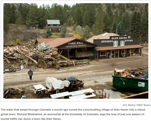
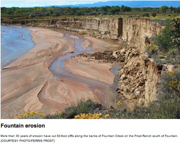

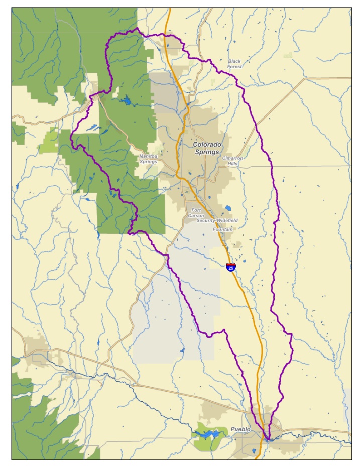


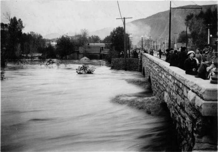





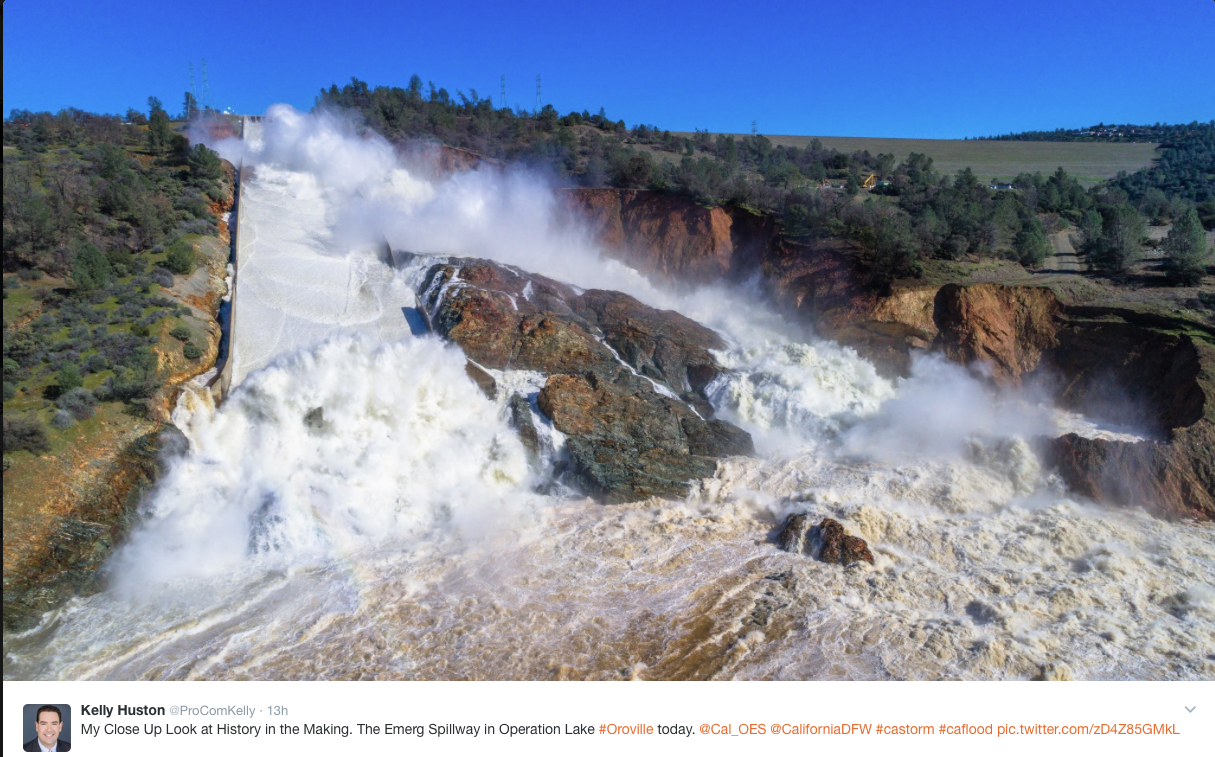


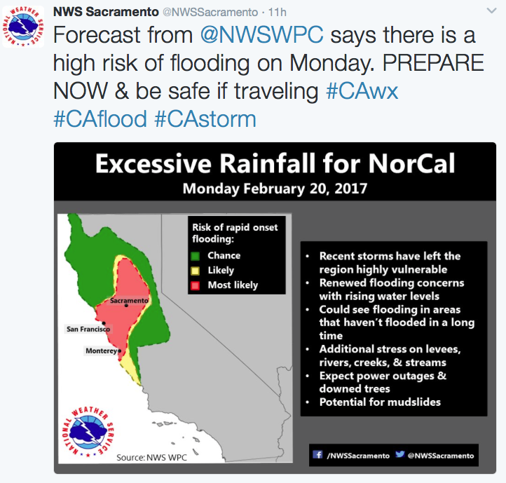
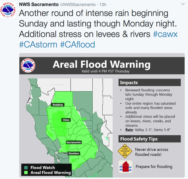


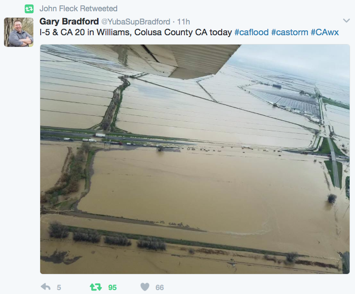

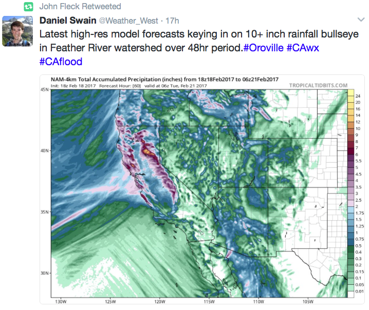


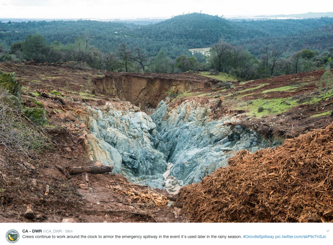

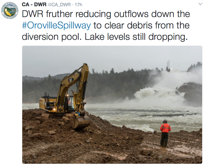
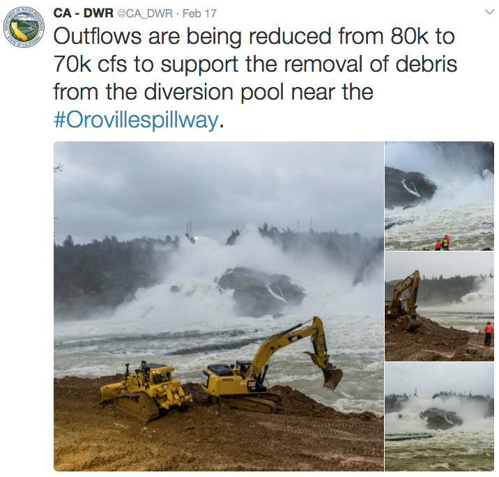
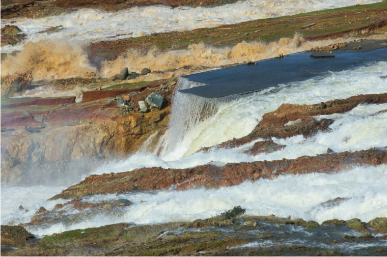




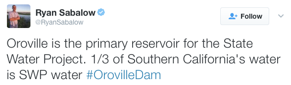
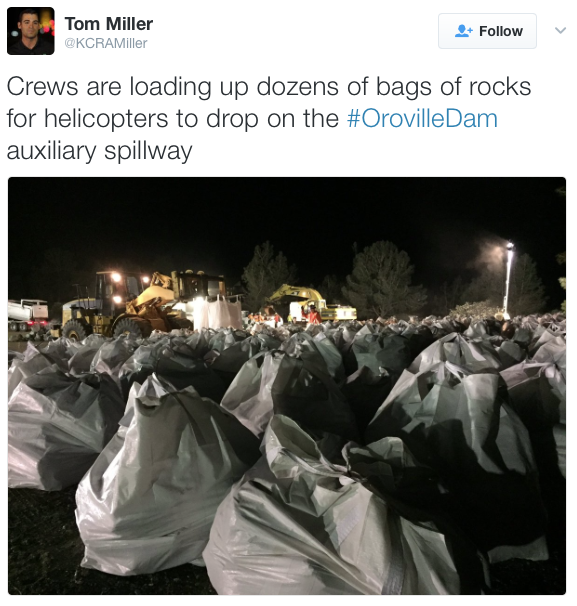
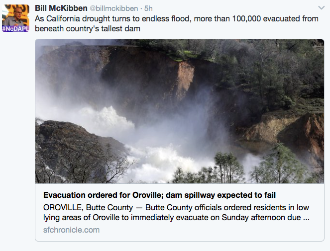


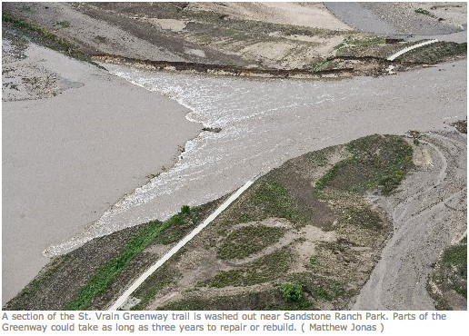
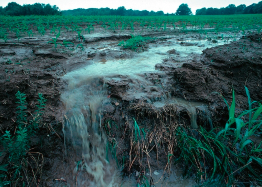


![Scott Hummer, general manager of North Poudre Irrigation Company, talks about how his agency worked with Fort Collins Natural Areas and Colorado Parks and Wildlife to include a fish passage when the irrigation company replaced a diversion structure on the Poudre River that was destroyed by the 2013 floods. Work was completed [in February 2016]. (Pamela Johnson / Loveland Reporter-Herald)](https://coyotegulch.blog/wp-content/uploads/2016/03/cachelapoudrefishpassage022016lovelandreporterheraldscotthummer.png)