#ColoradoSprings stormwater fees start

Heavy rains inundate Sand Creek. Photo via the City of Colorado Springs and the Colorado Springs Independent.

From The Colorado Springs Independent (Pam Zubeck):

City stormwater fees, approved by voters in November 2017, will finally be billed this month. For most, the fees aren’t based on impact — or square footage of impermeable surface, such as rooftops or driveways, that lead to runoff. Instead, residential properties will pay a flat $5 a month, whether for a palatial estate or a tiny studio apartment, bringing in an estimated $7.9 million a year.

Nonresidential property owners, who are expected to pay around $8.2 million a year, will be billed $30 per developed acre per month. But properties that are 5 acres or less will pay the fee without any adjustment for impermeable surface, while those larger than 5 acres will be charged fees determined by the city’s stormwater manager based on impermeable surface.

South Boulder flood mitigation

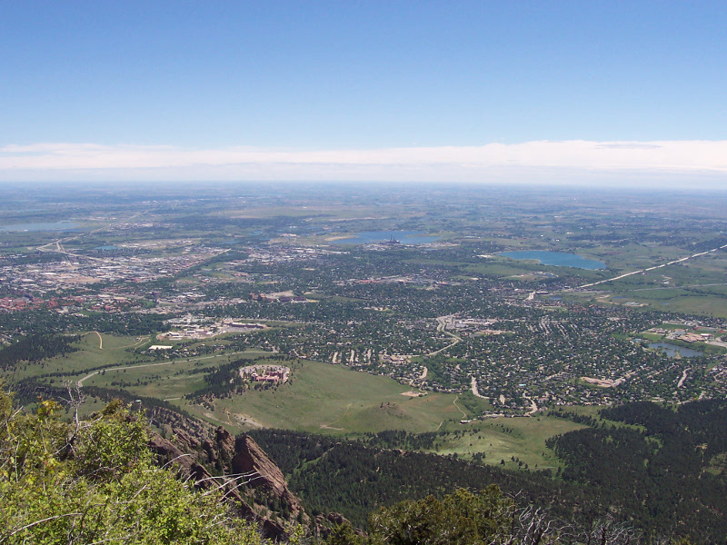
Boulder. By Gtj82 at English Wikipedia – Transferred from en.wikipedia to Commons by Patriot8790., Public Domain, https://commons.wikimedia.org/w/index.php?curid=11297782

From The Boulder Daily Camera (Anthony Hahn):

Issues surrounding the long-heralded CU Boulder South annexation plans continue to manifest most consistently within concerns over how eventual flood mitigation designs will play out on the property.

Those concerns were clear at a joint meeting between Boulder’s Water Resources Advisory Board and Open Space Board of Trustees on Monday, where dozens of residents from Boulder’s Frasier Meadows retirement community who wore bright orange shirts reading “Save our neighborhoods” and “Stop flooding of South Boulder Creek” urged officials to take quick action on those plans.

Upon annexation of the property by the city, the University of Colorado plans to build more than 1,000 housing units for students and employees, athletic fields and academic buildings on the 308-acre site over the coming decades. It also intends to devote nearly 100 acres of the site to a flood mitigation plan.

The parcel has proven controversial since its purchase in 1996, as neighbors have worried that university’s plans to eventually develop the site would put nearby homes at greater risk from floodwaters.

The chief flood mitigation concept — proposed under the South Boulder Creek Master Plan — includes a flood wall along the south side of U.S. 36 within the Colorado Department of Transportation right-of-way and a dam along the northern portion of the CU South parcel to contain flood waters, according to a staff report presented Monday.

Under this plan, vehicle access to CU South from Table Mesa Drive would be routed to a ramp up and over a portion of the dam. The flood wall would also include an overtopping spillway, which would be designed to discharge floodwaters “that exceed the design storm.”

#ColoradoSprings: Voter approved stormwater fee collection starts July 1, 2018

Colorado Springs with the Front Range in background. Photo credit Wikipedia.

From KOAA.com (Tyler Dumas):

The fee, which was Ballot Issue 2A, was passed by 54 percent in the November 7, 2017 special combined election. The ballot measure approved a dedicated municipal government storm water fee that will generate $16 – $17 million in annual funding for critical storm water infrastructure, regulatory permit compliance, and maintenance operations for the City’s storm water program, according to the City.

What this means for Springs residents is all residential units with water services through Colorado Springs Utilities will be assessed a $5 per unit monthly fee that will be collected through residents’ utilities bill. The City said it has partnered with Colorado Springs Utilities to administer the monthly residential fee on its behalf as it is the most cost effective billing mechanism. Residential units within the city limits without an active water services agreement with Colorado Springs Utilities will be billed through a separate billing agency.

The monthly fee for non-residential parcels will be $30 per acre. Non-residential parcels over five acres will be individually assessed and undeveloped or unimproved land will not be counted as they do not significantly contribute to storm water runoff.

With this dedicated funding mechanism freeing general fund dollars, the City said it plans to hire an additional 20 police officers, eight firefighters and two fire inspectors in 2018. These positions are part of a larger plan to add 120 police officers over the next five years.

For more information about the storm water fee and the City’s storm water program, visit http://ColoradoSprings.gov/stormwater or call (719) 385-7876.

The Grand Valley Drainage District will not appeal recent court decision

Bicycling the Colorado National Monument, Grand Valley in the distance via Colorado.com

From The Grand Junction Daily Sentinel (Charles Ashby):

The district’s three-member board of directors voted 2-1 Tuesday to forego any legal challenge to District Judge Lance Timbreza’s ruling last week, saying there was no guarantee they would prevail in an appeal and they didn’t want to subject district businesses and residents to more legal uncertainty.

As a result, the board said it would refund the $7.2 million it’s collected so far — plus interest — to the 40,000 property owners who have been assessed the tax since 2016, but exactly how that will happen is yet to be determined.

That’s partly because the district has already spent about $2.2 million of the money, and isn’t yet sure how much in interest it is obligated to pay.

The district’s board and staff is to spend the next couple of weeks trying to figure all that out, said district manager Tim Ryan.

First, the district staff has to figure out how much in interest it is obligated to pay, and then — because it doesn’t have the cash to cover the entire refund and interest — how it will do so. That could involve taking out a loan, laying off some workers, declaring bankruptcy of the enterprise fund the district formed to finance the stormwater improvements, or a combination of those options.

Under the state’s Taxpayer’s Bill of Rights, any overcollected tax that isn’t refunded within a year requires a 10 percent interest payment along with it, Ryan said.

“The ruling was (the fee) exceeded TABOR, and that it’s an extra tax, so those who paid it are entitled to what they paid plus 10 percent,” he said. “It’s no longer a fee, that’s the conundrum. Now we have to go back to 2016 and 2017. Those are the years that require interest because we’ve held their money for over a year. Everybody else will get their refunds within a year.”

While board member Mary Brophy was adamantly opposed to appealing the decision, and Jim Grisier cast the lone dissenting vote against not going ahead with one, board chairman Cody Davis stood somewhere in the middle.

While he ultimately cast the deciding vote not to appeal, Davis said part of him wanted to because there are aspects to Timbreza’s ruling that he saw as incomplete. The judge ruled that unlike fees charged in other jurisdictions that were for specific purposes, such as Aspen’s grocery bag fee, this fee was for a core function of the district’s mission, to handle drainage needs.

Mesa County District Judge Lance Timbreza rules that the Grand Valley Drainage District’s stormwater charge is a tax and subject to TABOR

Grand Valley Irrigation Canal. Photo: Brent Gardner-Smith/Aspen Journalism

From The Grand Junction Daily Sentinel (Gary Harmon):

The Grand Valley Drainage District’s charge, which for most of its residents is $36 a year, “runs afoul of (the Taxpayer’s Bill of Rights) and is unconstitutional beyond a reasonable doubt,” Mesa County District Judge Lance Timbreza wrote in a 43-page decision handed down a year after Timbreza presided over a trial on the case.

Mesa County and the Grand Junction Area Chamber of Commerce sued to halt the charge, contending that it was an illegal tax.

While the ruling halts the district from continuing to collect the charge, it’s silent on how or whether the district is to return the $7.2 million already collected over the last three years.

None of the drainage district board members now serving were on the board that instituted the fee and two said they expected to discuss what steps to take next in the coming weeks.

Board Chairman Cody Davis, who joined the board two years ago as an opponent of the charge, preferring that voters approve of any revenue-increasing measure, said he was surprised by the ruling…

Mesa County Commissioner Scott McInnis said it’s now time to deal with stormwater drainage issues across the county and said the drainage district should return to the bargaining table to “pick up where they left off and work toward a unified valley authority. And frankly, they don’t have the leverage to say no.”

[…]

Previous board members had leaned away from an appeal in the event they lost the suit, but the subject has yet to come before the current board.

Timbreza’s decision makes no mention of whether the district should return money to its customers. The county and chamber had made no request in their arguments about the money already collected…

While residents were asked to pay $36 a year, many businesses paid much more than that, up to $10,000 a year, Grand Junction Area Chamber of Commerce President and Chief Executive Officer Diane Schwenke said…

The chamber and Grisier both noted that the need to deal with stormwater hasn’t gone away.

The drainage district charged businesses, churches, local governments and others with large-area parking lots and rooftops $3 per month for each 2,500 square feet of impervious surface, or surfaces that shed, rather than absorb water.

Residents were charged $3 per month or $36 a year.

@EPA assures partners will take part in lawsuit settlement talks — The #ColoradoSprings Independent

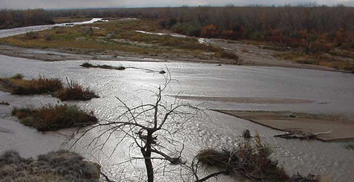
Fountain Creek photo via the Fountain Creek Watershed Flood Control and Greenway District

From The Colorado Springs Independent (Pam Zubeck):

The latest chapter is a March 25 letter obtained by the Indy from the DOJ to the state Health Department and Colorado Attorney General’s Office. In it, DOJ Acting Assistant Attorney General Jeffrey Wood says the federal government will “welcome and anticipate the full involvement of the State and intervenors in any such discussions with the City.”

That contrasts with the EPA’s unilateral action to reopen settlement negotiations with the city recently — without consulting other plaintiffs — after a year-long settlement discussion failed last year. The lawsuit is set for trial in August.

#ColoradoSprings and @EPA negotiating stormwater lawsuit, other plaintiffs left out and state attorney fired — Colorado Springs Independent

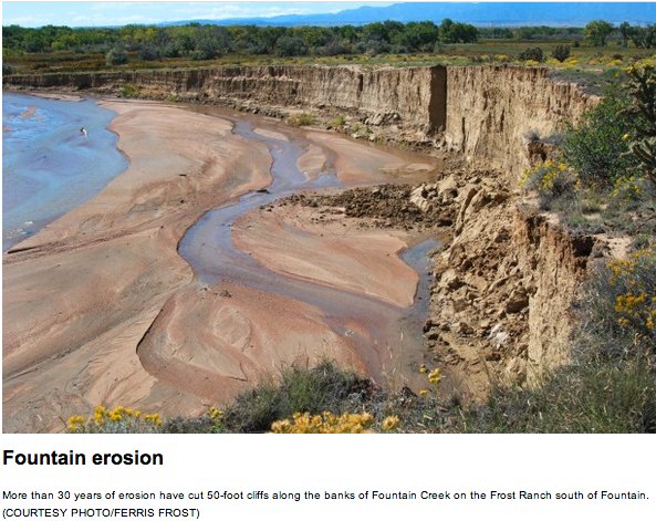
Fountain Creek erosion via The Pueblo Chieftain

From the Colorado Springs Independent (Pam Zubeck):

The renewed negotiations come as U.S. District Judge Richard Matsch scheduled an August trial in the lawsuit on May 22, the day after the state’s lead attorney in the case was reportedly fired for a reason the Colorado Attorney General’s Office won’t discuss.

That lead attorney, Margaret “Meg” Parish, first assistant attorney general in the Natural Resources & Environment Section, wrote at least two scathing letters to the EPA and the Department of Justice (DOJ) in recent months, calling the EPA’s action “shocking and extraordinary” and expressing “deep concern and disappointment” that the agency unilaterally reopened settlement talks without consulting co-plaintiffs. Besides the Colorado Department of Public Health and Environment (CDPHE), those include Pueblo County and the Lower Arkansas Valley Water Conservancy District.

The move was particularly alarming, she noted, because the state and EPA signed an agreement not to communicate with the city without the presence of the other.

Some who couldn’t comment on the record due to confidentiality rules labeled the latest moves “pure politics” in an era when the EPA’s reputation is pivoting from protecting the environment to serving polluters…

EPA’s reopening of negotiations has sown suspicion among co-plaintiffs who already distrust the city due to sewage discharges, raging stormwater flows and sediment in Fountain Creek that befoul the creek, threaten levees and block irrigation headgates interfering with raising crops.

The possibility of a settlement was suggested to voters last fall when Mayor John Suthers campaigned for passage of stormwater fees, saying their adoption would help the city end the lawsuit, filed by the EPA and CDPHE in November 2016 after the city flunked compliance inspections in 2013 and 2015 for its MS4 permit (Municipal Separate Storm Sewer System). The lawsuit alleges ongoing violations of the Clean Water Act, saying the city failed to force developers to install proper storm drainage infrastructure, gave waivers to others and didn’t adequately inspect and monitor its waterways. The city spent only $1.6 million a year on those tasks from 2011 to 2014, a pittance considering the city’s drainage needs are estimated at $1 billion.

Approved by voters in November, the fees go into effect July 1 and replace general fund money used to satisfy an April 2016 deal the city made with Pueblo County to spend $460 million over 20 years on stormwater. The agreement grew from Pueblo County’s demands after the city adopted stormwater fees in 2007 and abolished them in 2009 and came as the city activated its $825-million water pipeline from Pueblo Reservoir.

The Roaring Fork Conservancy is working to get Cattle Creek off the 303(d) list

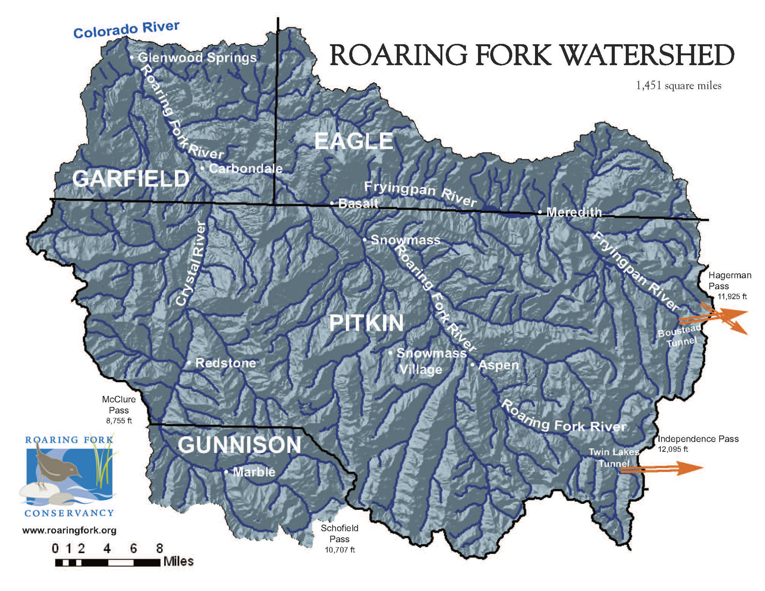
Map of the Roaring Fork River watershed via the Roaring Fork Conservancy

From Aspen Public Radio (Elizabeth Stewart-Severy):

Roaring Fork Conservancy has been studying the creek since 2015, and water quality coordinator Chad Rudow told commissioners Monday that research shows parts of the creek are healthier than the state thought.

“We’re pretty excited and pretty hopeful that at least a section of Cattle Creek will come off of that 303(d) list,” Rudow said.

Roaring Fork Conservancy has submitted its data to the Colorado water quality division, which will analyze it this year.

Garfield County agreed to Roaring Fork Conservancy’s request for $10,000 to continue studying water quality and take steps to improve it. Rudow said the studies have identified some clear trends…

There isn’t just one culprit; diversions, agriculture, septic systems and commercial development all contribute.

Roaring Fork Conservancy is working with landowners to better manage riparian areas and septic systems, and Rudow said continued outreach is key.

Because there are many diversions on Cattle Creek, the stream doesn’t see a typical spring runoff flow, which clears out pollutants and sediments. So Roaring Fork Conservancy is also working with water rights owners to discuss a pulse flow to mimic spring runoff.

Fountain Creek: Lower Ark and other agencies wonder if the @EPA will stay the course on lawsuit v. #ColoradoSprings

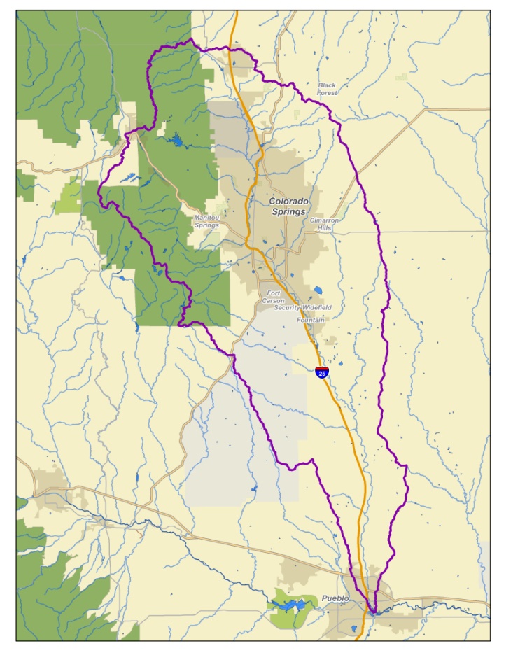
The Fountain Creek Watershed is located along the central front range of Colorado. It is a 927-square mile watershed that drains south into the Arkansas River at Pueblo. The watershed is bordered by the Palmer Divide to the north, Pikes Peak to the west, and a minor divide 20 miles east of Colorado Springs. Map via the Fountain Creek Watershed Flood Control and Greenway District.

From The Colorado Springs Independent (Pam Zubeck):

…in November 2016, the EPA and Colorado Department of Public Health and Environment sued, alleging violations of the Clean Water Act and the city’s Municipal Separate Storm Sewer System (MS4) permit to discharge into creeks, streams and rivers. As a federal judge looks to set a trial date this summer, the state and lawsuit intervenors, Pueblo County and the Rocky Ford-based Lower Arkansas Valley Water Conservancy District, urge the EPA in a March 26 letter to “re-commit” to the case, suggesting a dismissal or settlement might be in the works.

That would be a mistake, says Lower Ark executive director Jay Winner, because the city has broken promises in the past involving stormwater. “I started this in 2005 and we’ve had three or four deals, and something always goes south,” he says. “We’ve got to make sure we have good clean water, not just for now but for the future.”

The city’s struggle to fund stormwater dates to two failed ballot measures in 2001, and City Council’s adoption of fees in 2007 only to rescind them in 2009. In April 2016, the matter became a sticking point as the city prepared to activate the Southern Delivery System, a $825 million, 50-mile water pipeline from Pueblo Reservoir. Having issued a construction permit for it, Pueblo County demanded the city fix its storm system to relieve Fountain Creek flooding, or face revocation. In response, Mayor John Suthers and Council pledged $460 million over 20 years for city drainage work.

In November 2017, Suthers and Council proposed shifting that cost from the city’s general fund to fees. Voters approved, and the city begins collections in July. (See sidebar.)

By all indications, the city is working to comply with its MS4 permit. Its March 30 annual report for 2017 says the city:

  • Increased the number of drainage structures it maintained, from 53 in 2016 to 70, and for the first time, city workers walked every foot of the city’s 270 miles of creeks and channels to assess needs.
  • Boosted by 56 percent its reviews of drainage reports and construction and grading plans — to 1,590 last year. The city also rolled out new grading, erosion and sediment control permitting programs.
  • Launched Stormwater University, which instructs developers, engineers and consultants, as well as citizens, on MS4 mandates.
  • More than doubled the number of cleanup events along city waterways in 2017, to 88 from 37 in 2016, increasing public participation by 54 percent, to 6,014 people. Those volunteers removed 18 tons of trash. “We now have the capacity and people in place to run the programs,” says Jerry Cordova, who oversees the volunteer “trash mob” events, “so we can develop them and continue to grow.”
  • Beefed up development inspections, a key EPA lawsuit criticism. While no monetary penalties were imposed, the city stepped up enforcement, issuing 47 compliance actions last year compared to only 16 in 2016.
  • Inspections are more robust, says stormwater manager Rich Mulledy, because the city has more inspectors focused on drainage issues alone. “If you do a lot more inspections,” he says, “you’re going to catch more.” And the city did. It issued six stop-work orders last year, compared to only two in 2016, and 41 letters of noncompliance, the step that precedes a stop-work order — triple the 14 issued in 2016.

    Pockets of noncompliance, such as Wolf Ranch in the northeast, which gave rise to 23 percent of last year’s enforcement actions, stem from multiple adjacent job sites, Mulledy says. “We have a lot of different home builders and different contractors, and they’re all trying to play in the same sandbox, and they step on each other’s toes. You might have 100 pieces of equipment being used by 20 to 30 different companies.”

    Mulledy also warns against thinking that no monetary fines means no penalties. “Stop-work — that’s a very serious thing. That is a big deal,” he says. “They can’t work till it’s fixed.” Which is why stop-work orders span only a day or so, he says.

    The industry is aware of the heightened scrutiny, says Kevin Walker, spokesperson for the Housing & Building Association of Colorado Springs. That’s why the HBA instituted “Wet Wednesdays,” a series of tutorials about drainage rules for builders and developers.

    But it’s worth noting that builders applaud the Trump administration’s efforts to roll back clean-water and stormwater-runoff regulations. The HBA even funded EPA director Scott Pruitt’s “luxury hotel stay” at The Broadmoor in October 2017, according to Politico, which quoted HBA CEO Renee Zentz as saying it was “our chance to make sure the concerns of our industry are being listened to.”

    It’s not publicly known if the EPA’s lawsuit was discussed during Pruitt’s visit, but there’s been no filing that hints a negotiated settlement is imminent. Still, the March 26 letter from the state, Pueblo County and the Lower Ark says they “are now seriously concerned about whether the EPA continues to share our commitment to working together to protect Fountain Creek…”

    The CDPHE tells the Indy in an email the letter’s intent was to “reiterate the importance … of remedying the ongoing discharge of pollutants” into the Arkansas River watershed.

    But Lower Ark’s Jay Winner is more pointed: “I think there is a genuine distrust that the EPA may try to cut a deal,” he says. “We’re hoping that doesn’t happen. We’ve got to live with Fountain Creek for a very, very long time. Colorado Springs is doing a great job. Mayor Suthers is doing a great job. But we had a mayor before him [Steve Bach] that wasn’t doing a good job, and I don’t know if the mayor after John Suthers is going to do a good job.”

    More coverage of the Colorado Springs stormwater enterprise from Pam Zubeck writing for the Colorado Springs Independent:

    Starting July 2, billings for the city’s Stormwater Enterprise will be mailed to all Colorado Springs residents and property owners.

    The charges were authorized by voters last November under a 20-year plan that would raise roughly $20 million a year. The fee revenue will free up general fund money Mayor John Suthers and City Council had previously committed to its 20-year, $460-million deal with Pueblo County for projects to reduce erosion and flooding along Fountain Creek and other waterways. That general fund money, in turn, will be used for other purposes, such as hiring more cops.

    Since the November vote, the city has been working to set up billing procedures. Residential billings, including those for apartment dwellers, will be made by Colorado Springs Utilities, with one exception. Multi-family buildings that don’t have individual apartment water meters will be handled under nonresidential rates.

    City CFO Charae McDaniel says water service connections will trigger the stormwater fee for residential properties. Residential fee payers who don’t pay the $5 charge on their utility bills will be subject to disconnect under standard Utilities policies, which require payment within 14 days of the billing date. Utilities spokesman Steve Berry wouldn’t say how long Utilities provides service for overdue accounts, but it assesses a $20 fee for disconnection. Reconnection costs $30 during normal business hours and $40 after hours.

    If a residential customer refuses to pay the $5 fee, it rolls onto the next bill. If left unpaid for a period of time, accumulated fees could exceed the usage billings for water, sewer, electric and gas.

    “That couldn’t continue in perpetuity,” Berry says. “They [customers] will then eventually go into arrears, and they would be eligible for disconnection. There’s a point it becomes untenable for the customer, and they would be held responsible, just as in nonpayment of any service we offer.” But, Berry notes, Utilities gives customers “plenty of opportunity” to pay bills prior to disconnection.

    Nonresidential property owners of developed tracts up to 5 acres will be billed $30 per acre per month; if the land isn’t developed at all, no fee will be assessed. Owners of properties larger than 5 acres will be assessed $30 per acre per month on only those portions that are developed. Portions of those properties that remain in a natural state won’t be assessed a fee. Undeveloped land won’t pay any fee.

    There are currently 1,005 parcels that are over 5 acres that will be charged a fee, city spokesperson Jamie Fabos says. McDaniel says when properties are developed, based on monthly reports from the El Paso County Assessor’s Office, they’ll be added to the stormwater fee rolls.

    But Assessor Steve Schleiker says he changes a tract’s status only once a year, on Jan. 1, for tax purposes, and doesn’t generate a monthly report regarding development status; rather, those reports merely describe changes to property ownership.

    Asked about that, Fabos says, “Although we will be receiving monthly updates from the assessor’s office that show current ownership, acreage, and use, each property will be determined as developed or undeveloped by aerial investigation and through additional GIS technologies.” She adds that updates to parcel status will be made every six months — meaning new, nonresidential construction might not be assessed the fees until six months after they’re built.

    Nonresidential customers — which includes businesses, industry, churches, nonprofits and governments, including the city — won’t face disconnection of utility bills, because the city, not Utilities, will collect the fees. Nor will they be assessed late fees.

    “We will be going through collection processes if they become delinquent on the nonresidential side,” McDaniel says, meaning a collection agency could be used. If the fees become 150 days past due, she says, “We will process a lien on the property and record that with El Paso County to be added to property taxes.” That procedure carries a cost of 10 percent of the bill.

    Last fall, City Council President Richard Skorman said nonresidential billing information should be made public. Now, McDaniel says the City Attorney’s Office has said stormwater fees fall under the Colorado Open Records Act’s exemption for utility bills, so they’ll be kept confidential.

    That means citizens, or the media, can’t check how much various tracts are being assessed in stormwater fees.

    “It’s an issue I’d like to bring up,” Skorman says, “because I did make that promise, and I didn’t check with lawyers at the time, and I said, of course we would reveal it.”

    One possible alternative, he says, would be for Council to direct an appointed stormwater fee advisory committee to analyze and monitor fees assessed to assure they’re applied fairly. “That’s something that we definitely want to put in place,” he says.

    Moving forward, the fees can be raised by Council action, but only to satisfy a court order, comply with federal or state laws or permits, or fund the agreement with Pueblo County.

    Larimer County and the Big Thompson Watershed Coalition score $175,342 for river restoration

    From The Loveland Reporter-Herald (Pamela Johnson):

    The county commissioners on Tuesday approved a contract to work with the nonprofit river coalition on continued revegetation in key areas of the flood-damaged canyon with a $175,342 grant from the Colorado Water Conservation Board. To match the grant, the county and watershed coalition will put in $175,386, part in cash and part in staff and volunteer resources.

    Commissioners Donnelly and Steve Johnson voted 2-0 at their weekly administrative matters meeting to approve the contract, allowing county resources to be used for the project. Lew Gaiter, the third commissioner, was absent.

    The county’s in-kind contribution will be worth $23,490, including work by weed specialist Casey Cisneros, and its cash share will be $94,797 from the Larimer County Disaster Fund. The watershed coalition will pitch in $7,250 in cash and $49,849 of in-kind help, including volunteer labor.

    This project will focus on the Big Thompson River near Drake, Cedar Cove and Jasper Lake as well as the North Fork of the Big Thompson from Drake all the way to Glen Haven.

    Restoration projects have focused heavily on both private and public land along these areas, but additional work is needed for continued weed management and erosion control, said Shayna Jones, coalition director.

    “These are areas that received a lot of time and effort in the past,” said Jones. “This is about making sure those improvements are maintained and stay on the right trajectory. … We’ll be able to identify the key focal areas that need a little more attention.”

    This work, Donnelly said, is important to the fishery of the river, which is an economic driver for the region, to recreation along the river and to the quality of water that the river delivers to residents, including those who live in Loveland. These projects, he said, help restore the ecosystem and all river functions.

    Down ‘The River Of Lost Souls’ With Jonathan Thompson — Colorado Public Radio

    From Colorado Public Radio (Nathan Heffel). Click through to listen to the interview:

    A new book puts the Gold King Mine spill within the long history of mining and pollution in Southwest Colorado.

    Jonathan Thompson will be at the Book Bar tonight. I wonder if Denver is a bit of a shock to his system even though he’s a sixth-generation Coloradan?

    I am so happy to finally get to finally meet Jonathan. His new book, River of Lost Souls, is an important read. Understanding the industrialization of our state over the years will help us chart a less destructive course.

    I loved the passages where Jonathan reminisces about spending time around the Four Corners and in the San Juans. He transports you to those times in your life spent next to the river or exploring what sights the land has to offer. He connects you to the Four Corners in a way that only a son of the San Juans could.

    Cement Creek aerial photo — Jonathan Thompson via Twitter

    Mississippi River flood control infrastructure worsens flooding

    Created by Imgur user Fejetlenfej , a geographer and GIS analyst with a ‘lifelong passion for beautiful maps,’ it highlights the massive expanse of river basins across the country – in particular, those which feed the Mississippi River, in pink.

    From Wired (Adam Rogers):

    Basically, the Mississippi meanders. Sometimes the river curves around so tightly that it just pinches off, cutting across the peninsula and leaving the bigger curve high, if not dry. That parenthesis of water alongside the main channel is an oxbow. In a flood, water churns up chunks of sediment and spreads into the oxbow. When the flood waters recede, the layer of coarse sediment sinks to the oxbow’s bottom, where it remains.

    So Muñoz’s team humped their pontoon boat all the way from Woods Hole, Massachusetts to three oxbows whose birthdates they knew—one from about 1500, one from 1722, and one from 1776—and jammed pipe into the lakebed with a concrete mixer. “It vibrates so hard, your hands fall asleep,” Muñoz says. “And then you have 300 or 400 pounds of mud you’re trying to get back up.” But it worked.

    The cores were a map of time, with today at the top and the oxbow’s birthday at the bottom. In between: A peak of the radioactive isotope cesium-137 marked 1963, when humans started testing nuclear bombs. Using technique called optically stimulated luminescence to date, roughly, when a layer was last exposed to sunlight, they spotted classic floods, like 2011, which caused $3.2 billion in damages, and 1937, which required the largest rescue deployment the US Coast Guard had ever undertaken.

    The important part, though, was that the characteristics of the layers for floods they had numbers on could tell them about the magnitude of floods they didn’t. They got 1851, 1543, and on and on…

    AFTER A PARTICULARLY devastating flood in 1927—637,000 people lost their homes, perhaps up to 1,000 killed, $14 billion in period-adjusted damage—human beings deployed the US Army Corps of Engineers to wage all-out war on nature to protect industry, farms, and trade. People tried to warn the government even as construction began on the Mississippi’s infrastructure—channelization, dredging, dams in the upper stretch, and along the middle and lower levees, concrete mats along the banks called revetments, and gates.

    “All that increases the amount of water and the speed that water goes during a flood. What we’re saying is, we can’t explain the increase we’re seeing with climate alone,” Muñoz says. “But for the first time, we can go back further, to a state in which the river wasn’t dominated by human activities. We can really show that the way the river behaves today is not natural.”

    Even that look at the prelapsarian Mississippi may not change much. Warnings that flood control would lead to uncontrolled floods date back to at least 1852, when a famous engineer named Charles Ellet warned in a report to Congress that the whole idea was going to lead to disaster. Yet the US Army Corps of Engineers’ Mississippi River and Tributaries Project remains in full, multi-billion-dollar effect. (Representatives for the Corps of Engineers did not return multiple requests for comment.)

    Now, Muñoz’s inferential datasets don’t convince every river researcher. Bob Criss, a hydrogeologist at Washington University at St. Louis, says he doesn’t completely buy Muñoz’s team’s particle-size correlations and tree-ring cell biology. “It’s just a bunch of voodoo and sound bites,” Criss says. “I certainly don’t object to his conclusion. But I don’t think it’s robust.”

    Criss definitely does buy the idea that engineering has made flooding worse, though. He says straight-ahead numbers like stage measurement (the height of the river) are enough to tell you that. Levees upriver send more water downriver. Revetments move that water faster. What might have been slow-spreading floodwaters when they were unconstrained turn into neighborhood-destroying mini-tsunamis when they burst all at once from behind failing levees…

    And [Victor] Baker buys what Muñoz has come up with. “Levees protect against little floods. If you have a super-big flood that exceeds the capacity of the levee, the levees make that worse.” he says. There have been bigger floods than people remember—but the landscape recorded them. And if humans learn to play those recordings back, maybe we can find a new way to get ready for the waters yet to come.

    Platte to Park Hill Project Phase 1 update

    Storm drain and open channel improvements between the East Rail Line (38th & Blake Station) and the South Platte River (Globeville Landing Outfall), Stormwater detention/conveyance between the East Rail Line (38th & Blake Station) and Colorado Blvd, (Montclair Basin)
    Stormwater detention/ conveyance immediately east of Colorado Blvd. (Park Hill Basin).

    From 9News.com (Cory Reppenhagen):

    Denver Public Works refers to that problem area as the Montclair basin. It is the largest basin in Denver at 9.5 square miles, that does not have a path for stormwater to get to the South Platte River.

    So they say that stormwater tends to pool in that area, and some of the worst flooding in the city steams from this spot. The solution, according to Denver Public Works, is to build the largest flood protection project that Denver has ever seen.

    The Platte to Park Hill Project, or P2P, is extremely progressive in its use of open channels, water quality features, and inclusion of community and recreational assets.

    A 9NEWS crew toured the nearly completed first phase of this plan, called the Globeville Landing Outfall Project, which Denver Public Works describes as a giant storm drain.

    The centerpiece of this project is a massive pipe that’s actually a 500-yard-long, 12 foot by 15 foot – a concrete box culvert…

    This project will protect those historic neighborhoods around the Denver Coliseum, like Elyria, Swansea, Cole, Whittier, Clayton, Skyland, and Five Points.

    Denver Public Works said it will not only handle the routine stormwater, that often floods those areas, but also the big 100-year events.

    “It’s those storms that are above an inch in an hour. Two inches, three inches in an hour, those are the ones we don’t have a system for, those are the ones that this system is really going to do a good job for us,” said Uhernik.

    A thunderstorm that covers all 155 square miles of Denver, with just 1 inch of rain, puts down 2.7 billion gallons of water, which is enough to fill about 67 million bathtubs…

    In this new project, the water will flow out of that culvert and into the open, where it will run through a new park and into the South Platte River, just along the west end of the Denver Coliseum parking lot.

    It’s a natural path restored.

    Denver Public Works says this drain will be ready to take on stormwater by this summer. The new city park will be completed in the spring of 2019.

    They plan to build similar drains downstream in the years to come.

    @UCLA: 100% local water possible for Los Angeles by 2050 #ColoradoRiver #COriver

    Map of the Los Angeles River watershed via Wikimedia.

    Here’s the abstract for the recently released study:

    This report assesses the potential to improve water quality standards while integrating complementary One Water Management practices that can increase potential local water supplies for the City of Los Angeles (the City). This final report summarizes the current practices and future opportunities at the City-owned Water Reclamation Plants and underlying groundwater basins and highlights the importance of considering all aspects of integrated water management even when dealing with water quality or supply-focused projects.

    Implementing watershed-scale best management practice programs to meet stormwater permit requirements will significantly improve water quality in all watersheds. However, additional mechanisms such as increasing Low Impact Development implementation and comprehensive source tracking and source control mechanisms will be required to potentially eliminate water quality exceedances. There are multiple efforts occurring in the City and the region to increase the recharge of recycled water into the ground and the volumes of remediated groundwater extracted.

    This research further assessed the impacts of potential water supply portfolios, with greater volumes of locally-supplied water, on GHG emissions and energy needs of supplying LA’s water. Conservation will be another powerful tool to decrease our dependence on imported water. This research demonstrates the complex interrelationships between all aspects of urban water management, including, for example, stormwater management and local water supply.

    Fountain Creek: CSU-Pueblo scores additional $32,000 for water quality study

    The Fountain Creek Watershed is located along the central front range of Colorado. It is a 927-square mile watershed that drains south into the Arkansas River at Pueblo. The watershed is bordered by the Palmer Divide to the north, Pikes Peak to the west, and a minor divide 20 miles east of Colorado Springs. Map via the Fountain Creek Watershed Flood Control and Greenway District.

    From KRDO.com (Katie Spencer):

    But now, with an additional $32,000 in research funding from the county, researchers are hoping to find out exactly what lurks below the water’s surface.

    CSU-Pueblo staff and students have been collecting water samples, and they say there are large amounts of mercury and selenium in the water.

    “Mercury can be a problem. It has a whole syndrome, a whole set of symptoms if you see mercury levels getting too high,” [Scott] Herrmann said.

    County Commissioner Terry Hart said he just wants the Pueblo community to be able to enjoy the creek, as the people of Colorado Springs do.

    “Citizens are invited down to play in and around the creek and it’s a beautiful thing. We can’t do that in Pueblo County and we have not been able to do it because of our pollution concerns,” Hart said.

    He also wants to make sure the Pueblo commissioners and the city of Colorado Springs are keeping up their promises to clean up the creek.

    The researchers are also looking at the fish in Fountain Creek to determine what issues they are facing and if contaminants are being passed on to people who catch and eat them.

    Cañon City could see lawsuit from two ditch companies for routing stormwater to ditch easements

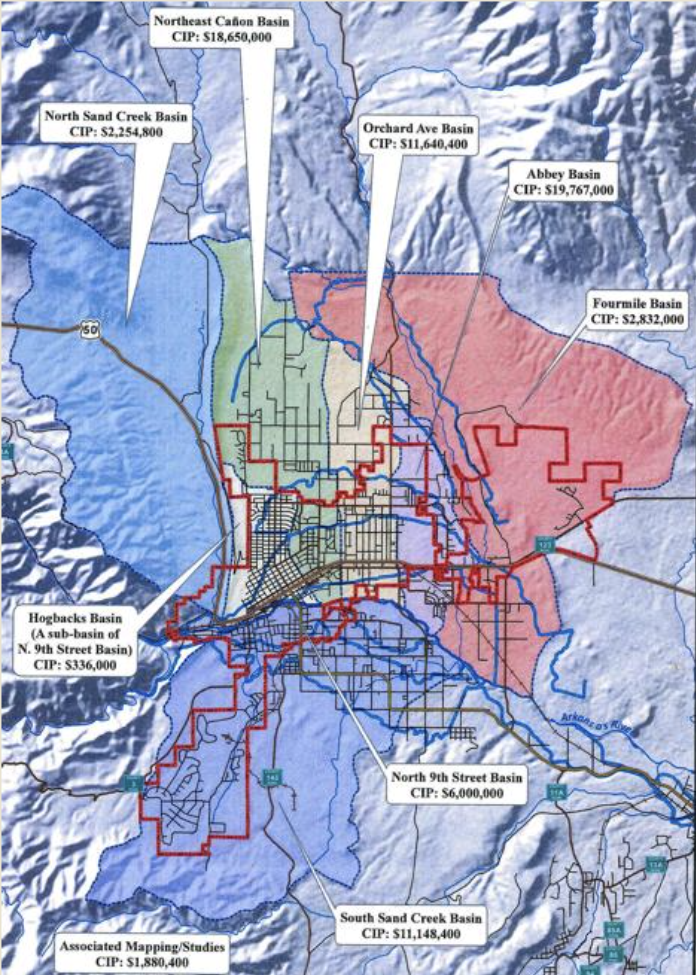
    This graphic shows the estimated cost for upgrades, repairs and maintenance of each stormwater basin. (City of Cañon City)

    From The Cañon City Daily Record ( Carie Canterbury):

    A second local ditch company is making preparations to potentially sue the City of Cañon City for allegedly utilizing irrigation ditches as a stormwater utility.

    During Monday’s city council meeting, former mayor George Turner, who also serves as the secretary/treasurer for the Cañon City & Oil Creek Ditch Company, said the city has been putting off stormwater improvements for the last 150 years and utilizing the irrigation ditches in the community as its stormwater utility…

    He said the Hydraulic Ditch Company has increased its assessment by $2 a share and the Cañon City & Oil Creek Ditch Company has increased its assessment by $5 per share for the sole purpose to generate a fund to hire water attorneys to potentially sue the city.

    Mannie Colon, the president of the Cañon City Hydraulic & Irrigating Ditch Company, initiated litigation last year against the city when he felt his solutions to the decades-long stormwater problems had been dismissed and not adequately implemented.

    In response, a stormwater task force consisting of representatives from the City of Cañon City, Fremont County and local ditch companies was formed in March 2017 to look at solutions.

    The city, county and the Hydraulic & Irrigating Ditch Company recently mutually have agreed to fund a $180,000 study to investigate and mitigate stormwater flooding of the ditch. The city council earlier this month approved a tolling agreement that preserves any legal right the ditch company believes it may have against the city and county for stormwater flooding while also maintaining the rights, claims or defenses of the city and county.

    The city contends that the cost of stormwater mitigation has gone up, but fees haven’t.

    The fee hasn’t increased in 10 years, and the city has an operating fund deficit in the stormwater fund that is compounded by a $75 million capital project backlog.

    In order to get the utility back in the black, fees would need to double, which also would provide for about $4 million in capital improvements during the next 10 years. Second reading of an ordinance that would double stormwater fees was tabled during Monday’s meeting.

    Some members of the public said they don’t mind increasing the fees, but they felt doubling them was much too excessive. However, City Administrator Tony O’Rourke said to meet the entire capital needs for the stormwater problem, the rate would have to increase in a rate in excess of 1,000 percent.

    During Monday’s meeting, there was much discussion about an effort to get county officials to take more of an active role in the stormwater problem.

    Stormwater is collected in eight drainage basins within the city and Fremont County. The city physically only represents 18 percent of the area within these eight drainage basins, the other 82 percent is in the unincorporated area of Fremont County, which does not impose a stormwater fee for those residents.

    “The drainage basins are in the county, and that’s who should be helping us pay for this,” Mayor Preston Troutman said.

    Councilman Mark Gill pointed out that on a $220,000 home, Cañon City receives about $46 in property taxes while the county receives about $197…

    The city is looking to create a regional stormwater basin authority, where all the residents within the eight basins would share the cost of stormwater management. This requires the support and concurrence of the Fremont County Commissioners who would have to approve a service plan before it could go before voters for approval.

    Former Councilman Dennis Wied said doubling the stormwater fee is particularly unfair to businesses. He said there are 1,000 business properties in town, and 5,000 residential properties, but the businesses pay 52 percent of the total stormwater fee. Additionally, he said a proposed stormwater impact fee would go from about $750 per acre to about $11,000 an acre…

    Other citizens asked for an explanation on how money in the stormwater fund is spent, specifically a $620,600 transfer to other funds.

    City Engineer Adam Lancaster said the majority of the money is spent on maintenance and a great deal is spent on compliance with the city’s MS-4 stormwater permit. Some funds are spent for a local contractor for maintenance and an inter-fund transfer also is used for the city’s street crews to do some maintenance…

    Wied said when the stormwater fee was first instituted, it was for the purpose to build up funds to address stormwater problems, not day-to-day operations. He said 100 percent of the city’s street sweeper is being charged to the stormwater fund, which he alleges just started recently…

    Wied also said that 20 percent of the time spent by 14 people in the street department is charged to the stormwater fund…

    A study analysis being conducted by an independent consultant is looking into how inter-fund transfers have been calculated. O’Rourke said preliminary results indicate that the city has not been charging the stormwater fund sufficiently, and the general fund is continuing to subsidize that fund by about $180,000 in addition to what it currently transfers. It is in violation of TABOR for the city to supplement the stormwater fund with the general fund, he said.

    Wied said the city, staff and the council the last 11 years have been fully aware of expenses that can and must be charged to a utility and those that don’t. He took exception to the comments made that certain fees have to be charged to the stormwater fund…

    Finance Director Harry Patel said since 2006, cost allocations have been moved from the general fund into the stormwater fund, and he will provide documentation during an upcoming meeting. The fund transfers were in council-approved budgets and on audited statements, he said.

    The council agreed to table the discussion to the next general government meeting that will be at 4 p.m. March 7 at City Hall.

    Councilwoman Ashley Smith asked that city staff bring back an in-depth analysis of spending and allocation requirements, as well as a state of future plans and proposed projects.

    Cañon City photo credit DowntownCañonCity.com

    @UN_Water: Say hello to the IIWQ World Water Quality Portal

    In central Wisconsin water moving into Lake Puckaway from the Fox River, collected on the right is relatively clear. As water moves through the lake it becomes more and more turbid. The main cause of this turbidity is algae followed by resuspension of sediment from wave action and the activities of Common Carp. Photo credit: Lake and wetland ecosystems.

    Here’s the release from UN Water:

    Water quality affects human health, as well as ecosystems, biodiversity, food production and economic growth.

    The IIWQ World Water Quality Portal, which was developed in the framework of UNESCO-IHP’s International Initiative on Water Quality (IIWQ), is a pioneering tool to monitor water quality using Earth Observation. The Portal addresses an urgent need to enhance the knowledge base and access to information in order to better understand the impacts of climate- and human-induced change on water security.

    It aims to provide water quality information, facilitate science-based, informed decision-making for water management and support Member States’ efforts in implementing the Sustainable Development Goal on water and sanitation (SDG 6), as well as several other Goals and Targets that are linked directly to water quality and water pollution.
    Access the IIWQ World Water Quality Portal.

    The latest “The Current” newsletter is hot off the presses from the Eagle River Watershed Council

    Gore Creek is healthy as it emerges from the Eagles Nest Wilderness Area, but has problems soon after, via The Mountain Town News. All photos by Jack Affleck.

    Click here to read the newsletter. Here’s an excerpt:

    Where does all the traction sand go on Vail Pass?

    The arrival of snow means traffic on I-70 over Vail Pass bustles with skiers and visitors to and from the Front Range, with cars braving storms and bumper-to-bumper traffic in search of a powder day. Without the help of traction sand or de-icers, our ability to constantly travel across the state would not be possible.

    Roughly 5,000 tons of traction sand are laid down on Vail Pass each year, but where does all that sand end up? Originating from aggregate mines from the Western Slope and stored in the igloo tent atop Vail Pass, the sand is sprinkled along the highway corridor to ensure safer travel along the pass. Colorado Department of Transportation (CDOT) enlists contractors each year to come through in the late summer with vacuum trucks to suck up the remaining sand on the road ways and median. The used sand is then brought down to the berms that line the north side of the highway in East Vail. Sand is also flushed by rain and snow over the embankments and carried into sediment-catch basins or into Black Gore Creek, which closely parallels about 10 miles of the interstate from its headwaters at Vail Pass to the confluence of Gore Creek.

    Extensive sediment loading to Black Gore Creek from nearly three decades of I-70 operations have severely impaired the stream, resulting in losses of aquatic habitat, impacts to wetlands and an overall reduction in water quality. In addition, the accumulation of sediment in Black Lakes near Vail Pass encroaches upon the storage capacity of water supply reservoirs that serve Vail and are used to maintain instream flows.

    Black Gore Creek Steering Committee’s Efforts

    Since 1997, the Black Gore Creek Steering Committee (BGCSC), headed by Eagle River Watershed Council, has worked to mitigate the impacts to Black Gore Creek and the health of its aquatic life. The committee is made up of a number of important partners in the community, including Eagle River Watershed Council, Colorado Department of Transportation, Eagle County, U.S. Forest Service, Town of Vail, Eagle County, Eagle River Water & Sanitation District, Lotic Hydrological, River Restoration, Colorado Parks & Wildlife, Colorado Department of Public Health & Environment, and concerned citizens.

    In 2002, Black Gore Creek was listed on the State’s 303(d) list of impaired waters for sediment—which is different than Gore Creek’s more recent listing in 2012 for aquatic life impairment. Although the State has yet to come out with a limit of how much traction sand can enter the creek, CDOT, in collaboration with the other BGCSC partners, has taken great initiative to address these issues over the past 10 years.

    Recent Accomplishments

    To date, CDOT is picking up nearly the same amount of traction sand as they are putting down annually, which has improved since the years when no cleanup occurred, and the basins slowly filled.

    Besides capital improvement projects such as repaving the medians and bike path enhancements, one of the most significant improvement projects has been the identification of a long-term maintenance solution for the Basin of Last Resort. A 3-acre section of Black Gore Creek around mile marker 183 on I-70, the Basin is a control structure that traps sediment missed by upstream catch basins. There has been concern with its effectiveness as the basin fills with sediment. In the fall of 2017, construction of a road allowing for easier access to excavate the basin more regularly and efficiently was finalized.

    More work is to be done, however, as the goal is to have less sediment reach the Basin of Last Resort in the first place. Through field assessments, mapping activities, and sediment transport modeling, consultants to Eagle River Watershed Council, namely River Restoration and Lotic Hydrological, are working to identify opportunities for capturing traction sand before it leaves the highway corridor and enters the creek.

    Traction Sand vs. Mag Chloride

    CDOT has also installed sophisticated software in their plowing vehicles that senses how much traction sand or de-icer they should be applying on any given segment of the highway. The increased prevalence of de-icers, commonly referred to as “mag(nesium) chloride,” has been an inevitable outcome from the pressure on CDOT to reduce the amount of traction sand applied. Although very effective at melting snow and preventing ice formation, de-icers aren’t without their downsides. Studies have shown that elevated levels of chloride in rivers can be detrimental to aquatic life. The Watershed Council and CDOT both conduct chloride-loading studies to understand how chloride concentrations differ in Black Gore Creek and Gore Creek and whether they are approaching harmful levels.

    “We don’t see the kinds of widespread impairments of the biological communities on Black Gore Creek that you would expect if they were really being negatively impacted by chloride. The health of those communities may be somewhat limited, but they do not meet the Colorado State definition for impairment right now,” reports Seth Mason of Lotic Hydrological. That is not to say that we shouldn’t be concerned about chloride levels in Black Gore Creek. While macroinvertebrate communities in Black Gore Creek may look better than those on Gore Creek through Vail, they may be stressed by elevated chloride concentrations and more vulnerable to other impacts on the creek. While more studies chloride’s effects are needed, the BGCSC is committed to not replacing one pollutant with another.

    Related to Gore Creek’s Woes?

    With all the recent attention on the Restore the Gore effort surrounding Gore Creek, some long-time locals believe the impacts from Black Gore Creek are at fault. Up until 2012, the State associated high sediment levels automatically with impaired aquatic life. In conducting macroinvertebrate sampling in our watershed, we are finding that aquatic bug scores on Black Gore Creek are healthier than those in the highly developed sections of Gore Creek through Vail. This along with other evidence leads to the belief that stormwater runoff from impervious surfaces in town and the loss of riparian areas along Gore Creek from development are a greater contributor to Gore Creek’s impairments.

    The important efforts on Vail Pass have not slowed–in fact CDOT has spent about $7 million since 2013 to clear out the catch basins and sweep our roadways. The Watershed Council will continue the collaborative dialogue and mitigation efforts of the stakeholders to ensure the important progress continues in keeping our waterways healthy and clean.

    #Colorado vulnerable to mudslides

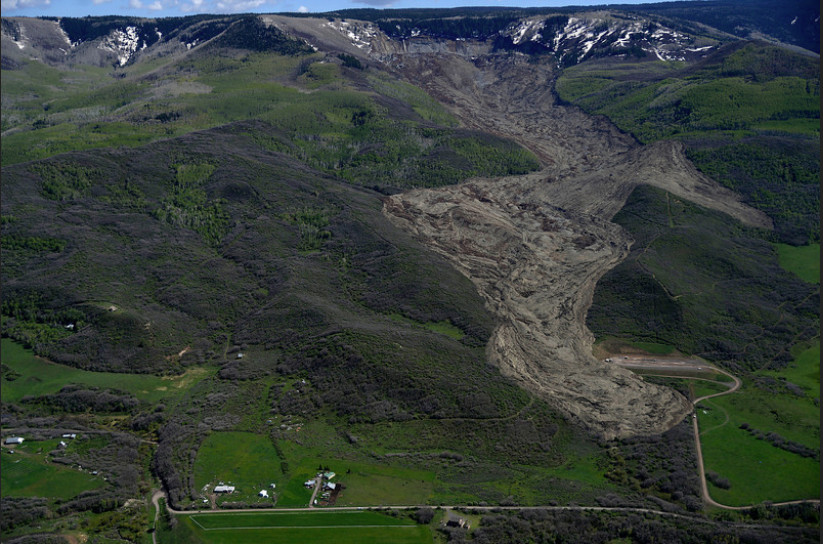
    Grand Mesa mudslide May 2014 via The Denver Post

    Here’s a guest column from Paul Santi that’s running in The Denver Post. Here’s an excerpt:

    The ingredients for deadly debris flows are steep mountain slopes, a loose mantle of soil and rocks covering the hillsides and choking the valleys, and occasional severe rainstorms. These things converge surprisingly often, and most canyons around here have an apron of both ancient and fairly recent debris flow deposits at their mouths, revealing a historic legacy of these events. However, the next ingredient is the kicker: wildfire. Suddenly, the tiny bit of stabilization offered by our patchy arid-climate vegetation is gone. On top of that, rainfall on burned areas runs off faster and in much greater volumes, since any sort of interception by plants or infiltration into the ground is drastically reduced. Oh, and by the way, the changing climate means that wildfires have been more frequent and larger, and intense rainstorms are more likely. More water, more tumbling rock and debris, and more danger.

    That was the story in California last week, as the fire-flood-mud sequence played out once again. That has also been the story in Colorado many times in the past. In 2012, the Waldo Canyon Fire burned hillsides above Colorado Springs, and a rainstorm the next summer brought muddy debris down Highway 24 near Manitou Springs, tragically sweeping two people to their deaths. Post wildfire debris flows have destroyed houses and damaged roads and bridges above Boulder, Glenwood Springs, Durango, and many other Colorado cities over the last dozen years.

    So what can we do about this? First, you need to know if you are personally in danger. The simple answer is that if you live near a canyon mouth, you live in risk from debris flows. If the forest above you burned, you are at even greater risk for the next few years, until the vegetation comes back. The same goes for highways crossing these areas. A more complex picture can be filled out with tools developed by the U.S. Geological Survey and others that predict that probability of debris flows, how big they will be, how much rain is needed to cause them, and where they will go. The USGS now routinely produces maps showing probability and volume for debris flows in areas where there were significant wildfires (over 80 of these maps were created in 2017 alone, including the Thomas Fire in Santa Barbara County that caused the maelstrom last week).

    Second, and this is just as important, if you live near a canyon below a burned forest, evacuate when it rains, as even small storms can cause debris flows in this hair-trigger setting. Natural processes are highly variable and unpredictable, so warnings and evacuation orders have to be conservative — and this means that there will be false alarms. Don’t fall prey to “evacuation saturation” and ignore a warning because the last one didn’t pan out. It is heartbreaking to think of how many lives would have been saved in California last week had those families been somewhere else at the time.

    Finally, we need to carefully consider where we are willing to build. Mountain canyons concentrate geologic hazards, and increase the likelihood of accidental fires. Therefore, the encroachment of our communities into steep forested terrain must be accompanied by planning and vigilance to protect ourselves. The scientific tools help, and they are getting better all the time, but our own awareness and caution can be life saving.

    ‘Atmospheric rivers’ aid the West — and imperil it — @HighCountryNews

    From The High Country News (Emily Benson):

    When a rainstorm slammed California’s Russian River watershed in December 2012, water rushed into Lake Mendocino, a reservoir north of San Francisco. The cause? An atmospheric river, a ribbon of moisture-laden air that can ferry water thousands of miles across the sky. When the tempest hit, the state was on the brink of an exceptional drought. But instead of storing the surge the storm brought for the dry days to come, the reservoir’s owner, the U.S. Army Corps of Engineers, let it run downstream.

    They had to. Army Corps rules say Lake Mendocino must be partly drained during the winter, leaving room for the next deluge to prevent downstream flooding. But in 2013, that space ended up being superfluous, mostly because drought conditions kicked into high gear and the rainy season essentially ended after the December downpour. “We lost that water,” says Shirlee Zane, who serves on the board of the Sonoma County Water Agency, which delivers water from Lake Mendocino to nearby homes. The agency estimates that more than $2 million slipped down the river. It was a loss that might have been prevented if the Army Corps had known they could safely store the water — and one managers would hate to repeat. “We lose millions of dollars of water if we don’t have better forecasting,” Zane says.

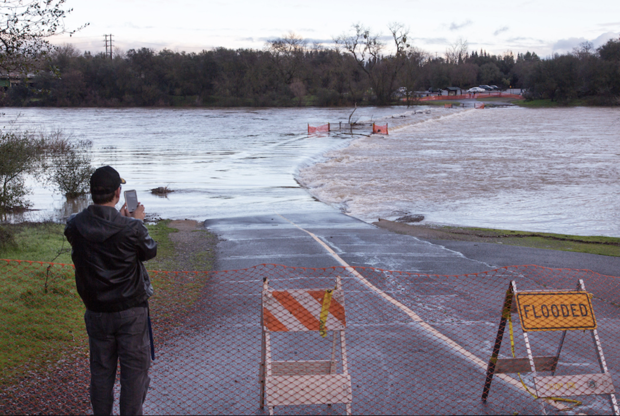
    Atmospheric river storms swelled the American River in January 2017, inundating a footbridge near Sacramento, California.
    Dale Kolke / California Department of Water Resources

    Now, scientists are getting closer to solving that problem. Atmospheric rivers can cause dangerous deluges — an atmospheric river contributed to the mudslides that recently killed more than a dozen people in southern California — but they also provide up to half the annual precipitation on the West Coast. To make the most of those benefits while reducing risks, researchers are improving forecasts using computer models, weather balloons and instruments dropped from airplanes. The knowledge they’re gaining could help reservoir managers stockpile more water for dry periods without sacrificing the safety of downstream communities. And as climate change intensifies both floods and shortages in the coming decades, meeting that balance will become even more critical.

    “It’s possible to predict these storms, to a degree,” says Marty Ralph, the director of the Center for Western Weather and Water Extremes, part of U.C. San Diego’s Scripps Institution of Oceanography. Meteorologists can see an atmospheric river coming a few days in advance; and, just as important, they can also see when the coast is clear after a big storm swells reservoir storage. “With good enough forecasts of no big atmospheric river coming in the next few days,” Ralph says, “then it’s plausible that one could safely keep that extra water.”

    To explore that possibility, Ralph and a group of scientists, water managers and agency officials are studying what would happen to water supply and flood risk at Lake Mendocino if reservoir operators didn’t always have to leave room for a winter storm that isn’t coming. Could they avoid a repeat of the December 2012 water dump, without imperiling people downstream? “It looks viable,” Ralph says.

    Further improving forecasts could help. “We’re good at seeing (atmospheric rivers),” says Anna Wilson, also a researcher at the Center for Western Weather and Water Extremes. “But we are not yet good at telling exactly where they’re going to land, exactly how strong they’ll be, and, in certain instances, whether precipitation is going to fall as rain versus snow.” Wilson, Ralph and other partners, including a U.S. Air Force squadron nicknamed the “hurricane hunters,” plan to drop dozens of parachute-carried sensors measuring moisture, temperature and wind data through several atmospheric rivers early this year. Working with the National Weather Service, they hope to advance forecasts of storm location and other details.

    Better forecasts could also help water managers deal with the increasingly intense atmospheric rivers climate change will likely cause. Because warmer air can hold more moisture, by the end of this century individual atmospheric rivers could drop substantially more precipitation on the West Coast than they already do, according to research done by Michael Warner, a Seattle-based meteorologist with the U.S. Army Corps of Engineers.

    Those lessons won’t just apply to California reservoirs. For a place like Washington’s Howard Hanson Dam, more intense storms might demand faster reservoir releases, which could put downstream areas in peril. In addition to supplying Tacoma with water during the summer, the dam protects more than $6 billion in businesses, infrastructure and homes from flooding. “Every major flood in the coastal Pacific Northwest has been associated with an atmospheric river event,” Warner says.

    Though it will take years of further research before official policies can be changed, managers at Lake Mendocino may try taking atmospheric river forecasts into account this year. This winter, for the first time, the steering committee of the Lake Mendocino project has requested that the Army Corps deviate from the rules that forced the agency to dump water in the past — if forecasts suggest it’s safe to do so. “We are in a feast or famine type of climate here on the West Coast,” says Zane, of the Sonoma County Water Agency. “If we have better data and we can do the forecasting … it’s going to improve our water management.”

    This story was originally published at High Country News (http://hcn.org) on Jan. 11, 2018.


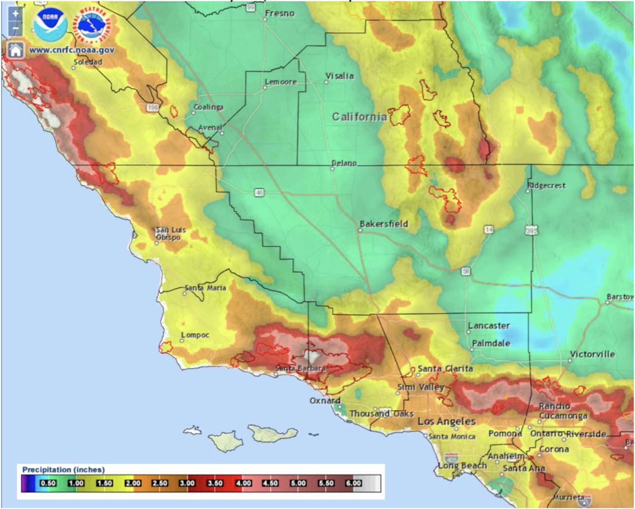
    Rain totals from atmospheric river event in S. California January 8-9, 2018 via NWS Los Angeles.

    Nederland budget approved

    Mailboxes are laden with snow on April 17, 2016 in Nederland, Colorado. (Helen H. Richardson, The Denver Post)

    From The Mountain Ear (John Scarffe):

    A new Waste Water Treatment facility and sewer maintenance dominated the 2018, $4.9 million budget approved by the Nederland Board of Trustees during a regular meeting at 7 p.m., December 5, 2017, at the Nederland Community Center…

    Estimated expenditures for each fund: General Fund: $2,793,371; Conservation Trust Fund: $16,000; Community Center Fund: $391,068; Water Fund: $708,808; Sewer Fund: $812,422; Downtown Development Authority Fund: $30,700; Downtown Development Authority TIF Fund: $2,900. Total: $4,755,269…

    The Sewer fund capital improvements have multiple items such as manhole repairs, mains and a new vehicle. The design and engineering of the Waste Water Treatment Plant Biosolids project will get up to 100 percent in 2018 but will be reimbursed by a loan, Hogan said, and will hopefully be awarded a $950,000 grant for improvements. It is a $2 million project.

    Capital improvements from the water fund include the other half of the new vehicle, a Micro Hydro Feasibility Study with a matching $8,000 grant, and other projects, Hogan said.

    Grant activity includes a Colorado Department of Local Affairs grant for the Biosolids project, a Great Outdoors Colorado grant for Fishing is Fun; a Colorado Department of Public Health and Environment grant for Pursuing Excellence Raw Water Filtration, a Colorado Water Resources and Power Development Authority grant for the Micro Hydro Feasibility Study with an $8,000 match and a GOCO Parks grant with a $6,000 town match…

    For the Water Fund, the changes in rates are explained in the fee schedule. Total revenue is $707,000, operating expenses are $475,000, capital improvements $91,000 and debt payments of $143,000, resulting in a net change in cash of negative $1,200.

    The Sewer Fund will also contain a fee schedule increase. Total revenue is budgeted to be $814,000, operating expenditures $527,000, capital improvements $42,000 and debt payments of $244,000, resulting in a positive net change in cash of $2,000.

    Hogan presented the 2018 Fee Schedule. Noteworthy increases include the water fee with a three percent increase, and the sewer fund with a four percent increase.

    5 awareness tips on stormwater pollution

    Barr Lake State Park photo via Colorado Parks and Wildlife.

    From the University of Colorado at Boulder:

    State and federal agencies task the office of Environmental Health and Safety at CU Boulder with ensuring everyone on campus does their part to keep our water clean by preventing chemical waste and other pollutants from being disposed of into storm drains and sanitary sewer lines.

    As a large, eco-conscious community at CU Boulder, we have the great opportunity to become educated and work together to reduce our impact on stormwater. Small amounts of contaminants from all over the landscape add up to cause pollution in our water. It is important to remember even the little things matter. You will make a difference, no matter how small, if you can adopt simple habits and change the way you look at water quality.

    A few important tips to keep in mind include:

  • Do not dispose of chemicals down the drain.
  • Report anything suspicious or unusual around stormwater.
  • Clean up after your pets, and do not litter.
  • Do not maintain or wash your car in public areas, where runoff will easily flow to storm water.
  • Be aware.
  • Evans: Riverside Park restoration update

    Evans Colorado September 2013 via TheDenverChannel.com

    From The Greeley Tribune (Tommy Wood):

    The beginning of the project was delayed because Evans kept the bidding for contractors open for a longer period than it planned, which pushed the project completion date to August 2018. The increased costs come from more complicated trash removal than contractors foresaw, and from increased wages for workers mandated by the Davis-Bacon Act. The project will cost $12.1 million, still under the $13.2 million budget.

    Riverside Park, 4000 Riverside Parkway, was destroyed in the 2013 floods when a berm protecting the park broke and inundated it under seven feet of water. The flood scattered debris all over the park and uncovered a landfill underneath Evans officials said they were unaware of. The park has been closed to the public since.

    Keith Meyer, the project manager for the restoration, said workers discovered asbestos in the trash that made cleanup riskier than they’d foreseen. It’s also heavier and denser than expected because it’s packed with dirt. Because Evans is paying for trash removal by the ton, that added $976,488 to trash removal costs.

    Additionally, Meyer said, Evans has to pay a total of $27,567 to workers to conform to the Davis-Bacon Act, which mandates public works laborers be paid the local prevailing wage — the hourly wage, usual benefits and overtime paid in the largest city in each county.

    The council will vote whether to accept the added costs in its next meeting, at 7 p.m. Jan. 2.

    After #Oroville, officials across the West review dam safety — @HighCountryNews

    New Oroville spillway finish work. Photo credit California DWR.

    Here’s an analysis from Emily Benson writing for The High Country News. Click through and read the whole thing. Here’s an excerpt:

    To avoid the risk of further erosion, however, both spillways [at Oroville] needed to be patched up before this winter. By early November, following months of ‘round-the-clock work, the California Department of Water Resources announced that Oroville was ready for the rainy season, though final repairs will take another year. And the consequences of the incident could last far longer: Its sheer scale means it has the potential to affect legislation and policy, as did earlier disasters at other dams. Safety officials in California and across the West are already reassessing spillways, updating disaster plans and refining evacuation maps, hoping to prevent a repeat of Oroville — or worse.

    Structural failures were the immediate cause of the Oroville catastrophe. The main spillway has successfully handled larger flows than what it saw last February. While it’s not yet clear exactly why it broke apart, some researchers say part of the blame lies in poor design and shoddy maintenance — and that those problems could have been addressed. An independent group of dam experts is investigating what went wrong, with a final report expected by the end of 2017. An interim report released in September notes that there was preexisting damage and repairs at the area that first crumbled. Weaknesses there could have allowed water to get beneath the spillway, potentially blasting apart the concrete from below.

    Administrative failures — problems with inspections or regulations — may share the blame for what happened at Oroville. A patchwork of agencies meant to prevent such problems regulates dam safety in the United States. Federal agencies like the Bureau of Reclamation and the Army Corps of Engineers oversee inspection and maintenance at their own dams. Dams that belong to the state, like Oroville, or a utility company or other non-federal entity, are typically under the jurisdiction of a state agency; the Federal Energy Regulatory Commission (FERC) is also involved in dam inspections at non-federal dams with hydropower projects they license, including Oroville…

    In Colorado, Oroville confirmed that dam safety officials were already on the right track, says Bill McCormick, the chief of dam safety at Colorado Division of Water Resources. There, the big test came in 2013, when widespread flooding in north-central Colorado driven by torrential rain led to the failure of about a dozen small dams. Nobody was hurt or killed as a result of the failures, “but they did get people’s attention,” McCormick says. (Several people died elsewhere during the flooding.) Another wet season in the spring of 2015 made clear the need to plan for different levels of flooding and dam releases. “Our main lesson from Oroville is that we still need to be vigilant,” he says, “but we’re doing the right things.”

    Cities explore the future of urban #stormwater — University of Denver Water Law Review

    From the University of Denver Water Law Review (Alicia Garcia):

    Need for a New System
    Chicago has the largest wastewater capture quarry, water treatment facility, and water treatment plant in the world. However, Chicago still continues to experience significant flooding from stormwater runoff. In the past five years, there have been approximately 181,000 claims totaling over $753 million in flood-related property damage.

    Brenna Berman, Chicago’s chief information officer, says that the city is, “still getting the same amount of rain annually that we got [in the past] but it’s coming at a different rate than it once did. However, we’re getting rain more quickly, rain for a shorter period of time, most likely due to global warming.” Therefore, the same solution does not work the same in every location.

    A Greener Solution?
    In response, Chicago has been installing green infrastructure to hold and treat stormwater. Currently, Chicago is in the midst of a five-year, $50-million plan towards creating ten million gallons of stormwater storage in hopes of reducing stormwater runoff by up to 250 million gallons per year. Permeable pavement has been installed in bike lanes and alleys, which allows for water to be soaked into the ground rather than flowing into the sewer system. Additionally, there are bioswales, tree pits, and infiltration planters, which are areas of vegetation and soil collecting and filtering stormwater that prevent flooding and allow cleaner water to enter the sewer system. Although there are a number of green infrastructure solutions available, there is not much data available regarding which types work best and how well they are working. That’s where City Digital comes in.

    City Digital, a partnership of companies based at University of Illinois’ UI LABS, heads the pilot project which combines sensors and cloud computing as an innovative solution to stormwater runoff. The project aims to develop the next generation of sensing and monitoring tools for green stormwater infrastructure. The partnership is comprised of large, multinational companies including Microsoft, ComEd, Siemens, Accenture, Tyco, and HBK Engineering, as well as academic institutions such as the University of Illinois, Illinois Institute of Technology, Northwestern University, and Argonne National Laboratory.

    These companies, universities, and the City of Chicago are collaborating together to identify and solve large-scale infrastructure challenges in order to develop solutions that can be broadly commercialized.

    How it Works
    Beginning in August of 2016, City Digital has been installing low cost sensors and innovative software tools throughout the city in order to monitor and evaluate the city’s current green infrastructure.

    The ultimate goal of this smart green infrastructure monitoring is to create a system of sensors that combines weather information with surface and groundwater monitoring to evaluate the amount of water present, whether or not it is entering the green infrastructure, and what the water undergoes once it enters the infrastructure. Additionally, the system will measure the pH levels and the temperature of the water. Above the ground, the sensors work to monitor the weather conditions, such as precipitation amounts and air pressure levels. Below ground, the sensors monitor soil moisture, chemical absorption rates, and water quality to determine if the infrastructure is managing the water as intended.

    The data collected by the sensors is then communicated via cellular network into an analytics platform. There, the effectiveness of the various green-infrastructures can be monitored in real time. As of this past spring, there are six sites throughout Chicago that are transmitting more than 20,000 streams of real time data that translate into site specific recommendations for green infrastructure being built in the future.

    Ultimately, the purpose is not only to determine if the green-infrastructure is working, but where and when certain types of green infrastructure are most effective. Specifically, whether the green infrastructure is preventing rainwater from entering the sewer system and what green designs work best for different types of rain and lengths of the storm.

    Supporters of the pilot project urge that smart green infrastructure monitoring can be a low-cost alternative to traditional monitoring. Joshua Peschel, one of the key players of the Chicago pilot project says, “the traditional way of monitoring stormwater infrastructure, if done at all, is with expensive measurements that are often very sparse in space and time. This project seeks to fill the data gaps by adding unique measurement techniques and intelligence to these new green streets in Chicago.”

    By providing innovative, low cost monitoring for green infrastructure, the pilot project is changing the way not only Chicago, but cities all over the world address stormwater issues. The pilot project is designed to create a pathway to commercialization so that successful pilots can easily and directly be extended throughout other areas of Chicago and even further to other cities both nationally and globally.

    Lower Arkansas Water Conservancy District board meeting recap

    Fountain Creek erosion via The Pueblo Chieftain

    From The La Junta Tribune-Democrat (Bette McFarren):

    Mark Shea of Colorado Springs Public Works Department was early to the meeting with the Lower Arkansas Valley Water Conservancy District with the good news that Colorado Springs voters have approved funding of the Fountain Creek Flood Mitigation Project by approving Ballot Issue 2A. The project has not been funded for several years, but some of the projects have been funded through the general fund, explained Engineer Richard Mulledy. The project is now the subject of litigation between Colorado Springs and the LAVWCD, so Attorney Bart Mendenhall urged both sides not to get into the territory of the lawsuit in progress.

    Mulledy has been at the helm of the storm water project for two and a half years. Anthony Nunez, Director from Pueblo, asked Mulledy if the current 2A funding replaced the Enterprise Zone, which was originally designed to fund the project but voted out by the people of Colorado Springs. Mulledy said yes. The 2A mandate is intended only for capital projects associated with Fountain Creek Flood Mitigation, drainage maintenance over the 395 square miles of the Colorado Springs area, and the water quality program associated with it. Fees for litigation are not included…

    Winner brought up sedimentation as the major cause of the North La Junta flooding problem. “Thirteen feet of sediment under the North La Junta Bridge,” said Winner. “More like 15 feet,” said Bud Quick, whose volunteer earth-moving has protected North La Junta several times. Earlier Quick had declared the problem of flooding in North La Junta will never be solved until the river is dredged and sediment controlled in the Arkansas River.
    At the end of the meeting, Rose Ward thanked the LAVWCD for its help in flood mitigation for North La Junta, and at the present time for helping them establish a special district that will enable North La Junta Conservancy District to help itself.

    #ColoradoSprings in a scramble to get finance systems in place to collect #stormwater fees

    Channel erosion Colorado Springs July 2012 via The Pueblo Chieftain

    From The Colorado Springs Independent (Pam Zubeck):

    …the Colorado Springs Utilities Board, composed of City Council, must approve placing the monthly $5-per-household fee on residential utility bills, for which the city would pay the agency a one-time fee of $1.8 million and $200,000 a year, the Gazette reported.

    Approval of Utilities handling collections is expected, and Strand says it appears that customers who don’t pay the stormwater fee would risk losing all utility services.

    “We’re discussing this with Utilities [staff],” Strand says. “If someone doesn’t pay their bill, what’s likely to happen is their utilities will be turned off.”

    Fees of $30 per acre for non-residential developed parcels will be billed by the city, which must set up the mechanics to do that. Undeveloped properties will be assessed by the stormwater manager based on impervious surface. (Suthers has said the city will pay an annual bill of about $100,000 for its property, including park land.) Those, too, will be billed by the city.

    Strand says the consequence for nonpayment of non-residential billings is “likely” a lien placed on the property, which would require cooperation from El Paso County, the keeper of deed records. “The county commissioners I’ve talked to say they will cooperate,” he says.

    In 2011, when the city wanted to collect $765,000 still owed for stormwater fees implemented in 2007 but halted in 2009, county officials refused to add the fees to property tax bills or deeds. Those fees, however, were not approved by voters.

    Another complication is which properties, if any, will be deemed exempt from the stormwater fee. The measure approved on Nov. 7 entitles the city to bill nonprofits and churches, but what about federal agencies, such as post offices?

    Federal agencies didn’t pay the city’s stormwater fees imposed in 2007, citing sovereign immunity and claiming the fees were a tax and, thus, unconstitutional. But, thanks to a bill signed into law by President Obama on Jan. 4, 2011, which amended the Clean Water Act, the federal government will pay its fair share of local stormwater management services, according to the Association of State Floodplain Managers.

    Whether that bill applies to military installations is unclear. However, the association wrote in a newsletter that the law was envisioned as a way to resolve billing disputes with various federal agencies, including in Aurora where the city had billed Buckley Air Force Base $143,445 in outstanding stormwater fees as of May 2010.

    Although Strand initially said he thought Peterson Air Force Base, which overlaps into the city limits, could be exempted, when told of the 2011 amendment to the Clean Water Act, he was eager to learn more about it.

    “They use our resources, and we respond to help them with fire protection, although they have their own fire service,” he says. “I think they ought to be accountable under this current situation [ballot measure] we passed on Tuesday [Nov. 7].”

    Brush councillors receive update on stormwater improvements

    From The Fort Morgan Times (Paul Albani-Burgio):

    Storm water flooding has been a long-standing problem in Brush, but City Manager Monty Torres recently told the city council that the city has made significant strides towards addressing that problem in recent years.

    During a presentation made to the council at its most recent meeting, Torres explained that the city is nearly finished with a five-phase downtown storm water improvement project. During that project, large inlets were installed on the downtown blocks, along with a 60-inch drainage pipe that is double the size of the old pipe.

    Torres said each of those phases cost $1 million-plus. Grants from the Colorado Department of Local Affairs and the Colorado Department of Transportation covered the majority of those costs, according to the city manager…

    Torres said the city has also made improvements to its storm inlets, which are designed to take in water during storms. Most of those improvements took the form of open-throated gates, which Torres said are designed to continue to take in storm water even if leaves and other debris build up around the grate’s opening. Torres said the previous grates the city had in place would often get clogged with newspapers, leaves and other debris during storms.

    Torres said that some new inlets have been installed at strategic points throughout the city in order to prevent flooding during the majority of the city’s storms. He said the inlets would quickly take care of the water produced by 90 percent of the city’s storms. Torres said that there would be another 5 percent of storms where the water would sit in the street for only a short time before being drained away.

    That left the most severe 5 percent of storms, which Torres said would still likely lead to flooding…

    The city manager said Brush also has more flooding projects on the horizon, including one intended to reduce flooding on Williams Street and another that would reduce flooding at the city’s golf course, which would also help to reduce flooding on Cambridge Street near the course. However, Torres said the latter project would be contingent on the city receiving additional funds to go through with paving the course’s parking lot from the J/N Foundation, its partner on that project.

    Torres said the city will also continue to look at adding additional inlets throughout Brush. However, he cautioned that the city does not have the funds to put in an inlet “whenever someone finds puddle of water.” Rather, those inlets will continue to be installed in strategic locations to help reduce flooding throughout the city.

    “This is a fine example of the new relationship between Pueblo and Colorado Springs” — Terry Hart

    The Fountain Creek Watershed is located along the central front range of Colorado. It is a 927-square mile watershed that drains south into the Arkansas River at Pueblo. The watershed is bordered by the Palmer Divide to the north, Pikes Peak to the west, and a minor divide 20 miles east of Colorado Springs. Map via the Fountain Creek Watershed Flood Control and Greenway District.

    From The Pueblo Chieftain (Anthony A. Mestas):

    Pueblo County officials said Wednesday that they are excited about Colorado Springs voters approving a ballot measure securing $17 million in annual stormwater fees to be used exclusively for stormwater drainage and flood control projects.

    “This is a fine example of the new relationship between Pueblo and Colorado Springs. I think it’s wonderful to have two communities rolling up their sleeves to tackle problems the two communities share,” Pueblo County Commissioner Terry Hart said.

    The money coming from the new ballot measure will be used to fund projects, including the list of 71 projects identified in the intergovernmental agreement between Pueblo County and Colorado Springs regarding the permit for the Southern Delivery System. SDS is the large pipeline that transfers water from the Pueblo Dam to Colorado Springs…

    The IGA commits the Front Range city and its utilities department to pay $460 million for storm water infrastructure, maintenance and education programs over the next two decades.

    “As evidenced by the incredible progress that has been made in our stormwater program over the past two years, the city of Colorado Springs is committed to operating an outstanding stormwater program,” said Colorado Springs Mayor John Suthers.

    “Our commitment, and the commitment of our citizens, is evident in passage of Ballot 2A to provide a dedicated funding source for stormwater infrastructure, operations and maintenance.”

    Suthers said this commitment will continue as the city of Colorado Springs and Colorado Springs Utilities invest $460 million over the next two decades to stormwater operations that will improve the city’s ability to mitigate flooding and preserve water quality while meeting the requirements of its MS4 Permit.

    #Stormwater fee passes in #ColoradoSprings

    Heavy rains inundate Sand Creek. Photo via the City of Colorado Springs and the Colorado Springs Independent.

    From KKTV (Jessica Leicht):

    Colorado Springs voters passed Ballot Issue 2A, a dedicated stormwater fee. The city says it will generate $17 to $20 million annually for stormwater infrastructure and maintenance.

    The fee stems from a lawsuit filed by the EPA, State of Colorado and Pueblo County against the City of Colorado Springs. It alleged the city failed to “adequately fund its stormwater management program,” causing problems for cities to the south. In an agreement with Pueblo, the City of Colorado Springs committed to providing at least $17 million in funding every year for stormwater infrastructure improvements to prevent issues downstream.

    Mayor John Suthers says the money the city was using under that agreement, came out of the city’s general fund. Now, he says the general fund money can be reallocated to hire more police officers and firefighters.

    “What this means is we’ll be able to take this dedicated revenue stream, deal with our legal problems surrounding stormwater and we’re also going to be able to deal with our public safety staffing issues,” Mayor Suthers said.

    The approved measure means a monthly fee, of $5.00 per residential property, and $30.00 per acre for non-residential properties. The fee will show up on utility bills starting in July 2018.

    The city says, properties bigger than five acres with significant areas of previous surface will be assessed by the Water Resources Engineering department.

    #ColoradoSprings: Is Issue 2A a springboard to outsized government spending?

    Colorado Springs with the Front Range in background. Photo credit Wikipedia.

    From The Colorado Springs Gazette (Conrad Swanson):

    While Mayor John Suthers touts stormwater fees as a route to financial stability for Colorado Springs, others see them as a symptom of the city’s insatiable appetite for cash.

    Some worry the city will inevitably raise the fees, which appear on El Paso County’s November ballot as Issue 2A.

    According to the ballot language, the city can raise the fees if ordered to do so by a judge, to come into compliance with state and federal laws or to abide by any intergovernmental agreements preceding June 1, 2016.

    A high-profile lawsuit filed against the city by state and federal governments or an intergovernmental agreement the city entered into with Pueblo County last year are the two most likely causes of future fee increases.

    Suthers argues that any increase from the agreement with Pueblo would be minimal and 2A is a proactive effort to mitigate high-dollar judgments against the city in the ongoing lawsuit.

    If passed, the fees would charge homeowners $5 a month and nonresidential property owners $30 per acre each month. The fees would last 20 years and are expected to raise as much as $18 million a year for the city’s stormwater obligations, which currently are met using the general fund.

    With a dedicated stormwater funding source in place, money freed in the general fund would be spent hiring new police officers and firefighters, Suthers said. If 2A passes, the city will be in good financial shape for the next two decades, he has said.

    But Councilmen Bill Murray and Don Knight, who oppose 2A, are dubious.

    Knight said the city’s wants will always be greater than the budget allows. The general fund has increased in recent years and the city can afford to continue paying for stormwater that way.

    And Murray said new police officers and firefighters serve a “Trojan horse” and open the door for fee increases.

    In April 2016, the city entered into a $460 million, 20-year agreement with Pueblo County to complete 71 stormwater projects. The city’s annual investments in those projects increase
    every five years and average $20 million a year over the life of the agreement. The investments currently sit at $17 million a year.

    If 2A passes and revenue hits the $18 million estimate in 2019, the first full year the fees will be in effect, the city can cover the $17 million investments. But in 2021 the city’s scheduled investments increase to $19 million a year, leaving a $1 million deficit.

    Suthers said he expects growth to help cover the increases, but money from the general fund can also help.

    Meeker: White River algae blooms topic of meeting

    Bloom on the White River.
    Photo courtesy of Colorado Parks and Wildlife via the Rio Blanco Herald Times.

    From The Rio Blanco Herald-Times (Reed Kelley):

    More than three dozen people gathered at the sheriff’s office conference room in Meeker last Friday morning to continue addressing why we’re experiencing such bothersome summer algae blooms in the ecological heart of our community—the White River. Led by Rio Blanco Commissioner Si Woodruff, with Commissioner Jeff Rector at his side, the past meetings were acknowledged and the county laid out their proposal for moving forward. The proposal was that an action oriented advisory group, smaller than the whole group gathered Friday, be established which could better focus on needed actions.

    In addition, the county proposed that the White River and Douglas Creek Conservation Districts (CDs) take the lead in coordinating and facilitating meetings and electronic communications and serve as the fiscal agent to pursue and manage finances including grant applications and management for addressing the algae and overall health of the river.

    Callie Hendrickson, executive director of the CDs, explained the discussions the CDs had held with the county and presented a possible scope of work to be carried out…

    The advisory group proposed by the county initially includes representatives from the U.S. Geological Service (USGS), the county, the Colorado River Water Conservation District, the Towns of Meeker and Rangely, Meeker Sanitation District, Rio Blanco Water Conservancy District, Colorado Parks and Wildlife, and the CDs. Interested vested stakeholders, non-governmental organizations and members of the general public are expected to be included at some point as well.

    The assembled group Friday accepted the county proposal without objection. The advisory group itself met Friday afternoon.

    The county’s concept was also to turn to the USGS to do much of the needed further research. USGS scientist Ken Leib of Grand Junction, who has been attending the county river algae meetings, gave a presentation to the whole group on what such a research effort should look like. Leib reviewed much of the information on the river conditions that have already been collected, and the further research and data gaps USGS would try to complete.

    Hendrickson facilitated a round-robin collection of important pieces individuals at the meeting would like to see included in further study and action. Several group members urged that the advisory group not delay pursuing actual remedial actions regarding the algae that make sense in the short term while conducting longer term research.

    Bridging troubled waters — Doug McPherson @MSUDenver

    Gabrielle Katz, Ph.D., assistant professor in the Department of Earth and Atmospheric Sciences at MSU Denver, has been studying river hydrology and its impact on ecosystems for the last two decades. Photo by Alyson McClaran

    Here’s the release from Doug McPherson writing for Metropolitan State University of Denver. Click through and read the whole article. Here’s an excerpt:

    When Colorado lawmakers wanted to know how the massive floods of 2013 affected plants along the South Platte River, they needed experts.

    Enter Gabrielle Katz, Ph.D., assistant professor in the Department of Earth and Atmospheric Sciences at Metropolitan State University of Denver. Katz has been studying river hydrology and its impact on ecosystems for the last two decades.

    “I’ve been fascinated by water management influences since my graduate research in the 1990s,” Katz said.

    Specifically, she’s become an expert on how flood control downstream of dams affects plant structure and composition and how groundwater pumping and hydrologic restoration affect streamside plant communities.

    Graduate watershed seminar discusses water quality regulations — @ColoradoStateU

    The Poudre River is one of the sources of water used in the city of Fort Collins (Jack Starkebaum | Collegian)

    From The Rocky Mountain Collegian (Julia Trowbridge):

    Watershed science majors listened to and discussed water quality control and clean water regulations for an interdisciplinary water resources seminar class Monday evening.

    Patrick J. Pfalzgraff, the director of the Water Quality Control Division of the Local Public Health and Environment Resources Department, spoke to watershed sciences majors for a GRAD 592 interdisciplinary water resources seminar class, which are open to the public. Pfalzgraff works with regulations of water quality control in terms of clean water and drinking water.

    According to the syllabus, the purpose of this course is “to prepare students in water resources by increasing their understanding of how water is actually managed in Colorado.” The seminar class brings in professionals in the water resources industry to speak about their work in the field.

    The Water Quality Control Division issues regulations on water treatment, pollution control, and does some water tests, with regulation standards finalized by state politicians.

    “Almost all of the decisions we make are based on some form of data, whether that is science data or weather data, we pull the data from these sources to determine the stream or lake health,” Pfalzgraff said.

    The division also aides smaller communities with meeting water regulation standards by providing funds or services if the communities do not have access to them.

    “A lot of small towns don’t have a lot of revenue because they don’t have a big population or industry, and they may or may not have the resources or revenue in order to do necessary upgrades,” Pfalzgraff said. “That’s where we can step in and get them back on their feet.”

    Patrick J Pfalzgraff, the Director of the Water Quality Control Division of the Local Public Health and Environment Resources Department (Julia Trowbridge | Collegian)

    Clean water, like the water in the Poudre River, have to pass regulations regarding pollution levels. A common pollution level issue is the concentrations of nitrogen and phosphorous in water levels, which can either come from human pollution or agricultural pollution.

    High concentrations of these elements in water, called nutrient loadings, can make the crops have excessive amounts of these elements, and the crops might not pass regulation standards for consumption.

    “We try to maintain that environmental balance with how pollutants are discharged throughout the state,” Pfalzgraff said.

    Clean water and clean drinking water are completely different standards. Drinking water is regulated through chemically treating clean water to insure that the water is safe and clean to distribute out to the public to prevent things like waterborne diseases being distributed in the drinking water.

    “In Puerto Rico, there are waterborne diseases,” Pfalzgraff said. “That’s not an issue in Colorado. We haven’t had a wate borne disease in the last five years.”

    The study of watershed sciences and the design of water flow is especially important in Colorado. According to Pfalzgraff, the population of Colorado is predicted to double by 2050, which creates a strong need in water quality regulation and the delegation of water resources.

    “There are a lot of uses on what are already stressed resources,” Pfalzgraff said.

    Stressed resources has been brought up by groups like Save the Poudre, who advocate that diversion plans made by the Northern Integrated Supply Project would drain even more water from the already depleted river. The river also has to pass a minimum water flow, which could cause problems with these diversion plans.

    Regardless, the growing population of Colorado needs to access water, whether it is by the proposed plan or another alternative.

    Cache la Poudre River from South Trail via Wikimedia Foundation.

    Denver: City Park Golf Course is scheduled to close for stormwater project on Nov. 1, 2017

    Storm drain and open channel improvements between the East Rail Line (38th & Blake Station) and the South Platte River (Globeville Landing Outfall), Stormwater detention/conveyance between the East Rail Line (38th & Blake Station) and Colorado Blvd, (Montclair Basin)
    Stormwater detention/ conveyance immediately east of Colorado Blvd. (Park Hill Basin).

    From 9News.com (Dan Grossman):

    The $270 million project is part of a proposal to improve drainage and prevent catastrophic flooding to neighborhoods north of the park.

    “Water goes where it wants to go and it wants to go here,” said Denver Department of Public Works communications manager Nancy Kuhn.

    Kuhn was one of several city employees at the City Park Golf Course clubhouse Saturday for an informational session on the project.

    It was the final one before the course closes on Oct. 31 until 2019.

    “[This project] will greatly minimize the flooding potential to the homes to the north of here,” said Denver Director of Golf Scott Rethlake.

    The project has been in the works for two years. The city says the course is the largest basin in Denver without a natural waterway. It means most of the area’s rain water trickles into it, where it pools and floods.

    The plan would cut 261 trees on the course to make room for the ditches, but it would also replant nearly 750 more to make up for the lost canopy in 10 years.

    The city would also relocate the club house and driving range, increasing the yardage from 240 to 320, which would allow for drivers, a club that can’t be used on the current driving range…

    Eight people are suing the city over this project. A ruling hasn’t been made by the judge but the attorney on the case, Aaron Goldhamer says they are meeting with the judge for an update on Oct. 26.

    #ColoradoSprings: Mayor Suthers on the stump for stormwater ballot issue (2A)

    Colorado Springs with the Front Range in background. Photo credit Wikipedia.

    From the Colorado Springs Independent (Pam Zubeck):

    ..Mayor John Suthers is the chief spokesperson for the 2A campaign in radio ads that began airing Oct. 3.

    Rachel Beck, a Colorado Springs Chamber and EDC official who’s running the Invest COS campaign committee (aka the “vote yes” committee), reports the ads will continue until Election Day and that other strategies include flyers targeting likely voters and Google and Facebook digital ads. “It’s a pretty broad audience we’re communicating with,” Beck says.

    With just 54 percent of likely voters supporting the measure, according to a poll conducted in early August, Invest COS hopes to move the needle to put the measure comfortably over the top. “Our polling showed that people have a high level of understanding of the issue,” Beck says, adding the campaign is focusing on explaining “that this is the right solution, what the components are and what they can expect to get in return if they support the measure with their vote.”

    […]

    The measure, if approved, would require every household, including renters, to pay $5 a month on their water bill to fund stormwater; owners of nonresidential property would pay $30 per acre. Property owners of developed land larger than five acres would pay fees set by the city’s stormwater manager, based on the area of impervious surface on the land. The city itself would also pay the fee, which Suthers says in an interview would cost about $100,000 a year. The fees would be collected for 20 years.

    Two seasoned political activists are working separately against the measure. Laura Carno, a political strategist who ran the campaign of the city’s first strong mayor, Steve Bach, in 2011, has set up a new campaign committee called Springstaxpayers.com. She says she’s raised less than $10,000 and plans a radio and digital campaign, plus TV if more money comes in. “The message will be that the city of Colorado Springs has plenty of money,” Carno says. “They just need to prioritize it.”

    Lawsuit filed over September 2013 Olympus Dam releases

    Flood damage Big Thompson Canyon September 2013 — photo via Northern Water

    From TheDenverChannel.com (Mark Belcher):

    According to the lawsuit, the Department of Interior’s Bureau of Reclamation, which operates the dam, made the call to release a massive amount of water from the dam to protect its integrity, as it overflowed with floodwater from a heavy storm that continued to dump water on Sept. 12, 2013.

    The plaintiffs in the suit say had they been warned of the massive release, they would have been able to move some of their property, but instead they were surprised to find homes literally washed away.

    Details revealed in the lawsuit confirms the victims lost their homes and businesses in the flood, and are seeking compensation from the government for their losses.

    The lawsuit says the Bureau of Reclamation “made the determination to take [the victims’] property through its actions in releasing water from the Olympus Dam due to its concern for the integrity of the dam and the greater public good in preserving the dam versus [the victims’] property.”

    The victims and their attorney requested a jury trial to judge all issues laid out in the suit, however the trial has not yet been scheduled.

    Colorado-Big Thompson Project east slope facilities

    #ColoradoSprings: Ballot issue debate, October 17, 2017

    Heavy rains inundate Sand Creek. Photo via the City of Colorado Springs and the Colorado Springs Independent.

    From The Colorado Springs Independent (Pam Zubeck):

    Two key ballot measures will be debated on Oct. 17 at a public forum at the MCI/Verizon Building, located at 2424 Garden of the Gods Road. The forum will be held from 5:30 p.m. to 7 p.m.

    Mayor John Suthers will promote the city’s proposed stormwater fee. If 2A is approved, it would require every household to pay $5 a month on their water bill to fund stormwater projects, and owners of nonresidential property to pay $30 per acre per month. Property owners of developed land larger than five acres would pay fees set by the city’s stormwater manager, based on impervious surface.

    Taking the “vote no” position will be political strategist Laura Carno, who’s mounting an opposition effort.

    #ColoradoSprings sales tax revenue up, stormwater infrastructure could benefit

    Colorado Springs with the Front Range in background. Photo credit Wikipedia.

    From The Colorado Springs Gazette (J. Adrian Stanley ):

    The budget proposal assumes the stormwater fee measure on the Nov. 7 ballot will not pass, but Suthers is prepared to submit an amendment to City Council if it does.

    A big chunk of the anticipated increase in revenue is from sales tax collection increases. At times, the city has needed to refund sales tax collections that grew quickly, due to revenue growth limits set by the Taxpayer’s Bill of Rights. But this year, and in 2018, the city will be able to keep $6 million per year in revenue overage thanks to a measure approved by voters in April. That money is dedicated to stormwater projects. (The city is aggressively dealing with drainage issues, in part, because it’s being sued by the federal government for violation of the Clean Water Act.)

    @CWCB_DNR stream recovery work nears completion four years after 2013 floods

    Air search for flood victims September 2013 via Pediment Publishing

    From email from the Colorado Water Conservation Board (Todd Hartman):

    Colorado Water Conservation Board joins partners for innovative approach to restore stream channels, protect property and improve ecological conditions

    The record-smashing floods of 2013 ravaged Front Range waterways, rerouting and flattening stream channels, eroding streambanks, degrading fish habitat and stripping trees and vegetation from riparian areas.

    Four years later, many of those waterways have been repaired, restored and even improved due to efforts led by the Colorado Water Conservation Board and myriad partners at the state, federal and community level.

    With most attention properly focused on the recovery of communities, reconstruction of homes and property as well as road, bridge and infrastructure repair, CWCB and its partners have quietly redesigned and rebuilt stream channels in a way that has improved stream flows, boosted fish habitat and created more resilient waterways in the event of future floods.

    Work is expected to be largely complete by the spring of 2018 on numerous waterways well-known and important to many communities. Coal Creek, Fountain Creek, the St. Vrain, Fish Creek, Fall River, the South Platte and other streams have benefited from intensive planning and channel construction work that reflects unprecedented collaboration to recreate streams in a way not only protective of nearby property, but with high ecological function.

    That meant not only repairing and replanting streamside habitat but also creating stream channels that work for a variety of flows. A narrow interior channel allows for better passage of sediment and healthier flows even during periods of low water, a feature that can also benefit aquatic life. Those channels were constructed within wider channels to accommodate larger flows that might fill the banks or extend onto floodplains.

    “This was a new way of doing business,” said Kevin Houck, chief of CWCB’s watershed and flood protection section. “Typically, after events like this, you’ll see efforts to simply armor the stream bank quickly, for purpose of safety and protecting property. We took a different, more holistic approach and we’re excited to see the results on the ground.”

    Shortly after the floods, the CWCB assembled a team of experts at all levels of government to help communities develop short-term and long-term plans to stabilize and recreate damaged stream channels. This team quickly determined that stream rehabilitation would best be guided by a master-planning process at the watershed level, directed by an array of local stakeholders.

    Master plans were developed for Fish Creek and Fall River by the Estes Valley Watershed Coalition, Big Thompson River (Big Thompson River Coalition), Little Thompson River (Little Thompson River Coalition), St. Vrain Creek (St. Vrain Creek Coalition), Left Hand Creek (Left Hand Watershed Oversight Group), Fourmile Creek (Fourmile Creek Coalition), Coal Creek (Coal Creek Canyon Watershed Partnership), Middle South Platte (Middle South Platte Watershed Alliance), and Fountain Creek (Fountain Creek Watershed Flood Control and Greenway District).

    Since the development of the master plans, the CWCB has partnered with the State Department of Local Affairs (DOLA), the Natural Resources Conservation Service (NRCS), and local sponsors to implement projects identified within the plans. The CWCB and DOLA are managing over $100 million in recovery funds directed towards stream rehabilitation. Money for the work has come from the U.S. Departments of Agriculture (NRCS) and Housing and Urban Development, state and local entities and private foundations. The majority of the funding is going towards implementation, but some of it has supported project design and capacity for the local watershed coalitions that are managing many of the projects.

    As of the four-year anniversary, most of the projects are complete or under active construction at this time. A detailed description of all projects and many images of the work can be found at the website for the Colorado Emergency Watershed Protection Plan, http://www.coloradoewp.com. The public can also follow progress on Twitter by following @ColoradoEWP.

    I don’t know how I missed the great website and Twitter feed.

    Scott Hummer, general manager of North Poudre Irrigation Company, talks about how his agency worked with Fort Collins Natural Areas and Colorado Parks and Wildlife to include a fish passage when the irrigation company replaced a diversion structure on the Poudre River that was destroyed by the 2013 floods. Work was completed [in February 2016]. (Pamela Johnson / Loveland Reporter-Herald)

    Fountain Creek: #Colorado Springs Nov. 7 stormwater ballot measure cost

    The Fountain Creek Watershed is located along the central front range of Colorado. It is a 927-square mile watershed that drains south into the Arkansas River at Pueblo. The watershed is bordered by the Palmer Divide to the north, Pikes Peak to the west, and a minor divide 20 miles east of Colorado Springs. Map via the Fountain Creek Watershed Flood Control and Greenway District.

    From The Colorado Springs Independent (Pam Zubeck):

    The city’s stormwater measure on the Nov. 7 ballot has stirred a lot of debate. Some don’t like the flat-fee concept — $5 per household, and $30 per acre for commercial land. Others say too many details remain unresolved.

    But one thing is beyond dispute: Colorado Springs’ stormwater system sucks, and it’s going to take many years and a lot of dough to fix it. Far from a sexy topic, stormwater drainage gets no respect, and the consequences of that came into full focus during a tag-along with Water Resources Engineering Division Manager Rich Mulledy on Aug. 31.

    To grasp the gravity of the problem, you have to get down in the weeds, literally, to see what’s going on along channels that border roads where tens of thousands of cars whiz by daily, their drivers unaware of possible catastrophes waiting to happen.
    Monument Creek

    Mulledy, a slim 38-year-old engineer and Colorado Springs native sporting a Chicago Cubs cap, leads the way on a short hike behind the Goose Gossage Youth Sports Complex on Mark Dabling Boulevard. “So if you’re playing ball out here,” he quips, “you wouldn’t know about it.”

    Beyond the outfield fences, he passes through trees before scampering down a steep embankment to a sandbar where Monument Creek gurgles its way along an embankment prone to sloughing, which sends sand, gravel and trash careening down the creek to its confluence with Fountain Creek, which, in turn, flows south to the Arkansas River east of Pueblo.

    Fountain Creek, Mulledy says, is unlike any other in the United States due to its wild fluctuations in flows, from 125 cubic feet per second during normal times to 25,000 cfs in heavy storms. “There’s no other creek that’s a sand bottom creek that sees that kind of flash,” Mulledy says. “It’s a tough creek.”

    Rushing runoff from Colorado Springs crumbles banks and sends hundreds of thousands of tons of sediment to Pueblo County, whose officials are none too pleased. There, sediment clogs levees and befouls the Arkansas River. After a 2014 regional ballot measure to fund drainage projects failed at the polls, Pueblo County officials threatened to rescind their construction permit for Colorado Springs’ Southern Delivery System (SDS) pipeline that delivers water from Pueblo Reservoir, unless the city dealt with stormwater. A deal approved by City Council in April 2016 enabled SDS’s activation in exchange for the city spending $460 million on drainage over the next 20 years. That spending eats into the general fund budget, which Mayor John Suthers says is needed to hire more cops and firefighters. Hence, the stormwater fee measure, which is intended to lift that burden.

    On this August day, Mulledy doesn’t have to point out damage from Monument Creek’s raging waters. A 20- to 25-foot dirt wall towers along the east side of the creek, where waters carve the banks and threaten to undermine the wall, triggering a collapse of a plateau above. That could bring a storage business crashing down.

    “The natural tendency of a stream is to move,” Mulledy explains. “Point [sand] bars move and push the water into the bank. It’s a built environment, so we built up next to it. Now, there’s nowhere for the river to move.”

    The city plans to install grouted boulders along a 350-foot stretch at the base of the wall, tying into bedrock. Then, the area will be backfilled with dirt to create a slope, which will be sown with seed to encourage vegetation. “Then it can hold itself, even in big storms,” he says.

    Sounds simple, but getting the right kind of heavy equipment into the creek area poses a challenge. “With road work, you can drive up, mill it and pave it,” Mulledy says. “Here, we have to create an access point. We have to bring material in, then we have to armor it for a 100-year [flood] event.” Moreover, the stream’s path itself will need to be moved west to allow workers to construct the project. Lastly, drop structures will be built to flatten the creek bed and retard the water’s flow.

    Cost: $750,000.

    After the project is completed in 2020, Mulledy says, the site should be inspected annually to assure it holds.

    North Douglas Creek

    As cars speed by on Interstate 25 just yards away, Mulledy hikes down a slope, through sunflowers and thistle, to the edge of North Douglas Creek where he warns visitors to stay away from the edge — a drop of 30 feet to the creek bed.

    Here, the creek has eroded soils so dramatically that part of a concrete box culvert has broken off and been carried about 20 yards downstream. Gas and water lines are exposed, along with a drainage pipe, which juts some 10 feet from the canyon wall, acting as a yardstick for how far the banks have been chipped away.

    “Colorado Springs Utilities is worried about that gas line and so are we,” Mulledy says.
    To the north is Johnson Storage and Moving, while on the south side lies a construction materials business. Both are threatened.

    “Johnson Storage is losing their lot,” Mulledy says, noting the embankment is chipping off several feet per year. Erosion is so bad, Sinton Road adjacent to the culvert could topple some day.

    One of the problems stems from development practices in the 1960s and ’70s that followed the then-conventional wisdom to simply move storm flows out of the city as fast as possible. Now, best management practices call for slowing down those flows using detention ponds and drop structures. “We have a better understanding than we used to,” Mulledy says.

    This segment of Douglas Creek is part of the city’s network of 270 miles of open channels and 500 miles of storm sewers — subject to inspection by federal regulators of the city’s municipal separate storm sewer system, or MS4, permit, issued through the Environmental Protection Agency.

    Violations of that permit and the Clean Water Act led the EPA and the state to sue the city last year. The case is pending and could take years to resolve as the city reconstitutes its program to address water quality and conveyance, compliance with plan review and site inspection for new developments, and maintenance of its entire system.

    This particular spot is so tenuous that Mulledy says crews visit it whenever heavy rains come. The fix, he says, will require installation of concrete walls along the bend in the creek to stop sloughing earth, structural fill and grouted rock. A crane will be employed to remove chunks of the concrete culvert.

    Cost: $3.5 million.

    Like many other projects, this undertaking will require the approval of federal flood plain managers and the Army Corps of Engineers. Work is slated for 2020.

    Pine Creek

    The most spectacular sight of the day comes at a canyon just north of the Margarita at Pine Creek restaurant, which sits dangerously close to a roughly 50-foot drop-off to Pine Creek below. Another on the city’s list of 71 projects included in the intergovernmental agreement with Pueblo, this site will require stacking boulders to create a wall at least 10 feet high, from the creek bed to the bottom of an exposed limestone shear. Below that limestone is a clay layer notoriously susceptible to erosion. Under that lies pure shale, easily crumbled, especially when the creek runs up to 10 feet deep during 10-year storms. “It’s a little stream,” Mulledy says, “until it rains.”

    The project was specifically identified by Pueblo County due to the large amounts of sediment washing into the creek and on to Pueblo via Fountain Creek. Pine Creek starts in Black Forest, winds through Falcon Estates and finally barrels through this canyon before it meets with Monument Creek about a quarter mile away. Power lines along the ridge top are mere feet from the canyon’s lip, and about 100 yards upstream, a bridge might be in danger eventually, Mulledy says.

    Like the others, this site will be challenging to access, driving the cost up, he adds.

    Cost: $2 million.

    The project will be designed next year, and construction is due to begin in 2019.
    Green Crest Channel

    Green Crest Channel almost claimed a couple of businesses and a portion of Austin Bluffs Parkway back in 2010 before the city shored up the dissolving embankment with a project completed in 2015.

    Mulledy worked on the solution to the problem while he was an engineer with Matrix Design Group, later joining the city in February 2016. By buttressing the banks and installing drop structures and grouted boulders, the stream is now healthy and lined with vegetation, such as willows, that appears historic but was placed there by Matrix as part of the project.

    Because the new features, including four drop structures, slow the stream’s flow in Templeton Gap, erosion is dramatically curtailed downstream.

    Cost: $2.8 million.

    Another project upstream from Green Crest will further secure the waterway. At Siferd Street in Park Vista, just east of Academy Boulevard, even a small rain creates monster flooding from an over-topped Templeton Gap waterway. Plans call for crews to raise the road by several feet, lower the creek, and install a box culvert and five drop structures downstream. Work begins in 2020.

    Cost: $3.75 million.

    Those projects just scratch the surface of problems that become evident when face-to-face with the city’s stream system. With the price tag in the high millions, Mulledy notes he wants to maximize those dollars. That’s why his staff works hand-in-glove with Utilities and the Parks Department to find opportunities to incorporate trails and recreation facilities where plausible.

    “Most of our projects are on green corridors,” he says, “so we look for opportunities for green spaces.”

    #Colorado Springs “vote yes” on stormwater ballot issue folks gearing up for campaign

    Heavy rains inundate Sand Creek. Photo via the City of Colorado Springs and the Colorado Springs Independent.

    From The Colorado Springs Independent (Pam Zubeck):

    The Nov. 6 election will be the fourth time voters have been asked to provide longterm funding for stormwater, the other failed attempts coming twice in 2001 and the regional effort in 2014 that went down 47 percent to 53 percent. (Voters in April did allow the city to keep up to $12 million in one-time excess revenue from 2016 and 2017 for stormwater.)

    But now, the city faces a lawsuit alleging violations of the Clean Water Act filed by the Environmental Protection Agency and state water quality regulators, stemming from the city’s neglect of its stormwater system and waivers the city gave to developers to sidestep building drainage facilities. Suthers says passage of a stormwater fee, which would raise $17 million a year from residents and property owners, would help the city avoid costly fines from the lawsuit, though some city councilors disagree.

    Most of the money to be raised by Invest in COS, the “vote yes” committee, will come from business people and construction contractors, says Rachel Beck, government affairs manager with the Colorado Springs Chamber and EDC. “They understand the link between reliable infrastructure and their ability to do business and economic health,” she says. The monthly stormwater fee for commercial property owners would be $30 an acre.

    Having hired consultant Clear Creek Strategies of Denver, the committee will use mailers, TV and radio, but so far doesn’t have a slogan for the measure, dubbed 2A on the ballot, Beck says.

    Suthers interprets a pre-campaign poll that showed the issue passing comfortably as the community seeing stormwater as a priority, he says. “It also indicates the public has confidence in the city’s leadership and hopefully that will result in greater support.”

    Laura Carno, a conservative political operative who lives in Monument and opposed the city’s 2C roads tax measure in 2015, might sit this one out, she says, adding she knows of no organized effort to defeat the fee.

    [Douglas Bruce], though, is putting together a “true grassroots organization,” though he himself cannot vote, because he remains on probation for a felony tax-evasion conviction that is under appeal.

    Bruce also plans to write a statement against the measure, though the city is not required to mail Taxpayer’s Bill of Rights notices to voters, since those are required only for tax hikes, not fee questions.

    Bruce says he’ll target the flat rate in his campaign, noting, “The idea that Suthers’s campaign donors who live in mansions in the Broadmoor [area] don’t have to pay any more than grandma in her trailer, that’s an abomination.”

    Notably, the city’s now-defunct stormwater fee charged fees based on impervious surface, meaning those that contributed most to the runoff problem, such as owners of large homes and businesses and parking lots, paid more. The city’s Stormwater Enterprise was shut down in 2011, after fees were suspended in late 2009 as a result of a ballot measure Bruce wrote that called for ending “the rain tax.”

    Denver councillors move Platte to Park Hill project forward

    Storm drain and open channel improvements between the East Rail Line (38th & Blake Station) and the South Platte River (Globeville Landing Outfall), Stormwater detention/conveyance between the East Rail Line (38th & Blake Station) and Colorado Blvd, (Montclair Basin)
    Stormwater detention/ conveyance immediately east of Colorado Blvd. (Park Hill Basin).

    From The Denver Business Journal (Cathy Proctor):

    The vote [August 14, 2017 was 10-3, with councilmembers Rafael Espinoza, Paul Kashmann and Debbie Ortega the three “no” votes.

    The project aims to reduce the potential for flooding in Denver’s northern neighborhoods, from Globeville, Elyria and Swansea to northwestern Park Hill. The projects are designed to capture and funnel the water from the neighborhoods to the South Platte River.

    But critics of the interconnected projects say their sole purpose is to aid the Colorado Department of Transportation’s (CDOT) $1.2 billion initiative to expand I-70 on Denver’s northern flank.

    CDOT officials have said the I-70 project, which includes ripping out a 50-year-old viaduct and adding a tolled express lane to each direction of the highway between I-25 and Chambers Road, has its own set of flood-mitigation elements. Those elements will be built, but might be reduced in size due to Denver’s projects, according to the agency.

    Critics of the I-70 project, including those who have filed lawsuits, say halting the project may force the state to shift the highway’s route further to the north. CDOT said it looked at what’s called the “reroute option” and found it would cost more than $3 billion, farm more than the Central 70 project, and clog the surface streets of north Denver with traffic.

    Kashmann, one of the no votes, said he believes Denver’s drainage project and CDOT’s I-70 project “are tightly interwoven, and the city is far more than an interested party.”

    Kashman said he believes CDOT is saving money on the Central 70 project by having the city do the Platte to Park Hill project.

    Espinoza said the project helps CDOT while harming City Park Golf Course, which will be redesigned with a larger detention pond on the west side as part of the Platte to Park Hill effort.

    “If you vote for this, you’re saying to vote for the priorities of CDOT over this asset [City Park Golf Course],” he said.

    But halting the Platte to Park Hill project won’t halt the Central 70 project, Councilman Paul López said.

    Nor would a “no” vote lead CDOT to decide to reroute I-70 traffic onto other highways further north, he said.

    “If you vote no on this, it won’t bring back the reroute [option],” López said.

    Nor would a no vote eliminate the risk of flooding in the neighborhoods, Councilwoman Mary Beth Susman noted.

    Councilwoman Stacie Gilmore said the project’s planned redesign of the City Parks Golf Course will bring native landscaping to the course. The councilwoman is the target of an ethics complaint, over her vote on Aug. 7 in favor of the contracts, due to her marriage to a city parks official…

    City Park Golf Course, as it exists today, is “a human-created, overwatered ecosystem” devoted to non-native turf grass, Gilmore said.

    After the project “the landscape will be more sustainable, with wetland areas to help filter stormwater runoff and contaminants in the water. We’ll improve on the non-native environment,” Gilmore said.

    Councilman Wayne New said he appreciated the project’s flood mitigation efforts — but, “putting on his golfer’s hat” — said the improvements to the golf course also are important.

    “City Park Golf Course needs to be improved,” New said. “It has beautiful views of our city, but it can be something that is notable. It’s a good public golf course, but it can be more.”

    The city contracts approved Monday were:

  • A three-year, $6 million, on-call program management contract between the city and Parsons Transportation Group to design and build drainage improvements at the City Park Golf Course and in Park Hill at 39th Avenue.
  • A $7.6 million, one-year contract with Flatiron Constructors Inc to install a 84-inch storm drainage pipe and 24-inch sanitary pipe from 48th Avenue and Dahlia Street to approximately 360 feet north of Smith Road and Dahlia Street.
  • A $44.99 million, three-year contract with Saunders Construction LLC to design and build improvements to the City Park Golf Course.
  • Update: Big Thompson restoration project

    This slideshow requires JavaScript.

    From The Loveland Reporter-Herald (Pamela Johnson):

    This stretch of the Big Thompson River, from the Jasper Lake bridge to just before the Cherry Cider Store, was scoured and severely changed during the 2013 floods. It was left too wide and entrenched, with vegetation ripped away from the banks.

    The new face of the river has a narrower channel with more areas along the banks for waters to disperse in the event of another flood.

    It has large boulders specifically placed to control the flow of the water and to create pools for fish habitat.

    There are large trees that extend from under the banks into the river, stabilizing the bank, preventing erosion and creating habitat.

    And trees, forbes and shrubs were strategically planted, again to stabilize the banks, prevent erosion and create shade and habitat.

    “We’ve really made it look like a river again,” said Shayna Jones, watershed coordinator with the Big Thompson Watershed Coalition.

    The goal was to mix several different restoration techniques — the planting, the rocks, the tree trunks — to improve the river while keeping it natural, which from the look of the river is mission accomplished.

    “It’s a really good mix of types of restoration,” added Jones.

    Even the planting is mixed for diversity and meticulously planned out. The project team chose all native vegetation and placed different shrubs, trees, forbes and grasses in different zones along the banks. The willows, live stands transplanted from the river corridor nearby, are close to and in some spots in the water, while pine trees are further away up the shore.

    The trees and shrubs are planted in clumps to mirror nature, not in neat rows as a gardener would do.

    Much of the vegetation was transplanted from the natural surroundings, while other plants were specifically grown by the Colorado State Forest Service for river restoration.

    This project is among five already completed by the Big Thompson Watershed Coalition and its partners, which have more planned this year in the Big Thompson as do other entities like the city of Loveland and Colorado Department of Transportation.

    The recently completed work, called the Jasper Lake project, spans a half mile of the river on both the north and south sides of the highway and crosses private, Larimer County and U.S. Forest Service land.

    It cost $800,000 with the money coming from a mixture of federal, state and private sources, including the Natural Resources Conservation Service, the Department of Local Affairs, the Colorado Water Conservation Board, Rocky Mountain Flycasters and the Trout and Salmon Foundation.

    Though the river project abuts Narrows Park, that piece of public land has not yet been restored. Owned by Larimer County, that park will serve as the site of a temporary bridge crossing the river while the county replaces the Jasper Lake Bridge this fall, so restoration is planned by the county after that bridge project, according to officials involved with the restoration project.

    The Big Thompson Watershed Coalition worked with contractors and several partners, including private landowners, on this project. Walsh said one of the greatest parts was to meet the people, to listen about the river’s past and to explain the new, healthier river that was being created.

    @EPAScottPruitt tours the #GoldKingMine

    On April 7, 2016, the Environmental Protection Agency proposed adding the “Bonita Peak Mining District” to the National Priorities List, making it eligible for Superfund. Forty-eight mine portals and tailings piles are “under consideration” to be included. The Gold King Mine will almost certainly be on the final list, as will the nearby American Tunnel. The Mayflower Mill #4 tailings repository, just outside Silverton, is another likely candidate, given that it appears to be leaching large quantities of metals into the Animas River. What Superfund will entail for the area beyond that, and when the actual cleanup will begin, remains unclear.
    Eric Baker

    From The Denver Post (Jesse Paul):

    Environmental Protection Agency chief Scott Pruitt says his agency “walked away” from Colorado after the Gold King Mine spill under the Obama administration, vowing Friday to make a federal cleanup of the Gold King and other abandoned mines around Silverton a priority…

    Pruitt visited the site Friday with a delegation of Colorado’s top politicians on the eve of the two-year anniversary of the EPA-triggered disaster. He said that he planned to meet with private citizens impacted by the spill, as well as local leaders, to get first-hand information on his agency’s response.

    “I’ve already sent out a letter to all the claimants who have filed claims asking them to resubmit,” Pruitt told The Denver Post in a phone interview ahead of his visit to the Gold King. “Some of those folks I’m sure I’ll meet today, and I’m looking forward to speaking with them directly. Farmers and ranchers, business owners, the recreational activities that occur on the Animas River — all were impacted, and from my perspective it was a wrong that we need to make right.”

    Remediation will take place at the scores of sites that have leeched millions of gallons of heavy metal-laden water from the Gold King and surrounding mines, Pruitt said, despite President Donald Trump’s proposed funding cuts to the EPA’s Superfund cleanup program. Silverton’s leaders have expressed concern about the EPA’s efforts taking too long or being delayed indefinitely.

    “I can absolutely commit that this will be a priority,” Pruitt said. “I’ve shared with Congress that if money is a concern about fulfilling our responsibilities under Superfund, I will advise them.”

    Pruitt said he is working to create a list of 10 Superfund sites — of the more than 1,300 nationwide — for the EPA to focus on.

    “I don’t know yet (if the Gold King and surrounding mines will be on that list),” he said. “We are evaluating all of the sites right now. Either way, it is going to be a priority.”

    From the Associated Press via The Fort Collins Coloradoan:

    The Environmental Protection Agency will reconsider whether to pay farmers, business owners and others in three states for economic losses caused by a mine waste spill that government crews accidentally triggered in 2015, the agency’s leader said Friday during a visit to the site.

    EPA Administrator Scott Pruitt, who toured Gold King Mine with Colorado lawmakers on the eve of the disaster’s second anniversary, said he told people to resubmit claims rejected under the Obama administration. It’s not clear if the agency could pay on its own or how much of the potential payouts would need to be approved by Congress…

    The EPA has designated the area a Superfund site to pay for a broad cleanup…

    Pruitt, who had promised to visit the mine during his confirmation hearing earlier this year, said he has sent letters to people whose claims were rejected by former President Barack Obama’s EPA.

    In January, the agency said federal law prevented it from paying claims because of sovereign immunity, which prohibits most lawsuits against the government…

    It’s uncertain whether the White House and Congress, both controlled by Republicans, are willing to pay for any of the economic losses, although the GOP has been most vocal in demanding the EPA make good.

    It’s not clear how much money would be at stake in a new round of claims.

    Claims for $1.2 billion in lost income, property damage and personal injuries were initially filed with the EPA, but attorneys for some of the larger claimants later reduced the amounts they were seeking. A review by The Associated Press estimated the damages sought at $420 million.

    The EPA has spent more than $31.3 million on the spill, including remediation work, water testing and payments to state, local and tribal agencies.

    The agency said last year it would pay $4.5 million to state, local and tribal governments to cover the cost of their emergency response to the spill, but it rejected $20.4 million in other requests for past and future expenses, again citing federal law.

    From CBS Denver (Rick Sallinger):

    In an interview with CBS4’s Matt Kroeshel, [U.S. Senator Michael] Bennet said, “Having designation as Superfund site is only one step in the process. We need to make sure the resources are put into there to do the remediation that’s required at the site.”

    The environmental mess that flowed from the Gold King Mine could happen again. Its owner Hennis says an adjacent mine is filled with even more toxic liquids.

    When asked, “Could we have another disaster?” Hennis replied, “Absolutely and it would be a thousand times worse than Gold King.”

    […]

    Sen. Gardner echoed that this is not a one time only problem, “Not just Gold King, we are talking about a handful of mines around the West that pose a threat to our environment and our community.”

    Drake: Big Thompson Memorial Service Monday, July 31, 2017, 7:00 PM

    Looking west into the narrows after the Big Thompson Flood July 31, 1976

    From The Fort Collins Coloradoan (Kevin Duggan):

    The annual commemoration of the 1976 Big Thompson Flood is scheduled for 7 p.m. Monday at the site of a flood memorial one mile east of Drake Road on U.S. Highway 34.

    The flash flood of July 31, 1976, in the Big Thompson Canyon took 144 lives, making it the worst natural disaster in Colorado’s history.

    The memorial service will include speakers, music, announcement of academic scholarships to relatives of flood victims, and light refreshments. Participants should bring a lawn chair for their comfort.

    Information: http://www.1976bigthompsonflood.org

    Fort Collins: Spring Creek Flood spurred increased flood preparedness

    Fort Collins, Spring Creek flood July 28, 1997

    From KUNC (Jackie Fortier):

    As the evening wore on, people living in two trailer parks just south of campus began to panic. Located in a low gully near Spring Creek, between College Avenue and a 15-foot railroad embankment, the trailers had begun to fill with water.

    “The rain kept falling hard on the same areas that had just had the heaviest rain so it was building this flood surge,” said state climatologist Nolan Doesken…

    Over the course of 24 hours, 14 inches of rain fell in southwest Fort Collins in a highly-localized storm.

    “And if anything that was what set the 1997 storm apart, everything was already soaked before it started — I mean really soaked — and then it dumped five hours of heavy rain, with the last hour being the heaviest of all,” said Doesken.

    Most of the water was building up behind the 15-foot railroad embankment near Spring Creek — where the trailer parks were.

    “Spring Creek is tiny. When you look at it, you can almost jump over it most times of the year,” said Marsha Hilmes-Robinson, floodplain administrator for the city of Fort Collins.

    During the flood, the railroad embankment was holding back 8,250 cubic feet of water per second.

    “Think of each cubic foot per second being one basketball going by a location in one second,” Hilmes-Robinson said. “So we had 8,250 basketballs flowing into the area behind the railroad embankment every second. That’s a lot of water.”

    The railroad embankment couldn’t hold. One of the culverts that had intentionally been filled blew out and water pounded through and eventually over the top. As the rain continued to pour through the night, residents of the trailer parks clung to trees and huddled on rooftops before rescuers in rubber rafts could reach them.

    “Then there was the fires, because some of the trailers had floated and the gas lines had been ruptured there was another explosion at a liquor store just to the north of the mobile home park, and then the train cars derailed,” Hilmes-Robinson said.

    Four train cars full of lumber and grain had been knocked off the tracks at the top of the embankment as the water began to go over the top.

    Rescuers worked through the night saving hundreds of people. Meanwhile at Colorado State University, 40 buildings were flooded, sustaining damages over $100 million, including to the newly renovated Morgan Library and the Lory Student Center.

    In all, five women died in the Spring Creek Flood and 200 homes were destroyed, including both trailer parks. Damages to the city and campus totaled $200 million.

    Since the Spring Creek Flood, an extensive rain gauge network has been installed in the foothills and in the city as an early warning system. The city has also taken an integrated approach to new projects, according to deputy director of the Colorado Resiliency and Recovery Office Iain Hyde.

    “When a new bridge or culvert or park is built, [Fort Collins] build risk reduction into that process, really thinking about floodplain management and sound regulations, and those actions are reducing risk but they’re also reducing risk for flood insurance for members of the community as well,” Hyde said.

    Now a gleaming apartment complex and strip malls sit where the trailer parks were. But the new construction had to meet need code regulations put in place after 1997, says Marsha Hilmes-Robinson.

    “Those city codes required the buildings to be raised by 18 inches above the 100-year floodplain,” she said.

    Flood mitigation also means giving the water somewhere to go. Fort Collins has used sales taxes to purchase two-thirds of the land in the 100-year Poudre River floodplain within city limits, turning it into natural areas and parks. The idea is to give the water somewhere to spread out and slow down. So far, it seems to be working.

    @CFWEwater — Barr Milton Urban Waters Tour

    This slideshow requires JavaScript.

    I rode along with the Barr Lake and Milton Reservoir Watershed Association and the Colorado Foundation for Water Education on their Urban Waters Tour of the South Platte River last Wednesday. These rides are educational and fun and well worth the time. It was great to meet some new folks from the water community. Thanks to Amy Conklin for organizing the ride.

    We started at Johnson Habitat Park where the Greenway Foundation has located their SPREE outdoor school. We learned about efforts to increase the volume of water in the river through the Chatfield Reallocation Project which will provide environmental flows through the City of Denver. Joe Shoemaker, Jr. explained the genesis of the Greenway Foundation and how the area we were in was one of Denver’s dumps during his youth. The educational effort was in full swing with young students plying the waters for macro-invertebrates and other life.

    A representative from Trout Unlimited conveyed his excitement about landing big carp from the river. He also told us that a fisherman recently pulled a 24 inch rainbow from the river just upstream from the park.

    Further downstream at Weir Gulch the focus was on widening the channel to more a more natural flood plain to help manage stormwater and improve river and riparian health. The South Platte through here, back in the day, was a braided, meandering stream with a flood plain that was sometimes as wide as a mile.

    A Denver Parks representative explained the big project at Confluence Park — the replacement of the original structures from the first project in the South Platte revitalization effort. Kudos to the contractor that stayed with the project as their profit dried up due to the discovery of coal tar on site. The Denver representative said that the company believed in the project and the benefits to the community.

    The last stop was at the site of Globeville Landing Park. There was a lot of construction going on to build an outfall for stormwater management. Denver is building their Platte to Park Hill Project to mitigate flooding caused by construction and development over the years.

    I highly recommend these tours. You’ll learn a lot, get a bike ride in, and meet some interesting folks. The South Platte River through Denver is a great ride. What a success story.

    Fountain Creek: #Colorado Springs budget calls for reestablishment of stormwater enterprise

    Fountain Creek photo via the Fountain Creek Watershed Flood Control and Greenway District

    From The Colorado Springs Gazette (Jakob Rodgers):

    Colorado Springs Mayor John Suthers pitched a sweeping vision Friday of bolstering the city’s short-staffed police force by 100 officers and modernizing its aging and increasingly-decrepit vehicle fleet.

    It hinges, however, on voters agreeing to resurrect the city’s controversial and defunct stormwater enterprise fee in November.

    Calling it “basic to our financial viability,” Suthers pitched the fee’s return during his annual summit with City Council – framing it as a means to restore several flagging or aging city services while offering Colorado Springs a powerful bargaining chip in battling a federal lawsuit over years of neglected stormwater needs.

    “We have a legal obligation (to fund stormwater projects),” Suthers said. “The question is whether we’re going to fund it at the expense of other things, or are we going to fund it separately.”

    Even if a fee is approved by voters in November, the outcome would not be legally binding. But, it would provide a political mandate for future Colorado Springs leaders and lawmakers to follow, Suthers said.

    From KRDO.com (Mike Carter):

    “Every other large city in America has a stormwater enterprise where they charge a fee to property owners and that money is what’s used for stormwater,” said Mayor Suthers.

    It’s a plan that was rejected by springs voters in 2009, but as the city continues its legal battle with the EPA and the state health department, city council members like Bill Murray say continuing to fund stormwater improvements through the city’s general fund simply won’t work.

    “It’s taken a big bite out of our general fund. And I’m sure that the citizens, once they’re given the opportunity, to understand it’s either the EPA or us, that they’ll select us because we actually have the solution and they don’t,” Murray said.

    The city pays $17 million a year out of its general fund for storm water obligations.

    “And that means we have less money available for police officers,” Suthers said. “We need as many as a hundred additional police officers probably over the next 5 to 10 years.”
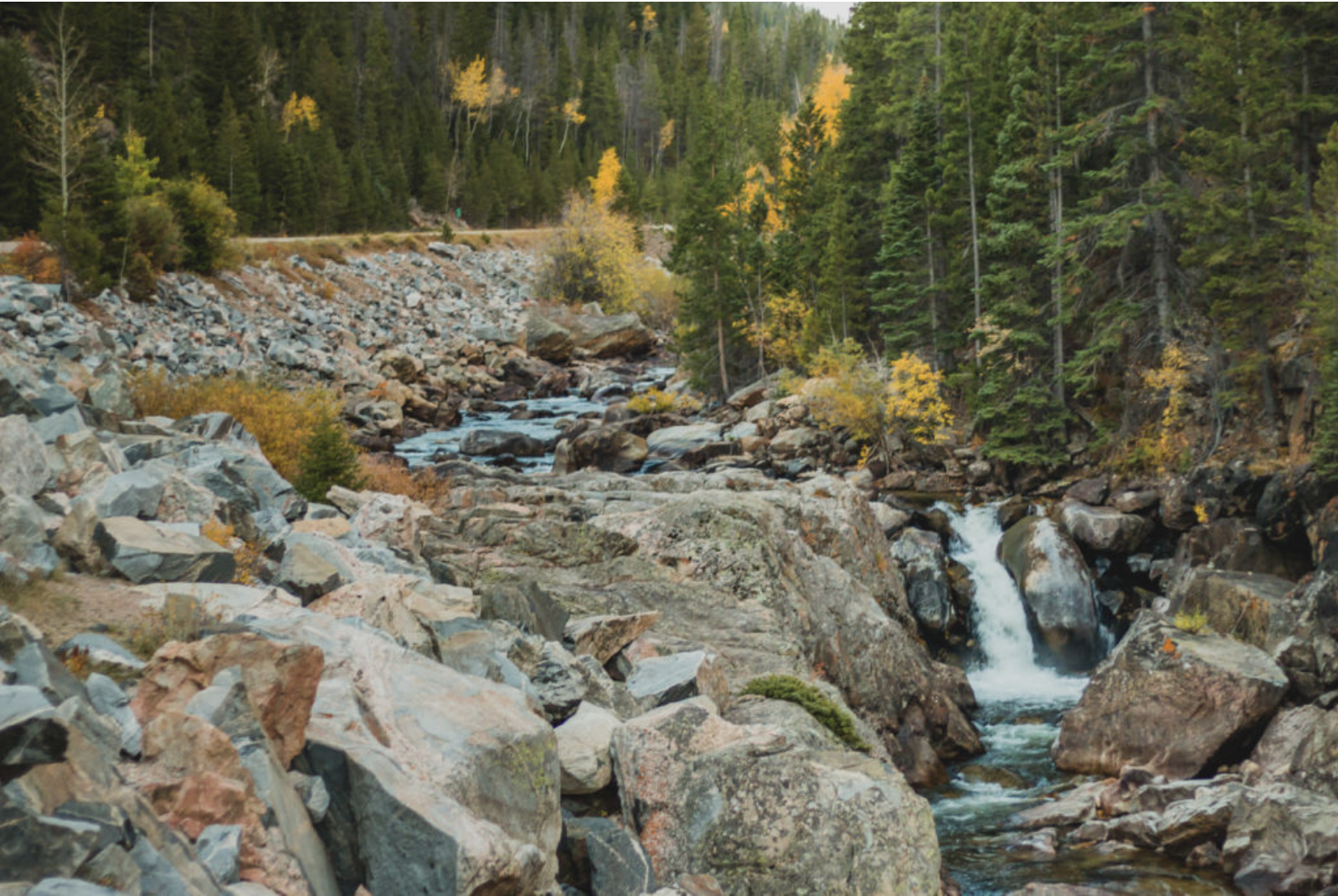
    Suthers says snowplow equipment also comes out of the general fund, leaving the city strapped for cash in three crucial areas.

    The stormwater fee based under the previous stormwater enterprise was based in part on a percentage of total impervious area on a property—think sidewalks and driveways. But the city says that can change over time and what used to be a front law under one homeowner change to a concrete driveway under another.

    “And so you would have a residential, a tiered residential structure and it would be based on the size of the lot would equate to a specific monthly fee,” said Springs Public Works Director Travis Easton.

    Lower Ark pens letter to @EPA chief Pruitt in support of lawsuit

    The Fountain Creek Watershed is located along the central front range of Colorado. It is a 927-square mile watershed that drains south into the Arkansas River at Pueblo. The watershed is bordered by the Palmer Divide to the north, Pikes Peak to the west, and a minor divide 20 miles east of Colorado Springs. Map via the Fountain Creek Watershed Flood Control and Greenway District.

    From The Pueblo Chieftain (Jon Pompia):

    The lower district recently submitted a letter to EPA administrator Scott Pruitt, reminding him that far from “picking on” Colorado Springs — as Lamborn and Colorado Springs Mayor John Suthers contend — the “EPA is carrying out its statutory responsibility to enforce the Clean Water Act against a permittee that district has sought for nearly a decade to get to live up to its stormwater obligations.”

    The dispatch comes on the heels of letters sent by the Pueblo County commissioners to members of the state’s federal congressional delegation, urging the EPA to follow through on its suit, which was filed in conjunction with the state in U.S. District Court in November 2016.

    Signed by Lynden Gill, the lower district’s board chair, the letter goes on to highlight efforts, dating back to at least 2008, in getting Colorado Springs to comply with its stormwater permit. Those efforts extended to the lower district filing a notice of intent to file a citizen’s suit pursuant to the Clean Water Act in November 2014.

    The lower district, along with Pueblo County, became parties of interest along with the EPA and the state in the lawsuit charging Colorado Springs with illegally discharging pollutants into Fountain Creek and the Arkansas River.

    “In short,” the letter continues, “the lower district appreciates EPA’s enforcement action against the city, action the lower district had felt compelled to undertake on its own before EPA sued the city, and can now jointly pursue with EPA and the State of Colorado.”

    The letter concludes with a plea for EPA not to abandon the lower district but pursue enforcement of Colorado Springs’ stormwater violations.

    Jay Winner, general manager of the lower district, expressed hope the letter will serve its purpose…

    Winner said that while the EPA may choose to withdraw from the lawsuit, it cannot halt it.

    “That’s why Pueblo County, the lower district and the state intervened — because if they withdraw, we’re still in,” Winner said.