New Mexico’s Middle #RioGrande: forest of cottonwoods, forest of pecans — John Fleck (InkStain.net)

Belen AT&SF Rio Grande crossing, looking east, March, 1943. Note lack of trees. Jack Delano, courtesy Library of Congress

Click the link to read the article on the InkStain.net website (John Fleck):

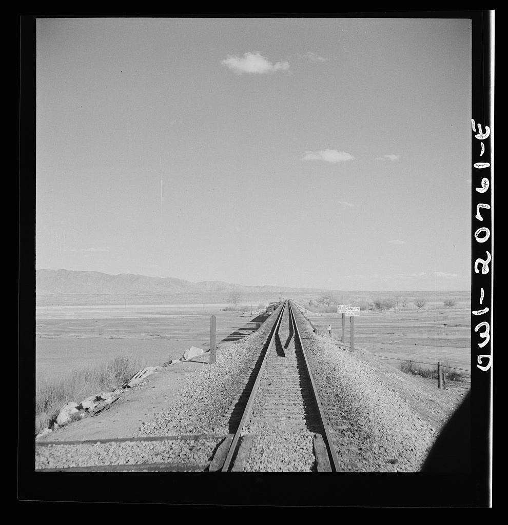
This Rio Grande crossing, just south of Belen, 30-plus miles downstream from Albuquerque, has changed dramatically since Jack Delano took the picture above in spring 1943.

Beyond drains, a forest. John Fleck, January 2024

THE BOSQUE

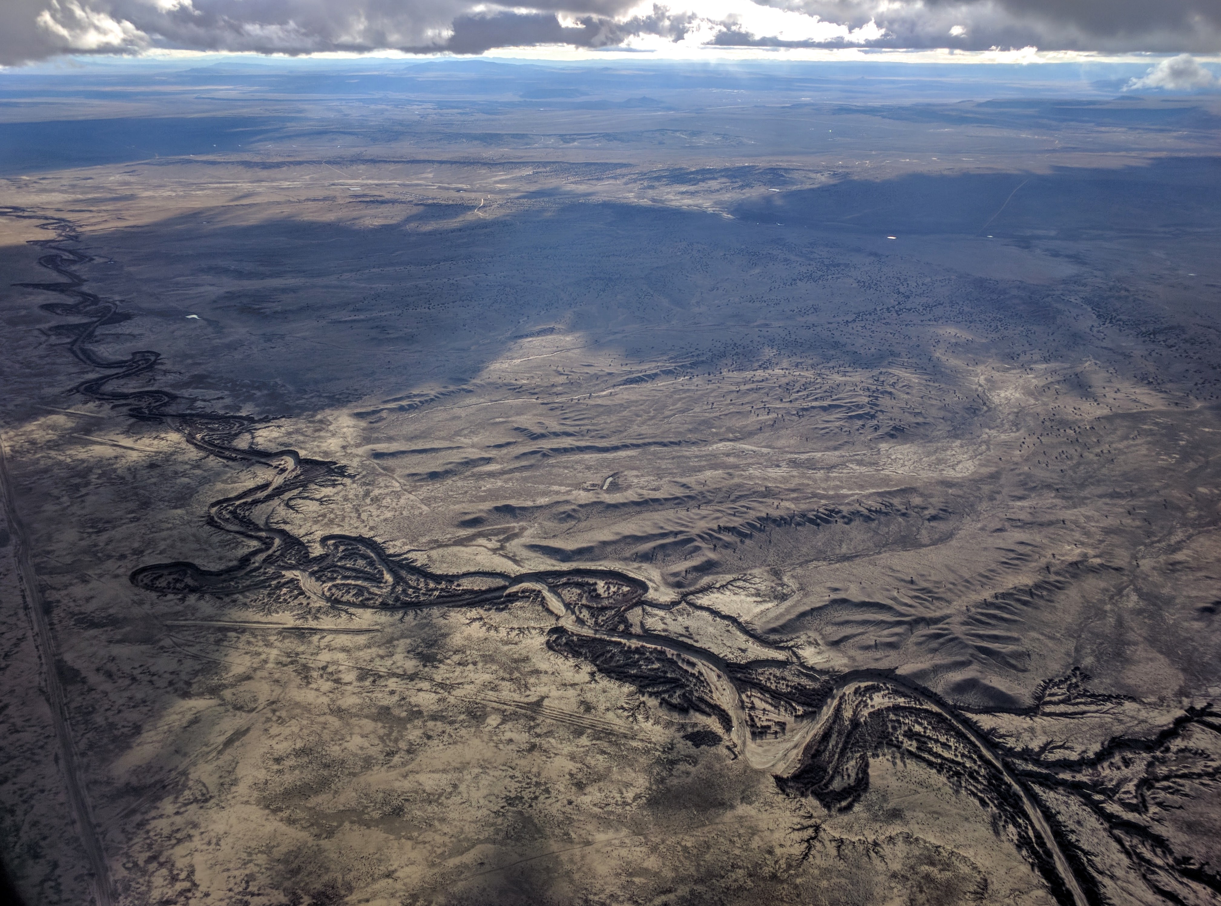
I’ve stared at Delano’s picture often, because of the story it tells – a broad open river valley. It’s nothing like that today.

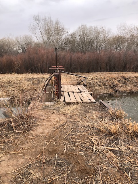
I pieced together some dirt roads and ditchbanks to visit the site on this morning’s bike ride. I had hopes of duplicating Delano’s picture, but the train traffic made standing in the middle of the tracks seem ill-advised. The picture to the right, facing the river looking east, should give you a feel. The Rio Grande here is now flanked by a magnificent cottonwood gallery forest, with low stands of coyote willow and salt cedar and some other stuff. We call it “the bosque.”

Looking at the picture last night as I was doing the map work to figure a sane bike route to get to the bridge, the date clicked: Spring 1943. In thinking about the modern relationship between human communities and the Rio Grande, 1941-42 is a dividing line – the last big flood years, the floods that drove the major changes in river management that created an ecological niche that the cottonwoods exploited in the second half of the twentieth century with full-throated glee.

Delano’s picture can be misleading. It wasn’t all treeless like that. The 1917-18 Rio Grande drainage survey, which is our best “before” snapshot of the valley, shows clumps of cottonwoods up and down the river. Following the 1941-42 floods, the federal Middle Rio Grande Project reengineered the main river channel with a series of sediment traps on the banks that were intended to push the river into a narrower central channel. In the process, they created ideal seed bed habitat for the cottonwoods to fill in the empty spaces.

A cottonwood forest in Bosque del Apache National Wildlife Refuge. Credit: Matthew Schmader/Open Space Division

The result is a linear cottonwood gallery forest more than 150 miles long. I’ve always called it “continuous,” but I just scanned the whole length using satellite imagery and found two short gaps. So “nearly continuous,” to add precision.

The bosque is often treated as one of the Middle Valley’s great natural treasures, and I don’t disagree. But “natural” may not be quite the right word.

Belen High Line Canal, feeding pecan orchards in New Mexico’s Middle Rio Grande Valley. John Fleck, January 2024

PECANS

Next stop: one of the most interesting climate change adaptation experiments underway in Middle Valley agriculture.

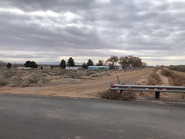
Past the railroad bridge, I found a ditch crossing and peeled away from the river toward the sand hills to the east, winding through the small farms of Jarales that make this stretch of the valley a lovely exemplar of the “ribbons of green” we talk about in the new book. Nearly all the farms were less than 10 acres – non-commercial, “custom and culture” agriculture, mostly alfalfa or other forage crops, lots of horses. Dodging the one busy highway the best I could, I veered into a neighborhood and under the interstate, where the road kicked up to a geomorphic bench in the sand hills maybe 30 feet in elevation above the nearby valley floor.

The pecans are in the distance in the picture to the right, though you can’t really see them. I was on relatively unfamiliar ground, and was cautious in my interpretation of the “No Trespassing” signs on the ditchbank road. It’s land that was once scrubland just like the land in the foreground. Now it’s irrigated with water from the ditch in the picture, to the tune of more than 1,000 acre feet per year. (We don’t know exactly. We don’t meter this use of water here.) There was a lot of controversy nearly 20 years ago when the land was brought into production. Critics (included regular Inkstain commenter Bill Turner, who was on the MRGCD board at the time) argued it wasn’t entitled to irrigation water from the Middle Rio Grande Conservancy District’s ditches. I’m not going to relitigate that argument here. Those objecting to serving the land with MRGCD irrigation water lost. Now the land is home to a fascinating experiment in climate change adaptation.

With a warming climate, the optimal range for pecans has moved north. (UNM Water Resources Program grad Tylee Griego took a deep dive into the pecans’ migration here.)

We have seen a century of failed efforts to foster a commercially successful crop in the valley – wheat, tomatoes, sugar beats, pinto beans, tobacco (!). Pecans are the latest, and rather than climate change making it harder to grow stuff, in this case it has made it easier. By increasing irrigated acreage in the valley. We usually think of agricultural climate change adaptation as “crop switching,” not “crop adding.” In addition to the big orchards by the river, the latest USDA CroplandCROS dataset, which uses satellite data and algorithms to identify crop types, is showing more pecans in small patches across the valley. I don’t full trust CroplandCROS – it gets a lot of pixels wrong ’round here, unfortunately. But this just means more bike rides needed to “ground truth” my blog posts. This is a part of the valley I don’t know as well, so fun ahead!

As I was riding through Jarales this morning and writing this post in my head, I was playing with the theme suggested by the two forests – each spread across a niche created by human alteration of the hydrologic system. Not sure it quite works, but I’ll leave it here.

“Santa Fe R.R. streamliner, the “Super Chief,” being serviced at the depot, Albuquerque, NM. Servicing these diesel streamliners takes five minutes”. Jack Delano’s original caption. Courtesy Library of Congress

A NOTE ON JACK DELANO

Jack Delano’s 1943 trip through New Mexico is worthy of note.

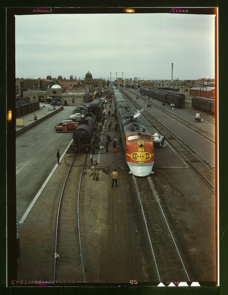
Delano, born Jacob Ovcharov in Ukraine, was one of the Farm Service Administration/Office of War Information photographers whose work dominates our visual understanding of the 1930s and early ’40s in the United States. His photographs of the AT&SF rail yard in Albuquerque, taken on the same spring 1943 trip that he took the Belen railroad bridge above, represent a remarkable documentation of a moment in time, as freight bustled through Albuquerque in service of the war effort.

We tend to think of the classic FSA photography as “documentary” work of the highest order – which it was. But it also was government propaganda – artists paid by the government to tell particular kinds of stories, and share particular kinds of messages.

Much of the classic visual vocabulary of the FSA pictures – think Dorothea Lange – is very much black and white. But with the development of Kodachrome in the 1930s, photographers of the period were beginning to shoot in color too. Most of Delano’s Albuuquerque pictures are in black and white, but his color picture of the Albuquerque rail yard, taken from the Lead Avenue orverpass circa 1943, is a classic.

Birds and water at Bosque de Apache New Mexico November 9, 2022. Photo credit: Abby Burk

Chaffee County Commissioners hear proposal for Clear Creek Reservoir expansion — The Chaffee County Times #ClearCreek #ArkansasRiver

Clear Creek Reservoir

Click the link to read the article on the Chaffee County Times website (Hannah Harn). Here’s an excerpt:

The presented concept project would be a partnership between Pueblo Water and [Colorado Springs Utilities] to enlarge the reservoir. Colorado Springs Utilities would use the enlarged space for the first 30 years, at which point Pueblo Water would get half of it. The reservoir’s dam was built in 1902 and was used by the Otero Irrigation Co. until 1955 when the reservoir was sold to Pueblo Water. Since then, [Alan] Ward said, Pueblo Water has “spent a lot of money doing various projects to upgrade the dam for improved safety.”

The purpose of the project “is to bring it up to modern dam safety standards,” Ward said. “The challenge with the dam as it is today … the dam is built on a foundation of rock and gravel, which allows a lot of water to seep through. We’ve constantly battled seepage issues over the years.”

The other reason for the enlargement is to increase water storage to “increase resiliency, reliability, and flexibility” in meeting future water needs for Pueblo Water and Colorado Springs Utilities. The current dam is 70 feet high with a capacity of 11,140 acre-feet (currently restricted at 9,100 af). The enlargement proposal would bring the dam to a height of 106 feet and 30,000 af capacity. The reservoir’s surface area would increase from 414 acres to 631 acres. The dam would be built on the downstream side of the current dam, closer to the highway. Another impact of the project…They also may be adding an upstream buttress to hold things in place in case of an earthquake…Around 30-40 acres of wetlands around the reservoir would be impacted as the reservoir backs further up the valley, as well as a few small areas at the base of the existing dam. Ward also noted the large boreal toad population in nearby ponds.

Arkansas River Basin — Graphic via the Colorado Geological Survey

The #USGS & @BLMNational have release a report with new oil and gas surface management guidance to support successful #reclamation at existing and future well pads — USGS

Click the link to read the release on the USGS website:

The report provides specific and comprehensive reclamation guidance for surface oil and gas exploration and development. 

The U. S. Geological Survey, in partnership with the Bureau of Land Management, recently published an oil and gas reclamation techniques and methods report that will, for the first time, give land managers and oil and gas operators specific tools to successfully reclaim disturbed lands during and after oil and gas activities. 

Pronghorns using habitat near oil and gas infrastructure. Sources/Usage: Public Domain.

Resource inventory, monitoring and protection of oil and gas sites are mandated by federal statutes and regulations, yet this is the first publication defining standards and guidelines for how to reclaim, monitor, and successfully reclaim disturbed oil and gas sites available at a national level. 

The report also emphasizes the importance of best management practices, clear standards, effective monitoring and minimizing surface disturbance for successful land reclamation. 

Initiated through an interagency agreement with the BLM, USGS and BLM drew upon existing federal reclamation policy, scientific literature review, practical field experience and expertise from various sources such as federal and state agencies, oil and gas contractors, and academia to produce the document, intended to be used for each reclamation step from start to finish.

“The BLM’s land management experience and the USGS’s best available science come together to create this powerful tool in the toolbox for federal agencies working on surface management of oil and gas to ensure environmentally responsible outcomes,” said Benjamin Gruber, BLM Acting Assistant Director for Energy, Minerals and Realty Management. “We’re proud to partner with the USGS to produce this guide that is relevant for all parts of the process—from the time a company develops its drilling application to monitoring reclamation activities after wells are plugged.”

Successful oil and gas Pad reclamation established grass Utah May 17, 2022. Sources/Usage: Public Domain.

New, comprehensive guidelines

Prior to this report, the industry relied on a set of guidelines known as the ‘Gold Book’ for practical information about oil and gas leasing and permitting, operations, bonding and reclamation planning processes. However, the Gold Book lacks the type of precise guidance often found in instructional memorandums and handbooks produced by surface management agency offices, multi-jurisdictional groups or state agencies. 

To maximize the efficacy of reclamation efforts, a set of national guidance and policies specific to oil and gas monitoring and assessment were needed.

This new USGS-BLM report supplements the Gold Book and other existing guidance by providing thorough and definitive steps and metrics for reclamation surface management. The report provides these kinds of uniform monitoring protocols and standards covering standardized soil and vegetation field monitoring methods, indicators, benchmarks, appropriate designs and analyses and electronic data capture and repositories supports planning procedures, leasing, permitting processes and bond release decisions.

While it was designed to be specific to the oil and gas industry, many of the report’s concepts and practices hold the potential to benefit reclamation of other fluid minerals development and land disturbance, including wind and solar energy development.

Vegetation data collection at a reclaimed wellpad April 26, 2021. Sources/Usage: Public Domain.

Leveraging ecological science to achieve success

Land reclamation, in essence, is aimed at techniques that set highly disturbed or degraded ecosystems on a trajectory that benefits native plants and animals and restores functioning habitats and ecological communities similar to surrounding, naturally occurring environments. During this process, the impacts of oil and gas development are minimized. 

This means a major component of land reclamation involves repopulating the landscape with locally appropriate vegetation. Therefore, the report provides useful information about repositories and data collection platforms such as the Landscape Data CommonsEsri ArcGIS Online Survey123, the Database for Inventory Monitoring and Assessment (DIMA) and LandPKS

The report also provides guidance for developing quantitative benchmarks to determine if erosion and vegetation standards have been met, including indicators of erosion and site stability, species composition and community structure.

“This technical publication provides a solid foundation based on current ecological science. It is the product of a collaborative effort between leading ecologists and reclamation scientists at the BLM, USGS, other agencies, and private organizations,” said USGS Deputy Associate Director for Ecosystems Paul Wagner. “The report addresses the need for well-managed data collection to inform reclamation plans, operations, approval decisions, and adaptive management strategies.”

Factors such as climate change, drought, intense storms, swings in temperature and invasive species all affect seedling survival rates. Ensuring that seedlings survive is crucial for agencies and operators to meet federal requirements and achieve reclamation success.

Successful reclamation is achieved when the standards defining soil and vegetation recovery are met, and a self-sustaining, vigorous, diverse, native, or approved plant community that minimizes visual land disturbance, provides forage, stabilizes soils and prevents noxious weeds from taking hold is in place.

Near Farmington, New Mexico. Photo credit: USGS

Who does this report support?

In conjunction with the Gold Book, this report supports the BLM — the largest surface management agency in the U.S. — with tools to monitor oil and gas reclamation and ensure environmentally responsible outcomes. BLM field office staff guide operators to create reclamation plans and to ensure that reclamation goals and expectations are clear. They inspect reclamation projects’ progress and status, complete quality assessments and quality control of operators’ monitoring data, and provide feedback. 

This report will also be particularly useful for operators and contractors who conduct oil and gas activities on U.S. federal or Tribal lands, surface management agencies who are responsible for advising and enforcing those activities, stewards of private lands and other landowner reclamation projects.

Reclamation has several phases, including interim and final reclamation, which each have differing overall goals. The report can help foster relationships between surface management agencies and operators, highlight timeframes, and provide operators with specific steps and goals in the reclamation process. 

The report may prove particularly useful for restoration efforts funded by the Bipartisan Infrastructure Law, which provides $4.7 billion for orphaned well site plugging, remediation and reclamation across federal, Tribal, state and private lands (see Through President Biden’s Bipartisan Infrastructure Law, 24 States Set to Begin Plugging Over 10,000 Orphaned Wells). 

Read the full report online: Oil and gas reclamation—Operations, monitoring methods, and standards: U.S. Geological Survey Techniques and Methods

USFWS, BLM, and USGS examining a large, newly reclaimed oil or gas pad. Sources/Usage: Public Domain.

Water Measurement Rules Now in Effect for #YampaRiver, #WhiteRiver, #GreenRiver, and #NorthPlatteRiver Basins — #Colorado Division of Water Resources

Scott Hummer, former water commissioner for District 58 in the Yampa River basin, checks out a Parshall flume installed on an irrigation ditch in this August 2020 photo. CREDIT: HEATHER SACKETT/ASPEN JOURNALISM

From email from the Colorado Division of Water Resources (Michael Elizabeth Sakas):

January 26, 2024

The Colorado Division of Water Resources announced that as of January 16, 2024, new rules governing the measurement of surface and groundwater diversions and storage are now in effect for Division 6. The division includes the Yampa, White, Green and North Platte River basins.

The Division 6 Measurement Rules are the first set of rules covering surface water measurement in the State of Colorado and are a significant milestone for the Division of Water Resources,” said Erin Light, Division 6 Engineer. “The adoption of the rules will provide the Division of Water Resources greater leverage in assuring that the diversion and use of water is administerable and properly measured and recorded.”

For background, Colorado statutes include a requirement that owners of ditches and reservoirs install headgates where water is taken from the natural stream. These statutes also give the state and division engineer the authority to require owners and users of water rights to install measuring devices. 

Accurate measurement of diversions is critical to protect Colorado’s entitlement to water, including under the Colorado River Compact, and to ensure we are maximizing the beneficial use of the public’s water resource for consumptive and environmental purposes,” said Jason Ullmann, Deputy State Engineer. 

The statutes, however, do not include any specifics regarding what is considered an acceptable headgate or measuring device. Historically, it has been administered by the Division of Water Resources (DWR) through issuing orders to owners for the installation of headgates or measuring devices. 

Over several years, Division 6 has issued hundreds of orders for the installation of operable headgates and measuring devices with varying degrees of success,” said Division Engineer Light. “I believe that these rules will help water users in Division 6 by providing clarity regarding what structures require measurement and what is considered an acceptable level of accuracy for the required measurement methods.

The rules describe two types of measurement methods: measuring devices, which are physical devices (flumes, weirs, etc) that are placed in a diversion for measurement. Then there are alternative measurement methods, which are typically indirect methods of measuring flow rates without a physical device. 

Water users are provided the following time periods to comply with the rules: 

  • Diversion structures with a capacity or water rights greater than or equal to 5.0 cfs – 12 months (January 16, 2025);
  • Diversion structures with a capacity or water rights greater than or equal to 2.0 cfs and less than 5.0 cfs – 18 months (July 16, 2025); 
  • Diversion structures with a capacity or water rights less than 2.0 cfs – 24 months (January 16, 2026); 
  • Reservoirs with a capacity or water rights greater than or equal to 5.0 AF – 12 months  (January 16, 2025);
  • Reservoirs with a capacity or water rights less than 5.0 AF – 24 months (January 16 2026).

Water users unsure of their decreed water right or permitted well permit flow rates and volumes can use DWR’s online tools available through CDSS (https://dwr.state.co.us/Tools/) to find this information. Anyone who has questions regarding how these Rules apply to their diversion or how to install a measuring device on their system can contact the DWR’s Division 6 Lead Hydrographer at (970) 291-6551. The Rules are available on the DWR website as a Laserfiche imaged document.

Yampa River Basin via Wikimedia.
Map of the North Platte River drainage basin, a tributary of the Platte River, in the central US. Made using USGS National Map and NASA SRTM data. By Shannon1 – Own work, CC BY-SA 4.0, https://commons.wikimedia.org/w/index.php?curid=79266632
White River Basin. By Shannon1 – Own work, CC BY-SA 4.0, https://commons.wikimedia.org/w/index.php?curid=69281367
Green River Basin

Mining Monitor: Uranium buzz, buzz, buzz — Jonathan P. Thompson (@Land_Desk) #ActOnClimate

Graphic credit: Jonathan P. Thompson/The Land Desk

Click the link to read the article on The Land Desk website (Jonathan P. Thompson):

January 26, 2024

⛏️Mining Monitor ⛏️

The uranium-mining buzz is reaching a fevered pitch lately as uranium prices climb above $100 per pound, the highest since October 2007. I already reported on Energy Fuels’ intent to begin or resume production at its Pinyon Plain and La Sal complex mines. But nearly every day another press release lands in my inbox touting a big find or big plans somewhere on the Colorado Plateau. 

Let’s start with the headline that irks me the most: “Churchrock could pump out 31 million lb of US uranium over three decades, Laramide PEA shows.” On its surface, this one looks like just another attempt to drive up share prices. And it probably is. But it’s the location and the name that gets to me: The project is just a couple of miles from the 1979 Church Rock disaster, when a uranium mill tailings dam failed, sending 94 million gallons of acidic liquid raffinate and 1,100 tons of uranium mill tailings rushing down the Puerco River and across the “checkerboard” area of the Navajo Nation. The slug of material, containing an estimated 1.36 tons of uranium and 46 trillion picocuries of gross-alpha activity, continued past Gallup and down the Puerco for another 50 miles or more, seeping into the sandy earth and the aquifer as it went, and leaving behind stagnant and poisonous pools from which livestock drank. 

The Rio Puerco, an ephemeral tributary of the Rio Grande, west of Albuquerque, crossing the eastern edge of the Tohajiilee Indian Reservation; December 2016. By Dicklyon – Own work, CC BY-SA 4.0, https://commons.wikimedia.org/w/index.php?curid=54602926

It seems like an appropriate site for a memorial, warning about the potential dangers of mining and energy development. But a new mine? I’m afraid so. For years, Hydro Resources worked to build an in-situ recovery operation there (and at another site closer to Crownpoint). ISR is a form of mining in which a solution is pumped underground to dissolve the uranium ore and then it’s pumped back out and processed. As one might expect, area residents, the Navajo Nation, and environmental advocates pushed back on the proposal

Last year Laramide bought the project from Hydro Resources and is now looking to jumpstart it. I doubt it will come without a fight. In other mining news:

  • Laramide is busy these days: They also recently announced the U.S. Forest Service has restarted the environmental review and permitting process for the company’s proposed La Jara Mesa project north of Grants, New Mexico. During the uranium industry’s last “renaissance” (lasting from 2007 to 2011), Laramide looked to open an underground mine on Cibola National Forest land. They made it as far as a draft environmental impact statement, released in 2012, before low uranium prices stalled the project. 
  • Nexus Uranium says it will begin exploratory drilling on its Wray Mesa claims near La Sal, Utah, on the northern edge of the Lisbon Valley. 
  • Anfield’s subsidiary, Highbury Resources, acquired another 12 Department of Energy uranium leases from Gold Eagle Mining in the Uravan Mineral Belt in western Colorado. The tracts are near Slickrock, on Monogram Mesa south of the Paradox Valley, and near Uravan. Anfield also says it plans to reopen the Shootaring uranium mill near Ticaboo, Utah, although it appears to have made little progress in that regard. 
  • Thor Energy says it has found high-grade uranium at its Wedding Bell and Radium Mountain projects on a mesa just east of the Dolores River in western Colorado. 
  • Kraken Energy got the Bureau of Land Management’s go-ahead to drill on Harts Point, right along the northeast border of Bears Ears National Monument in Utah. This is the second time the company (or its partners Atomic Minerals and Recoupment Exploration) have purportedly received a drilling permit for the slickrock peninsula adjacent to the Indian Creek climbing area. The first time the company failed to come up with a reclamation bond and the permit was cancelled. 
  • Australia-based Okapi Resources is set to begin exploratory drilling near Cañon City, Colorado, raising concerns among the locals.
  • And, perhaps the only big buzz in the lithium space right now (lithium prices are in the dumps): American Battery Metals is pushing its Lisbon Valley lithium project. Well, that is to say they are looking to get exploratory drilling permitted.
  • Explore the above projects and more on the Land Desk Mining Monitor Map.
Pictorial representation of the In situ uranium mining process. Graphic credit: (source: Heathgate Resources)