Registration is open nowย forย Water Law in a Nutshell Full Day Training — Water Information Program

Click the link for all the inside skinny and to register on the Water Information Program website:

Registration isย open for the popular Water Law in a Nutshell course, presented byย 
theย Water Information Program.ย 

Thursday, October 17, 2024 from 8:30 am – 5:00 pm
at the Lone Cone Library, 1455 Pinion St., Norwood, CO

Continuing Education Credits available: 

Realtors CE: 8 hours
Appraiser/Assessors CE: 4 hours
Attorneys CLE: 8 hours

We are pleased to present this in-person, full day water law course. Donโ€™t miss this rare opportunity to learn with Aaron Clay in Norwood, CO! 

This full day course will cover all aspects of the law related to water rights and ditch rights as applied in Colorado. Subject matter includes the appropriation, perfection, use, limitations, attributes, abandonment and enforcement of various types of water rights. Additional subject matter will include special rules for groundwater, public rights in appropriated water, Federal and interstate compacts and more.

Even if you have taken this course or one of the on-line short courses, it is a great refresher as there is so much information offered.

We welcome EVERONE, from anywhere in Colorado, including land owners, realtors, assessors, lawyers, water district employees, teachers, students and anyone interested in water law.

Register now to reserve your seat. General attendance is $125.00 (plus Eventbrite service fee) which includes lunch, course materials and a copy of the Citizen’s Guide to Colorado Water Law. ** $160.00 (plus Eventbrite service fee) if you wish to receive Continuing Education Credits (includes lunch, course materials and Citizen’s Guide to Colorado Water Law)

Past Participant Comments: 
“This is a great course and should be mandatory for real estate agents licensed in Colorado.”

“๏ปฟExcellent speaker, good explanations. Stayed on topic, stayed on schedule, good diagram, good materials.”
“๏ปฟAaron is very intelligent, had answers thorough explanations for each question, and was informative on Colorado (and other state/federal) water law.”
“๏ปฟOne of the most relevant and effective CLE presentations Iโ€™ve to over past 25 years.”:
“๏ปฟVery helpful. This is the 1st time itโ€™s actually all made sense.”

10,000 Acre-Feet of Water to Benefit #GreatSaltLake, Jordan River, Birds, Habitats and Communities: Partners Work Together to Bring New Water Flows — #Utah Department of Water Resources

Figure 1. A bridge where the Bear River used to flow into Great Salt Lake. Photo: EcoFlight.

Click the link to read the release on the Utah DWR website (Shaela Adams, Kelly Good, Wade Tuft):

September 16, 2024

SALT LAKE CITYโ€”Great Salt Lake will benefit from 10,000 additional acre-feet of water thanks to a partnership between the National Audubon Society and The Nature Conservancyโ€”as co-managers of the Great Salt Lake Watershed Enhancement Trustโ€”in partnership with Jordan Valley Water Conservancy District, the Church of Jesus Christ of Latter-day Saints, the Utah Division of Wildlife Resources, and the Utah Division of Forestry, Fire and State Lands. The water will be delivered from upstream storage in Utah Lake, and flow through the Jordan River to Great Salt Lakeโ€™s Farmington and Gilbert Bays through mid-October.

Jordan Valley Water Conservancy District (Jordan Valley Water) is donating 5,300 acre-feet of water, the Church of Jesus Christ of Latter-day Saints (Church) is donating 1,700 acre-feet of water, and the Great Salt Lake Watershed Enhancement Trust (the Trust) is leasing 3,000 acre-feet of water, with all water sourced from Welby Jacob Water Users Company shares. The Utah Divisions of Wildlife Resources (DWR) and Forestry, Fire and State Lands (FFSL) will place the water to beneficial use at Great Salt Lake.

โ€œDelivering new water to Great Salt Lake is essential to preserve the health of the lake and Utah communities, as well as protect the habitats for millions of birds that rely on it,โ€ said Marcelle Shoop, Executive Director of the Trust and National Audubon Societyโ€™s Saline Lakes Director. โ€œWe are grateful for the vision and commitment of many partners, for this innovative late season water release to diversify benefits to the lake and its wetlands, as well as the Jordan River. We look forward to future opportunities to repeat these efforts in years to come.โ€

While the 2024 spring season flows increased Great Salt Lake water levels, ongoing flows are needed to reach healthy levels. Now the lake will receive additional flows this fall through this key collaboration.

โ€œThis release to Great Salt Lake is made possible by four key factors: water conservation efforts of residents and businesses in Salt Lake Valley, important changes to water rights laws adopted by the legislature over the last few years, Jordan Valleyโ€™s effective use of its existing water storage and conveyance infrastructure, and a strong snowpack,โ€ says Alan Packard, General Manager of Jordan Valley Water. 

Migrating shorebirds, waterfowl and other waterbirds will benefit as their habitats receive these additional flows. Increased water flows to the lake can also aid with salinity management in the South Arm, and in some cases improve capacity to control the spread of botulism and other diseases.

โ€œAdditional flows late in the water season are particularly beneficial during dry, warm conditions when there are risks of avian botulism,โ€ DWR Director J Shirley said. โ€œOver 12 million birds, represented by 339 species, utilize the Great Salt Lake and its associated wetlands. The ecosystem that the Great Salt Lake and its wetlands provide is crucial for these birds, and we applaud the ongoing efforts to conserve these habitat areas and the lake.โ€ 

The release will take place during Jordan River Commissionโ€™s Get To the River Festival, highlighting that in addition to the benefits to Great Salt Lake, these flows will benefit Jordan River and bordering communities, ecologically and recreationally, as the water moves down some 51 river miles.

โ€œThe Church continues to look for ways to care for the Great Salt Lake and the ecosystem that depends on it. This latest donation is another step in that effort. We consider it a divine responsibility to care for the earth and be wise stewards of Godโ€™s creation,โ€ said Bishop W. Christopher Waddell, First Counselor in the Presiding Bishopric, The Church of Jesus Christ of Latter-day Saints.

Utah Rivers map via Geology.com

#PagosaSprings loans its sanitation $500,000 for critical sewer system repairs — The Pagosa Springs Sun #SanJuanRiver

Click the link to read the article on the Pagosa Springs Sun website (Derek Kutzer). Here’s an excerpt:

On September 3, 2024 the board of the Pagosa Springs Sanitation General Improve- ment District (PSSGID) voted to move $500,000 from town funds to kick-start critical repairs on its sewer system, pushing off a bigger decision on financing for a larger overhaul of the system. Public Works Director Karl Johnson said that he fears a โ€œcatastrophic eventโ€ could be in the cards if the district doesnโ€™t do something now to shore up the system.

Town Manager David Harris added, โ€œWe need to get moving here … and we need to move sooner rather than later.โ€

Johnson explained to the board that the biggest project on the districtโ€™s radar would be to continue repairing what has been deemed category 4 and 5 problems with sewer pipes, as well as its obligation to upgrade the Vista Treatment Plant, owned and operated by the Pagosa Area Water and Sanitation District (PAWSD), to bring it into compliance with state Regulation 85.

Navajo Dam operations update: Bumping down to 700 cfs September 17, 2024 #SanJuanRiver

Navajo Dam spillway via Reclamation.

From email from the Reclamation Western Colorado Area Office:

With a wetter weather pattern and increasing forecast flows downstream, the Bureau of Reclamation has scheduled a decrease in the release from Navajo Dam from 800 cubic feet per second (cfs) to 700 cfs for Tuesday, September 17th, at 4:00 AM.

Releases are made for the authorized purposes of the Navajo Unit, and to attempt to maintain a target base flow through the endangered fish critical habitat reach of the San Juan River (Farmington to Lake Powell).  The San Juan River Basin Recovery Implementation Program recommends a target base flow of between 500 cfs and 1,000 cfs through the critical habitat area.  The target base flow is calculated as the weekly average of gaged flows throughout the critical habitat area from Farmington to Lake Powell.  

This scheduled release change is subject to changes in river flows and weather conditions.  If you have any questions, please reply to this message, call 970-385-6560, or visit Reclamationโ€™s Navajo Dam website at https://www.usbr.gov/uc/water/crsp/cs/nvd.html.

U.S. senators from #Kansas, #Colorado, #Arizona introduce bill to unlock funds for water preservation — Kansas Reflector

U.S. Sen. Jerry Moran says Kansas communities, farmers and businesses have been impacted by widespread drought. (Sherman Smith/Kansas Reflector)

Click the link to read the article on the Kansas Reflector website (Allison Kite):

September 12, 2024

States, Native American tribes and local communities could get help accessing federal funds for water infrastructure projects in drought-stricken areas under new U.S. Senate legislation.

The Water Project Navigators Act โ€” sponsored by U.S. Sens. Jerry Moran and John Hickenlooper and Reps. Brittany Pettersen and Juan Ciscomani โ€” would create a program in the Bureau of Reclamation to place โ€œnavigatorโ€ positions in local, state and tribal communities. Navigators would help connect communities to resources.

In a news release announcing the legislation, Moran, a Kansas Republican, said federal resources to help preserve water can be difficult to access.

โ€œWidespread drought is impacting many communities across Kansas, hurting family farms, local municipalities and businesses,โ€ Moran said.

Hickenlooper, a Colorado Democrat, said the same.

โ€œRural and Tribal communities deserve their fair share of federal funds to address drought, but all too often are left out,โ€ Hickenlooper said.

Fellow Coloradoan Pettersen said water scarcity is felt throughout Colorado, but rural communities struggle to respond.

โ€œIt is critical that we invest in these areas to strengthen and protect our water resources and help communities draw down federal dollars,โ€ Pettersen said.

Kansas and Colorado โ€” along with Ciscomaniโ€™s home state of Arizona โ€” struggle with continual drought and limited access to water. As of last week, according to the U.S. Drought Monitor, more than 51% of Kansas is in some level of drought, mostly moderate or severe. Almost 5% of Arizona is in extreme drought. Colorado is currently the least affected with about 12% of the state in some level of drought.

โ€œIn Arizona, water is our most precious resource,โ€ said Ciscomani, a Republican. โ€œAs the drought worsens in the West, it is now more important than ever that impacted communities have the necessary tools to secure federal dollars for critical multi-benefit water infrastructure projects.โ€ 

The legislation is backed by conservation groups, according to the news release, along with the Kansas Water Office, Kansas Department of Health and Environment and the Kansas Department of Agriculture.

Youโ€™ve probably never heard of this โ€˜forever chemical.โ€™ Scientists say itโ€™s everywhere — E&E News #PFAS

Click the link to read the article on the E&E News website (Miranda Willson). Here’s an excerpt:

September 12, 2024

โ€œItโ€™s absolutely everywhere,โ€ said Sarah Hale, an environmental researcher who manages ZeroPM, a project funded by the European Union. โ€œTrifluoroacetic acid (TFA) will be the next discussion in America, I can guarantee it. It will be about how should we treat it and what should we do.โ€

The attention on TFA underscores the game of whack-a-mole that scientists and communities face with forever chemicals. With thousands of identified versions of the substances, the chemicals are practically ubiquitous in the global economy, and researchers are still determining the exact health risks associated with many of them. But TFA could pose a particularly difficult problem down the line, due to how much it would cost to take it out of drinking water, experts say. The substance is extremely small, mobile and water soluble. As a result, it cannot be removed from water using the filtration systems that many communities are installing now for large, widely studied forever chemicals, said Rainer Lohmann, a professor of oceanography at the University of Rhode Island.

Click the link to access the article “Assessing the environmental occurrence of the anthropogenic contaminant trifluoroacetic acid (TFA)” on the Science Direct website. Here’s the abstract:

Abstract

Trifluoroacetic acid (TFA) is a very persistent contaminant that has gained attention due to its multitude of anthropogenic sources, widespread occurrence in the environment, and expected accumulation in (semi-)closed drinking water cycles. Here, we summarize and assess the current knowledge on the anthropogenic sources of TFA to better understand the human-induced environmental TFA burden and highlight future research needs. Formation of TFA from the degradation of volatile precursors leads to diffuse and ubiquitous contamination of the environment. The analyses of ice core and archived leaf records have undoubtedly demonstrated that atmospheric depositions of TFA have increased considerably over the last decades in the Northern Hemisphere. Moreover, many point sources of TFA have been identified, which can lead to contamination hotspots posing a potential threat to human and environmental health. Also, unintentional formation of TFA during per- and polyfluoroalkyl substance (PFAS) remediation might become a major secondary source of TFA.

September 2024 #ENSO update: binge watch — NOAA

Click the link to read the article on the NOAA website (Emily Becker):

September 12, 2024

The tropical Pacific is still in neutral, but nature continues giving us signs that La Niรฑa is on the way, and our La Niรฑa Watch remains. Forecasters estimate a 71% chance that La Niรฑa will emerge during Septemberโ€“November and expect it will persist through the Northern Hemisphere winter. A weak La Niรฑa is the most likely scenario.

Opening credits

While there are no plot twists since Tomโ€™s August postโ€”frequent readers could be forgiven for fast-forwarding this monthโ€™s updateโ€”that 71% chance of La Niรฑa developing this autumn is a small upward tick. Also, the slower-than-expected development of La Niรฑa is a great example of how the short-term (subseasonal) and very long-term (climate change) complicate seasonal outlooks. Iโ€™ll run the numbers in a minute, after a word from our sponsor.

Hello folks! Do you wish you could get a heads-up about what your winter rain, snow, and temperature conditions might be like? Ask your forecaster about ENSO, the El Niรฑo/Southern Oscillation! This seasonal climate phenomenon is made from the surface temperature of the tropical Pacific, including warmer-than-average water (El Niรฑo) and cooler-than-average water (La Niรฑa), and can be predicted months in advance. ENSO changes global atmospheric circulation in known ways; common side-effects may include shifts in the jet stream and changes in global temperature and precipitation patterns, droughts, and heatwaves.

Back to our regularly scheduled program

ENSO forecasters get their information from two general areas: climate prediction models and current observed conditions in the ocean and atmosphere. Climate models are up first, today. (See footnote.)

Line graph showing observed and predicted temperatures (black line) in the key ENSO-monitoring region of the tropical Pacific from early 2024 though spring 2025. The gray shading shows the range of temperatures predicted by individual models that are part of the North American Multi Model Ensemble (NMME, for short). Most of the shading appears below the dashed blue line by the fall, meaning most models predict that temperature in the Niรฑo-3.4 region of the tropical Pacific will be cooler than average by at least 0.5 degrees Celsius (0.9 degrees Fahrenheit)โ€”the La Niรฑa threshold. NOAA Climate.gov image, based on data provided by Climate Prediction Center.

The North American Multi-Model Ensemble (NMME) is a collection of computer models that take information about current global conditions and apply physical equations to make predictions about upcoming weather and climate. For more about the NMME, check out this ENSO Blog post and this recent one from our friends at Seasoned Chaos.

This set of climate models has been predicting the development of La Niรฑa since last winter, and continues to do so, although itโ€™s taking a little longer than initially expected. This isnโ€™t particularly surprising, since predictions made in the spring are often less accurate than predictions made at other times of the year. Overall, though, the modelsโ€™ prediction of La Niรฑa this upcoming winter has been consistent, including from last month to this month, providing continued confidence in the forecast despite the slowdown.

Reality TV

Time to check in with a few of our favorite characters. Our primary metric for ENSO, the surface temperature of the tropical Pacific Ocean in the Niรฑo-3.4 region, was about 0.1 ยฐC cooler than the long-term average (long-term = 1991โ€“2020) in August, according to the ERSSTv5 dataset. This is solidly neutralโ€”the La Niรฑa threshold is 0.5 ยฐC cooler than averageโ€”and only a small drop from July.

2-year history of sea surface temperatures in the Niรฑo-3.4 region of the tropical Pacific for all strong El Niรฑo events since 1950 (gray lines) and the recent (2023-24) event (purple line). Five of the eight gray lines dip below the dashed blue line (the La Niรฑa threshold) in the winter following the El Niรฑo. The 2023-24 event appears headed in the same direction. Graph by Emily Becker based on monthly Niรฑo-3.4 index data from CPC using ERSSTv5.

The winds over the tropical Pacific play an important role in ENSOโ€™s dramatic arc. When the near-surface winds in the tropicsโ€”the trade windsโ€”are stronger, they cool the surface and keep warmer water piled up in the far western Pacific. They can also trigger an upwellingย Kelvin wave, an area of cooler-than-average water under the surface that moves from west to east. Throughout August, the trade winds were stronger than average across most of the tropical Pacific, helping to maintain the gradual surface cooling tendency and to bolster the amount of cooler water under the surface. This cooler subsurface water will provide a source to the surface over the next few months.

Beneath the surface of the tropical Pacific Ocean at the equator, a deep pool of cooler-than-average (blue) waters has been building up over the past couple of months (July 12โ€“Sept. 5, 2024). This pool of relatively cool water is a key factor behind the prediction for La Niรฑa later this fall and winter. NOAA Climate.gov image, based on analysis from Michelle L’Heureux, Climate Prediction Center.

Character development

We started this La Niรฑa Watch party back in February. Looking back at that forecast, the probability of La Niรฑa developing by Juneโ€“August was about 55%, with about a 42% chance of ENSO-neutral during that period. These probabilities mean that La Niรฑaโ€™s development in Juneโ€“August was favored, but there was still a good chance that neutral would linger. As it turned out, the Juneโ€“August average sea surface temperature in the Niรฑo-3.4 region, the โ€œOceanic Niรฑo Index,โ€ was 0.1 ยฐC below average, in the neutral range.

So why is La Niรฑa behind schedule? Honestly, nature is wild and crazy and it amazes me that we can predict anything ever, especially many months in advance. In this case, though, there are a couple of complicating factors we can point to. The first is our old frenemy, short-term variability, or, essentially, unpredictable weather events that complicate seasonal or longer predictions. For example, just a few periods of weaker trade winds can delay surface cooling.  Unfortunately, predicting such short-term variations is an ongoing challenge, and currently we can only predict these trade wind fluctuations a week or so in advance.

On the other side of the timeline, we have climate change. The global ocean temperatures are still way above average, and they are predicted to drop only slightly over the next several months. We donโ€™t yet have a clear picture of how global warming may affect ENSO in general, or the development of La Niรฑa this year in specific.

Coming up on La Niรฑa Watch

That said, the most likely outcome is still that La Niรฑa will be in place this winter, with slightly greater than 80% chance of La Niรฑa in Novemberโ€“January, probably a weaker event (see strength probabilitiesย here).

Out of the three climate possibilitiesโ€”La Niรฑa, El Niรฑo, and neutralโ€”forecasts say that neutral conditions are the most likely for the Augustโ€“October season (tall gray bar above the ASO label, slightly over 60 percent chance). By the September-November (SON) season, La Niรฑa has the highest chance of occurring (blue bar, 71 percent chance). NOAA Climate Prediction Center image.

A weak La Niรฑa wouldnโ€™t play as large a part in steering global atmospheric circulation patterns, meaning a lower chance of La Niรฑaโ€™s typical impacts on winter conditions. However, even a weak La Niรฑa can nudge the winter climate and would likely factor into CPCโ€™s winter outlook.

Stay tuned here for recaps and predictions about your favorite program, ENSO!

Footnote

There are two kinds of prediction models, dynamical and statistical. The model information I discuss in this post is from dynamical models. Statistical models use historical observations and their relationships to predict how conditions might evolve. Statistical models do not use physical equations, but rather statistical formulations that produce forecasts based on a long history of past observations of sea surface temperature, atmospheric pressure, subsurface temperature, and others. Statistical models have been around longer than dynamical models, because the dynamical ones require high performance computers. 

#Utah has a $276M bet on farms to save #ColoradoRiver water. Howโ€™s it going? — KUER #COriver #aridification

“New plot using the nClimGrid data, which is a better source than PRISM for long-term trends. Of course, the combined reservoir contents increase from last year, but the increase is less than 2011 and looks puny compared to the โ€˜holeโ€™ in the reservoirs. The blue Loess lines subtly change. Last year those lines ended pointing downwards. This year they end flat-ish. 2023 temps were still above the 20th century average, although close. Another interesting aspect is that the 20C Mean and 21C Mean lines on the individual plots really donโ€™t change much. Finally, the 2023 Natural Flows are almost exactly equal to 2019. (17.678 maf vs 17.672 maf). For all the hoopla about how this was record-setting year, the fact is that this year was significantly less than 2011 (20.159 maf) and no different than 2019” — Brad Udall

Click the link to read the article on the KUER website (David Condos). Here’s an excerpt:

September 10, 2024

โ€œWe will have less water. Forever,โ€ Rice said. โ€œWe have to accept that and โ€ฆ it’s up to us to be more efficient.โ€

Thatโ€™s why Rice applied for funding from Utahโ€™s Agricultural Water Optimization Program โ€” a big money push to help farmers and ranchers modernize their irrigation. With roughly three-fourths of the stateโ€™s water going to agriculture, the situation has put a bullseye on farming when it comes to stretching that H20. Utah is counting on the program โ€” which covers half the cost of buying new, more efficient gear โ€” to save more water for communities, rivers and reservoirs downstream.

Agricultural Irrigation Pivot. Photo credit: Colorado Springs Utilities

As he stood next to a center pivot irrigation system the program helped pay for, Rice reached for one of the dozens of spray nozzles that dangle a few feet over the ground. Compared to the equipment it replaced, he said, the difference is night and day.

โ€œIf hundreds of farms can save millions of gallons of water, I mean, we can fix it. โ€ฆ And do I feel like we have a responsibility to do that? Yeah, hell yeah.โ€ — [Andy Rice]

Thatโ€™s the idea behind Utahโ€™s optimization program. If state money lowers the financial barrier for farmers to upgrade, the water savings might add up to help Utah maximize the little moisture it has…

Rice is just one example of the stateโ€™s approved projects, 551 of them and counting, said Program Manager Hannah Freeze, since the program began in 2019. The Utah Legislature has allocated $276 million so far and $108 million has gone to approved projects. A majority of that money is flowing toward the Great Salt Lake โ€” $23 million has been approved for 112 projects in Utahโ€™s Colorado River Basin. Itโ€™s a good start, Freeze said, but a drop in the bucket compared to what it might take to significantly improve Utahโ€™s water outlook.

โ€œIf we were going to make a real dent or reach the majority of the farmers that we have, it’s more like a $2 billion number.โ€

Map of the Colorado River drainage basin, created using USGS data. By Shannon1 Creative Commons Attribution-Share Alike 4.0

A major #ColoradoRiver water transfer has some asking for more details — Alex Hager (KUNC) #COriver #aridification

The Colorado River flows through the Shoshone diversion structure on Jan. 29, 2024. Northern Water, which supplies cities and farms on the Front Range, is asking for more data about how much water will stay on the Western Slope after the Colorado River District purchases rights to the water that flows through Shoshone. Photo credit: Alex Hager/KUNC

Click the link to read the article on the KUNC website (Alex Hager):

September 11, 2024

This story is part of ongoing coverage of the Colorado River, produced by KUNC and supported by the Walton Family Foundation. KUNC is solely responsible for its editorial coverage.

A Front Range water distributor is pushing back on a planned transfer of rights to water from the Colorado River. It has led to a disagreement between two major water agencies โ€” a minor flare-up of longstanding tensions between Eastern Colorado and Western Colorado, which have anxiously monitored each othersโ€™ water usage for decades.

Northern Water, which serves cities and farms from Fort Collins to Broomfield, is asking for more data about the future of the Shoshone water right. Meanwhile, the Colorado River District, a powerful taxpayer-funded agency founded to keep water flowing to the cities and farms of Western Colorado, says Northern Water may be attempting to stymie its purchase of the water rights.

In early 2024, The Colorado River District announced it would spend nearly $100 million to buy rights to the water that flows through the Shoshone power plant, near Glenwood Springs. Shoshoneโ€™s water right is one of the oldest and biggest in the state, giving it preemptive power over many other rights in Colorado.

Shoshone Falls hydroelectric generation station via USGenWeb

Even in dry times, when water shortages hit other parts of the state, the Shoshone power plant can send water through its turbines. And when that water exits the turbines and re-enters the Colorado River, it keeps flowing for a variety of users downstream.

Since that announcement, the river district has rallied more than $15 million from Western Colorado cities and counties that could stand to benefit from the water right changing hands. Those governments are dishing out taxpayer money in hopes of helping make sure that water stays flowing to their region, even if demand for water goes up in other parts of the state.

The river district plans to leave Shoshoneโ€™s water flowing through the Colorado River. Itโ€™s an effort to help settle Western Coloradoโ€™s long-held anxieties over competition with the water needs of the Front Range, where fast-growing cities and suburbs around Denver need more water to keep pace with development.

The water right is classified as โ€œnon-consumptive,โ€ meaning every drop that enters the power plant is returned to the river. The river district wants to ensure the water that flows into the hydroelectric plant also flows downstream to farmers, fish and homes. The agency plans to buy rights to Shoshone’s water and lease it back to the power company, Xcel Energy, as long as Xcel wants to keep producing hydropower.

Almost all of the $98.5 million for the river districtโ€™s purchase of Shoshoneโ€™s water will come from public funds. In addition to money from its own coffers and Western Colorado governments, the river district also plans to apply for federal funding to pay for its purchase of Shoshone’s water. It is planning to seek $40 million from the Inflation Reduction Act.

Despite decades-long tensions between water users on the Western Slope and the Front Range, leaders on the East side of the mountains have stayed mostly quiet about the Shoshone transfer.

Bicycling the Colorado National Monument, Grand Valley in the distance via Colorado.com

Northern Waterโ€™s recent statements about Shoshone perhaps mark the most notable public pushback to the pending deal. The agency supplies water to Front Range cities such as Loveland and Greeley, as well as farms along the South Platte River all the way to the Nebraska border.

The agency outlined its concerns in a letter to elected representatives, including Colorado Senators Michael Bennet and John Hickenlooper and congresspeople Joe Neguse, Lauren Boebert, Yadira Caraveo and Greg Lopez.

In short, Northern said it supports the concept of the transfer, but wants an independent study of how much water the Colorado River District plans to send down the river each year.

โ€œWe want to make sure that we’re all going into this with the same data to make sure that everyone’s interests are being addressed,โ€ said Jeff Stahla, Northern Water spokesman.

Northern posits that the Western Slope could pull more water than the amount that has been historically used by Shoshone โ€“ enough to increase strain on upstream reservoirs that also supply the Front Range.

The River District calls that claim a โ€œgross mischaracterizationโ€ of its plans.

“Their points ignore the stated intent of the effort and are counter to the stated values,โ€ said Matthew Aboussie, a spokesman for the River District, โ€œAnd they 100% know that.โ€

The River District published its own letter about the matter. The agencyโ€™s director said Northern Waterโ€™s efforts โ€œwere received as intentional obstacles intended to threaten the viability of the Shoshone Permanency Project,โ€ and said Northernโ€™s calls for more data collection could require a time-intensive study of the project and tie it up in litigation for up to a decade.

โ€œWe are not looking to change the historic flows,โ€ Aboussie said. โ€œSo the intention is to protect the status quo.โ€

The River District is currently compiling data about the history and future of the Shoshone water right and plans to present it in Coloradoโ€™s water court, which is part of the stateโ€™s normal process to approve the transfer or sale of water rights.

Map credit: AGU

River advocates say promises broken on state-funded #RioGrande dam safety project — Jerd Smith (Fresh Water News)

Rio Grande Reservoir

Click the link to read the article on the Water Education Colorado website (Jerd Smith):

September 12, 2024

Four years after a high-profile dam restoration project was completed in the scenic headwaters of the Rio Grande, promises to deliver water for fish during the winter and other recreational benefits have not been met, environmental groups charge.

The Rio Grande Reservoir Project was funded by state loans and public grants provided by the Colorado Water Conservation Board, which often bases financing approvals, in part, on a projectโ€™s ability to serve multiple purposes, including water for fish, habitat and kayakers.

โ€œThe Colorado Water Conservation Board โ€ฆ provided $30 million in the form of loans and grants to complete the project,โ€ the CWCB said In aย project updateย posted on its website. โ€œBenefits include: instream flow enhancement; channel maintenance; outdoor recreation opportunities; terrestrial and aquatic wildlife habitat; irrigation, augmentation; and storage to comply with the Rio Grande Compact between Colorado, New Mexico, and Texas.โ€

The public-private project was completed in 2020.

The CWCB declined an interview request for this story, but said in an email that there were no specific conditions in the loans and grants tied to providing environmental benefits.

โ€œCWCB does not have the ability to impose extra terms on the recipients of funds that are not articulated in the funding agreements. In the case of the Rio Grande Reservoir Rehabilitation, the final deliverable was completion of the project,โ€ a spokesperson said.

Still Kevin Terry, southwest program director for Trout Unlimited, said the project would likely never have been funded without assurances that the dam would be operated differently to help the river, including releasing water in the winter to aid the fish and changing the time water is released throughout the summer to keep the river cooler and healthier during prime fishing and kayaking season.

โ€œThere were lots of environmental benefits touted before the Colorado Water Conservation Board and the roundtable,โ€ Terry said,  referring to the Rio Grande Basin Roundtable. The roundtable is one of nine public groups across the stateโ€™s major river basins that help address local water issues and funnel state grants to projects they approve.

The San Luis Valley Irrigation District, which owns and operates the dam, serves farms around Center and has delivered water from the dam since 1912, according to its website. Neither District President Randall Palmgren nor Superintendent Robert Phillips responded to numerous requests for comment.

The district uses the reservoir to store water for irrigators. Trout Unlimited and others arenโ€™t asking for any water, they say, just that existing water that would be released anyway be sent downstream at times that are beneficial to the river.

Screenshot from Google Maps

Among key complaints by environmentalists is that the irrigation company is not allowing water to flow out of the rehabilitated dam during the winter, something that would benefit young fish and allow them to grow larger for the next fishing season.

Terry said the irrigation district has said it canโ€™t deliver that winter water because it is difficult to operate the new equipment in freezing winter weather. But Terry said he doesnโ€™t understand how the project could have been built without the ability to deliver in cold weather, something that occurs routinely in other reservoirs in the valley.

Jim Loud, a Creede resident and avid angler who lives on the river, said he and others are tired of waiting for the river to receive the benefits many believed would have been delivered by now.

โ€œAll we want is to get them to do what they said they were going to do,โ€ said Loud, citing numerous CWCB documents dating back several years outlining the environmental benefits of the project. Loud is part of the Committee for a Healthy Rio Grande.

Rio Grande and Pecos River basins. Map credit: By Kmusser – Own work, Elevation data from SRTM, drainage basin from GTOPO [1], U.S. stream from the National Atlas [2], all other features from Vector Map., CC BY-SA 3.0, https://commons.wikimedia.org/w/index.php?curid=11218868

The old days werenโ€™t fun

The conflict comes as the Rio Grande Basin, which begins high above Creede and flows south to the Gulf of Mexico, continues to struggle with declining aquifer levels due to heavy agricultural use and low stream flows due to drought and climate change. In Colorado, the Rio Grande waters a potato industry that is one of the largest in the nation.

The last days of the potato harvest. Photo credit: The Alamaosa Citizen

Creede local Dale Pizel, who owns a ranch on the river and caters to the fishing community, said river conditions have improved some since the dam was rebuilt. Prior to the project, the irrigation company would routinely dry up the river for weeks during the high summer tourist season to make repairs to the dam.

โ€œThat doesnโ€™t happen anymore,โ€ Pizel said. He too serves on the Rio Grande Basin Roundtable, which also approved some grants for the project.

โ€œI voted for that project knowing it would have environmental benefits, and it did,โ€ Pizel said, because there is no need for the irrigators to dry up the river to repair a failing dam anymore.

Still, he said, if environmental promises are being made publicly, the state needs a better way to make sure they are kept.

Trout Unlimitedโ€™s Terry said for years he was hopeful that the rehabilitated dam would serve as another multiuse storage project in the water-short valley helping farmers and the environment.

โ€œWe are so disappointed in the delivery of what was promised and the lack of the CWCB holding the irrigation district accountable in any way,โ€ he said.

Altering the damโ€™s new equipment so that winter releases can occur will likely require spending about $5 million, according to Terry.

Pizel and others hope a resolution between the farmers and the environmentalists can occur without legal action.

โ€œWe donโ€™t want to start thumping each other in the chest,โ€ Pizel said. โ€œThatโ€™s the way it was in the old days. It was not fun.โ€

More by Jerd Smith

Jerd Smith is editor of Fresh Water News. She can be reached at 720-398-6474, via email at jerd@wateredco.org or @jerd_smith.

Sales of EVs and plug-in hybrids rise to 22.1%: #Colorado lags only #California in sales in second quarter of 2024. It bucks national trends. But can this momentum be sustained? — Allen Best (@BigPivots) #ActOnClimate

Click the link to read the article on the Big Pivots website (Allen Best):

September 11, 2024

Electric vehicles and plug-in hybrids reached 22.1% of all new vehicle sales in Colorado during the second quarter of 2024.

In the first quarter, Colorado was third in the nation in proportion of EVS and plug-in hybrids to total sales. During the second quarter an auto industry analyst reported that Colorado lagged only California, although the economist did not cite the source of the data.

Coloradoโ€™s incentives, among the nationโ€™s most attractive, have helped swell the stateโ€™s sales. EVs constituted 16.1% of all new-vehicle sales in Colorado from April through June and plug-in hybrids another 6%. Hybrids with internal-combustion engines constituted another 10.89%.

EVs and plug-in hybrids had constituted 17.1% of all sales in the third-quarter of 2023, another milestone.

But does Colorado need more tricks in its bag to continue the upward mobility?

Colorado currently has 138,060 EVs (98,202 battery-electric vehicles and 39,858 plug-in hybrids) on its roads. It has a goal of achieving 940,000 by 2030.

In March 2023, a new state roadmap for EV adoption set a goal of having 25% of new vehicle sales by 2025. That seems doable.

However, the Polis administrationโ€™s goal is to boost EV sales to at least 70% of new vehicle sales by 2030. Is that within reach using current strategies?

Matthew Groves, the chief executive of the Colorado Auto Dealers Association, suggests that Colorado has some serious work ahead to achieve that goal. A โ€œsprintโ€ is how he describes the task.

A fundamental task he identifies is to create confidence among buyers that they will not get stranded without access to a faster-charging station if they buy an EV.

Range anxiety, if tamed somewhat by charging infrastructure that has tripled in the last five years in Colorado, remains an issue. This is despite impressive figures about charging stations, including the 4,200 level-2 public chargers in Colorado as of early August.

Coyote Gulch’s Leaf charging at Red Rock Hyundai in Grand Junction May 23, 2023.

DC fast chargers? 1,079 ports altogether, according to Atlas Public Policy. As of February they were located within 30 miles of 78% of the stateโ€™s geographic area.

More are coming. The state expects the first of 400 additional fast-chargers funded through the federal DCFC Plazas grant program to be in place by the end of 2024. Those chargers will be placed at 65-plus locations across Colorado, although supply chain constraints for transformers and other components may slow the complete rollout to two years or more,

Also material to charging infrastructure are Colorado laws and funding that require and help fund sharing in multifamily housing projects and workplaces.

Instilling consumer confidence

Sounds good, but Groves describes it as an incomplete picture. โ€œNot every car works with every charger,โ€ he points out. Tesla was supposed to make its chargers accessible to other technologies, but that has not happened yet.

Charging stations that donโ€™t work are a problem, and the anecdotal reports suggest a significant one, at least in public perception.

โ€œWe can say that we have charging stations every 25 miles along major highways, but if there are six plugs at a stop in the middle of, say Rifle, and only two of them work, and theyโ€™re both occupied, what do I do? I may not have enough charge to make it to the next set of stations.โ€

Beyond the data, says Groves, what will matter most are the anecdotes shared among buyers and others. The importance of those anecdotes will vary from person to person.

Coyote Gulch’s Leaf charging at the Kremmling Town Park (Between Steamboat Springs and Denver) August 23, 2021.

โ€œIf I know somebody who got stuck between Steamboat Springs and Denver and heard they had to wait three hours for AAA to get to them, that is a more compelling (story) than the state telling me that our chargers are up 92% of the time.โ€

Coloradoโ€™s surging sales can be attributed in large part to the bucket of carrots offered buyers. The American Council for an Energy Efficiency Economy ranked Colorado third in the nation on its transportation electrification score in a 2023 report. That scorecard evaluating EV policies that states have taken to reduce barriers puts Colorado behind California and New York. Incentives are part of that package.

These incentives by the state, federal government and, in some cases, utilities can be โ€œstacked.โ€ In other words, the state EV tax credit can be combined with the federal tax credit as well as several other Colorado incentives that are available to income-qualified residents.

Groves said that he has seen purchase orders where a buyer can get back $23,000 on the purchase of a new vehicle.

Colorado also has another incentive that makes EVs particularly attractive. Beginning in 2017, purchasers could assign the state tax credits to a financing entity. A 2023 state law made it even easier. HB23-1272 allowed purchasers to assign the tax credit to a participating auto dealer in January. Dealer assignability is also available for the federal tax credit.

If it has some relatively minor problems, this program has yielded packages that have motivated consumer demand. For example, Groves reports knowing of leases for EVs that come in at about $2,100 a month. โ€œWhich is phenomenal,โ€ he says. The sheer economics of the heavily subsidized market has some people getting EVs because of the low cost regardless of how they feel about the technology.

How long?

How long can Colorado outpace most of the nation?

National media have carried many stories since late last year about a slowdown in EV sales. Lately comes news that Ford Motor Co. has abandoned plans to roll out a large electric SUV. Tesla has been forced to offer deeper discounts, General Motors has delayed its plans for an EV pickup.

The Washington Post, in an editorial on Aug. 30, urged state and federal policymakers to leave room for plug-in hybrid sales in the medium term.

โ€œThe industry is now in the phase that researchers call โ€˜the technology-adoption lifecycleโ€™ or cross-industry adjustment. When a new technology enters the market, there is a chasm between the enthusiastic early adopters who embrace it right away and the critical mass of consumers who need longer to be convinced,โ€ the newspaper opined.

โ€œMost of the early EV adopters have already purchased their vehicles. It might take time to bring along the critical mass of wait-and-see consumers. Offering electric-fuel hybrids is a way to ease that transition while providing practical solutions to some common concerns.โ€

The Wall Street Journal on Aug. 25 reported that automakers were already there: they have 47 models of plug-in hybrids available, nearly double those in 2019. They can run on electricity for between 20 and 40 miles before reverting to a gas engine.

Thatโ€™s how a Li-ion battery charges and discharges. Graphic credit: Volkswagen https://www.volkswagen-newsroom.com/en/stories/is-lithium-replaceable-4808

Groves is skeptical we will see many lower-priced EV models arriving. โ€œThere is a finite supply of the rare-earth metals that we need for EV batteries. And when thereโ€™s a finite supply and demand surges, costs tend to go up.โ€

What would benefit Colorado, says Groves, would be greater flexibility in the methods used to reduce pollution from cars under the Clean Air Act. States have two choices: the federal standards for reducing emissions from cars or taking the lead of California, which federal law permits. Colorado and 16 other states have chosen to work within the constructs of what California is doing.

He cites Coloradoโ€™sย Clean the Air Foundationย program as an example of the innovation. โ€œThat was a uniquely Colorado program.โ€

An attorney, Groves had law-enforcement training and spent 17 years in Washington D.C. working on tax policy and national security issues for three different members of the House of Representatives.

โ€œWeโ€™ve shown that we can be a leader in this field,โ€ he says, and should not be โ€œhandcuffed by the preemptory effect of federal law.โ€

Coyote Gulch outage

Map of the greater Colorado River Basin which encompasses the Colorado Plateau. Credit: GotBooks.MiraCosta.edu

I’m in Dolores tonight camped near the Dolores river. We’re over here for a little R & R on the eastern edge of the Colorado Plateau.

#Drought news September 12, 2024: The West remained mostly dry with little to no precipitation and above-normal temperatures

Click on a thumbnail graphic to view a gallery of drought data from the US Drought Monitor website. Here’s an excerpt:

This Week’s Drought Summary

There was a sharp difference in temperatures across the U.S. this week (Sep. 3 to Sep. 10). Temperatures in the West were above normal, whereas areas from Texas to Wisconsin and east saw temperatures of 3 to 9 degrees below normal. Very little precipitation fell, with Hurricane Francine providing most of it along the Gulf Coast. Overall, the central and eastern portions of the country saw continued deterioration, adding onto already expansive deterioration from last week. The Ohio River Basin continues to be the epicenter of the extremely dry conditions, though moderate and severe drought conditions are spreading through the southern Midwest into the Southeast. Improvements made along the Gulf Coast were primarily due to the well-above-normal precipitation brought by Hurricane Francine. There were some other areas of improvement in New Mexico, northeastern Arizona, eastern Utah, southern Wyoming and northwestern Montana. Areas of the West that have not seen any meaningful precipitation in a while are beginning to see dropping streamflows and drying soils…

High Plains

The High Plains saw a mixed bag of improvements and degradations. The area remained hot and dry, except for eastern Nebraska and Kansas. Higher elevations of Colorado and Wyoming did receive some precipitation, but conditions remained mostly status quo. Kansas has experienced feast or famine precipitation since the beginning of summer. Some isolated, slow-moving thunderstorms provided good moisture in the center of the state, but abnormally dry or moderate drought conditions expanded along the Kansas western, southern and eastern borders. Eastern Colorado is beginning to show signs of a prolonged dry period, with moderate drought creeping further eastward from the Kansas border. Similarly, central and northern Wyoming are showing drier signals in the short-term, including soil moistures. These same conditions brought abnormally dry conditions along the North and South Dakota border and into southern and eastern Nebraska…

Colorado Drought Monitor one week change map ending September 10, 2024.

West

The West remained mostly dry with little to no precipitation and above-normal temperatures, except for southern New Mexico where conditions improve mainly on the residual effects of a wet few weeks and aided by below-normal temperatures. Central and northeastern Arizona into southeastern Utah also saw some improvements. Arizona also saw the expansion of moderate drought, overflowing into southern California. Central California also saw abnormally dry conditions expand. Northern Nevada, eastern Oregon and west-central Idaho saw widespread moderate drought expansion due to warm temperatures, lack of precipitation and drying soils. Washington into northwestern Idaho saw severe conditions expand, but extreme dryness was removed in Grant County, Washington as conditions were similar to the surrounding severe drought conditions.

South

The western portion of the South saw widespread improvements from central Texas to central Mississippi. Heavy rainfall from Hurricane Franciene dropped 2 to 6 inches of rain and the southeastern tip of Louisiana got as much as 14 inches of rain. Outside of the Gulf Coast, precipitation was lacking with precipitation hovering below normal. Temperatures were 2 to 6 degrees below normal, with localized areas being 6 to 8 degrees below normal. Central and southern Texas continued to see one-category improvements. Louisiana saw most of the abnormal dryness added last week removed due to abundant precipitation. Things started to degrade in Oklahoma, northeast Texas, Arkansas and northern Mississippi, where one-category degradations were widespread…

Looking Ahead

Over the next five days (September 11-16), precipitation is expected in the high elevation of Alberta Canada into Montana and Idaho, southern Arizona, and across the Gulf and southern Atlantic Coasts. Precipitation amounts of 2 to 5 inches are expected in Mississippi, northern Alabama, western Tennessee, the Florida Panhandle, and coasts of North and South Carolina.

The National Weather Service Climate Predication Centerโ€™s 6-10 day outlook heavily favors above-normal temperatures from the north-central to eastern Canadian border to Texas-Mexican border with Minnesota, Wisconsin, and Michigan 80 to 95% likely to see above normal temperatures. Conversely, southern California and Arizona are 70 to 90% likely to see below-normal temperatures. Shifting northward towards the western Canadian border, there is a change of at- or slightly below-normal temperatures. Hawaii and northern Alaska are leaning toward above-normal temperatures.

The National Weather Service Climate Predication Centerโ€™s 6-10 day outlook heavily favors above-normal precipitation in Montana and central Idaho, as well as the Atlantic Coast of Maryland, Virginia and North Carolina. Alaska and Hawaii are also leaning toward above-normal precipitation. Arizona, New Mexico, the Gulf Coast of Texas and Louisiana, and the Great Lakes region are leaning towards below-normal precipitation.

US Drought Monitor one week change map ending September 10, 2024.

Giga-WHAT? We cut 1M kilowatt-hours, thatโ€™s what: #Denver Water employees hunt down huge energy cuts in latest round of sustainability efforts — News on Tap

Denver Waterโ€™s sustainability operations include generating energy from solar power panels installed on the roof of its Administration Building, parking garage and over its visitorโ€™s parking lot at its Operations Complex near downtown. Photo credit: Denver Water.

Click the link to read the article on the Denver Water website (Todd Hartman):

September 21, 2024

Denver Waterโ€™s mission is water, but efforts to cut energy use and carbon emissions have become more front and center over the last decade. 

After all, climate change threatens water supplies, so water utilities need to do their part to reduce the fossil-fuel ingredients that are warming the atmosphere and jeopardizing snowfall and river flows.ย [ed. emphasis mine]

Already, Denver Water powers its main Administration Building with solar panels, harnesses the power of water to generate enough hydroelectricity to juice 6,000 homes and employs a system that uses water, not air, to heat and cool its headquarters, making it easier and cheaper to keep temperatures comfortable. 

But itโ€™s not stopping there. 

Always on the lookout for new sustainability features, Denver Water last year set a goal to cut its energy use by one gigawatt-hour. Thatโ€™s 1 million kilowatt-hours โ€” a ton of electricity (or, in some cases, the equivalent amount of fuel, like gasoline) โ€” enough to power 750,000 homes for one hour, or roughly 100 homes for a year.

And, in the last 12 months, the utility accomplished its goal.

Employees scoured the organization for low-hanging fruit, the relatively easy fixes that could be done at little or no cost or would provide a rapid payback by quickly cutting energy expenses. 


It takes all kinds of passionate people to ensure a clean, safe water supply for 1.5 million people. Join the team at denverwater.org/Careers.


And it unleashed its in-house expertise, including personnel specializing in electrical, HVAC, plumbing, information technology, vehicle fleet, dams, reservoirs and the network of pipes that moves water through the city.

Teams pinpointed energy savings that could be snared by closing unused facilities that were still drawing power, replacing outdated boilers in the utilityโ€™s Winter Park facilities, updating old lighting, reducing the idling of fleet trucks (which wastes gas and diesel) and adding its first batch of electric vehicles โ€” among other steps.

โ€œThis was an energy treasure hunt,โ€ said Adam Hutchinson, an energy management specialist and part of Denver Waterโ€™s Sustainability Team. โ€œWeโ€™ve focused on energy efficiency for many years now, but we wanted to take another hard look across the organization for relatively quick and easy energy-saving opportunities.โ€

Hunt they did, and Denver Water employees put their expertise to work to find savings large and small. 

A new, more efficient boiler saves some 300,000 kilowatt-hours of electricity per year. Photo credit: Denver Water.

Some of the finds were big, like taking out a problem boiler used to heat a key Denver Water facility in Winter Park, home to workers and a fleet of heavy equipment that helps keep things running in the high country. 

The new equipment installed in Winter Park was more energy efficient, with an efficiency rating of 96% (compared to the old boilerโ€™s 80% efficiency), and the switchover saved some 300,000 kilowatt-hours of electricity per year.

โ€œWe installed a more efficient boiler that uses flue gas that would otherwise be expelled. The new equipment keeps it in the boiler to provide more heat,โ€ said Jeffrey Gulley, who leads the trade shop for Denver Water. โ€œWe wanted to have efficiency and reliability with the frigid temperatures up there.โ€ 

The utilityโ€™s transmission and distribution employees determined that a few small, scattered facilities in the metro area could be closed and their functions consolidated. That amounted to cutting another 100,000 kilowatt-hours via reductions in heating, cooling and lighting.

Smaller changes also added up. 

At Marston Treatment Plant in southwest Denver, an air bubbler keeps the water intake from freezing in winter months. Typically, the bubbler stays on constantly from November through May. But the simple addition of a temperature sensor means the bubbler can shut down when winter weather hits a warm stretch. 

And boom! That simple sensor produced another 9,000 kilowatt-hours of savings โ€” enough to pay for itself in 18 months.

Installing a temperature sensor on a water intake at Marston Treatment Plant in southwest Denver produced additional energy savings. Photo credit: Denver Water.

All told, the gigawatt project fit cleanly into the second phase of Denver Waterโ€™s Sustainability Plan, which includes a goal to reduce greenhouse gas emissions by 50% by 2025 from a 2015 baseline.

And it chips away at a broader strategy: To drive down energy usage as low as possible, then get what power you still need through renewable energy. 

โ€œAll of this aligns with Denver Waterโ€™s overall push to aggressively do our part to address climate change,โ€ said Kate Taft, the utilityโ€™s sustainability manager. โ€œOn the water planning side, we must adapt to the ongoing changes, but we can work on our operations side to reduce our own footprint. That is why we continue to move forward with change.โ€

And continue it does. After reaching the 1-gigawatt (that is, 1 million kilowatt-hours) goal, ongoing work has found more savings.

Denver Water is now at 1.2 million kilowatt-hours in energy savings since setting the goal a bit over a year ago.

And all of this isnโ€™t good news only for the environment. By cutting energy costs, Denver Water can also keep expenses down. 

โ€œWeโ€™re driven on our sustainability goals,โ€ Hutchinson said. โ€œAlong with that, weโ€™re keeping in mind our customers and our rates.โ€

Water quality to remain centric in the #RoaringForkRiver Basin — The #Aspen Times

Beavers have constructed a network of dams and lodges on this Woody Creek property. Pitkin County is betting big on beavers, funding projects that may eventually reintroduce the animals to suitable habitat on public lands. CREDIT: HEATHER SACKETT/ASPEN JOURNALISM

Click the link to read the article on The Aspen Times website (Westley Crouch). Here’s an excerpt:

Hunter and Woody Creeks and Avalanche and Thompson creeks in the Crystal River Basin are now designated Outstanding Waters by the Water Quality Control Commission. The Colorado Water Quality Control Commission on Aug. 21 unanimously designated roughly 385 miles of waterways across 15 rivers and streams in the upper and lower Colorado, Eagle, Yampa, and Roaring Fork River basins as Outstanding Waters.ย  The Outstanding Waters designations are authorized by the Colorado Water Quality Control Act and the Clean Water Act…

โ€œAn Outstanding Waters designation is a protection that can be given to reaches of streams that offer water quality protection. It is the highest level of water quality protection that can be given by the state of Colorado,โ€ [Mathew] Anderson said. โ€œWith the protection, future projects that may happen along these reaches have to ensure that the water quality will not be diminished.โ€

[…]

This designation can protect creeks and rivers from future developments and pollution. He noted that all existing industries, ranches, homes, and utilities along these sections of designations will be grandfathered in…He said that obtaining this designation took a coalition between different watershed groups that ranged from the Yampa to Eagle rivers…or creeks, streams, and rivers to receive this designation, the water quality must already be of a high standard. Eleven respective criteria points must be met as it relates to water quality before this designation can be obtained.

St. Vrain and Left Hand Water Conservancy District Launches Fish Salvage Pilot Project to Protect Local Fisheries

Screenshot from the Highland Ditch Company website.

Here’s the release from the St. Vrain and Left Hand Water Conservancy District (Sean Cronin):

September 9, 2024

LONGMONT, COLO โ€“ This fall, the St. Vrain and Left Hand Water Conservancy District (“District”) and the Highland Ditch Company are collaborating on a unique pilot project to save fish in St. Vrain Creek. As ditch diversions are closed off for the fall, fish often become trapped in standing pools behind the headgates, which eventually dry up. The pilot project will rescue these fish and return them to the adjacent creek, protecting local fish populations and aligning with the communityโ€™s values of environmental stewardship.

Healthy fisheries are essential not only for the ecological health of local streams but also for supporting the recreational fishing economyโ€”well worth the half daysโ€™ work it will take to move the fish back into the creek.

โ€œThe District and Highland are piloting this salvage effort, in the hopes that the results may be scaled up across the District, and potentially in other parts of Colorado,โ€ said the Districtโ€™s Watershed Program Manager Jenny McCarty.

Highland Ditch Company, which has been diverting water for over a century, sees this initiative as an example of the symbiotic relationship that can exist between local agriculture and environmental health.

The channelโ€™s water โ€œis used to irrigate 35,000 agriculture acres in this valley. Those farms are part of the fabric of this communityโ€ฆ residents eat food from [these] farms,โ€ said Wade Gonzales, Highlandโ€™s Ditch and Reservoir Superintendent. “We are all connected, and this pilot project will show how we can work together toward common goals.โ€

โ€œOur constituents across the St. Vrain and Left Hand Valley have time and again supported approaches that balance water needs for thriving agriculture and a healthy environmentโ€, said Sean Cronin, the Districtโ€™s Executive Director. โ€œWeโ€™re honored to be a trusted partner to Highland in leading this effort.โ€

Media are invited to the fish salvage effort in late September, 2024. Date to be determined. Please email jenny.mccarty@svlh.gov if you are interested in attending.

About the St. Vrain and Left Hand Water Conservancy District

The St. Vrain and Left Hand Water Conservancy District, created in 1971, is a local government, non -profit agency that serves Longmont and the surrounding land area. The District is dedicated to safeguarding water resources for all and promotes/partners on local water protection and management strategies that align with the five pillars of its Water Plan. Learn more at http://www.svlh.gov.

About the Highland Ditch Company

The Highland Ditch Company, based in Longmont, CO, was established in 1871 and irrigates about 35,000 acres of land along St. Vrain Creek, the most of any within District boundaries. The Highland Ditch Company pursues its mission to manage and deliver water for its shareholders by embracing innovative opportunities. Learn more at http://www.highlandditch.com.

Topsoil Moisture % short/very short: 47% of the Lower 48 is short/very short, 1% more than last week — @NOAADrought

Soils dried out in the Midwest. Areas of the East and Gulf Coast that saw tropical moisture improved; areas that missed out dried out further.

Blazing Tuesday sunset. #SanLuisValley #Colorado

Sunset September 10, 2024 in the San Luis Valley. Photo credit: Alamosa Citizen

#LakePowell plumbing will be repaired, but some say Glen Canyon Dam needs a long-term fix — Alex Hager (KUNC) #ColoradoRiver #COriver

In this undated photo, water flows through Glen Canyon Dam’s river outlet works. The pipes will undergo $9 million in repairs, but conservation groups want to see more permanent renovations at the dam, which holds back Lake Powell as Colorado River supplies shrink. Photo credit: Reclamation

Click the link to read the article on the KUNC website (Alex Hager):

September 9, 2024

This story is part of ongoing coverage of the Colorado River, produced by KUNC and supported by the Walton Family Foundation. KUNC is solely responsible for its editorial coverage.

Federal water managers will repair a set of little-used pipes within Glen Canyon Dam after discovering damage earlier this year. The tubes, called river outlet works, have been a focus for Colorado River watchers in recent years. If Lake Powell falls much lower, they could be the only way to pass water from the nationโ€™s second-largest reservoir to the 25 million people downstream of the dam.

The Bureau of Reclamation will use $8.9 million from the Bipartisan Infrastructure Law to apply a new lining to all four pipes, which were originally coated more than 60 years ago. Conservation groups, however, say Reclamation should turn its attention and finances to bigger, longer-term fixes for the dam.

โ€œDuct tape and baling wire won’t work in the long run,โ€ said Kyle Roerink, executive director of the nonprofit Great Basin Water Network. โ€œThese short-term efforts are myopic in the grand scheme of things.โ€

The river outlet works were originally designed to release excess water when the reservoir nears full capacity. Now, Lake Powell is facing a different problem: critically low water levels.

After more than two decades of climate-change-fueled drought and steady demand, the reservoir is less than 40% full. It was only 22% full as recently as 2023.

Lake Powell key elevations. Credit: Reclamation

Currently, water passes through hydroelectric generators inside Glen Canyon Dam before flowing into the Colorado River. Water experts fear that shrinking supplies and unsustainably heavy demand will keep sapping Lake Powell, bringing the top of the reservoir below the intakes for the generators.

Bob Martin, who manages hydropower at Glen Canyon Dam, shows the effects of cavitation on a decommissioned turbine on Nov. 2, 2022. When air pockets enter the dam’s pipes, they cause structural damage. Similar damage is the focus of upcoming repairs. Photo credit: Alex Hager/KUNC

Not only would such a drop jeopardize power generation for about 5 million people across seven states, but it would leave the river outlet works as the only means of passing water from Lake Powell to the other side of the dam.

The pipes are only capable of carrying a relatively small amount of water. If they become the only means of passing water through the dam, the Colorado Riverโ€™s Upper Basin states โ€” Colorado, Wyoming, New Mexico, and Utah โ€” could fail to meet a longstanding legal obligation to share a certain amount of water with their downstream neighbors each year.

That could mean less water for cities like Las VegasPhoenix and Los Angeles, as well as massive farm districts that put vegetables in grocery stores across the country.

Recent boosts in Lake Powell water levels are mostly due to back-to-back snowy winters, which climate experts say are becoming increasingly rare.

Conservation groups are putting pressure on policymakers to rein in demand. Some environmental advocates are asking them to consider draining Lake Powell altogether and storing its water elsewhere.

โ€œWe need to start planning for a river with less water,โ€ said Eric Balken, executive director of the nonprofit Glen Canyon Institute. โ€œThat means drastically rethinking infrastructure that was built for a much bigger river. As climate change and overuse continue to put pressure on this river system, Glen Canyon Dam’s plumbing limitations will become more and more problematic.โ€

The back of Glen Canyon Dam circa 1964, not long after the reservoir had begun filling up. Here the water level is above dead pool, meaning water can be released via the river outlets, but it is below minimum power pool, so water cannot yet enter the penstocks to generate electricity. Bureau of Reclamation photo. Annotations: Jonathan P. Thompson

USย #solar manufacturing capacity has quadrupled thanks to the Inflation Reduction Act — Canary Media #ActOnClimate

Solar installation in the San Luis Valley. Photo credit: Western Resource Advocates

Click the link to read the article on the Canary Media website (Eric Wesoff). Here’s an excerpt:

September 9, 2024

In the two years since the Inflation Reduction Act (IRA) was passed, domestic capacity for producing solar modules has nearly quadrupled, according to the U.S. Solar Market Insight report released today by the Solar Energy Industries Association (SEIA) and Wood Mackenzie. Generous incentives in the Biden administrationโ€™s landmark climate law have driven solar module manufacturing capacity to more thanย 31ย gigawatts. Thatโ€™s aย stark change from Augustย 2021, one year before theย IRAย became law, when the country could produce justย 8.3ย gigawatts. The U.S.ย installedย 32.4ย gigawatts of solar inย 2023, aย figure expected to climb even higher this year, meaning the countryโ€™s solar manufacturing capacity is now close to matching its pace of solar deployment. The massive expansion of home-grown solar manufacturing ensures that the U.S. is no longer dependent on the marketโ€™s hyperdominant supplier, China, for its solar modules.ย โ€‹โ€œModuleโ€ is the industry term for whatโ€™s more commonly known as aย solar panel…

Most solar modules are constructed with photovoltaic cells based on polysilicon wafers. While the U.S. has roughly enough polysilicon capacity to meet its needs, it still has no operational facilities that can turn that raw material into the solar wafers and cells that do the physics magic act of transforming light intoย power. That could change early next year, when Hanwha Qcells starts manufacturing wafers and cells at its end-to-end factory in Cartersville, Georgia. In the meantime, China still makes most of the U.S.โ€™s solar wafers…

Nevertheless, U.S. module capacity continues to expand faster than the rest of the domestic supply chain. Last quarter, production started up at aย newย Qcellsย factory in Georgia, aย Siriusย PV, facility in Georgia, and aย Meyer Burgerย pant in Arizona. Since theย IRAย was signed, the big names in Chinese module manufacturing, along with more thanย 30ย other companies, have announced plans to launch U.S. factories or grow their current capacity. The recent rush to produce solar panels in the U.S., spurred by theย IRAโ€™s cleantech manufacturing incentives, stands as proof that the carrots approach of the climate law is far more effective than the dead-end sticks approach of imposingย tariffsย on Chinese goods taken by the Obama, Trump, and Biden administrations.

Governor Polis and #Colorado DNR Announce New Funding for CO Strategic #Wildfire Action Program Wildfire Mitigation and Workforce Development Grants

Women in Wildland Fire cadets practice medical evacuation procedures, 2023. (USDA Forest Service photo by Julianne Nikirk)

Click the link to read the release on Governor Polis’ website (Chris Arend):

September 9, 2024

DENVER – Governor Polis and the Colorado Department of Natural Resources (DNR) announced the release of the 2024 Colorado Strategic Wildfire Action Programโ€™s Workforce Development Grant. In this release, $4 million is available for conservation corps, including those associated with the Colorado Youth Corps Association (CYCA) and Department of Corrections State Wildland Inmate Fire Teams (DOC SWIFT), to conduct wildfire mitigation projects and gain skills in forest restoration and wildfire risk reduction. The grant also funds mitigation and forestry training to educate and support the future workforce across the state. 

โ€œHere in Colorado we are aggressively expanding fire prevention strategies that work, and that includes the Colorado Strategic Wildfire Action Program. This funding will support mitigation efforts around the state that better protect homes and communities, and will also get Coloradans the skills needed to work in forestry,โ€ said Governor Jared Polis. 

Coloradoโ€™s Strategic Wildfire Action Program (COSWAP) was created after the devastating 2020 fire season by Governor Polis and the Colorado legislature as a collaborative effort between the Department of Natural Resources, Colorado State Forest Service, and the Division of Fire Prevention and Control to increase community resilience to wildfire. COSWAP addresses the urgent need to reduce wildfire risk in Colorado through workforce development and landscape-scale fuels reduction projects. Since the launch in 2021, COSWAP has funded 73 workforce development projects, totaling $10.3 million, and is now a permanent state program housed within DNR. 

โ€œI am proud of the impact COSWAP has made on workforce development and wildfire risk reduction across the state in its three years of operation,” said Dan Gibbs, Executive Director of the Department of Natural Resources. โ€œThis next $4 million will increase the number of communities that benefit from the hard work of conservation corps and SWIFT members, providing on the ground hand crews to help reduce the risk of wildfire on our communities and critical infrastructure.โ€ 

This is the third round of COSWAP Workforce Development funding. The grant provides two types of awards: crew time and cash grants. Crew time is awarded to grantees partnering with a CYCA accredited conservation corps or a DOC SWIFT crew where COSWAP pays for the mitigation work directly in order to reduce administrative burden on the grantee. Grantees who wish to work with an independent conservation corps can request a cash grant to hire the corps themselves. Cash grants are also available to cover program expenses or to support wildfire mitigation workforce training, including but not limited to: S-212 wildland fire chainsaw, advanced tree felling, prescribed fire training, and training for prescription development and treatment implementation. 

โ€œThe COSWAP program has exceeded expectations in changing lives and protecting landscapes,โ€ said Scott Segerstrom, Executive Director, Colorado Youth Corps Association. โ€œWe are developing the next diverse generation of wildland firefighters and professional natural resource managers while also ensuring the lives and property of Coloradans in the most fire-vulnerable areas are secure. This public-private partnership represents the best of government: channeling resources into effective, proven solutions that lift up all communities.โ€ 

Grants are available on all land ownership types in Colorado, however projects are only eligible in the following locations: 

  • For independent and CYCA accredited conservation corps, projects must be located within identified Strategic Focus Areas, which include: Boulder, Douglas, El Paso, Jefferson, Larimer, La Plata, and Teller counties, as well as the Rocky Mountain Restoration Initiative focal areas.ย 
  • The DOC SWIFT crews operate out of the Four Mile Correctional Facility in Canon City and can support projects within a three hour drive.
  • Wildfire mitigation trainings are available statewide.ย 

New this year, all projects or trainings awarded through the 2024 Workforce Development Grant must be completed in 2025. 

“The collaboration between the Department of Correctionsโ€™ State Wildland Inmate Fire Team (DOC SWIFT) and the Colorado Department of Natural Resources has significantly enhanced our stateโ€™s capacity to manage and mitigate wildfires. This initiative has not only strengthened our wildfire response but has also paved the way for meaningful post-incarceration employment opportunities, directly linking the skills developed on the fire team to future work prospects for those involved,” said Mitch Karstens, Deputy Director of Finance and Administration, Colorado Correctional Industries. 

To apply for Coloradoโ€™s Strategic Wildfire Action Programโ€™s Workforce Development Grant, visit the program website. The Request for Applications and application materials are available for download. Please note the eligible applicants, project activities, and expenses as well as reporting requirements explained in the Request for Applications. The application period is open now through November 1st, 2024. To allow for site visits in early fall, all CYCA conservation corps applications received by October 9th will be considered in a preliminary review. The remaining CYCA related applications will be reviewed after the deadline of November 1st. All other applications will also be reviewed upon the November 1st deadline and notified of funding awards by the end of the year. 

Timeline: 

September 9: Application release 
October 9: First round reviews for CYCA accredited conservation corps projects 
November 1: Deadline to submit all applications 
December 31, 2024: Applicants notified of funding decisions 
December 31, 2025: Project or training completion deadline 

To learn more and to apply for a COSWAP Workforce Development Grant, please visit: https://dnr.colorado.gov/divisions/forestry/co-strategic-wildfire-action-program. 

Navajo Dam operations update September 10, 2024: Bumping up to 800 cfs #SanJuanRiver

The San Juan River at the hwy 64 bridge in Shiprock, NM. June 18, 2021. ยฉ Jason Houston

From email from Reclamation (Susan Novak Behery):

Due to falling flows in the critical habitat reach, the Bureau of Reclamation has scheduled an increase in the release from Navajo Dam from 600 cubic feet per second (cfs) to 800 cfs for Tuesday, September 10th, at 4:00 AM.

Releases are made for the authorized purposes of the Navajo Unit, and to attempt to maintain a target base flow through the endangered fish critical habitat reach of the San Juan River (Farmington to Lake Powell).  The San Juan River Basin Recovery Implementation Program recommends a target base flow of between 500 cfs and 1,000 cfs through the critical habitat area.  The target base flow is calculated as the weekly average of gaged flows throughout the critical habitat area from Farmington to Lake Powell.  

This scheduled release change is subject to changes in river flows and weather conditions.  If you have any questions, please contact Susan Behery (sbehery@usbr.gov or 970-385-6560), or visit Reclamationโ€™s Navajo Dam website at https://www.usbr.gov/uc/water/crsp/cs/nvd.html

Feds finalize compromise plans for Grand Staircase-Escalante National Monument and Rock Springs field office: The BLM overcorrects — especially on grazing — Jonathan P. Thompson (www.landdesk.org)

Grand Staircase-Escalante National Monument. Jonathan P. Thompson photo.

Click the link to read the article on the Land Desk website (Jonathan P. Thompson):

September 6, 2024

๐ŸŒต Public Lands ๐ŸŒฒ

The Bureau of Land Management released the final environmental impact statement and management plan for Grand Staircase-Escalante National Monument last month and Iโ€™ve been making my way through it (itโ€™s a voluminous document, to put it mildly). A few things have really struck me:

  • Crafting a management plan for a 1.8-million-acre landscape that includes deserts, canyons, forests, riparian areas, and much more is a monumental undertaking.ย There are so many factors to consider, such a diversity of ecosystems to steward, and many competing interests to account for. This one is impressive for its thoroughness and for all of the science and information it contains about the current state of the land.ย 
  • As is almost always the case with these sorts of things,ย the preferred alternative is a compromise, offering a lower level of protection than the more purely preservation-oriented alternative. Nonetheless it strives for conservation and is leaps and bounds stronger than the existing Trump-era plan, which will remain in effect if the new plan is not implemented. I took aย look at the draft planย and the โ€œpreferredโ€ alternative C a year ago, which was the second-most restrictive of the lot. After receiving a boatload of input, the BLM went with a new approach โ€” Alternative E โ€” which is a modified version of Alt. C, and is more restrictive in some cases, less in others.ย 
  • The preferred alternative would:ย โ€œEstablish a management approach in collaboration with Tribal Nations that ensures continued Tribal Nation stewardship of GSENM resources.โ€ย 
  • Theย planโ€™s light-handed approach to livestock gravingย provides yet more evidence that national monument designations pose virtually no threat to ranching, public lands grazing, and the โ€œway of lifeโ€ they foster. So next time a Utah politician or wannabe sagebrush rebel whines about how the BLM or the Biden administration or national monuments are destroying ranching, show them this plan โ€” and remind them theyโ€™re still paying just $1.35 per month for a cow and its calf to roam around public land and chomp up about 1,000 pounds of the taxpayersโ€™ forage.ย 

Now for some of the key elements of the plan (with maps from the preferred Alternative E):

  • The monument has four management areas:ย Front Country, Passage, Outback, and Primitive.

  • The monument includes 559,600 acres of lands with wilderness characteristicsย (i.e. lack of roads or development, โ€œuntrammeled,โ€ etc.), but that arenโ€™t designated wilderness areas. Alternative E would manage 329,400 acres of those lands for the protection of those characteristics, making them de facto wilderness areas; 224,100 acres would be managed to โ€œminimize impactsโ€; and 6,100 acres would be managed for other compatible uses. Thatโ€™s compared to the status quo, which allows for other uses on all of those lands.

  • Hundreds of miles of roads, from paved highways to dirt two-tracks, are webbed throughout the national monument.ย Most have been claimed by the county as RS-2477 routes (which, if upheld by courts, would give the county control over them), and most remain open to motorized travel. Currently about 1,500 acres of the monument are completely closed to OHV travel, and OHV use is limited to designated routes on 1.86 million acres. Under the new plan, 1.25 million acres would be closed to OHVs, with OHVs still allowed only on designated routes on about 620,000 acres.

  • Currently,ย about 2.1 million acres in the national monument planning area (which extends beyond the boundaries) are available to grazing, un-permitted allotments can be reinstated, and suspended Animal Unit Months, or AUMs, can be reactivated.ย The new plan would put just 128,300 acres off-limits to grazingย โ€” a deep compromise, given that Alternative D would have halted grazing on 1.2 million acres โ€” and will allow cattle, but not sheep and goats, to chomp their way across 1.7 million acres.ย 
  • There areย currently 76 grazing allotments in the monument, 14 of which are partially or completely unavailable to grazing, and 10 of which are vacant and available but are not currently permitted. The existing plan allows those to be re-permitted; the new plan would not.
  • There are currently 105,452 animal unit monthsย (a cow-calf pair grazing for one month), or AUMs, available in the planning area (76,207 active and 29,245 suspended). The 2020 plan directed the agency to reinstate the suspended AUMs, but it has not done so yet.ย Of the 76,207 active AUMs, operators only used (or were billed for) about 42,377 AUMs on average between 1996-2020. That suggests itโ€™s the livestock operators themselves, not the land managers or monument protections, that are limiting grazing. There likely will still be aย lot of bovines munching on native grassesย and trampling the fragile cryptobiotic soils for years to come.ย 
  • The new plan would allocate 104,980 AUMs.ย But, when people voluntarily relinquish a grazing permit or lease, the number of allocated AUMs would automatically decrease by that same amount, which theoretically would phase out grazing over time.
  • The agency estimates the cattle willย emit a total of 4,584 metric tons of methaneย annually under the preferred plan.ย 


And you know those folks screaming and yelling that national monuments will destroy local โ€œheritageโ€ and livelihoods and all of that?ย Some are well-intentioned but misinformed. Others are intentionally spewing disinformation in order to advance an ideological, sometimes corporate-driven, agenda. The Center for Western Priorities calls the latter the National Monuments Disinformation Brigade, and they just issued aย reportย on these folks.ย Give it a read. Regularย Land Deskย readers will see some familiar names.


Speaking of land management plans and giving the livestock industry everything it wants, the BLMโ€™s Rock Springs field office also recently released its final resource management plan for about 3.6 million acres of public land in the southern part of the state, including the Red DesertThe draft plan was unexpectedly strong on the conservation side of things, and I held it up as proof that the BLM was shedding its Bureau of Livestock and Mining label (okay, maybe not the livestock part).

A lot of Wyoming right-wingers werenโ€™t so pleased with it, though, with one wing-nut claiming it would affect more people than โ€œthe Civil War, Pearl Harbor, and 9/11 combined.โ€ Except there arenโ€™t even that many people in all of Wyoming!

Anyway, rather than sticking to its guns, the BLM went back to the drawing board and did what federal agencies often do, compromised (and bent over backwards to please the noisy minority โ€” and industry). The new plan, in my opinion, overcorrects and leaves 99.95% of the area open to grazing; designates areas of critical environmental concern on some 700,000 fewer acres than the draft plan; opens far more land to coal and trona mining, oil and gas drilling, oil shale extraction, and new mining claims. The new proposed plan also opens up more land than the draft to wind, solar, and geothermal development.

I chopped up the BLMโ€™s chart and pasted it back together to allow for a quick comparison between last yearโ€™s draft proposal, and this yearโ€™s final preferred alternative plan.


โ›ˆ๏ธ Wacky Weather Watchโšก๏ธ

Welp, Phoenix went and did it again by setting all sorts of records for armageddon-like heat. For example, it is now on the 107th consecutive day on which maximum temperatures reached 100ยฐ F or higher; the previous record was 76 days in a row back in 1993. The mercury has reached 110ยฐ on 55 days, matching the record set โ€ฆ last year. The average monthly temperature has exceeded the 1990-2020 normal during six of the last eight months, and this climatological summer (June-August) was the hottest on record. All of thatโ€™s crazy, disturbing, and scary โ€” yet not all that surprising, given that weโ€™re clearly in the grips of human-caused climate warming. What is surprising is that when some kind-hearted Phoenician put a cooler full of bottled water in his driveway to offer free relief to passersby, his homeowners association went after him for violating some obscure rule. HOAs, hmmmph!


๐Ÿฆซ Wildlife Watch ๐Ÿฆ…

Someone shot a critically endangered California condor this spring near McPhee Reservoir in southwestern Colorado and wildlife officials want your help finding the shooter. Thanks to a tracking device, the dead condor was found and recovered in March within 24 hours of being shot between the small community of Lewis and the reservoir. It is illegal to kill the majestic birds. Folks with information are asked to call Colorado Operation Game Thief (OGT) Hotline: 1-877-COLO-OGT (1-877-265-6648); email game.thief@state.co.us; or report it online at Submit a Tip.

***

Sad news from Silverton, too: A mama bear died after a sheriffโ€™s deputy shot it with a beanbag โ€” that was supposed to be nonfatal โ€” in an attempt to shoo the bruin away from people (who were gathered around gawking at her and her two cubs). The Durango Herald reports the San Juan County Sheriffโ€™s department is looking into allegations that someone harassed one of the cubs.


๐Ÿ˜€ Good News Corner ๐Ÿ˜Ž

And, finally, some kind of cool news: The Ute Mountain Ute Tribeโ€™s farm in southwestern Colorado has finished integrating a hydropower system into its irrigation network that will harness excess water pressure from pivot-sprinkler pipes. Itโ€™s not a huge system, but it demonstrates one way to generate clean energy with minimal impact. Now letโ€™s hope there continues to be enough water running through those pipes.

Also: The U.S. EPA awarded the Hopi Tribe in Arizona $20 million to bring solar power to about 900 off-grid homes. It was all part of a massive clean energy and climate funding package to tribal nations, which included nearly $5 million to the Southern Ute Tribe to reduce greenhouse gas emissions from oil and gas facilities.

Can the #SouthPlatteRiver finally overcome its polluted past? Big investments aim to transform Denverโ€™s riverfront — The #Denver Post

Confluence Park Denver

Click the link to read the article on The Denver Post website (Elise Schmelzer and Joe Rubino). Here’s an excerpt:

September 8, 2024

…after decades of revitalization and efforts to stabilize flows, sections of the urban South Platte still smell of decay and waste, andย city officials discourage swimming. But cyclists also pedal along miles of paved trails on the riverfront. Kayakers and surfers play in the whitewater. Carp and trout lurk under bridges, while families of ducks paddle along the calmer waters. And strips of green parks border long stretches of the river where, in previous decades, factories spewed sludge and landfills leached pollutants. After a long era of neglect and abuse, city officials, nonprofit leaders and developers hope to build on that progress as they pose a question for the future: How can we turn the city toward the river โ€” the waterway that made Denverโ€™s existence on the High Plains possible โ€” instead of putting it at our backs and ignoring it? More than a quarter of a billion federal dollars are flowing into ecosystem restoration and flood management along the South Platte. For the first time, the Denver City Council recently created a committee dedicated to issues on and development near the river…

Developers plan to invest hundreds of millions of dollars along the river in coming years, building as much as 15 million square feet of combined new residential and commercial space on the land whereย Elitch Gardens Theme and Water Parkย sits today. If completed, that square footage will be nearly five times larger than Denver International Airportโ€™s terminal building. Should that and other ambitious projects reach their full potential, the Platte would serve as a focal point of brand new high-rise urban neighborhoods that expand the cityโ€™s skyline in a new direction…Property owners ranging from the Denver Housing Authority to Stan Kroenke, the billionaire owner of the Colorado Avalanche and Denver Nuggets, to the city itself will all play roles in determining how new construction capitalizes on a restored South Platte. The impending turnover of underutilized and unappreciated land has generated buzz and a glut of glossy renderings. At the same time, itโ€™s inducing heartburn in some corners of the city that have seen new investment like that drive gentrification in nearby low-income and minority neighborhoods.

Still, establishing the river as an asset rather than a barrier to urban growth is a sea change that veteran Denver city-builders like architect Chris Shears have hoped for decades would come. His firm,ย Shears Adkins Rockmore,ย has its hands in nearly every landscape-shifting project being contemplated near the South Platte today. The plans include transforming the vast parking lots around Empower Field and Ball Arena into new mixed-use neighborhoods.

Go all-electricโ€”and help change the world — Auden Schendler (WritersOnTheRange.org) #ActOnClimate

Click the link to read the article on the Writers on the Range website (Auden Schendler):

August 26, 2024

The company I work for recently built a new ticket office at the base of Buttermilk Mountain in Aspen, Colorado. Environmentally, we killed it: argon-gas-filled windows, super-thick insulation and comprehensive air sealing, 100 percent electrification using heat pumps instead of gas boilers. All within budget.

Yet one of the first comments we received was from a famous energy guru: โ€œNice building. But why do you have a heating system at all?โ€ Or more simply put: โ€œWhy didnโ€™t you build a perfect building, instead of just a really good one?โ€

Solving climate change could depend on how we answer that question. My answer: Society needs the Prius of buildings, not the Tesla X.

The green building movement didnโ€™t originate only from a desire to protect the environment. It often had elements of the bizarre ego gratification that trumped practicality.

Recall โ€œEarthshipsโ€ that used old tires and aluminum cans in the walls. Geodesic domes were interesting looking but produced inordinate waste to build. They also leaked. Rudolf Steinerโ€™s weirdly wonderful Goetheanum was an all-concrete structure designed to unite โ€œwhat is spiritual in the human being to what is spiritual in the universe.โ€

Early practitioners such as Steiner, Buckminster Fuller, and Bill McDonough, among others, were often building monuments, whose ultimate goal became the concept of โ€œnet zero.โ€ Net zero was a building that released no carbon dioxide emissions at all.

Designers achieved that goal by constructing well-sealed, heavily insulated, properly oriented and controlled buildingsโ€”but then they did something wasteful. They added solar panels to make up for carbon dioxide emissions from heating with natural gas. The approach zeroed out emissions, but at extraordinary cost that came in the form of added labor, expense and lost opportunity.

While net zero wasnโ€™t a good idea even when most buildings were heated with natural gas, the rapid decarbonization of utility gridsโ€” happening almost everywhereโ€”and advances in electrification make the idea downright pointless.

Instead, all you need to build an eventual net zero building is to go all-electric. It wonโ€™t be net zero today, but it will be net zero when the grid reaches 100% carbon-free power. So, all that really matters is that building codes require 100% electrification. 

Yet many communities remain focused on that sexy goal of net zero, and therefore include requirements for solar panels, or โ€œsolar readyโ€ wiring. Even apart from the issue of cost, many utilities donโ€™t need rooftop solar because they increasingly have access to huge solar arrays, giving them more electricity than they need in peak times.

What utilities really need is energy storage and smart management.

That means home batteries and grid integration that allows utilities to โ€œtalkโ€ to buildings and turn off appliances during peak times. The problem is that environmentalists havenโ€™t evolved: Just like we canโ€™t retire our tie-dyes, we think โ€œgreenโ€ means rooftop solar panels.

My companyโ€™s Buttermilk building passes the only test that matters: โ€œIf everyone built this kind of structure, would it solve the built environmentโ€™s portion of the climate problem?โ€ The answer for our building is โ€œyes.โ€

Still, aspirational monuments matter. We need the Lincoln Memorial, the Empire State Building. But if weโ€™re going to solve climate change in buildings, which is about a third of the total problem, new structures will have to reconceive what we consider efficient and beautiful. And it doesnโ€™t have to break the bank.

Electrification, for example, is getting cheaper every year. Years ago, I served on an environmental board for the town of Carbondale in western Colorado. The overwhelming interest there was ending dandelion spraying in the town park. But at one point, we worked on a building.

After a long conversation about the technical tricks and feats we could pull off, a Rudolf Steiner disciple named Farmer Jack Reed said: โ€œWe should also plant bulbs in the fall so colorful flowers blossom in the spring.โ€ โ€œWhy?โ€ I asked, stuck in my own technocratic hole. He said: โ€œBecause flowers are beautiful and they make people happy.โ€ 

Auden Schendler

So, too, are realistic solutions as we adapt to climate change.

Auden Schendler is a contributor to Writers on the Range, writersontherange.org, an independent nonprofit dedicated to spurring lively conversation about the West. He is senior vice president of sustainability at Aspen One. His book, Terrible Beauty: Reckoning with Climate Complicity and Rediscovering our Soul, comes out in November.

The Pagosa Area Water and Sanitation District board discusses funding options for Vista project — The #PagosaSprings Sun #SanJuanRiver

Click the link to read the article on the Pagosa Springs Sun website (Josh Pike). Here’s an excerpt:

September 5, 2024

The Pagosa Area Water and Sanitation District (PAWSD) Board of Directors discussed funding mechanisms for the districtโ€™s regulatorily required upgrades to the Vista wastewater treatment plant at its Aug. 29 meeting. Following a discussion, the board directed staff to move forward with seeking funding through a revenue bond publicly issued by the district to finance upgrades to the Vista plant required by Colorado Department of Public Health and Environment (CD- PHE) Water Quality Control Com- mission Regulation 85, in addition to other collection system improve- ments mandated by the CDPHE. Regulation 85 requires that certain wastewater treatment plants in the state reduce the amount of nutrients, such as nitrogen or phosphorus, con- tained in the outflows of treated water from the plants.

Grand Valley water managers have plan to outmuscle invasive species — Heather Sackett (@AspenJournalism) #ColoradoRiver #COriver #aridification

Palisade Irrigation District Superintendent Dan Crabtree shows an irrigation control box and headgate near the piped Price Ditch that could be susceptible to a zebra mussel infestation. PID plans to begin treating its water with copper this fall. Credit: Heather Sackett/Aspen Journalism

Click the link to read the article on the Aspen Journalism website (Heather Sackett):

September 4, 2024

Grand Valley water managers have a plan to nip a potential zebra mussel infestation in the bud, with one irrigation district beginning treatment of its water this fall.

Officials are hoping to secure federal funding to treat the water that irrigators and domestic water providers pull from the Colorado River with liquid ionic copper, which kills zebra mussels. Mesa County plans to ask for the money through the U.S. Bureau of Reclamationโ€™s Bucket 2 Environmental Drought Mitigation program.

Microscopic zebra mussel larvae, known as veligers, were found this summer in the Government Highline Canal, a crucial piece of irrigation infrastructure for the Grand Valleyโ€™s agricultural producers. If these aquatic invasive species become established, it could be disastrous for the regionโ€™s farms, vineyards, orchards and Coloradoโ€™s famous Palisade peaches. The fast-reproducing mussels, which are native to Eastern Europe, can clog water infrastructure and are incredibly hard to eradicate once established.

โ€œOur concern is for our smaller partners,โ€ said Tina Bergonzini, general manager of Grand Valley Water Users Association. โ€œMany of our commercial peach growers and vineyards use microdrip irrigation. It would take just absolutely nothing to pinch off those systems completely, and it would be catastrophic. โ€ฆ It could absolutely cripple agriculture from Palisade clear to Mack depending on the extent of the infestation.โ€

Mesa County plans to apply on behalf of the irrigation districts and water providers for more than $4 million in funding, which will come from the remaining $450 million of Inflation Reduction Act funding for projects in the Colorado Riverโ€™s Upper Basin (Colorado, New Mexico, Utah and Wyoming). โ€œB2Eโ€ funding, as itโ€™s called, is intended for projects that provide environmental benefits or ecosystem restoration and must be awarded to public entities or tribes. Several irrigation districts and domestic water providers would take part in the copper treatments: GVWUA, Grand Valley Irrigation Company, Orchard Mesa Irrigation District, Palisade Irrigation District, Mesa County Irrigation District and Clifton Water.

โ€œMesa County recognizes the serious threat posed by the recent discovery of zebra mussels in the Colorado River and the Government Highline Canal,โ€ Mesa County Commissioner Bobbie Daniel said in a written statement. โ€œWe understand the urgency of the zebra mussel situation, and that is why Mesa County is leading the charge in applying for federal funding to tackle this issue.โ€

Famous Palisade peaches hang heavy on the branches of an orchard in the Palisade Irrigation District. PID plans to treat its water with liquid ionic copper this fall in an effort to prevent a zebra mussel infestation. Credit: Heather Sackett/Aspen Journalism

Palisade Irrigation District is not waiting for federal funding. It plans this fall to begin treating with copper the roughly 8 miles of the Price Ditch and its many laterals that irrigate about 5,000 acres of orchards, vineyards, alfalfa, cornfields and lawns. PID gets its water from the Government Highline Canal.

PID Superintendent Dan Crabtree saw the issues with quagga mussels, a relative of zebra mussels that causes similar problems, in Lake Powell on his yearly trips to the reservoir and knew mussels could someday become a problem for the Upper Basin too.

โ€œIt just seemed inevitable that we would get them up here somehow,โ€ Crabtree said. โ€œThe Palisade Irrigation District actually started a line item in our budget for this very thing maybe four years ago, so weโ€™ve got a little money set aside. Our system, I believe, is very susceptible to mussels because we are all pipes.โ€

Crabtree said PID plans to start the copper treatment in October, which will cost the district about $60,000.

Copper has been used by water providers in the Colorado Riverโ€™s Lower Basin (Arizona, California and Nevada), including the Central Arizona Project, to kill invasive mussels that threaten infrastructure. Experts say the treatment doesnโ€™t harm fish or crops.

Dan Pogorzelski: The West should put its straws away. #GreatLakes water is not for sale — The Chicago Tribune

Great Lakes satellite photo via Wikipedia.

Click the link to read the column on The Chicago Tribune website (Dan Pogorzelski). Here’s an excerpt:

September 1, 2024

We know our Great Lakes are an enviable resource, one that is becoming more attractive to covetous states in the western U.S. that have been facing long-term drought, a process called aridification by some experts. No one is surprised that the squabbling has become more intense as the water supply out West has dwindled. With so many stakeholders, it will not be easy to reach a consensus on the changes that will need to be made to how this precious resource is managed and who will pay for it. 

A recent guest essay in The New York Times, โ€œWill We Have to Pump the Great Lakes to California to Feed the Nation?โ€ imagines a future in which we have no choice but to pump fresh water from hydrologically rich areas such as ours in order to supply farmers in the West or face starvation. That essay is not necessarily advocating the creation of cross-country pipelines or canals across the U.S. like what is being proposed in India and China. 

While I recognize that water policy is intrinsically linked with food security for our nation, the headline is more than just misleading. It also is perpetuating a dangerous fallacy. The idea that water from the Great Lakes will solve the thirst of the western United States is not just a misplaced notion; it is also an obstacle delaying the inevitable reckoning with the unsustainable status quo. 

The proposal to take water from the Great Lakes also ignores the existence of the legally binding interstate compact that governs how the states bordering them manage it. Known as the Great Lakes-St. Lawrence River Basin Water Resources Compact, it places strict limits on how much water can be used as well as who can divert it. Additionally, Canada borders four of the five Great Lakes, which means that our neighbor to the north has a say in what happens to these bodies of water. Often overlooked in this discussion, there are also governments of Native American tribes on both sides of the border in the Great Lakes region. None of these partners that share control of the Great Lakes would be willing to let water be shipped out of the Great Lakes Basin. 

Announcing Water Education #Colorado’s New Executive Director

Juan Pรฉrez Sรกez will succeed Jayla Poppleton as Executive Director of Water Education Colorado

Click the link to read the announcement on the Water Education Colorado website (Jayla Poppleton):

September 6, 2024

Juan Pรฉrez Sรกez has been named the next Executive Director of Water Education Colorado. He will succeed Jayla Poppleton, who has been in the leadership role since January 2017. He officially takes the reins beginning on September 23.

Pรฉrez Sรกez has spent two decades championing water conservation and environmental stewardship issues. Pรฉrez Sรกez was most recently the Executive Director for Environmental Learning for Kids (ELK), a Denver-based organization that educates Colorado youth about science, math, leadership and career opportunities by exposing them to outdoor experiences and service learning.

โ€œI am thrilled to have the opportunity to lead this organization, and through our programs continue to inform all Coloradans on how to be better stewards for the precious resource of water. WEcoโ€™s mission is instrumental to the sustainable future of our state, and our present and future generations,โ€ said Pรฉrez Sรกez.         

He comes to WEco with a broad range of experience.

Pรฉrez Sรกez previously worked with The Wilderness Society where he managed their strategic partnerships and helped bring together community leaders from many Western states. He also served as Conservation Coloradoโ€™s Organizing Manager for its Protรฉgete Program aimed at elevating the Latino community in ongoing natural resource issues.

Jayla Poppleton and Lisa Darling. Photo credit: Greg Hobbs

WEco Board President Lisa Darling introduced Pรฉrez Sรกez at WEcoโ€™s annual Presidentโ€™s Reception last evening. โ€œJuan brings an incredibly diverse background to the position and we are looking forward to his leadership of Coloradoโ€™s foremost water education organization. We see him continuing the excellence of our existing programs and publications, while exploring new initiatives and audiences.โ€

Pรฉrez Sรกez was born in Panama where he graduated from the National University in Engineering and Environmental Management. He later attended Ohio State University on a Fullbright Scholarship graduating with a Master’s of Science degree in Natural Resources with a focus on environmental social sciences.

In Panama he served as the National Coordinator for the โ€œMillion Hectares Alliance,โ€ which was an ambitious strategy to restore a million hectares of degraded land in five different watersheds across the country. Following his graduation at Ohio State, Juan worked with Amish and Mennonite farmers in Ohio to learn from successful water quality trading programs.

An accomplished bilingual speaker, Pรฉrez Sรกez is a member of the Advisory Council for the Colorado Office of Outdoor Recreation, serves as the Chair for the Governorโ€™s Commission on Community Service, and is a National Board Member for the Next 100 Coalition.

WEco is the leading statewide water education organization for informing and energizing Coloradans on water issues. Created by the State Legislature in 2002, WEcoโ€™s goal is to ensure that all Coloradans are both knowledgeable about key water issues and equipped to make smart decisions for a sustainable water future.

Please welcome Juan to the Water Education Colorado team!

For further information: watereductioncolorado.org

Western #Solar Plan: Balanced? Or apocalyptic? — Jonathan P. Thompson (www.landesk.org) #ActOnClimate

A utility scale solar installation near Boulder City, Nevada. Jonathan P. Thompson photo.

Click the link to read the article on The Land Desk website (Jonathan P. Thompson):

September 3, 2024

๐ŸŒต Public Lands ๐ŸŒฒ

THE NEWS: Last week the Bureau of Land Management released the final environmental review  of its Western Solar Plan, which guides utility-scale solar development on public lands. The proposed โ€œroadmapโ€ is similar to the draft proposals and puts millions of acres off-limits to any future solar development, while making 31 million acres available for potential development โ€” subject to BLM approval on a project-by-project basis. The proposal has drawn mixed reactions from industry, conservation groups, and politicians. 

THE CONTEXT: When the feds approve a big oil and gas drilling project or propose ending coal leasing, the response from various quarters is usually predictable. Not so with big solar and wind. So when a big plan like this comes out, I tend to check out the responses to it, often even before delving into the plan, itself. 

Hereโ€™s a sampling from across the spectrum: 

  • The Solar Energy Industries Association, in a preparedย statement, tentatively celebrated the proposal, writing: โ€œโ€ฆ weโ€™re pleased to see that BLM listened to much of the solar industryโ€™s feedback and added 11 million acres to its original proposal. While this is a step in the right direction, fossil fuels have access to over 80 million acres of public land โ€ฆโ€ Now, the group added, it would work to push the feds to streamline the permitting process for individual projects.ย 
  • The Wilderness Society, a national environmental group, alsoย likes the plan, saying it focuses โ€œsolar projects toward lands near transmission with fewer resource conflicts and away from protected landscapes, habitats, and other places where development is not appropriate.โ€ That, it said, will help in the fight to mitigate climate change.ย 
  • The Center for Biological Diversity, which had pushed the agency to limit large-scale solar projects to previously disturbed lands near existing transmission lines, was decidedly less enthused. In aย statement, the group wrote: โ€œThereโ€™s room on public lands for thoughtfully sited solar energy projects. We donโ€™t need to destroy tens of millions of acres of wildlife habitat to achieve our clean energy goals. This plan allows for death by a thousand cuts, where inappropriately sited industrial projects can proliferate across sensitive public lands throughout the West.โ€
  • And desert-preservationist Chris Clarkeโ€™s subhead on hisย Letters to the Desertย takeย says is it all: โ€œI ordered a solar eclipse, not a solar apocalypse.โ€ He points out that Nevada will take the brunt of the plan, with โ€œthe equivalent of 130 Las Vegases being offered upโ€ to solar developers. All of that land wonโ€™t be developed โ€” it doesnโ€™t need to be to generate all the power the nation needs. Which makes the plan, as Clarke puts it, โ€œa recipe for solar sprawl, with 3,000-acre plots and 7,000-acre plots spread across the landscape.โ€
  • And then thereโ€™s U.S. Sen. Cynthia Lummis, a Wyoming Republican, who came out with aย scathing statementย in which, predictably, she rails about Democrats destroying the so-called western way of life: โ€œThe Biden-Harris administration is hellbent on destroying the western way of life by closing off access to public lands for oil and gas drilling, grazing, recreation and industries our states rely on to stay afloat, all in the name of climate extremism.โ€ย 

Okay, I probably shouldnโ€™t have included Lummisโ€™ statement, simply because it is rather misinformed and might give readers the wrong idea. But itโ€™s important to include because it brings up a common misperception about this plan. It is not opening up anย additionalย 31 million acres to development (nor is it closing any land to other uses). A lot of BLM land was already open to solar leasing and right of way applications under the 2012 plan; this proposal simply extends the plan to more states and tweaks the focus for the existing states. Under the โ€œno actionโ€ alternative, i.e. the status quo, 59.5 million acres would be open to solar applications, nearly twice as much as under the proposed alternative.

Lummis can rest assured that few if any oil rigs will be blocked under this plan. The BLM was careful to exclude most oil and gas leasing areas from solar development and where it doesnโ€™t, the agency will prioritize existing oil and gas leases over new solar development (though an existing solar right-of-way would block new oil and gas leases). Most of the San Juan Basin, big swaths of southwestern Wyoming, and virtually all of southeastern Utah, for example, are off-limits to solar, less because of cultural or environmental impacts than because those are major oil and gas producing areas.ย 

I included this one because damn look at all that public land in grazing allotments! Also, the โ€œno actionโ€ alternative would create far more solar-grazing overlap than the proposed plan that Lummis bashes. Source: BLM.

Itโ€™s worth noting that about 80 million acres of federal land are available for oil and gas development, of which 23 million acres are currently under active lease. About 12 million of those acres are producing oil and gas. (In 2008, 47 million acres were under lease to oil and gas companies, with 14 million acres producing.)

By contrast, the solar industry under this plan will be allowed to apply for rights-of-way on some 31 million acres. Under the BLMโ€™s reasonable foreseeable development scenario, about 700,000 of those acres would actually see solar panels before 2045. Thatโ€™s an enormous amount of land, and itโ€™s probably all thatโ€™s needed to meet the regionโ€™s demand for solar power โ€” but itโ€™s only a small fraction of the available acreage.

The question then is this: If you only need less than 1 million acres, why open up all 31 million? It seems the answer is simply because thatโ€™s what the solar industry wanted, probably because it gives them more flexibility. The problem with that, as Clarke pointed out, is that youโ€™re likely to get a sprawling hodgepodge of massive solar installations scattered across the desert rather than all concentrated in a few places. 

The mission of the solar plan was to reduce conflicts by guiding development to the most appropriate areas. Iโ€™m sorry to say it hasnโ€™t succeeded. By offering up so much land, the agency almost guarantees more conflict as conservation groups protest and sue over proposals in less-than-appropriate places. 

The BLM would have been wiser to go with its Alternative 5, which would have limited development to previously disturbed areas within 10 miles of existing transmission lines (while still excluding development in critical habitat or other protected lands). Even that would have made 8.8 million acres available, giving developers plenty of flexibility for siting, while also giving them more clarity and reducing the chances their proposals will be tied up in litigation. Perhaps the agency could have offered this more restrictive approach to environmental groups in exchange for getting them on board to streamline permitting for these areas, thus further reducing conflict and uncertainty for industry.

Under the plan, proposed developments would continue to be subject to environmental reviews.

Thereโ€™s still time to alter the plan. The BLMโ€™s protest period is open until Sept. 29. You can weigh in here

๐Ÿ  Random Real Estate Room ๐Ÿค‘ 

An odd one popped up on my solar energy news feed the other day, with the headline: โ€œDoomsday-ready property north of Lake Tahoe to hit the market for $8 million.โ€ Not cheap, I thought, but a bargain if it will help me get through doomsday. It was featured on the Mansion Global website, the very existence of which makes me vomit a little each time I see it.

Itโ€™s a massive home on 10 acres of forest, with a caretakerโ€™s cottage that is nearly twice the size of my house. As for the Doomsday part, it has an artesian well, 72 solar panels, and four 1,000 gallon propane tanks (be careful with the matches yโ€™all; that would be a doomsday fireball, indeed) โ€” though, apparently no bunker or arsenal (though maybe they wouldnโ€™t let on about it until you actually purchase the place).

Itโ€™s funny because right around the same time another story, this one in the New Yorker, popped up on my feed, entitled: โ€œReal estate shopping for the apocalypse.โ€ Itโ€™s a good read, both amusing and a little bit disturbing. But it led me to seek out some doomsday real estate of my own, perhaps in the less-than-$8-million price range. And where does a prepper go? SurvivalRealty.com, of course! Thereโ€™s actually some cool properties on there, and even a few that arenโ€™t ridiculously expensive. I was surprised, however, to find only one property in Utah: An old scheelite mine in Beaver County where โ€œa couple thousand souls could hold out in a disaster scenario.โ€ Price? $995,000 โ€” or just $500 each for the couple thousand doomsday survivors!

#Drought news September 5, 2024: The eastern foothills and plains of #Colorado experienced little to no rain this week, leading to the expansion of moderate drought. Along the western Colorado border with #Utah, abnormal dryness was removed with increased streamflows aiding conditions

Click on a thumbnail graphic to view a gallery of drought data from the US Drought Monitor website.

Click the link to go to the US Drought Monitor website. Here’s an excerpt:

This Week’s Drought Summary

From Aug. 27 to Sep. 3, above-normal temperatures dominated the eastern United States, with areas along the Ohio River seeing temperatures upwards of 6 degrees above normal. The West and High Plains were a patchwork of above-, near- and below-normal temperatures. Isolated areas of southern New Mexico experienced temperatures of 5 degrees below normal. Overall, precipitation for most of the United States was within 1 inch of above- or below-normal conditions. This combination of hot and dry conditions led to continued drying in the Ohio River Basin, where conditions are dire. From Lake Superior southward to Alabama, drought conditions expanded with top and mid soil moisture and streamflow struggling. Texas and the western Gulf Coast saw over 8 to 10 inches of rain in some areas, quickly improving recent drying trends. In the West, there were dry conditions in the south and improving conditions in the Northwest…

High Plains

Parts of the eastern High Plains received precipitation. The areas of North Dakota and South Dakota in need of precipitation missed the 1 to 3 inches that fell in the central and eastern parts of the states. Abnormal dryness spread towards central Nebraska as the precipitation this week was very spotty. Southeast Nebraska into north-central and northeast Kansas saw both abnormally dry and moderate drought conditions expand despite precipitation this week, due to longer-term dryness. Southwestern Kansas has been seeing conditions continue to improve, leading to the trimming of abnormally dry, moderate and severe drought. The eastern foothills and plains of Colorado experienced little to no rain this week, leading to the expansion of moderate drought. Along the western Colorado border with Utah, abnormal dryness was removed with increased streamflows aiding conditions…

Colorado Drought Monitor one week change map ending September 3, 2024.

West

The West was a mixture of improvements in the northwest and Four Corners areas and degradations in in the desert areas of Nevada, Arizona, and California, plus isolated areas of the northern Rockies. South and central New Mexico received moisture, allowing some of the longer-term impacts to improve slightly. Utah saw some improvements on the eastern border with Colorado but did see abnormally dry conditions expand in Juab County and Millard County. In the Southwest, along with southern Nevada, western Arizona and southern California, abnormally dry and moderate drought conditions expanded. Moisture deficits continued in these areas, with not enough precipitation to aid in current dry conditions. Conditions from northwestern Washington southward along the Pacific Coast into northern California have seen improvements in short-term dryness, with streamflows and soil moistures improving. In central and northern Washington, there is still some lingering long-term drought but these, similarly to areas of short-term drought, are showing improvement…

South

Massive amounts of precipitation fell over Texas and along the Gulf Coast of Texas and Louisiana. Parts of central Texas saw 8 to 12 inches of rain. This moisture reversed much of the abnormally dry conditions introduced last week in central and southeastern Texas and western Louisiana. Northern Texas and Oklahoma missed out on meaningful precipitation, and with persistent dry conditions saw expansion of moderate and severe drought along the Texas-Oklahoma border. Precipitation deficits and drying soil moisture led to Tennessee seeing eastward expansion of abnormal dryness and moderate drought…

Looking Ahead

Over the next five days (September 4-9) the West and High Plains are likely to see little to trace amounts of precipitation, except for areas in the higher elevation of the southern Rocky Mountains. There is a better chance for precipitation in the Great Lakes region. There are three tropical waves in the Atlantic, with two having a 40 to 60% chance of developing into a tropical or sub-tropical cyclone within the next seven days. With these tropical waves the Gulf Coast states are likely to see 2 to 3 inches of rain.

The National Weather Service Climate Predication Centerโ€™s 6-10 day outlook heavily favors above-normal temperatures from the north-central Canadian border to Arizona-Mexican border. Surrounding areas to the west and east are leaning towards above-normal temperatures. From western Texas into Maryland the temperatures are expected to be near normal, with slightly increasing probability of cooler temperatures southward. Central and southern Florida are likely to see warmer-than-normal temperatures, along with the northern part of Alaska. The 6-10 day precipitation outlook is similar to the temperature outlook, though slightly shifted to the east. Areas of the northern Midwest are likely to see below-normal precipitation, with probability decreasing into the Rocky Mountains and Appalachian Mountains. There is a stronger probability that the Pacific Northwest and eastern Gulf Coast will see above normal precipitation. Hawaii and Alaska are also leaning toward above-normal precipitation.

US Drought Monitor one week change map ending September 3, 2024.

Just for grins here’s a gallery of early September US Drought Monitor maps for the last few years.

Opinion: Time is now for a new #ColoradoRiver Basin process to bring together and engage sovereigns and stakeholders — Lorelei Cloud and John Berggren (Western Resource Advocates) #COriver #aridification

Native America in the Colorado River Basin. Credit: USBR

From email from Western Resource Advocates (John Berggren and Lorelei Cloud):

August 15, 2024

Whole-basin forum that includes Indigenous knowledge would be safe place for difficult conversations and develop solutions together

The foundation of the laws, treaties, acts and policies that govern the Colorado River is the Colorado River Compact of 1922. Over the past 100 hundred years, dozens of additional agreements and decisions have been layered on top, providing for the management framework we know today. 

As we look to the future, and as individuals who represent Tribal and environmental interests in the Colorado River Basin, we believe it is time to return to โ€” and reimagine โ€” one of the primary stated purposes of the 1922 Compact: to provide for the equitable use of water.

For me, Lorelei, itโ€™s personal. Rooted in the Southern Ute Indian Tribe and raised on the Reservation in southwestern Colorado, my life has been deeply intertwined with water. 

We lived in one of the first adobe houses on the Reservation and did not have running water. We relied in part on groundwater, but the well often dried up. So, we hauled water once a week and my grandmother boiled ditch water for drinking water as needed. 

Water was a scarce resource, and we often had to choose between using water for drinking, taking showers or flushing the toilet. This scarcity is still a reality for many Native Americans today across the country.

I grew up knowing that water is a living, sacred being. Our Ute (Nuuchiu) culture centers around water, and we offer prayers for and with it. Water is the heart of our ceremonies. We were taught early on to take and use only what is needed. Above all else, we must care for the spirit of the water.

When I was first elected to the Southern Ute Tribal Council in 2015, I was asked to participate in the Ten Tribes Partnership, or TTP, which is a coalition of the 10 Tribes along the Colorado River focused on securing and using tribal water. After one year, I was asked to chair TTP.

I drew on my personal and spiritual connection to water and started learning about the complex legal and technical issues related to managing water in the American West. I was stunned to learn that Tribes have historically delegated to have little to no role in managing Western water, and that tribal needs and interests are often marginalized.

In recent years, I have had the opportunity to work alongside many people from diverse walks of life to begin addressing these inequities: lack of inclusion in decision-making; lack of access to clean water; and lack of capacity to manage, develop and use water.ย  I became a founding member of the Water and Tribes Initiative, or WTI, for the Colorado River Basin; was the first Native American appointed to the Colorado Water Conservation Board and the Colorado Chapter of The Nature Conservancy; co-founded the Indigenous Womenโ€™s Leadership Network, a program of WTI; and helped forge an historic agreement among the six tribes in the Upper Basin the Colorado River and the states of Wyoming, Colorado, Utah, and New Mexico to allow Tribes to be more meaningfully involved in collaborative problem-solving (but not decision-making per se).

Like Tribes, environmental interests have mostly taken a backseat to the use of the Colorado River for municipal and agricultural purposes. Most adjustments to address cultural and ecological values have been treated as subservient to the allocative laws that largely service municipal and agricultural interests.

Returning to the primary purpose of the 1922 Compact, we believe that providing for the equitable use of water includes substantive and procedural elements. Thereโ€™s a huge difference between how the Colorado River is managed for multiple values (substance) and how people who care about such issues determine what ought to happen (process). 

We are offering a process improvement. We believe itโ€™s time to establish an ongoing, whole-basin roundtable that would embrace the entire transboundary watershed, address the major water issues facing the basin, and, importantly, provide an equitable process to engage all four sets of sovereigns (United States, Mexico, seven basin states and 30 Tribal nations), water users and stakeholders. 

The late University of Colorado law professor David Getches, an astute observer of Colorado River law, noted in 1997 that โ€œthe awkwardness and the intractability of most of the Colorado Riverโ€™s problems reflect the absence of a venue to deal comprehensively with Colorado River basin issues.โ€ He called for โ€œthe establishment of a new entity that recognizes and integrates the interests and people who are most affected by the outcome of decisions on major Colorado River issues.โ€ 

Many other scholars and professionals have supported a whole-basin approach to complement, not duplicate, other forums for engagement and problem-solving in the basin. Establishing a whole-basin forum is also consistent with international best practices, as most transboundary river basins throughout the world have some type of river basin commission. 

A whole-basin forum would be a safe place to have difficult conversations, to exchange information, build trust and relationships, and to develop collaborative solutions. It should rely on the best available information, including Indigenous knowledge.

Addressing the historic inequities built into the fabric of governing the Colorado River requires innovative substantive tools as well as procedural reforms focused on engagement and problem-solving. We look forward to working with all of you to shape a more equitable, more sustainable future for the Colorado River.

Vice Chairman Lorelei Cloud lives on the Southern Ute Indian Reservation and is the first Native American appointed to the Colorado Water Conservation Board and the Colorado Chapter of The Nature Conservancy.

John Berggren lives in Boulder and is the Regional Policy Manager, Healthy Rivers for Western Resource Advocates

Topsoil Moisture % short/very short — @NOAADrought

46% of the Lower 48 is short/very short, 3% more than last week. Many of the Appalachian states dried out, and for the second week in a row, all of WV is short/very short. Much of the interior West also saw drying.

Vicious circle of climate change, wildfires and air pollution has major impacts — World Meteorological Organization #ActOnClimate

Photo credit: WMO

Click the link to read the release on the WMO website (Clare Nullis):

September 5, 2024

A vicious cycle of climate change, wildfires and air pollution is having a spiralling negative impact on human health, ecosystems and agriculture, according to a new report from the World Meteorological Organization (WMO).ย 

Key messages

  • WMO Air Quality and Climate Bulletin highlights interlinkages
  • Action against air pollution and climate change is win-win solution
  • Wildfire smoke harms human, ecosystem and crop health
  • Wildfire emissions cross borders and entire continents
  • Particulate matter levels show differing regional trends

The WMO Air Quality and Climate Bulletin includes a special focus on wildfires. It also looks at global and regional concentrations of particulate matter pollution and its harmful effects on crops in 2023. 

The WMO bulletin was released for Clean Air for Blue Skies Day on 7 September. This yearโ€™s theme is Invest in Clean Air Now.  Ambient air pollution causes more than 4.5 million premature deaths annually and wreaks a high economic and environmental cost.

The bulletin, the fourth in an annual series, explores the intricate relationship between air quality and climate. 

The chemical species that lead to a degradation in air quality are normally co-emitted with greenhouse gases. Thus, changes in one inevitably cause changes in the other. 

Air quality in turn affects ecosystem health as air pollutants settle from the atmosphere to Earthโ€™s surface.  Deposition of nitrogen, sulfur and ozone reduces the services provided by natural ecosystems such as clean water, biodiversity, and carbon storage.

โ€œClimate change and air quality cannot be treated separately. They go hand-in-hand and must be tackled together. It would be a win-win situation for the health of our planet, its people and our economies, to recognize the inter-relationship and act accordingly,โ€ said WMO Deputy-Secretary-General Ko Barrett.

โ€œThis Air Quality and Climate Bulletin relates to 2023. The first eight months of 2024 have seen a continuation of those trends, with intense heat and persistent droughts fuelling the risk of wildfires and air pollution. Climate change means that we face this scenario with increasing frequency. Interdisciplinary science and research is key to finding solutions,โ€ said Ko Barrett.

Global 2023 particulate matter concentration 

Particulate matter PM2.5 (i.e. with a diameter of 2.5 micrometers or smaller) is a severe health hazard, in particular if inhaled over long periods of time. Sources include emissions from fossil fuel combustion, wildfires and wind-blown desert dust.

The WMO bulletin used two independent and different products to estimate global particulate matter (PM) concentrations: the Copernicus Atmospheric Monitoring Service and the National Aeronautics and Space Administrationโ€™s Global Modeling and Assimilation Office (GMAO).

Both products found that wildfires over North America caused exceptionally high PM2.5   emissions compared to the reference period 2003โ€“2023. 

Above average PM2.5   levels were also measured over India, due to an increase in pollution emissions from human and industrial activities. 

By contrast, China and Europe measured below-average levels, thanks to decreased anthropogenic emissions. This continues a trend observed since the WMO Bulletin was first published in 2021. 

PM2.5 anomaly (ฮผg mโ€“3) in 2023 (reference period 2003โ€“2022. Generated from the CAMS reanalysis
NASA GMAO GEOS-IT reanalysis (https://gmao.gsfc.nasa.gov/ GMAO_products/GEOS-IT/) NASA

Impacts of particulate matter on crops

Particulate matter has a major impact not just on health, but also on agriculture. It can reduce crop productivity in areas where maximizing yield is of crucial importance for feeding the population.

Global hotspots include agricultural areas in Central Africa, China, India, Pakistan and South-East Asia.

Experimental evidence from China and India indicates that particulate matter can reduce crop yields by up to 15% in highly polluted areas. It reduces the amount of sunlight reaching leaf surfaces and physically blocks leaf stomata which regulate exchange of water vapour and carbon dioxide with the atmosphere.

Agriculture itself is a major contributor to PM through release of particles and their precursors by stubble burning, fertilizer and pesticide applications, tillage, harvesting, and manure storage and use.

The WMO bulletin provides practical solutions, including planting trees or shrubs to physically shelter crops from local sources of PM, with added carbon sequestration and biodiversity benefits.

Wildfires

There were hyper-active wildfire seasons in both the northern and southern hemisphere in 2023. 

There are many different causes of wildfires, including land management and human actions (both accidental and arson). But climate change also has an indirect role by increasing the frequency and intensity of heatwaves and prolonging drought. These conditions heighten  the risk and likelihood of forest fires spreading, which in turn has a major impact on air quality. 

โ€œSmoke from wildfires contains a noxious mix of chemicals that affects not only air quality and health, but also damages plants, ecosystems and crops โ€“ and leads to more carbon emissions and so more greenhouse gases in the atmosphere,โ€ says Dr Lorenzo Labrador, a WMO scientific officer in the Global Atmosphere Watch network which compiled the Bulletin.

The 2023 wildfire season set a multi-decade record in Canada in terms of total area burned, with seven times more hectares burned than the 1990โ€“2013 average, according to the Canadian National Fire Database.

Many large and persistent fires burned from the first week of May in western Canada (where it was unusually warm and dry) until the end of September. This led to  worsening air quality in eastern Canada and the north-eastern United States, particularly in New York City (in early June). Smoke was transported across the North Atlantic Ocean as far as southern Greenland and Western Europe. 

This resulted in cumulative total particulate matter and carbon emissions well above the annual average of at least the past 20 years. 

Monthly mean anomaly in total aerosol optical depth at 550 nm for June 2023 relative to June 2003โ€“2022 https://ads.atmosphere.copernicus.eu/cdsapp#!/ dataset/cams-global-reanalysis-eac4-monthly?tab=overview CAMS reanalysis of global atmospheric composition (2003โ€“2023)

Central and southern Chile was struck by devastating wildfires in January and February 2023, with at least 23 deaths. More than 400 fires, many of them intentional, burned vast regions of plantations and woods. High temperatures and winds fuelled the fires in an area affected by a pervasive drought that has lasted more than a decade. The National Air Quality Information System recorded increased levels of all air pollutants in all stations.

As a result, the daily short-term exposure to ozone increased drastically at several monitoring stations. Chilean authorities declared a state of environmental emergency in various regions of central Chile.

โ€œConcurrent observations of ozone, carbon monoxide, nitrogen oxides and PM2.5 in central Chile exhibit the extreme detriment to air quality caused by intense and persistent wildfire events made more common in a warming climate,โ€ write the Bulletin authors.

The Air Quality and Climate Bulletin also looks at:

Aerobiology. Accurate and timely information on concentrations of what is known as  “primary biological aerosols” (i.e. plant pollen, fungal spores, bacteria, etc), is in high demand from medical practitioners and allergy sufferers, agriculture and forestry industries, and climate change, biodiversity and air quality researchers, to name a few.

Bioaerosols play an important role in climate studies: vegetation is one of the most sensitive indicators of climate change. Biodiversity changes and plant flowering time, intensity and distribution patterns are all sensitive to meteorological conditions.

Over the past few years, and due to technological advances, new technologies have made it possible to obtain information on bioaerosol concentrations in real time. These new techniques open entirely new possibilities for the wide range of stakeholders interested in bioaerosols.

#Colorado Water Trust & Partners Protect Jasper Reservoir and its Water in Indian Peaks

Jasper Reservoir from dam. Photo credit: Colorado Water Trust

Here’s the release from the Colorado Water Trust (Kate Ryan and Doug Tiefel):

August 30, 2024

The Boulder Creek watershed is set to receive a vital boost in streamflow thanks to landmark water-sharing agreement facilitated by Colorado Water Trust. This agreement will support wildlife, ecosystems, and recreation during the driest months of the year in perpetuity.

Beginning this fall, water from Jasper Reservoir, located high in the Indian Peaks Wilderness above Nederland, will boost flows in 37 miles of Boulder Creek and its tributaries before being reused below the City of Boulder to help sustain local agriculture. This unique water-sharing agreement is the result of a generous donation of Jasper Reservoir by an anonymous donor to Colorado Water Trust and a subsequent transfer to 37-Mile LLC. The strategic release of water from Jasper Reservoir promises substantial environmental and community benefits for the Boulder Creek watershed and its residents and highlights the potential for collaborative multi-benefit solutions to enhance water resources and protect vital ecosystems in the face of climate change and ongoing development pressures.

On August 29, Colorado Water Trust accepted the donation of Jasper Reservoir in the Indian Peaks Wilderness Area from an anonymous donor. Executing on several years of careful planning, Colorado Water Trust immediately conveyed the reservoir to Doug Tiefel of 37-Mile LLC with a set of restrictive covenants that permanently protects public access to Jasper Reservoir and optimizes the environmental benefits of Jasper Reservoir water in the Boulder Creek system.

Jasper Reservoir/Boulder Creek. Credit: Colorado Water Trust

This fall, 37-Mile LLC will begin releasing water from Jasper Reservoir into the Boulder Creek system. In most years, late summer and fall are the periods in which Boulder County streamflow drops, and aquatic ecosystems benefit from boosted flows. Water released from Jasper Reservoir will be protected for 37 miles from Jasper Reservoir through the streams that traverse the Indian Peaks Wilderness, the Towns of Eldora and Nederland, and the entirety of Boulder Canyon. This project was several years in the making and showcases the opportunity for cross-industry collaborations that protect our precious Colorado resource from development and keep our water in our rivers through reaches of creeks and rivers in need
of boosted flows.

Project History and Backstory:

The beautiful Jasper Reservoir located deep in the Indian Peaks Wilderness was built in 1896. It is a valuable source of water for the Boulder Creek watershed, a popular camping and fishing destination and provides sustenance for wildlife in the region. Its protection is vital to the environment and local rivers, from Jasper Creek in the mountain headwaters, all the way down Boulder Canyon. In late summer and early fall, when temperatures are hottest and streamflow drops low, Jasper Reservoir will help prop streamflows back up.

In 1890, nearly a century before Congress designated the Indian Peaks Wilderness as a part of the nation’s Wilderness Preservation system, the Boulder High Line Canal Company constructed Jasper Reservoir. Irrigation companies and the Colorado Power Company operated the reservoir over the next century.

Since the 1980s, Jasper Reservoir has been in a series of private ownerships, having been bought and sold multiple times. In recent years, the City of Boulder leased Jasper Reservoir water from private owners and provided that water to various Boulder County irrigators. During that time, Colorado Water Trust worked with the owners of Jasper Reservoir to craft a plan for its use for environmental improvements and public benefit. As these conversations progressed, the owners generously offered Jasper Reservoir as a donation to Colorado Water Trust.

The nonprofit then sought out a steward for the reservoir with both the capacity and knowledge necessary to manage and maintain the reservoirโ€™s infrastructure. Additionally, Colorado Water Trust sought a partner with a desire to uphold the environmental and community values vital to operating Jasper Reservoir in a way that complements the mission of Colorado Water Trust. Luckily, the nonprofit found such a willing steward and partner in the Tiefel Family.

The Tiefel Family, long-time residents of Colorado, have a deep-rooted connection to the stateโ€™s natural landscapes and water resources. Known for their unwavering commitment to environmental preservation, the Tiefel Family has dedicated themselves to protecting Coloradoโ€™s vital water ecosystems.

Jasper Creek. Photo credit: Colorado Water Trust

With a passion for ensuring that future generations can enjoy the natural beauty of Boulder Creek and its surrounding areas, the Tiefel Family established 37-Mile LLC. Named after the length of the protected streamflow, 37-Mile LLC is a testament to their mission of safeguarding the regionโ€™s water resources from development pressures while promoting sustainable agricultural and irrigation practices.

With the support of the Tiefel Family and 37-Mile LLC, Colorado Water Trust made an arrangement that benefits all involved. After Colorado Water Trust accepted the reservoir donation, 37-Mile LLC entered into a purchase agreement to acquire the reservoir subject to a set of restrictive covenants that will permanently protect public access to the reservoir and ensure that water released from Jasper Reservoir will continue to provide environmental benefits well into the future.

As an additional benefit, once the water has traveled through Boulder Canyon and on to the plains, agricultural producers can then use the water downstream.

Why This Project is Important and Novel:

Colorado Water Trustโ€™s permanent protections safeguard this wetland that provides invaluable wildlife habitat and will remain forever accessible to the public for camping and fishing. The water will continue to improve Boulder Creek streamflow during the driest months of the year. Itโ€™s a multi-benefit solution, which is Colorado Water Trustโ€™s trademark, because it supports local water users, protects the environment and ensures all people can continue to enjoy the beauty of the area. The transaction also helps Colorado Water Trust, a small but mighty statewide nonprofit organization, in its mission to restore water to Coloradoโ€™s rivers.

Transactions and sales of water occur regularly throughout the state of Colorado. Certain types of water users have outsized purchasing power, which frequently results in water being transferred without much thought to the waterโ€™s role in supporting local river environments and community assets. Similar to how land trusts purchase and protect land through conservation easements, Colorado Water Trust is taking a public-interest approach on water-market transactions to protect rivers and streams in Colorado.

This project involving Jasper Reservoir and its water rights is a new concept in water, one that Colorado Water Trust hopes to replicate many times in the future. The biggest challenge is financial, as these are market-based transactions and Colorado Water Trust must make competitive offers to be able to acquire permanent public access, remove development potential, and safeguard environmental benefits.

Luckily, the anonymous donor in this transaction wanted to donate the reservoir and see its water protected, and the Tiefel Family was willing to forego development potential as the new steward of Jasper Reservoir. Their primary interests include securing environmental protections for the reservoir and Boulder Creek system and keeping water in agriculture to avoid โ€œbuy and dryโ€ on the Front Range.

Colorado Water Trust is proud to have led the way on this innovative solution to protect our rivers and hopes to participate in more projects like this in the future.

QUOTE FROM COLORADO WATER TRUST:

โ€œThe last twenty-five years of my life have been ever so special, with countless hiking and fishing trips up to Jasper and in Boulder Canyon. Colorado Water Trustโ€™s work will ensure that my loved-ones and our growing community continue to enjoy Jasperโ€™s epic summer views and that we can save streamflow in the Boulder Creek watershed, all the way from the mountains to the City of Boulder.โ€ -Kate Ryan, Colorado Water Trust

QUOTE FROM DOUG TIEFEL:

โ€œOur stewardship of Jasper Reservoir aligns with our broader vision of environmental conservation and community enrichment. The family is honored to partner with the Colorado Water Trust to ensure that the reservoirโ€™s water continues to benefit the local ecosystems and communities, reinforcing our legacy of environmental responsibility.โ€ -Doug Tiefel, 37-Mile LLC

Boulder Creek/St. Vrain River watershed. Map credit: Keep It Clean Partnership

#Colorado gets $225,000 from Centers for Disease Control to measure lead, #PFAS exposure: State is working with #Arizona, #NewMexico and #Utah — The #Denver Post

A whistleblower and watchdog advocacy group used an EPA database of locations that may have handled PFAS materials or products to map the potential impact of PFAS throughout Colorado. They found about 21,000 Colorado locations in the EPA listings, which were uncovered through a freedom of information lawsuit. Locations are listed by industry category. (Source: Public Employees for Environmental Responsibility analysis of EPA database)

Click the link to read the article on The Denver Post website (Meg Wingerter). Here’s an excerpt:

Colorado will receive $225,000 each of the next three years to monitor exposure to lead in rural residents and to โ€œforever chemicalsโ€ in people who encounter them at work. The Centers for Disease Control and Prevention made grants to Colorado, Arizona, New Mexico and Utah for โ€œbiomonitoring,โ€ which refers to testing blood or other bodily fluids for chemical contamination. The grants willย allow them to test the amount of lead and other heavy metals in rural residentsโ€™ blood, while testing for per- and polyfluoroalkyl (PFAS) will focus on firefighters and other people in jobs where they frequently use the chemicals.

Itโ€™s officially over! The fight to save Red Lady (Mt. Emmons) is over — The #CrestedButte News

Mount Emmons

Click the link to read the article on The Crested Butte News website (Mark Reaman). Here’s an excerpt:

August 29, 2024

The paperwork officially putting a close to the Red Lady mining fight on Mt. Emmons was filed the morning of Thursday, August 29, ending a battle that has lasted almost five decades. The documents finalized a so-called Mineral Extinguishment agreement, conservation easements on Mt. Emmons, and a major land exchange agreement between the Mount Emmons Mining Company (MEMC), a subsidiary of global mining giant Freeport McMoRan, and the US Forest Service were all signed, sealed and delivered Thursday…Groups, organizations and government entities including the High Country Conservation Advocates, the town of Crested Butte, the Crested Butte Land Trust, the Red Lady Coalition, Gunnison County, the state of Colorado, US senator Michael Bennet and others, all played a role in the outcome. And so did the mining company that made the collaborative decision to work with the local community to basically walk away from its mining rights and focus on reclamation and maintaining water quality on the site that sits in the townโ€™s watershed. The MEMC water treatment plant is on Red Lady and treats water from the old Keystone mine.

โ€œThis victory is an incredible testament to the staying power of the greater Gunnison Valley community. To say that not many mine fights end in a collaborative solution eliminating the potential to mine is an understatement,โ€ said Julie Nania, Red Lady Program Director for HCCA.

After less than two years of careful mitigation efforts and demolition work, the former Martin Drake Power Plant has been taken to ground level — @MayorofCOS

Thank you to Colorado Springs Utilities and the Utilities Board for their leadership in helping to chart a bright future for our city. A changing energy future means a fresh outlook on what is possible, including new opportunities. I appreciate Utilitiesโ€™ work and diligence in implementing the right balance of clean energy, cost management and reliability while also prioritizing the needs of our community.

#KlamathRiver flows free after last dams come down, leaving the land to tribes and salmon — AZCentral.com

Fog on the lower Klamath River near Arcata, California. Photo by Steve Gough/ U.S. Fish and Wildlife Service

Click the link to read the article on the AZCentral.com website (Debra Utacia Krol). Here’s an excerpt:

August 30, 2024

“I witnessed the 2002 fish kill on the Klamath River,” said Thompson, who’s now 28 and a member of the Yurok Tribe. “It was devastating seeing thousands of dead bodies the same size as me in the river.”

That horrific event spurred Thompson and many other Yurok, Karuk, Hupa and Klamath Tribes people to lead a two-decade campaign to save the Klamath River from death. Their solution: Remove four dams that impeded the free flow of the river and had bred deadly algae that led to the 2002 fish die-off. On Tuesday, the final impediment was removed and the Klamath was again a free-flowing river. The coffer dams, which had diverted water from the last two outdated hydroelectric dams undergoing demolition, were breached, allowing the river to reclaim its ancient course and reopen up to 400 miles of salmon spawning and nursery habitats. River and salmon protectors cheered and cried tears of joy as the coffer dams at Iron Gate and Copco I were broken open and the waters flowed down the river’s ancient channel. It’s the beginning of the end of a more than 20-year battle to remove the dams and restore the river during the nation’s largest-ever dam removal project…

The Klamath River has been hammered by more than 100 years of mismanagement and injustices against tribal communities. Some of those included building dams on ancestral Shasta Nation lands, replumbing the Upper Klamath Basin for agriculture and channelizing a key tributary resulting in massive amounts of phosphorus flowing into the Upper Klamath Lake and eventually, the lower river. Salmon and other fish populations, deprived of hundreds of miles of quiet pools to lay their eggs and for the juvenile fish to survive and thrive, shrank by about 95%, which led to the federal governmentย enacting protections for some salmon populations. And as the salmon’s numbers diminished, so did the spirit of the Native peoples who have called the Klamath home for uncounted centuries. Salmon is at the heart of the Yurok, Hupa, Karuk, Shasta, Klamath, Modoc and Yahooskin Paiute peoples. They measured their lives by the seasons of spring and fall salmon runs. Combined with other nourishing foods like acorn, berries and, along the coast, seaweed, the Klamath’s human inhabitants were only as healthy as the river that flowed through their homelands…

The Federal Energy Regulatory Commission issued the final approval for the removal of the lower four Klamath River dams in November 2023, and removal started shortly afterward. Two other dams upriver from the four that were removed, the Link River Dam and the Keno Dam, have fish ladders installed…The removal of the final coffer dams means that salmon and other migratory fish now have an unimpeded aquatic highway to Upper Klamath Lake, the Sprague and the Williamson Rivers.

National Fish & Wildlife Federation Announces $1.5 Million in #Conservation Grants to Help Restore #ColoradoRiver and #RioGrande Headwaters: Grants will conserve headwaters species and their habitats in the Rio Grande and #GilaRiver watersheds #COriver #aridification

Rio Grande. Photo credit: Big River Collective

August 14, 2024

The National Fish and Wildlife Foundation (NFWF) today announced more than $1.5 million in grants to restore, protect and enhance aquatic and riparian species of conservation concern and their habitats in the headwaters of the Colorado River and Rio Grande watersheds. The grants will leverage over $1.8 million in matching contributions for a total conservation impact of more than $3.3 million.ย 

The grants were awarded through the Southwest Rivers Headwaters Fund, a partnership between NFWF and the U.S. Department of Agricultureโ€™s Natural Resource Conservation Service, U.S. Forest Service, U.S. Fish and Wildlife Service, Walton Family Foundation and the Trinchera Blanca Foundation, an affiliate of The Moore Charitable Foundation, founded by Louis Bacon. 

โ€œCommunities in the Southwest have grappled with challenges to the long-term sustainability of their rivers,โ€ said Jeff Trandahl, executive director and CEO of NFWF. โ€œThese grants demonstrate how investments in stream and meadow restoration in our headwaters can increase the climate resiliency of these critical water resources while supporting the Southwestโ€™s many unique fish and wildlife species.โ€

The projects supported by the six grants announced today will address a key strategy for species and habitat restoration in headwaters streams of the Colorado River and Rio Grande: restoring and enhancing riparian and instream habitat.

โ€œConsistent with the intent of the Inflation Reduction Act, the selected restoration projects within the forests, streams and riparian areas of the National Forests in Arizona, New Mexico and southern Colorado are a significant step to maintain and improve riparian and aquatic ecosystems into the future in the face of changing climates,โ€ said Steve Hattenbach, Deputy Regional Forester, USDA Forest Service Southwestern Region. โ€œStreams and riparian areas are key to ensuring sufficient water to maintain the ecological integrity of watersheds that support life in the beautiful Southwest.โ€

NFWFโ€™s Southwest Rivers Program was launched in 2018 to fund projects that improve stream corridors, riparian systems and associated habitats from headwaters to mainstem rivers in the Southwest. Through the Southwest Rivers Headwaters Fund, the program funds projects that produce measurable outcomes for species of conservation concern in the wetlands and riparian corridors of the headwaters regions of major southwestern rivers. In 2022, the Fund expanded from the Rio Grande watershed to include to include priority headwaters watersheds of the Colorado River Basin in Arizona, New Mexico and Utah. 

A complete list of the 2024 grants made through the Southwest Rivers Headwaters Fund is available here

#ENSO and the southwest United States “megadroughtโ€ — NOAA

Click the link to read the article on the NOAA website (Hannah Bao):

August 28, 2024

This is a guest post by Hannah Bao, a recent graduate of the University of Marylandโ€™s Atmospheric and Oceanic Science Department. Hannah is currently enrolled in UMDโ€™s Data Science M.S. program. She developed this piece based on a longer research paper she did for a class. 

El Niรฑo and La Niรฑa (collectively, ENSO, the El Niรฑo/Southern Oscillation) affect global rain/snow and temperature patterns, making certain outcomes more likely in some regions. For example, winters with La Niรฑaโ€”cooler-than-average surface waters in the central and eastern tropical Pacificโ€”tend to be drier than average along the southern third of the U.S. While this is certainly not always the case, ENSO still gives us a valuable early heads-up of an increased chance of certain outcomes. (Here at the ENSO Blog, we have several posts discussing these precipitation relationships.) In this post, Iโ€™ll cover the relationship between ENSO and drought in the Southwest.

The state of the Southwest

The atmospheric river events of winter 2022โ€“23, and more recently those that swept through the U.S. West this past winter (2023-24), delivered much-needed moisture across portions of the southwest United States, a region afflicted with severe drought over the past two decades. Back in mid-March 2024, around 25% of the Southwest was in some level of drought. For comparison, at least 90% of the entire Southwest experienced drought conditions around that same time in 2021 and 2022.

This map shows July 2024 precipitation (total rain and snow) received across the United States as percent of normal (1991-2020 average). Places where precipitation was below normal are brown; places where it was above normal are blue-green. NOAA Climate.gov map from https://climatetoolbox.org data.

However, the so-called โ€œdrought-busterโ€ events of the previous two winters, coupled with the 2023ยญยญยญโ€“24 El Niรฑo, have not been enough to entirely eliminate the dryness over some parts of the region. Data from the U.S. Drought Monitor indicates that about 16% of the Southwest is in some level of drought as of early August 2024, including 20% of Arizona and roughly 48% of New Mexico experiencing drought conditions.

US Drought Monitor map August 3, 2021.
US Drought Monitor map August 6, 2024.

With a 66% chance for La Niรฑa to develop in September-November 2024, you may be wondering: what does this mean for drought in the southwest United States? Are La Niรฑa conditions likely to improve or worsen the severe multi-year drought persisting in portions of the region? Stay tuned to find out!

Drought is a complex phenomenon with many components, including rainfall, snowpack, temperature, land-use management, and other elements. However, we can begin to answer these questions by studying the historic links between ENSO and drought in the U.S. Southwest. In this blog, we will address:

  1. How does ENSO typically impact Southwest winter precipitation?
  2. How is ENSO impacting the 21st-century drought in the Southwest?

Weโ€™ll look at several scientific studies that have had important contributions to our understanding of ENSO impacts in the Southwest.

How does ENSO typically impact Southwest winter precipitation?

In a 1999 study (1), Dr. Daniel Cayan of Scripps Institution of Oceanography and his team found that the frequency of daily high precipitation and high stream flow over the western U.S. are strongly influenced by ENSO phase. They used daily wintertime precipitation and late-winter to early-summer stream flow from 1948 to 1995, retrieved from several hundred observing stations across 11 Western U.S. states.

Dr. Cayanโ€™s team found that El Niรฑo years are linked to more days than average with high daily precipitation and streamflow in the Southwest; La Niรฑa years showed an approximately opposite pattern. Heavier precipitation events also tend to occur more frequently during El Niรฑo years and less frequently during La Niรฑa years over the Southwest.

These findings agree with those from aย 2002 review (2)ย conducted by Dr. Paul Sheppard and colleagues. Dr. Sheppardโ€™s team concluded that El Niรฑo is generally associated with cooler and wetter winters in the Southwest, whereas La Niรฑa is linked to drier, warmer winters over the region. Anotherย 2002 studyย (3), led by Dr. Julia E. Cole and colleagues, traces the La Niรฑa and Southwest drought connection back to the 1800s using coral records! Together, these studies seem to point towards La Niรฑa events as potential drivers of drought over the Southwest during the latter half of the 20th century to early 21st century.ย This naturally prompts the question: has this pattern continued into recent decades?

Low water in the Dirty Devil river in Utah due to drought conditions. Credit: Drought.gov

ENSOโ€™s role in the 21st-century U.S. Southwest drought

Dry episodes are not uncommon for the Southwest, as discussed in this 2010 study (4) and the 2002 review by Dr. Sheppardโ€™s team. However, recent research (5) has shown that the 21st century drought is one of the worst droughts within the last 1200 years in the region. As southwestern U.S. precipitation patterns have exhibited a strong response to ENSO phase in the past, itโ€™s worth examining ENSOโ€™s role in the recent drying observed over the region.

2019 study (6) analyzing the effects of ENSO, the Pacific Decadal Oscillation (PDO), and the Atlantic Multi-Decadal Oscillation (AMO) on drought variability over the western United States from 1948 to 2009 found that the Southwest tends to experience more dry episodes during La Niรฑa years than El Niรฑo yearsโ€”consistent with the studies discussed earlier in this post. This study, led by Dr. Peng Jiang of the Desert Research Institute and colleagues, explored the response of winter consecutive dry days to ENSO.

More recently, a 2022 study (7) led by Dr. Richard Seager examined the roles of tropical Pacific sea surface temperature (SST), internal atmospheric variability, and anthropogenic change in driving the severe Summer 2020 to Spring 2021 drought over southwestern North America. Using observational SST and precipitation data, they found that the onset of the drought coincided with a La Niรฑa developing between June to August of 2020. Anomalously cool tropical Pacific SSTs and circulation anomaly patterns, typical of La Niรฑa events, corresponded to reduced precipitation from Fall 2020 to Spring 2021, suggesting La Niรฑa as a potential driver of drought during this period. Dr. Seager and colleagues concluded that a combination of internal atmospheric variability and La Niรฑa were largely responsible for fueling the extreme dry conditions across the Southwest from Fall 2020 to Spring 2021. Also, as we can see from the drought monitor images above, the drought conditions across much of the Southwest continued through the third consecutive La Niรฑa winter, 2022โ€“2023.

Paleoclimate data have uncovered multiple megadroughts in the American Southwest. Credit: National Climate Assessment

Limitations!

Soโ€ฆwill a potential La Niรฑa bring drier conditions to already-parched portions of the Southwest this coming winter 2024-25?  The current Climate Prediction Center outlook favors below-average precipitation for the region. 

Based on our understanding of typical ENSO teleconnections over the Southwest and the studies discussed above, itโ€™s entirely possible.

However, as always, letโ€™s keep in mind some key limitations and proceed with caution. First, our observed SST record for monitoring ENSO is very limited (around 74 years!). Second, ENSO explains only a fraction of the variability of wintertime southwestern U.S. precipitation. Other large-scale climate phenomena such as the PDO, ENSOโ€™s interactions with other climate modes, climate change, and other factors may all influence drought conditions in the Southwest to varying degrees.

It is also an open question to what extent the Southwest megadrought can be attributed to ENSO. Answering this important question requires more research, and ideally, a longer observational record.

Lead reviewer: Emily Becker

References

  1. Cayan, D. R., Redmond, K. T., & Riddle, L. G. (1999). ENSO and hydrologic extremes in the western United States.ย Journal of Climate, 12(9), 2881-2893.
  2. Sheppard, P. R., Comrie, A. C., Packin, G. D., Angersbach, K., & Hughes, M. K. (2002). The climate of the US Southwest.ย Climate Research, 21(3), 219-238. 10.3354/cr021219
  3. Cole, J. E., Overpeck, J. T., & Cook, E. R. (2002). Multiyear La Niรฑa events and persistent drought in the contiguous United States.ย Geophysical Research Letters, 29(13), 25-1.ย https://doi.org/10.1029/2001GL013561
  4. Woodhouse, C.A., Meko, D.M., MacDonald, G.M., Stahle, D.W., & Cook, E.R. (2010). A 1200-year perspective of 21st century drought in southwestern North America.ย Proceedings of the National Academy of Sciences, 107(50), 21283-21288.ย https://doi.org/10.1073/pnas.0911197107
  5. Williams, A. P., Cook, B. I., & Smerdon, J. E. (2022). Rapid intensification of the emerging southwestern North American megadrought in 2020โ€“2021. Nature Climate Change, 12(3), 232-234.ย https://doi.org/10.1038/s41558-022-01290-z
  6. Jiang, P., Yu, Z., & Acharya, K. (2019). Drought in the Western United States: its connections with large-scale oceanic oscillations.ย Atmosphere, 10(2), 82.ย https://doi.org/10.3390/atmos10020082
  7. Seager, R., Ting, M., Alexander, P., Nakamura, J., Liu, H., Li, C., & Simpson, I. R. (2022). Mechanisms of a meteorological drought onset: summer 2020 to spring 2021 in southwestern North America.ย Journal of Climate, 35(22), 3767-3785.ย https://doi.org/10.1175/JCLI-D-22-0314.1

Hualapai Tribe sues feds over lithium mining project near sacred spring — #Utah News Dispatch

Exploratory wells have damaged the water flow at Haโ€™ Kamweโ€™ in Wikieup, Arizona, seen here on Saturday, March 5, 2022. Ha โ€˜Kamwe is a hot spring sacred to the Hualapai Tribe, which says an Australian companyโ€™s proposed lithium mining project threatens. (Photo by Ash Ponders/Earthjustice)

Click the link to read the article on the Utah News Dispatch website (Shondin Silversmith):

August 19, 2024

For years, the Hualapai Tribe tried to work with the U.S. Bureau of Land Management by actively voicing their concerns about a lithium exploration project near Wikieup, in northern Arizona.

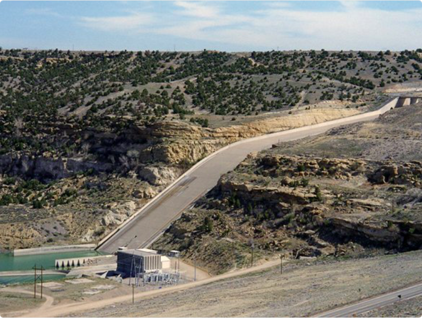
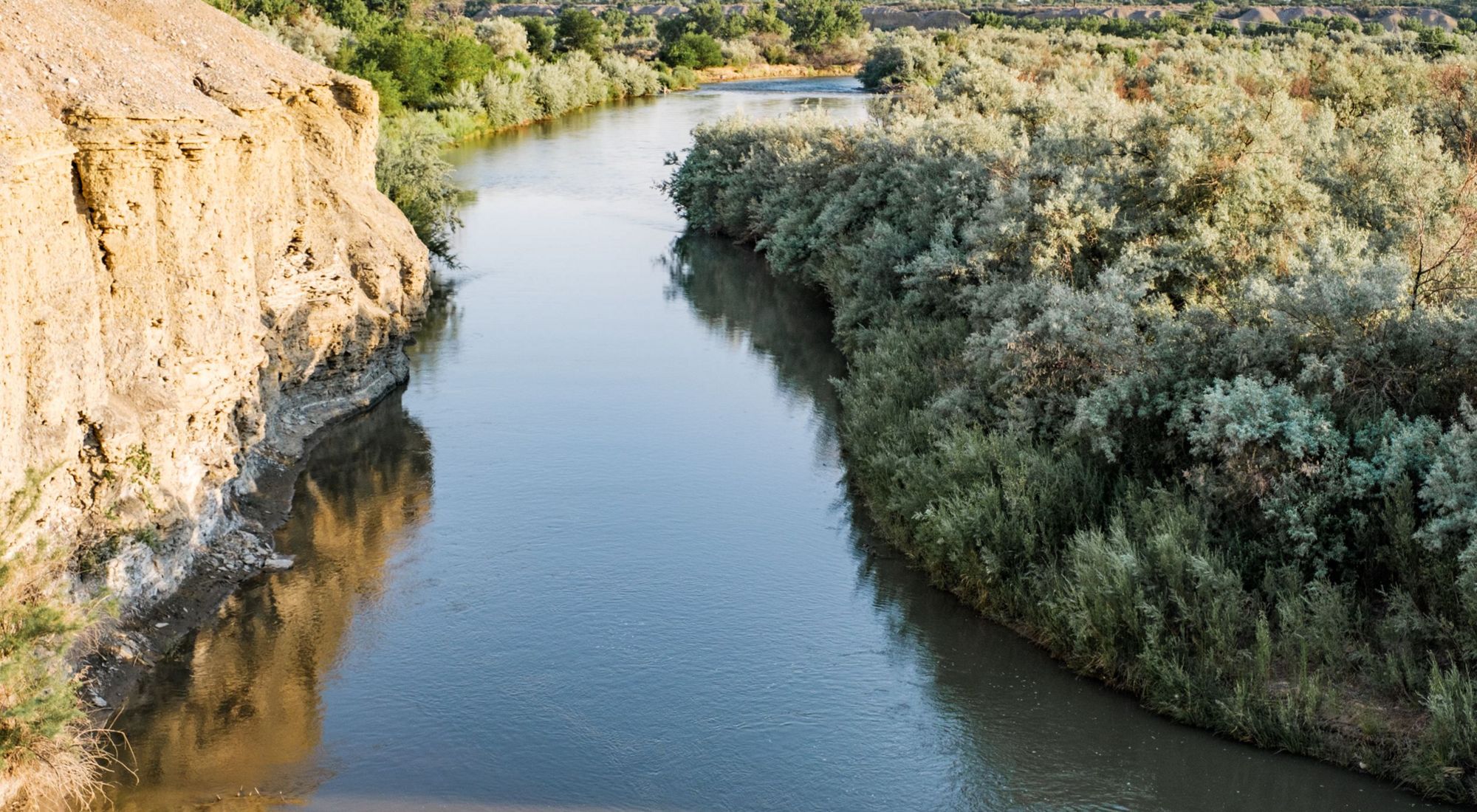
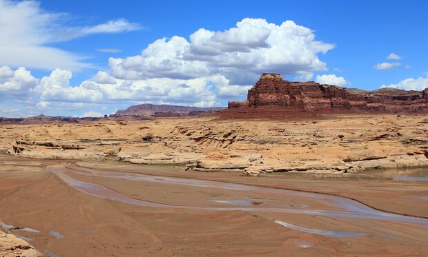
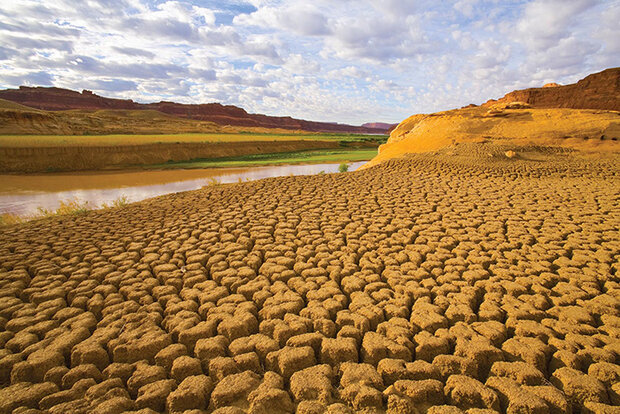
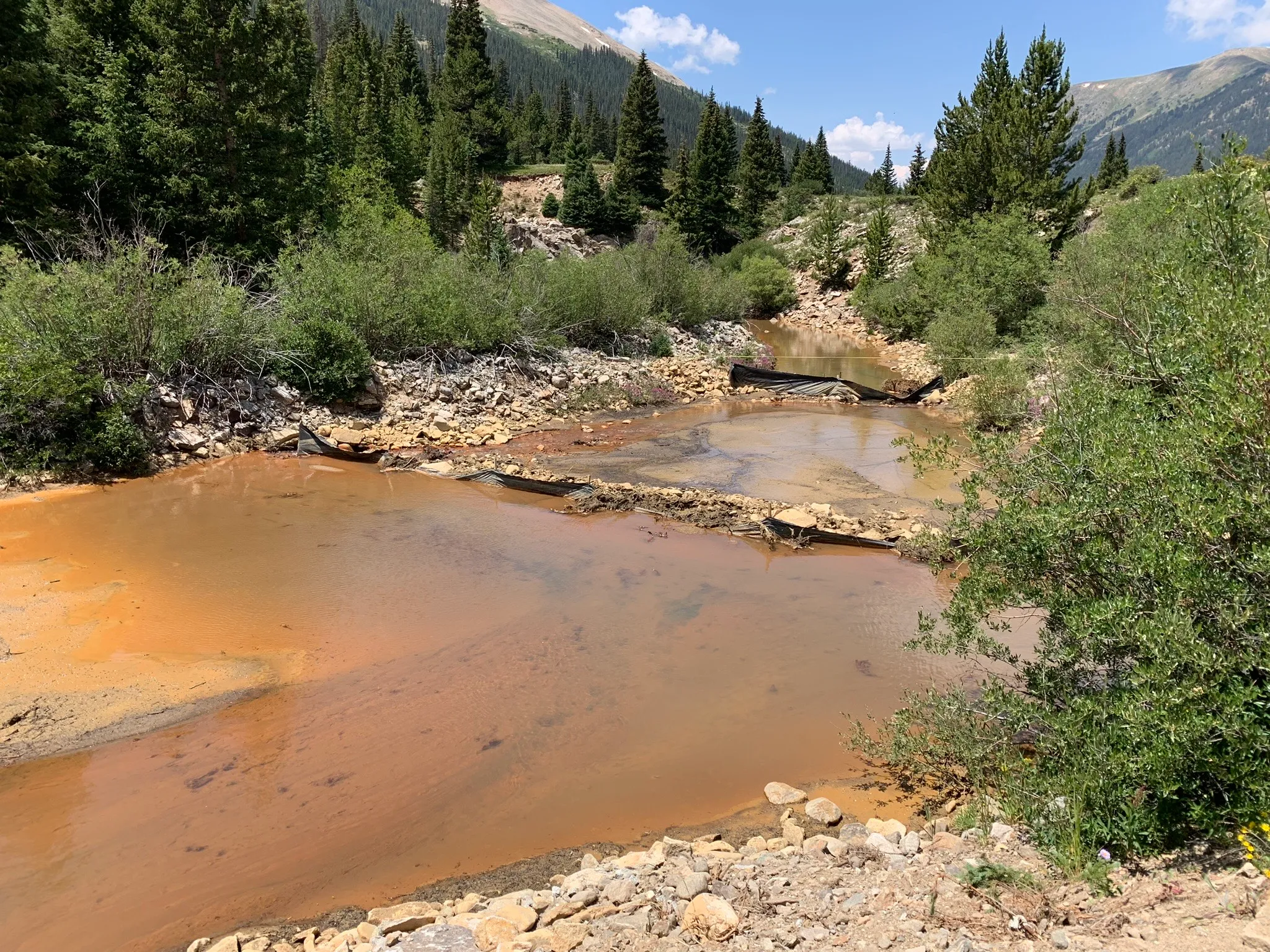
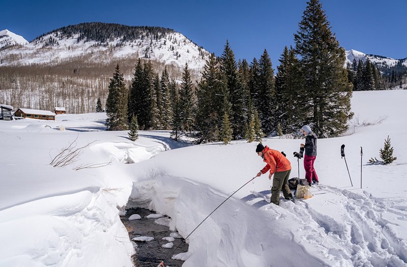
The project allows a mining company to drill and test over 100 sites across BLM land that surrounds one of the Hualapai Tribeโ€™s cultural properties, among them Haโ€™Kamweโ€™, a medicinal spring sacred to the tribe.

Haโ€™Kamweโ€™ is featured in tribal songs and stories about the history of the Hualapai people and their connection to the land. The historic flow and spring temperature are important attributes for its traditional uses, according to the tribe.

Out of concern for Haโ€™Kamweโ€™, the tribe submitted multiple public comments, sent several letters of concern and participated in tribal consultations with BLM throughout the planning phase for the Big Sandy Valley Lithium Exploration Project. Big Sandy, Inc., a subsidiary of Australian mining company Arizona Lithium, leads the project.

โ€œIt doesnโ€™t feel like the BLM really heard us or took our comments into full consideration,โ€ said Ka-voka Jackson, the director of the Hualapai Department of Cultural Resources, adding that the tribe often felt as if it was โ€œnever taken seriously.โ€

Big Sandy, Inc. has been seeking approval for its project since 2019, and the Hualapai Tribe has been voicing its concerns every step of the way. However, their efforts still fell flat, as BLM gave the project the green light on June 6.
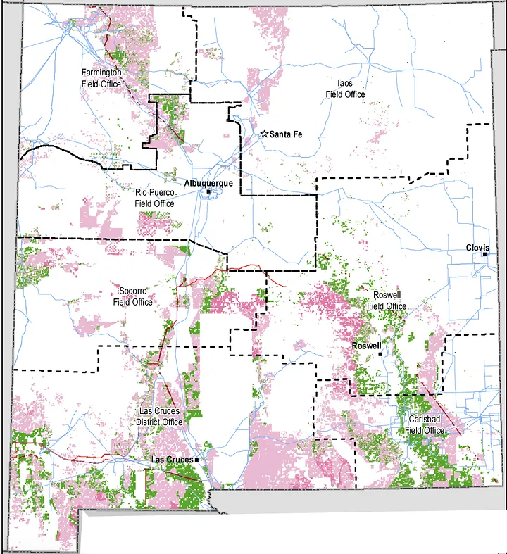
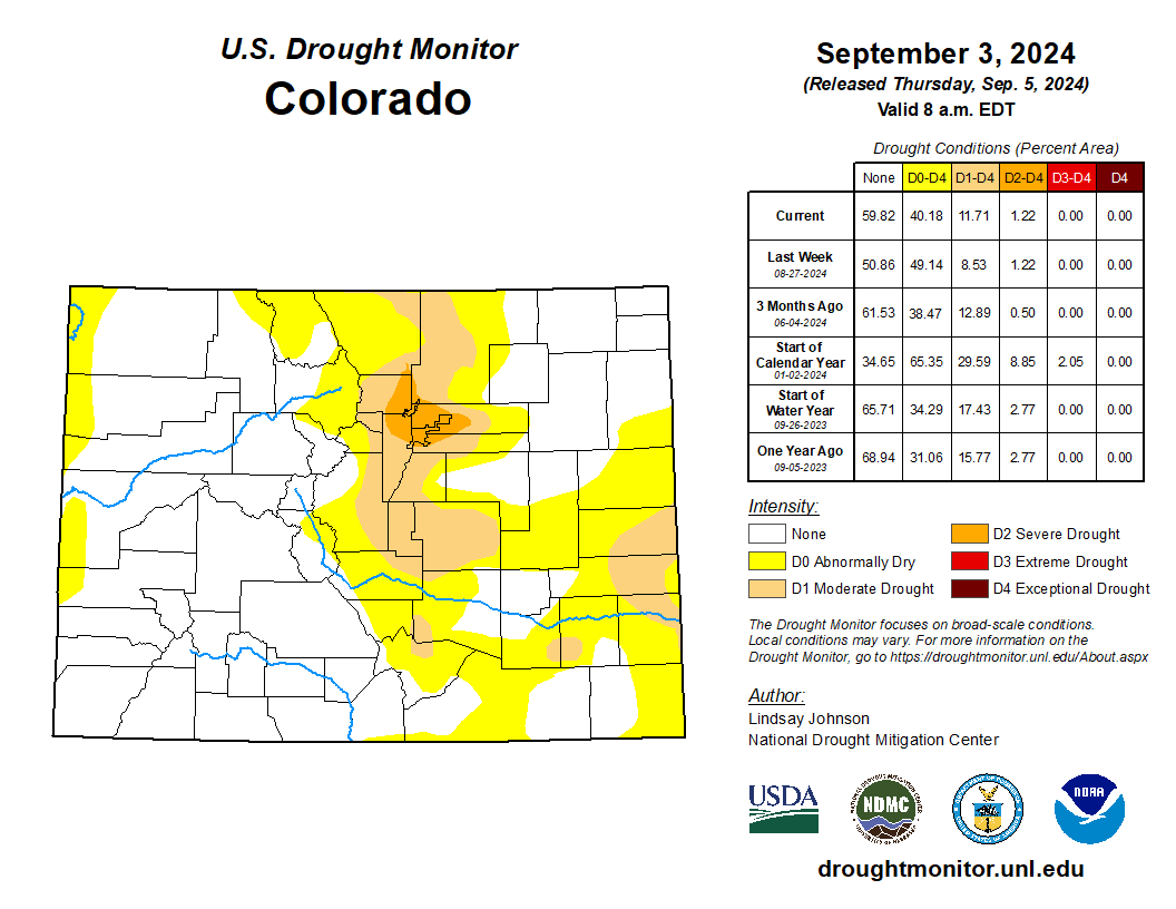
BLMโ€™s approval of the Big Sandy Valley Project allows the mining company to drill and test up to 131 exploration holes across 21 acres of BLM-managed public land to determine whether a full-scale lithium mining operation could be viable.

Two months later, the Hualapai Tribe filed a lawsuit against the Bureau of Land Management, challenging its approval.

Lawsuit: BLM refused to consider alternatives

Haโ€™Kamweโ€™ is located within the Hualapai Tribes property known as Cholla Canyon Ranch, and the boundaries of the Big Sandy Valley project nearly surround the entire property.

Only one portion of the tribeโ€™s land does not border the drilling project. Jackson said itโ€™s โ€œsurprising, appalling and, frankly, disgustingโ€ that the BLM is trying to say there are no adverse effects on the tribeโ€™s cultural property or cultural resources.

โ€œThe tribe maintains that we are opposed to this project,โ€ she said. โ€œThis lawsuit is to make sure that BLM is going through the proper processes.โ€

โ€œThese exploratory wells โ€” some of which will be drilled close to Haโ€™Kamweโ€™ โ€” will penetrate deep below ground into the aquifer that supports the springโ€™s flows,โ€ the lawsuit states. โ€œThe Project will also create noise, light, vibrations, and other disturbances that will degrade Haโ€™Kamweโ€™s character and harm Tribal membersโ€™ use of the spring for religious and cultural ceremonies.โ€

The lawsuit claims that the project violated mandates under the National Environmental Protection Act and the National Historic Preservation Act. Haโ€™Kamweโ€™ is recognized as a traditional cultural property and is eligible to be listed on the National Register of Historic Places.

โ€œThe litigation is asking for full compliance with the National Historic Preservation Act (NHPA) and the National Environmental Policy Act (NEPA),โ€ said Earthjustice Senior Attorney Laura Berglan, who is part of the team representing the Hualapai Tribe.

This includes BLM taking a โ€œhard lookโ€ at the environmental impacts of the exploration activity, as well as considering the impact of its actions on historic properties, she said.

The lawsuit claims that BLM approved the mining project without appropriately considering a reasonable range of alternatives or taking a hard look at water resources under the NEPA and moved forward with the project without providing mitigation measures under the NHPA for Haโ€™Kamweโ€™ and other resources important to the tribe, thus violating both acts.

โ€œThis isnโ€™t a situation where the tribe wasnโ€™t engaged throughout,โ€ Berglan said, adding that the Hualapai Tribe had provided BLM with traditional Indigenous knowledge related to the project. Still, it was not fully taken into account.

Berglan said the tribe has been trying to work with BLM for years, and has committed a substantial amount of time and resources to review drafts of the environmental assessments and submit extensive comments.

โ€œA lot of time has gone into this process, and to be sort of disrespected by not taking into account their Indigenous knowledge that this (project) is going to have impacts on Haโ€™kamweโ€™ is troublesome,โ€ she added.

The lawsuit argues that the tribe even asked BLM to consider alternatives to the project โ€” such as drilling fewer wells or moving them farther from the spring โ€” to reduce its adverse effects. However, BLM refused to consider a reasonable range of alternatives to the project proposal.

โ€œBLM violated NEPA by failing to consider a middle-ground alternative that would address the tribeโ€™s concerns,โ€ the lawsuit states

The Arizona Mirror contacted BLM for comment on the lawsuit, but a representative said the bureau does not comment on pending litigation.

โ€˜We were ignoredโ€™

Jackson said that the Hualapai Tribe does not want this mining project to happen, and like many other tribes in Arizona, they are experiencing just how hard it is to stop mining operations in the state.

โ€œWe submitted all our comments,โ€ Jackson said. โ€œWe were ignored.โ€

Jackson said the tribe filed the lawsuit because it believes BLM did not follow the proper processes during the Sandy Valley projectโ€™s environmental analysis phase.

โ€œNot all of those comments were addressed, and when the (environmental assessment) had been finalized, the BLM said there were no adverse effects on historic property, which is very contradictory to all the tribeโ€™s comments that have been submitted to the BLM,โ€ Jackson said.

Jackson said that before BLM finalized the environmental assessment, the tribe tried to stay in constant communication with the bureau to stay current on the project and were hopeful the bureau would consider their comments, but did not hear back.

โ€œItโ€™s been very upsetting for us,โ€ Jackson said, adding that itโ€™s been hard for the tribe because they are going up against an agency that has a lot of their ancestral homelands in their legal possession.

Dolores Garcia, the public affairs specialist at the BLM Arizona State Office, said in an email to the Mirror that BLM conducted outreach to tribes for consultations over the past three years. Details on the type of outreach efforts were not provided.

The tribes include the Chemehuevi Indian Tribe, the Colorado River Indian Tribes, the Fort Mojave Indian Tribe, the Hopi Tribe, the Hualapai Tribe, the Navajo Nation, the Salt River Pima-Maricopa Indian Community, the Yavapai-Apache Nation and the Yavapai-Prescott Indian Tribe.

โ€œTribal consultation is considered confidential government-to-government communication, so we cannot discuss specific details related to consultation,โ€ Garcia said.

However, Garcia said that, based on input from the tribes and the public, BLM worked with the proponent to revise its exploration plan, which included removing the use of a groundwater well within a few hundred feet of Haโ€™Kamweโ€™ and a nearby staging area.

โ€œWater needed to support the drilling operations will be trucked to the site,โ€ Garcia said. โ€œThe proponent has also committed to providing the opportunity for the Hualapai Tribe and other descendant tribal communities to monitor ground disturbing activities onsite.โ€

Jackson said their experience with how BLM moved forward on this lithium project did not give the tribe much faith in potential future projects.

She said when projects like Big Sandy Valley get proposed in the area, the tribe hopes that the BLM will come to work with them and take their comments seriously because they have been the stewards of the land for generations.

โ€œWe still use Haโ€™Kamweโ€™ as a community,โ€ Jackson said. โ€œWhen people go there, they have this sense of being, a sense of place, a sense of belonging, and a really deep ancestral tie there.โ€

โ€˜Temporaryโ€™ disruptions donโ€™t need permanent fixes, BLM says

As part of its environmental assessment, BLM listed several short- and long-term effects, including the temporary disruption to cultural practices at or near Haโ€™Kamweโ€™ and the impact on native wildlife and vegetation of up to 21 acres.

Even with these effects included in the assessment, which are concerns the Hualapai Tribe has brought up multiple times, BLM concluded that the Big Sandy Valley project would not significantly impact the quality of the area and an environmental impact statement was not needed.

โ€œVisual, noise, and vibration effects from drilling activities would be temporary,โ€ the BLM wrote in its final report. โ€œCoordination with and providing notice to the Hualapai Tribe of drilling activities in the vicinity of the Haโ€™Kamweโ€™ may reduce impacts to cultural practices at or near the hot spring.โ€

Jackson said the tribe and its members have every right to be out at Haโ€™Kamweโ€™ utilizing the spring for prayer and healing because it is part of their spirituality and religion. Tribal members have full access to the property and can use it whenever necessary.

โ€œHaving that type of noise occurring is really disrupting,โ€ she said. โ€œIt takes away from a lot of the spirituality and ability to practice ceremony in peace.โ€

Jackson said the tribe will have to deal with the disruptions throughout the projectโ€™s 18-month duration.

โ€œThatโ€™s a long time for tribal members to be affected, and that disrupts all of our activities,โ€ she added. โ€œIt disrupts our spirituality.โ€

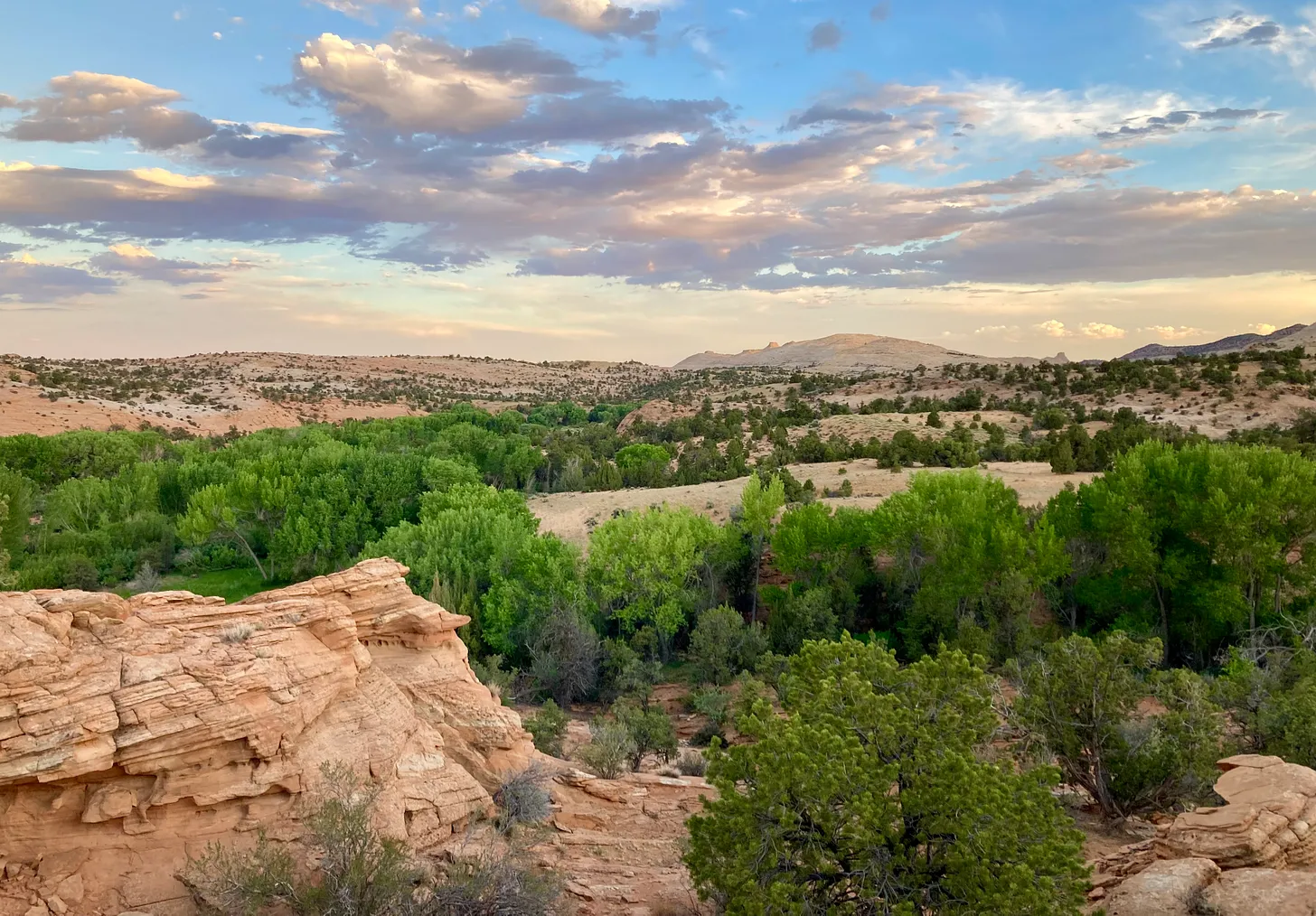
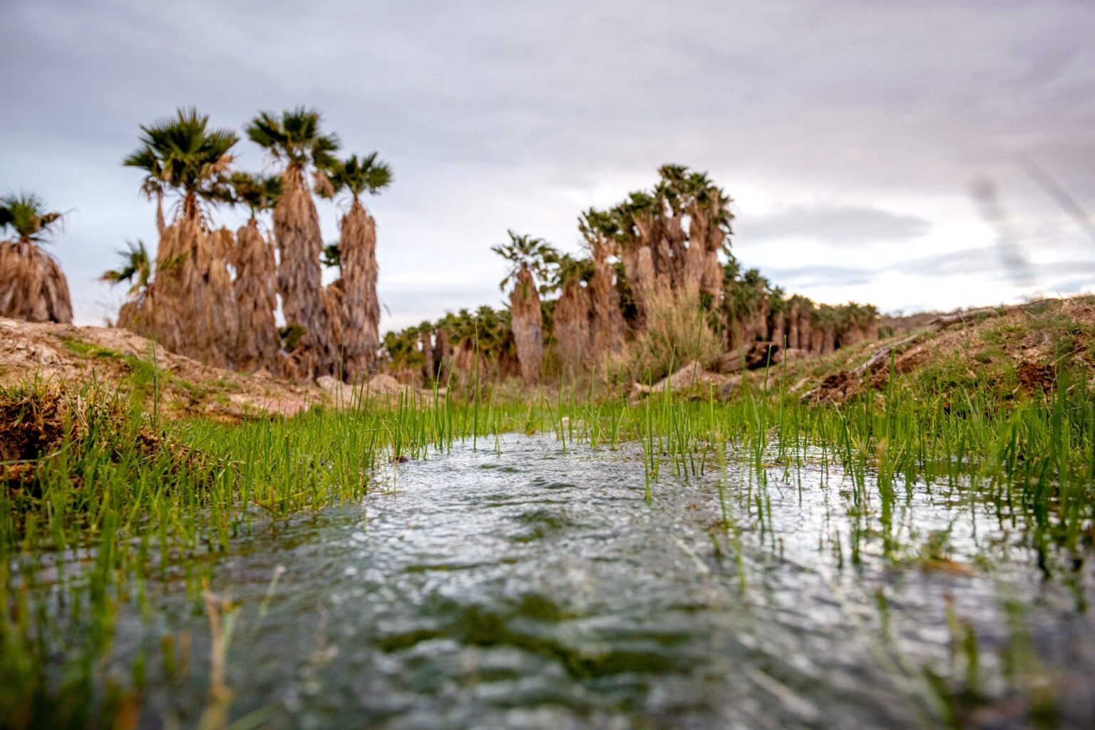
The drilling project threatens not only ceremonial ways of life but also natural resources the tribe relies on. Jackson said the community gathers native plants only found in the Big Sandy Valley area, including willows for basket making, traditional tobacco, and clay.

โ€œThose plants coming from that area have meaning,โ€ she said, and they are the same native plants their ancestors gathered from.

โ€œWhen we gather, weโ€™re not restricted to just the Hualapai property,โ€ Jackson said because tribal members gather on the public BLM land in the area, too.

โ€œThatโ€™s our right as people to be able to go out there and gather,โ€ she added, and the bulldozing that will occur to create the paths to the drilling sites will have an impact. โ€œThe desert will never recover from all that.โ€

Jackson said part of what makes the area sacred for the tribe is maintaining the integrity of the land, and the tribe feels that the mining operations will permanently change the location.

Theyโ€™re concerned about how the project will impact the spring because the drilling will occur so close to the site.

According to BLM, to minimize impacts on Haโ€™Kamweโ€™, a water source that was previously proposed to be used for the project has been removed from the plan, and a staging area that would have been set up near Haโ€™Kamweโ€™ has also been removed.

โ€œAnalysis of water resources has determined that the water source for Haโ€™Kamweโ€™ is located in a deeper aquifer,โ€ the report states. The proposed drilling is not anticipated to reach the aquifer, according to BLM, and if water is intersected during the drilling, the hole shall be plugged using cement grout or bentonite clay.

Jackson said the tribe does not think that is good enough because if the mining hits the water and does utilize bentonite clay or cement grout, there is no guarantee that it wonโ€™t have an adverse effect or potentially block off the underground water that flows through the spring.

โ€œIf the temperature were to be affected thatโ€™s changing the entire character of the spring and the integrity of it,โ€ Jackson said, which is a big deal for the tribe because Haโ€™Kamweโ€™ translates to โ€œwarm spring.โ€

โ€œWeโ€™re going to try every way we can to try and stop this operation,โ€ Jackson said, adding that this is the first lithium mining project of its kind on their homelands and theyโ€™ve opposed it the entire time.

โ€œItโ€™s kind of scary looking into the future, seeing how these mining companies can kind of get away with this and how the BLM is letting it happen, even when they know how it will negatively impact the tribes and the tribeโ€™s sacred lands,โ€ Jackson said.

Reporting on the State of the #Climate in 2023 — NOAA

Photo Credit: Mauri Pelto

Click the link to read the article on the NOAA website:

August 22, 2024

Greenhouse gas concentrations, the global temperature across land and oceans, global sea level and ocean heat content all reached record highs in 2023, according to the 34th annual State of the Climate report. This is the most accessible BAMS State of the Climate report to-date.

The international annual review of the worldโ€™s climate, led by scientists from NOAAโ€™s National Centers for Environmental Information and published by the Bulletin of the American Meteorological Society (BAMS), is based on contributions from more than 590 scientists in nearly 60 countries. It provides the most comprehensive update on Earthโ€™s climate indicators, notable weather events and other data collected by environmental monitoring stations and instruments located on land, water, ice and in space.

Notable findings from the international report include:

Earthโ€™s greenhouse gas concentrations were the highest on record. Carbon dioxide, methane and nitrous oxideโ โ€”Earthโ€™s major atmospheric greenhouse gasesโ โ€”once again reached record high concentrations in 2023. Annual growth in global mean CO2 has increased from 0.6ยฑ0.1 ppm yrโˆ’1 in the early 1960s to an average of 2.5 ppm yrโˆ’1 during the last decade of 2014โ€“23. The growth from 2022 to 2023 was 2.8 ppm, the fourth highest in the record since the 1960s. 

Caption: The three dominant greenhouse gases in Earth’s atmosphereโ€”carbon dioxide (left), methane (center) and nitrous oxide (right)โ€”all reached new highs in 2023. NOAA Climate.gov image, adapted from Figure 2.59 in State of the Climate in 2023. Background photo from Adobe Stock

Record temperatures notable across the globe.ย A range of scientific analyses indicate that the annual global surface temperature was 0.99 to 1.08 of a degree F (0.55 to 0.60 of a degree C) above the 1991โ€“2020 average. This makes 2023 the warmest year since records began in the mid to late 1800s, surpassing the previous record of 2016 by 0.23 to 0.31 of a degree F (0.13 to 0.17 of a degree C). The transition in the Pacific Ocean from La Niรฑa at the beginning of the year to a strong El Niรฑo by the end of the year contributed to the record warmth. All seven major global temperature datasets used for analysis in the report agree that the last nine years (2015โ€“23) were the nine warmest on record. The annual global mean surface temperature has increased at an average rate of 0.14 to 0.16 of a degree F (0.08 to 0.09 of a degree C) per decade since 1880, and at a rate more than twice as high since 1981.

Graphs of yearly global surface temperature compared to the 1991-2020 average from 1850 to 2023, based on data from four different sources: NOAA, NASA, the U.K. Met Office Hadley Center, and Berkeley Earth. Despite small differences among the records from year to year, all show our planet’s warming trend, ending with a new record high temperature in 2023. NOAA Climate.gov image, adapted from Figure 2.1a in State of the Climate in 2023. Background photo from Adobe Stock.

El Niรฑo conditions contributed to record-high sea surface temperatures.ย El Niรฑo conditions in the equatorial Pacific Ocean emerged in boreal spring 2023 and strengthened throughout the year. The mean annual global sea-surface temperature in 2023 was record high, surpassing the previous record of 2016 by 0.23 of a degree F (0.13 of a degree C). Each month from June to December was record warm. On August 22, an all-time high globally averaged daily sea-surface temperature of 66.18 degrees F (18.99 degrees C) was recorded. Approximately 94 percent of the ocean surface experienced at least one marine heatwave in 2023, which is defined as sea-surface temperatures in the warmest 10 percent of all recorded data in a particular location on that day for at least five days. The eastern tropical and North Atlantic Ocean, the Sea of Japan, the Arabian Sea, the Southern Ocean near New Zealand, and the eastern tropical Pacific, were in a marine heatwave state for at least 10 months of 2023. The ocean experienced a new global average record of 116 marine heatwave days in 2023, which was far more than the previous record of 86 days in 2016, and a new record of 13 marine cold spell days, far below the previous record of 37 days in 1982.

Caption: This map shows the number of months each part of the global ocean experienced heat wave conditions in 2023, meaning that for a given time of year, the monthly average temperatures were in the hottest 10 percent of all monthly temperatures from 1991-2020. Very few areas experienced less than one full month of heat wave conditions (darkest blue). Relatively large swaths of the eastern North Atlantic experienced heat wave conditions virtually all year (bright yellow). NOAA Climate.gov image, adapted from Figure SB3.1 in State of the Climate in 2023.

Ocean heat and global sea level were the highest on record. Over the past half-century, the oceans have stored more than 90 percent of the excess energy trapped in Earthโ€™s system by greenhouse gases and other factors. The global ocean heat content, measured from the oceanโ€™s surface to a depth of 2000 meters (over 6,500 feet), continued to increase and reached new record highs in 2023. Global mean sea level was record high for the 12th-consecutive year, reaching about 4.0 inches (101.4 millimeters) above the 1993 average when satellite altimetry measurements began. This rise is an increase of 0.3ยฑ0.1 of an inch (8.1ยฑ1.5 millimeters) over 2022, the third highest year-over-year increase on record.

Antarctica sea ice sets record lows throughout 2023. Eight months saw new monthly mean record lows in sea ice extent and sea ice area, and 278 days in 2023 set new daily record-low sea ice extents. On February 21, Antarctic sea ice extent and sea ice area both reached all-time record lows, surpassing the previous record lows that were set just a year earlier in February 2022. On July 6, a new record-low daily sea ice extent was 695,000 square miles (1.8 million square kilometers) lower than the previous record low for that day.

Caption: This map shows global drought status in 2023 based on a scale called the Palmer Self-calibrating Drought Index. Areas experiencing the most extreme drought are darkest brown; places that were extremely wet over the year are colored dark blue green. Nearly eight percent of the global land area experienced extreme drought in 2023โ€”a new record. NOAA Climate.gov image, adapted from State of the Climate 2023, Plate 2.1(s).

The Arctic was warm and navigable.ย The Arctic had its fourth-warmest year in the 124-year record, with summer (July to September) record warm. Below-ground, permafrost temperatures were the highest on record at over half of the reporting sites across the Arctic. Permafrost thaw disrupts Arctic communities and infrastructure and can also affect the rate of greenhouse gas release to the atmosphere, potentially accelerating global warming. The seasonal Arctic minimum sea-ice extent, typically reached in September, was the fifth-smallest in the 45-year record. The amount of multiyear iceโ€”ice that survives at least one summer melt season in the Arcticโ€”continued to decline. Since 2012, the Arctic has been nearly devoid of ice that is more than four years old. Both the Northern Sea Route and Northwest Passage became accessible to non-ice-hardened marine traffic. The Northern Sea Route, connecting the European Arctic to the Pacific Ocean via the north coast of Russia and Bering Strait, saw 75 ship transits in the 2023 open season, the second-highest number of ships on record. The Northwest Passage, which connects the Atlantic Ocean to the Pacific via northern Canada and Alaska waters, saw a record number of ship passages. A total of 42 ships made the complete Northwest Passage transit, far surpassing the previous record of 33 ships in 2017.

Caption: This trio of line graphs shows ice loss over time from three different environments: (left) Arctic glaciers and ice caps outside of Greenland, (center) mountain glaciers worldwide, and (right) the Antarctic Ice Sheet. From pole to pole and everywhere in between, Earth’s ice is disappearing. NOAA Climate.gov image, adapted from Figures 5.22, 2.17, and 6.10(a) in State of the Climate in 2023. Photo by Miguel Martรญn, used under a Creative Commons license.

Antarctica sea ice sets record lows throughout 2023.ย Eight months saw new monthly mean record lows in sea ice extent and sea ice area, and 278 days in 2023 set new daily record-low sea ice extents. On February 21, Antarctic sea ice extent and sea ice area both reached all-time record lows, surpassing the previous record lows that were set just a year earlier in February 2022. On July 6, a new record-low daily sea ice extent was 695,000 square miles (1.8 million square kilometers) lower than the previous record low for that day.

Tropical cyclone activity was below average, but storms still set records around the globe. There were 82 named tropical storms during the Northern and Southern Hemisphere storm seasons last year, which was below the 1991โ€“2020 average of 87. Seven tropical cyclones reached Category 5 intensity on the Saffirโ€“Simpson Hurricane Wind Scale. Globally, the accumulated cyclone energyโ€”a combined measure of the strength, frequency, and duration of tropical storms and hurricanesโ€”rebounded from the lowest in the 43-year record in 2022 to above average in 2023. Typhoon Doksuri (named Egay in the Philippines) caused $18.4 billion U.S. dollars in economic losses in the northern Philippines and China. Beijing received 744.8 mm of rain from remnants of the storm in a 40-hour period, which was the cityโ€™s heaviest rainfall in its 140-year record and caused floods that killed 137 residents. Tropical Cyclone Freddy became the worldโ€™s longest-lived tropical cyclone on record, developing into a tropical cyclone on February 6 and finally dissipating on March 12. Freddy crossed the full width of the Indian Ocean and made three landfalls in total: one in Madagascar and two in Mozambique. In the Mediterraneanโ€”outside of traditional tropical cyclone basinsโ€”heavy rains and flooding from Storm Daniel killed more than 4,300 people and left more than 8,000 missing in Libya. 

The State of the Climate report is a peer-reviewed series published annually as a special supplement to the Bulletin of the American Meteorological Society. The journal makes theย full reportย openly available online. NCEIโ€™s high-level overview report is alsoย available online

In 2023, Earthโ€™s major atmospheric greenhouse gasesโ€”carbon dioxide, methane, and nitrous oxideโ€”reached record highs again — @NOAANCEI #ActOnClimate

See

CIRES scientistsโ€™ contributions in the State of Climate 2023 report: https://bit.ly/2023BAMSSotC

Happy #LaborDay 2024

Silverton’s Greene Street, once a strong Union town photo via The Denver Public Library.

#LincolnCreek sediment release had high levels of aluminum, iron — Heather Sackett (@AspenJournalism)

These sediment traps of hay bales and tarps, seen on July 21, were placed in Lincoln Creek below Grizzly Reservoir. Pitkin County officials say that a July 16 release from Grizzly Reservoir that turned Lincoln Creek and the Roaring Fork River orange had minimal biological effects on fish and other aquatic life. Credit: Heather Sackett/Aspen Journalism

Click the link to read the article on the Aspen Journalism website (Heather Sackett):

August 30, 2024

Pitkin County officials say that a July release from Grizzly Reservoir that turned Lincoln Creek and the Roaring Fork River orange had minimal biological effects on fish and other aquatic life. 

Water quality testing results from the day of the sediment release, July 16, show high levels of iron and aluminum, but they do not show levels of copper high enough to be toxic to fish. 

Members of the Lincoln Creek workgroup, which is comprised of officials from Pitkin County, Colorado Parks & Wildlife, Colorado Department of Public Health and Environment, Independence Pass Foundation and others, met remotely on Wednesday to debrief the July 16 incident. The water quality samples were collected by staff from the Roaring Fork Conservancy and the results are available on River Watch, a statewide volunteer water quality monitoring program operated by CPW.

The released sediment was in particulate form and less able to be readily taken up by aquatic life, according to a press release from Pitkin County. There were no fish kills reported to CPW and the event is not expected to have a significant long-term impact on aquatic ecosystems. 

โ€œMost of this indicates that although visually the impact of the event was, you know, scary to look at, it does seem that at least from a copper and biological perspective that there was less of a copper biological risk to fish,โ€ said Megan McConville, CPW River Watch program manager. โ€œThe copper has a more toxic effect on aquatic life than the aluminum or the iron.โ€

Twin Lakes Reservoir & Canal Co., which operates Grizzly Reservoir, drained the reservoir this summer so it could make repairs to the dam and outlet works. On July 16, a pulse of sediment-laden water from the bottom of the reservoir was released down Lincoln Creek, turning it and the Roaring Fork River orange and alarming Aspen residents and visitors. 

A July 1 news release from Pitkin County had warned of the potential for temporary discoloration of the river as the reservoir was drawn down, but the severity of the event shocked many people. The U.S. Army Corps of Engineers is investigating whether the sediment release needed a permit under the Clean Water Act. 

Officials say the release is unlikely to pose any ongoing risk to people recreating in local waterways.

Local officials, residents and environmental groups have long been concerned about water quality on Lincoln Creek and the July 16 release came at a time of increased scrutiny. Officials have determined that a โ€œmineralized tributary,โ€ which feeds into Lincoln Creek above the reservoir near the ghost town of Ruby, is the source of the high concentrations of metals downstream. The contamination seems to have been increasing in recent years and may be exacerbated by climate change as temperatures rise. 

High levels of aluminum, iron at testing sites

Water quality samples were taken by Roaring Fork Conservancy staff at six locations on Lincoln Creek and the Roaring Fork on three dates: June 4, June 25 and July 16. The locations were the Grizzly Reservoir inlet, below Grizzly Dam, the Lincoln Gulch Campground on the creek just above the confluence with the the Roaring Fork, the Grottos day-use area and Difficult Campground. Control samples were also taken from the Roaring Fork just above the Lincoln Creek confluence. An additional location, below the sediment traps on Lincoln Creek about 50 yards below Grizzly Dam, was tested only on July 16. 

That data show sharply increasing concentrations of aluminum and iron on July 16, particularly just below the dam. On June 25, there were 258 micrograms (parts per billion) of aluminum in the water below Grizzly Dam, which is still exceeds the chronic water quality standard for aquatic life (on all but one date and location, the amount of aluminum exceeded either the CPW acute or chronic water quality standards for aquatic life). During the release on July 16, that jumped to 1.7 million micrograms. Testing at the second location below the dam, below the sediment traps placed by Twin Lakes, that number was down to 726,600. 

โ€œThere was a pretty significant drop from what was coming directly out of the dam,โ€ said Chad Rudow, water quality program manager with the Roaring Fork Conservancy. โ€œIt kind of shows the sediment traps were doing their job and helping to sequester some of that stuff.โ€

Map of the Roaring Fork River drainage basin in western Colorado, USA. Made using USGS data. By Shannon1 – Own work, CC BY-SA 4.0, https://commons.wikimedia.org/w/index.php?curid=69290878

By the time the release had made it downstream to the confluence of the Roaring Fork, the total iron levels had decreased by 97%, and total aluminum decreased by 98%.

Because there were additional elements in the water, the aluminum was not as toxic to fish as it could have been, McConville said. 

โ€œThe more carbon you have in the water, the less toxic it makes the aluminum,โ€ she said. โ€œBecause weโ€™ve got bottom lake sediments coming down, they were probably pretty high in carbon. โ€ฆ My guess is that a big slug of carbon came down along with the iron and aluminum and for aluminum in particular, it probably provided some protection for those aquatic organisms.โ€

The iron levels also exceeded state chronic water quality standards for aquatic life in eight of the 19 sites and days tested, but iron is a 30-day standard and the release was a roughly 36-hour event. 

โ€œIf that event had gone on for 30 days or a longer duration, then that standard would have been applicable,โ€ McConville said. โ€œBut because it was such a short-term event, that sort of clogging, smothering effect that we would expect from that precipitated iron just really didnโ€™t have a chance to occur.โ€

The reason copper levels below the reservoir were so low is probably because the entirety of Lincoln Creek above the reservoir โ€” the source of copper contamination โ€” is being diverted to the Arkansas River basin through the Twin Lakes Tunnel. 

A map of the Independence Pass Transmountain Diversion System, as submitted to Div. 5 Water Court by Twin Lakes Reservoir and Canal Co.

Lincoln Creek and Grizzly Reservoir are part of a highly engineered system that takes about 40% of the water from the headwaters of the Roaring Fork to cities and farms on the east side of the Continental Divide. Water is sent from the reservoir through Twin Lakes Tunnel into Lake Creek, which is then collected in Twin Lakes Reservoir.

Four municipalities own 95% of the shares of water from the Twin Lakes system: Colorado Springs Utilities owns 55%; the Board of Water Works of Pueblo has 23%; Pueblo West Metropolitan District owns 12% and the city of Aurora has 5%.

Officials said at Wednesdayโ€™s meeting that this is just the initial attempt at understanding the water quality testing data around one reservoir release event and there is still a lot of data that needs to be analyzed from other testing agencies. 

In addition to the Roaring Fork Conservancy, four other entities are conducting water quality sampling this summer: Pitkin County Environmental Health; the U.S. Forest Service; Colorado Parks and Wildlife; and the Institute of Arctic and Alpine Research at the University of Colorado Boulder. The workgroup has hired consultant LRE Water to review the data and an EPA report, make a site visit and comment on the sampling plans of the five different entities. 

โ€œThe initial plan was to have all of the data come to us at one time, the beginning of next year, but there became this ask for the data around this event; there was a concern around toxicity,โ€ said Kurt Dahl, Pitkin County environmental health director. โ€œThereโ€™s still a lot of data that we have out there. โ€ฆ The context of the entire year is going to have to wait until our intended timeframe of early next year to talk about how this looks in comparison to the various other times weโ€™re out there sampling.โ€ 

Prior to mining, snowmelt and rain seep into natural cracks and fractures, eventually emerging as a freshwater spring (usually). Graphic credit: Jonathan Thompson

When a Summer #Drought Begins in the Winter: Investigating Snow Drought — The Department of Energy

Alexander Newman of the Rocky Mountain Biological Laboratory inserts a probe into a stream in the SAIL study area. Next to him is Marianne Cowherd, a PhD candidate from the University of California, Berkeley. Image courtesy of Jeremy Snyder, DOEโ€™s Lawrence Berkeley National Laboratory

Click the link to read the article on the Department of Energy website (Shannon Brescher Shea):

August 28, 2024

From thirsty agricultural crops to whitewater rafters contemplating a low river, a lack of water is the most obvious in the summertime. Its impact is particularly clear when many people rely on the same source of water. What happens in the Colorado Riverโ€™s East River Watershed affects 40 million people from seven U.S. states as well as Mexico. Around the world, similar mountainous areas provide the water that helps feed one to two billion people. In fact, scientists call these regions โ€œthe worldโ€™s water towers.โ€

But problems with these watersheds donโ€™t start in the summer or even the spring. In fact, they begin in the winter, when snow isnโ€™t building up in the Rocky Mountains and similar areas as it once did. The snow that falls โ€“ or doesnโ€™t fall โ€“ in the mountains has huge effects on whatโ€™s available for the rest of the year. Future climate change may cause less and less snow to fall in these areas and reliably convert to water downstream.

Researchers supported by the Department of Energyโ€™s (DOE) Office of Science are working to understand the role of snow drought, how to measure it in the future, and how to use such data to inform decision-making.  

Droughts in the winter

In a regular drought โ€“ also called a meteorological drought โ€“ thereโ€™s a lack of precipitation. It often has immediate and obvious effects. In contrast, a snow droughtโ€™s effects are delayed. When snow falls in the winter, it builds up as snowpack. In the spring, much of this snowpack melts and moves through the watershed as runoff. It ends up in rivers that provide water to people far beyond the mountains.

But if thereโ€™s less snow than usual in a single winter, or if less snow fails to transition to water downstream, thereโ€™s less spring runoff. The lack of snow can change both the amount and the timing of the runoff. The situation gets even worse when there are multiple years of low snowfall, as the snowpack further decreases each year.  

Snow drought can happen for three reasons. When temperatures are exceptionally warm, precipitation can fall as rain instead of snow. When overall precipitation is low, thereโ€™s less rain and snow. Lastly, when temperatures are warm and precipitation is low, areas end up with less precipitation and a smaller proportion of it as snow. 

Providing water in a warmer future

While the mighty Colorado River often has huge amounts of water, that water comes from many small streams and rivers in the form of snowmelt. In fact, almost three-quarters of the Colorado Riverโ€™s water comes from runoff from snowfall. Snow drought can take a tremendous toll.

Poor water management can leave communities struggling to have enough water throughout the year. Unfortunately, the unpredictability from snow drought can make it hard for water managers to know how much and when water will be available. 

Future climate change is very likely to make this predicament worse. Higher elevations are already warming faster than lower ones. The hotter temperatures from climate change will result in less snowpack over time. Scientists are already seeing an increase in snow droughts across the world from the late 1980s to the present. 

To understand how much and where these shifts in snow droughts will occur, Marianne Cowherd, a researcher at the University of California Berkeley (UC Berkeley), worked with researchers at DOE’s Pacific Northwest National Laboratory to run scenarios on a number of climate models. Climate models provide a computer simulation of past, present, and future climate and Earth systems. Because each model has its strengths and gaps, the team compared the results from nine different models. 

They conducted two different scenarios. The medium emissions scenario assumed that greenhouse gas emissions will stay at the same level and start to decrease in 2050. The higher-emissions scenario assumes there will be no decrease in 2050 and that the emissions trends will continue. 

The news wasnโ€™t good. Both scenarios predicted snow drought increasing in most areas of the world. In particular, all snowy regions of the Northern hemisphere and the Andes were modeled to have less snow than they do now. Not surprisingly, the higher-emissions scenario was worse. In addition to snow droughts becoming more frequent, both scenarios predicted they will become more severe.

About two-thirds of the decrease would be from higher temperatures alone, with the rest a combination of higher temperatures and decreased precipitation. This is a major shift from the past, when snow droughts were mainly caused by low precipitation. This split from meteorological droughts will make it even more difficult for water managers to predict and accommodate snow droughts.  

Measuring a changing world

On top of all of that, itโ€™s likely that the tools water managers rely on are likely to become less accurate due to climate change. 

Measuring snow drought is already harder than measuring regular drought. Scientists use a combination of climate models and real-time measurements taken in the field to understand what will happen in the future. While climate models can make big-picture estimates, most are not yet precise enough to provide year-to-year predictions. For example, several models represent mountaintop temperatures as cooler than they are in real life.  

That leaves most of the short-term predictions up to field measurements. Fortunately, thereโ€™s already an extensive network of sites around the world. Unfortunately, these sites werenโ€™t designed for a changing climate. Over time, they will become less accurate as the snow line shifts to higher elevations. In particular, these changes will have major effects on the Lower Colorado River Basin and Nevada. 

Cowherd collaborated with scientists from DOEโ€™s Lawrence Berkeley National Laboratory and the University of California Los Angeles (UCLA) to study and solve this challenge. They determined that we can still use present snow-measurement networks, albeit with a few changes. They also found that it will be important to have additional information about the relationship between temperature, snow, and geographic space. In addition, climate models that are flexible enough to handle new information will be important for understanding these year-to-year differences. 

SAILing towards solutions

It’s clear that more information about snowfall in mountain terrain is essential to ensuring people in the American West can have access to the water they need. Thankfully, DOE is helping fill that gap.

The Surface Atmosphere Integrated Field Laboratory (SAIL) campaign was a 21-month effort to collect a massive amount and variety of data about the conditions above, at, and under the surface of the East River Watershed in Colorado. Scientists used more than 50 instruments from the DOE Office of Scienceโ€™s Atmospheric Radiation Measurement user facility, as well as guest and existing regional instruments to collect data on how and when water moves through this landscape. 

Researchers from SAIL and nearby field campaigns that ran simultaneously observed atmospheric, surface, and subsurface changes from season to season. In the winter, they slogged through deep snow. In the summer, they looked out on forested mountains and green valleys. 

SAIL finished collecting data in June 2023. However, the work of SAIL and its related campaigns is far from over. SAIL collected a far more comprehensive, detailed set of data than any previous mountain hydrology campaign had collected. Printing out all the data would generate 15 billion pages of documents.

Right now, researchers are analyzing the data and considering how to use them to make climate models more accurate and precise. Theyโ€™re closely collaborating with scientists funded by DOE Office of Scienceโ€™s Earth and Environmental Systems modeling program.  

There are already useful results. Both the study on snowpack measurement sites and the one describing how models underestimate temperatures on mountaintops used data from SAIL.

Scientists will continue to dig into data from SAIL and related campaigns. This data will help us better understand the โ€œworldโ€™s water towersโ€ and how they will change over time. The resulting improvements to climate models will help water managers and others better predict snowpack in the years to come. From the data collected in the past to the present, our scientists are helping us face a future with a changing climate.ย 

Photo credit: NRCS

Water treaty between #Mexico and U.S. faces biggest test in 80 years — National Public Radio #RioGrande #ColoradoRiver #COriver #aridification

Rio Grande in Albuquerque, Aug. 4, 2023. Photo by John Fleck

Click the link to read the article on the National Public Radio website (Bria Suggs). Here’s an excerpt:

August 16, 2024

Eighty years ago, the United States and Mexico worked out an arrangement to share water from the two major rivers that run through both countries: the Rio Grande and the Colorado. The treaty was created when water wasn’t as scarce as it is now. Water from Mexico flows to Texas’ half-billion-dollar citrus industry and dozens of cities near the border. On the Mexican side, some border states like Baja California and Chihuahua are heavily reliant on the water that comes from the American side of the Colorado River.

Now, those water-sharing systems are facing one of the biggest tests in their history. Mexico is some 265 billion gallons of water behind on its deliveries to the United States. Unpredictable weather patterns due to climate change, growing populations, aging infrastructure and significant water waste have left both countries strapped for water and have escalated tensions along the border. Maria-Elena Giner is the U.S. commissioner of the International Boundary and Water Commission, the binational agency that oversees the 1944 water treaty and settles disputes. Mexico is “at their lowest levels ever” in the treaty’s history, Giner said. The treaty operates in five-year cycles, and the current deadline for deliveries isn’t until October 2025.

But “the question is that they’re so far behind, it will be very difficult, if not statistically impossible, for them to make up that difference,” Giner said…

To address the water scarcity in Texas, officials last year proposed a solution: a treaty “minute,” or amendment, that would allow Mexico to pay water directly to South Texas instead of giving two-thirds to the Mexican state of Tamaulipas first, as currently specified in the treaty. But quenching the thirst in South Texas ahead of its own citizens was likely a nonstarter ahead of Mexico’s presidential election this year. Negotiations on the treaty changes were completed and both countries were set to sign last December, but Mexico has yet to receive official authorization to do so, said Giner, of the International Boundary and Water Commission.

Rio Grande and Pecos River basins. Map credit: By Kmusser – Own work, Elevation data from SRTM, drainage basin from GTOPO [1], U.S. stream from the National Atlas [2], all other features from Vector Map., CC BY-SA 3.0, https://commons.wikimedia.org/w/index.php?curid=11218868

Springtime Rain Crucial for Getting Wintertime Snowmelt to the #ColoradoRiver, Study Finds — Inside #Climate News #COriver #aridification

The sun sets over the Never Summer Range in the headwaters of the Colorado River in 2020. Photo credit: Northern Water

Click the link to read the article on the Inside Climate News website (Jake Bolster)

August 16, 2024

The Never Summer Mountains tower almost 13,000 feet above sea level on the west side of Rocky Mountain National Park, the regal headwaters of the Colorado River. Snowmelt and rainfall trickle southwest from the peaks through jumbles of scree and colorful deposits of silicic rock, formed some 27 to 29 million years ago, then plunge into Gore Canyon. There, the river gallops downstream, absorbing other tributaries from Arizona, New Mexico, Utah and Wyoming on its way to California. More than 40 million people from seven states and Mexico depend on water from the Colorado River Basin to drink, irrigate crops, generate electricity and recreate, a demand that is greater than the river system can bear. 

Historically, variations in snowpack would correlate with the amount of available water in the river come summertime. But since 2000, less and less snowmelt has been making its way into the Colorado River, and water levels in the river have not tracked as closely with variations in precipitation. A new study from the University of Washington, published today in the journal Geophysical Research Letters, offers a clue as to why this may be: increased evaporation and decreased springtime rainfall is leading parched plants and trees to suck up much of the snow melt before it ever reaches the river

โ€œThese headwater areas provide around 70 to 80 percent of the Colorado Riverโ€™s water,โ€ said Daniel Hogan, a PhD student at the University of Washington who worked on the study. โ€œSnowy peaks and all those high mountain rivers are really the linchpin of the system. So if less water is coming from there, then you can expect less water in the entire river.โ€

Hogan and a team of scientists used precipitation and streamflow data from 26 upper Colorado River basinsโ€”a large sample of the eventual riverโ€™s supply, accounting for about a quarter of the Colorado Riverโ€™s streamflowโ€”to study why there was a growing disparity between snowpack and water levels. 

They found that the upper Colorado River basin had experienced a 9 percent decrease in annual spring rainfall compared with precipitation levels prior to 2000. Over half of the 26 basins they surveyed had โ€œsignificant annual precipitation decreases,โ€ they wrote. Spring had the most severe dropoff in rain, with a 14 percent decline compared to pre-2000 data. โ€œLower and middle elevation headwater basins were particularly affected,โ€ with 12 of 17 showing โ€œsignificant decreases,โ€ they wrote.

This drop-off in spring precipitation appears to be especially detrimental to water levels in the summer. Though the researchers did find evidence of decreased rainfall in other seasons, spring rains accounted for 56 percent of the water-level variance.

โ€œSpring precipitation decreases alone fall short of explaining observed streamflow deficits,โ€ the team concluded, but when combined with other forms of water loss, like evaporation and nearby vegetation soaking up the moisture, that explained 67 percent of the variance.

Among the tens of millions of people the Colorado River is overpromised to are farmers irrigating about 5 million acres of agricultural land. But theirs arenโ€™t the only plants impacting Colorado River levels. In their study, the research team worked under the assumption that trees and vegetation in forests ringing the Rockies need springtime precipitation to grow; in its absence, snowmelt becomes the plantsโ€™ primary source of waterโ€”and they have first dibs. 

โ€œItโ€™s a very sound study,โ€ said Tanya Petach, a climate science fellow with the Aspen Global Institute, which helps connect academics with outside organizations that can make use of their work. Petach, who was not involved in the University of Washington study, is a hydrologist who got her Ph.D. in environmental engineering from the University of Colorado. โ€œIt helps fill out part of the missing puzzle pieceโ€ as to why high levels of winter snowpack havenโ€™t translated to large stream flow numbers in some recent years, she said.

The groupโ€™s findings read โ€œlike two knockout punches,โ€ said Hogan. โ€œYou have less precipitation, so that leads to less streamflow, just inherently. And then, you also have a consequence of the trees and plants that still need their water,โ€ which leads to โ€œuncertainty in how much water we think we have.โ€ He hopes this study helps water modelers understand the importance of using spring precipitation in addition to winter snowpack to predict how much water will be available in the river. 

This study โ€œputs a lot of momentumโ€ behind improving spring forecasts for Colorado River stream flows, Petach said. 

Hogan could not say for sure whether climate change has played a role in the decreasing springtime precipitation levels across the upper Colorado River basin as no part of their study was designed to investigate that possible connection. But other studies have already suggested climate change is driving droughts in the Colorado Riverโ€™s upper basin

Decreasing water levels across the Colorado River โ€œcould very well be linked to climate change directly,โ€ Hogan said. โ€œAnd if that is the case, then we can expect these declines to continue.โ€